View allAll Photos Tagged develop
Developed together with the knowbotiq collective, the listening session delves into gold and mercury amalgams — mercury is used to wash gold out of the earth — proposing a fictional space in which a collective subconscious of a mineral incorporated into all of our raw metabolisms might be sensed. This is then transformed into derivative stock market products, components of high-tech technologies, or libidinous wellness products. The installation explores the materiality of sounds which take form through glass bodies that work as resonators and allude to the molecular processes of gold refinement.
Photo: Florian Voggeneder
weeklyups.com/wp-content/uploads/2015/06/The-Powerpuff-Gi...

Powerpuff Girls: Developing the visual art of the new series
weeklyups.com/powerpuff-girls-developing-the-visual-art-o...
From September 15th to 19th the second of the four JCOM Masterclasses, educational programmes aimed at an international audience and held by international experts takes place. For the 20 selected participants this interactive course represents a unique opportunity to discuss the state-of-the-art of science exhibition development with particular focus on the possible different design approaches, helping participants to reflect on the relationship between the different media, contents and visitors' experience.
Nikon F100 | Nikon 50mm f1.4 G | Ilford HP5+ 400 @ 320
Digitized with Nikon Z7 / 60mm Micro Nikkor | Raleno LED Light Panel | Nikon ES-2
Home developed in 510 Pyro 1:100 | 8m 15s at 20c | Ilford Standard Agitaion
Negative Lab Pro v2.4.2 | Color Model: None | Pre-Sat: 3 | Tone Profile: LAB - Standard | WB: Auto-Neutral | LUT: Frontier
Lechuza Beach, Malibu, CA
Mamiya M645, Fuji Acros 100, Rodinal
Stand developed in Rodinal 1+100 for 60 minutes with 1 inversion at 30 minutes.
The OT-64 SKOT (Czech acronym for: Střední Kolový Obrněný Transportér, and/or Polish Średni Kołowy Opancerzony Transporter – medium wheeled armoured transporter) is an amphibious armoured personnel carrier (8×8), developed jointly by the Polish People's Republic (PRL) and Czechoslovakia (ČSSR) well into the 1960's.
Until the early 1970's Czechoslovakia and the Polish People's Republic produced around 4,500 OT-64 SKOT's of all variants, just under a third of which were exported. In 2002, the modernization of the SKOT transporter began in Poland. The work resulted in the KTO Ryś prepared by Wojskowe Zakłady Mechaniczne No. 5 from Poznań.
The OT-64 was intended to replace the halftrack OT-810, which was nearly identical to the German Sd.Kfz. 251 from World War II. The first prototype was built in 1959. In 1961 the first sample series were built. From October 1963 the vehicles were produced in Lublin, Poland by Fabryka Samochodów Ciężarowych. The Polish plant acted as an assembly plant. Components of the propulsion system and power transmission, Tatra engine, Praga transmission and chassis, were imported from Czechoslovakia.
Armoured hulls and turrets (Huta in Ostrowiec Świętokrzyski and Huta Częstochowa), elements of the suspension system (Huta Stalowa Wola) and on-board armaments (Zakłady Mechaniczne in Tarnów) were manufactured in Poland. Production ended in July 1971. Of the 4,500 OT-64's produced, 2,500 were obtained by the Polish army, and 2,000 by the Czechoslovak army. They were also acquired by the Hungarian army. Later, after introducing the BMP-1 infantry fighting vehicles into service, SKOT transporters were exported to other countries. Today, they are gradually being replaced by newer vehicles.
The OT-64's engine, transmission, suspension and axles were produced in Czechoslovakia. The engine was produced by Tatra. The gearbox was manufactured by Praga Hostivař. It has a pre-select Praga-Wilson gearbox, 5 forward +1 reverse gears. A gear is selected using the gear stick. When the gear is required the left pedal, gear change action/clutch combined, is pressed to the floor, giving a hiss of air sound. On release of the pedal the dry plate clutch engages after about half the return spring controlled movement.
The drive then passes to an auxiliary gearbox with low, neutral and high ratios which needs to be selected before moving off, for road/neutral/off-road use. This gives option to the driver of 10 forward and 2 reverse ratios. The gear change pedal is hydraulic and on action opens an air valve which causes the selected gear to engage. The armoured hull and weapons were produced in Poland.
The OT-64 was the answer to the Soviet BTR-60. Contrary to this, the OT-64 used a diesel set in place of a petrol engine. That diminished the danger of fire and at the same time increased the range. The main advantage in relation to the Russian counterpart was the full-armoured interior. The entrance is at the rear of the vehicle via twin doors. The OT-64 has nuclear, biological and chemical (NBC) protection facility and night-vision equipment. It has central inflation for all wheels which can be controlled by the driver. The OT-64 is air-transportable and amphibious, with two propellers installed at the back.
Several variants were built. Some OT-64 were re-equipped for air defense or built as tank hunters. The latter used the AT-3 Sagger missile as a weapon.
▪︎OT-64 SKOT entered service with Polish and Czechoslovak armies in 1963. It was produced until the early 1970's. It is still in service in Poland and Slovakia, among other operated by the Slovak police. Czech units were replaced in 2006 by new armoured vehicles Pandur II CZ. During the 1990's, Slovakia purchased hundreds of these units from the Czech Republic (150 in 1994, 100 in 1998). Slovaks then sold them to mainly African countries. The OT-64 SKOT was exported to eleven countries. The total number of vehicles produced was 4,500.
Czechoslovakia
▪︎OT-64 – Original version, used in the APC role. Early models were unarmed but later the vehicle was fitted with a pintle-mounted 7.62mm light machine gun or 12.7mm DShK 1938/46 heavy machine gun. They used to be known in the West as respectively OT-64A and OT-64B. Some 12.7mm DShK 1938/46 heavy machine gun armed OT-64 APC's had shields around the heavy machine gun mount.
▪︎OT-64 – fitted with a small turret from OT-65A. However this one is armed with twin machine guns and doesn't have the 82mm T-21 ''Tarasnice'' recoilless gun.
▪︎DTP-64 (dilna technicke pomoci) – Czech repair version with tow bars, welding equipment and a hand-operated crane with a capacity of 1 tonne. There were two sub-versions, namely the DTP-64/M for mechanized infantry units and the DTP-64/T for tank units.
▪︎OT-64 ZDRAV or ZDR-64 – (zdravotni) ambulance.
▪︎OT-64A – Improved version fitted with BPU-1 turret from Soviet BRDM-2 armoured scout car which is armed with a 14.5mm KPVT heavy machine gun and 7.62mm PKT coaxial machine gun. In Western sources, this version is often called OT-64C. In the late 1990's, some vehicles had the turret replaced by a pintle-mounted machine gun for peace keeping operations. The OT-64A is used as the basis for several command vehicles (velitelsko štábní obrněný transportér) fitted with multiple radio sets, a 1 kW generator and an antenna mast:
▪︎VSOT-64/R2 R102 – Unarmed signals and command variant.
▪︎VSOT-64/R2 R105 – Unarmed signals and command variant.
▪︎VSOT-64/R2 R108 – Unarmed signals and command variant.
▪︎VSOT-64/R2M – Signals and command variant with OT-64A's turret.
▪︎VSOT-64/R3 – Unarmed signals and command variant.
▪︎VSOT-64/R3MT – Unarmed signals and command variant.
▪︎VSOT-64/R4MT – Unarmed signals and command variant.
▪︎VSOT-64/R4RT – Unarmed signals and command variant.
▪︎OT-64A – Fitted with the ATGM mounts on the turret sides.
▪︎OT-64A – Ffitted with the new turret with higher elevation for armament. Similar to Polish SKOT-2AP.
▪︎OT-93 – Export version of the OT-64A with the original turret replaced by the one from the OT-65M or OT-62B. The armament consists of a single 7.62mm machine-gun.
▪︎Cobra - Infantry combat vehicle version with a new turret with 30mm gun 2A42. Did not enter production.
Polish People's Republic:
▪︎SKOT-1 – Early, unarmed model, similar to the OT-64.
▪︎SKOT-1A – SKOT-1 fitted with a superstructure in the front of the troop compartment. The superstructure a large, two piece hatch.
▪︎SKOT R-3 – Unarmed command vehicle used by regiment and higher command. It is equipped with 4 radios, 1 radio receiver, 1 microwave radio relay and 1 radiotelephone. The vehicle is operated by seven man crew.
▪︎SKOT R-3M – Unarmed signals and command variant for combat engineer units.
▪︎SKOT R-3Z – SKOT R-3 with modernized radio equipment which it includes the second microwave radio relay.
▪︎SKOT R-4 – Unarmed command vehicle used by division and army command. It is equipped with 4 radios, 3 radio receivers and 3 radiotelephones.
▪︎SKOT-WPT (wóz pogotowia technicznego) – Technical support vehicle with a light crane.
▪︎SKOT S-260 Art (artyleryjski) – Artillery tractor and transport vehicle for ammunition and mortar or anti-tank squads.
▪︎SKOT S-260 Inż (inżynieryjny) – Fitted with racks for anti-tank mines and used to tow mechanical mine layers or mine-clearing systems.
▪︎SKOT-2 – SKOT-1A with pintle MG mount around the hatch of the superstructure. Two types of machine guns were fitted there, 7.62mm light machine gun (first SGMT and later PKT) or 12.7mm DShK 1938/46 heavy machine gun. Sides of the machine gun mount are protected with armour plates.
▪︎SKOT-2A – Polish designator for the version with the BRDM-2 turret which was designed in the late 1960's. The vehicle is fitted with conical turret armed with 14.5mm KPV heavy machine gun and 7.62mm PKT coaxial light machine gun on the top of the vehicle. Number of soldiers transported in the troop compartment went down from 18 to 10. In Western sources, this version is often called OT-64C.
▪︎SKOT 2AM – A small number of Polish SKOT-2A APC's were fitted with 9M14 Malyutka (AT-3 Sagger) ATGM launchers on the turret sides. The launchers were protected with armour plate or wire mesh. In the West, they were known as OT-64C(1A).
▪︎SKOT R-2 – Command vehicle used by battalion and regiment command. It is equipped with 4 radios: R-112, R-113 and 2 R-105. The vehicle is operated by seven man crew.
▪︎SKOT R-2AM – Unarmed command and fire control variant for artillery units.
▪︎SKOT R-2M – Signals and command variant with SKOT-2A's turret.
▪︎SKOT R-6 – Unarmed signals and command variant.
▪︎SKOT-2AP – Polish modification with a new anti-aircraft WAT turret armed with 14.5mm heavy machine gun. The turret had higher elevation for its armament and therefore could be used to fire at air targets. The turret has the new CGS-90 sight. This vehicle was known in the West as OT-64C(2).
▪︎KTO WR-02 ''Ryś'' (KTO stands for Kołowy Transporter Opancerzony – Wheeled Armoured personnel Carrier) (Ryś - Lynx) - Heavily upgraded version with Iveco Cursor 8 engine. Work is performed by the 5th Military Mechanical Institute in Poznań.
▪︎KTO WR-02 ''Ryś-2'' (KTO stands for Kołowy Transporter Opancerzony – Wheeled Armoured personnel Carrier) (Ryś-2 - Lynx-2) - The export version of KTO WR-02 ''Ryś''.
Uruguay:
▪︎Vehículos acorazados de ruedas M64 – Uruguayan designation for OT-64 armed with a pintle-mounted machine gun.
▪︎Vehículos acorazados de ruedas M93 – Uruguayan designation for OT-93.
Civilian operators:
▪︎SKOT APC's – One in the Czech Republic and one in Poland, have been modified and are used as firefighting vehicles.
▪︎ SKOT APC's – In Poland and the Czech Republic were sold to private owners who make sure they are in working condition and regularly show them on military enthusiasts' meetings. Some private Czech OT-64's have number plates and can travel on public roads.
OT-64 SKOT General Characteristics:
▪︎Type: Wheeled amphibious armoured personnel carrier
▪︎Place of origin: Czechoslovak Socialist Republic / Polish People's Republic
▪︎Service: 1963–present
▪︎Conflicts: Indo-Pakistani War of 1971 / Western Sahara War / Uganda–Tanzania War / Iran–Iraq War / Operation Blue Star / Insurgency in Punjab, India / Syrian civil war / Russo-Ukrainian War / Russian invasion of Ukraine
▪︎Designed: 1959
▪︎Manufacturer: Fabryka Samochodów Ciężarowych (FSC) (Polish People's Republic)
▪︎Unit cost: $53,000 (vehicle's unit price for Morocco in 1967)
▪︎Produced: 1963 – early 1970's
▪︎No. built: 4,500
▪︎Mass: 14.5 tonnes / Length: 7.44m / Width: 2.55m / Height: 2.71m
▪︎Crew: 2 + 18 passengers / 2 + 10 passengers (OT-64A and SKOT-2A)
▪︎Armour: 6-13mm
▪︎Main armament: 7.62mm PKT machine gun and 14.5mm KPV machine gun
▪︎Engine: Air-cooled Tatra T-928-14 V-8 diesel, 177hp
▪︎Power/weight: 12.4hp/tonne
▪︎Suspension: 8×8 or 8×4
▪︎Operational range: 710km
▪︎Maximum speed: 94km/h (in water 9km/h).
Information sourced from – en.wikipedia.org/wiki/OT-64_SKOT
From September 15th to 19th the second of the four JCOM Masterclasses, educational programmes aimed at an international audience and held by international experts takes place. For the 20 selected participants this interactive course represents a unique opportunity to discuss the state-of-the-art of science exhibition development with particular focus on the possible different design approaches, helping participants to reflect on the relationship between the different media, contents and visitors' experience.
Leeds Dock (formerly New Dock and previously Clarence Dock) is a mixed development with retail, office and leisure presence by the River Aire in central Leeds, West Yorkshire, England. It has a large residential population in waterside apartments.
History
The dock was constructed for boats using the Leeds and Liverpool Canal and the Aire and Calder Navigation to tranship goods and commodities from Leeds city centre in 1843. It was primarily used to bring coal from collieries around Rothwell and Wakefield to supply heavy industries in Hunslet and business and commerce in Leeds city centre.
The western side of the dock once had a large crane on tracks along the side of the dock to load and unload goods from canal barges. In the 1990s the surrounding area was made up of Victorian industrial buildings most of which were derelict. Throughout the second half of the 20th century the area suffered steady industrial decline. The mills and many heavy engineering works began to close, move further out of town or scale down.
Construction of the £42.5 million purpose-built Royal Armouries Museum marked the start of the area's redevelopment which opened in March 1996. No further development was made until 2004 when a multi-storey car park opened followed by an Express hotel in August 2006. The retail and leisure sector was launched on 11 October 2008 with fashion shows from celebrity fashion consultant and TV presenter Gok Wan. However few retail chains were attracted to the area and the site failed to take off as a shopping centre.
The site, which had been known as Clarence Dock, became New Dock in mid-2012 as part of a re-branding initiative. The site was bought by Allied London, and rebranded as Leeds Dock in 2013.
Facilities
Leeds Dock is the home of the Royal Armouries Museum, a major national museum. The site attracts around 1.5 million visitors a year. Although the site was originally intended to include a destination shopping centre, few shops opened and most of the shops that did open have since closed. Leeds Dock's main shopping street, 'The Boulevard' radiates southbound from Armouries Square. Another focal point is 'The Anchorage' at the top of the dock. Clarence House is a 218-foot (66 m) tower containing 227 apartments and six retail units.
Leeds is a city in West Yorkshire, England. It is the largest settlement in Yorkshire and the administrative centre of the City of Leeds Metropolitan Borough, which is the second most populous district in the United Kingdom. It is built around the River Aire and is in the eastern foothills of the Pennines. The city was a small manorial borough in the 13th century and a market town in the 16th century. It expanded by becoming a major production centre, including of carbonated water where it was invented in the 1760s, and trading centre (mainly with wool) for the 17th and 18th centuries.
Leeds developed as a mill town during the Industrial Revolution alongside other surrounding villages and towns in the West Riding of Yorkshire. It was also known for its flax industry, iron foundries, engineering and printing, as well as shopping, with several surviving Victorian era arcades, such as Kirkgate Market. City status was awarded in 1893, and a populous urban centre formed in the following century which absorbed surrounding villages and overtook the population of nearby York.
Leeds economy is the most diverse of all the UK's main employment centres, and has seen the fastest rate of private-sector jobs growth of any UK city and has the highest ratio of private to public sector jobs. Leeds is home to over 109,000 companies generating 5% of England's total economic output of £60.5 billion, and is also ranked as a gamma world city by the Globalization and World Cities Research Network. Leeds is considered the cultural, financial and commercial heart of the West Yorkshire Urban Area. Leeds is the largest legal and financial centre in the UK, with the financial and insurance services industry worth £13 billion to regional economy.
Leeds is also served by four universities, and has the fourth largest student population in the country and the country's fourth largest urban economy. The student population has stimulated growth of the nightlife in the city and there are ample facilities for sporting and cultural activities, including classical and popular music festivals, and a varied collection of museums.
Leeds has multiple motorway links such as the M1, M62 and A1(M). The city's railway station is, alongside Manchester Piccadilly, the busiest of its kind in Northern England. Public transport, rail and road networks in the city and wider region are widespread. It is the county's largest settlement with a population of 536,280, while the larger City of Leeds district has a population of 812,000 (2021 census). The city is part of the fourth-largest built-up area by population in the United Kingdom, West Yorkshire Built-up Area, with a 2011 census population of 1.7 million.
Loidis, from which Leeds, Yorkshire derives its name, was anciently a forested area of the Celtic kingdom of Elmet. The settlement certainly existed at the time of the Norman conquest of England and in 1086 was a thriving manor under the overlordship of Ilbert de Lacy. It gained its first charter from Maurice de Gant in 1207 yet only grew slowly throughout the medieval and Tudor periods. The town had become part of the Duchy of Lancaster and reverted to the crown in the medieval period, so was a Royalist stronghold at the start of the English Civil War.
In the seventeenth and eighteenth centuries Leeds prospered and expanded as a centre of the woollen industry and it continued to expand rapidly in the Industrial Revolution. Following a period of post industrial decline in the mid twentieth century Leeds' prosperity revived with the development of tertiary industrial sectors.
Name
The name "Leeds" is first attested in the form "Loidis": around 731 Bede mentioned it in book II, chapter 14 of his Historia ecclesiastica, in a discussion of an altar surviving from a church erected by Edwin of Northumbria, located in "...regione quae vocatur Loidis" ('the region known as Loidis'). This was evidently a regional name, but it subsequently occurs in the 1086 Domesday Book denoting a settlement, in the later Old English form Ledes. (The 1725 map by John Cossins spells it as Leedes.) The name is not Old English in form, so is presumably an Anglo-Saxonisation of an earlier Celtic name. It is hard to be sure what this name was; Mills's A Dictionary of British Place-Names prefers Celtic *Lādenses 'people living by the strongly flowing river'. This name may be derived from the Brittonic *lāto- meaning "rut, heat" (in animals ready to mate),[3] an element represented in Welsh as llawd, "heat", and possibly cognate to Greek plōtós, "flowing".
It has been surmised that the name denoted either a forest covering most of the kingdom of Elmet, which existed during the fifth century into the early seventh, or an early river-name, presumably that of the River Aire. An inhabitant of Leeds is locally known as a Loiner, possibly derived from Loidis.
Leeds City Council maintains "a photographic archive of Leeds" using the title "Leodis", thought to be an Old English or Celtic form of the name.
Prehistoric to Anglo-Saxon periods
There is no dependable reference to any place that might be associated with Leeds, before Bede's mention in circa 730 AD; and that was to a region rather than a village or town; thus little is known of any Roman, British or Anglo-Saxon predecessors to Leeds.
As well as scattered Bronze Age objects throughout the Leeds area, there were, according to 19th-century records, two Bronze Age barrows on Woodhouse Moor. In the pre-Roman and Roman Iron Age, the vicinity of Leeds was associated with the Brigantes; as well as possible Roman-period earthworks, a paved ford across the River Aire has been discovered, and is supposed to date to Roman times. Brigantian remains have been found in villages and towns in the vicinity of Leeds, and there are Roman remains in nearby settlements, notably at Adel, and at Alwoodley; in the suburb of Headingley a stone coffin was found in 1995 at Beckett's Park which is believed to date from Roman times.
Bede's account indicates activity in the vicinity of Leeds, though not necessarily near the town as it is now known: his unidentified place-name Campodonum might refer to an important place in the area; and one Abbot Thrythwulf had a monastery nearby in Bede's time, though it did not last long into the medieval period. Campodonum is possibly, Elmet capital and Roman fort (anylised as camp+(l)odonum), Cambodunum. Cambodunum is a possible earlier Latin form name of Camelot, likely due to its location and early Brittonic ties.
Evidence for major wealth and status comes from fragments of at least six stone crosses/other monuments, with the ninth- to tenth-century decoration characteristic of Anglo-Scandinavian culture, which were found in the fabric of the 14th-century Leeds Parish Church when it was demolished and replaced in 1838, now site of Leeds Minster. The best preserved, now in the modern church, depicts alongside other images the story of Wayland the Smith.
Leeds's profile was raised by the 2008-09 discovery of the West Yorkshire Hoard, a small, probably tenth- or eleventh-century treasure hoard of items from the early 7th century onwards, in the Leeds area. It seems likely that the Anglo-Saxon settlement consisted largely of an ecclesiastical site, a ford over the River Aire, and Kirkgate. Other evidence for occupation in the Anglo-Saxon period lies in the old Shire Oak at Headingley, which is believed to have lent its name to the wapentake of Skyrack, and in the presence of many places around Leeds which have the termination of their names in ley: such as Bramley, Rodley, Farnley, Armley, Wortley, and Farsley, which is derived from the Anglo-Saxon leah, an open place in the wood.
Norman period
Leeds parish is thought to have developed from a large British estate sub-divided, under Anglo-Saxon occupation, into smaller land holdings. The ancient estate straddled the wapentakes of Morley and Skyrack, encompassing Leeds, Headingley, Allerton, Gipton, Bramley, Armley, Farnley, Beeston and Ristone (Wortley). Leeds parish in Skyrack was the most important of these holdings. Leeds was then further sub divided so that when the first dependable historical record about Leeds (as "Ledes") was written in the Domesday book of 1086, it was recorded as having comprised seven small manors in the days of Edward the Confessor. At the time of the Norman conquest, Leeds was evidently a purely agricultural domain, of about 1,000 acres (4 km2) in extent. It was divided into seven manors, held by as many thanes; they possessed six ploughs; there was a priest, and a church, and a mill: its taxable value was six pounds. When the Domesday records were made, it had slightly increased in value; the seven thanes had been replaced by twenty-seven villeins, four sokemen, and four bordars. The villains were what we should now call day-labourers: the soke or soc men were persons of various degrees, from small owners under a greater lord, to mere husbandmen: the bordars are considered by most specialists in Domesday terminology to have been mere drudges, hewers of wood, drawers of water. The mill, when this survey was made, was worth four shillings. There were 10 acres (40,000 m2) of meadow. The tenant in chief was Ilbert de Lacy to whom William the Conqueror had granted a vast Honour stretching widely across country from Lincolnshire into Lancashire, and whose chief stronghold was at Pontefract Castle, a few miles to the south-east.
That Leeds was owned by one of the chief favourites of William was fortunate; the probability is that the lands of the de Lacy ownership were spared when the harrying of the North took place. While the greater part of the county was absolutely destitute of human life, and all the land northward lay blackened, Leeds in 1086 had a population of at least two hundred people.
There were two significant foci to the settlement; the area around the parish church and the main manorial landholding half a mile to the west of the church. In 1399, according to the Hardynge Chronicle, the captive Richard II was briefly imprisoned at Leeds, before being transported to another de Lacy property at Pontefract, where he was later executed.
The kyng then sent kyng Richard to Ledis,
there to be kepte durely in previtee;
fro thens after to Pykering went he needis,
and to Knaresbro' after led was he
but to pontefrete last where he did dee.
In 1147, Cistercian monks settled at Kirkstall, and there from about 1152 began to build Kirkstall Abbey.
First borough charter
Leeds was subinfeudated – along with much other land in Yorkshire, by the de Lacy family to the Paynel family; Ralph Paynel is mentioned often in the Domesday entries. He was one of the principal tenants-in-chief in Yorkshire. It was from a descendant of the Paynels, sometimes described as Maurice de Gant, that the inhabitants of Leeds received their first charter, in November, 1207. Leeds had the geographical advantages of being on a river crossing and being on the York to Chester route as well as being close to the Wharfedale to Skipton route through the Pennines. The manorial lords were keen to increase their revenues by exploiting these advantages.
The preamble of the charter reads:
"I Maurice Paynall have given and granted and by this charter confirmed to my burgesses of Leeds and their heirs franchise and free burgage and their tofts and with each toft half an acre of land for tillage to hold these of me and my heirs in fief and inheritance freely quit and honourably rendering annually to me and my heirs for each toft and half an acre of land sixteen pence at Pentecost and at Martinmas."
The charter made various provisions for the appointment of a bailiff (prator) to preside over a court of justice, to collect rents and dues, and to fine recalcitrants; others stipulated for aids when the lord needed monetary help, and placed tenants under obligation to grind corn at his mill and bake in his oven Leeds was granted some rights of self-government and it had burgesses who were freemen. Yet the charter granted to the townspeople of Leeds only the lowest conditions needed for urban development. It did not transform the manor into a borough but established a borough within a manor. It was not coextensive with the manor but consisted of only a group of tenements within it. The new town was laid out along the line of a street, later to be called Briggate, which was wide enough to hold a market, with about thirty burgage plots on either side. The south end of the street had a river crossing but the earliest recorded bridge, from which its name is derived (bridge gate), is in 1384. The population was small in 1207 and remained scanty for a long time afterwards. At the time of the Poll Tax of 1379 it appears not to have exceeded three hundred persons at the very outside; it was certainly one of the smallest towns in Yorkshire, such places as Snaith, Ripon, Tickhill, and Selby exceeding it in importance. Even in the thirteenth century, Leeds consisted of several distinct areas of habitation and activity. There was the old settlement around the parish church, the newly founded borough, the manor house and mill to the west and the town fields at Burmantofts (borough men's tofts). By establishing the borough the manorial revenues were increased and Leeds became more prosperous. Tax returns of 1334 and 1377 show that population of the whole parish before the Black Death was about 1,000 people of whom 350 to 400 lived in the central area including the borough. Leeds began to rank with the more prosperous towns to the east.
In 1217 Maurice de Gant lost the Leeds estate by figuring on the wrong side at the battle of Lincoln. His holding passed from him to Ranulf, Earl of Chester, and through him reverted to the de Lacy family; when the de Lacy estates became merged by marriage in the Duchy of Lancaster they passed to the royal family, and, on the accession of Henry IV, were absorbed into the possessions of the Crown.
Late Middle Ages
For four centuries after the Norman invasion, the growth of Leeds was slow. Its site had no particular military advantages: the great strategic position of that part of Yorkshire was at Pontefract, close by. It had, at first, no commercial values—it may have been that its first beginnings in its staple wool trade sprang from the wool growing of the Cistercians at Kirkstall Abbey, on its western borders. The township was concerned with little more than agriculture, and such trade as it knew was confined to those retailings which establish themselves wherever communities spring up—dealings in the necessities of life, which, reduced to a minimum, are merely food and clothing. The town itself was small—it was probably confined within a triangle formed on the lines of the present lower Briggate, Kirkgate, and the River Aire, with the parish church at one angle somewhere about, perhaps on, the site of the modern one. The streets would be narrow, unpaved and unlighted. The houses, in spite of the fact that stone is so plentiful in the district, were of wood, whitewashed, in many cases, thatched. St Mary's Whitkirk is the only medieval church remaining, a 15th-century building replacing an earlier one. All around the town lay the open fields and meadows, cultivated on the principle of strip-farming. And beyond these lay the forest of Elmet.
Tudor period and incorporation
The Tudor period was a time of transition for Leeds, from a relatively mean settlement to a solid cloth-trading town. In 1470, it was obscure enough to be described as being "near to Rothwell", which in the fifteenth century had the rights of a market town. By 1536, when John Leland visited it, he was able to report of it that it was a pretty market town which stood most by clothing and was as large as Bradford, though not so "quik", by which he evidently meant not so enterprising. Nevertheless, much of the old life and conditions still existed. The Crown was now over-lord, and had been so ever since the accession of Henry IV, and the folk still ground their corn at the King's mills and baked their bread at the King's oven. There was as yet no charter of incorporation, and though the people were rapidly approaching to conditions of liberty their lot was still not very appreciably different from that of their forefathers. Up to the end of the sixteenth century Leeds may be looked upon as existing in semi-feudalism.
There is no mention of education in Leeds until 1552, when one William Sheafield, who seems to have been a chantry priest of St. Catherine in Leeds, left property in the town for the establishment of a learned school-master who should teach freely for ever such scholars, youths, and children as should resort to him, with the wise proviso that the Leeds folk themselves should find a suitable building and make up the master's salary to ten pounds a year. Here is the origin of Leeds Grammar School which, first housed in the Calls, and subsequently—through the beneficence of John Harrison—in Lady Lane, had by the end of that century become an institution of vast importance.
As the sixteenth century drew to a close, and while the seventeenth was still young, the towns-folk of Leeds secured in the first instance at their own cost, in the second by a strictly limited Royal favour two important privileges—the right of electing their own vicar and of governing themselves in municipal affairs. In 1583 the town bought the advowson of the parish church from its then possessor, Oliver Darnley, for £130, and henceforth the successive vicars were chosen by a body of trustees—the most notably successful experiment in popular election which has ever been known in the National Church. In 1626, Leeds received its first charter of incorporation from Charles I. The charter, premising that Leeds in the County of York is an ancient and populous town, whose inhabitants are well acquainted with the Art and Mystery of making Woollen Cloths, sets up a governing body of one Alderman, nine Burgesses, and twenty Assistants. But the privilege for some years was a limited one: the Crown reserved to itself the rights of appointment to any of the thirty vacancies which might occur by death: popular election did not come for some time.
English Civil War and political representation
Eighteen years after the granting of the charter of incorporation, Leeds joined with other towns in the neighbourhood in a Memorial to the King wherein he was besought to settle his differences with the rebellious Parliament. Of this no notice was taken, and in the earlier stages of the Civil War the town was garrisoned for the Royal cause under Sir William Savile. But it was a very small Leeds which he occupied for the King in January 1643, having under him 500 horse and 1,500 foot. He made elaborate preparations for the defence of the place, digging a six-foot trench from St. John's Church by Upper Headrow, Boar Lane, and Swinegate to the banks of the river; erecting breastworks at the north end of the bridge, and placing demi-culverins in a position to sweep Briggate. Against him on Monday, January 23, advanced the redoubtable Sir Thomas Fairfax, at the head of a Parliamentary force which appears to have numbered at least 3000 horse and foot. Finding the bridge at Kirkstall broken down, Fairfax crossed the Aire at Apperley Bridge, and came on to Woodhouse Moor, from where he called on Savile to surrender. Savile returned the answer which was doubtless expected, and in the teeth of a heavy snowstorm, Fairfax led his troops forward to the assault. The action began about two o'clock of the afternoon and appears to have developed on all sides of the town. It rapidly went in favour of the assailants, and by four o'clock the Parliamentarian leaders and their troops were in Briggate and Boar Lane, while Savile and others were fleeing for their lives. Fairfax took nearly 500 prisoners and immediately released them on their promising not to take up arms against the Parliament on any further occasion. Though not a very great affair, it settled the question of King or Commons so far as that part of the West Riding was concerned.
The Puritan regime followed on the first successes of the Parliamentarians, and Leeds saw two Puritan ministers placed in the parish church and the new church of St. John. But in 1644 Leeds folk had something else to think: an epidemic, so serious as to rank with the medieval visitations of plague, broke out, and resulted in the death of 1300 inhabitants. The weekly markets were discontinued, and deaths occurred with such startling rapidity that it was impossible to keep pace with them in the parish registers.
In 1646 Charles I. came to Leeds a prisoner. After his surrender to the Scottish generals at Kelham, near Newark, he was led northward to Newcastle; on his return from that city, he spent one night in the house called Red Hall, in Upper Head Row.
It seems curious that up to the middle of the seventeenth century Leeds had never been directly represented in Parliament. Many now quite insignificant places in Yorkshire had sent members to the House of Commons from a very early period--Malton, Beverley, Northallerton had returned members as far back as 1298; Otley had had two members for centuries. But it was not until 1654 that Adam Baynes was returned to sit at Westminster; he was returned again two years later with Francis Allanson as a second member. This representation came to an end at the Restoration in 1660, and Leeds had no more members of Parliament until the Reform Act 1832. But in 1661 it received some concession from the Crown which was perhaps of more importance to it—a new Municipal Charter. There had been some readjustment of the old one in 1642, but Charles II's Charter was of a far-reaching nature. It set up a Mayor, twelve Aldermen, twenty-four Assistants or Councillors, a Town Clerk, and a Recorder; it also provided for local election to vacancies. From the Charter of Charles I and that of his son are derived the well-known arms of the town. The owls are the Savile owls famous throughout the county, where the Saviles have been legion; the mullets figured on the arms of Thomas Danby, first Mayor. The dependent sheep typifies the wool trade.
In 1715 the first history of Leeds was written by Ralph Thoresby, entitled Ducatus Leodiensis; or the Topography of the antient and populous Town and Parish of Leedes.
Leeds was mainly a merchant town, manufacturing woollen cloths and trading with Europe via the Humber estuary and the population grew from 10,000 at the end of the seventeenth century to 30,000 at the end of the eighteenth. As a gauge of the importance of the town, by the 1770s Leeds merchants were responsible for 30% of the country's woollen exports, valued at £1,500,000 when 70 years previously Yorkshire accounted for only 20% of exports.
Woollen cloth trade
During the Middle Ages, Cistercian monks, such as those at Kirkstall, were involved in sheep farming, and weaving was introduced to West Yorkshire during the reign of Edward III. Leland records the organised trading of woollen cloth in a market that took place on a bridge over the Aire, at the foot of Briggate; this trade occurred under tightly regulated conditions, including specific times. The cloth was predominantly manufactured in individual homes, in the villages surrounding Leeds. (Bradford, by contrast, was the centre of the worsted cloth trade.) There was a fulling mill at Leeds by 1400, and cloth dying may also have been an early centralised activity.
By the early 18th century, cloth trading had outstripped the capacity of the bridge, and had moved to trestle tables in up to two rows on each side of Briggate. Ralph Thoresby was involved in the establishment of the first covered cloth market, when with others he secured the permission of the 3rd Viscount Irwin, holder of the Manor of Leeds, to erect the White Cloth Hall. The fact of Wakefield having erected a trading hall in 1710 was almost certainly a driver of change. The new hall opened on 22 May 1711 (It lasted for 65 years before being removed to a new site in The Calls; by the mid-19th century it was taking place in a dedicated trading hall.) Daniel Defoe (c. 1720) mentions that Leeds traders also travelled all over the country, selling cloth on credit terms; and that an export trade existed. In 1758, a coloured or mixed cloth hall was built near Mill Hill – a quadrangular building 66 yards (60 m) by 128 yards (117 m), with capacity for 1800 trading stalls, initially let at three guineas per annum, but later at a premium of £24 per annum. (In the 1890s both the hall and a subsequent hall were demolished to make way for the new General Post Office and the Metropole Hotel.)
In 1831, a strike at Gotts Woollen Mill led to the establishment of the Yorkshire Trades Union. This soon dissolved, but in 1887 the Yeadon and Guiseley Factory Workers' Union was founded, this later becoming part of the National Union of Dyers, Bleachers and Textile Workers.
Industrial Revolution Expansion
The industrial revolution had resulted in the radical growth of Leeds whose population had risen to over 150,000 by 1840. The city's industrial growth was catalysed by the introduction of the Aire & Calder Navigation in 1699, Leeds and Liverpool Canal in 1816 and the railways from 1834 onwards; the first being the Leeds and Selby Railway opened on 22 September 1834. The first Leeds railway station was at Marsh Lane; the Leeds Wellington station was opened in 1848; the Central in 1854, and the New station in 1869. Little by little the town was linked up with Hull, York, Sheffield, Bradford, Dewsbury; with the Durham and Northumberland towns; with Manchester and Liverpool; and with the Midlands and London.
In 1893 Leeds had been granted city status. These industries that developed in the industrial revolution had included making machinery for spinning, machine tools, steam engines and gears as well as other industries based on textiles, chemicals and leather and pottery. Coal was extracted on a large scale and the still functioning Middleton Railway, the first successful commercial steam locomotive railway in the world, transported coal into the centre of Leeds. The track was the first rack railway and the locomotive (Salamanca) was the first to have twin cylinders.
Various areas in Leeds developed different roles in the industrial revolution. The city centre became a major centre of transport and commerce, Hunslet and Holbeck became major engineering centres. Armley, Bramley and Kirkstall became milling centres and areas such as Roundhay became middle class suburbs, the building of the Leeds Tramway allowing them better connections with the rest of the city.
Barnbow
Barnbow in Cross Gates was a large ammunitions factory producing ten thousand shells per week by August 1915. The worst tragedy ever to happen within Leeds (in terms of fatalities) happened at the Barnbow tragedy of 5 December 1916. 35 workers (all women aged 14 or over) were killed in the Barnbow Munitions Factory, which later became the Royal Ordnance Factory Barnbow. The plant employed 16,000 workers, from Leeds, Selby, Wakefield, Tadcaster and Wetherby and had its own railway station to cope with the daily influx of workers. The railway station had an 850-foot (260 m) platform and 38 special trains from surrounding towns and cities. An explosion from Hall 42 killed 35 workers and mutilated many more. Mechanic Mr William Parking was presented with an engraved silver watch for his bravery in saving factory workers during the incident.
Leeds Pals
During the First World War, regiments were made up of men from particular towns, meaning that if one regiment suffered heavy losses, a town or city would suffer heavy losses of its male population. Leeds was one city unfortunate enough to suffer this. By the Second World War, regiments weren't so geographically based. The battalion formed in 1914 and suffered its worse losses in the Battle of the Somme in 1916.
Inter-war
During the period between the two world wars, the Leeds Women Citizens League was active in advocating what women's needs for housing were to the national Women's Housing Sub-Committee. This was a parliamentary committee which was established in 1918 by the Ministry of Reconstruction in order discover what a woman's view on post-war housing would look life. Recommendations for the Leeds branch of the league included 'porcelain sinks with plugs' that children could be washed in, as well as 'an upstairs'.
Second World War
During the Second World War Leeds made a further contribution to the war effort, although it was perhaps less historically notable than that of the first. Although the result of the sinking of the third Royal naval vessel named 'Ark Royal' which was Leeds's adopted ship the people of Leeds raised over £9 million in 1942 for a new ship, surpassing the £5 million target.
Bombing
Leeds escaped the worst of The Blitz, due mainly to its inland location and lack of any significant industrial targets. On the night of the 14 March and early hours of 15 March 1941, Leeds received its worst night of Luftwaffe bombing. Beeston had more bombs dropped on it than any other district of the city, yet escaped with the least damage. Flaxton Terrace was the only street to be damaged during the night-time blackout air raid, with nearly all the other bombs landing on Cross Flatts Park. In his 2005 poem 'Shrapnel' poet Tony Harrison, who was in Beeston on the night of the raid, speculates whether this was an act of heroism by the Luftwaffe pilot, a theory that has been explored ever since the raid. Significant damage was also caused in Holbeck and Headingley, while the Eastern side of the Town Hall was damaged. Bombs were also dropped on the Woodhouse area during nighttime air raids, as the Luftwaffe attempted to destroy an industrial target.
Thorp Arch
ROF Thorp Arch was the main munitions factory in the area at this time. The facility which is now a trading estate and retail park, was situated near Wetherby and like Barnbow featured significant railway facilities. The works suffered minor damage from bombing raids. People from all over West Yorkshire travelled to work at the facility by train from Leeds and Wetherby stations.
Yeadon
The town of Yeadon housed the underground factory that manufactured the parts for Avro Lancaster bombers. The factory was located alongside the current Leeds Bradford Airport.
Rodley
Rodley to the west had two factories, Smiths and Booths, that manufactured cranes and had been converted to make bombs.
Modern history
By the 20th century this social and economic had started to change with the creation of the academic institutions that are known today as the University of Leeds and Leeds Beckett University. This period had also witnessed expansion in medical provision, particularly Leeds General Infirmary and St James's Hospital. Following the Second World War there has been, as in many other cities, a decline in secondary industries that thrived in the 19th century. However this decline was reversed in the growth of new tertiary industries such as finance retail, call centres, offices and media. Today Leeds is known as one of eight core cities that act as a focus of their respective regions and Leeds is generally regarded as the dominant city of the ceremonial county of West Yorkshire.
Natural arch developed in chalk & impure chalk in the Cretaceous of Kansas, USA.
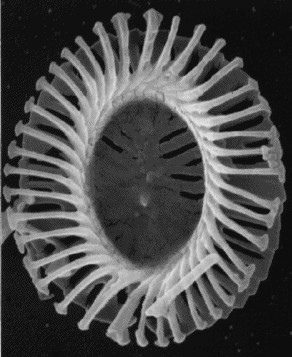
This western Kansas landscape consists of chalk badlands and chalk pillars and a natural arch. The rocks are chalks and impure chalks (e.g., argillaceous chalk and chalky shale) that range in color from whitish to light gray to yellowish. Chalk is a biogenic, calcitic, marine sedimentary rock composed of numerous coccolith microfossils (see: www.soes.soton.ac.uk/staff/tt/eh/pics/lith2.gif). Coccoliths are individual calcareous plates that covered a single-celled photosynthetic marine organism called a coccolithophorid (a.k.a. coccolithophore) (see: upload.wikimedia.org/wikipedia/commons/d/d9/Emiliania_hux...). These beds were deposited in the ancient Western Interior Seaway, a section of ocean that existed during parts of the Mesozoic Era in what is now the American and Canadian Great Plains.
.png)
Rock arches are rare erosional features - those developed in chalk beds are even rarer. If a stream goes under an arch, it is known as a natural bridge. If no stream is present, the feature is a natural arch. Along lakeshores, they are called lake arches. Along oceanic coastlines, they are called sea arches. The highest concentration of natural arches on Earth is Arches National Park in eastern Utah.
Stratigraphy: Smoky Hill Chalk Member (a.k.a. Smoky Hills Member), Niobrara Formation, mid-Upper Cretaceous
Locality: Monument Rocks (also known as the Chalk Pyramids), along Gove County Road 16, north of the Smoky Hill River, Gove County, western Kansas, USA (38° 47' 43.24" North latitude, 100° 45' 52.06" West longitude)
Developing Lasting Partnerships Between Law Enforcement, Community Coalitions, and Prevention Resource Centers to Advance Enviromental Prevention
How can developing countries ensure they take the path to prosperity, and not the road to ruin? Once a nation has more citizens of working age than dependents, it is poised at the edge of an unprecedented economic boom, known as the demographic dividend. But realizing this dividend demands multisectoral policies, investments, and programs that enable young people to flourish.
“Ensuring access to education, health services and employment for youth can mean the difference between capitalizing on a demographic dividend or taking a road towards disempowerment and disaffection,” says Dr. Babatunde Osotimehin, UNFPA’s Executive Director.
Join us on December 8th to explore how countries can achieve the demographic dividend through empowerment, education, and employment. Panelists will present innovative rights-based approaches to working with women, youth, and marginalized groups in ways that ensure the demographic dividend benefits all.
Just as empowerment, education, and employment are key to unlocking the demographic dividend, environmental sustainability also plays a critical role in the future of today’s youth. Join us for a special reception celebrating the release of ECSP’s “Healthy People, Healthy Environment” documentary trilogy, filmed in Tanzania, Ethiopia, and Nepal. Filmmaker, Sean Peoples, UNFPA’s Benoit Kalasa, and the Wilson Center’s Roger-Mark De Souza will offer brief remarks.
This event is co-sponsored by the United Nations Population Fund.
Read more: www.wilsoncenter.org/event/path-to-prosperity-empower-edu...
Developing two rolls of film from test runs in a camera my cousin asked me to take a look at: Canon AE-1. Replaced battery. Worked fine for a while with intermittent shutter errors related to the shutter button and a electronix release. Hmmm...
To develop the UK-India relationship on few strategic themes such as ‘Future Cities’, Science and Innovation Network India organised a ‘UK-India future cities workshop’. The aim of the event was to bring together UK stakeholders in future cities research and innovation to create a network with the Indian side which we would use a basis for our new strategic relationship with India on cities. The workshop took place on 24-25 February 2014 at Taj Palace Hotel, New Delhi. Follow us on twitter @UKinIndia
4 Testing Ilford Delta 3200 Minolta Dynax 5, Sigma 28-70mm F3.5-4.5 Minolta Program 3200i Flash Ilford Delta 3200 Developed In Ilford Ilfotec DD-X (1+4) January 2023
“Developing Inner Powers” @ Mahaan Institute, Shivaji Enclave,
New Delhi on 26th Feb 2020. Guest - Mr. Amrik Singh
I'm always looking to blend the beautiful aesthetic of traditional media while hybridizing the process of digital painting.
My latest investigations have been very productive. I have worked with fellow artists to obtain real world oil paint samples, then after importing and color correcting these samples I have developed a baseline for the actual colors to be used in my digital paintings.
The colors in the digital workflow are generally too saturated in comparison with real paint. Including knowledge of color theory and dynamics, my new Authentic Digital Colors will yield more painterly and acceptable results.