View allAll Photos Tagged trailing
This trail is aptly named, it goes right up the cliff face. It is as near to a technical climb without needing ropes and pitons as exists in the park. The Park's Dept. has provided iron rungs embedded in the cliff faces to negotiate the steeper sections of trail. It is not for the faint of heart or the physically challenged, but boy is the view worth it!
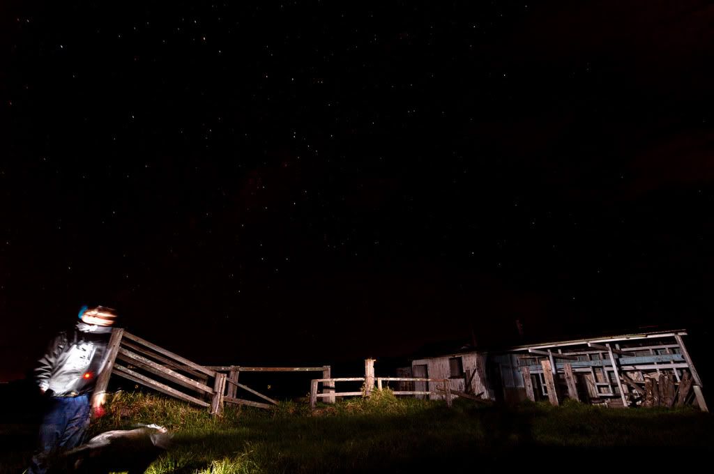
Ventured to Jamberoo Friday night at 8:30pm for a star trail with only my dog and nature. I would have liked to stay for longer but sitting by yourself for 2 hours was enough and it was 7 degrees! Kept on hearing weird noises in the distance too haha and it was pitch black (new moon).
This is a quick edit I did but not 100% happy with it yet.
Before I left I did a quick snap of it all but nothing great:
i264.photobucket.com/albums/ii190/cwiewiora/_DSC1630copy.jpg
Enjoy
www.sapadventures.com/ The Inca Trail is a magnificent, well preserved Inca Trail route which connects Machu Picchu with what once were other regions of the Inca Empire, and today it is one of the world’s most popular treks. This four-day walk goes from the highlands of 4,200mts and down through the cloud forests to finally arrive at Machu Picchu - 2,380mts.
DAY 01. - Between 06:00 and 06:30 we pick you up at your hotel in our private bus. Ensure you have your original passport and ISIC student card (if applicable – for a discount on entree fee to Machu Picchu).
The journey by bus to km 82 (the starting point for the Inca Trail) takes approximately 3 hours. Once we get there and are all ready to go, this first day will have us walking mostly through the valley. It starts at 2380m with a small climb to a plateau overlooking the Incan site of Llactapata and rewards you with superb views of Mount Veronica. Walking times are always approximate depending on weather conditions, group ability and other factors, but generally you will walk about 2-3 hours before lunch. Then after lunch we walk on just past the village of Wayllabamba to reach our first campsite at 3000m.
Approx 14km, 6 hours walking this day at Inca Trail.
DAY 02. - Day 2 is the most difficult day as you Inca Trail walk from about 3000m to 4200m — the highest pass of the trek (known as Dead Woman’s Pass – but don’t be discouraged!). You can walk at your own pace and stop to get your breath whenever you like. You’ll find your energy returns once you continue down to the valley of Pacaymayo, where we camp at 3600m.
You can hire a porter from the village of Wayllabamba to carry your pack to the top of this pass for approximately 70 soles. If you wish to do so you must organize and pay this money directly to the person who carries your items, and please check your belongings upon receiving them at the end of this service as these people are not Sap Adventures staff.
This is the coldest night at Inca Trail; between +2/+4 degrees Celsius (in December) and -3/-5 degrees Celsius (in June). Approx 12km, 7 hours walking this day at Inca Trail.
DAY 03.- Day 3 is exceptionally beautiful because of the ruins you will witness and the incredible stone Inca Trail you walk one, and also because there is a lot more downhill than uphill! However, there are about 2000 stairs descending from the ruins of Phuyupatamarca to those of Wiñaywayna, so take care with your knees. If you have had knee or ankle injuries an extra porter is recommended so that you are not carrying extra weight and overstressing your joints. There is a guided tour of all the ruins on the way. Camping is usually at Wiñaywayna 2700 mtrs.
Take extra care of your personal belongings at this campsite as all the tours campsites are nearby. As usual, always keep your daypack containing your valuables with you. The only hot shower on the Inca Trail is on this third night at Wiñaywayna. There is a hostel near the campsite with an 8min hot shower for 5 soles, and a bar and restaurant where you can purchase bottled water.
Approx 16km, 6 hours walking this day on Inca Trail.
DAY 04.- We get up extremely early to arrive at the magical Intipunku "The Gate of the Sun" as the first rays begin illuminating the lost city of Machu Picchu down bellow. A further 20 min walk down from here takes us to the famous view from the terraces at the end of the trail. It is a good time to take pictures before the 10:30 crowds arrive. Your tour of Machu Picchu should last about 2 hours and finish between 10:30 and 11:00am. Then you have free time to climb Huayna Picchu if you wish (This is the famous peak in the background of most images of Machu Picchu. The trek is about 90 minutes). A maximum of 400 hikers can climb this mountain per day so if you are determined then start immediately after your tour! Or, of course, you may simply just collapse under a tree and quietly reflect in amazement at the mystery, the architectural achievement and beauty of Machu Picchu.
From Machu Picchu, it is a pleasant walk through sub-tropical jungle down to Aguas Calientes (about 45 mins), but if you are weary you may also take a bus – the $7 bus ticket is included and your guide will give you the ticket.
Once in Aguas Calientes you can have a hot shower, and then store your backpack while you go to have lunch, visit the hot springs or shop around the village.
If you are not extending your stay for one night in Aguas Calientes*, you will leave around 6pm to return to Cusco by train or by a combination of train & bus. Please note that during the high season there are a number of different departure times for the trains that run only to Ollantaytambo, from where buses run onwards till Cusco. The type of return journey depends simply on availability. You will arrive back in Cusco around 9 - 9.30pm.
Approx 7km, 2 hours walking this day on Inca Trail.
The Bizz Johnson Trail is in northeastern California, along the Susan River in Lassen County. The main trailhead is at the old Railroad Depot in the City of Susanville, about 90 miles north of Reno and about 90 miles east of Red Bluff, California. The trail has four distinct seasons because of the high elevation location.
Photo by Bob Wick, BLM.
At Cowboy Trail Rides we don't just take people out horseback riding, when the visit Las Vegas. We spend a lot of our time volunteering our time and giving back to the community. We used a team of mules to haul gravel up the to groups of volunteers, to help heal the icebox Canyon trail, in Red Rock Canyon, Nevada, in the beautiful Mojave Desert, just west of Las Vegas. This was a joint effort with BLM, friends of Red Rock, Back Country Horsemen, and Cowboy Trail Rides. There were even some Airmen from Nellis Air Force Base. A lot of work got done. Lot of great people. Just goes to show, that the government and hard working people can get some great things done, if we all put our heads together, and work hard.
www.cowboytrailrides.com 702-387-2457
Encompassing 154,000 acres, including just over 100,000 acres of already congressionally-designated Wilderness, Sand to Snow National Monument is an ecological and cultural treasure and one of the most biodiverse areas in southern California, supporting more than 240 species of birds and twelve threatened and endangered wildlife species.
Home to the region’s tallest alpine mountain that rises from the floor of the Sonoran desert, the monument also will protect sacred, archaeological and cultural sites, including an estimated 1,700 Native American petroglyphs.
Featuring thirty miles of the world famous Pacific Crest National Scenic Trail, the area is a favorite for camping, hiking, hunting, horseback riding, photography, wildlife viewing, and even skiing.
Photo by Bob Wick, BLM.
A mule train along the South Kaibab Trail in the Grand Canyon, hauling trash and, probably, the mail from Phantom Ranch.
Loy Canyon Trail is west of Sedona, Arizona in Red Rock-Secret Mountain Wilderness. The trail was originally built to move livestock to and from summer pastures above the canyon's rim. The trail is easy until it reaches the end of the canyon, where it ascends to meet Secret Mountain Trail.
On the trail in Rocky Mountain National Park, CO. Gorgeous scenery everywhere we looked, I might as well have just filmed the entire day.
d300s, Nikkor 50mm.
Oh, yeah, and I got married - but since I wasn't allowed to carry a camera that day, someone else took the photos - a big thanks to Andrea Murphy Photography for doing such an awesome job! The photos will be up on a blog called Style Me Pretty because my amazing new wife Rachel has awesome style. In case you're not familiar with the blog (I wasn't), that's a pretty big deal. Look for them there sometime soon!
Section of the Ice Age Trail in Wisconsin. Pretty neat spot, to be honest, right outside downtown Hartland.
Abineau Trail is a steep 1,800 foot climb over two miles up the slopes of the San Francisco Peaks through Abineau Canyon. The trail meets the Waterline Trail at the top, which can be followed down to Bear Jaw Trail to return to the trailhead. Each leg of the loop is around two miles long, plus a 0.4 mile connector trail from the trailhead to the loop, making a total loop hike of seven miles. The loop is one of the quintessential autumn hikes in the San Francisco Peaks. Aspens along all three legs of the loop turn gold, and falling leaves carpet the forest floor and decorate the conifers.
A storm system passed through the area October 4-7, 2015, raining at lower elevations and snowing on the upper reaches of the San Francisco Peaks. The snow-capped Peaks were a wonderful treat after the few days grey, cloudy, wet weather that had put a damper on outdoor activity.
Photo by Deborah Lee Soltesz, October 8, 2015. Credit: U.S. Forest Service, Coconino National Forest. For more information about this trail, see the Abineau-Bear Jaw Loop trail description on the Coconino National Forest website.
“Trail Boss & Longhorn” by Robert Summers.
“Branding the Brazos”.
• The Trail Boss, Vaquero and African American Cowboy each with one Longhorn have been donated by Betsy and Clifton Robinson.....
Please, do not use any of my images on websites,
blogs or other media without my explicit written permission.
All rights reserved:
© 2014 Dave Bush
® Gravel Ridge Photography 2014
My images are copyrighted. ©
Be nice and ask to use an image for a non commercial application
Thanks, Dave
No images are to be used w/out permission!!!
PLEASE NO INVITES TO GROUPS….
Adobe Lightroom V. 5.3 64 Bit
Coral Paint Shop-Pro Photo X6
Coral After Shot Pro
Topaz Adjust v.5
Go to my profile to learn more about me:
Spectacular panoramic views. Unique botanical and geologic features. The Kerby Peak trail has it all!
The Kerby Peak Trail is documented on maps dating back to 1915, and was probably first established by Native Americans or game animals. In 1916, a telephone line was constructed to the peak by the State. In 1922, an official State lookout was established on top of the peak, where it remained until 1966. Civilian Conservation Corps were organized in 1933, and a camp was established outside of Selma (Camp Kerby). Men from the camp reportedly hiked the trail after hours in an effort to maintain physical fitness. The Oregon State Forestry Department burned the lookout in the fall of 1966, after it was acquired from the Forest Service and decommissioned. The last lookout tenant was reported as having a communicable disease (presumably Shingles, which was found in Selma around the same time), which contributed to the decision to burn the tower.
Be sure to stay on the main trail avoids erosion and disturbing sensitive vegetation. Be forewarned, there are no toilet facilities on the trail.
To find out more out this super-cool southwest Oregon gem, head on over to:
www.blm.gov/or/resources/recreation/site_info.php?siteid=368
The Bizz Johnson Trail is in northeastern California, along the Susan River in Lassen County. The main trailhead is at the old Railroad Depot in the City of Susanville, about 90 miles north of Reno and about 90 miles east of Red Bluff, California. The trail has four distinct seasons because of the high elevation location.
Photo by Bob Wick, BLM.
One of the most convenient amenities for students and residents at The Waters is the Trail to Education, a path that leads directly from The Waters to the Pike Road Elementary School. The trail is accessible by foot, bike — and even golf cart. It is open year-round and offers students and parents a safe car-free route between home and school.
It’s the coolest car-pool line around!
The Bizz Johnson Trail is in northeastern California, along the Susan River in Lassen County. The main trailhead is at the old Railroad Depot in the City of Susanville, about 90 miles north of Reno and about 90 miles east of Red Bluff, California. The trail has four distinct seasons because of the high elevation location.
Photo by Bob Wick, BLM.
Rising abruptly from the desert floor, the Santa Rosa and San Jacinto Mountains National Monument reaches an elevation of 10,834 feet. Providing a picturesque backdrop to local communities, visitors can enjoy magnificent palm oases, snow-capped mountains, a national scenic trail, and wilderness areas. Its extensive backcountry can be accessed via trails from both the Coachella Valley and the alpine village of Idyllwild.
Jointly managed by the BLM and the U.S. Forest Service, the Monument’s boundary encompasses about 280,000 acres, including public lands within the BLM’s California Desert Conservation Area and the San Jacinto Ranger District of the San Bernardino National Forest. The Monument includes two Federal wilderness areas -- the Santa Rosa and the San Jacinto.
Photo by Bob Wick, BLM.
My third practice attempt at doing star trails. I've come to appreciate the amount of effort it takes to compose a great star trails photo. The right setup, the right weather conditions, the right location, the right timing....
Since I'm in just practicing, this was done in my backyard so there's a significant amount of light pollution going on. Setup was: Canon 60D, Canon 10-22mm lens, Magic Lantern for intervalometer, and StarStaX
Trail Ridge Road winding through the alpine tundra of Rocky Mountain National Park, with Longs Peak (14,259ft) rising majestically in the background. Longs Peak is the highest summit (and only 14er) in RMNP.
Canning circus Nottingham. Long exposure light trails with the pub Sir John Borlase Warren in the background.
Virginia Creeper Trial between White Top Mountain and Damascus, VA.
I took a few too many photos to "light up" the bike trail with my new GPS tracker.
Rising abruptly from the desert floor, the Santa Rosa and San Jacinto Mountains National Monument reaches an elevation of 10,834 feet. Providing a picturesque backdrop to local communities, visitors can enjoy magnificent palm oases, snow-capped mountains, a national scenic trail, and wilderness areas. Its extensive backcountry can be accessed via trails from both the Coachella Valley and the alpine village of Idyllwild.
Jointly managed by the BLM and the U.S. Forest Service, the Monument’s boundary encompasses about 280,000 acres, including public lands within the BLM’s California Desert Conservation Area and the San Jacinto Ranger District of the San Bernardino National Forest. The Monument includes two Federal wilderness areas -- the Santa Rosa and the San Jacinto.
Photo by Bob Wick, BLM.
Returning from the lookout, the trail briefly appears to lead into the cloud. Loved walking above the cloud line.
My first foray into Star Trails photography. Took this from the deck of our house. The streaks going across are planes flying through. I also did a little light painting as well with a flashlight. The windows on the inside were lit up with a flashlight and then I went outside and swiped the side of the house with a flashlight. My settings were:
Manual Mode
ISO 800
Aperature 3.5
30 Second Exposure
2.5 hours of continous shooting
Software (Free): www.startrails.de/html/software.html
Would have been able to shoot longer if I had a battery grip for my camera....which would have made more Star Trail circles.