View allAll Photos Tagged Fastest
The peregrine falcon is the fastest bird and the fastest member of the animal kingdom with a diving speed of 389 km/h (242 mph).
-Wikipedia
+++ DISCLAIMER +++
Nothing you see here is real, even though the conversion or the presented background story might be based historical facts. BEWARE!
The Sea Fury was a British fighter aircraft designed and manufactured by Hawker. It was the last propeller-driven fighter to serve with the Royal Navy, and also one of the fastest production single piston-engined aircraft ever built. Developed during the Second World War, the Sea Fury entered service two years after the war ended. The Sea Fury proved to be a popular aircraft with a number of overseas militaries, and it was successfully used during the Korean War in the early 1950s where it could keep up with 1st generatiom jet fighters like the MiG-15.
The Sea Fury's development was formally initiated in 1943 in response to a wartime requirement of the RAF, thus the aircraft was initially named Fury. As the Second World War drew to a close, the RAF cancelled their order for the aircraft. However, the Royal Navy saw the type as a suitable carrier aircraft to replace a range of increasingly obsolete or poorly suited aircraft being operated by the Fleet Air Arm. Development of the Sea Fury proceeded, and the type began entering operational service in 1947.
The Sea Fury had many design similarities to Hawker's preceding Tempest fighter, but the Sea Fury was a considerably lighter aircraft. Both the Sea Fury's wings and fuselage originated from the Tempest but were significantly modified and redesigned. Production Sea Furies were fitted with the powerful Bristol Centaurus engine, and armed with four wing-mounted Hispano V 20mm cannons. While originally developed as a pure aerial fighter aircraft, the definitive Sea Fury FB 11 was a fighter-bomber, the design having been found suitable for this mission as well.
The Sea Fury attracted international orders as both a carrier and land-based aircraft; it was operated by countries including Australia, Burma, Canada, Cuba, Egypt, West Germany, Iraq, and Pakistan. The Sea Fury was retired by the majority of its military operators in the late 1950s in favour of jet-propelled aircraft. One of the largest export customers for the type, Pakistan, went a different way.
Originally, an initial order for 50 Sea Fury FB 60 aircraft for the Pakistan Air Force (PAF) was placed in 1949. A total of 87 new-build Sea Furies were purchased and delivered between 1950 and 1952, but some ex-FAA and Iraqi Sea Furies were also subsequently purchased.
The aircraft was operated by three frontline squadrons, Nos. 5, 9, and 14 Squadrons.
The Sea Fury began to be replaced by the jet-powered North American F-86 Sabre in 1955, but it became quickly clear that the Sabre was primarily a fighter, not a ground attack aircraft. It also lacked adequate performance in 'hot and high' operation theatres, and the PAF's B-57 bombers were too big for certain CAS tasks, and their number highly limited.
Hence the decision was taken to modernize a part of the PAF Sea Fury fleet for the ground attack role. This was to be achieved with a better engine that would deliver more power, a better overall performance as well as an extended range for prolonged loiter times close to the potential battlefield.
Engine choice fell on the Allison T56 turboshaft engine, which had originally been developed for the C-130 Hercules transporter (later also installed in the P-3 and E-2) - the type had just been bought by the PAF, so that low maintenance cost due to parts and infrastructure commonality was expected. Pakistan Aeronautical Complex (commonly abbreviated 'PAC') was tasked to develop a suitable update, and this lead to the integration of a turboprop engine into the Sea Fury airframe.
For the relatively small Sea Fury airframe the T56 was downrated to 3.000 hp, to which approximately 750 lbs of thrust from its exhaust could be added. The latter was bifurcated and ran along the fuselage flanks, ending in fairings at the wings' trailing edge. In order to cope with the additional power, the original five-bladed propeller had to be replaced by a six-bladed, indigenously developed propeller. Together with the more pointed spinner and the raised propeller position, the Sea Fury's profile changed dramatically, even though the good field of view for the pilot was retained.
Internally, structural reinforcements had to be made and new wing spars were introduced. These allowed higher g forces for low level maneuvers and also carried additional ordnance hardpoints under the outer wings - these enabled the aircraft to carry HVARs of American origin and/or several small caliber bombs instead of only a single pair of up to 1.000 lb (454 kg) caliber.
Unpretentiously, these modified Sea Furies just received a new 'Sea Fury FB.71' designation. Inofficially they were called 'Turbo Furies' or 'وایلار' (Urdu: Wailer), for their characteristic, penetrating engine and propeller sound.
The last piston engine Sea Furies in Pakistani service were ultimately retired in 1960, while the Turbo Fury fleet was kept in service, and they even fired in anger during the 1965 India-Pakistan War. The PAF fleet at that time consisted of 12 F-104 Starfighters, some 120 F-86 Sabres, around 20 B-57 Canberra bombers and still almost all converted 30 Furys. The latter were primarily used against small ground targets like tanks, supply trucks and single buildings, and achieved some success - but the permament threat from Indian fighters like the agile Hawker Hunter or the Folland Gnat limited efficacy. Air superiority was not achieved, from neither side. Thus 1965 was a stalemate in terms of the air war.
After the end of hostilities, the 'Turbo Furies' were quickly phased out since it had become clear that they had become too vulnerable in battlefield conditions.
General characteristics
Crew: One
Length: 36 ft 2 in (11.05 m)
Wingspan: 38 ft 43⁄4 in (11.69 m)
Height: 15 ft 101⁄2 in (4.84 m)
Wing area: 280 ft2 (26.01 m2)
Empty weight: 10.500 lb (4.767 kg)
Loaded weight: 14,100 lb (6.400 kg)
Max. takeoff weight: 15,650 lb (7.105 kg)
Powerplant:
1× Allison T56 turboshaft engine rated at 2.206 kW (3.000 hp) plus 750 lbs of residual thrust
Performance:
Maximum speed: 490 mph (427 knots, 790 km/h) at 18,000 ft (5,500 m)
Range: 700 mi (609 nmi, 1,126 km) with internal fuel;
1,040 mi (904 nmi, 1,674 km) with two drop tanks
Service ceiling: 35,800 ft (10,910 m)
Rate of climb: 4,320 ft/min (21.9 m/s)
Armament:
4× 20 mm (.79 in) Hispano Mk V cannons in the wings
Eight underwing hardpoints for an external load of 4.000 lb (1.814 kg),
including bombs, unguided rockets, napalm tanks or drop tanks
The kit and its assembly:
Well, the combination of a WWII figher design and a C-130 Hercules sounds like an unlikely combination, but that's what I built. The idea of revamped piston-engine aircraft for a post-WWII-use has its charm and continually brings forth impressive designs, so here's another contribution to that wild bunch of whifs.
Inspiration came with a set of 1:72 aftermarket C-130J resin engine nacelles from OzMods, which I had bunkered a while ago. One idea had been to modify a P-51 Mustang, as an alternative to the Cavalier Enforcer. But then I remembered the very succesful Hawker Sea Fury and its many international users - and a check with a fuselage confirmed that an engine swap might be rather easy!
The kit I used is the simple but solid Sea Fury from Pioneer2/PM Models. The Hercules engines are an almost perfect fit - the original fuselage just had to be cut away behind the original exhaust reflectors. Some sculpting had to be done on both sides, and the wing roots filled up in order to match the new, more narrow engine, but things went really smoothly.
For the turboprop's exhaust I drilled up oval holes on the fuselage flanks, under the cockpit, and inserted styrene tubes - the best position I could think of?
The spinner comes from the OzMods set, too, but the C-130J sickle-shaped propeller blades were just a bit too modern and too large for the Sea Fury. I was lucky to have some spare blades from a Pavla propeller set for the Academy B-24 Liberator - these were attached to the pointed spinner, and it looks menacing!
Otherwise, only littel things were changed. In the cockpit a new seat and a dashboard cover were added. The underwing hardpoints were new, too, and I added some antennae for a more modern and purposeful look of the aicraft.
All pylons are new, and the bomb ordnance was puzzled together from the spares box.
Painting and markings:
It took a while to settle on a user and a respective livery. The Netherlands had been a serious option, Myanmar and Morocco, too, but I eventually settled for Pakistan because the timeframe would provide a plausible story, and the PAF would also provide a good, if not unique, paint scheme.
Most PAF Sea Furies had been painted in Mid Stone/Dark Earth/Azure Blue, but some had the dark brown tone replaced by an "Olive Green". I was not able to turn up a photo of such an aircraft, only a profile, though, so there's some guessing involved.
Basic colors are Humbrol 84 (Mid Stone), Modelmaster #2091 (RLM 82) and #2087 (RLM 78), later shaded with Humbrol 83 (ochre), 102 and FS 35414.
The cockpit interior was kept in very dark gray, the landing gear is in Aluminum.
Decals come 100% from the Pakistani option from PM Model's Sea Fury T.61 trainer - they were printed slighlty offset, but I rolled with it as the flaw is not very obvious.
In the end, the "Turbo Fury" looks very conclusive, and the whole thing was tinkered together in less than 3 days (plus some time for the pics). And the conversion is rather easy to realize - there are more potential users of this whiffy creation...
+++ DISCLAIMER +++
Nothing you see here is real, even though the conversion or the presented background story might be based historical facts. BEWARE!
The Sea Fury was a British fighter aircraft designed and manufactured by Hawker. It was the last propeller-driven fighter to serve with the Royal Navy, and also one of the fastest production single piston-engined aircraft ever built. Developed during the Second World War, the Sea Fury entered service two years after the war ended. The Sea Fury proved to be a popular aircraft with a number of overseas militaries, and it was successfully used during the Korean War in the early 1950s where it could keep up with 1st generatiom jet fighters like the MiG-15.
The Sea Fury's development was formally initiated in 1943 in response to a wartime requirement of the RAF, thus the aircraft was initially named Fury. As the Second World War drew to a close, the RAF cancelled their order for the aircraft. However, the Royal Navy saw the type as a suitable carrier aircraft to replace a range of increasingly obsolete or poorly suited aircraft being operated by the Fleet Air Arm. Development of the Sea Fury proceeded, and the type began entering operational service in 1947.
The Sea Fury had many design similarities to Hawker's preceding Tempest fighter, but the Sea Fury was a considerably lighter aircraft. Both the Sea Fury's wings and fuselage originated from the Tempest but were significantly modified and redesigned. Production Sea Furies were fitted with the powerful Bristol Centaurus engine, and armed with four wing-mounted Hispano V 20mm cannons. While originally developed as a pure aerial fighter aircraft, the definitive Sea Fury FB 11 was a fighter-bomber, the design having been found suitable for this mission as well.
The Sea Fury attracted international orders as both a carrier and land-based aircraft; it was operated by countries including Australia, Burma, Canada, Cuba, Egypt, West Germany, Iraq, and Pakistan. The Sea Fury was retired by the majority of its military operators in the late 1950s in favour of jet-propelled aircraft. One of the largest export customers for the type, Pakistan, went a different way.
Originally, an initial order for 50 Sea Fury FB 60 aircraft for the Pakistan Air Force (PAF) was placed in 1949. A total of 87 new-build Sea Furies were purchased and delivered between 1950 and 1952, but some ex-FAA and Iraqi Sea Furies were also subsequently purchased.
The aircraft was operated by three frontline squadrons, Nos. 5, 9, and 14 Squadrons.
The Sea Fury began to be replaced by the jet-powered North American F-86 Sabre in 1955, but it became quickly clear that the Sabre was primarily a fighter, not a ground attack aircraft. It also lacked adequate performance in 'hot and high' operation theatres, and the PAF's B-57 bombers were too big for certain CAS tasks, and their number highly limited.
Hence the decision was taken to modernize a part of the PAF Sea Fury fleet for the ground attack role. This was to be achieved with a better engine that would deliver more power, a better overall performance as well as an extended range for prolonged loiter times close to the potential battlefield.
Engine choice fell on the Allison T56 turboshaft engine, which had originally been developed for the C-130 Hercules transporter (later also installed in the P-3 and E-2) - the type had just been bought by the PAF, so that low maintenance cost due to parts and infrastructure commonality was expected. Pakistan Aeronautical Complex (commonly abbreviated 'PAC') was tasked to develop a suitable update, and this lead to the integration of a turboprop engine into the Sea Fury airframe.
For the relatively small Sea Fury airframe the T56 was downrated to 3.000 hp, to which approximately 750 lbs of thrust from its exhaust could be added. The latter was bifurcated and ran along the fuselage flanks, ending in fairings at the wings' trailing edge. In order to cope with the additional power, the original five-bladed propeller had to be replaced by a six-bladed, indigenously developed propeller. Together with the more pointed spinner and the raised propeller position, the Sea Fury's profile changed dramatically, even though the good field of view for the pilot was retained.
Internally, structural reinforcements had to be made and new wing spars were introduced. These allowed higher g forces for low level maneuvers and also carried additional ordnance hardpoints under the outer wings - these enabled the aircraft to carry HVARs of American origin and/or several small caliber bombs instead of only a single pair of up to 1.000 lb (454 kg) caliber.
Unpretentiously, these modified Sea Furies just received a new 'Sea Fury FB.71' designation. Inofficially they were called 'Turbo Furies' or 'وایلار' (Urdu: Wailer), for their characteristic, penetrating engine and propeller sound.
The last piston engine Sea Furies in Pakistani service were ultimately retired in 1960, while the Turbo Fury fleet was kept in service, and they even fired in anger during the 1965 India-Pakistan War. The PAF fleet at that time consisted of 12 F-104 Starfighters, some 120 F-86 Sabres, around 20 B-57 Canberra bombers and still almost all converted 30 Furys. The latter were primarily used against small ground targets like tanks, supply trucks and single buildings, and achieved some success - but the permament threat from Indian fighters like the agile Hawker Hunter or the Folland Gnat limited efficacy. Air superiority was not achieved, from neither side. Thus 1965 was a stalemate in terms of the air war.
After the end of hostilities, the 'Turbo Furies' were quickly phased out since it had become clear that they had become too vulnerable in battlefield conditions.
General characteristics
Crew: One
Length: 36 ft 2 in (11.05 m)
Wingspan: 38 ft 43⁄4 in (11.69 m)
Height: 15 ft 101⁄2 in (4.84 m)
Wing area: 280 ft2 (26.01 m2)
Empty weight: 10.500 lb (4.767 kg)
Loaded weight: 14,100 lb (6.400 kg)
Max. takeoff weight: 15,650 lb (7.105 kg)
Powerplant:
1× Allison T56 turboshaft engine rated at 2.206 kW (3.000 hp) plus 750 lbs of residual thrust
Performance:
Maximum speed: 490 mph (427 knots, 790 km/h) at 18,000 ft (5,500 m)
Range: 700 mi (609 nmi, 1,126 km) with internal fuel;
1,040 mi (904 nmi, 1,674 km) with two drop tanks
Service ceiling: 35,800 ft (10,910 m)
Rate of climb: 4,320 ft/min (21.9 m/s)
Armament:
4× 20 mm (.79 in) Hispano Mk V cannons in the wings
Eight underwing hardpoints for an external load of 4.000 lb (1.814 kg),
including bombs, unguided rockets, napalm tanks or drop tanks
The kit and its assembly:
Well, the combination of a WWII figher design and a C-130 Hercules sounds like an unlikely combination, but that's what I built. The idea of revamped piston-engine aircraft for a post-WWII-use has its charm and continually brings forth impressive designs, so here's another contribution to that wild bunch of whifs.
Inspiration came with a set of 1:72 aftermarket C-130J resin engine nacelles from OzMods, which I had bunkered a while ago. One idea had been to modify a P-51 Mustang, as an alternative to the Cavalier Enforcer. But then I remembered the very succesful Hawker Sea Fury and its many international users - and a check with a fuselage confirmed that an engine swap might be rather easy!
The kit I used is the simple but solid Sea Fury from Pioneer2/PM Models. The Hercules engines are an almost perfect fit - the original fuselage just had to be cut away behind the original exhaust reflectors. Some sculpting had to be done on both sides, and the wing roots filled up in order to match the new, more narrow engine, but things went really smoothly.
For the turboprop's exhaust I drilled up oval holes on the fuselage flanks, under the cockpit, and inserted styrene tubes - the best position I could think of?
The spinner comes from the OzMods set, too, but the C-130J sickle-shaped propeller blades were just a bit too modern and too large for the Sea Fury. I was lucky to have some spare blades from a Pavla propeller set for the Academy B-24 Liberator - these were attached to the pointed spinner, and it looks menacing!
Otherwise, only littel things were changed. In the cockpit a new seat and a dashboard cover were added. The underwing hardpoints were new, too, and I added some antennae for a more modern and purposeful look of the aicraft.
All pylons are new, and the bomb ordnance was puzzled together from the spares box.
Painting and markings:
It took a while to settle on a user and a respective livery. The Netherlands had been a serious option, Myanmar and Morocco, too, but I eventually settled for Pakistan because the timeframe would provide a plausible story, and the PAF would also provide a good, if not unique, paint scheme.
Most PAF Sea Furies had been painted in Mid Stone/Dark Earth/Azure Blue, but some had the dark brown tone replaced by an "Olive Green". I was not able to turn up a photo of such an aircraft, only a profile, though, so there's some guessing involved.
Basic colors are Humbrol 84 (Mid Stone), Modelmaster #2091 (RLM 82) and #2087 (RLM 78), later shaded with Humbrol 83 (ochre), 102 and FS 35414.
The cockpit interior was kept in very dark gray, the landing gear is in Aluminum.
Decals come 100% from the Pakistani option from PM Model's Sea Fury T.61 trainer - they were printed slighlty offset, but I rolled with it as the flaw is not very obvious.
In the end, the "Turbo Fury" looks very conclusive, and the whole thing was tinkered together in less than 3 days (plus some time for the pics). And the conversion is rather easy to realize - there are more potential users of this whiffy creation...
My name is Bart Allen, and I am the fastest man alive! Well, fastest teenager alive.. I came back from the 30th century to get help from my grandfather-- Wait a minute, this sounds like an opening to some television show.. My bad. Let's back things up and properly explain. Like I said before, my name is Bart Allen. I'm the grandson of Barry Allen, who was known as the Flash of this time. He was a hero using the powers of the Speed Force to fight criminals, and put them behind bars. I say was, as he retired after several years of being a hero. Wanted to slow down, and settle down with the love of his life, Iris West. Didn't help that he no longer had access to the Speed Force. Central City still needed the Flash, so Wally West took up the mantle. He was originally Kid Flash, getting his powers through the Speed Force Storm which gave life to many new speedsters. How do you know all of this Bart? You weren't there when this happened! Yes, that's all true. But since I come from the 30th century, these events have already happened. Which leads me to the reason I travelled back in time to the 21st century. I needed Barry's help with my hyper-accelerated metabolism. Basically, I looked older than I actually was. When I arrived, it honestly didn't take much for them to help me. They were able to come up with a solution, and now, there's no crazy metabolism problems! Well besides having to eat a lot, but that's expected for speedsters. Anyways, after that whole ordeal, I ended up staying in Central City, even though there's a possibility that my existence ruins the timeline, therefore changing the future as I know it. I decided to become a hero, like my grandfather. Speed Force zen master Max Mercury taught me many things about the Speed Force, before his passing. The whole Flash Family was there for Max's funeral, and it still hurts to this day. Trying to move past his death, I started attending school, and now I'm a junior at Central City High. A few months ago, Wally West disappeared. His disappearance has hit his wife, Frances Kane-West the hardest. I've tried my best to reassure her that I'll find him. So now I have to keep this city safe as the Flash, while I also figure out where Wally is. I sure hope I can do it, because honestly, I'm not even sure I can.
I've checked with the usual suspects, but most are accounted for. Most of the Rogues are locked up in Iron Heights. Heatwave, Trickster, and Prank are the only ones not there. I heard through the grapevine that Heatwave is on vacation in Aruba, while the other two have gone into hiding. Can't say I blame them, with all these new speedsters running about. Speaking of speedsters, the major ones are accounted for. The Rival, Thawne, Hunter Zolomon (technically not a speedster, but I'll put him under the speedster umbrella anyway), Negative Flash, and Daniel West are all locked away in a prison tailor-made for those with the Speed Force. It was created after the Speed Force Storm gave speedster powers to a good chunk of people. Anyways, now that we're all caught up, let's move forward.
Central City High School, 2:30pm
The bell announcing the end of the school day rings, and I'm about to leave when Preston Lindsay, my best friend, walks up to me.
"Hey Bart!" He says with enthusiasm, as he opens his locker which is conveniently right beside mine.
"Oh hey Preston.. What's up?"
"The ceiling!" He starts laughing, even though that 'joke' got old after the first time..
"You know that joke got old after the first time you did it right?"
"Ah whatever. You just don't understand it's charm, that's all. Anyways, you free to hangout at my place? Really not in the mood to study right now."
"I feel ya there. Studying is so not crash. Would if I could man, but I already have plans for the afternoon. Sorry Preston. Maybe tomorrow?" That's me, lying to my best friend.. Well, sort of. My plans mostly just consist of me going out on patrol, fighting the various criminals. It's mostly been wannabe Rogues, but who knows, maybe some day I'll face the real deal. But it's better if he doesn't know. At least that's what Barry keeps telling me.
"It's all good. Got plans with Valerie, I understand.. Alright, well, I guess I better figure something else out then."
"Now you're making me feel the mode.. Also, my plans do not include Valerie. Not sure why you're so focused on the concept of us being an item, when we clearly aren't." It sometimes feels like he's saying these things intentionally to get a rise out of me.
"Mhm.. Sure.. Catch ya later Bart." He walks away, and soon enough, I can't spot him in the crowd of people bustling through the hallway.
"You too." I mutter under my breath, as he's gone by the time I'm about to speak. I walk out the front steps, and start running home, once I'm at a safe distance from the school. Upon arriving at home, I open the door, and shut it once I enter.
"I'm home!" I say, announcing my presence.
"Oh, Bart, you're home!" I hear Iris say, as I see her coming out of the kitchen. I go up to her and give her a hug.
"Yeah. Though I'm going out on patrol for a bit. It has been a pretty boring day, and I could go for some villain fight right about now."
"Sometimes, you just have to slow down. Like Barry has! Anyways, make sure you get your homework done before you go, and be careful."
"That will take me like two seconds, but fine. When am I not careful?" Iris gives me a look where she's essentially saying 'really?', without actually saying it.
"I'll be fine Iris! No need to fret!" I mostly call them by their first names, as it weirds me out calling them grandpa and grandma, considering how old they are right now. I rush into my room, unpack, and finish my homework in a matter of seconds before, grabbing the Flash ring, and releasing the costume from it. I change into the costume, and start running. There's police radio comms units in the earpieces of my cowl, which helps me out a bit with crimes in progress.
"211 in progress at Central City National Bank. Requesting all units in the area for back-up." Guess that's my queue. I make my way there, which only takes me a minute or two. Once there, I notice a few police cars already here. I stop right beside one of the cop cars, and an officer notices me. He walks towards me, with a look of relief on his face.
"Flash! Thank goodness you're here!"
"What's the situation like in there Officer--?" I ask, distinguishing my voice by vibrating it. After what seems like the longest pause ever, he responds
"Officer Heart. As for the situation, its White Lightning and her cronies again, trying to make fools out of us." Heart? That last name seems familiar. Oh right, he's that new speedster hero called Velocity.. August Heart.. Strange that he isn't just going in himself. White Lightning is one of my villains anyway, so it doesn't really bother me that he's not suiting up. I check the outside of the building before dashing inside. Once inside, I make sure there's no one here besides White Lightning and her crew. I notice them filling up bags of money inside the vault, talking among themselves.
"Got yourself a new crew I see.. Kind of miss the last one if I'm being honest. They were a more charismatic bunch." I mean I have to at least give them a warning, before locking them all away. Wouldn't be as crash if I just zoomed in there without them noticing, and knocked them out cold within seconds. I mean it'll still only take a few seconds, but at least I'll get some enjoyment out of it. Besides, banter is half the fun of being a superhero!
"Eh, well you know how it is with me, only using each crew once before moving on to another.. Love the new diggs by the way Impulse. Upgraded from zero to hero in no time.. Too bad you'll be dead soon enough." Her goon squad opens fire, unloading their clips into me. White Lightning throws her lightning bolts at me. I'm able to dodge all the bullets easily enough, along with her lightning.
"A + for effort. Sucks that you still haven't learned from the other times we've fought though." I disarm her cronies, and stand right in front of them, taunting White Lightning. When she shoots off her next electrical blast, I get out-of-the-way, and she takes down her own minions for me. I grab power dampener handcuffs from the police outside, and come back, handcuffing her hands together.
"I wouldn't be so smug if I were you.. He'll be coming soon enough, and when he does, you'll know what it means to lose everything."
---------
Unknown Location, with someone looking at security footage.
"Oh Bart Allen.. How little you truly know. She spoiled the surprise a little early, but that's what I get for using z list villains as my pawns in this game. It's fine.. I want him feeling cocky. Cockiness leads to mistakes, which can be lethal, especially when it's against an actual threat. I've been waiting for this moment all my life, so I can wait a little while longer before I introduce myself. Guess it's that time again. Have to check up on the prisoner. Bye for now." The figure cackles, as he leaves. In one of the security footage panels, there's someone with strawberry red hair, chained up in what looks to be a cellar of some sort.
Kuala Lumpur (/ˈkwɑːləˈlʊmpʊər/ or /-pər/; Malaysian pronunciation: [ˈkwalə ˈlumpʊr]) is the national capital and most populous global city in Malaysia. The city covers an area of 243 km2 and has an estimated population of 1.6 million as of 2010. Greater Kuala Lumpur, covering similar area as the Klang Valley, is an urban agglomeration of 7.5 million people as of 2012. It is among the fastest growing metropolitan regions in South-East Asia, in terms of population and economy.
Kuala Lumpur is the seat of the Parliament of Malaysia. The city was once home to the executive and judicial branches of the federal government, but they were moved to Putrajaya in early 1999. Some sections of the judiciary still remain in the capital city of Kuala Lumpur. The official residence of the Malaysian King, the Istana Negara, is also situated in Kuala Lumpur. Rated as an alpha world city, Kuala Lumpur is the cultural, financial and economic centre of Malaysia due to its position as the capital as well as being a key city. Kuala Lumpur was ranked 48th among global cities by Foreign Policy's 2010 Global Cities Index and was ranked 67th among global cities for economic and social innovation by the 2thinknow Innovation Cities Index in 2010.
Kuala Lumpur is defined within the borders of the Federal Territory of Kuala Lumpur and is one of three Malaysian Federal Territories. It is an enclave within the state of Selangor, on the central west coast of Peninsular Malaysia.
Since the 1990s, the city has played host to many international sporting, political and cultural events including the 1998 Commonwealth Games and the Formula One Grand Prix. In addition, Kuala Lumpur is home to the tallest twin buildings in the world, the Petronas Twin Towers, which have become an iconic symbol of Malaysia's futuristic development.
In May 2015, Kuala Lumpur was officially recognized as one of the New7Wonders Cities together with Vigan City, Doha, Durban, Havana, Beirut, and La Paz.
HISTORY
Kuala Lumpur means "muddy confluence", although it is also possible that the name is a corrupted form of an earlier but now unidentifiable forgotten name. It was originally a small settlement of just a few houses at the confluence of Sungai Gombak (previously known as Sungai Lumpur) and Sungai Klang (Klang River). The town of Kuala Lumpur was established circa 1857, when the Malay Chief of Klang, Raja Abdullah bin Raja Jaafar, aided by his brother Raja Juma'at of Lukut, raised funds to hire some Chinese miners from Lukut to open new tin mines here. The miners landed at Kuala Lumpur and continued their journey on foot to Ampang where the first mine was opened. Kuala Lumpur was the furthest point up the Klang River to which supplies could conveniently be brought by boat; it therefore became a collection and dispersal point serving the tin mines. The identity of the founder of Kuala Lumpur has however not been confirmed: Raja Abdullah bin Raja Jaafar and his role in founding the city do not appear in the earliest account of the history of Selangor. On the other hand, the Sumatrans Abdullah Hukum and Sutan Puasa, arrived in Kuala Lumpur at least in 1850. Raja Abdullah only came around 1857 and Yap Ah Loy, also regarded as the founding father of Kuala Lumpur, arrived in 1862. In addition, the Chinese men employed under Raja Abdullah worked in Ampang, 64 kilometres away from the main land. Meanwhile, efficient drainage and irrigation systems (bondar saba) were introduced in Kuala Lumpur by the technologically advanced Mandailing, improving the mining industry.
In the early history of Kuala Lumpur, the Minangkabaus of Sumatra were considered to be one of the most important groups of people who involved in trading. Utsman bin Abdullah and Haji Mohamed Taib were influenced tycoon in Kuala Lumpur and surrounding area. Haji Taib, one of the wealthiest figure at that time, was an important person in the early development centre of city: Kampung Baru. Beside as merchants, the Minangkabaus also overwhelmingly on socio-religious figures, such as Utsman bin Abdullah was the first kadi of Kuala Lumpur as well as Muhammad Nur bin Ismail.
Although the early miners suffered a high death toll due to the malarial conditions of the jungle, the Ampang mines were successful, and the first tin was exported in 1859. The tin-mining spurred the growth of the town, and miners later also settled in Pudu and Batu. The miners formed gangs among themselves; there were the Hakka-dominated Hai San in Kuala Lumpur, and the Cantonese-dominated Ghee Hin based in Kanching in Ulu Selangor. These two gangs frequently fought to gain control of best tin mines. The leaders of the Chinese community were conferred the title of Kapitan Cina (Chinese headman) by the Malay chief, and Hiu Siew, the owner of a mine in Lukut, was chosen as the first Kapitan of Kuala Lumpur. As one of the first traders to arrive in Ampang (along with Yap Ah Sze), he sold provisions to the miners in exchange for tin.
In 1868, Yap Ah Loy was appointed the third Chinese Kapitan of Kuala Lumpur. Yap, together with Frank Swettenham, were the two most important figures in the development of Kuala Lumpur in the early days of Kuala Lumpur. In 1880, the state capital of Selangor was moved from Klang to the more strategically advantageous Kuala Lumpur by the colonial administration, and Swettenham was appointed the Resident in 1882. Kuala Lumpur was a small town with buildings made of wood and atap (thatching) that were prone to burn. It suffered from many problems, including the Selangor Civil War which devastated the town; it was also plagued by diseases and constant fires and floods. The war and other setbacks led to a slump which lasted until 1879, when a rise in the price of tin allowed the town to recover.
In 1881, a flood swept through the town, following a fire that had engulfed it earlier. As a response, Frank Swettenham, the British Resident of Selangor, required that buildings be constructed of brick and tile.[33] Hence, Kapitan Yap Ah Loy bought a sprawling piece of real estate to set up a brick industry, which spurred the rebuilding of Kuala Lumpur. This place is the eponymous Brickfields. Hence, destroyed atap buildings were replaced with brick and tiled ones. He restructured the building layout of the city. Many of the new brick buildings mirrored those of shop houses in southern China, characterised by "five foot ways" as well as skilled Chinese carpentry work. This resulted in a distinct eclectic shop house architecture typical to this region. Kapitan Yap Ah Loy expand road access in the city significantly, linking up tin mines with the city, these roads include the main arterial roads of the present Ampang Road, Pudu Road and Petaling Street. As Chinese Kapitan, he was vested with wide powers on par with Malay community leaders. He implemented law reforms and introduced new legal measures. He also presided over a small claims court. With a police force of six, he was able to uphold the rule of law. He built a prison that could accommodate 60 prisoners at any time. Kapitan Yap Ah Loy also built Kuala Lumpur's first school and a major tapioca mill in Petaling Street of which the Selangor's Sultan Abdul Samad had an interest.
A railway line between Kuala Lumpur and Klang, initiated by Swettenham and completed in 1886, increased accessibility which resulted in the rapid growth of the town. The population grew from 4,500 in 1884 to 20,000 in 1890. As development intensified in the 1880s, it also put pressure on sanitation, waste disposal and other health issues. A Sanitary Board was created on 14 May 1890 which was responsible for sanitation, upkeep of roads, lighting of street and other functions. This would eventually became the Kuala Lumpur Municipal Council. Kuala Lumpur was only 0.65 km2 in 1895, but it expanded to 20 km2 in 1903, and by the time it became a municipality in 1948 it had expanded to 93 km2, and then to 243 km2 in 1974 as a Federal Territory. In 1896, Kuala Lumpur was chosen as the capital of the newly formed Federated Malay States. A mixture of different communities settled in various sections of Kuala Lumpur. The Chinese mainly settled around the commercial centre of Market Square, east of the Klang River, and towards Chinatown. The Malays, Indian Chettiars, and Indian Muslims resided along Java Street (now Jalan Tun Perak). The Padang, now known as Merdeka Square, was the centre of the British administrative offices.
During World War II, Kuala Lumpur was captured by the Imperial Japanese Army on 11 January 1942. They occupied the city until 15 August 1945, when the commander in chief of the Japanese Seventh Area Army in Singapore and Malaysia, Seishirō Itagaki, surrendered to the British administration following the atomic bombings of Hiroshima and Nagasaki. Kuala Lumpur grew through the war, the rubber and tin commodity crashes and the Malayan Emergency, during which Malaya was preoccupied with the communist insurgency. In 1957, the Federation of Malaya gained its independence from British rule. Kuala Lumpur remained the capital through the formation of Malaysia on 16 September 1963.
On 13 May 1969, the worst race riots on record in Malaysia took place in Kuala Lumpur. The so-called 13 May Incident refers to the occurrence of violence between members of the Malay and the Chinese communities. The violence was the result of Malaysian Malays being dissatisfied with their socio-political status. The riots resulted in the deaths of 196 people, and led to major changes in the country's economic policy to promote and prioritise Malay economic development over that of the other ethnicities.
Kuala Lumpur later achieved city status in 1972, becoming the first settlement in Malaysia to be granted the status after independence. Later, on 1 February 1974, Kuala Lumpur became a Federal Territory. Kuala Lumpur ceased to be the capital of Selangor in 1978 after the city of Shah Alam was declared the new state capital. On 14 May 1990, Kuala Lumpur celebrated 100 years of local council. The new federal territory Kuala Lumpur flag and anthem were introduced. On 1 February 2001, Putrajaya was declared a Federal Territory, as well as the seat of the federal government. The administrative and judicial functions of the government were shifted from Kuala Lumpur to Putrajaya. Kuala Lumpur however still retained its legislative function, and remained the home of the Yang di-Pertuan Agong (Constitutional King).
GEOGRAPHY
The geography of Kuala Lumpur is characterised by the huge Klang Valley. The valley is bordered by the Titiwangsa Mountains in the east, several minor ranges in the north and the south and the Strait of Malacca in the west. Kuala Lumpur is a Malay term that translates to "muddy confluence" as it is located at the confluence of the Klang and Gombak rivers.
Located in the centre of Selangor state, Kuala Lumpur was previously under the rule of Selangor State Government. In 1974, Kuala Lumpur was separated from Selangor to form the first Federal Territory governed directly by the Malaysian Federal Government. Its location on the west coast of Peninsular Malaysia, which has wider flat land than the east coast, has contributed to its faster development relative to other cities in Malaysia. The municipality of the city covers an area of 243 km2, with an average elevation of 21.95 m.
CLOMATE AND WEATHER
Protected by the Titiwangsa Mountains in the east and Indonesia's Sumatra Island in the west, Kuala Lumpur has a tropical rainforest climate (Köppen climate classification Af), which is warm and sunny, along with abundant rainfall, especially during the northeast monsoon season from October to March. Temperatures tend to remain constant. Maximums hover between 32 and 33 °C and have never exceeded 38.5 °C, while minimums hover between 23.4 and 24.6 °C and have never fallen below 14.4 °C. Kuala Lumpur typically receives minimum 2,600 mm of rain annually; June and July are relatively dry, but even then rainfall typically exceeds 131 millimetres per month.
Flooding is a frequent occurrence in Kuala Lumpur whenever there is a heavy downpour, especially in the city centre and downstream areas. Smoke from forest fires of nearby Sumatra sometimes cast a haze over the region. It is a major source of pollution in the city together with open burning, emission from motor vehicles and construction work.
POLITICS
Kuala Lumpur is home to the Parliament of Malaysia. The hierarchy of authority in Malaysia, in accordance with the Federal Constitution, has stipulated the three branches, of the Malaysian government as consisting of the Executive, Judiciary and Legislative branches. The Parliament consists of the Dewan Negara (Upper House / House of Senate) and Dewan Rakyat (Lower House / House of Representatives).
ECONOMY
Kuala Lumpur and its surrounding urban areas form the most industrialised and economically, the fastest growing region in Malaysia. Despite the relocation of federal government administration to Putrajaya, certain government institutions such as Bank Negara Malaysia (National Bank of Malaysia), Companies Commission of Malaysia and Securities Commission as well as most embassies and diplomatic missions have remained in the city.
The city remains as the economic and business centre of the country. Kuala Lumpur is a centre for finance, insurance, real estate, media and the arts of Malaysia. Kuala Lumpur is rated as an alpha world city, and is the only global city in Malaysia, according to the Globalization and World Cities Study Group and Network (GaWC). The infrastructure development in the surrounding areas such as the Kuala Lumpur International Airport at Sepang, the creation of the Multimedia Super Corridor and the expansion of Port Klang further reinforce the economic significance of the city.
Bursa Malaysia or the Malaysia Exchange is based in the city and forms one of its core economic activities. As of 5 July 2013, the market capitalisation stood at US$505.67 billion.
The Gross Domestic Product (GDP) for Kuala Lumpur is estimated at RM73,536 million in 2008 with an average annual growth rate of 5.9 percent.[66] The per capita GDP for Kuala Lumpur in 2013 is RM79,752 with an average annual growth rate of 5.6 percent. The total employment in Kuala Lumpur is estimated at around 838,400. The service sector comprising finance, insurance, real estate, business services, wholesale and retail trade, restaurants and hotels, transport, storage and communication, utilities, personal services and government services form the largest component of employment representing about 83.0 percent of the total. The remaining 17 percent comes from manufacturing and construction.
The average monthly household income for Kuala Lumpur was RM4,105 (USD 1,324) in 1999, up from RM3,371 (USD 1,087) four years prior, making it 66% higher than the national average. In terms of household income distribution, 23.5% of households in the city earned more than RM5,000 (USD 1,613) per month compared to 9.8% for the entire country, while 8.1% earned less than RM1,000 (USD 323) a month.
The large service sector is evident in the number of local and foreign banks and insurance companies operating in the city. Kuala Lumpur is poised to become the global Islamic Financing hub with an increasing number of financial institutions providing Islamic Financing and the strong presence of Gulf's financial institutions such as the world's largest Islamic bank, Al-Rajhi Bank and Kuwait Finance House. Apart from that, the Dow Jones & Company is keen to work with Bursa Malaysia to set up Islamic Exchange Trade Funds (ETFs), which would help raise Malaysia's profile in the Gulf. The city has a large number of foreign corporations and is also host to many multi national companies' regional offices or support centres, particularly for finance and accounting, and information technology functions. Most of the countries' largest companies have their headquarters based here and as of December 2007 and excluding Petronas, there are 14 companies that are listed in Forbes 2000 based in Kuala Lumpur.
Other important economic activities in the city are education and health services. Kuala Lumpur also has advantages stemming from the high concentration of educational institutions that provide a wide-ranging of courses. Numerous public and private medical specialist centres and hospitals in the city offer general health services, and a wide range of specialist surgery and treatment that caters to locals and tourists.
There has been growing emphasis to expand the economic scope of the city into other service activities, such as research and development, which supports the rest of the economy of Malaysia. Kuala Lumpur has been home for years to important research centres such as the Rubber Research Institute of Malaysia, the Forest Research Institute Malaysia and the Institute of Medical Research and more research centres are expected to be established in the coming years.
DEMOGRAPHICS
Kuala Lumpur is the most populous city in Malaysia, with a population of 1.6 million in the city proper as of 2010. It has a population density of 6,696 inhabitants per square kilometre , and is the most densely populated administrative district in Malaysia. Residents of the city are colloquially known as KLites. Kuala Lumpur is also the centre of the wider Klang Valley conurbation (covering Petaling Jaya, Klang, Subang Jaya, Shah Alam, Gombak and others) which has an estimated metropolitan population of 7.2–7.5 million as of 2012.
Kuala Lumpur's heterogeneous populace includes the country's three major ethnic groups: the Malays, the Chinese and the Indians, although the city also has a mix of different cultures including Eurasians, as well as Kadazans, Ibans and other indigenous races from East Malaysia and Peninsula Malaysia.
Historically Kuala Lumpur was a predominantly Chinese, but recently the Bumiputra component of the city has increased substantially and they are now the dominant group. Most of Malays who considered as Bumiputra came from Sumatra and other parts of Indonesia archipelago. The majority of them Javanese, Minangkabaus and Buginese began arriving in Kuala Lumpur in the mid 19th century, in addition to Acehnese who arrived in the late 20th century. The population of Kuala Lumpur was estimated to be around three thousand in 1880 when it was made the capital of Selangor. In the following decade which saw the rebuilding of the town it showed considerable increase, due in large part to the construction of a railway line in 1886 connecting Kuala Lumpur and Klang.
A census in 1891 of uncertain accuracy gave a figure of 43,796 inhabitants, 79% of whom were Chinese (71% of the Chinese were Hakka), 14% Malay, and 6% Indian. Another estimate put the population of Kuala Lumpur in 1890 at 20,000. In 1931, 61% of Kuala Lumpur's 111,418 inhabitants were Chinese, and in 1947 63.5%. The Malays however began to settle in the Kuala Lumpur in significant numbers, in part due to government employment, as well as the expansion of the city that absorbed the surrounding rural areas where many Malays lived. between 1947 and 1957 the population of Bumiputras in Kuala Lumpur doubled, increasing from 12.5 to 15%, while the proportion of Chinese dropped. The process continued after Malayan independence with the growth of a largely Malay civil service, and later the implementation of the New Economic Policy which encouraged Malay participation in urban industries and business. In 1980 the population of Kuala Lumpur had reached over a million, with 52% Chinese, 33% Malay, and 15% Indian. From 1980 to 2000 the number of Bumiputras increased by 77%, but the Chinese still outnumbered the Bumiputras in Kuala Lumpur in the 2000 census at 43% compared to Bumiputras at 38%. By the 2010 census, according to the Department of Statistics and excluding non-citizens, the percentage of the Bumiputera population in Kuala Lumpur has reached around 45.9%, with the Chinese population at 43.2% and Indians 10.3%.A notable phenomenon in recent times has been the increase of foreign residents in Kuala Lumpur, which rose from 1% of the city's population in 1980 to about 8% in the 2000 census, and 9.4% in the 2010 census. These figures also do not include a significant number of illegal immigrants. Kuala Lumpur's rapid development has triggered a huge influx of low-skilled foreign workers from Indonesia, Nepal, Burma, Thailand, Bangladesh, India, Sri Lanka, Philippines, and Vietnam into Malaysia, many of whom enter the country illegally or without proper permits.Birth rates in Kuala Lumpur have declined and resulted in the lower proportion of young people falling below 15 years old category from 33% in 1980 to slightly less than 27% in 2000.[69] On the other hand, the working age group of 15–59 increased from 63% in 1980 to 67% in 2000. The elderly age group, 60 years old and above has increased from 4% in 1980 and 1991 to 6% in 2000.
Kuala Lumpur is pluralistic and religiously diverse. The city has many places of worship catering to the multi-religious population. Islam is practised primarily by the Malays and the Indian Muslim communities. Buddhism, Confucianism and Taoism are practised mainly among the Chinese. Indians traditionally adhere to Hinduism. Some Chinese and Indians also subscribe to Christianity.
As of 2010 Census the population of Kuala Lumpur is 46.4% Muslim, 35.7% Buddhist, 8.5% Hindu, 5.8% Christian, 1.1% Taoist or Chinese religion adherent, 2.0% follower of other religions, and 0.5% non-religious.
Bahasa Malaysia is the principal language in Kuala Lumpur. Kuala Lumpur residents are generally literate in English, with a large proportion adopting it as their first language. It has a strong presence, especially in business and is a compulsory language taught in schools. Cantonese and Mandarin are prominent as they are spoken by the local majority Chinese population. Another major dialect spoken is Hakka. While Tamil is dominant amongst the local Indian population, other Indian languages spoken include Telugu, Malayalam, Punjabi and Hindi. Beside the Malay language, there are a variety of languages spoken by Indonesian descent, such as Minangkabau and Javanese.
EDUCATION
According to government statistics, Kuala Lumpur has a literacy rate of 97.5% in 2000, the highest rate in any state or territory in Malaysia. In Malaysia, Malay is the language of instruction for most subjects while English is a compulsory subject, but as of 2012, English is still the language of instruction for mathematics and the natural sciences for certain schools. Some schools provide Mandarin and Tamil as languages of instruction for certain subjects. Each level of education demands different skills of teaching and learning ability.Kuala Lumpur contains 13 tertiary education institutions, 79 high schools, 155 elementary schools and 136 kindergartens.
WIKIPEDIA
The fastest land speed of any living animal, runs in speeds between 112 -120km!!!!
Ancient Egyptians often kept cheetahs as pets, and also tamed and trained them for hunting. (But not domesticated i.e., bred under human control.) Cheetahs would be taken to hunting fields in low-sided carts or by horseback, hooded and blindfolded, and kept on leashes while dogs flushed out their prey. When the prey was near enough, the cheetahs would be released and their blindfolds removed. This tradition was passed on to the ancient Persians and brought to India, where the practice was continued by Indian princes into the twentieth century. Cheetahs continued to be associated with royalty and elegance. I love this Animal.
-------------------------------------------------
© MOHAMAD ALRUWAISHED
Copyright for this gallery photo belongs solely to MOHAMAD ALRUWAISHED . Images may not be copied, downloaded, or used in any way without the expressed, written permission of the photographer.
=====================================
===============================
=========================
Usain Bolt at the medals ceremony for the Men's 100m race in London where he won gold with a time of 9.63 seconds.
Camera: Canon 5D Mark II
Lens: 70-200mm f/2.8L@ 200mm
© 2012 Copyright Niel Galen - All Rights Reserved.
IMG_4850
IMG_4850
This railway track has recently been granted the status of a UNESCO World Heritage Site. The view is stunning, with the line passing through an amazing 103 tunnels. The fastest way to get to Kalka is to catch the Shatabdi Express, which departs early morning from the New Delhi Railway Station, arriving at Kalka four hours later.
The Kalka–Shimla Railway is a 762 mm narrow gauge railway in North-West India travelling along a mostly mountainous route from Kalka to Shimla. It is known for dramatic views of the hills and surrounding villages.
Shimla (then spelt Simla) was settled by the British shortly after the first Anglo-Gurkha war, and is located at 2169 m in the foothills of the Himalayas. By the 1830s, Shimla had already developed as a major base for the British.[citation needed] It became the summer capital of British India in 1864, and was also the headquarters of the British army in India. Prior to construction of the railway, communication with the outside world was via village cart.
The 1676 mm broad gauge Delhi-Kalka line was opened in 1891. The Kalka–Shimla Railway was constructed on 610 mm narrow gauge tracks by the Delhi-Ambala-Kalka Railway Company commencing in 1898. The 96.54 km line was opened for traffic November 9, 1903. It was inaugurated by Lord Curzon, then Viceroy of India. Because of the high capital and maintenance costs, coupled with peculiar working conditions, the Kalka–Shimla Railway was allowed to charge fares that were higher than the prevailing tariffs on other lines. However, even this was not good enough to sustain the company, so the Government had to purchase it on January 1. In 1905 the line was regauged to 762 mm gauge under guidelines from the Indian War Department seeking to ensure uniformity in all imperial narrow gauge systems.
In mid-August 2007, the government of Himachal Pradesh declared the railway a heritage property in preparation for its review in September.
ROUTE
The Kalka–Shimla Railway was built to connect Shimla, the summer capital of India during the British Raj, with the Indian rail system. Now, Shimla is the capital city of Himachal Pradesh and Kalka is a town in the Panchkula district of Haryana. Spectacular scenery along the whole route, and the marvels of its construction, keeps the traveler on this line spell bound. On leaving Kalka, 656 meters above sea level, the railway enters the foothills and immediately commences its climb.
The route offers a panoramic feast of the picturesque Himalayas from the Sivalik foot hills at Kalka to several important points such as Dharampur, Solan, Kandaghat, Taradevi, Barog, Salogra, Totu (Jutogh), Summerhill and Shimla at an altitude of 2,076 meters. Interestingly, all the 20 intermediate stations are located right next to bridges, built for the labour constructing the bridges to take rest there. Some of these have now been abandoned being unviable.
TUNNELS
Originally 107 tunnels were built on Kalka Shimla Railway Track. In 1930 they were renumbered and four of them were discarded so only 103 were left. In 2006 tunnel number 46 was dismantled so presently only 102 are in use. But tunnel number 103, the last tunnel in Shimla, is still famous as tunnel number 103 as this place has become a famous landmark of the town.
The longest tunnel is at Barog, and is associated with local tales and legends. As per a famous story of Colonel Barog, the engineer of this tunnel, had committed suicide here. He started digging the tunnel from both ends and could not align them. So he was fined 1 rupee. He could not stomach up that stigma so shot himself in the incomplete tunnel, which still exists. Chief Engineer H.S. Herlington completed it after the way for constructing this was earmarked by Bhalku, a local sadhu (monk), during 1900- 1903.
INFRASTRUCTURE
The line has 864 bridges, one of which is an 18.29 metre (60 ft) plate girder span and steel truss. The others are viaducts with multi-arched galleries like the ancient Roman aqueducts. Bridge No. 493, historically known as the "Arch Gallery", situated between Kandaghat and Kanoh stations, is an arch bridge in three stages, constructed with stone masonry. Bridge No. 226; between Sonwara and Dharampur is an arch gallery bridge having 5 tier galleries of multiple spans, constructed with stone masonry and bridging a deep valley surrounded by high peaks.
The railway has a ruling gradient of 1 in 33 or 3%. It has 919 curves, the sharpest being 48 degrees (a radius of 37.47 m). Climbing from 656 meters, the line terminates at an elevation of 2,076 meters at Shimla. The line originally used 21 kg/m rail but this was later relaid to 30 kg/m rail.
LOCOMOTIVES
The first locomotives to arrive were two class "B" 0-4-0ST from the famous Darjeeling Himalayan Railway. These were built as 2 ft (610 mm) gauge engines, but were converted to 2 ft 6 in (762 mm) gauge in 1901. They were not large enough for the job, and were sold in 1908. They were followed by 10 engines with a 0-4-2T wheel arrangement of a slightly larger design, introduced in 1902. These locomotives weighed 21.5 tons (21.85 tonnes) each, and had 30" (762 mm) driving wheels, and 12"x16" (304.8 mm x 406.4 mm) cylinders. They were later classified into the "B" class by the North Western State Railways. All these locomotives were constructed by the British firm of Sharp, Stewart and Company.
Larger locomotives were introduced in the form of a 2-6-2T, of which 30 were built with slight variations between 1904 and 1910. Built by the Hunslet and the North British Locomotive Company, these locomotives were about 35 tons (35.56 tonnes), with 30" (762 mm) drivers and 14"x16" (355.6 mm x 406.4 mm) cylinders. These locomotives, later classed K and K2 by the North Western State Railways, subsequently handled the bulk of the railways traffic during the steam era. A pair of Kitson-Meyer 2-6-2+2-6-2 articulated locomotives, classed TD, were supplied in 1928. They quickly fell into disfavour, as it often took all day for enough freight to be assembled to justify operating a goods train hauled by one of these locomotives. Shippers looking for a faster service started to turn to road transport. These 68 ton (69.09 tonnes) locomotives were soon transferred to the Kangra Valley Railway, and subsequently ended up converted to 1,000 mm metre gauge in Pakistan.
Steam operation of regular trains ended 1971.
The first diesel locomotives on the Kalka–Shimla Railway, class ZDM-1 by Arnold Jung Lokomotivfabrik (articulated with two prime movers), started operation in 1955. In the 1970s they were regauged and reclassified as NDM-1, then used on the Matheran Hill Railway.
In the 1960s, class ZDM-2 built by Maschinenbau Kiel (MaK) was introduced. These locomotives were later transferred to other lines.
Today this line is operated with class ZDM-3 diesel-hydraulic locomotives (522 kW, 50 km/h), built 1970 to 1982 by Chittaranjan Locomotive Works with a single cab road switcher body. Six locomotives of the same class were built in 2008/2009 by Central Railway Loco Workshop Parel with updated components and a dual cab body providing better visibility of the track.
The railway opened using conventional four-wheel and bogie coaches. The tare weight of these coaches meant that only four of the bogie coaches could be hauled upgrade by the 2-6-2T locomotives. In an effort to increase loadings in 1908 the entire coaching stock was rebuilt as bogie coaches 33' long by 7' wide, using steel frames and bodies. To further save weight the roofs were constructed using aluminium. Savings in weight meant the locomotives could now haul six of the larger coaches, significantly expanding capacity. This was an early example of the use of steel in construction of coaches to reduce the coaches' tare.
Goods rolling stock was constructed on a common pressed steel underframe, 30' long and 7' wide. Both open and covered wagons were provided, the open wagons having a capacity of 19 tons and the covered wagons 17.5 tons.
WIKIPEDIA
Cheetah female and almost adult cub, Leeupan, Kruger National Park
The fastest land animal in the world is losing its most important race: the race for survival. Africa Geographic (March 2012, Vol 20 No 2) provides the following sobering statistics:
• Cheetahs have vanished from 77% of their historical range on the African continent. In Asia they persist only in Iran and less than 110 Asiatic cheetahs are alive today.
• more than 100 000 roamed wild in 1900
• less than 10 000 roam wild today
• about 44 countries hosted cheetahs in 1900
• about 20 countries host cheetahs today
South Africa is home to fewer than 1,000 of these majestic cats. Though I could not get exact figures for the number of cheetahs in the Kruger National Park, it would seem there are less than 200 individuals and that makes this sighting so much more special for us. It was only the second time in 21 years that we had seen a cheetah in the Kruger National Park and we are frequent visitors.
This photograph and all others on my photostream are protected by copyright and may not be used on any site, blog or forum without my permission.
+++ DISCLAIMER +++
Nothing you see here is real, even though the conversion or the presented background story might be based historical facts. BEWARE!
The Sea Fury was a British fighter aircraft designed and manufactured by Hawker. It was the last propeller-driven fighter to serve with the Royal Navy, and also one of the fastest production single piston-engined aircraft ever built. Developed during the Second World War, the Sea Fury entered service two years after the war ended. The Sea Fury proved to be a popular aircraft with a number of overseas militaries, and it was successfully used during the Korean War in the early 1950s where it could keep up with 1st generatiom jet fighters like the MiG-15.
The Sea Fury's development was formally initiated in 1943 in response to a wartime requirement of the RAF, thus the aircraft was initially named Fury. As the Second World War drew to a close, the RAF cancelled their order for the aircraft. However, the Royal Navy saw the type as a suitable carrier aircraft to replace a range of increasingly obsolete or poorly suited aircraft being operated by the Fleet Air Arm. Development of the Sea Fury proceeded, and the type began entering operational service in 1947.
The Sea Fury had many design similarities to Hawker's preceding Tempest fighter, but the Sea Fury was a considerably lighter aircraft. Both the Sea Fury's wings and fuselage originated from the Tempest but were significantly modified and redesigned. Production Sea Furies were fitted with the powerful Bristol Centaurus engine, and armed with four wing-mounted Hispano V 20mm cannons. While originally developed as a pure aerial fighter aircraft, the definitive Sea Fury FB 11 was a fighter-bomber, the design having been found suitable for this mission as well.
The Sea Fury attracted international orders as both a carrier and land-based aircraft; it was operated by countries including Australia, Burma, Canada, Cuba, Egypt, West Germany, Iraq, and Pakistan. The Sea Fury was retired by the majority of its military operators in the late 1950s in favour of jet-propelled aircraft. One of the largest export customers for the type, Pakistan, went a different way.
Originally, an initial order for 50 Sea Fury FB 60 aircraft for the Pakistan Air Force (PAF) was placed in 1949. A total of 87 new-build Sea Furies were purchased and delivered between 1950 and 1952, but some ex-FAA and Iraqi Sea Furies were also subsequently purchased.
The aircraft was operated by three frontline squadrons, Nos. 5, 9, and 14 Squadrons.
The Sea Fury began to be replaced by the jet-powered North American F-86 Sabre in 1955, but it became quickly clear that the Sabre was primarily a fighter, not a ground attack aircraft. It also lacked adequate performance in 'hot and high' operation theatres, and the PAF's B-57 bombers were too big for certain CAS tasks, and their number highly limited.
Hence the decision was taken to modernize a part of the PAF Sea Fury fleet for the ground attack role. This was to be achieved with a better engine that would deliver more power, a better overall performance as well as an extended range for prolonged loiter times close to the potential battlefield.
Engine choice fell on the Allison T56 turboshaft engine, which had originally been developed for the C-130 Hercules transporter (later also installed in the P-3 and E-2) - the type had just been bought by the PAF, so that low maintenance cost due to parts and infrastructure commonality was expected. Pakistan Aeronautical Complex (commonly abbreviated 'PAC') was tasked to develop a suitable update, and this lead to the integration of a turboprop engine into the Sea Fury airframe.
For the relatively small Sea Fury airframe the T56 was downrated to 3.000 hp, to which approximately 750 lbs of thrust from its exhaust could be added. The latter was bifurcated and ran along the fuselage flanks, ending in fairings at the wings' trailing edge. In order to cope with the additional power, the original five-bladed propeller had to be replaced by a six-bladed, indigenously developed propeller. Together with the more pointed spinner and the raised propeller position, the Sea Fury's profile changed dramatically, even though the good field of view for the pilot was retained. Officially, the modified machines were just called 'Sea Fury FB.61', inofficially they were called 'Turbo Furies' or 'وایلار' (Urdu: Wailer), for their characteristic, penetrating engine and propeller sound.
Internally, structural reinforcements had to be made and new wing spars were introduced. These allowed higher g forces for low level maneuvers and also carried additional ordnance hardpoints under the outer wings - these enabled the aircraft to carry HVARs of American origin and/or several small caliber bombs instead of only a single pair of up to 1.000 lb (454 kg) caliber.
The last piston engine Sea Furies in Pakistani service were ultimately retired in 1960, while the Turbo Fury fleet was used throughout the 1965 India-Pakistan War. After the end of hostilities, the 'Turbo Furies' were quickly phased out since it had become clear that they had become too vulnerable in battlefield conditions.
Some of these machines was sold to Thailand, though. Due to its close proximity with Thailand, Vietnam's conflict was closely monitored by Bangkok. Thai involvement in Vietnam did not become official until the total involvement of the United States in 1963, and Thailand allowed the United States Air Force in Thailand to use air bases and naval bases for U.S. forces. Furthermore, constant border disputes with Cambodia urged the government to enlarge the military arsenal.
As a consequence, the Royal Thai Marine Corps received 13 Turbo Furys for the CAS role in 1966. Actually, these were the first aircraft for the naval air arm since 1951, because after a coup attempt by the Navy to overthrow the prime minister Phibun Songkhram the Government had decided to remove all planes from the Navy and give it to the Royal Thai Air Force.
The Thai Turbo Furys saw frequent use: The Chanthaburi and Trat borders with Cambodia gave the Marine Corps Department its first assignment, safeguarding the coastline and southeastern border. Since 1970 the Marine Corps' Chanthaburi-Trat Task Force had been officially assigned the defense of this area.
During 1972 and 1973, Thai Marines were involved in the "Sam-Chai" anti-communist operations in Phetchabun Province and the "Pha-Phum" anti-communist operations in Chiang Rai Province. In 1973 and 1974, they took part in anti-communist operations in the southern provinces of Pattani, Yala and Narathiwat.
Since 1975, Thai Marines have been assigned to Narathiwat as Marine Corps special forces, and this. after ten years of frequent and successful use, was the end of the Thai Tubro Furies - the type was retired in late 1975. Two specimen were sold into the USA and the remaining airframes (a total of 5 had been lost, two through accidents and three had been shot down by AA fire) were scrapped.
General characteristics
Crew: One
Length: 36 ft 2 in (11.05 m)
Wingspan: 38 ft 43⁄4 in (11.69 m)
Height: 15 ft 101⁄2 in (4.84 m)
Wing area: 280 ft2 (26.01 m2)
Empty weight: 10.500 lb (4.767 kg)
Loaded weight: 14,100 lb (6.400 kg)
Max. takeoff weight: 15,650 lb (7.105 kg)
Powerplant:
1× Allison T56 turboshaft engine rated at 2.206 kW (3.000 hp) plus 750 lbs of residual thrust
Performance:
Maximum speed: 490 mph (427 knots, 790 km/h) at 18,000 ft (5,500 m)
Range: 700 mi (609 nmi, 1,126 km) with internal fuel;
1,040 mi (904 nmi, 1,674 km) with two drop tanks
Service ceiling: 35,800 ft (10,910 m)
Rate of climb: 4,320 ft/min (21.9 m/s)
Armament:
4× 20 mm (.79 in) Hispano Mk V cannons in the wings
Eight underwing hardpoints for an external load of 4.000 lb (1.814 kg),
including bombs, unguided rockets, napalm tanks or drop tanks
The kit and its assembly:
This is tehe second build of the same kit conversion idea - spinning forth the initial fictional background story. Well, the combination of a WWII figher design and a C-130 Hercules sounds unlikely, but that's what I built. The idea of revamped piston-engine aircraft for a post-WWII-use has its charm and continually brings forth impressive designs, so here's another contribution to that wild bunch of whifs.
Inspiration came with a set of 1:72 aftermarket C-130J resin engine nacelles from OzMods, which I had bunkered a while ago. This time the engine was mated to a two-seater, the simple but solid "Bagdad Fury" from Pioneer2/PM Models. The Hercules engines are an almost perfect fit - the original fuselage just had to be cut away behind the original exhaust reflectors. Some sculpting had to be done on both sides, and the wing roots filled up in order to match the new, more narrow engine, but things went really smoothly. Additionally, the rear cockpit opening had to be faired over, and the canopy had to be adjusted a little.
For the turboprop's exhaust I drilled up oval holes on the fuselage flanks, under the cockpit, and inserted styrene tubes - the best position I could think of?
The spinner comes from the OzMods set, too, but the C-130J sickle-shaped propeller blades were just a bit too modern and too large for the Sea Fury. I was lucky to have some spare blades from a Pavla propeller set for the Academy B-24 Liberator - these were attached to the pointed spinner, and it looks menacing!
Otherwise, only littel things were changed. In the cockpit a new seat and a dashboard cover were added. The underwing hardpoints were new, too, and I added some antennae for a more modern and purposeful look of the aicraft.
All pylons are new, and the bomb ordnance was puzzled together from the spares box (P-47 drop tanks and four unguided rocket pods from the Revell G.91).
Painting and markings:
When searching for a potential user after the PAF I came across Thailand; the country had operated a handful of Fairey Fireflys after WWII, but these had to be retired in the early 50ies and the Thai Navy lost its air arm. These machine probably carried standard Extra Dark Sea Grey/Sky liveries.
One of these is on display in the Thai Air Force museum - and probably in a garish, non-authentic livery with a light blue underside, and very light grey uppers. Anyway, it looks odd enough to incorporate the concept onto my whiffy Turbo Fury...
The basic colors are Revell 57 (RAL 7000, very close to FS 35237) and FS 34515 for the lower sides. The Thailand (Navy) markings come from a Fairey Firefly aftermarket decal sheet, and suit the Fury well. Tactical codes and the "RTMC.
The cockpit interior was kept in very dark gray, the landing gear is in Aluminum.
Again, the "Turbo Fury" looks very conclusive, and the conversion is rather simple. Acutally, I might add a third chapter and build another one, since history opens an interesting "final use" to this aircraft. Maybe more in some time...
Saying it's the fastest weathering job he's done, Jeremy St. Peter took JUST 25 hours to finish The Juniata - USLX 26149 - as his contribution to a charity auction held by ExactRail earlier this year. The HO model is an ExactRail Evans 4780 covered hopper. For comparison, follow this link to see the stock model:
www.exactrail.com/evans-4780-covered-hopper-juniata-farme...
Jeremy - a member of The Weathering Shop - is our guest on Episode 12.
fastest chances of getting back with ex fastest way how to get revenge on your ex wife proven method winning back the ex ==>
www.iphoneshopusa.com/52-iphone-4s Fastest iPhone 4S Teardown. This video was recorded on an iPhone 4.
This is a set of photographs from the annual St. Coca's AC 5KM Road Race 2013 which was held in Kilcock, Co. Kildare, Ireland at 20:00 on Friday 27th June 2013. This superb road race is now firmly established again as one of the fastest and best organised road races of it's kind in Leinster. The course is left handed and starts outside the 'Bawn Og' St. Coca's AC track. It then proceeds around a well known local walking route around Laragh and in the closing kilometer runs parallel to the Royal Canal into the finish at the railway station. The members of St. Coca's AC and the many volunteers from the local community must be given great praise for organising another fantastic night of racing for runners, joggers, and walkers. The 5KM course is very flat with the exception of short incline up a motorway overpass and makes its way along narrow country lanes sheltered on either side by hedgerows. The weather was dry and humid and this made a good evening for an enjoyable night for everyone with a large crowd gathering at the finish to cheer on participants. Over 400 people participated in the race. There was a fantastic spread of refreshments (cakes, biscuits, sandwiches and hot drinks) in the school afterwards.
We have a large set of photographs from the event today. The full set is accessible at: www.flickr.com/photos/peterm7/sets/72157645423471903/
Timing and event management was provided by Precision Timing. Results are available on their website at www.precisiontiming.net/result/racetimer with additional material available on their Facebook page (www.facebook.com/davidprecisiontiming?fref=ts) See their promotional video on YouTube: www.youtube.com/watch?v=c-7_TUVwJ6Q
Reading on a Smartphone or tablet? Don't forget to scroll down further to read more about this race and see important Internet links to other information about the race! You can also find out how to access and download these photographs.
Some Useful Links
2014 St. Coca's 5KM Results www.precisiontiming.net/result.aspx?v=2056
GPS Trace of the 5KM Course (course hasn't changed in a few years) connect.garmin.com/activity/194011978
St. Coca's AC Facebook Page: www.facebook.com/stcocas.ac?ref=ts&fref=ts
St. Coca's Race Facebook Page: www.facebook.com/stcocas.roadrace?ref=ts&fref=ts
Start/finish area on Google Maps [Start: www.google.ie/maps/@53.397601,-6.675909,15z Finish: goo.gl/maps/3kPKq] are all within easy access of race HQ and the local village.
Google Streetview of the Location of the Race Finish: goo.gl/maps/3kPKq
Our Flickr Photograph Set of the St. Coca's 5KM 2013: www.flickr.com/photos/peterm7/sets/72157634382263872/
Our Flickr Photograph Set of the St. Coca's 5KM 2012: www.flickr.com/photos/peterm7/sets/72157630347296616/
Our Flickr Photograph Set of the St. Coca's 5KM 2011: www.flickr.com/photos/peterm7/sets/72157627042558602/
The Boards.ie Discussion Forum Thread about the Race in 2014: www.boards.ie/vbulletin/showthread.php?t=2057223729
The Boards.ie Discussion Forum Thread about the Race in 2013: www.boards.ie/vbulletin/showthread.php?t=2056954512
Read the Irish Heart Foundation Booklet on the "Slí na Sláinte" which the race encorporates: www.irishheart.ie/media/pub/slinaslainte/maps/kilcock.pdf
Can I use these photographs directly from Flickr on my social media account(s)?
Yes - of course you can! Flickr provides several ways to share this and other photographs in this Flickr set. You can share to: email, Facebook, Pinterest, Twitter, Tumblr, LiveJournal, and Wordpress and Blogger blog sites. Your mobile, tablet, or desktop device will also offer you several different options for sharing this photo page on your social media outlets.
We take these photographs as a hobby and as a contribution to the running community in Ireland. Our only "cost" is our request that if you are using these images: (1) on social media sites such as Facebook, Tumblr, Pinterest, Twitter,LinkedIn, Google+, etc or (2) other websites, blogs, web multimedia, commercial/promotional material that you must provide a link back to our Flickr page to attribute us.
This also extends the use of these images for Facebook profile pictures. In these cases please make a separate wall or blog post with a link to our Flickr page. If you do not know how this should be done for Facebook or other social media please email us and we will be happy to help suggest how to link to us.
I want to download these pictures to my computer or device?
You can download the photographic image here direct to your computer or device. This version is the low resolution web-quality image. How to download will vary slight from device to device and from browser to browser. However - look for a symbol with three dots 'ooo' or the link to 'View/Download' all sizes. When you click on either of these you will be presented with the option to download the image. Remember just doing a right-click and "save target as" will not work on Flickr.
I want get full resolution, print-quality, copies of these photographs?
If you just need these photographs for online usage then they can be used directly once you respect their Creative Commons license and provide a link back to our Flickr set if you use them. For offline usage and printing all of the photographs posted here on this Flickr set are available free, at no cost, at full image resolution.
Please email petermooney78 AT gmail DOT com with the links to the photographs you would like to obtain a full resolution copy of. We also ask race organisers, media, etc to ask for permission before use of our images for flyers, posters, etc. We reserve the right to refuse a request.
In summary please remember when requesting photographs from us - If you are using the photographs online all we ask is for you to provide a link back to our Flickr set or Flickr pages. You will find the link above clearly outlined in the description text which accompanies this photograph. Taking these photographs and preparing them for online posting does take a significant effort and time. We are not posting photographs to Flickr for commercial reasons. If you really like what we do please spread the link around your social media, send us an email, leave a comment beside the photographs, send us a Flickr email, etc. If you are using the photographs in newspapers or magazines we ask that you mention where the original photograph came from.
I would like to contribute something for your photograph(s)?
Many people offer payment for our photographs. As stated above we do not charge for these photographs. We take these photographs as our contribution to the running community in Ireland. If you feel that the photograph(s) you request are good enough that you would consider paying for their purchase from other photographic providers or in other circumstances we would suggest that you can provide a donation to any of the great charities in Ireland who do work for Cancer Care or Cancer Research in Ireland.
We use Creative Commons Licensing for these photographs
We use the Creative Commons Attribution-ShareAlike License for all our photographs here in this photograph set. What does this mean in reality?
The explaination is very simple.
Attribution- anyone using our photographs gives us an appropriate credit for it. This ensures that people aren't taking our photographs and passing them off as their own. This usually just mean putting a link to our photographs somewhere on your website, blog, or Facebook where other people can see it.
ShareAlike – anyone can use these photographs, and make changes if they like, or incorporate them into a bigger project, but they must make those changes available back to the community under the same terms.
Creative Commons aims to encourage creative sharing. See some examples of Creative Commons photographs on Flickr: www.flickr.com/creativecommons/
I ran in the race - but my photograph doesn't appear here in your Flickr set! What gives?
As mentioned above we take these photographs as a hobby and as a voluntary contribution to the running community in Ireland. Very often we have actually ran in the same race and then switched to photographer mode after we finished the race. Consequently, we feel that we have no obligations to capture a photograph of every participant in the race. However, we do try our very best to capture as many participants as possible. But this is sometimes not possible for a variety of reasons:
►You were hidden behind another participant as you passed our camera
►Weather or lighting conditions meant that we had some photographs with blurry content which we did not upload to our Flickr set
►There were too many people - some races attract thousands of participants and as amateur photographs we cannot hope to capture photographs of everyone
►We simply missed you - sorry about that - we did our best!
You can email us petermooney78 AT gmail DOT com to enquire if we have a photograph of you which didn't make the final Flickr selection for the race. But we cannot promise that there will be photograph there. As alternatives we advise you to contact the race organisers to enquire if there were (1) other photographs taking photographs at the race event or if (2) there were professional commercial sports photographers taking photographs which might have some photographs of you available for purchase. You might find some links for further information above.
Don't like your photograph here?
That's OK! We understand!
If, for any reason, you are not happy or comfortable with your picture appearing here in this photoset on Flickr then please email us at petermooney78 AT gmail DOT com and we will remove it as soon as possible. We give careful consideration to each photograph before uploading.
I want to tell people about these great photographs!
Great! Thank you! The best link to spread the word around is probably http://www.flickr.com/peterm7/sets
Kuala Lumpur (/ˈkwɑːləˈlʊmpʊər/ or /-pər/; Malaysian pronunciation: [ˈkwalə ˈlumpʊr]) is the national capital and most populous global city in Malaysia. The city covers an area of 243 km2 and has an estimated population of 1.6 million as of 2010. Greater Kuala Lumpur, covering similar area as the Klang Valley, is an urban agglomeration of 7.5 million people as of 2012. It is among the fastest growing metropolitan regions in South-East Asia, in terms of population and economy.
Kuala Lumpur is the seat of the Parliament of Malaysia. The city was once home to the executive and judicial branches of the federal government, but they were moved to Putrajaya in early 1999. Some sections of the judiciary still remain in the capital city of Kuala Lumpur. The official residence of the Malaysian King, the Istana Negara, is also situated in Kuala Lumpur. Rated as an alpha world city, Kuala Lumpur is the cultural, financial and economic centre of Malaysia due to its position as the capital as well as being a key city. Kuala Lumpur was ranked 48th among global cities by Foreign Policy's 2010 Global Cities Index and was ranked 67th among global cities for economic and social innovation by the 2thinknow Innovation Cities Index in 2010.
Kuala Lumpur is defined within the borders of the Federal Territory of Kuala Lumpur and is one of three Malaysian Federal Territories. It is an enclave within the state of Selangor, on the central west coast of Peninsular Malaysia.
Since the 1990s, the city has played host to many international sporting, political and cultural events including the 1998 Commonwealth Games and the Formula One Grand Prix. In addition, Kuala Lumpur is home to the tallest twin buildings in the world, the Petronas Twin Towers, which have become an iconic symbol of Malaysia's futuristic development.
In May 2015, Kuala Lumpur was officially recognized as one of the New7Wonders Cities together with Vigan City, Doha, Durban, Havana, Beirut, and La Paz.
HISTORY
Kuala Lumpur means "muddy confluence", although it is also possible that the name is a corrupted form of an earlier but now unidentifiable forgotten name. It was originally a small settlement of just a few houses at the confluence of Sungai Gombak (previously known as Sungai Lumpur) and Sungai Klang (Klang River). The town of Kuala Lumpur was established circa 1857, when the Malay Chief of Klang, Raja Abdullah bin Raja Jaafar, aided by his brother Raja Juma'at of Lukut, raised funds to hire some Chinese miners from Lukut to open new tin mines here. The miners landed at Kuala Lumpur and continued their journey on foot to Ampang where the first mine was opened. Kuala Lumpur was the furthest point up the Klang River to which supplies could conveniently be brought by boat; it therefore became a collection and dispersal point serving the tin mines. The identity of the founder of Kuala Lumpur has however not been confirmed: Raja Abdullah bin Raja Jaafar and his role in founding the city do not appear in the earliest account of the history of Selangor. On the other hand, the Sumatrans Abdullah Hukum and Sutan Puasa, arrived in Kuala Lumpur at least in 1850. Raja Abdullah only came around 1857 and Yap Ah Loy, also regarded as the founding father of Kuala Lumpur, arrived in 1862. In addition, the Chinese men employed under Raja Abdullah worked in Ampang, 64 kilometres away from the main land. Meanwhile, efficient drainage and irrigation systems (bondar saba) were introduced in Kuala Lumpur by the technologically advanced Mandailing, improving the mining industry.
In the early history of Kuala Lumpur, the Minangkabaus of Sumatra were considered to be one of the most important groups of people who involved in trading. Utsman bin Abdullah and Haji Mohamed Taib were influenced tycoon in Kuala Lumpur and surrounding area. Haji Taib, one of the wealthiest figure at that time, was an important person in the early development centre of city: Kampung Baru. Beside as merchants, the Minangkabaus also overwhelmingly on socio-religious figures, such as Utsman bin Abdullah was the first kadi of Kuala Lumpur as well as Muhammad Nur bin Ismail.
Although the early miners suffered a high death toll due to the malarial conditions of the jungle, the Ampang mines were successful, and the first tin was exported in 1859. The tin-mining spurred the growth of the town, and miners later also settled in Pudu and Batu. The miners formed gangs among themselves; there were the Hakka-dominated Hai San in Kuala Lumpur, and the Cantonese-dominated Ghee Hin based in Kanching in Ulu Selangor. These two gangs frequently fought to gain control of best tin mines. The leaders of the Chinese community were conferred the title of Kapitan Cina (Chinese headman) by the Malay chief, and Hiu Siew, the owner of a mine in Lukut, was chosen as the first Kapitan of Kuala Lumpur. As one of the first traders to arrive in Ampang (along with Yap Ah Sze), he sold provisions to the miners in exchange for tin.
In 1868, Yap Ah Loy was appointed the third Chinese Kapitan of Kuala Lumpur. Yap, together with Frank Swettenham, were the two most important figures in the development of Kuala Lumpur in the early days of Kuala Lumpur. In 1880, the state capital of Selangor was moved from Klang to the more strategically advantageous Kuala Lumpur by the colonial administration, and Swettenham was appointed the Resident in 1882. Kuala Lumpur was a small town with buildings made of wood and atap (thatching) that were prone to burn. It suffered from many problems, including the Selangor Civil War which devastated the town; it was also plagued by diseases and constant fires and floods. The war and other setbacks led to a slump which lasted until 1879, when a rise in the price of tin allowed the town to recover.
In 1881, a flood swept through the town, following a fire that had engulfed it earlier. As a response, Frank Swettenham, the British Resident of Selangor, required that buildings be constructed of brick and tile.[33] Hence, Kapitan Yap Ah Loy bought a sprawling piece of real estate to set up a brick industry, which spurred the rebuilding of Kuala Lumpur. This place is the eponymous Brickfields. Hence, destroyed atap buildings were replaced with brick and tiled ones. He restructured the building layout of the city. Many of the new brick buildings mirrored those of shop houses in southern China, characterised by "five foot ways" as well as skilled Chinese carpentry work. This resulted in a distinct eclectic shop house architecture typical to this region. Kapitan Yap Ah Loy expand road access in the city significantly, linking up tin mines with the city, these roads include the main arterial roads of the present Ampang Road, Pudu Road and Petaling Street. As Chinese Kapitan, he was vested with wide powers on par with Malay community leaders. He implemented law reforms and introduced new legal measures. He also presided over a small claims court. With a police force of six, he was able to uphold the rule of law. He built a prison that could accommodate 60 prisoners at any time. Kapitan Yap Ah Loy also built Kuala Lumpur's first school and a major tapioca mill in Petaling Street of which the Selangor's Sultan Abdul Samad had an interest.
A railway line between Kuala Lumpur and Klang, initiated by Swettenham and completed in 1886, increased accessibility which resulted in the rapid growth of the town. The population grew from 4,500 in 1884 to 20,000 in 1890. As development intensified in the 1880s, it also put pressure on sanitation, waste disposal and other health issues. A Sanitary Board was created on 14 May 1890 which was responsible for sanitation, upkeep of roads, lighting of street and other functions. This would eventually became the Kuala Lumpur Municipal Council. Kuala Lumpur was only 0.65 km2 in 1895, but it expanded to 20 km2 in 1903, and by the time it became a municipality in 1948 it had expanded to 93 km2, and then to 243 km2 in 1974 as a Federal Territory. In 1896, Kuala Lumpur was chosen as the capital of the newly formed Federated Malay States. A mixture of different communities settled in various sections of Kuala Lumpur. The Chinese mainly settled around the commercial centre of Market Square, east of the Klang River, and towards Chinatown. The Malays, Indian Chettiars, and Indian Muslims resided along Java Street (now Jalan Tun Perak). The Padang, now known as Merdeka Square, was the centre of the British administrative offices.
During World War II, Kuala Lumpur was captured by the Imperial Japanese Army on 11 January 1942. They occupied the city until 15 August 1945, when the commander in chief of the Japanese Seventh Area Army in Singapore and Malaysia, Seishirō Itagaki, surrendered to the British administration following the atomic bombings of Hiroshima and Nagasaki. Kuala Lumpur grew through the war, the rubber and tin commodity crashes and the Malayan Emergency, during which Malaya was preoccupied with the communist insurgency. In 1957, the Federation of Malaya gained its independence from British rule. Kuala Lumpur remained the capital through the formation of Malaysia on 16 September 1963.
On 13 May 1969, the worst race riots on record in Malaysia took place in Kuala Lumpur. The so-called 13 May Incident refers to the occurrence of violence between members of the Malay and the Chinese communities. The violence was the result of Malaysian Malays being dissatisfied with their socio-political status. The riots resulted in the deaths of 196 people, and led to major changes in the country's economic policy to promote and prioritise Malay economic development over that of the other ethnicities.
Kuala Lumpur later achieved city status in 1972, becoming the first settlement in Malaysia to be granted the status after independence. Later, on 1 February 1974, Kuala Lumpur became a Federal Territory. Kuala Lumpur ceased to be the capital of Selangor in 1978 after the city of Shah Alam was declared the new state capital. On 14 May 1990, Kuala Lumpur celebrated 100 years of local council. The new federal territory Kuala Lumpur flag and anthem were introduced. On 1 February 2001, Putrajaya was declared a Federal Territory, as well as the seat of the federal government. The administrative and judicial functions of the government were shifted from Kuala Lumpur to Putrajaya. Kuala Lumpur however still retained its legislative function, and remained the home of the Yang di-Pertuan Agong (Constitutional King).
GEOGRAPHY
The geography of Kuala Lumpur is characterised by the huge Klang Valley. The valley is bordered by the Titiwangsa Mountains in the east, several minor ranges in the north and the south and the Strait of Malacca in the west. Kuala Lumpur is a Malay term that translates to "muddy confluence" as it is located at the confluence of the Klang and Gombak rivers.
Located in the centre of Selangor state, Kuala Lumpur was previously under the rule of Selangor State Government. In 1974, Kuala Lumpur was separated from Selangor to form the first Federal Territory governed directly by the Malaysian Federal Government. Its location on the west coast of Peninsular Malaysia, which has wider flat land than the east coast, has contributed to its faster development relative to other cities in Malaysia. The municipality of the city covers an area of 243 km2, with an average elevation of 21.95 m.
CLOMATE AND WEATHER
Protected by the Titiwangsa Mountains in the east and Indonesia's Sumatra Island in the west, Kuala Lumpur has a tropical rainforest climate (Köppen climate classification Af), which is warm and sunny, along with abundant rainfall, especially during the northeast monsoon season from October to March. Temperatures tend to remain constant. Maximums hover between 32 and 33 °C and have never exceeded 38.5 °C, while minimums hover between 23.4 and 24.6 °C and have never fallen below 14.4 °C. Kuala Lumpur typically receives minimum 2,600 mm of rain annually; June and July are relatively dry, but even then rainfall typically exceeds 131 millimetres per month.
Flooding is a frequent occurrence in Kuala Lumpur whenever there is a heavy downpour, especially in the city centre and downstream areas. Smoke from forest fires of nearby Sumatra sometimes cast a haze over the region. It is a major source of pollution in the city together with open burning, emission from motor vehicles and construction work.
POLITICS
Kuala Lumpur is home to the Parliament of Malaysia. The hierarchy of authority in Malaysia, in accordance with the Federal Constitution, has stipulated the three branches, of the Malaysian government as consisting of the Executive, Judiciary and Legislative branches. The Parliament consists of the Dewan Negara (Upper House / House of Senate) and Dewan Rakyat (Lower House / House of Representatives).
ECONOMY
Kuala Lumpur and its surrounding urban areas form the most industrialised and economically, the fastest growing region in Malaysia. Despite the relocation of federal government administration to Putrajaya, certain government institutions such as Bank Negara Malaysia (National Bank of Malaysia), Companies Commission of Malaysia and Securities Commission as well as most embassies and diplomatic missions have remained in the city.
The city remains as the economic and business centre of the country. Kuala Lumpur is a centre for finance, insurance, real estate, media and the arts of Malaysia. Kuala Lumpur is rated as an alpha world city, and is the only global city in Malaysia, according to the Globalization and World Cities Study Group and Network (GaWC). The infrastructure development in the surrounding areas such as the Kuala Lumpur International Airport at Sepang, the creation of the Multimedia Super Corridor and the expansion of Port Klang further reinforce the economic significance of the city.
Bursa Malaysia or the Malaysia Exchange is based in the city and forms one of its core economic activities. As of 5 July 2013, the market capitalisation stood at US$505.67 billion.
The Gross Domestic Product (GDP) for Kuala Lumpur is estimated at RM73,536 million in 2008 with an average annual growth rate of 5.9 percent.[66] The per capita GDP for Kuala Lumpur in 2013 is RM79,752 with an average annual growth rate of 5.6 percent. The total employment in Kuala Lumpur is estimated at around 838,400. The service sector comprising finance, insurance, real estate, business services, wholesale and retail trade, restaurants and hotels, transport, storage and communication, utilities, personal services and government services form the largest component of employment representing about 83.0 percent of the total. The remaining 17 percent comes from manufacturing and construction.
The average monthly household income for Kuala Lumpur was RM4,105 (USD 1,324) in 1999, up from RM3,371 (USD 1,087) four years prior, making it 66% higher than the national average. In terms of household income distribution, 23.5% of households in the city earned more than RM5,000 (USD 1,613) per month compared to 9.8% for the entire country, while 8.1% earned less than RM1,000 (USD 323) a month.
The large service sector is evident in the number of local and foreign banks and insurance companies operating in the city. Kuala Lumpur is poised to become the global Islamic Financing hub with an increasing number of financial institutions providing Islamic Financing and the strong presence of Gulf's financial institutions such as the world's largest Islamic bank, Al-Rajhi Bank and Kuwait Finance House. Apart from that, the Dow Jones & Company is keen to work with Bursa Malaysia to set up Islamic Exchange Trade Funds (ETFs), which would help raise Malaysia's profile in the Gulf. The city has a large number of foreign corporations and is also host to many multi national companies' regional offices or support centres, particularly for finance and accounting, and information technology functions. Most of the countries' largest companies have their headquarters based here and as of December 2007 and excluding Petronas, there are 14 companies that are listed in Forbes 2000 based in Kuala Lumpur.
Other important economic activities in the city are education and health services. Kuala Lumpur also has advantages stemming from the high concentration of educational institutions that provide a wide-ranging of courses. Numerous public and private medical specialist centres and hospitals in the city offer general health services, and a wide range of specialist surgery and treatment that caters to locals and tourists.
There has been growing emphasis to expand the economic scope of the city into other service activities, such as research and development, which supports the rest of the economy of Malaysia. Kuala Lumpur has been home for years to important research centres such as the Rubber Research Institute of Malaysia, the Forest Research Institute Malaysia and the Institute of Medical Research and more research centres are expected to be established in the coming years.
DEMOGRAPHICS
Kuala Lumpur is the most populous city in Malaysia, with a population of 1.6 million in the city proper as of 2010. It has a population density of 6,696 inhabitants per square kilometre , and is the most densely populated administrative district in Malaysia. Residents of the city are colloquially known as KLites. Kuala Lumpur is also the centre of the wider Klang Valley conurbation (covering Petaling Jaya, Klang, Subang Jaya, Shah Alam, Gombak and others) which has an estimated metropolitan population of 7.2–7.5 million as of 2012.
Kuala Lumpur's heterogeneous populace includes the country's three major ethnic groups: the Malays, the Chinese and the Indians, although the city also has a mix of different cultures including Eurasians, as well as Kadazans, Ibans and other indigenous races from East Malaysia and Peninsula Malaysia.
Historically Kuala Lumpur was a predominantly Chinese, but recently the Bumiputra component of the city has increased substantially and they are now the dominant group. Most of Malays who considered as Bumiputra came from Sumatra and other parts of Indonesia archipelago. The majority of them Javanese, Minangkabaus and Buginese began arriving in Kuala Lumpur in the mid 19th century, in addition to Acehnese who arrived in the late 20th century. The population of Kuala Lumpur was estimated to be around three thousand in 1880 when it was made the capital of Selangor. In the following decade which saw the rebuilding of the town it showed considerable increase, due in large part to the construction of a railway line in 1886 connecting Kuala Lumpur and Klang.
A census in 1891 of uncertain accuracy gave a figure of 43,796 inhabitants, 79% of whom were Chinese (71% of the Chinese were Hakka), 14% Malay, and 6% Indian. Another estimate put the population of Kuala Lumpur in 1890 at 20,000. In 1931, 61% of Kuala Lumpur's 111,418 inhabitants were Chinese, and in 1947 63.5%. The Malays however began to settle in the Kuala Lumpur in significant numbers, in part due to government employment, as well as the expansion of the city that absorbed the surrounding rural areas where many Malays lived. between 1947 and 1957 the population of Bumiputras in Kuala Lumpur doubled, increasing from 12.5 to 15%, while the proportion of Chinese dropped. The process continued after Malayan independence with the growth of a largely Malay civil service, and later the implementation of the New Economic Policy which encouraged Malay participation in urban industries and business. In 1980 the population of Kuala Lumpur had reached over a million, with 52% Chinese, 33% Malay, and 15% Indian. From 1980 to 2000 the number of Bumiputras increased by 77%, but the Chinese still outnumbered the Bumiputras in Kuala Lumpur in the 2000 census at 43% compared to Bumiputras at 38%. By the 2010 census, according to the Department of Statistics and excluding non-citizens, the percentage of the Bumiputera population in Kuala Lumpur has reached around 45.9%, with the Chinese population at 43.2% and Indians 10.3%.A notable phenomenon in recent times has been the increase of foreign residents in Kuala Lumpur, which rose from 1% of the city's population in 1980 to about 8% in the 2000 census, and 9.4% in the 2010 census. These figures also do not include a significant number of illegal immigrants. Kuala Lumpur's rapid development has triggered a huge influx of low-skilled foreign workers from Indonesia, Nepal, Burma, Thailand, Bangladesh, India, Sri Lanka, Philippines, and Vietnam into Malaysia, many of whom enter the country illegally or without proper permits.Birth rates in Kuala Lumpur have declined and resulted in the lower proportion of young people falling below 15 years old category from 33% in 1980 to slightly less than 27% in 2000.[69] On the other hand, the working age group of 15–59 increased from 63% in 1980 to 67% in 2000. The elderly age group, 60 years old and above has increased from 4% in 1980 and 1991 to 6% in 2000.
Kuala Lumpur is pluralistic and religiously diverse. The city has many places of worship catering to the multi-religious population. Islam is practised primarily by the Malays and the Indian Muslim communities. Buddhism, Confucianism and Taoism are practised mainly among the Chinese. Indians traditionally adhere to Hinduism. Some Chinese and Indians also subscribe to Christianity.
As of 2010 Census the population of Kuala Lumpur is 46.4% Muslim, 35.7% Buddhist, 8.5% Hindu, 5.8% Christian, 1.1% Taoist or Chinese religion adherent, 2.0% follower of other religions, and 0.5% non-religious.
Bahasa Malaysia is the principal language in Kuala Lumpur. Kuala Lumpur residents are generally literate in English, with a large proportion adopting it as their first language. It has a strong presence, especially in business and is a compulsory language taught in schools. Cantonese and Mandarin are prominent as they are spoken by the local majority Chinese population. Another major dialect spoken is Hakka. While Tamil is dominant amongst the local Indian population, other Indian languages spoken include Telugu, Malayalam, Punjabi and Hindi. Beside the Malay language, there are a variety of languages spoken by Indonesian descent, such as Minangkabau and Javanese.
EDUCATION
According to government statistics, Kuala Lumpur has a literacy rate of 97.5% in 2000, the highest rate in any state or territory in Malaysia. In Malaysia, Malay is the language of instruction for most subjects while English is a compulsory subject, but as of 2012, English is still the language of instruction for mathematics and the natural sciences for certain schools. Some schools provide Mandarin and Tamil as languages of instruction for certain subjects. Each level of education demands different skills of teaching and learning ability.Kuala Lumpur contains 13 tertiary education institutions, 79 high schools, 155 elementary schools and 136 kindergartens.
WIKIPEDIA
Miramar, Fla.-based Spirit is calling it a “DOTUC fee,” for Department of Transportation Unintended Consequences, and the airline says it covers costs to the airline for holding fares 24 hours after booking without penalty.
.
........***** All images are copyrighted by their respective authors ........
.
............................................................................................................................................................................................
.
......item 1) .... Las Vegas Sun News ... www.lasvegassun.com/news .... TRANSPORTATION:
Spirit Airlines says DOT ignoring cost impact to customers, adds ‘unintended consequences’ fee
.
..................................................
img code photo .... A Spirit Airlines jet
photos.lasvegassun.com/media/img/photos/2011/08/26/scaled...
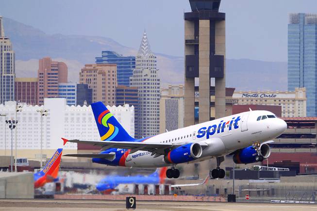
A Spirit Airlines jet takes off from McCarran International Airport on Friday, Aug. 26, 2011.
Sam Morris
..................................................
.
.
FEBRUARY 2, 2012
By Richard N. Velotta (contact)
Tuesday, Jan. 31, 2012 | 3:13 p.m.
www.lasvegassun.com/news/2012/jan/31/spirit-airlines-says...
The battle between discount air carrier Spirit Airlines and the U.S. Department of Transportation escalated today with the airline — the fastest growing carrier at McCarran International Airport last year — adding a new $2 fee to ticket prices to cover costs associated with new consumer regulations that took effect last week.
Miramar, Fla.-based Spirit is calling it a “DOTUC fee,” for Department of Transportation Unintended Consequences, and the airline says it covers costs to the airline for holding fares 24 hours after booking without penalty.
The Department of Transportation ordered new consumer protection rules that took effect on Thursday. Spirit, Southwest Airlines and Allegiant Air, all prominent operators at McCarran, have been the most vocal in their displeasure with the rules.
Spirit’s passenger counts at McCarran grew by 228 percent last year over 2010. Southwest is the busiest carrier at McCarran while Las Vegas-based Allegiant is poised to grow substantially in 2012 after having a 6.4 percent increase in local passengers last year.
The new rules order airlines to include all taxes and fees when advertising or displaying costs of airfares. Airlines don’t have to disclose fees that may not apply to all travelers, such as baggage and booking fees. The rules also order airlines to hold passengers’ fares when booking and allow them to be canceled or changed without penalty for 24 hours.
“People love the idea of not having to commit to a reservation, but this regulation, like most, imposes costs on consumers,” Spirit President and CEO Ben Baldanza said in a company release issued today.
“Wouldn’t we all like to eat all we want and not get fat?” Baldanza said. “Regulators like to try to sell the idea of this rule but have ignored the cost impact to consumers. You simply can’t eat all you want without consequences.”
.
........................................................
img code photo ... Senate Ethics Committee Chair Sen. Barbara Boxer, D-Calif.
photos.lasvegassun.com/media/img/photos/2011/05/12/AP1105...

Senate Ethics Committee Chair Sen. Barbara Boxer, D-Calif., is pursued by reporters on Capitol Hill in Washington, Thursday, May 12, 2011, after speaking on the Senate floor about former Nevada Sen. John Ensign.
AP PHOTO/J. SCOTT APPLEWHITE
........................................................
.
.
Baldanza was on the receiving end of a scathing letter from Sen. Barbara Boxer of California, who criticized Spirit for emailing customers and telling them the government is encouraging airlines to hide federal taxes. It is Spirit’s contention that by requiring airlines to display the full cost of a ticket that customers won’t see how much of it is taxes and fees and how much of it is the airline’s fare.
“I have been shocked by the failure of your airline to tell the truth in an email sent to your customers earlier this week as well as warnings posted on Spirit.com that read, ‘New government regulations require us to HIDE taxes in your fares.’ Nothing could be further from the truth,” Boxer wrote.
“What the rule says is that you have to tell your customers the full cost of a ticket," she continued. "It prohibits Spirit or any other airline from advertising fares ‘that exclude taxes, fees or other charges since the major impact of such presentations is to confuse and deceive consumers.’
“And despite Spirit's claim that the airline must now hide relevant information, the rule ‘allows carriers to advise the public in their fare solicitations about government taxes and fees ...’
“Today's consumers are faced with many options when planning air travel, and being able to compare the full price before purchase is both necessary and fair. Your recent statement that ‘the better form of transparency is to break out costs so that consumers know exactly what they are buying’ is exactly what this new DOT rule will help do,” her letter said.
Airlines like Spirit, Southwest and Allegiant are more sensitive to the new rules because they traditionally have offered lower fares and the displays that include taxes and fees come across as sticker shock to potential customers.
Spirit and Allegiant have business models that offer greatly discounted fares but numerous fees for baggage, booking by phone or online and for seat selection. Southwest fares appear higher with taxes and fees, but its counterparts don’t have to disclose bag fees it doesn’t have.
.
.
.............................................................................................................................................................................................
.
.
The fastest coach in Ireland! Formerly HST kitchen car 40513, it later became the Intercity Executive saloon, before spending some time in store. It was bought by Iarnród Éireann, who converted it to a buffet car for use on push pull services, largely to Waterford. When this photo was taken, the coach was in its last days of service with the ongoing introduction of the ICR sets. This is the corridor side.
2009_03270002
With one blast on Mallard’s whistle, York confirmed its position as the centre of the railway world today. It was the moment that marked the start of the Great Gathering – all six surviving A4 locomotives together to mark a very special anniversary.
Seventy-five years ago to the day, Mallard reached 126mph at Stoke Bank near Grantham in Lincolnshire, making it the fastest steam locomotive in history.
To mark the occasion her five sister A4s, all designed by Sir Nigel Gresley, were brought to the National Railway Museum as part of the Mallard 75 celebrations. Sir Nigel Gresley, Union of South Africa, Bittern, Dwight D Eisenhower, and Dominion of Canada – the latter two travelling 2,500 from North America – were lined up in the Great Hall. Then Mallard glided alongside them and the gathering was complete.
Dignitaries, rail buffs, former drivers and firemen from the great engines and press from Britain and beyond were there to witness locomotive history, the day after the NRM had officially been saved from a potential threat of closure.
The Great Gathering continues at the museum until July 17. And you can read about the NRM’s new art exhibition, It’s Quicker By Rail, here.
In honour of this historic event, here is a train-themed Mix Six: six facts about each of the six A4s.
4468 Mallard
•Mallard was the first A4 to be fitted with a special Kylchap exhaust and double blastpipe and chimney, making steam production more efficient.
•On the 3rd of July 1938 Mallard broke the world speed record for steam traction by reaching a speed of 126mph. But Sir Nigel Gresley himself never accepted this as the record-breaking maximum. He claimed this speed could only have been attained over a few yards, though he was comfortable that the German speed record of 124.5 mph had been surpassed.
•Selected to crew the locomotive on its record attempt were driver Joseph Duddington (a man renowned within the LNER for taking calculated risks) and fireman Thomas Bray.
•Mallard is the only surviving A4 in LNER livery.
•It is 70 ft long and weighs 165 tons, including the tender.
•At the NRM today you can climb aboard the Mallard Experience, a five-minute simulator ride “recreating the excitement and exhilaration of Mallard’s record breaking run”. But according to the warning signs, you shouldn’t go in if you are presumed pregnant or have skeletal defects.
4498 Sir Nigel Gresley
Sir Nigel Gresley takes a break from hauling visitors on the North Yorkshire Moors Railway
Sir Nigel Gresley takes a break from hauling visitors on the North Yorkshire Moors Railway
•Sir Nigel Gresley was built for the LNER in 1937, and was the 100th Gresley Pacific built.
•Locomotive 4498 was actually due to receive the name Bittern, originally suggested for 4492 (later Dominion of New Zealand). So the story goes, an LNER enthusiast who worked in the Railway Correspondence and Travel Society, realised in time that 4498 was the 100th Gresley Pacific locomotive and the suggestion was made that the locomotive be named after her designer.
•Sir Nigel Gresley holds the post-war steam record speed of 112mph gained on the 23 May 1959 and carries a plaque to that effect.
•On that record-breaking run, renowned driver Bill Hoole was on the footplate. He had a reputation for pushing locomotives to their limits.
•Bill believed that, given more freedom from those pesky safety regulations “Mallard’s record would have gone by the board”.
•Sir Nigel Gresley was saved from the scrap heap in 1966 and is based at the North Yorkshire Moors Railway. It carried the Olympic Flame in 2012.
4464 Bittern
A4 Pacific line-up, left to right: Union of South Africa, Bittern, Mallard and Dominion of Canada (just in view)
A4 Pacific line-up, left to right: Union of South Africa, Bittern, Mallard and Dominion of Canada (just in view)
•Initially Bittern was based at Heaton in Newcastle and served the famous Flying Scotsman route in the section between King’s Cross and Newcastle.
•Early in her career, Bittern suffered some collision damage, necessitating a general overhaul at Doncaster from 3rd – 4th January 1938.
•Bittern lost her garter blue paint for wartime black and was required to pull longer than normal passenger trains and later heavy freight and coal trains.
•The final day in service for Bittern was September 3rd 1966.
•Only now have the important repairs been undertaken to bring her up to mainline standard.
•Bittern is the only one with its original tender. By contrast it has had 14 different boilers, more than any other A4
60009 Union of South Africa
Union of South Africa passes Condover, Shropshire. Photograph: Wikipedia
Union of South Africa passes Condover, Shropshire. Photograph: Sam Ashton / CrossHouses on Wikipedia
•Union of South Africa had previously been allocated the name “Osprey”. “Osprey” name plates were fitted to the locomotive during the 1980s and early 1990s due to the politics of the time.
•Union of South Africa has accumulated the highest mileage of any locomotive in the class.
•The springbok plaque on the side of the locomotive was donated on 12 April 1954 by a Bloemfontein newspaper proprietor. Only one plaque was fitted on the left hand side of the locomotive.
•Union of South Africa was allocated to the Haymarket shed in Edinburgh from new and on 20 May 1962 she had her only shed transfer to Aberdeen.
•It was one of five 1937 locomotives built in 1937 to pull the new Coronation express service, which took passengers between London and Edinburgh in just six hours.
•In 1964 it was the last A4 to pull a service train from King’s Cross station. Arriving back on the return journey its final farewell whistle echoed across the platforms.
60010 Dominion of Canada
bittern
•Built in the Doncaster works in 1937, she was originally named Buzzard but was renamed Dominion of Canada in June 1937.
• Dominion of Canada was withdrawn at Darlington shed on May 29, 1965. That July the locomotive was marked in the records as “for sale to be scrapped”.
•It was left derelict and forgotten for many months until finally being moved to Crewe Works for cosmetic restoration and shipping to Canada.
•The loco was donated to the Canadian Railroad Historical Association (CRHA) by British Rail which has looked after it since May 1966.
•It returned to Britain last year where it has been restored to its pre-war state with Garter Blue livery.
•Dominion of Canada was fitted with a Canadian whistle and a bell which on one memorable occasion was rung all the way from London to York.
60008 Dwight D Eisenhower
Dwight D Eisenhower undergoing restoration
Dwight D Eisenhower undergoing restoration
•Built for the London and North Eastern Railway in 1937, the locomotive was originally numbered 4496 and named Golden Shuttle to reflect Yorkshire’s woollen industry.
•It was renamed Dwight D Eisenhower after the Second World War and renumbered 8 on 23 November 1946. It was intended that Eisenhower would attend an official unveiling, but this could not be arranged.
•The locomotive was cosmetically restored at the Doncaster Works in 1963 and was shipped to the USA the following Spring, arriving in New York harbour on 11 May 1964.
•Since then it has been housed at the National Railroad Museum in Green Bay Wisconsin, USA.
•It has travelled more than 1.4 million miles in main line service.
•This is its first return to Britain.
Gladstone
After modest beginnings, Gladstone in the late twentieth century became one of Queensland's fastest-growing towns, drawing its strength from coal mining and other industries, and a flourishing export trade, especially to Japan and China. Located 430 km from Brisbane, it was named in 1853 after the English Chancellor of the Exchequer and future prime minister, William Ewart Gladstone (1809-98). Ninety kilometres south of Rockhampton, Gladstone is a coastal city.
Gladstone was originally known as Port Curtis, which was named by Matthew Flinders in 1802 after Sir Roger Curtis who had been Commandant at the Cape of Good Hope when he had called there for victuals and resupply. Port Curtis enjoyed a brief three months of temporary settlement as the administrative centre of the colony of North Australia (1847). George Barney (Barney's Point, Gladstone) commanded the settlement but a change of government in England led to its disbandment.
Within a few years pastoral occupation of the hinterland brought about pressure for the port to be a livestock shipping outlet. In 1853 the town of Gladstone was surveyed and the first sale of town and suburban allotments took place the following year. Gladstone served well as a harbour, but the absence of plentiful water and agricultural land hindered its development. A gold rush at nearby Canoona (1858) then overshadowed Gladstone for a period. Although declared a municipality in 1863, Gladstone's growth was slow: a customs house was erected in 1860, the first school in 1864, a Presbyterian church in 1869 and Catholic and Church of England churches in 1874.
THE PORT
Gladstone's wharves were at Auckland Point (named after the ship Lord Auckland that brought the first European settlers in 1847), where Auckland Inlet enters Port Curtis. The short waterway involved navigating a strait which was obstructed by submerged rock and passable only at high tide.
Intermittent blasting and dredging went on until the 1890s in an attempt to improve access through the passage, with less than adequate results. Funds were spent on alternative harbours at Port Alma and Rockhampton, leaving Gladstone's population convinced they were being unfairly overlooked.
In 1880 the Gladstone Observer and Port Curtis Advertiser began publication, serving a population of 400. Ten years later a hospital opened. In 1896 the railway was opened from Bundaberg (giving the port a temporary advantage until the line was further extended to Rockhampton), along with the Gladstone Meat Works.
Further impetus came in 1906, with the opening of the Port Curtis Dairy Cooperative. After years of scrub clearing dairy farming had finally achieved critical mass, and the railway transported dairy produce to the factory.
Gladstone remained convinced that it had the best potential shipping harbour in central Queensland. The state government appointed the Gladstone Harbour Board in 1914, and the town formed its own Gladstone Harbour League to lobby the Railways minister for fairer haulage rates and for freight from surrounding shires. Progress was slow, and the town's economic mainstays remained the Port Curtis dairy factory (which achieved maximum production during the 1940s-50s) and the meat works. Tourism was still a distant prospect, although Heron Island emerged as a local holiday destination in the 1930s. Flying boats, bound for Singapore and connections to England called at Auckland Inlet from 1935 and a land aerodrome, jointly backed by Gladstone and Calliope Shire, opened in 1956.
World War II years saw reduced throughput for the port. However the postwar boom was to deliver circumstances allowing for a realisation of Gladstone's belief in its potential as a port. The first significant upturn was the shipping of Callide Valley coal in 1948, followed by Blackwater coal and grain shipments. In 1962 the Commonwealth Aluminium Corporation Pty Ltd (Comalco) announced its intention to build an alumina refinery at Gladstone for its bauxite from Weipa, on the Gulf of Carpentaria. The project injected hope into the community, offering some relief after the closure of the meat works in the early 1960s. Production at the refinery began in 1967 and by 1973 two expansions had made it the largest alumina refinery in the world. Power for the refinery came from the Gladstone Power Station (1967), fired by Callide and Boundary Hill coal.
BOOM
Coal for Japanese contracts had been shipped through Gladstone since 1959, and in 1968 a railway line from the Moura open cut mine to Gladstone opened. By 1980 coal was 47% of the port's cargo throughput, and in 2000 it was over 65%. The Gladstone power station was expanded, reaching maximum capacity in the early 1980s and generating over half Queensland's electricity.
In 1981 Queensland Cement and Lime opened a clinker plant: the cement clinker, produced in a kiln from limestone and other minerals is ground with gypsum and makes cement. Just outside Gladstone, on Boyne Island, another aluminium smelter opened in 1982, its employees swelling Gladstone's metropolitan population by several thousand. A chlorine and cyanide plant opened in 1989.
Gladstone's population increase from about 6000 to 20,000 in the period from 1960-80 strained the social fabric and local infrastructure. It was branded a slum and caravan town. Water supply and sewerage were the Council's first projects, the surfacing of dusty streets left to wait. The Council found that battling on alone was not enough, and extracted financial assistance from the State Government and development contributions from new industries to fund a town plan, hostel, a caravan site, recreation facilities, a new hospital and an extra high school (1981).
CONSOLIDATION
In 1976 the town was proclaimed a city. Ten years later, after strenuous efforts to answer the slum critics, Gladstone received the first of several Tidy Towns awards. By then much of the frenetic industrial construction was completed. There had been time to build a public square and City Centre Plaza (1982), and the town hall (built in 1934 in the depth of the Depression) was converted to a museum and art gallery. A Civic Beautification Committee (1971) enlisted numerous service organisations for voluntary landscape and beautification work, including the surrounds of the Awoonga Dam, a storage enlarged several times to service Gladstone's industry and growing population. In 1988 the Tondoon Botanic Gardens (83 ha) opened, specialising in endemic plants.
Gladstone's growing need for industrial and port land has been partly met by the reclamation by landfill of tidal flat foreshore, enabling industrial expansion near the port. In 1990 there were 18 km of foreshore and waterway shoreline reserved for port activities, which include facilities for bulk coal, grain, clinker, bauxite, petroleum and chemicals.
Gladstone is a regional education centre. In addition to State and Catholic primary and high schools there is a University of Queensland campus near the marina at Auckland Inlet, and a TAFE. Near the centre of town is a reminder of pre-industrial Gladstone, the showground (1915), next to Gladstone State High School (1953). The racecourse, golf course and rugby league ground are to the south, near the airport and the Kin Kora drive-in shopping centre (1977). Goondoon Street in the city centre is Gladstone's main shopping strip, with the recent addition of the City Heart centre at the Tank Street corner. There are also drive-in shopping centres in Toolooa Street, South Gladstone and on the Dawson Highway at West Gladstone.
In addition to the shops, Goondoon Street has four heritage-listed sites: the Catholic church and school (1920s), a former Commonwealth Bank (1920s), the former town hall, now the gallery and museum (1930s) and the former post office (1924). The Port Curtis dairy complex in Short Street is also heritage-listed.
By 2008 Gladstone City Council administered an area of 163 sq km. In that year it was amalgamated with Calliope and Miriam Vale Shires to form Gladstone Regional Council (10,488 sq km). The new council also absorbed the Gladstone Calliope Aerodrome Board.
Source: queenslandplaces.com.au/gladstone
---
1990 heralded a new decade with momentous change and significant events unfolding internationally and at home in Queensland. German reunification was achieved following the ‘fall’ of the Berlin Wall in November 1989. The Baltic states of Lithuania, Latvia and Estonia in turn declared their independence from the Soviet Union. Nelson Mandela was released after 27 years of imprisonment in South Africa, and Margaret Thatcher resigned as Prime Minister of the United Kingdom after more than 11 years in office. British computer scientist Tim Berners-Lee created the first web server and web browser, and the Hubble Space Telescope was launched from the space shuttle ‘Discovery’.
The Australian Labor Party’s federal election campaign was launched in Brisbane in early March before Prime Minister Bob Hawke’s government was returned later that month for a historic fourth term. Andrew Peacock resigned the leadership of the federal Liberal Party after the election defeat and was replaced by Dr John Hewson. Earlier in March, the Aboriginal and Torres Strait Islander Commission (ATSIC) was founded. The inaugural Cape York Aboriginal Land Conference took place at Lockhart River in September, leading to the formation of the Cape York Land Council.
The nation’s first women Premiers were sworn into office this year, firstly Western Australia’s Carmen Lawrence in February followed by Victoria’s Joan Kirner in August. On the day of Kirner’s swearing in, the Hawke government announced Australia would join the international naval blockade of Iraq in the Persian Gulf. A specially convened ALP national conference in September endorsed the privatisation of Qantas and other assets, ahead of deregulation of the domestic aviation market in November. Near that month’s end, Treasurer Paul Keating declared Australia was enduring “the recession we had to have”.
The 1990s was a decade of transformation as infrastructure connected the state, the Internet changed how we worked and Agro was a prime-time star. These photographic highlights come from a collection of thousands of images captured by Transport and Main Roads, documenting the plans, programs and growth of Queensland throughout the decade.
Find this series in our catalogue: www.archivessearch.qld.gov.au/series/S20086
The Transport and Main Roads Visual Resource Library collection contains over 200.000 photographs and other resources from the 1920’s to 2005 from the many and varied road, transport and maritime departments over that time. It is mostly the work of the Photographic Branch and Graphic Reproduction Services Unit between the 1930s and the 1990s. Photographers Les Dixon, Bob Reid, Ian Williams, Murray Waite and Ray Burgress recorded works and events of the Department.
Subjects covered include road construction projects, environmental science, road fittings, public transport and road users, people at work, community engagement, official openings, sod turnings, new structures (bridges, dams and Queensland University), awards, department initiatives, safety campaigns, exhibitions and displays.
This is a photograph from the annual St. Coca's AC 5KM Road Race 2013 which was held in Kilcock, Co. Kildare, Ireland at 20:00 on Friday 27th June 2013. This superb road race is now firmly established again as one of the fastest and best organised road races of it's kind in Leinster. The course is left handed and starts outside the 'Bawn Og' St. Coca's AC track. It then proceeds around a well known local walking route around Laragh and in the closing kilometer runs parallel to the Royal Canal into the finish at the railway station. The members of St. Coca's AC and the many volunteers from the local community must be given great praise for organising another fantastic night of racing for runners, joggers, and walkers. The 5KM course is very flat with the exception of short incline up a motorway overpass and makes its way along narrow country lanes sheltered on either side by hedgerows. The weather was dry and humid and this made a good evening for an enjoyable night for everyone with a large crowd gathering at the finish to cheer on participants. Over 400 people participated in the race. There was a fantastic spread of refreshments (cakes, biscuits, sandwiches and hot drinks) in the school afterwards.
We have a large set of photographs from the event today. The full set is accessible at: www.flickr.com/photos/peterm7/sets/72157645423471903/
Timing and event management was provided by Precision Timing. Results are available on their website at www.precisiontiming.net/result/racetimer with additional material available on their Facebook page (www.facebook.com/davidprecisiontiming?fref=ts) See their promotional video on YouTube: www.youtube.com/watch?v=c-7_TUVwJ6Q
Reading on a Smartphone or tablet? Don't forget to scroll down further to read more about this race and see important Internet links to other information about the race! You can also find out how to access and download these photographs.
Some Useful Links
2014 St. Coca's 5KM Results www.precisiontiming.net/result.aspx?v=2056
GPS Trace of the 5KM Course (course hasn't changed in a few years) connect.garmin.com/activity/194011978
St. Coca's AC Facebook Page: www.facebook.com/stcocas.ac?ref=ts&fref=ts
St. Coca's Race Facebook Page: www.facebook.com/stcocas.roadrace?ref=ts&fref=ts
Start/finish area on Google Maps [Start: www.google.ie/maps/@53.397601,-6.675909,15z Finish: goo.gl/maps/3kPKq] are all within easy access of race HQ and the local village.
Google Streetview of the Location of the Race Finish: goo.gl/maps/3kPKq
Our Flickr Photograph Set of the St. Coca's 5KM 2013: www.flickr.com/photos/peterm7/sets/72157634382263872/
Our Flickr Photograph Set of the St. Coca's 5KM 2012: www.flickr.com/photos/peterm7/sets/72157630347296616/
Our Flickr Photograph Set of the St. Coca's 5KM 2011: www.flickr.com/photos/peterm7/sets/72157627042558602/
The Boards.ie Discussion Forum Thread about the Race in 2014: www.boards.ie/vbulletin/showthread.php?t=2057223729
The Boards.ie Discussion Forum Thread about the Race in 2013: www.boards.ie/vbulletin/showthread.php?t=2056954512
Read the Irish Heart Foundation Booklet on the "Slí na Sláinte" which the race encorporates: www.irishheart.ie/media/pub/slinaslainte/maps/kilcock.pdf
Can I use these photographs directly from Flickr on my social media account(s)?
Yes - of course you can! Flickr provides several ways to share this and other photographs in this Flickr set. You can share to: email, Facebook, Pinterest, Twitter, Tumblr, LiveJournal, and Wordpress and Blogger blog sites. Your mobile, tablet, or desktop device will also offer you several different options for sharing this photo page on your social media outlets.
We take these photographs as a hobby and as a contribution to the running community in Ireland. Our only "cost" is our request that if you are using these images: (1) on social media sites such as Facebook, Tumblr, Pinterest, Twitter,LinkedIn, Google+, etc or (2) other websites, blogs, web multimedia, commercial/promotional material that you must provide a link back to our Flickr page to attribute us.
This also extends the use of these images for Facebook profile pictures. In these cases please make a separate wall or blog post with a link to our Flickr page. If you do not know how this should be done for Facebook or other social media please email us and we will be happy to help suggest how to link to us.
I want to download these pictures to my computer or device?
You can download the photographic image here direct to your computer or device. This version is the low resolution web-quality image. How to download will vary slight from device to device and from browser to browser. However - look for a symbol with three dots 'ooo' or the link to 'View/Download' all sizes. When you click on either of these you will be presented with the option to download the image. Remember just doing a right-click and "save target as" will not work on Flickr.
I want get full resolution, print-quality, copies of these photographs?
If you just need these photographs for online usage then they can be used directly once you respect their Creative Commons license and provide a link back to our Flickr set if you use them. For offline usage and printing all of the photographs posted here on this Flickr set are available free, at no cost, at full image resolution.
Please email petermooney78 AT gmail DOT com with the links to the photographs you would like to obtain a full resolution copy of. We also ask race organisers, media, etc to ask for permission before use of our images for flyers, posters, etc. We reserve the right to refuse a request.
In summary please remember when requesting photographs from us - If you are using the photographs online all we ask is for you to provide a link back to our Flickr set or Flickr pages. You will find the link above clearly outlined in the description text which accompanies this photograph. Taking these photographs and preparing them for online posting does take a significant effort and time. We are not posting photographs to Flickr for commercial reasons. If you really like what we do please spread the link around your social media, send us an email, leave a comment beside the photographs, send us a Flickr email, etc. If you are using the photographs in newspapers or magazines we ask that you mention where the original photograph came from.
I would like to contribute something for your photograph(s)?
Many people offer payment for our photographs. As stated above we do not charge for these photographs. We take these photographs as our contribution to the running community in Ireland. If you feel that the photograph(s) you request are good enough that you would consider paying for their purchase from other photographic providers or in other circumstances we would suggest that you can provide a donation to any of the great charities in Ireland who do work for Cancer Care or Cancer Research in Ireland.
We use Creative Commons Licensing for these photographs
We use the Creative Commons Attribution-ShareAlike License for all our photographs here in this photograph set. What does this mean in reality?
The explaination is very simple.
Attribution- anyone using our photographs gives us an appropriate credit for it. This ensures that people aren't taking our photographs and passing them off as their own. This usually just mean putting a link to our photographs somewhere on your website, blog, or Facebook where other people can see it.
ShareAlike – anyone can use these photographs, and make changes if they like, or incorporate them into a bigger project, but they must make those changes available back to the community under the same terms.
Creative Commons aims to encourage creative sharing. See some examples of Creative Commons photographs on Flickr: www.flickr.com/creativecommons/
I ran in the race - but my photograph doesn't appear here in your Flickr set! What gives?
As mentioned above we take these photographs as a hobby and as a voluntary contribution to the running community in Ireland. Very often we have actually ran in the same race and then switched to photographer mode after we finished the race. Consequently, we feel that we have no obligations to capture a photograph of every participant in the race. However, we do try our very best to capture as many participants as possible. But this is sometimes not possible for a variety of reasons:
►You were hidden behind another participant as you passed our camera
►Weather or lighting conditions meant that we had some photographs with blurry content which we did not upload to our Flickr set
►There were too many people - some races attract thousands of participants and as amateur photographs we cannot hope to capture photographs of everyone
►We simply missed you - sorry about that - we did our best!
You can email us petermooney78 AT gmail DOT com to enquire if we have a photograph of you which didn't make the final Flickr selection for the race. But we cannot promise that there will be photograph there. As alternatives we advise you to contact the race organisers to enquire if there were (1) other photographs taking photographs at the race event or if (2) there were professional commercial sports photographers taking photographs which might have some photographs of you available for purchase. You might find some links for further information above.
Don't like your photograph here?
That's OK! We understand!
If, for any reason, you are not happy or comfortable with your picture appearing here in this photoset on Flickr then please email us at petermooney78 AT gmail DOT com and we will remove it as soon as possible. We give careful consideration to each photograph before uploading.
I want to tell people about these great photographs!
Great! Thank you! The best link to spread the word around is probably http://www.flickr.com/peterm7/sets
The fastest I've ever seen a 73 move giving the passengers waiting on Shortlands station platform a bit of a shock as it raced through with squeaky horn going.
GB Railfreight's re-engineered class 73 number 73964 (previously E6031, 73124 and 73205) named "Jeanette" travels light engine from Loughborough Brush Works to Tonbridge West Yard on 1 April 2015. E6031 (works number E3593/E363) was built at the English Electric Vulcan Foundry in 1966. It was also photographed numerous times earlier on route e.g. by John Pink at East Hyde, by Aaron Oxford at Wandsworth Road, by Ian Dyer at Culvert Road.
According to Realtime Trains the route and timings were;
Loughborough Brush........0855........................0855................RT
Loughborough USL...........0905........................0906..................1L
Sileby Junction....................0911..........................0916..................5L
Syston South Junction......0916.........................0921..................5L
Leicester [LEI] UDS............0922 1/2.................0928................5L
Wigston North Junction....0940........................0944..................4L
Kilby Bridge Junction........0945/1005.............NoRep/1009....4L
Market Harborough 2........1021..........................1020 1/2...........RT
Kettering [KET] 1..................1036.........................1034 1/2............1E
Wellingborough [WEL] 3...1044.........................1043...................1E
Sharnbrook Junction.........1057.........................1053..................4E
Bedford [BDM] 2.................1113...........................1110....................3E
Flitwick [FLT] 1.....................1125..........................1119 1/2.............5E
Harlington [HLN] 1...............1129..........................1122 1/2............6E
Luton [LUT] 1........................1138 1/2....................1134...................4E
St Albans [SAC] 1.................1151 1/2.....................1148 1/2............3E
Radlett Junction..................1157..........................1154...................3E
Hendon [HEN].....................1210..........................1216...................6L
Brent Curve Junction.........1214..........................1218....................4L
Dudding Hill Junction........1217..........................1222..................5L
Neasden Junction..............1219..........................1225..................6L
Acton Wells Junction.........1225.........................1233...................8L
Kew East Junction..............1230.........................1239..................9L
Barnes [BNS] 1.....................1236.........................1251..................15L
Clapham Junction 3...........1246/1252...............1300/1305......13L
Factory Junction.................1258.........................1313..................15L
Voltaire Road Junction......1300 1/2..................1314..................13L
Shortlands Junction...........1321..........................1325...................4L
Bickley Junction[XLY]........1329 1/2...................1329..................RT
Petts Wood Junction.........1334.........................1335....................1L
Orpington [ORP] 3..............1335 1/2...................1340 1/2...........5L
Sevenoaks [SEV] 3.............1345.........................1351...................6L
Tonbridge [TON] D.............1354 1/2/1405 1/2..1402/NoRep....7L
Tonbridge West Yard........1409.........................1417....................8L
Join us for an evening of storytelling with some of New York City’s most influential and innovative producers of live storytelling shows. These are the people at the forefront of one of the fastest growing creative scenes in the country – to quote The Moth: “True stories, told live on stage, without notes.” This evening, curated by Moth GrandSLAM winner Brad Lawrence, will bring them together to perform and to discuss the process of crafting a story, the growth of the form, and its relationship to the broader world of the documentary arts.
Ask Me is a storytelling show that takes place at Arlo and Esme the first Wednesday of every month. It is co-hosted by Cammi Climaco and David Crabb. Each show features three performers, which has included Max Silvestri, Gabe Leidman and Catie Lazarus, and one themed promotional video. On special days, it features Jack Perry on piano accompanying the stories.
Cammi Climaco is a visual artist. She completed her M.F.A. at Cranbrook Academy of Art and received her B.F.A from Kent State University, Kent, Ohio. She has exhibited her multi-media sculpture and videos nationally and internationally in both solo and group exhibitions. Her most recent show was at The Lower East Side Print Shop, in New York City. She has also had exhibitions at Lump, Raleigh, NC, The Rotunda Gallery in Brooklyn, NY and Silo, New York, NY. Working primarily in sculpture and installation, she has recently completed a Special Projects Residency at the Lower East Side Print Shop for printmaking. Cammi teaches at Pratt Institute of Art.
David Crabb (AEA, SAG) is an actor, writer, producer, and musician. He is currently the in-studio story producer of the NYC show RISK!. He has been a member of the critically acclaimed Off-Broadway Axis Company since 2001, starring in and developing plays with the company in Paris and Edinburgh, Scotland. As on-camera host, writer, and content producer for the NRDC’s ItsYourNature.Org, David has traveled to SXSW, Bonnaroo, the Everglades, Miami, and the X Games to interview indie music luminaries The Roots, The Flaming Lips, and Regina Spektor, among many others. His photographs have graced the pages of Interview magazine. David is a recent Moth StorySLAM winner.
The BTK Band is NYC’s hardest-drinking improvised storytelling rock band. Raconteurs regale the audience with true stories from their lives while music and lyrics are improvised to turn their stories into songs. As if Tom Waits and The Moth delivered a baby from the gaping maw of Chaos.
Peter Aguero was born and raised in the wilds of South Jersey. At times a high school history teacher, bar bouncer and ice cream truck driver, he now resides in Queens, NY with his college sweetheart wife. He spent 8 years in the National Touring Company of Chicago City Limits, NYC’s longest running improv show. Peter is a Moth GrandSLAM champion, host of Moth StorySLAMs, and an instructor for the MothShop Community Program. He is the lead singer of The BTK Band, NYC’s only improvised storytelling rockband, performing in residence at Under St Mark’s Theater in the East Village. Peter loves his Mom.
The Moth was started in 1997 and believes that everyone has a story. Following the extraordinary success of the Mainstage series, where stories are pulled from the general public and cultivated with coaches, The Moth sought to accommodate all the people who asked, “When can I tell my story?” The StorySLAM aims to give those eager storytellers a forum, and also to encourage folks who’ve doubted they had a story worth telling. The Moth StorySLAM provides a stage and a microphone, a theme to inspire and shape the evening, a lively and supportive audience, and a host to guide the festivities. SLAM stories are limited to five minutes, and ten stories are heard. The stories are scored by three teams of audience-member judges, and a winner is announced at every SLAM. The winners later face off in a Moth GrandSLAM. Since 2001, the raucous, moving, funny and wild stories that emerge during each show have kept the crowds coming back again and again. Now, each month, there are four Moth StorySLAMs in NYC , three in Los Angeles and one in both Detroit and Chicago. The Moth will add more cities in 2011. Stories from the StorySLAMS are regularly featured on The Moth Radio Hour, which airs in over 200 major markets in America.
Jenifer Hixson is Senior Producer at The Moth, where she developed and oversees The Moth StorySLAM. She rarely misses a StorySLAM meaning she’s heard approximately 2,890 five-minute stories. Story-wise, there are always laughs, usually a tear or two, and on occasion, blood. Great that after all this time, and all those stories, there are still surprises.
Standard Issues is a monthly show which is designed for veteran storytellers to try out new material and new storytellers to get their feet wet in a fun and welcoming atmosphere. Every third Tuesday, at 8 o’clock at Pacific Standard in Park Slope, you can see New York’s acknowledged best together with the up and comers who are making a splash and then drink with them. Then at the end of each show, the name of a mystery guest is pulled from the hat.
Cyndi Freeman is an actress, playwright and burlesque performer. She co-produces The Standard Issues story telling show in Brooklyn with her husband Brad Lawrence. She is a MothSlam winner and has appeared on story telling shows throughout New York, including The Liar Show, Stripped Stories, True Tales of College as well as others. She also performs burlesque as Cherry Pitz and produces Hotsy Totsy Burlesque with co-producer Joe the Shark. She is currently working on a solo show entitled Wonder Woman: A how to guide for little Jewish Girls.
TOLD is a monthly storytelling show hosted by Seth Lind and produced by Heidi Grumelot. The third Monday of every month, New York’s best performers take the stage at Horse Trade’s UNDER St. Mark’s Theater to tell true stories related to a central theme. A special guest provides interludes to glue the evening together into a collective experience.
Seth Lind hosts the monthly storytelling show TOLD, performs improv comedy with the group Thank You Robot, and is production manager for the public radio program This American Life. He’s also worked in various capacities on several documentaries and fiction films. Seth has a pacemaker but no known allergies.
Brad Lawrence, the curator of this evening, is one of New York City’s rising talents in the burgeoning world of live storytelling. A Moth Storyslam winner, and one of the few to achieve that distinction on his first appearance, he is also the only storyteller to win back to back Moth GrandSLAMS. He has also been a guest intro performer for The Moth’s outreach program to schools and institutional communities. He is a regular at such shows as The Liar’s Show, Speakeasy Stories, Seth Lind’s Told, The Risk Podcast, as well as How I Learned at Happy Endings and the show he co-produces with his wife, The Standard Issues, both of which have garnered him mentions in The New York Times. Brad is currently working on his memoir, Monsters In The Wood, and will be performing each chapter as a live show at Under Saint Marks Theater, beginning in November. His blog is billyjoesboy.com.
Probably the fastest woodlouse in the UK, and certainly the largest. They don't usually stay still for a picture as this one did.
best way get your ex back free ebook fastest a poem for getting an ex girlfriend back proven method to how to stop a relationship breakup ==>
Kuala Lumpur (/ˈkwɑːləˈlʊmpʊər/ or /-pər/; Malaysian pronunciation: [ˈkwalə ˈlumpʊr]) is the national capital and most populous global city in Malaysia. The city covers an area of 243 km2 and has an estimated population of 1.6 million as of 2010. Greater Kuala Lumpur, covering similar area as the Klang Valley, is an urban agglomeration of 7.5 million people as of 2012. It is among the fastest growing metropolitan regions in South-East Asia, in terms of population and economy.
Kuala Lumpur is the seat of the Parliament of Malaysia. The city was once home to the executive and judicial branches of the federal government, but they were moved to Putrajaya in early 1999. Some sections of the judiciary still remain in the capital city of Kuala Lumpur. The official residence of the Malaysian King, the Istana Negara, is also situated in Kuala Lumpur. Rated as an alpha world city, Kuala Lumpur is the cultural, financial and economic centre of Malaysia due to its position as the capital as well as being a key city. Kuala Lumpur was ranked 48th among global cities by Foreign Policy's 2010 Global Cities Index and was ranked 67th among global cities for economic and social innovation by the 2thinknow Innovation Cities Index in 2010.
Kuala Lumpur is defined within the borders of the Federal Territory of Kuala Lumpur and is one of three Malaysian Federal Territories. It is an enclave within the state of Selangor, on the central west coast of Peninsular Malaysia.
Since the 1990s, the city has played host to many international sporting, political and cultural events including the 1998 Commonwealth Games and the Formula One Grand Prix. In addition, Kuala Lumpur is home to the tallest twin buildings in the world, the Petronas Twin Towers, which have become an iconic symbol of Malaysia's futuristic development.
In May 2015, Kuala Lumpur was officially recognized as one of the New7Wonders Cities together with Vigan City, Doha, Durban, Havana, Beirut, and La Paz.
HISTORY
Kuala Lumpur means "muddy confluence", although it is also possible that the name is a corrupted form of an earlier but now unidentifiable forgotten name. It was originally a small settlement of just a few houses at the confluence of Sungai Gombak (previously known as Sungai Lumpur) and Sungai Klang (Klang River). The town of Kuala Lumpur was established circa 1857, when the Malay Chief of Klang, Raja Abdullah bin Raja Jaafar, aided by his brother Raja Juma'at of Lukut, raised funds to hire some Chinese miners from Lukut to open new tin mines here. The miners landed at Kuala Lumpur and continued their journey on foot to Ampang where the first mine was opened. Kuala Lumpur was the furthest point up the Klang River to which supplies could conveniently be brought by boat; it therefore became a collection and dispersal point serving the tin mines. The identity of the founder of Kuala Lumpur has however not been confirmed: Raja Abdullah bin Raja Jaafar and his role in founding the city do not appear in the earliest account of the history of Selangor. On the other hand, the Sumatrans Abdullah Hukum and Sutan Puasa, arrived in Kuala Lumpur at least in 1850. Raja Abdullah only came around 1857 and Yap Ah Loy, also regarded as the founding father of Kuala Lumpur, arrived in 1862. In addition, the Chinese men employed under Raja Abdullah worked in Ampang, 64 kilometres away from the main land. Meanwhile, efficient drainage and irrigation systems (bondar saba) were introduced in Kuala Lumpur by the technologically advanced Mandailing, improving the mining industry.
In the early history of Kuala Lumpur, the Minangkabaus of Sumatra were considered to be one of the most important groups of people who involved in trading. Utsman bin Abdullah and Haji Mohamed Taib were influenced tycoon in Kuala Lumpur and surrounding area. Haji Taib, one of the wealthiest figure at that time, was an important person in the early development centre of city: Kampung Baru. Beside as merchants, the Minangkabaus also overwhelmingly on socio-religious figures, such as Utsman bin Abdullah was the first kadi of Kuala Lumpur as well as Muhammad Nur bin Ismail.
Although the early miners suffered a high death toll due to the malarial conditions of the jungle, the Ampang mines were successful, and the first tin was exported in 1859. The tin-mining spurred the growth of the town, and miners later also settled in Pudu and Batu. The miners formed gangs among themselves; there were the Hakka-dominated Hai San in Kuala Lumpur, and the Cantonese-dominated Ghee Hin based in Kanching in Ulu Selangor. These two gangs frequently fought to gain control of best tin mines. The leaders of the Chinese community were conferred the title of Kapitan Cina (Chinese headman) by the Malay chief, and Hiu Siew, the owner of a mine in Lukut, was chosen as the first Kapitan of Kuala Lumpur. As one of the first traders to arrive in Ampang (along with Yap Ah Sze), he sold provisions to the miners in exchange for tin.
In 1868, Yap Ah Loy was appointed the third Chinese Kapitan of Kuala Lumpur. Yap, together with Frank Swettenham, were the two most important figures in the development of Kuala Lumpur in the early days of Kuala Lumpur. In 1880, the state capital of Selangor was moved from Klang to the more strategically advantageous Kuala Lumpur by the colonial administration, and Swettenham was appointed the Resident in 1882. Kuala Lumpur was a small town with buildings made of wood and atap (thatching) that were prone to burn. It suffered from many problems, including the Selangor Civil War which devastated the town; it was also plagued by diseases and constant fires and floods. The war and other setbacks led to a slump which lasted until 1879, when a rise in the price of tin allowed the town to recover.
In 1881, a flood swept through the town, following a fire that had engulfed it earlier. As a response, Frank Swettenham, the British Resident of Selangor, required that buildings be constructed of brick and tile.[33] Hence, Kapitan Yap Ah Loy bought a sprawling piece of real estate to set up a brick industry, which spurred the rebuilding of Kuala Lumpur. This place is the eponymous Brickfields. Hence, destroyed atap buildings were replaced with brick and tiled ones. He restructured the building layout of the city. Many of the new brick buildings mirrored those of shop houses in southern China, characterised by "five foot ways" as well as skilled Chinese carpentry work. This resulted in a distinct eclectic shop house architecture typical to this region. Kapitan Yap Ah Loy expand road access in the city significantly, linking up tin mines with the city, these roads include the main arterial roads of the present Ampang Road, Pudu Road and Petaling Street. As Chinese Kapitan, he was vested with wide powers on par with Malay community leaders. He implemented law reforms and introduced new legal measures. He also presided over a small claims court. With a police force of six, he was able to uphold the rule of law. He built a prison that could accommodate 60 prisoners at any time. Kapitan Yap Ah Loy also built Kuala Lumpur's first school and a major tapioca mill in Petaling Street of which the Selangor's Sultan Abdul Samad had an interest.
A railway line between Kuala Lumpur and Klang, initiated by Swettenham and completed in 1886, increased accessibility which resulted in the rapid growth of the town. The population grew from 4,500 in 1884 to 20,000 in 1890. As development intensified in the 1880s, it also put pressure on sanitation, waste disposal and other health issues. A Sanitary Board was created on 14 May 1890 which was responsible for sanitation, upkeep of roads, lighting of street and other functions. This would eventually became the Kuala Lumpur Municipal Council. Kuala Lumpur was only 0.65 km2 in 1895, but it expanded to 20 km2 in 1903, and by the time it became a municipality in 1948 it had expanded to 93 km2, and then to 243 km2 in 1974 as a Federal Territory. In 1896, Kuala Lumpur was chosen as the capital of the newly formed Federated Malay States. A mixture of different communities settled in various sections of Kuala Lumpur. The Chinese mainly settled around the commercial centre of Market Square, east of the Klang River, and towards Chinatown. The Malays, Indian Chettiars, and Indian Muslims resided along Java Street (now Jalan Tun Perak). The Padang, now known as Merdeka Square, was the centre of the British administrative offices.
During World War II, Kuala Lumpur was captured by the Imperial Japanese Army on 11 January 1942. They occupied the city until 15 August 1945, when the commander in chief of the Japanese Seventh Area Army in Singapore and Malaysia, Seishirō Itagaki, surrendered to the British administration following the atomic bombings of Hiroshima and Nagasaki. Kuala Lumpur grew through the war, the rubber and tin commodity crashes and the Malayan Emergency, during which Malaya was preoccupied with the communist insurgency. In 1957, the Federation of Malaya gained its independence from British rule. Kuala Lumpur remained the capital through the formation of Malaysia on 16 September 1963.
On 13 May 1969, the worst race riots on record in Malaysia took place in Kuala Lumpur. The so-called 13 May Incident refers to the occurrence of violence between members of the Malay and the Chinese communities. The violence was the result of Malaysian Malays being dissatisfied with their socio-political status. The riots resulted in the deaths of 196 people, and led to major changes in the country's economic policy to promote and prioritise Malay economic development over that of the other ethnicities.
Kuala Lumpur later achieved city status in 1972, becoming the first settlement in Malaysia to be granted the status after independence. Later, on 1 February 1974, Kuala Lumpur became a Federal Territory. Kuala Lumpur ceased to be the capital of Selangor in 1978 after the city of Shah Alam was declared the new state capital. On 14 May 1990, Kuala Lumpur celebrated 100 years of local council. The new federal territory Kuala Lumpur flag and anthem were introduced. On 1 February 2001, Putrajaya was declared a Federal Territory, as well as the seat of the federal government. The administrative and judicial functions of the government were shifted from Kuala Lumpur to Putrajaya. Kuala Lumpur however still retained its legislative function, and remained the home of the Yang di-Pertuan Agong (Constitutional King).
GEOGRAPHY
The geography of Kuala Lumpur is characterised by the huge Klang Valley. The valley is bordered by the Titiwangsa Mountains in the east, several minor ranges in the north and the south and the Strait of Malacca in the west. Kuala Lumpur is a Malay term that translates to "muddy confluence" as it is located at the confluence of the Klang and Gombak rivers.
Located in the centre of Selangor state, Kuala Lumpur was previously under the rule of Selangor State Government. In 1974, Kuala Lumpur was separated from Selangor to form the first Federal Territory governed directly by the Malaysian Federal Government. Its location on the west coast of Peninsular Malaysia, which has wider flat land than the east coast, has contributed to its faster development relative to other cities in Malaysia. The municipality of the city covers an area of 243 km2, with an average elevation of 21.95 m.
CLOMATE AND WEATHER
Protected by the Titiwangsa Mountains in the east and Indonesia's Sumatra Island in the west, Kuala Lumpur has a tropical rainforest climate (Köppen climate classification Af), which is warm and sunny, along with abundant rainfall, especially during the northeast monsoon season from October to March. Temperatures tend to remain constant. Maximums hover between 32 and 33 °C and have never exceeded 38.5 °C, while minimums hover between 23.4 and 24.6 °C and have never fallen below 14.4 °C. Kuala Lumpur typically receives minimum 2,600 mm of rain annually; June and July are relatively dry, but even then rainfall typically exceeds 131 millimetres per month.
Flooding is a frequent occurrence in Kuala Lumpur whenever there is a heavy downpour, especially in the city centre and downstream areas. Smoke from forest fires of nearby Sumatra sometimes cast a haze over the region. It is a major source of pollution in the city together with open burning, emission from motor vehicles and construction work.
POLITICS
Kuala Lumpur is home to the Parliament of Malaysia. The hierarchy of authority in Malaysia, in accordance with the Federal Constitution, has stipulated the three branches, of the Malaysian government as consisting of the Executive, Judiciary and Legislative branches. The Parliament consists of the Dewan Negara (Upper House / House of Senate) and Dewan Rakyat (Lower House / House of Representatives).
ECONOMY
Kuala Lumpur and its surrounding urban areas form the most industrialised and economically, the fastest growing region in Malaysia. Despite the relocation of federal government administration to Putrajaya, certain government institutions such as Bank Negara Malaysia (National Bank of Malaysia), Companies Commission of Malaysia and Securities Commission as well as most embassies and diplomatic missions have remained in the city.
The city remains as the economic and business centre of the country. Kuala Lumpur is a centre for finance, insurance, real estate, media and the arts of Malaysia. Kuala Lumpur is rated as an alpha world city, and is the only global city in Malaysia, according to the Globalization and World Cities Study Group and Network (GaWC). The infrastructure development in the surrounding areas such as the Kuala Lumpur International Airport at Sepang, the creation of the Multimedia Super Corridor and the expansion of Port Klang further reinforce the economic significance of the city.
Bursa Malaysia or the Malaysia Exchange is based in the city and forms one of its core economic activities. As of 5 July 2013, the market capitalisation stood at US$505.67 billion.
The Gross Domestic Product (GDP) for Kuala Lumpur is estimated at RM73,536 million in 2008 with an average annual growth rate of 5.9 percent.[66] The per capita GDP for Kuala Lumpur in 2013 is RM79,752 with an average annual growth rate of 5.6 percent. The total employment in Kuala Lumpur is estimated at around 838,400. The service sector comprising finance, insurance, real estate, business services, wholesale and retail trade, restaurants and hotels, transport, storage and communication, utilities, personal services and government services form the largest component of employment representing about 83.0 percent of the total. The remaining 17 percent comes from manufacturing and construction.
The average monthly household income for Kuala Lumpur was RM4,105 (USD 1,324) in 1999, up from RM3,371 (USD 1,087) four years prior, making it 66% higher than the national average. In terms of household income distribution, 23.5% of households in the city earned more than RM5,000 (USD 1,613) per month compared to 9.8% for the entire country, while 8.1% earned less than RM1,000 (USD 323) a month.
The large service sector is evident in the number of local and foreign banks and insurance companies operating in the city. Kuala Lumpur is poised to become the global Islamic Financing hub with an increasing number of financial institutions providing Islamic Financing and the strong presence of Gulf's financial institutions such as the world's largest Islamic bank, Al-Rajhi Bank and Kuwait Finance House. Apart from that, the Dow Jones & Company is keen to work with Bursa Malaysia to set up Islamic Exchange Trade Funds (ETFs), which would help raise Malaysia's profile in the Gulf. The city has a large number of foreign corporations and is also host to many multi national companies' regional offices or support centres, particularly for finance and accounting, and information technology functions. Most of the countries' largest companies have their headquarters based here and as of December 2007 and excluding Petronas, there are 14 companies that are listed in Forbes 2000 based in Kuala Lumpur.
Other important economic activities in the city are education and health services. Kuala Lumpur also has advantages stemming from the high concentration of educational institutions that provide a wide-ranging of courses. Numerous public and private medical specialist centres and hospitals in the city offer general health services, and a wide range of specialist surgery and treatment that caters to locals and tourists.
There has been growing emphasis to expand the economic scope of the city into other service activities, such as research and development, which supports the rest of the economy of Malaysia. Kuala Lumpur has been home for years to important research centres such as the Rubber Research Institute of Malaysia, the Forest Research Institute Malaysia and the Institute of Medical Research and more research centres are expected to be established in the coming years.
DEMOGRAPHICS
Kuala Lumpur is the most populous city in Malaysia, with a population of 1.6 million in the city proper as of 2010. It has a population density of 6,696 inhabitants per square kilometre , and is the most densely populated administrative district in Malaysia. Residents of the city are colloquially known as KLites. Kuala Lumpur is also the centre of the wider Klang Valley conurbation (covering Petaling Jaya, Klang, Subang Jaya, Shah Alam, Gombak and others) which has an estimated metropolitan population of 7.2–7.5 million as of 2012.
Kuala Lumpur's heterogeneous populace includes the country's three major ethnic groups: the Malays, the Chinese and the Indians, although the city also has a mix of different cultures including Eurasians, as well as Kadazans, Ibans and other indigenous races from East Malaysia and Peninsula Malaysia.
Historically Kuala Lumpur was a predominantly Chinese, but recently the Bumiputra component of the city has increased substantially and they are now the dominant group. Most of Malays who considered as Bumiputra came from Sumatra and other parts of Indonesia archipelago. The majority of them Javanese, Minangkabaus and Buginese began arriving in Kuala Lumpur in the mid 19th century, in addition to Acehnese who arrived in the late 20th century. The population of Kuala Lumpur was estimated to be around three thousand in 1880 when it was made the capital of Selangor. In the following decade which saw the rebuilding of the town it showed considerable increase, due in large part to the construction of a railway line in 1886 connecting Kuala Lumpur and Klang.
A census in 1891 of uncertain accuracy gave a figure of 43,796 inhabitants, 79% of whom were Chinese (71% of the Chinese were Hakka), 14% Malay, and 6% Indian. Another estimate put the population of Kuala Lumpur in 1890 at 20,000. In 1931, 61% of Kuala Lumpur's 111,418 inhabitants were Chinese, and in 1947 63.5%. The Malays however began to settle in the Kuala Lumpur in significant numbers, in part due to government employment, as well as the expansion of the city that absorbed the surrounding rural areas where many Malays lived. between 1947 and 1957 the population of Bumiputras in Kuala Lumpur doubled, increasing from 12.5 to 15%, while the proportion of Chinese dropped. The process continued after Malayan independence with the growth of a largely Malay civil service, and later the implementation of the New Economic Policy which encouraged Malay participation in urban industries and business. In 1980 the population of Kuala Lumpur had reached over a million, with 52% Chinese, 33% Malay, and 15% Indian. From 1980 to 2000 the number of Bumiputras increased by 77%, but the Chinese still outnumbered the Bumiputras in Kuala Lumpur in the 2000 census at 43% compared to Bumiputras at 38%. By the 2010 census, according to the Department of Statistics and excluding non-citizens, the percentage of the Bumiputera population in Kuala Lumpur has reached around 45.9%, with the Chinese population at 43.2% and Indians 10.3%.A notable phenomenon in recent times has been the increase of foreign residents in Kuala Lumpur, which rose from 1% of the city's population in 1980 to about 8% in the 2000 census, and 9.4% in the 2010 census. These figures also do not include a significant number of illegal immigrants. Kuala Lumpur's rapid development has triggered a huge influx of low-skilled foreign workers from Indonesia, Nepal, Burma, Thailand, Bangladesh, India, Sri Lanka, Philippines, and Vietnam into Malaysia, many of whom enter the country illegally or without proper permits.Birth rates in Kuala Lumpur have declined and resulted in the lower proportion of young people falling below 15 years old category from 33% in 1980 to slightly less than 27% in 2000.[69] On the other hand, the working age group of 15–59 increased from 63% in 1980 to 67% in 2000. The elderly age group, 60 years old and above has increased from 4% in 1980 and 1991 to 6% in 2000.
Kuala Lumpur is pluralistic and religiously diverse. The city has many places of worship catering to the multi-religious population. Islam is practised primarily by the Malays and the Indian Muslim communities. Buddhism, Confucianism and Taoism are practised mainly among the Chinese. Indians traditionally adhere to Hinduism. Some Chinese and Indians also subscribe to Christianity.
As of 2010 Census the population of Kuala Lumpur is 46.4% Muslim, 35.7% Buddhist, 8.5% Hindu, 5.8% Christian, 1.1% Taoist or Chinese religion adherent, 2.0% follower of other religions, and 0.5% non-religious.
Bahasa Malaysia is the principal language in Kuala Lumpur. Kuala Lumpur residents are generally literate in English, with a large proportion adopting it as their first language. It has a strong presence, especially in business and is a compulsory language taught in schools. Cantonese and Mandarin are prominent as they are spoken by the local majority Chinese population. Another major dialect spoken is Hakka. While Tamil is dominant amongst the local Indian population, other Indian languages spoken include Telugu, Malayalam, Punjabi and Hindi. Beside the Malay language, there are a variety of languages spoken by Indonesian descent, such as Minangkabau and Javanese.
EDUCATION
According to government statistics, Kuala Lumpur has a literacy rate of 97.5% in 2000, the highest rate in any state or territory in Malaysia. In Malaysia, Malay is the language of instruction for most subjects while English is a compulsory subject, but as of 2012, English is still the language of instruction for mathematics and the natural sciences for certain schools. Some schools provide Mandarin and Tamil as languages of instruction for certain subjects. Each level of education demands different skills of teaching and learning ability.Kuala Lumpur contains 13 tertiary education institutions, 79 high schools, 155 elementary schools and 136 kindergartens.
WIKIPEDIA
With one blast on Mallard’s whistle, York confirmed its position as the centre of the railway world today. It was the moment that marked the start of the Great Gathering – all six surviving A4 locomotives together to mark a very special anniversary.
Seventy-five years ago to the day, Mallard reached 126mph at Stoke Bank near Grantham in Lincolnshire, making it the fastest steam locomotive in history.
To mark the occasion her five sister A4s, all designed by Sir Nigel Gresley, were brought to the National Railway Museum as part of the Mallard 75 celebrations. Sir Nigel Gresley, Union of South Africa, Bittern, Dwight D Eisenhower, and Dominion of Canada – the latter two travelling 2,500 from North America – were lined up in the Great Hall. Then Mallard glided alongside them and the gathering was complete.
Dignitaries, rail buffs, former drivers and firemen from the great engines and press from Britain and beyond were there to witness locomotive history, the day after the NRM had officially been saved from a potential threat of closure.
The Great Gathering continues at the museum until July 17. And you can read about the NRM’s new art exhibition, It’s Quicker By Rail, here.
In honour of this historic event, here is a train-themed Mix Six: six facts about each of the six A4s.
4468 Mallard
•Mallard was the first A4 to be fitted with a special Kylchap exhaust and double blastpipe and chimney, making steam production more efficient.
•On the 3rd of July 1938 Mallard broke the world speed record for steam traction by reaching a speed of 126mph. But Sir Nigel Gresley himself never accepted this as the record-breaking maximum. He claimed this speed could only have been attained over a few yards, though he was comfortable that the German speed record of 124.5 mph had been surpassed.
•Selected to crew the locomotive on its record attempt were driver Joseph Duddington (a man renowned within the LNER for taking calculated risks) and fireman Thomas Bray.
•Mallard is the only surviving A4 in LNER livery.
•It is 70 ft long and weighs 165 tons, including the tender.
•At the NRM today you can climb aboard the Mallard Experience, a five-minute simulator ride “recreating the excitement and exhilaration of Mallard’s record breaking run”. But according to the warning signs, you shouldn’t go in if you are presumed pregnant or have skeletal defects.
4498 Sir Nigel Gresley
Sir Nigel Gresley takes a break from hauling visitors on the North Yorkshire Moors Railway
Sir Nigel Gresley takes a break from hauling visitors on the North Yorkshire Moors Railway
•Sir Nigel Gresley was built for the LNER in 1937, and was the 100th Gresley Pacific built.
•Locomotive 4498 was actually due to receive the name Bittern, originally suggested for 4492 (later Dominion of New Zealand). So the story goes, an LNER enthusiast who worked in the Railway Correspondence and Travel Society, realised in time that 4498 was the 100th Gresley Pacific locomotive and the suggestion was made that the locomotive be named after her designer.
•Sir Nigel Gresley holds the post-war steam record speed of 112mph gained on the 23 May 1959 and carries a plaque to that effect.
•On that record-breaking run, renowned driver Bill Hoole was on the footplate. He had a reputation for pushing locomotives to their limits.
•Bill believed that, given more freedom from those pesky safety regulations “Mallard’s record would have gone by the board”.
•Sir Nigel Gresley was saved from the scrap heap in 1966 and is based at the North Yorkshire Moors Railway. It carried the Olympic Flame in 2012.
4464 Bittern
A4 Pacific line-up, left to right: Union of South Africa, Bittern, Mallard and Dominion of Canada (just in view)
A4 Pacific line-up, left to right: Union of South Africa, Bittern, Mallard and Dominion of Canada (just in view)
•Initially Bittern was based at Heaton in Newcastle and served the famous Flying Scotsman route in the section between King’s Cross and Newcastle.
•Early in her career, Bittern suffered some collision damage, necessitating a general overhaul at Doncaster from 3rd – 4th January 1938.
•Bittern lost her garter blue paint for wartime black and was required to pull longer than normal passenger trains and later heavy freight and coal trains.
•The final day in service for Bittern was September 3rd 1966.
•Only now have the important repairs been undertaken to bring her up to mainline standard.
•Bittern is the only one with its original tender. By contrast it has had 14 different boilers, more than any other A4
60009 Union of South Africa
Union of South Africa passes Condover, Shropshire. Photograph: Wikipedia
Union of South Africa passes Condover, Shropshire. Photograph: Sam Ashton / CrossHouses on Wikipedia
•Union of South Africa had previously been allocated the name “Osprey”. “Osprey” name plates were fitted to the locomotive during the 1980s and early 1990s due to the politics of the time.
•Union of South Africa has accumulated the highest mileage of any locomotive in the class.
•The springbok plaque on the side of the locomotive was donated on 12 April 1954 by a Bloemfontein newspaper proprietor. Only one plaque was fitted on the left hand side of the locomotive.
•Union of South Africa was allocated to the Haymarket shed in Edinburgh from new and on 20 May 1962 she had her only shed transfer to Aberdeen.
•It was one of five 1937 locomotives built in 1937 to pull the new Coronation express service, which took passengers between London and Edinburgh in just six hours.
•In 1964 it was the last A4 to pull a service train from King’s Cross station. Arriving back on the return journey its final farewell whistle echoed across the platforms.
60010 Dominion of Canada
bittern
•Built in the Doncaster works in 1937, she was originally named Buzzard but was renamed Dominion of Canada in June 1937.
• Dominion of Canada was withdrawn at Darlington shed on May 29, 1965. That July the locomotive was marked in the records as “for sale to be scrapped”.
•It was left derelict and forgotten for many months until finally being moved to Crewe Works for cosmetic restoration and shipping to Canada.
•The loco was donated to the Canadian Railroad Historical Association (CRHA) by British Rail which has looked after it since May 1966.
•It returned to Britain last year where it has been restored to its pre-war state with Garter Blue livery.
•Dominion of Canada was fitted with a Canadian whistle and a bell which on one memorable occasion was rung all the way from London to York.
60008 Dwight D Eisenhower
Dwight D Eisenhower undergoing restoration
Dwight D Eisenhower undergoing restoration
•Built for the London and North Eastern Railway in 1937, the locomotive was originally numbered 4496 and named Golden Shuttle to reflect Yorkshire’s woollen industry.
•It was renamed Dwight D Eisenhower after the Second World War and renumbered 8 on 23 November 1946. It was intended that Eisenhower would attend an official unveiling, but this could not be arranged.
•The locomotive was cosmetically restored at the Doncaster Works in 1963 and was shipped to the USA the following Spring, arriving in New York harbour on 11 May 1964.
•Since then it has been housed at the National Railroad Museum in Green Bay Wisconsin, USA.
•It has travelled more than 1.4 million miles in main line service.
•This is its first return to Britain.
From Left to right:
15mm f4 Voigtlander helliar - UWA with very little distortion with great optics
50mm f1.1 Voigtlander Nokton - fast 50mm prime, it gets bad reviews online but in real world shooting i find it very good, sharp, and has lovely bokeh.
35mm f1.2 voigtlander Nokton - the fastest 35mm rangefinder lens available, brilliant IQ
90mm f2 Leica Summicron - classic lens older than me that still out ranks many modern lenses
fastest way how to get over a girlfriend best how to get my ex girlfriend back back together back ==>
This is a set of photographs from the annual St. Coca's AC 5KM Road Race 2013 which was held in Kilcock, Co. Kildare, Ireland at 20:00 on Friday 27th June 2013. This superb road race is now firmly established again as one of the fastest and best organised road races of it's kind in Leinster. The course is left handed and starts outside the 'Bawn Og' St. Coca's AC track. It then proceeds around a well known local walking route around Laragh and in the closing kilometer runs parallel to the Royal Canal into the finish at the railway station. The members of St. Coca's AC and the many volunteers from the local community must be given great praise for organising another fantastic night of racing for runners, joggers, and walkers. The 5KM course is very flat with the exception of short incline up a motorway overpass and makes its way along narrow country lanes sheltered on either side by hedgerows. The weather was dry and humid and this made a good evening for an enjoyable night for everyone with a large crowd gathering at the finish to cheer on participants. Over 400 people participated in the race. There was a fantastic spread of refreshments (cakes, biscuits, sandwiches and hot drinks) in the school afterwards.
We have a large set of photographs from the event today. The full set is accessible at: www.flickr.com/photos/peterm7/sets/72157645423471903/
Timing and event management was provided by Precision Timing. Results are available on their website at www.precisiontiming.net/result/racetimer with additional material available on their Facebook page (www.facebook.com/davidprecisiontiming?fref=ts) See their promotional video on YouTube: www.youtube.com/watch?v=c-7_TUVwJ6Q
Reading on a Smartphone or tablet? Don't forget to scroll down further to read more about this race and see important Internet links to other information about the race! You can also find out how to access and download these photographs.
Some Useful Links
2014 St. Coca's 5KM Results www.precisiontiming.net/result.aspx?v=2056
GPS Trace of the 5KM Course (course hasn't changed in a few years) connect.garmin.com/activity/194011978
St. Coca's AC Facebook Page: www.facebook.com/stcocas.ac?ref=ts&fref=ts
St. Coca's Race Facebook Page: www.facebook.com/stcocas.roadrace?ref=ts&fref=ts
Start/finish area on Google Maps [Start: www.google.ie/maps/@53.397601,-6.675909,15z Finish: goo.gl/maps/3kPKq] are all within easy access of race HQ and the local village.
Google Streetview of the Location of the Race Finish: goo.gl/maps/3kPKq
Our Flickr Photograph Set of the St. Coca's 5KM 2013: www.flickr.com/photos/peterm7/sets/72157634382263872/
Our Flickr Photograph Set of the St. Coca's 5KM 2012: www.flickr.com/photos/peterm7/sets/72157630347296616/
Our Flickr Photograph Set of the St. Coca's 5KM 2011: www.flickr.com/photos/peterm7/sets/72157627042558602/
The Boards.ie Discussion Forum Thread about the Race in 2014: www.boards.ie/vbulletin/showthread.php?t=2057223729
The Boards.ie Discussion Forum Thread about the Race in 2013: www.boards.ie/vbulletin/showthread.php?t=2056954512
Read the Irish Heart Foundation Booklet on the "Slí na Sláinte" which the race encorporates: www.irishheart.ie/media/pub/slinaslainte/maps/kilcock.pdf
Can I use these photographs directly from Flickr on my social media account(s)?
Yes - of course you can! Flickr provides several ways to share this and other photographs in this Flickr set. You can share to: email, Facebook, Pinterest, Twitter, Tumblr, LiveJournal, and Wordpress and Blogger blog sites. Your mobile, tablet, or desktop device will also offer you several different options for sharing this photo page on your social media outlets.
We take these photographs as a hobby and as a contribution to the running community in Ireland. Our only "cost" is our request that if you are using these images: (1) on social media sites such as Facebook, Tumblr, Pinterest, Twitter,LinkedIn, Google+, etc or (2) other websites, blogs, web multimedia, commercial/promotional material that you must provide a link back to our Flickr page to attribute us.
This also extends the use of these images for Facebook profile pictures. In these cases please make a separate wall or blog post with a link to our Flickr page. If you do not know how this should be done for Facebook or other social media please email us and we will be happy to help suggest how to link to us.
I want to download these pictures to my computer or device?
You can download the photographic image here direct to your computer or device. This version is the low resolution web-quality image. How to download will vary slight from device to device and from browser to browser. However - look for a symbol with three dots 'ooo' or the link to 'View/Download' all sizes. When you click on either of these you will be presented with the option to download the image. Remember just doing a right-click and "save target as" will not work on Flickr.
I want get full resolution, print-quality, copies of these photographs?
If you just need these photographs for online usage then they can be used directly once you respect their Creative Commons license and provide a link back to our Flickr set if you use them. For offline usage and printing all of the photographs posted here on this Flickr set are available free, at no cost, at full image resolution.
Please email petermooney78 AT gmail DOT com with the links to the photographs you would like to obtain a full resolution copy of. We also ask race organisers, media, etc to ask for permission before use of our images for flyers, posters, etc. We reserve the right to refuse a request.
In summary please remember when requesting photographs from us - If you are using the photographs online all we ask is for you to provide a link back to our Flickr set or Flickr pages. You will find the link above clearly outlined in the description text which accompanies this photograph. Taking these photographs and preparing them for online posting does take a significant effort and time. We are not posting photographs to Flickr for commercial reasons. If you really like what we do please spread the link around your social media, send us an email, leave a comment beside the photographs, send us a Flickr email, etc. If you are using the photographs in newspapers or magazines we ask that you mention where the original photograph came from.
I would like to contribute something for your photograph(s)?
Many people offer payment for our photographs. As stated above we do not charge for these photographs. We take these photographs as our contribution to the running community in Ireland. If you feel that the photograph(s) you request are good enough that you would consider paying for their purchase from other photographic providers or in other circumstances we would suggest that you can provide a donation to any of the great charities in Ireland who do work for Cancer Care or Cancer Research in Ireland.
We use Creative Commons Licensing for these photographs
We use the Creative Commons Attribution-ShareAlike License for all our photographs here in this photograph set. What does this mean in reality?
The explaination is very simple.
Attribution- anyone using our photographs gives us an appropriate credit for it. This ensures that people aren't taking our photographs and passing them off as their own. This usually just mean putting a link to our photographs somewhere on your website, blog, or Facebook where other people can see it.
ShareAlike – anyone can use these photographs, and make changes if they like, or incorporate them into a bigger project, but they must make those changes available back to the community under the same terms.
Creative Commons aims to encourage creative sharing. See some examples of Creative Commons photographs on Flickr: www.flickr.com/creativecommons/
I ran in the race - but my photograph doesn't appear here in your Flickr set! What gives?
As mentioned above we take these photographs as a hobby and as a voluntary contribution to the running community in Ireland. Very often we have actually ran in the same race and then switched to photographer mode after we finished the race. Consequently, we feel that we have no obligations to capture a photograph of every participant in the race. However, we do try our very best to capture as many participants as possible. But this is sometimes not possible for a variety of reasons:
►You were hidden behind another participant as you passed our camera
►Weather or lighting conditions meant that we had some photographs with blurry content which we did not upload to our Flickr set
►There were too many people - some races attract thousands of participants and as amateur photographs we cannot hope to capture photographs of everyone
►We simply missed you - sorry about that - we did our best!
You can email us petermooney78 AT gmail DOT com to enquire if we have a photograph of you which didn't make the final Flickr selection for the race. But we cannot promise that there will be photograph there. As alternatives we advise you to contact the race organisers to enquire if there were (1) other photographs taking photographs at the race event or if (2) there were professional commercial sports photographers taking photographs which might have some photographs of you available for purchase. You might find some links for further information above.
Don't like your photograph here?
That's OK! We understand!
If, for any reason, you are not happy or comfortable with your picture appearing here in this photoset on Flickr then please email us at petermooney78 AT gmail DOT com and we will remove it as soon as possible. We give careful consideration to each photograph before uploading.
I want to tell people about these great photographs!
Great! Thank you! The best link to spread the word around is probably http://www.flickr.com/peterm7/sets
This is a set of photographs from the annual St. Coca's AC 5KM Road Race 2013 which was held in Kilcock, Co. Kildare, Ireland at 20:00 on Friday 27th June 2013. This superb road race is now firmly established again as one of the fastest and best organised road races of it's kind in Leinster. The course is left handed and starts outside the 'Bawn Og' St. Coca's AC track. It then proceeds around a well known local walking route around Laragh and in the closing kilometer runs parallel to the Royal Canal into the finish at the railway station. The members of St. Coca's AC and the many volunteers from the local community must be given great praise for organising another fantastic night of racing for runners, joggers, and walkers. The 5KM course is very flat with the exception of short incline up a motorway overpass and makes its way along narrow country lanes sheltered on either side by hedgerows. The weather was dry and humid and this made a good evening for an enjoyable night for everyone with a large crowd gathering at the finish to cheer on participants. Over 400 people participated in the race. There was a fantastic spread of refreshments (cakes, biscuits, sandwiches and hot drinks) in the school afterwards.
We have a large set of photographs from the event today. The full set is accessible at: www.flickr.com/photos/peterm7/sets/72157645423471903/
Timing and event management was provided by Precision Timing. Results are available on their website at www.precisiontiming.net/result/racetimer with additional material available on their Facebook page (www.facebook.com/davidprecisiontiming?fref=ts) See their promotional video on YouTube: www.youtube.com/watch?v=c-7_TUVwJ6Q
Reading on a Smartphone or tablet? Don't forget to scroll down further to read more about this race and see important Internet links to other information about the race! You can also find out how to access and download these photographs.
Some Useful Links
2014 St. Coca's 5KM Results www.precisiontiming.net/result.aspx?v=2056
GPS Trace of the 5KM Course (course hasn't changed in a few years) connect.garmin.com/activity/194011978
St. Coca's AC Facebook Page: www.facebook.com/stcocas.ac?ref=ts&fref=ts
St. Coca's Race Facebook Page: www.facebook.com/stcocas.roadrace?ref=ts&fref=ts
Start/finish area on Google Maps [Start: www.google.ie/maps/@53.397601,-6.675909,15z Finish: goo.gl/maps/3kPKq] are all within easy access of race HQ and the local village.
Google Streetview of the Location of the Race Finish: goo.gl/maps/3kPKq
Our Flickr Photograph Set of the St. Coca's 5KM 2013: www.flickr.com/photos/peterm7/sets/72157634382263872/
Our Flickr Photograph Set of the St. Coca's 5KM 2012: www.flickr.com/photos/peterm7/sets/72157630347296616/
Our Flickr Photograph Set of the St. Coca's 5KM 2011: www.flickr.com/photos/peterm7/sets/72157627042558602/
The Boards.ie Discussion Forum Thread about the Race in 2014: www.boards.ie/vbulletin/showthread.php?t=2057223729
The Boards.ie Discussion Forum Thread about the Race in 2013: www.boards.ie/vbulletin/showthread.php?t=2056954512
Read the Irish Heart Foundation Booklet on the "Slí na Sláinte" which the race encorporates: www.irishheart.ie/media/pub/slinaslainte/maps/kilcock.pdf
Can I use these photographs directly from Flickr on my social media account(s)?
Yes - of course you can! Flickr provides several ways to share this and other photographs in this Flickr set. You can share to: email, Facebook, Pinterest, Twitter, Tumblr, LiveJournal, and Wordpress and Blogger blog sites. Your mobile, tablet, or desktop device will also offer you several different options for sharing this photo page on your social media outlets.
We take these photographs as a hobby and as a contribution to the running community in Ireland. Our only "cost" is our request that if you are using these images: (1) on social media sites such as Facebook, Tumblr, Pinterest, Twitter,LinkedIn, Google+, etc or (2) other websites, blogs, web multimedia, commercial/promotional material that you must provide a link back to our Flickr page to attribute us.
This also extends the use of these images for Facebook profile pictures. In these cases please make a separate wall or blog post with a link to our Flickr page. If you do not know how this should be done for Facebook or other social media please email us and we will be happy to help suggest how to link to us.
I want to download these pictures to my computer or device?
You can download the photographic image here direct to your computer or device. This version is the low resolution web-quality image. How to download will vary slight from device to device and from browser to browser. However - look for a symbol with three dots 'ooo' or the link to 'View/Download' all sizes. When you click on either of these you will be presented with the option to download the image. Remember just doing a right-click and "save target as" will not work on Flickr.
I want get full resolution, print-quality, copies of these photographs?
If you just need these photographs for online usage then they can be used directly once you respect their Creative Commons license and provide a link back to our Flickr set if you use them. For offline usage and printing all of the photographs posted here on this Flickr set are available free, at no cost, at full image resolution.
Please email petermooney78 AT gmail DOT com with the links to the photographs you would like to obtain a full resolution copy of. We also ask race organisers, media, etc to ask for permission before use of our images for flyers, posters, etc. We reserve the right to refuse a request.
In summary please remember when requesting photographs from us - If you are using the photographs online all we ask is for you to provide a link back to our Flickr set or Flickr pages. You will find the link above clearly outlined in the description text which accompanies this photograph. Taking these photographs and preparing them for online posting does take a significant effort and time. We are not posting photographs to Flickr for commercial reasons. If you really like what we do please spread the link around your social media, send us an email, leave a comment beside the photographs, send us a Flickr email, etc. If you are using the photographs in newspapers or magazines we ask that you mention where the original photograph came from.
I would like to contribute something for your photograph(s)?
Many people offer payment for our photographs. As stated above we do not charge for these photographs. We take these photographs as our contribution to the running community in Ireland. If you feel that the photograph(s) you request are good enough that you would consider paying for their purchase from other photographic providers or in other circumstances we would suggest that you can provide a donation to any of the great charities in Ireland who do work for Cancer Care or Cancer Research in Ireland.
We use Creative Commons Licensing for these photographs
We use the Creative Commons Attribution-ShareAlike License for all our photographs here in this photograph set. What does this mean in reality?
The explaination is very simple.
Attribution- anyone using our photographs gives us an appropriate credit for it. This ensures that people aren't taking our photographs and passing them off as their own. This usually just mean putting a link to our photographs somewhere on your website, blog, or Facebook where other people can see it.
ShareAlike – anyone can use these photographs, and make changes if they like, or incorporate them into a bigger project, but they must make those changes available back to the community under the same terms.
Creative Commons aims to encourage creative sharing. See some examples of Creative Commons photographs on Flickr: www.flickr.com/creativecommons/
I ran in the race - but my photograph doesn't appear here in your Flickr set! What gives?
As mentioned above we take these photographs as a hobby and as a voluntary contribution to the running community in Ireland. Very often we have actually ran in the same race and then switched to photographer mode after we finished the race. Consequently, we feel that we have no obligations to capture a photograph of every participant in the race. However, we do try our very best to capture as many participants as possible. But this is sometimes not possible for a variety of reasons:
►You were hidden behind another participant as you passed our camera
►Weather or lighting conditions meant that we had some photographs with blurry content which we did not upload to our Flickr set
►There were too many people - some races attract thousands of participants and as amateur photographs we cannot hope to capture photographs of everyone
►We simply missed you - sorry about that - we did our best!
You can email us petermooney78 AT gmail DOT com to enquire if we have a photograph of you which didn't make the final Flickr selection for the race. But we cannot promise that there will be photograph there. As alternatives we advise you to contact the race organisers to enquire if there were (1) other photographs taking photographs at the race event or if (2) there were professional commercial sports photographers taking photographs which might have some photographs of you available for purchase. You might find some links for further information above.
Don't like your photograph here?
That's OK! We understand!
If, for any reason, you are not happy or comfortable with your picture appearing here in this photoset on Flickr then please email us at petermooney78 AT gmail DOT com and we will remove it as soon as possible. We give careful consideration to each photograph before uploading.
I want to tell people about these great photographs!
Great! Thank you! The best link to spread the word around is probably http://www.flickr.com/peterm7/sets
Kuala Lumpur (/ˈkwɑːləˈlʊmpʊər/ or /-pər/; Malaysian pronunciation: [ˈkwalə ˈlumpʊr]) is the national capital and most populous global city in Malaysia. The city covers an area of 243 km2 and has an estimated population of 1.6 million as of 2010. Greater Kuala Lumpur, covering similar area as the Klang Valley, is an urban agglomeration of 7.5 million people as of 2012. It is among the fastest growing metropolitan regions in South-East Asia, in terms of population and economy.
Kuala Lumpur is the seat of the Parliament of Malaysia. The city was once home to the executive and judicial branches of the federal government, but they were moved to Putrajaya in early 1999. Some sections of the judiciary still remain in the capital city of Kuala Lumpur. The official residence of the Malaysian King, the Istana Negara, is also situated in Kuala Lumpur. Rated as an alpha world city, Kuala Lumpur is the cultural, financial and economic centre of Malaysia due to its position as the capital as well as being a key city. Kuala Lumpur was ranked 48th among global cities by Foreign Policy's 2010 Global Cities Index and was ranked 67th among global cities for economic and social innovation by the 2thinknow Innovation Cities Index in 2010.
Kuala Lumpur is defined within the borders of the Federal Territory of Kuala Lumpur and is one of three Malaysian Federal Territories. It is an enclave within the state of Selangor, on the central west coast of Peninsular Malaysia.
Since the 1990s, the city has played host to many international sporting, political and cultural events including the 1998 Commonwealth Games and the Formula One Grand Prix. In addition, Kuala Lumpur is home to the tallest twin buildings in the world, the Petronas Twin Towers, which have become an iconic symbol of Malaysia's futuristic development.
In May 2015, Kuala Lumpur was officially recognized as one of the New7Wonders Cities together with Vigan City, Doha, Durban, Havana, Beirut, and La Paz.
HISTORY
Kuala Lumpur means "muddy confluence", although it is also possible that the name is a corrupted form of an earlier but now unidentifiable forgotten name. It was originally a small settlement of just a few houses at the confluence of Sungai Gombak (previously known as Sungai Lumpur) and Sungai Klang (Klang River). The town of Kuala Lumpur was established circa 1857, when the Malay Chief of Klang, Raja Abdullah bin Raja Jaafar, aided by his brother Raja Juma'at of Lukut, raised funds to hire some Chinese miners from Lukut to open new tin mines here. The miners landed at Kuala Lumpur and continued their journey on foot to Ampang where the first mine was opened. Kuala Lumpur was the furthest point up the Klang River to which supplies could conveniently be brought by boat; it therefore became a collection and dispersal point serving the tin mines. The identity of the founder of Kuala Lumpur has however not been confirmed: Raja Abdullah bin Raja Jaafar and his role in founding the city do not appear in the earliest account of the history of Selangor. On the other hand, the Sumatrans Abdullah Hukum and Sutan Puasa, arrived in Kuala Lumpur at least in 1850. Raja Abdullah only came around 1857 and Yap Ah Loy, also regarded as the founding father of Kuala Lumpur, arrived in 1862. In addition, the Chinese men employed under Raja Abdullah worked in Ampang, 64 kilometres away from the main land. Meanwhile, efficient drainage and irrigation systems (bondar saba) were introduced in Kuala Lumpur by the technologically advanced Mandailing, improving the mining industry.
In the early history of Kuala Lumpur, the Minangkabaus of Sumatra were considered to be one of the most important groups of people who involved in trading. Utsman bin Abdullah and Haji Mohamed Taib were influenced tycoon in Kuala Lumpur and surrounding area. Haji Taib, one of the wealthiest figure at that time, was an important person in the early development centre of city: Kampung Baru. Beside as merchants, the Minangkabaus also overwhelmingly on socio-religious figures, such as Utsman bin Abdullah was the first kadi of Kuala Lumpur as well as Muhammad Nur bin Ismail.
Although the early miners suffered a high death toll due to the malarial conditions of the jungle, the Ampang mines were successful, and the first tin was exported in 1859. The tin-mining spurred the growth of the town, and miners later also settled in Pudu and Batu. The miners formed gangs among themselves; there were the Hakka-dominated Hai San in Kuala Lumpur, and the Cantonese-dominated Ghee Hin based in Kanching in Ulu Selangor. These two gangs frequently fought to gain control of best tin mines. The leaders of the Chinese community were conferred the title of Kapitan Cina (Chinese headman) by the Malay chief, and Hiu Siew, the owner of a mine in Lukut, was chosen as the first Kapitan of Kuala Lumpur. As one of the first traders to arrive in Ampang (along with Yap Ah Sze), he sold provisions to the miners in exchange for tin.
In 1868, Yap Ah Loy was appointed the third Chinese Kapitan of Kuala Lumpur. Yap, together with Frank Swettenham, were the two most important figures in the development of Kuala Lumpur in the early days of Kuala Lumpur. In 1880, the state capital of Selangor was moved from Klang to the more strategically advantageous Kuala Lumpur by the colonial administration, and Swettenham was appointed the Resident in 1882. Kuala Lumpur was a small town with buildings made of wood and atap (thatching) that were prone to burn. It suffered from many problems, including the Selangor Civil War which devastated the town; it was also plagued by diseases and constant fires and floods. The war and other setbacks led to a slump which lasted until 1879, when a rise in the price of tin allowed the town to recover.
In 1881, a flood swept through the town, following a fire that had engulfed it earlier. As a response, Frank Swettenham, the British Resident of Selangor, required that buildings be constructed of brick and tile.[33] Hence, Kapitan Yap Ah Loy bought a sprawling piece of real estate to set up a brick industry, which spurred the rebuilding of Kuala Lumpur. This place is the eponymous Brickfields. Hence, destroyed atap buildings were replaced with brick and tiled ones. He restructured the building layout of the city. Many of the new brick buildings mirrored those of shop houses in southern China, characterised by "five foot ways" as well as skilled Chinese carpentry work. This resulted in a distinct eclectic shop house architecture typical to this region. Kapitan Yap Ah Loy expand road access in the city significantly, linking up tin mines with the city, these roads include the main arterial roads of the present Ampang Road, Pudu Road and Petaling Street. As Chinese Kapitan, he was vested with wide powers on par with Malay community leaders. He implemented law reforms and introduced new legal measures. He also presided over a small claims court. With a police force of six, he was able to uphold the rule of law. He built a prison that could accommodate 60 prisoners at any time. Kapitan Yap Ah Loy also built Kuala Lumpur's first school and a major tapioca mill in Petaling Street of which the Selangor's Sultan Abdul Samad had an interest.
A railway line between Kuala Lumpur and Klang, initiated by Swettenham and completed in 1886, increased accessibility which resulted in the rapid growth of the town. The population grew from 4,500 in 1884 to 20,000 in 1890. As development intensified in the 1880s, it also put pressure on sanitation, waste disposal and other health issues. A Sanitary Board was created on 14 May 1890 which was responsible for sanitation, upkeep of roads, lighting of street and other functions. This would eventually became the Kuala Lumpur Municipal Council. Kuala Lumpur was only 0.65 km2 in 1895, but it expanded to 20 km2 in 1903, and by the time it became a municipality in 1948 it had expanded to 93 km2, and then to 243 km2 in 1974 as a Federal Territory. In 1896, Kuala Lumpur was chosen as the capital of the newly formed Federated Malay States. A mixture of different communities settled in various sections of Kuala Lumpur. The Chinese mainly settled around the commercial centre of Market Square, east of the Klang River, and towards Chinatown. The Malays, Indian Chettiars, and Indian Muslims resided along Java Street (now Jalan Tun Perak). The Padang, now known as Merdeka Square, was the centre of the British administrative offices.
During World War II, Kuala Lumpur was captured by the Imperial Japanese Army on 11 January 1942. They occupied the city until 15 August 1945, when the commander in chief of the Japanese Seventh Area Army in Singapore and Malaysia, Seishirō Itagaki, surrendered to the British administration following the atomic bombings of Hiroshima and Nagasaki. Kuala Lumpur grew through the war, the rubber and tin commodity crashes and the Malayan Emergency, during which Malaya was preoccupied with the communist insurgency. In 1957, the Federation of Malaya gained its independence from British rule. Kuala Lumpur remained the capital through the formation of Malaysia on 16 September 1963.
On 13 May 1969, the worst race riots on record in Malaysia took place in Kuala Lumpur. The so-called 13 May Incident refers to the occurrence of violence between members of the Malay and the Chinese communities. The violence was the result of Malaysian Malays being dissatisfied with their socio-political status. The riots resulted in the deaths of 196 people, and led to major changes in the country's economic policy to promote and prioritise Malay economic development over that of the other ethnicities.
Kuala Lumpur later achieved city status in 1972, becoming the first settlement in Malaysia to be granted the status after independence. Later, on 1 February 1974, Kuala Lumpur became a Federal Territory. Kuala Lumpur ceased to be the capital of Selangor in 1978 after the city of Shah Alam was declared the new state capital. On 14 May 1990, Kuala Lumpur celebrated 100 years of local council. The new federal territory Kuala Lumpur flag and anthem were introduced. On 1 February 2001, Putrajaya was declared a Federal Territory, as well as the seat of the federal government. The administrative and judicial functions of the government were shifted from Kuala Lumpur to Putrajaya. Kuala Lumpur however still retained its legislative function, and remained the home of the Yang di-Pertuan Agong (Constitutional King).
GEOGRAPHY
The geography of Kuala Lumpur is characterised by the huge Klang Valley. The valley is bordered by the Titiwangsa Mountains in the east, several minor ranges in the north and the south and the Strait of Malacca in the west. Kuala Lumpur is a Malay term that translates to "muddy confluence" as it is located at the confluence of the Klang and Gombak rivers.
Located in the centre of Selangor state, Kuala Lumpur was previously under the rule of Selangor State Government. In 1974, Kuala Lumpur was separated from Selangor to form the first Federal Territory governed directly by the Malaysian Federal Government. Its location on the west coast of Peninsular Malaysia, which has wider flat land than the east coast, has contributed to its faster development relative to other cities in Malaysia. The municipality of the city covers an area of 243 km2, with an average elevation of 21.95 m.
CLOMATE AND WEATHER
Protected by the Titiwangsa Mountains in the east and Indonesia's Sumatra Island in the west, Kuala Lumpur has a tropical rainforest climate (Köppen climate classification Af), which is warm and sunny, along with abundant rainfall, especially during the northeast monsoon season from October to March. Temperatures tend to remain constant. Maximums hover between 32 and 33 °C and have never exceeded 38.5 °C, while minimums hover between 23.4 and 24.6 °C and have never fallen below 14.4 °C. Kuala Lumpur typically receives minimum 2,600 mm of rain annually; June and July are relatively dry, but even then rainfall typically exceeds 131 millimetres per month.
Flooding is a frequent occurrence in Kuala Lumpur whenever there is a heavy downpour, especially in the city centre and downstream areas. Smoke from forest fires of nearby Sumatra sometimes cast a haze over the region. It is a major source of pollution in the city together with open burning, emission from motor vehicles and construction work.
POLITICS
Kuala Lumpur is home to the Parliament of Malaysia. The hierarchy of authority in Malaysia, in accordance with the Federal Constitution, has stipulated the three branches, of the Malaysian government as consisting of the Executive, Judiciary and Legislative branches. The Parliament consists of the Dewan Negara (Upper House / House of Senate) and Dewan Rakyat (Lower House / House of Representatives).
ECONOMY
Kuala Lumpur and its surrounding urban areas form the most industrialised and economically, the fastest growing region in Malaysia. Despite the relocation of federal government administration to Putrajaya, certain government institutions such as Bank Negara Malaysia (National Bank of Malaysia), Companies Commission of Malaysia and Securities Commission as well as most embassies and diplomatic missions have remained in the city.
The city remains as the economic and business centre of the country. Kuala Lumpur is a centre for finance, insurance, real estate, media and the arts of Malaysia. Kuala Lumpur is rated as an alpha world city, and is the only global city in Malaysia, according to the Globalization and World Cities Study Group and Network (GaWC). The infrastructure development in the surrounding areas such as the Kuala Lumpur International Airport at Sepang, the creation of the Multimedia Super Corridor and the expansion of Port Klang further reinforce the economic significance of the city.
Bursa Malaysia or the Malaysia Exchange is based in the city and forms one of its core economic activities. As of 5 July 2013, the market capitalisation stood at US$505.67 billion.
The Gross Domestic Product (GDP) for Kuala Lumpur is estimated at RM73,536 million in 2008 with an average annual growth rate of 5.9 percent.[66] The per capita GDP for Kuala Lumpur in 2013 is RM79,752 with an average annual growth rate of 5.6 percent. The total employment in Kuala Lumpur is estimated at around 838,400. The service sector comprising finance, insurance, real estate, business services, wholesale and retail trade, restaurants and hotels, transport, storage and communication, utilities, personal services and government services form the largest component of employment representing about 83.0 percent of the total. The remaining 17 percent comes from manufacturing and construction.
The average monthly household income for Kuala Lumpur was RM4,105 (USD 1,324) in 1999, up from RM3,371 (USD 1,087) four years prior, making it 66% higher than the national average. In terms of household income distribution, 23.5% of households in the city earned more than RM5,000 (USD 1,613) per month compared to 9.8% for the entire country, while 8.1% earned less than RM1,000 (USD 323) a month.
The large service sector is evident in the number of local and foreign banks and insurance companies operating in the city. Kuala Lumpur is poised to become the global Islamic Financing hub with an increasing number of financial institutions providing Islamic Financing and the strong presence of Gulf's financial institutions such as the world's largest Islamic bank, Al-Rajhi Bank and Kuwait Finance House. Apart from that, the Dow Jones & Company is keen to work with Bursa Malaysia to set up Islamic Exchange Trade Funds (ETFs), which would help raise Malaysia's profile in the Gulf. The city has a large number of foreign corporations and is also host to many multi national companies' regional offices or support centres, particularly for finance and accounting, and information technology functions. Most of the countries' largest companies have their headquarters based here and as of December 2007 and excluding Petronas, there are 14 companies that are listed in Forbes 2000 based in Kuala Lumpur.
Other important economic activities in the city are education and health services. Kuala Lumpur also has advantages stemming from the high concentration of educational institutions that provide a wide-ranging of courses. Numerous public and private medical specialist centres and hospitals in the city offer general health services, and a wide range of specialist surgery and treatment that caters to locals and tourists.
There has been growing emphasis to expand the economic scope of the city into other service activities, such as research and development, which supports the rest of the economy of Malaysia. Kuala Lumpur has been home for years to important research centres such as the Rubber Research Institute of Malaysia, the Forest Research Institute Malaysia and the Institute of Medical Research and more research centres are expected to be established in the coming years.
DEMOGRAPHICS
Kuala Lumpur is the most populous city in Malaysia, with a population of 1.6 million in the city proper as of 2010. It has a population density of 6,696 inhabitants per square kilometre , and is the most densely populated administrative district in Malaysia. Residents of the city are colloquially known as KLites. Kuala Lumpur is also the centre of the wider Klang Valley conurbation (covering Petaling Jaya, Klang, Subang Jaya, Shah Alam, Gombak and others) which has an estimated metropolitan population of 7.2–7.5 million as of 2012.
Kuala Lumpur's heterogeneous populace includes the country's three major ethnic groups: the Malays, the Chinese and the Indians, although the city also has a mix of different cultures including Eurasians, as well as Kadazans, Ibans and other indigenous races from East Malaysia and Peninsula Malaysia.
Historically Kuala Lumpur was a predominantly Chinese, but recently the Bumiputra component of the city has increased substantially and they are now the dominant group. Most of Malays who considered as Bumiputra came from Sumatra and other parts of Indonesia archipelago. The majority of them Javanese, Minangkabaus and Buginese began arriving in Kuala Lumpur in the mid 19th century, in addition to Acehnese who arrived in the late 20th century. The population of Kuala Lumpur was estimated to be around three thousand in 1880 when it was made the capital of Selangor. In the following decade which saw the rebuilding of the town it showed considerable increase, due in large part to the construction of a railway line in 1886 connecting Kuala Lumpur and Klang.
A census in 1891 of uncertain accuracy gave a figure of 43,796 inhabitants, 79% of whom were Chinese (71% of the Chinese were Hakka), 14% Malay, and 6% Indian. Another estimate put the population of Kuala Lumpur in 1890 at 20,000. In 1931, 61% of Kuala Lumpur's 111,418 inhabitants were Chinese, and in 1947 63.5%. The Malays however began to settle in the Kuala Lumpur in significant numbers, in part due to government employment, as well as the expansion of the city that absorbed the surrounding rural areas where many Malays lived. between 1947 and 1957 the population of Bumiputras in Kuala Lumpur doubled, increasing from 12.5 to 15%, while the proportion of Chinese dropped. The process continued after Malayan independence with the growth of a largely Malay civil service, and later the implementation of the New Economic Policy which encouraged Malay participation in urban industries and business. In 1980 the population of Kuala Lumpur had reached over a million, with 52% Chinese, 33% Malay, and 15% Indian. From 1980 to 2000 the number of Bumiputras increased by 77%, but the Chinese still outnumbered the Bumiputras in Kuala Lumpur in the 2000 census at 43% compared to Bumiputras at 38%. By the 2010 census, according to the Department of Statistics and excluding non-citizens, the percentage of the Bumiputera population in Kuala Lumpur has reached around 45.9%, with the Chinese population at 43.2% and Indians 10.3%.A notable phenomenon in recent times has been the increase of foreign residents in Kuala Lumpur, which rose from 1% of the city's population in 1980 to about 8% in the 2000 census, and 9.4% in the 2010 census. These figures also do not include a significant number of illegal immigrants. Kuala Lumpur's rapid development has triggered a huge influx of low-skilled foreign workers from Indonesia, Nepal, Burma, Thailand, Bangladesh, India, Sri Lanka, Philippines, and Vietnam into Malaysia, many of whom enter the country illegally or without proper permits.Birth rates in Kuala Lumpur have declined and resulted in the lower proportion of young people falling below 15 years old category from 33% in 1980 to slightly less than 27% in 2000.[69] On the other hand, the working age group of 15–59 increased from 63% in 1980 to 67% in 2000. The elderly age group, 60 years old and above has increased from 4% in 1980 and 1991 to 6% in 2000.
Kuala Lumpur is pluralistic and religiously diverse. The city has many places of worship catering to the multi-religious population. Islam is practised primarily by the Malays and the Indian Muslim communities. Buddhism, Confucianism and Taoism are practised mainly among the Chinese. Indians traditionally adhere to Hinduism. Some Chinese and Indians also subscribe to Christianity.
As of 2010 Census the population of Kuala Lumpur is 46.4% Muslim, 35.7% Buddhist, 8.5% Hindu, 5.8% Christian, 1.1% Taoist or Chinese religion adherent, 2.0% follower of other religions, and 0.5% non-religious.
Bahasa Malaysia is the principal language in Kuala Lumpur. Kuala Lumpur residents are generally literate in English, with a large proportion adopting it as their first language. It has a strong presence, especially in business and is a compulsory language taught in schools. Cantonese and Mandarin are prominent as they are spoken by the local majority Chinese population. Another major dialect spoken is Hakka. While Tamil is dominant amongst the local Indian population, other Indian languages spoken include Telugu, Malayalam, Punjabi and Hindi. Beside the Malay language, there are a variety of languages spoken by Indonesian descent, such as Minangkabau and Javanese.
EDUCATION
According to government statistics, Kuala Lumpur has a literacy rate of 97.5% in 2000, the highest rate in any state or territory in Malaysia. In Malaysia, Malay is the language of instruction for most subjects while English is a compulsory subject, but as of 2012, English is still the language of instruction for mathematics and the natural sciences for certain schools. Some schools provide Mandarin and Tamil as languages of instruction for certain subjects. Each level of education demands different skills of teaching and learning ability.Kuala Lumpur contains 13 tertiary education institutions, 79 high schools, 155 elementary schools and 136 kindergartens.
WIKIPEDIA
New Delhi: India’s fastest train, Gatiman Express was flagged off by Railway Minister, Suresh Prabhu on Tuesday in New Delhi. Undoubtedly, this shows a new epoch of high-speed rail travel in India.
(adsbygoogle = window.adsbygoogle || []).push();
Gatiman Express is also...
tamilgoose.com/gatiman-express-indias-fastest-train-flagg...
This is a photograph from the annual St. Coca's AC 5KM Road Race 2013 which was held in Kilcock, Co. Kildare, Ireland at 20:00 on Friday 27th June 2013. This superb road race is now firmly established again as one of the fastest and best organised road races of it's kind in Leinster. The course is left handed and starts outside the 'Bawn Og' St. Coca's AC track. It then proceeds around a well known local walking route around Laragh and in the closing kilometer runs parallel to the Royal Canal into the finish at the railway station. The members of St. Coca's AC and the many volunteers from the local community must be given great praise for organising another fantastic night of racing for runners, joggers, and walkers. The 5KM course is very flat with the exception of short incline up a motorway overpass and makes its way along narrow country lanes sheltered on either side by hedgerows. The weather was dry and humid and this made a good evening for an enjoyable night for everyone with a large crowd gathering at the finish to cheer on participants. Over 400 people participated in the race. There was a fantastic spread of refreshments (cakes, biscuits, sandwiches and hot drinks) in the school afterwards.
We have a large set of photographs from the event today. The full set is accessible at: www.flickr.com/photos/peterm7/sets/72157645423471903/
Timing and event management was provided by Precision Timing. Results are available on their website at www.precisiontiming.net/result/racetimer with additional material available on their Facebook page (www.facebook.com/davidprecisiontiming?fref=ts) See their promotional video on YouTube: www.youtube.com/watch?v=c-7_TUVwJ6Q
Reading on a Smartphone or tablet? Don't forget to scroll down further to read more about this race and see important Internet links to other information about the race! You can also find out how to access and download these photographs.
Some Useful Links
2014 St. Coca's 5KM Results www.precisiontiming.net/result.aspx?v=2056
GPS Trace of the 5KM Course (course hasn't changed in a few years) connect.garmin.com/activity/194011978
St. Coca's AC Facebook Page: www.facebook.com/stcocas.ac?ref=ts&fref=ts
St. Coca's Race Facebook Page: www.facebook.com/stcocas.roadrace?ref=ts&fref=ts
Start/finish area on Google Maps [Start: www.google.ie/maps/@53.397601,-6.675909,15z Finish: goo.gl/maps/3kPKq] are all within easy access of race HQ and the local village.
Google Streetview of the Location of the Race Finish: goo.gl/maps/3kPKq
Our Flickr Photograph Set of the St. Coca's 5KM 2013: www.flickr.com/photos/peterm7/sets/72157634382263872/
Our Flickr Photograph Set of the St. Coca's 5KM 2012: www.flickr.com/photos/peterm7/sets/72157630347296616/
Our Flickr Photograph Set of the St. Coca's 5KM 2011: www.flickr.com/photos/peterm7/sets/72157627042558602/
The Boards.ie Discussion Forum Thread about the Race in 2014: www.boards.ie/vbulletin/showthread.php?t=2057223729
The Boards.ie Discussion Forum Thread about the Race in 2013: www.boards.ie/vbulletin/showthread.php?t=2056954512
Read the Irish Heart Foundation Booklet on the "Slí na Sláinte" which the race encorporates: www.irishheart.ie/media/pub/slinaslainte/maps/kilcock.pdf
Can I use these photographs directly from Flickr on my social media account(s)?
Yes - of course you can! Flickr provides several ways to share this and other photographs in this Flickr set. You can share to: email, Facebook, Pinterest, Twitter, Tumblr, LiveJournal, and Wordpress and Blogger blog sites. Your mobile, tablet, or desktop device will also offer you several different options for sharing this photo page on your social media outlets.
We take these photographs as a hobby and as a contribution to the running community in Ireland. Our only "cost" is our request that if you are using these images: (1) on social media sites such as Facebook, Tumblr, Pinterest, Twitter,LinkedIn, Google+, etc or (2) other websites, blogs, web multimedia, commercial/promotional material that you must provide a link back to our Flickr page to attribute us.
This also extends the use of these images for Facebook profile pictures. In these cases please make a separate wall or blog post with a link to our Flickr page. If you do not know how this should be done for Facebook or other social media please email us and we will be happy to help suggest how to link to us.
I want to download these pictures to my computer or device?
You can download the photographic image here direct to your computer or device. This version is the low resolution web-quality image. How to download will vary slight from device to device and from browser to browser. However - look for a symbol with three dots 'ooo' or the link to 'View/Download' all sizes. When you click on either of these you will be presented with the option to download the image. Remember just doing a right-click and "save target as" will not work on Flickr.
I want get full resolution, print-quality, copies of these photographs?
If you just need these photographs for online usage then they can be used directly once you respect their Creative Commons license and provide a link back to our Flickr set if you use them. For offline usage and printing all of the photographs posted here on this Flickr set are available free, at no cost, at full image resolution.
Please email petermooney78 AT gmail DOT com with the links to the photographs you would like to obtain a full resolution copy of. We also ask race organisers, media, etc to ask for permission before use of our images for flyers, posters, etc. We reserve the right to refuse a request.
In summary please remember when requesting photographs from us - If you are using the photographs online all we ask is for you to provide a link back to our Flickr set or Flickr pages. You will find the link above clearly outlined in the description text which accompanies this photograph. Taking these photographs and preparing them for online posting does take a significant effort and time. We are not posting photographs to Flickr for commercial reasons. If you really like what we do please spread the link around your social media, send us an email, leave a comment beside the photographs, send us a Flickr email, etc. If you are using the photographs in newspapers or magazines we ask that you mention where the original photograph came from.
I would like to contribute something for your photograph(s)?
Many people offer payment for our photographs. As stated above we do not charge for these photographs. We take these photographs as our contribution to the running community in Ireland. If you feel that the photograph(s) you request are good enough that you would consider paying for their purchase from other photographic providers or in other circumstances we would suggest that you can provide a donation to any of the great charities in Ireland who do work for Cancer Care or Cancer Research in Ireland.
We use Creative Commons Licensing for these photographs
We use the Creative Commons Attribution-ShareAlike License for all our photographs here in this photograph set. What does this mean in reality?
The explaination is very simple.
Attribution- anyone using our photographs gives us an appropriate credit for it. This ensures that people aren't taking our photographs and passing them off as their own. This usually just mean putting a link to our photographs somewhere on your website, blog, or Facebook where other people can see it.
ShareAlike – anyone can use these photographs, and make changes if they like, or incorporate them into a bigger project, but they must make those changes available back to the community under the same terms.
Creative Commons aims to encourage creative sharing. See some examples of Creative Commons photographs on Flickr: www.flickr.com/creativecommons/
I ran in the race - but my photograph doesn't appear here in your Flickr set! What gives?
As mentioned above we take these photographs as a hobby and as a voluntary contribution to the running community in Ireland. Very often we have actually ran in the same race and then switched to photographer mode after we finished the race. Consequently, we feel that we have no obligations to capture a photograph of every participant in the race. However, we do try our very best to capture as many participants as possible. But this is sometimes not possible for a variety of reasons:
►You were hidden behind another participant as you passed our camera
►Weather or lighting conditions meant that we had some photographs with blurry content which we did not upload to our Flickr set
►There were too many people - some races attract thousands of participants and as amateur photographs we cannot hope to capture photographs of everyone
►We simply missed you - sorry about that - we did our best!
You can email us petermooney78 AT gmail DOT com to enquire if we have a photograph of you which didn't make the final Flickr selection for the race. But we cannot promise that there will be photograph there. As alternatives we advise you to contact the race organisers to enquire if there were (1) other photographs taking photographs at the race event or if (2) there were professional commercial sports photographers taking photographs which might have some photographs of you available for purchase. You might find some links for further information above.
Don't like your photograph here?
That's OK! We understand!
If, for any reason, you are not happy or comfortable with your picture appearing here in this photoset on Flickr then please email us at petermooney78 AT gmail DOT com and we will remove it as soon as possible. We give careful consideration to each photograph before uploading.
I want to tell people about these great photographs!
Great! Thank you! The best link to spread the word around is probably http://www.flickr.com/peterm7/sets
Liv Jensen of Palo Alto High took first in the 50-yard freestyle with a time of 23.18.
I always like to see these start pictures because usually you can see that the champion gets off the block faster as you can see here by her toe compared to her opponents.
The fastest I've ever seen a 73 move giving the passengers waiting on Shortlands station platform a bit of a shock as it raced through with squeaky horn going.
73964 GBBR
GB Railfreight's re-engineered class 73 number 73964 (previously E6031, 73124 and 73205) named "Jeanette" travels light engine from Loughborough Brush Works to Tonbridge West Yard on 1 April 2015. E6031 (works number E3593/E363) was built at the English Electric Vulcan Foundry in 1966. It was also photographed numerous times earlier on route e.g. by Davidlindsell at Irchester, by John Pink at East Hyde, by Michael Thorne at Chiswick, by Aaron Oxford at Wandsworth Road, by Ian Dyer at Culvert Road.
According to Realtime Trains the route and timings were;
Loughborough Brush........0855........................0855................RT
Loughborough USL...........0905........................0906..................1L
Sileby Junction....................0911..........................0916..................5L
Syston South Junction......0916.........................0921..................5L
Leicester [LEI] UDS............0922 1/2.................0928................5L
Wigston North Junction....0940........................0944..................4L
Kilby Bridge Junction........0945/1005.............NoRep/1009....4L
Market Harborough 2........1021..........................1020 1/2...........RT
Kettering [KET] 1..................1036.........................1034 1/2............1E
Wellingborough [WEL] 3...1044.........................1043...................1E
Sharnbrook Junction.........1057.........................1053..................4E
Bedford [BDM] 2.................1113...........................1110....................3E
Flitwick [FLT] 1.....................1125..........................1119 1/2.............5E
Harlington [HLN] 1...............1129..........................1122 1/2............6E
Luton [LUT] 1........................1138 1/2....................1134...................4E
St Albans [SAC] 1.................1151 1/2.....................1148 1/2............3E
Radlett Junction..................1157..........................1154...................3E
Hendon [HEN].....................1210..........................1216...................6L
Brent Curve Junction.........1214..........................1218....................4L
Dudding Hill Junction........1217..........................1222..................5L
Neasden Junction..............1219..........................1225..................6L
Acton Wells Junction.........1225.........................1233...................8L
Kew East Junction..............1230.........................1239..................9L
Barnes [BNS] 1.....................1236.........................1251..................15L
Clapham Junction 3...........1246/1252...............1300/1305......13L
Factory Junction.................1258.........................1313..................15L
Voltaire Road Junction......1300 1/2..................1314..................13L
Shortlands Junction...........1321..........................1325...................4L
Bickley Junction[XLY]........1329 1/2...................1329..................RT
Petts Wood Junction.........1334.........................1335....................1L
Orpington [ORP] 3..............1335 1/2...................1340 1/2...........5L
Sevenoaks [SEV] 3.............1345.........................1351...................6L
Tonbridge [TON] D.............1354 1/2/1405 1/2..1402/NoRep....7L
Tonbridge West Yard........1409.........................1417....................8L
Kuala Lumpur (/ˈkwɑːləˈlʊmpʊər/ or /-pər/; Malaysian pronunciation: [ˈkwalə ˈlumpʊr]) is the national capital and most populous global city in Malaysia. The city covers an area of 243 km2 and has an estimated population of 1.6 million as of 2010. Greater Kuala Lumpur, covering similar area as the Klang Valley, is an urban agglomeration of 7.5 million people as of 2012. It is among the fastest growing metropolitan regions in South-East Asia, in terms of population and economy.
Kuala Lumpur is the seat of the Parliament of Malaysia. The city was once home to the executive and judicial branches of the federal government, but they were moved to Putrajaya in early 1999. Some sections of the judiciary still remain in the capital city of Kuala Lumpur. The official residence of the Malaysian King, the Istana Negara, is also situated in Kuala Lumpur. Rated as an alpha world city, Kuala Lumpur is the cultural, financial and economic centre of Malaysia due to its position as the capital as well as being a key city. Kuala Lumpur was ranked 48th among global cities by Foreign Policy's 2010 Global Cities Index and was ranked 67th among global cities for economic and social innovation by the 2thinknow Innovation Cities Index in 2010.
Kuala Lumpur is defined within the borders of the Federal Territory of Kuala Lumpur and is one of three Malaysian Federal Territories. It is an enclave within the state of Selangor, on the central west coast of Peninsular Malaysia.
Since the 1990s, the city has played host to many international sporting, political and cultural events including the 1998 Commonwealth Games and the Formula One Grand Prix. In addition, Kuala Lumpur is home to the tallest twin buildings in the world, the Petronas Twin Towers, which have become an iconic symbol of Malaysia's futuristic development.
In May 2015, Kuala Lumpur was officially recognized as one of the New7Wonders Cities together with Vigan City, Doha, Durban, Havana, Beirut, and La Paz.
HISTORY
Kuala Lumpur means "muddy confluence", although it is also possible that the name is a corrupted form of an earlier but now unidentifiable forgotten name. It was originally a small settlement of just a few houses at the confluence of Sungai Gombak (previously known as Sungai Lumpur) and Sungai Klang (Klang River). The town of Kuala Lumpur was established circa 1857, when the Malay Chief of Klang, Raja Abdullah bin Raja Jaafar, aided by his brother Raja Juma'at of Lukut, raised funds to hire some Chinese miners from Lukut to open new tin mines here. The miners landed at Kuala Lumpur and continued their journey on foot to Ampang where the first mine was opened. Kuala Lumpur was the furthest point up the Klang River to which supplies could conveniently be brought by boat; it therefore became a collection and dispersal point serving the tin mines. The identity of the founder of Kuala Lumpur has however not been confirmed: Raja Abdullah bin Raja Jaafar and his role in founding the city do not appear in the earliest account of the history of Selangor. On the other hand, the Sumatrans Abdullah Hukum and Sutan Puasa, arrived in Kuala Lumpur at least in 1850. Raja Abdullah only came around 1857 and Yap Ah Loy, also regarded as the founding father of Kuala Lumpur, arrived in 1862. In addition, the Chinese men employed under Raja Abdullah worked in Ampang, 64 kilometres away from the main land. Meanwhile, efficient drainage and irrigation systems (bondar saba) were introduced in Kuala Lumpur by the technologically advanced Mandailing, improving the mining industry.
In the early history of Kuala Lumpur, the Minangkabaus of Sumatra were considered to be one of the most important groups of people who involved in trading. Utsman bin Abdullah and Haji Mohamed Taib were influenced tycoon in Kuala Lumpur and surrounding area. Haji Taib, one of the wealthiest figure at that time, was an important person in the early development centre of city: Kampung Baru. Beside as merchants, the Minangkabaus also overwhelmingly on socio-religious figures, such as Utsman bin Abdullah was the first kadi of Kuala Lumpur as well as Muhammad Nur bin Ismail.
Although the early miners suffered a high death toll due to the malarial conditions of the jungle, the Ampang mines were successful, and the first tin was exported in 1859. The tin-mining spurred the growth of the town, and miners later also settled in Pudu and Batu. The miners formed gangs among themselves; there were the Hakka-dominated Hai San in Kuala Lumpur, and the Cantonese-dominated Ghee Hin based in Kanching in Ulu Selangor. These two gangs frequently fought to gain control of best tin mines. The leaders of the Chinese community were conferred the title of Kapitan Cina (Chinese headman) by the Malay chief, and Hiu Siew, the owner of a mine in Lukut, was chosen as the first Kapitan of Kuala Lumpur. As one of the first traders to arrive in Ampang (along with Yap Ah Sze), he sold provisions to the miners in exchange for tin.
In 1868, Yap Ah Loy was appointed the third Chinese Kapitan of Kuala Lumpur. Yap, together with Frank Swettenham, were the two most important figures in the development of Kuala Lumpur in the early days of Kuala Lumpur. In 1880, the state capital of Selangor was moved from Klang to the more strategically advantageous Kuala Lumpur by the colonial administration, and Swettenham was appointed the Resident in 1882. Kuala Lumpur was a small town with buildings made of wood and atap (thatching) that were prone to burn. It suffered from many problems, including the Selangor Civil War which devastated the town; it was also plagued by diseases and constant fires and floods. The war and other setbacks led to a slump which lasted until 1879, when a rise in the price of tin allowed the town to recover.
In 1881, a flood swept through the town, following a fire that had engulfed it earlier. As a response, Frank Swettenham, the British Resident of Selangor, required that buildings be constructed of brick and tile.[33] Hence, Kapitan Yap Ah Loy bought a sprawling piece of real estate to set up a brick industry, which spurred the rebuilding of Kuala Lumpur. This place is the eponymous Brickfields. Hence, destroyed atap buildings were replaced with brick and tiled ones. He restructured the building layout of the city. Many of the new brick buildings mirrored those of shop houses in southern China, characterised by "five foot ways" as well as skilled Chinese carpentry work. This resulted in a distinct eclectic shop house architecture typical to this region. Kapitan Yap Ah Loy expand road access in the city significantly, linking up tin mines with the city, these roads include the main arterial roads of the present Ampang Road, Pudu Road and Petaling Street. As Chinese Kapitan, he was vested with wide powers on par with Malay community leaders. He implemented law reforms and introduced new legal measures. He also presided over a small claims court. With a police force of six, he was able to uphold the rule of law. He built a prison that could accommodate 60 prisoners at any time. Kapitan Yap Ah Loy also built Kuala Lumpur's first school and a major tapioca mill in Petaling Street of which the Selangor's Sultan Abdul Samad had an interest.
A railway line between Kuala Lumpur and Klang, initiated by Swettenham and completed in 1886, increased accessibility which resulted in the rapid growth of the town. The population grew from 4,500 in 1884 to 20,000 in 1890. As development intensified in the 1880s, it also put pressure on sanitation, waste disposal and other health issues. A Sanitary Board was created on 14 May 1890 which was responsible for sanitation, upkeep of roads, lighting of street and other functions. This would eventually became the Kuala Lumpur Municipal Council. Kuala Lumpur was only 0.65 km2 in 1895, but it expanded to 20 km2 in 1903, and by the time it became a municipality in 1948 it had expanded to 93 km2, and then to 243 km2 in 1974 as a Federal Territory. In 1896, Kuala Lumpur was chosen as the capital of the newly formed Federated Malay States. A mixture of different communities settled in various sections of Kuala Lumpur. The Chinese mainly settled around the commercial centre of Market Square, east of the Klang River, and towards Chinatown. The Malays, Indian Chettiars, and Indian Muslims resided along Java Street (now Jalan Tun Perak). The Padang, now known as Merdeka Square, was the centre of the British administrative offices.
During World War II, Kuala Lumpur was captured by the Imperial Japanese Army on 11 January 1942. They occupied the city until 15 August 1945, when the commander in chief of the Japanese Seventh Area Army in Singapore and Malaysia, Seishirō Itagaki, surrendered to the British administration following the atomic bombings of Hiroshima and Nagasaki. Kuala Lumpur grew through the war, the rubber and tin commodity crashes and the Malayan Emergency, during which Malaya was preoccupied with the communist insurgency. In 1957, the Federation of Malaya gained its independence from British rule. Kuala Lumpur remained the capital through the formation of Malaysia on 16 September 1963.
On 13 May 1969, the worst race riots on record in Malaysia took place in Kuala Lumpur. The so-called 13 May Incident refers to the occurrence of violence between members of the Malay and the Chinese communities. The violence was the result of Malaysian Malays being dissatisfied with their socio-political status. The riots resulted in the deaths of 196 people, and led to major changes in the country's economic policy to promote and prioritise Malay economic development over that of the other ethnicities.
Kuala Lumpur later achieved city status in 1972, becoming the first settlement in Malaysia to be granted the status after independence. Later, on 1 February 1974, Kuala Lumpur became a Federal Territory. Kuala Lumpur ceased to be the capital of Selangor in 1978 after the city of Shah Alam was declared the new state capital. On 14 May 1990, Kuala Lumpur celebrated 100 years of local council. The new federal territory Kuala Lumpur flag and anthem were introduced. On 1 February 2001, Putrajaya was declared a Federal Territory, as well as the seat of the federal government. The administrative and judicial functions of the government were shifted from Kuala Lumpur to Putrajaya. Kuala Lumpur however still retained its legislative function, and remained the home of the Yang di-Pertuan Agong (Constitutional King).
GEOGRAPHY
The geography of Kuala Lumpur is characterised by the huge Klang Valley. The valley is bordered by the Titiwangsa Mountains in the east, several minor ranges in the north and the south and the Strait of Malacca in the west. Kuala Lumpur is a Malay term that translates to "muddy confluence" as it is located at the confluence of the Klang and Gombak rivers.
Located in the centre of Selangor state, Kuala Lumpur was previously under the rule of Selangor State Government. In 1974, Kuala Lumpur was separated from Selangor to form the first Federal Territory governed directly by the Malaysian Federal Government. Its location on the west coast of Peninsular Malaysia, which has wider flat land than the east coast, has contributed to its faster development relative to other cities in Malaysia. The municipality of the city covers an area of 243 km2, with an average elevation of 21.95 m.
CLOMATE AND WEATHER
Protected by the Titiwangsa Mountains in the east and Indonesia's Sumatra Island in the west, Kuala Lumpur has a tropical rainforest climate (Köppen climate classification Af), which is warm and sunny, along with abundant rainfall, especially during the northeast monsoon season from October to March. Temperatures tend to remain constant. Maximums hover between 32 and 33 °C and have never exceeded 38.5 °C, while minimums hover between 23.4 and 24.6 °C and have never fallen below 14.4 °C. Kuala Lumpur typically receives minimum 2,600 mm of rain annually; June and July are relatively dry, but even then rainfall typically exceeds 131 millimetres per month.
Flooding is a frequent occurrence in Kuala Lumpur whenever there is a heavy downpour, especially in the city centre and downstream areas. Smoke from forest fires of nearby Sumatra sometimes cast a haze over the region. It is a major source of pollution in the city together with open burning, emission from motor vehicles and construction work.
POLITICS
Kuala Lumpur is home to the Parliament of Malaysia. The hierarchy of authority in Malaysia, in accordance with the Federal Constitution, has stipulated the three branches, of the Malaysian government as consisting of the Executive, Judiciary and Legislative branches. The Parliament consists of the Dewan Negara (Upper House / House of Senate) and Dewan Rakyat (Lower House / House of Representatives).
ECONOMY
Kuala Lumpur and its surrounding urban areas form the most industrialised and economically, the fastest growing region in Malaysia. Despite the relocation of federal government administration to Putrajaya, certain government institutions such as Bank Negara Malaysia (National Bank of Malaysia), Companies Commission of Malaysia and Securities Commission as well as most embassies and diplomatic missions have remained in the city.
The city remains as the economic and business centre of the country. Kuala Lumpur is a centre for finance, insurance, real estate, media and the arts of Malaysia. Kuala Lumpur is rated as an alpha world city, and is the only global city in Malaysia, according to the Globalization and World Cities Study Group and Network (GaWC). The infrastructure development in the surrounding areas such as the Kuala Lumpur International Airport at Sepang, the creation of the Multimedia Super Corridor and the expansion of Port Klang further reinforce the economic significance of the city.
Bursa Malaysia or the Malaysia Exchange is based in the city and forms one of its core economic activities. As of 5 July 2013, the market capitalisation stood at US$505.67 billion.
The Gross Domestic Product (GDP) for Kuala Lumpur is estimated at RM73,536 million in 2008 with an average annual growth rate of 5.9 percent.[66] The per capita GDP for Kuala Lumpur in 2013 is RM79,752 with an average annual growth rate of 5.6 percent. The total employment in Kuala Lumpur is estimated at around 838,400. The service sector comprising finance, insurance, real estate, business services, wholesale and retail trade, restaurants and hotels, transport, storage and communication, utilities, personal services and government services form the largest component of employment representing about 83.0 percent of the total. The remaining 17 percent comes from manufacturing and construction.
The average monthly household income for Kuala Lumpur was RM4,105 (USD 1,324) in 1999, up from RM3,371 (USD 1,087) four years prior, making it 66% higher than the national average. In terms of household income distribution, 23.5% of households in the city earned more than RM5,000 (USD 1,613) per month compared to 9.8% for the entire country, while 8.1% earned less than RM1,000 (USD 323) a month.
The large service sector is evident in the number of local and foreign banks and insurance companies operating in the city. Kuala Lumpur is poised to become the global Islamic Financing hub with an increasing number of financial institutions providing Islamic Financing and the strong presence of Gulf's financial institutions such as the world's largest Islamic bank, Al-Rajhi Bank and Kuwait Finance House. Apart from that, the Dow Jones & Company is keen to work with Bursa Malaysia to set up Islamic Exchange Trade Funds (ETFs), which would help raise Malaysia's profile in the Gulf. The city has a large number of foreign corporations and is also host to many multi national companies' regional offices or support centres, particularly for finance and accounting, and information technology functions. Most of the countries' largest companies have their headquarters based here and as of December 2007 and excluding Petronas, there are 14 companies that are listed in Forbes 2000 based in Kuala Lumpur.
Other important economic activities in the city are education and health services. Kuala Lumpur also has advantages stemming from the high concentration of educational institutions that provide a wide-ranging of courses. Numerous public and private medical specialist centres and hospitals in the city offer general health services, and a wide range of specialist surgery and treatment that caters to locals and tourists.
There has been growing emphasis to expand the economic scope of the city into other service activities, such as research and development, which supports the rest of the economy of Malaysia. Kuala Lumpur has been home for years to important research centres such as the Rubber Research Institute of Malaysia, the Forest Research Institute Malaysia and the Institute of Medical Research and more research centres are expected to be established in the coming years.
DEMOGRAPHICS
Kuala Lumpur is the most populous city in Malaysia, with a population of 1.6 million in the city proper as of 2010. It has a population density of 6,696 inhabitants per square kilometre , and is the most densely populated administrative district in Malaysia. Residents of the city are colloquially known as KLites. Kuala Lumpur is also the centre of the wider Klang Valley conurbation (covering Petaling Jaya, Klang, Subang Jaya, Shah Alam, Gombak and others) which has an estimated metropolitan population of 7.2–7.5 million as of 2012.
Kuala Lumpur's heterogeneous populace includes the country's three major ethnic groups: the Malays, the Chinese and the Indians, although the city also has a mix of different cultures including Eurasians, as well as Kadazans, Ibans and other indigenous races from East Malaysia and Peninsula Malaysia.
Historically Kuala Lumpur was a predominantly Chinese, but recently the Bumiputra component of the city has increased substantially and they are now the dominant group. Most of Malays who considered as Bumiputra came from Sumatra and other parts of Indonesia archipelago. The majority of them Javanese, Minangkabaus and Buginese began arriving in Kuala Lumpur in the mid 19th century, in addition to Acehnese who arrived in the late 20th century. The population of Kuala Lumpur was estimated to be around three thousand in 1880 when it was made the capital of Selangor. In the following decade which saw the rebuilding of the town it showed considerable increase, due in large part to the construction of a railway line in 1886 connecting Kuala Lumpur and Klang.
A census in 1891 of uncertain accuracy gave a figure of 43,796 inhabitants, 79% of whom were Chinese (71% of the Chinese were Hakka), 14% Malay, and 6% Indian. Another estimate put the population of Kuala Lumpur in 1890 at 20,000. In 1931, 61% of Kuala Lumpur's 111,418 inhabitants were Chinese, and in 1947 63.5%. The Malays however began to settle in the Kuala Lumpur in significant numbers, in part due to government employment, as well as the expansion of the city that absorbed the surrounding rural areas where many Malays lived. between 1947 and 1957 the population of Bumiputras in Kuala Lumpur doubled, increasing from 12.5 to 15%, while the proportion of Chinese dropped. The process continued after Malayan independence with the growth of a largely Malay civil service, and later the implementation of the New Economic Policy which encouraged Malay participation in urban industries and business. In 1980 the population of Kuala Lumpur had reached over a million, with 52% Chinese, 33% Malay, and 15% Indian. From 1980 to 2000 the number of Bumiputras increased by 77%, but the Chinese still outnumbered the Bumiputras in Kuala Lumpur in the 2000 census at 43% compared to Bumiputras at 38%. By the 2010 census, according to the Department of Statistics and excluding non-citizens, the percentage of the Bumiputera population in Kuala Lumpur has reached around 45.9%, with the Chinese population at 43.2% and Indians 10.3%.A notable phenomenon in recent times has been the increase of foreign residents in Kuala Lumpur, which rose from 1% of the city's population in 1980 to about 8% in the 2000 census, and 9.4% in the 2010 census. These figures also do not include a significant number of illegal immigrants. Kuala Lumpur's rapid development has triggered a huge influx of low-skilled foreign workers from Indonesia, Nepal, Burma, Thailand, Bangladesh, India, Sri Lanka, Philippines, and Vietnam into Malaysia, many of whom enter the country illegally or without proper permits.Birth rates in Kuala Lumpur have declined and resulted in the lower proportion of young people falling below 15 years old category from 33% in 1980 to slightly less than 27% in 2000.[69] On the other hand, the working age group of 15–59 increased from 63% in 1980 to 67% in 2000. The elderly age group, 60 years old and above has increased from 4% in 1980 and 1991 to 6% in 2000.
Kuala Lumpur is pluralistic and religiously diverse. The city has many places of worship catering to the multi-religious population. Islam is practised primarily by the Malays and the Indian Muslim communities. Buddhism, Confucianism and Taoism are practised mainly among the Chinese. Indians traditionally adhere to Hinduism. Some Chinese and Indians also subscribe to Christianity.
As of 2010 Census the population of Kuala Lumpur is 46.4% Muslim, 35.7% Buddhist, 8.5% Hindu, 5.8% Christian, 1.1% Taoist or Chinese religion adherent, 2.0% follower of other religions, and 0.5% non-religious.
Bahasa Malaysia is the principal language in Kuala Lumpur. Kuala Lumpur residents are generally literate in English, with a large proportion adopting it as their first language. It has a strong presence, especially in business and is a compulsory language taught in schools. Cantonese and Mandarin are prominent as they are spoken by the local majority Chinese population. Another major dialect spoken is Hakka. While Tamil is dominant amongst the local Indian population, other Indian languages spoken include Telugu, Malayalam, Punjabi and Hindi. Beside the Malay language, there are a variety of languages spoken by Indonesian descent, such as Minangkabau and Javanese.
EDUCATION
According to government statistics, Kuala Lumpur has a literacy rate of 97.5% in 2000, the highest rate in any state or territory in Malaysia. In Malaysia, Malay is the language of instruction for most subjects while English is a compulsory subject, but as of 2012, English is still the language of instruction for mathematics and the natural sciences for certain schools. Some schools provide Mandarin and Tamil as languages of instruction for certain subjects. Each level of education demands different skills of teaching and learning ability.Kuala Lumpur contains 13 tertiary education institutions, 79 high schools, 155 elementary schools and 136 kindergartens.
WIKIPEDIA
How I Get My Ex Back fastest way ex boyfriend best way how to get your ex girlfriend to like you again ==> Click Here!
Liberal Art Education Can Lessen Our Actual Time And Cost Magically, No Matter It Is In Which Industries..
Simply Present Your Work Within One Magical Second Only....
World Fastest, Cheapest, Most Convenient Production & Time Saving Transaction...
一秒钟制作空间....迈入神化的宇宙梦境 007天堂 快、高、强、准的境界使命
Please see the actual reasons from www.youtube.com/justbeconfident or just search " Hiew Kim Lian " from www.google.com in order to see more further samples.
ანა ლომინაძემ (საქართველო) ბორკილითა და ჯაჭვით ხელფეხშეკრულ მდგომარეობაში 25 მეტრი გაცურა 21.76 წამში, 2014 წლის 3 აპრილს, დიღმის საცურაო აუზზე (თბილისი, საქართველო).
Ana Lominadze (Georgia) swam 25 meters in 21.76 seconds while wearing the handcuffs and leg irons on 3 April 2014, at the Dighomi Swimming Pool in Tbilisi, Georgia.
TEMPLE OF THE JADE MOUNTAIN
The Temple of the Jade Mountain (Vietnamese: Đền Ngọc Sơn) is located on Hoàn Kiếm Lake in central Hanoi, Vietnam.
HISTORY
Being built on the Jade Islet and dedicated to Confucian and Taoist philosophers and the national hero, Trần Hưng Đạo, the small temple was expanded in 1865.
From the shore, the Welcoming Morning Sunlight Bridge (Cầu Thê Húc) leads to the islet. Buildings of the temple include the Pen Tower (Tháp Bút), the ink-slab (Dai Nghien), the Moon Contemplation Pavilion (Dac Nguyet) and the Pavilion against Waves (Đình Trấn Ba), all of which have symbolic meaning.
__________________
Hanoi; Vietnamese: Hà Nội is the capital of Vietnam and the country's second largest city. Its population in 2009 was estimated at 2.6 million for urban districts and 6.5 million for the metropolitan jurisdiction. From 1010 until 1802, it was the most important political centre of Vietnam. It was eclipsed by Huế, the imperial capital of Vietnam during the Nguyễn Dynasty (1802–1945), but Hanoi served as the capital of French Indochina from 1902 to 1954. From 1954 to 1976, it was the capital of North Vietnam, and it became the capital of a reunified Vietnam in 1976, after the North's victory in the Vietnam War.
The city lies on the right bank of the Red River. Hanoi is 1,760 km north of Ho Chi Minh City and 120 km west of Hai Phong city.
October 2010 officially marked 1000 years since the establishment of the city. The Hanoi Ceramic Mosaic Mural is a 4 km ceramic mosaic mural created to mark the occasion.
NAMES
Hanoi (河內) has had many names throughout history. During the Chinese occupation of Vietnam, it was known first as Long Biên, then Tống Bình (宋平, "Song Peace") and Long Đỗ (龍肚, "Dragonbelly"). In 866, it was turned into a citadel and named Đại La (大羅, "Big Net"). During the Lê dynasty, Hanoi was known as Đông Kinh (東京, "Eastern Capital"); this gave the name to Tonkin.
HISTORY
Pre-Thăng Long period
Hanoi has been inhabited since at least 3000 BC. The Cổ Loa Citadel in Dong Anh district served as the capital of the Âu Lạc kingdom founded by the Shu emigrant Thục Phán after his 258 BC conquest of the native Văn Lang.
In 197 BC, Âu Lạc Kingdom was annexed by Nanyue, which ushered in more than a millennium of Chinese domination. By the middle of the 5th century, in the center of ancient Hanoi, the Liu Song Dynasty set up a new district (縣) called Songping (Tong Binh), which later became a commandery (郡), including two districts Yihuai (義懷) and Suining (綏寧) in the south of the Red River (now Từ Liêm and Hoài Đức districts) with a metropolis (the domination centre) in the present inner Hanoi. By the year 679, the Tang dynasty changed the region's name into Annan (Pacified South), with Songping as its capital.
In order to defeat the people’s uprisings, in the later half of the 8th century, Zhang Boyi (張伯儀), a Tang dynasty viceroy, built Luocheng (羅城, La Thanh or La citadel, from Thu Le to Quan Ngua in present-day Ba Dinh precinct). In the earlier half of the 9th century, it was further built up and called Jincheng (金城, Kim Thanh or Kim Citadel). In 866, Gao Pian, the Chinese Jiedushi, consolidated and named it Daluocheng (大羅城, Dai La citadel, running from Quan Ngua to Bach Thao), the then-largest citadel of ancient Hanoi.
Thăng Long, Đông Đô, Đông Quan, Đông Kinh
In 1010, Lý Thái Tổ, the first ruler of the Lý Dynasty, moved the capital of Đại Việt to the site of the Đại La Citadel. Claiming to have seen a dragon ascending the Red River, he renamed the site Thăng Long (昇龍, "Soaring Dragon") - a name still used poetically to this day. Thăng Long remained the capital of Đại Việt until 1397, when it was moved to Thanh Hóa, then known as Tây Đô (西都), the "Western Capital". Thăng Long then became Đông Đô (東都), the "Eastern Capital."
In 1408, the Chinese Ming Dynasty attacked and occupied Vietnam, changing Đông Đô's name to Dongguan (Chinese: 東關, Eastern Gateway), or Đông Quan in Sino-Vietnamese. In 1428, the Vietnamese overthrew the Chinese under the leadership of Lê Lợi, who later founded the Lê Dynasty and renamed Đông Quan Đông Kinh (東京, "Eastern Capital") or Tonkin. Right after the end of the Tây Sơn Dynasty, it was named Bắc Thành (北城, "Northern Citadel").
During Nguyễn Dynasty and the French colonial period
In 1802, when the Nguyễn Dynasty was established and moved the capital to Huế, the old name Thăng Long was modified to become Thăng Long (昇龍, "Soaring Dragon"). In 1831, the Nguyễn emperor Minh Mạng renamed it Hà Nội (河内, "Between Rivers" or "River Interior"). Hanoi was occupied by the French in 1873 and passed to them ten years later. As Hanoï, it became the capital of French Indochina after 1887.
DURING TWO WARS
The city was occupied by the Japanese in 1940 and liberated in 1945, when it briefly became the seat of the Viet Minh government after Ho Chi Minh proclaimed the independence of Vietnam. However, the French returned and reoccupied the city in 1946. After nine years of fighting between the French and Viet Minh forces, Hanoi became the capital of an independent North Vietnam in 1954.
During the Vietnam War, Hanoi's transportation facilities were disrupted by the bombing of bridges and railways. These were all, however, promptly repaired. Following the end of the war, Hanoi became the capital of a reunified Vietnam when North and South Vietnam were reunited on July 2, 1976.
MODERN HANOI
On May 29, 2008, it was decided that Hà Tây Province, Vĩnh Phúc Province's Mê Linh District and 4 communes of Lương Sơn District, Hòa Bình Province be merged into the metropolitan area of Hanoi from August 1, 2008. Hanoi's total area then increased to 334,470 hectares in 29 subdivisions with the new population being 6,232,940., effectively tripling its size. The Hanoi Capital Region (Vùng Thủ đô Hà Nội), a metropolitan area covering Hanoi and 6 surrounding provinces under its administration, will have an area of 13,436 square kilometres with 15 million people by 2020
Hanoi has experienced a rapid construction boom recently. Skyscrapers, popping up in new urban areas, have dramatically changed the cityscape and have formed a modern skyline outside the old city. In 2015, Hanoi is ranked # 39 by Emporis in the list of world cities with most skyscrapers over 100 m; its two tallest buildings are Hanoi Landmark 72 Tower (336m, tallest in Vietnam and second tallest in Southeast Asia after Malaysia's Petronas Twin Towers) and Hanoi Lotte Center (272m, also second tallest in Vietnam)
GEOGRAPHY
LOCATION - TOPOGRAPHY
Hanoi is located in northern region of Vietnam, situated in the Vietnam’s Red River delta, nearly 90 km away from the coastal area. Hanoi contains three basic kind of terrain, which are the delta area, the midland area and mountainous zone. In general, the terrain is gradually lower from the north to the south and from the west to the east, with the average height ranging from 5 to 20 meters above the sea level. The hills and mountainous zones are located in the northern and western part of the city. The highest peak is at Ba Vi with 1281 m, located in the western part of the region.
CLIMATE
Hanoi features a warm humid subtropical climate (Köppen Cwa) with plentiful precipitation. The city experiences the typical climate of northern Vietnam, with 4 distinct seasons. Summer, from May until August, is characterized by hot and humid weather with abundant rainfall. September to October is fall, characterized by a decrease in temperature and precipitation. Winter, from November to January, is dry and cool by national standards. The city is usually cloudy and foggy in winter, averaging only 1.5 hours of sunshine per day in February.
Hanoi averages 1,680 millimetres of rainfall per year, the majority falling from May to September. There are an average of 114 days with rain.
The average annual temperature is 23.6 °C with a mean relative humidity of 79%. The highest recorded temperature was 42.8 °C on May 1926 while the lowest recorded temperature was 2.7 °C on January 1955.
ADMINISTRATIVES DIVISIONS
Hà Nội is divided into 12 urban districts, 1 district-leveled town and 17 rural districts. When Ha Tay was merged into Hanoi in 2008, Hà Đông was transformed into an urban district while Sơn Tây degraded to a district-leveled town. They are further subdivided into 22 commune-level towns (or townlets), 399 communes, and 145 wards.
DEMOGRAPHICS
Hanoi's population is constantly growing (about 3.5% per year), a reflection of the fact that the city is both a major metropolitan area of Northern Vietnam, and also the country's political centre. This population growth also puts a lot of pressure on the infrastructure, some of which is antiquated and dates back to the early 20th century.
The number of Hanoians who have settled down for more than three generations is likely to be very small when compared to the overall population of the city. Even in the Old Quarter, where commerce started hundreds of years ago and consisted mostly of family businesses, many of the street-front stores nowadays are owned by merchants and retailers from other provinces. The original owner family may have either rented out the store and moved into the adjoining house or moved out of the neighbourhood altogether. The pace of change has especially escalated after the abandonment of central-planning economic policies and relaxing of the district-based household registrar system.
Hanoi's telephone numbers have been increased to 8 digits to cope with demand (October 2008). Subscribers' telephone numbers have been changed in a haphazard way; however, mobile phones and SIM cards are readily available in Vietnam, with pre-paid mobile phone credit available in all areas of Hanoi.
ECONOMY
Hanoi has the highest Human Development Index among the cities in Vietnam. According to a recent ranking by PricewaterhouseCoopers, Hanoi will be the fastest growing city in the world in terms of GDP growth from 2008 to 2025. In the year 2013, Hanoi contributed 12.6% to GDP, exported 7.5% of total exports, contributed 17% to the national budget and attracted 22% investment capital of Vietnam. The city's nominal GDP at current prices reached 451,213 billion VND (21.48 billion USD) in 2013, which made per capita GDP stand at 63.3 million VND (3,000 USD). Industrial production in the city has experienced a rapid boom since the 1990s, with average annual growth of 19.1 percent from 1991–95, 15.9 percent from 1996–2000, and 20.9 percent during 2001–2003. In addition to eight existing industrial parks, Hanoi is building five new large-scale industrial parks and 16 small- and medium-sized industrial clusters. The non-state economic sector is expanding fast, with more than 48,000 businesses currently operating under the Enterprise Law (as of 3/2007).
Trade is another strong sector of the city. In 2003, Hanoi had 2,000 businesses engaged in foreign trade, having established ties with 161 countries and territories. The city's export value grew by an average 11.6 percent each year from 1996–2000 and 9.1 percent during 2001–2003. The economic structure also underwent important shifts, with tourism, finance, and banking now playing an increasingly important role. Hanoi's business districts are traditionally Hoàn Kiếm and the neighborhood; and a newly developing Cầu Giấy and Từ Liêm in the western part.
Similar to Ho Chi Minh City, Hanoi enjoys a rapidly developing real estate market. The current most notable new urban areas are central Trung Hoa Nhan Chinh, Mỹ Đình, the luxurious zones of The Manor, Ciputra and Times City.
Agriculture, previously a pillar in Hanoi's economy, has striven to reform itself, introducing new high-yield plant varieties and livestock, and applying modern farming techniques.
Together with economic growth, Hanoi's appearance has also changed significantly, especially in recent years. Infrastructure is constantly being upgraded, with new roads and an improved public transportation system.
LANDMARKS
As the capital of Vietnam for almost a thousand years, Hanoi is considered one of the main cultural centres of Vietnam, where most Vietnamese dynasties have left their imprint. Even though some relics have not survived through wars and time, the city still has many interesting cultural and historic monuments for visitors and residents alike. Even when the nation's capital moved to Huế under the Nguyễn Dynasty in 1802, the city of Hanoi continued to flourish, especially after the French took control in 1888 and modeled the city's architecture to their tastes, lending an important aesthetic to the city's rich stylistic heritage. The city hosts more cultural sites than any other city in Vietnam, and boasts more than 1,000 years of history; that of the past few hundred years has been well preserved.
OLD QUARTER
The Old Quarter, near Hoàn Kiếm Lake, has the original street layout and architecture of old Hanoi. At the beginning of the 20th century the city consisted of only about 36 streets, most of which are now part of the old quarter. Each street then had merchants and households specializing in a particular trade, such as silk or jewelry. The street names nowadays still reflect these specializations, although few of them remain exclusively in their original commerce. The area is famous for its small artisans and merchants, including many silk shops. Local cuisine specialties as well as several clubs and bars can be found here also. A night market (near Đồng Xuân Market) in the heart of the district opens for business every Friday, Saturday, and Sunday evening with a variety of clothing, souvenirs and food.
Some other prominent places are: The Temple of Literature (Văn Miếu), site of the oldest university in Vietnam 1010; One Pillar Pagoda (Chùa Một Cột); Flag Tower of Hanoi (Cột cờ Hà Nội). In 2004, a massive part of the 900-year-old Hanoi Citadel was discovered in central Hanoi, near the site of Ba Đình Square.
LAKES
A city between rivers built from low land, Hanoi has many scenic lakes and is sometimes called "city of lakes." Among its lakes, the most famous are Hoàn Kiếm Lake, West Lake, and Bay Mau Lake (inside Thongnhat Park). Hoan Kiem Lake, also known as Sword Lake, is the historical and cultural center of Hanoi, and is linked to the legend of the magic sword. West Lake (Hồ Tây) is a popular place for people to spend time. It is the largest lake in Hanoi and there are many temples in the area. The lakeside road in the Nghi Tam - Quang Ba area is perfect for bicycling, jogging and viewing the cityscape or enjoying lotus ponds in the summer. The best way to see the majestic beauty of a Westlake sunset is to view it from one of the many bars around the lake, especially the Sofitel Plaza rooftop bar.
COLONIAL HANOI
Under French rule, as an administrative centre for the French colony of Indochina, the French colonial architecture style became dominant, and many examples remain today: the tree-lined boulevards (e.g. Phan Dinh Phung street) and its many villas and mansions, Grand Opera House, State Bank of Vietnam (formerly The Bank of Indochina), Presidential Palace (formerly the Palace of the Governor-General of French Indochina), St. Joseph's Cathedral, and the historic Hotel Metropole. Many of the colonial structures are an eclectic mixture of French and traditional Vietnamese architectural styles, such as the National Museum of Vietnamese History, the Vietnam National Museum of Fine Arts and the old Indochina Medical College. Gouveneur-Général Paul Doumer (1898-1902) played a crucial role in colonial Hanoi's urban planning. Under his tenure there was a major construction boom.
Critical historians of empire have noted that French colonial rule imposed a system of white supremacy on the city. Vietnamese subjects supplied labor and tax revenue, but the privileges and comforts of the city went to the white population. French efforts at rat eradication revealed some of the colonial city's racial double-standards.
MUSEUMS
Hanoi is home to a number of museums:
- National Museum of Vietnamese History
- Vietnam National Museum of Fine Arts
- Vietnam Museum of Ethnology
- Vietnam Museum of Revolution
- Hỏa Lò Prison (Hanoi Hilton)
- Ho Chi Minh Museum
- Hanoi Contemporary Arts Centre
- Vietnam Military History Museum
- Hanoi Museum
TOURISM
Hanoi is a very picturesque city, the leafy metropolis sometimes dubbed the "Paris of Asia." With its tree-fringed boulevards, more than two dozen lakes and thousands of French colonial-era buildings, Hanoi is a popular tourist attraction and one of only a few Asian capitals to retain its historic charm amid rapid modernization and population growth.
In 2015, Hanoi ranks #4 in TripAdvisor's list of the World's Best Destinations (Travellers' Choice).
And Hanoi is the most affordable international destination in TripAdvisor's annual TripIndex report. Created to help travelers plan and budget their summer holiday, the TripIndex looks at the average cost of a three-night trip in 60 key tourist cities around the world.
ENTERTAINMENT
A variety of options for entertainment in Hanoi can be found throughout the city. Modern and traditional theaters, cinemas, karaoke bars, dance clubs, bowling alleys, and an abundance of opportunities for shopping provide leisure activity for both locals and tourists. Hanoi has been named one of the top 10 cities for shopping in Asia by Water Puppet Tours. The number of art galleries exhibiting Vietnamese art has dramatically increased in recent years, now including galleries such as "Nhat Huy" of Huynh Thong Nhat.
A popular traditional form of entertainment is Water puppetry, which is shown, for example, at the Thăng Long Water Puppet Theatre."
CUISINE
Hanoi has rich culinary traditions. Many of Vietnam's most famous dishes, such as phở, chả cá, bánh cuốn and cốm are believed to have originated in Hanoi. Perhaps most widely known is Phở - a simple rice noodle soup often eaten as breakfast at home or at street-side cafes, but also served in restaurants as a meal. Two varieties dominate the Hanoi scene: Phở Bò, containing beef, and Phở Gà, containing chicken.
Vietnam's national dish phở has been named as one of the Top 5 streetfoods in the world by globalpost.
Hanoi has a number of restaurants whose menus specifically offer dishes containing dog, snake and various species of insects. Insect-inspired menus can be found at a number of restaurants in Khuong Thuong village, Hanoi. The signature dishes at these restaurant are those containing processed ant-eggs, often in the culinary styles of Thai people or Vietnam's Muong and Tay ethnic people.
EDUCATION
Hanoi, as the capital of French Indochina, was home to the first Western-style universities in Indochina, including: Indochina Medical College (1902) - now Hanoi Medical University, Indochina University (1904) - now Hanoi National University (the largest), and École Supérieure des Beaux-Arts de l'Indochine (1925) - now Hanoi University of Fine Art.
After the Communist Party took control over Hanoi in 1954 with support from the Soviet Union, many new universities were built, among them, Hanoi University of Technology, still the largest technical university in Vietnam. Recently ULIS (University of Languages and International Studies) was rated as one of the top universities in Southeast Asia for languages and language studies at the undergraduate level. Other universities that are not part of Vietnam National University or Hanoi University include Hanoi School for Public Health and Hanoi School of Agriculture.
Hanoi is the largest centre of education in Vietnam. It is estimated that 62% of the scientists in the whole country are living and working in Hanoi. Admissions to undergraduate study are through entrance examinations, which are conducted annually and open for everyone (who has successfully completed his/her secondary education) in the country. The majority of universities in Hanoi are public, although in recent years a number of private universities have begun operation. Thăng Long University, founded in 1988, by some Vietnamese mathematics professors in Hanoi and France is the first private university in Vietnam. Because many of Vietnam's major universities are located in Hanoi, students from other provinces (especially in the northern part of the country) wishing to enter university often travel to Hanoi for the annual entrance examination. Such events usually take place in June and July, during which a large number of students and their families converge on the city for several weeks around this intense examination period. In recent years, these entrance exams have been centrally coordinated by the Ministry of Education, but passing marks are decided independently by each university.
Although there are state owned kindergartens, there are also many private ventures that serve both local and international needs. Pre-tertiary (elementary and secondary) schools in Hanoi are generally state run, but there are also some independent schools. Education is equivalent to the K–12 system in the US, with elementary school between grades 1 and 5, middle school (or junior high) between grades 6 and 9, and high school from grades 10 to 12.
TRANSPORT
Hanoi is served by Noi Bai International Airport, located in the Soc Son District, approximately 15 km north of Hanoi. The new international terminal (T2), designed and built by Japanese contractors, opened in January 2015 and is a big facelift for Noibai International Airport. In addition, a new highway and the new Nhat Tan cable-stay bridge connecting the airport and the city center opened at the same time, offering much more convenience than the old road (via Thanglong bridge). Taxis are plentiful and usually have trip meters, although it is also common to agree on the trip price before taking a taxi from the airport to the city centre.
Hanoi is also the origin or departure point for many Vietnam Railways train routes in the country. The Reunification Express (tàu Thống Nhất) runs from Hanoi to Ho Chi Minh City from Hanoi station (formerly Hang Co station), with stops at cities and provinces along the line. Trains also depart Hanoi frequently for Hai Phong and other northern cities. The Reunification Express line was established during French colonial rule and was completed over a period of nearly forty years, from 1899 to 1936. The Reunification Express between Hanoi and Ho Chi Minh City covers a distance of 1,726 km and takes approximately 33 hours. As of 2005, there were 278 stations on the Vietnamese railway network, of which 191 were located along the North-South line.
The main means of transport within Hanoi city are motorbikes, buses, taxis, and a rising number of cars. In recent decades, motorbikes have overtaken bicycles as the main form of transportation. The increased number of motorcycles can cause gridlock. To minimize this and the negative consequences for the environment and health, the local government is trying to increase public transportation. Public buses run on many routes and fares can be purchased on the bus, with very cheap prices (30 cents for a journey where a taxi might cost $10).
There are 2 metro lines under construction in Hanoi now. The first one is expected to be operational in 2016, the second in 2018
Persons on their own or traveling in a pair who wish to make a fast trip around Hanoi to avoid traffic jams or to travel at an irregular time or by way of an irregular route often use "xe ôm" (literally, "hug bike"). Motorbikes can also be rented from agents within the Old Quarter of Hanoi.
WIKIPEDIA
Once the fastest production car in the world, the Jaguar XK120 was Jaguar's first new product following the end of the war, being designed in those dark final days of the conflict and being developed over the next three years, making its début in 1948.
The XK120 was launched in open two-seater form at the 1948 London Motor Show as a testbed and show car for the new Jaguar XK engine. The display car was the first prototype, chassis number 670001. It looked almost identical to the production cars except that the straight outer pillars of its windscreen would be curved on the production version. The roadster caused a sensation, which persuaded Jaguar founder and design boss William Lyons to put it into production.
Beginning in 1948, the first 242 cars wore wood-framed open 2-seater bodies with aluminium panels. Production switched to the 112lb heavier all-steel in early 1950. The "120" in the name referred to the aluminium car's 120 mph top speed, which made it the world's fastest production car at the time of its launch. Engine models ranged from a 160bhp DOHC Straight-6 Double SU H6 low end model, to the fastest version which was powered by a 210bhp DOHC Straight-6 Double SU H8, giving the car a top speed of 124mph, which in 1949 was a spectacular feat when compared to the Austins and Morris' of the time.
On 30 May 1949, on the empty Ostend-Jabbeke motorway in Belgium, a prototype XK120 timed by the officials of the Royal Automobile Club of Belgium achieved an average of runs in opposing directions of 132.6 mph with the windscreen replaced by just one small aeroscreen and a catalogued alternative top gear ratio, and 135 mph with a passenger-side tonneau cover in place. In 1950 and 1951, at a banked oval track in France, XK120 roadsters averaged over 100 mph for 24 hours and over 130 mph for an hour, and in 1952 a fixed-head coupé took numerous world records for speed and distance when it averaged 100 mph for a week.
The Motor magazine road-tested an XK120 roadster in November 1949. This pre-production car, chassis number 670001, road-registered as HKV 455, was the first prototype built. It was also the 1948 London Motor Show display model, and had been driven by Prince Bira in the 1949 Silverstone Production Car Race. The magazine reported a top speed of 124.6 mph, acceleration from 0–60 mph in 10.0 seconds and fuel consumption of 19.8 miles per imperial gallon. The car as tested cost £1263 including taxes.
In 1949 the first production roadster, chassis number 670003, was delivered to famous actor Clark Gable.
The XK120 was ultimately available in two open versions, first as an open 2-seater described in the US market as the roadster, then also as a drophead coupé from 1953; and also as a closed, or fixed head coupé from 1951.
Production of the car ended in 1954 after 12,055 examples were constructed, being replaced by the Jaguar XK140. Today you'd be hard pressed to find XK120's on a regular basis, but if you attend car shows like me you'd be likely to find at least one show up.
Most notably though, the car returned to the centre stage of modern motoring through a spectacularly organised and choreographed race between the presenters of Top Gear on their Race to the North, a competition set in a hypothetical 1949 between the primary modes of transport at the time, with James May in the Jaguar XK120, Richard Hammond on a Vincent Blackshadow motorbike, and Jeremy Clarkson on the rebuilt Peppercorn A1 Pacific number 60163 'Tornado'.
This is a photograph from the annual St. Coca's AC 5KM Road Race 2013 which was held in Kilcock, Co. Kildare, Ireland at 20:00 on Friday 27th June 2013. This superb road race is now firmly established again as one of the fastest and best organised road races of it's kind in Leinster. The course is left handed and starts outside the 'Bawn Og' St. Coca's AC track. It then proceeds around a well known local walking route around Laragh and in the closing kilometer runs parallel to the Royal Canal into the finish at the railway station. The members of St. Coca's AC and the many volunteers from the local community must be given great praise for organising another fantastic night of racing for runners, joggers, and walkers. The 5KM course is very flat with the exception of short incline up a motorway overpass and makes its way along narrow country lanes sheltered on either side by hedgerows. The weather was dry and humid and this made a good evening for an enjoyable night for everyone with a large crowd gathering at the finish to cheer on participants. Over 400 people participated in the race. There was a fantastic spread of refreshments (cakes, biscuits, sandwiches and hot drinks) in the school afterwards.
We have a large set of photographs from the event today. The full set is accessible at: www.flickr.com/photos/peterm7/sets/72157645423471903/
Timing and event management was provided by Precision Timing. Results are available on their website at www.precisiontiming.net/result/racetimer with additional material available on their Facebook page (www.facebook.com/davidprecisiontiming?fref=ts) See their promotional video on YouTube: www.youtube.com/watch?v=c-7_TUVwJ6Q
Reading on a Smartphone or tablet? Don't forget to scroll down further to read more about this race and see important Internet links to other information about the race! You can also find out how to access and download these photographs.
Some Useful Links
2014 St. Coca's 5KM Results www.precisiontiming.net/result.aspx?v=2056
GPS Trace of the 5KM Course (course hasn't changed in a few years) connect.garmin.com/activity/194011978
St. Coca's AC Facebook Page: www.facebook.com/stcocas.ac?ref=ts&fref=ts
St. Coca's Race Facebook Page: www.facebook.com/stcocas.roadrace?ref=ts&fref=ts
Start/finish area on Google Maps [Start: www.google.ie/maps/@53.397601,-6.675909,15z Finish: goo.gl/maps/3kPKq] are all within easy access of race HQ and the local village.
Google Streetview of the Location of the Race Finish: goo.gl/maps/3kPKq
Our Flickr Photograph Set of the St. Coca's 5KM 2013: www.flickr.com/photos/peterm7/sets/72157634382263872/
Our Flickr Photograph Set of the St. Coca's 5KM 2012: www.flickr.com/photos/peterm7/sets/72157630347296616/
Our Flickr Photograph Set of the St. Coca's 5KM 2011: www.flickr.com/photos/peterm7/sets/72157627042558602/
The Boards.ie Discussion Forum Thread about the Race in 2014: www.boards.ie/vbulletin/showthread.php?t=2057223729
The Boards.ie Discussion Forum Thread about the Race in 2013: www.boards.ie/vbulletin/showthread.php?t=2056954512
Read the Irish Heart Foundation Booklet on the "Slí na Sláinte" which the race encorporates: www.irishheart.ie/media/pub/slinaslainte/maps/kilcock.pdf
Can I use these photographs directly from Flickr on my social media account(s)?
Yes - of course you can! Flickr provides several ways to share this and other photographs in this Flickr set. You can share to: email, Facebook, Pinterest, Twitter, Tumblr, LiveJournal, and Wordpress and Blogger blog sites. Your mobile, tablet, or desktop device will also offer you several different options for sharing this photo page on your social media outlets.
We take these photographs as a hobby and as a contribution to the running community in Ireland. Our only "cost" is our request that if you are using these images: (1) on social media sites such as Facebook, Tumblr, Pinterest, Twitter,LinkedIn, Google+, etc or (2) other websites, blogs, web multimedia, commercial/promotional material that you must provide a link back to our Flickr page to attribute us.
This also extends the use of these images for Facebook profile pictures. In these cases please make a separate wall or blog post with a link to our Flickr page. If you do not know how this should be done for Facebook or other social media please email us and we will be happy to help suggest how to link to us.
I want to download these pictures to my computer or device?
You can download the photographic image here direct to your computer or device. This version is the low resolution web-quality image. How to download will vary slight from device to device and from browser to browser. However - look for a symbol with three dots 'ooo' or the link to 'View/Download' all sizes. When you click on either of these you will be presented with the option to download the image. Remember just doing a right-click and "save target as" will not work on Flickr.
I want get full resolution, print-quality, copies of these photographs?
If you just need these photographs for online usage then they can be used directly once you respect their Creative Commons license and provide a link back to our Flickr set if you use them. For offline usage and printing all of the photographs posted here on this Flickr set are available free, at no cost, at full image resolution.
Please email petermooney78 AT gmail DOT com with the links to the photographs you would like to obtain a full resolution copy of. We also ask race organisers, media, etc to ask for permission before use of our images for flyers, posters, etc. We reserve the right to refuse a request.
In summary please remember when requesting photographs from us - If you are using the photographs online all we ask is for you to provide a link back to our Flickr set or Flickr pages. You will find the link above clearly outlined in the description text which accompanies this photograph. Taking these photographs and preparing them for online posting does take a significant effort and time. We are not posting photographs to Flickr for commercial reasons. If you really like what we do please spread the link around your social media, send us an email, leave a comment beside the photographs, send us a Flickr email, etc. If you are using the photographs in newspapers or magazines we ask that you mention where the original photograph came from.
I would like to contribute something for your photograph(s)?
Many people offer payment for our photographs. As stated above we do not charge for these photographs. We take these photographs as our contribution to the running community in Ireland. If you feel that the photograph(s) you request are good enough that you would consider paying for their purchase from other photographic providers or in other circumstances we would suggest that you can provide a donation to any of the great charities in Ireland who do work for Cancer Care or Cancer Research in Ireland.
We use Creative Commons Licensing for these photographs
We use the Creative Commons Attribution-ShareAlike License for all our photographs here in this photograph set. What does this mean in reality?
The explaination is very simple.
Attribution- anyone using our photographs gives us an appropriate credit for it. This ensures that people aren't taking our photographs and passing them off as their own. This usually just mean putting a link to our photographs somewhere on your website, blog, or Facebook where other people can see it.
ShareAlike – anyone can use these photographs, and make changes if they like, or incorporate them into a bigger project, but they must make those changes available back to the community under the same terms.
Creative Commons aims to encourage creative sharing. See some examples of Creative Commons photographs on Flickr: www.flickr.com/creativecommons/
I ran in the race - but my photograph doesn't appear here in your Flickr set! What gives?
As mentioned above we take these photographs as a hobby and as a voluntary contribution to the running community in Ireland. Very often we have actually ran in the same race and then switched to photographer mode after we finished the race. Consequently, we feel that we have no obligations to capture a photograph of every participant in the race. However, we do try our very best to capture as many participants as possible. But this is sometimes not possible for a variety of reasons:
►You were hidden behind another participant as you passed our camera
►Weather or lighting conditions meant that we had some photographs with blurry content which we did not upload to our Flickr set
►There were too many people - some races attract thousands of participants and as amateur photographs we cannot hope to capture photographs of everyone
►We simply missed you - sorry about that - we did our best!
You can email us petermooney78 AT gmail DOT com to enquire if we have a photograph of you which didn't make the final Flickr selection for the race. But we cannot promise that there will be photograph there. As alternatives we advise you to contact the race organisers to enquire if there were (1) other photographs taking photographs at the race event or if (2) there were professional commercial sports photographers taking photographs which might have some photographs of you available for purchase. You might find some links for further information above.
Don't like your photograph here?
That's OK! We understand!
If, for any reason, you are not happy or comfortable with your picture appearing here in this photoset on Flickr then please email us at petermooney78 AT gmail DOT com and we will remove it as soon as possible. We give careful consideration to each photograph before uploading.
I want to tell people about these great photographs!
Great! Thank you! The best link to spread the word around is probably http://www.flickr.com/peterm7/sets
Fastest Time of Day, from 1981 after painting the Screamin Eagle 1. then we hit the road and did our Mutual hobby, this was an event put on by the New Mexico Corvette Association group, event held in Santa Fe, the both of us shared the Mens / Ladies fastest time of day, but more than that those of the Family and friends requested for me to share some of what ever photographs we had. as with any recorded photo it represents, precious moments. the tow rig, 1964 GMC V6 305 cubic inch 4 on the floor, with granny Low. purchase price $ 1,500 1975, I added the steel bed and ramps, did all the welding and fabrication, to include an extra fuel cell, 20 gallons now the capacity 38 gallons, In 1983 we updated to a one ton dually . 64 GMC our trusty ride from Colorado to Florida. and many points in between. the added compartments for spares, rear ends for the eagle, extra tires / wheels. service parts, standard and specialty. guesstimate total mileage in our possession about 68 K miles. we also had air, stereo, CB and Porto potty. but the memories and stories, aplenty ! the beauty is when we got the 1983 1-ton, this sold for $ 1,500. Memories keep us younger, this also part of my vintage photo collection, Photo restoration, one nephew, collects Family photo images. 2021 the togetherness = 54 years, Still Love Ya in the Air !!
This is a photograph from the annual St. Coca's AC 5KM Road Race 2013 which was held in Kilcock, Co. Kildare, Ireland at 20:00 on Friday 27th June 2013. This superb road race is now firmly established again as one of the fastest and best organised road races of it's kind in Leinster. The course is left handed and starts outside the 'Bawn Og' St. Coca's AC track. It then proceeds around a well known local walking route around Laragh and in the closing kilometer runs parallel to the Royal Canal into the finish at the railway station. The members of St. Coca's AC and the many volunteers from the local community must be given great praise for organising another fantastic night of racing for runners, joggers, and walkers. The 5KM course is very flat with the exception of short incline up a motorway overpass and makes its way along narrow country lanes sheltered on either side by hedgerows. The weather was dry and humid and this made a good evening for an enjoyable night for everyone with a large crowd gathering at the finish to cheer on participants. Over 400 people participated in the race. There was a fantastic spread of refreshments (cakes, biscuits, sandwiches and hot drinks) in the school afterwards.
We have a large set of photographs from the event today. The full set is accessible at: www.flickr.com/photos/peterm7/sets/72157645423471903/
Timing and event management was provided by Precision Timing. Results are available on their website at www.precisiontiming.net/result/racetimer with additional material available on their Facebook page (www.facebook.com/davidprecisiontiming?fref=ts) See their promotional video on YouTube: www.youtube.com/watch?v=c-7_TUVwJ6Q
Reading on a Smartphone or tablet? Don't forget to scroll down further to read more about this race and see important Internet links to other information about the race! You can also find out how to access and download these photographs.
Some Useful Links
2014 St. Coca's 5KM Results www.precisiontiming.net/result.aspx?v=2056
GPS Trace of the 5KM Course (course hasn't changed in a few years) connect.garmin.com/activity/194011978
St. Coca's AC Facebook Page: www.facebook.com/stcocas.ac?ref=ts&fref=ts
St. Coca's Race Facebook Page: www.facebook.com/stcocas.roadrace?ref=ts&fref=ts
Start/finish area on Google Maps [Start: www.google.ie/maps/@53.397601,-6.675909,15z Finish: goo.gl/maps/3kPKq] are all within easy access of race HQ and the local village.
Google Streetview of the Location of the Race Finish: goo.gl/maps/3kPKq
Our Flickr Photograph Set of the St. Coca's 5KM 2013: www.flickr.com/photos/peterm7/sets/72157634382263872/
Our Flickr Photograph Set of the St. Coca's 5KM 2012: www.flickr.com/photos/peterm7/sets/72157630347296616/
Our Flickr Photograph Set of the St. Coca's 5KM 2011: www.flickr.com/photos/peterm7/sets/72157627042558602/
The Boards.ie Discussion Forum Thread about the Race in 2014: www.boards.ie/vbulletin/showthread.php?t=2057223729
The Boards.ie Discussion Forum Thread about the Race in 2013: www.boards.ie/vbulletin/showthread.php?t=2056954512
Read the Irish Heart Foundation Booklet on the "Slí na Sláinte" which the race encorporates: www.irishheart.ie/media/pub/slinaslainte/maps/kilcock.pdf
Can I use these photographs directly from Flickr on my social media account(s)?
Yes - of course you can! Flickr provides several ways to share this and other photographs in this Flickr set. You can share to: email, Facebook, Pinterest, Twitter, Tumblr, LiveJournal, and Wordpress and Blogger blog sites. Your mobile, tablet, or desktop device will also offer you several different options for sharing this photo page on your social media outlets.
We take these photographs as a hobby and as a contribution to the running community in Ireland. Our only "cost" is our request that if you are using these images: (1) on social media sites such as Facebook, Tumblr, Pinterest, Twitter,LinkedIn, Google+, etc or (2) other websites, blogs, web multimedia, commercial/promotional material that you must provide a link back to our Flickr page to attribute us.
This also extends the use of these images for Facebook profile pictures. In these cases please make a separate wall or blog post with a link to our Flickr page. If you do not know how this should be done for Facebook or other social media please email us and we will be happy to help suggest how to link to us.
I want to download these pictures to my computer or device?
You can download the photographic image here direct to your computer or device. This version is the low resolution web-quality image. How to download will vary slight from device to device and from browser to browser. However - look for a symbol with three dots 'ooo' or the link to 'View/Download' all sizes. When you click on either of these you will be presented with the option to download the image. Remember just doing a right-click and "save target as" will not work on Flickr.
I want get full resolution, print-quality, copies of these photographs?
If you just need these photographs for online usage then they can be used directly once you respect their Creative Commons license and provide a link back to our Flickr set if you use them. For offline usage and printing all of the photographs posted here on this Flickr set are available free, at no cost, at full image resolution.
Please email petermooney78 AT gmail DOT com with the links to the photographs you would like to obtain a full resolution copy of. We also ask race organisers, media, etc to ask for permission before use of our images for flyers, posters, etc. We reserve the right to refuse a request.
In summary please remember when requesting photographs from us - If you are using the photographs online all we ask is for you to provide a link back to our Flickr set or Flickr pages. You will find the link above clearly outlined in the description text which accompanies this photograph. Taking these photographs and preparing them for online posting does take a significant effort and time. We are not posting photographs to Flickr for commercial reasons. If you really like what we do please spread the link around your social media, send us an email, leave a comment beside the photographs, send us a Flickr email, etc. If you are using the photographs in newspapers or magazines we ask that you mention where the original photograph came from.
I would like to contribute something for your photograph(s)?
Many people offer payment for our photographs. As stated above we do not charge for these photographs. We take these photographs as our contribution to the running community in Ireland. If you feel that the photograph(s) you request are good enough that you would consider paying for their purchase from other photographic providers or in other circumstances we would suggest that you can provide a donation to any of the great charities in Ireland who do work for Cancer Care or Cancer Research in Ireland.
We use Creative Commons Licensing for these photographs
We use the Creative Commons Attribution-ShareAlike License for all our photographs here in this photograph set. What does this mean in reality?
The explaination is very simple.
Attribution- anyone using our photographs gives us an appropriate credit for it. This ensures that people aren't taking our photographs and passing them off as their own. This usually just mean putting a link to our photographs somewhere on your website, blog, or Facebook where other people can see it.
ShareAlike – anyone can use these photographs, and make changes if they like, or incorporate them into a bigger project, but they must make those changes available back to the community under the same terms.
Creative Commons aims to encourage creative sharing. See some examples of Creative Commons photographs on Flickr: www.flickr.com/creativecommons/
I ran in the race - but my photograph doesn't appear here in your Flickr set! What gives?
As mentioned above we take these photographs as a hobby and as a voluntary contribution to the running community in Ireland. Very often we have actually ran in the same race and then switched to photographer mode after we finished the race. Consequently, we feel that we have no obligations to capture a photograph of every participant in the race. However, we do try our very best to capture as many participants as possible. But this is sometimes not possible for a variety of reasons:
►You were hidden behind another participant as you passed our camera
►Weather or lighting conditions meant that we had some photographs with blurry content which we did not upload to our Flickr set
►There were too many people - some races attract thousands of participants and as amateur photographs we cannot hope to capture photographs of everyone
►We simply missed you - sorry about that - we did our best!
You can email us petermooney78 AT gmail DOT com to enquire if we have a photograph of you which didn't make the final Flickr selection for the race. But we cannot promise that there will be photograph there. As alternatives we advise you to contact the race organisers to enquire if there were (1) other photographs taking photographs at the race event or if (2) there were professional commercial sports photographers taking photographs which might have some photographs of you available for purchase. You might find some links for further information above.
Don't like your photograph here?
That's OK! We understand!
If, for any reason, you are not happy or comfortable with your picture appearing here in this photoset on Flickr then please email us at petermooney78 AT gmail DOT com and we will remove it as soon as possible. We give careful consideration to each photograph before uploading.
I want to tell people about these great photographs!
Great! Thank you! The best link to spread the word around is probably http://www.flickr.com/peterm7/sets