View allAll Photos Tagged highest
The highest peak is the Säntis mountain, with its weather station at over 2500 m.
Schweiz 2020
Mamiya 7II, 4,5/50 mm, Kodak Tri-X 400
Print onto Foma Retrobrom with Moersch SE6 BLUE
At the highest and most isolated permanent settlement inhabited in Bosnia & Hercegovina at Bjelasnica a height of 1469 m above sea level.It is deemed to be one of the longest continually inhabited villages in all of Europe.
I saw this VERY leaf hanging from its rustic lichen covered fence a few weeks ago, but passed it by without taking a pic. Another opportunity missed...or so I thought. I had completely forgotten about it. Until yesterday, that is. As luck would have it, there it was, this Giant Maple Leaf, its stem lodged in the fence, still hanging SO perfectly, and just BEGGING me not to pass it by again without snapping a pic.
Thankful for a second chance to photograph this beauty! 😊
○•. Taken with an iPhone 7 Plus .•○
EXPLORE
Highest position: 327 on Saturday, December 3, 2016
The Panorama Trail through the Brandnertal brought us closer to the highest peak of the valley, the Schesaplana (2965m). This is the view from Austria - the mountain is situated on the border with Switzerland. It had snowed heavily during winter, so there is more snow on the mountain than in most pictures that are found online.
In the foreground (and out of focus) there are Globeflowers. They can grow up to 60cm high.
The highest clouds in the Earth’s atmosphere - night shining clouds seen to the north above Haile village fields. The sun is able to light these clouds all through the summer night whilst it is not far below the northern horizon.
Highest position on Explore: 489 on Tuesday, May 3, 2016.
©2016 Muktasyaf Ibrahim AnNamir™
Not to be used or reproduced without written permission.
My | Facebook | GettyImages | 500px | deviantART | Instagram | Tumblr | SoundCloud | YouTube |
_______________________________________________
THUMB this up? OR View Original Large?
_______________________________________________
Another series of my 3D Stereophoto. Captured during sunrise hour at Masjid As-Salam, Puchong, Malaysia.
Me:
Thanks for your kind visit and support =)
All comments, criticism and tips for improvements are welcome.
---------------------------------------------------------------------- --------------------------
• Feel free to view my BEST INTERESTING SHOTS according to Flickr: Search here:
---------------------------------------------------------------------- --------------------------
- Search for ISLAM
- Search for MALAYSIA
- Search for 7D
- Search for 350D
- Search for 500D
- Search for KITLENS
- Search for MASJID
- Search for MOSQUE
- Search for HDR
- Search for HANDHELD
- and search for AnNamir ;p
---------------------------------------------------------------------- --------------------------
© & ® 2016 annamir[at]putera.com s-DSC_6909
Explored
Highest position: 307 on Friday, July 11, 2008
Forgot to Add PLEASE VIEW LARGE
This is a photo, and not much done except for a crop
Again something a little different, at least for me. Let me know what you think
Can't believe I found this song
From 1988 by the Gruesomes (no relation)
Cùl Mòr is a shapely, twin summited mountain in the far north west of Scotland whose higher summit is the highest point of Inverpolly. It is almost completely separated from its southern neighbour, Cùl Beag.
Explore !
Highest position: 137 on Friday, November 21, 2008
bighugelabs.com/flickr/scout.php?mode=history&id=1278...
on the way of Gosaikunda
its height 4200
[ this is my 3rd day of trecking and its morning time ]
Highest position: 234 on Monday, August 31, 2009
Found in the grand ole city of Avignon, France! This city used to be home to the Pope and it's just plain gorgeous.
The hotel is called Cloître Saint Louis
The trigonometry point on the tower here marks the highest point on Slieve Donard and the highest point in the whole of Northern Ireland. Fantastic views! This side of the tower and wall were covered with frost but the other side was clear.
For a photo story of my hike up Slieve Donard:
The highest barracks I know of in Chwarel Dinorwig, Dinorwic Quarry. I don't know how high it is, but it's a good few levels above the 1400 foot contour. I imagine competition to land this as a billet was not stiff. The teetering slate slab porches are what I like here.
There was some evening sun, but didn't really catch things afire. And the door is long gone. But hoping, eh!
Climbing slightly above the Corrour Bothy, to see the commanding it has over the Lairig Ghru, a remote Glen deep in the Scottish Highlands. Still covered in winter snow is the UK's 2nd highest peak, Ben MacDui, which stands at 1309 meters (4295 feet). To the right is the rocky ridge leading to another Munro, Carn a'Mhaim.
Highest Explore Position #259 ~ On December 17th 2008.
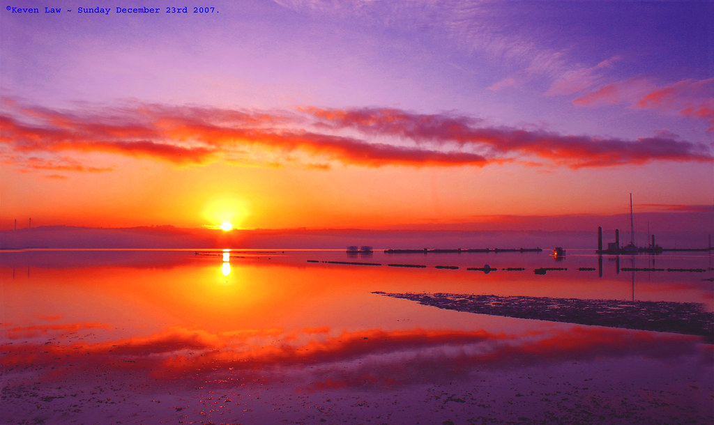
Sunrise over Brest - Brest, Brittany, France - Sunday December 23rd 2007.
Click here to see the Larger image
Click here to see My most interesting images
This is dedicated to my Insane Pink loving chum Cherish ~ www.flickr.com/photos/cherishlovespink/ ~...seeing as she asked nicely..lol..:O)))
The highest peak in the Dhofar Mountains is Jabal Samhan. At about 2000 m it looks down upon the wadi-ridden lands (see inset) dropping down to the city of Mirbat (Mocha) on the coast. A large part of this area is a natural reserve and one of the few places that Arabian Leopards might be spotted. We didn't see any...
But here's a Paper Wasp enjoying its own lunch on the mountain's top. I couldn't find it's Latin name, but it might be a Ropalidia...
Dent Railway Station - Settle-Carlisle Railway - the highest mainland station in England
The station was first opened for public use on 6th August 1877. It was closed in 1970 and re-opened in 1986 at which time the station was sold by Railtrack.
Apart from being Britain’s highest mainline station at 1150 feet above sea level, it is unusual in that it is situated four miles away and 600 feet higher than the actual village of Dent
Khinalug is a small village with about 2,000 inhabitants in the Caucasus Mountains in the northeastern part of Azerbaijan. This completely remote village is located 2250 metres above sea level and is considered the highest settlement in Europe and the Caucasus.
The mountain on the background forms the border between Azerbaijan and Dagestan (Russia)
Highest Exlpore position : 68# on Friday, March 20, 2009
FACEBOOK : Botond Horváth Photography
All comments, tips are welcome!
Please write me a comment if you like it or if you don't !
If You like it please add it to your favs!
Cualquier tipo de comentario esta bienvenido!
Por favor escribeme un comentario si te gusta o si no te gusta!!!
Si te gusta por favor agregalo a tus favs!
NO MULTI INVITES, please !!!
Personal comments are really appreciated though. THANK YOU!
Copyright
All my photos are under full copyright and any downloading, blogging, unauthorized use and or distribution of any image, will be dealt within the boundaries of the laws that protect these images.
Looking down from The Peak, highest point on Hong Kong Island, towards the Skyline of Hong Kong Island.
As early as the 19th century, the Peak attracted prominent European residents because of its panoramic view over the city and its temperate climate compared to the sub-tropical climate in the rest of Hong Kong. The sixth Governor of Hong Kong, Sir Richard MacDonnell had a summer residence built on the Peak circa 1868. Those that built houses named them whimsically, such as The Eyrie, and the Austin Arms. These original residents reached their homes by sedan chairs, which were carried up and down the steep slope of Victoria Peak. This limited development of the Peak until the opening of the Peak Tram funicular in 1888.
The boost to accessibility caused by the opening of the Peak Tram created demand for residences on the Peak. Between 1904 and 1930, the Peak Reservation Ordinance designated the Peak as an exclusive residential area reserved for non-Chinese. They also reserved the Peak Tram for the use of such passengers during peak periods. The Peak remains an upmarket residential area, although residency today is based on wealth.
The Peak is home to many species of birds, most prominently the black kite, and numerous species of butterflies. Wild boar and porcupines are also seen, along with a variety of snakes.
With seven million visitors every year, the Peak is a major tourist attraction of Hong Kong with its views of the city and its waterfront. The viewing deck also has coin-operated telescopes that the visitors can use to enjoy the cityscape. The number of visitors led to the construction of two major leisure and shopping centres, the Peak Tower and the Peak Galleria, situated adjacent to each other.
The Peak Tower incorporates the upper station of the Peak Tram, whilst the Peak Galleria incorporates the bus station used by the Hong Kong public buses and green minibuses on the Peak. The Peak is also accessible by taxi and private car via the circuitous Peak Road, or by walking up the steep Old Peak Road from near the Zoological Botanical Gardens or the Central Green Trail from Hong Kong Park.
Victoria Peak Garden is located on the site of Mountain Lodge, the Governor's old summer residence, and is the closest publicly accessible point to the summit. It can be reached from Victoria Gap by walking up Mount Austin Road, a climb of about 150 metres. Another popular walk is the level loop along Lugard and Harlech Roads, giving good views of the entire Hong Kong Harbour and Kowloon, as well as Lantau and Lamma Islands, encircling the summit at the level of the Peak Tower.
Information Source:
Explore Highest #429 on October 21, 2009
Best View On Black and Large (updated on my new Photography Portfolio)
This image along with others on my photostream are now available for purchase.
Please check my interestingness page :: HDR Set :: France Set
Please don't use this image on websites, blogs or other media without my explicit permission. Copyright © 2007-2010 Eric Rousset . All rights reserved.
Highest position on Explore: 329
After months of dormancy, the cyclamen is about to bloom. Thanks to all for the visits, faves, and awards. I will not be commenting for a couple of days as my husband is having surgery to correct a pinched nerve in his neck (at least he's not blaming me for his pain in the neck).
My first view of the Avenue of the Volcanoes at 6:52 am (a 4h58m climb) from the Refugio (Hut).
There are several volcanoes, but the most striking are the Chimborazo on your right (I will climb it tomorrow), the highest in the world and Cotopaxi, the second highest volcano in Ecuador (I climbed it in the first 24 hours).
***
Climbing an active volcano is complicated.
The crater is just below me. It took years for the Ecuadorian government to release climbing permits.
Me knowing the risks and signing the papers. It is a great pleasure for Pachamama to accept me, agradiseyki.
***
Tungurahua 5,023 metres (16,480 ft) is located in the Cordillera Oriental of the Andes of central Ecuador, 140 kilometres (87 mi) south of the capital Quito.
Nearby notable mountains are Chimborazo (6,310 metres (20,700 ft)) and El Altar (5,319 metres (17,451 ft)). It rises above the small thermal springs town of Baños de Agua Santa (1,800 metres (5,900 ft)) which is located at its foot 8 kilometres (5.0 mi) to the north.
Other nearby towns are Ambato (30 kilometres (19 mi) to the northwest), Baños and Riobamba (30 kilometres (19 mi) to the southwest).
Tungurahua is part of the Sangay National Park.