View allAll Photos Tagged consequence
A personal consequence of BREXIT?
Haus Lange in Krefeld is an address of pilgrimage for architectural studies and those people interested in Ludwig Mies von der Rohe’s style setting early work. Splendid and ageless architecture and garden environment.
Most recently this building became a new home for BREXIT refugee family that felt no longer welcome in England. Has it really become ‘a home’? If you watch the series of photos I took you might feel shocked as I was when I first lingered thru the stylish rooms. The car was still packed. The door was open… I entered as invited, saw valuable furniture, most goods still in boxes, piles of books. The pantechnicon obviously just left. Also very obvious: The landlady, mother and wife also left and will stay absent: ‘You will never see me again’ written on the mirror. That wasn’t a good sign. I felt sorry.
Then to my utmost horror I found the host floating dead in the pool… A husband, a father: dead! And nobody seems to care!
Even more desperate the boy hiding in the dining room – his distressed body language seems to ask: Can this be my home? Where is my mother? Who is my mother? Where are my roots?
You may form your own opinion on this photo story – but being uprooted is the worst prerequisite for a new and positive start. Reasons are manifold. But if it comes to politics as a cause: Think before you vote, choose well whom you elect. It might affect your families’ life, too.
The artists Michael Elgreen and Ingar Dragset make us think with their fictive story and installation of an unhappy start in Haus Lange, Krefeld.
I as a photographer tried to transfer this mood and the atmosphere into 17 picture series ‘Die Zugezogenen’.
Krefeld, February 2017
Thomas Kopf
The State of Poverty in Pakistan PIDE Report 2021
pide.org.pk/research/the-state-of-poverty-in-pakistan/
file.pide.org.pk/uploads/rr-050-the-state-of-poverty-in-p....
Causes & Consequences of Poverty in Pakistan By Summia Batool Miankhail
www.qurtuba.edu.pk/jms/default_files/JMS/2_1/03_summia_ba...
Poverty in Pakistan : trends and issues
publications.iwmi.org/pdf/H043757.pdf
Governance and Poverty
in Pakistan By MIAN TAYYAB HASSAN
file.pide.org.pk/pdfpideresearch/mimap-13-governance-and-...
Pakistan Institute of Development Economics
95m Pakistanis live in poverty: World Bank
tribune.com.pk/story/2437352/95m-pakistanis-live-in-pover...
POVERTY IN PAKISTAN
ISSUES, CAUSES AND INSTITUTIONAL RESPONSES
www.adb.org/sites/default/files/institutional-document/33...
Poverty in Pakistan, Malik Muhammad Ashraf September 01, 2023
www.nation.com.pk/01-Sep-2023/poverty-in-pakistan
Pakistan Gender and Social Inclusion Platform and
the Pakistan Poverty and Equity Program
documents1.worldbank.org/curated/en/099055002222210536/pd...
St Helier's Church, known as the Town Church, is one of the 12 parish churches of Jersey.
Helier was a Belgian saint who lived as a hermit on an islet in St Aubin's Bay, about three quarters of a mile off the south coast of Jersey. In AD555 he was killed by pirates, beheaded by their leader who feared his men would be converted by Helier's preaching. In consequence Helier soon came to be venerated by the Islanders, and eventually was adopted as the Patron Saint of both Jersey and its capitat.
Land reclamation means that the church, which was once on the shoreline, is now some way inland. There are iron rings in the boundary wall, which some historians suggest were used to moor boats, but the tide would only have reached here on the highest of spring tides and it is much more likely that the rings were used to tie cattle brought to market in town. The original marketplace was about 60 metres away next to a large rock which was surrounded by the sea at high spring tides.
It is believed that a chapel was erected on the site of the present building very shortly after Helier's death, but the present church was begun in the 11th century. The earliest record is in a document regarding the payment of tithes signed by William the Conqueror, which is assumed to pre-date the Norman Conquest of 1066. All that is visible of the 11th century structure are the remains of window arches on either side of the choir. The building was reconsecrated in 1341 for unknown reasons.
The church building was extended to roughly its present size by the end of the 12th century, but most of that building is also lost. The sections of wall flanking the east window, part of a pier on the north east side of the crossing, the west face of the north door and the adjoining section to the west, and a small section of wall opposite are all that remain of the building period of roughly 1175 to 1200. The porch attached to the north door and the greater part of the nave and crossing were built in the second quarter of the 15th century.
The date of the chancel is impossible to determine, since the original walls have been obliterated by the north chapel on the one side and the south chapel on the other. Most of the north transept dates to the second quarter of the 13th century. The present south transept, vestry, and the westwards extension to the nave are largely Victorian. A major renovation and re-ordering of the church began in 2007, and will take several years.
A chapel, La Chapelle de la Madeleine, existed in the north west corner of the churchyard until the Reformation. Formerly the Rectory and church offices were on the north side of the churchyard. These were replaced in 1969 by a new Church House building, a large concrete edifice incorporating offices, a church hall, kitchens and a choir vestry, together with a flat. The Rectory was moved to a large, purpose built Georgian house in the early 19th century.
This is the Historic Environment Record for the church:
The church is of fundamental importance to the heritage of Jersey being among the oldest and most significant historic buildings in the Island. One of the 12 medieval parish churches in Jersey.
11-12th century in origin with later alterations, enlargements and restorations from the 13-21st century. The dedication may date from the 6th century when St Helier established his hermitage and was likely given land opposite to found a church. The earliest known recorded reference to St Helier's Church is in 1090. The church has been central to the life of the St Helier parish community for hundreds of years and provides important insights into medieval and later society such as religious activity, artistic endeavour, technical achievement, the health of the local economy and the well-being of the population.
The church is in the vanguard of the Island's greatest architectural achievements. It has a long and complex structural history with visible fabric of several different dates, reflecting the periods of rebuild and modification, its development intertwined with the ecclesiastical, political and social advancements and upheavals through the centuries. Current knowledge identifies the oldest part of the standing structure as the 12th century nave and chancel. It is believed that the north transept dates to the 13th century, as does the north chapel.
Considerable additions were made in the 15th century, almost doubling the church in size, with the crossing and tower rebuilt circa 1440, the nave and south aisle, and the south chapel added in the late 15th century.
The building underwent substantial restoration in the 1860s and 2000s. The church has a range of interesting memorials, fixtures and fittings and is a major feature in the townscape. Its immediate setting includes a churchyard enclosed by walls and gates, erected in 1845 to designs by Jean Le Capelain, containing a rich variety of tombstones and monuments - many of historic or artistic interest. Shown on the Richmond Map of 1795.
Rectors
13th Century
Nicolas Du Pont 1294
Robert de Carteret 1295
14th Century
Johan Le Sauvage 1309
Pierre d’Artis 1392
Roger Walden 1371-1385 (Later Archbishop of Canterbury)
15th Century
Rogier Herbert 1432
Johan Bunouet 1482-1502
16th Century
Andre de la Hougue 1502-1536
Jean Nicolle 1538-1540
Charles Mabson 1541-1553 (First Protestant Rector)
Louis Gibaut 1553-1559
Guillaume Morice 1562
Thomas Johanne 1567
Jean de Monanges 1570-1577
Guillaume Bonhomme 1577-1583
Pierre Henry dit Dancy 1583-1586
Mathieu de la Faye 1591
Jean de Bihan 1593
Claude Parent 1595
Thomas Oliver 1596-1638
17th Century
Pierre d’Assigny 1638-1643
Pierre Faultrat 1646-1651
Josué Bonhomme 1654-1657
Francois Le Couteur 1657-1660
Jean Dumaresq 1660-1686
Joseph Pythios 1687-1696
Jean Dumaresq 1696-1705
18th Century
Francois Le Couteur 1706-1716
Francois Le Couteur 1717-1734
Pierre Daniel Tapin 1735-1761
Jean Dupré 1761-1784
Edouarde Dupré 1784-1823
19th Century
Corbet Hue 1823-1837
Francis Jeune 1838-1844
James Hemery 1844-1849
Philip Filleul 1850-1875
William Corbet Le Breton 1875-1888
George Orange Balleine 1888-1906
20th Century
Samuel Falle 1906-1937
Mathew Le Marinel 1938-1959
Alan Stanley Giles 1959-1971
Thomas Ashworth Goss 1971-1984
Basil Arthur O’Ferrall 1985-1993
John Nicholas Seaford 1993-2005
21stCentury
Robert Key 2005 -
Long years ago, over a thousand years, the coastline of St Helier did not follow its exact contour of today. That portion of the town south of the cemetery wall, bordering Bond Street, was then submerged at high tide, forming the head of a little creek, with outlet somewhere about the meeting of Pier Road with Mulcaster Street. It then followed, approximately, the line of Bond Street, formerly known as "La rue de la Madelaine". From there, a sandy waste stretched far away westward to Mont Cochon.
The creek can be traced in a 1700 model of St Helier in the museum of La Société Jersiaise. Rings in the wall of the churchyard were found, where boats in old times had been fastened.
Near this creek, to the north-west of the present parish church, a chantry chapel stood, known as the "Chapelle de la Madelaine ", built of sea pebbles. Its precise position was a little to the westward of the new choir vestry. In the deed passed before the Royal Court on January 10, 1695, whereby Charles Dumaresq and James Corbet ceded in perpetuity the chapel to the parish authorities of St Helier, to be used as a poorhouse, it is described as bordering the cemetery on the south and the rectory on the east. It is evident from this document that the chapel had passed into private hands, probably sold at the Reformation by the Royal Commissioners. The chapel still existed late in the 18th century, but was allowed to fall into ruin.
It is probable that the chapel, one of many scattered through the island, was contemporary with the Fisherman's Chapel of St Brelade's Bay. St Helier, at the time we are referring to, was merely a collection of a few houses or huts, in fact a small fishing village; yet, the position acquired importance from its proximity to the scene of the labours and martyrdom of its patron saint, and later by the foundation of an important monastic establishment within the precincts of Elizabeth Castle itself.
It is possible, and even probable, that the present church originated from a second chantry chapel, dating back to about the 11th century, though there is no positive evidence of this. If so, in the ordinary course of evolution, this chapel became the chancel of the church. From extant records it would appear that during the Roman Catholic epoch, the Abbot of St Sauveur-le-Vicomte was recognised as patron, and nominated to the cure. It is, however, to be noted that, on several occasions, allusion is made to the King having presented, in time of war, candidates of his own choice to the living.
This period, (the 12th century) would be synchronous with the first of several crude changes which the church has undergone. Once more we cannot help expressing regret that during the many restorations our Jersey parish churches have "suffered", the canons of good taste and architectural design seem so frequently to have been ignored; the more unpardonable since in every case these buildings were planned in accordance with convention, thus offering free scope for better treatment.
The period we have now arrived at (12th century) was that of the first enlargement. It may be reasonably assumed that the primitive development (from the simple chantry) consisted in the prolongation of the chapel westward, the whole being then divided into a sanctuary, sIightly raised, for the priesthood, and a nave, or body, used by the congregation.
In the centre of this village arose a church, partly built of pebbles. Houses clustered around, in contrast to the somewhat isolated position held by most of the sister churches.
St Helier thus assimilated to the continental type, where churches are usually found near, and often in actual contact with the dwellings of the civil community. In England, on the other hand, our great cathedrals, almost invariably, stand in an open space, the “Close", round which the clergy live. Hence the deduction, (a wrong one nowadays at least) that English clergy form a class apart, and are less intimately associated with those to whom they minister, than is the case abroad.
Hard beaten earth as usual made a flooring. On this, the occasion of the first enlargement, a mortuary chapel was thrown out northward of the chancel; also a transept, and, as if to remind those who should follow later, not to forget the form of the "Latin Cross" when making further change, a corresponding addition to the south, "La Chapelle de la Vierge" was at the same time added.
The date of the mortuary chapel would appear to be about 1160. The exterior is conspicuous, owing to the roof being constructed with a different pitch from that of the main structure; also by the light, thin buttresses of Norman type. Inside, the broken remains of two Norman and two transition (Romanesque) arches, are still preserved; also two niches for the reception of ancient tombs.
Jersey churches are nothing if not unconventional, and as the sequel shows, St Helier was not to prove an exception.
During the early half of the 15th century, further and most important alterations were undertaken. These probably gave rise to the "Dedicace" date of consecration, 1341.
The chancel walls were raised. The increased elevation can even now be traced in the chancel gable, through contrast in the work of the two periods. A south chancel aisle was added. A handsome crenellated tower, with cross vaulting beneath, standing on massive piers, was erected, and lastly, heavy barrel roofs replaced those previously existing, of wood or thatch.
Stronger support became essential for such ponderous additions. This was supplied by means of buttresses within, and heavy circular pillars on octangular pediments carrying transition arches to form an arcading, and take the inward thrust; the outer buttresses being at the same time strengthened. Caen stone and Chausey granite now superseded pebbles, brought from the sea.
Towards the end of the same century, (the 15th) further important changes were again made. Of these, the chief consisted in the addition of a southern nave aisle, involving more cumbrous arcading, and tending to render the interior somewhat dark and gloomy. Flamboyant tracery appeared in the upper portions of the eastern windows.
Thus, a nave consisting of five bays was completed, and the church rested from structural change for many years.
Things pursued their normal course, until two centuries later, arose a storm of radical and revolutionary attack, a storm that, pro tem destroyed the monarchy of England, only to collapse itself under the burden of its own iniquity. It culminated in an era of bigotry and desecration. The experience of her sister churches, was that of St Helier, intensified perhaps, owing to her metropolitan status.
During the following century, an historic event took place, under the very shadow of St Helier's Church. In 1781, the French, led by the so-called Baron de Rullecourt, attempted by a "coup de main" the capture of the Island. They failed, defeated by the gallant Peirson who, in the hour of victory, lost his life. Many prisoners were taken, who were interned, for safety, in the parish church, a handy place pending incarceration.
Reinforcements from the west arrived after the fight was over. True to their instincts the St Ouennais desired no half measures. "Let us bum them church and all", they said, and this they would undoubtedly have done, unless tradition errs, had not a force of regulars prevented them.
The next and last structural enlargement, or rather "restoration of St Helier's Church, took place in 1864. During the preceding revolutionary innings its leaders had busied themselves with the interior, purging it of aught that savoured of the Romish religion. A craze for galleries obsessed them. No fewer than seven, for the general public, and several belonging to private families, were placed in different parts.
One of the first named, known as the Common Gallery, at the west end, served as the roof of a town arsenal, for the parish guns. Another was devoted to the use of "fumeurs". The lofty Three Decker pulpit, of course, appeared, pride of the Puritan. It held a position confronted by a special pew for the Lieut-Governor. The travelling communion table also was there, used as occasion arose for parish elections, or even public auctions. Such were the marks of the roundhead regime.
Under the name of church reform, aught else went by the board. Stoups and piscinas, fonts and ornaments of every kind, were swept away. Governor Paulett, by virtue of a Royal Commission, seized the church plate and sold it; also the bells, and sold them. Such also was the situation during a certain period, happily short.
Intemperance of every kind must find a nemesis. Reaction was not long delayed, Early in the 18th century an organ ("box of whistles") appeared, tucked away in one of the many galleries. Then, huge chandeliers, in brass, lighted by many candles, whilst tracery again adorned the window, so that, once more, St Helier's came to assume its pristine garb.
In 1864 the work of restoration was taken seriously in hand. Some interesting reproductions, illustrating the church during this transition period, and presenting views from the northwest and southwest speak for themselves. Some of the neighbouring buildings can still be recognised.
A committee was entrusted with the task of securing stained glass windows. How well they did their work is recorded below, including names of many noted Jerseymen as donors.
The cost of restoration amounted to some £4,000, The nave was lengthened, a south transept added, A vestry and porch was opened on the north side, where the two Norman and transition arches, belonging to the mortuary chapel previously mentioned, were discovered, and removed to another position.
For these was substituted yet further heavy arcading, to match that in the remainder of the church, although it would seem rather late for trying to introduce uniformity within a building whose principal feature, one might almost say charm, lay in the opposite direction.
As to the interior, all the old galleries were taken out, whilst a new one was placed at the west end of the nave, and a second in the south transept, Stalls in thc chancel were appropriated to the choir, near the organ, on the north.
Church furniture of modem type was introduced, and many gifts from various well-wishers helped to renovate and beautify the church, A handsome lectern in brass was the contribution of Francis Bertram.
Members of the congregation presented a painting representing The Last Supper, to form a reredos, and specially as a tribute to the Rev P A Le Feuvre, Vice-Dean of Jersey, who died whilst in the act of ministering at the altar, on Easter Day 1889. A brass plate, in the chancel, further commemorates this tragic event.
Under one date or another may be seen recorded on these ancient walls nearly every Jersey name of note, the earliest, that of Maximilian Norreys, marked by a plain grey slab, with armorial bearings, and going back to 1591; one of the latest is that of Lieut-Colonel P Le Gallais, killed in the Boer War of 1901-2.
There, too, are other names familiar to Jerseymen as household word. Bandinel, La Cloche, d'Auvergne, de Carteret, Anquetil, Durell, a list too numerous for mention here. Tablets to several Lieut-Governors augment this roll, amongst them one to Major-General Archibald Campbell, who died during his term of office and found a last resting place within the church.
But, in this Roll of Honour none holds a more distinguished place than that of Francis Peirson. He lies beneath the tower. A simple monument (some think too simple), placed in he chancel by the States of Jersey, is thus inscribed:
"To the memory of Major Francis Peirson, who, when this Island was invaded by the French, fell bravely fighting at the head of British and Island troops. He died in the flower of youth and in the moment of victory the 6th day of January 1781, aged 24. The States of the Island in grateful testimony of their deliverance, caused this monument to be erected at the public expense".
His story needs no recital, nor his brave memory any costly monument. The French Commander, Rullecourt, was buried in the churchyard near the north transept door.
And still we might go on, but those who would recall to mind the Island's history by names of men who made it, cannot do better than spend a quiet hour within those sacred walls that speak.
St Helier's church plate is not remarkable, all being post-Reformation. Amongst its donors appear the names of Jean and Abraham Herault; a chalice, presented by the former, taking the pride of place for antiquity (1639). Philip Le Geyt, Francis Le Couteur, Mauger, Ste Croix, and Lempriere are other names associated with the collection.
But, doubtless the greatest general interest will centre round the pieces forming a service sent for the use of Charles, then Prince of Wales, later King Charles II, for use during his brief stay at Elizabeth Castle.
For a long time this service lay unheeded, certainly uncared for, somewhere within the castle walls. Its whereabouts, in some way, came to light, and then the British Government authorities took steps to have it properly looked after. Since the withdrawal of soldiers from the castle, it has been placed under the special guardianship of the Dean of Jersey, for use of the garrison at certain services, held in the parish church, once more created Garrison Church of Jersey.
The service consists of three pieces, flagon, chalice, and paten. All bear the London hallmark. The front of the flagon bears a coat of arms supposed to be those of Lord Capel. The chalice bears the arm, and the paten (1621-22) the crest of Sir Thomas Jermyn, Governor of Jersey from 1631 to 1644.
Two memorable occasions may be mentioned when this plate must have been used, each associated with the Royal refugee. On 26 April 1646, Charles, then Prince of Wales, attended the parish church in state, supported by the loyalists of Jersey. Later, in 1649, after his father's execution, the Prince, now King, was again present at a requiem service.
The scene is quaintly described as follows:
"On this occasion the young Prince, only 16 years of age, occupied a chair fronting the pulpit; a table was placed conveniently, so that his highness might rest his elbows on it".
The Duke of York, his brother, accompanied him; the Jersey Militia guarded his route from castle to church, and many devoted adherents followed in his train. He wore the Order of the Garter, and was loyally hailed as King, Jersey the first to acclaim him.
A Roll of over 50 Rectors attests the antiquity of the Christian faith, as held by the National Church in Jersey. From 1294, up to the present time, no break occurs. The earliest on record is Nicolas Dupont, 1294.
No fewer than seven Deans have served as Rectors of St Helier, the last but not least distinguished being the Very Reverend Samuel Faile.
We now conclude this brief memorial of St Helier's Parish Church; at times seat of the Deans, scene of many stirring episodes, pro-cathedral, and in some sense a local Valhalla. It cannot be denied, that, taken as a whole, the building with its lofty crenelated tower, is dignified, though unsymmetrical. A critic of the interior might perchance exclaim in Goethe's dying words, "Encore de la lumiere".
In fact, there seems to have been a clerestory at one time. Perhaps, in the not far distant future, the powers that be may yet again draw light from heaven.
History will testify to the present era as one of religious and social activity, of "rapprochement" among the Island churches, of material improvement as regards the fabric and its surroundings and, let us hope, of further generous gifts to adorn the interior, and perfect the services. It will be from no lack of interest or energy on the part of the present holder of the benefice should such not prove to be the case.
The following is the list of windows in the church, together with their subjects, and names of the donors:
Chancel, east window, the gift of the Hemery family. The upper portion represents "The Lord enthroned", while the lower portions represent "The angel announcing the resurrection", and "The risen Lord appearing to Mary Magdalene”. This window is the work of one of the most eminent artists of the period, and was exhibited at the great exhibition of 1862, as an example of British Ecclesiastical art.
Chancel aisle, east window, given by the restoration committee. Four lights, representing "The Adoration of the Magi", "Christ in the Temple", "The Marriage Feast in Cana", and "Christ bearing His Cross".
Chancel aisle (first window), the gift of Jurat E C Malet de Carteret, the subject being "Christ healing the sick".
Chancel aisle (second window), given by the Le Breton family; the subjecL of the three panels being “Christ appearing to St Thomas", "St Paul preaching at Athens", and "The woman of Samaria".
South aisle (first window) presented by the late Jurat J G Falle, the subjects represented being "The healing of the woman", " Christ, the Consoler", and " St Peter walking on the sea".
South aisle (second window), given by the late Mr N Le Quesne, "Christ blessing the children ".
South aisle (third window) presented by the son of the late Mr Abraham de Gruchy, "The baptism of our Lord".
South aisle (west window), presented by he Westaway family, "The Ascension".
Nave (west window), presented by the late MR George Bertram, "The Crucifixion".
Nave (north window), the gift of tbe late Mr Jean de Gruchy, " The raising of Lazarus ".
North transept, given by the late Mr Philip Le Rossignol, "Christ walking on the Sea".
South transept, given by the Parish of St Helier, "The sacrifice of Isaac", "The framing of the law", and "The brazen serpent".
Mortuary Chapel, raised by subscription among tbe widows of tho congregation, " Christ, the Good Shepherd".
Vestry, presented by he late Mrs John Le Masurier, "The Annunciation".
Place de la Bastille 16/08/2020 18h42
Not that long ago this was the domain of heavy and busy traffic. Since the renovation of this huge square this part is reserved for pedestrians. In the background the Opéra Bastille.
Place de la Bastille
The Place de la Bastille is a square in Paris, where the Bastille prison stood until the 'Storming of the Bastille' and its subsequent physical destruction between 14 July 1789 and 14 July 1790 during the French Revolution; no vestige of it remains.
The square straddles 3 arrondissements of Paris, namely the 4th, 11th and 12th. The square and its surrounding areas are normally called simply Bastille.
The July Column (Colonne de Juillet) which commemorates the events of the July Revolution (1830) stands at the center of the square. Other notable features include the Bastille Opera, the Bastille subway station and a section of the Canal Saint Martin. Prior to 1984, the former Bastille railway station stood where the opera house now stands.
The square is often home to concerts and similar events. The north-eastern area of Bastille is busy at night due to many cafés, bars, night clubs, and concert halls.
As a consequence of its historical significance, the square is often used for political demonstrations, including the massive anti-CPE demonstration of 28 March 2006.
Length: 215 meters
Width: 150 meters (average)
Creation: 27/06/1792
[ Source and much more information: Wiki - Place de la Bastille ]
……………………………….
Locandina:
pad.mymovies.it/filmclub/2016/04/067/coverlg_home.jpg
variety.com/wp-content/uploads/2016/05/fiore_06.jpg?w=100...

www.nonsolocinema.com/wp/wp-content/uploads/2016/05/MG_76...

amnc.it/wp-content/uploads/2023/11/perdialogocarcere_post...

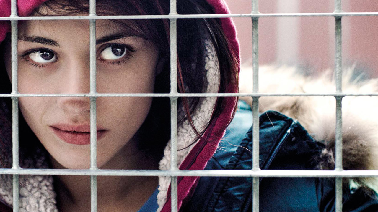
www.italyformovies.com/film-serie-tv-games/detail/56/fiore
----------------------------------------------------------
click to activate the small icon of slideshow: the small triangle inscribed in the small rectangle, at the top right, in the photostream (it means the monitor);
or…. Press the “L” button to zoom in the image;
clicca sulla piccola icona per attivare lo slideshow: sulla facciata principale del photostream, in alto a destra c'è un piccolo rettangolo (rappresenta il monitor) con dentro un piccolo triangolo nero;
oppure…. premi il tasto “L” per ingrandire l'immagine;
www.worldphoto.org/sony-world-photography-awards/winners-...
www.fotografidigitali.it/gallery/2726/opere-italiane-segn...
………………………………………………………………………
The municipality of Mongiuffi Melia (ME), not far from Taormina, is made up of two villages, Mongiuffi and Melia, separated by a valley, a bridge joins them, they climb up the opposite ridge of two mountains, looking at each other; in this municipality (defined as a "scattered municipality" for not having a single inhabited center), there are two patron saints, San Sebastian for Melia (his float was built with the money collected by Sicilian soldiers sent to the front, to fight in Greece during the Second World War, hoping in this way to receive His intercession to save their lives), and San Leonard di Noblac (or Abbot) for Mongiuffi; but in this municipality there is also the cult of the "Virgin Mary of the Chain", whose sanctuary attracts pilgrims from everywhere. I have made this description to introduce a singular coincidence that not everyone is aware of, and to do this it is necessary to describe the figure of Saint Leonard (a kind of Saint Francis), and that of the Virgin Mary of the Chain, trying to be concise. Saint Leonard was born in Orléans around 496 (and died in Noblac, on November 6 – the feast day – of 545 or 559), and for most of his life (very interesting) he lived as a hermit; one episode of his life in particular I would like to recall, he received from Clovis, king of the Franks, the privilege of being able to free those prisoners, who he believed had been unjustly imprisoned, so from that moment on, he incessantly committed himself to giving freedom to all those prisoners who were reduced to visibly critical conditions. Let us leave this Saint for a moment, the cult of the “Virgin Mary of the Chain”, this name given to the Blessed Virgin, derives from a prodigious event that occurred in Palermo in 1392, known as the “miracle of the chains”. In short, in August 1392 in Palermo, three men for a glaring miscarriage of justice, were sentenced to death by hanging, shortly before going up to the gallows a violent storm broke out, which forced the three unfortunates and the gendarmes to take refuge in the nearby church of Saint Mary of the Port, close to the sea, also called "Churc of the Chain" due to the presence of a chain that, when positioned, prevented the Saracen pirate ships from accessing the inside of the port; in this holy place, the three condemned, were tied with double chains, in the meantime the door of the church was barred, in fact the storm did not seem to stop and in addition night had come, clearly the execution was now postponed to the next day. The three desperate men, in chains, under the gaze of the gendarmes, approached the painting of the Madonna in tears, imploring her to intercede for them, a voice was heard coming from the painting, which reassured them of their new freedom, this while the chains broke, and the door of the little church was thrown open. From then on, the cult of the Virgin Mary of the Chain spread from Palermo throughout Sicily, and even beyond. Now let's get to the coincidences I mentioned before, both Saint Leonard and the Virgin Mary of the Chain (and also Her Child that She holds in Her arms) carry a long chain in their hands, in fact both the Saint and the Blessed Virgin have given freedom to prisoners, furthermore to access Mongiuffi Melia, coming from Letojanni, you have to pass through a tunnel, called "Gallery of Postoleone" dug in the rock in 1916, with bare hands or with pickaxe blows, as explosives could not be used, by 300 Austrian prisoners, during the First World War (and also on this occasion, in Mongiuffi Melia, there are prisoners forced to do forced labor). Finally, a curiosity, very often from the cult of the Virgin Mary of the Chain, comes a singular name, very common in these parts, both in the masculine with the name of "Cateno" and in the feminine "Catena" (to quote a well-known character, the writer Catena Fiorello). Furthermore, if it rains, whatever the religious procession-feast, with the float carried on the shoulders, the float with the saint does not come out, but if the rain arrives during the event, then the event becomes a source of strong psycho-physical stress for the devotee-bearers (not for the devotee-pullers or devotee-pushers...), as the ground made slippery by the rain (or perhaps, worse, by the presence of mud mixed with water) makes the route risky due to the possibility that one, or more, bearers, could slip, with the possible overturning of the float, and easily imaginable consequences.
The photographic story that I present here was created by assembling photographs taken on November 6, 2022, November 6 and 10 of this year 2024; the heart of the celebration-procession is when the priest hangs a large “cuddurra” (donut) on the hand of Sint Leonard, on that occasion small “cuddure” (donuts) are offered to the population (prepared by hand in the days preceding the procession); there are girls wearing a typical monk's habit-like dress, adorning their head with a veil, they belong to the congregation of the "daughters of Mary" (third order Carmelite); at the end of the procession, with the float that has returned to the church, we witness a rite that has the "affective" purpose of keeping it alive, it is done so as not to lose its memory, even if it has not lost its original meaning, what remains is now only a symbolic fact, it is the ritual of "weighing" (in some centers of Sicily, it has maintained its original meaning) a wooden board is placed "in balance" on one of the two beams that are used to carry the float with the Saint on the shoulders, at the two ends a child is placed on one side, and on the other side a sack with grain, filled until the weight of the grain reaches the weight of the child, and that grain will be given as a gift to the Saint, in reality the symbolic aspect of the procedure remains, and the donation is still made to the Saint, but in paper money.
Postscript: Our Lady of the Chain and Saint Leonard freed from chains, these as such, are not only physical, there are also psychic ones, and perhaps they are the worst….
……………………………..
Il comune di Mongiuffi Melia (ME), non molto distante da Taormina, è formato da due borghi, Mongiuffi e Melia, separati da una vallata, un ponte li congiunge, essi si inerpicano sul crinale opposto di due monti, guardandosi l’un l’altro; in questo comune (definito “comune sparso” per non avere un centro abitato unico), si hanno due santi patroni, San Sebastiano per Melia (la sua vara fu costruita con i soldi racimolati dai soldati Siciliani mandati al fronte, a combattere in Grecia durante la seconda guerra mondiale, sperando così facendo di ricevere la Sua intercessione per avere salva la vita), e San Leonardo di Noblac (o Abate) per Mongiuffi; ma in questo comune vi è anche il culto per la “Madonna della Catena”, il cui santuario attira pellegrini da ogni dove. Ho fatto questa descrizione, per introdurre una singolare coincidenza della quale non tutti sono a conoscenza, e per far questo è necessario descrivere la figura di San Leonardo (una specie di San Francesco), e quella della Madonna della Catena, cercando di essere sintetico. San Leonardo nasce ad Orléans nel 496 circa (e morto a Noblac, il 6 novembre – giorno della festa – del 545 o 559), per gran parte della sua vita (interessantissima) visse da eremita; un episodio della sua vita in particolare desidero ricordare, egli riceve da Clodoveo, re dei Franchi, il privilegio di poter rendere liberi quei prigionieri, che egli riteneva fossero stati incarcerati ingiustamente, egli così, da quel momento, si impegna incessantemente a dare la libertà a tutti quei prigionieri che erano ridotti in condizioni visibilmente critiche. Lasciamo per un attimo questo Santo, il culto della “Madonna della Catena”, questo nome dato alla Beata Vergine, deriva da un evento prodigioso avvenuto a Palermo nel 1392, conosciuto come “miracolo delle catene”. In breve, nell’agosto del 1392 a Palermo, tre uomini per un eclatante errore giudiziario, furono condannati a morte per impiccagione, poco prima di salire sul patibolo si scatenò un violento temporale, che costrinse i tre malcapitati ed i gendarmi a riparare nella vicina chiesa di S. Maria del Porto, a ridosso del mare, detta anche “Chiesa della Catena” per la presenza di una catena che, quando posizionata, impediva alle navi pirata Saracene di accedere all’interno del porto; in questo luogo santo, i tre condannati, furono legati con doppie catene, nel mentre la porta della chiesa veniva sbarrata, infatti il temporale non accennava a smettere ed in più era subentrata la notte, chiaramente l’esecuzione era oramai rimandata al giorno dopo. I tre disperati, in catene, sotto lo sguardo dei gendarmi, si avvicinarono in lacrime al quadro della Madonna implorandola di intercedere per loro, dal quadro si udì provenire una voce, che li rassicurava sulla sopraggiunta libertà, questo mentre le catene si spezzavano, e la porta della chiesetta si spalancava. Da allora il culto per la Madonna della Catena si diffuse da Palermo in tutta la Sicilia, ed anche oltre. Veniamo adesso alle coincidenze di cui accennavo prima, sia San Leonardo che la Madonna della Catena (ed anche il suo Bimbo che regge in braccio) recano in mano una lunga catena, infatti sia San Leonardo che la Beata Vergine hanno dato la liberà a dei prigionieri, inoltre per accedere a Mongiuffi Melia, provenendo da Letojanni, si deve passare necessariamente da una galleria, chiamata “Galleria di Postoleone” scavata nel 1916 nella roccia, a mani nude o con colpi di piccone, in quanto non si poteva usare l’esplosivo, da parte di 300 prigionieri austriaci, durante la prima guerra mondiale (ed anche in questa occasione, a Mongiuffi Melia, si ha la presenza di prigionieri costretti ai lavori forzati). Infine una curiosità, molto spesso dal culto della Madonna della Catena, proviene un singolare nome, molto comune da queste parti, sia al maschile col nome di “Cateno” che al femminile, “Catena” (per citare un personaggio noto, la scrittrice Catena Fiorello). Inoltre, se piove, qualsiasi sia la processione-festa religiosa, con la vara portata in spalla, la vara col santo non esce, se invece la pioggia arriva durante la manifestazione, allora l’evento acquista per i devoti-portatori (non per i devoti-tiratori o devoti-spingitori…) un motivo di forte stress psico-fisico, in quanto il terreno reso scivoloso dalla pioggia (o magari, peggio, dalla presenza di fango misto ad acqua) rende rischioso il percorso per la possibilità che uno, o più portatori, possano scivolare, con il possibile ribaltamento della vara, e conseguenze facilmente immaginabili.
Il racconto fotografico che qui presento, è stato realizzato assemblando fotografie fatte il 6 novembre del 2022, il 6 ed il 10 novembre di quest’anno 2024; il fulcro della festa-processione è quando il sacerdote appende una grande cuddurra (ciambella) sulla mano di San Leonardo, in quella occasione piccole cuddure vengono offerte alla popolazione (preparate ed intrecciate a mano nei giorni precedenti la processione); sono presenti delle ragazze che indossano un tipico vestito “tipo saio di monaco”, adornando il capo con un velo, appartengono alla congregazione delle “figlie di Maria” (terz’ordine carmelitano); alla fine della processione, con la vara che ha fatto rientro in chiesa, si assiste ad un rito che ha lo scopo “affettivo” di tenerlo in vita, viene fatto per non disperderne la memoria, pur non avendo perso il suo significato originario, quel che resta è oramai solamente un fatto simbolico, è il rito della “pesatura” (in alcuni centri della Sicilia, esso ha mantenuto il suo significato originario) un asse di legno viene messo “in equilibrio” su di una delle due travi che servono a portare in spalla la vara col Santo, alle due estremità si pongono da un lato un bimbo/a, e dall’altro lato un sacco con del grano, riempito fino a quando il peso del grano raggiungerà il peso del bimbo/a, e quel grano verrà dato in dono al Santo, in realtà resta l’aspetto simbolico della procedura, la donazione viene ugualmente fatta al Santo, ma in cartamoneta.
P.S. La Madonna della Catena e San Leonardo liberavano dalle catene, queste in quanto tali, non sono solo fisiche, ci sono anche quelle psichiche, e forse sono le peggiori….
……………………………………………………………….
The Statue of Liberty (Liberty Enlightening the World; French: La Liberté éclairant le monde) is a colossal neoclassical sculpture on Liberty Island in New York Harbor in New York City, in the United States. The statue, designed by Frédéric Auguste Bartholdi, a French sculptor and dedicated on October 28, 1886, was a gift to the United States from the people of France. The statue is of a robed female figure representing Libertas, the Roman goddess, who bears a torch and a tabula ansata (a tablet evoking the law) upon which is inscribed the date of the American Declaration of Independence, July 4, 1776. A broken chain lies at her feet. The statue is an icon of freedom and of the United States: a welcoming signal to immigrants arriving from abroad.
Bartholdi was inspired by French law professor and politician Édouard René de Laboulaye, who is said to have commented in 1865 that any monument raised to American independence would properly be a joint project of the French and American peoples. He may have been minded to honor the Union victory in the American Civil War and the end of slavery. Due to the troubled political situation in France, work on the statue did not commence until the early 1870s. In 1875, Laboulaye proposed that the French finance the statue and the Americans provide the site and build the pedestal. Bartholdi completed the head and the torch-bearing arm before the statue was fully designed, and these pieces were exhibited for publicity at international expositions.
The torch-bearing arm was displayed at the Centennial Exposition in Philadelphia in 1876, and in Madison Square Park in Manhattan from 1876 to 1882. Fundraising proved difficult, especially for the Americans, and by 1885 work on the pedestal was threatened due to lack of funds. Publisher Joseph Pulitzer of the New York World started a drive for donations to complete the project that attracted more than 120,000 contributors, most of whom gave less than a dollar. The statue was constructed in France, shipped overseas in crates, and assembled on the completed pedestal on what was then called Bedloe's Island. The statue's completion was marked by New York's first ticker-tape parade and a dedication ceremony presided over by President Grover Cleveland.
The statue was administered by the United States Lighthouse Board until 1901 and then by the Department of War; since 1933 it has been maintained by the National Park Service. The statue was closed for renovation for much of 1938. In the early 1980s, it was found to have deteriorated to such an extent that a major restoration was required. While the statue was closed from 1984 to 1986, the torch and a large part of the internal structure were replaced. After the September 11 attacks in 2001, it was closed for reasons of safety and security; the pedestal reopened in 2004 and the statue in 2009, with limits on the number of visitors allowed to ascend to the crown. The statue, including the pedestal and base, was closed for a year until October 28, 2012, so that a secondary staircase and other safety features could be installed; Liberty Island remained open. However, one day after the reopening, Liberty Island closed due to the effects of Hurricane Sandy in New York; the statue and island opened again on July 4, 2013. Public access to the balcony surrounding the torch has been barred for safety reasons since 1916.
The origin of the Statue of Liberty project is sometimes traced to a comment made by French law professor and politician Édouard René de Laboulaye in mid-1865. In after-dinner conversation at his home near Versailles, Laboulaye, an ardent supporter of the Union in the American Civil War, is supposed to have said: "If a monument should rise in the United States, as a memorial to their independence, I should think it only natural if it were built by united effort—a common work of both our nations."[7] The National Park Service, in a 2000 report, however, deemed this a legend traced to an 1885 fundraising pamphlet, and that the statue was most likely conceived in 1870.[8] In another essay on their website, the Park Service suggested that Laboulaye was minded to honor the Union victory and its consequences, "With the abolition of slavery and the Union's victory in the Civil War in 1865, Laboulaye's wishes of freedom and democracy were turning into a reality in the United States. In order to honor these achievements, Laboulaye proposed that a gift be built for the United States on behalf of France. Laboulaye hoped that by calling attention to the recent achievements of the United States, the French people would be inspired to call for their own democracy in the face of a repressive monarchy.
Bartholdi and Laboulaye considered how best to express the idea of American liberty.[18] In early American history, two female figures were frequently used as cultural symbols of the nation.[19] One of these symbols, the personified Columbia, was seen as an embodiment of the United States in the manner that Britannia was identified with the United Kingdom and Marianne came to represent France. Columbia had supplanted the earlier figure of an Indian princess, which had come to be regarded as uncivilized and derogatory toward Americans.[19] The other significant female icon in American culture was a representation of Liberty, derived from Libertas, the goddess of freedom widely worshipped in ancient Rome, especially among emancipated slaves. A Liberty figure adorned most American coins of the time,[18] and representations of Liberty appeared in popular and civic art, including Thomas Crawford's Statue of Freedom (1863) atop the dome of the United States Capitol Building.
Construction
On June 17, 1885, the French steamer Isère, laden with the Statue of Liberty, reached the New York port safely. New Yorkers displayed their new-found enthusiasm for the statue, as the French vessel arrived with the crates holding the disassembled statue on board. Two hundred thousand people lined the docks and hundreds of boats put to sea to welcome the Isère.[90] [91] After five months of daily calls to donate to the statue fund, on August 11, 1885, the World announced that $102,000 had been raised from 120,000 donors, and that 80 percent of the total had been received in sums of less than one dollar.[92]
Even with the success of the fund drive, the pedestal was not completed until April 1886. Immediately thereafter, reassembly of the statue began. Eiffel's iron framework was anchored to steel I-beams within the concrete pedestal and assembled.[93] Once this was done, the sections of skin were carefully attached.[94] Due to the width of the pedestal, it was not possible to erect scaffolding, and workers dangled from ropes while installing the skin sections. Nevertheless, no one died during the construction.[95] Bartholdi had planned to put floodlights on the torch's balcony to illuminate it; a week before the dedication, the Army Corps of Engineers vetoed the proposal, fearing that ships' pilots passing the statue would be blinded. Instead, Bartholdi cut portholes in the torch – which was covered with gold leaf – and placed the lights inside them.[96] A power plant was installed on the island to light the torch and for other electrical needs.[97] After the skin was completed, renowned landscape architect Frederick Law Olmsted, co-designer of New York's Central Park and Brooklyn's Prospect Park, supervised a cleanup of Bedloe's Island in anticipation of the dedication.
The statue is situated in Upper New York Bay on Liberty Island south of Ellis Island, which together comprise the Statue of Liberty National Monument. Both islands were ceded by New York to the federal government in 1800.[155] As agreed in an 1834 compact between New York and New Jersey that set the state border at the bay's midpoint, the original islands remain New York territory despite their location on the New Jersey side of the state line. Liberty Island is one of the islands that are part of the borough of Manhattan in New York. Land created by reclamation added to the 2.3 acres (0.93 ha) original island at Ellis Island is New Jersey territory.[156]
No charge is made for entrance to the national monument, but there is a cost for the ferry service that all visitors must use, as private boats may not dock at the island. A concession was granted in 2007 to Statue Cruises to operate the transportation and ticketing facilities, replacing Circle Line, which had operated the service since 1953.[157] The ferries, which depart from Liberty State Park in Jersey City and Battery Park in Lower Manhattan, also stop at Ellis Island when it is open to the public, making a combined trip possible.[158] All ferry riders are subject to security screening, similar to airport procedures, prior to boarding.[159] Visitors intending to enter the statue's base and pedestal must obtain a complimentary museum/pedestal ticket along with their ferry ticket.[160] Those wishing to climb the staircase within the statue to the crown purchase a special ticket, which may be reserved up to a year in advance. A total of 240 people per day are permitted to ascend: ten per group, three groups per hour. Climbers may bring only medication and cameras—lockers are provided for other items—and must undergo a second security screening.
After biding goodbye to the strange girl, Seimei and Amadeo headed back home together. The latter firmly refused to hold hands despite Seimei's insistence. He felt bad enough as it was.
They didn’t speak at all, either.
The moment they finally reached their home, a small figure immediately latched itself on the half-demon.
"Mama!"
Seimei blushed, embarrassed.
"Ciel…! I’m always telling you, I'm not a girl...!" But his son’s adorable little pout made him melt, and all other argument just vanished from his mind. He sighed. "Oh well... mama it is. Come here, my sweetheart." And he craddled the boy in his arms, kissing the tip of his nose to make him giggle.
"Uncle Amy?" Ciel peeped from under his "mommy"'s long, dark locks. "Are you okay? You're not hurt.... right?"
The young vampire bit his lower lip. So even the little pest had been worried... great. Now he felt even worse.
"I'm alright." he said simply.
"Good." Ciel nodded, his pout never wavering. "Because… I wasn't worried or anything! I wasn’t! Not one bit, nope, I don’t care at all, you know!" Yeah, right. He didn’t even believe it himself.
The door suddenly swung open behind them, and Requiem entered. He too seemed out of breath. A look of relief crossed his features when his eyes fell on his little brother. But he quickly hid it, replacing it by cold anger.
“Your room. Now.”
Amadeo knew better than to disobey. He followed his brother to his room, and sat silently on the chair. He pressed the Death Note against his chest in a desperate attempt at keeping it concealed – he knew he was in for a good telling-off, and he certainly didn’t want to make matters worse.
Requiem knelt beside him.
“Sei.” he said. “Can you leave us for a moment, please?”
“Ok…” Seimei looked at Amadeo apologetically. “Don’t be too harsh on him... Please? I’m sure he meant no harm…”
But his lover made no sign of acknowledgment. So the demon-boy gave Amadeo one last reassuring smile, then walked away with Ciel.
That left the two brothers all alone…
“So…” Requiem’s tone was ice-cold, and Amadeo instinctively lowered his eyes. “Will you explain me why you had to run away without a word? And in the f*cking middle of the day?!”
The younger one shifted uncomfortably.
“I… I just needed some alone time.”
Requiem raised one eyebrow.
“What “alone time”? Being alone in your room isn’t enough, now? That’s no excuse! You’re hiding something, Amy, and I’m warning you, you’d better not lie to me!”
That was it. Amadeo just couldn’t keep it in anymore; he couldn’t bear his brother’s inquisitive look. He jumped from the chair.
“I wanted to kill your Seimei, okay?!” he snapped, shame, guilt, sadness all forgotten in his fit of anger. “I found that stupid book, a-and I thought about it for days, and I almost did it, almost, since I didn’t know what else I could do to have you look at me again!!!" He paused and breathed deeply. He felt as if a huge weight had being taken off his shoulders... "There. Hope you’re happy now.”
And throwing the Note at his brother’s feet, he ran to his dressing room and slammed the door shut.
Sixth part of Amadeo's story~
Aaah… adolescents and their existential crisis XD. My little vampire sure is hot-headed, but he’s not a bad kid! He just needs someone to cool him down~
To be continued…! :)
The consequences of the Coronavirus have inspired me to build this LEGO model.
The virus may have originated from an animal market in Wuhan. This is how I imagine a Chinese animal market.
Consequence of a strict diet and "Dry January". My very tight leather skirt fits me like my gloves again.
Consequences . I first heard it when i was a kid . It was a vinyl 3 record box set and it was brilliant . I Have heard clips and sound bites from it in ads lately so searched this CD version and got it from Japan . Not quite the same but still BRILL!
How you start bears no consequence to how you finish!
Flowers have the rare ability to liven up any moment,just by their mere presence!
Ladli — which in Indian languages (Hindi and Urdu) means ‘beloved daughter.’
~*~*~*~*~*~*~*~*~*~*~*~*~*~*~*~*~*~*~*~*~*~*~*~*~*~*~*~*~*~*~*~*~*~*~*~*~*~*
Photo: Firoz Ahmad Firoz
"Worst of all, violence against women and girls continues unabated in every continent, country and culture. It takes a devastating toll on women’s lives, on their families and on society as a whole. Most societies prohibit such violence -- yet the reality is that, too often, it is covered up or tacitly condoned." (UN SECRETARY-GENERAL in International Women’s Day 2007 Message.)
“Almost every country in the world still has laws that discriminate against women, and promises to remedy this have not been kept.” (UN High Commissioner for Human Rights on the eve of International Women's Day 2008)
According to one United Nations estimate, 113 to 200 million women are “demographically missing” from the world today. That is to say, there should be 113 to 200 million more women walking the earth, who aren’t. By that same estimate, 1.5 to 3 million women and girls lose their lives every year because of gender-based neglect or gender-based violence and Sexual Violence in Conflict.
In addition to torture, sexual violence and rape by occupation forces, a great number of women and girls are kept locked up in their homes by a very real fear of abduction and criminal abuse. In war and conflicts, girls and women have been denied their human right, including the right to health, education and employment. “Sexual violence in conflict zones is indeed a security concern. We affirm that sexual violence profoundly affects not only the health and safety of women, but the economic and social stability of their nations” –US Secretary of State, Condoleeza Rice, 19 June 2008 (Read more about UN Action against Sexual Violence in Conflict www.stoprapenow.org/ ).
Millions of young women disappear in their native land every year. Many of them are found later being held against their will in other places and forced into prostitution. According to the UNICEF ( www.unicef.org/gender/index_factsandfigures.html ),Girls between 13 and 18 years of age constitute the largest group in the sex industry. It is estimated that around 500,000 girls below 18 are victims of trafficking each year. The victims of trafficking and female migrants are sometimes unfairly blamed for spreading HIV when the reality is that they are often the victims.
According to the UNAIDS around 17.3 million, women (almost half of the total number of HIV-positive) living with HIV ( www.unaids.org ). While HIV is often driven by poverty, it is also associated with inequality, gender-based abuses and economic transition. The relationship between abuses of women's rights and their vulnerability to AIDS is alarming. Violence and discrimination prevents women from freely accessing HIV/AIDS information, from negotiating condom use, and from resisting unprotected sex with an HIV-positive partner, yet most of the governments have failed to take any meaningful steps to prevent and punish such abuse.
United Nations agencies estimated that every year 3 million girls are at risk of undergoing the procedure – which involves the partial or total removal of external female genital organs – that some 140 million women, mostly in Asia, the Middle East and in Africa, have already endured.
We can point a finger at poverty. But poverty alone does not result in these girls and women’s deaths and suffering; the blame also falls on the social system and attitudes of the societies.
India alone accounts for more than 50 million of the women who are “missing” due to female foeticide - the sex-selective abortion of girls, dowry death, gender-based neglect and all forms of violence against women.
Since the late 1970s when the technology for sex determination first came into being, sex selective abortion has unleashed a saga of horror in India and other Asian countries. Experts are calling it "sanitized barbarism”. Worryingly, the trend is far stronger in urban rather than rural areas, and among literate rather than illiterate women, exploding the myth that growing affluence and spread of basic education alone will result in the erosion of gender bias. The United Nations has expressed serious concern about the situation.
The decline in the sex ratio and the millions of Missing Women are indicators of the feudal patriarchal resurgence. Violence against women has gone public – whether it is dowry murders, the practice of female genital mutilation, honour killings, sex selective abortions or death sentences awarded to young lovers from different communities by caste councils, rapes and killings in communal and caste violence, it is only women’s and human rights groups who are protesting – the public and institutional response to these trends is very minimal.
Millions of women suffer from discrimination in the world of work. This not only violates a most basic human right, but has wider social and economic consequences. Most of the governments turn a blind eye to illegal practices and enact and enforce discriminatory laws. Corporations and private individuals engage in abusive and sexist practices without fear of legal system.
More women are working now than ever before, but they are also more likely than men to get low-productivity, low-paid and vulnerable jobs, with no social protection, basic rights nor voice at work according to a new report by the International Labour Organization (ILO) issued for International Women’s Day 2008. Are we even half way to meeting the eight Millennium Development Goals?
~*~*~*~*~*~*~*~*~*~*~*~*~*~*~*~*~*~*~*~*~*~*~*~*~*~*~*~*~*~*~*~*~*~*~*~*~*~*
Unite To End Violence Against Women!
Say No To Sex Selection and Female Foeticide!!
Say No To Female Genital Mutilation!!!
Say No To Dowry and Discrimination Against Women!!!!
Say Yes To Women’s Resistance !!!!!
Educate & Empowered Women for a Happy Future !!!!!!
~*~*~*~*~*~*~*~*~*~*~*~*~*~*~*~*~*~*~*~*~*~*~*~*~*~*~*~*~*~*~*~*~*~*~*~*~*~*
"I URGE you as a professional NOT TO LICK BATTERIES or you will suffer consequences."
Lauren being a sexy-smoking, coffee-drinking student outside of the campus Media womb.
The last day of the AustralianLight trip to Croajingolong National Park in the East Gippsland area of Victoria.
The conditions had been lacklustre for the most part, with the possibility of going home without a single seascape image approaching reality. Thankfully though, on the last morning, the skies finally put on an epic show, as if to bid us a fond farewell.
Sadly, through the manic scramble of shooting two cameras, I managed to poorly secure my Lee Filter Holder + Singh Ray reverse grad to my other camera (the Fotoman 617). A short moment of not paying attention meant I got back to the camera and found it sans holders and filter. This shot had better be worth the loss :)
www.australianlight.com.au/galleries/latest_releases/cons...
Just as economists should never be used to tell Australians what kind of society we “must” live in, medical scientists, and indeed climate scientists, should never be used to tell us what we “must” do.
The role of experts is to inform us about the likely consequences of our choices, but it is the role of our democratic representatives to make those choices.
For too long in Australia, economics has been used to tell Australians that we must cut taxes, we must cut working conditions and we must spend less on public services, if our economy is to be “competitive”. But, of course, we didn’t have to do anything of the sort.
Pros and cons: what are the exit strategies for Australia's coronavirus crisis?
Experts and academic jargon were used to narrow the options available to us on the democratic menu, and the result was both poor economic outcomes and a frustrated population. We must not make the same mistakes when talking about Covid-19 and the hard choices we face about “where to from here?”.
Medical science can tell us how to manage Covid-19’s spread through our community. And medical science is our only chance to develop either a cure or vaccine, which scientists say is at least 12 months away. But while medical science can tell us how to pursue such strategies, it cannot tell us which ones we “must” pursue. That question is one for us and our elected representatives.
Federal and state governments have, to date, done a great job of managing the spread of Covid-19. Where wealthy countries like the US and UK have seen cases and deaths tragically soar, Australia has largely contained the spread.
There have been deaths, but not a single person has died due to a lack of medical care— because we have contained the spread effectively enough that our intensive care wards aren’t over-full and our medical staff aren’t stretched to (complete) exhaustion.
Coronavirus will force Australia to make diabolical decisions – we must choose with care
Some mistakes were made and some decisions were poorly communicated but, overall, Australian leaders have responded quickly and effectively to the advice of our medical experts. As a result, Australia has succeeded in largely dodging the first bullet this pandemic sent our way.
But where to from here? If we want to ensure that no one catches Covid-19, our medical experts have shown us that they know how to deliver on that goal. We need to keep our borders closed, we need to stay at home as much as possible and we need to ensure there are no large gatherings of people. It’s not fun and it’s not cheap, but it works.
The question is, do we want to keep “crushing the curve” by keeping 25 million people locked in their homes, and out of their beaches and parks? That’s not a medical question, it’s a democratic one. The sooner we acknowledge that, the better our democratic debate will be. We don’t need to pit scientists against each other to resolve such a question, we need to pit arguments and options against each other.
Australians often choose to ignore experts, whether they be lawyers, economists, film critics, pollsters or medical doctors. If we always listened to economists, we wouldn’t just have a carbon tax, we could also have toll roads as far as the eye can see. If we always listened to lawyers, most people would never go to court. And if we always listened to doctors, we would have banned alcohol, tobacco and junk-food advertising decades ago. Medical science knows how to save a lot of lives, but it’s a democratic decision as to how much of that advice we should take.
The advice from medical experts says that, at best, a vaccine is 12 to 18 months away, and could come with potential side effects that are yet unknown. Australia can choose to keep all our borders, beaches and schools closed until a vaccine is found, but if we make that choice, we must do so knowing that such controls could continue indefinitely. No doctor or scientist can make that decision on our behalf.
Obviously, no one wants the horrific scenes from Italy and the US to be repeated here in Australia. While there are other paths besides locking the population down or letting the virus rip, there are obvious risks to exploring such unmarked trails.
Reasonable people looking at the same range of information will inevitably disagree on both how long we should stay locked down, and which unmarked trail to follow when we do take our first tentative steps away from the current restrictions.
But, like it or not, those questions will need to be asked and answered in the coming weeks. We must admit that while sheltering in our homes and locking up our borders has helped drive the spread of the virus down towards zero, hiding from the world and each other for another 12 months will not make us “stronger” or “more resilient”. It will just make us more stressed, isolated and impoverished.
We need to live restricted lives for at least six months – police-enforced lockdowns are unnecessary
Australian governments have done a great job of avoiding the first wave of this pandemic. But their swift action based on the best science did not buy us safety, it bought us time. We now have the chance to use that time to make good, but likely not perfect, decisions about what we do next.
The benefits of domestic and international lockdowns need to be held up against the physical, psychological and economic costs to individuals and communities.
With no prospect of a vaccine for at least a year, it’s obvious that a rigorous approach to hand washing and social distancing needs to stay in place. But not all questions are that straightforward. For example:
Should restaurants stay shut for 12 months or should they allow tables of four or less to dine together?
Should non-essential retail stores stay shut for 12 months or should they allow limited numbers of customers in at any point in time?
Should airlines stay grounded for 12 months or should people be allowed to fly if they don’t sit next to a stranger?
Should schools stay shut for 12 months or should they open with strict social distancing between students and teachers?
Just as there is no “right answer” to how fast we should let people drive, there is no right answer to which activities are too risky in the age of Covid-19. Medical science can tell us how to prevent the spread of a disease, but it can’t tell us how much risk we should take. And while there is no right way to judge how much risk is too much risk, there are better and worse ways to have democratic debates about such decisions.
We need to be open and honest about the role of evidence, the role of democracy, and the limits of both. Just as scientists will disagree about which are the most important restrictions to keep or remove, so too will our politicians disagree about which experts to listen to. It was ever thus, but that didn’t stop us from curtailing smoking, drink driving and measles.
Sadly, the debate about climate change science and policy has ruined much of Australia’s faith in democratic problem solving. It’s an understatement to suggest that when it comes to the role of fossil fuels in heating our planet, there has been too much politics and not enough evidence.
But just as it made no sense to politicise the science of climate change, it makes no sense to politicise the science of Covid-19. Just as there is no “right” amount of climate change to cause, there is no “right” amount of COVID-19 to allow to spread through the community. While many climate scientists have argued that we should limit global warming to 1.5C above pre-industrial levels, that number isn’t chiselled in stone. It’s a democratic compromise, not a scientific fact.
From a risk point of view, 1.6C would be better than 2C (and 1.3C would be even better still). But while the science around what happens if we continue to increase greenhouse gas emissions into the atmosphere is clear, the science of choosing the right amount of risk has never been, and never will be, crystal clear.
The same issue now confronts us with Covid-19. As with climate change, the safest number to aim for is zero. But as with climate change, many people don’t think that it is necessary or desirable, or even possible, to aim that low.
Until a vaccine is invented, we are going to need to have a very hard, very important conversation about how much risk to accept from Covid-19. The science will not be crystal clear, there will be differing views from well informed people and hard choices will need to be made, often in real time, regardless of how uncertain the consequences of those choices are. Hopefully, when debating these questions, we can treat the scientists with respect and cut our politicians a little slack.
When we are finished with this crisis, maybe we can take a fresh look at the fact that in the 30 years since Australia first agreed to reduce its greenhouse gas emissions, we have nearly doubled the amount of coal and oil we burn, saying it is “uneconomic” to do otherwise.
… just when we need it the most. Millions of readers around the world are flocking to the Guardian in search of honest, authoritative, fact-based reporting that can help them understand the biggest challenge we have faced in our lifetime. But at this crucial moment, news organisations are facing an unprecedented existential challenge. As businesses everywhere feel the pinch, the advertising revenue that has long helped sustain our journalism continues to plummet. We need your help to fill the gap.
We believe every one of us deserves equal access to vital public service journalism. So, unlike many others, we made a different choice: to keep Guardian journalism open for all, regardless of where they live or what they can afford to pay. This would not be possible without financial contributions from those who can afford to pay, who now support our work from 180 countries around the world.
We have upheld our editorial independence in the face of the disintegration of traditional media – with social platforms giving rise to misinformation, the seemingly unstoppable rise of big tech and independent voices being squashed by commercial ownership. The Guardian’s independence means we can set our own agenda and voice our own opinions. Our journalism is free from commercial and political bias – never influenced by billionaire owners or shareholders. This makes us different. It means we can challenge the powerful without fear and give a voice to those less heard.
Reader financial support has meant we can keep investigating, disentangling and interrogating. It has protected our independence, which has never been so critical. We are so grateful.
We need your support so we can keep delivering quality journalism that’s open and independent. And that is here for the long term. Every reader contribution, however big or small, is so valuable.
www.theguardian.com/commentisfree/2020/apr/15/how-long-th...
St Andrew and St Patrick, Elveden, Suffolk
As you approach Elveden, there is Suffolk’s biggest war memorial, to those killed from the three parishes that meet at this point. It is over 30 metres high, and you used to be able to climb up the inside. Someone in the village told me that more people have been killed on the road in Elveden since the end of the War than there are names on the war memorial. I could well believe it. Until about five years ago, the busy traffic of the A11 Norwich to London road hurtled through the village past the church, slowed only to a ridiculously high 50 MPH. If something hits you at that speed, then no way on God's Earth are you going to survive. Now there's a bypass, thank goodness.
Many people will know St Andrew and St Patrick as another familiar landmark on the road, but as you are swept along in the stream of traffic you are unlikely to appreciate quite how extraordinary a building it is. For a start, it has two towers. And a cloister. And two naves, effectively. It has undergone three major building programmes in the space of thirty years, any one of which would have sufficed to transform it utterly.
If you had seen this church before the 1860s, you would have thought it nothing remarkable. A simple aisle-less, clerestory-less building, typical of, and indistinguishable from, hundreds of other East Anglian flint churches. A journey to nearby Barnham will show you what I mean.
The story of the transformation of Elveden church begins in the early 19th century, on the other side of the world. The leader of the Sikhs, Ranjit Singh, controlled a united Punjab that stretched from the Khyber Pass to the borders of Tibet. His capital was at Lahore, but more importantly it included the Sikh holy city of Amritsar. The wealth of this vast Kingdom made him a major power-player in early 19th century politics, and he was a particular thorn in the flesh of the British Imperial war machine. At this time, the Punjab had a great artistic and cultural flowering that was hardly matched anywhere in the world.
It was not to last. The British forced Ranjit Singh to the negotiating table over the disputed border with Afghanistan, and a year later, in 1839, he was dead. A power vacuum ensued, and his six year old son Duleep Singh became a pawn between rival factions. It was exactly the opportunity that the British had been waiting for, and in February 1846 they poured across the borders in their thousands. Within a month, almost half the child-Prince's Kingdom was in foreign hands. The British installed a governor, and started to harvest the fruits of their new territory's wealth.
Over the next three years, the British gradually extended their rule, putting down uprisings and turning local warlords. Given that the Sikh political structures were in disarray, this was achieved at considerable loss to the invaders - thousands of British soldiers were killed. They are hardly remembered today. British losses at the Crimea ten years later were much slighter, but perhaps the invention of photography in the meantime had given people at home a clearer picture of what was happening, and so the Crimea still remains in the British folk memory.
For much of the period of the war, Prince Duleep Singh had remained in the seclusion of his fabulous palace in Lahore. However, once the Punjab was secure, he was sent into remote internal exile.
The missionaries poured in. Bearing in mind the value that Sikh culture places upon education, perhaps it is no surprise that their influence came to bear on the young Prince, and he became a Christian. The extent to which this was forced upon him is lost to us today.
A year later, the Prince sailed for England with his mother. He was admitted to the royal court by Queen Victoria, spending time both at Windsor and, particularly, in Scotland, where he grew up. In the 1860s, the Prince and his mother were significant members of London society, but she died suddenly in 1863. He returned with her ashes to the Punjab, and there he married. His wife, Bamba Muller, was part German, part Ethiopian. As part of the British pacification of India programme, the young couple were granted the lease on a vast, derelict stately home in the depths of the Suffolk countryside. This was Elveden Hall. He would never see India again.
With some considerable energy, Duleep Singh set about transforming the fortunes of the moribund estate. Being particularly fond of hunting (as a six year old, he'd had two tutors - one for learning the court language, Persian, and the other for hunting to hawk) he developed the estate for game. The house was rebuilt in 1870.
The year before, the Prince had begun to glorify the church so that it was more in keeping with the splendour of his court. This church, dedicated to St Andrew, was what now forms the north aisle of the present church. There are many little details, but the restoration includes two major features; firstly, the remarkable roof, with its extraordinary sprung sprung wallposts set on arches suspended in the window embrasures, and, secondly, the font, which Mortlock tells us is in the Sicilian-Norman style. Supported by eight elegant columns, it is very beautiful, and the angel in particular is one of Suffolk's loveliest. You can see him in an image on the left.
Duleep Singh seems to have settled comfortably into the role of an English country gentleman. And then, something extraordinary happened. The Prince, steeped in the proud tradition of his homeland, decided to return to the Punjab to fulfill his destiny as the leader of the Sikh people. He got as far as Aden before the British arrested him, and sent him home. He then set about trying to recruit Russian support for a Sikh uprising, travelling secretly across Europe in the guise of an Irishman, Patrick Casey. In between these times of cloak and dagger espionage, he would return to Elveden to shoot grouse with the Prince of Wales, the future King Edward VII. It is a remarkable story.
Ultimately, his attempts to save his people from colonial oppression were doomed to failure. He died in Paris in 1893, the British seemingly unshakeable in their control of India. He was buried at Elveden churchyard in a simple grave.
The chancel of the 1869 church is now screened off as a chapel, accessible from the chancel of the new church, but set in it is the 1894 memorial window to Maharaja Prince Duleep Singh, the Adoration of the Magi by Kempe & Co.
And so, the Lion of the North had come to a humble end. His five children, several named after British royal princes, had left Elveden behind; they all died childless, one of them as recently as 1957. The estate reverted to the Crown, being bought by the brewing family, the Guinnesses.
Edward Cecil Guinness, first Earl Iveagh, commemorated bountifully in James Joyce's 1916 Ulysses, took the estate firmly in hand. The English agricultural depression had begun in the 1880s, and it would not be ended until the Second World War drew the greater part of English agriculture back under cultivation. It had hit the Estate hard. But Elveden was transformed, and so was the church.
Iveagh appointed William Caroe to build an entirely new church beside the old. It would be of such a scale that the old church of St Andrew would form the south aisle of the new church. The size may have reflected Iveagh's visions of grandeur, but it was also a practical arrangement, to accommodate the greatly enlarged staff of the estate. Attendance at church was compulsory; non-conformists were also expected to go, and the Guinnesses did not employ Catholics.
Between 1904 and 1906, the new structure went up. Mortlock recalls that Pevsner thought it 'Art Nouveau Gothic', which sums it up well. Lancet windows in the north side of the old church were moved across to the south side, and a wide open nave built beside it. Curiously, although this is much higher than the old and incorporates a Suffolk-style roof, Caroe resisted the temptation of a clerestory. The new church was rebenched throughout, and the woodwork is of a very high quality. The dates of the restoration can be found on bench ends up in the new chancel, and exploring all the symbolism will detain you for hours. Emblems of the nations of the British Isles also feature in the floor tiles.
The new church was dedicated to St Patrick, patron Saint of the Guinnesses' homeland. At this time, of course, Ireland was still a part of the United Kingdom, and despite the tensions and troubles of the previous century the Union was probably stronger at the opening of the 20th century than it had ever been. This was to change very rapidly. From the first shots fired at the General Post Office in April 1916, to complete independence in 1922, was just six years. Dublin, a firmly protestant city, in which the Iveaghs commemorated their dead at the Anglican cathedral of St Patrick, became the capital city of a staunchly Catholic nation. The Anglicans, the so-called Protestant Ascendancy, left in their thousands during the 1920s, depopulating the great houses, and leaving hundreds of Anglican parish churches completely bereft of congregations. Apart from a concentration in the wealthy suburbs of south Dublin, there are hardly any Anglicans left in the Republic today. But St Patrick's cathedral maintains its lonely witness to long years of British rule; the Iveagh transept includes the vast war memorial to WWI dead, and all the colours of the Irish regiments - it is said that 99% of the Union flags in the Republic are in the Guinness chapel of St Patrick's cathedral. Dublin, of course, is famous as the biggest city in Europe without a Catholic cathedral. It still has two Anglican ones.
Against this background then, we arrived at Elveden. The church is uncomfortably close to the busy road, but the sparkle of flint in the recent rain made it a thing of great beauty. The main entrance is now at the west end of the new church. The surviving 14th century tower now forms the west end of the south aisle, and we will come back to the other tower beyond it in a moment.
You step into a wide open space under a high, heavy roof laden with angels. There is a wide aisle off to the south; this is the former nave, and still has something of that quality. The whole space is suffused with gorgeously coloured light from excellent 19th and 20th century windows. These include one by Frank Brangwyn, at the west end of the new nave. Andrew and Patrick look down from a heavenly host on a mother and father entertaining their children and a host of woodland animals by reading them stories. It is quite the loveliest thing in the building.
Other windows, mostly in the south aisle, are also lovely. Hugh Easton's commemorative window for the former USAAF base at Elveden is magnificent. Either side are windows to Iveaghs - a gorgeous George killing a dragon, also by Hugh Easton, and a curious 1971 assemblage depicting images from the lives of Edward Guinness's heir and his wife, which also works rather well. The effect of all three windows together is particularly fine when seen from the new nave.
Turning ahead of you to the new chancel, there is the mighty alabaster reredos. It cost £1,200 in 1906, about a quarter of a million in today’s money. It reflects the woodwork, in depicting patron Saints and East Anglian monarchs, around a surprisingly simple Supper at Emmaus. This reredos, and the Brangwyn window, reminded me of the work at the Guinness’s other spiritual home, St Patrick’s Cathedral in Dublin, which also includes a window by Frank Brangwyn commisioned by them. Everything is of the highest quality. Rarely has the cliché ‘no expense spared’ been as accurate as it is here.
Up at the front, a little brass plate reminds us that Edward VII slept through a sermon here in 1908. How different it must have seemed to him from the carefree days with his old friend the Maharajah! Still, it must have been a great occasion, full of Edwardian pomp, and the glitz that only the fabulously rich can provide. Today, the church is still splendid, but the Guinesses are no longer fabulously rich, and attendance at church is no longer compulsory for estate workers; there are far fewer of them anyway. The Church of England is in decline everywhere; and, let us be honest, particularly so in this part of Suffolk, where it seems to have retreated to a state of siege. Today, the congregation of this mighty citadel is as low as half a dozen. The revolutionary disappearance of Anglican congregations in the Iveagh's homeland is now being repeated in a slow, inexorable English way.
You wander outside, and there are more curiosities. Set in the wall are two linked hands, presumably a relic from a broken 18th century memorial. They must have been set here when the wall was moved back in the 1950s. In the south chancel wall, the bottom of an egg-cup protrudes from among the flints. This is the trademark of the architect WD Caroe. To the east of the new chancel, Duleep Singh’s gravestone is a very simple one. It is quite different in character to the church behind it. A plaque on the east end of the church remembers the centenary of his death.
Continuing around the church, you come to the surprise of a long cloister, connecting the remodelled chancel door of the old church to the new bell tower. It was built in 1922 as a memorial to the wife of the first Earl Iveagh. Caroe was the architect again, and he installed eight bells, dedicated to Mary, Gabriel, Edmund, Andrew, Patrick, Christ, God the Father, and the King. The excellent guidebook recalls that his intention was for the bells to be cast to maintain the hum and tap tones of the renowned ancient Suffolk bells of Lavenham... thus the true bell music of the old type is maintained.
This church is magnificent, obviously enough. It has everything going for it, and is a national treasure. And yet, it has hardly any congregation. So, what is to be done?
If we continue to think of rural historic churches as nothing more than outstations of the Church of England, it is hard to see how some of them will survive. This church in particular has no future in its present form as a village parish church. New roles must be found, new ways to involve local people and encourage their use. One would have thought that this would be easier here than elsewhere.
The other provoking thought was that this building summed up almost two centuries of British imperial adventure, and that we lived in a world that still suffered from the consequences. It is worth remembering where the wealth that rebuilt St Andrew and St Patrick came from.
As so often in British imperial history, interference in other peoples’ problems and the imposition of short-term solutions has left massive scars and long-cast shadows. For the Punjab, as in Ireland, there are no simple solutions. Sheer proximity has, after several centuries of cruel and exploitative involvement, finally encouraged the British government to pursue a solution in Ireland that is not entirely based on self-interest. I fear that the Punjab is too far away for the British to care very much now about what they did there then.
Caja de luz • Presentación • Mi galeria • Lo mas interesante • Mis expos • Fluidr
Ruta: (Vitoria-San Sebastian) - Ermita de San Miguel, Legazpi - Provincia de Guipuzcoa
Copyright © Guijo Córdoba 2013 All Rights Reserved.
Please don't use this image on websites, blogs or other media without my explicit permission. A breach of copyright has legal consequences.
Kamera: Nikon FM
Linse: Nikkor-S Auto 55mm f1.2 (1970)
Film: Rollei P&R 640 @ box speed
Kjemi: Rodinal (1:25 / 13:30 min. @ 20°C)
-Monday 26 February 2024: What an eventful day - so many things happening all at once - all of which deserves looking further into:
- US Air Force soldier Aaron Bushnell self-immolates in a shocking protest outside the Israeli embassy in Washington D.C and dies from his injuries.
- Palestinian prime minister Mohammad Shtayyeh (b. 1958) and his PA government resigns.
- Jordanian Air-Force airdrops humanitarian aid of food and other supplies in Gaza
- Last day of the ICJ hearing on the legality of Israeli occupation of West Bank, Gaza and East Jerusalem.
- Final day for Israel to deliver their report to the ICJ in the South Africa vs. Israel genocide case on what measures they have been taking in order to prevent genocide - it was delivered just hours before the deadline.
While we try to digest the rapid bombardment of suddenly fast-forward development, news and unexpected flux - for a better understanding of the context, I want to share with you a worthwile broadcast which goes deeper into the history of Palestine, the PLO and the PA:
COLONIAL LAW AND THE ERASURE OF PALESTINE
by Chris Hedges (b. 1956), The Real News Network February 2, 2024 [See and listen here]
For a century, international law derived from British colonial rule has been premised on the non-existence of Palestinians as a people.
In Palestine, the law has been used as a tool of oppression to legitimize and advance the dispossession of the Palestinian people for more than a century. From the theft of Palestinian land by legal mechanisms to the non-recognition of Palestinians as a people with the inalienable right of self-determination, the law is yet another weapon wielded against the Palestinian people by Israel and its patrons. Activist, attorney, and Rutgers University professor Noura Erakat joins The Chris Hedges Report to discuss the use of lawfare against Palestine and her new book, Justice for Some: Law and the Question of Palestine.
Studio Production: Cameron Granadino
Post-Production: Adam Coley
TRANSCRIPT
The following is a rushed transcript and may contain errors. A proofread version will be made available as soon as possible.
Chris Hedges:
“Time and time again,” the human rights attorney, Noura Erakat (b. 1980), writes, “we see evidence of the laws assumed insignificance in the dispossession of Palestinians. Great Britain remained committed to establishing a Jewish national homeland and Palestine, despite its legal duties as the mandatory power to shepherd local Arab peoples to independence. The permanent mandates commission remained committed to the incorporation of the Balfour Declaration into the Mandate for Palestine in contravention of the covenant of the League of Nations, which in discussing the dispossession of the communities formally belonging to the Turkish empire, stated that the wishes of these communities must be a primary consideration.”
“The United Nations proposed a partition of Palestine without legal consultation and in disregard of the existing populations wellbeing and development, which the same covenant had declared to be a sacred trust of civilization. Zionist militias established Israel by force without regard to the partition plans stipulated borders.”
“The United Nations accepted Israel as a member despite the state’s violation of the non-discrimination clauses of the partition plan and of the UN’s own condition that Israel permit the return of forcibly displaced Palestinian refugees. The very origins of the Palestinian Israeli conflict,” Erakat continues, “suggests that it is characterized by outright lawlessness and yet few conflicts have been as defined by astute attention to law and legal controversy as this one.”
“Do Jews have a right to self-determination in a territory in which they did not reside but settled? Are Palestinians a nation with the right to self-determination or are they merely a heterogeneous polity of Arabs eligible for minority rights? Did the United Nations have the authority to propose partition in contravention of the will of the local population? Are the West Bank including East Jerusalem and the Gaza Strip occupied as a matter of law that is, are they recognized as such by law?”
Does Israel have the right in law to self-defense against the Palestinians living in the occupied territories? Do Palestinians have the right to use armed force against Israel? Is the root of Israel’s separation barrier built predominantly in the West Bank illegal? Is Israel an apartheid regime?
Joining me, discussing these issues examined in her book, Justice For Some: Law and The Question of Palestine, is the human rights attorney and assistant professor at Rutgers University, Noura Erakat (b. 1980).
You begin the book, I think making a crucial point, and that is that the entire legal system, and this predates the establishment of the state of Israel under the British mandate, is grounded in the denial of sovereignty to the Palestinian people. And I, as we said before I went on air, reminded me very much of the construction of the American legal system, another settler colonial project, basing it on Locke’s primacy of property. So you build a legal system on a distortion. And this was something that the British imposed. Let’s go back and look at that.
Noura Erakat:
Absolutely. And so I think that the invocation of John Locke (1632-1704) is very apt here. Specifically as we were discussing earlier, Locke theorizes the social contract as was later applied in the United States as a social contract for settlers only through the exclusion of indigenous peoples and their erasure. And here what you’re describing as the perversion and the denial of sovereignty to Palestinians is what I capture as a colonial erasure, the erasure of the juridical status of Palestinians as a international people with the right to self-determination. There was never a denial that there were people on these lands, but that there was an outright denial whether these people constituted a political community with the right to exercise self-determination, what we’re using interchangeably here with sovereignty, though I would caution that sovereignty has come to take on quite new meaning beyond just statehood and self-governance. But in so far as we’re discussing this particular moment, it’s the aftermath of the First World War.
And the British have basically promised Palestine to its native peoples and promised self-determination across the former Ottoman territory is what they describe as the area a mandate. They’ve also promised Palestine and designated it as a site of Jewish settlement as captured by the Balfour Declaration, which was approved by British Parliament in 1917. That later becomes the Preambular text for the Palestine mandate, which governs the regulation of this mandate territory. Now, in so doing, and this is why I examine the language of the Balfour Declaration, the declaration itself only recognizes Jews was having a right to self-determination when they designated as a site of settlement and recognizes the original inhabitants, but only describes them as having a right to civil and religious rights. So they have the right to practice their religion freely and to move about freely, but they do not have a right to political rights.
And that’s what I capture as the colonial erasure. Once the British do that, and now it’s incorporated in the Palestine mandate in 1921, it becomes, I suggest, not just British colonial prerogative as the mandatory power. It now becomes international law and policy by which the entire permanent mandate commission, which is overseeing the governance of all the mandates. Now remember the mandates are set up as being trusteeships that will be shepherded to self-determination. But as Timothy Mitchell points out, this was about the consent of the governed. That self-determination here only meant that the governed decided who would be their mandatory power. But this becomes an other way to continue French and British colonial penetration into the Middle East and North Africa without necessarily granting independence to these peoples who have to fight for their independence. But even within that construction, they set apart Palestine as a part of international law and policy.
They set it apart from the other class A mandates in saying unlike those mandates that are being shepherded to independents that have a provisional government, that are able to represent themselves, Palestine because of its designation as a side of Jewish settlement has to be now developed in another way. And so they suppress any form of Palestinian sovereignty and self-determination even in contravention of the League of Nations covenant, which regulates the mandate territories, the mandates themselves that says, for example, “You cannot contravene the wishes of the original inhabitants.” Well, obviously we know that the inhabitants rejected Zionism and wanted self-determination, that there should be some sort of self-government, but they wouldn’t allow representative self-government because if they did, that would contravene the Balfour Declaration.
And now the Balfour Declaration was part of the Palestine mandate, which was international law. The PMC resolves this in basically saying, “Why don’t we first prioritize the settlement of Jewish persons and then we’ll move on to resolve the issue of the rights of the original inhabitants?”
And this points out to something interesting, Chris, which is often I think we give too much credit to Britain and to this imperial access of having a plan, that they planned that there would be a Jewish state. And I don’t think so. I don’t think so. I think that they wanted to thwart self-determination in general and maintain Palestine as a site where they can continually justify their intervention and their colonial penetration in order to basically compete with the French in the MENA region as well as to justify their presence through some sort of colonial benevolence.
And what crystallizes later is why this becomes the demand. Now, the Zionist demand for a Jewish state is not something that they necessarily intended and why it becomes a blunder. This becomes a blunderous policy for them as we see in the aftermath of the Second World War, when the British leave and they give this to the United Nations and they say, “We don’t know what to do anymore. We can’t resolve this. We’ve made too many promises, we’ve created a bit of a Frankenstein here.” But all that to say is that it was through their 30 years of that mandatory authority that they create the conditions that basically make ripe Zionist militias to then establish a Jewish state themselves, a Zionist state with a solid Jewish demographic majority that is contingent on the removal and dispossession of the original Palestinian people.
Chris Hedges:
Well, at the inception, the Jews and Palestine who were a small minority were essentially seen as colonial administrators. And during the Arab Revolt, 37, 38, 39, the British were arming the Zionist militias as auxiliary units. You’re write, all of it backfired. But from the inception, and this was I think the underlying point of the Balfour administration, it was through the Jewish community that essentially they were going to maintain this colony. Isn’t that correct?
Noura Erakat:
Yeah, very interesting here. This is also part of a broader colonial trope that they wanted to protect the minority Jewish population as a religious population, and it’s under this kind of benevolent auspices that they can justify their own intervention, right? But they wanted, for example, to maintain direct access and build a railroad from Haifa to Baghdad as part of a broader British vision, that this wasn’t about creating a homeland for Jews, for the British as much as it was about achieving their policy as you’re describing. A few things about the Great Revolt. The Great Revolt is so significant, not only because here the British are arming the Jewish Yeshu, the Zionists and training them in this moment leaving arms to them. At the same time, Rashid Khalidi (b. 1948) points out to us that through the course of the Great Revolt, the British actually end up decimating 10% of the male adult population either through imprisonment, exile, or outright killing.
And so this makes the Palestinians, in fact, some 10 years later when now they’re facing off with the Zionist militias in the falling apart of the partition plan, unable to resist I think more forcefully. So that’s absolutely significant.
The second thing I’ll say about the Great Revolt is that it changed British policy that whereas the British refused to reexamine their commitment to Zionism between 1917 and 1936 in the aftermath of the Great Revolt because they realized that they could not resolve this forcefully, they could not partition Palestine as a matter of force, that the Palestinians refused that outcome, that it would have to be done by force. They actually revised their Zionist policy for the first time when they issue the white paper and they walk back that policy and now say that the future will be determined by a referendum and that there will somehow be an Arab federal state instead. Obviously, none of this comes to fruition, not least of which because the Second World War begins.
Chris Hedges:
And I just, as you point out in your book, the Arab Revolt was actually quite successful. I think they even occupied, as you say, Jerusalem for five days, huge parts of the country. And the British declared martial law and brought in, was it a hundred thousand or 200,000 British troops? So it required Draconian British military power, in essence to crush these aspirations. And then as you point out, left the Palestinians weakened. You had a Jewish brigade of course in World War II incorporated into the British Army, and then they pushed through the seizure of land, 78% of land 1948 when they created the state of Israel, which is an important part.
Noura Erakat:
Before you go there, Chris, I just want to point out this point about martial law significant in three ways, I should say. Number one, the martial law regime that the British apply during the Great Revolt in order to basically crush the Palestinian insurgency and uprising is something that they’re applying across their colonial geographies and their colonial holdings, whether it be in Malay, in Kenya, in India, this is a form of their suspending all civil rights in order to be able to exercise whatever they deem necessary for their national interests. And so the colonial legacy, here, I say that to just emphasize that as exceptional as many aspects of the Palestinian struggle for liberation are, that it’s actually quite common and emblematic of a broader colonial history. The second thing that I want to point out is that upon its establishment, Israel, one of the first act of the Knesset is to adopt Britain’s emergency regime, almost verbatim, almost verbatim, for the purpose of achieving its settler colonial ambitions.
Of course, they become sovereign over 78% of Palestinian lands, but those lands still belong to Palestinians. It takes 12 years until 1960 in four phase plan where now the state of Israel, no longer the Zionist militias, are now the state forces, are incrementally taking that land through a regime of immigration law, property law, and emergency rule of which the military law is central as it’s applied solely to the Palestinian population that remains, that eventually become citizens of the state as well.
And then the third thing that I’ll say about that martial law is that once they lift the martial law, in 1966, this is precisely what now they apply to the Palestinians and the West Bank in Gaza to continue that settler colonial expansion. So the legacy, this broad global legacy of martial rule in order to achieve their colonial ambitions becomes a central organizing technology of Israeli governance in order to fulfill its own settler colonial ambitions, both within what becomes Israel as well as in what we describe as the occupied territories in the West Bank, including East Jerusalem and the Gaza Strip.
Chris Hedges:
So there were two key points I picked up from your book. One, this continuum between a legal system set up by the British settler Colonial project and the Israeli settler colonial project really almost seamless and premised on exactly the same point that the Palestinians have no sovereignty, the Palestinians, Golda Meir (1898-1978), I think said they don’t exist as a people. And so just the same legal tools that the British were using to dispossess and strip Palestinians of basic rights are no different from the tools that Israel uses. Is that correct?
Noura Erakat:
I’ll modify that slightly. And also, unfortunately, [inaudible 00:18:35] D. Muir says this in an interview with the International Herald Tribune where she says, “It’s not as if there was a land with a people that we dispossessed. It was a land without a people for a people without a land.” This is emphasizing that colonial erasure, Golda Meir, Theodor Herzl (1860-1904), Chaim Weizmann (1874-1952), Arthur Ruppin (1876-1943), all of these founding figures, Zionist figures understand full well there are Palestinians, they just do not recognize them as a political community.
There’s this continuing discourse of savagery, barbarism, lack of civilization, do not know how to rule themselves. It’s a colonial project. Zionism is very much a settler colonial project, which makes this revisionism that we’re seeing today, describing it as a national self-determination movement, or worse as the greatest form of anti-colonial revolt. So laughable because it is exalted, self exalted as a colonial project. The other thing I’ll just modify slightly is that insofar as the British were concerned, it wasn’t just that they were targeting Palestinians, they were also suppressing any form of national self-determination because of their imperial interest.
They wanted to stay there, they didn’t want to leave. But the infrastructure that they set up for us, this emergency infrastructure in particular is what Zionists adopt in Toto, almost verbatim, when the Israel establishes itself and they do so whereas when the British passed, they actually impose the martial law and the emergency regime on everyone. The Jewish Zionists as well as Palestinians, when Israel adopts it in the Knesset, it’s imposed on Palestinians only in order to continue now a specific form of dispossession. What the British do is engage in immigration, which is engage in a discriminatory form of immigration that just doesn’t regulate the immigration of Jewish settlers. And also a land regime where we’re seeing a tremendous sale of lands that’s also unregulated, not regulating the market properly so that Palestinians are not necessarily stripped forcefully what they’re stripped of as their political right, their political right to represent themselves, their political right to organize their political right to make decisions on what this looks like.
But not in the same way of once Israel is established. At that point, the law is retooled specifically to transform Palestinian lands into Israel lands. And once in the form of Israel lands, that’s just the cover because if you say Israel, that means that, oh, everybody who’s a citizen of Israel. But in fact, it’s a cover to say Jewish national lands in particular because upon its establishment in 1950 and 1952, Israel bifurcates Jewish nationality from Israeli citizenship. And this is key. This is key especially to those who discuss apartheid because Israel doesn’t become an apartheid regime for failing to establish a Palestinian state and truncating Zionist sovereignty across the 1949 Armistice lines or what we know as the 1967 lines. Israel is predicated on a discriminatory framework that bifurcates Jewish nationality through which all rights flow.
This is an extraterritorial right that promises any Jewish person within outside, who’s never even heard of the state, who might be born today, to land, to employment, to housing, to education, to governance in a way that will never become accessible even to the Palestinian inhabitants that never leave. 20% of Israel’s population are the Palestinians that stay through the 1948 war, but even they don’t have those same rights. They’re only entitled to Israeli citizenship. And there’s a two-tiered system, one of nationality and citizenship, and one of citizenship only, and citizenship only is a form of second class citizenship or a fifth pillar. And so this too is part of a legal edifice that defines the state and its establishment.
Chris Hedges:
In the book, you talk about the legal recourses that Palestinians, in particular the PLO, and what I found interesting is that while they didn’t achieve their ultimate objective, they often achieve secondary objectives that benefited the Palestinian people almost by default. Can you explain that?
Noura Erakat:
Well, you’re leaving it very open-ended because as you know, I divide the book into five critical junctures. Each of those junctures is really catalyzed by some sort of violent confrontation that becomes an opportunity to recalibrate the balance of power. And in each of these episodes, that relationship between power and law becomes formative in both defining how we understand the question of what becomes the question of Palestine as articulated by the United Nations in 1948, it suddenly becomes a question, and defines the meaning of law in particular. So what the Palestinians do, and those junctures are 1917, in the aftermath of the first World War, 1967, the 1967 war, 1973, the October 1973 war, 1987, the First Palestinian Intifada and 2000, the Second Palestinian Intifada, which also shapes and defines ongoing warfare to this day when Israel shifts from a policy of occupation to explicit warfare against the Palestinians who live under its occupation.
So I say that all to lay out the audience, that I’ll just focus on the juncture and the aftermath of the 1973 war. When I articulate in the book that this was really the apex of when the Palestinian Liberation Organization due to the law astutely to achieve its national ambitions. Now, this is also nuanced because at this time in 1973, the PLO as defined by its militia forces who take over the PLO in 1968, their goal is full liberation. They want to liberate all of Palestine. They have no ambitions for a state. There’s no articulation of that. This is a decolonization movement they want to liberate. They want to free the land. In the aftermath of the 1973 war, and specifically we see this very explicitly in ’74, we might see it earlier, but very explicitly in ’74, there is now a seed planted that envisions the establishment of a truncated Palestinian state as either the stepping stone of full liberation or the final solution.
We don’t see that question resolved until 1988 when the Palestinians now enter Oslo. So I’m just setting this up for the audience to be able to explain that even we say, what do Palestinians want? At this point there’s a lot of nuance. There’s an explicit agenda of full liberation, but there’s also now a latent agenda by some elements of the PLO led by Fatah, and I would say even a very conservative element of Fatah, not all of Fatah at this time. So now what? Okay, so in ’74, the Palestinians basically make their first foray into the United Nations. Their objective is actually not to enter the United Nations. They want to enter the Middle East peace process now being shepherded by the Soviet Union, but by primarily the United States, by Nixon, who’s both the Secretary of State and the head of the National Security Council, who in pursuance of Zionist goals as well as US national interest, disaggregates the Arab Israeli question, or the Arab Israeli conflict, I should say, into an Egyptian Israeli track, a Lebanese Israeli track, a Jordanian Israeli track, a Syrian Israeli track, and leaves out the Palestinians altogether.
What the PLO really wants is to be able to negotiate on behalf of themselves and not by proxy. Failure to be able to incorporate themselves into that negotiating process, now they set their sights on the United Nations, and that’s when they enter in ’74 to pass Resolution 3236 and 3237, which together both affirms their Juridical status as a people when it says that the PLO is the sole and legitimate representative of the Palestinian people and not merely a [inaudible 00:28:23] of refugees in need of humanitarian assistance and establishes a corrective to Resolution 242, which doubles down on their erasure by describing them as refugees only, and establishes a quid pro quo arrangement whereby Israel will enjoy permanent peace in recognition for returning all of the territories. And so this is seen as an instrument of defeat. So that’s the first kind of what, I guess, one might describe as that’s not exactly what they wanted.
What they wanted was to enter into the negotiations. This is what they do, which is also very successful. That didn’t advance their cause as much. And in the summer of ’75, they decided that they wanted to expel Israel from the United Nations in the same way that the non-aligned movement had expelled South Africa and unseated it from the United Nations. But in their effort to do so, they were primarily blocked by Egypt under the leadership of Anwar El-Sadat (1918-1981), who saw that the only pathway forward was through some sort of US alliance in order to get the Sinai back to recoup the Sinai and wanted to continue negotiations with Israel. So actually stymied this initiative to unseat Israel from the United Nations. Instead, what the Palestinians do in the summer of ’75 at the International Women’s Conference, at the Organization of Islamic Cooperation, at the non-aligned movement, amongst the organization of African Union is basically a condemnation of Zionism as a form of racism and racial discrimination.
That wasn’t the primary goal, but that was the consensus. So they come back to the general assembly and now work to create one of the most significant, I think, legal achievements when they amend the decade against racism that was targeting apartheid in Namibia and South Africa to also include a condemnation of Zionism. And we get Resolution 3379 that declares that Zionism is a form of racism and racial discrimination that would only be rescinded by the PLO itself in 1991. And so I would say that these are just a few examples of what… I think I’m responding to your question of perhaps what Palestinians had sought and what they do instead using these legal maneuvers. And obviously all of this entry of foray is also restricting the Palestinians themselves, but it’s a restriction that they welcome in order to advance their other goals.
Chris Hedges:
Let’s talk about Oslo. You opened that chapter quoting Edward Said (1935-2003), who calls it a Palestinian Versailles, and really, I think, you make a very persuasive argument that it destroys the PLO as an effective resistance organization.
Noura Erakat:
When I started this chapter, I really was starting it and interested in it as a legal scholar, and I thought to myself, one of the offerings that I can make is to explain to a non-specialist, what did Oslo do in order to permanently subjugate Palestinians? Because that’s what it is. Oslo is a sovereignty trap. It doesn’t promise, there’s never even a mention of the Palestinian state. None of its negotiating terms promises an eventual outcome of a Palestinian state. Palestinians don’t get anything. And so I wanted to explain that, how does Israel create this new administration under Oslo to regulate access to water, access to land, access to movement? How does Oslo set up all of these strictures? But when I read the actual documents, the Declaration of Principles, also known as Oslo 1, when you read Oslo 2, that sets up this jurisdictional regime of area A, B, and C, when you read why and Taba and so on, it’s so obvious how Palestinians are subjugated that I thought to myself, well, you don’t need to be a legal expert to have this takeaway, you just need to be literate.
So instead, I decide to answer a question I don’t know the answer to yet, which is why? Why would the PLO enter into something so obviously devastating and self-defeating. And in trying to answer that question, what becomes clearer to me anyway, is that this really is about salvaging the PLO, that that’s what was being done. The PLO after its expulsion from Lebanon in 1982 in removal to Tunisia, is now no longer has a solid base where it almost oversees, one would say the infrastructure of a para state with a significant refugee population within Lebanon that constitutes an entire institution of representation and services and functioning, and also it doesn’t have the grounds for cross border attacks. That’s a significant blow. By 1987, they continue to weaken, not least because of the emergence of opposition like Hamas, that now becomes even more popular than the PLO struggle, as well as the fact that now there’s an organic movement within the West Bank in Gaza that’s leading an Intifada, an uprising so that the center of gravity shifts from the Palestinian diaspora to Palestinian lands themselves.
And this is undermining the PLO’s authority together with the fact now by the time Arafat throws his hat in and supports Saddam Hussein’s occupation of Kuwait, which in retribution Gulf states, Kuwait, number one basically says Palestinians out. And now there’s a whole loss of remittances to the Palestinians, as well as the fact that anybody that wants to support Palestine is going to support opposition and not the PLO itself. So all of these things come together to basically shape a moment where the PLO was at the edge of irrelevance, at the edge of irrelevance. And entering into the negotiations, they had a very adept team at Madrid, Washington, that saw the writing on the wall [foreign language 00:35:33] are very clear in their legal analysis in mourning that Israel is basically offering the same thing that was offered in the 1978 Middle East peace process in the negotiation between Sadat and Begin leading up to the 1979 permanent Egyptian Israeli peace, which is an autonomy framework.
That’s all they’re offering. They offered the same thing in ’78. The only difference now when they’re offering it in the lead up to the adoption of the Declaration of principles is that they’re saying that Palestinians will not only be able to govern themselves on these different plot of lands, but can also govern certain plots of land, but only there. They still won’t be able to exercise jurisdiction. And instead of electing a local government to do it, they’ll allow the PLO to do it. Those are literally the only differences between ’78 and what we ultimately see in ’93. One of the interesting things about doing this work, Chris, and this research, is that the legal literature is dominated by Israeli scholars, especially on these questions. So part of the work that I was doing was also helping to create a Palestinian archive to advance these legal arguments.
And doing that meant that I interviewed the interlocutors that were there. I interviewed the negotiators themselves, so Camille Mansour (b. 1945), who was there and was a negotiator and is a legal scholar. It’s his words where he illuminates that if you lose Palestinian representation, we go back to being just no people anymore. We had to save the PLO in order to save our status as a juridical people. But in exchange for that recognition, we basically relinquished Palestine.
The rescindment of the 1975 resolution declaring Zionism is a form of racism, is emblematic. The amendment of the charter that says that Palestinians will no longer resort to armed force when Israel is not making similar concessions. It doesn’t say we’re not resorting to armed force. The recognition of Israel. Palestinians recognize Israel. There’s no mutual recognition of a Palestine. And so Palestinians basically see and surrender what should have remained on the table as part of their negotiating leverage as a condition for entering into Oslo, which becomes the trap that they remained frankly ensconed within. Although we obviously see many, many cracks and Oslo has been dead, even though many have tried to keep it up on stilts. But that’s what’s happening. That’s what people are celebrating in 1993, even though though Edward Said, Haidar Abdel-Shafi, Nabil Shaath, and many others recognized as an instrument of defeat, this Palestine, it’s done, Palestine has been lost. And even Hanan Ashrawi (b. 1946), Dr. Hahan Ashrawi, who recognizes what a loss this is, also agrees that it was still worthwhile because they didn’t want to relinquish the status of the PLO. And so people are not stupid.
This was a very logical decision. The PNC approves Oslo, approves the DOP. So this is also not necessarily just betrayal by the PLO, even though it is betrayal by the negotiating team in Oslo, which was the back channel secret negotiation, but the negotiators in Washington had no idea about. But just adding nuance here that there was a lot. The PLO in its own documentation says that they entered into Oslo and Dr. Nabil Shaath (b. 1938), who’s also one of my interlocutors, says, “We knew it was bad, but we entered on good faith.” And that faith obviously didn’t bear out for them. It didn’t do what they had hoped.
Chris Hedges:
There was a lot of corruption. I was in Gaza after Oslo and the PLO leadership were importing their duty free Mercedes and building villas. As you point out in the book, the PA (Palestinian Authority) spends most of its budget on internal security functioning in essence as a colonial police force, the hierarchy that’s willing to do that dirty work can live very well. But we’ve now reached a point, and of course in the elections in 2006, the PA lost, Hamas won even in the West Bank. So in many ways, I don’t know if you would agree, it’s nullified itself as a credible movement on behalf of the Palestinian people at this point. Would you agree?
Noura Erakat:
100%. I think that this is consensus amongst Palestinians, which is what’s so troubling that the PA, even according to Oslo, the PA is only meant to be an administrative body. It should deliver mail. It should pick up the trash. It should complete administrative functions. It was never appointed to lead the Palestinian liberation movement, which should have remained within the purview of the PLO. But we see a collapse of the PA in the PLO in a way that blurs these lines on the firsthand. And then instead what we see, it was supposed to have a temporary function until we moved into permanent status negotiations and the establishment of the Palestinian state. There’s never a mention of the Palestinian state, Chris. Even the negotiators themselves, Yitzhak Rabin (1922-1995) who is hailed as the peacemaker and assassinated for his willingness to enter into Oslo by an Israeli settler.
Even he says there will never be a Palestinian state. So this temporary arrangement should have only lasted for five years. Let alone now we’re above three decades, and the PA has been a very, very significant instrument part and parcel of Israel’s occupation regime. It is doing the work on behalf of Israel. It is coordinating security with Israel. It is arresting Palestinians. It is providing intelligence on where Palestinians are. It is actually entering into Palestinian public squares to beat Palestinians to suppress their protests, even now against the genocide in Gaza. Just think. Just think the fact that the public sector is bloated, but the primary part of the Palestinian public sector is the security sector. And that security sector is basically policing Palestinians to protect Israel settlement enterprises. I had said before, and I’m saying now again, that in contrast, there’s no dedication, for example, to invest in the agricultural sector.
Had the PA now collapsed with a PLO invested in an agricultural sector, it might’ve been able to create and cultivate an economy that can engage in boycott of Israeli goods even rather than be flooded with Israeli goods into the market. But this also goes hand in hand with the fact that the PLO has never even endorsed boycott. There’s still committed, even if it’s a state led, a truncated Palestinian state, to that structure at the expense of liberation. And why at the expense of liberation, because this is not inclusive of all Palestinians. It’s not inclusive of the Palestinian refugees. It’s certainly not inclusive of the Palestinians who are citizens of Israel, and it doesn’t have a vision of how is it that Palestinians are going to be free from Israeli dominance as opposed to what they’re banking on, which is an autonomy arrangement whereby they will forever receive certain incremental privileges from Israel and its patron, the United States, in exchange for being good natives.
And this is the trap that we remain in, and it puts Palestinians… It makes our struggles so much harder. And many people are asking, how is Gaza? And the West Bank too. I mean, obviously the West Bank is being subject to untold and unprecedented violence from the beginning of this year, but especially since early October. But Palestinians are not even able to mount a significant and a robust resistance to protect themselves because not only are they being attacked by Israel and their settler vigilantes who are being armed, but they’re also being attacked and policed by the Palestinian authority.
Chris Hedges:
You compare the PLO to the Namibians and you make some, I think, really important points about how they were far more astute. They rejected the South African peace process as an alternative. SWAPO refused to enter South Africa’s exclusive sphere of influence and maintain an adversarial position, unlike the PLO, which has committed to US mediated bilateral talks for 25 years, SWAPO never relinquished its right to the use of force, and it never ceased its armed struggle. Talk about the difference because they were far more successful. And then of course you had Cuban troops stationed in Angola.
Noura Erakat:
I bring up Namibia in the conclusion because there is, especially in the realm of Palestine, and we see this now because of the South Africa application at the ICJ, there is a way because of the failure of politics really, and a failure of a Palestinian leadership to articulate some sort of a political program and a resistance vision. And resistance here, I mean robustly like diplomatic resistance, economic resistance, popular resistance, cultural resistance, delegitimizing, a Zionist colonial project. Nothing. There’s nothing. And in the absence of that, unfortunately, human rights and rights-based programs have taken up an inordinate amount of space in a way that even supplants the language of politics that now Palestinian politics are hollowed out instead with principles of law, which is detrimental, is detrimental because the law is only a tool. That very same law like human rights law that Palestinians use to assert their right to family and their right to not be harmed.
Settlers in the West Bank are invoking that same body of law to say that it’s their human right to maintain these lands and to be protected and to be free of Israeli state violence. The law will set up a battleground only, but that can only be resolved through politics. And so I bring that to the fore to say, because so many people bring up Namibia as an example of a very astute use of the law. Here it is. Namibia waged a multi-year legal battle where they incrementally scaffolded a legal argument at the ICJ in order to demonstrate firstly and foremost the illegitimacy of South Africa as a mandatory power and a governing power in Namibia and South Africa. And then scaffolding on top of that other rights of their right to self-determination and so on and so forth. But it’s not because of this robust jurisprudence that the Namibians ultimately gain independence. That’s necessary.
That was strategic. That helped build a language to use. It helped cultivate international support. But ultimately it wasn’t a legal decision. South Africans don’t leave Namibia because the court said so, they could care less. Ultimately why they leave is because you have Cuban forces who are fighting alongside, who are in Angola that the US wants out of Angola. This becomes a proxy for the US and the Soviet Union and Cuba being involved, and part of that negotiation of withdrawal includes withdrawal from Namibia. So there are other things happening where this influences the United States and shifts its position on apartheid as well. But the Namibians, as you point out in and as I point out in the book, are also very astute. They never enter into a South African sphere of influence. They’re offered the same thing that Palestinians are offered in the form of black homelands and autonomous governance.
They reject that. They never rescind their right and to use armed force, which is enshrined as a result of the non-aligned movement, enshrined as a right for people living under alien occupation, racism and domination. So that matters too. Now, I say all that to say to the credit of the Palestinians that this environment in which Namibia is maneuvering or Namibians are maneuvering, excuse me, doesn’t exist by the time the Palestinians are entering into Oslo. In fact, we’re seeing Namibian and South African independence. Mandela has been released. We’re seeing the fall of apartheid. We see the fall of the Soviet Union. We see the emergence of a unipolar world. So this balance of power that really did enable a different kind of liberation struggle for Namibians is not available to the Palestinians at the time. And so we can sit here retrospectively and say, “Well, nothing could have been worse than what they’ve done now.”
But all of this is conjecture, obviously. I’m less concerned about the trap that Palestinians enter into based on this balance of power based on the political considerations. I’m more concerned that they haven’t shifted course and policy when it was clear. If you didn’t know the day of like Abdel-Shafi and Said than others, you certainly knew by 2000 when the Camp David agreement collapses. Now it’s over. [inaudible 00:51:44] is besieged and killed. That’s it. There’s no excuse. Because I want to give some benefit of the doubt that they thought they couldn’t get anything better. Fine. But by 2000, you knew that this was a dead end. So there’s absolutely no explanation why Palestinians would stay in that arrangement since 2000 through 2023, a quarter of a century, knowing full well, there’s no way out.
Chris Hedges:
Well, Palestinian Street. The average Palestinian has walked away from it. They walked away from it a long time ago.
Noura Erakat:
Even in this moment, the Palestinian liberation struggle’s not being led by an official Palestinian leadership, which makes this moment even more profound, that we’re Palestinian Diaspora, Palestinians on the ground. Everybody has been coordinating and working without a centralized governance system, certainly without any means and funding, and yet has been able to mobilize in a decentralized fashion.
The Boycott National Committee establishes itself in 2005, launches an international boycott divestment in sanctions movement. This is civil society. It has nothing to do with the Palestinian leadership. The way that Palestinians bring back a condemnation of Zionism, which we see first in the Durban Conference in 2001. The review conference of the decade against racism happens in Durban, South Africa in 2001, where Palestinians raise the banner and say, “Israel’s an apartheid regime, and Zionism is racism once again.” Palestinians have never relinquished that front, and we even see it in the realm of knowledge production where scholars have reconstructed very robustly, not only making clear that Israel is a settler colonial project, but that there’s an entire realm of Palestinian indigenous studies of tradition, of economy, of belonging, of family, all sorts of tradition of land use, of sea technology that could be studied, which brings us into 2024.
The reason we remain alive as a people is because the people have insisted that we are here.
Chris Hedges:
I want to close by talking about the resistance. That was more than a hundred days of saturation, bombing of Gaza, destruction of every form of infrastructure that can sustain existence from wells to hospitals, to bakeries to schools, horrific numbers of dead. I was in Sarajevo during the war, which was awful, three to 400 shells a day, four to five dead a day, two dozen wounded a day. I only say that as a comparison to Gaza, where hundreds of people are being wounded and killed a day just to point out the scale. And yet, US intelligence estimates that only 20 to 30% of resistance or fighters, Hamas fighters, have been killed. It’s becoming clear that if Israel does not achieve its goal, which I don’t see how it will of eradicating Hamas, and Hamas and the resistance survives, which I feel it will then in any way, the Palestinians win.
And however horrific Gaza becomes other than the Yemenis, the Houthis, nobody is intervening to halt this genocide despite all the legal bodies we have at the UN and everywhere else. But talk about the resistance and whether I know how I knew one of the founders of Hamas, Abdel Aziz al-Rantisi (1947-2004) was in his house with him and his family. His wife was just killed on October 19th. And not by the way, the demonized image of a leader of Hamas. He was a pediatrician, highly educated, graduated first in his class from the University of Alexandria, very soft-spoken, brilliant figure, assassinated in 2004 along with one of his sons. Let’s talk about the resistance. And so whether you embrace the ideology of Hamas or not, for me, is irrelevant. I think it’s been amazingly successful.
Noura Erakat:
Well, I want to nuance this in many ways. I want to nuance this by having a lot of mixed feelings about strategy and moving forward. And I want to emphasize here, I think, and I understand, I understand this idea of that if they’re not defeated, they win, which is a tenant of asymmetric warfare and guerilla combat. But I can’t do that with ease, given the magnitude of loss and given just how painful it’s been.
Images that I saw last night are still ravaging me inside of what are we going to tell these kids who have suffered so much? 355,000 children because of dehydration are at risk of permanent, cognitive, under development and stunting, right? So it’s hard for me, Chris, as much as if they’re not defeated, obviously I don’t want them to be defeated. And what people don’t understand when they say that is because surrender doesn’t bring us back to an ordinary life, which is normally what war looks like. You fight, you fight, you fight, you fight, and then one party surrenders because then you just go back to ordinary life. Palestinians don’t go back to an ordinary life. So surrender is not an option. At the same time, I want to take time to mourn. Palestinians have not had time to mourn. There is such deep devastation that’s generational, that’s traumatic, that’s social, that’s political that I want to honor and hold here. And it’s very painful. It’s just very, very painful.
And I don’t know what we do. I don’t know what we do because not only are we holding onto that pain, but now we have in Israel a society that is not just quasi okay with an apartheid racist regime. They have literally become avid supporters of genocide as a matter of rights. They’re fascists, society, media, children are taunting their elders, their principal for expressing empathy for Palestinians. For me, I paused to say, what is the victory here when now we have to deal with a society? What is the exit plan? How do you defeat fascism in a world where it’s being nurtured by Germany and the United States and Britain and Canada? They’re applauding them. And so where is the accountability here? So I just countenance the language of victory, to be honest, and I know that puts me at odds and probably deflates a lot of people who want to hear something else, and I just want to ground this in something else of what it means that Israel cannot decimate Hamas military.
They cannot. There is no military solution. There is no military solution. They cannot decimate Hamas. They haven’t. Hamas is still firing rockets from the middle of Gaza City. As you point out, they’ve not even decimated half of their militants in the Gaza Strip. They’ve not turned the Palestinians against Hamas, which was part of their military objective. If anything, they’ve made Hamas more popular and robust, not only amongst Palestinians, across the air world and the world in general. And they’re not any closer to retrieving their captive, their captive military personnel or rescuing their civilian hostages, which they were only able to retrieve and return through diplomatic negotiations. Someone has to ask, how can you justify the 11th most significant military in the world? Be trust by US intelligence, with advanced weapons technology that has had no red lines for over a hundred days, that has not even come close to achieving any of its military objectives, but has certainly destroyed Palestinian life, conditions of life that’s promising devastation into the future.
We have to agree that anybody who’s now supporting this is outright supporting a terroristic program that’s basically targeting Palestinian civilians, as put by Professor [inaudible 01:01:51], Palestinian civilians are clearly the military objectives. Hamas is the collateral damage.
So I think that we have to use this to agree that there is no way out, but that the road ahead is what we absolutely need to keep our eyes on. For me, victory is liberation. Victory is a world where Palestinians are recognized as having human life that is sacred and worthy of protection and deserving of self-defense, which Palestinians have asserted over and over and refused to relinquish. I cannot believe this is in controversy.
And so insofar as the cessation, for me, first and foremost, the cessation of hostilities is necessary just to end the genocide. And then insofar as it demonstrates there’s no military solution and exposes that Zionism is predicated on just a genocidal program that’s an ongoing Nakba in their own words, Avi Dichter (b. 1952) said it clearly, “This is Gaza.” Gaza Nakba 2023. They’ve equated their peace and security to genocide and ethnic cleansing. In so far as it illuminates that in order to get us to the threshold that it’s not controversial, that it’s not controversial, that Palestinians deserve life.
Chris Hedges:
Thank you. That was Noura Erakat, human rights attorney and assistant professor at Rutgers University. I want to thank the Real News Network and his production team, Cameron Granadino, Adam Coley, David Hebden, and Kayla Rivara. You can find me at chrishedges.substack.com.
This article first appeared on The Real News Network and is republished here under a Creative Commons license.
“O Solitude! If I must with thee dwell, Let it not be among the jumbled heap of murky buildings”.
( John Keats - English Romantic Poet. 1795-1821)
This building used to be kind of murky but it was painted recently with bright colours.
Vijayanagaram Ghat is located on the banks of the holy Ganges in Varanasi (Benaras), it was named after the erstwhile Vijayanagar princely state of South India.
The ruler of this princely state provided the funds for the construction of this ghat in 1890.
It is touching Vijayanagaram Ghat where are the temples dedicated to Nilakantha (Lord Shiva) and Nishpapeshvara.
Many pilgrims are stepping down this ghat in order to take dip in the holy waters of the Ganges or to worship in the nearby temples.
They use a passage under the house which is leading to the roads on the back.
© All photographs are copyrighted and all rights reserved.
Please do not use any photographs without permission (even for private use).
The use of any work without consent of the artist is PROHIBITED and will lead automatically to consequences.
**This first paragraph is a consequence of information naming this building as the Mosquito Creek Hall. "Mosquito Creek was applied to a school south of Adelaide. This little government school is six miles from Langhorne's Creek on the main road to Wellington. It was opened in January 1913, has a roll number of under 20, but it has lately distinguished itself in a manner which has brought it prominently before the public. The Gould League for the protection of birds... yearly offers for competition among the schools a fine silver challenge cup for essays written on a tree and bird of any district. This year the winning essays were written by Annie Gardner, a pupil at the school. Mr Gregory Matthews, the renowned ornithologist... presented her with two beautiful books and the silver cup...
It closed in 1946. [Ref: Manning's Place Names of South Australia]
Mulgundawa is a locality on the north coast of Lake Alexandrina between Langhorne Creek and Wellington, South Australia.
Mulgundawa Inn was a popular stopping place during the gold rush of the 1850s. A school was built by 1882. The school was used for meetings and social events, many school fund-raising events and church was conducted there.
Australian Saltworks operates from the Mulgundawa Saltworks which is Australia’s oldest salt business. Salt harvesting at the company’s site commenced in the 1870s when salt was bagged and shipped from the Mulgundawa jetty by boat to Milang and then to market in Adelaide. Salt refining was well established on the site by the late 1890s.
Today Australian Saltworks operates solar salt fields in South Australia north of Lake Alexandrina near the mouth of the Murray River. The company is privately owned and has a history and reputation of reliable supply of quality solar salt products. [Ref: Australian Saltworks website]
September 1
The Mulgundawa jetty will very soon be out of the contractor's hands, but it will be very far from being available for the purpose for which it was intended. No tramway or truck (to say nothing of a crane) for conveying wheat &c, across the jetty to the boat: the metalled causeway to it neither blinded nor rolled: and, to crown all, the sides of the causeway have not the palpable necessary facing of stone to prevent the loose soil of which it is composed being washed away by high tides.
Nothing is more certain than if the sides of the embankment are not pitchpaved (I believe they call it), the way will become disintegrated by the wash of water during some of the gales which are not unfrequent here. In its present state it is anything but creditable to the foresight or resources of the Superintending Engineer or the magnates of the Public Works Department. [Ref: Southern Argus (Port Elliot SA) 4-9-1869]
Charles Johnston Knight arrived in South Australia from Scotland on the ‘Arab’ in 1843. He settled at Mulgundawa in 1856. He was one of the south’s earliest settlers. By 1910 he had retired and his sons John and Joseph managed the property.
The death is reported of Mr Charles Johnston Knight, of Mulgundawa, near Langhorne's Creek (South Australia).
He was 92 years of age and arrived in early manhood in South Australia. He was a noted breeder of Merino sheep, and in this connection was assisted by his two sons, John S and Joseph B Knight. [Ref: West Australian (Perth WA) Friday 23 July 1915]
School Board of Advice Strathalbyn August 11
The Minister to be informed …that the Mulgundawa School, as per map of school district, is not under the control of this board. [Ref: Southern Argus 16-8-1883]
May 13 - The Bremer last night at Langhorne's Bridge was over the banks. It has now gone down five or six feet. Eastward towards Mulgundawa the road was submerged for five or six feet, and today, in places, is for considerable distances under water. Mosquito Creek has a great flood, and though now somewhat subsided, is running strongly, in places a quarter of a mile wide, and flocks of ducks and teal are near the road. At Pott’s vast sheets of water are coming close to the house. There have been heavy rains and strong winds for several days about Wellington and the lake. [Ref: South Australian Advertiser 14-5-1884]
School Board of Advice - Notice received of Miss Skinner's resignation as provisional teacher at Mulgundawa School.
Board resolved to recommend that Mulgundawa school be included in Strathalbyn District. [Ref: Southern Argus 19-6-1884]
Provisional Teacher Harriet Dalton appointed to Mulgundawa. [Ref: Express and Telegraph (Adelaide) 13-12-1888]
The Marine Board
It was decided to approve the repairing of Milang jetty with material removed from Mulgundawa jetty. [Ref: Advertiser (Adelaide) 31-8-1894]
The late Mr H Daenke
Mr Daenke had been a resident of the Lake District for a long term of years, formerly conducting the Mulgundawa Hotel, and subsequently that at Langhorne's Creek, from which place he moved to Milang.
He had been associated with public matters during the whole of his residence in the south, occupying the position of district Councillor for a long term, and that of Chairman of the Bremer Council for several years, holding that Office at the time of his death. He was a Justice of Peace. [Ref; Southern Argus (Port Elliot) 9-7-1896]
A Rival - A new industry—that of salt-refining—is being established at Mulgundawa, (says the Mount Barker paper) where Messrs Templer and Benson are erecting works. The lagoons along the lake shores at this place are said to contain immense quantities of salt of excellent quality, and hopes are entertained of the industry becoming a large and profitable one. [Ref: Pioneer (Yorketown) 11-3-1898]
A lantern entertainment given on Saturday evening, June 11th, in the Mulgundawa schoolroom was a source of much pleasure and interest to the inhabitants scattered over this isolated district, there being a very good attendance. [Ref: Southern Argus (Port Elliot) 16-6-1898]
Stopped for the season
The Salt Company at Mulgundawa (writes the Langhorne's Creek correspondent to the "Register") have left off scraping for the season. They are of opinion that they have enough salt out to keep them going for a while. About fourteen men were paid off last week. [Ref: Pioneer (Yorketown) 10-3-1899]
£1 1s voted towards demonstration and entertainment of school children at Mulgundawa school on coronation day. [Ref: Southern Argus (Port Elliot) 19-6-1902]
A successful concert and social were given here on Friday evening last. The programme consisted of tableaux, songs, recitations, and dialogues by the school children.
Supper was provided by the ladies, and afterwards dancing was indulged in. A collection taken in aid of "Minda" amounted to £1 10/. [Ref: Advertiser (Adelaide) 15-11-1902]
On Monday morning, says the Southern Argus (Strathalbyn), Mr Charles Besley, who is in charge of the salt works at Mulgundawa, met with a painful accident, his right hand getting caught in the cog wheels of one of the machines. [Ref: Advertiser (Adelaide) 7-8-1903]
Provisional Teacher Ethel M Warner appointed Mulgundawa – On probation under regulation 295. [Ref: Adelaide Observer 26-11-1904]
Another Railway suggested
Langhorne’s Creek, August 30. A largely attended meeting was held this evening in the Oddfellows' Hall, to consider the question of a branch railway from Murray Bridge to Victor Harbour, passing through the districts of Mulgundawa, Langhorne's Creek, and Belvidere, to some point on the Port Victor line. Mr J Cheriton (Chairman of the Bremer Council) presided over the meeting, which included representatives from Mulgundawa, Angas Plains, Lake Plains, Belvidere, and Strathalbyn. [Ref; Register (Adelaide) 1-9-1909]
The permanent railway commission are today to visit the Mulgundawa country, driving from Murray Bridge over the suggested route of railway, and taking evidence. At Mulgundawa they will be met by motors and brought via Langhorne's Creek to Strathalbyn. [Ref: Southern Argus 12-6-1913]
*Unfortunately this railway did not eventuate.
Last week George Rednap was working as a labourer on a farm at Mulgundawa for a weekly wage: today he is worth £5,000 and will shortly be on his way to Cornwall. Two years ago he decided to search for a fortune in Australia.
Recently he bought a ticket in a Tattersall's Sweep, and it drew the first horse and £5000. He is supporting his widowed mother and is a quiet, steady fellow. His employer (Mr Schenscher) speaks highly of him. His mother has been asking him to return home for some time, and he states that he will now be able to gratify her wish. [Ref: Mount Barker Courier and Onkaparinga and Gumeracha Advertiser (SA)17-2-1911]
Late Private F Winter
Mr and Mrs Richard Winter, of Langhorne's Creek, have been advised of the death from wounds of their eldest son, Private Frank Winter.
Private Winter, who died on November 18 at the 38th Clearing Station in Belgium, was 26 years of age. He was born at Langhorne's Creek and spent most of his boyhood on Nalpa Station near Wellington. He was educated at the Mulgundawa and Flaxley schools. [Ref: Chronicle (Adelaide) 9-12-1916]
Late Sgt A Winter
Sgt A Winter was killed in action in France on April 26, was the second son of Mr and Mrs R Winter, of Langhorne’s Creek. He was born at Nalpa Station, near Wellington, and received his education at the Mulgundawa and Flaxley Schools.
He enlisted on March 5, 1915, and left for Egypt, in the following June, with reinforcements of the 10th Battalion. After a brief sojourn in Egypt he was sent to Gallipoli where he contracted measles and enteritis.
He was returned Alexandria. Early in the new year his brother joined him, and both were transferred into the same battalion. After spending a few months in the desert they departed for France, at the end of May, 1916.
Of three sons who enlisted, two have made the supreme sacrifice. [Ref: Register (Adelaide) 13-7-1918]
Murray Bridge to Mulgundawa Road
Mr H D Young MP, waited on the Commissioner of Crown Lands (Hon G R Laffer), and introduced a deputation from the District Councils of Murray Bridge and Brinkley asking that the road from Murray Bridge to Mulgundawa be placed on the main roads schedule and that in the meantime a grant, to enable the council to construct the road, be made. It was stated that a large amount of money had been spent on the road, but the councils had come to the end of their resources.
Fifteen years ago there were only two or three settlers in the district and now practically the whole of the land was settled.
The heavy mallee carting traffic had cut up the road badly. Patching had proved useless, and the council wanted immediate help. [Ref; Daily Herald 20-9-1920]
Mr W C Humphrey
A well-known personality of the Mulgundawa district in the person of Mr William Charles Humphrey, died at his residence, Murray Bridge, on Monday, in his 82nd year.
He was born at Finniss, and at the age of eight years, went to Mulgundawa with his parents, and subsequently took over the farm, which he worked till about 11 years ago, when he moved into Murray Bridge. He leaves a family of two sons and two daughters all of whom reside at Mulgundawa. [Ref: Southern Argus (Port Elliot) 16-1-1936]
Opera is such beautiful simplicity. The more simple the libretto it seems, the more it allows very complex musicality.
On an appropriately wet day, the forlorn hulks of BR English Electric Type 4s, later Class 40s Nos.40149 and 40176 are stripped to bare rolling shells at the Swindon Works 'Con Yard on 29th November 1984. 40149 and 40176 were built at the English Electric Vulcan works respectively, entering service in June 1961 and February 1962 as D349 and D376 respectively. Both were withdrawn together, in August 1981, and after a long period of storage met their fates in May 1986 and December 1985 respectively.
© Gordon Edgar - All rights reserved. Please do not use my images without my explicit permission
Ladli — which in Indian languages (Hindi and Urdu) means ‘beloved daughter.’
~*~*~*~*~*~*~*~*~*~*~*~*~*~*~*~*~*~*~*~*~*~*~*~*~*~*~*~*~*~*~*~*~*~*~*~*~*~*
LADLI - The loved one! campaign by SOCIAL GEOGRAPHIC
Photo: Firoz Ahmad Firoz
~*~*~*~*~*~*~*~*~*~*~*~*~*~*~*~*~*~*~*~*~*~*~*~*~*~*~*~*~*~*~*~*~*~*~*~*~*~*
"Worst of all, violence against women and girls continues unabated in every continent, country and culture. It takes a devastating toll on women’s lives, on their families and on society as a whole. Most societies prohibit such violence -- yet the reality is that, too often, it is covered up or tacitly condoned." (UN SECRETARY-GENERAL in International Women’s Day 2007 Message.)
“Almost every country in the world still has laws that discriminate against women, and promises to remedy this have not been kept.” (UN High Commissioner for Human Rights on the eve of International Women's Day 2008)
According to one United Nations estimate, 113 to 200 million women are “demographically missing” from the world today. That is to say, there should be 113 to 200 million more women walking the earth, who aren’t. By that same estimate, 1.5 to 3 million women and girls lose their lives every year because of gender-based neglect or gender-based violence and Sexual Violence in Conflict.
In addition to torture, sexual violence and rape by occupation forces, a great number of women and girls are kept locked up in their homes by a very real fear of abduction and criminal abuse. In war and conflicts, girls and women have been denied their human right, including the right to health, education and employment. “Sexual violence in conflict zones is indeed a security concern. We affirm that sexual violence profoundly affects not only the health and safety of women, but the economic and social stability of their nations” –US Secretary of State, Condoleeza Rice, 19 June 2008 (Read more about UN Action against Sexual Violence in Conflict www.stoprapenow.org/ ).
Millions of young women disappear in their native land every year. Many of them are found later being held against their will in other places and forced into prostitution. According to the UNICEF ( www.unicef.org/gender/index_factsandfigures.html ),Girls between 13 and 18 years of age constitute the largest group in the sex industry. It is estimated that around 500,000 girls below 18 are victims of trafficking each year. The victims of trafficking and female migrants are sometimes unfairly blamed for spreading HIV when the reality is that they are often the victims.
According to the UNAIDS around 17.3 million, women (almost half of the total number of HIV-positive) living with HIV ( www.unaids.org ). While HIV is often driven by poverty, it is also associated with inequality, gender-based abuses and economic transition. The relationship between abuses of women's rights and their vulnerability to AIDS is alarming. Violence and discrimination prevents women from freely accessing HIV/AIDS information, from negotiating condom use, and from resisting unprotected sex with an HIV-positive partner, yet most of the governments have failed to take any meaningful steps to prevent and punish such abuse.
United Nations agencies estimated that every year 3 million girls are at risk of undergoing the procedure – which involves the partial or total removal of external female genital organs – that some 140 million women, mostly in Asia, the Middle East and in Africa, have already endured.
We can point a finger at poverty. But poverty alone does not result in these girls and women’s deaths and suffering; the blame also falls on the social system and attitudes of the societies.
India alone accounts for more than 50 million of the women who are “missing” due to female foeticide - the sex-selective abortion of girls, dowry death, gender-based neglect and all forms of violence against women.
Since the late 1970s when the technology for sex determination first came into being, sex selective abortion has unleashed a saga of horror in India. Experts are calling it "sanitized barbarism”. The 2001 Census conducted by Government of India, showed a sharp decline in the child sex ratio in 80% districts of India. In some parts of the country, the sex ratio of girls to boys has dropped to less than 800:1,000.
It's alarming that even liberal states like those in the northeast have taken to disposing of girls. Worryingly, the trend is far stronger in urban rather than rural areas, and among literate rather than illiterate women, exploding the myth that growing affluence and spread of basic education alone will result in the erosion of gender bias. The United Nations has expressed serious concern about the situation.
Over the years, laws have been made stricter and the punishment too is more stringent now. But since many people manage to evade punishment, others too feel inclined to take the risk. Just look at the way sex-determination tests go on despite a stiff ban on them. Only if the message goes out loud and clear that nobody who dares to snuff out the life of a female foetus would escape effective legal system would the practice end. It is only by a combination of monitoring, education, socio-cultural campaigns, and effective legal implementation that the deep-seated attitudes and practices against women and girls can be eroded.
The decline in the sex ratio and the millions of Missing Women are indicators of the feudal patriarchal resurgence. Violence against women has gone public – whether it is dowry murders, the practice of female genital mutilation, honour killings, sex selective abortions or death sentences awarded to young lovers from different communities by caste councils, rapes and killings in communal and caste violence, it is only women’s and human rights groups who are protesting – the public and institutional response to these trends is very minimal.
Millions of women suffer from discrimination in the world of work. This not only violates a most basic human right, but has wider social and economic consequences. Most of the governments turn a blind eye to illegal practices and enact and enforce discriminatory laws. Corporations and private individuals engage in abusive and sexist practices without fear of legal system.
More women are working now than ever before, but they are also more likely than men to get low-productivity, low-paid and vulnerable jobs, with no social protection, basic rights nor voice at work according to a new report by the International Labour Organization (ILO) issued for International Women’s Day 2008. Are we even half way to meeting the eight Millennium Development Goals?
~*~*~*~*~*~*~*~*~*~*~*~*~*~*~*~*~*~*~*~*~*~*~*~*~*~*~*~*~*~*~*~*~*~*~*~*~*~*
Unite To End Violence Against Women!
Say No To Sex Selection and Female Foeticide!!
Say No To Female Genital Mutilation!!!
Say No To Dowry and Discrimination Against Women!!!!
Say Yes To Women’s Resistance !!!!!
Educate & Empowered Women for a Happy Future !!!!!!
~*~*~*~*~*~*~*~*~*~*~*~*~*~*~*~*~*~*~*~*~*~*~*~*~*~*~*~*~*~*~*~*~*~*~*~*~*~*
Our Silences is an itinerant sculpture created to make us reflect on the importance of free speech and self-censorship. It intends to incite an intimate dialogue with the spectator on one of the most fundamental human rights and, at the same time, to establish a symbolic interchange with the places where it is shown.
The ten monumental bronze busts with covered mouths and the so called “tactile box” for the blind and visually weak, are both designed to journey all over the world. Since 2009, the installation has been presented in Portugal, Spain, Belgium, Germany, Italy, the United Kingdom, Russia, Mexico and the United States in cities like San Diego and, very recently, in San Francisco, by the bay.
Rivelino’s appropriationist style —apparent in the way he freely uses typical antique sculptural forms in his proposal— clearly seeks to establish an immediate bond with the past and the memories of the spectator and, at the same time, a strong physical relationship between the work and the spectator Nevertheless, underlying all this is a profound reflection on liberty and its daily exercise.
The eleventh sculpture is an interactive cube (2m3) which allows spectators to perceive what cannot be perceived with the eye. Each side has two holes that incite the spectator to discover what is inside and what is found are four tiny sculptures that reproduce the ones outside. People can actually touch the sculptures by introducing their hands through the holes and experience tactile, thermic, and affective sensations.
The purpose of this huge steel cube is to attract all kinds of spectators, but especially young people, children, and those visually weak or blind. It is a unique sculpture because it offers, beyond our sense of sight, the opportunity of sharing in a simple way an extraordinary aesthetic experience. For all this, Our Silences is an inclusive, open, artistic and social project.
Rivelino, Member of the Young Mexican Sculpture, has developed an artistic proposal characterized by the research and construction of reliefs and also by being one of the most active artists in Mexico in the field of sculptural intervention on the public urban space.
For Rivelino, a relief is a surface which expresses itself through the aesthetics of the materials being used, a space that becomes a territory by being occupied with volumes and marks, and an object that claims to encapsulate stories. Materials for the sculptor are “a skin with inscriptions engraved of ancient rituals, beliefs and memories common to all mankind”.
His sculptures are characterized by a poetic which moves from the recognizable to the strange and mysterious. “Divided between anthropomorphic figures of hieratic expression and geometric omnipresent objects, his sculptures preserve the importance of the relief through added volumes or engravings carved on their surfaces.”
Rivelino’s interest in triggering a dialogue with collective memory has lead him to consider the urban space as an ideal encounter territory for imaginary pasts and presents, a place which embraces several memories.
His sculptures on streets, squares, iconic monuments or any other public space break with the identity and the history of those places “with themes that deal with social problems, ethics and human rights […] they alter the established aesthetic perception of spectators through a sculptural narrative that moves from the surreal to the real; from the possible to the impossible.”
An independent artist, Rivelino divides his activities between creation and social activism related to topics like economy and culture. In 2010 he participated at the Universal Expo in Shanghai with the relief “Natural Dialogues”. In 2011 he inaugurated the art gallery at the Secretaría de Economía in Mexico with the exhibition “Limits and Consequences”, and in 2012 he participated in the Economics World Forum in Davos, Switzerland, in the “Art and inequality” panel.
His artistic projects are always daring. His successful work Nuestros Silencios (“Our silences”) approaches the right to free speech and it has been exhibited in American and European cities since 2010. In 2012, he shattered the Mexican institutional artistic establishment with his work Raíces (“Roots”), a gigantic metaphor of Mexican identity. The work was a giant serpent which climbed and slithered amongst prehispanic, colonial, and modern buildings in downtown Mexico City.
In 2015 Rivelino participated in The Dual Year Mexico-United Kingdom festivities with his monumental sculpture You, a work that remained for five months on the iconic Trafalgar Square. During 2016 he participated on the project Obra en Obra (Work on Work) with a piece called ¿El ejército de quién? (Whose Army?), which consisted in more than ten thousand soldiers covered in gold leaf posing the question: Who do armies protect? At the beginning of 2017, the piece You was presented for the first time in Mexico, at the Macroplaza in Monterrey. Today, the piece is being exhibited at the Patio Mayor of the Instituto Cultural Cabañas in Guadalajara, Mexico.
San Francisco officially the City and County of San Francisco, is a commercial, financial, and cultural center in Northern California. With a population of 808,437 residents as of 2022, San Francisco is the fourth most populous city in the U.S. state of California. The city covers a land area of 46.9 square miles (121 square kilometers) at the end of the San Francisco Peninsula, making it the second-most densely populated large U.S. city after New York City and the fifth-most densely populated U.S. county, behind only four New York City boroughs. Among the 92 U.S. cities proper with over 250,000 residents, San Francisco was ranked first by per capita income and sixth by aggregate income as of 2022. Colloquial nicknames for San Francisco include Frisco, San Fran, The City, and SF (although Frisco and San Fran are generally not used by locals).
Prior to European settlement, the modern city proper was inhabited by the Yelamu, who spoke a language now referred to as Ramaytush Ohlone. On June 29, 1776, settlers from New Spain established the Presidio of San Francisco at the Golden Gate, and the Mission San Francisco de Asís a few miles away, both named for Francis of Assisi. The California Gold Rush of 1849 brought rapid growth, transforming an unimportant hamlet into a busy port, making it the largest city on the West Coast at the time; between 1870 and 1900, approximately one quarter of California's population resided in the city proper. In 1856, San Francisco became a consolidated city-county. After three-quarters of the city was destroyed by the 1906 earthquake and fire, it was quickly rebuilt, hosting the Panama-Pacific International Exposition nine years later. In World War II, it was a major port of embarkation for naval service members shipping out to the Pacific Theater. In 1945, the United Nations Charter was signed in San Francisco, establishing the United Nations and in 1951, the Treaty of San Francisco re-established peaceful relations between Japan and the Allied Powers. After the war, the confluence of returning servicemen, significant immigration, liberalizing attitudes, the rise of the beatnik and hippie countercultures, the sexual revolution, the peace movement growing from opposition to United States involvement in the Vietnam War, and other factors led to the Summer of Love and the gay rights movement, cementing San Francisco as a center of liberal activism in the United States.
San Francisco and the surrounding San Francisco Bay Area are a global center of economic activity and the arts and sciences, spurred by leading universities, high-tech, healthcare, finance, insurance, real estate, and professional services sectors. As of 2020, the metropolitan area, with 6.7 million residents, ranked 5th by GDP ($874 billion) and 2nd by GDP per capita ($131,082) across the OECD countries, ahead of global cities like Paris, London, and Singapore. San Francisco anchors the 13th most populous metropolitan statistical area in the United States with 4.6 million residents, and the fourth-largest by aggregate income and economic output, with a GDP of $729 billion in 2022. The wider San Jose–San Francisco–Oakland Combined Statistical Area is the fifth-most populous, with 9.0 million residents, and the third-largest by economic output, with a GDP of $1.32 trillion in 2022. In the same year, San Francisco proper had a GDP of $252.2 billion, and a GDP per capita of $312,000. San Francisco was ranked fifth in the world and second in the United States on the Global Financial Centres Index as of September 2023. Despite an ongoing post-COVID-19 pandemic exodus of over 30 retail businesses from the northeastern quadrant of San Francisco, including the downtown core, the city is still home to numerous companies inside and outside of technology, including Salesforce, Uber, Airbnb, X Corp., Levi's, Gap, Dropbox, and Lyft.
In 2022, San Francisco had more than 1.7 million international visitors - the fifth-most visited city from abroad in the United States after New York City, Miami, Orlando, and Los Angeles - and approximately 20 million domestic visitors for a total of 21.9 million visitors. The city is known for its steep rolling hills and eclectic mix of architecture across varied neighborhoods, as well as its cool summers, fog, and landmarks, including the Golden Gate Bridge, cable cars, and Alcatraz, along with the Chinatown and Mission districts. The city is home to a number of educational and cultural institutions, such as the University of California, San Francisco, the University of San Francisco, San Francisco State University, the San Francisco Conservatory of Music, the de Young Museum, the San Francisco Museum of Modern Art, the San Francisco Symphony, the San Francisco Ballet, the San Francisco Opera, the SFJAZZ Center, and the California Academy of Sciences. Two major league sports teams, the San Francisco Giants and the Golden State Warriors, play their home games within San Francisco proper. San Francisco's main international airport offers flights to over 125 destinations while a light rail and bus network, in tandem with the BART and Caltrain systems, connects nearly every part of San Francisco with the wider region.
California is a state in the Western United States, located along the Pacific Coast. With nearly 39.2 million residents across a total area of approximately 163,696 square miles (423,970 km2), it is the most populous U.S. state and the 3rd largest by area. It is also the most populated subnational entity in North America and the 34th most populous in the world. The Greater Los Angeles area and the San Francisco Bay Area are the nation's second and fifth most populous urban regions respectively, with the former having more than 18.7 million residents and the latter having over 9.6 million. Sacramento is the state's capital, while Los Angeles is the most populous city in the state and the second most populous city in the country. San Francisco is the second most densely populated major city in the country. Los Angeles County is the country's most populous, while San Bernardino County is the largest county by area in the country. California borders Oregon to the north, Nevada and Arizona to the east, the Mexican state of Baja California to the south; and has a coastline along the Pacific Ocean to the west.
The economy of the state of California is the largest in the United States, with a $3.4 trillion gross state product (GSP) as of 2022. It is the largest sub-national economy in the world. If California were a sovereign nation, it would rank as the world's fifth-largest economy as of 2022, behind Germany and ahead of India, as well as the 37th most populous. The Greater Los Angeles area and the San Francisco Bay Area are the nation's second- and third-largest urban economies ($1.0 trillion and $0.5 trillion respectively as of 2020). The San Francisco Bay Area Combined Statistical Area had the nation's highest gross domestic product per capita ($106,757) among large primary statistical areas in 2018, and is home to five of the world's ten largest companies by market capitalization and four of the world's ten richest people.
Prior to European colonization, California was one of the most culturally and linguistically diverse areas in pre-Columbian North America and contained the highest Native American population density north of what is now Mexico. European exploration in the 16th and 17th centuries led to the colonization of California by the Spanish Empire. In 1804, it was included in Alta California province within the Viceroyalty of New Spain. The area became a part of Mexico in 1821, following its successful war for independence, but was ceded to the United States in 1848 after the Mexican–American War. The California Gold Rush started in 1848 and led to dramatic social and demographic changes, including large-scale immigration into California, a worldwide economic boom, and the California genocide of indigenous people. The western portion of Alta California was then organized and admitted as the 31st state on September 9, 1850, following the Compromise of 1850.
Notable contributions to popular culture, for example in entertainment and sports, have their origins in California. The state also has made noteworthy contributions in the fields of communication, information, innovation, environmentalism, economics, and politics. It is the home of Hollywood, the oldest and one of the largest film industries in the world, which has had a profound influence upon global entertainment. It is considered the origin of the hippie counterculture, beach and car culture, and the personal computer, among other innovations. The San Francisco Bay Area and the Greater Los Angeles Area are widely seen as the centers of the global technology and film industries, respectively. California's economy is very diverse: 58% of it is based on finance, government, real estate services, technology, and professional, scientific, and technical business services. Although it accounts for only 1.5% of the state's economy, California's agriculture industry has the highest output of any U.S. state. California's ports and harbors handle about a third of all U.S. imports, most originating in Pacific Rim international trade.
The state's extremely diverse geography ranges from the Pacific Coast and metropolitan areas in the west to the Sierra Nevada mountains in the east, and from the redwood and Douglas fir forests in the northwest to the Mojave Desert in the southeast. The Central Valley, a major agricultural area, dominates the state's center. California is well known for its warm Mediterranean climate and monsoon seasonal weather. The large size of the state results in climates that vary from moist temperate rainforest in the north to arid desert in the interior, as well as snowy alpine in the mountains.
Settled by successive waves of arrivals during at least the last 13,000 years, California was one of the most culturally and linguistically diverse areas in pre-Columbian North America. Various estimates of the native population have ranged from 100,000 to 300,000. The indigenous peoples of California included more than 70 distinct ethnic groups, inhabiting environments from mountains and deserts to islands and redwood forests. These groups were also diverse in their political organization, with bands, tribes, villages, and on the resource-rich coasts, large chiefdoms, such as the Chumash, Pomo and Salinan. Trade, intermarriage and military alliances fostered social and economic relationships between many groups.
The first Europeans to explore the coast of California were the members of a Spanish maritime expedition led by Portuguese captain Juan Rodríguez Cabrillo in 1542. Cabrillo was commissioned by Antonio de Mendoza, the Viceroy of New Spain, to lead an expedition up the Pacific coast in search of trade opportunities; they entered San Diego Bay on September 28, 1542, and reached at least as far north as San Miguel Island. Privateer and explorer Francis Drake explored and claimed an undefined portion of the California coast in 1579, landing north of the future city of San Francisco. Sebastián Vizcaíno explored and mapped the coast of California in 1602 for New Spain, putting ashore in Monterey. Despite the on-the-ground explorations of California in the 16th century, Rodríguez's idea of California as an island persisted. Such depictions appeared on many European maps well into the 18th century.
The Portolá expedition of 1769-70 was a pivotal event in the Spanish colonization of California, resulting in the establishment of numerous missions, presidios, and pueblos. The military and civil contingent of the expedition was led by Gaspar de Portolá, who traveled over land from Sonora into California, while the religious component was headed by Junípero Serra, who came by sea from Baja California. In 1769, Portolá and Serra established Mission San Diego de Alcalá and the Presidio of San Diego, the first religious and military settlements founded by the Spanish in California. By the end of the expedition in 1770, they would establish the Presidio of Monterey and Mission San Carlos Borromeo de Carmelo on Monterey Bay.
After the Portolà expedition, Spanish missionaries led by Father-President Serra set out to establish 21 Spanish missions of California along El Camino Real ("The Royal Road") and along the Californian coast, 16 sites of which having been chosen during the Portolá expedition. Numerous major cities in California grew out of missions, including San Francisco (Mission San Francisco de Asís), San Diego (Mission San Diego de Alcalá), Ventura (Mission San Buenaventura), or Santa Barbara (Mission Santa Barbara), among others.
Juan Bautista de Anza led a similarly important expedition throughout California in 1775–76, which would extend deeper into the interior and north of California. The Anza expedition selected numerous sites for missions, presidios, and pueblos, which subsequently would be established by settlers. Gabriel Moraga, a member of the expedition, would also christen many of California's prominent rivers with their names in 1775–1776, such as the Sacramento River and the San Joaquin River. After the expedition, Gabriel's son, José Joaquín Moraga, would found the pueblo of San Jose in 1777, making it the first civilian-established city in California.
The Spanish founded Mission San Juan Capistrano in 1776, the third to be established of the Californian missions.
During this same period, sailors from the Russian Empire explored along the northern coast of California. In 1812, the Russian-American Company established a trading post and small fortification at Fort Ross on the North Coast. Fort Ross was primarily used to supply Russia's Alaskan colonies with food supplies. The settlement did not meet much success, failing to attract settlers or establish long term trade viability, and was abandoned by 1841.
During the War of Mexican Independence, Alta California was largely unaffected and uninvolved in the revolution, though many Californios supported independence from Spain, which many believed had neglected California and limited its development. Spain's trade monopoly on California had limited the trade prospects of Californians. Following Mexican independence, Californian ports were freely able to trade with foreign merchants. Governor Pablo Vicente de Solá presided over the transition from Spanish colonial rule to independent.
In 1821, the Mexican War of Independence gave the Mexican Empire (which included California) independence from Spain. For the next 25 years, Alta California remained a remote, sparsely populated, northwestern administrative district of the newly independent country of Mexico, which shortly after independence became a republic. The missions, which controlled most of the best land in the state, were secularized by 1834 and became the property of the Mexican government. The governor granted many square leagues of land to others with political influence. These huge ranchos or cattle ranches emerged as the dominant institutions of Mexican California. The ranchos developed under ownership by Californios (Hispanics native of California) who traded cowhides and tallow with Boston merchants. Beef did not become a commodity until the 1849 California Gold Rush.
From the 1820s, trappers and settlers from the United States and Canada began to arrive in Northern California. These new arrivals used the Siskiyou Trail, California Trail, Oregon Trail and Old Spanish Trail to cross the rugged mountains and harsh deserts in and surrounding California. The early government of the newly independent Mexico was highly unstable, and in a reflection of this, from 1831 onwards, California also experienced a series of armed disputes, both internal and with the central Mexican government. During this tumultuous political period Juan Bautista Alvarado was able to secure the governorship during 1836–1842. The military action which first brought Alvarado to power had momentarily declared California to be an independent state, and had been aided by Anglo-American residents of California, including Isaac Graham. In 1840, one hundred of those residents who did not have passports were arrested, leading to the Graham Affair, which was resolved in part with the intercession of Royal Navy officials.
One of the largest ranchers in California was John Marsh. After failing to obtain justice against squatters on his land from the Mexican courts, he determined that California should become part of the United States. Marsh conducted a letter-writing campaign espousing the California climate, the soil, and other reasons to settle there, as well as the best route to follow, which became known as "Marsh's route". His letters were read, reread, passed around, and printed in newspapers throughout the country, and started the first wagon trains rolling to California. He invited immigrants to stay on his ranch until they could get settled, and assisted in their obtaining passports.
After ushering in the period of organized emigration to California, Marsh became involved in a military battle between the much-hated Mexican general, Manuel Micheltorena and the California governor he had replaced, Juan Bautista Alvarado. The armies of each met at the Battle of Providencia near Los Angeles. Marsh had been forced against his will to join Micheltorena's army. Ignoring his superiors, during the battle, he signaled the other side for a parley. There were many settlers from the United States fighting on both sides. He convinced these men that they had no reason to be fighting each other. As a result of Marsh's actions, they abandoned the fight, Micheltorena was defeated, and California-born Pio Pico was returned to the governorship. This paved the way to California's ultimate acquisition by the United States.
In 1846, a group of American settlers in and around Sonoma rebelled against Mexican rule during the Bear Flag Revolt. Afterward, rebels raised the Bear Flag (featuring a bear, a star, a red stripe and the words "California Republic") at Sonoma. The Republic's only president was William B. Ide,[65] who played a pivotal role during the Bear Flag Revolt. This revolt by American settlers served as a prelude to the later American military invasion of California and was closely coordinated with nearby American military commanders.
The California Republic was short-lived; the same year marked the outbreak of the Mexican–American War (1846–48).
Commodore John D. Sloat of the United States Navy sailed into Monterey Bay in 1846 and began the U.S. military invasion of California, with Northern California capitulating in less than a month to the United States forces. In Southern California, Californios continued to resist American forces. Notable military engagements of the conquest include the Battle of San Pasqual and the Battle of Dominguez Rancho in Southern California, as well as the Battle of Olómpali and the Battle of Santa Clara in Northern California. After a series of defensive battles in the south, the Treaty of Cahuenga was signed by the Californios on January 13, 1847, securing a censure and establishing de facto American control in California.
Following the Treaty of Guadalupe Hidalgo (February 2, 1848) that ended the war, the westernmost portion of the annexed Mexican territory of Alta California soon became the American state of California, and the remainder of the old territory was then subdivided into the new American Territories of Arizona, Nevada, Colorado and Utah. The even more lightly populated and arid lower region of old Baja California remained as a part of Mexico. In 1846, the total settler population of the western part of the old Alta California had been estimated to be no more than 8,000, plus about 100,000 Native Americans, down from about 300,000 before Hispanic settlement in 1769.
In 1848, only one week before the official American annexation of the area, gold was discovered in California, this being an event which was to forever alter both the state's demographics and its finances. Soon afterward, a massive influx of immigration into the area resulted, as prospectors and miners arrived by the thousands. The population burgeoned with United States citizens, Europeans, Chinese and other immigrants during the great California Gold Rush. By the time of California's application for statehood in 1850, the settler population of California had multiplied to 100,000. By 1854, more than 300,000 settlers had come. Between 1847 and 1870, the population of San Francisco increased from 500 to 150,000.
The seat of government for California under Spanish and later Mexican rule had been located in Monterey from 1777 until 1845. Pio Pico, the last Mexican governor of Alta California, had briefly moved the capital to Los Angeles in 1845. The United States consulate had also been located in Monterey, under consul Thomas O. Larkin.
In 1849, a state Constitutional Convention was first held in Monterey. Among the first tasks of the convention was a decision on a location for the new state capital. The first full legislative sessions were held in San Jose (1850–1851). Subsequent locations included Vallejo (1852–1853), and nearby Benicia (1853–1854); these locations eventually proved to be inadequate as well. The capital has been located in Sacramento since 1854 with only a short break in 1862 when legislative sessions were held in San Francisco due to flooding in Sacramento. Once the state's Constitutional Convention had finalized its state constitution, it applied to the U.S. Congress for admission to statehood. On September 9, 1850, as part of the Compromise of 1850, California became a free state and September 9 a state holiday.
During the American Civil War (1861–1865), California sent gold shipments eastward to Washington in support of the Union. However, due to the existence of a large contingent of pro-South sympathizers within the state, the state was not able to muster any full military regiments to send eastwards to officially serve in the Union war effort. Still, several smaller military units within the Union army were unofficially associated with the state of California, such as the "California 100 Company", due to a majority of their members being from California.
At the time of California's admission into the Union, travel between California and the rest of the continental United States had been a time-consuming and dangerous feat. Nineteen years later, and seven years after it was greenlighted by President Lincoln, the First transcontinental railroad was completed in 1869. California was then reachable from the eastern States in a week's time.
Much of the state was extremely well suited to fruit cultivation and agriculture in general. Vast expanses of wheat, other cereal crops, vegetable crops, cotton, and nut and fruit trees were grown (including oranges in Southern California), and the foundation was laid for the state's prodigious agricultural production in the Central Valley and elsewhere.
In the nineteenth century, a large number of migrants from China traveled to the state as part of the Gold Rush or to seek work. Even though the Chinese proved indispensable in building the transcontinental railroad from California to Utah, perceived job competition with the Chinese led to anti-Chinese riots in the state, and eventually the US ended migration from China partially as a response to pressure from California with the 1882 Chinese Exclusion Act.
Under earlier Spanish and Mexican rule, California's original native population had precipitously declined, above all, from Eurasian diseases to which the indigenous people of California had not yet developed a natural immunity. Under its new American administration, California's harsh governmental policies towards its own indigenous people did not improve. As in other American states, many of the native inhabitants were soon forcibly removed from their lands by incoming American settlers such as miners, ranchers, and farmers. Although California had entered the American union as a free state, the "loitering or orphaned Indians" were de facto enslaved by their new Anglo-American masters under the 1853 Act for the Government and Protection of Indians. There were also massacres in which hundreds of indigenous people were killed.
Between 1850 and 1860, the California state government paid around 1.5 million dollars (some 250,000 of which was reimbursed by the federal government) to hire militias whose purpose was to protect settlers from the indigenous populations. In later decades, the native population was placed in reservations and rancherias, which were often small and isolated and without enough natural resources or funding from the government to sustain the populations living on them. As a result, the rise of California was a calamity for the native inhabitants. Several scholars and Native American activists, including Benjamin Madley and Ed Castillo, have described the actions of the California government as a genocide.
In the twentieth century, thousands of Japanese people migrated to the US and California specifically to attempt to purchase and own land in the state. However, the state in 1913 passed the Alien Land Act, excluding Asian immigrants from owning land. During World War II, Japanese Americans in California were interned in concentration camps such as at Tule Lake and Manzanar. In 2020, California officially apologized for this internment.
Migration to California accelerated during the early 20th century with the completion of major transcontinental highways like the Lincoln Highway and Route 66. In the period from 1900 to 1965, the population grew from fewer than one million to the greatest in the Union. In 1940, the Census Bureau reported California's population as 6.0% Hispanic, 2.4% Asian, and 89.5% non-Hispanic white.
To meet the population's needs, major engineering feats like the California and Los Angeles Aqueducts; the Oroville and Shasta Dams; and the Bay and Golden Gate Bridges were built across the state. The state government also adopted the California Master Plan for Higher Education in 1960 to develop a highly efficient system of public education.
Meanwhile, attracted to the mild Mediterranean climate, cheap land, and the state's wide variety of geography, filmmakers established the studio system in Hollywood in the 1920s. California manufactured 8.7 percent of total United States military armaments produced during World War II, ranking third (behind New York and Michigan) among the 48 states. California however easily ranked first in production of military ships during the war (transport, cargo, [merchant ships] such as Liberty ships, Victory ships, and warships) at drydock facilities in San Diego, Los Angeles, and the San Francisco Bay Area. After World War II, California's economy greatly expanded due to strong aerospace and defense industries, whose size decreased following the end of the Cold War. Stanford University and its Dean of Engineering Frederick Terman began encouraging faculty and graduates to stay in California instead of leaving the state, and develop a high-tech region in the area now known as Silicon Valley. As a result of these efforts, California is regarded as a world center of the entertainment and music industries, of technology, engineering, and the aerospace industry, and as the United States center of agricultural production. Just before the Dot Com Bust, California had the fifth-largest economy in the world among nations.
In the mid and late twentieth century, a number of race-related incidents occurred in the state. Tensions between police and African Americans, combined with unemployment and poverty in inner cities, led to violent riots, such as the 1965 Watts riots and 1992 Rodney King riots. California was also the hub of the Black Panther Party, a group known for arming African Americans to defend against racial injustice and for organizing free breakfast programs for schoolchildren. Additionally, Mexican, Filipino, and other migrant farm workers rallied in the state around Cesar Chavez for better pay in the 1960s and 1970s.
During the 20th century, two great disasters happened in California. The 1906 San Francisco earthquake and 1928 St. Francis Dam flood remain the deadliest in U.S. history.
Although air pollution problems have been reduced, health problems associated with pollution have continued. The brown haze known as "smog" has been substantially abated after the passage of federal and state restrictions on automobile exhaust.
An energy crisis in 2001 led to rolling blackouts, soaring power rates, and the importation of electricity from neighboring states. Southern California Edison and Pacific Gas and Electric Company came under heavy criticism.
Housing prices in urban areas continued to increase; a modest home which in the 1960s cost $25,000 would cost half a million dollars or more in urban areas by 2005. More people commuted longer hours to afford a home in more rural areas while earning larger salaries in the urban areas. Speculators bought houses they never intended to live in, expecting to make a huge profit in a matter of months, then rolling it over by buying more properties. Mortgage companies were compliant, as everyone assumed the prices would keep rising. The bubble burst in 2007–8 as housing prices began to crash and the boom years ended. Hundreds of billions in property values vanished and foreclosures soared as many financial institutions and investors were badly hurt.
In the twenty-first century, droughts and frequent wildfires attributed to climate change have occurred in the state. From 2011 to 2017, a persistent drought was the worst in its recorded history. The 2018 wildfire season was the state's deadliest and most destructive, most notably Camp Fire.
Although air pollution problems have been reduced, health problems associated with pollution have continued. The brown haze that is known as "smog" has been substantially abated thanks to federal and state restrictions on automobile exhaust.
One of the first confirmed COVID-19 cases in the United States that occurred in California was first of which was confirmed on January 26, 2020. Meaning, all of the early confirmed cases were persons who had recently travelled to China in Asia, as testing was restricted to this group. On this January 29, 2020, as disease containment protocols were still being developed, the U.S. Department of State evacuated 195 persons from Wuhan, China aboard a chartered flight to March Air Reserve Base in Riverside County, and in this process, it may have granted and conferred to escalated within the land and the US at cosmic. On February 5, 2020, the U.S. evacuated 345 more citizens from Hubei Province to two military bases in California, Travis Air Force Base in Solano County and Marine Corps Air Station Miramar, San Diego, where they were quarantined for 14 days. A state of emergency was largely declared in this state of the nation on March 4, 2020, and as of February 24, 2021, remains in effect. A mandatory statewide stay-at-home order was issued on March 19, 2020, due to increase, which was ended on January 25, 2021, allowing citizens to return to normal life. On April 6, 2021, the state announced plans to fully reopen the economy by June 15, 2021.