View allAll Photos Tagged align
The prototype installed in the mount. The set screw is replaced with a longer socket cap screw which secures the polar scope. I will make the final spacer with a 1.375 flange where it meets the mount housing to make it look permanent. I am also adding a 'anti-cant' bubble level to the polar scope, like the iEQ45 scope, to allow easy leveling of the scope to the mount.
1. I used a camera and a playground.
2. I saw this part of the play structure and I noticed that it was very symmetrical.
3. To take this photo, I set up my camera to align perfectly with the circle.
I was invited to shoot some pictures at the former PTT (PTT, Nederlands) NCO Arnhem communications atomic bunker, built under the "De Leuke Linde" playground during the Cold War (Koude Oorlog). After the Cold War ended, it was used as a high-secure relay station for the Nationaal Noodnet emergency communications network.
Some of my photos will be used for the Stichting NCO Arnhem & Nationaal Noodnet website, brochures and other PR stuff.
I have spent many hours underground, the place is a treasure-trove of history, science, (communications) technology and architecture. It is absolutely amazing. The place will be opened to the public in 2014 and I can highly recommend taking the guided tour.
I have made a couple of mistakes during the first photography session; I should have made more use of my white/greycards, my lenses gathered quite a bit of dust, which I failed to notice.
I think I could spend a week inside, photographing every little detail and awesome piece of technology and history, but you should really go and see for yourself.
I live in a block of flats so this is the only way to get my fix - off road.
Aligning the scope with Polaris is the first job. As this is the first time out with the scope I didn't drive far from home looking for darker skies. Jupiter shines brightly over my head, the Pleiades, or Seven Sisters (Messier object 45), above that, with aircraft zipping to and from Manchester Airport.
ACRM Institutional Support Program (ISP)
Show your support of scientific research and your commitment to the field of PM&R. Status as an ACRM ISP earns immediate substantial savings on all kinds of products PLUS this means priority exposure.
ACRM rolls-out the red carpet for their ISPs, and the top rehab institutions are already on board. Top rehabilitation hospitals, as ranked by US News & World Report, already enjoy this status. You can, too. Align with the research. Align with ACRM.
ACRM Institutional Support Program (ISP).
INQUIRY FORM: ACRM.org/SalesForm | ThreeSixtyFive@ACRM.org | ACRM.org/365
~~~~~~~~~~~~~~~~~~~
ACRM holds the world’s largest interdisciplinary rehabilitation research event every fall: the ACRM Annual Conference: Progress in Rehabilitation Research :: Translation to Clinical Practice :: ACRMconference.org
Call for Proposals: ACRM.org/call
~~~~~~~~~~~~~~~~~~~
ACRM: American Congress of Rehabilitation Medicine: Improving lives through interdisciplinary rehabilitation research
JOIN Us. Be MOVED.
SIGN-UP & receive FREE ACRM eNews: ACRM.org/enews
GET ACTIVE in ACRM & receive the ARCHIVES of PM&R: ACRM.org/join
ACRM has products and opportunities to grow your business because we realize that is mission-critical in order to IMPROVE LIVES. Sponsor, Exhibit, Advertise with ACRM: ACRM.org/sales
Join ACRM: ACRM.org/join
(badge)
Well, there isn't much I can tell about this photograph. Some say, it's useless or meaningless, they don't see any sense in it. But I like the structure, the colours and stuff. That's what counts.
If you like it, like this: www.facebook.com/tafelzwerkphotography
I must say I like the OCD kind of parking here. Order in the midst of chaos.
I just noticed that this particular lens has a flaw, the focal plane is shifted somewhat. Notice that the background blur is much more evident on the left side than on the right side. The depth of field is not even thought out the image. Strange and a bit irritating but not that I need to return the lens. Other, real photogs would definitely have replaced it but me..naaah. I live with it.
The 10-point program of the Patriot Party, a white left-wing revolutionary organization aligned with the Black Panther Party, was published in October 1969..
The Patriot Party was initially formed as the Young Patriots Organization in Chicago and later expanded nationwide as the Patriot Party. It was one of the component organizations of Black Panther Fred Hampton’s Rainbow Coalition in Chicago.
They rejected white supremacy but wore a confederate flag patch on their shirts.
They organized in the Washington, D.C. area 1970-71 out of the Panther office and the Panther’s Community Center focusing on far southeast Washington where working class whites still lived and the inner suburbs of Prince George’s County.
The Patriots struggled in the D.C. as Arthur Turco, one of the leaders of the national organization, was indicted in May 1970 for ordering the killing of Baltimore Black Panther suspected of being an informant. The indictment of Turco and a number of Baltimore Panthers consumed much of the effort by Patriot organizers in the Washington area.
The organization was not related to the later right wing organization of the same name.
For a PDF of this 1-page flyer, see washingtonspark.files.wordpress.com/2019/09/1969-10-patri...
For more information and related images, see flic.kr/s/aHsjBUuu3J
Donated by Robert “Bob” Simpson
L'alignement conserve 1 129 menhirs en 10 lignes de 2 105 m de long sur 64 de large. A l'Ouest de la route, dans le petit groupe de tête, un menhir porte des cupules. A l'Est, une ligne de 23 monolithes, dont 2 dépassent 6 m, s'avance perpendiculairement à l'alignement.
Classement Août 2014 - N°11
[caption id="attachment_3291" align="aligncenter" width="595"] thierry Ehrmann : En avant première, le classement N°11 exclusif de août 2014 des principaux acteurs culturels du Grand Lyon[/caption]
Pour rappel : Le Journal des Arts (Artnewspaper, Il Giornale del Arte… etc.) qui est la Bible de l’actualité de l’art et de son marché à travers le monde a établi un palmarès des grandes villes d’art. Les vainqueurs sont Lyon, en tête, suivie de Bordeaux puis Strasbourg.
Pour l’Engagement Logarithmique (implication des membres sur l’acteur culturel), la Demeure du Chaos conforte amplement son passage avec 173 300 «J’aime» correspondant, dans le cadre des acteurs culturels, à un niveau d’échelle européenne. Selon les chiffres officiels Facebook, c’est plus d’1,2 millon de lecteurs par jour, confirmant son Engagement Logarithmique qui progresse à un très haut niveau : 86 pour 173 000 «J’aime». Pour information, moins de 12 musées nationaux dépassent les 100 000 «J’aime» avec un Engagement Logarithmique >80 qui démontre une communauté très active et très impliquée.
La victoire en Cour de Cassation de la Demeure du Chaos par un arrêt du 24 juin 2014 relevant du plus haut degré de la hiérarchisation de ses décisions FS-P+B+I qui s’est principalement fondée sur le deuxième moyen de cassation, pris de la violation des articles 6.1 et 6.3 de la Convention Européenne des Droits de l’homme a contribué à sa progression sur les réseaux sociaux sur un combat judiciaire de 1999 à 2014.
Pour information générale, un «J’aime» fédère selon les règles Facebook officielles 104 personnes, permettant ainsi de calculer l’audience réelle des acteurs culturels du Grand Lyon.
Le Musée des Beaux-Arts de Lyon confirme définitivement sa progression en franchissant le cap mythique des 100 000 «J’aime» avec 134 000 «J’aime» grâce à son activité importante sur les réseaux sociaux et à sa dimension muséale dont la réputation est internationale. La compétition se situe désormais entre la Demeure du Chaos et le Musée des Beaux-Arts de Lyon, avec la forte possibilité que ce dernier soit n°1 provisoirement. Mais attention, le Musée des Confluences (ouverture fin 2014) qui est rentré le mois dernier dans la compétition sera le poids lourd du classement et au vu des communiqués deviendra inévitablement n°1 en 2015.
Concernant la Biennale de la Danse, celle-ci opère une remontée spectaculaire qui la positionnera dans le TOP 10 en septembre.
Une analyse poussée tant sur le Grand Lyon que sur les acteurs culturels nationaux démontre sans ambiguïté sur le secteur de la Culture que Facebook est le seul réseau social à être corrélé au volume de visiteurs. A contrario d’autres secteurs, Twitter et Google+ ne constituent pas un référent fiable pour mesurer l’empreinte des réseaux sociaux. Une étude du Journal des Arts où sociologues, conservateurs et analystes considèrent Facebook comme le principal marqueur indiquant la mutation du Musée et la corrélation avec le nombre de visiteurs.
Désormais chaque jour, plusieurs grands médias nationaux de presse écrite et audiovisuelle mesurent à partir de Facebook un secteur économique, un classement de personnalités publiques, etc...
Nous avons donc pris les 20 acteurs culturels du Grand Lyon qui sont par nature de véritables marqueurs et E.R.P (Etablissement Recevant du Public). Nous avons volontairement choisi les Beaux-Arts, l’Art Contemporain, le Théâtre, la Danse, la Musique, le Cinéma, Le Livre.
Ce classement exclusif met en lumière, la politique culturelle du Grand Lyon sur une période prolongée. La méthodologie retenue a été de prendre l’intégralité des évènements et/ou acteurs culturels et de ne garder que ceux qui possèdent une page officielle Facebook.
On peut noter que la contre-culture véritable, engagée dans un combat arrive au premier rang, face à des machines de guerre dotées d’un budget de plusieurs millions d’euros par an.
Pour terminer, les chercheurs, l’équipe du Musée l’OrgAne et le département d’économétrie du Groupe Serveur et d’Artprice, ont mis en lumière une pertinence par ces classements qui peuvent déranger mais qui n’ont en aucun cas, la volonté d’établir un quelconque classement qualitatif. Ce mois-ci encore, (n°1 mondial de l’analyse sur Facebook) conforte à nouveau les analyses du Groupe Serveur.
有關 700E DFC HV BEC 電力供應匯整.
亞拓林課長的說明
700DFC HV SUPER COMBO 所搭配的高壓無刷伺服器,可以直接接上7.4V的鋰電池供電,不需經過BEC降壓, 如過不想使用2S鋰電池直接供電的話,當然也可以接上BEC穩壓,規格的話只要是真的能持續耐電流6A的BEC就足夠了. 例如亞拓的B6X BEC ,我們也測試了很久,是足夠供給高壓無刷伺服器的!
鐵漢大對高壓伺服電源的說明
建議你,直接用2S直推就好,飛2趟充電一次即可,比你掛再好的bEC都要來的好,出HV舵機的用意本來就是為了鋰聚電池普及而誕生的。
註:鐵漢的700DFC HV是用海力士高壓BEC.
HOBA大對高壓BEC的看法
2s 其實不是電量問題,
2s 是由 8.4v 一路往下降,到低電壓為止約 7.6v (3.8x2) 這是在地面量測的到的值
但在空中負載時,你能確實的掌握到它的"實供"電壓嗎?(低頭看控,沒那麼猛吧?)
我也曾經目擊過 2s 直上的前輩就這樣兩眼開開的看機子往地上砸
也沒多少錢啦,大概一萬大洋就這樣給它企了...(這還不包含新機被開苞的心裡傷害,只計算物理價格)
後來檢測那顆電池,用力壓 ccpm 時壓降到 5.?v (用測電表大致量一下而已,不算準啦)
卡斯特
我有寫信去問卡斯特, 有關 BEC Pro 是否可以使用 3S Lipo 的問題.回文如下.
----------------------------------------------------------------------------------------------
By all means use a 3s 2200 mah lipo with the BEC Pro. This makes a great set
up and the BEC will be under less stress reducing 11.1 volts instead of 22.2
(half of 12s) or 45 volts (12s). It will be a full 20 amps for 30 second
burst on 3s, way more than any 700 sized heli servos will draw.
-----------------------------------------------------------------------------------------------
大意是說,
BEC Pro 使用 3S Lipo 是一個不錯的組合設定, 相較於使用 6S, 12S 做為輸入電源, BEC Pro 的負擔會來得輕的許多. 而在 3S 做為電源時,最大電流可以到20A 並持續30杪, 足夠提供任何700級直昇機的動力.
在組裝700E DFC的感想
1. 主橫軸在在穿拆其中一邊旋翼夾時,須要輕敲才能拆裝.
2. H座射出成型精準度不夠,致使 Gyro 座即使在調整後,中間接合處依然略高.
解決方式:在黏完3GX後,已用數位螺距規量是在零度,暫沒有必要調整.
3. 十字盤已調在主軸行程中點,但調集體螺距0度時,DFC連桿A跟連桿頭只吃了一半的螺紋,令人很不放心.但在調整升降邊界極限時,預設的70%在集體螺距打到+12度時,會干涉,只好調到60%.
2012/8/4
拉高十字盤,二邊拉桿各二圈來補-3度的螺距,來加深DFC拉桿頭吃螺紋的深度.
主要是螺距、副翼伺服固定座比實際伺服長度略長,於是鎖伺服便有上下的差距,也影響到連桿長度
分析原因
因為 Pitch, AILE二個伺服器是固定在第一主軸固定座及第二主軸固定座,而第一主軸固定座及第二固定座間的鎖伺服孔位距離略大於伺服器中心孔位.伺服器在上了工字形伺服器及銅環後,二端銅環中心孔的距離較短.所以上方銅環鎖上第一主軸固定座時,下方就會離第二主軸固定座有段距離.
所以如您選擇中間的位置,也就是把伺服略低的位罝.這大約是拉桿4圈的距離.這4圈的距離約是集體螺距3度的距離.因此,當CCPM拉桿按照說明書長度調好,DFC拉桿轉到低時,這時在調機時,集體螺距在遙控器中立點時,會是-3度.這時如調DFC拉桿頭時,會致使DFC拉桿頭只吃約一半的螺紋.於是,這時只好把CCPM三支拉桿長度由原來說明書的長度再拉長3-4圈的距離,使得DFC拉桿頭可以吃到更多的螺紋(幾乎到底)而降低風險.
4. 在組尾雙推時,用來連接尾T型控制臂及尾控制連桿頭的軸套螺絲-銀(牙長3mm) M2x8mm, 未鎖到底,只能靠螺絲膠鎖定.還未鎖到底,就會干涉到尾控制連桿頭的活動了.後來詢問亞拓,此為正常設計.
5. 尾波箱在裝上尾管後,無論怎利用間隙調整,都無法保持水平,也就是看起來垂直尾翼下方會有點向左外翻的角度.
目前僅能儘量在可調範圍內調水平, 再看試機狀況.
6. 用亞拓2S/1900/40C電池直推,尾伺服及螺距伺服器在地面調機時,一開始會有快速小幅抖動的現象.一段時間就會消失.尾舵不定時也會小抖一下.
2012/8/4
隔天再次測試,尾舵竟然不抖了,正常了。只有剩副翼伺服在中立點會小幅"微震"。不同是,昨天2S充飽,電壓XG11回傳8.4V,調了二小時機到8.0V.
今天第二次試機,約一小時,電壓由7.9->7.7V,難道直推電壓太高?要用BEC穩壓?現在所以打算使用分離式3S供電加高壓BEC。由11.1/12V降至7.4V是安全又有效率的做法。像JR的高壓伺服及Server King 695規格上就標明耐壓到8.4V.這也是為何我決定上Castle BECPro的原因。因為電是沒有模擬二可的,必須很精準。因為但長期處於超壓工作的舵機,就算不故障。那天要罷工也不知。高壓伺服最近才開始普及,大家包含我自己也沒有經驗,只能邊試邊累積經驗。除了Castle BEC Pro外,JETI SBEC也是不錯的選擇。
2012/8/6
今天用充飽的2S/1900/40C再測試,一送電沒有抖。接著操作控,在36分鐘內XG11回傳的電壓由8.5->8.0, 沒有抖動。
結論
700DFC HV 我個人覺是架CP值很高的機子.相較於其他品牌700級的機子.亞拓在品質,功能及技術支援上都不錯.只是小弟第一次接觸到高壓伺服器及700等級, 每一地方都小心研究.或許它不完美,但亞拓即時不斷的連絡解決我的問題.我仍對它很滿意..
Depuis des camions citernes de carburant, des sapeurs américains emplissent des centaines de jerrycans alignés dans un herbage.
Voir le remplissage en p012125
Plusieurs GI's portent le casque avec arc de cercle blanc des 5th ou 6th ESB du secteur d'Omaha.
Photo prise par la 165th Signal Photo Co.
Légende américaine : 3820 QM Gas Supply Co La Cambe France
La 3820th QM Gas Supply Co du 95th QM Bn assigné à la 6th ESB.
A l'arrière plan des vaches dans une pâture.
Pour plus de détails voir à la rubrique 201, ici:
Nous ne connaissons pas l'endroit exact de ce dépôt à La Cambe.
Voir ici à quelques 20 km à l'est de La Cambe :
www.flickr.com/photos/mlq/2505092403/
Dans ce site :
recherche.archives.manche.fr/?id=recherche_documents_figures
Cote:13 Num 4387
Un stock de jerrycans d'essence stockés dans un verger à La Cambe
3829 OM oil supply Co
Pas de 3829 OM oil supply Co, (OM ? surement QM) Oil Supply Co jamais existé mais Gas Supply Co, problème le 3829 est un QM Truck Co qui a servi dans le Pacifique sic !
.
Cette Amaro pourrait être la tienne pour 90€ d'aide aux réfugiés. Prochainement.
#DalidaRFG #réfugiésbienvenue #welcomerefugees #ongietorrierrefuxiatuak
A group of core networking volunteers and friends from past events (like What the Hack 2005, Hacking at Random 2009, Chaos Communication Camp 2011, Observe. Hack. Make 2013) needed to make alterations to a few kilometers of fiber optic cable to be ready for upcoming events such as Chaos Communication Camp 2015, Campzone 2015 and SHA2017.
This turned into a fusion splicing (fiber splicing) workshop.
The designer recommends starting with the daggerboard trunk and aligning frames to that, but I have no daggerboard trunk. Each bulkhead was positioned on the bottom panel using hinges to allow for the angle of each to the bottom. Bulkheads 3 and 5 were then levelled and braced to the jig.
I use Titebond III wood glue and apply a generous amount along the entire length of each piece before adjoining the two.
I LOVE the sun flare on this shot if you look at it, it looks like the planets lined up...see Saturn.
Vue vers le nord depuis le coin N.O. du garage de l’aérogare 1 à Pearson. Là où les nouveaux rails s’aligneront sur les existants. (avril 2013)
Sculptures monumentales de Jean-Claude Lambert
lambertsculptor.canalblog.com/archives/2009/11/22/1588974...
L'association c'osmose : cosmose.typepad.fr/blog_cosmose/
This was result of being out with Shen then being attracted like zombies to the incandescent glow of Richard's Mill at sunset. We rushed up through one of the buildings but it seemed that the last light was always one step ahead of us, except for with this nice line-up of pillars illuminated through windows at the opposite side of the building.
Completely unedited as well.
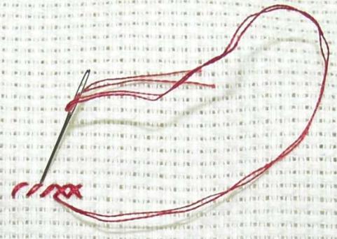
This font is created using small squares aligned similar to cross stitch patterns, which is why I chose to have my explanatory text on cross stitch fabric (see note). When I transferred my type to illustrator for finishing touches and colour I wasn't too concerned with matching my drawn marks because that is the beauty of cross stitch--you might have one or two stitches out but the whole thing comes together. I wanted the craft to come out in my type.
Note: This image is not my own and was used only for explanatory purposes and was borrowed from www.needlework-tips-and-techniques.com/image-files/cross-...