View allAll Photos Tagged relocation
One of the many Great Northern Divers that are currently wintering in Torbay and occasionally making an appearances in the Inner harbour at Brixham. They travel such long distances when underwater and they are quite difficult to relocate between the many boats in the marina and fishing harbour.
Just lacked a bit of sunlight on what was a very grey and gloomy day.
On Saturday 14th may 2022 Killamarsh Library, as it was, closed its doors to the public for the last time. Although I only work as a relief library assistant I regularly cover at Killamarsh and as I was working on the last day thought a few photos for prosperity would be worthwhile.
The positive thing is that the library will be relocating into the refurbished Killamarsh Sports Centre, which is adjacent to the current library site, and opening again this summer with more modern facilities and hopefully a bigger customer base.
Former Food Lion 22954 Sussex Hwy Seaford, DE. Relocated from 22941 Sussex Hwy on Oct 7, 2015. This is a former Safeway that became Sears that closed in 2014
Liberty Fair Mall of Martinsville, VA opened in 1989. The mall was anchored by Leggett (later Belk), Sears, JCPenney (which relocated from nearby Patrick Henry Mall, became an Outlet Store in 1999 and later rebranded as JC's 5 Star Outlet) and Walmart. By 1997 the Walmart had relocated and became Office Max, Kroger and Goody's (closed in 2009). Sears closed in 2012 and the JCPenney announced the closure of all of its outlet stores in October 2013. The mall was de-malled in 2014 and renamed The Village of Martinsville.
Sell House Fast in Ohio w FREE Relocation Assistance t.co/kQJPuoVUQW Sell House Fast in Ohio get a Cash … t.co/EZQs75E3Pc (via Twitter twitter.com/MyhousereCom/status/788818561443721217)
Edited at snipshot.com. Yet another baby Western Rattlesnake is moved to a new location away from camp.
Worcester is a Cathedral City and the county town of Worcestershire in the West Midlands of England.
The city is located some 17 miles (27 km) south-west of the southern suburbs of Birmingham, and 23 miles (37 km) north of Gloucester. The population is approximately 100,000. The River Severn flanks the western side of the city centre, which is overlooked by the 12th-century Worcester Cathedral.
The site of the final battle of the Civil War, Worcester was where Oliver Cromwell's New Model Army defeated King Charles I's Cavaliers, cementing the eleven-year Interregnum. Worcester was the home of Royal Worcester Porcelain, and for much of his life, the composer Sir Edward Elgar. It houses the Lea & Perrins factory where traditional Worcestershire Sauce is made. The University of Worcester is one of the UK's fastest-growing universities.
History
The trade route past Worcester which later formed part of the Roman Ryknild Street dates to Neolithic times. The position commanded a ford over the River Severn (the river was tidal past Worcester prior to public works projects in the 1840s) and was fortified by the Britons around 400 bc. It would have been on the northern border of the Dobunni and probably subject to the larger communities of the Malvern hillforts. The Roman settlement at the site passes unmentioned by Ptolemy's Geography, the Antonine Itinerary and the Register of Dignitaries but would have grown up on the road opened between Glevum (Gloucester) and Viroconium (Wroxeter) in the ad 40s and 50s. It may have been the "Vertis" mentioned in the 7th-century Ravenna Cosmography. Using charcoal from the Forest of Dean, the Romans operated pottery kilns and ironworks at the site and may have built a small fort.
In the 3rd century, Roman Worcester occupied a larger area than the subsequent medieval city, but silting of the Diglis Basin caused the abandonment of Sidbury. Industrial production ceased and the settlement contracted to a defended position along the lines of the old British fort at the river terrace's southern end. This settlement is generally identified with the Cair Guiragon listed among the 28 cities of Britain by the History of the Britons attributed to Nennius. This is not a British name but an adaption of its Old English name Weorgoran ceaster, "fort of the Weorgoran". The Weorgoran (the "people of the winding river") were precursors of Hwicce and probably West Saxons who entered the area some time after the 577 Battle of Dyrham. In 680, their fort at Worcester was chosen—in preference to both the much larger Gloucester and the royal court at Winchcombe—to be the seat of a new bishopric, suggesting there was already a well-established and powerful Christian community when the site fell into English hands. The oldest known church was St Helen's, which was certainly British; the Saxon cathedral was dedicated to St Peter.
The town was almost destroyed in 1041 after a rebellion against the punitive taxation of Harthacanute. During this time, the townsfolk relocated to (and at times were besieged at) the nearby Bevere Island, 2 miles upriver. The following century, the town (then better defended) was attacked several times (in 1139, 1150 and 1151) during "The Anarchy", i.e. civil war between King Stephen and Empress Matilda, daughter of Henry I. This is the background to the well-researched historical novel The Virgin in the Ice, part of Ellis Peters' "Cadfael" series, which begins with the words:
"It was early in November of 1139 that the tide of civil war, lately so sluggish and inactive, rose suddenly to wash over the city of Worcester, wash away half of its lifestock, property and women and send all those of its inhabitants who could get away in time scurrying for their lives northwards away from the marauders". (These are mentioned as having arrived from Gloucester, leaving a long lasting legacy of bitterness between the two cities.)
By late medieval times the population had grown to around 10,000 as the manufacture of cloth started to become a large local industry. The town was designated a county corporate, giving it autonomy from local government.
Worcester was the site of the Battle of Worcester (3 September 1651), when Charles II attempted to forcefully regain the crown, in the fields a little to the west and south of the city, near the village of Powick. However, Charles II was defeated and returned to his headquarters in what is now known as King Charles house in the Cornmarket, before fleeing in disguise to Boscobel House in Shropshire from where he eventually escaped to France. Worcester had supported the Parliamentary cause before the outbreak of war in 1642 but spent most of the war under Royalist occupation. After the war it cleverly used its location as the site of the final battles of the First Civil War (1646) and Third Civil War (1651) to try to mount an appeal for compensation from the new King Charles II. As part of this and not based upon any historical fact, it invented the epithet "Fidelis Civitas" (The Faithful City) and this motto has since been incorporated into the city's coat of arms.
In 1670, the River Severn broke its banks and the subsequent flood was the worst ever seen by Worcester. A brass plate can be found on a wall on the path to the cathedral by the path along the river showing how high this flood went and other flood heights of more recent times are also shown in stone bricks. The closest flood height to what is known as The Flood of 1670 was when the Severn flooded in the torrential rains of July 2007.
The Royal Worcester Porcelain Company factory was founded by Dr John Wall in 1751, although it no longer produces goods. A handful of decorators are still employed at the factory and the Museum is still open.
During the late 18th and early 19th centuries, Worcester was a major centre for glove making, employing nearly half the glovers in England at its peak (over 30,000 people). In 1815 the Worcester and Birmingham Canal opened, allowing Worcester goods to be transported to a larger conurbation.
The British Medical Association (BMA) was founded in the Board Room of the old Worcester Royal Infirmary building in Castle Street in 1832. While part of the Royal Infirmary has now been demolished to make way for the University of Worcester's new city campus, the original Georgian building has been preserved. One of the old wards opened as a medical museum, The Infirmary, in 2012.
In 1882 Worcester hosted the Worcestershire Exhibition, inspired by the Great Exhibition in London.There were sections for exhibits of fine arts (over 600 paintings), historical manuscripts and industrial items.The profit was £1,867.9s.6d. The number of visitors is recorded as 222,807. Some of the profit from the exhibition was used to build the Victoria Institute in Foregate Street, Worcester. This was opened on 1 October 1896 and now houses the city art gallery and museum. Further information about the exhibition can be found at the museum.
During World War II, the city was chosen to be the seat of an evacuated government in case of mass German invasion. The War Cabinet, along with Winston Churchill and some 16.000 state workers, would have moved to Hindlip Hall (now part of the complex forming the Headquarters of West Mercia Police), 3 miles (4.8 km) north of Worcester and Parliament would have temporarily seated in Stratford-upon-Avon. The former RAF station RAF Worcester was located east of Northwick.
In the 1950s and 1960s large areas of the medieval centre of Worcester were demolished and rebuilt as a result of decisions by town planners. This was condemned by many such as Nikolaus Pevsner who described it as a "totally incomprehensible... act of self-mutilation". There is still a significant area of medieval Worcester remaining, but it is a small fraction of what was present before the redevelopments.
The current city boundaries date from 1974, when the Local Government Act 1972 transferred the parishes of Warndon and St. Peter the Great County into the city.
Governance
The Conservatives had a majority on the council from 2003 to 2007, when they lost a by-election to Labour meaning the council had no overall control. The Conservatives remained with the most seats overall with 17 out of 35 seats after the 2008 election.
Worcester has one member of Parliament, Robin Walker of the Conservative Party, who represents the Worcester constituency as of the May 2010 general election.
The County of Worcestershire's local government arrangement is formed of a non-metropolitan county council (Worcestershire County Council) and six non-metropolitan district councils, with Worcester City Council being the district council for most of Worcester, with a small area of the St. Peters suburb actually falling within the neighbouring Wychavon District council. The Worcester City Council area includes two parish councils, these being Warndon Parish Council and St Peter the Great Parish Council.
Worcester Guildhall, the seat of local government, dates from 1721; it replaced an earlier hall on the same site. The Grade I listed Queen Anne style building is described by Pevsner as 'a splendid town hall, as splendid as any of C18 England'.
Economy
The city of Worcester, located on the River Severn and with transport links to Birmingham and other parts of the Midlands through the vast canal network, became an important centre for many light industries. The late-Victorian period saw the growth of ironfounders, like Heenan & Froude, Hardy & Padmore and McKenzie & Holland.
Glove industry
Gloves, Worcester City Art Gallery & Museum
One of the flourishing industries of Worcester was glove making. Worcester's Gloving industry peaked between 1790 and 1820 when about 30,000 were employed by 150 companies. At this time nearly half of the Glove manufacturers of Britain were located in Worcestershire.
In the 19th century the industry declined because import taxes on foreign competitors, mainly from France, were greatly reduced. By the middle of the 20th century, only a few Worcester gloving companies survived since gloves became less fashionable and free trade allowed in cheaper imports from the Far East.
Nevertheless, at least 3 large glove manufacturing companies still survived until the late 20th century: Dent Allcroft, Fownes and Milore. Queen Elizabeth II's coronation gloves were designed by Emil Rich and manufactured in the Worcester-based Milore factory.
Manufacturing
Lea & Perrins advertisement (1900)
The inter-war years saw the rapid growth of engineering, producing machine tools James Archdale, H.W. Ward, castings for the motor industry Worcester Windshields and Casements, mining machinery Mining Engineering Company (MECO) which later became part of Joy Mining Machinery and open-top cans Williamsons, though G H Williamson and Sons had become part of the Metal Box Co in 1930. Later the company became Carnaud Metal Box PLC.
Worcester Porcelain operated in Worcester until 2008, when the factory closed down due to the recession. However, the site of Worcester Porcelain still houses the Museum of Royal Worcester which is open daily to visitors.
One of Worcester's most famous products, Lea & Perrins Worcestershire sauce is made and bottled at the Midland Road factory in Worcester, which has been the home of Lea & Perrins since 16 October 1897. Mr Lea and Mr Perrins originally met in a chemist's shop on the site of the now Debenhams store in the Crowngate Shopping Centre.
The surprising foundry heritage of the city is represented by Morganite Crucible at Norton which produces graphitic shaped products and cements for use in the modern industry.
Worcester is the home of what is claimed to be the oldest newspaper in the world, Berrow's Worcester Journal, which traces its descent from a news-sheet that started publication in 1690. The city is also a major retail centre with several covered shopping centres that has most major chains represented as well as a host of independent shops and restaurants, particularly in Friar Street and New Street.
The city is home to the European manufacturing plant of Yamazaki Mazak Corporation, a global Japanese machine tool builder, which was established in 1980.
Retail trade
The Kays mail order business was founded in Worcester in the 1880s and operated from numerous premises in the city until 2007. It was then bought out by Reality, owner of the Grattan catalogue. Kays' former warehouse building was demolished in 2008.
Worcester’s main shopping centre is the High Street, home to the stores of a number of major retail chains. Part of the High Street was modernised in 2005 amid much controversy.[citation needed] Many of the issues focussed on the felling of old trees, the duration of the works (caused by the weather and an archaeological find) and the removal of flagstones outside the city’s 18th-century Guildhall. The other main thoroughfares are The Shambles and Broad Street, while The Cross (and its immediate surrounding area) is the city’s financial centre and location of the majority of Worcester’s main bank branches.
There are three main covered shopping centres in the city centre, these being CrownGate Shopping Centre, Cathedral Plaza and Reindeer Court. There is also an unenclosed shopping area located immediately east of the city centre called St. Martin's Quarter. There are three retail parks, the Elgar and Blackpole Retail Parks, which are located in the inner suburb of Blackpole and the Shrub Hill Retail Park neighbouring St. Martin's Quarter.
Landmarks
The most famous landmark in Worcester is its imposing Anglican Cathedral. The current building; known as Worcester Priory before the English Reformation, is officially named The Cathedral Church of Christ and the Blessed Virgin Mary. Construction begun in 1084 while its crypt dates from the 10th century. The chapter house is the only circular one in the country while the cathedral also has the distinction of having the tomb of King John.
The Hive, situated on the northern side of the River Severn at the former cattle market site, is Worcester's joint public and university library and archive centre, heralded as "the first of its kind in Europe". It is a prominent landmark feature on the Worcester skyline. With seven towers and a golden rooftop, The Hive has gained recognition winning two international awards for building design and sustainability.
There are three main parks in Worcester, Cripplegate Park, Gheluvelt Park and Fort Royal Park, the latter being on one of the battles sites of the English Civil War. In addition, there is a large open area known as Pitchcroft to the North of the city centre on the east bank of the River Severn, which, apart from those days when it is being used for horse racing, is a public space.
Gheluvelt Park was opened as a memorial to commemorate the Worcestershire Regiment's 2nd Battalion after their part in the Battle of Gheluvelt, during the First World War.
The statue of Sir Edward Elgar, commissioned from Kenneth Potts and unveiled in 1981, stands at the end of Worcester High Street facing the Cathedral, only yards from the original location of his father's music shop, which was demolished in the 1960s. Elgar's birthplace is a short way from Worcester, in the village of Broadheath.
There are also two large woodlands in the city, Perry Wood, at twelve hectares and Nunnery Wood, covering twenty-one hectares. Perry Wood is often said to be the place where Oliver Cromwell met and made a pact with the devil. Nunnery Wood is an integral part of the adjacent and popular Worcester Woods Country Park, itself next door to County Hall on the east side of the city.
climbing up the old concrete walkway up the bluffs reveals the remains of the once proud McKinley Elementary School. The school was built in 1910 and served students till the late 1970's.It is now privately owned and decaying....
The school has a unique location along the wooded bluffs in East Moline,IL.
Happy (school) fence Friday...!
relocated to the south side of Frankenmuth, a very old iron bridge built by Joliet Bridge and Iron Co. 1907
216a 1 - _TAC4511 - lr
tl;dr (up-front): If Burlington was to move elsewhere in Southaven, it’s no surprise that they chose South Lake Centre; Burlington photos begin this Saturday; many other local stores have made the same move; SLC is da bomb.
…Decided to go ahead and put that at the top for those of you who don’t care to stick around for the full description here, because I can already tell in advance that this is going to be a long one!
So… let’s get started. First, a shout-out is in order to both Albertsons Florida Blog and l_dawg2000 for guessing correctly this past Saturday that we’ll be headed to Burlington for my upcoming weekend photoset. (That served as our teaser for this week, so I’m sorry if you were hoping to get a guess of your own in!) In fact, this Burlington series will be my next extended feature on my photostream, and will last all the way into December, believe it or not (of course, there will be a couple of other stours interspersed in there, but at the tail end it will just be a few weeks of back-to-back-to-back Burlington due to the way the cookie crumbled as far as my scheduling goes). Before we get to their new Southaven store (the thing that spurred this set on, as you may recall), however, we’re going to poke around their now-former location first; that’s what you’ll begin seeing starting this Saturday. Plus, while I’ve been to the new store (it’s nice, bright, and shiny: three things that the old one frankly wasn’t, lol!), I actually haven’t gotten pictures there yet because I went on grand opening day and it was way too busy for that: so giving me ample time to go and take care of that is another good reason to stretch this series out some, haha!
Now, you’re probably wondering, what the heck does this graphic have to do with Burlington? Great question! What you’re looking at here is an aerial of South Lake Centre (within the red square with the rather obvious “South Lake Centre” lettering next to it :P ), which I’m no stranger to covering – see my blog posts here and here. I made this graphic all by myself, and tried to model it after similar graphics you’ll often see in commercial real estate lease listings. For example, see SLC’s developer’s own aerial here, complete with red square and obvious “South Lake Centre” lettering. But unlike Stonecrest Investment’s linked graphic, the goal of mine here is not to show you what stores surround SLC. And if that’s not it… what, then, is my goal?
Well, I’ll tell you! I’ve mentioned this (likely more than enough times) in my blog posts, but I’ll say it again here: South Lake Centre is arguably the premier shopping strip in Southaven. Sure, it has since been superseded by Southaven Towne Center to the immediate south, and more recently Tanger Outlets Southaven even further to the south of that. But South Lake Centre was first, and regardless is the only one of those three that calls the retail-iest interchange in DeSoto County – Goodman Road and I-55 – its home. Even ignoring its prominent location and its awesome architecture (again, check out my blog posts if you’re interested in more of the latter!), there’s no denying its significance. It’s a medium-range big-box power strip that has seen enviable stability in its tenant mix over the years since its opening in 2000. And in the off-chance that it does lose an anchor, that space has historically gotten filled super quickly; no lease has sat vacant here for too long.
On top of all of that, South Lake Centre has an extra bit of interestingness in that those vacancies I mentioned have all been filled not by retailers new to the area and/or opening their first Southaven/DeSoto County stores… but rather, in all cases since 2012, each and every empty storefront in the main drag of the shopping center has instead been re-leased out to stores relocating from elsewhere in the city/vicinity, aiming to take advantage of all the benefits associated with being in South Lake Centre as opposed to their previous, existing homes. Pretty cool, huh? That’s what I’m aiming to show with this graphic. Let me break it down for you…
First, let’s review the tenant mix. Rewind in time to 2000, when the center opened. From left to right on this graphic (assuming this is indeed the grand opening roster; if not, it at least was in place by the early 2000s, minus one retailer I’ll mention after the jump), you’ve got Office Depot, Waccamaw HomePlace, Petco, Dressbarn, Old Navy, Shoe Carnival, Hallmark Gold Crown, Marshalls, Fashion Bug, Sally Beauty Supply, and Hancock Fabrics. Waccamaw didn’t last long at all, and with that chain’s bankruptcy in 2001, was the first of the bunch to call it quits; Sports Authority quickly stepped in and assumed that space. Then, all was good for several years, until Hallmark decided to move out of the main row of stores and into one of the smaller bays in the parking lot of the center. A branch of the revived Dots chain picked up that lease in 2011, but disappeared a short time later, ceding the space to Rainbow. Besides those three cases, the remainder of all re-leasing here involved chains choosing to relocate from stores they already operated locally. Those are the ones pictured on the graphic, and we’ll look at them a little more closely.
Gap FactoryStore was the first to relocate into South Lake Centre. Fashion Bug announced in 2012 that it would be closing all of its stores, and as soon as the Southaven location became vacant, Gap snatched it up. Gap traveled the farthest distance to open in SLC; as you can see on the graphic, they came from a spot way out of view to the southwest, specifically the Casino Outlet Shoppes of Tunica in Robinsonville, MS. Accordingly, that store closed upon this one’s opening. I’ve noticed many shopping centers featuring both an Old Navy and a Gap FactoryStore, so it’s no surprise there that Gap would want to open in SLC considering its sister store was already here. And in fact, this may well have been more of a “de facto” relocation than a true one, since the Tunica Outlets also had an Old Navy store at the time. Gap was likely just interested in getting out of Tunica. I don’t blame them. That outlet mall has since lost every single national tenant it ever had (with one exception), and is struggling to stay alive these days with mom-and-pop retailers. However, that’s a story for another day. Specifically, for a future blog post ;)
OfficeMax was next to jump over from their existing store. This one also can’t exactly be considered a true relocation, considering that this took place in 2014 after the Office Depot/OfficeMax merger, and the OfficeMax across the interstate in Horn Lake was simply consolidating into the existing SLC Office Depot. But it nevertheless shows a conscious decision was made to keep the South Lake Centre store open instead of the DeSoto Crossing one. That would be thanks to the facts that the Office Depot in SLC is larger, owns its store (whereas the OfficeMax was leased), and enjoys all the added benefits of being part of a major power strip. So, while I chided its liquidation cover-up at the time, in this scenario I’m actually willing to take OfficeMax’s declaration that it was holding a “Moving Sale” at its face value! View my OfficeMax Closing album here, and my Office Depot album here.
The next closures and relocations all took place within the past two years. When Tanger Outlets opened in 2015, Dressbarn decided to pack everything up from South Lake Centre and move on down the road. (Indeed, if I had a counter-graphic for this, you could see that they weren’t the only ones. Rue21 similarly departed Southaven Towne Center for a space at Tanger, and Gap opened up its own FactoryStore in the complex, in addition to the one they already had at SLC literally just a mile and a half away. Both Gap stores continue to coexist for now, but time finally appears to be running out for the initial SLC location. Gap announced recently that they will soon be shutting 200 stores, and if two stores on the same block isn’t enough to make one a candidate, I don’t know what is. Plus, this new lease listing I found over the weekend [check out those sweet outdated pictures there, too – don’t be surprised if you see those in a blog post one day! :) ] has an 8,000 square foot opening for 95 Goodman Road W – Gap’s size and address – so that pretty much seals its fate, even if an official closing announcement hasn’t been confirmed yet. This isn’t unexpected, of course, but still sad because I like the SLC location better. But in all of this, I digress.)
Dressbarn’s loss became Tuesday Morning’s gain. They quickly snapped up the site, even though it was almost a good 2,000 square feet smaller than their existing space across the street at The Shops of Colonial Square. Not to worry, though: they subsequently tore out the back wall of the old Dressbarn and expanded the space! Now it’s a very respectable 11,000 square feet, which is about 2,000 square feet larger than their old store. The new and improved Southaven Tuesday Morning finally opened to the public in September 2016. View my Tuesday Morning Relocation album here.
In addition to Tuesday Morning’s grand opening, 2016 also brought two major losses to South Lake Centre. Both Hancock Fabrics and Sports Authority declared bankruptcy and closed all of their stores nationwide. Hancock gave up the ghost in April of that year. Being that its location was the prime corner space right along Airways Boulevard, I was a bit surprised to see it stay vacant for the remainder of 2016. Then, come December, I was also very surprised to see who had finally committed to moving in: none other than Books-a-Million, which chose to relocate from its existing store just a stone’s throw south! Work progressed quickly, and Southaven’s new BAM held its grand opening in February 2017. View my Hancock Fabrics Closing album here, and my Books-a-Million Relocation album here.
SLC’s last major victim of recent memory, Sports Authority, was gone by August 2016. That space, too, sat vacant for a while, but this wasn’t as surprising as duration of the Hancock vacancy; Sports Authority’s building is the largest square footage in the center, so it was expected for the real estate team to wait a little longer to find the proper new tenant. Lo and behold, that decision came soon enough – and what do you know, Burlington was the big-ticket buyer. Burlington’s existing Southaven store was located in 80,000 square feet of a former Super Kmart Center in the older, sleepier retail section of town one exit north on Stateline Road, so this new store would represent an improvement in both prototype (Burlington’s layout is now based on a 45,000 square foot design) and visibility for them. After several months of façade and interior construction, Burlington opened its doors in September 2017. View my Sports Authority Closing album here, and my Burlington Relocation album here. (Not too many pictures in that latter one just yet – again, that’s what I’ll begin adding to this Saturday and over the next couple of months!)
…Now you see why I put that tl;dr at the top, don’t you? :) Well, for those of you who did stick around and read this all, thank you. As you can tell, I really like South Lake Centre, and I enjoyed taking the time to put this graphic together as well. To come full-circle with the listing earlier in this description, here’s SLC’s current tenant mix: Office Depot, Burlington, Petco, Tuesday Morning, Old Navy, Shoe Carnival, Rainbow, Marshalls, Gap FactoryStore, Sally Beauty Supply, and Books-a-Million. But as I mentioned, that seems very likely to change again in the not-too-distant future, with Gap preparing to exit. Will we then see yet another relocation of an existing local retailer to South Lake Centre? Only time will tell…
So once again, I invite you to check out the start of my Burlington series this weekend. Until then, if you’re interested in even more information (!) as to what has taken over the stores that relocated to SLC… drop me a comment and I’ll be glad to share that, too. (I figured this description was lengthy enough not to include it here, haha!) And, to reward the patience of those of you who made it all the way to the end of this description, here are some music recommendations for you to listen to and enjoy :) (Although I will warn you: that last one’s got screaming in it, so if, like me, you’re not a big fan of that, I’d suggest skipping over approximately 1:56-2:26 in that song :P )
(c) 2017 Retail Retell
These places are public so these photos are too, but just as I tell where they came from, I'd appreciate if you'd say who :)
WEEK 1 – Memphis Kmart Closing, I
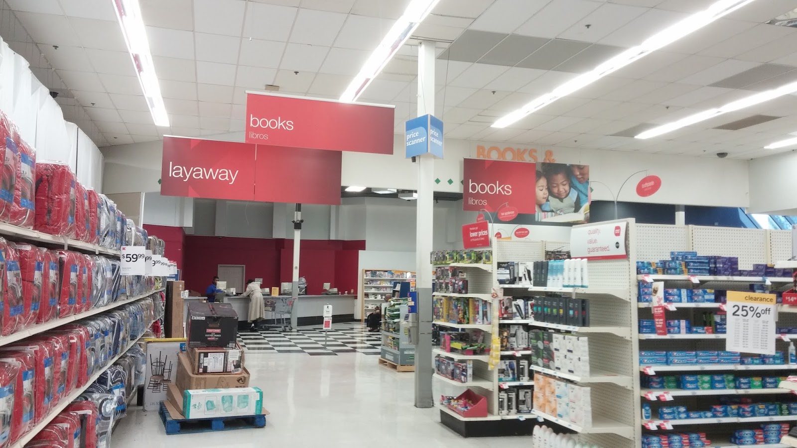
Prior to the liquidation, books occupied the former café space, but for the closing sale they had been consolidated out here in front of the former pharmacy. Something else I'm kicking myself for: if I had seen that copy of Jimmy Fallon's “Your Baby's First Word Will Be Dada,” I definitely would've bought it!
(c) 2017 Retail Retell
These places are public so these photos are too, but just as I tell where they came from, I'd appreciate if you'd say who :)
MAJUBA HILL POST OFFICE, British Columbia
Established - 1 July 1900
Became YARROW Post Office - 1 January 1914
Majuba Hill Post Office 1900 - William and Mary Jane (Town) Chadsey came to Sumas (now Greendale) in 1866, pre-empting 160 acres of land near the south end of Chilliwack Mountain. Following the flood of 1894 they moved to Majuba Hill with their 12 children. In 1900, William Chadsey opened a post office in his home on Majuba Hill Road, near Robinson Road. He was followed by James Hounsome in 1912 who relocated the post office to his home on the north side of the British Columbia Electric Railway tracks that are located adjacent to this park. The post office moved again in 1927 when Eva Siddall became the postmistress. The Siddall home, store and post office was located on this site. LINK to the complete article - www.chilliwack.com/main/page.cfm?id=1754&dowhat=locat...
- from - BRITISH COLUMBIA P0STAL HISTORY RESEARCH GR0UP / Volume 1 - Number 3 - September 1992 (By Ceci C. Coutts) - In 1877 Great Britain annexed the Transvaal. In a subsequent struggle for Independence, a troop of Boer soldiers under the comand of Petrus J. Jobert (1831-1900) routed 500 British soldiers at Maiuba Hill on 27 February 1881. Sir George Colley, British Comnander, was killed in the exchange. Skirmishes such as this led eventually to the South African War (1899-1905). The battle site was chosen as the name for a British Colmbia post office which opened on the north side of Vedder Mountain just south of where the Village of Yarrow was later built. The Chilliwack Progress (newspaper) of 4 July 1900 carried the following "A new semi-weekly mail service has been established between Sumas and Vedder Mountain. The new post office is called Majuba Hill and Mr. William Chasdey is postmaster."
The Post Office opened - 1 July 1900 in the Chadsey home situated at the intersection of Majuba Hill and Robinson Roads. William Chadsey (1843- 1906) was a brother of Chester and James Chadsey, who were pioneer farmers on Sumas Prairie. Mail in 1900 was received / dispatched through Sumas Post Office. When Sumas Lake flooded (which was a regular occurrence,) it was necessary to transport mail by boat. Later, (1902) a contract was let to William Chadsey to haul mail twice per week between Majuba Hill and Sardis, eight and one-half miles distant at $120 per annum. By this time, a bridge had been built at Vedder Crossing. On 1 December 1906, William Chadsey's eighth-born, Lockhart Eugene Chadsey (1879-1942) took over the postmaster job and mail hauling contract, the latter apparently being shared with J.B. Redman. Lock, a farmer, was married to Ola Adeline Mercy in January 1903. The couple had six children. He served as postmaster until 1 November 1909. Third postmaster was James Hounsome, who just nicely got set up in his home across the road from the Chadsey place, when the post office closed down because the bridge at Vedder Crossing was destroyed by high water. Postal service resumed 1 April 1910.
LINK to the complete article - www.bnaps.org/hhl/newsletters/bcr/bcr-1992-09-v001n03.pdf
In his history of the Chilliwack area post offices, Cecil Coutts states that Ella (Eva Elmina) Siddal succeeded James Hounsome on the recommendation of Elihu Manuel, a Liberal politician. Bill and Ella's house and store were ideally located for a post office. In 1928, Yale Road was the main highway, and Siddall's store prospered with the influx of immigrants. Eventually, the post office was moved to the "north side of the Siddall home" facing the railway tracks and Yarrow Station.
LINK to a list of the Postmasters who served at the MAJUBA HILL Post Office - www.bac-lac.gc.ca/eng/discover/postal-heritage-philately/...; ant the YARROW Post Office - www.bac-lac.gc.ca/eng/discover/postal-heritage-philately/...;
Chester Brown writes, "By 1929, Yarrow consisted of a station on the B.C. Electric rail line, a post office, and country store. Yarrow was a community of perhaps a dozen homes with a medical doctor. The Knox farmstead existed in the immediate vicinity, while several families were established on Majuba Hill within a mile west of Yarrow." LINK to the complete article - Majuba Hill / Yarrow - Pioneers and Settlers - www.yarrowbc.ca/pioneers/majubahill.html
sent from - / OLYMPIA / MAR 9 / 230 PM / WASH. / 1912 / - duplex cancel
Olympia is the capital of the U.S. state of Washington and the county seat and largest city of Thurston County. Olympia was incorporated as a town on January 28, 1859, and as a City in 1882. The population was 46,479 as of the 2010 census, making it the 24th largest city in the state. Olympia is located 60 miles (100 km) southwest of Seattle, the largest city in the state of Washington.
via - / NEW WESTMINSTER, B.C. / MAR 11 / 9 - AM / 1912 / - machine transit backstamp
- arrival - / MAJUBA HILL / MR 11 / 12 / B.C. / - split ring arrival - this split ring hammer (A-1) was not listed in the proof book - it was most likely proofed c. 1900 when the Post Office opened - (RF E - now a RF D due to a large post card find).
Message on postcard reads: Will write in a few days - Pa is not here - cant you find out where he is - all well - Laura May "Enyard" Camfield (Mary "Enyard" Fleming was her sister)
Laura May "Enyard" Camfield
Birth - 4 March 1873
Death - 4 November 1956 (aged 83)
Burial - Masonic Memorial Park, Tumwater, Thurston County, Washington, USA
Her husband was - Clarence H Camfield (July 1861 – 26 June 1948) - they were married - 7 Feb 1893 in Castle Rock, Cowlitz, Washington, United States. They had 2 children.
Addressed to: Mrs. Mary Fleming / Majuba Hill / B.C.
Mary "Enyard" Fleming
Birth - 31 May 1874
Death - 22 Nov 1972 (aged 98)
Burial - Woodlawn Cemetery, Ferndale, Whatcom County, Washington, USA
Her husband was - Perry Commodore Fleming (July 1873 – 28 March 1946) - they were married - 25 December 1893 in Castle Rock, Cowlitz, Washington. They immigrated to Canada (Majuba Hill, B.C. in 1903 and returned to the USA in the 1920's. They had 5 children.
Their father (mentioned at PA in this postcard) was:
Abner Jackson Enyard
Birth - 22 Sep 1843 in Missouri, USA
Death - 6 Jan 1930 (aged 86) in Olympia, Thurston County, Washington, USA
Burial - Masonic Memorial Park Tumwater, Thurston County, Washington, USA
According to his obituary published in the Morning Olympian on Tuesday, January 7, 1930, Abner died at the home of his daughter. Mrs. C. H. Camfield. He arrived in Hillsborough, Oregon with his parents in 1844, and in 1868 he came to Washington. He was employed by the Northern Pacific. In 1871 he married Amanda J. Black at Stockport, now known as Ostrander. He was survived by two daughters, Mrs. C. H. Camfield of Olympia, and Mrs. P. C. Fleming, of Bellingham; six grandchildren and 11 great grandchildren.
The "One Hundred Mules Walking the Los Angeles Aqueduct" passing the Manzanar War Relocation Center in the Owens Valley.
The "One Hundred Mules Walking the Los Angeles Aqueduct" is taking place October 15-November 12, 2013 and will traverse 240 miles from the Owens Valley to the heart of Los Angeles.
www.facebook.com/OneHundredMulesWalkingtheLosAngelesAqueduct
© 2013
October 20, 2013
Camera Canon EOS 5D Mark II
Exposure 0.001 sec (1/1000)
Aperture f/2.8
Focal Length 200 mm
ISO Speed 50
Exposure Bias 0 EV
Greek Revival in style, this former Baptist Meeting House was built in Streetsboro, Ohio in 1852. Slated for demolition in 1969, it was acquired and moved to Hale Farm & Village in 1970. The steeple, destroyed by a storm prior to its relocation, was carefully reproduced by Hale Farm using historic images and building drawings created by the Historic American Building Surveys (HABS) in the 1930s.
The Canada Goose (Branta canadensis) is a wild goose belonging to the genus Branta, which is native to arctic and temperate regions of North America, having a black head and neck, white patches on the face, and a brownish-gray body.
In North America, non-migratory Canada Goose populations have been on the rise. The species is frequently found on golf courses, parking lots and urban parks, which would have previously hosted only migratory geese on rare occasions. Owing to its adaptability to human-altered areas, it has become the most common waterfowl species in North America. In many areas, non-migratory Canada Geese are now regarded as pests by humans. They are suspected of being a cause of an increase in high fecal coliforms at beaches. An extended hunting season, deploying noise makers, and hazing by dogs have been used in an attempt to disrupt suspect flocks.
Since 1999, The United States Department of Agriculture Wildlife Services agency has been engaged in lethal culls of Canada Geese primarily in urban or densely populated areas. The agency responds to municipalities or private land owners, such as golf courses, who find the geese obtrusive or object to their waste. Addling goose eggs and destroying nests are promoted as humane population control methods.
In 1995, a US Air Force E-3 Sentry aircraft at Elmendorf AFB, Alaska struck a flock of Canada Geese on takeoff and crashed, killing all 24 crew. The accident sparked efforts to avoid such events, including habitat modification, aversion tactics, herding and relocation, and culling of flocks.[20] A collision with a flock of migratory Canada Geese resulted in US Airways Flight 1549 suffering a total power loss after takeoff from LaGuardia Airport, New York City, New York on 15 January 2009. The pilot brought the plane to an emergency 'splash'-landing in the Hudson River, causing only minor injuries to the 155 passengers and crew.
Geese have a tendency to attack humans when they feel themselves or their goslings to be threatened. First the geese will stand erect, spread their wings and produce a hissing sound. Next, the geese will charge. They may then bite or attack with their wings.
Canada goose goslings.
"The Los Angeles County Arboretum and Botanic Garden" Arcadia. California.
Up at the front of the store, another change that took place was the relocation of the recycling bins from a spot along the front end itself to this new alcove right beside the restrooms. Previously, this space had been home to three community display boards that, evidently, the store decided to remove.
Personally, I like this location for the recycling bins better, both in that they're closer to the doors and in that their previous location was, in my opinion, kinda awkward (even more so now, given that the manager's office they were up against is now a family restroom). Too bad I didn't get to make much use of their new spot, seeing as how we had finally received curbside recycling service by this time! :P
(c) 2018 Retail Retell
These places are public so these photos are too, but just as I tell where they came from, I'd appreciate if you'd say who :)
Many of the Nubians you’ll find living at either Nubian village were relocated here during the latter half of the twentieth century as construction of the High Dam in Aswan neared completion. The construction of the dam essentially meant that the Nubian communities had no option but to move
Taken @Aswan, Egypt
ARCHIVE IMAGE
Grazing kangaroos seem oblivious to two F111s from RAAF Base Amberley taxiing towards their departure.
The composition came from a group of Kangaroo's that got onto base and were there for a number of weeks. Efforts to move them on were not successful. Eventually they were caught & relocated off the base as they were creating a hazzard to the aircraft landing & taking off. The fence has also been 'Roo Proofed"
Photo by LAC Andrew Eddie
Remodel, Week 5
(cont.) ...and on that note, a fair amount of the merchandise that used to be housed over near the bakery has already found itself relocated to make room for the produce walk-in cooler. As you can see here, prepackaged bread, as well as (on the other side of this shelving) prepackaged muffins, bagels, and tortillas, have all been temporarily placed between the meat department's coffin coolers and the beer aisle, which runs perpendicular to said coolers. In the background of this photo, you can get a better, more zoomed-out indication of just how large the produce cooler will be. Also, for reference, here's a shot taken from over at the bakery, looking toward the spot where I was standing for this pic.
(c) 2017 Retail Retell
These places are public so these photos are too, but just as I tell where they came from, I'd appreciate if you'd say who :)
WEEK 51 – Barnes & Noble Ole Miss Relocation Revisited (I)
I have this strange tendency to upload photos from Oxford anytime EXCEPT when I’m actually in town. Which, you know, is a majority of the year, so it’s pretty talented that I do this. I did the same thing this exact time last year, as a matter of fact (you might recall my Oxford Walmart album update). This time we’re doing another album update, as Albertsons Florida Blog correctly guessed on Tuesday, and as is clear from the photo you’re looking at above this spiel: the next chapter in the Ole Miss Barnes & Noble campus bookstore saga. (cont.)
Barnes & Noble at Ole Miss (inside the University of Mississippi's Jackson Avenue Center/former Oxford Mall; now closed) // 1111 Jackson Avenue W, Oxford, MS 38655
(c) 2019 Retail Retell
These places are public so these photos are too, but just as I tell where they came from, I'd appreciate if you'd say who :)
Bremerhaven Unterfeuer (Zwiebelturm, Minarett)
1893. Active; focal plane 21 m (62 ft); white light, 2 s on, 2 s off, synchronized with the rear light. 26 m (85 ft) tapered-conical round cast iron tower with gallery, crowned by a large ball and a spire. Lighthouse painted with red and white horizontal This remarkable Gay Nineties tower has been a Bremerhaven landmark for more than a century. Its nickname Zwiebelturm ("onion tower") refers to its round topmark. The light is part of an upstream (northbound) range, helping ships leaving the Weser negotiate a major turn in the estuary. The lighthouse was relocated by 56 m (184 ft) in 1992 to improve its visibility. In recent years the Bremerhaven zoo has expanded along the waterfront and the lighthouse now stands just outside the zoo grounds. Located on the south side of the entrance to the Neuer Hafen (new harbor) in Bremerhaven. Site open, tower closed. Operator: WSA Weser-Jade-Nordsee.
Bremerhaven Oberfeuer (Loschenturm)
1855 (Simon Loschen). Active; focal plane 34 m (111 ft); white light, 2 s on, 2 s off, synchronized with the front light. 37 m (121 ft) square brick New Gothic tower with octagonal lantern. Tower is unpainted brick, lantern painted green. On the side of the tower is a large iron bracket structure formerly used to display storm signals. This elegant lighthouse, designed by the Bremen architect Simon Loschen, could not be more different from the front range tower. The oldest operating lighthouse of Germany's North Sea mainland, it narrowly escaped destruction during World War II. It is called the Loschenturm (Loschen's tower") to honor its architect. Located about 200 m (220 yd) north of the front light, near a former lock that provided entry to the Neuer Haven (originally the light keepers also operated the lock).
Above information taken from Lighthouse Directory's web site.
I don't normally handle wildlife but this fella seemed pretty vulnerable hanging out at a busy park. So a fter a few quick shots we tried to discretely relocate him to a safer spot.
Set to relocate to the former Dressbarn and Cato Fashions (by combining the two vacant storefronts) in the Lycoming Crossings shopping center.
Muncy, PA. October 2020.
------------------------------------------------------------------------------------------
If you would like to use THIS picture in any sort of media elsewhere (such as newspaper or article), please send me a Flickrmail or send me an email at natehenderson6@gmail.com
Relocated "Forever Marilyn" statue after it was returned to Palm Springs in 2021, Palm Springs, California.
For once I'm at something of a loss for this one. It started life as one thing and by the end had morphed into something quite different. It started life as a simple piece of A4 paper but by the time it was done was this concoction of cardboard, glue, stencils, spraypaint, stamped lettering and something of a dark heart vibe.
The gentleman in the piece is clearly something of a vagabond as it would appear he has cleared out all the bank accounts and made a hasty international departure to an uncertain destination. And all he left behind was a short note. The no-good piece of dirt. If I ever get my hands on him...
Cheers
id-iom
WEEK 51 – Barnes & Noble Ole Miss Relocation Revisited (I)
Hope y’all got all that, haha! And as if that wasn’t enough backstory, I probably should fill you in quickly on the mall situation again, too. The Oxford Mall used to be a two-anchor deal, with JCPenney and Wal-Mart… except when Wal-Mart built a new Supercenter down the road, well, that was the beginning of the end for the mall. Some plans to renovate it were thrown out there, and in an attempt to bring those to life the middle of the mall was demolished and turned into a new Malco Theatre, but ultimately the mall stayed in a stasis and Ole Miss purchased the property to use for extra square footage and – most importantly – parking. Currently, only the right half of the mall has been converted into offshoot campus space, but with JCPenney's departure in July 2017, I’m sure it’s only a matter of time before the left half of the mall is touched, too.
The only retail space that Ole Miss has left intact at the mall – now christened the “Jackson Avenue Center” – is this space at the very front of the right-side mall entry corridor, originally home to Ole South Cafeteria and, more notably, Campus Book Mart, which opened here in 1995 and lasted until 2015, when it relocated to a separate location down the street. Likely, CBM’s relocation was a result of landlord Ole Miss kicking them out, so that they could put their own university bookstore in this space during the Student Union remodel. But that’s just conjecture.
(c) 2019 Retail Retell
These places are public so these photos are too, but just as I tell where they came from, I'd appreciate if you'd say who :)
The Abu Simbel temples are two massive rock temples at Abu Simbel (أبو سمبل in Arabic), a village in Nubia, southern Egypt, near the border with Sudan. They are situated on the western bank of Lake Nasser, about 230 km southwest of Aswan (about 300 km by road). The complex is part of the UNESCO World Heritage Site known as the "Nubian Monuments," which run from Abu Simbel downriver to Philae (near Aswan). The twin temples were originally carved out of the mountainside during the reign of Pharaoh Ramesses II in the 13th century BC, as a lasting monument to himself and his queen Nefertari, to commemorate his victory at the Battle of Kadesh. Their huge external rock relief figures have become iconic.
The complex was relocated in its entirety in 1968, on an artificial hill made from a domed structure, high above the Aswan High Dam reservoir. The relocation of the temples was necessary to prevent them from being submerged during the creation of Lake Nasser, the massive artificial water reservoir formed after the building of the Aswan High Dam on the Nile River.
Windsor (/ˈwɪnzər/) is a town and unparished area in the Royal Borough of Windsor and Maidenhead in Berkshire, England. It is widely known as the site of Windsor Castle, one of the official residences of the British Royal Family.
The town is situated 23 miles (37 km) west of Charing Cross, London. It is immediately south of the River Thames, which forms its boundary with Eton. The village of Old Windsor, just over 2 miles (3 km) to the south, predates what is now called Windsor by around 300 years; in the past Windsor was formally referred to as New Windsor to distinguish the two.
The early history of the site is unknown, although it was almost certainly settled some years before 1070 when William the Conquerorhad a timber motte and bailey castle constructed.[2] The focus of royal interest at that time was not the castle, however, but a small riverside settlement about 3 miles (5 km) downstream, possibly established from the 7th century.
Windsor, or Windlesora as it was called in the 11th century, is first mentioned in the Anglo-Saxon Chronicle. The name originates from old English Windles-ore, or 'winch by the riverside'. The settlement had used an earlier name, but this is unknown. From about the 8th century, high status people started to visit the site occasionally, and possibly this included royalty. From the 11th century the site's link with king Edward the Confessor is documented, but again, information about his use of the place is scant. After the Conquest of 1066 royal use of the site increased, probably because it offered good access to woodlands and opportunities for hunting – a sport which also practised military skills. By the late 12th century, and the relocation of the royal household to an enlarged castle in 1110, the site was renamed Old Windsor.
Windsor Castle is noted in the Domesday Bookunder the entry for Clewer, the neighbouring manor to Windsor. Although this might seem strange, it occurred because plans for the castle had changed since 1070, and more land had been acquired in Clewer on which to site a castle town. This plan was not actioned until the early 12th century. By 1110, meetings of the Great Council, which had previously taken place at Windlesora, were noted as taking place at the Castle – referred to as New Windsor, probably to indicate that it was a two ward castle/borough complex, similar to other early castle designs, such as Denbigh. Henry I – according to one chronicle – had rebuilt it, and this followed the Norman kings' actions at other royal sites, such as Westminster, where larger and more magnificent accommodation was thought necessary for the new dynasty. King Henry married his second wife at Windsor Castle in 1121, after the White Ship disaster. The settlement at Old Windsor largely transferred to New Windsor during the 12th century, although substantial planning and setting out of the new town (including the parish church, marketplace, bridge, hermitage and leper hospital) did not take place until c. 1170, under Henry II, following the civil war of Stephen's reign. At about the same time, the present upper ward of the castle was rebuilt in stone. Windsor Bridge is the earliest bridge on the Thames between Staines and Reading, built at a time when bridge building was rare; it was first documented in 1191, but had probably been built, according to the Pipe rolls, in 1173. It played an important part in the national road system, linking London with Reading and Winchester, but also, by diverting traffic into the new town, it underpinned the success of its fledgling economy.
The town of New Windsor, as an ancient demesne of the Crown, was a privileged settlement from the start, apparently having the rights of a 'free borough', for which other towns had to pay substantial fees to the king. It had a merchant guild (known by the 14th century as the Fraternity or brotherhood of the Holy Trinity) from the early 13th century and, under royal patronage, was made the chief town of the county in 1277, as part of its grant of royal borough status by Edward I's charter. Somewhat unusually, this charter gave no new rights or privileges to Windsor but probably codified the rights which it had enjoyed for many years. Windsor's position as chief town of Berkshire was short-lived, however, as people found it difficult to reach. Wallingford took over this position in the early 14th century. As a self-governing town Windsor enjoyed a number of freedoms unavailable to other towns, including the right to hold its own borough court, the right of membership (or 'freedom') and some financial independence. The town accounts of the 16th century survive in part, although most of the once substantial borough archive dating back to the 12th century was destroyed, probably in the late 17th century.
The early history of the site is unknown, although it was almost certainly settled some years before 1070 when William the Conquerorhad a timber motte and bailey castle constructed.[2] The focus of royal interest at that time was not the castle, however, but a small riverside settlement about 3 miles (5 km) downstream, possibly established from the 7th century.
Windsor, or Windlesora as it was called in the 11th century, is first mentioned in the Anglo-Saxon Chronicle. The name originates from old English Windles-ore, or 'winch by the riverside'. The settlement had used an earlier name, but this is unknown. From about the 8th century, high status people started to visit the site occasionally, and possibly this included royalty. From the 11th century the site's link with king Edward the Confessor is documented, but again, information about his use of the place is scant. After the Conquest of 1066 royal use of the site increased, probably because it offered good access to woodlands and opportunities for hunting – a sport which also practised military skills. By the late 12th century, and the relocation of the royal household to an enlarged castle in 1110, the site was renamed Old Windsor.
Windsor Castle is noted in the Domesday Bookunder the entry for Clewer, the neighbouring manor to Windsor. Although this might seem strange, it occurred because plans for the castle had changed since 1070, and more land had been acquired in Clewer on which to site a castle town. This plan was not actioned until the early 12th century. By 1110, meetings of the Great Council, which had previously taken place at Windlesora, were noted as taking place at the Castle – referred to as New Windsor, probably to indicate that it was a two ward castle/borough complex, similar to other early castle designs, such as Denbigh. Henry I – according to one chronicle – had rebuilt it, and this followed the Norman kings' actions at other royal sites, such as Westminster, where larger and more magnificent accommodation was thought necessary for the new dynasty. King Henry married his second wife at Windsor Castle in 1121, after the White Ship disaster. The settlement at Old Windsor largely transferred to New Windsor during the 12th century, although substantial planning and setting out of the new town (including the parish church, marketplace, bridge, hermitage and leper hospital) did not take place until c. 1170, under Henry II, following the civil war of Stephen's reign. At about the same time, the present upper ward of the castle was rebuilt in stone. Windsor Bridge is the earliest bridge on the Thames between Staines and Reading, built at a time when bridge building was rare; it was first documented in 1191, but had probably been built, according to the Pipe rolls, in 1173. It played an important part in the national road system, linking London with Reading and Winchester, but also, by diverting traffic into the new town, it underpinned the success of its fledgling economy.
The town of New Windsor, as an ancient demesne of the Crown, was a privileged settlement from the start, apparently having the rights of a 'free borough', for which other towns had to pay substantial fees to the king. It had a merchant guild (known by the 14th century as the Fraternity or brotherhood of the Holy Trinity) from the early 13th century and, under royal patronage, was made the chief town of the county in 1277, as part of its grant of royal borough status by Edward I's charter. Somewhat unusually, this charter gave no new rights or privileges to Windsor but probably codified the rights which it had enjoyed for many years. Windsor's position as chief town of Berkshire was short-lived, however, as people found it difficult to reach. Wallingford took over this position in the early 14th century. As a self-governing town Windsor enjoyed a number of freedoms unavailable to other towns, including the right to hold its own borough court, the right of membership (or 'freedom') and some financial independence. The town accounts of the 16th century survive in part, although most of the once substantial borough archive dating back to the 12th century was destroyed, probably in the late 17th century.
The Last Supper by Franz de Cleyn in the West Gallery of Windsor parish church of St John The Baptist.[3]
New Windsor was a nationally significant town in the Middle Ages, certainly one of the fifty wealthiest towns in the country by 1332. Its prosperity came from its close association with the royal household. The repeated investment in the castle brought London merchants (goldsmiths, vintners, spicers and mercers) to the town in the late 13th century and provided much employment for townsmen. The development of the castle under Edward III, between 1350–68, was the largest secular building project in England of the Middle Ages, and many Windsor people worked on this project, again bringing great wealth to the town. Although the Black Death in 1348 had reduced some towns' populations by up to 50%, in Windsor the building projects of Edward III brought money to the town, and possibly its population doubled: this was a 'boom' time for the local economy. People came to the town from every part of the country, and from continental Europe. The poet Geoffrey Chaucerheld the honorific post of 'Clerk of the Works' at Windsor Castle in 1391.
The development of the castle continued in the late 15th century with the rebuilding of St George's Chapel. With this Windsor became a major pilgrimage destination, particularly for Londoners. Pilgrims came to touch the royal shrine of the murdered Henry VI, the fragment of the True Cross and other important relics. Visits to the chapel were probably combined with a visit to the important nearby Marian shrine and college at Eton, founded by Henry VI in 1440, and dedicated to the Assumption; which is now better known as Eton College. Pilgrims came with substantial sums to spend. From perhaps two or three named inns in the late 15th century, some 30 can be identified a century later. The town again grew in wealth. For London pilgrims, Windsor was probably – but briefly – of greater importance than Canterbury and the shrine of the City's patron Saint Thomas Becket. With the closures of the Reformation, however, Windsor's pilgrim traffic died out. Henry VIII was buried in St George's Chapel in 1547, next to Jane Seymour, the mother of his only legitimate son, Edward (Edward VI). Henry, the founder of the Church of England, may have wanted to benefit from the stream of Catholic pilgrims coming to the town. His will gives that impression.
The town began to stagnate about ten years after the Reformation. The castle was considered old-fashioned and shrines to the dead were thought to be superstitious. The early modern period formed a stark contrast to the medieval history of the town. Most accounts of Windsor in the 16th and 17th centuries talk of its poverty, badly made streets and poor housing. Shakespeare's play The Merry Wives of Windsor is set in Windsor and contains many references to parts of the town and the surrounding countryside. Shakespeare must have walked the town's streets, near the castle and river, much as people still do. The play may have been written in the Garter Inn, opposite the Castle, but this was destroyed by fire in the late 17th century. The long-standing – and famous – courtesan of king Charles II, Nell Gwyn, was given a house on St Albans Street: Burford House (now part of the Royal Mews). Her residence in this house, as far as it is possible to tell, was brief. Only one of her letters addressed from Burford House survives: it was probably intended as a legacy for her illegitimate son, the Earl of Burford, later the Duke of St Albans.
Windsor was garrisoned by Colonel Venn during the English Civil War. Later it became the home of the New Model Army when Venn had left the castle in 1645. Despite its royal dependence, like many commercial centres, Windsor was a Parliamentarian town. Charles Iwas buried without ceremony in St George's Chapel after his execution at Whitehall in 1649. The present Guildhall, built in 1680–91, replaced an earlier market house that had been built on the same site around 1580, as well as the old guildhall, which faced the castle and had been built around 1350. The contraction in the number of old public buildings speaks of a town 'clearing the decks', ready for a renewed period of prosperity with Charles II's return to the Castle. But his successors did not use the place, and as the town was short of money, the planned new civic buildings did not appear. The town continued in poverty until the mid 19th century.
In 1652 the largest house in Windsor Great Park was built on land which Oliver Cromwell had appropriated from the Crown. Now known as Cumberland Lodge after the Duke of Cumberland's residence there in the mid 18th century, the house was variously known as Byfield House, New Lodge, Ranger's Lodge, Windsor Lodge and Great Lodge.
In 1778, there was a resumption of the royal presence, with George III at the Queen's Lodge and, from 1804, at the castle. This started a period of new development in Windsor, with the building of two army barracks. However the associated large numbers of soldiers led to a major prostitution problem by 1830, in a town where the number of streets had little changed since 1530. In the 18th c. the town traded with London selling the Windsor Chair which was actually made in Buckinghamshire.
A number of fine houses were built in this period, including Hadleigh House on Sheet Street, which was built in 1793 by the then Mayor of Windsor, William Thomas. In 1811 it was the home of John O'Reilly, the apothecary-surgeon to George III.
Windsor Castle was the westernmost sighting-point for the Anglo-French Survey (1784–1790), which measured the precise distance between the Royal Greenwich Observatory and the Paris Observatory by trigonometry. Windsor was used because of its relative proximity to the base-line of the survey at Hounslow Heath.
The substantial redevelopment of the castle in the subsequent decade and Queen Victoria's residence from 1840, as well as the coming of two railways in 1849, signalled the most dramatic changes in the town's history. These events catapulted the town from a sleepy medieval has-been to the centre of empire – many European crowned heads of state came to Windsor to visit the Queen throughout the rest of the 19th century. Unfortunately, excessive redevelopment and 'refurbishment' of Windsor's medieval fabric at this time resulted in widespread destruction of the old town, including the demolition of the old parish church of St John the Baptist in 1820. The original had been built around 1135.
Most of the current town's streets date from the mid to late 19th century.[5] However the main street, Peascod Street (pronunciation: /ˈpɛskɒd/) is very ancient, predating the castle by many years, and probably of Saxon origin. It formed part of the 10th-century parish structure in east Berkshire[citation needed] and is first referred to as Peascroftstret in c. 1170. The 1000-year-old royal Castle, although the largest and longest-occupied in Europe, is a recent development in comparison. "New Windsor" was officially renamed "Windsor" in 1974.
is accessible from Junction 6 of the M4 and from Slough via a 3 mile long dual carriageway. Bus services in the town are mostly provided by First Berkshire & The Thames Valley, although a park-and-rideservice and one local route are operated by Courtney Coaches.
Windsor has two railway stations. Windsor & Eton Central railway station has a shuttle service to Slough. Windsor & Eton Riverside station provides a service to London Waterloo. Both stations were time in the 19th century, as the two train companies which owned the lines both wanted to carry Queen Victoria to Windsor, with the first line opened gaining the privilege.[8] From 1883 to 1885, the London Underground's District line's westbound service ran as far as Windsor.
Windsor has frequent bus services to/from London Heathrow Airport, Victoria Coach Station in central London and Legoland Windsor Resort.
Originally Weston's; Former Kmart & Hobby Lobby. Staples relocated here to make room for a relocated Bath & Body Works and a new to market REI.
Ithaca, NY. June 2024.
If you would like to use THIS picture in any sort of media (such as newspaper or article) please send me a Flickr mail or an e-mail at natehenderson6@gmail.com.
Remodel, Week 14
So without any further ado, let’s head inside and take stock of things! We’re beginning at the back left corner of the store, home to the new walk-in produce cooler. As of September 23rd, the date of this photo, it still had not been opened to the public, but I think it was undergoing a test run and the cold air was blasting in there. You can also see that the cases placed along its front have also been activated and are home to various juices and grapes. But most noticeable here is the fact that the rest of the club’s produce department has moved over here to join the new cooler! You’ll recall that it was previously placed in the actionway in front of the refrigerated and frozen units on the right side of the store. Now, it’s much more sensibly located over here.
(c) 2017 Retail Retell
These places are public so these photos are too, but just as I tell where they came from, I'd appreciate if you'd say who :)
As fate would have it, I would relocate to the North Bay and end up living in Sebastopol...whodda thunk?
© Earl C. Leatherberry all rights reserved
The Atchison, Topeka & Santa Fe Railway was routed through Tatum in 1885. The depot from that era was relocated from trackside. In 2018, the building was "stored" on city property, apparently awaiting restoration.
I was set up where the Happy Couple are standing taking long exposures of the sky and sea. This is the 'Fee' I extracted for giving up that spot. Anyone who has browsed my photos will see that people and portraiture aren't my thing. Available for hire as a back up to the back up wedding photographer.
Cape Schanck.
The first Great Victoria Street station in Belfast was built by the Ulster Railway in 1839. The facilities were expanded over the years until it became the main terminus of the Great Northern Railway in 1876. A century later, Northern Ireland Railways closed Great Victoria Street and transferred its traffic to the new Belfast Central station. The irony is, of course, that Great Victoria Street was more central than Belfast Central, and so in the 1990s it was decided to rebuild the former station. It couldn't be put back in exactly the same place though because the Great Northern Tower had been built on the original site, so the new Great Victoria Street station was moved a few yards further down the former trackbed and opened in 1995. Here is the station today, with some modern Class 3000 diesel multiple units standing at two of its four platforms.
WEEK 19 – Barnes & Noble Ole Miss Relocation, Set II
Here’s a shot taken a little closer to the entrance, with the checkouts again just out of view. (Looks like I didn’t get a shot of them after all!) You’re looking at this scene correctly: even though the store has an exterior access point, as we saw in the first photo today, B&N decided to use the entry into the mall corridor… (cont.)
Oh, and by the way: I have a new compilation Bookstores album now, since I've uploaded so many bookstore photos as of late! :P
(c) 2017 Retail Retell
These places are public so these photos are too, but just as I tell where they came from, I'd appreciate if you'd say who :)