View allAll Photos Tagged precisely
Photograph taken at an altitude of Eighty metres, prior to the magic of the Golden Hour around sunrise (Sunrise was at precisely 04:38am), at 03:27am on Thursday 12th June 2014 off Lullingstone Lane and Eagle Heights overlooking the field adjacent to Eynsford Viaduct in the village of Eynsford, Kent, England.
.
.
Nikon D800 35mm 1/40s f/2.8 iso100 RAW (14 bit) Nikon RC-DC2 remote shutter release. AF-S Single point focus. Manual exposure. Matrix metering. Auto white balance.
Nikkor AF-S 24-70mm f/2.8G ED IF. Jessops 77mm UV filter. Nikon MB-D12 battery grip. Two Nikon EN-EL batteries. Nikon DK-17M Magnifying Eyepiece. Nikon DK-19 soft rubber eyecup. Manfrotto MT057C3 057 Carbon Fiber Tripod 3 Sections (Payload 18kgs). Manfrotto MH057M0-RC4 057 Magnesium Ball Head with RC4 Quick Release (Payload 15kgs). Manfrotto quick release plate 410PL-14.Jessops Tripod bag. Optech Tripod Strap.Digi-Chip 64GB Class 10 UHS-1 SDXC. Lowepro Transporter camera strap. Lowepro Vertex 200 AW camera bag. Nikon MC-DC2 remote shutter release. Nikon GP-1 GPS unit.
.
.
LATITUDE: N 51d 22m 8.08s
LONGITUDE: E 0d 11m 46.16s
ALTITUDE: 80.0m
RAW (TIFF) FILE: 103.00MB
PROCESSED FILE: 10.09MB
.
.
Processing power:
HP Pavillion Desktop with AMD A10-5700 APU processor. HD graphics. 2TB with 8GB RAM. 64-bit Windows 8.1. Verbatim USB 2.0 1TB desktop hard drive. Nikon VIEWNX2 Version 2.90 64bit. Adobe photoshop Elements 8 Version 8.0 64bit
The third primary job of the day, precisely placing concrete forms over the rebar cage, is under way in light breeze and dark, cloudy weather. To me, this looked like a problem. How could crane operators straighten tons of dangling concrete forms and get the load in position to slip over the rebar? It is possible with “tag lines”attached and in the hands of skilled riggers guiding the load into place. Looking closely at the photographi, at the bottom, I can see the tag lines and their handlers in place. Wow, that is a complicated rigging assignment and an interesting way to make a living.
According to OSHA §1926.1401 a tag line “means a rope (usually fiber) attached to a lifted load for purposes of controlling load spinning and pendular motions or used to stabilize a bucket or magnet during material handling operations.”
Photograph taken at an altitude of One hundred and eleven metres, in the Golden Hour around Sunset (Sunset was at precisely 19:38pm), at 19:15pm on Saturday 14th September 2013 Just before Aberfeldy On the shoreline of Loch Tay, nestled in the Tay Forest Park near Kenmore off the A827.
Kenmore (Cheannmhor) is a small village in Perthshire in the Highlands of Scotland where Loch Tay drains into the River Tay. This was my final evening in Scotland, and I could not resist one final photoshoot, even though the sunset was not as spectacular as might have been.
.
.
Nikon D800 27mm 1/125s f/5.0 iso200 RAW (14Bit). Manual focus. Manual exposure. Matrix metering.
Nikkor AF-S 24-70mm f/2.8G ED IF. Jessops 77mm UV filter. Nikon MB-D12 battery grip. Two Nikon EN-EL15 batteries. Manfrotto 055XPROB tripod. Manfrotto quick release plate 200PL-14. Manfrotto 327RC2 Grip action ball head. Sandisc 32GB Ultra Class 10 30MB/s SDHC. Nikon DK-17a magnifying eyepiece. Hoodman HGEC soft eyepiece cup. Nikon MC-DC2 remote shutter release. Nikon GP-1 GPS unit.
.
.
LATITUDE: N 56d 34m 52.77s
LONGITUDE: W 4d 1m 14.83s
ALTITUDE: 111.0m
RAW (TIFF) FILE: 103.00MB
PROCESSED FILE: 18.07MB
.
.
Processing power:
HP Pavillion Desktop with AMD A10-5700 APU processor. HD graphics. 2TB with 8GB RAM. 64-bit Windows 8.1. Verbatim USB 2.0 1TB desktop hard drive. Nikon VIEWNX2 Version 2.90 64bit. Adobe photoshop Elements 8 Version 8.0 64bit
The Cornell Farm
West Building, Main Floor—Gallery 63
•Date: 1848
•Medium: Oil on Canvas
•Dimensions:
oOverall: 93.3 × 124.4 cm (36¾ × 49 in.)
oFramed: 119.1 × 149.9 × 6 cm (46⅞ × 59 × 2⅜ in.)
•Credit Line: Gift of Edgar William and Bernice Chrysler Garbisch
•Accession Number: 1964.23.4
•Artists/Makers:
oArtist: Edward Hicks, American, 1780-1849
Overview
Edward Hicks, having apprenticed to a Pennsylvania coachmaker at thirteen, became a minister in 1811. He was torn between his calling as a Quaker minister and his love of painting, worrying that his art kept him from “the Lord’s work.”
Hicks precisely identified this subject with a long inscription along the bottom of the canvas: “An Indian summer view of the Farm & Stock OF JAMES C. CORNELL of Northampton Bucks county Pennsylvania. That took the Premium in the Agricultural society, October the 12, 1848 Painted by E. Hicks in the 69th year of his age.” Though the punctuation and capitalization are inconsistent, the quality of the lettering proves that Edward Hicks was schooled in sign painting.
Having no background in academic art, Hicks employed the direct approach of a primitive or folk painter. The horizontal band of livestock across the foreground, although childlike in its simplicity, clearly presents each prize-winning animal as an individual portrait. Hicks’ delight in creating ornamental pattern is evident in the arrangement of fences, while the rich red and bright white of the house and barn symmetrically flank this central landscape. Although the stark silhouettes of figures and buildings seem naive, Hicks softly blended his paints over the orchard to give the impression of space existing well beyond what the eye can see.
Inscription
•Across Bottom: An Indian summer view of the Farm & Stock of JAMES C. CORNELL of Northampton Bucks county Pennsylvania. That took the Premium in the Agricultural society, october the 12, 1848 / Painted by E. Hicks in the 69th year of his age.
Provenance
Painted for James C. Cornell, Northampton, Bucks County, Pennsylvania; to Theodore Cornell, his son; to Russell Cornell, his son; to Mr. and Mrs. J. Stanley Lee (Mrs. Lee is Hick’s great-granddaughter), Newtown, Pennsylvania, by whom sold in 1954 to Edgar William and Bernice Chrysler Garbisch; gift to NGA, 1964.
Associated Names
•Cornell, James C.
•Cornell, Russell
•Cornell, Theodore
•Garbisch, Edgar William, Mr. and Mrs.
•Lee, J. Stanley, Mr. and Mrs.
Exhibition History
•1882—Bucks County Bi-Centennial Celebration, Doylestown, Pennsylvania, 1882.
•1957—American Primitive Paintings from the Collection of Edgar William and Bernice Chrysler Garbisch, Part II, National Gallery of Art, Washington, 1957, no. 81.
•1957—Art Our Children Live With, Downtown Gallery, New York, 1957, no cat.
•1958—American Folk Art. Part of American Art. Four Exhibitions, Brussels Universal and International Exhibition, Belgium, 1958, no. 84, 45, repro. 51.
•1960—Edward Hicks, 1780-1849, Abby Aldrich Rockefeller Folk Art Center, Williamsburg, Virginia, 1960, no. 37.
•1961—101 Masterpieces of American Primitive Painting from the Collection of E.W. and B.C. Garbisch, traveling exh. by the Amer. Fed. of Arts, New York, 1961-1964, no. 75, color repro. First venue, The Metropolitan Museum of Art, New York.
•1966—Three Self-Taught Pennsylvania Artist: Hicks, Kane and Pippin, Carnegie Institute of Art, Pittsburgh; Corcoran Gallery of Art, Washington, 1966-1967, no. 33, color repro.
•1968—American Naive Painting of the 18th and 19th Centuries: 111 Masterpieces from the Collection of E.W. and B.C. Garbisch, traveling exh. by Amer. Fed. of Arts, N.Y., 1968-1970, no. 73, repro. First venue: Grand Palais, Paris.
•1970—American Naive Painting of the 18th and 19th Centuries: Masterpieces from the Collection of E.W. and B.C. Garbisch, organized by the Amer. Fed. of Arts, N.Y., and Mainichi News., Nihobashi Mitsukoshi, Tokyo, 1970, no cat.
•1970—The New World: 1620-1970, Chrysler Museum of Art, Provincetown, Massachusetts, 1970, no. 15.
•1971—What is American in American Art, M. Knoedler and Co. [benefit exhibition for the Museum of American Folk Art], New York, 1971, no. 46, color repro.
•1974—Our Land, Our Sky, Our Water, organized for International Exposition, Spokane, Washington, 1974, no. 15.
•1978—The American Folk Art Tradition: Paintings from the Garbisch Collection, National Gallery of Art, Washington, D.C., 1978.
•1980—American Folk Painters of Three Centuries, Whitney Museum of American Art, New York, 1980, 96, color repro. (cat. edited by Jean Lipman and Thomas Armstrong).
•1981—American Naive Paintings from the National Gallery of Art, Terra Museum of American Art, Evanston, Illinois, 1981-1982, no. 26, color repro. (cat. by Ronald McKnight Melvin).
•1985—American Naive Paintings from the National Gallery of Art, Exh. cat. Traveling exh. by the International Exhibitions Foundation, Washington, 1985-1987, no. 36, color repro. First venue: Museum of American Folk Art, New York.
•1988—La Nascita di Una Nazione: Pittori americani dalla National Gallery of Art di Washington 1730-1880, Palazzo Pepoli Campogrande, Bologna; Galleria Internazionale d’Arte Moderna di Ca’Pesaro, Venice, 1988-1989, no. 36, repro.
•1996—1846: Portrait of the Nation, National Portrait Gallery, Washington, D.C., 1996, unnumbered catalogue, repro.
•1997—Charles Sheeler in Doylestown: American Modernism and the Pennsylvania Tradition, Allentown Art Museum; Amon Carter Museum, Fort Worth; Cincinnati Art Museum, 1997-1998, no. 40, repro.
•1999—The Kingdoms of Edward Hicks, 5 venues, shown only at the first two, The Abby Aldrich Rockefeller Folk Art Center, Williamsburg; Philadelphia Museum of Art, 1999-2000, no. 82, fig. 171.
•2018—Outliers and American Vanguard Art, National Gallery of Art, Washington; High Museum of Art, Atlanta; Los Angeles County Museum of Art, 2018-2019, no. 35.
Bibliography
•1947—Editorial, Antiques, 52 (October 1947): 252-253.
•1950—Lipman, Jean, and Alice Winchester. Primitive Painters in America 1750-1950. New York, 1950: 46-47.
•1952—Ford, Alice. Edward Hicks, Painter of the Peaceable Kingdom. Philadelphia, 1952: 97, 107, 108, 121, color repro. opp. 108.
•1966—Cairns, Huntington, and John Walker, eds. A Pageant of Painting from the National Gallery of Art. 2 vols. New York, 1966: 2:480, color repro.
•1970—American Paintings and Sculpture: An Illustrated Catalogue. National Gallery of Art, Washington, 1970: 68, repro.
•1971—Campbell, William P. “The American Heritage at the National Gallery of Art.” Connoisseur 178 (December 1971): 270, 272.
•1974—Lipman, Jean, and Alice Winchester. The Flowering of American Folk Art. New York, 1974: color pl. 70.
•1975—Parry, Ellwood. “Edward Hicks and A Quaker Iconography.” Arts Magazine 49 (June 1975): 94.
•1976—Lipman, Jean, and Helen M. Franc. Bright Stars: American Painting and Sculpture Since 1776. New York, 1976: color repro., 60.
•1978—King, Marian. Adventures in Art: National Gallery of Art, Washington, D.C. New York, 1978: 100, pl. 63.
•1979—Haverstock, Mary Sayre. An American Bestiary. New York, 1979: color repro., 146.
•1980—American Paintings: An Illustrated Catalogue. National Gallery of Art, Washington, 1980: 175, repro.
•1980—Wilmerding, John. American Masterpieces from the National Gallery of Art. National Gallery of Art, Washington, D.C., 1980: 10, no. 19, color repro.
•1983—Mather, Eleanore Price. Edward Hicks: His Peaceable Kingdoms and Other Paintings. Newark, Delaware, 1983: 85, 195, no. 106, color pl. 8.
•1984—Walker, John. National Gallery of Art, Washington. Rev. ed. New York, 1984: 543, no. 820, color repro.
•1985—Ford, Alice. Edward Hicks, His Life and Art. New York, 1985: 234-236, color repro.
•1988—Wilmerding, John. American Masterpieces from the National Gallery of Art. Rev. ed. National Gallery of Art, Washington, D.C., 1988: 90, no. 22, color repro.
•1992—American Paintings: An Illustrated Catalogue. National Gallery of Art, Washington, 1992: 202, repro.
•1992—Chotner, Deborah, with contributions by Julie Aronson, Sarah D. Cash, and Laurie Weitzenkorn. American Naive Paintings. The Collections of the National Gallery of Art Systematic Catalogue. Washington, D.C., 1992: 194-196, color repro. 195.
•1992—National Gallery of Art, Washington. National Gallery of Art, Washington, 1992: 226, repro.
•1998—Ford, Alice. Edward Hicks, Painter of the Peaceable Kingdom. Philadelphia, 1998: 97, 108, 120, repro.
•2001—Southgate, M. Therese. The Art of JAMA II: Covers and Essays from The Journal of the American Medical Association. Chicago, 2001: 178-179, 216, color repro.
•2004—Hand, John Oliver. National Gallery of Art: Master Paintings from the Collection. Washington and New York, 2004: 300, no. 242, color repro.
From American Naïve Paintings:
1964.23.4 (1936)
The Cornell Farm
•1848
•Oil on Canvas, 93.3 × 114.4 (36¼ × 49)
•Gift of Edgar William and Bernice Chrysler Garbisch
Inscriptions
•Across Bottom: An Indian summer view of the Farm & Stock of JAMES c. CORNELL of Northampton Bucks county Pennsylvania. That took the Premium in the Agricultural society, October the 12., 1848 / Painted by E. Hicks in the 69th year of his age.
Technical Notes
The tacking margins on the fine support are intact, although unusually narrow (1 cm). The off-white ground is smoothly applied. The darker and cooler colors were applied first in relatively thin layers. The lighter colors were placed over them in heavier application. Low impasto is evident in the highlights and details. There is no visible underdrawing in natural light or infrared reflectography, and no design changes are apparent. Vertical streaks in the sky appear to originate beneath the paint film. The picture is in excellent condition with only a few tiny losses scattered in the sky and foreground.
Provenance
James C. Cornell, Northampton, Bucks County, Pennsylvania; to Theodore Cornell, his son; to Russell Cornell, his son; to Mr. and Mrs. J. Stanley Lee (Mrs. Lee is Hicks’ great-granddaughter), Newtown, Pennsylvania, by whom sold in 1954 to Edgar William and Bernice Chrysler Garbisch.
Exhibitions
Bucks County Bi-Centennial Celebration, Doylestown, Pennsylvania, 1881. // NGA, 1957, no. 81. // Art Our Children Live With, Downtown Gallery, New York, 1957, no cat. // American Art, Brussels Universal and International Exhibition, Belgium, 1958, no. 84. / / Edward Hicks, 1/80-1849, AARFAC, 1960, no. 37. / / 101 Masterpieces, 1961-1964, no. 75, color repro. // Three Self-taught Pennsylvania Artists: Hicks, Kane and Pippin, Carnegie Institute of Art, Pittsburgh; Corcoran Gallery of Art, Washington, 1966-1967, no. 33, color repro. // in Masterpieces, 1968-1970, no. 73, color repro. // Tokyo, 1970. / / The New World: 162.0-19/0, Chrysler Museum of Art, Provincetown, Massachusetts, 1970, no. 15. // What is American in American Art, M. Knoedler and Co., New York, 1971, catalogue by Mary C. Black, no. 46, color repro. / / Twenty-five Polk Artists: Their Lives and Work, AARFAC, 1971, no cat. / / Our Land, Our Sky, Our Water, organized for International Exposition, Spokane, Washington, 1974, no. 15. // Whitney, 1980, 96, color repro. / / Terra, 1981-1981, no. 26, color repro. / / American Naïve Paintings, (IEF) 1985-1987, no. 36, color repro. // Italy, 1988-1989, no. 36, color repro.
Toward the end of his life Edward Hicks created four farmscapes of the Pennsylvania countryside.1 These late paintings, which feature calm, harmonious views of Bucks County farms, are considered to be his finest works. Hicks’ granddaughter reported that the artist “always considered the Cornell picture his masterpiece.”2
In this resplendent panoramic view of his friend’s neatly cultivated property Hicks presents convincing atmospheric perspective and suffuses the landscape with the golden light of Indian summer. Against this naturalistic background, however, Hicks parades Cornell’s prizewinning livestock across the foreground in an unnaturalistic way, their flat, sharply delineated shapes reminiscent of the crowded collages of animals in some of his peaceable kingdom pictures. Most of the figures populating the middle ground have one arm extended, appearing to call attention proudly to outstanding features of the bountiful farm. Descendants have identified the belted figure as the farm owner, James Cornell, in conversation with his friend William Janney. Their inspection of the farm may represent a real scene, since Cornell was awarded several prizes at the 1848 Newtown Exhibition and Janney apparently was on the committee of judges. In addition to honors for his horses, swine, sheep, poultry, and native stock, Cornell was presented with “the first premium of $5 for the best cultivated Farm over 100 acres, regard being had to the quality of produce, mode of cultivation, and general appearance.”3
Although Hicks relied on his observations of nature, another source of inspiration for The Cornell Farm may have been The Country Fair, 182.5 (private collection) by John A. Woodside (1781-1851).4 Both paintings depict houses and barns perched on gently rolling hills with a variety of animals arranged in profile across the foreground. Although Woodside distributes his animals and figures more evenly throughout the landscape, both artists include men with stiff, outstretched arms pointing to features of the farm and conversing with each other. Hicks’ farmer with a plow, on the right, also seems to derive from two plowing farmers on the left of Woodside’s canvas. The animals in both paintings may ultimately derive from British livestock and sporting prints of the late eighteenth and nineteenth centuries, which frequently depicted animals in profile or aligned horizontally across the composition. These prints were extremely popular, serving as wall decorations and advertisements for stockbreeders.5
Hicks’ farm scenes may also reflect his own reverence for farming. He tried his hand at it briefly in 1813 and later remarked, “[I] verily thought then and still think farming more consistent with the Christian, and was willing to sacrifice all my fondness for painting.”6 Hicks’ farmscapes present this ideal Christian way of life; they are secular peaceable kingdoms occupied by men and animals in complete harmony with each other.
America’s earliest landscapes, like those painted by Winthrop Chandler (q.v.) in the eighteenth century or Ralph Wheelock’s Farm (1965.15.13) of c. 1814 by Francis Alexander (q.v.), were often “portraits” of a landowner’s property and possessions, and The Cornell Farm falls within this tradition. Some writers, recognizing the relationship of Hicks’ farmscapes to these early landscapes, have concluded that they have “no historical or religious connotation,”7 but it would seem incongruous for the deeply religious Hicks to paint a scene without some allusion to his strong Quaker ideals. Although The Cornell Farm and the other farmscapes relate to the topographical tradition, they are “profoundly Quaker pictures.”8 Their harmony, serenity, and richness prove that industry and Quaker piety can result in an earthly perfection.9
The Cornell Farm was painted for James Cornell himself, who must have been pleased with the portrait of his prize bull which he had commissioned from Hicks two years earlier in 1846.10 Slides taken at the farm’s site reveal that Hicks attempted to portray its actual topography and appearance. The landscape today remains similar to Hicks’ depiction; two wagon houses still stand, although the original house was replaced and the barn burned down in the 1960$.
LW
Notes
1.Hicks’ other farmscapes are The Residence of Thomas Hillhorn, 1845 (AARFAC; Mather 1983, cat. no. 101), his earliest farm scene; The Residence of David Twining in 178 5, c. 1845-1846 (four versions; Mather 1983, cat. nos. 101-105) and The Leedom Farm, 1849 (AARFAC; Mather 1983, cat. no. 107). The latter, like The Cornell Farm, shows expansive, panoramic views, while the other two focus on only a segment of the farm. It is generally assumed that Hicks was inspired by his actual Pennsylvania surroundings. The Residence of David Twining 1785, however, is based on Hicks’ memories of his childhood rather than on a contemporary scene.
2.A 1954 letter,}. Stanley Lee to Colonel Garbisch, records Edward Hicks’ granddaughter quoting the painter to Lee.
3.The Doylestown Democrat and Bucks County Republican, 17 October 1848.
4.Reproduced in Virgil Barker, American Painting (New York, 1950), 373.
5.While Ford 1951, 97, mentions the possibility that Hicks may have seen Woodside’s painting, she believes it unlikely. However, Woodside was a contemporary of Hicks and a leading sign painter in nearby Philadelphia, and the possibility should not be discounted. Since Hicks was concerned first and foremost with religious pursuits, his Memoirs contain little information to assist historians in pinning down his artistic influences. On Woodside, see Stuart P. Feld and Albert Ten Eyck Gardner, American Paintings: A Catalogue of the Collection of the Metropolitan Museum of Art (Greenwich, 1965), 151.
6.Louisa Dresser, “The Peaceable Kingdom,” Bulletin of the Worcester Art Museum 2.5 (Spring 1934), 17.
7.Three Self-Taught Pennsylvania Artists: Hicks, Kane and Pippin [exh. cat., Carnegie Institute of Art] (Pittsburgh, 1966), unpaginated.
8.Parry 1975, 94.
9.It is worth noting that Hicks painted this scene at the same time the Hudson River School artists were creating their tributes to God’s nature. The Cornell Farm seems to relate philosophically, as well as in subject matter, to this academic landscape tradition. Hicks, in this peaceful scene with its warm, glowing light, shares the Hudson River painters’ belief in the manifestation of God’s presence in nature and light. Like the academic landscape painters, he considered man in harmony with the landscape or as “part and parcel of God” (Ralph Waldo Emerson as quoted in Barbara Novak, American Painting of the Nineteenth Century: Realism, Idealism and the American Experience, id ed. [New York, 1979], no). In fact, the Quaker belief that all men possess a portion of the Spirit (Eleanore Price Mather, “A Quaker Icon: The Inner Kingdom of Edward Hicks,” Art Quarterly 36 [Spring/Summer 1973], 85) resembles the Emersonian belief in physical facts as “the end or last issue of spirit” (Emerson as quoted in Novak 1979, in).
10.James Cornell’s Prize BU//ÍS at AARFAC and reproduced in Mather 1983 (see Bibliography), cat. no. 108. A receipt which was removed from the reverse reads: “James Cornell / To Edward Hicks Do / To painting his prize bull. $15.00 / Rec 5th mo 16th 1846 the above in full / of all demands by me / Edward Hicks.” As Mather explains, this work has its precedents in Dutch pastoral lithographs (81-86).
References
•1947—Antiques, 51 (October): 151-153 (untitled editorial).
•1950—Lipman and Winchester: 46-47.
•1951—Ford (see Bibliography): 97, 107, 108, in, color repro. opp. 108.
•1971—Campbell, William P. “The American Heritage at the National Gallery of Art.” Connoisseur 178 (December):
•2-70, 2.72-
•1974—Lipman, Jean, and Alice Winchester. The Flowering of American Folk Art. New York: color pi. 70.
•1975—Parry, Ellwood. “Edward Hicks and a Quaker Iconography.” Arts Magazine 49 (June): 94.
•1976—Lipman, Jean, and Helen M. Franc. Bright Stars: American Painting and Sculpture Since 1776. New York: color repro. p. 60.
•1979—Haverstock, Mary Sayre. An American Bestiary. New York: color repro. p. 146.
•1983—Mather (see Bibliography): 85, 195, cat. no. 106, color pi. 8.
•1985—Ford (see Bibliography): 134-136, color repro.
At precisely 15:05 on a sunny Wednesday afternoon, 47229 makes her way northward through Crewe station before diverging up the Manchester line.
An interesting thing about this shot is the full yellow end. I photographed the same end of this loco some 3 years later and the rather tasteful addition of a blacked-in former headcode panel had been made. The rectangular repair next to the appalling headlight was still apparent on the later photograph.
47229 remained in traffic until the 3rd of February 1999. She was eventually taken to TJ Thomson's yard in Stockton and cut up during March 2007. RIP.
Photograph taken at an altitude of Forty nine metres, in the thick blanket of mist prior to the magic of the Golden Hour around sunrise (Sunrise was at precisely 04:42am), at 03:24am on Thursday 19th June 2014 off Lullingstone Lane beside the Lullingstone Roman Villa in Eynsford Viaduct in the village of Eynsford, Kent, England.
Just to the far right you can see the Eynsford Viaduct. This impressive nine-arched red-brick viaduct is a prominent feature on the line to the 'Bat & Ball' station. The structure was built by the independent ''Sevenoaks Railway'', incorporated in 1859 to link the ''Chatham'' main line with the market town of Sevenoaks. And first services began on 2nd June 1862. The viaduct has nine arches of 30-foot span, and rises to a height of 75-feet above the valley and the River Darent.
.
.
Nikon D800 105mm 1/60s f/2.8 iso100 RAW (14 bit) Mirror up. Manual focus. Manual exposure. Matrix metering.Auto white balance.
Nikkor AF-S 70-200mm f/2.8G ED IF VRII. Jessops 77mm UV filter. Nikon MB-D12 battery grip. Two Nikon EN-EL batteries. Nikon DK-17M Magnifying Eyepiece. Nikon DK-19 soft rubber eyecup. Manfrotto MT057C3 057 Carbon Fiber Tripod 3 Sections (Payload 18kgs). Manfrotto MH057M0-RC4 057 Magnesium Ball Head with RC4 Quick Release (Payload 15kgs). Manfrotto quick release plate 410PL-14.Jessops Tripod bag. Optech Tripod Strap.Digi-Chip 64GB Class 10 UHS-1 SDXC. Lowepro Transporter camera strap. Lowepro Vertex 200 AW camera bag. Nikon MC-DC2 remote shutter release. Nikon GP-1 GPS unit.
LATITUDE: N 51d 21m 51.83s
LONGITUDE: E 0d 11m 48.92s
ALTITUDE: 49.0m
RAW (TIFF) FILE: 103.00MB
PROCESSED FILE: 10.02MB
.
.
Processing power:
HP Pavillion Desktop with AMD A10-5700 APU processor. HD graphics. 2TB with 8GB RAM. 64-bit Windows 8.1. Verbatim USB 2.0 1TB desktop hard drive. Nikon VIEWNX2 Version 2.90 64bit. Adobe photoshop Elements 8 Version 8.0 64bit
Photograph taken at an altitude of Nine metres, in the magic of the Golden hour around sunrise at 05:35am, (sunrise was at precisely 06.15am) on Saturday 6th September 2014 off the Patricia Bay Highway 17, on Lochside Drive close to Frost Avenue and the Lochside Waterfront Park, in beautiful Sidney by the sea on Vancouver Island, British Columbia, Canada.
Here, I am standing beside the wooden decked viewing platform, looking over towards Mt Baker in Washington State, USA from beautiful Sidney by the sea on Vancouver Island, British Columbia, Canada. Also known as Koma Kulshan, she is an active glaciated andesitic stratovolcano in the Cascade Volcanic Arc and the North Cascades of Washington State in the United States, standing 3,286 metres tall and was first ascended in 1868, her last eruption recorded in 1880.
.
.
Nikon D800 185mm 1/320s f/4.5 iso100 RAW (14 bit) Manual focus. Manual exposure. Matrix metering. Auto white balance.
Nikkor AF-S 70-200mm f/2.8G ED IF VRII. Jessops 77mm UV filter. Nikon MB-D12 battery grip. Two Nikon EN-EL batteries. Nikon DK-17M Magnifying Eyepiece. Nikon DK-19 soft rubber eyecup. Manfrotto MT057C3 057 Carbon Fiber Tripod 3 Sections (Payload 18kgs). Manfrotto MH057M0-RC4 057 Magnesium Ball Head with RC4 Quick Release (Payload 15kgs). Manfrotto quick release plate 410PL-14.Jessops Tripod bag. Optech Tripod Strap.Digi-Chip 64GB Class 10 UHS-1 SDXC. Lowepro Transporter camera strap. Lowepro Vertex 200 AW camera bag. Nikon MC-DC2 remote shutter release. Nikon GP-1 GPS unit.
LATITUDE: N 48d 38m 15.76s
LONGITUDE: W 123d 24m 12.88s
ALTITUDE: 9.0m
RAW (TIFF) FILE SIZE: 103.00MB
PROCESSED (JPeg) SIZE: 16.72MB
.
.
Processing power:
HP Pavillion P6-2388EA Desktop with AMD A10-5700 APU processor. AMD Radeon HD 7570 graphics. 2TB with 8GB RAM. 64-bit Windows 8.1. Verbatim USB 2.0 1TB desktop hard drive. Nikon VIEWNX2 Version 2.10.0 64bit. Adobe photoshop Elements 8 Version 8.0 64bit
Photograph taken at an altitude of Sixty one metres, prior to the magic of the Golden Hour around sunrise (Sunrise was at precisely 04:38am), at 03:54am on Thursday 12th June 2014 off Lullingstone Lane and Eagle Heights overlooking the steeply inclined field adjacent to Eynsford Viaduct in the village of Eynsford, Kent, England.
.
.
Nikon D800 38mm 1/80s f/5.6 iso100 RAW (14 bit) Nikon RC-DC2 remote shutter release. Manual focus. Manual exposure. Matrix metering. Auto white balance.
Nikkor AF-S 24-70mm f/2.8G ED IF. Jessops 77mm UV filter. Nikon MB-D12 battery grip. Two Nikon EN-EL batteries. Nikon DK-17M Magnifying Eyepiece. Nikon DK-19 soft rubber eyecup. Manfrotto MT057C3 057 Carbon Fiber Tripod 3 Sections (Payload 18kgs). Manfrotto MH057M0-RC4 057 Magnesium Ball Head with RC4 Quick Release (Payload 15kgs). Manfrotto quick release plate 410PL-14.Jessops Tripod bag. Optech Tripod Strap.Digi-Chip 64GB Class 10 UHS-1 SDXC. Lowepro Transporter camera strap. Lowepro Vertex 200 AW camera bag. Nikon MC-DC2 remote shutter release. Nikon GP-1 GPS unit.
.
.
LATITUDE: N 51d 22m 4.52s
LONGITUDE: E 0d 11m 51.79s
ALTITUDE: 66.0m
RAW (TIFF) FILE: 103.00MB
PROCESSED FILE: 12.61MB
.
.
Processing power:
HP Pavillion Desktop with AMD A10-5700 APU processor. HD graphics. 2TB with 8GB RAM. 64-bit Windows 8.1. Verbatim USB 2.0 1TB desktop hard drive. Nikon VIEWNX2 Version 2.90 64bit. Adobe photoshop Elements 8 Version 8.0 64bit
"It is not known precisely where angels dwell - whether in the air, the void, or the planets. It has not been God's pleasure that we should be informed of their abode." -Voltaire
It took quite awhile driving around on back roads to find the little white Galpin church. I don't think it is abandoned, but I do think it is very seldom used. The little church is at the end of a very desolate country road near the Fort Peck lake and dam. I assume that when the dam was being built in the 1940s this church was formed. They certainly couldn't have put it in a more beautiful location!
Driving towards this beautiful church at sunset, watching a storm roll in reminded me of this song:
www.youtube.com/watch?v=Ezf3e44rRI0
"Long Time Traveler" by the Wailin Jennys
Baroque facade constructed in 1809.
"Piesport is a local community in the Bernkastel-Wittlich district in Rhineland-Palatinate and the largest wine-growing town in the Mosel wine-growing region. She has been a member of the Bernkastel-Kues municipality since January 1, 2012.
The local community is located, surrounded by vineyards, meadows and forests, on a loop of the Moselle that bulges out to the north in the Moselle valley between Bernkastel-Kues and Trier, more precisely between Minheim and Neumagen. The district of Piesport is located on the left bank of the river on the Eifel side. On the opposite, gently rising side of the river on the Hunsrück side is the Müstert district and a little further downstream, at the exit of the loop, is the Reinsport district. The higher district around the church of St. Martin is Emmel. Ferres is located slightly upstream on the left bank of the river. Müstert used to consist of just a few houses that gather around the All Saints Chapel at the bridgehead of the lower of the two Moselle bridges. This district grew together with Emmel and Reinsport over the centuries and formed the independent municipality of Niederemmel until the administrative reform in 1969. The B 53, the Moseluferstrasse, runs through the district of Niederemmel. From here, at a roundabout at the entrance to the town from the direction of Neumagen, the L 50 branches off to the north over the Moselle bridge to Klausen and the L 156 branches off to the south towards Neumagen-Dhron.
It can be assumed that in Roman times there was a ford through the Moselle at the site of today's town, through which wagons could drive when the water level was low. This ford was dedicated to Mercurius Bigentius, a local deity, from which the name Porto Pingontio was derived, which gradually became Piesport.
A sanctuary was also dedicated to Bigentius, which stood on the northern, left-hand bank on the mountain slope and which is now only remembered by the chapel house, which is also popularly known as Michelskirch ( Lage→ ). In Christian times it was replaced by a church dedicated to the Archangel Michael, which was attested in 1350 as the matrix ecclesia (“mother church”). Because of the long and arduous journey to the parish of Piesport on the banks of the Moselle, a new church was finally built, today's parish church of St. Michael.
The Romans already settled in the region around Piesport. The vineyards framed the place “like the tiers of an amphitheater,” wrote the poet Ausonius. The largest Roman wine press north of the Alps was discovered and partially reconstructed in 1985 between the districts of Alt-Piesport and Ferres. It is the center of the Roman Press Festival, which takes place annually on the second weekend in October. In 1950, a Roman diatret jar was found in a sarcophagus in a burial ground near Niederemmel, which is now in the Rheinisches Landesmuseum Trier. Witnesses to the Roman era are also the Roman road (L 157) on the height between Niederemmel and Morbach, where a Roman grave was found near the Tonnkopf hunting lodge, as well as the Römerhof on the southern outskirts of Niederemmel. There was also a Roman milestone at the Tonnkopf.
The first documented mention of Piesport was in 776. Between 1506 and 1508, Piesport lost 82 of its 95 citizens (households) to the plague. In the Middle Ages and early modern times, Piesport was part of Kurtrier. From 1794 the area was under French rule, and in 1815 it was assigned to the Kingdom of Prussia at the Congress of Vienna. Since 1946 it has been part of the then newly formed state of Rhineland-Palatinate.
Today's community was re-formed on June 7, 1969 from the dissolved communities of Piesport (then 503 residents) and Niederemmel (1,633 residents).
Mosel (German: [ˈmoːzl̩]) is one of 13 German wine regions (Weinbaugebiete) for quality wines (Qualitätswein, formerly QbA and Prädikatswein), and takes its name from the Mosel River (French: Moselle; Luxembourgish: Musel). Before 1 August 2007 the region was called Mosel-Saar-Ruwer, but changed to a name that was considered more consumer-friendly. The wine region is Germany's third largest in terms of production but some consider it the leading region in terms of international prestige.
The region covers the valleys of the rivers Mosel, Saar, and Ruwer from near the mouth of the Mosel at Koblenz and upstream to the vicinity of Trier in the federal state of Rhineland-Palatinate. The area is known for the steep slopes of the region's vineyards overlooking the river. At 65° degrees incline, the steepest recorded vineyard in the world is the Calmont vineyard located on the Mosel and belonging to the village of Bremm, and therefore referred to as Bremmer Calmont. The Mosel is mainly famous for its wines made from the Riesling grape, but Elbling and Müller-Thurgau also contribute to the production, among others.
In the past two decades red wine production, especially from the Spätburgunder (Pinot noir), has increased in the Mosel and throughout the German vignoble and has become of increasing interest to the international wine community. Because of the northerly location of the Mosel, the Riesling wines are often light, tending to lower alcohol, crisp and high in acidity, and often exhibit "flowery" rather than or in addition to "fruity" aromas. Its most common vineyard soil is derived in the main from various kinds of slate deposits, which tend to give the wines a transparent, mineralic aspect, that often exhibit great depth of flavor. In the current era of climate change much work has been done to improve and gain acceptance for completely dry ("Trocken") Rieslings in this region, so that most of the more famous makers have found acceptance for such wines, particularly in Europe." - info from Wikipedia.
Summer 2019 I did a solo cycling tour across Europe through 12 countries over the course of 3 months. I began my adventure in Edinburgh, Scotland and finished in Florence, Italy cycling 8,816 km. During my trip I took 47,000 photos.
Now on Instagram.
Award Of Excellence - Unforgettable Flowers
Moderator Award - Group Reflections Of Passion
Admin Award - Group Reflections Of Passion
Admin Award - Nature's Elegant Shots
Gold Award - The Best Of Unforgettable Flowers
The Elite Of Flickr's Awesome Blossoms
The Best Of Mimamor's Groups
Few photographs have so precisely captured the elusive atmosphere of the remote way side halt as this study of Llanstephan halt
A solitary passenger waits patiently on a tranquil summers day the only noise that breaks a peaceful silence are the bees , employed within the nearby Rhododendron tree and then in the distance a whistle shrill cracks and reverberates within the valley floor, in the distant one can almost hear the 'spit spit spit' of the vacuum pump as the driver of an unidentified Ivatt 2MT Class 2-6-0 free wheels into the tiny halt, and the inrush of air through the valve as he applies the brake.
Today one can drive a motor vehicle along the former track bed at Llanstephan as it has now been converted into a country lane.
Photograph taken at an altitude of Sixty nine metres, prior to the magic of the Golden Hour around sunrise (Sunrise was at precisely 04:42am), at 03:35am on Thursday 19th June 2014 off Lullingstone Lane and Eagle Heights overlooking a blanket of morning mist as it rolled across Eynsford Viaduct in the village of Eynsford, Kent, England.
This impressive nine-arched red-brick viaduct is a prominent feature on the line to the 'Bat & Ball' station. The structure was built by the independent ''Sevenoaks Railway'', incorporated in 1859 to link the ''Chatham'' main line with the market town of Sevenoaks. And first services began on 2nd June 1862. The viaduct has nine arches of 30-foot span, and rises to a height of 75-feet above the valley and the River Darent.
.
.
Nikon D800 40mm 1/20s f/5.0 iso200 RAW (14 bit) Mirror up. Manual focus mode. Manual exposure. Matrix metering. Auto white balance.
Nikkor AF-S 24-70mm f/2.8G ED IF. Jessops 77mm UV filter. Nikon MB-D12 battery grip. Two Nikon EN-EL batteries. Nikon DK-17M Magnifying Eyepiece. Nikon DK-19 soft rubber eyecup. Manfrotto MT057C3 057 Carbon Fiber Tripod 3 Sections (Payload 18kgs). Manfrotto MH057M0-RC4 057 Magnesium Ball Head with RC4 Quick Release (Payload 15kgs). Manfrotto quick release plate 410PL-14.Jessops Tripod bag. Optech Tripod Strap.Digi-Chip 64GB Class 10 UHS-1 SDXC. Lowepro Transporter camera strap. Lowepro Vertex 200 AW camera bag. Nikon MC-DC2 remote shutter release. Nikon GP-1 GPS unit.
.
.
LATITUDE: N 51d 22m 4.30s
LONGITUDE: E 0d 11m 52.26s
ALTITUDE: 69.0m
RAW (TIFF) FILE: 103.00MB
PROCESSED FILE: 18.11MB
.
.
Processing power:
HP Pavillion Desktop with AMD A10-5700 APU processor. HD graphics. 2TB with 8GB RAM. 64-bit Windows 8.1. Verbatim USB 2.0 1TB desktop hard drive. Nikon VIEWNX2 Version 2.90 64bit. Adobe photoshop Elements 8 Version 8.0 64bit
Photograph taken at an altitude of Fifty metres, in the thick blanket of mist prior to the magic of the Golden Hour around sunrise (Sunrise was at precisely 04:42am), at 03:27am on Thursday 19th June 2014 off Lullingstone Lane beside the Lullingstone Roman Villa in Eynsford Viaduct in the village of Eynsford, Kent, England.
Just to the far right you can see the Eynsford Viaduct. This impressive nine-arched red-brick viaduct is a prominent feature on the line to the 'Bat & Ball' station. The structure was built by the independent ''Sevenoaks Railway'', incorporated in 1859 to link the ''Chatham'' main line with the market town of Sevenoaks. And first services began on 2nd June 1862. The viaduct has nine arches of 30-foot span, and rises to a height of 75-feet above the valley and the River Darent.
.
.
Nikon D800 95mm 1/20s f/2.8 iso100 RAW (14 bit) Mirror up. AF-S Single point focus. Manual exposure. Matrix metering. Auto white balance.
Nikkor AF-S 70-200mm f/2.8G ED IF VRII. Jessops 77mm UV filter. Nikon MB-D12 battery grip. Two Nikon EN-EL batteries. Nikon DK-17M Magnifying Eyepiece. Nikon DK-19 soft rubber eyecup. Manfrotto MT057C3 057 Carbon Fiber Tripod 3 Sections (Payload 18kgs). Manfrotto MH057M0-RC4 057 Magnesium Ball Head with RC4 Quick Release (Payload 15kgs). Manfrotto quick release plate 410PL-14.Jessops Tripod bag. Optech Tripod Strap.Digi-Chip 64GB Class 10 UHS-1 SDXC. Lowepro Transporter camera strap. Lowepro Vertex 200 AW camera bag. Nikon MC-DC2 remote shutter release. Nikon GP-1 GPS unit.
.
.
LATITUDE: N 51d 21m 52.18s
LONGITUDE: E 0d 11m 48.55s
ALTITUDE: 50.0m
RAW (TIFF) FILE: 103.00MB
PROCESSED FILE: 18.88MB
.
.
Processing power:
HP Pavillion Desktop with AMD A10-5700 APU processor. HD graphics. 2TB with 8GB RAM. 64-bit Windows 8.1. Verbatim USB 2.0 1TB desktop hard drive. Nikon VIEWNX2 Version 2.90 64bit. Adobe photoshop Elements 8 Version 8.0 64bit
Photograph taken at an altitude of Forty eight metres, prior to the magic of the Golden Hour around sunrise (Sunrise was at precisely 04:42am), at 03:13am on Thursday 19th June 2014 off Lullingstone Lane and Eagle Heights overlooking a blanket of morning mist as it rolled across Eynsford Viaduct in the village of Eynsford, Kent, England.
This impressive nine-arched red-brick viaduct is a prominent feature on the line to the 'Bat & Ball' station. The structure was built by the independent ''Sevenoaks Railway'', incorporated in 1859 to link the ''Chatham'' main line with the market town of Sevenoaks. And first services began on 2nd June 1862. The viaduct has nine arches of 30-foot span, and rises to a height of 75-feet above the valley and the River Darent.
.
.
Nikon D800 17mm 1/6s f/2.8 iso200 RAW (14 bit) Mirror up. AF-S auto mode. Manual exposure. Matrix metering.Auto white balance.
Nikkor AF-S 14-24mm f/2.8G ED IF. Nikon MB-D12 battery grip. Two Nikon EN-EL batteries. Nikon DK-17M Magnifying Eyepiece. Nikon DK-19 soft rubber eyecup. Manfrotto MT057C3 057 Carbon Fiber Tripod 3 Sections (Payload 18kgs). Manfrotto MH057M0-RC4 057 Magnesium Ball Head with RC4 Quick Release (Payload 15kgs). Manfrotto quick release plate 410PL-14.Jessops Tripod bag. Optech Tripod Strap.Digi-Chip 64GB Class 10 UHS-1 SDXC. Lowepro Transporter camera strap. Lowepro Vertex 200 AW camera bag. Nikon MC-DC2 remote shutter release. Nikon GP-1 GPS unit.
.
.
LATITUDE: N 51d 22m 6.76s
LONGITUDE: E 0d 12m 11.09s
ALTITUDE: 48.0m
RAW (TIFF) FILE: 103.00MB
PROCESSED FILE: 32.83MB
.
.
Processing power:
HP Pavillion Desktop with AMD A10-5700 APU processor. HD graphics. 2TB with 8GB RAM. 64-bit Windows 8.1. Verbatim USB 2.0 1TB desktop hard drive. Nikon VIEWNX2 Version 2.90 64bit. Adobe photoshop Elements 8 Version 8.0 64bit
A common warthog, more precisely. They are frequently encountered in the region of Lake Naivasha even outside the protected wildlife reserves.
This is the postcard view, and that's precisely the point of making it anyway — done straight, level, and honest, the west front of Notre-Dame doesn't need a clever angle. The facade reads like sheet music: three sculpted portals across the base, the Gallery of Kings running its twenty-eight figures above them, then the western rose flanked by paired lancets, the open colonnade stitching the composition together, and finally the twin towers, famously unfinished without their spires and iconic precisely as they are. Building began in 1163 and this front took shape through the early 13th century — proportions so carefully reasoned that the whole thing feels inevitable, as if it grew rather than was argued into existence by generations of master masons. The bottom of the frame supplies the counterweight: a churn of visitors, school groups in matching blue backpacks, the daily congregation of the curious that has gathered on this parvis for eight hundred years in one form or another. Keeping them in the shot keeps the building honest about its job. April 2017, two years before fire took the roof and spire behind this facade — which stood, as it has through revolution, war, and weather. The crowds came back. They always do.
Treehoppers (more precisely typical treehoppers to distinguish them from the Aetalionidae) and thorn bugs are members of the family Membracidae, a group of insects related to the cicadas and the leafhoppers. There are about 3,200 species of treehoppers in over 600 genera. They are found on all continents except Antarctica, although there are only three species in Europe.
Dholavira - Harappan Metrolpoly - The reservoirs of Dholavira near the Bailey - precisely designed channels to facilitate the flow of water with minimal waste and properly filtered.
Dholavira (Gujarati: ધોળાવીરા) is an archaeological site at Khadirbet in Bhachau Taluka of Kutch District, in the state of Gujarat in western India, which has taken its name from a modern-day village 1 kilometre (0.62 mi) south of it. This village is 165 km (103 mi) from Radhanpur. Also known locally as Kotada timba, the site contains ruins of an ancient Indus Valley Civilization/Harappan city. Dholavira’s location is on the Tropic of Cancer. It is one of the five largest Harappan sites and most prominent archaeological sites in India belonging to the Indus Valley Civilization. It is also considered as having been the grandest of cities of its time. It is located on Khadir bet island in the Kutch Desert Wildlife Sanctuary in the Great Rann of Kutch. The 47 ha (120 acres) quadrangular city lay between two seasonal streams, the Mansar in the north and Manhar in the south. The site was occupied from c.2650 BCE, declining slowly after about 2100 BCE. It was briefly abandoned then reoccupied until c.1450 BCE.
The site was discovered in 1967-1968 by J. P. Joshi ex. D.G. of the Archaeological Survey of India and is the fifth largest of eight major Harappan sites. It has been under excavation since 1990 by the Archaeological Survey of India, which opines that "Dholavira has indeed added new dimensions to personality of Indus Valley Civilisation." The other major Harappan sites discovered so far are: Harappa, Mohenjo-daro, Ganeriwala, Rakhigarhi, Kalibangan, Rupnagar and Lothal.
R.S. Bisht, the director of the Dholavira excavations, has defined the following seven stages of occupation at the site:
StagesDates
Stage I2650–2550 BCEEarly Harappan – Mature Harappan Transition A
Stage II2550–2500 BCEEarly Harappan – Mature Harappan Transition B
Stage III2500–2200 BCEMature Harappan A
Stage IV2200–2000 BCEMature Harappan B
Stage V2000–1900 BCEMature Harappan C
1900–1850 BCEPeriod of desertion
Stage VI1850–1750 BCEPosturban Harappan A
1750–1650 BCEPeriod of desertion
Stage VII1650–1450 BCEPosturban Harappan B
Excavation was initiated in 1989 by the Archaeological Survey of India under the direction of R. S. Bisht, and there were 13 field excavations between 1990 and 2005. The excavation brought to light the urban planning and architecture, and unearthed large numbers of antiquities such as seals, beads, animal bones, gold, silver, terracotta ornaments, pottery and bronze vessels. Archaeologists believe that Dholavira was an important centre of trade between settlements in south Gujarat, Sindh and Punjab and Western Asia.
Estimated to be older than the port-city of Lothal, the city of Dholavira has a rectangular shape and organization, and is spread over 22 ha (54 acres). The area measures 771.1 m (2,530 ft) in length, and 616.85 m (2,023.8 ft) in width. Unlike Harappa and Mohenjo-daro, the city was constructed to a pre-existing geometrical plan consisting of three divisions – the citadel, the middle town, and the lower town. The acropolis and the middle town had been furnished with their own defence-work, gateways, built-up areas, street system, wells, and large open spaces. The acropolis is the most thoroughly fortified and complex area in the city, of which it appropriates the major portion of the southwestern zone. The towering "castle" stands is defended by double ramparts. Next to this stands a place called the 'bailey' where important officials lived. The city within the general fortifications accounts for 48 ha (120 acres). There are extensive structure-bearing areas which are outside yet integral to the fortified settlement. Beyond the walls, another settlement has been found. The most striking feature of the city is that all of its buildings, at least in their present state of preservation, are built of stone, whereas most other Harappan sites, including Harappa itself and Mohenjo-daro, are almost exclusively built of brick. Dholavira is flanked by two storm water channels; the Mansar in the north, and the Manhar in the south.
Reservoirs
"The kind of efficient system of Harappans of Dholavira, developed for conservation, harvesting and storage of water speaks eloquently about their advanced hydraulic engineering, given the state of technology in the third millennium BCE" says R.S.Bist, Joint Director General (Rtd.), Archaeological Survey of India. One of the unique features of Dholavira is the sophisticated water conservation system of channels and reservoirs, the earliest found anywhere in the world, built completely of stone. The city had massive reservoirs, three of which are exposed. They were used for storing fresh water brought by rains or to store water diverted from two nearby rivulets. This clearly came in response to the desert climate and conditions of Kutch, where several years may pass without rainfall. A seasonal stream which runs in a north-south direction near the site was dammed at several points to collect water.
The inhabitants of Dholavira created sixteen or more reservoirs of varying size during Stage III. Some of these took advantage of the slope of the ground within the large settlement, a drop of 13 metres (43 ft) from northeast to northwest. Other reservoirs were excavated, some into living rock. Recent work has revealed two large reservoirs, one to the east of the castle and one to its south, near the Annexe.
The reservoirs are cut through stone vertically, and are about 7 m (23 ft) deep and 79 m (259 ft) long. They skirt the city, while the citadel and bath are centrally located on raised ground. There is also a large well with a stone-cut trough connecting it to a drain meant for conducting water to a storage tank. The bathing tank had steps descending inwards.
In October 2014 excavation began on a rectangular stepwell which measured 73.4 m (241 ft) long, 29.3 m (96 ft) wide, and 10 m (33 ft) deep, making it three times bigger than the Great Bath of Mohenjedaro.
Seal making
Some of the seals found at Dholavira, belonging to Stage III, contained animal only figures, without any type of script. It is suggested that these type of seals represent early conventions of Indus seal making. The guide mentioned Unicorns and there was a profusion of seals bearing the Unicorn. So was it real and not mythical?
A huge circular structure on the site is believed to be a grave or memorial, although it contained no skeletons or other human remains. The structure consists of ten radial mud-brick walls built in the shape of a spoked wheel. A soft sandstone sculpture of a male with phallus erectus but head and feet below ankle truncated was found in the passageway of the eastern gate. Many funerary structures have been found (although all but one were devoid of skeletons), as well as pottery pieces, terra cotta seals, bangles, rings, beads, and intaglio engravings.
Seven hemispherical constructions were found at Dholavira, of which two were excavated in detail, which were constructed over large rock cut chambers. Having a circular plan, these were big hemispherical elevated mud brick constructions. One of the excavated structures was designed in the form of a spoked wheel. The other was also designed in same fashion, but as a wheel without spokes. Although they contained burial goods of pottery, no skeletons were found except for one grave, where a skeleton and a copper mirror were found. A necklace of steatite beads strung to a copper wire with hooks at both ends, a gold bangle, gold and other beads were also found in one of the hemispherical structures.
These hemispherical structures bear similarity to early Buddhist stupas. The Archaeological Survey of India, which conducted the excavation, opines that "the kind of design that is of spoked wheel and unspoked wheel also remind one of the Sararata-chakra-citi and sapradhi-rata-chakra-citi mentioned in the Satapatha Brahmana and Sulba-sutras".
Painted Indus black-on-red-ware pottery, square stamp seals, seals without Indus script, a huge sign board measuring about 3 m (9.8 ft) in length, containing ten letters of Indus script etc. One poorly preserved seated male figure made of stone has also been found, comparable to high quality two stone sculptures found at Harappa. Large black-slipped jars with pointed base were also found at this site. A giant bronze hammer, a big chisel, a bronze hand-held mirror, a gold wire, gold ear stud, gold globules with holes, copper celts and bangles, shell bangles, phallus-like symbols of stone, square seals with indus inscription and signs, a circular seal, carleian humped animals, pottery with painted motifs, goblets, dish-on-stand, perforated jars, Terracotta tumblers in good shape, architectural members made of ballast stones, grinding stones, mortars, etc., were also found at this site. Stone weights of different measures were also found.
It is suggested that a coastal route existed linking Lothal and Dholavira to Sutkagan Dor on the Makran coast.
Language and script
The Harrapans spoke an unknown language and their script has not yet been deciphered. It is believed to have had about 400 basic signs, with many variations. The signs may have stood both for words and for syllables. The direction of the writing was generally from right to left. Most of the inscriptions are found on seals (mostly made out of stone) and sealings (pieces of clay on which the seal was pressed down to leave its impression). Some inscriptions are also found on copper tablets, bronze implements, and small objects made of terracotta, stone and faience. The seals may have been used in trade and also for official administrative work. A lot of inscribed material was found at Mohenjo-daro and other Indus Valley Civilisation sites.
Sign board
One of the most significant discoveries at Dholavira was made in one of the side rooms of the northern gateway of the city, and is generally known as the Dholavira Signboard. The Harappans had arranged and set pieces of the mineral gypsum to form ten large symbols or letters on a big wooden board. At some point, the board fell flat on its face. The wood decayed, but the arrangement of the letters survived. The letters of the signboard are comparable to large bricks that were used in nearby walls. Each sign is about 37 cm (15 in) high and the board on which letters were inscribed was about 3 m (9.8 ft) long. The inscription is one of the longest in the Indus script, with one symbol appearing four times, and this and its large size and public nature make it a key piece of evidence cited by scholars arguing that the Indus script represents full literacy. A four sign inscription with large letters on a sand stone is also found at this site, considered first of such inscription on sand stone at any of Harappan sites.
Precisely when the clouds were darkest, a little robin showed up to spread her joy.
~ Silver Terrace Cemetery, Virginia City.
Photographer: Liz Huntington
Did a lot of cropping and cautious sharpening to this, but here is Legend in all his German shepherd glory. He will be precisely 10 months old on Tuesday. <3 I love him so much. When I worked with my group of dogs today I focused mainly on him. I think he finally understands the concept of agility. He really seems to enjoy it now and will even try to push the other dogs out of the way when I try to run someone else on the course, lol!
With obedience he has a nasty habit of getting really "footsy" or "slappy". He knows how to shake but thinks that anything I ask him to do requires him to shake, so he ends up slapping my legs a lot or even jumping up and hitting me elsewhere. It's weird. I have no idea what's up with that but when he competes this summer he'll be docked points for it. So I'm attempting to break him out of it. Otherwise he is very solid on his sits, downs, swings, heels, and stays once he stops hitting me. He's too big of a boy at this point to be doing that, especially jumping up and doing it because he's knocked me over more than once. He's going to top out at 100+ pounds so he's gotta break the habit soon here.
I didn't get lost, precisely - I almost always have an idea where I am and where I'm going - but the intervening docks meant I couldn't just walk back to where I started. Thankfully, this skyline view drew me towards a pontoon bridge that connected back to the heart of the area, so I didn't have to detour too far.
I'm very much enjoying deforming these wide images in postprocessing - you can obtain perspectives that wouldn't otherwise be possible (and I think it looks better). Cities and ultrawides go well together.
Canon EOS 5D mark III, Samyang 14mm f/2.8 ED AS IF UMC.
14mm, f/11?, 1/160, ISO 100.
I'm struggling to locate this viewpoint precisely (from memory, about six years after I took the photo!), but I think it's on the embankment of the disused Milnthorpe-Arnside railway line, ~1½ km north-east of the latter's station on the still-open Cumbrian coastal line.
The main channel of the River Kent crosses right-to-left, ~250 m away; it's not clear from the photo that the tidal Milnthorpe Sands beyond are over a kilometre wide, before a levée protects an expanse of reclaimed farmland near Meathop.
The hill behind must be Newton Fell, reaching 178 m asl north of Lindale; it's rather unlikely to be White Scar, at the southern end of Whitbarrow, as I'd thought when I began typing this caption – before noting the position of the sun, which rarely sets due north of Arnside....
Salton City Beach and Westmorland.
I cant remember exactly where this is precisely except that it is in what is left of what never was Salton City; a ghost city which appears on google maps but is in fact not there save for graded gravel driveways which would have been streets and skeletal framework of telephone poles which hold aloft wires that are functionless and power or communicate nothing.
There is a section if the city which was once populated by trailer homes and has since been eviscerated by weather and salt from the dying lake on which the city is named. Being there, the places is eerily silent and is reminiscent of of the opening scenes in Robert Wise's film depiction of Micheal Chrichton's 'The Andromeda Strain' where a small town is wiped out by an alien contaminant.
--I dont understand why so many people are asking me to delete this picture? Whats the problem? The image is part of a documentary about the area, this particular image is one of three taken in close proximity to eachother, i dont have the time to physically scan and put them all up at one time, but asking me to delete my images is just fucking obnoxious. You should be ashamed of yourselves.
Tom Waits - Telephone call from Istanbul
All night long on the broken glass
livin' in a medicine chest
mediteromanian hotel back
sprawled across a roll top desk
the monkey rode the blade on an
overhead fan
they paint the donkey blue if you pay
I got a telephone call from Istanbul
my baby's coming home today
will you sell me one of those if I shave my head
get me out of town is what fireball said
never trust a man in a blue trench coat
never drive a car when you're dead
Saturday's a festival
Friday's a gem
dye your hair yellow
and raise your hem
follow me to beulah's on
dry creek road
I got to wear the hat that my baby done sewed
take me down to buy a tux
on red rose bear
got to cut a hole in the day
I got a telephone call from Istanbul
my baby's coming home today
Photograph taken in the magic of The Golden Hour around Sunrise (Sunrise was at precisely 07:46am), at an altitude of One metres, at 07:52am on Tuesday December 9th 2014 off Botany Road and Marine Drive, on the sandy shoreline of Botany Bay in Broadstairs, Kent, England.
I have come to Botany Bay ever since I was a child, and I love the fact that every visit is different, with the tide depositing and collecting chalk stones, debris and seaweed to offer a new experience each time. The cave is a favourite place, big enough to sit and watch the world go by, and often featuring a plethora of items, driftwood and stones that the tide has a care to offer.
A very chilly morning on the beach, around One degree, and a bracing wind that pounded flesh and bones, but well worth the one and a half hour journey there to enjoy a lovely sunrise. The seven bays in Broadstairs consist of: (From south to north) Dumpton Gap, Louisa Bay, Viking Bay, Stone Bay, Joss Bay, Kingsgate Bay and Botany Bay.
.
.
Nikon D800 14mm 1/15s f/6.3 iso100 RAW (14Bit) Manual focus. Manual exposure. Matrix metering. Auto white balance.
Nikkor AF-S 14-24mm f/2.8G ED IF. Nikon MB-D12 battery grip. Two Nikon EN-EL batteries. Nikon DK-17M Magnifying Eyepiece. Nikon DK-19 soft rubber eyecup. Manfrotto MT057C3 057 Carbon Fiber Tripod 3 Sections (Payload 18kgs). Manfrotto MH057M0-RC4 057 Magnesium Ball Head with RC4 Quick Release (Payload 15kgs). Manfrotto quick release plate 410PL-14.Jessops Tripod bag. Optech Tripod Strap.Digi-Chip 64GB Class 10 UHS-1 SDXC. Lowepro Transporter camera strap. Lowepro Vertex 200 AW camera bag. Nikon MC-DC2 remote shutter release. Nikon GP-1 GPS unit.
.
.
LATITUDE: N 51d 23m 15.49s
LONGITUDE: E 1d 26m 29.95s
ALTITUDE: 1.0m
RAW (TIFF) FILE SIZE: 103.00MB
PROCESSED (JPeg) SIZE: 16.51MB
.
.
Processing power:
HP Pavillion P6-2388EA Desktop with AMD A10-5700 APU processor. AMD Radeon HD 7570 graphics. 2TB with 8GB RAM. 64-bit Windows 8.1. Verbatim USB 2.0 1TB desktop hard drive. Nikon VIEWNX2 Version 2.10.0 64bit. Adobe photoshop Elements 8 Version 8.0 64bit
"It is not known precisely where angels dwell - whether in the air, the void, or the planets. It has not been God's pleasure that we should be informed of their abode."
Voltaire
"Angels descending, bring from above,
Echoes of mercy, whispers of love."
Fanny J. Crosby
"Have you ever seen a flower down
Sometimes angels skip around
And in their blissful state of glee
Bump into a daisy or sweet pea."
Jessi Lane Adams
Blackrock covers a large but not precisely defined area, rising from sea level on the coast to 90 metres (300 ft) at White's Cross on the N11 national primary road. Blackrock is bordered by Booterstown, Mount Merrion, Stillorgan, Foxrock, Deansgrange and Monkstown.
Blackrock is a large commercial centre with cafes, restaurants, boutiques, hairdressers and barbers, a tattoo and piercing studio, pharmacies, supermarkets, art galleries, antiques and home improvements outlets as well as bars such as The Breffni, Jack O'Rourkes, O'Donohues, Flash Harrys, Conways, The Wicked Wolf and the Ten Tun Tavern.
The Blackrock Shopping Centre was built in 1984 by Superquinn who managed the development and are the anchor store. Superquinn has now become Supervalu.
There are many high street finance branches for AIB, Bank of Ireland, EBS, National Irish Bank, Ulster Bank and the Blackrock Credit Union. Permanent TSB closed their Blackrock branch in March 2010 but retain their administrative offices on Carysfort Avenue.
There are many office buildings that house large corporations such as Zurich Financial Services and AIG, and car dealers such as Carroll & Kinsella Motors, Maxwell Motors (generally BMW) and Eco Aer (eco electric vehicles).
Photograph taken at an altitude of One metre, during the first vestiges of ambient light prior to the magic of the Golden Hour around sunrise (which was at precisely 04:51am), at 03:10am on Monday 7th July 2014, off Botany Road and the Viking Coastal Trail on the shoreline of Botany Bay, the Northern most of seven bays in Broadstairs, Kent, England.
Here, I am standing knee deep in the warm and rapidly returning tidal water after a one hour drive to the coast that had me in the shower at 01:30am.The seven bays are (from south to north) Dumpton Gap, Louisa Bay, Viking Bay, Stone Bay, Joss Bay, Kingsgate Bay and Botany Bay.
.
.
Nikon D800 105mm 1/15s f/2.8 iso100 RAW (14 bit) Mirror up. Manual focus. Aperture Priority mode. Matrix metering. Auto white balance.
Nikkor AF-S 70-200mm f/2.8G ED IF VRII. Jessops 77mm UV filter. Nikon MB-D12 battery grip. Two Nikon EN-EL batteries. Nikon DK-17M Magnifying Eyepiece. Nikon DK-19 soft rubber eyecup. Manfrotto MT057C3 057 Carbon Fiber Tripod 3 Sections (Payload 18kgs). Manfrotto MH057M0-RC4 057 Magnesium Ball Head with RC4 Quick Release (Payload 15kgs). Manfrotto quick release plate 410PL-14.Jessops Tripod bag. Optech Tripod Strap.Digi-Chip 64GB Class 10 UHS-1 SDXC. Lowepro Transporter camera strap. Lowepro Vertex 200 AW camera bag. Nikon MC-DC2 remote shutter release. Nikon GP-1 GPS unit.
.
.
LATITUDE: N 51d 23m 20.43s
LONGITUDE: E 1d 26m 14.33s
ALTITUDE: 1.0m
RAW (TIFF) FILE: 103.00MB
PROCESSED FILE: 13.72MB
.
.
Processing power:
HP Pavillion Desktop with AMD A10-5700 APU processor. HD graphics. 2TB with 8GB RAM. 64-bit Windows 8.1. Verbatim USB 2.0 1TB desktop hard drive. Nikon VIEWNX2 Version 2.90 64bit. Adobe photoshop Elements 8 Version 8.0 64bit
The second of two opus sectile mosaics (composed of large pieces of precisely shaped colored marble, like a large puzzle) depicting a tigress attacking a white calf, which, given the horns, is probably a male (although in some species of cattle, females sport horns, so the jury is out).
The panels were apparently placed in the Church of Sant’Antonio, perhaps around the end of the 17th century. In 1892, the land having been expropriated after the declaration of Rome as capital of Italy, the Commissione Archeologica Comunale decided to move them from Sant’Antonio. They were installed in the Capitoline Museum in 1903.
Images that illustrated these munera or depicted animals kept in enclosures were popular for domestic decoration from the 1st century BCE on. It was the public appreciation for and pleasure at such displays, and the centuries long tradition of these images, that spurred Bassus to select them as a major subject of the panels in his hall. The tiger panels are larger than the other surviving panels, and constructed on a larger scale. The images commemorated a magnificent spectacle, one which required years of planning and the mobilization of resources of a personal, political, and financial nature. To depict these venationes was to epitomize these efforts on behalf of the Roman people, to vaunt Bassus’ ability to afford such a display, and to preserve the memory of his having done so.
As Bassus and his basilica were part of the Christian world, the symbology here is that the animal victims depicted symbolize the mortal body, the destruction of which by death is inevitable.
The tiger panels form a mirrored pair. In each panel a tigress, striped in serpentine against giallo antico, attacks a white bull. The combat—the outcome of which holds no suspense—is set on a dark serpentine ground of serpentine. Behind the tiger is a small tree, a branch of which bends over the tiger’s back in imitation of her curving tail. This tree and the brown spotted ground are the only indications of a landscape. The panels depict venationes, staged animal combats that were part of arena spectacles in the Roman world. Editores mounted both contests between animals and encounters that pitted humans against animals; the word venatio does not denote which type was meant, and might even mean simply the display and exhibition of animals.
Both tigers are made of giallo antico, with serpentine stripes. The tree and the earthen ground on the panel with the right-facing tiger are made of oriental alabaster (a calcite type, to be distinguished from the softer gypsum type). Leaves from the tree blossom in palombino bianco. The cow is executed in marmo bianco. The left-facing cow (this one) is also largely of marmo bianco, but its stone has a pale green veining On the panel with the left-facing tiger, the earth is composed of broccatello, and the tree is portasanta.
Roman, 2nd quarter of the 4th c. CE. From the Basilica of Junius Bassus on the Esquiline Hill in Rome.
Musei Capitolini, Palazzo dei Conservatori, Rome (inv. MC 1222)
Or more precisely, “Red Hot Chicag”.
I must have sneezed or something right as I snapped the photo. Oh well
75 year old woman waiting for better treatment in Leprosy hospital in Karachi, Sindh, Pakistan.
36 acres Leprosy hospital a picture of neglect
The agony of Gregor Samsa in Franz Kafka’s The Metamorphosis of being rejected by his loved ones for no fault of his own, but due to a deformity that suddenly emerged out of nowhere, touched the hearts of many. The misery of being an outcast is traumatic in itself and is precisely what many lepers, admitted to the only city government-run leprosy hospital in Manghopir, feel. But their despair has multiplied owing to the dilapidated condition of the hospital building and inefficient management.
Leprosy is a contagious disease. According to the annual report of the Marie Adelaide Leprosy Centre, there are 700 new cases of the disease found annually in Pakistan. “Furthermore, those infected with the bacteria called Mycobacterium leprae, develop signs and symptoms of the disease in 3 to 40 years. It is transmitted from an infected and untreated patient through droplets (mucus), from the nose and mouth,” says a World Health Organisation (WHO) report.
Located in a far-flung area of the city, the leprosy hospital was built in 1896 by a philanthropist, Dr B.L. Roy. However, after being run by various NGOs it was handed over to the now defunct Karachi Municipal Corporation in 1960. There is no prize for guessing what happened to the facility afterwards.
According to the Medical Superintendent (MS), Dr Mohammad Abbasi, 180 patients are under treatment in this healthcare unit. However, this scribe could see not more than 80 to 100 patients at the time of the visit. Currently there are six doctors working at the hospital, out of which two work in the OPD till 1.30pm. The other doctors visit the hospital occasionally but are basically called when there is an emergency. The same is the case with the nurses and ward boys, (there are only two of each) and although they live on the premises, they too leave at 1.30pm.
The statements of the MS about the state of the hospital are quite quizzical. He says that most of the in-house patients have been cured and are staying there as they have no other place to go. He also claims that the majority of the lepers came when MDT was not introduced (before 1985) by the WHO, as earlier the disease was considered incurable. Nonetheless, when this reporter mentioned that a patient had been living there for not more than six years, he had no answer.
Thirty-six acres of the hospice’s land have been encroached upon and the administration says that they cannot do much about it. The hospital, which appears quite presentable whenever high-ups of the government have to visit it, in reality has a suffocating environment.
Walls in the ward have cracks running through them and paint flakes off due to dampness. When there is an electricity breakdown patients are seen lying on the floor to beat the heat. Bed sheets and pillows are stained and it seems that they haven’t been changed in ages. In addition to this, the patients have to wash their clothes themselves, while they have no access to recreation facilities.
Proper medicines are not visible on the bedside table. Instead, one can see cooking utensils as the patients have to cook their own food, as there are no cooks in the hospital. It is simply horrific to even imagine what will happen if any of the patients injures or burns themselves while cooking.
But the management seems to be in no particular hurry to appoint cooks. The MS maintains two reasons for this. “The old cooks have retired and the city government has to allow (us) to appoint new ones,” he says, adding that the other reason is that “no one wishes to work among lepers.”
The city government has sanctioned 100 employees, but the administration says they only have 80 people working for them. Forty patients are also employed as gardeners, gatekeepers, watchman etc. Though 30 of them draw their salary from the city government, the remainder are paid by some NGOs.
It is worth pondering whether these men and women, who have lost parts of their hands and feet to leprosy, can perform the job, for example, of a watchman satisfactorily? A recent incident quite clearly illustrates the pathetic situation.
A few men from the nearby colony entered the hospital, as there is no significant boundary wall to stop anyone, and proceeded to beat and rob one of the patients. The watchman tried, to the best of his ability, to stop the intruders but couldn’t do much. Dr Abbasi himself admits that he was helpless to prevent the incident.
On one hand the authorities claim they have no money to improve the conditions of the hospital. However, the administration has spent millions on the construction of a molecular laboratory, tuberculosis centre and dental healthcare unit. Then why are funds not being allocated for the uplift of this facility?
It is not difficult to understand why these patients are forced to live there. Abandoned by their families, they have no other place to go. Some of the women even have their children with them in the hospital. Male patients voice their concerns about food. It seems that they want to complain about other things as well, but the presence of the MS prevents them from doing so. However, the female patients are more careful in this respect and say that they do not have any complaints.
Talking to these patients, one senses an air of melancholy about them. Not being accepted by society they are confined to the hospital, while the attitude of their relatives has shattered them. Thirty-eight-year-old Najibur Rehman has been living in the hospital since he was a young boy. His family found out about him being infected with the disease when he was 9. They tried to have him treated by various hakims and doctors, but it was all in vain. His mother, brother and family visit him once in a while.
On the other hand Anwer Hussain says that he hates his family. When asked why, he says that “when I was diagnosed with leprosy, my mother did not come close to me.” He adds that “not even my dad or brothers bothered to come and see me.” He also criticises the hospital administration for not taking care of the patients. All the patients agree when he says that the hospital gives one piece of bread per meal, which is not enough for them.
Hailing from Chitral, Mirsawat, 70, sits on the floor of the hospital. He lost half of his foot and both of his eyes due to this bacterium. He doesn’t know what has happened to his family as he has not been in touch with them for ages. In fact, he has also lost track of the time when he first came here. He used to work as a street vendor in a nearby area and when he was diagnosed with leprosy, he moved to the hospital.
The situation in the female ward is no different. Bibi Khatoon, 70, sitting on the edge of her bed complains about the poor provision of electricity to the hospital. She reveals that she had to come here as most of her family lives in India. “After my husband died some years ago, I was left with no option,” she says. As she has no children of her own, her brother-in-law’s kids, living in Karachi, visit her. She very innocently says that her nieces and nephews do love her, “but they never take me home and therefore, I no longer insist.”
Sara, 30, had to leave her infant girl in Afghanistan seven years ago. She still remembers how her daughter looked like then. She says that the clothes she and the others wear are donated by charities. She thinks it is best for her to stay in the hospital so as to not infect any others with the disease.
It seems extremely unfair for these patients to suffer further due to the incompetence and neglect of the hospital staff. The city government should try to improve the living standard of these people. If they are cured, they should be shifted to a place where they can settle down and rejoin the fabric of society.
Bergh Apton
*******************************************************************
Former Bergh Apton parish councillors John Ling and Chris Johnson have done a great amount of research on the memorial, and through their diligent efforts have succeeded in adding additional names to the memorial. Much of their work is recorded at the Roll of Honour site for this village, the current page of which predates some of the latest additions to the memorial.
I apologise for both shamelessly cribbing from the Roll of Honour and not ensuring that all the names were captured.
www.roll-of-honour.com/Norfolk/Berghapton.html
*******************************************************************
Ernest Albert Leeder
Roll of Honour
Private 11th Battalion, Australian Infantry.
Ernest had emigrated to Australia in 1912 and enlisted in the Australian infantry on 24 January 1916 in Bunberry. He died on 16 April 1917 but his body was never recovered. He is remembered on the impressive Australian Memorial at Villers-Bretonneux near Amiens.
We have no record of precisely how he died but many men in his battalion died that day in a fierce fight at the village of Lagnicourt in which they ran out of ammunition, and where Lieutenant Charles Pope was awarded a posthumous Victoria Cross.
His enlistment papers tell us that his brother farmed at Town Farm and his mother Sophia Maria Leeder farmed at the neighbouring Valley Farm on Welbeck Road. She had lost her husband Edmund only the year before she lost this son.
As well as being remembered on Bergh Apton’s own memorial Ernest’s name is included on the memorial in the park at Donnybrook in Western Australia, and on the Roll of Honour in the town’s Memorial Hall.
www.cwgc.org/search/casualty_details.aspx?casualty=1455671
No match on Norlink
A digital copy of Ernest’s enlistment papers and military records can be seen here
naa12.naa.gov.au/scripts/imagine.asp?B=8195302&I=1&am...
*******************************************************************
Sidney Herbert Marks
Roll of Honour
probably Sidney Herbert Marks, Private 1st Bn, The Essex Regiment
It is not yet proven, but we are confident that this is the man recorded on our Memorial. He was killed on 8 October 1917 and that date fits with an entry in Bergh Apton parish church’s Register of Services that records a memorial service held for Private S Marks on 2 December 1917. The very fact that a memorial service was held for him also suggests that he had a close connection in some way with the village.The Commonwealth War Graves Commission records that his wife lived in Norwich, only six miles away, so the next step in research will begin there.
The CWGC record also says that he was ‘employed by the late Captain Lord Richard Wellesley of the Grenadier Guards’ (who had died on 29 October 1914). This intriguing note may give us something else to go on in further researches into Sidney, one of only two people who remain a complete mystery to us.
www.cwgc.org/search/casualty_details.aspx?casualty=1634456
Son of Mr. R. I. Marks, (Journalist), of Clapham Junction, London; husband of Rhoda Marks, of 68, Edinburgh Rd., Norwich. Employed by the late Captain Lord Richard Wellesley (Grenadier Guards).
No match on Norlink
*******************************************************************
Harry Samuel Mayes
Roll of Honour
Private 7th Battalion the Norfolk Regiment.
Harry was killed 1 October 1915 but his body was never found. His name is on the Loos Memorial at Lens in the Pas de Calais (the spot known as ‘Dud Corner’). Army records have only one soldier of this name killed so we are confident that this is the man on our Memorial, but we have yet to find detail of his particular part of the widespread Mayes family that lived in the village.
By sad co-incidence, when researching his details in the Records Office, we noticed that his birth was recorded on the same page of the Registry of Births as that of Walter Wilfred Bracey (q.v.) who had been killed in 1914.
There are actually numerous H Mayes on the CWGC website, but no Harry Samuel.
There is a Harry Stanley Mayes who comes from Norwich
Son of the late William Mayes; husband of Beatrix Mayes, of 277, Armistice Terrace, Sprowston Rd., Norwich.
www.cwgc.org/search/casualty_details.aspx?casualty=780834
There are no additional details for the Harry Mayes who was killed on the 1st October 1915.
www.cwgc.org/search/casualty_details.aspx?casualty=736015
No match on Norlink
*******************************************************************
Albert William Parker
Roll of Honour
Pioneer, 392 Road Construction Company, Royal Engineers.
Albert was killed on 9 February 1917 and is buried in St Pol Communal Cemetery Extension at St Pol sur Ternoise in the Pas de Calais.
He was the husband of Rose Parker and lived at Hellington Corner in Bergh Apton. There is an interesting footnote here in that the Unknown Warrior who is buried in Westminster Abbey to represent all the dead of the First World War was taken from this Cemetery.
www.cwgc.org/search/casualty_details.aspx?casualty=591156
No match on Norlink
1901 Census has a William Parker, born 1876 Bergh Apton and still resident there, working as a Jobbing Gardener
*******************************************************************
Leonard Godfrey Rope
Roll of Honour
Private 31st Battalion, Canadian Infantry (the Alberta Regiment).
Alfred Rope’s brother Leonard was killed at St Eloi aged 27 on 7 April 1916 but his body was never found. He is remembered on the Menin Gate at Ypres in Belgium.
His parents Aaron and Ellen Alice Rope farmed at Holly Farm on Loddon Road. He enlisted as a volunteer in Calgary Alberta on 8 April 1915 - his 27th birthday but we have few details of his travels between Bergh Apton and western Canada except that he left this village in about 1912.
He joined the 31st Battalion (Alberta Regiment), part of the Canadian Army’s 5th Brigade that became known as the “Iron Fifth” for its exploits under the command of Lt Colonel (later Brigadier General) Ketchen.
His death may well have occurred in an event recorded by G E Hewitt in his book ‘History of 28th Battalion’ (Charles and Son, London) that records the war of one of the the 31st’s sister battalions:
‘April 7, 1916. An attack was made during the night of April 6 - 7 on craters 4 & 5 by bombing parties from 25th, 28th and 31st Battalions led by Lt Murphy of 25th Battalion. They reported that, despite heavy rain and shellfire, they got quite close to the craters before being repulsed. In fact, they lost their way in the dark and occupied a group of craters north of crater 4 and, though they captured several small German patrols, they had failed to even identify their objective correctly’.
Hewitt goes on to say ‘The following night, April 7 - 8, the 6th Brigade was relieved after suffering 617 casualties in the preceding four days of fighting’.
It is probable that Leonard was amongst the 617 men who died in the fighting in one of those raiding parties. It had been the eve of his twenty-eighth birthday.
www.cwgc.org/search/casualty_details.aspx?casualty=1595690
No match on Norlink
Leonard’s enlistment papers can be seen here
collectionscanada.ca/databases/cef/001042-119.02-e.php?im...

collectionscanada.ca/databases/cef/001042-119.02-e.php?im...

What reads like the Battalions’ Medical Officers report can be seen here:
data2.collectionscanada.ca/e/e039/e000974916.jpg
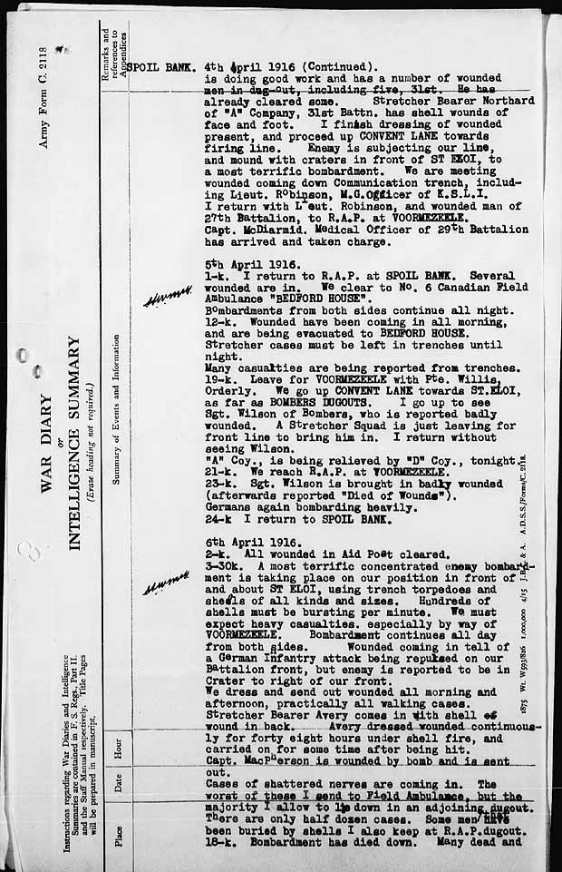
data2.collectionscanada.ca/e/e039/e000974917.jpg

In a separate letter the medical officer explains that the R.A.P (for Emergency treatment) at VOORMEZEELE was shared with the 28th and 29th battalions, and was manned by the medical officers from those battalions. Most of the wounded from the 31st battalion were in the trench sector adjoining those battalions, and so went to Voormezeele rather than through his post.
“6th April 1916.
2-k All wounded in Aid Post cleared.
3-30k A most terrific concentrated enemy bombardment is taking place on our position in front of and about ST ELOI, using trench torpedoes and shells of all kinds and sizes. Hundreds of shells must be bursting every minute. We must expect heavy casualties, especially by way of VOORMEZEELE. Bombardment contiues all day from both sides. Wounded coming in tell of German Infantry attack being repulsed on our battalion front, but enemy is reported to be in crater to right of our front.
We dress and send out wounded all morning and afternoon, practicaly all walking cases.
Stretcher bearer Avery comes in with Shell wound in back. Avery dressed wounded continuously for forty eight hours under shell fire and carried on for some time after being hit.
Capt MacPherson is wounded by bomb and is sent out.
Cases of shattered nerves are coming in. The worst of these I send to Field Ambulance, but the majority I allow to lie down in an adjoining dugout. There are only half dozen cases. Some men that have been buried by shells I also keep at R.A.P dugout.
18-k Bombardment has died down. Many dead and wounded are reported from front line.
70 bearers from No.6 Field Ambulance are to help clear wounded from right section towards Voormezeele after dark.
“C” Coy, holding centre of our Battalion front reports several badly wounded men.
20-k I leave Battalion Headquarters, with Major Hewgill and Corporal Bright and a party of men, for the front line, to bring out wounded.
21-k to 24 - k. I redress a number of wounded men in front line, among them Sergeant Proven with a bad compound fracture of the thigh.
Front trenches here are pretty well battered to pieces. Raining hard.
7th April 1916.
5k Last wounded men just cleared to Field Ambulance.
11-k Morning has been fairly quiet after uproar of yesterday, but there is still considerable artillery firing.
A number are coming in with chilled, sodden feet. They are chiefly men of “A” Company who were in mud and water for forty eight hours in crater before being relieved by “D” Coy. We have them wash their feet in cold water, dry and apply whale from a can found in shelled dugout. We supply dry socks when possible.
Corporal dace, Sanitary NCO, is given a squad of partially recovered nerve cases and starts in to clean up about R.A.P, and Battn Headquarters.
17-k. Another furious enemy bombardment of one hour duration on our right section. Battalion expect to be relieved tonight by 19th Battalion”
More details from the unit diary for this period can be found here
data2.collectionscanada.ca/e/e039/e000974924.jpg

data2.collectionscanada.ca/e/e039/e000974925.jpg

No mention of a trench raid or bombing party.
A description of the defensive actions taken by the 31st during the period 6th / 7th April can be seen in these extracts from the commanding officers’ report for the period,
data2.collectionscanada.ca/e/e039/e000974958.jpg

data2.collectionscanada.ca/e/e039/e000974959.jpg

The battalions casualty list has Leonard down as killed in action, 7th April, the only man from B Company to die on this day, presumably as a result of shelling or sniping.
data2.collectionscanada.ca/e/e039/e000974964.jpg

*******************************************************************
Alfred Hubert Rope
Roll of Honour
Private Royal Marines Light Infantry (RMLI)
Alfred Rope died aged 23 on 5 May 1917. He is one of 10,769 soldiers buried in Etaples Military Cemetery close to the British Expeditionary Force’s main base that included a military hospital complex where, even ten months after the final Armistice in September 1919, three hospitals and a QMAAC convalescent depot remained to treat men seriously wounded in battle.
Alfred Rope was the one of the two sons of Aaron and Ellen Alice Rope of Holly Farm on Loddon Road, both of whom was to be killed within a little over a year.
His Birth Certificate records him as Alfred Hubert and in the 1901 Census he is listed as Herbert, but his CWGC record has him as Hubert Alfred. We can be confident that he was called Hubert in the village as it was that name entered in the church service record by the Reverend Harvey Thursby after his Memorial service on 8 June 1917.
He volunteered for the Royal Marines on exactly the same date and at the same London recruiting office as his near-neighbour Victor Gillingwater (q.v.). Even their service numbers are consecutive. Victor lived at Bussey Bridge – literally a few hundred yards from the Rope farmstead, and it seems clear that these boys were friends who went to London together to enlist for the great adventure, and died within a month of each other in 1917.
CWGC lists as Hubert Alfred
www.cwgc.org/search/casualty_details.aspx?casualty=505345
No match on Norlink
*******************************************************************
Aubrey Samuel Stone
Roll of Honour
Lance Corporal 9th Battalion, the Norfolk Regiment.
Aubrey was killed on 17 September 1916 but his body was never recovered and he is remembered on the Thiepval Memorial together with Sidney Kedge (q.v.).
Commonwealth War Graves Commission records do not include his next-of-kin but he was the son of John and Mary Stone of The Street in Bergh Apton, and he was one of eleven children. His mother’s maiden name was Bracey so he may also have been related to Walter Wilfred Bracey (q.v.). Aubrey’s nephew John Clemence still lives at Davy Place in Loddon
www.cwgc.org/search/casualty_details.aspx?casualty=1554813
*******************************************************************
Clement Sidney Wall
Roll of Honour
Private 8th Battalion the Norfolk Regiment.
Clement had three other brothers who all fought in the Great War and survived. He was killed aged 29 on 11 August 1917 and is buried in the Railway Ground at Zillebeke near Ypres.
He was the son of Leonard and Anna Maria Wall of The Street in Bergh Apton, and uncle to Joy Lester of this village, Anna Stratton of Thurton and to Olive Hudson of Harleston. His parents and his sister Lily Scarles are buried in Bergh Apton churchyard.
Clement worked for Mr Redgrave the builder of The Beeches in Threadneedle Street. His niece Anna Stratton told us that he was a runner of some repute who would often pay small children a half-penny or a penny to time him on training runs. On one occasion he ran to Denton to take part in a race, won the race, and ran home again. The round-trip distance he ran just to take part was over thirty-six miles!
www.cwgc.org/search/casualty_details.aspx?casualty=490874
*******************************************************************
Charles Daniel Weddup
Roll of Honour
Private, 1st Battalion, Coldstream Guards
Charles was one of two village men to die in the service of this famous Regiment raised in the Scottish borders. He was killed on 17 October 1915 but like so many has no known grave. His name is on the same Loos Memorial as that of Harry Mayes who died only two weeks before him.
We have no details yet of his family but his birth is recorded in the Norwich register for the June Quarter of 1895. When we check that it may link him to Annie Weddup who lived in The Street in Bergh Apton at the beginning of the war.
www.cwgc.org/search/casualty_details.aspx?casualty=736897
No match on Norlink
The 1901 Census lists a Charles for 1882, born at Stoke Holy Cross and was now resident Carleton.
There are numerous Weddup’s from villages close to Bergh Apton, but assuming that all the Weddup’s listed as living in Carleton in the 1901 Census are one family, then they could be a picture of life at the bottom of the agricultural labouring ladder.
Rosa ...........................born 1862 Shottesham
Charles .......................born 1882 Stoke Holy Cross Profession: Horseman on Farm
William ........................born 1887 Alpington Profession: Worker on Farm
Annie ..........................born 1890 Bergh Apton
Bessie ........................born 1892 Alpington
Daniel .........................born 1895 Seething
Charles is the only Weddup listed as dying in WW1.
*******************************************************************
James Robert Wright
Roll of Honour
P/7989, Lance Corporal, Military Police Corps (The Red Caps).
James was 33 years old when he died of fever on 17 December 1918, over a month after the Armistice, aboard a hospital ship in the harbour at Alexandria.
He is buried in Cairo War Memorial Cemetery. His parents Robert and Elizabeth Wright of Sunnyside Bergh Apton are buried in our churchyard. His wife Annie Elizabeth Wright is also buried here.
www.cwgc.org/search/casualty_details.aspx?casualty=113933
No match on Norlink
*******************************************************************
1939 - 1945
++++++++++++++++++++++++++++++++++++++++++++++++
Leonard Cain
Roll of Honour - Leonard Walter George
Private 7th Battalion, the Royal Norfolk Regiment.
Leonard was 24 when he was killed on 8 August 1944 as the British Army advanced through Normandy following the D-Day landings.
He died during an action that pitted the 7th Royal Norfolks against tanks of the 12th Panzer Division outside the village of Grimbosq on the River Orne some 17 kilometres south of Caen. In this action Major David Jamieson, commanding Leonard Cain’s Company, won the Victoria Cross.
Leonard was the husband of Miriam and the son of Walter and Clara Elizabeth Cain of Framingham Pigot and later of Prospect Place, Bergh Apton. He is buried in Bayeux Cemetery
CWGC: www.cwgc.org/search/casualty_details.aspx?casualty=2955717
*******************************************************************
Jack Lovewell
Roll of Honour
Sergeant 75th (RNZAF) Squadron, RAF Volunteer Reserve
Jack was killed aged 21 on Monday, 16 August 1943 on a raid over the Gironde Estuary (Bay of Biscay) where his aircraft was lost. His body was never found and he is remembered on the RAF Memorial at Runnymede.
He was an Air Gunner, trained in Canada and part of a Squadron of which the original nucleus was Wellington bombers contributed by the New Zealand government and flown by Kiwis. His own crew, flying in a Short Stirling bomber and engaged on a mine-laying (‘gardening’) mission, was flown and navigated by New Zealanders and had a Canadian bomb aimer. Jack was the rear gunner.
He was the son of Arthur and Ethel Lovewell who ran the village shop on Threadneedle Street and owned much of the land around the crossroads where Threadneedle Street and Mill Road meet in Bergh Apton. They are buried in our churchyard but his brother Brian, at the time of writing (August 2005) is still alive and living in Lincolnshire.
CWGC: www.cwgc.org/search/casualty_details.aspx?casualty=1078952
Stirling EE891 Information
Type........................................................................Stirling
Serial Number......................................................EE891
Squadron...............................................................75
X1D.........................................................................AA-Q
Operation..............................................................Gardening
Date 1....................................................................15th August 1943
Date 2....................................................................16th August 1943
EF316 were converted to Mk.1V. Delivered by Short & Harland between May43 and Jul43. Contract No.774677/38. Delivered to No.75 Sqdn 20Jun43.
Airborne 2049 15Aug43 from Mepal to lay mines in the Gironde Estuary. Cause of loss not established. Crashed in the sea. Three are buried in Olonne-sur-mer Communal Cemetery; F/S Costello is buried in les Sables-d_Olonne (la Chaume) New Communal Cemetery, while F/O Turnbull and Sgt Lovewell are commemorated on the Runnymede Memorial.
F/S N.B.Whitts RNZAF KIA
Sgt F.D.Mason KIA
F/O J.G.Turnbull RNZAF KIA
F/S M.Costello RCAF KIA
Sgt R.F.Andrews KIA
Sgt E.G.Crisp KIA
Sgt J.E.Lovewell KIA "
www.lostbombers.co.uk/bomber.php?id=6902
Some of these crewmen could even be on these photograph of 75 Squadron that is believed to have been taken sometime in 1943.
www.commanet.org/reflect.aspx?action=navigate&rec=500...
www.commanet.org/reflect.aspx?action=navigate&rec=500...
www.commanet.org/reflect.aspx?action=navigate&rec=500...
www.commanet.org/reflect.aspx?action=navigate&rec=500...
And could this be the crew of AA-Q?
www.commanet.org/reflect.aspx?action=navigate&rec=500...
*******************************************************************
Archibald Mayes
Roll of Honour
Leading Seaman, Royal Navy.
Archie died on 19 Feb 1941 while serving in HMS Warspite in the Mediterranean. We have been told by the son of a shipmate that he was the victim of an infection rather than injury. He is buried in Ramla (formerly Ralmeh) War Cemetery in Palestine, 12 kilometres south-east of Jaffa. We understand - and hope - that this is a different place from the Rameleh where so much destruction has taken place in recent fighting.
Archie was the brother of Jack Mayes (q.v.) who died later that year. His family lived at Prospect Place in Bergh Apton, on the A146 between Norwich and Lowestoft.
CWGC: Archie Russell Mayes www.cwgc.org/search/casualty_details.aspx?casualty=2220064
*******************************************************************
Jack Mayes
Roll of Honour (John Arthur)
Petty Officer (Cook), Royal Navy
Jack Mayes served in the Destroyer HMS Cossack and was killed aged 38 on the night of 23 October 1941 when the Tribal class Destroyer was torpedoed and sank in the
Mediterranean with the loss of 158 lives.
His body was not recovered and he is remembered on the Royal Navy Memorial in Portsmouth. He was the brother of Archie Mayes (q.v. above).
CWGC does only one Jack Mayes, who was an Australian infantryman who died during the fall of Singapore, (service number NX/35164, from Wagga Wagga New South Wales).
.The details on the Roll of Honour relate to a John Arthur Mayes. In the additional information on the CWGC site is the information:- “Son of Thomas William and Agnes Mayes; husband of Nellie Dorothy Mayes, of Elson, Hampshire.”
www.cwgc.org/search/casualty_details.aspx?casualty=2657177
Under attacks by submarines of BRESLAU Group during
which ship was hit by torpedo from U563 in position
35.36N 10.04W whilst stationed astern of convoy.
Structure forward for bridge demolished killing the
Captain and 158 of ship’s company. Survivors abandoned
ship which remained afloat.
www.naval-history.net/xGM-Chrono-10DD-34Tribal-Cossack1.htm
*******************************************************************
Charles Podd
Roll of Honour Herbert Charles George
1474624, Gunner, 74th Field Regiment, Royal Artillery.
Herbert was killed aged 26 on 28 June 1942 serving with the 8th Army in the Western Desert and is remembered on the Alamein Memorial in Egypt, having no known grave. His family was from Norwich but parents Herbert and Rose rented a house on Threadneedle Street in Bergh Apton during the war having been bombed out of their house in the city.
CWGC: www.cwgc.org/search/casualty_details.aspx?casualty=2123887
*******************************************************************
Albert E H Starman
www.cwgc.org/search/casualty_details.aspx?casualty=2072290
Name: STARMAN, ALBERT EDWARD Initials: A E
Rank: Private Regiment/Service: Royal Norfolk Regiment Unit Text: 4th Bn. Age: 25 Date of Death: 21/09/1944 Service No: 5773302
Additional information: Son of Frank and Daisy Starman; husband of Wilma E. Starman, of Thurlton, Norfolk.
Grave/Memorial Reference: Column 52. Memorial: SINGAPORE MEMORIAL
*******************************************************************
*******************************************************************
Eric B Barnes
www.cwgc.org/search/casualty_details.aspx?casualty=2491394
Name: BARNES, ERIC BENJAMIN
Rank: Leading Signalman Regiment/Service: Royal Navy
Unit Text: H.M. Submarine Phoenix Age: 25 Date of Death: 21/07/1940
Service No: P/JX 134697
Additional information: Son of Benjamin and Edith Eliza Barnes, of Brooke, Norfolk. Grave/Memorial Reference: Panel 40, Column 2. Memorial: PORTSMOUTH NAVAL MEMORIAL
At least one site has the Phoenix as reported lost on the 16th July 1940
www.naval-history.net/xDKCas1940-07JUL.htm
All crew are listed as missing, presumed killed.
After completion in 1930 she was deployed on the China Station in the 4th Submarine Flotilla. In 1940 this Flotilla was transferred from Hong Kong to the Mediterranean where they arrived in May of that year.
During a patrol in July she reported Italian warship movements and a few days later was sunk off Sicily
www.naval-history.net/xGM-Chrono-12SS-02P-Phoenix.htm
On July 16, 1940, the HMS Phoenix was patrolling the Western Ionian Sea, when she spotted and torpedoed the Italian tanker Dora off the Italian base of Augusta (Eastern Sicily).
The British submarine was counterattacked by the Italian topedo boat Albatros, whose depth charges sank the HMS Phoenix
www.sportesport.it/wrecksSI030.htm
*******************************************************************
Maurice C Barnes
www.cwgc.org/search/casualty_details.aspx?casualty=2463415
Name: BARNES, MAURICE CHARLES
Rank: Petty Officer Regiment/Service: Royal Navy Unit Text: H.M.S. Seal
Age: 24 Date of Death: 09/09/1940 Service No: C/JX 137224
Additional information: Son of Benjamin and Edith Eliza Barnes, of Brooke, Norfolk. Grave/Memorial Reference: Panel 83. Memorial: CHATHAM NAVAL MEMORIAL
“They also found Maurice Barnes, a survivor of the capture of the submarine HMS Seal by the Germans in the Baltic. He later escaped from a prisoner of war camp in Poland but was shot by Russian border guards in 1940.”
new.edp24.co.uk/content/news/storyrss.aspx?brand=EDPOnlin... May 2007 21:29:43:670
May 1940
4th Entered Kattegat and encounter HMS NARWHAL returning from minelay.
5th Under air attack without serious damage.
Sighted enemy trawlers and decided to carry out lay in in alternative area.
Under anti-submarine search and during evasive manoeuvres detonated mine and sustained major damage which resulted in submarine being stuck in the mud on sea bed.
Obliged to surface when air became foul.
When unable to surface released drop keel and blew reserve tanks which enable submarine to surface.
Under series of air attacks which totally disabled submarine.
submarine was later towed to Frederickshaven, Denmark and crew were taken PoW
www.naval-history.net/xGM-Chrono-12SS-05Grampus-Seal.htm
*******************************************************************
Robert K Gidney
new.edp24.co.uk/content/news/storyrss.aspx?brand=EDPOnlin... May 2007 21:29:43:670
Probably
www.cwgc.org/search/casualty_details.aspx?casualty=2764188
Name: GIDNEY, ROBERT KITCHENER
Rank: Driver Regiment/Service: Royal Army Service Corps
Age: 25 Date of Death: 18/11/1941 Service No: T/204681
Additional information: Son of Mr. and Mrs. J. Gidney, husband of V. M. Gidney, of Norwich.
Grave/Memorial Reference: Sec. 54. Grave 551. Cemetery: NORWICH CEMETERY, Norfolk
*******************************************************************
Henry Hood
new.edp24.co.uk/content/news/storyrss.aspx?brand=EDPOnlin... May 2007 21:29:43:670
Probably
Name: HOOD, HENRY JOHN
Rank: Private Regiment/Service: Essex Regiment Unit Text: 1/4th Bn. Age: 19
Date of Death: 26/07/1944 Service No: 14415798
Additional information: Son of Albert and Mary Elizabeth Hood, of Lakenham, Norwich, Norfolk.
Grave/Memorial Reference: V. C. 22. Cemetery: AREZZO WAR CEMETERY
www.cwgc.org/search/casualty_details.aspx?casualty=2097407
*******************************************************************
William L Tolver
new.edp24.co.uk/content/news/storyrss.aspx?brand=EDPOnlin... May 2007 21:29:43:670
Name: TOLVER, WILLIAM LEONARD
Rank: Private Regiment/Service: Suffolk Regiment Unit Text: 1st Bn. Age: 20
Date of Death: 23/07/1944 Service No: 5782848
Additional information: Son of George William and Edith Maria Tolver, of Wramplingham, Norfolk.
Grave/Memorial Reference: II. E. 20. Cemetery: BANNEVILLE-LA-CAMPAGNE WAR CEMETERY
The One O'Clock Gun is a time signal, fired every day at precisely 13:00, excepting Sunday, Good Friday and Christmas Day. The 'Time Gun' was established in 1861 as a time signal for ships in the harbour of Leith and the Firth of Forth, 2 miles (3.2 km) away. It complemented the 'Time Ball', which was installed on the Nelson Monument in 1852, but was useless as a visual signal in foggy weather. Because sound travels relatively slowly (approximately 343 metres per second (770 mph)), a map was produced in 1861 to show the actual time when the sound of the gun would be heard at various locations across Edinburgh.[154]
The original gun was an 18-pound muzzle-loading cannon, which needed four men to load, and was fired from the Half Moon Battery. This was replaced in 1913 by a 32-pound breech-loader, and in May 1952 by a 25-pound Howitzer.[155] The present One O'Clock Gun is an L118 Light Gun, brought into service on 30 November 2001.[156]
The gun is now fired from Mill's Mount Battery, on the north face of the castle, by the District Gunner from the 105th Regiment Royal Artillery (Volunteers). Although the gun is no longer required for its original purpose, the ceremony has become a popular tourist attraction. The longest-serving District Gunner, Staff Sergeant Thomas McKay MBE, nicknamed "Tam the Gun", fired the One O'Clock Gun from 1979 until his retirement in January 2005. McKay helped establish the One O'Clock Gun Association, which opened a small exhibition at Mill's Mount, and published a book entitled What Time Does Edinburgh's One O'clock Gun Fire?.[157] In 2006 Sergeant Jamie Shannon, nicknamed "Shannon the Cannon", became the 29th District Gunner,[158] and in 2006 Bombardier Allison Jones became the first woman to fire the gun
The Moon is Earth's only natural satellite and is the fifth largest satellite in the Solar System. It is the largest moon in the Solar System relative to the size of its planet, a quarter the diameter of Earth and 1/81 its mass, and is the second densest satellite after Io. It is in synchronous rotation with Earth, always showing the same face; the near side is marked with dark volcanic maria among the bright ancient crustal highlands and prominent impact craters. Despite being the brightest object in the sky after the Sun, its surface is actually very dark, with a similar reflectance to coal. Its prominence in the sky and its regular cycle of phases have since ancient times made the Moon an important cultural influence on language, the calendar, art and mythology. The Moon's gravitational influence produces the ocean tides and the minute lengthening of the day. The Moon's current orbital distance, about thirty times the diameter of the Earth, causes it to be the same size in the sky as the Sun – allowing the Moon to cover the Sun precisely in total solar eclipses.
The Moon is the only celestial body on which human beings have made a manned landing. While the Soviet Union's Luna programme was the first to reach the Moon with unmanned spacecraft, the United States' NASA Apollo program achieved the only manned missions to date, beginning with the first manned lunar orbiting mission by Apollo 8 in 1968, and six manned lunar landings between 1969 and 1972 – the first being Apollo 11 in 1969. These missions returned over 380 kg of lunar rocks, which have been used to develop a detailed geological understanding of the Moon's origins (it is thought to have formed some 4.5 billion years ago in a giant impact), the formation of its internal structure, and its subsequent history.
Since the Apollo 17 mission in 1972, the Moon has been visited only by unmanned spacecraft. Since 2004, Japan, China, India, the United States, and the European Space Agency have each sent lunar orbiters. These spacecraft have confirmed the discovery of lunar water ice in permanently shadowed craters at the poles and bound into the lunar regolith. Future manned missions to the Moon are planned but not yet underway; the Moon remains, under the Outer Space Treaty, free to all nations to explore for peaceful purposes.
Did this digital collage for Obsession Collage collective, theme was Vampires, more precisely on Contesse Elizabeth Bathory. But I stayed a bit away from the original image we could include, since I really wanted to do a digital collage that would tell a story. I also submited it to Illustration Friday since the theme of this week is "Gesture". Somehow I think it works well with this image. Too bad Flickr do not able you to see the animated crow on her shoulder! You will have to visit my website to see him move! :)
Photograph taken at an altitude of Nine metres, in the magic of the Golden hour around sunrise at 05:17am, (sunrise was at precisely 06.15am) on Saturday 6th September 2014 off the Patricia Bay Highway 17, on Lochside Drive close to Frost Avenue and the Lochside Waterfront Park, in beautiful Sidney by the sea on Vancouver Island, British Columbia, Canada.
The small private jet has just taken off from Victoria International Airport (YYJ) at 1640 Electra Boulevard and is heading over towards Mt Baker in Washington State, USA from beautiful Sidney by the sea on Vancouver Island, British Columbia, Canada. Also known as Koma Kulshan, (pronounced kō-ō’mah’ kool-shän’),she is an active glaciated andesitic stratovolcano in the Cascade Volcanic Arc and the North Cascades of Washington State in the United States, standing 3,286 metres tall and was first ascended in 1868, her last eruption recorded in 1880.
The name Mount Baker first appeared in print in Captain Vancouver’s 1798 narrative of his voyage around Vancouver Island. Legend has it that his third-lieutenant, Joseph Baker, was the first to spot the mountain while they sailed into Dungeness Bay on April 30th, 1792. Also known by the Lummi as Kwud-Shad, and Koba (meaning 'high mountain always covered with snow', was the Skagit name.
.
.
Nikon D800 70mm 1/100s f/2.8 iso100 RAW (14 bit) Manual focus. Manual exposure. Matrix metering. Auto white balance.
Nikkor AF-S 70-200mm f/2.8G ED IF VRII. Jessops 77mm UV filter. Nikon MB-D12 battery grip. Two Nikon EN-EL batteries. Nikon DK-17M Magnifying Eyepiece. Nikon DK-19 soft rubber eyecup. Manfrotto MT057C3 057 Carbon Fiber Tripod 3 Sections (Payload 18kgs). Manfrotto MH057M0-RC4 057 Magnesium Ball Head with RC4 Quick Release (Payload 15kgs). Manfrotto quick release plate 410PL-14.Jessops Tripod bag. Optech Tripod Strap.Digi-Chip 64GB Class 10 UHS-1 SDXC. Lowepro Transporter camera strap. Lowepro Vertex 200 AW camera bag. Nikon MC-DC2 remote shutter release. Nikon GP-1 GPS unit.
LATITUDE: N 48d 38m 15.76s
LONGITUDE: W 123d 24m 12.80s
ALTITUDE: 9.0m
RAW (TIFF) FILE SIZE: 103.00MB
PROCESSED (JPeg) SIZE: 7.03MB
.
.
Processing power:
HP Pavillion P6-2388EA Desktop with AMD A10-5700 APU processor. AMD Radeon HD 7570 graphics. 2TB with 8GB RAM. 64-bit Windows 8.1. Verbatim USB 2.0 1TB desktop hard drive. Nikon VIEWNX2 Version 2.10.0 64bit. Adobe photoshop Elements 8 Version 8.0 64bit
.
.
***** Selected for sale in the GETTY IMAGES COLLECTION on March 26th 2015
CREATIVE RF gty.im/545126385 MOMENT OPEN COLLECTION**
.
.
Photograph taken at an altitude of Eight metres, in the magic of the Golden hour around sunrise at 05:41am, (sunrise was at precisely 06.15am) on Saturday 6th September 2014 off the Patricia Bay Highway 17, on Lochside Drive close to Frost Avenue and the Lochside Waterfront Park, in beautiful Sidney by the sea on Vancouver Island, British Columbia, Canada.
Here, I am standing beside the wooden decked viewing platform, looking over towards Mt Baker in Washington State, USA from beautiful Sidney by the sea on Vancouver Island, British Columbia, Canada. Also known as Koma Kulshan, she is an active glaciated andesitic stratovolcano in the Cascade Volcanic Arc and the North Cascades of Washington State in the United States, standing 3,286 metres tall and was first ascended in 1868, her last eruption recorded in 1880.
The name Mount Baker first appeared in print in Captain Vancouver’s 1798 narrative of his voyage around Vancouver Island. Legend has it that his third-lieutenant, Joseph Baker, was the first to spot the mountain while they sailed into Dungeness Bay on April 30th, 1792. Also known by the Lummi as Kwud-Shad, and Koba (meaning 'high mountain always covered with snow', was the Skagit name.
These Canada Geese, along with many other small groups, fly across the lake from East to West every morning and back again every evening at Sunset, and I love to watch the classic Vee formations and listen to the honking as they pass me by. In flight, a group of Geese are called, a Skein. For this frame, in the dawns early darkness, I was shooting the sunrise over Mt Baker and I could hear the geese honking as groups of up to ten flew byu me East to West. I waited until they entered the frame, amazed at how close they actually were to me, and began manually pressing the shutter.
.
.
Nikon D800 70mm 1/1000s f/2.8 iso100 RAW (14 bit) Manual focus. Manual exposure. Matrix metering. Auto white balance.
Nikkor AF-S 70-200mm f/2.8G ED IF VRII. Jessops 77mm UV filter. Nikon MB-D12 battery grip. Two Nikon EN-EL batteries. Nikon DK-17M Magnifying Eyepiece. Nikon DK-19 soft rubber eyecup. Manfrotto MT057C3 057 Carbon Fiber Tripod 3 Sections (Payload 18kgs). Manfrotto MH057M0-RC4 057 Magnesium Ball Head with RC4 Quick Release (Payload 15kgs). Manfrotto quick release plate 410PL-14.Jessops Tripod bag. Optech Tripod Strap.Digi-Chip 64GB Class 10 UHS-1 SDXC. Lowepro Transporter camera strap. Lowepro Vertex 200 AW camera bag. Nikon MC-DC2 remote shutter release. Nikon GP-1 GPS unit.
.
.
LATITUDE: N 48d 38m 15.79s
LONGITUDE: W 123d 24m 12.85s
ALTITUDE: 8.0m
RAW (TIFF) FILE SIZE: 103.00MB
PROCESSED (JPeg) SIZE: 11.42MB
.
.
PROCESSING POWER:
HP 110-352na Desktop PC with AMD Quad-Core A6-5200 APU processor. AMD Radeon HD8400 graphics. 8 GB DDR3 Memory with 1TB SATA storage. 64-bit Windows 8.1. Verbatim USB 2.0 1TB desktop hard drive. WD My Passport Ultra 1tb USB3 Portable hard drive. Nikon VIEWNX2 Version 2.10.3 64bit. Adobe photoshop Elements 8 Version 8.0 64bit
This is a bit long winded, but it has a valid point to make at the end:
I hate shopping. My type of shopping requires me to know precisely what I want, and where to get it at an acceptable price, to go directly to that point of sale, collect and pay and disappear quickly to that place from whence I came. Unfortunately I have to do the shopping for work. We have a major client who requires us to buy large quantities of washing products for consumer testing trials. It means buying say 600 examples of one product, and 600 of another, often less, but sometimes more. One day I had to order £13,000 of one item from a supermarket. You would think it easy. I pay the going price. I’m not buying up discounted stock to sell on a corner shop at full price. I just want the stuff at the standard price. But all major supermarkets have a company policy forbidding bulk buying. Believe it or not most do not want my business. OK, you say, go to the bulk buy specialists like Makro or Costco, but no, there is a problem there too. They only sell the large size packs, the 5 kilo box of soap powder, not the 1 kilo box, and our client wants lots of separate samples to give to lots of separate testers. They only want the small pack sizes.
Each order from this client comes as a race against time. By today I needed 115 tubes of "L’Oreal Men Expert Shave Revolution non-foaming shave gel, ice effect" in 125ml tubes to send for product testing in the USA. In my home town I tried Boots and Tesco. None available. From work I went to Sainsbury’s, Boots and Tesco’s superstore in Altrincham. None. Resorting to online stocks I ordered the whole stock available of 61 from Boots Online and the balance of 54 from Ocado. Ocado only delivered 12, as all they had in stock. We managed to order a further 17 from Superdrug, and 8 from ChemistDirect. The only other sources we could find online were a handful of tubes from Amazon and a supplier in Germany.
The prices varied. Those at Tesco, Boots and Superdrug were £ 3.99 each, Ocado £ 3.49 each and ChemistDirect £ 3.39 each
But we still had 17 still to find. I started ringing stores around the region, finding that more than half the stores I called had absolutely none in stock, but I did track down 4 at Superdrug in Stockport, 2 in a nearby Tesco, 7 at Boots in Manchester’s Trafford Centre and 5 at Superdrug near Manchester University.
Picking up the 2 at Tesco, and with a colleague getting the 7 at Boots in the Trafford Centre, I headed to Stockport. On my way to Superdrug to pick up 4 tubes, I passed a big Boots. None in stock . Arriving in Superdrug I grabbed the 4 tubes off the shelf and went to the till. Asking the lady behind the till if they might have any more stock in the back she checked and confirmed there were none but helpfully suggested I try their other Superdrug store a short distance away or go to Savers, a discount store which she said is owned by Superdrug. The other Superdrug had no stock, and my heart fell when I found Savers. It was a rather ‘poor’ looking shop in a rather tatty back street, and the people in its door way were enough to make me wonder if I could get in or out without being mugged. Inside was not alot better with narrow aisles, and an irritating smell of soap powder that caused me to cough, as I squeezed past those I assumed were at the lower end of the social scale. Forcing my way past buggies, young men in hoodies and browsing women with young children I eventually came to the stack of Men’s shaving products where my eyes fell on a whole line of L’Oreal Men Expert. All that I needed. And the price?
£ 1.49 each……………..£ 1.49 each. Not £ 3.49 or £ 3.99 each. £ 1.49 each. Exactly the same product. And how does Superdrug justify selling an item at £ 3.99 in it’s main stores but sells exactly the same item in its subsidiary Savers branch at £ 1.49?
I had been mugged.
Because I don’t do the shopping I do tend to notice how the pricing on a small range of (soap) products go up and down in our supermarkets. It’s obvious the mark up is huge. This is why Aldi, Lidl and the other discount stores are doing so well in attracting new customers. The main supermarkets have been conning us, varying prices and deals to make us think we are getting a bargain. No doubt when you go out to do your Christmas food shop your eyes will be attracted by ‘special’ deals on booze and other treats you might buy to make the festive season just that. But as you stock up on the routine essential household items like washing powder, pay attention. Have you been dazzled by the booze bargains and failed to notice that the price of the soap powder has mysteriously gone up by £ 1.00 a box?
Don’t get mugged on Black Friday.
Chinese postcard. Laura Harring in Mulholland Dr. (David Lynch, 2001).
On 15 January, American filmmaker David Lynch (1946-2025) passed away in Los Angeles. He was the figurehead of American surrealist cinema and won several awards for his films and television series Twin Peaks (1990-1991). Nightmares, strange worlds, metamorphoses, voyeurism and the unconscious are recurring themes in his work. In his thrillers Blue Velvet (1986), Twin Peaks: Fire Walk with Me (1992) and Mulholland Dr. (2001), he combined sex, violence and black humour with stylistic beauty and an attempt at technical perfection. Besides directing films, Lynch was a producer, actor, screenwriter, and visual artist and he engaged in many other avocations.
David Keith Lynch was born in 1946 in Missoula, Montana, precisely the kind of small-town American setting so familiar from his films. His father, Donald Walton Lynch was a research scientist working for the U.S. Department of Agriculture (USDA), and his mother, Edwina ‘Sunny’ Lynch née Sundholm, was an English language tutor. Lynch initially wanted to become a painter. He attended several art schools until he found his niche at the Pennsylvania Academy of Fine Arts where he started working with film. He married Peggy Reavey and then fathered future director Jennifer Lynch shortly after he turned 21. During this period, he made four short films with a grant from the American Film Institute. His first short was Six Men Getting Sick (Six Times) (1967). Lynch played it on a loop at the academy's annual end-of-year exhibit, where it shared the joint-first prize with a painting by Noel Mahaffey. After several exhibitions in local galleries, he moved to Los Angeles where he studied at the AFI Center for Advanced Film Studies. There he started his first larger project, on which he worked obsessively for five years, Eraserhead (1976). Filmed in black and white, Eraserhead tells the story of Henry (Jack Nance), a quiet young man, living in a dystopian industrial wasteland, whose girlfriend gives birth to a deformed baby whom she leaves in his care. The film reflects dangerous and terrifying elements he encountered while living and studying in a particularly violent and run-down area of Philadelphia. Eraserhead saw success in the midnight movie underground circuit. Stuart Cornfeld, an executive producer for Brooksfilms, Mel Brook's newly formed production company, saw it and agreed to help Lynch with his next film. Lynch asked Cornfeld to find him a script by someone else that he could direct. Lynch chose the biographical drama The Elephant Man (1980) by Christopher De Vore and Eric Bergren. It was based on the true story of Joseph Merrick (John Hurt), a severely deformed man in Victorian London, who was held in a sideshow but later taken under the care of a London surgeon, Frederick Treves (Anthony Hopkins). Though surrealistic and in black and white, it is one of the more conventional of Lynch's films. The Elephant Man was a huge critical and commercial success, earning eight Academy Award nominations, including Best Director and Best Adapted Screenplay.
David Lynch was now one of the most promising new talents in Hollywood. Producer Dino de Laurentiis asked Lynch to create a film adaptation of Frank Herbert's Science Fiction novel ‘Dune’. It became a hugely expensive commercial disaster. The film is set in the far future when humans live in an interstellar empire under a feudal system. Paul Atreides (Kyle MacLachlan) is the son of a noble who takes control of the desert planet Arrakis, which grows the rare spice melange, the empire's most highly prized commodity. Lynch was unhappy with the work and didn't have the final cut. Dune cost $45 million to make and grossed $27.4 million domestically. Lynch was contractually obliged to produce two other projects for De Laurentiis, the first a planned sequel to Dune, which due to the film's failure never went beyond the script stage. The other was a more personal work, the thriller Blue Velvet (1986). Kyle MacLachlan plays a college student, Jeffrey Beaumont, who finds a severed ear in a field. Investigating further with the help of friend Sandy (Laura Dern), he discovers that it is related to a criminal gang led by psychopath Frank Booth (Dennis Hopper). Frank has kidnapped the husband and child of singer Dorothy Vallens (Isabella Rossellini) and repeatedly rapes her. This was Lynch's first collaboration with composer Angelo Badalamenti, who has since written the music for all of Lynch's films. For Blue Velvet, Lynch received his second Oscar nomination. It became a huge critical and moderate commercial success.
In 1986, David Lynch met screenwriter producer Mark Frost and they started to develop some projects. They created for television the drama series Twin Peaks (1990–1991), set in a small Washington town where popular high school student Laura Palmer has been murdered. Twin Peaks featured FBI Special Agent Dale Cooper (Kyle MacLachlan) as the investigator trying to identify the killer and discover not only the murder's supernatural aspects but also many of the townsfolk's secrets. Lynch portrayed FBI agent Gordon Cole in the series. 35 million viewers watched the pilot and the series soon spawned a cult following. Lynch received five Primetime Emmy Award nominations for the drama series, including Outstanding Directing and Outstanding Writing. Twin Peaks was sold to 55 countries. Lynch co-wrote and directed a film prequel, Twin Peaks: Fire Walk with Me (1992), and a third season in 2017. His next film, the romantic and violent crime drama Wild at Heart (1990) starring Nicolas Cage as Sailor and Laura Dern as Lula. won the Palme d'Or (Golden Palm) at the Cannes Film Festival. Although he focused almost exclusively on the United States, Lynch had a large audience in Europe and especially France, where several of his later films were co-financed by French production companies. Lynch won the César twice for ‘Best Foreign Film’. After a few unsuccessful TV ventures, Lynch returned to film. In 1997, he released the Neo-Noir Lost Highway (1997), which was co-written by Barry Gifford and starred Bill Pullman and Patricia Arquette. The film failed commercially and received a mixed response from critics. Lynch then filmed the biographical drama The Straight Story (1999), based on the true story of Alvin Straight (Richard Farnsworth), an elderly man from Laurens, Iowa, who goes on a 300-mile journey to visit his sick brother (Harry Dean Stanton) in Mount Zion, Wisconsin, by riding lawnmower. The plot seemed far removed from Lynch's earlier works, but in fact, Lynch made a surreal road movie. Walt Disney Pictures acquired the distribution rights.
The ABC network gave David Lynch the go-ahead to shoot a two-hour pilot for the series Mulholland Drive but disputes over content and running time led to the project being shelved indefinitely. But with $7 million from the French production company StudioCanal, Lynch completed the pilot as a film, the Neo-Noir Mulholland Dr. (2001). The film, a non-linear narrative surrealist tale of Hollywood's dark side, stars Naomi Watts, Laura Harring and Justin Theroux. It performed relatively well at the box office worldwide and was a critical success, earning Lynch Best Director at the 2001 Cannes Film Festival (shared with Joel Coen for The Man Who Wasn't There) and his third Academy Award nomination for Best Director. In 2006, Lynch's longest film, Inland Empire, was released. Like Mulholland Dr.and Lost Highway, it does not follow a traditional narrative structure. It stars Lynch regulars Laura Dern, Harry Dean Stanton and Justin Theroux. Interested in working with Werner Herzog, in 2009 Lynch collaborated on Herzog's film My Son, My Son, What Have Ye Done? With a nonstandard narrative, the film is based on a true story of an actor who committed matricide while acting in a production of the 'Oresteia' and starred Lynch regular Grace Zabriskie. He portrayed Howard in the drama film Lucky (John Carroll Lynch, 2017) alongside friend and collaborator Harry Dean Stanton, and John Ford in Steven Spielberg's The Fabelmans (2022). He also guest-starred in shows, voicing a bartender in The Cleveland Show (2010–2013) and playing an entertainment veteran in Louie (2012). In 2019, he received an honorary Oscar ‘for fearlessly breaking boundaries in the pursuit of his unique cinematic vision’. Lynch was married four times and was the father of two sons and two daughters. In August 2024, he announced he was suffering from pulmonary emphysema due to years of smoking. This left him unable to leave his home. In January 2025, he was evacuated from his home due to the Los Angeles wildfires, after which his health deteriorated rapidly. He died on 15 January 2025 in the home of one of his daughters.
Sources: Michael Brooke (IMDb), Wikipedia (Dutch, German and English) and IMDb.
And, please check out our blog European Film Star Postcards.
It is not known precisely when construction of Colchester Castle began, but it was probably started in the 1070s or 1080s on the orders of William the Conqueror. The Castle was sited on the great stone base of what had been the Roman Temple of Claudius. William was linking his authority to that of the Roman emperors before him.
The keep is the largest surviving example built by the Normans, measuring 46m by 33.5m. Its ground plan is shared in England only by the White Tower at the Tower of London which makes Gundulph, Bishop of Rochester the likely designer of both castles.
Faced with a lack of good quality building stone, the Normans used the ruins of Roman Colchester to provide most of the brick and stone that they needed. The Castle was built in two stages. The first phase keep was only one storey high as is shown by the battlement which can still be seen clearly on some areas of the outer walls. The second phase of construction from about 1106 was entrusted to Eudo, who served the first three Norman kings as Steward of Normandy. The walls were raised higher, though how high is still a matter for debate. The traditional view is that the Castle was a three storey building. However, new evidence and a re-appraisal of the arguments suggest that the Castle was always roughly at the height it is today.
Without Philips, Eindhoven would probably still be a collection of a couple of tiny villages. Because of the great employment that the company created, Philips turned the small village of Eindhoven into a city. But precisely when Philips left for Amsterdam and many other places around the world, the multinational made it possible for former industrial area Strijp-S to flourish again.
From 1928, Philips developed the Strijp-S rapidly. The Clock Building (a Philite factory) raised from the dust, followed by device factories on the Hoge Rug. An engine room and a boiler house were built. Even during the Second World War a new building was constructed: the Veemgebouw with its typical rounded corners, intended for the storage of electronic parts. With the industrial area Strijp-S, Philips became completely self-sufficient. From raw materials to finished products in a cardboard box, transport to the consumer included: the company had everything in its own hand. No wonder some people joked that their slogan was ‘From sand to customer's hand'.
Every time after a great invention, Philips grew tremendously. The radio came first, followed by the TV after the war. The expansion required new industrial areas: Strijp-R and Strijp-T on the other side of the ring road. The 27 hectares of Strijp-S were not nearly enough. In the 70s, Philips reached its peak at Strijp: about 10,000 people work in this area on a daily basis. The area got its nickname ‘Forbidden City', because it used to be surrounded by fences and barriers. One could only enter with a valid pass.
The first ideas for redeveloping the area came up in 2000, when Philips left the City of Light. Philips sold Strijp-S to Park Strijp Beheer in 2004. The buildings that were still in use by Philips were hired back. Since 2006, the redevelopment of Strijp-S became a very serious plan. The first buildings had been demolished and new activities came to the area, particularly the creative industries and the annual Dutch Design Week. These ‘quartermasters' shape the area more and more every year. But in the years to come, there is still a lot to be done!
(Source: strijp-s.nl)
Worm March Moon Rising
I knew what time and place the moon was to rise but it seemed to take FOREVER for the March 9th rising Supermoon. It was precisely this color. The same phenomena effects the sun. “Golden Hour” and better, the red light passing to the pink/red “Belt of Venus” alpenglow. That projected filtered to red light on the ice in the sky opposite of the sun. Same effect here but on the moon. This just the atmospheric gauntlet of dust, moisture of all phase states, pollution etc block out all but the red light. Lots less yellow in this.
So the “Worm Moon A.K.A. Lenten Moon, Crow Moon, Sugar Moon, Sap Moon, Chaste Moon or just the March Full Moon lol.
Of course when the moon OR the sun is apparently this low, you actually seeing the celestial object below the line of sight to the horizon. The image is actually bent around the horizon. The atmospheric lens literally guides the image around the surface to my camera/eye. Getting topography/ hills and a celestial object to cooperate the same time can be challenging. …I know the topography I work pretty well after ‘working it’ for decades. Knowing the direction the moon is going to set is a matter of looking it up on google. Get a map, (in my head by now) and figure out “what two or three things” can line up.
I decide where to go early on but am flexible enough to change mid stream because I’m very mobile. Getting around in the snowy hills is a requirement for this job lolol. I never know WHAT the show is going to be when I go out with cameras. I do usually know WHERE an alignment will occur. 😄
This moon didn’t sneak up on me by any means. Getting up on the high ridges is of course the place to be for such a shot. The backcountry high in the hills provide all the topography and perspective that any photographer could need. Having free access to many square miles of backcountry WY/MT is always a good thing with a camera. Both States in this Photo.. I was lucky the weather cooperated with me as it disappeared into a cloud deck 20 minutes later not to reappear for over a day.
Location: Bliss Dinosaur Ranch, Wyoming/Montana borderlands (Wyotana).
Title: Worm March Moon Rising
"Longuich ([ ˈlɔŋɡɪç ]) is a local community in the Trier-Saarburg district in Rhineland-Palatinate. It belongs to the municipality of Schweich on the Roman Wine Route. The place is on the right bank of the Moselle in the Moselle-Franconian language area.
Longuich is a Gallo-Roman (more precisely: Mosel-Roman) place name (pronounced: Long_gich), which is derived from a 1st-century foundation called Longus Vicus (long village, long district). The place has been inhabited since at least Roman times, as various finds indicate, in particular the Villa Urbana, whose reconstructed bathing wing can be visited.
At the beginning of the 19th century, the Prussian mayor's office of Longuich emerged from the French Mairie Longuich.
Mosel (German: [ˈmoːzl̩]) is one of 13 German wine regions (Weinbaugebiete) for quality wines (Qualitätswein, formerly QbA and Prädikatswein), and takes its name from the Mosel River (French: Moselle; Luxembourgish: Musel). Before 1 August 2007 the region was called Mosel-Saar-Ruwer, but changed to a name that was considered more consumer-friendly. The wine region is Germany's third largest in terms of production but some consider it the leading region in terms of international prestige.
The region covers the valleys of the rivers Mosel, Saar, and Ruwer from near the mouth of the Mosel at Koblenz and upstream to the vicinity of Trier in the federal state of Rhineland-Palatinate. The area is known for the steep slopes of the region's vineyards overlooking the river. At 65° degrees incline, the steepest recorded vineyard in the world is the Calmont vineyard located on the Mosel and belonging to the village of Bremm, and therefore referred to as Bremmer Calmont. The Mosel is mainly famous for its wines made from the Riesling grape, but Elbling and Müller-Thurgau also contribute to the production, among others.
In the past two decades red wine production, especially from the Spätburgunder (Pinot noir), has increased in the Mosel and throughout the German vignoble and has become of increasing interest to the international wine community. Because of the northerly location of the Mosel, the Riesling wines are often light, tending to lower alcohol, crisp and high in acidity, and often exhibit "flowery" rather than or in addition to "fruity" aromas. Its most common vineyard soil is derived in the main from various kinds of slate deposits, which tend to give the wines a transparent, mineralic aspect, that often exhibit great depth of flavor. In the current era of climate change much work has been done to improve and gain acceptance for completely dry ("Trocken") Rieslings in this region, so that most of the more famous makers have found acceptance for such wines, particularly in Europe." - info from Wikipedia.
Summer 2019 I did a solo cycling tour across Europe through 12 countries over the course of 3 months. I began my adventure in Edinburgh, Scotland and finished in Florence, Italy cycling 8,816 km. During my trip I took 47,000 photos.
Now on Instagram.
Source: en.wikipedia.org/wiki/Dublin
Dublin (Irish: Baile Átha Cliath) is the capital and largest city of Ireland. It is on the east coast of Ireland, in the province of Leinster, at the mouth of the River Liffey, and is bordered on the south by the Wicklow Mountains. It has an urban area population of 1,173,179, while the population of the Dublin Region (formerly County Dublin), as of 2016, was 1,347,359, and the population of the Greater Dublin area was 1,904,806.
There is archaeological debate regarding precisely where Dublin was established by the Gaels in or before the 7th century AD. Later expanded as a Viking settlement, the Kingdom of Dublin, the city became Ireland's principal settlement following the Norman invasion. The city expanded rapidly from the 17th century and was briefly the second largest city in the British Empire before the Acts of Union in 1800. Following the partition of Ireland in 1922, Dublin became the capital of the Irish Free State, later renamed Ireland.
Dublin is a historical and contemporary centre for education, the arts, administration and industry. As of 2018 the city was listed by the Globalization and World Cities Research Network (GaWC) as a global city, with a ranking of "Alpha −", which places it amongst the top thirty cities in the world.
Source: en.wikipedia.org/wiki/Arthur_Guinness
Arthur Guinness (24 September 1725 – 23 January 1803) was an Irish brewer and the founder of the Guinness brewery business and family. He was also an entrepreneur and philanthropist.
At 27, in 1752, Guinness's godfather Arthur Price, the Church of Ireland Archbishop of Cashel, bequeathed him £100 in his will. Guinness invested the money and in 1755 had a brewery at Leixlip, just 17 km from Dublin. In 1759, Guinness went to the city and set up his own business. He took a 9,000-year lease on the 4-acre (16,000 m2) brewery at St. James's Gate from the descendants of Sir Mark Rainsford for an annual rent of £45.
Guinness's flowery red signature is still copied on every label of bottled Guinness.
Source: en.wikipedia.org/wiki/Guinness_Storehouse
Guinness Storehouse is a tourist attraction at St. James's Gate Brewery in Dublin, Ireland. Since opening in 2000, it has received over four million visitors.
The Storehouse covers seven floors surrounding a glass atrium shaped in the form of a pint of Guinness. The ground floor introduces the beer's four ingredients (water, barley, hops and yeast), and the brewery's founder, Arthur Guinness. Other floors feature the history of Guinness advertising and include an interactive exhibit on responsible drinking. The seventh floor houses the Gravity Bar with views of Dublin and where visitors may drink a pint of Guinness included in the price of admission, which was €18.50 on 15 October 2018 with discounts depending on dates and times, described as "overpriced" by Condé Nast Traveler. In 2006, a new wing opened incorporating a live installation of the present-day brewing process.
Source: en.wikipedia.org/wiki/Guinness_Brewery
St. James's Gate Brewery (Irish: Grúdlann Gheata Naomh Séamuis) is a brewery founded in 1759 in Dublin, Ireland, by Arthur Guinness. The company is now a part of Diageo, a British company formed from the merger of Guinness and Grand Metropolitan in 1997. The main product of the brewery is Guinness Draught.
Originally leased in 1759 to Arthur Guinness at IR£45 (Irish pounds) per year for 9,000 years, the St. James's Gate area has been the home of Guinness ever since. It became the largest brewery in Ireland in 1838, and the largest in the world by 1886, with an annual output of 1.2 million barrels. Although no longer the largest brewery in the world, it remains as the largest brewer of stout. The company has since bought out the originally leased property, and during the 19th and early 20th centuries the brewery owned most of the buildings in the surrounding area, including many streets of housing for brewery employees, and offices associated with the brewery. The brewery also made all of its own power using its own power plant.
There is an attached exhibition on the 250-year-old history of Guinness, called the Guinness Storehouse.
Source: en.wikipedia.org/wiki/Guinness
Guinness is a dark Irish dry stout that originated in the brewery of Arthur Guinness at St. James's Gate, Dublin, Ireland, in 1759. It is one of the most successful beer brands worldwide, brewed in almost 50 countries, and available in over 120. Sales in 2011 amounted to 850 million litres (220,000,000 US gal). It is popular with the Irish, both in Ireland and abroad. In spite of declining consumption since 2001, it is still the best-selling alcoholic drink in Ireland where Guinness & Co. Brewery makes almost €2 billion worth annually.
Guinness' burnt flavour derives from malted barley and roasted unmalted barley, a relatively modern development, not becoming part of the grist until the mid-20th century. For many years, a portion of aged brew was blended with freshly brewed beer to give a sharp lactic acid flavour. Although Guinness's palate still features a characteristic "tang", the company has refused to confirm whether this type of blending still occurs. The draught beer's thick, creamy head comes from mixing the beer with nitrogen and carbon dioxide.[6]
The company moved its headquarters to London at the beginning of the Anglo-Irish Trade War in 1932. In 1997, Guinness Plc merged with Grand Metropolitan to form the multinational alcoholic-drinks producer Diageo plc, based out of London.
Horned Treehopper (Membracidae)
Treehoppers (more precisely typical treehoppers to distinguish them from the Aetalionidae) and thorn bugs are members of the family Membracidae, a group of insects related to the cicadas and the leafhoppers. About 3,200 species of treehoppers in over 400 genera are known. They are found on all continents except Antarctica; only three species are known from Europe. Individual treehoppers usually live for only a few months.
Morphology
Thorn bugs, due to their unusual appearance, have long interested naturalists. They are best known for their enlarged and ornate pronotum, which most often resembles thorns, apparently to aid camouflage. In some species, the pronotum is a horn-like extension, but can form more bizarre shapes. The specialised pronotum (or helmet) may not be simply an expansion of the prothoracic sclerite, but a fused pair of dorsal appendages of the first thoracic segment.
These may be serial homologues of insect wings, which are dorsal appendages of the second and/or third thoracic segments. Evidence for this theory includes the development of the helmet, which arises as a pair of appendages attached to each side of the dorsal prothorax by an articulation with muscles and a flexible membrane that allow it to be mobile. Also, the same genes are involved in development of the helmet and the wings. Distinguishing males from females is accomplished only by looking at the genitalia.
Ecology
Treehoppers pierce plant stems with their beaks, and feed upon sap. The immatures can frequently be found on herbaceous shrubs and grasses, whereas the adults more often frequent hardwood tree species. Excess sap becomes concentrated as honeydew, which often attracts ants. Some species have a well-developed ant mutualism, and these species are normally gregarious, as well, which attracts more ants. The ants provide protection from predators. Treehoppers mimic thorns to prevent predators from spotting them.
Others have formed mutualisms with wasps, such as Parachartergus apicalis. Even geckos form mutualistic relations with treehoppers, with whom they communicate by small vibrations of the abdomen.
Eggs are laid by the female with her saw-like ovipositor in slits cut into the cambium or live tissue of stems, though some species lay eggs on top of leaves or stems. The eggs may be parasitised by wasps, such as the tiny fairyflies (Mymaridae) and Trichogrammatidae. The females of some membracid species sit over their eggs to protect them from predators and parasites, and may buzz their wings at intruders. The females of some gregarious species work together to protect each other's eggs. In at least one species, Publilia modesta, mothers serve to attract ants when nymphs are too small to produce much honeydew. Some other species make feeding slits for the nymphs.
Like the adults, the nymphs also feed upon sap, and unlike adults, have an extensible anal tube that appears designed to deposit honeydew away from their bodies. The tube appears to be longer in solitary species rarely attended by ants. It is important for sap-feeding bugs to dispose of honeydew, as otherwise it can become infected with sooty moulds. Indeed, one of the evident benefits of ants for Publilia concava nymphs is that the ants remove the honeydew and reduce such fungal growth.
Most species are innocuous to humans, although a few are considered minor pests, such as Umbonia crassicornis (a thorn bug), the three-cornered alfalfa hopper (Spissistilus festinus), and the buffalo treehopper (Stictocephala bisonia), which has been introduced to Europe. The cowbug Oxyrachis tarandus has been recorded as a pest of Withania somnifera in India.
Systematics
The diversity of treehoppers has been little researched, and their systematic arrangement is tentative. It seems three main lineages can be distinguished; the Endoiastinae are the most ancient treehoppers, still somewhat resembling cicadas. Centrotinae form the second group; they are somewhat more advanced but the pronotum still does not cover the scutellum in almost all of these. The Darninae, Heteronotinae, Membracinae and Smiliinae contain the most apomorphic treehoppers.
Several proposed subfamilies seem to be paraphyletic. Centronodinae and Nicomiinae might need to be merged into the Centrotinae to result in a monophyletic group.
[Credit: en.wikipedia.org]
A view along The Sunken Lane looking towards Hawthorn Ridge, where the mine was detonated prior to the advance on 1st July 1916, with a still from the Geoffrey Malins film superimposed, showing the men of 1st Battalion The Lancashire Fusiliers.
I do not claim that the position is precisely matched, rather I have just tried to put some faces back into the location, and wonder what they must have been thinking and feeling in the moments before the attack, almost certainly none of these men would have survived for more than a few moments as soon as they emerged from the Lane.
RIP
Location and background information:-
The Sunken Lane is a lane running in a north-south direction situated in what was No Mans Land, roughly halfway between the opposing Front Lines west of Beaumont Hamel village until the fighting moved beyond the village in November 1916. From September 1914 the French Army occupied the Allied Front Line here. From August 1915 the British Army took over the Front Line sector here.A little further along the road from Beaumont Hamel to Auchonvillers, on the right, is the position where Geoffrey Malins famously filmed the mine explosion on Hawthorn Ridge on the 1st of July 1916. A track leading up from this point runs to the position which was known during the war as 'White City'; where there were stores and also dugouts used in the Somme offensives.
Lancashire Fusilier's War Diary for July 1st. It makes chilling reading:-
A transcription of part of the material in the Lancashire Fusilier's War Diary for July 1st. It was written by Lieutenant Colonel Magniac.
86th Brigade
1st Battalion The Lancashire Fusiliers
Summary of Events and Information
Account of action 1st July 1916.The Battalion was badly cut up by enemy’s Machine Gun fire suffering 508 casualties and 21 officer casualties. At dusk we returned to the trenches but held and consolidated Sunken Road. The Battalion fought nobly but had no chance of success against enemy’s Machine Gun fire.
Attack of 1st Lancashire Fusiliers on BEAUMONT HAMEL
At 7 am Battalion Headquarters moved from White City to Sunken Road, and at the same time the enemy began to shell the Sunken Road with 77cm guns, and inflicted about 20 casualties. They had probably spotted the communication trench leading from the end of the tunnel into the road.
07.20
The mine under HAWTHORNE REDOUBT was fired, and though it was not visible from the road, all felt the ground shake. ‘B’ and ‘D’ Companies were now lining up in position for the assault. ‘D’ Company had to be careful not to expose themselves as the Northern end of Sunken Road is shallow, and ‘B’ Company had to carefully select their exits, as the bank is overhung and lined with trees at the Southern end. 86th Stokes Gun battery speed hurricane bombardment on German front line.
0730
The leading sections of ‘B’ and ‘D’ and bombing company dashed forward in extended order, ’D’ Company being led by 2/Lieutenants CRAIG, GORFUNKLE and SPENCER, ‘B’ Company by 2/Lieutenants PRESCOTT, EDWARDS, and KERSHAW. At the same moment 1 platoon ‘B’ Company under Lieutenant WHITTAM and 2 platoons bombers left our trenches South of BEAUMONT road. ‘A’ Company began to leave front line trenches in support of ‘B’ and ‘D’ Companies.
The leading 2 lines of ‘B’ and ‘D’ Companies had a few moments [grace] and then the Enemy Machine Gun opened and a storm of bullets met the attack. The third and fourth lines of ‘B’ and ‘D’ Companies were practically wiped out within a few yards of Sunken Road and only some wounded, including Captains NUNAELLY and WELLS the two Company Commanders managed to crawl back. ‘A’ Company had also suffered in their advance to Sunken Road, the three Subalterns all being hit and many men. Captain [MATHEY] reached the road and dashed in with the men who entered over Northern end.
‘C’ Company caught the Machine Gun fire as soon as they left the trenches. Captain DAWSON and Colour Sergeant Major NELSON being hit on the parapet when giving orders to Company to advance. 2/Lieutenant CASEBY and about 60 Other Ranks reached the Sunken Road, but one platoon under 2/Lieutenant JONES got blocked in the communication trench by wounded.
The bank into the Sunken Road is a steep drop of about 15 feet, and men encumbered with coils of wire mounts etc. rolled down this to the bottom.
This now ensured some delay whilst ‘C’ Company and remainder of ‘A’ Company who had entered down steep bank were collected and sorted from 100 wounded who had by now collected in Sunken Road, preparatory to further advance.
Sergeant CAULFIELD, a Lewis Gunner, had located a Machine Gun behind some debris in the village, and he pointed this out to the Commanding Officer. Two Lewis Guns were established toward [Left] Flank to put it out of action, but the German Artillery observation was very quick and they were immediately shelled by 77cm guns and 1 gun hit, still the Machine Gun ceased firing from that position.
0815
It took nearly half an hour to organise the further advance, and at 0815 the Commanding Officer ordered the Stokes Guns to open a rapid burst under cover of which 2/Lieutenant CASEBY led forward about 75 Other Ranks who had been collected. This reinforcement was launched from the [Left] end of the road to try and gain a footing toward Northern end of village, where the ground is higher.
All ranks dashed forward bravely, but on tipping the crest, just 10 yards from the Sunken Road they were met by the same heavy Machine Gun fire and only 2/Lieutenant CASEBY and about 10 Other Ranks reached the German wire.
It was now 0830, and no reports had come from the front, and it was not possible to see from Sunken Road what was happening on the flanks, so Commanding Officer returned to our trenches and got news there.
Major UTTERSON reported that besides the 10% reinforcements, who were holding front line system there was about 30 men, who had not gone over the top owing to being blocked by wounded. These were collected.
Very little movement could be seen in the German lines, and the village was certainly not occupied by our troops, and fire had died down. Around HAWTHORN REDOUBT about 25 Germans under an officer could be seen working toward the crater. One of our Machine Guns opened on them, but had to cease almost at once as enemy Artillery blew in the parapet by them in under 3 minutes.
0945
Returning to the Sunken Road there was nothing to be done, as we had no reinforcements. At about 0945 there was a sudden retirement on our Right or Southern flank, presumably Royal Fusiliers and Middlesexs’. Everyone thought for the moment the Germans were counter attacking [original must be re-examined as half a sentence is missing]. We had over 100 wounded in the Sunken Road and they tried to make [rush] for the tunnel. This was soon cancelled and about [50 fit] men were made to [line] the bank at either end. 25 under Sergeant GREEN began digging at the Southern end and making a barricade and about 35 did the same at the Northern end.
1145
Time passed and at 11.45 GS 43 from General Officer Commanding 86th Brigade was received. GM 17/1 sent in reply - (copies attached).
There was no time to receive an answer to GM 17/1 and orders were given to Major UTTERSON that at 12.30 he was to advance with his 25 men viz. all that was available - our front Trenches exclusive - exclusive of 10% who were left under our orders.
The remaining men in Sunken Road were got ready to advance, if Major UTTERSON’S reinforcements reached the road.
Although there was no chance of achieving anything on our own front, there were about 700 men in the trenches opposite the Hawthorne Redoubt and to help them it seemed necessary to attract as much Machine Gun fire as possible on ourselves.
Unfortunately only Major UTTERSON and 4 Other Ranks reached the road, and the troops on our right never moved, so our sacrifice was in vain. Still it showed us that the Enemy still held the village and that his Machine Guns were intact.
There was nothing now to be done except to hold on to Sunken Road.
Further steps were taken to improve entrenchments already begun, and the wounded who could move by themselves were allowed to crawl back to White City via the Tunnel.
1 pm.
Received BM 1. Copy attached - and reply CM 15/1.
1.50 pm
CM 16/1 dispatched.
2.10 pm
Captain FULTON (attached to Brigade Staff) arrived and talked over situation, and informed me that Sunken Road must be held at all costs.
Nothing else changed the situation for the remainder of the day, except the German shells which dropped into Sunken Road caused a few more casualties and the Germans sniped [and] killed a good many of our wounded, whenever they moved or tried to put on their field dressings.
At 6 pm remainder of men except 1 officer and 25 withdrew from Sunken Road, and at night all available stretcher bearers and men searched the field for wounded.
The day had cost the Battalion many valuable lives. Casualties were 7 officers killed, 14 wounded and 500 Other Ranks. The Battalion fought well, but the enemy was ready for us and had plenty of Machine Guns and against them no troops with a strength of only 1½ men per yard can hope for success.
A link to the footage shot by Geoffrey Malins:-