View allAll Photos Tagged nonexistent
An imaginary city I drew by hand. This one is appr. 55x35 cm (14x21 inches). I used to draw my maps in blue, but the pencil shop doesn't sell my pencils any longer - only some red ones were left.
The city is inspired on Dordrecht and Amsterdam. It's a typical Dutch city, as in Holland places can't just expand wherever people want to build; new buildings must be around existing towns. Urban sprawl simply doesn't exist, except very old urban sprawl. Therefore, cities are always distinct from other towns, agglomeration of suburbs is not possible. Between ever-expanding cities, green buffers must prevent cities from growing into one, large megacity,
The city is on the northern bank of the imaginary east-west river (being not far away from the river's mouth into the sea) while at the point where the southern river flows into the main river, a fortress was built in order to have a good view of the river during war time.
The old road to the fortress from the south is still in use, new neighbourhoods have been built around it, so it's a perfect bicycle/bus lane. In the southwest on the river, the Plaza area with a cruise quai, schools, station, P+R, ferry dock, sports palais, outlet shops, many offices and a hotel make this shore a vivid place. Newer neighbourhoods (Dutch: VINEX) are built at the southeastern bank of the river.
2011.
On the amphora main body fight between warriors and Amazons. All characters are named. At center of the scene, Herakles, retr. hερακλες, fights against the Amazon Andromache, Ανδρομαχε. Near the main scene two more fights: Ifis, [Ι]φις, vs. Pantariste, Πανταριστε, and Telamone, retr. Τελαμον, vs. Ainipe, Αινιπ[π]ε. Neck decoration: palmette-lotus festoons.
With Hyppolyte, the queen of the Amazons, willing to hand over her prized belt, Herakles’ ninth labor seemed rather simple. But the goddess Hera infected the Amazons with the notion that Herakles and his band of companions intended to abduct their queen. The ferocious women warriors therefore rushed to save Hippolyte from her nonexistent doom. Herakles ordered her warriors to attack, and killed the Amazons queen, taking the belt by force.
Tyrrhenian amphorae type is produced during the second quarter of the sixth century B.C. Made by the Athenians for export, perhaps filled with prime Attic oil, and aimed at a market which had been conditioned to the wares of Corinth, the Tyrrhenian amphora takes its name from that area in Italy, north of Rome, where they were found ( and once believed to have been made).
Black-figured Tyrrhenian neck amphora
Attributed to Prometheus Painter (Bothmer)
Second quarter 6th century BC
Athens, National Archaeological Museum, inv. n. 27524
P98 screams out of town and heads past one of the few deciduous trees in the area. Most of the trees in Eastern NC are pine trees, so fall foliage is practically nonexistent.
After a super disappointing overnight for the nonexistent first light, the second one was a hell lot better. Big Huat to everyone of you for this 2015!
Each day, we see people like him, but we hardly ever notice them. It’s ironic but true. It’s like they are visible ghosts whose existence is on the contrary, nonexistent as far as we are concerned. Let’s wake up and see if we can help, be it as inexpensive as a smile for nothing but a better world to live in.
SHot with : Nikon D700 + Nikon 85mm AF f1.4D IF @ 2500 iso 1/ 125 @ f1.4 Spot
After spending about a week in the province of Palawan with my family I then took a flight to the Island of Cebu to meet longtime flickr contact Raycoy. I got there Saturday afternoon and then at 7 pm Saturday evening we went to meeting. We got some fun pictures after the meeting and this was one of them. I somehow managed to post this right to flickr from my phone although the internet connection was weak to nonexistent most of the trip.
It was very special to meet with Raycoy after knowing him for so many years through flickr. I've seen the pictures of his family so many times so I feel like I knew them too. You can see the joy on our faces.
Esperanza Limjap-Osmeña, wife of Philippine President Sergio Osmeña, reserves her first painting at the Filipino painters exhibition, Manila, Philippines, Feb. 23, 1946
She became first lady upon the death of Manuel L. Quezon, when her husband succeeded to the presidency of the Philippine government-in-exile in the United States. However, while her husband was president-in-exile, she herself was still in the Philippines and remained there, during the Japanese occupation of the Philippines during World War II. Mrs. Osmena was in Baguio. She and her three children, Ramon, (22), Rosie (20) and Victor (11), escaped from Japanese held Baguio by walking 50 miles across the mountains to Dagupan, Luzon, Philippines early Feb. 1945.
US Signal Corps Photo, US National Archives
I have been going through the USA National Archives, WWII Philippines photographs albums that are posted on line. The picture here is one of them. It will take a long time to go through them all, as there are 134 albums of about 160 pictures per album that equals approximately 21,000 pictures. I believe it is import to save the most important images and to share them as I have time to work on them and to have them available on a memory drive that will go to researchers for many years to come. There are a lot of pictures of people shaking hands and pinning metals on each other that does not interest me much. The subject mater of the pictures are mostly haphazardly arranged with very poor to nonexistent indexing so I have to look at each what appears in a postage stamp size thumbnail picture to ascertain if it is important to save. Many of the pictures are very gruesome and difficult to look at but needs to be seen for an accurate picture of what truly happened here in the Philippines. I am realizing that what most think of the history of WWII Philippines is not the real picture of what happened but only a selected very condensed picture that often relate to personal views, I will take some of the blame as this includes myself. The pictures I will personally be sharing online will predominately show the humanitarian side of the war.
I am needing a memory storage device such as a USB hard drive that would last a long time and be a safe place to archive all the pictures I am saving if anyone would like to help. Also need advice to where would be best for all my history pictures could be saved for future generations long after I am gone.
This month’s challenge called I Smell A (Modern) Rat asks us what would rat rodding be like if we applied the same principles to modern cars. For this I chose a Dodge Magnum with a V-8 Hemi. Instead of a more predictable post-apoc Mad Max look, I went with a beach combing car with rugged tires, wood paneling, and a nonexistent roof and tailgate. Just enough rust and patina adds a bit of well loved character while a wooden deck and benches gives this “Magnum Opus” a boat-like appearance that’s suitable for fishing, surfing, or just soaking up some rays. Its the perfect modern rat rod for a hot summer day!
Muscovy ducks (Cairina moschata) are neotropical birds not native to North America but populations have been well established in Utah for several decades. In this video a male Muscovy duck approaches a female and mates with her.
Muscovy females reach sexual maturity at 28 weeks and males at 29 weeks. Their mating season is from August-May. Courtship is brief or nonexistent and males are polygamous though sometimes they display social monogamy and help to guard nests and ducklings.
By reproducing sexually, Muscovy ducks, as well as most* other birds, increase genetic variation in their offspring. Sexual reproduction increases genetic diversity because the sperm and egg provided by the parents each offer a different set of genes.
*some exceptions include turkeys who can sometimes reproduce asexually
There are several benefits to increased levels of diversity. On the level of the individual organism, one important benefit is that they are less likely to be affected by deleterious alleles. In avian species this is especially true for males. In birds, females are sex-determining. Males have 2 Z chromosomes whereas females have 1 Z and 1 X chromosome. Therefore, males are less likely to have sex-linked disorders because if they were to inherit a mutated chromosome the second, healthy Z chromosome, would be able to mask the effect of the mutation. If birds were asexual reproducers then both sexes would have a more equal likelihood to inherit sex-linked disorders and the overall percentage for both sexes would be greater due to the absence of the benefit of recombination that sexual reproduction provides.
Increased genetic diversity is also important on a population level. The more variation there is, the more likely it is that some individuals will have variations of alleles that make them suited to survive certain circumstances. Therefore, when conditions are unfavorable for some genotypes, those who are different will not die off with those who are not well suited to their environment. Therefore increasing the overall survival of the population.
This photo was taken on March 17, 2020 at Beus Pond in Ogden, UT.
Unfortunately I couldn't stop down more than f2.8 as the ambient light was nearly nonexistent. So the depth of field is a little limited but I hope the beautifully crafted handrail makes up for that...
Press L for view on black.
Leica M6 TTL 1.4/35mm Summilux ASPH
Fuji Superia 200 (C-41)
To create this photo, I took a broken egg and placed it on top of an LED flashlight on my dining room table. When editing, I cooled down the photo to show more detail on the egg's shell. I also took out the glow that surrounded the egg to give it more of a defined shape. This photo meets the project's goal because without light this photo would be nonexistent. If I were to have taken the same picture just without the flashlight being turn on, the photo would have turned out to be a dark mess with an image of nothingness. A strength this photo captured is the detail in the egg's shell that you could not have seen without having to shine a light through the egg. Finally, a weakness this photo displays is a lack of depth. If I were to change one thing, I would position the egg in a way where shadows could be seen.
I am on a desperate search for an unspectacularly looking musician. Based on my current sample, the odds are slim. They seem nonexistent when it comes to guitarists
THEME: www.youtube.com/watch?v=tUAcDMHuC2E
Introducing my Self-MOC! This is actually the 12th version (12.4 to be exact) and a character reboot, though, and I have revamped the whole thing again since this version, too. I will post a picture showing some of the previous versions (I don't have pictures of pre-7th versions, except for the very first), just so you can get an idea of the evolution of the character.
---DESCRIPTION---
Nicknamed "Rahksha" due to her Makuta heritage, Nyctoria is somewhat of a Toa: the most accurate way to put it is, she's a protector...of sorts. She has a strong link with the Netherverse, enabling her to draw on its dark power to perform necromancy, as well as harvest souls and summon them as Netherwalkers (inhabitants of the Netherverse) with her scythe. She can also reanimate corpses to serve her by using seals on their Kanohi.
However, the power of the Netherverse always takes it toll, and the user's soul - and therefore body - will decay the more they use it. The only way to maintain oneself is to harvest the souls of others. Hence, Nyctoria hunts down villains to defeat and consume.
While Nyctoria does defend others from Makuta and other threats, she is not altrustic in her motives -- she will just as easily consume innocents if there is no other source available, and rarely helps others unless she perceives them or the target as useful in her quest for revenge against her "father", Teridax -- and by extension, her de facto creator, Mutran.
As an individual, Nyctoria is largely anti-social, apathetic and an on-off misanthrope - hardly surprising considering her origins. That being said, she is not without a sense of justice and empathy, although her concept of morality is nonexistent at worst and dubious at best.
---BIO---
NAME: Nyctoria
ALIASES: Rahksha, Daughter of Teridax, Destral's Shadowborne
SPECIES: Rahkshi/Toa (mutant; Kraata infused with energy from a Nui Stone)
GENDER: Female
KANOHI: N/A
ELEMENT: Shadow
WEAPON: Harvest Scythe - "Slayer's Slave"
Autumn Leaves, Tahoe Shoreline. Lake Tahoe, California. October 9, 2014. © Copyright 2014 G Dan Mitchell - all rights reserved.
Colorful autumn leaves along the northern shore of Lake Tahoe, California
As part of a project that I'm working on I spent a few days photographing and exploring in the greater Lake Tahoe area in early October. I've gone to Tahoe for years, but mostly in the winter for cross-country or Telemark skiing or in the summer for family trips, back when we would occasionally get a cabin up there. Oddly, my experience with the lake in the fall was almost nonexistent.
So this trip was part of a process to fix that omission. I spent time in some of the surrounding areas where there can be some spectacular autumn color and I spent one full day circumnavigating the lake. It was on that day that I paused at the north end of the lake, just inside the California border, to photograph these colorful trees against the deep blues of the sky, mountains, and lake.
G Dan Mitchell is a California photographer and visual opportunist whose subjects include the Pacific coast, redwood forests, central California oak/grasslands, the Sierra Nevada, California deserts, urban landscapes, night photography, and more.
Blog | About | Flickr | Twitter | Facebook | Google+ | 500px.com | LinkedIn | Email
Text, photographs, and other media are © Copyright G Dan Mitchell (or others when indicated) and are not in the public domain and may not be used on websites, blogs, or in other media without advance permission from G Dan Mitchell.
“A Little Tale”…
He was born to two very powerful wizards. Both his parents were highly respected for their strong abilities and gifts. Other wizards were in awe of what each could do alone and together. They were a force no one dared to reckon with.
Unfortunately, as life does, it extracts a price for every gift received. Maybe that is Universal Laws’ “Law of Balance”. In the case of the young wizard, he was the price his parents had to pay for their great wizardly and other abilities. You see, their son, their only child, had very little, okay, truth be told, almost no wizardly abilities. And, the ones he did possess were uncontrollable and weak.
Rather ironic, don’t you think? The two most powerful wizards produced an offspring who was barely a wizard; and, they were ashamed of him. He shamed them because they felt they failed to continue the long line of superior wizards, and thus, to them, that meant that they had flaws and were not as perfect as they considered themselves to be. They felt that the other wizards took delight in their son’s lack of powers and abilities and that they were ridiculed behind their backs. So, they regarded their son, their own child, as something less and an abomination. They also believed he was dumb and simple minded.
And, he, their son, knew how they felt and rather than being in their loving sunlight, as their son, he was cast into their shadows. No matter what he did, it never succeeded in pleasing his parents. He always fell short of their mark in some way.
The way his parents felt about and regarded him alienated them from him…He saw each time they glanced at him, they saw failure…his and theirs. But, in truth, it was no one’s failure or fault, but, rather, nature’s doing. But, they did not see him that way. He was an enormous embarrassment and burden to them.
Thus, they avoided him as much as possible and when in his presence, treated him as if were simple minded. And, that could not be farther from the truth. He was, in fact, quite brilliant, in spite of his lack of wizard super powers and abilities. He would have been considered a genius among humans. But, sadly, he was not human and so, his parents were blind to the gifts he was given…all of them.
He had the ability to invent and create gadgets, machines, gizmos, and the like at a time in history when there were no electronics, computer was not nonexistent and neither were many of today’s taken for granted conveniences. Some of his creations, which I am certain you have heard of, include…the Time Reversenum, the Magnifyometer, and the Energy Directiumus.
More than once, he tried to share his inventions with his parents, but they always waved him off like a mere fly. They had no need for gadgets or machinery. They had their powers. Plus, they had, in reality, disowned him, unofficially, as their son. They simply didn’t care about him or want him.
Hurt badly to his very core by his parents’ feelings toward him and their treatment of and disregard for him, he made a vow to himself that he would not let them make him feel as if he was a failure, a nothing or a loser. They, in fact, were the ones, in spite of their super powers, who fell short of the mark as sentient beings. They were conceited, small minded, self involved and self absorbed, vain, and looked down on others. He was grateful he was nothing like them. He was his own person.
So, he packed his things, left them a brief note of goodbye, which he knew would bring them great joy, and set out to follow his own life plan and destiny. He settled in the Enchanted Woods where he was immediately accepted. He found a very old, huge, and dead Oak tree, which had been abandoned. Inside it had so many floors going up to the top of the tree; each connected by spiral branch staircases. But best of all, it had, below the ground, where its dead roots were, a cellar. It was enormous. This was the ideal place to set up his lab and create his inventions.
His neighbors in the Enchanted Woods-elementals, fairies, witches, hobbits, gnomes, squirrels, wizards, and others, delighted in each of his “odd”, scary, and “magical” inventions. They loved to see them work and try them out. They were fascinated by them and by him. The wizards and witches especially loved his Energy Directiumus because it helped them direct the energy needed for difficult or complicated spells.
They would “pop” in unexpected from time to time just to see what he was working on. This was fine with him. He enjoyed hearing the fairies giggle, the gnomes snort in glee, and the wizards and witches saying, “OOOO! or “Hmmmm”. Their reactions gave him great pleasure and a sense of worth. He was accepted for himself and respected for his gifts. The hurt and the pain of his early years with his parents fell away and his life was one of accomplishment, friendship, and happiness.
~ Marsha J. West, Author~ edited for Flickr
(This is my original story or “A Little Tale”. It is my personal property and cannot be copied or used in any medium either online or written without prior approval.)
Capitol Reef National Park is an American national park in south-central Utah. The park is approximately 60 miles (97 km) long on its north–south axis and just 6 miles (9.7 km) wide on average. The park was established in 1971 to preserve 241,904 acres (377.98 sq mi; 97,895.08 ha; 978.95 km2) of desert landscape and is open all year, with May through September being the highest visitation months.
Partially in Wayne County, Utah, the area was originally named "Wayne Wonderland" in the 1920s by local boosters Ephraim P. Pectol and Joseph S. Hickman. Capitol Reef National Park was designated a national monument on August 2, 1937, by President Franklin D. Roosevelt to protect the area's colorful canyons, ridges, buttes, and monoliths; however, it was not until 1950 that the area officially opened to the public. Road access was improved in 1962 with the construction of State Route 24 through the Fremont River Canyon.
The majority of the nearly 100 mi (160 km) long up-thrust formation called the Waterpocket Fold—a rocky spine extending from Thousand Lake Mountain to Lake Powell—is preserved within the park. Capitol Reef is an especially rugged and spectacular segment of the Waterpocket Fold by the Fremont River. The park was named for its whitish Navajo Sandstone cliffs with dome formations—similar to the white domes often placed on capitol buildings—that run from the Fremont River to Pleasant Creek on the Waterpocket Fold. Locally, reef refers to any rocky barrier to land travel, just as ocean reefs are barriers to sea travel.
Capitol Reef encompasses the Waterpocket Fold, a warp in the earth's crust that is 65 million years old. It is the largest exposed monocline in North America. In this fold, newer and older layers of earth folded over each other in an S-shape. This warp, probably caused by the same colliding continental plates that created the Rocky Mountains, has weathered and eroded over millennia to expose layers of rock and fossils. The park is filled with brilliantly colored sandstone cliffs, gleaming white domes, and contrasting layers of stone and earth.
The area was named for a line of white domes and cliffs of Navajo Sandstone, each of which looks somewhat like the United States Capitol building, that run from the Fremont River to Pleasant Creek on the Waterpocket Fold.
The fold forms a north-to-south barrier that has barely been breached by roads. Early settlers referred to parallel impassable ridges as "reefs", from which the park gets the second half of its name. The first paved road was constructed through the area in 1962. State Route 24 cuts through the park traveling east and west between Canyonlands National Park and Bryce Canyon National Park, but few other paved roads invade the rugged landscape.
The park is filled with canyons, cliffs, towers, domes, and arches. The Fremont River has cut canyons through parts of the Waterpocket Fold, but most of the park is arid desert. A scenic drive shows park visitors some highlights, but it runs only a few miles from the main highway. Hundreds of miles of trails and unpaved roads lead into the equally scenic backcountry.
Fremont-culture Native Americans lived near the perennial Fremont River in the northern part of the Capitol Reef Waterpocket Fold around the year 1000. They irrigated crops of maize and squash and stored their grain in stone granaries (in part made from the numerous black basalt boulders that litter the area). In the 13th century, all of the Native American cultures in this area underwent sudden change, likely due to a long drought. The Fremont settlements and fields were abandoned.
Many years after the Fremont left, Paiutes moved into the area. These Numic-speaking people named the Fremont granaries moki huts and thought they were the homes of a race of tiny people or moki.
In 1872 Almon H. Thompson, a geographer attached to United States Army Major John Wesley Powell's expedition, crossed the Waterpocket Fold while exploring the area. Geologist Clarence Dutton later spent several summers studying the area's geology. None of these expeditions explored the Waterpocket Fold to any great extent.
Following the American Civil War, officials of the Church of Jesus Christ of Latter-day Saints in Salt Lake City sought to establish missions in the remotest niches of the Intermountain West. In 1866, a quasi-military expedition of Mormons in pursuit of natives penetrated the high valleys to the west. In the 1870s, settlers moved into these valleys, eventually establishing Loa, Fremont, Lyman, Bicknell, and Torrey.
Mormons settled the Fremont River valley in the 1880s and established Junction (later renamed Fruita), Caineville, and Aldridge. Fruita prospered, Caineville barely survived, and Aldridge died. In addition to farming, lime was extracted from local limestone, and uranium was extracted early in the 20th century. In 1904 the first claim to a uranium mine in the area was staked. The resulting Oyler Mine in Grand Wash produced uranium ore.
By 1920 no more than ten families at one time were sustained by the fertile flood plain of the Fremont River and the land changed ownership over the years. The area remained isolated. The community was later abandoned and later still some buildings were restored by the National Park Service. Kilns once used to produce lime are still in Sulphur Creek and near the campgrounds on Scenic Drive.
Local Ephraim Portman Pectol organized a "booster club" in Torrey in 1921. Pectol pressed a promotional campaign, furnishing stories to be sent to periodicals and newspapers. In his efforts, he was increasingly aided by his brother-in-law, Joseph S. Hickman, who was the Wayne County High School principal. In 1924, Hickman extended community involvement in the promotional effort by organizing a Wayne County-wide Wayne Wonderland Club. That same year, Hickman was elected to the Utah State Legislature.
In 1933, Pectol was elected to the presidency of the Associated Civics Club of Southern Utah, successor to the Wayne Wonderland Club. The club raised U.S. $150 (equivalent to $3,391 in 2022) to interest a Salt Lake City photographer in taking a series of promotional photographs. For several years, the photographer, J. E. Broaddus, traveled and lectured on "Wayne Wonderland".
In 1933, Pectol was elected to the legislature and almost immediately contacted President Franklin D. Roosevelt and asked for the creation of "Wayne Wonderland National Monument" out of the federal lands comprising the bulk of the Capitol Reef area. Federal agencies began a feasibility study and boundary assessment. Meanwhile, Pectol guided the government investigators on numerous trips and escorted an increasing number of visitors. The lectures of Broaddus were having an effect.
Roosevelt signed a proclamation creating Capitol Reef National Monument on August 2, 1937. In Proclamation 2246, President Roosevelt set aside 37,711 acres (15,261 ha) of the Capitol Reef area. This comprised an area extending about two miles (3 km) north of present State Route 24 and about 10 mi (16 km) south, just past Capitol Gorge. The Great Depression years were lean ones for the National Park Service (NPS), the new administering agency. Funds for the administration of Capitol Reef were nonexistent; it would be a long time before the first rangers would arrive.
Administration of the new monument was placed under the control of Zion National Park. A stone ranger cabin and the Sulphur Creek bridge were built and some road work was performed by the Civilian Conservation Corps and the Works Progress Administration. Historian and printer Charles Kelly came to know NPS officials at Zion well and volunteered to watchdog the park for the NPS. Kelly was officially appointed custodian-without-pay in 1943. He worked as a volunteer until 1950, when the NPS offered him a civil-service appointment as the first superintendent.
During the 1950s Kelly was deeply troubled by NPS management acceding to demands of the U.S. Atomic Energy Commission that Capitol Reef National Monument be opened to uranium prospecting. He felt that the decision had been a mistake and destructive of the long-term national interest. It turned out that there was not enough ore in the monument to be worth mining.
In 1958 Kelly got additional permanent help in protecting the monument and enforcing regulations; Park Ranger Grant Clark transferred from Zion. The year Clark arrived, fifty-six thousand visitors came to the park, and Charlie Kelly retired for the last time.
During the 1960s (under the program name Mission 66), NPS areas nationwide received new facilities to meet the demand of mushrooming park visitation. At Capitol Reef, a 53-site campground at Fruita, staff rental housing, and a new visitor center were built, the latter opening in 1966.
Visitation climbed dramatically after the paved, all-weather State Route 24 was built in 1962 through the Fremont River canyon near Fruita. State Route 24 replaced the narrow Capitol Gorge wagon road about 10 mi (16 km) to the south that frequently washed out. The old road has since been open only to foot traffic. In 1967, 146,598 persons visited the park. The staff was also growing.
During the 1960s, the NPS purchased private land parcels at Fruita and Pleasant Creek. Almost all private property passed into public ownership on a "willing buyer-willing seller" basis.
Preservationists convinced President Lyndon B. Johnson to set aside an enormous area of public lands in 1968, just before he left office. In Presidential Proclamation 3888 an additional 215,056 acres (87,030 ha) were placed under NPS control. By 1970, Capitol Reef National Monument comprised 254,251 acres (102,892 ha) and sprawled southeast from Thousand Lake Mountain almost to the Colorado River. The action was controversial locally, and NPS staffing at the monument was inadequate to properly manage the additional land.
The vast enlargement of the monument and diversification of the scenic resources soon raised another issue: whether Capitol Reef should be a national park, rather than a monument. Two bills were introduced into the United States Congress.
A House bill (H.R. 17152) introduced by Utah Congressman Laurence J. Burton called for a 180,000-acre (72,800 ha) national park and an adjunct 48,000-acre (19,400 ha) national recreation area where multiple use (including grazing) could continue indefinitely. In the United States Senate, meanwhile, Senate bill S. 531 had already passed on July 1, 1970, and provided for a 230,000-acre (93,100 ha) national park alone. The bill called for a 25-year phase-out of grazing.
In September 1970, United States Department of Interior officials told a house subcommittee session that they preferred about 254,000 acres (103,000 ha) be set aside as a national park. They also recommended that the grazing phase-out period be 10 years, rather than 25. They did not favor the adjunct recreation area.
It was not until late 1971 that Congressional action was completed. By then, the 92nd United States Congress was in session and S. 531 had languished. A new bill, S. 29, was introduced in the Senate by Senator Frank E. Moss of Utah and was essentially the same as the defunct S. 531 except that it called for an additional 10,834 acres (4,384 ha) of public lands for a Capitol Reef National Park. In the House, Utah Representative K. Gunn McKay (with Representative Lloyd) had introduced H.R. 9053 to replace the dead H.R. 17152. This time, the House bill dropped the concept of an adjunct Capitol Reef National Recreation Area and adopted the Senate concept of a 25-year limit on continued grazing. The Department of Interior was still recommending a national park of 254,368 acres (102,939 ha) and a 10-year limit for grazing phase-out.
S. 29 passed the Senate in June and was sent to the House, which dropped its own bill and passed the Senate version with an amendment. Because the Senate was not in agreement with the House amendment, differences were worked out in Conference Committee. The Conference Committee issued its report on November 30, 1971, and the bill passed both houses of Congress. The legislation—'An Act to Establish The Capitol Reef National Park in the State of Utah'—became Public Law 92-207 when it was signed by President Richard Nixon on December 18, 1971.
The area including the park was once the edge of a shallow sea that invaded the land in the Permian, creating the Cutler Formation. Only the sandstone of the youngest member of the Cutler Formation, the White Rim, is exposed in the park. The deepening sea left carbonate deposits, forming the limestone of the Kaibab Limestone, the same formation that rims the Grand Canyon to the southwest.
During the Triassic, streams deposited reddish-brown silt that later became the siltstone of the Moenkopi Formation. Uplift and erosion followed. Conglomerate, followed by logs, sand, mud, and wind-transported volcanic ash, then formed the uranium-containing Chinle Formation.
The members of the Glen Canyon Group were all laid down in the middle- to late-Triassic during a time of increasing aridity. They include:
Wingate Sandstone: sand dunes on the shore of an ancient sea
Kayenta Formation: thin-bedded layers of sand deposited by slow-moving streams in channels and across low plains
Navajo Sandstone: huge fossilized sand dunes from a massive Sahara-like desert.
The Golden Throne. Though Capitol Reef is famous for white domes of Navajo Sandstone, this dome's color is a result of a lingering section of yellow Carmel Formation carbonate, which has stained the underlying rock.
The San Rafael Group consists of four Jurassic-period formations, from oldest to youngest:
Carmel Formation: gypsum, sand, and limey silt laid down in what may have been a graben that was periodically flooded by sea water
Entrada Sandstone: sandstone from barrier islands/sand bars in a near-shore environment
Curtis Formation: made from conglomerate, sandstone, and shale
Summerville Formation: reddish-brown mud and white sand deposited in tidal flats.
Streams once again laid down mud and sand in their channels, on lakebeds, and in swampy plains, creating the Morrison Formation. Early in the Cretaceous, similar nonmarine sediments were laid down and became the Dakota Sandstone. Eventually, the Cretaceous Seaway covered the Dakota, depositing the Mancos Shale.
Only small remnants of the Mesaverde Group are found, capping a few mesas in the park's eastern section.
Near the end of the Cretaceous period, a mountain-building event called the Laramide orogeny started to compact and uplift the region, forming the Rocky Mountains and creating monoclines such as the Waterpocket Fold in the park. Ten to fifteen million years ago, the entire region was uplifted much further by the creation of the Colorado Plateau. This uplift was very even. Igneous activity in the form of volcanism and dike and sill intrusion also occurred during this time.
The drainage system in the area was rearranged and steepened, causing streams to downcut faster and sometimes change course. Wetter times during the ice ages of the Pleistocene increased the rate of erosion.
There are more than 840 species of plants that are found in the park and over 40 of those species are classified as rare and endemic.
The closest town to Capitol Reef is Torrey, about 11 mi (18 km) west of the visitor center on Highway 24, slightly west of its intersection with Highway 12. Its 2020 population is less than 300. Torrey has a few motels and restaurants and functions as a gateway town to Capitol Reef National Park. Highway 12, as well as a partially unpaved scenic backway named the Burr Trail, provide access from the west through the Grand Staircase–Escalante National Monument and the town of Boulder.
A variety of activities are available to tourists, both ranger-led and self-guided, including auto touring, hiking, backpacking, camping, bicycling (on paved and unpaved roads only; no trails), horseback riding, canyoneering, and rock climbing. The orchards planted by Mormon pioneers are maintained by the National Park Service. From early March to mid-October, various fruit—cherries, apricots, peaches, pears, or apples—can be harvested by visitors for a fee.
A hiking trail guide is available at the visitor center for both day hikes and backcountry hiking. Backcountry access requires a free permit.
Numerous trails are available for hiking and backpacking in the park, with fifteen in the Fruita District alone. The following trails are some of the most popular in the park:
Cassidy Arch Trail: a very steep, strenuous 3.5 mi (5.6 km) round trip that leads into the Grand Wash to an overlook of the Cassidy Arch.
Hickman Bridge Trail: a 2 mi (3.2 km) round trip leading to the natural bridge.
Frying Pan Trail: an 8.8 mi (14.2 km) round trip that passes the Cassidy Arch, Grand Wash, and Cohab Canyon.
Brimhall Natural Bridge: a popular, though strenuous, 4.5 mi (7.2 km) round trip with views of Brimhall Canyon, the Waterpocket Fold, and Brimhall Natural Bridge.
Halls Creek Narrows: 22 mi (35 km) long and considered strenuous, with many side canyons and creeks; typically hiked as a 2-3 day camping trip.
Visitors may explore several of the main areas of the park by private vehicle:
Scenic Drive: winds through the middle of the park, passing the major points of interest; the road is accessible from the visitor center to approximately 2 mi (3.2 km) into the Capitol Gorge.
Notom-Bullfrog Road: traverses the eastern side of the Waterpocket Fold, along 10 mi (16 km) of paved road, with the remainder unpaved.
Cathedral Road: an unpaved road through the northern areas of the park, that traverses Cathedral Valley, passing the Temples of the Sun and Moon.
The primary camping location is the Fruita campground, with 71 campsites (no water, electrical, or sewer hookups), and restrooms without bathing facilities. The campground also has group sites with picnic areas and restrooms. Two primitive free camping areas are also available.
Canyoneering is growing in popularity in the park. It is a recreational sport that takes one through slot canyons. It involves rappelling and may require swimming and other technical rope work. Day-pass permits are required for canyoneering in the park, and can be obtained for free from the visitor's center or through email. It's key to know that each route requires its own permit. If one is planning on canyoneering for multiple days, passes are required for each day. Overnight camping as part of the canyoneering trip is permitted, but one must request a free backcountry pass from the visitor center.
It is imperative to plan canyoneering trips around the weather. The Colorado Plateau is susceptible to flash flooding during prime rainy months. Because canyoneering takes place through slot canyons, getting caught in a flash flood could be lethal. Take care to consult reliable weather sources. The Weather Atlas shows charts with the monthly average rainfall in inches.
Another risk to be aware of during the summer months is extreme heat. Visitors can find weather warnings on the National Weather Service website. The heat levels are detailed by a color and numerical scale (0-4).
One of the most popular canyoneering routes in Capitol Reef National Park is Cassidy Arch Canyon. A paper by George Huddart, details the park's commitment to working with citizens to maintain the route as well as the vegetation and rocks. The canyon route is approximately 2.3 miles long (0.4 miles of technical work), consisting of 8 different rappels, and takes between 2.5 and 4.5 hours to complete. The first rappel is 140 ft and descends below the famous Cassidy Arch.
Utah is a landlocked state in the Mountain West subregion of the Western United States. It borders Colorado to its east, Wyoming to its northeast, Idaho to its north, Arizona to its south, and Nevada to its west. Utah also touches a corner of New Mexico in the southeast. Of the fifty U.S. states, Utah is the 13th-largest by area; with a population over three million, it is the 30th-most-populous and 11th-least-densely populated. Urban development is mostly concentrated in two areas: the Wasatch Front in the north-central part of the state, which is home to roughly two-thirds of the population and includes the capital city, Salt Lake City; and Washington County in the southwest, with more than 180,000 residents. Most of the western half of Utah lies in the Great Basin.
Utah has been inhabited for thousands of years by various indigenous groups such as the ancient Puebloans, Navajo, and Ute. The Spanish were the first Europeans to arrive in the mid-16th century, though the region's difficult geography and harsh climate made it a peripheral part of New Spain and later Mexico. Even while it was Mexican territory, many of Utah's earliest settlers were American, particularly Mormons fleeing marginalization and persecution from the United States via the Mormon Trail. Following the Mexican–American War in 1848, the region was annexed by the U.S., becoming part of the Utah Territory, which included what is now Colorado and Nevada. Disputes between the dominant Mormon community and the federal government delayed Utah's admission as a state; only after the outlawing of polygamy was it admitted in 1896 as the 45th.
People from Utah are known as Utahns. Slightly over half of all Utahns are Mormons, the vast majority of whom are members of the Church of Jesus Christ of Latter-day Saints (LDS Church), which has its world headquarters in Salt Lake City; Utah is the only state where a majority of the population belongs to a single church. A 2023 paper challenged this perception (claiming only 42% of Utahns are Mormons) however most statistics still show a majority of Utah residents belong to the LDS church; estimates from the LDS church suggests 60.68% of Utah's population belongs to the church whilst some sources put the number as high as 68%. The paper replied that membership count done by the LDS Church is too high for several reasons. The LDS Church greatly influences Utahn culture, politics, and daily life, though since the 1990s the state has become more religiously diverse as well as secular.
Utah has a highly diversified economy, with major sectors including transportation, education, information technology and research, government services, mining, multi-level marketing, and tourism. Utah has been one of the fastest growing states since 2000, with the 2020 U.S. census confirming the fastest population growth in the nation since 2010. St. George was the fastest-growing metropolitan area in the United States from 2000 to 2005. Utah ranks among the overall best states in metrics such as healthcare, governance, education, and infrastructure. It has the 12th-highest median average income and the least income inequality of any U.S. state. Over time and influenced by climate change, droughts in Utah have been increasing in frequency and severity, putting a further strain on Utah's water security and impacting the state's economy.
The History of Utah is an examination of the human history and social activity within the state of Utah located in the western United States.
Archaeological evidence dates the earliest habitation of humans in Utah to about 10,000 to 12,000 years ago. Paleolithic people lived near the Great Basin's swamps and marshes, which had an abundance of fish, birds, and small game animals. Big game, including bison, mammoths and ground sloths, also were attracted to these water sources. Over the centuries, the mega-fauna died, this population was replaced by the Desert Archaic people, who sheltered in caves near the Great Salt Lake. Relying more on gathering than the previous Utah residents, their diet was mainly composed of cattails and other salt tolerant plants such as pickleweed, burro weed and sedge. Red meat appears to have been more of a luxury, although these people used nets and the atlatl to hunt water fowl, ducks, small animals and antelope. Artifacts include nets woven with plant fibers and rabbit skin, woven sandals, gaming sticks, and animal figures made from split-twigs. About 3,500 years ago, lake levels rose and the population of Desert Archaic people appears to have dramatically decreased. The Great Basin may have been almost unoccupied for 1,000 years.
The Fremont culture, named from sites near the Fremont River in Utah, lived in what is now north and western Utah and parts of Nevada, Idaho and Colorado from approximately 600 to 1300 AD. These people lived in areas close to water sources that had been previously occupied by the Desert Archaic people, and may have had some relationship with them. However, their use of new technologies define them as a distinct people. Fremont technologies include:
use of the bow and arrow while hunting,
building pithouse shelters,
growing maize and probably beans and squash,
building above ground granaries of adobe or stone,
creating and decorating low-fired pottery ware,
producing art, including jewelry and rock art such as petroglyphs and pictographs.
The ancient Puebloan culture, also known as the Anasazi, occupied territory adjacent to the Fremont. The ancestral Puebloan culture centered on the present-day Four Corners area of the Southwest United States, including the San Juan River region of Utah. Archaeologists debate when this distinct culture emerged, but cultural development seems to date from about the common era, about 500 years before the Fremont appeared. It is generally accepted that the cultural peak of these people was around the 1200 CE. Ancient Puebloan culture is known for well constructed pithouses and more elaborate adobe and masonry dwellings. They were excellent craftsmen, producing turquoise jewelry and fine pottery. The Puebloan culture was based on agriculture, and the people created and cultivated fields of maize, beans, and squash and domesticated turkeys. They designed and produced elaborate field terracing and irrigation systems. They also built structures, some known as kivas, apparently designed solely for cultural and religious rituals.
These two later cultures were roughly contemporaneous, and appear to have established trading relationships. They also shared enough cultural traits that archaeologists believe the cultures may have common roots in the early American Southwest. However, each remained culturally distinct throughout most of their existence. These two well established cultures appear to have been severely impacted by climatic change and perhaps by the incursion of new people in about 1200 CE. Over the next two centuries, the Fremont and ancient Pueblo people may have moved into the American southwest, finding new homes and farmlands in the river drainages of Arizona, New Mexico and northern Mexico.
In about 1200, Shoshonean speaking peoples entered Utah territory from the west. They may have originated in southern California and moved into the desert environment due to population pressure along the coast. They were an upland people with a hunting and gathering lifestyle utilizing roots and seeds, including the pinyon nut. They were also skillful fishermen, created pottery and raised some crops. When they first arrived in Utah, they lived as small family groups with little tribal organization. Four main Shoshonean peoples inhabited Utah country. The Shoshone in the north and northeast, the Gosiutes in the northwest, the Utes in the central and eastern parts of the region and the Southern Paiutes in the southwest. Initially, there seems to have been very little conflict between these groups.
In the early 16th century, the San Juan River basin in Utah's southeast also saw a new people, the Díne or Navajo, part of a greater group of plains Athabaskan speakers moved into the Southwest from the Great Plains. In addition to the Navajo, this language group contained people that were later known as Apaches, including the Lipan, Jicarilla, and Mescalero Apaches.
Athabaskans were a hunting people who initially followed the bison, and were identified in 16th-century Spanish accounts as "dog nomads". The Athabaskans expanded their range throughout the 17th century, occupying areas the Pueblo peoples had abandoned during prior centuries. The Spanish first specifically mention the "Apachu de Nabajo" (Navaho) in the 1620s, referring to the people in the Chama valley region east of the San Juan River, and north west of Santa Fe. By the 1640s, the term Navaho was applied to these same people. Although the Navajo newcomers established a generally peaceful trading and cultural exchange with the some modern Pueblo peoples to the south, they experienced intermittent warfare with the Shoshonean peoples, particularly the Utes in eastern Utah and western Colorado.
At the time of European expansion, beginning with Spanish explorers traveling from Mexico, five distinct native peoples occupied territory within the Utah area: the Northern Shoshone, the Goshute, the Ute, the Paiute and the Navajo.
The Spanish explorer Francisco Vázquez de Coronado may have crossed into what is now southern Utah in 1540, when he was seeking the legendary Cíbola.
A group led by two Spanish Catholic priests—sometimes called the Domínguez–Escalante expedition—left Santa Fe in 1776, hoping to find a route to the California coast. The expedition traveled as far north as Utah Lake and encountered the native residents. All of what is now Utah was claimed by the Spanish Empire from the 1500s to 1821 as part of New Spain (later as the province Alta California); and subsequently claimed by Mexico from 1821 to 1848. However, Spain and Mexico had little permanent presence in, or control of, the region.
Fur trappers (also known as mountain men) including Jim Bridger, explored some regions of Utah in the early 19th century. The city of Provo was named for one such man, Étienne Provost, who visited the area in 1825. The city of Ogden, Utah is named for a brigade leader of the Hudson's Bay Company, Peter Skene Ogden who trapped in the Weber Valley. In 1846, a year before the arrival of members from the Church of Jesus Christ of latter-day Saints, the ill-fated Donner Party crossed through the Salt Lake valley late in the season, deciding not to stay the winter there but to continue forward to California, and beyond.
Members of the Church of Jesus Christ of Latter-day Saints, commonly known as Mormon pioneers, first came to the Salt Lake Valley on July 24, 1847. At the time, the U.S. had already captured the Mexican territories of Alta California and New Mexico in the Mexican–American War and planned to keep them, but those territories, including the future state of Utah, officially became United States territory upon the signing of the Treaty of Guadalupe Hidalgo, February 2, 1848. The treaty was ratified by the United States Senate on March 10, 1848.
Upon arrival in the Salt Lake Valley, the Mormon pioneers found no permanent settlement of Indians. Other areas along the Wasatch Range were occupied at the time of settlement by the Northwestern Shoshone and adjacent areas by other bands of Shoshone such as the Gosiute. The Northwestern Shoshone lived in the valleys on the eastern shore of Great Salt Lake and in adjacent mountain valleys. Some years after arriving in the Salt Lake Valley Mormons, who went on to colonize many other areas of what is now Utah, were petitioned by Indians for recompense for land taken. The response of Heber C. Kimball, first counselor to Brigham Young, was that the land belonged to "our Father in Heaven and we expect to plow and plant it." A 1945 Supreme Court decision found that the land had been treated by the United States as public domain; no aboriginal title by the Northwestern Shoshone had been recognized by the United States or extinguished by treaty with the United States.
Upon arriving in the Salt Lake Valley, the Mormons had to make a place to live. They created irrigation systems, laid out farms, built houses, churches, and schools. Access to water was crucially important. Almost immediately, Brigham Young set out to identify and claim additional community sites. While it was difficult to find large areas in the Great Basin where water sources were dependable and growing seasons long enough to raise vitally important subsistence crops, satellite communities began to be formed.
Shortly after the first company arrived in the Salt Lake Valley in 1847, the community of Bountiful was settled to the north. In 1848, settlers moved into lands purchased from trapper Miles Goodyear in present-day Ogden. In 1849, Tooele and Provo were founded. Also that year, at the invitation of Ute chief Wakara, settlers moved into the Sanpete Valley in central Utah to establish the community of Manti. Fillmore, Utah, intended to be the capital of the new territory, was established in 1851. In 1855, missionary efforts aimed at western native cultures led to outposts in Fort Lemhi, Idaho, Las Vegas, Nevada and Elk Mountain in east-central Utah.
The experiences of returning members of the Mormon Battalion were also important in establishing new communities. On their journey west, the Mormon soldiers had identified dependable rivers and fertile river valleys in Colorado, Arizona and southern California. In addition, as the men traveled to rejoin their families in the Salt Lake Valley, they moved through southern Nevada and the eastern segments of southern Utah. Jefferson Hunt, a senior Mormon officer of the Battalion, actively searched for settlement sites, minerals, and other resources. His report encouraged 1851 settlement efforts in Iron County, near present-day Cedar City. These southern explorations eventually led to Mormon settlements in St. George, Utah, Las Vegas and San Bernardino, California, as well as communities in southern Arizona.
Prior to establishment of the Oregon and California trails and Mormon settlement, Indians native to the Salt Lake Valley and adjacent areas lived by hunting buffalo and other game, but also gathered grass seed from the bountiful grass of the area as well as roots such as those of the Indian Camas. By the time of settlement, indeed before 1840, the buffalo were gone from the valley, but hunting by settlers and grazing of cattle severely impacted the Indians in the area, and as settlement expanded into nearby river valleys and oases, indigenous tribes experienced increasing difficulty in gathering sufficient food. Brigham Young's counsel was to feed the hungry tribes, and that was done, but it was often not enough. These tensions formed the background to the Bear River massacre committed by California Militia stationed in Salt Lake City during the Civil War. The site of the massacre is just inside Preston, Idaho, but was generally thought to be within Utah at the time.
Statehood was petitioned for in 1849-50 using the name Deseret. The proposed State of Deseret would have been quite large, encompassing all of what is now Utah, and portions of Colorado, Idaho, Nevada, Wyoming, Arizona, Oregon, New Mexico and California. The name of Deseret was favored by the LDS leader Brigham Young as a symbol of industry and was derived from a reference in the Book of Mormon. The petition was rejected by Congress and Utah did not become a state until 1896, following the Utah Constitutional Convention of 1895.
In 1850, the Utah Territory was created with the Compromise of 1850, and Fillmore (named after President Fillmore) was designated the capital. In 1856, Salt Lake City replaced Fillmore as the territorial capital.
The first group of pioneers brought African slaves with them, making Utah the only place in the western United States to have African slavery. Three slaves, Green Flake, Hark Lay, and Oscar Crosby, came west with this first group in 1847. The settlers also began to purchase Indian slaves in the well-established Indian slave trade, as well as enslaving Indian prisoners of war. In 1850, 26 slaves were counted in Salt Lake County. Slavery didn't become officially recognized until 1852, when the Act in Relation to Service and the Act for the relief of Indian Slaves and Prisoners were passed. Slavery was repealed on June 19, 1862, when Congress prohibited slavery in all US territories.
Disputes between the Mormon inhabitants and the federal government intensified after the Church of Jesus Christ of Latter-day Saints' practice of polygamy became known. The polygamous practices of the Mormons, which were made public in 1854, would be one of the major reasons Utah was denied statehood until almost 50 years after the Mormons had entered the area.
After news of their polygamous practices spread, the members of the LDS Church were quickly viewed by some as un-American and rebellious. In 1857, after news of a possible rebellion spread, President James Buchanan sent troops on the Utah expedition to quell the growing unrest and to replace Brigham Young as territorial governor with Alfred Cumming. The expedition was also known as the Utah War.
As fear of invasion grew, Mormon settlers had convinced some Paiute Indians to aid in a Mormon-led attack on 120 immigrants from Arkansas under the guise of Indian aggression. The murder of these settlers became known as the Mountain Meadows massacre. The Mormon leadership had adopted a defensive posture that led to a ban on the selling of grain to outsiders in preparation for an impending war. This chafed pioneers traveling through the region, who were unable to purchase badly needed supplies. A disagreement between some of the Arkansas pioneers and the Mormons in Cedar City led to the secret planning of the massacre by a few Mormon leaders in the area. Some scholars debate the involvement of Brigham Young. Only one man, John D. Lee, was ever convicted of the murders, and he was executed at the massacre site.
Express riders had brought the news 1,000 miles from the Missouri River settlements to Salt Lake City within about two weeks of the army's beginning to march west. Fearing the worst as 2,500 troops (roughly 1/3rd of the army then) led by General Albert Sidney Johnston started west, Brigham Young ordered all residents of Salt Lake City and neighboring communities to prepare their homes for burning and evacuate southward to Utah Valley and southern Utah. Young also sent out a few units of the Nauvoo Legion (numbering roughly 8,000–10,000), to delay the army's advance. The majority he sent into the mountains to prepare defenses or south to prepare for a scorched earth retreat. Although some army wagon supply trains were captured and burned and herds of army horses and cattle run off no serious fighting occurred. Starting late and short on supplies, the United States Army camped during the bitter winter of 1857–58 near a burned out Fort Bridger in Wyoming. Through the negotiations between emissary Thomas L. Kane, Young, Cumming and Johnston, control of Utah territory was peacefully transferred to Cumming, who entered an eerily vacant Salt Lake City in the spring of 1858. By agreement with Young, Johnston established the army at Fort Floyd 40 miles away from Salt Lake City, to the southwest.
Salt Lake City was the last link of the First Transcontinental Telegraph, between Carson City, Nevada and Omaha, Nebraska completed in October 1861. Brigham Young, who had helped expedite construction, was among the first to send a message, along with Abraham Lincoln and other officials. Soon after the telegraph line was completed, the Deseret Telegraph Company built the Deseret line connecting the settlements in the territory with Salt Lake City and, by extension, the rest of the United States.
Because of the American Civil War, federal troops were pulled out of Utah Territory (and their fort auctioned off), leaving the territorial government in federal hands without army backing until General Patrick E. Connor arrived with the 3rd Regiment of California Volunteers in 1862. While in Utah, Connor and his troops soon became discontent with this assignment wanting to head to Virginia where the "real" fighting and glory was occurring. Connor established Fort Douglas just three miles (5 km) east of Salt Lake City and encouraged his bored and often idle soldiers to go out and explore for mineral deposits to bring more non-Mormons into the state. Minerals were discovered in Tooele County, and some miners began to come to the territory. Conner also solved the Shoshone Indian problem in Cache Valley Utah by luring the Shoshone into a midwinter confrontation on January 29, 1863. The armed conflict quickly turned into a rout, discipline among the soldiers broke down, and the Battle of Bear River is today usually referred to by historians as the Bear River Massacre. Between 200 and 400 Shoshone men, women and children were killed, as were 27 soldiers, with over 50 more soldiers wounded or suffering from frostbite.
Beginning in 1865, Utah's Black Hawk War developed into the deadliest conflict in the territory's history. Chief Antonga Black Hawk died in 1870, but fights continued to break out until additional federal troops were sent in to suppress the Ghost Dance of 1872. The war is unique among Indian Wars because it was a three-way conflict, with mounted Timpanogos Utes led by Antonga Black Hawk fighting federal and Utah local militia.
On May 10, 1869, the First transcontinental railroad was completed at Promontory Summit, north of the Great Salt Lake. The railroad brought increasing numbers of people into the state, and several influential businessmen made fortunes in the territory.
Main article: Latter Day Saint polygamy in the late-19th century
During the 1870s and 1880s, federal laws were passed and federal marshals assigned to enforce the laws against polygamy. In the 1890 Manifesto, the LDS Church leadership dropped its approval of polygamy citing divine revelation. When Utah applied for statehood again in 1895, it was accepted. Statehood was officially granted on January 4, 1896.
The Mormon issue made the situation for women the topic of nationwide controversy. In 1870 the Utah Territory, controlled by Mormons, gave women the right to vote. However, in 1887, Congress disenfranchised Utah women with the Edmunds–Tucker Act. In 1867–96, eastern activists promoted women's suffrage in Utah as an experiment, and as a way to eliminate polygamy. They were Presbyterians and other Protestants convinced that Mormonism was a non-Christian cult that grossly mistreated women. The Mormons promoted woman suffrage to counter the negative image of downtrodden Mormon women. With the 1890 Manifesto clearing the way for statehood, in 1895 Utah adopted a constitution restoring the right of women's suffrage. Congress admitted Utah as a state with that constitution in 1896.
Though less numerous than other intermountain states at the time, several lynching murders for alleged misdeeds occurred in Utah territory at the hand of vigilantes. Those documented include the following, with their ethnicity or national origin noted in parentheses if it was provided in the source:
William Torrington in Carson City (then a part of Utah territory), 1859
Thomas Coleman (Black man) in Salt Lake City, 1866
3 unidentified men at Wahsatch, winter of 1868
A Black man in Uintah, 1869
Charles A. Benson in Logan, 1873
Ah Sing (Chinese man) in Corinne, 1874
Thomas Forrest in St. George, 1880
William Harvey (Black man) in Salt Lake City, 1883
John Murphy in Park City, 1883
George Segal (Japanese man) in Ogden, 1884
Joseph Fisher in Eureka, 1886
Robert Marshall (Black man) in Castle Gate, 1925
Other lynchings in Utah territory include multiple instances of mass murder of Native American children, women, and men by White settlers including the Battle Creek massacre (1849), Provo River Massacre (1850), Nephi massacre (1853), and Circleville Massacre (1866).
Beginning in the early 20th century, with the establishment of such national parks as Bryce Canyon National Park and Zion National Park, Utah began to become known for its natural beauty. Southern Utah became a popular filming spot for arid, rugged scenes, and such natural landmarks as Delicate Arch and "the Mittens" of Monument Valley are instantly recognizable to most national residents. During the 1950s, 1960s, and 1970s, with the construction of the Interstate highway system, accessibility to the southern scenic areas was made easier.
Beginning in 1939, with the establishment of Alta Ski Area, Utah has become world-renowned for its skiing. The dry, powdery snow of the Wasatch Range is considered some of the best skiing in the world. Salt Lake City won the bid for the 2002 Winter Olympics in 1995, and this has served as a great boost to the economy. The ski resorts have increased in popularity, and many of the Olympic venues scattered across the Wasatch Front continue to be used for sporting events. This also spurred the development of the light-rail system in the Salt Lake Valley, known as TRAX, and the re-construction of the freeway system around the city.
During the late 20th century, the state grew quickly. In the 1970s, growth was phenomenal in the suburbs. Sandy was one of the fastest-growing cities in the country at that time, and West Valley City is the state's 2nd most populous city. Today, many areas of Utah are seeing phenomenal growth. Northern Davis, southern and western Salt Lake, Summit, eastern Tooele, Utah, Wasatch, and Washington counties are all growing very quickly. Transportation and urbanization are major issues in politics as development consumes agricultural land and wilderness areas.
In 2012, the State of Utah passed the Utah Transfer of Public Lands Act in an attempt to gain control over a substantial portion of federal land in the state from the federal government, based on language in the Utah Enabling Act of 1894. The State does not intend to use force or assert control by limiting access in an attempt to control the disputed lands, but does intend to use a multi-step process of education, negotiation, legislation, and if necessary, litigation as part of its multi-year effort to gain state or private control over the lands after 2014.
Utah families, like most Americans everywhere, did their utmost to assist in the war effort. Tires, meat, butter, sugar, fats, oils, coffee, shoes, boots, gasoline, canned fruits, vegetables, and soups were rationed on a national basis. The school day was shortened and bus routes were reduced to limit the number of resources used stateside and increase what could be sent to soldiers.
Geneva Steel was built to increase the steel production for America during World War II. President Franklin D. Roosevelt had proposed opening a steel mill in Utah in 1936, but the idea was shelved after a couple of months. After the attack on Pearl Harbor, the United States entered the war and the steel plant was put into progress. In April 1944, Geneva shipped its first order, which consisted of over 600 tons of steel plate. Geneva Steel also brought thousands of job opportunities to Utah. The positions were hard to fill as many of Utah's men were overseas fighting. Women began working, filling 25 percent of the jobs.
As a result of Utah's and Geneva Steels contribution during the war, several Liberty Ships were named in honor of Utah including the USS Joseph Smith, USS Brigham Young, USS Provo, and the USS Peter Skene Ogden.
One of the sectors of the beachhead of Normandy Landings was codenamed Utah Beach, and the amphibious landings at the beach were undertaken by United States Army troops.
It is estimated that 1,450 soldiers from Utah were killed in the war.
Marty “Fitz” Fitzgerald is a “good cop” in contrast to his partner. He is quiet and calculating in his approach to his job. A true professional, Fitz keeps to himself and relies on his unwavering confidence to find the answers needed to complete his task. He has deep respect for his partner and his loyalty has kept Jon out of trouble more times than can be counted. Fitz is very intelligent and his math skills are unrivaled within the department. A transplant from Blocston, Fitz has an uncanny calmness to him when approaching a crime scene. He has a highly developed photographic memory and specializes in criminology to get the job done. He has passed on promotions because he loves being in the field. His affection for New Blok City has kept him here and his love of the job keeps him going. Fitz has a different opinion than his partner when it comes to the super powered heroes within NBC. He loves the challenge of discovering new individuals and clues that would otherwise be nonexistent without them. He believes in justice, but isn’t as opposed to the vigilantes as his partner.
Built for the League of Lego Heroes
I passed by this place one night in Manhattan's lower east side. I've never seen this sort of a store, looking like a refrigerator turned inside out.
I tried looking this place up, to find some more information about it, but the website on their awning doesn't exist. That's strange. Why promote a nonexistent site? I did find reviews of the places though. They run the gamut from "rude and surly" to "friendly and helpful", so I guess it's hit or miss what sort of service you may get. Everyone seemed to agree the prices were on the expensive side though. I'd like to go back and do some shooting here with a tripod some night.
Alfred walked back and forth between the various monitors located in Bruce's old lair. HE had rarely visited it since Bruce died.
-Bruce Wayne- Did ya miss me Alfie?
Alfred spun around in shock when he heard this.
-Alfred- Master Wayne! You know as surprised as i am to see you, I had no doubt that Barry would be successful in taking you to Ras.
-Bruce Wayne- Barry? Barry took me there?
-Alfred- After the crash the League decided that you were a valuable member of the team and that you had to be saved. So they made a literal deal with the devil.
-Bruce Wayne- What is the crime rate like since I've been gone?
-Alfred- actually not so high, other than some major threats, small crime has been kept almost nonexistent by a young man who approached me.
-Bruce Wayne- And who was this?
-Alfred- His name is Dick Grayson.
more to come soon, school just started and is kind of fully time consuming though.
Capitol Reef National Park is an American national park in south-central Utah. The park is approximately 60 miles (97 km) long on its north–south axis and just 6 miles (9.7 km) wide on average. The park was established in 1971 to preserve 241,904 acres (377.98 sq mi; 97,895.08 ha; 978.95 km2) of desert landscape and is open all year, with May through September being the highest visitation months.
Partially in Wayne County, Utah, the area was originally named "Wayne Wonderland" in the 1920s by local boosters Ephraim P. Pectol and Joseph S. Hickman. Capitol Reef National Park was designated a national monument on August 2, 1937, by President Franklin D. Roosevelt to protect the area's colorful canyons, ridges, buttes, and monoliths; however, it was not until 1950 that the area officially opened to the public. Road access was improved in 1962 with the construction of State Route 24 through the Fremont River Canyon.
The majority of the nearly 100 mi (160 km) long up-thrust formation called the Waterpocket Fold—a rocky spine extending from Thousand Lake Mountain to Lake Powell—is preserved within the park. Capitol Reef is an especially rugged and spectacular segment of the Waterpocket Fold by the Fremont River. The park was named for its whitish Navajo Sandstone cliffs with dome formations—similar to the white domes often placed on capitol buildings—that run from the Fremont River to Pleasant Creek on the Waterpocket Fold. Locally, reef refers to any rocky barrier to land travel, just as ocean reefs are barriers to sea travel.
Capitol Reef encompasses the Waterpocket Fold, a warp in the earth's crust that is 65 million years old. It is the largest exposed monocline in North America. In this fold, newer and older layers of earth folded over each other in an S-shape. This warp, probably caused by the same colliding continental plates that created the Rocky Mountains, has weathered and eroded over millennia to expose layers of rock and fossils. The park is filled with brilliantly colored sandstone cliffs, gleaming white domes, and contrasting layers of stone and earth.
The area was named for a line of white domes and cliffs of Navajo Sandstone, each of which looks somewhat like the United States Capitol building, that run from the Fremont River to Pleasant Creek on the Waterpocket Fold.
The fold forms a north-to-south barrier that has barely been breached by roads. Early settlers referred to parallel impassable ridges as "reefs", from which the park gets the second half of its name. The first paved road was constructed through the area in 1962. State Route 24 cuts through the park traveling east and west between Canyonlands National Park and Bryce Canyon National Park, but few other paved roads invade the rugged landscape.
The park is filled with canyons, cliffs, towers, domes, and arches. The Fremont River has cut canyons through parts of the Waterpocket Fold, but most of the park is arid desert. A scenic drive shows park visitors some highlights, but it runs only a few miles from the main highway. Hundreds of miles of trails and unpaved roads lead into the equally scenic backcountry.
Fremont-culture Native Americans lived near the perennial Fremont River in the northern part of the Capitol Reef Waterpocket Fold around the year 1000. They irrigated crops of maize and squash and stored their grain in stone granaries (in part made from the numerous black basalt boulders that litter the area). In the 13th century, all of the Native American cultures in this area underwent sudden change, likely due to a long drought. The Fremont settlements and fields were abandoned.
Many years after the Fremont left, Paiutes moved into the area. These Numic-speaking people named the Fremont granaries moki huts and thought they were the homes of a race of tiny people or moki.
In 1872 Almon H. Thompson, a geographer attached to United States Army Major John Wesley Powell's expedition, crossed the Waterpocket Fold while exploring the area. Geologist Clarence Dutton later spent several summers studying the area's geology. None of these expeditions explored the Waterpocket Fold to any great extent.
Following the American Civil War, officials of the Church of Jesus Christ of Latter-day Saints in Salt Lake City sought to establish missions in the remotest niches of the Intermountain West. In 1866, a quasi-military expedition of Mormons in pursuit of natives penetrated the high valleys to the west. In the 1870s, settlers moved into these valleys, eventually establishing Loa, Fremont, Lyman, Bicknell, and Torrey.
Mormons settled the Fremont River valley in the 1880s and established Junction (later renamed Fruita), Caineville, and Aldridge. Fruita prospered, Caineville barely survived, and Aldridge died. In addition to farming, lime was extracted from local limestone, and uranium was extracted early in the 20th century. In 1904 the first claim to a uranium mine in the area was staked. The resulting Oyler Mine in Grand Wash produced uranium ore.
By 1920 no more than ten families at one time were sustained by the fertile flood plain of the Fremont River and the land changed ownership over the years. The area remained isolated. The community was later abandoned and later still some buildings were restored by the National Park Service. Kilns once used to produce lime are still in Sulphur Creek and near the campgrounds on Scenic Drive.
Local Ephraim Portman Pectol organized a "booster club" in Torrey in 1921. Pectol pressed a promotional campaign, furnishing stories to be sent to periodicals and newspapers. In his efforts, he was increasingly aided by his brother-in-law, Joseph S. Hickman, who was the Wayne County High School principal. In 1924, Hickman extended community involvement in the promotional effort by organizing a Wayne County-wide Wayne Wonderland Club. That same year, Hickman was elected to the Utah State Legislature.
In 1933, Pectol was elected to the presidency of the Associated Civics Club of Southern Utah, successor to the Wayne Wonderland Club. The club raised U.S. $150 (equivalent to $3,391 in 2022) to interest a Salt Lake City photographer in taking a series of promotional photographs. For several years, the photographer, J. E. Broaddus, traveled and lectured on "Wayne Wonderland".
In 1933, Pectol was elected to the legislature and almost immediately contacted President Franklin D. Roosevelt and asked for the creation of "Wayne Wonderland National Monument" out of the federal lands comprising the bulk of the Capitol Reef area. Federal agencies began a feasibility study and boundary assessment. Meanwhile, Pectol guided the government investigators on numerous trips and escorted an increasing number of visitors. The lectures of Broaddus were having an effect.
Roosevelt signed a proclamation creating Capitol Reef National Monument on August 2, 1937. In Proclamation 2246, President Roosevelt set aside 37,711 acres (15,261 ha) of the Capitol Reef area. This comprised an area extending about two miles (3 km) north of present State Route 24 and about 10 mi (16 km) south, just past Capitol Gorge. The Great Depression years were lean ones for the National Park Service (NPS), the new administering agency. Funds for the administration of Capitol Reef were nonexistent; it would be a long time before the first rangers would arrive.
Administration of the new monument was placed under the control of Zion National Park. A stone ranger cabin and the Sulphur Creek bridge were built and some road work was performed by the Civilian Conservation Corps and the Works Progress Administration. Historian and printer Charles Kelly came to know NPS officials at Zion well and volunteered to watchdog the park for the NPS. Kelly was officially appointed custodian-without-pay in 1943. He worked as a volunteer until 1950, when the NPS offered him a civil-service appointment as the first superintendent.
During the 1950s Kelly was deeply troubled by NPS management acceding to demands of the U.S. Atomic Energy Commission that Capitol Reef National Monument be opened to uranium prospecting. He felt that the decision had been a mistake and destructive of the long-term national interest. It turned out that there was not enough ore in the monument to be worth mining.
In 1958 Kelly got additional permanent help in protecting the monument and enforcing regulations; Park Ranger Grant Clark transferred from Zion. The year Clark arrived, fifty-six thousand visitors came to the park, and Charlie Kelly retired for the last time.
During the 1960s (under the program name Mission 66), NPS areas nationwide received new facilities to meet the demand of mushrooming park visitation. At Capitol Reef, a 53-site campground at Fruita, staff rental housing, and a new visitor center were built, the latter opening in 1966.
Visitation climbed dramatically after the paved, all-weather State Route 24 was built in 1962 through the Fremont River canyon near Fruita. State Route 24 replaced the narrow Capitol Gorge wagon road about 10 mi (16 km) to the south that frequently washed out. The old road has since been open only to foot traffic. In 1967, 146,598 persons visited the park. The staff was also growing.
During the 1960s, the NPS purchased private land parcels at Fruita and Pleasant Creek. Almost all private property passed into public ownership on a "willing buyer-willing seller" basis.
Preservationists convinced President Lyndon B. Johnson to set aside an enormous area of public lands in 1968, just before he left office. In Presidential Proclamation 3888 an additional 215,056 acres (87,030 ha) were placed under NPS control. By 1970, Capitol Reef National Monument comprised 254,251 acres (102,892 ha) and sprawled southeast from Thousand Lake Mountain almost to the Colorado River. The action was controversial locally, and NPS staffing at the monument was inadequate to properly manage the additional land.
The vast enlargement of the monument and diversification of the scenic resources soon raised another issue: whether Capitol Reef should be a national park, rather than a monument. Two bills were introduced into the United States Congress.
A House bill (H.R. 17152) introduced by Utah Congressman Laurence J. Burton called for a 180,000-acre (72,800 ha) national park and an adjunct 48,000-acre (19,400 ha) national recreation area where multiple use (including grazing) could continue indefinitely. In the United States Senate, meanwhile, Senate bill S. 531 had already passed on July 1, 1970, and provided for a 230,000-acre (93,100 ha) national park alone. The bill called for a 25-year phase-out of grazing.
In September 1970, United States Department of Interior officials told a house subcommittee session that they preferred about 254,000 acres (103,000 ha) be set aside as a national park. They also recommended that the grazing phase-out period be 10 years, rather than 25. They did not favor the adjunct recreation area.
It was not until late 1971 that Congressional action was completed. By then, the 92nd United States Congress was in session and S. 531 had languished. A new bill, S. 29, was introduced in the Senate by Senator Frank E. Moss of Utah and was essentially the same as the defunct S. 531 except that it called for an additional 10,834 acres (4,384 ha) of public lands for a Capitol Reef National Park. In the House, Utah Representative K. Gunn McKay (with Representative Lloyd) had introduced H.R. 9053 to replace the dead H.R. 17152. This time, the House bill dropped the concept of an adjunct Capitol Reef National Recreation Area and adopted the Senate concept of a 25-year limit on continued grazing. The Department of Interior was still recommending a national park of 254,368 acres (102,939 ha) and a 10-year limit for grazing phase-out.
S. 29 passed the Senate in June and was sent to the House, which dropped its own bill and passed the Senate version with an amendment. Because the Senate was not in agreement with the House amendment, differences were worked out in Conference Committee. The Conference Committee issued its report on November 30, 1971, and the bill passed both houses of Congress. The legislation—'An Act to Establish The Capitol Reef National Park in the State of Utah'—became Public Law 92-207 when it was signed by President Richard Nixon on December 18, 1971.
The area including the park was once the edge of a shallow sea that invaded the land in the Permian, creating the Cutler Formation. Only the sandstone of the youngest member of the Cutler Formation, the White Rim, is exposed in the park. The deepening sea left carbonate deposits, forming the limestone of the Kaibab Limestone, the same formation that rims the Grand Canyon to the southwest.
During the Triassic, streams deposited reddish-brown silt that later became the siltstone of the Moenkopi Formation. Uplift and erosion followed. Conglomerate, followed by logs, sand, mud, and wind-transported volcanic ash, then formed the uranium-containing Chinle Formation.
The members of the Glen Canyon Group were all laid down in the middle- to late-Triassic during a time of increasing aridity. They include:
Wingate Sandstone: sand dunes on the shore of an ancient sea
Kayenta Formation: thin-bedded layers of sand deposited by slow-moving streams in channels and across low plains
Navajo Sandstone: huge fossilized sand dunes from a massive Sahara-like desert.
The Golden Throne. Though Capitol Reef is famous for white domes of Navajo Sandstone, this dome's color is a result of a lingering section of yellow Carmel Formation carbonate, which has stained the underlying rock.
The San Rafael Group consists of four Jurassic-period formations, from oldest to youngest:
Carmel Formation: gypsum, sand, and limey silt laid down in what may have been a graben that was periodically flooded by sea water
Entrada Sandstone: sandstone from barrier islands/sand bars in a near-shore environment
Curtis Formation: made from conglomerate, sandstone, and shale
Summerville Formation: reddish-brown mud and white sand deposited in tidal flats.
Streams once again laid down mud and sand in their channels, on lakebeds, and in swampy plains, creating the Morrison Formation. Early in the Cretaceous, similar nonmarine sediments were laid down and became the Dakota Sandstone. Eventually, the Cretaceous Seaway covered the Dakota, depositing the Mancos Shale.
Only small remnants of the Mesaverde Group are found, capping a few mesas in the park's eastern section.
Near the end of the Cretaceous period, a mountain-building event called the Laramide orogeny started to compact and uplift the region, forming the Rocky Mountains and creating monoclines such as the Waterpocket Fold in the park. Ten to fifteen million years ago, the entire region was uplifted much further by the creation of the Colorado Plateau. This uplift was very even. Igneous activity in the form of volcanism and dike and sill intrusion also occurred during this time.
The drainage system in the area was rearranged and steepened, causing streams to downcut faster and sometimes change course. Wetter times during the ice ages of the Pleistocene increased the rate of erosion.
There are more than 840 species of plants that are found in the park and over 40 of those species are classified as rare and endemic.
The closest town to Capitol Reef is Torrey, about 11 mi (18 km) west of the visitor center on Highway 24, slightly west of its intersection with Highway 12. Its 2020 population is less than 300. Torrey has a few motels and restaurants and functions as a gateway town to Capitol Reef National Park. Highway 12, as well as a partially unpaved scenic backway named the Burr Trail, provide access from the west through the Grand Staircase–Escalante National Monument and the town of Boulder.
A variety of activities are available to tourists, both ranger-led and self-guided, including auto touring, hiking, backpacking, camping, bicycling (on paved and unpaved roads only; no trails), horseback riding, canyoneering, and rock climbing. The orchards planted by Mormon pioneers are maintained by the National Park Service. From early March to mid-October, various fruit—cherries, apricots, peaches, pears, or apples—can be harvested by visitors for a fee.
A hiking trail guide is available at the visitor center for both day hikes and backcountry hiking. Backcountry access requires a free permit.
Numerous trails are available for hiking and backpacking in the park, with fifteen in the Fruita District alone. The following trails are some of the most popular in the park:
Cassidy Arch Trail: a very steep, strenuous 3.5 mi (5.6 km) round trip that leads into the Grand Wash to an overlook of the Cassidy Arch.
Hickman Bridge Trail: a 2 mi (3.2 km) round trip leading to the natural bridge.
Frying Pan Trail: an 8.8 mi (14.2 km) round trip that passes the Cassidy Arch, Grand Wash, and Cohab Canyon.
Brimhall Natural Bridge: a popular, though strenuous, 4.5 mi (7.2 km) round trip with views of Brimhall Canyon, the Waterpocket Fold, and Brimhall Natural Bridge.
Halls Creek Narrows: 22 mi (35 km) long and considered strenuous, with many side canyons and creeks; typically hiked as a 2-3 day camping trip.
Visitors may explore several of the main areas of the park by private vehicle:
Scenic Drive: winds through the middle of the park, passing the major points of interest; the road is accessible from the visitor center to approximately 2 mi (3.2 km) into the Capitol Gorge.
Notom-Bullfrog Road: traverses the eastern side of the Waterpocket Fold, along 10 mi (16 km) of paved road, with the remainder unpaved.
Cathedral Road: an unpaved road through the northern areas of the park, that traverses Cathedral Valley, passing the Temples of the Sun and Moon.
The primary camping location is the Fruita campground, with 71 campsites (no water, electrical, or sewer hookups), and restrooms without bathing facilities. The campground also has group sites with picnic areas and restrooms. Two primitive free camping areas are also available.
Canyoneering is growing in popularity in the park. It is a recreational sport that takes one through slot canyons. It involves rappelling and may require swimming and other technical rope work. Day-pass permits are required for canyoneering in the park, and can be obtained for free from the visitor's center or through email. It's key to know that each route requires its own permit. If one is planning on canyoneering for multiple days, passes are required for each day. Overnight camping as part of the canyoneering trip is permitted, but one must request a free backcountry pass from the visitor center.
It is imperative to plan canyoneering trips around the weather. The Colorado Plateau is susceptible to flash flooding during prime rainy months. Because canyoneering takes place through slot canyons, getting caught in a flash flood could be lethal. Take care to consult reliable weather sources. The Weather Atlas shows charts with the monthly average rainfall in inches.
Another risk to be aware of during the summer months is extreme heat. Visitors can find weather warnings on the National Weather Service website. The heat levels are detailed by a color and numerical scale (0-4).
One of the most popular canyoneering routes in Capitol Reef National Park is Cassidy Arch Canyon. A paper by George Huddart, details the park's commitment to working with citizens to maintain the route as well as the vegetation and rocks. The canyon route is approximately 2.3 miles long (0.4 miles of technical work), consisting of 8 different rappels, and takes between 2.5 and 4.5 hours to complete. The first rappel is 140 ft and descends below the famous Cassidy Arch.
Utah is a landlocked state in the Mountain West subregion of the Western United States. It borders Colorado to its east, Wyoming to its northeast, Idaho to its north, Arizona to its south, and Nevada to its west. Utah also touches a corner of New Mexico in the southeast. Of the fifty U.S. states, Utah is the 13th-largest by area; with a population over three million, it is the 30th-most-populous and 11th-least-densely populated. Urban development is mostly concentrated in two areas: the Wasatch Front in the north-central part of the state, which is home to roughly two-thirds of the population and includes the capital city, Salt Lake City; and Washington County in the southwest, with more than 180,000 residents. Most of the western half of Utah lies in the Great Basin.
Utah has been inhabited for thousands of years by various indigenous groups such as the ancient Puebloans, Navajo, and Ute. The Spanish were the first Europeans to arrive in the mid-16th century, though the region's difficult geography and harsh climate made it a peripheral part of New Spain and later Mexico. Even while it was Mexican territory, many of Utah's earliest settlers were American, particularly Mormons fleeing marginalization and persecution from the United States via the Mormon Trail. Following the Mexican–American War in 1848, the region was annexed by the U.S., becoming part of the Utah Territory, which included what is now Colorado and Nevada. Disputes between the dominant Mormon community and the federal government delayed Utah's admission as a state; only after the outlawing of polygamy was it admitted in 1896 as the 45th.
People from Utah are known as Utahns. Slightly over half of all Utahns are Mormons, the vast majority of whom are members of the Church of Jesus Christ of Latter-day Saints (LDS Church), which has its world headquarters in Salt Lake City; Utah is the only state where a majority of the population belongs to a single church. A 2023 paper challenged this perception (claiming only 42% of Utahns are Mormons) however most statistics still show a majority of Utah residents belong to the LDS church; estimates from the LDS church suggests 60.68% of Utah's population belongs to the church whilst some sources put the number as high as 68%. The paper replied that membership count done by the LDS Church is too high for several reasons. The LDS Church greatly influences Utahn culture, politics, and daily life, though since the 1990s the state has become more religiously diverse as well as secular.
Utah has a highly diversified economy, with major sectors including transportation, education, information technology and research, government services, mining, multi-level marketing, and tourism. Utah has been one of the fastest growing states since 2000, with the 2020 U.S. census confirming the fastest population growth in the nation since 2010. St. George was the fastest-growing metropolitan area in the United States from 2000 to 2005. Utah ranks among the overall best states in metrics such as healthcare, governance, education, and infrastructure. It has the 12th-highest median average income and the least income inequality of any U.S. state. Over time and influenced by climate change, droughts in Utah have been increasing in frequency and severity, putting a further strain on Utah's water security and impacting the state's economy.
The History of Utah is an examination of the human history and social activity within the state of Utah located in the western United States.
Archaeological evidence dates the earliest habitation of humans in Utah to about 10,000 to 12,000 years ago. Paleolithic people lived near the Great Basin's swamps and marshes, which had an abundance of fish, birds, and small game animals. Big game, including bison, mammoths and ground sloths, also were attracted to these water sources. Over the centuries, the mega-fauna died, this population was replaced by the Desert Archaic people, who sheltered in caves near the Great Salt Lake. Relying more on gathering than the previous Utah residents, their diet was mainly composed of cattails and other salt tolerant plants such as pickleweed, burro weed and sedge. Red meat appears to have been more of a luxury, although these people used nets and the atlatl to hunt water fowl, ducks, small animals and antelope. Artifacts include nets woven with plant fibers and rabbit skin, woven sandals, gaming sticks, and animal figures made from split-twigs. About 3,500 years ago, lake levels rose and the population of Desert Archaic people appears to have dramatically decreased. The Great Basin may have been almost unoccupied for 1,000 years.
The Fremont culture, named from sites near the Fremont River in Utah, lived in what is now north and western Utah and parts of Nevada, Idaho and Colorado from approximately 600 to 1300 AD. These people lived in areas close to water sources that had been previously occupied by the Desert Archaic people, and may have had some relationship with them. However, their use of new technologies define them as a distinct people. Fremont technologies include:
use of the bow and arrow while hunting,
building pithouse shelters,
growing maize and probably beans and squash,
building above ground granaries of adobe or stone,
creating and decorating low-fired pottery ware,
producing art, including jewelry and rock art such as petroglyphs and pictographs.
The ancient Puebloan culture, also known as the Anasazi, occupied territory adjacent to the Fremont. The ancestral Puebloan culture centered on the present-day Four Corners area of the Southwest United States, including the San Juan River region of Utah. Archaeologists debate when this distinct culture emerged, but cultural development seems to date from about the common era, about 500 years before the Fremont appeared. It is generally accepted that the cultural peak of these people was around the 1200 CE. Ancient Puebloan culture is known for well constructed pithouses and more elaborate adobe and masonry dwellings. They were excellent craftsmen, producing turquoise jewelry and fine pottery. The Puebloan culture was based on agriculture, and the people created and cultivated fields of maize, beans, and squash and domesticated turkeys. They designed and produced elaborate field terracing and irrigation systems. They also built structures, some known as kivas, apparently designed solely for cultural and religious rituals.
These two later cultures were roughly contemporaneous, and appear to have established trading relationships. They also shared enough cultural traits that archaeologists believe the cultures may have common roots in the early American Southwest. However, each remained culturally distinct throughout most of their existence. These two well established cultures appear to have been severely impacted by climatic change and perhaps by the incursion of new people in about 1200 CE. Over the next two centuries, the Fremont and ancient Pueblo people may have moved into the American southwest, finding new homes and farmlands in the river drainages of Arizona, New Mexico and northern Mexico.
In about 1200, Shoshonean speaking peoples entered Utah territory from the west. They may have originated in southern California and moved into the desert environment due to population pressure along the coast. They were an upland people with a hunting and gathering lifestyle utilizing roots and seeds, including the pinyon nut. They were also skillful fishermen, created pottery and raised some crops. When they first arrived in Utah, they lived as small family groups with little tribal organization. Four main Shoshonean peoples inhabited Utah country. The Shoshone in the north and northeast, the Gosiutes in the northwest, the Utes in the central and eastern parts of the region and the Southern Paiutes in the southwest. Initially, there seems to have been very little conflict between these groups.
In the early 16th century, the San Juan River basin in Utah's southeast also saw a new people, the Díne or Navajo, part of a greater group of plains Athabaskan speakers moved into the Southwest from the Great Plains. In addition to the Navajo, this language group contained people that were later known as Apaches, including the Lipan, Jicarilla, and Mescalero Apaches.
Athabaskans were a hunting people who initially followed the bison, and were identified in 16th-century Spanish accounts as "dog nomads". The Athabaskans expanded their range throughout the 17th century, occupying areas the Pueblo peoples had abandoned during prior centuries. The Spanish first specifically mention the "Apachu de Nabajo" (Navaho) in the 1620s, referring to the people in the Chama valley region east of the San Juan River, and north west of Santa Fe. By the 1640s, the term Navaho was applied to these same people. Although the Navajo newcomers established a generally peaceful trading and cultural exchange with the some modern Pueblo peoples to the south, they experienced intermittent warfare with the Shoshonean peoples, particularly the Utes in eastern Utah and western Colorado.
At the time of European expansion, beginning with Spanish explorers traveling from Mexico, five distinct native peoples occupied territory within the Utah area: the Northern Shoshone, the Goshute, the Ute, the Paiute and the Navajo.
The Spanish explorer Francisco Vázquez de Coronado may have crossed into what is now southern Utah in 1540, when he was seeking the legendary Cíbola.
A group led by two Spanish Catholic priests—sometimes called the Domínguez–Escalante expedition—left Santa Fe in 1776, hoping to find a route to the California coast. The expedition traveled as far north as Utah Lake and encountered the native residents. All of what is now Utah was claimed by the Spanish Empire from the 1500s to 1821 as part of New Spain (later as the province Alta California); and subsequently claimed by Mexico from 1821 to 1848. However, Spain and Mexico had little permanent presence in, or control of, the region.
Fur trappers (also known as mountain men) including Jim Bridger, explored some regions of Utah in the early 19th century. The city of Provo was named for one such man, Étienne Provost, who visited the area in 1825. The city of Ogden, Utah is named for a brigade leader of the Hudson's Bay Company, Peter Skene Ogden who trapped in the Weber Valley. In 1846, a year before the arrival of members from the Church of Jesus Christ of latter-day Saints, the ill-fated Donner Party crossed through the Salt Lake valley late in the season, deciding not to stay the winter there but to continue forward to California, and beyond.
Members of the Church of Jesus Christ of Latter-day Saints, commonly known as Mormon pioneers, first came to the Salt Lake Valley on July 24, 1847. At the time, the U.S. had already captured the Mexican territories of Alta California and New Mexico in the Mexican–American War and planned to keep them, but those territories, including the future state of Utah, officially became United States territory upon the signing of the Treaty of Guadalupe Hidalgo, February 2, 1848. The treaty was ratified by the United States Senate on March 10, 1848.
Upon arrival in the Salt Lake Valley, the Mormon pioneers found no permanent settlement of Indians. Other areas along the Wasatch Range were occupied at the time of settlement by the Northwestern Shoshone and adjacent areas by other bands of Shoshone such as the Gosiute. The Northwestern Shoshone lived in the valleys on the eastern shore of Great Salt Lake and in adjacent mountain valleys. Some years after arriving in the Salt Lake Valley Mormons, who went on to colonize many other areas of what is now Utah, were petitioned by Indians for recompense for land taken. The response of Heber C. Kimball, first counselor to Brigham Young, was that the land belonged to "our Father in Heaven and we expect to plow and plant it." A 1945 Supreme Court decision found that the land had been treated by the United States as public domain; no aboriginal title by the Northwestern Shoshone had been recognized by the United States or extinguished by treaty with the United States.
Upon arriving in the Salt Lake Valley, the Mormons had to make a place to live. They created irrigation systems, laid out farms, built houses, churches, and schools. Access to water was crucially important. Almost immediately, Brigham Young set out to identify and claim additional community sites. While it was difficult to find large areas in the Great Basin where water sources were dependable and growing seasons long enough to raise vitally important subsistence crops, satellite communities began to be formed.
Shortly after the first company arrived in the Salt Lake Valley in 1847, the community of Bountiful was settled to the north. In 1848, settlers moved into lands purchased from trapper Miles Goodyear in present-day Ogden. In 1849, Tooele and Provo were founded. Also that year, at the invitation of Ute chief Wakara, settlers moved into the Sanpete Valley in central Utah to establish the community of Manti. Fillmore, Utah, intended to be the capital of the new territory, was established in 1851. In 1855, missionary efforts aimed at western native cultures led to outposts in Fort Lemhi, Idaho, Las Vegas, Nevada and Elk Mountain in east-central Utah.
The experiences of returning members of the Mormon Battalion were also important in establishing new communities. On their journey west, the Mormon soldiers had identified dependable rivers and fertile river valleys in Colorado, Arizona and southern California. In addition, as the men traveled to rejoin their families in the Salt Lake Valley, they moved through southern Nevada and the eastern segments of southern Utah. Jefferson Hunt, a senior Mormon officer of the Battalion, actively searched for settlement sites, minerals, and other resources. His report encouraged 1851 settlement efforts in Iron County, near present-day Cedar City. These southern explorations eventually led to Mormon settlements in St. George, Utah, Las Vegas and San Bernardino, California, as well as communities in southern Arizona.
Prior to establishment of the Oregon and California trails and Mormon settlement, Indians native to the Salt Lake Valley and adjacent areas lived by hunting buffalo and other game, but also gathered grass seed from the bountiful grass of the area as well as roots such as those of the Indian Camas. By the time of settlement, indeed before 1840, the buffalo were gone from the valley, but hunting by settlers and grazing of cattle severely impacted the Indians in the area, and as settlement expanded into nearby river valleys and oases, indigenous tribes experienced increasing difficulty in gathering sufficient food. Brigham Young's counsel was to feed the hungry tribes, and that was done, but it was often not enough. These tensions formed the background to the Bear River massacre committed by California Militia stationed in Salt Lake City during the Civil War. The site of the massacre is just inside Preston, Idaho, but was generally thought to be within Utah at the time.
Statehood was petitioned for in 1849-50 using the name Deseret. The proposed State of Deseret would have been quite large, encompassing all of what is now Utah, and portions of Colorado, Idaho, Nevada, Wyoming, Arizona, Oregon, New Mexico and California. The name of Deseret was favored by the LDS leader Brigham Young as a symbol of industry and was derived from a reference in the Book of Mormon. The petition was rejected by Congress and Utah did not become a state until 1896, following the Utah Constitutional Convention of 1895.
In 1850, the Utah Territory was created with the Compromise of 1850, and Fillmore (named after President Fillmore) was designated the capital. In 1856, Salt Lake City replaced Fillmore as the territorial capital.
The first group of pioneers brought African slaves with them, making Utah the only place in the western United States to have African slavery. Three slaves, Green Flake, Hark Lay, and Oscar Crosby, came west with this first group in 1847. The settlers also began to purchase Indian slaves in the well-established Indian slave trade, as well as enslaving Indian prisoners of war. In 1850, 26 slaves were counted in Salt Lake County. Slavery didn't become officially recognized until 1852, when the Act in Relation to Service and the Act for the relief of Indian Slaves and Prisoners were passed. Slavery was repealed on June 19, 1862, when Congress prohibited slavery in all US territories.
Disputes between the Mormon inhabitants and the federal government intensified after the Church of Jesus Christ of Latter-day Saints' practice of polygamy became known. The polygamous practices of the Mormons, which were made public in 1854, would be one of the major reasons Utah was denied statehood until almost 50 years after the Mormons had entered the area.
After news of their polygamous practices spread, the members of the LDS Church were quickly viewed by some as un-American and rebellious. In 1857, after news of a possible rebellion spread, President James Buchanan sent troops on the Utah expedition to quell the growing unrest and to replace Brigham Young as territorial governor with Alfred Cumming. The expedition was also known as the Utah War.
As fear of invasion grew, Mormon settlers had convinced some Paiute Indians to aid in a Mormon-led attack on 120 immigrants from Arkansas under the guise of Indian aggression. The murder of these settlers became known as the Mountain Meadows massacre. The Mormon leadership had adopted a defensive posture that led to a ban on the selling of grain to outsiders in preparation for an impending war. This chafed pioneers traveling through the region, who were unable to purchase badly needed supplies. A disagreement between some of the Arkansas pioneers and the Mormons in Cedar City led to the secret planning of the massacre by a few Mormon leaders in the area. Some scholars debate the involvement of Brigham Young. Only one man, John D. Lee, was ever convicted of the murders, and he was executed at the massacre site.
Express riders had brought the news 1,000 miles from the Missouri River settlements to Salt Lake City within about two weeks of the army's beginning to march west. Fearing the worst as 2,500 troops (roughly 1/3rd of the army then) led by General Albert Sidney Johnston started west, Brigham Young ordered all residents of Salt Lake City and neighboring communities to prepare their homes for burning and evacuate southward to Utah Valley and southern Utah. Young also sent out a few units of the Nauvoo Legion (numbering roughly 8,000–10,000), to delay the army's advance. The majority he sent into the mountains to prepare defenses or south to prepare for a scorched earth retreat. Although some army wagon supply trains were captured and burned and herds of army horses and cattle run off no serious fighting occurred. Starting late and short on supplies, the United States Army camped during the bitter winter of 1857–58 near a burned out Fort Bridger in Wyoming. Through the negotiations between emissary Thomas L. Kane, Young, Cumming and Johnston, control of Utah territory was peacefully transferred to Cumming, who entered an eerily vacant Salt Lake City in the spring of 1858. By agreement with Young, Johnston established the army at Fort Floyd 40 miles away from Salt Lake City, to the southwest.
Salt Lake City was the last link of the First Transcontinental Telegraph, between Carson City, Nevada and Omaha, Nebraska completed in October 1861. Brigham Young, who had helped expedite construction, was among the first to send a message, along with Abraham Lincoln and other officials. Soon after the telegraph line was completed, the Deseret Telegraph Company built the Deseret line connecting the settlements in the territory with Salt Lake City and, by extension, the rest of the United States.
Because of the American Civil War, federal troops were pulled out of Utah Territory (and their fort auctioned off), leaving the territorial government in federal hands without army backing until General Patrick E. Connor arrived with the 3rd Regiment of California Volunteers in 1862. While in Utah, Connor and his troops soon became discontent with this assignment wanting to head to Virginia where the "real" fighting and glory was occurring. Connor established Fort Douglas just three miles (5 km) east of Salt Lake City and encouraged his bored and often idle soldiers to go out and explore for mineral deposits to bring more non-Mormons into the state. Minerals were discovered in Tooele County, and some miners began to come to the territory. Conner also solved the Shoshone Indian problem in Cache Valley Utah by luring the Shoshone into a midwinter confrontation on January 29, 1863. The armed conflict quickly turned into a rout, discipline among the soldiers broke down, and the Battle of Bear River is today usually referred to by historians as the Bear River Massacre. Between 200 and 400 Shoshone men, women and children were killed, as were 27 soldiers, with over 50 more soldiers wounded or suffering from frostbite.
Beginning in 1865, Utah's Black Hawk War developed into the deadliest conflict in the territory's history. Chief Antonga Black Hawk died in 1870, but fights continued to break out until additional federal troops were sent in to suppress the Ghost Dance of 1872. The war is unique among Indian Wars because it was a three-way conflict, with mounted Timpanogos Utes led by Antonga Black Hawk fighting federal and Utah local militia.
On May 10, 1869, the First transcontinental railroad was completed at Promontory Summit, north of the Great Salt Lake. The railroad brought increasing numbers of people into the state, and several influential businessmen made fortunes in the territory.
Main article: Latter Day Saint polygamy in the late-19th century
During the 1870s and 1880s, federal laws were passed and federal marshals assigned to enforce the laws against polygamy. In the 1890 Manifesto, the LDS Church leadership dropped its approval of polygamy citing divine revelation. When Utah applied for statehood again in 1895, it was accepted. Statehood was officially granted on January 4, 1896.
The Mormon issue made the situation for women the topic of nationwide controversy. In 1870 the Utah Territory, controlled by Mormons, gave women the right to vote. However, in 1887, Congress disenfranchised Utah women with the Edmunds–Tucker Act. In 1867–96, eastern activists promoted women's suffrage in Utah as an experiment, and as a way to eliminate polygamy. They were Presbyterians and other Protestants convinced that Mormonism was a non-Christian cult that grossly mistreated women. The Mormons promoted woman suffrage to counter the negative image of downtrodden Mormon women. With the 1890 Manifesto clearing the way for statehood, in 1895 Utah adopted a constitution restoring the right of women's suffrage. Congress admitted Utah as a state with that constitution in 1896.
Though less numerous than other intermountain states at the time, several lynching murders for alleged misdeeds occurred in Utah territory at the hand of vigilantes. Those documented include the following, with their ethnicity or national origin noted in parentheses if it was provided in the source:
William Torrington in Carson City (then a part of Utah territory), 1859
Thomas Coleman (Black man) in Salt Lake City, 1866
3 unidentified men at Wahsatch, winter of 1868
A Black man in Uintah, 1869
Charles A. Benson in Logan, 1873
Ah Sing (Chinese man) in Corinne, 1874
Thomas Forrest in St. George, 1880
William Harvey (Black man) in Salt Lake City, 1883
John Murphy in Park City, 1883
George Segal (Japanese man) in Ogden, 1884
Joseph Fisher in Eureka, 1886
Robert Marshall (Black man) in Castle Gate, 1925
Other lynchings in Utah territory include multiple instances of mass murder of Native American children, women, and men by White settlers including the Battle Creek massacre (1849), Provo River Massacre (1850), Nephi massacre (1853), and Circleville Massacre (1866).
Beginning in the early 20th century, with the establishment of such national parks as Bryce Canyon National Park and Zion National Park, Utah began to become known for its natural beauty. Southern Utah became a popular filming spot for arid, rugged scenes, and such natural landmarks as Delicate Arch and "the Mittens" of Monument Valley are instantly recognizable to most national residents. During the 1950s, 1960s, and 1970s, with the construction of the Interstate highway system, accessibility to the southern scenic areas was made easier.
Beginning in 1939, with the establishment of Alta Ski Area, Utah has become world-renowned for its skiing. The dry, powdery snow of the Wasatch Range is considered some of the best skiing in the world. Salt Lake City won the bid for the 2002 Winter Olympics in 1995, and this has served as a great boost to the economy. The ski resorts have increased in popularity, and many of the Olympic venues scattered across the Wasatch Front continue to be used for sporting events. This also spurred the development of the light-rail system in the Salt Lake Valley, known as TRAX, and the re-construction of the freeway system around the city.
During the late 20th century, the state grew quickly. In the 1970s, growth was phenomenal in the suburbs. Sandy was one of the fastest-growing cities in the country at that time, and West Valley City is the state's 2nd most populous city. Today, many areas of Utah are seeing phenomenal growth. Northern Davis, southern and western Salt Lake, Summit, eastern Tooele, Utah, Wasatch, and Washington counties are all growing very quickly. Transportation and urbanization are major issues in politics as development consumes agricultural land and wilderness areas.
In 2012, the State of Utah passed the Utah Transfer of Public Lands Act in an attempt to gain control over a substantial portion of federal land in the state from the federal government, based on language in the Utah Enabling Act of 1894. The State does not intend to use force or assert control by limiting access in an attempt to control the disputed lands, but does intend to use a multi-step process of education, negotiation, legislation, and if necessary, litigation as part of its multi-year effort to gain state or private control over the lands after 2014.
Utah families, like most Americans everywhere, did their utmost to assist in the war effort. Tires, meat, butter, sugar, fats, oils, coffee, shoes, boots, gasoline, canned fruits, vegetables, and soups were rationed on a national basis. The school day was shortened and bus routes were reduced to limit the number of resources used stateside and increase what could be sent to soldiers.
Geneva Steel was built to increase the steel production for America during World War II. President Franklin D. Roosevelt had proposed opening a steel mill in Utah in 1936, but the idea was shelved after a couple of months. After the attack on Pearl Harbor, the United States entered the war and the steel plant was put into progress. In April 1944, Geneva shipped its first order, which consisted of over 600 tons of steel plate. Geneva Steel also brought thousands of job opportunities to Utah. The positions were hard to fill as many of Utah's men were overseas fighting. Women began working, filling 25 percent of the jobs.
As a result of Utah's and Geneva Steels contribution during the war, several Liberty Ships were named in honor of Utah including the USS Joseph Smith, USS Brigham Young, USS Provo, and the USS Peter Skene Ogden.
One of the sectors of the beachhead of Normandy Landings was codenamed Utah Beach, and the amphibious landings at the beach were undertaken by United States Army troops.
It is estimated that 1,450 soldiers from Utah were killed in the war.
Fellas! Ever have a long night out that ended with an encounter with an "unsavory" lady? Ever have that "not so fresh feeling" after said encounter?
Well worry no more! Introducing Ireland's "Stank Remover". It removes "Stank" from anywhere....namely your hangdown.
If you are lucky enough...you can see the background story on this inside joke right here.
A la derecha España, a la izquierda Portugal (desde donde está hecha esta foto), en el centro el Río Duero: los Arribes del Duero.
DONA TU FOTO >>> www.donatufoto.es
--------------------------
Parque Natural de Arribes del Duero
El Parque Natural de Arribes del Duero es el espacio natural protegido que alberga el gran cañón del río Duero en todo su tramo fronterizo, junto a las zonas de valle y de meseta adyacentes. Está situado en el noroeste de la provincia de Salamanca y el suroeste de la provincia de Zamora, en la Comunidad Autónoma de Castilla y León, España.
En esta zona, el curso del río Duero hace de frontera natural entre España y Portugal. La otra orilla se conoce bajo la protección del Parque Natural del Duero Internacional, situado en el sureste del distrito de Braganza y el noreste del distrito de Guarda, Portugal.
Introducción
Poblado del Salto de Aldeadávila
La característica más destacada de este espacio natural es la grandiosidad paisajística de su territorio. Un espectacular paraje en el que se pueden ver los graníticos cañones fluviales y valles frondosos por los que discurren encajonados los cursos de agua del río Duero y sus afluentes Águeda, Esla, Huebra, Uces y Tormes. Dentro de la demarcación del parque, también se incluye una zona de meseta zamorano-salmatina adyacente a la depresión causada por los ríos.
El alto caudal del Duero, los grandes desniveles de la zona y los numerosos ríos que en ella desembocan, convierten al parque en uno de los puntos de mayor potencial energético de toda la península Ibérica. Por ello, se ha ido construyendo una red de presas y embalses conocida como Saltos del Duero.
La peculiaridad de la orografía hace posible la existencia de un microclima más suave en los valles. Esto contribuye a la diversidad vegetal y convierte al parque en un lugar perfecto para el refugio de numerosos animales, especialmente para las aves.
Es una zona alejada con escasez de infraestructuras que se encuentra en un continuo proceso de despoblación debido al envejecimiento de sus habitantes. Gracias al carácter aislado de estas tierras, se han podido conservar numerosas costumbres y tradiciones como el idioma leonés. En los últimos años, las principales iniciativas inversoras de la zona han venido de la mano del comercio minorista transfronterizo y el turismo. Esta circunstancia ha hecho que sea necesario preservar el hábitat natural y desarrollar las tradiciones socioculturales como propulsores de la economía de la zona.
Tras años de reivindicaciones, el gobierno del país vecino protegió la parte portuguesa del espacio natural el 11 de mayo de 1998 bajo el nombre de Parque Natural del Duero Internacional.[1] El lado español no goza de la misma protección hasta el 11 de abril de 2002, cuando la Junta de Castilla y León incorporó este paraje a su red de parques naturales bajo el nombre de Parque Natural de Arribes del Duero.[2]
[editar] Extensión y territorio
Casa del parque, en el torreón de Sobradillo
Centro de recepción de visitantes, Trabanca
Arribanzos zamoranos, Torregamones
Cascada del Pozo de los Humos, Pereña
Puente de Requejo en Villadepera y Pino
El Duero a su paso por Saucelle
El gran cañón del Duero sirve de frontera natural entre España y Portugal, dividiendo este amplio espacio natural entre estos dos países. El río y sus afluentes son el elemento común y nexo de unión de todo el territorio que se extiende linealmente a lo largo de más de 100 km. La parte española, denominada Parque Natural de Arribes del Duero, se extiende sobre una superficie de aproximadamente 106.105 hectáreas mientras que la parte portuguesa, denominada Parque Natural del Duero Internacional, se extiende sobre una superficie de 85.150 hectáreas. La demarcación de estos parques, protege el territorio que comprende la depresión causada por los ríos y la franja de meseta adyacente. Los dos espacios suman una superficie de 191.255 hectáreas, lo que convierte a esta zona en una de las áreas protegidas más grandes de Europa.
[editar] Demarcación y municipios
La demarcación del parque comprende (total o parcialmente) la superficie de 37 términos municipales:
* 24 pertenecientes a la provincia de Salamanca: Ahigal de los Aceiteros, Aldeadávila de la Ribera, Almendra, Barruecopardo, Bermellar, La Bouza, Cabeza del Caballo, Cerezal de Peñahorcada, La Fregeneda, Hinojosa de Duero, Lumbrales, Masueco, Mieza, La Peña, Pereña de la Ribera, Puerto Seguro, Saldeana, San Felices de los Gallegos, Saucelle, Sobradillo, Trabanca, Villarino de los Aires, Vilvestre y La Zarza de Pumareda.
* 13 pertenecientes a la provincia de Zamora: Argañín, Fariza, Fermoselle, Fonfría, Gamones, Moral de Sayago, Moralina, Pino, Torregamones, Villadepera, Villalcampo, Villar del Buey y Villardiegua de la Ribera.
Durante años se discutió ampliar el área protegida hacia el este, englobando así a la zona del curso del río Tormes desde la presa de Almendra hasta Ledesma. Las características de la fauna y la flora en esta franja son muy similares a las del parque natural. Las zonas de nidificación de muchas especies de rapaces y ciconiiformes protegidas se solapan en ambos lugares. Finalmente se optó por ceñirse al área que hoy conocemos.[cita requerida]
En algunas localidades limítrofes, todavía existe el interés por pertenecer al parque. Olmedo de Camaces, Fuenteliante y Bañobárez solicitaron su inclusión en 2004. De hecho, estos municipios estuvieron incluidos en el anteproyecto del parque natural pero finalmente fueron excluidos de la demarcación definitiva.[3]
[editar] Puntos de referencia y accesos
[editar] Casas del parque
La peculiaridad de ser un parque a caballo entre las provincias de Salamanca y Zamora, tiene su reflejo en que la Junta de Castilla y León lo concibió con dos casas del parque. En estos puntos, se puede investigar sobre la historia, la arquitectura, las tradiciones, los paisajes, la flora o la fauna de estas tierras, pero también se puede consultar sobre rutas, lugares turísticos, restaurantes, alojamiento o diversas actividades organizadas, así como pedir mapas, folletos informativos o calendarios con las fiestas y eventos de la zona. Una de estas casas, está situada en la zamorana localidad de Fermoselle y la otra, en la población salmantina de Sobradillo. Surgen de la necesidad de aportar al visitante un visible punto de referencia, con información especializada desde la que iniciar su visita, y justifican su existencia en el desarrollo y coordinación de múltiples actividades de promoción e interpretación.
* La casa del parque del convento de San Francisco,[4] situada en el zamorano municipio de Fermoselle, tiene las siguientes opciones de acceso:
1. Desde Zamora, por la CL-527 directamente hasta Fermoselle.
2. Desde Salamanca, por la SA-300 hasta Ledesma. Allí se toma la SA-302 hacia Almendra, desde donde se siguen las indicaciones hasta Fermoselle.
* La casa del parque del Torreón de Sobradillo,[5] situada en la torre del homenaje del municipio salmantino de Sobradillo, tiene las siguientes opciones de acceso:
1. Desde Salamanca, por la CL-517 hasta Lumbrales. Allí se toma la DSA-464 hacia Sobradillo.
2. Desde Zamora, por la CL-528 hasta Ledesma. Allí se toma la CL-517 hacia Lumbrales, desde donde se coge la DSA-464 hacia Sobradillo.
En el zamorano municipio de Fariza se encuentran las oficinas del parque. Pertenecen a la Junta de Castilla y León y tienen la finalidad de ser el centro de coordinación de las actividades de conservación de la zona.[6]
[editar] Oficinas municipales de información
Complementariamente, algunos ayuntamientos de la demarcación del parque han creado sus propias oficinas de turismo. Estas instalaciones, por lo general más modestas que las de las casas del parque, también cuentan con información genérica del espacio natural aunque suelen ser especialmente visitadas por aquellos que buscan profundizar en la información de su área territorial de influencia. Existen oficinas de información turística en las localidades de Aldeadávila, Fermoselle, Hinojosa, La Fregeneda, Lumbrales, Torregamones, Trabanca y Villarino.[7] [8]
[editar] Museos
Otros lugares donde se puede estudiar más detenidamente algunos aspectos de la zona, son el museo arqueológico de Lumbrales,[9] las bodegas de Fermoselle, el museo de ecoturismo de Aldeadávila de la Ribera, las ferias agroalimentaria y de artesanía de Trabanca,[10] el museo de la tradición de Moralina,[11] el museo del vino y destilados de Villarino de los Aires, el parque temático de construcciones populares de Trabanca,[12] los museos etnográficos de Fariza, Hinojosa de Duero[13] y Villardiegua, la feria transfronteriza del olivar en Vilvestre, el salón internacional del vino de Trabanca,[14] los museos del aceite de San Felices de los Gallegos y Ahigal de los Aceiteros, la fragua de Trabanca,[15] la feria internacional del queso de Hinojosa de Duero,[16] el taller de alfarería y cerámica de Trabanca, el museo de historia de San Felices de los Gallegos, el museo textil de Lumbrales, los museos harineros de Sobradillo y San Felices de los Gallegos, el museo sacro de Villadepera y el museo casa de los frailes de Vilvestre.[17]
[editar] Etimología
Al estar caracterizada esta zona por ser un crisol de culturas, ha llevado a que este espacio natural reciba numerosos nombres dependiendo de la zona en la que nos encontremos. Denominaciones que en todo caso son de carácter popular y transmitidas de generación en generación.[18]
"Arribes" es una palabra de origen asturleonés derivada del latín "ad ripam" que significa "a la orilla".[19] Este término aparece publicado por primera vez en una obra escrita en 1885.[20] Era utilizado por los naturales de las comarcas salmantinas de El Abadengo y La Ribera para referirse a los cañones del Duero y demás ríos de este territorio. Sin embargo, en las comarcas zamoranas de Sayago y Aliste, esta misma zona se denominaba "Arribas" o "Las Arribas",[21] término que en la actualidad ha ido perdido presencia a favor del término foráneo "Los Arribes", pero ambos siguen siendo utilizados indistintamente en algunas localidades zamoranas. Existe además el término "Arribanzo", con el que los habitantes de la parte zamorana del parque se refieren a los enormes roquedos o gigantescas rocas graníticas que forman el encajonamiento del Duero.[22]
Frente a los nombres locales, es a partir de mediados de los años 70 cuando se ha extendido en la parte zamorana, la denominación masculinizada "Los Arribes", fruto de la fuerte popularidad que le han concedido a la zona los distintos medios de comunicación e instituciones, quienes, ajenos a la terminología local, han influido a los propios habitantes de la zona. De este modo, los zamoranos han generalizado el término Los Arribes mientras que paralelamente en el tiempo, en la parte salmantina se ha comenzado a utilizar cada vez con mayor frecuencia, la versión femenina de este término para referirse a la comarca salmantina de La Ribera, lo que ha implicado la pérdida progresiva de su propio e histórico nombre en favor de la nueva denominación "Las Arribes".[23]
"Arribes", tanto en masculino como en femenino, ha evolucionado en los últimos años para incluir también en su denominación, el paisaje de las zonas aledañas al río como es la franja de meseta más próxima al cañón además de todas las laderas intermedias.
[editar] Orografía
El relieve del parque se caracteriza por la fuerte incisión que presentan los cursos de los ríos Duero y sus afluentes Águeda, Esla, Huebra, Uces y Tormes sobre la meseta central, que constituye la unidad geomorfológica más antigua de la península Ibérica. Los procesos geológicos endógenos junto con la erosión del agua, han dado lugar a este espacio natural de abruptos cañones y valles escarpados por los que discurren encajados los cursos fluviales de estas tierras, estableciendo así la frontera natural entre España y Portugal.
Este inmenso balcón natural con vistas al país vecino, tiene su origen en la era primaria o Paleozoica (600-225 millones de años), cuando la península Ibérica se encontraba bajo el nivel del mar. La orogenia hercínica de esta etapa ocasionó la unión de todas las masas continentales, que se fusionaron formando la Pangea. De este modo, se deformó la litosfera y se produjo la emersión del denominado Macizo Hespérico, una enorme cadena montañosa resultante del choque de las placas, compuesta de granito, pizarra y cuarcita, sobre la que se asienta la actual meseta central y la mayor parte de España. Es por esto por lo que en el cañón del río Duero se pueden ver los denominados arribanzos o gigantescas rocas graníticas.
Durante la era secundaria o Mesozoica (225-68 millones de años), comienza a disgregarse la Pangea y formarse la estructua actual de la corteza. Esta gran masa continental se fragmenta originando la Gondwana por un lado y la Laurasia por otro. La erosión desgasta intensamente las formaciones paleozoicas dando como resultado el paisaje actual de la penillanura zamorano-salmantina. Las profundas capas graníticas, al contactar con los sedimentos paleozoicos, originaron en algunos puntos micacita y gneis.
Finalmente, la era terciaria o Cenozoica (68-1,7 millones de años) es el periodo en el que se produce el progresivo levantamiento del este peninsular, que tiene lugar gracias a la orogenia alpina. La inclinación de la península Ibérica hacia el océano Atlántico determina la orientación hacia éste de la mayoría de los ríos peninsulares incluido el Duero, que tiene que abrirse camino entre la llanura, dando como resultado el inmenso cañón de Arribes del Duero. Por último, con el inicio del período cuaternario comienzan a formarse las terrazas del río debido a las alternancias climáticas de esta etapa.
[editar] Climatología
Existen dos tipos de clima dentro del parque. En las zonas de cañón y valle se puede disfrutar de un microclima mediterráneo que suaviza las temperaturas y contribuye a la diversidad vegetal, mientras que en las zonas de meseta incluidas dentro de la demarcación, se puede observar ya el clima continental propio de la llanura zamorano-salmantina, donde los inviernos son más fríos y acusados. En el observatorio de Mieza, situado a 658 m de altura, se registran 12°C de temperatura media anual mientras que el observatorio de la presa de Saucelle, situado a 162 m de altura, se registran 17°C.
Los inviernos duran aproximadamente dos meses en las proximidades del río ya que la climatología es más suave y húmeda. Esto se debe a que los valles están a salvo del viento y más expuestos al sol. En las zonas de meseta se prolongan durante cinco meses al presentarse una climatología más fría y seca.
Las temperaturas medias del mes más gélido (enero o diciembre), están en torno a 9°C en las zonas de valle mientras que en las zonas de mayor altitud rondan los 5°C. La diferencia más notable entre una zona y otra son las heladas, prácticamente inexistentes en los valles. Esto posibilita el cultivo de olivos, vides, almendros y naranjos, que no son habituales en la meseta.
Durante los veranos, las diferencias no son tan acentuadas puesto que las temperaturas medias del mes más cálido (julio o agosto) son de 27°C en los valles y 25°C en la meseta. Por último, hay que indicar que aunque las temperaturas mínimas en esta época son bastante atenuadas, las máximas suelen ser elevadas, superando con frecuencia los 30°C durante los meses estivales.
Las precipitaciones se distribuyen de una forma muy irregular por todo el parque. La zona más lluviosa es el observatorio de Barruecopardo, con precipitaciones cercanas a los 900 mm, sin embargo el observatorio menos lluvioso se encuentra casualmente apenas a 20 km, en la presa de Saucelle, donde la precipitación anual supera escasamente los 500 mm. En términos generales, las precipitaciones son más abundantes al norte del parque, estando cercanas a los 700 mm en casi toda la demarcación zamorana donde se distribuyen de una forma más regular. Van disminuyendo cuanto más al suroeste nos encontremos.
[editar] Ecosistemas: fauna y flora
La fauna y la flora de este espacio natural brilla por la gran riqueza y variedad de especies que las componen. La singularidad del clima junto con la peculiaridad de la orografía, favorecen la existencia de un ecosistema natural de singular belleza. Las especies animales y vegetales que habitan en el parque natural, constituyen una síntesis de entre las que se pueden encontrar en el clima mediterráneo de los valles y en el clima continental de la meseta. En esta demarcación habitan cerca de 200 especies de aves, unas 47 clases de mamíferos y 21 tipos de reptiles entre una vegetación de tipo mediterráneo.
[editar] Fauna
La diversidad animal es uno de los motivos más importantes por los que la zona se declaró parque natural. Destaca el elevado número de aves, tanto nidificantes como hibernantes. La gran variedad existente se debe a que el cañón del río Duero, las grandes masas forestales y los numerosos cursos fluviales, constituyen en conjunto, el hábitat perfecto para cualquier tipo de ave.
Cigueña negra
Buitre leonado
Alimoche
Milano Real
Águila Real
[editar] Aves más destacadas
En 1990, este paraje natural fue declarado Zona de Especial Protección para las Aves (ZEPA).[24] Las especies protagonistas de este logro son el águila perdicera, el águila real, el alimoche, el búho real, el buitre leonado, la chova piquirroja, la cigüeña negra y el halcón peregrino.
La cigüeña negra es la más emblemática y extendida en la zona. Los huecos y recodos de los llamados arribanzos o roquedos graníticos del Duero, son el lugar elegido para la nidificación de este ave que en España está incluida dentro de las especies con posible peligro de extinción. Es por tanto este espacio natural, un punto clave para la conservación de esta especie. El 22 de junio de 1998, fue designado como Área Crítica para la Conservación de la Cigüeña Negra.[25] Las 20 parejas de cigueña negra que hay en esta zona, suponen el 8% de la población española y el 25% de la de Castilla y León (datos de febrero de 2005).[24]
Las grandes rapaces son las otras nidificantes más significativas e importantes del parque. Entre ellas, la forma del buitre leonado es la más sencilla de reconocer, pues campea a sus anchas por todo el área. En 2005 tenía una población de 550 parejas.[24] También destacan y son relativamente fáciles de reconocer las siluetas del alimoche (75 parejas en 2005),[24] el búho real (25 parejas en 1992),[24] el águila real (24 parejas en 2005),[24] el águila perdicera (17 parejas en 2005),[24] el milano real (9 parejas en 2005)[24] y el halcón peregrino (6 parejas en 2005).[24]
También destacan las poblaciones de chova piquirroja (159 parejas en 2005)[24] y cigueña blanca (115 parejas en 1999).[24]
[editar] Otras aves
Existen otras aves que dependen del resguardo de los arribanzos para criar o simplemente para sobrevivir. La más común es el avión roquero, que a diferencia del de otras zonas, permanece aquí todo el año gracias al microclima de la zona. También se pueden ver por aquí la chova piquirroja, el cuervo, la golondrina dáurica, la grajilla, el roquero solitario y el vencejo real.
En los bosques donde predominan los robles, se encuentran pequeñas poblaciones de arrendajo, becada, camachuelo común, mirlo común, mito, pico menor, pico picapinos, pito real, torcecuello, trepador azul y zorzal común. En los bosques donde predominan las encinas, son más frecuentes los alcaudones comunes, los alcaudones reales, los agateadores, los críalos y los rabilargos.
También es habitual la presencia de rapaces forestales como el águila calzada, el milano negro, el milano real y el ratonero común. Durante la noche son frecuentes el autillo, el búho chico, el cárabo y el chotacabras gris.
En las riberas de los ríos, se puede ver al chorlitejo chico, la focha común, la gallina de agua, la garza real, el martín pescador y el mirlo acuático.
[editar] Mamíferos
Se cuenta con la presencia de ejemplares tan escasos como son el gato montés y el tejón.
Destacada es la presencia de murciélagos, de las que se calcula la presencia de 14 especies. En su proliferación ha tenido especial trascendencia el abrigo proporcionado por los roquedales de los acantilados y el especial clima benigno de la zona.
Uno de los mamíferos cuya presencia despierta un especial interés, por su escasez y galopante regresión en el continente europeo, es la nutria. La construcción de numerosos embalses fue antaño la principal causa de su casi completa desaparición en el Duero, de la que escasamente se ha ido recuperando con el paso del tiempo.
Visitante ocasional del parque es el lobo que, también desde el sector norte, penetra sin haber llegado a mantener una población estable. Otros mamíferos, ya relativamente más abundantes, serían el zorro, jabalí, gineta, conejo, liebre, erizo, comadreja, garduña y lirón careto.
El más destacado de todos los mamíferos que han habitado alguna vez en el parque, es el endémico lince ibérico. Aunque actualmente se da por extinguido en la zona,[26] [27] [28] algunos expertos afirman que en los valles más tranquilos y de vegetación mejor conservada, aún podrían quedar algunos ejemplares.[29] De hecho, aunque no esté demostrada su supervivencia en estas tierras, en la mayoría de los carteles, folletos y webs de promoción y publicidad de la zona, así como en la propia ley de declaración como parque natural, todavía lo incluyen entre sus especies.[2] [30]
[editar] Peces, anfibios y reptiles
Se puede reconocer en torno a una veintena de especies piscícolas en área acuática protegida y, de ellas, algunas son endemismos: barbo ibérico, boga, bermejuela y colmilleja, la pardilla y calandino.
El esturión es otro de los que más escasez de individuos se ha detectado en toda la zona, lo que ha motivado su clasificación como especie "en peligro de extinción". La anguila es también una especie amenazada en la parte española del Duero, ya que solo sobrevive en ríos que desembocan en el Océano Atlántico y los embalses españoles (al contrario que los portugueses) no cuentan con escalas de peces. Frecuentes son también, entre otros, las clásicas carpa, tenca y lucio.
Respecto de los anfibios, las condiciones ambientales no son las más idóneas, ya que el menor número de precipitaciones, a pesar de un mayor rigor termométrico, dificulta la proliferación de los anfibios en el parque. Hasta trece especies se han contabilizado, de las que al menos dos son endémicas: tritón ibérico y sapo partero ibérico. Más abundantes son el sapo común, sapo corredor, tritón jaspeado, rana de san Antonio, y la salamandra común.
Sin embargo, el Parque es un hábitat idóneo para la proliferación de reptiles, tanto por clima como por relieve, siendo los más abundantes el lagarto ocelado, la lagartija colilarga, el bastardo y la culebra escalera. Estos a su vez se han convertido en elementos clave de la alimentación de las rapaces diurnas, por la disminución progresiva de otros animales como conejo y perdiz. Relevante es también la presencia de la salamandra común, amparada por la mayor benignidad climática, junto al galápago europeo y el galápago leproso.
[editar] Flora
La diversidad vegetal está representada por flora de tipo mayoritariamente mediterráneo. La mayoría de los bosques están formados por robles. Coexisten con los de alcornoques y encinas. Las grandes extensiones de matorral están llenas de retamas, piornos, tomillos, jaras, chumberas o enebros.
Gracias al microclima, además es posible el cultivo de plantas y árboles que no son habituales en las vecinas comarcas de la meseta, donde se presenta un clima continental. Esta peculiaridad la representan los olivos, las vides, los almendros, los naranjos y los limoneros, aunque actualmente el número de estas plantaciones es mucho menor que antaño. También se llegó a cultivar caña de azúcar a finales del siglo XIX.[31]
En la actualidad, el cultivo más importante y extendido en la zona, es el de la vid. Destacan las catorce bodegas de Ahigal de los Aceiteros, Fermoselle, Fornillos de Fermoselle, La Fregeneda, Pereña de la Ribera y Villarino de los Aires, que elaboran los vinos de la Denominación de Origen Arribes. También se pueden ver algunos olivares importantes en Ahigal de los Aceiteros, San Felices de los Gallegos y Vilvestre,[32] [33] y quedan varias extensiones de almendros en Hinojosa de Duero, Mieza, Saucelle y más concretamente en La Fregeneda y Vilvestre.[34] Los naranjos también tienen presencia en esta misma zona, sobre todo en Vilvestre.[35] De las extensiones de limoneros, ya sólo quedan algunos árboles individuales.
[editar] Vestigios, demografía y población
Esta zona ha estado habitada desde hace mucho tiempo. Se conservan numerosos vestigios sobre los antiguos pobladores. En la actualidad, la pérdida de población es el gran problema de la zona.
[editar] Hallazgos del antiguo poblamiento
Mula prerromana, Villardiegua
Cabeza del Caballo
La Fregeneda
Numerosas huellas dan fe del antiguo servilismo de esta tierra hacia el hombre. De los vestigios existentes, los más antiguos se han fechado en el paleolítico, como las pinturas rupestres de la cueva de Palla Rubia,[36] situada frente al Pozo de los Humos, en la orilla perteneciente al municipio de Pereña. De la misma época son las pinturas rupestres del Risco de Bermellar,[37] próximo al Puerto de la Molinera.
Del neolítico se conserva el taller de Vilvestre, al que algunos expertos arqueólogos califican como el más importante de España.[37] En él se afilaban las herramientas que posteriormente serían utilizadas en las actividades cotidianas.
La presencia árabe, muy importante en toda la zona, se conserva en la tradición oral leyendas de tesoros, fortalezas y acoso a doncellas... en Pereña de la Ribera, Masueco y Aldeadávila de la Ribera. De esta época también hay restos junto a la Ermita de Nuestra Señora del Castillo en Pereña, y un tramo de cercas árabes del siglo X junto a la Ermita de la Santa en Aldeadávila.
[editar] Población actual
En 2010, la población total de los términos municipales incluidos (total o parcialmente) en la demarcación del parque, era de 16.514 habitantes (INE 2010), mientras que en el año 2000, era de 19.718 habitantes (INE 2000). Como se puede obervar, la población arribeña ha sufrido un descenso importante. Desde los años 60, se da una evolución continuamente negativa en el número de habitantes de esta zona. Esto se debe principalmente al acusado envejecimiento, que viene como consecuencia de la emigración de la juventud hacia las ciudades.
Esta emigración tiene una primera etapa que va desde principios del siglo XX hasta 1950 en la que algunos habitantes parten hacia Argentina y otros países de Iberoamérica. A partir de los años 50 se origina una emigración, aunque tampoco muy importante, hacia Europa occidental y un poco más adelante, en los años 60, se produce el gran boom de la emigración hacia la ciudades españolas más desarrolladas, orientándose sobre todo, hacia Madrid, Cataluña, País Vasco, Valladolid y en menor medida hacia Andalucía y la Comunidad Valenciana.
Veintitrés de los treinta y siete términos municipales incluidos (total o parcialmente) en la demarcación parque, tienen una población inferior a 500 habitantes (INE 2002). Albergan solamente a un tercio de los residentes totales (30,9%) y ocupan una extensión bastante inferior a la mitad de las hectáreas protegidas (39,8%).
Nueve términos municipales (la cuarta parte del total) tienen poblaciones que oscilan entre 500 y 1.000 habitantes (INE 2002). Estos albergan al 32,9% de la población total y ocupan el 36,4% del territorio del parque. Son núcleos de población que sólo se diferencian de los anteriores en el censo, ya que a pesar de tener mayor densidad demográfica que los anteriores, no cuentan con la entidad suficiente como para modificar sus rasgos cualitativos y adquirir un cierto rango en la escala funcional de este tipo de espacios.
Ese mayor rango es atribuible, aunque sólo parcialmente, a los cinco términos municipales que tienen poblaciones superiores a los 1.000 habitantes. Son Aldeadávila de la Ribera, Fermoselle, Fonfría, Lumbrales y Villarino de los Aires (INE 2002). La población censada en ellos cuantifica el 36,2% de la residente y sin embargo representan algo menos de la cuarte parte de la superficie (23,8%). Estas localidades están algo mejor dotadas y es en ellas donde se puede disfrutar de la mayoría de la actividades organizadas de la zona.
Frente a esta tendencia decreciente de la población residente, contrasta el aumento demográfico que se produce en la época estival como consecuencia de la vuelta al pueblo por vacaciones, de la población que emigró y ahora vive en las ciudades. También destaca el número de turistas, que asciende a 90.758 visitantes en 2008, según el servicio de espacios naturales de la consejería de medio ambiente de la Junta de Castilla y León.[38] Una cifra muy elevada en comparación con la del número de personas que vive en estas tierras.
[editar] Lucha contra el despoblamiento
Es importante mencionar las actuaciones llevadas a cabo por los ayuntamientos de la zona para frenar la pérdida de población. En un pleno celebrado el 27 de julio de 2007, en el ayuntamiento de Aldeadávila de la Ribera, se aprobó por unanimidad la concesión de una ayuda de 3.000 euros a las familias censadas en este municipio por cada nacimiento de un hijo[39] mientras que en Trabanca lanzaron una amplia oferta de empleo para 36 profesionales de todo tipo, con la intención de revitalizar y dinamizar económicamente la zona.[40]
El 14 de marzo de 2009, se constituye la Agrupación Europea de Cooperación Territorial Duero-Douro, una institución o asociación con entidad jurídica, que agrupa varios municipios de España y Portugal con la finalidad de organizar, gestionar y llevar a cabo proyectos de cooperación transfronteriza en los ámbitos del desarrollo económico, laboral, medioambiental y turístico.[41]
[editar] Aprovechamiento hidroeléctrico
Presa de Aldeadávila
Artículo principal: Saltos del Duero
El Duero es el tercer río más largo de España y el más caudaloso de la península Ibérica. A su paso por la frontera, su caudal medio es de 570 m³/s.
Siendo éste un territorio alejado y mal comunicado, el río es su principal recurso natural. El alto caudal que posee y el gran desnivel que existe en este tramo, junto con la desembocadura de los ríos Águeda, Esla, Uces, Huebra y Tormes en la zona, son los factores que convierten al parque en un lugar idóneo para el levantamiento de grandes presas y embalses cuyo objetivo sea la obtención energía eléctrica. Por ello, el 16 de agosto de 1927 se firmó un acuerdo hispano-luso en el que se asignó a España el tramo entre las desembocaduras de los ríos Tormes y Huebra, y a Portugal los otros dos tramos de frontera del Duero para la construcción de estos aprovechamientos hidroeléctricos.
Saltos del Duero es el nombre de la empresa que gestionó la construcción de las grandes presas y actualmente es como se conoce al sistema hidroeléctrico que conforman, cuya potencia instalada supera los 3000 megavatios en la parte española. Este factor hace que Castilla y León, con 5657 megavatios, sea la productora de más del 20% de la energía eléctrica de origen hidraúlico de España.
[editar] Gastronomía
Véanse también: Gastronomía de la provincia de Salamanca y Gastronomía de la provincia de Zamora
El arte del buen comer es otro de los atractivos turísticos que ofrece la zona. La calidad de la materia prima y los excelentes modos culinarios, hacen posible la elaboración de una cocina tradicional, rica y variada. Las cinco denominaciones de origen (carne de morucha, garbanzos de Fuentesaúco, jamón de Guijuelo, lenteja de La Armuña y queso zamorano) y las cuatro marcas de garantía (chorizo de Zamora, harina tradicional zamorana, ternera charra, ternera de Aliste y quesos de Arribes) son ejemplo de reconocimiento a la calidad de los productos de las provincias de Salamanca y Zamora.
Los entrantes constituyen una parte esencial y muy característica de esta cocina. Los protagonistas indiscutibles aquí son el embutido, el jamón o el queso. Comparten este puesto con la chanfaina, las patatas revolconas y el hornazo, una especie de empanada rellena de embutidos, muy tradicional de la zona.
Unos huevos fritos con farinato, un potaje, una sencilla ensalada de la huerta o la típica sopa de ajo podrían constituir una primera parte de la degustación, para dar paso a la carta de carnes, que está sin duda entre los platos fuertes de la cocina de estas tierras. Destacan en primer lugar, las especialidades en ternera, cuya calidad reside en la frescura del género y en el tradicional sistema de cría de las ganaderías de la zona, con razas autóctonas de reconocido prestigio como la morucha, sayaguesa o alistana. Menos conocidos, pero de igual virtud, son otros platos como el cordero lechal, el cabrito al horno, los reconocidos guisos de pollo de corral o los asados de costillares de cerdo. Para los que aún continúen buscando alternativas, la cocina arribeña ofrece sus especialidades en bacalao, especialmente asado, o la tenca escabechada así como las lentejas, las alubias o los garbanzos, que también constituyen una parte importante de la comida de la tierra.
Al llegar al postre se pueden degustar dulces típicos como las perrunillas, los repelaos, el piñonate, el bollo maimón, las obleas, los suspiros de monja y el queso de almendra o saborear las naranjas, cerezas, manzanas y peras de la zona.
Además, como en toda buena comida, no puede faltar una buena selección de vinos como los de la recientemente creada Denominación de Origen Arribes o de los ya consolidados caldos de la Denominación de Origen Toro y la Denominación de Origen Tierra del Vino de Zamora.
Hornazo
Sopa de ajo
Huevos con farinato
Bollo maimón
[editar] Lenguas y literatura
Artículos principales: Habla arribeña, habla sayaguesa, idioma leonés e idioma mirandés
Al ser y haber sido ésta una zona aislada y fronteriza, se han podido conservar en mayor o menor grado una larga lista de arraigadas tradiciones, costumbres y peculiaridades autóctonas como es el idioma leonés. De esta forma, en la ribera española todavía son de uso cotidiano por la población de muy avanzada edad, algunas palabras, giros y expresiones en lengua leonesa.
En el vecino concelho portugués de Miranda do Douro, el dialecto derivado del leonés, denominado oficialmente mirandés, goza de protección y reconocimiento legal.[42]
[editar] Miguel de Unamuno quiso dejar presente su visita a la zona, con un lugar dentro de la literatura española más conocida
El famoso escritor bilbaíno Miguel de Unamuno era un enamorado de este espacio natural. Visitó la zona al menos en dos ocasiones. La primera de ellas fue en marzo de 1898 a modo de retiro espiritual. Llegó a Masueco para visitar el Pozo de los Humos. Se acercó al cañón del Duero en Aldeadávila de la Ribera y quiso contemplar las ruinas del Convento de La Verde. También visitó Vilvestre, donde dice que pudo contemplar una de las mejores puestas de sol de todas las que había visto. Habla con gran cariño de todos estos lugares en el relato (1898) que mandó a la revista bilbaína Ecos Literarios.
El escritor visitó la zona por segunda vez en mayo de 1902. En esta visita, Unamuno pudo conocerla más en profundidad. En Por tierras de Portugal y España (1911), aparece una descripción detallada de este espacio natural.
El primer pueblo de La Ribera a donde llegué fue Masueco... Al siguiente día de mi llegada fuimos a ver la cascada de los Humos, en los arribes de uno de los afluentes al Duero... Es singular el atractivo del agua. Estaríase uno las horas muertas contemplándola fluir, dejándose ganar el espíritu por la sensación purísima que su constante curso nos produce. El agua es acaso la que mejor imagen nos ofrece de la quietud en el movimiento, del solemne reposo supremo que del concierto de las carreras de los seres todos surge. En el estanque duerme el agua reflejando al cielo, pero con no menos pureza lo refleja en el cristal de un sosegado río, cuyas aguas, siempre distintas, ofrecen la misma superficie siempre. Y en la cascada misma, por donde se despeña bramando, preséntanos una vena compacta, una columna que acaba por parecer sólida. ¡Enorme fuerza la que sin aparato alguno, con la sencillez del coloso, despliega!... Es una de las más hermosas caídas de agua que pueden verse entre aquellos tajos adustos. Divídese la cascada mayor en dos cuerpos debido a un saliente de la roca, y va a perderse en un remanso de donde surge el vapor que ha valido al paraje el nombre de los Humos. Junto a la inmensa vena líquida, a su abrigo, en las quebraduras y resquicios de la roca, anidan palomas que revolotean en torno del coloso. Este irá desgastando poco apoco el desnivel que le produce, y es seguro que cada año se achica la cascada, aunque sólo sea en un milímetro o en fracción de él. ¡Los siglos que habría necesitado el agua para excavar tales tajos y reducir análogas cascadas!.
Al siguiente día de nuestra visita a los Humos, preparamos la expedición a Laverde... Laverde está en territorio de Aldeadávila de la Ribera, la corte de esta región, la villa para los comarcanos... Dimos... vista al Duero y con él a un paisaje dantesco... En lo alto, apuntados picones que se asoman al abismo, peñas y aserradas crestas; a lo largo, inmensas escotaduras que encajándose de un lado y de otro, en la disposición llamada de cola de milano, forman la garganta por cuyo hondón corre el río. Los enormes cuchillos van perdiéndose en gradación de tintas hasta ir a confundirse con la niebla. Allí arribota, arribota, en la cresta del escarpado frontero, verdean trozos de trigo, nuncios de una campiña serena, y asoma su copa algún que otro arbolito que denuncian a un pueblecillo portugués. Juegos de luz animan la dantesca garganta; peñas en claro se destacan sobre el tono oscuro de las peñas en sombra, y allá en lo alto, dominando al ceñudo paisaje, algún milano se cierne bañándose en luz. Suben del río perezosas nieblas que se agarran a los peñascos, y fingen el alma de éstos que de ellos se desprende con pesar. El Duero, que dibujando su vena central, su líquido senderillo de espuma, corre encajonado en el fondo de estas gargantas, es el mismo que pasa amplio y solemne, abrazando a la feraz llanura y como gozándose en ella, por tierra de Zamora. Todas estas gargantas dantescas son obras de él, obra de la lenta labor del agua terca...
En una de estas laderas del tajo del Duero, en medio de lo que queda de una que debió de ser huerta frondosa, se alzan las ruinas del convento de Laverde, retiro en un tiempo de los religiosos menores. En la portería, sobre la puerta y debajo de un escudo con los cinco estigmas, se lee, enteramente ahumada, esta inscripción: «Entre la vida y la muerte no ai espacio ninguno; en un instante se acaba lo que se vive en el mundo. Año de MDCCLXIX»... Es una pena la que ofrece aquella desolación. Las celdas deshechas y a la intemperie; la yerba creciendo por todas partes; en el claustro un limonero entre maleza, y en el jardín un boscaje de limoneros y de naranjos... Por la parte que mira al río presenta algún aspecto de fortaleza. Lo hermoso es su escenario y su ambiente, los restos de vegetación de que está rodeado. Frente a él se alza una gigantesca piñal (pino) y en lo hondo zumba el Duero enfrenado entre peñascos. Lo más típico es lo que del huerto queda, aquel rincón umbrío de limoneros y naranjos, a cuya sombra rezarían los frailes sus oraciones, descabezarían sus siestas y gozarían de tranquilo sosiego los ancianos retirados ya del todo del mundo... Hubo un tiempo, hasta eso del año 30, en que floreció en su retiro aquel cenobio, ofreciendo en aquella colosal hendidura de la adusta meseta castellana escuela de recogimiento y meditación a los frailes menores durante algún tiempo del año y refugio para su vejez a los que de ellos pedían acabar allí sus días, en el vivo silencio, rezando a la sombra de los limoneros y al compás del murmullo del contenido río.
Es, sí, un silencio vivo el que aquí reina, vivo porque reposa sobre el sempiterno rumor del Duero, que en puro ser continuo acaba por borrarse de la conciencia de quien lo recoge. Allí, en aquel refugio, libertaríanse los espíritus del tiempo, engendrador de cuidados, yendo cada día a hundirse sin ruido con su malicia en la eternidad. ¡Siempre el mismo río, los mismos peñascos siempre, todo inmutable! Cuando lo que nos rodea no cambia, acabamos por no sentimos cambiar, por comprender que es el vivir un morir continuo, que «entre la vida y la muerte no hay espacio ninguno», como reza la inscripción del convento de Laverde... Hay en el camino un punto que se llama el montadero de los frailes; a una peña que forma a modo de un asiento le llaman la silla del guardián. Allí cuentan también que, viniendo Santa Marina perseguida de los moros y cansada del camino, al llegar a una peña, le dijo: «Ábrete, peña cerrada, que viene Marina cansada». En la peña hendida se colocó un altar a la santa, y sobre ella se alzó la capilla de Santa Marina, cercana al convento...
Al siguiente día de nuestra visita a Laverde, fuimos a Vilvestre, un pueblecillo despejado y limpio que se tiende a la falda de una colina coronada por las ruinas de un castillo. Y en Vilvestre nos asomamos a dos picones que dominan los arribes, a Peño Corvo y el Castillo de Narbona, nombre extraño para un desnudo peñasco. Domínase desde ellos, como desde elevada comisa, un sitio en que la barranca se ensancha dulcificándose el paisaje... Al retirarnos al pueblo poníase tras las colinas portuguesas el rojo disco del sol. Fue una de las más hermosas puestas que he visto. El inmenso globo candente, de rojo cereza, se ponía en paz y sin herir la vista, entre nubecillas que a ratos le ocultaban en parte, fingiendo en su encendida esfera paisajes de adustos peñascos, remedo de los que acabamos de ver.
***********************************************
To the right of Spain, left Portugal (from where I took this photo), in downtown Rio Douro: Douro Arribes.
DONATE YOUR PHOTO>>> www.donatufoto.es
--------------------------
Natural Park of Douro Arribes
Natural Park of Douro Arribes the nature reserve is home to the Grand Canyon of the Duero River in all its border stretch along the valley areas and adjacent plateau. Located in the northwestern province of Salamanca and the southwestern province of Zamora in the Autonomous Community of Castilla y León, Spain.
In this area, the river Douro is the natural border between Spain and Portugal. The other side is known under the umbrella of the International Duero Natural Park, located in the southeastern district of Bragança and the northeastern district of Guarda, Portugal.
Introduction
Jump populous Aldeadávila
The most striking feature of this natural area is the scenic grandeur of its territory. A spectacular place where you can see the granite lush river canyons and valleys through which run streams encased the Douro River and its tributaries Agueda Esla Huebra, Uces and Tormes. Within the boundary of the park, also includes a plateau area Zamora-salmatina adjacent to the depression caused by rivers.
The high flow of the Douro, the steep slopes of the area and the many rivers that flow into it, turn the park into one of the major points of potential energy of the entire Iberian Peninsula. Therefore, it has been building a network of dams and reservoirs known as Saltos del Duero.
The peculiarity of the terrain makes the existence of a milder microclimate in the valleys. This contributes to plant diversity and makes the park a perfect place for the refuge of many animals, especially birds.
It is a remote area with poor infrastructure that is in a continuous process of depopulation due to the aging of its population. Thanks to the isolated nature of these lands have been preserved many customs and traditions as Leonese language. In recent years, major investment initiatives in the area have become possible with cross-border retail trade and tourism. This has made it necessary to preserve the natural habitat and develop cultural traditions as drivers of the economy of the area.
After years of demands the government of the neighboring country the Portuguese protected natural area on 11 May 1998 under the name of the International Duero Natural Park. [1] The Spanish side did not enjoy the same protection until April 11 2002, when the Junta de Castilla y León joined this site in its network of natural parks under the name of Parque Natural del Duero Arribes [2].
[Edit] Extension and territory
Park House, the tower Sobradillo
Visitor Reception Center, Trabanca
Arribanzos Zamora, Torregamones
Cascada del Pozo de los Hood, Pereña
Requejo Bridge in Villadepera y Pino
The Douro step Saucelle
The Grand Canyon del Duero forms a natural boundary between Spain and Portugal, dividing the large natural area between the two countries. The river and its tributaries are the common and link all the territory that extends linearly along over 100 km. The Spanish called Arribes Natural Park of Douro, extends over an area of approximately 106,105 hectares while the Portuguese called the International Duero Natural Park, covers an area of 85,150 hectares. The demarcation of these parks, protect the borders of the depression caused by the rivers and the adjacent plateau fringe. The two areas have a combined area of 191,255 hectares, making this area one of the largest protected areas in Europe.
[Edit] Demarcation and municipalities
The demarcation of the park is (totally or partially) the area of 37 municipalities:
* 24 belong to the province of Salamanca: Ahigal of oil, Aldeadávila de la Ribera, Almond, Barruecopardo Bermellar, La Bouza, Head of the Horse, Cerezal of Peñahorcada, La Fregeneda, Hinojosa de Duero, Lumbrales, Masueco, Mieza, The Peña, Pereña de la Ribera, Puerto Seguro, Saldeana, San Felices de los Gallegos, Saucelle, Sobradillo, Trabanca, Villarino of Aires, and La Zarza Vilvestre Pumareda.
* 13 belong to the province of Zamora: Argañín, Fariza, Fermoselle, Fonfría, Gamones, Moral de Sayago, Moralina, Pino, Torregamones, Villadepera, Villalcampo, Villar del Buey and Villardiegua de la Ribera.
Discussed for years to expand the protected area to the east, thus encompassing the area of the river Tormes from prey to Ledesma Almond. The characteristics of the fauna and flora in this age are very similar to the natural park. Nesting sites for many species of raptors and protected Ciconiiformes overlap in both places. Finally we decided to stick to the area we know today. [Citation needed]
In some border towns, there is still interest in joining the park. Camaces Olmedo, Bañobárez Fuenteliante and requested its inclusion in 2004. In fact, these municipalities were included in the draft natural park but were eventually excluded from the final demarcation. [3]
[Edit] Reference and Access Points
[Edit] Holiday Park
The peculiarity of being a park straddling the provinces of Salamanca and Zamora, is reflected in the Junta de Castilla y León conceived with two houses of the park. At these points, you can research the history, architecture, traditions, landscapes, flora and fauna of these lands, but can also be found on routes, tourist attractions, restaurants, accommodation and various activities organized and ordering maps, brochures and calendars with festivals and events in the area. One of these houses, is located in Fermosella Zamora and the other in the town of Salamanca in Sobradillo. Arise from the need to provide the visitor with a visible point of reference, specialized information from which to start your visit, and justify their existence in the development and coordination of multiple advocacy and interpretation.
* The Park House Convent of San Francisco, [4] in the municipality of Fermoselle Zamora, has the following access options:
1. From Zamora, by the CL-527 directly to Fermoselle.
2. From Salamanca, the SA-300 to Ledesma. They take the SA-302 toward Almond, where you follow the signs to Fermoselle.
* The house of the Tower of Sobradillo Park, [5] on the tower of the town of Salamanca Sobradillo has the following access options:
1. From Salamanca, by the CL-517 to Lumbrales. There is taken into Sobradillo DSA-464.
2. From Zamora, by the CL-528 to Ledesma. There is taken into Lumbrales CL-517, from where you take the DSA-464 to Sobradillo.
In the municipality of Fariza Zamora are the offices of the park. Belong to the Junta de Castilla y León and are intended to be the focal point for conservation activities in the area. [6]
[Edit] Municipal Information Office
Additionally, some municipalities in the demarcation of the park have created their own tourist offices. These facilities, generally more modest than those of the houses in the park, also have general information of the countryside but are often particularly visited by those seeking in-depth information of its land area of influence. There are tourist information offices in the towns of Aldeadávila, Fermoselle, Hinojosa, La Fregeneda, Lumbrales, Torregamones, Trabanca and Villarino. [7] [8]
[Edit] Museums
Other places where you can explore further some aspects of the area are the archaeological museum of Lumbrales, [9] Fermoselle cellars, the museum's ecotourism Aldeadávila de la Ribera, food fairs and craft Trabanca [10 ] Museum Moralina tradition, [11] the museum of wine and distillates Villarino of Aires, the theme park construction Trabanca popular [12] Fariza ethnographic museums, Hinojosa de Duero [13] and Villardiegua The Olive Fair Vilvestre border, the international fair Trabanca wine, [14] Oil Museum of San Felices de los Gallegos and Ahigal of oil, Trabanca Forge [15] the International Cheese Fair Hinojosa de Duero, [16] and ceramic pottery workshop Trabanca, the history museum of San Felices de los Gallegos, Lumbrales the textile museum, museums Sobradillo Flour and San Felices de los Gallegos, the museum's sacred Villadepera and the museum house of the friars of Vilvestre [17].
[Edit] Etymology
To be characterized this area for being a melting pot of cultures, has led to this natural area receives numerous names depending on the area where we are. Names that are in any case popular character and transmitted from generation to generation. [18]
"Up" is a word derived from Latin origin Leonese ad IRPCAS "which means" the shore. "[19] This term is published for the first time in a work written in 1885. [20] was used by natural Salamanca counties of El Abadengo and La Ribera to refer to the guns of Duero and other rivers of this territory. However, in the counties of Zamora Sayago and Ready, this area was called "Up" or "The Top", [21] term that has now been lost ground in favor of the foreign term "The Top", but both are still used interchangeably in some localities Zamora. There is also the term "Arribanzo", with which the inhabitants of the park Zamora referred to the huge granite rocks and huge boulders that form the narrowing of the Duero. [22]
Faced with local names, is from the mid-70 when it has spread in the Zamora, the masculine name "The Top", the result of the strong popularity which has been attached to the area various media and institutions who, outside the local terminology, have influenced the inhabitants of the area. Thus, the widespread Zamora's term up as parallel in time, in the Salamanca has begun to use more and more frequently, the female version of this term to refer to the Salamanca district of La Ribera, This has meant the progressive loss of its own historic name for the new name "The Above." [23]
"Up", both masculine and feminine, has evolved in recent years to include in its name, the landscape of the areas along the river as is the strip of plateau near the canyon as well as all the intermediate slopes.
[Edit] Terrain
The highlight of the park is characterized by strong incision presents the courses of rivers Duero and its tributaries Agueda Esla Huebra, Uces and Tormes on the central plateau, which is the oldest geomorphological unit of the Iberian Peninsula. Endogenous geological processes with water erosion, have led to this natural area of steep canyons and steep valleys that run embedded by the rivers of this land, thus establishing the natural border between Spain and Portugal.
This immense natural balcony overlooking the neighboring country, has its origin in the primary or Paleozoic era (600-225 million years ago), when the Iberian Peninsula was under sea level. The Hercynian orogeny in this stage resulted in the union of all the continents, which merged to form the Pangea. Thus, the lithosphere is deformed and there was the emergence of the so-called Hesperian Massif, a vast mountain chain resulting from the collision of plates, made of granite, slate and quartzite, which is based on the current central plateau and most Spain. It is for this reason that in the Duero River Gorge can be seen the so-called arribanzos or giant granite rocks.
During the secondary or Mesozoic era (225-68 million years ago), Pangea began to break up the current and form the structure of the crust. This great landmass Gondwana fragments originating the one hand and the other Laurasia. Erosion wears intensely Paleozoic formations resulting in the current landscape of the peneplain Zamora-Salamanca. The deep layers of granite, the contact with the Paleozoic sediments, originated at some points micacita and gneiss.
Finally, the Tertiary or Cenozoic (from 68 to 1.7 million years) is the period that produced the progressive lifting of the eastern peninsula, which takes place through the Alpine Orogeny. The slope of the Iberian peninsula into the Atlantic Ocean it determines the orientation of most of the peninsular rivers including the Duero, which has cut through the plains, resulting in the huge canyon of Arribes del Duero. Finally, with the beginning of the Quaternary period, begin to form the terraces of the river due to climatic alternations of this phase.
[Edit] Climatology
There are two types of climate in the park. In the canyon and valley areas can enjoy a Mediterranean microclimate which makes the temperatures and contributes to plant diversity, whereas in the plateau areas included within the boundary can be observed as the continental climate typical of the plain Zamora -Salamanca, where winters are colder and defendants. In Mieza Observatory, located at 658 m in height, is a 12 ° C mean annual temperature while the observatory Saucelle Dam, located 162 m high, recorded 17 ° C.
The winters last about two months in the vicinity of the river because the weather is mild and wet. This is because the valleys are safe from more exposed to wind and sun. In the plateau areas are extended for five months to present a more cold and dry weather.
The average temperatures of the coldest month (January / December) are around 9 ° C in the valley areas while the higher elevations around 5 ° C. The most notable difference between one area and another frost are virtually nonexistent in the valleys. This allows the cultivation of olive trees, vines, almond and orange trees that are rare on the plateau.
During summer, the differences are not as pronounced as the average temperature of the warmest month (July or August) are 27 ° C in the valleys and 25 ° C on the plateau. Finally, it should be noted that although the minimum temperatures at this time are quite dim, the maximum tends to be high, often exceeding 30 ° C during the summer months.
Rainfall is distributed in a very irregular throughout the park. The wettest area is the Barruecopardo observatory, with rainfall around 900 mm, but less rainfall observatory is just 20 km casually in Saucelle Dam, where annual rainfall rarely exceeds 500 mm. In general, rainfall is most abundant north of the park, with close to 700 mm in most of the Zamora river where they are distributed in a more regular basis. Are decreasing the further south we are.
[Edit] Ecosystems: flora and fauna
The fauna and flora of this natural area is conspicuous by the richness and variety of species composition. The uniqueness of the climate together with the peculiarity of the terrain favors the existence of a natural ecosystem of unique beauty. Plant and animal species that inhabit the natural park, are a synthesis between which can be found in the Mediterranean climate of the valleys and continental climate of the plateau. In this river live about 200 species of birds, some 47 species of mammals and 21 types of reptiles from a Mediterranean-type vegetation.
[Edit] Fauna
Animal diversity is one of the most important reasons why the area was declared a natural park. Highlights the high number of birds nesting and wintering. The existing range because the Duero River Canyon, the large forests and numerous rivers, together form the perfect habitat for any bird.
Black Stork
Griffon Vulture
Egyptian Vulture
Milano Real
Golden Eagle
[Edit] Bird highlights
In 1990, this natural area was declared a Special Protection Area for Birds (SPA). [24] The protagonists of this achievement species are the eagle, golden eagles, Egyptian vultures, owls, the griffon vulture, the Chough Tern, black stork and the peregrine falcon.
The black stork is the most emblematic and widespread in the area. The holes and corners of the so-called arribanzos or granitic rocks of the Duero, are the venue for this bird nesting in Spain is included within species with possible extinction. It is therefore the natural space, a key point for the conservation of this species. On June 22, 1998, was designated as Critical Area for Conservation of the Black Stork. [25] The 20 pairs of black storks are in this area, accounts for 8% of the Spanish population and 25% of that of Castilla and León (as of February 2005). [24]
Large raptors are the other most significant and important nesting in the park. Among them, the shape of vultures is the easiest to recognize, because at home abounds throughout the area. In 2005 had a population of 550 pairs. [24] are excellent and relatively easy to recognize the silhouettes of the Egyptian vulture (75 pairs in 2005), [24] the eagle owl (25 pairs in 1992), [24] the golden eagle (24 pairs in 2005), [24] Bonelli's eagle (17 pairs in 2005), [24] Red Kite (9 pairs in 2005) [24] and the peregrine falcon (6 pairs in 2005). [24]
They also stress the chough population (159 pairs in 2005) [24] and white stork (115 pairs in 1999). [24]
[Edit] Other birds
There are other birds that depend on the receipt of arribanzos to breed or simply to survive. The most common is the airplane rocker, that unlike other areas, stays here all year thanks to the microclimate of the area. You can also see here the chough, crow, swallow dáurica, the jackdaw, the blue rock thrush and real swift.
In forests dominated by oaks, there are small populations jay, woodcock, common finch, blackbird, myth, Lesser Spotted Woodpecker, Great Spotted Woodpecker, woodpecker, wryneck, nuthatch and song thrush. In forests dominated by oaks, are more frequent common shrike, gray shrikes, the agates, raise them and the magpies.
It is also common to find forest birds of prey like the eagle, black kite, red kite and buzzard. During the night are often the tawny owl, the owl, the owl and Nightjar.
On the banks of the rivers, you can see the little ringed plover, the coot, the water fowl, herons, kingfishers and dippers.
[Edit] Mammals
It has the presence of copies are as rare as the bobcat and badger.
Outstanding is the presence of bats, which calculates the presence of 14 species. In their proliferation has special significance shelter provided by the rocky cliffs and the special mild climate of the area.
One of the mammals whose presence arouses special interest, because of its scarcity and soaring regression on the European continent, is the otter. The construction of numerous dams was once the main cause of its almost complete disappearance in the Douro, which has recovered slightly over time.
Occasional visitor of the park is the wolf, also from the north, enters without ever having to maintain a stable population. Other mammals, and relatively more abundant, would be the fox, wild boar, genet, rabbit, hare, hedgehog, weasel, marten and dormouse.
The most prominent of all mammals that have ever lived in the park, is the endemic Iberian lynx. Although now taken for extinct in the area, [26] [27] [28] Some experts say that in the quiet valleys and best preserved vegetation, they may still be some copies. [29] Indeed, although not shown survival in these lands, most of the posters, brochures and websites to promote and advertise the area as well as in the act itself declared a natural park, still include among their species. [2] [30]
[Edit] Fish, amphibians and reptiles
You can recognize about a dozen fish species in protected water area, of which some are endemic: Iberian barbel, vogue, roach and loach, the duck and calandino.
The sturgeon is one of the most shortage of individuals has been detected throughout the area, which has led to its classification as a species "endangered." The eel is also a threatened species in the Spanish part of the Duero, and survives only in rivers that flow into the Atlantic Ocean and the Spanish reservoirs (as opposed to the Portuguese) do not have fish ladders. Frequently they are also, among others, the classic carp, tench and pike.
With regard to amphibians, environmental conditions are not the most suitable, since the lower amount of rainfall, despite the tightening thermometric hinders the proliferation of amphibians in the park. Thirteen species have been recorded, of which at least two are endemic: Newt Iberian Iberian midwife toad. More abundant are the common toad, natterjack toad, marbled newt, frog, St. Anthony, and spotted salamander.
However, the Park is an ideal habitat for the proliferation of reptiles, both emphasized climate as being the most abundant of the lizard, the long-tailed lizard, and snake bastard step. These in turn have become key elements of the diurnal feeding, the progressive decline of other animals like rabbits and partridge. Significant is also the presence of the salamander, covered by more benign climate, together with the European pond turtle and the terrapin.
[Edit] Flora
Plant diversity is represented by mostly Mediterranean-type flora. Most of the forests consist of oak. Coexist with cork and holm oak. Large tracts of scrub are full of brooms, broom, thyme, rock rose, prickly pears and junipers.
Thanks to the microclimate, it is also possible to grow plants and trees that are not common in the neighboring districts of the plateau, which has a continental climate. This peculiarity is represented by the olive trees, vines, almond, orange and lemon trees, but now the number of these plantations is much lower than before. Also came to grow sugar cane in the late nineteenth century. [31]
Currently, the most important and widespread crop in the area, is the vine. Highlight the fourteen wineries Ahigal of oil, Fermoselle, Fornillos the border with La Fregeneda, Pereña of the Bank and Villarino Aires, which produce wines of the Appellation of Origin Arribes. You can also see some important olive Ahigal of Aceiteros, San Felices de los Gallegos and Vilvestre, [32] [33] and there are several extensions of almond Hinojosa de Duero, Mieza Saucelle and more specifically in the Fregeneda and Vilvestre. [34] The orange trees are also present in this zone, especially in Vilvestre. [35] extensions of lemon, there are only a few individual trees.
[Edit] Vestiges, demography and population
This area has been inhabited for a long time. It retains many vestiges of the old settlers. Today, the population loss is the major problem in the area.
[Edit] Findings of the ancient settlement
Mula pre-Roman Villardiegua
Horse Head
The Fregeneda
Many attest to the ancient footprints of this land subservience to man. Of the existing remains, the oldest have been dated to the Paleolithic, such as the cave paintings of Palla Blonde, [36] in front of the Smoke Pit, on the shore in the municipality
Cold, cold water surrounds me now
And all I've got is your hand
Can you hear me now?
Can you hear me now?
Can you hear me now?
Or am I lost?
{"Cold Water", Damien Rice}
Wow, putting these two side by side really shows how dull and washed out the Humbrol yellow is; I can see why people who do more serious model repaints than me use car body paint. Though, similarly, OOC’s chosen shade of green is really murky compared to the Humbrol no.2, so I guess it goes both ways.
As well as the colours, the thing that connects these two is Stagecoach, since RoadCar 904 went on to be Stagecoach 16904 for most of its life, and the open topper is basically a fictitious version of the exact same thing; a bus new to an operator that was later absorbed into Stagecoach. And the fact it’s in a green and white colour scheme is no coincidence; it can pass itself off as a faux RoadCar vehicle if I ever need it to.
As far as I’m aware, there never was a V320 HBD, and if there was then it definitely wasn’t a Plaxton President Dennis Trident. What used to be my pretty terrible ‘what if’ NCT open topper now assumes the identity of the equally nonexistent Newall Citybus 1220/Stagecoach 18550. The open top President casting offers limited options for depicting real vehicles, so I figured I’d redo it as a member of another fictitious operator I’ve come up with that isn’t Robertson Buses.
I suppose I could’ve had it be part of the RB fleet (and I did consider it), but eh, I didn’t really feel like it. There’s nothing stopping it appearing there on loan, though!
This city is inspired by inland seaports such as Hamburg, a bit of Copenhagen, and the Dutch 'Drechtsteden'. The city draws upon the port for its existence, plus some universities, a zoo, and quite good leisure opportunities. Large parts fall outside the sheet, so imagine that there're many sleep towns attached beyond the map's edges. Otherwise, such a small population could never justify so large a port, which likewise extends far beyond the paper.
Dimensions: 35×43 cm. For the making-off process, see www.flickr.com/photos/31322479@N04/17686915191/in/datepos...
More is explained in a blog called Urban Geofiction: urbangeofiction.stadtkreation.com/zuverdam/
2015.
Céfiro (Del lat. Zephyrus); Viento suave y apacible. Brisa primaveral.
The b-east wind has been lashing the strait for a few days. Or a few weeks. When it happens, the ocean turns out a bit greenish and the waves fade away. Then, you can see on the crests of the undulating water how minusculous drops begin to fly off.
When the sun of May just got out, some of them landed on our window. From the misted up glass, I heard a murmur about rebuilding an empire and becoming a wave again. Then, as I used to do when I was a child, I told them that I have found someone who truly empathises and whose breeze does not destroy us. Neither deliberately, nor unconciously. As an answer, a new murmur appeared speaking about a confluence of the guardian, the healer and the oracle. All in one. Each for each. We, all together, as a team.
Meanwhile, on my side, I am learning how to deal with what is nonexistent on my inner-world but pretty common in the one I live, and trying to make something beautiful out of all of this.
Listening to:
Pequeña Gran Revolución, Izal.
- - - - - - - - - - - - - - - - - - - - - - - - - - - - - - - - - - - - - - - - - - - - - - -
Thank you to W., for following my strict directions and making this photograph possible.
Our guide holds an original basketball fundraiser shirt from the Barcelona Olympics by artist Greg Speirs, tie-dyed in the colors of the Lithuanian flag -- quite the collectible now.
Lithuania's 1992 basketball team was a contender, but they didn't even have the money to pay their way to Barcelona. Lithuania had just declared independence from the Soviet Union, it's economy was in shambles, and state support for athletics was nonexistent.
The Grateful Dead learned of their plight and not only made an angel donation but also brought in Speirs, who created this shirt as a fundraiser. The team ended up on the medal platform -- in their tie dyes. The victory was all the sweeter because in the bronze medal game they defeated Russia, their country's old occupier (and their own former teammates). Not bad for a country of 3 million people!
Our guide came by the shirt circuitously. She always shows her tour groups the documentary "The Other Dream Team", which recounts the above events. One year an attendee went home, dug their 1992 souvenir shirt out of a drawer, and sent it to her as a gift.
I recently acquired this in an auction box lot. It's a typewritten draft of what seems like a short piece for a magazine. My hunch is it was never published. I also suspect that the true author is Charlotte G. Moulton; her contact info is furnished at the end of the piece and her middle name is Glidden. Ms. Moulton was for several decades the UPI wire correspondent covering the Supreme Court. She was among the very first to report some momentous decisions in the 20th century, among them Brown v. Board of Education, Roe v. Wade, and the Miranda case.
Here's a transcript of the article:
Moteling — 1955
By Susan K. Glidden [probably a pseudonym of Charlotte G. Moulton]
To those who have never moteled may I say that in this pursuit, as elsewhere in life, it’s the little things that count.
Motel owners please note.
Having just returned from a grand circle vacation tour of the United States, where three of us located for a night in 16 different motor courts and three cabins in national parks, I speak with the voice of experience — not bitter but pretty well seasoned.
Of course after a daily 350 miles or so of dusty wayfaring, any modest billet with a clean-sheeted bed looks like a corner of heaven.
Cabins in national parks are designed to rent as cheaply as possible and naturally have to be rustic, with no fancy extras. The government now hopes to embark on an ambitious development program to meet the needs of an ever-increasing tourist load.
But the better motels go all-out for the motorist’s comfort. Wall-to-wall carpeting is usual, with gay draperies, easy chairs, radio and/or TV (usually the “insert a coin” type), immaculate tiled shower and air-conditioning. One motel clerk asked us to select either foam rubber or inner spring mattresses. All for prices ranging from $7 to $10 a night.
But, as I said, it’s the little things that count. And we soon had our own list of small desirables. After a few days on the road it became a standing joke to them off on arrival to see how the night’s stopping place met the test.
A shelf in the bathroom and a hook on the inside of the door headed the list. It’s right difficult to dispose of your toothbrush and toothpaste, lotion, soap flakes, pajamas and robe, soiled undies and other accessories when the bathroom offers no place to hang anything or set anything down. When even the toilet seat lacks a cover, it’s downright frustrating.
A wastebasket in both the bathroom and bedroom is also a help. We were always walking from one room to the other with crumpled paper or other rubbish in search of that essential article.
Small nightly laundry is highly important to the traveler but apparently seldom enters the thinking of motel designers. Bathroom basins are usually small, with no rim to hold wet garments between washing and rinsing. After the laundry is finished there is no place to hang it up to dry.
A shower curtain rod is a life-saver. But the trend in showers appears to be toward glass doors rather than curtains. Stretch clotheslines are obtainable at department store notion counters, but motels seldom provide any convenient appurtenances between which the line can stretch.
So bedtime usually found nylons panties draped on doorknobs, socks dangling from uplifted covers of vanity cases, and T-shirts on wire coat hangers balanced on door frames.
Many motels provide water glasses wrapped carefully in crisp little paper bags labeled “sterilized for your health and safety.” We had added this fine idea to our list until we observed the “sterilizing” being effected in something less than a super-safe manner. But even after that the little bags with their reassuring message made us feel protected anyway.
There were other acceptables — nice but not necessary. They included a real closet, instead of a clothes rack, a separate dressing alcove with a shelf for toilet articles, etc. (seldom found), and more than one luggage rack.
Frequently a room with two double beds would boast only one rack for a suitcase. The only other out-of-the-way space was often between wall and bed or even under the bed. Access to the bag’s contents could be had most conveniently by lying flat across the bed on the stomach.
Most motor courts had their own ideas of the “little extras” a traveler likes. A bottle-opener attached to a door jamb was a virtual certainty. Also small cakes of soap and bath mats, either cloth or fiber. Ice cubes were usually readily available, frequently in enormous quantity in a freezer in either the motel office or outside in the patio.
About a third of the motels provided face cloths along with the towels. Some had paper cups and facial tissue. One had a couple of super-fine quality tissues in envelopes inscribed with the management’s compliments. Another supplied two tough-fiber utility cloths for bathroom use which we used on the car for three weeks afterwards.
Free post cards bearing a picture of the motel were common. A few supplied stationery. In one or two we found packets of instant coffee for an early bracer. One advertised a continental breakfast of coffee and sweet roll for a quarter. And one even offered hot coffee and a doughnut “on the house.”
We seldom found a telephone in our room but there was always one in the office or in an outside booth.
Free reading matter included newspapers, the Bible and the Book of Mormon. One motel office offered borrowers an assortment of recent magazines.
Eating is always a travel problem. Some motels also operate cafes, with fairly good food at reasonable prices. But restaurants that would be considered A-1 in New York or Chicago simply don’t exist in small cities and towns. The motel manager directed us to the nearest eating place and we hoped for the best.
In first-class motels, serious defects are virtually nonexistent. In one place, however, the bathroom fixtures came off at the slightest encouragement. Sometimes the faucets dripped. A rodent gnawing away in the woodwork overhead caused one wakeful night.
We never realized how many systems there are for turning a shower on and off. But we always solved the mystery after a few tries. Soundproofing in all but one instance was excellent.
Of course we had to take in stride the afflictions suffered by the local residents themselves. For instance, as we approached one court in Oklahoma, we saw the manager pacing back and forth menacingly, with fly swatter in hand. It turned out that a horde of king-size crickets, different from the reassuring Eastern chirpers, had descended on the town, invading stores and homes. We found only one in our room, which we promptly dispatched.
Because motels must be on highways, we were sometimes disturbed at night by traffic noises. But this disadvantage was more than offset by the convenience of driving in and obtaining comfortable accommodations in less than five minutes.
Sometimes we didn’t even have to get out of the car. The manager came out to meet us, determined our needs and directed us to a room. Later we registered at the office, stating name, address, license plate and make and model of car.
From there we were on our own. Motels offer no bellboy service. Managers offered in a half-hearted way to carry our bags but they never insisted.
Names of motels run to a pattern. The country is dotted with Knotty Pines, Sunsets, Skylines, Westerns, Holidays and Trail’s Ends. Many owners concentrate on the atmosphere of their own region — El Rancho, Sea Breeze, Coral Sands, Plantation, Westward Ho, Desert Inn, etc. But some go to great expense to be different. One owner was importing blue spruce trees from another state so his patio would justify the name Blue Spruce Motel.
We soon became expert at telling from the outside what the inside of a motor court would look like. The safest bet is to choose one recommended by the American Automobile Association or some other reputable travel agency. That way you can’t go wrong.
[END]
Charlotte G. Moulton
Falls Church, Virginia
TP&W GP50 5010 passes a preserved N&W caboose in Forrest, IL. There's a lot of cool photo props around here, its a shame that traffic is almost nonexistent.
Did you notice the fox?
This is another fantasy city, again inspired by Ísafjörður, Iceland. Though that town only has 2,500, this a mere 200,000 inhabitants.
My technique is quite straight-forward: to create an organically grown city, just draw organically. For this map I only had planned the geographical situation: a peninsula in a fiord with steep slopes and a river. An Icelandic town model in a Norwegian landscape. From there just start on two blank papers. Draw some blocks, smaller neighbourhoods, and extend the city again and again. Without a plan, you avoid anachronisms: The suburb built first did not take later suburbs into account, which had to adept to the settled setting. Also important: determine where the north is: the sun facing slopes should (generally spoken in the northern hemisphere) be more built-up.
Any questions? You're welcome to ask me all about it!
Sea also the "making of" illustration: www.flickr.com/photos/31322479@N04/9166641366/in/photostr...
2013.
we discovered the old marcus dairy bar, just off I-84 near the danbury mall, by accident almost fifteen years ago while shopping at macy's for our first kitchen table. now we make a point to stop there for breakfast or burgers whenever we're in the area.
without fail, we always get faith as our waitress.
the place is a fracture in the space-time continuum. as you walk in the door and take in the bar-counter seating, the orange chrome stools and the waitress with the bright red lipstick, the years peel away and you find yourself in the early sixties. suddenly you want things like milkshakes and patty melts, and you feel inclined to blow a spitball at your husband's scruffy neck. then faith comes over and apologizes for the nonexistent wait.
i order a bacon, egg and cheese and a strawberry milk; florian gets the veggie omelet. faith runs to get us silverware and more coffee, laughs a bit nervously when i ask to take her portrait, and tells us how the developers who want to tear the dairy bar down have put the project on hold. "one good thing to come out of this economy, huh?" she says, pushing seventy and still slinging plates for a living.
we sit and eat; we don't want to leave. see we'd heard the place might close, but we thought we'd check it out just in case. and as we turned the corner, there it still was, the same unremarkable low-slung structure sitting square in the middle of a commericial dairy parking lot. as always, the booths and stools were filled with truckers and families and bikers from all over (the dairy is famous for its sunday morning motorcycle rallies).
i snap more pics as we head out the door, worried i'd never see it again. and then i realized... maybe it'll survive.
cos, you know.
(faith.)
APPROXIMATE RELEASE DATE: 2016-2021
DOLLS IN LINE: Willa; Camille; Ashlynn; Kendall; Emerson
HEAD MOLD: "Willa"
***The girl on the far right is wearing Glitter Girls Ladybug Shimmer.
PERSONAL FUN FACT: For me, I always knew Wellie Wishers were a "when" scenario, not an "if." By that I mean I had immediately connected with the Wellies, but held out for the perfect timing. These dolls debuted in 2016, when I was a full blown American Girl addict. There were so many delightful things to ogle online or in the pages of the catalogue back then. Yet, I still felt drawn to the Wellie Wishers. Admittedly the concept of the line was a tad baffling. Were the doll designers huddled up at a meeting too long, tossing back and forth new ideas for a doll line? Were they cooped up so long that some over caffeinated, under slept business person jumped up and said, "AHA! We can give them wellies and call them...wait for it...WELLIE WISHERS!!!" Why I ask myself constantly. It's not like every outfit has wellies either...as if they possess some magical power that the girls acquire when wearing them. Maybe I'm missing something...I'm not familiar with the background of the dolls. Despite the obvious idea reach, I love the dolls. Even the name is charming (although I can imagine how my dad would twist it to be inappropriate, but I'll spare you). The outdoorsy, cutesy, innocent vibe of these charming dolls is compelling.
Right away, Colleen and I clicked with Kendall and Willa. Emerson was a close third...but Ashlynn and Camille were the "bland" ones. I felt a bond to the dolls because they reminded me a bit of an updated version of the Hopscotch Hill line. In the early 2000s, the Hopscotch Hill gals were the middle aged American Girls. You had Bitty Baby for the young girls, Hopscotch Hill for the early elementary school aged, and of course the 18" dolls for the oldest. The Hopscotch Hill dolls were short lived...and questionably homely. They featured these strange grimacing smiles and jointed bodies (which were notorious for going limp...and the doll hospital stopped repairing them years ago). Don't misinterpret me though...I wanted a Hopscotch Hill doll as a kid (which is why I pounced on Gwen at the local Salvation Army in 2017). I am a lustful doll glutton after all, and American Girl could sell me just about anything if you give them 45 minutes to make a pitch (or if you leave me unattended and bored with a catalogue for 30 minutes). In a strange way, the Wellie Wisher brought me back to my childhood, because they filled in the empty spot that the Hopscotch Hill dolls left behind. Honestly, I expected this line to be a flop, which is part of why I didn't bother putting much thought into getting a Wellie Wisher.
The more time progressed, the more I couldn't resist the lure of the Wellies. They had some of the most eye catching spreads in the catalogue. The photos reminded me of my elaborate outdoor garden setups I'd painstakingly put together as a kid. It also was even harder to resist the dolls when they started appearing at non-American Girl stores. American Girl licensed the Wellies to some other retailers, like Barnes and Noble, Kohl's, Toys 'R' Us, and even Amazon. There were even exclusive outfits only sold at some of these locations. This meant I was likely to encounter one of the cuties in the "wild." I remember before Toys 'R' Us closed, Colleen and I spent WAY too much time ogling the Wellie Wishers. It was the last time we ever went before the store permanently closed its doors. To our disappointment, all the fashion dolls were either not marked down, or not interesting. The Wellies weren't discounted either...but American Girl is strict with things going on sales (like you can't use a store discount on them). There was a moment of strong contemplation...do we buy one? In the end, my rational, responsible side won out. I did not need to splurge $60 on a Wellie Wishers doll and heaven knows how much more on an elaborate wardrobe for her. The time would come...but that occasion wasn't it.
I was pleasantly surprised by how well the Wellies seemed to sell (pun intended). Rather than being discontinued, their little world seemed to develop more and more. I was astonished by how many outfits American Girl cranked out for them. When Colleen and I realized that the Wellies had a matching Star & Snow Dress made for them in 2020, we both desperately wanted a Wellie of our own. What could be cuter than having a Bitty Baby, Truly Me, and Wellie Wishers dolls all wearing MATCHING dresses?!!! I guess fate decided that the time had finally come. If things had played out any other way, I don't think Willa would be standing in this photo before you. It was a dreary Sunday in April...what was supposed to be our second flea market weekend of the year. Since we had done some online shopping that week (cough, Cave Club bonanza), I was hesitant to spend MORE money on dolls. It was cold, dark, and wet from the snow that had melted. We had just gotten a little storm that Friday that left us with four inches of super slushy snow. While it had melted on Saturday, the ground was muddy. I woke up that Sunday morning determined not to go to the flea market. Colleen had also had her second COVID vaccine the day before. We were anticipating that she'd be sick from side effects. However, she felt like her usual ray of sunshine and we were both restless. It's very hard to resist going to the flea market during the first month of the season. The BEST deals are always at the start or end of the season...and we hadn't even reconnected with regular sellers (since the opening week was so slow).
I thought we would go home empty handed as we strolled around the last two aisles of the flea market. Despite the fact that there were a considerable amount of sellers, nobody had anything worthwhile. Then I spotted two friendly faces, and a very distinctive pile of dolls. The elderly couple Colleen and I had been buying from since 2012 had returned!!! They love the flea market as much as we do. It had become a wonderful buyer/seller relationship over the nine years we'd known them. It all started with three "ugly" Bratz dolls they were happy to unload in 2012 (one of them being my first Pretty 'N' Punk Cloe). After that they kept bringing in more and more dolls...and the more we bought, the more deals we got. I was so distracted by "Doll Mountain" that I didn't even look over at the other end of the booth where their more expensive items were usually displayed. It wasn't all that uncommon for this couple to have some sort of American Girl (obviously ones we already had, generic ones we weren't interested in, or overpriced ones). I had already paid for the four fashion dolls when I spotted three Wellie Wishers.
I assumed at a distant glance they'd be expensive. But curiosity compelled me to book it over to the Wellies. It turns out they were just $20 and fully dressed. Well, one of the Willa dolls was missing her boots. I pretended I needed "time" to ponder this purchase. Secretly I'd already made up my mind, but I was feeling guilty about buying two Wellie Wishers because I knew I'd have to get them clothes. You can summarize my personality with "If You Give A Mouse A Cookie." However, my story would go more like this: "If you give Shelly a doll, she'll have to buy her an outfit. Once she has the outfit, she'll have to make her accessories. Once she's done that, the doll will need a friend...." You get the idea...I may or may not have a problem. Anyways, we double backed to the booth after finishing the last aisle and getting some money from the ATM (I was like $5 short). The seller was not surprised that we bought the Wellie Wishers. She knew they'd sell that day since they were affordable and American Girl. She even made sure we snagged the Willa who had her boots (doll on left side of photo). Other than the missing hair accessories, Willa and Camille were complete. Camille had some staining on her face, and part of Willa's wig was coming undone. I had to sew down the prominent weft that was hanging off her head by her hairline. After a bath and laundering their clothes, the gals were good as new...and of course we had to hit up the AG website to get some goodies for them.
All the stars aligned the day we got Willa. If Colleen had side effects from her vaccine, we wouldn't have gone to the flea market. Likewise, if it had rained sooner or if the snow had not melted we would have stayed home. Had we gone later, Willa and Camille might have been sold to someone else! Somehow, I always knew Willa would be one of our first Wellie Wishers. I also had a similar feeling about Camille, despite the fact that I thought she was more boring than the other characters. It's also special that both dolls were bought together. I'm guessing they originated from the same previous home. It was a pleasant addition to the story that we got them from our favorite flea market sellers (who share our passion for said flea market). The best part of the story though was the excuse to finally get my hands on the wonders of the world of the Wellies. These dolls have some of the most whimsical fashions I've ever seen! I also found that Willa and Camille were far more attractive in person than I ever anticipated (and that was with a messed up wig and stained face). Willa is the perfect little sister for my 18" dolls, and a friend for Gwen (who hopes to profit off all the Wellie clothes because she can fit some). Timing really is everything, and I'm so glad that the Wellies joined our dolly family in 2021!
The longer we had Wellies, the more I fell for their fragile, childlike features and whimsical fashions. That's why I was SO excited when five more showed up at my door. It was a little bit before lunchtime one Thursday in February of 2023. I was listening to a Youtube video, while working on a dolly flooring project. I looked up from the table to see the mail truck pulling out of our driveway. I knew that a package must have been delivered, but I was flummoxed. I wasn't expecting anything...so what could have been dropped off? I opened the door to see an ENORMOUS Chewy box sitting on the mat. I was even more baffled...I hadn't ordered anything for the guinea pigs or chinchillas. Then I realized it was a gift, that had simply been packed into a reused Chewy box. Inside there were fifty some odd dolls. FIVE were Wellie Wishers. The doll in the middle of the photo was from the "Wondrous Wellie Wishers Lot" as we dubbed it. She was in the worst condition of the bunch--given her nicked face and messed up wig. Plus, not a single doll had a stitch of clothing on (other than Kendall, who was sporting a non-AG fashion). Although I didn't "need" this duplicated Willa, the thought of turning her out was nonexistent. She was an extremely generous gift, and was in need of TLC. Plus, Wellies are quite small and don't take up too much space. I named this little lady Willow, and found her a "meet" outfit from a lot on Mercari. I didn't "need" another "meet" getup, but I feel weird when my American Girls are missing them (even if they are a duplicate). Her hair went straight after the boil wash--it was so gnarly and dry I had no other choice. Rather than curling it, I kept it sleek for easier maintenance. Plus, it gives Willow her own personality, separate from Willa's. It's funny that the day we bought our first Willa there was a second one at the flea market booth. In the end, we got a second Willa...just not from the same seller!!!
You can tell Willa is a very popular doll...because we ended up with a third. Ironically, the girl on the far right of this photo was also a gift. In July of 2024, my sister and I were surprised with two boxes of dollies! They had been generously sent to us as a surprise. One of the packages contained mostly Barbies. The other, larger one, had bigger scale dolls...like Cabbies and American Girls. This lady needed some work. Her hair was a disaster, she was nude, and she was squalid. Based on the accompanying letter, I believe she was rescued from a thrift store. Wellie Wishers are fortunately very forgiving, so it was easy fixing her up. We opted to name her Wella (keeping the "w" themed name trend going). One day I'd like to get her a "meet" outfit too, but it wasn't a priority when we first got the bin. She too is very special, as she was an incredibly generous gift!
"Change means movement. Movement means friction. Only in the frictionless vacuum of a nonexistent abstract world can movement or change occur without that abrasive friction of conflict."
by Saul Alinsky
"Auto Museum Volkswagen - Germany - Wolfsburg"
_______________________________________
The Ford Model T (colloquially known as the Tin Lizzie, T‑Model Ford, Model T, T, Leaping Lena, or flivver) is an automobile that was produced by Ford Motor Company from October 1, 1908, to May 26, 1927. It is generally regarded as the first affordable automobile, the car that opened travel to the common middle-class American; some of this was because of Ford's efficient fabrication, including assembly line production instead of individual hand crafting.
The Ford Model T was named the most influential car of the 20th century in the 1999 Car of the Century competition, ahead of the BMC Mini, Citroën DS, and Volkswagen Type 1. With 16.5 million sold it stands eighth on the top ten list of most sold cars of all time as of 2012.
Although automobiles had already existed for decades, they were still mostly scarce and expensive at the Model T's introduction in 1908. Positioned as reliable, easily maintained mass market transportation, it was a runaway success. In a matter of days after the release, 15,000 orders were placed. The first production Model T was produced on August 12, 1908 and left the factory on September 27, 1908, at the Ford Piquette Avenue Plant in Detroit, Michigan. On May 26, 1927, Henry Ford watched the 15 millionth Model T Ford roll off the assembly line at his factory in Highland Park, Michigan.
There were several cars produced or prototyped by Henry Ford from the founding of the company in 1903 until the Model T was introduced. Although he started with the Model A, there were not 19 production models (A through T); some were only prototypes. The production model immediately before the Model T was the Model S, an upgraded version of the company's largest success to that point, the Model N. The follow-up was the Ford Model A (rather than any Model U). The company publicity said this was because the new car was such a departure from the old that Henry wanted to start all over again with the letter A.
The Model T was Ford's first automobile mass-produced on moving assembly lines with completely interchangeable parts, marketed to the middle class. Henry Ford said of the vehicle:
I will build a car for the great multitude. It will be large enough for the family, but small enough for the individual to run and care for. It will be constructed of the best materials, by the best men to be hired, after the simplest designs that modern engineering can devise. But it will be so low in price that no man making a good salary will be unable to own one – and enjoy with his family the blessing of hours of pleasure in God's great open spaces.
Although credit for the development of the assembly line belongs to Ransom E. Olds with the first mass-produced automobile, the Oldsmobile Curved Dash, beginning in 1901, the tremendous advancements in the efficiency of the system over the life of the Model T can be credited almost entirely to the vision of Ford and his engineers.
CHARACTERISTICS
The Model T was designed by Childe Harold Wills, and Hungarian immigrants Joseph A. Galamb and Eugene Farkas. Henry Love, C. J. Smith, Gus Degner and Peter E. Martin were also part of the team. Production of the Model T began in the third quarter of 1908. Collectors today sometimes classify Model Ts by build years and refer to these as "model years", thus labeling the first Model Ts as 1909 models. This is a retroactive classification scheme; the concept of model years as we conceive it today did not exist at the time. The nominal model designation was "Model T", although design revisions did occur during the car's two decades of production.
ENGINE
The Model T had a front-mounted 2.9 L inline four-cylinder engine, producing 20 hp (15 kW), for a top speed of 64–72 km/h. According to Ford Motor Company, the Model T had fuel economy on the order of 13–21 mpg-US (16–25 mpg-imp; 18–11 L/100 km). The engine was capable of running on gasoline, kerosene, or ethanol, although the decreasing cost of gasoline and the later introduction of Prohibition made ethanol an impractical fuel for most users.
The ignition system used an unusual trembler coil system to drive the spark plugs, as used for stationary gas engines, rather than the expensive magnetos that were used on other cars. This ignition also made the Model T more flexible as to the quality or type of fuel it used. The need for a starting battery and also Ford's use of an unusual AC alternator located inside the flywheel housing encouraged the adoption of electric lighting (standard fitment as of 1915), rather than oil or acetylene lamps, but it also delayed the adoption of electric starting, which was not offered until 1919.
TRANSMISSION AND DRIVE TRAIN
The Model T was a rear-wheel drive vehicle. Its transmission was a planetary gear type billed as "three speed". In today's terms it would be considered a two-speed, because one of the three speeds was reverse.
The Model T's transmission was controlled with three foot pedals and a lever that was mounted to the road side of the driver's seat. The throttle was controlled with a lever on the steering wheel. The left pedal was used to engage the gear. With the floor lever in either the mid position or fully forward and the pedal pressed and held forward the car entered low gear. When held in an intermediate position the car was in neutral. If the left pedal was released, the Model T entered high gear, but only when the lever was fully forward – in any other position the pedal would only move up as far as the central neutral position. This allowed the car to be held in neutral while the driver cranked the engine by hand. The car could thus cruise without the driver having to press any of the pedals. There was no separate clutch pedal.
When the car was in neutral, the middle pedal was used to engage reverse gear, and the right pedal operated the transmission brake – there were no separate brakes on the wheels. The floor lever also controlled the parking brake, which was activated by pulling the lever all the way back. This doubled as an emergency brake.
Although it was uncommon, the drive bands could fall out of adjustment, allowing the car to creep, particularly when cold, adding another hazard to attempting to start the car: a person cranking the engine could be forced backward while still holding the crank as the car crept forward, although it was nominally in neutral. As the car utilized a wet clutch, this condition could also occur in cold weather, when the thickened oil prevents the clutch discs from slipping freely. Power reached the differential through a single universal joint attached to a torque tube which drove the rear axle; some models (typically trucks, but available for cars as well) could be equipped with an optional two-speed Ruckstell rear axle shifted by a floor-mounted lever which provided an underdrive gear for easier hill climbing. All gears were vanadium steel running in an oil bath.
Transmission bands and linings
Two main types of band lining material were used:
Cotton – Cotton woven linings were the original type fitted and specified by Ford. Generally, the cotton lining is "kinder" to the drum surface, with damage to the drum caused only by the retaining rivets scoring the drum surface. Although this in itself did not pose a problem, a dragging band resulting from improper adjustment caused overheating transmission and engine, diminished power, and – in the case of cotton linings – rapid destruction of the band lining.
Wood – Wooden linings were originally offered as a "longer life" accessory part during the life of the Model T. They were a single piece of steam bent cottonwood[citation needed] fitted to the normal Model T transmission band. These bands give a very different feel to the pedals, with much more of a "bite" feel. The sensation is of a definite "grip" of the drum and seemed to noticeably increase the feel, in particular of the brake drum.
SUSPENSION AND WHEELS
Model T suspension employed a transversely mounted semi-elliptical spring for each of the front and rear beam axles which allowed a great deal of wheel movement to cope with the dirt roads of the time.
The front axle was drop forged as a single piece of vanadium steel. Ford twisted many axles through eight full rotations (2880 degrees) and sent them to dealers to be put on display to demonstrate its superiority. The Model T did not have a modern service brake. The right foot pedal applied a band around a drum in the transmission, thus stopping the rear wheels from turning. The previously mentioned parking brake lever operated band brakes acting on the inside of the rear brake drums, which were an integral part of the rear wheel hubs. Optional brakes that acted on the outside of the brake drums were available from aftermarket suppliers.
Wheels were wooden artillery wheels, with steel welded-spoke wheels available in 1926 and 1927.
Tires were pneumatic clincher type, 76 cm in diameter, 8.9 cm wide in the rear, 7.5 cm wide in the front. Clinchers needed much higher pressure than today's tires, typically 60 psi (410 kPa), to prevent them from leaving the rim at speed. Horseshoe nails on the roads, together with the high pressure, made flat tires a common problem.
Balloon tires became available in 1925. They were 53 cm × 11 cm all around. Balloon tires were closer in design to today's tires, with steel wires reinforcing the tire bead, making lower pressure possible – typically 35 psi (240 kPa) – giving a softer ride. The old nomenclature for tire size changed from measuring the outer diameter to measuring the rim diameter so 530 mm (rim diameter) × 110 mm (tire width) wheels has about the same outer diameter as 76 cm clincher tires. All tires in this time period used an inner tube to hold the pressurized air; "tubeless" tires were not generally in use until much later.
Wheelbase was 254 cm and standard tread width was 142 cm; 152 cm tread could be obtained on special order, "for Southern roads", identical to the pre-Civil War track gauge for many railroads in the former Confederacy.
COLORS
By 1918, half of all the cars in the US were Model Ts. However, it was a monolithic bloc; Ford wrote in his autobiography that in 1909 he told his management team that in the future “Any customer can have a car painted any color that he wants so long as it is black”.
However, in the first years of production from 1908 to 1913, the Model T was not available in black but rather only gray, green, blue, and red. Green was available for the touring cars, town cars, coupes, and Landaulets. Gray was only available for the town cars, and red only for the touring cars. By 1912, all cars were being painted midnight blue with black fenders. It was only in 1914 that the "any color so long as it is black" policy was finally implemented. It is often stated that Ford suggested the use of black from 1914 to 1926 due to the cheap cost and durability of black paint. During the lifetime production of the Model T, over 30 types of black paint were used on various parts of the car. These were formulated to satisfy the different means of applying the paint to the various parts, and had distinct drying times, depending on the part, paint, and method of drying.
BODY
Although Ford classified the Model T with a single letter designation throughout its entire life and made no distinction by model years, there were enough significant changes to the body over the production life that the car can be classified into five distinct generations. Among the most immediately visible and identifiable changes were in the hood and cowl areas, although many other modifications were made to the vehicle.
1909–1914 – T1 – Characterized by a nearly straight, five-sided hood, with a flat top containing a center hinge and two side sloping sections containing the folding hinges. The firewall was flat from the windshield down with no distinct cowl.
1915–1916 – T2 – The hood design was nearly the same five sided design with the only obvious change being the addition of louvers to the vertical sides. There was a significant change to the cowl area with the windshield relocated significantly behind the firewall and joined with a compound contoured cowl panel.
1917–1923 – T3 – The hood design was changed to a tapered design with a curved top. the folding hinges were now located at the joint between the flat sides and the curved top. This is sometime referred to as the low hood to distinguish if from the later hoods. The back edge of the hood now met the front edge of the cowl panel so that no part of the flat firewall was visible outside of the hood. This design was used the longest and during the highest production years accounting for about half of the total number of Model T's built.
1923–1925 – T4 – This change was made during the 1923 calendar year so models built earlier in the year have the older design while later vehicles have the newer design. The taper of the hood was increased and the rear section at the firewall is about an inch taller and several inches wider than the previous design. While this is a relatively minor change, the parts between the third and fourth generation are not interchangeable.
1926–1927 – T5 – This design change made the greatest difference in the appearance of the car. The hood was again enlarged with the cowl panel no longer a compound curve and blended much more with the line of the hood. The distance between the firewall and the windshield was also increased significantly. This style is sometimes referred to as the high hood.
The styling on the fifth generation was a preview for the following Model A but the two models are visually quite different as the body on the A was much wider and had curved doors as opposed to the flat doors on the T.
DIVERSE APPLICATIONS
When the Model T was designed and introduced, the infrastructure of the world was quite different from today's. Pavement was a rarity except for sidewalks and a few big-city streets. (The sense of the term "pavement" as equivalent with "sidewalk" comes from that era, when streets and roads were generally dirt and sidewalks were a paved way to walk along them.) Agriculture was the occupation of many people. Power tools were scarce outside factories, as were power sources for them; electrification, like pavement, was found usually only in larger towns. Rural electrification and motorized mechanization were embryonic in some regions and nonexistent in most. Henry Ford oversaw the requirements and design of the Model T based on contemporary realities. Consequently, the Model T was (intentionally) almost as much a tractor and portable engine as it was an automobile. It has always been well regarded for its all-terrain abilities and ruggedness. It could travel a rocky, muddy farm lane, cross a shallow stream, climb a steep hill, and be parked on the other side to have one of its wheels removed and a pulley fastened to the hub for a flat belt to drive a bucksaw, thresher, silo blower, conveyor for filling corn cribs or haylofts, baler, water pump, electrical generator, and many other applications. One unique application of the Model T was shown in the October 1922 issue of Fordson Farmer magazine. It showed a minister who had transformed his Model T into a mobile church, complete with small organ.
During this era, entire automobiles (including thousands of Model Ts) were even hacked apart by their owners and reconfigured into custom machinery permanently dedicated to a purpose, such as homemade tractors and ice saws,. Dozens of aftermarket companies sold prefab kits to facilitate the T's conversion from car to tractor. The Model T had been around for a decade before the Fordson tractor became available (1917–18), and many Ts had been converted for field use. (For example, Harry Ferguson, later famous for his hitches and tractors, worked on Eros Model T tractor conversions before he worked with Fordsons and others.) During the next decade, Model T tractor conversion kits were harder to sell, as the Fordson and then the Farmall (1924), as well as other light and affordable tractors, served the farm market. But during the Depression (1930s), Model T tractor conversion kits had a resurgence, because by then used Model Ts and junkyard parts for them were plentiful and cheap.
Like many popular car engines of the era, the Model T engine was also used on home-built aircraft (such as the Pietenpol Sky Scout) and motorboats.
An armored car variant (called the FT-B) was developed in Poland in 1920.
Many Model Ts were converted into vehicles which could travel across heavy snows with kits on the rear wheels (sometimes with an extra pair of rear-mounted wheels and two sets of continuous track to mount on the now-tandemed rear wheels, essentially making it a half-track) and skis replacing the front wheels. They were popular for rural mail delivery for a time. The common name for these conversions of cars and small trucks was "snowflyers". These vehicles were extremely popular in the northern reaches of Canada where factories were set up to produce them.
A number of companies built Model T–based railcars. In The Great Railway Bazaar, Paul Theroux mentions a rail journey in India on such a railcar. The New Zealand Railways Department's RM class included a few.
PRODUCTION
MASS PRODUCTION
The knowledge and skills needed by a factory worker were reduced to 84 areas. When introduced, the T used the building methods typical at the time, assembly by hand, and production was small. The Ford Piquette Avenue Plant could not keep up with demand for the Model T, and only 11 cars were built there during the first full month of production. More and more machines were used to reduce the complexity within the 84 defined areas. In 1910, after assembling nearly 12,000 Model Ts, Henry Ford moved the company to the new Highland Park complex.
As a result, Ford's cars came off the line in three-minute intervals, much faster than previous methods, reducing production time by a factor of eight (requiring 12.5 hours before, 93 minutes afterwards), while using less manpower. By 1914, the assembly process for the Model T had been so streamlined it took only 93 minutes to assemble a car. That year Ford produced more cars than all other automakers combined. The Model T was a great commercial success, and by the time Henry made his 10 millionth car, 50 percent of all cars in the world were Fords. It was so successful that Ford did not purchase any advertising between 1917 and 1923, instead it became so famous that people now considered it a norm; more than 15 million Model Ts were manufactured, reaching a rate of 9,000 to 10,000 cars a day in 1925, or 2 million annually, more than any other model of its day, at a price of just $260 (or about $3,240 in 2016 dollars). Model T production was finally surpassed by the Volkswagen Beetle on February 17, 1972.
Henry Ford's ideological approach to Model T design was one of getting it right and then keeping it the same; he believed the Model T was all the car a person would, or could, ever need. As other companies offered comfort and styling advantages, at competitive prices, the Model T lost market share. Design changes were not as few as the public perceived, but the idea of an unchanging model was kept intact. Eventually, on May 26, 1927, Ford Motor Company ceased US production and began the changeovers required to produce the Model A. Some of the other Model T factories in the world continued a short while.
Model T engines continued to be produced until August 4, 1941. Almost 170,000 were built after car production stopped, as replacement engines were required to service already produced vehicles. Racers and enthusiasts, forerunners of modern hot rodders, used the Model T's block to build popular and cheap racing engines, including Cragar, Navarro, and famously the Frontenacs ("Fronty Fords") of the Chevrolet brothers, among many others.
The Model T employed some advanced technology, for example, its use of vanadium steel alloy. Its durability was phenomenal, and many Model Ts and their parts remain in running order nearly a century later. Although Henry Ford resisted some kinds of change, he always championed the advancement of materials engineering, and often mechanical engineering and industrial engineering.
In 2002, Ford built a final batch of six Model Ts as part of their 2003 centenary celebrations. These cars were assembled from remaining new components and other parts produced from the original drawings. The last of the six was used for publicity purposes in the UK.
Although Ford no longer manufactures parts for the Model T, many parts are still manufactured through private companies as replicas to service the thousands of Model Ts still in operation today. On May 26, 1927 Henry Ford and his son Edsel, drove the 15 millionth Model T out of the factory. This marked the famous automobile's official last day of production at the main factory.
PRICE AND PRODUCTION
The assembly line system allowed Ford to sell his cars at a price lower than his competitors due to the efficiency of the system. As he continued to fine-tune the system, he was able to keep reducing his costs. As his volume increased, he was able to also lower the prices due to fixed costs being spread over a larger number of vehicles. Other factors affected the price such as material costs and design changes.
The figures below are US production numbers compiled by R.E. Houston, Ford Production Department, August 3, 1927. The figures between 1909 and 1920 are for Ford's fiscal year. From 1909 to 1913, the fiscal year was from October 1 to September 30 the following calendar year with the year number being the year it ended in. For the 1914 fiscal year, the year was October 1, 1913 through July 31, 1914. Starting in August 1914, and through the end of the Model T era, the fiscal year was August 1 through July 31. Beginning with January 1920 the figures are for the calendar year.
RECYCLING
Henry Ford used wood scraps from the production of Model Ts to make charcoal. Originally named Ford Charcoal, the name was changed to Kingsford Charcoal after Ford's brother-in-law E. G. Kingsford brokered the selection of the new charcoal plant site. Lumber for production of the Model T came from the same location, built in 1920 called the Ford Iron Mountain Plant, which incorporated a sawmill where lumber from Ford purchased land in the Upper Peninsula of Michigan was sent to the River Rouge Plant; scrap wood was then returned for charcoal production.
FIRST GLOBAL CAR
The Ford Model T was the first automobile built by various countries simultaneously since they were being produced in Walkerville, Canada and in Trafford Park, Greater Manchester, England starting in 1911 and were later assembled in Germany, Argentina, France, Spain, Denmark, Norway, Belgium, Brazil, Mexico, and Japan, as well as several locations throughout the US. Ford made use of the knock-down kit concept almost from the beginning of the company as freight and production costs from Detroit had Ford assembling vehicles in major metropolitan centers of the US.
The Aeroford was an English automobile manufactured in Bayswater, London, from 1920 to 1925. It was a Model T with distinct hood and grille to make it appear to be a totally different design, what later would have been called badge engineering. The Aeroford sold from £288 in 1920, dropping to £168-214 by 1925. It was available as a two-seater, four-seater, or coupé.
ADVERTISING AND MARKETING
Ford created a massive publicity machine in Detroit to ensure every newspaper carried stories and advertisements about the new product. Ford's network of local dealers made the car ubiquitous in virtually every city in North America. As independent dealers, the franchises grew rich and publicized not just the Ford but the very concept of automobiling; local motor clubs sprang up to help new drivers and to explore the countryside. Ford was always eager to sell to farmers, who looked on the vehicle as a commercial device to help their business. Sales skyrocketed – several years posted around 100 percent gains on the previous year.
CAR CLUBS
Cars built before 1919 are classed as veteran cars and later models as vintage cars. Today, four main clubs exist to support the preservation and restoration of these cars: the Model T Ford Club International, the Model T Ford Club of America[51] and the combined clubs of Australia. With many chapters of clubs around the world, the Model T Ford Club of Victoria[52] has a membership with a considerable number of uniquely Australian cars. (Australia produced its own car bodies, and therefore many differences occurred between the Australian bodied tourers and the US/Canadian cars.) In the UK, the Model T Ford Register of Great Britain celebrated its 50th anniversary in 2010. Many steel Model T parts are still manufactured today, and even fiberglass replicas of their distinctive bodies are produced, which are popular for T-bucket style hot rods (as immortalized in the Jan and Dean surf music song "Bucket T", which was later recorded by The Who). In 1949, more than twenty years after the end of production, 200,000 Model Ts were registered in the United States. In 2008, it was estimated that about 50,000 to 60,000 Ford Model Ts remain roadworthy.
WIKIPEDIA
Though personalized art appeared during World War I, and occasionally grew to incorporate the entire aircraft, most pilots carried a saying or a slogan, or a family crest, or squadron symbol. Some were named, but nose art was not common. During World War II, nose art not only saw its true beginnings, but its heyday.
No one knows exactly who started nose art first--it appeared with both the British and the Germans around the first time, with RAF pilots painting Hitler being kicked or skulls and crossbones on their aircraft, while German nose art was usually a personal symbol, named for a girlfriend or adopting a mascot (such as Adolf Galland using Mickey Mouse, something Walt Disney likely didn't approve of). It would be with the Americans, and a lesser extent the Canadians, that nose art truly became common--and started including its most famous forms, which was usually half-naked or completely naked women. This was not always true, but it often was.
The quality of nose art depended on the squadron or wing artist. Some of it was rather crude, while others were equal to the finest pinup artists in the United States, such as Alberto Vargas. For men thousands of miles away from home and lonely, a curvaceous blonde on a B-17 or a P-51 made that loneliness a bit easier. Others thought naked women were a little crude, and just limited themselves to names, or depicted animals, cartoon characters, or patriotic emblems, or caricatures of the Axis dictators they were fighting.
Generally speaking, there was little censorship, with squadron and group commanders rarely intervening on names or pictures; the pilots themselves practiced self-censorship, with profanity almost unknown, and full-frontal nudity nearly nonexistent. After the loss of a B-17 named "Murder Inc.," which the Germans captured and used to make propaganda, the 8th Air Force, at least, set up a nose art committee that reviewed the nose art of aircraft--but even it rarely wielded its veto. For the most part, nose art was limited only by the crew's imagination and the artist's ability. The British tended to stay away from the lurid nudes of the Americans, though the Canadians adopted them as well. (The Axis also did not use nose art in this fashion, and neither did the Soviets, who usually confined themselves to patriotic slogans on their aircraft, such as "For Stalin!" or "In the Spirit of the Motherland!")
When World War II ended, so did nose art, for the most part. In the peacetime, postwar armed forces, the idea of having naked women were wives and children could see it was not something the postwar USAF or Navy wanted, and when it wasn't scrapped, it was painted over. A few units (especially those away from home and family) still allowed it, but it would take Korea to begin a renaissance of nose art.
"In the Mood" is B-25J 44-29199, which never saw combat; instead, it served as a TB-25N navigation trainer during its postwar USAF service, and retired in 1958. After a decade as a firefighting aircraft, it was restored back to its wartime appearance, and today is part of the collection at the National Museum of World War II Aviation at Colorado Springs, Colorado. 44-29199 is still flyable.
"In the Mood" is today painted in the colors of the 345th Bomb Group, based in New Guinea during World War II. The Varga Girl pinup is very World War II-appropriate (though more than likely the wartime version's negilgee would be see-through). Naturally, it's named for Glenn Miller's 1938 jazz hit, which became very popular during the war.
Capitol Reef National Park is an American national park in south-central Utah. The park is approximately 60 miles (97 km) long on its north–south axis and just 6 miles (9.7 km) wide on average. The park was established in 1971 to preserve 241,904 acres (377.98 sq mi; 97,895.08 ha; 978.95 km2) of desert landscape and is open all year, with May through September being the highest visitation months.
Partially in Wayne County, Utah, the area was originally named "Wayne Wonderland" in the 1920s by local boosters Ephraim P. Pectol and Joseph S. Hickman. Capitol Reef National Park was designated a national monument on August 2, 1937, by President Franklin D. Roosevelt to protect the area's colorful canyons, ridges, buttes, and monoliths; however, it was not until 1950 that the area officially opened to the public. Road access was improved in 1962 with the construction of State Route 24 through the Fremont River Canyon.
The majority of the nearly 100 mi (160 km) long up-thrust formation called the Waterpocket Fold—a rocky spine extending from Thousand Lake Mountain to Lake Powell—is preserved within the park. Capitol Reef is an especially rugged and spectacular segment of the Waterpocket Fold by the Fremont River. The park was named for its whitish Navajo Sandstone cliffs with dome formations—similar to the white domes often placed on capitol buildings—that run from the Fremont River to Pleasant Creek on the Waterpocket Fold. Locally, reef refers to any rocky barrier to land travel, just as ocean reefs are barriers to sea travel.
Capitol Reef encompasses the Waterpocket Fold, a warp in the earth's crust that is 65 million years old. It is the largest exposed monocline in North America. In this fold, newer and older layers of earth folded over each other in an S-shape. This warp, probably caused by the same colliding continental plates that created the Rocky Mountains, has weathered and eroded over millennia to expose layers of rock and fossils. The park is filled with brilliantly colored sandstone cliffs, gleaming white domes, and contrasting layers of stone and earth.
The area was named for a line of white domes and cliffs of Navajo Sandstone, each of which looks somewhat like the United States Capitol building, that run from the Fremont River to Pleasant Creek on the Waterpocket Fold.
The fold forms a north-to-south barrier that has barely been breached by roads. Early settlers referred to parallel impassable ridges as "reefs", from which the park gets the second half of its name. The first paved road was constructed through the area in 1962. State Route 24 cuts through the park traveling east and west between Canyonlands National Park and Bryce Canyon National Park, but few other paved roads invade the rugged landscape.
The park is filled with canyons, cliffs, towers, domes, and arches. The Fremont River has cut canyons through parts of the Waterpocket Fold, but most of the park is arid desert. A scenic drive shows park visitors some highlights, but it runs only a few miles from the main highway. Hundreds of miles of trails and unpaved roads lead into the equally scenic backcountry.
Fremont-culture Native Americans lived near the perennial Fremont River in the northern part of the Capitol Reef Waterpocket Fold around the year 1000. They irrigated crops of maize and squash and stored their grain in stone granaries (in part made from the numerous black basalt boulders that litter the area). In the 13th century, all of the Native American cultures in this area underwent sudden change, likely due to a long drought. The Fremont settlements and fields were abandoned.
Many years after the Fremont left, Paiutes moved into the area. These Numic-speaking people named the Fremont granaries moki huts and thought they were the homes of a race of tiny people or moki.
In 1872 Almon H. Thompson, a geographer attached to United States Army Major John Wesley Powell's expedition, crossed the Waterpocket Fold while exploring the area. Geologist Clarence Dutton later spent several summers studying the area's geology. None of these expeditions explored the Waterpocket Fold to any great extent.
Following the American Civil War, officials of the Church of Jesus Christ of Latter-day Saints in Salt Lake City sought to establish missions in the remotest niches of the Intermountain West. In 1866, a quasi-military expedition of Mormons in pursuit of natives penetrated the high valleys to the west. In the 1870s, settlers moved into these valleys, eventually establishing Loa, Fremont, Lyman, Bicknell, and Torrey.
Mormons settled the Fremont River valley in the 1880s and established Junction (later renamed Fruita), Caineville, and Aldridge. Fruita prospered, Caineville barely survived, and Aldridge died. In addition to farming, lime was extracted from local limestone, and uranium was extracted early in the 20th century. In 1904 the first claim to a uranium mine in the area was staked. The resulting Oyler Mine in Grand Wash produced uranium ore.
By 1920 no more than ten families at one time were sustained by the fertile flood plain of the Fremont River and the land changed ownership over the years. The area remained isolated. The community was later abandoned and later still some buildings were restored by the National Park Service. Kilns once used to produce lime are still in Sulphur Creek and near the campgrounds on Scenic Drive.
Local Ephraim Portman Pectol organized a "booster club" in Torrey in 1921. Pectol pressed a promotional campaign, furnishing stories to be sent to periodicals and newspapers. In his efforts, he was increasingly aided by his brother-in-law, Joseph S. Hickman, who was the Wayne County High School principal. In 1924, Hickman extended community involvement in the promotional effort by organizing a Wayne County-wide Wayne Wonderland Club. That same year, Hickman was elected to the Utah State Legislature.
In 1933, Pectol was elected to the presidency of the Associated Civics Club of Southern Utah, successor to the Wayne Wonderland Club. The club raised U.S. $150 (equivalent to $3,391 in 2022) to interest a Salt Lake City photographer in taking a series of promotional photographs. For several years, the photographer, J. E. Broaddus, traveled and lectured on "Wayne Wonderland".
In 1933, Pectol was elected to the legislature and almost immediately contacted President Franklin D. Roosevelt and asked for the creation of "Wayne Wonderland National Monument" out of the federal lands comprising the bulk of the Capitol Reef area. Federal agencies began a feasibility study and boundary assessment. Meanwhile, Pectol guided the government investigators on numerous trips and escorted an increasing number of visitors. The lectures of Broaddus were having an effect.
Roosevelt signed a proclamation creating Capitol Reef National Monument on August 2, 1937. In Proclamation 2246, President Roosevelt set aside 37,711 acres (15,261 ha) of the Capitol Reef area. This comprised an area extending about two miles (3 km) north of present State Route 24 and about 10 mi (16 km) south, just past Capitol Gorge. The Great Depression years were lean ones for the National Park Service (NPS), the new administering agency. Funds for the administration of Capitol Reef were nonexistent; it would be a long time before the first rangers would arrive.
Administration of the new monument was placed under the control of Zion National Park. A stone ranger cabin and the Sulphur Creek bridge were built and some road work was performed by the Civilian Conservation Corps and the Works Progress Administration. Historian and printer Charles Kelly came to know NPS officials at Zion well and volunteered to watchdog the park for the NPS. Kelly was officially appointed custodian-without-pay in 1943. He worked as a volunteer until 1950, when the NPS offered him a civil-service appointment as the first superintendent.
During the 1950s Kelly was deeply troubled by NPS management acceding to demands of the U.S. Atomic Energy Commission that Capitol Reef National Monument be opened to uranium prospecting. He felt that the decision had been a mistake and destructive of the long-term national interest. It turned out that there was not enough ore in the monument to be worth mining.
In 1958 Kelly got additional permanent help in protecting the monument and enforcing regulations; Park Ranger Grant Clark transferred from Zion. The year Clark arrived, fifty-six thousand visitors came to the park, and Charlie Kelly retired for the last time.
During the 1960s (under the program name Mission 66), NPS areas nationwide received new facilities to meet the demand of mushrooming park visitation. At Capitol Reef, a 53-site campground at Fruita, staff rental housing, and a new visitor center were built, the latter opening in 1966.
Visitation climbed dramatically after the paved, all-weather State Route 24 was built in 1962 through the Fremont River canyon near Fruita. State Route 24 replaced the narrow Capitol Gorge wagon road about 10 mi (16 km) to the south that frequently washed out. The old road has since been open only to foot traffic. In 1967, 146,598 persons visited the park. The staff was also growing.
During the 1960s, the NPS purchased private land parcels at Fruita and Pleasant Creek. Almost all private property passed into public ownership on a "willing buyer-willing seller" basis.
Preservationists convinced President Lyndon B. Johnson to set aside an enormous area of public lands in 1968, just before he left office. In Presidential Proclamation 3888 an additional 215,056 acres (87,030 ha) were placed under NPS control. By 1970, Capitol Reef National Monument comprised 254,251 acres (102,892 ha) and sprawled southeast from Thousand Lake Mountain almost to the Colorado River. The action was controversial locally, and NPS staffing at the monument was inadequate to properly manage the additional land.
The vast enlargement of the monument and diversification of the scenic resources soon raised another issue: whether Capitol Reef should be a national park, rather than a monument. Two bills were introduced into the United States Congress.
A House bill (H.R. 17152) introduced by Utah Congressman Laurence J. Burton called for a 180,000-acre (72,800 ha) national park and an adjunct 48,000-acre (19,400 ha) national recreation area where multiple use (including grazing) could continue indefinitely. In the United States Senate, meanwhile, Senate bill S. 531 had already passed on July 1, 1970, and provided for a 230,000-acre (93,100 ha) national park alone. The bill called for a 25-year phase-out of grazing.
In September 1970, United States Department of Interior officials told a house subcommittee session that they preferred about 254,000 acres (103,000 ha) be set aside as a national park. They also recommended that the grazing phase-out period be 10 years, rather than 25. They did not favor the adjunct recreation area.
It was not until late 1971 that Congressional action was completed. By then, the 92nd United States Congress was in session and S. 531 had languished. A new bill, S. 29, was introduced in the Senate by Senator Frank E. Moss of Utah and was essentially the same as the defunct S. 531 except that it called for an additional 10,834 acres (4,384 ha) of public lands for a Capitol Reef National Park. In the House, Utah Representative K. Gunn McKay (with Representative Lloyd) had introduced H.R. 9053 to replace the dead H.R. 17152. This time, the House bill dropped the concept of an adjunct Capitol Reef National Recreation Area and adopted the Senate concept of a 25-year limit on continued grazing. The Department of Interior was still recommending a national park of 254,368 acres (102,939 ha) and a 10-year limit for grazing phase-out.
S. 29 passed the Senate in June and was sent to the House, which dropped its own bill and passed the Senate version with an amendment. Because the Senate was not in agreement with the House amendment, differences were worked out in Conference Committee. The Conference Committee issued its report on November 30, 1971, and the bill passed both houses of Congress. The legislation—'An Act to Establish The Capitol Reef National Park in the State of Utah'—became Public Law 92-207 when it was signed by President Richard Nixon on December 18, 1971.
The area including the park was once the edge of a shallow sea that invaded the land in the Permian, creating the Cutler Formation. Only the sandstone of the youngest member of the Cutler Formation, the White Rim, is exposed in the park. The deepening sea left carbonate deposits, forming the limestone of the Kaibab Limestone, the same formation that rims the Grand Canyon to the southwest.
During the Triassic, streams deposited reddish-brown silt that later became the siltstone of the Moenkopi Formation. Uplift and erosion followed. Conglomerate, followed by logs, sand, mud, and wind-transported volcanic ash, then formed the uranium-containing Chinle Formation.
The members of the Glen Canyon Group were all laid down in the middle- to late-Triassic during a time of increasing aridity. They include:
Wingate Sandstone: sand dunes on the shore of an ancient sea
Kayenta Formation: thin-bedded layers of sand deposited by slow-moving streams in channels and across low plains
Navajo Sandstone: huge fossilized sand dunes from a massive Sahara-like desert.
The Golden Throne. Though Capitol Reef is famous for white domes of Navajo Sandstone, this dome's color is a result of a lingering section of yellow Carmel Formation carbonate, which has stained the underlying rock.
The San Rafael Group consists of four Jurassic-period formations, from oldest to youngest:
Carmel Formation: gypsum, sand, and limey silt laid down in what may have been a graben that was periodically flooded by sea water
Entrada Sandstone: sandstone from barrier islands/sand bars in a near-shore environment
Curtis Formation: made from conglomerate, sandstone, and shale
Summerville Formation: reddish-brown mud and white sand deposited in tidal flats.
Streams once again laid down mud and sand in their channels, on lakebeds, and in swampy plains, creating the Morrison Formation. Early in the Cretaceous, similar nonmarine sediments were laid down and became the Dakota Sandstone. Eventually, the Cretaceous Seaway covered the Dakota, depositing the Mancos Shale.
Only small remnants of the Mesaverde Group are found, capping a few mesas in the park's eastern section.
Near the end of the Cretaceous period, a mountain-building event called the Laramide orogeny started to compact and uplift the region, forming the Rocky Mountains and creating monoclines such as the Waterpocket Fold in the park. Ten to fifteen million years ago, the entire region was uplifted much further by the creation of the Colorado Plateau. This uplift was very even. Igneous activity in the form of volcanism and dike and sill intrusion also occurred during this time.
The drainage system in the area was rearranged and steepened, causing streams to downcut faster and sometimes change course. Wetter times during the ice ages of the Pleistocene increased the rate of erosion.
There are more than 840 species of plants that are found in the park and over 40 of those species are classified as rare and endemic.
The closest town to Capitol Reef is Torrey, about 11 mi (18 km) west of the visitor center on Highway 24, slightly west of its intersection with Highway 12. Its 2020 population is less than 300. Torrey has a few motels and restaurants and functions as a gateway town to Capitol Reef National Park. Highway 12, as well as a partially unpaved scenic backway named the Burr Trail, provide access from the west through the Grand Staircase–Escalante National Monument and the town of Boulder.
A variety of activities are available to tourists, both ranger-led and self-guided, including auto touring, hiking, backpacking, camping, bicycling (on paved and unpaved roads only; no trails), horseback riding, canyoneering, and rock climbing. The orchards planted by Mormon pioneers are maintained by the National Park Service. From early March to mid-October, various fruit—cherries, apricots, peaches, pears, or apples—can be harvested by visitors for a fee.
A hiking trail guide is available at the visitor center for both day hikes and backcountry hiking. Backcountry access requires a free permit.
Numerous trails are available for hiking and backpacking in the park, with fifteen in the Fruita District alone. The following trails are some of the most popular in the park:
Cassidy Arch Trail: a very steep, strenuous 3.5 mi (5.6 km) round trip that leads into the Grand Wash to an overlook of the Cassidy Arch.
Hickman Bridge Trail: a 2 mi (3.2 km) round trip leading to the natural bridge.
Frying Pan Trail: an 8.8 mi (14.2 km) round trip that passes the Cassidy Arch, Grand Wash, and Cohab Canyon.
Brimhall Natural Bridge: a popular, though strenuous, 4.5 mi (7.2 km) round trip with views of Brimhall Canyon, the Waterpocket Fold, and Brimhall Natural Bridge.
Halls Creek Narrows: 22 mi (35 km) long and considered strenuous, with many side canyons and creeks; typically hiked as a 2-3 day camping trip.
Visitors may explore several of the main areas of the park by private vehicle:
Scenic Drive: winds through the middle of the park, passing the major points of interest; the road is accessible from the visitor center to approximately 2 mi (3.2 km) into the Capitol Gorge.
Notom-Bullfrog Road: traverses the eastern side of the Waterpocket Fold, along 10 mi (16 km) of paved road, with the remainder unpaved.
Cathedral Road: an unpaved road through the northern areas of the park, that traverses Cathedral Valley, passing the Temples of the Sun and Moon.
The primary camping location is the Fruita campground, with 71 campsites (no water, electrical, or sewer hookups), and restrooms without bathing facilities. The campground also has group sites with picnic areas and restrooms. Two primitive free camping areas are also available.
Canyoneering is growing in popularity in the park. It is a recreational sport that takes one through slot canyons. It involves rappelling and may require swimming and other technical rope work. Day-pass permits are required for canyoneering in the park, and can be obtained for free from the visitor's center or through email. It's key to know that each route requires its own permit. If one is planning on canyoneering for multiple days, passes are required for each day. Overnight camping as part of the canyoneering trip is permitted, but one must request a free backcountry pass from the visitor center.
It is imperative to plan canyoneering trips around the weather. The Colorado Plateau is susceptible to flash flooding during prime rainy months. Because canyoneering takes place through slot canyons, getting caught in a flash flood could be lethal. Take care to consult reliable weather sources. The Weather Atlas shows charts with the monthly average rainfall in inches.
Another risk to be aware of during the summer months is extreme heat. Visitors can find weather warnings on the National Weather Service website. The heat levels are detailed by a color and numerical scale (0-4).
One of the most popular canyoneering routes in Capitol Reef National Park is Cassidy Arch Canyon. A paper by George Huddart, details the park's commitment to working with citizens to maintain the route as well as the vegetation and rocks. The canyon route is approximately 2.3 miles long (0.4 miles of technical work), consisting of 8 different rappels, and takes between 2.5 and 4.5 hours to complete. The first rappel is 140 ft and descends below the famous Cassidy Arch.
Utah is a landlocked state in the Mountain West subregion of the Western United States. It borders Colorado to its east, Wyoming to its northeast, Idaho to its north, Arizona to its south, and Nevada to its west. Utah also touches a corner of New Mexico in the southeast. Of the fifty U.S. states, Utah is the 13th-largest by area; with a population over three million, it is the 30th-most-populous and 11th-least-densely populated. Urban development is mostly concentrated in two areas: the Wasatch Front in the north-central part of the state, which is home to roughly two-thirds of the population and includes the capital city, Salt Lake City; and Washington County in the southwest, with more than 180,000 residents. Most of the western half of Utah lies in the Great Basin.
Utah has been inhabited for thousands of years by various indigenous groups such as the ancient Puebloans, Navajo, and Ute. The Spanish were the first Europeans to arrive in the mid-16th century, though the region's difficult geography and harsh climate made it a peripheral part of New Spain and later Mexico. Even while it was Mexican territory, many of Utah's earliest settlers were American, particularly Mormons fleeing marginalization and persecution from the United States via the Mormon Trail. Following the Mexican–American War in 1848, the region was annexed by the U.S., becoming part of the Utah Territory, which included what is now Colorado and Nevada. Disputes between the dominant Mormon community and the federal government delayed Utah's admission as a state; only after the outlawing of polygamy was it admitted in 1896 as the 45th.
People from Utah are known as Utahns. Slightly over half of all Utahns are Mormons, the vast majority of whom are members of the Church of Jesus Christ of Latter-day Saints (LDS Church), which has its world headquarters in Salt Lake City; Utah is the only state where a majority of the population belongs to a single church. A 2023 paper challenged this perception (claiming only 42% of Utahns are Mormons) however most statistics still show a majority of Utah residents belong to the LDS church; estimates from the LDS church suggests 60.68% of Utah's population belongs to the church whilst some sources put the number as high as 68%. The paper replied that membership count done by the LDS Church is too high for several reasons. The LDS Church greatly influences Utahn culture, politics, and daily life, though since the 1990s the state has become more religiously diverse as well as secular.
Utah has a highly diversified economy, with major sectors including transportation, education, information technology and research, government services, mining, multi-level marketing, and tourism. Utah has been one of the fastest growing states since 2000, with the 2020 U.S. census confirming the fastest population growth in the nation since 2010. St. George was the fastest-growing metropolitan area in the United States from 2000 to 2005. Utah ranks among the overall best states in metrics such as healthcare, governance, education, and infrastructure. It has the 12th-highest median average income and the least income inequality of any U.S. state. Over time and influenced by climate change, droughts in Utah have been increasing in frequency and severity, putting a further strain on Utah's water security and impacting the state's economy.
The History of Utah is an examination of the human history and social activity within the state of Utah located in the western United States.
Archaeological evidence dates the earliest habitation of humans in Utah to about 10,000 to 12,000 years ago. Paleolithic people lived near the Great Basin's swamps and marshes, which had an abundance of fish, birds, and small game animals. Big game, including bison, mammoths and ground sloths, also were attracted to these water sources. Over the centuries, the mega-fauna died, this population was replaced by the Desert Archaic people, who sheltered in caves near the Great Salt Lake. Relying more on gathering than the previous Utah residents, their diet was mainly composed of cattails and other salt tolerant plants such as pickleweed, burro weed and sedge. Red meat appears to have been more of a luxury, although these people used nets and the atlatl to hunt water fowl, ducks, small animals and antelope. Artifacts include nets woven with plant fibers and rabbit skin, woven sandals, gaming sticks, and animal figures made from split-twigs. About 3,500 years ago, lake levels rose and the population of Desert Archaic people appears to have dramatically decreased. The Great Basin may have been almost unoccupied for 1,000 years.
The Fremont culture, named from sites near the Fremont River in Utah, lived in what is now north and western Utah and parts of Nevada, Idaho and Colorado from approximately 600 to 1300 AD. These people lived in areas close to water sources that had been previously occupied by the Desert Archaic people, and may have had some relationship with them. However, their use of new technologies define them as a distinct people. Fremont technologies include:
use of the bow and arrow while hunting,
building pithouse shelters,
growing maize and probably beans and squash,
building above ground granaries of adobe or stone,
creating and decorating low-fired pottery ware,
producing art, including jewelry and rock art such as petroglyphs and pictographs.
The ancient Puebloan culture, also known as the Anasazi, occupied territory adjacent to the Fremont. The ancestral Puebloan culture centered on the present-day Four Corners area of the Southwest United States, including the San Juan River region of Utah. Archaeologists debate when this distinct culture emerged, but cultural development seems to date from about the common era, about 500 years before the Fremont appeared. It is generally accepted that the cultural peak of these people was around the 1200 CE. Ancient Puebloan culture is known for well constructed pithouses and more elaborate adobe and masonry dwellings. They were excellent craftsmen, producing turquoise jewelry and fine pottery. The Puebloan culture was based on agriculture, and the people created and cultivated fields of maize, beans, and squash and domesticated turkeys. They designed and produced elaborate field terracing and irrigation systems. They also built structures, some known as kivas, apparently designed solely for cultural and religious rituals.
These two later cultures were roughly contemporaneous, and appear to have established trading relationships. They also shared enough cultural traits that archaeologists believe the cultures may have common roots in the early American Southwest. However, each remained culturally distinct throughout most of their existence. These two well established cultures appear to have been severely impacted by climatic change and perhaps by the incursion of new people in about 1200 CE. Over the next two centuries, the Fremont and ancient Pueblo people may have moved into the American southwest, finding new homes and farmlands in the river drainages of Arizona, New Mexico and northern Mexico.
In about 1200, Shoshonean speaking peoples entered Utah territory from the west. They may have originated in southern California and moved into the desert environment due to population pressure along the coast. They were an upland people with a hunting and gathering lifestyle utilizing roots and seeds, including the pinyon nut. They were also skillful fishermen, created pottery and raised some crops. When they first arrived in Utah, they lived as small family groups with little tribal organization. Four main Shoshonean peoples inhabited Utah country. The Shoshone in the north and northeast, the Gosiutes in the northwest, the Utes in the central and eastern parts of the region and the Southern Paiutes in the southwest. Initially, there seems to have been very little conflict between these groups.
In the early 16th century, the San Juan River basin in Utah's southeast also saw a new people, the Díne or Navajo, part of a greater group of plains Athabaskan speakers moved into the Southwest from the Great Plains. In addition to the Navajo, this language group contained people that were later known as Apaches, including the Lipan, Jicarilla, and Mescalero Apaches.
Athabaskans were a hunting people who initially followed the bison, and were identified in 16th-century Spanish accounts as "dog nomads". The Athabaskans expanded their range throughout the 17th century, occupying areas the Pueblo peoples had abandoned during prior centuries. The Spanish first specifically mention the "Apachu de Nabajo" (Navaho) in the 1620s, referring to the people in the Chama valley region east of the San Juan River, and north west of Santa Fe. By the 1640s, the term Navaho was applied to these same people. Although the Navajo newcomers established a generally peaceful trading and cultural exchange with the some modern Pueblo peoples to the south, they experienced intermittent warfare with the Shoshonean peoples, particularly the Utes in eastern Utah and western Colorado.
At the time of European expansion, beginning with Spanish explorers traveling from Mexico, five distinct native peoples occupied territory within the Utah area: the Northern Shoshone, the Goshute, the Ute, the Paiute and the Navajo.
The Spanish explorer Francisco Vázquez de Coronado may have crossed into what is now southern Utah in 1540, when he was seeking the legendary Cíbola.
A group led by two Spanish Catholic priests—sometimes called the Domínguez–Escalante expedition—left Santa Fe in 1776, hoping to find a route to the California coast. The expedition traveled as far north as Utah Lake and encountered the native residents. All of what is now Utah was claimed by the Spanish Empire from the 1500s to 1821 as part of New Spain (later as the province Alta California); and subsequently claimed by Mexico from 1821 to 1848. However, Spain and Mexico had little permanent presence in, or control of, the region.
Fur trappers (also known as mountain men) including Jim Bridger, explored some regions of Utah in the early 19th century. The city of Provo was named for one such man, Étienne Provost, who visited the area in 1825. The city of Ogden, Utah is named for a brigade leader of the Hudson's Bay Company, Peter Skene Ogden who trapped in the Weber Valley. In 1846, a year before the arrival of members from the Church of Jesus Christ of latter-day Saints, the ill-fated Donner Party crossed through the Salt Lake valley late in the season, deciding not to stay the winter there but to continue forward to California, and beyond.
Members of the Church of Jesus Christ of Latter-day Saints, commonly known as Mormon pioneers, first came to the Salt Lake Valley on July 24, 1847. At the time, the U.S. had already captured the Mexican territories of Alta California and New Mexico in the Mexican–American War and planned to keep them, but those territories, including the future state of Utah, officially became United States territory upon the signing of the Treaty of Guadalupe Hidalgo, February 2, 1848. The treaty was ratified by the United States Senate on March 10, 1848.
Upon arrival in the Salt Lake Valley, the Mormon pioneers found no permanent settlement of Indians. Other areas along the Wasatch Range were occupied at the time of settlement by the Northwestern Shoshone and adjacent areas by other bands of Shoshone such as the Gosiute. The Northwestern Shoshone lived in the valleys on the eastern shore of Great Salt Lake and in adjacent mountain valleys. Some years after arriving in the Salt Lake Valley Mormons, who went on to colonize many other areas of what is now Utah, were petitioned by Indians for recompense for land taken. The response of Heber C. Kimball, first counselor to Brigham Young, was that the land belonged to "our Father in Heaven and we expect to plow and plant it." A 1945 Supreme Court decision found that the land had been treated by the United States as public domain; no aboriginal title by the Northwestern Shoshone had been recognized by the United States or extinguished by treaty with the United States.
Upon arriving in the Salt Lake Valley, the Mormons had to make a place to live. They created irrigation systems, laid out farms, built houses, churches, and schools. Access to water was crucially important. Almost immediately, Brigham Young set out to identify and claim additional community sites. While it was difficult to find large areas in the Great Basin where water sources were dependable and growing seasons long enough to raise vitally important subsistence crops, satellite communities began to be formed.
Shortly after the first company arrived in the Salt Lake Valley in 1847, the community of Bountiful was settled to the north. In 1848, settlers moved into lands purchased from trapper Miles Goodyear in present-day Ogden. In 1849, Tooele and Provo were founded. Also that year, at the invitation of Ute chief Wakara, settlers moved into the Sanpete Valley in central Utah to establish the community of Manti. Fillmore, Utah, intended to be the capital of the new territory, was established in 1851. In 1855, missionary efforts aimed at western native cultures led to outposts in Fort Lemhi, Idaho, Las Vegas, Nevada and Elk Mountain in east-central Utah.
The experiences of returning members of the Mormon Battalion were also important in establishing new communities. On their journey west, the Mormon soldiers had identified dependable rivers and fertile river valleys in Colorado, Arizona and southern California. In addition, as the men traveled to rejoin their families in the Salt Lake Valley, they moved through southern Nevada and the eastern segments of southern Utah. Jefferson Hunt, a senior Mormon officer of the Battalion, actively searched for settlement sites, minerals, and other resources. His report encouraged 1851 settlement efforts in Iron County, near present-day Cedar City. These southern explorations eventually led to Mormon settlements in St. George, Utah, Las Vegas and San Bernardino, California, as well as communities in southern Arizona.
Prior to establishment of the Oregon and California trails and Mormon settlement, Indians native to the Salt Lake Valley and adjacent areas lived by hunting buffalo and other game, but also gathered grass seed from the bountiful grass of the area as well as roots such as those of the Indian Camas. By the time of settlement, indeed before 1840, the buffalo were gone from the valley, but hunting by settlers and grazing of cattle severely impacted the Indians in the area, and as settlement expanded into nearby river valleys and oases, indigenous tribes experienced increasing difficulty in gathering sufficient food. Brigham Young's counsel was to feed the hungry tribes, and that was done, but it was often not enough. These tensions formed the background to the Bear River massacre committed by California Militia stationed in Salt Lake City during the Civil War. The site of the massacre is just inside Preston, Idaho, but was generally thought to be within Utah at the time.
Statehood was petitioned for in 1849-50 using the name Deseret. The proposed State of Deseret would have been quite large, encompassing all of what is now Utah, and portions of Colorado, Idaho, Nevada, Wyoming, Arizona, Oregon, New Mexico and California. The name of Deseret was favored by the LDS leader Brigham Young as a symbol of industry and was derived from a reference in the Book of Mormon. The petition was rejected by Congress and Utah did not become a state until 1896, following the Utah Constitutional Convention of 1895.
In 1850, the Utah Territory was created with the Compromise of 1850, and Fillmore (named after President Fillmore) was designated the capital. In 1856, Salt Lake City replaced Fillmore as the territorial capital.
The first group of pioneers brought African slaves with them, making Utah the only place in the western United States to have African slavery. Three slaves, Green Flake, Hark Lay, and Oscar Crosby, came west with this first group in 1847. The settlers also began to purchase Indian slaves in the well-established Indian slave trade, as well as enslaving Indian prisoners of war. In 1850, 26 slaves were counted in Salt Lake County. Slavery didn't become officially recognized until 1852, when the Act in Relation to Service and the Act for the relief of Indian Slaves and Prisoners were passed. Slavery was repealed on June 19, 1862, when Congress prohibited slavery in all US territories.
Disputes between the Mormon inhabitants and the federal government intensified after the Church of Jesus Christ of Latter-day Saints' practice of polygamy became known. The polygamous practices of the Mormons, which were made public in 1854, would be one of the major reasons Utah was denied statehood until almost 50 years after the Mormons had entered the area.
After news of their polygamous practices spread, the members of the LDS Church were quickly viewed by some as un-American and rebellious. In 1857, after news of a possible rebellion spread, President James Buchanan sent troops on the Utah expedition to quell the growing unrest and to replace Brigham Young as territorial governor with Alfred Cumming. The expedition was also known as the Utah War.
As fear of invasion grew, Mormon settlers had convinced some Paiute Indians to aid in a Mormon-led attack on 120 immigrants from Arkansas under the guise of Indian aggression. The murder of these settlers became known as the Mountain Meadows massacre. The Mormon leadership had adopted a defensive posture that led to a ban on the selling of grain to outsiders in preparation for an impending war. This chafed pioneers traveling through the region, who were unable to purchase badly needed supplies. A disagreement between some of the Arkansas pioneers and the Mormons in Cedar City led to the secret planning of the massacre by a few Mormon leaders in the area. Some scholars debate the involvement of Brigham Young. Only one man, John D. Lee, was ever convicted of the murders, and he was executed at the massacre site.
Express riders had brought the news 1,000 miles from the Missouri River settlements to Salt Lake City within about two weeks of the army's beginning to march west. Fearing the worst as 2,500 troops (roughly 1/3rd of the army then) led by General Albert Sidney Johnston started west, Brigham Young ordered all residents of Salt Lake City and neighboring communities to prepare their homes for burning and evacuate southward to Utah Valley and southern Utah. Young also sent out a few units of the Nauvoo Legion (numbering roughly 8,000–10,000), to delay the army's advance. The majority he sent into the mountains to prepare defenses or south to prepare for a scorched earth retreat. Although some army wagon supply trains were captured and burned and herds of army horses and cattle run off no serious fighting occurred. Starting late and short on supplies, the United States Army camped during the bitter winter of 1857–58 near a burned out Fort Bridger in Wyoming. Through the negotiations between emissary Thomas L. Kane, Young, Cumming and Johnston, control of Utah territory was peacefully transferred to Cumming, who entered an eerily vacant Salt Lake City in the spring of 1858. By agreement with Young, Johnston established the army at Fort Floyd 40 miles away from Salt Lake City, to the southwest.
Salt Lake City was the last link of the First Transcontinental Telegraph, between Carson City, Nevada and Omaha, Nebraska completed in October 1861. Brigham Young, who had helped expedite construction, was among the first to send a message, along with Abraham Lincoln and other officials. Soon after the telegraph line was completed, the Deseret Telegraph Company built the Deseret line connecting the settlements in the territory with Salt Lake City and, by extension, the rest of the United States.
Because of the American Civil War, federal troops were pulled out of Utah Territory (and their fort auctioned off), leaving the territorial government in federal hands without army backing until General Patrick E. Connor arrived with the 3rd Regiment of California Volunteers in 1862. While in Utah, Connor and his troops soon became discontent with this assignment wanting to head to Virginia where the "real" fighting and glory was occurring. Connor established Fort Douglas just three miles (5 km) east of Salt Lake City and encouraged his bored and often idle soldiers to go out and explore for mineral deposits to bring more non-Mormons into the state. Minerals were discovered in Tooele County, and some miners began to come to the territory. Conner also solved the Shoshone Indian problem in Cache Valley Utah by luring the Shoshone into a midwinter confrontation on January 29, 1863. The armed conflict quickly turned into a rout, discipline among the soldiers broke down, and the Battle of Bear River is today usually referred to by historians as the Bear River Massacre. Between 200 and 400 Shoshone men, women and children were killed, as were 27 soldiers, with over 50 more soldiers wounded or suffering from frostbite.
Beginning in 1865, Utah's Black Hawk War developed into the deadliest conflict in the territory's history. Chief Antonga Black Hawk died in 1870, but fights continued to break out until additional federal troops were sent in to suppress the Ghost Dance of 1872. The war is unique among Indian Wars because it was a three-way conflict, with mounted Timpanogos Utes led by Antonga Black Hawk fighting federal and Utah local militia.
On May 10, 1869, the First transcontinental railroad was completed at Promontory Summit, north of the Great Salt Lake. The railroad brought increasing numbers of people into the state, and several influential businessmen made fortunes in the territory.
Main article: Latter Day Saint polygamy in the late-19th century
During the 1870s and 1880s, federal laws were passed and federal marshals assigned to enforce the laws against polygamy. In the 1890 Manifesto, the LDS Church leadership dropped its approval of polygamy citing divine revelation. When Utah applied for statehood again in 1895, it was accepted. Statehood was officially granted on January 4, 1896.
The Mormon issue made the situation for women the topic of nationwide controversy. In 1870 the Utah Territory, controlled by Mormons, gave women the right to vote. However, in 1887, Congress disenfranchised Utah women with the Edmunds–Tucker Act. In 1867–96, eastern activists promoted women's suffrage in Utah as an experiment, and as a way to eliminate polygamy. They were Presbyterians and other Protestants convinced that Mormonism was a non-Christian cult that grossly mistreated women. The Mormons promoted woman suffrage to counter the negative image of downtrodden Mormon women. With the 1890 Manifesto clearing the way for statehood, in 1895 Utah adopted a constitution restoring the right of women's suffrage. Congress admitted Utah as a state with that constitution in 1896.
Though less numerous than other intermountain states at the time, several lynching murders for alleged misdeeds occurred in Utah territory at the hand of vigilantes. Those documented include the following, with their ethnicity or national origin noted in parentheses if it was provided in the source:
William Torrington in Carson City (then a part of Utah territory), 1859
Thomas Coleman (Black man) in Salt Lake City, 1866
3 unidentified men at Wahsatch, winter of 1868
A Black man in Uintah, 1869
Charles A. Benson in Logan, 1873
Ah Sing (Chinese man) in Corinne, 1874
Thomas Forrest in St. George, 1880
William Harvey (Black man) in Salt Lake City, 1883
John Murphy in Park City, 1883
George Segal (Japanese man) in Ogden, 1884
Joseph Fisher in Eureka, 1886
Robert Marshall (Black man) in Castle Gate, 1925
Other lynchings in Utah territory include multiple instances of mass murder of Native American children, women, and men by White settlers including the Battle Creek massacre (1849), Provo River Massacre (1850), Nephi massacre (1853), and Circleville Massacre (1866).
Beginning in the early 20th century, with the establishment of such national parks as Bryce Canyon National Park and Zion National Park, Utah began to become known for its natural beauty. Southern Utah became a popular filming spot for arid, rugged scenes, and such natural landmarks as Delicate Arch and "the Mittens" of Monument Valley are instantly recognizable to most national residents. During the 1950s, 1960s, and 1970s, with the construction of the Interstate highway system, accessibility to the southern scenic areas was made easier.
Beginning in 1939, with the establishment of Alta Ski Area, Utah has become world-renowned for its skiing. The dry, powdery snow of the Wasatch Range is considered some of the best skiing in the world. Salt Lake City won the bid for the 2002 Winter Olympics in 1995, and this has served as a great boost to the economy. The ski resorts have increased in popularity, and many of the Olympic venues scattered across the Wasatch Front continue to be used for sporting events. This also spurred the development of the light-rail system in the Salt Lake Valley, known as TRAX, and the re-construction of the freeway system around the city.
During the late 20th century, the state grew quickly. In the 1970s, growth was phenomenal in the suburbs. Sandy was one of the fastest-growing cities in the country at that time, and West Valley City is the state's 2nd most populous city. Today, many areas of Utah are seeing phenomenal growth. Northern Davis, southern and western Salt Lake, Summit, eastern Tooele, Utah, Wasatch, and Washington counties are all growing very quickly. Transportation and urbanization are major issues in politics as development consumes agricultural land and wilderness areas.
In 2012, the State of Utah passed the Utah Transfer of Public Lands Act in an attempt to gain control over a substantial portion of federal land in the state from the federal government, based on language in the Utah Enabling Act of 1894. The State does not intend to use force or assert control by limiting access in an attempt to control the disputed lands, but does intend to use a multi-step process of education, negotiation, legislation, and if necessary, litigation as part of its multi-year effort to gain state or private control over the lands after 2014.
Utah families, like most Americans everywhere, did their utmost to assist in the war effort. Tires, meat, butter, sugar, fats, oils, coffee, shoes, boots, gasoline, canned fruits, vegetables, and soups were rationed on a national basis. The school day was shortened and bus routes were reduced to limit the number of resources used stateside and increase what could be sent to soldiers.
Geneva Steel was built to increase the steel production for America during World War II. President Franklin D. Roosevelt had proposed opening a steel mill in Utah in 1936, but the idea was shelved after a couple of months. After the attack on Pearl Harbor, the United States entered the war and the steel plant was put into progress. In April 1944, Geneva shipped its first order, which consisted of over 600 tons of steel plate. Geneva Steel also brought thousands of job opportunities to Utah. The positions were hard to fill as many of Utah's men were overseas fighting. Women began working, filling 25 percent of the jobs.
As a result of Utah's and Geneva Steels contribution during the war, several Liberty Ships were named in honor of Utah including the USS Joseph Smith, USS Brigham Young, USS Provo, and the USS Peter Skene Ogden.
One of the sectors of the beachhead of Normandy Landings was codenamed Utah Beach, and the amphibious landings at the beach were undertaken by United States Army troops.
It is estimated that 1,450 soldiers from Utah were killed in the war.
Los áfidos o pulgones, son insectos muy particulares, de diminutas dimensiones. En los climas templados, tienen ciclos de vida complejos: durante la primavera y verano se reproducen las hembras partenogenéticamente, dando a luz juveniles que son todas hembras. Cuando la densidad de población se acrecienta, entonces dan a luz hembras de una morfología distinta, estas tienen alas para poder desparramar la especie, y no son de tan alta reproductividad como las hembras ápteras.
Solo en el otoño, antes de los fríós invernales que eliminaran a casi todos, se aparean con machos y se reproducen por medio de huevos, los cuales resisiten el frío de las heladas hasta la primavera siguiente.
Es un hecho notorio que en los climas tropicales, la reproducción sexual prácticamente no existe, y lo hacen solo por medio de partenogénesis.
Aparentemente las altas temperaturas inhiben la producción de machos, pero si las temperaturas bajan algunas hembras pueden llegar a producirlos, aún en climas tropicales.
English
The aphids are very particular insects, tiny dimensions. In temperate climates, have complex life cycles: spring and summer, females reproduce parthenogenetically, giving birth to juveniles who are all female. When population density increases, then give birth to females of different morphology, they have wings to spread the species, and are not as high reproducibility and wingless females.
Only in the autumn before the cold winter which would eliminate nearly all, mate with males and reproduce by laying eggs, which resisting the cold of frost until the following spring.
It is well known that in tropical climates, sexual reproduction virtually nonexistent, and do so only through parthenogenesis.
High temperatures apparently inhibit the production of males, but if temperatures drop some females can produce, even in tropical climates.
ive been in miami. (bitch!)
ha. sorry for the language.
anyhoooo, im sorry for not uploading / keeping up with your fabulous pictures! but the internet was nonexistent :[
i took just about a bajillion pictures and will be posting them asap!
btw, loves, i am thinking about quitting 365. i mean, its not like ive actually been keeping up with it. and school is about to start.. we'll see.
<3
explore #393 on august 21, 2009! thank you guys :]
Though personalized art appeared during World War I, and occasionally grew to incorporate the entire aircraft, most pilots carried a saying or a slogan, or a family crest, or squadron symbol. Some were named, but nose art was not common. During World War II, nose art not only saw its true beginnings, but its heyday.
No one knows exactly who started nose art first--it appeared with both the British and the Germans around the first time, with RAF pilots painting Hitler being kicked or skulls and crossbones on their aircraft, while German nose art was usually a personal symbol, named for a girlfriend or adopting a mascot (such as Adolf Galland using Mickey Mouse, something Walt Disney likely didn't approve of). It would be with the Americans, and a lesser extent the Canadians, that nose art truly became common--and started including its most famous forms, which was usually half-naked or completely naked women. This was not always true, but it often was.
The quality of nose art depended on the squadron or wing artist. Some of it was rather crude, while others were equal to the finest pinup artists in the United States, such as Alberto Vargas. For men thousands of miles away from home and lonely, a curvaceous blonde on a B-17 or a P-51 made that loneliness a bit easier. Others thought naked women were a little crude, and just limited themselves to names, or depicted animals, cartoon characters, or patriotic emblems, or caricatures of the Axis dictators they were fighting.
Generally speaking, there was little censorship, with squadron and group commanders rarely intervening on names or pictures; the pilots themselves practiced self-censorship, with profanity almost unknown, and full-frontal nudity nearly nonexistent. After the loss of a B-17 named "Murder Inc.," which the Germans captured and used to make propaganda, the 8th Air Force, at least, set up a nose art committee that reviewed the nose art of aircraft--but even it rarely wielded its veto. For the most part, nose art was limited only by the crew's imagination and the artist's ability. The British tended to stay away from the lurid nudes of the Americans, though the Canadians adopted them as well. (The Axis also did not use nose art in this fashion, and neither did the Soviets, who usually confined themselves to patriotic slogans on their aircraft, such as "For Stalin!" or "In the Spirit of the Motherland!")
When World War II ended, so did nose art, for the most part. In the peacetime, postwar armed forces, the idea of having naked women were wives and children could see it was not something the postwar USAF or Navy wanted, and when it wasn't scrapped, it was painted over. A few units (especially those away from home and family) still allowed it, but it would take Korea to begin a renaissance of nose art.
The real "Nine O Nine" was 42-31909, a B-17G assigned to the 91st Bomb Group at RAF Bassingbourne, UK during World War II; it became famous for completing 132 missions over Europe--quite an achievement when a B-17 was lucky to complete 25 missions. It was scrapped after the war, but when the Collings Foundation restored another B-17G, 44-83575, back to wartime configuration, it was repainted as "Nine O Nine." 44-83575 had its own interesting history, having survived being exposed to several nuclear detonations on the Nevada Test Range and then sitting in the desert for 13 years before it was restored.
"Nine O Nine's" artwork depicts a leperchaun thumbing its nose at the Germans, while riding a bomb; 132 bomb mission marks decorate the nose, along with three swastikas--the real "Nine O Nine" was credited with three kills. A Norden bombsight can be seen in the nose.
Sadly, this would prove to be one of the last pictures taken of this historic aircraft. Almost three months later, on 2 October 2019, 44-83575 crashed in Connecticut, with the deaths of seven out of the 13 people aboard.
Hand-made map (yes, on paper and with red pens) of a non-existent fantasy city on a fictive island. The city/map is called Vaddum, after Wad/Watt/Vad, a unique mudland sea area that stretches along the North Sea's Dutch/German/Danish coast.
Can you find...
- a boulevard that used to be a four-lane highway?
-the world ("upside down")?
-where the former fortresses of the old city are today?
Topography
Vaddum's island is, say, twice the size of Sylt and has a very elongated east-west form. The northern coast consists of sand beaches and dunes; the southern has dikes to protect the farmland from monthly floodings that are so typical to the mudland sea. Vaddum is on the southern coast, where two fresh water streams merge and become salty. The sea here is very prone to the tides, with all the hatched areas being land for 3 hours, than sea for 3 hours, then land again and so on. A storm surge barrier closes when water levels are hazardously high.In the north of the city, a rare southern stretch of dunes seperates the two streams.
Transport
A highway system runs east-west, but is interrrupted by the built-up environment and dunes. A new tunnel and pieces of highway in the north are visible, but is yet to be delivered. Three railways connect Vaddum: to the east, west and north, all terminating at the new ferry dock. Also an urban train connects the university campus and eastern bank's neighbourhoods with the city centre. The ferry dock was initially near the city centre, where passenger ferries keep docking "today"; later, a modern quay at near the southernmost bridge was opened; "nowadays", most ferries dock at the large ferry dam that points into the all tide's shipping lane.
Urban expansions
In the 1870s, after the Dutch "Fortress Act" came into force, the old protective walls were demolished, although some remained as a park (left of the centre). People in the city could expand outwart and did so. In the 1930s, Garden Cities came in the west, while the eastern bank got settled as well. In the 1950 and 1960s, the apartment flat neighbourhood was the quickest and cheapest (and very modernistic) architectural syle, which is visible in the eastern bank. In the 1970 and 1980s, 'colliflower' suburbs of winding streets and hollow (park) centres, were popular (middle left). Then, in the 1990-2000s, large neighbourhoods with fancy patterns came (lower left; middle right; upper left). Now, water rich suburbs for the richer are popular (upper right).
2014.
Scots Illustrator Angus McBride:
~~~~~~~~~~~~~~~~~~~~~~~~~~~~~~~~~~~~~~~~~~~~~~~~~~
www.theguardian.com/news/2007/may/26/guardianobituaries.a...
~~~~~~~~~~~~~~~~~~~~~~~~~~~~~~~~~~~~~~~~~~~~~~~~~~
Brennus or Brennos (Gaulish: Brano "raven") is the name of two Gaulish chieftains, famous in ancient history:
Brennus, chieftain of the Senones, a Gallic tribe originating from the modern areas of France known as Seine-et-Marne, Loiret, and Yonne; in 387 BC, in the Battle of the Allia, he led an army of Cisalpine Gauls in their attack on Rome.
This one . Another Brennus was one of the leaders of the army of Gauls who attempted to invade and settle in the Greek mainland in 278 BC. After a looting spree and after managing to pass Thermopylae by encircling the Greek army and forcing it to retreat he made his way to the rich treasury at Delphi but he was defeated by the re-assembled Greek army. Brennus was heavily injured at the battle of Delphi and may have committed suicide there. This Brennus invaded Greece in 281 BC with a huge war band and was turned back before he could plunder the temple of Apollo at Delphi. At the same time, another Gaulish group of men, women, and children were migrating through Thrace. They had split off from Brennus' people in 279 BC, and had migrated into Thrace under their leaders Leonnorius and Lutarius. These invaders appeared in Asia Minor in 278–277 BC.
John T. Koch, "Brân, Brennos: an instance of Early Gallo-Brittonic history and mythology'", Cambridge Medieval Celtic Studies 20 (Winter 1990:1-20).
______________________________________________
The Athenian Treasury at Delphi would have been one of the more wealthy there for the ancient pilgrims.
www.flickr.com/photos/celtico/23240585430/
Delphi was founded in the 'navel' of the known world by the Greek father god Zeus , he released two eagles that circumnavigated the world, where the two eagles met became the place to talk to their gods via the oracles or pythos. Apollo had a temple here. Before this, the major ancient site, a place of pilgrimage for Greeks
had been the Gates of Hades or the Underworld.
These Gauls (later some became Galatians) reached Delphi, to attack the Temple of Apollo in mid winter.An inscription near the oracle perhaps from older times was 'Know Thyself'.Delphi became the site of a major temple to Phoebus Apollo, as well as the Pythian Games and the famous prehistoric oracle. Even in Roman times, hundreds of votive statues remained, described by Pliny the Younger and seen by Pausanias.
www.livius.org/sources/content/pausanias-guide-to-greece/...
Carved into the temple were three phrases: γνῶθι σεαυτόν (gnōthi seautón = "know thyself") and μηδέν άγαν (mēdén ágan = "nothing in excess"), and Ἑγγύα πάρα δ'ἄτη (eggýa pára d'atē = "make a pledge and mischief is nigh"), In ancient times, the origin of these phrases was attributed to one or more of the Seven Sages of Greece.
Additionally, according to Plutarch's essay on the meaning of the "E at Delphi"—the only literary source for the inscription—there was also inscribed at the temple a large letter E.Among other things epsilon signifies the number 5.
According to one pair of modern scholars, "The actual authorship of the three maxims set up on the Delphian temple may be left uncertain. Most likely they were popular proverbs, which tended later to be attributed to particular sages."
A great actual and mythic battle began, recorded well after Greece was under Rome's dominion.
The Greeks had asked the gods for help to protect their sacred temple and treasury which was a focal point of their lives. Accordingly ,the pleas were 'answered' and there were earthquakes and thunderbolts and even rock slides from nearby Mount Parnassus upon the enemy. Still the Celts or Gauls fought on , a famous earlier story to Alexander the Great when he went north of the Danube briefly and met chieftains of the Gauls or Celts , who implied they were only fearful of the sky falling in....so he might have considered them too reckless rather than brave ...he may have thought they might fear him?
24.media.tumblr.com/tumblr_mcbsidHvJH1qaxacfo1_500.jpg
The Greeks again asked for divine help. During the night, the Celts were said to 'panic' and fight each other. Pausanias, writing over 300 years later in Roman times ,described the mayhem as "causeless terrors are said to come from the god Pan". Eventually the Celts retreated after suffering grievous losses, 26,000 dead, according to the Greek historian Pausanias in later times. Here is Pausanias describing the battle which was fought with symbolic divine aid (or knowledge of a primal fear of the Celts) as mentioned earlier to Alexander the Great of Macedonia :
Pausanias (geographer), Greek traveller, geographer, and writer (Description of Greece) of the 2nd century AD. As a Greek writing under the auspices of the Roman empire, he found himself in an awkward cultural space, between the glories of the Greek past he was so keen to describe and the realities of a Greece beholden to Rome as a dominating imperial force. His work bears the marks of his attempt to navigate that space and establish an identity for Roman Greece.
en.wikipedia.org/wiki/Pausanias_(geographer)
Pausanias has the instincts of an antiquary.
en.wikipedia.org/wiki/Pausanias_%28geographer%29
Ptolemy Keraunos (Greek: Πτολεμαῖος Κεραυνός, died 279 BC) was the arrogant ,murderous King of Macedon from 281 BC to 279 BC. His epithet Keraunos is Greek for "Thunder" or "Thunderbolt". See more on him here:
However, although Keraunos was at the zenith of his power, he did not live long afterwards. In 279 BC he was captured and killed (beheaded) during the wars against the Gauls led by Bolgios ("Lightening" ) who conducted a series of mass raids against Macedon and the rest of Greece.His death brought anarchy to the Greek states, since none of his successors were able to bring stability. This situation lasted about two years, until Antigonos Gonatas defeated the Gauls in the battle near Lysimachia, Thrace, in 277 BC, After this victory he was recognized king of Macedon and his power extended eventually also to south Greece.
en.wikipedia.org/wiki/File:Antigonus_Gonatas_British_Muse...
en.wikipedia.org/wiki/File:AntigonusGonatas.jpg
The Antigonid dynasty was a dynasty of Hellenistic kings descended from Alexander the Great's general Antigonus I Monophthalmus ("the One-eyed"). It was one of four dynasties established by Alexander's successors, the others being the Seleucid dynasty, Ptolemaic dynasty and Attalid dynasty. The last scion of the dynasty, Perseus of Macedon, who reigned between 179-168 BCE, proved unable to stop the advancing Roman legions and Macedon's defeat at the Battle of Pydna signaled the end of the dynasty.
skyelander.orgfree.com/celts4.html
Spanish language source internet illustration on ancient tribal attire.
www.housebarra.com/EP/ep04/15celtclothes.html
Several versions out there, if copyrighted please let me know.
Source is likely to be.... from an interesting book called 'Rome's Enemies 2 Gallic and British Celts', #158 in the Ospreys , Men-At-Arms Series, by Peter Wilcox and Angus MacBride (ISBN: 0850456061), 1985. The paintings, done by McBride, (see his picture here)
www.flickr.com/photos/roondorozhand/3234794396/
are based on literary descriptions and archeological finds and are said to be as accurate as possible at this time. www.flickr.com/photos/ancientgreekmapsandmore/2133688042/
www.youtube.com/watch?v=BZPd2DS5sq4
(NO , Not a~vik~ing, they who came from the north, hundreds of years later).See theTaking of the Temple at Delphi by the Gauls, 1885 by Alphonse Cornet a French Academic Classical artist born 1814 - died 1874.
The earliest directly attested examples of a Celtic language are the Lepontic .Lepontic is an extinct Alpine language that was spoken in parts of Rhaetia and Cisalpine Gaul between 550 and 100 BC. It is generally regarded as a Celtic language, although its exact classification within Celtic, or even within the western Indo-European languages, has been the object of debate...
inscriptions, beginning from the 6th century BC.The Continental Celtic languages were spoken by the people known to Roman and Greek writers as Keltoi,...
are attested only in inscriptions and place-names. Insular Celtic is attested from about the 4th century AD in ogham inscriptions, although it is clearly much earlier. Literary tradition begins with Old Irish from about the 8th century. Coherent texts of Early Irish literature. Early Irish literature-The earliest Irish authors:It is unclear when literacy first came to Ireland. The earliest Irish writings are inscriptions, mostly simple memorials, on stone in the ogham alphabet, the earliest of which date to the fourth century..., such as the Táin Bó Cúailnge (a legendary tale from early Irish literature, often considered an epic, although it is written primarily in prose rather than verse)...(The Cattle Raid of Cooley), survive in 12th-century recensions. According to the theory of Professor John T. Koch is an American academic, historian and linguist who specializes in Celtic studies, especially prehistory and the early Middle Ages....
and others.The Tartessian language, also known as Southwestern or South Lusitanian, is a Paleohispanic language once spoken in the southwest of the Iberian Peninsula: mainly in the south of Portugal , but also in Spain...may have been the earliest directly attested Celtic language with the Tartessian written script used in the inscriptions based on a version of a Phoenician script in use around 825 BC.
GREEK RELIEF writing on tablet 3RD BCE
Decree of the town of Cos, Greece. Inscription on stone about the conquest of Delphi by the Gauls under Brennus in March 278 BCE, followed by news of the expulsion of the Gauls from Delphi in the Archaeological Museum, Istanbul, modern Turkey.
www.lessing-photo.com/dispimg.asp?i=10010366+&cr=1679...
Synonyms: Bryth, Gaul: The Raven King
A Brennos , Brennos of the Senones, first appears as the Celtic or Gaulish hero who led the Celtic sack of Rome. During the third century BCE the Celtic expansion led them to the Po valley in Italy. Fearful of this expansion the Etruscans called , on their adversaries, Rome for assistance. The Romans sent three envoys to meet the Celtic leaders. However, one of the Roman envoys killed a Celtic chief and Rome sent an army of 40 000 to meet these 'barbarians'. When the Celts learned of the Roman army moving towards them, Brennos (most likely a chiefly title rather than a real name, like a Duke, see below) marched the Celts off to meet the Romans. The Celts met the Romans at the River Allia, the Romans panicked at the sight of all those crazed Celts, and many Roman soldiers even drowned in the River in attempt to escape. A few made it back to Rome and informed the Senate about the battle at Allia (the date of the battle, July 18, became known as Alliaensis, and was considered thereafter to be a very bad day to do any public activity). The Roman citizens, rightfully fearing that the Celts were headed toward Rome, fled in a panic (much like the soldiers at Allia). By the time the Celts/ Gauls arrived, Rome had been deserted, with the exception of several elderly patricians. These old patricians were sitting in a courtyard, believing that if they were to sacrifice their lives for Rome in its most dire hour of need, Rome's enemies would then be thrown into panic and confusion, and Rome thereby saved. This nearly worked, but the spell of quietude was broken and Rome was looted and the old men killed. They advanced on the Capitol, but were thwarted by plague and a night-time attack was spoiled by cackling of geese. However, about seven months, later the Romans decided to negotiate and the Celts agreed to leave if the Romans would pay them 1,000 pounds of gold. The Celts were accused of using false weights, upon which Brennos (the Celtic chieftain) is said to have thrown his sword on the scales and loudly declare, "Vea victus", or "woe to the defeated".
www.flickr.com/photos/96490373@N02/14550761807/
cgi.ebay.com/Ancient-Roman-Dictator-Brennus-c1915-Card-/3...
www.flickr.com/photos/summoning_ifrit/4211154813/
The early 4th century BCE a vast group of Gauls sacked the city of Rome. Romans gave it up rather easily, actually. Most fled to neighbouring cities like Veii while the Senate, priests, and what was left of the Roman army migrated to the Capitol - defending and taking refuge in the temples there. The Gauls made easy pickings of what they found in the city. According to Livy:
For several days they had been directing their fury only against bricks and mortar. Rome was a heap of smouldering ruins, but something remained - the armed men in the Citadel, and when the Gauls saw that, in spite of everything, they remained unshaken and would never yield to anything but force, they resolved to attempt an assault. At dawn, therefore, on a given signal the whole vast horde assembled in the Forum; then, roaring out their challenge, they locked shields and moved up the slope of the Capitol." (5.43)
The Romans, however, used the advantage of being at the top of the hill and managed to beat the Gauls back. Yet the Gauls were determined and even though they had destroyed most of the food and supplies in their initial sack of the city, they began a siege on the hill.
During all of this, officials in Veii were determined to get a message through to the Roman Senate - despite the fact that the Senate was under siege. As the old saying goes, 'if there's a will, there's a way', and a young Roman soldier named Pontius Cominus managed to do it. "Floating on a life-buoy down the river to Rome, he took the shortest way to the Capitol up and over a bluff so steep that the Gauls had never thought of watching it." (5.46) But the Gauls did find out about it and figured if he could do it, then they should all be able to do it too.
One starlit night, they made the attempt. Having first sent an unarmed man to reconnoitre the route, they began the climb. It was something of a scramble: at the awkward spots a man would get a purchase for his feet on a comrade below him, then haul him up in his turn - weapons were passed up from hand to hand as the lie of the rocks allowed - until by pushing and pulling on another they reached the top. What is more, they accomplished the climb so quietly that the Romans on guard never heard a sound, and even the dogs - who are normally aroused by the least noise in the night - noticed nothing. It was the geese that saved them - Juno's sacred geese, which in spite of the dearth of provisions had not been killed. The cackling of the birds and the clapping of their wings awoke Marcus Manlius - a distinguished officer who had been consul three years before - and he, seizing his sword and giving the alarm, hurried, without waiting for the support of his bewildered comrades, straight to the point of danger. (5.46)
And that is either Roman spin or real history of how the sacred geese of Juno saved Rome - since after that last attempt, the lack of food forced the Gaul to accept payment from the Romans to leave the city alone.
www.mmdtkw.org/AU0308bJunoMonetaGeese.jpg
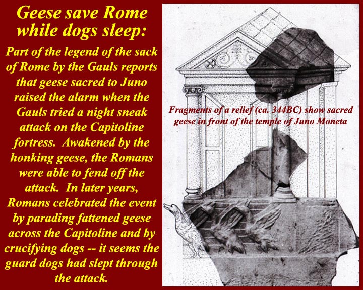
www.mmdtkw.org/AU0308gBrennerPass.jpg
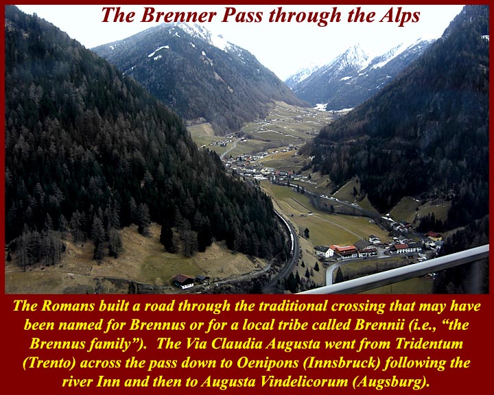
www.mmdtkw.org/AU0308gBrennusFrenchMaritimeSculpture.jpg
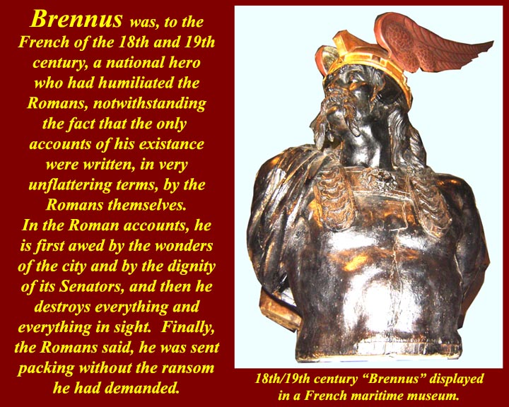
While Brennus I was evil personified to the Romans, he was a hero to transalpine people.
en.wikipedia.org/wiki/Battle_of_the_Allia
"Other Greek and Roman synchronisms have a more obvious historical symbolism, as may be the casewith the Polybian synchronism we saw above, between Dionysius’s siege of
Rhegium and the Gallic sack of Rome."
wxy.seu.edu.cn/humanities/sociology/htmledit/uploadfile/s...
www.unrv.com/empire/gallic-sack-of-rome.php
REFOUNDING THE CITY:
ENNIUS, LIVY, AND VIRGIL
The city of Rome has now been successfully founded in historical time—whether
that time is focalized as Greek or Roman—but we have not yet reached the end of
the story. As everyone knows, the city of Rome kept having to be re-founded, and
the patterns of refoundation drastically reconfigure the trajectory of movement
from myth to history that we have been following so far.188
Ennius’s most explicit surviving allusion to the date of the foundation of the city
in fact comes at the moment when the city had just been virtually destroyed, and
was on the verge of vanishing from history, after the sack by the Gauls in 387/6
b.c.e.189 The context is a speech in which Camillus persuades the Senate not to
move to Veii, but to refound the city instead (154–55 Skutsch):
Septingenti sunt paulo plus aut minus anni
augusto augurio postquam incluta condita Roma est.
It is seven hundred years, a little more or a little less,
since famous Rome was founded by august augury.
How this seven-hundred-year period between Romulus’s foundation and the sack
of Rome by the Gauls actually worked remains a mystery, at least to me.190 Still, we
should not overlook the symbolic significance of this number in its own right. The
importance of the seven-hundred-year period has been very well illustrated in the
fascinating book Die rhetorische Zahl, written by a scholar with the gloriously apt
name of Dreizehnter.191 Dreizehnter does not mention this passage of Ennius, but
he collects a great deal of interesting material about seven hundred years as the life
span of a city or an empire from foundation to extinction, or from foundation to
virtual extinction or only just-escaped extinction. In various traditions that he
examines there were seven hundred years from the foundation to the destruction
of Melos, Carthage, and Macedonia, or from the foundation to the virtual extinc-
(Myth into History I: Foundations of the city)
tion of Sparta.192 What we see in the Ennius passage, in other words, is that the city
was virtually destroyed and came within an ace of fulfilling the seven-hundred year
doom. The point will have been accentuated by Ennius’s book divisions.
Camillus’s speech comes at the end of book 4, and the regal period ended with
book 3, so that up to this point in the Annales we have had only one self-contained
volume of Republican history, and if things had gone differently that might have
been all we had.193
Livy activates the power of this Ennian symbolic numeral, even as he corrects
Ennius’s dating, with his allusion to the seven hundred years of Rome (Pref. 4):
Res est praeterea et immensi operis, ut quae supra septingentesimum annum
repetatur et quae ab exiguis profecta initiis eo creuerit ut iam magnitudine
laboret sua.
In addition, the matter is of immeasurable scope, in that it must be taken back
past the seven hundredth year, and having started from small beginnings has
grown to the stage that it is now laboring under its own size.194
Chaplin has argued that Livy’s preface is constructing recent Roman history as a
death, with a possible rebirth to come:195 the Republic has been destroyed, and the
Romans of Livy’s time are like the Romans of Camillus’s time, faced with the task
of refounding the city after it has only just escaped its seven-hundred-year doom.
In Livy’s treatment of the Roman response to the sack of the city by the Gauls,
we can see him returning to the Ennian theme of rebirth from destruction,
although this time using different significant numbers. Having exploited the numinous
associations of Ennius’s seven hundred years in his preface, Livy now produces
another numinous numeral for the span from foundation to sack, one that
conforms with the modern orthodox chronology. Livy has Camillus deliver a
mighty speech to convince his fellow citizens not to abandon Rome for the site of
Veii (5.51–54).196When Livy’s Camillus echoes Ennius’s by counting off the years
since the foundation, it appears that some kind of great year has gone by. From
Romulus’s foundation down to the sack by the Gauls there have been as many
years as there are days in a year: Trecentensimus sexagensimus quintus annus urbis,
Quirites, agitur (“This is the 365th year of the city, Quirites,” 5.54.5). This is of
course a calculation that fully resonates only after Caesar’s reform of the calendar,
when a Roman year for the first time had 365 days.This counting places
Camillus’s refounding of the city at a pivotal point in time, precisely halfway
(Refounding the City: Ennius, Livy, Virgil . 101)
between the first founding of the city, in 753, and the refounding that faces Livy
and his contemporaries 365 years after Camillus, in the 20s b.c.e.198 Exactly the
same structuring appears to underpin the panorama of Roman history on Virgil’s
Shield of Aeneas, where the barely averted destruction of Rome by the Gauls (Aen.
8.652–62) comes midway in time between the foundation of the city (8.635) and
the barely averted destruction of Rome by Antonius and Cleopatra (8.671–713).199
In all of these authors, city destruction, whether achieved or barely averted,
leads to refoundation and consequent reconfiguring of identity, in a process that
begins with Troy and continues through the fates of Alba Longa, Veii, and Rome
itself.200 As Kraus has shown, when Livy begins his next book after the Gallic sack,
he refounds his narrative along with the city, capitalizing on the annalistic tradition’s
identification of the city and history.201 In an extraordinary moment, the
opening sentences of book 6 tell us that only now is real history beginning. All of
the material in the first five books, Livy now declares, has been “obscure because
of its excessive antiquity” (uetustate nimia obscuras), and because there were few
written records in those early days, while the ones that did exist “for the most part
were destroyed when the city was burnt” (incensa urbe pleraeque interiere, 6.1.2).
Everything up until this point, from Troy to the Gallic sack, is suddenly reconfigured
as prior, prefoundational. In his preface Livy had drawn a line between myth
and history around the time of the Romulean foundation of the city (ante conditam
condendamue urbem, 6), but “the fresh start in 390 redraws the limits of the historically
verifiable.”202We now have a new entry into history, with a newly rebuilt city
and a newly solid evidential base for its written commemoration (6.1.3):
Clariora deinceps certioraque ab secunda origine uelut ab stirpibus laetius
feraciusque renatae urbis gesta domi militiaeque exponentur.
From here there will be a more clear and definite exposition of the domestic
and military history of the city, reborn from a second origin, as if from the
old roots, with a more fertile and fruitful growth.203
Livy here is picking up on the annalistic history of Claudius Quadrigarius, who
had written about fifty years earlier. We know that Claudius began his history with
the sack of Rome by the Gauls, no doubt on the grounds we see alluded to in Livy,
that no history was possible before then, thanks to the destruction of monuments
and archives.204
We have already seen how the Roman tradition picks up demarcations that are
102 . Myth into History I: Foundations of the City
crucial from the Greek tradition—Troy and the first Olympiad—and recasts
them as transitions into a new, Roman, phase of history. The Gallic sack is a vital
addition to this series of watersheds. The first key fixed synchronistic point in
Timaeus and Polybius that makes it possible for Roman history to be properly connected
with Greek history, the Gallic sack is itself made to serve as the “beginning
of history” in Claudius Quadrigarius and Livy book 6.205 The very event that almost
expunged Rome altogether is the one that put the city on the world stage—
just as the destruction of Troy led to the city’s existence in the first place.206
Ovid intuited the power of these associated watersheds of foundation and Gallic
sack, and his subtle deployment of them in the Metamorphoses is proof of their
understood significance. Before he arrives at the foundation of Rome in book 14,
he has a very small number of proleptic references to the as yet nonexistent city.
Book 1 contains two forward references to his own day, with the poem’s first simile
referring to the reign of Augustus (1.199–205), and the story of Apollo and
Daphne likewise anticipating the reign of Augustus, as Apollo prophesies the use
of his sacred laurel to grace Roman triumphs and adorn Augustus’s house (1.560–
63). His only other proleptic references to the city before the foundation in book
14 occur in book 2, and they are both references to the city only just escaping total
catastrophe, catastrophes that would have ensured the city was never part of world
history. One is in a cosmic setting, when the natural site of the city is almost
expunged, as the Tiber is dried up along with other rivers by Phaethon’s chariot
(2.254–59); the other is an allusion to the geese that “were to save the Capitol with
their wakeful cry” (seruaturis uigili Capitolia uoce/ . . . anseribus, 2.538–39).207
Again, in the Fasti, when the gods meet in council to deliberate how to save Rome
from the Gauls, Ovid takes as his template the Ennian council that deliberated over
the foundation of the city: in both cases, Mars expostulates with his father, Jupiter,
and is assured that all will be well.208
It is highly significant that these two events, the city’s foundation and near
destruction by the Gauls, are the only “historical” events commemorated on the
Republican calendar, the Fasti Antiates.209 Calendrical fasti from the Principate
mention all kinds of events, but the Fasti Antiates, the only calendar we have surviving
from the Republic, mark only two historical events: 21 April, the Parilia and
the foundation of the city, and 18 July, the dies Alliensis, the day of the battle of the
Allia, when the Roman army was scattered by the advancing Gauls on their way
to the city, which they entered on the next day.210
The foundation of the city and its near extinction by the Gauls are symbolically
joined events, linked by significant numbers, either 700 or 365, linked by themes of
Refounding the City: Ennius, Livy, Virgil . 103
refoundation and rebirth. The history of the city keeps getting restarted at such
crucial transition moments, when repetitive patterns of quasi-cyclical destruction
and refoundation replay themselves, in a fascinating interplay between a drive for
onward narrative continuity and the threat of eddying, repetitious, circularity.211 It
is poignant to observe the power of this theme still persisting in the fifth century
c.e., when Rutilius Namatianus, six years after the sack of Rome by the Visigoths
in 410 c.e., can hail Rome’s potential to bounce back from disaster, citing its eventual
defeat of Brennus, who led the Gauls to the sack of Rome, and of the Samnites,
Pyrrhus, and Hannibal:212 “You, Rome, are built up,” he claims, “by the very thing
that undoes other powers: the pattern of your rebirth is the ability to grow from
your calamities” (illud te reparat quod cetera regna resoluit:/ordo renascendi est
crescere posse malis, 139–40). Each of these key marker moments in time may become
a new opportunity for the community to reimagine itself, as the epochal moment
produces a new beginning point from which the community may imagine its
progress forward into time, measured against its backward extension into time.213
_______________________________ __________________________
The Gauls in the Italia peninsula .Clusium was reached by the Gauls, who had invaded most of Etruria already, and its people turned to Rome for help. However, the Roman embassy provoked a skirmish and, then, the Gauls marched straight for Rome (July, 387 BC). After the entire Roman army was defeated at the Allia brook (Battle of the Allia), the defenseless Rome was seized by the invaders. The entire Roman army retreated into the deserted Veii whereas most civilians ended at the Etruscan Caere. Nonetheless, a surrounded Roman garrison continued to resist on the Capitoline Hill. The Gauls dwelt within the city, getting their supplies by destroying all nearby towns for plunder.When the Gauls went for Ardea, the exiled Camillus, who was now a private man, organized the local forces for a defense. Particularly, he harangued that, always, the Gauls exterminated their defeated enemies. Camillus found that the Gauls were too distracted, celebrating their latest spoils with much 'crapulence' at their camp. Then, he attacked during a night, defeating the enemy easily with great bloodshed.He is thus considered the second founder of Rome.Camillus was hailed then by all other Roman exiles throughout the region. After he refused a makeshift generalship, a Roman messenger sneaked into the Capitol and, therein, Camillus was officially appointed dictator by the Roman Senators, to confront the Gauls.At the Roman base of Veii, Camillus gathered a 12,000-man army whereas more men joined out of the region. The occupying Gauls were in serious need, under quite poor health conditions. As the Roman Dictator, Camillus negotiated with the Gallic leader Brennus, and the Gauls left Rome, camping nearby at the Gabinian road. A day after this, Camillus confronted them with his refreshed army and the Gauls were forced to withdraw, after seven months of occupation (386 BC).
Camillus sacrificed for the successful return and he ordered the construction of the temple of Aius Locutius. Then, he subdued another claim of the plebeian orators, who importuned further about moving to Veii. After ordering a Senate debate, Camillus argued for staying and the Roman house approved this unanimously. The reconstruction extended for an entire year.
By this one-year office, Camillus was the longest of all Roman dictators. Basically, the Senators had been persuaded by the disturbing social clashes, which could be better managed by Camillus. Instead, Camillus disliked this and, vainly, he requested the dismissal.
Roman dictator (367 BC)
As the Gauls were, again, marching toward Latium, all Romans reunited despite their severe differences. Camillus was named Roman dictator for the fifth time then (367 BC). He organized the defense of Rome actively. By the commands of Camillus, the Roman soldiers were protected particularly against the Gallic main attack, the heavy blow of their swords. Both smooth iron helmets and brass rimed shields were built. Also, long pikes were used, to keep the enemy's swords far.
The Gauls camped at the Anio river, carrying loads of recently gotten plunder. Near them, at the Alban Hills, Camillus discovered their disorganization, which was due to unruly celebrations. Before the dawn, then, the light infantry disarrayed the Gallic defenses and, subsequently, the heavy infantry and the pikemen of the Romans finished their enemy. After the battle, Velitrae surrendered voluntarily to Rome. Back in Rome, Camillus celebrated with another Triumph.
ancientimes.blogspot.co.nz/2007/06/brennus-and-first-sack...
A deadly pestilence struck Rome and it affected most Roman public figures. Camillus was amongst them, passing away in 365 BC.
Source: Plutarch, The Parallel Lives - The Life of Camillus:
In popular culture
Marcus Furius Camillus was played by Massimo Serato in the 1963 film 'Brennus, Enemy of Rome'.
www.flickr.com/photos/ggnyc/1405297848/
BC 400's Celts from the Alps flowed into Italy ....
Herodotus of Halicarnassus reported a merchant from Samos named Colacus was driven off course by tides and winds when trading off the African shore. He landed at the Tartessus (modern River Guadalquivir in southern Spain) where he found tribes of Keltoi working the silver mines
396 BC Celts defeated the Etruscans at Melpum (Melzo, west of Milan)
390 Senones Celts ('the veterans') led by Brennos (Latinate: Brennus) defeated the Romans in Rome (July 19) so badly it took the Romans 200 years to recover from the 'terror Gallicus'. After seven months and a ransom of 100 pounds of gold, the Celts moved along to Picenum on Italy's eastern seaboard.
Ephoros of Cyme reported the Celts occupied an area the size of the Indian sub-continent.
334-335 Alexander of Macedonia met the Celts on the Danube banks to make an agreement: The Celts would not attack his empire while he was off conquering in the east. Only after his death they expanded to Moravia and Thrace .
----------- ----------
Along with Bolgios, Brennos II was the legendary leader of other Celts on their invasion of Macedonia in the second century BCE. Though Bolgios led the invasion of Macedonia , Brennus succeeded in crossing his whole army over the river Sperchios into Greece proper, where he laid seige to the town of Heraclea and, having driven out the garrison there, marched on to Thermopylae where he defeated an army raised by a confederation of Greek cities. Brennus then avanced across Greece, where he decided to go on to Delphi, which was reported as the treasure house of Greece. Brennus and his army of 30,000 set off to attack the temple of Apollo, the ultimate goal of his expedition. Here it is said that Brennos was defeated by earthquakes and thunderbolts that reduced the soldiers to ashes; snow storms, showers of great stones, and "ancient heroes appearing from the heavens". In the midst of this snowstorm, Brennos and his men were attacked near the Parnassus mountains. The Celts were soundly defeated and Brennos was mortally wounded. As he lay dying, he gave the order for all of the wounded to be killed, and all the booty to be burned, as the army would never make it home if they had to carry the wounded warriors and their plunder. After giving the order, Brennos drank some wine and then took his own life. (? Source)
www.maryjones.us/ctexts/classical_pausianas.html
The Description of Greece
Pausanias (fl. 2nd c. CE) XIX.
[5] "I have made some mention of the Gallic invasion of Greece in my description of the Athenian Council Chamber. But I have resolved to give a more detailed account of the Gauls in my description of Delphi, because the greatest of the Greek exploits against the barbarians took place there. The Celts conducted their first foreign expedition under the leadership of Cambaules. Advancing as far as Thrace they lost heart and broke off their march, realizing that they were too few in number to be a match for the Greeks. "...........
10]" When the Gallic horsemen were engaged, the servants remained behind the ranks and proved useful in the following way. Should a horseman or his horse fall, the slave brought him a horse to mount; if the rider was killed, the slave mounted the horse in his master's place; if both rider and horse were killed, there was a mounted man ready. When a rider was wounded, one slave brought back to camp the wounded man, while the other took his vacant place in the ranks.
[11] I believe that the Gauls in adopting these methods copied the Persian regiment of the Ten Thousand, who were called the Immortals. There was, however, this difference. The Persians used to wait until the battle was over before replacing casualties, while the Gauls kept reinforcing the horsemen to their full number during the height of the action. This organization is called in their native speech trimarcisia, for I would have you know that marca3 is the Celtic name for a horse. "
(Addit :we know from Celtic myth this was indigenous to the confederacy of Celtic tribes as on Gundestrup Cauldron ,warrior plate)
[12] "This was the size of the army, and such was the intention of Brennos, when he attacked Greece. The spirit of the Greeks was utterly broken, but the extremity of their terror forced them to defend Greece. They realized that the struggle that faced them would not be one for liberty, as it was when they fought the Persian, and that giving water and earth would not bring them safety. They still remembered the fate of Macedonia, Thrace and Paeonia during the former incursion of the Gauls, and reports were coming in of enormities committed at that very time on the Thessalians. So every man, as well as every state, was convinced that they must either conquer or perish. "
Attalus I (Greek: Ἄτταλος), surnamed Soter (Greek: Σωτὴρ, "Savior"; 269 BC – 197 BC) ruled Pergamon, an Ionian Greek polis (what is now Bergama, Turkey), first as dynast, later as king, from 241 BC to 197 BC. He was the second cousin and the adoptive son of Eumenes I, whom he succeeded, and was the first of the Attalid dynasty to assume the title of king in 238 BC.He was the son of Attalus and his wife Antiochis.
Attalus won an important victory over the Galatians, newly arrived Celtic tribes from Thrace, who had been, for more than a generation, plundering and exacting tribute throughout most of Asia Minor without any serious check. This victory, celebrated by the triumphal monument at Pergamon, famous for its 'Dying Galatian' or 'Gaul' statue , and the liberation from the Gallic "terror" which it represented, earned for Attalus the name of "Soter", and the title of "king". A courageous and capable general and loyal ally of Rome, he played a significant role in the first and second Macedonian Wars, waged against Philip V of Macedon.
Etymologically Brennos is related to Brân and is related to the reconstructed proto-Celtic lexical elements *brano- (raven) -n- (the deicific particle) and os (the masculine ending). Thus Brennos is literally the 'Raven God'. However, the bren part of the name is also the root for one Cymric word for king brenhin and Brennos can be rendered as 'Raven King'. Which also leads to the supposition that 'Brennos', rather than being a proper name is actually an honorific denoting 'battle lord'. Raven gods being tribal leaders in the time of war so a Celtic war leader would take-on the name of such a deity. Indeed, the modern Cymric for king is brenin a word derived from 'Brennos'.
An actual late Iron Age helmet like this has been located in ancient Dacia , Translyvania , now modern Roumania/ Romania the Helmet of Ciumeşti.
www.flickr.com/photos/42003310@N05/4886860352/
As one of the styles depicted on the Celtic Gundestrup Cauldron.
Wilcox and McBride mentioned that their illustration of the iron Gallic warrior's helmet of the middle La Tene period had been reconstructed the on the basis of the Ciumesti helmet.[45]