View allAll Photos Tagged Include
The Qalawun complex is a massive complex in Cairo, Egypt that includes a madrasa, a hospital and a mausoleum. It was built by the Sultan Al-Nasir Muhammad Ibn Qalawun in the 1280s; some thirty surviving mosques were built during his time.
The Qalawun Complex was built over the ruins of the Fatimid Palace of Cairo, with several halls in the Palace. It was sold to several people until it was finally bought by the Sultan Qalawun in 1283 AD. The structure resides in the heart of Cairo, in the Bayn al-Qasrayn, and has been a center for important religious ceremonies and rituals of the Islamic faith for years, stretching from the Mamluk dynasty through the Ottoman Empire.
The Mausoleum of Sultan Qalawun in Cairo is considered by many to be the second most beautiful mausoleum, succeeded only by the Taj Mahal in India. Al-Nuwayri (an Arab Historian), has said in his book Nihayet al Irab (The Utmost Desire), that the Mausoleum was not intended to become a buriel site, but a Mosque and a school, and that it was first used as a tomb when he died, and hosted his body. His body was kept in the Cairo Citadel for two months until the tomb was ready to replace the Citadel's Burial location, later when Qalawun's son died, he too was buried in the Mausoleum. The mihrab of the mausoleum is often considered as the most lavish of its kind. This is in contrast to the mihrab of the madrasa, which is less grand in size and general esthetics. With a horse-shoe profile the mihrab is flanked by three columns made of marble. The Mausoleum later on, and under the mamluks included a Museum for Royal Cloths of those buried in it.
The Mausoleum of Qalawun is significant in that it’s dome served as a ceremonial center for the investing of new emirs. Indeed the dome was a symbol of new power, a changing of the guard, signifying a new center of Mamluk power, which enjoyed great prosperity at the time. The Mausoleum's Dome was demolished by the Ottoman Governor over Egypt Abdul-Rahman Katkhuda and was then rebuilt in Ottoman architecture, However the Comite for reservation of Arab monuments built another dome to replace that in 1908 [Wikipedia.org]
The Lidl Run Kildare Events 2013 were held at the Curragh Racecourse, Newbridge, Co. Kildare, Ireland on Sunday 12th May 2013. There were three events: a 10KM, a half marathon, and a full marathon. This is a selection of photographs which includes all events. The photographs are taken from the start and finish of the marathon, the finish of the 10KM, and the finish of the half marathon. Due to the large numbers participating we did not manage to photograph everyone - which was not helped by the weather. Congratulations to Jo Cawley and her RunKildare crew for another great event. The weather didn't dampen the spirits of the many happy participants.
Electronic timing was provided by Red Tag Timing [www.redtagtiming.com/]
Overall Race Summary
Participants: There were approximately 3,000 participants over the 3 race events - there were runners, joggers, and walkers participating.
Weather: A cold breezy morning with heavy rain at the start. The weather dried up for the 10KM and the Half Marathon races
Course: This is an undulating course with some good flat stretches on the Curragh.
Viewing this on a smartphone device?
If you are viewing this Flickr set on a smartphone and you want to see the larger version(s) of this photograph then: scroll down to the bottom of this description under the photograph and click the "View info about this photo..." link. You will be brought to a new page and you should click the link "View All Sizes".
Some Useful Links
GPS Garmin Trace of the Kildare Marathon Route: connect.garmin.com/activity/175709313
Homepage of the Lidl Run Kildare Event: www.kildaremarathon.ie/index.html
Facebook Group page of the Lidl Run Kildare Event: www.facebook.com/RunKildare
Boards.ie Athletics Discussion Board pages about the race series: www.boards.ie/vbulletin/showthread.php?t=2056815306
Our photographs from Run Kildare 2012: www.flickr.com/photos/peterm7/sets/72157629707887620/
Our photographs from Run Kildare 2011: www.flickr.com/photos/peterm7/sets/72157626725200956/
A small selection of photographs from Run Kildare 2010: www.flickr.com/photos/peterm7/sets/72157623899845567/ (first event)
Can I use the photograph with the watermark?
Yes! Absolutely - you can post this photograph to your social networks, blogs, micro-blogging, etc.
How can I get a full resolution, no watermark, copy of these photographs?
All of the photographs here on this Flickr set have a visible watermark embedded in them. All of the photographs posted here on this Flickr set are available, free, at no cost, at full resolution WITHOUT watermark. We take these photographs as a hobby and as a contribution to the running community in Ireland. We do not know of any other photographers who operate such a policy. Our only "cost" is our request that if you are using these images: (1) on social media sites such as Facebook, Tumblr, Pinterest, Twitter,LinkedIn, Google+, etc or (2) other websites, web multimedia, commercial/promotional material that you provide a link back to our Flickr page to attribute us. This also extends the use of these images for Facebook profile pictures. In these cases please make a separate wall or blog post with a link to our Flickr page. If you do not know how this should be done for Facebook or other social media please email us and we will be happy to help suggest how to link to us.
Please email petermooney78 AT gmail DOT com with the links to the photographs you would like to obtain a full resolution copy of. We also ask race organisers, media, etc to ask for permission before use of our images for flyers, posters, etc. We reserve the right to refuse a request.
In summary please remember - all we ask is for you to link back to our Flickr set or Flickr pages. Taking the photographs and preparing them for online posting does take a significant effort. We are not posting photographs to Flickr for commercial reasons. If you really like what we do please spread the link around, send us an email, leave a comment beside the photographs, send us a Flickr email, etc.
If you would like to contribute something for your photograph(s)?
Some people offer payment for our photographs. We do not charge for these photographs. We take these photographs as our contribution to the running community in Ireland. If you feel that the photograph(s) you request are good enough that you would pay for their purchase from other photographic providers we would suggest that you can provide a donation to any of the great charities in Ireland who do work for Cancer Care or Cancer Research in Ireland.
I ran in the race - but my photograph doesn't appear here in your Flickr set! What gives?
As mentioned above we take these photographs as a hobby and as a voluntary contribution to the running community in Ireland. Very often we have actually ran in the same race and then switched to photographer mode after we finished the race. Consequently, we feel that we have no obligations to capture a photograph of every participant in the race. However, we do try our very best to capture as many participants as possible. But this is sometimes not possible for a variety of reasons:
►You were hidden behind another participant as you passed our camera
►Weather or lighting conditions meant that we had some photographs with blurry content which we did not upload to our Flickr set
►There were too many people - some races attract thousands of participants and as amateur photographs we cannot hope to capture photographs of everyone
►We simply missed you - sorry about that - we did our best!
You can email us petermooney78 AT gmail DOT com to enquire if we have a photograph of you which didn't make the final Flickr selection for the race. But we cannot promise that there will be photograph there. As alternatives we advise you to contact the race organisers to enquire if there were (1) other photographs taking photographs at the race event or if (2) there were professional commercial sports photographers taking photographs which might have some photographs of you available for purchase. You might find some links for further information above.
Don't like your photograph here?
That's OK! We understand!
If, for any reason, you are not happy or comfortable with your picture appearing here in this photoset on Flickr then please email us at petermooney78 AT gmail DOT com and we will remove it as soon as possible. We give careful consideration to each photograph before uploading.
I want to tell people about these great photographs!
Great! Thank you! The best link to spread the word around is probably www.flickr.com/peterm7/sets
Wikipedia, Lavandula angustifolia, formerly L. officinalis, is a flowering plant in the family Lamiaceae, native to the Mediterranean (Spain, France, Italy, Croatia etc.). Its common names include lavender, true lavender and English lavender[2] (though it is not native to England); also garden lavender,[3] common lavender and narrow-leaved lavender.
Description
It is a strongly aromatic shrub growing as high as 1 to 2 metres (3+1⁄2 to 6+1⁄2 ft) tall. The leaves are evergreen, 2–6 centimetres (1–2+1⁄2 inches) long, and 4–6 millimetres (3⁄16–1⁄4 in) broad. The flowers are typically purple (lavender-coloured), produced on spikes 2–8 cm (1–3 in) long at the top of slender, leafless stems 10–30 cm (4–12 in) long.
Stems and flowers
Stems and flowers
Flower spike before the petals emerge
Flower spike before the petals emerge
Calyx (purple) and flower bracts (light brown)
Calyx (purple) and flower bracts (light brown)
Calyx and corolla
Calyx and corolla
Corolla (petals)
Corolla (petals)
Calyx and corolla (side view)
Calyx and corolla (side view)
Etymology
The species name angustifolia is Latin for "narrow leaf". Previously, it was known as Lavandula officinalis, referring to its medicinal properties.
Cultivation
English lavender is commonly grown as an ornamental plant. It is popular for its colourful flowers, its fragrance, and its ability to survive with low water consumption. It does not grow well in continuously damp soil and may benefit from increased drainage provided by inorganic mulches, such as gravel. It does best in Mediterranean climates similar to its native habitat, characterised by wet winters and dry summers. It is fairly tolerant of low temperatures, and is generally considered hardy to Royal Horticultural Society zone H6, or USDA zone 5.[4] It tolerates acid soils, but favours neutral to alkaline soils, and in some conditions it may be short-lived.[5]
Cultivars
AGM cultivars
The following cultivars of L. angustifolia and its hybrids have gained the Royal Horticultural Society's Award of Garden Merit:-[6]
L. × intermedia 'Alba'[7] (large white)
L. angustifolia 'Beechwood Blue' [8]
L. angustifolia 'Hidcote' [9]
L. × intermedia 'Hidcote Giant' [10]
L. angustifolia 'Imperial Gem' [11]
L. angustifolia Little Lottie='Clarmo'[12]
L. angustifolia 'Miss Katherine' [13]
L. angustifolia Miss Muffet='Scholmis'[14]
L. angustifolia 'Nana Alba'[15] (dwarf white)
L. × intermedia Olympia='Downoly' [16]
L × chaytoriae 'Richard Gray'[17]
L. × chaytoriae 'Sawyers'[18]
L. × intermedia 'Sussex'[19]
Dwarf cultivars
Compacta, Folgate, Dwarf Blue, Dwarf White, Hidcote Pink, Hidcote Superior, Munstead, Nana Atropurpurea, Nana Rosea, Sarah, Summerland Supreme, Lady Lavender
'Hidcote Superior', a compact evergreen shrub 40 cm × 45 cm (16 in × 18 in) with fragrant gray-green foliage and deep violet-blue flowers in summer, prefers full sun, well drained soil, low water, hardy to −30 °C (−20 °F), western Mediterranean species
'Munstead' (syn. Dwarf Munstead, Munstead Blue and Munstead Variety) L. angustifolia variety, 30 cm (12 in) tall, having pink-purple to lavender-blue inflorescences that are slightly fragrant,[20] named after Munstead Wood in Surrey, which was the home of Gertrude Jekyll
'Sarah', grows to 15–60 cm (6–24 in), the flowers are petite, as is the plant, used as a short edging, or as a very fragrant addition to the window box, dark violet flowers
'Lady Lavender', grows to 45 cm (18 in), fragrant, gray-green foliage and lavender-blue flowers in summer, prefers full sun, well-drained soil, low water, hardy to −30 °C (–20 °F)
Semi-dwarf cultivars
Bowles Early, Hidcote Variety, Loddon Blue, Martha Roderick, Jean Davis, Twickle Purple, Pink Perfume
'Hidcote' (syn. Hidcote Variety, Hidcote Blue, Hidcote Purple) L. angustifolia variety. 40 to 50 cm (15 in to 20 in) tall, with silver-gray foliage and deep violet-blue inflorescences, named after Hidcote Manor in England as it was cultivated there by Lawrence Johnston
'Jean Davis' 50–60 cm (20–24 in) tall, up to 1 m (3 ft). A pale pink flowered lavender with exceptionally fruity taste
'Pink Perfume' 60 cm × 45 cm (24 in × 18 in)
Giant cultivars
Alba, Backhouse Purple, Biostos, Bridestowe, Graves, Gray Lady, Gwendolyn Anley, Hidcote Giant, Irene Doyle, Mailette, Middachten
'Hidcote Giant'. A Lavandula × intermedia lavandin. Very vigorous grower (90 to 100 cm; 36–40 in) with a lovely strong fragrance. This has large deep lavender-purple flowers on very long 60 cm (24 in) stems.
'Vera' 75 to 90 cm (30–36 in). Thought to be the original species lavender, harvested for its oil.
Uses
Dried Lavandulae flos as used in herbal teas
The flowers and leaves are applied in herbal medicine.[21] Commercially, the plant is used to produce lavender essential oil used in balms, salves, perfumes, cosmetics, and topical applications.[22] Lavender essential oil, when diluted with a carrier oil, is commonly used for massage therapy or aromatherapy.[22]
The flowers are also used as a culinary herb, most often as part of the North American version of the French herb blend called herbes de Provence.
Lavandula angustifolia is included in the Tasmanian Fire Service's list of low flammability plants, indicating that it is suitable for growing within a building protection zone.[23]
Subspecies
Lavandula angustifolia subsp. angustifolia[1]
Lavandula angustifolia subsp. pyrenaica[1]
Hybrids
Lavandula hybrids are referred to as lavandins. Hybrids between L. angustifolia and L. latifolia (spike lavender) are called Lavandula × intermedia. They bloom later than the ordinary English lavenders.The sweet smell of lavender, Lavandula (common name lavender) is a genus of 47 known species of perennial flowering plants in the mints family, Lamiaceae.[1] It is native to the Old World, primarily found across the drier, warmer regions of mainland Eurasia, with an affinity for maritime breezes.[2]
Lavender is found on the Iberian Peninsula and around the entirety of the Mediterranean coastline (including the Adriatic coast, the Balkans, the Levant, and coastal North Africa), in parts of Eastern and Southern Africa and the Middle East, as well as in South Asia and on the Indian subcontinent.[3]
Many members of the genus are cultivated extensively in temperate climates as ornamental plants for garden and landscape use, for use as culinary herbs, and also commercially for the extraction of essential oils.[4] Lavender is used in traditional medicine and as an ingredient in cosmetics.
Description
Plant and leaves
The genus includes annual or short-lived herbaceous perennial plants, and shrub-like perennials, subshrubs or small shrubs.[5]
Leaf shape is diverse across the genus. They are simple in some commonly cultivated species; in other species, they are pinnately toothed, or pinnate, sometimes multiple pinnate and dissected. In most species, the leaves are covered in fine hairs or indumentum, which normally contain essential oils.[5]
Flowers
Flowers are contained in whorls, held on spikes rising above the foliage, the spikes being branched in some species. Some species produce colored bracts at the tips of the inflorescences. The flowers may be blue, violet, or lilac in the wild species, occasionally blackish purple or yellowish. The sepal calyx is tubular. The corolla is also tubular, usually with five lobes (the upper lip often cleft, and the lower lip has two clefts).[6]
Nomenclature and taxonomy
Lavandula stoechas, L. pedunculata, and L. dentata were known in Roman times.[7]: 51 From the Middle Ages onwards, the European species were considered two separate groups or genera, Stoechas (L. stoechas, L. pedunculata, L. dentata) and Lavandula (L. spica and L. latifolia), until Linnaeus combined them. He recognised only five species in Species Plantarum (1753), L. multifida and L. dentata (Spain) and L. stoechas and L. spica from Southern Europe. L. pedunculata was included within L. stoechas.
By 1790, L. pinnata and L. carnosa were recognised. The latter was subsequently transferred to Anisochilus. By 1826, Frédéric Charles Jean Gingins de la Sarraz listed 12 species in three sections, and by 1848 eighteen species were known.[7]: 51
One of the first modern major classifications was that of Dorothy Chaytor in 1937 at Kew. The six sections she proposed for 28 species still left many intermediates that could not easily be assigned. Her sections included Stoechas, Spica, Subnudae, Pterostoechas, Chaetostachys, and Dentatae. However, all the major cultivated and commercial forms resided in the Stoechas and Spica sections. There were four species within Stoechas (Lavandula stoechas, L. dentata, L. viridis, and L. pedunculata) while Spica had three (L. officinalis (now L. angustifolia), L. latifolia and L. lanata). She believed that the garden varieties were hybrids between true lavender L. angustifolia and spike lavender (L. latifolia).[8]
Lavandula has three subgenera:[9][10][11]
Subgenus Lavandula is mainly of woody shrubs with entire leaves. It contains the principal species grown as ornamental plants and for oils. They are found across the Mediterranean region to northeast Africa and western Arabia.
Subgenus Fabricia consists of shrubs and herbs, and it has a wide distribution from the Atlantic to India. It contains some ornamental plants.
Subgenus Sabaudia constitutes two species in the southwest Arabian peninsula and Eritrea, which are rather distinct from the other species, and are sometimes placed in their own genus Sabaudia.
In addition, there are numerous hybrids and cultivars in commercial and horticultural usage.[5]
The first major clade corresponds to subgenus Lavandula, and the second Fabricia. The Sabaudia group is less clearly defined. Within the Lavandula clade, the subclades correspond to the existing sections but place Dentatae separately from Stoechas, not within it. Within the Fabricia clade, the subclades correspond to Pterostoechas, Subnudae, and Chaetostachys.
Thus the current classification includes 39 species distributed across 8 sections (the original 6 of Chaytor and the two new sections of Upson and Andrews), in three subgenera (see table below). However, since lavender cross-pollinates easily, countless variations present difficulties in classification.
Etymology
The English word lavender came into use in the 13th century, and is generally thought to derive from Old French lavandre,[12] ultimately from Latin lavare from lavo (to wash),[13] referring to the use of blue infusions of the plants for bathing.[7]: 35 The botanic name Lavandula as used by Linnaeus is considered to be derived from this and other European vernacular names for the plants.[14]
The names widely used for some of the species, "English lavender", "French lavender" and "Spanish lavender" are all imprecisely applied. "English lavender" is commonly used for L. angustifolia, though some references say the proper term is "Old English lavender".[15] The name "French lavender" may refer to either L. stoechas or to L. dentata. "Spanish lavender" may refer to L. pedunculata,[16] L. stoechas,[17] or L. lanata.
Cultivation
Honey bee on flower
The most common form in cultivation is the common or English lavender Lavandula angustifolia (formerly named L. officinalis). A wide range of cultivars can be found. Other commonly grown ornamental species are L. stoechas, L. dentata, and L. multifida (Egyptian lavender).
Because the cultivated forms are planted in gardens worldwide, they are occasionally found growing wild as garden escapes, well beyond their natural range. Such spontaneous growth is usually harmless, but in some cases, Lavandula species have become invasive. For example, in Australia, L. stoechas has become a cause for concern; it occurs widely throughout the continent and has been declared a noxious weed in Victoria since 1920.[18] It is regarded as a weed in parts of Spain.[19]
Lavenders flourish best in dry, well-drained, sandy or gravelly soils in full sun.[20] English lavender has a long germination process (14–28 days) and matures within 100–110 days.[21] All types need little or no fertilizer and good air circulation. In areas of high humidity, root rot due to fungus infection can be a problem. Organic mulches can trap moisture around the plants' bases, encouraging root rot. Gravelly materials such as crushed rocks give better results.[22] It grows best in soils with a pH between 6 and 8.[23] Most lavender is hand-harvested, and harvest times vary depending on intended use.[23]
Lavender oil
"Lavandin" redirects here. For the racehorse, see Lavandin (horse).
Main article: Lavender oil
Commercially, the plant is grown mainly for the production of lavender essential oil. English lavender (Lavandula angustifolia) yields an oil with sweet overtones and can be used in balms, salves, perfumes, cosmetics, and topical applications.[24]
Lavandula × intermedia, also known as lavandin or Dutch lavender, hybrids of L. angustifolia and L. latifolia.[25] are widely cultivated for commercial use since their flowers tend to be bigger than those of English lavender and the plants tend to be easier to harvest.[26] They yield a similar essential oil, but with higher levels of terpenes including camphor, which add a sharper overtone to the fragrance, regarded by some as of lower quality than that of English lavender.
The US Food and Drug Administration considers lavender as generally recognized as safe (GRAS) for human consumption.[27] The essential oil was used in hospitals during World War I.[20]
Phytochemicals
Some 100 individual phytochemicals have been identified in lavender oil, including major contents of linalyl acetate (30–55%), linalool (20–35%), tannins (5–10%), and caryophyllene (8%), with lesser amounts of sesquiterpenoids, perillyl alcohols, esters, oxides, ketones, cineole, camphor, beta-ocimene, limonene, caproic acid, and caryophyllene oxide.[24][27][28] The relative amounts of these compounds vary considerably among lavender species.[24]
Culinary use
Lavender-flavored cupcakes
Culinary lavender is usually English lavender, the most commonly used species in cooking (L. angustifolia 'Munstead'). As an aromatic, it has a sweet fragrance with lemon or citrus notes.[29] It is used as a spice or condiment in pastas, salads and dressings, and desserts.[30][31] Their buds and greens are used in teas, and their buds, processed by bees, are the essential ingredient of a monofloral honey.[32]
Use of buds
For most cooking applications the dried buds, which are also referred to as flowers, are used. Lavender greens have a more subtle flavor when compared to rosemary.[33]
The potency of the lavender flowers increases with drying which necessitates more sparing use to avoid a heavy, soapy aftertaste. Chefs note to reduce by two-thirds the dry amount in recipes that call for fresh lavender buds.[29][34][better source needed]
Lavender buds can amplify both sweet and savory flavors in dishes and are sometimes paired with sheep's milk and goat's milk cheeses. Lavender flowers are occasionally blended with black, green, or herbal teas. Lavender flavors baked goods and desserts, pairing especially well with chocolate. In the United States, both lavender syrup and dried lavender buds are used to make lavender scones and marshmallows.[35][36]
Lavender buds are put into sugar for two weeks to allow the essential oils and fragrance to transfer; then the sugar itself is used in baking. Lavender can be used in breads where recipes call for rosemary. Lavender can be used decoratively in dishes or spirits, or as a decorative and aromatic in a glass of champagne. Lavender is used in savory dishes, giving stews and reduced sauces aromatic flair. It is also used to scent flans, custards, and sorbets.[29]
In honey
The flowers yield abundant nectar, from which bees make a high-quality honey. Monofloral honey is produced primarily around the Mediterranean Sea, and is marketed worldwide as a premium product. Flowers can be candied and are sometimes used as cake decorations. It is also used to make "lavender sugar".[32]
Other uses
Soaps scented with lavender.
Lavender products for sale at the San Francisco Farmers Market.
Flower spikes are used for dried flower arrangements. The fragrant, pale purple flowers and flower buds are used in potpourris. Lavender is also used as herbal filler inside sachets used to freshen linens. Dried and sealed in pouches, lavender flowers are placed among stored items of clothing to give a fresh fragrance and to deter moths.[37] Dried lavender flowers may be used for wedding confetti. Lavender is also used in scented waters, soaps, and sachets.
In history and culture
See also: Spikenard
The ancient Greeks called the lavender herb νάρδος: nárdos, Latinized as nardus, after the Syrian city of Naarda (possibly the modern town of Duhok, Iraq). It was also commonly called nard.[38] The species originally grown was L. stoechas.[5]
During Roman times, flowers were sold for 100 denarii per pound, which was about the same as a month's wages for a farm laborer, or fifty haircuts from the local barber. Its late Latin name was lavandārius, from lavanda (things to be washed), from lavāre from the verb lavo (to wash).[13][39]
Since the late 19th century, lavenders have been associated with the queer community.[40]
Culinary history
Spanish nard (Old French: "spykenard de spayn le pays"), referring to L. stoechas, is listed as an ingredient in making a spiced wine, namely hippocras, in The Forme of Cury.[41]
Lavender was introduced into England in the 1600s. It is said that Queen Elizabeth prized a lavender conserve (jam) at her table, so lavender was produced as a jam at that time, as well as used in teas both medicinally and for its taste.[29]
Lavender was not used in traditional southern French cooking at the turn of the 20th century. It does not appear at all in the best-known compendium of Provençal cooking, J.-B. Reboul's Cuisinière Provençale.[42] French lambs have been allowed to graze on lavender as it is alleged to make their meat more tender and fragrant.[29] In the 1970s, a blend of herbs called herbes de Provence was invented by spice wholesalers. Culinary lavender is added to the mixture in the North American version.[43]
In the 21st century, lavender is used in many world regions to flavor tea, vinegar, jellies, baked goods, and beverages.[44]
Bunches of lavender for sale, intended to repel insects
Herbalism
The German scientific committee on traditional medicine, Commission E, reported uses of lavender flower in practices of herbalism, including its use for restlessness or insomnia, Roemheld syndrome, intestinal discomfort, and cardiovascular diseases, among others.[45]
Health precautions
The U.S. National Center for Complementary and Integrative Health (NCCIH) states that lavender is considered likely safe in food amounts, and that topical uses may cause allergic reactions.[46] NCCIH does not recommend the use of lavender while pregnant or breastfeeding because of lack of knowledge of its effects.[46] It recommends caution if young boys use lavender oil because of possible hormonal effects leading to gynecomastia.[46][47][48]
A 2007 study examined the relationship between various fragrances and photosensitivity, stating that lavender is known "to elicit cutaneous photo-toxic reactions", but does not induce photohaemolysis.[49]
Adverse effects
Some people experience contact dermatitis, allergic eczema, or facial dermatitis from the use of lavender oil on skin.[24][46]
Taxonomic table
Different lavender cultivars growing at Snowshill, the Cotswolds, UK.
This is based on the classification of Upson and Andrews, 2004.
Lavender field in Carshalton, in the London Borough of Sutton.
Lavender field in Hitchin, UK.
Lavender field in Çuxur Qəbələ, Qabala District, Azerbaijan.
I. Subgenus Lavendula Upson & S.Andrews
i. Section Lavandula (3 species)
Lavandula angustifolia Mill.
subsp. angustifolia — Catalonia and the Pyrenees.
subsp. pyrenaica — SE France and nearby Mediterranean coastal regions of Croatia, Italy, Spain.
Lavandula latifolia Medik — central Portugal, east-central Spain, southern France, northern Italy.
Lavandula lanata Boiss. — southern Spain.
Hybrids:
Lavandula × chaytorae Upson & S.Andrews (L. angustifolia subsp. angustifolia × L. lanata)
Lavandula × intermedia Emeric ex Loisel. (L. angustifolia subsp. angustifolia × L. latifolia)
ii. Section Dentatae Suarez-Cerv. & Seoane-Camba (1 species)
Lavandula dentata L. — east Spain, coastal Algeria, and northern and SW Morocco.
var. dentata (rosea, albiflora), candicans (persicina) [Batt.]
iii. Section Stoechas Ging. (3 species)
Lavandula stoechas L.
subsp. stoechas — mostly coastal regions of east Spain, southern France, west Italy, Greece, Bulgaria, southern coastal Turkey, Levantine coast, and many Mediterranean islands.
subsp. luisieri — coastal and inland Portugal and border regions of Spain.
Lavandula pedunculata Mill.(Cav.)
subsp. pedunculata — Spain and Portugal.
subsp. cariensis — western Turkey and southern Bulgaria.
subsp. atlantica — montane Morocco.
subsp. lusitanica — southern Portugal and SW Spain.
subsp. sampaiana — from Portugal and SW Spain.
Lavandula viridis L'Her. — SW Spain, Portugal, and possibly also on Madeira.
Intersectional hybrids (Dentatae and Lavendula)
Lavandula × heterophylla Viv. (L. dentata × L. latifolia )
Lavandula × allardii
Lavandula × ginginsii Upson & S.Andrews (L. dentata × L. lanata )
II. Subgenus Fabricia (Adams.) Upson & S.Andrews
iv. Section Pterostoechas Ging. (16 species)
Lavandula multifida L. — Morocco, southern Portugal, Spain, northern Algeria, Tunisia, Tripolitania, Calabria and Sicily, with isolated Nile valley populations.
Lavandula canariensis Mill. — the Canary Islands.
subsp. palmensis – La Palma.
subsp. hierrensis – El Hierro.
subsp. canariensis – Tenerife.
subsp. canariae – Gran Canaria.
subsp. fuerteventurae – Fuerteventura.
subsp. gomerensis – La Gomera.
subsp. lancerottensis – Lanzarote.
Lavandula minutolii Bolle — Canary Islands.
subsp. minutolii
subsp. tenuipinna
Lavandula bramwellii Upson & S.Andrews — Gran Canaria.
Lavandula pinnata L. — Canarias and Madeira.
Lavandula buchii Webb & Berthel. — Tenerife.
Lavandula rotundifolia Benth. — Cape Verde.
Lavandula maroccana Murb. — Atlas Mountains, Morocco.
Lavandula tenuisecta Coss. ex Ball — Atlas Mtns., Morocco.
Lavandula rejdalii Upson & Jury — Morocco.
Lavandula mairei Humbert — Morocco.
Lavandula coronopifolia Poir. — Cape Verde, Northern Africa, NE Western Africa, Arabia to East Iran.
Lavandula saharica Upson & Jury — southern Algeria and nearby regions.
Lavandula antineae Maire — central Sahara.
subsp. antinae
subsp. marrana
subsp. tibestica
Lavandula pubescens Decne. — Egypt, Eritrea, Sinai, Israel, Palestine, Jordan, western Saudi Arabia to Yemen.
Lavandula citriodora A.G. Mill. – SW Arabian peninsula.
Hybrids:
Lavandula × christiana Gattef. & Maire (L. pinnata × L. canariensis)
v. Section Subnudae Chaytor (10 species)
Lavandula subnuda Benth. — mountains of Oman and the United Arab Emirates.
Lavandula macra Baker – southern Arabian peninsula and Somaliland.
Lavandula dhofarensis A.G. Mill. – from Dhofar, Oman.
subsp. dhofarensis
subsp. ayunensis
Lavandula samhanensis Upson & S.Andrews – Dhofar, Oman.
Lavandula setifera T. Anderson – coastal Yemen and Somaliland.
Lavandula qishnensis Upson & S.Andrews – southern Yemen.
Lavandula nimmoi Benth. – Socotra.
Lavandula galgalloensis A.G. Mill. – Somaliland.
Lavandula aristibracteata A.G. Mill. – Somaliland.
Lavandula somaliensis Chaytor – Somaliland.
vi. Section Chaetostachys Benth. (2 species)
Lavandula bipinnata (Roth) Kuntze — Deccan peninsula and north-central India.
Lavandula gibsonii J. Graham – Western Ghats, South India.
vii. Section Hasikenses Upson & S.Andrews (2 species)
Lavandula hasikensis A.G. Mill. – Oman.
Lavandula sublepidota Rech. f. – Far, Iran.
III. Subgenus Sabaudia (Buscal. & Muschl.) Upson & S.Andrews
viii. Section Sabaudia (Buscal. & Muschl.) Upson & S.Andrews (2 species)
Lavandula atriplicifolia Benth. – western Arabian peninsula, Egypt.
Lavandula erythraeae (Chiov.) Cufod. – Eritrea. Wikipedia
ATSCC Arizona CBP Operations, to include aerials of CBP locations, canine inspections, ports of entry and exit, border patrols, OFO operations and inspections, apprehensions, drug seizures, and check points.
Includes a version for Maitreya Lara, Slink Hourglass and a non-rigged version. Only available on the SL Marketplace
The Lidl Run Kildare Events 2013 were held at the Curragh Racecourse, Newbridge, Co. Kildare, Ireland on Sunday 12th May 2013. There were three events: a 10KM, a half marathon, and a full marathon. This is a selection of photographs which includes all events. The photographs are taken from the start and finish of the marathon, the finish of the 10KM, and the finish of the half marathon. Due to the large numbers participating we did not manage to photograph everyone - which was not helped by the weather. Congratulations to Jo Cawley and her RunKildare crew for another great event. The weather didn't dampen the spirits of the many happy participants.
Electronic timing was provided by Red Tag Timing [www.redtagtiming.com/]
Overall Race Summary
Participants: There were approximately 3,000 participants over the 3 race events - there were runners, joggers, and walkers participating.
Weather: A cold breezy morning with heavy rain at the start. The weather dried up for the 10KM and the Half Marathon races
Course: This is an undulating course with some good flat stretches on the Curragh.
Viewing this on a smartphone device?
If you are viewing this Flickr set on a smartphone and you want to see the larger version(s) of this photograph then: scroll down to the bottom of this description under the photograph and click the "View info about this photo..." link. You will be brought to a new page and you should click the link "View All Sizes".
Some Useful Links
GPS Garmin Trace of the Kildare Marathon Route: connect.garmin.com/activity/175709313
Homepage of the Lidl Run Kildare Event: www.kildaremarathon.ie/index.html
Facebook Group page of the Lidl Run Kildare Event: www.facebook.com/RunKildare
Boards.ie Athletics Discussion Board pages about the race series: www.boards.ie/vbulletin/showthread.php?t=2056815306
Our photographs from Run Kildare 2012: www.flickr.com/photos/peterm7/sets/72157629707887620/
Our photographs from Run Kildare 2011: www.flickr.com/photos/peterm7/sets/72157626725200956/
A small selection of photographs from Run Kildare 2010: www.flickr.com/photos/peterm7/sets/72157623899845567/ (first event)
Can I use the photograph with the watermark?
Yes! Absolutely - you can post this photograph to your social networks, blogs, micro-blogging, etc.
How can I get a full resolution, no watermark, copy of these photographs?
All of the photographs here on this Flickr set have a visible watermark embedded in them. All of the photographs posted here on this Flickr set are available, free, at no cost, at full resolution WITHOUT watermark. We take these photographs as a hobby and as a contribution to the running community in Ireland. We do not know of any other photographers who operate such a policy. Our only "cost" is our request that if you are using these images: (1) on social media sites such as Facebook, Tumblr, Pinterest, Twitter,LinkedIn, Google+, etc or (2) other websites, web multimedia, commercial/promotional material that you provide a link back to our Flickr page to attribute us. This also extends the use of these images for Facebook profile pictures. In these cases please make a separate wall or blog post with a link to our Flickr page. If you do not know how this should be done for Facebook or other social media please email us and we will be happy to help suggest how to link to us.
Please email petermooney78 AT gmail DOT com with the links to the photographs you would like to obtain a full resolution copy of. We also ask race organisers, media, etc to ask for permission before use of our images for flyers, posters, etc. We reserve the right to refuse a request.
In summary please remember - all we ask is for you to link back to our Flickr set or Flickr pages. Taking the photographs and preparing them for online posting does take a significant effort. We are not posting photographs to Flickr for commercial reasons. If you really like what we do please spread the link around, send us an email, leave a comment beside the photographs, send us a Flickr email, etc.
If you would like to contribute something for your photograph(s)?
Some people offer payment for our photographs. We do not charge for these photographs. We take these photographs as our contribution to the running community in Ireland. If you feel that the photograph(s) you request are good enough that you would pay for their purchase from other photographic providers we would suggest that you can provide a donation to any of the great charities in Ireland who do work for Cancer Care or Cancer Research in Ireland.
I ran in the race - but my photograph doesn't appear here in your Flickr set! What gives?
As mentioned above we take these photographs as a hobby and as a voluntary contribution to the running community in Ireland. Very often we have actually ran in the same race and then switched to photographer mode after we finished the race. Consequently, we feel that we have no obligations to capture a photograph of every participant in the race. However, we do try our very best to capture as many participants as possible. But this is sometimes not possible for a variety of reasons:
►You were hidden behind another participant as you passed our camera
►Weather or lighting conditions meant that we had some photographs with blurry content which we did not upload to our Flickr set
►There were too many people - some races attract thousands of participants and as amateur photographs we cannot hope to capture photographs of everyone
►We simply missed you - sorry about that - we did our best!
You can email us petermooney78 AT gmail DOT com to enquire if we have a photograph of you which didn't make the final Flickr selection for the race. But we cannot promise that there will be photograph there. As alternatives we advise you to contact the race organisers to enquire if there were (1) other photographs taking photographs at the race event or if (2) there were professional commercial sports photographers taking photographs which might have some photographs of you available for purchase. You might find some links for further information above.
Don't like your photograph here?
That's OK! We understand!
If, for any reason, you are not happy or comfortable with your picture appearing here in this photoset on Flickr then please email us at petermooney78 AT gmail DOT com and we will remove it as soon as possible. We give careful consideration to each photograph before uploading.
I want to tell people about these great photographs!
Great! Thank you! The best link to spread the word around is probably www.flickr.com/peterm7/sets
City Palace, Jaipur, which includes the Chandra Mahal and Mubarak Mahal palaces and other buildings, is a palace complex in Jaipur, the capital of the Rajasthan state, India. It was the seat of the Maharaja of Jaipur, the head of the Kachwaha Rajput clan. The Chandra Mahal palace now houses a museum but the greatest part of it is still a royal residence. The palace complex, which is located northeast of the centre of the grid patterned Jaipur city, incorporates an impressive and vast array of courtyards, gardens and buildings. The palace was built between 1729 and 1732, initially by Sawai Jai Singh II, the ruler of Amber. He planned and built the outer walls, and later additions were made by successive rulers right up to the 20th century. The credit for the urban layout of the city and its structures is attributed to two architects namely, Vidyadar Bhattacharya, the chief architect in the royal court and Sir Samuel Swinton Jacob, apart from the Sawai himself who was a keen architectural enthusiast. The architects achieved a fusion of the Shilpa Shastra of Indian architecture with Rajput, Mughal and European styles of architecture.
The palace complex lies in the heart of Jaipur city, to the northeast of the very centre. The site for the palace was located on the site of a royal hunting lodge on a plain land encircled by a rocky hill range, five miles south of Amber (city). The history of the city palace is closely linked with the history of Jaipur city and its rulers, starting with Maharaja Sawai Jai Singh II who ruled from 1699-1744. He is credited with initiating construction of the city complex by building the outer wall of the complex spreading over many acres. Initially, he ruled from his capital at Amber, which lies at a distance of 11 kilometres from Jaipur. He shifted his capital from Amber to Jaipur in 1727 because of an increase in population and increasing water shortage. He planned Jaipur city in six blocks separated by broad avenues, on the classical basis of principals of Vastushastra and other similar classical treatise under the architectural guidance of Vidyadar Bhattacharya, a man who was initially an accounts-clerk in the Amber treasury and later promoted to the office of Chief Architect by the King.
Following Jaisingh's death in 1744, there were internecine wars among the Rajput kings of the region but cordial relations were maintained with the British Raj. Maharaja Ram Singh sided with the British in the Sepoy Mutiny or Uprising of 1857 and established himself with the Imperial rulers. It is to his credit that the city of Jaipur including all of its monuments (including the City Palace) are stucco painted 'Pink' and since then the city has been called the "Pink City". The change in colour scheme was as an honour of hospitality extended to the Prince of Wales (who later became King Edward VII) on his visit. This colour scheme has since then become a trademark of the Jaipur city.
Man Singh II, the adopted son of Maharaja Madho Singh II, was the last Maharaja of Jaipur to rule from the Chandra Mahal palace, in Jaipur. This palace, however, continued to be a residence of the royal family even after the Jaipur kingdom merged with the Indian Union in 1949 (after Indian independence in August 1947) along with other Rajput states of Jodhpur, Jaisalmer and Bikaner. Jaipur became the capital of the Indian state of Rajasthan and Man Singh II had the distinction of becoming the Rajapramukh (present day Governor of the state) for a time and later was the Ambassador of India to Spain.
The badge of Queensland developed from the need to include a seal or badge in the design of the state flag.
The badge was adopted as part of the state flag on 29 November 1976. It is officially described as "On a Roundel Argent a Maltese Cross Azure surmounted with a Royal Crown".
It was designed by William Hemmant, the then Queensland Colonial Secretary and Treasurer. It is not known why this was chosen as a suitable badge.
However, it is interesting to note that a Maltese Cross is the final stop on the legend band around the Great Seal of Queensland (1859). The Royal Crown also appears on this seal.
It was last altered in 1963, after Queen Elizabeth II decided to reproduce the Crown during her reign.
Description source:
View the original record at the Queensland State Archives:
Various pictures from our city tour. These includes pictures from our quick visit to a beach, pictures from the bus and a few of light shining on the Bacardi factory in Puerto Rico. We took the "Old and New San Juan City Tour" and it was excellent. We had a great driver and tour guide. Here is the description: "Fall in love with the beauty of Puerto Rico's capital as you tour historical landmarks in Old and New San Juan. In New San Juan, you'll explore Condado, Isla Verde, and the picturesque residential areas. In Old San Juan, you'll discover the Capitol Building, Fortress San Cristobal, and the Art Deco designs of the Old Town. Top off your day with a scenic stroll along the quaint streets of Old San Juan's shopping district." Pictures taken on Monday February 19th, 2018 during our stop in San Juan during our great week-long Eastern Caribbean Cruise to San Juan, Puerto Rico, St. Maarten, and St. Kitts on the Celebrity Equinox (February 17-24, 2018).
The perimeter wall of the Cemetery, and the connecting "bridge". A wider shot would havebeen better, but it would include a parked car, and a parking ticket machine! :-(
In 1233 AD a Dominican Friary was constructed in Inverness. It was located on the edge of the Town Centre, directly opposite St Michael’s Mound, where St Columba of Iona is said to have preached in 565 AD. (There has been a church on that site since Celtic times, where the Old High Church currently stands)
The Friary or Abbey (Blackfriars) was disbanded in 1556 at the time of the Reformation, and the building soon fell into disrepair. In 1567 Queen Mary (Mary Queen of Scots, mother of King James VI and I) awarded the lands and church buildings of the Dominicans to the Council and Community of Inverness. In 1653 the Town of Inverness sold the ruinous buildings to Oliver Cromwell's local representative for use in construction of the Citadel at Inverness Harbour (several other large disused church buildings in the area also suffered a similar fate, and what stone remained was later used in the construction of a Castle at Inverness. (It kept getting destroyed!)
In 1935 a smart new Telephone Exchange was constructed in Friars Lane, Inverness on the west extremity of the Town Centre proper. It was built of sandstone, and despite its modern look ,the colour of the stone makes it blend in. The land on which is was located was where the Abbey's School had stood and the Exchange backed on to the Blackfriars graveyard - now confusingly called Greyfriars! This graveyard would have been within the actual abbey building, and nowadays only a sandstone pillar and an effigy of a knight (now mounted on a wall) remain of the actual building. The gravestones still legible all appear to be more recent, mainly 18th century.
In the 1970s, as telecommunications became more prolific (but before miniaturisation took full hold) there was a need to extend the Telephone Exchange, but it was not possible due to the ancient graveyard, although other land further down Friars Street was available. A novel solution was adopted, with a "bridge" (and enclosed corridor at first floor level being used to provide access between the two buildings without disturbing those resting beneath.
In 1233 AD a Dominican Friary was constructed in Inverness. It was located on the edge of the Town Centre, directly opposite St Michael’s Mound, where St Columba of Iona is said to have preached in 565 AD. (There has been a church on that site since Celtic times, where the Old High Church currently stands)
The Friary or Abbey (Blackfriars) was disbanded in 1556 at the time of the Reformation, and the building soon fell into disrepair. In 1567 Queen Mary (Mary Queen of Scots, mother of King James VI and I) awarded the lands and church buildings of the Dominicans to the Council and Community of Inverness. In 1653 the Town of Inverness sold the ruinous buildings to Oliver Cromwell's local representative for use in construction of the Citadel at Inverness Harbour (several other large disused church buildings in the area also suffered a similar fate, and what stone remained was later used in the construction of a Castle at Inverness. (It kept getting destroyed!)
In 1935 a smart new Telephone Exchange was constructed in Friars Lane, Inverness on the west extremity of the Town Centre proper. It was built of sandstone, and despite its modern look ,the colour of the stone makes it blend in. The land on which is was located was where the Abbey's School had stood and the Exchange backed on to the Blackfriars graveyard - now confusingly called Greyfriars! This graveyard would have been within the actual abbey building, and nowadays only a sandstone pillar and an effigy of a knight (now mounted on a wall) remain of the actual building. The gravestones still legible all appear to be more recent, mainly 18th century.
In the 1970s, as telecommunications became more prolific (but before miniaturisation took full hold) there was a need to extend the Telephone Exchange, but it was not possible due to the ancient graveyard, although other land further down Friars Street was available. A novel solution was adopted, with a "bridge" (an enclosed corridor) at first floor level being used to provide access between the two buildings without disturbing those resting beneath.
The history of the Old High Church (including the Blackfriars Abbey):
docs.google.com/open?id=0B_A4H0VrUgZMOTQ0YjhiYzktYTQ4NC00...
Helping my brother in the kitchen during a pre-Christmas visit to my parents, I found these redundant items in a drawer. On the left a cap for an old style glass milk bottle. On the right a shredder for green beans.
Leam Lane Estate is a housing estate in Gateshead, built in the 1950s and early 60's. Originally made up solely of council-built accommodation and housing association houses. Most of the properties are now privately owned. The estate is located around 4 miles (6.4 km) from Newcastle upon Tyne, 10.5 miles (16.9 km) from Sunderland, and 15.5 miles (24.9 km) from Durham. In 2011, Census data for the Gateshead Metropolitan Borough Council ward of Wardley and Leam Lane recorded a total population of 8,327.
The estate's main shopping area, Fewster Square, provides a number of amenities, including independent shops, two supermarkets, post office, and medical centre. The nearby Oliver Henderson Park includes a play area, lake, skateboard park and a bowling green, as well as a large grass football pitch.
Leam Lane Estate is bordered by Heworth, Whitehills Estate, Springwell Estate, Wardley and Windy Nook. Most of the estate is in the NE10 postcode, with NE9 covering the upper side of Leam Lane, at the border with Springwell.
Demography
According to the 2011 Census, the Wardley and Leam Lane ward has a population of 8,327. 51.2% of the population are female, slightly above the national average, while 48.8% are male. Only 2.5% of the population were from a black, Asian and minority ethnic (BAME) group, as opposed to 14.6% of the national population.
Data from the 2011 Census found that the average life expectancy in Wardley and Leam Lane is 79.9 years for men, and 81.9 years for women. These statistics compare fairly favorably, when compared to the average life expectancy in the North East of England, of 77.4 and 81.4 years, respectively.
Car ownership is higher than the average in the Metropolitan Borough of Gateshead (63.5%), but lower than the national average of 74.2% – with 67.8% of households in the Wardley and Leam Lane ward owning at least one car.
Education
Leam Lane Estate is served by four primary schools: Colegate Community Primary School and St. Augustine's Catholic Primary School – both of which were rated "good" by Ofsted. Also, Lingey House Primary School and Roman Road Primary School – both of which were rated "outstanding". Nearby primary schools also include The Drive Community Primary School in Heworth, St. Alban's Catholic Primary School in Pelaw, and Wardley Primary School and White Mere Community Primary School in Wardley.
In terms of secondary education, Leam Lane Estate is located within the catchment area for Heworth Grange School. An inspection carried out by Ofsted in January 2017 deemed the school to be "inadequate". Students from the area also attend the nearby Cardinal Hume Catholic School in Wrekenton, rated "outstanding" by Ofsted in January 2014, as well as St. Joseph's Catholic Academy in Hebburn, which was rated "requires improvement" by Ofsted in January 2019.
Governance
Wardley and Leam Lane is a local council ward in the Metropolitan Borough of Gateshead. This ward covers an area of around 1.6 square miles (4.1 km2), and has a population of 8,327. As of April 2020, the ward is served by three councillors: Anne Wheeler, Linda Green and Stuart Green. Leam Lane Estate is located within the parliamentary constituencies of Gateshead. As of April 2020, the constituency is served by MP Ian Mearns.
Transport
Air
The nearest airport to Leam Lane Estate is Newcastle International Airport, which is located around 11.5 miles (18.5 km) away by road. Teesside International Airport and Carlisle Lake District Airport are located around 34.5 and 60 miles (55.5 and 96.6 km) away by road, respectively.
Bus
Leam Lane Estate is served by Go North East's local bus services, with services 51, 52, 57 and 58 serving Gateshead and Newcastle upon Tyne. Gateshead Central Taxis also operate services 67 and 69, which serve Wardley, Winlaton and the Metrocentre.
Rail
The nearest Tyne and Wear Metro stations are located at Pelaw and Heworth. The Tyne and Wear Metro provides a regular service to Newcastle, with trains running up to every 6 minutes (7–8 minutes during the evening and Sunday) between Pelaw and South Gosforth, increasing to up to every 3 minutes at peak times. Heworth is the nearest rail station, with Northern Trains providing an hourly service along the Durham Coast Line.
Road
Leam Lane Estate is located near to the A184 – a busy route linking South Tyneside with Gateshead and Newcastle upon Tyne. By road, Gateshead can be reached in around 10 minutes, Newcastle in 15 minutes, and Newcastle International Airport in 30 minutes.
People from Leam Lane Estate
Chris Waddle – former professional football player and manager
Jill Halfpenny – actress, best known for her roles in Coronation Street, EastEnders and Waterloo Road
In the media
The world's first online home shopping took place in the area, when resident, Jane Snowball, bought an item from a local Tesco supermarket in May 1984, by using her television set and remote control. The scheme had been developed by Newcastle University lecturer, Ross Davies, in conjunction with Rediffusion.
Gateshead is a town in the Gateshead Metropolitan Borough of Tyne and Wear, England. It is on the River Tyne's southern bank. The town's attractions include the twenty metre tall Angel of the North sculpture on the town's southern outskirts, The Glasshouse International Centre for Music and the Baltic Centre for Contemporary Art. The town shares the Millennium Bridge, Tyne Bridge and multiple other bridges with Newcastle upon Tyne.
Historically part of County Durham, under the Local Government Act 1888 the town was made a county borough, meaning it was administered independently of the county council.
In the 2011 Census, the town had a population of 120,046 while the wider borough had 200,214.
History
Gateshead is first mentioned in Latin translation in Bede's Ecclesiastical History of the English People as ad caput caprae ("at the goat's head"). This interpretation is consistent with the later English attestations of the name, among them Gatesheued (c. 1190), literally "goat's head" but in the context of a place-name meaning 'headland or hill frequented by (wild) goats'. Although other derivations have been mooted, it is this that is given by the standard authorities.
A Brittonic predecessor, named with the element *gabro-, 'goat' (c.f. Welsh gafr), may underlie the name. Gateshead might have been the Roman-British fort of Gabrosentum.
Early
There has been a settlement on the Gateshead side of the River Tyne, around the old river crossing where the Swing Bridge now stands, since Roman times.
The first recorded mention of Gateshead is in the writings of the Venerable Bede who referred to an Abbot of Gateshead called Utta in 623. In 1068 William the Conqueror defeated the forces of Edgar the Ætheling and Malcolm king of Scotland (Shakespeare's Malcolm) on Gateshead Fell (now Low Fell and Sheriff Hill).
During medieval times Gateshead was under the jurisdiction of the Bishop of Durham. At this time the area was largely forest with some agricultural land. The forest was the subject of Gateshead's first charter, granted in the 12th century by Hugh du Puiset, Bishop of Durham. An alternative spelling may be "Gatishevede", as seen in a legal record, dated 1430.
Industrial revolution
Throughout the Industrial Revolution the population of Gateshead expanded rapidly; between 1801 and 1901 the increase was over 100,000. This expansion resulted in the spread southwards of the town.
In 1854, a catastrophic explosion on the quayside destroyed most of Gateshead's medieval heritage, and caused widespread damage on the Newcastle side of the river.
Sir Joseph Swan lived at Underhill, Low Fell, Gateshead from 1869 to 1883, where his experiments led to the invention of the electric light bulb. The house was the first in the world to be wired for domestic electric light.
In the 1889 one of the largest employers (Hawks, Crawshay and Company) closed down and unemployment has since been a burden. Up to the Second World War there were repeated newspaper reports of the unemployed sending deputations to the council to provide work. The depression years of the 1920s and 1930s created even more joblessness and the Team Valley Trading Estate was built in the mid-1930s to alleviate the situation.
Regeneration
In the late noughties, Gateshead Council started to regenerate the town, with the long-term aim of making Gateshead a city. The most extensive transformation occurred in the Quayside, with almost all the structures there being constructed or refurbished in this time.
In the early 2010s, regeneration refocused on the town centre. The £150 million Trinity Square development opened in May 2013, it incorporates student accommodation, a cinema, health centre and shops. It was nominated for the Carbuncle Cup in September 2014. The cup was however awarded to another development which involved Tesco, Woolwich Central.
Governance
In 1835, Gateshead was established as a municipal borough and in 1889 it was made a county borough, independent from Durham County Council.
In 1870, the Old Town Hall was built, designed by John Johnstone who also designed the previously built Newcastle Town Hall. The ornamental clock in front of the old town hall was presented to Gateshead in 1892 by the mayor, Walter de Lancey Willson, on the occasion of him being elected for a third time. He was also one of the founders of Walter Willson's, a chain of grocers in the North East and Cumbria. The old town hall also served as a magistrate's court and one of Gateshead's police stations.
Current
In 1974, following the Local Government Act 1972, the County Borough of Gateshead was merged with the urban districts of Felling, Whickham, Blaydon and Ryton and part of the rural district of Chester-le-Street to create the much larger Metropolitan Borough of Gateshead.
Geography
The town of Gateshead is in the North East of England in the ceremonial county of Tyne and Wear, and within the historic boundaries of County Durham. It is located on the southern bank of the River Tyne at a latitude of 54.57° N and a longitude of 1.35° W. Gateshead experiences a temperate climate which is considerably warmer than some other locations at similar latitudes as a result of the warming influence of the Gulf Stream (via the North Atlantic drift). It is located in the rain shadow of the North Pennines and is therefore in one of the driest regions of the United Kingdom.
One of the most distinguishing features of Gateshead is its topography. The land rises 230 feet from Gateshead Quays to the town centre and continues rising to a height of 525 feet at Queen Elizabeth Hospital in Sheriff Hill. This is in contrast to the flat and low lying Team Valley located on the western edges of town. The high elevations allow for impressive views over the Tyne valley into Newcastle and across Tyneside to Sunderland and the North Sea from lookouts in Windmill Hills and Windy Nook respectively.
The Office for National Statistics defines the town as an urban sub-division. The latest (2011) ONS urban sub-division of Gateshead contains the historical County Borough together with areas that the town has absorbed, including Dunston, Felling, Heworth, Pelaw and Bill Quay.
Given the proximity of Gateshead to Newcastle, just south of the River Tyne from the city centre, it is sometimes incorrectly referred to as being a part of Newcastle. Gateshead Council and Newcastle City Council teamed up in 2000 to create a unified marketing brand name, NewcastleGateshead, to better promote the whole of the Tyneside conurbation.
Economy
Gateshead is home to the MetroCentre, the largest shopping mall in the UK until 2008; and the Team Valley Trading Estate, once the largest and still one of the larger purpose-built commercial estates in the UK.
Arts
The Baltic Centre for Contemporary Art has been established in a converted flour mill. The Glasshouse International Centre for Music, previously The Sage, a Norman Foster-designed venue for music and the performing arts opened on 17 December 2004. Gateshead also hosted the Gateshead Garden Festival in 1990, rejuvenating 200 acres (0.81 km2) of derelict land (now mostly replaced with housing). The Angel of the North, a famous sculpture in nearby Lamesley, is visible from the A1 to the south of Gateshead, as well as from the East Coast Main Line. Other public art include works by Richard Deacon, Colin Rose, Sally Matthews, Andy Goldsworthy, Gordon Young and Michael Winstone.
Traditional and former
The earliest recorded coal mining in the Gateshead area is dated to 1344. As trade on the Tyne prospered there were several attempts by the burghers of Newcastle to annex Gateshead. In 1576 a small group of Newcastle merchants acquired the 'Grand Lease' of the manors of Gateshead and Whickham. In the hundred years from 1574 coal shipments from Newcastle increased elevenfold while the population of Gateshead doubled to approximately 5,500. However, the lease and the abundant coal supplies ended in 1680. The pits were shallow as problems of ventilation and flooding defeated attempts to mine coal from the deeper seams.
'William Cotesworth (1668-1726) was a prominent merchant based in Gateshead, where he was a leader in coal and international trade. Cotesworth began as the son of a yeoman and apprentice to a tallow - candler. He ended as an esquire, having been mayor, Justice of the Peace and sheriff of Northumberland. He collected tallow from all over England and sold it across the globe. He imported dyes from the Indies, as well as flax, wine, and grain. He sold tea, sugar, chocolate, and tobacco. He operated the largest coal mines in the area, and was a leading salt producer. As the government's principal agent in the North country, he was in contact with leading ministers.
William Hawks originally a blacksmith, started business in Gateshead in 1747, working with the iron brought to the Tyne as ballast by the Tyne colliers. Hawks and Co. eventually became one of the biggest iron businesses in the North, producing anchors, chains and so on to meet a growing demand. There was keen contemporary rivalry between 'Hawks' Blacks' and 'Crowley's Crew'. The famous 'Hawks' men' including Ned White, went on to be celebrated in Geordie song and story.
In 1831 a locomotive works was established by the Newcastle and Darlington Railway, later part of the York, Newcastle and Berwick Railway. In 1854 the works moved to the Greenesfield site and became the manufacturing headquarters of North Eastern Railway. In 1909, locomotive construction was moved to Darlington and the rest of the works were closed in 1932.
Robert Stirling Newall took out a patent on the manufacture of wire ropes in 1840 and in partnership with Messrs. Liddell and Gordon, set up his headquarters at Gateshead. A worldwide industry of wire-drawing resulted. The submarine telegraph cable received its definitive form through Newall's initiative, involving the use of gutta-percha surrounded by strong wires. The first successful Dover–Calais cable on 25 September 1851, was made in Newall's works. In 1853, he invented the brake-drum and cone for laying cable in deep seas. Half of the first Atlantic cable was manufactured in Gateshead. Newall was interested in astronomy, and his giant 25-inch (640 mm) telescope was set up in the garden at Ferndene, his Gateshead residence, in 1871.
Architecture
JB Priestley, writing of Gateshead in his 1934 travelogue English Journey, said that "no true civilisation could have produced such a town", adding that it appeared to have been designed "by an enemy of the human race".
Victorian
William Wailes the celebrated stained-glass maker, lived at South Dene from 1853 to 1860. In 1860, he designed Saltwell Towers as a fairy-tale palace for himself. It is an imposing Victorian mansion in its own park with a romantic skyline of turrets and battlements. It was originally furnished sumptuously by Gerrard Robinson. Some of the panelling installed by Robinson was later moved to the Shipley Art gallery. Wailes sold Saltwell Towers to the corporation in 1876 for use as a public park, provided he could use the house for the rest of his life. For many years the structure was essentially an empty shell but following a restoration programme it was reopened to the public in 2004.
Post millennium
The council sponsored the development of a Gateshead Quays cultural quarter. The development includes the Gateshead Millennium Bridge, erected in 2001, which won the prestigious Stirling Prize for Architecture in 2002.
Former brutalism
The brutalist Trinity Centre Car Park, which was designed by Owen Luder, dominated the town centre for many years until its demolition in 2010. A product of attempts to regenerate the area in the 1960s, the car park gained an iconic status due to its appearance in the 1971 film Get Carter, starring Michael Caine. An unsuccessful campaign to have the structure listed was backed by Sylvester Stallone, who played the main role in the 2000 remake of the film. The car park was scheduled for demolition in 2009, but this was delayed as a result of a disagreement between Tesco, who re-developed the site, and Gateshead Council. The council had not been given firm assurances that Tesco would build the previously envisioned town centre development which was to include a Tesco mega-store as well as shops, restaurants, cafes, bars, offices and student accommodation. The council effectively used the car park as a bargaining tool to ensure that the company adhered to the original proposals and blocked its demolition until they submitted a suitable planning application. Demolition finally took place in July–August 2010.
The Derwent Tower, another well known example of brutalist architecture, was also designed by Owen Luder and stood in the neighbourhood of Dunston. Like the Trinity Car Park it also failed in its bid to become a listed building and was demolished in 2012. Also located in this area are the Grade II listed Dunston Staithes which were built in 1890. Following the award of a Heritage Lottery Fund grant of almost £420,000 restoration of the structure is expected to begin in April 2014.
Sport
Gateshead International Stadium regularly holds international athletics meetings over the summer months, and is home of the Gateshead Harriers athletics club. It is also host to rugby league fixtures, and the home ground of Gateshead Football Club. Gateshead Thunder Rugby League Football Club played at Gateshead International Stadium until its purchase by Newcastle Rugby Limited and the subsequent rebranding as Newcastle Thunder. Both clubs have had their problems: Gateshead A.F.C. were controversially voted out of the Football League in 1960 in favour of Peterborough United, whilst Gateshead Thunder lost their place in Super League as a result of a takeover (officially termed a merger) by Hull F.C. Both Gateshead clubs continue to ply their trade at lower levels in their respective sports, thanks mainly to the efforts of their supporters. The Gateshead Senators American Football team also use the International Stadium, as well as this it was used in the 2006 Northern Conference champions in the British American Football League.
Gateshead Leisure Centre is home to the Gateshead Phoenix Basketball Team. The team currently plays in EBL League Division 4. Home games are usually on a Sunday afternoon during the season, which runs from September to March. The team was formed in 2013 and ended their initial season well placed to progress after defeating local rivals Newcastle Eagles II and promotion chasing Kingston Panthers.
In Low Fell there is a cricket club and a rugby club adjacent to each other on Eastwood Gardens. These are Gateshead Fell Cricket Club and Gateshead Rugby Club. Gateshead Rugby Club was formed in 1998 following the merger of Gateshead Fell Rugby Club and North Durham Rugby Club.
Transport
Gateshead is served by the following rail transport stations with some being operated by National Rail and some being Tyne & Wear Metro stations: Dunston, Felling, Gateshead Interchange, Gateshead Stadium, Heworth Interchange, MetroCentre and Pelaw.
Tyne & Wear Metro stations at Gateshead Interchange and Gateshead Stadium provide direct light-rail access to Newcastle Central, Newcastle Airport , Sunderland, Tynemouth and South Shields Interchange.
National Rail services are provided by Northern at Dunston and MetroCentre stations. The East Coast Main Line, which runs from London Kings Cross to Edinburgh Waverley, cuts directly through the town on its way between Newcastle Central and Chester-le-Street stations. There are presently no stations on this line within Gateshead, as Low Fell, Bensham and Gateshead West stations were closed in 1952, 1954 and 1965 respectively.
Road
Several major road links pass through Gateshead, including the A1 which links London to Edinburgh and the A184 which connects the town to Sunderland.
Gateshead Interchange is the busiest bus station in Tyne & Wear and was used by 3.9 million bus passengers in 2008.
Cycle routes
Various bicycle trails traverse the town; most notably is the recreational Keelmans Way (National Cycle Route 14), which is located on the south bank of the Tyne and takes riders along the entire Gateshead foreshore. Other prominent routes include the East Gateshead Cycleway, which connects to Felling, the West Gateshead Cycleway, which links the town centre to Dunston and the MetroCentre, and routes along both the old and new Durham roads, which take cyclists to Birtley, Wrekenton and the Angel of the North.
Religion
Christianity has been present in the town since at least the 7th century, when Bede mentioned a monastery in Gateshead. A church in the town was burned down in 1080 with the Bishop of Durham inside.[citation needed] St Mary's Church was built near to the site of that building, and was the only church in the town until the 1820s. Undoubtedly the oldest building on the Quayside, St Mary's has now re-opened to the public as the town's first heritage centre.
Many of the Anglican churches in the town date from the 19th century, when the population of the town grew dramatically and expanded into new areas. The town presently has a number of notable and large churches of many denominations.
Judaism
The Bensham district is home to a community of hundreds of Jewish families and used to be known as "Little Jerusalem". Within the community is the Gateshead Yeshiva, founded in 1929, and other Jewish educational institutions with international enrolments. These include two seminaries: Beis Medrash L'Morot and Beis Chaya Rochel seminary, colloquially known together as Gateshead "old" and "new" seminaries.
Many yeshivot and kollels also are active. Yeshivat Beer Hatorah, Sunderland Yeshiva, Nesivos Hatorah, Nezer Hatorah and Yeshiva Ketana make up some of the list.
Islam
Islam is practised by a large community of people in Gateshead and there are 2 mosques located in the Bensham area (in Ely Street and Villa Place).
Twinning
Gateshead is twinned with the town of Saint-Étienne-du-Rouvray near Rouen in France, and the city of Komatsu in Japan.
Notable people
Eliezer Adler – founder of Jewish Community
Marcus Bentley – narrator of Big Brother
Catherine Booth – wife of William Booth, known as the Mother of The Salvation Army
William Booth – founder of the Salvation Army
Mary Bowes – the Unhappy Countess, author and celebrity
Ian Branfoot – footballer and manager (Sheffield Wednesday and Southampton)
Andy Carroll – footballer (Newcastle United, Liverpool and West Ham United)
Frank Clark – footballer and manager (Newcastle United and Nottingham Forest)
David Clelland – Labour politician and MP
Derek Conway – former Conservative politician and MP
Joseph Cowen – Radical politician
Steve Cram – athlete (middle-distance runner)
Emily Davies – educational reformer and feminist, founder of Girton College, Cambridge
Daniel Defoe – writer and government agent
Ruth Dodds – politician, writer and co-founder of the Little Theatre
Jonathan Edwards – athlete (triple jumper) and television presenter
Sammy Johnson – actor (Spender)
George Elliot – industrialist and MP
Paul Gascoigne – footballer (Newcastle United, Tottenham Hotspur, Lazio, Rangers and Middlesbrough)
Alex Glasgow – singer/songwriter
Avrohom Gurwicz – rabbi, Dean of Gateshead Yeshiva
Leib Gurwicz – rabbi, Dean of Gateshead Yeshiva
Jill Halfpenny – actress (Coronation Street and EastEnders)
Chelsea Halfpenny – actress (Emmerdale)
David Hodgson – footballer and manager (Middlesbrough, Liverpool and Sunderland)
Sharon Hodgson – Labour politician and MP
Norman Hunter – footballer (Leeds United and member of 1966 World Cup-winning England squad)
Don Hutchison – footballer (Liverpool, West Ham United, Everton and Sunderland)
Brian Johnson – AC/DC frontman
Tommy Johnson – footballer (Aston Villa and Celtic)
Riley Jones - actor
Howard Kendall – footballer and manager (Preston North End and Everton)
J. Thomas Looney – Shakespeare scholar
Gary Madine – footballer (Sheffield Wednesday)
Justin McDonald – actor (Distant Shores)
Lawrie McMenemy – football manager (Southampton and Northern Ireland) and pundit
Thomas Mein – professional cyclist (Canyon DHB p/b Soreen)
Robert Stirling Newall – industrialist
Bezalel Rakow – communal rabbi
John William Rayner – flying ace and war hero
James Renforth – oarsman
Mariam Rezaei – musician and artist
Sir Tom Shakespeare - baronet, sociologist and disability rights campaigner
William Shield – Master of the King's Musick
Christina Stead – Australian novelist
John Steel – drummer (The Animals)
Henry Spencer Stephenson – chaplain to King George VI and Queen Elizabeth II
Steve Stone – footballer (Nottingham Forest, Aston Villa and Portsmouth)
Chris Swailes – footballer (Ipswich Town)
Sir Joseph Swan – inventor of the incandescent light bulb
Nicholas Trainor – cricketer (Gloucestershire)
Chris Waddle – footballer (Newcastle United, Tottenham Hotspur and Sheffield Wednesday)
William Wailes – stained glass maker
Taylor Wane – adult entertainer
Robert Spence Watson – public benefactor
Sylvia Waugh – author of The Mennyms series for children
Chris Wilkie – guitarist (Dubstar)
John Wilson - orchestral conductor
Peter Wilson – footballer (Gateshead, captain of Australia)
Thomas Wilson – poet/school founder
Robert Wood – Australian politician
The red kite (Milvus milvus) is a medium-large bird of prey in the family Accipitridae, which also includes many other diurnal raptors such as eagles, buzzards, and harriers. The species is currently endemic to the Western Palearctic region in Europe and north-west Africa. It is resident in the milder parts of its range, but birds from north-eastern and central Europe winter further south and west, reaching south to Turkey.
They are 60-70 cm long with a 175–179 cm wingspan; males weigh 800–1,200g and females 1,000–1,300g. It is an elegant bird, soaring on long wings held at a dihedral, and long forked tail, twisting as it changes direction. The body, upper tail and wing coverts are rufous. The white primary flight feathers contrast with the black wing tips and dark secondaries. Apart from the weight difference, the sexes are similar, but juveniles have a buff breast and belly. Older females, such as this one, have a whitening of the feathers on the head. Its call is a thin piping sound, similar to but less mewling than the common buzzard.
Their diet consists mainly of small mammals such as mice, voles, shrews, young hares and rabbits. They feed on a wide variety of carrion including sheep carcasses and dead game birds. Live birds are also taken and occasionally reptiles and amphibians. Earthworms form an important part of the diet, especially in spring.
As scavengers, red kites are particularly susceptible to poisoning. Illegal poison baits set for foxes or crows are indiscriminate and kill protected birds and other animals.
In the UK red kites were ubiquitous scavengers that lived on carrion and rubbish. Shakespeare's King Lear describes his daughter Goneril as a detested kite, and he wrote "when the kite builds, look to your lesser linen" in reference to them stealing washing hung out to dry in the nesting season. In the mid-15th century King James II of Scotland decreed that they should be "killed wherever possible", but they remained protected in England and Wales for the next 100 years as they kept the streets free of carrion and rotting food. Under Tudor "vermin laws" many creatures were seen as competitors for the produce of the countryside and bounties were paid by the parish for their carcasses.
By the 20th century the breeding population was restricted to a handful of pairs in South Wales, but recently the Welsh population has been supplemented by re-introductions in England and Scotland. In 2004, from 375 occupied territories identified, at least 216 pairs were thought to have hatched eggs and 200 pairs reared at least 286 young. In 1989 six Swedish birds were released at a site in north Scotland and four Swedish and a Welsh bird in Buckinghamshire. Altogether, 93 birds of Swedish and Spanish origin were released at each of the sites. In the second stage of reintroduction in 1995 and 1996, further birds were brought from Germany to populate areas of Dumfries and Galloway. 94 birds were brought from the Chilterns and introduced into the Derwent Valley in north-east England between 2004 and 2006. In Northern Ireland 80 birds from wild stock in Wales were released over three years between 2008 and 2010, and in 2010 the first successful breeding was recorded. The reintroductions in the Chilterns have been a success. Between 1989 and 1993 90 birds were released in the Chilterns Area of Outstanding Natural Beauty and by 2002, 139 pairs were breeding there. Another successful reintroduction has been in Northamptonshire, which has become a stronghold for the red kite. Thirty Spanish birds were introduced into Rockingham Forest near Corby in 2000, and by 2010, the RSPB estimated that over 200 chicks had been reared from the initial release. So successful has the reintroduction been that 30 chicks have been transported from Rockingham Forest, for release in Cumbria.
A sighting of the first red kite in London for 150 years was reported in The Independent newspaper in January 2006 and in June of that year, the UK-based Northern Kites Project reported that kites had bred in the Derwent Valley in and around Rowlands Gill, Tyne and Wear for the first time since the re-introduction.
In 1999 the red kite was named 'Bird of the Century' by the British Trust for Ornithology. It has been unofficially adopted as the national bird of Wales.
In June 2010 the Forestry Commission North West England announced a three-year project to release 90 red kites in Grizedale Forest, Cumbria under a special licence issued by Natural England. The Grizedale programme will be the ninth reintroduction of red kites into different regions of the UK, and the final re-introduction phase in England.
As of July 2011, non-breeding birds are regularly seen in all parts of Britain, and the number of breeding pairs is too large for the RSPB to continue to survey them on an annual basis.
Some of the best places to see them in the UK are Gigrin Farm near Rhayader, mid-Wales, where hundreds are fed by the local farmer as a tourist attraction, and the nearby Nant-Yr-Arian forest recreation centre in Ceredigion where the rare leucistic variant can be seen. In the England, the Oxfordshire part of the Chilterns has many red kites, especially near Henley-on-Thames and Watlington, where they were introduced on John Paul Getty's estate. They can also be seen around Harewood near Leeds where they were re-introduced in 1999. - extracted from Wikipedia.
This captive bird was displayed in the wild meadow at the Hawk Conservancy near Andover, Hants.
The Dallas Arts District's "Spotlight Sunday" on October 18
Festivities to celebrate the opening of the new AT&T Performing Arts Center include a day of free admission and extended hours. Enjoy performances in the exhibition All the World’s a Stage, tours family experiences, and much more.
-----
The Dallas Arts District
2200 Ross Ave
Dallas, TX 75201
(214) 744-6642
The Dallas Arts District is a unique, 68-acre, 19-block neighborhood in the heart of the city. A rare jewel that is the centerpiece of the region’s cultural life, the District is home to some of the finest architecture in the world. Enhancing the downtown Dallas skyline are buildings by Pritzker Prize winners I.M. Pei, Renzo Piano, Norman Foster, Rem Koolhaas and AIA “Gold Medal” recipient Edward Larrabee Barnes.
Our neighborhood is a center for innovative architecture, world-class exhibits, exemplary cultural programming and much more. We are restaurants, hotels, churches, residences and even the world headquarters of 7-Eleven.
This website is designed to help you explore the many facets of the district. And whether you are coming from around the corner or from around the world, we hope you will find your trip enjoyable and your experience unparalleled.
We look forward to sharing with you the works of art, the performances, the cuisine and the vibrancy of the Dallas Arts District.
-----
Dallas Museum of Art
The Dallas Museum of Art ranks among leading art institutions in the country and is distinguished by its innovative exhibitions and groundbreaking educational programs.
-----
Nasher Sculpture Center
The Nasher Sculpture Center opened in 2003 as the first institution in the world dedicated exclusively to the exhibition of modern and contemporary sculpture with a collection of global significance at its foundation.
www.nashersculpturecenter.org/
-----
Trammell Crow Center and Crow Collection of Asian Art
The Trammell and Margaret Crow Collection of Asian Art is nestled like a small jewel in Dallas’ Arts District, offering visitors a glimpse of a world possessing serene beauty and spirituality in the heart of a bustling city.
-----
Belo Mansion
The current home of the Dallas Bar Association, the Belo Mansion was built c. 1890 by Coleonel A. H. Belo, founder of the Dallas Morning News.
-----
Cathedral Shrine of the Virgin of Guadalupe
The city’s oldest Catholic parish, this High Victorian Gothic cathedral is the second busiest Catholic cathedral in the nation.
-----
Morton H. Meyerson Symphony Center
Since its grand opening celebration, the legendary rich sound of the Meyerson’s Eugene McDermott Concert Hall has made it a premier destination for the world’s finest soloists and conductors.
www.dallasculture.org/meyersonSymphonyCenter/
-----
AT&T Performing Arts Center Margot and Bill Winspear Opera House
With transparent, soaring 60-foot glass walls revealing views of the Grand Lobby and a café open throughout the day, the Winspear Opera House is a destination for all.
-----
AT&T Performing Arts Center Dee and Charles Wyly Theatre
The world’s only vertical theatre, the innovative design of the Wyly Theatre creates ultimate performance flexibility.
-----
Booker T. Washington High School for the Visual and Performing Arts
The school’s dual emphasis on arts and academics has produced a stellar list of famous graduates including Grammy Award®-winners Norah Jones, Erykah Badu and jazz trumpeter Roy Hargrove.
-----
St. Paul United Methodist Church
St. Paul United Methodist Church was founded in 1873 by freed slaves from Mississippi, Louisiana and Texas.
-----
One Arts Plaza
One Arts Plaza is a multiuse structure comprised of residences, corporate offices and retail, the first of three buildings on over 10 acres at the eastern edge of the Dallas Arts District.
-----
Dallas Black Dance Theatre
Dallas Black Dance Theatre is the city’s oldest continuously operating dance company.
-----
AT&T Performing Arts Center Elaine D. and Charles A. Sammons Park
Weaving together the Winspear Opera House, Wyly Theatre, Strauss Square and City Performance Hall, the ten-acre park stretches from Woodall Rodgers Freeway to Ross Avenue, and is the first public park in the Dallas Arts District.
-----
Outside the AT&T Performing Arts Center Dee and Charles Wyly Theatre
[CNC] PADDY SET 1
INCLUDES-
DRESS
BOOTS
PANTIES BOM
FITS-MAITREYA-LEGACY-REBORN-GEN X CURVY
_____________________________________________________________
-----------------------------------------------------------
****ALWAYS TEST DEMO BEFORE BUYING*****
____NO REFUNDS____
----------------------
BUY HERE>>>>>
marketplace.secondlife.com/p/CNC-PADDY-SET-1/24569441
------------------
BUY DEMO HERE>>>>>>
marketplace.secondlife.com/p/CNC-DEMO-PADDY-SET-1/24569440
------------------
JOIN OUR FLICKR>>>>>>
www.flickr.com/photos/156255678@N03/
------------------
**** JOIN OUR IN-WORLD GROUP FOR UPDATES AND NEW RELEASES****
~~>PLUS ADDED BONUS OF 5% OFF With GROUP DISCOUNTS **IN-WORLD STORE ONLY**
secondlife:///app/group/223794df-22fc-52b0-77cb-8f7f8410d697/about
~~~> IN- WORLD STORE
maps.secondlife.com/secondlife/Ancient%20Sanctuary/185/11...
----------------------------------------------------------------
PLEASE LEAVE REVIEWS. IT CAN HELP OTHERS AND THE CREATOR KNOW IF ANY ISSUES ARISE<3 THANKS
-----------------------------------------------------------------
=======================================
Tridacna gigas (Linnaeus, 1758) - giant clam (public display, Bailey-Matthews Shell Museum, Sanibel Island, Florida, USA)
Bivalves are bilaterally symmetrical molluscs having two calcareous, asymmetrical shells (valves) - they include the clams, oysters, and scallops. In most bivalves, the two shells are mirror images of each other (the major exception is the oysters). They occur in marine, estuarine, and freshwater environments. Bivalves are also known as pelecypods and lamellibranchiates.
Bivalves are sessile, benthic organisms - they occur on or below substrates. Most of them are filter-feeders, using siphons to bring in water, filter the water for tiny particles of food, then expel the used water. The majority of bivalves are infaunal - they burrow into unlithified sediments. In hard substrate environments, some forms make borings, in which the bivalve lives. Some groups are hard substrate encrusters, using a mineral cement to attach to rocks, shells, or wood.
The fossil record of bivalves is Cambrian to Recent. They are especially common in the post-Paleozoic fossil record.
The bivalve shown above is the shell of a giant clam, Tridacna gigas, which is the largest bivalve species on Earth. Tridacnid bivalves sit on seafloors with their two shells open to expose colorful mantle tissues. Within the clam's mantle, small microbial organisms (zooxanthellae) live in a symbiotic relationship with the host. In tridacnid bivalves, the zooxanthellae are photosynthesizing dinoflagellates (www.daviddarling.info/images/dinoflagellate.gif). The dinoflagellates provide food for the clam, and the clam also obtains food by filter feeding.
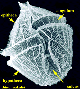
---------------
Info. from museum signage: "The giant clam is not only the largest, but the most spectacular of all bivalves. The species may reach in excess of 1.4 meters (4.5 feet) in size and may weigh more than 400 kilos (about 900 pounds). It inhabits the shallow, warm waters of the Southwest Pacific including the Great Barrier Reef. Its colorful, soft mantle harbors microscopic algae that provide part the nourishment to this giant of the reef. The adductor muscle of the giant clam is a much-prized food item in Southeast Asia, where the species is cultivated in marine farms."
---------------
More info. from museum signage: "The giant Tridacna clam of the southwest Pacific may grow to a length of four feet and a weight of 500 pounds. They live upside-down in shallow, coral reef waters with their huge, fleshy mantle exposed to sunlight. Within this colorful, soft organ, the clam farms its own seaweed food, Zooxanthella. Giant clams are vegetarisn and have never eaten fish, crabs or worms, much less humans. No cases of a person being trapped and drowned by a clam have ever been proved. Cuts and bruises have been caused by the sharp edges of young clams."
---------------
Classification: Animalia, Mollusca, Bivalvia, Veneroida, Cardiidae
----------------------
More info. at:
en.wikipedia.org/wiki/Tridacna
and
Stourhead (/ˈstɑːˌhɛd/[1]) is a 1,072-hectare (2,650-acre) estate[2] at the source of the River Stour near Mere, Wiltshire, England. The estate includes a Palladian mansion, the village of Stourton, gardens, farmland, and woodland. Stourhead is part owned with the National Trust since 1946.
Contents [hide]
1History
2Gardens
2.1Architects
2.2"The Genius of the Place"
3Prints
4Trivia
5Gallery
6References
7External links
History[edit]
The Stourton family, the Barons of Stourton, had lived in the Stourhead estate for 500 years[3] until they sold it to Sir Thomas Meres in 1714.[4] His son, John Meres, sold it to Henry Hoare I, son of wealthy banker Sir Richard Hoare in 1717.[5] The original manor house was demolished and a new house, one of the first of its kind, was designed by Colen Campbell and built by Nathaniel Ireson between 1721 and 1725.[6] Over the next 200 years the Hoare family collected many heirlooms, including a large library and art collection. In 1902 the house was gutted by fire but many of the heirlooms were saved, and the house was rebuilt in a near identical style.[7]
The last Hoare family member to own the property, Henry Hugh Arthur Hoare, gave the house and gardens to the National Trust in 1946, one year before his death; his sole heir and son, Captain "Harry" Henry Colt Arthur Hoare, of the Queen's Own Dorset Yeomanry, had died of wounds received at the Battle of Mughar Ridge on 13 November 1917 in World War I.[7] The last Hoare family member to be born at the house was Edward Hoare on 11 October 1949.
Gardens[edit]
Architects[edit]
Although the main design for the estate at Stourhead was created by Colen Campbell, there were various other architects involved in its evolution through the years. William Benson, Henry Hoare's brother-in-law, was in part responsible for the building of the estate in 1719.[8] Francis Cartwright, a master builder and architect, was established as a "competent provincial designer in the Palladian manner."[9] He worked on Stourhead between the years of 1749–1755. Cartwright was a known carver, presumably of materials such as wood and stone. It is assumed that his contribution to Stourhead was in this capacity. Nathaniel Ireson is the master builder credited for much of the work on the Estate. It is this work that established his career, in 1720.[10]
The original estate remained intact, though changes and additions were made over time. Henry Flitcroft built three temples and a tower on the property. The Temple of Ceres was added in 1744, followed by the Temple of Hercules in 1754 and the Temple of Apollo in 1765. That same year he designed Alfred's Tower, but it wasn't built until 1772.[11] In 1806, the mason and surveyor John Carter added an ornamental cottage to the grounds; at the request of Sir Richard Colt Hoare.[12] The architect William Wilkins created a Grecian style lodge in 1816; for Sir R. Colt Hoare.[12]
In 1840, over a century after the initial buildings were constructed, Charles Parker was hired by Sir Hugh Hoare to make changes to the estate. A portico was added to the main house, along with other alterations. The design of the additions was in keeping with original plans.[13]
"The Genius of the Place"[edit]
The lake at Stourhead is artificially created. Following a path around the lake is meant to evoke a journey similar to that of Aeneas's descent in to the underworld.[14] In addition to Greek mythology, the layout is evocative of the "genius of the place", a concept made famous by Alexander Pope. Buildings and monuments are erected in remembrance of family and local history. Henry Hoare was a collector of art– one of his pieces was Claude Lorrain's Aeneas at Delos, which is thought to have inspired the pictorial design of the gardens.[14] Passages telling of Aeneas's journey are quoted in the temples surrounding the lake.
Monuments are used to frame one another; for example the Pantheon designed by Flitcroft entices the visitor over, but once reached, views from the opposite shore of the lake beckon.[15] The use of the sunken path allows the landscape to continue on into neighbouring landscapes, allowing the viewer to contemplate all the surrounding panorama. The Pantheon was thought to be the most important visual feature of the gardens. It appears in many pieces of artwork owned by Hoare, depicting Aeneas's travels.[16] The plantings in the garden were arranged in a manner that would evoke different moods, drawing visitors through realms of thought.[15] According to Henry Hoare, 'The greens should be ranged together in large masses as the shades are in painting: to contrast the dark masses with the light ones, and to relieve each dark mass itself with little sprinklings of lighter greens here and there.'[17]
View taken from the Grotto, of the lake in autumn colours
Stourhead's lake and foliage as seen from a high hill vantage point
The gardens were designed by Henry Hoare II and laid out between 1741 and 1780 in a classical 18th-century design set around a large lake, achieved by damming a small stream. The inspiration behind their creation were the painters Claude Lorrain, Poussin, and, in particular, Gaspard Dughet, who painted Utopian-type views of Italian landscapes. It is similar in style to the landscape gardens at Stowe.
Included in the garden are a number of temples inspired by scenes of the Grand Tour of Europe. On one hill overlooking the gardens there stands an obelisk and King Alfred's Tower, a 50-metre-tall, brick folly designed by Henry Flitcroft in 1772; on another hill the temple of Apollo provides a vantage point to survey the magnificent rhododendrons, water, cascades and temples. The large medieval Bristol High Cross was moved from Bristol to the gardens. Amongst the hills surrounding the site there are also two Iron Age hill forts: Whitesheet Hill and Park Hill Camp. The gardens are home to a large collection of trees and shrubs from around the world.
Richard Colt Hoare, the grandson of Henry Hoare II, inherited Stourhead in 1783.[7] He added the library wing to the mansion,[7] and in the garden was responsible for the building of the boathouse and the removal of several features that were not in keeping with the classical and gothic styles (including a Turkish Tent). He also considerably enhanced the planting – the Temple of Apollo rises from a wooded slope that was planted in Colt Hoare's time. With the antiquarian passion of the times, he had 400 ancient burial mounds dug up to inform his pioneering History of Ancient Wiltshire.
Shoreditch London Old Street and City Road Silicon Roundabout Major Road Works.
This was due to be completed Autumn 2022 which has been delayed until Early 2024. The project commenced way back in 2019.
This cycle lane change was initially a three-year project. Now Five Years. The road is the inner ring road for London. They have blocked one of the tube entrances which includes the underpass. Ironically, cyclist do not even use this route since they blocked off the backstreets to traffic. They are trying to sabotage London. The situation is disgusting.
The Great Patriotic War (Russian: Вели́кая Оте́чественная война́, romanized: Velikaja Otečestvennaja vojna) is a term used in Russia and some other former republics of the Soviet Union to describe the conflict fought during the period from 22 June 1941 to 9 May 1945 along the many fronts of the Eastern Front of World War II, primarily between the Soviet Union and Nazi Germany. For some legal purposes, this period may be extended to 11 May 1945 to include the end of the Prague offensive.
History
The term Patriotic War refers to the Russian resistance to the French invasion of Russia under Napoleon I, which became known as the Patriotic War of 1812. In Russian, the term отечественная война originally referred to a war on one's own territory (otechestvo means "the fatherland"), as opposed to a campaign abroad (заграничная война), and later was reinterpreted as a war for the fatherland, i.e. a defensive war for one's homeland. Sometimes the Patriotic War of 1812 was also referred to as the Great Patriotic War (Великая отечественная война); the phrase first appeared in 1844 and became popular on the eve of the centenary of the Patriotic War of 1812.
After 1914, the phrase was applied to World War I. It was the name of a special war-time appendix to the magazine Theater and Life (Театр и жизнь) in Saint Petersburg, and referred to the Eastern Front of World War I, where Russia fought against the German Empire and the Austro-Hungarian Empire. The phrases Second Patriotic War (Вторая отечественная война) and Great World Patriotic War (Великая всемирная отечественная война) were also used during World War I in Russia.
The term Great Patriotic War re-appeared in the official newspaper of the CPSU, Pravda, on 23 June 1941, just a day after Germany invaded the Soviet Union. It was found in the title of "The Great Patriotic War of the Soviet People" (Velikaya Otechestvennaya Voyna Sovetskogo Naroda), a long article by Yemelyan Yaroslavsky, a member of Pravda editors' collegium. The phrase was intended to motivate the population to defend the Soviet fatherland and to expel the invader, and a reference to the Patriotic War of 1812 was seen as a great morale booster. During the Soviet period, historians engaged in huge distortions to make history fit with Communist ideology, with Marshal Mikhail Kutuzov and Prince Pyotr Bagration transformed into peasant generals, Alexander I alternatively ignored or vilified, and the war becoming a massive "People's War" fought by the ordinary people of Russia with almost no involvement on the part of the government. The invasion by Germany was called the Great Patriotic War by the Soviet government to evoke comparisons with the victory by Tsar Alexander I over Napoleon's invading army.
The term Отечественная война (Patriotic War or Fatherland War) was officially recognized by establishment of the Order of the Patriotic War on 20 May 1942, awarded for heroic deeds.
The term is not generally used outside the former Soviet Union, and the closest term is the Eastern Front of World War II (1941–1945). Neither term covers the initial phase of World War II in Eastern Europe, during which the USSR, then still in a non-aggression pact with Germany, invaded eastern Poland (1939), the Baltic states (1940), Bessarabia and Northern Bukovina (1940) and Finland (1939–1940). The term also does not cover the Soviet–Japanese War (1945) nor the Battles of Khalkhin Gol (1939).
In Russia and some other post-Soviet countries, the term is given great significance; it is accepted as a representation of the most important part of World War II. Until 2014, Uzbekistan was the only nation in the Commonwealth of Independent States that had not recognized the term, referring to it as World War II on the state holiday - the Day of Remembrance and Honour.
On 9 April 2015, the Ukrainian parliament replaced the term Great Patriotic War (1941–1945) (Velyka vitchyzniana viina) in the country's law with the "Second World War (1939–1945)" (Druha svitova viina), as part of a set of decommunization laws. Also in 2015, Ukraine's "Victory Day over Nazism in World War II" was established as a national holiday in accordance with the law of "On Perpetuation of Victory over Nazism in World War II 1939–1945". The new holiday was celebrated on May 9 and replaced the Soviet-Russian Victory Day, which is celebrated on May 9. These laws were adopted by the Ukrainian parliament within the package of laws on decommunization. In 2023 Ukraine abolished the 2015 9 May "Victory Day over Nazism" holiday and replaced it with the new public holiday "Day of Remembrance and Victory over Nazism in World War II 1939 – 1945" which is celebrated on 8 May annually.
Low resolution clip taken from very old video footage.
In 1983, Port Parham, in South Australia, faced a turning point.
Between the proposed Department of defence extension and the proposed airport at Two Wells, Port Parham and it's residents were about to become extinct.
A battle begun that ran for almost 4 years. 6 elderly residents passed away during the battle and in the last year, it looked like the future of the area for public use, was clouded.
The Army had created the "Department of defence, Proposed extension of the proof and experimental establishment, Pt , Draft environmental impact statement"
The Department of defence needed to test larger guns. The current area was the army firing range, Gun testing range and munitions testing area.
They needed to expand to test the new (At the time) 155 mm Howitzer. They needed to test it up to 6 times a year and needed 30 kms extra area (The range is 40 kms).
The Army faced three options.
Option 1 was to acquire land all the way up to Pt Prime (All the way from Sandy Point). This included Port Parham (Inhabited), Webb Beach(Inhabited) and Thompson Beach
(Uninhabited). Pt Prime being a previous shelling range and not a very nice beach). That leaves no real beaches north of Adelaide.
They did consider relocating all buildings and people to Pt Prime/Thompson's beach. Thompson's beach had no houses or infrastructure yet.
This plan would have been end to private land development planned at Thompson's.
This plan would include $5.5 million to acquire 5000 ha of land.
Option 2, move the firing range further north and fire into the existing area.
Option 3, close and relocate the firing range.
The preferred option for the Army was option 1. This meant they would compulsory acquire the land, lease it back for 10 years and close the beach. You cold see the beach but not
access it for the rolled up security barbed wire and armed men on hovercrafts. This was deemed to be in the national interest and a matter of "National Security. It was highlighted that
the Pt Wakefield range was the only lace in Australia where they can test the ammunition like this.
The army had been testing munitions in the mud flats since 1929 and it is littered with dangerous unexploded ammunition. They also test destroyer 5" navel shells and it is impossible
to recover all the shells. The Army has had access to the sea and airspace North of Pt Prime since the 2nd world war. (For all types of Weapons testing).
The army fired at high tide and retrieved munitions at low tide and then inspected them.
The area of Pt Parham was allocated to the army in 1937 for defence purposes. From 1978 government allowed freehold land and local council had been approving building permits.
The area North was not considered to have any restrictions except a building height restriction of 15 feet. The army approved many dwellings over this height since 1978.
The current proof range has been in use since about 1944. It is currently Sandy point to about 2 Kms north of Pt Parham. It is looked after by the Keswick Barracks which is a barracks
of the Australian Army in Keswick
As option 1 was pushed into the public space, it lead to all kinds of protests. During these, the gun on Pt Wakefield road was turned into a tent, defaced and graffiti.
This started the fight for land and homes. This plan would kill Pt Parham. Some of the current residents had been there since the depression. Some of them had settled in the area to
retire. There were 100's of full time residents and thousands of shack owners and other visitors that frequented the area.
The residents don't want to have the Army contaminate Pt Parham for all time, like they have where they are at the moment. They have already admitted that they will never be able to
clear the current mudflats of dangerous unexploded material. The residents also feared nuclear testing.
In July 1983 a document was released that outlined the process to compulsory acquire land. This is when the battled heated up. There were many meetings in the old social club (Grain
store - Webbs Carbonate of lime), at Collins Corner and beside the old shade house on the esplanade. There was a 13 point protest plan developed and issues were found in the
environmental impact study. Many people from Pt Parham and Webb beach attended the meetings, as did many holiday makers from across Australia.
People started to paint their fences and roof's with slogans.
"Army go home"
"P*ss off Army"
"Use a pond"
"Move the gun"
"St Kilda Next?"
"Sorry My Beazly, not for sale"
"We have enough shells"
"Only Beach north of Adelaide"
"People before Guns"
"I don't trust them"
"Not for Sale"
Hat's, stickers, shirts and beer cools came out with the slogans
"Save the crabbers and the gulf"
"Save the crabbers from the army shells"
I still have my yellow hat somewhere with the "Save the crabbers and the gulf" on the front. It is likely a rarity these days.
ABC, Channel 7 and 10 frequented the beach to have interviews with the residents and fly over the site in their helicopters.
Kevin Collins (member of Action Committee), Ian Featherstone (Chairman - Parham Action committee) and Leon Broster (Chairman Mallala council) appeared regularly on the news to
show that they were against the plans.
Local member John Meyer(?) and Lands minister Mr Abbot were against it but it was a federal issue and they could do nothing.
Len Web was interviewed. He had lived at Port Parham all his life and ran the shell grit plant. Shell grit is not widely available and sought after for poultry.
Col. Phillip Cooper and Major Andrew (Andy) Renolds came to Port Parham meetings to try and explain why this needed to happen. Barry Tompson of the
"Pt Wakefield friends of the proof range" wanted it to go ahead as he did not want Port Wakefield to die. He did not want the proof range to move.
Kim Beazley, the Federal defence minister, wanted to wait on the environmental study before making a decision. Premier John Bannon was against this.
After the battle, Kim Beazley compromised. In the end 2900 ha was acquired including 16 farms and 2 houses inland.
Pt Parham gave up 2 kms of land and coast (It was the army's anyway) and Port Parham has thrived ever since.
I still have access to the old footage.
• colors include soft burgundys and reds, orangey melons, creams, greys and dark brown :)
• fibers include merino, bfl, bfl x montadale, mohair, romney, gotland x border leicester, merino x romney, cotswald, silk and sari silk threads, novelty fabric and yarn snippets
City Palace, Jaipur, which includes the Chandra Mahal and Mubarak Mahal palaces and other buildings, is a palace complex in Jaipur, the capital of the Rajasthan state, India. It was the seat of the Maharaja of Jaipur, the head of the Kachwaha Rajput clan. The Chandra Mahal palace now houses a museum but the greatest part of it is still a royal residence. The palace complex, which is located northeast of the centre of the grid patterned Jaipur city, incorporates an impressive and vast array of courtyards, gardens and buildings. The palace was built between 1729 and 1732, initially by Sawai Jai Singh II, the ruler of Amber. He planned and built the outer walls, and later additions were made by successive rulers right up to the 20th century. The credit for the urban layout of the city and its structures is attributed to two architects namely, Vidyadar Bhattacharya, the chief architect in the royal court and Sir Samuel Swinton Jacob, apart from the Sawai himself who was a keen architectural enthusiast. The architects achieved a fusion of the Shilpa Shastra of Indian architecture with Rajput, Mughal and European styles of architecture.
The palace complex lies in the heart of Jaipur city, to the northeast of the very centre. The site for the palace was located on the site of a royal hunting lodge on a plain land encircled by a rocky hill range, five miles south of Amber (city). The history of the city palace is closely linked with the history of Jaipur city and its rulers, starting with Maharaja Sawai Jai Singh II who ruled from 1699-1744. He is credited with initiating construction of the city complex by building the outer wall of the complex spreading over many acres. Initially, he ruled from his capital at Amber, which lies at a distance of 11 kilometres from Jaipur. He shifted his capital from Amber to Jaipur in 1727 because of an increase in population and increasing water shortage. He planned Jaipur city in six blocks separated by broad avenues, on the classical basis of principals of Vastushastra and other similar classical treatise under the architectural guidance of Vidyadar Bhattacharya, a man who was initially an accounts-clerk in the Amber treasury and later promoted to the office of Chief Architect by the King.
Following Jaisingh's death in 1744, there were internecine wars among the Rajput kings of the region but cordial relations were maintained with the British Raj. Maharaja Ram Singh sided with the British in the Sepoy Mutiny or Uprising of 1857 and established himself with the Imperial rulers. It is to his credit that the city of Jaipur including all of its monuments (including the City Palace) are stucco painted 'Pink' and since then the city has been called the "Pink City". The change in colour scheme was as an honour of hospitality extended to the Prince of Wales (who later became King Edward VII) on his visit. This colour scheme has since then become a trademark of the Jaipur city.
Man Singh II, the adopted son of Maharaja Madho Singh II, was the last Maharaja of Jaipur to rule from the Chandra Mahal palace, in Jaipur. This palace, however, continued to be a residence of the royal family even after the Jaipur kingdom merged with the Indian Union in 1949 (after Indian independence in August 1947) along with other Rajput states of Jodhpur, Jaisalmer and Bikaner. Jaipur became the capital of the Indian state of Rajasthan and Man Singh II had the distinction of becoming the Rajapramukh (present day Governor of the state) for a time and later was the Ambassador of India to Spain.
Thursday at the Goodwood Festival of Speed. A flat display from the Red Arrows on Thursday. Friday's display was cancelled due to the rain/low cloud.
Map Locations Include:
Apple Valley Farm
Aztec Motorcoach Resort
Bayley's Camping Resort
Bella Terra RV Resort
Blue Ridge Mountains MotorCoach Resort
Blue Water Key - A Luxury RV Resort
Buckhorn Lake RV Resort
Cane Creek RV Reosrt and Marina
Cherry Hill Park
Citrus Valley RV Resort
Coastal GA RV Resort
Deercreek RV Resort
Dunedin RV Resort
Elite Resorts
Elkhorn Ridge RV Resort
Emerald Desert RV Resort
Everglades Isle Motorcoach Resort
Gilgal Oasis Campground and RV Resort
Heathside Grove RV Resort
Heritage Orange Beach Motor Coach Resort & Marina
Horseshoe Cove RV Resort
Indigo Bluffs RV Resort
Lake Placid KOA
Lakeview RV Park
Las Vegas Motor Coach Resort
Majestic Oaks RV Resort
McCall RV Resort
Motor Coach County Club
Nevada Treasure RV Resort
Pacific Shores Motorcoach Resort
Pelican Lake Motorcoach Resort
Rayford Crossing RV Resort
Red Oaks Rv Resort
River Bend RV Resort
River Plantation RV Resort
River Vista Mountain Villiage RV Resort
Signature Motorcoach Resorts
St. Lucie West Motorcoach Resort
Sunny Brook RV Resort
The Dell RV Resort
Traverse Bay RV Resort
Virginia Beach RV Resort
Willow Tree Resort
The full title of this 360/720 panorama includes the above phrase, but is prefaced with: In the manner of Robbert Frick.
Robbert Frick is a Los Angeles-based artist. He attached a camera to his car and drove around, generating pictures that way. This method is both relevant to LA and elegantly minimal.
My friend, Paul Zelevansky suggested I do something similar with the equipment I use to generate 360/720 spherical panoramas. At first, I didn’t think this would work. Then, I became intrigued. It might generate really different kinds of images.
So…I got a tripod out, mounted theVRkit rotator on it, and put all this on the floor of the passenger side of my Subaru Forester Sport. I put my iPhone 11 with my Sandmarc fisheye lens in the Rotator clamp, and set off.
I didn’t have to go very far before I had my first pano. You have to know my neighborhood in West Des Moines to understand how really smashed up this picture is.
1. My house is sizable, but it doesn’t have 3 garages on the first floor. It doesn’t even have two garages.
2. I appear to be going east, to the right of my house, but the picture has moved everything that actually is west of my house to the east.
3. Not to mention my left arm has taken the place of my right arm in the first reflection and then moves back to its proper place in the next reflection.
There are many more instances in this image of fractured duplications and reflections. Enjoy!
This image is a 360/720 spherical panorama. It is best viewed in a VR headset such as the Oculus Quest 2, but can also be viewed happily just as it is.
News Release
For Immediate Release
Contact: Walter Gallas, 504-400-3017 or Sandra Stokes, 225-445-3800
41 ORGANIZATIONS CALL ON GOVERNOR AND CITY LEADERS FOR OPEN PROCESS IN DECISION-MAKING FOR MAJOR HOSPITALS
They ask Gov. Jindal for cost-benefit analysis of two competing LSU plans, and ask City Council and Planning Commission to include hospitals in the New Orleans master plan.
New Orleans, La. (Wednesday, March 25, 2009)—With the debate over locating new LSU and VA hospitals in Mid-City continuing, 41 local and national organizations—including a diverse range of community groups, professional organizations and planning associations—are asking state and city leaders to engage the public more directly in the search for a solution.
At a press conference held today, the organizations asked Gov. Jindal to commission an independent, third-party comprehensive cost-benefit analysis of the two LSU hospital plans--proposed new construction in Lower Mid-City and an alternative proposal to gut and rebuild a new 21st century hospital inside the shell of Charity Hospital. The organizations argue that a rigorous, side-by-side financial analysis will both clear up contradictory claims about construction costs of the two plans and will also measure the impact of different timelines on job creation, related economic development and health care delivery to the community.
In addition, the groups called on the City Council and the City Planning Commission to hold public hearings to receive information about the hospital designs and plans for a biomedical research district, and to give members of the public their first City-Hall-sponsored opportunity to respond to the plans. The groups want the hearings to be part of a process in which the council and planning commission take responsibility for making sure that the locations and designs for the huge hospital complex are best for the citizens, neighborhoods and the medical industry.
A third recommendation by the groups is to include the hospitals and the new biosciences economic development district in the city’s new master planning process. Goody Clancy, the city’s planning contractor, has stated that the Planning Commission excluded the hospitals and medical district from the scope of the master plan, which was released Friday in draft form.
“Despite the profound and lasting impact these projects will have on the city of New Orleans, the City Council and the City Planning Commission have been sitting on the sidelines of the debate, doing nothing, and the people of New Orleans have been kept largely in the dark,” said William Borah, New Orleans land use attorney. “This decision is far too important to be made in a backroom deal, without citizen input. This coalition is calling for a more transparent, open decision making process—one that has citizens at the table to help decide which hospital plan is in the best long-term interests of the people of New Orleans.”
Louisiana State University’s proposed $1.2 billion teaching hospital and medical center and a new $600-plus million hospital for the Department of Veterans Affairs constitute the largest single economic-development project in the city’s history. LSU and VA propose to locate the hospitals in a 70-acre section of the Mid-City neighborhood, after removing residents and small businesses from hundreds of buildings, many of them historic structures. The LSU plan for moving the hospitals to Mid-City would also affect the Central Business District, since the university proposes to abandon the landmark Charity Hospital building. A plan by RMJM Hillier proposes reusing the shell of the Charity building to house the state-of-the-art hospital that would serve as the core of LSU’s academic medical center, an approach the nationally-recognized architects say will produce a world-class hospital with savings of hundreds of millions of dollars over new construction and will be completed at least two years sooner.
Last week at the Senate District 9 Health Care Reform Forum, Louisiana Secretary of Health and Hospitals Alan Levine—the state’s point person on the hospital issue—said that no final decisions have been made and that both the LSU and the RMJM Hillier approaches are still on the table.
"Every neighborhood in New Orleans should be concerned that the plans for the replacement of Charity and the VA hospitals are not a part of the city's master planning process which is going on right now," said Charles E. Allen, III, president of the Holy Cross Neighborhood Association. "What is happening in Lower Mid-City could happen in any neighborhood of the city. We need to make sure that City Planning and the City Council insist that the process applies to our entire city. We can't leave anything out."
“Health care is in critical condition here in New Orleans,” said Dr. Sissy Sartor. “I am appealing to Governor Jindal to come forward and show the citizens of New Orleans and of the state that he is serious about returning health care to our city and that he will do it in a fiscally responsible way. The governor has it in his power to order a cost-benefit analysis that would answer the questions about alternative plans for rebuilding the LSU medical center.”
“At this point, what we need is a clear factual basis from which a decision can be reached,” said Sandra Stokes, Executive Vice Chair of the Foundation for Historical Louisiana “We need to move forward, and the best way to do that is for the state to conduct an independent, side-by-side analysis of the two plans. That process would provide answers to fundamental questions of time, efficiency and cost. Which plan would provide 21st century medical care faster? Which would cost less? We need an independent voice to provide answers to these basic questions.”
ORGANIZATIONS IN THE COALITION ARE CALLING FOR:
1.Governor Jindal to order an independent, comprehensive cost-benefit analysis of the two hospital plans.
2.The City Planning Commission and the City Council to hold public hearings on these critical planning issues.
3.The City Planning Commission and the City Council to include the hospitals in the current master-planning process.
●American Planning Association
●Broadmoor Improvement Association
●Charity Hospital School of Nursing Alumni Association
●Foundation for Historical Louisiana
●New Orleans Committee to Reopen Charity Hospital
●Coliseum Square Association
●Doctors for Charity Hospital
●National Trust for Historic Preservation
●Squandered Heritage
●Faubourg Marigny Improvement Association
●Smart Growth for Louisiana
●Preservation Resource Center
●Louisiana ACORN
●Faubourg St. John Neighborhood Association
●Louisiana Landmarks Society
●GNO Affordable Housing Action Center
●Holy Cross Neighborhood Association
●New Creation Christian Church
●Louisiana Trust for Historic Preservation
●Lower Mid-City Residents and Business Owners Affected by the LSU/VA Hospitals
●The Renaissance Project
●Vieux Carré Property Owners, Residents and Associates
●Southern Christian Leadership Conference Louisiana Women’s Division
●French Quarter Citizens, Inc.
●Lantern Light Inc.
●Irish Channel Neighborhood Association
●Louisiana Justice Institute
●Lafayette Square Association
●Lower Ninth Ward Center for Sustainable Engagement and Development
●Mid-City Neighborhood Organization
●New Orleans Pax Christi
●Partners for Livable Communities
●C3/Hands Off Iberville
●Phoenix of New Orleans
●Restaurant Opportunity Center of New Orleans
●Social Justice Committee of the First Unitarian Universalist Church
●The Townscape Institute
●The Urban Conservancy
●United Teachers of New Orleans
●Advocates for Environmental Human Rights
●Historic Faubourg Treme Association
Battery Park (also known as The Battery), which includes a park known as White Point Gardens, is a landmark promenade in Charleston, South Carolina famous for its stately antebellum homes. First used as a public park in 1837, it became a place for artillery during the American Civil War. It stretches along the shores of the Charleston peninsula, bordered by the Ashley and Cooper Rivers. Fort Sumter is visible from the Cooper River side and the point, as is Castle Pinckney, the World War II aircraft carrier USS Yorktown (CV-10), Fort Moultrie, and Sullivan's Island.
In the 18th century, rocks and heavy materials were used to fortify the shore of the Cooper River. In 1838, this area of the Battery, known as High Battery, became a promenade.
Before becoming a park, Fort Broughton (ca. 1735) and Fort Wilkins (during the American Revolution and War of 1812) occupied White or Oyster Point, so named because of the piles of bleached oyster shells on the point. This site is now known as White Point Garden(s) and boasts many large oak trees, a bandstand, a few memorials, and pieces of artillery, some of which were used during the United States Civil War.
A monument in White Point Gardens commemorates the hanging near that site of pirate captain Stede Bonnet and his crew in 1718, as well as the 1719 hanging of Richard Worley's pirates. The monument states that 29 of Bonnet's crew were executed close by. Although 29 of Bonnet's crew were sentenced to death, the evidence suggests that only 22 were actually hanged.
Includes front entrance, information desk, historic weaponry section, museum shop and cafe, and a rear exit
At Pevensey Castle
Pevensey Castle: a Saxon Shore fort, Norman defences, a medieval enclosure castle, and later associated remains
The monument includes Anderita Saxon Shore fort, traces of later, Norman defences, an enclosure castle, a 16th century gun emplacement and World War II defences situated on a low spur of sand and clay which now lies around 2km north west of the present East Sussex coastline at Pevensey. During the Roman and medieval periods the spur formed a peninsula projecting into a tidal lagoon and marshland, but coastal deposition and land reclamation have gradually built up the ground around it so that it is now completely land-locked. The roughly oval, north east-south west aligned Roman fort is the earliest of the structures which make up the monument and has been dated to the first half of the fourth century AD. Covering almost 4ha, the fort survives in the form of substantial ruins and buried remains. It is enclosed by a massive defensive wall with a flint and sandstone rubble core faced by coursed greensand and ironstone blocks, interspersed with red tile bonding courses. The whole is up to 3.7m thick and survives to a height of up to 8.1m. The wall was originally topped by a wall walk and parapet. Part excavation in 1906-8 showed that the wall was constructed on footings of rammed chalk and flints underpinned by oak piles and held together by a framework of wooden beams. Investigation of the internal face indicated that this was stepped upwards from a wide base so as to provide extra strength and support. Despite these precautions, a landslip on the south eastern side of the fort has resulted in the destruction of a c.180m length of the perimeter walls and, although fragments of the fallen masonry do survive, most have been removed over the years. Smaller sections of wall have also collapsed along the north western and eastern stretches. The defensive strength provided by the perimeter wall was enhanced by irregularly-spaced, externally projecting semicircular bastions with diameters of around 5m. There were originally at least 15 of these, of which 10 survive today. The fort was entered from its south western, landward approach by way of the main gateway. In front of this a protective ditch 5.5m wide was dug, and, although this became infilled over the years, a 40m stretch located towards its south eastern end has been recut and exposed. The ditch would have been spanned originally by a wooden bridge, although this no longer survives. The main gateway takes the form of a rectangular gatehouse set back between two solid semicircular bastions 8m apart. The 2.7m wide, originally arched entrance is flanked by two oblong guardrooms and the whole gateway structure projects beyond the inner face of the perimeter wall into the fort and is thought to have been originally two or even three storeys high. On the eastern side of the fort is a more simply designed subsidiary gateway, originally a 3m wide archway entrance, giving access to part of the adjacent Roman harbour, now overlain by Pevensey village. The extant archway is a modern reconstruction of the Norman rebuilding of the original entrance. Traces of a wooden causeway which led from it into the fort have been found during partial excavation. Midway along the north western stretch of perimeter wall is a now ruined postern c.2m wide, approached by a curved passage set within the wall. Part excavation between 1906-1908 indicated that the internal buildings which housed the garrison of up to 1,000 men, along with their livestock and supplies, were constructed of timber infilled with wattle and daub. A c.1m sq timber-lined Roman well was found in the south western sector of the fort, at the bottom of which were the remains of the wooden bucket with rope still attached. The well was found to have been filled with rubbish in Roman times and the presence of the bones of cattle, sheep, red deer, wild boar, wild birds, domestic dogs and cats, along with sea shells, gives some indication of the diet and lifestyle of the fort's original inhabitants. Anderita is thought to have been abandoned by its garrison by the latter half of the 4th century AD, and although little is known of its subsequent history until the 11th century, the Anglo-Saxon Chronicle records a massacre of Britons by the invading Saxons at the fort in AD 491. The Bayeux Tapestry states that William the Conquerer landed at Pevensey in 1066, and the Norman army are believed to have made use of the Roman fort as one of their first armed camps. The defences at Pevensey and the surrounding land were granted to King William's half-brother Robert, Count of Mortain. The medieval defences then went through at least 300 years of development, culminating in the construction of a stone built enclosure castle within the largely intact walls of the earlier Roman fort. It is thought that the first Norman defences took the form of a wooden palisade surrounded by a bank and ditch, and a c.40m length of partially infilled ditch up to 9m wide which survives across the north eastern sector of the earlier fort may indicate their original extent. Limited excavations in 1993-94 showed that the ground surface in the south eastern sector of the fort, in the vicinity of the later stone-built keep, was artificially raised some time before 1200, suggesting that a motte may also have been constructed. The original Roman gateways were rebuilt and a new ditch dug in front of the south western gate. Most of the Norman defences and interior wooden buildings will now survive in buried form beneath the later medieval castle, although herringbone-pattern repairs to the Roman masonry, by then serving as the outer bailey of the medieval defences, also date from this time. Around 1100 the defences were strengthened and the accommodation improved by the addition of a masonry keep in the south eastern sector of the earlier fort. The subject of a complex history of alteration, collapse and repair, the keep utilises part of the earlier, Roman perimeter wall and bastions. It takes the form of a rectangular block measuring c.16.8m by c.9m internally, reinforced by apsidal projections on all sides. Now surviving in ruined form up to first floor level, the keep originally took the form of a tall tower with an entrance on the first floor. A rectangular building measuring 7.6m by 6m was later constructed in the south eastern angle between the keep and the Roman wall. At around 1200 work began on the construction of a smaller, stone-built inner bailey in the south eastern sector of the earlier fort. An L-shaped ditch around 20m wide was dug to define the new enclosure, and this retains water in its northern arm. The material excavated from the ditch and from the destruction of the earlier bank was spread over much of the outer bailey to a depth of up to 1.5m. The ditch was recut during extensive renovations carried out during the early 20th century. The first structure to be built in this phase was the gatehouse to the south west which has an arched entrance between twin, semicircular external towers, now ruined. The basement chambers beneath each tower have ashlar-faced walls and barrel-vaulted ceilings, the southern chamber being entered by way of a newel staircase, the northern by a trapdoor. Both were used to house prisoners. Many subsequent alterations included the replacement, during the 15th century, of the wooden bridge over the outer ditch by a stone causeway. The originally embattled curtain wall enclosing the inner bailey was built within the ditch and inner berm around 1250. This survives almost to its full original height and is faced with coursed Greensand ashlar. Three semicircular external towers provided flanking cover from the narrow embrasures which pierce their walls. Each has a narrow staircase to a basement, a branch staircase off it into the ditch and a room and garderobe, or latrine, at ground floor level. Upper rooms were entered by way of the wall walk and were heated by fireplaces. The basement of the northernmost tower has two rib-vaulted bays, the keeled ribs resting on stiff-leaf corbels. The interior castle buildings continued to be built mainly of wood and these will survive in buried form, although the stone foundations of a chapel were exposed during partial excavation of the northern sector of the inner bailey. Around 20m south east of the chapel is a large stone-lined well at least 15.5m deep, and near this is a pile of medieval stone missile-balls, a selection of those recovered from the ditch. These were thrown from trebuchets during the four sieges of the castle. William, Count of Mortain forfeited Pevensey after an unsuccessful rebellion against Henry I in 1101 and the castle, which remained in the royal gift until the later Middle Ages, passed into the hands of the de Aquila family. The most famous siege took place in 1264-65 when the supporters of Henry III, fleeing from their defeat by the Barons at Lewes, took refuge in the castle. In 1372 the castle was given to John of Gaunt, and during his period of office was used to imprison James I, King of Scotland, who had been seized in 1406, and Joan, Queen of Navarre, accused of witchcraft by her stepson, Henry V. By 1300, the sea had gradually begun to recede from around the castle and its military importance declined as a result. Contemporary records show that the castle walls were constantly in need of expensive repair and by the end of the 14th century were not being properly maintained, although the roof leads were kept intact until the middle of the 15th century. By 1500 the castle had ceased to be inhabited and fell rapidly into decay. The threat of the Spanish Armada led to some renewed interest in the defensive value of the site, and a survey of 1587 records that the castle housed two demi-culverins, or heavy guns. These were sited on the contemporary, south east orientated, M-shaped earthen gun emplacement situated in the outer bailey around 90m north east of the main Roman gateway. This takes the form of a raised level platform c.20m long bounded on the seaward side by a slight bank c.0.4m high and around 3m wide. One of the cast iron guns, manufactured in the East Sussex Weald, is now housed within the inner bailey on a modern replica carriage. From the 17th century the castle passed through the hands of various private owners. Valued as a picturesque ruin during the 18th and 19th centuries, it features in many contemporary engravings and illustrations. In 1925 the Duke of Devonshire presented the monument to the state, and extensive repairs began with a view to opening the monument to the public. These were interrupted by the outbreak of World War II, when the castle resumed its original military purpose of protecting the south coast. The castle was refortified in May 1940 as an observation and command post. It was continuously occupied by regular troops, including Canadian forces and the United States Army Air Corps, who used it as a radio direction centre, and by the Home Guard until 1944. The World War II defences include two pillboxes and three machine gun posts of concrete faced with rubble and flints, carefully concealed and camouflaged within the earlier Roman and medieval fabric. An internal tower was built just to the south of the Roman east gateway and a blockhouse housing anti-tank weapons was built in front of the main Roman gateway. The blockhouse no longer survives. Modifications carried out to the medieval mural towers included lining the interiors with brick and inserting wooden floors. In 1945 the monument was returned to peaceful use and is now in the guardianship of the Secretary of State and open to the public.
[Historic England]
Includes home fries and fresh fruit. Extra side of bacon. Photo credit: Nancy Wong Photo taken: Apr.25,2015
Item Attributes Of all the tastes that LorAnn provides, These Tastes are taken into consideration the most effective for making your personal E-Juice. They are water soluble, they include no food additives or tryglicerides. These 10 Loads ALWAYS Ship Within a Corrugated Box to Maintain Your Oils Safe After Distribution, We
www.vapestore.wupples.com/index.php/2016/06/06/10-best-di...