View allAll Photos Tagged Extended
Experiment with converted IR camera using a polarizing filter and HDR software. AEB +/-2 total 3 exposures processed with Photomatix.
High Dynamic Range (HDR)
High-dynamic-range imaging (HDRI) is a high dynamic range (HDR) technique used in imaging and photography to reproduce a greater dynamic range of luminosity than is possible with standard digital imaging or photographic techniques. The aim is to present a similar range of luminance to that experienced through the human visual system. The human eye, through adaptation of the iris and other methods, adjusts constantly to adapt to a broad range of luminance present in the environment. The brain continuously interprets this information so that a viewer can see in a wide range of light conditions.
HDR images can represent a greater range of luminance levels than can be achieved using more 'traditional' methods, such as many real-world scenes containing very bright, direct sunlight to extreme shade, or very faint nebulae. This is often achieved by capturing and then combining several different, narrower range, exposures of the same subject matter. Non-HDR cameras take photographs with a limited exposure range, referred to as LDR, resulting in the loss of detail in highlights or shadows.
The two primary types of HDR images are computer renderings and images resulting from merging multiple low-dynamic-range (LDR) or standard-dynamic-range (SDR) photographs. HDR images can also be acquired using special image sensors, such as an oversampled binary image sensor.
Due to the limitations of printing and display contrast, the extended luminosity range of an HDR image has to be compressed to be made visible. The method of rendering an HDR image to a standard monitor or printing device is called tone mapping. This method reduces the overall contrast of an HDR image to facilitate display on devices or printouts with lower dynamic range, and can be applied to produce images with preserved local contrast (or exaggerated for artistic effect).
In photography, dynamic range is measured in exposure value (EV) differences (known as stops). An increase of one EV, or 'one stop', represents a doubling of the amount of light. Conversely, a decrease of one EV represents a halving of the amount of light. Therefore, revealing detail in the darkest of shadows requires high exposures, while preserving detail in very bright situations requires very low exposures. Most cameras cannot provide this range of exposure values within a single exposure, due to their low dynamic range. High-dynamic-range photographs are generally achieved by capturing multiple standard-exposure images, often using exposure bracketing, and then later merging them into a single HDR image, usually within a photo manipulation program). Digital images are often encoded in a camera's raw image format, because 8-bit JPEG encoding does not offer a wide enough range of values to allow fine transitions (and regarding HDR, later introduces undesirable effects due to lossy compression).
Any camera that allows manual exposure control can make images for HDR work, although one equipped with auto exposure bracketing (AEB) is far better suited. Images from film cameras are less suitable as they often must first be digitized, so that they can later be processed using software HDR methods.
In most imaging devices, the degree of exposure to light applied to the active element (be it film or CCD) can be altered in one of two ways: by either increasing/decreasing the size of the aperture or by increasing/decreasing the time of each exposure. Exposure variation in an HDR set is only done by altering the exposure time and not the aperture size; this is because altering the aperture size also affects the depth of field and so the resultant multiple images would be quite different, preventing their final combination into a single HDR image.
An important limitation for HDR photography is that any movement between successive images will impede or prevent success in combining them afterwards. Also, as one must create several images (often three or five and sometimes more) to obtain the desired luminance range, such a full 'set' of images takes extra time. HDR photographers have developed calculation methods and techniques to partially overcome these problems, but the use of a sturdy tripod is, at least, advised.
Some cameras have an auto exposure bracketing (AEB) feature with a far greater dynamic range than others, from the 3 EV of the Canon EOS 40D, to the 18 EV of the Canon EOS-1D Mark II. As the popularity of this imaging method grows, several camera manufactures are now offering built-in HDR features. For example, the Pentax K-7 DSLR has an HDR mode that captures an HDR image and outputs (only) a tone mapped JPEG file. The Canon PowerShot G12, Canon PowerShot S95 and Canon PowerShot S100 offer similar features in a smaller format.. Nikon's approach is called 'Active D-Lighting' which applies exposure compensation and tone mapping to the image as it comes from the sensor, with the accent being on retaing a realistic effect . Some smartphones provide HDR modes, and most mobile platforms have apps that provide HDR picture taking.
Camera characteristics such as gamma curves, sensor resolution, noise, photometric calibration and color calibration affect resulting high-dynamic-range images.
Color film negatives and slides consist of multiple film layers that respond to light differently. As a consequence, transparent originals (especially positive slides) feature a very high dynamic range
Tone mapping
Tone mapping reduces the dynamic range, or contrast ratio, of an entire image while retaining localized contrast. Although it is a distinct operation, tone mapping is often applied to HDRI files by the same software package.
Several software applications are available on the PC, Mac and Linux platforms for producing HDR files and tone mapped images. Notable titles include
Adobe Photoshop
Aurora HDR
Dynamic Photo HDR
HDR Efex Pro
HDR PhotoStudio
Luminance HDR
MagicRaw
Oloneo PhotoEngine
Photomatix Pro
PTGui
Information stored in high-dynamic-range images typically corresponds to the physical values of luminance or radiance that can be observed in the real world. This is different from traditional digital images, which represent colors as they should appear on a monitor or a paper print. Therefore, HDR image formats are often called scene-referred, in contrast to traditional digital images, which are device-referred or output-referred. Furthermore, traditional images are usually encoded for the human visual system (maximizing the visual information stored in the fixed number of bits), which is usually called gamma encoding or gamma correction. The values stored for HDR images are often gamma compressed (power law) or logarithmically encoded, or floating-point linear values, since fixed-point linear encodings are increasingly inefficient over higher dynamic ranges.
HDR images often don't use fixed ranges per color channel—other than traditional images—to represent many more colors over a much wider dynamic range. For that purpose, they don't use integer values to represent the single color channels (e.g., 0-255 in an 8 bit per pixel interval for red, green and blue) but instead use a floating point representation. Common are 16-bit (half precision) or 32-bit floating point numbers to represent HDR pixels. However, when the appropriate transfer function is used, HDR pixels for some applications can be represented with a color depth that has as few as 10–12 bits for luminance and 8 bits for chrominance without introducing any visible quantization artifacts.
History of HDR photography
The idea of using several exposures to adequately reproduce a too-extreme range of luminance was pioneered as early as the 1850s by Gustave Le Gray to render seascapes showing both the sky and the sea. Such rendering was impossible at the time using standard methods, as the luminosity range was too extreme. Le Gray used one negative for the sky, and another one with a longer exposure for the sea, and combined the two into one picture in positive.
Mid 20th century
Manual tone mapping was accomplished by dodging and burning – selectively increasing or decreasing the exposure of regions of the photograph to yield better tonality reproduction. This was effective because the dynamic range of the negative is significantly higher than would be available on the finished positive paper print when that is exposed via the negative in a uniform manner. An excellent example is the photograph Schweitzer at the Lamp by W. Eugene Smith, from his 1954 photo essay A Man of Mercy on Dr. Albert Schweitzer and his humanitarian work in French Equatorial Africa. The image took 5 days to reproduce the tonal range of the scene, which ranges from a bright lamp (relative to the scene) to a dark shadow.
Ansel Adams elevated dodging and burning to an art form. Many of his famous prints were manipulated in the darkroom with these two methods. Adams wrote a comprehensive book on producing prints called The Print, which prominently features dodging and burning, in the context of his Zone System.
With the advent of color photography, tone mapping in the darkroom was no longer possible due to the specific timing needed during the developing process of color film. Photographers looked to film manufacturers to design new film stocks with improved response, or continued to shoot in black and white to use tone mapping methods.
Color film capable of directly recording high-dynamic-range images was developed by Charles Wyckoff and EG&G "in the course of a contract with the Department of the Air Force". This XR film had three emulsion layers, an upper layer having an ASA speed rating of 400, a middle layer with an intermediate rating, and a lower layer with an ASA rating of 0.004. The film was processed in a manner similar to color films, and each layer produced a different color. The dynamic range of this extended range film has been estimated as 1:108. It has been used to photograph nuclear explosions, for astronomical photography, for spectrographic research, and for medical imaging. Wyckoff's detailed pictures of nuclear explosions appeared on the cover of Life magazine in the mid-1950s.
Late 20th century
Georges Cornuéjols and licensees of his patents (Brdi, Hymatom) introduced the principle of HDR video image, in 1986, by interposing a matricial LCD screen in front of the camera's image sensor, increasing the sensors dynamic by five stops. The concept of neighborhood tone mapping was applied to video cameras by a group from the Technion in Israel led by Dr. Oliver Hilsenrath and Prof. Y.Y.Zeevi who filed for a patent on this concept in 1988.
In February and April 1990, Georges Cornuéjols introduced the first real-time HDR camera that combined two images captured by a sensor3435 or simultaneously3637 by two sensors of the camera. This process is known as bracketing used for a video stream.
In 1991, the first commercial video camera was introduced that performed real-time capturing of multiple images with different exposures, and producing an HDR video image, by Hymatom, licensee of Georges Cornuéjols.
Also in 1991, Georges Cornuéjols introduced the HDR+ image principle by non-linear accumulation of images to increase the sensitivity of the camera: for low-light environments, several successive images are accumulated, thus increasing the signal to noise ratio.
In 1993, another commercial medical camera producing an HDR video image, by the Technion.
Modern HDR imaging uses a completely different approach, based on making a high-dynamic-range luminance or light map using only global image operations (across the entire image), and then tone mapping the result. Global HDR was first introduced in 19931 resulting in a mathematical theory of differently exposed pictures of the same subject matter that was published in 1995 by Steve Mann and Rosalind Picard.
On October 28, 1998, Ben Sarao created one of the first nighttime HDR+G (High Dynamic Range + Graphic image)of STS-95 on the launch pad at NASA's Kennedy Space Center. It consisted of four film images of the shuttle at night that were digitally composited with additional digital graphic elements. The image was first exhibited at NASA Headquarters Great Hall, Washington DC in 1999 and then published in Hasselblad Forum, Issue 3 1993, Volume 35 ISSN 0282-5449.
The advent of consumer digital cameras produced a new demand for HDR imaging to improve the light response of digital camera sensors, which had a much smaller dynamic range than film. Steve Mann developed and patented the global-HDR method for producing digital images having extended dynamic range at the MIT Media Laboratory. Mann's method involved a two-step procedure: (1) generate one floating point image array by global-only image operations (operations that affect all pixels identically, without regard to their local neighborhoods); and then (2) convert this image array, using local neighborhood processing (tone-remapping, etc.), into an HDR image. The image array generated by the first step of Mann's process is called a lightspace image, lightspace picture, or radiance map. Another benefit of global-HDR imaging is that it provides access to the intermediate light or radiance map, which has been used for computer vision, and other image processing operations.
21st century
In 2005, Adobe Systems introduced several new features in Photoshop CS2 including Merge to HDR, 32 bit floating point image support, and HDR tone mapping.
On June 30, 2016, Microsoft added support for the digital compositing of HDR images to Windows 10 using the Universal Windows Platform.
HDR sensors
Modern CMOS image sensors can often capture a high dynamic range from a single exposure. The wide dynamic range of the captured image is non-linearly compressed into a smaller dynamic range electronic representation. However, with proper processing, the information from a single exposure can be used to create an HDR image.
Such HDR imaging is used in extreme dynamic range applications like welding or automotive work. Some other cameras designed for use in security applications can automatically provide two or more images for each frame, with changing exposure. For example, a sensor for 30fps video will give out 60fps with the odd frames at a short exposure time and the even frames at a longer exposure time. Some of the sensor may even combine the two images on-chip so that a wider dynamic range without in-pixel compression is directly available to the user for display or processing.
en.wikipedia.org/wiki/High-dynamic-range_imaging
Infrared Photography
In infrared photography, the film or image sensor used is sensitive to infrared light. The part of the spectrum used is referred to as near-infrared to distinguish it from far-infrared, which is the domain of thermal imaging. Wavelengths used for photography range from about 700 nm to about 900 nm. Film is usually sensitive to visible light too, so an infrared-passing filter is used; this lets infrared (IR) light pass through to the camera, but blocks all or most of the visible light spectrum (the filter thus looks black or deep red). ("Infrared filter" may refer either to this type of filter or to one that blocks infrared but passes other wavelengths.)
When these filters are used together with infrared-sensitive film or sensors, "in-camera effects" can be obtained; false-color or black-and-white images with a dreamlike or sometimes lurid appearance known as the "Wood Effect," an effect mainly caused by foliage (such as tree leaves and grass) strongly reflecting in the same way visible light is reflected from snow. There is a small contribution from chlorophyll fluorescence, but this is marginal and is not the real cause of the brightness seen in infrared photographs. The effect is named after the infrared photography pioneer Robert W. Wood, and not after the material wood, which does not strongly reflect infrared.
The other attributes of infrared photographs include very dark skies and penetration of atmospheric haze, caused by reduced Rayleigh scattering and Mie scattering, respectively, compared to visible light. The dark skies, in turn, result in less infrared light in shadows and dark reflections of those skies from water, and clouds will stand out strongly. These wavelengths also penetrate a few millimeters into skin and give a milky look to portraits, although eyes often look black.
Until the early 20th century, infrared photography was not possible because silver halide emulsions are not sensitive to longer wavelengths than that of blue light (and to a lesser extent, green light) without the addition of a dye to act as a color sensitizer. The first infrared photographs (as distinct from spectrographs) to be published appeared in the February 1910 edition of The Century Magazine and in the October 1910 edition of the Royal Photographic Society Journal to illustrate papers by Robert W. Wood, who discovered the unusual effects that now bear his name. The RPS co-ordinated events to celebrate the centenary of this event in 2010. Wood's photographs were taken on experimental film that required very long exposures; thus, most of his work focused on landscapes. A further set of infrared landscapes taken by Wood in Italy in 1911 used plates provided for him by CEK Mees at Wratten & Wainwright. Mees also took a few infrared photographs in Portugal in 1910, which are now in the Kodak archives.
Infrared-sensitive photographic plates were developed in the United States during World War I for spectroscopic analysis, and infrared sensitizing dyes were investigated for improved haze penetration in aerial photography. After 1930, new emulsions from Kodak and other manufacturers became useful to infrared astronomy.
Infrared photography became popular with photography enthusiasts in the 1930s when suitable film was introduced commercially. The Times regularly published landscape and aerial photographs taken by their staff photographers using Ilford infrared film. By 1937 33 kinds of infrared film were available from five manufacturers including Agfa, Kodak and Ilford. Infrared movie film was also available and was used to create day-for-night effects in motion pictures, a notable example being the pseudo-night aerial sequences in the James Cagney/Bette Davis movie The Bride Came COD.
False-color infrared photography became widely practiced with the introduction of Kodak Ektachrome Infrared Aero Film and Ektachrome Infrared EIR. The first version of this, known as Kodacolor Aero-Reversal-Film, was developed by Clark and others at the Kodak for camouflage detection in the 1940s. The film became more widely available in 35mm form in the 1960s but KODAK AEROCHROME III Infrared Film 1443 has been discontinued.
Infrared photography became popular with a number of 1960s recording artists, because of the unusual results; Jimi Hendrix, Donovan, Frank and a slow shutter speed without focus compensation, however wider apertures like f/2.0 can produce sharp photos only if the lens is meticulously refocused to the infrared index mark, and only if this index mark is the correct one for the filter and film in use. However, it should be noted that diffraction effects inside a camera are greater at infrared wavelengths so that stopping down the lens too far may actually reduce sharpness.
Most apochromatic ('APO') lenses do not have an Infrared index mark and do not need to be refocused for the infrared spectrum because they are already optically corrected into the near-infrared spectrum. Catadioptric lenses do not often require this adjustment because their mirror containing elements do not suffer from chromatic aberration and so the overall aberration is comparably less. Catadioptric lenses do, of course, still contain lenses, and these lenses do still have a dispersive property.
Infrared black-and-white films require special development times but development is usually achieved with standard black-and-white film developers and chemicals (like D-76). Kodak HIE film has a polyester film base that is very stable but extremely easy to scratch, therefore special care must be used in the handling of Kodak HIE throughout the development and printing/scanning process to avoid damage to the film. The Kodak HIE film was sensitive to 900 nm.
As of November 2, 2007, "KODAK is preannouncing the discontinuance" of HIE Infrared 35 mm film stating the reasons that, "Demand for these products has been declining significantly in recent years, and it is no longer practical to continue to manufacture given the low volume, the age of the product formulations and the complexity of the processes involved." At the time of this notice, HIE Infrared 135-36 was available at a street price of around $12.00 a roll at US mail order outlets.
Arguably the greatest obstacle to infrared film photography has been the increasing difficulty of obtaining infrared-sensitive film. However, despite the discontinuance of HIE, other newer infrared sensitive emulsions from EFKE, ROLLEI, and ILFORD are still available, but these formulations have differing sensitivity and specifications from the venerable KODAK HIE that has been around for at least two decades. Some of these infrared films are available in 120 and larger formats as well as 35 mm, which adds flexibility to their application. With the discontinuance of Kodak HIE, Efke's IR820 film has become the only IR film on the marketneeds update with good sensitivity beyond 750 nm, the Rollei film does extend beyond 750 nm but IR sensitivity falls off very rapidly.
Color infrared transparency films have three sensitized layers that, because of the way the dyes are coupled to these layers, reproduce infrared as red, red as green, and green as blue. All three layers are sensitive to blue so the film must be used with a yellow filter, since this will block blue light but allow the remaining colors to reach the film. The health of foliage can be determined from the relative strengths of green and infrared light reflected; this shows in color infrared as a shift from red (healthy) towards magenta (unhealthy). Early color infrared films were developed in the older E-4 process, but Kodak later manufactured a color transparency film that could be developed in standard E-6 chemistry, although more accurate results were obtained by developing using the AR-5 process. In general, color infrared does not need to be refocused to the infrared index mark on the lens.
In 2007 Kodak announced that production of the 35 mm version of their color infrared film (Ektachrome Professional Infrared/EIR) would cease as there was insufficient demand. Since 2011, all formats of color infrared film have been discontinued. Specifically, Aerochrome 1443 and SO-734.
There is no currently available digital camera that will produce the same results as Kodak color infrared film although the equivalent images can be produced by taking two exposures, one infrared and the other full-color, and combining in post-production. The color images produced by digital still cameras using infrared-pass filters are not equivalent to those produced on color infrared film. The colors result from varying amounts of infrared passing through the color filters on the photo sites, further amended by the Bayer filtering. While this makes such images unsuitable for the kind of applications for which the film was used, such as remote sensing of plant health, the resulting color tonality has proved popular artistically.
Color digital infrared, as part of full spectrum photography is gaining popularity. The ease of creating a softly colored photo with infrared characteristics has found interest among hobbyists and professionals.
In 2008, Los Angeles photographer, Dean Bennici started cutting and hand rolling Aerochrome color Infrared film. All Aerochrome medium and large format which exists today came directly from his lab. The trend in infrared photography continues to gain momentum with the success of photographer Richard Mosse and multiple users all around the world.
Digital camera sensors are inherently sensitive to infrared light, which would interfere with the normal photography by confusing the autofocus calculations or softening the image (because infrared light is focused differently from visible light), or oversaturating the red channel. Also, some clothing is transparent in the infrared, leading to unintended (at least to the manufacturer) uses of video cameras. Thus, to improve image quality and protect privacy, many digital cameras employ infrared blockers. Depending on the subject matter, infrared photography may not be practical with these cameras because the exposure times become overly long, often in the range of 30 seconds, creating noise and motion blur in the final image. However, for some subject matter the long exposure does not matter or the motion blur effects actually add to the image. Some lenses will also show a 'hot spot' in the centre of the image as their coatings are optimised for visible light and not for IR.
An alternative method of DSLR infrared photography is to remove the infrared blocker in front of the sensor and replace it with a filter that removes visible light. This filter is behind the mirror, so the camera can be used normally - handheld, normal shutter speeds, normal composition through the viewfinder, and focus, all work like a normal camera. Metering works but is not always accurate because of the difference between visible and infrared refraction. When the IR blocker is removed, many lenses which did display a hotspot cease to do so, and become perfectly usable for infrared photography. Additionally, because the red, green and blue micro-filters remain and have transmissions not only in their respective color but also in the infrared, enhanced infrared color may be recorded.
Since the Bayer filters in most digital cameras absorb a significant fraction of the infrared light, these cameras are sometimes not very sensitive as infrared cameras and can sometimes produce false colors in the images. An alternative approach is to use a Foveon X3 sensor, which does not have absorptive filters on it; the Sigma SD10 DSLR has a removable IR blocking filter and dust protector, which can be simply omitted or replaced by a deep red or complete visible light blocking filter. The Sigma SD14 has an IR/UV blocking filter that can be removed/installed without tools. The result is a very sensitive digital IR camera.
While it is common to use a filter that blocks almost all visible light, the wavelength sensitivity of a digital camera without internal infrared blocking is such that a variety of artistic results can be obtained with more conventional filtration. For example, a very dark neutral density filter can be used (such as the Hoya ND400) which passes a very small amount of visible light compared to the near-infrared it allows through. Wider filtration permits an SLR viewfinder to be used and also passes more varied color information to the sensor without necessarily reducing the Wood effect. Wider filtration is however likely to reduce other infrared artefacts such as haze penetration and darkened skies. This technique mirrors the methods used by infrared film photographers where black-and-white infrared film was often used with a deep red filter rather than a visually opaque one.
Another common technique with near-infrared filters is to swap blue and red channels in software (e.g. photoshop) which retains much of the characteristic 'white foliage' while rendering skies a glorious blue.
Several Sony cameras had the so-called Night Shot facility, which physically moves the blocking filter away from the light path, which makes the cameras very sensitive to infrared light. Soon after its development, this facility was 'restricted' by Sony to make it difficult for people to take photos that saw through clothing. To do this the iris is opened fully and exposure duration is limited to long times of more than 1/30 second or so. It is possible to shoot infrared but neutral density filters must be used to reduce the camera's sensitivity and the long exposure times mean that care must be taken to avoid camera-shake artifacts.
Fuji have produced digital cameras for use in forensic criminology and medicine which have no infrared blocking filter. The first camera, designated the S3 PRO UVIR, also had extended ultraviolet sensitivity (digital sensors are usually less sensitive to UV than to IR). Optimum UV sensitivity requires special lenses, but ordinary lenses usually work well for IR. In 2007, FujiFilm introduced a new version of this camera, based on the Nikon D200/ FujiFilm S5 called the IS Pro, also able to take Nikon lenses. Fuji had earlier introduced a non-SLR infrared camera, the IS-1, a modified version of the FujiFilm FinePix S9100. Unlike the S3 PRO UVIR, the IS-1 does not offer UV sensitivity. FujiFilm restricts the sale of these cameras to professional users with their EULA specifically prohibiting "unethical photographic conduct".
Phase One digital camera backs can be ordered in an infrared modified form.
Remote sensing and thermographic cameras are sensitive to longer wavelengths of infrared (see Infrared spectrum#Commonly used sub-division scheme). They may be multispectral and use a variety of technologies which may not resemble common camera or filter designs. Cameras sensitive to longer infrared wavelengths including those used in infrared astronomy often require cooling to reduce thermally induced dark currents in the sensor (see Dark current (physics)). Lower cost uncooled thermographic digital cameras operate in the Long Wave infrared band (see Thermographic camera#Uncooled infrared detectors). These cameras are generally used for building inspection or preventative maintenance but can be used for artistic pursuits as well.
Extended version of popular IK260.
Built in 2000, bought by BKV from Hajdú Volán (Debrecen) in 2010.
The Mobile Emergency Room is a project by Thierry Geoffroy/Colonel, a participating artist of the Maldives Pavilion working with art formats developed around the notion of emergency.
Emergency Room is a format providing space for artists to engage in urgent debates, address societal dysfunctions and express emergencies in the now, today, before it is too late. Geoffroy’s approach allows immediate artistic intervention and displaces the contemporary to the status of delayed comment on yesterday’s world.
Taking as point of departure climate change and the Maldives, Geoffroy developed a scenario of disappearance and translated actual emergencies and hospitality needs into artistic interventions. In this context he activated his penetration format in order to transform “rigid exhibition spaces” into “elastic and generous exhibition spaces”.
An intervention facilitated by curator Christine Eyene, the Mobile Emergency Room was set up at the Zimbabwe Pavilion during the opening week of the biennale with the hospitality of commissioner Doreen Sibanda and curator Raphael Chikukwa. The first pieces presented in this room consisted in Geoffroy’s tent and an installation by Polish artist Christian Costa. Since then it has been animated online and has extended from being a space for artists expressing emergencies about climate change, to encompassing various emergency topics.
From 24 to 28 August, Geoffroy was in Venice collaborating with Danish artists Nadia Plesner, Mads Vind Ludvigsen, who created new work everyday, raising various emergencies and concerns, with a daily change of exhibition (“passage”) at 3.00 pm. For his last day in Venice, Geoffroy addressed the Syrian situation.
The work produced during this intervention is displayed until 30 September. The presentation is based on Geoffroy's concept of "Delay Museum" where art created for past emergencies is exhibited, while new work enters the Mobile Emergency Room.
--------------------------------------------------------------------------------------------------------------------------------------------
the Emergency Room Mobile at the Zimbabwe pavilion / Venice Biennale has now been completed with some work from the The Delay Museum ,Please visit the pavilion when you go the Venice Biennale this is part of the PENETRATIONS formats ( the Zimbabwe pavilion gave hopsitality for a period of several monthes ) the displayed art works in the Delay Museum are still "boiling " as they are from last week . ( Nadia Plesner / Mads Vind Ludvigsen , COLONEL ) ( this project is a convergence with BIENNALIST / Emergency Room ) more on Christine Eyene blog as she facilated and work within ....This penetration was in connection with my participation in the Maldives pavilion " CAN A NATION WELCOME ANOTHER NATION ?"CAN EMERGENCIES BE RANKED " .Thank you also for the work by David Marin , @Guillaume Dimanche and Christian Costa
venice-biennale-biennalists.blogspot.dk/2013/09/recents-w...
--------------------------------------------------------------------------------------------------------------------------------------------
VENICE BIENNALE / VENEZIA BIENNIAL 2013 : BIENNALIST
www.emergencyrooms.org/biennalist.html
Biennalist is an Art Format by Thierry Geoffroy / Colonel debating with artistic tools on Biennales and other cultural managed events . Often those events promote them selves with thematics and press releases faking their aim . Biennalist take the thematics of the Biennales very seriously , and test their pertinance . Artists have questioned for decade the canvas , the pigment , the museum ... since 1989 we question the Biennales .Often Biennalist converge with Emergency Room providing a burning content that cannot wait ( today before it is too late )
please contact before using the images : Thierry Geoffroy / Colonel 1@colonel.dk
--------------------------
Countries( nations ) that participate at the Venice Biennale 55 th ( 2013 Biennale di Venezia ) in Italy ( at Giardini or Arsenale or ? ) , Encyclopedic Palace is curated by Massimiliano Gioni
Albania, Andorra, Argentina, Australia, Austria, Azerbaijan, Bangladesh, Belarus, Belgium, Brazil, Bulgaria,
Costa Rica, Croatia, Cuba, Cyprus, Czech , Slovenia, South Africa, Spain, Canada, Chile, China, Congo,
Slovak Republic, Egypt, Estonia, Finland, France, Georgia, Germany, Greece, Haiti, Hungary, Iceland, India, Iran, Iraq, Ireland, Israel, Italy, Japan, Korea, Latvia, Lithuania, Luxembourg, Macedonia,
Mexico, Moldova, Montenegro, Netherlands, New Zealand, Norway, Poland, Portugal, Romania, Russia, San Marino, Saudi Arabia, Serbia, Singapore
Sweden, Switzerland, Syrian Arab Republic, Thailand, Turkey, Ukraine, United Arab Emirates, United Kingdom, United States of America, Uruguay, Venezuela, Zimbabwe
the Bahamas, the Kingdom of Bahrain, the Republic of Kosovo, Kuwait, the Maldives, Côte d'Ivoire, Nigeria and Paraguay
Eight countries will also participate for the first time in next year's biennale: the Bahamas, the Kingdom of Bahrain, the Republic of Kosovo, Kuwait, the Maldives, Côte d'Ivoire, Nigeria and Paraguay. In 2011, 89 international pavilions, the most ever, were accessible in the Giardini and across the city.
please contact before using the images : Thierry Geoffroy / Colonel 1@colonel.dk
--------------------------------------------------------------------------------------------------------------------------------------------
lists of artists participating at the Venice Biennale
Hilma af Klint, Victor Alimpiev, Ellen Altfest, Paweł Althamer, Levi Fisher Ames, Yuri Ancarani, Carl Andre, Uri Aran, Yüksel Arslan, Ed Atkins, Marino Auriti, Enrico Baj, Mirosław Bałka, Phyllida Barlow, Morton Bartlett, Gianfranco Baruchello, Hans Bellmer, Neïl Beloufa, Graphic Works of Southeast Asia and Melanesia, Hugo A. Bernatzik Collection, Ștefan Bertalan, Rossella Biscotti, Arthur Bispo do Rosário, John Bock, Frédéric Bruly Bouabré, Geta Brătescu, KP Brehmer, James Lee Byars, Roger Caillois, Varda Caivano, Vlassis Caniaris, James Castle, Alice Channer, George Condo, Aleister Crowley & Frieda Harris, Robert Crumb, Roberto Cuoghi, Enrico David, Tacita Dean, John De Andrea, Thierry De Cordier, Jos De Gruyter e Harald Thys, Walter De Maria, Simon Denny, Trisha Donnelly, Jimmie Durham, Harun Farocki, Peter Fischli & David Weiss, Linda Fregni Nagler, Peter Fritz, Aurélien Froment, Phyllis Galembo, Norbert Ghisoland, Yervant Gianikian & Angela Ricci Lucchi, Domenico Gnoli, Robert Gober, Tamar Guimarães and Kasper Akhøj, Guo Fengyi, João Maria Gusmão & Pedro Paiva, Wade Guyton, Haitian Vodou Flags, Duane Hanson, Sharon Hayes, Camille Henrot, Daniel Hesidence, Roger Hiorns, Channa Horwitz, Jessica Jackson Hutchins, René Iché, Hans Josephsoh, Kan Xuan, Bouchra Khalili, Ragnar Kjartansson, Eva Kotátková, Evgenij Kozlov, Emma Kunz, Maria Lassnig, Mark Leckey, Augustin Lesage, Lin Xue, Herbert List, José Antonio Suárez Londoño, Sarah Lucas, Helen Marten, Paul McCarthy, Steve McQueen, Prabhavathi Meppayil, Marisa Merz, Pierre Molinier, Matthew Monahan, Laurent Montaron, Melvin Moti, Matt Mullican, Ron Nagle, Bruce Nauman, Albert Oehlen, Shinro Ohtake, J.D. ‘Okhai Ojeikere, Henrik Olesen, John Outterbridg, Paño Drawings, Marco Paolini, Diego Perrone, Walter Pichler, Otto Piene, Eliot Porter, Imran Qureshi, Carol Rama, Charles Ray, James Richards, Achilles G. Rizzoli, Pamela Rosenkranz, Dieter Roth, Viviane Sassen, Shinichi Sawada, Hans Schärer, Karl Schenker, Michael Schmidt, Jean-Frédéric Schnyder, Friedrich Schröder-Sonnenstern, Tino Sehgal, Richard Serra, Shaker Gift Drawings, Jim Shaw, Cindy Sherman, Laurie Simmons e Allan McCollum, Drossos P. Skyllas, Harry Smith, Xul Solar, Christiana Soulou, Eduard Spelterini, Rudolf Steiner, Hito Steyerl, Papa Ibra Tall, Dorothea Tanning, Anonymous Tantric Paintings, Ryan Trecartin, Rosemarie Trockel, Andra Ursuta, Patrick Van Caeckenbergh, Stan VanDerBeek, Erik van Lieshout, Danh Vo, Eugene Von Bruenchenhein, Günter Weseler, Jack Whitten, Cathy Wilkes, Christopher Williams, Lynette Yiadom-Boakye, Kohei YoshiyUKi, Sergey Zarva, Anna Zemánková, Jakub Julian Ziółkowski ,Artur Żmijewski.
--------------------------------------------------------------------------------------------------------------------------------------------
other pavilions at Venice Biennale
Andorra
Artists: Javier Balmaseda, Samantha Bosque, Fiona Morrison
Commissioner: Henry Périer
Deputy Commissioners: Francesc Rodríguez, Ermengol Puig, Ruth Casabella
Curators: Josep M. Ubach, Paolo De Grandis
Venue: Arsenale di Venezia, Nappa 90
Angola
Artist: Edson Chagas
Commissioner: Ministry of Culture
Curators: Beyond Entropy (Paula Nascimento, Stefano Rabolli Pansera), Jorge Gumbe, Feliciano dos Santos
Venue: Palazzo Cini, San Vio, Dorsoduro 864
Argentina
Artist: Nicola Costantino
Commissioner: Magdalena Faillace
Curator: Fernando Farina
Venue: Pavilion at Arsenale
Armenia
Artist: Ararat Sarkissian
Commissioner: Ministry of Culture
Curator: Arman Grogoryan
Venue: Isola di San Lazzaro degli Armeni, everyday from 2:30 p.m. to 5:30 p.m.
Australia
Artist: Simryn Gill
Commissioner: Simon Mordant
Deputy Commissioner: Penelope Seidler
Curator: Catherine de Zegher
Venue: Pavilion at Giardini
Austria
Artist: Mathias Poledna
Commissioner/Curator: Jasper Sharp
Venue: Pavilion at Giardini
Azerbaijan
Artists: Rashad Alakbarov, Sanan Aleskerov, Chingiz Babayev, Butunay Hagverdiyev, Fakhriyya Mammadova, Farid Rasulov
Commissioner: Heydar Aliyev Foundation
Curator: Hervé Mikaeloff
Venue: Palazzo Lezze, Campo S. Stefano, San Marco 2949
Bahamas
Artist: Tavares Strachan
Commissioner: Nalini Bethel, Ministry of Tourism
Curators: Jean Crutchfield, Robert Hobbs
Deputy Curator: Stamatina Gregory
Venue: Arsenale, Tese Cinquecentesche
Bangladesh
Chhakka Artists’ Group: Mokhlesur Rahman, Mahbub Zamal, A. K. M. Zahidul Mustafa, Ashok Karmaker, Lala Rukh Selim, Uttam Kumar Karmaker. Dhali Al Mamoon, Yasmin Jahan Nupur, Gavin Rain, Gianfranco Meggiato, Charupit School
Commissioner/Curator: Francesco Elisei.
Curator: Fabio Anselmi.
Venue: Officina delle Zattere, Dorsoduro 947
Bahrain
Artists: Mariam Haji, Waheeda Malullah, Camille Zakharia
Commissioner: Mai bint Mohammed Al Khalifa, Minister of Culture
Curator: Melissa Enders-Bhatiaa
Venue: Pavilion at Arsenale
Belgium
Artist: Berlinde De Bruyckere
Commissioner: Joke Schauvliege, Flemish Minister for Environment, Nature and Culture
Curator: J. M. Coetzee
Deputy Curator: Philippe Van Cauteren
Venue: Pavilion at Giardini
Bosnia and Herzegovina
Artist: Mladen Miljanovic
Commissioners: Sarita Vujković, Irfan Hošić
Venue: Palazzo Malipiero, San Marco
Brazil
Artists: Hélio Fervenza, Odires Mlászho, Lygia Clark, Max Bill, Bruno Munari
Commissioner: Luis Terepins, Fundação Bienal de São Paulo
Curator: Luis Pérez-Oramas
Deputy Curator: André Severo
Venue: Pavilion at Giardini
Canada
Artist: Shary Boyle
Commissioner: National Gallery of Canada / Musée des beaux-arts du Canada
Curator: Josée Drouin-Brisebois
Venue: Pavilion at Giardini
Central Asia
Artists: Vyacheslav Akhunov, Sergey Chutkov, Saodat Ismailova, Kamilla Kurmanbekova, Ikuru Kuwajima, Anton Rodin, Aza Shade, Erlan Tuyakov
Commissioner: HIVOS (Humanist Institute for Development Cooperation)
Deputy Commissioner: Dean Vanessa Ohlraun (Oslo National Academy of the Arts/The Academy of Fine Art)
Curators: Ayatgali Tuleubek, Tiago Bom
Scientific Committee: Susanne M. Winterling
Venue: Palazzo Malipiero, San Marco 3199-3201
Chile
Artist: Alfredo Jaar
Commissioner: CNCA, National Council of Culture and the Arts
Curator: Madeleine Grynsztejn
Venue: Pavilion at Arsenale
China
Artists: He Yunchang, Hu Yaolin, Miao Xiaochun, Shu Yong, Tong Hongsheng, Wang Qingsong, Zhang Xiaotao
Commissioner: China Arts and Entertainment Group (CAEG)
Curator: Wang Chunchen
Venue: Pavilion at Arsenale
Costa Rica
Artists: Priscilla Monge, Esteban Piedra, Rafael Ottón Solís, Cinthya Soto
Commissioner: Francesco Elisei
Curator: Francisco Córdoba, Museo de Arte y Diseño Contemporáneo (Fiorella Resenterra)
Venue: Ca’ Bonvicini, Santa Croce
Croatia
Artist: Kata Mijatovic
Commissioner/Curator: Branko Franceschi.
Venue: Sala Tiziano, Opera don Orione Artigianelli, Fondamenta delle Zattere ai Gesuati 919
Cuba
Artists: Liudmila and Nelson, Maria Magdalena Campos & Neil Leonard, Sandra Ramos, Glenda León, Lázaro Saavedra, Tonel, Hermann Nitsch, Gilberto Zorio, Wang Du, H.H.Lim, Pedro Costa, Rui Chafes, Francesca Leone
Commissioner: Miria Vicini
Curators: Jorge Fernández Torres, Giacomo Zaza
Venue: Museo Archeologico Nazionale di Venezia, Palazzo Reale, Piazza San Marco 17
Cyprus
Artists: Lia Haraki, Maria Hassabi, Phanos Kyriacou, Constantinos Taliotis, Natalie Yiaxi, Morten Norbye Halvorsen, Jason Dodge, Gabriel Lester, Dexter Sinister
Commissioner: Louli Michaelidou
Deputy Commissioners: Angela Skordi, Marika Ioannou
Curator: Raimundas Malašauskas
Czech Republic & Slovak Republic
Artists: Petra Feriancova, Zbynek Baladran
Commissioner: Monika Palcova
Curator: Marek Pokorny
Venue: Pavilion at Giardini
Denmark
Artist: Jesper Just in collaboration with Project Projects
Commissioners: The Danish Arts Council Committee for International Visual Arts: Jette Gejl Kristensen (chairman), Lise Harlev, Jesper Elg, Mads Gamdrup, Anna Krogh
Curator: Lotte S. Lederballe Pedersen
Venue: Pavilion at Giardini
Egypt
Artists: Mohamed Banawy, Khaled Zaki
Commissioner: Ministry of Culture
Venue: Pavilion at Giardini
Estonia
Artist: Dénes Farkas
Commissioner: Maria Arusoo
Curator: Adam Budak
Venue: Palazzo Malipiero, San Marco 3199, San Samuele
Finland
Artist: Antti Laitinen
Commissioner: Raija Koli
Curators: Marko Karo, Mika Elo, Harri Laakso
Venue: Pavilion at Giardini
France
Artist: Anri Sala
Commissioner: Institut français
Curator: Christine Macel
Venue: Pavilion of Germany at the Giardini
Georgia
Artists: Bouillon Group,Thea Djordjadze, Nikoloz Lutidze, Gela Patashuri with Ei Arakawa and Sergei Tcherepnin, Gio Sumbadze
Commissioner: Marine Mizandari, First Deputy Minister of Culture
Curator: Joanna Warsza
Venue: Pavilion at Arsenale
Germany
Artists: Ai Weiwei, Romuald Karmakar, Santu Mofokeng, Dayanita Singh
Commissioner/Curator: Susanne Gaensheimer
Venue: Pavilion of France at Giardini
Great Britain
Artist: Jeremy Deller
Commissioner: Andrea Rose
Curator: Emma Gifford-Mead
Venue: Pavilion at Giardini
Greece
Artist: Stefanos Tsivopoulos
Commissioner: Hellenic Ministry of Education and Religious Affairs, Culture and Sports
Curator: Syrago Tsiara
Venue: Pavilion at Giardini
Holy See
Artists: Lawrence Carroll, Josef Koudelka, Studio Azzurro
Curator: Antonio Paolucci
Venue: Pavilion at Arsenale
Hungary
Artist: Zsolt Asztalos
Commissioner: Kunstahalle (Art Hall)
Curator: Gabriella Uhl
Venue: Pavilion at Giardini
Iceland
Artist: Katrín Sigurðardóttir
Commissioner: Dorotheé Kirch
Curators: Mary Ceruti , Ilaria Bonacossa
Venue: Lavanderia, Palazzo Zenobio, Collegio Armeno Moorat-Raphael, Fondamenta del Soccorso, Dorsoduro 2596
Indonesia
Artists: Albert Yonathan Setyawan, Eko Nugroho, Entang Wiharso, Rahayu Supanggah, Sri Astari, Titarubi
Commissioner: Soedarmadji JH Damais
Deputy Commissioner: Achille Bonito Oliva
Assistant Commissioner: Mirah M. Sjarif
Curators: Carla Bianpoen, Rifky Effendy
Venue: Pavilion at Arsenale
Iraq
Artists: Abdul Raheem Yassir, Akeel Khreef, Ali Samiaa, Bassim Al-Shaker, Cheeman Ismaeel, Furat al Jamil, Hareth Alhomaam, Jamal Penjweny, Kadhim Nwir, WAMI (Yaseen Wami, Hashim Taeeh)
Commissioner: Tamara Chalabi (Ruya Foundation for Contemporary Culture)
Deputy Commissioner: Vittorio Urbani
Curator: Jonathan Watkins.
Venue: Ca' Dandolo, San Tomà, Venezia
Ireland
Artist: Richard Mosse
Commissioner, Curator: Anna O’Sullivan
Venue: Fondaco Marcello, San Marco 3415
Israel
Artist: Gilad Ratman
Commissioners: Arad Turgeman, Michael Gov
Curator: Sergio Edelstein
Venue: Pavilion at Giardini
Italy
Artists: Francesco Arena, Massimo Bartolini, Gianfranco Baruchello, Elisabetta Benassi, Flavio Favelli, Luigi Ghirri, Piero Golia, Francesca Grilli, Marcello Maloberti, Fabio Mauri, Giulio Paolini, Marco Tirelli, Luca Vitone, Sislej Xhafa
Commissioner: Maddalena Ragni
Curator: Bartolomeo Pietromarchi
Venue: Italian Pavilion, Tese delle Vergini at Arsenale
Ivory Coast
Artists: Frédéric Bruly Bouabré, Tamsir Dia, Jems Koko Bi, Franck Fanny
Commissioner: Paolo De Grandis
Curator: Yacouba Konaté
Venue: Spiazzi, Arsenale, Castello 3865
Japan
Artist: Koki Tanaka
Commissioner: The Japan Foundation
Curator: Mika Kuraya
Venue: Pavilion at Giardini
Kenya
Artists: Kivuthi Mbuno, Armando Tanzini, Chrispus Wangombe Wachira, Fan Bo, Luo Ling & Liu Ke, Lu Peng, Li Wei, He Weiming, Chen Wenling, Feng Zhengjie, César Meneghetti
Commissioner: Paola Poponi
Curators: Sandro Orlandi, Paola Poponi
Venue: Caserma Cornoldi, Castello 4142 and San Servolo island
Korea (Republic of)
Artist: Kimsooja
Commissioner/Curator: Seungduk Kim
Deputy Commissioner: Kyungyun Ho
Venue: Pavilion at Giardini
Kosovo
Artist: Petrit Halilaj
Commissioner: Erzen Shkololli
Curator: Kathrin Rhomberg
Venue: Pavilion at Arsenale
Kuwait
Artists: Sami Mohammad, Tarek Al-Ghoussein
Commissioner: Mohammed Al-Asoussi (National Council of Culture, Arts and Letters)
Curator: Ala Younis
Venue: Palazzo Michiel, Sestriere Cannaregio, Strada Nuova
Latin America
Istituto Italo-Latino Americano
Artists:
Marcos Agudelo, Miguel Alvear & Patricio Andrade, Susana Arwas, François Bucher, Fredi Casco, Colectivo Quintapata (Pascal Meccariello, Raquel Paiewonsky, Jorge Pineda, Belkis Ramírez), Humberto Díaz, Sonia Falcone, León & Cociña, Lucía Madriz, Jhafis Quintero, Martín Sastre, Guillermo Srodek-Hart, Juliana Stein, Simón Vega, Luca Vitone, David Zink Yi.
Harun Farocki & Antje Ehmann. In collaboration with: Cristián Silva-Avária, Anna Azevedo, Paola Barreto, Fred Benevides, Anna Bentes, Hermano Callou, Renata Catharino, Patrick Sonni Cavalier, Lucas Ferraço Nassif, Luiz Garcia, André Herique, Bruna Mastrogiovanni, Cezar Migliorin, Felipe Ribeiro, Roberto Robalinho, Bruno Vianna, Beny Wagner, Christian Jankowski
Commissioner: Sylvia Irrazábal
Curator: Alfons Hug
Deputy Curator: Paz Guevara
Venue: Pavilion at Arsenale
Latvia
Artists: Kaspars Podnieks, Krišs Salmanis
Commissioners: Zane Culkstena, Zane Onckule
Curators: Anne Barlow, Courtenay Finn, Alise Tifentale
Venue: Pavilion at Arsenale
Lebanon
Artist: Akram Zaatari
Commissioner: Association for the Promotion and Exhibition of the Arts in Lebanon (APEAL)
Curators: Sam Bardaouil, Till Fellrath
Venue: Pavilion at Arsenale
Lithuania
Artist: Gintaras Didžiapetris, Elena Narbutaite, Liudvikas Buklys, Kazys Varnelis, Vytaute Žilinskaite, Morten Norbye Halvorsen, Jason Dodge, Gabriel Lester, Dexter Sinister
Commissioners: Jonas Žokaitis, Aurime Aleksandraviciute
Curator: Raimundas Malašauskas
Venue: Palasport Arsenale, Calle San Biagio 2132, Castello
Luxembourg
Artist: Catherine Lorent
Commissioner: Clément Minighetti
Curator: Anna Loporcaro
Venue: Ca’ del Duca, Corte del Duca Sforza, San Marco 3052
Macedonia
Artist: Elpida Hadzi-Vasileva
Commissioner: Halide Paloshi
Curator: Ana Frangovska
Venue: Scuola dei Laneri, Santa Croce 113/A
Maldives
Participants: Paul Miller (aka DJ Spooky), Thierry Geoffrey (aka Colonel), Gregory Niemeyer, Stefano Cagol, Hanna Husberg, Laura McLean & Kalliopi, Tsipni-Kolaza, Khaled Ramadan, Moomin Fouad, Mohamed Ali, Sama Alshaibi, Patrizio Travagli, Achilleas Kentonis & Maria Papacaharalambous, Wooloo, Khaled Hafez in collaboration with Wael Darwesh, Ursula Biemann, Heidrun Holzfeind & Christoph Draeger, Klaus Schafler
Commissioner: Ministry of Tourism, Arts & Culture
Curators: CPS – Chamber of Public Secrets (Alfredo Cramerotti, Aida Eltorie, Khaled
Ramadan)
Deputy Curators: Maren Richter, Camilla Boemio
Venue: Gervasuti Foundation, Via Garibaldi
Mexico
Artist: Ariel Guzik
Commissioner: Gastón Ramírez Feltrín
Curator: Itala Schmelz
Venue: Ex Chiesa di San Lorenzo, Campo San Lorenzo
Montenegro
Artist: Irena Lagator Pejovic
Commissioner/Curator: Nataša Nikcevic
Venue: Palazzo Malipiero, San Marco 3078-3079/A, Ramo Malipiero Venezia – Ground Floor
The Netherlands
Artist: Mark Manders
Commissioner: Mondriaan Fund
Curator: Lorenzo Benedetti
Venue: Pavilion at Giardini
New Zealand
Artist: Bill Culbert
Commissioner: Jenny Harper
Deputy Commissioner: Heather Galbraith
Curator: Justin Paton
Venue: Santa Maria della Pietà, Calle della Pietà, Castello
Nordic Pavilion (Finland, Norway)
Finland:
Artist: Terike Haapoja
Commissioner: Raija Koli
Curators: Marko Karo, Mika Elo, Harri Laakso
Venue: Pavilion at Giardini
Norway:
Artists: Edvard Munch, Lene Berg
Commissioner: Office for Contemporary Art Norway (OCA)
Curators: Marta Kuzma, Pablo Lafuente, Angela Vettese
Venue: Galleria di Piazza San Marco, Fondazione Bevilacqua La Masa
Paraguay
Artists: Pedro Barrail, Felix Toranzos, Diana Rossi, Daniel Milessi
Commissioner: Elisa Victoria Aquino Laterza
Deputy Commissioner: Nori Vaccari Starck
Curator: Osvaldo González Real
Venue: Palazzo Carminati, Santa Croce 1882
Poland
Artist: Konrad Smolenski
Commissioner: Hanna Wróblewska
Curators: Agnieszka Pindera, Daniel Muzyczuk
Venue: Pavilion at Giardini
Portugal
Artist: Joana Vasconcelos
Commissioner: Direção-Geral das Artes/Secretário de Estado da Cultura, Governo de Portugal
Curator: Miguel Amado
Venue: Riva dei Partigiani
Romania
Artists: Maria Alexandra Pirici, Manuel Pelmus
Commissioner: Monica Morariu
Deputy Commissioner: Alexandru Damian
Curator: Raluca Voinea
Venue: Pavilion at Giardini
Artists: Anca Mihulet, Apparatus 22 (Dragos Olea, Maria Farcas,Erika Olea), Irina Botea, Nicu Ilfoveanu, Karolina Bregula, Adi Matei, Olivia Mihaltianu, Sebastian Moldovan
Commissioner: Monica Morariu
Deputy Commissioner: Alexandru Damian
Curator: Anca Mihulet
Venue: Nuova Galleria dell'Istituto Romeno di Venezia, Palazzo Correr, Campo Santa Fosca, Cannaregio 2214
Russia
Artist: Vadim Zakharov
Commissioner: Stella Kasaeva
Curator: Udo Kittelmann
Venue: Pavilion at Giardini
Serbia
Artists: Vladimir Peric, Miloš Tomic
Commissioner: Maja Ciric
Venue: Pavilion at Giardini
Singapore
Cancelled the participation
Slovenia
Artist: Jasmina Cibic
Commissioner: Blaž Peršin
Curator: Tevž Logar
Venue: Galleria A+A, San Marco 3073
South Africa
Contemporary South African Art and the Archive
Commissioner: Saul Molobi
Curator: Brenton Maart
Venue: Pavilion at Arsenale
Spain
Artist: Lara Almarcegui
Commissioner/Curator: Octavio Zaya
Venue: Pavilion at Giardini
Switzerland
Artist: Valentin Carron
Commissioners: Pro Helvetia - Sandi Paucic and Marianne Burki
Deputy Commissioner: Pro Helvetia - Rachele Giudici Legittimo
Curator: Giovanni Carmine
Venue: Pavilion at Giardini
Syrian Arab Republic
Artists: Giorgio De Chirico, Miro George, Makhowl Moffak, Al Samman Nabil, Echtai Shaffik, Giulio Durini, Dario Arcidiacono, Massimiliano Alioto, Felipe Cardena, Roberto Paolini, Concetto Pozzati, Sergio Lombardo, Camilla Ancilotto, Lucio Micheletti, Lidia Bachis, Cracking Art Group, Hannu Palosuo
Commissioner: Christian Maretti
Curator: Duccio Trombadori
Venue: Isola di San Servolo
Taiwan
Artists: Bernd Behr, Chia-Wei Hsu, Kateřina Šedá + BATEŽO MIKILU
Curator: Esther Lu
Organizer: Taipei Fine Arts Museum
Venue: Palazzo delle Prigioni, Castello 4209, San Marco
Thailand
Artists: Wasinburee Supanichvoraparch, Arin Rungjang
Commissioner: Office of Contemporary Art and Culture, Ministry of Culture
Curators: Penwadee Nophaket Manont, Worathep Akkabootara
Venue: Santa Croce 556
Turkey
Artist: Ali Kazma
Commissioner: Istanbul Foundation for Culture and Arts
Curator: Emre Baykal
Venue: Pavilion at Arsenale
Tuvalu
Artist: Vincent J.F.Huang
Commissioners: Apisai Ielemia, Minister of Foreign Affair, Trade, Tourism, Environment & Labour; Tapugao Falefou, Permanent Secretary of Foreign Affairs, Tourism, Environment & Labour
Curators: An-Yi Pan, Szu Hsien Li, Shu Ping Shih
Venue: Forte Marghera, via Forte Marghera, 30
Ukraine
Artists: Ridnyi Mykola, Zinkovskyi Hamlet, Kadyrova Zhanna
Commissioner: Victor Sydorenko
Curators: Soloviov Oleksandr, Burlaka Victoria
Venue: Palazzo Loredan, Istituto Veneto di Scienze, Lettere ed Arti, Campo Santo Stefano
United Arab Emirates
Artist: Mohammed Kazem
Commissioner: Dr. Lamees Hamdan
Curator: Reem Fadda
Venue: Pavilion at Arsenale, Sale d'Armi
Uruguay
Artist: Wifredo Díaz Valdéz
Commissioner: Ricardo Pascale
Curators: Carlos Capelán, Verónica Cordeiro
Venue: Pavilion at Giardini
USA
Artist: Sarah Sze
Commissioners/Curators: Carey Lovelace, Holly Block
Venue: Pavilion at Giardini
Venezuela
Colectivo de Artistas Urbanos Venezolanos
Commissioner: Edgar Ernesto González
Curator: Juan Calzadilla
Venue: Pavilion at Giardini
Zimbabwe
Artists: Portia Zvavahera, Michele Mathison, Rashid Jogee, Voti Thebe, Virginia Chihota
Commissioner: Doreen Sibanda
Curator: Raphael Chikukwa
Venue: Santa Maria della Pietà, Calle della Pietà, Castello 3701
---
SWFEC Special Guest Chat: Shawnlei Breeding – Manager, Audubon Florida EagleWatch Program, April 11, 2019 8pm
Essec09 (Admin): SWFEC would like to extend a very warm welcome to Audubon Florida EagleWatch Program Manager, Shawnlei Breeding. We are very excited to have her join us this evening. Many of our SWFEC viewers provided questions earlier for Shawnlei. She will try to answer as many as time allows. The first part of the session will address the questions that were already submitted.
Essec09 (Admin): Welcome to SWFEC Shawnlei!
GinnyLWI (Admin): Good evening Shawnlei , we are all so looking forward to this special chat this evening.
MsSmith57 (Admin): Good evening and a huge SWFEC welcome to you Shawnlei
purpleagle (Admin): Good evening Shawnlei! We are so excited to have you here with us this evening for our special chat session!
RobertoD (Admin): Welcome, and thank you Shawnlei We are all excited to have you here!
icecream247 (Admin): Good evening Shawnlei. So happy you were able to join us this evening.
Sue_Lyons (Admin): Hello Shawnlei, thank you so much for spending time with us tonight! We are looking forward to learning from you
samour17 (Admin): Good evening Shawnlei and looking forward to this evening.
Shelli22 (Admin): Hi Shawnlei...I'm stoked to hear what you have to share with us!
SBAudubon (Moderator): Hello everyone! Thank you so much for the warm welcome! And thank you to the Pritchetts for inviting me! I’m honored to get to spend some time with you to answer your questions and chat about eagles! I was asked to briefly share a bit about myself. I received a B.S. in Zoology from the University of Oklahoma and had always dreamed of working with animals but fell into an administrative job for a number of years before switching gears to pursue that dream. I worked for a few years as a vet tech and then was hired as a Zookeeper at the Brevard Zoo in Melbourne, FL. Then I accepted a position with Disney’s Animal Kingdom where I was a Bird Keeper in their Avian Research Center for 12 years.
During that time I went back to school to get a Master’s degree in Conservation Biology from the University of Central Florida. That experienced opened doors which lead me to my current position with the Audubon Center for Birds of Prey. I’ve always loved Audubon and was so excited to get to work with them! So now that you now a bit about me, let's get started!
HOeagletfan1: thank you Shawnlei for joshing us and sharing your Eagle wisdom with us !
LCampbell75: Good Evening Shawlei...So nice to have you to chat with us tonight!!! Thanks for coming!!
Deen622: Good evening Mods and Shawnlei!
MagEagle9: I couldn't be more blessed to 'work' with this lady! Welcome my friend!
SBAudubon (Moderator): Thank you!
SueUMc: Good evening Shawnlei- much appreciation!
cats3eagles: Thank you for being here with us tonight Shawnlei!
Janet1: Good evening Shawlei. So nice to have you here tonight
Peggy180: Good evening, Shawnee, thank you for joining us tonight!
Carrie Brooks: GE what a treat!
SBAudubon (Moderator): Here's our first question.... Peggy Main asks: Shawnlei, thank you for your time with us! What has been the most challenging part of your job(s)?
SBAudubon (Moderator): Great question, Peggy. Everyone brings their own unique strengths to their role, so I suspect the answer might be different if you asked my predecessors. But for me, the most challenging part of the role has probably been the people side of things. People who love eagles are REALLY passionate about them. And it’s not uncommon in the world of conservation for there to be many different (and strongly held opinions) on how to accomplish our goals, or what our focus should be. I’m a peacemaker at heart, so I had to quickly learn that I can’t please everyone. I receive mean emails and get yelled at on a fairly regular basis and have had to learn not to take it personally, which is hard. I try to remind myself of the passion that is behind the emotion. I've definitely learned and grown so much! And the challenges have made me a better person. And leader.
SBAudubon (Moderator): Next up. Lauren Roberts asks: Hi Shawnlei and SWFL mods! I am an Eagle Watch volunteer and would just like to make a comment. Anyone that is thinking of volunteering, please do so! Your observations and reporting can help with studies and give insight to all the people, like Shawnlei, that are able to reach out to all organizations to help these amazing creatures! If you're already watching nests, why not let your observations be known! You might just see something that all eagles can benefit from!
SBAudubon (Moderator): Thank you for all you do as a volunteer! EagleWatch started 26 years ago with the goal of protecting nesting eagles in Florida We started in 3 counties with 22 volunteers and are now in 40+ counties with over 300 volunteers! Lauren makes a great point about the importance of the nest data we collect. This information is useful for showing general trends in the population. For example, EagleWatch data will show if the number of chicks surviving to fledge at the nests we watch is starting to decline. Then can delve further into the data to determine possible causes of that decline (disturbance, nest location, habitat, water quality).
vlpritchett (Moderator): Hey Shawnlei, This is Ginnie Pritchett McSpadden. Thank you so much for joining us tonight. So excited to see what viewers are asking and your thoughts on Bald Eagles in our state o FL!
SBAudubon (Moderator): Thanks, Ginnie!
SBAudubon (Moderator): Babs Liberty asks: Could you explain the process of when someone in the Eagle Watch program sees a problem at or in a nest including the process of what happens after that as far as who is contacted & how they determine the rehab facility the eaglet goes to? Is it always Audubon or others? SWFEC could you post that great link about the program in the chat maybe at the end for the next two days? Thanks!
SBAudubon (Moderator): Hi Babs! EagleWatch volunteers are trained to respond to a variety of potential problems at a nest, from human disturbance to injured eagles. For nest disturbances by humans, volunteers are asked to call the Florida Fish and Wildlife Hotline Alert: 888-404-3922. FWC is the law enforcement in our state for the federal laws protecting eagles and will send out an officer to determine if the law is being violated. Anyone can call this number if they have a concern about something happening near an active nest. FWC may also be contacted if you encounter an injured eagle. My office is at the Audubon Center for Birds of Prey and we work closely with many licensed raptor rehab facilities around the state. These organizations will often contact me when they recover an injured eagle. If it is a young eagle, I share our nest information to help them find a home for the young one if it can’t go back to its own nest. Some of the rehabbers we work with may not have a license to hold an eagle for treatment so will transfer it to the Audubon Center for Birds of Prey or another facility in their area that is licensed to rehab an eagle. Thankfully we have a broad network of caring rehabilitation facilities across the state! To learn more about EagleWatch, visit: cbop.audubon.org/conservation/about-eaglewatch-program.Yo... find information about EagleWatch as well as opportunities to support the amazing work that they do at the Raptor Trauma Clinic, which treats over 700 injured birds of prey each year. About 70-80 of those patients are Bald eagles
SBAudubon (Moderator): Mohammed Abul Magd asks: This year I have noticed an increased violence against protected birds. Vultures and eagles shot by arrows and guns. In your point of view, why is that? And what measures do we need to implement in order to stop this?
SBAudubon (Moderator): Hi Mohammed! At times it certainly feels like there has been an increase in violent acts against protected birds, but our intake data at the Center for Birds of Prey indicates no significant increase in these types of events. Looking back at 10 years of our intake records, only 1% of the patients had been shot. I suspect we are hearing about them more because of the prevalence of social media and the rapidity with which these types of stories are passed along. But it’s a good reminder for people that Bald eagles and other protected birds still face challenges and need our help.
SBAudubon (Moderator): DaveinMissouri asks: SBAudubon, would you be able to have any influence on asking manufacturers of lead bullets and fishing tackle to not use lead bullets for hunting. For fishing use alternative weights, not lead, and don't discard line or weights in the water. Maybe more warnings to hunters and fishermen on the products and better education when receiving a hunting or fishing license. Thank you for being here and for any help on this subject!
SBAudubon (Moderator): Great suggestion, Dave. These are both difficult battles to fight. I think it will take everyone raising their voice together and sharing the numbers of birds affected---and the stories behind those numbers of the birds that have been affected by lead poisoning or hung up in fishing line. Whenever I get a chance to speak somewhere I always touch on ways we can help raptors and I raise both of these points-stop using lead bullets and don’t cut the line. If a few people are reached and then share it in their realm of influence, perhaps we can change it at the grass roots level. Sort of like the societal pressure for restaurants to stop using straws. These are definitely topics of concern for our state and the federal wildlife agencies.
SBAudubon (Moderator): Androcat asks: Of the EagleWatch eaglets/fledglings, what diseases/health issues/injuries/or necropsy results are most commonly seen? Part 2. Have any EagleWatch fledglings that have come into care had lead exposures show up in the blood work done while in care?
SBAudubon (Moderator): I like your user name! Androcat.
As I mentioned, my office is at the Audubon Center for Birds of Prey in Maitland. Most of the eaglets we receive in our Raptor Trauma Clinic have fallen out of their nest for whatever reason. Surprisingly, they don’t often break any bones in the fall like you would expect. Generally after a round of meds to treat any internal parasites and some fluids and good food to fatten them up, they can be released. Other issues we’ll see with eaglets are Avian Pox, which is spread by mosquitos and causes wart-like lesions on the dry skin around their eyes, beak and feet. Sometimes the pox lesion will grow so large it will cover an eye or their nares. It’s treatable but can internalize and be fatal. But we’ve also seen cases of an eaglet in a nest with a bad case of pox and he got over it on his own. A couple of years ago, we got permission from US Fish and Wildlife to use a high-reach lift to rescue an eaglet from a nest that had a treble fishing lure with one hook caught in his beak and the other hook caught in his foot. He was basically hog-tied and was unable to eat. Thankfully the EagleWatch volunteers noticed something was wrong and we were able to rescue him and treat his wounds. He was released back at his nest a few weeks later. In general, the leading cause of injury for adult raptors we see in our Clinic is impact related issues, usually from car strikes. We also see a number of eagles who get secondary poisoning from consuming euthanized animals that aren’t properly buried at a landfill. This can be fatal if they aren’t rescued in time. But thankfully with just a couple of days of fluids to flush their system, they are usually as good as new! We do see lead toxicity in some of the birds.We are fortunate to have our own machine to test for lead levels, thanks to the generosity of some of our corporate donors. It allows us to quickly determine if they have lead in their system so we can start the treatment early. They usually recover from it with treatment. We usually see lead issues in birds that come from more rural areas where they may scavenge on a carcass that has been shot with lead bullets.
SBAudubon (Moderator): Donna LaFleur asks: Was that were BOB was?
SBAudubon (Moderator): Yes! Bob was a famous patient at the Audubon Center for Birds of Prey for about a year. Because of his injuries, he was no longer able to fly so was not releasable to the wild. We all wished we could’ve kept him at the Center but we just didn’t have room. So a lengthy search was made for the perfect forever home for Bob. (Bob was an adult Bald eagle) While we searched, Bob lived in our 100ft flight barn where he hung out with all of the other eagles that came through on their way to being released back into the wild. Including Peace, the young eagle from the American Eagle Foundation NE Florida Eagle Cam.
Bob now lives at the Ecotarium in Worcester, MA. We all miss him but are so happy for him to have a great home.
SBAudubon (Moderator): mdofmich asks: Any studies being done on three adult eagle nests?
SBAudubon (Moderator): Aren’t those fascinating? Several cases of three adult eagle nests have been documented but I’m not aware of any published studies on them. Often when you see something unusual like that in breeding behavior, it’s an adaptation to a limitation—not enough females for males or vice versa. And perhaps its enough of a challenge in those areas to provide enough food for the young that they tolerate a helper. But that’s my own speculation. One thing I’ve learned is to never say “birds never do that” or “birds always do that”. Because they will always surprise you! It’s one of the many reasons I love working with them.
SBAudubon (Moderator): Androcat: Q#1. Of the EagleWatch nests, are there any banded nesting adults, and if so, were the numbers of the bands able to be read to determine any history of the banded eagle parent? Part 2 of this question: If any EagleWatch fledglings have been banded in care, have there been any band sightings or returns (interested in where it migrated to or returned to, or what happened).
SBAudubon (Moderator): Androcat is back with another great question! The Audubon Center for Birds of Prey has a banding permit and we do band every Bald eagle we treat before release with a silver federal band. That band has a 9 digit unique code but unfortunately is almost impossible to read enough of the code to positively ID the bird. But having said that, we do have a number of nests monitored by EagleWatch that have banded adults. One nest in Lake County has a banded adult that we suspect is one we know. The breeding male had been rescued on the ground near this nest a few years before and then was banded and released. After that, a banded adult showed up at the nest the next season. We haven’t been able to confirm it’s him, but it makes sense that it probably is him. His patient number was 007. Like James Bond. The nest is in a neighborhood on the lake and all of the residents keep a close eye on that family. They love 007!
Two years we started an auxiliary banding program with the juvenile eagles we treat and release. In addition to the silver federal band, young eagles get a colored band on their other leg with an easy-to-read code in large white letters and numbers. Many of these banded juveniles are seen near their release location for the next few days but then take off on their migration. It can take up to 8 years on average for the first band resighting but we’ve been fortunate to receive a couple of reports of our banded youngsters being seen. Last July we got a report from West Virginia for one of our fledglings who had been released a month earlier in Lake county. That was our first report of one of a band outside of Florida! I think everyone heard me scream from excitement a mile away! This fall I got a photo from an EagleWatch volunteer in Pinellas County of one our bird who was banded two years ago and released in Orange County. That was encouraging to see that he had survived his first two years. So keep your eyes out for our birds! They either have a black band with two white numbers over a white A, or a green band with a white K over two white numbers.
SBAudubon (Moderator): Judy Shepherd asks: What is it like to be holding or standing right next to a bald eagle? I'm assuming you have based on the photo.
SBAudubon (Moderator): Hi Judy! It’s as amazing as you probably can imagine. I am fortunate to get to handle our eagle ambassadors at the Audubon Center for Birds of Prey. They are so large and majestic. It’s really cool to be that close to them. Handling them is not without its challenges, though. They are 8-10 lbs, so I had to start lifting weights to carry them. And they are still wild animals, and like any wild animal, they can be dangerous. I’ve learned to read their moods and respect their power and capabilities. But I try to never take it for granted that I have this privilege. Insider tip: their call is really loud when it’s right in your ear. And they have bad breath.
SBAudubon (Moderator): Valerie Seyforth Clayton asks: Where do we think Florida Eagles go when they fledge? Where do we think our adult adults go when they are out of the area? (June, July, Aug)
SBAudubon (Moderator): Hi Valerie! Valerie is one of our dedicated EagleWatch volunteers in the Florida panhandle!
OrchrdHs asked as similar question: What is the longest distance a banded bald eagle has been recorded as traveling seasonally from/to Florida?
So I thought I would address them together. In 1998 USFWS to put a satellite tracking device on a pre-fledgling in a nest in Polk county. When she fledged, she flew all the way north to Canada and spent the summer there, returning to Florida for the winter (where she traveled around the Central Florida region, going as far south as Lake Okeechobee and visiting both coasts). She made this migration for the next 3 years until the transmitter fell off. In 2014 she was badly injured in a territory fight in Deltona and was rescued and transferred to the Audubon Center for Birds of Prey. Unfortunately, she had to have part of her right wing amputated so she is a permanent resident at our Center—at the ripe young age of 21! Her name is Tallulah. Last year I received a photo of a banded eagle from an Orlando resident. The eagle also had the remnants of a satellite tracking pack on her back. I was able to track down the researcher who banded the bird. He said she was banded as an adult in Maine in 2015 and the tracking data indicated she spent her winters in Orlando and returned to Maine in the spring (their breeding season). Her pack has stopped transmitting the previous year. So it appears that FL eagles mostly migrate up the Atlantic flyway as far as Canada
SBAudubon (Moderator): Peggy180 asks: How does the hormone ghrelin make birds feel they have to migrate? What happens if a bird does not have enough to eat and is not full. Will that stop them from migrating?
SBAudubon (Moderator): Hi Peggy 180! That’s an interesting question. Migration is such a complex behavior, influenced by many factors that are still not well understood. And different bird species have different migratory patterns. In Piping plovers, the female leaves before the young have fledged, leaving the male behind to finish raising the young. When the young make their first flight south, they don’t follow their dad or even stick together. They take off seemingly not knowing where they are going. So for some, migration seems very instinctual while for other birds it is more of a societal cue—they learn the route from older birds by following them.
Body condition is certainly an important factor when a bird prepares to migrate. That’s why fattening up on their wintering grounds is so important. And why I always encourage parents of young children to teach their kids not to chase birds on the beach. Many of these birds are exhausted after migrating or are resting and preparing to start the trip. Using up energy and fat stores to run or fly away from being chased by humans puts them at risk of not being fit enough to survive the journey. But from what I’ve read, it sounds like ghrelin plays a role in signaling to some birds when they are fat enough to start that journey. But for truly migratory species, I think there are other important signals the birds receives that would drive it to start the migratory journey even if it’s not full. Sadly, not all birds survive their migration. Birds with insufficient fat stores may not make it back or if they do, they may be in too poor of a condition to defend a nest and raise a family. I’ve done shorebird surveys in February and have seen numbers of weak or deceased seabirds on the beach who didn’t make it. It’s heart-breaking to witness but reminds me how fragile life is and what a tough life it is out there for many birds.
SBAudubon (Moderator): Judy Jirasek asks: Why do some states like Florida have so many eagles and some states don't have many? I live in Central Texas and we don't have eagles here. There are so many lakes and rivers throughout the state so I don't understand why Texas doesn't have many.
SBAudubon (Moderator): Hi Judy from Texas! I’ve asked that question about tarantulas in Florida. Our climate is a lot like many of the Central American countries where you find tarantulas in great numbers. But we don’t have any in Florida. Why not? But that’s a question for another time. From a strict biology standpoint, the size of a population in an area is the result of the carrying capacity of its historic range, along with the birth and death and rate of immigration and emigration. That’s a long sentence to say if there aren’t a lot of eagles in Texas, it may simply be that historically there never were many there and the birth and death rate of those who live there is roughly equal so that the population is static. It could also be something related to climate or food source, two important factors in determining where species breed. Florida has one of the largest Bald eagle populations in the lower 48 states and biologists often wonder what our carrying capacity may be. i.e. will we reach a point where there is not enough nesting or foraging sites to sustain the population. When that happens, you will often see the range of a species start to spread as the adventurous birds strike out to stake their claim on the edge of the historic range. Over time, if they are successful, the range will continue to creep outwards.
SBAudubon (Moderator): Selena Elizondo-Cepeda asks: What states have best Eagle Nest results?
SBAudubon (Moderator): Great question, Selena. Florida’s population is doing well. Last season, for the nests that EagleWatch monitors, they fledged 1.3 chicks per nesting attempt. Nests that were successful fledged 1.65 young per nest. I don’t have great statistics for other states to compare with but have read that some states are seeing a decline in the number of nests that are hatching and fledgling two young. They speculated that this may be due to reaching its carrying capacity for that area. In Florida, the majority of the nests we monitor still produce 2 young, and each year ~10% of our nests hatch and fledge 3 young. That’s a testament to the large prey base here, that eagles can catch enough food to successfully raise three voracious eagles.
SBAudubon (Moderator): Annie Keeley asks: When Juvies leave the Northern States for winter do they return and fly together?
SBAudubon (Moderator): Research studies indicate that Bald eagles don’t migrate together. They may share common stopover spots for foraging and refueling as they travel, but ultimately they make the journey alone.
SBAudubon (Moderator): Carl Berube asks: Are there any current studies or research taking place on migration of young/sub-adult eagles on the east coast? And are there documented cases of a sub-adult eagle returning permanently to the nest area they hatched at?
SBAudubon (Moderator): Hi Carl, a study published in 2008 using satellite tracking indicated that sub-adults migrate up the Atlantic Flyway as far as Canada. Their routes varied somewhat going north and returning south during the first year or two, but as they aged, they showed more fidelity to a set route, indicating they were gaining experience in migrating as they aged. A study in 2014 based on banding data indicates that Bald eagles in general tend to disperse from 40-90 miles from where they were born to breed, with females dispersing greater distances than males (which is a typical life strategy for many species of bird to promote genetic diversity). However, one of our EagleWatch volunteers reported a banded adult at a newly documented nest in Martin County a year ago. When I reported the band to the researcher, I learned that the male was banded as a chick in a nest in Polk County in 2000. Our report was the first time he’d been seen since then! So 18 years later he had traveled 118 miles SE from where he hatched to breed.
SBAudubon (Moderator): Jackie Brown asks: Do you believe the parents and their off springs would recognize each other- if the kids came back into the area after leaving for a period of time?
SBAudubon (Moderator): Eagles seem to have a way or recognizing others. Mates indicate some level of recognition in that they mate for life and return to each other each season. They will often tolerate juvenile birds who visit their nest, even if not their own young. Last season we have several nests that we monitored that had an extra fledgling show up and join the family for a few days and the parents took them in. The parents were OK with it although the young in the nest seemed annoyed. We use this to our advantage in the rehab community so that we are able to rehome young eagles into foster nests if they can’t go back to their own nest or family for some reason. Our Clinic supervisor likes to joke that the adults either can’t count or don’t care.
SBAudubon (Moderator): Linda L. Reid asks: Are there statistics on the percentage of juvies who make it to 5 years old! I heard it is low and that is sad!!! Looking forward to the chat session! And JudyJirasek: What is the lastest statistics for a young Eagle surviving to adulthood and how do you know?
SBAudubon (Moderator): Hi Linda and Judy! You all had similar questions so thought I would address them together. The most dangerous time for a young Bald eagle is the first year. Recent studies using satellite tracking in several states indicate survival rates of 60-75% that first year. If birds survive that first year, their mortality rate drops to 10-15%into adulthood. We know these statistics thanks to bird banding.
SBAudubon (Moderator): Daunelle Danish asks: If a bald eagle pair abandon a nest will another bald eagle pair most likely move into that nest?
SBAudubon (Moderator): Hi Daunelle! Another EagleWatch volunteer! Having a breeding territory is incredibly valuable to a nesting pair, so much so that they will defend it to their death. So it would be unusual for a pair to abandon a territory. What is more likely is that they may be ejected for the territory by another pair that takes their nest, or a mate dies and the survivor finds another mate in the area. Sometimes you’ll have a nest that hasn’t been active in several years that is suddenly active again. Is it the same pair or a new one? It’s hard to say with any certainty unless the eagles are banded.
SBAudubon (Moderator): Isabelle Brunelle asks: How does the eagle know/determine the sex of another eagle for "bonding" purposes?
SBAudubon (Moderator): Eagles are dimorphic, meaning the females are substantially larger than the males, so those physical cues would play a big role. Behavioral clues likely also play a role. Females are much more dominant and aggressive. I would imagine there a number of nuances that the human eye doesn’t notice that eagles pick up on that signal whether the other bird is male or female.
SBAudubon (Moderator): NHDalGal asks: Are altercations between eagles, when fighting for territory or a nest, usually female vs.female or male vs. male? If yes, is this because males may not prevail in a fight with a female because females are larger than males?
SBAudubon (Moderator): That’s a great question, and one that I hadn’t really thought about before! I know that both adults defend the nest and will fight but I have not read anything in the literature that says males only fight males and females only fight females. It would make sense if that is true for the reason you mentioned, the size difference. Anecdotally, with eagles we see that come into the Center as the result of a territory fight, it does seem that they are from same-sex fights. If anyone’s heard of females fighting males, let me know!
SBAudubon (Moderator): Pamela Dorman Wright asks: Hi, Shawnlei and mods! Since eagles have moved from "endangered" to "protected" status, is there a designated point at which they will no longer fall under the "protected" parameters? Thanks and I hope your chat will be available for later viewing!
SBAudubon (Moderator): Hi Pamela, Thanks for the question. As you know, eagles were once on the brink of extinction but made an incredible come-back when laws were put in place to protect them. Their numbers have increased enough that they were removed from the federal list of Threatened and Endangered species just over 10 years ago. But Bald eagles are still protected by a federal law known as the Bald and Golden Eagle Protection Act. The Bald and Golden Eagle Protection Act has recently loosened some of their permitting processes based on data that indicates the population is doing well. The permits issued are directly related to the size and health of the populations. These permits allow for "take" of eagles or their nests. So if anything, I think the authorities may allow more take permits in the future if the population continues to do well and grow. The data that EagleWatch collects is used to help track the status of the population in Florida and is shared with both state and federal authorities. Because of America’s affinity for our national bird, I suspect eagles will always be protected in some measure.
SBAudubon (Moderator): Bonnie Rinehart asks: I always wonder how do they get water when young?
SBAudubon (Moderator): Good question! As with most raptors, they majority of the moisture they need from the food they consume as chicks in the nest. But as adults you will sometimes see them getting a drink from a pond, but if anything, they are usually bathing. They like to keep it clean!
SBAudubon (Moderator): Daunelle Danish asks: Hi Shawnlei, question: is there such thing of infertility in young bald eagles and if yes, do they hatch with that condition or could it be caused by injury, or both?
SBAudubon (Moderator): Infertility can affect birds of any age. Sometimes it is a genetic defect they are born with and sometimes it develops later in life due to injury or other health issues. As with most animals, birds enter a period of senescence in their later years where they are no longer reproductive.
SBAudubon (Moderator): Christine Napoline Lonabaugh asks: Do we know how old Harriet is? How long can she breed?
SBAudubon (Moderator): The wonderful moderators helped me with these questions. Here is what they said: The adults are not banded,so there is no way of knowing their exact age. Based on local viewers who have watched Harriet over the years, Harriet is at least 20 years of age. She has been seen at this nest since 2006. If she is the same female that nested across the street she could be in her mid 20s - this is taking into consideration that eagles mature and usually begin breeding at around five years of age.
Regarding how long they can breed, if they are healthy, I would imagine that like most birds, they can breed for much of their adult life. They are a long-lived species, living into their late 30’s/early 40’s in the wild.
SBAudubon (Moderator): Babs Liberty asks: Are the Eagle Watch training programs online or at specific locations. If online, can one sign up for the training but not actually join the program (for educational purposes)? Is there a cost? How many sessions are there? Is the training a one-time event or at different times during the year. I will try to think of more questions.
SBAudubon (Moderator): EagleWatch volunteer trainings are held in the fall and are mostly in-person at 8-10 locations around the state. I also held several online web trainings for the first time last year to reach those who live in areas that I don’t make it to for trainings. The trainings are focused on what we do, protocols, etiquette, etc. You are certainly welcome to sign up to attend. There is no cost to attend and no requirement that you continue on to volunteer. If you’re interested in being notified of the training dates and locations, email me at eaglewatch@audubon.org to be added to our email list.
SBAudubon (Moderator): Thank you so much for your time and for the great questions.
beju: Did Bob go to a zoo, there as some talk last year it could be a possibility
SBAudubon (Moderator): Yes! Bob went to the Ecotarium in Massachusetts. It's a zoological and educational facility.
MagEagle9: Would you explain what 'take' means in the permitting process?
PamW2017: Shawnlei - Can you explain what a "take" permit is?
Opalillie Colligan: Hi. What does it mean to "take" of eagles or their nests?
SBAudubon (Moderator): Thanks, yes
"Take" is the term used when a permit is issued to remove a nest (which is illegal without a permit, even if the nest is not being used). The other type of take permit covers work near a nest that may cause the nest to fail or may cause loss of life for an adult or the young
MelodyCS: Are internal parasites common? And if not treated, is it life threatening?
SBAudubon (Moderator): Internal parasites seem to be fairly common. At a low level they are not a concern. But if the bird is weakened or the load gets too high, it could potentially be fatal.
WPBEgal: Do you only monitor nests or do you take information on frequent eagle sightings in an area?
SBAudubon (Moderator): We only collect nest data. Ebird is a great resource for posting your eagle sightings
samour17 (Admin): Good evening Shawnlei. I am curious if the possible banding of all eaglets has been discussed for future studies similar to those being done at the Catalina Islands for their reintroduction program.
SBAudubon (Moderator): Currently our permit only allows us to band young eagles that come to our clinic for treatment. So we don’t actively climb up to the nest and band young in the nest like come research projects do. The color of the band we put on the eaglet is based on what type of nest they came from: green bands for eaglets from nests in trees and black bands for eaglets from nests on artificial structures (cell towers, power line transmission towers, platforms). The goal of our study is to determine if the type of nest they hatched in influences their nest choice at maturity. Because it takes juveniles 5 years to reach sexual maturity, this is a long term study, so I suspect we’ll focus on these methods for the foreseeable future. Great question!
SBAudubon (Moderator): Thank you again for having me! I hope you will consider visiting the Audubon Center for Birds of Prey the next time you are in the Central Florida area! You may visit our website for more information: cbop.audubon.org/visit-us. And don’t hesitate to contact me if you have any questions or ever need help with an injured eagle or eagle nest issue. I can be reached via email at 407-644-0190 or eaglewatch@audubon.org.
Essec09 (Admin): I want to thank you for sharing your evening with us Shawnlei. It was so informative and I really enjoyed it. We will be posting this session on SWFEC’s Flickr account by this weekend so that everyone will be able to read it. Thank you again! It was so nice “meeting you”. And thank you to the Pritchetts for setting this session up!
icecream247 (Admin): thank you Shawnlei, Very informative.
MtGal30: TY Shawnlei, Ginnie, Modsquad,Pritchett's n Peepers. I learned so much more about BE's tonight. Thoughtful questions were featured with some surprising answers!
DaveinMissouri: Thank you so much Shawnlei for taking time to be here tonight, it was very interesting seeing your answers to the questions being asked! Please come back when you can!
Sue_Lyons (Admin): Shawnlei thank you so much, this has been enlightening and educational - we so appreciate your time tonight!
SBAudubon (Moderator): Good night everyone!
Joanne Campbell: Thank you!
WPBEgal: Thank you Shawnlei!
Jackie Brown: Welcome Shawnie and thank you for coming to SWFE chat tonight.
MsSmith57 (Admin): Thank you Shawnlei, so much great information, Good night.
Megster: Thank you for joining this most special group of Admins and chatters Shawnllei
BckEE: Hello, Shawnlei! Welcome, and thank you!
Babs628: Thanks, Shawnlei, for joining this great chat with us tonight. Looking forward to all of the educational information you will be sharing with us tonight.
Gail Siebler: SB Audubon. Welcome to the SW world. I know you will enjoy it here. Such nice folks to share your info and ideas with.
vlpritchett (Moderator): Thank you Shawnlei and everyone for joining us tonight!
Sharon Davis: Nice to have you with us tonight shawnlei it's hard to pronounce really don't have any questions I'll just read
Valerie Seyforth Clayton: Hi Shawnlei this is Valerie. Thank you for all you do. I monitor 9 nests in the Panhandle for Eagle watch.My love of eagles began with E9. Thank you Shawnlei for all you do. Thank you to Dick Pritchett for the cam. Love my H and M15
HOeagletfan1: Night all and thanks Shawnlei SEDs
EJsbe: Thank you Shawnlei!
MelodyCS: A big thank you
Elaine Herbert: Welcome, Shawnlei! we are excited to have you with us!
Daunelle Danish: Thank you Shawnlei
Deen622: Thank you Shawnlei so much valuable information learned alot!
Susan Kiser: Thank you so very much for all of this very informative info Shawnlei! I am copying/pasting it to OpenOffice right now and I can't wait to read it later!
Ilene Horwitz: Thank you for so much information, Shawnlei, the hour flew by!
dadsjazz (Admin): Thanks so much for all the very valuable information!
monieagl11: Thank You Shawnlei so much was so informative
Essec09 (Admin): There are a few questions that Shawnlei wasn't able to get to. We will forward them to her by email and post the answers if she is able to answer them. Thank you all for joining us this evening. Was a wonderful, informative session.
purpleagle (Admin): Thank you Shawnlei for sharing your evening with us. I'm sure that you were able to answer many of our viewers questions !
E9Lover2: Thank you Shawnie for all the amazing knowledge you shared with us tonight. Hope you will visit with us again maybe next session?
RobertoD (Admin): Shawnlei, thank you very much for all of the information about migration! It’s my favorite subject Especially for mentioning Piping Plovers, and how you encourage parents with children to not chase after birds on the beach. I work and live on a barrier island off the SC coast and we do see Plovers migrating through each year. They stop here to refuel on the eggs of Horseshoe Crabs. Our problem here is dogs off of leashes which is difficult to control. I manage to get photos each year of banded Piping Plovers and am always fascinated by the data that I get back when I report the sightings. Thank you so much for being here tonight!
MelodyCS: I'm still giggling at, eagles have bad breath lol
LNBirdLady: Hello everyone. Thank you for all your information tonight. FYI, I visited Bob at the Ecotarium last summer. He had a new young female eagle joining him who was named Dianne after the author of the book Eagle One who raised eaglets in MA.
Peggy180: Thank you so much, Shawnlei. That information was absolutely fascinating!
SoarFreeE9: Thank you Shawnlei!!
beju: Thank you so very muchShawnlei
Macky Miller: I am a firm believer that protecting our precious wildlife has to start with the young. Our moderators have sessions with the schools. Have schools been receptive to your coming in and talking to the students? Have you been able to get younger children involved? I suspect they would, in turn, go back home and bring their parents into the picture. Hope I'm not off the wall with my thinking. I thank you for being here tonight.
SBAudubon (Moderator): Hi Macky! So true. Children are the future! And we do get many opportunities through the Center for Birds of Prey to go into schools and talk about the importance of eagles and other raptors and how we can help protect them. One of our EagleWatch volunteers is a grade school technology teacher and she uses the SW FL Eagle cam in her classroom. It’s really heartwarming to hear her stories.
jsheptwo: Shawnlei, thank you SO much....this has just been fascinating and so much wonderful information. I found the point about eagles scavaging on euthanized animals not buried deeply enough somewhat disturbing. Would that possibly be as a result of farmers leaving their euthanized animals out?
SBAudubon (Moderator): You make a good point. I had assumed that farmers were required to property dispose of euthanized animals. If not, that could certainly be one of the causes. But in most cases when we’ve received an eagle that has signs of secondary barbiturate poisoning (the chemical used to euthanize animals), they are found at a landfill or within half a mile of a landfill. Landfills are supposed to properly bury euthanized animals they receive. So when we identify a landfill that is a repeat offender, we work with them and the Florida Dept of Environmental Protection to help them address the issue.
Janet1: Thank you Shawnlei for all the information have a good night
JudyJirasek: Very informative thank you very much
Shannon Jemison Price: Thank you, Shawnlei! What a wonderful session tonight. Thank you for all you do and for your time tonight.
hootie-hoo: Shawnlei, Thank you for sharing your evening with us! DaveM great question about lead awareness!
katbate: Great, informative session. Thank you so much
Androcat: Thank you Shawnlei! Favorite chat session ever! Thank you Pritchett family for yet another gift!
PamW2017: Shawnlie - Many thanks for answering our questions! Very informative, and hope you can come back some time.
Carol Guarco Myers: Thank you all for coordinating. What a great hour! Time flies!
trusteagles: Thank you so much, Shawnlei. As Essec said, it was a pleasure to meet you. I learned so much tonight. Thank you,Ginnie, for making this happen.
NHDalGal: Wow! This was an awesome addition to our chat. I hope we can do things like this again. Thank you to Shawnlei and the Pritchetts for making this available to us.
TinEar: I think the operative word tonight was "take" which startled several people apparently. I also though it meant to hunt/kill/harvest and was a bit alarmed at first until getting Shawnlei's explanation.
Pat Kwap Kemble: Thank you Shawnlei for teaching us so much about eagles.
OrchrdHs: Super interesting and reminds us that there is still so much to learn about these magnificent birds. Adding notes to my eagle journal and now I have more ideas for research and then can share with others who are interested in BEs. Thanks so much!
Tom Sawyer: Thank you to Shawnlei for all the great information! I would like to see an answer to Sams last question myself? That was an interesting and very relevant question regarding banding considerations.
Beverly Morden Hall: Shawnlie thank you so much. I can't wait to read it all GAIN. iT IS FACINATING
lucybird: Thanks all for this special chat. It was so very informative. What a treat Thank you Ginni P for putting this together WOW.
Eagletoe06: Many thanks to Ginnie Pritchett & Shawnlei! Very informative & great statistics! Always learning!
Lauren Roberts: Thank you to the Pritchetts for having Shawnlei join us tonight. And thank you, Shawnlei. She is the BEST! I'm having computer issues and was afraid I would miss it. SO back to work on that for me. Thank you Mods for getting that all set up for us! SEDs all!
scurtis123: Thank you to our hosts and speaker, and other eagle fans here!
TinEar: Shawnlie certainly opened the door for those interested to further their eagle education with the free training classes held around the state of FL. Here's your opportunity.
Jackie Brown: Thanks Eagle Squad for having our guess Shawnlei with is tonight. Thanks Pritchett family for providing us the opportunity to always learn about our eagle family.
Babs628: That was very enjoyable, educational and thought-provoking. Definitely a copy & paste to keep for reference. Thank you, Shawnlei & the SWFEC & Pritchett family for arranging this great Q & A.
AndrewNH26: Thank you Shawnlie << Notice the 3 Eagles in oct on cam 2 nodding yes to eveything you shared Lol
TaraTrac: Please thank Shawnlei for this informative and inspiring talk! The timing couldn't be better because I'm signing up for an introductory class and nest viewing by our East Bay Regional Park Dist. citizen Raptor Research program, with a focus on bald eagles. Thanks Essec, SueL, Roberto, Sam for hosting her. And GE viewers.....great talk, huh?
Nancy Phillips: Thanks Pritchett's and all involved in this chat, Shawnlie was so interesting and I learned a lot more about our great Eagles, great chat!
MagEagle9: Thank you Ginnie for the great idea of this chat with Shawnlei and thank you Essec and awesome mods for making it happen! I get to work with her thru EagleWatch and the days I volunteer at the Audubon Center for Birds of Prey. I was blessed to spend the morning with her at 2 eagle releases! That is what it is all about-getting them back home! I hope to meet you the next time you visit our amazing center Ginnie! If any of you are ever near central Florida it is well worth the visit!
floridafox: Hi all question: Why is it unlawful to pick up an eagle feather from the ground it doesn’t seem to affect any natural events in an Eagles life ty
SBAudubon (Moderator): Hi floridafox! You are referring to the federal law that protects eagles and all of their body parts so that it is illegal to own an eagle feather or any body part without a federal permit. I didn’t realize until I came to this position that even deceased eagles found on the road, or wherever they may be found, must be properly disposed of. FWC often brings deceased eagles to our Clinic for processing. We have to report the death to US Fish and Wildlife and they direct us as to what to do with the body—either send it to a lab for necropsy to determine if the cause of death was something illegal or to the eagle repository where the remains are made available to American Indians for use in their religious ceremonies. So it’s quite a process. I suspect the law is as strict as it is because allowing the collection of eagle feathers could be a slippery slope—was the feather found on the ground or did someone shoot the eagle to get the feather and then hide the remains? Unfortunately, there are many unscrupulous people out there and as is often the case, our laws are shaped to prevent the worst.
LCampbell75: Those were great questions...I learned a lot... thanks for doing this...and why do you guys name the eagles and we at SWEFC don't??
SBAudubon (Moderator): Thanks! Are you referring to my story about Bob and Peace? We don’t actually name our eagle patients at the Audubon Center for Birds of Prey. Peace was named by the folks at the NE FL Eagle Cam, which is operated by the American Eagle Foundation, and they do name their eagles. When Peace came to our clinic for treatment, all of their camera followers began watching the live feed from our flight barn and they are the ones who gave the name Bob to the adult eagle who “fostered” Peace. We refer to our patients by their patient number. Although we do go on to name any non-releasable raptors who become permanent residents at our facility. At that point, they become family.
The Great North Museum: Hancock is a museum of natural history and ancient civilisations in Newcastle upon Tyne, England.
The museum was established in 1884 and was formerly known as the Hancock Museum. In 2006 it merged with Newcastle University's Museum of Antiquities and Shefton Museum to form the Great North Museum. The museum reopened as the Great North Museum: Hancock in May 2009 following a major extension and refurbishment of the original Victorian building. The museum and most of its collections are owned by the Natural History Society of Northumbria, and it is managed by Tyne & Wear Archives & Museums on behalf of Newcastle University.
The museum is located on the campus of Newcastle University, next to the Great North Road, and close to Barras Bridge. The nearest Tyne & Wear Metro station is Haymarket, and there is also a bus station at Haymarket.
One of the Second World War air raid shelter openings into the Victoria Tunnel is beneath the grounds of the museum.
The collection of the Hancock Museum can be traced to about 1780 when Marmaduke Tunstall started accumulating ethnographic and natural history material from around the world. He then brought his collection from London to North Yorkshire. In 1790 Tunstall died, and George Allan of Darlington purchased Tunstall's collection; and later in 1823 it was acquired by the Literary and Philosophical Society of Newcastle upon Tyne. A wombat, which is still on display, is considered to be the earliest object in the collection. It was the first complete wombat specimen to reach Europe. In 1829 the Natural History Society of Northumberland, Durham and Newcastle upon Tyne (now the Natural History Society of Northumbria) was formed as a scientific offshoot of the Literary and Philosophical Society. Amongst the founding and early members of the Natural History Society were Joshua Alder, Albany Hancock, John Hancock, Prideaux John Selby and William Chapman Hewitson.
The museum opened on its current site in 1884 after the collection of the Natural History Society outgrew its small museum, located on Westgate Road, which opened in 1834. A major benefactor to the museum was William Armstrong who gave the then large sum of £11,500. Armstrong had also founded the College of Physical Science which later became part of Newcastle University. The museum was renamed in the 1890s, after the local Victorian naturalists, Albany and John Hancock. In 1959 the Natural History Society agreed with the University of Newcastle for the university to care for the building and collections, and since 1992 the university has contracted with Tyne & Wear Museums to manage the museum under a Service Level Agreement.
The Hancock Museum was closed on 23 April 2006 for refurbishment and did not reopen until 23 May 2009. It was completely refurbished and extended as part of the Great North Museum Project, at a cost of £26 million. Great North Museum project is a partnership between Newcastle University, Tyne & Wear Museums, Newcastle City Council, the Natural History Society of Northumbria and the Society of Antiquaries of Newcastle upon Tyne. The project was made possible with funds from the Heritage Lottery Fund, TyneWear Partnership, One NorthEast, the European Regional Development Fund, Newcastle University, Newcastle City Council, the Department for Culture, Media and Sport, the Wolfson Foundation and The Northern Rock Foundation, as well as numerous other trusts and foundations. The building architects were Terry Farrell and Partners; Sir Terry Farrell is a native of Newcastle, and had previously been a student at Newcastle University.
The new museum includes new displays on natural history and geology, Ancient Egypt and Ancient Greece, Romans and Hadrian's Wall, World Cultures and Pre-history. It also includes an interactive study zone, an under 5's space, and a digital Planetarium, as well as new learning facilities, a new temporary exhibition space, and a study garden. The new museum houses not only the Hancock Museum collections, but also those of the university's Museum of Antiquities and Shefton Museum. The building that formerly housed the Museum of Antiquities was later demolished. The Hatton Gallery is also a part of the Great North Museum Project, but is not relocating to the Hancock, and is remaining in Newcastle University's Fine Art Building.
In September 2008, the Great North Museum searched for a lookalike of the Emperor Hadrian, for a photo shoot, whose likeness would feature in a permanent display at the Hancock Museum. On 21 November 2008 the 'Be Part of It' campaign was launched, and it was announced that the Great North Museum: Hancock would be opening in May 2009. Athlete Jonathan Edwards is the patron of the 'Be Part of It' campaign. Other celebrity supporters of the museum include Sir Thomas Allen and Adam Hart-Davis. Donors to the campaign have the opportunity to have their name (or the name of a loved one) permanently included on a donor wall in the museum.
The Great North Museum formally re-opened on 23 May 2009. In August the museum announced that they had surpassed their expected annual target of 300,000 visitors. By August over 400,000 people had visited the reopened museum. On 6 November 2009 HM The Queen officially opened the Great North Museum. In 2009, the Great North Museum had over 600,000 visitors.
By August 2010, the reopened Great North Museum had welcomed its one millionth visitor.
Among the museum's permanent residents are a life-size cast of an African elephant; the Egyptian mummy Bakt-en-Hor (previously known as Bakt-hor-Nekht); a full size replica of a T-Rex skeleton; and Sparkie, Newcastle's famous talking budgie, who was stuffed after his death in 1962 and is now the subject of a new opera by Michael Nyman.
The full size cast of an African Elephant was built in the Living Planet gallery. The model was crafted by Zephyr Wildlife, who took a cast from an actual stuffed elephant at a museum in Bonn in Germany. To get the elephant into the museum a crane, from Bel Lift Trucks, had to be used. The full size model of a T-Rex dinosaur has been shipped from Canada, where it was built by a company called Research Casting International. It forms part of the display known as the Fossil Stories gallery. The T-Rex model was one of the first items to be placed in the new museum, due to its size. In 1908, the Manchester taxidermist Harry Ferris Brazenor mounted a "fine bison bull" for the museum.
Other exhibitions include 'Hadrian's Wall' looking at Roman life in the north of England, 'Natural Northumbria' focusing on the wildlife found in the northeast, 'Ancient Egypt' looking at the Ancient Egyptians and featuring the museum's two mummies, 'Ice Age to Iron Age' detailing the history of the British Isles over the past 12,000 years, 'World Cultures' featuring artifacts and displays from cultures across the globe, 'The Shefton Collection' with one of the most detailed collections of Greek artifacts in the UK and 'Explore' which is a more hands-on area of the museum and features regular interactive sessions.
There were live animals on display but these have now been withdrawn, as well as a conference area for corporate events and a fully provisioned learning suite for school visits.
The museum was entered into the 'long list' for the 2010 Art Fund Prize for museums and galleries.
The interactive Bio-Wall features hundreds of creatures, that visitors will be able to investigate and find out where they live and how they survive in such extreme places as the Arctic and Desert. There is also a great white shark display, polar bear and giraffe specimens from the historic Hancock collections and a moa skeleton. Also between May and October 2019 the museum hosted Dippy the dinosaur as part of its UK tour.
Within the museum's archives are the nineteenth century botanical paintings by Margaret Rebecca Dickinson of plants from the Newcastle and Scottish Borders region.
Roman Britain was the territory that became the Roman province of Britannia after the Roman conquest of Britain, consisting of a large part of the island of Great Britain. The occupation lasted from AD 43 to AD 410.
Julius Caesar invaded Britain in 55 and 54 BC as part of his Gallic Wars. According to Caesar, the Britons had been overrun or culturally assimilated by the Belgae during the British Iron Age and had been aiding Caesar's enemies. The Belgae were the only Celtic tribe to cross the sea into Britain, for to all other Celtic tribes this land was unknown. He received tribute, installed the friendly king Mandubracius over the Trinovantes, and returned to Gaul. Planned invasions under Augustus were called off in 34, 27, and 25 BC. In 40 AD, Caligula assembled 200,000 men at the Channel on the continent, only to have them gather seashells (musculi) according to Suetonius, perhaps as a symbolic gesture to proclaim Caligula's victory over the sea. Three years later, Claudius directed four legions to invade Britain and restore the exiled king Verica over the Atrebates. The Romans defeated the Catuvellauni, and then organized their conquests as the province of Britain. By 47 AD, the Romans held the lands southeast of the Fosse Way. Control over Wales was delayed by reverses and the effects of Boudica's uprising, but the Romans expanded steadily northward.
The conquest of Britain continued under command of Gnaeus Julius Agricola (77–84), who expanded the Roman Empire as far as Caledonia. In mid-84 AD, Agricola faced the armies of the Caledonians, led by Calgacus, at the Battle of Mons Graupius. Battle casualties were estimated by Tacitus to be upwards of 10,000 on the Caledonian side and about 360 on the Roman side. The bloodbath at Mons Graupius concluded the forty-year conquest of Britain, a period that possibly saw between 100,000 and 250,000 Britons killed. In the context of pre-industrial warfare and of a total population of Britain of c. 2 million, these are very high figures.
Under the 2nd-century emperors Hadrian and Antoninus Pius, two walls were built to defend the Roman province from the Caledonians, whose realms in the Scottish Highlands were never controlled. Around 197 AD, the Severan Reforms divided Britain into two provinces: Britannia Superior and Britannia Inferior. During the Diocletian Reforms, at the end of the 3rd century, Britannia was divided into four provinces under the direction of a vicarius, who administered the Diocese of the Britains. A fifth province, Valentia, is attested in the later 4th century. For much of the later period of the Roman occupation, Britannia was subject to barbarian invasions and often came under the control of imperial usurpers and imperial pretenders. The final Roman withdrawal from Britain occurred around 410; the native kingdoms are considered to have formed Sub-Roman Britain after that.
Following the conquest of the Britons, a distinctive Romano-British culture emerged as the Romans introduced improved agriculture, urban planning, industrial production, and architecture. The Roman goddess Britannia became the female personification of Britain. After the initial invasions, Roman historians generally only mention Britain in passing. Thus, most present knowledge derives from archaeological investigations and occasional epigraphic evidence lauding the Britannic achievements of an emperor. Roman citizens settled in Britain from many parts of the Empire.
History
Britain was known to the Classical world. The Greeks, the Phoenicians and the Carthaginians traded for Cornish tin in the 4th century BC. The Greeks referred to the Cassiterides, or "tin islands", and placed them near the west coast of Europe. The Carthaginian sailor Himilco is said to have visited the island in the 6th or 5th century BC and the Greek explorer Pytheas in the 4th. It was regarded as a place of mystery, with some writers refusing to believe it existed.
The first direct Roman contact was when Julius Caesar undertook two expeditions in 55 and 54 BC, as part of his conquest of Gaul, believing the Britons were helping the Gallic resistance. The first expedition was more a reconnaissance than a full invasion and gained a foothold on the coast of Kent but was unable to advance further because of storm damage to the ships and a lack of cavalry. Despite the military failure, it was a political success, with the Roman Senate declaring a 20-day public holiday in Rome to honour the unprecedented achievement of obtaining hostages from Britain and defeating Belgic tribes on returning to the continent.
The second invasion involved a substantially larger force and Caesar coerced or invited many of the native Celtic tribes to pay tribute and give hostages in return for peace. A friendly local king, Mandubracius, was installed, and his rival, Cassivellaunus, was brought to terms. Hostages were taken, but historians disagree over whether any tribute was paid after Caesar returned to Gaul.
Caesar conquered no territory and left no troops behind, but he established clients and brought Britain into Rome's sphere of influence. Augustus planned invasions in 34, 27 and 25 BC, but circumstances were never favourable, and the relationship between Britain and Rome settled into one of diplomacy and trade. Strabo, writing late in Augustus's reign, claimed that taxes on trade brought in more annual revenue than any conquest could. Archaeology shows that there was an increase in imported luxury goods in southeastern Britain. Strabo also mentions British kings who sent embassies to Augustus, and Augustus's own Res Gestae refers to two British kings he received as refugees. When some of Tiberius's ships were carried to Britain in a storm during his campaigns in Germany in 16 AD, they came back with tales of monsters.
Rome appears to have encouraged a balance of power in southern Britain, supporting two powerful kingdoms: the Catuvellauni, ruled by the descendants of Tasciovanus, and the Atrebates, ruled by the descendants of Commius. This policy was followed until 39 or 40 AD, when Caligula received an exiled member of the Catuvellaunian dynasty and planned an invasion of Britain that collapsed in farcical circumstances before it left Gaul. When Claudius successfully invaded in 43 AD, it was in aid of another fugitive British ruler, Verica of the Atrebates.
Roman invasion
The invasion force in 43 AD was led by Aulus Plautius,[26] but it is unclear how many legions were sent. The Legio II Augusta, commanded by future emperor Vespasian, was the only one directly attested to have taken part. The Legio IX Hispana, the XIV Gemina (later styled Martia Victrix) and the XX (later styled Valeria Victrix) are known to have served during the Boudican Revolt of 60/61, and were probably there since the initial invasion. This is not certain because the Roman army was flexible, with units being moved around whenever necessary. The IX Hispana may have been permanently stationed, with records showing it at Eboracum (York) in 71 and on a building inscription there dated 108, before being destroyed in the east of the Empire, possibly during the Bar Kokhba revolt.
The invasion was delayed by a troop mutiny until an imperial freedman persuaded them to overcome their fear of crossing the Ocean and campaigning beyond the limits of the known world. They sailed in three divisions, and probably landed at Richborough in Kent; at least part of the force may have landed near Fishbourne, West Sussex.
The Catuvellauni and their allies were defeated in two battles: the first, assuming a Richborough landing, on the river Medway, the second on the river Thames. One of their leaders, Togodumnus, was killed, but his brother Caratacus survived to continue resistance elsewhere. Plautius halted at the Thames and sent for Claudius, who arrived with reinforcements, including artillery and elephants, for the final march to the Catuvellaunian capital, Camulodunum (Colchester). Vespasian subdued the southwest, Cogidubnus was set up as a friendly king of several territories, and treaties were made with tribes outside direct Roman control.
Establishment of Roman rule
After capturing the south of the island, the Romans turned their attention to what is now Wales. The Silures, Ordovices and Deceangli remained implacably opposed to the invaders and for the first few decades were the focus of Roman military attention, despite occasional minor revolts among Roman allies like the Brigantes and the Iceni. The Silures were led by Caratacus, and he carried out an effective guerrilla campaign against Governor Publius Ostorius Scapula. Finally, in 51, Ostorius lured Caratacus into a set-piece battle and defeated him. The British leader sought refuge among the Brigantes, but their queen, Cartimandua, proved her loyalty by surrendering him to the Romans. He was brought as a captive to Rome, where a dignified speech he made during Claudius's triumph persuaded the emperor to spare his life. The Silures were still not pacified, and Cartimandua's ex-husband Venutius replaced Caratacus as the most prominent leader of British resistance.
On Nero's accession, Roman Britain extended as far north as Lindum. Gaius Suetonius Paulinus, the conqueror of Mauretania (modern day Algeria and Morocco), then became governor of Britain, and in 60 and 61 he moved against Mona (Anglesey) to settle accounts with Druidism once and for all. Paulinus led his army across the Menai Strait and massacred the Druids and burnt their sacred groves.
While Paulinus was campaigning in Mona, the southeast of Britain rose in revolt under the leadership of Boudica. She was the widow of the recently deceased king of the Iceni, Prasutagus. The Roman historian Tacitus reports that Prasutagus had left a will leaving half his kingdom to Nero in the hope that the remainder would be left untouched. He was wrong. When his will was enforced, Rome[clarification needed] responded by violently seizing the tribe's lands in full. Boudica protested. In consequence, Rome[clarification needed] punished her and her daughters by flogging and rape. In response, the Iceni, joined by the Trinovantes, destroyed the Roman colony at Camulodunum (Colchester) and routed the part of the IXth Legion that was sent to relieve it. Paulinus rode to London (then called Londinium), the rebels' next target, but concluded it could not be defended. Abandoned, it was destroyed, as was Verulamium (St. Albans). Between seventy and eighty thousand people are said to have been killed in the three cities. But Paulinus regrouped with two of the three legions still available to him, chose a battlefield, and, despite being outnumbered by more than twenty to one, defeated the rebels in the Battle of Watling Street. Boudica died not long afterwards, by self-administered poison or by illness. During this time, the Emperor Nero considered withdrawing Roman forces from Britain altogether.
There was further turmoil in 69, the "Year of the Four Emperors". As civil war raged in Rome, weak governors were unable to control the legions in Britain, and Venutius of the Brigantes seized his chance. The Romans had previously defended Cartimandua against him, but this time were unable to do so. Cartimandua was evacuated, and Venutius was left in control of the north of the country. After Vespasian secured the empire, his first two appointments as governor, Quintus Petillius Cerialis and Sextus Julius Frontinus, took on the task of subduing the Brigantes and Silures respectively.[38] Frontinus extended Roman rule to all of South Wales, and initiated exploitation of the mineral resources, such as the gold mines at Dolaucothi.
In the following years, the Romans conquered more of the island, increasing the size of Roman Britain. Governor Gnaeus Julius Agricola, father-in-law to the historian Tacitus, conquered the Ordovices in 78. With the XX Valeria Victrix legion, Agricola defeated the Caledonians in 84 at the Battle of Mons Graupius, in north-east Scotland. This was the high-water mark of Roman territory in Britain: shortly after his victory, Agricola was recalled from Britain back to Rome, and the Romans initially retired to a more defensible line along the Forth–Clyde isthmus, freeing soldiers badly needed along other frontiers.
For much of the history of Roman Britain, a large number of soldiers were garrisoned on the island. This required that the emperor station a trusted senior man as governor of the province. As a result, many future emperors served as governors or legates in this province, including Vespasian, Pertinax, and Gordian I.
Roman military organisation in the north
In 84 AD
In 84 AD
In 155 AD
In 155 AD
Hadrian's Wall, and Antonine Wall
There is no historical source describing the decades that followed Agricola's recall. Even the name of his replacement is unknown. Archaeology has shown that some Roman forts south of the Forth–Clyde isthmus were rebuilt and enlarged; others appear to have been abandoned. By 87 the frontier had been consolidated on the Stanegate. Roman coins and pottery have been found circulating at native settlement sites in the Scottish Lowlands in the years before 100, indicating growing Romanisation. Some of the most important sources for this era are the writing tablets from the fort at Vindolanda in Northumberland, mostly dating to 90–110. These tablets provide evidence for the operation of a Roman fort at the edge of the Roman Empire, where officers' wives maintained polite society while merchants, hauliers and military personnel kept the fort operational and supplied.
Around 105 there appears to have been a serious setback at the hands of the tribes of the Picts: several Roman forts were destroyed by fire, with human remains and damaged armour at Trimontium (at modern Newstead, in SE Scotland) indicating hostilities at least at that site.[citation needed] There is also circumstantial evidence that auxiliary reinforcements were sent from Germany, and an unnamed British war of the period is mentioned on the gravestone of a tribune of Cyrene. Trajan's Dacian Wars may have led to troop reductions in the area or even total withdrawal followed by slighting of the forts by the Picts rather than an unrecorded military defeat. The Romans were also in the habit of destroying their own forts during an orderly withdrawal, in order to deny resources to an enemy. In either case, the frontier probably moved south to the line of the Stanegate at the Solway–Tyne isthmus around this time.
A new crisis occurred at the beginning of Hadrian's reign): a rising in the north which was suppressed by Quintus Pompeius Falco. When Hadrian reached Britannia on his famous tour of the Roman provinces around 120, he directed an extensive defensive wall, known to posterity as Hadrian's Wall, to be built close to the line of the Stanegate frontier. Hadrian appointed Aulus Platorius Nepos as governor to undertake this work who brought the Legio VI Victrix legion with him from Germania Inferior. This replaced the famous Legio IX Hispana, whose disappearance has been much discussed. Archaeology indicates considerable political instability in Scotland during the first half of the 2nd century, and the shifting frontier at this time should be seen in this context.
In the reign of Antoninus Pius (138–161) the Hadrianic border was briefly extended north to the Forth–Clyde isthmus, where the Antonine Wall was built around 142 following the military reoccupation of the Scottish lowlands by a new governor, Quintus Lollius Urbicus.
The first Antonine occupation of Scotland ended as a result of a further crisis in 155–157, when the Brigantes revolted. With limited options to despatch reinforcements, the Romans moved their troops south, and this rising was suppressed by Governor Gnaeus Julius Verus. Within a year the Antonine Wall was recaptured, but by 163 or 164 it was abandoned. The second occupation was probably connected with Antoninus's undertakings to protect the Votadini or his pride in enlarging the empire, since the retreat to the Hadrianic frontier occurred not long after his death when a more objective strategic assessment of the benefits of the Antonine Wall could be made. The Romans did not entirely withdraw from Scotland at this time: the large fort at Newstead was maintained along with seven smaller outposts until at least 180.
During the twenty-year period following the reversion of the frontier to Hadrian's Wall in 163/4, Rome was concerned with continental issues, primarily problems in the Danubian provinces. Increasing numbers of hoards of buried coins in Britain at this time indicate that peace was not entirely achieved. Sufficient Roman silver has been found in Scotland to suggest more than ordinary trade, and it is likely that the Romans were reinforcing treaty agreements by paying tribute to their implacable enemies, the Picts.
In 175, a large force of Sarmatian cavalry, consisting of 5,500 men, arrived in Britannia, probably to reinforce troops fighting unrecorded uprisings. In 180, Hadrian's Wall was breached by the Picts and the commanding officer or governor was killed there in what Cassius Dio described as the most serious war of the reign of Commodus. Ulpius Marcellus was sent as replacement governor and by 184 he had won a new peace, only to be faced with a mutiny from his own troops. Unhappy with Marcellus's strictness, they tried to elect a legate named Priscus as usurper governor; he refused, but Marcellus was lucky to leave the province alive. The Roman army in Britannia continued its insubordination: they sent a delegation of 1,500 to Rome to demand the execution of Tigidius Perennis, a Praetorian prefect who they felt had earlier wronged them by posting lowly equites to legate ranks in Britannia. Commodus met the party outside Rome and agreed to have Perennis killed, but this only made them feel more secure in their mutiny.
The future emperor Pertinax (lived 126–193) was sent to Britannia to quell the mutiny and was initially successful in regaining control, but a riot broke out among the troops. Pertinax was attacked and left for dead, and asked to be recalled to Rome, where he briefly succeeded Commodus as emperor in 192.
3rd century
The death of Commodus put into motion a series of events which eventually led to civil war. Following the short reign of Pertinax, several rivals for the emperorship emerged, including Septimius Severus and Clodius Albinus. The latter was the new governor of Britannia, and had seemingly won the natives over after their earlier rebellions; he also controlled three legions, making him a potentially significant claimant. His sometime rival Severus promised him the title of Caesar in return for Albinus's support against Pescennius Niger in the east. Once Niger was neutralised, Severus turned on his ally in Britannia; it is likely that Albinus saw he would be the next target and was already preparing for war.
Albinus crossed to Gaul in 195, where the provinces were also sympathetic to him, and set up at Lugdunum. Severus arrived in February 196, and the ensuing battle was decisive. Albinus came close to victory, but Severus's reinforcements won the day, and the British governor committed suicide. Severus soon purged Albinus's sympathisers and perhaps confiscated large tracts of land in Britain as punishment. Albinus had demonstrated the major problem posed by Roman Britain. In order to maintain security, the province required the presence of three legions, but command of these forces provided an ideal power base for ambitious rivals. Deploying those legions elsewhere would strip the island of its garrison, leaving the province defenceless against uprisings by the native Celtic tribes and against invasion by the Picts and Scots.
The traditional view is that northern Britain descended into anarchy during Albinus's absence. Cassius Dio records that the new Governor, Virius Lupus, was obliged to buy peace from a fractious northern tribe known as the Maeatae. The succession of militarily distinguished governors who were subsequently appointed suggests that enemies of Rome were posing a difficult challenge, and Lucius Alfenus Senecio's report to Rome in 207 describes barbarians "rebelling, over-running the land, taking loot and creating destruction". In order to rebel, of course, one must be a subject – the Maeatae clearly did not consider themselves such. Senecio requested either reinforcements or an Imperial expedition, and Severus chose the latter, despite being 62 years old. Archaeological evidence shows that Senecio had been rebuilding the defences of Hadrian's Wall and the forts beyond it, and Severus's arrival in Britain prompted the enemy tribes to sue for peace immediately. The emperor had not come all that way to leave without a victory, and it is likely that he wished to provide his teenage sons Caracalla and Geta with first-hand experience of controlling a hostile barbarian land.
Northern campaigns, 208–211
An invasion of Caledonia led by Severus and probably numbering around 20,000 troops moved north in 208 or 209, crossing the Wall and passing through eastern Scotland on a route similar to that used by Agricola. Harried by punishing guerrilla raids by the northern tribes and slowed by an unforgiving terrain, Severus was unable to meet the Caledonians on a battlefield. The emperor's forces pushed north as far as the River Tay, but little appears to have been achieved by the invasion, as peace treaties were signed with the Caledonians. By 210 Severus had returned to York, and the frontier had once again become Hadrian's Wall. He assumed the title Britannicus but the title meant little with regard to the unconquered north, which clearly remained outside the authority of the Empire. Almost immediately, another northern tribe, the Maeatae, went to war. Caracalla left with a punitive expedition, but by the following year his ailing father had died and he and his brother left the province to press their claim to the throne.
As one of his last acts, Severus tried to solve the problem of powerful and rebellious governors in Britain by dividing the province into Britannia Superior and Britannia Inferior. This kept the potential for rebellion in check for almost a century. Historical sources provide little information on the following decades, a period known as the Long Peace. Even so, the number of buried hoards found from this period rises, suggesting continuing unrest. A string of forts were built along the coast of southern Britain to control piracy; and over the following hundred years they increased in number, becoming the Saxon Shore Forts.
During the middle of the 3rd century, the Roman Empire was convulsed by barbarian invasions, rebellions and new imperial pretenders. Britannia apparently avoided these troubles, but increasing inflation had its economic effect. In 259 a so-called Gallic Empire was established when Postumus rebelled against Gallienus. Britannia was part of this until 274 when Aurelian reunited the empire.
Around the year 280, a half-British officer named Bonosus was in command of the Roman's Rhenish fleet when the Germans managed to burn it at anchor. To avoid punishment, he proclaimed himself emperor at Colonia Agrippina (Cologne) but was crushed by Marcus Aurelius Probus. Soon afterwards, an unnamed governor of one of the British provinces also attempted an uprising. Probus put it down by sending irregular troops of Vandals and Burgundians across the Channel.
The Carausian Revolt led to a short-lived Britannic Empire from 286 to 296. Carausius was a Menapian naval commander of the Britannic fleet; he revolted upon learning of a death sentence ordered by the emperor Maximian on charges of having abetted Frankish and Saxon pirates and having embezzled recovered treasure. He consolidated control over all the provinces of Britain and some of northern Gaul while Maximian dealt with other uprisings. An invasion in 288 failed to unseat him and an uneasy peace ensued, with Carausius issuing coins and inviting official recognition. In 293, the junior emperor Constantius Chlorus launched a second offensive, besieging the rebel port of Gesoriacum (Boulogne-sur-Mer) by land and sea. After it fell, Constantius attacked Carausius's other Gallic holdings and Frankish allies and Carausius was usurped by his treasurer, Allectus. Julius Asclepiodotus landed an invasion fleet near Southampton and defeated Allectus in a land battle.
Diocletian's reforms
As part of Diocletian's reforms, the provinces of Roman Britain were organized as a diocese governed by a vicarius under a praetorian prefect who, from 318 to 331, was Junius Bassus who was based at Augusta Treverorum (Trier).
The vicarius was based at Londinium as the principal city of the diocese. Londinium and Eboracum continued as provincial capitals and the territory was divided up into smaller provinces for administrative efficiency.
Civilian and military authority of a province was no longer exercised by one official and the governor was stripped of military command which was handed over to the Dux Britanniarum by 314. The governor of a province assumed more financial duties (the procurators of the Treasury ministry were slowly phased out in the first three decades of the 4th century). The Dux was commander of the troops of the Northern Region, primarily along Hadrian's Wall and his responsibilities included protection of the frontier. He had significant autonomy due in part to the distance from his superiors.
The tasks of the vicarius were to control and coordinate the activities of governors; monitor but not interfere with the daily functioning of the Treasury and Crown Estates, which had their own administrative infrastructure; and act as the regional quartermaster-general of the armed forces. In short, as the sole civilian official with superior authority, he had general oversight of the administration, as well as direct control, while not absolute, over governors who were part of the prefecture; the other two fiscal departments were not.
The early-4th-century Verona List, the late-4th-century work of Sextus Rufus, and the early-5th-century List of Offices and work of Polemius Silvius all list four provinces by some variation of the names Britannia I, Britannia II, Maxima Caesariensis, and Flavia Caesariensis; all of these seem to have initially been directed by a governor (praeses) of equestrian rank. The 5th-century sources list a fifth province named Valentia and give its governor and Maxima's a consular rank. Ammianus mentions Valentia as well, describing its creation by Count Theodosius in 369 after the quelling of the Great Conspiracy. Ammianus considered it a re-creation of a formerly lost province, leading some to think there had been an earlier fifth province under another name (may be the enigmatic "Vespasiana"), and leading others to place Valentia beyond Hadrian's Wall, in the territory abandoned south of the Antonine Wall.
Reconstructions of the provinces and provincial capitals during this period partially rely on ecclesiastical records. On the assumption that the early bishoprics mimicked the imperial hierarchy, scholars use the list of bishops for the 314 Council of Arles. The list is patently corrupt: the British delegation is given as including a Bishop "Eborius" of Eboracum and two bishops "from Londinium" (one de civitate Londinensi and the other de civitate colonia Londinensium). The error is variously emended: Bishop Ussher proposed Colonia, Selden Col. or Colon. Camalodun., and Spelman Colonia Cameloduni (all various names of Colchester); Gale and Bingham offered colonia Lindi and Henry Colonia Lindum (both Lincoln); and Bishop Stillingfleet and Francis Thackeray read it as a scribal error of Civ. Col. Londin. for an original Civ. Col. Leg. II (Caerleon). On the basis of the Verona List, the priest and deacon who accompanied the bishops in some manuscripts are ascribed to the fourth province.
In the 12th century, Gerald of Wales described the supposedly metropolitan sees of the early British church established by the legendary SS Fagan and "Duvian". He placed Britannia Prima in Wales and western England with its capital at "Urbs Legionum" (Caerleon); Britannia Secunda in Kent and southern England with its capital at "Dorobernia" (Canterbury); Flavia in Mercia and central England with its capital at "Lundonia" (London); "Maximia" in northern England with its capital at Eboracum (York); and Valentia in "Albania which is now Scotland" with its capital at St Andrews. Modern scholars generally dispute the last: some place Valentia at or beyond Hadrian's Wall but St Andrews is beyond even the Antonine Wall and Gerald seems to have simply been supporting the antiquity of its church for political reasons.
A common modern reconstruction places the consular province of Maxima at Londinium, on the basis of its status as the seat of the diocesan vicarius; places Prima in the west according to Gerald's traditional account but moves its capital to Corinium of the Dobunni (Cirencester) on the basis of an artifact recovered there referring to Lucius Septimius, a provincial rector; places Flavia north of Maxima, with its capital placed at Lindum Colonia (Lincoln) to match one emendation of the bishops list from Arles;[d] and places Secunda in the north with its capital at Eboracum (York). Valentia is placed variously in northern Wales around Deva (Chester); beside Hadrian's Wall around Luguvalium (Carlisle); and between the walls along Dere Street.
4th century
Emperor Constantius returned to Britain in 306, despite his poor health, with an army aiming to invade northern Britain, the provincial defences having been rebuilt in the preceding years. Little is known of his campaigns with scant archaeological evidence, but fragmentary historical sources suggest he reached the far north of Britain and won a major battle in early summer before returning south. His son Constantine (later Constantine the Great) spent a year in northern Britain at his father's side, campaigning against the Picts beyond Hadrian's Wall in the summer and autumn. Constantius died in York in July 306 with his son at his side. Constantine then successfully used Britain as the starting point of his march to the imperial throne, unlike the earlier usurper, Albinus.
In the middle of the century, the province was loyal for a few years to the usurper Magnentius, who succeeded Constans following the latter's death. After the defeat and death of Magnentius in the Battle of Mons Seleucus in 353, Constantius II dispatched his chief imperial notary Paulus Catena to Britain to hunt down Magnentius's supporters. The investigation deteriorated into a witch-hunt, which forced the vicarius Flavius Martinus to intervene. When Paulus retaliated by accusing Martinus of treason, the vicarius attacked Paulus with a sword, with the aim of assassinating him, but in the end he committed suicide.
As the 4th century progressed, there were increasing attacks from the Saxons in the east and the Scoti (Irish) in the west. A series of forts had been built, starting around 280, to defend the coasts, but these preparations were not enough when, in 367, a general assault of Saxons, Picts, Scoti and Attacotti, combined with apparent dissension in the garrison on Hadrian's Wall, left Roman Britain prostrate. The invaders overwhelmed the entire western and northern regions of Britannia and the cities were sacked. This crisis, sometimes called the Barbarian Conspiracy or the Great Conspiracy, was settled by Count Theodosius from 368 with a string of military and civil reforms. Theodosius crossed from Bononia (Boulogne-sur-Mer) and marched on Londinium where he began to deal with the invaders and made his base.[ An amnesty was promised to deserters which enabled Theodosius to regarrison abandoned forts. By the end of the year Hadrian's Wall was retaken and order returned. Considerable reorganization was undertaken in Britain, including the creation of a new province named Valentia, probably to better address the state of the far north. A new Dux Britanniarum was appointed, Dulcitius, with Civilis to head a new civilian administration.
Another imperial usurper, Magnus Maximus, raised the standard of revolt at Segontium (Caernarfon) in north Wales in 383, and crossed the English Channel. Maximus held much of the western empire, and fought a successful campaign against the Picts and Scots around 384. His continental exploits required troops from Britain, and it appears that forts at Chester and elsewhere were abandoned in this period, triggering raids and settlement in north Wales by the Irish. His rule was ended in 388, but not all the British troops may have returned: the Empire's military resources were stretched to the limit along the Rhine and Danube. Around 396 there were more barbarian incursions into Britain. Stilicho led a punitive expedition. It seems peace was restored by 399, and it is likely that no further garrisoning was ordered; by 401 more troops were withdrawn, to assist in the war against Alaric I.
End of Roman rule
The traditional view of historians, informed by the work of Michael Rostovtzeff, was of a widespread economic decline at the beginning of the 5th century. Consistent archaeological evidence has told another story, and the accepted view is undergoing re-evaluation. Some features are agreed: more opulent but fewer urban houses, an end to new public building and some abandonment of existing ones, with the exception of defensive structures, and the widespread formation of "dark earth" deposits indicating increased horticulture within urban precincts. Turning over the basilica at Silchester to industrial uses in the late 3rd century, doubtless officially condoned, marks an early stage in the de-urbanisation of Roman Britain.
The abandonment of some sites is now believed to be later than had been thought. Many buildings changed use but were not destroyed. There was a growing number of barbarian attacks, but these targeted vulnerable rural settlements rather than towns. Some villas such as Chedworth, Great Casterton in Rutland and Hucclecote in Gloucestershire had new mosaic floors laid around this time, suggesting that economic problems may have been limited and patchy. Many suffered some decay before being abandoned in the 5th century; the story of Saint Patrick indicates that villas were still occupied until at least 430. Exceptionally, new buildings were still going up in this period in Verulamium and Cirencester. Some urban centres, for example Canterbury, Cirencester, Wroxeter, Winchester and Gloucester, remained active during the 5th and 6th centuries, surrounded by large farming estates.
Urban life had generally grown less intense by the fourth quarter of the 4th century, and coins minted between 378 and 388 are very rare, indicating a likely combination of economic decline, diminishing numbers of troops, problems with the payment of soldiers and officials or with unstable conditions during the usurpation of Magnus Maximus 383–87. Coinage circulation increased during the 390s, but never attained the levels of earlier decades. Copper coins are very rare after 402, though minted silver and gold coins from hoards indicate they were still present in the province even if they were not being spent. By 407 there were very few new Roman coins going into circulation, and by 430 it is likely that coinage as a medium of exchange had been abandoned. Mass-produced wheel thrown pottery ended at approximately the same time; the rich continued to use metal and glass vessels, while the poor made do with humble "grey ware" or resorted to leather or wooden containers.
Sub-Roman Britain
Towards the end of the 4th century Roman rule in Britain came under increasing pressure from barbarian attacks. Apparently, there were not enough troops to mount an effective defence. After elevating two disappointing usurpers, the army chose a soldier, Constantine III, to become emperor in 407. He crossed to Gaul but was defeated by Honorius; it is unclear how many troops remained or ever returned, or whether a commander-in-chief in Britain was ever reappointed. A Saxon incursion in 408 was apparently repelled by the Britons, and in 409 Zosimus records that the natives expelled the Roman civilian administration. Zosimus may be referring to the Bacaudic rebellion of the Breton inhabitants of Armorica since he describes how, in the aftermath of the revolt, all of Armorica and the rest of Gaul followed the example of the Brettaniai. A letter from Emperor Honorius in 410 has traditionally been seen as rejecting a British appeal for help, but it may have been addressed to Bruttium or Bologna. With the imperial layers of the military and civil government gone, administration and justice fell to municipal authorities, and local warlords gradually emerged all over Britain, still utilizing Romano-British ideals and conventions. Historian Stuart Laycock has investigated this process and emphasised elements of continuity from the British tribes in the pre-Roman and Roman periods, through to the native post-Roman kingdoms.
In British tradition, pagan Saxons were invited by Vortigern to assist in fighting the Picts, Scoti, and Déisi. (Germanic migration into Roman Britannia may have begun much earlier. There is recorded evidence, for example, of Germanic auxiliaries supporting the legions in Britain in the 1st and 2nd centuries.) The new arrivals rebelled, plunging the country into a series of wars that eventually led to the Saxon occupation of Lowland Britain by 600. Around this time, many Britons fled to Brittany (hence its name), Galicia and probably Ireland. A significant date in sub-Roman Britain is the Groans of the Britons, an unanswered appeal to Aetius, leading general of the western Empire, for assistance against Saxon invasion in 446. Another is the Battle of Deorham in 577, after which the significant cities of Bath, Cirencester and Gloucester fell and the Saxons reached the western sea.
Historians generally reject the historicity of King Arthur, who is supposed to have resisted the Anglo-Saxon conquest according to later medieval legends.
Trade
During the Roman period Britain's continental trade was principally directed across the Southern North Sea and Eastern Channel, focusing on the narrow Strait of Dover, with more limited links via the Atlantic seaways. The most important British ports were London and Richborough, whilst the continental ports most heavily engaged in trade with Britain were Boulogne and the sites of Domburg and Colijnsplaat at the mouth of the river Scheldt. During the Late Roman period it is likely that the shore forts played some role in continental trade alongside their defensive functions.
Exports to Britain included: coin; pottery, particularly red-gloss terra sigillata (samian ware) from southern, central and eastern Gaul, as well as various other wares from Gaul and the Rhine provinces; olive oil from southern Spain in amphorae; wine from Gaul in amphorae and barrels; salted fish products from the western Mediterranean and Brittany in barrels and amphorae; preserved olives from southern Spain in amphorae; lava quern-stones from Mayen on the middle Rhine; glass; and some agricultural products. Britain's exports are harder to detect archaeologically, but will have included metals, such as silver and gold and some lead, iron and copper. Other exports probably included agricultural products, oysters and salt, whilst large quantities of coin would have been re-exported back to the continent as well.
These products moved as a result of private trade and also through payments and contracts established by the Roman state to support its military forces and officials on the island, as well as through state taxation and extraction of resources. Up until the mid-3rd century, the Roman state's payments appear to have been unbalanced, with far more products sent to Britain, to support its large military force (which had reached c. 53,000 by the mid-2nd century), than were extracted from the island.
It has been argued that Roman Britain's continental trade peaked in the late 1st century AD and thereafter declined as a result of an increasing reliance on local products by the population of Britain, caused by economic development on the island and by the Roman state's desire to save money by shifting away from expensive long-distance imports. Evidence has been outlined that suggests that the principal decline in Roman Britain's continental trade may have occurred in the late 2nd century AD, from c. 165 AD onwards. This has been linked to the economic impact of contemporary Empire-wide crises: the Antonine Plague and the Marcomannic Wars.
From the mid-3rd century onwards, Britain no longer received such a wide range and extensive quantity of foreign imports as it did during the earlier part of the Roman period; vast quantities of coin from continental mints reached the island, whilst there is historical evidence for the export of large amounts of British grain to the continent during the mid-4th century. During the latter part of the Roman period British agricultural products, paid for by both the Roman state and by private consumers, clearly played an important role in supporting the military garrisons and urban centres of the northwestern continental Empire. This came about as a result of the rapid decline in the size of the British garrison from the mid-3rd century onwards (thus freeing up more goods for export), and because of 'Germanic' incursions across the Rhine, which appear to have reduced rural settlement and agricultural output in northern Gaul.
Economy
Mineral extraction sites such as the Dolaucothi gold mine were probably first worked by the Roman army from c. 75, and at some later stage passed to civilian operators. The mine developed as a series of opencast workings, mainly by the use of hydraulic mining methods. They are described by Pliny the Elder in his Natural History in great detail. Essentially, water supplied by aqueducts was used to prospect for ore veins by stripping away soil to reveal the bedrock. If veins were present, they were attacked using fire-setting and the ore removed for comminution. The dust was washed in a small stream of water and the heavy gold dust and gold nuggets collected in riffles. The diagram at right shows how Dolaucothi developed from c. 75 through to the 1st century. When opencast work was no longer feasible, tunnels were driven to follow the veins. The evidence from the site shows advanced technology probably under the control of army engineers.
The Wealden ironworking zone, the lead and silver mines of the Mendip Hills and the tin mines of Cornwall seem to have been private enterprises leased from the government for a fee. Mining had long been practised in Britain (see Grimes Graves), but the Romans introduced new technical knowledge and large-scale industrial production to revolutionise the industry. It included hydraulic mining to prospect for ore by removing overburden as well as work alluvial deposits. The water needed for such large-scale operations was supplied by one or more aqueducts, those surviving at Dolaucothi being especially impressive. Many prospecting areas were in dangerous, upland country, and, although mineral exploitation was presumably one of the main reasons for the Roman invasion, it had to wait until these areas were subdued.
By the 3rd and 4th centuries, small towns could often be found near villas. In these towns, villa owners and small-scale farmers could obtain specialist tools. Lowland Britain in the 4th century was agriculturally prosperous enough to export grain to the continent. This prosperity lay behind the blossoming of villa building and decoration that occurred between AD 300 and 350.
Britain's cities also consumed Roman-style pottery and other goods, and were centres through which goods could be distributed elsewhere. At Wroxeter in Shropshire, stock smashed into a gutter during a 2nd-century fire reveals that Gaulish samian ware was being sold alongside mixing bowls from the Mancetter-Hartshill industry of the West Midlands. Roman designs were most popular, but rural craftsmen still produced items derived from the Iron Age La Tène artistic traditions. Britain was home to much gold, which attracted Roman invaders. By the 3rd century, Britain's economy was diverse and well established, with commerce extending into the non-Romanised north.
Government
Further information: Governors of Roman Britain, Roman client kingdoms in Britain, and Roman auxiliaries in Britain
Under the Roman Empire, administration of peaceful provinces was ultimately the remit of the Senate, but those, like Britain, that required permanent garrisons, were placed under the Emperor's control. In practice imperial provinces were run by resident governors who were members of the Senate and had held the consulship. These men were carefully selected, often having strong records of military success and administrative ability. In Britain, a governor's role was primarily military, but numerous other tasks were also his responsibility, such as maintaining diplomatic relations with local client kings, building roads, ensuring the public courier system functioned, supervising the civitates and acting as a judge in important legal cases. When not campaigning, he would travel the province hearing complaints and recruiting new troops.
To assist him in legal matters he had an adviser, the legatus juridicus, and those in Britain appear to have been distinguished lawyers perhaps because of the challenge of incorporating tribes into the imperial system and devising a workable method of taxing them. Financial administration was dealt with by a procurator with junior posts for each tax-raising power. Each legion in Britain had a commander who answered to the governor and, in time of war, probably directly ruled troublesome districts. Each of these commands carried a tour of duty of two to three years in different provinces. Below these posts was a network of administrative managers covering intelligence gathering, sending reports to Rome, organising military supplies and dealing with prisoners. A staff of seconded soldiers provided clerical services.
Colchester was probably the earliest capital of Roman Britain, but it was soon eclipsed by London with its strong mercantile connections. The different forms of municipal organisation in Britannia were known as civitas (which were subdivided, amongst other forms, into colonies such as York, Colchester, Gloucester and Lincoln and municipalities such as Verulamium), and were each governed by a senate of local landowners, whether Brythonic or Roman, who elected magistrates concerning judicial and civic affairs. The various civitates sent representatives to a yearly provincial council in order to profess loyalty to the Roman state, to send direct petitions to the Emperor in times of extraordinary need, and to worship the imperial cult.
Demographics
Roman Britain had an estimated population between 2.8 million and 3 million people at the end of the second century. At the end of the fourth century, it had an estimated population of 3.6 million people, of whom 125,000 consisted of the Roman army and their families and dependents.[80] The urban population of Roman Britain was about 240,000 people at the end of the fourth century. The capital city of Londinium is estimated to have had a population of about 60,000 people. Londinium was an ethnically diverse city with inhabitants from the Roman Empire, including natives of Britannia, continental Europe, the Middle East, and North Africa. There was also cultural diversity in other Roman-British towns, which were sustained by considerable migration, from Britannia and other Roman territories, including continental Europe, Roman Syria, the Eastern Mediterranean and North Africa. In a study conducted in 2012, around 45 percent of sites investigated dating from the Roman period had at least one individual of North African origin.
Town and country
During their occupation of Britain the Romans founded a number of important settlements, many of which survive. The towns suffered attrition in the later 4th century, when public building ceased and some were abandoned to private uses. Place names survived the deurbanised Sub-Roman and early Anglo-Saxon periods, and historiography has been at pains to signal the expected survivals, but archaeology shows that a bare handful of Roman towns were continuously occupied. According to S.T. Loseby, the very idea of a town as a centre of power and administration was reintroduced to England by the Roman Christianising mission to Canterbury, and its urban revival was delayed to the 10th century.
Roman towns can be broadly grouped in two categories. Civitates, "public towns" were formally laid out on a grid plan, and their role in imperial administration occasioned the construction of public buildings. The much more numerous category of vici, "small towns" grew on informal plans, often round a camp or at a ford or crossroads; some were not small, others were scarcely urban, some not even defended by a wall, the characteristic feature of a place of any importance.
Cities and towns which have Roman origins, or were extensively developed by them are listed with their Latin names in brackets; civitates are marked C
Alcester (Alauna)
Alchester
Aldborough, North Yorkshire (Isurium Brigantum) C
Bath (Aquae Sulis) C
Brough (Petuaria) C
Buxton (Aquae Arnemetiae)
Caerleon (Isca Augusta) C
Caernarfon (Segontium) C
Caerwent (Venta Silurum) C
Caister-on-Sea C
Canterbury (Durovernum Cantiacorum) C
Carlisle (Luguvalium) C
Carmarthen (Moridunum) C
Chelmsford (Caesaromagus)
Chester (Deva Victrix) C
Chester-le-Street (Concangis)
Chichester (Noviomagus Reginorum) C
Cirencester (Corinium) C
Colchester (Camulodunum) C
Corbridge (Coria) C
Dorchester (Durnovaria) C
Dover (Portus Dubris)
Exeter (Isca Dumnoniorum) C
Gloucester (Glevum) C
Great Chesterford (the name of this vicus is unknown)
Ilchester (Lindinis) C
Leicester (Ratae Corieltauvorum) C
Lincoln (Lindum Colonia) C
London (Londinium) C
Manchester (Mamucium) C
Newcastle upon Tyne (Pons Aelius)
Northwich (Condate)
St Albans (Verulamium) C
Silchester (Calleva Atrebatum) C
Towcester (Lactodurum)
Whitchurch (Mediolanum) C
Winchester (Venta Belgarum) C
Wroxeter (Viroconium Cornoviorum) C
York (Eboracum) C
Religion
The druids, the Celtic priestly caste who were believed to originate in Britain, were outlawed by Claudius, and in 61 they vainly defended their sacred groves from destruction by the Romans on the island of Mona (Anglesey). Under Roman rule the Britons continued to worship native Celtic deities, such as Ancasta, but often conflated with their Roman equivalents, like Mars Rigonemetos at Nettleham.
The degree to which earlier native beliefs survived is difficult to gauge precisely. Certain European ritual traits such as the significance of the number 3, the importance of the head and of water sources such as springs remain in the archaeological record, but the differences in the votive offerings made at the baths at Bath, Somerset, before and after the Roman conquest suggest that continuity was only partial. Worship of the Roman emperor is widely recorded, especially at military sites. The founding of a Roman temple to Claudius at Camulodunum was one of the impositions that led to the revolt of Boudica. By the 3rd century, Pagans Hill Roman Temple in Somerset was able to exist peaceably and it did so into the 5th century.
Pagan religious practices were supported by priests, represented in Britain by votive deposits of priestly regalia such as chain crowns from West Stow and Willingham Fen.
Eastern cults such as Mithraism also grew in popularity towards the end of the occupation. The London Mithraeum is one example of the popularity of mystery religions among the soldiery. Temples to Mithras also exist in military contexts at Vindobala on Hadrian's Wall (the Rudchester Mithraeum) and at Segontium in Roman Wales (the Caernarfon Mithraeum).
Christianity
It is not clear when or how Christianity came to Britain. A 2nd-century "word square" has been discovered in Mamucium, the Roman settlement of Manchester. It consists of an anagram of PATER NOSTER carved on a piece of amphora. There has been discussion by academics whether the "word square" is a Christian artefact, but if it is, it is one of the earliest examples of early Christianity in Britain. The earliest confirmed written evidence for Christianity in Britain is a statement by Tertullian, c. 200 AD, in which he described "all the limits of the Spains, and the diverse nations of the Gauls, and the haunts of the Britons, inaccessible to the Romans, but subjugated to Christ". Archaeological evidence for Christian communities begins to appear in the 3rd and 4th centuries. Small timber churches are suggested at Lincoln and Silchester and baptismal fonts have been found at Icklingham and the Saxon Shore Fort at Richborough. The Icklingham font is made of lead, and visible in the British Museum. A Roman Christian graveyard exists at the same site in Icklingham. A possible Roman 4th-century church and associated burial ground was also discovered at Butt Road on the south-west outskirts of Colchester during the construction of the new police station there, overlying an earlier pagan cemetery. The Water Newton Treasure is a hoard of Christian silver church plate from the early 4th century and the Roman villas at Lullingstone and Hinton St Mary contained Christian wall paintings and mosaics respectively. A large 4th-century cemetery at Poundbury with its east–west oriented burials and lack of grave goods has been interpreted as an early Christian burial ground, although such burial rites were also becoming increasingly common in pagan contexts during the period.
The Church in Britain seems to have developed the customary diocesan system, as evidenced from the records of the Council of Arles in Gaul in 314: represented at the council were bishops from thirty-five sees from Europe and North Africa, including three bishops from Britain, Eborius of York, Restitutus of London, and Adelphius, possibly a bishop of Lincoln. No other early sees are documented, and the material remains of early church structures are far to seek. The existence of a church in the forum courtyard of Lincoln and the martyrium of Saint Alban on the outskirts of Roman Verulamium are exceptional. Alban, the first British Christian martyr and by far the most prominent, is believed to have died in the early 4th century (some date him in the middle 3rd century), followed by Saints Julius and Aaron of Isca Augusta. Christianity was legalised in the Roman Empire by Constantine I in 313. Theodosius I made Christianity the state religion of the empire in 391, and by the 5th century it was well established. One belief labelled a heresy by the church authorities — Pelagianism — was originated by a British monk teaching in Rome: Pelagius lived c. 354 to c. 420/440.
A letter found on a lead tablet in Bath, Somerset, datable to c. 363, had been widely publicised as documentary evidence regarding the state of Christianity in Britain during Roman times. According to its first translator, it was written in Wroxeter by a Christian man called Vinisius to a Christian woman called Nigra, and was claimed as the first epigraphic record of Christianity in Britain. This translation of the letter was apparently based on grave paleographical errors, and the text has nothing to do with Christianity, and in fact relates to pagan rituals.
Environmental changes
The Romans introduced a number of species to Britain, including possibly the now-rare Roman nettle (Urtica pilulifera), said to have been used by soldiers to warm their arms and legs, and the edible snail Helix pomatia. There is also some evidence they may have introduced rabbits, but of the smaller southern mediterranean type. The European rabbit (Oryctolagus cuniculus) prevalent in modern Britain is assumed to have been introduced from the continent after the Norman invasion of 1066. Box (Buxus sempervirens) is rarely recorded before the Roman period, but becomes a common find in towns and villas
Legacy
During their occupation of Britain the Romans built an extensive network of roads which continued to be used in later centuries and many are still followed today. The Romans also built water supply, sanitation and wastewater systems. Many of Britain's major cities, such as London (Londinium), Manchester (Mamucium) and York (Eboracum), were founded by the Romans, but the original Roman settlements were abandoned not long after the Romans left.
Unlike many other areas of the Western Roman Empire, the current majority language is not a Romance language, or a language descended from the pre-Roman inhabitants. The British language at the time of the invasion was Common Brittonic, and remained so after the Romans withdrew. It later split into regional languages, notably Cumbric, Cornish, Breton
A 54 qy cooler and two batteries are tongue mounted. The roof rack allows for even more "take along" capacity.
The Minerva sales literature stated that 63% of the parts used in the vehicles were of Belgian origin. The chassis were later built in Belgium as they are different in a number of ways to the Land-Rover chassis, being box welded and lacking the PTO hole provision in the rear crossmember.
The Minerva assembly line employed about 500 skilled workers who could produce 50 vehicles a day. These vehicles produced were left hand drive, 80 inch wheelbase models, with the 2 litre Rover IoE engine. The most obvious differences between the Minerva and the Land-Rover Series one being that the front wings that are squared off and sloping. The bodywork, including the doors, were all steel and a narrower front grille was used with the Minerva badge affixed. Two styles of badges were used, the earlier version stating 'Land-Rover - manufactured under licence by Minerva' and the later having the oval Land-Rover badge at the bottom of the Minerva name (top pic). Slatted oval panels on either side of the grille cover the apertures and the front bumper was fitted with a single "pigtail" towing eye on the drivers side. The side lights were located at the bottom of the wings and the headlights were larger than usual. Smaller brake lights were fitted to the rear panels.
Other differences include the exhaust being emitted from beneath the drivers door and the door handles. The 80 inch army Minerva door handles were like those of its British counterpart with the canvas flap - although the door locks are slightly different. However, the civilian Minervas had external door handles.
The military vehicles look quite different from the rear; a three quarter height fixed tailgate being fitted. The police and military versions had the spare wheel mounted on the right and a jerry can holder mounted on the left hand side (the Minerva petrol tanks are a little smaller than the Land-Rover equivalent).
No centre seat was provided, a toolbox being fitted in its place which was about the same size as a seat base cushion. (The space under the seat which Series Ones often use as a toolbox housed one of two 6-volt batteries, the second being under the bonnet).
It is thought that the Belgian army stockpiled the vehicles and thus effectively brand new vehicles were, until quite recently, still entering service. They simply had the mileage of occasional trips around the warehouse which prevented them from seizing up!
An armoured / assault vehicle version was also produced, with heavy plating, armoured glass screens and machine gun mounts at both the front and back. The spare wheel for these was mounted on the front, in front of the grille. Field ambulance versions were produced, being basically the same as the standard vehicle but with the tilt extended at the rear to cover the overhanging stretchers. It is thought that this tilt could in fact be the same as used by the ambulance version of the Jeep.
In October 1953 a civilian version of the Minerva Land-Rover was announced. This new vehicle was different in a number of ways from the previously produced military versions. The new vehicle was fitted with three seats, a drop down tailgate and provision in the rear cross member for a rear PTO to be fitted. A choice of colours was also offered.
The brochure for the civilian model describes a central PTO from the main gear box to drive belts and describes the vehicle being useful for any portable apparatus - including generators, welders and water pumps. Indeed, the scenes used for the Minerva literature are virtually identical to those that Land-Rover were using - with the obvious exception of slightly different vehicles. Like our own Series Ones, Minerva versions included station wagons, hard tops, truck cabs, and tilt versions; the tilt uniquely being fitted with side windows. These vehicles were apparently well received by construction companies and farmers but are now very rare.
In 1954, the new 86 inch version was introduced, (as in the UK replacing the 80 inch). This vehicle was produced for the next two years, until 1956 when all contracts between Minerva and the Rover Company were terminated. During this time, only 1,100 86 inch vehicles were produced, and these are now extremely rare.
It is likely that these 86 inch vehicles were primarily only available as civilian models. The 86 inch model had 3 seats and rear PTO hole. The rear agricultural plate was also fitted. These vehicles had tailgates and the external door handles as fitted to the 80 inch civilian vehicles.
The original Belgian army order was for 2,500 vehicles although a further 3,421 were subsequently ordered. As a result, despatches for 1952 and 1953 totalled 7,859 Completely Knocked Down vehicles. However, only 200 CKD 86 inch vehicles were despatched during 1954 and this may well have contributed to the dispute between the two companies and agreement that all contracts would be terminated after a further 900 vehicles had been despatched.
Thus, from May 1952 until the contract between the two companies was terminated at the end of June 1956, a total of 8,959 CKD vehicles were despatched from the Rover Company to SA Societe Nouvelle Minerva of Belgium.
In 1956 Minerva announced the C-20 and M-20 (Civilian and Military) Tout Terrain vehicles but very few of these are believed to have been produced and the company soon experienced financial difficulties.
The Minerva company finally went into liquidation in 1958.
Shreveport is the third-largest city and the principal city of the third largest metropolitan area in the U.S. state of Louisiana, as well as being the 99th-largest city in the United States.[1][2][3] It is the seat of Caddo Parish[4] and extends slightly into neighboring Bossier Parish. Bossier City is separated from Shreveport by the Red River. The population was 200,145 at the 2000 census, and the Shreveport-Bossier City Metropolitan Area population exceeds 375,000.[5]
Shreveport was founded in 1836 by the Shreve Town Company, a corporation established to develop a town at the juncture of the newly navigable Red River and the Texas Trail, an overland route into the newly independent Republic of Texas and, prior to that time, into Mexico.[6]
Shreveport is the commercial and cultural center of the Ark-La-Tex, the area where Arkansas, Louisiana, and Texas meet. Many people in the community refer to the two cities of Shreveport and Bossier City as &quot;Shreveport-Bossier&quot;.
The Shreve Town Company was established to launch a town at the meeting point of the Red River and the Texas Trail. The Red River was cleared and made newly navigable by Captain Henry Miller Shreve, who commanded the United States Army Corps of Engineers. A 180-mile (289 km) long natural logjam, the Great Raft, had previously obstructed passage to shipping. Shreve used a specially modified riverboat, the Heliopolis, to remove the logjam. The company and the village of Shreve Town were named in Shreve''''''''''''''''s honor.[7]
Shreve Town was originally contained within the boundaries of a section of land sold to the company by the indigenous Caddo Indians in the year of 1835. In 1838, Caddo Parish was created from the large Natchitoches Parish (pronounced &quot;NACK-a-tish&quot;) and Shreve Town became the parish seat. Shreveport remains the parish seat of Caddo Parish today. On March 20, 1839, the town was incorporated as &quot;Shreveport.&quot; Originally, the town consisted of sixty-four city blocks, created by eight streets running west from the Red River and eight streets running south from Cross Bayou, one of its tributaries.
Shreveport soon became a center of steamboat commerce, mostly cotton and agricultural crops. Shreveport also had a slave market, though slave trading was not as widespread as in other parts of the state. Both slaves and freedmen worked on the river steamboats which plied the Red River, and as stevedores loading and unloading cargo. By 1860, Shreveport had a free population of 2,200 and 1,300 slaves within the city limits.
During the American Civil War, Shreveport was capital of Louisiana (1863-1865). The city was a Confederate stronghold and was the site of the headquarters of the Trans-Mississippi Department of the Confederate Army. Isolated from events in the east, the Civil War continued in the Trans-Mississippi theater for several weeks after Robert E. Lee''''''''''''''''s surrender in April 1865, and the Trans-Mississippi was the last Confederate Command to surrender (May 26, 1865). Confederate President Jefferson Davis attempted to flee to Shreveport when he left Richmond but was captured in Georgia en route.
The Red River, opened by Shreve in the 1830s, remained navigable until 1914 when disuse, owing to the rise of the railroad, again resulted in the river becoming unnavigable. In 1994, navigability was restored by the Army Corps of Engineers with the completion of a series of lock-and-dam structures and a navigation channel. Today, Shreveport-Bossier City is again being developed as a port and shipping center.
By the 1910s, Huddie William Ledbetter - also known as &quot;Leadbelly&quot; (1889-1949), a blues singer and guitarist who eventually achieved worldwide fame - was performing for Shreveport audiences in St. Paul''''''''''''''''s Bottoms, the notorious red light district of Shreveport which operated legally from 1903 to 1917. Ledbetter began to develop his own style of music after exposure to a variety of musical influences on Shreveport''''''''''''''''s Fannin Street, a row of saloons, brothels, and dance halls in the Bottoms.
Shreveport was also home to the &quot;Louisiana Hayride&quot; radio program, broadcast weekly from the Municipal Auditorium. During its heyday from 1948 to 1960, this program spawned the careers of some of the greatest names in American music. The Hayride featured names such as Hank Williams, Sr. and Elvis Presley (who got his start at this venue).
In 1963, headlines across the country reported that Sam Cooke was arrested after his band tried to register at a “whites only” Holiday Inn in Shreveport.[8] In the months following, Cooke recorded the civil rights era song, A Change Is Gonna Come.
The coming of riverboat gambling to Shreveport in the mid-1990s spurred a revitalization of the downtown and riverfront areas. Many downtown streets were given a facelift through the &quot;Streetscape&quot; project, where brick sidewalks and crosswalks were built and statues, sculptures, and mosaics were added. The Texas Street Bridge was lit with neon lights, that were met with a variety of opinions among residents.[9]
Shreveport was named an All-American City in 1953, 1979, and 1999.[10]
Shreveport''''''''''''''''s landscape sits on a low elevation overlooking the Red River. Pine forests, cotton fields, wetlands, and waterways mark the outskirts of the city.
Shreveport has a humid subtropical climate (Koppen climate classification Cfa). Rainfall is abundant with the normal annual rain just over 51 inches (1.3 m), with monthly averages ranging less than 3 inches (76 mm) in August to more than 5 inches (130 mm) in May and June. Severe thunderstorms with heavy rain, hail damaging winds and tornadoes occur in the area during the spring. The winter months are normally mild with an average of 39 days of freezing or below-freezing temperatures per year, though ice and sleet storms do occur. Summer months are very warm and humid, with maximum temperatures exceeding 95 degrees about 32 days per year, with high to very high relative average humidity sometimes exceeding the 90 percent level.
Founded in 1836 and incorporated in 1839, Shreveport is the parish seat of Caddo Parish. It is part of the First Judicial District, housing the Parish courthouse. It also houses the Louisiana Second Circuit Court of Appeal, which consists of nine elected judges representing twenty parishes in northwest Louisiana. A portion of east Shreveport extends into Bossier Parish due to the changing course of the Red River.
The city of Shreveport has a mayor-council government. The elected municipal officials include the mayor, Cedric Glover, and seven members of the city council. Glover, a former member of the Louisiana House of Representatives, is the first African American to hold the position. Shreveport became a majority black city in the 2000 census.
Under the mayor-council government, the mayor serves as the executive officer of the city. As the city''''''''''''''''s chief administrator and official representative, the mayor is responsible for the general management of the city and for seeing that all laws and ordinances are enforced.
Shreveport was once a major player in United States oil business and at one time could boast Standard Oil of Louisiana as a locally based company. The Louisiana branch was later absorbed by Standard Oil of New Jersey. In the 1980s, the oil and gas industry suffered a large economic downturn, and many companies cut back jobs or went out of business, including a large retail shopping mall, South Park Mall, which closed in the late 1990s and is now Summer Grove Baptist Church. Shreveport suffered severely from this recession, and many residents left the area.
Today the city has largely transitioned to a service economy. In particular, the area has seen a rapid growth in the gaming industry, hosting various riverboat gambling casinos, and was second only to New Orleans in Louisiana tourism before Hurricane Katrina. Nearby Bossier City is home to one of the three horse racetracks in the state, Harrah''''''''''''''''s Louisiana Downs. Casinos in Shreveport-Bossier include Sam''''''''''''''''s Town Casino, Eldorado Casino, Horseshoe Casino, Boomtown Casino, and Diamond Jacks Casino (formerly Isle of Capri). The Shreveport-Bossier Convention &amp; Tourist Bureau is the official tourism information agency for the region. The bureau maintains a comprehensive database of restaurants, accommodations, attractions and events.
In May 2005, the Louisiana Boardwalk, a 550,000 square foot (51,000 m²) shopping and entertainment complex, opened across the Red River in Bossier City, featuring outlet shopping, several restaurants, a 14-screen movie theater, a bowling complex, and a Bass Pro Shops.
A new 350,000-square-foot (33,000 m2) convention center was recently completed in downtown Shreveport. It includes an 800-space parking garage. An adjoining 12-story Hilton Hotel opened in early June 2007. The city''''''''''''''''s direct construction and ownership of the Hilton Hotel has been a controversial issue as to the proper use of public funds. The site is managed by Hilton Hotels. The Shreveport Convention Center is managed by SMG.
Shreveport is also a major medical center of the region and state. The Louisiana State University Health Sciences Center Shreveport operates at expanded facilities once used by the former Confederate Memorial Medical Center. Major hospitals include Christus Schumpert, Willis Knighton, and Shriners Hospital for Children.
As of November 2008, the recent excitement about the Haynesville Shale has been a boon to Shreveport and the surrounding areas. Many new jobs in the natural gas industry are expected to be created over the next few years and local residents are enjoying large bonuses for signing mineral rights leases up to $25,000 per acre. However, the recent economic turndown has resulted in a lower market price for natural gas and slower-than-expected drilling activity. The city itself stands to profit by leasing the mineral rights on public lands in the near future as neighboring municipalities have already done.
Tax incentives offered by the state government have given Louisiana the third largest film industry in the country, behind California and New York, and lead to its nickname of &quot;Hollywood South.&quot;[14] Shreveport is no exception and has seen a number of films made in the city. Facilities include sound stages, the State Fair of Louisiana Fairgrounds Complex, and the Louisiana Wave Studio, a computer-controlled outdoor wave pool.[15]
Selected movies shot in Shreveport include:
* The Guardian (2006): Ashton Kutcher and Kevin Costner
* Not Like Everyone Else (2006) (TV Movie)
* Factory Girl (2006): Sienna Miller and Guy Pierce
* Mr. Brooks (2007): Kevin Costner, William Hurt, and Demi Moore
* Blonde Ambition (2007): Jessica Simpson
* Cleaner (2007): Samuel L. Jackson
* The Mist (2007): Thomas Jane, Toby Jones, and Marcia Gay Harden
* The Last Lullaby (2007): Tom Sizemore
* Wonderful World (2007): Matthew Broderick
* Welcome Home Roscoe Jenkins (2008): Michael Clarke Duncan and Martin Lawrence
* The Longshots (2008): Ice Cube, Keke Palmer, and Fred Durst
* Disaster Movie (2008): Vanessa Minillo, Matt Lanter, and Kim Kardashian
* The Year One (2008): Jack Black and Michael Cera
* W. (2008): Josh Brolin, Richard Dreyfuss, and James Cromwell
* Deadly Exchange (2009): John McTiernan
* I Hope They Serve Beer in Hell (2009): Matt Czuchry, Jesse Bradford, and Geoff Stults
Shreveport and Bossier City share an af2 arena football team, the Bossier-Shreveport Battle Wings, as well as a Central Hockey League team, the Bossier-Shreveport Mudbugs.
Baseball in Shreveport has an extensive past. The current team is a Minor League Baseball team known as the Shreveport-Bossier Captains. Baseball teams in Shreveport have gone through 8 different name changes and 7 different leagues all since 1895.
Shreveport''''''''''''''''s rugby team, the Shreveport Rugby Football Club, was founded in 1977 and participates in the Texas Rugby Football Union.
Shreveport is the home of the Shreveport Aftershock of the Independent Women''''''''''''''''s Football League. The Aftershock play in the Midsouth Division of the Eastern Conference of the IWFL. The home field for the Aftershock is Independence Stadium.[18]
Shreveport had an expansion team of the defunct World Football League, the Shreveport Steamer, in 1974. They played in State Fair Stadium (now known as Independence Stadium) from September 1974 until October 1975. The Steamer were originally the Houston Texans and moved to Shreveport in September 1974. In 1974 they had a record of 7-12-1 and in 1975 5-7. Shreveport also had a Canadian Football League football team in the mid-1990s known as the Shreveport Pirates. Bernard Glieberman, a Detroit real estate developer, owned the Ottawa Rough Riders and in 1994, sold the team and then purchased the expansion franchise that ultimately wound up in Shreveport. He was allowed to take a handful of Ottawa players with him, including quarterback Terrence Jones. However, the Pirates were another American CFL team that ultimately became unsuccessful. Their first victory did not come until the 15th week of their initial season, and in 1995, all their victories were against Canadian teams. By 1996 the team had folded up.
Shreveport is the birthplace of several football stars. Terry Bradshaw, a former quarterback for Louisiana Tech University and the Pittsburgh Steelers, Joe Ferguson, former quarterback for the Buffalo Bills, Jacob Hester, a running back for the 2007 NCAA National Champions LSU; Josh Booty, a former shortstop for the Florida Marlins and former quarterback for the Cleveland Browns and Oakland Raiders and his younger brother John David Booty, quarterback for USC. Tommy Spinks was a Bradshaw teammate early in their career at Louisiana Tech.
Shreveport was also mentioned as a potential city to house the NFL''''''''''''''''s New Orleans Saints in 2005 after Hurricane Katrina. It was passed over in favor of the much larger San Antonio and Louisiana State University in Baton Rouge. The Saints did play a game in Shreveport against the Dallas Cowboys during the 2006 NFL preseason.
Shreveport has hosted the NCAA postseason Independence Bowl since 1976. [1]
Barksdale Air Force Base is located in Bossier Parish across the river from Shreveport, which donated the land for its construction in the 1920s. Named for pioneer army aviator Lt. Eugene Hoy Barksdale and originally called Barksdale Army Air Field, it opened in 1933 and became Barksdale Air Force Base in 1947. Headquartered here are the 8th Air Force, 2d Bomb Wing, and 917th Wing. The primary plane housed here is the Boeing B52 Stratofortress. In earlier years, the base was the home to other famous planes, including the B-47.
Shreveport is home to the 2-108th Cavalry Squadron, the reconnaissances element of the 256th Infantry Brigade. Three of the squadron''''''''''''''''s four cavalry troops are located at 400 East Stoner Avenue in a historic armory known as &quot;Fort Humbug&quot;.
<a href="http://en.wikipedia.org/wiki/Shreveport,_Louisiana">en.wikipedia.org/wiki/Shreveport,_Louisiana</a>
<a target="_blank" href="http://scolarshipsferxice.blogspot.com">If you like the photos, check the blog</a>
Stopped by this mandarin orange orchard in Capel. Beautiful and sweet mandarins. Pity owner of the orchard is planning to sell. Extended Family Trip to Western Australia from 7 to 16 Jun 2016. (photo by Ben Cho)
Source: en.wikipedia.org/wiki/Chicago
Chicago, officially the City of Chicago, is the most populous city in the U.S. state of Illinois, and the third-most-populous city in the United States. With an estimated population of 2,705,994 (2018), it is also the most populous city in the Midwestern United States. Chicago is the county seat of Cook County, the second-most-populous county in the US, with a small portion of the northwest side of the city extending into DuPage County near O'Hare Airport. Chicago is the principal city of the Chicago metropolitan area, often referred to as Chicagoland. At nearly 10 million people, the metropolitan area is the third most populous in the United States.
Located on the shores of freshwater Lake Michigan, Chicago was incorporated as a city in 1837 near a portage between the Great Lakes and the Mississippi River watershed and grew rapidly in the mid-19th century. After the Great Chicago Fire of 1871, which destroyed several square miles and left more than 100,000 homeless, the city made a concerted effort to rebuild. The construction boom accelerated population growth throughout the following decades, and by 1900, less than 30 years after the great fire, Chicago was the fifth-largest city in the world. Chicago made noted contributions to urban planning and zoning standards, including new construction styles (including the Chicago School of architecture), the development of the City Beautiful Movement, and the steel-framed skyscraper.
Chicago is an international hub for finance, culture, commerce, industry, education, technology, telecommunications, and transportation. It is the site of the creation of the first standardized futures contracts, issued by the Chicago Board of Trade, which today is the largest and most diverse derivatives market in the world, generating 20% of all volume in commodities and financial futures alone. Depending on the particular year, the city's O'Hare International Airport is routinely ranked as the world's fifth or sixth busiest airport according to tracked data by the Airports Council International. The region also has the largest number of federal highways and is the nation's railroad hub. Chicago was listed as an alpha global city by the Globalization and World Cities Research Network, and it ranked seventh in the entire world in the 2017 Global Cities Index. The Chicago area has one of the highest gross domestic products (GDP) in the world, generating $689 billion in 2018. In addition, the city has one of the world's most diversified and balanced economies, with no single industry employing more than 14% of the workforce. Chicago is home to several Fortune 500 companies, including Allstate, Boeing, Caterpillar, Exelon, Kraft Heinz, McDonald's, Mondelez International, Sears, United Airlines Holdings, and Walgreens.
Chicago's 58 million domestic and international visitors in 2018 made it the second most visited city in the nation, as compared with New York City's 65 million visitors in 2018. The city was ranked first in the 2018 Time Out City Life Index, a global quality of life survey of 15,000 people in 32 cities. Landmarks in the city include Millennium Park, Navy Pier, the Magnificent Mile, the Art Institute of Chicago, Museum Campus, the Willis (Sears) Tower, Grant Park, the Museum of Science and Industry, and Lincoln Park Zoo. Chicago's culture includes the visual arts, literature, film, theatre, comedy (especially improvisational comedy), food, and music, particularly jazz, blues, soul, hip-hop, gospel, and electronic dance music including house music. Of the area's many colleges and universities, the University of Chicago, Northwestern University, and the University of Illinois at Chicago are classified as "highest research" doctoral universities. Chicago has professional sports teams in each of the major professional leagues, including two Major League Baseball teams.
Source: en.wikipedia.org/wiki/Wrigley_Building
The Wrigley Building is a skyscraper located at 400–410 North Michigan Avenue on Chicago's Near North Side. It is located on the Magnificent Mile directly across Michigan Avenue from the Tribune Tower. It was built to house the corporate headquarters of the Wrigley Company.
Source: en.wikipedia.org/wiki/Chicago_Riverwalk
The Chicago Riverwalk is an open, pedestrian waterfront located on the south bank of the main branch of the Chicago River in downtown Chicago, Illinois managed by MB Real Estate. It extends from Lake Shore Drive to Lake Street. Called the city's 'Second Waterfront', after Lake Michigan, the Riverwalk contains restaurants, park-seating, boat rentals, and other activities. Its current and planned final extent was opened to Wolf Point in 2017.
Source: en.wikipedia.org/wiki/NBC_Tower
The NBC Tower is an office tower on the Near North Side of Chicago, Illinois located at 454 North Columbus Drive (455 North Cityfront Plaza is also used as a vanity address for the building) in downtown Chicago's Magnificent Mile area. Completed in 1989, the 37-story building reaches a height of 627 feet (191 m). NBC's Chicago offices, studios, and owned-and-operated station WMAQ-TV are located here as of 1989 and on October 1, 1989, WMAQ-TV broadcast their first newscast at 10:00 that evening at their new home, NBC Tower with the then-weeknight news team of Ron Magers, Carol Marin, John Coleman, and Mark Giangreco. Later, Telemundo O&O WSNS-TV since their 2002 purchase by NBC. Formerly its former radio sister WMAQ/WSCR was located here. The studios of NBC's former Chicago FM property, WKQX and its sister station WLUP are located in the NBC Tower.
The design, by Adrian D. Smith of Skidmore, Owings & Merrill, is considered one of the finest reproductions of the Art Deco style. It was inspired by 30 Rockefeller Plaza in New York City, which is NBC's global headquarters. The tower is further enhanced by the use of limestone piers and recessed tinted glass with granite spandrels. The building takes additional cues from the nearby landmark Tribune Tower with the use of flying buttresses. A 130 ft (40 m) broadcast tower and spire tops the skyscraper. WMAQ and WSNS have STL and satellite facilities on the roof; the STLs link to WMAQ and WSNS's transmitter facilities atop the Willis Tower. WMAQ radio/WSCR studios and STL were located in the building until 2006 when they relocated to Two Prudential Plaza.
Located in the Cityfront Plaza area, the building contains 850,000 sq ft (79,000 m2) of space and three floors of underground parking with 261 spaces. Connected to the main tower is a four-story radio and television broadcasting facility where popular shows such as Judge Mathis and WSNS's newscasts and WMAQ's newscasts are currently taped, and was the former recording facility for The Jerry Springer Show and The Steve Wilkos Show before their tax credit-influenced move to Stamford, Connecticut in 2009. It was also home to the 1990s syndicated improv/sketch show Kwik Witz, The Jenny Jones Show until its cancellation in 2003, and Steve Harvey until their move to Los Angeles in 2017.
Rockhampton, the biggest city in the Fitzroy River Basin, is 640 km north of Brisbane, just north of the Tropic of Capricorn. It is 40 km upstream from the mouth of the Fitzroy River, and is the largest town in the Fitzroy River Basin, a region extending further inland than the area usually thought of as Capricornia. With its spectacular riverside setting, it was, by the 1890s, along with Charters Towers, Toowoomba and Ipswich, one of Queensland's greatest inland cities. Many of the main buildings of that era survive, giving the central area of the city a continuing sense of grandeur.
Europeans first settled the district in 1855 when Charles and William Archer established Gracemere pastoral station, ten kilometres south-west of the site of the later town. The Archer brothers were followed by other settlers in a matter of months, and they established a rudimentary wharf facility as far upstream on the Fitzroy River as conditions allowed for the movement of livestock. The colonial government decided to establish a site for a Court of Petty Sessions in the north, and the wharf was the best option available. Lands Commissioner Wiseman apparently fixed on the name Rockhampton, derived from the rocky bar upstream from the wharf and adding 'hampton' to denote a town.
BOOM TOWN
Rockhampton was formally proclaimed as both a port and a town in 1858, following an inrush of hopeful gold prospectors en route to the Canoona gold field about 60 km to the north. The goldfield was a duffer, but it brought to Rockhampton surplus labour and a demand for food and provisions. The town was proclaimed a municipality in 1860, and within a decade the population touched 5000. There had been a sustained period of growth and in that first decade several businesses were set up which were to prosper well into the twentieth century. Examples were James Stewart (draper and proprietor of a future department store), John Hendrick (importer), Walter Reid (wholesaler) as well as pharmacists and furniture makers. Rockhampton agitated for a railway inland and, in return for withdrawing opposition to rail construction in the south, got one in 1867. A botanic garden was begun in 1869.
There were two newspapers, the Rockhampton Bulletin and the Northern Argus. Steamers plied between the wharf and Brisbane and Sydney once a week. Gold and copper mines at Peak Downs, along with hides, tallow and meat preserving, injected wealth into the local economy. While the lagoons and the botanic garden offered mild relief from oppressive inland heat, Rockhampton's inhabitants looked to the coast and chose Yeppoon and Emu Park as their watering places.
Scarcely a year passed without a short-lived rush to a new goldfield somewhere around Rockhampton, but something rich and permanent seemed to emerge from Mount Morgan in 1886. By 1890 the mine was run by Rockhampton investors, chief among them, William Knox D'Arcy. Another of the newly arrived Rockhampton entrepreneurs of the 1860s, D'Arcy worked as a solicitor before moving into mining. Becoming a 'Mount Morgan millionaire', he supported the local rowing club and jockey club and later invested in Persian oil and helped set up British Petroleum.
NORTHERN CAPITAL
Rockhampton became the northern regional capital and with wealth from its mineral hinterland was built to last. New buildings included St Paul's Anglican Cathedral (1883), Supreme Court building (1887), St Joseph's Catholic Cathedral (1889) and Customs House (1901). All survived as heritage buildings, along with the Quay Street precinct beside the Fitzroy River. The precinct contains numerous commercial and civic buildings: Criterion Hotel (1889), Fitzroy Shire offices (1896), the Mount Morgan Company's office (1897) later an ABC studio, and the Commercial Hotel (1898).
When the Customs House was completed in 1901 the Fitzroy River wharves were the sole import/export point for central Queensland, as the railway line from Brisbane had reached only Gladstone, and Rockhampton was successfully fending off Gladstone's numerous attempts to develop Port Curtis. The need for a deep-water port was answered with Port Alma at the mouth of the Fitzroy River. A northwards extension to Mackay was not completed until 1921, enabling Rockhampton to continue as a regional export point. A railway crossing was built over the Fitzroy River to North Rockhampton in 1899, joining a growing municipality that had been proclaimed in 1883.
North Rockhampton was the poor relation, but it constructed a substantial borough chamber in 1886. The town had been joined to Rockhampton by a graceful iron suspension bridge in 1881, replacing a system of punts and ferries. The north side municipality was amalgamated with its more affluent relation in 1919. Such was Rockhampton's commercial strength, its neighbouring rural shires each positioned their offices there for generations: Fitzroy Shire's offices were moved to Gracemere in 1979 and Livingstone's to coastal Yeppoon in 1982.
BEEF AND COAL
Rockhampton was a premier location for private secondary schools: Rockhampton Grammar (boys and girls 1881-85, then boys only until 1977 when it reverted to co-educational); Rockhampton Girls' Grammar (1892); Range Convent High School (1907); and Rockhampton Technical School (1914). A municipal tramway system operated between 1909 and 1939, with a fleet of steam trams, displaced by council-operated buses. By 1900 the Central Railway from Rockhampton had reached Longreach, with branches to Clermont, Springsure and Mount Morgan. Much of the land it crossed was semi-improved or brigalow scrub, suitable for beef cattle grazing. Rockhampton was on the way to becoming the beef capital of Australia, with a pioneering meat processing works (1871) at Lake Creek, seven kilometres east of the town. Ninety years later Rockhampton claimed to have central Queensland's leading secondary industry, handling chilled, frozen or canned beef, as well as mutton, ham, bacon and smallgoods. At peak times it employed 1750 Rockhampton residents.
A railway extension from Clermont in 1910 brought Blair Athol's coal within reach, keeping Mount Morgan's ore crushers in operation. Forty years later Dawson Valley/Callide coal and Blackall coal was being extracted by open-cut methods. The future lay in coal exports. Gladstone's turn as a deep-water port finally came, and special coal carrying railways were opened direct to Port Curtis. Peak Downs coal was taken north to Mackay harbour. This turn of events made Rockhampton look vulnerable in the future, one commentator in 1971 referring to the 'air of anxiety about Rockhampton' compared with the 'optimism radiating from ... the Fitzroy Basin' as a whole. In fact, Rockhampton showed a steady growth in population during 1954-76, albeit less spectacular than Gladstone.
By the 1970s Rockhampton's urban area was spilling into neighbouring Fitzroy and Livingstone Shires. In 40 years the census populations of the two shires and Rockhampton increased from 55,024 (1961) to 99,415 (2001). When the coal and heavy industry growth was surging ahead, Rockhampton appeared to be missing out, but the information and service age brought benefits. The largest employment sectors in Rockhampton in 2001 were retail and wholesale (22.6%), health and community services (11.5%) and education (10.1%). Accommodation and hospitality - the tourism related industries - had just 5.6%. The significance of education was seen in the six private secondary colleges, including two Anglican and two Catholic, and the Central Queensland University which began in 1967 as an Institute of Technology. In 1991 the Council acquired the just-expanded Rockhampton airport which offers regular jet services to Brisbane and onward connections.
HERITAGE CITY
Rockhampton's tourist attractions tend to be of the cultural kind: the botanic garden, reputedly the finest tropical one in Australia; Quay Street historic precinct has nearly twenty heritage sites, including the Customs House. East Street has the court house (1886) and the former post office (1892). Bolsover Street has eight heritage sites, including the school of arts, the town hall (1939-41) and the Railway workshops (1915). The Anglican, Catholic, Lutheran and Presbyterian churches/cathedrals are also listed on the Queensland heritage register, and the grammar schools and the Range Convent high school are prominent buildings.
More than 50 heritage sites are found in Rockhampton, south of the river, along with the central shopping mall. The city's growth area has been North Rockhampton, necessitating a second bridge in 1980. Beside the first bridge the Kershaw Gardens offer a fine prospect upon entering North Rockhampton.
Controversy arose in 2003 with the re-emergence of an urban legend alleging that Rockhampton's city lights spell out the word 'Hell' when viewed from Mount Archer. Councillors voted against a proposal to install additional lighting that would turn 'hell' into 'hello'.
Natural disasters
The Fitzroy River at Rockhampton has a long history of flooding. Since 1860 Rockhampton has had nine floods very close to or above the ‘major’ category and about 20 were classed as ‘moderate’. About one metre in river height separates major (8.5 metres) from moderate (7.5 metres). The worst recorded flood was in 1918 (10.1 metres), and Cyclone Joy in 1991 produced a river peak of 9.3 metres. Other bad years have been 1929 and 1954.
In early January 2011, heavy rain during December began a slow rise in the Fitzroy River which peaked at 9.2 metres on 6 January. The water began receding on 16 January, and lay about for days afterwards. Depot Hill and Port Curtis were inundated, and West Rockhampton and the airport were severely flooded. (Other suburbs included Berserker, Lake Creek, Park Avenue and Wandal.) Rockhampton was encircled by floodwater for as far as the eye could see.
Tropical cyclone Marcia crossed the coast at Shoalwater Bay in February 2015 as a Category 5 cyclone, having escalated from Category 1 in just a few hours. As it progressed southwards it was downgraded but caused widespread damage and subsequent flooding in and around Rockhampton.
In 2008 Rockhampton City was amalgamated with Fitzroy, Livingstone and Mount Morgan Shires to form Rockhampton Regional Council.
Source: queenslandplaces.com.au/rockhampton
---
1990 heralded a new decade with momentous change and significant events unfolding internationally and at home in Queensland. German reunification was achieved following the ‘fall’ of the Berlin Wall in November 1989. The Baltic states of Lithuania, Latvia and Estonia in turn declared their independence from the Soviet Union. Nelson Mandela was released after 27 years of imprisonment in South Africa, and Margaret Thatcher resigned as Prime Minister of the United Kingdom after more than 11 years in office. British computer scientist Tim Berners-Lee created the first web server and web browser, and the Hubble Space Telescope was launched from the space shuttle ‘Discovery’.
The Australian Labor Party’s federal election campaign was launched in Brisbane in early March before Prime Minister Bob Hawke’s government was returned later that month for a historic fourth term. Andrew Peacock resigned the leadership of the federal Liberal Party after the election defeat and was replaced by Dr John Hewson. Earlier in March, the Aboriginal and Torres Strait Islander Commission (ATSIC) was founded. The inaugural Cape York Aboriginal Land Conference took place at Lockhart River in September, leading to the formation of the Cape York Land Council.
The nation’s first women Premiers were sworn into office this year, firstly Western Australia’s Carmen Lawrence in February followed by Victoria’s Joan Kirner in August. On the day of Kirner’s swearing in, the Hawke government announced Australia would join the international naval blockade of Iraq in the Persian Gulf. A specially convened ALP national conference in September endorsed the privatisation of Qantas and other assets, ahead of deregulation of the domestic aviation market in November. Near that month’s end, Treasurer Paul Keating declared Australia was enduring “the recession we had to have”.
The 1990s was a decade of transformation as infrastructure connected the state, the Internet changed how we worked and Agro was a prime-time star. These photographic highlights come from a collection of thousands of images captured by Transport and Main Roads, documenting the plans, programs and growth of Queensland throughout the decade.
Find this series in our catalogue: www.archivessearch.qld.gov.au/series/S20086
The Transport and Main Roads Visual Resource Library collection contains over 200.000 photographs and other resources from the 1920’s to 2005 from the many and varied road, transport and maritime departments over that time. It is mostly the work of the Photographic Branch and Graphic Reproduction Services Unit between the 1930s and the 1990s. Photographers Les Dixon, Bob Reid, Ian Williams, Murray Waite and Ray Burgress recorded works and events of the Department.
Subjects covered include road construction projects, environmental science, road fittings, public transport and road users, people at work, community engagement, official openings, sod turnings, new structures (bridges, dams and Queensland University), awards, department initiatives, safety campaigns, exhibitions and displays.
After an extended stop to make up for the early arrival, T356 & A66 blast out of Seymour just past High St. Level crossing on its way to Murchison East 17.1.26.
Nikon FM10
Nikkor 50mm 1.8 E Series
Kodak 400cn(shot at 200)
This is from a neighborhood walk pretty unique car haven't seen a Falcon like this....
Was part of Pentridge Mill
© Copyright Alexander P Kapp and licensed for reuse under this Creative Commons Licence.
The four storey Pentridge Mill in Burnley was built about 1854 for a Mr Lomas on land bordered by Todmorden Road, Holmes Street and Oxford Road; near to where the River Calder passes under the latter. The mill was extended in 1881. In 1909 building approval was given to J. Palmer & Sons Ltd. to operate a skating rink on the second floor of the mill.
In 1910 the same company converted part of the ground floor to a “Cinematograph Picture Hall” which traded as the Pentridge Picture Hall on Oxford Road, Burnley and opened on Monday 29th August 1910. It was actually on Holmes Street. It advertised as “a snug little hall” with “the very latest Pathé machine” (note the singular) and “all comfortable tip up chairs” and showing “the very best of pictures”. Early advertising did not name any films: in addition to the previous quotes the billing gave the prices (3d, 4d and 6d) and times (one show at 7.30 pm with 2.30 pm matinees every Monday, Tuesday and Saturday). There were programme changes every Monday and Thursday. It is not one of the 8 Burnley cinemas listed in the Kinematograph Year Book (KYB) for 1914.
There were extensions and alterations to the cinema. These included removing three internal floors in 1912 and in 1917 creating a new frontage to the cinema and a dress circle at a higher level. The seating capacity was for 1,530 people (according to a recent Burnley Council document). The working mill continued at the rear of the cinema.
In KYB 1927 its owners are Pentridge Cinema Ltd., managing director P. Crossley. By KYB 1928 it was trading as the Pentridge Cinema.
Talkies debuted on Monday 20th May 1929 with Bebe Daniels in “Hot News”. The sound equipment was by Electrocord; and the advertising showed mixed programmes of ‘silents’ and ‘talkies'. The Pentridge Cinema was the first Burnley cinema to install sound on a permanent basis. The Savoy Cinema had run a trial 18 months earlier but had abandoned it as unsuitable; but was to follow the Pentridge Cinema with a top-of-the-range Western Electric(WE) installation in August 1929. The Electrocord system seems to have been inferior to a noticeable degree. The late-comer Savoy Cinema traded on the WE brand in its billing; and the Imperia Cinemal, the third to go sound in September 1929, used billing about WE talkies, hiding the fact that they were going for British Talking Pictures(BTP) kit. By KYB 1935 the Pentridge Cinema had replaced the Electrocord with WE. That edition was also first to give a seating capacity: 1,189
KYB 1936 shows ownership passed to New Empire(Burnley) Ltd. which operated 8 other cinemas in the town (plus 6 elsewhere) from their offices in the Empire Theatre, by then a cinema, on St James’s Street in Burnley. The offices would later move to Rochdale.
By KYB 1954 ownership had gone full circle and the Pentridge Cinema was with Northern Operators Ltd. with offices at Pentridge Buildings on Holmes Street in Burnley; and the capacity was down to 1,177. Northern Operators ran a very small local chain of cinemas. They closed the Pentridge Cinema in 1960, the same year that they closed the Imperial Cinema at the other side of town.
The building still stood in December 2014, very derelict, subject to arson attacks, and near the end of its life, having been the Circulation Club. It was demolished in April 2015 to build student accommodation on the site.
cinematreasures.org/theaters/47678
01062025 BBC News, Lancashire by Angela Ferguson
People were told to stay inside after a fire broke out at a derelict commercial building in Burnley.
Eight fire crews were called to the incident, where they used a drone unit to tackle the fire, on Holmes Street at around 14:30 BST on Saturday, Lancashire Fire and Rescue Service (LFRS) said.
There are no reports of any injuries, but resident Rachel Maclean told the BBC that Aldi, next to the building, was evacuated.
Expressing concern about the incident, Ms Maclean said: "There are kids in and out (of the derelict building) all the time and local homeless people do stay in there."
A LFRS spokesperson said that, by 21:00 BST on Saturday, six fire crews and the aerial appliances remained.
They said four crews remained on scene on Sunday, with Oxford Road and Holmes Street remaining closed to vehicles throughout the day.
Hector J Hill Facebook
"The site of the former Savoy cinema: the second Burnley cinema to install sound - though the owners tried to claim otherwise. The first was the Pentridge on Holmes Street, several weeks before.
There are newspaper reports of a plagues of rats disturbed by the demolishing of old properties to make way for the cinema."
A little over four years ago a friend extended an invite to join his party's celebratory dinner at The French Laundry. It was literally the first restaurant that I specifically travelled for, a weekend spent out in the Bay area with the sole purpose to eat. While Chef Keller wasn't present that night we dined at The French Laundry (he was at Per Se receiving his 3 Michelin stars!) the rest of his crew carried on splendidly in his absence, taking great care of all the guests. Zion, our head server (who's still there according to Chef Keller) made a great impression on me and volunteered to help me get the menu signed by the kitchen crew (who were still present at the end of the day). My very first chef signed menu.
When I learnt that I would have the opportunity to meet Chef Keller, the food enthusiast in me remembered the menu and the missing signature... I brought it with me and Chef Keller was all too kind in indulging in my request. There is now a sense of completeness. :)
The other item that surprised me when I looked at my menu was to find that I had Chef Timothy Hollingsworth's signature on my menu (the current Chef de Cuisine; I remembered being a tiny bit sad that Corey Lee wasn't in house at the time, but lo and behold, I had the future CdC). Little things that surprise us when we least expect it.
Hey i am a thief, and origin source is from my friends so keep on going with those comment!!!
p/s : Zuri sorry ter"curi" your gambar LOL
It can found in here : farm2.static.flickr.com/1185/1109833480_949e4692ac.jpg?v=0
Both of these two buses feature an extended mirror with the Scanias coming as standard while the mirror on the Dart is a modification after the original mirror fell off after a collision with our gold ALX500.
www.messersmith.name/wordpress/2011/12/02/arizona-miscell...
Since I have been on an extended R&R leave since mid-March, I have made some observations. I'll take advantage of my pile of miscellaneous Arizona images to waste your valuable time with my folksy anecdotes and unsolicited opinions. I'll begin with the notion that while one is recovering from a trauma is probably the worst opportunity for getting some rest. While I was moving, gypsy-like, from place to place grieving for the loss of Eunie and wondering with alarm what the future might bring I was not feeling rested. It's no small wonder that life seemed so utterly intense and constantly disturbing. Recreation consisted of anything which would distract me for a while from my distress. Only time and change of circumstance broke this pattern of misery.
So, when is a good time to kick back? Well, I'm as healed as I'll ever be and grief has subsided to the level of an incipient toothache. I am once again married to a woman I love dearly and who is the best kind of friend one can have. I have a home again. I'm not broke, but still viciously frugal, a good combination for these times. I'm still on R&R until I start my new job in January. So, I reckon that I should be relaxing and recreating, eh? That would probably be so were it not for one thing. My wife is "retired". What I want to know is how can there still be so much stuff to do, none of it is trivial, it seems? The primary necessary activity appears to be something called "shopping." I confess that I do not get it.
When I need something I tend to go directly to the place where I can buy it. I go inside. I find what I want. I make a bee line to the nearest checkout station and make my purchase, being careful to keep my vision averted from the thousands of oh-so-tempting impulse items lurking in every spot where one's eyes might fall. This thrifty and, I dare say, wise technique bears no resemblance to the ways of a "shopper."
I'm learning that a shopper must properly "scan" the store, possibly making multiple rounds of every aisle, taking in the "scope" of the offerings, noting "newness" (sometimes "freshness") and "cool." Shoppers operate on a plane of awareness that is incomprehensible to me. I expend a good deal of psychic fuel avoiding being enticed by things which may arouse my desire to purchase them. Looking at things which tug at my consumer heartstrings makes me slightly nauseous, as if I'm experience the onset of buyer's remorse before I even hand over the cash.
I am particularly annoyed by stores which sell exclusively to women, but provide not so much as a chair accompanied by a rack of magazines (NOT ladies' magazines) for a man to sit comfortably while the spouse enjoys a leisurely couple of hours examining every item for tastiness. This is foolishness on the part of the store managers. I would be far less likely to distract Grace from her ecstasy if I were not tagging along behind her rolling my eyes every fifteen seconds. I will give it to her that she seldom spends much. It appears that shopping is mostly for entertainment.
Okay, enough of that.
Arizona has more than its share of strange little restaurants. In Black Canyon City there is an odd restaurant called Kid Chilleen's. The sign outside proclaims the quality of its BBQ:
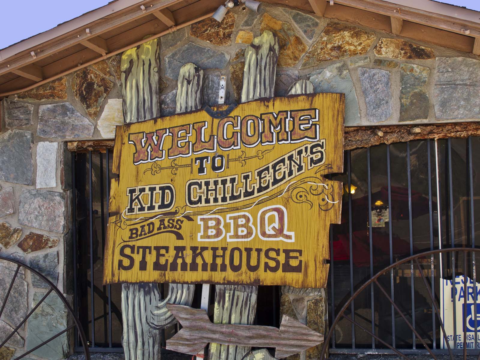
Kid Chilleen's Steakhouse is family owned and operated by the whole Chilleen Family, including Daughter Aleah, Son Scott and daughter Cheyenne. Many of the recipes used were handed down from Jeannine Chilleen, Scott's Grandmother. The clever use of the family name's similarity to that of the character Kid Shelleen played by Lee Marvin in the 1965 movie Cat Ballo.
Inside you are greeted by a wall painting which depicts one iconic scene from the movie:
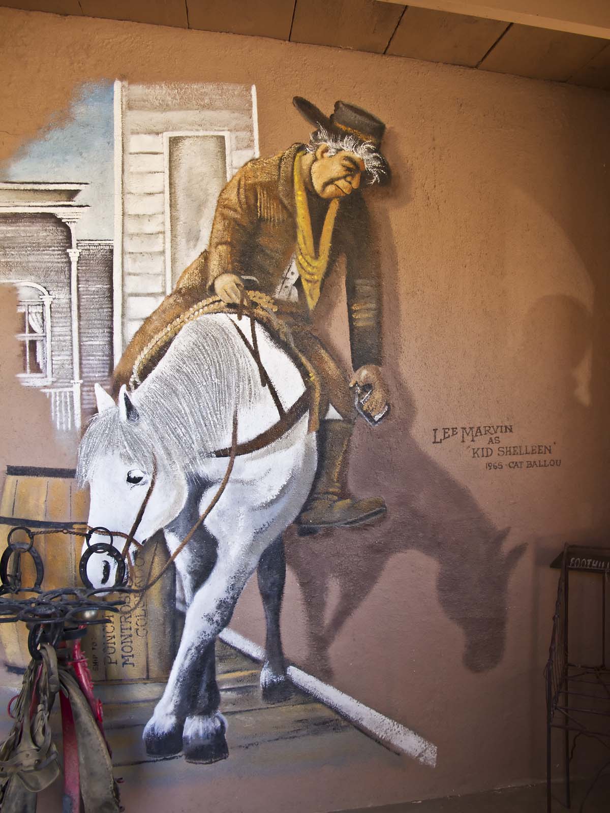
Among the many quaint western themed items are several Cougar skins:
I felt sorry for the cougars.
Next to the restaurant is the saddest little motel I've ever seen. I assume that it's not a joke:
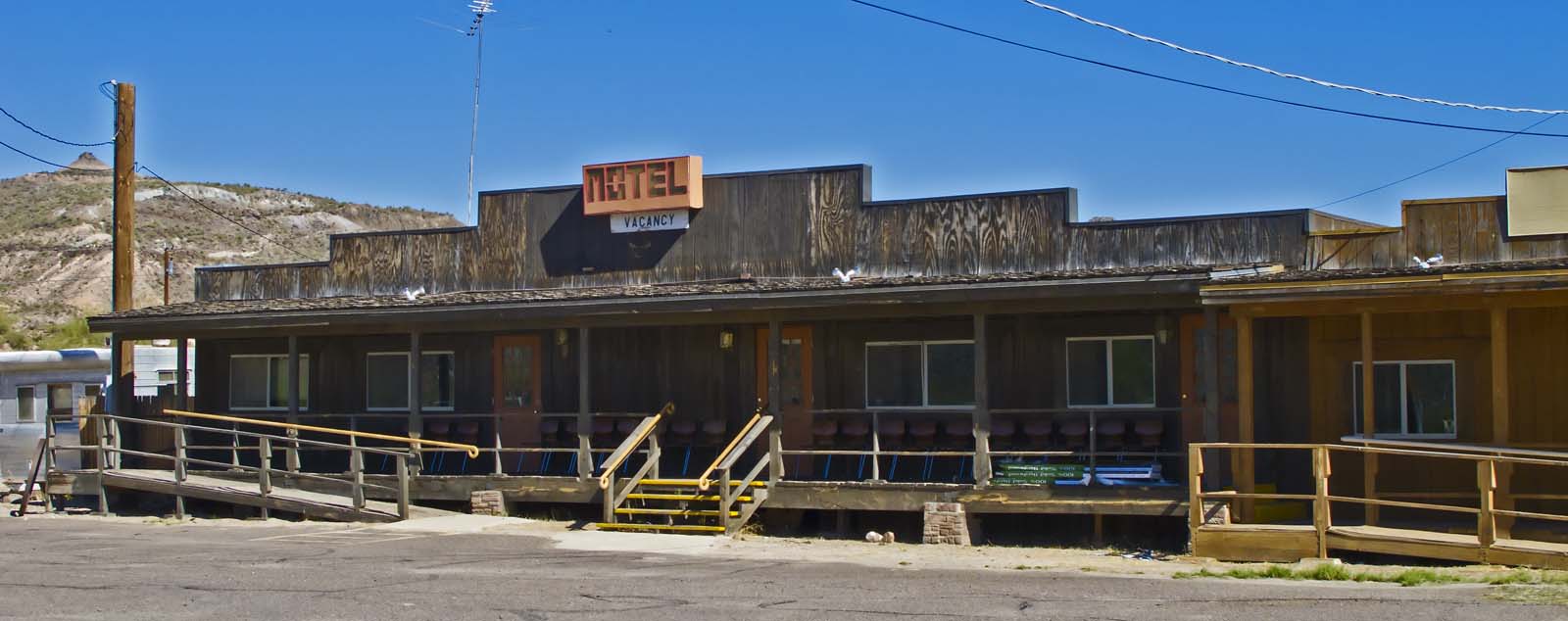
I didn't inquire about a room.
I shot multiple frames at the same exposure settings to get this panoramic view from the Haunted Hamburger Restaurant in Jerome, Arizona:
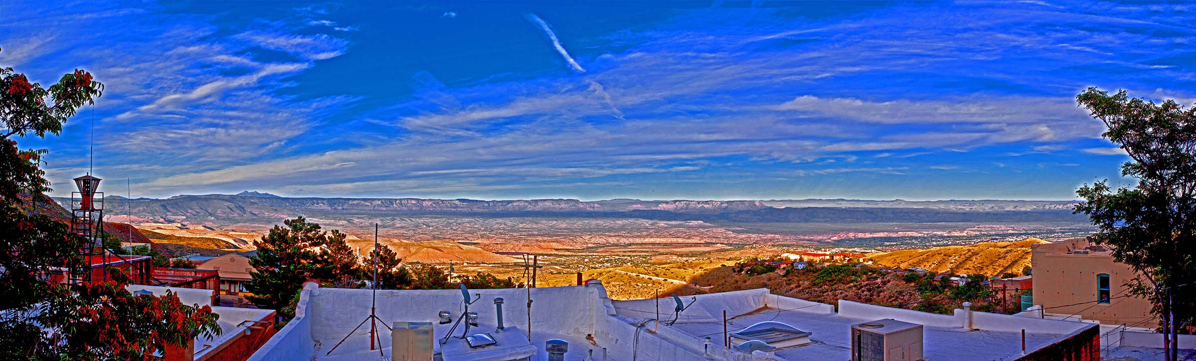
The work in progress was boring me, so I used some High Dynamic Range techniques to turn it into funky art. The Haunted Hamburger has, of course, a story. You can read about it here. The food is better than the story.
I began to play with the image of grace which I got on the day of our first snow.
I've been fooling around with cartoon techniques for a few years. I haven't found any automated process which satisfies me. Someday I hope I'll stumble on just the right combination of filters. The process I used here worked nicely for this shot.
Nearly done now.
I got this shot at afternoon twilight from near the "vortex" at the Sedona Airport:
Too bad I can't show you the full resolution image. You can see the individual lights in Sedona.
I'm hoping they'll be fruitful and multiply.
And this, kiddies, is Mistletoe (Phoradendron flavescens):
I always thought that mistletoe was an exotic plant dragged out from some mystical place for Christmas decoration. It seems that it more like a weed.
If all goes as planned I'll begin a four day trek back to Madang tomorrow morning. I'll be there for six weeks to sell Faded Glory and all of the rest of my possessions there. There will be some great bargains for Madang residents. I have some very sad things to do in Madang, but I can always think of my goal - to get back to Grace and Sedona, my new wife and my new home. Visiting Eunie's grave and saying goodbye to many friends will be difficult, but moving on is as necessary as breathing for me.
Southerness is a small, compact coastal village in Dumfries and Galloway, Scotland. Southerness is located approximately 2 mi (3.2 km) south of the A710 between Caulkerbush and Kirkbean. The town today is mainly a tourist village and has for many years had a large number of static caravans, some private and many rented to holiday makers. The local bus services to and from Dalbeattie and Dumfries are more frequent during the summer season.
Southerness has a large, shallow, sandy beaches on both sides of the rocky next to the village and to the west extend out to the vast Mersehead Sands exposed at low tide. The only landmark is its Southerness lighthouse which was built in 1749 and is one of the oldest lighthouses in Scotland. The lighthouse stands approximately 56 feet (17 m) tall and was decommissioned in the 1930s.
One of the two golf courses was redesigned in 1947 by course manager Mackenzie Ross.
The village has to the north a magnificent backdrop of the "marilyn" Criffel, and to the south the sandy (please note the quick sand) bay of Gillfoot. On clear days the views stretch across the Solway Firth to the Lakeland fells.
Tourist facilities
18-hole golf course
JJ's fish and chip shop
Paul Jones Hotel
19th Hole bar
Mermaid Bar
The Venue
The Minimarket
Evening entertainment "during the high season"
Two ParkDean caravan parks
LightHouse Leisure is a family run park with about 200 caravans. It also has the Mermaid Bar on site where bingo is offered most evenings during the season, and a swimming pool with tanning booth. LightHouse Leisure is about a 2-minute walk away from the beach and lighthouse of Southerness.
Southerness Holiday Park is owned by Parkdean Resorts. There is a new multi-purpose swimming pool, built in 2011, with flumes, a toddlers' pool, and a 25-metre swimming pool. The site also has a nature trail.
The Solway Firth (Scottish Gaelic: Tràchd Romhra) is a firth that forms part of the border between England and Scotland, between Cumbria (including the Solway Plain) and Dumfries and Galloway. It stretches from St Bees Head, just south of Whitehaven in Cumbria, to the Mull of Galloway, on the western end of Dumfries and Galloway. The Isle of Man is also very near to the firth. The firth comprises part of the Irish Sea.
The firth's coastline is characterised by lowland hills and small mountains. It is a mainly rural area, with mostly small villages and settlements (such as Powfoot). Fishing, hill farming, and some arable farming play a large part in the local economy, although tourism is increasing.
The northern part of the English coast of the Solway Firth was designated as an Area of Outstanding Natural Beauty, known as the Solway Coast, in 1964. Construction of the Robin Rigg Wind Farm in the firth began in 2007.
Within the firth, there are some salt flats and mud flats that can be dangerous, due to their frequently shifting patches of quicksand.
There are over 290 square kilometres (110 sq mi) of Sites of Special Scientific Interest (SSSIs) in the area of the firth (one of which is Salta Moss), as well as national nature reserves — at Caerlaverock and in Cumbria. On the Cumbrian side, much of the coastline has been designated an Area of Outstanding Natural Beauty (AONB). The Solway Coast’s AONB has two separate sections: the first runs westward from just north of Carlisle to Skinburness; the second runs south from the hamlet of Beckfoot, past Mawbray and Allonby, to Crosscanonby.
In 2013, the honeycomb worm and blue mussel were designated as targets of conservation efforts, and Allonby Bay (an inlet of the Solway Firth) was put forward as a candidate for a Marine Conservation Zone.
A 53-mile (85 km) long-distance walking route, the Annandale Way, runs through Annandale, from the source of the River Annan, in the Moffat Hills, to the Solway Firth; it was opened in September 2009.
Unlike other parts of the west coast of Scotland, the Solway Firth has only a few islands. They are:
Hestan Island
Rough Island
Little Ross
The so-called Isle of Whithorn (which is actually a peninsula).
The Islands of Fleet
The Solway Firth is the estuary of the River Eden and the River Esk.
The name 'Solway' (recorded as Sulewad in 1218) is of Scandinavian origin, and was originally the name of a ford across the mud flats at Eskmouth. The first element of the name is probably from the Old Norse word súl 'pillar', referring to the Lochmaben Stane, though it may instead be from súla, meaning 'solan goose'. Súl and súla both have long vowels, but the early spellings of Solway indicate a short vowel in the first element. This may be due to the shortening of an originally long vowel in the Middle English period but may also represent an original short vowel. If this is the case, the first element may be *sulr, an unrecorded word cognate with Old English sol 'muddy, pool', or a derivative of sulla, meaning 'to swill'.
The second element of the name is from the Old Norse vað, meaning 'ford' (which is cognate with the modern English word wade).
The area had three fords: the Annan or Bowness Wath, the Dornock Wath (once called the Sandywathe), and the main one —the Solewath (also called the Solewath or the Sulewad).
A wooden lighthouse was built in 1841 at Barnkirk Point (grid reference NY 1903 6425). It was destroyed by fire in 1960.
On 9 March 1876, a 79-ton French lugger St. Pierre, was stranded - and finally declared lost - on Blackshaw Bank, an ill-defined feature which extends for a considerable distance on both sides of the channel of the River Nith.
Between 1869 and 1921, the estuary was crossed by the Solway Junction Railway on a 1780 m (5850 ft) iron viaduct. The line was built to carry iron ore from the Whitehaven area to Lanarkshire and was financed and operated by the Caledonian Railway of Scotland. After the railway, which was not a financial success, ceased operating in 1921, the railway bridge became a popular footpath, enabling residents of Scotland to easily cross into England, where alcoholic drink was legally available seven days a week. (Scotland was dry on Sundays at the time.) The viaduct was demolished between 1931 and 1933.
The Ministry of Defence had by 1999 fired more than 6,350 depleted uranium rounds into the Solway Firth from its testing range at Dundrennan Range.
The Solway Firth has been used as the location for films. For example, the 1973 film The Wicker Man was filmed around Kirkcudbright and Burrow Head on the Wigtownshire coast.
In July 2019, the American metal band Slipknot released a song called “Solway Firth” that is named after the firth.
Dumfries and Galloway is one of the 32 unitary council areas of Scotland, located in the western part of the Southern Uplands. It is bordered by East Ayrshire, South Ayrshire, and South Lanarkshire to the north; Scottish Borders to the north-east; the English ceremonial county of Cumbria, the Solway Firth, and the Irish Sea to the south, and the North Channel to the west. The administrative centre and largest settlement is the town of Dumfries. The second largest town is Stranraer, located 76 miles (122 km) to the west of Dumfries on the North Channel coast.
Dumfries and Galloway corresponds to the historic shires of Dumfriesshire, Kirkcudbrightshire, and Wigtownshire, the last two of which are collectively known as Galloway. The three counties were combined in 1975 to form a single region, with four districts within it. The districts were abolished in 1996, since when Dumfries and Galloway has been a unitary local authority. For lieutenancy purposes, the area is divided into three lieutenancy areas called Dumfries, Wigtown, and the Stewartry of Kirkcudbright, broadly corresponding to the three historic counties.
The Dumfries and Galloway Council region is composed of counties and their sub-areas. From east to west:
Dumfriesshire County
the sub-area of Dumfriesshire – Annandale
the sub-area of Dumfriesshire – Eskdale
the sub-area of Dumfriesshire – Nithsdale
Kirkcudbrightshire County
the sub-area of Kirkcudbrightshire – Stewartry (archaically, Desnes)
Wigtownshire County
the sub-area of Wigtownshire – Machars (archaically, Farines)--divided into census areas (civil parish areas)
the sub-area of Wigtownshire – Rhins of Galloway divided into census areas (civil parish areas)
The term Dumfries and Galloway has been used since at least the 19th century – by 1911 the three counties had a united sheriffdom under that name. Dumfries and Galloway covers the majority of the western area of the Southern Uplands,[1] it also hosts Scotland's most Southerly point, at the Mull of Galloway in the west of the region.
Water systems and transport routes
The region has a number of south running water systems which break through the Southern Uplands creating the main road, and rail, arteries north–south through the region and breaking the hills up into a number of ranges.
River Cree valley carries the A714 north-westward from Newton Stewart to Girvan and Water of Minnoch valley which lies just west of the Galloway Hills carries a minor road northward through Glentrool village into South Ayrshire. This road leaves the A714 at Bargrennan.
Water of Ken and River Dee form a corridor through the hills called the Glenkens which carries the A713 road from Castle Douglas to Ayr. The Galloway Hills lie to the west of this route through the hills and the Carsphairn and Scaur Hills lie to the east.
River Nith rises between Dalmellington and New Cumnock in Ayrshire and runs east then south down Nithsdale to Dumfries. Nithsdale carries both the A76 road and the rail line from Dumfries to Kilmarnock. It separates the Carsphairn and Scaur Hills from the Lowther Hills which lie east of the Nith.
River Annan combines with Evan Water and the River Clyde to form one of the principal routes into central Scotland from England – through Annandale and Clydesdale – carrying the M74 and the west coast railway line. This gap through the hills separates the Lowthers from the Moffat Hills.
River Esk enters the Solway Firth just south of Gretna having travelled south from Langholm and Eskdalemuir. The A7 travels up Eskdale as far as Langholm and from Langholm carries on up the valley of Ewes Water to Teviothead where it starts to follow the River Teviot to Hawick. Eskdale itself heads north west from Langholm through Bentpath and Eskdalemuir to Ettrick and Selkirk.
The A701 branches off the M74 at Beattock, goes through the town of Moffat, climbs to Annanhead above the Devil's Beef Tub (at the source of the River Annan) before passing the source of the River Tweed and carrying on to Edinburgh. Until fairly recent times the ancient route to Edinburgh travelled right up Annandale to the Beef Tub before climbing steeply to Annanhead. The present road ascends northward on a ridge parallel to Annandale but to the west of it which makes for a much easier ascent.
From Moffat the A708 heads north east along the valley of Moffat Water (Moffatdale) on its way to Selkirk. Moffatdale separates the Moffat hills (to the north) from the Ettrick hills to the south.
There are three National scenic areas within this region.
Nith Estuary: this area follows the River Nith southward from just south of Dumfries into the Solway Firth. Dumfries itself has a rich history going back over 800 years as a Royal Burgh (1186). It is particularly remembered as the place where Robert the Bruce murdered the Red Comyn in 1306 before being crowned King of Scotland – and where Robert Burns spent his last years. His mausoleum is in St Michael's graveyard. Going down the east bank is the village of Glencaple, Caerlaverock Castle, Caerlaverock Wild Fowl Trust, an ancient Roman fort on Ward Law Hill and nearby in Ruthwell is the Ruthwell Cross and the Brow Well where Robert Burns "took the waters" and bathed in the Solway just before his death. On the west bank, there are several walks and cycle routes in Mabie Forest, Kirkconnell Flow for the naturalist, the National Museum of Costume just outside New Abbey and Sweetheart Abbey within the village. Criffel (569 metres) offers the hill walker a reasonably modest walk with views across the Solway to the Lake District. The house of John Paul Jones founder of the American Navy is also open to visitors near Kirkbean.
East Stewartry Coast: this takes in the coast line from Balcary Point eastward across Auchencairn Bay and the Rough Firth past Sandyhills to Mersehead. There are several coastal villages within this area – Auchencairn, Kippford, Colvend, Rockcliffe, and Portling. There is also a round tower at Orchardton and the islands of Hestan Isle and Rough Island can be reached at low tide outside the breeding season for birds. Mersehead is a wildfowl reserve. The area has a number of coastal paths.
Fleet Valley: this area takes in Fleet Bay with its holiday destinations of Auchenlarie, Mossyard Bay, Cardoness, Sandgreen and Carrick Shore. The area also includes the town of Gatehouse of Fleet and the historic villages of Anworth and Girthon – there is a castle at Cardoness in the care of Historic Scotland.
The region is known as a stronghold for several rare and protected species of amphibian, such as the Natterjack toad and the Great crested newt. There are also RSPB Nature Reserves at the Mull of Galloway, Wood of Cree (Galloway Forest Park), Ken Dee Marshes (near Loch Ken) and Mereshead (near Dalbeattie on the Solway Firth)
There are five 7Stanes mountain biking centres in Dumfries and Galloway at Dalbeattie, Mabie, Ae, Glentrool and Kirroughtree. The Sustrans Route 7 long distance cycle route also runs through the region. There is excellent hill walking in the Moffat Hills, Lowther Hills the Carsphairn and Scaur Hills and Galloway Hills. The Southern Upland Way coast to coast walk passes through Dumfries and Galloway and the 53-mile long Annandale Way travels from the Solway Firth into the Moffat hills near the Devil's Beef Tub. There is also fresh water sailing on Castle Loch at Lochmaben and at various places on Loch Ken Loch Ken also offers waterskiing and wakeboarding. The Solway Firth coastline offers fishing, caravaning and camping, walking and sailing.
Dumfries and Galloway is well known for its arts and cultural activities as well as its natural environment.[citation needed]
The major festivals include the region-wide Dumfries & Galloway Arts Festival, and Spring Fling Open Studios. Other festivals include Big Burns Supper in Dumfries and the Wigtown Book Festival in Wigtown – Scotland's national book town.
Places of interest
Galloway and List of Category A listed buildings in Dumfries and Galloway
Annandale distillery - Scotch Whisky
Bladnoch Distillery & Visitor Centre - Scotch Whisky
Caerlaverock Castle – Historic Scotland
Caerlaverock NNR (national nature reserve)
WWT Caerlaverock – a reserve of the Wildfowl and Wetlands Trust
Cardoness Castle
Castle of St John, Stranraer
Corsewall Lighthouse, privately owned
Drumlanrig Castle
HM Factory, Gretna, Eastriggs – site of a munitions factory during World War I
Galloway Forest Park, Forestry and Land Scotland
Galloway Hydro Electric Scheme, Scottish Power
Glenlair – home of 19th century physicist James Clerk Maxwell
Glenluce Abbey
Hallhill Covenanter Martyrs Memorial - near Kirkpatrick Irongray Church.
Isle of Whithorn Castle
Kenmure Castle – a seat of the Clan Gordon
Loch Ken
MacLellan's Castle, Kirkcudbright
Motte of Urr
Mull of Galloway – RSPB/ South Rhins Community Development Trust
Ruthwell Cross
Samye Ling Tibetan Monastery
Southern Upland Way – long distance footpath
Sweetheart Abbey, New Abbey
Threave Castle
Prior to 1975, the area that is now Dumfries and Galloway was administered as three separate counties: Dumfriesshire, Kirkcudbrightshire, and Wigtownshire. The counties of Scotland originated as sheriffdoms, which were established from the twelfth century, consisting of a group of parishes over which a sheriff had jurisdiction. An elected county council was established for each county in 1890 under the Local Government (Scotland) Act 1889.
The three county councils were abolished in 1975 under the Local Government (Scotland) Act 1973, which established a two-tier structure of local government across Scotland comprising upper-tier regions and lower-tier districts. A region called Dumfries and Galloway was created covering the area of the three counties, which were abolished as administrative areas. The region contained four districts:
Annandale and Eskdale, covering the eastern part of Dumfriesshire.
Nithsdale, covering the western part of Dumfriesshire and a small part of Kirkcudbrightshire.
Stewartry, covering most of Kirkcudbrightshire.
Wigtown, covering all of Wigtownshire and a small part of Kirkcudbrightshire.
Further local government reform in 1996 under the Local Government etc. (Scotland) Act 1994 saw the area's four districts abolished, with the Dumfries and Galloway Council taking over the functions they had previously performed. The council continues to use the areas of the four abolished districts as committee areas. The four former districts are also used to define the area's three lieutenancy areas, with Nithsdale and Annandale and Eskdale together forming the Dumfries lieutenancy, the Stewartry district corresponding to the Stewartry of Kirkcudbright lieutenancy, and the Wigtown district corresponding to the Wigtown lieutenancy.
The council headquarters is at the Council Offices at 113 English Street in Dumfries, which had been built in 1914 as the headquarters for the old Dumfriesshire County Council, previously being called "County Buildings".
The first election to the Dumfries and Galloway Regional Council was held in 1974, initially operating as a shadow authority alongside the outgoing authorities until the new system came into force on 16 May 1975. A shadow authority was again elected in 1995 ahead of the reforms which came into force on 1 April 1996. Political control of the council since 1975 has been as follows:
Since 2007 the council has been required to designate a leader of the council. The leader may also act as the convener, chairing council meetings, or the council may choose to appoint a different councillor to be convener. Prior to 2007 the council sometimes chose to appoint a leader, and sometimes did not. The leaders since 2007 have been:
It has been many years since I last visited here. I tried over the winter, but found the church locked on a Saturday morning.
A common occurrence for an urban church.
But, in town for a haircut and meeting with a good friend, Mary, walking past at half eleven I saw the door open and the congregation filing out, so with just one camera and the 50mm lens, I went round snapping.
One really positive highlight is that they seem to have got rid of the dreadful lighting, meaning natural light now floods in and shows the multiple Victorian details standing out as vibrant as when they were first done.
At some point, a longer, more detailed revisit is called for, but for now, the highlights!
------------------------------------------
A superb location in a leafy churchyard away from the busy shopping centre, and yet much more of a town church than that of a seaside resort. It was originally a thirteenth-century building, but so much has happened to it that today we are left with the impression of a Victorian interior. Excellent stained glass by Kempe, mosaics by Carpenter and paintings by Hemming show the enthusiasm of Canon Woodward, vicar from 1851 to 1898. His efforts encouraged others to donate money to beautify the building in an almost continuous restoration that lasted right into the twentieth century They were spurred on by the discovery, in 1885, of the bones of St Eanswythe, in a lead casket which had been set into the sanctuary wall. She had founded a convent in the town in the seventh century and died at the age of twenty-six.
www.kentchurches.info/church.asp?p=Folkestone+1
-------------------------------------------
FOLKESTONE.
THE parish of Folkestone, which gives name to this hundred, was antiently bounded towards the south by the sea, but now by the town and liberty of Folkestone, which has long since been made a corporation, and exempt from the jurisdiction of the hundred. The district of which liberty is a long narrow slip of land, having the town within it, and extending the whole length of the parish, between the sea shore and that part of the parish still within the jurisdiction of the hundred, and county magistrates, which is by far the greatest part of it.
THE PARISH, which is about three miles across each way, is situated exceedingly pleasant and healthy. The high chalk, or down hills uniclosed, and well covered with pasture, cross the northern part of it, and from a sine romantic scene. Northward of these, this part of the parish is from its high situation, called the uphill of Folkestone; in this part is Tirlingham, the antient mansion of which has been some years since pulled down, and a modern farm-house erected in its stead; near it is Hearn forstal, on which is a good house, late belonging to Mr. Nicholas Rolse, but now of Mr. Richard Marsh; over this forstal the high road leads from Folkestone to Canterbury. The centre of the parish is in the beautiful and fertile vale called Folkestone vale, which has downs, meadows, brooks, marshes, arable land, and every thing in small parcels, which is sound in much larger regions; being interspersed with houses and cottages, and well watered by several fresh streams; besides which, at Ford forstall, about a mile northward from the town, there rises a strong chalybeat spring. This part of the parish, by far the greatest part of it, as far as the high road from Dover, through it, towards Hythe, is within the jurisdiction of the hundred of Folkestone, and the justices of the county. The small part on the opposite, or southern side of that road is within the liberty of the town or corporation of Folkestone, where the quarry or sand hills, on the broken side of one of which, the town is situated, are its southern maritime boundaries. These hills begin close under the chalk or down hills, in the eastern part of this parish, close to the sea at Eastware bay, and extend westward along the sea shore almost as far as Sandgate castle, where they stretch inland towards the north, leaving a small space between them and the shore. So that this parish there crossing one of them, extends below it, a small space in the bottom as far as that castle, these quarry, or sand hills, keeping on their course north-west, from the northern boundary of Romney Marsh, and then the southern boundary of the Weald, both which they overlook, extending pretty nearly in a parallel line with the chalk or down hills.
The prospect over this delightful vale of Folkestone from the hill, on the road from Dover as you descend to the town, is very beautiful indeed for the pastures and various fertility of the vale in the centre, beyond it the church and town of Hythe, Romney Marsh, and the high promontory of Beachy head, boldly stretching into the sea. On the right the chain of losty down hills, covered with verdure, and cattle seeding on them; on the lest the town of Folkestone, on the knole of a hill, close to the sea, with its scattered environs, at this distance a pleasing object, and beyond it the azure sea unbounded to the sight, except by the above-mentioned promontory, altogether from as pleasing a prospect as any in this county.
FOLKESTONE was a place of note in the time of the Romans, and afterwards in that of the Saxons, as will be more particularly noticed hereafter, under the description of the town itself. By what name it was called by the Romans, is uncertain; by the Saxons it was written Folcestane, and in the record of Domesday, Fulchestan. In the year 927 king Athelstane, son of king Edward the elder, and grandson of king Alfred, gave Folkstane, situated, as is mentioned in the grant of it, on the sea shore, where there had been a monastery, or abbey of holy virgins, in which St. Eanswith was buried, which had been destroyed by the Danes, to the church of Canterbury, with the privilege of holding it L. S. A. (fn. 1) But it Seems afterwards to have been taken from it, for king Knute, in 1038, is recorded to have restored to that church, the parish of Folkstane, which had been given to it as above-mentioned; but upon condition, that it should never be alienated by the archbishop, without the licence both of the king and the monks. Whether they joined in the alienation of it, or it was taken from them by force, is uncertain; but the church of Canterbury was not in possession of this place at the time of taking the survey of Domesday, in 1080, being the 14th year of the Conqueror's reign, at which time it was part of the possessions of the bishop of Baieux, the conqueror's half-brother, under the general description of whose lands it is thus entered in it:
In Limowart lest, in Fulcbestan hundred, William de Acris holds Fulchestan. In the time of king Edward the Consessor, it was taxed at forty sulings, and now at thirty-nine. The arable land is one hundred and twenty carucates. In demesne there are two hundred and nine villeins, and four times twenty, and three borderes. Among all they have forty-five carcates. There are five churches, from which the archbishop has fifty-five shillings. There are three servants, and seven mills of nine pounds and twelve shillings. There are one hundred acres of meadow. Wood for the pannage of forty bogs. Earl Godwin held this manor.
Of this manor, Hugo, son of William, holds nine sulings of the land of the villeins, and there he has in demesne four carucates and an half, and thirty-eight villeins, with seventeen borderes, who have sixteen carucates. There are three churches, and one mill and an half, of sixteen shillings and five-pence, and one saltpit of thirty pence. Wood for the pannage of six bogs. It is worth twenty pounds.
Walter de Appeuile holds of this manor three yokes and twelve acres of land, and there he has one carucate in demesne, and three villeins, with one borderer. It is worth thirty shillings.
Alured holds one suling and forty acres of land, and there he has in demesne two carucates, with six borderers, and twelve acres of meadow. It is worth four pounds.
Walter, son of Engelbert, holds half a suling and forty acres, and there he has in demesne one carucate, with seven borderers, and five acres of meadow. It is worth thirty shillings.
Wesman holds one suling, and there he has in demesne one carucate, and two villeins, with seven borderers having one carucate and an half. It is worth four pounds.
Alured Dapiser holds one suling and one yoke and six acres of land, and there he has in demesne one carucate, with eleven borderers. It is worth fifty shillings.
Eudo holds half a suling, and there he has in demesne one carucate, with four borderers, and three acres of meadow. It is worth twenty shillings.
Bernard de St. Owen, four sulings, and there he has in demesne three carucates, and six villeins, with eleven borderes, having two carucates. There are four servants, and two mills of twenty-four shillings, and twenty acres of meadow. Wood for the pannage of two bogs.
Of one denne, and of the land which is given from these suling to ferm, there goes out three pounds. In the whole it is worth nine pounds.
Baldric holds half a suling, and there he has one carucate, and two villeins, with six borderers having one carucate, and one mill of thirty pence. It is worth thirty shillings.
Richard holds fifty-eight acres of land, and there he has one carucate, with five borderers. It is worth ten shillings.
All Fulchestan, in the time of king Edward the Consessor, was worth one hundred and ten pounds, when he received it forty pounds, now what he has in demesne is worth one hundred pounds; what the knights hold abovementioned together, is worth forty-five pounds and ten shillings.
¶It plainly appears that this entry in Domesday does not only relate to the lands within this parish, but to those in the adjoining parishes within the hundred, the whole of which, most probably, were held of the bishop of Baieux, but to which of them each part refers in particular, is at this time impossible to point out. About four years after the taking of the above survey, the bishop was disgraced, and all his possessions consiscated to the crown. After which, Nigell de Muneville, a descendant of William de Arcis, mentioned before in Domesday, appears to have become possessed of the lordship of Folkestone, and as such in 1095, being the 9th year of king William Rusus, removed the priory of Folkestone from the bail of the castle to the place where it afterwards continued. His son William dying in his life-time s. p, Matilda his sole daughter and heir was given in marriage with the whole of her inheritance, by king Henry I. to Ruallanus de Albrincis, or Averenches, whose descendant Sir William de Albrincis, was become possessed of this lordship at the latter end of that reign; and in the 3d year of the next reign of king Stephen, he confirmed the gifts of his ancestors above-mentioned to the priory here. He appears to have been one of those knights, who had each a portion of lands, which they held for the de sence of Dover castle, being bound by the tenure of those lands to provide a certain number of soldiers, who should continually perform watch and ward within it, according to their particular allotment of time; but such portions of these lands as were not actually in their own possession were granted out by them to others, to hold by knight's service, and they were to be ready for the like service at command, upon any necessity whatever, and they were bound likewife, each knight to desend a certain tower in the castle; that desended by Sir William de Albrincis being called from him, Averenches tower, and afterwards Clinton tower, from the future owners of those lands. (fn. 2) Among those lands held by Sir William de Albrincis for this purpose was Folkestone, and he held them of the king in capitle by barony. These lands together made up the barony of Averenches, or Folkestone, as it was afterwards called, from this place being made the chief of the barony, caput baroniæ, as it was stiled in Latin; thus The Manor of Folkestone, frequently called in after times An Honor, (fn. 3) and the mansion of it the castle, from its becoming the chief seat or residence of the lords paramount of this barony, continued to be so held by his descendants, whose names were in Latin records frequently speit Albrincis, but in French Avereng and Averenches, and in after times in English ones, Evering; in them it continued till Matilda, daughter and heir of William de Albrincis, carried it in marriage to Hamo de Crevequer, who, in the 20th year of that reign, had possession given him of her inheritance. He died in the 47th year of that reign, possessed of the manor of Folkestone, held in capite, and by rent for the liberty of the hundred, and ward of Dover castle. Robert his grandson, dying s. p. his four sisters became his heirs, and upon the division of their inheritance, and partition of this barony, John de Sandwich, in right of his wife Agnes, the eldest sister, became entitled to this manor and lordship of Folkestone, being the chief seat of the barony, a preference given to her by law, by reason of her eldership; and from this he has been by some called Baron of Folkestone, as has his son Sir John de Sandwich, who left an only daughter and heir Julian, who carried this manor in marriage to Sir John de Segrave, who bore for his arms, Sable, three garbs, argent. He died in the 17th year of Edward III. who, as well as his son, of the same name, received summons to parliament, though whether as barons of Folkestone, as they are both by some called, I know not. Sir John de Segrave, the son, died possessed of this manor anno 23 Edward III. soon after which it appears to have passed into the family of Clinton, for William de Clinton, earl of Huntingdon, who bore for his arms, Argent, crusulee, situchee, sable, upon a chief, azure, two mullets, or, pierced gules; which coat differed from that of his elder brother's only in the croslets, which were not borne by any other of this family till long afterwards, (fn. 4) died possessed of it in the 28th year of that reign, at which time the mansion of this manor bore the name of the castle. He died s. p. leaving his nephew Sir John de Clinton, son of John de Clinton, of Maxtoke, in Warwickshire, his heir, who was afterwards summoned to parliament anno 42 Edward III. and was a man of great bravery and wisdom, and much employed in state affairs. He died possessed of this manor, with the view of frank-pledge, a moiety of the hundred of Folkestone, and THE MANOR OF WALTON, which, though now first mentioned, appears to have had the same owners as the manor of Folkestone, from the earliest account of it. He married Idonea, eldest daughter of Jeffry, lord Say, and at length the eldest coheir of that family, and was succeeded in these manors by his grandson William, lord Clinton, who, anno 6 Henry IV. had possession granted of his share of the lands of William de Say, as coheir to him in right of his grandmother Idonea, upon which he bore the title of lord Clinton and Saye, which latter however he afterwards relinquished, though he still bore for his arms, Qnarterly, Clinton and Saye, with two greybounds for his supporters. After which the manor of Folkestone, otherwise called Folkestone Clinton, and Walton, continued to be held in capite by knight's service, by his descendants lords Clinton, till Edward, lord Clinton and Saye, which title he then bore, together with Elizabeth his wife, in the 30th year of Henry VIII. conveyed these manors, with other premises in this parish, to Thomas Cromwell lord Cromwell, afterwards created earl of Essex, on whose attainder two years afterwards they reverted again to the crown, at which time the lordship of Folkestone was stiled an honor; whence they were granted in the fourth year of Edward VI. to the former possessor of them, Edward, lord Clinton and Saye, to hold in capite, for the meritorious services he had performed. In which year, then bearing the title of lord Clinton and Saye, he was declared lord high admiral, and of the privy council, besides other favours conferred on him; and among other lands, he had a grant of these manors, as abovementioned, which he next year, anno 5 Edward VI. reconveyed back to the crown, in exchange for other premises. (fn. 5) He was afterwards installed knight of the garter, by the title of Earl of Lincoln and Baron of Clinton and Saye; and in the last year of that reign, constable of the tower of London. Though in the 1st year of queen Mary he lost all his great offices for a small time, yet he had in recompence of his integrity and former services, a grant from her that year, of several manors and estates in this parish, as well as elsewhere, and among others, of these manors of Folkestone and Walton, together with the castle and park of Folkestone, to hold in capite; all which he, the next year, passed away by sale to Mr. Henry Herdson, citizen and alderman of London, who lest several sons, of whom Thomas succeeded him in this estate, in whose time the antient park of Folkestone seems to have been disparked. His son Mr. Francis Herdson alienated his interst in these manors and premises to his uncle Mr. John Herdson, who resided at the manor of Tyrlingham, in this parish, and dying in 1622, was buried in the chancel of Hawking church, where his monument remains; and there is another sumptuous one besides erected for him in the south isle of Folkestone church. They bore for their arms, Argent, a cross sable, between four fleurs de lis, gules. He died s. p. and by will devised these manors, with his other estates in this parish and neighbourhood, to his nephew Basill, second son of his sister Abigail, by Charles Dixwell, esq. Basill Dixwell, esq. afterwards resided at Tyrlingham, a part of the estate devised to him by his uncle, where, in the 3d year of king Charles I. he kept his shrievalty, with great honor and hospitality; after which he was knighted, and in 1627, anno 3 Charles I. created a baronet; but having rebuilt the mansion of Brome, in Barham, he removed thither before his death. On his decease unmarried, the title of baronet became extinct; but he devised these manors, with the rest of his estates, to his nephew Mark Dixwell, son of his elder brother William Dixwell, of Coton, in Warwickshire, who afterwards resided at Brome. He married Elizabeth, sister and heir of William Read, esq. of Folkestone, by whom he had Basill Dixwell, esq. of Brome, who in 1660, anno 12 Charles II. was created a baronet. His son Sir Basill Dixwell, bart. of Brome, about the year 1697, alientated these manors, with the park-house and grounds, and other estates in this parish and neighbourhood, to Jacob Desbouverie, esq. of LondonHe was descended from Laurence de Bouverie, de la Bouverie, or Des Bouveries, of an antient and honorable extraction in Flanders, (fn. 6) who renouncing the tenets of the Romish religion came into England in the year 1567, anno 10 Elizabeth, and seems to have settled first at Canterbury. He was a younger son of Le Sieur des Bouveries, of the chateau de Bouverie, near Lisle, in Flanders, where the eldest branch of this family did not long since possess a considerable estate, bearing for their arms, Gules, a bend, vaire. Edward, his eldest son, was an eminet Turkey merchant, was knighted by king James II. and died at his seat at Cheshunt, in Hertfordshire, in 1694. He had seven sons and four daughters; of the former, William, the eldest, was likewife an eminent Turkey merchant, and was, anno 12 queen Anne, created a baronet, and died in 1717. Jacob, the third son, was purchaser of these manors; and Christopher, the seventh son, was knighted, and seated at Chart Sutton, in this county, under which a further account of him may be seen; (fn. 7) and Anne, the second daughter, married Sir Philip Boteler, bart. Jacob Desbouverie afterwards resided at Tyrlingham, and dying unmarried in 1722, by his will devised these manors, with his other estates here, to his nephew Sir Edward Desbouverie, bart. the eldest brother son of Sir William Desbouverie, bart. his elder brother, who died possessed of them in 1736, s. p. on which his title, with these and all his other estates, came to his next surviving brother and heir Sir Jacob Desbouverie, bart. who anno 10 George II. procured an act to enable himself and his descendants to use the name of Bouverie only, and was by patent, on June 29, 1747, created baron of Longford, in Wiltshire, and viscount Folkestone, of Folkestone. He was twice married; first to Mary, daughter and sole heir of Bartholomew Clarke, esq. of Hardingstone, in Northamptonshire, by whom he had several sons and daughters, of whom William, the eldest son, succeeded him in titles and estates; Edward is now of Delapre abbey, near Northamptonshire; Anne married George, a younger son of the lord chancellor Talbot; Charlotte; Mary married Anthony, earl of Shastesbury; and Harriot married Sir James Tilney Long, bart. of Wiltshire. By Elizabeth his second wife, daughter of Robert, lord Romney, he had Philip, who has taken the name of Pusey, and possesses, as heir to his mother Elizabeth, dowager viscountess Folkestone, who died in 1782, several manors and estates in the western part of this county. He died in 1761, and was buried in the family vault at Britford, near Salisbury, being succeeded in title and estates by his eldest son by his first wife, William, viscount Folkestone, who was on Sept. 28, anno 5 king George III. created Earl of Radnor, and Baron Pleydell Bouverie, of Coleshill, in Berkshire. He died in 1776, having been three times married; first, to Harriot, only daughter and heir of Sir Mark Stuart Pleydell, bart. of Colefhill, in Berkshire. By her, who died in 1750, and was buried at Britford, though there is an elegant monument erected for her at Coleshill, he had Hacob, his successor in titles and estates, born in 1750. He married secondly, Rebecca, daughter of John Alleyne, esq. of Barbadoes, by whom he had four sons; William-Henry, who married Bridget, daughter of James, earl of Morton; Bartholomew, who married MaryWyndham, daughter of James Everard Arundell, third son of Henry, lord Arundell, of Wardour; and Edward, who married first Catherine Murray, eldest daughter of John, earl of Dunmore; and secondly, Arabella, daughter of admiral Sir Chaloner Ogle. His third wife was Anne, relict of Anthony Duncombe, lord Faversham, and daughter of Sir Thomas Hales, bart. of Bekesborne, by whom he had two daughters, who both died young. He was succeeded in titles and estates by his eldest son, the right hon. Jacob Pleydell Bouverie, earl of Radnor, who is the present possessor of these manors of Folkestone and Walton, with the park-house and disparked grounds adjacent to it, formerly the antient park of Folkestone, the warren, and other manors and estates in this parish and neighbourhood.
FOLKESTONE is within the ECCLESIASTICAL JURISDICTION of the diocese of Canterbury, and deanry of Dover.
The church, which is dedicated to St. Mary and St. Eanswith, consists of three isles and three chancels, having a square tower, with a beacon turret in the middle of it, in which there is a clock, and a peal of eight bells, put up in it in 1779. This church is built of sand-stone; the high chancel, which has been lately ceiled, seems by far the most antient part of it. Under an arch in the north wall is a tomb, with the effigies of a man, having a dog at his feet, very an tient, probably for one of the family of Fienes, constables of Dover castle and wardens of the five ports; and among many other monuments and inscriptions, within the altar-rails, are monuments for the Reades, of Folkestone, arms, Azure, a griffin, or, quartering gules, a pheon between three leopards faces, or; for William Langhorne, A.M. minister, obt. 1772. In the south chancel is a most elegant monument, having the effigies of two men kneeling at two desks, and an inscription for J. Herdson, esq. who lies buried in Hawkinge church, obt. 1622. In the south isle a tomb for J. Pragels, esq. obt. 1676, arms, A castle triple towered, between two portcullises; on a chief, a sinister hand gauntled, between two stirrups. In the middle isle a brass plate for Joane, wife of Thomas Harvey, mother of seven sons (one of which was the physician) and two daughters. In the north wall of the south isle were deposited the remains of St. Eanswith, in a stone coffin; and under that isle is a large charnelhouse, in which are deposited the great quantity of bones already taken notice of before. Philipott, p. 96, says, the Bakers, of Caldham, had a peculiar chancel belonging to them in this church, near the vestrydoor, over the charnel-house, which seems to have been that building mentioned by John Baker, of Folkestone, who by his will in 1464, ordered, that his executors should make a new work, called an isle, with a window in it, with the parishioners advice; which work should be built between the vestry there and the great window. John Tong, of Folkestone, who was buried in this church, by will in 1534, ordered that certain men of the parish should be enfeoffed in six acres of land, called Mervyle, to the use of the mass of Jhesu, in this church.
On Dec. 19, 1705, the west end of this church, for the length of two arches out of the five, was blown down by the violence of the wind; upon which the curate and parishioners petitioned archbishop Tillot son, for leave to shorten the church, by rebuilding only one of the fallen arches, which was granted. But by this, the church, which was before insufficient to contain the parishioners, is rendered much more inconvenient to them for that purpose. By the act passed anno 6 George III. for the preservation of the town and church from the ravages of the sea as already noticed before. After such works are finished, &c. the rates are to be applied towards their repair, and to the keeping in repair, and the support and preservation of this church.
¶This church was first built by Nigell de Muneville, lord of Folkestone at the latter end of king Henry I. or the beginning of king Stephen's reign, when he removed the priory from the precinct of the castle to it in 1137, and he gave this new church and the patronage of it to the monks of Lolley, in Normandy, for their establishing a cell, or alien priory here, as has been already mentioned, to which this new church afterwards served as the conventual church of it. The profits of it were very early appropriated to the use of this priory, that is, before the 8th of king Richard II. anno 1384, the duty of it being served by a vicar, whose portion was settled in 1448, at the yearly pension of 10l. 0s. 2½d. to be paid by the prior, in lieu of all other profits whatsoever. In which state this appropriation and vicarage remained till the surrendry of the priory, in the 27th year of king Henry VIII. when they came, with the rest of the possessions of it, into the king's hands, who in his 31st year demised the vicarage and parish church of Folkestone, with all its rights, profits, and emoluments, for a term of years, to Thomas, lord Cromwell, who assigned his interest in it to Anthony Allcher, esq. but the fee of both remained in the crown till the 4th year of king Edward VI. when they were granted, with the manor, priory, and other premises here, to Edward, lord Clinton and Saye, to hold in capite; who the next year conveyed them back again to the crown, in exchange for other premises, (fn. 23) where the patronage of the vicarage did not remain long; for in 1558, anno 6 queen Mary, the queen granted it, among several others, to the archbishop. But the church or parsonage appropriate of Folkestone remained longer in the crown, and till queen Elizabeth, in her 3d year, granted it in exchange, among other premises, to archbishop Parker, being then in lease to lord Clinton, at the rent of 57l. 2s. 11d. at which rate it was valued to the archbishop, in which manner it has continued to be leased out ever since, and it now, with the patronage of the vicarage, remains parcel of the possessions of the see of Canterbury; the family of Breams were formerly lessees of it, from whom the interest of the lease came to the Taylors, of Bifrons, and was sold by the late Rev. Edward Taylor, of Bisrons, to the right hon. Jacob, earl of Radnor, the present lessee of it.
View from the N of Rosendale Road railway bridge "No.2" (Herne Hill and West Dulwich, London) carrying suburban line services to and from London Bridge terminus.
The green and grey bridge has recently replaced an older one, during work carried out in the early hours of January 19th 2014. The previous bridge (1950s-1960s) replaced an even older one (1866) supported on the same cast iron columns (not visible here but see accompanying photos in this series). During the present replacement work, the columns were then also removed forever.
The railway plaque is the original one, mounted on a new concrete replacement capital. The plaque bears the coat-of-arms of the London, Brighton and South Coast Railway on the L, and of the Dulwich Estate on the R. The Dulwich Estate own, or owned, much of the land in this area, including, I assume, the land on which this bridge was built. The shield in the middle of the plaque carries the date "1866", the date of construction the original bridge, though the main span has been replaced at least twice since then. The initials "AC"on the central shield stand for Alleyn College, the former name of Dulwich College (founded 1619 by the Shakespearean actor-manager, Edward Alleyn.)
----------
ROSENDALE ROAD RAILWAY BRIDGES
There were three railway bridges over Rosendale Road, two of which still exist. They don't appear to have names, so I have numbered them arbitrarily.
"No.1" is the most northern one, close to Brockwell Park, behind the camera viewpoint. It currently carries suburban line services of the Thameslink network between Wimbledon and Sutton and central London (and beyond).
This view shows "No.2" orignally built in 1866 for the London Brighton and South Coast Railway. It rested on brick abutments and on red cast iron columns. But the girder bridge itself, and its railings, must have been younger, having apparently replaced the older, more ornate, structure some time after 1952 (compare the photo of its more ornate predecessor in Edwin Course's article, below). The original bridge was designed by Charles Barry Junior. The large sums paid by the then railway company (London, Brighton and South Coast Railway) for construction of its line across the Dulwich Estate, with other bridges matching this one, enabled the Estate to build the present main building of Dulwich College (1857-1866). There were a pair ornamental plaques on each side of the road on this N side of Rosendale Railway bridge, each on its own pilaster - four in all. Some or all of the upper parts of the older pillasters were removed and replaced by modern concrete ones, but the old plaques were retained and remounted on the new pilasters (as here, upper R). It seems that the pilasters had to be replaced by narrower ones (i.e. as measured in the direction away from the camera) to allow for the installation of the access walkway (in grey undercoat on the L) along the outside of the bridge proper.
This view also shows the site of "No.3". This bridge was demolished some time after 1966. It was very ornate in cast iron and ran across the road here, in the background immediately beyond "No.2", supported on brick abutments and cast iron columns. The eastern abutment can just be seen through the bridge in the distance (lower L) (see also notes on the picture). The bridge carried coal trains of the former London and North Western Railway into Knight's Hill Sidings and its former coal depot. The sidings included the former bridge, which was therefore much wider than "No.2". The sidings extended to the R beyond the R side of this view behind the embankment of the nearer bridge, where they are now covered by houses of the Lairdale Estate of the London Borough of Lambeth (one of these houses can be seen upper R). Although the depot was an LNWR one, the abutments for the demolished bridge actually bear plaques (not visible here) with the coat-of-arms of the London, Brighton and South Coast Railway and the Dulwich Estate, and the date "1866" - just as on "No.2". It is clear from the photo in Course's article that the original designs of both bridges also matched each other. However, an iron plaque on the bridge proper bore the date 1891.
--- belowtheriver.co.uk/wednesday-picture-the-bridges-of-west...
--- Course, Edwin, 1960. The foreign goods depots of South London. Railway Magazine [vol?] (for November 1960), pp. 761-766. www.semgonline.com/RlyMag/ForeignDepotsofSthLondon.pdf
----------
RAILWAY BRIDGE REPLACEMENT WORK IN DULWICH & HERNE HILL, JANUARY-FEBRUARY 2014 (32/39)
This bridge, and two further sister bridges carrying the same line over neighbouring streets, had been in poor condition for some time. After a period of preparation work, the replacement work happening here began in January 2014. Two neighbouring streets, one of them a busy main road, were closed to traffic concurrently for about two weeks, and another was closed for work on the third bridge shortly afterwards. To minimise disruption to train services, the main replacement work was carried out night and day in continuous shifts over two weekends. Huge hydraulic cranes had to come from Scotland (James Jack, Ainscough) to do this engineering work because there were no cranes available nearer to London capable of handling the old and new bridges.
--- belowtheriver.co.uk/wednesday-picture-the-bridges-of-west...
----------
for COMMUTE ROUTE set:
SERIES 1. MY USUAL ROUTE (& POINTS IN COMMON TO ALL ROUTES).
This view looks in the direction of returning to our house. (I've uploaded many other photos of this bridge replacement work, but for the 'Commute Route' set here, I have included only those that I took on the way to work.)
My standard outward commuting route:
home > (walk) > Rosendale Road > (walk) > Brockwell Park > (walk) > Herne Hill station > (National Rail suburban service) > London Victoria station > (District/Circle Line) > South Kensington > (walk) > Natural History Museum.
----------
Photo
© Darkroom Daze Creative Commons.
If you would like to use or refer to this image, please link or attribute.
ID: DSC_8701 - Version 2
I couldn't help myself Karen - this technique begged to be expanded... A little wreath for a Christmas card. Straight stitches and lace bits before the paint/plaster, silk ribbon and beads after. I'm working now on a little tree-shape...
Steve Hackett and his supremely talented band from their 'Genesis Extended' gig at the Eventim Apollo in Hammersmith, last November.
The final gig of the 'Genesis Extended' tour is in Santiago, tonight. Wish I was there. :-)
From left to right are: Rob Townsend; Roger King; Nad Sylvan; Steve Hackett; Gary O'Toole; and Nick Beggs
My thanks are due to Steve and Jo Hackett for arranging my photography access. :-)
You can see other pics in my Steve Hackett set.
Canon EF 100-400mm @ F/8.0
Some more testing with the new Canon EOS Rebel T3i that just went on sale today in Canada. These are all full sized images to companion my blog.
A fellow photographer and I took some time today to also compare the 100-400L vs a 70-200 F/2.8L IS USM II + the new 2X III extender. More on my blog here: frontallobbings.blogspot.com/2011/02/canon-ef-100-400mm-v...