View allAll Photos Tagged Calgary
Sunset at Calgary Bay, where many people departed Scotland for the last time during the highland clearances.
The light was cracking!
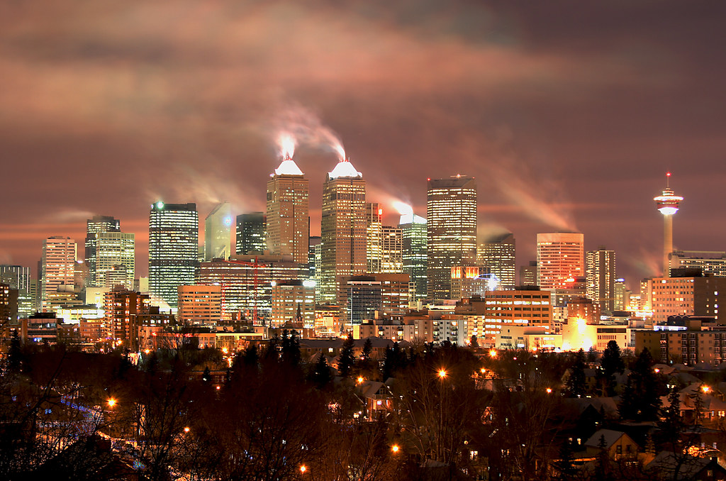
Well, for a photo taken out of the passenger side window of our car as Lisa and I were driving back from a scrumptous brunch on Friday, i thought this turned out pretty well!
This was taken just south of the Deerfoot Trail and 32nd Avenue NE interchange, looking west, and shows the Sam Livingston Fish Hatchery in the foreground, and some central Calgary homes overlooking the Calgary Tower (left middle, red top) and a portion of the downtown skyline.
Also featured is an amazing Chinook arch of cloud and sky, a sign of the temperate weather that has been prevailing for the past few weeks (I am still waiting for everything to turn green, though, as you can see)...this made for wonderful contrast with the buildings below!
Went for a long walk around Calgary today many photos to follow :-) The white bridge is being replaced and the green bridge may be removed when they put the green line LRT through princes island park.
Looking west from the observation deck on Calgary Tower, 191m (626 ft) above the ground.
Calgary, Alberta, Canada
Sunday, 16 February 2020: our temperature this morning is -7C (windchill -9C). Sunrise is at 7:47 am, and sunset is at 5:54 pm. Forecast is for partly cloudy with a few snow flurries into the afternoon.
After my complicated, time-consuming drive in the city two days ago, yesterday, 15 February 2020, was another challenge. A group of friends was meeting at Griffith Woods for a morning birding walk. I had avoided several previous walks there, as I knew that I would have to face the absolute nightmare of road construction that side of the city. They are building a massive Ring Road around the whole city. This is causing an absolute nightmare for drivers, to put it very mildly, and will take a few years to complete.
Most of my drive would be on familiar roads, but I knew the last part would not be pleasant. They desperately need some new road signs and signs that are accurate. On the drive to the park, I found myself in the wrong lane, heading north on Sarcee Trail. Thankfully, there was no traffic coming towards me, and I was able to cut through some muddy ground and large, orange barrels and quickly continue in the opposite direction. I couldn't tell where I was going - the whole landscape has changed - and was so relieved when I saw a sign pointing to the road to the park.
Our walk gave us a few very nice sightings, with a male Three-toed Woodpecker being the highlight. It was a long way away, so I don't know how someone was able to spot it. It was also good to see a Tundra Swan hanging out with a group of Canada Geese in the creek. A lone White-tailed Deer female was a happy sight to see, too.
After our very enjoyable walk, I arranged to follow friend, Tony, out of the whole area, as I knew I would never be able to find the correct roads. Thanks to a sign that said "South Sarcee", we found ourselves heading north on that road. My friend kept driving further and further north, and I suddenly wondered if I might be following the wrong car! A few more roads and turns and I was more than happy to see familiar Crowchild Trail. Shortly after reaching home, an email arrived, about the "scenic route home". No kidding, ha! At least now, if I ever tried getting to this park again, which is highly unlikely, I would have some idea of how to get home.