View allAll Photos Tagged maps!
A map of the Paris Métro (subway) system in 1973, when I visited Paris. .
I became quite familiar with the Métro map during my first time in Paris, in May 1960. This map has the new "RER" lines, in orange. This map must be 1973, not visits in 1968 or 1979. There were no RER lines in 1968. The Étoile station at the Arc de Triomphe was renamed Étoile-Charles de Gaulle shortly after de Gaulle's death in 1970. You can see (or imagine) de Gaulle's name in very small print. RER lines were given letters as definitions in 1977, and the letters are not on this map.
Paris Métro lines are defined by their end points. A few of the lines in 1960 have been extended, and had new definitions. I remember line 8 as Charenton-Écoles in 1960, but it went well into the suburbs in 1973;
So much attention is focused on Israel, many describe us as the “big baddy’s” – look how big we really are compared to all the Arab countries surrounding us! And the world wants us to give away chunks of that tiny yellow dot on the map...
I love map tacks. How about you?
Unfortunately I couldn't find that many lovely colors in the market. Most of the ones I found were primary colors. Then one night I dreamt of a whole lot of map tacks in adorable pastel colors. Haha! That sounds silly but when I woke up I was still thinking about that dream...and then I decided to color my own map tacks using nail polish! Blogged here
Just finished my map for "They draw and travel":
www.theydrawandtravel.com/maps/jaffa-israel-anat-sifri#pa...
Foldout map booklet, front cover. Combination piece serves as a roadmap from airport to Boulder as well as a streetmap of the town. When unfolded, map highlights favorite spots in Boulder the couple wanted their friends & family to see, as well as informational notes regarding the wedding and subsequent reception. Folded map was intended to be convenient enough to carry in one's pocket.
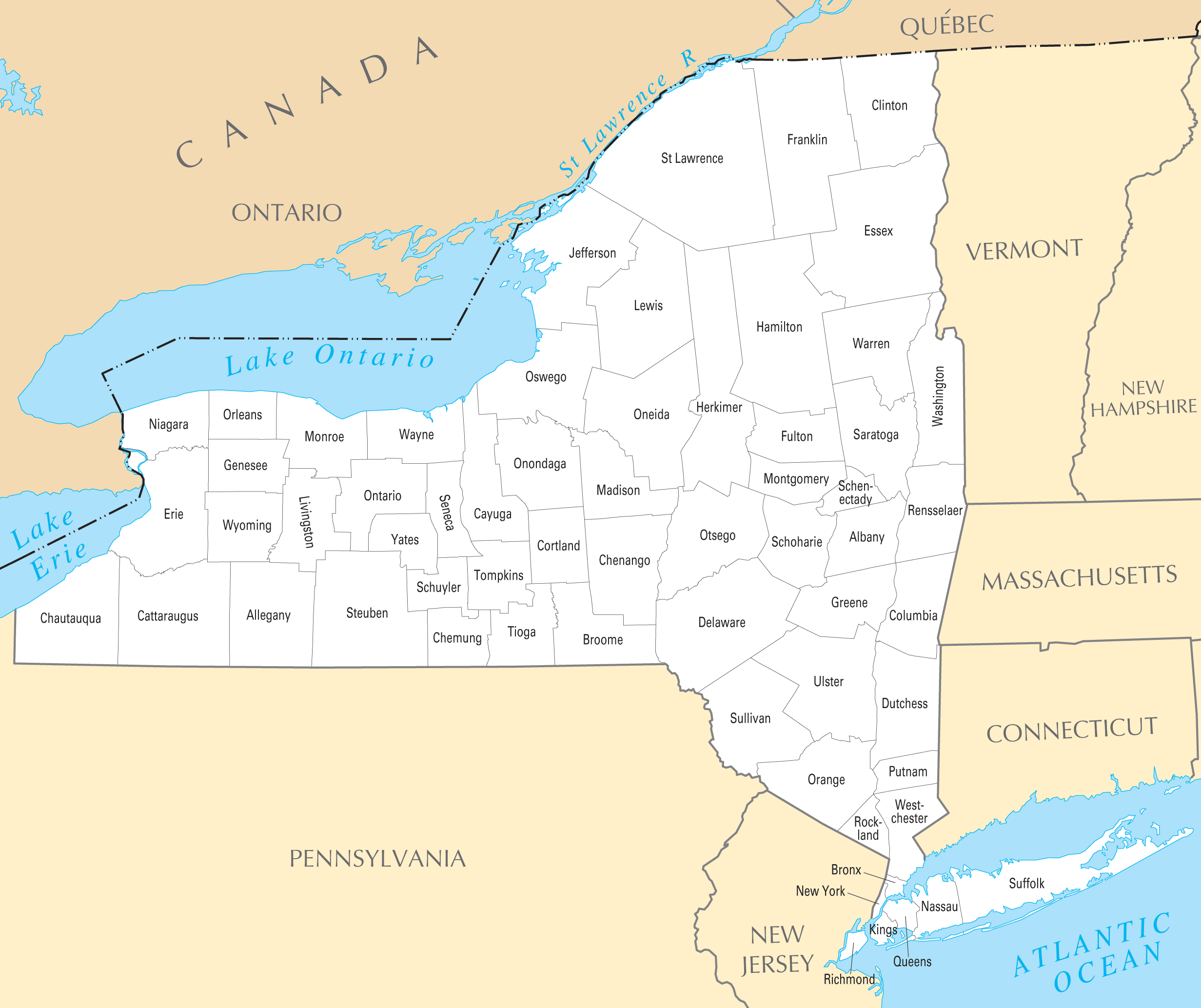
Updated view of the 27 stores still operating within New York
Map background courtesy of:
mapsof.net/uploads/static-maps/new_york_county_map.png----------------------------------------------------------------
If you would like to use THIS picture in any sort of media elsewhere (such as newspaper or article), please send me a Flickrmail or send me an email at natehenderson6@gmail.com.
You have full permission to use these images for whatever you like as long as you credit me through one of these links.
www.flickr.com/battlefrontcaptures
www.youtube.com/channel/UCA1oEnRYKBmFDAcoKso2pAA
(1929) This map shows the early development of the airfield. By 1941 the airport would encompass the entire square mile. By the late 1950's and with the advent of early jets the entire field was too small. The land around the airport was completely residential and commercial, so by the early 60's most airlines had migrated north to O'Hare Field.
EN:
Map of Tuscany showing (among other cities) Pisa, Livorno, Lucca, Pistoia, San Gimignano, Siena and Florence. The map is painted on a wall in the small town San Miniato. And, let's be honest, they kinda exaggerated the size of their own town :-)
NL:
Kaart van Toscane met daarop (onder andere) de steden Pisa, Livorno, Lucca, Pistoia, San Gimignano, Siena en Florence. De kaart is op een oude muur geschilderd in het plaatsje San Miniatio. En, laten we eerlijk zijn, de inwoners van San Miniatio hebben de grootte van hun eigen stadje lichtelijk overdreven :-)
For those of you who want to know where I took this shot; check it out in Street View!
In this Ptolemaic world map it is fascinating to follow the known world by looking at its varying specificity and accuracy. Europe is well known, as are parts of Asia and northern Africa, but much of everything else is a cipher. I'm fascinated, for example, that the Indian Ocean was deemed a land-locked sea.
Description: Two page spread containing a tactile map with braille. War Maps, Belgium and North-Eastern France.
Note: Map with tactile elements for use by the blind.
Creator: The National Institute for the Blind, London
Date: undated
Format: book
Digital Identifier: MAPS-00048
Rights: Samuel P. Hayes Research Library, Perkins School for the Blind, Watertown, MA
While exploring my archive I've stumbled on this map of Amman, it was published by "International Media Services", as you see their credentials at the map footer.
It's really a strange thing to find! I don't recall how it came into my archive.. it's like seeing a visualised memory directly in my hands. Anway, the map is really interesting, it shows you the brands, shops, venues and landmarks of Amman two decades ago, I'm sure many of us still remembering few parts of this map, the map of a vivid city who changed a lot.
The map, obviously, was drawn by hand, the artist who done that used some weird orientations, so you find Rainbow street is west of Al-Husseini Mosque and they share the same horizontal level, then you keep going west until you reach Abdoun, a few steps after Abdoun you find yourself in the Queen Alia Airport! Funny..
However, the artist made a good effort to draw the building's facade, I was impressed to see some iconic buildings of Amman drawn in a nice way, it seems like someone did a big research for photos and logos, and delivered them to the artist's hands.
Many brands in this map have been extinct, and many are still surviving, but it still Amman that we love!
All rights reserved by - Muhammad Amit [ goo.gl/m1Pe8h ]
Check - Amit Photography [ goo.gl/jqLb8h ]
Pakage Detail : goo.gl/rDhHK3
Email :- muhammadamit2@gmail.com
Thanks in advance
This map has links to places where we took photos.
The map is best viewed in either large or original format.
Map source, Wikipedia, map author Eric Gaba – Wikimedia Commons user: Sting.
Vintage map of Hokkaido, the northern island of Japan.
I bought a packet of 1960s tourist ephemera on eBay about a year ago. The graphics and maps are awesome. The text for almost everything is written in Japanese. Most of the items concern sites you can visit on Hokkaido, the northern island of Japan.
Skelly Oil map.
I incorrectly labeled this 1961 but SWABloGuy pointed out my error.
Dallas Ft. Worth Turnpike Toll was .60 cents.
Title: Moll's Map of Dublin
Year: 1714
Scale: 1 inch to 1 mile
Size: 13cm x 9.5cm
Location / recall no.: Special Collection
Notes: Herman Moll. (plate XI photocopy) Inset from ‘A new map of Ireland’
Dublin City Library and Archive houses a collection of maps of ancient and modern Dublin from the 17th century to the present day. From Speed's map of 1610 to Rocque's map of 1756, through to the Dublin City Development plans of today this collection traces the growth of the capital city. Maps of Ireland and the counties are also held.
Map background courtesy of:
mapsof.net/uploads/static-maps/maryland_county_map.png
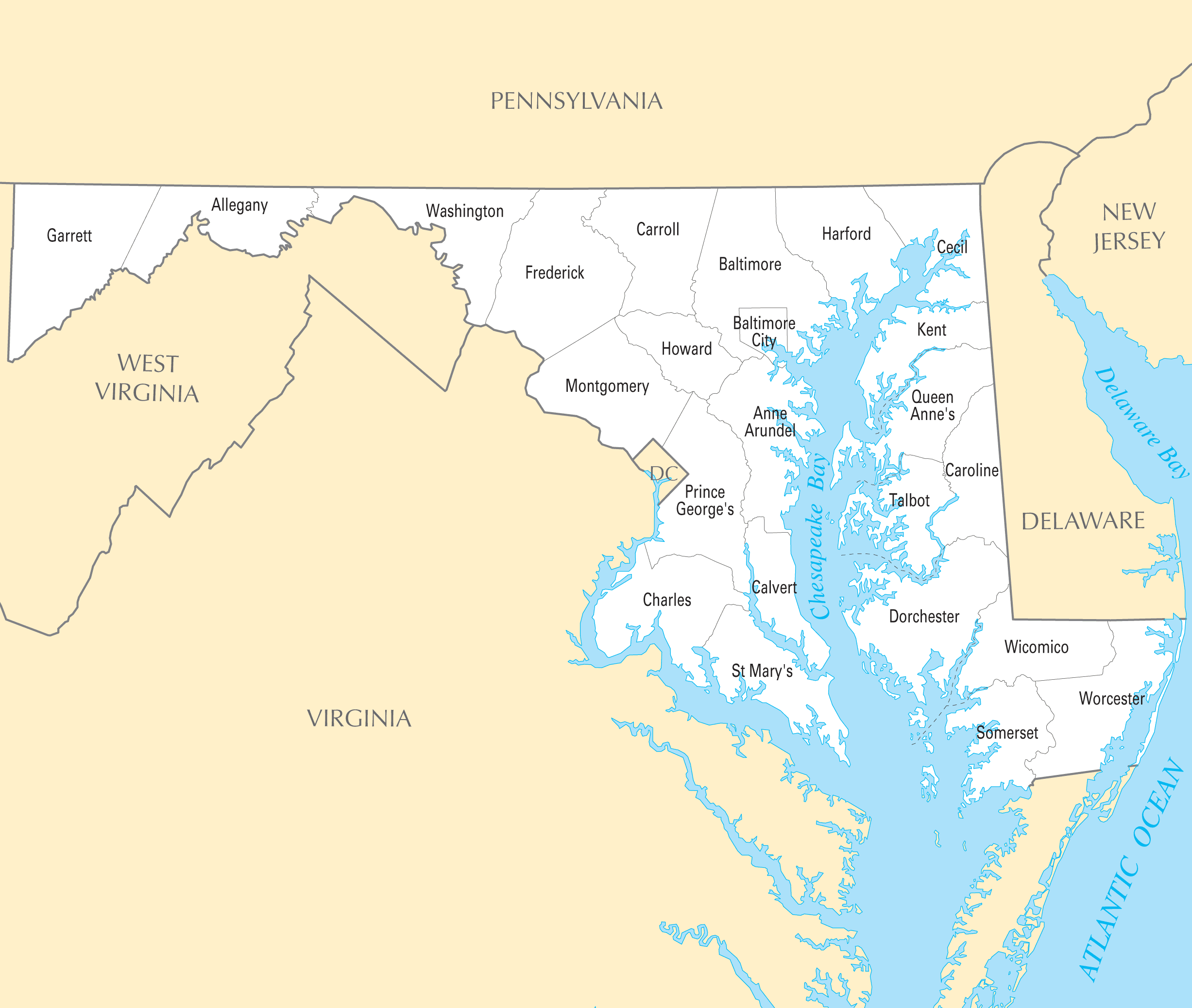
------------------------------------------------------------------------------------------
If you would like to use THIS picture in any sort of media elsewhere (such as newspaper or article), please send me a Flickrmail or send me an email at natehenderson6@gmail.com.
The updated Sydney Trains map including the South West Rail link that opened in February 2015. See the map with it under construction from 2014 here. Circa November 2015.
Here is the old Sydney Cityrail map.
The Southwest Airlines route map in October 2020. The map shows the nine new destinations planned through June 2021.
Courtesy of Southwest Airlines.