View allAll Photos Tagged consequence
Anatomical consequences of a punch to the eye for a Neuroradiologist by illustrator Jeanne Koelling: all rights reserved by the artist. I believe this piece is done with Prismacolor pencil on frosted acetate. Yes, she would work BOTH sides of the acetate! Jeanne is one of the best medical illustrators I've ever worked with. We've been friends for decades.
+++ DISCLAIMER +++
Nothing you see here is real, even though the model, the conversion or the presented background story might be based historical facts. BEWARE!
Some background:
The Boeing 727 was an American midsized, narrow-body three-engine jet aircraft built by Boeing Commercial Airplanes from the early 1960s to 1984. Intended for short and medium-length flights, it could carry 149 to 189 passengers and later models could fly up to 2,700 nautical miles (5,000 km) nonstop. It was originally powered by three Pratt & Whitney JT8D engines below the T-tail, one on each side of the rear fuselage with a center engine that connected through an S-duct to an inlet at the base of the fin.
The 727 followed the 707 and the 720, both quad-jet airliners, with which it shared its upper fuselage cross-section and cockpit design. The 727 was designed as a more economical alternative to the 707/720s and was tailored to operations from smaller airports, so independence from ground facilities was an important requirement. This led to one of the 727's most distinctive features: the built-in airstair that opened from the rear underbelly of the fuselage, which initially could be opened in flight (a feature that was later blocked). Nose wheel brakes were available as an option to reduce braking distance on landing, which provided reduction in braking distances of up to 150 m. In order to protect the tail section in the event of an over-rotation on take-off, the 727 was equipped with a retractable tailskid. Another innovation was the auxiliary power unit (APU), which allowed electrical and air-conditioning systems to run independently of a ground-based power supply, and without having to start one of the main engines. An unusual design feature was that the APU was mounted in a hole in the keel beam web, in the main landing gear bay.
The 727's fuselage had an outer diameter of 148 inches (3.8 m). This allowed six-abreast seating (three per side) and a single aisle when 18-inch (46 cm) wide coach-class seats were installed. An unusual feature of the fuselage was the 10-inch (25 cm) difference between the lower lobe forward and aft of the wing, as the higher fuselage height of the center section was simply retained towards the rear.
The 727 proved to be such a reliable and versatile airliner that it came to form the core of many startup airlines' fleets. The 727 was successful with airlines worldwide partly because it could use smaller runways while still flying medium-range routes. This allowed airlines to carry passengers from cities with large populations, but smaller airports, to worldwide tourist destinations. One of the features that gave the 727 its ability to land on shorter runways was its clean wing design: With no wing-mounted engines, leading-edge devices (Krueger, or hinged, flaps on the inner wing and extendable leading edge slats out to the wingtip) and trailing-edge lift enhancement equipment (triple-slotted, fowler flaps) could be used on the entire wing. Together, these high-lift devices produced a maximum wing lift coefficient of 3.0 (based on the flap-retracted wing area).
The 727-100 first flew in February 1963 and entered service with Eastern Air Lines in February 1964; the stretched 727-200 flew in July 1967 and entered service with Northeast Airlines that December. After the global success of the -100 and especially the stretched -200 series, Boeing considered another version, the -300 series, a thoroughly modified variant, dedicated to the South American and Asian markets and optimized for “hot and high” climate operations.
The basis for the -300 was the extended -200 airframe, but in order to improve security as well as landing and starting characteristics, a fourth engine was added for extra thrust. This changed the tail layout completely, since the central JT8D and its S-duct were deleted. Instead, the 727-300’s four engines were re-arranged in two new twin-nacelles along the reinforced rear fuselage, similar to the Vickers VC-10 and Ilyushin Il-62 long-range airliners, which were both bigger/heavier aircraft, though. With the fourth engine’s extra power, the -300 became the Boeing 727 variant with the shortest take-off run: only 1.5 miles were necessary to get airborne (vs. 2 miles for late 727-200 variants and even less than 1,6 miles for the lighter, early 727-100). It also had the highest operational ceiling and an improved rate of climb, but top speed and range remained virtually unaffected.
In order to better cope with smaller airfields with less-than-perfect runways and higher landing speeds, the -300’s landing gear was reinforced and the twin wheels on the 727’s main legs replaced with four-wheel bogies. This necessitated bigger landing gear wells and the relocation of the APU into the rear fuselage, occupying the space of the former middle engine. The 727’s tail-mounted airstair was retained, and basically any interior feature and layout of the 727-200 cabin could be ordered for the -300, too, including side freight doors and equipment for mixed cargo/passenger operations.
Even though thrust-reversers were planned for all four engines, the inboard devices were omitted for serial production aircraft due to continued tail plane buffeting on the prototype, which flew in March 1970 for the first time. In order to compensate for this loss of braking power, Boeing’s engineers added a unique feature to the 727-300: a drogue parachute, which could be deployed to relieve the brakes and augment the outer JT8D’s thrust reversers, once the landing speed had been reduced to 80 knots or less. The parachute was mounted in a clamshell compartment in the now empty tail section.
However, the improved performance came at a price: through its additional engine, the 727-300 turned out to be costly to operate, being almost on par with the 707 and 720 models, which the 727 was originally intended to replace. In consequence, this specialized variant was only built in small numbers and found only a few operators. Launch customer was Aéromexico in 1972, ordering ten -301 machines primarily for domestic and South American routes. Other major civil operators became Air India with eight -302 machines, TAME (EP Linea Aerea del Ecuador) with six -303 aircraft, and Aerolíneas Argentinas with five -304 aircraft. A total of six machines were furthermore built under the designation C-22D for military operators; two of them flew as VIP transports for the USAF (also carrying out CIA missions, the integral airstair was a convenient detail of the type), and two each flew for the air forces of Mexico and Pakistan.
The highest production rate of the 727 was in the 1970s. Airport noise regulations have led to 727s being equipped with hush kits, the last 727 was completed in 1984. Successor models include variants of the 737 and the 757-200. The last commercial passenger flight of the 727 was in January 2019 in Iran, even though a few machines of the type still remain in government and private use or operate as freighters.
General characteristics:
Crew: 3 (+ 3 flight attendants)
Length: 153 ft 2 in (46.68m)
Wingspan: 108 ft (32.92m)
Height: 34 ft 11 in (10.65m)
Wing area: 1,650 sq ft (153 m²), 32° sweep
Empty weight: 100,700 lb (45,720 kg)
Max. takeoff weight: 209,500 lb (95,100 kg)
Fuel capacity: 8,090 US gal (30,620 l)
Cabin width: 140 in/3.56m
Two-class seats: 134 (20F@38" + 114Y@34")
Single-class seats: 155@34", absolute maximum of 189 passengers
Powerplant:
4× Pratt & Whitney JT8D-11 low-bypass (0.96 to 1) turbofan engines,
delivering 15,000 lbf (66.72 kN) each
Performance:
Maximum speed: Mach 0.9 (961 km/h; 519 kn)
Cruise speed: Mach 0.86 (917 km/h; 495 kn)
Landing speed: 151 ml/h (244 km/h; 135 kn)
Rate of climb: 1,920 ft/min (9.8 m/s)
Maximum service ceiling: 44,550 ft (13,600 m)
Range: 1,900 nmi (2,173 ml, 3,500 km)
Takeoff distance to 35 ft (11 m): 7,860 ft (2,400 m)
Landing distance from 50 ft (15 m): 2,160ft at maximum gross landing weight with thrust reverser,
1,800ft with additional drogue parachute deployment
The kit and its assembly:
This model became the third and relatively spontaneous entry for the “More or less engines” group build at whatifmodelers.com. It was actually an early idea for the GB, but I rejected it at first because I usually do not build small-scale airliners and did not have any ingredient for the build at hand. However, a fellow modeler had a similar idea, a four-engine Sud Aviation Caravelle, and upon discussing the project in the forum I became eventually convinced to build this conceptual sister ship, even though the procurement of its major ingredients took some time.
I considered and checked several Boeing 727 kits on the market, and settled for the Minicraft kit – in particular its USAF C-22C boxing. The Revell kit, a 727-100, was rejected as outdated rubbish and due to its short fuselage, and the Airfix kit, a long -200, also fell through because of its raised surface details and simply for being an Airfix kit.
The Minicraft kit was the only option left – and even though it has its weak points, too (like the wings’ massive leading edges and a so-so fit of the fuselage halves), it turned out to be a sound basis for this modification project. Its main selling points were engraved surface details, the lack of passenger cabin window openings and separate decals for the windows. Esp. the latter two factors were an important part of my construction and painting plan for this build (see below).
Another important ingredient for this build were the engines. For a quad-engine conversion I found a resin set for VC-10 engines from Bra.Z Models (and procured them from Hong Kong!), which are a good match in size and shape. Furthermore, due to the more massive rear end and potential operations from less-than-perfect runways, I decided to replace the original twin main wheels with four-wheel bogies, taken from the remains of a Hasegawa 1:200 Boeing 747 kit. Since the 727’s main landing gear well doors remain closed on the ground, this change was relatively simple to make.
The only major change beyond the engine nacelle swap concern the fin and the tail tip: the original 2nd engine and its air intake with the S-duct had to go. This stunt was more challenging than it sounds at first, because the intake duct widens the fin’s root considerably, and the respective bulge reaches very far back, almost reaching the rudder!
This meant that a considerable portion of the fin had to be cut away, what also left a gap in the fuselage spine. The latter was filled with a piece of 0.5mm styrene sheet from inside of the fuselage (before the halves were glued together), and then a “prosthesis” from 1.5mm styrene sheet was inserted into the gap in the fin, trying to sculpt a suitable profile with a mild curve at the fin’s base, inspired the early 737s’ fin shape.
Around this skeleton, I built the new fin with the help of 2C putty, because some serious sculpting was necessary to create a suitable fin profile and shape that would blend into the existing fin section. A proper intersection at the fin’s base had to be created, too, a real 3D puzzle, more complex than one might think at first!
The tail exhaust opening was trimmed down to a wedge shape, and then the tail tip was filled/sculpted with a 2C putty plug, creating a clamshell shape for the fictional brake parachute container without extending the tail tip too much.
A small APU outlet was added on the new tail tip’s starboard side, too, while the APU’s intake was placed in the fin’s lower leading edge. The original ventral APU intake between the wings was faired over.
One of the Minicraft kit’s weak points is the shape of the wings’ leading edges: they look very crude and solid, with an almost vertical front. In an attempt to mend this flaw, I tried to give the leading edges a more rounded shape with the help of putty.
The model’ nose section was filled with a lot of lead and, for the model’s in-flight pics, I added a ventral, vertical styrene tube in the model’s center of gravity as a display holder adapter.
Painting and markings:
The idea behind this four-engine 727 was a dedicated “hot & high” variant, so I searched for an obvious operator, and it was to be a commercial airline. Mexico became my first and favorite candidate, despite the fact that Aéromexico did not operate any Boeing aircraft during the Seventies, rather a fleet of mixed Douglas aircraft. I also found the airline’s livery of that era to be very attractive, with an NMF finish and orange and black trim - very elegant and colorful.
Finding suitable decals became a challenge, though. After some research I found a DC-8 Aéromexico sheet from 26decals – it not only matched the intended time slot, it also had the benefit of coming with separate decals for cheat lines and windows. This was a perfect match for the window-less Minicraft Boeing 727 kit, and, as a convenient complement, the kit’s C-22 boxing had the benefit that it depicts a uniform, white aircraft, so that its decal sheet comes with “clean” window and door decals, without any colored background. A perfect match for my plan!
Painting was straightforward. After having finished the building phase, I gave the model an initial coat of grey acrylic primer from the rattle can. Some small surface blemishes had to be corrected, and then I added light grey panels on top of the wings and the stabilizers (Humbrol 40, gloss FS 36440). The fin as well as the engine pods and the wing tips were painted in orange; Humbrol 18 (Gloss Orange) came very close to the decals’ tone. These areas were masked with Tamiya tape and then the model received an overall coat with a tone called “White Aluminum”, also from the rattle can.
Thereafter, the decals for the orange and black trim were applied. Since the DC-8 decals would not fit the 727 fuselage in every place, orange paint and generic black and silver decal stripes (TL Modellbau) were used for fine-tuning. Once the “style” decals were applied, the windows were added and the model received an overall coat of gloss acrylic varnish, also from the rattle can.
In a final step, the landing gear (painted all glossy white) was mounted.
This conversion appears simple at first sight, but the execution caused some headaches. The challenge was not so much building this model, but rather getting all the major input parts and pieces together. Creating a new fin shape was also more challenging than one would expect at first sight. However, the result is quite subtle, and I guess that this fictional 727-300 might make some people look twice, since it reminds a lot of the (bigger) Vickers VC10. Indeed, the outlines are very similar.
Great Sampford, Essex
The beautiful church of St Michael the Archangel at Great Sampford is not the first church to stand on the rising ground at the centre of the village overlooking the cornfields along the valley of the river Pant. It is possibly sited on an ancient place of cult or religious significance. The proximity of the Stow farm may be of some importance, for the word ‘Stow’ in Old English can mean a ‘holy place’ or ‘place of assembly’. A pre-Conquest church, presumably of timber and thatch construction, followed perhaps, by a simple stone-built church, was replaced by the 13c on the same site by a major church building of which one of the transepts remains as the vestry of the present church which was built between 1320 and 1350. The original dedication of the church, if different, is not known as the first documentary reference to St Michael occurs as late as 1540 in a Sampford will. Dedications were sometimes changed and the use of the proper style, St. Michael the Archangel, is in fact quite rare. However, dedications to St. Michael or St. Michael and All Angels are numerous and were popular as the Archangel is an important figure in Christian tradition and art, symbolising the victory of God over evil, as an intercessor for the sick and as a leader of the Church militant. Churches dedicated to him, as at Great Sampford, are often found on hill—top sites or on high ground .a possible allusion to St. Michael’s pre-eminence in the Angelic Host of Christian belief. His Feast Day is 29th September.
Knowledge of the origins of the Christian Church in Essex relies largely on the fragile but growing evidence of archaeology and landscape interpretation. An ill-defined and mobile pattern of contemporaneous pagan and early Christian practices in the Roman era comes into historical focus with the missionary endeavours of the Roman and Celtic Churches when such names as Augustine, Mellitus and Cedd are prominent in Essex history. Within that tradition there are various, as yet unproven, theories about the establishment of a church at Great Sampford.
On entering the church the first impression that the visitor receives is of its elegant dignity; the next, the incongruence of its scale in such a tiny rural community. An interesting aspect of this enigma is the search for a convincing explanation of its status, from the mid-13c until 1907, as a deanery church serving twenty-one surrounding parishes in the Freshwell Hundred and in part of Uttlesford. It may have been a consequence of an early ‘minster’ (i.e.: missionary) role or as the result of a parochial compromise in an area with more important communities such as (Saffron) Walden. We do not know. However, it is a fact that the missionary work of the early minsters often extended to and beyond the boundaries of the administrative hundreds and became the sites of the hundredal centres themselves. There may well be historic linkages, not yet understood, between the Freshwell and Uttlesford Hundreds and the Sampford Deanery that relate to the early status of the church at Great Sampford.
The earliest historical fact about St. Michael’s is the grant by William Rufus, son and successor of William the Conqueror, of the church at Sampford along with the subordinate chapel at Hempstead with their lands and tithes to Battle Abbey in 1094. According to Philip Morant, the most famous of Essex historians, this was a formal confirmation of the Conqueror's original royal grant. This act of confirmation was a necessary and regular practice in regard to the efficacy of grants and early charters which were frequently forged. The church at Hempstead was within the jurisdiction of the vicar of Great Sampford until as late as 1979. Great Sampford remained in the hands of Battle Abbey until the Dissolution of the Monasteries in 1539 when it was transferred to the Dean and Chapter of Canterbury. In 1836 it passed to the newly-established Church Commissioners. In 1982 Great Sampford was combined with the parish of Little Sampford.
For perhaps a thousand years, even more, the Church at Sampford pursued its mission and, like others of medieval foundation, did not escape the consequences of religious, political and parochial events or circumstances. An astonishing flowering of spiritual faith and social commitment led to the building and re-building of these lovely churches. This phase was followed by the painful disruption of the Reformation, the Commonwealth and the Restoration, all of which led to anxious change and despoliation. In the course of these events much of the magnificence of the church at Great Sampford and its furnishings was lost or abandoned. All his was compounded by periods of neglect and the chronic problems of maintaining a great building in a small village bereft of wealthy resident patrons.
The loss, confiscation or sale of the rood, images, church plate and "such other goods as could be spared" was mirrored by decay of the fabric as is evident from the Parochial Inventories and Visitations of the l6c and l7c. The l7c saw the introduction of new arrangements for the railing of the Lord’s Table and seating for the congregation, a school was held in the south transept and the village musicians performed in a gallery under the tower. The inevitable ‘restorations’ by the Victorians led to the removal of furnishings, the installation of new pews, patterned floor tiling and the stripping of the stucco from the exterior walls of the church to expose the original flint and rubble surfaces. In more recent times the spiral staircase in the tower was removed and the roof structure of the south aisle replaced. We are, fortunately, left with a church of beauty and distinction.
It is hoped that the following brief notes on the architectural features and minor objects and details of interest in the church will help visitors to enjoy their visit.
The significance of St. Michael the Archangel in the village scene is apparent from the scale of the building, its strong profiles and conspicuous English Gothic idiom of the Decorated period. Internally, the major architectural theme is that of a restrained, uncomplicated elegance that is enhanced by the ample light admitted by plain glass windows. A dominant feature is the fine range of trefoiled, cinquefoiled and sexfoiled lights of the nave, chancel and aisle windows all dating from the period c. 1320-50. The cusped tracery of the windows is complemented by the symmetrical refinement of the arcading which is only lightly embellished by mouldings and carved capitals, typical of the period, and among the best in the county. Although not devoid of interesting detail, there is nothing to detract from the simple elegance and spatial qualities with which the fenestration and graceful arcading endow this fine building.
In 1769 Peter Muilman referred to the church at Great Sampford which "stands pleasantly on a small eminence by the roadside". Pleasantly indeed, the church is handsomely set in the Essex cornfields and seen to advantage from the high ground on the opposite side of the river. Close to, the sturdy profiles and somewhat severe external textures, relieved by some decorative areas of knapped flint flushwork, offer little hint of the quality of its Gothic interior. The main structure is built with random-faced flint and rubble set in lime mortar with limestone and clunch dressings. The roof is tiled and slated. The prominent west tower was built in the mid-l4c and, like the south aisle, has an embattled parapet. The south porch is of the same period. Unhappily, the window tracery of the 13c transept has been lost and is now disfigured by brickwork of two phases which seem to date from the late-18c to early-19c. Conspicuous in the churchyard are the fine lime trees planted in about 1835. The only monument of significance is the obelisk near the east wall of the churchyard which commemorates members of the Watson Family of Sampford. Colonel Jonas Watson was a distinguished soldier who was killed in action at the siege of Cartagena in 1741. But spare a moment to look at the adjacent grave stone of William Ruffle who died in 1881, a village worthy who served Great Sampford as shopkeeper, constable, clerk and in other public offices for over half a century.
External details of note are a rare series of consecration crosses of varying designs around the church, an early scratch dial, now displaced and seen on a doorstep in the north wall, a benchmark and the slot for the surveyor’s bench on the south-west buttress of the tower and miscellaneous graffiti mainly in the porch. Other details of interest include the rainwater heads, the vigorous carvings on the label of the south transept and niches in the south transept and the north and west walls. The clock on the church tower was installed in l9ll to mark the coronation of King George V.
On entering, visitors will appreciate the impressive dimensions and architectural refinement of this handsome village church. Standing in the centre of the nave the dominant curvilinear idiom of the Gothic styling will be apparent. The nave is flanked by north and south arcaded aisles with plain two-centred arches datable to the l4c. The piers of the north arcade are quatrefoil in plan with slender engaged shafting; those of the south arcade are octagonal in plan. All of the piers have moulded bases and capitals.
The 14c west tower is constructed in four stages. Internally it is open to the nave under a two-centred moulded arch. There is access to the belfry but, sadly, the brick-built circular Tudor staircase was removed about fifty years ago. The carved head of a woman recovered from this staircase, although it presumably originated from elsewhere in the church, can be seen in the vestry. But the finest aspects of this church are to be seen in the early chancel which is remarkable for its size and the splendour of its architectural expression. It dates from the first decades of the l4c. This fine chancel is framed by an exceptionally large east window of five cinquefoiled lights, the curvilinear bar tracery and verticality of which enhance the powerful impact of this aspect of the building. Most interesting, and presumably deriving from the deanery status of the church, there is a series on the north and south walls of twenty-one stalls recessed under a canopied arcade with mouldings and cusping. At the east end of the south arcade there are the piscina and sedilia. The chancel arch, of the same period and sprung from the capitals of clustered shafts, shows residual traces, near the base on either side of the step, of a former stone screen which is possibly significant in view of the rare stone screens in the nearby churches of Stebbing and Great Bardfield. Note also the small blocked low window by the north side of the arch. The panels behind the altar on which the Creed, Lords Prayer and Commandments are painted were made in 1837 for the church at Danbury and brought to Great Sampford in 1894.
The vestry, formerly a chapel, is of great interest as a surviving major element of the previous church of the late - 13c (however when I visited this was locked). In the east wall there are good coupled windows of two trefoiled lights with two quatrefoil and sexfoil circular openings, interesting examples of pierced plate-tracery. The large brick-filled window in the south wall is of the mid-13c with good mouldings and the surviving arch and shafting in the splays. Below this window, fragments of medieval glass were found buried in the ground outside. The contemporary archway in the west wall has some intriguing carved capitals richly adorned with robust oak-leaf foliage and vibrant figures including an owl, snail, pig and a human face in a good state of preservation. One is assumed to be a representation of a ‘Green Man’ a symbolic figure of English folklore. The north wall has four quatrefoil openings. There is, under the south window, a triple gabled recess with crockets and linear moulding, pinnacles and a neat acanthus motif which was probably once a fine tomb of an important local family, perhaps a member of the de Kemesek family. It is said to have served as a fireplace in the time when the vestry housed the village school! The battened and studded oak door leading into the chancel is 16c.
The open church roof structures are well worth close study. The best is in the vestry which is roofed with twelve pairs of collared scissor-braced trusses supporting the steep-pitched rafters on moulded wall plates. The chancel roof is also of trussed-rafter construction of seven cants, as is that of the nave roof which also has three tie-beams which may have been installed at a later date, perhaps when, as we know from church records, the roof was repaired in the 16c. The lean-to roof of the north aisle is attractively braced with graceful curved members sprung from a good moulded wall-plate. Unfortunately, the original roof of the south aisle has been replaced by a modern structure, but three of the amusing stone corbels which supported it remain. The trussed-rafter roof of the south porch with seven cants should be noted as it rests on extremely fine early moulded plates. Visitors should not miss the intriguing carved medieval wooden head which is fastened onto the wall above the chancel arch at the north-west corner facing the nave. This appears to have been repositioned, perhaps from a figure that was once part of church statuary. On the south side in the clerestory will be seen an attractive 15c Perpendicular style rectilinear and cinquefoiled window of three ogee lights which was devised to throw light onto the former rood.
Originally the church would have been resplendent with a comprehensive range of wall paintings for visual instruction depicting scenes of biblical or religious significance. A few fragments survive, having been discovered during restoration work in 1979, above the arches on the walls of the north arcade. Although faint and incomplete the two remaining paintings are of interest. One represents the seven deadly sins in the form of a diagrammatic tree which is comparatively rare. The other may be of St. Christopher, a saintly figure normally positioned, as possibly here, opposite the church entrance as a reassuring gesture to the worshippers. There are traces, too, possibly of another period, that suggest a dragon was depicted which would imply an association with St. Michael to whom the church is dedicated or, possibly, St. Margaret. Traces of colour in the wall plaster of the vestry may eventually yield further paintings.
Worthy of note are some special features beginning with the door at the church entrance. This is thought to be contemporary with the building of the church in the early l4c and, although damaged at the base, is still a fine example and retains the original wrought iron strap-work and studding. According to expert opinion it is the most elaborate of all saltire-braced doors in Essex. The boards of which it is constructed are pegged together. The font in the south aisle has a plain moulded octagonal bowl of the 15c. Its stem is earlier and has complex decoration which combines ogee-headed panels with intricate tracery on a chamfered 14c plinth. The Victorian pews were recently detached and the nave flooring paved. The beautiful series of kneelers worked with flower motifs were recently embroidered by local people. The lovely embroidered runner on the step of the sanctuary was made in 1990 and is an exact copy of the Victorian runner it replaced.
It is valid to observe that St. Michael’s benefits aesthetically from the absence of monumental clutter which, although sometimes historically useful, can be detrimental to the architectural purity of the building as a whole. The only remaining monuments of antiquity in the church are the tomb slabs (Calthorp and Burrows) of the 17c and 18c in the chance]. They commemorate a family whose name persists at a local farm and another of textile merchants who lived opposite the church. There is another (Gretton) in the south aisle. The pulpit, the provenance of which is unknown, is Victorian. There are also a few notable pieces of furniture. These include a 17c desk with a writing slope and cupboard which once served the school in the church. There is also a standing cupboard or hutch of the late 16c and a 16c church chest, iron-banded with strap hinges and an interior ‘till’ which may have been built-in as a response to a Parochial Visitation of 1686 which ordered it to be provided and lockable. The modern portable altar at the east end of the north aisle was given to the church by an anonymous donor in 1991. The small bronze of the Madonna and Child is of German provenance.
The five church bells which were once rung for church services as well as for special village occasions like harvest and gleaning can no longer be pealed. This is because of structural weaknesses in the belfry though they are still hung on the original stocks. Nowadays one is chimed for church services, as a Sanctus bell and used to ring the hours for the clock. The first, third and fourth bells were cast by William Land in 1624; the second (which bears the Royal Arms and a medallion with a bust of Charles II) by Henry Yaxley in 1684; the fifth by John Hodson in 1664. The church plate includes an interesting early Elizabethan silver cup of 1562 with a paten cover of c1567 and another paten dated 1630. None of these is inscribed although they carry makers' marks. An electro-plated flagon of 1854 was purchased by the vicar for five guineas in 1856. The organ, installed in 1976, is said to have come from a nonconformist chapel and to have been built in c1830 by G.M. Holdich. The eagle lectern in the south aisle was placed in the church in 1909 as a tribute to the incumbency of the Rev. Robert Eustace, vicar from 1850 to 1905.
Almost every ancient church has a range, most of which cannot be satisfactorily explained, of markings and graffiti, ostensibly symbolic figuring, idle scratchings and numerous initials and dates. Great Sampford has a generous quota of such. Of genuine interest is a 3-men’s (or 9-men's) Morris cut into the second stall on the north side of the chancel inside the altar rail. These are gaming boards of some antiquity, the play having affinities with ludo and allegedly used to relieve the boredom of long sermons or tedious ritual. On the opposite side one of the sedilia has a set of unexplained grooves, possibly another game.
This guide has so far been concerned mostly with events, architecture and objects of beauty or interest. More important are the people, clergy, church officers and villagers who have worked for and worshipped in the church. They all emerge from the obscurity of the past through the church records and the village archives as personalities or in human situations which help us to share their hopes, commitment or despair. The clergy, ever since Thomas de Sampford, dean in 1163, have served the church and ministered to the people throughout the ages and struggled with the traumas of turbulent and anxious times. The churchwardens, like Richard Petytt and John Mylner in the l6c and their successors, have striven to preserve the church from decay and neglect and carried out their onerous and multifarious duties with devotion if not always with alacrity. There have been too the countless parishioners whose recurring family names fill the registers recording the joy of marriage and birth and the sadness of illness and death. They are all part of the story and the reality of the church and its life in the village. They too were familiar with the building we admire. They sat in the pews and looked upon the beauty that is now our heritage. Their responsibility has passed to successive generations, and now to us. We hope that they would have approved of this little booklet and that it will play its part in safeguarding the continuity of that inheritance.
Hyderabad (Listeni/ˈhaɪdərəˌbæd/ HY-dər-ə-bad; often /ˈhaɪdrəˌbæd/) is the capital of the southern Indian state of Telangana and de jure capital of Andhra Pradesh. Occupying 625 square kilometres along the banks of the Musi River, it has a population of about 6.8 million and a metropolitan population of about 7.75 million, making it the fourth most populous city and sixth most populous urban agglomeration in India. At an average altitude of 542 metres, much of Hyderabad is situated on hilly terrain around artificial lakes, including Hussain Sagar - predating the city's founding - north of the city centre.
Established in 1591 by Muhammad Quli Qutb Shah, Hyderabad remained under the rule of the Qutb Shahi dynasty for nearly a century before the Mughals captured the region. In 1724, Mughal viceroy Asif Jah I declared his sovereignty and created his own dynasty, known as the Nizams of Hyderabad. The Nizam's dominions became a princely state during the British Raj, and remained so for 150 years, with the city serving as its capital. The city continued as the capital of Hyderabad State after it was brought into the Indian Union in 1948, and became the capital of Andhra Pradesh after the States Reorganisation Act, 1956. Since 1956, Rashtrapati Nilayam in the city has been the winter office of the President of India. In 2014, the newly formed state of Telangana split from Andhra Pradesh and the city became joint capital of the two states, a transitional arrangement scheduled to end by 2025.
Relics of Qutb Shahi and Nizam rule remain visible today, with the Charminar - commissioned by Muhammad Quli Qutb Shah - coming to symbolise Hyderabad. Golconda fort is another major landmark. The influence of Mughlai culture is also evident in the city's distinctive cuisine, which includes Hyderabadi biryani and Hyderabadi haleem. The Qutb Shahis and Nizams established Hyderabad as a cultural hub, attracting men of letters from different parts of the world. Hyderabad emerged as the foremost centre of culture in India with the decline of the Mughal Empire in the mid-19th century, with artists migrating to the city from the rest of the Indian subcontinent. While Hyderabad is losing its cultural pre-eminence, it is today, due to the Telugu film industry, the country's second-largest producer of motion pictures.
Hyderabad was historically known as a pearl and diamond trading centre, and it continues to be known as the City of Pearls. Many of the city's traditional bazaars, including Laad Bazaar, Begum Bazaar and Sultan Bazaar, have remained open for centuries. However, industrialisation throughout the 20th century attracted major Indian manufacturing, research and financial institutions, including Bharat Heavy Electricals Limited, the National Geophysical Research Institute and the Centre for Cellular and Molecular Biology. Special economic zones dedicated to information technology have encouraged companies from across India and around the world to set up operations and the emergence of pharmaceutical and biotechnology industries in the 1990s led to the area's naming as India's "Genome Valley". With an output of US$74 billion, Hyderabad is the fifth-largest contributor to India's overall gross domestic product.
HISTORY
TOPONYMY
According to John Everett-Heath, the author of Oxford Concise Dictionary of World Place Names, Hyderabad means "Haydar's city" or "lion city", from haydar (lion) and ābād (city). It was named to honour the Caliph Ali Ibn Abi Talib, who was also known as Haydar because of his lion-like valour in battles. Andrew Petersen, a scholar of Islamic architecture, says the city was originally called Baghnagar (city of gardens). One popular theory suggests that Muhammad Quli Qutb Shah, the founder of the city, named it "Bhaganagar" or "Bhāgnagar" after Bhagmati, a local nautch (dancing) girl with whom he had fallen in love. She converted to Islam and adopted the title Hyder Mahal. The city was renamed Hyderabad in her honour. According to another source, the city was named after Haidar, the son of Quli Qutb Shah.
EARLY AND MEDIEVAL HISTORY
Archaeologists excavating near the city have unearthed Iron Age sites that may date from 500 BCE. The region comprising modern Hyderabad and its surroundings was known as Golkonda ("shepherd's hill"), and was ruled by the Chalukya dynasty from 624 CE to 1075 CE. Following the dissolution of the Chalukya empire into four parts in the 11th century, Golkonda came under the control of the Kakatiya dynasty from 1158, whose seat of power was at Warangal, 148 km northeast of modern Hyderabad.
The Kakatiya dynasty was reduced to a vassal of the Khilji dynasty in 1310 after its defeat by Sultan Alauddin Khilji of the Delhi Sultanate. This lasted until 1321, when the Kakatiya dynasty was annexed by Malik Kafur, Allaudin Khilji's general. During this period, Alauddin Khilji took the Koh-i-Noor diamond, which is said to have been mined from the Kollur Mines of Golkonda, to Delhi. Muhammad bin Tughluq succeeded to the Delhi sultanate in 1325, bringing Warangal under the rule of the Tughlaq dynasty until 1347 when Ala-ud-Din Bahman Shah, a governor under bin Tughluq, rebelled against Delhi and established the Bahmani Sultanate in the Deccan Plateau, with Gulbarga, 200 km west of Hyderabad, as its capital. The Bahmani kings ruled the region until 1518 and were the first independent Muslim rulers of the Deccan.
Sultan Quli, a governor of Golkonda, revolted against the Bahmani Sultanate and established the Qutb Shahi dynasty in 1518; he rebuilt the mud-fort of Golconda and named the city "Muhammad nagar". The fifth sultan, Muhammad Quli Qutb Shah, established Hyderabad on the banks of the Musi River in 1591, to avoid the water shortages experienced at Golkonda. During his rule, he had the Charminar and Mecca Masjid built in the city. On 21 September 1687, the Golkonda Sultanate came under the rule of the Mughal emperor Aurangzeb after a year-long siege of the Golkonda fort. The annexed area was renamed Deccan Suba (Deccan province) and the capital was moved from Golkonda to Aurangabad, about 550 km northwest of Hyderabad.
MODERN HISTORY
In 1713 Farrukhsiyar, the Mughal emperor, appointed Asif Jah I to be Viceroy of the Deccan, with the title Nizam-ul-Mulk (Administrator of the Realm). In 1724, Asif Jah I defeated Mubariz Khan to establish autonomy over the Deccan Suba, named the region Hyderabad Deccan, and started what came to be known as the Asif Jahi dynasty. Subsequent rulers retained the title Nizam ul-Mulk and were referred to as Asif Jahi Nizams, or Nizams of Hyderabad. The death of Asif Jah I in 1748 resulted in a period of political unrest as his sons, backed by opportunistic neighbouring states and colonial foreign forces, contended for the throne. The accession of Asif Jah II, who reigned from 1762 to 1803, ended the instability. In 1768 he signed the treaty of Masulipatnam, surrendering the coastal region to the East India Company in return for a fixed annual rent.
In 1769 Hyderabad city became the formal capital of the Nizams. In response to regular threats from Hyder Ali (Dalwai of Mysore), Baji Rao I (Peshwa of the Maratha Empire), and Basalath Jung (Asif Jah II's elder brother, who was supported by the Marquis de Bussy-Castelnau), the Nizam signed a subsidiary alliance with the East India Company in 1798, allowing the British Indian Army to occupy Bolarum (modern Secunderabad) to protect the state's borders, for which the Nizams paid an annual maintenance to the British.
Until 1874 there were no modern industries in Hyderabad. With the introduction of railways in the 1880s, four factories were built to the south and east of Hussain Sagar lake, and during the early 20th century, Hyderabad was transformed into a modern city with the establishment of transport services, underground drainage, running water, electricity, telecommunications, universities, industries, and Begumpet Airport. The Nizams ruled their princely state from Hyderabad during the British Raj.
After India gained independence, the Nizam declared his intention to remain independent rather than become part of the Indian Union. The Hyderabad State Congress, with the support of the Indian National Congress and the Communist Party of India, began agitating against Nizam VII in 1948. On 17 September that year, the Indian Army took control of Hyderabad State after an invasion codenamed Operation Polo. With the defeat of his forces, Nizam VII capitulated to the Indian Union by signing an Instrument of Accession, which made him the Rajpramukh (Princely Governor) of the state until 31 October 1956. Between 1946 and 1951, the Communist Party of India fomented the Telangana uprising against the feudal lords of the Telangana region. The Constitution of India, which became effective on 26 January 1950, made Hyderabad State one of the part B states of India, with Hyderabad city continuing to be the capital. In his 1955 report Thoughts on Linguistic States, B. R. Ambedkar, then chairman of the Drafting Committee of the Indian Constitution, proposed designating the city of Hyderabad as the second capital of India because of its amenities and strategic central location. Since 1956, the Rashtrapati Nilayam in Hyderabad has been the second official residence and business office of the President of India; the President stays once a year in winter and conducts official business particularly relating to Southern India.
On 1 November 1956 the states of India were reorganised by language. Hyderabad state was split into three parts, which were merged with neighbouring states to form the modern states of Maharashtra, Karnataka and Andhra Pradesh. The nine Telugu- and Urdu-speaking districts of Hyderabad State in the Telangana region were merged with the Telugu-speaking Andhra State to create Andhra Pradesh,with Hyderabad as its capital. Several protests, known collectively as the Telangana movement, attempted to invalidate the merger and demanded the creation of a new Telangana state. Major actions took place in 1969 and 1972, and a third began in 2010. The city suffered several explosions: one at Dilsukhnagar in 2002 claimed two lives; terrorist bombs in May and August 2007 caused communal tension and riots; and two bombs exploded in February 2013. On 30 July 2013 the United Progressive Alliance (UPA) government of India declared that part of Andhra Pradesh would be split off to form a new Telangana state, and that Hyderabad city would be the capital city and part of Telangana, while the city would also remain the capital of Andhra Pradesh for no more than ten years. On 3 October 2013 the Union Cabinet approved the proposal, and in February 2014 both houses of Parliament passed the Telangana Bill. With the final assent of the President of India in June 2014, Telangana state was formed.
GEOGRAPHY
TOPOGRAPHY
Situated in the southern part of Telangana in southeastern India, Hyderabad is 1,566 kilometres south of Delhi, 699 kilometres southeast of Mumbai, and 570 kilometres north of Bangalore by road. It lies on the banks of the Musi River, in the northern part of the Deccan Plateau. Greater Hyderabad covers 625 km2, making it one of the largest metropolitan areas in India. With an average altitude of 542 metres, Hyderabad lies on predominantly sloping terrain of grey and pink granite, dotted with small hills, the highest being Banjara Hills at 672 metres. The city has numerous lakes referred to as sagar, meaning "sea". Examples include artificial lakes created by dams on the Musi, such as Hussain Sagar (built in 1562 near the city centre), Osman Sagar and Himayat Sagar. As of 1996, the city had 140 lakes and 834 water tanks (ponds).
CLIMATE
Hyderabad has a tropical wet and dry climate (Köppen Aw) bordering on a hot semi-arid climate (Köppen BSh). The annual mean temperature is 26.6 °C; monthly mean temperatures are 21–33 °C. Summers (March–June) are hot and humid, with average highs in the mid-to-high 30s Celsius; maximum temperatures often exceed 40 °C between April and June. The coolest temperatures occur in December and January, when the lowest temperature occasionally dips to 10 °C. May is the hottest month, when daily temperatures range from 26 to 39 °C; December, the coldest, has temperatures varying from 14.5 to 28 °C.
Heavy rain from the south-west summer monsoon falls between June and September, supplying Hyderabad with most of its mean annual rainfall. Since records began in November 1891, the heaviest rainfall recorded in a 24-hour period was 241.5 mm on 24 August 2000. The highest temperature ever recorded was 45.5 °C on 2 June 1966, and the lowest was 6.1 °C on 8 January 1946. The city receives 2,731 hours of sunshine per year; maximum daily sunlight exposure occurs in February.
CONSERVATION
Hyderabad's lakes and the sloping terrain of its low-lying hills provide habitat for an assortment of flora and fauna. The forest region in and around the city encompasses areas of ecological and biological importance, which are preserved in the form of national parks, zoos, mini-zoos and a wildlife sanctuary. Nehru Zoological Park, the city's one large zoo, is the first in India to have a lion and tiger safari park. Hyderabad has three national parks (Mrugavani National Park, Mahavir Harina Vanasthali National Park and Kasu Brahmananda Reddy National Park), and the Manjira Wildlife Sanctuary is about 50 km from the city. Hyderabad's other environmental reserves are: Kotla Vijayabhaskara Reddy Botanical Gardens, Shamirpet Lake, Hussain Sagar, Fox Sagar Lake, Mir Alam Tank and Patancheru Lake, which is home to regional birds and attracts seasonal migratory birds from different parts of the world. Organisations engaged in environmental and wildlife preservation include the Telangana Forest Department, Indian Council of Forestry Research and Education, the International Crops Research Institute for the Semi-Arid Tropics (ICRISAT), the Animal Welfare Board of India, the Blue Cross of Hyderabad and the University of Hyderabad.
ADMINISTRATION
COMMON CAPITAL OF TELANGANA AND ANDHRA PRADESH
According to the Andhra Pradesh Reorganisation Act, 2014 part 2 Section 5: "On and from the appointed day, Hyderabad in the existing State of Andhra Pradesh, shall be the common capital of the State of Telangana and the State of Andhra Pradesh for such period not exceeding ten years. After expiry of the period referred to in sub-section, Hyderabad shall be the capital of the State of Telangana and there shall be a new capital for the State of Andhra Pradesh."
The same sections also define that the common capital includes the existing area designated as the Greater Hyderabad Municipal Corporation under the Hyderabad Municipal Corporation Act, 1955. As stipulated in sections 3 and 18 of the Reorganisation Act, city MLAs are members of Telangana state assembly.
LOCAL GOVERNMENT
The Greater Hyderabad Municipal Corporation (GHMC) oversees the civic infrastructure of the city's 18 "circles", which together encompass 150 municipal wards. Each ward is represented by a corporator, elected by popular vote. The corporators elect the Mayor, who is the titular head of GHMC; executive powers rest with the Municipal Commissioner, appointed by the state government. The GHMC carries out the city's infrastructural work such as building and maintenance of roads and drains, town planning including construction regulation, maintenance of municipal markets and parks, solid waste management, the issuing of birth and death certificates, the issuing of trade licences, collection of property tax, and community welfare services such as mother and child healthcare, and pre-school and non-formal education. The GHMC was formed in April 2007 by merging the Municipal Corporation of Hyderabad (MCH) with 12 municipalities of the Hyderabad, Ranga Reddy and Medak districts covering a total area of 625 km2. In the 2009 municipal election, an alliance of the Indian National Congress and Majlis-e-Ittehadul Muslimeen formed the majority. The Secunderabad Cantonment Board is a civic administration agency overseeing an area of 40.1 km2, where there are several military camps. The Osmania University campus is administered independently by the university authority.
Law and order in Hyderabad city is supervised by the governor of Telangana. The jurisdiction is divided into two police commissionerates: Hyderabad and Cyberabad, which are again divided into four and five police zones respectively. Each zone is headed by a deputy commissioner.
The jurisdictions of the city's administrative agencies are, in ascending order of size: the Hyderabad Police area, Hyderabad district, the GHMC area ("Hyderabad city") and the area under the Hyderabad Metropolitan Development Authority (HMDA). The HMDA is an apolitical urban planning agency that covers the GHMC and its suburbs, extending to 54 mandals in five districts encircling the city. It coordinates the development activities of GHMC and suburban municipalities and manages the administration of bodies such as the Hyderabad Metropolitan Water Supply and Sewerage Board (HMWSSB).
As the seat of the government of Telangana, Hyderabad is home to the state's legislature, secretariat and high court, as well as various local government agencies. The Lower City Civil Court and the Metropolitan Criminal Court are under the jurisdiction of the High Court. The GHMC area contains 24 State Legislative Assembly constituencies, which form five constituencies of the Lok Sabha (the lower house of the Parliament of India).
UTILITY SERVICES
The HMWSSB regulates rainwater harvesting, sewerage services and water supply, which is sourced from several dams located in the suburbs. In 2005, the HMWSSB started operating a 116-kilometre-long water supply pipeline from Nagarjuna Sagar Dam to meet increasing demand. The Telangana Southern Power Distribution Company Limited manages electricity supply. As of October 2014, there were 15 fire stations in the city, operated by the Telangana State Disaster and Fire Response Department. The government-owned India Post has five head post offices and many sub-post offices in Hyderabad, which are complemented by private courier services.
POLLUTION CONTROL
Hyderabad produces around 4,500 tonnes of solid waste daily, which is transported from collection units in Imlibun, Yousufguda and Lower Tank Bund to the dumpsite in Jawaharnagar. Disposal is managed by the Integrated Solid Waste Management project which was started by the GHMC in 2010. Rapid urbanisation and increased economic activity has also led to increased industrial waste, air, noise and water pollution, which is regulated by the Telangana Pollution Control Board (TPCB). The contribution of different sources to air pollution in 2006 was: 20–50% from vehicles, 40–70% from a combination of vehicle discharge and road dust, 10–30% from industrial discharges and 3–10% from the burning of household rubbish. Deaths resulting from atmospheric particulate matter are estimated at 1,700–3,000 each year. Ground water around Hyderabad, which has a hardness of up to 1000 ppm, around three times higher than is desirable, is the main source of drinking water but the increasing population and consequent increase in demand has led to a decline in not only ground water but also river and lake levels. This shortage is further exacerbated by inadequately treated effluent discharged from industrial treatment plants polluting the water sources of the city.
HEALTHCARE
The Commissionerate of Health and Family Welfare is responsible for planning, implementation and monitoring of all facilities related to health and preventive services. As of 2010–11, the city had 50 government hospitals, 300 private and charity hospitals and 194 nursing homes providing around 12,000 hospital beds, fewer than half the required 25,000. For every 10,000 people in the city, there are 17.6 hospital beds, 9 specialist doctors, 14 nurses and 6 physicians. The city also has about 4,000 individual clinics and 500 medical diagnostic centres. Private clinics are preferred by many residents because of the distance to, poor quality of care at and long waiting times in government facilities, despite the high proportion of the city's residents being covered by government health insurance: 24% according to a National Family Health Survey in 2005. As of 2012, many new private hospitals of various sizes were opened or being built. Hyderabad also has outpatient and inpatient facilities that use Unani, homeopathic and Ayurvedic treatments.
In the 2005 National Family Health Survey, it was reported that the city's total fertility rate is 1.8, which is below the replacement rate. Only 61% of children had been provided with all basic vaccines (BCG, measles and full courses of polio and DPT), fewer than in all other surveyed cities except Meerut. The infant mortality rate was 35 per 1,000 live births, and the mortality rate for children under five was 41 per 1,000 live births. The survey also reported that a third of women and a quarter of men are overweight or obese, 49% of children below 5 years are anaemic, and up to 20% of children are underweight, while more than 2% of women and 3% of men suffer from diabetes.
DEMOGRAPHICS
When the GHMC was created in 2007, the area occupied by the municipality increased from 175 km2 to 625 km2. Consequently, the population increased by 87%, from 3,637,483 in the 2001 census to 6,809,970 in the 2011 census, 24% of which are migrants from elsewhere in India, making Hyderabad the nation's fourth most populous city. As of 2011, the population density is 18,480/km2. At the same 2011 census, the Hyderabad Urban Agglomeration had a population of 7,749,334, making it the sixth most populous urban agglomeration in the country. The population of the Hyderabad urban agglomeration has since been estimated by electoral officials to be 9.1 million as of early 2013 but is expected to exceed 10 million by the end of the year. There are 3,500,802 male and 3,309,168 female citizens - a sex ratio of 945 females per 1000 males, higher than the national average of 926 per 1000. Among children aged 0–6 years, 373,794 are boys and 352,022 are girls - a ratio of 942 per 1000. Literacy stands at 82.96% (male 85.96%; female 79.79%), higher than the national average of 74.04%. The socio-economic strata consist of 20% upper class, 50% middle class and 30% working class.
ETHNIC GROUPS, LANGUAGE AND RELIGION
Referred to as "Hyderabadi", residents of Hyderabad are predominantly Telugu and Urdu speaking people, with minority Bengali, Gujarati (including Memon), Kannada (including Nawayathi), Malayalam, Marathi, Marwari, Odia, Punjabi, Tamil and Uttar Pradeshi communities. Hadhrami Arabs, African Arabs, Armenians, Abyssinians, Iranians, Pathans and Turkish people are also present; these communities, of which the Hadhrami are the largest, declined after Hyderabad State became part of the Indian Union, as they lost the patronage of the Nizams.
Telugu is the official language of Hyderabad and Urdu is its second language. The Telugu dialect spoken in Hyderabad is called Telangana, and the Urdu spoken is called Dakhani. English is also used. A significant minority speak other languages, including Hindi, Marathi, Odia, Tamil, Bengali and Kannada.
Hindus are in the majority. Muslims are present throughout the city and predominate in and around the Old City. There are also Christian, Sikh, Jain, Buddhist and Parsi communities and iconic temples, mosques and churches can be seen. According to the 2001 census, Hyderabad district's religious make-up was: Hindus (55.41%), Muslims (41.17%), Christians (2.43%), Jains (0.43%), Sikhs (0.29%) and Buddhists (0.02%); 0.23% did not state any religion.
SLUMS
In the greater metropolitan area, 13% of the population live below the poverty line. According to a 2012 report submitted by GHMC to the World Bank, Hyderabad has 1,476 slums with a total population of 1.7 million, of whom 66% live in 985 slums in the "core" of the city (the part that formed Hyderabad before the April 2007 expansion) and the remaining 34% live in 491 suburban tenements. About 22% of the slum-dwelling households had migrated from different parts of India in the last decade of the 20th century, and 63% claimed to have lived in the slums for more than 10 years. Overall literacy in the slums is 60–80% and female literacy is 52–73%. A third of the slums have basic service connections, and the remainder depend on general public services provided by the government. There are 405 government schools, 267 government aided schools, 175 private schools and 528 community halls in the slum areas. According to a 2008 survey by the Centre for Good Governance, 87.6% of the slum-dwelling households are nuclear families, 18% are very poor, with an income up to ₹20000 (US$300) per annum, 73% live below the poverty line (a standard poverty line recognised by the Andhra Pradesh Government is ₹24000 (US$360) per annum), 27% of the chief wage earners (CWE) are casual labour and 38% of the CWE are illiterate. About 3.72% of the slum children aged 5–14 do not go to school and 3.17% work as child labour, of whom 64% are boys and 36% are girls. The largest employers of child labour are street shops and construction sites. Among the working children, 35% are engaged in hazardous jobs.
NEIGHBOURHOODS
The historic city established by Muhammad Quli Qutb Shah on the southern side of the Musi River forms the "Old City", while the "New City" encompasses the urbanised area on the northern banks. The two are connected by many bridges across the river, the oldest of which is Purana Pul ("old bridge"). Hyderabad is twinned with neighbouring Secunderabad, to which it is connected by Hussain Sagar.
Many historic and tourist sites lie in south central Hyderabad, such as the Charminar, the Mecca Masjid, the Salar Jung Museum, the Nizam's Museum, the Falaknuma Palace, and the traditional retail corridor comprising the Pearl Market, Laad Bazaar and Madina Circle. North of the river are hospitals, colleges, major railway stations and business areas such as Begum Bazaar, Koti, Abids, Sultan Bazaar and Moazzam Jahi Market, along with administrative and recreational establishments such as the Reserve Bank of India, the Telangana Secretariat, the Hyderabad Mint, the Telangana Legislature, the Public Gardens, the Nizam Club, the Ravindra Bharathi, the State Museum, the Birla Temple and the Birla Planetarium.
North of central Hyderabad lie Hussain Sagar, Tank Bund Road, Rani Gunj and the Secunderabad Railway Station. Most of the city's parks and recreational centres, such as Sanjeevaiah Park, Indira Park, Lumbini Park, NTR Gardens, the Buddha statue and Tankbund Park are located here. In the northwest part of the city there are upscale residential and commercial areas such as Banjara Hills, Jubilee Hills, Begumpet, Khairatabad and Miyapur. The northern end contains industrial areas such as Sanathnagar, Moosapet, Balanagar, Patancheru and Chanda Nagar. The northeast end is dotted with residential areas. In the eastern part of the city lie many defence research centres and Ramoji Film City. The "Cyberabad" area in the southwest and west of the city has grown rapidly since the 1990s. It is home to information technology and bio-pharmaceutical companies and to landmarks such as Hyderabad Airport, Osman Sagar, Himayath Sagar and Kasu Brahmananda Reddy National Park.
LANDMARKS
Heritage buildings constructed during the Qutb Shahi and Nizam eras showcase Indo-Islamic architecture influenced by Medieval, Mughal and European styles. After the 1908 flooding of the Musi River, the city was expanded and civic monuments constructed, particularly during the rule of Mir Osman Ali Khan (the VIIth Nizam), whose patronage of architecture led to him being referred to as the maker of modern Hyderabad. In 2012, the government of India declared Hyderabad the first "Best heritage city of India".
Qutb Shahi architecture of the 16th and early 17th centuries followed classical Persian architecture featuring domes and colossal arches. The oldest surviving Qutb Shahi structure in Hyderabad is the ruins of Golconda fort built in the 16th century. The Charminar, Mecca Masjid, Charkaman and Qutb Shahi tombs are other existing structures of this period. Among these the Charminar has become an icon of the city; located in the centre of old Hyderabad, it is a square structure with sides 20 m long and four grand arches each facing a road. At each corner stands a 56 m-high minaret. Most of the historical bazaars that still exist were constructed on the street north of Charminar towards Golconda fort. The Charminar, Qutb Shahi tombs and Golconda fort are considered to be monuments of national importance in India; in 2010 the Indian government proposed that the sites be listed for UNESCO World Heritage status.
Among the oldest surviving examples of Nizam architecture in Hyderabad is the Chowmahalla Palace, which was the seat of royal power. It showcases a diverse array of architectural styles, from the Baroque Harem to its Neoclassical royal court. The other palaces include Falaknuma Palace (inspired by the style of Andrea Palladio), Purani Haveli, King Kothi and Bella Vista Palace all of which were built at the peak of Nizam rule in the 19th century. During Mir Osman Ali Khan's rule, European styles, along with Indo-Islamic, became prominent. These styles are reflected in the Falaknuma Palace and many civic monuments such as the Hyderabad High Court, Osmania Hospital, Osmania University, the State Central Library, City College, the Telangana Legislature, the State Archaeology Museum, Jubilee Hall, and Hyderabad and Kachiguda railway stations. Other landmarks of note are Paigah Palace, Asman Garh Palace, Basheer Bagh Palace, Errum Manzil and the Spanish Mosque, all constructed by the Paigah family.
ECONOMY
Hyderabad is the largest contributor to the gross domestic product (GDP), tax and other revenues, of Telangana, and the sixth largest deposit centre and fourth largest credit centre nationwide, as ranked by the Reserve Bank of India (RBI) in June 2012. Its US$74 billion GDP made it the fifth-largest contributor city to India's overall GDP in 2011–12. Its per capita annual income in 2011 was ₹44300 (US$670). As of 2006, the largest employers in the city were the governments of Andhra Pradesh (113,098 employees) and India (85,155). According to a 2005 survey, 77% of males and 19% of females in the city were employed. The service industry remains dominant in the city, and 90% of the employed workforce is engaged in this sector.
Hyderabad's role in the pearl trade has given it the name "City of Pearls" and up until the 18th century, the city was also the only global trading centre for large diamonds. Industrialisation began under the Nizams in the late 19th century, helped by railway expansion that connected the city with major ports. From the 1950s to the 1970s, Indian enterprises, such as Bharat Heavy Electricals Limited (BHEL), Nuclear Fuel Complex (NFC), National Mineral Development Corporation (NMDC), Bharat Electronics (BEL), Electronics Corporation of India Limited (ECIL), Defence Research and Development Organisation (DRDO), Hindustan Aeronautics Limited (HAL), Centre for Cellular and Molecular Biology (CCMB), Centre for DNA Fingerprinting and Diagnostics (CDFD), State Bank of Hyderabad (SBH) and Andhra Bank (AB) were established in the city. The city is home to Hyderabad Securities formerly known as Hyderabad Stock Exchange (HSE), and houses the regional office of the Securities and Exchange Board of India (SEBI). In 2013, the Bombay Stock Exchange (BSE) facility in Hyderabad was forecasted to provide operations and transactions services to BSE-Mumbai by the end of 2014. The growth of the financial services sector has helped Hyderabad evolve from a traditional manufacturing city to a cosmopolitan industrial service centre. Since the 1990s, the growth of information technology (IT), IT-enabled services (ITES), insurance and financial institutions has expanded the service sector, and these primary economic activities have boosted the ancillary sectors of trade and commerce, transport, storage, communication, real estate and retail.
Hyderabad's commercial markets are divided into four sectors: central business districts, sub-central business centres, neighbourhood business centres and local business centres. Many traditional and historic bazaars are located throughout the city, Laad Bazaar being the prominent among all is popular for selling a variety of traditional and cultural antique wares, along with gems and pearls.
The establishment of Indian Drugs and Pharmaceuticals Limited (IDPL), a public sector undertaking, in 1961 was followed over the decades by many national and global companies opening manufacturing and research facilities in the city. As of 2010, the city manufactured one third of India's bulk drugs and 16% of biotechnology products, contributing to its reputation as "India's pharmaceutical capital" and the "Genome Valley of India". Hyderabad is a global centre of information technology, for which it is known as Cyberabad (Cyber City). As of 2013, it contributed 15% of India's and 98% of Andhra Pradesh's exports in IT and ITES sectors and 22% of NASSCOM's total membership is from the city. The development of HITEC City, a township with extensive technological infrastructure, prompted multinational companies to establish facilities in Hyderabad. The city is home to more than 1300 IT and ITES firms, including global conglomerates such as Microsoft (operating its largest R&D campus outside the US), Google, IBM, Yahoo!, Dell, Facebook, and major Indian firms including Tech Mahindra, Infosys, Tata Consultancy Services (TCS), Polaris and Wipro. In 2009 the World Bank Group ranked the city as the second best Indian city for doing business. The city and its suburbs contain the highest number of special economic zones of any Indian city.
Like the rest of India, Hyderabad has a large informal economy that employs 30% of the labour force. According to a survey published in 2007, it had 40–50,000 street vendors, and their numbers were increasing. Among the street vendors, 84% are male and 16% female, and four fifths are "stationary vendors" operating from a fixed pitch, often with their own stall. Most are financed through personal savings; only 8% borrow from moneylenders. Vendor earnings vary from ₹50 (75¢ US) to ₹800 (US$12) per day. Other unorganised economic sectors include dairy, poultry farming, brick manufacturing, casual labour and domestic help. Those involved in the informal economy constitute a major portion of urban poor.
CULTURE
Hyderabad emerged as the foremost centre of culture in India with the decline of the Mughal Empire. After the fall of Delhi in 1857, the migration of performing artists to the city particularly from the north and west of the Indian sub continent, under the patronage of the Nizam, enriched the cultural milieu. This migration resulted in a mingling of North and South Indian languages, cultures and religions, which has since led to a co-existence of Hindu and Muslim traditions, for which the city has become noted. A further consequence of this north–south mix is that both Telugu and Urdu are official languages of Telangana.[164] The mixing of religions has also resulted in many festivals being celebrated in Hyderabad such as Ganesh Chaturthi, Diwali and Bonalu of Hindu tradition and Eid ul-Fitr and Eid al-Adha by Muslims.
Traditional Hyderabadi garb also reveals a mix of Muslim and South Asian influences with men wearing sherwani and kurta - paijama and women wearing khara dupatta and salwar kameez. Muslim women also commonly wear burqas and hijabs in public. In addition to the traditional Indian and Muslim garments, increasing exposure to western cultures has led to a rise in the wearing of western style clothing among youths.
LITERATURE
In the past, Qutb Shahi rulers and Nizams attracted artists, architects and men of letters from different parts of the world through patronage. The resulting ethnic mix popularised cultural events such as mushairas (poetic symposia). The Qutb Shahi dynasty particularly encouraged the growth of Deccani Urdu literature leading to works such as the Deccani Masnavi and Diwan poetry, which are among the earliest available manuscripts in Urdu. Lazzat Un Nisa, a book compiled in the 15th century at Qutb Shahi courts, contains erotic paintings with diagrams for secret medicines and stimulants in the eastern form of ancient sexual arts. The reign of the Nizams saw many literary reforms and the introduction of Urdu as a language of court, administration and education. In 1824, a collection of Urdu Ghazal poetry, named Gulzar-e-Mahlaqa, authored by Mah Laqa Bai - the first female Urdu poet to produce a Diwan - was published in Hyderabad.
Hyderabad has continued with these traditions in its annual Hyderabad Literary Festival, held since 2010, showcasing the city's literary and cultural creativity. Organisations engaged in the advancement of literature include the Sahitya Akademi, the Urdu Academy, the Telugu Academy, the National Council for Promotion of Urdu Language, the Comparative Literature Association of India, and the Andhra Saraswata Parishad. Literary development is further aided by state institutions such as the State Central Library, the largest public library in the state which was established in 1891, and other major libraries including the Sri Krishna Devaraya Andhra Bhasha Nilayam, the British Library and the Sundarayya Vignana Kendram.
MUSIC AND FILMS
South Indian music and dances such as the Kuchipudi and Kathakali styles are popular in the Deccan region. As a result of their culture policies, North Indian music and dance gained popularity during the rule of the Mughals and Nizams, and it was also during their reign that it became a tradition among the nobility to associate themselves with tawaif (courtesans). These courtesans were revered as the epitome of etiquette and culture, and were appointed to teach singing, poetry and classical dance to many children of the aristocracy. This gave rise to certain styles of court music, dance and poetry. Besides western and Indian popular music genres such as filmi music, the residents of Hyderabad play city-based marfa music, dholak ke geet (household songs based on local Folklore), and qawwali, especially at weddings, festivals and other celebratory events. The state government organises the Golconda Music and Dance Festival, the Taramati Music Festival and the Premavathi Dance Festival to further encourage the development of music.
Although the city is not particularly noted for theatre and drama, the state government promotes theatre with multiple programmes and festivals in such venues as the Ravindra Bharati, Shilpakala Vedika and Lalithakala Thoranam. Although not a purely music oriented event, Numaish, a popular annual exhibition of local and national consumer products, does feature some musical performances. The city is home to the Telugu film industry, popularly known as Tollywood and as of 2012, produces the second largest number of films in India with the largest number being produced by Bollywood. Films in the local Hyderabadi dialect are also produced and have been gaining popularity since 2005. The city has also hosted international film festivals such as the International Children's Film Festival and the Hyderabad International Film Festival. In 2005, Guinness World Records declared Ramoji Film City to be the world's largest film studio.
ART AND HANDICRAFTS
The region is well known for its Golconda and Hyderabad painting styles which are branches of Deccani painting. Developed during the 16th century, the Golconda style is a native style blending foreign techniques and bears some similarity to the Vijayanagara paintings of neighbouring Mysore. A significant use of luminous gold and white colours is generally found in the Golconda style. The Hyderabad style originated in the 17th century under the Nizams. Highly influenced by Mughal painting, this style makes use of bright colours and mostly depicts regional landscape, culture, costumes and jewellery.
Although not a centre for handicrafts itself, the patronage of the arts by the Mughals and Nizams attracted artisans from the region to Hyderabad. Such crafts include: Bidriware, a metalwork handicraft from neighbouring Karnataka, which was popularised during the 18th century and has since been granted a Geographical Indication (GI) tag under the auspices of the WTO act; and Zari and Zardozi, embroidery works on textile that involve making elaborate designs using gold, silver and other metal threads. Another example of a handicraft drawn to Hyderabad is Kalamkari, a hand-painted or block-printed cotton textile that comes from cities in Andhra Pradesh. This craft is distinguished in having both a Hindu style, known as Srikalahasti and entirely done by hand, and an Islamic style, known as Machilipatnam that uses both hand and block techniques. Examples of Hyderabad's arts and crafts are housed in various museums including the Salar Jung Museum (housing "one of the largest one-man-collections in the world"), the AP State Archaeology Museum, the Nizam Museum, the City Museum and the Birla Science Museum.
CUISINE
Hyderabadi cuisine comprises a broad repertoire of rice, wheat and meat dishes and the skilled use of various spices. Hyderabadi biryani and Hyderabadi haleem, with their blend of Mughlai and Arab cuisines, have become iconic dishes of India. Hyderabadi cuisine is highly influenced by Mughlai and to some extent by French, Arabic, Turkish, Iranian and native Telugu and Marathwada cuisines. Other popular native dishes include nihari, chakna, baghara baingan and the desserts qubani ka meetha, double ka meetha and kaddu ki kheer (a sweet porridge made with sweet gourd).
MEDIA
One of Hyderabad's earliest newspapers, The Deccan Times, was established in the 1780s. In modern times, the major Telugu dailies published in Hyderabad are Eenadu, Andhra Jyothy, Sakshi and Namaste Telangana, while the major English papers are The Times of India, The Hindu and The Deccan Chronicle, and the major Urdu papers include The Siasat Daily, The Munsif Daily and Etemaad. Many coffee table magazines, professional magazines and research journals are also regularly published. The Secunderabad Cantonment Board established the first radio station in Hyderabad State around 1919. Deccan Radio was the first radio public broadcast station in the city starting on 3 February 1935, with FM broadcasting beginning in 2000. The available channels in Hyderabad include All India Radio, Radio Mirchi, Radio City, Red FM and Big FM.
Television broadcasting in Hyderabad began in 1974 with the launch of Doordarshan, the Government of India's public service broadcaster, which transmits two free-to-air terrestrial television channels and one satellite channel. Private satellite channels started in July 1992 with the launch of Star TV. Satellite TV channels are accessible via cable subscription, direct-broadcast satellite services or internet-based television. Hyderabad's first dial-up internet access became available in the early 1990s and was limited to software development companies. The first public internet access service began in 1995, with the first private sector internet service provider (ISP) starting operations in 1998. In 2015, high-speed public WiFi was introduced in parts of the city.
EDUCATION
Public and private schools in Hyderabad are governed by the Central Board of Secondary Education and follow a "10+2+3" plan. About two-thirds of pupils attend privately run institutions. Languages of instruction include English, Hindi, Telugu and Urdu. Depending on the institution, students are required to sit the Secondary School Certificate or the Indian Certificate of Secondary Education. After completing secondary education, students enroll in schools or junior colleges with a higher secondary facility. Admission to professional graduation colleges in Hyderabad, many of which are affiliated with either Jawaharlal Nehru Technological University Hyderabad (JNTUH) or Osmania University (OU), is through the Engineering Agricultural and Medical Common Entrance Test (EAM-CET).There are 13 universities in Hyderabad: two private universities, two deemed universities, six state universities and three central universities. The central universities are the University of Hyderabad, Maulana Azad National Urdu University and the English and Foreign Languages University. Osmania University, established in 1918, was the first university in Hyderabad and as of 2012 is India's second most popular institution for international students. The Dr. B. R. Ambedkar Open University, established in 1982, is the first distance learning open university in India.
Hyderabad is also home to a number of centres specialising in particular fields such as biomedical sciences, biotechnology and pharmaceuticals, such as the National Institute of Pharmaceutical Education and Research (NIPER) and National Institute of Nutrition (NIN). Hyderabad has five major medical schools - Osmania Medical College, Gandhi Medical College, Nizam's Institute of Medical Sciences, Deccan College of Medical Sciences and Shadan Institute of Medical Sciences - and many affiliated teaching hospitals. The Government Nizamia Tibbi College is a college of Unani medicine. Hyderabad is also the headquarters of the Indian Heart Association, a non-profit foundation for cardiovascular education.
Institutes in Hyderabad include the National Institute of Rural Development, the Indian School of Business, the Institute of Public Enterprise, the Administrative Staff College of India and the Sardar Vallabhbhai Patel National Police Academy. Technical and engineering schools include the International Institute of Information Technology, Hyderabad (IIITH), Birla Institute of Technology and Science, Pilani – Hyderabad (BITS Hyderabad) and Indian Institute of Technology, Hyderabad (IIT-H) as well as agricultural engineering institutes such as the International Crops Research Institute for the Semi-Arid Tropics (ICRISAT) and the Acharya N. G. Ranga Agricultural University. Hyderabad also has schools of fashion design including Raffles Millennium International, NIFT Hyderabad and Wigan and Leigh College. The National Institute of Design, Hyderabad (NID-H), will offer undergraduate and postgraduate courses from 2015.
SPORTS
The most popular sports played in Hyderabad are cricket and association football. At the professional level, the city has hosted national and international sports events such as the 2002 National Games of India, the 2003 Afro-Asian Games, the 2004 AP Tourism Hyderabad Open women's tennis tournament, the 2007 Military World Games, the 2009 World Badminton Championships and the 2009 IBSF World Snooker Championship. The city hosts a number of venues suitable for professional competition such as the Swarnandhra Pradesh Sports Complex for field hockey, the G. M. C. Balayogi Stadium in Gachibowli for athletics and football, and for cricket, the Lal Bahadur Shastri Stadium and Rajiv Gandhi International Cricket Stadium, home ground of the Hyderabad Cricket Association. Hyderabad has hosted many international cricket matches, including matches in the 1987 and the 1996 ICC Cricket World Cups. The Hyderabad cricket team represents the city in the Ranji Trophy - a first-class cricket tournament among India's states and cities. Hyderabad is also home to the Indian Premier League franchise Sunrisers Hyderabad. A previous franchise was the Deccan Chargers, which won the 2009 Indian Premier League held in South Africa.
During British rule, Secunderabad became a well-known sporting centre and many race courses, parade grounds and polo fields were built. Many elite clubs formed by the Nizams and the British such as the Secunderabad Club, the Nizam Club and the Hyderabad Race Club, which is known for its horse racing especially the annual Deccan derby, still exist. In more recent times, motorsports has become popular with the Andhra Pradesh Motor Sports Club organising popular events such as the Deccan 1/4 Mile Drag, TSD Rallies and 4x4 off-road rallying.
International-level sportspeople from Hyderabad include: cricketers Ghulam Ahmed, M. L. Jaisimha, Mohammed Azharuddin, V. V. S. Laxman, Venkatapathy Raju, Shivlal Yadav, Arshad Ayub and Noel David; football players Syed Abdul Rahim, Syed Nayeemuddin and Shabbir Ali; tennis player Sania Mirza; badminton players S. M. Arif, Pullela Gopichand, Saina Nehwal, P. V. Sindhu, Jwala Gutta and Chetan Anand; hockey players Syed Mohammad Hadi and Mukesh Kumar; rifle shooters Gagan Narang and Asher Noria and bodybuilder Mir Mohtesham Ali Khan.
TRANSPORT
The most commonly used forms of medium distance transport in Hyderabad include government owned services such as light railways and buses, as well as privately operated taxis and auto rickshaws. Bus services operate from the Mahatma Gandhi Bus Station in the city centre and carry over 130 million passengers daily across the entire network. Hyderabad's light rail transportation system, the Multi-Modal Transport System (MMTS), is a three line suburban rail service used by over 160,000 passengers daily. Complementing these government services are minibus routes operated by Setwin (Society for Employment Promotion & Training in Twin Cities). Intercity rail services also operate from Hyderabad; the main, and largest, station is Secunderabad Railway Station, which serves as Indian Railways' South Central Railway zone headquarters and a hub for both buses and MMTS light rail services connecting Secunderabad and Hyderabad. Other major railway stations in Hyderabad are Hyderabad Deccan Station, Kachiguda Railway Station, Begumpet Railway Station, Malkajgiri Railway Station and Lingampally Railway Station. The Hyderabad Metro, a new rapid transit system, is to be added to the existing public transport infrastructure and is scheduled to operate three lines by 2015. As of 2012, there are over 3.5 million vehicles operating in the city, of which 74% are two-wheelers, 15% cars and 3% three-wheelers. The remaining 8% include buses, goods vehicles and taxis. The large number of vehicles coupled with relatively low road coverage - roads occupy only 9.5% of the total city area - has led to widespread traffic congestion especially since 80% of passengers and 60% of freight are transported by road. The Inner Ring Road, the Outer Ring Road, the Hyderabad Elevated Expressway, the longest flyover in India, and various interchanges, overpasses and underpasses were built to ease the congestion. Maximum speed limits within the city are 50 km/h for two-wheelers and cars, 35 km/h for auto rickshaws and 40 km/h for light commercial vehicles and buses.
Hyderabad sits at the junction of three National Highways linking it to six other states: NH-7 runs 2,369 km from Varanasi, Uttar Pradesh, in the north to Kanyakumari, Tamil Nadu, in the south; NH-9, runs 841 km east-west between Machilipatnam, Andhra Pradesh, and Pune, Maharashtra; and the 280 km NH-163 links Hyderabad to Bhopalpatnam, Chhattisgarh. Five state highways, SH-1, SH-2, SH-4, SH-5 and SH-6, either start from, or pass through, Hyderabad.
Air traffic was previously handled via Begumpet Airport, but this was replaced by Rajiv Gandhi International Airport (RGIA) (IATA: HYD, ICAO: VOHS) in 2008, with the capacity of handling 12 million passengers and 100,000 tonnes of cargo per annum. In 2011, Airports Council International, an autonomous body representing the world's airports, judged RGIA the world's best airport in the 5–15 million passenger category and the world's fifth best airport for service quality.
WIKIPEDIA
+++ DISCLAIMER +++
Nothing you see here is real, even though the model, the conversion or the presented background story might be based historical facts. BEWARE!
Some background:
The AMD Mystère S represents one of the many evolutionary steps in French 2nd generation jet fighter aircraft design, which began with the straight-wing Dassault Ouragan and progressed through the Mystère II/III and Mystère IV to the supersonic Super Mystère SM2B. Internally designated AMD 461 and originally called the Mystère X (Roman numeral “10”, not the letter “X”), the new aircraft was the attempt to improve the successful Mystère IV from 1953 in many respects, following Marcel Dassaults strategy to take small, evolutionary steps instead of radical quantum leaps. While the overall outlines were similar and followed the proven layout of the former Dassault jet fighters, the AMD 461 was a completely new design, though.
First of all, the machine was from the start designed around the indigenous axial-flow Atar 101 jet engine, since it had become obvious that the former radial-flow engines used in Dassault’s fighters, like the Rolls-Royce Tay and its French-built version, the Hispano-Suiza Verdon 350, did not offer the potential for sustained supersonic performance in level flight. As a result, the fuselage became thinner and the aircraft had a less tubby look. Furthermore, in order to achieve the ambitious performance goals, a new wing was devised, and it incorporated leading edges made from novel composite materials. The wing shape was more complex than previous AMD designs: unlike the simple trapezoid Mystère II and IV wing designs, the AMD 461’s wings had kinked wing leading edges at about half span, so that the wing root sections were extended forward and had a slightly stronger sweep than the outer wing sections (47° vs. 45°), resulting in a crescent planform with rounded tips. Dogteeth at the kinks’ position increased the wings’ critical Mach number, augmented by small boundary layer fences. A novelty were power-operated ailerons. The tail surfaces were swept, too, and featured a variable-incidence tail plane.
The Mystère IV’s circular nose air intake arrangement was retained, but the intake received a sharper lip for better aerodynamic efficiency at high speed. The intake ducts were split deeper down inside of the fuselage, flanking the cockpit and the weapon bay behind it (see below) on both sides. The small ranging radar, originally developed for the upgraded Mystère IVB (which never made it into series production due to a fatal prototype crash and the progress of AMD’s other supersonic projects), was relocated and now mounted on top of the intake section, reminiscent of the F-86’s arrangement. A gun camera was placed outside of the intake in a small fairing on the starboard side. Two pitots under the air intake (one main and a secondary sensor) replaced the Mystère IV’s single wing-mounted sensor boom.
Being a classic “gunfighter”, the AMD 461’s main armament comprised a pair of 30mm DEFA cannon in the lower front fuselage, taken over from the Mystère IV, and a retractable Type 103 pannier for 45 unguided MATRA missiles against air or ground targets behind the front wheel well. Four underwing hardpoints could carry a total payload of 1.500 kg (3.300 lb), including a pair of supersonic 625 l drop tanks on the inner pair of pylons. A typical fighter weapon were lightweight Matra Type 116M launchers, each with 19 unguided SNEB-68 air-to-air rockets. Up to four could be carried under the wings. In a secondary attack/fighter bomber role, bombs of various caliber (up to 500 kg/1.100 lb on the inner and 250 kg/550 lb on the outer hardpoints) and other unguided missiles/pods were possible, too.
The first Mystère X prototype was powered by the Atar 101D with 29,420 N (6,610 lbf) of thrust, and it flew successfully in June 1953. However, due to the lack of an afterburner at this stage, the machine could only become supersonic in a dive, just like the former Mystère fighters, and it offered in this guise only minimal performance improvements – even though the handling near Mach 1 was already noticeably better. The initial flight test program was successful, though, and the Armée de l’Air immediately placed an order for 100 Mystère X aircraft, intended to improve the Armée de l’Air’s interception capabilities as soon as possible. Serial production started instantaneously, even while the flight tests were still ongoing, and the production machines were powered by the newly developed Atar 101F, which had just been cleared for production and operation on the Mystère X prototype. The Atar 101F was basically a D model with an afterburner added to it, to produce a temporary thrust of 37,300 N (8,400 lbf) and ensure the desired top speed in level flight of more than Mach 1. As a result, the Mystère X’s tail section had to be modified to accommodate the new engine’s longer tailpipe, which did not feature an adjustable nozzle yet – it was simply extended beyond the fin’s trailing edge, and even then the longer jet pipe protruded from the hull. However, this modification was successful and incorporated into the serial aircraft. With the Atar 101F, the serial production Mystère X’s performance was appreciably improved: beyond supersonic top speed, initial rate of climb was almost doubled in comparison with the Mystère IV, but the thirsty afterburner engine almost nullified any gain in range from the new type’s higher internal fuel capacity. Drop tanks had to be carried almost all the time.
The quick (if not hastened) order for the Mystère X also served as an insurance policy in the event of the AMD effort failing to produce an even more capable supersonic aircraft with the Mystère XX, a project that had been under development as a private venture in parallel, but with a time lag of about two years and benefitting from the research that had been done for the AMD 461. However, both designs turned out to be successful and both were adopted for service. They became known to the public as the Mystère S (for ‘supersonique’) and the Super Mystère, respectively. The first Super Mystère prototype, powered by a Rolls-Royce Avon RA.7R, took to the air on 2 March 1955, and the promising aircraft already broke the sound barrier in level flight the following day. The Super Mystère turned out to be the more capable and modern aircraft thanks to its new, more powerful Atar 109G-2 engine.
The more capable Super Mystère was immediately favored and, as a consequence, the running Mystère S order was cancelled in May 1955 and its initial production run limited to a mere 54 airframes - the number that had been completed until that point. The Super Mystère became the Armée de l’Air’s standard fighter for the late Fifties and production was quickly switched to the new type, 180 specimen were eventually built. Since a mix of types in the operational fighter squadrons was not economical, the Armée de l’Air decided to separate them and find a different role for the young but relatively small Mystère S fleet. Since the aircraft had a rugged airframe and had shown very good handling characteristics at medium to low altitude, and because the Armée de l’Air was lacking a fast, tactical and indigenous reconnaissance aircraft at that time (the standard type was the RF-84F), the Armée de l’Air decided in 1956 to convert the Mystère S fighters accordingly.
This modification was a relatively easy task: The retractable missile pannier (which was hardly ever used) was removed and its well behind the cockpit offered sufficient internal space for optical reconnaissance equipment in a conditioned compartment. This comprised four OMERA cameras (less than the RF-84F’s six cameras), covered by a ventral canoe fairing. One camera was facing forward, two were set on mounts that allowed vertical photography or camera orientation to either port or starboard, and the fourth camera had a panoramic field of view. After these modifications, the machines were re-designated Mystère SR to reflect their new role and capabilities.
Initially, the converted machines retained the twin DEFA cannon armament and full external stores capability. Typical load in the new photo-recce role was the standard pair of drop tanks, plus optional flares for night photography. In this guise the Mystère SR fleet was distributed among two reconnaissance units, ER 2/33 “Savoie” and ER 3/33 “Moselle” in Eastern France, close to the German border, starting service in April 1957.
Later in their career, the Mystère SR’s guns and also the ranging radar equipment (even though the empty small radome was retained) were often removed. This was initially a weight-saving measure for better performance, but due to their short legs many Mystère SRs had extra fuel tanks added to the former gun and ammunition bays. In some cases the space was used to house additional mission equipment, the aircrafts’ designation did not change, though. The integration of the new Matra R.550 Magic AAM was considered briefly in 1970, but not deemed relevant for the Mystère SR’s mission profile. However, eight late-production Mystère SRs received a new, bigger panoramic OMERA camera, which necessitated a larger ventral fairing and some other internal changes. These machines were re-designated Mystère SRP (‘panoramique’). Another early Mystère SR was used for the development of indigenous infra-red linescan and side looking airborne radar systems, which were both later incorporated in an under-fuselage pod for the Mirage IIIR.
Having become quickly obsolete through the introduction of 3rd generation jet fighters in the early Sixties – namely the Mirage III – the Mystère SR’s active career only lasted a mere 10 years, and the Mirage III’s fighter variants quickly replaced the Super Mystère, too. Due to its many limitations, the Mystère SR was soon replaced by the Mirage IIIR reconnaissance version, by 1974 all aircraft had been retired. Another reason for this early operational end were durability problems with the composite elements on the aircraft’s wings – there had been no long-term experience with the new material, but the elements tended to become brittle and collapse under stress or upon bird strikes. AMD conceived a plan to replace the affected panels with light metal sheets, but this update, which would have prolonged service life for 10 more years, was not carried out. After spending 5 years in mothballed storage, all surviving Mystère SR airframes were scrapped between 1980 and 1981.
General characteristics:
Crew: 1
Length: 42 ft 3 in (12.88 m) overall
42 ft 3 in (12.88 m) w/o pitots
Wingspan: 32 ft 4 in (9.86 m)
Height: 3.75 m (12 ft 4 in)
Wing area: 345.5 sq ft (32.2 m²)
Empty weight: 13,435 lb (6,094 kg)
Gross weight: 21,673 lb (9,831 kg)
Fuel capacity: 3,540 l (778 imp gal; 934 US gal) internally
plus 2x 625 l (72 imp gal; 165 US gal) drop tanks
Powerplant:
1× Atar 101F turbojet, rated at 29.42 kN (6,610 lbf) dry thrust
and with 37.3 kN (8,400 lbf) with afterburner
Performance:
Maximum speed: 1,110 km/h (600 kn, 690 mph) at sea level
1,180 km/h (637 kn 732 mph,) at 11,000 m (36,089 ft)
Combat range: 915 km (494 nmi, 570 mi) with internal fuel only
Maximum range: 1,175 km (730 mi, 634 nmi)
Service ceiling: 45,800 ft (14,000 m)
Rate of climb: 14,660 ft/min (74.5 m/s)
Time to altitude: 40,000 ft (12,000 m) in 4 minutes 41 seconds
Armament:
2x 30mm (1.18 in) DEFA 552 cannon with 150 rounds per gun (later frequently deleted)
Four underwing hardpoints for 1.500 kg (3.300 lb) of ordnance,
including a pair of 625 liter drop tanks, flares and various unguided missiles and iron bombs
The kit and its assembly:
A project I had on my idea list for a long time – there were so many AMD jet fighter designs (both that entered service but also many paper projects and prototypes) during the Fifties and Sixties that I wondered if I could smuggle a what-if type somewhere into the lineage. A potential basis appeared when I recognized that the British Supermarine Swift had a fuselage shape quite similar to the contemporary French fighters, and from this impression the idea was born to “Frenchize” a Swift.
This called for a kitbash, and I used a Matchbox Mystère IV (Revell re-boxing) for the French donor elements that would be grafted onto an Xtrakit FR.5 model, which looks good in the box but has serious fit issues, e.g. between the rear fuselage halves or when the wings have to be mated with the completed fuselage.
The transplantations from the rather primitive/blunt Matchbox Mystère included the whole cockpit section except for the interior, which was taken from the in this respect much better Swift, the glazing, the spine and the whole tail with fin and stabilizers. The Swift provided most of the fuselage, the wings and the landing gear, even though I used the Mystère’s main wheels because of their characteristic hub caps/brake arrangement.
Mating the fuselage sections from the two models became a major stunt, though, because the diameters and shapes were rather different. Three-dimensional gaps and steps behihd the cockpit had to be bridged, initially with 2C putty for the rough overall shape and then with NC putty for a smooth finish. A gap in the spine in front of the fin had to be improvised/filled, too, and the Mystère’s fin had to be tailored to the different Swift rear fuselage shape, too.
The result looks a little odd, though, the Swift’s original air intake ducts now look from certain angles like hamster cheeks – but after all, the ducts have to pass the central cockpit section on both sides somehow, so that the arrangement makes nonetheless sense. And the small dorsal spine taken over from the Mystère changes the Swift’s profile considerably, as well as the shorter Dassault-style canopy.
The small ranging radar radome is just a piece of sprue from the Mystère kit, blended into the rest of the fuselage with putty. The interior of the air intake was heavily modified – the original splitter, positioned directly inside of the intake, was deleted and the walls trimmed down for a much thinner/sharper lip. Inside of the intake a bulkhead was added as a sight blocker, and a new splitter was mounted to the new bulkhead in a much deeper position. The gun camera fairing is a piece of styrene profile, the new twin pitots (reminiscent of the SM2B’s arrangement) were made from heated sprue material.
The camera fairing is the lower half from a P-47 drop tank, left over from a Hobby Boss kit, IIRC, and in order to fit the Swift’s cockpit tub into the Mystère’s fuselage the rear bulkhead had to be re-created with the help of paper tissue drenched with white glue.
The drop tanks come from a KP MiG-19, which had the benefit of integral, thin pylons at a suitable position for the Mystère SR. For a different look I just canted their fins downwards.
Painting and markings:
For a subtle impression I settled for an authentic livery: the French rendition of the USAF SEA scheme for the F-100 with local CELOMER tones, which was not only applied to the Armée de l’Air’s F-100s (these were originally delivered in NMF and camouflaged later in the Sixties), but also to the Super Mystères - the SM2Bs actually carried a quite faithful adaptation of the USAF’s F-100 pattern! However, the indigenous CELOMER paints differed from the original U.S. Federal Standard tones (FS 30219, 34102, 34079 and 36622, respectively), esp. the reddish light tan was more of an earth tone, and the dark green had a more bluish hue.
This offered some freedom – even more so because real life pictures of French reference aircraft show a wide range of shades of these basic tones and frequent serious weathering. Instead of the U.S. tan I went for RAF Dark Earth (Humbrol 29), the dark Forest Green was replaced with Humbrol 75 (Bronze Green). The light green became a 2:1 mix of Humbrol 117 (the original FS 34102) with Humbrol 78 (RAF Cockpit Green), for more contrast and less yellow in the tone. The undersides were painted with Humbrol 166 (RAF Light Aircraft Grey).
After a black ink wash I gave the model a thorough panel post-shading and recreated some lost panel lines with the help of silver paint, too. I also added some paint patches and touch-ups, for a rather worn look of the aircraft.
The black areas around the gun muzzles were created with the help of decal material, generic black decal sheet material was also used to create the camera windows. Grey (Revell 75) dielectric panels were added to the fin tip and behind the cockpit. The cockpit interior became very dark grey (Revell 09, Anthracite, with some dry-painted medium grey on top), while the landing gear and the respective wells were left in aluminum (Humbrol 56).
The decals are a mix from various sources. The ER 2/33 markings came from a Heller Mirage III sheet, which offers an optional IIIR from 1984. I also settled for relatively small roundels (from a Mirage F.1C) – a trend which started in the Armée de l’Air in the early Seventies and also comprised the deletion of the fin flash. Contemporary real world SM2Bs with the French SEA cammo frequently carried a similar type of subdued markings instead of earlier, bigger roundels found on the machines in NMF finish or on the aircraft from EC 1/12 "Cambresis" with their unique and different camouflage in two shades of green and a rather sandy tan, almost like a desert paint scheme. The white tactical code “33-PS” was improvised with single 4mm letters from TL Modellbau. The stencils were puzzled together from various Mirage III/V/F.1C sheets and also from an IAI Kfir.
The kit received some additional dry-painting with silver to simulate more wear, and was finally sealed with a coat of matt acrylic varnish.
Another “missing link” build, but I think that my Mystère S fits stylistically well into the (non-existent, though) gap between the Mystère IV and the Super Mystère, sporting vintage details like the round air intake but coupled with highly swept wings and the Swift’s elegant lines. The “traditional” French paint scheme adds to the realism - and, when put in the right background/landscape context, turns out to be very effective. Not a spectacular model, despite serious body work around the cockpit, but a convincing result.
(Read the entire text it the 'note' section). The playwright based “Dear Madam City Attorney McLean”upon his experiences/discussions with City of Santee, California, City Attorney Don McLean. The play examines the consequences of unethical conduct bygovernment lawyers. The play is available to anyone gratis!
TITLE: Dear Madam City Attorney McLean
! &n bsp; by Richard W. White
Copyright 1997; Edited, 2000.
CLASSIFICATION:Three-act, contemporary political drama
RATING: G
CAST: RICK - male, near fifty; thin; worn;
McLEAN – male, used to giving orders.
TAX LADY - female; self-assured; over bearing;
Ms. HOWARD - female; handsome; well dressed.
GEORGE - friendly; city cowboy; well fed.
LENGTH:50 minutes, plus or minus.
REQUIREMENTS: Permission to produce “Dear MadamCity Attorney McLean” is granted to any public or private school or theater.The playwright asks to be informed on any production of this work.
“Dear Madam City Attorney McLean” was written for the classroom or community theater setting, with minimal set requirements or rehearsal. Thecharacter McLEAN may be entirely read from the script, since the player is never seen. The character RICK may read much of his dialogue “from the computer monitor” (since he is writing it as he is speaking it). The glowing light (the McLEAN effect) maybe a flashlight or a small spotlight.
CONTACTING THE PLAYWRIGHT OR THE MAYOR:
The playwright may be contacted through by email firecat2@sbcglobal.net
NOTES: The playwright based “Dear Madam CityAttorney McLean” upon his experiences/discussions with Santee City Attorney DonMcLean. The play examines the consequences of unethical conduct by government lawyers. The characters of the play examine the political drama genre in contemporary America.
DEAR MADAM CITYATTORNEY McLEAN
A political drama
by RICHARD W.WHITE
based upondiscussions with
Donald McLean,City Attorney
City of Santee,California
© 1997 by Richard W. White
Theauthor hereby grants to everyone the right to use this play gratis!
DEARMADAM CITY ATTORNEY McLEAN
APolitical Drama by RICHARD W. WHITE
Based upondiscussions with
Don McLean,City Attorney,
City of Santee,California
CHARACTERS
RICK TAX LADY
McLEAN DIRECTOR
! Ms. HOWARD
GEORGE
UNNAMED COUNCILMAN
MRS. McLEAN
With the curtain closed, RICK, a thin, cleanbut worn man near fifty, hurrying toward old age, appears at the center of thestage.
RICK: I’m going to start byreading the first two pages of the letter I read to the Santee City Council inApril 1995. Then, I’ll get on with the play.
Rick walks to the side of the stage andtakes his place behind a small podium.
RICK: Good evening, Mr. Mayorand Santee City Council. My name is Rick: I’m a former twenty yearresident and business owner. And I came here this evening to tell you straightout, the City of Santee cheated me on the Prospect Avenue bridge project.
The City engineer, Cary Stewart, concealed survey error from me and heconcealed plan error from the surveyors. And the result was chaos. Piles weren't centered under the footings. Footings weren't aligned underthe abutments. The bridge deck had to be lowered and reduced inthickness. Some alignments were off as much as two (2) foot.
City Engineer Cary Stewart concealed the survey error because he didn't want topay for fixing his mistakes. They were his mistakes because his planswere wrong and I should have been paid for fixing the accumulated errors. But I wasn't paid. I was cheated and Cary couldn't have cheated mewithout the help of City Attorney McLean. Period.
Cary also requested extra work, which he didn't pay for. The asphaltbikeway; lowering the bridge deck and cutting off the rebar; extra rip rap; changesin the manholes. Cary kept a 'log of extras', but when the project wasfinished, Cary wouldn't pay for any of it and he wouldn't give us any reasonfor not paying.
Nearly a year after we finished the work, we demanded arbitration before theState Board. In answer to our demand, City Attorney McLean sued claiming theState didn’t have authority to hear it.
But Cary and Attorney McLean weren't satisfied to see me cheated. Andthey weren't satisfied to see me wasting my! time an d money playing lawyergames. They decided to destroy my business with a bogus defaultresolution voted on by this city council without advance notice to me. The State found 100% in my favor two months after Santee defaulted me. It’s been years: Why hasn't the Santee rescinded the default resolution? Why haven’t I been paid? Why was I cheated? Why is it okay for Santee tocheat?
Good evening.
As Rick begins to walk behind the curtain,councilwoman Lori Howard blocks his path.
RICK: If you don’t mind, we’lldo this scene here, instead of in your coffee shop, to save on set cost.
LORI: Rick, you can’t do thisplay. The council has talked about it in closed session. You can’t do it,in my coffee shop or anywhere else.”
A rotund city cowboy, George Tockstein, CityManager enters.
RICK: Hi ya,George. I’ve been wanting to talk to you.
GEORGE: (Smiling andfriendly)Rick, we, I mean the council, we, the city, would rather just rely on thefinding of the court.
RICK: George, there has neverbeen a hearing on the merits. There has never been a finding by anycourt, except the one that decided Cary’s labor complaint was bogus. Whydon’t you just ask Cary Stewart why he didn’t pay me?
LORI: You can’t do thisplay! We aren’t asking or answering anything. Come on, George,let’s get out of this play.
UnnamedCouncilman steps into Rick’ path.
MRS. McLEAN: “I don’tcare if you use my name, in this play. It’s my married nameanyway.”
UNNAMED COUCILMAN: “Rick, you can’t do this play. On the phone or anywhere else.”
RICK: I won’t say yourname, or try to describe your peculiar voice or overly long sideburns. Iwill only work with your voice and the threat that you made to me. I tookit as a threat when you told me on the phone ‘this time you have gone too far,’in response, I thought, you’d said that to me for the barbeque I had thrown forthat intercity pop-Warner football team I sponsored. I gave the barbeque as aprize for the team having won the league championship. And I won’t saynothing about seeing you at five o’clock in the morning stuffing Jack Doylecampaign signs in the truck of your late model Japanese make sedan. Ihave already decided to keep the Mayor’s name out of this by referencing themayor of La Mesa, Art Madrid, who, I ran into in the parking lot of La MesaCity Hall.”
Nameless Councilmanleaves in a huff, as Lori and George walk from the stage. The curtainopens to reveal an early morning scene. Rick takes his seat, a foldingsteel chair at a folding table, which serves as his desk, facing theaudience. He is under the glow of a desk lamp, typing at the green hazeof his small computer monitor. Books are stacked on the d! esk, whi ch is setbetween two (tall) old steel filing cabinets. The walls of the room behindthe desk are primarily old scaffolding and two-by-four wall studs with noplaster covering. The house has been gutted by reconstruction. Framed pictures hang about on open-wall studs. A door is at the back ofthe stage. A wooden plank on saw horses serves as a counter top on stageright. An electric coffee pot is set upon the plank, together with coffeecup, a jar of instant coffee, a pill bottle and a grocery bag. Twocardboard boxes, stuffed with clothing, covered with plastic trash bags, are onthe floor at the back of the stage and a sleeping bag. Drying laundryhangs about. Old books, under plastic sheets, are stacked about on thefloor.
RICK: (Reading aloudin monotone from his computer monitor.) Opening scene. At his desk in his sparsepremises, Rick is reading from his computer screen, making a sternpronouncement: (Announcing, narrative style, still reading from thecomputer screen.) Since the beginning of history, productive people have organized themselves …
(The green glow of t! he compu ter screenbecomes tinged with orange, causing RICK to stop reading.)
RICK: McLean, move offmy monitor. I can’t see to read.
McLEAN: (A demanding, butdistant sounding man who is used to giving orders, speaking from high offstage.) It’s cold over here. The warmth feels good.
RICK: (Grinning.) Then go to hell.
(The orange glow fades from the computerscreen as a glow of light appears on the small gray cloth screen that is aboveand in front of R! ick.)&nb sp;
McLEAN: That little exercisebefore the city council last night was a waste of time.
RICK: The necessity of it goesbeyond what we can see or understand just now.
McLEAN: So why did you bother?
RICK: This experience needs tobe shared. The helplessness of one man’s humanity, the richness ofpoverty, the peace I am feeling: all of this deserves to be celebrated. But more importantly, you’re not the only crooked government lawyer: peopleneed to shown what happens when the government cheats.
McLEAN: What people? Idon't understand. Who are you are talking about? You should beworking.
RICK: Michaelanglo once toldthe Pope, ‘A man doesn't work with his hands alone.’ My heart is tootroubled to work.
McLEAN: Your soul is troubled.
RICK: Look who'stalking.
McLEAN: I was surprised howgood you looked last night.
RICK: Appearances is thecheapest of modern lifes’ necessities. It’s the one perk I allow mypride.
McLEAN: Pride? You don't evenown a bed.
RICK: When all my bills arepaid, I’ll buy a bed. (Softly speaking to McLean) Now please, I’m tryingto work. (After a slight pause, starting again with the narratorvoice.) Sincethe beginning, productive people have organized themselves into governments forthe purpose of mutual benefit. Where government is honest and withoutcorruption, society prospers. Where government is dishonest, societyfails to thrive.
For thoseliving it, the correlation between the ethics of government and quality of lifeis obscure, but it is observable, by a stroke as brief and brilliant as theflash of lighting, which unites the earth and sky in the night. I haveseen this coruscation as its power passed through my existence, vaporizing mylife’s work. And I come before you as a witness, for having lived throughit, (a pause, then the dialogue flows quickly) I know that the great unseendanger that America faces today, (slowly) is the ethical depravity which is creepinginto the ranks of our government lawyers.
McLEAN: That indictment is alittle enthusiastic.
RICK: (Quietly to McLEAN): I am still editing. Nowhush, I want to finish this. (! Narratin g) For America to prosper,we need to publicly condemn the crooked government lawyer.
McLEAN: What is allthis?
RICK: I’m writing a play aboutus.
McLEAN: Us? Doesn’t seem very productive.
(RICK types during thefollowing dialogue, reading it as he types it.)
RICK: (Speaking offhand): Realistically, my options arevery limited. My only asset is experience, which would count a negativein any other enterprise, but in this play writing business, it may be anadvantage. And the risk in this undertaking is minimal, which makes itattractive. (Rick stops typing) McLean, read this, please.
McLEAN (Poetically): In search of understanding,you trespassed into timeless contemplation, and for this offense, fate has castyou adrift upon a cosmic tide, where the jetsam of humanity twines with dybbuksand bobbing ossuaries in a slick of black ink on a windless white page, toawait Dies Irae. (Plainly): This play is crap.
RICK: What should I do tocontribute to America? Go door to door, to collect secondhand integrityand slightly worn ethics for you and your law partner wife?
McLEAN: Where do you get theseideas?
RICK: I asked you thatquestion while you were still living and you did the same thing: Why don’t youanswer me? I’m trying to do some good here: or should I write Mrs. McLeana letter, setting out my concerns for America’s future?
McLEAN: Reading oldbooks?
RICK: My experience is asomber treasure. For it to have value, it must be cast into the pool ofliterature, where in the ageless waters of humanly acceptable conclusions, allthe obtuse, precisely objective, impersonal phenomenon of science and law blendtogether … to become understanding … eventually.
(RICK types the words that McLEAN isspeaking.)
McLEAN: (Conciliatory,condescending): It’s these old books, isn’t it? These used up, very old books.
RICK: (RICK stops histyping and looks at McLEAN): George Bernard Shaw was self-taught.
McLEAN: And he to was afailure, painting his ideological graffiti in other peoples’ minds. (Apause) This idea is lunacy. Why don’t you get back into business?
RICK: (Looking to McLEAN): Lunacy is inspiration indisguise, since a man with many more brains than his fellows, necessarilyappears as mad to them as one who has less.
McLEAN: And cynicism is thelast refuge of a quitter.
RICK: ‘No man is abovethe law’. Did you ever read my letters?
McLEAN: Your little ethicslessons were misdirected: I was the law.
RICK: And that is preciselythe problem: You were the government of my part of America, functioning withthe ethics of an open pit toilet, a putrid, infected zit on the economic hullof America.
McLEAN: If America has aproblem, it’s people like you, failing to contribute their talents.
RICK: One more man on the oarswon’t save a leaky boat.
McLEAN: You’re pumping bilgewater onto the deck of the sturdiest democracy ever to set sail.
RICK: I’m simply plugging thelegal rot below the waterline.
McLEAN: If this country sinks,the fatal damage will more likely spring from the infectious negative mentalityof your ilk, rather than from structural damage, legal or otherwise.
RICK: The economic hull ofAmerica is taking on water, but you are still loading lawyer ballast. Don’t you realize each business lost in a free enterprise system is anotherhole in the ship of state?
McLEAN: What ken yourintellect brings to the American political discussion is as shallow as thisso-called play.
RICK: Allowing government lawyerslike you to smash small businessmen like me, with impunity, brings this countryto a potentially dangerous crossroads. The greatness of America comesfrom the diversity of its entrepreneurs sailing in the shallows; theinnovators; the small shops; individuals working alone who aren’t swimming withthe main stream. Ben Franklin with his kite; the Wright brothers in theirbicycle shop; Ford, with his first gasoline motor on his kitchen sink onChristmas eve.
McLEAN: (Enunciatingsternly) Isee the problem here: you imagine yourself a sort of mental ventriloquist whocan cleverly project his thoughts into other people’s minds. That’s whatyou used to do with your letters to me, wasn’t it? Well, you should know,your constant little lessons in good citizenship were a waste of postagestamps.
RICK: The drama of life isn’tplayed out with thoughts alone, lawyer McLean. (The telephone ringsand RICK answers it.) Hello. (He smiles proudly.) Yeah, this is Grandpa. (Helistens carefully for a moment.) No, I didn’t die. It’s just hard for me tocome and visit. (Listening, then gently) Mommy is driving on thelittle tire? (A pause.) Oh, gee. We’ll have to do something aboutthat. (Pause a beat) Is Mommy at work? (Pause) Okay. Grampa willthink of something. You better get ready for school. Grampa lovesyou. Bye-bye.
(RICK hangs up the telephone and typesMcLEAN’s dialogue as he speaks it.)
McLEAN: A rational manacting in the real world will strike a balance between what he desires and whatcan be done. It is only in imaginary worlds that we can do whatever wewish.
RICK: (Looking at McLean) (Typing the next line ofdialogue):This is my play and I imagine you gone. Go away. I don’t need thephilosophical counsel of a crooked government lawyer.
(RICK dials the telephone while McLeanreads.)
McLEAN: Choose your friends onmoral principles and you’ll soon have less company then you have now.
RICK: (Speaking tothe telephone) Isthe boss there?
McLEAN: I am here as the voiceof reality. You can’t continue to subsist like a Brahmanistictramp.
(A noisy jet passes low, shaking the house.)
RICK: (Speaking to McLean,offhand.) Reality in practical affairs is simply a series of tradeoffs. I choose tosurvive without material flourish. (Speaking into the telephone.) Hello, John. Hey,do you still want a structural slab behind the shop? (A pause.) I’ll make you a trade: fourtires for the slab. You buy the mud. (A pause.) Thanks. (Hehangs up the handset.)
McLEAN: You have turned yourlife into a lonely tragedy.
RICK: (Typing as hespeaks): This solitude is a thing of beauty.
McLEAN: It’s been years. Have you lost all sense of time?
RICK: Contemplation is thetimeless sense and best practiced in isolation, for as Emerson said, ‘alone iswisdom’. Leave me.
McLEAN: You are not happy inthis state.
RICK: Emerson said, ‘alone ishappiness’. Leave me.
McLEAN: You need to get outamong normal people.
RICK: Emerson said, ‘the crowdthat you are obstructs my contentment’. Leave me.
McLEAN: Emerson also said,‘Life consists of what a man is thinking of all day.’
(A moment of silence.)
McLEAN: You’re a talentedfellow. You should contribute.
RICK: This is mycontribution. You were the government: why did you cheat me?
McLEAN: For me to discussparticulars of the matter would violate the attorney/client privilege. Itwould be unethical.
RICK: (Looking to McLEAN,sans typing):So tell me of your ethics.
McLEAN: You should be doingsomething.
RICK: This play issomething. Help me with it or leave me alone.
McLEAN: You don’t really wantme to leave. Without me, you would have nothing at all and you reallywould be all alone.
RICK: Why did you cheatme?
McLEAN: I was protecting myclient.
RICK: Your client was thetaxpayer, not City engineer Cary Stewart. Your duty was to the law, notyour fat wallet. ABA Rule one point two D: ‘A lawyer shall not … assist aclient in conduct that … is … fraudulent.’
McLEAN: I will not respond toyour egregious slander. I assert it was my job to protect the City.
RICK: Your engineer CaryStewart ordered the work and then wouldn’t pay for it. When I demanded Statearbitration, you sued the State, claiming it had no authority to settle thematter. It was all legal baloney, to fatten your own wallet.
McLEAN: I love the law; I wastop of my class at Cal Western in sixty-two; but I’m not being paid to argueand I won’t do it.
RICK: So then leave.
McLEAN: I see you better thanyou realize. You turned your anger inside and now it is coming fullcircle, inside out, until it’s directed against those who would help you.
RICK: You are not helpingme.
McLEAN: You’re bulliedby your own ego; you’re trying to undo what happened with shear will power. It can’t be done. You can’t shift a single grain of sand with willpower. You should start a new business. You have the ability tocreate jobs.
RICK: (Typing as hespeaks): Ihave created a new job: I am a prospector, panning the sands of my experience, (gesturingto the books)exploring the veins of these old pages, in search of understanding.
McLEAN: (Laughs): Look around you. You made a better brick layer.
RIC! K: Brick s were a hobby,something for me to love: nothing more.
McLEAN: Your hobby made asplash at City Hall when they featured your home in the newspaper homesection.
RICK: Cary used to walk hisdog by every night, to make a splash on my bricks, after Santee defaulted me.
McLEAN: I’m notsurprised. You put him on the defensive. He needed to do somethingto assuage his ego.
RICK: Your loyalty wasmisplaced in Cary. Shielding him from the Engineer’s Board investigationwas a disservice to the community and a breach of your professionaleth! ics.&nbs p;
McLEAN: For me to commentwould be a breach of the attorney client privilege.
RICK: Cary wasn’t yourclient. It was a professional breach to stonewall the engineer’s boardinvestigation for five years.
McLEAN: What’s thepoint? It’s been eight years.
RICK: (RICK puts his handsto his forehead and looks to McLean through his fingers) Eight years and I am stillunable to make any sense of it. Eight years of document searches,depositions, motions, law! yer game s. Eight years with my spirit frustrated,my aspirations chained, my family in disarray. Eight years since I spentthe last of my pride, since I could afford self respect.
McLEAN: Forget it.
RICK: All I have is my memory:it is the most of me; and it needs healing: it must be healed, because ourfuture rests on our memories; memories are the foundation of our spirit - butto be healed, they must be exposed to the light.
McLEAN: (After a long pause.) Have you read this allthe way through? You sound stilted, on artificial wooden words that willalways be too long for your social stature. Believe me, you need to getback into business.
RICK: (Tinged with irony,his hands over his lowered head): The business I know has no sense to it, ifgovernment can cheat with impunity.
McLEAN: Government must putits own interest, the good of all, before that of any individual citizen.
(Rick rises and pours himself a cup ofcoffee while speaking the following dialogue.)
RICK: ‘Injusticeanywhere is a threat to justice everywhere. Whatever affects one directly,affects all indirectly’. Dr. King wrote that in his letter fromBirmingham jail.
McLEAN: And what did itget him? He was dead within six months.
RICK: What hope do any of ushave, if our government cheats?
www.mcspotlight.org/media/reports/beyond.html
Is beef still an essential part of our diet? Or is growing awareness of the hidden environmental and health costs of beef consumption leading more and more Americans beyond beef? To help you understand this important new trend, we have prepared this briefing kit of facts about rainforest destruction, resource depletion, global warming, world hunger, human disease, animal suffering and other
compelling reasons why more Americans are eating less beef.
We in the United States are a big part or the problem. Americans consume almost a quarter of all the beef produced in the world.
The beef addiction of the United States and other industrialized nations has set off a global food crisis. Today, hundreds of millions of cattle are being fed precious grain so that American and European consumers can enjoy the pleasures of "marbled" beef. Meanwhile, nearly one billion people suffer from hunger and malnutrition, and between 40 and 60 million people -- mostly children -- die each year from starvation and related diseases Currently, more than 70 percent of the U.S. grain harvest -- and more than one third of the grain produced in the world is fed to cattle and other livestock. We could provide proper nourishment to more than a billion people if we used the world's agricultural lands to grow food for human consumption rather than feed for cattle and other livestock.
Forests, particularly the rain forests of Central American and the Amazon, are being burned and cleared to make way for cattle pasture. Since 1960, more than 25 percent of the Central American forests have been lost to beef production -- most of it for export to the United States and Europe. It has been estimated that for every quarter-pound fast-food hamburger made from Central American beef, 55 square feet of tropical forest -- including 165 pounds of unique species of plants and animals -- is destroyed.
Cattle production is a major cause of water pollution. In the United States, cattle produce nearly one billion tons of organic waste each year. It has been estimated that cattle and other livestock account for a significant percentage of pollutants in the nation's rivers, lakes, streams and aquifers. Raising cattle also requires vast amounts of water. Nearly half the water consumed in the United States is used to grow feed for cattle and other livestock -- while our precious stores of fresh water dwindle at an alarming rate.
allgreen.com/site/index.php?option=com_content&task=v...
There has never been a better time to go vegetarian. Mounting evidence suggests that meat-based diets are not only unhealthy, but that just about every aspect of meat production—from grazing-related loss of cropland, to the inefficiencies of feeding vast quantities of water and grain to cattle, to pollution from “factory farms”—is an environmental disaster with wide and sometimes catastrophic consequences.
The 4.8 pounds of grain fed to cattle to make one pound of beef represents a colossal waste of resources in a world teeming with hungry and malnourished people. According to Vegfam, a 10-acre farm can support 60 people growing soy, 24 people growing wheat, 10 people growing corn—but only two (that's 2!) raising cattle.
Food First’s Frances Moore Lappé says to imagine sitting down to an eight-ounce steak. “Then imagine the room filled with 45 to 50 people with empty bowls... For the feed cost of your steak, each of their bowls could be filled with a full cup of cooked cereal grains.” Harvard nutritionist Jean Mayer says that reducing U.S. meat production 10 percent would free grain to feed 60 million people.
Other than polluting water, beef production alone uses more water than is used in growing our entire fruit and vegetable crop. And over a third of all raw materials and fossil fuels consumed in the U.S. are used in animal production.
“There is no question that the choice to become a vegetarian or lower meat consumption is one of the most positive lifestyle changes a person could make in terms of reducing one’s personal impact on the environment,” says Christopher Flavin of the Worldwatch Institute. “The resource requirements and environmental degradation associated with a meat-based diet are very substantial.”
by Jonathan Campbell
Beef-eating is portrayed in the U.S. almost as a patriotic endeavor. Our favorite sports heroes - from Michael Jordan to Drew Bledsoe - are featured in McDonalds ads and toys. We are literally bombarded with ads for McDonalds, Burger King, and Wendy's. But . . . there are hints (or front page headlines) telling us that there is something wrong with all this beef consumption.
Beef production is the major cause of the destruction of the world's rainforests. The high price of beef encourages ranchers to burn the forest to create new rangelands. The fragile, thin rainforest soil cover is quickly destroyed by grazing in 1-2 years, and the ranchers move on to burn another area, in a never-ending cycle of destruction. Thousands of species of plants and animals have already been destroyed forever, as well as straining the earth's ability to convert carbon dioxide into oxygen. At current rates, the rainforests will be totally destroyed in 30-50 years.
Beef production is a serious social justice issue. Beef cattle and their grazing land take up nearly a quarter of the land mass of the earth, to supply beef to the U.S., Europe, and Japan. About one third of the world's grain harvest is used for feed for cattle instead of food for people. In the U.S., that figure is over 70 percent. It takes 16 pounds of grain to produce a single pound of beef. This, in a world where nearly a billion people lack enough food, is unjust. Beef production for the developed parts of the world is severely limiting the amount of food available for people in the poor and developing world.
www.motherjones.com/blue_marble_blog/archives/2007/07/492...
A kilogram (2.2 pounds) of beef is responsible for more greenhouse gas emissions and other pollution than driving for 3 hours while leaving all the lights on back home. This, according to New Scientist’s Daniele Fanelli, is the conclusion of a study out of the National Institute of Livestock and Grassland Science in Japan. The team looked at the effects of beef production on global warming, water acidification and eutrophication, and energy consumption. They focussed on calf production, animal management, and the effects of producing and transporting feed, to calculate the total environmental load of a portion of beef. They concluded that a kilogram of beef is responsible for the equivalent of the amount of CO2 emitted by the average European car every 250 kilometers (155 miles), and burns enough energy to light a 100-watt bulb for nearly 20 days. The calculations did not include the impact of managing farm infrastructure and transporting the meat, so the total environmental load is even higher. . . Still want that burger?
Ash is a large village, now almost a town, now bypassed by the Canterbury to Sandwich road.
St Nicholas is a large church, and sits on a low mound above the High Street and houses.
The church itself is cruciform in shape, and previously stated, large.
It is furnished with serval monuments and brasses, all of a very high standard.
--------------------------------------------
A large and impressive church of mainly thirteenth century date over restored in 1847 by the irrepressible William Butterfield. The scale of the interior is amazing - particularly in the tower crossing arches which support the enormous spire. They are an obvious insertion into an earlier structure. The best furnishing at Ash is the eighteenth century font which stands on an inscribed base. For the visitor interested in memorials, Ash ahs more than most ranging from the fourteenth century effigy of a knight to two excellent alabaster memorials to Sir Thomas Harfleet (d 1612) and Christopher Toldervy (d 1618). Mrs Toldervy appears twice in the church for she accompanies her husband on his memorial and may also be seen as a `weeper` on her parents` memorial! On that she is one of two survivors of what was once a group of seven daughters - all her weeping brothers have long since disappeared.
www.kentchurches.info/church.asp?p=Ash+2
------------------------------------------
ASH
LIES adjoining to the last-described parish of Staple northward. It is written in Domesday, Ece, and in other antient records, Aisse, and is usually called Ash, near Sandwich, to distinguish it from Ash, near Wrotham.
The parish of Ash is very large, extending over a variety of soil and country, of hill, dale, and marsh lands, near four miles across each way, and containing more than six thousand acres of land, of which about one half is marsh, the river Stour being its northern bounday, where it is very wet and unwholesone, but the southern or upland part of the parish is very dary, pleasant and healthy. The soil in general is fertile, and lets on an average at about one pound an acre; notwithstanding, there is a part of it about Ash-street and Gilton town, where it is a deep sand. The village of Ash, commonly called Ash-street, situated in this part of it, on high ground, mostly on the western declivity of a hill, having the church on the brow of it, is built on each side of the road from Canterbury to Sandwich, and contains about fifty houses. On the south side of this road, about half a mile westward, is a Roman burial ground, of which further mention will be taken hereaster, and adjoining to it the hamlet of Gilton town, formerly written Guildanton, in which is Gilton parsonage, a neat stuccoed house, lately inhabited by Mr. Robert Legrand, and now by Mrs. Becker. In the valley southward stands Mote farm, alias Brooke house, formerly the habitation of the Stoughtons, then of the Ptoroude's and now the property of Edward Solly, esq. of London.
There are dispersed throughout this large parish many small hamlets and farms, which have been formerly of more consequence, from the respective owners and in habitants of them, all which, excepting East and New Street, and Great Pedding, (the latter of which was the antient residence of the family of solly, who lie buried in Ash church-yard, and bore for their arms, Vert, a chevron, per pale, or, and gules, between three soles naiant, argent, and being sold by one of them to dean Lynch, is now in the possession of lady Lynch, the widow of Sir William Lynch, K. B.) are situated in the northern part of the parish, and contain together about two hundred and fifty houses, among them is Hoden, formerly the residence of the family of St. Nicholas; Paramour-street, which for many years was the residence of those of that name, and Brook-street, in which is Brook-house, the residence of the Brooke's, one of whom John Brooke, esq. in queen Elizabeth's reign, resided here, and bore for his arms, Per bend, vert and sable, two eagles, counterchanged.
William, lord Latimer, anno 38 Edward III. obtained a market to be held at Ash, on a Thursday; and a fair yearly on Lady-day, and the two following ones. A fair is now held in Ash-street on Lady and Michaelmas days yearly.
In 1473 there was a lazar house for the infirm of the leprosy, at Eche, near Sandwich.
¶The manor of Wingham claims paramount over this parish, subordinate to which there were several manors in it, held of the archbishop, to whom that manor belonged, the mansions of which, being inhabited by families of reputation and of good rank in life, made this parish of much greater account than it has been for many years past, the mansions of them having been converted for a length of time into farmhouses to the lands to which they belong.
f this manor, (viz. Wingham) William de Acris holds one suling in Fletes, and there he has in demesne one carucate and four villeins, and one knight with one carucate, and one fisbery, with a saltpit of thirty pence. The whole is worth forty shillings.
This district or manor was granted by archbishop Lanfranc, soon after this, to one Osberne, (fn. 7) of whom I find no further mention, nor of this place, till king Henry III.'s reign, when it seems to have been separated into two manors, one of which, now known by the name of the manor of Gurson Fleet, though till of late time by that of Fleet only, was held afterwards of the archbishop by knight's service, by the family of Sandwich, and afterwards by the Veres, earls of Oxford, one of whom, Robert de Vere, earl of Oxford, who died anno 3 Edward III. was found by the escheat-rolls of that year, to have died possessed of this manor of Fleet, which continued in his descendants down to John de Vere, earl of Oxford, who for his attachment to the house of Lancaster, was attainted in the first year of king Edward IV. upon which this manor came into the hands of the crown, and was granted the next year to Richard, duke of Gloucester, the king's brother, with whom it staid after his succession to the crown, as king Richard III. on whose death, and the accession of king Henry VII. this manor returned to the possession of John, earl of Oxford, who had been attainted, but was by parliament anno I Henry VII. restored in blood, titles and possessions. After which this manor continued in his name and family till about the middle of queen Elizabeth's reign, when Edward Vere, earl of Oxford, alienated it to Hammond, in whose descendants it continued till one of them, in the middle of king Charles II.'s reign, sold it to Thomas Turner, D. D. who died possessed of it in 1672, and in his name and descendants it continued till the year 1748, when it was sold to John Lynch, D. D. dean of Canterbury, whose son Sir William Lynch, K. B. died possessed of it in 1785, and by his will devised it, with the rest of his estates, to his widow lady Lynch, who is the present possessor of it. A court baron is held for this manor.
Archbishop Lanfranc, on his founding the priory of St. Gregory, in the reign of the Conqueror, gave to it the tithe of the manor of Fleet; which gift was confirmed by archbishop Hubert in Richard I.'s reign. This portion of tithes, which arose principally from Gurson Fleet manor, remained with the priory at its dissolution, and is now part of Goldston parsonage, parcel of the see of Canterbury, of which further mention has been made before.
The other part of the district of Fleet was called, to distinguish it, and from the possessors of it, the manor of Nevills Fleet, though now known by the name of Fleet only, is situated between Gurson and Richborough, adjoining to the former. This manor was held in king John's reign of the archbishop, by knight's service, by Thomas Pincerna, so called probably from his office of chief butler to that prince, whence his successors assumed the name of Butler, or Boteler. His descendant was Robert le Boteler, who possessed this manor in king Ed ward I.'s reign, and from their possession of it, this manor acquired for some time the name of Butlers Fleet; but in the 20th year of king Edward III. William, lord Latimer of Corbie, appears to have been in the possession of it, and from him it acquired the name of Latimers Fleet. He bore for his arms, Gules, a cross flory, or. After having had summons to parliament, (fn. 8) he died in the begening of king Richard II.'s reign, leaving Elizabeth his sole daughter and heir, married to John, lord Nevill, of Raby, whose son John bore the title of lord Latimer, and was summoned to parliament as lord Latimer, till the 9th year of king Henry VI. in which he died, so that the greatest part of his inheritance, among which was this manor, came by an entail made, to Ralph, lord Nevill, and first earl of Westmoreland, his eldest, but half brother, to whom he had sold, after his life, the barony of Latimer, and he, by seoffment, vested it, with this manor and much of the inheritance above-mentioned, in his younger son Sir George Nevill, who was accordingly summoned to parliament as lord Latimer, anno 10 Henry VI. and his grandson Richard, lord Latimer, in the next regin of Edward IV. alienated this manor, which from their length of possession of it, had acquired the name of Nevill's Fleet, to Sir James Cromer, and his son Sir William Cromer, in the 11th year of king Henry VII, sold it to John Isaak, who passed it away to Kendall, and he, in the beginning of king Henry VIII.'s reign, sold it to Sir John Fogge, of Repton, in Ashford, who died possessed of it in 1533, and his son, of the same name, before the end of it, passed it away to Mr. Thomas Rolfe, and he sold it, within a few years afterwards, to Stephen Hougham, gent. of this parish, who by his will in 1555, devised it to his youngest son Rich. Hougham, of Eastry, from one of whose descendants it was alienated to Sir Adam Spracklin, who sold it to one of the family of Septvans, alias Harflete, in which name it continued till within a few years after the death of king Charles I. when by a female heir Elizabeth it went in marriage to Thomas Kitchell, esq. in whose heirs it continued till it was at length, about the year 1720, alienated by one of them to Mr. Thomas Bambridge, warden of the Fleet prison, upon whose death it became vested in his heirs-at-law, Mr. James Bambridge, of the Temple, attorney at-law, and Thomas Bambridge, and they divided this estate, and that part of it allotted to the latter was soon afterwards alienated by him to Mr. Peter Moulson, of London, whose only daughter and heir carried it in marriage to Mr. Geo. Vaughan, of London, and he and the assignees of Mr. James Bambridge last mentioned, have lately joined in the conveyance of the whole fee of this manor to Mr. Joseph Solly, gent. of Sandwich, the present owner of it. There is not any court held for this manor.
In this district, and within this manor of Fleet lastmentioned, there was formerly a chapel of cose to the church of Ash, as that was to the church of Wingham, to which college, on its foundation by archbishop Peckham in 1286, the tithes, rents, obventions, &c of this chapel and district was granted by him, for the support in common of the provost and canons of it, with whom it remained till the suppression of it, anno I king Edward VI. The tithes, arising from this manor of Fleet, and the hamlet of Richborough, are now a part of the rectory of Ash, and of that particular part of it called Gilton parsonage, parcel of the possessions of the see of Canterbury, of which further mention will be made hereafter. There have not been any remains left of it for a long time part.
Richborough is a hamlet and district of land, in the south-east part of this parish, rendered famous from the Roman fort and town built there, and more so formerly, from the port or haven close adjoining to it.
It was in general called by the Romans by the plural name of Rutupiæ; for it must be observed that the æstuary, which at that time separated the Isle of Thanet from the main land of Kent, and was the general passage for shipping,had at each mouth of it, towards the sea, a fort and haven, called jointly Rutupiæ. That at the northern part and of it being now called Reculver, and that at the eastern, being the principal one, this of Richborough.
The name of it is variously spelt in different authors. By Ptolemy it is written [Patapiaia (?)] urbem; by Tacitus, according to the best reading, Portus, Rutupensis; by Antonine, in his Itinerary, Ritupas, and Ritupis Portum; by Ammianus, Ritupiæ statio; afterwards by the Saxons, Reptacester, and now Richborough.
The haven, or Portus Rutupinus, or Richborough, was very eminent in the time of the Romans, and much celebrated in antient history, being a safe and commodious harbour, stationem ex adverso tranquillam, as Ammianus calls it, situated at the entrance of the passage towards then Thamas, and becoming the general place of setting sail from Britain to the continent, and where the Roman fleets arrived, and so large and extensive was the bay of it, that it is supposed to have extended far beyond Sandwich on the one side, almost to Ramsgate cliffs on the other, near five miles in width, covering the whole of that flat of land on which Stonar and Sandwich were afterwards built, and extending from thence up the æstuary between the Isle of Thanet and the main land. So that Antonine might well name it the Port, in his Itinerary, [Kat exochin], from there being no other of like consequence, and from this circumstance the shore for some distance on each side acquired the general name of Littus Rutupinum, the Rutupian shore. (fn. 9) Some have contended that Julius Cæsar landed at Richborough, in his expeditions into Britain; but this opinion is refuted by Dr. Hasley in Phil, Trans. No. 193, who plainly proves his place of landing to have been in the Downs. The fort of Richborough, from the similarity of the remains of it to those of Reculver, seems to have been built about the same time, and by the same emperer, Serveris, about the year 205. It stands on the high hill, close to a deep precipice eastward, at the soot of which was the haven. In this fortress, so peculiarly strengthened by its situation, the Romans had afterwards a stationary garrison, and here they had likewise a pharos, of watch tower, the like as at Reculver and other places on this coast, as well to guide the shipping into the haven, as to give notice of the approach of enemies. It is by most supposed that there was, in the time of the Romans, near the fort, in like manner as at Reculver, a city or town, on the decline of the hill, south-westward from it, according to custom, at which a colony was settled by them. Prolemy, in his geography, reckons the city Rutpia as one of the three principal cities of Kent. (fn. 10) Orosius. and Bede too, expressly mention it as such; but when the haven decayed, and there was no longer a traffic and resort to this place, the town decayed likewise, and there have not been, for many ages since, any remains whatever of it left; though quantities of coins and Roman antiquities have been sound on the spot where it is supposed to have once stood.
During the latter part of the Roman empire, when the Saxons prevented all trade by sea, and insefted these coasts by frequent robberies, the second Roman legion, called Augusta, and likewise Britannica, which had been brought out of Germany by the emperor Claudius, and had resided for many years at the Isca Silurum, in Wales, was removed and stationed here, under a president or commander, præpositus, of its own, who was subordinate to the count of the Saxon shore, and continued so till the final departure of the Romans from Britain, in the year 410, when this fortress was left in the hands of the Britons, who were afterwards dispossessed of it by the Saxons, during whose time the harbour seems to have began to decay and to swerve up, the sea by degrees entirely deserting it at this place, but still leaving one large and commodious at Sandwich, which in process of time became the usual resort for shipping, and arose a flourishing harbour in its stead, as plainly appears by the histories of those times, by all of which, both the royal Saxon fleets, as well as those of the Danes, are said to sail for the port of Sandwich, and there to lie at different times; (fn. 11) and no further mention is made by any of them of this of Rutupiæ, Reptachester, or Richborough; so that the port being thus destroyed, the town became neglected and desolate, and with the castle sunk into a heap of ruins. Leland's description of it in king Henry VIII.'s reign, is very accurate, and gives an exceeding good idea of the progressive state of its decay to that time. He says, "Ratesburg otherwyse Richeboro was, of ever the ryver of Sture dyd turn his botom or old canale, withyn the Isle of the Thanet, and by Iykelyhod the mayn se came to the very foote of the castel. The mayn se ys now of yt a myle by reason of wose, that has there swollen up. The scite of the town or castel ys wonderful fair apon an hille. The walles the wich remayn ther yet be in cumpase almost as much as the tower of London. They have bene very hye thykke stronge and wel embateled. The mater of them is flynt mervelus and long brykes both white and redde after the Britons fascion. The sement was made of se sand and smaul pible. Ther is a great lykelyhod that the goodly hil abowte the castel and especially to Sandwich ward hath bene wel inhabited. Corne groweth on the hille yn bene mervelous plenty and yn going to plowgh ther hath owt of mynde fownd and now is mo antiquities of Romayne money than yn any place els of England surely reason speketh that this should be Rutupinum. For byside that the name sumwhat toucheth, the very near passage fro Cales Clyves or Cales was to Ratesburgh and now is to Sandwich, the which is about a myle of; though now Sandwich be not celebrated by cawse of Goodwine sandes and the decay of the haven. Ther is a good flyte shot of fro Ratesburg toward Sandwich a great dyke caste in a rownd cumpas as yt had bene for sens of menne of warre. The cumpase of the grownd withyn is not much above an acre and yt is very holo by casting up the yerth. They cawle the place there Lytleborough. Withyn the castel is a lytle paroche chirch of St. Augustine and an heremitage. I had antiquities of the heremite the which is an industrious man. Not far fro the hermitage is a cave wher men have sowt and digged for treasure. I saw it by candel withyn, and ther were conys. Yt was so straite that I had no mynd to crepe far yn. In the north side of the castel ys a hedde yn the walle, now fore defaced with wether. They call it queen Bertha hedde. Nere to that place hard by the wal was a pot of Romayne mony sownd."
The ruins of this antient castle stand upon the point of a hill or promontory, about a mile north-west from Sandwich, overlooking on each side, excepting towards the west, a great flat which appears by the lowness of it, and the banks of beach still shewing themselves in different places, to have been all once covered by the sea. The east side of this hill is great part of it so high and perpendicular from the flat at the foot of it, where the river Stour now runs, that ships with the greatest burthen might have lain close to it, and there are no signs of any wall having been there; but at the north end, where the ground rises into a natural terrace, so as to render one necessary, there is about 190 feet of wall left. Those on the other three sides are for the most part standing, and much more entire than could be expected, considering the number of years since they were built, and the most so of any in the kingdom, except Silchester. It is in shape an oblong square, containing within it a space of somewhat less than five acres. They are in general about ten feet high within, but their broken tops shew them to have been still higher. The north wall, on the outside, is about twice as high as it is within, or the other two, having been carried up from the very bottom of the hill, and it seems to have been somewhat longer than it is at present, by some pieces of it sallen down at the east end. The walls are about eleven feet thick. In the middle of the west side is the aperture of an entrance, which probably led to the city or town, and on the north side is another, being an entrance obliquely into the castle. Near the middle of the area are the ruins of some walls, full of bushes and briars, which seem as if some one had dug under ground among them, probably where once stood the prætorium of the Roman general, and where a church or chapel was afterwards erected, dedicated to St. Augustine, and taken notice of by Leland as such in his time. It appears to have been a chapel of ease to the church of Ash, for the few remaining inhabitants of this district, and is mentioned as such in the grant of the rectory of that church, anno 3 Edward VI. at which time it appears to have existed. About a furlong to the south, in a ploughed field, is a large circular work, with a hollow in the middle, the banks of unequal heights, which is supposed to have been an amphitheatre, built of turf, for the use of the garrison, the different heights of the banks having been occasioned by cultivation, and the usual decay, which must have happened from so great a length of time. These stations of the Romans, of which Richborough was one, were strong fortifications, for the most part of no great compass or extent, wherein were barracks for the loding of the soldiers, who had their usual winter quarters in them. Adjoining, or at no great distance from them, there were usually other, buildings forming a town; and such a one was here at Richborough, as has been already mentioned before, to which the station or fort was in the nature of a citadel, where the soldiers kept garrison. To this Tacitus seems to allude, when he says, "the works that in time of peace had been built, like a free town, not far from the camp, were destroyed, left they should be of any service to the enemy." (fn. 12) Which in great measure accounts for there being no kind of trace or remains left, to point out where this town once stood, which had not only the Romans, according to the above observation, but the Saxons and Danes afterwards, to carry forward at different æras the total destruction of it.
The burial ground for this Roman colony and station of Richborough, appears to have been on the hill at the end of Gilton town, in this parish, about two miles south-west from the castle, and the many graves which have been continually dug up there, in different parts of it, shew it to have been of general use for that purpose for several ages.
The scite of the castle at Richborough was part of the antient inheritance of the family of the Veres, earls of Oxford, from which it was alienated in queen Elizabeth's reign to Gaunt; after which it passed, in like manner as Wingham Barton before-described, to Thurbarne, and thence by marriage to Rivett, who sold it to Farrer, from whom it was alienated to Peter Fector, esq. of Dover, the present possessor of it. In the deed of conveyance it is thus described: And also all those the walls and ruins of the antient castle of Rutupium, now known by the name of Richborough castle, with the scite of the antient port and city of Rutupinum, being on and near the lands before-mentioned. About the walls of Richborough grows Fæniculum valgare, common fennel, in great plenty.
It may be learned from the second iter of Antonine's Itinerary, that there was once a Roman road, or highway from Canterbury to the port of Richborough, in which iter the two laft stations are, from Durovernum, Canterbury, to Richborough, ad portum Rutupis, xii miles; in which distance all the different copies of the Itinerary agree. Some parts of this road can be tracted at places at this time with certainty; and by the Roman burial-ground, usually placed near the side of a high road, at Gilton town, and several other Roman vestigia thereabouts, it may well be supposed to have led from Canterbury through that place to Richborough, and there is at this time from Goldston, in Ash, across the low-grounds to it, a road much harder and broader than usual for the apparent use of it, which might perhaps be some part of it.
Charities.
A person unknown gave four acres and an half of land, in Chapman-street, of the annual produce of 5l. towards the church assessments.
Thomas St. Nicholas, esq. of this parish, by deed about the year 1626, gave an annuity of 11. 5s. to be paid from his estate of Hoden, now belonging to the heirs of Nathaniel Elgar, esq. to be distributed yearly, 10s. to the repairing and keeping clean the Toldervey monument in this church, and 15s. on Christmas-day to the poor.
John Proude, the elder, of Ash, yeoman, by his will in 1626, ordered that his executor should erect upon his land adjoining to the church-yard, a house, which should be disposed of in future by the churchwardens and overseers, for a school-house, and for a storehouse, to lay in provision for the church and poor. This house is now let at 1l. per annum, and the produce applied to the use of the poor.
Richard Camden, in 1642, gave by will forty perches of land, for the use of the poor, and of the annual produce of 15s. now vested in the minister and churchwardens.
Gervas Cartwright, esq. and his two sisters, in 1710 and 1721, gave by deed an estate, now of the yearly value of 50l. for teaching fifty poor children to read, write, &c. vested in the minister, churchwardens, and other trustees.
The above two sisters, Eleanor and Anne Cartwright, gave besides 100l. for beautifying the chancel, and for providing two large pieces of plate for the communion service; and Mrs. Susan Robetts added two other pieces of plate for the same purpose.
There is a large and commodious workhouse lately built, for the use of the poor, to discharge the expence of which, 100l. is taken yearly out of the poor's rate, till the whole is discharged. In 1604, the charges of the poor were 29l. 15s. 11d. In 1779. 1000l.
There is a charity school for boys and girls, who are educated, but not cloathed.
The poor constantly relieved are about seventy-five, casually fifty-five.
This parish is within the ecclesiastical jurisdiction of the dioceseof Canterbury, and deanry of Bridge.
The church, which is dedicated to St. Nicholas, is a handsome building, of the form of a cross, consisting of two isles and two chancels, and a cross sept, having a tall spire steeple in the middle, in which are eight bells and a clock. It is very neat and handsome in the inside. In the high or south chancel is a monument for the Roberts's, arms, Argent, three pheons, sable, on a chief of the second, a greybound current of the first; another for the Cartwrights, arms, Or, a fess embattled, between three catherine wheels, sable. In the north wall is a monument for one of the family of Leverick, with his effigies, in armour, lying cross-legged on it; and in the same wall, westward, is another like monument for Sir John Goshall, with his effigies on it, in like manner, and in a hollow underneath, the effigies of his wife, in her head-dress, and wimple under her chin. A gravestone, with an inscription, and figure of a woman with a remarkable high high-dress, the middle part like a horseshoe inverted, for Jane Keriell, daughter of Roger Clitherow. A stone for Benjamin Longley, LL. B. minister of Ash twenty-nine years, vicar of Eynsford and Tonge, obt. 1783. A monument for William Brett, esq. and Frances his wife. The north chancel, dedicated to St. Nicholas, belongs to the manor of Molland. Against the north wall is a tomb, having on it the effigies of a man and woman, lying at full length, the former in armour, and sword by his side, but his head bare, a collar of SS about his neck, both seemingly under the middle age, but neither arms nor inscription, but it was for one of the family of Harflete, alias Septvans; and there are monuments and several memorials and brasses likewise for that family. A memorial for Thomas Singleton, M. D. of Molland, obt. 1710. One for John Brooke, of Brookestreet, obt. 1582, s. p. arms, Per bend, two eagles.—Several memorials for the Pekes, of Hills-court, and for Masters, of Goldstone. A monument for Christopher Toldervy, of Chartham, obt. 1618. A memorial for Daniel Hole, who, as well as his ancestors, had lived upwards of one hundred years at Goshall, as occupiers of it. In the north cross, which was called the chapel of St. Thomas the Martyr, was buried the family of St. Nicholas. The brass plates of whom, with their arms, are still to be seen. A tablet for Whittingham Wood, gent. obt. 1656. In the south cross, a monument for Richard Hougham, gent. of Weddington, and Elizabeth his wife, daughter of Edward Sanders, gent. of Norborne. An elegant monument for Mary, wife of Henry Lowman, esq. of Dortnued, in Germany. She died in 1737, and he died in 1743. And for lieutenant colonel Christopher Ernest Kien, obt. 1744, and Jane his wife, their sole daughter and heir, obt. 1762, and for Evert George Cousemaker, esq. obt. 1763, all buried in a vault underneath, arms, Or, on a mount vert, a naked man, bolding a branch in his hand, proper, impaling per bend sinister, argent and gules, a knight armed on borjeback, holding a tilting spear erect, the point downwards, all counterchanged. On the font is inscribed, Robert Minchard, arms, A crescent, between the points of it a mullet. Several of the Harfletes lie buried in the church-yard, near the porch, but their tombs are gone. On each side of the porch are two compartments of stone work, which were once ornamented with brasses, most probably in remembrance of the Harfleets, buried near them. At the corner of the church-yard are two old tombs, supposed for the family of Alday.
In the windows of the church were formerly several coats of arms, and among others, of Septvans, alias Harflete, Notbeame, who married Constance, widow of John Septvans; Brooke, Ellis, Clitherow, Oldcastle, Keriell, and Hougham; and the figures of St. Nicholas, Keriell, and Hougham, kneeling, in their respective surcoats of arms, but there is not any painted glass left in any part of the church or chancels.
John Septvans, about king Henry VII.'s reign, founded a chantry, called the chantry of the upper Hall, as appears by the will of Katherine Martin, of Faversham, sometime his wife, in 1497. There was a chantry of our blessed Lady, and another of St. Stephen likewise, in it; both suppressed in the 1st year of king Edward VI. when the former of them was returned to be of the clear yearly certified value of 15l. 11s. 1½d. (fn. 13)
The church of Ash was antiently a chapel of east to that of Wingham, and was, on the foundation of the college there in 1286, separated from it, and made a distinct parish church of itself, and then given to the college, with the chapels likewise of Overland and Fleet, in this parish, appurtenant to this church; which becoming thus appropriated to the college, continued with it till the suppression of it in king Edward VI.'s reign, when this part of the rectory or parsonage appropriate, called Overland parsonage, with the advowson of the church, came, with the rest of the possessions of the college, into the hands of the crown, where the advowson of the vicarage, or perpetual curacy of it did not remain long, for in the year 1558, queen Mary granted it, among others, to the archbishop. But the above-mentioned part of the rectory, or parsonage appropriate of Ash, with those chapels, remained in the crown, till queen Elizabeth, in her 3d year, granted it in exchange to archbishop Parker, who was before possessed of that part called Goldston parsonage, parcel of the late dissolved priory of St. Gregory, by grant from king Henry VIII. so that now this parish is divided into two distinct parsonages, viz. of Overland and of Goldston, which are demised on separate beneficial leases by the archbishop, the former to the heirs of Parker, and the latter, called Gilton parsonage, from the house and barns of it being situated in that hamlet, to George Gipps, esq. M. P. for Canterbury. The patronage of the perpetual curacy remains parcel of the possessions of the see of Canterbury.
¶At the time this church was appropriated to the college of Wingham, a vicarage was endowed in it, which after the suppression of the college came to be esteemed as a perpetual curacy. It is not valued in the king's books. The antient stipend paid by the provost, &c. to the curate being 16l. 13s. 4d. was in 1660, augmented by archbishop Juxon with the addition of 33l. 6s. 8d. per annum; and it was afterwards further augmented by archbishop Sheldon, anno 28 Charles II. with twenty pounds per annum more, the whole to be paid by the several lessees of these parsonages. Which sum of seventy pounds is now the clear yearly certified value of it. In 1588 here were communicants five hundred; in 1640, eight hundred and fifty. So far as appears by the registers, the increase of births in this parish is almost double to what they were two hundred years ago.
Dans l'agglomération d'Agen de nombreux administrés pensent manger sainement en cultivant leur potager mais à chaque fois qu'ils laissent une heure ou deux décanter l'eau de la nappe phréatique dans un arrosoir propre, un film huileux se forme à la surface.
Par leur je-m'en-foutisme et par leur inaction de nombreux entrepreneurs, ainsi que les autorités locales sont indéniablement responsables de nombreux cancers.
Il faut mettre les irresponsables qui sont censés gérer l'agglomération d'Agen en prison!
Historic Sierra County Courthouse in Truth or Consequences, New Mexico. The Territorial Revival style building was built in 1939 as a New Deal Works Progress Administration (WPA) project.
Truth or Consequences county seat of Sierra County NM Police department . 2010 Dodge Charger with mid 2013 to 2016 graphics.
Updated 5/7/2016
BEAUTY OF FORM AND BEAUTY OF MIND
By Christian Andersen
THERE was once a sculptor, named Alfred, who having won the large gold medal and obtained a traveling scholarship, went to Italy, and then came back to his native land. He was young at that time- indeed, he is young still, although he is ten years older than he was then.
On his return, he went to visit one of the little towns in the island of Zealand. The whole town knew who the stranger was; and one of the richest men in the place gave a party in his honor, and all who were of any consequence, or who possessed some property, were invited. It was quite an event, and all the town knew of it, so that it was not necessary to announce it by beat of drum.
Apprentice-boys, children of the poor, and even the poor people themselves, stood before the house, watching the lighted windows; and the watchman might easily fancy he was giving a party also, there were so many people in the streets. There was quite an air of festivity about it, and the house was full of it; for Mr. Alfred, the sculptor, was there.
He talked and told anecdotes, and every one listened to him with pleasure, not unmingled with awe; but none felt so much respect for him as did the elderly widow of a naval officer.
She seemed, so far as Mr. Alfred was concerned, to be like a piece of fresh blotting-paper that absorbed all he said and asked for more. She was very appreciative, and incredibly ignorant- a kind of female Gaspar Hauser.
"I should like to see Rome," she said; "it must be a lovely city, or so many foreigners would not be constantly arriving there. Now, do give me a description of Rome. How does the city look when you enter in at the gate?"
"I cannot very well describe it," said the sculptor; "but you enter on a large open space, in the centre of which stands an obelisk, which is a thousand years old."
"An organist!" exclaimed the lady, who had never heard the word ''''obelisk.'''' Several of the guests could scarcely forbear laughing, and the sculptor would have had some difficulty in keeping his countenance, but the smile on his lips faded away; for he caught sight of a pair of dark-blue eyes close by the side of the inquisitive lady. They belonged to her daughter; and surely no one who had such a daughter could be silly.
The mother was like a fountain of questions; and the daughter, who listened but never spoke, might have passed for the beautiful maid of the fountain. How charming she was! She was a study for the sculptor to contemplate, but not to converse with; for she did not speak, or, at least, very seldom.
"Has the pope a great family?" inquired the lady.
The young man answered considerately, as if the question had been a different one, "No; he does not come from a great family."
"That is not what I asked," persisted the widow; "I mean, has he a wife and children?"
"The pope is not allowed to marry," replied the gentleman.
"I don''''t like that," was the lady''''s remark.
She certainly might have asked more sensible questions; but if she had not been allowed to say just what she liked, would her daughter have been there, leaning so gracefully on her shoulder, and looking straight before her, with a smile that was almost mournful on her face?
Mr. Alfred again spoke of Italy, and of the glorious colors in Italian scenery; the purple hills, the deep blue of the Mediterranean, the azure of southern skies, whose brightness and glory could only be surpassed in the north by the deep-blue eyes of a maiden; and he said this with a peculiar intonation; but she who should have understood his meaning looked quite unconscious of it, which also was charming.
"Beautiful Italy!" sighed some of the guests.
"Oh, to travel there!" exclaimed others.
"Charming! Charming!" echoed from every voice.
"I may perhaps win a hundred thousand dollars in the lottery," said the naval officer''''s widow; "and if I do, we will travel- I and my daughter; and you, Mr. Alfred, must be our guide. We can all three travel together, with one or two more of our good friends." And she nodded in such a friendly way at the company, that each imagined himself to be the favored person who was to accompany them to Italy. "Yes, we must go," she continued; "but not to those parts where there are robbers. We will keep to Rome. In the public roads one is always safe."
The daughter sighed very gently; and how much there may be in a sigh, or attributed to it! The young man attributed a great deal of meaning to this sigh. Those deep-blue eyes, which had been lit up this evening in honor of him, must conceal treasures, treasures of heart and mind, richer than all the glories of Rome; and so when he left the party that night, he had lost it completely to the young lady.
The house of the naval officer''''s widow was the one most constantly visited by Mr. Alfred, the sculptor. It was soon understood that his visits were not intended for that lady, though they were the persons who kept up the conversation. He came for the sake of the daughter. They called her Kaela. Her name was really Karen Malena, and these two names had been contracted into the one name Kaela. She was really beautiful; but some said she was rather dull, and slept late of a morning.
"She has been accustomed to that," her mother said. "She is a beauty, and they are always easily tired. She does sleep rather late; but that makes her eyes so clear."
What power seemed to lie in the depths of those dark eyes! The young man felt the truth of the proverb, "Still waters run deep:" and his heart had sunk into their depths. He often talked of his adventures, and the mamma was as simple and eager in her questions as on the first evening they met. It was a pleasure to hear Alfred describe anything. He showed them colored plates of Naples, and spoke of excursions to Mount Vesuvius, and the eruptions of fire from it. The naval officer''''s widow had never heard of them before.
"Good heavens!" she exclaimed. "So that is a burning mountain; but is it not very dangerous to the people who live near it?"
"Whole cities have been destroyed," he replied; "for instance, Herculaneum and Pompeii."
"Oh, the poor people! And you saw all that with your own eyes?"
"No; I did not see any of the eruptions which are represented in those pictures; but I will show you a sketch of my own, which represents an eruption I once saw."
He placed a pencil sketch on the table; and mamma, who had been over-powered with the appearance of the colored plates, threw a glance at the pale drawing and cried in astonishment, "What, did you see it throw up white fire?"
For a moment, Alfred''''s respect for Kaela''''s mamma underwent a sudden shock, and lessened considerably; but, dazzled by the light which surrounded Kaela, he soon found it quite natural that the old lady should have no eye for color. After all, it was of very little consequence; for Kaela''''s mamma had the best of all possessions; namely, Kaela herself.
Alfred and Kaela were betrothed, which was a very natural result; and the betrothal was announced in the newspaper of the little town. Mama purchased thirty copies of the paper, that she might cut out the paragraph and send it to friends and acquaintances. The betrothed pair were very happy, and the mother was happy too. She said it seemed like connecting herself with Thorwalsden.
"You are a true successor of Thorwalsden," she said to Alfred; and it seemed to him as if, in this instance, mamma had said a clever thing. Kaela was silent; but her eyes shone, her lips smiled, every movement was graceful,- in fact, she was beautiful; that cannot be repeated too often. Alfred decided to take a bust of Kaela as well as of her mother. They sat to him accordingly, and saw how he moulded and formed the soft clay with his fingers.
"I suppose it is only on our account that you perform this common-place work yourself, instead of leaving it to your servant to do all that sticking together."
"It is really necessary that I should mould the clay myself," he replied.
"Ah, yes, you are always so polite," said mamma, with a smile; and Kaela silently pressed his hand, all soiled as it was with the clay.
Then he unfolded to them both the beauties of Nature, in all her works; he pointed out to them how, in the scale of creation, inanimate matter was inferior to animate nature; the plant above the mineral, the animal above the plant, and man above them all. He strove to show them how the beauty of the mind could be displayed in the outward form, and that it was the sculptor''''s task to seize upon that beauty of expression, and produce it in his works.
Kaela stood silent, but nodded in approbation of what he said, while mamma-in-law made the following confession:-
"It is difficult to follow you; but I go hobbling along after you with my thoughts, though what you say makes my head whirl round and round. Still I contrive to lay hold on some of it."
Kaela''''s beauty had a firm hold on Alfred; it filled his soul, and held a mastery over him. Beauty beamed from Kaela''''s every feature, glittered in her eyes, lurked in the corners of her mouth, and pervaded every movement of her agile fingers. Alfred, the sculptor, saw this. He spoke only to her, thought only of her, and the two became one; and so it may be said she spoke much, for he was always talking to her; and he and she were one.
Such was the betrothal, and then came the wedding, with bride''''s-maids and wedding presents, all duly mentioned in the wedding speech. Mamma-in-law had set up Thorwalsden''''s bust at the end of the table, attired in a dressing-gown; it was her fancy that he should be a guest. Songs were sung, and cheers given; for it was a gay wedding, and they were a handsome pair. "Pygmalion loved his Galatea," said one of the songs.
"Ah, that is some of your mythologies," said mamma-in-law.
Next day the youthful pair started for Copenhagen, where they were to live; mamma-in-law accompanied them, to attend to the "coarse work," as she always called the domestic arrangements. Kaela looked like a doll in a doll''''s house, for everything was bright and new, and so fine. There they sat, all three; and as for Alfred, a proverb may describe his position- he looked like a swan amongst the geese.
The magic of form had enchanted him; he had looked at the casket without caring to inquire what it contained, and that omission often brings the greatest unhappiness into married life. The casket may be injured, the gilding may fall off, and then the purchaser regrets his bargain.
In a large party it is very disagreeable to find a button giving way, with no studs at hand to fall back upon; but it is worse still in a large company to be conscious that your wife and mother-in-law are talking nonsense, and that you cannot depend upon yourself to produce a little ready wit to carry off the stupidity of the whole affair.
The young married pair often sat together hand in hand; he would talk, but she could only now and then let fall a word in the same melodious voice, the same bell-like tones. It was a mental relief when Sophy, one of her friends, came to pay them a visit. Sophy was not, pretty. She was, however, quite free from any physical deformity, although Kaela used to say she was a little crooked; but no eye, save an intimate acquaintance, would have noticed it.
She was a very sensible girl, yet it never occurred to her that she might be a
dangerous person in such a house. Her appearance created a new atmosphere in the doll''''s house, and air was really required, they all owned that. They felt the want of a change of air, and consequently the young couple and their mother travelled to Italy.
"Thank heaven we are at home again within our own four walls," said mamma-in-law and daughter both, on their return after a year''''s absence.
"There is no real pleasure in travelling," said mamma; "to tell the truth, it''''s very wearisome; I beg pardon for saying so. I was soon very tired of it, although I had my children with me; and, besides, it''''s very expensive work travelling, very expensive. And all those galleries one is expected to see, and the quantity of things you are obliged to run after!
It must be done, for very shame; you are sure to be asked when you come back if you have seen everything, and will most likely be told that you''''ve omitted to see what was best worth seeing of all. I got tired at last of those endless Madonnas; I began to think I was turning into a Madonna myself."
"And then the living, mamma," said Kaela.
"Yes, indeed," she replied, "no such a thing as a respectable meat soup- their cookery is miserable stuff."
The journey had also tired Kaela; but she was always fatigued, that was the worst of it. So they sent for Sophy, and she was taken into the house to reside with them, and her presence there was a great advantage. Mamma-in-law acknowledged that Sophy was not only a clever housewife, but well-informed and accomplished, though that could hardly be expected in a person of her limited means.
She was also a generous-hearted, faithful girl; she showed that thoroughly while Kaela lay sick, fading away. When the casket is everything, the casket should be strong, or else all is over. And all was over with the casket, for Kaela died.
"She was beautiful," said her mother; "she was quite different from the beauties they call ''''antiques,'''' for they are so damaged. A beauty ought to be perfect, and Kaela was a perfect beauty."
Alfred wept, and mamma wept, and they both wore mourning. The black dress suited mamma very well, and she wore mourning the longest. She had also to experience another grief in seeing Alfred marry again, marry Sophy, who was nothing at all to look at.
"He''''s gone to the very extreme," said mamma-in-law; "he has gone from the most beautiful to the ugliest, and he has forgotten his first wife. Men have no constancy. My husband was a very different man,- but then he died before me."
"''''Pygmalion loved his Galatea,'''' was in the song they sung at my first wedding," said Alfred; "I once fell in love with a beautiful statue, which awoke to life in my arms; but the kindred soul, which is a gift from heaven, the angel who can feel and sympathize with and elevate us, I have not found and won till now. You came, Sophy, not in the glory of outward beauty, though you are even fairer than is necessary. The chief thing still remains. You came to teach the sculptor that his work is but dust and clay only, an outward form made of a material that decays, and that what we should seek to obtain is the ethereal essence of mind and spirit.
Poor Kaela! our life was but as a meeting by the way-side; in yonder world, where we shall know each other from a union of mind, we shall be but mere acquaintances."
"That was not a loving speech," said Sophy, "nor spoken like a Christian. In a future state, where there is neither marrying nor giving in marriage, but where, as you say, souls are attracted to each other by sympathy; there everything beautiful develops itself, and is raised to a higher state of existence: her soul will acquire such completeness that it may harmonize with yours, even more than mine, and you will then once more utter your first rapturous exclamation of your love, ''''Beautiful, most beautiful!''''"
~~ THE END~~~~
<b>Bai Maleiha''''s Reflection:</b>
Men adore physical beauty for human eyes are weak to temptation. More often
than not, man battles his internal desire for pleasure while he tries to balance the
quality of his choices and decisions.
A beautiful form and face will not last as nature has a timetable for the freshness
of beauty. It is important therefore that the genuine focus of appreciating an individual is to look beyond the eyes..for the <b>heart sees beyond the eyes</b>.
The National Offender Management Service event, Actions Have Consequences, was delivered to pupils at schools in Oldham, Rochdale, Salford and Bolton by a Her Majesty's Prison (HMP) officer, dog handler Paul McGovern MBE and GMP were there to support the event.
Prison Officer Paul McGovern MBE, from HMP Manchester, works within the Prison Community Team which engages with children in local schools to break the cycle of children being peer pressured into local crime gangs and subsequently being imprisoned when they are adults.
The aim of the Actions Have Consequences programme is to build bridges between local children, their teachers, local neighbourhood policing teams, school based officers and the youth offending team.
The programme is carried out in a fun but serious way and covers 46 subjects, some of which include the realities of knife crime, gang wars, drugs, anti-social behaviour, relationship breakdown, and the a real-life experience of being in prison.
Local GMP officers and pupils interact throughout the session and the pupils soon see through the police uniform and see the individual underneath, who are not only there for when they are in trouble but are also there to help them.
Since it began in 2010 the programme has been delivered to over one million children throughout the country with the support of the local neighbourhood teams, school based officers and the youth offending teams.
GMP is committed to educating young people, engaging with the community and taking part in programmes like these that are vital in helping to shaping people's future.
Prison Officer Paul McGovern MBE comments that: "I put a lot of energy into the day so it is quite tiring but if it stops one person from being killed or stops someone being imprisoned, the aim of the programme has worked.
"I do have to mention my two prison dogs G and J who also come along on the day. They always receive lots of attention but when I need a volunteer for someone to wear the sleeve - everyone goes strangely quiet.
"I have received positive feedback from those schools I have attended so I must be doing something right as I am always asked when I am coming back".
Chief Inspector Danny Atherton commented that: "We have worked with Paul and the programme for many years and find it is a valuable input for the young people of Greater Manchester.
“It is a powerful way to educate them as they approach adulthood, so they make the right decisions when a situation arises to keep themselves and their friends safe.
"I'm proud to support such an inspiring project and I'd like to thank everyone that works hard to make it happen. Sadly, these examples and situations are some people's reality, but by sharing them we hope they will make good choices in the future and speak to ourselves if they need help."
Deputy Mayor of Greater Manchester Bev Hughes said: “We are committed, not only to strong enforcement against violent crime, but also to trying to prevent it happening first place. Greater Manchester’s Violence Reduction Unit takes a public health approach to violence reduction; this means focusing on understanding what lies behind the problem, the root causes, on testing and evaluating interventions to find out what works best, then and delivering those interventions more widely.
“Interventions such as the Actions have Consequences programme help to build positive relationships between children, their teachers and the police.
“By working with young people, families and communities we can understand and address the reasons how and why people, particularly young people, can get drawn into violent crime. If we can turn young people away from violence at the earliest possible opportunity we can make a real difference to them and our communities."
The National Offender Management Service event, Actions Have Consequences, was delivered to pupils at schools in Oldham, Rochdale, Salford and Bolton by a Her Majesty's Prison (HMP) officer, dog handler Paul McGovern MBE and GMP were there to support the event.
Prison Officer Paul McGovern MBE, from HMP Manchester, works within the Prison Community Team which engages with children in local schools to break the cycle of children being peer pressured into local crime gangs and subsequently being imprisoned when they are adults.
The aim of the Actions Have Consequences programme is to build bridges between local children, their teachers, local neighbourhood policing teams, school based officers and the youth offending team.
The programme is carried out in a fun but serious way and covers 46 subjects, some of which include the realities of knife crime, gang wars, drugs, anti-social behaviour, relationship breakdown, and the a real-life experience of being in prison.
Local GMP officers and pupils interact throughout the session and the pupils soon see through the police uniform and see the individual underneath, who are not only there for when they are in trouble but are also there to help them.
Since it began in 2010 the programme has been delivered to over one million children throughout the country with the support of the local neighbourhood teams, school based officers and the youth offending teams.
GMP is committed to educating young people, engaging with the community and taking part in programmes like these that are vital in helping to shaping people's future.
Prison Officer Paul McGovern MBE comments that: "I put a lot of energy into the day so it is quite tiring but if it stops one person from being killed or stops someone being imprisoned, the aim of the programme has worked.
"I do have to mention my two prison dogs G and J who also come along on the day. They always receive lots of attention but when I need a volunteer for someone to wear the sleeve - everyone goes strangely quiet.
"I have received positive feedback from those schools I have attended so I must be doing something right as I am always asked when I am coming back".
Chief Inspector Danny Atherton commented that: "We have worked with Paul and the programme for many years and find it is a valuable input for the young people of Greater Manchester.
“It is a powerful way to educate them as they approach adulthood, so they make the right decisions when a situation arises to keep themselves and their friends safe.
"I'm proud to support such an inspiring project and I'd like to thank everyone that works hard to make it happen. Sadly, these examples and situations are some people's reality, but by sharing them we hope they will make good choices in the future and speak to ourselves if they need help."
Deputy Mayor of Greater Manchester Bev Hughes said: “We are committed, not only to strong enforcement against violent crime, but also to trying to prevent it happening first place. Greater Manchester’s Violence Reduction Unit takes a public health approach to violence reduction; this means focusing on understanding what lies behind the problem, the root causes, on testing and evaluating interventions to find out what works best, then and delivering those interventions more widely.
“Interventions such as the Actions have Consequences programme help to build positive relationships between children, their teachers and the police.
“By working with young people, families and communities we can understand and address the reasons how and why people, particularly young people, can get drawn into violent crime. If we can turn young people away from violence at the earliest possible opportunity we can make a real difference to them and our communities."
OCTOBER 13, 2022 - WASHINGTON DC. 2022 IMF/WORLD BANK ANNUAL MEETINGS: Investing in People and Planet: Financing the Low-carbon, Resilient Transition
Climate action is in danger of stalling with profound consequences for all countries, particularly the poorest. Overlapping crises—the war in Ukraine, COVID-19, surging inflation — could derail the investments required to tackle the climate crisis. It is vital to improve not only the quantity but also the quality of climate finance, making sure it reaches those most affected by climate impacts, prioritizing adaptation and resilience. This event focused on ways to address climate and development needs together, supporting people and communities in the low-carbon, resilient transition.
Speakers: David Malpass, President, World Bank Group; Annette Nazareth, Chair, Integrity Council for the Voluntary Carbon Market; Dirk Forrister, President and CEO, International Emissions Trading Association (IETA); Makhtar Diop, Managing Director, IFC; Slawomir Krupa, Head, Global Banking & Investor Solutions, and future CEO, Société Générale; Mari Pangestu, Managing Director, Development Policy and Partnerships, World Bank; Nicholas Stern, IG Patel Professor of Economics and Government, London School of Economics. Host: Mercy Niwe, Stakeholder Engagement Lead, External and Corporate Relations, World Bank Group. Photo: World Bank
I was shooting sunset over river Thames from the Tower Bridge. The elderly couple (above) came and stood next to me. We exchanged smiles. I went back to my business. A few minutes later the lady started to feel quite poorly. When asked they assured me she was alright.
I was really moved by the way the gentleman was comforting her and couldn't resist taking a quick snap. The man himself looked quite frail and needed the aid of an walking stick. A few moments later they decided to head back....
This leads me to something which has been very close to my heart for many years now. I believe, the elderly has a very raw deal in our present day societies. It has almost become the norm to push them to Old People's Home after they have reached a certain age. Surprisingly, this trend is alarmingly gaining grounds in many traditional societies where the age old institution of extended family still relatively strong. I'm not totally against the idea of "Old Peoples Home". It can be useful in emergency and as a last resort.
Marginalisation of the elderly to the fringe of society has serious sociological/human consequences. Many youths increasingly find it very difficult to relate with the elderly and quite a few of them even foster very strange opinions about them. This would be quite a "natural" development given that children nowadays very rarely interact with the elderly on a daily basis. Then there is the sense of vulnerability and loneliness by the elderly themselves. I think we can all relate as to how painful loneliness can be. Infact, a great many are, literally, dying lonely. When we visit them at their homes they put up a brave face and bury their feelings as our societies expect everyone to be independent...even the frailed elderly ones. I have heard many a heart wrenching story from friends who have worked with elderly people.
Campaigns against cruelty towards animal has captured the imagination of nations; its about time we start a campaign for compassion towards the elderly. We could start with our own first...
Thanks for reading :)
Sihanoukville (Khmer: ក្រុងព្រះសីហនុ, Krong Preah Sihanouk), also known as 'Kompong Som' (Khmer: កំពង់សោម), is a coastal city in Cambodia and the capital city of Sihanoukville Province, located at the tip of an elevated peninsula in the country's south-west at the Gulf of Thailand. The city is flanked by an almost uninterrupted string of beaches along its entire coastline and coastal marshlands bordering the Ream National Park in the East. A number of thinly inhabited islands - under Sihanoukville's administration - are in the city's proximity, where in recent years moderate development has helped to attract a sizable portion of Asia's individual travelers, young students and back-packers.
The city, which was named in honour of former king Norodom Sihanouk, had a population of around 89.800 people and approximately 66.700 in its urban center in 2008. Sihanoukville city encompasses the greater part of four of the five communes (Sangkats) of Sihanoukville provinces' Mittakpheap District. A relatively young city, it has evolved parallel to the construction of the Sihanoukville Autonomous Port, which commenced in June 1955, as the country's gateway to direct and unrestricted international sea trade. The only deep water port in Cambodia includes a mineral oil terminal and a transport logistics facility. As a consequence, the city grew to become a leading national center of trade, commerce, transport and process manufacturing.
Sihanoukville's many beaches and nearby islands make it Cambodia's premier seaside resort with steadily rising numbers of national visitors and international tourists since the late 20th century. As a result of its economic diversity, the region's natural beauty and the considerable recreational potential, a constantly increasing number of seasonal and permanent foreign residents make Sihanoukville one of the culturally most varied and dynamic population centers in Cambodia. As of 2014 the tourism sector remains insignificant in comparison with neighboring Thailand. Sihanoukville's future will largely be defined by the authorities' capability of a successfully balanced management in order to protect and conserve natural resources on the one hand and the necessities of island - and urban development, increasing visitor numbers, expanding infrastructure, the industrial sector and population growth on the other.
Despite being the country’s premier sea side destination, after decades of war and upheaval the town and its infrastructure remain very much disjointed and architecturally unimpressive. Infrastructure problems persist, in particular related to water and power supply, while international standard health facilities remain limited.
ETYMOLOGY
The official name of the city in Khmer is: Krong (city) Preah (holy) Sihanouk (name of the former king), which adds up to: "City of the holy Sihanouk" or "Honorable Sihanouk City". King Norodom Sihanouk (reigned 1941-1955, 1993-2004) was and still is revered as father of the (modern) nation. The name "Sihanouk" is derived from Sanskrit through two Pali words: Siha (lion), and Hanu (jaws).
The alternative name, Kompong Saom (also romanized as Kompong Som and Kampong Som), (Khmer: កំពង់សោម) means "Port of the Moon" or "Shiva's Port". Saom is derived from the Sanskrit word "saumya", the original (Rig Vedic) meaning of which was "Soma, the juice or sacrifice of the moon-god", but evolved into Pali "moon", "moonlike" "name of Shiva". The word Kampong or Kompong is of Malayan origin and means village or hamlet. Its meaning underwent extension towards pier or river landing bridge.
HISTORY
CLASSICAL PERIOD (BEFORE 1700)
Prior to the ports' and city's foundation works of 1955, the port of Kompong Som must have been only of regional significance - due to the absence of navigable waterways that connect the port with the kingdom's settlement centers. During the many centuries of pre-Angkorian and Angkorian history – from Funan to Chenla and during the Khmer Empire, regional trade was centered at O Keo (Vietnamese: Óc Eo) in the Mekong Delta, now the province of Rạch Giá in Vietnam. The township of Prei Nokor (Saigon) was a commercial center of the Khmer Empire. The Chronicle of Samtec Cauva Vamn Juon - one of the 18th and 19th century Cambodian Royal Chronicles - briefly mentions the region as the country was split into 3 parts during a 9-year civil war from 1476 to 1485: "In 1479, Dhammaraja took on the throne at Catumukh (Phnom Penh) and controlled the provinces of Samraong Tong, Thbong, Kompong Saom, Kampot up to the Bassak, Preah Trapeang, Kramuon Sah, Koh Slaket and Peam"[mouth of the Mekong].
EARLY MODERN PERIOD (AROUND 1700-1863)
From the end of the seventeenth century, Cambodia lost control of the Mekong River route as Vietnamese power expanded into the lower Mekong. During the Nguyen-Siamese War (1717–18) a Siamese fleet burned the port of Kompong Som in 1717 but was defeated by the Vietnamese at Banteay Meas/Ha Tien.[20] A Cambodian king of the late eighteenth century, Outey-Reachea III allied with a Chinese pirate, Mac-Thien-Tu, who had established an autonomous polity based in Ha Tien and controlled the maritime network on the eastern part of the Gulf of Thailand. Ha Tien was located at a point where a river linking to the Bassac River flows into the Gulf of Thailand. Landlocked Cambodia tried to keep its access to maritime trade through Ha Tien. In 1757 Ha Tien acquired the ports of Kampot and Kompong Som as a reward for Mac's military support to the King of Cambodia. Until its destruction in 1771 the port developed into an independent duty-free entrepot - linked with several Chinese trading networks.
Alexander Hamilton, who traveled on the Gulf of Thailand in 1720, wrote that "Kompong Som and Banteay Meas (later Ha Tien) belonged to Cambodia, as Cochin-China was divided from Cambodia by a river (Bassac river) of three leagues broad." and "King Ang Duong constructed a road from his capital of Oudong to Kampot". Kampot remained the only international seaport of Cambodia. "The traveling time between Udong and Kampot was eight days by oxcart and four days by elephants." French Résident Adhemard Leclère wrote: "...Until 1840s, the Vietnamese governed Kampot and Péam [Mekong Delta], but Kompong Som belonged to Cambodia. The Vietnamese constructed a road from Ha Tien to Svai village - on the border with Kompong-Som - via Kampot."
The British Empire followed a distinct policy by the 1850s, seeking to consolidate its influence. Eye witness reports give rare insights, as Foreign Secretary Lord Palmerston's agent John Crawfurd reports: "Cambodia was...the Keystone of our policy in these countries, - the King of that ancient Kingdom is ready to throw himself under the protection of any European nation...The Vietnamese were interfering with the trade at Kampot, and this would be the basis of an approach..." Palmerston concluded: "The trade at Kampot - one of the few remaining ports, could never be considerable, in consequence of the main entrance to the country, the Mekong, with all its feeders flowing into the Sea through the territory of Cochin China The country, too, had been devastated by recent Siam - Vietnam wars. Thus, without the aid of Great Britain, Kampot or any other port in Cambodia, can never become a commercial Emporium." Crawfurd later wrote: "The Cambodians... sought to use intervals of peace in the Siam - Vietnam wars to develop intercourse with outside nations. The trade at Kampot which they sought to foster was imperiled by pirates. Here is a point where the wedge might be inserted, that would open the interior of the Indo-Chinese Peninsula to British Commerce, as the great River of the Cambodians traverses its entire length and even affords communication into the heart of Siam".
FRENCH RULE (1863-1954)
Under French rule Vietnam, Laos and Cambodia became a single administrative and economic unit. The coastal region Circonscription Résidentielle with Kampot as its capital contained the Arrondissements of Kampot, Kompong Som, Trang and Kong-Pisey. The establishment of another international trading center near the existing city of Saigon was not considered necessary. Focus remained the Mekong and the idea to establish an alternative route to Chinese and Thai internal markets along an uninterrupted navigable waterway from the Red River to the Mekong Delta.
INSURRECTION
An insurrection that took place from 1885 to 1887 further discouraged French ambition. It started in Kampot and quickly spread to Veal Rinh, Kampong Seila, and Kompong Som, where the insurgents were led by a Chinese pirate named Quan-Khiem. He managed to control the northern part of Preah Sihanouk for some time until he - an old man - was arrested by Preah Sihanouk's governor.
The most notable infrastructural improvements of this period were the construction of Route Coloniale No.17, later renamed National Road No.3 and the national railway system, although work on the "Southern Line" - from Phnom Penh to Sihanoukville - only began in 1960.
AFTER INDIPENDENCE (SINCE 1954)
The city's and province's alternative name Kampong som (Kampong Som) was adopted from the local indigenous community. After the dissolution of French Indochina in 1954, it became apparent that the steadily tightening control of the Mekong Delta by Vietnam required a solution to gain unrestricted access to the seas. Plans were made to construct an entirely new deep-water port. Kompong Saom (Kampong Som) was selected for water depth and ease of access. In August 1955, a French/Cambodian construction team cut a base camp into the unoccupied jungle in the area that is now known as Hawaii Beach. Funds for construction of the port came from France and the road was financed by the USA.
During the Vietnam War the port became an intensive military facility on both sides, in the service of National Front for the Liberation of South Vietnam and after 1970, under the government of Lon Nol, in the service of the United States.
The port was the last place to be evacuated by the US Army, only days before Khmer Rouge guerrillas took control of the government in April 1975. The events surrounding the taking of the US container ship SS Mayaguez and its crew on 12 May by the Khmer Rouge and the subsequent rescue operation by US Marines played out on the waters of Koh Tang off the coast of Sihanoukville. During the two days of action, the US commenced air strikes on targets on the mainland of Sihanoukville including the port, the Ream Naval Base, an airfield, the railroad yard and the petroleum refinery in addition to strikes and naval gun fire on several islands.
After the fall of the Khmer Rouge regime in 1979 and the subsequent opening of the economy, the port of Sihanoukville resumed its importance in the development and recovery of the country. With the further opening of new markets in 1999, the city regained its role in the economic growth of Cambodia.
In 1993, the Ream National Park was established per royal decree of former King Sihanouk.
The Sihanoukville Municipality was elevated to a regular province on 22 December 2008 after King Norodom Sihamoni signed a Royal Decree converting the municipalities of Kep, Pailin and Sihanoukville into provinces.
In 2006 the Koh Puos (Cambodia) Investment Group submitted an application, planning to invest $276 million in converting the 116-hectare Koh Puos - Snake island into a luxury residential - and resort complex. After the completion of certain elements of the infrastructure, the investor announced alterations of the original blueprints, as "Reapplying for permission will happen in 2014..." according to the Council of the Development of Cambodia.
On 26 May 2011 Preah Sihanouk area joined the Paris-based club Les Plus Belles Baies Du Monde (The most Beautiful Bays in the World). The organisation officially accepts the Bay of Cambodia as one of its members at the 7th General Assembly.
BEACHES
Sihanoukville's beaches are one of the city's most valuable ecological and economic resource with varying degrees of commercial exploitation. The beaches listed in this section do not include any of the island's beaches.
- Ochheuteal Beach, ឆ្នេរអូរឈើទាល: is a 3.3 km long strip of white sand beach and although the name translates to "Creek/Estuary of the Tiel tree" it is lined with Casuarina and Tamarisk trees. Grass umbrellas, rental chairs in front of around 30 standardized beach huts serve meals, drinks and entertainment. Well established middle class hotels and high-profile residences flank the beach along its Northern part. The sustainability of Ochheuteal beach was a primary consideration of various stakeholders, which brought about the development of a tourism development and management plan in 2005. The Southern half remains - apart from some hotels at its far end - essentially undeveloped.
- Serendipity Beach: Technically the western end (roughly one fifth or 600 m) of Ochheuteal beach, is very popular with Western tourists and has a few small guesthouses right on the beach. It has been named by an American fellow, who came here in the Nineties. Struck by its (then) unspoiled beauty and pristine condition, he came up with the term, which quickly entered common vocabulary.
- Otres Beach, ្នេរអូរត្រេស: is around 4.6 km long and beyond the small "Queen hill" headland at the southern end of Ochheuteal Beach. Its long white sand strip, also completely lined with Casuarina and Tamarisk trees, is far less developed and commercialized than Ochheuteal Beach and has developed into a preferred lodging place for Western visitors. From 2004 to 2011 this beach was occupied by numerous bungalows and dormitories, run by Western people. Due to the element of illegality of on-beach accommodation, among other reasons, police cleaned up the area in May 2011, removing the greater part of the beach-side bungalows. Permanent structures beyond the beach road supplement the remaining places since 2012. It is a very popular, well established holiday retreat – where prices have risen considerably over the course of the last years.
- Sokha Beach: Sokha Beach is around 1.2 km long and located west of Serendipity Beach. The beach is privately owned by - and its southern half occupied by the Sokha Beach Hotel, the first five-star luxury beach hotel in Cambodia. While the beach is well kept and many facilities are provided, visitors have to pay for their use and beach vendors are not allowed.
- Independence Beach: Independence Beach is around 1.3 km long and located north-west of Sokha Beach. The beach is named after the Independence Hotel, another example of New Khmer Architecture, towering on top of a rock at the beaches northern end.
- Victory Beach: Victory beach is around 300 m long and situated at the furthest north of the peninsula of Sihanoukville. It was heavily used by backpackers and is still popular with budget travelers. The deep water port is located at the northern end of the beach. A consortium of Russian business people undertook large scale development here. The beach is regularly maintained.
- Lamherkay/Hawaii Beach: is the southern succession of Victory Beach, situated north of Independence Beach. It is a strip of similar length as Victory Beach - around 300 m. Here is the very place where the French/Cambodian construction team's groundwork began for the construction of the Sihanoukville Autonomous Port in 1955.
- Treasure Island Beach south of Lamherkay/Hawaii Beach is less than 50 m long and its entire length is fringed with concrete steps and wooden pavilions of a big Cambodian seafood restaurant.
- Hun Sen (Prek Treng) Beach, ឆ្នេរព្រែកត្រែង: is the northernmost beach of the city with a length of around 1.5 km, situated behind the local port and essentially empty without beach huts and bars, it sees only weekend - and holiday visitors. The water is very shallow, but the area is lacking favorable infrastructure and is not regularly cleaned.
WIKIPEDIA
Runnymede is a water-meadow alongside the River Thames in the English county of Surrey, and just over 20 miles (32 km) west of central London. It is notable for its association with the sealing of Magna Carta, and as a consequence is, with its adjoining hillside, the site of memorials. Runnymede Borough is named after the area, Runnymede being at its northernmost point.
Topography
The name Runnymede refers to land in public and National Trust ownership in the Thames flood plain south-west of the river between Old Windsor and Egham. The area includes (to the west of A308 road) the Long Mede and Runnymede, which together with Coopers Hill Slopes is managed by the National Trust. There is also a narrower strip of land, east of the road and west of the river, known as the Yard Mede. Slightly further downstream from the area shown on the map are (inter alia): a recreational area with a car park; a number of private homes; a large distribution centre; and an hotel.
The landscape of Runnymede is characterised as "Thames Basin Lowland", urban fringe. It is a gently undulating vale of small fields interspersed by woods, shaws, ponds, meadows, and heath. The National Trust area is a Site of Nature Conservation Interest (SNCI) which contains a Site of Special Scientific Interest. Both sites are overseen by Runnymede Borough Council.
The National Trust holding includes:
188 acres (0.76 km2) donated in 1929 set behind a narrow riverside park with occasional benches on the southern river bank, with car and coach parking;
110 acres (0.45 km2) of broadleaved woodland on Coopers Hill Slopes, given in 1963 by the former Egham Urban District Council.
Long Mede is a meadow north of the ancient "mede" (meadow) of Runnymede towards Old Windsor and has been used for centuries to provide good-quality hay from the alluvial pasture. Runnymede itself lies towards Egham. It is likely that Runnymede proper was the site of the sealing of Magna Carta, although the Magna Carta Memorial (see below) stands on Long Mede, and the event is also popularly associated with Magna Carta Island, on the opposite bank of the Thames.
Near the Island, on the north-east flood plain, in parkland on the eastern bank of the river, are Ankerwycke and the ruins of the 12th century Priory of St Mary's. The Thames has changed course here occasionally, and these areas may once have been an integral part of Runnymede. Both were acquired by the National Trust in 1998.
History
Runnymede's historical significance has been heavily influenced by its proximity to the Roman Road river crossing at nearby Staines-upon-Thames.
The name Runnymede may be derived from the Anglo-Saxon runieg (regular meeting) and mede (mead or meadow), describing a place in the meadows used to hold regular meetings. The Witan, Witenagemot or Council of the Anglo-Saxon Kings of the 7th to 11th centuries was held from time to time at Runnymede during the reign of Alfred the Great. The Council met usually in the open air. This political organ was transformed in succeeding years, influencing the creation of England's 13th century parliament.
The water-meadow at Runnymede is the most likely location at which, in 1215, King John sealed Magna Carta. The charter indicates Runnymede by name as "Ronimed. inter Windlesoram et Stanes" (between Windsor and Staines). Magna Carta had an impact on common and constitutional law as well as political representation also affecting the development of parliament.
Runnymede's association with ideals of democracy, limitation of power, equality and freedom under law has attracted placement there of monuments and commemorative symbols.
The last fatal duel in England took place in 1852, on Priest Hill, a continuation of Cooper's Hill by Windsor Great Park.
The National Trust land was donated in 1929 by Cara Rogers Broughton and her two sons. The American-born widow of Urban Hanlon Broughton, she was permitted by letter from George V to join her son's new peerage in tribute to her husband and this gift and be officially styled Lady Fairhaven. The gift was given in memory of Urban Broughton. At the time the New Bedford Standard-Times commented "It must be a source of gratification to all Americans, and especially to us here and in Fairhaven, that the presentation of this historic spot as public ground has been brought about by an American woman, an appropriate enough circumstance considering that the great charter underlies the USA's conception of government and human rights."
Features
Urban H. Broughton Memorials
After the death of Urban Broughton in 1929, Sir Edwin Lutyens was commissioned to design a set of twin memorials consisting of large kiosks and posts or "piers" with stone blocks crowned with laurel wreaths and formalised urns at the Egham end and with lodges and piers at the Windsor end. Lutyens also designed a low wide arch bridge to carry the main road over the Thames to the north, integrating the road layout and bridge design into his plans for the memorials. The southern kiosks were moved to their present location when the M25 motorway was constructed.
There are two octagonal kiosks with piers facing each other across the A308 towards Egham. These piers are a shorter version of those adjacent to the lodges either side of the same road towards Old Windsor in the Long Mede. The lodges show typical Lutyens design features with steeply angled roofs, large false chimneys and no rainwater gutters at the eaves.
The piers carry similar inscriptions. On one face is the inscription:
“ In these Meads on 15th June 1215 King John at the instance of Deputies from the whole community of the Realm granted the Great Charter the earliest of constitutional documents whereunder ancient and cherished customs were confirmed abuses redressed and the administration of justice facilitated new provisions formulated for the preservation of peace and every individual perpetually secured in the free enjoyment of his life and property. ”
and on the other the words:-
“ In perpetual memory of Urban Hanlon Broughton 1857 – 1929 of Park Close Englefield Green in the county of Surrey Sometime Member of Parliament These meadows of historic interest on 18th December 1929 were gladly offered to the Nation by his widow Cara Lady Fairhaven and his sons Huttleston Lord Fairhaven and Henry Broughton ”
The memorials were opened in 1932 by the Prince of Wales (Edward VIII) and are Grade II listed buildings.
Langham Pond SSSI
Langham Pond was created when the meandering River Thames formed an oxbow lake. Its status as a wetland Site of Special Scientific Interest (SSSI) was first notified in 1975 and later reviewed under Section 28 of the Wildlife and Countryside Act 1981 when the protected area was extended to 64 acres (260,000 m2) within Runnymede as managed by the National Trust.
The pond and associated meadow form a habitat considered unique in Southern England and of international importance for nature conservation. The flora and fauna include nationally scarce plants and insects including a species of fly unrecorded elsewhere in the United Kingdom.
Air Forces Memorial
The Air Forces Memorial commemorates the men and women of the Allied Air Forces who died during the Second World War and records the names of the 20,456 airmen who have no known grave.
From the top of the tower visitors can see long views over Windsor, the surrounding counties and aircraft taking off and landing at Heathrow. On a good day visitors can see as far as the Wembley Arch and even the Gherkin in the City of London. The memorial was designed by Sir Edward Maufe, architect of Guildford Cathedral.
John F. Kennedy Memorial
The British memorial for U.S. President John F. Kennedy was jointly dedicated in May 1965, by Queen Elizabeth II and Jacqueline Kennedy, prior to a reception for the Kennedy family at Windsor Castle. The memorial consists of a garden and Portland stone memorial tablet inscribed with the famous quote from his Inaugural Address:
“ Let every Nation know, whether it wishes us well or ill, that we shall pay any price, bear any burden, meet any hardship, support any friend or oppose any foe, in order to assure the survival and success of liberty. ”
Visitors reach the memorial by treading a steep path of irregular granite steps, intended to symbolise a pilgrimage. There are 50 steps in total. Each step is different from all others, with the entire flight made from 60,000 hand-cut granite setts.[10] Landscape architect Geoffrey Jellicoe designed the garden; sculptor Alan Collins designed and carved the stone inscription. The area of ground on which the memorial is situated was given as a gift to the United States of America by the people of Britain. (Though property ownership was transferred to the federal government of the United States, the area remains under the sovereignty of the United Kingdom.) It is maintained by the Kennedy Memorial Trust, which also sponsors educational scholarships for British students to attend university in the United States.
In 1968 the 7-ton stone was damaged by a bomb during a time of anti-Vietnam war demonstrations; it was later repaired by the sculptor.
Magna Carta Memorial
Situated in a grassed enclosure. on the lower slopes of Cooper's Hill, this memorial is of a domed classical style monopteros, containing a pillar of English granite on which is inscribed "To commemorate Magna Carta, symbol of Freedom Under Law". The memorial was created by the American Bar Association (ABA) to a design by Sir Edward Maufe R.A., and was unveiled on 18 July 1957 at a ceremony attended by American and English lawyers.
Since 1957 representatives of the ABA have visited and rededicated the Memorial, renewing pledges to the Great Charter. In 1971 and 1985 commemorative stones were placed on the Memorial plinth. In July 2000 the ABA came:
“ to celebrate Magna Carta, foundation of the rule of law for ages past and for the new millennium. ”
In 2007, on its 50th anniversary, the ABA again visited Runnymede. During its convention it installed as President Charles Rhyne, who devised Law Day, which in the USA represents an annual reaffirmation of faith in the forces of law for peace.
In 2008 floodlights were installed to light the memorial at night.
In 2015, in anticipation of the 800th anniversary of the sealing of Magna Carta, the two wooden benches at the memorial were replaced by stone benches. On 15 June, the anniversary day, the ABA, accompanied by US Attorney General Loretta Lynch, rededicated the memorial in a ceremony led by HRH The Princess Royal in the presence of Her Majesty the Queen and other members of the Royal family.
The Magna Carta Memorial is administered by the Magna Carta Trust, which is chaired by the Master of the Rolls.
Ceremonial Tree Plantings
The Duke of Kent together with David K. Diebold, a Minister-Counselor at the US Embassy in London, planted an oak tree adjacent to the Magna Carta Memorial in 1987, as did P. V. Narismha Rao, Prime Minister of the Republic of India. The Prime Minister left a plaque reading:
“ As a tribute to the historic Magna Carta, a source of inspiration throughout the world, and as an affirmation of the values of Freedom, Democracy and the Rule of Law which the People of India cherish and have enshrined in their Constitution. March 16, 1994 ”
In 1987 two further oak trees were planted near the Memorial. One, planted by Her Majesty Queen Elizabeth II, marked National Tree Week. Another, planted by John O. Marsh, Secretary of the Army of the USA, has a plaque which reads:
“ This oak tree, planted with soil from Jamestown, Virginia, the first permanent English settlement in the New World, commemorates the bicentenary of the Constitution of the United States of America. It stands in acknowledgement that the ideals of liberty and justice embodied in the Constitution trace their lineage through institutions of English law to the Magna Carta, sealed at Runnymede on June 15th, 1215. ”
The Jurors
The Jurors artwork was commissioned by Surrey County Council and the National Trust to mark the 800th anniversary of the sealing of Magna Carta. The sculptor Hew Locke created 12 bronze chairs each of which is decorated with symbols of past and present struggles for freedom, equality and the rule of law. The artist / sculptor invites participants to sit, reflect upon and discuss the themes represented. In the image the back of the chair nearest the viewer is a representation of Nelson Mandela's prison cell on Robben Island, South Africa. The portrait seen of the further chair is of Lillie Lenton wearing insignia related to the imprisonment and activism of suffragettes.
The installation was inaugurated at Runnymede by Prince William during the Magna Carta 800th Anniversary celebrations.
Cooper's Hill House
A large house on Cooper's Hill, overlooking Runnymede and the River Thames, has played a number of roles – as the Royal Indian Engineering College; wartime Post Office headquarters; storage for the Statue of Eros during World War II; an emergency teacher training college; Shoreditch College – a centre for craft and handiwork education – and most recently, Brunel University's design school (has removed to Uxbridge Main Campus).
Ankerwycke Yew
The revered +1,400 year old Ankerwycke Yew, on the left bank of the river, is also a possible site where Magna Carta may have been sealed. The sacred tree could have been the location of the Witan council and influenced the founding of St Mary's Priory there. This religious site may well have been the preferred neutral meeting place of King John and the barons.
Land development proposals threatening the yew led to action resulting in the tree and surrounding estate passing into the protection of the National Trust in 1998.
Henry VIII is said to have met Anne Boleyn under the tree in the 1530s.
In 1992, botanist and environmental campaigner David Bellamy led a dedication at the yew, stating:
“ We the free people of the islands of Great Britain on the 777th anniversary of the signing of Magna Carta do:
Look back and give thanks for the benefits that the signings, sealing and swearing of oaths on that document handed down to us. Look forward to a new age of freedom through sustainability by granting the following rights to all the sons of plants and animals with which we share our islands and our planet.
”
There followed ten pledges to sustain all life forms.
Location and access
Runnymede is 20 miles (32 km) west by southwest of the centre of London. It is owned by the National Trust and is open 24 hours, seven days a week, at no charge.
Runnymede is accessed via the road or river towpath on foot or by bicycle, or by motor vehicle via the A308 road near Egham about 4 miles (6.4 km) southeast of Windsor. Two car parks (on the A308) adjoin the Windsor entrance (these may be closed in winter due to flooding etc.). Runnymede is also along the Thames Path National Trail. The nearest railway station is Egham. One of the Lutyens lodges at the Windsor entrance to the meadow houses a popular tea room.
The Anckerwycke area on the other bank of the river is accessible from the B376 between Wraysbury and Staines (nearest station Wraysbury).
doing a second and final run!
these books are sewn/hand bound by me. price is $10 to $15 -- whatever you can afford personally (this would cover shipping as well). if you want one, send me a message and i'll send you instructions/we can make arrangements :) you can also tell me if you have a color preference for the cover! (now also available in yellow, cream and lavender)
for a sample of my writing, you can see this post and this post. there are a total of 12 stories in the book, including these two. inside looks like this.
thanks!
Prinz Eugen, Eugenio di Savoia, Eugenio de Saboya, Eugène de Savoie-Carignan, Prince Eugene of Savoy, Eugeniusz Sabaudzki
History of the Vienna Hofburg
First residence
(further information you can get by clicking on the link at the end of page!)
With the elevation of Austria to Archduchy in 1156 Vienna became city of residence. From the residence of the Babenberg which was located on the present site "Am Hof", unfortunately there are no more remains left. After the extinction of the Babenberg, King Ottokar II Přemysl of Bohemia (1230-1278) took over by marriage the rule in Vienna and began in 1275 with the construction of a castle within the city walls of Vienna. This castle was equipped with four towers around a rectangular court that is known today as the Schweizerhof (Swiss court). In the fight for the German crown Ottokar was defeated at the Battle of Dürnkrut (Lower Austria) by Rudolf I of Habsburg (1218-1291) and killed during the retreat.
As the old residence of the Babenberg burnt about 1276, Rudolf probably in 1296 moved to the former castle of Ottokar 1279. The descendants of Rudolf extended the castle only slightly: chapel (documentary mention in 1296), St. Augustine's Church (consecrated in 1349), reconstruction of the chapel (1423-1426) . Due to the division of the lands of the Habsburgs, Vienna lost its importance and it also lacked the financial resources to expand the castle.
Imperial residence
Under Frederick III. (1415-1493) acquired the Habsburgs the imperial title and Vienna became an imperial residence. But Friedrich and his successors used the Vienna Residence rarely and so it happened that the imperial residence temporarily orphaned. Only under Ferdinand I (1503-1564) Vienna again became the capital of the Archduchy. Under Ferdinand began a large construction: the three wings of the existing Swiss court were expanded and increased. The defensive wall in the northwest was as fourth wing with the Swiss Gate (built in 1552 probably by Pietro Ferrabosco ) rebuilt. In the southwest was a tract for Ferdinand's children (the so-called "children Stöckl (Kinderstöckl)") added. The newly constituted authorities Exchequer and Chancery were domiciled in adjacent buildings at Castle Square. There were also an art chamber in the castle, a hospital, a passage from the castle to St. Augustine's Church and a new ballroom.
First major extensions of the residence
In the area of the "desolate church" built Ferdinand from 1559 a solitary residence for his son. However, the construction was delayed, and Maximilian II (1527-1576) moved after his father's death in 1564 in the old castle. He had his residence for his Spanish horses in a Hofstallgebäude (Court stables building - Stallburg) converted and from 1565 increased.
Ferdinand I decided to divide his lands to his three sons, which led to a reduction of Vienna as a residence. Moreover, resided Maximilian II, who was awarded apart from Austria above and below the Enns also Bohemia and Hungary, readily in Prague and moved also the residence there. In 1575 he decided to build a new building opposite the Swiss court for the royal household of his eldest son, Rudolf II (1552-1612). The 1577 in the style of the late Renaissance completed and in 1610 expanded building, which was significantly fitted with a turret with "welscher hood" and an astronomical clock, but was inhabited by the governor of the Emperor (Archduke Ernst of Austria). However, the name "Amalienborg Castle" comes from Amalie of Brunswick-Wolfenbüttel (wife of Joseph I) that in 1711 there established her widow's home.
In the late 16th and early 17th Century only a few extensions were carried out: extension of a separate tract in the northeast of the castle for the treasure and art chamber (1583-1585) as well as setting up of a dance hall in the area of today's Redoutensäle (1629-1631).
Under Leopold I the dance hall war rebuilt of Ludovico Burnacini 1659/1660 into a at that time modern theater ("Comedy House"). 1666 Leopold I had in the area of today's castle garden a new opera house with three tiers and a capacity of 5,000 persons built.
In the 1660-ies was under Leopold I (1640-1705) between the Amalienbourg and the Schweizerhof, the so-called Leopoldine Wing (Leopoldinischer Trakt), according to the plans of architect Filiberto Lucchese an elongated Flügelbau (wing building) built. Since, however, the tract shortly after the completion burned down, it has been newly built and increased by Giovanni Pietro Tencala. Due to its architectur, this tract connects yet more to the late Renaissance. The connection with the Amalienborg Castle followed then under Leopold's son, Joseph I (1678-1711).
After completion of the Leopoldine Wing the in the southeast of the castle located Riding School was restored, the south tower of the old castle razed, the old sacristy of the castle chapel replaced by an extension. Under Charles VI. (1685-1740) the gatehouse between the Castle Yard and carbon market (Kohlmarkt) by Johann Lucas von Hildebrandt was transformed into a monumental triumphal portal as a representative signum of the imperial power. However, this construction does not exist anymore, it had to give way to the Michael tract.
Baroque redesign of the Hofburg
In the early 18th Century began an intense construction activity. The Emperor commissioned Johann Bernhard Fischer von Erlach with the construction of new stables outside the city walls as well as a new court library.
After the death of Johann Bernhard Fischer von Erlach whose son Joseph Emanuel Fischer von Erlach took over the supervision of the stables and the Imperial Library. 1725 the palatial front of the stables was completed. Since yet during the construction period has been noted that the stables were too smal dimensioned, the other wings were not realized anymore. The with frescoes by Daniel Gran and emperor statues of Paul Strudel equipped Court Library was completed in 1737.
Opposite of the Leopoldine Wing was supposed to be built a new Reich Chancellery. 1723 Johann Lucas von Hildebrandt was commissioned with the design. 1726, however, the Reich Chancellery was withdrawn the supervision and is was transferred to the Chancery and thus to Joseph Emanuel Fischer von Erlach, who also designed the adjacent court chamber and the front to St. Michael's Church. 1728 were finished the court chamber and the facade of the two buildings. By Joseph Emanuel Fischer von Erlach was also planned the Michaelertrakt, the connection between the Winter Riding School and Reichskanzleitrakt (Imperial Chancellery Tract). However, since the old Burgtheater building was in the way, this was half done for a period of 150 years and was only completed in 1889-1893 by Ferdinand Kirschner.
Under Maria Theresa (1717-1780) was the at St. Michael's Square located and only as remnants existing Ballhaus (ballhouse) adapted as a court theater. Beside the Kaiser hospital therefore a new ballhouse was built, which was name giving for the Ballhausplatz. Subsequently, there were over and over again modifications and adaptations: reconstruction of the comedy hall according to the plans of Jean Nicolas Jadot into two ballrooms, the small Redoutensaal and the large Redoutensaal (ball room) (1744-1748). The transformation of the two halls (since 1760), repair of the Court Library and since 1769 the design of the Josefsplatz followed under Joseph Nicolas of Pacassi. These buildings were completed by the successor of Pacassi Franz Anton Hillebrandt. As an extension building for the Royal Library was built in the southeast the Augustinian tract.
Other structural measures under Maria Theresa: establishment of the court pharmacy into the Stallburg, relocation of the in the Stallburg accommodated art collection to the Upper Belvedere, demolition of the remaining two towers of the old castle, the construction of two stairways (the ambassadors (Botschafterstiege) and the Säulenstiege (pillar stairway).
Extensions in the 19th Century and early 20th century
Francis II (1768-1835) gave Albert Duke of Saxe-Teschen and his wife Marie Christine (daughter of Maria Theresa), the Palais Tarouca south of the Augustinian monastery. From 1800 this was remodeled by Louis Montoyer and by a wing building expanded to the today's Albertina.
1804 proclaimed Francis II the hereditary Empire of Austria and was thus as Francis I the first Austrian emperor. With the by Napoleon Bonaparte provoked abdication of the emperor in 1806 ended the Holy Roman Empire of the German Nation.
1809 part of the old bastions by the castle was blown up as a consequence of the war with Napoleon and afterwards razed. Towards to the today's ring road then new outworks were layed out (the so-called Hornwerkskurtine and the Escarpen). In the early 20's of the 19th Century were created three gardens: the private Imperial Castle Garden with two by Louis von Remy planned steel/glass-constructed greenhouses, Heroes Square with boulevards and the People garden with the Theseus Temple (Pietro Nobile). At the same time arised also the new, by Luigi Cagnola in 1821 begun and 1824 by Pietro Nobile completed outer castle gate.
1846 was built a monumental memorial to Francis I in the Interior Castle Square. In the turmoil of the 1848 Revolution the Stallburg was stormed and at the outer castle square as well as the castle gate fiercely fought. In the process burned the roof of the court library. The political consequences of the revolution were the abdication of Emperor Ferdinand I (1793-1875), the dismissal of the dreaded Chancellor Clemens Lothar Prince Metternich and the coronation of Ferdinand's nephew Franz Joseph.
In the first years of the reign of Emperor Franz Joseph I (1830-1916) were converted the court stables by Leopold Mayer and expanded. As part of the expansion of the city, the city walls were razed and it emerged in place of the fort complex space for a magnificent boulevard, the Ringstrasse (Ring road). 1862, was born the idea of an Imperial Forum of architect Ludwig Förster. On the surface between the Hofburg and the Imperial Stables should arise Court Museums (Art and Natural History Museum).
At the outer Castle Square (today's Heldenplatz) were in the 60-ies of the 19th Century the by Anton Dominik Fernkorn created equestrian statues of Archduke Charles (defeated Napoleon at the Battle of Aspern-Essling) and Prince Eugene of Savoy (victor over the Turks in several battles) set.
After an unsuccessful architectural competition on the design of the Heroes square area in 1869 Gottfried Semper could be won. This led to the involuntary and not frictionless collaboration with Carl Freiherr von Hasenauer. Planned was a two-wing building over the ring road away with the two flanking twin museums (Art and Natural History Museum) and the old stables as a conclusion. 1871 was started with the Erdaushebungen (soil excavations) for the museums. 1889, the Natural History Museum was opened,1891 the Museum of Fine Arts (Kunsthistorisches Museum).
On a watercolor from 1873 by Rudolf Ritter von Alt (1812 - 1905), an overall view of the Imperial Forum is shown
1888 the Old Court Theatre at St. Michael's Square was demolished as the new KK Court Theatre (today's Burgtheater) by Gottfried Semper and Carl Freiherr von Hasenauer built, was finished. The since150 years existing construction site at St. Michael's Square could be completed. The roundel got a dome, the concave curved Michaelertrakt was finalized by Ferdinand Kirschner. The once by Lorenzo Mattielli created cycle of statues on the facade of the Reich Chancellery was continued with four other "deeds of Hercules" sidewards of the drive-through arches. 1893, the Hofburg had finally its last magnificent decorative facade .
1901, the old greenhouses were demolished and replaced by an orangery with Art Nouveau elements according to plans of Friedrich Ohmann (finalization in 1910). In 1907, the Corps de Logis, which forms a closure of the new castle, completed. Since Emperor Franz Joseph I in the budding 20th Century no longer was interested in lengthy construction projects and the Crown Prince Franz Ferdinand of Austria-Este (1863-1914) spoke out against the establishment of a throne hall building, but spoke for the construction of a smaller ballroom tract, the implementation of the second wing was dropped. After the assassination of Franz Ferdinand of Austria-Este in Sarajevo, the First World War broke out. Franz Joseph I died in 1916. A great-nephew of Franz Joseph I, Charles I (1887-1922) succeeded to the throne, however, that he only occupied two years. The end of the First World War also meant the end of the Austro-Hungarian monarchy. On 11th November 1918 the First Republic was proclaimed. As Karl in fact renounced of the businesses of government, but not the throne, he had to go into exile with his family.
The Imperial Palace in the 20th century
The interior design of the ballroom tract and the New Castle were continued despite the end of the monarchy to 1926. By the end of the monarchy, many of the buildings lost their purpose. Further on used or operated was the Riding School. The stables were used from 1921 as the Wiener Messe (Fair) exhibition grounds ("Messe palace"). In 1928, the Corps de Logis, the Museum of Ethnology, by then part of the Natural History Museum, opened. 1935 came the weapons collection (court, hunting and armour chamber) of the Kunsthistorisches Museum in the New Castle.
1933/1934 the outer castle gate by Rudolf Wondracek was transformed into a hero monument to the victims of the First World War. 1935 emerged left and right of the castle gate pylon portals with eagle sculptures of Wilhelm Frass. In March 1938, the Heroes' Square and the balcony of the Neue Burg gained notoriety after Adolf Hitler announced to the cheering crowd at the Heldenplatz the annexation of Austria to the German Reich. The Nazis were planning a redesign of the Heroes' Square to a paved parade and ceremony space. The plans were not realized since 1943 a fire pond at Heldenplatz was dredged and the place was later used for agriculture. In the Trade Fair Palace were held during the period of the Nazism propaganda events.
During the war, the Imperial Palace (Stallburg, St. Augustine's Church, Albertina, the head office of the Federal President, the current building of the Federal Chancellery) was severely damaged by bomb hits: The first President of the Second Republic, Dr. Karl Renner, moved in 1946 the Office of the President to the Leopoldine Wing (in the former living quarters of Maria Theresa and Joseph II).
During the time of occupation the seat of the Inter-Allied Commission was housed in the Neue Burg.
1946 again were held first events in the Exhibition Palace and have been set up two large exhibition halls in the main courtyard of the fair palace. In the course of the reconstruction the damages of war were eliminated and the Imperial Palace repaired, the castle stable were built again. In 1958 in the ballroom wing was set up the convention center, 1962-1966 the modern Library of the Austrian National Library housed in the Neue Burg.
For the first time appeared in 1989 the concept of a "Museum Quarter". The Museum district should include contemporary art and culture. The oversized design of Laurids and Manfred Ortner but was redimensioned several times after the resistance of a citizens' initiative. The implementation followed a decade later.
1992 the two Redoutensäle completely burned out. Yet shortly after the fire was began with the reconstruction. The roof was extended and the small ball room could be restored. The big ball room, however, was renovated and designed with paintings by Josef Mikl. In 1997 the two halls were reopened.
From 1997-2002 the Museum Quarter (including Kunsthalle Wien, Leopold Collection) was rebuilt and the old building fabric renovated.
1999 was began with the renovation of the Albertina. The for a study building, two exhibition halls and an underground storage enlarged museum was reopened in 2003. The Albertina ramp was built with an oversized shed roof by Hans Hollein.
In 2006, in the area of the boiler house yard were created additional rooms for the convention center.
(Source: Trenkler, Thomas: "The Vienna Hofburg", Vienna 2004)
Batuwangala Maha Vidyalaya's students participated for their annual excursion from 03.08.2009 to 07.08.2009.This event was organized by the Buddhist Association of the college and was proposed at the English literary Association.The whole plan was to cover the most impotent places of the Sri Lankan culture.The late Kingdoms of ancient Sri lanka was given priority.We left the school early morning at about 3am of 03.08.2009 and traveled through Mathugama,Horana,Aththanagalla and reached to Dambulla area by 2pm.We had the day one break fast near Horana.We first visited the ' Namal Uyana temple near Dambulla,Sri Lanka.This temple was a full of collections of pictures.
The pictures were about the misbehavior of the people in this birth and consequences of the deeds when they enter the next birth.It was put in to pictures in a way kind of calling to one to refrain from bad deeds.Students were awarded of the Eight fold path way revealed by Loard Bhudhdha and the statues of the temple was very helpful to depict.After taking the lunch of the day one @ the same temple we left for Dambulla Rock temple.
Dambulla Rock temple is more impotent to Art Students coz of its wall paintings.Dambulla temple is one of the masters peace of Buddhist Rock cravings and the watershed technologies used by the ancient people.All the students climbed up to the caves and worshiped there.there after We left for Anuradhapura where our day one accommodations were readied.The Night meal was cooked by the accompanied parents with the help of teachers and Senior Girls.Senior Boys were divided in to groups and assigned duties Accordingly.The parents woke up early morning with teachers and again prepared breakfast and lunch all together.We server break fast and containerized the Lunch.We left the technical College of Anuradhapura At about 7.30am And reached to the Isurumuniya Raja Maha Viharaya by 10 minutes traveling.
Isurumuniya is another impotent place for Sinhala Buddhist.there is a 6th Century Gupta style carving. The woman, seated on the man's lap, lifts a warning finger, probably as a manifestation of her coyness; but the man carries on regardless."
The figures may represent The Great King Dutugemunu's son Saliya and the law caste (Sadol Kula) maiden Asokamala whom he loved. It's known that he gave up the throne for her.
After the Isurumuniya we left for 'mirisaweliya' next to it.Mirisawetiya was built by the great King Dutugamunu who reigned during the time (161-137 BC) and united Sri Lanka under a single flag.
It is believed that King Dutugamunu had a sceptre that contained a scared relic of the Buddha. While going to the tank “Tissawewa”, for a water festival, the King has planted the scepter in a certain place. When he came back, it is said that his men could not remove the scepter from the place.
Witnessing the miracle, the King decided to build a dagaba enclosing the scepter. Thus was the creation of Mirisawetiya.
The significance of the scepter is the fact that this was the king's "victory scepter" for his battles with Elara, and by building the Dagaba around it shows the tremendous dedication that the King had for Buddhism and his spirituality.Mirisawetiya was the first dagaba built by the great king Dutugamunu.
After that we left for Ruwanweli Saya.The Ruwanwelisaya is a stupa in Sri Lanka, considered a marvel for its architectural qualities and sacred to many Buddhists all over the world. It was built by King Dutugemunu, who became lord of all Sri Lanka after a war in which the Chola King Elara, were defeated. It is also known as Mahathupa, Swarnamali Chaitya and Rathnamali Dagaba.
The stupa is also one of the Solosmasthana (the 16 places of veneration) and the Atamasthana (the 8 places of veneration in the ancient sacred city of Anuradhapura). The stupa is one of the world's tallest monuments, standing at 300 ft (92 m) and with a circumference of 950 ft (292 m).
Then we left for Jaya Shi Maha Bodhiya.The 'Bo' ( 'Bodhi') tree or Pipal (ficus religiosa) was planted as a cutting brought from India by by emperor Ashoka's daughter, the Princess Sangamitta, at some point after 236 BC. Guardians have kept uninterrupted watch over the tree ever since. There are other Bo trees around the Sir Maha Bodhi which stands on the highest terrace. In April a large number of pilgrims arrive to make offering during the Snana Pooja, and to bathe the tree with milk. Every 12th year the ceremony is particularly auspicious.
After the Sri Maha Bhodiya we vent to worship Thuparamaya.Thera Mahinda him self had introduce Theravada Buddhism and also chetiya worship to Sri Lanka. At his request King Devanampiyatissa built Thuparamaya in which was enshrined the collarbone of the Buddha and is considered as the first dagaba built in Sri Lanka, after the introduction of Buddhism. This is considered the earliest monument of chronicled Sri Lanka. The name Thuparamaya comes from "stupa" and "aramaya" which is a residential complex for monks.
This chetiya was built in the shape of a heap of paddy. This dagaba was destroyed from time to time. During the reign of King Agbo II it was completely destroyed and the King restored it. What we have today is the construction of the dagaba, done in 1862 AD. As it is today, after several renovations, in the course of the centuries, the monument has a diameter of 59 ft (18 m), at the base. The dome is 11 feet 4 inches (3.45 m) in height from the ground, 164½ ft (50.1 m) in diameter. The compound is paved with granite and there are 2 rows of stone pillars round the dagaba. During the early period vatadage was built round the dagaba.
After that we went to see Sandakadapahana.The Best of the Moon Stones we have in Sri Lanka is the one which is at the entrance to the palace of King Mahasen. According to Dr. Senarath Paranawithana, there is a deep philosophy underlying these carvings found in this Moon Stone.
We can clearly see the Hindu influence on the Moon Stones of Polonnaruwa . In the Moonstones of Anuradhapura , among the animals carved out was an ox. Hindus consider the oxen as sacred. Hence we do not see the ox in the Moon Stones of Polonnaruwa.
Then we moved to see the Samadhi Statue.Samadhi statue is a statue situated at Mahamevuna Park in Anuradhapura, Sri Lanka. It is said that this is one of the best pieces of sculpture. The statue is 8 feet in height and made of granite and the Dhyana mudra is symbolished - The posture of meditation in which Buddha sits in the cross - legged position with upturned palms, placed one over the other on the lap.
Then we visited"kuttam Pokuna".One of the best specimen of bathing tanks or pools in ancient Sri Lanka is the pair of pools known as "Kuttam Pokuna" (Twin Ponds/Pools). The said pair of pools were built by the Sinhalese in the ancient kingdom of Anuradhapura. These are considered one of the significant achievements in the field of hydrological engineering and outstanding architectural and artistic creations of the ancient Sinhalese.
A garden was landscaped which separates the two ponds which in length is 18 1/2 ft. The larger pool of the two is 132ft by 51 ft, while the smaller pool is 91ft by 51 ft. The depths of the two pools is 14ft and 18ft for the smaller pool and the larger pool respectively.
The faces of the pools were cut granite slabs which includes the bottom and the sides of the pool. A wall was also built around the pool which encloses the compound. Flights of steps are seen on both ends of the pool decorated with punkalas, or pots of abundance and scroll design. Embankments were constructed to enable monks to bathe using pots or other utensils. Water to the pools were transferred through underground ducts and filtered before flowing to the pool and in a similar fashion the water was emptied.
Dr. Senerath Paranavithana was actively involved in the restoration of the ponds, in which small figures of fish, a conch, a crab and a dancing woman were found in the bottom.
With kuttampokuna we left the Ancient city Anuradhapura.Students wanted to have there Lunch on a Tank Dam.So we had our day two lunch on the dam of Nuwara wewa,Anuradhapura.But before lunch we did not forget to feel the breeze and the cold of the water.
By 2 pm day two we finished the Anuradhapura Visiting and left for Sigiriya.Student were curious and active.They took just 1hour to climb up to the Sigiya.Sigiriya (Lion's rock) is an ancient rock fortress and palace ruin situated in the central Matale District of Sri Lanka, surrounded by the remains of an extensive network of gardens, reservoirs, and other structures. A popular tourist destination, Sigiriya is also renowned for its ancient paintings (frescos), which are reminiscent of the Ajanta Caves of India. The Sigiriya was built during the reign of King Kassapa I (AD 477 – 495), and it is one of the seven World Heritage Sites of Sri Lanka.
Sigiriya may have been inhabited through prehistoric times. It was used as a rock-shelter mountain monastery from about the 5th century BC, with caves prepared and donated by devotees to the Buddhist Sangha. The garden and palace were built by King Kasyapa. Following King Kasyapa's death, it was again a monastery complex up to about the 14th century, after which it was abandoned. The ruins were discovered in 1907 by British explorer John Still. The Sigiri inscriptions were deciphered by the archaeologist Senarath Paranavithana in his renowned two-volume work, published by Oxford, Sigiri Graffiti. He also wrote the popular book "Story of Sigiriya".
The Mahavamsa, the ancient historical record of Sri Lanka, describes King Kasyapa as the son of King Dhatusena. Kasyapa murdered his father by walling him alive and then usurping the throne which rightfully belonged to his brother Mogallana, Dhatusena's son by the true queen. Mogallana fled to India to escape being assassinated by Kasyapa but vowed revenge. In India he raised an army with the intention of returning and retaking the throne of Sri Lanka which he considered was rightfully his. Knowing the inevitable return of Mogallana, Kasyapa is said to have built his palace on the summit of Sigiriya as a fortress and pleasure palace. Mogallana finally arrived and declared war. During the battle Kasyapa's armies abandoned him and he committed suicide by falling on his sword. Chronicles and lore say that the battle-elephant on which Kasyapa was mounted changed course to take a strategic advantage, but the army misinterpreted the movement as the King having opted to retreat, prompting the army to abandon the king altogether. Moggallana returned the capital to Anuradapura, converting Sigiriya into a monastery complex.
Alternative stories have the primary builder of Sigiriya as King Dhatusena, with Kasyapa finishing the work in honour of his father. Still other stories have Kasyapa as a playboy king, with Sigiriya a pleasure palace. Even Kasyapa's eventual fate is mutable. In some versions he is assassinated by poison administered by a concubine. In others he cuts his own throat when isolated in his final battle. Still further interpretations have the site as the work of a Buddhist community, with no military function at all.
We did not miss the beauty of sigiriya and to have some pictures of it.After the Sigiriya we Finished day two.Our day two Accommodation was ready @ Royal college Polonnaruwa.it was a nice experience coz all the students should experience a bath in a canal.most of them this was the first time to bath in a canal.
In early morning after taking the breakfast and the contained lunch we left to see polonnaruwa,the late kingdom of Sri Lanka.First fo all we went to see the statue of King Parakramabhahu facing the Parakrama Samudraya.it was another master peace of rock carvings.
then we traveled on the Dam of Parakrama Samudraya,the leargest tank of the polonnaruwa,and captured some occasions.We could visit the museum in frat of the Parakrama Samudraya.
After that we left for Dimbulagala.But we saw the Mahaweli river at Manampitiya and the newly built bridge.So we stopped there for the day three lunch.Students got the first chance to have a bath in the Mahaweli River.The water was cald and so clean even the dry season in the polonnaruwa area.it was so hot but still the water of Mahaweli river gave the full satisfaction of having a birth.with in 40 Minutes we finished the bathing and started to have our lunch.Students were very happy to have their lunch on a river bank.Dimbulagala is Another impotent Rock in polonnaruwa.After the lunch we left for Dimbulagala temple and visited the temple.After that we left for Mahiyanganaya.Our aim is to visit the ancient people in Sri lanka and to talk to them.We reached to the Dambana with the dawn an could talk to some Ancient people there.A gang of people there entertained us with some beautiful Veddas dance and songs.
After Dambana we went to our day three resting place.We stayed in a resthall at Mahiyanganaya.Like the two previous days cooking and containing food for the day was happened and we went to see mahiyangana Dagoba.Mahiyanganaya is one of a place where the lord Buddha has visited.We could capture the beauty of the dagoba to our lenses.
After that we went to see Soraborawewa.Another master piece of Tank technology by Ancient Sri lanken People.At sorabora wewa we went on a cane trip on the river and we found one capable oarsman with us on board.He too joined with other oarsman and took us around the Soraborawewa.
Then we left for Kandy.The road to Kandy to Mahiyanganaya was under construction but our two drivers took us to Kandy by 4.30pm.then we went to see Sri Dalandamaligawa.But on the way we impotent guests there.
According to Sri Lankan legends, when the Buddha died, his body was cremated in a sandalwood pyre at Kusinara in India and his left canine tooth was retrieved from the funeral pyre by Arahat Khema. Khema then gave it to King Brahmadatte for veneration. It became a royal possession in Brahmadatte's country and was kept in the city of Dantapuri (present day Puri in Orissa).
A belief grew that whoever possessed the Sacred Tooth Relic had a divine right to rule that land. Wars were fought to take possession of the relic. 800 years after the Buddha's death, in the 4th century CE, the tooth came into the possession of King Guhaseeva of Kalinga, which roughly corresponds to the present day state of Orissa.
Kalinga had become a Buddhist and begun to worship the Sacred Tooth relic. This caused discontent among some of the citizens, who went to King Paandu and said that King Guhaseeva had stopped believing in god and that he had started to worship a tooth.
King Paandu decided to destroy the relic, and ordered to it brought to the city. It is said that, as the tooth arrived at the city, a miracle occurred, and King Paandu converted to Buddhism.
When King Ksheeradara heard, he went with his army to attack Paandu in the city of Palalus. The invaders were defeated before reaching the city, and King Ksheeradara died.
A prince from the city of Udeni who had become a Buddhist came to worship the sacred tooth. King Guhaseeva was pleased with him, and let him marry his daughter. The prince was known as Dantha and the princess as Hemamala.
When they heard that King Ksheeradara had died in the war, his sons raised a large army to attack King Guhaseeva and destroy the relic. They entered the city, but King Guhaseeva secretly sent Dantha and Hemamala out of the city, with the relic.
According to legend, Hemamali hid the relic in her hair ornament and the royal couple disguised themselves as Brahmins in order to avoid discovery. They set sail from Tamralipti, a port at the mouth of the river Ganges, and landed in Sri Lanka at the port of Lankapattana (now Ilankeiturei).
It is said that Sri Lanka was chosen as the new home for the tooth relic because the Lord Buddha had declared that his religion would be safe in Sri Lanka for 2,500 years.[citation needed]
At the time of Dantha's and Hemamali's arrival on the island, King Kirti Sri Megavanna or Kithsirimevan ruled Sri Lanka. The King was overjoyed when he heard the news and warmly welcomed the royal couple and received the Sacred Tooth Relic with great veneration. He built a beautiful palace within the Royal Palace Complex itself and enshrined the Relic in it. Thereafter, he ordered that an annual perahera be held in honour of the Sacred Relic.
As time went on, as the land was threatened with foreign invasions, the seat of the kingdom was moved from Anuradhapura to Polonnaruwa, then to Dambadeniya and other cities. Upon each change of capital, a new palace was built to enshrine the Relic. Finally, it was brought to Kandy where it is at present, in the Sri Dalada Maligawa temple.
The Sacred Tooth Relic came to be regarded as a symbolic representation of the living Buddha and it is on this basis that there grew up a series of offerings, rituals, and ceremonies. These are conducted under the supervision of the two Mahanayake Theros of Malwatte, Asgiriya Chapters, and Diyawadana Nilame of the Maligawa. These have a hierarchy of officials and temple functionaries to perform the services and rituals.
Finally we visited the Peradeniya botonical guarden.Royal Botanical Garden, Peradeniya is located in close proximity to the city of Kandy in the Central Province of Sri Lanka. It is renowned for the collection the variety of Orchids,and has more than 300 varieties of Orchids, spices, medicinal plants and palms trees attach it is the National Herbarium. Total land mass of the botanical garden is 147 acres, 460 Meters above sea level with a 200 day annual rain fall, it is managed by the Division of National Botanic Gardens of the Department of Agriculture.
Finally we finished our Annual Excursion with lot of Joy and Knowledge,Experiences and lot more.We would like to thank the Two Rivers who took us all around this Island and parents,Teachers who helped to make this event a success.
Lüneburg (officially the Hanseatic Town of Lüneburg, German: Hansestadt Lüneburg, pronounced [ˈhan.zə.ʃtat ˈlyː.nə.bʊɐk], Low German Lümborg, Latin Luneburgum or Lunaburgum, Old High German Luneburc, Old Saxon Hliuni, Polabian Glain), also called Lunenburg in English, is a town in the German state of Lower Saxony. It is located about 50 km southeast of another Hanseatic city, Hamburg. It is part of the Hamburg Metropolitan Region. The capital of the district of Lüneburg, its population is around 72,000 people. Lüneburg's urban area, which includes the surrounding communities like Adendorf, Bardowick, Bleckede, Amelinghausen and Reppenstedt, has a population of around 103,000. Lüneburg has been allowed to use the title "Hansestadt" (Hanseatic Town) in its name since 2007, in recognition of its membership in the former Hanseatic League. Lüneburg is also a university town.
GEOGRAPHY
LOCATION
Lüneburg lies on the river Ilmenau, about 30 kilometres from its confluence with the Elbe. The river flows through the town and is featured in its song; it was formerly traversed by cogs taking salt from the town to the other, larger, ports of the Hanseatic League nearby.
To the south of the town stretches the 7,400-square-kilometre Lüneburg Heath which emerged as a result of widespread tree-felling, forest fires and grazing. The tradition that the heath arose from centuries of logging undertaken to meet the constant need of the Lüneburg salt works for wood is not historically confirmed. More likely, the heath was originally formed by clearances during the Bronze Age. The old town (Altstadt) of Lüneburg lies above a salt dome which is the town's original source of prosperity. However, the constant mining of the salt deposits over which the town stands has also resulted in the sometimes gradual, sometimes dramatically pronounced, sinking of various areas of the town. On the western edge of the town is the Kalkberg, a small hill and former gypsum quarry.
TOWN LAYOUT
HISTORICAL QUARTERS
The motto Mons, Pons, Fons ("Hill, bridge, spring") characterised the development of the town from the 8th century as it coalesced from initially three, and later four, areas of settlement. These areas were the refuge castle on the — at that time considerably higher — Kalkberg, together with its adjoining settlement (the Marktviertel or "Market Quarter"), the village of Modestorpe between the bridge over the river Ilmenau and the large square, Am Sande (the Sandviertel or "Sand Quarter"), and the saline with its walled settlement for the work force (the Sülzviertel or "Salt Quarter"). Not until the 13th century was the river port settlement (the Wasserviertel or "Waterside Quarter") built between the market place and the Ilmenau. The resulting shape of the town thus formed did not change until its expansion in the late 19th century and it is still clearly visible today. Lüneburg's six historic town gates were the Altenbrücker Tor, the Bardowicker Tor, the Rote Tor, the Sülztor, the Lüner Tor and the Neue Tor.
NEIGHBOURHOODS
Luneburg has the following Stadtteile: Altstadt, Bockelsberg, Ebensberg, Goseburg-Zeltberg, Häcklingen, Kaltenmoor (the largest Statdteil, with around 8,000 inhabitants), Kreideberg, Lüne, Moorfeld, Mittelfeld, Neu Hagen, Ochtmissen, Oedeme, Rettmer, Rotes Feld, Schützenplatz, Weststadt and Wilschenbruch.
Jüttkenmoor, Klosterkamp, Bülows Kamp, In den Kämpen, Krähornsberg, Schäferfeld, Volgershall and Zeltberg are the names of individual blocks within a single Stadtteil.
SUBSIDENCE
The houses in the historic quarter between the Lüneburg Saltworks (today the German Salt Museum) and the Kalkberg were built above a salt dome that was excavated by the saltworks and which extended to just below the surface of the ground. As a result of the increasing quantities of salt mined with improved technical equipment after 1830, the ground began to sink by several metres. This resulted in the so-called Senkungsgebiet or "subsidence area". The houses there and the local church (St. Lambert's) lost their stability and had to be demolished. Because of this subsidence, and because salt mining was increasingly unprofitable, the saltworks were finally closed in 1980. Today, only small amounts of brine are extracted for the health spa in the Lüneburg Thermal Salt Baths (the Salztherme Lüneburg or SaLü). One side of the saltworks now houses a supermarket, while the other is the German Salt Museum.
The subsidence has been monitored at about 240 stations since 1946 every two years. The land has not quite stopped subsiding yet, but it is stable enough that new construction has taken place on it, and several historic buildings which had previously been damaged or demolished have been restored. The subsidence can still be clearly seen even today. Those who walk from Am Sande to the end of the Grapengießerstraße can clearly sense the degree of subsidence for themselves: the hollow in front of them was formerly at the same level as the Grapengießerstraße. This depression extends as far as the Lambertiplatz square.
In the Frommestraße, another sign of earth movements caused by salt mining may be seen: the Tor zur Unterwelt ("Door to the Underworld"), where two cast iron doors have been pushed on top of one another.
Near St. Michael's Church (Michaeliskirche) other consequences of the subsidence can be seen in its sloping columns and the west wing of the nave. Current subsidence movements can be seen in the road known as Ochtmisser Kirchsteig.
HISTORY
PREHISTORY
The first signs of human presence in the area of Lüneburg date back to the time of Neanderthal Man: 56 axes, estimated at 150,000 years old, were uncovered during the construction in the 1990s of the autobahn between Ochtmissen and Bardowick. The site of the discovery at Ochtmissen was probably a Neanderthal hunting location where huntsmen skinned and cut up the animals they had caught.
The area was almost certainly not continuously inhabited at that time, however, due to the various glaciations that lasted for millennia. The first indication of a permanent, settled farming culture in the area was found not far from the site of the Neanderthal discovery in the river Ilmenau between Lüne and Bardowick. This was an axe that is described as a Schuhleistenkeil or "shoe last wedge" due to its shape. It dates to the 6th century BC and is now in the collection of the Lüneburg Museum.
Since the Bronze Age, the Lüneburg hill known as the Zeltberg has concealed a whole range of prehistoric and early historic graves, which were laid out by people living in the area of the present-day town of Lüneburg. One of the oldest finds from this site is a so-called Unetice flanged axe (Aunjetitzer Randleistenbeil) which dates to 1900 BC.
The land within the town itself has also yielded a number of ice age urns that were already being reported in the 18th century. These discoveries are, however, like those from the Lüneburger Kalkberg — they went into the private collections of several 18th century scholars and, with a few exceptions, were lost when the scholars died.
Also worth mentioning in this regard are the Lombard Urnfield graves on the Lüneburg Zeltberg and Oedeme from the first few centuries AD. In the Middle Ages, there several discoveries were made on the site of the town, for example on the site of the old village of Modestorpe not far from St. John's Church (Johanniskirche), at the Lambertiplatz near the saltworks and in the old Waterside Quarter.
The ancient town may be that identified as Leufana or Leuphana (Greek: Λευφάνα), a town listed in Ptolemy (2.10) in the north of Germany on the west of the Elbe.
FROM VILLAG ETO COMMERCIAL TOWN
Lüneburg was first mentioned in medieval records in a deed signed on 13 August, 956 AD, in which Otto I, Holy Roman Emperor granted "the tax from Lüneburg to the monastery built there in honour of Saint Michael" (German den Zoll zu Lüneburg an das zu Ehren des heiligen Michaels errichtete Kloster, Latin: teloneum ad Luniburc ad monasterium sancti Michahelis sub honore constructum). An older reference to the place in the Frankish imperial annals dated 795 states:...ad fluvium Albim pervenit ad locum, qui dicitur Hliuni i.e. on the river Elbe, at the location, which is called "Hliuni") and refers to one of the three core settlements of Lüneburg; probably the castle on the Kalkburg which was the seat of the Billunger nobles from 951. The Elbe-Germanic name Hliuni corresponds to the Lombard word for "refuge site".
From archaeological finds, it is clear that the area around Lüneburg had already been settled (in the museum of the Principality of Lüneburg, for example, there is a whole range of artefacts that were found here) and the saltworks had already started production.
According to tradition, the salt was first discovered by a hunter who observed a wild boar bathing in a pool of water, shot and killed it, and hung the coat up to dry. When it was dry, he discovered white crystals in the bristles — salt. Later he returned to the site of the kill and located the salt pool, the first production of salt on the site took place. In the town hall is a bone preserved in a glass case; legend has it that this is the preserved leg-bone of the boar. It was here that the Lüneburg Saltworks was subsequently established for many centuries.
In spite of its lucrative saltworks, Lüneburg was originally subordinated to the town of Bardowick only a few miles to the north. Bardowick was older and was an important trading post for the Slavs. Bardowick's prosperity – it had seven churches – was based purely on the fact that no other trading centres were tolerated. Only when Bardowick refused to pay allegiance to Henry the Lion was it destroyed by him in 1189, whereupon Lüneburg was given town privileges (Stadtrechte) and developed into the central trading post in the region in place of Bardowick.
The Polabian name for Lüneburg is Glain (written as Chlein or Glein in older German sources), probably derived from glaino (Slavonic: glina) which means "clay". In the Latin texts Lüneburg surfaces not only as the Latinised Lunaburgum, but also as Selenopolis.
HANSEATIC PERIOD
As a consequence of the monopoly that Lüneburg had for many years as a supplier of salt within the North German region, a monopoly not challenged until much later by French imports, it very quickly became a member of the Hanseatic League. The League was formed in 1158 in Lübeck, initially as a union of individual merchants, but in 1356 it met as a federation of trading towns at the first general meeting of the Hansetag. Lüneburg's salt was needed in order to pickle the herring caught in the Baltic Sea and the waters around Norway so that it could be preserved for food inland during periods of fasting when fish (not meat) was permitted.
The Scania Market at Scania in Sweden was a major fish market for herring and became one of the most important trade events in Northern Europe in the Middle Ages. Lüneburg's salt was in great demand and the town quickly became one of the wealthiest and most important towns in the Hanseatic League, together with Bergen and Visby (the fish suppliers) and Lübeck (the central trading post between the Baltic and the interior). In the Middle Ages salt was initially conveyed overland up the Old Salt Road to Lübeck. With the opening of the Stecknitz Canal in 1398 salt could be transported by cog from the Lübeck salt warehouses, the Salzspeicher.
Around the year 1235, the Duchy of Brunswick-Lüneburg emerged, ruled by a family whose aristocratic lines repeatedly divided and re-united. The smaller states that kept re-appearing as a result, and which ranked as principalities, were usually named after the location of the ducal seat. Thus between 1267 and 1269 a Principality of Lüneburg was created for the first time, with Lüneburg as the seat of the royal Residenz. In 1371, in the wake of the Lüneburg War of Succession, rebel citizens threw the princes out of the town and destroyed their royal castle on the Kalkberg along with the nearby monastery. The state peace treaty in 1392 granted their demand to become a free imperial town, a status they were able to defend until 1637. The money now stayed in the town, enabling fine houses and churches to be built.
In 1392 Lüneburg was accorded the staple right. This forced merchants who travelled through the area with their carts to stop in Lüneburg, unload their wares, and offer them for sale for a certain period. So that merchants could not go around Lüneburg, an impassable defensive barrier was built west of the town in 1397; a similar barrier was built east of the town in 1479.
The Lüneburg Prelates' War caused a crisis from 1446 to 1462. This was not a war in the proper sense, but rather a bitter dispute between the town council and those members of the clergy who were also part-owners of the town's saltworks. It was not resolved until the intervention of the Danish King Christian I, the Bishop of Schwerin and the Lübeck Bishop, Arnold Westphal.
In 1454 the citizens demanded even more influence over public life.
Since 2007, Lüneburg has once again held the title of a Hanseatic town.
MODERN PERIOD TO THE END OF SECOND WORLD WAR
With the demise of the Hanseatic League – and the absence of herrings around 1560 around Falsterbo in Scania – the biggest customers of Lüneburg's salt broke away and the town rapidly became impoverished. Hardly any new houses were built in central Lüneburg after this time, which is why the historical appearance of the town centre has remained almost unchanged until the present day.
The town became part of the Electorate of Hanover in 1708, the Kingdom of Westphalia in 1807, the First French Empire in 1810, the Kingdom of Hanover in 1814, and the Prussian Province of Hanover in 1866.
In the centuries after the collapse of the League, it was as if Lüneburg had fallen into a Sleeping Beauty slumber. Heinrich Heine, whose parents lived in Lüneburg from 1822 to 1826, called it his "residence of boredom" (Residenz der Langeweile). Near the end of the 19th century Lüneburg evolved into a garrison town, and it remained so until the 1990s.
In the Lüneburg Special Children's Ward, part of the Lüneburg State Mental Hospital, it is suspected that over 300 children were killed during the Second World War as part of the official Nazi child euthanasia programme.
In 1945 Lüneburg surfaced once again in the history books when, south of the town on the hill known as the Timeloberg (near the village of Wendisch Evern) the German Instrument of Surrender was signed that brought the Second World War in Europe to an end. The location is presently inaccessible to the general public as it lies within a military out-of-bounds area. Only a small monument on a nearby track alludes to the event. On 23 May 1945 Reichsführer SS Heinrich Himmler took his own life in Lüneburg whilst in British Army custody by biting into a potassium cyanide capsule embedded in his teeth before he could be properly interrogated. He was subsequently buried in an unmarked location in a nearby forest.
POST-WAR PERIOD
Even before the Nuremberg Trials took place, the first war crimes trial, the so-called Belsen Trial (Bergen-Belsen-Prozess), began in Lüneburg on 17 September 1945 conducted against 45 former SS men, women and kapos (prisoner functionaries) from the Bergen-Belsen and Auschwitz concentration camps.
After World War II, Lüneburg became part of the new state of Lower Saxony. But the dilapidated state of its buildings led to various plans to try to improve living conditions. One proposition that was seriously discussed was to tear down the entire Altstadt and replace it with modern buildings. The ensuing public protest resulted in Lüneburg becoming the focal point for a new concept: cultural heritage conservation. Since the early 1970s the town has been systematically restored. A leading figure in this initiative since the late 1960s has been Curt Pomp: against much opposition from politicians and councillors he founded and championed the Lüneburg Altstadt Working Group (Arbeitskreis Lüneburger Altstadt) for the preservation of historic buildings. His engagement was rewarded with the German Prize for Cultural Heritage Conservation and the German Order of Merit. Today Lüneburg is a tourist attraction as a result of the restoration and important sectors of the town's economy also depend on tourism.
Between Lüneburg and Soltau to the southwest, a large military training area, the Soltau-Lüneburg Training Area (SLTA), was established by the British and Canadian military, which was used from 1963 to 1994. It was governed by the Soltau-Lüneburg Agreement between the Federal Republic of Germany, the United Kingdom and Canada. The area was located on the Lüneburg Heath and was heavily used particularly by tanks and other armoured vehicles.
The salt mine was closed in 1980, ending the thousand-year tradition of salt mining, although small amounts are still mined for ceremonial purposes. Small bags of salt may be purchased in the town hall, and bags are given as a gift from the town to all couples married in the town. After the closing of the salt mines, the town gained new relevance from its university, which was founded in 1989.
As part of the restructuring of Defence in 1990 two of the three Bundeswehr barracks in the town were closed and the remaining one reduced in size. The Bundesgrenzschutz barracks was also closed. Lüneburg University moved to the site of the old Scharnhorst barracks. The university grew out of the new economics and cultural studies departments set up in the 1980s and their amalgamation with the College of Education (Pädagogischen Hochschule or PH) that took place in 1989. Since its move to the former barracks site the university has enrolled increasing numbers of students. The expansion of the university is an important contribution to the restructuring of the town into a service centre.
Today an industrial estate, the Lünepark, has been built on the terrain of the old Bundesgrenzschutz barracks with its new industrial premises for entrepreneurs. The promotion of trade and industry has resulted in many firms from the ICT area locating themselves there. In May 2006 the nearby Johannes Westphal Bridge was opened to traffic. This links the newly created Lünepark with the suburb of Goseburg on the far side of the Ilmenau. Since 5 October 2007 Lüneburg has been able to call itself a Hanseatic Town; together with Stade it is one of only two towns in Lower Saxony to bear the title.
AMALGAMATED VILLAGES/COMMUNITIES
1943: Hagen and Lüne
1974: Häcklingen, Ochtmissen, Oedeme and Rettmer as well as the Ortsteile of Alt-Hagen, Ebensberg and Pflegerdorf/Gut Wienebüttel.
DEMOGRAPHICS
Lüneburg already had about 14,000 inhabitants in the Late Middle Ages and beginning of the Modern Period and was one of the largest 'cities' of its time, but its population shrank with the economic downturn to just 9,400 in 1757; then rose again to 10,400 in 1813. With the onset of industrialisation in the 19th century, population growth accelerated. If 13,000 were living in the town in 1855, by 1939 there were as many as 35,000. Shortly after the Second World War, refugees and displaced persons from Germany's eastern territories brought an increase in population within just a few months of around 18,000 people so that the total number in December 1945 was 53,000. In 2003 the 70,000 level was exceeded for the first time.
The town of Lüneburg, its eponymous district and the neighbouring district of Harburg belong to the few regions in Germany that have experienced such a massive growth. The reasons for this include the growth of areas around the Hamburg Metropolitan Region and the consequent shift of people to those areas. The Lower Saxon State Office for Statistics has forecast that the town of Lüneburg will have a population of 89,484 by the year 2021. More realistic estimates, however, put the future size Lüneburg at between 75,000 and 79,000 in that time frame.
On 31 December 2008, according to the Statistics Office, the official census for Lüneburg recorded 72,492 people (those who had their main residence in the town and after adjustments with other states offices) – the highest number in its history. Currently Lüneburg is the eleventh largest centre of population in Lower Saxony. In addition Lüneburg has particularly close relations with its adjacent municipalities which are also growing and with which it is forming an agglomeration. The town, together with the nearby villages of Adendorf, Bardowick, Deutsch Evern, Reppenstedt, Vögelsen and Wendisch Evern, has a total population of about 103,000 and, on that basis, would qualify as a city (in Germany cities or Großstädte are defined as settlements with a population of over 100,000). The town council has the plan to extend the population by adding these villages to the town area.
The following overview shows the population figures based on the situation at the time. Up to 1813 they were mostly estimates; thereafter based on censuses (*) or official projections by the State Office of Statistics. From 1871 the figures were based on those 'present in the town', from 1925 on those 'living in the town' and since 1987 on the 'population who have their main residence in the town'. Before 1871 the numbers were based on inconsistent survey methods.
ECONOMY
At one time Lüneburg had over 80 breweries. The Lüneburger Kronen Brewery of 1485 in Heiligengeiststraße brewed beers such as Lüneburger Kronen-Pilsener and Moravia Pilsener that were very well known in North Germany. These beers are brewed today by the Holsten Brewery in Hamburg, although the original yeast stock (Hefestämme) was destroyed when the Kronen Brewery was taken over. Only the original Lüneburger Pilsener is still produced as before, although it is now made by the Holsten Brewery and only sold on tap. Today there are just two small inn breweries left in Lüneburg. In the Nolte Inn Brewery (Gasthausbrauerei Nolte) some distance from the centre on the Dahlenburger Landstraße and in the Brau- und Tafelhaus Mälzer in Heiligengeiststraße the tradition of Lüneburger breweries lives on.
Recently Lüneburg has increasingly developed into a venue for tourists. Nevertheless, medium-sized and small businesses still play a major role in Lüneburg's economy. The University of Lüneburg has also generated changes which, together with its student population, have stimulated the economy of the region.
ARTS AND CULTURE
THEATRE
The Lüneburg Theatre (Theater Lüneburg) is one of the smallest, three-stage theatres in Germany. Not only are plays of all styles put on, but also operas, operettas, musicals and ballets. Although the financial means of the Lüneburg Theatre are comparatively limited, it is no 'provincial stage' and can hold its ground successfully against the many theatres in nearby Hamburg. In addition Lüneburg has a large number of amateur theatres, that also produce regular performances. Such a variety in amateur drama is otherwise only found in large cities like Hamburg or Hanover. Examples include (arranged in order of year founded):
Niederdeutsche Bühne Sülfmeister
Kleines Keller Theater e. V.
Amateurtheater Rampenlicht e. V.
Theater Spotlight
theater im e.novum'
In addition there are amateur theatres in the surrounding communities such as the Puschentheater in Melbeck, the Plattsnack Widsbold in Marxen am Berge and the Kleine Salzhäuser Theater (KleiST) in Salzhausen.
MUSEUMS
The historic town is itself a kind of open-air museum (a "Rothenburg of the North"), but there are numerous museums and old churches (St. Michael's, St. John's, St. Nicholas'). The most important museums are the German Salt Museum in the premises of the old Lüneburg Saltworks, in which the significance of salt in the Middle Ages and the extraction of salt is portrayed, and the Museum of the Principality of Lüneburg, in which the town's history and the history of the surrounding area is captured. Also worthy of mention are the East Prussian State Museum, the nearby North German Brewery Museum with a gallery of valuable drinking vessels (over 1200 years), the 1485 Kronen Brewery of Lüneburg and the Lüneburg Nature Museum on the edge of the subsidence zone.
TOWN ARCHITECTURE
Lüneburg is one of the few towns in North Germany whose historic centre was not destroyed during the Second World War. Nevertheless, the general neglect of its buildings until the 1960s and the damage in the area of subsidence has led to gaps in the historic architecture of the town. In addition the demolition of ramshackle buildings in the 1950s and 1960s and the construction of shops with a contemporary design broke up the historic appearance of many rows of houses. Since the beginning of the 1970s, however, Lüneburg has been carefully restored. The restoration process revealed hitherto hidden ceiling frescos, medieval pottery workshops and many historic soakaways (Sickergruben) from which a considerably better picture of life in the Middle Ages resulted.
In the Lüneburg Stadtteil of Kaltenmoor is St. Stephen's (St. Stephanus), the oldest ecumenical building in the town, with Protestant and Catholic churches under one roof. Other buildings worthy of mention are the three remaining town churches: St. John (St. Johannis am Sande, completed 1370), St. Michael (Michaeliskirche), where Johann Sebastian Bach was a choirboy from 1700 to 1702, and the relatively 'modern' St. Nicholas (Nikolaikirche), which was built in 1407. The Church of St. Lambertus (Lambertikirche) was demolished in 1850 due to its dilapidated state; it stood in the subsidence area.
In addition there are the Glockenhaus ("Bell House", an old armoury) on the Glockenhof, the Rathsapotheke (town chemist's), dating to 1598, in Große Bäckerstraße and the historic town hall or Rathaus with its famous town council meeting room, the Gerichtslaube. The Luna Fountain (Lunabrunnen) in front of the town hall is graced by a bronze statue of the moon goddess with bow and arrow; the original dating to 1532 was stolen in 1970 and melted down; the present statue is a replica dating to 1972. In the area of the old port can still be seen the Baroque façade of the "Old Store" (Altes Kaufhaus), most of the rest of which was burned down and had to be replaced by one that was more suitable for a fire station. The port is also home to the "Old Crane" (Alter Kran), a wooden, medieval riverside crane that is still in working order today and which has two large wheels inside that enable the crane cable to be raised and lowered. The fire station moved in autumn 2007 to a new building on the edge of the town centre; the Altes Kaufhaus has since (2009) been converted into a hotel.
On the southern edge of the town centre is the Lüneburg Water Tower which now acts as an observation tower.
In front of the gates of the old town is Lüne Abbey, a former Benedictine nunnery. It was built in 1172 and has been restored.
About 2 kilometres west of Lüneburg, in the villages of Reppenstedt and Vögelsen, is a well-preserved section of the historic Lüneburg Landwehr, a boundary embankment and ditch, that can be walked.
EDUCATION
The town has one university, the Leuphana Universität Lüneburg (previously known only as the Universität Lüneburg). There are 14 high schools in the town: 5 Gymnasien, 4 Realschulen, and 5 Hauptschulen; there is currently 1 Gesamtschule, the "IGS Lüneburg" founded in 2009. There are 6 vocational schools, 3 special schools, 3 private schools, and 12 elementary schools.
Leuphana Universität Lüneburg has more than 7,000 students.
WIKIPEDIA
The days drag and the weeks fly by.
It has been a grim week at work, and yet the weekend is here once again.
The cold snap is still here; thick frosts and icy patches, but Sunday afternoon storms will sweep in from the west and temperatures will soar by day to 13 degrees.
But for now it is cold, and colder at nights, the wood burner makes the living room toasty warm, though the rest of the house seems like a fridge in comparison.
Even though we went to bed at nine, we slept to nearly half seven, which meant we were already later than usual going to Tesco.
We had a coffee first, then got dressed and went out into the winter wonderland.
Tesco was more crowded mainly because we were an hour later. There were no crackers for cheese, a whole aisle empty of cream crackers and butter wafers.
There is only so much food you can eat even over Christmas, so the cracker-shortage won't affect us, we have two Dundee cakes, filling for two lots of mince pies and pastry for five lots of sausage rolls.
We won't starve.
We buy another bag of stuff for the food bank, try to get two weeks of stuff so we wont need to go next weekend, just to a farm shop for vegetables, and the butcher for the Christmas order, though on the 25th we are going out for dinner to the Lantern.
Back home for fruit, then bacon butties and another huge brew. Yes, smoked bacon is again in short supply, with just the basic streaky smoked available, but we're not fussy, so that does the trick.
Also, Jools picked up her inhalers for her cough, and so, we hope, the road to recovery begins.
What to do with the day?
Although a walk would have been good, Jools can do no more than ten minutes in freezing conditions before a coughing fits starts, so a couple of churches to revisit and take more shots of.
First on the list was St Leonard in Upper Deal. A church I have only have been inside once. As it was just half ten, there should have been a chance it was open, but no. We parked up and I walked over the road to try the porch door, but it was locked.
No worries, as the next two would certainly be open.
Just up the road towards Canterbury is Ash.
Ash is a large village that the main roads now bypass its narrow streets, and buses call not so frequently.
The church towers over the village, its spire piercing the grey sky. We park beside the old curry hours than burned down a decade ago, is now a house and no sign of damage.
indeed the church was open, though the porch door was closed, it opened with use of the latch, and the inner glass door swung inwards, revealing an interior I had forgotten about, rich Victorian glass let in the weak sunlight, allowing me to take detailed shots. It was far better and more enjoyable than I remembered.
Once I took 200 or so shots, we went back to the car, drove back to the main road, and on to Wingham, where the church there, a twin of Wingham, would also be open too.
And it was.
The wardens were just finishing trimming the church up, and putting out new flowers, it was a bustle of activity, then one by one they left.
got my shots, and we left, back to the car and to home, though we did stop at he farm shop at Aylsham, and all we wanted was some sweet peppers for hash.
We went in and there was the bakery: I bought two sausage rolls, four small pork pies and two Cajun flavours scotch eggs. We got cider, beer, healthy snacks (we told ourselves) and finally found the peppers.
Three peppers cost £50!
Then back home, along the A2.
And arriving back home at one. We feasted on the scotch eggs and two of the pork pies.
Yummy.
There was the third place play off game to watch on the tellybox, the Football league to follow on the radio. We lit the woodburner and it was soon toasty warm.
At half five, Norwich kicked off, and hopes were high as Blackburn had not beaten us in over a decade.
And, yes you guessed it, Norwich lost. Played poorly, and in Dad's words, were lucky to get nil.
Oh dear.
Oh dear indeed.
We have Christmas cake for supper, and apart from the football, as was well with the world.
------------------------------------------------
A large and impressive church of mainly thirteenth century date over restored in 1847 by the irrepressible William Butterfield. The scale of the interior is amazing - particularly in the tower crossing arches which support the enormous spire. They are an obvious insertion into an earlier structure. The best furnishing at Ash is the eighteenth century font which stands on an inscribed base. For the visitor interested in memorials, Ash ahs more than most ranging from the fourteenth century effigy of a knight to two excellent alabaster memorials to Sir Thomas Harfleet (d 1612) and Christopher Toldervy (d 1618). Mrs Toldervy appears twice in the church for she accompanies her husband on his memorial and may also be seen as a `weeper` on her parents` memorial! On that she is one of two survivors of what was once a group of seven daughters - all her weeping brothers have long since disappeared.
www.kentchurches.info/church.asp?p=Ash+2
------------------------------------------
ASH
LIES adjoining to the last-described parish of Staple northward. It is written in Domesday, Ece, and in other antient records, Aisse, and is usually called Ash, near Sandwich, to distinguish it from Ash, near Wrotham.
The parish of Ash is very large, extending over a variety of soil and country, of hill, dale, and marsh lands, near four miles across each way, and containing more than six thousand acres of land, of which about one half is marsh, the river Stour being its northern bounday, where it is very wet and unwholesone, but the southern or upland part of the parish is very dary, pleasant and healthy. The soil in general is fertile, and lets on an average at about one pound an acre; notwithstanding, there is a part of it about Ash-street and Gilton town, where it is a deep sand. The village of Ash, commonly called Ash-street, situated in this part of it, on high ground, mostly on the western declivity of a hill, having the church on the brow of it, is built on each side of the road from Canterbury to Sandwich, and contains about fifty houses. On the south side of this road, about half a mile westward, is a Roman burial ground, of which further mention will be taken hereaster, and adjoining to it the hamlet of Gilton town, formerly written Guildanton, in which is Gilton parsonage, a neat stuccoed house, lately inhabited by Mr. Robert Legrand, and now by Mrs. Becker. In the valley southward stands Mote farm, alias Brooke house, formerly the habitation of the Stoughtons, then of the Ptoroude's and now the property of Edward Solly, esq. of London.
There are dispersed throughout this large parish many small hamlets and farms, which have been formerly of more consequence, from the respective owners and in habitants of them, all which, excepting East and New Street, and Great Pedding, (the latter of which was the antient residence of the family of solly, who lie buried in Ash church-yard, and bore for their arms, Vert, a chevron, per pale, or, and gules, between three soles naiant, argent, and being sold by one of them to dean Lynch, is now in the possession of lady Lynch, the widow of Sir William Lynch, K. B.) are situated in the northern part of the parish, and contain together about two hundred and fifty houses, among them is Hoden, formerly the residence of the family of St. Nicholas; Paramour-street, which for many years was the residence of those of that name, and Brook-street, in which is Brook-house, the residence of the Brooke's, one of whom John Brooke, esq. in queen Elizabeth's reign, resided here, and bore for his arms, Per bend, vert and sable, two eagles, counterchanged.
William, lord Latimer, anno 38 Edward III. obtained a market to be held at Ash, on a Thursday; and a fair yearly on Lady-day, and the two following ones. A fair is now held in Ash-street on Lady and Michaelmas days yearly.
In 1473 there was a lazar house for the infirm of the leprosy, at Eche, near Sandwich.
¶The manor of Wingham claims paramount over this parish, subordinate to which there were several manors in it, held of the archbishop, to whom that manor belonged, the mansions of which, being inhabited by families of reputation and of good rank in life, made this parish of much greater account than it has been for many years past, the mansions of them having been converted for a length of time into farmhouses to the lands to which they belong.
f this manor, (viz. Wingham) William de Acris holds one suling in Fletes, and there he has in demesne one carucate and four villeins, and one knight with one carucate, and one fisbery, with a saltpit of thirty pence. The whole is worth forty shillings.
This district or manor was granted by archbishop Lanfranc, soon after this, to one Osberne, (fn. 7) of whom I find no further mention, nor of this place, till king Henry III.'s reign, when it seems to have been separated into two manors, one of which, now known by the name of the manor of Gurson Fleet, though till of late time by that of Fleet only, was held afterwards of the archbishop by knight's service, by the family of Sandwich, and afterwards by the Veres, earls of Oxford, one of whom, Robert de Vere, earl of Oxford, who died anno 3 Edward III. was found by the escheat-rolls of that year, to have died possessed of this manor of Fleet, which continued in his descendants down to John de Vere, earl of Oxford, who for his attachment to the house of Lancaster, was attainted in the first year of king Edward IV. upon which this manor came into the hands of the crown, and was granted the next year to Richard, duke of Gloucester, the king's brother, with whom it staid after his succession to the crown, as king Richard III. on whose death, and the accession of king Henry VII. this manor returned to the possession of John, earl of Oxford, who had been attainted, but was by parliament anno I Henry VII. restored in blood, titles and possessions. After which this manor continued in his name and family till about the middle of queen Elizabeth's reign, when Edward Vere, earl of Oxford, alienated it to Hammond, in whose descendants it continued till one of them, in the middle of king Charles II.'s reign, sold it to Thomas Turner, D. D. who died possessed of it in 1672, and in his name and descendants it continued till the year 1748, when it was sold to John Lynch, D. D. dean of Canterbury, whose son Sir William Lynch, K. B. died possessed of it in 1785, and by his will devised it, with the rest of his estates, to his widow lady Lynch, who is the present possessor of it. A court baron is held for this manor.
Archbishop Lanfranc, on his founding the priory of St. Gregory, in the reign of the Conqueror, gave to it the tithe of the manor of Fleet; which gift was confirmed by archbishop Hubert in Richard I.'s reign. This portion of tithes, which arose principally from Gurson Fleet manor, remained with the priory at its dissolution, and is now part of Goldston parsonage, parcel of the see of Canterbury, of which further mention has been made before.
The other part of the district of Fleet was called, to distinguish it, and from the possessors of it, the manor of Nevills Fleet, though now known by the name of Fleet only, is situated between Gurson and Richborough, adjoining to the former. This manor was held in king John's reign of the archbishop, by knight's service, by Thomas Pincerna, so called probably from his office of chief butler to that prince, whence his successors assumed the name of Butler, or Boteler. His descendant was Robert le Boteler, who possessed this manor in king Ed ward I.'s reign, and from their possession of it, this manor acquired for some time the name of Butlers Fleet; but in the 20th year of king Edward III. William, lord Latimer of Corbie, appears to have been in the possession of it, and from him it acquired the name of Latimers Fleet. He bore for his arms, Gules, a cross flory, or. After having had summons to parliament, (fn. 8) he died in the begening of king Richard II.'s reign, leaving Elizabeth his sole daughter and heir, married to John, lord Nevill, of Raby, whose son John bore the title of lord Latimer, and was summoned to parliament as lord Latimer, till the 9th year of king Henry VI. in which he died, so that the greatest part of his inheritance, among which was this manor, came by an entail made, to Ralph, lord Nevill, and first earl of Westmoreland, his eldest, but half brother, to whom he had sold, after his life, the barony of Latimer, and he, by seoffment, vested it, with this manor and much of the inheritance above-mentioned, in his younger son Sir George Nevill, who was accordingly summoned to parliament as lord Latimer, anno 10 Henry VI. and his grandson Richard, lord Latimer, in the next regin of Edward IV. alienated this manor, which from their length of possession of it, had acquired the name of Nevill's Fleet, to Sir James Cromer, and his son Sir William Cromer, in the 11th year of king Henry VII, sold it to John Isaak, who passed it away to Kendall, and he, in the beginning of king Henry VIII.'s reign, sold it to Sir John Fogge, of Repton, in Ashford, who died possessed of it in 1533, and his son, of the same name, before the end of it, passed it away to Mr. Thomas Rolfe, and he sold it, within a few years afterwards, to Stephen Hougham, gent. of this parish, who by his will in 1555, devised it to his youngest son Rich. Hougham, of Eastry, from one of whose descendants it was alienated to Sir Adam Spracklin, who sold it to one of the family of Septvans, alias Harflete, in which name it continued till within a few years after the death of king Charles I. when by a female heir Elizabeth it went in marriage to Thomas Kitchell, esq. in whose heirs it continued till it was at length, about the year 1720, alienated by one of them to Mr. Thomas Bambridge, warden of the Fleet prison, upon whose death it became vested in his heirs-at-law, Mr. James Bambridge, of the Temple, attorney at-law, and Thomas Bambridge, and they divided this estate, and that part of it allotted to the latter was soon afterwards alienated by him to Mr. Peter Moulson, of London, whose only daughter and heir carried it in marriage to Mr. Geo. Vaughan, of London, and he and the assignees of Mr. James Bambridge last mentioned, have lately joined in the conveyance of the whole fee of this manor to Mr. Joseph Solly, gent. of Sandwich, the present owner of it. There is not any court held for this manor.
In this district, and within this manor of Fleet lastmentioned, there was formerly a chapel of cose to the church of Ash, as that was to the church of Wingham, to which college, on its foundation by archbishop Peckham in 1286, the tithes, rents, obventions, &c of this chapel and district was granted by him, for the support in common of the provost and canons of it, with whom it remained till the suppression of it, anno I king Edward VI. The tithes, arising from this manor of Fleet, and the hamlet of Richborough, are now a part of the rectory of Ash, and of that particular part of it called Gilton parsonage, parcel of the possessions of the see of Canterbury, of which further mention will be made hereafter. There have not been any remains left of it for a long time part.
Richborough is a hamlet and district of land, in the south-east part of this parish, rendered famous from the Roman fort and town built there, and more so formerly, from the port or haven close adjoining to it.
It was in general called by the Romans by the plural name of Rutupiæ; for it must be observed that the æstuary, which at that time separated the Isle of Thanet from the main land of Kent, and was the general passage for shipping,had at each mouth of it, towards the sea, a fort and haven, called jointly Rutupiæ. That at the northern part and of it being now called Reculver, and that at the eastern, being the principal one, this of Richborough.
The name of it is variously spelt in different authors. By Ptolemy it is written [Patapiaia (?)] urbem; by Tacitus, according to the best reading, Portus, Rutupensis; by Antonine, in his Itinerary, Ritupas, and Ritupis Portum; by Ammianus, Ritupiæ statio; afterwards by the Saxons, Reptacester, and now Richborough.
The haven, or Portus Rutupinus, or Richborough, was very eminent in the time of the Romans, and much celebrated in antient history, being a safe and commodious harbour, stationem ex adverso tranquillam, as Ammianus calls it, situated at the entrance of the passage towards then Thamas, and becoming the general place of setting sail from Britain to the continent, and where the Roman fleets arrived, and so large and extensive was the bay of it, that it is supposed to have extended far beyond Sandwich on the one side, almost to Ramsgate cliffs on the other, near five miles in width, covering the whole of that flat of land on which Stonar and Sandwich were afterwards built, and extending from thence up the æstuary between the Isle of Thanet and the main land. So that Antonine might well name it the Port, in his Itinerary, [Kat exochin], from there being no other of like consequence, and from this circumstance the shore for some distance on each side acquired the general name of Littus Rutupinum, the Rutupian shore. (fn. 9) Some have contended that Julius Cæsar landed at Richborough, in his expeditions into Britain; but this opinion is refuted by Dr. Hasley in Phil, Trans. No. 193, who plainly proves his place of landing to have been in the Downs. The fort of Richborough, from the similarity of the remains of it to those of Reculver, seems to have been built about the same time, and by the same emperer, Serveris, about the year 205. It stands on the high hill, close to a deep precipice eastward, at the soot of which was the haven. In this fortress, so peculiarly strengthened by its situation, the Romans had afterwards a stationary garrison, and here they had likewise a pharos, of watch tower, the like as at Reculver and other places on this coast, as well to guide the shipping into the haven, as to give notice of the approach of enemies. It is by most supposed that there was, in the time of the Romans, near the fort, in like manner as at Reculver, a city or town, on the decline of the hill, south-westward from it, according to custom, at which a colony was settled by them. Prolemy, in his geography, reckons the city Rutpia as one of the three principal cities of Kent. (fn. 10) Orosius. and Bede too, expressly mention it as such; but when the haven decayed, and there was no longer a traffic and resort to this place, the town decayed likewise, and there have not been, for many ages since, any remains whatever of it left; though quantities of coins and Roman antiquities have been sound on the spot where it is supposed to have once stood.
During the latter part of the Roman empire, when the Saxons prevented all trade by sea, and insefted these coasts by frequent robberies, the second Roman legion, called Augusta, and likewise Britannica, which had been brought out of Germany by the emperor Claudius, and had resided for many years at the Isca Silurum, in Wales, was removed and stationed here, under a president or commander, præpositus, of its own, who was subordinate to the count of the Saxon shore, and continued so till the final departure of the Romans from Britain, in the year 410, when this fortress was left in the hands of the Britons, who were afterwards dispossessed of it by the Saxons, during whose time the harbour seems to have began to decay and to swerve up, the sea by degrees entirely deserting it at this place, but still leaving one large and commodious at Sandwich, which in process of time became the usual resort for shipping, and arose a flourishing harbour in its stead, as plainly appears by the histories of those times, by all of which, both the royal Saxon fleets, as well as those of the Danes, are said to sail for the port of Sandwich, and there to lie at different times; (fn. 11) and no further mention is made by any of them of this of Rutupiæ, Reptachester, or Richborough; so that the port being thus destroyed, the town became neglected and desolate, and with the castle sunk into a heap of ruins. Leland's description of it in king Henry VIII.'s reign, is very accurate, and gives an exceeding good idea of the progressive state of its decay to that time. He says, "Ratesburg otherwyse Richeboro was, of ever the ryver of Sture dyd turn his botom or old canale, withyn the Isle of the Thanet, and by Iykelyhod the mayn se came to the very foote of the castel. The mayn se ys now of yt a myle by reason of wose, that has there swollen up. The scite of the town or castel ys wonderful fair apon an hille. The walles the wich remayn ther yet be in cumpase almost as much as the tower of London. They have bene very hye thykke stronge and wel embateled. The mater of them is flynt mervelus and long brykes both white and redde after the Britons fascion. The sement was made of se sand and smaul pible. Ther is a great lykelyhod that the goodly hil abowte the castel and especially to Sandwich ward hath bene wel inhabited. Corne groweth on the hille yn bene mervelous plenty and yn going to plowgh ther hath owt of mynde fownd and now is mo antiquities of Romayne money than yn any place els of England surely reason speketh that this should be Rutupinum. For byside that the name sumwhat toucheth, the very near passage fro Cales Clyves or Cales was to Ratesburgh and now is to Sandwich, the which is about a myle of; though now Sandwich be not celebrated by cawse of Goodwine sandes and the decay of the haven. Ther is a good flyte shot of fro Ratesburg toward Sandwich a great dyke caste in a rownd cumpas as yt had bene for sens of menne of warre. The cumpase of the grownd withyn is not much above an acre and yt is very holo by casting up the yerth. They cawle the place there Lytleborough. Withyn the castel is a lytle paroche chirch of St. Augustine and an heremitage. I had antiquities of the heremite the which is an industrious man. Not far fro the hermitage is a cave wher men have sowt and digged for treasure. I saw it by candel withyn, and ther were conys. Yt was so straite that I had no mynd to crepe far yn. In the north side of the castel ys a hedde yn the walle, now fore defaced with wether. They call it queen Bertha hedde. Nere to that place hard by the wal was a pot of Romayne mony sownd."
The ruins of this antient castle stand upon the point of a hill or promontory, about a mile north-west from Sandwich, overlooking on each side, excepting towards the west, a great flat which appears by the lowness of it, and the banks of beach still shewing themselves in different places, to have been all once covered by the sea. The east side of this hill is great part of it so high and perpendicular from the flat at the foot of it, where the river Stour now runs, that ships with the greatest burthen might have lain close to it, and there are no signs of any wall having been there; but at the north end, where the ground rises into a natural terrace, so as to render one necessary, there is about 190 feet of wall left. Those on the other three sides are for the most part standing, and much more entire than could be expected, considering the number of years since they were built, and the most so of any in the kingdom, except Silchester. It is in shape an oblong square, containing within it a space of somewhat less than five acres. They are in general about ten feet high within, but their broken tops shew them to have been still higher. The north wall, on the outside, is about twice as high as it is within, or the other two, having been carried up from the very bottom of the hill, and it seems to have been somewhat longer than it is at present, by some pieces of it sallen down at the east end. The walls are about eleven feet thick. In the middle of the west side is the aperture of an entrance, which probably led to the city or town, and on the north side is another, being an entrance obliquely into the castle. Near the middle of the area are the ruins of some walls, full of bushes and briars, which seem as if some one had dug under ground among them, probably where once stood the prætorium of the Roman general, and where a church or chapel was afterwards erected, dedicated to St. Augustine, and taken notice of by Leland as such in his time. It appears to have been a chapel of ease to the church of Ash, for the few remaining inhabitants of this district, and is mentioned as such in the grant of the rectory of that church, anno 3 Edward VI. at which time it appears to have existed. About a furlong to the south, in a ploughed field, is a large circular work, with a hollow in the middle, the banks of unequal heights, which is supposed to have been an amphitheatre, built of turf, for the use of the garrison, the different heights of the banks having been occasioned by cultivation, and the usual decay, which must have happened from so great a length of time. These stations of the Romans, of which Richborough was one, were strong fortifications, for the most part of no great compass or extent, wherein were barracks for the loding of the soldiers, who had their usual winter quarters in them. Adjoining, or at no great distance from them, there were usually other, buildings forming a town; and such a one was here at Richborough, as has been already mentioned before, to which the station or fort was in the nature of a citadel, where the soldiers kept garrison. To this Tacitus seems to allude, when he says, "the works that in time of peace had been built, like a free town, not far from the camp, were destroyed, left they should be of any service to the enemy." (fn. 12) Which in great measure accounts for there being no kind of trace or remains left, to point out where this town once stood, which had not only the Romans, according to the above observation, but the Saxons and Danes afterwards, to carry forward at different æras the total destruction of it.
The burial ground for this Roman colony and station of Richborough, appears to have been on the hill at the end of Gilton town, in this parish, about two miles south-west from the castle, and the many graves which have been continually dug up there, in different parts of it, shew it to have been of general use for that purpose for several ages.
The scite of the castle at Richborough was part of the antient inheritance of the family of the Veres, earls of Oxford, from which it was alienated in queen Elizabeth's reign to Gaunt; after which it passed, in like manner as Wingham Barton before-described, to Thurbarne, and thence by marriage to Rivett, who sold it to Farrer, from whom it was alienated to Peter Fector, esq. of Dover, the present possessor of it. In the deed of conveyance it is thus described: And also all those the walls and ruins of the antient castle of Rutupium, now known by the name of Richborough castle, with the scite of the antient port and city of Rutupinum, being on and near the lands before-mentioned. About the walls of Richborough grows Fæniculum valgare, common fennel, in great plenty.
It may be learned from the second iter of Antonine's Itinerary, that there was once a Roman road, or highway from Canterbury to the port of Richborough, in which iter the two laft stations are, from Durovernum, Canterbury, to Richborough, ad portum Rutupis, xii miles; in which distance all the different copies of the Itinerary agree. Some parts of this road can be tracted at places at this time with certainty; and by the Roman burial-ground, usually placed near the side of a high road, at Gilton town, and several other Roman vestigia thereabouts, it may well be supposed to have led from Canterbury through that place to Richborough, and there is at this time from Goldston, in Ash, across the low-grounds to it, a road much harder and broader than usual for the apparent use of it, which might perhaps be some part of it.
Charities.
A person unknown gave four acres and an half of land, in Chapman-street, of the annual produce of 5l. towards the church assessments.
Thomas St. Nicholas, esq. of this parish, by deed about the year 1626, gave an annuity of 11. 5s. to be paid from his estate of Hoden, now belonging to the heirs of Nathaniel Elgar, esq. to be distributed yearly, 10s. to the repairing and keeping clean the Toldervey monument in this church, and 15s. on Christmas-day to the poor.
John Proude, the elder, of Ash, yeoman, by his will in 1626, ordered that his executor should erect upon his land adjoining to the church-yard, a house, which should be disposed of in future by the churchwardens and overseers, for a school-house, and for a storehouse, to lay in provision for the church and poor. This house is now let at 1l. per annum, and the produce applied to the use of the poor.
Richard Camden, in 1642, gave by will forty perches of land, for the use of the poor, and of the annual produce of 15s. now vested in the minister and churchwardens.
Gervas Cartwright, esq. and his two sisters, in 1710 and 1721, gave by deed an estate, now of the yearly value of 50l. for teaching fifty poor children to read, write, &c. vested in the minister, churchwardens, and other trustees.
The above two sisters, Eleanor and Anne Cartwright, gave besides 100l. for beautifying the chancel, and for providing two large pieces of plate for the communion service; and Mrs. Susan Robetts added two other pieces of plate for the same purpose.
There is a large and commodious workhouse lately built, for the use of the poor, to discharge the expence of which, 100l. is taken yearly out of the poor's rate, till the whole is discharged. In 1604, the charges of the poor were 29l. 15s. 11d. In 1779. 1000l.
There is a charity school for boys and girls, who are educated, but not cloathed.
The poor constantly relieved are about seventy-five, casually fifty-five.
This parish is within the ecclesiastical jurisdiction of the dioceseof Canterbury, and deanry of Bridge.
The church, which is dedicated to St. Nicholas, is a handsome building, of the form of a cross, consisting of two isles and two chancels, and a cross sept, having a tall spire steeple in the middle, in which are eight bells and a clock. It is very neat and handsome in the inside. In the high or south chancel is a monument for the Roberts's, arms, Argent, three pheons, sable, on a chief of the second, a greybound current of the first; another for the Cartwrights, arms, Or, a fess embattled, between three catherine wheels, sable. In the north wall is a monument for one of the family of Leverick, with his effigies, in armour, lying cross-legged on it; and in the same wall, westward, is another like monument for Sir John Goshall, with his effigies on it, in like manner, and in a hollow underneath, the effigies of his wife, in her head-dress, and wimple under her chin. A gravestone, with an inscription, and figure of a woman with a remarkable high high-dress, the middle part like a horseshoe inverted, for Jane Keriell, daughter of Roger Clitherow. A stone for Benjamin Longley, LL. B. minister of Ash twenty-nine years, vicar of Eynsford and Tonge, obt. 1783. A monument for William Brett, esq. and Frances his wife. The north chancel, dedicated to St. Nicholas, belongs to the manor of Molland. Against the north wall is a tomb, having on it the effigies of a man and woman, lying at full length, the former in armour, and sword by his side, but his head bare, a collar of SS about his neck, both seemingly under the middle age, but neither arms nor inscription, but it was for one of the family of Harflete, alias Septvans; and there are monuments and several memorials and brasses likewise for that family. A memorial for Thomas Singleton, M. D. of Molland, obt. 1710. One for John Brooke, of Brookestreet, obt. 1582, s. p. arms, Per bend, two eagles.—Several memorials for the Pekes, of Hills-court, and for Masters, of Goldstone. A monument for Christopher Toldervy, of Chartham, obt. 1618. A memorial for Daniel Hole, who, as well as his ancestors, had lived upwards of one hundred years at Goshall, as occupiers of it. In the north cross, which was called the chapel of St. Thomas the Martyr, was buried the family of St. Nicholas. The brass plates of whom, with their arms, are still to be seen. A tablet for Whittingham Wood, gent. obt. 1656. In the south cross, a monument for Richard Hougham, gent. of Weddington, and Elizabeth his wife, daughter of Edward Sanders, gent. of Norborne. An elegant monument for Mary, wife of Henry Lowman, esq. of Dortnued, in Germany. She died in 1737, and he died in 1743. And for lieutenant colonel Christopher Ernest Kien, obt. 1744, and Jane his wife, their sole daughter and heir, obt. 1762, and for Evert George Cousemaker, esq. obt. 1763, all buried in a vault underneath, arms, Or, on a mount vert, a naked man, bolding a branch in his hand, proper, impaling per bend sinister, argent and gules, a knight armed on borjeback, holding a tilting spear erect, the point downwards, all counterchanged. On the font is inscribed, Robert Minchard, arms, A crescent, between the points of it a mullet. Several of the Harfletes lie buried in the church-yard, near the porch, but their tombs are gone. On each side of the porch are two compartments of stone work, which were once ornamented with brasses, most probably in remembrance of the Harfleets, buried near them. At the corner of the church-yard are two old tombs, supposed for the family of Alday.
In the windows of the church were formerly several coats of arms, and among others, of Septvans, alias Harflete, Notbeame, who married Constance, widow of John Septvans; Brooke, Ellis, Clitherow, Oldcastle, Keriell, and Hougham; and the figures of St. Nicholas, Keriell, and Hougham, kneeling, in their respective surcoats of arms, but there is not any painted glass left in any part of the church or chancels.
John Septvans, about king Henry VII.'s reign, founded a chantry, called the chantry of the upper Hall, as appears by the will of Katherine Martin, of Faversham, sometime his wife, in 1497. There was a chantry of our blessed Lady, and another of St. Stephen likewise, in it; both suppressed in the 1st year of king Edward VI. when the former of them was returned to be of the clear yearly certified value of 15l. 11s. 1½d. (fn. 13)
The church of Ash was antiently a chapel of east to that of Wingham, and was, on the foundation of the college there in 1286, separated from it, and made a distinct parish church of itself, and then given to the college, with the chapels likewise of Overland and Fleet, in this parish, appurtenant to this church; which becoming thus appropriated to the college, continued with it till the suppression of it in king Edward VI.'s reign, when this part of the rectory or parsonage appropriate, called Overland parsonage, with the advowson of the church, came, with the rest of the possessions of the college, into the hands of the crown, where the advowson of the vicarage, or perpetual curacy of it did not remain long, for in the year 1558, queen Mary granted it, among others, to the archbishop. But the above-mentioned part of the rectory, or parsonage appropriate of Ash, with those chapels, remained in the crown, till queen Elizabeth, in her 3d year, granted it in exchange to archbishop Parker, who was before possessed of that part called Goldston parsonage, parcel of the late dissolved priory of St. Gregory, by grant from king Henry VIII. so that now this parish is divided into two distinct parsonages, viz. of Overland and of Goldston, which are demised on separate beneficial leases by the archbishop, the former to the heirs of Parker, and the latter, called Gilton parsonage, from the house and barns of it being situated in that hamlet, to George Gipps, esq. M. P. for Canterbury. The patronage of the perpetual curacy remains parcel of the possessions of the see of Canterbury.
¶At the time this church was appropriated to the college of Wingham, a vicarage was endowed in it, which after the suppression of the college came to be esteemed as a perpetual curacy. It is not valued in the king's books. The antient stipend paid by the provost, &c. to the curate being 16l. 13s. 4d. was in 1660, augmented by archbishop Juxon with the addition of 33l. 6s. 8d. per annum; and it was afterwards further augmented by archbishop Sheldon, anno 28 Charles II. with twenty pounds per annum more, the whole to be paid by the several lessees of these parsonages. Which sum of seventy pounds is now the clear yearly certified value of it. In 1588 here were communicants five hundred; in 1640, eight hundred and fifty. So far as appears by the registers, the increase of births in this parish is almost double to what they were two hundred years ago.
ROMA ARCHEOLOGIA e RESTAURO ARCHITETTURE: Italy's fears that corporate-sponsored restoration projects will lead to the Disneyfication of its cultural heritage, WASHINGTON POST | INDEPENDENT, U.K., (6-7|09|2014).
-- The fall of Rome? Italy's fears that corporate-sponsored restoration projects will lead to the Disneyfication of its cultural heritage, INDEPENDENT, U.K., (07|09|2014).
__________
‘…With this we come to deal with what may be rightly considered the new problems in the restoration of ruins, referring in particularly to the refined spectacular effect of the restoration and the numerous consequences owing to the impact of tourism. Already in 1965, with considerable farsightness, the Master [Prof. Cesare Brandi] warned of the dangers that the indiscriminate desire for massive tourism entail[s]:
“monumenti antichi riporti alla lezione con cui li ammanniscono nei polpettoni dell pellicole storiche. Sicche’ per un pelo si e` capitolato pericolo di veder sorgere a Roma, una Roma in miniatura tipo Disneyland."
‘In fact, while on the one hand tourism can provide an important opportunity for the enhancing the cultural heritage of a country, on the other, it is undoubtedly one of the direct causes of its deterioration,’
Fonte | source:
– Prof. Cesare Brandi, ‘La situazione archeologica. Ulisse, 2, Sansoni, 1966, pp. 9-15; in: Dott. Arch. Maria Grazia Ercolino”The preservation of ruins. The topicality of Cesare Brandi’s theory,” pp. 205-204; J. D. Rodrigues & J.M. Mimoso (edt.), Theory and Practice in Conservation, National Laboratory of Civic Engineering, LISBON (2006).
__________
They have clothed the world’s wealthy fashionistas and bejeweled Hollywood stars. Now, Italy’s kings of fashion are poised to give this nation’s crumbling monuments a makeover to restore them to their former glory, something the cash-strapped Italian government cannot do.
But as Italy courts private cash to rescue some of the globe’s best-known relics of the ancient world, a debate is raging over the commercialisation of history. The Italians have been careful to avoid, say, the kind of US-style rebranding that could lead to Prada’s Pompeii or the Leaning Tower of Gucci. But critics are already fretting about corporate exploitation of Italy’s national patrimony.
Yet something, everyone agrees, needs to be done. Caked with pollution and, in some cases, falling apart, a number of major sites have long been in jeopardy here. Hit by erosion, stone laurel leaves have dropped from the Trevi Fountain like foliage in a mythical winter. The original color of the Colosseum — an off-ivory in the glory days of Roman gladiators — has been darkened by the exhaust of Rome’s new chariots, cars.
Fearing the Disneyfication of its landmarks, the Italian government has largely eschewed private donations and sponsorships for upkeep and renovations. But in the face of Italy’s multi-year economic malaise and the gravity of deterioration at some sites, the Italians have done an about-face. Portraying themselves now as merely caretakers of some of humanity’s most important artifacts, they are rallying billionaires, companies and even foreign governments to their cause.
____________
s.v.,
-- ROMA ARCHEOLOGIA e RESTAURO ARCHITETTURE: "THE FALL OF ROME?... in: 'Archiwatch', Il Blog di Prof. Arch. Giorgio Muratore, Pubblicato il 7 settembre 2014.
archiwatch.it/2014/09/07/the-fall-of-rome/
-- ROMA ARCHEOLOGIA e BENI CULTURALI: Archaeology and Privatization – Italy, the New ‘Grand Tour’ – Rome | the New American Disneyland Approach to Italian Archaeology, LA REPUBBLICA (18|04|2014).
-- ITALIA ARCHEOLOGIA e BENI CULTURALI: Archaeology and Privatization – Italy, the New ‘Grand Tour’ – Rome | Pompeii and the New American Disneyland Approach to Italian Archaeology, l’Espresso; il manifesto; & Corr. Della Sera (18|04|2014).
-- ROMA ARCHEOLOGIA e BENI CULTURALI: Una Flop – the New American Disneyland Approach to Italian Archaeology, First, “3D Rome Rewind (= Prof. Bernard Frischer, Rome Reborn)”, now “Time Elevator Roma” = “Don’t waste your money on this tourist trap|crap”, (30|03|2014).
-- ROMA ARCHEOLOGIA e RESTAURO ARCHITETTURE: Judith Harris, [Rome's] Warrior Archaeologists on the March [26.02.2009]).
www.flickr.com/photos/imperial_fora_of_rome/4307600590/
-- ROMA ARCHEOLOGIA e RESTAURO ARCHITETTURE: ELISABETTA POVOLEDO, Angst Among the Ruins: [Archeologists] Protests in Italy. THE NEW YORK TIMES ONLINE EDITION (March 11th, 2009) & Originally published in print on March 12, 2009, page C3.
www.flickr.com/photos/imperial_fora_of_rome/4345011442/
-- ROMA ARCHEOLOGIA e RESTAURO ARCHITETTURE: Prof. Arch. Giorgio Muratore & “Roma Non Puo’ Diventare Una Disneyland.” Secolo d’ Italia (21|02|2004), p. 12.
www.flickr.com/photos/imperial_fora_of_rome/683088173/
-- ROMA ARCHEOLOGIA e RESTAURO ARCHITETTURE: Rome, The New Celian Hill Theme Park – “A Phony Rome for Lazy Tourists.”? Cited from the Il Messaggero 1959, in: The New York Times (15|07|1959), p. 6.
NYT (15|07|1959), Pg. 1 =
www.flickr.com/photos/imperial_fora_of_rome/683953525/
NYT (15|07|1959), Pg. 2 =
www.flickr.com/photos/imperial_fora_of_rome/684814162/
--POMPEI e ERCOLANO ARCHEOLOGIA e BENI CULTURALI: Prof. Giacomo Boni & Prof. Corrado Ricci, Entrambi si oppongono gli investitori stranieri facoltosi negli scavi di Ercolano, THE MARION ENTERPRISE, NEWSPAPER, USA (1909) & NEW YORK TIMES (1907).
____________
As the Italians peddle their monuments like so many troubled children in need of sponsors, the dandies of Italian fashion have come to the rescue. They are throwing millions of euros toward desperately needed restorations in exchange for various sponsorship rights, helping spur one of the single-largest periods of archaeological and artistic renewal in modern Italian history.
Even as the scaffolding goes up around ancient structures and an army of skilled restorers gets set to work, not all Italians are pleased about the invading horde of private cash. They say Italy — in a quest for sponsorship — may be selling its soul. Some companies making donations, for instance, will receive discreet recognition near monuments, something purists say could nevertheless make the landmarks of Rome seem like so many fashion accessories.
The Trevi Fountain by Fendi.
The Colosseum by Tod’s.
The Spanish Steps by Bulgari.
“I am very worried that the Italian government doesn’t have a line,” said Maria Luisa Catoni, associate professor of ancient art history and archeology at Italy’s IMT Lucca University. “This is a question of preservation and restoration, but also a question of taste.”
The Italian state once viewed national patrimony in highly proprietary terms. But local and national politicians began a major shift two years ago, with massive new tax breaks for restoration donations taking effect this year. It happens as Italy’s own cultural budget has shrunk precipitously under a succession of fraught governments, even as disrepair at landmarks worsened. The fast-deteriorating condition of Pompeii — including a wall that fell down at the Temple of Venus after heavy rain last March — has, for instance, sparked a global outcry from alarmed archaeologists.
Outside money, the Italians say, is the only answer. The city of Rome, for example, recently struck a preliminary agreement with Saudi Arabia to fund the restoration of the Mausoleum of Augustus.
Ignazio Marino, a former transplant surgeon who worked for years in the United States and is the mayor of Rome, will hold a symposium in California this month in a bid to tap Silicon Valley’s tech millionaires for donations. He will argue that the Italians are taking drastic steps to ensure preservation — including his own highly controversial decision to ban cars near the Colosseum to reduce deterioration from vehicle exhaust. “But the world also needs to help,” Marino said. “We cannot do this alone.”
The national government, meanwhile, is weighing a more substantial new push, including the possibility of allowing private companies to run small museums or archeology sites, and possibly even opening for-profit cafes or bookshops, on site.
“In Italy, the list of beauty is infinite,” said Dario Franceschini, Italy’s minister of culture. “And even if this weren’t a time of cuts to public expenditures, Italy’s cultural heritage is too vast. So I don’t really see why we should ever say ‘no’ to opening up to private interests.”
In the past, however, some Italian cities have seemed to not only cross the line of commercialism, but bulldoze over it. During the restorations around Venice’s Bridge of Sighs and the Palazzo Ducale, for instance, the city signed an agreement allowing the construction company doing the restoration to sell ads to offset its costs. The scheme resulted in garish and massive ads for the likes of Coca-Cola and Bulgari that fueled public outrage.
But more recent campaigns for donations and sponsorship have largely yielded more tasteful publicity, particularly in Rome. In exchange for Fendi’s $2.8 million (£1.7 million) donation to restore the Trevi Fountain, for instance, its chief executive, Pietro Beccari, said the brand will only receive a small plaque “about the size of a shoe box” near the fountain to mark its role in the project.
“The state is not in a position to care for all of these things,” Beccari said. “We want to help, not have our name in huge letters over a fountain.”
To date, the most controversial deal has also been the largest — the $33 million (£20 million) donated from the Italian luxury leather maker, Tod’s, to give the Colosseum its most complete restoration in modern history. On a recent afternoon, artisans were perched on the scaffolding that surrounds the ancient structure, using water sprays and lime in their painstaking work. Before and after segments of the Colosseum already show a dramatic change — from soot-stained rock, its color is being transformed to a pale oatmeal more closely resembling its appearance when ancient Romans gathered for bloodsport.
But the contract struck with Tod’s president, billionaire Diego Della Valle, has provoked the ire of a local citizens group, which claims it was too generous. For a limited time, Tod’s will have the right to put its logo on hundreds of thousands of Colosseum tickets sold each year. It also won the right to associate its brand with the Colosseum’s restoration in promotional material for up to 15 years.
Della Valle, however, insists that critics are seeing ulterior motives where there are none, saying he pushed forward with the donation because he simply relished the idea of seeing the famous structure renewed.
“Donating in order to support any form of art should be considered unsurprising, and without rewards of any kind,” he said in an e-mail. “Companies lucky enough to be doing well should give some positivity back to the country.”
The mayor of Rome also dismisses critics.
“If someone wants to give you €25 million euros to restore the Colosseum, you know what? You take it,” he said.
FONTE | SOURCES:
-- World, Will corporate cash save Roman monuments or diminish them? THE WASHINGTON POST, WASH. D.C., USA (06|09|2014).
www.washingtonpost.com/world/will-corporate-cash-save-rom...
-- The fall of Rome? Italy's fears that corporate-sponsored restoration projects will lead to the Disneyfication of its cultural heritage, THE INDEPENDENT, U.K., (07|09|2014).
www.independent.co.uk/news/world/europe/the-fall-of-rome-...
The text on the kiosk (selling water and cigarettes) translates into: "The consequences of running away from school"!
Miramar, Fla.-based Spirit is calling it a “DOTUC fee,” for Department of Transportation Unintended Consequences, and the airline says it covers costs to the airline for holding fares 24 hours after booking without penalty.
.
........***** All images are copyrighted by their respective authors ........
.
............................................................................................................................................................................................
.
......item 1) .... Las Vegas Sun News ... www.lasvegassun.com/news .... TRANSPORTATION:
Spirit Airlines says DOT ignoring cost impact to customers, adds ‘unintended consequences’ fee
.
..................................................
img code photo .... A Spirit Airlines jet
photos.lasvegassun.com/media/img/photos/2011/08/26/scaled...
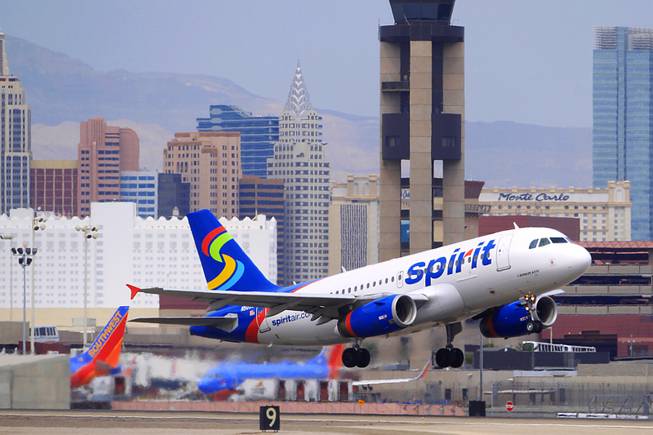
A Spirit Airlines jet takes off from McCarran International Airport on Friday, Aug. 26, 2011.
Sam Morris
..................................................
.
.
FEBRUARY 2, 2012
By Richard N. Velotta (contact)
Tuesday, Jan. 31, 2012 | 3:13 p.m.
www.lasvegassun.com/news/2012/jan/31/spirit-airlines-says...
The battle between discount air carrier Spirit Airlines and the U.S. Department of Transportation escalated today with the airline — the fastest growing carrier at McCarran International Airport last year — adding a new $2 fee to ticket prices to cover costs associated with new consumer regulations that took effect last week.
Miramar, Fla.-based Spirit is calling it a “DOTUC fee,” for Department of Transportation Unintended Consequences, and the airline says it covers costs to the airline for holding fares 24 hours after booking without penalty.
The Department of Transportation ordered new consumer protection rules that took effect on Thursday. Spirit, Southwest Airlines and Allegiant Air, all prominent operators at McCarran, have been the most vocal in their displeasure with the rules.
Spirit’s passenger counts at McCarran grew by 228 percent last year over 2010. Southwest is the busiest carrier at McCarran while Las Vegas-based Allegiant is poised to grow substantially in 2012 after having a 6.4 percent increase in local passengers last year.
The new rules order airlines to include all taxes and fees when advertising or displaying costs of airfares. Airlines don’t have to disclose fees that may not apply to all travelers, such as baggage and booking fees. The rules also order airlines to hold passengers’ fares when booking and allow them to be canceled or changed without penalty for 24 hours.
“People love the idea of not having to commit to a reservation, but this regulation, like most, imposes costs on consumers,” Spirit President and CEO Ben Baldanza said in a company release issued today.
“Wouldn’t we all like to eat all we want and not get fat?” Baldanza said. “Regulators like to try to sell the idea of this rule but have ignored the cost impact to consumers. You simply can’t eat all you want without consequences.”
.
........................................................
img code photo ... Senate Ethics Committee Chair Sen. Barbara Boxer, D-Calif.
photos.lasvegassun.com/media/img/photos/2011/05/12/AP1105...

Senate Ethics Committee Chair Sen. Barbara Boxer, D-Calif., is pursued by reporters on Capitol Hill in Washington, Thursday, May 12, 2011, after speaking on the Senate floor about former Nevada Sen. John Ensign.
AP PHOTO/J. SCOTT APPLEWHITE
........................................................
.
.
Baldanza was on the receiving end of a scathing letter from Sen. Barbara Boxer of California, who criticized Spirit for emailing customers and telling them the government is encouraging airlines to hide federal taxes. It is Spirit’s contention that by requiring airlines to display the full cost of a ticket that customers won’t see how much of it is taxes and fees and how much of it is the airline’s fare.
“I have been shocked by the failure of your airline to tell the truth in an email sent to your customers earlier this week as well as warnings posted on Spirit.com that read, ‘New government regulations require us to HIDE taxes in your fares.’ Nothing could be further from the truth,” Boxer wrote.
“What the rule says is that you have to tell your customers the full cost of a ticket," she continued. "It prohibits Spirit or any other airline from advertising fares ‘that exclude taxes, fees or other charges since the major impact of such presentations is to confuse and deceive consumers.’
“And despite Spirit's claim that the airline must now hide relevant information, the rule ‘allows carriers to advise the public in their fare solicitations about government taxes and fees ...’
“Today's consumers are faced with many options when planning air travel, and being able to compare the full price before purchase is both necessary and fair. Your recent statement that ‘the better form of transparency is to break out costs so that consumers know exactly what they are buying’ is exactly what this new DOT rule will help do,” her letter said.
Airlines like Spirit, Southwest and Allegiant are more sensitive to the new rules because they traditionally have offered lower fares and the displays that include taxes and fees come across as sticker shock to potential customers.
Spirit and Allegiant have business models that offer greatly discounted fares but numerous fees for baggage, booking by phone or online and for seat selection. Southwest fares appear higher with taxes and fees, but its counterparts don’t have to disclose bag fees it doesn’t have.
.
.
.............................................................................................................................................................................................
.
.
There was truth, there was consequence, against you
A weak defense, then there's me
I'm 17, and looking for a fight
All my life, I was never there just a ghost, running scared
Here our dreams aren't made, they're won
Lost in the city of angels
Down in the comfort of strangers, I
Found myself in the fire burnt hills
In the land of a billion lights
Bought my fate, straight from hell
A second sight has paid off well
For a mother, a brother and me
The silver of the lake at night
The hills of Hollywood on fire
A boulevard of hope and dreams
And streets made of desire
Lost in the city of angels
Down in the comfort of strangers, I
Found myself in the fire burnt hills
In the land of a billion lights
I found myself in the fire burnt hills
In the land of a billion lights
(Angels)
(Angels)
I am home, home, home, home
Lost in the city of angels
Down in the comfort of strangers, I
Found myself in the fire burnt hills
In the land of a billion lights
One life, one love, live
One life, one love, live
One life, one love, live
One life, one love
The city of angels
The city of angels
The city of angels
The city of angels
(lyrics and song by 30 seconds to Mars - City of Angels)
A coolie (alternatively spelled cooli, cooly, quli, koelie, and other such variations), during the 19th and early 20th century, was a term for a locally sourced unskilled labourer hired by a company, mainly from the Indian subcontinent or Southern China.
Today, it is used varyingly as a legal inoffensive word (for example, in India for helpers carrying luggage in railway stations) and also used as a racial slur in Africa for certain people from Asia, particularly in South Africa
ETYMOLOGY
The origins of the word are uncertain but it is thought to have originated from the name of a Gujarati sect (the Kolī, who worked as day labourers) or perhaps from the Tamil word for a payment for work, kuli (கூலி). An alternative etymological explanation is that the word came from the Urdu qulī (क़ुली, قلی), which itself could be from the Turkish word for slave, qul. The word was used in this sense for labourers from India. In 1727, Dr. Engelbert Kämpfer described "coolies" as dock labourers who would unload Dutch merchant ships at Nagasaki in Japan.
The Chinese word 苦力 (pinyin: kǔlì) literally means "bitterly hard (use of) strength", in the Mandarin pronunciation.
HISTORY OF THE COOLIE TRADE
An early trade in Asian labourers is believed to have begun sometime in or around the 16th century. Social and political pressure led to the abolition of the slave trade throughout the British Empire in 1807, with other European nations following suit. Labour-intensive industries, such as cotton and sugar plantations, mines and railway construction, in the colonies were left without a cheap source of manpower. As a consequence, a large scale slavery-like trade in Asian (primarily Indian and Chinese) indentured labourers began in the 1820s to fill this vacuum. Some of these labourers signed contracts based on misleading promises, some were kidnapped and sold into the trade, some were victims of clan violence whose captors sold them to coolie brokers, while others sold themselves to pay off gambling debts. British companies were the first to experiment with this potential new form of cheap labour in 1807, when they imported 200 Chinese men to work in Trinidad.
The coolie trade was often compared to the earlier slave trade and they accomplished very similar things.
Although there are reports of ships for Asian coolies carrying women and children, the great majority of them were men. Finally, regulations were put in place, as early as 1837 by the British authorities in India to safeguard these principles of voluntary, contractual work and safe and sanitary transportation although in practice this rarely occurred especially during examples such as the Pacific Passage or the Guano Pits of Peru. The Chinese government also made efforts to secure the well-being of their nation's workers, with representations being made to relevant governments around the world.
CHINESE COOLIES
Workers from China were mainly transported to work in Peru and Cuba, but they also worked in British colonies such as Jamaica, British Guiana (now Guyana), British Malaya, Trinidad and Tobago, British Honduras (now Belize) and in the Dutch colonies Dutch East Indies and Suriname. The first shipment of Chinese labourers was to the British colony of Trinidad in 1806.
In 1847 two ships from Cuba transported workers to Havana to work in the sugar cane fields from the port of Xiamen, one of the five Chinese treaty ports opened to the British by the Treaty of Nanking in 1842. The trade soon spread to other ports in Guangdong province and demand became particularly strong in Peru for workers in the silver mines and the guano collecting industry. Australia began importing workers in 1848 and the United States began using them in 1865 on the First Transcontinental Railroad construction. These workers were deceived about their terms of employment to a much greater extent than their Indian counterparts, and consequently, there was a much higher level of Chinese emigration during this period.
The trade flourished from 1847 to 1854 without incident, until reports began to surface of the mistreatment of the workers in Cuba and Peru. As the British government had political and legal responsibility for many of the ports involved, including Amoy, the trade was shut down at these places. However, the trade simply shifted to the more accommodating port in the Portuguese enclave of Macau.
Many coolies were first deceived or kidnapped and then kept in barracoons (detention centres) or loading vessels in the ports of departure, as were African slaves. In 1875, British commissioners estimated that approximately eighty percent of the workers had been abducted. Their voyages, which are sometimes called the Pacific Passage, were as inhumane and dangerous as the notorious Middle Passage of the Atlantic slave trade. Mortality was very high. For example, it is estimated that from 1847 to 1859, the average mortality for coolies aboard ships to Cuba was 15.2 percent, and losses among those aboard ships to Peru were 40 percent in the 1850s and 30.44 percent from 1860 to 1863.
They were sold and were taken to work in plantations or mines with very bad living and working conditions. The duration of a contract was typically five to eight years, but many coolies did not live out their term of service because of the hard labour and mistreatment. Those who did live were often forced to remain in servitude beyond the contracted period. The coolies who worked on the sugar plantations in Cuba and in the guano beds of the Chincha Islands (the islands of Hell) of Peru were treated brutally. Seventy-five percent of the Chinese coolies in Cuba died before fulfilling their contracts. More than two-thirds of the Chinese coolies who arrived in Peru between 1849 and 1874 died within the contract period. In 1860 it was calculated that of the 4000 coolies brought to the Chinchas since the trade began, not one had survived.
Because of these unbearable conditions, Chinese coolies often revolted against their Ko-Hung bosses and foreign company bosses at ports of departure, on ships, and in foreign lands. The coolies were put in the same neighbourhoods as Africans and, since most were unable to return to their homeland or have their wives come to the New World, many married African women. The coolies' interracial relationships and marriages with Africans, Europeans and Indigenous peoples, formed some of the modern world's Afro-Asian and Asian Latin American populations.
Chinese immigration to the United States was almost entirely voluntary, but working and social conditions were still harsh. In 1868, the Burlingame Treaty allowed unrestricted Chinese immigration into the country. Within a decade significant levels of anti-Chinese sentiment had built up, stoked by populists such as Denis Kearney with racist slogans - "To an American, death is preferable to life on a par with the Chinese."
Although Chinese workers contributed to the building of the first Transcontinental Railroad in the United States and of the Canadian Pacific Railway in western Canada, Chinese settlement was discouraged after completion of the construction. California's Anti-Coolie Act of 1862 and the federal Chinese Exclusion Act of 1882 contributed to the curtailment of Chinese immigration to the United States.
Notwithstanding such attempts to restrict the influx of cheap labour from China, beginning in the 1870s Chinese workers helped construct a vast network of levees in the Sacramento-San Joaquin River Delta. These levees made thousands of acres of fertile marshlands available for agricultural production.
The 1879 Constitution of the State of California declared that "Asiatic coolieism is a form of human slavery, and is forever prohibited in this State, and all contracts for coolie labour shall be void."
Colonos asiáticos is a Spanish term for coolies. The Spanish colony of Cuba feared slavery uprisings such as those that took place in Haiti and used coolies as a transition between slaves and free labor. They were neither free nor slaves. Indentured Chinese servants also labored in the sugarcane fields of Cuba well after the 1884 abolition of slavery in that country. Two scholars of Chinese labor in Cuba, Juan Pastrana and Juan Perez de la Riva, substantiated horrific conditions of Chinese coolies in Cuba and stated that coolies were slaves in all but name. Denise Helly is one researcher who believes that despite their slave-like treatment, the free and legal status of the Asian laborers in Cuba separated them from slaves. The coolies could challenge their superiors, run away, petition government officials, and rebel according to Rodriguez Pastor and Trazegnies Granda. Once they had fulfilled their contracts the colonos asiáticos integrated into the countries of Peru, The Dominican Republic, Puerto Rico and Cuba. They adopted cultural traditions from the natives and also welcomed in non-Chinese to experience and participate into their own traditions. Before the Cuban Revolution in 1959, Havana had Latin America's largest Chinatown.
In South America, Chinese indentured labourers worked in Peru's silver mines and coastal industries (i.e., guano, sugar, and cotton) from the early 1850s to the mid-1870s; about 100,000 people immigrated as indentured workers. They participated in the War of the Pacific, looting and burning down the haciendas where they worked, after the capture of Lima by the invading Chilean army in January 1880. Some 2000 coolies even joined the Chilean Army in Peru, taking care of the wounded and burying the dead. Others were sent by Chileans to work in the newly conquered nitrate fields.
The Chinese Engineering and Mining Corporation, of which later U.S. president Herbert Hoover was a director, was instrumental in supplying Chinese coolie labour to South African mines from c.1902 to c.1910 at the request of mine owners, who considered such labour cheaper than native African and white labour. The horrendous conditions suffered by the coolie labourers led to questions in the British parliament as recorded in Hansard.
In 1866, the British, French and Chinese governments agreed to mitigate the abuse by requiring all traders to pay for the return of all workers after their contract ended. The employers in the British West Indies declined these conditions, bringing the trade there to an end. Until the trade was finally abolished in 1875, over 150,000 coolies had been sold to Cuba alone, the majority having been shipped from Macau. These labourers endured conditions far worse than those experienced by their Indian counterparts. Even after the 1866 reforms, the scale of abuse and conditions of near slavery did not get any better - if anything they deteriorated. In the early 1870s increased media exposure of the trade led to a public outcry, and the British, as well as the Qing government, put pressure on the Portuguese authorities to bring the trade at Macau to an end; this was ultimately achieved in 1874. By that time, a total of up to half a million Chinese workers had been exported.
The term coolie was also applied to Chinese workers recruited for contracts on cacao plantations in German Samoa. German planters went to great lengths to secure access to their "coolie" labour supply from China. In 1908 a Chinese commissioner, Lin Shu Fen, reported on the cruel treatment of coolie workers on German plantations in the western Samoan Islands. The trade began largely after the establishment of colonial German Samoa in 1900 and lasted until the arrival of New Zealand forces in 1914. More than 2000 Chinese "coolies" were present in the islands in 1914 and most were eventually repatriated by the New Zealand administration.
INDIAN COOLIES
By the 1820s, many Indians were voluntarily enlisting to go abroad for work, in the hopes of a better life. European merchants and businessmen quickly took advantage of this and began recruiting them for work as a cheap source of labour. The British began shipping Indians to colonies around the world, including Mauritius, Fiji, Natal, British East Africa, and British Malaya. The Dutch also shipped workers to labour on the plantations on Suriname and the Dutch East Indies. A system of agents was used to infiltrate the rural villages of India and recruit labourers. They would often deceive the credulous workers about the great opportunities that awaited them for their own material betterment abroad. The Indians primarily came from the Indo-Gangetic Plain, but also from Tamil Nadu and other areas to the south of the country.
Without permission from the British authorities, the French attempted to illegally transport Indian workers to their sugar producing colony, the Reunion Island, from as early as 1826. By 1830, over 3000 labourers had been transported. After this trade was discovered, the French successfully negotiated with the British in 1860 for permission to transport over 6,000 workers annually, on condition that the trade would be suspended if abuses were discovered to be taking place.
The British began to transport Indians to Mauritius in the Indian Ocean, starting in 1829. Slavery had been abolished with the planters receiving two million pounds sterling in compensation for the loss of their slaves. The planters turned to bringing in a large number of indentured labourers from India to work in the sugar cane fields. Between 1834 and 1921, around half a million indentured labourers were present on the island. They worked on sugar estates, factories, in transport and on construction sites.
In 1837, the Raj issued a set of regulations for the trade. The rules provided for each labourer to be personally authorised for transportation by an officer designated by the Government, it limited the length of service to five years subject to voluntary renewal, it made the contractor responsible for returning the worker after the contract elapsed and required the vessels to conform to basic health standards
Despite this, conditions on the ships were often extremely crowded, with rampant disease and malnutrition. The workers were paid a pittance for their labour, and were expected to work in often awful and harsh conditions. Although there were no large scale scandals involving coolie abuse in British colonies, workers often ended up being forced to work, and manipulated in such a way that they became dependent on the plantation owners so that in practice they remained there long after their contracts expired; possibly as little as 10% of the coolies actually returned to their original country of origin. Colonial legislation was also passed to severely limit their freedoms; in Mauritius a compulsory pass system was instituted to enable their movements to be easily tracked. Conditions were much worse in the French colonies of Reunion and Guadeloupe and Martinique, where workers were 'systematically overworked' and abnormally high mortality rates were recorded for those working in the mines.
However, there were also attempts by the British authorities to regulate and mitigate the worst abuses. Workers were regularly checked up on by health inspectors, and they were vetted before transportation to ensure that they were suitably healthy and fit to be able to endure the rigours of labour. Children under the age of 15 were not allowed to be transported from their parents under any circumstances.
The first campaign against the 'coolie' trade in England likened the system of indentured labour to the slavery of the past. In response to this pressure, the labour export was temporarily stopped in 1839 by the authorities when the scale of the abuses became known, but it was soon renewed due to its growing economic importance. A more rigorous regulatory framework was put into place and severe penalties were imposed for infractions in 1842. In that year, almost 35,000 people were shipped to Mauritius.
In 1844, the trade was expanded to the colonies in the West Indies, including Jamaica, Trinidad and Demerara, where the Asian population was soon a major component of the island demographic.
Starting in 1879, many Indians were transported to Fiji to work on the sugar cane plantations. Many of them chose to stay after their term of indenture elapsed and today they number about 40% of the total population. Indian workers were also imported into the Dutch colony of Suriname after the Dutch signed a treaty with the United Kingdom on the recruitment of contract workers in 1870. In Mauritius, the Indian population are now demographically dominant, with Indian festivals being celebrated as national holidays.
This system prevailed until the early twentieth century. Increasing focus on the brutalities and abuses of the trade by the sensationalist media of the time, incited public outrage and lead to the official ending of the coolie trade in 1916 by the British government. By that time tens of thousands of Chinese workers were being used along the Western Front by the allied forces (see Chinese Labour Corps).
SEX RATIOS AND INTERMARRIAGE AMONG COOLIES
A major difference between the Chinese coolie trade and the Indian coolie trade was that the Chinese coolies were all male, while East Indian women (from India) were brought alongside men as coolies. This led to a high rate of Chinese men marrying women of other ethnicities like Indian women and mixed race Creole women. Indian women and children were brought alongside Indian men as coolies while Chinese men made up 99% of Chinese colonies. The contrast with the female to male ratio among Indian and Chinese immigrants has been compared by historians. In Sumatra in the Dutch East Indies just 18,731 Chinese women and 92,985 Chinese men served as coolies on plantations. Chinese women migrated less than Javanese and Indian women as indentured coolies. The number of Chinese women as coolies was "very small" while Chinese men were easily taken into the coolie trade. In Cuba men made up the vast majority of Chinese indentured servants on sugar plantations and in Peru non-Chinese women married the mostly male Chinese coolies.
Chinese women were scarce in every place where Chinese indentured laborers were brought, the migration was dominated by Chinese men. Up to the 1940s men made up the vast majority of the Costa Rican Chinese community. Males made up the majority of the original Chinese community in Mexico and they married Mexican women.
In the early 1900s, the Chinese communities in Manila, Singapore, Mauritius, New Zealand, Victoria in Australia, the United States, and Victoria in British Columbia in Canada were all male dominated.
WIKIPEDIA
Hofburg (Burgkapelle) - Chapel, Chapelle, Capilla, Cappella (gotisch)
Hofburg (Schatzkammer Wien), Secular and Ecclesiastical Treasury, Cámara del Tesoro, Сокровищница (Вена), Chambre du Trésor, Camera del Tesoro Profano e Sacro
History of the Vienna Hofburg
First residence
(further informations you can get by clicking on the link at the end of page!)
With the elevation of Austria to Archduchy in 1156 Vienna became city of residence. From the residence of the Babenberg which was located on the present site "Am Hof", unfortunately there are no more remains left. After the extinction of the Babenberg, King Ottokar II Přemysl of Bohemia (1230-1278) took over by marriage the rule in Vienna and began in 1275 with the construction of a castle within the city walls of Vienna. This castle was equipped with four towers around a rectangular court that is known today as the Schweizerhof (Swiss court). In the fight for the German crown Ottokar was defeated at the Battle of Dürnkrut (Lower Austria) by Rudolf I of Habsburg (1218-1291) and killed during the retreat.
As the old residence of the Babenberg burnt about 1276, Rudolf probably in 1296 moved to the former castle of Ottokar 1279. The descendants of Rudolf extended the castle only slightly: chapel (documentary mention in 1296), St. Augustine's Church (consecrated in 1349), reconstruction of the chapel (1423-1426) . Due to the division of the lands of the Habsburgs, Vienna lost its importance and it also lacked the financial resources to expand the castle.
Imperial residence
Under Frederick III. (1415-1493) acquired the Habsburgs the imperial title and Vienna became an imperial residence. But Friedrich and his successors used the Vienna Residence rarely and so it happened that the imperial residence temporarily orphaned. Only under Ferdinand I (1503-1564) Vienna again became the capital of the Archduchy. Under Ferdinand began a large construction: the three wings of the existing Swiss court were expanded and increased. The defensive wall in the northwest was as fourth wing with the Swiss Gate (built in 1552 probably by Pietro Ferrabosco ) rebuilt. In the southwest was a tract for Ferdinand's children (the so-called "children Stöckl (Kinderstöckl)") added. The newly constituted authorities Exchequer and Chancery were domiciled in adjacent buildings at Castle Square. There were also an art chamber in the castle, a hospital, a passage from the castle to St. Augustine's Church and a new ballroom.
First major extensions of the residence
In the area of the "desolate church" built Ferdinand from 1559 a solitary residence for his son. However, the construction was delayed, and Maximilian II (1527-1576) moved after his father's death in 1564 in the old castle. He had his residence for his Spanish horses in a Hofstallgebäude (Court stables building - Stallburg) converted and from 1565 increased.
Ferdinand I decided to divide his lands to his three sons, which led to a reduction of Vienna as a residence. Moreover, resided Maximilian II, who was awarded apart from Austria above and below the Enns also Bohemia and Hungary, readily in Prague and moved also the residence there. In 1575 he decided to build a new building opposite the Swiss court for the royal household of his eldest son, Rudolf II (1552-1612). The 1577 in the style of the late Renaissance completed and in 1610 expanded building, which was significantly fitted with a turret with "welscher hood" and an astronomical clock, but was inhabited by the governor of the Emperor (Archduke Ernst of Austria). However, the name "Amalienborg Castle" comes from Amalie of Brunswick-Wolfenbüttel (wife of Joseph I) that in 1711 there established her widow's home.
In the late 16th and early 17th Century only a few extensions were carried out: extension of a separate tract in the northeast of the castle for the treasure and art chamber (1583-1585) as well as setting up of a dance hall in the area of today's Redoutensäle (1629-1631).
Under Leopold I the dance hall war rebuilt of Ludovico Burnacini 1659/1660 into a at that time modern theater ("Comedy House"). 1666 Leopold I had in the area of today's castle garden a new opera house with three tiers and a capacity of 5,000 persons built.
In the 1660-ies was under Leopold I (1640-1705) between the Amalienbourg and the Schweizerhof, the so-called Leopoldine Wing (Leopoldinischer Trakt), according to the plans of architect Filiberto Lucchese an elongated Flügelbau (wing building) built. Since, however, the tract shortly after the completion burned down, it has been newly built and increased by Giovanni Pietro Tencala. Due to its architectur, this tract connects yet more to the late Renaissance. The connection with the Amalienborg Castle followed then under Leopold's son, Joseph I (1678-1711).
After completion of the Leopoldine Wing the in the southeast of the castle located Riding School was restored, the south tower of the old castle razed, the old sacristy of the castle chapel replaced by an extension. Under Charles VI. (1685-1740) the gatehouse between the Castle Yard and carbon market (Kohlmarkt) by Johann Lucas von Hildebrandt was transformed into a monumental triumphal portal as a representative signum of the imperial power. However, this construction does not exist anymore, it had to give way to the Michael tract.
Baroque redesign of the Hofburg
In the early 18th Century began an intense construction activity. The Emperor commissioned Johann Bernhard Fischer von Erlach with the construction of new stables outside the city walls as well as a new court library.
After the death of Johann Bernhard Fischer von Erlach whose son Joseph Emanuel Fischer von Erlach took over the supervision of the stables and the Imperial Library. 1725 the palatial front of the stables was completed. Since yet during the construction period has been noted that the stables were too smal dimensioned, the other wings were not realized anymore. The with frescoes by Daniel Gran and emperor statues of Paul Strudel equipped Court Library was completed in 1737.
Opposite of the Leopoldine Wing was supposed to be built a new Reich Chancellery. 1723 Johann Lucas von Hildebrandt was commissioned with the design. 1726, however, the Reich Chancellery was withdrawn the supervision and is was transferred to the Chancery and thus to Joseph Emanuel Fischer von Erlach, who also designed the adjacent court chamber and the front to St. Michael's Church. 1728 were finished the court chamber and the facade of the two buildings. By Joseph Emanuel Fischer von Erlach was also planned the Michaelertrakt, the connection between the Winter Riding School and Reichskanzleitrakt (Imperial Chancellery Tract). However, since the old Burgtheater building was in the way, this was half done for a period of 150 years and was only completed in 1889-1893 by Ferdinand Kirschner.
Under Maria Theresa (1717-1780) was the at St. Michael's Square located and only as remnants existing Ballhaus (ballhouse) adapted as a court theater. Beside the Kaiser hospital therefore a new ballhouse was built, which was name giving for the Ballhausplatz. Subsequently, there were over and over again modifications and adaptations: reconstruction of the comedy hall according to the plans of Jean Nicolas Jadot into two ballrooms, the small Redoutensaal and the large Redoutensaal (ball room) (1744-1748). The transformation of the two halls (since 1760), repair of the Court Library and since 1769 the design of the Josefsplatz followed under Joseph Nicolas of Pacassi. These buildings were completed by the successor of Pacassi Franz Anton Hillebrandt. As an extension building for the Royal Library was built in the southeast the Augustinian tract.
Other structural measures under Maria Theresa: establishment of the court pharmacy into the Stallburg, relocation of the in the Stallburg accommodated art collection to the Upper Belvedere, demolition of the remaining two towers of the old castle, the construction of two stairways (the ambassadors (Botschafterstiege) and the Säulenstiege (pillar stairway).
Extensions in the 19th Century and early 20th century
Francis II (1768-1835) gave Albert Duke of Saxe-Teschen and his wife Marie Christine (daughter of Maria Theresa), the Palais Tarouca south of the Augustinian monastery. From 1800 this was remodeled by Louis Montoyer and by a wing building expanded to the today's Albertina.
1804 proclaimed Francis II the hereditary Empire of Austria and was thus as Francis I the first Austrian emperor. With the by Napoleon Bonaparte provoked abdication of the emperor in 1806 ended the Holy Roman Empire of the German Nation.
1809 part of the old bastions by the castle was blown up as a consequence of the war with Napoleon and afterwards razed. Towards to the today's ring road then new outworks were layed out (the so-called Hornwerkskurtine and the Escarpen). In the early 20's of the 19th Century were created three gardens: the private Imperial Castle Garden with two by Louis von Remy planned steel/glass-constructed greenhouses, Heroes Square with boulevards and the People garden with the Theseus Temple (Pietro Nobile). At the same time arised also the new, by Luigi Cagnola in 1821 begun and 1824 by Pietro Nobile completed outer castle gate.
1846 was built a monumental memorial to Francis I in the Interior Castle Square. In the turmoil of the 1848 Revolution the Stallburg was stormed and at the outer castle square as well as the castle gate fiercely fought. In the process burned the roof of the court library. The political consequences of the revolution were the abdication of Emperor Ferdinand I (1793-1875), the dismissal of the dreaded Chancellor Clemens Lothar Prince Metternich and the coronation of Ferdinand's nephew Franz Joseph.
In the first years of the reign of Emperor Franz Joseph I (1830-1916) were converted the court stables by Leopold Mayer and expanded. As part of the expansion of the city, the city walls were razed and it emerged in place of the fort complex space for a magnificent boulevard, the Ringstrasse (Ring road). 1862, was born the idea of an Imperial Forum of architect Ludwig Förster. On the surface between the Hofburg and the Imperial Stables should arise Court Museums (Art and Natural History Museum).
At the outer Castle Square (today's Heldenplatz) were in the 60-ies of the 19th Century the by Anton Dominik Fernkorn created equestrian statues of Archduke Charles (defeated Napoleon at the Battle of Aspern-Essling) and Prince Eugene of Savoy (victor over the Turks in several battles) set.
After an unsuccessful architectural competition on the design of the Heroes square area in 1869 Gottfried Semper could be won. This led to the involuntary and not frictionless collaboration with Carl Freiherr von Hasenauer. Planned was a two-wing building over the ring road away with the two flanking twin museums (Art and Natural History Museum) and the old stables as a conclusion. 1871 was started with the Erdaushebungen (soil excavations) for the museums. 1889, the Natural History Museum was opened,1891 the Museum of Fine Arts (Kunsthistorisches Museum).
On a watercolor from 1873 by Rudolf Ritter von Alt (1812 - 1905), an overall view of the Imperial Forum is shown
1888 the Old Court Theatre at St. Michael's Square was demolished as the new KK Court Theatre (today's Burgtheater) by Gottfried Semper and Carl Freiherr von Hasenauer built, was finished. The since150 years existing construction site at St. Michael's Square could be completed. The roundel got a dome, the concave curved Michaelertrakt was finalized by Ferdinand Kirschner. The once by Lorenzo Mattielli created cycle of statues on the facade of the Reich Chancellery was continued with four other "deeds of Hercules" sidewards of the drive-through arches. 1893, the Hofburg had finally its last magnificent decorative facade .
1901, the old greenhouses were demolished and replaced by an orangery with Art Nouveau elements according to plans of Friedrich Ohmann (finalization in 1910). In 1907, the Corps de Logis, which forms a closure of the new castle, completed. Since Emperor Franz Joseph I in the budding 20th Century no longer was interested in lengthy construction projects and the Crown Prince Franz Ferdinand of Austria-Este (1863-1914) spoke out against the establishment of a throne hall building, but spoke for the construction of a smaller ballroom tract, the implementation of the second wing was dropped. After the assassination of Franz Ferdinand of Austria-Este in Sarajevo, the First World War broke out. Franz Joseph I died in 1916. A great-nephew of Franz Joseph I, Charles I (1887-1922) succeeded to the throne, however, that he only occupied two years. The end of the First World War also meant the end of the Austro-Hungarian monarchy. On 11th November 1918 the First Republic was proclaimed. As Karl in fact renounced of the businesses of government, but not the throne, he had to go into exile with his family.
The Imperial Palace in the 20th century
The interior design of the ballroom tract and the New Castle were continued despite the end of the monarchy to 1926. By the end of the monarchy, many of the buildings lost their purpose. Further on used or operated was the Riding School. The stables were used from 1921 as the Wiener Messe (Fair) exhibition grounds ("Messe palace"). In 1928, the Corps de Logis, the Museum of Ethnology, by then part of the Natural History Museum, opened. 1935 came the weapons collection (court, hunting and armour chamber) of the Kunsthistorisches Museum in the New Castle.
1933/1934 the outer castle gate by Rudolf Wondracek was transformed into a hero monument to the victims of the First World War. 1935 emerged left and right of the castle gate pylon portals with eagle sculptures of Wilhelm Frass. In March 1938, the Heroes' Square and the balcony of the Neue Burg gained notoriety after Adolf Hitler announced to the cheering crowd at the Heldenplatz the annexation of Austria to the German Reich. The Nazis were planning a redesign of the Heroes' Square to a paved parade and ceremony space. The plans were not realized since 1943 a fire pond at Heldenplatz was dredged and the place was later used for agriculture. In the Trade Fair Palace were held during the period of the Nazism propaganda events.
During the war, the Imperial Palace (Stallburg, St. Augustine's Church, Albertina, the head office of the Federal President, the current building of the Federal Chancellery) was severely damaged by bomb hits: The first President of the Second Republic, Dr. Karl Renner, moved in 1946 the Office of the President to the Leopoldine Wing (in the former living quarters of Maria Theresa and Joseph II).
During the time of occupation the seat of the Inter-Allied Commission was housed in the Neue Burg.
1946 again were held first events in the Exhibition Palace and have been set up two large exhibition halls in the main courtyard of the fair palace. In the course of the reconstruction the damages of war were eliminated and the Imperial Palace repaired, the castle stable were built again. In 1958 in the ballroom wing was set up the convention center, 1962-1966 the modern Library of the Austrian National Library housed in the Neue Burg.
For the first time appeared in 1989 the concept of a "Museum Quarter". The Museum district should include contemporary art and culture. The oversized design of Laurids and Manfred Ortner but was redimensioned several times after the resistance of a citizens' initiative. The implementation followed a decade later.
1992 the two Redoutensäle completely burned out. Yet shortly after the fire was began with the reconstruction. The roof was extended and the small ball room could be restored. The big ball room, however, was renovated and designed with paintings by Josef Mikl. In 1997 the two halls were reopened.
From 1997-2002 the Museum Quarter (including Kunsthalle Wien, Leopold Collection) was rebuilt and the old building fabric renovated.
1999 was began with the renovation of the Albertina. The for a study building, two exhibition halls and an underground storage enlarged museum was reopened in 2003. The Albertina ramp was built with an oversized shed roof by Hans Hollein.
In 2006, in the area of the boiler house yard were created additional rooms for the convention center.
(Source: Trenkler, Thomas: "The Vienna Hofburg", Vienna 2004)
I have lived in Kent since 2007, and hadn't visited Sevenoaks before yesterday. It being one of Kent's major towns, this is something of a surprise, I even had to check my photostream on here to make sure: nothing for Sevenoaks.
For me, Sevenoaks is famous for two things: 1. the seven oaks destroyed in the 1987 "hurricane" and I suppose home to the chain of hi-fi shops, Sevenoaks Audio, though I didn't see a branch during my visit.
I don't know why I decided to visit here today, the idea had been to go to Nunhead to a large rambling and overgrown Victorian cemetery (more of that later), and the Southeastern website suggested the way there was via St Pancras and then on Thameslink. I thought there must have been a route across Kent, which is how I came to be in Sevenoaks, change here for Nunhead.
So, why not explore the town before travelling on?
So, I guess that's why I was here.
The spread of the new COVID variant meant I did consider cancelling the trip, but with no new lockdowns announced on Monday, and armed with a mask I set off, Jools dropping me off at Dover Priory at half six, withenough time for a gingerbread latte (with an extra shot) before my train pulled in.
Less than a dozen got in the 12 carriages, and there service trundled through Kent, Ashford, Pluckley, Marden, Staplehurst, Tonbdrige to deposit me here at Sevenoaks.
I and half a dozen people got off, I lingered to take a couple of shots before the long walk up the hill to the town centre.
Thanks to GSV, I had travelled up London Road to the centre of town, so knew it was a hike, but worth it. I mean, no point going somewhere if there was nothing of worth to snap, was there?
At first I walked past large houses, then at the major road junction, a sparkling Ferrari Dealership, not something we have in Dover, and not sure if Canterbury even has one. But Sevenoaks does, as well as on one, not two, but three dry cleaners, all looking busy.
The main shopping area had old pubs and coaching inns, clapboard houses and other with peg tiles decorating the outside, all got photographed, of course.
Att he top of the shopping streets, where the two A roads meet, there is a fine pre-warboys signpost that I snapped good and proper.
Finally, as the hill flattened out, the buildings got older still, before coming to the parish church, which I knew from research was almost impossible to get inside judging by the reviews left.
It wasn't yet nine, my back was complaining, so I took a seat in the chuchyard to wait.
Wait for what, I do not know.
The clocked chimed mournfully for nine, to the south, a couple of workmen repair the top of the substantial wall, and I guess the ownes comes into the churchyard to find bricks that have fallen from it. The wall is at least twenty feet high, separating the church from the grand house, I wonder what the owners thought were being kept out?
--------------------------------------------
The church looks well from the main street, with its east end almost on the road. Built of local stone, the nave, aisles, chapels and tower are typical of fifteenth-century design. The church has been so often restored - in 1812, 1878, 1954 and most recently in 1994 when a crypt was built - that its historical interest is limited. However, the stained glass windows by Kempe and Heaton, Butler and Bayne are of excellent quality, especially those in the south aisle. There are also some interesting monuments, including one to William Lambarde (d. 1601), the first Kentish historian.
www.kentchurches.info/church.asp?p=Sevenoaks+1
--------------------------------------------
SEVENOKE.
NEXT southward from Seale lies the parish and town of SEVENOKE, called, in the Textus Roffensis, SEOUENACCA, which name was given to it from seven large oaks, standing on the hill where the town is, at the time of its being first built. It is now commonly called SENNOCK.
THE PARISH of Sevenoke is situated partly above and partly below the great ridge of sand hills which runs across this county, and divides the upland from the Weald or southern district of it. It is divided into three districts, the Town Borough, Rotherhith or Rethered, now called Riverhead, and the Weald. The parish is of considerable extent, being five miles in length, from north to south, and about four miles in width. The soil of it varies much; at and about the town, it is a sand, as it is towards the hill southward, below which it is a stiff clay, and towards the low grounds, to Riverhead, a rich sertile soil. It reaches more than a mile below the hill, where there is a hamlet, called Sevenoke Weald, lying within that district, for it should be known, that all that part of this parish, which lies below the great range of sand hills southward, is in the Weald of Kent, the bound of which is the narrow road which runs along the bottom of them, and is called, to distinguish it, Sevenoke Weald; thus when a parish extends below, and the church of it is above the hill, that part below, has the addition of Weald to it, as Sevenoke Weald, Sundridge Weald, and the like.
THE TOWN of Sevenoke lies about thirty-three miles from London, on high ground above the sand hill, the church, which is situated at the south end of it, is a conspicuous object each way to a considerable distance. The high roads from Westram; and from London through Farnborough, meeting at about a mile above it; and that from Dartford through Farningham and Otford, at the entrance of the town; and leading from thence again both to Penshurst and Tunbridge. Between the town and the hill there is much coppice wood, and a common, called Sevenoke common, on which is a seat, called Ash-grove, belonging to Mrs. Smith. The town of Sevenoke is a healthy, pleasant situation, remarkable for the many good houses throughout it, inhabited by persons of genteel fashion and fortune, which make it a most desirable neighbourhood. In the middle of the High-Street is the house of the late Dr. Thomas Fuller, afterwards of Francis Austen, esq. clerk of the peace for this county; near which is the large antient market-place, in which the market, which is plentifully supplied with every kind of provisions, is held weekly on a Saturday; and the two fairs yearly, on July 10, and Oct. 12, and where the business of the assizes, when held at Sevenoke, as they were several times in queen Elizabeth's reign, and in the year before the death of king Charles I. and once since, has been usually transacted. At the south end of it is a seat, the residence of Multon Lambard, esq. at a small distance westward is the magnificent mansion and park of Knole; and eastward, a small valley intervening, the seat of Kippington; at a little distance northward of the town is an open space, called Sevenoke Vine, noted for being the place where the great games of Cricket, the provincial amusement of this county, are in general played; this joins to Gallows common, so called from the execution of criminals on it formerly. In the valley below it is Bradborne, and the famous silk mills, belonging to Peter Nonaille, esq. called Greatness, near which are the ruins of the hospital or chapel, dedicated to St. John, where this parish bounds to Otford.
About a mile north-west from the town, where the two roads from London and Westerham meet, is the large hamlet of Riverhead, bounded by the river Darent and the parish of Chevening; in which, among others, is the seat of Montreal; that of Mrs. Petley; and of the late admiral Amherst and others; most of which the reader will find described hereafter.
In the Account of the Roman Stations in Britain, written by Richard, a monk of Cirencester, published by Dr. Stukely, the station, called Vagniacæ, is supposed to have been at Sevenoke, which is there set down as eighteen miles distant both from Medum, Maidstone; and Noviomagus, Croydon; but in this opinion he has hardly been followed by any one.
THE MANOR OF SEVENOKE was always esteemed as an appendage to that of Otford, and as such was part of the possessions of the see of Canterbury, till it was exchanged with the crown for other premises, by archbishop Cranmer, in the 9th year of Henry VIII. as will be further mentioned below.
THE MANOR OF KNOLE, with that of Bradborne, in this parish, had, according to the earliest accounts, for some time the same owners as the manors of Kemsing, Seale, and Bradborne. Accordingly, in king John's reign, they were in the possession of Baldwin de Betun, earl of Albemarle, from whom they went in marriage into the family of the Mareschalls, earls of Pembroke. Whilst one of these, William Mareschal, earl of Pembroke, sided with the rebellious barons at the latter end of king John's, and beginning of king Henry III's reign, the king seized on his lands, as escheats to the crown; during which time these manors seem to have been granted to Fulk de Brent, a desperate fellow, as Camden calls him. He was a bastard by birth, of mean extraction, who had come out of the low countries, with some foreign auxiliaries and freebooters, to king John's assistance, and became a great favorite, both with that king and his son, Henry III. from both of whom he was invested with much power, and had the lands of many of the barons conferred on him; till giving loose to his natural inclination, he became guilty of many cruelties and oppressions, and at length sided with prince Lewis of France in his design of invading England. But failing in this, he fled into Wales, and the king seized on all his possessions throughout England; after which, returning and pleading for mercy, in consideration of his former services, he was only banished the realm, and died in Italy soon afterwards, as is said, of poison. After which, the earl returning to his obedience, obtained the possession of these manor's again. (fn. 1) Hence they passed again in like manner to Hugh Bigod, earl of Norfolk, whose heir in the 11th year of king Edward I. conveyed them to Otho de Grandison; on whose death without issue, William de Grandison, his brother, became his heir; his grandson, Sir Thomas Grandison, passed away Knole to Geoffry de Say, and Braborne, Kemsing, and Seale, to others, as may be seen under their respective descriptions.
Geoffry de Say was only son and heir of Geoffry de Say, by Idonea his wife, daughter of William, and sister and heir of Thomas lord Leyborne, and was a man of no small consequence, having been summoned to parliament in the 1st year of king Edward III. and afterwards constituted admiral of all the king's fleets, from the river Thames westward, being then a banneret. He died in the 33d year of king Edward III. leaving William, his son and heir, and three daughters. William de Say left issue a son, John, who died without issue in his minority, anno 6 king Richard II. and a daughter Elizabeth, who was first married to Sir John de Fallesley, and afterwards to Sir William Heron, but died s. p. in the 6th year of king Edward IV. (fn. 2) so that the three sisters of William de Say became coheirs to the inheritance of this family. (fn. 3)
¶How the manor of Knole passed from the family of Say I do not find; but in the reign of king Henry VI. it was in the possession of Ralf Leghe, who then conveyed it by sale to James Fienes, or Fenys, as the name came now to be called, who was the second son of Sir William Fynes, son of Sir William Fienes, or Fynes, who had married Joane, third sister and coheir of William de Say above-mentioned. He was much employed by king Henry V. and no less in favor with king Henry VI. who, in the 24th year of his reign, on account of Joane, his grandmother, being third sister and coheir to William de Say, by an especial writ that year summoned him to parliament as lord Say and Seale; and, in consideration of his eminent services, in open parliament, advanced him to the dignity of a baron, as lord Say, to him and his heirs male. After which he was made constable of Dover-castle, and warden of the five ports, lord chamberlain, and one of the king's council; and, in the 28th year of that reign, lord treasurer; which great rise so increased the hatred of the commons against him, that having arraigned him before the lord mayor and others, they hurried him to the standard in Cheapside, where they cut off his head, and carried it on a pole before his naked body, which was drawn at a horse's tail into Southwark, and there hanged and quartered.
Of the THREE DISTRICTS, into which this parish is divided, of which those of Town Borough and the Weald have already been described, the remaining one of Riverhead is by no means inconsiderable. It lies about a mile from Sevenoke town, and seems formerly to have been written both Rotherhith and Rothered, comprehending the western part of this parish; it contains the large hamlet of Riverhead, in which are situated lord Amherst's seat of Montreal; that of Cool Harbour, late admiral Amherst's; and Mrs. Petley's; through this hamlet the road branches on the one hand to Westerham, and on the other across the river Darent towards Farnborough and London; hence it extends beyond Bradborne to the bounds of this parish, north-eastward, at Greatness, which is within it.
In this hamlet was the antient mansion, called Brook's Place, Supposed to have been built by one of the family of Colpeper, out of the materials taken from the neighbouring suppressed hospital of St. John. It afterwards came into the possession of a younger branch of the family of Amherst. Jeffrey Amherst, esq. bencher of Gray's-inn, was owner of it, and resided here at the latter end of the last century. He was descended of ancestors, who had been seated at Pembury in the reign of king Richard II. from whom, in a direct line, descended Richard Amherst, esq. who left three sons; the eldest of whom, Richard, was sergeant at law, and of Bayhall, in Pembury, in the description of which a full account will be given of him and his descendants. Jeffry, the second, was ancestor of the Riverhead branch, as will be mentioned hereafter; and William, the third son, left an only daughter, Margaret, married to John Champs of Tunbridge.
Jeffry Amherst was rector of Horsemonden, and resided at Southes, in Sussex, where he died, and was buried in 1662; whose grandson, Jeffry Amherst, esq. was of Riverhead, as has been before mentioned. and a bencher of Gray's-inn, and dying in 1713, was buried at Pembury. By his first wife, Elizabeth, daughter of Henry Yates, esq. of Sussex, he had several children, of whom, Jeffry, the second son, only arrived at maturity, and was of Riverhead; he was a bencher of Gray's-inn, and dying in 1750, was buried in Sevenoke church, having married Elizabeth, daughter of Thomas Kerrill, esq. of Hadlow, by whom he had seven sons and two daughters, viz. Elizabeth, married to John Thomas, clerk, of Welford, in Gloucestershire; and Margaret, who died unmarried.
Of the sons, Sackville, the eldest, died unmarried in 1763, Jeffry the second, will be mentioned hereafter; John, the third, was of Riverhead, and viceadmiral of the blue squadron; he married Anne, daughter of Thomas Lindzee, of Portsmouth, by whom he had no issue; he died in 1778, and his widow re-married Thomas Munday, esq. The seventh son, William, was a lieutenant-general in the army, and married Elizabeth, daughter of Thomas Patterson, esq. of London. He died in 1781, leaving one son, William-Pitt, and a daughter, Elizabeth-Frances.
Jeffry Amherst, esq. the second son, became, at length, possessed of the mansion of Brooks, and attaching himself early in life to the prossession of a soldier, he acquired the highest military honours and preferments, after a six years glorious war in North America, of which he was appointed governor and commander in chief in 1760; which, when he resigned, the king, among other marks of his royal approbation of his conduct, appointed him governor of the province of Virginia.
¶The victorious atchievements of the British forces in North America, during Sir Jeffry Amherst's continuance there, cannot be better summed up than by giving two of the inscriptions on an obelisk, in the grounds of his seat at Montreal; viz.
Al regreso del paseo, el cielo nos regala en su despedida del día este fantástico escenario de nubes, que no tengo por menos que pararme a contemplar.
Presentación • Mis expos • Fluidr
Copyright © Guijo Córdoba 2011 All Rights Reserved.
Please don't use this image on websites, blogs or other media without my explicit permission. A breach of copyright has legal consequences.
A hearse, police car, ambulance and taxi lined up along Piccadilly Gardens to remind revellers of the consequences of their decisions.
The vehicles took their place at the busy city centre location on ‘Mad Friday’ to encourage those going out on the busiest night of the year to make responsible choices whilst enjoying the festivities.
Three hundred thousand people are expected to visit the city centre this weekend, and extra officers will be out on patrol throughout to ensure the night is fun and safe for all. Officers will also be patrolling the roads looking for drink drivers.
Chief Superintendent John O’Hare from Greater Manchester Police’s Specialist Operations, said: “Our officers will be on duty throughout the holiday period to ensure people have a safe and peaceful Christmas. However, I urge everyone to consider how they plan to spend their festive period – nobody wants to end up in a police car, ambulance or – in the worst instance – a hearse.
“We want people to come out and enjoy themselves but ask that they take personal responsibility. Alcohol can have devastating consequences and one thoughtless act after too much alcohol can end violently and tragically. Often people don’t realise what they are doing when they have had a drink and it is those split-second actions that result in devastating life-long consequences.
“No police officer wants to have to deliver the message that a loved one has died in an alcohol-fuelled fight or been killed or seriously injured at the hands of a drink or drug driver. Or where they have been the driver deliver the news of their tragic death.
“If you’re out tonight then please look after yourself and your friends. Know your limits, control your temper, walk away from trouble and make sure the only vehicle taking you home tonight is a taxi.”
Steve Hynes, Greater Manchester Head of Service, North West Ambulance Service NHS Trust, said: “We are currently receiving an unprecedented amount of 999 calls. The festive season is always an extremely busy time for the emergency services and is set to place even more demand on our resources this year.
“We want to encourage the public to consider the seriousness associated with this time of year, especially in the week before Christmas. Our staff see first-hand the devastating affect alcohol-related incidents can cause - in some instances, it can result in death.
“Ultimately, we want people to have a safe, enjoyable festive season but it can all change quickly, so please consider your actions as the implications may be life-changing.”
To find out more about Greater Manchester Police please visit our website.
You should call 101, the new national non-emergency number, to report crime and other concerns that do not require an emergency response.
Always call 999 in an emergency, such as when a crime is in progress, violence is being used or threatened or where there is danger to life.
You can also call anonymously with information about crime to Crimestoppers on 0800 555 111.
Based on true events, 'I am B-19' is a brutal account of when science and the desire to be "normal" collide with horrific consequences. Laced with humour and hope, award-winning writer Dan Ireland-Reeves sheds light on both LGBT history and the fragility of its future.
For more details and tickets www.greatermanchesterfringe.co.uk
Runnymede is a water-meadow alongside the River Thames in the English county of Surrey, and just over 20 miles (32 km) west of central London. It is notable for its association with the sealing of Magna Carta, and as a consequence is, with its adjoining hillside, the site of memorials. Runnymede Borough is named after the area, Runnymede being at its northernmost point.
Topography
The name Runnymede refers to land in public and National Trust ownership in the Thames flood plain south-west of the river between Old Windsor and Egham. The area includes (to the west of A308 road) the Long Mede and Runnymede, which together with Coopers Hill Slopes is managed by the National Trust. There is also a narrower strip of land, east of the road and west of the river, known as the Yard Mede. Slightly further downstream from the area shown on the map are (inter alia): a recreational area with a car park; a number of private homes; a large distribution centre; and an hotel.
The landscape of Runnymede is characterised as "Thames Basin Lowland", urban fringe. It is a gently undulating vale of small fields interspersed by woods, shaws, ponds, meadows, and heath. The National Trust area is a Site of Nature Conservation Interest (SNCI) which contains a Site of Special Scientific Interest. Both sites are overseen by Runnymede Borough Council.
The National Trust holding includes:
188 acres (0.76 km2) donated in 1929 set behind a narrow riverside park with occasional benches on the southern river bank, with car and coach parking;
110 acres (0.45 km2) of broadleaved woodland on Coopers Hill Slopes, given in 1963 by the former Egham Urban District Council.
Long Mede is a meadow north of the ancient "mede" (meadow) of Runnymede towards Old Windsor and has been used for centuries to provide good-quality hay from the alluvial pasture. Runnymede itself lies towards Egham. It is likely that Runnymede proper was the site of the sealing of Magna Carta, although the Magna Carta Memorial (see below) stands on Long Mede, and the event is also popularly associated with Magna Carta Island, on the opposite bank of the Thames.
Near the Island, on the north-east flood plain, in parkland on the eastern bank of the river, are Ankerwycke and the ruins of the 12th century Priory of St Mary's. The Thames has changed course here occasionally, and these areas may once have been an integral part of Runnymede. Both were acquired by the National Trust in 1998.
History
Runnymede's historical significance has been heavily influenced by its proximity to the Roman Road river crossing at nearby Staines-upon-Thames.
The name Runnymede may be derived from the Anglo-Saxon runieg (regular meeting) and mede (mead or meadow), describing a place in the meadows used to hold regular meetings. The Witan, Witenagemot or Council of the Anglo-Saxon Kings of the 7th to 11th centuries was held from time to time at Runnymede during the reign of Alfred the Great. The Council met usually in the open air. This political organ was transformed in succeeding years, influencing the creation of England's 13th century parliament.
The water-meadow at Runnymede is the most likely location at which, in 1215, King John sealed Magna Carta. The charter indicates Runnymede by name as "Ronimed. inter Windlesoram et Stanes" (between Windsor and Staines). Magna Carta had an impact on common and constitutional law as well as political representation also affecting the development of parliament.
Runnymede's association with ideals of democracy, limitation of power, equality and freedom under law has attracted placement there of monuments and commemorative symbols.
The last fatal duel in England took place in 1852, on Priest Hill, a continuation of Cooper's Hill by Windsor Great Park.
The National Trust land was donated in 1929 by Cara Rogers Broughton and her two sons. The American-born widow of Urban Hanlon Broughton, she was permitted by letter from George V to join her son's new peerage in tribute to her husband and this gift and be officially styled Lady Fairhaven. The gift was given in memory of Urban Broughton. At the time the New Bedford Standard-Times commented "It must be a source of gratification to all Americans, and especially to us here and in Fairhaven, that the presentation of this historic spot as public ground has been brought about by an American woman, an appropriate enough circumstance considering that the great charter underlies the USA's conception of government and human rights."
Features
Urban H. Broughton Memorials
After the death of Urban Broughton in 1929, Sir Edwin Lutyens was commissioned to design a set of twin memorials consisting of large kiosks and posts or "piers" with stone blocks crowned with laurel wreaths and formalised urns at the Egham end and with lodges and piers at the Windsor end. Lutyens also designed a low wide arch bridge to carry the main road over the Thames to the north, integrating the road layout and bridge design into his plans for the memorials. The southern kiosks were moved to their present location when the M25 motorway was constructed.
There are two octagonal kiosks with piers facing each other across the A308 towards Egham. These piers are a shorter version of those adjacent to the lodges either side of the same road towards Old Windsor in the Long Mede. The lodges show typical Lutyens design features with steeply angled roofs, large false chimneys and no rainwater gutters at the eaves.
The piers carry similar inscriptions. On one face is the inscription:
“ In these Meads on 15th June 1215 King John at the instance of Deputies from the whole community of the Realm granted the Great Charter the earliest of constitutional documents whereunder ancient and cherished customs were confirmed abuses redressed and the administration of justice facilitated new provisions formulated for the preservation of peace and every individual perpetually secured in the free enjoyment of his life and property. ”
and on the other the words:-
“ In perpetual memory of Urban Hanlon Broughton 1857 – 1929 of Park Close Englefield Green in the county of Surrey Sometime Member of Parliament These meadows of historic interest on 18th December 1929 were gladly offered to the Nation by his widow Cara Lady Fairhaven and his sons Huttleston Lord Fairhaven and Henry Broughton ”
The memorials were opened in 1932 by the Prince of Wales (Edward VIII) and are Grade II listed buildings.
Langham Pond SSSI
Langham Pond was created when the meandering River Thames formed an oxbow lake. Its status as a wetland Site of Special Scientific Interest (SSSI) was first notified in 1975 and later reviewed under Section 28 of the Wildlife and Countryside Act 1981 when the protected area was extended to 64 acres (260,000 m2) within Runnymede as managed by the National Trust.
The pond and associated meadow form a habitat considered unique in Southern England and of international importance for nature conservation. The flora and fauna include nationally scarce plants and insects including a species of fly unrecorded elsewhere in the United Kingdom.
Air Forces Memorial
The Air Forces Memorial commemorates the men and women of the Allied Air Forces who died during the Second World War and records the names of the 20,456 airmen who have no known grave.
From the top of the tower visitors can see long views over Windsor, the surrounding counties and aircraft taking off and landing at Heathrow. On a good day visitors can see as far as the Wembley Arch and even the Gherkin in the City of London. The memorial was designed by Sir Edward Maufe, architect of Guildford Cathedral.
John F. Kennedy Memorial
The British memorial for U.S. President John F. Kennedy was jointly dedicated in May 1965, by Queen Elizabeth II and Jacqueline Kennedy, prior to a reception for the Kennedy family at Windsor Castle. The memorial consists of a garden and Portland stone memorial tablet inscribed with the famous quote from his Inaugural Address:
“ Let every Nation know, whether it wishes us well or ill, that we shall pay any price, bear any burden, meet any hardship, support any friend or oppose any foe, in order to assure the survival and success of liberty. ”
Visitors reach the memorial by treading a steep path of irregular granite steps, intended to symbolise a pilgrimage. There are 50 steps in total. Each step is different from all others, with the entire flight made from 60,000 hand-cut granite setts.[10] Landscape architect Geoffrey Jellicoe designed the garden; sculptor Alan Collins designed and carved the stone inscription. The area of ground on which the memorial is situated was given as a gift to the United States of America by the people of Britain. (Though property ownership was transferred to the federal government of the United States, the area remains under the sovereignty of the United Kingdom.) It is maintained by the Kennedy Memorial Trust, which also sponsors educational scholarships for British students to attend university in the United States.
In 1968 the 7-ton stone was damaged by a bomb during a time of anti-Vietnam war demonstrations; it was later repaired by the sculptor.
Magna Carta Memorial
Situated in a grassed enclosure. on the lower slopes of Cooper's Hill, this memorial is of a domed classical style monopteros, containing a pillar of English granite on which is inscribed "To commemorate Magna Carta, symbol of Freedom Under Law". The memorial was created by the American Bar Association (ABA) to a design by Sir Edward Maufe R.A., and was unveiled on 18 July 1957 at a ceremony attended by American and English lawyers.
Since 1957 representatives of the ABA have visited and rededicated the Memorial, renewing pledges to the Great Charter. In 1971 and 1985 commemorative stones were placed on the Memorial plinth. In July 2000 the ABA came:
“ to celebrate Magna Carta, foundation of the rule of law for ages past and for the new millennium. ”
In 2007, on its 50th anniversary, the ABA again visited Runnymede. During its convention it installed as President Charles Rhyne, who devised Law Day, which in the USA represents an annual reaffirmation of faith in the forces of law for peace.
In 2008 floodlights were installed to light the memorial at night.
In 2015, in anticipation of the 800th anniversary of the sealing of Magna Carta, the two wooden benches at the memorial were replaced by stone benches. On 15 June, the anniversary day, the ABA, accompanied by US Attorney General Loretta Lynch, rededicated the memorial in a ceremony led by HRH The Princess Royal in the presence of Her Majesty the Queen and other members of the Royal family.
The Magna Carta Memorial is administered by the Magna Carta Trust, which is chaired by the Master of the Rolls.
Ceremonial Tree Plantings
The Duke of Kent together with David K. Diebold, a Minister-Counselor at the US Embassy in London, planted an oak tree adjacent to the Magna Carta Memorial in 1987, as did P. V. Narismha Rao, Prime Minister of the Republic of India. The Prime Minister left a plaque reading:
“ As a tribute to the historic Magna Carta, a source of inspiration throughout the world, and as an affirmation of the values of Freedom, Democracy and the Rule of Law which the People of India cherish and have enshrined in their Constitution. March 16, 1994 ”
In 1987 two further oak trees were planted near the Memorial. One, planted by Her Majesty Queen Elizabeth II, marked National Tree Week. Another, planted by John O. Marsh, Secretary of the Army of the USA, has a plaque which reads:
“ This oak tree, planted with soil from Jamestown, Virginia, the first permanent English settlement in the New World, commemorates the bicentenary of the Constitution of the United States of America. It stands in acknowledgement that the ideals of liberty and justice embodied in the Constitution trace their lineage through institutions of English law to the Magna Carta, sealed at Runnymede on June 15th, 1215. ”
The Jurors
The Jurors artwork was commissioned by Surrey County Council and the National Trust to mark the 800th anniversary of the sealing of Magna Carta. The sculptor Hew Locke created 12 bronze chairs each of which is decorated with symbols of past and present struggles for freedom, equality and the rule of law. The artist / sculptor invites participants to sit, reflect upon and discuss the themes represented. In the image the back of the chair nearest the viewer is a representation of Nelson Mandela's prison cell on Robben Island, South Africa. The portrait seen of the further chair is of Lillie Lenton wearing insignia related to the imprisonment and activism of suffragettes.
The installation was inaugurated at Runnymede by Prince William during the Magna Carta 800th Anniversary celebrations.
Cooper's Hill House
A large house on Cooper's Hill, overlooking Runnymede and the River Thames, has played a number of roles – as the Royal Indian Engineering College; wartime Post Office headquarters; storage for the Statue of Eros during World War II; an emergency teacher training college; Shoreditch College – a centre for craft and handiwork education – and most recently, Brunel University's design school (has removed to Uxbridge Main Campus).
Ankerwycke Yew
The revered +1,400 year old Ankerwycke Yew, on the left bank of the river, is also a possible site where Magna Carta may have been sealed. The sacred tree could have been the location of the Witan council and influenced the founding of St Mary's Priory there. This religious site may well have been the preferred neutral meeting place of King John and the barons.
Land development proposals threatening the yew led to action resulting in the tree and surrounding estate passing into the protection of the National Trust in 1998.
Henry VIII is said to have met Anne Boleyn under the tree in the 1530s.
In 1992, botanist and environmental campaigner David Bellamy led a dedication at the yew, stating:
“ We the free people of the islands of Great Britain on the 777th anniversary of the signing of Magna Carta do:
Look back and give thanks for the benefits that the signings, sealing and swearing of oaths on that document handed down to us. Look forward to a new age of freedom through sustainability by granting the following rights to all the sons of plants and animals with which we share our islands and our planet.
”
There followed ten pledges to sustain all life forms.
Location and access
Runnymede is 20 miles (32 km) west by southwest of the centre of London. It is owned by the National Trust and is open 24 hours, seven days a week, at no charge.
Runnymede is accessed via the road or river towpath on foot or by bicycle, or by motor vehicle via the A308 road near Egham about 4 miles (6.4 km) southeast of Windsor. Two car parks (on the A308) adjoin the Windsor entrance (these may be closed in winter due to flooding etc.). Runnymede is also along the Thames Path National Trail. The nearest railway station is Egham. One of the Lutyens lodges at the Windsor entrance to the meadow houses a popular tea room.
The Anckerwycke area on the other bank of the river is accessible from the B376 between Wraysbury and Staines (nearest station Wraysbury).