Sponsored images from ![]()
View allAll Photos Tagged Augmentation
"Route 30 to QC Hall Augmentation"
Saulog Transit 717182
Company/Owner: Saulog Transit, Inc.
Route: Cavite City-Plaza Lawton
(QC Augmentation Route: Quezon City Hall-Gilmore)
Area of Service: Cavite, CALABARZON (R4A)
Type of Service: PUB Provincial Operation Bus
Classification: Regular Airconditioned Bus
Coachbuilder: (Xiamen) Golden Dragon Bus Automotive Ind.
Model: XML6102
Chassis: LFZ6102
Engine: YC6L270-30
Transmission: M/T
Speed: 6 Forward, 1 Reverse
Suspension Type: Airsuspension
Seat Configuration: 2x2
Maximum Capacity: 45+2
Shot Location: Quezon Memorial Circle, Quezon City
Date Taken: February 15, 2021
I love drawing these faces! Even though I have given my girls color augmentation therapy (oh, perish the thought) in Photoshop I really think they are marvelous drawings as rough drafts go.
Badami formerly known as Vatapi, is a town and headquarters of a taluk by the same name, in the Bagalkot district of Karnataka, India. It was the regal capital of the Badami Chalukyas from 540 to 757 AD. It is famous for its rock cut structural temples. It is located in a ravine at the foot of a rugged, red sandstone outcrop that surrounds Agastya lake. Badami has been selected as one of the heritage cities for HRIDAY - Heritage City Development and Augmentation Yojana scheme of Government of India.
HISTORY
- Dravidian architecture - Badami Chalukyas
- Hindu temple architecture - Badami Chalukya architecture
- Political history of medieval Karnataka - Badami Chalukyas
- Architecture of Karnataka - Badami Chalukya architecture
- Chalukyas of Badami
PRE-HISTORIC
Badami is surrounded by many pre-historic places including Khyad area of Badami, Hiregudda, Sidlaphadi and Kutkankeri (Junjunpadi, Shigipadi and Anipadi), there we can see the rock shelters megalithic burial sites and paintings.
BADAMI CHALUKYAS AND OTHER DYNASTIES
MYTHOLOGY
The Puranic story says the wicked asura Vatapi was killed by sage Agastya (as per Agastya-Vatapi story), the area in which the incident happened so named as Vatapi. At Aihole there was a merchant guild known as Ayyavole Ainuravaru lived in the area have reformed. As per scholar Dr. D. P. Dikshit, the first Chalukya king was Jayasimha (a feudatory lord in the Kadamba dynasty), who in 500 AD established the Chalukya kingdom. His grandson Pulakeshin Ibuilt a fort at Vatapi.
BADAMI CHALUKYAS
It was founded in 540 AD by Pulakeshin I (535-566 AD), an early ruler of the Chalukyas. His sons Kirtivarma I (567-598 AD) and his brother Mangalesha (598-610 AD) constructed the cave temples.Kirtivarma I strengthened Vatapi and had three sons Pulakeshin II, Vishnuvardhana and Buddhavarasa, who at his death were minors, thus making them ineligible to rule, so Kirtivarma I's brother Mangalesha took the throne and tried to establish rule, only to be killed by Pulakeshin II who ruled between 610 A.D to 642 A.D. Vatapi was the capital of the Early Chalukyas, who ruled much of Karnataka, Maharashtra, Few parts of Tamil Nadu and Andhra Pradesh between the 6th and 8th centuries. The greatest among them was Pulakeshin II (610-642 AD) who defeated many kings including the Pallavas of Kanchipuram.
The rock-cut Badami Cave Temples were sculpted mostly between the 6th and 8th centuries. The four cave temples represent the secular nature of the rulers then, with tolerance and a religious following that inclines towards Hinduism, Buddhism and Jainism. cave 1 is devoted to Shiva, and Caves 2 and 3 are dedicated to Vishnu, whereas cave 4 displays reliefs of Jain Tirthankaras. Deep caverns with carved images of the various incarnations of Hindu gods are strewn across the area, under boulders and in the red sandstone. From an architectural and archaeological perspective, they provide critical evidence of the early styles and stages of the southern Indian architecture.
The Pallavas under the king Narasimhavarma I seized it in 642 AD & destroyed the vatapi. Pulakeshin II's son Vikramaditya I of Chalukyas drove back Pallavas in 654 AD and led a successful attack on Kanchipuram, the capital of Pallavas. Then Rashtrakutas came to power in Karnataka including Badami around 757 AD and the town lost its importance. Later it was ruled by the Hoysalas.
Then it passed on to Vijayanagara empire, The Adil Shahis, Mughal Empire, The Savanur Nawabs (They were vassals of Nizams and Marathas), The Maratha, Hyder Ali. The Britishers made it part of the Bombay Presidency.
INSCRIPTIONS
Badami has eighteen inscriptions, among them some inscriptions are important. The first Sanskrit inscription in old Kannada script, on a hillock dates back to 543 CE, from the period of Pulakeshin I (Vallabheswara), the second is the 578 CE cave inscription of Mangalesha in Kannada language and script and the third is the Kappe Arabhatta records, the earliest available Kannada poetry in tripadi (three line) metre. one inscription near the Bhuthanatha temple also has inscriptions dating back to the 12th century in Jain rock-cut temple dedicated to the Tirtankara Adinatha.
VATAPI GANAPATI
In the Carnatic music and Hamsadhwani raga the Vatapi Ganapatim Bhaje by the composer Muthuswami Dikshitar. The idol of Vatapi Ganapati brought from Badami by Pallavas, is now in the Uthrapathiswaraswamy Temple, near Thanjavur of Tamil Nadu.
In 7th century, Vatapi Ganapati idol was brought from Badami (Vatapi - Chalukya capital) by Pallava who defeated Chalukyas.
TOURISM
Landmarks in Badami include cave temples, gateways, forts, inscriptions and sculptures.
- A Buddhist cave in a natural setting that can be entered only by crawling on knees.
- The Bhuhtanatha temple, a small shrine, facing the lake, constructed in 5th century.
- Badami Fort situated on top of the hill.
- Many Shivalayas including the Malegatti Shivalaya with 7th century origins.
- The Dattatreya temple.
- The Mallikarjuna temple dating back to the 11th century, built on a star shaped plan.
- a Dargah, a dome of an Islamic place of worship on the south fort side.
- Vista points on top of the North Fort for the view of the ancient town below.
- Temple of Banashankari, a Kuladevata (family deity) for many families, is located near Badami.
- Archaeological museum, that has collection of sculptures from Badami, Aihole and Pattadakal.
BADAMI CAVE TEMPLES
The Badami cave temples are a complex of four cave temples located at Badami, a town in the Bagalkot district in the north part of Karnataka, India. They are considered an example of Indian rock-cut architecture, especially Badami Chalukya architecture initiated during the 6th century. Badami was previously known as Vataapi Badami, the capital of the early Chalukya dynasty, who ruled much of Karnataka from middle of the sixth until the middle of the eighth centuries. Badami is situated on the west bank of an artificial lake filled with greenish water dammed by an earthen wall faced with stone steps. Badami is surrounded in the north and south by forts built in later times from the ramparts that crown their summits.
The Badami cave temples represent some of the earliest known experimentation of Hindu temple prototypes for later temples in the Indian peninsula. Along with Aihole, states UNESCO, their pioneering designs transformed the Malaprabha river valley into a cradle of Temple Architecture, whose ideas defined the components of later Hindu Temples elsewhere. Caves 1 to 3 feature Hindu themes of Shiva and Vishnu, while Cave 4 features Jain icons. There is also a Buddhist Cave 5 which has been converted into a Hindu temple of Vishnu. Another cave identified in 2013 has a number of carvings of Vishnu and other Hindu deities, and water is seen gushing out through the cave all the time.
GEOGRAPHY
The Badami cave temples are located in the Badami town in the north central part of Karnataka, India. The temples are about 110 km northeast from Hubli-Dharwad, the second largest metropolitan area of the state. Malaprabha river is 4.8 km away. Badami, also referred to as Vatapi, Vatapipuri and Vatapinagari in historical texts, and the 6th-century capital of Chalukya dynasty, is at the exit point of the ravine between two steep mountain cliffs. Four cave temples have been excavated in the escarpment of the hill to the south-east of the town above the artificial lake called Agastya Lake created by an earthen dam faced with stone steps. To the west end of this cliff, at its lowest point, is the first cave temple dedicated to Shiva, followed by a cave north east to it dedicated to Vishnu but is at a much higher level. The largest is Cave 3, mostly a Vaishnava cave, is further to the east on the northern face of the hill. The first three caves are dedicated to Hindu gods and goddesses including Brahma, Vishnu and Shiva. The fourth cave, dedicated to Jainism, is a short distance away.
HISTORY OF CAVE TEMPLES
The cave temples, numbered 1 to 4 in the order of their creation, identified in the town of Badami, the capital city of the Chalukya kingdom (also known as Early Chalukyas) are dated from the late 6th century onwards. The exact dating is known only for cave 3 which is a Brahmanical temple dedicated to Vishnu. An inscription found here records the creation of the shrine by Mangalesha in Saka 500 (lunar calendar, spanning 578 to 579 CE). These inscriptions are in Kannada language, and have been the source for dating these rock cave temples to the 6th-century. The Badami caves complex are part of the UNESCO inscribed World Heritage Site under the title "Evolution of Temple Architecture – Aihole-Badami-Pattadakal" in the Malaprabha river valley which is considered a cradle of Temple Architecture, which formed the template for later Hindu temples in the region. The art work in Cave 1 and Cave 2 exhibit the northern Deccan style of 6th- and 7th-century, while those in Cave 3 show a simultaneous co-exhibition of two different ancient Indian artistic traditions – the northern Nagara and the southern Dravida styles. The Cave 3 also shows icons and reliefs in the Vesara style – a creative fusion of ideas from the two styles, as well as some of the earliest surviving historical examples of yantra-chakra motifs and colored fresco paintings in Karnataka. The first three caves feature sculpture of Hindu icons and legends focusing on Shiva and Vishnu, while Cave 4 features Jain icons and themes.
TEMPLE CAVES
The Badami cave temples are composed of mainly four caves, all carved out of the soft Badami sandstone on a hill cliff, dated to the late 6th to 7th centuries. The planning of four caves (1 to 4) is simple. The entrance is a verandah (mukha mandapa) with stone columns and brackets, a distinctive feature of these caves, leading to a columned mandapa – main hall (also maha mandapa) and then to the small square shrine (sanctum sanctorum, garbhaghrha) cut deep into the cave. The cave temples are linked by stepped path with intermediate terraces looking over the town and lake. Cave temples are labelled 1–4 in their ascending series even though this numbering does not necessarily reflect the sequence of excavation.
The cave temples are dated to 6th to 8th century, with an inscription dated to 579 CE. The inscriptions are in old Kannada script. The architecture includes structures built in Nagara style and Dravidian style which is the first and most persistent architectural idiom to be adopted by the early chalukyas There is also the fifth natural cave temple in Badami – a Buddhist temple, a natural cave, which can be entered kneeling on all fours.
CAVE 1
The cave is just about 18 m above the street level on the northwest part of the hill. Access is through series of steps which depict carvings of dwarfish ganas (with "bovine and equine heads") in different postures. The verandah with 21 m length with a width of 20 m in the interior, has four columns all sculpted with reliefs of the god Shiva in different dancing positions and different incarnations. The guardian dwarapalas at the entrance to the cave stand to a height of 1.879 m.
The cave portrays the Tandava-dancing Shiva, as Nataraja. The image, (1.5 m tall, has 18 arms, in a form that express the dance positions arranged in a geometric pattern, which Alice Boner states, is a time division symbolizing the cosmic wheel. Some of the arms hold objects while most express mudras (symbolic hand postures). The objects include drums, trident and axe. Some arms also have serpents coiled around them. Shiva has his son Ganesha and the bull Nandi by his side. Adjoining to the Nataraja, a wall depicts the goddess Durga, depicted slaying the buffalo-demon Mahishasura. Elsewhere, the two sons of Shiva, Ganesha and Kartikkeya, the god of war and family deity of the Chalukya dynasty are seen in one of the carved sculptures on the walls of the cave with Kartikkeya riding a peacock.
The cave also has carved sculptures of the goddesses Lakshmi and Parvati flanking Harihara, a 2.36 m high sculpture of a fused image that is half Shiva and half Vishnu. To the right, Ardhanarishvara, a composite androgynous form of Shiva and his consort Parvati, is sculpted towards the end of the walls. All the carved sculptures show ornaments worn by them, as well as borders with reliefs of various animals and birds. Lotus design is a common theme. On the ceiling are images of the Vidyadhara couples. Through a cleavage in the back side of the cave is a square sanctuary with more images carved.
Other prominent images in the cave are Nandi, the bull, in the sculptural form of Dharmadeva, the god of justice, Bhringi, a devotee of Shiva, a female decorated goddess holding a flat object in her left hand, which are all part of Ardhanarishvara described earlier. The roof in the cave has five carved panels with the central panel depicting the serpent Shesha. The head and bust are well formed and project boldly from the centre of the coil. In another compartment a bass-relief of 0.76 m diameter has carvings of a male and female; the male is Yaksha carrying a sword and the female is Apsara with a flying veil. The succeeding panel has carvings of two small figures; and the panel at the end is carved with lotuses.
CAVE 2
Cave 2, facing north, to the west of Cave 3, created in late 6th century AD, is almost same as cave 1 in terms of its layout and dimensions but it is dedicated primarily to Vishnu. Cave is reached by climbing 64 steps from the first cave. The cave entrance is the verandah, divided by four square pillars, which has carvings from its middle section to the top where there are yali brackets with sculptures within them. The cave is adorned with reliefs of guardians. Like the Cave 1, the cave art carved is a pantheon of Hindu divinities.
The largest relief in Cave 2 shows Vishnu as Trivikrama – with one foot on Earth and another – directed to the north. Other representations of Vishnu in this cave include Varaha (boar) where he is shown rescuing Bhudevi (symbolism for earth) from the depths of ocean, and Krishna avatars – legends found in Hindu Puranas text such as the Bhagavata Purana. Like other major murti (forms) in this and other Badami caves, the Varaha sculpture is set in a circle, the panel is an upright rectangle, states Alice Boner, whose "height is equal to the octopartite directing circle and sides are aligned to essential geometric ratios, in this case to the second vertical chord of the circle". The doorway is framed by pilasters carrying an entablature with three blocks embellished with gavaksha ornament. The entrance of the cave also has two armed guardians holding flowers rather than weapons. The end walls of the outer verandah is occupied by sculpted panels, to the right, Trivikrama; to the left, Varaha rescuing Bhudevi, with a penitent multi-headed snake (Nag) below. The adjacent side walls and ceiling have traces of colored paintwork, suggesting that the cave used to have fresco paintings. The columns show gods and battle scenes, the churning of cosmic ocean (Samudra Manthan), Gajalakshmi and figures, Brahma, Vishnu asleep on Shesha, illustrations of the birth of Krishna, Krishna's youth, Krishna with gopis and cows.
The ceiling of Cave 2 shows a wheel with sixteen fish spokes in a square frame along with swastikas and flying couples. The end bays have a flying couple and Vishnu on Garuda.[8] The main hall in the cave is 10.16 m in width, 7.188 m deep and 3.45 m high and is supported by eight square pillars in two rows. The roof of this hall has panels which have carvings. At the upper end of the wall a frieze runs all along the wall with engravings of episodes from the Krishna or Vishnu legends.
The sculptures of Cave 2, like Cave 1, are of the northern Deccan style of 6th-and 7th-century similar to that found in Ellora caves.
CAVE 3
The Cave 3 is dedicated to Vishnu, and is the most intricately carved and the biggest. It has well carved giant figures of Trivikrama, Anantasayana, Paravasudeva, Bhuvaraha, Harihara and Narasimha. The theme on which the Cave 3 is carved is primarily Vaishnavite, however the cave also shows Harihara on its southern wall – half Vishnu and half Shiva shown fused as one, making the cave important to Shaivism studies as well. Cave 3, facing north, is 60 steps away from the Cave 2. This cave temple's veranda, 21 m in length with an interior width of 20 m, has been sculpted 15 m deep into the mountain, and an added square shrine at the end extends the cave some 3.7 m further inside. The verandah itself is 2.1 m wide and has four free standing carved pillars separating it from the hall. The cave is 4.6 m high, supported by six pillars each measuring 0.76 m square. Each column and pilaster is carved with wide and deep bases crowned by capitals which are camouflaged by brackets on three sides. Each bracket, except for one bracket, has carvings of standing human figures, under foliage in different postures, of a male and female mythological characters, along with attendant figure of a dwarf. A moulded cornice in the facia, with a dado of blocks below it (generally in 2.1 m lengths), have about thirty compartments carved with series of two fat dwarfs called ganas. The cave shows a Kama scene on one pillar, where a woman and man are in maithuna (erotic) embrace beneath a tree.
Cave 3 also shows fresco paintings on the ceiling, but some of these are faded, broken and unclear. These are among the earliest known and surviving evidence of fresco painting in Indian art.[14] The Hindu god Brahma is seen in one of the murals, while the wedding of Shiva and Parvati, attended by various Hindu deities, is the theme of another. There is a lotus medallion on the floor underneath the mural of four armed Brahma. The sculpture is well preserved, and a large number of Vishnu's reliefs including standing Vishnu with 8 arms, Vishnu seated on a hooded serpent called Sesha or Ananta on the eastern side of the verandha, Vishnu as Narasimha (half human – half lion), Varaha fully armed, a boar incarnation of Vishnu in the back wall of the cave, Harihara (a syncretic sculpture of Vishnu and Shiva), and Trivikrama avatars. The back wall also has carvings of Vidhyadaras holding offerings to Varaha, and adjoining this is an inscription dated 579 AD with the name Mangalis inscribed on it. At one end of the pilaster there is a sculpture of the fourth incarnation of Vishnu as Vamana shown with eight arms called Ashtabhuja decorated with various types of weapons. A crescent moon is crafted above his face, crown of Vishnu decorates his head and is flanked by Varaha and two other figures and below on his right is his attendant Garuda. The images in front of Vamana are three figures of Bali and his wife with Shukra, his councilor. Reliefs stand 4 metres tall. The culture and clothing embedded in the sixth century is visible in the art sculpted in this cave. The roof in the verandha has seven panels created by cross beams, each is painted in circular compartments with images of Shiva, Vishnu, Indra, Brahma, Kama and so forth with smaller images of Dikpalas (cardinal guardians) with geometric mosaics filling the gaps at the corners.
The front aisle's roof has panels with murals in the center of male and female figurines flying in the clouds; the male figure is yaksha holding a sword and a shield. Decoration of lotus blooms are also seen on the panels. The roof in the hall is divided into nine panels slightly above the level of the ceiling. The central panel here depicts a deva mounted on a ram – conjectured as Agni. Images of Brahma and Varuna are also painted in the central panels while the floating figures are seen in the balance panels.
CAVE 4
The Cave 4, to the east of Cave 3, excavated around 650 AD, is located higher than other caves. It is dedicated to revered figures of Jainism and was constructed last among all the caves. It also features detailed carvings and diverse range of motifs. The cave has five bayed entrance with four square columns with brackets and capitals, and to the back of this verandah is a hall with two standalone and two joined pillars. The first aisle is a verandah 9.4 m in length, 2.0 m wide and extends to 4.9 m deep. From the hall, steps lead to the sanctum sanctorum, which is 7.8 m wide extending to a depth of 1.8 m. On the back part of this, Mahavira is represented, sitting on lion throne, flanked by bas-reliefs of attendants with chauri (fans), sardulas and makara's heads. The end walls have Parshvanath (about 2.3 m tall) with his head decorated to represent protection and reverence by a multi-headed cobra, Indrabhuti Gautama covered by four snakes and Bahubali are seen; Bahubali is present to the left of Gautama shown with his lower legs surrounded by snakes along with his daughters Brahmi and Sundari. The sanctum, which is adorned by the image of Mahavira, has pedestal which contains an old Kannada inscription of the 12th century A.D. which registers the death of one Jakkave. Many Jaina Tirthankara images have been engraved in the inner pillars and walls. In addition, there are some idols of Yakshas, Yakshis, Padmavati and other Tirthankaras. Some scholars also assign the cave to the 8th century.
CAVE 5
It is a natural cave of small dimensions, undated, is approached by crawling as it has a narrow opening. Inside, there is a carved statue seated over a sculpted throne with reliefs showing people holding chauris (fans), tree, elephants and lions in an attacking mode. The face of this statue was reasonably intact till about 1995, and is now damaged and missing. There are several theories as to who the statue represents.
The first theory states that it is a Buddha relief, in a sitting posture. Those holding the chauris are Bodhisattvas flanking the Buddha, states this theory, and that the cave has been converted to a Hindu shrine of Vishnu, in later years, as seen from the white religious markings painted on the face of the Buddha as the 9th incarnation of Vishnu. Shetti suggests that the cave was not converted, but from the start represented a tribute to Mayamoha of the Hindu Puranas, or Buddhavatara Vishnu, its style suggesting it was likely carved in or before 8th century CE.
The second theory, found in colonial era texts such as one by John Murray, suggested that the main image carved in the smallest fifth cave is that of Jaina figure.
The third theory, by Henry Cousens as well as A. Sundara, and based by local legends, states that the statue is of an ancient king because the statue's photo, when its face was not damaged, lacked Ushnisha lump that typically goes with Buddha's image. Further, the statue has unusual non-Buddha ornaments such as rings for fingers, necklace and chest-band, it wears a Hindu Yajnopavita thread, and its head is stylistically closer to a Jina head than a Buddha head. These features suggest that the statue may be of a king represented with features of various traditions. The date and identity of the main statue in Cave 5, states Bolon, remains enigmatic.
OTHER CAVES
In 2013, Manjunath Sullolli reported the discovery of another cave with 27 rock carvings, about 500 metres from the four caves, from which water gushes year round. It depicts Vishnu and other Hindu deities, and features inscription in Devanagari script. The dating of these carvings is unknown.
OTHER TEMPLES AT BADAMI
On the north hill, there are three temples, of which Malegitti-Shivalaya is perhaps the oldest temple and also the finest in Badami, and has a Dravidian tower. Out of the two inscriptions found here, one states that Aryaminchi upadhyaya, as the sculptor who got this temple constructed and the other dated 1543 speaks of the erection of a bastion during the Vijayanagara rule. The lower Shivalaya has a Dravidian tower, and only the sanctum remains now.
Jambhulinga temple, situated in the town, is presumably the oldest known trikutachala temple in Karnataka. An inscription dated 699 ascribes construction of this temple to Vinayavathi mother of Emperor Vijayaditya.
The place also has Agasthya Tirtha, temples of Goddess Yellamma, Mallikarjuna, Datttreya and Virupaksha. Bhuthanatha group of temples are most important in Badami.
BADAMI FORT
Badami fort lies east of the Bhuthnatha temple, atop a cliff right opposite the Badami cave temples. The entrance to this temple is right through the Badami museum. It is a steep climb with many view points and dotted with little shrines. The path is laid with neatly cut stone, the same that adores all the architecture around.
ETYMOLOGY
The name Vatapi has origin in the Vatapi legend of Ramayana relating to Sage Agastya.There were two demon siblings Vatapi and Ilvala. They used to kill all mendicants by tricking them in a peculiar way. The elder Ilvala would turn Vatapi into a ram and would offer its meat to the guest. As soon as the person ate the meat, Ilvala would call out the name of Vatapi. As he had a boon that whomsoever Ilvala calls would return from even the netherland, Vatapi would emerge ripping through the body of the person, thus killing him. Their trick worked until Sage Agastya countered them by digesting Vatapi before Ilvala could call for him, thus ending the life of Vatapi at the hands of Ilvala. Two of the hills in Badami represent the demons Vatapi and Ilvala.
It is also believed that name Badami has come from colour of its stone (badam - Almond).
CULTURE
The main language is Kannada. The local population wears traditional Indian cotton wear.
GEOGRAPHY
Badami is located at 15.92°N 75.68°E. It has an average elevation of 586 metres. It is located at the mouth of a ravine between two rocky hills and surrounds Agastya tirtha water reservoir on the three other sides. The total area of the town is 10.3 square kilometers.
It is located 30 kilometers from Bagalkot, 128 kilometers from Bijapur, 132 kilometers from Hubli, 46 kilometers from Aihole, another ancient town, and 589 kilometers from Bangalore, the state capital.
WIKIPEDIA
Which will come first? Green vs. Grey, as they say.
Thanks to Ariel Poler for hosting a SF Salon on the subject with Erik Torenberg of Village Global and Silicon Foundry.
I think we will build a superhuman AGI before we understand our own brain well enough to radically improve it or upload it to a silicon substrate. The complex creations of iterative algorithms (like evolution and deep learning) are inherently inscrutable. It is easier to push evolution forward than to reverse engineer the products of evolution.
We are in the middle of a sea change in how the vanguard of engineering will be done. Building complex systems that exceed human understanding is more like parenting than programming. The locus of learning shifts from end products to the process of their creation. An ever-growing percentage of software will be grown and an ever-growing percentage of compute will run on infrastructure that resembles the brain (massively parallel, fine grained architectures with in-memory compute and a growing focus on the memory and interconnect elements). This is the path to AGI, IMHO.
I’ve been working with a neural plasticity company for 14 years now (Posit Science). One of my concerns with uploading is the extreme plasticity of the sensory cortex and the recruitment of neighboring regions in the face of external changes (like phantom limb pain in amputees). Cut and paste of brain state to a foreign substrate may require a deep understanding of the analog domain, where structural topology and functional spike train variation is immense (there are over 300 types of neurons in neocortex that are structurally and electrically different. And each neuron has ~200 ion channels from a pool of 20-40 variations). Furthermore, our mostly 2D silicon substrates lack the interconnect density for a direct map of the synaptic fan-out of the brain. Without a deep understanding of what elements can be ignored or abstracted, a simulation of brain function explodes in combinatorial complexity.
Going back a decade, in talks about AI futures, I was fond of advising to “augment early and often.” I worry that people want to believe in extreme augmentation and uploading, not because it is likely, but because it offers a mental model for “humanity” maintaining the mantle of supremacy, perpetually perched at the pinnacle of evolution. The idea that evolution will eventually progress way beyond us is hard to internalize. We seek transcendence, as the antidote for obsolescence.
I’ll be brainstorming more about storming the brain this evening at a follow up salon.
My 2006 musings on these topics.
Cassandra Stanfill, an Associate Research Engineer with the Intelligence, Surveillance Augmentation and Reconnaissance Branch at the Air Force Research Laboratory at Wright Patterson Air Force Base in Dayton, Ohio, uses eye tracking technology, and other methods, on test subject Lt. Michael Emard to examine the response of ISR analysts to displays, tools and interfaces used in their jobs, Jul 21, 2016. The research strives to relieve user fatigue and stress due to data overload and increase the efficiency of data assessment and transference by analysts. Stanfill was exposed to AFRL because she lived in Dayton, Ohio, her father was an active-duty Airman and her mother was active-duty Army. (U.S. Air Force photo by J.M. Eddins Jr.)
The human body has natural limits but that doesn't mean we are just limited to what we were born with. Instead we develop technology as an aid to surpass our natural limitations, using tools to do things we couldn't otherwise do. However, technology is extrinsic to the human body, not part of it. But what if it literally became part of us and allowed us to inherently exceed the human body's natural limitations? If that makes us stronger, faster, smarter than ever was biologically possible are we more human?
Deus Ex: Human Revolution had me thinking about how entwined we are with technology and the role it plays in society and being human. This was visually apparent to me most in the brilliant design of Jaron Namir. Most all of his body is completely artificial as products of advanced technology, but it was modeled after the human muscular system which it replaced. He looked like he came straight out of an anatomy textbook, yet he surpassed the natural limits and capability of the human body. He represented the extreme change from human biology to human technology.
The triangle has a double meaning here:
First, it's the letter Delta, used in math and science to denote change.
Second, *spoiler alert*, it alludes to the Illuminati, whom Namir works for as commander of the Tyrants.
Badami formerly known as Vatapi, is a town and headquarters of a taluk by the same name, in the Bagalkot district of Karnataka, India. It was the regal capital of the Badami Chalukyas from 540 to 757 AD. It is famous for its rock cut structural temples. It is located in a ravine at the foot of a rugged, red sandstone outcrop that surrounds Agastya lake. Badami has been selected as one of the heritage cities for HRIDAY - Heritage City Development and Augmentation Yojana scheme of Government of India.
HISTORY
- Dravidian architecture - Badami Chalukyas
- Hindu temple architecture - Badami Chalukya architecture
- Political history of medieval Karnataka - Badami Chalukyas
- Architecture of Karnataka - Badami Chalukya architecture
- Chalukyas of Badami
PRE-HISTORIC
Badami is surrounded by many pre-historic places including Khyad area of Badami, Hiregudda, Sidlaphadi and Kutkankeri (Junjunpadi, Shigipadi and Anipadi), there we can see the rock shelters megalithic burial sites and paintings.
BADAMI CHALUKYAS AND OTHER DYNASTIES
MYTHOLOGY
The Puranic story says the wicked asura Vatapi was killed by sage Agastya (as per Agastya-Vatapi story), the area in which the incident happened so named as Vatapi. At Aihole there was a merchant guild known as Ayyavole Ainuravaru lived in the area have reformed. As per scholar Dr. D. P. Dikshit, the first Chalukya king was Jayasimha (a feudatory lord in the Kadamba dynasty), who in 500 AD established the Chalukya kingdom. His grandson Pulakeshin Ibuilt a fort at Vatapi.
BADAMI CHALUKYAS
It was founded in 540 AD by Pulakeshin I (535-566 AD), an early ruler of the Chalukyas. His sons Kirtivarma I (567-598 AD) and his brother Mangalesha (598-610 AD) constructed the cave temples.Kirtivarma I strengthened Vatapi and had three sons Pulakeshin II, Vishnuvardhana and Buddhavarasa, who at his death were minors, thus making them ineligible to rule, so Kirtivarma I's brother Mangalesha took the throne and tried to establish rule, only to be killed by Pulakeshin II who ruled between 610 A.D to 642 A.D. Vatapi was the capital of the Early Chalukyas, who ruled much of Karnataka, Maharashtra, Few parts of Tamil Nadu and Andhra Pradesh between the 6th and 8th centuries. The greatest among them was Pulakeshin II (610-642 AD) who defeated many kings including the Pallavas of Kanchipuram.
The rock-cut Badami Cave Temples were sculpted mostly between the 6th and 8th centuries. The four cave temples represent the secular nature of the rulers then, with tolerance and a religious following that inclines towards Hinduism, Buddhism and Jainism. cave 1 is devoted to Shiva, and Caves 2 and 3 are dedicated to Vishnu, whereas cave 4 displays reliefs of Jain Tirthankaras. Deep caverns with carved images of the various incarnations of Hindu gods are strewn across the area, under boulders and in the red sandstone. From an architectural and archaeological perspective, they provide critical evidence of the early styles and stages of the southern Indian architecture.
The Pallavas under the king Narasimhavarma I seized it in 642 AD & destroyed the vatapi. Pulakeshin II's son Vikramaditya I of Chalukyas drove back Pallavas in 654 AD and led a successful attack on Kanchipuram, the capital of Pallavas. Then Rashtrakutas came to power in Karnataka including Badami around 757 AD and the town lost its importance. Later it was ruled by the Hoysalas.
Then it passed on to Vijayanagara empire, The Adil Shahis, Mughal Empire, The Savanur Nawabs (They were vassals of Nizams and Marathas), The Maratha, Hyder Ali. The Britishers made it part of the Bombay Presidency.
INSCRIPTIONS
Badami has eighteen inscriptions, among them some inscriptions are important. The first Sanskrit inscription in old Kannada script, on a hillock dates back to 543 CE, from the period of Pulakeshin I (Vallabheswara), the second is the 578 CE cave inscription of Mangalesha in Kannada language and script and the third is the Kappe Arabhatta records, the earliest available Kannada poetry in tripadi (three line) metre. one inscription near the Bhuthanatha temple also has inscriptions dating back to the 12th century in Jain rock-cut temple dedicated to the Tirtankara Adinatha.
VATAPI GANAPATI
In the Carnatic music and Hamsadhwani raga the Vatapi Ganapatim Bhaje by the composer Muthuswami Dikshitar. The idol of Vatapi Ganapati brought from Badami by Pallavas, is now in the Uthrapathiswaraswamy Temple, near Thanjavur of Tamil Nadu.
In 7th century, Vatapi Ganapati idol was brought from Badami (Vatapi - Chalukya capital) by Pallava who defeated Chalukyas.
TOURISM
Landmarks in Badami include cave temples, gateways, forts, inscriptions and sculptures.
- A Buddhist cave in a natural setting that can be entered only by crawling on knees.
- The Bhuhtanatha temple, a small shrine, facing the lake, constructed in 5th century.
- Badami Fort situated on top of the hill.
- Many Shivalayas including the Malegatti Shivalaya with 7th century origins.
- The Dattatreya temple.
- The Mallikarjuna temple dating back to the 11th century, built on a star shaped plan.
- a Dargah, a dome of an Islamic place of worship on the south fort side.
- Vista points on top of the North Fort for the view of the ancient town below.
- Temple of Banashankari, a Kuladevata (family deity) for many families, is located near Badami.
- Archaeological museum, that has collection of sculptures from Badami, Aihole and Pattadakal.
BADAMI CAVE TEMPLES
The Badami cave temples are a complex of four cave temples located at Badami, a town in the Bagalkot district in the north part of Karnataka, India. They are considered an example of Indian rock-cut architecture, especially Badami Chalukya architecture initiated during the 6th century. Badami was previously known as Vataapi Badami, the capital of the early Chalukya dynasty, who ruled much of Karnataka from middle of the sixth until the middle of the eighth centuries. Badami is situated on the west bank of an artificial lake filled with greenish water dammed by an earthen wall faced with stone steps. Badami is surrounded in the north and south by forts built in later times from the ramparts that crown their summits.
The Badami cave temples represent some of the earliest known experimentation of Hindu temple prototypes for later temples in the Indian peninsula. Along with Aihole, states UNESCO, their pioneering designs transformed the Malaprabha river valley into a cradle of Temple Architecture, whose ideas defined the components of later Hindu Temples elsewhere. Caves 1 to 3 feature Hindu themes of Shiva and Vishnu, while Cave 4 features Jain icons. There is also a Buddhist Cave 5 which has been converted into a Hindu temple of Vishnu. Another cave identified in 2013 has a number of carvings of Vishnu and other Hindu deities, and water is seen gushing out through the cave all the time.
GEOGRAPHY
The Badami cave temples are located in the Badami town in the north central part of Karnataka, India. The temples are about 110 km northeast from Hubli-Dharwad, the second largest metropolitan area of the state. Malaprabha river is 4.8 km away. Badami, also referred to as Vatapi, Vatapipuri and Vatapinagari in historical texts, and the 6th-century capital of Chalukya dynasty, is at the exit point of the ravine between two steep mountain cliffs. Four cave temples have been excavated in the escarpment of the hill to the south-east of the town above the artificial lake called Agastya Lake created by an earthen dam faced with stone steps. To the west end of this cliff, at its lowest point, is the first cave temple dedicated to Shiva, followed by a cave north east to it dedicated to Vishnu but is at a much higher level. The largest is Cave 3, mostly a Vaishnava cave, is further to the east on the northern face of the hill. The first three caves are dedicated to Hindu gods and goddesses including Brahma, Vishnu and Shiva. The fourth cave, dedicated to Jainism, is a short distance away.
HISTORY OF CAVE TEMPLES
The cave temples, numbered 1 to 4 in the order of their creation, identified in the town of Badami, the capital city of the Chalukya kingdom (also known as Early Chalukyas) are dated from the late 6th century onwards. The exact dating is known only for cave 3 which is a Brahmanical temple dedicated to Vishnu. An inscription found here records the creation of the shrine by Mangalesha in Saka 500 (lunar calendar, spanning 578 to 579 CE). These inscriptions are in Kannada language, and have been the source for dating these rock cave temples to the 6th-century. The Badami caves complex are part of the UNESCO inscribed World Heritage Site under the title "Evolution of Temple Architecture – Aihole-Badami-Pattadakal" in the Malaprabha river valley which is considered a cradle of Temple Architecture, which formed the template for later Hindu temples in the region. The art work in Cave 1 and Cave 2 exhibit the northern Deccan style of 6th- and 7th-century, while those in Cave 3 show a simultaneous co-exhibition of two different ancient Indian artistic traditions – the northern Nagara and the southern Dravida styles. The Cave 3 also shows icons and reliefs in the Vesara style – a creative fusion of ideas from the two styles, as well as some of the earliest surviving historical examples of yantra-chakra motifs and colored fresco paintings in Karnataka. The first three caves feature sculpture of Hindu icons and legends focusing on Shiva and Vishnu, while Cave 4 features Jain icons and themes.
TEMPLE CAVES
The Badami cave temples are composed of mainly four caves, all carved out of the soft Badami sandstone on a hill cliff, dated to the late 6th to 7th centuries. The planning of four caves (1 to 4) is simple. The entrance is a verandah (mukha mandapa) with stone columns and brackets, a distinctive feature of these caves, leading to a columned mandapa – main hall (also maha mandapa) and then to the small square shrine (sanctum sanctorum, garbhaghrha) cut deep into the cave. The cave temples are linked by stepped path with intermediate terraces looking over the town and lake. Cave temples are labelled 1–4 in their ascending series even though this numbering does not necessarily reflect the sequence of excavation.
The cave temples are dated to 6th to 8th century, with an inscription dated to 579 CE. The inscriptions are in old Kannada script. The architecture includes structures built in Nagara style and Dravidian style which is the first and most persistent architectural idiom to be adopted by the early chalukyas There is also the fifth natural cave temple in Badami – a Buddhist temple, a natural cave, which can be entered kneeling on all fours.
CAVE 1
The cave is just about 18 m above the street level on the northwest part of the hill. Access is through series of steps which depict carvings of dwarfish ganas (with "bovine and equine heads") in different postures. The verandah with 21 m length with a width of 20 m in the interior, has four columns all sculpted with reliefs of the god Shiva in different dancing positions and different incarnations. The guardian dwarapalas at the entrance to the cave stand to a height of 1.879 m.
The cave portrays the Tandava-dancing Shiva, as Nataraja. The image, (1.5 m tall, has 18 arms, in a form that express the dance positions arranged in a geometric pattern, which Alice Boner states, is a time division symbolizing the cosmic wheel. Some of the arms hold objects while most express mudras (symbolic hand postures). The objects include drums, trident and axe. Some arms also have serpents coiled around them. Shiva has his son Ganesha and the bull Nandi by his side. Adjoining to the Nataraja, a wall depicts the goddess Durga, depicted slaying the buffalo-demon Mahishasura. Elsewhere, the two sons of Shiva, Ganesha and Kartikkeya, the god of war and family deity of the Chalukya dynasty are seen in one of the carved sculptures on the walls of the cave with Kartikkeya riding a peacock.
The cave also has carved sculptures of the goddesses Lakshmi and Parvati flanking Harihara, a 2.36 m high sculpture of a fused image that is half Shiva and half Vishnu. To the right, Ardhanarishvara, a composite androgynous form of Shiva and his consort Parvati, is sculpted towards the end of the walls. All the carved sculptures show ornaments worn by them, as well as borders with reliefs of various animals and birds. Lotus design is a common theme. On the ceiling are images of the Vidyadhara couples. Through a cleavage in the back side of the cave is a square sanctuary with more images carved.
Other prominent images in the cave are Nandi, the bull, in the sculptural form of Dharmadeva, the god of justice, Bhringi, a devotee of Shiva, a female decorated goddess holding a flat object in her left hand, which are all part of Ardhanarishvara described earlier. The roof in the cave has five carved panels with the central panel depicting the serpent Shesha. The head and bust are well formed and project boldly from the centre of the coil. In another compartment a bass-relief of 0.76 m diameter has carvings of a male and female; the male is Yaksha carrying a sword and the female is Apsara with a flying veil. The succeeding panel has carvings of two small figures; and the panel at the end is carved with lotuses.
CAVE 2
Cave 2, facing north, to the west of Cave 3, created in late 6th century AD, is almost same as cave 1 in terms of its layout and dimensions but it is dedicated primarily to Vishnu. Cave is reached by climbing 64 steps from the first cave. The cave entrance is the verandah, divided by four square pillars, which has carvings from its middle section to the top where there are yali brackets with sculptures within them. The cave is adorned with reliefs of guardians. Like the Cave 1, the cave art carved is a pantheon of Hindu divinities.
The largest relief in Cave 2 shows Vishnu as Trivikrama – with one foot on Earth and another – directed to the north. Other representations of Vishnu in this cave include Varaha (boar) where he is shown rescuing Bhudevi (symbolism for earth) from the depths of ocean, and Krishna avatars – legends found in Hindu Puranas text such as the Bhagavata Purana. Like other major murti (forms) in this and other Badami caves, the Varaha sculpture is set in a circle, the panel is an upright rectangle, states Alice Boner, whose "height is equal to the octopartite directing circle and sides are aligned to essential geometric ratios, in this case to the second vertical chord of the circle". The doorway is framed by pilasters carrying an entablature with three blocks embellished with gavaksha ornament. The entrance of the cave also has two armed guardians holding flowers rather than weapons. The end walls of the outer verandah is occupied by sculpted panels, to the right, Trivikrama; to the left, Varaha rescuing Bhudevi, with a penitent multi-headed snake (Nag) below. The adjacent side walls and ceiling have traces of colored paintwork, suggesting that the cave used to have fresco paintings. The columns show gods and battle scenes, the churning of cosmic ocean (Samudra Manthan), Gajalakshmi and figures, Brahma, Vishnu asleep on Shesha, illustrations of the birth of Krishna, Krishna's youth, Krishna with gopis and cows.
The ceiling of Cave 2 shows a wheel with sixteen fish spokes in a square frame along with swastikas and flying couples. The end bays have a flying couple and Vishnu on Garuda.[8] The main hall in the cave is 10.16 m in width, 7.188 m deep and 3.45 m high and is supported by eight square pillars in two rows. The roof of this hall has panels which have carvings. At the upper end of the wall a frieze runs all along the wall with engravings of episodes from the Krishna or Vishnu legends.
The sculptures of Cave 2, like Cave 1, are of the northern Deccan style of 6th-and 7th-century similar to that found in Ellora caves.
CAVE 3
The Cave 3 is dedicated to Vishnu, and is the most intricately carved and the biggest. It has well carved giant figures of Trivikrama, Anantasayana, Paravasudeva, Bhuvaraha, Harihara and Narasimha. The theme on which the Cave 3 is carved is primarily Vaishnavite, however the cave also shows Harihara on its southern wall – half Vishnu and half Shiva shown fused as one, making the cave important to Shaivism studies as well. Cave 3, facing north, is 60 steps away from the Cave 2. This cave temple's veranda, 21 m in length with an interior width of 20 m, has been sculpted 15 m deep into the mountain, and an added square shrine at the end extends the cave some 3.7 m further inside. The verandah itself is 2.1 m wide and has four free standing carved pillars separating it from the hall. The cave is 4.6 m high, supported by six pillars each measuring 0.76 m square. Each column and pilaster is carved with wide and deep bases crowned by capitals which are camouflaged by brackets on three sides. Each bracket, except for one bracket, has carvings of standing human figures, under foliage in different postures, of a male and female mythological characters, along with attendant figure of a dwarf. A moulded cornice in the facia, with a dado of blocks below it (generally in 2.1 m lengths), have about thirty compartments carved with series of two fat dwarfs called ganas. The cave shows a Kama scene on one pillar, where a woman and man are in maithuna (erotic) embrace beneath a tree.
Cave 3 also shows fresco paintings on the ceiling, but some of these are faded, broken and unclear. These are among the earliest known and surviving evidence of fresco painting in Indian art.[14] The Hindu god Brahma is seen in one of the murals, while the wedding of Shiva and Parvati, attended by various Hindu deities, is the theme of another. There is a lotus medallion on the floor underneath the mural of four armed Brahma. The sculpture is well preserved, and a large number of Vishnu's reliefs including standing Vishnu with 8 arms, Vishnu seated on a hooded serpent called Sesha or Ananta on the eastern side of the verandha, Vishnu as Narasimha (half human – half lion), Varaha fully armed, a boar incarnation of Vishnu in the back wall of the cave, Harihara (a syncretic sculpture of Vishnu and Shiva), and Trivikrama avatars. The back wall also has carvings of Vidhyadaras holding offerings to Varaha, and adjoining this is an inscription dated 579 AD with the name Mangalis inscribed on it. At one end of the pilaster there is a sculpture of the fourth incarnation of Vishnu as Vamana shown with eight arms called Ashtabhuja decorated with various types of weapons. A crescent moon is crafted above his face, crown of Vishnu decorates his head and is flanked by Varaha and two other figures and below on his right is his attendant Garuda. The images in front of Vamana are three figures of Bali and his wife with Shukra, his councilor. Reliefs stand 4 metres tall. The culture and clothing embedded in the sixth century is visible in the art sculpted in this cave. The roof in the verandha has seven panels created by cross beams, each is painted in circular compartments with images of Shiva, Vishnu, Indra, Brahma, Kama and so forth with smaller images of Dikpalas (cardinal guardians) with geometric mosaics filling the gaps at the corners.
The front aisle's roof has panels with murals in the center of male and female figurines flying in the clouds; the male figure is yaksha holding a sword and a shield. Decoration of lotus blooms are also seen on the panels. The roof in the hall is divided into nine panels slightly above the level of the ceiling. The central panel here depicts a deva mounted on a ram – conjectured as Agni. Images of Brahma and Varuna are also painted in the central panels while the floating figures are seen in the balance panels.
CAVE 4
The Cave 4, to the east of Cave 3, excavated around 650 AD, is located higher than other caves. It is dedicated to revered figures of Jainism and was constructed last among all the caves. It also features detailed carvings and diverse range of motifs. The cave has five bayed entrance with four square columns with brackets and capitals, and to the back of this verandah is a hall with two standalone and two joined pillars. The first aisle is a verandah 9.4 m in length, 2.0 m wide and extends to 4.9 m deep. From the hall, steps lead to the sanctum sanctorum, which is 7.8 m wide extending to a depth of 1.8 m. On the back part of this, Mahavira is represented, sitting on lion throne, flanked by bas-reliefs of attendants with chauri (fans), sardulas and makara's heads. The end walls have Parshvanath (about 2.3 m tall) with his head decorated to represent protection and reverence by a multi-headed cobra, Indrabhuti Gautama covered by four snakes and Bahubali are seen; Bahubali is present to the left of Gautama shown with his lower legs surrounded by snakes along with his daughters Brahmi and Sundari. The sanctum, which is adorned by the image of Mahavira, has pedestal which contains an old Kannada inscription of the 12th century A.D. which registers the death of one Jakkave. Many Jaina Tirthankara images have been engraved in the inner pillars and walls. In addition, there are some idols of Yakshas, Yakshis, Padmavati and other Tirthankaras. Some scholars also assign the cave to the 8th century.
CAVE 5
It is a natural cave of small dimensions, undated, is approached by crawling as it has a narrow opening. Inside, there is a carved statue seated over a sculpted throne with reliefs showing people holding chauris (fans), tree, elephants and lions in an attacking mode. The face of this statue was reasonably intact till about 1995, and is now damaged and missing. There are several theories as to who the statue represents.
The first theory states that it is a Buddha relief, in a sitting posture. Those holding the chauris are Bodhisattvas flanking the Buddha, states this theory, and that the cave has been converted to a Hindu shrine of Vishnu, in later years, as seen from the white religious markings painted on the face of the Buddha as the 9th incarnation of Vishnu. Shetti suggests that the cave was not converted, but from the start represented a tribute to Mayamoha of the Hindu Puranas, or Buddhavatara Vishnu, its style suggesting it was likely carved in or before 8th century CE.
The second theory, found in colonial era texts such as one by John Murray, suggested that the main image carved in the smallest fifth cave is that of Jaina figure.
The third theory, by Henry Cousens as well as A. Sundara, and based by local legends, states that the statue is of an ancient king because the statue's photo, when its face was not damaged, lacked Ushnisha lump that typically goes with Buddha's image. Further, the statue has unusual non-Buddha ornaments such as rings for fingers, necklace and chest-band, it wears a Hindu Yajnopavita thread, and its head is stylistically closer to a Jina head than a Buddha head. These features suggest that the statue may be of a king represented with features of various traditions. The date and identity of the main statue in Cave 5, states Bolon, remains enigmatic.
OTHER CAVES
In 2013, Manjunath Sullolli reported the discovery of another cave with 27 rock carvings, about 500 metres from the four caves, from which water gushes year round. It depicts Vishnu and other Hindu deities, and features inscription in Devanagari script. The dating of these carvings is unknown.
OTHER TEMPLES AT BADAMI
On the north hill, there are three temples, of which Malegitti-Shivalaya is perhaps the oldest temple and also the finest in Badami, and has a Dravidian tower. Out of the two inscriptions found here, one states that Aryaminchi upadhyaya, as the sculptor who got this temple constructed and the other dated 1543 speaks of the erection of a bastion during the Vijayanagara rule. The lower Shivalaya has a Dravidian tower, and only the sanctum remains now.
Jambhulinga temple, situated in the town, is presumably the oldest known trikutachala temple in Karnataka. An inscription dated 699 ascribes construction of this temple to Vinayavathi mother of Emperor Vijayaditya.
The place also has Agasthya Tirtha, temples of Goddess Yellamma, Mallikarjuna, Datttreya and Virupaksha. Bhuthanatha group of temples are most important in Badami.
BADAMI FORT
Badami fort lies east of the Bhuthnatha temple, atop a cliff right opposite the Badami cave temples. The entrance to this temple is right through the Badami museum. It is a steep climb with many view points and dotted with little shrines. The path is laid with neatly cut stone, the same that adores all the architecture around.
ETYMOLOGY
The name Vatapi has origin in the Vatapi legend of Ramayana relating to Sage Agastya.There were two demon siblings Vatapi and Ilvala. They used to kill all mendicants by tricking them in a peculiar way. The elder Ilvala would turn Vatapi into a ram and would offer its meat to the guest. As soon as the person ate the meat, Ilvala would call out the name of Vatapi. As he had a boon that whomsoever Ilvala calls would return from even the netherland, Vatapi would emerge ripping through the body of the person, thus killing him. Their trick worked until Sage Agastya countered them by digesting Vatapi before Ilvala could call for him, thus ending the life of Vatapi at the hands of Ilvala. Two of the hills in Badami represent the demons Vatapi and Ilvala.
It is also believed that name Badami has come from colour of its stone (badam - Almond).
CULTURE
The main language is Kannada. The local population wears traditional Indian cotton wear.
GEOGRAPHY
Badami is located at 15.92°N 75.68°E. It has an average elevation of 586 metres. It is located at the mouth of a ravine between two rocky hills and surrounds Agastya tirtha water reservoir on the three other sides. The total area of the town is 10.3 square kilometers.
It is located 30 kilometers from Bagalkot, 128 kilometers from Bijapur, 132 kilometers from Hubli, 46 kilometers from Aihole, another ancient town, and 589 kilometers from Bangalore, the state capital.
WIKIPEDIA
Contrary to it’s name the Three Armed Sloth is a marvel in speed, balance and neural augmentation. The battle armor suit protects the wearer from weapons damage but it also amplifies strength and keeps balance even in high speed and tricky terrain.
Neural connectors gets feed directly from the brain and the suit can therefore react in real time to the wearers moves. It can also feed data and stimulus back to the brain.
Mounted on the back of the suit is the real reason for it’s efficiency in combat. A robotic arm that can wield a multitude of weapons and mimics every move of the suit's right arm. This suit is armed with an Anti-Armor-Vibro-Sword that can cut through steel, stone and armed concrete like it’s made of paper.
On the other end of the robotic arm is the counter weight and the balancing machinery that keeps the suit in the right position and keeps the wearer from feeling any of the additional weight and momentum from the arm. Some arms have mounting points for additional weaponry, like the one seen here. A double barrel Auto-Target-Anti-Personnel-Rail-Gun tracks targets and feeds the results directly into the visual cortex of the wearer.
The wearer carries a "control pad". Shaped like a sword and weighted properly to make the feeling of swinging a sword feel more like the real thing. The controller is equipped with triggers for the various weaponry the suit carries.
-----------------------------------------------------------------
Ever since I saw this great moc by polywen I've been somewhat fascinated by the Galidor heads. Allegra's head in particular. I think it's one of the best minifig heads LEGO ever did.
So I bought one. Since then I've wanted to build something fitting this great LEGO piece. Not long thereafter I stumbled onto this sketch by Trevor Claxton. I knew I had to try to build something like that. I think I have been trying to build this for at least a year. Trying to find the right parts. The right proportions. Now, I really need to be finished with this MOC, or I think I might go insane :)
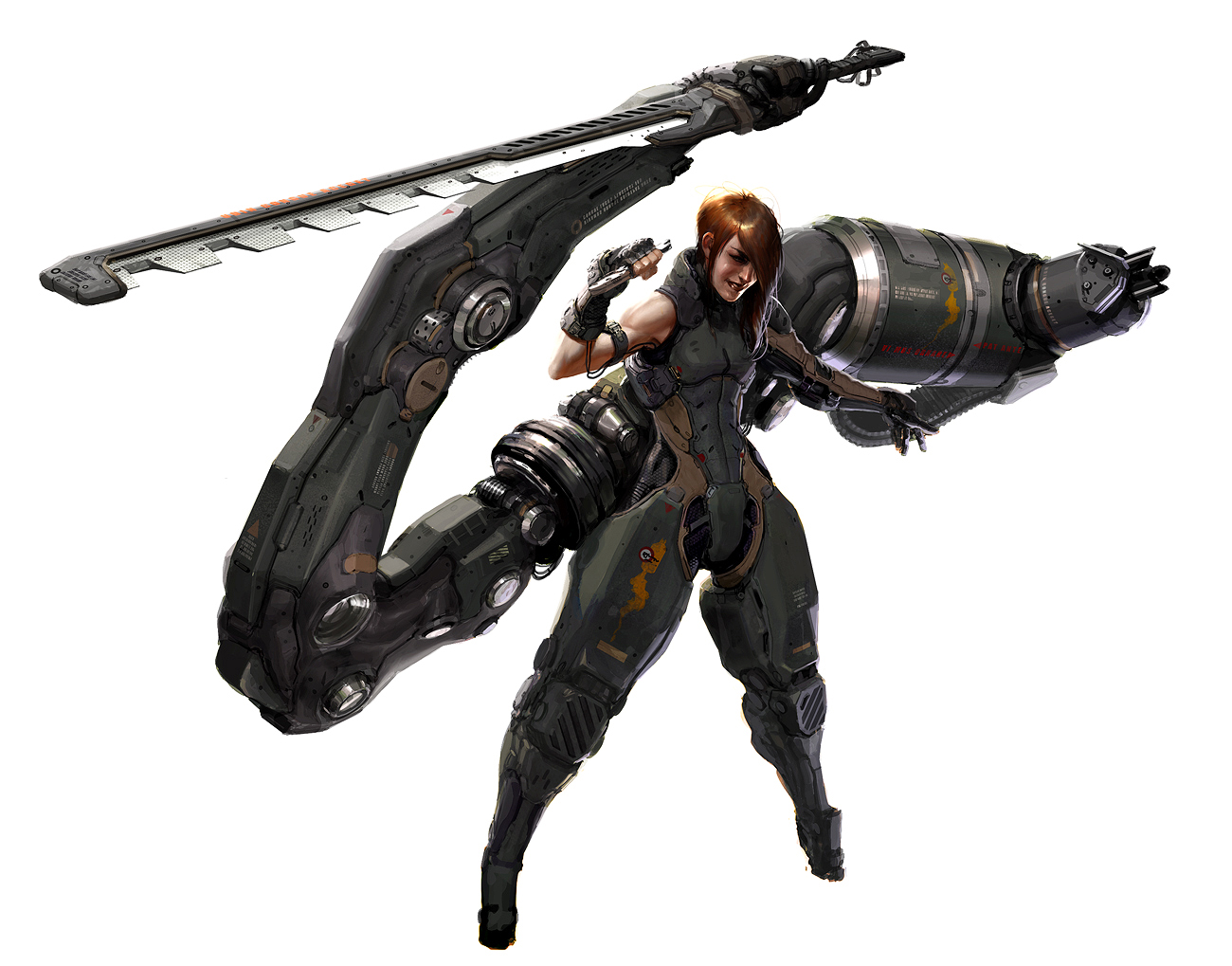
Most of the women think how to have larger and firmer breasts and haunting by this concern, women choice variety of breast enhancement methods nowadays. Usually, women who are not satisfied with size and shape of their boobs, they take breast enlargement pills or undergo Harley street breast augmentation process after consulting with cosmetic and plastic breast doctor.
Here is a video BREASTFEEDING ! HOW TO HEAL MASTITIS NOW! Don't take it sexually it is a tips to moms . MASTITIS SUCKS! THIS IS THE EASIEST WAY TO UNCLOG CLOGGED DUCT IN BREAST! Also known as augmentation mammoplasty, breast augmentation involves using implants to create fuller breasts or to restore breasts that may have lost volume due to weight loss or from pregnancy. If you are unhappy with the size or shape of your breasts, augmentation surgery is a choice to consider. Breast augmentation can increase the fullness and projection of your breasts, improve the balance and proportions of your figure and improve your self-image and self-confidence. Like breastfeeding, the benefits of using a breast pump are many. Stimulating lactation for new moms with a low milk supply and relieving engorgement, a painful condition when the breasts are overfull, is just one of those great benefits. Even if you can direct breastfeed, a breast pump will come in handy as you return to work or have to be away from your baby. Also, if you need to take medication that affects your breast milk or if you simply want to enjoy a night out and have a drink or two, you can express and store your milk for your baby until you can resume nursing. Finally pumping helps you recover from pregnancy quickly even though your baby may no longer needs the milk see pumping: bit.ly/1V2ffBu KEYWORDS: Mastitis (Disease Or Medical Condition), Breastfeeding (Literature Subject), Health (Industry), breastfeeding and mastitis, heal mastitis, how to cure mastit,breastfeeding, breastfeed, infant, baby, breast milk,how to breastfeed, breastfeeding positions, breast feed, BREASTFEEDING
Get fuller and attractive breast with the help of Breast Augmentation Treatment in Lahore and regain your self-esteem through breast augmentation. No matter why are you unsatisfied with the appearance of your breast, our cosmetic surgeons are capable enough to meet your expectation with the promising results.
The Do 28 was developed from the single-engine Do 27 at the end of the 1950s. The design shared the high-wing cantilever layout and the lift augmentation devices of the Do 27, together with the rear fuselage which seated six passengers.
"Breaktime"
Five Star 1118
Company/Owner: Pangasinan Five Star Bus Co., Inc.
Route: Cubao-Dagupan via Marquee, TPLEX/MNR
QC Augmentation Route: Route 4: QC Hall-General Luis
Area of Service: Pangasinan, Ilocos Region (R1)
Type of Service: PUB Provincial Operation Bus
Classification: Regular Airconditioned Bus
Coachbuilder: Almazora Motors, Corp.
Model: MAN 18.350 Tourist Star RE
Chassis: PBMR39
Engine: D2066LOH
Transmission: M/T
Speed: 6 Forward, 1 Reverse
Suspension Type: Electronically-Controlled Airsuspension
Seat Configuration: 2x2
Maximum Capacity: 49+2
Shot Location: Quezon Memorial Circle, Brgy. Pinyahan, Diliman, Quezon City
Date Taken: June 21, 2021
Kanchipuram a otherwise known as Kanchi (previously romanized as Kāñci-pura, Conjevaram) is a city in the Indian state of Tamil Nadu, 72 km from Chennai – the capital of Tamil Nadu. The city covers an area of 11.605 km2 and had a population of 164,265 in 2001. It is the administrative headquarters of Kanchipuram District. Kanchipuram is well-connected by road and rail. Chennai International Airport is the nearest domestic and international airport to the city, which is located at Tirusulam in Kanchipuram district.
Located on the banks of the Vegavathy River, Kanchipuram has been ruled by the Pallavas, the Medieval Cholas, the Later Cholas, the Later Pandyas, the Vijayanagar Empire, the Carnatic kingdom, and the British. The city's historical monuments include the Kailasanathar Temple and the Vaikunta Perumal Temple. Historically, Kanchipuram was a centre of education and was known as the ghatikasthanam, or "place of learning". The city was also a religious centre of advanced education for Jainism and Buddhism between the 1st and 5th centuries.
In Hindu theology, Kanchipuram is one of the seven Indian cities to reach final attainment. The city houses Varadharaja Perumal Temple, Ekambareswarar Temple, Kamakshi Amman Temple, and Kumarakottam Temple, which are some of major Hindu temples in the state. The city is a holy pilgrimage site for both Saivites and Vaishnavites. Of the 108 holy temples of the Hindu god Vishnu, 14 are located in Kanchipuram. The city is well known for its hand woven silk sarees and most of the city's workforce is involved in the weaving industry.
Kanchipuram is administered by a Special grade municipality constituted in 1947. It is the headquarters of the Kanchi matha, a Hindu monastic institution believed to have been founded by the Hindu saint and commentator Adi Sankaracharya, and was the capital city of the Pallava Kingdom between the 4th and 9th centuries.
Kanchipuram has been chosen as one of the heritage cities for HRIDAY - Heritage City Development and Augmentation Yojana scheme of Government of India.
ETYMOLOGY
Kanchipuram was known in early Tamil literature as Kachi or Kachipedu but was later Sanskritized to Kanchi or Kanchipuram. According to legend, the name Kanchi is derived from Ka referring to the Hindu god Brahma and anchi, referring to his worship of Hindu god Vishnu at this place. The earliest inscription from the Maurya period (325–185 BCE) denote the city as Kanchipuram, where King Visnugopa was defeated by Samudragupta Maurya (320–298 BCE). Patanjali (150 BCE or 2nd century BCE) refers to the city in his Mahabhasya as Kanchipuraka. The city was referred to by various Tamil names like Kanchi, Kanchipedu and Sanskrit names like Kanchipuram. The Pallava inscriptions from (250–355) and the inscriptions of the Chalukya dynasty refers the city as Kanchipura. Jaina Kanchi refers to the area around Tiruparutti Kundram. During the British rule, the city was known as Conjeevaram and later as Kanchipuram. The municipal administration was renamed Kancheepuram, while the district retains the name Kanchipuram.
HISTORY
While it is widely accepted that Kanchipuram had served as an Early Chola capital, the claim has been contested by Indian historian P. T. Srinivasa Iyengar who wrote that the Tamil culture of the Sangam period did not spread through the Kanchipuram district, and cites the Sanskritic origins of its name in support of his claim. The earliest references to Kanchipuram are found in the books of the Sanskrit grammarian Patanjali, who lived between the 3rd and 2nd centuries BCE. The city is believed to have been part of the mythical Dravida Kingdom of the Mahabharatha, and was described as "the best among cities" (Sanskrit: Nagareshu Kanchi) by the 4th-century Sanskrit poet, Kalidasa. The city was regarded as the "Banaras of the South". Kanchipuram grew in importance when the Pallavas of southern Andhra Pradesh, wary of constant invasions from the north, moved their capital south to the city in the 6th century. The Pallavas fortified the city with ramparts, wide moats, well-laid-out roads, and artistic temples. During the reign of the Pallava King Mahendravarman I, the Chalukya King Pulakesin II (610–642) invaded the Pallava kingdom as far as the Kaveri River. The Pallavas successfully defended Kanchipuram and foiled repeated attempts to capture the city. A second invasion ended disastrously for Pulakesin II, who was forced to retreat to his capital Vatapi which was besieged and Pulakesin II was killed by Narasimhavarman I (630–668), son of Mahendravarman I (600–630), at the Battle of Vatapi. Under the Pallavas, Kanchipuram flourished as a centre of Hindu and Buddhist learning. King Narasimhavarman II built the city's important Hindu temples, the Kanchi Kailasanathar Temple, the Varadharaja Perumal Temple and the Iravatanesvara Temple. Xuanzang, a Chinese traveller who visited Kanchipuram in 640, recorded that the city was 9.7 km in circumference and that its people were renowned for their bravery, piety, love of justice, and veneration for learning. The Medieval Chola king Aditya I conquered the Pallava kingdom, including Kanchipuram, after defeating the Pallava ruler Aparajitavarman (880–897) in about 890. Under the Cholas, the city was the headquarters of the northern viceroyalty. The province was renamed "Jayamkonda Cholamandalam" during the reign of King Raja Raja Chola I (985–1014), who constructed the Karchapeswarar Temple and renovated the Kamakshi Amman Temple. His son, Rajendra Chola I (1012–44) constructed the Yathothkari Perumal Temple. According to the Siddhantasaravali of Trilocana Sivacharya, Rajendra Chola I brought a band of Saivas with him on his return from the Chola expedition to North India and settled them in Kanchipuram. In about 1218, the Pandya king Maravarman Sundara Pandyan (1216–1238) invaded the Chola country, making deep inroads into the kingdom which was saved by the intervention of the Hoysala king Vira Narasimha II (1220–1235), who fought on the side of the Chola king Kulothunga Chola III. Inscriptions indicate the presence of a powerful Hoysala garrison in Kanchipuram, which remained in the city until about 1230. Shortly afterwards, Kanchipuram was conquered by the Telugu Cholas, from whom Jatavarman Sundara Pandyan I took the city in 1258. The city remained with the Pandyas until 1311 when the Sambuvarayars declared independence, taking advantage of the anarchy caused by Malik Kafur's invasion. After short spells of occupation by Ravivarman Kulasekhara of Venad (Quilon, Kerala) in 1313–1314 and the Kakatiya ruler Prataparudra II, Kanchipuram was conquered by the Vijayanagar general Kumara Kampana, who defeated the Madurai Sultanate in 1361.
The Vijayanagar Empire ruled Kanchipuram from 1361 to 1645. The earliest inscriptions attesting to Vijayanagar rule are those of Kumara Kampanna from 1364 and 1367, which were found in the precincts of the Kailasanathar Temple and Varadaraja Perumal Temple respectively. His inscriptions record the re-institution of Hindu rituals in the Kailasanathar Temple that had been abandoned during the Muslim invasions. Inscriptions of the Vijayanagar kings Harihara II, Deva Raya II, Krishna Deva Raya, Achyuta Deva Raya, Sriranga I, and Venkata II are found within the city. Harihara II endowed grants in favour of the Varadaraja Perumal Temple. In the 15th century, Kanchipuram was invaded by the Velama Nayaks in 1437, the Gajapati kingdom in 1463–1465 and 1474–75 and the Bahmani Sultanate in about 1480. A 1467 inscription of Virupaksha Raya II mentions a cantonment in the vicinity of Kanchipuram. In 1486, Saluva Narasimha Deva Raya, the governor of the Kanchipuram region, overthrew the Sangama Dynasty of Vijayanagar and founded the Saluva Dynasty. Like most of his predecessors, Narasimha donated generously to the Varadaraja Perumal Temple. Kanchipuram was visited twice by the Vijayanagar king Krishna Deva Raya, considered to be the greatest of the Vijayanagar rulers, and 16 inscriptions of his time are found in the Varadaraja Perumal Temple. The inscriptions in four languages – Tamil, Telugu, Kannada, and Sanskrit – record the genealogy of the Tuluva kings and their contributions, along with those of their nobles, towards the upkeep of the shrine. His successor, Achyuta Deva Raya, reportedly had himself weighed against pearls in Kanchipuram and distributed the pearls amongst the poor. Throughout the second half of the 16th and first half of the 17th centuries, the Aravidu Dynasty tried to maintain a semblance of authority in the southern parts after losing their northern territories in the Battle of Talikota. Venkata II (1586–1614) tried to revive the Vijayanagar Empire, but the kingdom relapsed into confusion after his death and rapidly fell apart after the Vijayanagar king Sriranga III's defeat by the Golconda and Bijapur sultanates in 1646.
After the fall of the Vijayanagar Empire, Kanchipuram endured over two decades of political turmoil. The Golconda Sultanate gained control of the city in 1672, but lost it to Bijapur three years later. In 1676, Shivaji arrived in Kanchipuram at the invitation of the Golconda Sultanate in order to drive out the Bijapur forces. His campaign was successful and Kanchipuram was held by the Golconda Sultanate until its conquest by the Mughal Empire led by Aurangazeb in October 1687. In the course of their southern campaign, the Mughals defeated the Marathas under Sambhaji, the elder son of Shivaji, in a battle near Kanchipuram in 1688 which caused considerable damage to the city but cemented Mughal rule. Soon after, the priests at the Varadaraja Perumal, Ekambareshwarar and Kamakshi Amman temples, mindful of Aurangazeb's reputation for iconoclasm, transported the idols to southern Tamil Nadu and did not restore them until after Aurangazeb's death in 1707. Under the Mughals, Kanchipuram was part of the viceroyalty of the Carnatic which, in the early 1700s, began to function independently, retaining only a nominal acknowledgement of Mughal rule. The Marathas invaded Kanchipuram during the Carnatic period in 1724 and 1740, and the Nizam of Hyderabad in 1742.
Kanchipuram was a battlefront for the British East India Company in the Carnatic Wars against the French East India Company and in the Anglo-Mysore Wars with the Sultanate of Mysore. The popular 1780 Battle of Pollilur of the Second Anglo-Mysore War, known for the use of rockets by Hyder Ali of Mysore, was fought in the village of Pullalur near Kanchipuram. In 1763, the British East India Company assumed indirect control from the Nawab of the Carnatic over the erstwhile Chingleput District, comprising the present-day Kanchipuram and Tiruvallur districts, in order to defray the expenses of the Carnatic wars. The Company brought the territory under their direct control during the Second Anglo-Mysore War, and the Collectorate of Chingleput was created in 1794. The district was split into two in 1997 and Kanchipuram made the capital of the newly created Kanchipuram district.
GEOGRAPHY
Kanchipuram is located at 12.98°N 79.71°E, 72 km south-west of Chennai on the banks of the Vegavathi River, a tributary of the Palar River. The city covers an area of 11.6 km2 and has an elevation of 83.2 m above sea level. The land around Kanchipuram is flat and slopes towards the south and east. The soil in the region is mostly clay, with some loam, clay, and sand, which are suitable for use in construction. The Chingleput District Manual (1879) describes the region's soils as "highly inferior" and "highly stony or mixed with lime, gravel, soda and laterite". It has been postulated that the granite required for the Varadaraja Perumal Temple might have been obtained from the Sivaram Hills located 10 miles east of Kanchipuram. The area is classified as a Seismic Zone II region, and earthquakes of up to magnitude 6 on the Richter Scale may be expected. Kanchipuram is subdivided into two divisions – Big Kanchi, also called Shiva Kanchi occupies the western portion of the city and is the larger of the two divisions. Little Kanchi, also called Vishnu Kanchi, is located on the eastern fringes of the city. Most of the Shiva temples lie in Big Kanchi while most of the Vishnu temples lie in Little Kanchi.
Ground water is the major source of water supplies used for irrigation – the block of Kanchipuram has 24 canals, 2809 tanks, 1878 tube wells and 3206 ordinary wells. The area is rich in medicinal plants, and historic inscriptions mention the medicinal value. Dimeria acutipes and cyondon barberi are plants found only in Kanchipuram and Chennai.
CLIMATE
Kanchipuram generally experiences hot and humid climatic conditions throughout the year. Temperatures reache an average maximum of 37.5 °C between April and July, and an average minimum of 20.5 °C between December and February. The daytime heat during summer can be oppressive; temperatures can reach 43 °C. Relative humidities of between 58% and 84% prevail throughout the year. The humidity reaches its peak during the morning and is lowest in the evening. Relative humidity is higher between November and January and is lowest throughout June.
The city receives an average of 1064 mm of rainfall annually, 68% of which falls during the northeast monsoon. Most of the precipitation occurs in the form of cyclonic storms caused by depressions in the Bay of Bengal during the northeast monsoon. The prevailing wind direction is south-westerly in the morning and south-easterly in the evening.
GOVERNMENT AND POLITICS
The Kanchipuram municipality was officially constituted in 1866, covering 7.68 km2, and its affairs were administered by a municipal committee. It was upgraded to a grade I municipality in 1947, selection grade municipality in 1983 and special grade municipality in 2008. As of 2011 the municipality occupies 11.6 km2, has 51 wards and is the biggest municipality in Kanchipuram district. The functions of the municipality are devolved into six departments: General, Engineering, Revenue, Public Health, Town Planning and the Computer Wing, all of which are under the control of a Municipal Commissioner, who is the supreme executive head. The legislative powers are vested in a body of 51 members, each representing one ward. The legislative body is headed by an elected Chairperson who is assisted by a Deputy Chairperson.
Kanchipuram comes under the Kanchipuram state assembly constituency. From the state delimitation after 1967, seven of the ten elections held between 1971 and 2011 were won by the Anna Dravida Muneetra Kazhagam (ADMK). Dravida Munnetra Kazhagam (DMK) won the seat during the 1971 and 1989 elections and its ally Pattali Makkal Katchi won the seat during the 2006 elections. The current member of the legislative assembly is V. Somasundaram from the ADMK party.
Kanchipuram Lok Sabha constituency is a newly formed constituency of the Parliament of India after the 2008 delimitation. The constituency originally existed for the 1951 election, and was formed in 2008 after merging the assembly segments of Chengalpattu, Thiruporur, Madurantakam (SC), Uthiramerur and Kanchipuram, which were part of the now defunct Chengalpattu constituency, and Alandur, which was part of the Chennai South constituency. This constituency is reserved for Scheduled Castes (SC) candidates. K. Maragatham from the All India Anna Dravida Munnetra Kazhagam is the current Member of Parliament for the constituency. Indian writer, politician and founder of the DMK, C. N. Annadurai, was born and raised in Kanchipuram. He was the first member of a Dravidian party to hold that post and was the first non-Congress leader to form a majority government in post-colonial India.
Policing in the city is provided by the Kanchipuram sub-division of the Tamil Nadu Police headed by a Deputy Superintendent of Police. The force's special units include prohibition enforcement, district crime, social justice and human rights, district crime records and special branch that operate at the district level police division, which is headed by a Superintendent of Police.
DEMOGRAPHICS
During the rule of King Narasimha Varma in the 7th century, the city covered about 10 square kilometres and had a population of 10,000. The population increased to 13,000 in subsequent years and the city developed cross patterned links with rectangular streets. The settlements in the city were mostly caste based. During the period of Nandivarma Pallavan II, houses were built on raised platforms and burnt bricks. The concepts of the verandah in the front yard, garden in the backyard, ventilation facilities and drainage of rainwater were all introduced for the first time. The centre of the city was occupied by Brahmins, while the Tiruvekka temple and houses of agricultural labourers were situated outside the city. There were provisions in the city's outskirts for training the cavalry and infantry.
During the Chola era, Kanchipuram was not the capital, but the kings had a palace in the city and lot of development was extended eastwards. During the Vijayanagara period, the population rose to 25,000. There were no notable additions to the city's infrastructure during British rule. The British census of 1901 recorded that Kanchipuram had a population of 46,164, consisting of 44,684 Hindus, 1,313 Muslims, 49 Christians and 118 Jains.
According to 2011 census, Kanchipuram had a population of 164,384 with a sex-ratio of 1,005 females for every 1,000 males, much above the national average of 929. A total of 15,955 were under the age of six, constituting 8,158 males and 7,797 females. Scheduled Castes and Scheduled Tribes accounted for 3.55% and .09% of the population respectively. The average literacy of the city was 79.51%, compared to the national average of 72.99%. The city had a total of 41807 households. There were a total of 61,567 workers, comprising 320 cultivators, 317 main agricultural labourers, 8,865 in house hold industries, 47,608 other workers, 4,457 marginal workers, 61 marginal cultivators, 79 marginal agricultural labourers, 700 marginal workers in household industries and 3,617 other marginal workers. About 800,000 (800,000) pilgrims visit the city every year as of 2001. As per the religious census of 2011, Kancheepuram had 93.38% Hindus, 5.24% Muslims, 0.83% Christians, 0.01% Sikhs, 0.01% Buddhists, 0.4% Jains, 0.11% following other religions and 0.01% following no religion or did not indicate any religious preference.Kanchipuram has 416 hectares of residential properties, mostly around the temples. The commercial area covers 62 hectares, constituting 6.58% of the city. Industrial developments occupy around 65 hectares), where most of the handloom spinning, silk weaving, dyeing and rice production units are located. 89.06 hectares are used for transport and communications infrastructure, including bus stands, roads, streets and railways lines
ECONOMY
The major occupations of Kanchipuram are silk sari weaving and agriculture. As of 2008, an estimated 5,000 families were involved in sari production. The main industries are cotton production, light machinery and electrical goods manufacturing, and food processing. There are 25 silk and cotton yarn industries, 60 dyeing units, 50 rice mills and 42 other industries in the Kanchipuram. Another important occupation is tourism and service related segments like hotels, restaurants and local transportation.
Kanchipuram is a traditional centre of silk weaving and handloom industries for producing Kanchipuram Saris. The industry is worth ₹ 100 cr (US$18.18 million), but the weaving community suffers from poor marketing techniques and duplicate market players. In 2005, "Kanchipuram Silk Sarees" received the Geographical Indication tag, the first product in India to carry this label. The silk trade in Kanchipuram began when King Raja Raja Chola I (985–1014) invited weavers to migrate to Kanchi. The craft increased with the mass migration from Andhra Pradesh in the 15th century during the Vijayanagara rule. The city was razed during the French siege of 1757, but weaving re-emerged in the late 18th century.
All major nationalized banks such as Vijaya Bank, State Bank of India, Indian Bank, Canara Bank, Punjab National Bank, Dena Bank and private banks like ICICI Bank have branches in Kanchipuram. All these banks have their Automated teller machines located in various parts of the city.
HUMAN RIGHTS
Kanchipuram has more than the national average rate of child labour and bonded labour. The local administration is accused of aiding child labour by opening night schools in Kanchipuram from 1999. There is an estimated 40,000 to 50,000 child workers in Kanchipuram compared to 85,000 in the same industry in Varanasi. Children are commonly traded for sums of between ₹ 10,000 and 15,000 (200 – $300) and there are cases where whole families are held in bondage. Child labour is prohibited in India by the Children (Pledging of Labour) Act and Child Labour (Prohibition and Regulation) Act, but these laws are not strictly enforced.
TRANSPORT, COMMUNICATION AND UTILITY SERVICES
Kanchipuram is most easily accessible by road. The Chennai – Bangalore National Highway, NH 4 passes the outskirts of the city. Daily bus services are provided by the Tamil Nadu State Transport Corporation to and from Chennai, Bangalore, Villupuram, Tirupathi, Thiruthani, Tiruvannamalai, Vellore, Salem, Coimbatore and Pondicherry. There are two major bus routes to Chennai, one connecting via Guindy and the other via Tambaram. Local bus services are provided by The Villupuram division of Tamil Nadu State Transport Corporation. As of 2006, there were a total of 403 buses for 191 routes operated out of the city.
The city is also connected to the railway network through the Kanchipuram railway station. The Chengalpet – Arakkonam railway line passes through Kanchipuram and travellers can access services to those destinations. Daily trains are provided to Pondicherry and Tirupati, and there is a weekly express train to Madurai and a bi-weekly express train to Nagercoil. Two passenger trains from both sides of Chengalpattu and Arakkonam pass via Kanchipuram.
The nearest domestic as well as international airport is Chennai International Airport, located at a distance of 72 km from the city.
Telephone and broadband internet services are provided by Bharat Sanchar Nigam Limited (BSNL), India's state-owned telecom and internet services provider. Electricity supply is regulated and distributed by the Tamil Nadu Electricity Board (TNEB). Water supply is provided by the Kanchipuram municipality; supplies are drawn from subterranean springs of Vegavati river. The head works is located at Orikkai, Thiruparkadal and St. Vegavathy, and distributed through overhead tanks with a total capacity of 9.8 litres. About 55 tonnes of solid waste are collected from the city daily at five collection points covering the whole of the city. The sewage system in the city was implemented in 1975; Kanchipuram was identified as one of the hyper endemic cities in 1970. Underground drainage covers 82% of roads in the city, and is divided into east and west zones for internal administration.
EDUCATION
Kanchipuram is traditionally a centre of religious education for the Hindu, Jainism and Buddhism faiths. The Buddhist monasteries acted as nucleus of the Buddhist educational system. With the gradual resurrection of Hinduism during the reign of Mahendra Varman I, the Hindu educational system gained prominence with Sanskrit emerging as the official language.
As of 2011 Kanchipuram has 49 registered schools, 16 of which are run by the city municipality. The district administration opened night schools for educating children employed in the silk weaving industry – as of December 2001, these schools together were educating 127 people and 260 registered students from September 1999. Larsen & Toubro inaugurated the first rail construction training centre in India at Kanchipuram on 24 May 2012, that can train 300 technicians and 180 middle level managers and engineers each year. Sri Chandrasekharendra Saraswathi Viswa Mahavidyalaya and Chettinad Academy of Research and Education (CARE) are the two Deemed universities present in Kanchipuram.
Kanchipuram is home to one of the four Indian Institute of Information of Technology, a public private partnered institute, offering under graduate and post graduate programs in information technology. The city has two medical colleges – Arignar Anna Memorial Cancer Institute and Hospital, established in 1969 is operated by the Department of Health, Government of Tamil Nadu and the privately owned Meenakshi Medical College. The city has 6 engineering colleges, 3 polytechnic institutes and 6 arts and science colleges.
RELIGION
BUDDHISM
Buddhism is believed to have flourished in Kanchipuram between the 1st and 5th centuries. Some notable Buddhists associated with Kanchipuram are Āryadeva (2nd–3rd centuries) – a successor of Nāgārjuna of Nalanda University, Dignaga and the Pali commentators Buddhaghosa and Dhammapala. According to a popular tradition, Bodhidharma, a 5th/6th-century Buddhist monk and founder of Shaolin Kung Fu was the third son of a Pallava king from Kanchipuram. However, other traditions ascribe his origins to other places in Asia. Buddhists institutions from Kanchipuram were instrumental in spreading Theravada Buddhism to the Mon people of Myanmar and Thailand who in return spread the religion to the incoming Burmese and Thai people.
JAINISM
It is thought that Jainism was introduced into Kanchipuram by Kunda Kundacharya (1st century). Jainism spread to the city by Akalanka (3rd century). Kalbhras, the rulers of Kanchipuram before the Pallavas, followed Jainism which gained popularity from royal patronage. The Pallava kings, Simhavishnu, Mahendra Varman and Simhavarman (550–560) followed Jainism, until the advent of Nayanmars and Azhwars during the 6th and 7th centuries. Mahendravarman I converted from Jainism to Hinduism under the influence of the Naynamar, Appar, was the turning point in the religious geography. The two sects of Hinduism, Saivism and Vaishnavism were revived under the influence of Adi Sankara and Ramanuja respectively. Later Cholas and Vijayanagara kings tolerated Jainism, and the religion was still practiced in Kanchi.
Trilokyanatha/Chandraprabha temple is a twin Jain temple that has inscriptions from Pallava king, Narasimhavarman II and the Chola kings Rajendra Chola I, Kulothunga Chola I and Vikrama Chola, and the Kanarese inscriptions of Krishnadevaraya. The temple is maintained by Tamil Nadu archaeological department.
HINDUISM
Hindus regard Kanchipuram to be one of the seven holiest cities in India, the Sapta Puri. According to Hinduism, a kṣetra is a sacred ground, a field of active power, and a place where final attainment, or moksha, can be obtained. The Garuda Purana says that seven cities, including Kanchipuram are providers of moksha. The city is a pilgrimage site for both Saivites and Vaishnavites.
Ekambareswarar Temple in northern Kanchipuram, dedicated to Shiva, is the largest temple in the city. Its gateway tower, or gopuram, is 59 metres tall, making it one the tallest temple towers in India. The temple is one of five called Pancha Bhoota Stalams, which represent the manifestation of the five prime elements of nature; land, water, air, sky, and fire. Ekambareswarar temple temple represents earth.
Kailasanathar Temple, dedicated to Shiva and built by the Pallavas, is the oldest Hindu temple in existence and is declared an archaeological monument by the Archaeological Survey of India. It has a series of cells with sculptures inside. In the Kamakshi Amman Temple, goddess Parvati is depicted in the form of a yantra, Chakra or peetam (basement). In this temple, the yantra is placed in front of the deity. Adi Sankara is closely associated with this temple and is believed to have established the Kanchi matha after this temple.
Muktheeswarar Temple, built by Nandivarman Pallava II (720–796) and Iravatanesvara Temple built by Narasimhavarman Pallava II (720–728) are the other Shiva temples from the Pallava period. Kachi Metrali – Karchapeswarar Temple, Onakanthan Tali, Kachi Anekatangapadam, Kuranganilmuttam, and Karaithirunathar Temple in Tirukalimedu are the Shiva temples in the city reverred in Tevaram, the Tamil Saiva canonical work of the 7th–8th centuries.
Kumarakottam Temple, dedicated to Muruga, is located between the Ekambareswarar temple and Kamakshi Amman temple, leading to the cult of Somaskanda (Skanda, the child between Shiva and Parvati). Kandapuranam, the Tamil religious work on Muruga, translated from Sanskrit Skandapurana, was composed in 1625 by Kachiappa Shivacharya in the temple.
Varadharaja Perumal Temple, dedicated to Vishnu and covering 93,000 m2, is the largest Vishnu temple in Kanchipuram. It was built by the Cholas in 1053 and was expanded during the reigns of Kulottunga Chola I (1079–1120) and Vikrama Chola (1118–1135). It is one of the divyadesams, the 108 holy abodes of Vishnu. The temple features carved lizards, one platted with gold and another with silver, over the sanctum. Clive of India is said to have presented an emerald necklace to the temple. It is called the Clive Makarakandi and is still used to decorate the deity on ceremonial occasions.
Tiru Parameswara Vinnagaram is the birthplace of the azhwar saint, Poigai Alvar. The central shrine has a three-tier shrine, one over the other, with Vishnu depicted in each of them. The corridor around the sanctum has a series of sculptures depicting the Pallava rule and conquest. It is the oldest Vishnu temple in the city and was built by the Pallava king Paramesvaravarman II (728–731).
Ashtabujakaram, Tiruvekkaa, Tiruththanka, Tiruvelukkai, Ulagalantha Perumal Temple, Tiru pavla vannam, Pandava Thoothar Perumal Temple are among the divyadesam, the 108 famous temples of Vishnu in the city. There are a five other divyadesams, three inside the Ulagalantha Perumal temple, one each in Kamakshi Amman Temple and Ekambareswarar Temple.
The Kanchi Matha is a Hindu monastic institution, whose official history states that it was founded by Adi Sankara of Kaladi, tracing its history back to the 5th century BCE. A related claim is that Adi Sankara came to Kanchipuram, and that he established the Kanchi mutt named "Dakshina Moolamnaya Sarvagnya Sri Kanchi Kamakoti Peetam" in a position of supremacy, namely Sarvagnya Peetha, over the other mathas (religious institutions) of the subcontinent, before his death there. Other historical accounts state that the mutt was established probably in the 18th century in Kumbakonam, as a branch of the Sringeri Matha, and that it declared itself independent.
Another mutt which was famous in ancient times was the Upanishad Bramham Mutt, located near Kailasanathar temple, Kanchipuram. It has the Mahasamadhi of Upanishad Bramham, a saint who wrote commentaries on all the major upanishads in Hinduism. It is said that the great Sage, Sadasiva Brahmendra took to sanyasa at this mutt.
OTHER RELIGIONS
The city has two mosques; one near the Ekambareswarar temple was built during the rule of Nawab of Arcot in the 17th century, and another near the Vaikunta Perumal temple shares a common tank with the Hindu temple. Muslims take part in the festivals of the Varadarajaswamy temple. Christ Church is the oldest Christian church in the city. It was built by a British man named Mclean in 1921. The church is built in Scottish style brick structure with arches and pillars.
WIKIPEDIA
A member of the Orbital Syngas Commodity Augmentation Reactor (OSCAR) team performs ground testing at NASA’s Kennedy Space Center in Florida. The tests are in preparation for a scheduled suborbital flight test later this year, facilitated by NASA’s Flight Opportunities program. Begun as an Early Career Initiative project, OSCAR evaluates technology to make use of trash and human waste generated during long-duration spaceflight. Photo credit: NASA/Amber Jean Watson
Kanchipuram a otherwise known as Kanchi (previously romanized as Kāñci-pura, Conjevaram) is a city in the Indian state of Tamil Nadu, 72 km from Chennai – the capital of Tamil Nadu. The city covers an area of 11.605 km2 and had a population of 164,265 in 2001. It is the administrative headquarters of Kanchipuram District. Kanchipuram is well-connected by road and rail. Chennai International Airport is the nearest domestic and international airport to the city, which is located at Tirusulam in Kanchipuram district.
Located on the banks of the Vegavathy River, Kanchipuram has been ruled by the Pallavas, the Medieval Cholas, the Later Cholas, the Later Pandyas, the Vijayanagar Empire, the Carnatic kingdom, and the British. The city's historical monuments include the Kailasanathar Temple and the Vaikunta Perumal Temple. Historically, Kanchipuram was a centre of education and was known as the ghatikasthanam, or "place of learning". The city was also a religious centre of advanced education for Jainism and Buddhism between the 1st and 5th centuries.
In Hindu theology, Kanchipuram is one of the seven Indian cities to reach final attainment. The city houses Varadharaja Perumal Temple, Ekambareswarar Temple, Kamakshi Amman Temple, and Kumarakottam Temple, which are some of major Hindu temples in the state. The city is a holy pilgrimage site for both Saivites and Vaishnavites. Of the 108 holy temples of the Hindu god Vishnu, 14 are located in Kanchipuram. The city is well known for its hand woven silk sarees and most of the city's workforce is involved in the weaving industry.
Kanchipuram is administered by a Special grade municipality constituted in 1947. It is the headquarters of the Kanchi matha, a Hindu monastic institution believed to have been founded by the Hindu saint and commentator Adi Sankaracharya, and was the capital city of the Pallava Kingdom between the 4th and 9th centuries.
Kanchipuram has been chosen as one of the heritage cities for HRIDAY - Heritage City Development and Augmentation Yojana scheme of Government of India.
ETHYMOLOGY
Kanchipuram was known in early Tamil literature as Kachi or Kachipedu but was later Sanskritized to Kanchi or Kanchipuram. According to legend, the name Kanchi is derived from Ka referring to the Hindu god Brahma and anchi, referring to his worship of Hindu god Vishnu at this place. The earliest inscription from the Maurya period (325–185 BCE) denote the city as Kanchipuram, where King Visnugopa was defeated by Samudragupta Maurya (320–298 BCE).[9] Patanjali (150 BCE or 2nd century BCE) refers to the city in his Mahabhasya as Kanchipuraka. The city was referred to by various Tamil names like Kanchi, Kanchipedu and Sanskrit names like Kanchipuram. The Pallava inscriptions from (250–355) and the inscriptions of the Chalukya dynasty refers the city as Kanchipura. Jaina Kanchi refers to the area around Tiruparutti Kundram. During the British rule, the city was known as Conjeevaram and later as Kanchipuram. The municipal administration was renamed Kancheepuram, while the district retains the name Kanchipuram.
HISTORY
While it is widely accepted that Kanchipuram had served as an Early Chola capital, the claim has been contested by Indian historian P. T. Srinivasa Iyengar who wrote that the Tamil culture of the Sangam period did not spread through the Kanchipuram district, and cites the Sanskritic origins of its name in support of his claim. The earliest references to Kanchipuram are found in the books of the Sanskrit grammarian Patanjali, who lived between the 3rd and 2nd centuries BCE. The city is believed to have been part of the mythical Dravida Kingdom of the Mahabharatha, and was described as "the best among cities" (Sanskrit: Nagareshu Kanchi) by the 4th-century Sanskrit poet, Kalidasa. The city was regarded as the "Banaras of the South".
Kanchipuram grew in importance when the Pallavas of southern Andhra Pradesh, wary of constant invasions from the north, moved their capital south to the city in the 6th century. The Pallavas fortified the city with ramparts, wide moats, well-laid-out roads, and artistic temples. During the reign of the Pallava King Mahendravarman I, the Chalukya King Pulakesin II (610–642) invaded the Pallava kingdom as far as the Kaveri River. The Pallavas successfully defended Kanchipuram and foiled repeated attempts to capture the city. A second invasion ended disastrously for Pulakesin II, who was forced to retreat to his capital Vatapi which was besieged and Pulakesin II was killed by Narasimhavarman I (630–668), son of Mahendravarman I (600–630), at the Battle of Vatapi. Under the Pallavas, Kanchipuram flourished as a centre of Hindu and Buddhist learning. King Narasimhavarman II built the city's important Hindu temples, the Kanchi Kailasanathar Temple, the Varadharaja Perumal Temple and the Iravatanesvara Temple. Xuanzang, a Chinese traveller who visited Kanchipuram in 640, recorded that the city was 9.7 km in circumference and that its people were renowned for their bravery, piety, love of justice, and veneration for learning.
The Medieval Chola king Aditya I conquered the Pallava kingdom, including Kanchipuram, after defeating the Pallava ruler Aparajitavarman (880–897) in about 890. Under the Cholas, the city was the headquarters of the northern viceroyalty. The province was renamed "Jayamkonda Cholamandalam" during the reign of King Raja Raja Chola I (985–1014), who constructed the Karchapeswarar Temple and renovated the Kamakshi Amman Temple. His son, Rajendra Chola I (1012–44) constructed the Yathothkari Perumal Temple. According to the Siddhantasaravali of Trilocana Sivacharya, Rajendra Chola I brought a band of Saivas with him on his return from the Chola expedition to North India and settled them in Kanchipuram. In about 1218, the Pandya king Maravarman Sundara Pandyan (1216–1238) invaded the Chola country, making deep inroads into the kingdom which was saved by the intervention of the Hoysala king Vira Narasimha II (1220–1235), who fought on the side of the Chola king Kulothunga Chola III. Inscriptions indicate the presence of a powerful Hoysala garrison in Kanchipuram, which remained in the city until about 1230. Shortly afterwards, Kanchipuram was conquered by the Telugu Cholas, from whom Jatavarman Sundara Pandyan I took the city in 1258. The city remained with the Pandyas until 1311 when the Sambuvarayars declared independence, taking advantage of the anarchy caused by Malik Kafur's invasion. After short spells of occupation by Ravivarman Kulasekhara of Venad (Quilon, Kerala) in 1313–1314 and the Kakatiya ruler Prataparudra II, Kanchipuram was conquered by the Vijayanagar general Kumara Kampana, who defeated the Madurai Sultanate in 1361. The Vijayanagar Empire ruled Kanchipuram from 1361 to 1645. The earliest inscriptions attesting to Vijayanagar rule are those of Kumara Kampanna from 1364 and 1367, which were found in the precincts of the Kailasanathar Temple and Varadaraja Perumal Temple respectively. His inscriptions record the re-institution of Hindu rituals in the Kailasanathar Temple that had been abandoned during the Muslim invasions. Inscriptions of the Vijayanagar kings Harihara II, Deva Raya II, Krishna Deva Raya, Achyuta Deva Raya, Sriranga I, and Venkata II are found within the city. Harihara II endowed grants in favour of the Varadaraja Perumal Temple. In the 15th century, Kanchipuram was invaded by the Velama Nayaks in 1437, the Gajapati kingdom in 1463–1465 and 1474–75 and the Bahmani Sultanate in about 1480. A 1467 inscription of Virupaksha Raya II mentions a cantonment in the vicinity of Kanchipuram. In 1486, Saluva Narasimha Deva Raya, the governor of the Kanchipuram region, overthrew the Sangama Dynasty of Vijayanagar and founded the Saluva Dynasty. Like most of his predecessors, Narasimha donated generously to the Varadaraja Perumal Temple. Kanchipuram was visited twice by the Vijayanagar king Krishna Deva Raya, considered to be the greatest of the Vijayanagar rulers, and 16 inscriptions of his time are found in the Varadaraja Perumal Temple. The inscriptions in four languages – Tamil, Telugu, Kannada, and Sanskrit – record the genealogy of the Tuluva kings and their contributions, along with those of their nobles, towards the upkeep of the shrine. His successor, Achyuta Deva Raya, reportedly had himself weighed against pearls in Kanchipuram and distributed the pearls amongst the poor. Throughout the second half of the 16th and first half of the 17th centuries, the Aravidu Dynasty tried to maintain a semblance of authority in the southern parts after losing their northern territories in the Battle of Talikota. Venkata II (1586–1614) tried to revive the Vijayanagar Empire, but the kingdom relapsed into confusion after his death and rapidly fell apart after the Vijayanagar king Sriranga III's defeat by the Golconda and Bijapur sultanates in 1646.
After the fall of the Vijayanagar Empire, Kanchipuram endured over two decades of political turmoil. The Golconda Sultanate gained control of the city in 1672, but lost it to Bijapur three years later. In 1676, Shivaji arrived in Kanchipuram at the invitation of the Golconda Sultanate in order to drive out the Bijapur forces. His campaign was successful and Kanchipuram was held by the Golconda Sultanate until its conquest by the Mughal Empire led by Aurangazeb in October 1687. In the course of their southern campaign, the Mughals defeated the Marathas under Sambhaji, the elder son of Shivaji, in a battle near Kanchipuram in 1688 which caused considerable damage to the city but cemented Mughal rule. Soon after, the priests at the Varadaraja Perumal, Ekambareshwarar and Kamakshi Amman temples, mindful of Aurangazeb's reputation for iconoclasm, transported the idols to southern Tamil Nadu and did not restore them until after Aurangazeb's death in 1707. Under the Mughals, Kanchipuram was part of the viceroyalty of the Carnatic which, in the early 1700s, began to function independently, retaining only a nominal acknowledgement of Mughal rule. The Marathas invaded Kanchipuram during the Carnatic period in 1724 and 1740, and the Nizam of Hyderabad in 1742.
Kanchipuram was a battlefront for the British East India Company in the Carnatic Wars against the French East India Company and in the Anglo-Mysore Wars with the Sultanate of Mysore. The popular 1780 Battle of Pollilur of the Second Anglo-Mysore War, known for the use of rockets by Hyder Ali of Mysore, was fought in the village of Pullalur near Kanchipuram. In 1763, the British East India Company assumed indirect control from the Nawab of the Carnatic over the erstwhile Chingleput District, comprising the present-day Kanchipuram and Tiruvallur districts, in order to defray the expenses of the Carnatic wars. The Company brought the territory under their direct control during the Second Anglo-Mysore War, and the Collectorate of Chingleput was created in 1794. The district was split into two in 1997 and Kanchipuram made the capital of the newly created Kanchipuram district.
GEOGRAPHY
Kanchipuram is located at 12.98°N 79.71°E, 72 km south-west of Chennai on the banks of the Vegavathi River, a tributary of the Palar River. The city covers an area of 11.6 km2 and has an elevation of 83.2 m above sea level.[37]The land around Kanchipuram is flat and slopes towards the south and east. The soil in the region is mostly clay, with some loam, clay, and sand, which are suitable for use in construction. The Chingleput District Manual (1879) describes the region's soils as "highly inferior" and "highly stony or mixed with lime, gravel, soda and laterite". It has been postulated that the granite required for the Varadaraja Perumal Temple might have been obtained from the Sivaram Hills located 10 miles east of Kanchipuram. The area is classified as a Seismic Zone II region, and earthquakes of up to magnitude 6 on the Richter Scale may be expected. Kanchipuram is subdivided into two divisions – Big Kanchi, also called Shiva Kanchi occupies the western portion of the city and is the larger of the two divisions. Little Kanchi, also called Vishnu Kanchi, is located on the eastern fringes of the city. Most of the Shiva temples lie in Big Kanchi while most of the Vishnu temples lie in Little Kanchi.Ground water is the major source of water supplies used for irrigation – the block of Kanchipuram has 24 canals, 2809 tanks, 1878 tube wells and 3206 ordinary wells. The area is rich in medicinal plants, and historic inscriptions mention the medicinal value. Dimeria acutipes and cyondon barberi are plants found only in Kanchipuram and Chennai.
CLIMATE
Kanchipuram generally experiences hot and humid climatic conditions throughout the year. Temperatures reache an average maximum of 37.5 °C between April and July, and an average minimum of 20.5 °C between December and February. The daytime heat during summer can be oppressive; temperatures can reach 43 °C. Relative humidities of between 58% and 84% prevail throughout the year. The humidity reaches its peak during the morning and is lowest in the evening. Relative humidity is higher between November and January and is lowest throughout June.
The city receives an average of 1064 mm of rainfall annually, 68% of which falls during the northeast monsoon. Most of the precipitation occurs in the form of cyclonic storms caused by depressions in the Bay of Bengal during the northeast monsoon. The prevailing wind direction is south-westerly in the morning and south-easterly in the evening.
GOVERNMENT AND POLITICS
The Kanchipuram municipality was officially constituted in 1866, covering 7.68 km2, and its affairs were administered by a municipal committee. It was upgraded to a grade I municipality in 1947, selection grade municipality in 1983 and special grade municipality in 2008. As of 2011 the municipality occupies 11.6 km2, has 51 wards and is the biggest municipality in Kanchipuram district. The functions of the municipality are devolved into six departments: General, Engineering, Revenue, Public Health, Town Planning and the Computer Wing, all of which are under the control of a Municipal Commissioner, who is the supreme executive head. The legislative powers are vested in a body of 51 members, each representing one ward. The legislative body is headed by an elected Chairperson who is assisted by a Deputy Chairperson.Kanchipuram comes under the Kanchipuram state assembly constituency. From the state delimitation after 1967, seven of the ten elections held between 1971 and 2011 were won by the Anna Dravida Muneetra Kazhagam (ADMK). Dravida Munnetra Kazhagam (DMK) won the seat during the 1971 and 1989 elections and its ally Pattali Makkal Katchi won the seat during the 2006 elections. The current member of the legislative assembly is V. Somasundaram from the ADMK party.
Kanchipuram Lok Sabha constituency is a newly formed constituency of the Parliament of India after the 2008 delimitation. The constituency originally existed for the 1951 election, and was formed in 2008 after merging the assembly segments of Chengalpattu, Thiruporur, Madurantakam (SC), Uthiramerur and Kanchipuram, which were part of the now defunct Chengalpattu constituency, and Alandur, which was part of the Chennai South constituency. This constituency is reserved for Scheduled Castes (SC) candidates. K. Maragatham from the All India Anna Dravida Munnetra Kazhagam is the current Member of Parliament for the constituency. Indian writer, politician and founder of the DMK, C. N. Annadurai, was born and raised in Kanchipuram. He was the first member of a Dravidian party to hold that post and was the first non-Congress leader to form a majority government in post-colonial India.
Policing in the city is provided by the Kanchipuram sub-division of the Tamil Nadu Police headed by a Deputy Superintendent of Police. The force's special units include prohibition enforcement, district crime, social justice and human rights, district crime records and special branch that operate at the district level police division, which is headed by a Superintendent of Police.
DEMOGRAPHICS
During the rule of King Narasimha Varma in the 7th century, the city covered about 10 square kilometres and had a population of 10,000. The population increased to 13,000 in subsequent years and the city developed cross patterned links with rectangular streets. The settlements in the city were mostly caste based. During the period of Nandivarma Pallavan II, houses were built on raised platforms and burnt bricks. The concepts of the verandah in the front yard, garden in the backyard, ventilation facilities and drainage of rainwater were all introduced for the first time. The centre of the city was occupied by Brahmins, while the Tiruvekka temple and houses of agricultural labourers were situated outside the city. There were provisions in the city's outskirts for training the cavalry and infantry.
During the Chola era, Kanchipuram was not the capital, but the kings had a palace in the city and lot of development was extended eastwards. During the Vijayanagara period, the population rose to 25,000. There were no notable additions to the city's infrastructure during British rule. The British census of 1901 recorded that Kanchipuram had a population of 46,164, consisting of 44,684 Hindus, 1,313 Muslims, 49 Christians and 118 Jains.
According to 2011 census, Kanchipuram had a population of 164,384 with a sex-ratio of 1,005 females for every 1,000 males, much above the national average of 929. A total of 15,955 were under the age of six, constituting 8,158 males and 7,797 females. Scheduled Castes and Scheduled Tribes accounted for 3.55% and .09% of the population respectively. The average literacy of the city was 79.51%, compared to the national average of 72.99%. The city had a total of 41807 households. There were a total of 61,567 workers, comprising 320 cultivators, 317 main agricultural labourers, 8,865 in house hold industries, 47,608 other workers, 4,457 marginal workers, 61 marginal cultivators, 79 marginal agricultural labourers, 700 marginal workers in household industries and 3,617 other marginal workers. About 800,000 (800,000) pilgrims visit the city every year as of 2001. As per the religious census of 2011, Kancheepuram had 93.38% Hindus, 5.24% Muslims, 0.83% Christians, 0.01% Sikhs, 0.01% Buddhists, 0.4% Jains, 0.11% following other religions and 0.01% following no religion or did not indicate any religious preference. Kanchipuram has 416 hectares of residential properties, mostly around the temples. The commercial area covers 62 hectares, constituting 6.58% of the city. Industrial developments occupy around 65 hectares, where most of the handloom spinning, silk weaving, dyeing and rice production units are located. 89.06 hectares are used for transport and communications infrastructure, including bus stands, roads, streets and railways lines.
ECONOMY
The major occupations of Kanchipuram are silk sari weaving and agriculture. As of 2008, an estimated 5,000 families were involved in sari production. The main industries are cotton production, light machinery and electrical goods manufacturing, and food processing. There are 25 silk and cotton yarn industries, 60 dyeing units, 50 rice mills and 42 other industries in the Kanchipuram. Another important occupation is tourism and service related segments like hotels, restaurants and local transportation.
Kanchipuram is a traditional centre of silk weaving and handloom industries for producing Kanchipuram Saris. The industry is worth ₹ 100 cr (US$18.18 million), but the weaving community suffers from poor marketing techniques and duplicate market players. In 2005, "Kanchipuram Silk Sarees" received the Geographical Indication tag, the first product in India to carry this label. The silk trade in Kanchipuram began when King Raja Raja Chola I (985–1014) invited weavers to migrate to Kanchi. The craft increased with the mass migration from Andhra Pradesh in the 15th century during the Vijayanagara rule. The city was razed during the French siege of 1757, but weaving re-emerged in the late 18th century.
All major nationalized banks such as Vijaya Bank, State Bank of India, Indian Bank, Canara Bank, Punjab National Bank, Dena Bank and private banks like ICICI Bank have branches in Kanchipuram. All these banks have their Automated teller machines located in various parts of the city.
HUMAN RIGHTS
Kanchipuram has more than the national average rate of child labour and bonded labour. The local administration is accused of aiding child labour by opening night schools in Kanchipuram from 1999. There is an estimated 40,000 to 50,000 child workers in Kanchipuram compared to 85,000 in the same industry in Varanasi. Children are commonly traded for sums of between ₹ 10,000 and 15,000 (200 – $300) and there are cases where whole families are held in bondage. Child labour is prohibited in India by the Children (Pledging of Labour) Act and Child Labour (Prohibition and Regulation) Act, but these laws are not strictly enforced.
TRANSPORT, COMMUNICATION AND UTILITY SERVICES
Kanchipuram is most easily accessible by road. The Chennai – Bangalore National Highway, NH 4 passes the outskirts of the city. Daily bus services are provided by the Tamil Nadu State Transport Corporation to and from Chennai, Bangalore, Villupuram, Tirupathi, Thiruthani, Tiruvannamalai, Vellore, Salem, Coimbatore and Pondicherry. There are two major bus routes to Chennai, one connecting via Guindy and the other via Tambaram. Local bus services are provided by The Villupuram division of Tamil Nadu State Transport Corporation. As of 2006, there were a total of 403 buses for 191 routes operated out of the city.
The city is also connected to the railway network through the Kanchipuram railway station. The Chengalpet – Arakkonam railway line passes through Kanchipuram and travellers can access services to those destinations. Daily trains are provided to Pondicherry and Tirupati, and there is a weekly express train to Madurai and a bi-weekly express train to Nagercoil. Two passenger trains from both sides of Chengalpattu and Arakkonam pass via Kanchipuram.
The nearest domestic as well as international airport is Chennai International Airport, located at a distance of 72 km from the city.
Telephone and broadband internet services are provided by Bharat Sanchar Nigam Limited (BSNL), India's state-owned telecom and internet services provider. Electricity supply is regulated and distributed by the Tamil Nadu Electricity Board (TNEB). Water supply is provided by the Kanchipuram municipality; supplies are drawn from subterranean springs of Vegavati river. The head works is located at Orikkai, Thiruparkadal and St. Vegavathy, and distributed through overhead tanks with a total capacity of 9.8 litres. About 55 tonnes of solid waste are collected from the city daily at five collection points covering the whole of the city. The sewage system in the city was implemented in 1975; Kanchipuram was identified as one of the hyper endemic cities in 1970. Underground drainage covers 82% of roads in the city, and is divided into east and west zones for internal administration.
EDUCATION
Kanchipuram is traditionally a centre of religious education for the Hindu, Jainism and Buddhism faiths. The Buddhist monasteries acted as nucleus of the Buddhist educational system. With the gradual resurrection of Hinduism during the reign of Mahendra Varman I, the Hindu educational system gained prominence with Sanskrit emerging as the official language.
As of 2011 Kanchipuram has 49 registered schools, 16 of which are run by the city municipality. The district administration opened night schools for educating children employed in the silk weaving industry – as of December 2001, these schools together were educating 127 people and 260 registered students from September 1999. Larsen & Toubro inaugurated the first rail construction training centre in India at Kanchipuram on 24 May 2012, that can train 300 technicians and 180 middle level managers and engineers each year. Sri Chandrasekharendra Saraswathi Viswa Mahavidyalaya and Chettinad Academy of Research and Education (CARE) are the two Deemed universities present in Kanchipuram.
Kanchipuram is home to one of the four Indian Institute of Information of Technology, a public private partnered institute, offering under graduate and post graduate programs in information technology. The city has two medical colleges – Arignar Anna Memorial Cancer Institute and Hospital, established in 1969 is operated by the Department of Health, Government of Tamil Nadu and the privately owned Meenakshi Medical College. The city has 6 engineering colleges, 3 polytechnic institutes and 6 arts and science colleges.
RELIGION
BUDDHISM
Buddhism is believed to have flourished in Kanchipuram between the 1st and 5th centuries. Some notable Buddhists associated with Kanchipuram are Āryadeva (2nd–3rd centuries) – a successor of Nāgārjuna of Nalanda University, Dignaga and the Pali commentators Buddhaghosa and Dhammapala. According to a popular tradition, Bodhidharma, a 5th/6th-century Buddhist monk and founder of Shaolin Kung Fu was the third son of a Pallava king from Kanchipuram. However, other traditions ascribe his origins to other places in Asia. Buddhists institutions from Kanchipuram were instrumental in spreading Theravada Buddhism to the Mon people of Myanmar and Thailand who in return spread the religion to the incoming Burmese and Thai people.
JAINISM
It is thought that Jainism was introduced into Kanchipuram by Kunda Kundacharya (1st century). Jainism spread to the city by Akalanka (3rd century). Kalbhras, the rulers of Kanchipuram before the Pallavas, followed Jainism which gained popularity from royal patronage. The Pallava kings, Simhavishnu, Mahendra Varman and Simhavarman (550–560) followed Jainism, until the advent of Nayanmars and Azhwars during the 6th and 7th centuries. Mahendravarman I converted from Jainism to Hinduism under the influence of the Naynamar, Appar, was the turning point in the religious geography. The two sects of Hinduism, Saivism and Vaishnavism were revived under the influence of Adi Sankara and Ramanuja respectively. Later Cholas and Vijayanagara kings tolerated Jainism, and the religion was still practiced in Kanchi. Trilokyanatha/Chandraprabha temple is a twin Jain temple that has inscriptions from Pallava king, Narasimhavarman II and the Chola kings Rajendra Chola I, Kulothunga Chola I and Vikrama Chola, and the Kanarese inscriptions of Krishnadevaraya. The temple is maintained by Tamil Nadu archaeological department.
HINDUISM
Hindus regard Kanchipuram to be one of the seven holiest cities in India, the Sapta Puri. According to Hinduism, a kṣetra is a sacred ground, a field of active power, and a place where final attainment, or moksha, can be obtained. The Garuda Purana says that seven cities, including Kanchipuram are providers of moksha. The city is a pilgrimage site for both Saivites and Vaishnavites.
Ekambareswarar Temple in northern Kanchipuram, dedicated to Shiva, is the largest temple in the city. Its gateway tower, or gopuram, is 59 metres tall, making it one the tallest temple towers in India. The temple is one of five called Pancha Bhoota Stalams, which represent the manifestation of the five prime elements of nature; land, water, air, sky, and fire. Ekambareswarar temple temple represents earth.
Kailasanathar Temple, dedicated to Shiva and built by the Pallavas, is the oldest Hindu temple in existence and is declared an archaeological monument by the Archaeological Survey of India. It has a series of cells with sculptures inside. In the Kamakshi Amman Temple, goddess Parvati is depicted in the form of a yantra, Chakra or peetam (basement). In this temple, the yantra is placed in front of the deity. Adi Sankara is closely associated with this temple and is believed to have established the Kanchi matha after this temple.
Muktheeswarar Temple, built by Nandivarman Pallava II (720–796) and Iravatanesvara Temple built by Narasimhavarman Pallava II (720–728) are the other Shiva temples from the Pallava period. Kachi Metrali – Karchapeswarar Temple, Onakanthan Tali, Kachi Anekatangapadam, Kuranganilmuttam, and Karaithirunathar Temple in Tirukalimedu are the Shiva temples in the city reverred in Tevaram, the Tamil Saiva canonical work of the 7th–8th centuries.
Kumarakottam Temple, dedicated to Muruga, is located between the Ekambareswarar temple and Kamakshi Amman temple, leading to the cult of Somaskanda (Skanda, the child between Shiva and Parvati). Kandapuranam, the Tamil religious work on Muruga, translated from Sanskrit Skandapurana, was composed in 1625 by Kachiappa Shivacharya in the temple.
Varadharaja Perumal Temple, dedicated to Vishnu and covering 93,000 m2, is the largest Vishnu temple in Kanchipuram. It was built by the Cholas in 1053 and was expanded during the reigns of Kulottunga Chola I (1079–1120) and Vikrama Chola (1118–1135). It is one of the divyadesams, the 108 holy abodes of Vishnu. The temple features carved lizards, one platted with gold and another with silver, over the sanctum. Clive of India is said to have presented an emerald necklace to the temple. It is called the Clive Makarakandi and is still used to decorate the deity on ceremonial occasions.
Tiru Parameswara Vinnagaram is the birthplace of the azhwar saint, Poigai Alvar. The central shrine has a three-tier shrine, one over the other, with Vishnu depicted in each of them. The corridor around the sanctum has a series of sculptures depicting the Pallava rule and conquest. It is the oldest Vishnu temple in the city and was built by the Pallava king Paramesvaravarman II (728–731).
Ashtabujakaram, Tiruvekkaa, Tiruththanka, Tiruvelukkai, Ulagalantha Perumal Temple, Tiru pavla vannam, Pandava Thoothar Perumal Temple are among the divyadesam, the 108 famous temples of Vishnu in the city. There are a five other divyadesams, three inside the Ulagalantha Perumal temple, one each in Kamakshi Amman Temple and Ekambareswarar Temple.
The Kanchi Matha is a Hindu monastic institution, whose official history states that it was founded by Adi Sankara of Kaladi, tracing its history back to the 5th century BCE. A related claim is that Adi Sankara came to Kanchipuram, and that he established the Kanchi mutt named "Dakshina Moolamnaya Sarvagnya Sri Kanchi Kamakoti Peetam" in a position of supremacy, namely Sarvagnya Peetha, over the other mathas (religious institutions) of the subcontinent, before his death there. Other historical accounts state that the mutt was established probably in the 18th century in Kumbakonam, as a branch of the Sringeri Matha, and that it declared itself independent.
Another mutt which was famous in ancient times was the Upanishad Bramham Mutt, located near Kailasanathar temple, Kanchipuram. It has the Mahasamadhi of Upanishad Bramham, a saint who wrote commentaries on all the major upanishads in Hinduism. It is said that the great Sage, Sadasiva Brahmendra took to sanyasa at this mutt.
OTHER RELIGIONS
The city has two mosques; one near the Ekambareswarar temple was built during the rule of Nawab of Arcot in the 17th century, and another near the Vaikunta Perumal temple shares a common tank with the Hindu temple. Muslims take part in the festivals of the Varadarajaswamy temple. Christ Church is the oldest Christian church in the city. It was built by a British man named Mclean in 1921. The church is built in Scottish style brick structure with arches and pillars.
WIKIPEDIA
Breast augmentation (http://docturs.com/dd/pg/groups/11226/breast-augmentation/) denotes surgical and non-surgical mammoplasty procedures to alter and correct the size, form, and feel of a woman’s breasts. Find out about Breast augmentation and other medical services from our (http://docturs.com/dd/) website.
Mathura is a city in the North Indian state of Uttar Pradesh. It is located approximately 50 kilometres north of Agra, and 145 kilometres south-east of Delhi; about 11 kilometres from the town of Vrindavan, and 22 kilometres from Govardhan. It is the administrative centre of Mathura District of Uttar Pradesh. During the ancient period, Mathura was an economic hub, located at the junction of important caravan routes. The 2011 census of India estimated the population of Mathura to be 441,894.
Mathura is the birthplace of Lord Krishna which is located at the centre of Braj or Brij-bhoomi, called Shri Krishna Janma-Bhoomi, literally: 'Lord Krishna's birthplace'. It is one of the seven cities (Sapta Puri) considered holy by Hindus. The Keshav Dev Temple was built in ancient times on the site of Krishna's birthplace (an underground prison). Mathura was the capital of the Surasena Kingdom, ruled by Kansa the maternal uncle of Krishna.
Mathura has been chosen as one of the heritage cities for HRIDAY - Heritage City Development and Augmentation Yojana scheme of Government of India.
HISTORY
Mathura has an ancient history and also homeland and birthplace of Krishna who was born in yadu dynasty. According to the Archaeological Survey of India plaque at the Mathura Museum, the city is mentioned in the oldest Indian epic, the Ramayana. In the epic, the Ikshwaku prince Shatrughna slays a demon called Lavanasura and claims the land. Afterwards, the place came to be known as Madhuvan as it was thickly wooded, then Madhupura and later Mathura.
In the 6th century BCE Mathura became the capital of the Surasena mahajanapada. The city was later ruled by the Maurya empire (4th to 2nd centuries BCE) and the Shunga dynasty (2nd century BCE). It may have come under the control of Indo-Greeks some time between 180 BCE and 100 BCE. It then reverted to local rule before being conquered by the Indo-Scythians during the 1st century BCE.
Mathuran art and culture reached its zenith under the Kushan dynasty which had Mathura as one of their capitals, the other being Purushapura (Peshawar). The dynasty had kings with the names of Kujula Kadphises, Kanishka, Huvishka and Vasudeva I.
Megasthenes, writing in the early 3rd century BCE, mentions Mathura as a great city under the name Μέθορα (Méthora).
The Indo-Scythians (aka Sakas or Shakas) conquered the area of Mathura over Indian kings around 60 BCE.
The findings of ancient stone inscriptions in Maghera, a town 17 kilometres from Mathura, provide historical artifacts giving more details on this era of Mathura. The opening of the 3 line text of these inscriptions are in Brahmi script and were translated as: "In the 116th year of the Greek kings..."
The Mathura Lion Capital inscriptions attest that Mathura fell under the control of the Sakas. The inscriptions contain references to Kharaosta Kamuio and Aiyasi Kamuia. Yuvaraja Kharostes (Kshatrapa) was the son of Arta, as is attested by his own coins.
Arta is stated to be brother of King Moga or Maues. Princess Aiyasi Kambojaka, also called Kambojika, was the chief queen of Shaka Mahakshatrapa Rajuvula. Kamboja presence in Mathura is also verified from some verses of the epic, the Mahabharata, which are believed to have been composed around this period.
The Indo-Scythian satraps of Mathura are sometimes called the "Northern Satraps", as opposed to the "Western Satraps" ruling in Gujarat and Malwa. After Rajuvula, several successors are known to have ruled as vassals to the Kushans, such as the "Great Satrap" Kharapallana and the "Satrap" Vanaspara, who are known from an inscription discovered in Sarnath, and dated to the 3rd year of Kanishka (c 130 CE), in which they were paying allegiance to the Kushans.
Mathura served as one of the Kushan Empire's two capitals from the first to the third centuries.
Faxian mentions the city as a centre of Buddhism about 400 while his successor Xuanzang, who visited the city in 634 CE, mentions it as Mot'ulo, recording that it contained twenty Buddhist monasteries and five Brahmanical temples. Later, he went east to Thanesar, Jalandhar in the eastern Punjab, before climbing up to visit predominantly Theravada monasteries in the Kulu valley and turning southward again to Bairat and then Mathura, on the Yamuna river.
The city was sacked and many of its temples destroyed by Mahmud of Ghazni in 1018 and again by Sikandar Lodhi, who ruled the Sultanate of Delhi from 1489 to 1517.
Sikander Lodhi earned the epithet of 'Butt Shikan', the 'Destroyer of Hindu deities'. The Mughal Emperor Aurangzeb, built the city's Jami Masjid (Friday mosque) .[citation needed] The noteworthy fact is that the exact place of birth of Krishna, according to historians, is in the place of worship of the Hindus, though the mosque was built near the birthplace of Krishna. The bigger Krishna shrine, better known as Dwarkadeesh Temple is a few metres away from what is believed to be the actual birthplace of Krishna. It was built in 1815 by Seth Gokuldas Parikh, Treasurer of Gwalior.
In 2016, 24 people including 2 police officers were killed in the Jawahar Bagh clash, when the police tried to evict a large number of squatters from the public park
GEOGRAPHY
Mathura is located at 27.28°N 77.41°E. It has an average elevation of 174 metres
DEMOGRAPHICS
The 2011 census of India estimates the population of Mathura to be 441,894, a decadal growth rate of 22.53 per cent from 2001 census of India. Males account for 54% (268,445) and females for 46% (173,449) of this population. Sex ratio of Mathura is 858 females per 1000 males, which has increased from 840 in 2001. However, national sex ratio is 940. Population density in 2011 has increased from 621 per km2 in 2001 to 761 per km2. Mathura has an average literacy rate of 72.65 per cent which has increased from 61.46 per cent in 2001 but still lower than the national average of 74.04 per cent. Male and female literacy rate are 84.39 and 58.93 per cent respectively. 15.61 per cent of Mathura's population is under 6 years of age. This figure was 19.56 per cent in 2001 census. Mathura has large population of Jat and Yadav in rural areas and Brahmins & Baniyas in City. The famous cities/villages of Mathura District are as follows.
Lohwan
Vrindavan
Baldeo
Nandgaon
Barsana
Goverdhan
Gokul
Chaumuhan
Kosi Kalan
TRANSPORTATION
RAIL
Mathura is well connected by train to major cities in India such as New Delhi, Mumbai, Kolkata, Chennai, Bangalore, Hyderabad, Indore, Alwar, Jaipur, Bhopal, Gwalior, Jabalpur, Ujjain, Rewa, Lucknow, Kanpur, Varanasi etc.
The city is served by four stations, Mathura Junction being the biggest one connecting to West, North and Southern India. Mathura Cantt connects to eastern Uttar Pradesh. Bhuteshwar serves for local trains for Delhi, Delhi NCR, Agra, Bharatpur and Alwar. Another station Krishnajanmabhoomi connects to Vrindavan via rail bus.
ROAD
Mathura is well connected by road to the rest of Uttar Pradesh and India. NH 2 (Delhi-Howrah) Highway passes through the city and connects to National Highway 3 (to Mumbai), a part of which is known as Mathura Road. NH-11 (Agra to Bikaner). SH-33 (Bareilly to Mathura via Badaun ,Ujhani, Kasganj ,Soron, Sikandra Rao, Hathras) NH-93 (Moradabad) are also prominent arterial highways. Yamuna Expressway also connects to Mathura and in fact shortest way to reach Mathura by road.
The city is served by Upsrtc, JNNURAM, Rajasthan, Haryana, Madhya Pradesh, DTC, Chandigarh and Punjab state transportation bus companies. Mathura depot, run by upsrtc - the Uttar Pradesh state bus company - runs 120 buses. Direct buses are available to Alwar, Agra, Aligarh, Khair, Indore, Bhopal, Gwalior, Jabalpur, Jaipur, Udaipur, Ajmer, Delhi, Chandigarh, Lucknow, Kanpur, Meerut, Haridwar, Rohtak and other Indian cities. An intercity JnNURM bus facility also exists.
AIR
As of now the city has no airport but the airport was proposed to Mathura in 2012. The civil aviation minister Ajit Singh suggested Mathura's name for the site of a new greenfield international airport to chief minister of Uttar Pradesh Akhilesh Yadav. Mathura's name came into play when group of ministers terminated the planning of building Taj International Airport at Greater Noida. Land has been marked, and construction is in progress near the Yamuna Expressway, with plans to open in the next five years with regular flights to Delhi, Mumbai, Ujjain and Varanasi and some international routes in future.
TOURISM
Mathura is a holy city for Hinduism, the world's third-largest religion. There are many places of historic and religious importance in Mathura and its neighbouring towns. The twin-city to Mathura is Vrindavan. As the home of Krishna in his youth, the small town is host to a multitude of temples belonging to various sects of Hinduism proclaiming Krishna in various forms and avatars. Some places of interest are:
Baldeo(Dauji Mandir)
Lohwan Mata Mandir
Shri Ratneshwar Mahadev
Gopinath Maharaj Mandir
Keshav Dev Temple (Shri Krishna Janma Bhoomi)
Vishram Ghat (Bank of River Yamuna)
Shri Jagannath Temple Bhuteshwar Mathura
Prem Mandir, Vrindavan
Vrindavan Chandrodaya Mandir, Vrindavan
Mathura Museum
Birla Mandir
Shri Krishna Janmabhoomi
Naam yog Sadhna Mandir (Baba Jai Gurudev Temple)
Banke Bihari Temple
Shri Krishna Janmabhoomi
Iskcon Temple.
bhuteshwar temple
The Udasin Kashni Ashram (Ramanrati) near Gokul (Mahaven)
STRATEGIC IMPORTANCE
Mathura is the home for Indian I Corps (Strike Formation) within the Indian Army's Central Command, hosting Strike I Corps headquarters in a large classified area in the outskirts of the city known as Mathura Cantonment (Central Command itself has its headquarters at Lucknow). It hosts Strike Infantry units, Air Defence units, Armoured Divisions, Engineer brigades, Aritillery Units and classified units of Strategic Nuclear Command. Corps I is primarily responsible for western borders of India. In 2007 during Exercise Ashwamedha, all the armoured, artillery and infantry divisions performed a simulation of an overall NBC (nuclear-chemical-biological) environment. The aim was to show operational ability in high intensity, short duration and 'sudden' battles.
INDUSTRIES
One of the major contributors in the economy of Uttar Pradesh are Mathura Industries.[citation needed] Mathura Refinery located in the city is one of the biggest oil refineries of Asia with 8.0 MMTPA refining capacity. This oil refinery of the Indian Oil Corporation is a highly technologically advanced oil refinery. Mathura Refinery is the first in Asia and third in the world to receive the coveted ISO-14001 certification for Environment Management System in 1996.
Textile printing industry that includes both sari-printing and fabric dyeing and silver ornaments manufacturing are major industrial contributors to the region. Apart from these other industries are water tap manufacturing units and other decorative and household items. Mathura also is a big centre for production of cotton materials; prominent among them being pure white bleached cotton sarees for women and dhotis for men,and cotton niwar tapes for beds. It is also a hub for production of milk based sweet meals,prominent among them being mathura Pedas and burfis. Renowned as the place where rivers of milk flowed, Mathura till today boasts of Milk trading centres where you can buy any amount of fresh milk where rates vary every few minutes and are notified on a black board akin to stock prices.
POLITICS
In 2014 General Elections Mrs. Hema Malini of BJP became the Member of Parliament from Mathura Constituency. The Mayor of the city is Mrs. Manisha Gupta of BJP.
CULTURE
Mathura has contributed a lot towards Indian Culture through its rich heritage. The ethos of Mathura, and in fact the whole of Braj mandal is centered on Krishna and his tales. Mathura sees heightened activities during the major festivities dedicated to Krishna.
The Braj culture has been expressed widely through various practices.
Sanjhee is the colourful art of decorating the ground with flowers.
Rasiya is a tradition that is integral to Mathura's culture. It is the tradition of folk-songs that describe the love of the divine couple Radha and Krshnaji. It is an inseparable part of the Holi celebrations and all other festive occasions at Mathura. (Dhulendi – Holi with drums (dholak), colours, etc. originated from Braj region hundreds of millennia before today.)
Raaslilas of Mathura have become an integral part of Indian Folklore. Krshnaji had danced the Raas with gopis on banks of Yamuna river.
Charkula is a traditional folk dance of the Braj. In this dance, a woman balances a column of deepikas on her head and dances to the accompaniment of Rasiya songs by the menfolk.
The language spoken in the Braj mandal is mainly Hindi which is spoken in a different dialect. This dialect is characteristic with the Braj region and known as Brajbhasha. Being close to haryana and uttar pradesh haryanwi is spoken by people and very few people speak Punjabi. Before Hindi and until past few centuries, Brajbhasha used to be the dominant language in literature.
Mathura is one of the seven most holy places for Hindus in India.
- Ayodhyā Mathurā Māyā Kāsi Kāñchī Avantikā I
- Purī Dvārāvatī chaiva saptaitā moksadāyikāh II - Garuḍa Purāṇa I XVI .14
A Kṣetra is a sacred ground, a field of active power, a place where Moksha, final release can be obtained. The Garuda Purana enumerates seven cities as giver of Moksha, They are Ayodhya, Mathura, Māyā, Kāsi, Kāñchī, Avantikā, Puri and Dvārāvatī.
MEDIA AND COMMUNICATIONS
All India Radio has a local station in Mathura which transmits various programs of mass interest. Commissioned in 2001, Mathura has a Programme generating Facility (PGF) of Doordarshan - India's Public service Broadcasters.
EDUCATIONAL INSTITUTIONS
GLA University, R.K. Group of Institutions (including Rajiv Academy For Technology & Management, Rajiv Academy For Teacher's Education, Rajiv Academy For Pharmacy, K.D. Dental College & Hospital, etc.) and BSA College of engineering and technology, Excel Institute of Management & Technology has been accorded as status of university). 40 engineering & management colleges had been established in Mathura up to 12-12-2009.
Mathura is home to the Uttar Pradesh Pandit Deen Dayal Upadhyaya Veterinary University, the first of its kind in the state and the fourth in the country to be made independent veterinary universities."Mathura University ::-:: Website Loading". Upvetuniv.edu.in. Retrieved 2013-11-17.The college was established in 1947 by Govt of U.P. and it is Asia's first veterinary college which awarded Veterinary science degree. The University is located on the Mathura-Agra road, about 5 kilometres from Mathura Junction. The main campus of the University is spread over a land area of 3.1659 km2 in Mathura Cantt and about 6 km2 at Madhurikund, about 20 kilometres from the main campus.
WIKIPEDIA
"From P2P to Augmentation Program"
Genesis Transport 818474
Company/Owner: Genesis Transport Services, Inc.
Route: Clark-San Fernando/Lubao
QC Augmentation Route: Route 8: QC Hall-Muñoz Loop
Area of Service: Pampanga, Central Luzon (R3)
Type of Service: PUB Premium Point to Point Operation Bus
Classification: Airconditioned Bus
Coachbuilder: (Zhengzhou) Yutong Bus Co., Ltd.
Model: ZK6107HA
Chassis: ZK6107CRA
Engine: YC6G270-30
Transmission: M/T
Speed: 6 Forward, 1 Reverse
Suspension Type: Airsuspension
Seat Configuration: 2x2
Maximum Capacity: 49+2
Shot Location: Elliptical Rd., Brgy. Central, Diliman, Quezon City
Date Taken: June 21, 2021
post op 1 weeks after beast augmentation only pic for now cause it hurts sooo damn much every time i take the compression bra off when they are fully healed prepare for a photo avalanche :P
"Augmentation Program by QC LGU"
Genesis Transport 818737
Company/Owner: Genesis Transport Services, Inc.
Route: Balanga-Cubao
(Augmentation Route by QC: QC Hall-Muñoz via SM North)
Area of Service: Bataan, Central Luzon (R3)
Type of Service: PUB Provincial Operation Bus
Classification: Airconditioned Bus
Coachbuilder: (Xiamen) Golden Dragon Bus Automotive Ind.
Model: XML6122J18
Chassis: LL3AH
Engine: YC6A240-20
Transmission: M/T
Speed: 6 Forward, 1 Reverse
Suspension Type: Airsuspension
Seat Configuration: 2x2
Maximum Capacity: 49+1
Shot Location: Elliptical Rd. , Quezon City
Date and Time Taken: December 13, 2020 1241H
Can Visual Boosts Increase Bust Size:Natural Big Breast?
Would you like to have bigger boobs, but are hesitant to go through the expenses and time required for breast augmentation surgery? Fear not, because you are not the only one going through this. Nowadays, a lot of women are depending on a...
Read more: bit.ly/2duk0FG
Nevertheless, Kat Dennings bra size is great and it is due to her natural boobs no modifications or augmentations, but only with her breasts as far as her lips are concerned you can see the change. plasticsurgerybeforeafter.net/kat-dennings-bra-size/
Kanchipuram a otherwise known as Kanchi (previously romanised as Kāñci-pura, Conjevaram) is a city in the Indian state of Tamil Nadu, 72 km from Chennai – the capital of Tamil Nadu. The city covers an area of 11.605 km2 and had a population of 164,265 in 2001. It is the administrative headquarters of Kanchipuram District. Kanchipuram is well-connected by road and rail. Chennai International Airport is the nearest domestic and international airport to the city, which is located at Tirusulam in Kanchipuram district.
Located on the banks of the Vegavathy river, Kanchipuram has been ruled by the Pallavas, the Medieval Cholas, the Later Cholas, the Later Pandyas, the Vijayanagar Empire, the Carnatic kingdom, and the British. The city's historical monuments include the Kailasanathar Temple and the Vaikunta Perumal Temple. Historically, Kanchipuram was a centre of education and was known as the ghatikasthanam, or "place of learning". The city was also a religious centre of advanced education for Jainism and Buddhism between the 1st and 5th centuries.
In Vaishnavism Hindu theology, Kanchipuram is one of the seven Tirtha (pilgrimage) sites, for spiritual release. The city houses Varadharaja Perumal Temple, Ekambareswarar Temple, Kamakshi Amman Temple, and Kumarakottam Temple, which are some of major Hindu temples in the state. Of the 108 holy temples of the Hindu god Vishnu, 14 are located in Kanchipuram. The city is particularly important to Sri Vaishnavism, but is also a holy pilgrimage site in Shaivism. The city is well known for its hand woven silk sarees and most of the city's workforce is involved in the weaving industry.
Kanchipuram is administered by a Special grade municipality constituted in 1947. It is the headquarters of the Kanchi matha, a Hindu monastic institution believed to have been founded by the Hindu saint and commentator Adi Sankaracharya, and was the capital city of the Pallava Kingdom between the 4th and 9th centuries.
Kanchipuram has been chosen as one of the heritage cities for HRIDAY - Heritage City Development and Augmentation Yojana scheme of Government of India.
ETYMOLOGY
Kanchipuram was known in early Tamil literature as Kachi or Kachipedu but was later Sanskritized to Kanchi or Kanchipuram. According to legend, the name Kanchi is derived from Ka referring to the Hindu god Brahma and anchi, referring to his worship of Hindu god Vishnu at this place. The earliest inscription from the Maurya period (325–185 BCE) denote the city as Kanchipuram, where King Visnugopa was defeated by Samudragupta Maurya (320–298 BCE). Patanjali (150 BCE or 2nd century BCE) refers to the city in his Mahabhasya as Kanchipuraka.[10] The city was referred to by various Tamil names like Kanchi, Kanchipedu and Sanskrit names like Kanchipuram. The Pallava inscriptions from (250–355) and the inscriptions of the Chalukya dynasty refers the city as Kanchipura. Jaina Kanchi refers to the area around Tiruparutti Kundram. During the British rule, the city was known as Conjeevaram and later as Kanchipuram. The municipal administration was renamed Kancheepuram, while the district retains the name Kanchipuram.
HISTORY
While it is widely accepted that Kanchipuram had served as an Early Chola capital, the claim has been contested by Indian historian P. T. Srinivasa Iyengar who wrote that the Tamil culture of the Sangam period did not spread through the Kanchipuram district, and cites the Sanskritic origins of its name in support of his claim. The earliest references to Kanchipuram are found in the books of the Sanskrit grammarian Patanjali, who lived between the 3rd and 2nd centuries BCE. The city is believed to have been part of the mythical Dravida Kingdom of the Mahabharatha, and was described as "the best among cities" (Sanskrit: Nagareshu Kanchi) by the 4th-century Sanskrit poet, Kalidasa. The city was regarded as the "Banaras of the South".
Kanchipuram grew in importance when the Pallavas of southern Andhra Pradesh, wary of constant invasions from the north, moved their capital south to the city in the 6th century. The Pallavas fortified the city with ramparts, wide moats, well-laid-out roads, and artistic temples. During the reign of the Pallava King Mahendravarman I, the Chalukya King Pulakesin II (610–642) invaded the Pallava kingdom as far as the Kaveri River. The Pallavas successfully defended Kanchipuram and foiled repeated attempts to capture the city. A second invasion ended disastrously for Pulakesin II, who was forced to retreat to his capital Vatapi which was besieged and Pulakesin II was killed by Narasimhavarman I (630–668), son of Mahendravarman I (600–630), at the Battle of Vatapi. Under the Pallavas, Kanchipuram flourished as a centre of Hindu and Buddhist learning. King Narasimhavarman II built the city's important Hindu temples, the Kanchi Kailasanathar Temple, the Varadharaja Perumal Temple and the Iravatanesvara Temple. Xuanzang, a Chinese traveller who visited Kanchipuram in 640, recorded that the city was 9.7 km in circumference and that its people were renowned for their bravery, piety, love of justice, and veneration for learning.
The Medieval Chola king Aditya I conquered the Pallava kingdom, including Kanchipuram, after defeating the Pallava ruler Aparajitavarman (880–897) in about 890. Under the Cholas, the city was the headquarters of the northern viceroyalty. The province was renamed "Jayamkonda Cholamandalam" during the reign of King Raja Raja Chola I (985–1014), who constructed the Karchapeswarar Temple and renovated the Kamakshi Amman Temple. His son, Rajendra Chola I (1012–44) constructed the Yathothkari Perumal Temple. According to the Siddhantasaravali of Trilocana Sivacharya, Rajendra Chola I brought a band of Saivas with him on his return from the Chola expedition to North India and settled them in Kanchipuram. In about 1218, the Pandya king Maravarman Sundara Pandyan (1216–1238) invaded the Chola country, making deep inroads into the kingdom which was saved by the intervention of the Hoysala king Vira Narasimha II (1220–1235), who fought on the side of the Chola king Kulothunga Chola III. Inscriptions indicate the presence of a powerful Hoysala garrison in Kanchipuram, which remained in the city until about 1230. Shortly afterwards, Kanchipuram was conquered by the Telugu Cholas, from whom Jatavarman Sundara Pandyan I took the city in 1258. The city remained with the Pandyas until 1311 when the Sambuvarayars declared independence, taking advantage of the anarchy caused by Malik Kafur's invasion. After short spells of occupation by Ravivarman Kulasekhara of Venad (Quilon, Kerala) in 1313–1314 and the Kakatiya ruler Prataparudra II, Kanchipuram was conquered by the Vijayanagar general Kumara Kampana, who defeated the Madurai Sultanate in 1361.
The Vijayanagar Empire ruled Kanchipuram from 1361 to 1645. The earliest inscriptions attesting to Vijayanagar rule are those of Kumara Kampanna from 1364 and 1367, which were found in the precincts of the Kailasanathar Temple and Varadaraja Perumal Temple respectively. His inscriptions record the re-institution of Hindu rituals in the Kailasanathar Temple that had been abandoned during the Muslim invasions. Inscriptions of the Vijayanagar kings Harihara II, Deva Raya II, Krishna Deva Raya, Achyuta Deva Raya, Sriranga I, and Venkata II are found within the city. Harihara II endowed grants in favour of the Varadaraja Perumal Temple. In the 15th century, Kanchipuram was invaded by the Velama Nayaks in 1437, the Gajapati kingdom in 1463–1465 and 1474–75 and the Bahmani Sultanate in about 1480. A 1467 inscription of Virupaksha Raya II mentions a cantonment in the vicinity of Kanchipuram. In 1486, Saluva Narasimha Deva Raya, the governor of the Kanchipuram region, overthrew the Sangama Dynasty of Vijayanagar and founded the Saluva Dynasty. Like most of his predecessors, Narasimha donated generously to the Varadaraja Perumal Temple. Kanchipuram was visited twice by the Vijayanagar king Krishna Deva Raya, considered to be the greatest of the Vijayanagar rulers, and 16 inscriptions of his time are found in the Varadaraja Perumal Temple. The inscriptions in four languages – Tamil, Telugu, Kannada, and Sanskrit – record the genealogy of the Tuluva kings and their contributions, along with those of their nobles, towards the upkeep of the shrine. His successor, Achyuta Deva Raya, reportedly had himself weighed against pearls in Kanchipuram and distributed the pearls amongst the poor. Throughout the second half of the 16th and first half of the 17th centuries, the Aravidu Dynasty tried to maintain a semblance of authority in the southern parts after losing their northern territories in the Battle of Talikota. Venkata II (1586–1614) tried to revive the Vijayanagar Empire, but the kingdom relapsed into confusion after his death and rapidly fell apart after the Vijayanagar king Sriranga III's defeat by the Golconda and Bijapur sultanates in 1646.
After the fall of the Vijayanagar Empire, Kanchipuram endured over two decades of political turmoil. The Golconda Sultanate gained control of the city in 1672, but lost it to Bijapur three years later. In 1676, Shivaji arrived in Kanchipuram at the invitation of the Golconda Sultanate in order to drive out the Bijapur forces. His campaign was successful and Kanchipuram was held by the Golconda Sultanate until its conquest by the Mughal Empire led by Aurangazeb in October 1687. In the course of their southern campaign, the Mughals defeated the Marathas under Sambhaji, the elder son of Shivaji, in a battle near Kanchipuram in 1688 which caused considerable damage to the city but cemented Mughal rule. Soon after, the priests at the Varadaraja Perumal, Ekambareshwarar and Kamakshi Amman temples, mindful of Aurangazeb's reputation for iconoclasm, transported the idols to southern Tamil Nadu and did not restore them until after Aurangazeb's death in 1707. Under the Mughals, Kanchipuram was part of the viceroyalty of the Carnatic which, in the early 1700s, began to function independently, retaining only a nominal acknowledgement of Mughal rule. The Marathas invaded Kanchipuram during the Carnatic period in 1724 and 1740, and the Nizam of Hyderabad in 1742.
Kanchipuram was a battlefront for the British East India Company in the Carnatic Wars against the French East India Company and in the Anglo-Mysore Wars with the Sultanate of Mysore. The popular 1780 Battle of Pollilur of the Second Anglo-Mysore War, known for the use of rockets by Hyder Ali of Mysore, was fought in the village of Pullalur near Kanchipuram. In 1763, the British East India Company assumed indirect control from the Nawab of the Carnatic over the erstwhile Chingleput District, comprising the present-day Kanchipuram and Tiruvallur districts, in order to defray the expenses of the Carnatic wars. The Company brought the territory under their direct control during the Second Anglo-Mysore War, and the Collectorate of Chingleput was created in 1794. The district was split into two in 1997 and Kanchipuram made the capital of the newly created Kanchipuram district.
GEOGRAPHY
Kanchipuram is located at 12.98°N 79.71°E, 72 km south-west of Chennai on the banks of the Vegavathi River, a tributary of the Palar River. The city covers an area of 11.6 km2 and has an elevation of 83.2 m above sea level. The land around Kanchipuram is flat and slopes towards the south and east. The soil in the region is mostly clay, with some loam, clay, and sand, which are suitable for use in construction. The Chingleput District Manual (1879) describes the region's soils as "highly inferior" and "highly stony or mixed with lime, gravel, soda and laterite". It has been postulated that the granite required for the Varadaraja Perumal Temple might have been obtained from the Sivaram Hills located 10 miles east of Kanchipuram. The area is classified as a Seismic Zone II region, and earthquakes of up to magnitude 6 on the Richter Scale may be expected. Kanchipuram is subdivided into two divisions – Big Kanchi, also called Shiva Kanchi occupies the western portion of the city and is the larger of the two divisions. Little Kanchi, also called Vishnu Kanchi, is located on the eastern fringes of the city. Most of the Shiva temples lie in Big Kanchi while most of the Vishnu temples lie in Little Kanchi.
Ground water is the major source of water supplies used for irrigation – the block of Kanchipuram has 24 canals, 2809 tanks, 1878 tube wells and 3206 ordinary wells. The area is rich in medicinal plants, and historic inscriptions mention the medicinal value. Dimeria acutipes and cyondon barberi are plants found only in Kanchipuram and Chennai.
CLIMATE
Kanchipuram generally experiences hot and humid climatic conditions throughout the year. Temperatures reache an average maximum of 37.5 °C between April and July, and an average minimum of 20.5 °C between December and February. The daytime heat during summer can be oppressive; temperatures can reach 43 °C. Relative humidities of between 58% and 84% prevail throughout the year. The humidity reaches its peak during the morning and is lowest in the evening. Relative humidity is higher between November and January and is lowest throughout June.
The city receives an average of 1064 mm of rainfall annually, 68% of which falls during the northeast monsoon. Most of the precipitation occurs in the form of cyclonic storms caused by depressions in the Bay of Bengal during the northeast monsoon. The prevailing wind direction is south-westerly in the morning and south-easterly in the evening.
GOVERNMENT AND POLITICS
The Kanchipuram municipality was officially constituted in 1866, covering 7.68 km2, and its affairs were administered by a municipal committee. It was upgraded to a grade I municipality in 1947, selection grade municipality in 1983 and special grade municipality in 2008. As of 2011 the municipality occupies 11.6 km2, has 51 wards and is the biggest municipality in Kanchipuram district. The functions of the municipality are devolved into six departments: General, Engineering, Revenue, Public Health, Town Planning and the Computer Wing, all of which are under the control of a Municipal Commissioner, who is the supreme executive head. The legislative powers are vested in a body of 51 members, each representing one ward. The legislative body is headed by an elected Chairperson who is assisted by a Deputy Chairperson.
Kanchipuram comes under the Kanchipuram state assembly constituency. From the state delimitation after 1967, seven of the ten elections held between 1971 and 2011 were won by the Anna Dravida Muneetra Kazhagam (ADMK). Dravida Munnetra Kazhagam (DMK) won the seat during the 1971 and 1989 elections and its ally Pattali Makkal Katchi won the seat during the 2006 elections.[58] The current member of the legislative assembly is V. Somasundaram from the ADMK party.
Kanchipuram Lok Sabha constituency is a newly formed constituency of the Parliament of India after the 2008 delimitation. The constituency originally existed for the 1951 election, and was formed in 2008 after merging the assembly segments of Chengalpattu, Thiruporur, Madurantakam (SC), Uthiramerur and Kanchipuram, which were part of the now defunct Chengalpattu constituency, and Alandur, which was part of the Chennai South constituency. This constituency is reserved for Scheduled Castes (SC) candidates. K. Maragatham from the All India Anna Dravida Munnetra Kazhagam is the current Member of Parliament for the constituency. Indian writer, politician and founder of the DMK, C. N. Annadurai, was born and raised in Kanchipuram. He was the first member of a Dravidian party to hold that post and was the first non-Congress leader to form a majority government in post-colonial India.
Policing in the city is provided by the Kanchipuram sub-division of the Tamil Nadu Police headed by a Deputy Superintendent of Police. The force's special units include prohibition enforcement, district crime, social justice and human rights, district crime records and special branch that operate at the district level police division, which is headed by a Superintendent of Police.
DEMOGRAPHICS
During the rule of King Narasimha Varma in the 7th century, the city covered about 10 square kilometres and had a population of 10,000. The population increased to 13,000 in subsequent years and the city developed cross patterned links with rectangular streets. The settlements in the city were mostly caste based. During the period of Nandivarma Pallavan II, houses were built on raised platforms and burnt bricks. The concepts of the verandah in the front yard, garden in the backyard, ventilation facilities and drainage of rainwater were all introduced for the first time. The centre of the city was occupied by Brahmins, while the Tiruvekka temple and houses of agricultural labourers were situated outside the city. There were provisions in the city's outskirts for training the cavalry and infantry.
During the Chola era, Kanchipuram was not the capital, but the kings had a palace in the city and lot of development was extended eastwards.[68] During the Vijayanagara period, the population rose to 25,000. There were no notable additions to the city's infrastructure during British rule. The British census of 1901 recorded that Kanchipuram had a population of 46,164, consisting of 44,684 Hindus, 1,313 Muslims, 49 Christians and 118 Jains.
According to 2011 census, Kanchipuram had a population of 164,384 with a sex-ratio of 1,005 females for every 1,000 males, much above the national average of 929. A total of 15,955 were under the age of six, constituting 8,158 males and 7,797 females. Scheduled Castes and Scheduled Tribes accounted for 3.55% and .09% of the population respectively. The average literacy of the city was 79.51%, compared to the national average of 72.99%. The city had a total of 41807 households. There were a total of 61,567 workers, comprising 320 cultivators, 317 main agricultural labourers, 8,865 in house hold industries, 47,608 other workers, 4,457 marginal workers, 61 marginal cultivators, 79 marginal agricultural labourers, 700 marginal workers in household industries and 3,617 other marginal workers. About 800,000 pilgrims visit the city every year as of 2001. As per the religious census of 2011, Kancheepuram had 93.38% Hindus, 5.24% Muslims, 0.83% Christians, 0.01% Sikhs, 0.01% Buddhists, 0.4% Jains, 0.11% following other religions and 0.01% following no religion or did not indicate any religious preference.
Kanchipuram has 416 hectares of residential properties, mostly around the temples. The commercial area covers 62 hectares, constituting 6.58% of the city. Industrial developments occupy around 65 hectares, where most of the handloom spinning, silk weaving, dyeing and rice production units are located. 89.06 hectares are used for transport and communications infrastructure, including bus stands, roads, streets and railways lines.
ECONOMY
The major occupations of Kanchipuram are silk sari weaving and agriculture. As of 2008, an estimated 5,000 families were involved in sari production. The main industries are cotton production, light machinery and electrical goods manufacturing, and food processing. There are 25 silk and cotton yarn industries, 60 dyeing units, 50 rice mills and 42 other industries in the Kanchipuram. Another important occupation is tourism and service related segments like hotels, restaurants and local transportation.
Kanchipuram is a traditional centre of silk weaving and handloom industries for producing Kanchipuram Saris. The industry is worth ₹ 100 cr (US$18.18 million), but the weaving community suffers from poor marketing techniques and duplicate market players. In 2005, "Kanchipuram Silk Sarees" received the Geographical Indication tag, the first product in India to carry this label. The silk trade in Kanchipuram began when King Raja Raja Chola I (985–1014) invited weavers to migrate to Kanchi. The craft increased with the mass migration from Andhra Pradesh in the 15th century during the Vijayanagara rule. The city was razed during the French siege of 1757, but weaving re-emerged in the late 18th century.
All major nationalised banks such as Vijaya Bank, State Bank of India, Indian Bank, Canara Bank, Punjab National Bank, Dena Bank and private banks like ICICI Bank have branches in Kanchipuram. All these banks have their Automated teller machines located in various parts of the city.
HUMAN RIGHTS
Kanchipuram has more than the national average rate of child labour and bonded labour. The local administration is accused of aiding child labour by opening night schools in Kanchipuram from 1999. There is an estimated 40,000 to 50,000 child workers in Kanchipuram compared to 85,000 in the same industry in Varanasi. Children are commonly traded for sums of between ₹ 10,000 and 15,000 (200 – $300) and there are cases where whole families are held in bondage. Child labour is prohibited in India by the Children (Pledging of Labour) Act and Child Labour (Prohibition and Regulation) Act, but these laws are not strictly enforced.
TRANSPORT, COMMUNICATION AND UTILITY SERVICES
Kanchipuram is most easily accessible by road. The Chennai – Bangalore National Highway, NH 4 passes the outskirts of the city. Daily bus services are provided by the Tamil Nadu State Transport Corporation to and from Chennai, Bangalore, Villupuram, Tirupathi, Thiruthani, Tiruvannamalai, Vellore, Salem, Coimbatore and Pondicherry. There are two major bus routes to Chennai, one connecting via Guindy and the other via Tambaram. Local bus services are provided by The Villupuram division of Tamil Nadu State Transport Corporation. As of 2006, there were a total of 403 buses for 191 routes operated out of the city.
The city is also connected to the railway network through the Kanchipuram railway station. The Chengalpet – Arakkonam railway line passes through Kanchipuram and travellers can access services to those destinations. Daily trains are provided to Pondicherry and Tirupati, and there is a weekly express train to Madurai and a bi-weekly express train to Nagercoil. Two passenger trains from both sides of Chengalpattu and Arakkonam pass via Kanchipuram.
The nearest domestic as well as international airport is Chennai International Airport, located at a distance of 72 km from the city.
Telephone and broadband internet services are provided by Bharat Sanchar Nigam Limited (BSNL), India's state-owned telecom and internet services provider. Electricity supply is regulated and distributed by the Tamil Nadu Electricity Board (TNEB). Water supply is provided by the Kanchipuram municipality; supplies are drawn from subterranean springs of Vegavati river. The head works is located at Orikkai, Thiruparkadal and St. Vegavathy, and distributed through overhead tanks with a total capacity of 9.8 litres. About 55 tonnes of solid waste are collected from the city daily at five collection points covering the whole of the city. The sewage system in the city was implemented in 1975; Kanchipuram was identified as one of the hyper endemic cities in 1970. Underground drainage covers 82% of roads in the city, and is divided into east and west zones for internal administration.
EDUCATION
Kanchipuram is traditionally a centre of religious education for the Hindu, Jainism and Buddhism faiths. The Buddhist monasteries acted as nucleus of the Buddhist educational system. With the gradual resurrection of Hinduism during the reign of Mahendra Varman I, the Hindu educational system gained prominence with Sanskrit emerging as the official language.
As of 2011 Kanchipuram has 49 registered schools, 16 of which are run by the city municipality. The district administration opened night schools for educating children employed in the silk weaving industry – as of December 2001, these schools together were educating 127 people and 260 registered students from September 1999. Larsen & Toubro inaugurated the first rail construction training centre in India at Kanchipuram on 24 May 2012, that can train 300 technicians and 180 middle level managers and engineers each year. Sri Chandrasekharendra Saraswathi Viswa Mahavidyalaya and Chettinad Academy of Research and Education (CARE) are the two Deemed universities present in Kanchipuram.
Kanchipuram is home to one of the four Indian Institute of Information of Technology, a public private partnered institute, offering under graduate and post graduate programs in information technology. The city has two medical colleges – Arignar Anna Memorial Cancer Institute and Hospital, established in 1969 is operated by the Department of Health, Government of Tamil Nadu and the privately owned Meenakshi Medical College. The city has 6 engineering colleges, 3 polytechnic institutes and 6 arts and science colleges.
RELIGION
BUDDHISM
Buddhism is believed to have flourished in Kanchipuram between the 1st and 5th centuries.[103] Some notable Buddhists associated with Kanchipuram are Āryadeva (2nd–3rd centuries) – a successor of Nāgārjuna of Nalanda University, Dignaga and the Pali commentators Buddhaghosa and Dhammapala. According to a popular tradition, Bodhidharma, a 5th/6th-century Buddhist monk and founder of Shaolin Kung Fu was the third son of a Pallava king from Kanchipuram. However, other traditions ascribe his origins to other places in Asia. Buddhists institutions from Kanchipuram were instrumental in spreading Theravada Buddhism to the Mon people of Myanmar and Thailand who in return spread the religion to the incoming Burmese and Thai people.
JAINISM
It is thought that Jainism was introduced into Kanchipuram by Kunda Kundacharya (1st century). Jainism spread to the city by Akalanka (3rd century). Kalbhras, the rulers of Kanchipuram before the Pallavas, followed Jainism which gained popularity from royal patronage. The Pallava kings, Simhavishnu, Mahendra Varman and Simhavarman (550–560) followed Jainism, until the advent of Nayanmars and Azhwars during the 6th and 7th centuries.[104] Mahendravarman I converted from Jainism to Hinduism under the influence of the Naynamar, Appar, was the turning point in the religious geography. The two sects of Hinduism, Saivism and Vaishnavism were revived under the influence of Adi Sankara and Ramanuja respectively. Later Cholas and Vijayanagara kings tolerated Jainism, and the religion was still practised in Kanchi. Trilokyanatha/Chandraprabha temple is a twin Jain temple that has inscriptions from Pallava king, Narasimhavarman II and the Chola kings Rajendra Chola I, Kulothunga Chola I and Vikrama Chola, and the Kanarese inscriptions of Krishnadevaraya. The temple is maintained by Tamil Nadu archaeological department.
HINDUISM
Hindus regard Kanchipuram to be one of the seven holiest cities in India, the Sapta Puri. According to Hinduism, a kṣetra is a sacred ground, a field of active power, and a place where final attainment, or moksha, can be obtained. The Garuda Purana says that seven cities, including Kanchipuram are providers of moksha. The city is a pilgrimage site for both Saivites and Vaishnavites. It has close to 108 shiva temples.
Ekambareswarar Temple in northern Kanchipuram, dedicated to Shiva, is the largest temple in the city. Its gateway tower, or gopuram, is 59 metres tall, making it one the tallest temple towers in India. The temple is one of five called Pancha Bhoota Stalams, which represent the manifestation of the five prime elements of nature; land, water, air, sky, and fire. Ekambareswarar temple temple represents earth.
Kailasanathar Temple, dedicated to Shiva and built by the Pallavas, is the oldest Hindu temple in existence and is declared an archaeological monument by the Archaeological Survey of India. It has a series of cells with sculptures inside. In the Kamakshi Amman Temple, goddess Parvati is depicted in the form of a yantra, Chakra or peetam (basement). In this temple, the yantra is placed in front of the deity. Adi Sankara is closely associated with this temple and is believed to have established the Kanchi matha after this temple.
Muktheeswarar Temple, built by Nandivarman Pallava II (720–796) and Iravatanesvara Temple built by Narasimhavarman Pallava II (720–728) are the other Shiva temples from the Pallava period. Kachi Metrali – Karchapeswarar Temple, Onakanthan Tali, Kachi Anekatangapadam, Kuranganilmuttam, and Karaithirunathar Temple in Tirukalimedu are the Shiva temples in the city reverred in Tevaram, the Tamil Saiva canonical work of the 7th–8th centuries.
Kumarakottam Temple, dedicated to Muruga, is located between the Ekambareswarar temple and Kamakshi Amman temple, leading to the cult of Somaskanda (Skanda, the child between Shiva and Parvati). Kandapuranam, the Tamil religious work on Muruga, translated from Sanskrit Skandapurana, was composed in 1625 by Kachiappa Shivacharya in the temple.
Varadharaja Perumal Temple, dedicated to Vishnu and covering 93,000 m2, is the largest Vishnu temple in Kanchipuram. It was built by the Cholas in 1053 and was expanded during the reigns of Kulottunga Chola I (1079–1120) and Vikrama Chola (1118–1135). It is one of the divyadesams, the 108 holy abodes of Vishnu. The temple features carved lizards, one platted with gold and another with silver, over the sanctum. Clive of India is said to have presented an emerald necklace to the temple. It is called the Clive Makarakandi and is still used to decorate the deity on ceremonial occasions.
Tiru Parameswara Vinnagaram is the birthplace of the azhwar saint, Poigai Alvar. The central shrine has a three-tier shrine, one over the other, with Vishnu depicted in each of them. The corridor around the sanctum has a series of sculptures depicting the Pallava rule and conquest. It is the oldest Vishnu temple in the city and was built by the Pallava king Paramesvaravarman II (728–731).
Ashtabujakaram, Tiruvekkaa, Tiruththanka, Tiruvelukkai, Ulagalantha Perumal Temple, Tiru pavla vannam, Pandava Thoothar Perumal Temple are among the divyadesam, the 108 famous temples of Vishnu in the city. There are a five other divyadesams, three inside the Ulagalantha Perumal temple, one each in Kamakshi Amman Temple and Ekambareswarar Temple.
The Kanchi Matha is a Hindu monastic institution, whose official history states that it was founded by Adi Sankara of Kaladi, tracing its history back to the 5th century BCE. A related claim is that Adi Sankara came to Kanchipuram, and that he established the Kanchi mutt named "Dakshina Moolamnaya Sarvagnya Sri Kanchi Kamakoti Peetam" in a position of supremacy, namely Sarvagnya Peetha, over the other mathas (religious institutions) of the subcontinent, before his death there. Other historical accounts state that the mutt was established probably in the 18th century in Kumbakonam, as a branch of the Sringeri Matha, and that it declared itself independent.
Another mutt which was famous in ancient times was the Upanishad Bramham Mutt, located near Kailasanathar temple, Kanchipuram. It has the Mahasamadhi of Upanishad Brahmayogin, a saint who wrote commentaries on all the major upanishads in Hinduism. It is said that the great Sage, Sadasiva Brahmendra took to sanyasa at this mutt.
OTHER RELIGIONS
The city has two mosques; one near the Ekambareswarar temple was built during the rule of Nawab of Arcot in the 17th century, and another near the Vaikunta Perumal temple shares a common tank with the Hindu temple. Muslims take part in the festivals of the Varadarajaswamy temple. Christ Church is the oldest Christian church in the city. It was built by a British man named Mclean in 1921. The church is built in Scottish style brick structure with arches and pillars.
WIKIPEDIA
Kanchipuram a otherwise known as Kanchi (previously romanized as Kāñci-pura, Conjevaram) is a city in the Indian state of Tamil Nadu, 72 km from Chennai – the capital of Tamil Nadu. The city covers an area of 11.605 km2 and had a population of 164,265 in 2001. It is the administrative headquarters of Kanchipuram District. Kanchipuram is well-connected by road and rail. Chennai International Airport is the nearest domestic and international airport to the city, which is located at Tirusulam in Kanchipuram district.
Located on the banks of the Vegavathy River, Kanchipuram has been ruled by the Pallavas, the Medieval Cholas, the Later Cholas, the Later Pandyas, the Vijayanagar Empire, the Carnatic kingdom, and the British. The city's historical monuments include the Kailasanathar Temple and the Vaikunta Perumal Temple. Historically, Kanchipuram was a centre of education and was known as the ghatikasthanam, or "place of learning". The city was also a religious centre of advanced education for Jainism and Buddhism between the 1st and 5th centuries.
In Hindu theology, Kanchipuram is one of the seven Indian cities to reach final attainment. The city houses Varadharaja Perumal Temple, Ekambareswarar Temple, Kamakshi Amman Temple, and Kumarakottam Temple, which are some of major Hindu temples in the state. The city is a holy pilgrimage site for both Saivites and Vaishnavites. Of the 108 holy temples of the Hindu god Vishnu, 14 are located in Kanchipuram. The city is well known for its hand woven silk sarees and most of the city's workforce is involved in the weaving industry.
Kanchipuram is administered by a Special grade municipality constituted in 1947. It is the headquarters of the Kanchi matha, a Hindu monastic institution believed to have been founded by the Hindu saint and commentator Adi Sankaracharya, and was the capital city of the Pallava Kingdom between the 4th and 9th centuries.
Kanchipuram has been chosen as one of the heritage cities for HRIDAY - Heritage City Development and Augmentation Yojana scheme of Government of India.
ETYMOLOGY
Kanchipuram was known in early Tamil literature as Kachi or Kachipedu but was later Sanskritized to Kanchi or Kanchipuram. According to legend, the name Kanchi is derived from Ka referring to the Hindu god Brahma and anchi, referring to his worship of Hindu god Vishnu at this place. The earliest inscription from the Maurya period (325–185 BCE) denote the city as Kanchipuram, where King Visnugopa was defeated by Samudragupta Maurya (320–298 BCE). Patanjali (150 BCE or 2nd century BCE) refers to the city in his Mahabhasya as Kanchipuraka. The city was referred to by various Tamil names like Kanchi, Kanchipedu and Sanskrit names like Kanchipuram. The Pallava inscriptions from (250–355) and the inscriptions of the Chalukya dynasty refers the city as Kanchipura. Jaina Kanchi refers to the area around Tiruparutti Kundram. During the British rule, the city was known as Conjeevaram and later as Kanchipuram. The municipal administration was renamed Kancheepuram, while the district retains the name Kanchipuram.
HISTORY
While it is widely accepted that Kanchipuram had served as an Early Chola capital, the claim has been contested by Indian historian P. T. Srinivasa Iyengar who wrote that the Tamil culture of the Sangam period did not spread through the Kanchipuram district, and cites the Sanskritic origins of its name in support of his claim. The earliest references to Kanchipuram are found in the books of the Sanskrit grammarian Patanjali, who lived between the 3rd and 2nd centuries BCE. The city is believed to have been part of the mythical Dravida Kingdom of the Mahabharatha, and was described as "the best among cities" (Sanskrit: Nagareshu Kanchi) by the 4th-century Sanskrit poet, Kalidasa. The city was regarded as the "Banaras of the South". Kanchipuram grew in importance when the Pallavas of southern Andhra Pradesh, wary of constant invasions from the north, moved their capital south to the city in the 6th century. The Pallavas fortified the city with ramparts, wide moats, well-laid-out roads, and artistic temples. During the reign of the Pallava King Mahendravarman I, the Chalukya King Pulakesin II (610–642) invaded the Pallava kingdom as far as the Kaveri River. The Pallavas successfully defended Kanchipuram and foiled repeated attempts to capture the city. A second invasion ended disastrously for Pulakesin II, who was forced to retreat to his capital Vatapi which was besieged and Pulakesin II was killed by Narasimhavarman I (630–668), son of Mahendravarman I (600–630), at the Battle of Vatapi. Under the Pallavas, Kanchipuram flourished as a centre of Hindu and Buddhist learning. King Narasimhavarman II built the city's important Hindu temples, the Kanchi Kailasanathar Temple, the Varadharaja Perumal Temple and the Iravatanesvara Temple. Xuanzang, a Chinese traveller who visited Kanchipuram in 640, recorded that the city was 9.7 km in circumference and that its people were renowned for their bravery, piety, love of justice, and veneration for learning. The Medieval Chola king Aditya I conquered the Pallava kingdom, including Kanchipuram, after defeating the Pallava ruler Aparajitavarman (880–897) in about 890. Under the Cholas, the city was the headquarters of the northern viceroyalty. The province was renamed "Jayamkonda Cholamandalam" during the reign of King Raja Raja Chola I (985–1014), who constructed the Karchapeswarar Temple and renovated the Kamakshi Amman Temple. His son, Rajendra Chola I (1012–44) constructed the Yathothkari Perumal Temple. According to the Siddhantasaravali of Trilocana Sivacharya, Rajendra Chola I brought a band of Saivas with him on his return from the Chola expedition to North India and settled them in Kanchipuram. In about 1218, the Pandya king Maravarman Sundara Pandyan (1216–1238) invaded the Chola country, making deep inroads into the kingdom which was saved by the intervention of the Hoysala king Vira Narasimha II (1220–1235), who fought on the side of the Chola king Kulothunga Chola III. Inscriptions indicate the presence of a powerful Hoysala garrison in Kanchipuram, which remained in the city until about 1230. Shortly afterwards, Kanchipuram was conquered by the Telugu Cholas, from whom Jatavarman Sundara Pandyan I took the city in 1258. The city remained with the Pandyas until 1311 when the Sambuvarayars declared independence, taking advantage of the anarchy caused by Malik Kafur's invasion. After short spells of occupation by Ravivarman Kulasekhara of Venad (Quilon, Kerala) in 1313–1314 and the Kakatiya ruler Prataparudra II, Kanchipuram was conquered by the Vijayanagar general Kumara Kampana, who defeated the Madurai Sultanate in 1361.
The Vijayanagar Empire ruled Kanchipuram from 1361 to 1645. The earliest inscriptions attesting to Vijayanagar rule are those of Kumara Kampanna from 1364 and 1367, which were found in the precincts of the Kailasanathar Temple and Varadaraja Perumal Temple respectively. His inscriptions record the re-institution of Hindu rituals in the Kailasanathar Temple that had been abandoned during the Muslim invasions. Inscriptions of the Vijayanagar kings Harihara II, Deva Raya II, Krishna Deva Raya, Achyuta Deva Raya, Sriranga I, and Venkata II are found within the city. Harihara II endowed grants in favour of the Varadaraja Perumal Temple. In the 15th century, Kanchipuram was invaded by the Velama Nayaks in 1437, the Gajapati kingdom in 1463–1465 and 1474–75 and the Bahmani Sultanate in about 1480. A 1467 inscription of Virupaksha Raya II mentions a cantonment in the vicinity of Kanchipuram. In 1486, Saluva Narasimha Deva Raya, the governor of the Kanchipuram region, overthrew the Sangama Dynasty of Vijayanagar and founded the Saluva Dynasty. Like most of his predecessors, Narasimha donated generously to the Varadaraja Perumal Temple. Kanchipuram was visited twice by the Vijayanagar king Krishna Deva Raya, considered to be the greatest of the Vijayanagar rulers, and 16 inscriptions of his time are found in the Varadaraja Perumal Temple. The inscriptions in four languages – Tamil, Telugu, Kannada, and Sanskrit – record the genealogy of the Tuluva kings and their contributions, along with those of their nobles, towards the upkeep of the shrine. His successor, Achyuta Deva Raya, reportedly had himself weighed against pearls in Kanchipuram and distributed the pearls amongst the poor. Throughout the second half of the 16th and first half of the 17th centuries, the Aravidu Dynasty tried to maintain a semblance of authority in the southern parts after losing their northern territories in the Battle of Talikota. Venkata II (1586–1614) tried to revive the Vijayanagar Empire, but the kingdom relapsed into confusion after his death and rapidly fell apart after the Vijayanagar king Sriranga III's defeat by the Golconda and Bijapur sultanates in 1646.
After the fall of the Vijayanagar Empire, Kanchipuram endured over two decades of political turmoil. The Golconda Sultanate gained control of the city in 1672, but lost it to Bijapur three years later. In 1676, Shivaji arrived in Kanchipuram at the invitation of the Golconda Sultanate in order to drive out the Bijapur forces. His campaign was successful and Kanchipuram was held by the Golconda Sultanate until its conquest by the Mughal Empire led by Aurangazeb in October 1687. In the course of their southern campaign, the Mughals defeated the Marathas under Sambhaji, the elder son of Shivaji, in a battle near Kanchipuram in 1688 which caused considerable damage to the city but cemented Mughal rule. Soon after, the priests at the Varadaraja Perumal, Ekambareshwarar and Kamakshi Amman temples, mindful of Aurangazeb's reputation for iconoclasm, transported the idols to southern Tamil Nadu and did not restore them until after Aurangazeb's death in 1707. Under the Mughals, Kanchipuram was part of the viceroyalty of the Carnatic which, in the early 1700s, began to function independently, retaining only a nominal acknowledgement of Mughal rule. The Marathas invaded Kanchipuram during the Carnatic period in 1724 and 1740, and the Nizam of Hyderabad in 1742.
Kanchipuram was a battlefront for the British East India Company in the Carnatic Wars against the French East India Company and in the Anglo-Mysore Wars with the Sultanate of Mysore. The popular 1780 Battle of Pollilur of the Second Anglo-Mysore War, known for the use of rockets by Hyder Ali of Mysore, was fought in the village of Pullalur near Kanchipuram. In 1763, the British East India Company assumed indirect control from the Nawab of the Carnatic over the erstwhile Chingleput District, comprising the present-day Kanchipuram and Tiruvallur districts, in order to defray the expenses of the Carnatic wars. The Company brought the territory under their direct control during the Second Anglo-Mysore War, and the Collectorate of Chingleput was created in 1794. The district was split into two in 1997 and Kanchipuram made the capital of the newly created Kanchipuram district.
GEOGRAPHY
Kanchipuram is located at 12.98°N 79.71°E, 72 km south-west of Chennai on the banks of the Vegavathi River, a tributary of the Palar River. The city covers an area of 11.6 km2 and has an elevation of 83.2 m above sea level. The land around Kanchipuram is flat and slopes towards the south and east. The soil in the region is mostly clay, with some loam, clay, and sand, which are suitable for use in construction. The Chingleput District Manual (1879) describes the region's soils as "highly inferior" and "highly stony or mixed with lime, gravel, soda and laterite". It has been postulated that the granite required for the Varadaraja Perumal Temple might have been obtained from the Sivaram Hills located 10 miles east of Kanchipuram. The area is classified as a Seismic Zone II region, and earthquakes of up to magnitude 6 on the Richter Scale may be expected. Kanchipuram is subdivided into two divisions – Big Kanchi, also called Shiva Kanchi occupies the western portion of the city and is the larger of the two divisions. Little Kanchi, also called Vishnu Kanchi, is located on the eastern fringes of the city. Most of the Shiva temples lie in Big Kanchi while most of the Vishnu temples lie in Little Kanchi.
Ground water is the major source of water supplies used for irrigation – the block of Kanchipuram has 24 canals, 2809 tanks, 1878 tube wells and 3206 ordinary wells. The area is rich in medicinal plants, and historic inscriptions mention the medicinal value. Dimeria acutipes and cyondon barberi are plants found only in Kanchipuram and Chennai.
CLIMATE
Kanchipuram generally experiences hot and humid climatic conditions throughout the year. Temperatures reache an average maximum of 37.5 °C between April and July, and an average minimum of 20.5 °C between December and February. The daytime heat during summer can be oppressive; temperatures can reach 43 °C. Relative humidities of between 58% and 84% prevail throughout the year. The humidity reaches its peak during the morning and is lowest in the evening. Relative humidity is higher between November and January and is lowest throughout June.
The city receives an average of 1064 mm of rainfall annually, 68% of which falls during the northeast monsoon. Most of the precipitation occurs in the form of cyclonic storms caused by depressions in the Bay of Bengal during the northeast monsoon. The prevailing wind direction is south-westerly in the morning and south-easterly in the evening.
GOVERNMENT AND POLITICS
The Kanchipuram municipality was officially constituted in 1866, covering 7.68 km2, and its affairs were administered by a municipal committee. It was upgraded to a grade I municipality in 1947, selection grade municipality in 1983 and special grade municipality in 2008. As of 2011 the municipality occupies 11.6 km2, has 51 wards and is the biggest municipality in Kanchipuram district. The functions of the municipality are devolved into six departments: General, Engineering, Revenue, Public Health, Town Planning and the Computer Wing, all of which are under the control of a Municipal Commissioner, who is the supreme executive head. The legislative powers are vested in a body of 51 members, each representing one ward. The legislative body is headed by an elected Chairperson who is assisted by a Deputy Chairperson.
Kanchipuram comes under the Kanchipuram state assembly constituency. From the state delimitation after 1967, seven of the ten elections held between 1971 and 2011 were won by the Anna Dravida Muneetra Kazhagam (ADMK). Dravida Munnetra Kazhagam (DMK) won the seat during the 1971 and 1989 elections and its ally Pattali Makkal Katchi won the seat during the 2006 elections. The current member of the legislative assembly is V. Somasundaram from the ADMK party.
Kanchipuram Lok Sabha constituency is a newly formed constituency of the Parliament of India after the 2008 delimitation. The constituency originally existed for the 1951 election, and was formed in 2008 after merging the assembly segments of Chengalpattu, Thiruporur, Madurantakam (SC), Uthiramerur and Kanchipuram, which were part of the now defunct Chengalpattu constituency, and Alandur, which was part of the Chennai South constituency. This constituency is reserved for Scheduled Castes (SC) candidates. K. Maragatham from the All India Anna Dravida Munnetra Kazhagam is the current Member of Parliament for the constituency. Indian writer, politician and founder of the DMK, C. N. Annadurai, was born and raised in Kanchipuram. He was the first member of a Dravidian party to hold that post and was the first non-Congress leader to form a majority government in post-colonial India.
Policing in the city is provided by the Kanchipuram sub-division of the Tamil Nadu Police headed by a Deputy Superintendent of Police. The force's special units include prohibition enforcement, district crime, social justice and human rights, district crime records and special branch that operate at the district level police division, which is headed by a Superintendent of Police.
DEMOGRAPHICS
During the rule of King Narasimha Varma in the 7th century, the city covered about 10 square kilometres and had a population of 10,000. The population increased to 13,000 in subsequent years and the city developed cross patterned links with rectangular streets. The settlements in the city were mostly caste based. During the period of Nandivarma Pallavan II, houses were built on raised platforms and burnt bricks. The concepts of the verandah in the front yard, garden in the backyard, ventilation facilities and drainage of rainwater were all introduced for the first time. The centre of the city was occupied by Brahmins, while the Tiruvekka temple and houses of agricultural labourers were situated outside the city. There were provisions in the city's outskirts for training the cavalry and infantry.
During the Chola era, Kanchipuram was not the capital, but the kings had a palace in the city and lot of development was extended eastwards. During the Vijayanagara period, the population rose to 25,000. There were no notable additions to the city's infrastructure during British rule. The British census of 1901 recorded that Kanchipuram had a population of 46,164, consisting of 44,684 Hindus, 1,313 Muslims, 49 Christians and 118 Jains.
According to 2011 census, Kanchipuram had a population of 164,384 with a sex-ratio of 1,005 females for every 1,000 males, much above the national average of 929. A total of 15,955 were under the age of six, constituting 8,158 males and 7,797 females. Scheduled Castes and Scheduled Tribes accounted for 3.55% and .09% of the population respectively. The average literacy of the city was 79.51%, compared to the national average of 72.99%. The city had a total of 41807 households. There were a total of 61,567 workers, comprising 320 cultivators, 317 main agricultural labourers, 8,865 in house hold industries, 47,608 other workers, 4,457 marginal workers, 61 marginal cultivators, 79 marginal agricultural labourers, 700 marginal workers in household industries and 3,617 other marginal workers. About 800,000 (800,000) pilgrims visit the city every year as of 2001. As per the religious census of 2011, Kancheepuram had 93.38% Hindus, 5.24% Muslims, 0.83% Christians, 0.01% Sikhs, 0.01% Buddhists, 0.4% Jains, 0.11% following other religions and 0.01% following no religion or did not indicate any religious preference.Kanchipuram has 416 hectares of residential properties, mostly around the temples. The commercial area covers 62 hectares, constituting 6.58% of the city. Industrial developments occupy around 65 hectares), where most of the handloom spinning, silk weaving, dyeing and rice production units are located. 89.06 hectares are used for transport and communications infrastructure, including bus stands, roads, streets and railways lines
ECONOMY
The major occupations of Kanchipuram are silk sari weaving and agriculture. As of 2008, an estimated 5,000 families were involved in sari production. The main industries are cotton production, light machinery and electrical goods manufacturing, and food processing. There are 25 silk and cotton yarn industries, 60 dyeing units, 50 rice mills and 42 other industries in the Kanchipuram. Another important occupation is tourism and service related segments like hotels, restaurants and local transportation.
Kanchipuram is a traditional centre of silk weaving and handloom industries for producing Kanchipuram Saris. The industry is worth ₹ 100 cr (US$18.18 million), but the weaving community suffers from poor marketing techniques and duplicate market players. In 2005, "Kanchipuram Silk Sarees" received the Geographical Indication tag, the first product in India to carry this label. The silk trade in Kanchipuram began when King Raja Raja Chola I (985–1014) invited weavers to migrate to Kanchi. The craft increased with the mass migration from Andhra Pradesh in the 15th century during the Vijayanagara rule. The city was razed during the French siege of 1757, but weaving re-emerged in the late 18th century.
All major nationalized banks such as Vijaya Bank, State Bank of India, Indian Bank, Canara Bank, Punjab National Bank, Dena Bank and private banks like ICICI Bank have branches in Kanchipuram. All these banks have their Automated teller machines located in various parts of the city.
HUMAN RIGHTS
Kanchipuram has more than the national average rate of child labour and bonded labour. The local administration is accused of aiding child labour by opening night schools in Kanchipuram from 1999. There is an estimated 40,000 to 50,000 child workers in Kanchipuram compared to 85,000 in the same industry in Varanasi. Children are commonly traded for sums of between ₹ 10,000 and 15,000 (200 – $300) and there are cases where whole families are held in bondage. Child labour is prohibited in India by the Children (Pledging of Labour) Act and Child Labour (Prohibition and Regulation) Act, but these laws are not strictly enforced.
TRANSPORT, COMMUNICATION AND UTILITY SERVICES
Kanchipuram is most easily accessible by road. The Chennai – Bangalore National Highway, NH 4 passes the outskirts of the city. Daily bus services are provided by the Tamil Nadu State Transport Corporation to and from Chennai, Bangalore, Villupuram, Tirupathi, Thiruthani, Tiruvannamalai, Vellore, Salem, Coimbatore and Pondicherry. There are two major bus routes to Chennai, one connecting via Guindy and the other via Tambaram. Local bus services are provided by The Villupuram division of Tamil Nadu State Transport Corporation. As of 2006, there were a total of 403 buses for 191 routes operated out of the city.
The city is also connected to the railway network through the Kanchipuram railway station. The Chengalpet – Arakkonam railway line passes through Kanchipuram and travellers can access services to those destinations. Daily trains are provided to Pondicherry and Tirupati, and there is a weekly express train to Madurai and a bi-weekly express train to Nagercoil. Two passenger trains from both sides of Chengalpattu and Arakkonam pass via Kanchipuram.
The nearest domestic as well as international airport is Chennai International Airport, located at a distance of 72 km from the city.
Telephone and broadband internet services are provided by Bharat Sanchar Nigam Limited (BSNL), India's state-owned telecom and internet services provider. Electricity supply is regulated and distributed by the Tamil Nadu Electricity Board (TNEB). Water supply is provided by the Kanchipuram municipality; supplies are drawn from subterranean springs of Vegavati river. The head works is located at Orikkai, Thiruparkadal and St. Vegavathy, and distributed through overhead tanks with a total capacity of 9.8 litres. About 55 tonnes of solid waste are collected from the city daily at five collection points covering the whole of the city. The sewage system in the city was implemented in 1975; Kanchipuram was identified as one of the hyper endemic cities in 1970. Underground drainage covers 82% of roads in the city, and is divided into east and west zones for internal administration.
EDUCATION
Kanchipuram is traditionally a centre of religious education for the Hindu, Jainism and Buddhism faiths. The Buddhist monasteries acted as nucleus of the Buddhist educational system. With the gradual resurrection of Hinduism during the reign of Mahendra Varman I, the Hindu educational system gained prominence with Sanskrit emerging as the official language.
As of 2011 Kanchipuram has 49 registered schools, 16 of which are run by the city municipality. The district administration opened night schools for educating children employed in the silk weaving industry – as of December 2001, these schools together were educating 127 people and 260 registered students from September 1999. Larsen & Toubro inaugurated the first rail construction training centre in India at Kanchipuram on 24 May 2012, that can train 300 technicians and 180 middle level managers and engineers each year. Sri Chandrasekharendra Saraswathi Viswa Mahavidyalaya and Chettinad Academy of Research and Education (CARE) are the two Deemed universities present in Kanchipuram.
Kanchipuram is home to one of the four Indian Institute of Information of Technology, a public private partnered institute, offering under graduate and post graduate programs in information technology. The city has two medical colleges – Arignar Anna Memorial Cancer Institute and Hospital, established in 1969 is operated by the Department of Health, Government of Tamil Nadu and the privately owned Meenakshi Medical College. The city has 6 engineering colleges, 3 polytechnic institutes and 6 arts and science colleges.
RELIGION
BUDDHISM
Buddhism is believed to have flourished in Kanchipuram between the 1st and 5th centuries. Some notable Buddhists associated with Kanchipuram are Āryadeva (2nd–3rd centuries) – a successor of Nāgārjuna of Nalanda University, Dignaga and the Pali commentators Buddhaghosa and Dhammapala. According to a popular tradition, Bodhidharma, a 5th/6th-century Buddhist monk and founder of Shaolin Kung Fu was the third son of a Pallava king from Kanchipuram. However, other traditions ascribe his origins to other places in Asia. Buddhists institutions from Kanchipuram were instrumental in spreading Theravada Buddhism to the Mon people of Myanmar and Thailand who in return spread the religion to the incoming Burmese and Thai people.
JAINISM
It is thought that Jainism was introduced into Kanchipuram by Kunda Kundacharya (1st century). Jainism spread to the city by Akalanka (3rd century). Kalbhras, the rulers of Kanchipuram before the Pallavas, followed Jainism which gained popularity from royal patronage. The Pallava kings, Simhavishnu, Mahendra Varman and Simhavarman (550–560) followed Jainism, until the advent of Nayanmars and Azhwars during the 6th and 7th centuries. Mahendravarman I converted from Jainism to Hinduism under the influence of the Naynamar, Appar, was the turning point in the religious geography. The two sects of Hinduism, Saivism and Vaishnavism were revived under the influence of Adi Sankara and Ramanuja respectively. Later Cholas and Vijayanagara kings tolerated Jainism, and the religion was still practiced in Kanchi.
Trilokyanatha/Chandraprabha temple is a twin Jain temple that has inscriptions from Pallava king, Narasimhavarman II and the Chola kings Rajendra Chola I, Kulothunga Chola I and Vikrama Chola, and the Kanarese inscriptions of Krishnadevaraya. The temple is maintained by Tamil Nadu archaeological department.
HINDUISM
Hindus regard Kanchipuram to be one of the seven holiest cities in India, the Sapta Puri. According to Hinduism, a kṣetra is a sacred ground, a field of active power, and a place where final attainment, or moksha, can be obtained. The Garuda Purana says that seven cities, including Kanchipuram are providers of moksha. The city is a pilgrimage site for both Saivites and Vaishnavites.
Ekambareswarar Temple in northern Kanchipuram, dedicated to Shiva, is the largest temple in the city. Its gateway tower, or gopuram, is 59 metres tall, making it one the tallest temple towers in India. The temple is one of five called Pancha Bhoota Stalams, which represent the manifestation of the five prime elements of nature; land, water, air, sky, and fire. Ekambareswarar temple temple represents earth.
Kailasanathar Temple, dedicated to Shiva and built by the Pallavas, is the oldest Hindu temple in existence and is declared an archaeological monument by the Archaeological Survey of India. It has a series of cells with sculptures inside. In the Kamakshi Amman Temple, goddess Parvati is depicted in the form of a yantra, Chakra or peetam (basement). In this temple, the yantra is placed in front of the deity. Adi Sankara is closely associated with this temple and is believed to have established the Kanchi matha after this temple.
Muktheeswarar Temple, built by Nandivarman Pallava II (720–796) and Iravatanesvara Temple built by Narasimhavarman Pallava II (720–728) are the other Shiva temples from the Pallava period. Kachi Metrali – Karchapeswarar Temple, Onakanthan Tali, Kachi Anekatangapadam, Kuranganilmuttam, and Karaithirunathar Temple in Tirukalimedu are the Shiva temples in the city reverred in Tevaram, the Tamil Saiva canonical work of the 7th–8th centuries.
Kumarakottam Temple, dedicated to Muruga, is located between the Ekambareswarar temple and Kamakshi Amman temple, leading to the cult of Somaskanda (Skanda, the child between Shiva and Parvati). Kandapuranam, the Tamil religious work on Muruga, translated from Sanskrit Skandapurana, was composed in 1625 by Kachiappa Shivacharya in the temple.
Varadharaja Perumal Temple, dedicated to Vishnu and covering 93,000 m2, is the largest Vishnu temple in Kanchipuram. It was built by the Cholas in 1053 and was expanded during the reigns of Kulottunga Chola I (1079–1120) and Vikrama Chola (1118–1135). It is one of the divyadesams, the 108 holy abodes of Vishnu. The temple features carved lizards, one platted with gold and another with silver, over the sanctum. Clive of India is said to have presented an emerald necklace to the temple. It is called the Clive Makarakandi and is still used to decorate the deity on ceremonial occasions.
Tiru Parameswara Vinnagaram is the birthplace of the azhwar saint, Poigai Alvar. The central shrine has a three-tier shrine, one over the other, with Vishnu depicted in each of them. The corridor around the sanctum has a series of sculptures depicting the Pallava rule and conquest. It is the oldest Vishnu temple in the city and was built by the Pallava king Paramesvaravarman II (728–731).
Ashtabujakaram, Tiruvekkaa, Tiruththanka, Tiruvelukkai, Ulagalantha Perumal Temple, Tiru pavla vannam, Pandava Thoothar Perumal Temple are among the divyadesam, the 108 famous temples of Vishnu in the city. There are a five other divyadesams, three inside the Ulagalantha Perumal temple, one each in Kamakshi Amman Temple and Ekambareswarar Temple.
The Kanchi Matha is a Hindu monastic institution, whose official history states that it was founded by Adi Sankara of Kaladi, tracing its history back to the 5th century BCE. A related claim is that Adi Sankara came to Kanchipuram, and that he established the Kanchi mutt named "Dakshina Moolamnaya Sarvagnya Sri Kanchi Kamakoti Peetam" in a position of supremacy, namely Sarvagnya Peetha, over the other mathas (religious institutions) of the subcontinent, before his death there. Other historical accounts state that the mutt was established probably in the 18th century in Kumbakonam, as a branch of the Sringeri Matha, and that it declared itself independent.
Another mutt which was famous in ancient times was the Upanishad Bramham Mutt, located near Kailasanathar temple, Kanchipuram. It has the Mahasamadhi of Upanishad Bramham, a saint who wrote commentaries on all the major upanishads in Hinduism. It is said that the great Sage, Sadasiva Brahmendra took to sanyasa at this mutt.
OTHER RELIGIONS
The city has two mosques; one near the Ekambareswarar temple was built during the rule of Nawab of Arcot in the 17th century, and another near the Vaikunta Perumal temple shares a common tank with the Hindu temple. Muslims take part in the festivals of the Varadarajaswamy temple. Christ Church is the oldest Christian church in the city. It was built by a British man named Mclean in 1921. The church is built in Scottish style brick structure with arches and pillars.
WIKIPEDIA
Kanchipuram a otherwise known as Kanchi (previously romanised as Kāñci-pura, Conjevaram) is a city in the Indian state of Tamil Nadu, 72 km from Chennai – the capital of Tamil Nadu. The city covers an area of 11.605 km2 and had a population of 164,265 in 2001. It is the administrative headquarters of Kanchipuram District. Kanchipuram is well-connected by road and rail. Chennai International Airport is the nearest domestic and international airport to the city, which is located at Tirusulam in Kanchipuram district.
Located on the banks of the Vegavathy river, Kanchipuram has been ruled by the Pallavas, the Medieval Cholas, the Later Cholas, the Later Pandyas, the Vijayanagar Empire, the Carnatic kingdom, and the British. The city's historical monuments include the Kailasanathar Temple and the Vaikunta Perumal Temple. Historically, Kanchipuram was a centre of education and was known as the ghatikasthanam, or "place of learning". The city was also a religious centre of advanced education for Jainism and Buddhism between the 1st and 5th centuries.
In Vaishnavism Hindu theology, Kanchipuram is one of the seven Tirtha (pilgrimage) sites, for spiritual release. The city houses Varadharaja Perumal Temple, Ekambareswarar Temple, Kamakshi Amman Temple, and Kumarakottam Temple, which are some of major Hindu temples in the state. Of the 108 holy temples of the Hindu god Vishnu, 14 are located in Kanchipuram. The city is particularly important to Sri Vaishnavism, but is also a holy pilgrimage site in Shaivism. The city is well known for its hand woven silk sarees and most of the city's workforce is involved in the weaving industry.
Kanchipuram is administered by a Special grade municipality constituted in 1947. It is the headquarters of the Kanchi matha, a Hindu monastic institution believed to have been founded by the Hindu saint and commentator Adi Sankaracharya, and was the capital city of the Pallava Kingdom between the 4th and 9th centuries.
Kanchipuram has been chosen as one of the heritage cities for HRIDAY - Heritage City Development and Augmentation Yojana scheme of Government of India.
ETYMOLOGY
Kanchipuram was known in early Tamil literature as Kachi or Kachipedu but was later Sanskritized to Kanchi or Kanchipuram. According to legend, the name Kanchi is derived from Ka referring to the Hindu god Brahma and anchi, referring to his worship of Hindu god Vishnu at this place. The earliest inscription from the Maurya period (325–185 BCE) denote the city as Kanchipuram, where King Visnugopa was defeated by Samudragupta Maurya (320–298 BCE). Patanjali (150 BCE or 2nd century BCE) refers to the city in his Mahabhasya as Kanchipuraka.[10] The city was referred to by various Tamil names like Kanchi, Kanchipedu and Sanskrit names like Kanchipuram. The Pallava inscriptions from (250–355) and the inscriptions of the Chalukya dynasty refers the city as Kanchipura. Jaina Kanchi refers to the area around Tiruparutti Kundram. During the British rule, the city was known as Conjeevaram and later as Kanchipuram. The municipal administration was renamed Kancheepuram, while the district retains the name Kanchipuram.
HISTORY
While it is widely accepted that Kanchipuram had served as an Early Chola capital, the claim has been contested by Indian historian P. T. Srinivasa Iyengar who wrote that the Tamil culture of the Sangam period did not spread through the Kanchipuram district, and cites the Sanskritic origins of its name in support of his claim. The earliest references to Kanchipuram are found in the books of the Sanskrit grammarian Patanjali, who lived between the 3rd and 2nd centuries BCE. The city is believed to have been part of the mythical Dravida Kingdom of the Mahabharatha, and was described as "the best among cities" (Sanskrit: Nagareshu Kanchi) by the 4th-century Sanskrit poet, Kalidasa. The city was regarded as the "Banaras of the South".
Kanchipuram grew in importance when the Pallavas of southern Andhra Pradesh, wary of constant invasions from the north, moved their capital south to the city in the 6th century. The Pallavas fortified the city with ramparts, wide moats, well-laid-out roads, and artistic temples. During the reign of the Pallava King Mahendravarman I, the Chalukya King Pulakesin II (610–642) invaded the Pallava kingdom as far as the Kaveri River. The Pallavas successfully defended Kanchipuram and foiled repeated attempts to capture the city. A second invasion ended disastrously for Pulakesin II, who was forced to retreat to his capital Vatapi which was besieged and Pulakesin II was killed by Narasimhavarman I (630–668), son of Mahendravarman I (600–630), at the Battle of Vatapi. Under the Pallavas, Kanchipuram flourished as a centre of Hindu and Buddhist learning. King Narasimhavarman II built the city's important Hindu temples, the Kanchi Kailasanathar Temple, the Varadharaja Perumal Temple and the Iravatanesvara Temple. Xuanzang, a Chinese traveller who visited Kanchipuram in 640, recorded that the city was 9.7 km in circumference and that its people were renowned for their bravery, piety, love of justice, and veneration for learning.
The Medieval Chola king Aditya I conquered the Pallava kingdom, including Kanchipuram, after defeating the Pallava ruler Aparajitavarman (880–897) in about 890. Under the Cholas, the city was the headquarters of the northern viceroyalty. The province was renamed "Jayamkonda Cholamandalam" during the reign of King Raja Raja Chola I (985–1014), who constructed the Karchapeswarar Temple and renovated the Kamakshi Amman Temple. His son, Rajendra Chola I (1012–44) constructed the Yathothkari Perumal Temple. According to the Siddhantasaravali of Trilocana Sivacharya, Rajendra Chola I brought a band of Saivas with him on his return from the Chola expedition to North India and settled them in Kanchipuram. In about 1218, the Pandya king Maravarman Sundara Pandyan (1216–1238) invaded the Chola country, making deep inroads into the kingdom which was saved by the intervention of the Hoysala king Vira Narasimha II (1220–1235), who fought on the side of the Chola king Kulothunga Chola III. Inscriptions indicate the presence of a powerful Hoysala garrison in Kanchipuram, which remained in the city until about 1230. Shortly afterwards, Kanchipuram was conquered by the Telugu Cholas, from whom Jatavarman Sundara Pandyan I took the city in 1258. The city remained with the Pandyas until 1311 when the Sambuvarayars declared independence, taking advantage of the anarchy caused by Malik Kafur's invasion. After short spells of occupation by Ravivarman Kulasekhara of Venad (Quilon, Kerala) in 1313–1314 and the Kakatiya ruler Prataparudra II, Kanchipuram was conquered by the Vijayanagar general Kumara Kampana, who defeated the Madurai Sultanate in 1361.
The Vijayanagar Empire ruled Kanchipuram from 1361 to 1645. The earliest inscriptions attesting to Vijayanagar rule are those of Kumara Kampanna from 1364 and 1367, which were found in the precincts of the Kailasanathar Temple and Varadaraja Perumal Temple respectively. His inscriptions record the re-institution of Hindu rituals in the Kailasanathar Temple that had been abandoned during the Muslim invasions. Inscriptions of the Vijayanagar kings Harihara II, Deva Raya II, Krishna Deva Raya, Achyuta Deva Raya, Sriranga I, and Venkata II are found within the city. Harihara II endowed grants in favour of the Varadaraja Perumal Temple. In the 15th century, Kanchipuram was invaded by the Velama Nayaks in 1437, the Gajapati kingdom in 1463–1465 and 1474–75 and the Bahmani Sultanate in about 1480. A 1467 inscription of Virupaksha Raya II mentions a cantonment in the vicinity of Kanchipuram. In 1486, Saluva Narasimha Deva Raya, the governor of the Kanchipuram region, overthrew the Sangama Dynasty of Vijayanagar and founded the Saluva Dynasty. Like most of his predecessors, Narasimha donated generously to the Varadaraja Perumal Temple. Kanchipuram was visited twice by the Vijayanagar king Krishna Deva Raya, considered to be the greatest of the Vijayanagar rulers, and 16 inscriptions of his time are found in the Varadaraja Perumal Temple. The inscriptions in four languages – Tamil, Telugu, Kannada, and Sanskrit – record the genealogy of the Tuluva kings and their contributions, along with those of their nobles, towards the upkeep of the shrine. His successor, Achyuta Deva Raya, reportedly had himself weighed against pearls in Kanchipuram and distributed the pearls amongst the poor. Throughout the second half of the 16th and first half of the 17th centuries, the Aravidu Dynasty tried to maintain a semblance of authority in the southern parts after losing their northern territories in the Battle of Talikota. Venkata II (1586–1614) tried to revive the Vijayanagar Empire, but the kingdom relapsed into confusion after his death and rapidly fell apart after the Vijayanagar king Sriranga III's defeat by the Golconda and Bijapur sultanates in 1646.
After the fall of the Vijayanagar Empire, Kanchipuram endured over two decades of political turmoil. The Golconda Sultanate gained control of the city in 1672, but lost it to Bijapur three years later. In 1676, Shivaji arrived in Kanchipuram at the invitation of the Golconda Sultanate in order to drive out the Bijapur forces. His campaign was successful and Kanchipuram was held by the Golconda Sultanate until its conquest by the Mughal Empire led by Aurangazeb in October 1687. In the course of their southern campaign, the Mughals defeated the Marathas under Sambhaji, the elder son of Shivaji, in a battle near Kanchipuram in 1688 which caused considerable damage to the city but cemented Mughal rule. Soon after, the priests at the Varadaraja Perumal, Ekambareshwarar and Kamakshi Amman temples, mindful of Aurangazeb's reputation for iconoclasm, transported the idols to southern Tamil Nadu and did not restore them until after Aurangazeb's death in 1707. Under the Mughals, Kanchipuram was part of the viceroyalty of the Carnatic which, in the early 1700s, began to function independently, retaining only a nominal acknowledgement of Mughal rule. The Marathas invaded Kanchipuram during the Carnatic period in 1724 and 1740, and the Nizam of Hyderabad in 1742.
Kanchipuram was a battlefront for the British East India Company in the Carnatic Wars against the French East India Company and in the Anglo-Mysore Wars with the Sultanate of Mysore. The popular 1780 Battle of Pollilur of the Second Anglo-Mysore War, known for the use of rockets by Hyder Ali of Mysore, was fought in the village of Pullalur near Kanchipuram. In 1763, the British East India Company assumed indirect control from the Nawab of the Carnatic over the erstwhile Chingleput District, comprising the present-day Kanchipuram and Tiruvallur districts, in order to defray the expenses of the Carnatic wars. The Company brought the territory under their direct control during the Second Anglo-Mysore War, and the Collectorate of Chingleput was created in 1794. The district was split into two in 1997 and Kanchipuram made the capital of the newly created Kanchipuram district.
GEOGRAPHY
Kanchipuram is located at 12.98°N 79.71°E, 72 km south-west of Chennai on the banks of the Vegavathi River, a tributary of the Palar River. The city covers an area of 11.6 km2 and has an elevation of 83.2 m above sea level. The land around Kanchipuram is flat and slopes towards the south and east. The soil in the region is mostly clay, with some loam, clay, and sand, which are suitable for use in construction. The Chingleput District Manual (1879) describes the region's soils as "highly inferior" and "highly stony or mixed with lime, gravel, soda and laterite". It has been postulated that the granite required for the Varadaraja Perumal Temple might have been obtained from the Sivaram Hills located 10 miles east of Kanchipuram. The area is classified as a Seismic Zone II region, and earthquakes of up to magnitude 6 on the Richter Scale may be expected. Kanchipuram is subdivided into two divisions – Big Kanchi, also called Shiva Kanchi occupies the western portion of the city and is the larger of the two divisions. Little Kanchi, also called Vishnu Kanchi, is located on the eastern fringes of the city. Most of the Shiva temples lie in Big Kanchi while most of the Vishnu temples lie in Little Kanchi.
Ground water is the major source of water supplies used for irrigation – the block of Kanchipuram has 24 canals, 2809 tanks, 1878 tube wells and 3206 ordinary wells. The area is rich in medicinal plants, and historic inscriptions mention the medicinal value. Dimeria acutipes and cyondon barberi are plants found only in Kanchipuram and Chennai.
CLIMATE
Kanchipuram generally experiences hot and humid climatic conditions throughout the year. Temperatures reache an average maximum of 37.5 °C between April and July, and an average minimum of 20.5 °C between December and February. The daytime heat during summer can be oppressive; temperatures can reach 43 °C. Relative humidities of between 58% and 84% prevail throughout the year. The humidity reaches its peak during the morning and is lowest in the evening. Relative humidity is higher between November and January and is lowest throughout June.
The city receives an average of 1064 mm of rainfall annually, 68% of which falls during the northeast monsoon. Most of the precipitation occurs in the form of cyclonic storms caused by depressions in the Bay of Bengal during the northeast monsoon. The prevailing wind direction is south-westerly in the morning and south-easterly in the evening.
GOVERNMENT AND POLITICS
The Kanchipuram municipality was officially constituted in 1866, covering 7.68 km2, and its affairs were administered by a municipal committee. It was upgraded to a grade I municipality in 1947, selection grade municipality in 1983 and special grade municipality in 2008. As of 2011 the municipality occupies 11.6 km2, has 51 wards and is the biggest municipality in Kanchipuram district. The functions of the municipality are devolved into six departments: General, Engineering, Revenue, Public Health, Town Planning and the Computer Wing, all of which are under the control of a Municipal Commissioner, who is the supreme executive head. The legislative powers are vested in a body of 51 members, each representing one ward. The legislative body is headed by an elected Chairperson who is assisted by a Deputy Chairperson.
Kanchipuram comes under the Kanchipuram state assembly constituency. From the state delimitation after 1967, seven of the ten elections held between 1971 and 2011 were won by the Anna Dravida Muneetra Kazhagam (ADMK). Dravida Munnetra Kazhagam (DMK) won the seat during the 1971 and 1989 elections and its ally Pattali Makkal Katchi won the seat during the 2006 elections.[58] The current member of the legislative assembly is V. Somasundaram from the ADMK party.
Kanchipuram Lok Sabha constituency is a newly formed constituency of the Parliament of India after the 2008 delimitation. The constituency originally existed for the 1951 election, and was formed in 2008 after merging the assembly segments of Chengalpattu, Thiruporur, Madurantakam (SC), Uthiramerur and Kanchipuram, which were part of the now defunct Chengalpattu constituency, and Alandur, which was part of the Chennai South constituency. This constituency is reserved for Scheduled Castes (SC) candidates. K. Maragatham from the All India Anna Dravida Munnetra Kazhagam is the current Member of Parliament for the constituency. Indian writer, politician and founder of the DMK, C. N. Annadurai, was born and raised in Kanchipuram. He was the first member of a Dravidian party to hold that post and was the first non-Congress leader to form a majority government in post-colonial India.
Policing in the city is provided by the Kanchipuram sub-division of the Tamil Nadu Police headed by a Deputy Superintendent of Police. The force's special units include prohibition enforcement, district crime, social justice and human rights, district crime records and special branch that operate at the district level police division, which is headed by a Superintendent of Police.
DEMOGRAPHICS
During the rule of King Narasimha Varma in the 7th century, the city covered about 10 square kilometres and had a population of 10,000. The population increased to 13,000 in subsequent years and the city developed cross patterned links with rectangular streets. The settlements in the city were mostly caste based. During the period of Nandivarma Pallavan II, houses were built on raised platforms and burnt bricks. The concepts of the verandah in the front yard, garden in the backyard, ventilation facilities and drainage of rainwater were all introduced for the first time. The centre of the city was occupied by Brahmins, while the Tiruvekka temple and houses of agricultural labourers were situated outside the city. There were provisions in the city's outskirts for training the cavalry and infantry.
During the Chola era, Kanchipuram was not the capital, but the kings had a palace in the city and lot of development was extended eastwards.[68] During the Vijayanagara period, the population rose to 25,000. There were no notable additions to the city's infrastructure during British rule. The British census of 1901 recorded that Kanchipuram had a population of 46,164, consisting of 44,684 Hindus, 1,313 Muslims, 49 Christians and 118 Jains.
According to 2011 census, Kanchipuram had a population of 164,384 with a sex-ratio of 1,005 females for every 1,000 males, much above the national average of 929. A total of 15,955 were under the age of six, constituting 8,158 males and 7,797 females. Scheduled Castes and Scheduled Tribes accounted for 3.55% and .09% of the population respectively. The average literacy of the city was 79.51%, compared to the national average of 72.99%. The city had a total of 41807 households. There were a total of 61,567 workers, comprising 320 cultivators, 317 main agricultural labourers, 8,865 in house hold industries, 47,608 other workers, 4,457 marginal workers, 61 marginal cultivators, 79 marginal agricultural labourers, 700 marginal workers in household industries and 3,617 other marginal workers. About 800,000 pilgrims visit the city every year as of 2001. As per the religious census of 2011, Kancheepuram had 93.38% Hindus, 5.24% Muslims, 0.83% Christians, 0.01% Sikhs, 0.01% Buddhists, 0.4% Jains, 0.11% following other religions and 0.01% following no religion or did not indicate any religious preference.
Kanchipuram has 416 hectares of residential properties, mostly around the temples. The commercial area covers 62 hectares, constituting 6.58% of the city. Industrial developments occupy around 65 hectares, where most of the handloom spinning, silk weaving, dyeing and rice production units are located. 89.06 hectares are used for transport and communications infrastructure, including bus stands, roads, streets and railways lines.
ECONOMY
The major occupations of Kanchipuram are silk sari weaving and agriculture. As of 2008, an estimated 5,000 families were involved in sari production. The main industries are cotton production, light machinery and electrical goods manufacturing, and food processing. There are 25 silk and cotton yarn industries, 60 dyeing units, 50 rice mills and 42 other industries in the Kanchipuram. Another important occupation is tourism and service related segments like hotels, restaurants and local transportation.
Kanchipuram is a traditional centre of silk weaving and handloom industries for producing Kanchipuram Saris. The industry is worth ₹ 100 cr (US$18.18 million), but the weaving community suffers from poor marketing techniques and duplicate market players. In 2005, "Kanchipuram Silk Sarees" received the Geographical Indication tag, the first product in India to carry this label. The silk trade in Kanchipuram began when King Raja Raja Chola I (985–1014) invited weavers to migrate to Kanchi. The craft increased with the mass migration from Andhra Pradesh in the 15th century during the Vijayanagara rule. The city was razed during the French siege of 1757, but weaving re-emerged in the late 18th century.
All major nationalised banks such as Vijaya Bank, State Bank of India, Indian Bank, Canara Bank, Punjab National Bank, Dena Bank and private banks like ICICI Bank have branches in Kanchipuram. All these banks have their Automated teller machines located in various parts of the city.
HUMAN RIGHTS
Kanchipuram has more than the national average rate of child labour and bonded labour. The local administration is accused of aiding child labour by opening night schools in Kanchipuram from 1999. There is an estimated 40,000 to 50,000 child workers in Kanchipuram compared to 85,000 in the same industry in Varanasi. Children are commonly traded for sums of between ₹ 10,000 and 15,000 (200 – $300) and there are cases where whole families are held in bondage. Child labour is prohibited in India by the Children (Pledging of Labour) Act and Child Labour (Prohibition and Regulation) Act, but these laws are not strictly enforced.
TRANSPORT, COMMUNICATION AND UTILITY SERVICES
Kanchipuram is most easily accessible by road. The Chennai – Bangalore National Highway, NH 4 passes the outskirts of the city. Daily bus services are provided by the Tamil Nadu State Transport Corporation to and from Chennai, Bangalore, Villupuram, Tirupathi, Thiruthani, Tiruvannamalai, Vellore, Salem, Coimbatore and Pondicherry. There are two major bus routes to Chennai, one connecting via Guindy and the other via Tambaram. Local bus services are provided by The Villupuram division of Tamil Nadu State Transport Corporation. As of 2006, there were a total of 403 buses for 191 routes operated out of the city.
The city is also connected to the railway network through the Kanchipuram railway station. The Chengalpet – Arakkonam railway line passes through Kanchipuram and travellers can access services to those destinations. Daily trains are provided to Pondicherry and Tirupati, and there is a weekly express train to Madurai and a bi-weekly express train to Nagercoil. Two passenger trains from both sides of Chengalpattu and Arakkonam pass via Kanchipuram.
The nearest domestic as well as international airport is Chennai International Airport, located at a distance of 72 km from the city.
Telephone and broadband internet services are provided by Bharat Sanchar Nigam Limited (BSNL), India's state-owned telecom and internet services provider. Electricity supply is regulated and distributed by the Tamil Nadu Electricity Board (TNEB). Water supply is provided by the Kanchipuram municipality; supplies are drawn from subterranean springs of Vegavati river. The head works is located at Orikkai, Thiruparkadal and St. Vegavathy, and distributed through overhead tanks with a total capacity of 9.8 litres. About 55 tonnes of solid waste are collected from the city daily at five collection points covering the whole of the city. The sewage system in the city was implemented in 1975; Kanchipuram was identified as one of the hyper endemic cities in 1970. Underground drainage covers 82% of roads in the city, and is divided into east and west zones for internal administration.
EDUCATION
Kanchipuram is traditionally a centre of religious education for the Hindu, Jainism and Buddhism faiths. The Buddhist monasteries acted as nucleus of the Buddhist educational system. With the gradual resurrection of Hinduism during the reign of Mahendra Varman I, the Hindu educational system gained prominence with Sanskrit emerging as the official language.
As of 2011 Kanchipuram has 49 registered schools, 16 of which are run by the city municipality. The district administration opened night schools for educating children employed in the silk weaving industry – as of December 2001, these schools together were educating 127 people and 260 registered students from September 1999. Larsen & Toubro inaugurated the first rail construction training centre in India at Kanchipuram on 24 May 2012, that can train 300 technicians and 180 middle level managers and engineers each year. Sri Chandrasekharendra Saraswathi Viswa Mahavidyalaya and Chettinad Academy of Research and Education (CARE) are the two Deemed universities present in Kanchipuram.
Kanchipuram is home to one of the four Indian Institute of Information of Technology, a public private partnered institute, offering under graduate and post graduate programs in information technology. The city has two medical colleges – Arignar Anna Memorial Cancer Institute and Hospital, established in 1969 is operated by the Department of Health, Government of Tamil Nadu and the privately owned Meenakshi Medical College. The city has 6 engineering colleges, 3 polytechnic institutes and 6 arts and science colleges.
RELIGION
BUDDHISM
Buddhism is believed to have flourished in Kanchipuram between the 1st and 5th centuries.[103] Some notable Buddhists associated with Kanchipuram are Āryadeva (2nd–3rd centuries) – a successor of Nāgārjuna of Nalanda University, Dignaga and the Pali commentators Buddhaghosa and Dhammapala. According to a popular tradition, Bodhidharma, a 5th/6th-century Buddhist monk and founder of Shaolin Kung Fu was the third son of a Pallava king from Kanchipuram. However, other traditions ascribe his origins to other places in Asia. Buddhists institutions from Kanchipuram were instrumental in spreading Theravada Buddhism to the Mon people of Myanmar and Thailand who in return spread the religion to the incoming Burmese and Thai people.
JAINISM
It is thought that Jainism was introduced into Kanchipuram by Kunda Kundacharya (1st century). Jainism spread to the city by Akalanka (3rd century). Kalbhras, the rulers of Kanchipuram before the Pallavas, followed Jainism which gained popularity from royal patronage. The Pallava kings, Simhavishnu, Mahendra Varman and Simhavarman (550–560) followed Jainism, until the advent of Nayanmars and Azhwars during the 6th and 7th centuries.[104] Mahendravarman I converted from Jainism to Hinduism under the influence of the Naynamar, Appar, was the turning point in the religious geography. The two sects of Hinduism, Saivism and Vaishnavism were revived under the influence of Adi Sankara and Ramanuja respectively. Later Cholas and Vijayanagara kings tolerated Jainism, and the religion was still practised in Kanchi. Trilokyanatha/Chandraprabha temple is a twin Jain temple that has inscriptions from Pallava king, Narasimhavarman II and the Chola kings Rajendra Chola I, Kulothunga Chola I and Vikrama Chola, and the Kanarese inscriptions of Krishnadevaraya. The temple is maintained by Tamil Nadu archaeological department.
HINDUISM
Hindus regard Kanchipuram to be one of the seven holiest cities in India, the Sapta Puri. According to Hinduism, a kṣetra is a sacred ground, a field of active power, and a place where final attainment, or moksha, can be obtained. The Garuda Purana says that seven cities, including Kanchipuram are providers of moksha. The city is a pilgrimage site for both Saivites and Vaishnavites. It has close to 108 shiva temples.
Ekambareswarar Temple in northern Kanchipuram, dedicated to Shiva, is the largest temple in the city. Its gateway tower, or gopuram, is 59 metres tall, making it one the tallest temple towers in India. The temple is one of five called Pancha Bhoota Stalams, which represent the manifestation of the five prime elements of nature; land, water, air, sky, and fire. Ekambareswarar temple temple represents earth.
Kailasanathar Temple, dedicated to Shiva and built by the Pallavas, is the oldest Hindu temple in existence and is declared an archaeological monument by the Archaeological Survey of India. It has a series of cells with sculptures inside. In the Kamakshi Amman Temple, goddess Parvati is depicted in the form of a yantra, Chakra or peetam (basement). In this temple, the yantra is placed in front of the deity. Adi Sankara is closely associated with this temple and is believed to have established the Kanchi matha after this temple.
Muktheeswarar Temple, built by Nandivarman Pallava II (720–796) and Iravatanesvara Temple built by Narasimhavarman Pallava II (720–728) are the other Shiva temples from the Pallava period. Kachi Metrali – Karchapeswarar Temple, Onakanthan Tali, Kachi Anekatangapadam, Kuranganilmuttam, and Karaithirunathar Temple in Tirukalimedu are the Shiva temples in the city reverred in Tevaram, the Tamil Saiva canonical work of the 7th–8th centuries.
Kumarakottam Temple, dedicated to Muruga, is located between the Ekambareswarar temple and Kamakshi Amman temple, leading to the cult of Somaskanda (Skanda, the child between Shiva and Parvati). Kandapuranam, the Tamil religious work on Muruga, translated from Sanskrit Skandapurana, was composed in 1625 by Kachiappa Shivacharya in the temple.
Varadharaja Perumal Temple, dedicated to Vishnu and covering 93,000 m2, is the largest Vishnu temple in Kanchipuram. It was built by the Cholas in 1053 and was expanded during the reigns of Kulottunga Chola I (1079–1120) and Vikrama Chola (1118–1135). It is one of the divyadesams, the 108 holy abodes of Vishnu. The temple features carved lizards, one platted with gold and another with silver, over the sanctum. Clive of India is said to have presented an emerald necklace to the temple. It is called the Clive Makarakandi and is still used to decorate the deity on ceremonial occasions.
Tiru Parameswara Vinnagaram is the birthplace of the azhwar saint, Poigai Alvar. The central shrine has a three-tier shrine, one over the other, with Vishnu depicted in each of them. The corridor around the sanctum has a series of sculptures depicting the Pallava rule and conquest. It is the oldest Vishnu temple in the city and was built by the Pallava king Paramesvaravarman II (728–731).
Ashtabujakaram, Tiruvekkaa, Tiruththanka, Tiruvelukkai, Ulagalantha Perumal Temple, Tiru pavla vannam, Pandava Thoothar Perumal Temple are among the divyadesam, the 108 famous temples of Vishnu in the city. There are a five other divyadesams, three inside the Ulagalantha Perumal temple, one each in Kamakshi Amman Temple and Ekambareswarar Temple.
The Kanchi Matha is a Hindu monastic institution, whose official history states that it was founded by Adi Sankara of Kaladi, tracing its history back to the 5th century BCE. A related claim is that Adi Sankara came to Kanchipuram, and that he established the Kanchi mutt named "Dakshina Moolamnaya Sarvagnya Sri Kanchi Kamakoti Peetam" in a position of supremacy, namely Sarvagnya Peetha, over the other mathas (religious institutions) of the subcontinent, before his death there. Other historical accounts state that the mutt was established probably in the 18th century in Kumbakonam, as a branch of the Sringeri Matha, and that it declared itself independent.
Another mutt which was famous in ancient times was the Upanishad Bramham Mutt, located near Kailasanathar temple, Kanchipuram. It has the Mahasamadhi of Upanishad Brahmayogin, a saint who wrote commentaries on all the major upanishads in Hinduism. It is said that the great Sage, Sadasiva Brahmendra took to sanyasa at this mutt.
OTHER RELIGIONS
The city has two mosques; one near the Ekambareswarar temple was built during the rule of Nawab of Arcot in the 17th century, and another near the Vaikunta Perumal temple shares a common tank with the Hindu temple. Muslims take part in the festivals of the Varadarajaswamy temple. Christ Church is the oldest Christian church in the city. It was built by a British man named Mclean in 1921. The church is built in Scottish style brick structure with arches and pillars.
WIKIPEDIA
Sufi place of worship for Hazrath Hameed Aulia (RA)
_________________________________________
Kanchipuram a otherwise known as Kanchi (previously romanised as Kāñci-pura, Conjevaram) is a city in the Indian state of Tamil Nadu, 72 km from Chennai – the capital of Tamil Nadu. The city covers an area of 11.605 km2 and had a population of 164,265 in 2001. It is the administrative headquarters of Kanchipuram District. Kanchipuram is well-connected by road and rail. Chennai International Airport is the nearest domestic and international airport to the city, which is located at Tirusulam in Kanchipuram district.
Located on the banks of the Vegavathy river, Kanchipuram has been ruled by the Pallavas, the Medieval Cholas, the Later Cholas, the Later Pandyas, the Vijayanagar Empire, the Carnatic kingdom, and the British. The city's historical monuments include the Kailasanathar Temple and the Vaikunta Perumal Temple. Historically, Kanchipuram was a centre of education and was known as the ghatikasthanam, or "place of learning". The city was also a religious centre of advanced education for Jainism and Buddhism between the 1st and 5th centuries.
In Vaishnavism Hindu theology, Kanchipuram is one of the seven Tirtha (pilgrimage) sites, for spiritual release. The city houses Varadharaja Perumal Temple, Ekambareswarar Temple, Kamakshi Amman Temple, and Kumarakottam Temple, which are some of major Hindu temples in the state. Of the 108 holy temples of the Hindu god Vishnu, 14 are located in Kanchipuram. The city is particularly important to Sri Vaishnavism, but is also a holy pilgrimage site in Shaivism. The city is well known for its hand woven silk sarees and most of the city's workforce is involved in the weaving industry.
Kanchipuram is administered by a Special grade municipality constituted in 1947. It is the headquarters of the Kanchi matha, a Hindu monastic institution believed to have been founded by the Hindu saint and commentator Adi Sankaracharya, and was the capital city of the Pallava Kingdom between the 4th and 9th centuries.
Kanchipuram has been chosen as one of the heritage cities for HRIDAY - Heritage City Development and Augmentation Yojana scheme of Government of India.
ETYMOLOGY
Kanchipuram was known in early Tamil literature as Kachi or Kachipedu but was later Sanskritized to Kanchi or Kanchipuram. According to legend, the name Kanchi is derived from Ka referring to the Hindu god Brahma and anchi, referring to his worship of Hindu god Vishnu at this place. The earliest inscription from the Maurya period (325–185 BCE) denote the city as Kanchipuram, where King Visnugopa was defeated by Samudragupta Maurya (320–298 BCE). Patanjali (150 BCE or 2nd century BCE) refers to the city in his Mahabhasya as Kanchipuraka.[10] The city was referred to by various Tamil names like Kanchi, Kanchipedu and Sanskrit names like Kanchipuram. The Pallava inscriptions from (250–355) and the inscriptions of the Chalukya dynasty refers the city as Kanchipura. Jaina Kanchi refers to the area around Tiruparutti Kundram. During the British rule, the city was known as Conjeevaram and later as Kanchipuram. The municipal administration was renamed Kancheepuram, while the district retains the name Kanchipuram.
HISTORY
While it is widely accepted that Kanchipuram had served as an Early Chola capital, the claim has been contested by Indian historian P. T. Srinivasa Iyengar who wrote that the Tamil culture of the Sangam period did not spread through the Kanchipuram district, and cites the Sanskritic origins of its name in support of his claim. The earliest references to Kanchipuram are found in the books of the Sanskrit grammarian Patanjali, who lived between the 3rd and 2nd centuries BCE. The city is believed to have been part of the mythical Dravida Kingdom of the Mahabharatha, and was described as "the best among cities" (Sanskrit: Nagareshu Kanchi) by the 4th-century Sanskrit poet, Kalidasa. The city was regarded as the "Banaras of the South".
Kanchipuram grew in importance when the Pallavas of southern Andhra Pradesh, wary of constant invasions from the north, moved their capital south to the city in the 6th century. The Pallavas fortified the city with ramparts, wide moats, well-laid-out roads, and artistic temples. During the reign of the Pallava King Mahendravarman I, the Chalukya King Pulakesin II (610–642) invaded the Pallava kingdom as far as the Kaveri River. The Pallavas successfully defended Kanchipuram and foiled repeated attempts to capture the city. A second invasion ended disastrously for Pulakesin II, who was forced to retreat to his capital Vatapi which was besieged and Pulakesin II was killed by Narasimhavarman I (630–668), son of Mahendravarman I (600–630), at the Battle of Vatapi. Under the Pallavas, Kanchipuram flourished as a centre of Hindu and Buddhist learning. King Narasimhavarman II built the city's important Hindu temples, the Kanchi Kailasanathar Temple, the Varadharaja Perumal Temple and the Iravatanesvara Temple. Xuanzang, a Chinese traveller who visited Kanchipuram in 640, recorded that the city was 9.7 km in circumference and that its people were renowned for their bravery, piety, love of justice, and veneration for learning.
The Medieval Chola king Aditya I conquered the Pallava kingdom, including Kanchipuram, after defeating the Pallava ruler Aparajitavarman (880–897) in about 890. Under the Cholas, the city was the headquarters of the northern viceroyalty. The province was renamed "Jayamkonda Cholamandalam" during the reign of King Raja Raja Chola I (985–1014), who constructed the Karchapeswarar Temple and renovated the Kamakshi Amman Temple. His son, Rajendra Chola I (1012–44) constructed the Yathothkari Perumal Temple. According to the Siddhantasaravali of Trilocana Sivacharya, Rajendra Chola I brought a band of Saivas with him on his return from the Chola expedition to North India and settled them in Kanchipuram. In about 1218, the Pandya king Maravarman Sundara Pandyan (1216–1238) invaded the Chola country, making deep inroads into the kingdom which was saved by the intervention of the Hoysala king Vira Narasimha II (1220–1235), who fought on the side of the Chola king Kulothunga Chola III. Inscriptions indicate the presence of a powerful Hoysala garrison in Kanchipuram, which remained in the city until about 1230. Shortly afterwards, Kanchipuram was conquered by the Telugu Cholas, from whom Jatavarman Sundara Pandyan I took the city in 1258. The city remained with the Pandyas until 1311 when the Sambuvarayars declared independence, taking advantage of the anarchy caused by Malik Kafur's invasion. After short spells of occupation by Ravivarman Kulasekhara of Venad (Quilon, Kerala) in 1313–1314 and the Kakatiya ruler Prataparudra II, Kanchipuram was conquered by the Vijayanagar general Kumara Kampana, who defeated the Madurai Sultanate in 1361.
The Vijayanagar Empire ruled Kanchipuram from 1361 to 1645. The earliest inscriptions attesting to Vijayanagar rule are those of Kumara Kampanna from 1364 and 1367, which were found in the precincts of the Kailasanathar Temple and Varadaraja Perumal Temple respectively. His inscriptions record the re-institution of Hindu rituals in the Kailasanathar Temple that had been abandoned during the Muslim invasions. Inscriptions of the Vijayanagar kings Harihara II, Deva Raya II, Krishna Deva Raya, Achyuta Deva Raya, Sriranga I, and Venkata II are found within the city. Harihara II endowed grants in favour of the Varadaraja Perumal Temple. In the 15th century, Kanchipuram was invaded by the Velama Nayaks in 1437, the Gajapati kingdom in 1463–1465 and 1474–75 and the Bahmani Sultanate in about 1480. A 1467 inscription of Virupaksha Raya II mentions a cantonment in the vicinity of Kanchipuram. In 1486, Saluva Narasimha Deva Raya, the governor of the Kanchipuram region, overthrew the Sangama Dynasty of Vijayanagar and founded the Saluva Dynasty. Like most of his predecessors, Narasimha donated generously to the Varadaraja Perumal Temple. Kanchipuram was visited twice by the Vijayanagar king Krishna Deva Raya, considered to be the greatest of the Vijayanagar rulers, and 16 inscriptions of his time are found in the Varadaraja Perumal Temple. The inscriptions in four languages – Tamil, Telugu, Kannada, and Sanskrit – record the genealogy of the Tuluva kings and their contributions, along with those of their nobles, towards the upkeep of the shrine. His successor, Achyuta Deva Raya, reportedly had himself weighed against pearls in Kanchipuram and distributed the pearls amongst the poor. Throughout the second half of the 16th and first half of the 17th centuries, the Aravidu Dynasty tried to maintain a semblance of authority in the southern parts after losing their northern territories in the Battle of Talikota. Venkata II (1586–1614) tried to revive the Vijayanagar Empire, but the kingdom relapsed into confusion after his death and rapidly fell apart after the Vijayanagar king Sriranga III's defeat by the Golconda and Bijapur sultanates in 1646.
After the fall of the Vijayanagar Empire, Kanchipuram endured over two decades of political turmoil. The Golconda Sultanate gained control of the city in 1672, but lost it to Bijapur three years later. In 1676, Shivaji arrived in Kanchipuram at the invitation of the Golconda Sultanate in order to drive out the Bijapur forces. His campaign was successful and Kanchipuram was held by the Golconda Sultanate until its conquest by the Mughal Empire led by Aurangazeb in October 1687. In the course of their southern campaign, the Mughals defeated the Marathas under Sambhaji, the elder son of Shivaji, in a battle near Kanchipuram in 1688 which caused considerable damage to the city but cemented Mughal rule. Soon after, the priests at the Varadaraja Perumal, Ekambareshwarar and Kamakshi Amman temples, mindful of Aurangazeb's reputation for iconoclasm, transported the idols to southern Tamil Nadu and did not restore them until after Aurangazeb's death in 1707. Under the Mughals, Kanchipuram was part of the viceroyalty of the Carnatic which, in the early 1700s, began to function independently, retaining only a nominal acknowledgement of Mughal rule. The Marathas invaded Kanchipuram during the Carnatic period in 1724 and 1740, and the Nizam of Hyderabad in 1742.
Kanchipuram was a battlefront for the British East India Company in the Carnatic Wars against the French East India Company and in the Anglo-Mysore Wars with the Sultanate of Mysore. The popular 1780 Battle of Pollilur of the Second Anglo-Mysore War, known for the use of rockets by Hyder Ali of Mysore, was fought in the village of Pullalur near Kanchipuram. In 1763, the British East India Company assumed indirect control from the Nawab of the Carnatic over the erstwhile Chingleput District, comprising the present-day Kanchipuram and Tiruvallur districts, in order to defray the expenses of the Carnatic wars. The Company brought the territory under their direct control during the Second Anglo-Mysore War, and the Collectorate of Chingleput was created in 1794. The district was split into two in 1997 and Kanchipuram made the capital of the newly created Kanchipuram district.
GEOGRAPHY
Kanchipuram is located at 12.98°N 79.71°E, 72 km south-west of Chennai on the banks of the Vegavathi River, a tributary of the Palar River. The city covers an area of 11.6 km2 and has an elevation of 83.2 m above sea level. The land around Kanchipuram is flat and slopes towards the south and east. The soil in the region is mostly clay, with some loam, clay, and sand, which are suitable for use in construction. The Chingleput District Manual (1879) describes the region's soils as "highly inferior" and "highly stony or mixed with lime, gravel, soda and laterite". It has been postulated that the granite required for the Varadaraja Perumal Temple might have been obtained from the Sivaram Hills located 10 miles east of Kanchipuram. The area is classified as a Seismic Zone II region, and earthquakes of up to magnitude 6 on the Richter Scale may be expected. Kanchipuram is subdivided into two divisions – Big Kanchi, also called Shiva Kanchi occupies the western portion of the city and is the larger of the two divisions. Little Kanchi, also called Vishnu Kanchi, is located on the eastern fringes of the city. Most of the Shiva temples lie in Big Kanchi while most of the Vishnu temples lie in Little Kanchi.
Ground water is the major source of water supplies used for irrigation – the block of Kanchipuram has 24 canals, 2809 tanks, 1878 tube wells and 3206 ordinary wells. The area is rich in medicinal plants, and historic inscriptions mention the medicinal value. Dimeria acutipes and cyondon barberi are plants found only in Kanchipuram and Chennai.
CLIMATE
Kanchipuram generally experiences hot and humid climatic conditions throughout the year. Temperatures reache an average maximum of 37.5 °C between April and July, and an average minimum of 20.5 °C between December and February. The daytime heat during summer can be oppressive; temperatures can reach 43 °C. Relative humidities of between 58% and 84% prevail throughout the year. The humidity reaches its peak during the morning and is lowest in the evening. Relative humidity is higher between November and January and is lowest throughout June.
The city receives an average of 1064 mm of rainfall annually, 68% of which falls during the northeast monsoon. Most of the precipitation occurs in the form of cyclonic storms caused by depressions in the Bay of Bengal during the northeast monsoon. The prevailing wind direction is south-westerly in the morning and south-easterly in the evening.
GOVERNMENT AND POLITICS
The Kanchipuram municipality was officially constituted in 1866, covering 7.68 km2, and its affairs were administered by a municipal committee. It was upgraded to a grade I municipality in 1947, selection grade municipality in 1983 and special grade municipality in 2008. As of 2011 the municipality occupies 11.6 km2, has 51 wards and is the biggest municipality in Kanchipuram district. The functions of the municipality are devolved into six departments: General, Engineering, Revenue, Public Health, Town Planning and the Computer Wing, all of which are under the control of a Municipal Commissioner, who is the supreme executive head. The legislative powers are vested in a body of 51 members, each representing one ward. The legislative body is headed by an elected Chairperson who is assisted by a Deputy Chairperson.
Kanchipuram comes under the Kanchipuram state assembly constituency. From the state delimitation after 1967, seven of the ten elections held between 1971 and 2011 were won by the Anna Dravida Muneetra Kazhagam (ADMK). Dravida Munnetra Kazhagam (DMK) won the seat during the 1971 and 1989 elections and its ally Pattali Makkal Katchi won the seat during the 2006 elections.[58] The current member of the legislative assembly is V. Somasundaram from the ADMK party.
Kanchipuram Lok Sabha constituency is a newly formed constituency of the Parliament of India after the 2008 delimitation. The constituency originally existed for the 1951 election, and was formed in 2008 after merging the assembly segments of Chengalpattu, Thiruporur, Madurantakam (SC), Uthiramerur and Kanchipuram, which were part of the now defunct Chengalpattu constituency, and Alandur, which was part of the Chennai South constituency. This constituency is reserved for Scheduled Castes (SC) candidates. K. Maragatham from the All India Anna Dravida Munnetra Kazhagam is the current Member of Parliament for the constituency. Indian writer, politician and founder of the DMK, C. N. Annadurai, was born and raised in Kanchipuram. He was the first member of a Dravidian party to hold that post and was the first non-Congress leader to form a majority government in post-colonial India.
Policing in the city is provided by the Kanchipuram sub-division of the Tamil Nadu Police headed by a Deputy Superintendent of Police. The force's special units include prohibition enforcement, district crime, social justice and human rights, district crime records and special branch that operate at the district level police division, which is headed by a Superintendent of Police.
DEMOGRAPHICS
During the rule of King Narasimha Varma in the 7th century, the city covered about 10 square kilometres and had a population of 10,000. The population increased to 13,000 in subsequent years and the city developed cross patterned links with rectangular streets. The settlements in the city were mostly caste based. During the period of Nandivarma Pallavan II, houses were built on raised platforms and burnt bricks. The concepts of the verandah in the front yard, garden in the backyard, ventilation facilities and drainage of rainwater were all introduced for the first time. The centre of the city was occupied by Brahmins, while the Tiruvekka temple and houses of agricultural labourers were situated outside the city. There were provisions in the city's outskirts for training the cavalry and infantry.
During the Chola era, Kanchipuram was not the capital, but the kings had a palace in the city and lot of development was extended eastwards.[68] During the Vijayanagara period, the population rose to 25,000. There were no notable additions to the city's infrastructure during British rule. The British census of 1901 recorded that Kanchipuram had a population of 46,164, consisting of 44,684 Hindus, 1,313 Muslims, 49 Christians and 118 Jains.
According to 2011 census, Kanchipuram had a population of 164,384 with a sex-ratio of 1,005 females for every 1,000 males, much above the national average of 929. A total of 15,955 were under the age of six, constituting 8,158 males and 7,797 females. Scheduled Castes and Scheduled Tribes accounted for 3.55% and .09% of the population respectively. The average literacy of the city was 79.51%, compared to the national average of 72.99%. The city had a total of 41807 households. There were a total of 61,567 workers, comprising 320 cultivators, 317 main agricultural labourers, 8,865 in house hold industries, 47,608 other workers, 4,457 marginal workers, 61 marginal cultivators, 79 marginal agricultural labourers, 700 marginal workers in household industries and 3,617 other marginal workers. About 800,000 pilgrims visit the city every year as of 2001. As per the religious census of 2011, Kancheepuram had 93.38% Hindus, 5.24% Muslims, 0.83% Christians, 0.01% Sikhs, 0.01% Buddhists, 0.4% Jains, 0.11% following other religions and 0.01% following no religion or did not indicate any religious preference.
Kanchipuram has 416 hectares of residential properties, mostly around the temples. The commercial area covers 62 hectares, constituting 6.58% of the city. Industrial developments occupy around 65 hectares, where most of the handloom spinning, silk weaving, dyeing and rice production units are located. 89.06 hectares are used for transport and communications infrastructure, including bus stands, roads, streets and railways lines.
ECONOMY
The major occupations of Kanchipuram are silk sari weaving and agriculture. As of 2008, an estimated 5,000 families were involved in sari production. The main industries are cotton production, light machinery and electrical goods manufacturing, and food processing. There are 25 silk and cotton yarn industries, 60 dyeing units, 50 rice mills and 42 other industries in the Kanchipuram. Another important occupation is tourism and service related segments like hotels, restaurants and local transportation.
Kanchipuram is a traditional centre of silk weaving and handloom industries for producing Kanchipuram Saris. The industry is worth ₹ 100 cr (US$18.18 million), but the weaving community suffers from poor marketing techniques and duplicate market players. In 2005, "Kanchipuram Silk Sarees" received the Geographical Indication tag, the first product in India to carry this label. The silk trade in Kanchipuram began when King Raja Raja Chola I (985–1014) invited weavers to migrate to Kanchi. The craft increased with the mass migration from Andhra Pradesh in the 15th century during the Vijayanagara rule. The city was razed during the French siege of 1757, but weaving re-emerged in the late 18th century.
All major nationalised banks such as Vijaya Bank, State Bank of India, Indian Bank, Canara Bank, Punjab National Bank, Dena Bank and private banks like ICICI Bank have branches in Kanchipuram. All these banks have their Automated teller machines located in various parts of the city.
HUMAN RIGHTS
Kanchipuram has more than the national average rate of child labour and bonded labour. The local administration is accused of aiding child labour by opening night schools in Kanchipuram from 1999. There is an estimated 40,000 to 50,000 child workers in Kanchipuram compared to 85,000 in the same industry in Varanasi. Children are commonly traded for sums of between ₹ 10,000 and 15,000 (200 – $300) and there are cases where whole families are held in bondage. Child labour is prohibited in India by the Children (Pledging of Labour) Act and Child Labour (Prohibition and Regulation) Act, but these laws are not strictly enforced.
TRANSPORT, COMMUNICATION AND UTILITY SERVICES
Kanchipuram is most easily accessible by road. The Chennai – Bangalore National Highway, NH 4 passes the outskirts of the city. Daily bus services are provided by the Tamil Nadu State Transport Corporation to and from Chennai, Bangalore, Villupuram, Tirupathi, Thiruthani, Tiruvannamalai, Vellore, Salem, Coimbatore and Pondicherry. There are two major bus routes to Chennai, one connecting via Guindy and the other via Tambaram. Local bus services are provided by The Villupuram division of Tamil Nadu State Transport Corporation. As of 2006, there were a total of 403 buses for 191 routes operated out of the city.
The city is also connected to the railway network through the Kanchipuram railway station. The Chengalpet – Arakkonam railway line passes through Kanchipuram and travellers can access services to those destinations. Daily trains are provided to Pondicherry and Tirupati, and there is a weekly express train to Madurai and a bi-weekly express train to Nagercoil. Two passenger trains from both sides of Chengalpattu and Arakkonam pass via Kanchipuram.
The nearest domestic as well as international airport is Chennai International Airport, located at a distance of 72 km from the city.
Telephone and broadband internet services are provided by Bharat Sanchar Nigam Limited (BSNL), India's state-owned telecom and internet services provider. Electricity supply is regulated and distributed by the Tamil Nadu Electricity Board (TNEB). Water supply is provided by the Kanchipuram municipality; supplies are drawn from subterranean springs of Vegavati river. The head works is located at Orikkai, Thiruparkadal and St. Vegavathy, and distributed through overhead tanks with a total capacity of 9.8 litres. About 55 tonnes of solid waste are collected from the city daily at five collection points covering the whole of the city. The sewage system in the city was implemented in 1975; Kanchipuram was identified as one of the hyper endemic cities in 1970. Underground drainage covers 82% of roads in the city, and is divided into east and west zones for internal administration.
EDUCATION
Kanchipuram is traditionally a centre of religious education for the Hindu, Jainism and Buddhism faiths. The Buddhist monasteries acted as nucleus of the Buddhist educational system. With the gradual resurrection of Hinduism during the reign of Mahendra Varman I, the Hindu educational system gained prominence with Sanskrit emerging as the official language.
As of 2011 Kanchipuram has 49 registered schools, 16 of which are run by the city municipality. The district administration opened night schools for educating children employed in the silk weaving industry – as of December 2001, these schools together were educating 127 people and 260 registered students from September 1999. Larsen & Toubro inaugurated the first rail construction training centre in India at Kanchipuram on 24 May 2012, that can train 300 technicians and 180 middle level managers and engineers each year. Sri Chandrasekharendra Saraswathi Viswa Mahavidyalaya and Chettinad Academy of Research and Education (CARE) are the two Deemed universities present in Kanchipuram.
Kanchipuram is home to one of the four Indian Institute of Information of Technology, a public private partnered institute, offering under graduate and post graduate programs in information technology. The city has two medical colleges – Arignar Anna Memorial Cancer Institute and Hospital, established in 1969 is operated by the Department of Health, Government of Tamil Nadu and the privately owned Meenakshi Medical College. The city has 6 engineering colleges, 3 polytechnic institutes and 6 arts and science colleges.
RELIGION
BUDDHISM
Buddhism is believed to have flourished in Kanchipuram between the 1st and 5th centuries.[103] Some notable Buddhists associated with Kanchipuram are Āryadeva (2nd–3rd centuries) – a successor of Nāgārjuna of Nalanda University, Dignaga and the Pali commentators Buddhaghosa and Dhammapala. According to a popular tradition, Bodhidharma, a 5th/6th-century Buddhist monk and founder of Shaolin Kung Fu was the third son of a Pallava king from Kanchipuram. However, other traditions ascribe his origins to other places in Asia. Buddhists institutions from Kanchipuram were instrumental in spreading Theravada Buddhism to the Mon people of Myanmar and Thailand who in return spread the religion to the incoming Burmese and Thai people.
JAINISM
It is thought that Jainism was introduced into Kanchipuram by Kunda Kundacharya (1st century). Jainism spread to the city by Akalanka (3rd century). Kalbhras, the rulers of Kanchipuram before the Pallavas, followed Jainism which gained popularity from royal patronage. The Pallava kings, Simhavishnu, Mahendra Varman and Simhavarman (550–560) followed Jainism, until the advent of Nayanmars and Azhwars during the 6th and 7th centuries.[104] Mahendravarman I converted from Jainism to Hinduism under the influence of the Naynamar, Appar, was the turning point in the religious geography. The two sects of Hinduism, Saivism and Vaishnavism were revived under the influence of Adi Sankara and Ramanuja respectively. Later Cholas and Vijayanagara kings tolerated Jainism, and the religion was still practised in Kanchi. Trilokyanatha/Chandraprabha temple is a twin Jain temple that has inscriptions from Pallava king, Narasimhavarman II and the Chola kings Rajendra Chola I, Kulothunga Chola I and Vikrama Chola, and the Kanarese inscriptions of Krishnadevaraya. The temple is maintained by Tamil Nadu archaeological department.
HINDUISM
Hindus regard Kanchipuram to be one of the seven holiest cities in India, the Sapta Puri. According to Hinduism, a kṣetra is a sacred ground, a field of active power, and a place where final attainment, or moksha, can be obtained. The Garuda Purana says that seven cities, including Kanchipuram are providers of moksha. The city is a pilgrimage site for both Saivites and Vaishnavites. It has close to 108 shiva temples.
Ekambareswarar Temple in northern Kanchipuram, dedicated to Shiva, is the largest temple in the city. Its gateway tower, or gopuram, is 59 metres tall, making it one the tallest temple towers in India. The temple is one of five called Pancha Bhoota Stalams, which represent the manifestation of the five prime elements of nature; land, water, air, sky, and fire. Ekambareswarar temple temple represents earth.
Kailasanathar Temple, dedicated to Shiva and built by the Pallavas, is the oldest Hindu temple in existence and is declared an archaeological monument by the Archaeological Survey of India. It has a series of cells with sculptures inside. In the Kamakshi Amman Temple, goddess Parvati is depicted in the form of a yantra, Chakra or peetam (basement). In this temple, the yantra is placed in front of the deity. Adi Sankara is closely associated with this temple and is believed to have established the Kanchi matha after this temple.
Muktheeswarar Temple, built by Nandivarman Pallava II (720–796) and Iravatanesvara Temple built by Narasimhavarman Pallava II (720–728) are the other Shiva temples from the Pallava period. Kachi Metrali – Karchapeswarar Temple, Onakanthan Tali, Kachi Anekatangapadam, Kuranganilmuttam, and Karaithirunathar Temple in Tirukalimedu are the Shiva temples in the city reverred in Tevaram, the Tamil Saiva canonical work of the 7th–8th centuries.
Kumarakottam Temple, dedicated to Muruga, is located between the Ekambareswarar temple and Kamakshi Amman temple, leading to the cult of Somaskanda (Skanda, the child between Shiva and Parvati). Kandapuranam, the Tamil religious work on Muruga, translated from Sanskrit Skandapurana, was composed in 1625 by Kachiappa Shivacharya in the temple.
Varadharaja Perumal Temple, dedicated to Vishnu and covering 93,000 m2, is the largest Vishnu temple in Kanchipuram. It was built by the Cholas in 1053 and was expanded during the reigns of Kulottunga Chola I (1079–1120) and Vikrama Chola (1118–1135). It is one of the divyadesams, the 108 holy abodes of Vishnu. The temple features carved lizards, one platted with gold and another with silver, over the sanctum. Clive of India is said to have presented an emerald necklace to the temple. It is called the Clive Makarakandi and is still used to decorate the deity on ceremonial occasions.
Tiru Parameswara Vinnagaram is the birthplace of the azhwar saint, Poigai Alvar. The central shrine has a three-tier shrine, one over the other, with Vishnu depicted in each of them. The corridor around the sanctum has a series of sculptures depicting the Pallava rule and conquest. It is the oldest Vishnu temple in the city and was built by the Pallava king Paramesvaravarman II (728–731).
Ashtabujakaram, Tiruvekkaa, Tiruththanka, Tiruvelukkai, Ulagalantha Perumal Temple, Tiru pavla vannam, Pandava Thoothar Perumal Temple are among the divyadesam, the 108 famous temples of Vishnu in the city. There are a five other divyadesams, three inside the Ulagalantha Perumal temple, one each in Kamakshi Amman Temple and Ekambareswarar Temple.
The Kanchi Matha is a Hindu monastic institution, whose official history states that it was founded by Adi Sankara of Kaladi, tracing its history back to the 5th century BCE. A related claim is that Adi Sankara came to Kanchipuram, and that he established the Kanchi mutt named "Dakshina Moolamnaya Sarvagnya Sri Kanchi Kamakoti Peetam" in a position of supremacy, namely Sarvagnya Peetha, over the other mathas (religious institutions) of the subcontinent, before his death there. Other historical accounts state that the mutt was established probably in the 18th century in Kumbakonam, as a branch of the Sringeri Matha, and that it declared itself independent.
Another mutt which was famous in ancient times was the Upanishad Bramham Mutt, located near Kailasanathar temple, Kanchipuram. It has the Mahasamadhi of Upanishad Brahmayogin, a saint who wrote commentaries on all the major upanishads in Hinduism. It is said that the great Sage, Sadasiva Brahmendra took to sanyasa at this mutt.
OTHER RELIGIONS
The city has two mosques; one near the Ekambareswarar temple was built during the rule of Nawab of Arcot in the 17th century, and another near the Vaikunta Perumal temple shares a common tank with the Hindu temple. Muslims take part in the festivals of the Varadarajaswamy temple. Christ Church is the oldest Christian church in the city. It was built by a British man named Mclean in 1921. The church is built in Scottish style brick structure with arches and pillars.
WIKIPEDIA
In some cases, surgeon recommends mammogram or other mammography examination before surgery. You need to stop smoking one week before the surgery. If you are taking aspirin or anti-inflammatory drugs then you need to stop its use 2 weeks before the surgery. Actually, these medicines may cause increased bleeding during the surgery.
Dr Robert Shenker of The Cosmetic Surgery Clinic in the Operating Room.
The Clinic is a Certified Independent Health Facility through the CAAASF and surgical procedures are performed in state-of-the-art operating rooms in the building.
L165H106W30BSL137BBL87H32RH8TL400M₀+M₊₆ₓ685+115
12.7×19.2mm8.0grsHS6LPP300grsFMJ150MPa320mps995J
The .50 G.A.P. is a sbs automatic pistol ctg design with KE levels comparable to those of sps .45 Super, a stronger case head to reduce the possibility of case neck blowouts, and same case OAL of .45 G.A.P. in order to fit in sc handguns, such as the G39.
Frame material: Zytel HTN53G60LRHFBK083: 60% glassfiber + Nylon PA66 matrix resin, 1,720 Kg · m⁻³, 21GPa, -40≤°C≤302
REFERENCES
J.B. Snow 2022: S. Austin 7,081 m ULRSR (20220913).
M. Dimitrov 2021: Next Generation Squad Weapon.
J.B. Snow 2021: R. Cheney 3,780 m ULRSR (20210327).
L. Burgess 2019: J. Phillips 5,497 m ULRSR (20190119).
B. Litz 2015: Applied ballistics for long range shooting.
W.T. Woodard 2014: Cartridges of the world, pp. 455-456.
J. Hartikka 1992: Bullet flight noise vs. speed.
J.W. Arblaster 1989: Densities of Os and Ir.
USC2A · BC · DEW · EXACTO · NGSW · TP · NYR · ЛМБ · 7.62×43 · .277 TVCM · .300 BLK · 9×39 · .458 SOCOM · 12.7×55 · .510 WSP
PLR • 5PO • PGM • IVAS • DRA • Pike HVRRPG • ULRS • BP • HAG
Badami formerly known as Vatapi, is a town and headquarters of a taluk by the same name, in the Bagalkot district of Karnataka, India. It was the regal capital of the Badami Chalukyas from 540 to 757 AD. It is famous for its rock cut structural temples. It is located in a ravine at the foot of a rugged, red sandstone outcrop that surrounds Agastya lake. Badami has been selected as one of the heritage cities for HRIDAY - Heritage City Development and Augmentation Yojana scheme of Government of India.
HISTORY
- Dravidian architecture - Badami Chalukyas
- Hindu temple architecture - Badami Chalukya architecture
- Political history of medieval Karnataka - Badami Chalukyas
- Architecture of Karnataka - Badami Chalukya architecture
- Chalukyas of Badami
PRE-HISTORIC
Badami is surrounded by many pre-historic places including Khyad area of Badami, Hiregudda, Sidlaphadi and Kutkankeri (Junjunpadi, Shigipadi and Anipadi), there we can see the rock shelters megalithic burial sites and paintings.
BADAMI CHALUKYAS AND OTHER DYNASTIES
MYTHOLOGY
The Puranic story says the wicked asura Vatapi was killed by sage Agastya (as per Agastya-Vatapi story), the area in which the incident happened so named as Vatapi. At Aihole there was a merchant guild known as Ayyavole Ainuravaru lived in the area have reformed. As per scholar Dr. D. P. Dikshit, the first Chalukya king was Jayasimha (a feudatory lord in the Kadamba dynasty), who in 500 AD established the Chalukya kingdom. His grandson Pulakeshin Ibuilt a fort at Vatapi.
BADAMI CHALUKYAS
It was founded in 540 AD by Pulakeshin I (535-566 AD), an early ruler of the Chalukyas. His sons Kirtivarma I (567-598 AD) and his brother Mangalesha (598-610 AD) constructed the cave temples.Kirtivarma I strengthened Vatapi and had three sons Pulakeshin II, Vishnuvardhana and Buddhavarasa, who at his death were minors, thus making them ineligible to rule, so Kirtivarma I's brother Mangalesha took the throne and tried to establish rule, only to be killed by Pulakeshin II who ruled between 610 A.D to 642 A.D. Vatapi was the capital of the Early Chalukyas, who ruled much of Karnataka, Maharashtra, Few parts of Tamil Nadu and Andhra Pradesh between the 6th and 8th centuries. The greatest among them was Pulakeshin II (610-642 AD) who defeated many kings including the Pallavas of Kanchipuram.
The rock-cut Badami Cave Temples were sculpted mostly between the 6th and 8th centuries. The four cave temples represent the secular nature of the rulers then, with tolerance and a religious following that inclines towards Hinduism, Buddhism and Jainism. cave 1 is devoted to Shiva, and Caves 2 and 3 are dedicated to Vishnu, whereas cave 4 displays reliefs of Jain Tirthankaras. Deep caverns with carved images of the various incarnations of Hindu gods are strewn across the area, under boulders and in the red sandstone. From an architectural and archaeological perspective, they provide critical evidence of the early styles and stages of the southern Indian architecture.
The Pallavas under the king Narasimhavarma I seized it in 642 AD & destroyed the vatapi. Pulakeshin II's son Vikramaditya I of Chalukyas drove back Pallavas in 654 AD and led a successful attack on Kanchipuram, the capital of Pallavas. Then Rashtrakutas came to power in Karnataka including Badami around 757 AD and the town lost its importance. Later it was ruled by the Hoysalas.
Then it passed on to Vijayanagara empire, The Adil Shahis, Mughal Empire, The Savanur Nawabs (They were vassals of Nizams and Marathas), The Maratha, Hyder Ali. The Britishers made it part of the Bombay Presidency.
INSCRIPTIONS
Badami has eighteen inscriptions, among them some inscriptions are important. The first Sanskrit inscription in old Kannada script, on a hillock dates back to 543 CE, from the period of Pulakeshin I (Vallabheswara), the second is the 578 CE cave inscription of Mangalesha in Kannada language and script and the third is the Kappe Arabhatta records, the earliest available Kannada poetry in tripadi (three line) metre. one inscription near the Bhuthanatha temple also has inscriptions dating back to the 12th century in Jain rock-cut temple dedicated to the Tirtankara Adinatha.
VATAPI GANAPATI
In the Carnatic music and Hamsadhwani raga the Vatapi Ganapatim Bhaje by the composer Muthuswami Dikshitar. The idol of Vatapi Ganapati brought from Badami by Pallavas, is now in the Uthrapathiswaraswamy Temple, near Thanjavur of Tamil Nadu.
In 7th century, Vatapi Ganapati idol was brought from Badami (Vatapi - Chalukya capital) by Pallava who defeated Chalukyas.
TOURISM
Landmarks in Badami include cave temples, gateways, forts, inscriptions and sculptures.
- A Buddhist cave in a natural setting that can be entered only by crawling on knees.
- The Bhuhtanatha temple, a small shrine, facing the lake, constructed in 5th century.
- Badami Fort situated on top of the hill.
- Many Shivalayas including the Malegatti Shivalaya with 7th century origins.
- The Dattatreya temple.
- The Mallikarjuna temple dating back to the 11th century, built on a star shaped plan.
- a Dargah, a dome of an Islamic place of worship on the south fort side.
- Vista points on top of the North Fort for the view of the ancient town below.
- Temple of Banashankari, a Kuladevata (family deity) for many families, is located near Badami.
- Archaeological museum, that has collection of sculptures from Badami, Aihole and Pattadakal.
BADAMI CAVE TEMPLES
The Badami cave temples are a complex of four cave temples located at Badami, a town in the Bagalkot district in the north part of Karnataka, India. They are considered an example of Indian rock-cut architecture, especially Badami Chalukya architecture initiated during the 6th century. Badami was previously known as Vataapi Badami, the capital of the early Chalukya dynasty, who ruled much of Karnataka from middle of the sixth until the middle of the eighth centuries. Badami is situated on the west bank of an artificial lake filled with greenish water dammed by an earthen wall faced with stone steps. Badami is surrounded in the north and south by forts built in later times from the ramparts that crown their summits.
The Badami cave temples represent some of the earliest known experimentation of Hindu temple prototypes for later temples in the Indian peninsula. Along with Aihole, states UNESCO, their pioneering designs transformed the Malaprabha river valley into a cradle of Temple Architecture, whose ideas defined the components of later Hindu Temples elsewhere. Caves 1 to 3 feature Hindu themes of Shiva and Vishnu, while Cave 4 features Jain icons. There is also a Buddhist Cave 5 which has been converted into a Hindu temple of Vishnu. Another cave identified in 2013 has a number of carvings of Vishnu and other Hindu deities, and water is seen gushing out through the cave all the time.
GEOGRAPHY
The Badami cave temples are located in the Badami town in the north central part of Karnataka, India. The temples are about 110 km northeast from Hubli-Dharwad, the second largest metropolitan area of the state. Malaprabha river is 4.8 km away. Badami, also referred to as Vatapi, Vatapipuri and Vatapinagari in historical texts, and the 6th-century capital of Chalukya dynasty, is at the exit point of the ravine between two steep mountain cliffs. Four cave temples have been excavated in the escarpment of the hill to the south-east of the town above the artificial lake called Agastya Lake created by an earthen dam faced with stone steps. To the west end of this cliff, at its lowest point, is the first cave temple dedicated to Shiva, followed by a cave north east to it dedicated to Vishnu but is at a much higher level. The largest is Cave 3, mostly a Vaishnava cave, is further to the east on the northern face of the hill. The first three caves are dedicated to Hindu gods and goddesses including Brahma, Vishnu and Shiva. The fourth cave, dedicated to Jainism, is a short distance away.
HISTORY OF CAVE TEMPLES
The cave temples, numbered 1 to 4 in the order of their creation, identified in the town of Badami, the capital city of the Chalukya kingdom (also known as Early Chalukyas) are dated from the late 6th century onwards. The exact dating is known only for cave 3 which is a Brahmanical temple dedicated to Vishnu. An inscription found here records the creation of the shrine by Mangalesha in Saka 500 (lunar calendar, spanning 578 to 579 CE). These inscriptions are in Kannada language, and have been the source for dating these rock cave temples to the 6th-century. The Badami caves complex are part of the UNESCO inscribed World Heritage Site under the title "Evolution of Temple Architecture – Aihole-Badami-Pattadakal" in the Malaprabha river valley which is considered a cradle of Temple Architecture, which formed the template for later Hindu temples in the region. The art work in Cave 1 and Cave 2 exhibit the northern Deccan style of 6th- and 7th-century, while those in Cave 3 show a simultaneous co-exhibition of two different ancient Indian artistic traditions – the northern Nagara and the southern Dravida styles. The Cave 3 also shows icons and reliefs in the Vesara style – a creative fusion of ideas from the two styles, as well as some of the earliest surviving historical examples of yantra-chakra motifs and colored fresco paintings in Karnataka. The first three caves feature sculpture of Hindu icons and legends focusing on Shiva and Vishnu, while Cave 4 features Jain icons and themes.
TEMPLE CAVES
The Badami cave temples are composed of mainly four caves, all carved out of the soft Badami sandstone on a hill cliff, dated to the late 6th to 7th centuries. The planning of four caves (1 to 4) is simple. The entrance is a verandah (mukha mandapa) with stone columns and brackets, a distinctive feature of these caves, leading to a columned mandapa – main hall (also maha mandapa) and then to the small square shrine (sanctum sanctorum, garbhaghrha) cut deep into the cave. The cave temples are linked by stepped path with intermediate terraces looking over the town and lake. Cave temples are labelled 1–4 in their ascending series even though this numbering does not necessarily reflect the sequence of excavation.
The cave temples are dated to 6th to 8th century, with an inscription dated to 579 CE. The inscriptions are in old Kannada script. The architecture includes structures built in Nagara style and Dravidian style which is the first and most persistent architectural idiom to be adopted by the early chalukyas There is also the fifth natural cave temple in Badami – a Buddhist temple, a natural cave, which can be entered kneeling on all fours.
CAVE 1
The cave is just about 18 m above the street level on the northwest part of the hill. Access is through series of steps which depict carvings of dwarfish ganas (with "bovine and equine heads") in different postures. The verandah with 21 m length with a width of 20 m in the interior, has four columns all sculpted with reliefs of the god Shiva in different dancing positions and different incarnations. The guardian dwarapalas at the entrance to the cave stand to a height of 1.879 m.
The cave portrays the Tandava-dancing Shiva, as Nataraja. The image, (1.5 m tall, has 18 arms, in a form that express the dance positions arranged in a geometric pattern, which Alice Boner states, is a time division symbolizing the cosmic wheel. Some of the arms hold objects while most express mudras (symbolic hand postures). The objects include drums, trident and axe. Some arms also have serpents coiled around them. Shiva has his son Ganesha and the bull Nandi by his side. Adjoining to the Nataraja, a wall depicts the goddess Durga, depicted slaying the buffalo-demon Mahishasura. Elsewhere, the two sons of Shiva, Ganesha and Kartikkeya, the god of war and family deity of the Chalukya dynasty are seen in one of the carved sculptures on the walls of the cave with Kartikkeya riding a peacock.
The cave also has carved sculptures of the goddesses Lakshmi and Parvati flanking Harihara, a 2.36 m high sculpture of a fused image that is half Shiva and half Vishnu. To the right, Ardhanarishvara, a composite androgynous form of Shiva and his consort Parvati, is sculpted towards the end of the walls. All the carved sculptures show ornaments worn by them, as well as borders with reliefs of various animals and birds. Lotus design is a common theme. On the ceiling are images of the Vidyadhara couples. Through a cleavage in the back side of the cave is a square sanctuary with more images carved.
Other prominent images in the cave are Nandi, the bull, in the sculptural form of Dharmadeva, the god of justice, Bhringi, a devotee of Shiva, a female decorated goddess holding a flat object in her left hand, which are all part of Ardhanarishvara described earlier. The roof in the cave has five carved panels with the central panel depicting the serpent Shesha. The head and bust are well formed and project boldly from the centre of the coil. In another compartment a bass-relief of 0.76 m diameter has carvings of a male and female; the male is Yaksha carrying a sword and the female is Apsara with a flying veil. The succeeding panel has carvings of two small figures; and the panel at the end is carved with lotuses.
CAVE 2
Cave 2, facing north, to the west of Cave 3, created in late 6th century AD, is almost same as cave 1 in terms of its layout and dimensions but it is dedicated primarily to Vishnu. Cave is reached by climbing 64 steps from the first cave. The cave entrance is the verandah, divided by four square pillars, which has carvings from its middle section to the top where there are yali brackets with sculptures within them. The cave is adorned with reliefs of guardians. Like the Cave 1, the cave art carved is a pantheon of Hindu divinities.
The largest relief in Cave 2 shows Vishnu as Trivikrama – with one foot on Earth and another – directed to the north. Other representations of Vishnu in this cave include Varaha (boar) where he is shown rescuing Bhudevi (symbolism for earth) from the depths of ocean, and Krishna avatars – legends found in Hindu Puranas text such as the Bhagavata Purana. Like other major murti (forms) in this and other Badami caves, the Varaha sculpture is set in a circle, the panel is an upright rectangle, states Alice Boner, whose "height is equal to the octopartite directing circle and sides are aligned to essential geometric ratios, in this case to the second vertical chord of the circle". The doorway is framed by pilasters carrying an entablature with three blocks embellished with gavaksha ornament. The entrance of the cave also has two armed guardians holding flowers rather than weapons. The end walls of the outer verandah is occupied by sculpted panels, to the right, Trivikrama; to the left, Varaha rescuing Bhudevi, with a penitent multi-headed snake (Nag) below. The adjacent side walls and ceiling have traces of colored paintwork, suggesting that the cave used to have fresco paintings. The columns show gods and battle scenes, the churning of cosmic ocean (Samudra Manthan), Gajalakshmi and figures, Brahma, Vishnu asleep on Shesha, illustrations of the birth of Krishna, Krishna's youth, Krishna with gopis and cows.
The ceiling of Cave 2 shows a wheel with sixteen fish spokes in a square frame along with swastikas and flying couples. The end bays have a flying couple and Vishnu on Garuda.[8] The main hall in the cave is 10.16 m in width, 7.188 m deep and 3.45 m high and is supported by eight square pillars in two rows. The roof of this hall has panels which have carvings. At the upper end of the wall a frieze runs all along the wall with engravings of episodes from the Krishna or Vishnu legends.
The sculptures of Cave 2, like Cave 1, are of the northern Deccan style of 6th-and 7th-century similar to that found in Ellora caves.
CAVE 3
The Cave 3 is dedicated to Vishnu, and is the most intricately carved and the biggest. It has well carved giant figures of Trivikrama, Anantasayana, Paravasudeva, Bhuvaraha, Harihara and Narasimha. The theme on which the Cave 3 is carved is primarily Vaishnavite, however the cave also shows Harihara on its southern wall – half Vishnu and half Shiva shown fused as one, making the cave important to Shaivism studies as well. Cave 3, facing north, is 60 steps away from the Cave 2. This cave temple's veranda, 21 m in length with an interior width of 20 m, has been sculpted 15 m deep into the mountain, and an added square shrine at the end extends the cave some 3.7 m further inside. The verandah itself is 2.1 m wide and has four free standing carved pillars separating it from the hall. The cave is 4.6 m high, supported by six pillars each measuring 0.76 m square. Each column and pilaster is carved with wide and deep bases crowned by capitals which are camouflaged by brackets on three sides. Each bracket, except for one bracket, has carvings of standing human figures, under foliage in different postures, of a male and female mythological characters, along with attendant figure of a dwarf. A moulded cornice in the facia, with a dado of blocks below it (generally in 2.1 m lengths), have about thirty compartments carved with series of two fat dwarfs called ganas. The cave shows a Kama scene on one pillar, where a woman and man are in maithuna (erotic) embrace beneath a tree.
Cave 3 also shows fresco paintings on the ceiling, but some of these are faded, broken and unclear. These are among the earliest known and surviving evidence of fresco painting in Indian art.[14] The Hindu god Brahma is seen in one of the murals, while the wedding of Shiva and Parvati, attended by various Hindu deities, is the theme of another. There is a lotus medallion on the floor underneath the mural of four armed Brahma. The sculpture is well preserved, and a large number of Vishnu's reliefs including standing Vishnu with 8 arms, Vishnu seated on a hooded serpent called Sesha or Ananta on the eastern side of the verandha, Vishnu as Narasimha (half human – half lion), Varaha fully armed, a boar incarnation of Vishnu in the back wall of the cave, Harihara (a syncretic sculpture of Vishnu and Shiva), and Trivikrama avatars. The back wall also has carvings of Vidhyadaras holding offerings to Varaha, and adjoining this is an inscription dated 579 AD with the name Mangalis inscribed on it. At one end of the pilaster there is a sculpture of the fourth incarnation of Vishnu as Vamana shown with eight arms called Ashtabhuja decorated with various types of weapons. A crescent moon is crafted above his face, crown of Vishnu decorates his head and is flanked by Varaha and two other figures and below on his right is his attendant Garuda. The images in front of Vamana are three figures of Bali and his wife with Shukra, his councilor. Reliefs stand 4 metres tall. The culture and clothing embedded in the sixth century is visible in the art sculpted in this cave. The roof in the verandha has seven panels created by cross beams, each is painted in circular compartments with images of Shiva, Vishnu, Indra, Brahma, Kama and so forth with smaller images of Dikpalas (cardinal guardians) with geometric mosaics filling the gaps at the corners.
The front aisle's roof has panels with murals in the center of male and female figurines flying in the clouds; the male figure is yaksha holding a sword and a shield. Decoration of lotus blooms are also seen on the panels. The roof in the hall is divided into nine panels slightly above the level of the ceiling. The central panel here depicts a deva mounted on a ram – conjectured as Agni. Images of Brahma and Varuna are also painted in the central panels while the floating figures are seen in the balance panels.
CAVE 4
The Cave 4, to the east of Cave 3, excavated around 650 AD, is located higher than other caves. It is dedicated to revered figures of Jainism and was constructed last among all the caves. It also features detailed carvings and diverse range of motifs. The cave has five bayed entrance with four square columns with brackets and capitals, and to the back of this verandah is a hall with two standalone and two joined pillars. The first aisle is a verandah 9.4 m in length, 2.0 m wide and extends to 4.9 m deep. From the hall, steps lead to the sanctum sanctorum, which is 7.8 m wide extending to a depth of 1.8 m. On the back part of this, Mahavira is represented, sitting on lion throne, flanked by bas-reliefs of attendants with chauri (fans), sardulas and makara's heads. The end walls have Parshvanath (about 2.3 m tall) with his head decorated to represent protection and reverence by a multi-headed cobra, Indrabhuti Gautama covered by four snakes and Bahubali are seen; Bahubali is present to the left of Gautama shown with his lower legs surrounded by snakes along with his daughters Brahmi and Sundari. The sanctum, which is adorned by the image of Mahavira, has pedestal which contains an old Kannada inscription of the 12th century A.D. which registers the death of one Jakkave. Many Jaina Tirthankara images have been engraved in the inner pillars and walls. In addition, there are some idols of Yakshas, Yakshis, Padmavati and other Tirthankaras. Some scholars also assign the cave to the 8th century.
CAVE 5
It is a natural cave of small dimensions, undated, is approached by crawling as it has a narrow opening. Inside, there is a carved statue seated over a sculpted throne with reliefs showing people holding chauris (fans), tree, elephants and lions in an attacking mode. The face of this statue was reasonably intact till about 1995, and is now damaged and missing. There are several theories as to who the statue represents.
The first theory states that it is a Buddha relief, in a sitting posture. Those holding the chauris are Bodhisattvas flanking the Buddha, states this theory, and that the cave has been converted to a Hindu shrine of Vishnu, in later years, as seen from the white religious markings painted on the face of the Buddha as the 9th incarnation of Vishnu. Shetti suggests that the cave was not converted, but from the start represented a tribute to Mayamoha of the Hindu Puranas, or Buddhavatara Vishnu, its style suggesting it was likely carved in or before 8th century CE.
The second theory, found in colonial era texts such as one by John Murray, suggested that the main image carved in the smallest fifth cave is that of Jaina figure.
The third theory, by Henry Cousens as well as A. Sundara, and based by local legends, states that the statue is of an ancient king because the statue's photo, when its face was not damaged, lacked Ushnisha lump that typically goes with Buddha's image. Further, the statue has unusual non-Buddha ornaments such as rings for fingers, necklace and chest-band, it wears a Hindu Yajnopavita thread, and its head is stylistically closer to a Jina head than a Buddha head. These features suggest that the statue may be of a king represented with features of various traditions. The date and identity of the main statue in Cave 5, states Bolon, remains enigmatic.
OTHER CAVES
In 2013, Manjunath Sullolli reported the discovery of another cave with 27 rock carvings, about 500 metres from the four caves, from which water gushes year round. It depicts Vishnu and other Hindu deities, and features inscription in Devanagari script. The dating of these carvings is unknown.
OTHER TEMPLES AT BADAMI
On the north hill, there are three temples, of which Malegitti-Shivalaya is perhaps the oldest temple and also the finest in Badami, and has a Dravidian tower. Out of the two inscriptions found here, one states that Aryaminchi upadhyaya, as the sculptor who got this temple constructed and the other dated 1543 speaks of the erection of a bastion during the Vijayanagara rule. The lower Shivalaya has a Dravidian tower, and only the sanctum remains now.
Jambhulinga temple, situated in the town, is presumably the oldest known trikutachala temple in Karnataka. An inscription dated 699 ascribes construction of this temple to Vinayavathi mother of Emperor Vijayaditya.
The place also has Agasthya Tirtha, temples of Goddess Yellamma, Mallikarjuna, Datttreya and Virupaksha. Bhuthanatha group of temples are most important in Badami.
BADAMI FORT
Badami fort lies east of the Bhuthnatha temple, atop a cliff right opposite the Badami cave temples. The entrance to this temple is right through the Badami museum. It is a steep climb with many view points and dotted with little shrines. The path is laid with neatly cut stone, the same that adores all the architecture around.
ETYMOLOGY
The name Vatapi has origin in the Vatapi legend of Ramayana relating to Sage Agastya.There were two demon siblings Vatapi and Ilvala. They used to kill all mendicants by tricking them in a peculiar way. The elder Ilvala would turn Vatapi into a ram and would offer its meat to the guest. As soon as the person ate the meat, Ilvala would call out the name of Vatapi. As he had a boon that whomsoever Ilvala calls would return from even the netherland, Vatapi would emerge ripping through the body of the person, thus killing him. Their trick worked until Sage Agastya countered them by digesting Vatapi before Ilvala could call for him, thus ending the life of Vatapi at the hands of Ilvala. Two of the hills in Badami represent the demons Vatapi and Ilvala.
It is also believed that name Badami has come from colour of its stone (badam - Almond).
CULTURE
The main language is Kannada. The local population wears traditional Indian cotton wear.
GEOGRAPHY
Badami is located at 15.92°N 75.68°E. It has an average elevation of 586 metres. It is located at the mouth of a ravine between two rocky hills and surrounds Agastya tirtha water reservoir on the three other sides. The total area of the town is 10.3 square kilometers.
It is located 30 kilometers from Bagalkot, 128 kilometers from Bijapur, 132 kilometers from Hubli, 46 kilometers from Aihole, another ancient town, and 589 kilometers from Bangalore, the state capital.
WIKIPEDIA
If the breast augmentation in Dubai is on your mind, here is the complete breast enlargement surgery guide answering all your questions Click here to read
Aguiar Plastic Surgery & Medical Spa is honored to offer state-of-the art, safe, & effective Cosmetic Procedures, Plastic Surgery, Reconstructive Surgery, & Med Spa Services in Tampa, Florida. Breast augmentation in Tampa, FL is a very personal choice and no one should ever undergo this procedure to please someone else.
Address : 12015 Whitmarsh Ln, Tampa, FL 33626, USA
Phone : 813-658-3600
Official Website : www.aguiarplasticsurgery.com/
So You Want To Have Bigger Boobs…
Breast augmentation surgery has been gaining popularity for years probably due to the fact that a huge percentage of women are not satisfied or happy about their sizes. Some of these ladies are brave enough to go under the knife because they are willing to do a...
Read more: bit.ly/2elVxIT