View allAll Photos Tagged Maps
this is a map i drew for my wedding in august-- it's for out of town people, so they know how to get where they need to go!
Map background courtesy of:
mapsof.net/uploads/static-maps/pennsylvania_cities_and_to...
------------------------------------------------------------------------------------------
If you would like to use THIS picture in any sort of media elsewhere (such as newspaper or article), please send me a Flickrmail or send me an email at natehenderson6@gmail.com.
Thanks to AFB for the store's number
------------------------------------------------------------------------------------------
If you would like to use THIS picture in any sort of media elsewhere (such as newspaper or article), please send me a Flickrmail or send me an email at natehenderson6@gmail.com
This map has links to places where we took photos.
The map is best viewed in either large or original format.
Map source, Wikipedia, map author Eric Gaba – Wikimedia Commons user: Sting.
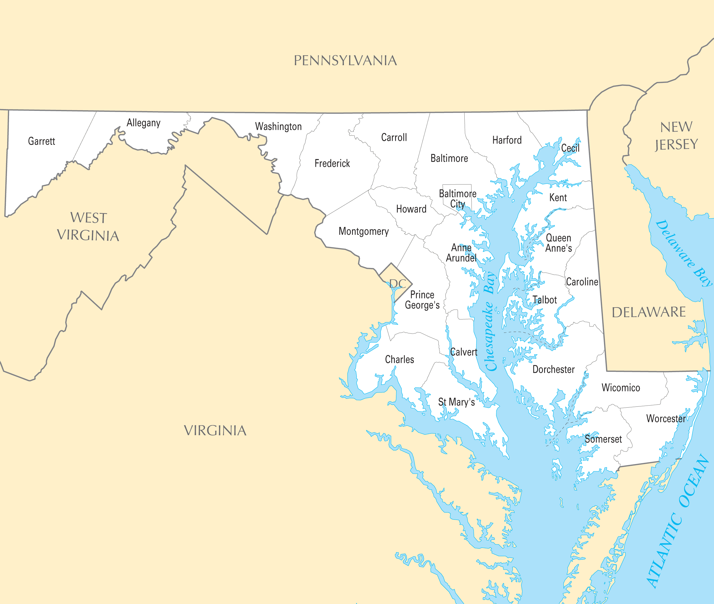
Map background courtesy of:
mapsof.net/uploads/static-maps/maryland_county_map.png
------------------------------------------------------------------------------------------
If you would like to use THIS picture in any sort of media elsewhere (such as newspaper or article), please send me a Flickrmail or send me an email at natehenderson6@gmail.com.
with thanks to www.midlandrailwaystudycentre.org.uk/contents.htm
The railway was an East West link of 183 miles and 20 chains between Yarmouth, Norwich and Peterborough with its works at the four way crossing at Melton Constable. 2 sections survive in use: the Cromer to Sheringham section of the national network and Sheringham to Holt (almost) as a preserved steam operated line.
Thanks to AFB for the store's number
------------------------------------------------------------------------------------------
If you would like to use THIS picture in any sort of media elsewhere (such as newspaper or article), please send me a Flickrmail or send me an email at natehenderson6@gmail.com
Title: Dublin Street Directory Map showing the boundaries of several wards
Year: 1852
Scale: 4 and one-eighth inches to one statute mile
Size: 40.5cm x 28cm
Location / recall no.: Cabinet 7, drawer 12
Notes: General Post Office Directory. Colour map
Dublin City Library and Archive houses a collection of maps of ancient and modern Dublin from the 17th century to the present day. From Speed's map of 1610 to Rocque's map of 1756, through to the Dublin City Development plans of today this collection traces the growth of the capital city. Maps of Ireland and the counties are also held.
Loner's Paradise MOC (still work in progress) is a build inspired by the drawings of the Swedish author Jan Lööf.
I've posted this for somebody else and know nothing about railways, so I'll appreciate any comments.
Thanks.
Collection of old maps scanned from books and other print sources Download them all at Photoshop Roadmap.
Collection of old maps scanned from books and other print sources Download them all at Photoshop Roadmap.
Printable tourist attractions map of Nashville.
Created by Tripomatic
www.tripomatic.com/United-States-of-America/Tennessee/Nas...
Maps of racial and ethnic divisions in US cities, inspired by Bill Rankin's map of Chicago, updated for Census 2010.
Red is White, Blue is Black, Green is Asian, Orange is Hispanic, Yellow is Other, and each dot is 25 residents.
Data from Census 2010. Base map © OpenStreetMap, CC-BY-SA
Printable tourist attractions map of Orlando.
Created by Tripomatic
www.tripomatic.com/United-States-of-America/Florida/Orlan...
I was astounded by Bill Rankin's map of Chicago's racial and ethnic divides and wanted to see what other cities looked like mapped the same way. To match his map, Red is White, Blue is Black, Green is Asian, Orange is Hispanic, Gray is Other, and each dot is 25 people. Data from Census 2000. Base map © OpenStreetMap, CC-BY-SA
Turkey map www.mapsofworld.com/turkey/
shows the major geographical boundaries, cities and provinces of Turkey. Mapsofworld.com provides exclusive collection of maps of Turkey including Physical map, outline map, City Maps, Province maps
ck` e ếi ... ♥
bên tay trái nhoeee ... ♥
♥♥♥♥♥♥♥
dnài vào học r` nhưg vui l' ... ♥
hp vô cùg ... ♥
iu ck` e cực luôg ... ♥
ngài nào k~ đc gặp ck` nè ... ♥
ôi ... ♥♥♥
i luv more than i can say ... ♥
...
p/s: vào năm học r` .... ♥
chúc mấi bn. kóa 1 năm học vv~ nhoe ... ♥
ai kóa lòg tút thì fav + note cho mìg luôg he ....
ôi cí f* nì là cí chùaaaaa =]]]] XXX ... ♥
Collection of old maps scanned from books and other print sources Download them all at Photoshop Roadmap.