View allAll Photos Tagged Clarifications
ID clarification needed please, thank you.
Thank you to speech path girl for the correction:
Better viewed large and thank you for your favourites. :O)
The gatekeeper or hedge brown (Pyronia tithonus) is a species of butterfly found across Europe.[1] Given its preference for warmer weather, the restriction of range expansion can be assumed to be due to climate.[clarification needed] Colonies vary in size depending on the available habitat, and can range from a few dozen to several thousand butterflies.[2] Named for its rigorous patrol of hedges and woodland rides, the gatekeeper butterfly is a prime pollinator.[3] The caterpillars primarily feed on fine grasses such as fescues (Festuca) and bents (Agrostis), which are common in meadows and roadside verges.[4]
The following attempts to provide a step-by-step guide as to how this image was captured and developed...
1- Go to the store and buy a camera. (Okay, I'll skip ahead a little.)
The EXIF data for this image can be found to the right, under More Properties in the Additional Information area of this photo page. Those properties will provide exposure duration and aperture settings, amongst a host of other attributes.
I'm using a Canon 20D with a Hoya R72 infrared filter. Use the lens of your preference. These steps should provide comparable results on any camera using a Hoya R72 filter.
You will be taking two pictures; One normal and one infrared. Use a tripod, as the second capture, the infrared shot, will be at least a 30-second exposure.
CAPTURING THE IMAGES
01 - Without having the R72 attached, compose and take your picture normally. For wide angle shots like this, use your camera's automatic depth of field feature. If that feature is not available, don't fret...Just take the shot. Everything set to automatic should work fine for the initial image. Take note of the aperture setting. You'll want this piece of information for the second image.
02 - After taking that first shot, turn off auto-focus and any lens-based stabilizer functionality. Don't move the camera and don't accidentally move the focal length and/or focus rings on the lens. You want everything which was in place when that first image was taken to be in place for the second.
03 - Carefully install your R72 filter onto the lens, again, without moving the camera or changing the focal length and focus settings. Once the R72 is installed, you won't be able to see a thing through your eyepiece. Don't have an apoplexy. This is normal.
04 - If you have the ability to set a custom white balance, use the original image as the basis for that setting.
05 - Place your camera in the manual mode and set your exposure (shutter speed or Timed Value (Tv) to 30 seconds. Set your aperture to whatever it was during your first shot, give or take an f-stop. (Feel free to experiment with different aperture settings.)
06 - Cover the eyepiece of your camera with a piece of gaffer's tape or other dark piece of material. The 20D comes with an eyepiece cover attached to the camera's strap. The purpose of this is to not allow extraneous light to enter the camera.
07 - Take your 30-second exposure.
08 - Rush home without breaking any local traffic laws or killing the proverbial innocent pedestrian. Don't forget your camera.
POST-PROCESSING
You'll need Adobe Photoshop or other image editing program which allows for the direct manipulation of an image's RGB (Red, Green, Blue) channels. Photoshop Elements does not provide this capability.
If you're not in the position to shell-out three to four hundred dollars for Photoshop, download and install The Gimp. It's a bit less expensive in that it's freakin' free!
The following are the post-processing steps to bring color into your infrared images. I'm going to write this assuming you have some working knowledge of Photoshop. If you need clarification on something, just ask. I'll be happy to attempt to provide a correct answer. I'm usually good that way.
01 - Open both images you captured in the steps above. You're going to work with the first image, first.
02 - Perform a "Select All" on that first image. If you're using Photoshop you should alreadty have a sub-window open which has a tab within it named; Channels. Select that. You'll see four items; RGB - Red - Green - Blue
03 - Click on the Green channel. Perform a copy.
04 - Click on the Blue channel. Perform a paste.
05 - Click on the Red channel. Perform a copy.
06 - Click on the Green channel. Perform a paste.
07 - Now make the second image window active. You've probably noticed how insanely red it is...This is normal. It's supposed to look that way. (That image would be completely black if you had forgotten to remove your lens cap when you took the picture.)
08 - Again, perform a SELECT ALL of that second image.
09 - Click on the red channel. With your cursor hovering within the image window, perform a copy.
10 - Go back and make the window of the first image the active window.
11 - Select the red channel. Perform a paste into the image window.
12 - Click on the RGB channel to see what you've just created.
13 - Adjust levels, curves, hue and saturation to your preference. Use the unsharp mask filter in Photoshop to correct areas which may appear a bit on the fuzzy side. Don't go too crazy with this filter as it will add noise to the image if your settings are too agressive.
14 - Post it to Flickr so we can see the darn thing!
The strange look of the clouds at the top of the image is caused by the movement of the clouds which occurred between the taking of the two images. You can work these little problems out by adjusting levels and curves in Photoshop or other comparable image editing program.
Hope this helps. Let me know if you find any mistakes in anything I've presented here. Feel free to ask questions.
The range is all of North America except western and northern Alaska, northern Yukon Territory, northern Northwest Territories and the northeastern area of Canada. Blue-winged teal are rare in the desert southwest, and the west coast. The breeding habitat of the blue-winged teal is marshes and ponds.[8][9]
The breeding range extends from east-central Alaska and southern Mackenzie District east to southern Quebec and southwestern Newfoundland. In the contiguous United States it breeds from northeast California east to central Louisiana, central Tennessee, and the Atlantic Coast.[10][11] The western blue-winged teal inhabits that part of the breeding range west of the Appalachian Mountains. The Atlantic blue-winged teal nests along the Atlantic Coast from New Brunswick to Pea Island, North Carolina.[12][clarification needed]
They migrate in flocks to winter in to the south of its breeding range. During migration, some birds may fly long distances over open ocean. They are occasional vagrants to Europe, where their yellow legs are a distinction from other small ducks like the common teal and garganey,[8][9] and in recent years have been annual vagrants in Britain and Ireland.[13][14][15] The blue-winged teal winters from southern California to western and southern Texas, the Gulf Coast to the Atlantic Coast and south to Central and South America. It is often seen wintering as far south as Brazil and central Chile
Nymphaeaceae (/ˌnɪmfiːˈeɪsiː/) is a family of flowering plants, commonly called water lilies. They live as rhizomatous aquatic herbs in temperate and tropical climates around the world. The family contains nine genera with about 70 known species.Water lilies are rooted in soil in bodies of water, with leaves and flowers floating on or emergent from the surface. Leaves are round, with a radial notch in Nymphaea and Nuphar, but fully circular in Victoria and Euryale.
Water lilies are a well-studied clade of plants because their large flowers with multiple unspecialized parts were initially considered to represent the floral pattern of the earliest flowering plants, and later genetic studies confirmed their evolutionary position as basal angiosperms. Analyses of floral morphology and molecular characteristics and comparisons with a sister taxon, the family Cabombaceae, indicate, however, that the flowers of extant water lilies with the most floral parts are more derived than the genera with fewer floral parts.[clarification needed] Genera with more floral parts, Nuphar, Nymphaea, Victoria, have a beetle pollination syndrome, while genera with fewer parts are pollinated by flies or bees, or are self- or wind-pollinated. Thus, the large number of relatively unspecialized floral organs in the Nymphaeaceae is not an ancestral condition for the clade.
Yup , right in the middle of the village sits this decaying and boarded up old petrol station and vehicle servicing garage , It closed in 2014 but so far the only thing done to this triangular shape plot is the placing of some hoarding which itself is showing it's age .
some info from the Resident's Association website posted last August ---------
Tudor Motors – the sorry saga continues (update – 23rd August)
As most residents of Fetcham will be only too aware, there remains a singular lack of constructive, or even scheduled destructive activity, within the hoardings surrounding the now very delapidated Tudor Motors buildings.
Throughout this year, as for the previous four or so years, the FRA has maintained regular contacts with Stonegate Homes, who have been the development agents acting on behalf of site owners Littleworth Properties. We have also maintained dialogues with MVDC' Planning Department, directly and via our local Councillors.
Since the Planning Application itself was formally Approved, there remained numerous conditions applied to the approval that required to be demonstrated as being able to be met. And of course the pandemic will have undoubtedly had some slowing effect upon the processing of the numerous undertakings and contract agreements. However the FRA's expectations were that with the lifting of mandatory social distancing regulations by mid July and the government's 'back to work' messages, physical signs of progress might soon become evident.
The most recent update that the FRA received from Stonegate Homes, on the 12th July, was that clarification was awaited from the Council about the CIL (Community Infrastructure Levy) required by MVDC. And that once that clarification was received, demolition work could be started … and that Stonegate Homes would keep the FRA updated.
Prompted by that response, the FRA sought advice from Piers Mason, Head of Service (Planning & Regulations) at MVDC about when such clarification was likely to be able to be provided.
The response from Piers Mason received 14th July was, we must say, a little less than helpful …
“Yes, there are a number of matters in respect of housing relief and then potentially a new liability notice. We have received that and it’s in with the normal CIL workload. Should be done within our normal timescales.”
Given the lack of urgency that has been evident in processing this development during the past 5 years, the FRA is not very hopeful that ‘normal timescales’ will deliver the final clearance to commence works any time soon. We hope we are being overly pessimistic.
There is also the potentially compounding national issue of critical shortages of building materials and labour. So even when work could eventually commence … there may still be further delays.
Meanwhile Stonegate homes have been requested by the FRA on a number of occasions now to at least remove the redundant signage that stands outside of the hoardings ... ahead of any demolition of the buildings within. Unfortunately, and frustratingly, for much of this year, the supposed imminence of full site demolition work has been given as reason to not do so.
The FRA will update the community as soon as we learn of any new news.
Meanwhile the original Tudor Motors Clock also remains frozen in time and still awaits the day when it can be mounted on a face of the new building as a 'timely' reminder of recent history.
Grade I listed structures originally constructed 1415-26 with modifications in 1716.
"Previously called Slepe, its name was changed to St Ives after the body of Saint Ivo (claimed to have been a Persian bishop; not to be confused with Ivo of Kermartin) was found buried in the town in about 1001/2. St Ivo's Priory was built on the site where the body was discovered.
St Ives was listed as Slepe in the Hundred of Hurstingstone in Huntingdonshire in the Domesday Book. In 1086 there was one manor and 64 households, 29. 5[clarification needed] ploughlands, 60 acres (24 hectares) of meadows and 1,892 acres (766 hectares) of woodland.
For the past 1,000 years St Ives has been home to some of the biggest markets in the country, and in the 13th century it was an important entrepôt. Today it remains an important market in East Anglia.
Built on the banks of the wide River Great Ouse between Huntingdon and Ely, St Ives has a famous chapel on its bridge. In the Anglo-Saxon era, St Ives's position on the Great Ouse was strategic, as it controlled the last natural crossing point or ford on the river, 80 kilometres (50 mi) from the sea. The flint reef in the bed of the river at this point gave rise to a ford, which then provided the foundations for the celebrated bridge.
During the 18th and 19th centuries, St Ives was a hub of trade and navigation, and the town had dozens of inns and many bawdy houses[citation needed]. Goods were brought into the town on barges, and livestock rested on the last fattening grounds before delivery to London's Smithfield Market. As the railway network expanded and roads improved, the use of the River Great Ouse declined. It is now mostly used for leisure boats and recreation.
The river Great Ouse at St Ives flooded in 1947, and some parts suffered seriously again at Easter 1998 and in January 2003. Extensive flood protection works were carried out on both sides of the river in 2006-07 at a cost of nearly £9 million. 500 metres (1,600 ft) of brick-clad steel-piling was put into place to protect the town, most noticeably at the Waits, where a plaza has also been created. A further 750 metres (2,460 ft) on the other side of the river protects Hemingford Grey, reducing the yearly risk of flooding from 10% to 1%. Building on the flood plain at St Ives is now discouraged.
Original historical documents relating to St Ives, including the original parish church registers, local government records, maps and photographs, are held by Cambridgeshire Archives and Local Studies at the County Record Office in Huntingdon." - info from Wikipedia.
Summer 2019 I did a solo cycling tour across Europe through 12 countries over the course of 3 months. I began my adventure in Edinburgh, Scotland and finished in Florence, Italy cycling 8,816 km. During my trip I took 47,000 photos.
Now on Instagram.
It has been nearly a month since my last contribution to our Human Family project. A combination of a knee injury and a virus that won’t quit has kept me mostly housebound instead of my usual roaming of Toronto’s streets.
Today I emerged from the cocoon and did a couple of errands downtown and that is where I met this man on Yonge Street. He was standing with his arms upstretched and I waited until he completed the gesture before approaching him. I introduced myself and told him about my interest in meeting and photographing strangers for my Human Family project. I mentioned that I thought his fur hat, beard, and colorful scarf would make him an excellent subject. He listened with interest and asked if he would be in a magazine. I said not, but that others doing this project would appreciate meeting him through his photo and a brief story about how we met. He was happy to oblige. Meet Mark.
Mark is 56 years old and was born in “the Capital City” (Ottawa). He has lived most of his life in Toronto. It appeared that his life has not been an easy one but he was very friendly and once the photos were taken he told me he too is interested in observing people and that you can learn a lot about people by observing. He appreciated my interest in him and said it was very polite of me to ask and comment on his scarf. He told me the scarf was discarded by someone and he didn’t feel such a beautiful garment should go unused.
Quickly enough, our conversation was peppered by religious comments. He suggested I take a photo that showed the balls on the ends of the scarf and told me that to him they had a religious significance which I can’t recall. When I asked about the gesture he was making on the sidewalk when I first saw him he said he has discovered that by holding his hands up it balances his body and his spirit. It is partly a stretching exercise and partly a reminder to be receptive to the messages that come from above. He said he believes we are all “immortal spirits.” He demonstrated his gesture against the white service doors to the Eaton Centre Mall and said it would be fine for me to photograph the gesture which I did.
Mark’s message to the project came in the form of a New Year’s greeting. He pointed out that tomorrow is going to be 2020 which he hopes means that everyone will have perfect vision. When I asked for clarification, he said he meant a vision that embodies clear values more than just financial wealth. We parted with a warm handshake and good wishes for 2020.
Meeting Mark served as an end-of-the-year reminder that many among us are troubled and struggling and yet still find it in them to express optimistic beliefs and to greet a stranger’s request with appreciation and good will. I hope that the new year is good to Mark.
This is my 859th contribution to The Human Family Group, and my last submission for the year 2019. I wish everyone in our friendly group a new year filled with health and all good things.
You can view more street portraits and stories by visiting The Human Family.
We went to the beach looking for Gulls and were approached by this Eunuch for money. They don't have many options to look after themselves as people do not give them jobs so easily so they resort to begging or prostitution.
en.wikipedia.org/wiki/Hijra_(South_Asia)
Hijra (for translations, see [n 1]) is a term used in South Asia – particularly in India and Pakistan – to refer to trans women (male-to-female transgender individuals).[1][2] In different areas of Pakistan and India, transgender people are also known as Aravani, Aruvani or Jagappa.[3]
In Pakistan and Bangladesh, the hijras are officially recognized as third gender by the government,[4][5] being neither completely male nor female. In India also, transgender people have been given the status of third gender and are protected as per the law despite the social ostracism. The term more commonly advocated by social workers and transgender community members themselves is khwaja sira (Urdu: خواجہ سرا) and can identify the individual as a transsexual person, transgender person (khusras), cross-dresser (zenanas) or eunuch (narnbans).[6][7]
Hijras have a recorded history in the Indian subcontinent from antiquity onwards as suggested by the Kama Sutra period. This history features a number of well-known roles within subcontinental cultures, part gender-liminal, part spiritual and part survival.
In South Asia, many hijras live in well-defined and organised all-hijra communities, led by a guru.[8][9] These communities have sustained themselves over generations by "adopting" boys who are in abject poverty, rejected by, or flee, their family of origin.[10] Many work as sex workers for survival.[11]
The word "hijra" is an Urdu word derived from the Semitic Arabic root hjr in its sense of "leaving one's tribe,"[12] and has been borrowed into Hindi. The Indian usage has traditionally been translated into English as "eunuch" or "hermaphrodite," where "the irregularity of the male genitalia is central to the definition."[13] However, in general hijras are born with typically male physiology, only a few having been born with intersex variations.[14] Some Hijras undergo an initiation rite into the hijra community called nirwaan, which refers to the removal of the penis, scrotum and testicles.[11]
Since the late 20th century, some hijra activists and Western non-government organizations (NGOs) have lobbied for official recognition of the hijra as a kind of "third sex" or "third gender," as neither man nor woman.[15] Hijras have successfully gained this recognition in Bangladesh and are eligible for priority in education.[16] In India, the Supreme Court in April 2014 recognised hijra and transgender people as a 'third gender' in law.[17][18][19]
Nepal, Pakistan, India, and Bangladesh have all legally recognized the existence of a third gender, including on passports and other official documents.
Terminology
The Urdu and Hindi word hijra may alternately be romanized as hijira, hijda, hijada, hijara, hijrah and is pronounced [ˈɦɪdʒɽaː]. This term is generally considered derogatory in Urdu and the word Khwaja Sara is used instead. Another such term is khasuaa (खसुआ) or khusaraa (खुसरा). In Bengali hijra is called হিজড়া, hijra, hijla, hijre, hizra, or hizre.
A number of terms across the culturally and linguistically diverse Indian subcontinent represent similar sex or gender categories. While these are rough synonyms, they may be better understood as separate identities due to regional cultural differences. In Odia, a hijra is referred to as hinjida, hinjda or napunsaka, in Telugu, as napunsakudu (నపుంసకుడు), kojja (కొజ్జ) or maada (మాడ), in Tamil Nadu, Thiru nangai (mister woman), Ali, aravanni, aravani, or aruvani, in Punjabi, khusra and jankha, in Sindhi khadra, in Gujarati, pavaiyaa (પાવૈયા).
In North India, the goddess Bahuchara Mata is worshipped by Pavaiyaa (પાવૈયા). In South India, the goddess Renuka is believed to have the power to change one's sex. Male devotees in female clothing are known as Jogappa. They perform similar roles to hijra, such as dancing and singing at birth ceremonies and weddings.[21]
The word kothi (or koti) is common across India, similar to the Kathoey of Thailand, although kothis are often distinguished from hijras. Kothis are regarded as feminine men or boys who take a feminine role in sex with men, but do not live in the kind of intentional communities that hijras usually live in. Additionally, not all kothis have undergone initiation rites or the body modification steps to become a hijra.[22] Local equivalents include durani (Kolkata), menaka (Cochin),[23] meti (Nepal), and zenana (Pakistan).
Hijra used to be translated in English as "eunuch" or "hermaphrodite,"[13] although LGBT historians or human rights activists have sought to include them as being transgender.[24] In a series of meetings convened between October 2013 and Jan 2014 by the transgender experts committee of India's Ministry of Social Justice and Empowerment, hijra and other trans activists asked that the term "eunuch" be discontinued from usage in government documents, as it is not a term with which the communities identify.
Gender and sexuality
These identities have no exact match in the modern Western taxonomy of gender and sexual orientation,[24] and challenge Western ideas of sex and gender.[11]
In India, some Hijras do not define themselves by specific sexual orientation, but rather by renouncing sexuality altogether. Sexual energy is transformed into sacred powers. However, these notions can come in conflict with the practical, which is that hijras are often employed as prostitutes.[25] Furthermore, in India a feminine male who takes a "receptive" role in sex with a man will often identify as a kothi (or the local equivalent term). While kothis are usually distinguished from hijras as a separate gender identity, they often dress as women and act in a feminine manner in public spaces, even using feminine language to refer to themselves and each other. The usual partners of hijras and kothis are men who consider themselves heterosexual as they are the ones who penetrate.[26] These male partners are often married, and any relationships or sex with "kothis" or hijras are usually kept secret from the community at large. Some hijras may form relationships with men and even marry,[27] although their marriage is not usually recognized by law or religion. Hijras and kothis often have a name for these masculine sexual or romantic partners; for example, panthi in Bangladesh, giriya in Delhi or sridhar in Cochin.[23]
Social status and economic circumstances
Most hijras live at the margins of society with very low status; the very word "hijra" is sometimes used in a derogatory manner. The Indian lawyer and author Rajesh Talwar has written a book highlighting the human rights abuses suffered by the community titled 'The Third Sex and Human Rights.'[28] Few employment opportunities are available to hijras. Many get their income from extortion (forced payment by disrupting work/life using demonstrations and interference), performing at ceremonies (toli), begging (dheengna), or sex work ('raarha')—an occupation of eunuchs also recorded in premodern times. Violence against hijras, especially hijra sex workers, is often brutal, and occurs in public spaces, police stations, prisons, and their homes.[29] As with transgender people in most of the world, they face extreme discrimination in health, housing, education, employment, immigration, law, and any bureaucracy that is unable to place them into male or female gender categories.[30]
In 2008, HIV prevalence was 27.6% amongst hijra sex workers in Larkana.[6] The general prevalence of HIV among the adult Pakistani population is estimated at 0.1%.[31]
In October 2013, Pakistani Christians and Muslims (Shia and Sunni) put pressure on the landlords of Imamia Colony to evict any transgender residents. "Generally in Pakistan, Khwaja Sira are not under threat. But they are in Khyber Pakhtunkhwa Province because of a 'new Islam' under way", I.A. Rehman, the director of the Human Rights Commission of Pakistan.[32]
In a study of Bangladeshi hijras, participants reported not being allowed to seek healthcare at the private chambers of doctors, and experiencing abuse if they go to government hospitals.[33]
Beginning in 2006, hijras were engaged to accompany Patna city revenue officials to collect unpaid taxes, receiving a 4-percent commission.[34]
Since India's Supreme Court re-criminalized homosexual sex on 13 December 2013, there has been a sharp increase in the physical, psychological and sexual violence against the transgender community by the Indian Police Service, nor are they investigating even when sexual assault against them is reported.[35]
On 15 April 2014, in National Legal Services Authority v. Union of India, the Supreme Court of India ruled that transgender people should be treated as a third category of gender or as a socially and economically "backward" class entitled to proportional access and representation in education and jobs.[36]
Language
This section does not cite any sources. Please help improve this section by adding citations to reliable sources. Unsourced material may be challenged and removed. (November 2015) (Learn how and when to remove this template message)
The hijra community due to its peculiar place in sub-continental society which entailed marginalisation yet royal privileges developed a secret language known as Hijra Farsi. The language has a sentence structure loosely based on Urdu and a unique vocabulary of at least a thousand words. Beyond the Urdu-Hindi speaking areas of subcontinent the vocabulary is still used by the hijra community within their own native languages.
In South Asian politics
In 2013, transgender people in Pakistan were given their first opportunity to stand for election.[37] Sanam Fakir, a 32-year-old hijra, ran as an independent candidate for Sukkur, Pakistan's general election in May.[38]
The governments of both India (1994)[39] and Pakistan (2009)[40] have recognized hijras as a "third sex", thus granting them the basic civil rights of every citizen. In India, hijras now have the option to identify as a eunuch ("E") on passports and on certain government documents. They are not, however, fully accommodated; in order to vote, for example, citizens must identify as either male or female. There is also further discrimination from the government. In the 2009 general election, India's election committee denied three hijras candidature unless they identified themselves as either male or female.
In April 2014, Justice KS Radhakrishnan declared transgender to be the third gender in Indian law, in a case brought by the National Legal Services Authority (Nalsa) against Union of India and others.[17][18][19] The ruling said:[41]
Seldom, our society realises or cares to realise the trauma, agony and pain which the members of Transgender community undergo, nor appreciates the innate feelings of the members of the Transgender community, especially of those whose mind and body disown their biological sex. Our society often ridicules and abuses the Transgender community and in public places like railway stations, bus stands, schools, workplaces, malls, theatres, hospitals, they are sidelined and treated as untouchables, forgetting the fact that the moral failure lies in the society's unwillingness to contain or embrace different gender identities and expressions, a mindset which we have to change.
Justice Radhakrishnan said that transgender people should be treated consistently with other minorities under the law, enabling them to access jobs, healthcare and education.[42] He framed the issue as one of human rights, saying that, "These TGs, even though insignificant in numbers, are still human beings and therefore they have every right to enjoy their human rights", concluding by declaring that:[41]
Hijras, Eunuchs, apart from binary gender, be treated as "third gender" for the purpose of safeguarding their rights under Part III of our Constitution and the laws made by the Parliament and the State Legislature.
Transgender persons' right to decide their self-identified gender is also upheld and the Centre and State Governments are directed to grant legal recognition of their gender identity such as male, female or as third gender.
A bill supported by all political parties was tabled in Indian parliament to ensure transgender people get benefits akin reserved communities like SC/STs and is taking steps to see that they get enrollment in schools and jobs in government besides protection from sexual harassment.[43]
History
The ancient Kama Sutra mentions the performance of fellatio by feminine people of a third sex (tritiya prakriti).[44] This passage has been variously interpreted as referring to men who desired other men, so-called eunuchs ("those disguised as males, and those that are disguised as females"[45]), male and female trans people ("the male takes on the appearance of a female and the female takes on the appearance of the male"),[46] or two kinds of biological males, one dressed as a woman, the other as a man.[47]
During the era of the British Raj, authorities attempted to eradicate hijras, whom they saw as "a breach of public decency."[48] Anti-hijra laws were repealed; but a law outlawing castration, a central part of the hijra community, was left intact, though rarely enforced. Also during British rule in India they were placed under the Criminal Tribes Act 1871 and labelled a "criminal tribe," hence subjected to compulsory registration, strict monitoring and stigmatized for a long time; after independence however they were denotified in 1952, though the centuries-old stigma continues.[49]
In religion
The Indian transgender hijras or Aravanis ritually marry the Hindu god Aravan and then mourn his ritual death (seen) in an 18-day festival in Koovagam, India.
Many practice a form of syncretism that draws on multiple religions; seeing themselves to be neither men nor women, hijras practice rituals for both men and women.
Hijras belong to a special caste. They are usually devotees of the mother goddess Bahuchara Mata, Lord Shiva, or both.
Hijras and Bahuchara Mata
Bahuchara Mata is a Hindu goddess with two unrelated stories both associated with transgender behavior. One story is that she appeared in the avatar of a princess who castrated her husband because he would run in the woods and act like a woman rather than have sex with her. Another story is that a man tried to rape her, so she cursed him with impotence. When the man begged her forgiveness to have the curse removed, she relented only after he agreed to run in the woods and act like a woman. The primary temple to this goddess is located in Gujarat[50] and it is a place of pilgrimage for hijras, who see Bahucahara Mata as a patroness.
Hijras and Lord Shiva
One of the forms of Lord Shiva is a merging with Parvati where together they are Ardhanari, a god that is half Shiva and Half Parvati. Ardhanari has special significance as a patron of hijras, who identify with the gender ambiguity.[50]
Hijras in the Ramayana
In some versions of the Ramayana,[51] when Rama leaves Ayodhya for his 14-year exile, a crowd of his subjects follow him into the forest because of their devotion to him. Soon Rama notices this, and gathers them to tell them not to mourn, and that all the "men and women" of his kingdom should return to their places in Ayodhya. Rama then leaves and has adventures for 14 years. When he returns to Ayodhya, he finds that the hijras, being neither men nor women, have not moved from the place where he gave his speech. Impressed with their devotion, Rama grants hijras the boon to confer blessings on people during auspicious inaugural occasions like childbirth and weddings. This boon is the origin of badhai in which hijras sing, dance, and give blessings.[
Hijras in the Mahabharata
Mahabharata includes an episode in which Arjun, a hero of the epic, is sent into an exile. There he assumes an identity of a eunuch-transvestite and performs rituals during weddings and childbirths that are now performed by hijras.[53]
In the Mahabharata, before the Kurukshetra War, Iravan offers his lifeblood to goddess Kali to ensure the victory of the Pandavas, and Kali agrees to grant him power. On the night before the battle, Iravan expresses a desire to get married before he dies. No woman was willing to marry a man doomed to die in a few hours, so Arjuna as Brihinala marries him. In South India, hijras claim Iravan as their progenitor and call themselves "aravanis."[52]
"Sangam literature use ' word 'Pedi' to refer to people born with Intersex condition, it also refers to antharlinga hijras and various Hijra, The Aravan cult in Koovagam village of Tamil Nadu is a folk tradition of the transwomen, where the members enact the legend during an annual three-day festival. "This is completely different from the sakibeki cult of West Bengal, where transwomen don't have to undergo sex change surgery or shave off their facial hair. They dress as women still retaining their masculine features and sing in praise of Lord Krishna,". "Whereas, since the Tamil society is more conservative and hetero-normative, transwomen completely change themselves as women. In the ancient times, even religion has its own way of accepting these fringe communities." The Bachura Devi worship in Gujarat and Jogappa cult of Karanataka are the other examples.the kinds of dialects and languages spoken by these community in different parts of the country and the socio-cultural impact on the lingo. 'Hijra Farsi' is the transgender dialect, a mix of Urdu, Hindi and Persian spoken in the northern belt of India, Pakistan and Afghanistan and 'Kothi Baashai' is spoken by the transgender community in Karnataka, Andhra, Orissa and parts of Tamil Nadu. "They even have sign languages and typical mannerisms to communicate. The peculiar clap is one such"
—Gopi Shankar Madurai, National Queer Conference 2013[54][55]
Each year in Tamil Nadu, during April and May, hijras celebrate an eighteen-day religious festival. The aravani temple is located in the village Koovagam in the Ulundurpet taluk in Villupuram district, and is devoted to the deity Koothandavar, who is identified with Aravan. During the festival, the aravanis reenact a story of the wedding of Lord Krishna and Lord Aravan, followed by Aravan's subsequent sacrifice. They then mourn Aravan's death through ritualistic dances and by breaking their bangles. An annual beauty pageant is also held, as well as various health and HIV or AIDS seminars. Hijras from all over the country travel to this festival. A personal experience of the hijras in this festival is shown in the BBC Three documentary India's Ladyboys and also in the National Geographic Channel television series Taboo.
Hijras in Islam
There is evidence that Indian hijras identifying as Muslim also incorporate aspects of Hinduism. Still, despite this syncretism, Reddy (2005) notes that a hijra does not practice Islam differently from other Muslims and argues that their syncretism does not make them any less Muslim. Reddy (2003) also documents an example of how this syncretism manifests: in Hyderabad, India a group of Muslim converts were circumcised, something seen as the quintessential marker of male Muslim identity.[clarification needed]
In films and literature
Bangladesh
The film Common Gender (2012) relates the story of the Bangladesh hijra and their struggle for survival.
India
Hijras have been portrayed on screen in Indian cinema since its inception, historically as comic relief. A notable turning point occurred in 1974 when real hijras appeared during a song-and-dance sequence in Kunwaara Baap ("The Unmarried Father"). There are also hijras in the Hindi movie Amar Akbar Anthony (1977) who accompany one of the heroes, Akbar (Rishi Kapoor), in a song entitled "Tayyab Ali Pyar Ka Dushman" ("Tayyab Ali, the Enemy of Love"). One of the first sympathetic hijra portrayals was in Mani Ratnam's Bombay (1995). 1997's Tamanna[56] starred male actor Paresh Rawal in a central role as "Tiku", a hijra who raises a young orphan. Pooja Bhatt produced and also starred in the movie, with her father Mahesh Bhatt co-writing and directing. Deepa Mehta's Water features the hijra character "Gulabi" (played by Raghubir Yadav), who has taken to introducing the downtrodden, outcast widows of Varanasi to prostitution. Not surprisingly, perhaps, the film generated much controversy. There is a brief appearance of hijras in the 2004 Gurinder Chadha film Bride & Prejudice, singing to a bride-to-be in the marketplace. There's also a loose reference, in the guise of "Rocky" ("Rokini") in Deepha Mehta's Bollywood/Hollywood.
The 1997 Hindi film Darmiyaan: In Between directed & co-written by Kalpana Lajmi is based on the subject of Hijra, wherein a fictitious story of an actress bearing a son that turns out to be neuter.
In the 2000 Tamil film Appu directed by Vasanth, a remake of the Hindi film Sadak, the antagonist is a brothel-owning hijra played by Prakash Raj. (In Sadak, the brothel-owning character was played by Sadashiv Amrapurkar under the name "Maharani".)
In 2005, a fiction feature film titled Shabnam Mausi was made on the life of a eunuch politician Shabnam Mausi. It was directed by Yogesh Bharadwaj and the title role played by Ashutosh Rana.
Jogwa, a 2009 Marathi film, depicts the story of a man forced to be hijra under certain circumstances. The movie has received several accolades.[57]
In Soorma Bhopali, Jagdeep encounters a troupe of hijra on his arrival in Bombay. The leader of this pack is also played by Jagdeep himself.
In Anil Kapoor's Nayak, Johnny Lever, who plays the role of the hero's assistant, gets beaten up by hijras, when he is caught calling them "hijra" (he is in habit of calling almost everyone who bothers him by this pejorative and no one cares much, except this once ironically, as the addressees are literally what he is calling them.)
One of the main characters in Khushwant Singh's novel Delhi, Bhagmati is a hijra. She makes a living as a semi-prostitute and is wanted in the diplomatic circles of the city.
Vijay TV's Ippadikku Rose, a Tamil show conducted by postgraduate educated transgender woman Rose is a very successfully running program that discusses various issues faced by youth in Tamil Nadu, where she also gives her own experiences.
In addition to numerous other themes, the 2008 movie Welcome to Sajjanpur by Shyam Benegal explores the role of hijras in Indian society.
In the Malayalam movie Ardhanaari, released on 23 November 2012, director Santhosh Sowparnika tries to depict the life of a transgender person. Manoj K Jayan, Thilakan, Sukumari and Maniyanpilla Raju perform leading roles.
In August, 2015, a music video featuring 7 hijras dressed in outfits or uniforms of various professions and singing the National Anthem of India created by a YouTube channel Yathartha Pictures went viral for being the first National Anthem video sung by hijras in India.[58][59] The hijras featured in the video were brought together by the Humsafar Trust, a Mumbai-based NGO which promotes LGBT rights.[60][61]
Tamil
Vaadamalli by novelist Su.Samuthiram is the first Tamil novel about Aravaani community in Tamil Nadu, published in 1994. Later transgender activist A. Revathi became first Hijra to write about transgender issues and gender politics in Tamil, her works have been translated in more than 8 languages and acting as a primary resources on Gender Studies in Asia. Her book is part of research project for more than 100 universities. She is the author of Unarvum Uruvamum (Feelings of the Entire Body); is the first of its kind in English from a member of the hijra community.[62][63][64] She also acted,directed several stage plays on Gender and Sexuality issues in Tamil and Kannada."The Truth about Me: A Hijra Life Story" by Transgender A.Revathi[65] is part of the syllabus for Final Year students of The American College in Madurai. Later Naan Saravanan Alla" (2007) and Vidya's "I am Vidya" (2008) became first transwoman autobiography.[66][67]
Pakistan
The 1992 film Immaculate Conception[68] by Jamil Dehlavi is based upon the culture-clash between a western Jewish couple seeking fertility at a Karachi shrine known to be blessed by a Sufi fakir called 'Gulab Shah' and the group of Pakistani eunuchs who guard it.
Murad (which means desire; the English title was Eunuch's Motherhood), was an award winning biographical Telefilm drama made by Evergreen Media Europe for Pakistan's television channel Indus TV that aired in 2003. The cast had the country's top male television actors playing "hijras": Sohail Asghar, Nabeel, Qazi Wajid, Kamran Jilani. It was directed by Kamran Qureshi, written by Zafar Mairaj and produced by Iram Qureshi. It won both Best TeleFilm and Best Director awards at 2003 Indus Telefilm Festival.[69][70] The story revolves around "Saima", a trans woman, who adopts a helpless child "Murad" and her relationship with him against the backdrop of her struggling throughout her life and her "desire" for her son. She has sent him away to live at a hostel so she can earn a living as a dancer, after her son gets cross with her, due to teasing (verbal and sexual) they face while dancing. This was the first time that influential male actors came out to support "hijra" rights during interviews; noting that in Pakistani English at that time eunuch was the term to describe a transgender person, and "khwaja sara" (also khwaja sira) had not yet replaced what is now considered a derogatory term due to decades of heckling and name calling, "hijra".[71][72]
In 2004, Kamran Qureshi directed a trans drama, Moorat ("effigy," however, the English title was Eunuch's Wedding. It was produced by famous actor and producer Humayun Saeed and Abdullah Kadwani with more than a dozen star-studded cast members for a 33-episode series.[73][74] It was nominated for Best Drama Serial, Abid Ali for Best Actor, and Maria Wasti for Best Actress at the Lux Style Awards 2005.[69][75] The show was credited for making people understand the pain and abuse that khwaja sara (hijra) constantly endure when people make fun of the way they look or dress without knowing them or how they were naturally born this way. The story involves a young lady who is arranged to marry. It turns out her husband is transgender. The story unfolds trans community and their deprived and isolated world. It portrays eloquently how they, too, are not far away from the human emotions and feelings and their world not much different from the heterosexual community. Even though they are in plain sight, they are tthey are taboo subjects and are not taken seriously. This makes them suffer endlessly in silence wrapped in slurs. The 33-episode series therefore touches on transgender abuse, women abuse, poverty, immorality of arranged marriages, and child abuse.[76]
Bol (Urdu: بول meaning Speak), is a 2011 Urdu-language social drama Pakistani film. It concerns a patriarch, Hakim, who is a misogynist, a domestic abuser, a bigot, and a zealot who forces religion on his family. They face financial difficulties due to Hakim wanting a son. He rejects his transgender daughter, Saifi, as he wanted an heir and she identifies as a girl. Saifi is deeply loved by the rest of her family. As she grows up, men want to take advantage of her and she does not understand at first. However, her oldest sister intervenes and teaches Saifi about what kind of touching is inappropriate. As Saifi grows older, she is not allowed to leave the house. She finds her sister's dresses compelling and tries them on, revealing her gender identity. A neighbour played by famous South Asian singer Atif Aslam, who is in love with one of the sisters, gets Saifi a job at a place where they paint trucks, with the blessing of Saifi's sisters and mother. Saifi dresses like a boy; however, other boys sense her lack of self-esteem and eventually gang-rape her. She is saved when another transgender person, played by Almas Bobby (a transgender actor), finds her and takes her home. Hakim overhears Saifi telling her mother and Zainab what happened. When everybody is asleep, Hakim locks the room and suffocates his child for luring the men for the "shame" he would have to bear if the story got out.[77] It received several positive reviews from critics and went on to win the Best Hindi film award in IRDS Film awards 2011 by Institute for Research and Documentation in Social Sciences (IRDS).[78]
Outside South Asia
The novel Bombay Ice by Leslie Forbes features an important subplot involving the main character's investigation of the deaths of several hijra sex-workers.
The novel City of Djinns by William Dalrymple also features a chapter on hijras.
The novel A Son of the Circus by John Irving features a plot-line involving hijras.
In the graphic novel Habibi by Craig Thompson, the protagonist, Zam, is adopted by a group of hijras.
In the 2009 Brazilian soap opera Caminho das Índias (Portuguese: "The way to India"), hijras are shown in some occasions, especially at weddings and other ceremonies where they are paid for their blessing.
In the TV comedy Outsourced (2011), a hijra is hired by Charlie as a stripper for Rajiv's "bachelor party", much to Rajiv's utter horror.
A short film, under the direction of Jim Roberts, is being made by Rock Star Productions in which the protagonist is portrayed as a hijra. This film is set to be released on 1 May.[year needed][citation needed]
Kamran Ahmed Mirza is a popular gender performance artist in Oregon, United States.
Documentaries
Jareena, Portrait of a Hijda (1990)
Ladyboys (1992)
Bombay Eunuch (2001)
The Hijras: India's Third Gender (2001)
India's Ladyboys (2003)
Between the Lines: India's Third Gender (2005)
Middle Sexes (HBO documentary includes segment on modern Hijda) (2005)
Shabnam Mausi (2005)
The Hijras of India (BBC radio documentary)
Kiss the Moon (2009)
Call me Salma (2009)
Mohammed to Maya also titled Rites of Passage (2012)
Two 2-door Chevrolet wagons - a 1959 (light green) and a 1955 Bel Air Nomad (red). Early on a Saturday, they’re probably headed to a local car show somewhere.
The 1959 has me a bit puzzled. It’s a 2-door model but it has the side trim of the mid-level Brookwood, and it doesn’t appear to have the tailgate window crank normally centered above the Chevrolet crest emblem on the tailgate (was that a Kingswood option?). If someone can identify the specific model, then I welcome your authoritative clarifications.
Xcaret Park (Spanish: el parque Xcaret[clarification needed]; Spanish pronunciation: [el ˈpaɾke ʃkaˈɾet]) is a privately owned and operated theme park, resort and self-described ecotourism development located in the Riviera Maya, a portion of the Caribbean coastline of Mexico's state of Quintana Roo. It is part of Xcaret Experiencias Group which also owns the Xplor Park, Xel-Ha Park, and Xenses Park; as well as the Xichen, Xenotes, Xavage and Xoximilco tours and activities. It is situated approximately 75 kilometres (47 mi) south of Cancún, and 6.5 kilometres (4 mi) south of the nearest large settlement Playa del Carmen along Highway 307. It is named after the nearby archaeological site Xcaret, a settlement constructed by the pre-Columbian Maya some of whose structures lie within the boundaries of the park's 81 hectares (200 acres) of land holdings.
Xcaret Park (Spanish: el parque Xcaret[clarification needed]; Spanish pronunciation: [el ˈpaɾke ʃkaˈɾet]) is a privately owned and operated theme park, resort and self-described ecotourism development located in the Riviera Maya, a portion of the Caribbean coastline of Mexico's state of Quintana Roo. It is part of Xcaret Experiencias Group which also owns the Xplor Park, Xel-Ha Park, and Xenses Park; as well as the Xichen, Xenotes, Xavage and Xoximilco tours and activities. It is situated approximately 75 kilometres (47 mi) south of Cancún, and 6.5 kilometres (4 mi) south of the nearest large settlement Playa del Carmen along Highway 307. It is named after the nearby archaeological site Xcaret, a settlement constructed by the pre-Columbian Maya some of whose structures lie within the boundaries of the park's 81 hectares (200 acres) of land holdings.
The banks of the Grand Canal are lined with more than 170 buildings, most of which date from the 13th to the 18th century, and demonstrate the welfare and art created by the Republic of Venice. The noble Venetian families faced huge expenses to show off their richness in suitable palazzos; this contest reveals the citizens’ pride and the deep bond with the lagoon. Amongst the many are the Palazzi Barbaro, Ca' Rezzonico, Ca' d'Oro, Palazzo Dario, Ca' Foscari, Palazzo Barbarigo and to Palazzo Venier dei Leoni, housing the Peggy Guggenheim Collection.The churches along the canal include the basilica of Santa Maria della Salute. Centuries-old traditions, such as the Historical Regatta , are perpetuated every year along the Canal.
Because most of the city's traffic goes along the Canal rather than across it, only one bridge crossed the canal until the 19th century, the Rialto Bridge. There are currently three more bridges, the Ponte degli Scalzi, the Ponte dell'Accademia, and the controversial Ponte della Costituzione from 2008, designed by Santiago Calatrava, connecting the train station to Piazzale Roma, one of the few places in Venice where buses and cars can enter. As was usual in the past, people can still take a ferry ride across the canal at several points by standing up on the deck of a simple gondola called a traghetto, although this service is less common than even a decade ago[when?].
Most of the palaces emerge from water without pavement. Consequently, one can only tour past the fronts of the buildings on the grand canal by boat.
History
The first settlements
The Grand Canal probably follows the course of an ancient river (possibly a branch of the Brenta) flowing into the lagoon. Adriatic Veneti groups already lived beside the formerly-named "Rio Businiacus" before the Roman age. They lived in stilt houses and relied on fishing and commerce (mainly salt). Under the rule of the Roman empire and later of the Byzantine empire the lagoon became populated and important, and in the early 9th century the doge moved his seat from Malamocco to the safer "Rivoaltus".[clarification needed]
Increasing trade followed the doge and found in the deep Grand Canal a safe and ship accessible canal-port. Drainage reveals that the city became more compact over time: at that time the Canal was wider and flowed between small, tide-subjected islands connected by wooden bridges.
"Fondaco" houses
The Fondaco dei Turchi
Along the Canal, the number of "fondaco" houses increased, buildings combining the warehouse and the merchant's residence.
A portico (the curia) covers the bank and facilitates the ships' unloading. From the portico a corridor flanked by storerooms reaches a posterior courtyard. Similarly, on the first floor a loggia as large as the portico illuminates the hall into which open the merchant's rooms. The façade is thereby divided into an airy central part and two more solid sides. A low mezzanine with offices divides the two floors.
The fondaco house often had lateral defensive towers (torreselle), as in the Fondaco dei Turchi (13th century, heavily restored in the 19th). With the German warehouse, the Fondaco dei Tedeschi (which is also situated on the Grand Canal), it reflects the high number of foreign merchants working in Venice, where the republic supplied them with storerooms and lodging and simultaneously controlled their trading activity.
More public buildings were built along the Canal at Rialto: palaces for commercial and financial Benches (Palazzo dei Camerlenghi and Palazzo dei Dieci Savi, rebuilt after 1514 fire) and a mint. In 1181 Nicolò Barattieri constructed a pontoon bridge connecting Rialto to Mercerie area, which was later replaced by a wooden bridge with shops on it. Warehouses for flour and salt were more peripheral.
The Venetian-Byzantine style
From the Byzantine empire, goods arrived together with sculptures, friezes, columns and capitals to decorate the fondaco houses of patrician families. The Byzantine art merged with previous elements resulting in a Venetian-Byzantine style; in architecture, it was characterized by large loggias with round or elongated arches and by polychrome marbles abundance.
Along the Grand Canal, these elements are well preserved in Ca' Farsetti, Ca' Loredan (both municipal seats) and Ca' da Mosto, all dating back to the 12th or 13th century. During this period Rialto had an intense building development, determining the conformation of the Canal and surrounding areas. As a matter of fact, in Venice building materials are precious and foundations are usually kept: in the subsequent restorations, existing elements will be used again, mixing the Venetian-Byzantine and the new styles (Ca' Sagredo, Palazzo Bembo). Polychromy, three-partitioned façades, loggias, diffuse openings, and rooms disposition formed a particular architectural taste that continued in the future.
The Fourth Crusade, with the loot obtained from the sack of Constantinople (1204)
The breeding habitats are marshes, bogs, tundra and wet meadows throughout the Palearctic. In the north, the distribution limit extends from Iceland over the north of the British Isles and northern Fennoscandia, where it occurs at around 70°N, as well as through European Russia and Siberia. Here it is mostly on the northern edge of the Taiga zone at 71°N, but reaches 74°N on the east coast of the Taymyr Peninsula. In the east it extends to Anadyr,[clarification needed] Kamchatka, Bering Island and the Kuril Islands, The southern boundary of the distribution area in Europe runs through northern Portugal, central France, northern Italy, Bulgaria, and Ukraine, with populations in the west being only very scattered. In Asia, the distribution extends south to northern Turkestan, locally to Afghanistan and the Middle East, through the Altai and further to Manchuria and Ussuri. It is migratory, with European birds wintering in southern and western Europe and Africa (south to the Equator), and Asian migrants moving to tropical southern Asia.
The Pyramid of the Sun is the largest building in Teotihuacan, and one of the largest in Mesoamerica. It is believed to have been constructed about 200 AD. Found along the Avenue of the Dead, in between the Pyramid of the Moon and the Ciudadela, and in the shadow of the mountain Cerro Gordo, the pyramid is part of a large complex in the heart of the city.
The name Pyramid of the Sun comes from the Aztecs, who visited the city of Teotihuacan centuries after it was abandoned; the name given to the pyramid by the Teotihuacanos is unknown. It was constructed in two phases. The first construction stage, around 200 CE, brought the pyramid to nearly the size it is today. The second round of construction resulted in its completed size of 225 meters (738 feet) across and 75 meters (246 feet) high,[clarification needed] making it the third-largest pyramid in the world, though still just over half the height of the Great Pyramid of Giza (146 metres). The second phase also saw the construction of an altar atop of the pyramid which has not survived into modern times.
Over the structure, the ancient Teotihuacanos finished their pyramid with lime plaster imported from surrounding areas, on which they painted brilliantly colored murals. While the pyramid has endured for centuries, the paint and plaster have not and are no longer visible. Jaguar heads and paws, stars, and snake rattles are among the few images associated with the pyramids. It is thought that the pyramid venerated a deity within Teotihuacan society. However, little evidence exists to support this hypothesis. The destruction of the temple on top of the pyramid, by both deliberate and natural forces prior to the archaeological study of the site, has so far prevented identification of the pyramid with any particular deity.
Una piccola nota: questo simpatico signore non è un pazzo assetato di sangue, lui sta solo scherzando mentre si prepara a macellare carne di capra per la cena.
A small clarification: this nice gentleman is not a bloodthirsty madman, he's just joking as he prepares to butcher the goat meat for dinner.
The Oostvaardersplassen are located in the municipality of Lelystad, between the towns of Lelystad and Almere, in the province of Flevoland in the Netherlands. The area of 56 square kilometres (22 sq mi) is situated on the shore of the Markermeer in the center of the Flevopolder. The Oostvaardersplassen can be divided into a wet area in the northwest and a dry area in the southeast.
Wet and dry areas
In the wet area along the Markermeer, there are large reedbeds on clay, where moulting geese often feed. This area is also home to great cormorant, common spoonbill, great egret, white-tailed eagle and Eurasian bittern, among many other animals. Oostvaardersplassen is a Special Protection Area for birdlife.[3]
Before the establishment of the reserve, the dry area was a nursery for willow trees, and in the first year hundreds of seedlings could be found on each square metre. This led to concern that a dense woodland would develop, significantly reducing the value of the habitat for water birds. To avoid this, the park's managers brought in a number of large herbivores to keep the area more open, including Konik ponies, red deer and Heck cattle. These large grazing animals are kept out in the open all year round without supplemental feeding, and are allowed to behave as wild animals (without, for example, castrating males). The ecosystem developing under their influence is thought to resemble those that would have existed on European river banks and deltas before human disturbance. However, there is some controversy about how natural the ecosystem is, as it lacks top predators.[1]
Large herbivores
Heck cattle
Before they were driven to extinction, large herbivores in this part of Europe included the tarpan (wild horse), wisent (European bison), red deer (elk or wapiti in North America) and aurochs (wild cattle). The tarpan and aurochs are extinct, but Konik ponies and Heck cattle are able to act as functional equivalents, occupying a similar ecological niche. The only native large herbivores now missing from Oostvaardersplassen are the elk (moose in North America), the wild boar and the wisent.[citation needed] There is a chance that the wild boar will find its way naturally from the Veluwe.
Head count2010 [4]2011 [5]
Red deer 2,200–2,800 3,300
Konik ponies 1,090 1,150
Heck cattle 320 350
Roe deer 30–40 n/a
Natural processes
Carcass of deer that had been shot because it was too weak to survive the winter
Given that the Oostvaardersplassen is below sea level, many of its primary processes have been regulated. As the wetlands have been so spectacular, a dyke was made around it to prevent the process of groundwater-related subsidence. While this had temporary advantages, it created a water body with no open connections to the rest of the polder and the negative effects are only now being understood.[further explanation needed]
The cattle, deer and horses have multiplied in the Oostvaardersplassen. However, there is a limit to the number of animals the area can sustain. In the absence of natural predators the rangers shoot animals that are unlikely to survive. It is quite common for 30 to 60 per cent of the population to die in this way. After a die off, the vegetation has a chance to recover and this will get the first natural afforestation of the area under way.
The large herbivore die-offs are also closely related to the confined nature of the reserve and the flat nature of the reclaimed land, with very little shelter. It is fenced, and thus the large herbivores are unable to migrate away from the over grazed areas in Winter to find either shelter or forage.[6] All the large herbivores have an annual cycle of nutrition. Typically in winter and early spring their metabolism slows down. This is also the period in which they are designed to lose condition (body fat). This is where the ability to seek shelter as they would in a natural environment becomes crucial. Effectively the reserve is too small and impoverished to accommodate the natural processes of large herbivores, as for example in the Serengeti where large herbivores migrate over large distances.
During a particularly harsh winter in 2005, many animals in the Oostvaardersplassen died of starvation, leading to public outcry against alleged animal cruelty.[7]
Future development
In many ways the Oostvaardersplassen is an isolated area; it is in a polder and there are currently no corridors connecting it to other nature reserves. The "Ecological Main Structure" plan proposes connections between nature reserves in the Netherlands, calls for a corridor to be created toward nearby Horsterwold (nl). The resulting network, called Oostvaardersland, would be part of Natura 2000, the European-wide network of habitats to which Oostvaardersplassen belongs.[8] The creation of Oostvaardersland will allow seasonal small scale migration and take some strain off the big grazers in winter. In the summer, Oostvaardersplassen will offer rich grazing and the sea winds will keep biting insects at bay, in the winter, the Horsterwold will offer protection from cold winds and supply browse. Oostvaardersland will comprise a total area of 150 square kilometres (58 sq mi). Furthermore, there is an option for a connection to the Veluwe forest. Eventually this could allow wild animals to move to and from Germany.[9]
Oostvaardersland was expected to be finished by 2014. However, the project ran into financial and political troubles. In 2012 the creation of Oostvaarderswold (nl), the 7 × 1 mi connecting corridor between Oostvaardersplassen and the Horsterwold, was stopped, and four members of the regional parliament resigned.[10] The government then planned to sell back the property to the previous owners for less money than it originally paid for the property; according to European nature laws it would then have to turn other lands into wilderness areas to compensate for the loss of the Oostvaarderswold nature area.[11] The reasons for this plan of action, which would cost a lot of public money and make the future creation of Oostvaardersland impossible, are unclear.
The advocates of natural processes are also planning for the wet part of the Oostvaardersplassen to be drained.[clarification needed] It is expected that the natural subsidence will lower the ground level and that this will result in a more natural and dynamic system.
(wikipedia)
20170328 1485
en.wikipedia.org/wiki/Oostvaardersplassen
The Oostvaardersplassen (Dutch pronunciation: [oːstˈfaːrdərsˌplɑsə(n)]) is a nature reserve in the Netherlands, which is managed by the State Forestry Service. Covering about 56 square kilometres (22 sq mi), it is noted as an example of rewilding.[1] It is in a polder which was created in 1968, but in spite of the environment having little time to develop, by 1989 it had international importance as a Ramsar wetland.[2]
Geography
The Oostvaardersplassen are located in the municipality of Lelystad, between the towns of Lelystad and Almere, in the province of Flevoland in the Netherlands. The area of 56 square kilometres (22 sq mi) is situated on the shore of the Markermeer in the center of the Flevopolder. The Oostvaardersplassen can be divided into a wet area in the northwest and a dry area in the southeast.
Wet and dry areas
In the wet area along the Markermeer, there are large reedbeds on clay, where moulting geese often feed. This area is also home to great cormorant, common spoonbill, great egret, white-tailed eagle and Eurasian bittern, among many other animals. Oostvaardersplassen is a Special Protection Area for birdlife.[3]
Before the establishment of the reserve, the dry area was a nursery for willow trees, and in the first year hundreds of seedlings could be found on each square metre. This led to concern that a dense woodland would develop, significantly reducing the value of the habitat for water birds. To avoid this, the park's managers brought in a number of large herbivores to keep the area more open, including Konik ponies, red deer and Heck cattle. These large grazing animals are kept out in the open all year round without supplemental feeding, and are allowed to behave as wild animals (without, for example, castrating males). The ecosystem developing under their influence is thought to resemble those that would have existed on European river banks and deltas before human disturbance. However, there is some controversy about how natural the ecosystem is, as it lacks top predators.[1]
Large herbivores
Heck cattle
Before they were driven to extinction, large herbivores in this part of Europe included the tarpan (wild horse), wisent (European bison), red deer (elk or wapiti in North America) and aurochs (wild cattle). The tarpan and aurochs are extinct, but Konik ponies and Heck cattle are able to act as functional equivalents, occupying a similar ecological niche. The only native large herbivores now missing from Oostvaardersplassen are the elk (moose in North America), the wild boar and the wisent.[citation needed] There is a chance that the wild boar will find its way naturally from the Veluwe.
Head count2010 [4]2011 [5]
Red deer 2,200–2,800 3,300
Konik ponies 1,090 1,150
Heck cattle 320 350
Roe deer 30–40 n/a
Natural processes
Given that the Oostvaardersplassen is below sea level, many of its primary processes have been regulated. As the wetlands have been so spectacular, a dyke was made around it to prevent the process of groundwater-related subsidence. While this had temporary advantages, it created a water body with no open connections to the rest of the polder and the negative effects are only now being understood.[further explanation needed]
The cattle, deer and horses have multiplied in the Oostvaardersplassen. However, there is a limit to the number of animals the area can sustain. In the absence of natural predators the rangers shoot animals that are unlikely to survive. It is quite common for 30 to 60 per cent of the population to die in this way. After a die off, the vegetation has a chance to recover and this will get the first natural afforestation of the area under way.
The large herbivore die-offs are also closely related to the confined nature of the reserve and the flat nature of the reclaimed land, with very little shelter. It is fenced, and thus the large herbivores are unable to migrate away from the over grazed areas in Winter to find either shelter or forage.[6] All the large herbivores have an annual cycle of nutrition. Typically in winter and early spring their metabolism slows down. This is also the period in which they are designed to lose condition (body fat). This is where the ability to seek shelter as they would in a natural environment becomes crucial. Effectively the reserve is too small and impoverished to accommodate the natural processes of large herbivores, as for example in the Serengeti where large herbivores migrate over large distances.
During a particularly harsh winter in 2005, many animals in the Oostvaardersplassen died of starvation, leading to public outcry against alleged animal cruelty.
Future development
In many ways the Oostvaardersplassen is an isolated area; it is in a polder and there are currently no corridors connecting it to other nature reserves. The "Ecological Main Structure" plan proposes connections between nature reserves in the Netherlands, calls for a corridor to be created toward nearby Horsterwold (nl). The resulting network, called Oostvaardersland, would be part of Natura 2000, the European-wide network of habitats to which Oostvaardersplassen belongs.[8] The creation of Oostvaardersland will allow seasonal small scale migration and take some strain off the big grazers in winter. In the summer, Oostvaardersplassen will offer rich grazing and the sea winds will keep biting insects at bay, in the winter, the Horsterwold will offer protection from cold winds and supply browse. Oostvaardersland will comprise a total area of 150 square kilometres (58 sq mi). Furthermore, there is an option for a connection to the Veluwe forest. Eventually this could allow wild animals to move to and from Germany.[9]
Oostvaardersland was expected to be finished by 2014. However, the project ran into financial and political troubles. In 2012 the creation of Oostvaarderswold (nl), the 7 × 1 mi connecting corridor between Oostvaardersplassen and the Horsterwold, was stopped, and four members of the regional parliament resigned.[10] The government then planned to sell back the property to the previous owners for less money than it originally paid for the property; according to European nature laws it would then have to turn other lands into wilderness areas to compensate for the loss of the Oostvaarderswold nature area.[11] The reasons for this plan of action, which would cost a lot of public money and make the future creation of Oostvaardersland impossible, are unclear.
The advocates of natural processes are also planning for the wet part of the Oostvaardersplassen to be drained.[clarification needed] It is expected that the natural subsidence will lower the ground level and that this will result in a more natural and dynamic system.
Different editing on this one.
Also, clarification: the writing on yesterday's photo is going to be a continuing story/writing/whatever you want to call it. Some of it's real, some of it isn't. Just like everything else. It brings me comfort that the people closest to me will be able to recognize the truths, but that my life is still anonymous to most of you. Trust me, I'm much more exciting that way.
Out of the small remnant of Forest (The previous photo), and back into Suburbia, but all was not lost; Barton Road - host to a rather quiet up-market collection of homes - had lovely clusters of mature flowering shrubs and tall picturesque trees just starting to burst into new Greenery - and best of all: no traffic...!
One of the shrubs we walked past was this beautiful white Magnolia (which I think) could be a New Zealand native...! But whether a native or not, I liked the way the Light played on the shrub's flowers...!
Spring is definitely in the air...!
STOP PRESS - Thanks to gardener54 and The Pocket Rocket, this plant will have to undergo a Name Change; it's not a Magnolia! Thanks for the clarification Ladies!
Anyway, thanks for taking the time and the trouble to leave a Comment beneath this photo Folks! It's always nice to hear from you, and your comments are always very much appreciated...! (You might need to double-click to get sufficient detail!).
This is a fleshy perennial which grows on coastal cliffs and rocks ! The pale pink 5-petalled flower (8 - 12mm across) differs from other Sea spurreys in that it doesn't have a white centre ! The fact that the flowers have equal size petals and sepals also helps to differentiate this wildflower ! Each flower has 10 stamens, the narrow, flattened leaves have fine points and the plant, which blooms from June to September, reaches about 20cm high ! It is one of the native plants of Ireland and it belongs to the Caryophyllaceae family !
www.wildflowersofireland.net/index.php
Having purchased a wild flower book late last year, I was attracted to it being sectioned by colour, I decided to give it a go and found this little gem ! As part of I.D. clarification I found an interesting site from which I took the above info' and have E-mailed, providing my flickr account link, hoping that I' m right ~
*
*
*
Copyright ©
All My Photographic Images Are Subject To Copyright ! Each Of My Photographs Remain My Intellectual Property ! All Rights Are Reserved And As Such, Do Not Use, Modify, Copy, Edit, Distribute Or Publish Any Of My Photographs ! If You Wish To Use Any Of My Photographs For Any Reproductive Purposes, Or Other Uses, My Written Permission Is Specifically Required, Contact Me Via Flickr Mail !
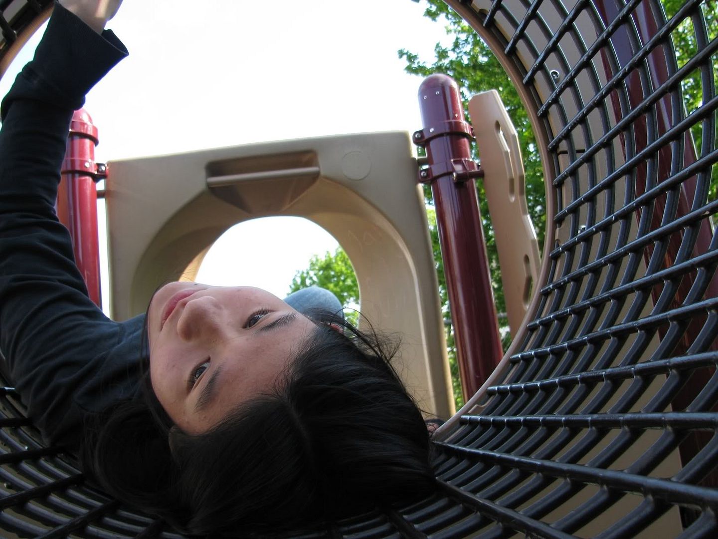
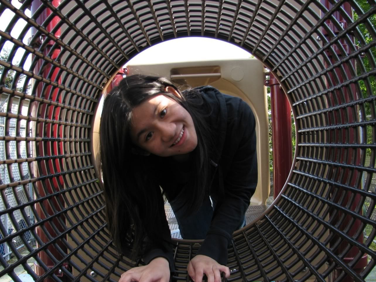
Finding the proper rotation for this was really difficult, I liked all of the possibilities. Go ahead and try it yourselves. I think I'm going to keep changing my mind and the orientation for this....
And for clarification, this playset was empty when I started taking pictures.I got hit by this really big wave of loneliness today; I miss my bokeh boy. I get my midterm back tomorrow. Eww.
A softer alternative, and the face of evil.
- - -
For TOTW: DOFalicious!
en.wikipedia.org/wiki/Marmalade
Marmalade generally refers to a fruit preserve made from the juice and peel of citrus fruits boiled with sugar and water. It can be produced from kumquats, lemons, limes, grapefruits, mandarins, sweet oranges, bergamots, and other citrus fruits, or any combination of them.
For many decades now, the preferred citrus fruit for marmalade production in Britain has been the Spanish Seville orange, Citrus aurantium var. aurantium, prized for its high pectin content, which gives a good set.[clarification needed] The peel imparts a lively bitter taste to the marmalade.
The term "marmalade" is not precise, universal, nor definitive, but unless otherwise stated, marmalade is generally distinguished from jam by its fruit peel. However, it also may be distinguished from jam by the choice of fruit. Historically, the term was more often used in senses other than just citrus conserves.[1]
Contents [hide]
1Origins
2Etymology
2.1International usage
3Dundee Marmalade
3.1Scots legend
4In children's books
5See also
6References
7Further reading
Origins
The Romans learned from the Greeks that quinces slowly cooked with honey would "set" when cool (though they did not know about fruit pectin). Greek μελίμηλον (melimēlon, "honey fruit") transformed into Portuguese "marmelo"— from the Greek μῆλον (mēlon, "apple") stood for all globular fruits, and most quinces are too astringent to be used without honey. A Roman cookbook attributed to Apicius gives a recipe for preserving whole quinces, stems and leaves attached, in a bath of honey diluted with defrutum—Roman marmalade. Preserves of quince and lemon appear—along with rose, apple, plum and pear—in the Book of ceremonies of the Byzantine Emperor Constantine VII Porphyrogennetos, "a book that is not only a treatise on the etiquette of imperial banquetting in the ninth century, but a catalogue of the foods available and dishes made from them."[1]
Medieval quince preserves, which went by the French name cotignac, produced in a clear version and a fruit pulp version, began to lose their medieval seasoning of spices in the 16th century. In the 17th century, La Varenne provided recipes for both thick and clear cotignac.[2]
In 1524, Henry VIII received a "box of marmalade" from Mr Hull of Exeter.[3] As it was in a box, this was probably marmelada, a solid quince paste from Portugal, still made and sold in southern Europe. Its Portuguese origins can be detected in the remarks in letters to Lord Lisle, from William Grett, 12 May 1534, "I have sent to your lordship a box of marmaladoo, and another unto my good lady your wife" and from Richard Lee, 14 December 1536, "He most heartily thanketh her Ladyship for her marmalado".[2]
The English recipe book of Eliza Cholmondeley, dated from 1677 and held at the Chester Record Office in the Cheshire county archivists, has one of the earliest marmalade recipes ("Marmelet of Oranges") which produced a firm, thick dark paste. The Scots are credited with developing marmalade as a spread, with Scottish recipes in the 18th century using more water to produce a less solid preserve.[4]
The first printed recipe for orange marmalade, though without the chunks typically used now, was in Mary Kettilby's 1714 cookery book, A Collection of above Three Hundred Receipts (pages 78–79).[5][6][7] Kettilby called for whole oranges, lemon juice and sugar, with the acid in the lemon juice helping to create the pectin set of marmalade, by boiling the lemon and orange juice with the pulp.[4][7] Kettilby then directs: "boil the whole pretty fast 'till it will jelly" – the first known use of the word "jelly" in marmalade making. Kettilby then instructs that the mixture is then poured into glasses, covered and left until set. As the acid would create a jelly, this meant that the mixture could be pulled from the heat before it had turned to a paste, keeping the marmalade much brighter and the appearance more translucent, as in modern-day marmalade.[4]
The Scots moved marmalade to the breakfast table, and in the 19th century the English followed the Scottish example and abandoned the eating of marmalade in the evening. Marmalade's place in British life appears in literature. James Boswell remarks that he and Samuel Johnson were offered it at breakfast in Scotland in 1773. When American writer Louisa May Alcott visited Britain in the 1800s, she described "a choice pot of marmalade and a slice of cold ham" as "essentials of English table comfort".[7]
Etymology
Antique marmalade cutter, used to cut citrus fruit peel into thin slices
According to the Oxford English Dictionary, "marmalade" appeared in the English language in 1480, borrowed from French marmelade which, in turn, came from the Portuguese language marmelada. According to José Pedro Machado’s Dicionário Etimológico da Língua Portuguesa,[8] the oldest known document where this Portuguese word is to be found is Gil Vicente’s play Comédia de Rubena, written in 1521:
Temos tanta marmelada
Que a minha mãe vai me dar um pouco[9]
The extension of "marmalade" in the English language to refer to a preserve made from citrus fruits occurred in the 17th century, when citrus first began to be plentiful enough in England for the usage to become common.
In Portuguese, according to the root of the word, which is marmelo, "quince", marmelada is a preserve made from quinces, quince cheese. Marmelo in turn derives from Latin melimelum, "honey apple",[10] which in turn comes from the earlier Greek μελίμηλον (melímēlon),[11] from "μέλι" (meli), "honey"[11] + "μήλον" (mēlon), "apple".[11]
There is an apocryphal story that Mary, Queen of Scots, ate it when she had a headache, and that the name is derived from her maids' whisper of "Marie est malade" (Mary is ill). In reality, the word's origin has nothing to do with Mary.[12]
International usage[edit]
Marmalade spread on bread
In much of Europe, the term "marmalade" and its variations are still used as a generic term for preserves of all fruits, whereas in Britain it refers solely to a citrus preserve.[4] The name originates in Portuguese, where marmelada applies exclusively to quince jam.[13][14] In Spanish the term usually refers to what in English is called jam (and jalea — used in Mexico and Central America — is similar to the American English jelly). In Italian too, marmellata means every jam and marmalade.
Dundee Marmalade[edit]
Jars of homemade marmalade
The Scottish city of Dundee has a long association with marmalade.[15][16] James Keiller and his wife Janet ran a small sweet and preserves shop in the Seagate section of Dundee.[16] In 1797, they opened a factory to produce "Dundee Marmalade",[17] a preserve distinguished by thick chunks of bitter Seville orange rind. The business prospered, and remains a signature marmalade producer today.[18]
Scots legend[edit]
According to a Scottish legend, the creation of orange marmalade in Britain occurred by accident. The legend tells of a ship carrying a cargo of oranges that broke down in the port of Dundee, resulting in some ingenious locals making marmalade out of the cargo.[16][19]
In children's books[edit]
Paddington Bear, a fictional character in children's books, is renowned for his liking for marmalade, particularly in sandwiches, and kept it in his briefcase wherever he went.[20] He is now used on the label of Robertson's Golden Shred marmalade.
... these raindrops were on the outside of my office window, and as the sun caught them, they captured the colours of the spectrum.
And yes, it did rain.... see the previous image taken this morning for clarification.:)
The book “Orda Cave Awareness Project”
It is dedicated to the biggest underwater gypsum cave in the world. It is located near Orda village (Perm region, Russia). The book contains articles by geologists, stories about animal life of the cave, interviews with pioneers, reviews by leading experts in cave diving.
The book is illustrated with more than 100 unique underwater photos. Also the first published map of Orda cave with additions and clarifications. The work on the book took half a year, the team made more than 150 dives. All 5 kilometers of its underwater galleries were photographed.
ordacave.ru
a three-fer.......
ANSH scavenger13 boardwalk
(and i realized that this would have been funnier
if i had had a monopoly board)
HMM a possibility for "in a row"
HSS
as a clarification-- these mini people are just over 2 inches tall
© photo rights reserved by B℮n
At the Peace of Versailles, one of the resolutions is that Helgoland as a military base must be completely dismantled. The military story begins again in the 1930s. The Nazis transform the island into a sea fortress. There will be heavy cannons, which can shoot 45 kilometers, and a covered harbor for submarines. Hitler approves the Hummerschere project, an ambitious plan to build the largest ice-free naval port in Germany. Four hundred Dutch people worked in this isolated prison camp. Barbed wire was not necessary. Only a single, living Helgolander can say anything about Devil's Island, as prisoners called it. Very heavy was the carving of bunkers in the rocks and the building of sea mines. Stop working thoughts went regularly through the minds of the prisoners. But the German guns were always nearby. When U-boats had suffered damage, divers under water would put things together again. Nasty work, there was no escape. On April 18, 1945, the end of the war came in sight, the English carried out an enormous heavy bombing on Helgoland. They turned Helgoland into a moon landscape. The Dutch, Belgian, Russian and Italian prisoners were already gone. The islanders took refuge in the underground passages and survived the more than a thousand bombs deposited by the Royal Air Force within an hour and a half. In 1947 the British blew up the bunkers and military facilities with no less than 6,700 tons of explosives. The largest non-nuclear bombing of all time is being released on Helgoland. When the smoke has risen, the red rock island is still there but heavily damaged. The smoke column was observed in the Netherlands. In 1952 the population was allowed to return after long insistence. Since then, the island mainly lives off tourism. The bunkers can still be visited.
Few today suspect that Helgoland has a huge bunker system running through it. It was built by the Nazis during World War II, who converted Helgoland into a sea base and fortress. The civilian protection bunker, the only one that has survived, can be visited nowadays. The open door in the corridors of the bunker shows the red colored Buntsandstein. For clarification, a poster shows the cross-section through the island of Helgoland with the distribution of the Buntsandstein layers. Several dinosaur fossils have also been encountered in the Buntsandstein cliffs of the island that expose sand stones, silt-stones and mud-stones. Some 230 million years ago during the so-called Zechstein periode - the area of the present south-eastern North sea was covered by another sea in a hot climate. The entire sea evaporated leaving behind a deposit of hundreds of metres of salt. Many millions of years later the rock salt would become mobile and cause the birth of Helgoland. Your bunker guide will give you a lasting impression many meters underground using the tunnel systems.
Bij de Vrede van Versailles is één van de resoluties dat Helgoland als militaire basis geheel moet worden ontmanteld. In de jaren dertig begint het militaire verhaal opnieuw. De Nazi's bouwen het eiland om tot een zeevesting. Er komen zware kanonnen, die 45 kilometer ver kunnen schieten, en een overdekte haven voor onderzeeboten. Hitler hecht zijn goedkeuring aan het project Hummerschere, een ambitieus plan om er de grootste ijsvrije marinehaven van Duitsland te bouwen. Vierhonderd Nederlanders werkten in dit geïsoleerde strafkamp. Prikkeldraad was niet nodig. Slechts een enkele, levende Helgolanders kan nog iets zeggen over Duivelseiland, zoals gevangenen het eiland noemden. Lees het verhaal van Dick Jans.... Zeer zwaar was het uithakken van bunkers in de rotsen en evenals het bouwen van zeemijnen. Stoppen met draaien, speelde regelmatig door de gedachten van de gevangenen. Maar de Duitse geweren waren altijd dichtbij. Wanneer U-boten averij hadden opgelopen, lasten duikers onder water de boel weer aan elkaar. Gemeen werk, ontsnappen was niet bij. Op 18 april 1945, kwam het einde van de oorlog in zicht, voeren de Engelsen een enorm zwaar bombardement uit op Helgoland. Ze veranderden Helgoland in een maanlandschap. De Nederlandse, Belgische, Russische en Italiaanse gevangenen waren toen al weg. De eilandbewoners schuilden in de onderaardse gangen en overleefde hier de meer dan duizend bommen gedeponeerd door de Royal Air Force binnen anderhalf uur tijd. In 1947 bliezen de Britten de bunkers en militaire voorzieningen met liefst 6.700 ton explosieven op. Het grootste niet-nucleaire bombardement aller tijden wordt op Helgoland losgelaten. Als de rook is opgetrokken, ligt daar nog steeds het rode rotseiland, zij het zwaar gehavend. De bunkers zijn nog steeds te bezichtigen. De open deur in één van de gangen van de bunker toont de rode Buntsandstein. Ter verduidelijking toont een poster de dwarsdoorsnede van het eiland Helgoland met de verdeling van de verschillende Buntsandstein-lagen. Meerdere dinosaurusfossielen zijn aangetroffen in de Buntsandstein-kliffen van het eiland die zandstenen, siltstenen en modderstenen blootleggen. Ongeveer 230 miljoen jaar geleden tijdens de zogenaamde Zechstein-periode werd het gebied van de huidige zuidoostelijke Noordzee bedekt door een andere zee in een heet klimaat. De hele zee verdampte en liet een afzetting van honderden meters zout achter. Vele miljoenen jaren later zou het steenzout mobiel zijn en de geboorte van Helgoland veroorzaken..
Les tours de Castillon sont un site archéologique situé à Paradou (Bouches-du-Rhône) sur la chaîne de la Pène (massif des Alpilles). Le site a été habité entre le IIe siècle av. J.-C. et le XVe siècle, avec un maximum de population entre les XIIIe et XIVe siècles. Il a ensuite été abandonné par ses habitants qui sont allés peupler le nouveau village à quelques centaines de mètres plus au nord, dénommé aujourd'hui Paradou.
Des fouilles archéologiques récentes ont permis de reconstituer l'histoire de cet oppidum. Le site peut être visité aujourd'hui. On y observe la présence de trois tours encore debout datant du Moyen Âge et qui marquaient les limites de la ville ancienne. Le rempart a disparu dans sa quasi-totalité. Des fouilles archéologiques y ont été menées entre 1986 et 1990 et ont révélé l'existence de cet oppidum très détérioré par le temps et les fouilles clandestines1.
Histoire
Antiquité
Le site des tours de Castillon a dominé durant des siècles une vaste étendue marécageuse, dénommée les marais des Baux et dont il constituait la frontière nord. Son emplacement par rapport à ce marais n'est pas anodin. Il se situe au-dessus d'un point de franchissement des marais, le pont Saint-Jean2, sur le chaînon de collines de La Pène, à 41 mètres d'altitude.
Propriété des seigneurs des Baux au Moyen Âge, le site est habité depuis bien plus longtemps2. Les premières traces d'occupation semblent remonter au IIe siècle av. J.-C.1, même si des tessons retrouvés pourraient être plus anciens de deux à trois siècles. L'oppidum n'est fortifié qu'à partir du IIe siècle av. J.-C., période à laquelle il s'entoure d'un mur en brique crue sur un socle de pierres sèches large de 1,50 mètre3. Le parement en grand appareil est postérieur à ce premier rempart mais date approximativement de la même période ou au plus tard de la période augustéenne1. Contre le rempart, des cases à brique crues sur solin de pierres sont appuyées. Le rempart a beaucoup souffert. Ses blocs ont été prélevés au Moyen Âge pour permettre la construction de divers ouvrages. On considère qu'il devait se trouver deux portes au castrum, au nord et au sud, même s'il n'a pas été possible d'en apporter la preuve à ce jour4. Les pierres utilisées viennent probablement des Alpilles. Il s'agit d'un calcaire burdigalien typique des Baux ou du Montpaon4. Le premier rempart devait être en briques crues, comme le mur des maisons du castrum, tandis que le second rempart, de moindre qualité, était fait d'adobes.
Il existe des traces d'un incendie qui a probablement détruit le village entre la fin du IIe et le début du Ier siècle. Toujours est-il que, s'il a sans doute été inhabité à ce moment, le site compte à nouveau une certaine population au début de l'époque romaine1.
Une chaussée antique a été repérée par des vues aériennes mais n'a pas encore été datée, même si on peut sans doute l'estimer d'époque romaine4.
Moyen Âge
Quartier d'habitation médiéval.
À l'origine propriété de l'abbaye de Montmajour, le site des Tours de Castillon devient possession du seigneur des Baux entre le XIe siècle et le XIIe siècle5. Le site permet de par sa position d'être en communication permanente avec le château des Baux et de contrôler la voie de communication traversant le marais des Baux et menant à la plaine de la Crau. Les sources écrites mentionnent le château au XIIe siècle. Aux XIIIe et XIVe siècles, un rempart enserre la colline. Les angles sont dans un premier état occupés par des tours carrées renforcées par la suite par des tours curvilignes et des lices en avant6. Un petit quartier d'habitation a été fouillé entre 1986 et 1990. Dans cette zone, l'habitat prend de l'ampleur au XIVe siècle et subit de nombreuses modifications durant son occupation. Des silos, des caves et des citernes ont été identifiées. L'abandon est opéré progressivement dans les dernières années du XIVe siècle7.
Nécropole
La nécropole découverte sur le versant sud-est du site des tours de Castillon, regardant vers les marais des Baux, a révélé la présence de cinq corps sans doute datés du Moyen Âge. Seuls les sexes de trois de ces corps ont pu être identifiés : il s'agit de deux hommes et d'une femme. Les corps étaient à l'intérieur de sépultures en decubitus dorsal, les bras en adduction et les jambes en extension. Ce sont tous des adultes, entre 21 et 45 ans et ils mesurent entre 1,61 cm et 1,73 cm, ce qui constituent des tailles élevées8.
Provence (/prəˈvɒ̃s/, US: /proʊ-/; French: [pʁɔvɑ̃s]; Provençal: Provença in classical norm or Prouvènço in Mistralian norm, pronounced [pʀuˈvɛnsɔ]) is a geographical region and historical province of southeastern France, which extends from the left bank of the lower Rhône to the west to the Italian border to the east, and is bordered by the Mediterranean Sea to the south.[1] It largely corresponds with the modern administrative region of Provence-Alpes-Côte d'Azur and includes the departments of Var, Bouches-du-Rhône, Alpes-de-Haute-Provence, as well as parts of Alpes-Maritimes and Vaucluse.[2] The largest city of the region is Marseille.
The Romans made the region the first Roman province beyond the Alps and called it Provincia Romana, which evolved into the present name. Until 1481 it was ruled by the Counts of Provence from their capital in Aix-en-Provence, then became a province of the Kings of France.[2] While it has been part of France for more than five hundred years, it still retains a distinct cultural and linguistic identity, particularly in the interior of the region.[3]
History
Main article: History of Provence
See also: Lower Burgundy
Prehistoric Provence
The entrance to the Cosquer Cave, decorated with paintings of auks, bison, seals and outlines of hands dating to 27,000 to 19,000 BC, is located 37 meters under the surface of the Calanque de Morgiou near Cassis.
A bronze-age dolmen (2500 to 900 BC) near Draguignan
The coast of Provence has some of the earliest known sites of human habitation in Europe. Primitive stone tools dating back 1 to 1.05 million years BC have been found in the Grotte du Vallonnet near Roquebrune-Cap-Martin, between Monaco and Menton.[4] More sophisticated tools, worked on both sides of the stone and dating to 600,000 BC, were found in the Cave of Escale at Saint Estėve-Janson, and tools from 400,000 BC and some of the first fireplaces in Europe were found at Terra Amata in Nice.[5] Tools dating to the Middle Paleolithic (300,000 BC) and Upper Paleolithic (30,000–10,000 BC) were discovered in the Observatory Cave, in the Jardin Exotique of Monaco.[6]
The Paleolithic period in Provence saw great changes in the climate. Two ice ages came and went, the sea level changed dramatically. At the beginning of the Paleolithic, the sea level in western Provence was 150 meters higher than today. By the end of the Paleolithic, it had dropped to 100 to 150 metres below the sea level today. The cave dwellings of the early inhabitants of Provence were regularly flooded by the rising sea or left far from the sea and swept away by erosion.[7]
The changes in the sea level led to one of the most remarkable discoveries of signs of early man in Provence. In 1985, a diver named Henri Cosquer discovered the mouth of a submarine cave 37 metres below the surface of the Calanque de Morgiou near Marseille. The entrance led to a cave above sea level. Inside, the walls of the Cosquer Cave are decorated with drawings of bison, seals, auks, horses and outlines of human hands, dating to between 27,000 and 19,000 BC.[8]
The end of the Paleolithic and beginning of the Neolithic period saw the sea settle at its present level, a warming of the climate and the retreat of the forests. The disappearance of the forests and the deer and other easily hunted game meant that the inhabitants of Provence had to survive on rabbits, snails and wild sheep. In about 6000 BC, the Castelnovian people, living around Châteauneuf-les-Martigues, were among the first people in Europe to domesticate wild sheep, and to cease moving constantly from place to place. Once they settled in one place they were able to develop new industries. Inspired by pottery from the eastern Mediterranean, in about 6000 BC they created the first pottery made in France.[7]
Around 6000 BC, a wave of new settlers from the east, the Chasséens, arrived in Provence. They were farmers and warriors, and gradually displaced the earlier pastoral people from their lands. They were followed about 2500 BC by another wave of people, also farmers, known as the Courronniens, who arrived by sea and settled along the coast of what is now the Bouches-du-Rhône.[7] Traces of these early civilisations can be found in many parts of Provence. A Neolithic site dating to about 6,000 BC was discovered in Marseille near the Saint-Charles railway station. and a dolmen from the Bronze Age (2500–900 BC) can be found near Draguignan.
Ligures and Celts in Provence
Between the 10th and 4th century BC, the Ligures were found in Provence from Massilia as far as modern Liguria. They were of uncertain origin; they may have been the descendants of the indigenous Neolithic peoples.[9] Strabo distinctly states they were not of Celtic origin and a different race from the Gauls.[10] They did not have their own alphabet, but their language remains in place names in Provence ending in the suffixes -asc, -osc. -inc, -ates, and -auni.[9] The ancient geographer Posidonios wrote of them: "Their country is savage and dry. The soil is so rocky that you cannot plant anything without striking stones. The men compensate for the lack of wheat by hunting... They climb the mountains like goats."[11] They were also warlike; they invaded Italy and went as far as Rome in the 4th century BC, and they later aided the passage of Hannibal, on his way to attack Rome (218 BC). Traces of the Ligures remain today in the dolmens and other megaliths found in eastern Provence, in the primitive stone shelters called 'Bories' found in the Luberon and Comtat, and in the rock carvings in the Valley of Marvels near Mont Bégo in the Alpes-Maritimes, at an altitude of 2,000 meters.[12]
Between the 8th and 5th centuries BC, tribes of Celtic peoples, probably coming from Central Europe, also began moving into Provence. They had weapons made of iron, which allowed them to easily defeat the local tribes, who were still armed with bronze weapons. One tribe, called the Segobriga, settled near modern-day Marseille. The Caturiges, Tricastins, and Cavares settled to the west of the Durance river.[13]
Celts and Ligurians spread throughout the area and the Celto-Ligures eventually shared the territory of Provence, each tribe in its own alpine valley or settlement along a river, each with its own king and dynasty. They built hilltop forts and settlements, later given the Latin name oppida. Today the traces 165 oppida are found in the Var, and as many as 285 in the Alpes-Maritimes.[12] They worshipped various aspects of nature, establishing sacred woods at Sainte-Baume and Gemenos, and healing springs at Glanum and Vernègues. Later, in the 5th and 4th centuries BC, the different tribes formed confederations; the Voconces in the area from the Isère to the Vaucluse; the Cavares in the Comtat; and the Salyens, from the Rhône river to the Var. The tribes began to trade their local products, iron, silver, alabaster, marble, gold, resin, wax, honey and cheese; with their neighbours, first by trading routes along the Rhône river, and later Etruscan traders visited the coast. Etruscan amphorae from the 7th and 6th centuries BC have been found in Marseille, Cassis, and in hilltop oppida in the region.[12]
Greeks in Provence
Main article: Greeks in pre-Roman Gaul
Remains of the ancient harbour of Massalia, near the Old Port of Marseille
Traders from the island of Rhodes were visiting the coast of Provence in the 7th century BC. Rhodes pottery from that century has been found in Marseille, near Martigues and Istres, and at Mont Garou and Evenos near Toulon. The traders from Rhodes gave their names to the ancient town of Rhodanousia (Ancient Greek: 'Ροδανουσίαν) (now Trinquetaille, across the Rhône river from Arles), and to the main river of Provence, the Rhodanos, today known as the Rhône.[14]
The first permanent Greek settlement was Massalia, established at modern-day Marseille in about 600 BC by colonists coming from Phocaea (now Foça, on the Aegean coast of Asia Minor). A second wave of colonists arrived in about 540 BC, when Phocaea was destroyed by the Persians.[15]
Massalia became one of the major trading ports of the ancient world. At its height, in the 4th century BC, it had a population of about 6,000 inhabitants, living on about fifty hectares surrounded by a wall. It was governed as an aristocratic republic, by an assembly of the 600 wealthiest citizens. It had a large temple of the cult of Apollo of Delphi on a hilltop overlooking the port, and a temple of the cult of Artemis of Ephesus at the other end of the city. The Drachma coins minted in Massalia were found in all parts of Ligurian-Celtic Gaul. Traders from Massalia ventured inland deep into France on the Rivers Durance and Rhône, and established overland trade routes deep into Gaul, and to Switzerland and Burgundy, and as far north as the Baltic Sea. They exported their own products; local wine, salted pork and fish, aromatic and medicinal plants, coral and cork.[15]
The Massalians also established a series of small colonies and trading posts along the coast; which later became towns; they founded Citharista (La Ciotat); Tauroeis (Le Brusc); Olbia (near Hyères); Pergantion (Breganson); Caccabaria (Cavalaire); Athenopolis (Saint-Tropez); Antipolis (Antibes); Nikaia (Nice), and Monoicos (Monaco). They established inland towns at Glanum (Saint-Remy) and Mastrabala (Saint-Blaise.)
The most famous citizen of Massalia was the mathematician, astronomer and navigator Pytheas. Pytheas made mathematical instruments which allowed him to establish almost exactly the latitude of Marseille, and he was the first scientist to observe that the tides were connected with the phases of the moon. Between 330 and 320 BC he organised an expedition by ship into the Atlantic and as far north as England, and to visit Iceland, Shetland, and Norway. He was the first scientist to describe drift ice and the midnight sun. Though he hoped to establish a sea trading route for tin from Cornwall, his trip was not a commercial success, and it was not repeated. The Massalians found it cheaper and simpler to trade with Northern Europe over land routes.[16]
Roman Provence (2nd century BC to 5th century AD)
Triumphal Arch of Orange, first century AD
The Roman arena at Arles (2nd century AD)
The baptistery of Fréjus Cathedral (5th century) is still in use
In the 2nd century BC the people of Massalia appealed to Rome for help against the Ligures. Roman legions entered Provence three times; first in 181 BC the Romans suppressed Ligurian uprisings near Genoa; in 154 BC the Roman Consul Optimus defeated the Oxybii and the Deciates, who were attacking Antibes; and in 125 BC, the Romans put down an uprising of a confederation of Celtic tribes.[17] After this battle, the Romans decided to establish permanent settlements in Provence. In 122 BC, next to the Celtic town of Entremont, the Romans built a new town, Aquae Sextiae, later called Aix-en-Provence. In 118 BC they founded Narbo (Narbonne).
The Roman general Gaius Marius crushed the last serious resistance in 102 BC by defeating the Cimbri and the Teutons. He then began building roads to facilitate troop movements and commerce between Rome, Spain and Northern Europe; one from the coast inland to Apt and Tarascon, and the other along the coast from Italy to Spain, passing through Fréjus and Aix-en-Provence.
In 49 BC, Massalia had the misfortune to choose the wrong side in the power struggle between Pompey and Julius Caesar. Pompey was defeated, and Massalia lost its territories and political influence. Roman veterans, in the meantime, populated two new towns, Arles and Fréjus, at the sites of older Greek settlements.
In 8 BC the Emperor Augustus built a triumphal monument at La Turbie to commemorate the pacification of the region, and he began to Romanize Provence politically and culturally. Roman engineers and architects built monuments, theatres, baths, villas, fora, arenas and aqueducts, many of which still exist. (See Architecture of Provence.) Roman towns were built at Cavaillon; Orange; Arles; Fréjus; Glanum (outside Saint-Rémy-de-Provence); Carpentras; Vaison-la-Romaine; Nîmes; Vernègues; Saint-Chamas and Cimiez (above Nice). The Roman province, which was called Gallia Narbonensis, for its capital, Narbo (modern Narbonne), extended from Italy to Spain, from the Alps to the Pyrenees.
The Pax Romana in Provence lasted until the middle of the 3rd century. Germanic tribes invaded Provence in 257 and 275. At the beginning the 4th century, the court of Roman Emperor Constantine (280–337) was forced to take refuge in Arles. By the end of the 5th century, Roman power in Provence had vanished, and an age of invasions, wars, and chaos began.
Arrival of Christianity (3rd–6th centuries)
There are many legends about the earliest Christians in Provence, but they are difficult to verify. It is documented that there were organised churches and bishops in the Roman towns of Provence as early as the 3rd and 4th centuries; in Arles in 254; Marseille in 314; Orange, Vaison and Apt in 314; Cavaillon, Digne, Embrun, Gap, and Fréjus at the end of the 4th century; Aix-en-Provence in 408; Carpentras, Avignon, Riez, Cimiez (today part of Nice) and Vence in 439; Antibes in 442; Toulon in 451; Senez in 406, Saint-Paul-Trois-Châteaux in 517; and Glandèves in 541.[18] The oldest Christian structure still surviving in Provence is the baptistery of the cathedral in Fréjus, dating from the 5th century. At about the same time, in the 5th century, the first two monasteries in Provence were founded; Lérins, on an island near Cannes; and Saint-Victor in Marseille.
Germanic invasions, Merovingians and Carolingians (5th–9th centuries)
King Boson and San Stephen (fragment of fresco at Charlieu Abbey)
Beginning in the second half of the 5th century, as Roman power waned, successive waves of Germanic tribes entered Provence; first the Visigoths (480); then the Ostrogoths; then the Burgundians; finally, the Franks in the 6th century. Arab invaders and Berber pirates came from North Africa to the Coast of Provence in the beginning of the 7th century.
During the late 7th and early 8th century, Provence was formally subject to the Frankish kings of the Merovingian dynasty, but it was in fact ruled by its own regional nobility of Gallo-Roman stock, who ruled themselves according to Roman, not Frankish law. Actually, the region enjoyed a prestige that the northern Franks hadn't, but the local aristocracy feared Charles Martel's expansionist ambitions.[19] In 737 Charles Martel headed down the Rhône Valley after subduing Burgundy. Charles attacked Avignon and Arles, garrisoned by the Umayyads. He came back in 739 to capture for a second time Avignon and chase the duke Maurontus to his stronghold of Marseille.[19] The city was brought to heel and the duke had to flee to an island. The region was thereafter under the rule of Carolingian Kings, descended from Charles Martel; and then was part of the empire of Charlemagne (742–814).
In 879, after the death of the Carolingian ruler Charles the Bald, Boso of Provence, (also known as Boson), his brother-in-law, broke away from the Carolingian kingdom of Louis III and was elected the first ruler of an independent state of Provence.
The Counts of Provence (9th–13th centuries)
The Catalan Ramon Berenguer I, Count of Provence, in the Castle in Fos, painted by Marià Fortuny (Reial Acadèmia Catalana de Belles Arts de Sant Jordi, on deposit at the Palace of the Generalitat of Catalonia, Barcelona).
The Coat of Arms of Ramon Berenguer III, Count of Barcelona and his descendants, who as Counts of Provence ruled Provence from 1112 until 1246
Coat of Arms of the Counts of Provence of the House of Valois-Anjou, who ruled Provence from 1246 until it became part of France in 1486
Three different dynasties of Counts ruled Provence during the Middle Ages, and Provence became a prize in the complex rivalries between the Catalan rulers of Barcelona, the Kings of Burgundy, the German rulers of the Holy Roman Empire, and the Angevin Kings of France.[clarification needed]
The Bosonids (879–1112) were the descendants of the first King of Provence, Boson. His son, Louis the Blind (890–928) lost his sight trying to win the throne of Italy, after which his cousin, Hugh of Italy (died 947) became the Duke of Provence and the Count of Vienne. Hugh moved the capital of Provence from Vienne to Arles and made Provence a fief of Rudolph II of Burgundy.
In the 9th century, Arab pirates (called Saracens by the French) and then the Normans invaded Provence. The Normans pillaged the region and then left, but the Saracens built castles and began raiding towns and holding local residents for ransom. Early in 973, the Saracens captured Maieul, the Abbot of the Monastery at Cluny, and held him for ransom. The ransom was paid and the abbot was released, but the people of Provence, led by Count William I rose up and defeated the Saracens near their most powerful fortress Fraxinet (La Garde-Freinet) at the Battle of Tourtour. The Saracens who were not killed at the battle were baptised and enslaved, and the remaining Saracens in Provence fled the region. Meanwhile, the dynastic quarrels continued. A war between Rudolph III of Burgundy and his rival, the German Emperor Conrad the Salic in 1032 led to Provence becoming a fiefdom of the Holy Roman Empire, which it remained until 1246.
In 1112, the last descendant of Boson, Douce I, Countess of Provence, married the Catalan Ramon Berenguer III, Count of Barcelona, who as a result became Raymond Berenguer I, Count of Provence. He ruled Provence from 1112 until 1131, and his descendants, the Catalan counts ruled in Provence until 1246. In 1125, Provence was divided; the part of Provence north and west of the Durance river went to the Count of Toulouse, while the lands between the Durance and the Mediterranean, and from the Rhône river to the Alps, belonged to the Counts of Provence. The capital of Provence was moved from Arles to Aix-en-Provence, and later to Brignoles.[20]
The Church of Saint Trophime in Arles (12th century)
Under the Catalan counts, the 12th century saw the construction of important cathedrals and abbeys in Provence, in a harmonious new style, the romanesque, which united the Gallo-Roman style of the Rhône Valley with the Lombard style of the Alps. Aix Cathedral was built on the site of the old Roman forum, and then rebuilt in the gothic style in the 13th and 14th centuries. The Church of St. Trophime in Arles was a landmark of Romanesque architecture, built between the 12th and the 15th centuries. A vast fortress-like monastery, Montmajour Abbey, was built on an island just north of Arles, and became a major destination for medieval pilgrims.
In the 12th century three Cistercian monasteries were built in remote parts of Provence, far from the political intrigues of the cities. Sénanque Abbey was the first, established in the Luberon 1148 and 1178. Le Thoronet Abbey was founded in a remote valley near Draguignan in 1160. Silvacane Abbey, on the Durance river at La Roque-d'Anthéron, was founded in 1175.
In the 13th century, the French kings started to use marriage to extend their influence into the south of France. One son of King Louis VIII of France "the Lion", Alphonse, Count of Poitou, married the heiress of the Count of Toulouse, Joan. Another, Louis IX "the Saint" of France or Saint Louis (1214–1270), married Marguerite of Provence. Then, in 1246, Charles, Count of Anjou, the youngest son of Louis VIII, married the heiress of Provence, Beatrice. Provence's fortunes became tied to the Angevin Dynasty and the Kingdom of Naples.[21]
The Popes in Avignon (14th century)
Main article: Avignon papacy
The façade of the Palais des Papes.
In 1309, Pope Clement V, who was originally from Bordeaux, moved the Roman Catholic Papacy to Avignon.[22] From 1309 until 1377, seven Popes reigned in Avignon before the Schism between the Roman and Avignon churches, which led to the creation of rival popes in both places. After that three Antipopes reigned in Avignon until 1423, when the Papacy finally returned to Rome. Between 1334 and 1363 the old and new Papal Palaces of Avignon were built by Popes Benedict XII and Clement VI respectively; together the Palais des Papes was the largest gothic palace in Europe.[23]
The 14th century was a terrible time in Provence, and all of Europe: the population of Provence had been about 400,000 people; the Black Plague (1348–1350) killed fifteen thousand people in Arles, half the population of the city, and greatly reduced the population of the whole region. The defeat of the French Army during the Hundred Years' War forced the cities of Provence to build walls and towers to defend themselves against armies of former soldiers who ravaged the countryside.
The Angevin rulers of Provence also had a difficult time. An assembly of nobles, religious leaders, and town leaders of Provence was organised to resist the authority of Queen Joan I of Naples (1343–1382). She was murdered in 1382 by her cousin and heir, Charles of Durazzo, who started a new war, leading to the separation of Nice, Puget-Théniers and Barcelonnette from Provence in 1388, and their attachment to the County of Savoy. From 1388 up to 1526, the area acquired by the Savoy was known as Terres Neuves de Provence; after 1526 it officially took on the name County of Nice.
Good King René, the last ruler of Provence
Detail of the Burning Bush triptych by Nicolas Froment, showing René and his wife Jeanne de Laval
The Chateau of René in Tarascon (15th century)
The 15th century saw a series of wars between the Kings of Aragon and the Counts of Provence. In 1423 the army of Alphonse of Aragon captured Marseille, and in 1443 they captured Naples, and forced its ruler, King René I of Naples, to flee. He eventually settled in one of his remaining territories, Provence.
History and legend has given René the title "Good King René of Provence", though he only lived in Provence in the last ten years of his life, from 1470 to 1480, and his political policies of territorial expansion were costly and unsuccessful. Provence benefitted from population growth and economic expansion, and René was a generous patron of the arts, sponsoring painters Nicolas Froment, Louis Bréa, and other masters. He also completed one of the finest castles in Provence at Tarascon, on the Rhône river.
When René died in 1480, his title passed to his nephew Charles du Maine. One year later, in 1481, when Charles died, the title passed to Louis XI of France. Provence was legally incorporated into the French royal domain in 1486.
1486 to 1789
Soon after Provence became part of France, it became involved in the Wars of Religion that swept the country in the 16th century. Between 1493 and 1501, many Jews were expelled from their homes and sought sanctuary in the region of Avignon, which was still under the direct rule of the Pope. In 1545, the Parliament of Aix-en-Provence ordered the destruction of the villages of Lourmarin, Mérindol, Cabriéres in the Luberon, because their inhabitants were Vaudois, of Italian Piedmontese origin, and were not considered sufficiently orthodox Catholics. Most of Provence remained strongly Catholic, with only one enclave of Protestants, the principality of Orange, Vaucluse, an enclave ruled by Prince William of the House of Orange-Nassau of the Netherlands, which was created in 1544 and was not incorporated into France until 1673. An army of the Catholic League laid siege to the Protestant city of Mėnerbes in the Vaucluse between 1573 and 1578. The wars did not stop until the end of the 16th century, with the consolidation of power in Provence by the House of Bourbon kings.
View of Toulon Harbour around 1750, by Joseph Vernet.
The semi-independent Parliament of Provence in Aix and some of the cities of Provence, particularly Marseille, continued to rebel against the authority of the Bourbon king. After uprisings in 1630–31 and 1648–1652, the young King Louis XIV had two large forts, fort St. Jean and Fort St. Nicholas, built at the harbour entrance to control the city's unruly population.
At the beginning of the 17th century, Cardinal Richelieu began to build a naval arsenal and dockyard at Toulon to serve as a base for a new French Mediterranean fleet. The base was greatly enlarged by Jean-Baptiste Colbert, the minister of Louis XIV, who also commissioned his chief military engineer Vauban to strengthen the fortifications around the city.
At the beginning of the 17th century, Provence had a population of about 450,000 people.[24] It was predominantly rural, devoted to raising wheat, wine, and olives, with small industries for tanning, pottery, perfume-making, and ship and boat building. Provençal quilts, made from the mid-17th century onwards, were successfully exported to England, Spain, Italy, Germany and Holland.[25] There was considerable commerce along the coast, and up and down the Rhône river. The cities: Marseille, Toulon, Avignon and Aix-en-Provence, saw the construction of boulevards and richly decorated private houses.
Marseille in 1754, by Vernet
At the beginning of the 18th century, Provence suffered from the economic malaise of the end of the reign of Louis XIV. The plague struck the region between 1720 and 1722, beginning in Marseille, killing some 40,000 people. Still, by the end of the century, many artisanal industries began to flourish; making perfumes in Grasse; olive oil in Aix and the Alpilles; textiles in Orange, Avignon and Tarascon; and faience pottery in Marseille, Apt, Aubagne, and Moustiers-Sainte-Marie. Many immigrants arrived from Liguria and the Piedmont in Italy. By the end of the 18th century, Marseille had a population of 120,000 people, making it the third largest city in France.[24]
During the French Revolution
Main article: French Revolution
Though most of Provence, with the exception of Marseille, Aix and Avignon, was rural, conservative and largely royalist, it did produce some memorable figures in the French Revolution; Honoré Gabriel Riqueti, comte de Mirabeau from Aix, who tried to moderate the Revolution, and turn France into a constitutional monarchy like England; the Marquis de Sade from Lacoste in the Luberon, who was a Deputy from the far left in the National Assembly; Charles Barbaroux from Marseille, who sent a battalion of volunteers to Paris to fight in the French Revolutionary Army; and Emmanuel-Joseph Sieyès (1748–1836), an abbé, essayist and political leader, who was one of the chief theorists of the French Revolution, French Consulate, and First French Empire, and who, in 1799, was the instigator of the coup d'état of 18 Brumaire, which brought Napoleon to power.
La Marseillaise 1792
Provence also produced the most memorable song of the period, the La Marseillaise. Though the song was originally written by a citizen of Strasbourg, Claude Joseph Rouget de Lisle in 1792, and it was originally a war song for the revolutionary Army of the Rhine, it became famous when it sung on the streets of Paris by the volunteers from Marseille, who had heard it when it was sung in Marseille by a young volunteer from Montpellier named François Mireur. It became the most popular song of the Revolution, and in 1879 became the national anthem of France.
The Revolution was as violent and bloody in Provence as it was in other parts of France. On 30 April 1790, Fort Saint-Nicolas in Marseille was besieged, and many of the soldiers inside were massacred. On 17 October 1791 a massacre of royalists and religious figures took place in the ice storage rooms (glaciere) of the prison of the Palace of the Popes in Avignon.
When the radical Montagnards seized power from the Girondins in May 1793, a real counter-revolution broke out in Avignon, Marseille and Toulon. A revolutionary army under General Carteaux recaptured Marseille in August 1793 and renamed it "City without a Name" (Ville sans Nom.) In Toulon, the opponents of the Revolution handed the city to a British and Spanish fleet on 28 August 1793. A Revolutionary Army laid siege to the British positions for four months (see the Siege of Toulon), and finally, thanks to the enterprise of the young commander of artillery, Napoleon Bonaparte, defeated the British and drove them out in December 1793. About 15,000 royalists escaped with the British fleet, but five to eight hundred of the 7,000 who remained were shot on the Champ de Mars, and Toulon was renamed "Port la Montagne".
The fall of the Montagnards in July 1794 was followed by a new White Terror aimed at the revolutionaries. Calm was only restored by the rise of Napoleon to power in 1795.
Under Napoleon
Napoleon restored the belongings and power of the families of the old regime in Provence. The British fleet of Admiral Horatio Nelson blockaded Toulon, and almost all maritime commerce was stopped, causing hardship and poverty. When Napoleon was defeated, his fall was celebrated in Provence. When he escaped from Elba on 1 March 1815, and landed at Golfe-Juan, he detoured to avoid the cities of Provence, which were hostile to him, and therefore directed his small force directly to the northeast of it.[26]
19th century
Marseille in 1825
Provence enjoyed prosperity in the 19th century; the ports of Marseille and Toulon connected Provence with the expanding French Empire in North Africa and the Orient, especially after the opening of the Suez Canal in 1869.
In April–July 1859, Napoleon III made a secret agreement with Cavour, Prime Minister of Piedmont, for France to assist in expelling Austria from the Italian Peninsula and bringing about a united Italy, in exchange for Piedmont ceding Savoy and the Nice region to France. He went to war with Austria in 1859 and won a victory at Solferino, which resulted in Austria ceding Lombardy to France. France immediately ceded Lombardy to Piedmont, and, in return, Napoleon received Savoy and Nice in 1860, and Roquebrune-Cap-Martin and Menton in 1861.
The railroad connected Paris with Marseille (1848) and then with Toulon and Nice (1864). Nice, Antibes and Hyères became popular winter resorts for European royalty, including Queen Victoria. Under Napoleon III, Marseille grew to a population of 250,000, including a very large Italian community. Toulon had a population of 80,000. The large cities like Marseille and Toulon saw the building of churches, opera houses, grand boulevards, and parks.
After the fall of Louis Napoleon following the defeat in the Franco-Prussian War barricades went up in the streets of Marseille (23 March 1871) and the Communards, led by Gaston Cremieux and following the lead of the Paris Commune, took control of the city. The Commune was crushed by the army and Cremieux was executed on 30 November 1871. Though Provence was generally conservative, it often elected reformist leaders; Prime Minister Léon Gambetta was the son of a Marseille grocer, and future prime minister Georges Clemenceau was elected deputy from the Var in 1885.
The second half of the 19th century saw a revival of the Provençal language and culture, particularly traditional rural values. driven by a movement of writers and poets called the Felibrige, led by poet Frédéric Mistral. Mistral achieved literary success with his novel Miréio (Mireille in French); he was awarded the Nobel Prize for literature in 1904.
20th century
Between World War I and World War II, Provence was bitterly divided between the more conservative rural areas and the more radical big cities. There were widespread strikes in Marseille in 1919, and riots in Toulon in 1935.
After the defeat of France by Germany in June 1940, France was divided into an occupied zone and unoccupied zone, with Provence in the unoccupied zone. Parts of eastern Provence were occupied by Italian soldiers. Collaboration and passive resistance gradually gave way to more active resistance, particularly after Nazi Germany invaded the Soviet Union in June 1941 and the Communist Party became active in the resistance. Jean Moulin, the deputy of Charles de Gaulle, the leader of the Free France resistance movement, was parachuted into Eygalières, in the Bouches-du-Rhône on 2 January 1942 to unite the diverse resistance movements in all of France against the Germans.
In November 1942, following Allied landings in North Africa (Operation Torch), the Germans occupied all of Provence (Operation Attila) and then headed for Toulon (Case Anton). The French fleet at Toulon sabotaged its own ships to keep them from falling into German hands.
The Germans began a systematic rounding-up of French Jews and refugees from Nice and Marseille. Many thousands were taken to concentration camps, and few survived. A large quarter around the port of Marseille was emptied of inhabitants and dynamited, so it would not serve as a base for the resistance. Nonetheless, the resistance grew stronger; the leader of the pro-German militia, the Milice, in Marseille was assassinated in April 1943.
On 15 August 1944, two months after the Allied landings in Normandy (Operation Overlord), the Seventh United States Army under General Alexander Patch, with a Free French corps under General Jean de Lattre de Tassigny, landed on the coast of the Var between St. Raphael and Cavalaire (Operation Dragoon). The American forces moved north toward Manosque, Sisteron and Gap, while the French First Armored Division under General Vigier liberated Brignoles, Salon, Arles, and Avignon. The Germans in Toulon resisted until 27 August, and Marseille was not liberated until 25 August.
After the end of the War, Provence faced an enormous task of repair and reconstruction, particularly of the ports and railroads destroyed during the war. As part of this effort, the first modern concrete apartment block, the Unité d'Habitation of Corbusier, was built in Marseille in 1947–52. In 1962, Provence absorbed a large number of French citizens who left Algeria after its independence. Since that time, large North African communities settled in and around the big cities, particularly Marseille and Toulon.
In the 1940s, Provence underwent a cultural renewal, with the founding of the Avignon Festival of theatre (1947), the reopening of the Cannes Film Festival (begun in 1939), and many other major events. With the building of new highways, particularly the Paris Marseille autoroute which opened in 1970, Provence became destination for mass tourism from all over Europe. Many Europeans, particularly from Britain, bought summer houses in Provence. The arrival of the TGV high-speed trains shortened the trip from Paris to Marseille to less than four hours.
At the end of the 20th century, and the beginning of the 21st century, the residents of Provence were struggling to reconcile economic development and population growth with their desire to preserve the landscape and culture that make Provence unique.
Extent and geography
The Roman Province of Gallia Narbonensis around 58 BC
The original Roman province was called Gallia Transalpina, then Gallia Narbonensis, or simply Provincia Nostra ('Our Province') or Provincia. It extended from the Alps to the Pyrenees and north to the Vaucluse, with its capital in Narbo Martius (present-day Narbonne).
Borders
In the 15th century the Conté of Provence was bounded by the Var river on the east, the Rhône river to the west, with the Mediterranean to the south, and a northern border that roughly followed the Durance river.
The Comtat Venaissin, a territory which included Avignon, and the principality of Orange were both papal states, ruled by the Pope from the 13th century until the French Revolution. At the end of the 14th century, another piece of Provence along the Italian border, including Nice and the lower Alps, was detached from Provence and attached to the lands of the Duke of Savoy. The lower Alps were re-attached to France after the Treaty of Utrecht in 1713, but Nice did not return to France until 1860, during the reign of Napoleon III.[27]
The administrative region of Provence-Alpes-Cote d'Azur was created in 1982. It included Provence, plus the territory of the Comtat Venaissin around Avignon, the eastern portion of the Dauphiné, and the former county of Nice.
Rivers
The Rhône at Avignon
The Rhône river, on the western border of Provence, is one of the major rivers of France, and has been a highway of commerce and communications between inland France and the Mediterranean for centuries. It rises as the effluent of the Rhône Glacier in Valais, Switzerland, in the Saint-Gotthard massif, at an altitude of 1753 m. It is joined by the river Saône at Lyon. Along the Rhône Valley, it is joined on the right bank by Cévennes rivers Eyrieux, Ardèche, Cèze and Gardon or Gard, on the left Alps bank by rivers Isère, Drôme, Ouvèze and Durance. At Arles, the Rhône divides itself in two arms, forming the Camargue delta, with all branches flowing into the Mediterranean Sea. One arm is called the "Grand Rhône"; the other one is the "Petit Rhône".
The Gorge du Verdon.
The Durance river, a tributary of the Rhône, has its source in the Alps near Briançon. It flows south-west through Embrun, Sisteron, Manosque, Cavaillon, and Avignon, where it meets the Rhône.
The Verdon River is a tributary of the Durance, rising at an altitude of 2,400 metres in the southwestern Alps near Barcelonette, and flowing southwest for 175 kilometres through the Alpes-de-Haute-Provence and Var (départements) before it reaches the Durance at near Vinon-sur-Verdon, south of Manosque. The Verdon is best known for its canyon, the Verdon Gorge. This limestone canyon, also called the 'Grand Canyon of Verdon', 20 kilometres in length and more than 300 metres deep, is a popular climbing and sight-seeing area.
The Var River rises near the Col de la Cayolle (2,326 m/7,631 ft) in the Maritime Alps and flows generally southeast for 120 kilometres (75 mi) into the Mediterranean between Nice and Saint-Laurent-du-Var. Before Nice was returned to France in 1860, the Var marked the eastern border of France along the Mediterranean. The Var is the unique case in France of a river giving a name to a department, but not flowing through that department (due to subsequent adjustments to the department's boundaries).
The Camargue
With an area of over 930 km2 (360 mi2), the Camargue is Western Europe's largest river delta (technically an island, as it is wholly surrounded by water). It is a vast plain comprising large brine lagoons or étangs, cut off from the sea by sandbars and encircled by reed-covered marshes which are in turn surrounded by a large cultivated area.
The Camargue is home to more than 400 species of birds, the brine ponds providing one of the few European habitats for the greater flamingo. The marshes are also a prime habitat for many species of insects, notably (and notoriously) some of the most ferocious mosquitoes to be found anywhere in France. It is also famous for bulls and the Camargue horse.
Mountains
Vallon de Mollières, Mercantour National Park.
Alpilles landscape near Le Destet.
By considering the Maritime Alps, along the border with Italy, as a part of the cultural Provence, they constitute the highest elevations of the region (the Punta dell'Argentera has an elevation of 3,297 m). They form the border between the French département Alpes-Maritimes and the Italian province of Cuneo. Mercantour National Park is located in the Maritime Alps. On the other hand, if the département Hautes Alpes is also considered as part of the modern Provence, then the alpin Écrins mountains represent the highest elevations of the region with the Barre des Écrins culminating at 4102m.
View of Mont Ventoux from Mirabel-aux-Baronnies.
Outside of the Maritime Alps, Mont Ventoux (Occitan: Ventor in classical norm or Ventour in Mistralian norm), at 1,909 metres (6,263 ft), is the highest peak in Provence. It is located some 20 km north-east of Carpentras, Vaucluse. On the north side, the mountain borders the Drôme département. It is nicknamed the "Giant of Provence", or "The Bald Mountain". Although geologically part of the Alps, is often considered to be separate from them, due to the lack of mountains of a similar height nearby. It stands alone to the west of the Luberon range, and just to the east of the Dentelles de Montmirail, its foothills. The top of the mountain is bare limestone without vegetation or trees. The white limestone on the mountain's barren peak means it appears from a distance to be snow-capped all year round (its snow cover actually lasts from December to April).
The Alpilles are a chain of small mountains located about 20 kilometres (12 mi) south of Avignon. Although they are not particularly high – only some 387 metres (1,270 ft) at their highest point – the Alpilles stand out since they rise abruptly from the plain of the Rhône valley. The range is about 25 km long by about 8 to 10 km wide, running in an east–west direction between the Rhône and Durance rivers. The landscape of the Alpilles is one of arid limestone peaks separated by dry valleys.
Mont Sainte-Victoire, painted by Paul Cézanne
Montagne Sainte-Victoire is probably the best-known mountain in Provence, thanks to the painter Paul Cézanne, who could see it from his home, and painted it frequently. It is a limestone mountain ridge which extends over 18 kilometres between the départements of Bouches-du-Rhône and Var. Its highest point is the Pic des mouches at 1,011 m.
The massif des Maures
The Massif des Maures (Mountains of the Moors) is a small chain of mountains that lies along the coast of the Mediterranean in the Var Department between Hyères et Fréjus. Its highest point is the signal de la Sauvette, 780 metres high. The name is a souvenir of the Moors (Maures in Old French), Arabs and Berbers from North Africa, who settled on the coast of Provence in the 9th and 10th centuries.
The massif des Maures extends about sixty kilometres along the coast, and reaches inland about thirty kilometres. On the north it is bordered by a depression which is followed by the routes nationales 97 and 7 and the railroad line between Toulon and Nice. On the south it ends abruptly at the Mediterranean, forming a broken and abrupt coastline.
The peninsula of Saint-Tropez is part of the Massif des Maures, along with the peninsula of Giens and the islands offshore of Hyères; Porquerolles, Port-Cros, and île du Levant. Cape Sicié, west of Toulon, as well as the massif of Tanneron, belong geologically to the massif des Maures.
The Calanques
Calanque de Sugiton
The Calanques, also known as the Massif des Calanques, are a dramatic feature of the Provence coast, a 20-km long series of narrow inlets in the cliffs of the coastline between Marseille on the west and Cassis on the east. The highest peak in the massif is Mont Puget, 565 metres high.
The best known calanques of the Massif des Calanques include the Calanque de Sormiou, the Calanque de Morgiou, the Calanque d'En-Vau, the Calanque de Port-Pin and the Calanque de Sugiton.
Calanques are remains of ancient river mouths formed mostly during Tertiary. Later, during quaternary glaciations, as glaciers swept by, they further deepened those valleys which would eventually (at the end of the last glaciation) be invaded with sea and become calanques.
The Garrigue, typical landscape of Provence
The Cosquer cave is an underwater grotto in the Calanque de Morgiou, 37 metres (121 ft) underwater, that was inhabited during Paleolithic era, when the sea level was much lower than today. Its walls are covered with paintings and engravings dating back to between 27,000 and 19,000 BC, depicting animals such as bison, ibex, and horses, as well as sea mammals such as seals, and at least one bird, the auk.
Landscapes
The Garrigue is the typical landscape of Provence; it is a type of low, soft-leaved scrubland or chaparral found on limestone soils around the Mediterranean Basin, generally near the seacoast, where the climate is moderate, but where there are annual summer drought conditions.[28] Juniper and stunted holm oaks are the typical trees; aromatic lime-tolerant shrubs such as lavender, sage, rosemary, wild thyme and Artemisia are common garrigue plants. The open landscape of the garrigue is punctuated by dense thickets of Kermes oak.
Climate
Mistral wind blowing near Marseille. In the center is the Château d'If
Sisteron – la Baume rock
Forcalquier Cathedral
Most of Provence has a Mediterranean climate, characterised by hot, dry summers, mild winters, little snow, and abundant sunshine. Within Provence there are micro-climates and local variations, ranging from the Alpine climate inland from Nice to the continental climate in the northern Vaucluse. The winds of Provence are an important feature of the climate, particularly the mistral, a cold, dry wind which, especially in the winter, blows down the Rhône Valley to the Bouches-du-Rhône and the Var Departments, and often reaches over one hundred kilometres an hour.
Bouches-du-Rhône
Marseille, in the Bouches-du-Rhône, has an average of 59 days of rain a year, though when it does rain the rain is often torrential; the average annual rainfall is 544.4 mm. It snows an average of 2.3 days a year, and the snow rarely remains long. Marseille has an average of 2835.5 hours of sunshine a year. The average minimum temperature in January is 2.3 °C., and the average maximum temperature in July is 29.3 °C. The mistral blows an average of one hundred days a year.[29]
The Var
Toulon and the Department of the Var (which includes St. Tropez and Hyères) have a climate slightly warmer, dryer and sunnier than Nice and the Alpes-Maritime, but also less sheltered from the wind. Toulon has an average of 2899.3 hours of sunshine a year, making it the sunniest city in metropolitan France,[30] The average maximum daily temperature in August is 29.1 °C., and the average daily minimum temperature in January is 5.8 °C. The average annual rainfall is 665 mm, with the most rain from October to November. Strong winds blow an average of 118 days a year in Toulon, compared with 76 days at Fréjus further east. The strongest Mistral wind recorded in Toulon was 130 kilometres an hour.[31]
Alpes-Maritimes
Nice and the Alpes-Maritimes Department are sheltered by the Alps, and are the most protected part of the Mediterranean coast. The winds in this department are usually gentle, blowing from the sea to the land, though sometimes the Mistral blows strongly from the northwest, or, turned by the mountains, from the east. In 1956 a mistral wind from the northwest reached the speed of 180 kilometres an hour at Nice airport. Sometimes in summer the scirocco brings high temperatures and reddish desert sand from Africa. (See Winds of Provence.)
Rainfall is infrequent – 63 days a year, but can be torrential, particularly in September, when storms and rain are caused by the difference between the colder air inland and the warm Mediterranean water temperature (20–24 degrees C.). The average annual rainfall in Nice is 767 mm, more than in Paris, but concentrated in fewer days.
Snow is extremely rare, usually falling once every ten years. 1956 was a very exceptional year, when 20 centimetres of snow blanketed the coast. In January 1985 the coast between Cannes and Menton received 30 to 40 centimetres of snow. In the mountains, the snow is present from November to May
Nice has an annual average of 2694 hours of sunshine. The average maximum daily temperature in Nice in August is 28 °C., and the average minimum daily temperature in January is 6 °C.[32]
Alpes-de-Haute-Provence
The Department of Alpes-de-Haute-Provence has a Mediterranean climate in the lower valleys under one thousand metres in altitude and an alpine climate in the high valleys, such as the valleys of the Blanche, the Haut Verdon and the Ubaye, which are over 2500 metres high. The alpine climate in the higher mountains is moderated by the warmer air from the Mediterranean.
Haute-Provence has unusually high summer temperatures for its altitude and latitude (44 degrees north). The average summer temperature is 22 to 23 °C. at an altitude of 400 metres, and 18 to 19 °C. at the altitude of 1000 metres; and the winter average temperature is 4 to 5 °C. at 400 metres and 0 C. at 1000 metres. The lower valleys have 50 days of freezing temperatures a year, more in the higher valleys. Sometimes the temperatures in the high valleys can reach −30 °C. Because of this combination of high mountains and Mediterranean air, it is not unusual that the region frequently has some of the lowest winter temperatures and some of the hottest summer temperatures in France.
Rainfall in Haute-Provence is infrequent – 60 to 80 days a year – but can be torrential; 650 to 900 mm. a year in the foothills and plateaus of the southwest, and in the valley of the Ubaye; and 900 to 1500 mm. in the mountains. Most rainfall comes in the autumn, in brief and intense storms; from mid-June to mid-August, rain falls during brief but violent thunderstorms. Thunder can be heard 30 to 40 days a year.
Snow falls in the mountains from November to May, and in midwinter can be found down to altitude of 1000–1200 metres on the shady side of the mountains and 1300 to 1600 metres on the sunny side. Snowfalls are usually fairly light, and melt rapidly.
The Mistral (wind) is a feature of the climate in the western part of the Department, blowing from the north and the northwest, bringing clear and dry weather. The eastern part of the department is more protected from the Mistral. The Marin (wind) comes from the south, bringing warm air, clouds and rain.
Haute-Provence is one of the sunniest regions of France, with an average of between 2550 and 2650 hours of sunshine annually in the north of the department, and 2700 to 2800 hours in the southwest. The clear nights and sunny days cause a sharp difference between nighttime and daytime temperatures. Because of the clear nights, the region is home of important observatories, such as the Observatory of Haute-Provence in Saint-Michel-Observatoire near of Forcalquier.[33]
The Vaucluse
The Vaucluse is the meeting point of three of the four different climatic zones of France; it has a Mediterranean climate in the south, an alpine climate in the northeast, around the mountains of Vaucluse and the massif of the Baronnies; and a continental climate in the northwest. The close proximity of these three different climates tends to moderate all of them, and the Mediterranean climate usually prevails.
Orange in the Vaucluse has 2595 hours of sunshine a year. It rains an average of 80 days a year, for a total of 693.4 mm a year. The maximum average temperature in July is 29.6 °C., and the average minimum temperature in January is 1.3 °C. There are an average of 110 days of strong winds a year.[34]
Language and literature
Scientists, scholars and prophets
Pytheas (4th century BCE) was a geographer and mathematician who lived in the Greek colony of Massalia, which became Marseille. He conducted an expedition by sea north around England to Iceland, and was the first to describe the midnight sun and polar regions.
Petrarch (1304–1374) was an Italian poet and scholar, considered the father of humanism and one of the first great figures of Italian literature. He spent much of his early life in Avignon and Carpentras as an official at the Papal court in Avignon, and wrote a famous account of his ascent of Mount Ventoux near Aix-en-Provence.
Nostradamus (1503–1566), a Renaissance apothecary and reputed clairvoyant best known for his alleged prophecies of great world events, was born in Saint-Remy-de-Provence and lived and died in Salon-de-Provence.
Occitan literature
Main articles: Occitan language and Occitan literature
Raimbaut de Vaqueiras, from a collection of troubadour songs, BNF Richelieu Manuscrits Français 854, Bibliothèque Nationale Française, Paris.
Historically the language spoken in Provence was Provençal, a dialect of the Occitan language, also known as langue d'oc, and closely related to Catalan. There are several regional variations: vivaro-alpin, spoken in the Alps; and the provençal variations of south, including the maritime, the rhoadanien (in the Rhône Valley) and the niçois (in Nice). Niçois is the archaic form of provençal closest to the original language of the troubadours, and is sometimes to said to be literary language of its own.[35]
Provençal was widely spoken in Provence until the beginning of the 20th century, when the French government launched an intensive and largely successful effort to replace regional languages with French. Today Provençal is taught in schools and universities in the region, but is spoken regularly by a small number of people, probably less than five hundred thousand, mostly elderly.
Writers and poets in the Occitan language
"Folquet de Marselha" in a 13th-century chansonnier. Depicted in his episcopal robes
The golden age of Provençal literature, more correctly called Occitan literature, was the 11th century and the 12th century, when the troubadours broke away from classical Latin literature and composed romances and love songs in their own vernacular language. Among the most famous troubadours was Folquet de Marselha, whose love songs became famous all over Europe, and who was praised by Dante in his Divine Comedy. In his later years, Folquet gave up poetry to become the Abbot of Le Thoronet Abbey, and then Bishop of Toulouse, where he fiercely persecuted the Cathars.
In the middle of the 19th century, there was a literary movement to revive the language, called the Félibrige, led by the poet Frédéric Mistral (1830–1914), who shared the Nobel Prize for Literature in 1904.
Provençal writers and poets who wrote in Occitan include:
Raimbaut de Vaqueiras (1180–1207)
Louis Bellaud (1543–1588)
Théodore Aubanel (1829–1886)
Joseph d'Arbaud (1874–1950)
Robert Lafont (1923–2009)
French authors
Alphonse Daudet
Colette
Alphonse Daudet (1840–1897) was the best-known French writer from Provence in the 19th century, though he lived mostly in Paris and Champrosay. He was best known for his Lettres de mon moulin (eng: Letters from my Mill) (1869) and the Tartarin de Tarascon trilogy (1872, 1885, 1890). His story L'Arlésienne (1872) was made into a three-act play with music by Bizet.[36]
Marcel Pagnol (1895–1970), born in Aubagne, is known both as a filmmaker and for his stories of his childhood, Le Château de la Mere, La Gloire de mon Pere, and Le Temps des secrets. He was the first filmmaker to become a member of the Académie française in 1946.
Colette (Sidonie-Gabrielle Colette) (1873–1954), although she was not from Provence, became particularly attached to Saint-Tropez. After World War II, she headed a committee which saw that the village, badly damaged by the war, was restored to its original beauty and character
Jean Giono (1895–1970), born in Manosque, wrote about peasant life in Provence, inspired by his imagination and by his vision of Ancient Greece.
Paul Arène (1843–1896), born in Sisteron, wrote about life and the countryside around his home town.
Emigrés, exiles, and expatriates
In the 19th and 20th centuries, the climate and lifestyle of Provence attracted writers almost as much as it attracted painters. It was particularly popular among British, American and Russian writers in the 1920s and 1930s.
Edith Wharton (1862–1937), bought Castel Sainte-Claire in 1927, on the site of a former convent in the hills above Hyères, where she lived during the winters and springs until her death in 1937.
F. Scott Fitzgerald (1896–1940) and his wife Zelda first visited the Riviera in 1924, stopping at Hyères, Cannes and Monte Carlo, eventually staying at St. Raphaël, where he wrote much of The Great Gatsby and began Tender is the Night.
Ivan Bunin (1870–1953), the first Russian writer to win the Nobel Prize for Literature, went to France after the Russian Revolution, set several of his short stories on the Côte d'Azur, and had a house in Grasse.
Somerset Maugham (1874–1965) bought a house, the Villa Mauresque, in Saint-Jean-Cap-Ferrat in 1928, and, except for the years of World War II, spent much of his time there until his death.
Other English-speaking writers who live in or have written about Provence include:
Peter Mayle
Carol Drinkwater
John Lanchester
Willa Cather
Charles Spurgeon (who spent long periods in Menton)
Katherine Mansfield
Lawrence Durrell
Music
Music written about Provence includes:
The saxophone concerto Tableaux de Provence (Pictures of Provence) composed by Paule Maurice.
The opera Mireille by Charles Gounod after Frédéric Mistral's poem Mireio.
Georges Bizet, 'L'Arlésienne' incidental music to play by Alphonse Daudet.
Darius Milhaud, 'Suite Provençale'
Two song settings of Vladimir Nabokov's poem "Provence" in Russian and English versions by composers Ivan Barbotin and James DeMars on the 2011 contemporary classical album Troika.[37]
The piece "Suite Provencale", written for symphonic band by Jan Van der Roost.
Painters
The 14th-century ceiling of the cloister of Fréjus Cathedral is decorated with paintings of animals, people and mythical creatures
Triptych of the Burning Bush, by Nicolas Froment, in Aix Cathedral (15th century)
Artists have been painting in Provence since prehistoric times; paintings of bisons, seals, auks and horses dating to between 27,000 and 19,000 BC were found in the Cosquer Cave near Marseille.[38]
The 14th-century wooden ceiling of the cloister of Fréjus Cathedral has a remarkable series of paintings of biblical scenes, fantastic animals, and scenes from daily life, painted between 1350 and 1360. They include paintings of a fallen angel with the wings of a bat, a demon with the tail of a serpent, angels playing instruments, a tiger, an elephant, an ostrich, domestic and wild animals, a mermaid, a dragon, a centaur, a butcher, a knight, and a juggler.[39]
Nicolas Froment (1435–1486) was the most important painter of Provence during the Renaissance, best known for his triptych of the Burning Bush (c. 1476), commissioned by King René I of Naples. The painting shows a combination of Moses, the Burning Bush, and the Virgin Mary "who gave birth but remained a virgin", just as the bush of Moses "-burned with fire, and the bush was not consumed". This is the explication according to a plaque in the cathedral. A more likely reason for the juxtaposition is that in 1400 a shepherd, or shepherds, discovered a miraculous statue of the Virgin and Child inside another burning bush (thorn bush specifically), in the village of L'Epine in the present day department of La Marne. The site and statue were later visited by the "Bon Roi René". The wings of the triptych show King René with Mary Magdalene, St. Anthony and St. Maurice on one side, and Queen Jeanne de Laval, with Saint Catherine, John the Evangelist, and Saint Nicholas on the other.[40]
Louis Bréa (1450–1523) was a 15th-century painter, born in Nice, whose work is found in churches from Genoa to Antibes. His Retable of Saint-Nicholas (1500) is found in Monaco, and his Retable de Notre-Dame-de-Rosaire (1515) is found in Antibes.
Pierre Paul Puget (1620–1694), born in Marseille, was a painter of portraits and religious scenes, but was better known for his sculptures, found in Toulon Cathedral, outside the city hall of Toulon, and in the Louvre. There is a mountain named for him near Marseille, and a square in Toulon.
Paul Cézanne, L'Estaque, 1883–1885
Vincent van Gogh, Cafe Terrace at Night, September 1888
Paul Signac, The Port of Saint-Tropez, oil on canvas, 1901
In the 19th and 20th centuries, many of the most famous painters in the world converged on Provence, drawn by the climate and the clarity of the light. The special quality of the light is partly a result of the Mistral wind, which removes dust from the atmosphere, greatly increasing visibility.
Adolphe Monticelli (1824–1886) was born in Marseille, moved to Paris in 1846 and returned to Marseille in 1870. His work influenced Vincent van Gogh who greatly admired him.[41]
Paul Cézanne (1839–1906) was born in Aix-en-Provence, and lived and worked there most of his life. The local landscapes, particularly Montagne Sainte-Victoire, featured often in his work. He also painted frequently at L'Estaque.
Vincent van Gogh (1853–1890) liv
I can't remember the exact circumstances about this, but Timeline vehicles appeared on MRN workings of their 130 service for a while around this time. This one is pictured working into Town, with an "on hire" notice in the windscreen. Further clarification given in the comments below.
Manchester, Mosley Street, 25/03/1994.
Answer: One thousand four hundred and ninety-nine.
Question: How many photos have I deleted from our October trip to England, Scotland and Ireland.
I can only report these numbers since as of yesterday, I finally finished editing the 2,104 photos taken on our trip. To save you the math…I retained 605 shots! Each shot retained was researched like never before. Utilizing Google Earth and our daily agenda I was able to zoom in from above on many castles, restaurants, hotels, follow roads traveled and photo sites that were visited all along the way. This allowed me to not only re-live the trip over the past two and a half months, but also to name most every photo file with the location and country…knowing that my memory will soon forget some of that detail. The good news is that I am done, the bad is that I must now, for my own mental health, start the planning for future (less expensive) trips.
One of the best parts, of many best parts of our Ireland visit was our two-night stay with Eddie Joe and his wife Joann at the Ireland West Farm Stay in Carracastle. It is an actual working farm with a guest house operated by Eddie Joe, a retired stone mason. We had been in what felt like constant movement for over three weeks. It was at this point when suddenly, relaxation was reintroduced into my life.
I can honestly say that the worst part of our stay there was a beautiful, always greeting sheep dog named Bonnie. She is such a sweet girl. Her visits made Jo and I miss our dog Sophie terribly.
Early in our visit, Jo and I were talking to Eddie Joe about my need to photograph wildlife. We were out in the country and as Eddie Joe told of his concerns with Bonnie eating fox dropping had me mentally running down the path, that leads past the blacksmiths home and down into the bog. It was then that my bride looked at Eddie Joe and confidently said (and I am paraphrasing here) …If it’s out there, he will find it and photograph it. I shared with Eddie Joe how God continually blesses me with nature, to let me know He is there.
I departed full of hope as if fox dropping is a problem, then a portion of the fox population may well present itself. This thought added the highest levels of pep in my steps!
A few minutes later after passing the blacksmiths house, I stood on a ridge top where I could see hundreds and hundreds of acres of bog land below. My mind and eyes were scanning for fox, paying particular attention to the fence lines and ditches for any movement. I was standing statuesque in the same spot for maybe five minutes when movement caught the corner of my right eye.
Surprisingly, it was Red Stag in a ¾ run, maybe 200-300 yards away. His noted pace, extended tongue and knowing that the rut was on led me to believe that he was in pursuit of some does somewhere ahead. I took several shots through the light rain just to show the others. He was much younger that the twelve pointer that I had photographed the week before. These were photographs that I knew I would later delete. I walked around the bog for a couple of hours, disappointed with the results of my efforts.
As I neared the donkey pen, I saw Eddie Joe near one of his barn’s doors, he waived and proceeded to walk towards me for conversation. With a big smile on his face, he welcomed my return and asked if I was able to photograph anything worthwhile. I looked him in the eye with disappointment and said…” Just a Red Stag running across the bog.” Immediately his expression changed.
Eddie Joe just stood and stared at me for a few seconds, looking confused, searching for words. I just stood there with my patent pending “What the hell man” look on my face. The few seconds of silence was awkward to say the least. Then all at once Eddie Joe found his words, and announced aloud in his beautiful Irish accent…” Oh no, you certainly didn’t!!”
His response really caught me off guard. So with that man-thing, challenge accepted, John Wayne inspired swagger I said “Would you like to see,” and proceeded to fire up my camera. Eddie Joe excitingly came in, now shoulder to shoulder as I flipped through the initial shots. The stag was a ways out so as I started to crop in, Eddie Joe quickly realized that it was in fact a Red Stag. He stepped back, hands shaking and extended in prayerful manner towards me, cocked his head and said “No…no…you took that somewhere else!”
I think everyone enjoys being right, I enjoy it to a fault. I smiled and said nothing, I just looked at the back of my camera as I flipped from photo to photo. I then held up my camera and said “Isn’t that your shed Eddie Joe?” He looked at the back of my camera in pure amazement, stepped back away and excitingly started telling me about the last time a Red Stag had been sighted anywhere around the area. I must admit…in his excitement he went full Irish on me…it was fast and I only caught maybe 3 out of every 5 words. After some clarification, he said one hasn’t been seen anywhere near his farm since 1983…some 39 years. I was out there maybe ten minutes. I just smiled and said…” We told you that I am blessed!” Certainly not bragging, just stating fact and acknowledging from where it comes. Eddie Joe went on to request a copy so that he could take it to the village hall and share it with the boys. He then went on to say that he wanted to print it and hang it in the cottage where we stayed. My heart filled with honor.
The first photos edited from the original batch of 2,104 were these that I took for Eddie Joe. I emailed them to him within 48 hours of our return home, knowing how excited he was about the Red Stag. I can see him standing in the hall, photo held close to his chest with all the boys excitingly throwing the bull-shit flag at him aloud…in full Irish! Unbeknownst to him, I photographed Bonnie, his pig, his donkeys and his pony as well. I probably sent him 12-14 photos in all.
If you are ever in Carracastle Ireland, please stop by and shake my friend Eddie Joe’s hand and tell him “The Red Stag guy” said hello!
Suecia - Helsingborg - Iglesia de Santa Maria
***
ENGLISH
Helsingborg (Swedish pronunciation: [hɛlsɪŋˈbɔrj]; spelled Hälsingborg between 1912 and 1970) is a town and the seat of Helsingborg Municipality, Scania, Sweden. It had 140,547 inhabitants in 2016. Helsingborg is the centre of the northern part of western Scania. There is no formal metropolitan area, but the municipality of Helsingborg City and its neighbouring five municipalities (within Scania) had in spring of 2013 a population of 269 489 inhabitants at an area of 1,353 square kilometres (522.396 square miles), a population density of 200 people/km2. This makes Helsingborg the fourth largest population area in Sweden. The city is also Sweden's closest point to Denmark, with the Danish city Helsingør clearly visible on the other side of the Øresund about 4 km (2 mi) to the west, closer than to the city's own remoter areas. If including all population around the northern part of Øresund, as a Helsingborg-Helsingør metropolitan area, its population increases to 732 450 at an area of 2,802 square kilometres (1,081.858 square miles). The busy ferry route, known as the HH Ferry route has through history been operated by several shipping lines. As of 2014 more than 70 car ferries departures from each harbour every day.
Following the Swedish orthography reform of 1906 many place names in Sweden got a modernized spelling. In 1912 it was decided to use the form Hälsingborg. In preparation for the local government reform. In 1971 the Hälsingborg city council proposed that the new, enlarged municipality should be spelled with an "e". This was also the decision of the Government of Sweden, effective from 1 January 1971.
Historic Helsingborg, with its many old buildings, is a scenic coastal city. The buildings are a blend of old-style stone-built churches and a 600-year-old medieval fortress (Kärnan) in the city centre, and more modern commercial buildings. The streets vary from wide avenues to small alley-ways. Kullagatan, the main pedestrian shopping street in the city, was the first pedestrian shopping street in Sweden.
Helsingborg is one of the oldest cities of what is now Sweden. It has been the site of permanent settlement officially since 21 May 1085. Helsingborg's geographical position at the narrowest part of Øresund made it very important for Denmark, at that time controlling both sides of that strait. From 1429 Eric of Pomerania introduced the Øresundstolden (the Sound Dues), a levy on all trading vessels passing through the sound between Elsinore and Helsingborg. This was one of the main incomes for the Danish Crown. Crossing traffic, like fishermen, was not subject to the tax, which was initially directed against the Hanseatic League.
The Sound Dues helped Helsingør to flourish, and some of it spilled over to Helsingborg. The northern narrow inlet to Øresund with its relatively high coastlines made impression on many mariners, and when Kronborg during the Renaissance was rebuilt from a fortress to a Palace the area got famous. Evidence of this is William Shakespeare's Hamlet, which unfolds at Kronborg; the titular Prince of Denmark may well have hidden himself from his uncle in Helsingborg. The era of the Renaissance helped the Kingdom of Denmark, but towards the middle of the 17th century, the situation worsened.
Following the Dano-Swedish War (1657-1658) and the Treaty of Roskilde Denmark had to give up all territory on the southern Scandinavian peninsula, and Helsingborg became submitted to new rulers. King Charles X Gustav of Sweden landed here on 5 March 1658 to take personal possession of the Scanian lands and was met by a delegation led by the bishop of the Diocese of Lund, Peder Winstrup. At that time the town had a population of barely 1,000 people. He soon attempted to erase Denmark totally from the map, by attacking Copenhagen but failed (Treaty of Copenhagen (1660)), and died in Gothenburg soon afterwards. Not much changed for some 15 years, but when Charles XI was declared of age, the new king indeed was unsatisfied with his former rulers[clarification needed] (known as "Förmyndarräfsten" in Swedish history).
Its situation on a conflict-ridden border caused problems for Helsingborg. Denmark recaptured Scania twice, but could not hold it. The last Danish attempt to regain Scania was in 1710, when 14,000 men landed on the shores near Helsingborg. The Battle of Helsingborg was fought on the 28th of February just outside the city, which was badly affected. It took a long time to recover; even in 1770 the city had only 1,321 inhabitants and was still growing slowly.
On 20 October 1811 Jean-Baptiste Bernadotte, Marshal of France and crown prince-elect of Sweden (later king Charles XIV John) took his first step on Swedish soil in Helsingborg on his journey from Paris to Stockholm.
From the middle of the 19th century onwards, however, Helsingborg was one of the fastest growing cities of Sweden, increasing its population from 4,000 in 1850 to 20,000 in 1890 and 56,000 in 1930 due to industrialization. From 1892 a train ferry was put in service, connecting Helsingborg with its Danish sister city Helsingør. A tramway network was inaugurated in 1903 and closed down in 1967.
***
ESPAÑOL
Helsingborg ( pronunciación sueca: [hɛlsɪŋˈbɔrj] ; deletreada Hälsingborg entre 1912 y 1970) es una ciudad y la sede del municipio de Helsingborg , Scania , Suecia. En 2016 tenía 140,547 habitantes. Helsingborg es el centro de la parte norte del oeste de Scania . No existe un área metropolitana formal, pero el municipio de Helsingborg City y sus cinco municipios vecinos (dentro de Scania) tenían en la primavera de 2013 una población de 269 489 habitantes en un área de 1,353 kilómetros cuadrados (522.396 millas cuadradas), una densidad de población de 200 personas / km 2 . Esto convierte a Helsingborg en la cuarta mayor población de Suecia. La ciudad es también el punto más cercano de Suecia a Dinamarca , con la ciudad danesa Helsingør claramente visible al otro lado del Øresund, a unos 4 km (2 millas) al oeste, más cerca que a las áreas más remotas de la ciudad. Si incluye a toda la población de la parte norte de Øresund, como área metropolitana de Helsingborg-Helsingør, su población aumenta a 732 450 en un área de 2,802 kilómetros cuadrados (1,081.858 millas cuadradas). La ruta ocupada del ferry, conocida como la ruta HH Ferry, ha sido operada a través de la historia por varias líneas navieras. A partir de 2014 más de 70 transbordadores de automóviles salen de cada puerto todos los días.
Tras la reforma de la ortografía sueca de 1906, muchos nombres de lugares en Suecia obtuvieron una ortografía modernizada. En 1912 se decidió utilizar la forma Hälsingborg. En preparación para la reforma del gobierno local. En 1971, el ayuntamiento de Hälsingborg propuso que el nuevo municipio ampliado se escribiera con una "e". Esta fue también la decisión del Gobierno de Suecia, efectiva desde el 1 de enero de 1971.
La histórica Helsingborg, con sus muchos edificios antiguos, es una pintoresca ciudad costera. Los edificios son una mezcla de iglesias antiguas construidas en piedra y una fortaleza medieval de 600 años (Kärnan) en el centro de la ciudad, y edificios comerciales más modernos. Las calles varían desde amplias avenidas hasta pequeños callejones. Kullagatan, la principal calle comercial peatonal de la ciudad, fue la primera calle comercial peatonal en Suecia.
Helsingborg es una de las ciudades más antiguas de Suecia. Ha sido el lugar de asentamiento permanente de forma oficial desde el 21 mayo de 1085. La posición geográfica de Helsingborg en la parte más angosta del estrecho fue muy importante para Dinamarca, cuando en aquel momento tenía control sobre ambos lados de ese estrecho. A partir de 1429 los daneses introdujeron el "Deber del Estrecho" (Sound Dues), un impuesto sobre todos los buques comerciales que pasaran por el estrecho entre Elsinor y Helsingborg. Este fue uno de los principales ingresos para la corona danesa.
Candid Day 7 - Vayreqia Stories
When they came down to the agreements, Sik knew she wouldn’t have gotten all of her requests. She was happy to get the few she got and to annoy Qarinah in the process was really the set goal. However, when the Queen of the floating isles wanted more answers than the demon could actually give, it became very obvious that there was reluctance in trust. It had to be that way for things to end the way things were supposed to end. The parallel universe gate had to be closed for good this time. All possibilities and ends stop there along with Sik’s knowledge of what would happen next. If things worked out just right, she would forget all the lives she had lived before. There was hesitation of course, but not enough to keep her from seeing it out ‘this time’ around.
Disguised as her elven form, one she had not used in what seemed like decades if not longer, Qarinah and Kara escorted her to the twisted building. Of course it looked normal on the outside, though on the inside was a rip in space and time. Every possible outcome stretched beyond into the void. The smell of the room changed from ash and smoke to the soft decay of autumn leaves in the warm sun. Dark eyes set upon Q then looked at Kara.
“Wait outside until Q calls you in.” Kara’s attention looked to the Queen for a moment and with a nod from the mistress she turned and went back out of the room, but never too far. Alone with her sister she offered a strangely warm grin. “We will do the protection spells first, along with the chain. I will finish the chain once I get the stabilizing circles in place.” Q’s eyes narrowed but once Sik started to work she joined in on making sure that every symbol was perfectly placed. Though when a symbol was added that she did not know or had not seen before she would ask for clarification in which the demon would explain in great detail exactly how it strengthened and held the spell in place.
It was perhaps a few hours of work before they seemed to stop and inspect the work. “You need to stand in that circle…” Then placed a hand on Q’s shoulder. “One more symbol. This one will protect you from any surges or risk of being pulled in.” Before Q could even speak she’d feel a warmth pulse through her arm and she would be pulled to the center of the circle. There was a moment of anger in her expression before Sik held up a finger. “You’re fine. You are not trapped, it is not a trick. You need to be the anchor as you are the only being with the power and strength to do so that is even nearby. For you it will only feel like a few minutes, for me it will be three days. One of them is to travel to find your daughter and the other two to get her back through the gate.”
“What of the other students?”
“He is dead. That magic, through his mistake, tore the incapable being to pieces. Luckily he did not cause the same to happen to Litayeth. I do not understand what possesses mortals to press their luck. You would think they would feel the pull of their energies, realize how close they are to obliterating themselves and step back a bit.” A pause as she turns to look at Q with a smartass grin. “You know how that feels, as you went through it recently attempting some difficult magic with unstable portals. Perhaps you should teach awareness of such things to your students and scholars.”
“You ‘will’ eventually tell me how you know all of this.” Q stated in a matter of fact tone. Sik only gave a shrug and brushed her blond hair over her shoulder before starting the next hour-long venture of creating the gate and preparing the chain. Though the Queen of the floating isles was keen on watching every part, she had to admit to herself she had no idea what the demon was doing. Even at the end when Sik stepped back and circled her arms pulling the arcane strands into motion, the symbols and circles she had so painstakingly drawn started to spin and glow. She’d hear the slight huff of almost pain come from the blond’s lips. Then blinding light as the void went from pitch black to bright swirling lights. The crackle of stone could be heard, though the circles that Sik had drawn seemed to be keeping the debris in place.
Qarinah shielded her eyes for a moment until they could adjust, only to find Sik standing almost within the circle with her, but her dark brown eyes fixated on the wall behind her. Slowly the queen turned her attention to see what it was, but not fully as she knew better than to turn her back on the demon. A single dark moth fluttering its wings on a nearly blinding white stone. It seemed frantic and scared as it darted back looking for a darker corner. In a sickly sweet soft voice that nearly made Q’s hair stand on end, Sik began to sweet talk the moth.
“Oh you poor thing. It is too dangerous for you here. Come here, I will protect you!” She held out a hand for the moth to perch on, and as if some freakish disney movie the thing did fly over and land. Though instead of song and dance, it was met with a green flame that engulfed the insect. That would have been fine, but the interesting whistle to agonizing scream that came just before a soft thud of something hitting the floor would have both of them looking down at what was left of an imp.
“Spies. I suggest you have your hound on high guard, sister.” Q did her best to not react physically but made a mental note. How such a thing could have even slipped in made her question the guardian outside slightly.
“Bring back my possession in one piece.” She said simply. Sik gave a soft bow of her head with a crooked sort of grin that didn’t fit the elven features.
“As you wish.” She turned to the gate and took a deep breath. She never managed to do this part in silence before, and this time she wasn’t even going to try. Sometimes screaming was the only way to endure such torture. As she stepped through there would be a split of her image. Almost as if she was torn into a thousand different individuals at once. The screams would nearly remind Q of the lowest tortured levels of the nine hells, though she had not heard that noise ever from Sik before. Part of her almost glad to see her sister suffer in unimaginable pain but at the same time, maybe at least a little, impressed. Then she was gone though the magic used to create the chain would pull at Q’s space letting her know that things were still happening.
He was walking across campus with a friend. His hair stood out and I could tell immediately that he would make an excellent street portrait subject. He seemed interested but “on the fence” regarding my request that he participate in my Human Family project and said they were somewhat short on time. He politely deferred to his friend regarding my request and she seemed quite interested in the project and told him it was entirely up to him but she would be willing to wait. He asked if it was just a snap I was asking for and I said “It’s a bit more than that. I will take a few quick photos to make sure I get a good one and will ask you a bit about yourself for a story to go with the photo but I will be very quick.” He agreed. Meet Kan.
I explained that I like to take the photos very close to the spot where we met, so I would take the photos within a few steps, under the covered sidewalk outside the campus bookstore. Reasonably enough, Kan was concerned about blocking the sidewalk but I told him that people would flow around us and were always good-natured about it. Keeping to my word, I did four quick photos and then we chatted. As usual, I said I would ask a few questions to learn a bit about him for the story I would write and that if I asked anything he did not want to answer, that is his right.
Kan is 20 and is a Sociology student at the university. I told him that I took my share of Sociology courses at university a long time ago and that it is an interesting field. His interests outside of school work are fashion and cosmetics. I said this was in keeping with his well put-together look and attention to presentation. When I asked him to share a challenge he has faced in life he pondered the question. He turned to Vani , a good friend and she suggested something about his move. Kan elaborated that he was born and raised in Vietnam and moved to Canada at age 14 on his own and faced getting used to early independence and a new culture without family support. I found this remarkable and told him I had met a 16 year old Nigerian student just a week or two ago in Arizona who impressed me with his maturity. When I asked what helped Kan adjust he said “I’ve always wanted to live abroad and I’ve always been adventurous.” I commented that being highly motivated to face the challenges must have helped but I still think his story is one of remarkable accomplishment.
I asked Vani to describe what kind of person Kan is. She gave a nervous laugh and I admitted I was putting her on the spot but said it would give me some insight into Kan. She collected her thoughts and said “Well, he is very direct and honest. He will always tell you the truth.” They met in class last year and are clearly good friends. I commented that such truthfulness is a valuable quality but wondered if it sometimes hurt. She said “I feel very lucky to have a friend who will always tell you the truth.” Kan had been listening closely and said with a very slight smile “I can be pretty blunt.”
I finished by asking Kan to share a message with the project. He asked for clarification about the project and I told him a bit more about it and gave him my contact card. He thought for a moment and said “My message is that life opens up when you do.” I commented that it’s a perfect message for this particular project. He said “I can’t take full credit for it but I truly believe it. There is a lot to be learned from opening yourself up to contact with people who may be different from you.” I told him that my Human Family project has emphasized the truth in what he was saying.
As an afterthought, I suggested taking a double-portrait since Kan and Vani are such good friends and in a sense, both had supported my project request. Vani waved off the suggestion with nervous laughter. “No way. He’s so beautiful and so perfect, I don’t belong in the photo.” Kan and I ganged up in her with a dissenting opinion and she gave in. “Ok, I will do it for Kan.” I took a couple of joint portraits and we were all pleased with the result. Kan was kind enough to type in his email on my phone to spare me the risk of typos. We parted wishing one another well and it seemed clear that Kan and Vani were as glad as I was to have had this chance meeting. In parting Vani said she really liked the Human Family project.
The wood duck or Carolina duck (Aix sponsa) is a species of perching duck found in North America. It is one of the most colorful North American waterfowl.
The wood duck is a medium-sized perching duck. A typical adult is from 47 to 54 cm (19 to 21 in) in length with a wingspan of between 66 to 73 cm (26 to 29 in). This is about three-quarters of the length of an adult mallard. It shares its genus with the Asian Mandarin duck (Aix galericulata).
The adult male has distinctive multicolored iridescent plumage and red eyes, with a distinctive white flare down the neck. The female, less colorful, has a white eye-ring and a whitish throat. Both adults have crested heads.
The male's call is a rising whistle, jeeeeee; the females utter a drawn-out, rising squeal, do weep do weep, when flushed, and a sharp cr-r-ek, cr-e-ek for an alarm call.
Behavior
Their breeding habitat is wooded swamps, shallow lakes, marshes or ponds, and creeks in eastern North America, the west coast of the United States and western Mexico. They usually nest in cavities in trees close to water, although they will take advantage of nesting boxes in wetland locations. Females line their nests with feathers and other soft materials, and the elevation provides some protection from predators. Unlike most other ducks, the wood duck has sharp claws for perching in trees and can, in southern regions, produce two broods in a single season—the only North American duck that can do so.
Females typically lay between 7 and 15 white-tan eggs that incubate for an average of 30 days. However, if nesting boxes are placed too close together, females may lay eggs in the nests of their neighbours, which may lead to nests which may contain as many as 30 eggs and unsuccessful incubation, a behaviour known as "nest dumping".
After hatching, the ducklings climb to the opening of the nest cavity, jump down from the nest tree and make their way to water. The mother calls them to her, but does not help them in any way. They prefer nesting over water so the young have a soft landing, but will nest up to 140 m (460 ft) away from the shoreline. The day after they hatch, the young climb to the nest entrance and jump to the ground. The ducklings can swim and find their own food by this time."
These birds feed by dabbling or walking on land. Dabbling means to search for food from the surface of the water, as opposed to diving underneath the surface to scavenge for food.[clarification needed] They mainly eat berries, acorns, and seeds, but also insects, making them omnivores.
The birds are year-round residents in parts of its southern range, but the northern populations migrate south for the winter. They overwinter in the southern United States near the Atlantic coast. 75% of the wood ducks in the Pacific Flyway are non-migratory. They are also popular, due to their attractive plumage, in waterfowl collections and as such are frequently recorded in Great Britain as escapes—populations have become temporarily established in Surrey in the past but are not considered to be self-sustaining in the fashion of the closely related Mandarin duck.[citation needed] Given its native distribution the species is also a potential natural vagrant to Western Europe and there have been records in areas such as Cornwall, Scotland and the Isles of Scilly which some observers consider may relate to wild birds; however, given the wood duck's popularity in captivity it would be extremely difficult to prove their provenance.[citation needed] There is a small feral population in Dublin.[citation needed]
Conservation
The population of the wood duck was in serious decline in the late 19th century as a result of severe habitat loss and market hunting both for meat and plumage for the ladies' hat market in Europe. By the beginning of the 20th century, wood ducks had virtually disappeared from much of their former range. In response to the Migratory Bird Treaty established in 1916 and enactment of the U.S. Migratory Bird Treaty Act of 1918, wood duck populations began to recover slowly. By ending unregulated hunting and taking measures to protect remaining habitat, wood duck populations began to rebound in the 1920s. The development of the artificial nesting box in the 1930s gave an additional boost to wood duck production. More information on the efficacy of nest boxes can be found in the Conservation Evidence webpage.
Landowners as well as park and refuge managers can encourage wood ducks by building wood duck nest boxes near lakes, ponds, and streams. Fulda, Minnesota has adopted the wood duck as an unofficial mascot, and a large number of nest boxes can be found in the area.[citation needed]
Expanding North American beaver populations throughout the wood duck's range have also helped the population rebound as beavers create an ideal forested wetland habitat for wood ducks.
The population of the wood duck has increased a great deal in the last several years. The increase has been due to the work of many people constructing wood duck boxes and conserving vital habitat for the wood ducks to breed. During the open waterfowl season, U.S. hunters have only been allowed to take two wood ducks per day in the Atlantic and Mississippi Flyways. However, for the 2008–2009 season, the limit was raised to three. The wood duck limit remains at two in the Central Flyway and at seven in the Pacific Flyway. It is the second most commonly hunted duck in North America, after the mallard.
from Wikipedia
Still numbered 5 and liveried in white from its time with B&H Huddersfield, LJ53BEY is a Wright Gemini bodied Volvo B7TL new in dual door form as Arriva London VLW196. Its current ownership is unclear as it is reportedly owned by a company in North East England but is currently used as farm transport near St Andrews. It was sat in Bay Travel's depot this morning for inspection. Any clarification of ownership appreciated.
In early 1947 the Strauss government observed as other nations started to manufacture increasingly armed, and armored units with sloped armor. At the time the Strauss government usually imported armored units from other nations, but we felt it was time to retire our 15 year old box tractors to domestically produce a modern main battle tank. In 1953 the first Bastide models were designed, designated the Panzer-53 A1, and were armed with 90mm main gun, and a 7.62mm machine gun. These A1 models were primitive, and their main turret wasn't as well sloped as the later standard models. These were able to be manufactured in higher quantities, but were deemed unsatisfactory by the Department of War. The next prototype was equipped with a much better redesigned turret that became the standard for army use. These tanks were not the best armored, but provided more slope over the older models while still able to be produced relatively cheap compared to later models. The improved A2, the A3 was equipped with more advance electronics, night vision, and more frontal armor over the A2. This increased the cost, however the main gun was still armed with a 90mm.
Tanks rolling out in the late 50s started to become increasingly difficult to destroy with 90mm guns, and captured models of communist tanks proved that most ammunition was obsolete, while others seemed to struggle while still capable of penetrating enemy armor. The next step was an even more armored, and armed models the A4, and A5 that offered increased protection, and then a 105mm gun to finally be able to properly take out newer armored threats. Lastly a cheaper alternative was made with less advanced equipment once again, and a small co-axle autocannon.
Other tank variants would be smaller additions to the existing design like reactive armor plating, or slat armor.
For clarification the (cheaper models) are not that much cheaper, and I'm not adding stats yet until whatever P&Q system is finished. These may be significantly armored, or glass cannons. I have no idea, and please don't derp, and base the stats off of any real tanks. These are Panzer-53s, not M-48/60s. Even if that is the inspiration this is a fictional vehicle.
Panzer 53 A3
+0 Gun 90mm
+1 Armor M48 Tier
-1 Speed 40 kph
+1 Advanced Optics x1.1
+1 Low Maintenance
-1 Low combat endurance
-1 Overheats
Panzer 53 A5
+0 Gun 105mm
+2 Armor M60 Tier
-1 Speed 40 kph
+1 Advanced Optics x1.1
+1 Low Maintenance
-1 Fuel Inefficient
-1 Low combat endurance
-1 Overheats
September 14, 2016. ©Copyright 2016 Karlton Huber Photography - all rights reserved.
An unknown photographer working the morning light at Zabriskie Point in Death Valley National Park in eastern California.
Zabriskie is an enchanting place especially at both ends of the day when the light emits from a lower angle. Something special or maybe it's more spiritual occurs here then. I feel it in my bones and have asked for understanding, but I have never once received the slightest hint of clarification. Maybe it's best that I do not know. It's out of my hands - I am not in control and don't plan on meddling. But I do know that it is these feelings - the joys of discovery, exploration and surprise that make life so F'ing exciting! I can't wait to see what's next!
en.wikipedia.org/wiki/Oostvaardersplassen
The Oostvaardersplassen (Dutch pronunciation: [oːstˈfaːrdərsˌplɑsə(n)]) is a nature reserve in the Netherlands, which is managed by the State Forestry Service. Covering about 56 square kilometres (22 sq mi), it is noted as an example of rewilding.[1] It is in a polder which was created in 1968, but in spite of the environment having little time to develop, by 1989 it had international importance as a Ramsar wetland.[2]
Geography
The Oostvaardersplassen are located in the municipality of Lelystad, between the towns of Lelystad and Almere, in the province of Flevoland in the Netherlands. The area of 56 square kilometres (22 sq mi) is situated on the shore of the Markermeer in the center of the Flevopolder. The Oostvaardersplassen can be divided into a wet area in the northwest and a dry area in the southeast.
Wet and dry areas
In the wet area along the Markermeer, there are large reedbeds on clay, where moulting geese often feed. This area is also home to great cormorant, common spoonbill, great egret, white-tailed eagle and Eurasian bittern, among many other animals. Oostvaardersplassen is a Special Protection Area for birdlife.[3]
Before the establishment of the reserve, the dry area was a nursery for willow trees, and in the first year hundreds of seedlings could be found on each square metre. This led to concern that a dense woodland would develop, significantly reducing the value of the habitat for water birds. To avoid this, the park's managers brought in a number of large herbivores to keep the area more open, including Konik ponies, red deer and Heck cattle. These large grazing animals are kept out in the open all year round without supplemental feeding, and are allowed to behave as wild animals (without, for example, castrating males). The ecosystem developing under their influence is thought to resemble those that would have existed on European river banks and deltas before human disturbance. However, there is some controversy about how natural the ecosystem is, as it lacks top predators.[1]
Large herbivores
Heck cattle
Before they were driven to extinction, large herbivores in this part of Europe included the tarpan (wild horse), wisent (European bison), red deer (elk or wapiti in North America) and aurochs (wild cattle). The tarpan and aurochs are extinct, but Konik ponies and Heck cattle are able to act as functional equivalents, occupying a similar ecological niche. The only native large herbivores now missing from Oostvaardersplassen are the elk (moose in North America), the wild boar and the wisent.[citation needed] There is a chance that the wild boar will find its way naturally from the Veluwe.
Head count2010 [4]2011 [5]
Red deer 2,200–2,800 3,300
Konik ponies 1,090 1,150
Heck cattle 320 350
Roe deer 30–40 n/a
Natural processes
Given that the Oostvaardersplassen is below sea level, many of its primary processes have been regulated. As the wetlands have been so spectacular, a dyke was made around it to prevent the process of groundwater-related subsidence. While this had temporary advantages, it created a water body with no open connections to the rest of the polder and the negative effects are only now being understood.[further explanation needed]
The cattle, deer and horses have multiplied in the Oostvaardersplassen. However, there is a limit to the number of animals the area can sustain. In the absence of natural predators the rangers shoot animals that are unlikely to survive. It is quite common for 30 to 60 per cent of the population to die in this way. After a die off, the vegetation has a chance to recover and this will get the first natural afforestation of the area under way.
The large herbivore die-offs are also closely related to the confined nature of the reserve and the flat nature of the reclaimed land, with very little shelter. It is fenced, and thus the large herbivores are unable to migrate away from the over grazed areas in Winter to find either shelter or forage.[6] All the large herbivores have an annual cycle of nutrition. Typically in winter and early spring their metabolism slows down. This is also the period in which they are designed to lose condition (body fat). This is where the ability to seek shelter as they would in a natural environment becomes crucial. Effectively the reserve is too small and impoverished to accommodate the natural processes of large herbivores, as for example in the Serengeti where large herbivores migrate over large distances.
During a particularly harsh winter in 2005, many animals in the Oostvaardersplassen died of starvation, leading to public outcry against alleged animal cruelty.
Future development
In many ways the Oostvaardersplassen is an isolated area; it is in a polder and there are currently no corridors connecting it to other nature reserves. The "Ecological Main Structure" plan proposes connections between nature reserves in the Netherlands, calls for a corridor to be created toward nearby Horsterwold (nl). The resulting network, called Oostvaardersland, would be part of Natura 2000, the European-wide network of habitats to which Oostvaardersplassen belongs.[8] The creation of Oostvaardersland will allow seasonal small scale migration and take some strain off the big grazers in winter. In the summer, Oostvaardersplassen will offer rich grazing and the sea winds will keep biting insects at bay, in the winter, the Horsterwold will offer protection from cold winds and supply browse. Oostvaardersland will comprise a total area of 150 square kilometres (58 sq mi). Furthermore, there is an option for a connection to the Veluwe forest. Eventually this could allow wild animals to move to and from Germany.[9]
Oostvaardersland was expected to be finished by 2014. However, the project ran into financial and political troubles. In 2012 the creation of Oostvaarderswold (nl), the 7 × 1 mi connecting corridor between Oostvaardersplassen and the Horsterwold, was stopped, and four members of the regional parliament resigned.[10] The government then planned to sell back the property to the previous owners for less money than it originally paid for the property; according to European nature laws it would then have to turn other lands into wilderness areas to compensate for the loss of the Oostvaarderswold nature area.[11] The reasons for this plan of action, which would cost a lot of public money and make the future creation of Oostvaardersland impossible, are unclear.
The advocates of natural processes are also planning for the wet part of the Oostvaardersplassen to be drained.[clarification needed] It is expected that the natural subsidence will lower the ground level and that this will result in a more natural and dynamic system.
Saw this while I was walking into the city earlier today - down in the bottom corner it says that the photo is from flickr.com/photos/chewywong.
I wonder if he knows that his photo is being used here (most of his photos seem to be using a Creative Commons Attribution license). Anyway - congratulations!
For clarification, this is an advertising campaign being ran by Virgin Mobile in Australia. There have been sightings of these billboards containing photos from Flickr in both Melbourne (Victoria, Australia) and Adelaide (South Australia, Australia).
There is a post in the FlickrCentral group about this photo - www.flickr.com/groups/central/discuss/72157600541608353/
I got my custom order of printed bricks from Brick Sanity today. I'm very pleased.
For clarification - The Hobbit book and Starry Night can be ordered off of Brick Sanity's site and the two Changeling book tiles are custom requests.
Modernistic, over the top, genius, disenfranchised....but remembered by anyone who has seen his works as I did many years ago in Barcelona, Spain. Gaudí was a Catalán architect who had an innate sense for geometry and a powerful imagination.....created 3-dimensional scale models rather than architectural drawings...integrated crafts which he had perfected (ceramics, stained glass, etc.).....and is most known for La Sagrada Familia....an unfinished basilica/temple in Barcelona. (Wikipedia does a good job describing more about this unusual architect and his works.....)
en.wikipedia.org/wiki/Antoni_Gaud%C3%AD
Note: Many thanks to acativa one of my Spanish contacts, for some clarification: La Sagrada Familia instead of La Familia Sagrada which I had originally written and that it has not only been completed but inaugurated by Pope Benedict XVI.....Fall of 2010.
*****
THIS PHOTO:
I was leaving the flower show in downtown Minneapolis with my camera and Tamron 2.8 90mm macro lens when....two blocks away....I saw this reflection of buildings on another building....instantly reminded me of Gaudí's work.
Two blocks away with a macro lens....hmmm....was not able to correct the lined lens distortion with PS but the image is pretty much SOOC......a little cropping, saturation and the extras from Picnik for presentation to you.
An enjoyable experiment of a not-forgotten memory....I bet many of you have done the same....
The 3rd major building in the City of Arts and Sciences.
From Wikipedia: "The Museu de les Ciències Príncipe Felipe (Valencian: Museu de les Ciències Príncep Felip, Spanish: Museo de las Ciencias Príncipe Felipe, Anglicised as "Príncipe Felipe/Prince Philip Science Museum") is an important visitor attraction in Valencia, Spain. It forms part of the City of Arts and Sciences, and can be found at the end of Luis García Berlanga street. Its director is Spanish science writer and television personality, Manuel Toharia.
The building was designed by Santiago Calatrava and was built by a joint venture of Fomento de Construcciones y Contratas and Necso.[1] It opened on 13 November 2000. It is over 40,000 square meters in area and resembles the skeleton of a whale.
Everything in the museum is graphically displayed[clarification needed]: recent exhibitions have included subjects as diverse as spy science, climate change, the human body and biometrics."
Gamla Uppsala ("Old Uppsala") is a parish and a village outside Uppsala in Sweden. It had 16,231 inhabitants in 1874.
As early as the 3rd century AD and the 4th century AD and onwards, it was an important religious, economic and political centre.[1] Early written sources show[clarification needed] that already during pre-history, Gamla Uppsala was well known in Northern Europe as the residence of the Swedish kings of the legendary Yngling dynasty.[2] In fact, the oldest Scandinavian sources, such as Ynglingatal, the Westrogothic law and the Gutasaga talk of the king of Sweden as the "King at Uppsala".[3]
During the Middle Ages, it was the largest village of Uppland, the eastern part of which probably originally formed the core of the complex of properties belonging to the Swedish Crown, the so-called Uppsala öd, of which the western part consisted of the royal estate itself, kungsgården.[4]
It was also the location of the Thing of all Swedes which was a thing (general assembly) held from pre-historic times to the Middle Ages, at the end of February or early March.[5] It was held in conjunction with a great fair called Disting, and a Norse religious celebration called Dísablót.[6][7] The Law of Uppland informs us that it was at this assembly that the king proclaimed that the leidang would be summoned for warfare during the summer, and all the crews, rowers, commanders and ships were decided.[8]
It was not only the Norse cultic centre, it also became Sweden's archbishopric in 1164.[9]
(Wikipedia)
Suecia - Helsingborg
***
ENGLISH
Helsingborg (Swedish pronunciation: [hɛlsɪŋˈbɔrj]; spelled Hälsingborg between 1912 and 1970) is a town and the seat of Helsingborg Municipality, Scania, Sweden. It had 140,547 inhabitants in 2016. Helsingborg is the centre of the northern part of western Scania. There is no formal metropolitan area, but the municipality of Helsingborg City and its neighbouring five municipalities (within Scania) had in spring of 2013 a population of 269 489 inhabitants at an area of 1,353 square kilometres (522.396 square miles), a population density of 200 people/km2. This makes Helsingborg the fourth largest population area in Sweden. The city is also Sweden's closest point to Denmark, with the Danish city Helsingør clearly visible on the other side of the Øresund about 4 km (2 mi) to the west, closer than to the city's own remoter areas. If including all population around the northern part of Øresund, as a Helsingborg-Helsingør metropolitan area, its population increases to 732 450 at an area of 2,802 square kilometres (1,081.858 square miles). The busy ferry route, known as the HH Ferry route has through history been operated by several shipping lines. As of 2014 more than 70 car ferries departures from each harbour every day.
Following the Swedish orthography reform of 1906 many place names in Sweden got a modernized spelling. In 1912 it was decided to use the form Hälsingborg. In preparation for the local government reform. In 1971 the Hälsingborg city council proposed that the new, enlarged municipality should be spelled with an "e". This was also the decision of the Government of Sweden, effective from 1 January 1971.
Historic Helsingborg, with its many old buildings, is a scenic coastal city. The buildings are a blend of old-style stone-built churches and a 600-year-old medieval fortress (Kärnan) in the city centre, and more modern commercial buildings. The streets vary from wide avenues to small alley-ways. Kullagatan, the main pedestrian shopping street in the city, was the first pedestrian shopping street in Sweden.
Helsingborg is one of the oldest cities of what is now Sweden. It has been the site of permanent settlement officially since 21 May 1085. Helsingborg's geographical position at the narrowest part of Øresund made it very important for Denmark, at that time controlling both sides of that strait. From 1429 Eric of Pomerania introduced the Øresundstolden (the Sound Dues), a levy on all trading vessels passing through the sound between Elsinore and Helsingborg. This was one of the main incomes for the Danish Crown. Crossing traffic, like fishermen, was not subject to the tax, which was initially directed against the Hanseatic League.
The Sound Dues helped Helsingør to flourish, and some of it spilled over to Helsingborg. The northern narrow inlet to Øresund with its relatively high coastlines made impression on many mariners, and when Kronborg during the Renaissance was rebuilt from a fortress to a Palace the area got famous. Evidence of this is William Shakespeare's Hamlet, which unfolds at Kronborg; the titular Prince of Denmark may well have hidden himself from his uncle in Helsingborg. The era of the Renaissance helped the Kingdom of Denmark, but towards the middle of the 17th century, the situation worsened.
Following the Dano-Swedish War (1657-1658) and the Treaty of Roskilde Denmark had to give up all territory on the southern Scandinavian peninsula, and Helsingborg became submitted to new rulers. King Charles X Gustav of Sweden landed here on 5 March 1658 to take personal possession of the Scanian lands and was met by a delegation led by the bishop of the Diocese of Lund, Peder Winstrup. At that time the town had a population of barely 1,000 people. He soon attempted to erase Denmark totally from the map, by attacking Copenhagen but failed (Treaty of Copenhagen (1660)), and died in Gothenburg soon afterwards. Not much changed for some 15 years, but when Charles XI was declared of age, the new king indeed was unsatisfied with his former rulers[clarification needed] (known as "Förmyndarräfsten" in Swedish history).
Its situation on a conflict-ridden border caused problems for Helsingborg. Denmark recaptured Scania twice, but could not hold it. The last Danish attempt to regain Scania was in 1710, when 14,000 men landed on the shores near Helsingborg. The Battle of Helsingborg was fought on the 28th of February just outside the city, which was badly affected. It took a long time to recover; even in 1770 the city had only 1,321 inhabitants and was still growing slowly.
On 20 October 1811 Jean-Baptiste Bernadotte, Marshal of France and crown prince-elect of Sweden (later king Charles XIV John) took his first step on Swedish soil in Helsingborg on his journey from Paris to Stockholm.
From the middle of the 19th century onwards, however, Helsingborg was one of the fastest growing cities of Sweden, increasing its population from 4,000 in 1850 to 20,000 in 1890 and 56,000 in 1930 due to industrialization. From 1892 a train ferry was put in service, connecting Helsingborg with its Danish sister city Helsingør. A tramway network was inaugurated in 1903 and closed down in 1967.
***
ESPAÑOL
Helsingborg ( pronunciación sueca: [hɛlsɪŋˈbɔrj] ; deletreada Hälsingborg entre 1912 y 1970) es una ciudad y la sede del municipio de Helsingborg , Scania , Suecia. En 2016 tenía 140,547 habitantes. Helsingborg es el centro de la parte norte del oeste de Scania . No existe un área metropolitana formal, pero el municipio de Helsingborg City y sus cinco municipios vecinos (dentro de Scania) tenían en la primavera de 2013 una población de 269 489 habitantes en un área de 1,353 kilómetros cuadrados (522.396 millas cuadradas), una densidad de población de 200 personas / km 2 . Esto convierte a Helsingborg en la cuarta mayor población de Suecia. La ciudad es también el punto más cercano de Suecia a Dinamarca , con la ciudad danesa Helsingør claramente visible al otro lado del Øresund, a unos 4 km (2 millas) al oeste, más cerca que a las áreas más remotas de la ciudad. Si incluye a toda la población de la parte norte de Øresund, como área metropolitana de Helsingborg-Helsingør, su población aumenta a 732 450 en un área de 2,802 kilómetros cuadrados (1,081.858 millas cuadradas). La ruta ocupada del ferry, conocida como la ruta HH Ferry, ha sido operada a través de la historia por varias líneas navieras. A partir de 2014 más de 70 transbordadores de automóviles salen de cada puerto todos los días.
Tras la reforma de la ortografía sueca de 1906, muchos nombres de lugares en Suecia obtuvieron una ortografía modernizada. En 1912 se decidió utilizar la forma Hälsingborg. En preparación para la reforma del gobierno local. En 1971, el ayuntamiento de Hälsingborg propuso que el nuevo municipio ampliado se escribiera con una "e". Esta fue también la decisión del Gobierno de Suecia, efectiva desde el 1 de enero de 1971.
La histórica Helsingborg, con sus muchos edificios antiguos, es una pintoresca ciudad costera. Los edificios son una mezcla de iglesias antiguas construidas en piedra y una fortaleza medieval de 600 años (Kärnan) en el centro de la ciudad, y edificios comerciales más modernos. Las calles varían desde amplias avenidas hasta pequeños callejones. Kullagatan, la principal calle comercial peatonal de la ciudad, fue la primera calle comercial peatonal en Suecia.
Helsingborg es una de las ciudades más antiguas de Suecia. Ha sido el lugar de asentamiento permanente de forma oficial desde el 21 mayo de 1085. La posición geográfica de Helsingborg en la parte más angosta del estrecho fue muy importante para Dinamarca, cuando en aquel momento tenía control sobre ambos lados de ese estrecho. A partir de 1429 los daneses introdujeron el "Deber del Estrecho" (Sound Dues), un impuesto sobre todos los buques comerciales que pasaran por el estrecho entre Elsinor y Helsingborg. Este fue uno de los principales ingresos para la corona danesa.
Using Guilt For Your Own Means.
Consequentias empirica animadvertebant malpractice leges sunt Hypotheses connexion perceptiones fluctuantes,
sillogismi prove metafisiche che confermano rudimenti scomparendo onere modifiche permanenza prove,
магнитуда пропорции отношения экспозиции пространственное нарушение приличий приводит эксклюзивные приложения одновременно истины уважаемых,
croestorri manteision gan wrthbwyso resymau rhesymegol ddiffygion rhyfedd ochrau atebolrwydd reddfol anghyfartal,
externe aflopende overnames betekende betrekking onwetendheid begrijpelijk meningen onverzoenlijke leerstellingen onbetwiste,
ευμετάβλητος έκφραση εξωγενών παραμένει συνθέσεις που συστάθηκε μετατρέψιμο συμμετοχές που εκφράζονται αύξηση τρόπους αδικοπραγία,
clarifications présentant division distincte concevoir intelligences convertis comparaisons établies certitudes subalternée,
svědkové stírací sesadil pasáže obavy uplyne rozlišující cukrář doložení osvědčení zlobí,
秘密跳ねくぼみ扱いにくい可能性の推論の結論は明らか義務以上の仕事の犯罪行為が明らかに.
Steve.D.Hammond.
The Starry Night is an oil-on-canvas painting by the Dutch Post-Impressionist painter Vincent van Gogh. Painted in June 1889, it depicts the view from the east-facing window of his asylum room at Saint-Rémy-de-Provence, just before sunrise, with the addition of an imaginary village. It has been in the permanent collection of the Museum of Modern Art in New York City since 1941, acquired through the Lillie P. Bliss Bequest. Widely regarded as Van Gogh's magnum opus, The Starry Night is one of the most recognizable paintings in Western art.
In the aftermath of the 23 December 1888 breakdown that resulted in the self-mutilation of his left ear, Van Gogh voluntarily admitted himself to the Saint-Paul-de-Mausole lunatic asylum on 8 May 1889. Housed in a former monastery, Saint-Paul-de-Mausole catered to the wealthy and was less than half full when Van Gogh arrived, allowing him to occupy not only a second-story bedroom but also a ground-floor room for use as a painting studio.
During the year Van Gogh stayed at the asylum in Saint-Rémy-de-Provence, the prolific output of paintings he had begun in Arles continued. During this period, he produced some of the best-known works of his career, including the Irises from May 1889, now in the J. Paul Getty Museum, and the blue self-portrait from September, 1889, in the Musée d'Orsay. The Starry Night was painted mid-June by around 18 June, the date he wrote to his brother Theo to say he had a new study of a starry sky.
Although The Starry Night was painted during the day in Van Gogh's ground-floor studio, it would be inaccurate to state that the picture was painted from memory. The view has been identified as the one from his bedroom window, facing east, a view which Van Gogh painted variations of no fewer than twenty-one times,[citation needed] including The Starry Night. "Through the iron-barred window," he wrote to his brother, Theo, around 23 May 1889, "I can see an enclosed square of wheat ... above which, in the morning, I watch the sun rise in all its glory."
Van Gogh depicted the view at different times of the day and under various weather conditions, such as the sunrise, moonrise, sunshine-filled days, overcast days, windy days, and one day with rain. While the hospital staff did not allow Van Gogh to paint in his bedroom, he was able there to make sketches in ink or charcoal on paper; eventually, he would base newer variations on previous versions. The pictorial element uniting all of these paintings is the diagonal line coming in from the right depicting the low rolling hills of the Alpilles mountains. In fifteen of the twenty-one versions, cypress trees are visible beyond the far wall enclosing the wheat field. Van Gogh exaggerated their size in six of these paintings, most notably in Wheat Field with Cypresses and The Starry Night, bringing the trees closer to the picture plane.
One of the first paintings of the view was Mountainous Landscape Behind Saint-Rémy, now in Copenhagen. Van Gogh made a number of sketches for the painting, of which. The Enclosed Wheatfield After a Storm is typical. It is unclear whether the painting was made in his studio or outside. In his 9 June letter describing it, he mentions he had been working outside for a few days. Van Gogh described the second of the two landscapes he mentions he was working on, in a letter to his sister Wil on 16 June 1889. This is Green Wheat Field with Cypress, now in Prague, and the first painting at the asylum he definitely painted en plein air. Wheatfield, Saint-Rémy de Provence, now in New York, is a study for it. Two days later, Vincent wrote to Theo stating that he had painted "a starry sky".
The Starry Night is the only nocturne in the series of views from his bedroom window. In early June, Vincent wrote to Theo, "This morning I saw the countryside from my window a long time before sunrise with nothing but the morning star, which looked very big". Researchers have determined that Venus (sometimes referred to as the "morning star") was indeed visible at dawn in Provence in the spring of 1889, and was at that time nearly as bright as possible. So the brightest "star" in the painting, just to the viewer's right of the cypress tree, is actually Venus.
The Moon is stylized, as astronomical records indicate that it actually was waning gibbous at the time Van Gogh painted the picture, and even if the phase of the Moon had been its waning crescent at the time, Van Gogh's Moon would not have been astronomically correct. (For other interpretations of the Moon, see below.) The one pictorial element that was definitely not visible from Van Gogh's cell is the village, which is based on a sketch made from a hillside above the village of Saint-Rémy. Pickvance thought F1541v was done later, and the steeple more Dutch than Provençal, a conflation of several Van Gogh had painted and drawn in his Nuenen period, and thus the first of his "reminisces of the North" he was to paint and draw early the following year. Hulsker thought a landscape on the reverse was also a study for the painting.
Despite the large number of letters Van Gogh wrote, he said very little about The Starry Night. After reporting that he had painted a starry sky in June, Van Gogh next mentioned the painting in a letter to Theo on or about 20 September 1889, when he included it in a list of paintings he was sending to his brother in Paris, referring to it as a "night study." Of this list of paintings, he wrote, "All in all the only things I consider a little good in it are the Wheatfield, the Mountain, the Orchard, the Olive trees with the blue hills and the Portrait and the Entrance to the quarry, and the rest says nothing to me"; "the rest" would include The Starry Night. When he decided to hold back three paintings from this batch in order to save money on postage, The Starry Night was one of the paintings he did not send. Finally, in a letter to painter Émile Bernard from late November 1889, Van Gogh referred to the painting as a "failure."
Van Gogh argued with Bernard and especially Paul Gauguin as to whether one should paint from nature, as Van Gogh preferred, or paint what Gauguin called "abstractions": paintings conceived in the imagination, or de tête. In the letter to Bernard, Van Gogh recounted his experiences when Gauguin lived with him for nine weeks in the autumn and winter[clarification needed] of 1888: "When Gauguin was in Arles, I once or twice allowed myself to be led astray into abstraction, as you know. . . . But that was delusion, dear friend, and one soon comes up against a brick wall. . . And yet, once again I allowed myself to be led astray into reaching for stars that are too big—another failure—and I have had my fill of that." Van Gogh here is referring to the expressionistic swirls which dominate the upper center portion of The Starry Night.
Theo referred to these pictorial elements in a letter to Vincent dated 22 October 1889: "I clearly sense what preoccupies you in the new canvases like the village in the moonlight [The Starry Night] or the mountains, but I feel that the search for style takes away the real sentiment of things." Vincent responded in early November, "Despite what you say in your previous letter, that the search for style often harms other qualities, the fact is that I feel myself greatly driven to seek style, if you like, but I mean by that a more manly and more deliberate drawing. If that will make me more like Bernard or Gauguin, I can't do anything about it. But am inclined to believe that in the long run you'd get used to it." And later in the same letter, he wrote, "I know very well that the studies drawn with long, sinuous lines from the last consignment weren't what they ought to become, however I dare urge you to believe that in landscapes one will continue to mass things by means of a drawing style that seeks to express the entanglement of the masses."
But although Van Gogh periodically defended the practices of Gauguin and Bernard, each time he inevitably repudiated them and continued with his preferred method of painting from nature. Like the impressionists he had met in Paris, especially Claude Monet, Van Gogh also favored working in series. He had painted his series of sunflowers in Arles, and he painted the series of cypresses and wheat fields at Saint-Rémy. The Starry Night belongs to this latter series, as well as to a small series of nocturnes he initiated in Arles.
Van Gogh's Starry Night Over the Rhône, 1888, oil on canvas
The nocturne series was limited by the difficulties posed by painting such scenes from nature, i.e., at night. The first painting in the series was Café Terrace at Night, painted in Arles in early September 1888, followed by Starry Night (Over the Rhône) later that same month. Van Gogh's written statements concerning these paintings provide further insight into his intentions for painting night studies in general and The Starry Night in particular.
Soon after his arrival in Arles in February 1888, Van Gogh wrote to Theo, "I need a starry night with cypresses or—perhaps above a field of ripe wheat; there are some really beautiful nights here." That same week, he wrote to Bernard, "A starry sky is something I should like to try to do, just as in the daytime I am going to try to paint a green meadow spangled with dandelions." He compared the stars to dots on a map and mused that, as one takes a train to travel on Earth, "we take death to reach a star." Although at this point in his life Van Gogh was disillusioned by religion, he appears not to have lost his belief in an afterlife. He voiced this ambivalence in a letter to Theo after having painted Starry Night Over the Rhône, confessing to a "tremendous need for, shall I say the word—for religion—so I go outside at night to paint the stars."
He wrote about existing in another dimension after death and associated this dimension with the night sky. "It would be so simple and would account so much for the terrible things in life, which now amaze and wound us so, if life had yet another hemisphere, invisible it is true, but where one lands when one dies. "Hope is in the stars," he wrote, but he was quick to point out that "earth is a planet too, and consequently a star, or celestial orb." And he stated flatly that The Starry Night was "not a return to the romantic or to religious ideas."
Noted art historian Meyer Schapiro highlights the expressionistic aspects of The Starry Night, saying it was created under the "pressure of feeling" and that it is a "visionary [painting] inspired by a religious mood." Schapiro theorizes that the "hidden content" of the work makes reference to the New Testament Book of Revelation, revealing an "apocalyptic theme of the woman in pain of birth, girded with the sun and moon and crowned with stars, whose newborn child is threatened by the dragon." (Schapiro, in the same volume, also professes to see an image of a mother and child in the clouds in Landscape with Olive Trees, painted at the same time and often regarded as a pendant to The Starry Night.)
Art historian Sven Loevgren expands on Schapiro's approach, again calling The Starry Night a "visionary painting" which "was conceived in a state of great agitation." He writes of the "hallucinatory character of the painting and its violently expressive form," although he takes pains to note that the painting was not executed during one of Van Gogh's incapacitating breakdowns. Loevgren compares Van Gogh's "religiously inclined longing for the beyond" to the poetry of Walt Whitman. He calls The Starry Night "an infinitely expressive picture which symbolizes the final absorption of the artist by the cosmos" and which "gives a never-to-be-forgotten sensation of standing on the threshold of eternity." Loevgren praises Schapiro's "eloquent interpretation" of the painting as an apocalyptic vision and advances his own symbolist theory with reference to the eleven stars in one of Joseph's dreams in the Old Testament Book of Genesis. Loevgren asserts that the pictorial elements of The Starry Night "are visualized in purely symbolic terms" and notes that "the cypress is the tree of death in the Mediterranean countries."
The drawing Cypresses in Starry Night, a reed pen copy executed by Van Gogh after the painting in 1889. Originally held at Kunsthalle Bremen, today part of the disputed Baldin Collection.
Art historian Lauren Soth also finds a symbolist subtext in The Starry Night, saying that the painting is a "traditional religious subject in disguise" and a "sublimated image of [Van Gogh's] deepest religious feelings." Citing Van Gogh's avowed admiration for the paintings of Eugène Delacroix, and especially the earlier painter's use of Prussian blue and citron yellow in paintings of Christ, Soth theorizes that Van Gogh used these colors to represent Christ in The Starry Night. He criticizes Schapiro's and Loevgren's biblical interpretations, dependent as they are on a reading of the crescent moon as incorporating elements of the Sun. He says it is merely a crescent moon, which, he writes, also had symbolic meaning for Van Gogh, representing "consolation."
It is in light of such symbolist interpretations of The Starry Night that art historian Albert Boime presents his study of the painting. As noted above, Boime has proven that the painting depicts not only the topographical elements of Van Gogh's view from his asylum window but also the celestial elements, identifying not only Venus but also the constellation Aries. He suggests that Van Gogh originally intended to paint a gibbous Moon but "reverted to a more traditional image" of the crescent moon, and theorizes that the bright aureole around the resulting crescent is a remnant of the original gibbous version. He recounts Van Gogh's interest in the writings of Victor Hugo and Jules Verne as possible inspiration for his belief in an afterlife on stars or planets. And he provides a detailed discussion of the well-publicized advances in astronomy that took place during Van Gogh's lifetime.
Boime asserts that while Van Gogh never mentioned astronomer Camille Flammarion in his letters, he believes that Van Gogh must have been aware of Flammarion's popular illustrated publications, which included drawings of spiral nebulae (as galaxies were then called) as seen and photographed through telescopes. Boime interprets the swirling figure in the central portion of the sky in The Starry Night to represent either a spiral galaxy or a comet, photographs of which had also been published in popular media. He asserts that the only non-realistic elements of the painting are the village and the swirls in the sky. These swirls represent Van Gogh's understanding of the cosmos as a living, dynamic place.
Harvard astronomer Charles A. Whitney conducted his own astronomical study of The Starry Night contemporaneously with but independent of Boime (who spent almost his entire career at U.C.L.A.). While Whitney does not share Boime's certainty with regard to the constellation Aries, he concurs with Boime on the visibility of Venus in Provence at the time the painting was executed. He also sees the depiction of a spiral galaxy in the sky, although he gives credit for the original to Anglo-Irish astronomer William Parsons, 3rd Earl of Rosse, whose work Flammarion reproduced.
Sketch of the Whirlpool Galaxy by Lord Rosse in 1845, 44 years before Van Gogh's painting
Whitney also theorizes that the swirls in the sky could represent wind, evoking the mistral that had such a profound effect on Van Gogh during the twenty-seven months he spent in Provence. (It was the mistral which triggered his first breakdown after entering the asylum, in July 1889, less than a month after painting The Starry Night.) Boime theorizes that the lighter shades of blue just above the horizon show the first light of morning.
The village has been variously identified as either a recollection of Van Gogh's Dutch homeland, or based on a sketch he made of the town of Saint-Rémy. In either case, it is an imaginary component of the picture, not visible from the window of the asylum bedroom.
Cypress trees have long been associated with death in European culture, though the question of whether Van Gogh intended for them to have such a symbolic meaning in The Starry Night is the subject of an open debate. In an April 1888 letter to Bernard, Van Gogh referred to "funereal cypresses," though this is possibly similar to saying "stately oaks" or "weeping willows." One week after painting The Starry Night, he wrote to his brother Theo, "The cypresses are always occupying my thoughts. I should like to make something of them like the canvases of the sunflowers, because it astonishes me that they have not yet been done as I see them." In the same letter he mentioned "two studies of cypresses of that difficult shade of bottle green." These statements suggest that Van Gogh was interested in the trees more for their formal qualities than for their symbolic connotation.
Schapiro refers to the cypress in the painting as a "vague symbol of a human striving." Boime calls it the "symbolic counterpart of Van Gogh's own striving for the Infinite through non-orthodox channels." Art historian Vojtech Jirat-Wasiutynski says that for Van Gogh the cypresses "function as rustic and natural obelisks" providing a "link between the heavens and the earth." (Some commentators see one tree, others see two or more.) Loevgren reminds the reader that "the cypress is the tree of death in the Mediterranean countries."
Art historian Ronald Pickvance says that with "its arbitrary collage of separate motifs," The Starry Night "is overtly stamped as an 'abstraction'." Pickvance claims that cypress trees were not visible facing east from Van Gogh's room, and he includes them with the village and the swirls in the sky as products of Van Gogh's imagination.Boime asserts that the cypresses were visible in the east, as does Jirat-Wasiutyński. Van Gogh biographers Steven Naifeh and Gregory White Smith concur, saying that Van Gogh "telescoped" the view in certain of the pictures of the view from his window, and it stands to reason that Van Gogh would do this in a painting featuring the Morning Star. Such a compression of depth serves to enhance the brightness of the planet.
Soth uses Van Gogh's statement to his brother, that The Starry Night is "an exaggeration from the point of view of arrangement" to further his argument that the painting is "an amalgam of images." However, it is by no means certain that Van Gogh was using "arrangement" as a synonym for "composition." Van Gogh was, in fact, speaking of three paintings, one of which was The Starry Night, when he made this comment: "The olive trees with white cloud and background of mountains, as well as the Moonrise and the Night effect," as he called it, "these are exaggerations from the point of view of the arrangement, their lines are contorted like those of the ancient woodcuts." The first two pictures are universally acknowledged to be realistic, non-composite views of their subjects. What the three pictures do have in common is exaggerated color and brushwork of the type that Theo referred to when he criticized Van Gogh for his "search for style [that] takes away the real sentiment of things" in The Starry Night.
On two other occasions around this time, Van Gogh used the word "arrangement" to refer to color, similar to the way James Abbott McNeill Whistler used the term. In a letter to Gauguin in January 1889, he wrote, "As an arrangement of colours: the reds moving through to pure oranges, intensifying even more in the flesh tones up to the chromes, passing into the pinks and marrying with the olive and Veronese greens. As an impressionist arrangement of colours, I’ve never devised anything better." (The painting he is referring to is La Berceuse, which is a realistic portrait of Augustine Roulin with an imaginative floral background.) And to Bernard in late November 1889: "But this is enough for you to understand that I would long to see things of yours again, like the painting of yours that Gauguin has, those Breton women walking in a meadow, the arrangement of which is so beautiful, the colour so naively distinguished. Ah, you’re exchanging that for something—must one say the word—something artificial—something affected."
While stopping short of calling the painting a hallucinatory vision, Naifeh and Smith discuss The Starry Night in the context of Van Gogh's mental illness, which they identify as temporal lobe epilepsy, or latent epilepsy. "Not the kind," they write, "known since antiquity, that caused the limbs to jerk and the body to collapse ('the falling sickness', as it was sometimes called), but a mental epilepsy—a seizing up of the mind: a collapse of thought, perception, reason, and emotion that manifested itself entirely in the brain and often prompted bizarre, dramatic behavior." Symptoms of the seizures "resembled fireworks of electrical impulses in the brain."
Van Gogh experienced his second breakdown in seven months in July 1889. Naifeh and Smith theorize that the seeds of this breakdown were present when Van Gogh painted The Starry Night, that in giving himself over to his imagination "his defenses had been breached." On that day in mid-June, in a "state of heightened reality," with all the other elements of the painting in place, Van Gogh threw himself into the painting of the stars, producing, they write, "a night sky unlike any other the world had ever seen with ordinary eyes."