View allAll Photos Tagged Civilizations
Some places more than others.
Vancouver Central Business District from Stanley Park.
Happy Mono Monday!
The light on the bushes is from the moon, still low over the horizon. The city lighting the horizon is Lancaster, California.
Under the right conditions, after a bulldozer rearranges the beach sand, interesting patterns remain. This is about a 2 foot drop off.
PhotoShop CS4 Raw Editor for color "adjustment." 😎
Riis Park, Rockaway Beach, New York
Uno dei più monumentali esempi di architettura funeraria in Sardegna, Sa Domu ‘e S’Orcu rappresenta al meglio la tipologia delle tombe megalitiche a filari proprie dell’età nuragica. Databile al Bronzo Medio (XVI-XIV sec. a. C. circa), è costituita da grandi blocchi di basalto sovrapposti in file regolari, con il prospetto frontale comprendente le ali semicircolari dell’esedra, e la parte posteriore dalla bellissima abside, alta più di tre metri. In questa tipologia di tombe manca la stele centinata, e infatti qui è presente al centro una “porta d’ingresso”, di oltre un metro di altezza, sormontata da un imponente architrave. Il corpo tombale si sviluppa per ben 15 metri, per un’altezza media di 2 metri e mezzo, mentre la copertura è fatta di lastre colossali di pietra, pesanti da 4 a 12 tonnellate.
(Vedi altre foto del monumento nello stesso album “Tombe di Giganti, i sepolcri dell’età del bronzo”).
FS 19.11.21
In the ASTRA National Museum Complex, Sibiu, Romania
The Romanian cultural association ASTRA decided in 1897 to establish a museum of Romanian civilization as a "shelter for keeping the past". The "ASTRA" Museum of Traditional Folk Civilization (Romanian: Muzeul Civilizaţiei Populare Tradiţionale "ASTRA") is located in the Dumbrava Forest, 3 km south of Sibiu. Occupying an area of 0.96 square kilometers, it is the largest open-air museum in Romania and one of the largest in Central and Eastern Europe. It contains houses and workshops of the traditional Romanian folk culture from the pre-industrial era. Over 300 houses and other buildings are situated in the forest around two artificial lakes with over 10 km of walkways between them.
The exhibits are organized into six thematic groups: food production and animal husbandry; production of raw materials; means of transportation; manufacture of household objects; public buildings; an exposition of monumental sculpture. (Wikipedia)
© ALL RIGHTS RESERVED. Use without permission is illegal.
Please, no fave without comment !
Edited in Topaz Studio
AI generated image
Lago de Atitlan with first sunlight over Volcán Tolimán.
The lake is volcanic in origin, filling an enormous caldera formed in an eruption 84000 years ago. It is renowned as one of the most beautiful lakes in the world, and Aldous Huxley famously wrote of it: "Lake Como, it seems to me, touches on the limit of permissibly picturesque, but Atitlán is Como with additional embellishments of several immense volcanoes. It really is too much of a good thing".
Tolimán is a stratovolcano in Guatemala, on the southern shores of Lago de Atitlán. The volcano has an elevation of 3,158 m (10,361 ft) and was formed near the southern margin of the Pleistocene Atitlán III caldera. The top of the volcano has a shallow crater and its flanks are covered with the thick remains of ancient lavas flows that emerged from vents in the volcano's flanks. A parasitic lava dome, known as Cerro de Oro, was formed on the volcano's northern flank, which may have erupted a few thousand years ago.
Toronto at 6am - On the edge of a downtown parking lot, archaeologists recently discovered this artifact from an ancient civilization. It is believed the Old Ones would enter these glass-enclosed chambers in order to communicate with the gods.
(Press z to zoom)
I'm on 500px: 500px.com/danielnebreda
I'm on Instagram: www.instagram.com/daninebreda
This photo is taken from Astoria Park by the East River. The bridge on the front is Hell Gate Bridge and the rear one is Triborough Bridge. And the highly illuminated cityscape on the background is, of course, Manhattan.
Awesome On Black
I had couple hours of free time this evening and the weather was so darn good. Zero cloud, nada! So, I grabbed my camera bag and a tripod and hopped on the subway train to Astoria. It was about 30 degree Fahrenheit outside with moderate wind. Not too bad. So, I wore what I usually wear for this kind of weather - sweater, double jacket, jeans and sneaker. Normally, that’d be just enough. Not today!
I forgot to think about the river. It’s usually much colder and windier when you’re by one. Let alone the fact that I was there for almost an hour. I had no gloves, no beanie, no scarf, no board pants (I hate long john). It was fine the first 5-10 minutes… then hell began. My face and hands turned solid within twenty minutes, and I didn’t feel a thing after that. Well, consider what I got out of the evening, it’s still worth it. But next time around, I’d definitely bundle the hell up before I go out doing photography work.
Moral of the story: Never underestimate the weather… EVER!!!
Exploring Maya civilization in Belize, the only Central America country that use English as the primary language
Lost Civilization
My Interplanetary Memories
Interplanetary Travel
While carrying out scientific studies on the planets I visit, I also make plans for my next space travel. I'm doing my planetary observations. And I calculate the fitness of these planets for life. As a result of my calculations and research, I find the planet I will visit next. Thus, I have a certain goal when I travel in outer space. But sometimes there are deviations from these targets. A planet that I missed can cause me to deviate from my course. Despite all these technological devices, I am very excited to visit these almost invisible planets. The possibility of finding life on these planets where the unknown is at its highest impresses me tremendously. In general, when I give a name to the planets I have discovered, I name these invisible planets with a letter. However, I have not encountered a civilization so far. I have found the remains of civilizations that once lived on some planets. These were habitats left over from ancient civilizations. I am working to find these lost civilizations. They seemed to have disappeared in an instant. I named this civilization that left the planet on which they lived, the "Plutonian Civilization". And finding this lost civilization became my new goal. Only settlements and some farmland remained from the lost Plutonian Civilization. I started looking for reasons to leave the planet. I have done various scientific researches and experiments. But I couldn't find a single reason for them to leave the planet. I haven't been able to reach a drought, bio-pollution, war or any other negative result. Everything seemed normal on the planet. I did not encounter anything abnormal except that it was too quiet. This surprised me quite a bit. Why had the lost Plutonian civilization disappeared? Why did they leave their planet? In order to find answers to all these questions, I needed to find the lost civilization.
I was less likely to return to Earth. This interplanetary travel that I had been on had reached a different dimension. I found myself in an event that is very difficult to return. I had achieved my goal of finding planets suitable for life. Now I had a new goal. Finding the lost civilization.
Camera: Canon EOS Kiss X7i
Photograph by Yusuf Alioglu
Location: Outer space (space)
I still live, I’m just more active on Instagram mainly because Flickr, to put it bluntly, is dead as shit.
I left an hour early for work to capture the thick fog at the Wakarusa Wetlands. We don't have too many foggy days here and it was a treat.
This post is for my dear friends Brigitte and Andreas...
What can we learn today from civilizations long gone? Would we become more civilized if we did?
Contact print of 6x9 negative on expired Agfa Brovira, using Moersch Easy Lith 20+20+960.
Many civilizations have passed through here: the Etruscans, the Greeks (who gave the city its urban layout that is still clearly visible today in the historical centre), the Oscans, the Romans. Later the subjugation to Byzantium, the sack by the Longobards, the conquest by the Normans, the good influence of the Aragonese. After a long period of stagnation, the beginning of the 1700s saw a period of cultural, economic and social rebirth for the whole Sorrentine peninsula, which reached its climax during the 1800s. This was the period when the tourist vocation of this arca was born and was established with its inclusion in the so-called "Grand Tour", a journey through the most important Italian sights that every noble European son of the time had to make to complete his cultural, historical and literary formation. Thus distinguished guests such as Byron, Keats, Scott, Dickens, Goethe, Wagner, lbsen and Nitzsche, to just mention the most famous, came to stay in Sorrento in search of sun and inspiration.
EXPLORE 09 jul #471
Transition from the soft shaped world of nature into the hard shaped industrial world... somehow they go well together :)
About:
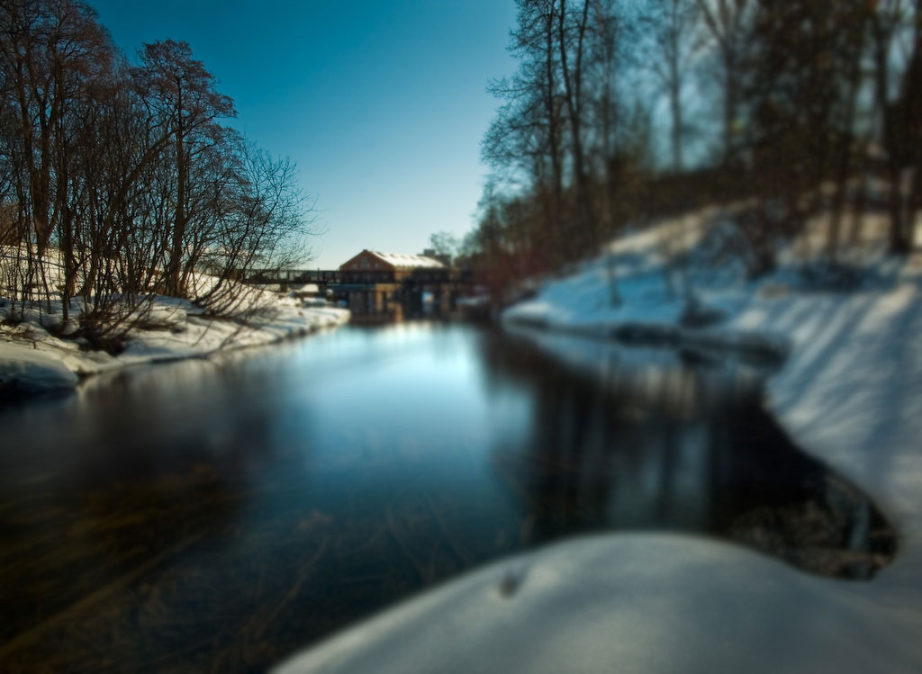
This was shot a bit further up the Lysakerelven river, than this shot from Saturday. Fåbro Fossen or Granfossen waterfall that was utilized for industrial purposes for centuries, begins in the distance.
Discussion
Comments and critique are as always welcome. Let me hear your opinion, why do you like this, or even better, how would you approach this scenery. Give me your thoughts... not just a Wow!... only then I can improve :))
uberfischer and Gunnar Bangsmoen have spotted a halo in this shot....!!!! Hmmmm, not good :))))) They want to see a larger version to judge this matter better :))
So I uploaded a larger version (blurred foreground :)
What do think? Is there a halo in there...
Kane feels that the glow on the water might be over powering. I used a circular polarizer filter to reduce reflections, that's why the river bottom is visible in the front. But I find it hard to reduce reflections in big surfaces when I'm shooting at 10mm (16mm fullframe eq).
Any suggestions?
Thanks
In and out of Explore, thanks to all for comments and faves :))
Use
This photo is Copyrighted 2010 © Morten Prom. All rights reserved.
Facebook Site | Contact & Portfolio | Twitter | Blog | Print Sales
Santorini
We had always said we would never ever go to Santorini as too many tourists visit the island and we like less obvious holiday spots. Time showed that we took a flight actually to Santorini to get to Paros by ferry. And tell you what - Santorini is awe-inspiring!. There are absolutely too many tourists (here great respect for the local bus drivers and the guys who sell tickets on buses) but the unique volcanic beaches with their hot black sands, the mighty rock you see when approaching the island from the sea, the dazzling white-washed buildings cascading down the cliffs, finally he breathtaking views of the caldera and the deep blue Aegean Sea, sunsets that paint the sky with stunning hues of orange, pink, and purple - all of this makes Santorini appear as a true paradise on Earth. The magic of the island leaves a lasting impression on you
Santorini (Greek: Σαντορίνη, romanized: Santoríni, pronounced [sa(n)doˈrini]), officially Thira (Greek: Θήρα, romanized: Thíra, pronounced [ˈθira]) or Thera, is a Greek island in the southern Aegean Sea, about 200 km (120 mi) southeast from the mainland. It is the largest island of a small, circular archipelago formed by the Santorini caldera. It is the southernmost member of the Cyclades group of islands, with an area of approximately 73 km2 (28 sq mi) and a 2021 census population of 15,480. The municipality of Santorini includes the inhabited islands of Santorini and Therasia, as well as the uninhabited islands of Nea Kameni, Palaia Kameni, Aspronisi and Christiana. The total land area is 91 km2 (35 sq mi). Santorini is part of the Thira regional unit.
The island was the site of one of the largest volcanic eruptions in recorded history: the Minoan eruption (sometimes called the Thera eruption), which occurred about 3,600 years ago at the height of the Minoan civilization. The eruption left a large caldera surrounded by volcanic ash deposits hundreds of metres deep.
It is the most active volcanic centre in the South Aegean Volcanic Arc, though what remains today is chiefly a water-filled caldera. The volcanic arc is approximately 500 km (300 mi) long and 20 to 40 km (12 to 25 mi) wide. The region first became volcanically active around 3–4 million years ago, though volcanism on Thera began around 2 million years ago with the extrusion of dacitic lavas from vents around Akrotiri.