View allAll Photos Tagged :
Short iPhone video of Giza the melanistic leopard walking to (and under) our vehicle. Photo here flic.kr/p/2pEsXUX
While we were eating lunch by the pond, the whale boat's tail got caught in a pine branch on a small island in the pond. The crew pedaled desperately but could not escape. I asked my friend the boat manager to rescue them, and the whale boat was rescued safely. After a while, a crew member, mother and her son came to thank us.
At Pashley Manor Gardens you will discover 11 acres of beautiful borders and vistas – the culmination of a lifetime of passion for gardening, an appetite for beauty and an admiration of the tradition of the English Country garden. These graceful gardens, on the border of Sussex and Kent, are family owned and maintained – visitors often express delight at the attention to detail displayed throughout and the intimate, peaceful atmosphere.
All the ingredients of the English Country Garden are present – sweeping herbaceous borders, ha-ha, well maintained lawns, box hedges, espaliered rose walk, historic walled garden, inspiring kitchen garden, venerable trees and the Grade I listed house as a backdrop. The gardens are a haven for wildlife – bees, butterflies and small birds as well as moor hens, ducks and a black swan. Then, of course, the plants! Borders overflowing with perennials and annuals – the look changing through the seasons, but always abundantly filled, and each garden ‘room’ planted in a different colour theme.
Pashley is also renowned for fantastic displays of tulips, roses and dahlias. Our annual Tulip Festival features more than 48,000 tulips this year! During Special Rose Week over a hundred varieties of rose swathe the walls, climb obelisks and bloom in flower beds. Then in late summer our Dahlia Days event transforms the gardens once more with bountiful, brightly coloured dahlias in every border and pot.
Add to all this a Café and Terrace with excellent garden views, serving delicious homemade lunches, scones and cakes; Sculpture and Art Exhibitions; a Gift Shop with Plant Sales; and a friendly, knowledgeable team waiting to welcome you, and the recipe for a wonderful day out is complete.
For more information please visit www.pashleymanorgardens.com/
Sé por conocimiento propio que en la primera guerra mundial, durante la retirada alemana final de la Línea Hindenburg, los ametralladores dejados atrás para demorar tanto como fuera posible el avance eran casi siempre ejecutados hasta el último hombre, aun cuando se rendían. En estos juicios hay un elemento de hipocresía que hiere. Ahorcar generales y políticos y gente de campos de concentración está bien, pero cuando se llega a oficiales menores dejo de sentirme cómodo. La libertad de elección que tuvieron estos hombres me parece poco más que la libertad de preferir la muerte al deshonor, y eso es pedirle demasiado a la naturaleza humana.
(El simple arte de escribir, pág. 165, Carta a James Sandoe, 25 de febrero de 1949) Raymond Chandler
" Les belles infos du canard "
Les cyclosportifs qui gémissent et s'époumonent avec force commentaires lors de la supposée rude ascension du Ballon d'Alsace nous mentent : le Ballon d'Alsace, c'est plat, la preuve, vue et confirmée par l'image tôt le matin et même pas fatigué ni essoufflé, c'est dire ...
Sony FE 35.0mm f/9.0 1/160 ISO 100 ...
Discover more on Coronaviking's Youtube Channel:
Majestic Landscapes of Patagonia, Norway and New Zealand in motion with orchestral music
Website: https://coronaviking.com/
Instagram:: https://instagram.com/coronaviking:
Telegram channel:: https://t.me/coronaviking
Join Me on PATREON
Support me and evaluate my photos for you.
Your support helps me grow and develop.
Thank you for staying with me.
It's 106 miles to Myrtle Beach, we've got a full tank of gas, a half-eaten BLT sandwich, it's dark... and I'm wearing leather. Hit it!
My island in the sun ..
Island in the Sun, Harry Belafonte
This is my island in the sun
Where my people have toiled since time begun
I may sail on many a sea
Her shores will always be home to me
Oh, island in the sun
Willed to me by my father's hand
All my days I will sing in praise
Of your forest, waters,
Your shining sand
As morning breaks
The heaven on high
I lift my heavy load to the sky
Sun comes down with a burning glow
Mingles my sweat with the earth below
Oh, island in the sun
Willed to me by my father's hand
All my days I will sing in praise
Of your forest, waters,
Your shining sand
Even Red-shouldered Hawks are looking for water on a day like this! Taken in my yard in NE Oklahoma.
The Serra dos Órgãos National Park is the third oldest park in the country, representing an important milestone in the history of Brazilian Conservation Units. It was created during the Getúlio Vargas government on November 30, 1939. It currently has an approximate area of 20,024 hectares in the municipalities of Teresópolis, Petrópolis, Magé and Guapimirim.
It is one of the best places in the country to practice mountain sports, such as climbing, hiking, abseiling and others; besides having fantastic waterfalls. The Park has the largest network of trails in Brazil. There are more than 200 km / 124 miles of trails at all levels of difficulty: from the suspended trail, accessible to wheelchair users, to the heavy Petrópolis-Teresópolis crossing, with 30 km / 19 miles of ascents and descents through the high part of the mountains.
Among the climbs, the peak of God's Finger stands out, considered the starting point of climbing in Brazil, and God's Finger, chosen as one of the 15 best rock climbs in the world.
Selection of mountains and presenting other peaks besides God's Finger which is the most famous and known worldwide, get ready to know the other peaks such as: Devil's Needle, São João Hill, Santo Antônio Hill, Fish Head, Our Lady's Finger, Escalavrado (where I'm on the video), Friar's Crown, Friar's Wart, Carboy, Castles of Açu and Bell Stone.
SCOUT: "Daddy? Daddy!"
DADDY: "Yes, Scout?"
SCOUT: "Daddy, can we go out for a walk, please?"
DADDY: "Yes of course, Scout. Is there somewhere in particular you’d like to go?"
SCOUT: "Anywhere there are flowers, please Daddy!"
DADDY: "Well, it is wintertime now, Scout, so a lot of the flowers will be asleep, but we will see what we can find."
SCOUT: "Come on Paddy and Rosie! I know Daddy says that it’s wintertime, but if Cornelia found some pretty flowers for Moesje, maybe we can find some pretty flowers for Oleg and mijn beste vriend Peter."
ROSIE: "Who also happens to be mijn prins Peter! Yes! Let’s go, Scout! Peter saw me in his magical crystal ball, so I want to give him some beautiful flowers as a thank you for thinking of me!"
PADDY: "Yes, let’s go, but let’s wrap up nice and warmly first, everybear. "
SCOUT and ROSIE: "Yes Paddy!"
DADDY, PADDY, SCOUT and ROSIE: *Go for a walk.*
PADDY: "Oh look Scout and Rosie! There is a whole bush of pretty red Prunus flowers! We can pick some of them for mijn best vriend Oleg and your beste vriend and prins, Peter!"
ROSIE: "Prunes? Oh yuck! I hate prunes!" *Sticks out cute little pink bear tongue.* "They taste disgusting! Blagh!"
SCOUT: "Oh, I hate prunes too, Rosie! Yuck!" *Sticks out cute little pink bear tongue.* "Daddy makes me eat prunes when I can't..."
PADDY: "Ahem!" *Clears throat.* "Scout!"
SCOUT: "What?" *Looks at Paddy questioningly.*
PADDY: "There is no need to discuss bodily functions in public, Scout!" *Blushes pink beneath plush fur.*
SCOUT: "But it's true, Paddy! Daddy makes me eat them when..." *Lowers voice to a whisper.* "When I can't... can't... can't go visit the... the... the Lady Louisa!"
ROSIE: "Considering that mijn poor prins Peter got stuck on the poop chair, he might not like these Prune flowers that help you go poop."
SCOUT: "Oh, I hadn’t thought of that. We don’t want to upset mijn beste vriend Peter."
ROSIE: "Who also happens to be mijn prins Peter!"
SCOUT: "Maybe we better find a better kind of flower than these Prune flowers then, Paddy and Rosie!"
PADDY: "Prunus flowers, Scout and Rosie, not Prune flowers."
DADDY: "Actually Paddy, I think you'll find that those red flowers are actually Japonica and aren't Prunus at all. Sorry to correct you."
PADDY, SCOUT and ROSIE: "Oh thank you for telling us Daddy!"
SCOUT: *Scratches head.* "What is a Japonica, Daddy?"
PADDY: "Isn't that a type of Camellia, Daddy?"
DADDY: "Well, it is, but it is also the proper name of the Japanese quince or Maule's quince."
SCOUT and ROSIE: "Oh! Thank you Daddy!"
PADDY: "Yes, thank you for correcting me, Daddy."
ROSIE: "You are so knowledgeable Daddy!"
SCOUT: "I bet you know the names of every flower, Daddy!"
DADDY: "Well, perhaps not every flower, Scout, but quite a few common ones."
SCOUT: "Daddy? Daddy! "
DADDY: "Yes Scout?"
SCOUT: "Do quinces help you..." *Lowers voice to a whisper.* "Go to the Lady Louisa?"
DADDY: "Well they can Scout if you eat too many of them, but they don't work as well as prunes do. Why do you ask, Scout? Do you need some help?"
SCOUT: "No! No! No, Daddy!" *Shakes head vehemently.*
ROSIE: "Good! Well, now I know that it isn't a prune tree! I like these Japonica flowers! They are pretty! Maybe we can pick some for mijn prins Peter" *Smiles.*
My Paddington Bear came to live with me in London when I was two years old (many, many years ago). He was hand made by my Great Aunt and he has a chocolate coloured felt hat, the brim of which had to be pinned up by a safety pin to stop it getting in his eyes. The collar of his mackintosh is made of the same felt. He wears wellington boots made from the same red leather used to make the toggles on his mackintosh.
He has travelled with me across the world and he and I have had many adventures together over the years. He is a very precious member of my small family.
Scout was a gift to Paddy from my friend. He is a Fair Trade Bear hand knitted in Africa. His name comes from the shop my friend found him in: Scout House. He tells me that life was very different where he came from, and Paddy is helping introduce him to many new experiences. Scout catches on quickly, and has proven to be a cheeky, but very lovable member of our closely knit family.
Rosie is Scout's cousin, because like Scout, she is a free trade knitted bear from Africa. She was made in Kenya by one of the Kenana Knitters, Martha Wanjira. She is made from home spun and dyed wool. She was a gift to me from two very dear friends, includng the one who gave Scout to Paddy.
Being colder here, Paddy and Scout are wearing hand knitted scarves, Paddy is wearing hand knitted hat and Rosie is wearing a hand knitted cape made by Lorna's Lovely Looks. Paddy sports a heart pin and Scout insisted on wearing a pink cupcake one, which seems most appropriate considering his perpetual grumbly tummy. Both were gifts from a good friend who is very fond of both Paddy and Scout.
Trying to catch up my delay ... (which is still very big) ... but I need to post a new photo from time to time ...
Thank you in advance for all your faves and comments. I might answer several WEEKS/MONTHS later. And I might post several photos in the meantime.
Merci d'avance pour tous vos faves et commentaires. Je vous répondrai peut-être dans plusieurs SEMAINES/MOIS. Et je posterai peut-être plusieurs photos entre temps.
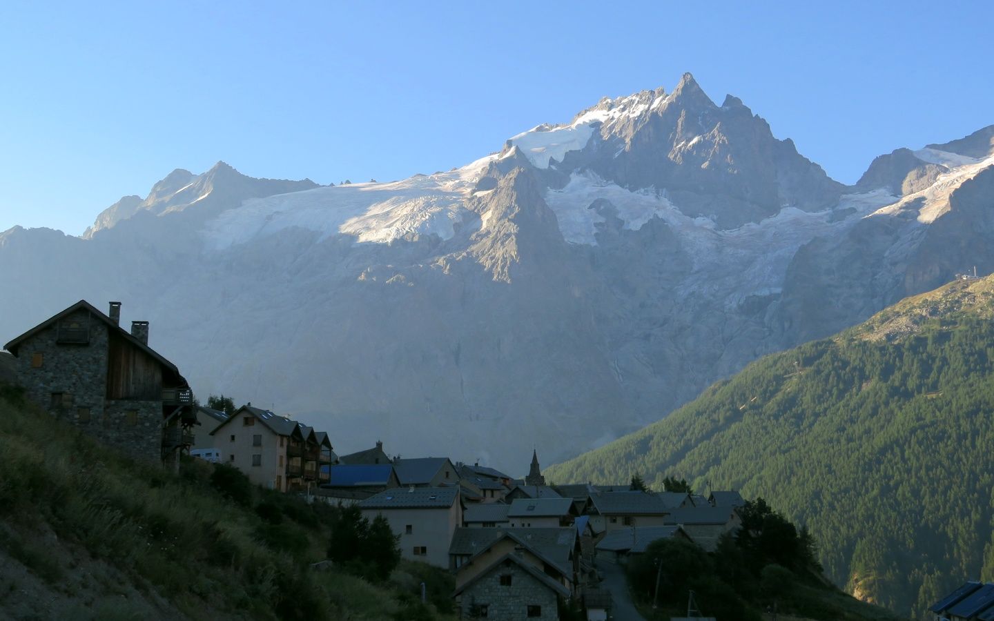
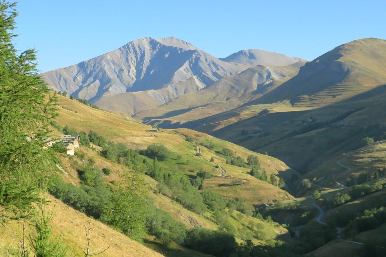
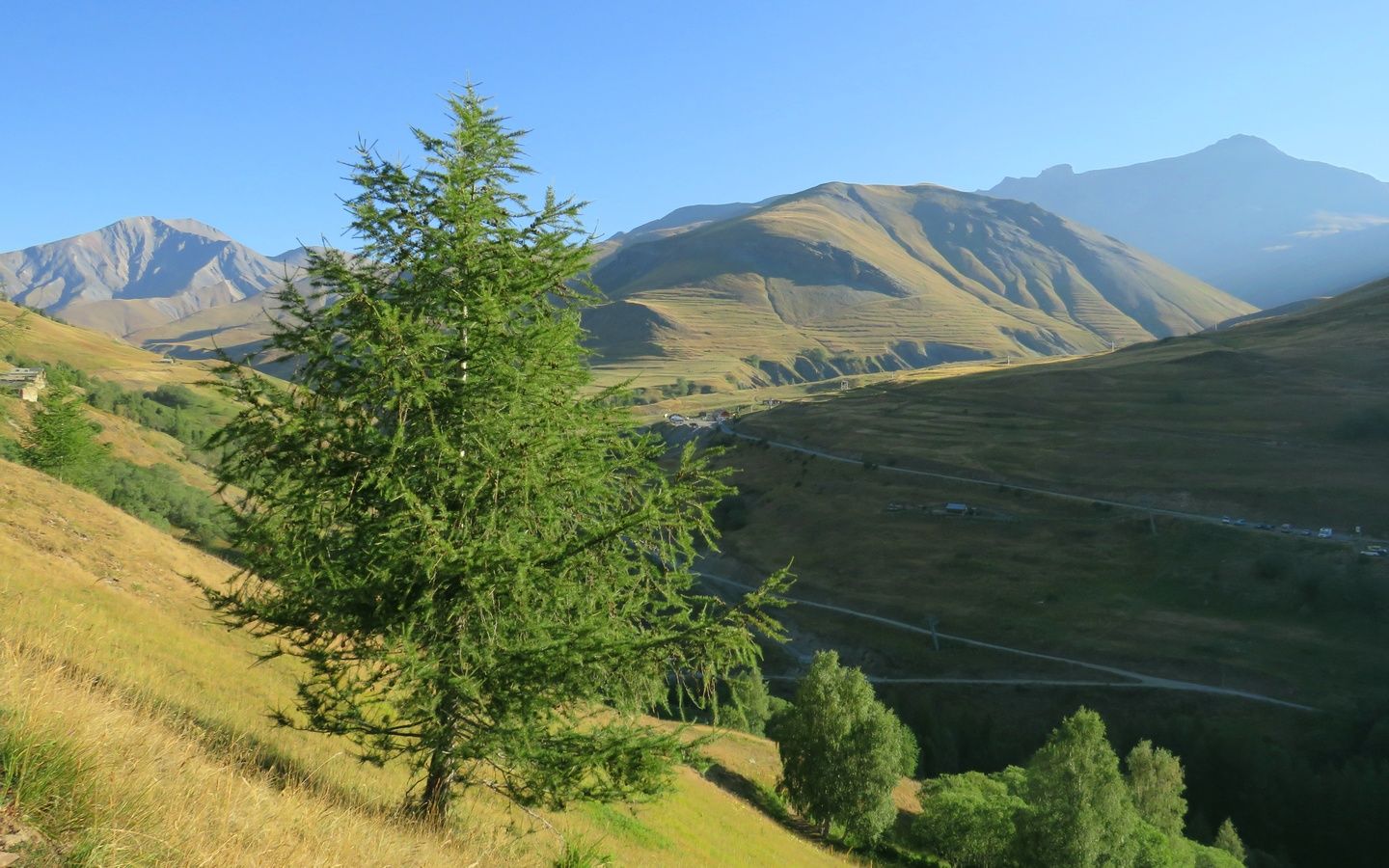
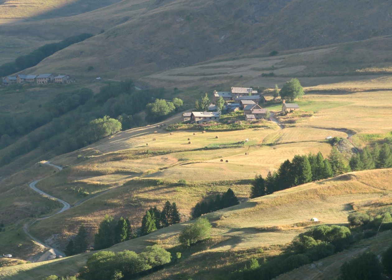
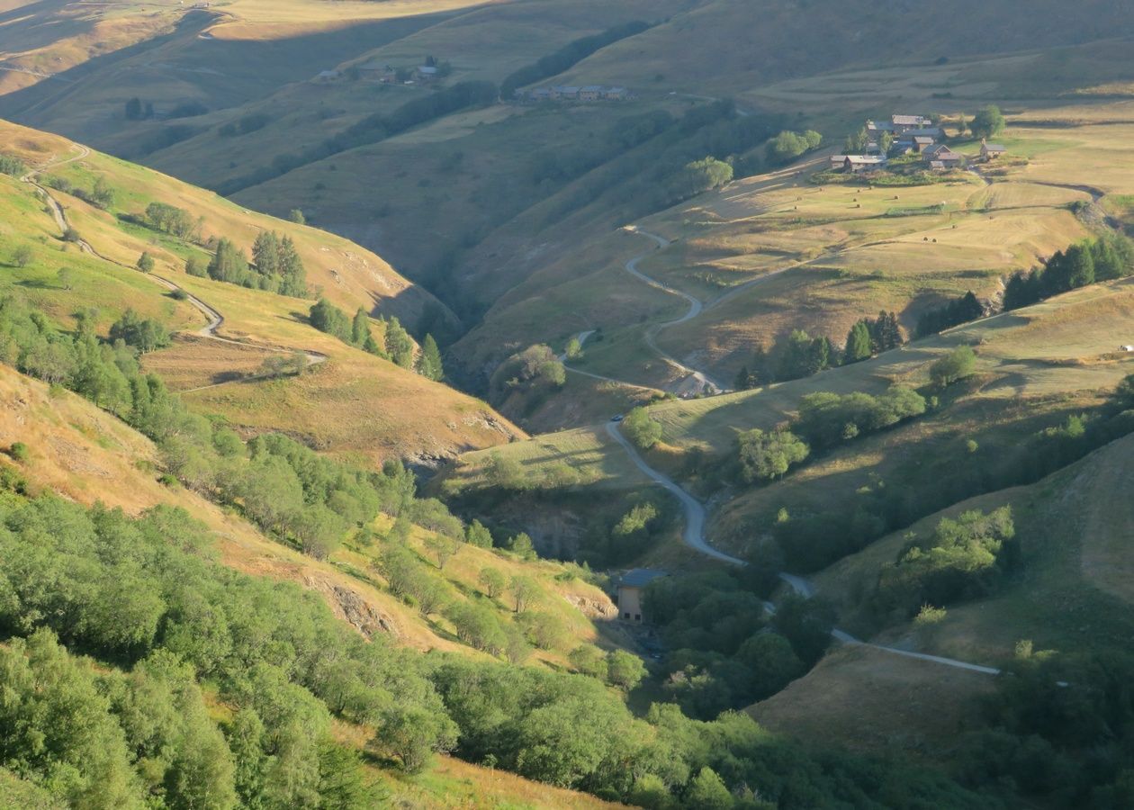
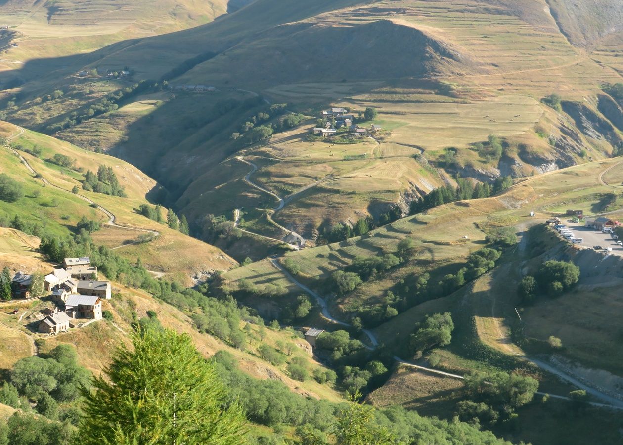
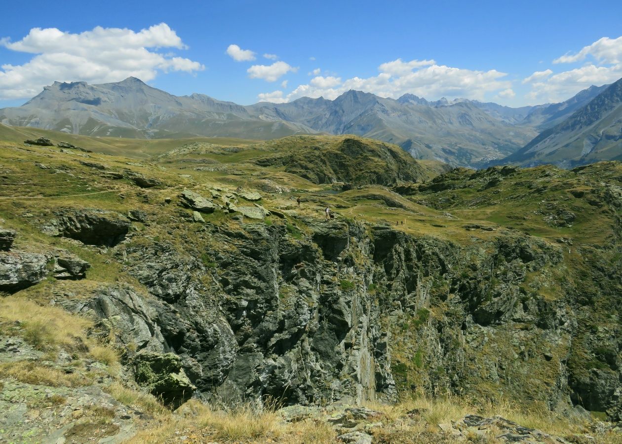
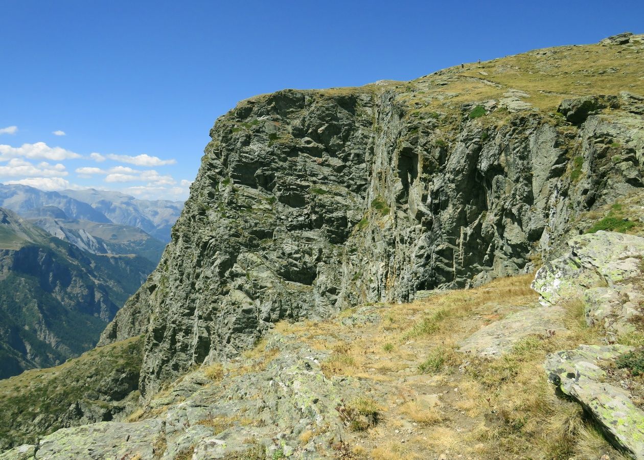
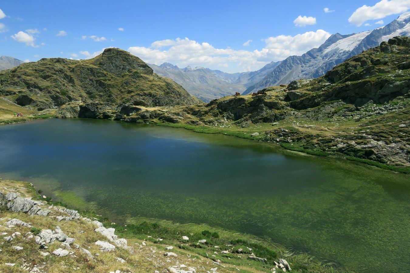
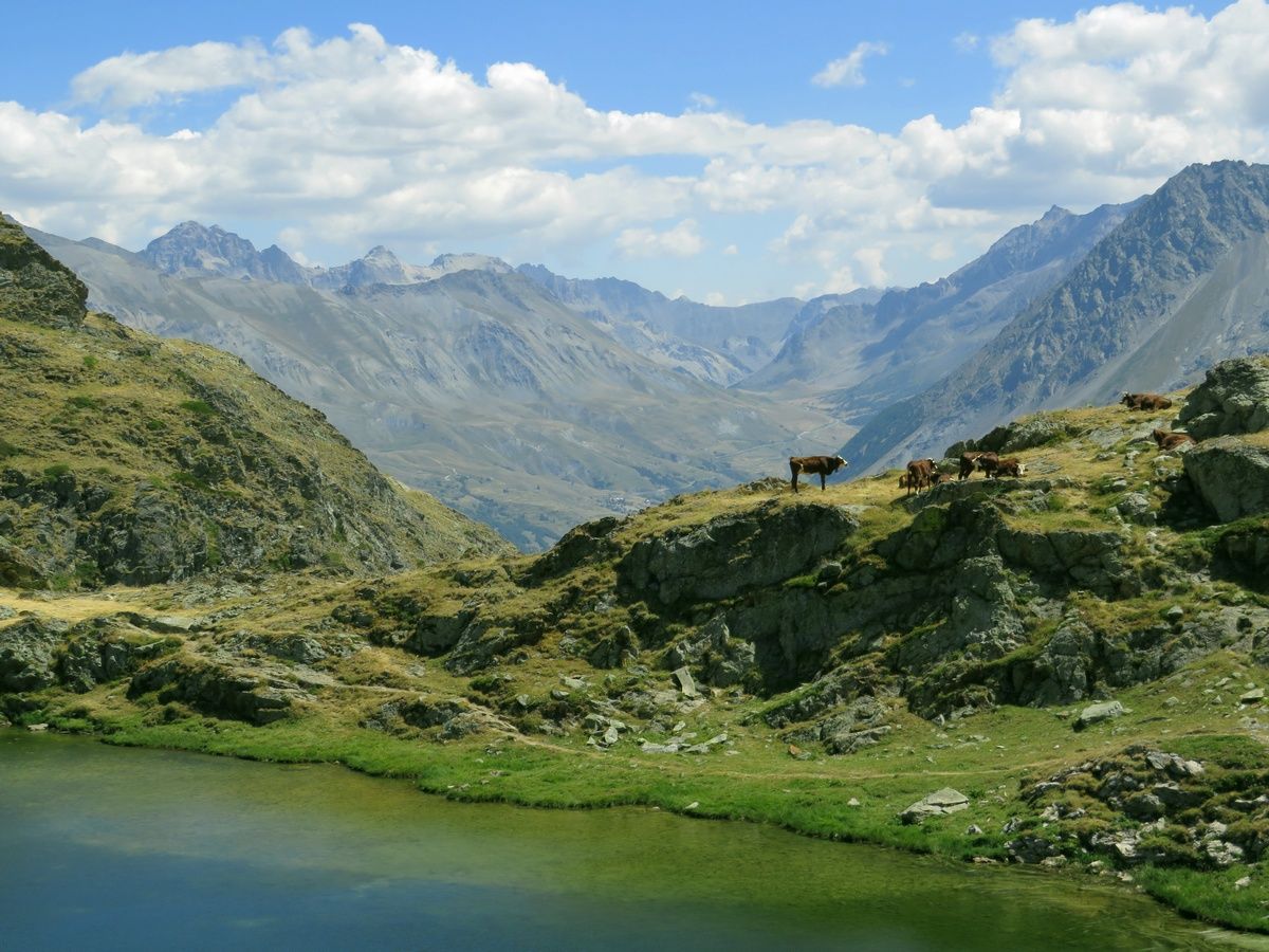
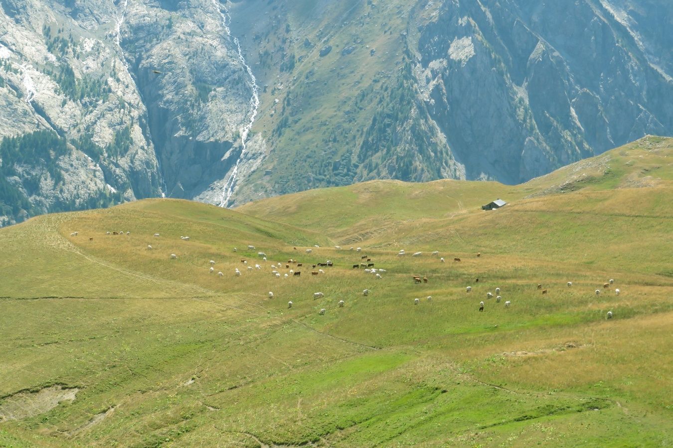
France. Alpes. Département des Hautes Alpes (05). Massif des Arves. Photo prise lors d'une randonnée effectuée en solo sur le très célèbre et très fréquenté Plateau d'Emparis, au départ de la station du Chazelet, en passant par le Lac Noir et le Lac Lérié. C'était mon 10ème jour de rando sur les 18 jours où j'ai pu randonner lors de notre séjour alpin de 3 semaines pendant l'été 2022.
Je fais une petite parenthèse pour dire que dans 1 semaine, nous partirons pour notre séjour alpin de l'été 2023, en espérant qu'une fois de plus nous vivrons beaucoup de moments magiques et inoubliables. 😊 Mais d'ici là, j'ai du pain sur la planche pour finir de préparer les randos ...
Cette photo a été prise au début de la montée au Plateau d'Emparis, depuis la station du Chazelet, très tôt (à 7h58), à une heure où les couleurs et la lumière étaient particulièrement belles. Je me suis levé particulièrement tôt ce jour-là mais j'ai été amplement récompensé de ce départ inhabituellement matinal. 🙏😊
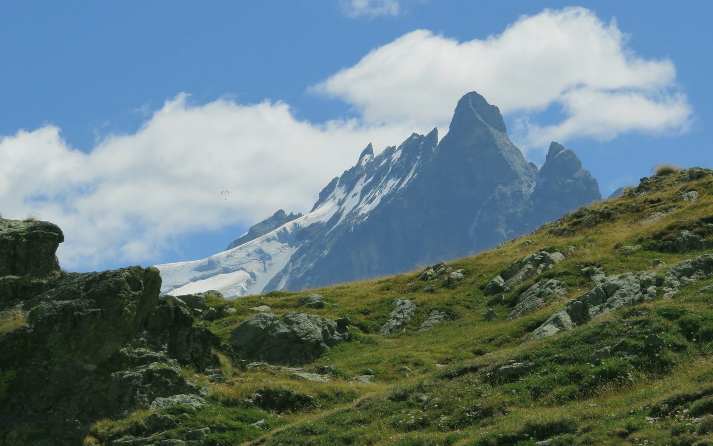
Tout au long de la rando, je n'ai pu que constater à quel point l'herbe du Plateau d'Emparis était complètement desséchée, même aux abords des 2 grands lacs du plateau, témoignage de cet été 2022 particulièrement chaud et sec. Et les paysages que j'ai pu voir n'étaient pas ceux d'un début de mois d'août mais d'un mois de septembre déjà bien avancé. Mais cela ne m'a pas empêché de goûter à la beauté de ce plateau, avec de nombreux sommets prestigieux visibles dans toutes les directions, et tout particulièrement la star des lieux, la Meije, située tout près du plateau, juste de l'autre côté de la Vallée de la Romanche. J'ai hésité à choisir une photo de la Meije. Finalement, c'est cette photo du Pic du Mas de la Grave (3020m) et du vallon du Torrent du Gâ que j'ai choisie. Mais ci-dessous, j'ai mis des liens vers des photos de la Meije et de ses glaciers.
Liens vers cette sortie et son album de 76 photos sur le site AltitudeRando :
www.altituderando.com/rando22386
www.altituderando.com/spip.php?page=album-photo&id_ra...
Et voici une sélection de 24 autres coups de cœur de cet album :
www.altituderando.com/IMG/jpg/3/e/7/041-chazelet-emparis-...
www.altituderando.com/IMG/jpg/c/c/2/041-chazelet-emparis-...
www.altituderando.com/IMG/jpg/6/1/4/041-chazelet-emparis-...
www.altituderando.com/IMG/jpg/c/1/b/041-chazelet-emparis-...
www.altituderando.com/IMG/jpg/7/3/3/041-chazelet-emparis-...
www.altituderando.com/IMG/jpg/1/0/3/041-chazelet-emparis-...
www.altituderando.com/IMG/jpg/f/5/1/041-chazelet-emparis-...
www.altituderando.com/IMG/jpg/6/c/5/041-chazelet-emparis-...
www.altituderando.com/IMG/jpg/e/6/6/041-chazelet-emparis-...
www.altituderando.com/IMG/jpg/b/c/a/041-chazelet-emparis-...
www.altituderando.com/IMG/jpg/c/b/3/041-chazelet-emparis-...
www.altituderando.com/IMG/jpg/6/1/4/041-chazelet-emparis-...
www.altituderando.com/IMG/jpg/4/8/1/041-chazelet-emparis-...
www.altituderando.com/IMG/jpg/5/e/9/041-chazelet-emparis-...
www.altituderando.com/IMG/jpg/4/2/1/041-chazelet-emparis-...
www.altituderando.com/IMG/jpg/f/3/e/041-chazelet-emparis-...
www.altituderando.com/IMG/jpg/4/2/b/041-chazelet-emparis-...
www.altituderando.com/IMG/jpg/c/f/f/041-chazelet-emparis-...
www.altituderando.com/IMG/jpg/d/8/f/041-chazelet-emparis-...
www.altituderando.com/IMG/jpg/9/7/a/041-chazelet-emparis-...
www.altituderando.com/IMG/jpg/b/0/d/041-chazelet-emparis-...
www.altituderando.com/IMG/jpg/5/7/4/041-chazelet-emparis-...
www.altituderando.com/IMG/jpg/2/2/9/041-chazelet-emparis-...
www.altituderando.com/IMG/jpg/7/1/2/041-chazelet-emparis-...
The AYAS VALLEY, one part, photographed from Punta (Peak) della Regina (Queen) near Colle (Pass) della Ranzola, where a plaque is placed in a chapel commemorating the ascent made by the poet Lev Nikolaevic Tolstoj in 1857. Aosta Valley, ITALY.
Trying to catch up my delay ... (which is still very big) ... but I need to post a new photo from time to time ...
Thank you in advance for all your faves and comments. I might answer several WEEKS/MONTHS later. And I might post several photos in the meantime.
Merci d'avance pour tous vos faves et commentaires. Je vous répondrai peut-être dans plusieurs SEMAINES/MOIS. Et je posterai peut-être plusieurs photos entre temps.
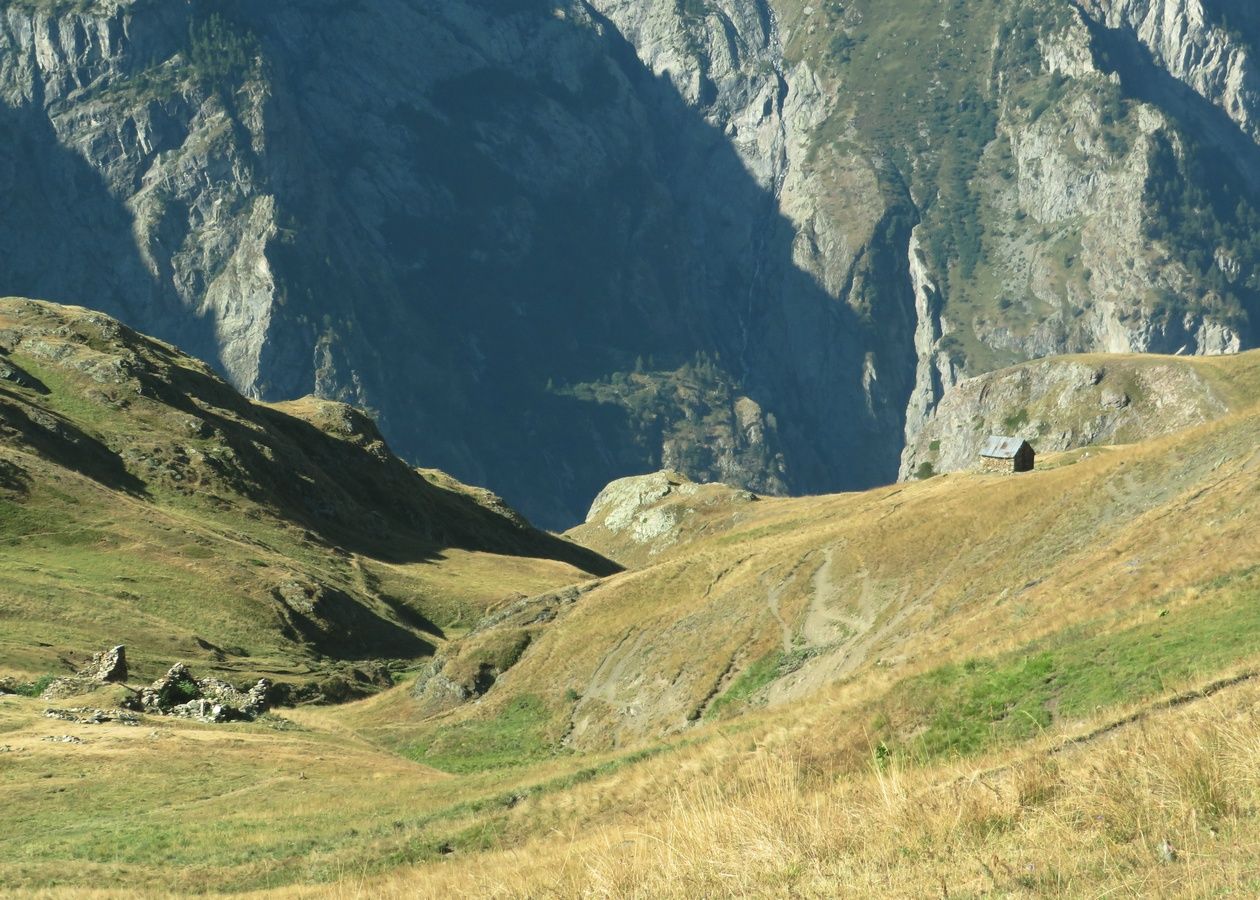
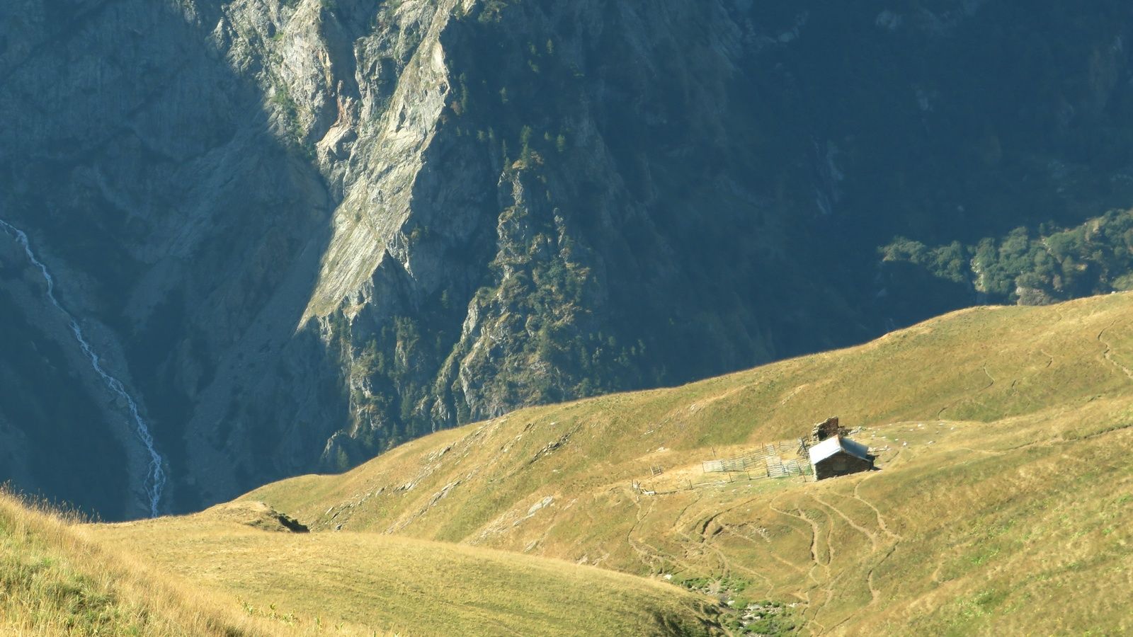
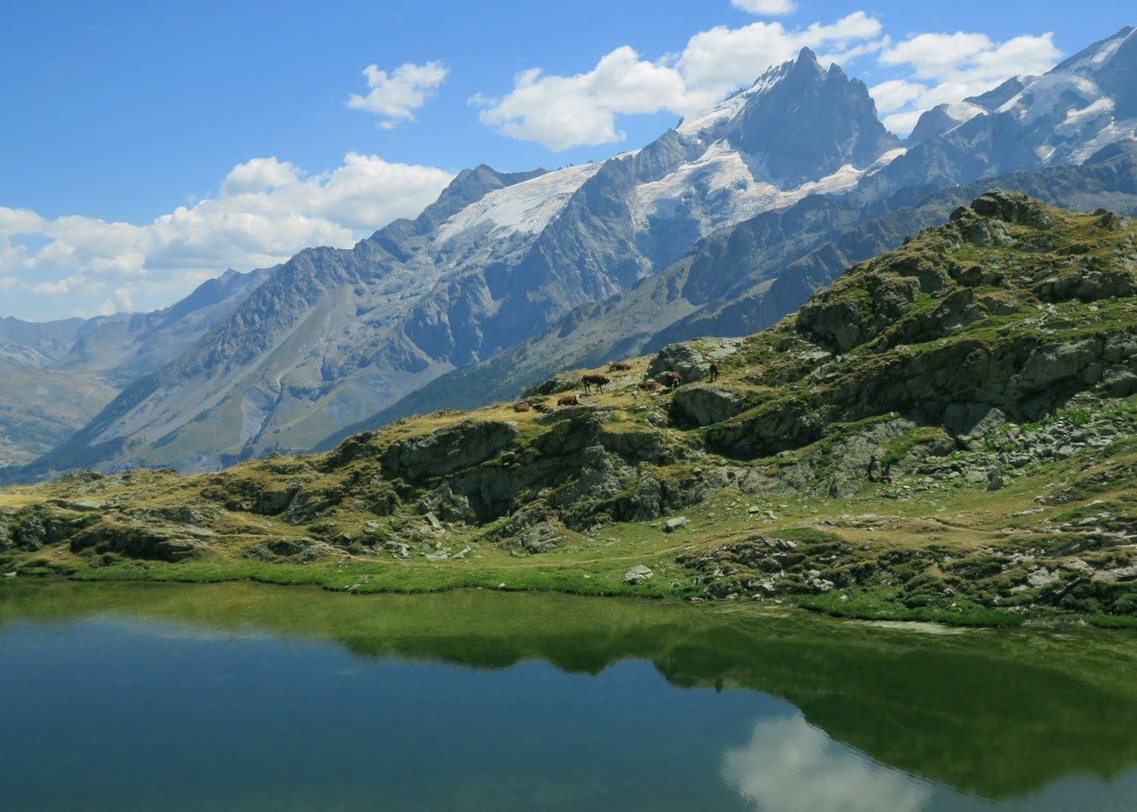
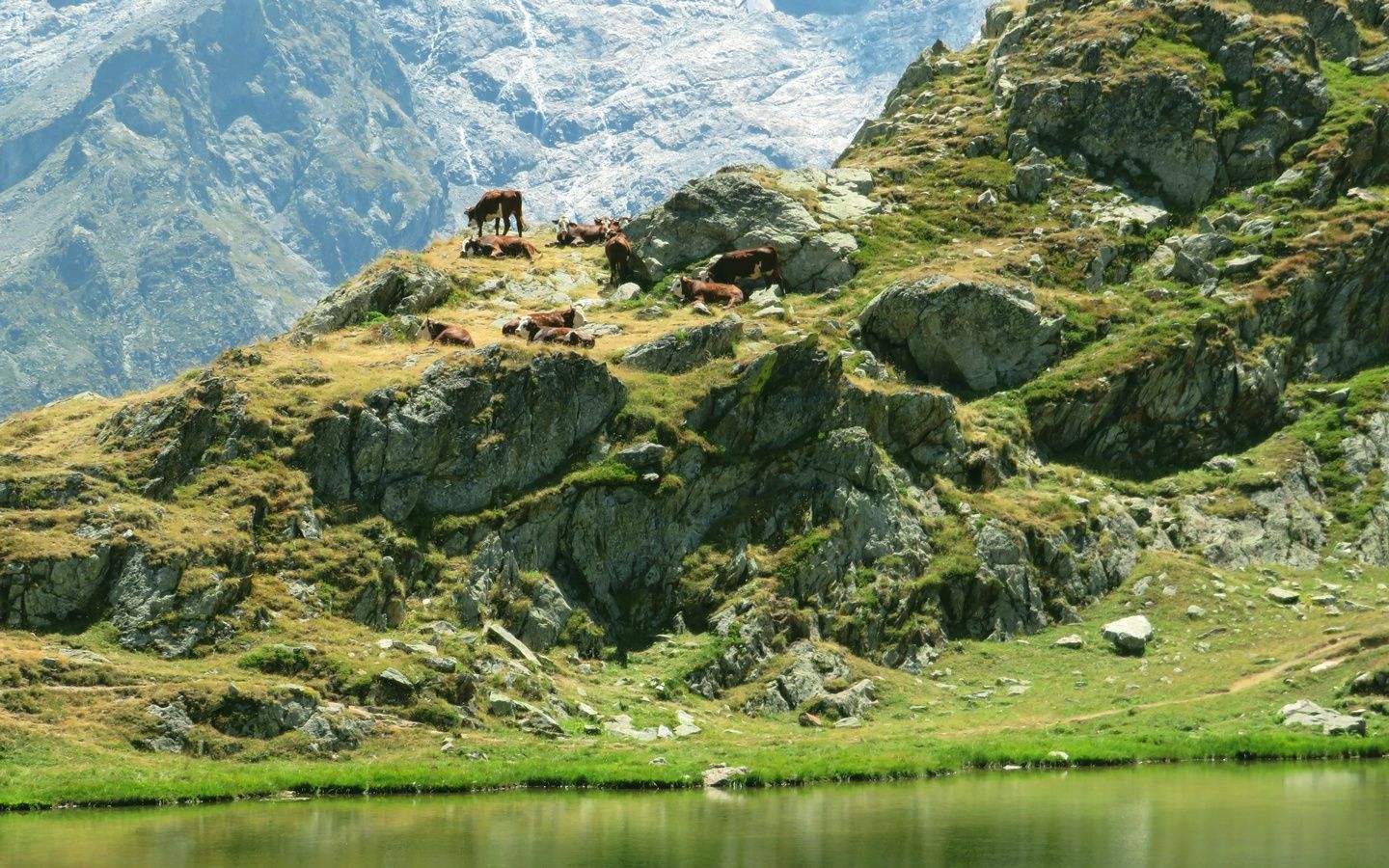
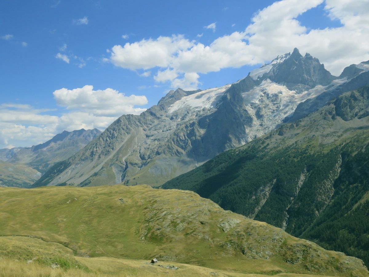
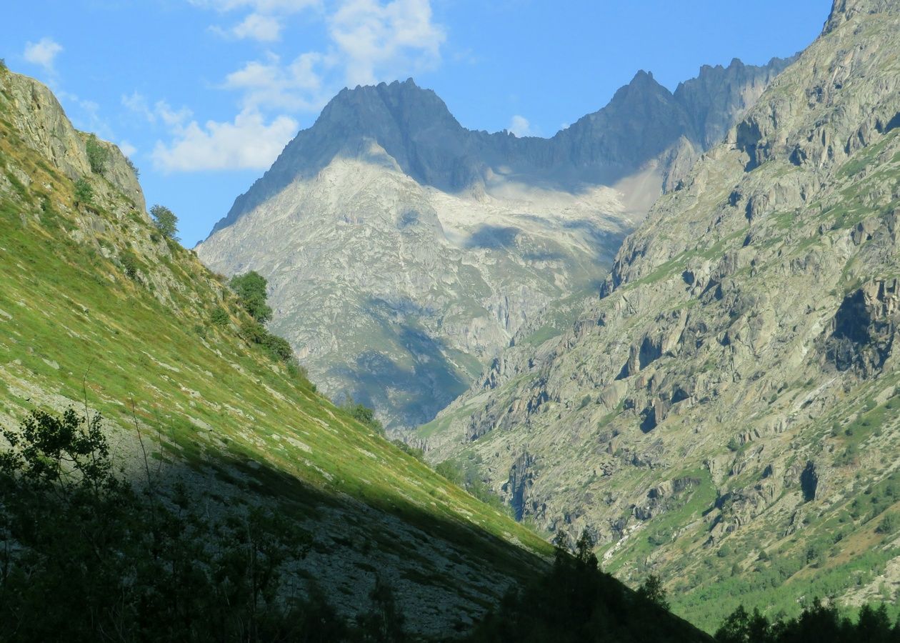
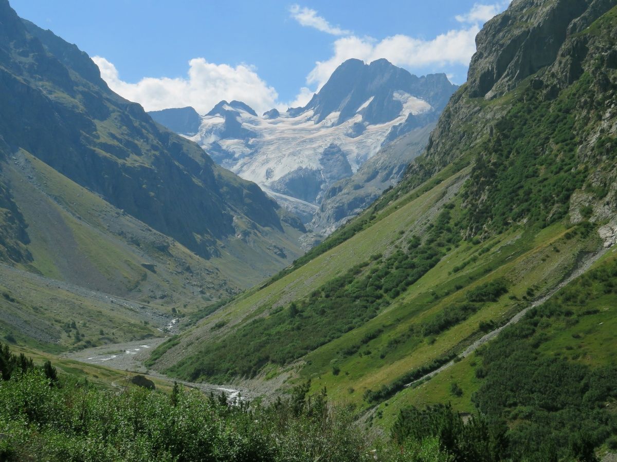
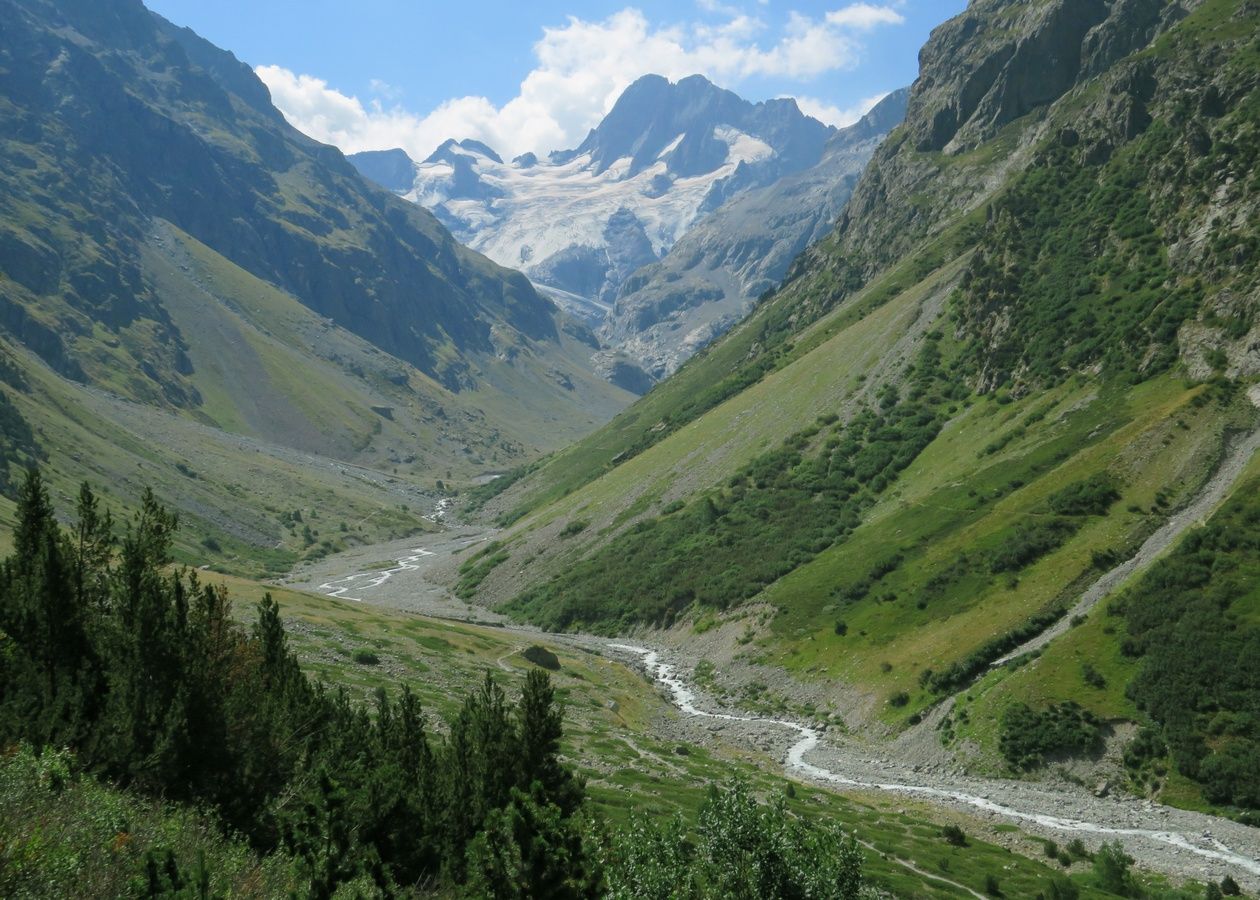
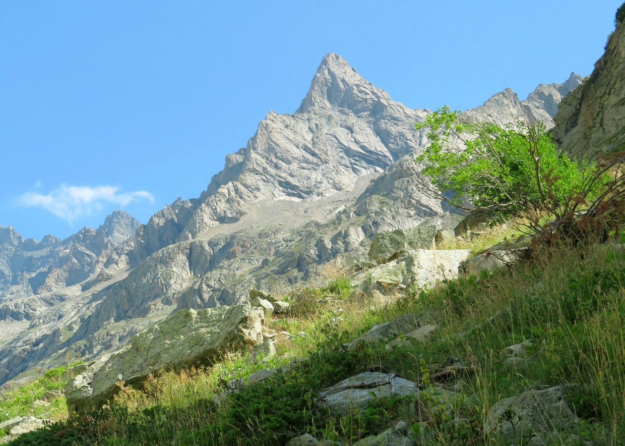
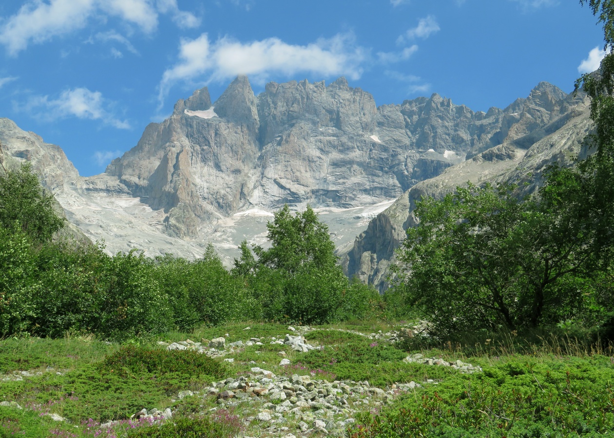
France. Alpes. Département de l'Isère (38). Massif des Écrins. Vallée du Vénéon. Photo prise lors d'une randonnée en aller-retour effectuée en solo, au départ de la Bérarde, jusqu'au Refuge de Temple Écrins. C'était mon 17ème jour de rando sur les 18 jours où j'ai pu randonner lors de notre séjour alpin de 3 semaines pendant l'été 2022.
La photo a été prise en remontant le Vénéon sur sa rive droite, un peu au nord du Refuge du Carrelet.
Cette randonnée s'est déroulée dans un cadre absolument grandiose, foisonnant de sommets de plus de 3000m, dont certains très célèbres. Les 2 sommets que j'ai trouvés les plus photogéniques sont la Tête du Chéret (que j'ai choisie de mettre à l'honneur sur cette photo) et Les Bans (dont le Sommet Sud culmine à 3669m), qui domine le superbe Glacier de la Pilatte, où le Vénéon prend sa source.
Par contre, cette journée fut très éprouvante pour moi physiquement, et cela pour plusieurs raisons. D'abord parce que j'étais diminué par le COVID, avec le dos courbatu. Ensuite parce qu'il faisait chaud. Et enfin parce que la montée finale au Refuge de Temple Écrins était particulièrement raide et éprouvante (450m de dénivelé concentrés sur seulement 2km, soit une pente moyenne de plus de 20%). Mais grâce à la beauté des lieux et avec l'aide d'une boisson énergisante qui donne des ailes, j'ai réussi à monter jusqu'au refuge. Et cerise sur le gâteau, en plus de la magnifique vue panoramique sur le plan incliné du refuge, j'ai eu une 2ème récompense pour mes efforts, en ayant la chance de pouvoir observer une marmotte pendant mon pique-nique, et cela malgré la forte fréquentation des lieux. 🙏
NB : Je ne sais pas si vous voyez ce que je veux dire mais les 2 pentes de devant, le sentier et le cours d'eau forment presque une espèce de X. 😉
Liens vers cette sortie et son album de 65 photos sur le site AltitudeRando :
www.altituderando.com/rando22154
www.altituderando.com/spip.php?page=album-photo&id_ra...
Et voici une sélection de 17 autres coups de cœur de cet album :
www.altituderando.com/IMG/jpg/7/6/5/040-temple-ecrins-22-...
www.altituderando.com/IMG/jpg/c/0/6/040-temple-ecrins-22-...
www.altituderando.com/IMG/jpg/2/6/e/040-temple-ecrins-22-...
www.altituderando.com/IMG/jpg/6/6/2/040-temple-ecrins-22-...
www.altituderando.com/IMG/jpg/c/4/2/040-temple-ecrins-22-...
www.altituderando.com/IMG/jpg/8/9/9/040-temple-ecrins-22-...
www.altituderando.com/IMG/jpg/2/1/d/040-temple-ecrins-22-...
www.altituderando.com/IMG/jpg/6/f/4/040-temple-ecrins-22-...
www.altituderando.com/IMG/jpg/a/0/b/040-temple-ecrins-22-...
www.altituderando.com/IMG/jpg/2/3/d/040-temple-ecrins-22-...
www.altituderando.com/IMG/jpg/1/1/0/040-temple-ecrins-22-...
www.altituderando.com/IMG/jpg/b/7/b/040-temple-ecrins-22-...
www.altituderando.com/IMG/jpg/e/4/b/040-temple-ecrins-22-...
www.altituderando.com/IMG/jpg/e/0/1/040-temple-ecrins-22-...
www.altituderando.com/IMG/jpg/4/2/8/040-temple-ecrins-22-...
www.altituderando.com/IMG/jpg/a/a/0/040-temple-ecrins-22-...
www.altituderando.com/IMG/jpg/2/8/e/040-temple-ecrins-22-...
Rund um Geislingen an der Steige gibt es eine Vielzahl spannender Aussichtspnkte. So zum Beispiel auch der Anwandfelsen, der einen Blick von Norden her auf die Fünftälerstadt ermöglicht. Am Abend des 1. Juni 2021 konnte ich von dort ICE 512 beobachten, der den Albabstieg geschafft hat und nun durchs Filstal der Landeshauptstadt entgegenstrebt.
Da mein weitwinklichstes Objektiv nicht weitwinklig genug ist, um die ganze Aussicht zu erfassen, besteht das Bild aus zwei Aufnahmen, die ich zusammengefügt habe.
TOUS DROITS RÉSERVÉS
Tout le matériel dans ma galerie NE PEUT PAS être reproduit, copié, édité, publié, transmis ou téléchargé de quelque manière sans ma permission.
my Instagram :
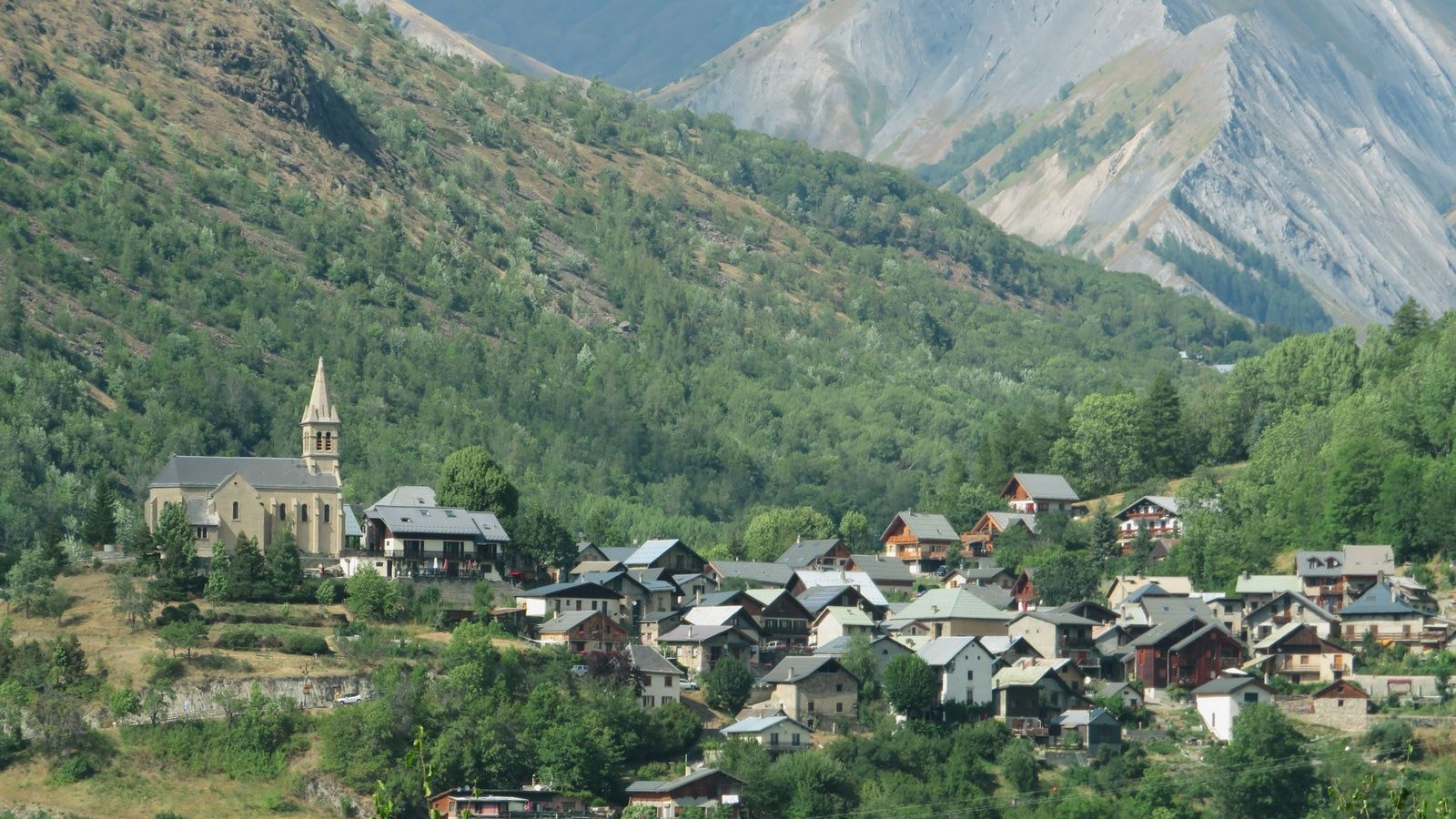
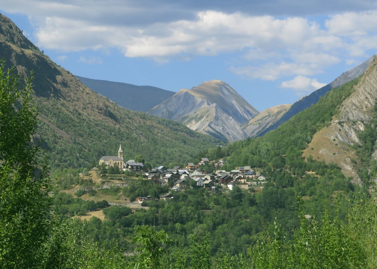
PRUNETTO, one of the many small villages of the Langa. The town is located on the ridge between the Bormida Valley and the Uzzone Valley and is dominated by the 12th century Del Carretto Castle and the interesting 14th century Sanctuary of the Madonna del Carmine. Piedmont, ITALY.
Please don't use this image on websites, blogs or other media without my explicit permission. © All rights reserved Luigi Alesi
Trying to catch up my delay ... (which is still very big) ... but I need to post a new photo from time to time ...
Thank you in advance for all your faves and comments. I might answer several WEEKS/MONTHS later. And I might post several photos in the meantime.
Merci d'avance pour tous vos faves et commentaires. Je vous répondrai peut-être dans plusieurs SEMAINES/MOIS. Et je posterai peut-être plusieurs photos entre temps.
Si je le pouvais, j'aimerais partager sur Flickr d'autres photos de cette rando. Mais si je veux publier au moins 1 photo de toutes mes autres randos, ce n'est pas possible avec mon rythme de publication actuel trop faible. Du coup, j'ai publié un album de 72 photos de cette rando sur le site AltitudeRando (où j'ai un compte avec le même pseudo). Voici le lien vers la page de ma sortie, dans laquelle on peut ouvrir l'album de photos (le 2ème lien permet d'ouvrir directement l'album mais je pense qu'il est beaucoup plus susceptible de changer avec le temps que le lien de la sortie) :
www.altituderando.com/rando21732
More photos of this hike (72) there :
www.altituderando.com/spip.php?page=album-photo&id_ra...
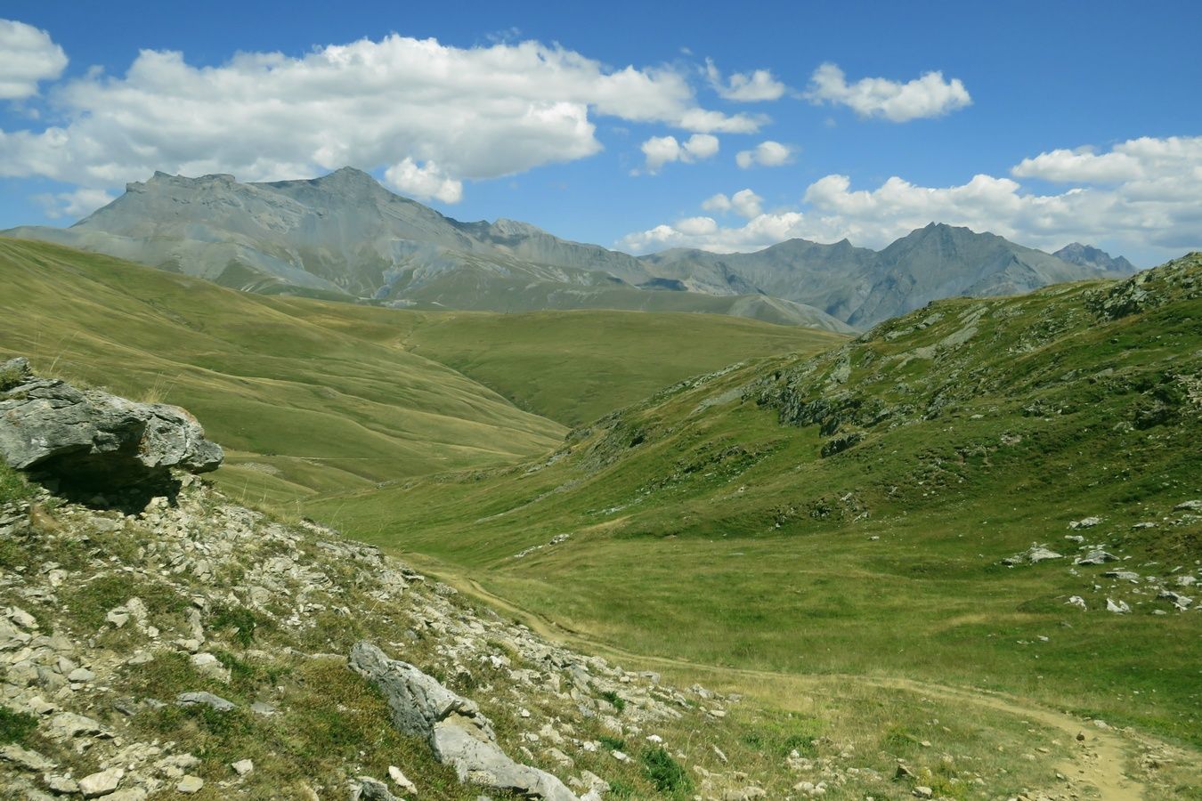
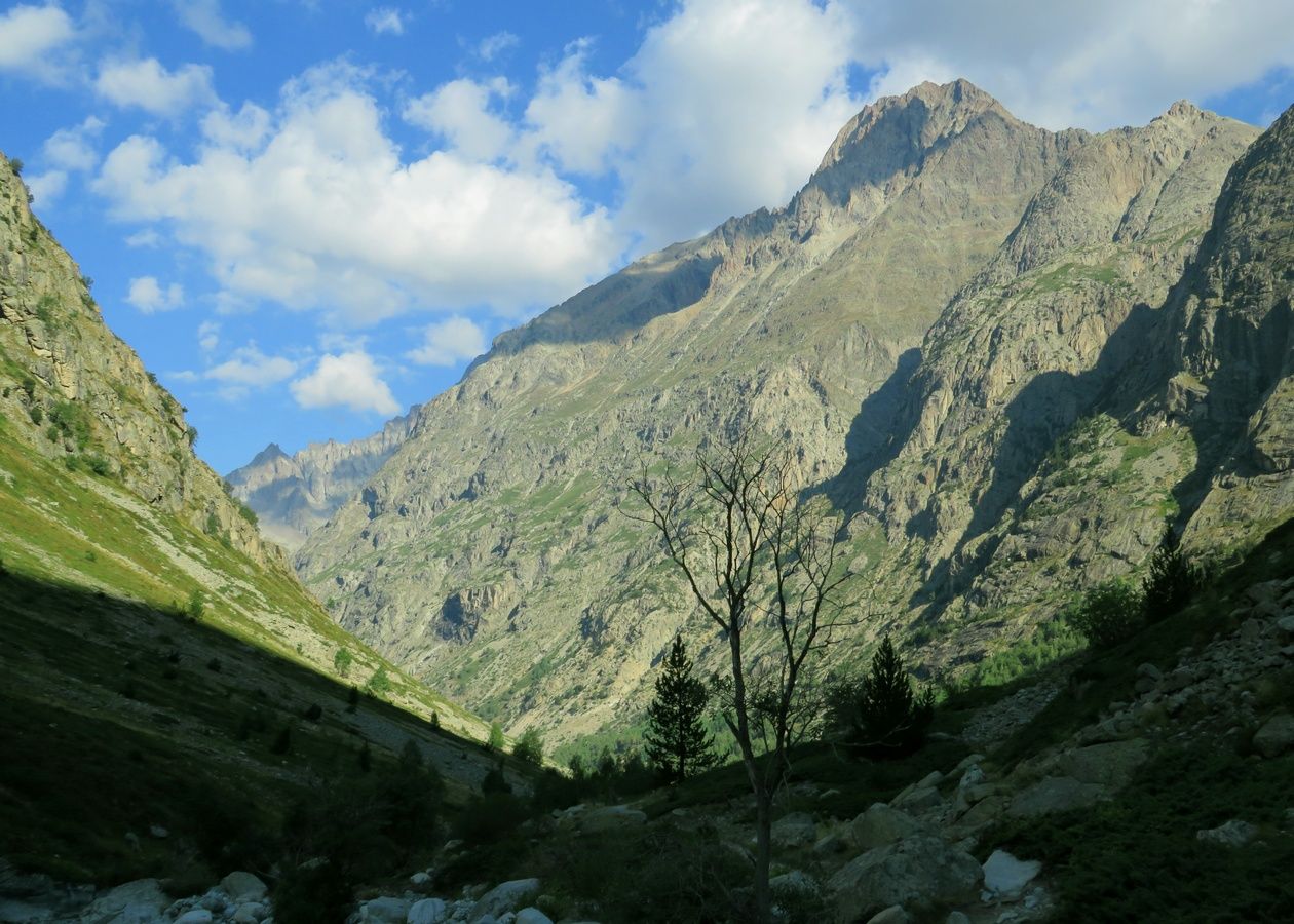
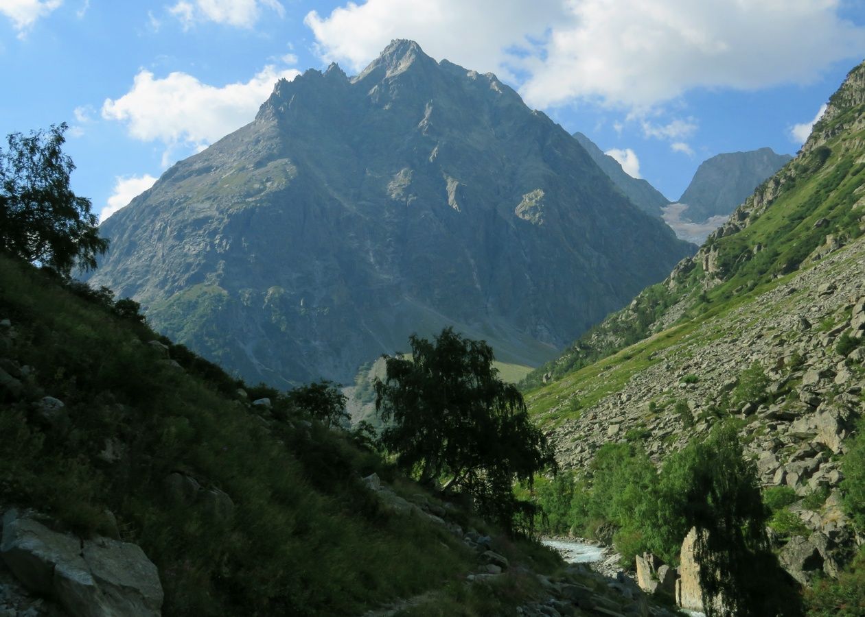
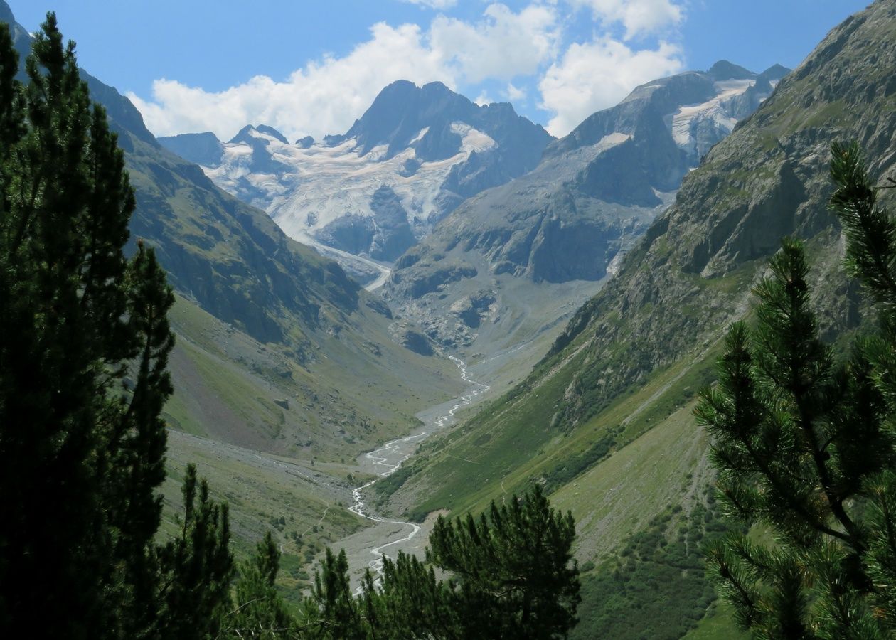
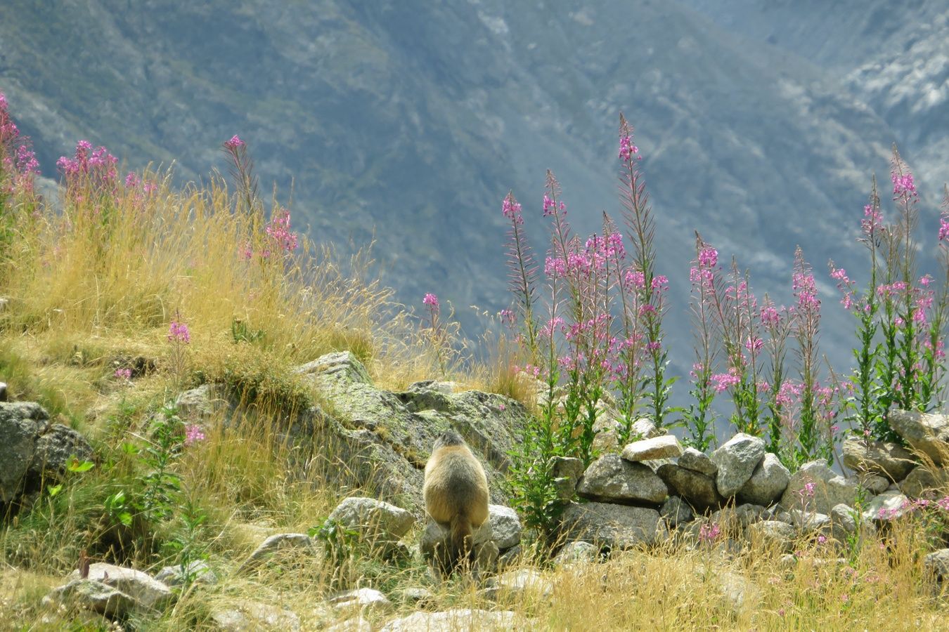
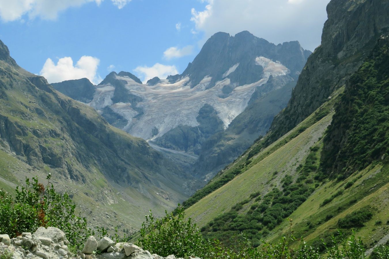
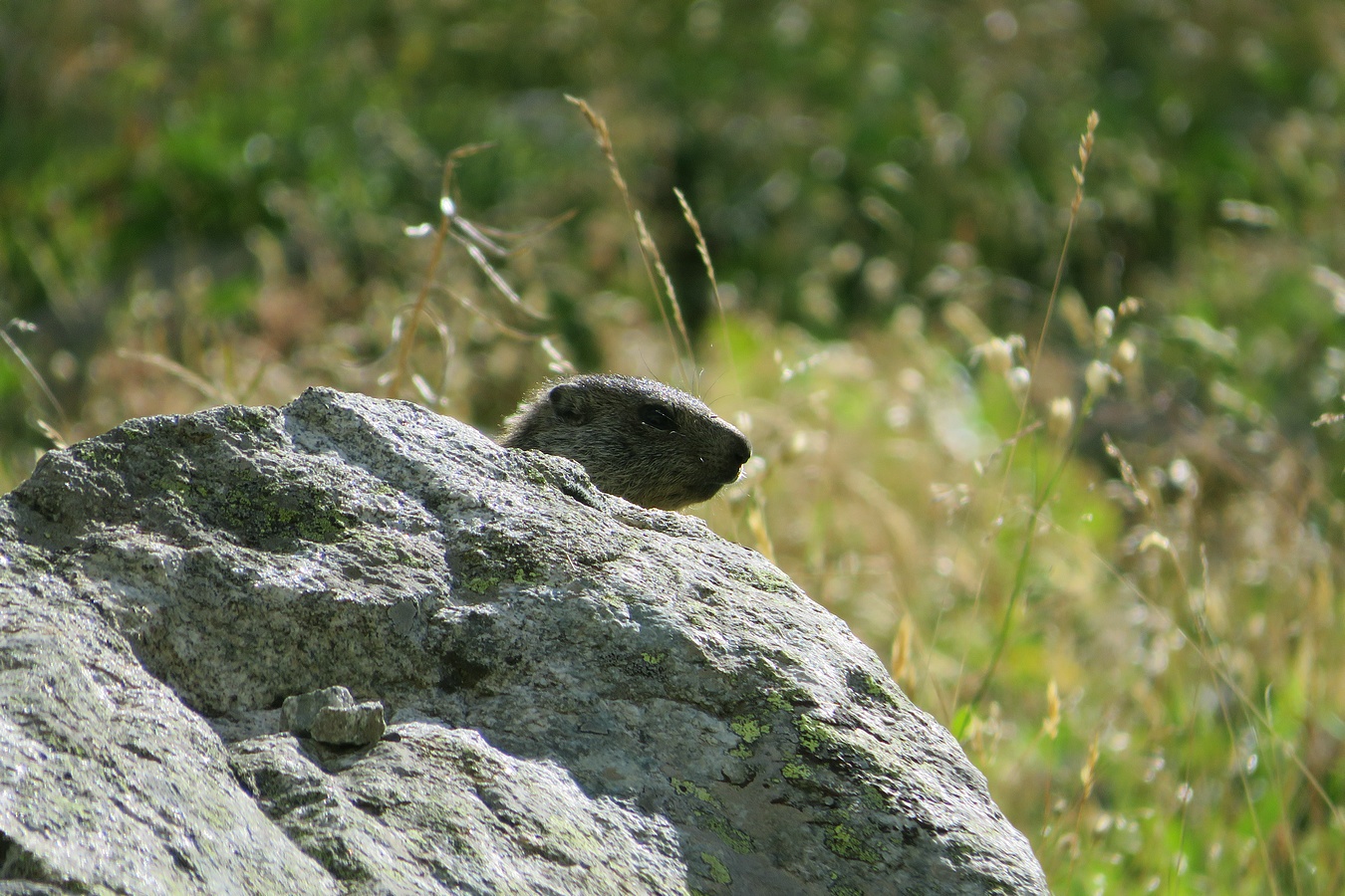
France. Alpes. Département de l'Isère (38). Massif des Écrins. Vallée du Vénéon. Photo prise lors d'une randonnée en aller-retour effectuée en solo, au départ de la Bérarde, jusque vers le Refuge du Châtelleret dans le Vallon des Étançons. C'était mon 13ème jour de rando sur les 18 jours où j'ai pu randonner lors de notre séjour alpin de 3 semaines pendant l'été 2022.
La photo a été prise depuis le Vallon des Étançons en zoomant par-dessus le Vallon de Bonne Pierre.
On y voit 2 sommets de plus de 4000m :
- Le Dôme de Neige des Écrins (4015m) au centre
- Le Pic Lory (4088m) derrière sur sa droite
Quant au point culminant du Massif des Écrins (la Barre des Écrins à 4102m), il est caché derrière car sous ce point de vue, le Dôme et la Barre sont alignés et c'est le Dôme qui se trouve devant.
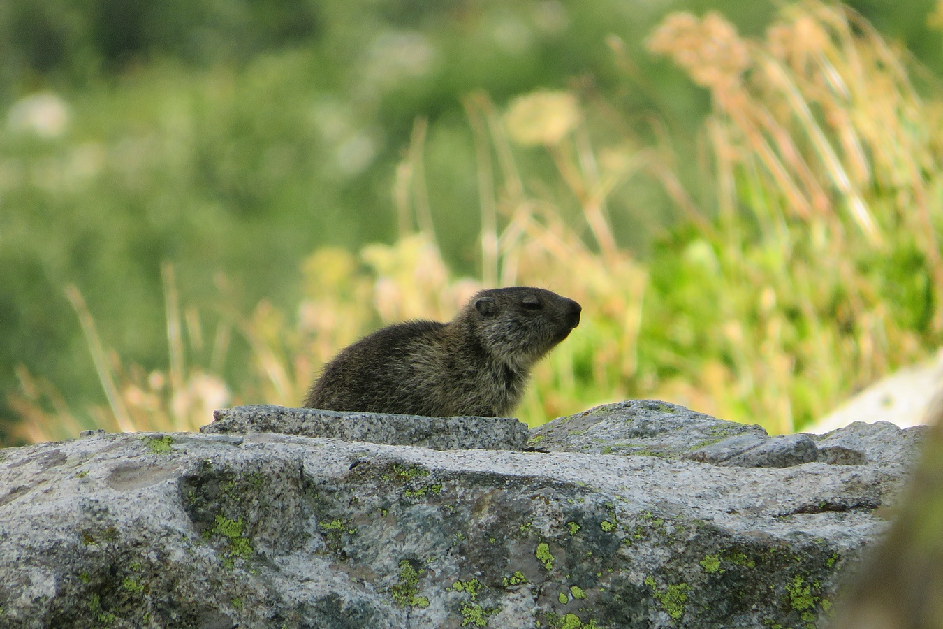
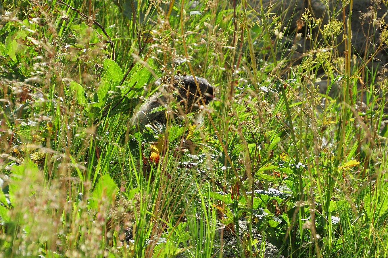
Cette rando dans le Vallon des Étançons fut assurément une des plus belles de mes 18 randos alpines de l'été 2022. Notamment parce que j'ai pu y voir de nombreux sommets de plus de 3000m, dont plusieurs d'entre eux particulièrement photogéniques, comme ce Dôme de Neige des Écrins sur lequel j'ai flashé. Et puis le parcours m'a permis de voir une grande diversité de décors avec plein d'ingrédients (des torrents, des vallées, des vallons, des cirques, des glaciers, des cascades, des sommets, des cols et des brèches de toutes formes ... bref ... à peu près tout sauf des lacs et des forêts). Et cerise sur le gâteau, j'ai rencontré 2 marmottons pas trop farouches (à moins que ça ne soit le même). J'ai rencontré un 1er marmotton qui se reposait tranquillement sur un rocher. Et un peu plus loin, j'en ai rencontré un 2ème (ou le même) qui jouait à cache-cache dans les herbes puis derrière les rochers. 😊
Pour illustration, voici une sélection de 5 des 72 photos de mon album sur AltitudeRando (3 photos de marmotton, 1 photo du Pic Nord des Cavales en forme de corne de rhinocéros et 1 photo de la Reine Meije qui trône au fond du Vallon des Étançons) :
www.altituderando.com/IMG/jpg/d/f/d/037-etancons-22-219-0...
www.altituderando.com/IMG/jpg/4/2/f/037-etancons-22-219-0...
www.altituderando.com/IMG/jpg/7/4/e/037-etancons-22-219-0...
www.altituderando.com/IMG/jpg/4/6/6/037-etancons-22-219-0...
www.altituderando.com/IMG/jpg/3/5/5/037-etancons-22-219-0...
Fort Hays State University (FHSU) is a public university in Hays that is the fourth largest of the six state universities governed by the Kansas Board of Regents.
Fort Hays State was founded in 1902 as the Western Branch of Kansas State Normal School, which is now known as Emporia State University. The institution was originally located on the grounds of Fort Hays, a frontier military outpost that was closed in 1889. The university served the early settlers' needs for educational facilities in the new region. The first building closer to Hays was completed in 1904, at which time the university moved to its present location.
Information from: en.wikipedia.org/wiki/Fort_Hays_State_University
With a 2020 population of roughly 21,000 residents, Hays is the largest city in northwestern Kansas. It serves as the seat of Ellis County, and is home to Fort Hays State University.