View allAll Photos Tagged oscillation
The Millennium Bridge was the first new bridge to be built over the Thames in London for more than 100 years. It was the result of a 1996 competition and it was won by the 'blade of light' design envisioned by Arup (engineers), Foster and Partners (architects) and Sir Anthony Caro (sculptor).
It was officially opened by the Queen on 10 June 2000. Around 80,000 people crossed the bridge on its opening day, with around 2,000 on the bridge at any one time. People felt the bridge begin to sway and twist in regular oscillations. Feeling unsteady, the pedestrians altered their gait to the same lateral rhythm as the bridge. The adjusted footsteps just magnified the motion: the more it happened, the more people responded to the movement; and the worse it got. Two days later the bridge was closed until the problem was fixed but it’s known as the Wobbly Bridge since.
It reopened for good on 27 February 2002 and the best time to catch it without people crossing it is at sunrise, albeit the occasional photographer will be desperately trying to find a new angle.
Cuesta del Codoceo
Cuesta Codoceo is a high mountain pass at an elevation of 4.342m (14,245ft) above the sea level, located in the Nevado Tres Cruces National Park in the Atacama Region of Chile.
The road to reach this pass, also known as Portezuelo Codoceo, is gravel. It’s called Ruta 31-CH. It’s a 280 km long gravel road. It starts in the municipality of Copiapó and ends in Paso San Francisco, on the Argentinian border. This is a maintained road where a high clearance 2WD vehicle is able to travel safely at low speeds on long dry straight-of-ways, without losing control due to wash boarding, ruts, or dips. Desertic weather. The temperature oscillates between day and night time. The climb is simply terrible, with a notorius lack of oxygen that tests the organisms and a high degree of steepness. It has a well-deserved reputation for being dangerous because of unpredictable snowstorms and blizzards, and driving under these conditions, can be extremely challenging. The air dryness and the oscillation of temperatures that takes place during the day and night is one of the features of this area. Day is warm by direct sun and nights are extremely cold. A minor gravel road at the summit climbs up to Portezuelo Caballo Muerto, a mountain pass at 4.410m (14,468ft) above the sea level.
#Donnerstagsmonochrom
This is a re-edit of a capture that I've uploaded to Flickr years ago (you can find it in the first comment), taken at the same trip to the Baltic sea island Usedom as my recently posted "White Like Snow" photo. Back then, I wasn't happy with the crop, and I also didn't really like the colour version, but still felt unsure of black and white. So I decided to do a new version in b&w and crop it as 1:1 format; I think the square format is a little more "direct", and it draws the view right to and along the wavy sculpture, "ready to climb up and ride the wave", so to say ;)
For the final new version I did some basic processing in DXO PhotoLab 4, then took the image into HDR Efex (the result looked nice even in colour) and then used a film simulation from the DXO FilmPack, the Ilford Pan F Plus 50. I've also done two more b&w edits in Silver Efex, but liked neither. And who knows, maybe one day I'll do another colour edit of this - or I'll find time to visit Usedom again and take an all new photo ;)
Wellenbewegung #2
Dies ist eine Neuinterpretation eines Fotos, das ich in meinen Flickr-Anfangstagen vor Jahren hochgeladen hatte. Mit dem "Original", das Ihr im ersten Kommentar finden könnt, war ich aber nie so richtig zufrieden, mochte weder den Bildschnitt so richtig noch die Farbe, hatte mich damals aber noch nur selten an Schwarzweiß herangetraut. Und da ich kürzlich ja ein "neues" (sprich noch nie gezeigtes) Foto von meinem 2013er Kurzurlaub auf Usedom hochgeladen hatte ("White Like Snow"), dachte ich, jetzt sei eine gute Gelegenheit, Euch mal diese Neubearbeitung zu zeigen. Ich habe mich hier nicht nur für SW, sondern auch für das 1:1-Format entschieden, weil die begehbare Wellenskulptur, die auf dem Weg von Ahlbeck nach Heringsdorf zu finden ist, ja die Hauptdarstellerin ist - und ich finde, dass der Bildschnitt hier "unmittelbarer" wirkt, so, als könnte man sogleich auf die Skulptur klettern und auf der Welle reiten ;)
Entwickelt in DXO PhotoLab 4 (Grundlegendes); danach habe ich verschiedene SW-Ansätze, u.a. auch in Silver Efex, ausprobiert. Diese finale Version habe ich aber nach DXO PL4 nur noch in HDR Efex bearbeitet (da sah sogar die Farbe schön aus) und anschließend im DXO FilmPack mit der Filmsimulation Ilford Pan F Plus 50 (mit kleinen Anpassungen) versehen. Und den breiten weißen Rahmen fand ich auch ganz schick :)
When it was opened it quickly became apparent that the large number of pedestrians crossing London's Millennium Bridge were causing it to sway from side to side (pedestrians crossing a bridge have an unconscious tendency to match their footsteps to the sway, thereby exacerbating the small sideways oscillations of the bridge). The extent of this had not been anticipated by the designers and the bridge was closed until dampers were added to nullify the sway effect. And this, in my opinion, took all the fun out of crossing the bridge :)
calm night. brilliant golden light.
mirrored sun, faint reflection of the day, rule the saturated blues, breathe out the misty twilight. invocation, exhalation, meditation, depth and breadth and oh …
moth i am, or butterfly, strange attractor, gentle oscillation against the heavy air, a quantum entanglement, a winged, elemental blue note, stretched, connected, resonant, reverberant, effecting a change, a golden glow.
calm night, brilliant golden light.
littletinperson
Meisterhaus Moholy-Nagy
Dessau
"After the Bauhauslers moved out in 1932 the Masters’ Houses were radically transformed by modifications. Gropius House and Moholy-Nagy House were destroyed in an air raid in the final days of WWII. In the GDR era a single-family home with a pitched roof was erected on the foundations of Gropius House, but this was demolished again later.
The gaps left behind in the ensemble of buildings were closed in 2014. A historically accurate reconstruction was rejected; Berlin-based architects Bruno Fioretti Marquez (BFM) created an ‘architecture of imprecision’ for the two demolished buildings. This evokes a deliberate sense of oscillation between specific historic state and reinterpretation."
www.bauhaus-dessau.de/en/architecture/bauhaus-buildings-i...
A little of several things I like to shoot, all in one tight shot; lines, curves, angles, texture, light, shadow, corner. At a friend's house in San Jose, California.
Do you feel the same? I already feel like the weekend is over! It’s done before it even started. The one thing that comforts me, before the new weeks start, it was pretty fun. Saturday morning start was really good and I would like to post this pano first. What do you think?
TGIF right? I can tell you how much I needed this break after this long week. Still don’t have a solid plan but I will work that out tonight and take the full advantage of this free time. For now I’m leaving you with this frame from a light chase that ended up being successful! What do you think!
maps.secondlife.com/secondlife/Earp/190/179/1186
youtu.be/zrX_pYsQEp8?feature=shared
“The beauty of nature arouses this feeling in me; a feeling I don’t know if it’s joy, sadness, hope, despair, pain or pleasure. And when I reach this feeling, I stop. I already know it, I don’t try to untie the knot, but I’m content with this oscillation.”
Lev Tolstoy
Built in 1854-1856 the Wheeling Suspension bridge is the oldest bridge of it's kind in the US. But, with a gross weight limit of 2,000 lbs and a requirement that vehicles travel less than 45mph and stay 50' apart it's not practical for today's traffic and has been closed to all vehicles since 2019.
Oscillation is a significant concern for this bridge and noting how close to the banks the piers are built I can understand this is a real issue.
For those inclined to research this bridge, it is interesting the note the battle between Wheeling, to have this bridge built and Pittsburgh, who was concerned about the impact of this bridge on river traffic.
New Masters’ Houses
by Bruno Fioretti Marquez (2014)After the Bauhauslers moved out in 1932 the Masters’ Houses were radically transformed by modifications. Gropius House and Moholy-Nagy House were destroyed in an air raid in the final days of WWII. In the GDR era a single-family home with a pitched roof was erected on the foundations of Gropius House, but this was demolished again later.
Architecture of imprecision
The gaps left behind in the ensemble of buildings were closed in 2014. A historically accurate reconstruction was rejected; Berlin-based architects Bruno Fioretti Marquez (BFM) created an ‘architecture of imprecision’ for the two demolished buildings. This evokes a deliberate sense of oscillation between specific historic state and reinterpretation.
Reopening ceremony
On 16 May 2014 Joachim Gauck, President of the Federal Republic of Germany, opened the new Dessau Masters’ Houses to the public. Internally, they demonstrate their distinctness. Emerging from the residential architecture designed by Walter Gropius in 1926 is an open spatial structure, which is used for exhibitions. Artist Olaf Nicolai has designed an installation for both buildings, which is inspired by Moholy-Nagy’s theories and in which abstraction and figuration interact. The Colour of Light (2014) links the texture of the render with the effects of daylight. Quelle: www.bauhaus-dessau.de/en/architecture/bauhaus-buildings-i...
Bartolomé Island
Galapagos
Ecuador
South America
The Galápagos penguin (Spheniscus mendiculus) is a penguin endemic to the Galápagos Islands. It is the only penguin that lives north of the equator in the wild. It can survive due to the cool temperatures resulting from the Humboldt Current and cool waters from great depths brought up by the Cromwell Current.
While ninety percent of the Galápagos penguins live among the western islands of Fernandina and Isabela, they also occur on Santiago, Bartolomé, northern Santa Cruz, and Floriana. The northern tip of Isabela crosses the equator, meaning that some Galápagos penguins live the northern hemisphere, the only penguins to do so.
The species is endangered, with an estimated population size of around 1,500 individuals in 2004, according to a survey by the Charles Darwin Research Station. The population underwent an alarming decline of over 70% in the 1980s but is slowly recovering. It is therefore the rarest penguin species (a status which is often falsely attributed to the yellow-eyed penguin).
Population levels are influenced by the effects of the El Niño Southern Oscillation, which reduces the availability of shoaling fish, leading to low reproduction or starvation. However, anthropogenic factors (e.g. oil pollution, fishing by-catch and competition) may be adding to the ongoing demise of this species. On Isabela Island, cats, dogs, and rats attack penguins and destroy their nests. When in the water, they are preyed upon by sharks, fur seals, and sea lions. – Wikipedia
Bats' Cave or Saint Grigorie Decapolitul's Cave is located in Costeşti commune, Vâlcea County, Oltenia, Romania.
The cave was formed due to erosion caused by Bistriţa River, has three openings, a length of 400 meters, two levels, and a negative oscillation of level of 15 meters.
In the wall of the lower level is a small church named Ovidenia, partly built, partly carved in the rock, dating from the 17th century. It represents the secret place where were hidden in harsh times the treasures of Bistriţa Monastery and the relics of St. Grigorie Decapolitul. Under the largest opening there is the Holy Archangels church (photo), built by monks Macarie and Daniel in 1635.
The cave is home for several species of bats. Miniopterus schreibersi lives permanently in this cave; Rhinolophus ferrumequinum, Vespertilio pipistrellus, Plecotus auritus, Barbastella barbastellus houses here during the winter; Myotis myotis and Myotis oxygnathus comes here in spring for reproduction and leaves in autumn. On the floor, under the colonies of bats, is a guano layer of 1.7 m thick, where the fauna is very rich (as the trogobiont species), the cave having a great bio-speleological importance.
Rain puts on display a lot of story about Harmony.
One specialist in physics can call these Harmonics. I'll stick with rain's nostalgic harmony.
EOCT68-14
Blouberg
Canon 350D, 18-55mm lens
Another shot from my saturday excursion last weekend with the fisheye. Since there was still quite a bit of light I was only able to keep the shutter open for just over 30 seconds each time.
I think I want one of these lenses now.
Best viewed on black.
Walking along the shore of Lake Michigan during still summer evenings time seems to slow almost to a standstill, and the only sound is the gentle oscillations of the water moving in for high tide
Perito Moreno Glacier (Patagonia) 20240207
The Perito Moreno Glacier is an iconic site in the Patagonia Argentina included in the Los Glaciares National Park, declared as World Heritage Site by UNESCO in 1981. It has well-defined limits, great accessibility and infrastructure that gives the area educational potential. Besides the anomalous and periodic unique behavior of this glacier. The area offers an excellent example of the significant process of glaciation, as well as of geological, geomorphic and physiographic phenomena caused by the advance and retreat of the glaciations, which took place during the Pleistocene Epoch.
The Perito Moreno is one of the most important glaciers that break off from the Southern Patagonian Ice Field located in the southern chain of the Andes (Argentina and Chile). This icefield is the last reliect of the greatest glacial expansions that occurred form the late Miocene to the late Pleistocene. This glacier is approximately 30 km long. Its front is 5 km long and has walls up to 60 m high. The glacier penetrates Argentino Lake, but its base maintains contact with the rocky substratum. It´s a temperate or humid base glacier with a unique dynamic behavior. In this sense, its front presents a condition of stability, with brief oscillations (advances) that, when colliding with the western end of the Magallanes Peninsula, periodically causes the temporary blockage of Brazo Rico (as a dam), raising its water level. This situation generates differential stresses at the end of the glacier and causes the progressive transfer of water to the Argentino lake through a tunnel excavated in the ice. The roof of the tunnel collapsed in 1995, which was a spectacular event that made the glacier famous internationally.
Source: .iugs-geoheritage.org
At the foot of my tree, I found a lace-like viaduct. Designed by Gustave Eiffel and Léon Boyer - Cantal - Auvergne - France - Europe
--------------
Le viaduc de Garabit est un viaduc ferroviaire français, ouvrage d'art de la ligne de Béziers à Neussargues (dite aussi ligne des Causses), permettant le franchissement des gorges de la Truyère. Il est situé sur le territoire de la commune de Ruynes-en-Margeride et de la commune de Val d'Arcomie dans le département du Cantal dans la région d'Auvergne-Rhône-Alpes.
Ce viaduc est un projet de l'ingénieur des ponts et chaussées Léon Boyer, qui en confie la finalisation et la réalisation à Gustave Eiffel et sa société. Le chantier de construction, ouvert en janvier 1880, se termine en septembre 1884 et sa mise en service est effectuée en 1888 par la Compagnie des chemins de fer du Midi et du Canal latéral à la Garonne, concessionnaire de la ligne. Cet ambitieux ouvrage métallique, long de 565 m, culmine à 122 m au-dessus de la rivière et est alors le « plus haut viaduc du monde ». Finalement, son arche était, jusqu'en 1886, celle ayant la plus grande portée au monde.
Histoire :
À l'origine du projet, l'idée d'un pont métallique à grand arc enjambant la vallée revient à un jeune ingénieur, Léon Boyer (1851-1886). Il impose l'idée d'un tracé direct de la voie ferrée sur les plateaux et un franchissement de la Truyère à grande hauteur (120 m au-dessus du niveau d'étiage), plutôt que la solution traditionnelle qui aurait consisté à descendre la ligne par les vallées affluentes pour franchir la Truyère par un ouvrage plus modeste, solution plus coûteuse en exploitation par la suite.
Pour ce franchissement, il était exclu de recourir au pont suspendu, à cause des risques d'oscillations provoquées par le vent, et il était impossible d'envisager techniquement à l'époque des piles de plus de 65 m de haut. Léon Boyer s'est inspiré de l'exemple du viaduc Maria Pia sur le Douro (Portugal). Ce viaduc avait été conçu par l'un des associés de l'entreprise Eiffel, Théophile Seyrig, avec la participation tardive de l'ingénieur Émile Nouguier. Inauguré en 1877, il comporte un arc métallique de 160 m de portée, avec une flèche d'intrados de 37,50 m
L'inauguration de la section de Saint-Chély à Saint-Flour via le viaduc de Garabit, a lieu le 28 mai 1888. La compagnie qui avait annoncé une importante cérémonie d'inauguration a finalement choisi de faire simple en attendant l'ouverture complète de la ligne jusqu'à Neussargues qui doit intervenir prochainement. Elle n'a donc prévu que le passage d'un train transportant Mrs Arnaud, inspecteur d'exploitation, et André, inspecteur principal. Néanmoins, le temps étant beau et pas trop chaud, les habitants ont montré leur curiosité en venant en nombre dans les deux gares de part et d'autre, pour rejoindre à pied ou en convoi, le site du viaduc que d'autres, en nombre également, ont préféré voir du fond de la vallée. Un train a traversé le viaduc à 50 km/h sans que ses passagers ne ressentent la moindre trépidation.
Le viaduc est construit pour supporter une voie ferrée unique et relier Paris à Béziers par chemin de fer, en passant par le Massif central. C'est donc depuis plus d'un siècle que l'Aubrac Express — nom du train ayant circulé sur la voie — surplombe à chaque passage la vallée de la Truyère. Le viaduc dispose d'une caténaire et supporte une voie unique. La vitesse des trains circulant sur le viaduc est limitée à 40 km/h pour réduire les contraintes de l'ouvrage.
Depuis sa construction, il y a 140 ans, le viaduc de Garabit suscite l’admiration de tous. A ses pieds, la Truyère a creusé son lit dans une somptueuse vallée aux multiples facettes.
Le viaduc fait l'objet d'une inscription au titre des monuments historiques depuis le 14 septembre 1965, et d'un classement depuis le 18 octobre 2017 . Il fait actuellement l'objet d'une procédure pour être inscrit au patrimoine mondial de l'Unesco dans les prochaines années.
Source Wikipédia
-----------------------------------
This viaduct was a project by civil engineer Léon Boyer, who entrusted its completion and construction to Gustave Eiffel and his company. Construction began in January 1880 and was completed in September 1884. It was commissioned in 1888 by the Compagnie des chemins de fer du Midi et du Canal latéral à la Garonne, the concession holder for the line. This ambitious metal structure, 565 meters long, reaches 122 meters above the river, making it the "highest viaduct in the world." Its arch was, until 1886, the longest span in the world.
History:
The idea of a large-arched metal bridge spanning the valley originated with a young engineer, Léon Boyer (1851-1886). He imposed the idea of a direct railway route across the plateaus and a crossing of the Truyère at great height (120 m above the low-water mark), rather than the traditional solution, which would have consisted of descending the line through the tributary valleys to cross the Truyère with a more modest structure, a solution that would have been more expensive to operate.
For this crossing, a suspension bridge was out of the question due to the risk of oscillations caused by the wind, and it was technically impossible at the time to envisage piers more than 65 m high. Léon Boyer was inspired by the example of the Maria Pia Viaduct over the Douro (Portugal). This viaduct had been designed by one of the partners of the Eiffel company, Théophile Seyrig, with the late participation of engineer Émile Nouguier. Inaugurated in 1877, it features a 160-meter-span metal arch with a 37.50-meter intrados spire.
The inauguration of the section from Saint-Chély to Saint-Flour via the Garabit viaduct took place on May 28, 1888. The company, which had announced a major inauguration ceremony, ultimately chose to keep things simple while awaiting the full opening of the line to Neussargues, which was expected to take place shortly. It therefore only planned for a train carrying Mrs. Arnaud, operations inspector, and André, chief inspector. Nevertheless, the weather being fine and not too hot, the locals showed their curiosity by coming in large numbers to the two stations on both sides, to reach the site of the viaduct on foot or in convoy, which others, also in large numbers, preferred to view from the valley floor. A train crossed the viaduct at 50 km/h without its passengers feeling the slightest jolt.
The viaduct was built to support a single railway track and connect Paris to Béziers by rail, passing through the Massif Central. For over a century, the Aubrac Express—the name of the train that ran on the line—has overlooked the Truyère Valley every time it passed. The viaduct has a catenary and supports a single track. The speed of trains traveling on the viaduct is limited to 40 km/h to reduce the stresses on the structure.
Since its construction 140 years ago, the Garabit Viaduct has aroused universal admiration. At its feet, the Truyère River has carved its channel into a sumptuous, multifaceted valley.
The viaduct has been listed as a historic monument since September 14, 1965, and has been classified since October 18, 2017. It is currently undergoing a process to be listed as a UNESCO World Heritage Site in the coming years.
Source: Wikipedia
-----------------------------------
Life is a constant oscillation between the sharp horns of dilemmas.
Image taken where coastal erosion is taking over, I would be surprised if the "horns" had not been washed away by now!
Magnetic compass
The magnetic compass is the most familiar compass type. It functions as a pointer to "magnetic north", the local magnetic meridian, because the magnetized needle at its heart aligns itself with the horizontal component of the Earth's magnetic field. The magnetic field exerts a torque on the needle, pulling the North end or pole of the needle approximately toward the Earth's North magnetic pole, and pulling the other toward the Earth's South magnetic pole. The needle is mounted on a low-friction pivot point, in better compasses a jewel bearing, so it can turn easily. When the compass is held level, the needle turns until, after a few seconds to allow oscillations to die out, it settles into its equilibrium orientation.
In navigation, directions on maps are usually expressed with reference to geographical or true north, the direction toward the Geographical North Pole, the rotation axis of the Earth. Depending on where the compass is located on the surface of the Earth the angle between true north and magnetic north, called magnetic declination can vary widely with geographic location. The local magnetic declination is given on most maps, to allow the map to be oriented with a compass parallel to true north. The locations of the Earth's magnetic poles slowly change with time, which is referred to as geomagnetic secular variation. The effect of this means a map with the latest declination information should be used. Some magnetic compasses include means to manually compensate for the magnetic declination, so that the compass shows true directions.
[Wikipedia]
……………………………….
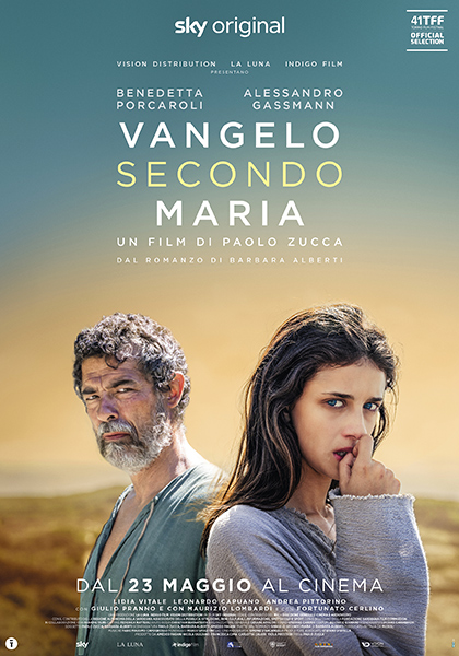
Poster:
Locandina:
pad.mymovies.it/filmclub/2022/09/120/coverlg_home.jpg
pad.mymovies.it/filmclub/2022/09/120/locandina.jpg
www.cinematografo.it/image-service/version/c:M2QyY2FiZTct...
www.artribune.com/wp-content/uploads/2024/06/vangelo-seco...
www.nuovodialogo.com/wp-content/uploads/2024/05/vangelo-s...
.............................................................................
click to activate the small icon of slideshow: the small triangle inscribed in the small rectangle, at the top right, in the photostream (it means the monitor);
or…. Press the “L” button to zoom in the image;
clicca sulla piccola icona per attivare lo slideshow: sulla facciata principale del photostream, in alto a destra c'è un piccolo rettangolo (rappresenta il monitor) con dentro un piccolo triangolo nero;
oppure…. premi il tasto “L” per ingrandire l'immagine;
www.fotografidigitali.it/gallery/2726/opere-italiane-segn...
………………………………………………………………………
I propose here, on Flickr, a photographic story, with descriptive text, of a traditional Sicilian popular festival that is always highly anticipated, it takes place in the town of Fiumedinisi (Messina), in the last 18 years what is called the "Great Feast" has been celebrated only 3 times, always on the second Sunday of August, it was celebrated in 2007, in 2016, this year 2025, in all three editions I took photographs, those that I now present are almost all of the "Great Feast" of this year 2025. The town of Fiumedinisi is inextricably linked to her patron saint, Our Lady of the Annunciation, every year a traditional procession is held on March 24th and 25th, on the 24th the procession is made by the faithful on their knees, they carry a large lit candle with which they help themselves to support themselves, it takes place along a straight path in what is called "street of float" (it joins two churches), the next day there is another traditional procession, the two "Sacred Float," that of the Our Lady of the Annunciation and that of the Archangel Gabriel, are carried on the shoulders, followed by the faithful, through the narrow streets of the town. Then comes the "Great Feast" in August, also linked to the Annunciation, which occurs every year after many years. It is on Christmas Eve that it is announced whether that year will be the year of the Great Feast. At Christmas, "the Son of Man" is born, incarnated in Mary's womb. It is the Archangel Gabriel who announces to Mary the conception of the Son of the Most High. The iconography of the Sacred Representations depicts him kneeling before her, offering her a lily, a symbol of Mary's purity. The "Great Feast" in August has ancient origins dating back to the 16th century, the period of Spanish rule in Sicily. It was initially celebrated on March 25th, the religious feast of the Annunciation of the Lord. Later, towards the end of the 19th century, it was moved to August to allow the many emigrants from all over the world to attend. In short, the "Great Feast" includes a "morning procession" led by three young men who will impersonate the three main characters on the "living float"—the Mary, the Archangel Gabriel, and the Eternal Father. Around 11:00 a.m., the "Great Living Float," a very heavy object carried on shoulders, will make its first journey along the "street of float" (the one traveled on one's knees in March, but also on the eve of the Great Feast) with the barefoot bearers in ordinary clothing. In the afternoon, many boys and girls dressed as angels take their places on special seats on the "Great Living Float", the "three characters" (the Mary, the Archangel Gabriel, and the "Eternal Father" at the top) take their places. Now the Great Float will make the same journey in reverse, carried on the shoulders of devotee-bearers dressed entirely in white, barefoot, thus arriving in the square in front of the church-sanctuary dedicated to Maria SS Annunziata. Once the journey has finished and the Float has been placed on the ground, the ceremony includes, and ends, with an ancient dialect song sung by the children, with microphones, who dress up as Mary and the Archangel Gabriel. A curiosity, this "Great Float", an enormous metal and wood structure, extremely heavy, requires perfect coordination between the bearers. It is essential to raise and lower it in perfect synchrony, with all its "inhabitants" atop it. It is therefore crucial to avoid any oscillations that would be transmitted to the children seated at various heights, and to the Eternal Father, seated very high up. The moments preceding the float's departure, and those following its arrival, are of great concentration, silence is absolute, the launch occurs at the third blow of the hammer, all the devotee-bearers rise in perfect synchrony and "the magic comes to life"...! The Great Machine travels the "street of float" upon its arrival, there is maximum silence, and at the third blow of the hammer the devotee-bearers lower themselves, placing the incredible Living Float on the ground, renewing before our eyes an event of beauty and absolute wonder, the unique magic of an ancient Sicilian feast tradition.
…………………………………
Propongo qui, su Flickr, un racconto fotografico, con testo descrittivo, di una festa tradizionale popolare siciliana sempre molto attesa, si svolge nel paese di Fiumedinisi (Messina), negli ultimi 18 anni quella che è chiamata la “Festa Grande” si è celebrata solo 3 volte, sempre la seconda domenica di agosto, è stata celebrata nel 2007, nel 2016, quest’anno 2025, in tutte e tre le edizioni ho realizzato fotografie, quelle che ora presento sono quasi tutte della “Festa Grande” di quest’anno 2025. Il paese di Fiumedinisi è indissolubilmente legato alla sua santa patrona, Maria SS. Annunziata, ogni anno si tiene una tradizionale processione il 24 e 25 marzo, il 24 la processione viene fatta dai fedeli in ginocchio, essi recano una grossa candela accesa con la quale si aiutano nel sostenersi, si svolge lungo un percorso rettilineo in quella che è chiamata “strada vara” (unisce due chiese), il giorno dopo si ha un’altra processione, classica, le due “Sacre Vare”, quella di Maria SS. Annunziata e quella dell’Arcangelo Gabriele, vengono portate in spalla, seguite dai fedeli, nelle stradine del paese; poi la “Festa Grande” di agosto, legata anch’essa all’Annunciazione, che avviene ogni volta dopo molti anni: è la notte di Natale che si annuncia se quello sarà l’anno della Festa Grande, a Natale nasce “il Figlio dell’Uomo” incarnatosi nel ventre materno di Maria, è l’Arcangelo Gabriele che annuncia a Maria il concepimento del Figlio dell’Altissimo, l’iconografia delle Sacre Rappresentazioni lo raffigura inginocchiarsi al cospetto di Lei porgendole un giglio, simbolo della purezza di Maria. La “Festa Grande” di agosto ha origini antiche che risalgono al XVI secolo, periodo della dominazione spagnola in Sicilia, essa inizialmente veniva celebrata il 25 marzo, con la ricorrenza religiosa dell’Annunciazione del Signore, successivamente verso la fine del XIX secolo venne spostata ad agosto, per consentire ai molti emigrati, provenienti da ogni dove, di potervi assistere. In maniera sintetica, la “Festa Grande” prevede una “processione mattutina” con in testa i tre ragazzi che impersoneranno sulla “vara vivente” i tre principali personaggi, la Maria, l’Arcangelo Gabriele ed il Padre Eterno; verso le ore 11:00 la “Grande Vara Vivente”, pesantissima, portata in spalla farà un primo viaggio lungo la “strada vara” (quella che viene percorsa in ginocchio a marzo, ma anche la vigilia della Festa Grande) con i portatori scalzi, in abiti comuni; il pomeriggio sulla “Grande Vara Vivente” prendono posto su appositi seggiolini tanti bimbi e bimbe, vestiti da angeli, prendono posto i “tre personaggi” (Maria, l’Arcangelo Gabriele, in alto prende posto il “Padre Eterno”), adesso la Grande Vara farà lo stesso percorso inverso, portata sulle spalle dei devoti-portatori vestiti completamente di bianco, scalzi, così giungendo nella piazza davanti la chiesa-santuario dedicata a Maria SS Annunziata, terminato il percorso e deposta a terra la vara, la cerimonia prevede, e termina, con un antico canto dialettale intonato dai ragazzi, microfonati, che vestono i panni di Maria e dell’Arcangelo Gabriele. Una “curiosità”, questa “Vara Ranni” (dialettalmente, Vara Grande), enorme struttura in metallo e legno, pesantissima, necessita di una perfetta coordinazione tra i portatori, è fondamentale alzarla ed abbassarla in perfetto sincronismo, con sopra tutti i suoi “abitanti”, importantissimo quindi evitare qualsiasi oscillazione che si trasmetterebbe sui bimbi seduti a varie altezze, ed al Padre Eterno, seduto molto in alto: gli attimi che precedono la partenza della vara, e quelli che fanno seguito all’arrivo sono di grande concentrazione, il silenzio è massimo, la partenza avviene al terzo colpo di martello, tutti i devoti-portatori si alzano in perfetta sincronia e “la magia prende vita”…! La Grande Macchina percorre la “strada vara”, al suo arrivo, silenzio massimo, al terzo colpo di martello i devoti-portatori si abbassano deponendo a terra quella incredibile Vara Vivente che rinnova davanti ai nostri occhi un evento fatto di bellezza ed assoluta meraviglia, magia unica di una antica tradizione popolare Siciliana.
.....................
A striped brush.
More precisely, it's a sonic toothbrush replaceable head, whose stripes race side-to-side at roughly 250 hertz, or 15,000 oscillations per minute, to do its plaque-busting task. (For comparison, the electricity from your outlet alternates at 50 or 60 Hz, depending on your country.)
The stripes are not all show and no go. The dye in the dark blue pair of bristles fade with use, giving a visual indication the brush head needs replacing.
Equinoxes bring gales and this year has been particularly windy. The La Niña period in the Southern Oscillation is ending and these winds herald the change in our weather patterns to El Niño ... predominant westerlies and the threat of drought in summer.
This photo is a single shot ICM taken in wild weather on a storm swept beach.
This image illustrates the oscillating air mass flow over the mountains and the resulting lenticular cloud formations.
Roaring engines coming to life.
Trembling oscillations resonate. Acceleration G-forces locking you into your seat.
……………………………….
Poster:
Locandina:
pad.mymovies.it/filmclub/2022/09/120/coverlg_home.jpg
pad.mymovies.it/filmclub/2022/09/120/locandina.jpg
www.cinematografo.it/image-service/version/c:M2QyY2FiZTct...
www.artribune.com/wp-content/uploads/2024/06/vangelo-seco...
www.nuovodialogo.com/wp-content/uploads/2024/05/vangelo-s...
.............................................................................
click to activate the small icon of slideshow: the small triangle inscribed in the small rectangle, at the top right, in the photostream (it means the monitor);
or…. Press the “L” button to zoom in the image;
clicca sulla piccola icona per attivare lo slideshow: sulla facciata principale del photostream, in alto a destra c'è un piccolo rettangolo (rappresenta il monitor) con dentro un piccolo triangolo nero;
oppure…. premi il tasto “L” per ingrandire l'immagine;
www.fotografidigitali.it/gallery/2726/opere-italiane-segn...
………………………………………………………………………
I propose here, on Flickr, a photographic story, with descriptive text, of a traditional Sicilian popular festival that is always highly anticipated, it takes place in the town of Fiumedinisi (Messina), in the last 18 years what is called the "Great Feast" has been celebrated only 3 times, always on the second Sunday of August, it was celebrated in 2007, in 2016, this year 2025, in all three editions I took photographs, those that I now present are almost all of the "Great Feast" of this year 2025. The town of Fiumedinisi is inextricably linked to her patron saint, Our Lady of the Annunciation, every year a traditional procession is held on March 24th and 25th, on the 24th the procession is made by the faithful on their knees, they carry a large lit candle with which they help themselves to support themselves, it takes place along a straight path in what is called "street of float" (it joins two churches), the next day there is another traditional procession, the two "Sacred Float," that of the Our Lady of the Annunciation and that of the Archangel Gabriel, are carried on the shoulders, followed by the faithful, through the narrow streets of the town. Then comes the "Great Feast" in August, also linked to the Annunciation, which occurs every year after many years. It is on Christmas Eve that it is announced whether that year will be the year of the Great Feast. At Christmas, "the Son of Man" is born, incarnated in Mary's womb. It is the Archangel Gabriel who announces to Mary the conception of the Son of the Most High. The iconography of the Sacred Representations depicts him kneeling before her, offering her a lily, a symbol of Mary's purity. The "Great Feast" in August has ancient origins dating back to the 16th century, the period of Spanish rule in Sicily. It was initially celebrated on March 25th, the religious feast of the Annunciation of the Lord. Later, towards the end of the 19th century, it was moved to August to allow the many emigrants from all over the world to attend. In short, the "Great Feast" includes a "morning procession" led by three young men who will impersonate the three main characters on the "living float"—the Mary, the Archangel Gabriel, and the Eternal Father. Around 11:00 a.m., the "Great Living Float," a very heavy object carried on shoulders, will make its first journey along the "street of float" (the one traveled on one's knees in March, but also on the eve of the Great Feast) with the barefoot bearers in ordinary clothing. In the afternoon, many boys and girls dressed as angels take their places on special seats on the "Great Living Float", the "three characters" (the Mary, the Archangel Gabriel, and the "Eternal Father" at the top) take their places. Now the Great Float will make the same journey in reverse, carried on the shoulders of devotee-bearers dressed entirely in white, barefoot, thus arriving in the square in front of the church-sanctuary dedicated to Maria SS Annunziata. Once the journey has finished and the Float has been placed on the ground, the ceremony includes, and ends, with an ancient dialect song sung by the children, with microphones, who dress up as Mary and the Archangel Gabriel. A curiosity, this "Great Float", an enormous metal and wood structure, extremely heavy, requires perfect coordination between the bearers. It is essential to raise and lower it in perfect synchrony, with all its "inhabitants" atop it. It is therefore crucial to avoid any oscillations that would be transmitted to the children seated at various heights, and to the Eternal Father, seated very high up. The moments preceding the float's departure, and those following its arrival, are of great concentration, silence is absolute, the launch occurs at the third blow of the hammer, all the devotee-bearers rise in perfect synchrony and "the magic comes to life"...! The Great Machine travels the "street of float" upon its arrival, there is maximum silence, and at the third blow of the hammer the devotee-bearers lower themselves, placing the incredible Living Float on the ground, renewing before our eyes an event of beauty and absolute wonder, the unique magic of an ancient Sicilian feast tradition.
…………………………………
Propongo qui, su Flickr, un racconto fotografico, con testo descrittivo, di una festa tradizionale popolare siciliana sempre molto attesa, si svolge nel paese di Fiumedinisi (Messina), negli ultimi 18 anni quella che è chiamata la “Festa Grande” si è celebrata solo 3 volte, sempre la seconda domenica di agosto, è stata celebrata nel 2007, nel 2016, quest’anno 2025, in tutte e tre le edizioni ho realizzato fotografie, quelle che ora presento sono quasi tutte della “Festa Grande” di quest’anno 2025. Il paese di Fiumedinisi è indissolubilmente legato alla sua santa patrona, Maria SS. Annunziata, ogni anno si tiene una tradizionale processione il 24 e 25 marzo, il 24 la processione viene fatta dai fedeli in ginocchio, essi recano una grossa candela accesa con la quale si aiutano nel sostenersi, si svolge lungo un percorso rettilineo in quella che è chiamata “strada vara” (unisce due chiese), il giorno dopo si ha un’altra processione, classica, le due “Sacre Vare”, quella di Maria SS. Annunziata e quella dell’Arcangelo Gabriele, vengono portate in spalla, seguite dai fedeli, nelle stradine del paese; poi la “Festa Grande” di agosto, legata anch’essa all’Annunciazione, che avviene ogni volta dopo molti anni: è la notte di Natale che si annuncia se quello sarà l’anno della Festa Grande, a Natale nasce “il Figlio dell’Uomo” incarnatosi nel ventre materno di Maria, è l’Arcangelo Gabriele che annuncia a Maria il concepimento del Figlio dell’Altissimo, l’iconografia delle Sacre Rappresentazioni lo raffigura inginocchiarsi al cospetto di Lei porgendole un giglio, simbolo della purezza di Maria. La “Festa Grande” di agosto ha origini antiche che risalgono al XVI secolo, periodo della dominazione spagnola in Sicilia, essa inizialmente veniva celebrata il 25 marzo, con la ricorrenza religiosa dell’Annunciazione del Signore, successivamente verso la fine del XIX secolo venne spostata ad agosto, per consentire ai molti emigrati, provenienti da ogni dove, di potervi assistere. In maniera sintetica, la “Festa Grande” prevede una “processione mattutina” con in testa i tre ragazzi che impersoneranno sulla “vara vivente” i tre principali personaggi, la Maria, l’Arcangelo Gabriele ed il Padre Eterno; verso le ore 11:00 la “Grande Vara Vivente”, pesantissima, portata in spalla farà un primo viaggio lungo la “strada vara” (quella che viene percorsa in ginocchio a marzo, ma anche la vigilia della Festa Grande) con i portatori scalzi, in abiti comuni; il pomeriggio sulla “Grande Vara Vivente” prendono posto su appositi seggiolini tanti bimbi e bimbe, vestiti da angeli, prendono posto i “tre personaggi” (Maria, l’Arcangelo Gabriele, in alto prende posto il “Padre Eterno”), adesso la Grande Vara farà lo stesso percorso inverso, portata sulle spalle dei devoti-portatori vestiti completamente di bianco, scalzi, così giungendo nella piazza davanti la chiesa-santuario dedicata a Maria SS Annunziata, terminato il percorso e deposta a terra la vara, la cerimonia prevede, e termina, con un antico canto dialettale intonato dai ragazzi, microfonati, che vestono i panni di Maria e dell’Arcangelo Gabriele. Una “curiosità”, questa “Vara Ranni” (dialettalmente, Vara Grande), enorme struttura in metallo e legno, pesantissima, necessita di una perfetta coordinazione tra i portatori, è fondamentale alzarla ed abbassarla in perfetto sincronismo, con sopra tutti i suoi “abitanti”, importantissimo quindi evitare qualsiasi oscillazione che si trasmetterebbe sui bimbi seduti a varie altezze, ed al Padre Eterno, seduto molto in alto: gli attimi che precedono la partenza della vara, e quelli che fanno seguito all’arrivo sono di grande concentrazione, il silenzio è massimo, la partenza avviene al terzo colpo di martello, tutti i devoti-portatori si alzano in perfetta sincronia e “la magia prende vita”…! La Grande Macchina percorre la “strada vara”, al suo arrivo, silenzio massimo, al terzo colpo di martello i devoti-portatori si abbassano deponendo a terra quella incredibile Vara Vivente che rinnova davanti ai nostri occhi un evento fatto di bellezza ed assoluta meraviglia, magia unica di una antica tradizione popolare Siciliana.
..........................................
Dopo 9 anni torna l’emozionante Festa della Vara a Fiumedinisi
FIUMEDINISI (ME) - Festa della Vara edizione 2025
I momenti emozionanti della Vara di Fiumedinisi in processione con tanti angioletti
Fiumedinisi ( ME ) - Festa della Vara - I Viaggi - 09 /08 / 2025
Fiumedinisi ( ME ) - Festa della Vara - 10 / 08 /2025
……………………………………………
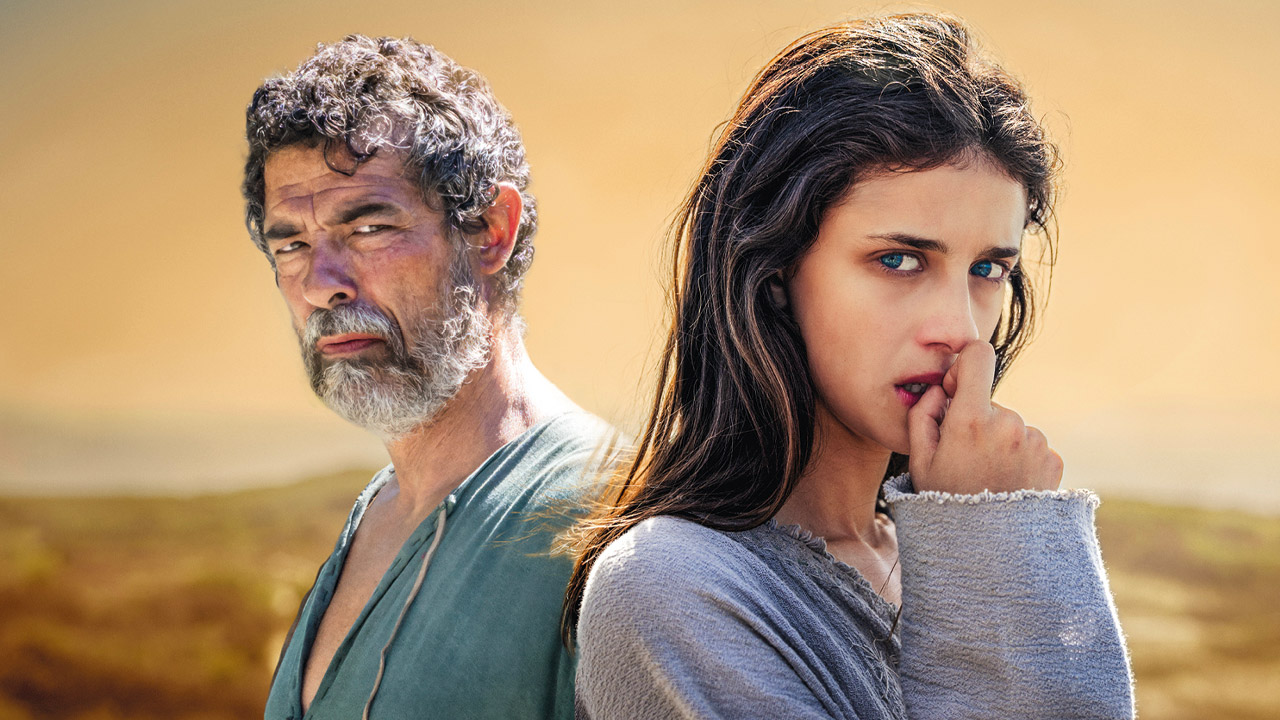
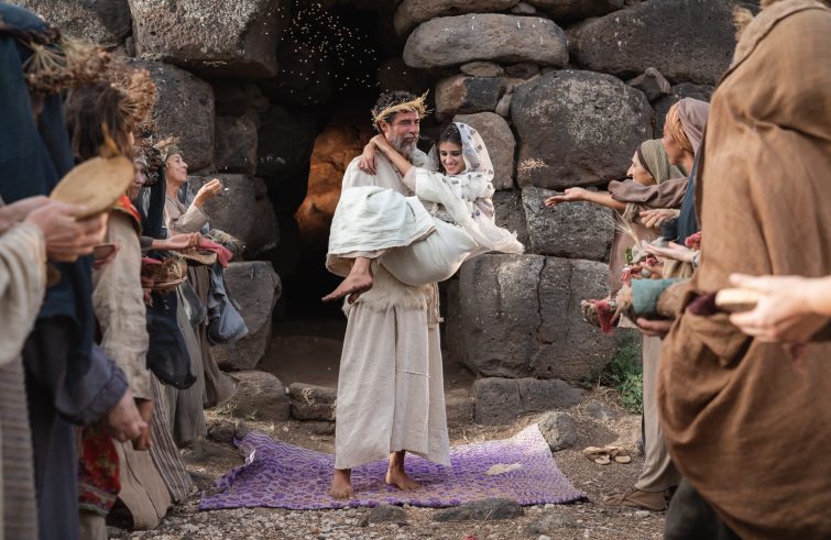
VANGELO SECONDO MARIA (2024) Trailer | Benedetta Porcaroli, Alessandro Gassmann
Benedetta Porcaroli e Alessandro Gassmann sul film | Vangelo Secondo Maria
Vangelo secondo Maria, incontro stampa con Alessandro Gassmann, Benedetta Porcaroli, Barbara Alberti
Vangelo secondo Maria, di Paolo Zucca - Clip 2
Vangelo secondo Maria - Prima Clip Ufficiale
Effetto Notte (TV2000) - “Il Vangelo secondo Maria”, Alessandro Gassmann e Benedetta Porcaroli
Vangelo secondo Maria, Barbara Alberti: più che scomodare la Madonna, l'ho fatta sorridere
................................................
……………………………….
Poster:
Locandina:
pad.mymovies.it/filmclub/2022/09/120/coverlg_home.jpg
pad.mymovies.it/filmclub/2022/09/120/locandina.jpg
www.cinematografo.it/image-service/version/c:M2QyY2FiZTct...
www.artribune.com/wp-content/uploads/2024/06/vangelo-seco...
www.nuovodialogo.com/wp-content/uploads/2024/05/vangelo-s...
.............................................................................
click to activate the small icon of slideshow: the small triangle inscribed in the small rectangle, at the top right, in the photostream (it means the monitor);
or…. Press the “L” button to zoom in the image;
clicca sulla piccola icona per attivare lo slideshow: sulla facciata principale del photostream, in alto a destra c'è un piccolo rettangolo (rappresenta il monitor) con dentro un piccolo triangolo nero;
oppure…. premi il tasto “L” per ingrandire l'immagine;
www.fotografidigitali.it/gallery/2726/opere-italiane-segn...
………………………………………………………………………
I propose here, on Flickr, a photographic story, with descriptive text, of a traditional Sicilian popular festival that is always highly anticipated, it takes place in the town of Fiumedinisi (Messina), in the last 18 years what is called the "Great Feast" has been celebrated only 3 times, always on the second Sunday of August, it was celebrated in 2007, in 2016, this year 2025, in all three editions I took photographs, those that I now present are almost all of the "Great Feast" of this year 2025. The town of Fiumedinisi is inextricably linked to her patron saint, Our Lady of the Annunciation, every year a traditional procession is held on March 24th and 25th, on the 24th the procession is made by the faithful on their knees, they carry a large lit candle with which they help themselves to support themselves, it takes place along a straight path in what is called "street of float" (it joins two churches), the next day there is another traditional procession, the two "Sacred Float," that of the Our Lady of the Annunciation and that of the Archangel Gabriel, are carried on the shoulders, followed by the faithful, through the narrow streets of the town. Then comes the "Great Feast" in August, also linked to the Annunciation, which occurs every year after many years. It is on Christmas Eve that it is announced whether that year will be the year of the Great Feast. At Christmas, "the Son of Man" is born, incarnated in Mary's womb. It is the Archangel Gabriel who announces to Mary the conception of the Son of the Most High. The iconography of the Sacred Representations depicts him kneeling before her, offering her a lily, a symbol of Mary's purity. The "Great Feast" in August has ancient origins dating back to the 16th century, the period of Spanish rule in Sicily. It was initially celebrated on March 25th, the religious feast of the Annunciation of the Lord. Later, towards the end of the 19th century, it was moved to August to allow the many emigrants from all over the world to attend. In short, the "Great Feast" includes a "morning procession" led by three young men who will impersonate the three main characters on the "living float"—the Mary, the Archangel Gabriel, and the Eternal Father. Around 11:00 a.m., the "Great Living Float," a very heavy object carried on shoulders, will make its first journey along the "street of float" (the one traveled on one's knees in March, but also on the eve of the Great Feast) with the barefoot bearers in ordinary clothing. In the afternoon, many boys and girls dressed as angels take their places on special seats on the "Great Living Float", the "three characters" (the Mary, the Archangel Gabriel, and the "Eternal Father" at the top) take their places. Now the Great Float will make the same journey in reverse, carried on the shoulders of devotee-bearers dressed entirely in white, barefoot, thus arriving in the square in front of the church-sanctuary dedicated to Maria SS Annunziata. Once the journey has finished and the Float has been placed on the ground, the ceremony includes, and ends, with an ancient dialect song sung by the children, with microphones, who dress up as Mary and the Archangel Gabriel. A curiosity, this "Great Float", an enormous metal and wood structure, extremely heavy, requires perfect coordination between the bearers. It is essential to raise and lower it in perfect synchrony, with all its "inhabitants" atop it. It is therefore crucial to avoid any oscillations that would be transmitted to the children seated at various heights, and to the Eternal Father, seated very high up. The moments preceding the float's departure, and those following its arrival, are of great concentration, silence is absolute, the launch occurs at the third blow of the hammer, all the devotee-bearers rise in perfect synchrony and "the magic comes to life"...! The Great Machine travels the "street of float" upon its arrival, there is maximum silence, and at the third blow of the hammer the devotee-bearers lower themselves, placing the incredible Living Float on the ground, renewing before our eyes an event of beauty and absolute wonder, the unique magic of an ancient Sicilian feast tradition.
…………………………………
Propongo qui, su Flickr, un racconto fotografico, con testo descrittivo, di una festa tradizionale popolare siciliana sempre molto attesa, si svolge nel paese di Fiumedinisi (Messina), negli ultimi 18 anni quella che è chiamata la “Festa Grande” si è celebrata solo 3 volte, sempre la seconda domenica di agosto, è stata celebrata nel 2007, nel 2016, quest’anno 2025, in tutte e tre le edizioni ho realizzato fotografie, quelle che ora presento sono quasi tutte della “Festa Grande” di quest’anno 2025. Il paese di Fiumedinisi è indissolubilmente legato alla sua santa patrona, Maria SS. Annunziata, ogni anno si tiene una tradizionale processione il 24 e 25 marzo, il 24 la processione viene fatta dai fedeli in ginocchio, essi recano una grossa candela accesa con la quale si aiutano nel sostenersi, si svolge lungo un percorso rettilineo in quella che è chiamata “strada vara” (unisce due chiese), il giorno dopo si ha un’altra processione, classica, le due “Sacre Vare”, quella di Maria SS. Annunziata e quella dell’Arcangelo Gabriele, vengono portate in spalla, seguite dai fedeli, nelle stradine del paese; poi la “Festa Grande” di agosto, legata anch’essa all’Annunciazione, che avviene ogni volta dopo molti anni: è la notte di Natale che si annuncia se quello sarà l’anno della Festa Grande, a Natale nasce “il Figlio dell’Uomo” incarnatosi nel ventre materno di Maria, è l’Arcangelo Gabriele che annuncia a Maria il concepimento del Figlio dell’Altissimo, l’iconografia delle Sacre Rappresentazioni lo raffigura inginocchiarsi al cospetto di Lei porgendole un giglio, simbolo della purezza di Maria. La “Festa Grande” di agosto ha origini antiche che risalgono al XVI secolo, periodo della dominazione spagnola in Sicilia, essa inizialmente veniva celebrata il 25 marzo, con la ricorrenza religiosa dell’Annunciazione del Signore, successivamente verso la fine del XIX secolo venne spostata ad agosto, per consentire ai molti emigrati, provenienti da ogni dove, di potervi assistere. In maniera sintetica, la “Festa Grande” prevede una “processione mattutina” con in testa i tre ragazzi che impersoneranno sulla “vara vivente” i tre principali personaggi, la Maria, l’Arcangelo Gabriele ed il Padre Eterno; verso le ore 11:00 la “Grande Vara Vivente”, pesantissima, portata in spalla farà un primo viaggio lungo la “strada vara” (quella che viene percorsa in ginocchio a marzo, ma anche la vigilia della Festa Grande) con i portatori scalzi, in abiti comuni; il pomeriggio sulla “Grande Vara Vivente” prendono posto su appositi seggiolini tanti bimbi e bimbe, vestiti da angeli, prendono posto i “tre personaggi” (Maria, l’Arcangelo Gabriele, in alto prende posto il “Padre Eterno”), adesso la Grande Vara farà lo stesso percorso inverso, portata sulle spalle dei devoti-portatori vestiti completamente di bianco, scalzi, così giungendo nella piazza davanti la chiesa-santuario dedicata a Maria SS Annunziata, terminato il percorso e deposta a terra la vara, la cerimonia prevede, e termina, con un antico canto dialettale intonato dai ragazzi, microfonati, che vestono i panni di Maria e dell’Arcangelo Gabriele. Una “curiosità”, questa “Vara Ranni” (dialettalmente, Vara Grande), enorme struttura in metallo e legno, pesantissima, necessita di una perfetta coordinazione tra i portatori, è fondamentale alzarla ed abbassarla in perfetto sincronismo, con sopra tutti i suoi “abitanti”, importantissimo quindi evitare qualsiasi oscillazione che si trasmetterebbe sui bimbi seduti a varie altezze, ed al Padre Eterno, seduto molto in alto: gli attimi che precedono la partenza della vara, e quelli che fanno seguito all’arrivo sono di grande concentrazione, il silenzio è massimo, la partenza avviene al terzo colpo di martello, tutti i devoti-portatori si alzano in perfetta sincronia e “la magia prende vita”…! La Grande Macchina percorre la “strada vara”, al suo arrivo, silenzio massimo, al terzo colpo di martello i devoti-portatori si abbassano deponendo a terra quella incredibile Vara Vivente che rinnova davanti ai nostri occhi un evento fatto di bellezza ed assoluta meraviglia, magia unica di una antica tradizione popolare Siciliana.
.....................
HERE [4]
Breath by breath,
Forced oscillation
Of waiting,
Suspended and restitched
In mutual immersion,
In an instant
Welding of thresholds.
Seizing horizons.
________________
Di respiro in respiro,
Oscillazioni forzate
D'attesa,
Sospesa e ricucita
In reciproca immersione.
In un saldarsi
Istantaneo di soglie.
Afferrando orizzonti.
claudia ioan 2016
San Feliciano, Lago Trasimeno, Umbria (Italy)
……………………………….
Poster:
Locandina:
pad.mymovies.it/filmclub/2022/09/120/coverlg_home.jpg
pad.mymovies.it/filmclub/2022/09/120/locandina.jpg
www.cinematografo.it/image-service/version/c:M2QyY2FiZTct...
www.artribune.com/wp-content/uploads/2024/06/vangelo-seco...
www.nuovodialogo.com/wp-content/uploads/2024/05/vangelo-s...
.............................................................................
click to activate the small icon of slideshow: the small triangle inscribed in the small rectangle, at the top right, in the photostream (it means the monitor);
or…. Press the “L” button to zoom in the image;
clicca sulla piccola icona per attivare lo slideshow: sulla facciata principale del photostream, in alto a destra c'è un piccolo rettangolo (rappresenta il monitor) con dentro un piccolo triangolo nero;
oppure…. premi il tasto “L” per ingrandire l'immagine;
www.fotografidigitali.it/gallery/2726/opere-italiane-segn...
………………………………………………………………………
I propose here, on Flickr, a photographic story, with descriptive text, of a traditional Sicilian popular festival that is always highly anticipated, it takes place in the town of Fiumedinisi (Messina), in the last 18 years what is called the "Great Feast" has been celebrated only 3 times, always on the second Sunday of August, it was celebrated in 2007, in 2016, this year 2025, in all three editions I took photographs, those that I now present are almost all of the "Great Feast" of this year 2025. The town of Fiumedinisi is inextricably linked to her patron saint, Our Lady of the Annunciation, every year a traditional procession is held on March 24th and 25th, on the 24th the procession is made by the faithful on their knees, they carry a large lit candle with which they help themselves to support themselves, it takes place along a straight path in what is called "street of float" (it joins two churches), the next day there is another traditional procession, the two "Sacred Float," that of the Our Lady of the Annunciation and that of the Archangel Gabriel, are carried on the shoulders, followed by the faithful, through the narrow streets of the town. Then comes the "Great Feast" in August, also linked to the Annunciation, which occurs every year after many years. It is on Christmas Eve that it is announced whether that year will be the year of the Great Feast. At Christmas, "the Son of Man" is born, incarnated in Mary's womb. It is the Archangel Gabriel who announces to Mary the conception of the Son of the Most High. The iconography of the Sacred Representations depicts him kneeling before her, offering her a lily, a symbol of Mary's purity. The "Great Feast" in August has ancient origins dating back to the 16th century, the period of Spanish rule in Sicily. It was initially celebrated on March 25th, the religious feast of the Annunciation of the Lord. Later, towards the end of the 19th century, it was moved to August to allow the many emigrants from all over the world to attend. In short, the "Great Feast" includes a "morning procession" led by three young men who will impersonate the three main characters on the "living float"—the Mary, the Archangel Gabriel, and the Eternal Father. Around 11:00 a.m., the "Great Living Float," a very heavy object carried on shoulders, will make its first journey along the "street of float" (the one traveled on one's knees in March, but also on the eve of the Great Feast) with the barefoot bearers in ordinary clothing. In the afternoon, many boys and girls dressed as angels take their places on special seats on the "Great Living Float", the "three characters" (the Mary, the Archangel Gabriel, and the "Eternal Father" at the top) take their places. Now the Great Float will make the same journey in reverse, carried on the shoulders of devotee-bearers dressed entirely in white, barefoot, thus arriving in the square in front of the church-sanctuary dedicated to Maria SS Annunziata. Once the journey has finished and the Float has been placed on the ground, the ceremony includes, and ends, with an ancient dialect song sung by the children, with microphones, who dress up as Mary and the Archangel Gabriel. A curiosity, this "Great Float", an enormous metal and wood structure, extremely heavy, requires perfect coordination between the bearers. It is essential to raise and lower it in perfect synchrony, with all its "inhabitants" atop it. It is therefore crucial to avoid any oscillations that would be transmitted to the children seated at various heights, and to the Eternal Father, seated very high up. The moments preceding the float's departure, and those following its arrival, are of great concentration, silence is absolute, the launch occurs at the third blow of the hammer, all the devotee-bearers rise in perfect synchrony and "the magic comes to life"...! The Great Machine travels the "street of float" upon its arrival, there is maximum silence, and at the third blow of the hammer the devotee-bearers lower themselves, placing the incredible Living Float on the ground, renewing before our eyes an event of beauty and absolute wonder, the unique magic of an ancient Sicilian feast tradition.
…………………………………
Propongo qui, su Flickr, un racconto fotografico, con testo descrittivo, di una festa tradizionale popolare siciliana sempre molto attesa, si svolge nel paese di Fiumedinisi (Messina), negli ultimi 18 anni quella che è chiamata la “Festa Grande” si è celebrata solo 3 volte, sempre la seconda domenica di agosto, è stata celebrata nel 2007, nel 2016, quest’anno 2025, in tutte e tre le edizioni ho realizzato fotografie, quelle che ora presento sono quasi tutte della “Festa Grande” di quest’anno 2025. Il paese di Fiumedinisi è indissolubilmente legato alla sua santa patrona, Maria SS. Annunziata, ogni anno si tiene una tradizionale processione il 24 e 25 marzo, il 24 la processione viene fatta dai fedeli in ginocchio, essi recano una grossa candela accesa con la quale si aiutano nel sostenersi, si svolge lungo un percorso rettilineo in quella che è chiamata “strada vara” (unisce due chiese), il giorno dopo si ha un’altra processione, classica, le due “Sacre Vare”, quella di Maria SS. Annunziata e quella dell’Arcangelo Gabriele, vengono portate in spalla, seguite dai fedeli, nelle stradine del paese; poi la “Festa Grande” di agosto, legata anch’essa all’Annunciazione, che avviene ogni volta dopo molti anni: è la notte di Natale che si annuncia se quello sarà l’anno della Festa Grande, a Natale nasce “il Figlio dell’Uomo” incarnatosi nel ventre materno di Maria, è l’Arcangelo Gabriele che annuncia a Maria il concepimento del Figlio dell’Altissimo, l’iconografia delle Sacre Rappresentazioni lo raffigura inginocchiarsi al cospetto di Lei porgendole un giglio, simbolo della purezza di Maria. La “Festa Grande” di agosto ha origini antiche che risalgono al XVI secolo, periodo della dominazione spagnola in Sicilia, essa inizialmente veniva celebrata il 25 marzo, con la ricorrenza religiosa dell’Annunciazione del Signore, successivamente verso la fine del XIX secolo venne spostata ad agosto, per consentire ai molti emigrati, provenienti da ogni dove, di potervi assistere. In maniera sintetica, la “Festa Grande” prevede una “processione mattutina” con in testa i tre ragazzi che impersoneranno sulla “vara vivente” i tre principali personaggi, la Maria, l’Arcangelo Gabriele ed il Padre Eterno; verso le ore 11:00 la “Grande Vara Vivente”, pesantissima, portata in spalla farà un primo viaggio lungo la “strada vara” (quella che viene percorsa in ginocchio a marzo, ma anche la vigilia della Festa Grande) con i portatori scalzi, in abiti comuni; il pomeriggio sulla “Grande Vara Vivente” prendono posto su appositi seggiolini tanti bimbi e bimbe, vestiti da angeli, prendono posto i “tre personaggi” (Maria, l’Arcangelo Gabriele, in alto prende posto il “Padre Eterno”), adesso la Grande Vara farà lo stesso percorso inverso, portata sulle spalle dei devoti-portatori vestiti completamente di bianco, scalzi, così giungendo nella piazza davanti la chiesa-santuario dedicata a Maria SS Annunziata, terminato il percorso e deposta a terra la vara, la cerimonia prevede, e termina, con un antico canto dialettale intonato dai ragazzi, microfonati, che vestono i panni di Maria e dell’Arcangelo Gabriele. Una “curiosità”, questa “Vara Ranni” (dialettalmente, Vara Grande), enorme struttura in metallo e legno, pesantissima, necessita di una perfetta coordinazione tra i portatori, è fondamentale alzarla ed abbassarla in perfetto sincronismo, con sopra tutti i suoi “abitanti”, importantissimo quindi evitare qualsiasi oscillazione che si trasmetterebbe sui bimbi seduti a varie altezze, ed al Padre Eterno, seduto molto in alto: gli attimi che precedono la partenza della vara, e quelli che fanno seguito all’arrivo sono di grande concentrazione, il silenzio è massimo, la partenza avviene al terzo colpo di martello, tutti i devoti-portatori si alzano in perfetta sincronia e “la magia prende vita”…! La Grande Macchina percorre la “strada vara”, al suo arrivo, silenzio massimo, al terzo colpo di martello i devoti-portatori si abbassano deponendo a terra quella incredibile Vara Vivente che rinnova davanti ai nostri occhi un evento fatto di bellezza ed assoluta meraviglia, magia unica di una antica tradizione popolare Siciliana.
.....................
The Millennium Bridge, designed by a consortium of British engineering firms, is a steel suspension pedestrian bridge. Construction began in 1998 and opened on 10 June 2000. It crosses the Thames and its southern end is close to the Globe Theater and Tate Modern, while the other end ends near the City of London School under St's Paul Cathedral.
Londoners dubbed it "Wobbly Bridge" after pedestrians experienced an alarming swaying movement on opening day. Following this problem, the bridge was closed two days after the inauguration and remained closed for works for almost two years. The work was carried out by a US multinational, the same that designed the arms connecting the Saturn V rocket to the launch pad, which installed large shock absorbers capable of damping oscillations and ensuring its stability.