View allAll Photos Tagged bdellium
Cosplayer: Mommy and me Cosplay
Products used in this application (links below will redirect to a retailer to view/purchase these products)
Fleet Street Bloodworks: Drying Blood (dark)
Fog by Fog It Up (LA Smog)
SFX Makeup brushes by Bdellium Tools
Makeup products sponsored by CameraReadyCosmetics
The Creation of the World
1 In the beginning, God created the heavens and the earth. 2 The earth was without form and void, and darkness was over the face of the deep. And the Spirit of God was hovering over the face of the waters.
3 And God said, “Let there be light,” and there was light. 4 And God saw that the light was good. And God separated the light from the darkness. 5 God called the light Day, and the darkness he called Night. And there was evening and there was morning, the first day.
6 And God said, “Let there be an expanse[a] in the midst of the waters, and let it separate the waters from the waters.” 7 And God made[b] the expanse and separated the waters that were under the expanse from the waters that were above the expanse. And it was so. 8 And God called the expanse Heaven.[c] And there was evening and there was morning, the second day.
9 And God said, “Let the waters under the heavens be gathered together into one place, and let the dry land appear.” And it was so. 10 God called the dry land Earth,[d] and the waters that were gathered together he called Seas. And God saw that it was good.
11 And God said, “Let the earth sprout vegetation, plants[e] yielding seed, and fruit trees bearing fruit in which is their seed, each according to its kind, on the earth.” And it was so. 12 The earth brought forth vegetation, plants yielding seed according to their own kinds, and trees bearing fruit in which is their seed, each according to its kind. And God saw that it was good. 13 And there was evening and there was morning, the third day.
14 And God said, “Let there be lights in the expanse of the heavens to separate the day from the night. And let them be for signs and for seasons,[f] and for days and years, 15 and let them be lights in the expanse of the heavens to give light upon the earth.” And it was so. 16 And God made the two great lights—the greater light to rule the day and the lesser light to rule the night—and the stars. 17 And God set them in the expanse of the heavens to give light on the earth, 18 to rule over the day and over the night, and to separate the light from the darkness. And God saw that it was good. 19 And there was evening and there was morning, the fourth day.
20 And God said, “Let the waters swarm with swarms of living creatures, and let birds[g] fly above the earth across the expanse of the heavens.” 21 So God created the great sea creatures and every living creature that moves, with which the waters swarm, according to their kinds, and every winged bird according to its kind. And God saw that it was good. 22 And God blessed them, saying, “Be fruitful and multiply and fill the waters in the seas, and let birds multiply on the earth.” 23 And there was evening and there was morning, the fifth day.
24 And God said, “Let the earth bring forth living creatures according to their kinds—livestock and creeping things and beasts of the earth according to their kinds.” And it was so. 25 And God made the beasts of the earth according to their kinds and the livestock according to their kinds, and everything that creeps on the ground according to its kind. And God saw that it was good.
26 Then God said, “Let us make man[h] in our image, after our likeness. And let them have dominion over the fish of the sea and over the birds of the heavens and over the livestock and over all the earth and over every creeping thing that creeps on the earth.”
27
So God created man in his own image,
in the image of God he created him;
male and female he created them.
28 And God blessed them. And God said to them, “Be fruitful and multiply and fill the earth and subdue it, and have dominion over the fish of the sea and over the birds of the heavens and over every living thing that moves on the earth.” 29 And God said, “Behold, I have given you every plant yielding seed that is on the face of all the earth, and every tree with seed in its fruit. You shall have them for food. 30 And to every beast of the earth and to every bird of the heavens and to everything that creeps on the earth, everything that has the breath of life, I have given every green plant for food.” And it was so. 31 And God saw everything that he had made, and behold, it was very good. And there was evening and there was morning, the sixth day.
The Seventh Day, God Rests
2 Thus the heavens and the earth were finished, and all the host of them. 2 And on the seventh day God finished his work that he had done, and he rested on the seventh day from all his work that he had done. 3 So God blessed the seventh day and made it holy, because on it God rested from all his work that he had done in creation.
The Creation of Man and Woman
4
These are the generations
of the heavens and the earth when they were created,
in the day that the Lord God made the earth and the heavens.
5 When no bush of the field[i] was yet in the land[j] and no small plant of the field had yet sprung up—for the Lord God had not caused it to rain on the land, and there was no man to work the ground, 6 and a mist[k] was going up from the land and was watering the whole face of the ground— 7 then the Lord God formed the man of dust from the ground and breathed into his nostrils the breath of life, and the man became a living creature. 8 And the Lord God planted a garden in Eden, in the east, and there he put the man whom he had formed. 9 And out of the ground the Lord God made to spring up every tree that is pleasant to the sight and good for food. The tree of life was in the midst of the garden, and the tree of the knowledge of good and evil.
10 A river flowed out of Eden to water the garden, and there it divided and became four rivers. 11 The name of the first is the Pishon. It is the one that flowed around the whole land of Havilah, where there is gold. 12 And the gold of that land is good; bdellium and onyx stone are there. 13 The name of the second river is the Gihon. It is the one that flowed around the whole land of Cush. 14 And the name of the third river is the Tigris, which flows east of Assyria. And the fourth river is the Euphrates.
15 The Lord God took the man and put him in the garden of Eden to work it and keep it. 16 And the Lord God commanded the man, saying, “You may surely eat of every tree of the garden, 17 but of the tree of the knowledge of good and evil you shall not eat, for in the day that you eat[l] of it you shall surely die.”
18 Then the Lord God said, “It is not good that the man should be alone; I will make him a helper fit for[m] him.” 19 Now out of the ground the Lord God had formed[n] every beast of the field and every bird of the heavens and brought them to the man to see what he would call them. And whatever the man called every living creature, that was its name. 20 The man gave names to all livestock and to the birds of the heavens and to every beast of the field. But for Adam[o] there was not found a helper fit for him. 21 So the Lord God caused a deep sleep to fall upon the man, and while he slept took one of his ribs and closed up its place with flesh. 22 And the rib that the Lord God had taken from the man he made[p] into a woman and brought her to the man. 23 Then the man said,
“This at last is bone of my bones
and flesh of my flesh;
she shall be called Woman,
because she was taken out of Man.”[q]
24 Therefore a man shall leave his father and his mother and hold fast to his wife, and they shall become one flesh. 25 And the man and his wife were both naked and were not ashamed.
The Fall
3 Now the serpent was more crafty than any other beast of the field that the Lord God had made.
He said to the woman, “Did God actually say, ‘You[r] shall not eat of any tree in the garden’?” 2 And the woman said to the serpent, “We may eat of the fruit of the trees in the garden, 3 but God said, ‘You shall not eat of the fruit of the tree that is in the midst of the garden, neither shall you touch it, lest you die.’” 4 But the serpent said to the woman, “You will not surely die. 5 For God knows that when you eat of it your eyes will be opened, and you will be like God, knowing good and evil.” 6 So when the woman saw that the tree was good for food, and that it was a delight to the eyes, and that the tree was to be desired to make one wise,[s] she took of its fruit and ate, and she also gave some to her husband who was with her, and he ate. 7 Then the eyes of both were opened, and they knew that they were naked. And they sewed fig leaves together and made themselves loincloths.
8 And they heard the sound of the Lord God walking in the garden in the cool[t] of the day, and the man and his wife hid themselves from the presence of the Lord God among the trees of the garden. 9 But the Lord God called to the man and said to him, “Where are you?”[u] 10 And he said, “I heard the sound of you in the garden, and I was afraid, because I was naked, and I hid myself.” 11 He said, “Who told you that you were naked? Have you eaten of the tree of which I commanded you not to eat?” 12 The man said, “The woman whom you gave to be with me, she gave me fruit of the tree, and I ate.” 13 Then the Lord God said to the woman, “What is this that you have done?” The woman said, “The serpent deceived me, and I ate.”
14 The Lord God said to the serpent,
“Because you have done this,
cursed are you above all livestock
and above all beasts of the field;
on your belly you shall go,
and dust you shall eat
all the days of your life.
15
I will put enmity between you and the woman,
and between your offspring[v] and her offspring;
he shall bruise your head,
and you shall bruise his heel.”
16 To the woman he said,
“I will surely multiply your pain in childbearing;
in pain you shall bring forth children.
Your desire shall be contrary to[w] your husband,
but he shall rule over you.”
17 And to Adam he said,
“Because you have listened to the voice of your wife
and have eaten of the tree
of which I commanded you,
‘You shall not eat of it,’
cursed is the ground because of you;
in pain you shall eat of it all the days of your life;
18
thorns and thistles it shall bring forth for you;
and you shall eat the plants of the field.
19
By the sweat of your face
you shall eat bread,
till you return to the ground,
for out of it you were taken;
for you are dust,
and to dust you shall return.”
20 The man called his wife's name Eve, because she was the mother of all living.[x] 21 And the Lord God made for Adam and for his wife garments of skins and clothed them.
22 Then the Lord God said, “Behold, the man has become like one of us in knowing good and evil. Now, lest he reach out his hand and take also of the tree of life and eat, and live forever—” 23 therefore the Lord God sent him out from the garden of Eden to work the ground from which he was taken. 24 He drove out the man, and at the east of the garden of Eden he placed the cherubim and a flaming sword that turned every way to guard the way to the tree of life.
SFX Makeup/Photography: Mike Rollerson
Model: Katt Louise
Products used in this application (links below will redirect to a retailer to view/purchase these products)
Base:
Dirtworks Grime Spray: Muddy Waters
Dirtworks Grime Spray: Dark Brun
Bruising:
Ben Nye Professional Wheel: Bruise
Blood:
Fleet Street Bloodworks: Drying Blood (dark)
SFX Makeup brushes by Bdellium Tools
Makeup products sponsored by CameraReadyCosmetics
SFX Makeup/Photography: Mike Rollerson
Model: Katt Louise
Products used in this application (links below will redirect to a retailer to view/purchase these products)
Base:
Dirtworks Grime Spray: Muddy Waters
Dirtworks Grime Spray: Dark Brun
Bruising:
Ben Nye Professional Wheel: Bruise
Blood:
Jesus is the
The Tree of Life
Having a Faith based Relationship with Jesus Christ is LIFE! From our condition of Spiritual Death.
Genesis 2:8-9
The LORD God planted a garden toward the east, in Eden; and there He placed the man whom He had formed.
Genesis 2:9-17
Out of the ground the LORD God caused to grow every tree that is pleasing to the sight and good for food; THE TREE OF LIFE also in the midst of the garden, and the tree of the knowledge of good and evil. Now a river flowed out of Eden to water the garden; and from there it divided and became four rivers. The name of the first is Pishon; it flows around the whole land of Havilah, where there is gold. The gold of that land is good; the bdellium and the onyx stone are there. The name of the second river is Gihon; it flows around the whole land of Cush. The name of the third river is Tigris; it flows east of Assyria And the fourth river is the Euphrates. Then the LORD God took the man and put him into the garden of Eden to cultivate it and keep it. The LORD God commanded the man, saying, "From any tree of the garden you may eat freely; but from the tree of the knowledge of good and evil you shall not eat, for in the day that you eat from it you will surely die.”
Genesis 3:1-24
Then the LORD God said, "Behold, the man has become like one of Us, knowing good and evil; and now, he might stretch out his hand, and take also from THE TREE OF LIFE and eat, and LIVE FOREVER"-- therefore the LORD God sent him out from the garden of Eden, to cultivate the ground from which he was taken. Now the serpent was more crafty than any beast of the field which the LORD God had made. And he said to the woman, "Indeed, has God said, 'You shall not eat from any tree of the garden’?" The woman said to the serpent, "From the fruit of the trees of the garden we may eat; but from the fruit of the tree which is in the middle of the garden, God has said, 'You shall not eat from it or touch it, or you will die.'" The serpent said to the woman, "You surely will not die! "For God knows that in the day you eat from it your eyes will be opened, and you will be like God, knowing good and evil." When the woman saw that the tree was good for food, and that it was a delight to the eyes, and that the tree was desirable to make one wise, she took from its fruit and ate; and she gave also to her husband with her, and he ate. Then the eyes of both of them were opened, and they knew that they were naked; and they sewed fig leaves together and made themselves loin coverings. They heard the sound of the LORD God walking in the garden in the cool of the day, and the man and his wife hid themselves from the presence of the LORD God among the trees of the garden. Then the LORD God called to the man, and said to him, "Where are you?" He said, "I heard the sound of You in the garden, and I was afraid because I was naked; so I hid myself." And He said, "Who told you that you were naked? Have you eaten from the tree of which I commanded you not to eat?" The man said, "The woman whom You gave to be with me, she gave me from the tree, and I ate." Then the LORD God said to the woman, "What is this you have done?" And the woman said, "The serpent deceived me, and I ate." The LORD God said to the serpent, "Because you have done this, Cursed are you more than all cattle, And more than every beast of the field; On your belly you will go, And dust you will eat All the days of your life; And I will put enmity Between you and the woman, And between your seed and her seed; He shall bruise you on the head, And you shall bruise him on the heel." To the woman He said, "I will greatly multiply Your pain in childbirth, In pain you will bring forth children; Yet your desire will be for your husband, And he will rule over you." Then to Adam He said, "Because you have listened to the voice of your wife, and have eaten from the tree about which I commanded you, saying, 'You shall not eat from it'; Cursed is the ground because of you; In toil you will eat of it All the days of your life. "Both thorns and thistles it shall grow for you; And you will eat the plants of the field; By the sweat of your face You will eat bread, Till you return to the ground, Because from it you were taken; For you are dust, And to dust you shall return." Now the man called his wife's name Eve, because she was the mother of all the living. The LORD God made garments of skin for Adam and his wife, and clothed them.
Genesis 3:24
So He drove the man out; and at the east of the garden of Eden He stationed the cherubim and the flaming sword which turned every direction to guard the way to THE TREE OF LIFE.
Revelation 22:1-2
Then he showed me a river of the water of LIFE, clear as crystal, coming from the throne of God and of the Lamb,
Revelation 22:2
in the middle of its street On either side of the river was THE TREE OF LIFE, bearing twelve kinds of fruit, yielding its fruit every month; and the leaves of the TREE were for the healing of the nations.
Revelation 2:7
'He who has an ear, let him hear what the Spirit says to the churches To him who overcomes, I will grant to eat of THE TREE OF LIFE which is in the Paradise of God.'
Revelation 22:14-15
Blessed are those who wash their robes, so that they may have the right to THE TREE OF LIFE, and may enter by the gates into the city. Outside are the dogs and the sorcerers and the immoral persons and the murderers and the idolaters, and everyone who loves and practices lying.
Proverbs 15:4
A soothing tongue is a tree of life, But perversion in it crushes the spirit.
Proverbs 3:13-18
How blessed is the man who finds wisdom And the man who gains understanding. For her profit is better than the profit of silver And her gain better than fine gold. She is more precious than jewels; And nothing you desire compares with her. Long life is in her right hand; In her left hand are riches and honor. Her ways are pleasant ways And all her paths are peace. She is a tree of life to those who take hold of her, And happy are all who hold her fast.
Proverbs 11:30
The fruit of the righteous is a tree of life, And HE WHO IS WISE WINS SOULS.
------------------------ JESUS ✝️ SAVES -------------------------
Grace and Peace to you from God our Father in the Lord Jesus Christ, FOREVER! Through Faith in Jesus!
10 The thief comes only to STEAL and KILL and DESTROY; I have come that they may have LIFE, and have it to the FULL. (John 10:10)
Jesus came to bring spiritual LIFE to the spiritually dead and set the captives FREE! FREE from RELIGION, ERROR and outright LIES, so they might serve THE LIVING GOD! In SPIRIT and in TRUTH!
For the best Biblical teaching in the last 2 centuries! Please listen to and down load these FREE audio files that were created with YOU in mind. It's ALL FREE, if you like it, please share it with others. ❤️ ✝️ ❤️
archive.org/details/PeopleToPeopleByBobGeorgeFREE-ARCHIVE...
CLICK THE LETTER "L" TO ENLARGE THE IMAGE.
My THANK'S to all those who have taken the time to view, fave, comment or share my photo's with others. I really appreciate it! ❤️
Model: Melissa Smith
Products used in this application (jacket/prop) (links below will redirect to a retailer to view/purchase these products)
Base:
Dirtworks Grime Spray: Muddy Waters
Dirtworks Grime Spray: Dark Brun
Blood:
Reel Creations - Reel Blood (Aged)
Fleet Street Bloodworks: Drying Blood (dark)
SFX Makeup brushes by Bdellium Tools
Strobist Info:
Yongnuo YN-560 III camera-side-left in 12x56" Strip Box (1/2 power) w/ Eggcrate Grid, Pink/Red Gels
Yongnuo YN560 III camera-front-right in Fotodiox 60" Octabox (1/1 power) with Eggcrate Grid, Blue gel
Triggered by YN-560TX on-camera
The quest for pinpointing the exact location of the Biblical Garden of Eden and the four rivers almost rivals the quest for the location of fabled Atlantis. And the theories that abound are almost as numerous as the interpretations of the seven days of Genesis. Before tackling this question let's review what is written in Genesis about the four rivers:
10And a river went out of Eden to water the garden; and from thence it was parted, and became into four heads. 11The name of the first is Pison: that is it which compasseth the whole land of Havilah, where there is gold; 12And the gold of that land is good: there is bdellium and the onyx stone. 13And the name of the second river is Gihon: the same is it that compasseth the whole land of Ethiopia. 14And the name of the third river is Hiddekel: that is it which goeth toward the east of Assyria. And the fourth river is Euphrates.
(Genesis 2:10-14 KJV)
The Bible says that a single river flowed "out" of Eden and then does something that most rivers DO NOT do; specifically, split into four separate "heads" or rivers that flowed downstream, all fed from a common single river source. Almost all rivers start from a single source or are fed by multiple sources (tributaries). For example, the Ohio River actually begins where two rivers (the Monongahela and Allegheny) flow together at Pittsburg, Pennsylvania. The Ohio River terminates when it flows into the Mississippi river as one of that river's many tributaries. So the names of rivers are an arbitrary thing, usually denoting only a portion of a greater complex stream system, with one stream flowing into another, which in-turn, may flow into yet another. This pattern of rivers, as observed in nature, is just the opposite of what the Bible describes about the rivers of Eden.
For that reason, nobody has been able to look at modern maps of the regions mentioned in Genesis and figure out exactly where the Garden of Eden was, at least by the present topography of the lands of the Middle East. Only one river of the four, the Euphrates, is known by the same name in modern times. It presently originates in the mountains of Turkey and terminates when it merges with the Tigris River near the Iraq/Kuwait border region. Many have speculated that the Tigris is the river Hiddekel. This has led to speculation that the Garden of Eden was located somewhere in Turkey. This is assumed because the present headwaters of the Euphrates River originate in Turkey, as do the headwaters of the Tigris.
Others have proposed that the other end of the Euphrates River, where it meets the Tigris, may be the true location. This requires interpreting the Tigris river as one of the other three (the Hiddekel), then interpreting a tributary confluence of rivers as a river "head" (which it is not), and then locating at least two more rivers (or old river beds) as the other missing two. Having done so, they then claim that the Garden of Eden was near present day Kuwait. This is a convenient solution, but not one supported by the literal wording of the Bible or the geological and geographical realities of what a river "head" means, i.e. headwaters or source of origin. You will notice that the present day headwaters of both the Tigris and Euphrates rivers originate in Turkey very close to each other in mountainous terrain. Logically, one would assume that if two of the rivers started there, the other two must have done so, as well, if Turkey was the location of Eden. Neither the Pison nor Gihon rivers are ever mentioned again in the Bible. However, the Hiddekel River is:
"And in the four and twentieth day of the first month, as I was by the side of the great river, which is Hiddekel;"
(Daniel 10:4 KJV)
This reference by the prophet Daniel comes from a vision he had while with the children of Israel during the Babylonian Captivity. This would put Daniel somewhere in the area of present-day Iraq and would make the present-day Tigris river a fairly good candidate for the "Hiddekel" river spoken of by the prophet, as it is the only other great river known in that region today. But the Bible says that this river "that is it which goeth toward the east of Assyria" and a historical map of the location of Assyria, shows that the Tigris actually goes southeastward. Keep in mind that the geographical area known as "Assyria" is not so easy to pin down. Although the Assyrian Empire was centered near Nineveh, the actual empire also extended into what is also present-day Syria and Palestine. However, lacking a better candidate, and knowing that the prophet Daniel was in that geographical area at the time of his visions, the Tigris appears to be the best possible modern-day candidate for the Hiddekel River. We now must search out the probable locations of the other two rivers. It is here that the theories that the Garden of Eden was either in Turkey or Kuwait starts to lose credibility.
First, let's identify the geographical region of the Pison river. The Bible says: "Pison: that is it which compasseth the whole land of Havilah, where there is gold" and gives us two good clues. There is a recently discovered "Fossil River" that runs from the western mountains of Saudi Arabia towards Kuwait. This old river course is now nothing more than a dry riverbed. It's old path was detected by satellite imaging. Many have speculated that this may be the ancient Pison, as it has been dry since about 3,500 to 2,000 BC. Although Saudi Arabia could marginally qualify for the land of Havilah, the fossil riverbed that flows across it had its origins in the mountains bordering the eastern side of the present day Red Sea, south of Israel. It should be pointed out that those mountains are mirrored by another range of mountains on the western side of the Red Sea. The Red Sea is a tectonic spreading zone and part of the Great Rift system that runs from northward in Turkey, down to the Dead Sea, along the length of the Red Sea and then southward deep into the African continent. Obviously, when that mountain range was split by the Rift the source waters of the proposed Pison river would have dried up.
But this proposed river path may be somewhat of a "red-herring" because it does not seem to naturally "fit" the overall pattern. An even better fit may be for the river to have flowed down into what today is the Gulf of Aden south of present day Yemen (southern tip of Arabia). Yemen has both gold and onyx, which matches: "...the whole land of Havilah, where there is gold; And the gold of that land is good: there is bdellium and the onyx stone... " and the eastward trending fault branch from the Afar triangle, which is south of Yemen would have been a natural riverbed in the days prior to Noah's flood (when sea levels were lower than today). If this fossil-river (referred to as the 'Kuwait river') was indeed the Pison River, it does not correspond with the present-day headwater source of the Euphrates or Tigris up in Turkey. What's more, the geography of the last remaining river, the Gihon, further complicates the problem.
The Gihon is spoken of as: "Gihon: the same is it that compasseth the whole land of Ethiopia" which is the African land area west of the Red Sea and southward. Of course, the political boundaries of what we call Ethiopia today were certainly different in Biblical times, but the general area is correct. And if a river formerly flowed down what is now the Red Sea basin and southward into Africa at the Afar Triangle, it would certainly fit the description of a river that "compasseth the whole land of Ethiopia." (Genesis 2:13)
All four of these rivers have one thing in common: All are connected to the Great Rift system. And that is the key to the mystery. Two of the rivers of Eden were to the north of Israel, the active remnants of which presently originate out of Turkey to the north. The two other rivers of Eden were to the south of Israel. The geographical "center" of these four points of flow is neither Turkey nor Kuwait; the center is somewhere near the general region of present day Israel and Jordan.
The Bible itself lends further credence to Israel (or someplace nearby) as the location of the Garden of Eden. If you run the name "Eden" through a search of the Bible, among several references the following ones provide some insightful clues:
"3Behold, the Assyrian was a cedar in Lebanon with fair branches, and with a shadowing shroud, and of an high stature; and his top was among the thick boughs. 4The waters made him great, the deep set him up on high with her rivers running round about his plants, and sent out her little rivers unto all the trees of the field. 5Therefore his height was exalted above all the trees of the field, and his boughs were multiplied, and his branches became long because of the multitude of waters, when he shot forth. 6All the fowls of heaven made their nests in his boughs, and under his branches did all the beasts of the field bring forth their young, and under his shadow dwelt all great nations. 7Thus was he fair in his greatness, in the length of his branches: for his root was by great waters. 8The cedars in the garden of God could not hide him: the fir trees were not like his boughs, and the chesnut trees were not like his branches; nor any tree in the garden of God was like unto him in his beauty. 9I have made him fair by the multitude of his branches: so that all the trees of Eden, that were in the garden of God, envied him."
(Ezekiel 31:3-9 KJV). In this passage the Bible says that the Assyrian was in Lebanon. Spiritually speaking, the "trees" in this passage refer to men and leaders. Cedar trees are mentioned elsewhere in the Bible as references to Lebanon (Judges 9:15, Psalms 29:5 & 104:16, Song of Solomon 5:15, Isaiah 2:13, Jeremiah 22:23 and more).
Notice also in the last of the passage that the Spirit associates the trees with "Eden" that "were in the Garden of God." Lebanon, although not a part of modern political Israel, was a part of the Biblical lands ruled by the Kings of Israel in times past. From this we can infer that the Garden and the source of the rivers of the Garden was somewhere close to the land of Lebanon.
Assuming this postulation is correct, that the source of the four rivers was somewhere near Lebanon, and that the rivers all had a connection to the Great Rift system, the interconnection of the river systems would need to be somewhat like the map below: What roughly emerges, when all four rivers are connected to trace of the Great Rift fault system, is a complex river network emerging from a common point of origin that flows both north and south, with each north and south extension splitting into two separate streams, for a total of four rivers. That adds up to four separate heads.
But the so-called Kuwait River, which has been proposed as the lost river Pison, still does not seem to match well with the common denominator of the others - the Great Rift and branching fault systems. Based on the description of its path in the Bible which says, "compasseth the whole land of Havilah" and knowing from the geology of present day Yemen that onyx can be found there, then this part of the verse, "where there is gold; And the gold of that land is good: there is bdellium and the onyx stone" suggests an alternate path for the River Pison, to the south of Yemen, as we mentioned previously. So, When all factors are considered (Bible text and geology), I believe the paths indicated by the dotted lines on the large map below are the probable paths where the four-rivers of the Garden of Eden actually flowed. And a southern path around Yemen puts the fourth river squarely into the basin of the Great Rift system, flowing east from the upwelling Afar Triangle. These paths meet the requirements of the Biblical text because the single river water source ("head"), originating from high ground somewhere in or near present day Israel, would have originated or flowed down into the Rift Valley basin. Those waters would then need to have been diverted to flow both north and south along the path of the Rift zone, with both the north and south forks each splitting a second time when intercepting other fault zones, to produce a total of four rivers, with four heads.
The chart below is an overview of the known fault systems across the Middle East region (south of the Red Sea excluded): Keep in mind that the course of rivers around and through the vicinity of the Great Rift fault system may have changed or dried up because of block faulting all along the Rift zone since the times of Adam and Eve. Certainly Horst and Graben faulting along the Rift could, and would, change the surface topography. Horst and Graben faulting is defined as "elongate fault blocks of the Earth's crust that have been raised and lowered, respectively, relative to their surrounding areas as a direct effect of faulting. Horsts and Grabens may range in size from blocks a few centimeters wide to tens of kilometers wide; the vertical movement may be up to several thousand feet." But when did this happen? The most likely time frame would be in the years immediately following Noah's Flood. Keep in mind that the Bible says there was a significant geologic event that happened 101 years after Noah's Flood - The "Earth was divided" (see: Genesis 10:25 & 1 Chronicles 1:19). The Bible also describes what was probably tectonic/volcanic activity in the Rift valley in Abraham's days (the destruction of Sodom and Gomorrah - See Genesis 19:28).
Imaging of the Dead Sea indicates that, at one time, the river bed of what is now the Jordan River once flowed across the land surface that is now at the bottom of the Dead Sea. This further suggests that there was Horst and Graben faulting at the southern end of the present Dead Sea, which abruptly terminated the former flow of that river southward and formed the current Dead Sea. And that stream was probably the feeder channel to the ancient Gihon and Pison Rivers, which ran down the floor of what is now the Red Sea into Ethiopia and through the Rift basin south from the Afar Triangle. Supporting coincidental evidence for this is the fact that fish species down in the African Rift valley river and lake systems are very similar to those found in the Jordan River system:
Note: The aquatic life of the African lakes and rivers belongs to the so-called Ethiopian zoogeographical region. According to Annandale, the explanation of the Ethiopian affinity of the fish fauna of the Jordan is that the Jordan formed at one time merely part of a river system that ran down the Great Rift Valley. The Jordan was one branch of this huge river system, the chain of lakes in East Africa represents the other; and together they opened into the Indian Ocean. See R. Washbourn, The Percy Sladen Expedition to Lake Huleh, 1935, Palestine Exploration Fund, Quarterly Statements, (1936), p. 209. (Source website: The Great Rift and the Jordan)
Now, returning to the general area of Lebanon as the Biblical location of the Garden of Eden and the water source for the four rivers, let us take a look at the present-day geology and topography of that area. This map shows a great deal of block faulting in the area of Lebanon just north of modern-day Israel. You will note from the topographical relief and surface features that, had waters once flowed north out of Lebanon, they would naturally flow into the Euphrates Fault system river basin. So, at the time of the Garden of Eden, the main headwaters of the Euphrates could have come from that direction. If the water flow at that time continued northward along the path of the Great Rift, it would intersect the present-day Tigris river basin system, as well. That would mean that the present-day head-waters of both rivers, that currently originate in Turkey, may have in older times been only tributaries to both rivers, not the main water source. The prominent bodies of water along the Rift zone in this photo are the Dead Sea (bottom) and Sea of Galilee (top). They are connected by the Jordan River which flows south. Before the Earth was divided by the Rift, the elevations along Great Rift floor were certainly different. What you are looking at in the satellite photo is "ground zero" of what was once the Garden of Eden.
Here is another important point to remember. The Bible says that the river flowed out of Eden, but nowhere does the Bible give a geographical size for what constituted the actual area of Eden. Therefore, the actual source of the waters could have been south of Lebanon. More specifically, those waters could have originated in or near Jerusalem in present-day Israel, or even up welled from a massive spring under the sea of Tiberius, but the river originated here and, from here, branched out north and south along the Rift, then branched out again further north and further south.
Evidence for the Israel/Lebanon region as the location of Eden and the lost river finds considerable support in the Bible, in the fact that God considers the land of Israel as His Holy land. It was upon one of the mountains in the "land of Moriah" (Genesis 22:2) where Abraham was told to sacrifice his son (a type of the Lord's sacrifice of Jesus). Solomon was told to build the Temple "at Jerusalem in mount Moriah" (2 Chronicles 3:1) and Jerusalem was where the Lord Jesus was actually crucified. By extension, we can assume that when God sacrificed an animal to cover Adam and Eve with its skin (Genesis 3:21), that animal was a Lamb (Revelation 13:8). Therefore, we can be certain from the typology that Adam and Eve, and the center of the Garden of God, were somewhere at or very near geographical Jerusalem. And so was the source of the River.
Now, what exactly do those spiritual realities have to do with the location of the river of Eden? In the future, when the Lord Jesus Christ establishes His Kingdom and Righteous Temple in Jerusalem, the Bible speaks of a river flowing from below the Temple. The prophet Ezekiel spoke of seeing this in a vision:
1Afterward he brought me again unto the door of the house; and, behold, waters issued out from under the threshold of the house eastward: for the forefront of the house stood toward the east, and the waters came down from under from the right side of the house, at the south side of the altar. 2Then brought he me out of the way of the gate northward, and led me about the way without unto the utter gate by the way that looketh eastward; and, behold, there ran out waters on the right side. 3And when the man that had the line in his hand went forth eastward, he measured a thousand cubits, and he brought me through the waters; the waters were to the ankles. Again he measured a thousand, and brought me through the waters; the waters were to the knees. 4Again he measured a thousand, and brought me through; the waters were to the loins. 5Afterward he measured a thousand; and it was a river that I could not pass over: for the waters were risen, waters to swim in, a river that could not be passed over. 6And he said unto me, Son of man, hast thou seen this? Then he brought me, and caused me to return to the brink of the river. 7Now when I had returned, behold, at the bank of the river were very many trees on the one side and on the other. 8Then said he unto me, These waters issue out toward the east country, and go down into the desert, and go into the sea: which being brought forth into the sea, the waters shall be healed. 9And it shall come to pass, that every thing that liveth, which moveth, whithersoever the rivers shall come, shall live: and there shall be a very great multitude of fish, because these waters shall come thither: for they shall be healed; and every thing shall live whither the river cometh. 10And it shall come to pass, that the fishers shall stand upon it from Engedi even unto Eneglaim; they shall be a place to spread forth nets; their fish shall be according to their kinds, as the fish of the great sea, exceeding many. 11But the miry places thereof and the marishes thereof shall not be healed; they shall be given to salt. 12And by the river upon the bank thereof, on this side and on that side, shall grow all trees for meat, whose leaf shall not fade, neither shall the fruit thereof be consumed: it shall bring forth new fruit according to his months, because their waters they issued out of the sanctuary: and the fruit thereof shall be for meat, and the leaf thereof for medicine.
(Ezekiel 47:1-12 KJV)
The above passage is speaking of the future days on the one-thousand year reign of the Lord Jesus Christ in Jerusalem (Revelation 20), and a reconfiguration of the land after the regeneration of the heavens and Earth following the Great Tribulation (see: Jeremiah 4:23-28 & Isaiah 65:17-25). At that time, once again, the land will be like the Garden of Eden (but not quite exactly, from a geological viewpoint).
What Ezekiel wrote about (above) should not be confused with the eternal future time of the new heaven and Earth that comes after the Great White Throne Judgment (Revelation 20:11).
"And I saw a new heaven and a new earth: for the first heaven and the first earth were passed away; and there was no more sea. And I John saw the holy city, new Jerusalem, coming down from God out of heaven, prepared as a bride adorned for her husband."
(Revelation 21:1-2 KJV)
And he shewed me a pure river of water of life, clear as crystal, proceeding out of the throne of God and of the Lamb. In the midst of the street of it, and on either side of the river, was there the tree of life, which bare twelve manner of fruits, and yielded her fruit every month: and the leaves of the tree were for the healing of the nations.
(Revelation 22:1-2 KJV)
The difference between the earthly Jerusalem of Ezekiel's description, with a river flowing out from below the house of the Lord (the Temple) during the one-thousand-year reign of the Lord (Revelation 20), and the river flowing out from the "throne of God" in the New Jerusalem that John wrote about, is that there is NO TEMPLE in the New Jerusalem.
"And I saw no temple therein: for the Lord God Almighty and the Lamb are the temple of it."
(Revelation 21:22 KJV)
The Jerusalem and river described in Ezekiel 47:1-12, and the New Jerusalem and river described in Revelation 22:1-2, are two different places in two different times, though very similar in their descriptions, yet different in important ways.
In summary: The Bible tends to indicate that the river from the Garden of Eden originated in the Holy Land, and from there became four heads. A forensic study of the region's geology tends to support the theory over the alternatively proposed locations of Turkey or Kuwait. What we have not shown is a geologic model for the source of these waters originating from the area of Jerusalem. Keep in mind, however, that Jerusalem sits just west of the Great Rift Valley. It is quite possible that the legendary river of Eden originated from a massive artesian aquifer, the source of which has long since been disrupted by block faulting along the Rift. We know for a scientific fact that there is a considerable amount of "fossil" water under the Middle East in the deep-rock sandstone aquifers of the region such as the Nubian sandstone aquifers and equivalent formations.
Also keep in mind that in the days of Adam and Eve a "mist" went up and watered the face of the Earth within the Garden (Genesis 2:6). Fountains of waters (underground waters under pressure gushing upwards) would certainly be a logical source for the generation of such a mist and would be a logical feed-source for such a river. Certainly, we cannot exclude this possibility. Although the modern-day geology and topography of the Middle-East does not readily reveal the exact location of the Garden of Eden and the four rivers source, guidance by faith from the Holy Bible and a forensic study of the region's geology and topography reveals the matter. The available data appears to suggest that present-day Israel was the central location of the Garden of Eden.
In the next chapter we begin our study about the dynamics of Noah's flood.
10 And a river went out of Eden to water the garden; and from thence it was parted, and became into four heads.
11 The name of the first is Pison: that is it which compasseth the whole land of Havilah, where there is gold;
12 And the gold of that land is good: there is bdellium and the onyx stone.
13 And the name of the second river is Gihon: the same is it that compasseth the whole land of Ethiopia.
14 And the name of the third river is Hiddekel: that is it which goeth toward the east of Assyria. And the fourth river is Euphrates.
Genesis 2:10-14King James Version (KJV)
Mosaic in Aachen Cathedral .
Here I'm in one of those diners popular with the locals (it's more crowded than you can tell in this photo), and I'm eating a bowl of abgusht (pron. ah-pooshed) a delicious stew, but very carefully and very slowly as it's full of small bone sherds broken for the marrow. It's a Tabrizi specialty, "made with fatty meat, typically beef or mutton, thick chunks of potato and lentils." (LP) Other patrons here were smoking the hookah.
- These men are Azeris, Turkic-speaking Shiites, members of the largest minority in Iran (@ 25% of the total pop.!). West and East Azerbayjan provinces are majority Azeri.
- Tabriz is a city of @ 1.5 million, the 6th largest in Iran and the 4th largest I would tour in Iran that trip. It's a legendary city, known for its great splendour as a capital in the Il-khanate, the Qara Qoyunlu and Aq Qoyunlu states, and in the early Safavid period. But it's a cerebral place for a tourist. Many once-glorious Persian cities are, as earthquakes have cleared away most of its late-medieval monuments.
GARDEN of EDEN - More from the Book of Genesis: "Biblical clues point to the Ajichay river flowing out of the Garden of Eden, which places Tabriz at the gates of paradise!" (LP, 2012) Genesis 2:8-14 reads: "A river flows out of Eden to water the garden, and from there it divides and becomes 4 branches. The name of the 1st is Pishon; it's the one that flows @ the whole land of Havilah, where there is gold; and the gold of that land is good; bdellium and onyx stone are there. The name of the 2nd river is Gihon; it's the one that flows @ the whole land of Cush. The name of the 3rd river is Hiddekel [Tigris], which flows east of Assyria. And the 4th river is the Perath [Euphrates]." British archaeologist David Rohl claims to have located and identified the biblical Garden of Eden as the Adji Chay valley in which, or just west of which, Tabriz sits and which extends east @ 150 clicks to the city of Sarab ('Edin' is Sumerian for plain or steppe, see a map at the 32:20 min. pt. in the doc. in the link below) on the basis of the following argument. He suggests that the Gihon and Pishon are the Aras (or Araxes) river and the Uizhun. Before the Islamic invasion, the Aras was known as the Gaihun. "Victorian dictionaries had referred to it as the Gihon-Aras." Pishon is the Hebrew corruption of Uizon, wherein labial 'U' becomes labial 'P', 'z' becomes 'sh', and 'o' and 'u' are well accepted linguistic variations. The headwaters for all 4 rivers are in the region of this valley or plain. (But the Adji Chay isn't their source. Again, "a river flows out of Eden, ... and divides and becomes 4 branches." And from what I can see in the map in the video in the link to follow, the headwaters of the Tigris and the Euphrates are west and NW of Lake Ourumiyeh, respectively. Something to google.) www.ramsdale.org/dna6.htm The wider area is "packed with landmarks that retain their biblical names. North of the Adji Chay river valley rises the Kusheh Dagh, the mtn. of Kush. Beyond it lay the biblical land of Cush, Rohl asserts. "The bible tells us that the Gihon flows through the land of Cush", and the Araxes, the biblical Gihon, "winds through" the area. The Uizhun is known locally as the Golden river and meanders /b/ ancient gold mines and lodes of lapis lazuli, matching the biblical account. "East of Eden" [or just east of the river valley or plain hemmed in by mtn.s to the north, east, and south, and beyond a pass] is a rural district named Noqdi ['belonging to Noq'], which could be Cain's land of Nod. Some km.s south of Noqdi, at the head of a mtn. pass, lies the sleepy town of Helabad, www.google.com/maps/place/Hellabad,+Ardabil+Province,+Ira... formerly Kheruabad, "settlement of the Kheru people," which could be "a permutation of the Biblical word Keruvim ['Cherubim'], the ferocious winged guardians of Eden's eastern gateway. The name in Genesis is normally read as a reference to some type of angel, but Rohl suggests that the Keruvim, or 'Cherubs', were a tribe of fearsome warriors whose token was an eagle or falcon, and who only morphed into otherworldly creatures by later tradition." ("So He drove the man out. And He placed cherubim east of the garden of Eden with a sword of fire that turned every way. They kept watch over the path to the tree of life.") Wow! A series of coincidences or clues? It seems I might've spent 3 days in the Garden of Eden (in Tabriz!) or only @ 40 clicks west of it. What a miss! tiborkrausz.com/html/features/Paradise Found.html (Rohl's findings or theories were publicized in 1999 just before I took this trip, but I'm only reading about them now [in 2023]. Nobody tells me anything.)
- Rohl argues that the ancient Sumerians might've descended from people who lived in this 'Edin' (or plain, literally) east of Lake Ourumiyeh in a warmer period, and then moved south into southern Mesopotamia. (They might've been driven from their home by violent invaders or by an epidemic or drought, more the rule than the exception when prehistoric peoples moved en masse.) A legend then developed as an expression of their nostalgia for life in the mtn.s (there's no stone in southern Mesopotamia; I can take rocks for granted at times I confess), which then spread throughout much of the Middle and Near East, transmuting into the biblical tale in Genesis. What's most remarkable, if Rohl's right (and the coincidences with all the names listed above really do rack up), is the evidence that the author(s) of Genesis knew where the former site of the 'Garden' was on the map, so to speak. He or they knew it as a real place that had fallen from grace, a location that could be visited.
- I wonder what kind of access a Judaean might have had (if any) to the Adji Chay river valley as a traveller or trader in the early 1st mill. B.C. (Long-distance trade was alive and well then. Lapis lazuli was traded great distances from Afghanistan.) It was within or just south of the land of Aratta (quite possibly Ararat [Urartu]) on the other side of Assyria until the early 6th cent. B.C., and was NE of the north-eastern extent of the Neo-Babylonian empire in lands newly-conquered by the Medes, enemies of the Babylonians, during the period of the Babylonian exile. The description and co-ordinates given are so specific, it seems the author(s) received a credible, current account of the place (if he didn't visit it himself), wherever it is.
- Rohl makes his pitch.: youtu.be/jjuYYFn1cXk He recommends the lower slopes of Mt. Sahand (the 'Mountain of God' in Genesis he suggests), the old town of Osku in particular, 15 clicks SW of Tabriz, with its orchards, olive groves, walnut and almond trees, ancient giant plane tree and silk-weaving workshops, as the place to seek a glimpse of the inspiration for Genesis 2-3. Sarab at the east end of the valley and surrounding villages, groves, and orchards, look inviting as well, and Sarab is in the valley itself, near its 'Eastern gate'. (Sarab's old brick mosque has 2 old minarets topped with huge storks' nests.)
- A final point is that Rohl's assertions re these names listed above should be fact-checked wherever possible (although I haven't found an article or anything online that debunks them yet), b/c his other work is dodgy. He famously argues for a shift in the Egyptian chronology by 300-350 yr.s, such that the Amarna period of Akhenaten becomes that of the Early Monarchic period in Israel so as to identify the grand 12th-13th cent. BC ruins of what's been accepted as a Canaanite centre at the site of Jerusalem in that period with David and Solomon, for whose 10th-cent.-BC reign such ruins are conspicuous by their absence. Without touching on carbon-dating, this article debunks his Egyptian re-set handily.: anarchic-teapot.net/david-rohl-how-to-fail-a-test-of-time/ I think he tells a white lie when he says he's not religious (let alone a fundamentalist), that he hasn't sought to support the accuracy of the Bible, his discoveries are happen-stance, etc. His mask might've slipped a bit when he spoke to Peter Martin about historical figures who "apparently knew" where Noah's Ark was (on Mt. Judi Dagh in SE Turkey), which of course implies that Noah's Ark was a thing.
TABRIZ CITY HISTORY: - An Iron-age cemetery from the early 1st mill. B.C. has been excavated near the Blue mosque, the city was referred to as Tarui or Taruis in a royal Assyrian epigraph dating from 714 B.C., and is said to have been 'founded' by Jhosrow Arshakid (Arsacid) of Armenia in @ 220. Following the Muslim conquest, the Arab Azd tribe from Yemen settled in what was then a Sassanian village. In 791, Zubaidah, wife of the Abbasid caliph Harun al-Rashid, rebuilt Tabriz following a devastating earthquake and beautified the city such that she was (also) credited with founding it. Earthquakes in 858 and 1042 levelled any structure from the pre-Islamic period. By the end of the 10th cent. it was such a prosperous centre for trade that it was chosen as the venue for the marriage celebrations of the Seljuq sultan Tughril Beg and a daughter of the caliph of Baghdad.
- At Ramadan in 1208, Tabriz and its adjacent territories, then under Seljuq rule, were conquered by the Kingdom of Georgia under Queen Tamar the Great, in response to the (infamous) massacre of 12,000 Christians by the Seljuqs in the Georgian-controlled city of Ani on Easter day. In nearby Ardabil, the Georgians slew as many as 12,000 Muslims (in a tit for tat?).
- Following the Mongol invasion, Tabriz came to eclipse Maragheh as the 2nd Il-Khanid (Mongol) 'royal' capital of Azerbaijan, chosen by Abaqa Khan (r 1265-'81), 4th ruler of the Ilkhanate, in @ 1265 for its favoured location in the northwestern grasslands. "Even then [the locals] had a reputation for business acumen as the city's traders rioted over the introduction of paper money to replace coinage." Western visitors to Tabriz in the 13th cent. would consistently gush as to the magnificence of the city and its bldg.s. Marco Polo described it in 1275 as "a great and noble city. ... The men of Tauris get their living by trade and handicrafts, for they weave many kinds of beautiful and valuable stuffs of silk and gold. The city has such a good position that merchandise is brought thither from India, Baudas [Baghdad], Cremesor [aka Garmsir, the Gulf coast], and many other regions; and that attracts many Latin merchants, Genoese in particular, to buy goods and transact other business there; the more as it is also a great market for precious stones. It is a city in fact where merchants make large profits." (But he then refers to "a medley of different classes" in the city, and to "the natives of the city themselves", the Taurizi, as "a very evil generation." [He's generally regative re 'worshippers of Mahommet."]) In 1295, Abaqa's successor Ghazan Khan made Tabriz the administrative centre of an empire stretching from Anatolia to the Oxus river and from the Caucasus to the Indian Ocean. Under his rule, new city walls, many public buildings, schools, an enormous mausoleum, bazaars, and caravanserais were built to serve traders travelling the Silk road, but little remains of these. But, his conversion to Islam was marked by persecution of all non-Muslims in the region and the razing of all churches, synagogues and Zoroastrian temples in town.
- The Byzantine Greek astronomer Gregory Chioniades served as the city's Orthodox bishop during this time. Born in @ 1240 and raised in Constantinople, he "received assistance from Alexios II and travelled to Persia where he lived in Tabriz from 1295 to '96 and translated a number of Arabic and Persian works on mathematics and astronomy, incl. the astronomical tables of his teacher Shams al-Din al-Bukhari who had worked at the famous observatory at Maragheh under the polymath Nasir al-Din al-Tusi. Chioniades played an important role in transmitting several innovations from the Islamic world to Europe, incl. the universal latitude-independent astrolabe and a Greek description of the Tusi couple." (Wikipedia) He returned to Tabriz as a bishop in 1302 and stayed until at least 1310. (But what about Ghazan Khan's persecution of Christians?)
- From the mid-14th cent., Tabriz and the surrounding area came under the control of various warlords, and the city was sacked by Timur in 1392. The Turcoman Qara Qoyunlu ('Black Sheep') tribal chiefs made Tabriz their capital from 1436 to 1467 when Jahan Shah was slain in an ambush and the city was taken by Uzun Hassan of the Aq Koyunlu ('White Sheep') who located their capital there from 1469 to 1501. The 'Blue mosque' dates to the Qara Qoyunlu period. Ismail I entered Tabriz in 1501 and proclaimed it the capital of his Safavid state. He was crowned there, and it was at Tabriz where he momentously declared the Twelver branch of Shi'ite Islam as the official religion of the Safavid empire. The primarily Sunni population of Tabriz was then forcibly converted to Shi'ism. In 1514, following the Persian defeat at the Battle of Chaldiran, Tabriz was sacked by Selim I (the Grim). On July 16, 1534, prior to the Ottoman conquest of Baghdad, Pargalı Ibrahim Pasha occupied Tabriz. In 1555, Tahmasp I transferred the Safavid capital to Qazvin to avoid the growing Ottoman threat, ending a period of 290 yr.s in which Tabriz had been the capitol of much of the medieval Middle East. Tabriz came under Ottoman occupation from 1585 to 1603, was retaken by the Safavids under Abbas I, and then grew as a centre of commerce and of trade with the Ottoman empire, Russia, and the Caucasus. Tabriz was then occupied and sacked by Murad IV in 1635 in the Ottoman-Safavid War (1623–39), was returned to Persia with the Treaty of Zohab in 1639, and was devastated by a strong earthquake in 1641.
- The 18th cent. was an unhappy one for Tabriz. It was shocked by a deadly earthquake in 1721 that killed @ 80,000, and was then invaded by the Ottomans in 1724-'25 who took many captives and massacred @ 200,000 (!). When the Persians retook the city, a famine and an epidemic killed more of the survivors. In 1780, a major earthquake killed @ 50,000 (an estimate, some say as many as 200,000), leaving only @ 30,000!
- The Persians were such accomplished engineers, I wonder how they designed their cities and their larger buildings to withstand earthquakes, as the Incas, the Chinese and Japanese famously did. Or might there have been less emphasis on seismic threats because Islam means submission? www.theguardian.com/environment/2003/dec/27/iran.naturald... This article explores vernacular measures taken in the construction of adobe bldg.s in Yazd to anticipate earthquakes, such as reducing their weight and lowering their centre of gravity, and the use of "thick spandrel walls and vaults which function as transversal stiffeners and enhance vault lateral capacity." built-heritage.springeropen.com/articles/10.1186/s43238-0... The Times of India claims that the Tomb of Cyrus at Pasargadae is the world's oldest earthquake resistant structure. timesofindia.indiatimes.com/travel/destinations/do-you-kn... It's not true. Ancient coastal Peruvians employed very effective "shicra bags in the foundations of their monumental step pyramids" @ 5,000 yr.s ago, more than 2,000 yr.s before Cyrus. They filled these mesh bags "with river cobbles and piled them behind retaining walls and into the bases of the terraces of their temples." roseannechambers.com/buildings-that-last/ But "[a]n Iranian newspaper has quoted a Tehran risk management official as reporting that 60% of the city's bldg.s don't meet seismic standards and would be heavily damaged if a major earthquake hit." One official in the city's 'risk management dept.' said that 20% of Tehran's bldg.s would be "completely destroyed". The standards are on the books, but enforcement is lax. www.rferl.org/a/iran-earthquake-risks-damage/31439140.html temblor.net/earthquake-insights/a-personal-cry-by-an-iran...
- In the late 18th cent., the city was divided into several districts, each ruled by a family until 1799 when Qajar Prince Abbas Mirza was appointed governor. In the Qajar era the city was the residence of the Crown Prince, who would serve as governor of Azerbaijan province as well. (Something similar in 15th-16th cent. Amasya where, by tradition, the Ottoman crown prince was sent "to be taught statecraft, and to test his knowledge and skill as governor of the province." The Qajar shahs were of Turkish stock.) Prince Eristov marched into the city with 3,000 troops and captured it in the Russo-Persian War of 1826-'28. The 'Peace of Turkomanchay' signed by Abbas Mirza and Ivan Paskevich in 1828 ceded Iran's Caucasian territories (Georgia, southern Dagestan, Azerbaijan and Armenia, prior to which "Tabriz had been instrumental to the implementation of Iranian rule in [those] territories"), and the Russians left Tabriz having received a crippling war indemnity. Abbas Mirza then launched a modernization scheme from Tabriz, introduced Western institutions, imported industrial machinery, installed the first regular postal service, and undertook military reforms in the city. He launched a rebuilding campaign and established a modern taxation system. Tabriz became a city of Iranian 'firsts'. It was home to the first publication house, public library, public cinema, primary school, kindergarten, municipality, chamber of commerce, firefighting dept., telephone system, power plant, industrial factories, public limited co., etc. (Wikipedia, etc.)
- "Heavy-handed Qajar attempts to 'persianize' the Azeri reqion caused resentment. The 'Constitutional revolution' of 1906 briefly permitted Azeri Turkic-speakers to regain linguistic rights (schools, newspapers, etc.) and Tabriz held out valiantly in 1908 when the liberal constitution was promptly revoked again. For its pains it was brutally besieged by Russian troops [again]", etc. (LP, 2012)
- www.youtube.com/watch?v=gusgQNkFLYw
- I was happy with the moserferkhane (sp?) that I found and stayed at in Tabriz, @ $5.00 per night. My memory's fuzzy but I recall sleeping in a bed that was raised quite high atop some structure and that I had to climb up to with a ladder, although it wasn't a 'bunk-bed' (? possibly above wall storage cabinets), and which was very clean and comfortable with white sheets. It wasn't luxurious but it was perfect. I was well-rested in Tabriz and spent 3 days there (I think).
- As to sites and sights, I followed the LP and toured the following.:
- The ARG (Citadel), one of 4 massive eivans of what "must have been one of the largest mosques ever constructed" (LP), the Masjed-e-Shah (Il-Khanate, 1312-'22), built of brick with a huge mihrab /b/ 2 arches and visible from afar, it was once coated in tile panels. (I'll scan a photo.) The mosque was "the brainchild of a vizier in Oljeitu's court. Judging from the surviving height (26 m.s) and thickness (10.5 m.s) of the walls of the eivan, it's thought that the one leading to the prayer chamber stood @ 66 m.s high, with the vault springing starting at @ 24.5 m.s, with a staggering vault span of almost 31 m.s, much wider than anything attempted in 14th cent. Europe." (Bradt) A point of local pride was that the vault was larger than the famous, ancient (Sassanian! pre-Islamic) vault of Khosrow/Kisra, the Taq-i-Kisra at Ctesiphon in latter-day Iraq, 37 m.s high, 26 across and 50 m.s long, said to be "the largest man-made, free standing vault constructed until modern times", but apparently not. (Fie those earthquakes!). "Chronicles describe the mosque as having a huge 285 x 228 m. marble-paved courtyard, surrounded by an alabaster-columned arcade and with an ablution pool so large that, 2 centuries later, Shah Ismail I would sail across it in a barge. Its minarets, soaring > 60 m.s high, were said to have so impressed envoys from the Mameluke court of Cairo that they influenced the design of those built in 1330 at the Mosque of Amir Qarasunqur in Cairo (no longer extant)." (Bradt) The compound also included adjoining prayer halls, libraries, and a mausoleum. Most of it collapsed in the earthquake of 1641, although later that century "there was [still] enough cover to conduct the Friday prayer."
- In 1809, the Qajar governor converted the structure into a citadel, "a large acropolis fortification (whence the metathetic name Ark or Arg plus polis)", and built a barracks, headquarters, cannon foundry and a small palace on-site. The Qajar general Samson Makintsev, a Ukrainian deserter from the Russian army, lived in the citadel for years with his wife, the daughter of Prince Aleksandre of Georgia. en.wikipedia.org/wiki/Samson_Makintsev
- In that period, "criminals were hurled from the top of the Arg into a ditch below. It's said that one woman sentenced to this end was saved from death by the parachute-like effect of her chador." (LP)
- "The Arg's defenses were finally dismantled in the late 19th cent., and by then not one tile panel remained." (Bradt)
- The Russians shelled the Arg in yet another invasion in 1911, and then used it as a command centre. In the Pahlavi era, parts of it which were presumed to date from the Qajar era were removed, and in the process much of the much older Il-khanid and Safavid elements were unwittingly destroyed. It now adjoins an empty plaza and is handy to a vast, controversial new mosque (the construction of which is said to have undermined the Arg's foundations).
Encounters with architectural and engineering superlatives like this would recur over my 3 mos. in Iran.
- The 'BLUE MOSQUE', Masjed-e Kabud (1465, Qara Qoyunlu): Its construction was on the orders of Saliha Khanum, daughter of Jahan Shah, or of his wife Khatun Jan, and was completed in 1465, 2 yr.s before Jahan Shah was slain in an ambush (Bradt) and Tabriz was taken by Uzun Hassan of the Aq Koyunlu. Following the Safavid defeat at Chaldiran in 1514, the Ottomans looted Tabriz and the mosque, absconding with at least 8 carpets, taken to Istanbul. The mosque was damaged in several earthquakes /b/ the 16th and 18th cent.s, and most severely in 1780 (Wikipedia, 1776 according to Bradt) when only the entrance eivan was left standing, although the mosque had been abandoned by then. (That quake had an estimated magnitude of 7.4, a maximum felt intensity of IX on the Mercalli Intensity Scale, and almost entirely destroyed the city. The number of reported casualties varies from 40,000 to as many as 200,000, with a 'best estimate' of 50,000.) Locals looted its ruins in the 19th cent. Reconstruction began in 1973 (according to Wikipedia, 1950 according to Bradt, 1960 according to the LP), and much of it's been rebuilt, incl. the dome (since 2000).
- It's renowned for the fine, chromatic, mosaic tiling which once coated the interior and exterior walls, but which is now fractured and fragmentary, although still glorious. The tiles were of such quality that they represent something of a height or pinnacle of achievement in their production, or so I've read. (But Esfahan? Sheikh Lotfollah?) www.flickr.com/photos/bijantaravels/3032399359/ www.flickr.com/photos/bijantaravels/46464373821/ www.youtube.com/watch?v=53gifnSsXGI The Kufic and Thuluth inscriptions, arabesque compositions and patterns were created by the famous calligrapher Nematollah-ben-Mohammad-ol-Bavab. www.youtube.com/shorts/7AwUyTuKYvQ "Modern glazes rarely match the jewel-like intensity and depth of colour" in the tiles that remain. (Bradt) This mosque was my reintroduction to the height of this art-form after my tourism in Istanbul and Bursa (where the famous 'Green mosque' and 'Green tomb' were decorated by Persian 'Masters of Tabriz' in the early 15th cent.) and which I'd see much more of later at Esfahan (!) and Yazd.
- It was designed in the 'covered mosque' plan of 9 domes, incl. the central dome (diameter 16 m.s), more often found in early Ottoman architecture. The ground plan is similar to the 'T-shaped' mosques of 15th cent. Bursa (such as the Green mosque), but the function, emphasis and proportions differ. (Bradt)
- The importance of this mosque was emphasized with the great pains taken to preserve and reconstruct much of it, and the remaining tiles are lovely, but I'd appreciate it more today than I did then. Again, most of the sites and sights in Tabriz are cerebral. It's on Iran's 'Tentative list' for Unesco designation.
- A video re the Blue mosque led me to this video (1 of 3 from 'Gamesquad') of this group playing a strange boardgame, 'Secret Hitler' (a "social deduction game for 5-10") with fascists v. liberals. youtu.be/P0KHFO9Jekc It reminds me of how well the average young, University-educated Iranian in the big cities speaks English, better than the average German, even in Berlin, and much better than les Quebecois in much of rural Quebec. It also reminds me of how strange it was to travel in a country for 3 mos. where much of the population dress like nuns.
- The CHURCH of ST. MARY (Armenian, 1785): I'm a fan of Marco Polo, of course (I travelled to Montreal in 2014 to take in this exhibit at the Pte.-à-Callière: pacmusee.qc.ca/en/exhibitions/detail/marco-polo-an-epic-j... ), and looked forward to touring this church as the LP ('92) had written that "there's been a sizeable Armenian community in Tabriz from the earliest days of Christianity, and the city boasts a number of churches, incl. one mentioned by Marco Polo. Probably the most interesting is the old but [very] substantially rebuilt Church of St. Mary." But there's no reference in Marco Polo's 'Travels' to any church in 'Tauris' (Tabriz). (?) The 12th-cent. church that he allegedly visited in 1271, and which served as the seat of the Armenian archbishop of Azerbaijan, stood on-site until the city was destroyed in the earthquake of 1780. The current domed bldg., 16 x 14 m.s, was built upon its ruins "in Safavid style" from 1782 to '85 per an inscription. "The oldest gravestone [inside] dates to the 16th cent." and "parts of the tabernacle date to the 12th" (Wikipedia), but I was disappointed. It was in a spacious, sunny compound, but aside from an old plaque or 2 preserved in its walls, it appeared to be entirely new with little atmosphere. See for yourself from the 13 min. pt. in this French vlog.: www.youtube.com/watch?v=SMeiye6ZRYU Again, tourism in Tabriz was often cerebral (and later in Hamadan and Shiraz too). Preserve thoroughly, renovate sparingly.
- The SAHEB-OL-AMR MOSQUE and medrese (1636, Safavid, reconstructed 1694-1722) www.flickr.com/photos/bijantaravels/52021115783/ This was the most atmospheric sight that I toured in the city and not so cerebral. Built in 1636 by Tahmasp I, destroyed in 1638 by Murad IV, then rebuilt and then badly damaged in an earthquake, the mosque was finally rebuilt by Goli Khan Danbali. "In favour of the people" it was named Sāheb ol Amr, the title of the last 'Twelver' Shī‘ite Imām, Muhammad al-Mahdi, which is to say that Danbali was being selfless in not naming it after himself. (Wikipedia)
- It wasn't in my LP guide (not much was), and I was surprised when I came across it. It's large, wide, and domed, with rows of false pointed arches along the exterior and with twin minarets with ornate brickwork and little metal domes or cupolas raised on poles at the tops to shelter the muezzin (something I hadn't seen before). It was visibly ancient and seemed exotic. My memory's hazy (again) but I explored it and it definitely wasn't crowded if it wasn't entirely or almost entirely empty. Old, dim and quiet with high ceilings, what I recall best is a pair of tall wooden doors that open onto a prayer-room to the right of the entrance, entirely coated on the side facing the room with small, round or oval metal faces with unibrows which I assumed had been tacked up by local supplicants, one at a time. There were some metal hands as well, but far fewer (more likely in Shi'ite cultures to represent the hands of Abulfazl Abbas, who lost them as punishment for bringing water to Imam Hussein's children, than 'the hand of Fatima', a shield against jealousy and the evil eye). These were charms or offerings of some type and seemed very un-Islamic (Islam is iconoclastic), possibly syncretistic. www.flickr.com/photos/peteshep/5258476665/ (I'll scan a photo.) This kind of thing can be common in Catholic churches, as congregants will attach photos of loved ones etc. to a particular wall. (One in this cathedral in San Antonio is covered with photos.: www.flickr.com/photos/97924400@N00/15458532657/in/photoli... ). I didn't see these for sale in town.
- I just found this on-line.: pdfs.semanticscholar.org/e50c/9711a8b2ea0d1634041424cc285... "Metal Decorations of Door of Saheb al-Amr Mosque in Tabriz: Azerbaijan Folk Art from Qajar Era", in the 'Journal of History, Culture and Art Research' (2019). They're of "low-grade silver and brass" and many are inscribed with prayers for divine assistance, verses from the Koran, or spells. The most interesting point in the article, made at the end, is that such metal faces or masks hadn't been used or found in any other mosques or shrines in Iran. Their use was unique to the culture of the members of this one congregation. Wow.
- The mosque, or bldg. (if it's no longer a functioning mosque), now houses a 'Qur'an museum' with exhibits in cases.
- The BAZAAR, has become the most celebrated attraction in Tabriz following its designation by Unesco in 2010. I didn't know it when I explored part of it (or until I read this just now), but it's the largest covered bazaar in the world. Labyrinthine, "it covers some 7 km.s with 24 separate caravanserais and 22 impressive timchehs (domed halls). Construction began over a millenium ago, although much of the fine brick-vaulting is 15th cent. There are several carpet sections, organized according to knot-size and type. The spice bazaar has a few shops that still sell herbal remedies and natural perfumes. ..." (LP)
- This complex has long been one of the most important commercial centres on the Silk Road, having stood on the same site since the early periods of Iranian urbanism following the arrival of Islam. Al-Maqdisi (in the 10th cent.), Yaqut al-Hamawi (@ 1213), Zakariya al-Qazwini (@ 1252), Marco Polo (1271), Odoric of Pordenone (@ 1321), Ibn Battuta (@ 1330), Ambrogio Contarini (1474), Hamdallah Mustawfi (13th to 14th cent.), John Cartwright (1606), Jean Chardin (in the time of Suleiman I of Persia), Jean-Baptiste Tavernier (@ 1636), Giovanni Francesco Gemelli Careri (@ 1642) and dozens of other explorers and historians have written about it.
- During Ashura merchants cease trading for @ 10 days and religious ceremonies are held inside the bazaar. Several mosques have been constructed behind it, incl. the Jameh mosque. (Wikipedia)
- The walls are cleaner, lighter and brighter today, following restoration with much sand-blasting, than they were in 2000. It's a bit like a grand mosque, with high ceilings in a very long series of pointed arches, with lofty, round sky-lights and domes supported by elaborate squinches, all built with fine, small bricks. I preferred the bazaar in Esfahan, but this in Tabriz has Unesco designation for good reason.
- Some 19th and/or early 20th cent. Tabrizi bldg.s have some European baroque architectural or decorative features. I'll scan a shot of some large, relatively intact pieces of decorative, white stucco work in a pile on the ground somewhere (that would've been snapped right up in the west) which include images of the faces of cherubs with long, wild hair above their heads.
- The AZERBAIJAN MUSEUM.: I spent the better part of my last day in town touring this history and archaeology museum (with the 2nd largest collection in Iran from a range of periods and cultures in the country's history; the proto-Elamite, Elamite, Mitanni, Median, etc. through to the Qajar, after the Bastam in Tehran [Wikipedia]), perusing its ancient and medieval coins, seals, much sculpture (incl. some fine Sassanian metal plates or disks with reliefs), ceramics, calligraphy, etc., and the obligatory ethnographic collection. The item I remember best is the Basmala or 'Sang-e Bism Allah stone', intricately carved in 1845 by Mohammad-Ali Qhochani (Mirza Sanglakh) in Cairo, a huge, marble masterpiece with a large central inscription, in the photo in the next link. (It helps that I have a postcard of it in a bound collection I bought in town. In Tabriz I had returned to the world of postcards, quality ones.) 'Besm Allah', 'In the name of Allah' is from the phrase "In the name of God, the Most Gracious, the Most Merciful", one of the most important phrases in Islam, used by Muslims before performing 'good deeds', daily prayers, etc. Those words commence each surah in the Koran, apart from the 9th.
commons.wikimedia.org/wiki/File:Besm_allah_stone.jpg en.wikipedia.org/wiki/Azerbaijan_Museum#
- The POET'S MAUSOLEUM, Maqbarat-o-shoara (1971, modernist) - I toured this monument on my return visit to Tabriz in December, and I'll write about it here.: www.flickr.com/photos/97924400@N00/3471850513/in/datepost...
- I might vaguely recall the Tabriz Municipal bldg. with its distinctive clock tower (1934), built under the supervision of German architects. I didn't tour the municipal museum inside, but I don't know that it was a miss apart from a room with 12 Tabrizi carpets.
Misses in Tabriz include:
- The Armenian 'Church of St. Sergius' (Sarkis), renovated in 1845 and a bit Russian in appearance.
- The "curious" Anglican church "has a tower of 4 diminishing cylinders." (LP, '12). There are some 6 churches in town but I only recall the one (see above).
- The Jame mosque (11th-12th cent., renovated or rebuilt after 1779), a miss as I don't see how I could've forgotten its dramatic entrance.: en.wikipedia.org/wiki/Jameh_Mosque_of_Tabriz#/media/File:...
- 'The Constitution House' (1868), a "Qajar-era courtyard house, headquarters for rebels during the 1906-'11 Constitutional revolution" (LP);
- The Imāmzādeh Hamzah (14th cent.), a pilgrimage site with the tomb of Hamzah, son of the Twelver Shī‘ah Imām, Mūsā al-Kāzim and a founder of the Safavid dynasty (!);
- The shrine of On ibn Ali on Eynali mtn. (a large park) just north of town, a tomb for 2 Muslim clerics which had initially been a Sassanid Zoroastrian temple (also !);
- Ruins of the Rab'-e Rashidi University or academic community (Ilkhanid, 1307 at the latest until after 1501), founded and endowed (with @ 50,000 dinars, a huge sum) by Rashid-al-Din Hamadani, vizier to Ghazan Khan, it received "provision for > 100 employees, @ 1/4 labourers and the rest skilled professionals, 220 slaves, and salaried students [i.e. with scholarships] from Iran, China, Egypt, and Syria." Early manuscripts of the Jami' al-Tawarikh and the Great Mongol Shahnameh were produced there, as well as the 1st global history (!), with sections or chapters on Mongolia (of course), China, India, the Jews, and the Franks, books on plants and agriculture, medicine, etc. "The most prominent extant ruin might be the foundation of an observatory mentioned in Rashid al-Din's writings." (Wikipedia, etc.) www.youtube.com/watch?v=30g_yHmgusM www.youtube.com/watch?v=_3S6oiWkaCY
- Several Tabrizi museums have come about since 2000 incl. the now-famous Qajar museum (2006) in the Amir Nezām mansion; the 'Iron Age museum' (2006) built to showcase an Iron Age cemetery and items found there; the Qur'an museum in the Saheb-ol-Amr mosque; and the photogenic Hariree house (Qajar, 19th cent.).: en.wikipedia.org/wiki/Hariree_House#/media/File:Hariri_Ho...
- A big miss 62 clicks south of town was the very photogenic and now very popular troglodyte town of Kandovan, a little piece of Cappadocchia where locals live in ancient, multi-level homes carved out from the volcanic tuff. (Get a better guidebook!) www.youtube.com/shorts/nNvqXBUC3bo
- Ardabil was a big hike from Tabriz, 3 1/2 hr.s, 215 clicks east towards the Caspian, but a mausoleum-shrine complex there, that of Sheikh Safi-od-din-Ardabili (1252/3-1334, dervish-Sufi mystic, founder of the Safaviyya order and eponymous forebear of the Safavid dynasty), is my 3rd or 4th biggest miss in the country. A work in progress from the 14th to the 17th cent.s, the exterior is impressive but the interior is about as delicate and dazzling as any I've seen anywhere or seen photos of, at least that I can think of (apart from the Sistine chapel). With its "'Chini Khaneh', 'China room' (1612), honeycombed with ‘stalactite’-vaulted, gilt niches designed to display the royal porcelain collection" carted off to the Hermitage by the Russians (LP), etc., it competes with the best in Samarkand, Khiva, Esfahan, etc., although on a more intimate scale.
From Tabriz I took a long-distance bus @ 30 clicks SE down the 16 to the fork with the 21, then @ 80 south down the 21 to Bonab and the fork with the 24, and then east @ 15-20 clicks to Maragheh. I passed Mamqan a few clicks west of the 21, a town claimed to be the largest producer of chickpeas in the world. The biggest miss that leg of my trip was the Mithraic cave temple near the village of Qadamgah, less than 10 clicks SE of the 21 and @ 12 S. of Azarshahr, a vast domed chamber sculpted out from a natural cave or from the living rock. www.youtube.com/shorts/UWrNiJvG7HM
- I only passed through Bonab on the bus, but it's at least 6,000 yr.s old and "has 25 registered historical national monuments, 8 under protection." (What are they?) The Mehrabad mosque is filled with "splendid wooden columns under colourful, faceted capitals dated to 1083." (LP) The city has "the only nuclear research centre in the NW of the country" where "the laser ion argon 10 was first produced in the Middle East." It's known for laser and thyatron production, etc. But Bonab is famous for one thing, Bonab Kebab (mixed ground beef and lamb). Not only is it the best in Iran, it was registered as 'National Intangible Cultural Heritage' in 2015, so it's official. youtu.be/1JWgA70aXOU
- "Archeologists hope a newly-discovered tunnel in Bonab will lead them to the legendary city of Shiz, dating back 7,000 yr.s. [??] ... The tunnel is 12 km.s long [? I wouldn't buy 1 km., let alone 12] and 0.8 m.s high [a qanat?] and clearly reveals the impact of sledge hammers used to burrow it. Experts speculate it might have served as an escape route for the city's nobility." Shiz was one of the most prosperous cities in ancient Persia with a pop. of > 10,000 at its height and is believed to predate Susa. Experts can't agree on its location. (Wikipedia, etc.)
MARAGHEH (Marag-huh) was a city with a pop. of < 150,000 in 2000, but with an out-sized importance to history as the capital, albeit briefly (only 7 yr.s) of the vast, new Il-Khanate in the mid-13th cent.
- It might've been ancient Phraata, winter capital of Atropatene, as it was known as 'Afrah-rudh' in the 10th cent. and as 'Afrazah-rudh' in the 12th-13th, which might have derived from Phraata. The Umayyad prince Marwan ibn Muhammad briefly stayed at Maragheh following his expedition to Muqan and Gilan in 740. It was in this period that the settlement was given the name Maragheh ('place where an animal rolls') due to the large quantity of dung there. A perimeter wall was erected and a garrison established there (803 or later) on the orders of Khuzayma ibn Khazim, governor of Adharbayjan and Arminiya in response to the rebellion of Wajna ibn Rawwad, Lord of Tabriz. Caliph al-Mam'un (r. 813–833) restored the walls following the rebellion of Babak Khorramdin in 816/17. Khaydhar ibn Kawus al-Afshin used Maragheh as his winter quarters during his expedition against Babak. To reduce the unstable autonomy of the Arab chieftains of Adharbayjan and curb the dominance of the Bagratid kings of Armenia, Caliph al-Mu'tamid installed Muhammad ibn Abi'l-Saj (of the Sajid family, native to Ushrusana, likely Soghdian) as governor of Adharbayjan and Armenia in @ 892. When rebel 'Abd-Allah ibn al-Hasan ibn al-Hamdani took control of Maragheh in 893, Muhammad convinced him to surrender by promising his safety, but then executed him anyway. Muhammad then made Maragheh his capital (although he was more often in Barda'a) and amassed so much authority that he briefly declared independence from the caliphate. He died in an epidemic in 901, his troops installed his son Devdad ibn Muhammad on the throne, and 5 mos. later his uncle Yusuf ibn Abi'l-Saj usurped, destroyed the city walls, and moved his capital to Ardabil. Yusuf was acknowledged as the ruler of Adharbayjan and Armenia in 909 by the new caliph al-Muqtadir. The last Sajid ruler, Abu'l-Musafir al-Fath, was killed at Maragheh in 929.
- Maragheh and much of Azerbaijan were then contested and held by the Daylamite Sallarids, the Buyids, the Kurdish Rawadids, Oghuz Turks, and the Seljuqs. The Seljuq brothers and rivals Berkyaruq and Muhammad I Tapar signed a peace treaty near Maragheh in 1104. One Ahmadil ibn Ibrahim ibn Wahsudan (who might've been Rawadid, the 1st of the Ahmadili dynasty) was appointed ruler of Maragheh in 1111/12, and was succeeded by his slave Aq Sunqur (who engaged in much intrigue with unsuccessfully rebellious Seljuq princes, was dismissed and somehow reappointed as governor). "The last Ahmadili ruler of Maragheh, Sulafa Khatun (r. 1209–1225) was at Ru'in Dez", the local "impregnable fortress", during the storming and burning of Maragheh and the slaughter of its inhabitants by the Mongols on March 30, 1221. In 1225, the Khwarazmshah of the Anushtegins, Jalal al-Din Mangburni (r. 1220–1231) entered and conquered Maragheh easily due to local discontent with recent raids and oppression by the raiding Georgians.
- Mongol rule over Maragheh and the region was solidified in 1231. Following his conquest of Baghdad in 1258, Hulagu Khan (r 1256-'65), ruler of the vast Il-Khanate, established his residence and his court at Maragheh. He died from an illness and was buried on the island of Shahi in Lake Ourumiyeh with a shamanist funeral (together with many beautiful, young virgins) in 1265, only 7 yr.s later. His successor, his son Abaqa Khan, moved the capital to Tabriz in 1265 or soon thereafter. By 1340, Maragheh was the capital of a tuman, which included the southern portion of Azerbaijan. (All Wikipedia, etc.)
- I spent a night in Maragheh and recall eating a restaurant meal and reading or writing at a table outside by a busy street after dark. I saw most of what I'd see in and @ town the next day.
- I wrote (on the back of a photo) in 2002 that Maraghe "is known for the excellence of its seedless grapes. the best I remember ever having." ! At least I remembered them then, 20 yr.s ago, lol.
- I vaguely recall touring the interesting but small 'Il-Khanate museum' with its surfeit of ancient hand-written books, collection of coins, ceramics and all manner of things from the Il-khanid period, Maragheh's heyday in the 13th-14th cent.s.
- The main attraction (according to the LP in '92, but not really, see below) are 4 gonbads, medieval tomb towers.:
1. The GONBAD-e SORKH ('Red', Seljuq, 1147): The oldest of the bunch, tall and boxy, 8.4 m.s2 in area, 10 m.s high, with 2 blind pointed-arches on 3 of its sides, it reminds me a bit of a British telephone-booth. The pyramidal roof above the dome is long gone. It has 7 inscriptions incl. Koranic verses and was built by architect Bani Bakr Mohammad Ibn Bandan Ibn Mohsen Memar per the order of Abd al-Aziz Ibn Mahmoud Ibn Saad Yadim, Seljuk governor of Azerbaijan (although it's uncertain if he's the occupant).
- Holes in the sides of the bldg. were used like a sundial to determine the months of the year and the hours of the day (before construction of the local observatory). It's the most recent bldg. constructed in the 'Razi' architectural style in Iran, popular in the time of the Samanid and Seljuk empires and the Khwarazmian dynasty. (Wikipedia) I've read that it's the oldest known structure in which turquoise tiles or faience is combined with decorative brickwork (as seen in the tall entrance with its central, Kufic inscription), a big deal. The decorative brickwork fills each of the blind arches.
2. The BORJ-e MODAVAR ('Round', Seljuq, 1167): It stands, photogenically juxtaposed, next to the Gonbad-e Kabood. (I'll scan a photo). Per its name, it's cylindrical and much simpler than the other tombs, apart from its ornate entrance portal, with delicate, interlacing brickwork and two inscriptions in blue faience.
3. The GONBAD-e KABOOD ('Blue', Seljuq, 1197): A decagonal, brick tower, 14.5 m.s tall, it's been (falsely) attributed to the Christian mother of Hulagu Khan (not with those Koranic verses in its Kufic inscriptions). There's a blind pointed-arch on each of its 10 sides, within which the surfaces are entirely covered in complex strap brickwork with raised, interlacing hexagons and 6-pointed stars, like a large web. There's much muqarnas vaulting covered in dense, labyrinthine patterns in brick and mosaic faience. It's by far the busiest of the gonbads and the most memorable. Much of it's badly damaged (and in photos online, it looks worse for wear than it did in 2000 I think), but it's > 800 yr.s old and delicate.
commons.wikimedia.org/wiki/File:Gonbadkabod.jpg
4. The GONBAD-e GHAFFARIYEH (Il-Khanid, 1325-'28): Named after a local school, it's another boxy, square, brick construction on a stone platform, with pairs of blind pointed-arches on 3 of its sides, and contains a main chamber above a crypt. But the brick used is a darker red and all inscriptions are in the Rayhani script. What's left of the decorative blue tiles (both turquoise and sky blue) is impressive. I've read that it's thought to be the tomb of one Shams al-din Qara Sunghur "who worked for both the Egyptian Mamluks and then the Il-Khanids as a local governor. He was also 'Master of the Royal Polo', indicated by the heraldic device of 2 polo sticks." (Bradt). But the presenter in the Press TV clip in the link below advises that it's the tomb of the 9th Il-Khanate Khan, Abe Saeed Bahadur (?).
- iolanda-andrade.blogspot.com/2017/06/my-19-day-iranian-az...
- www.tehrantimes.com/news/465808/Maragheh-tomb-towers-on-t...
- See 2 of these gonbads to the 6 min. pt. in this Press-TV clip.: www.youtube.com/watch?v=7becD8x5yJs
- To tour Towers 1, 2 and 3, above, "I had to pay a man from the museum a fee (and taxi-fare) to accompany me to 2 locked courtyards. He unlocked the Gonbads as well." (written on the back of a photo 20 yr.s ago, but which I don't recall. youtu.be/zTIVI6JLQUE youtu.be/063qvy0QJos ) I toured the 4th on my own.
- I don't recall the Gonbad-e Arqala or Aghalar, which looks (in photos online) to be plainer in appearance and shorter but wider. It contains a museum today.
- The MOLLA ROSTAM MOSQUE (Safavid, 16th cent., rebuilt in the Qajar era): Said to have been built by one 'Haj Ali Khan Moghaddam Maraghe'e', it's spacious, under a flat wooden ceiling supported by rows of 35 octagonal wooden pillars, with stalactite-carving on the capitols which connect with beams which support perpendicular logs which in turn support long rows of long, narrow, wooden slats, parallel to the beams. Medallions are painted on the beams and logs, and detailed floral and foliate images with tiny medallions on each slat /b/ the logs. It's a very busy ceiling with one painstaking paint-job. I liked that it (clearly) hadn't been renovated or touched up. tishineh.com/tour/Pictures/Item/3077/38532.jpg See it from the 7:07 min. pt. in this clip.: www.youtube.com/watch?v=7becD8x5yJs www.youtube.com/watch?v=tHHR65SOMi4&list=PLhxDUhiBSi9...
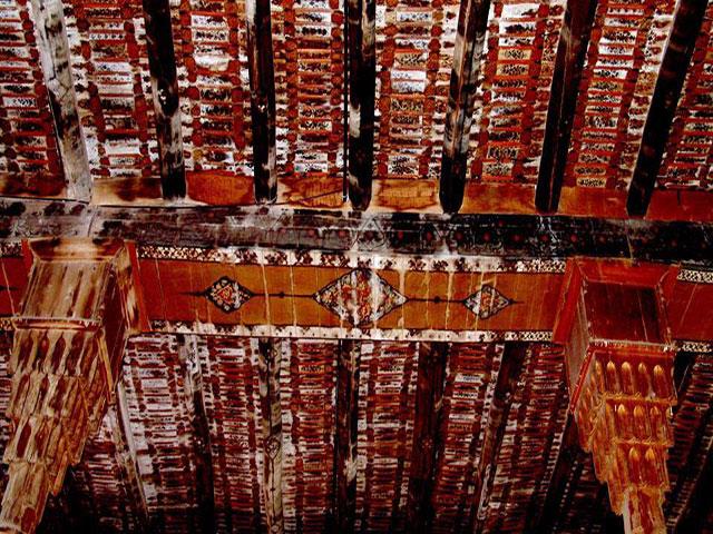
- The famous MARAGHEH OBSERVATORY (the greatest Observatory in the Medieval world!): The ruins of Hulagu khan's 13th cent. rasadkhune (observatory; known in it's day as 'the Star House') are on a low, flat-topped hill west of the city under a geodesic dome, and include a long, straight, flag-stone-paved, 3.1-m.-wide corridor with entrances to a series of long, rectangular rooms on both sides, and with the 'meridian', a straight gutter-like recess, running down its centre to the base of the 'Mural Quadrant' ( www.flickr.com/photos/97924400@N00/6337193475/in/photostr... ), originally with a radius of @ 40 m.s of which 5.5 m.s has survived, and which was used to calculate the position and motion of the sun (see below), all within the round base of what was once a large bldg., 22 m.s in diameter, and /b/ the thick foundations of the walls of its rooms. "The bldg., which no doubt served as a citadel as well, had a staff of at least 10 astronomers and a librarian, covered 340 x 135 m.s, and the foundations of the walls were 1.3 to 2 m.s thick." It made use of "a complex system of water wheels" (?). Instruments designed for it include the said quadrant, an armillary sphere with a radius of @ 160 cm.s, a solstitial armilla, an azimuth ring and a parallactic ruler (triquetrum). 5 circular platforms "on which astronomical instruments were placed" (I'll scan a photo of one) and the foundations of outbldg.s surround the site of the central tower, incl. one 330 m.s2, thought to have been the library which allegedly had holdings of @ 400,000 books (plundered by the Mongols from libraries across Persia, Syria and Mesopotamia, incl. "the legendary library of Alamut" where Tusi himself salvaged some works.) Some families of Iranian tourists were milling @. www.youtube.com/watch?v=rGYczp2WJpM
- "A mural instrument is an angle-measuring device mounted on or built into a wall. For astronomical purposes, such walls were oriented to lie precisely on the meridian. Mural instruments that measured angles from 0 to 90 degrees were called 'mural quadrants' and were utilized as astronomical devices in ancient Egypt and ancient Greece. ... To measure the position of a star, the observer needs a sidereal clock in addition to the mural instrument. With the clock measuring time, a star of interest is observed with the instrument until it crosses an indicator and 'transits the meridian'. The time on the clock is then recorded as well as the angular elevation of the star, yielding the position in the coordinates of the instrument. If the instrument's arc is not marked relative to the celestial equator, then the elevation is corrected for the difference, resulting in the star's declination." (Wikipedia)
- The Astronomical Observatory, as we know it, was a medieval, Islamic invention. www.youtube.com/watch?v=jqQYR6qYj4U And the Maragheh observatory (Il-Khanid, 1259-@'63) "represented new heights in the science of astronomy within Islam and the [wider] world" (Huff, "The rise of Early Modern Science"). It was the earliest and most successful of the 3 greatest astronomical observatories in the Muslim Middle East, incl. those in Islanbul (1420) and Samarkand (1577). (Why isn't this site on Iran's 'Tentative list' for Unesco designation?) "[T]he Chinese, having less hostile relations with Islam, and possibly through the intermediaries of the Mongols who sponsored the observatory, could have gained access to the most advanced astronomy in the world [!] 2 centuries before the West did." (Huff)
- "... The Maragha school of astronomers built [their] observatory with the hope of constructing new tables of observation that would surpass those of Ptolemy. Although this research team included such figures as al-Urdi, al-Tusi, Qutb al-Din al-Shirazi, and al-Maghribi [whose full name was Muhyī al‐Milla wa al‐Dīn Yahyā Abū ʿAbdallāh ibn Muhammad ibn Abī al‐Shukr al‐Maghribī al‐Andalusī], they didn't produce the observational database that might have displaced Ptolemy. Nonetheless, by adjusting various parameters they did create the first non-Ptolemaic planetary models, [but which] remained geocentric, ... [and] improved the Ptolemaic system such that its models were mathematically equivalent to [and preceded by > a century] those in the Copernican system. ... This is to say, (1) Copernicus [1473-1543] used the Tusi couple as the Maragha astronomers did ["a geometric system that includes a smaller circle within a larger circle twice its diameter. The rotations of the smaller circle allow a specific point on the circumference to oscillate in linear motion. The Tusi-couple solved many issues with Ptolemaic systems over planetary motion" and helped astronomers to understand how celestial bodies revolve around one another.], (2) his planetary models for longitude in the Commentariolus are very similar to those of Ibn al-Shatir, while (3) those for the superior planets in De Revolutionibus used Maragha models, and (4) the lunar models of Copernicus and the Maragha school are identical." (Huff) At the Maragheh and Samarkand observatories, the Earth's rotation was discussed by Najm al-Din al-Qazwini al-Katibi (d. 1277), Tusi (b. 1201) and Qushji (b. 1403). (Huff) The arguments and evidence used by Tusi and Qushji resemble those used by Copernicus to support the Earth's motion. (Wikipedia)
- financialtribune.com/articles/travel/3009/maragheh-the-je...
- "In 1256, the Mongols under Hulagu took the [infamous] Alamut castle [see my photo] where the religious scholar and astronomer Nasir al-Din al-Tusi (d. 1274) and several other scholars had taken refuge to continue their studies. Impressed with Al-Tusi's scholarship, Hulagu appointed him wazir or vizier, and then employed him to found and oversee the construction of the observatory. (According to one account, Al-Tusi appealed to Hulagu's superstitions and told him that he could predict the future with a good observatory.) This appears to have been done under the umbrella of the law of waqf, the religious law of endowments that al-Tusi understood as a legal scholar. This seems to be the first example of such use of Islamic law for these purposes." (Huff) But while Islam had initially generated and supported the observatory, it was Islam that would later destroy it. "Astronomers [maintained] that astronomy was a “handmaiden of religion”, as it was used to determine the new moon and time-keeping. Nonetheless it was associated with astrology whose assumptions ran counter to the tenets of Islam (and to those of Christianity too). If only God knows the future, those who claim such knowledge usurp his power and capacities. The decline of the observatory began in the late 13th cent., although it would survive the rule of 7 khans, incl. Abaqa and Uljaytu, and remained active for over 50 yr.s. > 100 astronomers conducted research in the facility in that period. ("It is believed that several Chinese astronomers worked at the observatory where they introduced several Chinese methods of computation.") The site became derelict as a result of a loss of funding, and damage sustained in earthquakes.
- en.wikipedia.org/wiki/Astronomy_in_the_medieval_Islamic_w...
- RASAD-KHANEH CAVES: A "MITHRAIC" TEMPLE or BUDDHIST or ?: I came upon an unusual cave complex, the Rasad-khaneh caves, just below and west of the observatory, carved out of the side of the hill. The ceilings of 2 chambers had been sculpted and smoothed, each like 2 sides of a triangle meeting at a point, like ceilings under a pitched roof. What look like large altars carved out from the living rock were in the centre of the floor in each. (I'll scan a photo.) There were subterranean levels and tunnels with much atmosphere. I used my flashlight or my camera flash to spelunk all through it. A vlogger and his friends explore some of it here.: www.youtube.com/watch?v=TxfCFZ7hPdU Some maintain that this was a mithraic temple complex, but Wikipedia refers to these sculpted caves as similar in style to Chinese and Mongol cave temples or shrines, and as having been used "for religious ceremonies in the Il-Khanid period." Oxford research fellow Arezou Azad writes that "[t]he rectangular stone blocks in chambers A and B were identified as altars, and hence the chambers as sanctuaries. To [Warwick] Ball they [resemble] the Buddhist circumambulatory pillar-caves of Afghanistan and Central Asia, and to Bowman and Thompson the Jacobite style of dual sanctuaries. I would also note a resemblance to the Sassanian fire altars of Balkh. ... In the cave temples of the Mithraists (or Mithraea), altars of such dimensions can also be found. An ancient Mithraic use is likely given the similarities with Roman Mithraic temples, but it is the Il-khanid period which is of greater interest to us." www.tertullian.org/rpearse/mithras/display.php?page=supp_...
- "Mithraic narratives state that Mehr was born in a cave and thus caves were considered important in the construction of mithraic temples. [Supplicants] performed their rituals in natural caves. ... The most important part of a temple was its altar, located at the end of the hall and including a small porch, built a little higher than ground level. The walls contained images of Mehr. ... [In the] hand-made caves of the Observatory hill ... platforms for sacrifice or on which images of Mehr were engraved are well preserved." www.cais-soas.com/CAIS/Archaeology/Ashkanian/verjuy_mithr...
- Dr. Amin Moradi is dismissive of "the traditional views of scholars" that the cave complex at Varjavi, nearby, is a mithraeum. link.springer.com/article/10.1007/s41826-022-00049-x "In the history of Zoroastrianism or Mazdayasna, Western Iran has been thought of as the heart of religious activity under the Median emperors (Herodotus). It's believed that after the unification of the Median and Achaemenid dynasties in 550 B.C., temples to Mithra, a Zoroastrian divinity, were constructed throughout the empire. (Malandra 1983, 88)." But he maintains that no evidence of any ancient mithraeum has been identified east of Syria (although they're found from Great Britain across the former Roman Empire to Dura Europos, and notwithstanding that the cult of Mithras is thought to have been adopted by Roman soldiers from its source in the worship of the Aryan pantheon in Parthian and Sassanian Iran.) No assumptions or inferences should be made as to Iranian mithraism on the basis of Roman mithraism. As to the purported mithraic cave-complex at Varjavi (which I write about in the next photo comment, a miss) Moradi suggests that it's an Il-Khanid-era tomb, "an attempt to try to copy the earlier Mongol construction methodologies in the Islamic context of Iran." He notes similarities in its layout with those of 7 cave 'dome tombs' that belong to clans of eastern Turks in Mongolia and which predate the Il-Khanate by /b/ @ 230 and 570 yr.s. But who was buried at Varjavi? All Khans are accounted for. Moradi admits that there's "no unknown Ilkhanid elite burial candidate for this monument in this region."
- After all that, I might find the evidence of the Buddhist nature of the Rasad-Khaneh caves (but not the Varjavi complex) to be most persuasive. (Cont.)
Antibacterial and eco-friendly handmade brushes made up of both natural and synthetic bristles.
Pelos 03 kits de pincéis da Mac eu tanto tenho desejado eu consigo comprar um kit com 24 desses pincéis, como eu não sou uma grande fã da MAC continuo pesquisando sobre esses novos pincéis, mas estou muito interessada e os reviews que tenho lido são positivos.
Tem na Amazon, mas acho que teria que entregar lá nos USA.
The African Chicken Genetic Gains (ACGG) project aims at testing and making available high-producing, farmer-preferred genotypes that increase smallholder chicken productivity in Africa. Nigeria is one of the three project countries. The ACGG-Nigeria team capped off its 2016 activities with its participation at the maiden edition of Ife City Trade Expo which was held from the 19th to 24th December, 2016 at EastWind Arena, Ile-Ife, Osun State. (Photo credit: ACGG Nigeria)
“Now the manna was like corlander seed, and its color like the color of bdellium.”
Numbers 11:7
For more on this story, visit: Jerusalem Prayer Team Articles Page.
LIKE and SHARE this story to encourage others to pray for peace in Jerusalem, and leave your own PRAYERS and COMMENTS below.
--------------------
Support the Jerusalem Prayer Team. Visit us now.
Indigenous to the sub-Saharan, Bdellium grows best in red or sandy clay and rocky ground. It has a massive underground root system that searches for water to sustain it. It leafs at the beginning of the wet season and, in dry seasons can produce two crops of leaves.
Growing from 16-33 feet tall, the Bdellium has a short trunk with gray-green bark. The bark is pleasantly scented and exudes a clear gum of resin, which is similar to myrrh but lacks the monetary value. It produces flowers and fruit, though not necessarily every year.
Nomadic groups use the Bdellium for several purposes. The roots of young plants have a sweet taste and are chewed. Timber is used for stools, milk containers, spoons and, occasionally, for building houses. The bark is brewed for tea, and the soft “gum” is eaten while the hard “gum” is used to make arrows.
For more on this story, visit: Jerusalem Prayer Team Articles Page.
LIKE and SHARE this story to encourage others to pray for peace in Jerusalem, and leave your own PRAYERS and COMMENTS below.
--------------------
Support the Jerusalem Prayer Team. Visit us now.
The Bible says that the region of the Pishon River was rich in an aromatic material called bdellium. This could refer to guggulu that is produced at Pushkar near the Sagarmati River which could be the Pishon. For more information please visit www.commonprophets.com/where-was-the-garden-of-eden-locat...
Throughout the ages this aromatic resin has proven itself invaluable for a variety of special purposes. Discover some of the key health benefits of myrrh. www.leojen.us/4-Ways-That-Myrrh-Supports-a-Healthy-Body-7...
"The name of the first is the Pishon. It is the one that flowed around the whole land of Havilah, where there is gold.
And the gold of that land is good; bdellium and onyx stone are there"
www.biblegateway.com/passage/?search=Genesis+2%3A11-12&am...
Like my photos? Buy me a coffee!
At Los Angeles Fashion Week presented by AHF. Official Hair Sponsor Style The Runway & Hair Dreams Extensions powered by Woody Michleb Salons. Makeup Sponsor Moira Cosmetics powered by April Love Pro Team featuring tools be Bdellium. Event Held at the Beverly Hilton Hotel. Sponsors Include: Monster Energy, Savvy Travelers, Shibue Couture, Selfie Cookie, Thats IT, and La Foglia. Art Gallery presented by Six Summit Gallery. Video by Jimmy Alioto Productions. Event produced by Rosete Inc. #NewYorkFashionWeek #NYFW #ArtHeartsFashion
One egg's lower half transformed
And became the earth below,
And its upper half transmuted
And became the sky above;
From the yolk the sun was made,
Light of day to shine upon us;
From the white the moon was formed,
Light of night to gleam above us;
All the colored brighter bits
Rose to be the stars of heaven
And the darker crumbs changed into
Clouds and cloudlets in the sky.
The scent of Creation: frankincense, bdellium, sweet cane, cassia, cinnamon, and dammar gum.
The ancient symbol of the Orphic Mysteries was the serpent-entwined egg, which signified Cosmos as encircled by the fiery Creative Spirit. The egg also represents the soul of the philosopher; the serpent, the Mysteries. At the time of initiation the shell is broke, and man emerges from the embryonic state of physical existence wherein he had remained through the fetal period of philosophic regeneration. -- Manly P. Hall