Bokeh: Smooth & Silky
View allAll Photos Tagged apogee
The "Aggregat 4" missile, better known as the V2 rocket (V2 = Vergeltungswaffe 2 = Vengeance Weapon 2) was the first long-range guided ballistic missile.
During testing in Peenemünde it was also the first vehicle reaching outer space by flying above the Kármán line (defined by the FAI at 100 km altitude) with the vertical test launch of MW 18014 on 20 June 1944 reaching an apogee of 176 km. Actual launch location was a tiny island named Greifswalder Oie.
This one here is actually just a replica standing in the Historisch-Technisches Museum Peenemünde (Historical Technical Museum Peenemünde).
© All Rights Reserved - you may not use this image in any form without my prior permission.
Located in the altitude fields of the "Serra da Bocaina", the "Casa de Pedra", as it is currently known, was built by Dr. Lassance, a resident doctor from Rio de Janeiro, in the beginning of the 20th century and its apogee in 1914.
Once ready and decorated with the richest imported refinements, the house was not much to the liking of his wife who was not interested in the patrimony.
The abandonment and vandalism were destroying the beautiful building that is now in ruins, and today is only a reminder of the golden days of "Bocaina".
"Serra da Bocaina" National Park, São José do Barreiro, São Paulo, Brazil.
"La mort n'est finalement que l'apogée de notre déclin."
Vincent Guérin
Thank you very much for your comments and for your faves.
(Please do not use without my written permission.)
Fondée en 1146 dans la vallée de la Thyle par Bernard de Clairvaux, cette abbaye était l'une des premières filles de l'abbaye de Clairvaux. Elle fut très tôt protégée par les ducs de Brabant et ainsi rapidement féconde. Le XIIIe siècle marque son apogée. Entre les XIVe et XVIIe siècles, l'abbaye a connu une succession de périodes calmes et troublées, durant lesquelles les moines ont quitté les lieux à neuf reprises pour raisons d'insécurité. Au XVIIIe siècle, l'abbaye a connu son second âge d'or, marqué par une grande ébullition architecturale. Après la Révolution française, la communauté monastique a dû se disperser, puis l'abbaye fut vendue comme bien national.
Dès lors, aux XIXe et XXe siècles, le site a connu dégradations et restaurations. L'ancienne abbaye de Villers est devenue un lieu de visite romantique et pittoresque, mais bien que devenu touristique, le site se dégradait. L'État belge a donc procédé à l'expropriation des lieux en 1892 pour y entamer un important chantier de restauration.
Les ruines appartiennent désormais à la Région wallonne, relevant du patrimoine majeur de Wallonie. La gestion du site est confiée à une association sans but lucratif, laquelle organise depuis 1987 des représentations théâtrales, des expositions et autres manifestations.
Founded in 1146 in the valley of the Thyle by Bernard de Clairvaux, this abbey was one of the first daughters of the abbey of Clairvaux. It was very early protected by the Dukes of Brabant and thus quickly fertile. The 13th century marks its peak. Between the fourteenth and seventeenth centuries, the abbey experienced a succession of calm and troubled periods, during which the monks left the premises nine times for reasons of insecurity. In the 18th century, the abbey experienced its second golden age, marked by great architectural turmoil. After the French Revolution, the monastic community had to disperse, then the abbey was sold as national property.
From then on, in the 19th and 20th centuries, the site suffered damage and restoration. The old abbey of Villers has become a romantic and picturesque place to visit, but although it has become touristy, the site is deteriorating. The Belgian State therefore expropriated the premises in 1892 to begin a major restoration project.
The ruins now belong to the Walloon Region, belonging to the major heritage of Wallonia. The management of the site is entrusted to a non-profit association, which has been organizing theatrical performances, exhibitions and other events since 1987.
♦Sponsor♦
FACS - Apogee Sweater and Sweat pants
Available @ Hong Dae
-------
Hair- Wasabi // Star Hair
Shoes- [MERCH] Dream 1's
Snack- ::CHERRYISH:: Ikayaki
Mask- {Sakura} Face Mask
Moon rise facing east & bit north of Mica Peak, Idaho. Gibbous waning 10-12 hours after full. The sky was very blue, then 5 minutes later the bright moon turned the wispy clouds to yellows & oranges. This year’s Hunter's Moon; the Beaver Moon; the Frost, Frosty, or Snow Moon; Sharad Purnima; and the Thadingyut, Hpaung Daw U, and Low Krathong Festival Moon. This full moon occurs when it is farthest from the Earth (apogee), thus a Micro Moon (the opposite of a "Supermoon").
INDIEN, Khajuraho (Tempel)
Most Khajuraho temples were built between 950 and 1050 by the Chandela dynasty. Historical records note that the Khajuraho temple site had 85 temples by 12th century, spread over 20 square kilometers. Of these, only about 20 temples have survived, spread over 6 square kilometers. Of the various surviving temples, the Kandariya Mahadeva Temple is decorated with a profusion of sculptures with intricate details, symbolism and expressiveness of ancient Indian art
The Khajuraho temples feature a variety of art work, of which 10% is sexual or erotic art outside and inside the temples. Some of the temples that have two layers of walls have small erotic carvings on the outside of the inner wall. Some scholars suggest these to be tantric sexual practices.] Other scholars state that the erotic arts are part of Hindu tradition of treating kama as an essential and proper part of human life, and its symbolic or explicit display is common in Hindu temples. James McConnachie, in his history of the Kamasutra, describes the sexual-themed Khajuraho sculptures as "the apogee of erotic art":
Фазу цветения гиппеаструма, условно называемую «North, South, East, West”, в таком виде, как на фото (все цветки раскрыты), на самом деле, мне удаётся наблюдать не часто. Как правило, цветки раскрываются и достигают апогея своей красоты, последовательно, один за другим, и к моменту раскрытия 4-го, первый уже начинает вянуть.
In fact, you can not often observe the flowering phase of Hippeastrum, conventionally called “North, South, East, West”, when all flowers are open. As a rule, the flowers open and reach the apogee of their beauty, sequentially, one after another, and when the fourth flower opens, the first one is already withering.
.
*
cf. Wikipedia
*
Photo : Vitrail de l’église paroissiale de Pencran (Finitère) représentant le cycle biblique de Noël (Naissance du Christ) à l’Epiphanie (l’arrivée de Rois Mages). On reconnaît, de gauche à droite, Marie, Joseph et l’enfant Jésus, avec les bergers venus adorer l’enfant et les trois rois mages. Pencran (en breton Penn-ar-C'hrann) est un petit village du Finistère (canton de Landerneau)
Foto: Pencran (Finisterre, Francia). Vidriera de la iglesia parroquial que representa el ciclo de 12 días que va del Nacimiento a la Epifania. So observa, de izquierda a derecha, a los personajes bíblicos de José, María y el Niño Jesús, los pastores y los tres reyes magos. Pencran es un pequeño pueblo del Finis Terrae francés (Bretaña).
La route est belle et sinueuse de Saint-Jean vers l'archipel de la péninsule de Roche-de-la Rose à l'extrémité de la péninsule depuis Saint-Jean jusqu'au phare de Lighthouse à Rose-Blanche de Terre-Neuve ! Route vers le village Saint-Trinity et les belles maisons !
The road between St-John and Anthony, for the Harvey trail and then to the Harvey Trail is the way longest from the seaside to Rockliff and coral reef in the Atlantic ocean near of Newport by the sea At Saint-Anthony, Newfoundland !
Saint-Anthony, Saint-John, West Isle Hillsborough, County Wiltshire , Newfoundland.
Le village de Barbour est situé à l'extrême sud de la péninsule amérindienne et constitue l'apogée des Iroquois à Tilly-sur-Mer également situé sur la péninsule du Nord-Brunswick et son paysage marin. Tout est beau et magnifique dans les récifs et les marées hautes.
The village of Barbour is located at the extreme south of the Amerindian peninsula and constituting the heyday of the Iroquois in Tilly-sur-Mer also located on the North Brunswick peninsula and its seascape. Everything is beautiful and magnificent in the reefs and high tides. Harvey trail is the second trail of Newfoundland !
Thanks a lot for your visits, comments, faves, invites !
Regards, Serge
Copyright © Serge Daigneault Photography, 2020
All rights reserved. Do not use without my written authorization.
Fondée en 1146 dans la vallée de la Thyle par Bernard de Clairvaux, cette abbaye était l'une des premières filles de l'abbaye de Clairvaux. Elle fut très tôt protégée par les ducs de Brabant et ainsi rapidement féconde. Le XIIIe siècle marque son apogée. Entre les XIVe et XVIIe siècles, l'abbaye a connu une succession de périodes calmes et troublées, durant lesquelles les moines ont quitté les lieux à neuf reprises pour raisons d'insécurité. Au XVIIIe siècle, l'abbaye a connu son second âge d'or, marqué par une grande ébullition architecturale. Après la Révolution française, la communauté monastique a dû se disperser, puis l'abbaye fut vendue comme bien national.
Dès lors, aux XIXe et XXe siècles, le site a connu dégradations et restaurations. L'ancienne abbaye de Villers est devenue un lieu de visite romantique et pittoresque, mais bien que devenu touristique, le site se dégradait. L'État belge a donc procédé à l'expropriation des lieux en 1892 pour y entamer un important chantier de restauration.
Les ruines appartiennent désormais à la Région wallonne, relevant du patrimoine majeur de Wallonie. La gestion du site est confiée à une association sans but lucratif, laquelle organise depuis 1987 des représentations théâtrales, des expositions et autres manifestations.
Founded in 1146 in the valley of the Thyle by Bernard de Clairvaux, this abbey was one of the first daughters of the abbey of Clairvaux. It was very early protected by the Dukes of Brabant and thus quickly fertile. The 13th century marks its peak. Between the fourteenth and seventeenth centuries, the abbey experienced a succession of calm and troubled periods, during which the monks left the premises nine times for reasons of insecurity. In the 18th century, the abbey experienced its second golden age, marked by great architectural turmoil. After the French Revolution, the monastic community had to disperse, then the abbey was sold as national property.
From then on, in the 19th and 20th centuries, the site suffered damage and restoration. The old abbey of Villers has become a romantic and picturesque place to visit, but although it has become touristy, the site is deteriorating. The Belgian State therefore expropriated the premises in 1892 to begin a major restoration project.
The ruins now belong to the Walloon Region, belonging to the major heritage of Wallonia. The management of the site is entrusted to a non-profit association, which has been organizing theatrical performances, exhibitions and other events since 1987.
La route est belle et sinueuse de Saint-Jean vers l'archipel de la péninsule de Roche-de-la Rose à l'extrémité de la péninsule depuis Saint-Jean jusqu'au phare de Lighthouse à Rose-Blanche de Terre-Neuve !
The road between St-John and Anthony, for the Harvey trail and then to the Harvey Trail is the way longest from the seaside to Rockliff and coral reef in the Atlantic ocean near of Newport by the sea At Saint-Anthony, Newfoundland !
Saint-Anthony, Saint-john, West Isle Hillsborough, County Wiltshire , Newfoundland.
Le village de Barbour est situé à l'extrême sud de la péninsule amérindienne et constitue l'apogée des Iroquois à Tilly-sur-Mer également situé sur la péninsule du Nord-Brunswick et son paysage marin. Tout est beau et magnifique dans les récifs et les marées hautes.
The village of Barbour is located at the extreme south of the Amerindian peninsula and constituting the heyday of the Iroquois in Tilly-sur-Mer also located on the North Brunswick peninsula and its seascape. Everything is beautiful and magnificent in the reefs and high tides. Harvey trail is the second trail of Newfoundland !
Thanks a lot for your visits, comments, faves, invites !
Regards, Serge
Copyright © Serge Daigneault Photography, 2020
All rights reserved. Do not use without my written authorization.
The moon on the left is nearly full and taken on April 19th of this year. This moon was known as a "Micro Moon." The furthest full moon of the year. The moon on the right was shot yesterday and as you probably know, a nearly full Supermoon. They were both shot from the same location and with the same equipment. There was no cropping to the frames before the composite was made.
Thanks for viewing!
It wasn't the best time to photograph the moon since it was almost as far away as it can get from the Earth when full this year. Never heard the term before but I discovered it is called a Micro Moon. Looking forward to the November Super Moon.
Thanks for viewing!
INDIEN, Khajuraho (Tempel)
Most Khajuraho temples were built between 950 and 1050 by the Chandela dynasty. Historical records note that the Khajuraho temple site had 85 temples by 12th century, spread over 20 square kilometers. Of these, only about 20 temples have survived, spread over 6 square kilometers. Of the various surviving temples, the Kandariya Mahadeva Temple is decorated with a profusion of sculptures with intricate details, symbolism and expressiveness of ancient Indian art
The Khajuraho temples feature a variety of art work, of which 10% is sexual or erotic art outside and inside the temples. Some of the temples that have two layers of walls have small erotic carvings on the outside of the inner wall. Some scholars suggest these to be tantric sexual practices.] Other scholars state that the erotic arts are part of Hindu tradition of treating kama as an essential and proper part of human life, and its symbolic or explicit display is common in Hindu temples. James McConnachie, in his history of the Kamasutra, describes the sexual-themed Khajuraho sculptures as "the apogee of erotic art":
Gainesville Florida 2/28/23
…Apogee:
the highest point in the development of something; a climax or culmination.
Last night's full moon was the smallest full moon this year due to Lunar Apogee (June 9, 2017). Because of the moon's elliptical orbit, it is farthest from Earth at this time. I just think it's pretty!
Most Khajuraho temples were built between 950 and 1050 by the Chandela dynasty. Historical records note that the Khajuraho temple site had 85 temples by 12th century, spread over 20 square kilometers. Of these, only about 20 temples have survived, spread over 6 square kilometers. Of the various surviving temples, the Kandariya Mahadeva Temple is decorated with a profusion of sculptures with intricate details, symbolism and expressiveness of ancient Indian art
The Khajuraho temples feature a variety of art work, of which 10% is sexual or erotic art outside and inside the temples. Some of the temples that have two layers of walls have small erotic carvings on the outside of the inner wall. Some scholars suggest these to be tantric sexual practices.] Other scholars state that the erotic arts are part of Hindu tradition of treating kama as an essential and proper part of human life, and its symbolic or explicit display is common in Hindu temples. James McConnachie, in his history of the Kamasutra, describes the sexual-themed Khajuraho sculptures as "the apogee of erotic art":
Petra, Jordan represents the apogee of Nabatean civilisation in the !st century BCE to 2nd century CE. This photo shows the first view of the Treasury( regarded as the finest monument at Petra) as emerge for the sik(the naturally formed rock cut way)
This eclipse, with a totality lasting 104 minutes, is the longest this century. It is also close to apogee, making the moon a mini-moon, much smaller than its perigee counterpart. So telescopic images of the eclipsed moon from these two dates show an observable size difference if the same magnification is used for the images (if you have a good memory and good eyesight you noticed the difference with the unaided eye). Some people calling this a blood Moon, The Moon does not turn the colour of blood, but will go a deep copper colour due to the refraction of red light through our atmosphere. This was a fairly deep eclipse with the Moon becoming quite dark, even dark grey/brown and become hard to see. Unfortunately, the July 28 eclipse occurs in the early morning. Fortunately it was on a Saturday. It started well before astronomical twilight in all of Australia. All Australia got to see the deepest totality, but in the eastern states totality ends after the Moon sets, central states gets to see totality end (just) and only Western Australia sees the entire eclipse. Totality is long and deep, 104 minutes, the longest this century. January's total lunar eclipse was only 76 minutes long. You didn't need special filters or fancy equipment to watch the lunar eclipse, you just need your eyes and somewhere comfortable to sit and watch. Watching earth's shadow creep across the Moons face, as the stars begin to appear again was quite beautiful. The Moon was very obvious to the west with bright red Mars close by, and Saturn below. The contrast between the deep coppery red Moon and the ruddy Mars was interesting. Binoculars or a telescope were a plus, but not necessary. 16868
Nina Beier zoome sur la tradition des statues équestres. La popularité de ces statues a atteint son apogée sous Louis XIV. Celui-ci estimait qu’un ordre hiérarchique d’hommes à cheval était la manière idéale pour faire montre de sa puissance. Nina Beier nous montre le flux et le reflux du pouvoir en utilisant le cheval comme effet de renforcement. Elle a réuni des statues qui ne sont plus exposées dans l’espace public et les a installées en formation tout près de la mer.
Cette référence à l’armée mélange les lignes dans le temps et l'espace, tandis que les statues disparaissent dans la mer et en émergent à nouveau, au fil des marées.
Nina Beier zooms in on the tradition of equestrian statues. The popularity of these statues reached its peak under Louis XIV. He believed that a pecking order of men on horseback was the ideal way to demonstrate power. Nina Beier shows us the ebb and flow of power using the horse as a reinforcing effect. She gathered statues that are no longer on display in public space and installed them in a formation near the sea.
This reference to the military blends lines in time and space, as statues disappear into the sea and emerge again, with the tides.
Fondée en 1146 dans la vallée de la Thyle par Bernard de Clairvaux, cette abbaye était l'une des premières filles de l'abbaye de Clairvaux. Elle fut très tôt protégée par les ducs de Brabant et ainsi rapidement féconde. Le XIIIe siècle marque son apogée. Entre les XIVe et XVIIe siècles, l'abbaye a connu une succession de périodes calmes et troublées, durant lesquelles les moines ont quitté les lieux à neuf reprises pour raisons d'insécurité. Au XVIIIe siècle, l'abbaye a connu son second âge d'or, marqué par une grande ébullition architecturale. Après la Révolution française, la communauté monastique a dû se disperser, puis l'abbaye fut vendue comme bien national.
Dès lors, aux XIXe et XXe siècles, le site a connu dégradations et restaurations. L'ancienne abbaye de Villers est devenue un lieu de visite romantique et pittoresque, mais bien que devenu touristique, le site se dégradait. L'État belge a donc procédé à l'expropriation des lieux en 1892 pour y entamer un important chantier de restauration.
Les ruines appartiennent désormais à la Région wallonne, relevant du patrimoine majeur de Wallonie. La gestion du site est confiée à une association sans but lucratif, laquelle organise depuis 1987 des représentations théâtrales, des expositions et autres manifestations.
Founded in 1146 in the valley of the Thyle by Bernard de Clairvaux, this abbey was one of the first daughters of the abbey of Clairvaux. It was very early protected by the Dukes of Brabant and thus quickly fertile. The 13th century marks its peak. Between the fourteenth and seventeenth centuries, the abbey experienced a succession of calm and troubled periods, during which the monks left the premises nine times for reasons of insecurity. In the 18th century, the abbey experienced its second golden age, marked by great architectural turmoil. After the French Revolution, the monastic community had to disperse, then the abbey was sold as national property.
From then on, in the 19th and 20th centuries, the site suffered damage and restoration. The old abbey of Villers has become a romantic and picturesque place to visit, but although it has become touristy, the site is deteriorating. The Belgian State therefore expropriated the premises in 1892 to begin a major restoration project.
The ruins now belong to the Walloon Region, belonging to the major heritage of Wallonia. The management of the site is entrusted to a non-profit association, which has been organizing theatrical performances, exhibitions and other events since 1987.
INDIEN, Khajuraho (Tempel)
Most Khajuraho temples were built between 950 and 1050 by the Chandela dynasty. Historical records note that the Khajuraho temple site had 85 temples by 12th century, spread over 20 square kilometers. Of these, only about 20 temples have survived, spread over 6 square kilometers. Of the various surviving temples, the Kandariya Mahadeva Temple is decorated with a profusion of sculptures with intricate details, symbolism and expressiveness of ancient Indian art
The Khajuraho temples feature a variety of art work, of which 10% is sexual or erotic art outside and inside the temples. Some of the temples that have two layers of walls have small erotic carvings on the outside of the inner wall. Some scholars suggest these to be tantric sexual practices.] Other scholars state that the erotic arts are part of Hindu tradition of treating kama as an essential and proper part of human life, and its symbolic or explicit display is common in Hindu temples. James McConnachie, in his history of the Kamasutra, describes the sexual-themed Khajuraho sculptures as "the apogee of erotic art":
Last night's full moon was the smallest full moon this year due to Lunar Apogee (June 9, 2017). Because of the moon's elliptical orbit, it is farthest from Earth at this time. I just think it's pretty!
Fondée en 1146 dans la vallée de la Thyle par Bernard de Clairvaux, cette abbaye était l'une des premières filles de l'abbaye de Clairvaux. Elle fut très tôt protégée par les ducs de Brabant et ainsi rapidement féconde. Le XIIIe siècle marque son apogée. Entre les XIVe et XVIIe siècles, l'abbaye a connu une succession de périodes calmes et troublées, durant lesquelles les moines ont quitté les lieux à neuf reprises pour raisons d'insécurité. Au XVIIIe siècle, l'abbaye a connu son second âge d'or, marqué par une grande ébullition architecturale. Après la Révolution française, la communauté monastique a dû se disperser, puis l'abbaye fut vendue comme bien national.
Dès lors, aux XIXe et XXe siècles, le site a connu dégradations et restaurations. L'ancienne abbaye de Villers est devenue un lieu de visite romantique et pittoresque, mais bien que devenu touristique, le site se dégradait. L'État belge a donc procédé à l'expropriation des lieux en 1892 pour y entamer un important chantier de restauration.
Les ruines appartiennent désormais à la Région wallonne, relevant du patrimoine majeur de Wallonie. La gestion du site est confiée à une association sans but lucratif, laquelle organise depuis 1987 des représentations théâtrales, des expositions et autres manifestations.
Founded in 1146 in the valley of the Thyle by Bernard de Clairvaux, this abbey was one of the first daughters of the abbey of Clairvaux. It was very early protected by the Dukes of Brabant and thus quickly fertile. The 13th century marks its peak. Between the fourteenth and seventeenth centuries, the abbey experienced a succession of calm and troubled periods, during which the monks left the premises nine times for reasons of insecurity. In the 18th century, the abbey experienced its second golden age, marked by great architectural turmoil. After the French Revolution, the monastic community had to disperse, then the abbey was sold as national property.
From then on, in the 19th and 20th centuries, the site suffered damage and restoration. The old abbey of Villers has become a romantic and picturesque place to visit, but although it has become touristy, the site is deteriorating. The Belgian State therefore expropriated the premises in 1892 to begin a major restoration project.
The ruins now belong to the Walloon Region, belonging to the major heritage of Wallonia. The management of the site is entrusted to a non-profit association, which has been organizing theatrical performances, exhibitions and other events since 1987.
I wouldn't say it's been a bad week, but it's been a stressful one. Nice to reach its pinnacle and its end, and to enter another week.
INDIEN, Khajuraho (Tempel)
Most Khajuraho temples were built between 950 and 1050 by the Chandela dynasty. Historical records note that the Khajuraho temple site had 85 temples by 12th century, spread over 20 square kilometers. Of these, only about 20 temples have survived, spread over 6 square kilometers. Of the various surviving temples, the Kandariya Mahadeva Temple is decorated with a profusion of sculptures with intricate details, symbolism and expressiveness of ancient Indian art
The Khajuraho temples feature a variety of art work, of which 10% is sexual or erotic art outside and inside the temples. Some of the temples that have two layers of walls have small erotic carvings on the outside of the inner wall. Some scholars suggest these to be tantric sexual practices.] Other scholars state that the erotic arts are part of Hindu tradition of treating kama as an essential and proper part of human life, and its symbolic or explicit display is common in Hindu temples. James McConnachie, in his history of the Kamasutra, describes the sexual-themed Khajuraho sculptures as "the apogee of erotic art":
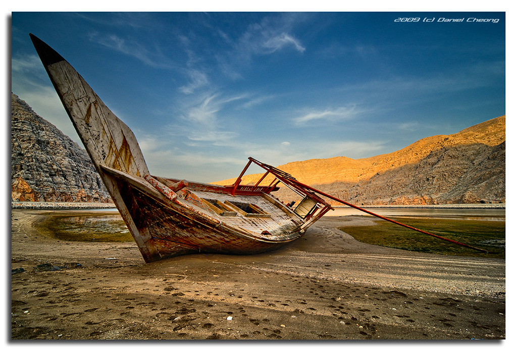
Yesterday I drove to the Northen Emirates and crossed the border to Oman to drive up to the town of Khasab. Beautiful coastline, superb beaches, emerald sea, white sand, rocks, cliffs and even fjords with dolphins swimming around! It was an awesome refreshing trip, far from the skyscrapers of Dubai. At last I found some really nice landscapes in this region, even though it was quite challenging to photograph the fjords from a boat.
And as a big bonus, this beautiful boat wreck was just lying on the side of the road! The sun was setting hence the lighting on the mountains.
In the next days, I'll be posting some shots from Istanbul again, and more shots from Oman.
This is a 7 exposures tone-mapped HDR with Dynamic Photo HDR (it gave me much better results than Photomatix). The sky is from one original exposure (tweaked in ACR because it was a bit hazy). The tone-mapped sky was a bit over cooked for my taste.
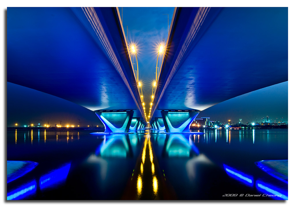
My dear Friends, after a rather long flickr break, I am back! I still don't have enough 'flickr worthy' material to post regularly, but I've started going out again to shoot, despite the heat here in Dubai.
Note: I was planning to come back with shots of the inauguration of the Burj Dubai on 9-9-9, but unfortunately the tallest tower in the world is still not completed. Hopefully it will be by the end of this year!
I'll be slowly catching up on your streams, so please bear with me!
Wish you all a great week end!
en.wikipedia.org/wiki/C%c3%b3rdoba,_Spain
Córdoba (also Cordova) is a city in Andalusia, southern Spain, and the capital of the province of Córdoba. Located at 37.88° North, 4.77° West, on the Guadalquivir river, it was founded in ancient Roman times as Corduba by Claudius Marcellus. Its population in 2008 was 325,453.[1]
Today a moderately-sized modern city, the old town contains many impressive architectural reminders of when Qurṭuba (قرطبة), the thriving capital of the Caliphate of Córdoba, governed almost all of the Iberian peninsula. It has been estimated that in the latter half of the tenth century Córdoba, with up to 500,000 inhabitants, was then the most populated city in Europe and, perhaps, in the world.[2]
History
Roman temple of Córdoba.Córdoba was the capital of the Roman province of Hispania Ulterior Baetica. Great Roman philosophers like Lucius Annaeus Seneca the Younger, orators like Seneca the Elder and poets like Lucan came from Roman Cordoba. Later, it occupied an important place in the Provincia Hispaniae of the Byzantine Empire (552-572) and during the Visigoth period.
It was captured in 711[3] by the Muslims, and Córdoba became capital during the Umayyad Caliphate, the period of its apogee, with a population of roughly 400,000 inhabitants,[4] though estimates range between 250,000 and 500,000. In the 10th century, Cordoba – called قرطبة (Qurṭuba) in Arabic – was one of the most advanced cities in the world, as well as a great cultural, political and economic centre. The Córdoba Mosque dates back to this time. In 1236 it was captured by King Ferdinand III during the Spanish Reconquista.
On the Rio Guadalquivir, just downstream from the Puente Romano (Roman Bridge) is a restored Islamic water wheel that once would have raised water to the caliph's palace.
With one of the most extensive historical heritages in the world (declared a World Heritage Site by UNESCO 17 December 1984), the city also features a number of modern areas, including the districts of Zoco and the railway station district, Plan RENFE.
The regional government (the Junta de Andalucía) has for some time been studying the creation of a Córdoba Metropolitan Area that would comprise, in addition to the capital itself, the towns of Villafranca, Obejo, La Carlota, Villaharta, Villaviciosa, Almodóvar del Río and Guadalcázar. The combined population of such an area would be around 351,000.
Geography
The city is located on the banks of the Guadalquivir river and its easy access to the mining resources of the Sierra Morena (coal, lead, zinc) satisfies the population’s needs.
The city is located in a depression of the valley of the Guadalquivir. In the north is the Sierra Morena, which defines the borders of the municipal area.
Córdoba is one of the few cities in the world that has a near-exact antipodal city – Hamilton, New Zealand.
Climate
Córdoba has a Mediterranean climate with Atlantic coastal influences. Winters are mild with isolated frosts.
Summers, with increased daily thermal oscillations, have the highest maximum temperatures in Europe, exceeding 40 °C occasionally. Local minimum summer temperature is 27 °C, the highest in Spain and Europe. Precipitation is concentrated in the coldest months; this is due to the Atlantic coastal influence. Precipitation is generated by storms from the west that occur more often from December through February. This Atlantic characteristic then gives way to a hot summer with significant drought more typical of Mediterranean climates.
Annual rain surpasses 500 mm although there is a recognized inter-annual irregularity. In agreement with the Köppen climate classification, the local climate can be described as Csa.
Registered maximum temperatures at Cordoba Airport (located at 6 km of the city) are 46.6° (23rd, July 1995) and 46.2° (1st, August 2003). The minimum temperature is -8.2° (28 January 2005).
May celebrations
Tourism is especially intense in Córdoba during May because of the weather and as this month hosts three very popular festivals.[7]
The May Crosses Festival takes place at the beginning of the month. During three or four days, crosses of around 3 meters of height are placed in many squares and streets and decorated with flowers and a contest is held to choose the most beautiful one. Usually there is regional food and music near the crosses.
The most important of the three is the Patios Festival celebrated during the second and third week of the month. Many houses of the historic center open their private patios to the public and compete in a contest. Both the architectonic value and the floral decorations are taken into consideration to choose the winners. It is usually very difficult and expensive to find accommodation in the city during the festival.
Córdoba's Fair takes place at the ending of the month and is similar, if smaller, to the better known Seville Fair.
Main sights
Religious architecture
Great Mosque of Córdoba, which contains columns that date back to the Roman and Visigothic periods, primarily constructed during the Umayyad period (its construction started in 784). It was converted into a Cathedral after the Reconquista.
Córdoba Synagogue (14th century)
Fernandine and Alphonsine-style churches (13th century)
Various monasteries and convents
Walcha Cave (built in 1489)
Civil and military architecture
Alcázar of the Christian Kings (14th century)
Palace of Viana with its flowered patios (16th century)
Royal residences and palaces
The Tower of Calahorra (14th century)
The Door of the Bridge (16th century)
The Plaza Vieja or Plaza Mayor
Walls and towers of the Muslim and also Christian period
Archaeological sites
Roman archaeological remains (temple, mausoleum)
Islamic archaeological remains (minarets preserved in the churches, Arab baths)
Archaeological site of Madinat Al-Zahra (10th century)
The Roman Bridge
Museums
Archeological and Ethnological Museum of Córdoba.
Julio Romero de Torres Museum.
Museum of Fine Arts.
Dioceses Museum.
Baths of the Fortress Califal.
Botanical Museum of Cordova.
Three Cultures Museum.
Bullfighting Museum.
Molino de Martos Hydraulic Museum.
Parks and Gardens
Garden of the Victory
Garden of the Rivas Duc
Garden of the Agriculture
Garden of the Conde de Vallellano
Garden of Juan Carlos I
Park Cruz Conde
Sotos de la Albolafia
Balcón del Guadalquivir
Peri-urban park of Los Villares
Park of the Miraflores
Famous people born in Córdoba and its province
Cordova was the birthplace of five famous philosophers and religious scholars:
In Roman times the Stoic philosopher Seneca,
In classical Islamic times
The Islamic scholar ibn Hazm, a major Muslim theologian and legal jurist,
The Islamic scholar ibn Rushd or Averroes, one of Islam's most famous and eminent scholars and philosophers,
Imam Abu 'Abdullah al-Qurtubi, a leading jurist of the Maliki madhab, and
The rabbi and Jewish philosopher Moses Maimonides.
Córdoba was also the birthplace of
The Roman poet Lucan,
The medieval Spanish poet Juan de Mena, and
The Renaissance poet Luis de Góngora, who lived most of his life and wrote all his most important works but one in Cordoba.
In addition some scholars have linked to Córdoba
The Renaissance philosopher Abraham Cohen de Herrera and
The prominent Jewish mystic Moses ben Jacob Cordovero
Both of these were evidently descended from families which lived in Córdoba before the expulsion of the Jews from Spain.
More recently, several flamenco artists were born here as well, including
Vicente Amigo
Joaquín Cortés
Fosforito
Paco Peña
Juan Serrano (Flamenco)
Fernando Tejero
Transport
The city is connected by high speed trains to the main Spanish cities: Madrid, Barcelona, Seville, Malaga and Zaragoza. More than 20 trains per day connect the downtown area, in 54 minutes, with Málaga Airport.
Twin cities
São Paulo, Brazil
Manchester, United Kingdom[8]
Bourg-en-Bresse, France
Fes, Morocco[9]
Lahore, Pakistan[9]
Bethlehem, Palestinian Authority[10]
Damascus, Syria[9]
Al Qayrawan, Tunisia[9]
Adana, Turkey
Istanbul, Turkey
Izmir, Turkey
Bukhara, Uzbekistan[9]
Here we can see the fact that the orbit of the Earth around the Sun is not circular and neither is the orbit of the Moon around the Earth.
The Solar image on the left comprises an image of the Sun when farthest from the Earth (Aphelion), shot in July this year (2020) and closest (Perihelion) shot in January. The images of the Moon are of the closest full Moon (Perigee) of 2019 and the farthest (Apogee).
The Court of the Lions or Palace of the Lions is a palace in the heart of the Alhambra, a historic citadel formed by a complex of palaces, gardens and forts in Granada, Spain. It was commissioned by the Nasrid sultan Muhammed V of the Emirate of Granada in Al-Andalus. Its construction started in the second period of his reign, between 1362 and 1391 AD. Along with the Alhambra, the palace is part of a UNESCO World Heritage Site. It was minted in Spain's 2011 limited edition of €2 Commemorative Coins.
The Palace of the Lions is one of the most famous palaces in Islamic architecture and exemplifies the apogee of Nasrid architecture in Al-Andalus. The architecture of the palace presented a significant shift in the design of Nasrid palaces and introduced new trends in ornamentation. The building consists of a rectangular courtyard centered on a marble fountain with twelve sculpted lions. Four main halls surround the courtyard, along with some upper-floor rooms. Water channels connect the central fountain with smaller fountains in the four halls. The halls feature some of the most elaborate and sophisticated muqarnas vaults in the Islamic world.
The name "Palace of the Lions" or "Court of the Lions" is a modern designation given to the palace, based on the notable lion sculptures around the central fountain. Due to limited historical documentation, the palace's original name during the Nasrid period cannot be confirmed for certain. One theory is that it was known as the Qasr ar-Riyad or, more fully, Qasr ar-Riyad as-Sa'id. Another suggestion is that it was known as Dar 'Aisha, purportedly named after one of Muhammad V's favourite wives, although there is no historical record of what his wives were called. This name was later corrupted to Daraxa or Daraja in Spanish, and survives in the name of the adjoining Lindaraja courtyard.
The Alhambra was a self-contained palace-city surrounded by fortifications, built up by the Nasrid rulers of the Emirate of Granada in the 13th to 15th centuries. Multiple palaces were added and expanded over the years by different rulers. The Palace of the Lions was added by Muhammad V, who is also responsible for other important contributions to the Alhambra. The period of Muhammad V's reign is considered by scholars to mark the apogee of Nasrid architecture, characterized in particular by a profusive use of muqarnas (stalactite-like sculpting) and three-dimensional muqarnas vaults.
The chronology of construction in the Palace of the Lions is not clearly established, but it took place during Muhammad V's second reign (1362–1391), after his return from a period of exile. The Hall of the Two Sisters (Sala de Dos Hermanas), on the north side of the court, was completed in 1362 or between 1362 and 1365, when Muhammad V was celebrating his return to the throne and was also refurbishing the Mexuar and the Comares Palace. According to scholar Felix Arnold, the rest of the palace was built between 1377 and 1390. Some scholars have suggested that the palace was most likely completed in 1380. Inscriptions throughout the palace feature poems by Ibn Zamrak, a poet and long-serving vizier at the time, which suggests that he was probably involved in its design.
The area the Palace of the Lions was built on was formerly part of a larger garden or riad. Much of the area around it remained an open garden afterward, including the area on its north side which is now occupied by the Patio de Lindaraja (Courtyard of Lindaraja). Possibly because of this, the palace's original name may have been Qasr ar-Riyad. During the Nasrid era, the palace was completely independent from the nearby Comares Palace to the west and had its own street entrance. On the south side of the palace, separated from it by a narrow street, was the Rawda, the dynastic mausoleum of the Nasrids, of which only the foundations remain today.
A widely-held scholarly view is that the palace was intended to serve as a private residence with a more intimate character than the Comares Palace, which served more official public functions. It may have served as a pleasure palace for entertainment. In his 2004 book on the Alhambra, Robert Irwin argued that while this interpretation is plausible, there is little direct evidence about the palace's function. It has also been suggested that the palace was built to commemorate Muhammad V's victories, in particular his retaking of Algeciras in 1369. Robert Irwin states that there is no direct evidence for this interpretation either and that the chronology of events makes it unlikely. However, the loot gained from those victories may have helped Muhammad V finance his construction projects.
One theory by art historian Juan Carlos Ruiz Souza proposes that the palace may have actually been a madrasa and zawiya instead. According to this interpretation, the so-called Hall of Kings (Sala de los Reyes) and the Hall of Muqarnas (Sala de los Mocárabes) would have served as the palace library, the Hall of Two Sisters (Sala de Dos Hermanas) would have been a multifunctional space, the upstairs Court of the Harem (Patio del Harén) would have been a residential apartment for the person in charge of the madrasa, and the Hall of the Abencerrajes (Sala de los Abencerrajes) would have served as the madrasa's oratory and possibly also as the mausoleum of Muhammad V himself. Another scholar commenting on this theory, Cynthia Robinson, argues that while its function as a formal madrasa and a mausoleum may be hard for scholars to accept, the building could have still functioned as a kind of bayt al-ḥikma ("house of knowledge") – meaning a place dedicated to education, contemplation and other intellectual or cultural activities – aimed at a royal Nasrid audience and related to their patronage of Sufism.
Granada was conquered by the Catholic Monarchs of Spain in 1492 and the Alhambra became a palace owned by the Spanish monarchy. Like much of the Alhambra, the Palace of the Lions suffered damages and underwent various repairs, restorations, and modifications over time. Under the Catholic Monarchs, it was connected to the Comares Palace by a direct passage for the first time, as it remains today.
Starting in 1528, emperor Charles V commissioned the construction of new apartments in the area to the north of the palace. The former gardens on the north side of the palace, which had allowed for an uninterrupted view of the city on this side, were turned into an enclosed garden during this period, resulting in the present Patio de Lindaraja. Additionally, the original entrance to the Palace of the Lions, on its south side, was suppressed in order to make a connection to the new Renaissance-style Palace of Charles V. Modifications were also made to the fountain inside the Court of the Lions during the second half of the 16th century.
In 1590 the western chamber of the palace, the Sala de los Mocarabes, was destroyed by the explosion of a nearby gunpowder magazine. The room's former muqarnas-vault ceiling, now lost, was eventually replaced by a Baroque-style plaster vault in 1714, designed by painter Blas de Ledesma for the visit of Phillip V and Isabella of Parma.
In the 19th century, probably during the French occupation (1810–1812), the floor of the courtyard was replaced with gardens – although there has been much debate among scholars as to whether gardens had previously existed in the courtyard.
In 1859 the architect Rafael Contreras "restored" the courtyard's eastern pavilion by giving it a spherical dome roof with ceramic tiling, based in part on Iranian architecture. This conformed to what European restorers at the time thought the "Arab style" should look like. The domed roof was disassembled in 1934 by Leopoldo Torres Balbás and replaced with its current pyramidal roof, which set off an international debate about the nature of restorations. Torres Balbás argued for a more scientific approach to restoration, in contrast with the more "stylistic" restoration philosophy of his predecessors. Nonetheless, Torres Balbás's roof is still partly incorrect, as its angles are too steep compared with similar pyramidal roofs in Moorish architecture.
In 2002, the Patronato de la Alhambra (the official agency in charge of the historical site) began a major and comprehensive restoration of the Court of the Lions. This involved the temporary removal of the fountain's lion sculptures and modifications to its hydraulic system. The restoration of the fountain and most of the courtyard was completed in 2012. One of the last steps in the restoration was the replacement of the courtyard's previous gravel flooring with a pavement of Macael marble flagstones, a decision based on the study of historical archives and on new archeological investigations showing that the underlying rock bed would have made the topsoil too thin for gardens. A recent study of some of the muqarnas compositions around Court of the Lions was able to identify deformations and imperfections that have occurred due to the many repairs and restorations that took place across generations. The Sala de los Reyes is still undergoing further restoration work. A project to restore its three painted leather ceilings was completed in 2018, while a new project to restore the stucco decoration below these ceilings began in July 2022
Having always been interested in Astronomy, Cosmology, and Physics, I jumped at an opportunity last week to attend a "Mars Party" at the Northern Skies Observatory in Peacham, Vermont. The observatory is operated by the Northeast Kingdom Astronomy Foundation. We started off on smaller telescopes set up outside, viewing Venus, Mars, Saturn, and their moons.
Once it got darker, we moved into the observatory to see how the telescope worked. The astronomer told us about a rare class of bizarre stars called Wolf Rayet, and talked about a particular one named WR136. This star is near the center of the Crescent Nebula in constellation Cygnus, 5000 light years from Earth. WR136 is about 3 times the radius of our sun and 15 times its mass, yet it is an incredible 250,000 times brighter than our sun. A photo was then taken. It was interesting to note that all photos taken by telescopes such as this one, and even the Hubble, are inherently black and white, getting their colors solely from filters.
The telescope itself is robotically controlled and has a 17 inch diameter mirror, the second largest in Vermont. The software that operates the telescope is quite sophisticated. A person can simply type in the name of an object to be viewed or photographed, and the telescope will be robotically moved to the correct position. This coordinates with the software for the 14.5 foot dome, so that the door at the top opens (if closed) and rotates to the position associated with the telescope. The telescope then continues to track the object so that multiple photos can be taken and stacked. Additionally, this can all run in an unattended mode, where a list of objects to be photographed has been provided, and the software will work to take photos of those objects. To accomplish this, the software determines when those objects will be in the field of view, and checks that sky conditions are right for photos (e.g. it is dark enough, and the sky is clear).
The above photo was taken facing North (more precisely, NNE), so the galactic core of the Milky Way is not visible here. You may be able to see the spiral galaxy Andromeda, about half way up the sky on the right. The photo was taken 2 days before the Perseid meter showers are at peak, but it will be overcast on those days at this location. However, we did still see a few meteors that night, and I managed to capture one in the photo.
The observatory is open to the public for scheduled events. See their website or Facebook page for more info.
Website: www.nkaf.org
Facebook: www.facebook.com/nkaf.org
Updates:
- I received an e-mail from William Vinton, President of the Northeast Kingdom Astronomy Foundation, indicating that the two bright, closely spaced objects near the center are the famous "Double Cluster" in constellation Perseus, two open star clusters, each of which contains about 300 to 400 stars. The clusters are about 7000 light years distant and only a few hundred light years apart. For comparison, the Andromeda Galaxy is 2.5 million light years distant.
- The telescope is a PlaneWave f/6.8 17 inch CDK.
- The camera is an Apogee Alta F16M Monochrome CCD with a Kodak 52 mm full frame sensor.
- The observatory is one of about 20 on the Skynet Robotic Telescope Network, whose major purpose is to record, image, and study gamma-ray bursts.
- See this photo of the Triangulum galaxy taken with the telescope at this observatory and processed with FITS: www.flickr.com/photos/davetrono/48687865046
- Photo of a full Milky Way panorama over the observatory:
The Moon shot from London on the 13th September, just a few hours from full.
This was the full moon farthest placed from Earth (Apogee) in 2019. Also informally known as a micro-moon - though you'd not be able to distinguish between it and a 'super-moon' with the naked eye!
Celestron Edge HD11 & Canon EOS 6D
A supermoon is a full moon or a new moon that nearly coincides with perigee—the closest that the Moon comes to the Earth in its elliptic orbit—resulting in a slightly larger-than-usual apparent size of the Moon as viewed from Earth.[1] The technical name is a perigee syzygy (of the Earth–Moon–Sun system) or a full (or new) Moon around perigee.[a] Because the term supermoon is astrological in origin, it has no precise astronomical definition.[2]
The real association of the Moon with both oceanic and crustal tides has led to claims that the supermoon phenomenon may be associated with increased risk of events like earthquakes and volcanic eruptions, but no such link has been found.[3]
The opposite phenomenon, an apogee syzygy or a full (or new) Moon around apogee, has been called a micromoon.
A blue moon is an additional full moon that appears in a subdivision of a year: the third of four full moons in a season.
The phrase in modern usage has nothing to do with the actual color of the Moon, although a visually blue Moon (the Moon appearing with a bluish tinge) may occur under certain atmospheric conditions—for instance, if volcanic eruptions or fires release particles in the atmosphere of just the right size to preferentially scatter red light.
Wikipedia
The Moon Rose over the rock “Haghia” in Meteora, Greece, on the very night preceding the Full Harvest Moon. The Moon was close to its apogee (the point of its orbit farthest from Earth), it was therefore a micromoon.
The rock formation Haghia (aka Aïá, from the Greek word Ἁϊά, meaning “Great Saint”) is 2,067 ft high (630 m, measured from sea level). This is the highest of all Meteora rocks. On its top there are the ruins of the abbey (aka monastery) of the 12 Apostles. It was built on the very spot of ancient fortifications of Aeginium (the city currently called Kalampaka). Haghia is probably the most impressive of the lofty rock formations called Meteora.
Meteora is the name of the group comprising many impressive and lofty rock formations: The height of the sandstone megaliths ranges between 1,000-2,067 ft (300-630 m). The rock masses which were formed 60 million years ago are geologically unique and listed in UNESCO world heritage sites. The Varlaam monastery (abbey) was built in 1517-1518 on a 1,808 ft high (551 m) rock.
When the Moon was shot, it had: 98.53% illumination, 13.3 days’ age, -12.52 magnitude, 402,547 km distance from Earth, an a 104° 42′ 41″ azimuth and it was 06° 20′ 09″ above horizon.
Oiiiiiiii!!!
E o lindo escolhido hoje foi o maxi,esmalte maravilhoso além de Lindoooooooooooooo fácil de esmaltar de limpar cobriu perfeitamente com 3 camadas,minhas unhas estão brilhando muitooooo...Adorei esse fofo.
Bjus*-*
The Full Harvest Moon sets at dawn. The lunar golden and orange hue matches the magenta-rich colors of the belt of Venus at sunrise. The setting Moon is not companionless: a spectacular conjuction of the Moon and Mars graces the sky. The Red Planet appears brighter in the sky and bigger than usual, as it will reach Opposition in a few days.
Both celestial bodies set above the Varlaam monastery (abbey), built in 1517-1518 on a 1,808 ft high (551 m) rock formation. The latter is only one of the many impressive and lofty rocks, collectively called Meteora, in Greece. The height of the sandstone megaliths ranges between 1,000-2,067 ft (300-630 m). The rock masses which were formed 60 million years ago, are geologically unique and listed in UNESCO world heritage sites.
Lunar data: Waning gibbous phase, 98.3% illumination, 15.7 days’ age, -12.51 magnitude, 11° 57′ 14″ above horizon, at a 266° 42′ 43″ azimuth; distance from Earth: 406,206 km (close to its apogee, i.e. the point of its orbit farthest from Earth).
Data of Mars: -2.52 magnitude, 12° 43′ 42″ above horizon, at an azimuth of 267° 25′ 59″; distance from Earth: 0.42 AU
Hello,
The idea : someone builds a starfighter and others dudes (from french forum brickpirate) will build their own take
What's important to me is that everyone is going to build something different from the same starting point, absolutely no pretention to build something better than the others , that's not the goal ( there are contests for that .........)
So here , this is the third round , my take to a starfighter built , designed by Xavier Clement the original version is just there
www.flickr.com/photos/105482375@N06/albums/72157665879975815