View allAll Photos Tagged SHIPMENT
Amazing vibes @ Ascension Collective's 4th edition, at "Shipment" venue, with containers all around and quite the industrial vibe. It was so very nice to spin some of the finest Deep House and even with an encore later on as an "Afterparty". It was raining quite a lot but that didn't stop anyone from partying very hard this friday, on August 4th, 2023.
For those of you who wonder where you can listen to my set off-world. Here's the link to my Mixcloud page!
For notices and more informations (on where I am partying next) you can join my very own DJ Group inworld, at the link: House of Pandora.
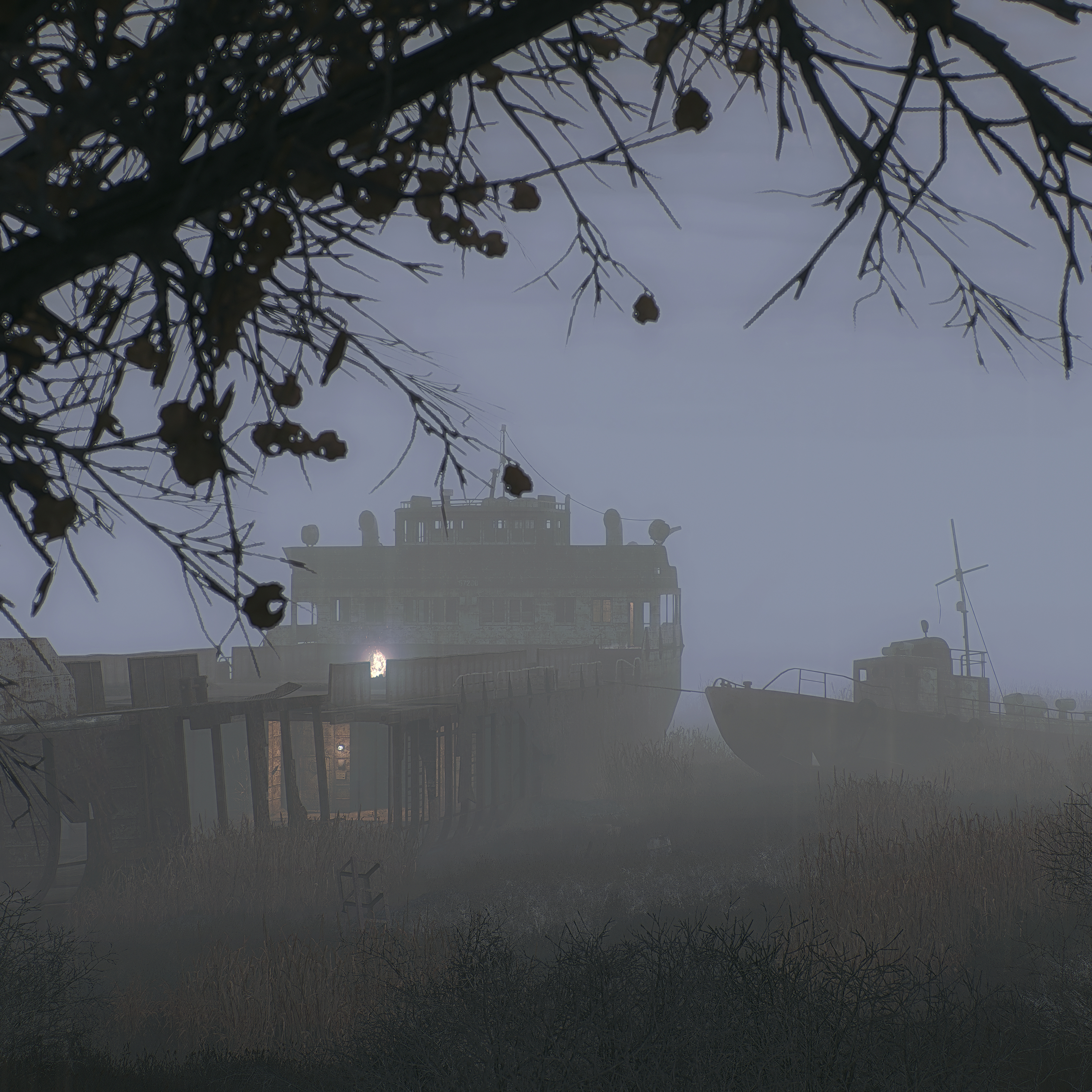
Using Atmosfear 3 in combination with Absolute Texture, enhanced grass draw distance, console controlled FOV, 'GOTZ' for enemy-, weather- and location-spawn, ingame console commands (fov, tilt), user.ltx tweaks (r2_lumscale etc.), CheatEngine (slomo, fake 'timestop' by setting timescale to 0.0 - no camera movement possible though), ReShade 2.x.
NASA is preparing the Space Launch System rocket core stage that will help power the first crewed mission of NASA’s Artemis campaign for shipment. On July 6, NASA and Boeing, the core stage lead contractor, moved the Artemis II rocket stage to another part of the agency’s Michoud Assembly Facility in New Orleans. The move comes as teams prepare to roll the massive rocket stage to the agency’s Pegasus barge for delivery to NASA’s Kennedy Space Center in Florida in mid-July.
Prior to the move, technicians began removing external access stands, or scaffolding, surrounding the rocket stage in early June. NASA and Boeing teams used the scaffolding surrounding the core stage to assess the interior elements, including its complex avionics and propulsion systems. The 212-foot core stage has two huge propellant tanks, avionics and flight computer systems, and four RS-25 engines, which together enable the stage to operate during launch and flight.
Credit: NASA/Michael DeMocker
#Artemis #NASAMarshall #Space #NASASLS #NASA #NASAMichoud
Safe roads #truck #road #way #hay #bale #unsafe #saferoads #shipment #strada #camion #stradesicure #fieno #Italy #Appia
12 Likes on Instagram
1 Comments on Instagram:
in_facts: Molto bella 👍
Tuesday 28th October 2008
Now most of my Lego contact's have probably been wondering where all my Lego CPKF images are? Simple. I haven't been taking them. And on that note you tank builders are probably wondering where's the medium/heavy armour? That's still in development.
It all comes down to time. At the moment I have very little of it. Sheesh, I haven't even got time to update my 365 project (a week's worth of images on back log)... So I'll upload them soon...
Anyway, back to the Lego army Peace Keeping Force building. Well it's game on...
This long awaited* BrickArms order arrived today. How awesome is it... and before any of you ask - no trades... sorry...
Will was kind enough to send me some awesome prototypes too.
I feel obliged to mention that I paid for this just as the $AUD fell against other currencies, so I ended up paying about 40% more than what I expected to..
That's the (my) CPKF logo in the top left.
I'll profile these fellas on minifigs/MOC's over the upcoming [insert time unit here].
A big THANK YOU (love-you-long-time) to Will Chapman, Founder of BrickArms. Thanks for the excellent service and consultation from since before the beginning and for the future! I do hope to meet in you in person one day to talk about stuff over a beer or something.
If you're interested in more information about BrickArms please visit www.brickarms.com.
Joz
*my long awaited
Shipment bringing huge load to the Savannah docks. Savannah also has one of the most beautiful bridges I have seen.
The rest of the ladies from The Boudoir Collection take a very rocky ride to arrive to me. Agnes had multiple defects on her head that I had to send her back for replacement. At the same time, my shipping buddy messed up with the shipment and it took extra 3 weeks for Adele and Mlle. Jolie to arrive but thankfully they are here now, so let’s get the reviews rolling.
In every IT collection, there will be a girl (or two) that look better in real life than in her promo photos and in this case it is Just a Tease - Mademoiselle Jolie. I was not very excited when I see her reveal and to be honest I pre-ordered her just to secure Dasha. However, after seeing her IRL images online she became the doll I’m looking forward to arrive the most. And in hand, the girl is stunning. It’s all thanks to the very strong Isha sculpt that she has.
I’m still not a fan of the drawn on spider lashes and the rolled up eyes but the muted color palette with the blond hair look very fresh on her. She shares the same screening with Scene Stealer Isha. However, the girl doesn’t read Mlle. Jolie though; to me she looks like Luchia before the character has a face lift. It’s amazing how the Isha sculpt can transform into many different characters and look very different when the screenings change. I also notice that in Just a Tease, her head is very big, much bigger when putting her next to my other FR girls including a OOAK Isha that I have.
Her styling is not so well thought out IMO, a very intricate pair of earrings with a chunky bracelet with a black moody teddy on a doll that looks very fresh and feminine, they don’t go well with each others. The teddy while looking very detailed up close doesn’t read well when it’s on the doll. The black color basically hides everything. While other lingerie sets in The Boudoir Collection are elevated versions of their original ones, this one comparing to the original featured in Key Pieces Elyse sadly is a step down. My Mlle. Jolie is now rocking the lingerie set of Hauntingly Lovely Ayumi with different jewelries.
The most disappoint part about her is again the hair. It doesn’t make sense to me that in this age and time when there are a lot of new techniques used in doll making we still have to deal with crazy boxed hair. And the use of hairnet contributes nothing in protecting the style, it just leaves indent mark on top of the hair. I’m starting to get frustrated every time I unbox a doll with curly hair because it guarantees that I’ll have to spend several hours after that trying to fix the crazy hair that she comes with. I’m not much of a hair stylist who knows how to fix problem with boxed hair so my only solution would be taking a comb and fluff the whole thing up. Hopefully more thoughts will be put into the way the dolls are packaged so that curly dolls arrive with the hair style they are designed with.
All the negatives aside, Mlle. Jolie in Just a Tease is still a very beautiful doll with some re-styling, she’s one of the best Mlle. Jolie/Luchia 1.0 versions created.
The area that was to become West Palm Beach was settled in the late 1870s and 1880s by a few hundred settlers who called the vicinity "Lake Worth Country." These settlers were a diverse community from different parts of the United States and the world. They included founding families such at the Potters and the Lainharts, who would go on to become leading members of the business community in the fledgling city. The first white settlers in Palm Beach County lived around Lake Worth, then an enclosed freshwater lake, named for Colonel William Jenkins Worth, who had fought in the Second Seminole War in Florida in 1842. Most settlers engaged in the growing of tropical fruits and vegetables for shipment the north via Lake Worth and the Indian River. By 1890, the U.S. Census counted over 200 people settled along Lake Worth in the vicinity of what would become West Palm Beach. The area at this time also boasted a hotel, the "Cocoanut House", a church, and a post office. The city was platted by Henry Flagler as a community to house the servants working in the two grand hotels on the neighboring island of Palm Beach, across Lake Worth in 1893, coinciding with the arrival of the Florida East Coast railroad. Flagler paid two area settlers, Captain Porter and Louie Hillhouse, a combined sum of $45,000 for the original town site, stretching from Clear Lake to Lake Worth.
On November 5, 1894, 78 people met at the "Calaboose" (the first jail and police station located at Clematis St. and Poinsettia, now Dixie Hwy.) and passed the motion to incorporate the Town of West Palm Beach in what was then Dade County (now Miami-Dade County). This made West Palm Beach the first incorporated municipality in Dade County and in South Florida. The town council quickly addressed the building codes and the tents and shanties were replaced by brick, brick veneer, and stone buildings. The city grew steadily during the 1890s and the first two decades of the 20th century, most residents were engaged in the tourist industry and related services or winter vegetable market and tropical fruit trade. In 1909, Palm Beach County was formed by the Florida State Legislature and West Palm Beach became the county seat. In 1916, a new neo-classical courthouse was opened, which has been painstakingly restored back to its original condition, and is now used as the local history museum.
The city grew rapidly in the 1920s as part of the Florida land boom. The population of West Palm Beach quadrupled from 1920 to 1927, and all kinds of businesses and public services grew along with it. Many of the city's landmark structures and preserved neighborhoods were constructed during this period. Originally, Flagler intended for his Florida East Coast Railway to have its terminus in West Palm, but after the area experienced a deep freeze, he chose to extend the railroad to Miami instead.
The land boom was already faltering when city was devastated by the 1928 Okeechobee hurricane. The Depression years of the 1930s were a quiet time for the area, which saw slight population growth and property values lower than during the 1920s. The city only recovered with the onset of World War II, which saw the construction of Palm Beach Air Force Base, which brought thousands of military personnel to the city. The base was vital to the allied war effort, as it provided an excellent training facility and had unparalleled access to North Africa for a North American city. Also during World War II, German U-Boats sank dozens of merchant ships and oil tankers just off the coast of West Palm Beach. Nearby Palm Beach was under black out conditions to minimize night visibility to German U-boats.
The 1950s saw another boom in population, partly due to the return of many soldiers and airmen who had served in the vicinity during the war. Also, the advent of air conditioning encouraged growth, as year-round living in a tropical climate became more acceptable to northerners. West Palm Beach became the one of the nation's fastest growing metropolitan areas during the 1950s; the city's borders spread west of Military Trail and south to Lake Clarke Shores. However, many of the city's residents still lived within a narrow six-block wide strip from the south to north end. The neighborhoods were strictly segregated between White and African-American populations, a legacy that the city still struggles with today. The primary shopping district remained downtown, centered around Clematis Street.
In the 1960s, Palm Beach County's first enclosed shopping mall, the Palm Beach Mall, and an indoor arena were completed. These projects led to a brief revival for the city, but in the 1970s and 1980s crime continued to be a serious issue and suburban sprawl continued to drain resources and business away from the old downtown area. By the early 1990s there were very high vacancy rates downtown, and serious levels of urban blight.
Since the 1990s, developments such as CityPlace and the preservation and renovation of 1920s architecture in the nightlife hub of Clematis Street have seen a downtown resurgence in the entertainment and shopping district. The city has also placed emphasis on neighborhood development and revitalization, in historic districts such as Northwood, Flamingo Park, and El Cid. Some neighborhoods still struggle with blight and crime, as well as lowered property values caused by the Great Recession, which hit the region particularly hard. Since the recovery, multiple new developments have been completed. The Palm Beach Mall, located at the Interstate 95/Palm Beach Lakes Boulevard interchange became abandoned as downtown revitalized - the very mall that initiated the original abandonment of the downtown. The mall was then redeveloped into the Palm Beach Fashion Outlets in February 2014. A station for All Aboard Florida, a high-speed passenger rail service serving Miami, Fort Lauderdale, West Palm Beach, and Orlando, is under construction as of July 2015.
Credit for the data above is given to the following website:
It's now very rare for a cargo vessel to visit the top end of the Manchester Ship Canal above Mode Wheel Locks.
Today the vessel 'Naomi-B' delivered a cargo of oversize grain silos to the former dry docks on the Manchester side, now operated by Esprit.
This part of Salford Quays is now mostly occupied by media companies, with the BBC studios visible behind the ship and ITV's Coronation Street set just out of shot to the right of this photo.
Here the first silo is seen being craned out of the ship's hold and transferred to a low-loader on the quayside.
The silos will continue their journey by road in the early hours of the morning - they are destined for the Heineken brewery.
IMO:9557367
The last silo shipment I'm aware of was two years ago, seen here:
Any ocean going ship is a rare sight in Owen Sound Harbour - let alone the Ara Rotterdam, hailing out of Gibraltar. This is especially so since she is bringing a shipment of grain from Germany into port. Usually, it's the other way around. With the wind picking up, rain already started, and snow squalls in the forecast, I imagine she wont linger.
Locomotives ready for shipment overseas
Part of a consignment of 200 which were shipped in running order
Sir W G Armstrong Whitworth & Co Ltd was a major British manufacturing company of the early years of the 20th century. With headquarters in Elswick, Newcastle upon Tyne, Armstrong Whitworth engaged in the construction of armaments, ships, locomotives, automobiles and aircraft
Post-WWI, Armstrong Whitworth converted its Scotswood Works to build railway locomotives. From 1919 it rapidly penetrated the locomotive market due to its modern plant. Its two largest contracts were 200 2-8-0s for the Belgian State Railways in 1920 and 327 Black 5 4-6-0s for the LMS in 1935/36
AW also modified locomotives. In 1926 Palestine Railways sent six of its H class Baldwin 4-6-0 locomotives to AW for conversion into 4-6-2 tank locomotives to work the PR's steeply graded branch between Jaffa and Jerusalem. PR also sent another six H Class Baldwins for their defective steel fireboxes to be replaced with copper ones
AW's well-equipped works included its own design department and enabled it to build large locomotives, including an order for 30 engines of three types for the modernization of the South Australian Railways in 1926. These included ten "500" class 4-8-2 locomotives, which were the largest non-articulated locomotives built in Great Britain, and were based on Alco drawings modified by AW and SAR engineers. They were a sensation in Australia. AW went on to build 20 large three-cylinder "Pacific" type locomotives for the Central Argentine Railway (F.C.C.A) in 1930, with Caprotti valve gear and modern boilers. They were the most powerful locomotives on the F.C.C.A
A total of 1,464 locomotives were built at Scotswood Works before it was converted back to armaments manufacture in 1937
(Information from Wikipedia)
Photo Copyright 2012, dynamo.photography.
All rights reserved, no use without license
++++ FROM WIKIPEDIA ++++
Jiufen, also spelled Jioufen or Chiufen (Chinese: 九份; pinyin: Jiǔfèn; Pe̍h-ōe-jī: Káu-hūn; literally: "nine portions"), is a mountain area in Ruifang
History
During the first years of the Qing Dynasty, the isolated village housed nine families, thus the village would request "nine portions" every time shipments arrived from town. Later Kau-hun (meaning "nine portions" in Hokkien) would become the name of the village.
Despite the earliest reference to the production of gold in the island dating to 1430,[1] and multiple rediscoveries by early inhabitants, visiting Japanese, Dutch occupiers, and Koxinga's retainers, awareness of the wealth of Taiwan's gold districts did not develop until the late Qing era. In 1890, workmen discovered flakes of gold while constructing the new Taipeh-Kelung railway,[2] and in 1893 a rich placer district was discovered in the hills of Kau-hun that produced several kilograms[a] of gold a day. In the next year, the promise became greater than ever after a Chinese "expert" with experience gained in California found gold-bearing quartz in the said hills.
The resulting gold rush hastened the village's development into a town, and reached its peak during the Japanese era. In The Island of Formosa, Past and Present (1903), American diplomat James W. Davidson wrote, "Kyu-fun [Kau-hun] is as odd looking a settlement as one could find. [...] never before has the writer seen so many houses in such a small space. Some appear to be partially telescoped in adjoining buildings, other standing above as though unable to force their way to the group, and each structure seems to be making a silent appeal to its neighbor to move over."[4] Water ran "in many small streams, directed so as to provide each building with a little rivulet, passing sometimes by the doorway or even over the floor of the building." The claim was owned by the Fujita Company, the first Japanese company to mine quartz in Taiwan and which occasionally made an income of a few thousand yen per month from the Kau-hun gold operations.
Many present features of Jiufen reflect the era under Japanese colonization, with many Japanese inns surviving to this day. During World War II, a POW camp named Kinkaseki was set up in the village, holding Allied soldiers captured in Singapore (including many British) who worked in the nearby gold mines. Gold mining activities declined after World War II, and the mine was shut off in 1971. Jiufen quickly went into decline, and for a while the town was mostly forgotten.
In 1989, Hou Hsiao-hsien's A City of Sadness, the first film to touch on the February 28 Incident, then a taboo subject in Taiwan, became a big hit in the theatres. As a result, Jiufen, where the film was set, revived due to the film's popularity. The nostalgic scenery of Jiufen as seen in the film, as well as appearances in other media, charmed many people into visiting Jiufen. For the beginning of the 1990s, Jiufen experienced a tourist boom that has shaped the town as a tourist attraction. Soon retro-Chinese style cafés, tea houses, and souvenir stores bearing the name "City of Sadness" were built.
Jiufen also became popular in 2001 due to its resemblance to the downtown in the anime movie Spirited Away. Jiufen soon attracted Japanese tourists. Many Japanese travel magazines and guide books about Taiwan introduced Jiufen. It became a must visit place among Japanese tourists. However, Miyazaki himself denied that Jiufen was the model city of the movie.[5] [6]
At present, Jiufen is a renowned tourist attraction representative of Taiwan. It draws many tourists from Taipei during the weekends.
Transportation
As Jiufen is a mountain town, the roads that lead there are mostly steep, curving, narrow, and possibly dangerous.
The town is served by buses that run from Keelung, Taipei, etc.
The nearest train station is Rueifang Station of the TRA Yilan Line, which is 15 minutes away by bus.
Taiwan /ˌtaɪˈwɑːn/ (About this sound listen)), officially the Republic of China (ROC), is a state in East Asia. Its neighbors include the People's Republic of China (PRC) to the west, Japan to the northeast, and the Philippines to the south. Taiwan is the most populous state and largest economy that is not a member of the United Nations.
The island of Taiwan, formerly known as Formosa, was inhabited by aborigines before the 17th century, when Dutch and Spanish colonies opened the island to mass Han immigration. After a brief rule by the Kingdom of Tungning, the island was annexed by the Qing dynasty, the last dynasty of China. The Qing ceded Taiwan to Japan in 1895 after the Sino-Japanese War. While Taiwan was under Japanese rule, the Republic of China (ROC) was established on the mainland in 1912 after the fall of the Qing dynasty. Following the Japanese surrender to the Allies in 1945, the ROC took control of Taiwan. However, the resumption of the Chinese Civil War led to the ROC's loss of the mainland to the Communists, and the flight of the ROC government to Taiwan in 1949. Although the ROC continued to claim to be the legitimate government of China, its effective jurisdiction has, since the loss of Hainan in 1950, been limited to Taiwan and its surrounding islands, with the main island making up 99% of its de facto territory. As a founding member of the United Nations, the ROC continued to represent China at the United Nations until 1971, when the PRC assumed China's seat, causing the ROC to lose its UN membership.
In the early 1960s, Taiwan entered a period of rapid economic growth and industrialization, creating a stable industrial economy. In the 1980s and early 1990s, it changed from a one-party military dictatorship dominated by the Kuomintang to a multi-party democracy with a semi-presidential system. Taiwan is the 22nd-largest economy in the world, and its high-tech industry plays a key role in the global economy. It is ranked highly in terms of freedom of the press, healthcare,[16] public education, economic freedom, and human development.[d][14][17] The country benefits from a highly skilled workforce and is among the most highly educated countries in the world with one of the highest percentages of its citizens holding a tertiary education degree.[18][19]
The PRC has consistently claimed sovereignty over Taiwan and asserted the ROC is no longer in legitimate existence. Under its One-China Policy the PRC refuses diplomatic relations with any country that recognizes the ROC. Today, 20 countries maintain official ties with the ROC but many other states maintain unofficial ties through representative offices and institutions that function as de facto embassies and consulates. Although Taiwan is fully self-governing, most international organizations in which the PRC participates either refuse to grant membership to Taiwan or allow it to participate only as a non-state actor. Internally, the major division in politics is between the aspirations of eventual Chinese unification or Taiwanese independence, though both sides have moderated their positions to broaden their appeal. The PRC has threatened the use of military force in response to any formal declaration of independence by Taiwan or if PRC leaders decide that peaceful unification is no longer possible.[20]
Etymology
See also: Chinese Taipei, Formosa, and Names of China
Taiwan
Taiwan (Chinese characters).svg
(top) "Taiwan" in Traditional Chinese characters and Kyūjitai Japanese Kanji. (bottom) "Taiwan" in Simplified Chinese characters and Japanese Kanji.
Chinese name
Traditional Chinese 臺灣 or 台灣
Simplified Chinese 台湾
[show]Transcriptions
Japanese name
Kanji 台湾
Kana たいわん
Kyūjitai 臺灣
[show]Transcriptions
Republic of China
ROC (Chinese characters).svg
"Republic of China" in Traditional (top) and Simplified (bottom) Chinese characters
Traditional Chinese 中華民國
Simplified Chinese 中华民国
Postal Chunghwa Minkuo
[show]Transcriptions
China
Traditional Chinese 中國
Simplified Chinese 中国
Literal meaning Middle or Central State[21]
[show]Transcriptions
There are various names for the island of Taiwan in use today, derived from explorers or rulers by each particular period. The former name Formosa (福爾摩沙) dates from 1542,[verification needed] when Portuguese sailors sighted the main island of Taiwan and named it Ilha Formosa, which means "beautiful island".[22] The name "Formosa" eventually "replaced all others in European literature"[23] and was in common use in English in the early 20th century.[24]
In the early 17th century, the Dutch East India Company established a commercial post at Fort Zeelandia (modern-day Anping, Tainan) on a coastal sandbar called "Tayouan",[25] after their ethnonym for a nearby Taiwanese aboriginal tribe, written by the Dutch and Portuguese variously as Taiouwang, Tayowan, Teijoan, etc.[26] This name was also adopted into the Chinese vernacular (in particular, Hokkien, as Pe̍h-ōe-jī: Tāi-oân/Tâi-oân) as the name of the sandbar and nearby area (Tainan). The modern word "Taiwan" is derived from this usage, which is seen in various forms (大員, 大圓, 大灣, 臺員, 臺圓 and 臺窩灣) in Chinese historical records. The area of modern-day Tainan was the first permanent settlement by Western colonists and Chinese immigrants, grew to be the most important trading centre, and served as the capital of the island until 1887. Use of the current Chinese name (臺灣) was formalized as early as 1684 with the establishment of Taiwan Prefecture. Through its rapid development, the entire Formosan mainland eventually became known as "Taiwan".[27][28][29][30]
In his Daoyi Zhilüe (1349), Wang Dayuan used "Liuqiu" as a name for the island of Taiwan, or the part of it near to Penghu.[31] Elsewhere, the name was used for the Ryukyu Islands in general or Okinawa, the largest of them; indeed the name Ryūkyū is the Japanese form of Liúqiú. The name also appears in the Book of Sui (636) and other early works, but scholars cannot agree on whether these references are to the Ryukyus, Taiwan or even Luzon.[32]
The official name of the state is the "Republic of China"; it has also been known under various names throughout its existence. Shortly after the ROC's establishment in 1912, while it was still located on the Chinese mainland, the government used the short form "China" Zhōngguó (中國), to refer to itself, which derives from zhōng ("central" or "middle") and guó ("state, nation-state"), [e] A term which also developed under the Zhou Dynasty in reference to its royal demesne[f] and the name was then applied to the area around Luoyi (present-day Luoyang) during the Eastern Zhou and then to China's Central Plain before being used as an occasional synonym for the state under the Qingera .[34] During the 1950s and 1960s, after the government had fled to Taiwan due to losing the Chinese Civil War, it was commonly referred to as "Nationalist China" (or "Free China") to differentiate it from "Communist China" (or "Red China").[36] It was a member of the United Nations representing "China" until 1971, when it lost its seat to the People's Republic of China. Over subsequent decades, the Republic of China has become commonly known as "Taiwan", after the island that comprises 99% of the territory under its control. In some contexts, especially official ones from the ROC government, the name is written as "Republic of China (Taiwan)", "Republic of China/Taiwan", or sometimes "Taiwan (ROC)."[37] The Republic of China participates in most international forums and organizations under the name "Chinese Taipei" due to diplomatic pressure from the People's Republic of China. For instance, it is the name under which it has competed at the Olympic Games since 1984, and its name as an observer at the World Health Organization.[38]
History
Main articles: History of Taiwan and History of the Republic of China
See the History of China article for historical information in the Chinese Mainland before 1949.
Prehistoric Taiwan
Main article: Prehistory of Taiwan
A young Tsou man
Taiwan was joined to the mainland in the Late Pleistocene, until sea levels rose about 10,000 years ago. Fragmentary human remains dated 20,000 to 30,000 years ago have been found on the island, as well as later artefacts of a Paleolithic culture.[39][40][41]
Around 6,000 years ago, Taiwan was settled by farmers, most likely from mainland China.[42] They are believed to be the ancestors of today's Taiwanese aborigines, whose languages belong to the Austronesian language family, but show much greater diversity than the rest of the family, which spans a huge area from Maritime Southeast Asia west to Madagascar and east as far as New Zealand, Hawaii and Easter Island. This has led linguists to propose Taiwan as the urheimat of the family, from which seafaring peoples dispersed across Southeast Asia and the Pacific and Indian Oceans.[43][44]
Han Chinese fishermen began settling in the Penghu islands in the 13th century.[45] Hostile tribes, and a lack of valuable trade products, meant that few outsiders visited the main island until the 16th century.[45] By the 1700's visits to the coast by fishermen from Fujian, as well as Chinese and Japanese pirates, became more frequent.[45]
Opening in the 17th century
The Dutch East India Company attempted to establish a trading outpost on the Penghu Islands (Pescadores) in 1622, but were militarily defeated and driven off by the Ming authorities.[46]
In 1624, the company established a stronghold called Fort Zeelandia on the coastal islet of Tayouan, which is now part of the main island at Anping, Tainan.[30] David Wright, a Scottish agent of the company who lived on the island in the 1650s, described the lowland areas of the island as being divided among 11 chiefdoms ranging in size from two settlements to 72. Some of these fell under Dutch control, while others remained independent.[30][47] The Company began to import labourers from Fujian and Penghu (Pescadores), many of whom settled.[46]
In 1626, the Spanish Empire landed on and occupied northern Taiwan, at the ports of Keelung and Tamsui, as a base to extend their trading. This colonial period lasted 16 years until 1642, when the last Spanish fortress fell to Dutch forces.
Following the fall of the Ming dynasty, Koxinga (Zheng Chenggong), a self-styled Ming loyalist, arrived on the island and captured Fort Zeelandia in 1662, expelling the Dutch Empire and military from the island. Koxinga established the Kingdom of Tungning (1662–1683), with his capital at Tainan. He and his heirs, Zheng Jing, who ruled from 1662 to 1682, and Zheng Keshuang, who ruled less than a year, continued to launch raids on the southeast coast of mainland China well into the Qing dynasty era.[46]
Qing rule
In 1683, following the defeat of Koxinga's grandson by an armada led by Admiral Shi Lang of southern Fujian, the Qing dynasty formally annexed Taiwan, placing it under the jurisdiction of Fujian province. The Qing imperial government tried to reduce piracy and vagrancy in the area, issuing a series of edicts to manage immigration and respect aboriginal land rights. Immigrants mostly from southern Fujian continued to enter Taiwan. The border between taxpaying lands and "savage" lands shifted eastward, with some aborigines becoming sinicized while others retreated into the mountains. During this time, there were a number of conflicts between groups of Han Chinese from different regions of southern Fujian, particularly between those from Quanzhou and Zhangzhou, and between southern Fujian Chinese and aborigines.
Northern Taiwan and the Penghu Islands were the scene of subsidiary campaigns in the Sino-French War (August 1884 to April 1885). The French occupied Keelung on 1 October 1884, but were repulsed from Tamsui a few days later. The French won some tactical victories but were unable to exploit them, and the Keelung Campaign ended in stalemate. The Pescadores Campaign, beginning on 31 March 1885, was a French victory, but had no long-term consequences. The French evacuated both Keelung and the Penghu archipelago after the end of the war.
In 1887, the Qing upgraded the island's administration from Taiwan Prefecture of Fujian to Fujian-Taiwan-Province (福建臺灣省), the twentieth in the empire, with its capital at Taipei. This was accompanied by a modernization drive that included building China's first railroad.[48]
Japanese rule
Main articles: Taiwan under Japanese rule and Republic of Formosa
Japanese colonial soldiers march Taiwanese captured after the Tapani Incident from the Tainan jail to court, 1915.
As the Qing dynasty was defeated in the First Sino-Japanese War (1894–1895), Taiwan, along with Penghu and Liaodong Peninsula, were ceded in full sovereignty to the Empire of Japan by the Treaty of Shimonoseki. Inhabitants on Taiwan and Penghu wishing to remain Qing subjects were given a two-year grace period to sell their property and move to mainland China. Very few Taiwanese saw this as feasible.[49] On 25 May 1895, a group of pro-Qing high officials proclaimed the Republic of Formosa to resist impending Japanese rule. Japanese forces entered the capital at Tainan and quelled this resistance on 21 October 1895.[50] Guerrilla fighting continued periodically until about 1902 and ultimately took the lives of 14,000 Taiwanese, or 0.5% of the population.[51] Several subsequent rebellions against the Japanese (the Beipu uprising of 1907, the Tapani incident of 1915, and the Musha incident of 1930) were all unsuccessful but demonstrated opposition to Japanese colonial rule.
Japanese colonial rule was instrumental in the industrialization of the island, extending the railroads and other transportation networks, building an extensive sanitation system, and establishing a formal education system.[52] Japanese rule ended the practice of headhunting.[53] During this period the human and natural resources of Taiwan were used to aid the development of Japan and the production of cash crops such as rice and sugar greatly increased. By 1939, Taiwan was the seventh greatest sugar producer in the world.[54] Still, the Taiwanese and aborigines were classified as second- and third-class citizens. After suppressing Chinese guerrillas in the first decade of their rule, Japanese authorities engaged in a series of bloody campaigns against the mountain aboriginals, culminating in the Musha Incident of 1930.[55] Intellectuals and laborers who participated in left-wing movements within Taiwan were also arrested and massacred (e.g. Chiang Wei-shui (蔣渭水) and Masanosuke Watanabe (渡辺政之輔)).[56]
Around 1935, the Japanese began an island-wide assimilation project to bind the island more firmly to the Japanese Empire and people were taught to see themselves as Japanese under the Kominka Movement, during which time Taiwanese culture and religion were outlawed and the citizens were encouraged to adopt Japanese surnames.[57] The "South Strike Group" was based at the Taihoku Imperial University in Taipei. During World War II, tens of thousands of Taiwanese served in the Japanese military.[58] For example, former ROC President Lee Teng-hui's elder brother served in the Japanese navy and was killed in action in the Philippines in February 1945. The Imperial Japanese Navy operated heavily out of Taiwanese ports. In October 1944, the Formosa Air Battle was fought between American carriers and Japanese forces based in Taiwan. Important Japanese military bases and industrial centres throughout Taiwan, like Kaohsiung, were targets of heavy American bombings.[59] Also during this time, over 2,000 women were forced into sexual slavery for Imperial Japanese troops, now euphemistically called "comfort women."[60]
In 1938, there were 309,000 Japanese settlers in Taiwan.[61] After World War II, most of the Japanese were expelled and sent to Japan.[62]
Republic of China
On 25 October 1945, the US Navy ferried ROC troops to Taiwan in order to accept the formal surrender of Japanese military forces in Taipei on behalf of the Allied Powers, as part of General Order No. 1 for temporary military occupation. General Rikichi Andō, governor-general of Taiwan and commander-in-chief of all Japanese forces on the island, signed the receipt and handed it over to General Chen Yi of the ROC military to complete the official turnover. Chen Yi proclaimed that day to be "Taiwan Retrocession Day", but the Allies considered Taiwan and the Penghu Islands to be under military occupation and still under Japanese sovereignty until 1952, when the Treaty of San Francisco took effect.[63][64] Although the 1943 Cairo Declaration had envisaged returning these territories to China, in the Treaty of San Francisco and Treaty of Taipei Japan has renounced all claim to them without specifying to what country they were to be surrendered. This introduced the problem of the legal status of Taiwan.
The ROC administration of Taiwan under Chen Yi was strained by increasing tensions between Taiwanese-born people and newly arrived mainlanders, which were compounded by economic woes, such as hyperinflation. Furthermore, cultural and linguistic conflicts between the two groups quickly led to the loss of popular support for the new government, while the mass movement led by the working committee of the Communist Party also aimed to bring down the Kuomintang government.[65][66] The shooting of a civilian on 28 February 1947 triggered island-wide unrest, which was suppressed with military force in what is now called the February 28 Incident. Mainstream estimates of the number killed range from 18,000 to 30,000. Those killed were mainly members of the Taiwanese elite.[67][68]
The Nationalists' retreat to Taipei: after the Nationalists lost Nanjing (Nanking) they next moved to Guangzhou (Canton), then to Chongqing (Chungking), Chengdu (Chengtu) and Xichang (Sichang) before arriving in Taipei.
After the end of World War II, the Chinese Civil War resumed between the Chinese Nationalists (Kuomintang), led by Chiang Kai-shek, and the Communist Party of China, led by Mao Zedong. Throughout the months of 1949, a series of Chinese Communist offensives led to the capture of its capital Nanjing on 23 April and the subsequent defeat of the Nationalist army on the mainland, and the Communists founded the People's Republic of China on 1 October.[69]
On 7 December 1949, after the loss of four capitals, Chiang evacuated his Nationalist government to Taiwan and made Taipei the temporary capital of the ROC (also called the "wartime capital" by Chiang Kai-shek).[70] Some 2 million people, consisting mainly of soldiers, members of the ruling Kuomintang and intellectual and business elites, were evacuated from mainland China to Taiwan at that time, adding to the earlier population of approximately six million. In addition, the ROC government took to Taipei many national treasures and much of China's gold reserves and foreign currency reserves.[71][72][73]
After losing most of the mainland, the Kuomintang held remaining control of Tibet, the portions of Qinghai, Xinjiang, and Yunnan provinces along with the Hainan Island until 1951 before the Communists subsequently captured both territories. From this point onwards, the Kuomintang's territory was reduced to Taiwan, Penghu, the portions of the Fujian province (Kinmen and Matsu Islands), and two major islands of Dongsha Islands and Nansha Islands. The Kuomintang continued to claim sovereignty over all "China", which it defined to include mainland China, Taiwan, Outer Mongolia and other areas. On mainland China, the victorious Communists claimed they ruled the sole and only China (which they claimed included Taiwan) and that the Republic of China no longer existed.[74]
A Chinese man in military uniform, smiling and looking towards the left. He holds a sword in his left hand and has a medal in shape of a sun on his chest.
Chiang Kai-shek, leader of the Kuomintang from 1925 until his death in 1975
Chinese Nationalist one-party rule
Martial law, declared on Taiwan in May 1949,[75] continued to be in effect after the central government relocated to Taiwan. It was not repealed until 1987,[75] and was used as a way to suppress the political opposition in the intervening years.[76] During the White Terror, as the period is known, 140,000 people were imprisoned or executed for being perceived as anti-KMT or pro-Communist.[77] Many citizens were arrested, tortured, imprisoned and executed for their real or perceived link to the Communists. Since these people were mainly from the intellectual and social elite, an entire generation of political and social leaders was decimated. In 1998 law was passed to create the "Compensation Foundation for Improper Verdicts" which oversaw compensation to White Terror victims and families. President Ma Ying-jeou made an official apology in 2008, expressing hope that there will never be a tragedy similar to White Terror.[78]
Initially, the United States abandoned the KMT and expected that Taiwan would fall to the Communists. However, in 1950 the conflict between North Korea and South Korea, which had been ongoing since the Japanese withdrawal in 1945, escalated into full-blown war, and in the context of the Cold War, US President Harry S. Truman intervened again and dispatched the US Navy's 7th Fleet into the Taiwan Strait to prevent hostilities between Taiwan and mainland China.[79] In the Treaty of San Francisco and the Treaty of Taipei, which came into force respectively on 28 April 1952 and 5 August 1952, Japan formally renounced all right, claim and title to Taiwan and Penghu, and renounced all treaties signed with China before 1942. Neither treaty specified to whom sovereignty over the islands should be transferred, because the United States and the United Kingdom disagreed on whether the ROC or the PRC was the legitimate government of China.[80] Continuing conflict of the Chinese Civil War through the 1950s, and intervention by the United States notably resulted in legislation such as the Sino-American Mutual Defense Treaty and the Formosa Resolution of 1955.
With President Chiang Kai-shek, the US President Dwight D. Eisenhower waved to crowds during his visit to Taipei in June 1960.
As the Chinese Civil War continued without truce, the government built up military fortifications throughout Taiwan. Within this effort, KMT veterans built the now famous Central Cross-Island Highway through the Taroko Gorge in the 1950s. The two sides would continue to engage in sporadic military clashes with seldom publicized details well into the 1960s on the China coastal islands with an unknown number of night raids. During the Second Taiwan Strait Crisis in September 1958, Taiwan's landscape saw Nike-Hercules missile batteries added, with the formation of the 1st Missile Battalion Chinese Army that would not be deactivated until 1997. Newer generations of missile batteries have since replaced the Nike Hercules systems throughout the island.
During the 1960s and 1970s, the ROC maintained an authoritarian, single-party government while its economy became industrialized and technology oriented. This rapid economic growth, known as the Taiwan Miracle, was the result of a fiscal regime independent from mainland China and backed up, among others, by the support of US funds and demand for Taiwanese products.[81][82] In the 1970s, Taiwan was economically the second fastest growing state in Asia after Japan.[83] Taiwan, along with Hong Kong, South Korea and Singapore, became known as one of the Four Asian Tigers. Because of the Cold War, most Western nations and the United Nations regarded the ROC as the sole legitimate government of China until the 1970s. Later, especially after the termination of the Sino-American Mutual Defense Treaty, most nations switched diplomatic recognition to the PRC (see United Nations General Assembly Resolution 2758).
Up until the 1970s, the government was regarded by Western critics as undemocratic for upholding martial law, for severely repressing any political opposition and for controlling media. The KMT did not allow the creation of new parties and those that existed did not seriously compete with the KMT. Thus, competitive democratic elections did not exist.[84][85][86][87][88] From the late 1970s to the 1990s, however, Taiwan went through reforms and social changes that transformed it from an authoritarian state to a democracy. In 1979, a pro-democracy protest known as the Kaohsiung Incident took place in Kaohsiung to celebrate Human Rights Day. Although the protest was rapidly crushed by the authorities, it is today considered as the main event that united Taiwan's opposition.[89]
Democratization
Chiang Ching-kuo, Chiang Kai-shek's son and successor as the president, began to liberalize the political system in the mid-1980s. In 1984, the younger Chiang selected Lee Teng-hui, a Taiwanese-born, US-educated technocrat, to be his vice-president. In 1986, the Democratic Progressive Party (DPP) was formed and inaugurated as the first opposition party in the ROC to counter the KMT. A year later, Chiang Ching-kuo lifted martial law on the main island of Taiwan (martial law was lifted on Penghu in 1979, Matsu island in 1992 and Kinmen island in 1993). With the advent of democratization, the issue of the political status of Taiwan gradually resurfaced as a controversial issue where, previously, the discussion of anything other than unification under the ROC was taboo.
After the death of Chiang Ching-kuo in January 1988, Lee Teng-hui succeeded him as president. Lee continued to democratize the government and decrease the concentration of government authority in the hands of mainland Chinese. Under Lee, Taiwan underwent a process of localization in which Taiwanese culture and history were promoted over a pan-China viewpoint in contrast to earlier KMT policies which had promoted a Chinese identity. Lee's reforms included printing banknotes from the Central Bank rather than the Provincial Bank of Taiwan, and streamlining the Taiwan Provincial Government with most of its functions transferred to the Executive Yuan. Under Lee, the original members of the Legislative Yuan and National Assembly(a former supreme legislative body defunct in 2005),[90] elected in 1947 to represent mainland Chinese constituencies and having held the seats without re-election for more than four decades, were forced to resign in 1991. The previously nominal representation in the Legislative Yuan was brought to an end, reflecting the reality that the ROC had no jurisdiction over mainland China, and vice versa. Restrictions on the use of Taiwanese Hokkien in the broadcast media and in schools were also lifted.[citation needed]
US Secretary of State Hillary Clinton and Taiwan's special envoy to the APEC summit, Lien Chan, November 2011
Democratic reforms continued in the 1990s, with Lee Teng-hui re-elected in 1996, in the first direct presidential election in the history of the ROC.[91] During the later years of Lee's administration, he was involved in corruption controversies relating to government release of land and weapons purchase, although no legal proceedings commenced. In 1997,"To meet the requisites of the nation prior to national unification",[92] the Additional Articles of the Constitution of the Republic of China was passed and then the former "constitution of five powers" turns to be more tripartite. In 2000, Chen Shui-bian of the Democratic Progressive Party was elected as the first non-Kuomintang (KMT) President and was re-elected to serve his second and last term since 2004. Polarized politics has emerged in Taiwan with the formation of the Pan-Blue Coalition of parties led by the KMT, favouring eventual Chinese reunification, and the Pan-Green Coalition of parties led by the DPP, favouring an eventual and official declaration of Taiwanese independence.[93][clarification needed] In early 2006, President Chen Shui-bian remarked: “The National Unification Council will cease to function. No budget will be ear-marked for it and its personnel must return to their original posts...The National Unification Guidelines will cease to apply."[94]
The ruling DPP has traditionally leaned in favour of Taiwan independence and rejects the "One-China policy".
On 30 September 2007, the ruling DPP approved a resolution asserting a separate identity from China and called for the enactment of a new constitution for a "normal country". It also called for general use of "Taiwan" as the country's name, without abolishing its formal name, the Republic of China.[95] The Chen administration also pushed for referendums on national defence and UN entry in the 2004 and 2008 elections, which failed due to voter turnout below the required legal threshold of 50% of all registered voters.[96] The Chen administration was dogged by public concerns over reduced economic growth, legislative gridlock due to a pan-blue, opposition-controlled Legislative Yuan and corruption involving the First Family as well as government officials.[97][98]
The KMT increased its majority in the Legislative Yuan in the January 2008 legislative elections, while its nominee Ma Ying-jeou went on to win the presidency in March of the same year, campaigning on a platform of increased economic growth and better ties with the PRC under a policy of "mutual nondenial".[96] Ma took office on 20 May 2008, the same day that President Chen Shui-bian stepped down and was notified by prosecutors of possible corruption charges. Part of the rationale for campaigning for closer economic ties with the PRC stems from the strong economic growth China attained since joining the World Trade Organization. However, some analysts say that despite the election of Ma Ying-jeou, the diplomatic and military tensions with the PRC have not been reduced.[99]
On 24 May 2017, the Constitutional Court ruled that current marriage laws have been violating the Constitution by denying Taiwanese same-sex couples the right to marry. The Court ruled that if the Legislative Yuan does not pass adequate amendments to Taiwanese marriage laws within two years, same-sex marriages will automatically become legitimate in Taiwan.[100]
Geography
Taiwan is mostly mountainous in the east, with gently sloping plains in the west. The Penghu Islands are west of the main island.
The total area of the current jurisdiction of the Republic of China is 36,193 km2 (13,974 sq mi),[9] making it the world's 137th-largest country/dependency, smaller than Switzerland and larger than Belgium.
The island of Taiwan has an area of 35,883 km2 (13,855 sq mi), and lies some 180 kilometres (110 mi) from the southeastern coast of mainland China across the Taiwan Strait.[9] The East China Sea lies to the north, the Philippine Sea to the east, the Bashi Channel of the Luzon Strait directly to the south, and the South China Sea to the southwest. Its shape is similar to a sweet potato, giving rise to the name sweet potato used by Taiwanese Hokkien speakers for people of Taiwanese descent.[101]
The island is characterized by the contrast between the eastern two-thirds, consisting mostly of rugged mountains running in five ranges from the northern to the southern tip of the island, and the flat to gently rolling Chianan Plains in the west that are also home to most of Taiwan's population. Taiwan's highest point is Yu Shan (Jade Mountain) at 3,952 metres (12,966 ft),[102] making Taiwan the world's fourth-highest island.
The Penghu Islands, 50 km (31.1 mi) west of the main island, have an area of 126.9 km2 (49.0 sq mi). More distant islands controlled by the Republic of China are the Kinmen, Wuchiu and Matsu Islands off the coast of Fujian, with a total area of 180.5 km2 (69.7 sq mi), and the Pratas Islands and Taiping Island in the South China Sea, with a total area of 2.9 km2 (1.1 sq mi) and no permanent inhabitants.[9] The ROC government also claims the Senkaku Islands to the northeast, which are controlled by Japan.
Climate
Taiwan lies on the Tropic of Cancer, and its general climate is marine tropical.[8] The northern and central regions are subtropical, whereas the south is tropical and the mountainous regions are temperate.[103] The average rainfall is 2,600 millimetres (100 inches) per year for the island proper; the rainy season is concurrent with the onset of the summer East Asian Monsoon in May and June.[104] The entire island experiences hot, humid weather from June through September. Typhoons are most common in July, August and September.[104] During the winter (November to March), the northeast experiences steady rain, while the central and southern parts of the island are mostly sunny.
Geology
Main article: Geology of Taiwan
Dabajian Mountain
The island of Taiwan lies in a complex tectonic area between the Yangtze Plate to the west and north, the Okinawa Plate on the north-east, and the Philippine Mobile Belt on the east and south. The upper part of the crust on the island is primarily made up of a series of terranes, mostly old island arcs which have been forced together by the collision of the forerunners of the Eurasian Plate and the Philippine Sea Plate. These have been further uplifted as a result of the detachment of a portion of the Eurasian Plate as it was subducted beneath remnants of the Philippine Sea Plate, a process which left the crust under Taiwan more buoyant.[105]
The east and south of Taiwan are a complex system of belts formed by, and part of the zone of, active collision between the North Luzon Trough portion of the Luzon Volcanic Arc and South China, where accreted portions of the Luzon Arc and Luzon forearc form the eastern Coastal Range and parallel inland Longitudinal Valley of Taiwan respectively.[106]
The major seismic faults in Taiwan correspond to the various suture zones between the various terranes. These have produced major quakes throughout the history of the island. On 21 September 1999, a 7.3 quake known as the "921 earthquake" killed more than 2,400 people. The seismic hazard map for Taiwan by the USGS shows 9/10 of the island as the highest rating (most hazardous).[107]
Political and legal status
Main article: Political status of Taiwan
The political and legal statuses of Taiwan are contentious issues. The People's Republic of China (PRC) claims that the Republic of China government is illegitimate, referring to it as the "Taiwan Authority" even though current ROC territories have never been controlled by the PRC.[108][109] The ROC has its own constitution, independently elected president and armed forces. It has not formally renounced its claim to the mainland, but ROC government publications have increasingly downplayed it.[110]
Internationally, there is controversy on whether the ROC still exists as a state or a defunct state per international law due to the lack of wide diplomatic recognition. In a poll of Taiwanese aged 20 and older taken by TVBS in March 2009, a majority of 64% opted for the "status quo", while 19% favoured "independence" and 5% favoured "unification".[111]
Relations with the PRC
The political environment is complicated by the potential for military conflict should Taiwan declare de jure independence; it is the official PRC policy to use force to ensure unification if peaceful unification is no longer possible, as stated in its anti-secession law, and for this reason there are substantial military installations on the Fujian coast.[112][113][114][115][116]
On 29 April 2005, Kuomintang Chairman Lien Chan travelled to Beijing and met with Communist Party of China (CPC) Secretary-General Hu Jintao,[117] the first meeting between the leaders of the two parties since the end of the Chinese Civil War in 1949. On 11 February 2014, Mainland Affairs Council Head Wang Yu-chi travelled to Nanjing and met with Taiwan Affairs Office Head Zhang Zhijun, the first meeting between high-ranking officials from either side.[118] Zhang paid a reciprocal visit to Taiwan and met Wang on 25 June 2014, making Zhang the first minister-level PRC official to ever visit Taiwan.[119] On 7 November 2015, Ma Ying-jeou (in his capacity as Leader of Taiwan) and Xi Jinping (in his capacity as Leader of Mainland China) travelled to Singapore and met up,[120] marking the highest-level exchange between the two sides since 1949.
The area that was to become West Palm Beach was settled in the late 1870s and 1880s by a few hundred settlers who called the vicinity "Lake Worth Country." These settlers were a diverse community from different parts of the United States and the world. They included founding families such at the Potters and the Lainharts, who would go on to become leading members of the business community in the fledgling city. The first white settlers in Palm Beach County lived around Lake Worth, then an enclosed freshwater lake, named for Colonel William Jenkins Worth, who had fought in the Second Seminole War in Florida in 1842. Most settlers engaged in the growing of tropical fruits and vegetables for shipment the north via Lake Worth and the Indian River. By 1890, the U.S. Census counted over 200 people settled along Lake Worth in the vicinity of what would become West Palm Beach. The area at this time also boasted a hotel, the "Cocoanut House", a church, and a post office. The city was platted by Henry Flagler as a community to house the servants working in the two grand hotels on the neighboring island of Palm Beach, across Lake Worth in 1893, coinciding with the arrival of the Florida East Coast railroad. Flagler paid two area settlers, Captain Porter and Louie Hillhouse, a combined sum of $45,000 for the original town site, stretching from Clear Lake to Lake Worth.
On November 5, 1894, 78 people met at the "Calaboose" (the first jail and police station located at Clematis St. and Poinsettia, now Dixie Hwy.) and passed the motion to incorporate the Town of West Palm Beach in what was then Dade County (now Miami-Dade County). This made West Palm Beach the first incorporated municipality in Dade County and in South Florida. The town council quickly addressed the building codes and the tents and shanties were replaced by brick, brick veneer, and stone buildings. The city grew steadily during the 1890s and the first two decades of the 20th century, most residents were engaged in the tourist industry and related services or winter vegetable market and tropical fruit trade. In 1909, Palm Beach County was formed by the Florida State Legislature and West Palm Beach became the county seat. In 1916, a new neo-classical courthouse was opened, which has been painstakingly restored back to its original condition, and is now used as the local history museum.
The city grew rapidly in the 1920s as part of the Florida land boom. The population of West Palm Beach quadrupled from 1920 to 1927, and all kinds of businesses and public services grew along with it. Many of the city's landmark structures and preserved neighborhoods were constructed during this period. Originally, Flagler intended for his Florida East Coast Railway to have its terminus in West Palm, but after the area experienced a deep freeze, he chose to extend the railroad to Miami instead.
The land boom was already faltering when city was devastated by the 1928 Okeechobee hurricane. The Depression years of the 1930s were a quiet time for the area, which saw slight population growth and property values lower than during the 1920s. The city only recovered with the onset of World War II, which saw the construction of Palm Beach Air Force Base, which brought thousands of military personnel to the city. The base was vital to the allied war effort, as it provided an excellent training facility and had unparalleled access to North Africa for a North American city. Also during World War II, German U-Boats sank dozens of merchant ships and oil tankers just off the coast of West Palm Beach. Nearby Palm Beach was under black out conditions to minimize night visibility to German U-boats.
The 1950s saw another boom in population, partly due to the return of many soldiers and airmen who had served in the vicinity during the war. Also, the advent of air conditioning encouraged growth, as year-round living in a tropical climate became more acceptable to northerners. West Palm Beach became the one of the nation's fastest growing metropolitan areas during the 1950s; the city's borders spread west of Military Trail and south to Lake Clarke Shores. However, many of the city's residents still lived within a narrow six-block wide strip from the south to north end. The neighborhoods were strictly segregated between White and African-American populations, a legacy that the city still struggles with today. The primary shopping district remained downtown, centered around Clematis Street.
In the 1960s, Palm Beach County's first enclosed shopping mall, the Palm Beach Mall, and an indoor arena were completed. These projects led to a brief revival for the city, but in the 1970s and 1980s crime continued to be a serious issue and suburban sprawl continued to drain resources and business away from the old downtown area. By the early 1990s there were very high vacancy rates downtown, and serious levels of urban blight.
Since the 1990s, developments such as CityPlace and the preservation and renovation of 1920s architecture in the nightlife hub of Clematis Street have seen a downtown resurgence in the entertainment and shopping district. The city has also placed emphasis on neighborhood development and revitalization, in historic districts such as Northwood, Flamingo Park, and El Cid. Some neighborhoods still struggle with blight and crime, as well as lowered property values caused by the Great Recession, which hit the region particularly hard. Since the recovery, multiple new developments have been completed. The Palm Beach Mall, located at the Interstate 95/Palm Beach Lakes Boulevard interchange became abandoned as downtown revitalized - the very mall that initiated the original abandonment of the downtown. The mall was then redeveloped into the Palm Beach Fashion Outlets in February 2014. A station for All Aboard Florida, a high-speed passenger rail service serving Miami, Fort Lauderdale, West Palm Beach, and Orlando, is under construction as of July 2015.
Credit for the data above is given to the following website:
Black Mask: See these boxes boys?
Thug 1: Yeah Whadda 'bout them?
Black Mask: Get them in our truck! Make sure nothing happens to them.
Thug 2: Why, what's in it?
Black Mask: Our "Merchandise" to sell on the East End.
Thug 2: You don't mean!
Thug 1: This much of it!
Black Mask: No need for guessing, it's straight imported from Colombia. The finest Cocaine you can get.
Thug 2: How the hell did you get all of this?
Black Mask: No need for you knowing anything, this is strictly a pickup. When I told you in briefing that I ruled the streets, I meant it.
Just making Slight Work of the new area I've taken in Gotham City War.
Rudder frame ready for shipment from the Elswick Works, c1928 (TWAM ref. 1027/9).
‘Workshop of the World’ is a phrase often used to describe Britain’s manufacturing dominance during the Nineteenth Century. It’s also a very apt description for the Elswick Works and Scotswood Works of Vickers Armstrong and its predecessor companies. These great factories, situated in Newcastle along the banks of the River Tyne, employed hundreds of thousands of men and women and built a huge variety of products for customers around the globe.
The Elswick Works was established by William George Armstrong (later Lord Armstrong) in 1847 to manufacture hydraulic cranes. From these relatively humble beginnings the company diversified into many fields including shipbuilding, armaments and locomotives. By 1953 the Elswick Works covered 70 acres and extended over a mile along the River Tyne. This set of images, mostly taken from our Vickers Armstrong collection, includes fascinating views of the factories at Elswick and Scotswood, the products they produced and the people that worked there. By preserving these archives we can ensure that their legacy lives on.
(Copyright) We're happy for you to share this digital image within the spirit of The Commons. Please cite 'Tyne & Wear Archives & Museums' when reusing. Certain restrictions on high quality reproductions and commercial use of the original physical version apply though; if you're unsure please email info@twarchives.org.uk.
Columbus - Rickenbacker International (Lockbourne AFB / ANGB) (LCK / KLCK)
Columbus, OH
Boeing 777-36N/ER c/n 37709/826, RP-C7777, Philippine Airlines
-PAL8128 to KLCK from RPLL
Mid-April sees sunsets back on the north side of the tracks. For a time, the low sun hits eastbound L516 particularly nicely where the track curves to follow the edge of High Street in New Richmond, if the timing of the train cooperates. With their work west of town complete L516 rolls east through New Richmond minutes from sunset. As usual, bulk of the trip to Stevens Point will be made under cover of darkness. April 14, 2024.
Original Caption: "Mazdas" await shipment, June 1972
U.S. National Archives’ Local Identifier:412-DA-4840
Photographer: O'Rear, Charles, 1941-
Subjects:
Terminal Island (Los Angeles County) island
Environmental Protection Agency
Project DOCUMERICA
Persistent URL: research.archives.gov/description/547327
Repository: Still Picture Records Section, Special Media Archives Services Division (NWCS-S), National Archives at College Park, 8601 Adelphi Road, College Park, MD, 20740-6001.
For information about ordering reproductions of photographs held by the Still Picture Unit, visit: www.archives.gov/research/order/still-pictures.html
Reproductions may be ordered via an independent vendor. NARA maintains a list of vendors at www.archives.gov/research/order/vendors-photos-maps-dc.html
Access Restrictions: Unrestricted
Use Restrictions: Unrestricted
Original Caption: New Mazda cars awaiting shipment at Terminal Island, June 1973
U.S. National Archives’ Local Identifier: 412-DA-5255
Photographer: O'Rear, Charles, 1941-
Subjects:
Los Angeles (California)
Environmental Protection Agency
Project DOCUMERICA
Persistent URL: research.archives.gov/description/547742
Repository: Still Picture Records Section, Special Media Archives Services Division (NWCS-S), National Archives at College Park, 8601 Adelphi Road, College Park, MD, 20740-6001.
For information about ordering reproductions of photographs held by the Still Picture Unit, visit: www.archives.gov/research/order/still-pictures.html
Reproductions may be ordered via an independent vendor. NARA maintains a list of vendors at www.archives.gov/research/order/vendors-photos-maps-dc.html
Access Restrictions: Unrestricted
Use Restrictions: Unrestricted
It's now very rare for a cargo vessel to visit the top end of the Manchester Ship Canal above Mode Wheel Locks.
Today the vessel 'Naomi-B' delivered a cargo of oversize grain silos to the former dry docks on the Manchester side, now operated by Esprit.
This part of Salford Quays is now mostly occupied by media companies, with the BBC studios visible behind the ship and ITV's Coronation Street set just out of shot to the right of this photo.
Here the first silo is seen being craned out of the ship's hold and transferred to a low-loader on the quayside.
The silos will continue their journey by road in the early hours of the morning - they are destined for the Heineken brewery.
IMO:9557367
The last silo shipment I'm aware of was two years ago, seen here:
My video art/ machinima is showing in New Media Film Festival tomorrow. The Safe Shipment of Small Cargo is mixed realism - a montage of archive film and virtual world art exhibition in Second Life.
Boulder, Colorado. My company, Radiometrics, is shipping one of their sodars (used to measure wind speed and direction from the ground up to about 700 meters). Radiometrics manufactures microwave radiometers for measuring the temperature and humidity from the ground to up around 10 kilometers, a family of radar wind profilers which can measure wind from about 100 meters up to 20 kilometers, and sodars.
Radiometrics devices are useful in improving near-term local severe weather forecasts.
This shot shows a mobile sodar being loaded on a flatbed truck for shipment to California.