View allAll Photos Tagged CALIFORNIA_GOLD
California is a state in the Western United States, located along the Pacific Coast. With nearly 39.2 million residents across a total area of approximately 163,696 square miles (423,970 km2), it is the most populous U.S. state and the 3rd largest by area. It is also the most populated subnational entity in North America and the 34th most populous in the world. The Greater Los Angeles area and the San Francisco Bay Area are the nation's second and fifth most populous urban regions respectively, with the former having more than 18.7 million residents and the latter having over 9.6 million. Sacramento is the state's capital, while Los Angeles is the most populous city in the state and the second most populous city in the country. San Francisco is the second most densely populated major city in the country. Los Angeles County is the country's most populous, while San Bernardino County is the largest county by area in the country. California borders Oregon to the north, Nevada and Arizona to the east, the Mexican state of Baja California to the south; and has a coastline along the Pacific Ocean to the west.
The economy of the state of California is the largest in the United States, with a $3.4 trillion gross state product (GSP) as of 2022. It is the largest sub-national economy in the world. If California were a sovereign nation, it would rank as the world's fifth-largest economy as of 2022, behind Germany and ahead of India, as well as the 37th most populous. The Greater Los Angeles area and the San Francisco Bay Area are the nation's second- and third-largest urban economies ($1.0 trillion and $0.5 trillion respectively as of 2020). The San Francisco Bay Area Combined Statistical Area had the nation's highest gross domestic product per capita ($106,757) among large primary statistical areas in 2018, and is home to five of the world's ten largest companies by market capitalization and four of the world's ten richest people.
Prior to European colonization, California was one of the most culturally and linguistically diverse areas in pre-Columbian North America and contained the highest Native American population density north of what is now Mexico. European exploration in the 16th and 17th centuries led to the colonization of California by the Spanish Empire. In 1804, it was included in Alta California province within the Viceroyalty of New Spain. The area became a part of Mexico in 1821, following its successful war for independence, but was ceded to the United States in 1848 after the Mexican–American War. The California Gold Rush started in 1848 and led to dramatic social and demographic changes, including large-scale immigration into California, a worldwide economic boom, and the California genocide of indigenous people. The western portion of Alta California was then organized and admitted as the 31st state on September 9, 1850, following the Compromise of 1850.
Notable contributions to popular culture, for example in entertainment and sports, have their origins in California. The state also has made noteworthy contributions in the fields of communication, information, innovation, environmentalism, economics, and politics. It is the home of Hollywood, the oldest and one of the largest film industries in the world, which has had a profound influence upon global entertainment. It is considered the origin of the hippie counterculture, beach and car culture, and the personal computer, among other innovations. The San Francisco Bay Area and the Greater Los Angeles Area are widely seen as the centers of the global technology and film industries, respectively. California's economy is very diverse: 58% of it is based on finance, government, real estate services, technology, and professional, scientific, and technical business services. Although it accounts for only 1.5% of the state's economy, California's agriculture industry has the highest output of any U.S. state. California's ports and harbors handle about a third of all U.S. imports, most originating in Pacific Rim international trade.
The state's extremely diverse geography ranges from the Pacific Coast and metropolitan areas in the west to the Sierra Nevada mountains in the east, and from the redwood and Douglas fir forests in the northwest to the Mojave Desert in the southeast. The Central Valley, a major agricultural area, dominates the state's center. California is well known for its warm Mediterranean climate and monsoon seasonal weather. The large size of the state results in climates that vary from moist temperate rainforest in the north to arid desert in the interior, as well as snowy alpine in the mountains.
Settled by successive waves of arrivals during at least the last 13,000 years, California was one of the most culturally and linguistically diverse areas in pre-Columbian North America. Various estimates of the native population have ranged from 100,000 to 300,000. The indigenous peoples of California included more than 70 distinct ethnic groups, inhabiting environments from mountains and deserts to islands and redwood forests. These groups were also diverse in their political organization, with bands, tribes, villages, and on the resource-rich coasts, large chiefdoms, such as the Chumash, Pomo and Salinan. Trade, intermarriage and military alliances fostered social and economic relationships between many groups.
The first Europeans to explore the coast of California were the members of a Spanish maritime expedition led by Portuguese captain Juan Rodríguez Cabrillo in 1542. Cabrillo was commissioned by Antonio de Mendoza, the Viceroy of New Spain, to lead an expedition up the Pacific coast in search of trade opportunities; they entered San Diego Bay on September 28, 1542, and reached at least as far north as San Miguel Island. Privateer and explorer Francis Drake explored and claimed an undefined portion of the California coast in 1579, landing north of the future city of San Francisco. Sebastián Vizcaíno explored and mapped the coast of California in 1602 for New Spain, putting ashore in Monterey. Despite the on-the-ground explorations of California in the 16th century, Rodríguez's idea of California as an island persisted. Such depictions appeared on many European maps well into the 18th century.
The Portolá expedition of 1769-70 was a pivotal event in the Spanish colonization of California, resulting in the establishment of numerous missions, presidios, and pueblos. The military and civil contingent of the expedition was led by Gaspar de Portolá, who traveled over land from Sonora into California, while the religious component was headed by Junípero Serra, who came by sea from Baja California. In 1769, Portolá and Serra established Mission San Diego de Alcalá and the Presidio of San Diego, the first religious and military settlements founded by the Spanish in California. By the end of the expedition in 1770, they would establish the Presidio of Monterey and Mission San Carlos Borromeo de Carmelo on Monterey Bay.
After the Portolà expedition, Spanish missionaries led by Father-President Serra set out to establish 21 Spanish missions of California along El Camino Real ("The Royal Road") and along the Californian coast, 16 sites of which having been chosen during the Portolá expedition. Numerous major cities in California grew out of missions, including San Francisco (Mission San Francisco de Asís), San Diego (Mission San Diego de Alcalá), Ventura (Mission San Buenaventura), or Santa Barbara (Mission Santa Barbara), among others.
Juan Bautista de Anza led a similarly important expedition throughout California in 1775–76, which would extend deeper into the interior and north of California. The Anza expedition selected numerous sites for missions, presidios, and pueblos, which subsequently would be established by settlers. Gabriel Moraga, a member of the expedition, would also christen many of California's prominent rivers with their names in 1775–1776, such as the Sacramento River and the San Joaquin River. After the expedition, Gabriel's son, José Joaquín Moraga, would found the pueblo of San Jose in 1777, making it the first civilian-established city in California.
The Spanish founded Mission San Juan Capistrano in 1776, the third to be established of the Californian missions.
During this same period, sailors from the Russian Empire explored along the northern coast of California. In 1812, the Russian-American Company established a trading post and small fortification at Fort Ross on the North Coast. Fort Ross was primarily used to supply Russia's Alaskan colonies with food supplies. The settlement did not meet much success, failing to attract settlers or establish long term trade viability, and was abandoned by 1841.
During the War of Mexican Independence, Alta California was largely unaffected and uninvolved in the revolution, though many Californios supported independence from Spain, which many believed had neglected California and limited its development. Spain's trade monopoly on California had limited the trade prospects of Californians. Following Mexican independence, Californian ports were freely able to trade with foreign merchants. Governor Pablo Vicente de Solá presided over the transition from Spanish colonial rule to independent.
In 1821, the Mexican War of Independence gave the Mexican Empire (which included California) independence from Spain. For the next 25 years, Alta California remained a remote, sparsely populated, northwestern administrative district of the newly independent country of Mexico, which shortly after independence became a republic. The missions, which controlled most of the best land in the state, were secularized by 1834 and became the property of the Mexican government. The governor granted many square leagues of land to others with political influence. These huge ranchos or cattle ranches emerged as the dominant institutions of Mexican California. The ranchos developed under ownership by Californios (Hispanics native of California) who traded cowhides and tallow with Boston merchants. Beef did not become a commodity until the 1849 California Gold Rush.
From the 1820s, trappers and settlers from the United States and Canada began to arrive in Northern California. These new arrivals used the Siskiyou Trail, California Trail, Oregon Trail and Old Spanish Trail to cross the rugged mountains and harsh deserts in and surrounding California. The early government of the newly independent Mexico was highly unstable, and in a reflection of this, from 1831 onwards, California also experienced a series of armed disputes, both internal and with the central Mexican government. During this tumultuous political period Juan Bautista Alvarado was able to secure the governorship during 1836–1842. The military action which first brought Alvarado to power had momentarily declared California to be an independent state, and had been aided by Anglo-American residents of California, including Isaac Graham. In 1840, one hundred of those residents who did not have passports were arrested, leading to the Graham Affair, which was resolved in part with the intercession of Royal Navy officials.
One of the largest ranchers in California was John Marsh. After failing to obtain justice against squatters on his land from the Mexican courts, he determined that California should become part of the United States. Marsh conducted a letter-writing campaign espousing the California climate, the soil, and other reasons to settle there, as well as the best route to follow, which became known as "Marsh's route". His letters were read, reread, passed around, and printed in newspapers throughout the country, and started the first wagon trains rolling to California. He invited immigrants to stay on his ranch until they could get settled, and assisted in their obtaining passports.
After ushering in the period of organized emigration to California, Marsh became involved in a military battle between the much-hated Mexican general, Manuel Micheltorena and the California governor he had replaced, Juan Bautista Alvarado. The armies of each met at the Battle of Providencia near Los Angeles. Marsh had been forced against his will to join Micheltorena's army. Ignoring his superiors, during the battle, he signaled the other side for a parley. There were many settlers from the United States fighting on both sides. He convinced these men that they had no reason to be fighting each other. As a result of Marsh's actions, they abandoned the fight, Micheltorena was defeated, and California-born Pio Pico was returned to the governorship. This paved the way to California's ultimate acquisition by the United States.
In 1846, a group of American settlers in and around Sonoma rebelled against Mexican rule during the Bear Flag Revolt. Afterward, rebels raised the Bear Flag (featuring a bear, a star, a red stripe and the words "California Republic") at Sonoma. The Republic's only president was William B. Ide,[65] who played a pivotal role during the Bear Flag Revolt. This revolt by American settlers served as a prelude to the later American military invasion of California and was closely coordinated with nearby American military commanders.
The California Republic was short-lived; the same year marked the outbreak of the Mexican–American War (1846–48).
Commodore John D. Sloat of the United States Navy sailed into Monterey Bay in 1846 and began the U.S. military invasion of California, with Northern California capitulating in less than a month to the United States forces. In Southern California, Californios continued to resist American forces. Notable military engagements of the conquest include the Battle of San Pasqual and the Battle of Dominguez Rancho in Southern California, as well as the Battle of Olómpali and the Battle of Santa Clara in Northern California. After a series of defensive battles in the south, the Treaty of Cahuenga was signed by the Californios on January 13, 1847, securing a censure and establishing de facto American control in California.
Following the Treaty of Guadalupe Hidalgo (February 2, 1848) that ended the war, the westernmost portion of the annexed Mexican territory of Alta California soon became the American state of California, and the remainder of the old territory was then subdivided into the new American Territories of Arizona, Nevada, Colorado and Utah. The even more lightly populated and arid lower region of old Baja California remained as a part of Mexico. In 1846, the total settler population of the western part of the old Alta California had been estimated to be no more than 8,000, plus about 100,000 Native Americans, down from about 300,000 before Hispanic settlement in 1769.
In 1848, only one week before the official American annexation of the area, gold was discovered in California, this being an event which was to forever alter both the state's demographics and its finances. Soon afterward, a massive influx of immigration into the area resulted, as prospectors and miners arrived by the thousands. The population burgeoned with United States citizens, Europeans, Chinese and other immigrants during the great California Gold Rush. By the time of California's application for statehood in 1850, the settler population of California had multiplied to 100,000. By 1854, more than 300,000 settlers had come. Between 1847 and 1870, the population of San Francisco increased from 500 to 150,000.
The seat of government for California under Spanish and later Mexican rule had been located in Monterey from 1777 until 1845. Pio Pico, the last Mexican governor of Alta California, had briefly moved the capital to Los Angeles in 1845. The United States consulate had also been located in Monterey, under consul Thomas O. Larkin.
In 1849, a state Constitutional Convention was first held in Monterey. Among the first tasks of the convention was a decision on a location for the new state capital. The first full legislative sessions were held in San Jose (1850–1851). Subsequent locations included Vallejo (1852–1853), and nearby Benicia (1853–1854); these locations eventually proved to be inadequate as well. The capital has been located in Sacramento since 1854 with only a short break in 1862 when legislative sessions were held in San Francisco due to flooding in Sacramento. Once the state's Constitutional Convention had finalized its state constitution, it applied to the U.S. Congress for admission to statehood. On September 9, 1850, as part of the Compromise of 1850, California became a free state and September 9 a state holiday.
During the American Civil War (1861–1865), California sent gold shipments eastward to Washington in support of the Union. However, due to the existence of a large contingent of pro-South sympathizers within the state, the state was not able to muster any full military regiments to send eastwards to officially serve in the Union war effort. Still, several smaller military units within the Union army were unofficially associated with the state of California, such as the "California 100 Company", due to a majority of their members being from California.
At the time of California's admission into the Union, travel between California and the rest of the continental United States had been a time-consuming and dangerous feat. Nineteen years later, and seven years after it was greenlighted by President Lincoln, the First transcontinental railroad was completed in 1869. California was then reachable from the eastern States in a week's time.
Much of the state was extremely well suited to fruit cultivation and agriculture in general. Vast expanses of wheat, other cereal crops, vegetable crops, cotton, and nut and fruit trees were grown (including oranges in Southern California), and the foundation was laid for the state's prodigious agricultural production in the Central Valley and elsewhere.
In the nineteenth century, a large number of migrants from China traveled to the state as part of the Gold Rush or to seek work. Even though the Chinese proved indispensable in building the transcontinental railroad from California to Utah, perceived job competition with the Chinese led to anti-Chinese riots in the state, and eventually the US ended migration from China partially as a response to pressure from California with the 1882 Chinese Exclusion Act.
Under earlier Spanish and Mexican rule, California's original native population had precipitously declined, above all, from Eurasian diseases to which the indigenous people of California had not yet developed a natural immunity. Under its new American administration, California's harsh governmental policies towards its own indigenous people did not improve. As in other American states, many of the native inhabitants were soon forcibly removed from their lands by incoming American settlers such as miners, ranchers, and farmers. Although California had entered the American union as a free state, the "loitering or orphaned Indians" were de facto enslaved by their new Anglo-American masters under the 1853 Act for the Government and Protection of Indians. There were also massacres in which hundreds of indigenous people were killed.
Between 1850 and 1860, the California state government paid around 1.5 million dollars (some 250,000 of which was reimbursed by the federal government) to hire militias whose purpose was to protect settlers from the indigenous populations. In later decades, the native population was placed in reservations and rancherias, which were often small and isolated and without enough natural resources or funding from the government to sustain the populations living on them. As a result, the rise of California was a calamity for the native inhabitants. Several scholars and Native American activists, including Benjamin Madley and Ed Castillo, have described the actions of the California government as a genocide.
In the twentieth century, thousands of Japanese people migrated to the US and California specifically to attempt to purchase and own land in the state. However, the state in 1913 passed the Alien Land Act, excluding Asian immigrants from owning land. During World War II, Japanese Americans in California were interned in concentration camps such as at Tule Lake and Manzanar. In 2020, California officially apologized for this internment.
Migration to California accelerated during the early 20th century with the completion of major transcontinental highways like the Lincoln Highway and Route 66. In the period from 1900 to 1965, the population grew from fewer than one million to the greatest in the Union. In 1940, the Census Bureau reported California's population as 6.0% Hispanic, 2.4% Asian, and 89.5% non-Hispanic white.
To meet the population's needs, major engineering feats like the California and Los Angeles Aqueducts; the Oroville and Shasta Dams; and the Bay and Golden Gate Bridges were built across the state. The state government also adopted the California Master Plan for Higher Education in 1960 to develop a highly efficient system of public education.
Meanwhile, attracted to the mild Mediterranean climate, cheap land, and the state's wide variety of geography, filmmakers established the studio system in Hollywood in the 1920s. California manufactured 8.7 percent of total United States military armaments produced during World War II, ranking third (behind New York and Michigan) among the 48 states. California however easily ranked first in production of military ships during the war (transport, cargo, [merchant ships] such as Liberty ships, Victory ships, and warships) at drydock facilities in San Diego, Los Angeles, and the San Francisco Bay Area. After World War II, California's economy greatly expanded due to strong aerospace and defense industries, whose size decreased following the end of the Cold War. Stanford University and its Dean of Engineering Frederick Terman began encouraging faculty and graduates to stay in California instead of leaving the state, and develop a high-tech region in the area now known as Silicon Valley. As a result of these efforts, California is regarded as a world center of the entertainment and music industries, of technology, engineering, and the aerospace industry, and as the United States center of agricultural production. Just before the Dot Com Bust, California had the fifth-largest economy in the world among nations.
In the mid and late twentieth century, a number of race-related incidents occurred in the state. Tensions between police and African Americans, combined with unemployment and poverty in inner cities, led to violent riots, such as the 1965 Watts riots and 1992 Rodney King riots. California was also the hub of the Black Panther Party, a group known for arming African Americans to defend against racial injustice and for organizing free breakfast programs for schoolchildren. Additionally, Mexican, Filipino, and other migrant farm workers rallied in the state around Cesar Chavez for better pay in the 1960s and 1970s.
During the 20th century, two great disasters happened in California. The 1906 San Francisco earthquake and 1928 St. Francis Dam flood remain the deadliest in U.S. history.
Although air pollution problems have been reduced, health problems associated with pollution have continued. The brown haze known as "smog" has been substantially abated after the passage of federal and state restrictions on automobile exhaust.
An energy crisis in 2001 led to rolling blackouts, soaring power rates, and the importation of electricity from neighboring states. Southern California Edison and Pacific Gas and Electric Company came under heavy criticism.
Housing prices in urban areas continued to increase; a modest home which in the 1960s cost $25,000 would cost half a million dollars or more in urban areas by 2005. More people commuted longer hours to afford a home in more rural areas while earning larger salaries in the urban areas. Speculators bought houses they never intended to live in, expecting to make a huge profit in a matter of months, then rolling it over by buying more properties. Mortgage companies were compliant, as everyone assumed the prices would keep rising. The bubble burst in 2007–8 as housing prices began to crash and the boom years ended. Hundreds of billions in property values vanished and foreclosures soared as many financial institutions and investors were badly hurt.
In the twenty-first century, droughts and frequent wildfires attributed to climate change have occurred in the state. From 2011 to 2017, a persistent drought was the worst in its recorded history. The 2018 wildfire season was the state's deadliest and most destructive, most notably Camp Fire.
Although air pollution problems have been reduced, health problems associated with pollution have continued. The brown haze that is known as "smog" has been substantially abated thanks to federal and state restrictions on automobile exhaust.
One of the first confirmed COVID-19 cases in the United States that occurred in California was first of which was confirmed on January 26, 2020. Meaning, all of the early confirmed cases were persons who had recently travelled to China in Asia, as testing was restricted to this group. On this January 29, 2020, as disease containment protocols were still being developed, the U.S. Department of State evacuated 195 persons from Wuhan, China aboard a chartered flight to March Air Reserve Base in Riverside County, and in this process, it may have granted and conferred to escalated within the land and the US at cosmic. On February 5, 2020, the U.S. evacuated 345 more citizens from Hubei Province to two military bases in California, Travis Air Force Base in Solano County and Marine Corps Air Station Miramar, San Diego, where they were quarantined for 14 days. A state of emergency was largely declared in this state of the nation on March 4, 2020, and as of February 24, 2021, remains in effect. A mandatory statewide stay-at-home order was issued on March 19, 2020, due to increase, which was ended on January 25, 2021, allowing citizens to return to normal life. On April 6, 2021, the state announced plans to fully reopen the economy by June 15, 2021.
Cronan Ranch, pictured here is under the stewardship of the BLM Mother Lode Field Office and contains 12 miles of trails for hiking, biking, horseback riding, fishing, bird watching and more near Pilot Hill, California.
The area is part of the South Fork American River corridor. It was once home to riches with the discovery of gold just upstream at Sutter's Mill, which started the famed California Gold Rush. The area is now one of the most popular whitewater rivers in the United States with visitors coming from far and wide to enjoy the class 3+ rapids.
www.blm.gov/visit/cronan-ranch-trailhead
Photo by Jesse Pluim, BLM
The San Francisco–Oakland Bay Bridge, known locally as the Bay Bridge, is a complex of bridges spanning San Francisco Bay in California. As part of Interstate 80 and the direct road between San Francisco and Oakland, it carries about 260,000 vehicles a day on its two decks. It includes one of the longest bridge spans in the United States.
The toll bridge was conceived as early as the California Gold Rush days, with "Emperor" Joshua Norton famously advocating for it, but construction did not begin until 1933. Designed by Charles H. Purcell, and built by American Bridge Company, it opened on Thursday, November 12, 1936, six months before the Golden Gate Bridge. It originally carried automobile traffic on its upper deck, with trucks, cars, buses and commuter trains on the lower, but after the Key System abandoned its rail service on April 20, 1958, the lower deck was converted to all-road traffic as well. On October 12, 1963, traffic was reconfigured to one way traffic on each deck, westbound on the upper deck, and eastbound on the lower deck, with trucks and buses also allowed on the upper deck.
In 1986, the bridge was unofficially dedicated to former California Governor James Rolph.
The bridge has two sections of roughly equal length; the older western section, officially known as the Willie L. Brown Jr. Bridge (after former San Francisco Mayor and California State Assembly Speaker Willie L. Brown Jr.), connects downtown San Francisco to Yerba Buena Island, and the newer east bay section connects the island to Oakland. The western section is a double suspension bridge with two decks, westbound traffic being carried on the upper deck while eastbound is carried on the lower one. The largest span of the original eastern section was a cantilever bridge.
During the 1989 Loma Prieta earthquake, a portion of the eastern section's upper deck collapsed onto the lower deck and the bridge was closed for a month. Reconstruction of the eastern section of the bridge as a causeway connected to a self-anchored suspension bridge began in 2002; the new eastern section opened September 2, 2013, at a reported cost of over $6.5 billion; the original estimate of $250 million was for a seismic retrofit of the existing span. Unlike the western section and the original eastern section of the bridge, the new eastern section is a single deck carrying all eastbound and westbound lanes. Demolition of the old east span was completed on September 8, 2018.
Before work got underway, 12 massive underwater telephone cables were moved 1,000 feet north of the proposed bridge route by crews of the Pacific Telephone and Telegraph Co. during the summer of 1931.
Construction began on July 9, 1933 after a groundbreaking ceremony attended by former president Herbert Hoover, dignitaries, and local beauty queens.
The western section of the bridge between San Francisco and Yerba Buena Island presented an enormous engineering challenge. The bay was up to 100 feet (30 m) deep in places and the soil required new foundation-laying techniques. A single main suspension span some 4,100 feet (1.2 km) in length was considered but rejected, as it would have required too much fill and reduced wharfage space at San Francisco, had less vertical clearance for shipping, and cost more than the design ultimately adopted. The solution was to construct a massive concrete anchorage halfway between San Francisco and the island, and to build a main suspension span on each side of this central anchorage.
East of Yerba Buena Island, the bay to Oakland was spanned by a 10,176-foot (3.102 km) combination of double cantilever, five long-span through-trusses, and a truss causeway, forming the longest bridge of its kind at the time. The cantilever section was longest in the nation and third-longest anywhere.
Much of the original eastern section was founded upon treated wood pilings. Because of the very deep mud on the bay bottom, it was not practical to reach bedrock, although the lower levels of the mud are quite firm. Long wooden pilings were crafted from entire old-growth Douglas fir trees, which were driven through the soft mud to the firmer bottom layers. The construction project had casualties: twenty-four men would die while constructing the bridge.
California Department of Transportation engineer C.H. Purcell served as chief engineer for the Bay Bridge, including the construction of the Yerba Buena Tunnel. Before starting excavation, the ground through which the western half of the tunnel would be bored was stabilized by injecting cement grout under pressure through 25 1.5-inch (38 mm) holes bored into the loose rock over the crown of the tunnel.
After excavating the western and eastern open portals, three drifts were bored from west to east along the path of the tunnel: one at the crown and the other two at the lower corners. The first drift broke through in July 1934, approximately one year after the start of construction. A ceremonial party led by Governor Merriam celebrated the completion of the first 12-foot-square (3.7 m) drift on July 24 by walking through it, followed by a short speech. The space between the three drifts was then excavated, resulting in a single arch-shaped bore (in cross-section), and the tunnel roof was constructed using 16-inch (410 mm) steel I-beam ribs spaced 3 feet (0.91 m) apart to support the rock, which were then embedded in concrete up to 3 feet (0.91 m) thick at the crown. No cave-ins occurred during the excavation of the tunnel.
After the roof was completed, the remaining core of rock between the tunnel roof and lower deck was excavated using a power shovel. By May 1935, work on removing the core was progressing and 40 steel ribs had been placed; concrete embedment was just starting. Removal of the core was completed on November 18, 1935. Once the excavation was complete, the upper deck was placed and the interior ceiling above the upper deck was lined with tiles. The last concrete poured during the construction of the Bay Bridge was part of the upper deck lining in late summer 1936. This included the emplacement of regularly spaced refuge bays ("deadman holes") along the south wall of the lower deck tunnel, escape alcoves common in all railway tunnels into which track maintenance workers could duck if a train came along. These remain and are visible to eastbound motorists today.
The completed tunnel bore is 76 feet (23 m) wide and 58 feet (18 m) high overall, and the dimensions of the tunnel interior are 66 feet (20 m) wide and 53 feet (16 m) high. In 1936, it was hailed as the world's largest-bore tunnel. The cross-sectional area of the upper half is 1,500 square feet (140 m2), and the lower half is 1,000 square feet (93 m2).
Reminders of the long-gone bridge railway survive along the south side of the lower Yerba Buena Tunnel. These are the regularly spaced refuge bays ("deadman holes"), escape alcoves common in all railway tunnels, along the wall, into which track maintenance workers could safely retreat if a train came along. (The north side, which always carried only motor traffic, lacks these holes.)
San Francisco officially the City and County of San Francisco, is a commercial, financial, and cultural center in Northern California. With a population of 808,437 residents as of 2022, San Francisco is the fourth most populous city in the U.S. state of California. The city covers a land area of 46.9 square miles (121 square kilometers) at the end of the San Francisco Peninsula, making it the second-most densely populated large U.S. city after New York City and the fifth-most densely populated U.S. county, behind only four New York City boroughs. Among the 92 U.S. cities proper with over 250,000 residents, San Francisco was ranked first by per capita income and sixth by aggregate income as of 2022. Colloquial nicknames for San Francisco include Frisco, San Fran, The City, and SF (although Frisco and San Fran are generally not used by locals).
Prior to European settlement, the modern city proper was inhabited by the Yelamu, who spoke a language now referred to as Ramaytush Ohlone. On June 29, 1776, settlers from New Spain established the Presidio of San Francisco at the Golden Gate, and the Mission San Francisco de Asís a few miles away, both named for Francis of Assisi. The California Gold Rush of 1849 brought rapid growth, transforming an unimportant hamlet into a busy port, making it the largest city on the West Coast at the time; between 1870 and 1900, approximately one quarter of California's population resided in the city proper. In 1856, San Francisco became a consolidated city-county. After three-quarters of the city was destroyed by the 1906 earthquake and fire, it was quickly rebuilt, hosting the Panama-Pacific International Exposition nine years later. In World War II, it was a major port of embarkation for naval service members shipping out to the Pacific Theater. In 1945, the United Nations Charter was signed in San Francisco, establishing the United Nations and in 1951, the Treaty of San Francisco re-established peaceful relations between Japan and the Allied Powers. After the war, the confluence of returning servicemen, significant immigration, liberalizing attitudes, the rise of the beatnik and hippie countercultures, the sexual revolution, the peace movement growing from opposition to United States involvement in the Vietnam War, and other factors led to the Summer of Love and the gay rights movement, cementing San Francisco as a center of liberal activism in the United States.
San Francisco and the surrounding San Francisco Bay Area are a global center of economic activity and the arts and sciences, spurred by leading universities, high-tech, healthcare, finance, insurance, real estate, and professional services sectors. As of 2020, the metropolitan area, with 6.7 million residents, ranked 5th by GDP ($874 billion) and 2nd by GDP per capita ($131,082) across the OECD countries, ahead of global cities like Paris, London, and Singapore. San Francisco anchors the 13th most populous metropolitan statistical area in the United States with 4.6 million residents, and the fourth-largest by aggregate income and economic output, with a GDP of $729 billion in 2022. The wider San Jose–San Francisco–Oakland Combined Statistical Area is the fifth-most populous, with 9.0 million residents, and the third-largest by economic output, with a GDP of $1.32 trillion in 2022. In the same year, San Francisco proper had a GDP of $252.2 billion, and a GDP per capita of $312,000. San Francisco was ranked fifth in the world and second in the United States on the Global Financial Centres Index as of September 2023. Despite an ongoing post-COVID-19 pandemic exodus of over 30 retail businesses from the northeastern quadrant of San Francisco, including the downtown core, the city is still home to numerous companies inside and outside of technology, including Salesforce, Uber, Airbnb, X Corp., Levi's, Gap, Dropbox, and Lyft.
In 2022, San Francisco had more than 1.7 million international visitors - the fifth-most visited city from abroad in the United States after New York City, Miami, Orlando, and Los Angeles - and approximately 20 million domestic visitors for a total of 21.9 million visitors. The city is known for its steep rolling hills and eclectic mix of architecture across varied neighborhoods, as well as its cool summers, fog, and landmarks, including the Golden Gate Bridge, cable cars, and Alcatraz, along with the Chinatown and Mission districts. The city is home to a number of educational and cultural institutions, such as the University of California, San Francisco, the University of San Francisco, San Francisco State University, the San Francisco Conservatory of Music, the de Young Museum, the San Francisco Museum of Modern Art, the San Francisco Symphony, the San Francisco Ballet, the San Francisco Opera, the SFJAZZ Center, and the California Academy of Sciences. Two major league sports teams, the San Francisco Giants and the Golden State Warriors, play their home games within San Francisco proper. San Francisco's main international airport offers flights to over 125 destinations while a light rail and bus network, in tandem with the BART and Caltrain systems, connects nearly every part of San Francisco with the wider region.
California is a state in the Western United States, located along the Pacific Coast. With nearly 39.2 million residents across a total area of approximately 163,696 square miles (423,970 km2), it is the most populous U.S. state and the 3rd largest by area. It is also the most populated subnational entity in North America and the 34th most populous in the world. The Greater Los Angeles area and the San Francisco Bay Area are the nation's second and fifth most populous urban regions respectively, with the former having more than 18.7 million residents and the latter having over 9.6 million. Sacramento is the state's capital, while Los Angeles is the most populous city in the state and the second most populous city in the country. San Francisco is the second most densely populated major city in the country. Los Angeles County is the country's most populous, while San Bernardino County is the largest county by area in the country. California borders Oregon to the north, Nevada and Arizona to the east, the Mexican state of Baja California to the south; and has a coastline along the Pacific Ocean to the west.
The economy of the state of California is the largest in the United States, with a $3.4 trillion gross state product (GSP) as of 2022. It is the largest sub-national economy in the world. If California were a sovereign nation, it would rank as the world's fifth-largest economy as of 2022, behind Germany and ahead of India, as well as the 37th most populous. The Greater Los Angeles area and the San Francisco Bay Area are the nation's second- and third-largest urban economies ($1.0 trillion and $0.5 trillion respectively as of 2020). The San Francisco Bay Area Combined Statistical Area had the nation's highest gross domestic product per capita ($106,757) among large primary statistical areas in 2018, and is home to five of the world's ten largest companies by market capitalization and four of the world's ten richest people.
Prior to European colonization, California was one of the most culturally and linguistically diverse areas in pre-Columbian North America and contained the highest Native American population density north of what is now Mexico. European exploration in the 16th and 17th centuries led to the colonization of California by the Spanish Empire. In 1804, it was included in Alta California province within the Viceroyalty of New Spain. The area became a part of Mexico in 1821, following its successful war for independence, but was ceded to the United States in 1848 after the Mexican–American War. The California Gold Rush started in 1848 and led to dramatic social and demographic changes, including large-scale immigration into California, a worldwide economic boom, and the California genocide of indigenous people. The western portion of Alta California was then organized and admitted as the 31st state on September 9, 1850, following the Compromise of 1850.
Notable contributions to popular culture, for example in entertainment and sports, have their origins in California. The state also has made noteworthy contributions in the fields of communication, information, innovation, environmentalism, economics, and politics. It is the home of Hollywood, the oldest and one of the largest film industries in the world, which has had a profound influence upon global entertainment. It is considered the origin of the hippie counterculture, beach and car culture, and the personal computer, among other innovations. The San Francisco Bay Area and the Greater Los Angeles Area are widely seen as the centers of the global technology and film industries, respectively. California's economy is very diverse: 58% of it is based on finance, government, real estate services, technology, and professional, scientific, and technical business services. Although it accounts for only 1.5% of the state's economy, California's agriculture industry has the highest output of any U.S. state. California's ports and harbors handle about a third of all U.S. imports, most originating in Pacific Rim international trade.
The state's extremely diverse geography ranges from the Pacific Coast and metropolitan areas in the west to the Sierra Nevada mountains in the east, and from the redwood and Douglas fir forests in the northwest to the Mojave Desert in the southeast. The Central Valley, a major agricultural area, dominates the state's center. California is well known for its warm Mediterranean climate and monsoon seasonal weather. The large size of the state results in climates that vary from moist temperate rainforest in the north to arid desert in the interior, as well as snowy alpine in the mountains.
Settled by successive waves of arrivals during at least the last 13,000 years, California was one of the most culturally and linguistically diverse areas in pre-Columbian North America. Various estimates of the native population have ranged from 100,000 to 300,000. The indigenous peoples of California included more than 70 distinct ethnic groups, inhabiting environments from mountains and deserts to islands and redwood forests. These groups were also diverse in their political organization, with bands, tribes, villages, and on the resource-rich coasts, large chiefdoms, such as the Chumash, Pomo and Salinan. Trade, intermarriage and military alliances fostered social and economic relationships between many groups.
The first Europeans to explore the coast of California were the members of a Spanish maritime expedition led by Portuguese captain Juan Rodríguez Cabrillo in 1542. Cabrillo was commissioned by Antonio de Mendoza, the Viceroy of New Spain, to lead an expedition up the Pacific coast in search of trade opportunities; they entered San Diego Bay on September 28, 1542, and reached at least as far north as San Miguel Island. Privateer and explorer Francis Drake explored and claimed an undefined portion of the California coast in 1579, landing north of the future city of San Francisco. Sebastián Vizcaíno explored and mapped the coast of California in 1602 for New Spain, putting ashore in Monterey. Despite the on-the-ground explorations of California in the 16th century, Rodríguez's idea of California as an island persisted. Such depictions appeared on many European maps well into the 18th century.
The Portolá expedition of 1769-70 was a pivotal event in the Spanish colonization of California, resulting in the establishment of numerous missions, presidios, and pueblos. The military and civil contingent of the expedition was led by Gaspar de Portolá, who traveled over land from Sonora into California, while the religious component was headed by Junípero Serra, who came by sea from Baja California. In 1769, Portolá and Serra established Mission San Diego de Alcalá and the Presidio of San Diego, the first religious and military settlements founded by the Spanish in California. By the end of the expedition in 1770, they would establish the Presidio of Monterey and Mission San Carlos Borromeo de Carmelo on Monterey Bay.
After the Portolà expedition, Spanish missionaries led by Father-President Serra set out to establish 21 Spanish missions of California along El Camino Real ("The Royal Road") and along the Californian coast, 16 sites of which having been chosen during the Portolá expedition. Numerous major cities in California grew out of missions, including San Francisco (Mission San Francisco de Asís), San Diego (Mission San Diego de Alcalá), Ventura (Mission San Buenaventura), or Santa Barbara (Mission Santa Barbara), among others.
Juan Bautista de Anza led a similarly important expedition throughout California in 1775–76, which would extend deeper into the interior and north of California. The Anza expedition selected numerous sites for missions, presidios, and pueblos, which subsequently would be established by settlers. Gabriel Moraga, a member of the expedition, would also christen many of California's prominent rivers with their names in 1775–1776, such as the Sacramento River and the San Joaquin River. After the expedition, Gabriel's son, José Joaquín Moraga, would found the pueblo of San Jose in 1777, making it the first civilian-established city in California.
The Spanish founded Mission San Juan Capistrano in 1776, the third to be established of the Californian missions.
During this same period, sailors from the Russian Empire explored along the northern coast of California. In 1812, the Russian-American Company established a trading post and small fortification at Fort Ross on the North Coast. Fort Ross was primarily used to supply Russia's Alaskan colonies with food supplies. The settlement did not meet much success, failing to attract settlers or establish long term trade viability, and was abandoned by 1841.
During the War of Mexican Independence, Alta California was largely unaffected and uninvolved in the revolution, though many Californios supported independence from Spain, which many believed had neglected California and limited its development. Spain's trade monopoly on California had limited the trade prospects of Californians. Following Mexican independence, Californian ports were freely able to trade with foreign merchants. Governor Pablo Vicente de Solá presided over the transition from Spanish colonial rule to independent.
In 1821, the Mexican War of Independence gave the Mexican Empire (which included California) independence from Spain. For the next 25 years, Alta California remained a remote, sparsely populated, northwestern administrative district of the newly independent country of Mexico, which shortly after independence became a republic. The missions, which controlled most of the best land in the state, were secularized by 1834 and became the property of the Mexican government. The governor granted many square leagues of land to others with political influence. These huge ranchos or cattle ranches emerged as the dominant institutions of Mexican California. The ranchos developed under ownership by Californios (Hispanics native of California) who traded cowhides and tallow with Boston merchants. Beef did not become a commodity until the 1849 California Gold Rush.
From the 1820s, trappers and settlers from the United States and Canada began to arrive in Northern California. These new arrivals used the Siskiyou Trail, California Trail, Oregon Trail and Old Spanish Trail to cross the rugged mountains and harsh deserts in and surrounding California. The early government of the newly independent Mexico was highly unstable, and in a reflection of this, from 1831 onwards, California also experienced a series of armed disputes, both internal and with the central Mexican government. During this tumultuous political period Juan Bautista Alvarado was able to secure the governorship during 1836–1842. The military action which first brought Alvarado to power had momentarily declared California to be an independent state, and had been aided by Anglo-American residents of California, including Isaac Graham. In 1840, one hundred of those residents who did not have passports were arrested, leading to the Graham Affair, which was resolved in part with the intercession of Royal Navy officials.
One of the largest ranchers in California was John Marsh. After failing to obtain justice against squatters on his land from the Mexican courts, he determined that California should become part of the United States. Marsh conducted a letter-writing campaign espousing the California climate, the soil, and other reasons to settle there, as well as the best route to follow, which became known as "Marsh's route". His letters were read, reread, passed around, and printed in newspapers throughout the country, and started the first wagon trains rolling to California. He invited immigrants to stay on his ranch until they could get settled, and assisted in their obtaining passports.
After ushering in the period of organized emigration to California, Marsh became involved in a military battle between the much-hated Mexican general, Manuel Micheltorena and the California governor he had replaced, Juan Bautista Alvarado. The armies of each met at the Battle of Providencia near Los Angeles. Marsh had been forced against his will to join Micheltorena's army. Ignoring his superiors, during the battle, he signaled the other side for a parley. There were many settlers from the United States fighting on both sides. He convinced these men that they had no reason to be fighting each other. As a result of Marsh's actions, they abandoned the fight, Micheltorena was defeated, and California-born Pio Pico was returned to the governorship. This paved the way to California's ultimate acquisition by the United States.
In 1846, a group of American settlers in and around Sonoma rebelled against Mexican rule during the Bear Flag Revolt. Afterward, rebels raised the Bear Flag (featuring a bear, a star, a red stripe and the words "California Republic") at Sonoma. The Republic's only president was William B. Ide,[65] who played a pivotal role during the Bear Flag Revolt. This revolt by American settlers served as a prelude to the later American military invasion of California and was closely coordinated with nearby American military commanders.
The California Republic was short-lived; the same year marked the outbreak of the Mexican–American War (1846–48).
Commodore John D. Sloat of the United States Navy sailed into Monterey Bay in 1846 and began the U.S. military invasion of California, with Northern California capitulating in less than a month to the United States forces. In Southern California, Californios continued to resist American forces. Notable military engagements of the conquest include the Battle of San Pasqual and the Battle of Dominguez Rancho in Southern California, as well as the Battle of Olómpali and the Battle of Santa Clara in Northern California. After a series of defensive battles in the south, the Treaty of Cahuenga was signed by the Californios on January 13, 1847, securing a censure and establishing de facto American control in California.
Following the Treaty of Guadalupe Hidalgo (February 2, 1848) that ended the war, the westernmost portion of the annexed Mexican territory of Alta California soon became the American state of California, and the remainder of the old territory was then subdivided into the new American Territories of Arizona, Nevada, Colorado and Utah. The even more lightly populated and arid lower region of old Baja California remained as a part of Mexico. In 1846, the total settler population of the western part of the old Alta California had been estimated to be no more than 8,000, plus about 100,000 Native Americans, down from about 300,000 before Hispanic settlement in 1769.
In 1848, only one week before the official American annexation of the area, gold was discovered in California, this being an event which was to forever alter both the state's demographics and its finances. Soon afterward, a massive influx of immigration into the area resulted, as prospectors and miners arrived by the thousands. The population burgeoned with United States citizens, Europeans, Chinese and other immigrants during the great California Gold Rush. By the time of California's application for statehood in 1850, the settler population of California had multiplied to 100,000. By 1854, more than 300,000 settlers had come. Between 1847 and 1870, the population of San Francisco increased from 500 to 150,000.
The seat of government for California under Spanish and later Mexican rule had been located in Monterey from 1777 until 1845. Pio Pico, the last Mexican governor of Alta California, had briefly moved the capital to Los Angeles in 1845. The United States consulate had also been located in Monterey, under consul Thomas O. Larkin.
In 1849, a state Constitutional Convention was first held in Monterey. Among the first tasks of the convention was a decision on a location for the new state capital. The first full legislative sessions were held in San Jose (1850–1851). Subsequent locations included Vallejo (1852–1853), and nearby Benicia (1853–1854); these locations eventually proved to be inadequate as well. The capital has been located in Sacramento since 1854 with only a short break in 1862 when legislative sessions were held in San Francisco due to flooding in Sacramento. Once the state's Constitutional Convention had finalized its state constitution, it applied to the U.S. Congress for admission to statehood. On September 9, 1850, as part of the Compromise of 1850, California became a free state and September 9 a state holiday.
During the American Civil War (1861–1865), California sent gold shipments eastward to Washington in support of the Union. However, due to the existence of a large contingent of pro-South sympathizers within the state, the state was not able to muster any full military regiments to send eastwards to officially serve in the Union war effort. Still, several smaller military units within the Union army were unofficially associated with the state of California, such as the "California 100 Company", due to a majority of their members being from California.
At the time of California's admission into the Union, travel between California and the rest of the continental United States had been a time-consuming and dangerous feat. Nineteen years later, and seven years after it was greenlighted by President Lincoln, the First transcontinental railroad was completed in 1869. California was then reachable from the eastern States in a week's time.
Much of the state was extremely well suited to fruit cultivation and agriculture in general. Vast expanses of wheat, other cereal crops, vegetable crops, cotton, and nut and fruit trees were grown (including oranges in Southern California), and the foundation was laid for the state's prodigious agricultural production in the Central Valley and elsewhere.
In the nineteenth century, a large number of migrants from China traveled to the state as part of the Gold Rush or to seek work. Even though the Chinese proved indispensable in building the transcontinental railroad from California to Utah, perceived job competition with the Chinese led to anti-Chinese riots in the state, and eventually the US ended migration from China partially as a response to pressure from California with the 1882 Chinese Exclusion Act.
Under earlier Spanish and Mexican rule, California's original native population had precipitously declined, above all, from Eurasian diseases to which the indigenous people of California had not yet developed a natural immunity. Under its new American administration, California's harsh governmental policies towards its own indigenous people did not improve. As in other American states, many of the native inhabitants were soon forcibly removed from their lands by incoming American settlers such as miners, ranchers, and farmers. Although California had entered the American union as a free state, the "loitering or orphaned Indians" were de facto enslaved by their new Anglo-American masters under the 1853 Act for the Government and Protection of Indians. There were also massacres in which hundreds of indigenous people were killed.
Between 1850 and 1860, the California state government paid around 1.5 million dollars (some 250,000 of which was reimbursed by the federal government) to hire militias whose purpose was to protect settlers from the indigenous populations. In later decades, the native population was placed in reservations and rancherias, which were often small and isolated and without enough natural resources or funding from the government to sustain the populations living on them. As a result, the rise of California was a calamity for the native inhabitants. Several scholars and Native American activists, including Benjamin Madley and Ed Castillo, have described the actions of the California government as a genocide.
In the twentieth century, thousands of Japanese people migrated to the US and California specifically to attempt to purchase and own land in the state. However, the state in 1913 passed the Alien Land Act, excluding Asian immigrants from owning land. During World War II, Japanese Americans in California were interned in concentration camps such as at Tule Lake and Manzanar. In 2020, California officially apologized for this internment.
Migration to California accelerated during the early 20th century with the completion of major transcontinental highways like the Lincoln Highway and Route 66. In the period from 1900 to 1965, the population grew from fewer than one million to the greatest in the Union. In 1940, the Census Bureau reported California's population as 6.0% Hispanic, 2.4% Asian, and 89.5% non-Hispanic white.
To meet the population's needs, major engineering feats like the California and Los Angeles Aqueducts; the Oroville and Shasta Dams; and the Bay and Golden Gate Bridges were built across the state. The state government also adopted the California Master Plan for Higher Education in 1960 to develop a highly efficient system of public education.
Meanwhile, attracted to the mild Mediterranean climate, cheap land, and the state's wide variety of geography, filmmakers established the studio system in Hollywood in the 1920s. California manufactured 8.7 percent of total United States military armaments produced during World War II, ranking third (behind New York and Michigan) among the 48 states. California however easily ranked first in production of military ships during the war (transport, cargo, [merchant ships] such as Liberty ships, Victory ships, and warships) at drydock facilities in San Diego, Los Angeles, and the San Francisco Bay Area. After World War II, California's economy greatly expanded due to strong aerospace and defense industries, whose size decreased following the end of the Cold War. Stanford University and its Dean of Engineering Frederick Terman began encouraging faculty and graduates to stay in California instead of leaving the state, and develop a high-tech region in the area now known as Silicon Valley. As a result of these efforts, California is regarded as a world center of the entertainment and music industries, of technology, engineering, and the aerospace industry, and as the United States center of agricultural production. Just before the Dot Com Bust, California had the fifth-largest economy in the world among nations.
In the mid and late twentieth century, a number of race-related incidents occurred in the state. Tensions between police and African Americans, combined with unemployment and poverty in inner cities, led to violent riots, such as the 1965 Watts riots and 1992 Rodney King riots. California was also the hub of the Black Panther Party, a group known for arming African Americans to defend against racial injustice and for organizing free breakfast programs for schoolchildren. Additionally, Mexican, Filipino, and other migrant farm workers rallied in the state around Cesar Chavez for better pay in the 1960s and 1970s.
During the 20th century, two great disasters happened in California. The 1906 San Francisco earthquake and 1928 St. Francis Dam flood remain the deadliest in U.S. history.
Although air pollution problems have been reduced, health problems associated with pollution have continued. The brown haze known as "smog" has been substantially abated after the passage of federal and state restrictions on automobile exhaust.
An energy crisis in 2001 led to rolling blackouts, soaring power rates, and the importation of electricity from neighboring states. Southern California Edison and Pacific Gas and Electric Company came under heavy criticism.
Housing prices in urban areas continued to increase; a modest home which in the 1960s cost $25,000 would cost half a million dollars or more in urban areas by 2005. More people commuted longer hours to afford a home in more rural areas while earning larger salaries in the urban areas. Speculators bought houses they never intended to live in, expecting to make a huge profit in a matter of months, then rolling it over by buying more properties. Mortgage companies were compliant, as everyone assumed the prices would keep rising. The bubble burst in 2007–8 as housing prices began to crash and the boom years ended. Hundreds of billions in property values vanished and foreclosures soared as many financial institutions and investors were badly hurt.
In the twenty-first century, droughts and frequent wildfires attributed to climate change have occurred in the state. From 2011 to 2017, a persistent drought was the worst in its recorded history. The 2018 wildfire season was the state's deadliest and most destructive, most notably Camp Fire.
Although air pollution problems have been reduced, health problems associated with pollution have continued. The brown haze that is known as "smog" has been substantially abated thanks to federal and state restrictions on automobile exhaust.
One of the first confirmed COVID-19 cases in the United States that occurred in California was first of which was confirmed on January 26, 2020. Meaning, all of the early confirmed cases were persons who had recently travelled to China in Asia, as testing was restricted to this group. On this January 29, 2020, as disease containment protocols were still being developed, the U.S. Department of State evacuated 195 persons from Wuhan, China aboard a chartered flight to March Air Reserve Base in Riverside County, and in this process, it may have granted and conferred to escalated within the land and the US at cosmic. On February 5, 2020, the U.S. evacuated 345 more citizens from Hubei Province to two military bases in California, Travis Air Force Base in Solano County and Marine Corps Air Station Miramar, San Diego, where they were quarantined for 14 days. A state of emergency was largely declared in this state of the nation on March 4, 2020, and as of February 24, 2021, remains in effect. A mandatory statewide stay-at-home order was issued on March 19, 2020, due to increase, which was ended on January 25, 2021, allowing citizens to return to normal life. On April 6, 2021, the state announced plans to fully reopen the economy by June 15, 2021.
It's out in the middle of some wonderful backwoods farm country, barely two horse carriages long... but it picturesquely advertises the historical California gold rush town of Oregon City. The minute I saw it I thought of a painting! I expected to find an artist here with her easel, engrossed in capturing this bucolic scene. Instead, I have tried to slide it into a painting with digital brushes for Sunday Sliders. HSS!
In the past there had been a covered bridge here but it had disappeared over time and only an overpass remained across the creek. The bridge was rebuilt in 1984 as a project spearheaded by a retired county public works director, and all the parts and labor were donated by local volunteers. Now it is thought to be the newest covered bridge in California and some historians say in the nation.
Best on Black! Type L to see it in the Flickr Light box.
Enjoy a bit of living history when you visit California's state capitol. After touring the Capitol building and grounds. Take in old town just a mile away on the Riverfront. Most of the buildings even with the tourist trappings give off the flavor of life in 1850 just before the gold rush. On summer weekend enjoy free shows of Irish dancers or melodramas with period costumes from the gold rush era.
It's a great walking place. A one mile stroll takes you over the river and the city's famous bridge. Enjoy a ride on the riverboat or sit outside and feel the delta breeze at night. The most famous attraction is the train museum. After that take in Fort Sutter or drive and walk in the homes of the fabulous forties with shady streets and a neighborhood that is a preservation of building styles from 1940s, and fifties. If you come in summer stay hydrated and enjoy the air conditioning at the train museum on the 95 plus days. A great town for visitors that want to see a different side of California life.
Settled in 1852 as a mining town of the California Gold Rush, it was originally named Humbug after the creek of the same name. As the settlement grew, it was renamed Humbug City, and then the more dignified Bloomfield. The settlement thrived during Malakoff Diggins mining days. When a post office was established on June 1, 1857, residents selected the current name to differentiate the town from Bloomfield, California.
In 1857, the population was approximately 500. Three years later, the North Bloomfield Mining and Gravel Company arrived and began hydraulic mining operations. By 1876, the population swelled to 2000. But in 1884, when hydraulic mining ended because of Woodruff v. North Bloomfield Gravel Mining Company, a lawsuit by Sacramento area farmers, North Bloomfield became an uninhabited San Juan Ridge ghost town.
In the present day, the town of North Bloomfield is contained within the Malakoff Diggins State Historic Park.
Sequoia National Park is an American national park in the southern Sierra Nevada east of Visalia, California. The park was established on September 25, 1890, to protect 404,064 acres (631 sq mi; 163,519 ha; 1,635 km2) of forested mountainous terrain. Encompassing a vertical relief of nearly 13,000 feet (4,000 m), the park contains the highest point in the contiguous United States, Mount Whitney, at 14,505 feet (4,421 m) above sea level. The park is south of, and contiguous with, Kings Canyon National Park; both parks are administered by the National Park Service together as the Sequoia and Kings Canyon National Parks. UNESCO designated the areas as Sequoia-Kings Canyon Biosphere Reserve in 1976.
The park is notable for its giant sequoia trees, including the General Sherman tree, the largest tree on Earth by volume. The General Sherman tree grows in the Giant Forest, which contains five of the ten largest trees in the world. The Giant Forest is connected by the Generals Highway to Kings Canyon National Park's General Grant Grove, home of the General Grant tree among other giant sequoias. The park's giant sequoia forests are part of 202,430 acres (316 sq mi; 81,921 ha; 819 km2) of old-growth forests shared by Sequoia and Kings Canyon National Parks. The parks preserve a landscape that was first cultivated by the Monachee tribe, the southern Sierra Nevada before Euro-American settlement.
The national park was partially closed in September 2020 due to the Sequoia Complex wildfire, and again from mid-September through mid-December 2021 due to the KNP Complex Fire.
Many park visitors enter Sequoia National Park through its southern entrance near the town of Three Rivers at Ash Mountain at 1,700 ft (520 m) elevation. The lower elevations around Ash Mountain contain the only National Park Service-protected California Foothills ecosystem, consisting of blue oak woodlands, foothills chaparral, grasslands, yucca plants, and steep, mild river valleys. Seasonal weather results in a changing landscape throughout the foothills with hot summer yielding an arid landscape while spring and winter rains result in blossoming wildflowers and lush greens. The region is also home to abundant wildlife: bobcats, foxes, ground squirrels, rattlesnakes, and mule deer are commonly seen in this area, and more rarely, reclusive mountain lions and the Pacific fisher are seen as well. The last California grizzly was killed in this park in 1922 (at Horse Corral Meadow). The California Black Oak is a key transition species between the chaparral and higher elevation conifer forest.
At higher elevations in the front country, between 5,500 and 9,000 feet (1,700 and 2,700 m) in elevation, the landscape becomes montane forest-dominated coniferous belt. Found here are Ponderosa, Jeffrey, sugar, and lodgepole pine trees, as well as abundant white and red fir. Found here too are the giant sequoia trees, the most massive living single-stem trees on earth. Between the trees, spring and summer snowmelts sometimes fan out to form lush, though delicate, meadows. In this region, visitors often see mule deer, Douglas squirrels, and American black bears, which sometimes break into unattended cars to eat food left by careless visitors. There are plans to reintroduce the bighorn sheep to this park.
The vast majority of the park is roadless wilderness; no road crosses the Sierra Nevada within the park's boundaries. 84 percent of Sequoia and Kings Canyon National Parks is designated wilderness and is accessible only by foot or by horseback. The majority was designated Sequoia-Kings Canyon Wilderness in 1984 and the southwest portion was protected as John Krebs Wilderness in 2009.
Sequoia's backcountry offers a vast expanse of high-alpine wonders. Covering the highest-elevation region of the High Sierra, the backcountry includes Mount Whitney on the eastern border of the park, accessible from the Giant Forest via the High Sierra Trail. On a traveler's path along this 35-mile (56 km) backcountry trail, one passes through about 10 miles (16 km) of montane forest before reaching the backcountry resort of Bearpaw Meadow, just short of the Great Western Divide.
Continuing along the High Sierra Trail over the Great Western Divide via Kaweah Gap, one passes from the Kaweah River Drainage, with its characteristic V-shaped river valleys, and into the Kern River drainage, where an ancient fault line has aided glaciers in the last ice age to create a U-shaped canyon that is almost perfectly straight for nearly 20 miles (32 km). On the floor of this canyon, at least two days hike from the nearest road, is the Kern Canyon hot spring, a popular resting point for weary backpackers. From the floor of Kern Canyon, the trail ascends again over 8,000 ft (2,400 m) to the summit of Mount Whitney. At Mount Whitney, the High Sierra Trail meets with the John Muir Trail and the Pacific Crest Trail, which continue northward along the Sierra crest and into the backcountry of Kings Canyon National Park.
The area which now is Sequoia National Park shows evidence of Native American settlement as early as 1000 A.D.[ The area was first home to "Monachee" (Western Mono) Native Americans, who resided mainly in the Kaweah River drainage in the Foothills region of what is now the park, though evidence of seasonal habitation exists as high as the Giant Forest. Members of this tribe were permanent residents of the park, with a population estimate of around 2,000. In the summertime the Tubatulabal Native Americans used the eastern part of the area (the Kern River drainage) as their summer hunting grounds. During this time, the Western Mono tribe would travel over the high mountain passes to trade with tribes to the East. To this day, pictographs can be found at several sites within the park, notably at Hospital Rock and Potwisha, as well as bedrock mortars used to process acorns, a staple food for the Monachee people.
The first European settler to homestead in the area was Hale Tharp, who famously built a home out of a hollowed-out fallen giant sequoia log in the Giant Forest next to Log Meadow. Tharp arrived in 1858 to the region and encountered several groups of Native Americans, the largest being around 600 with several other smaller groups found at higher elevations. After becoming friendly with the Western Mono tribe, Tharp was shown the Giant Forest Sequoia Grove. After his settlement, more settlers came around 1860. Shortly thereafter - between 1860 and 1863, epidemics of smallpox, measles, and scarlet fever killed the majority of the Native Americans living in the area. After this, the rest of the Native Americans left with the largest campsite (Hospital Rock) abandoned by 1865. During their time in the area, the Monachee used periodic fire burning to aid in hunting and agriculture. This technique played an important role in the ecology of the region and allowed for a "natural" vegetation cover development. After they left, Tharp and other settlers allowed sheep and cattle to graze the meadow, while at the same time maintaining a respect for the grandeur of the forest and led early battles against logging in the area. From time to time, Tharp received visits from John Muir, who would stay at Tharp's log cabin. Tharp's Log can still be visited today in its original location in the Giant Forest.
However, Tharp's attempts to conserve the giant sequoias were at first met with only limited success. In the 1880s, white settlers seeking to create a utopian society founded the Kaweah Colony, which sought economic success in trading Sequoia timber. However, Giant Sequoia trees, unlike their coast redwood relatives, were later discovered to splinter easily and therefore were ill-suited to timber harvesting, though thousands of trees were felled before logging operations finally ceased. The National Park Service incorporated the Giant Forest into Sequoia National Park in 1890, the year of its founding, promptly ceasing all logging operations in the Giant Forest.
Another consequence of the Giant Forest becoming Sequoia National Park was the shift in park employment. Prior to the incorporation by the National Park Service, the park was managed by US army troops of the 24th Regiment of Infantry and the 9th Regiment of Cavalry, better known as the Buffalo Soldiers. These segregated troops, founded in 1866, were African-American men from the South, an invaluable demographic to the military with the lowest rates of desertion. The Buffalo Soldiers completed park infrastructure projects as well as park management duties, helping to shape the role of the modern-day park ranger. The Buffalo Soldiers rose to this position due to a lack of funding for the park which led to an inability to hire civilians. The third African American West Point graduate, Captain Charles Young led the cavalries of Buffalo Soldiers in the Sequoia and General Grant Parks. Young landed this post as a result of the segregation rampant throughout the Army: as a black man, he was not permitted to head any combat units. He did, however, demonstrate his leadership capability through his initiatives in the National Park delegating park infrastructure projects, hosting tourists and politicians, and setting a standard of a strong work ethic into his men. Young was also a prominent figure regarding the early conservation of Sequoia National Park. He greenlighted the dedication of trees in honor of prominent figures as a means of promoting their preservation. One such example is the Redwood dedicated to the escaped slave and activist, Booker T Washington. Young also argued to the Secretary of the Interior that the lack of enforcement of forest protection laws allowed the detrimental practices of logging and the popular tourist hobby of carving names into the redwoods to continue. To combat this, Young increased patrolling of troops around heavily trafficked areas and initiated a proposal to buy out private landowners surrounding Sequoia to further buffer the protected area.
The land buyouts Young initiated were just the beginning of increasing the area of Sequoia National Park. The park has expanded several times over the decades to its present size; one of the most significant expansions took place in 1926 and was advocated for by Susan Thew Parks. One of the most recent expansions occurred in 1978, when grassroots efforts, spearheaded by the Sierra Club, fought off attempts by the Walt Disney Corporation to purchase a high-alpine former mining site south of the park for use as a ski resort. This site known as Mineral King was annexed to the park. Its name dates back to early 1873 when the miners in the area formed the Mineral King Mining District. Mineral King is the highest-elevation developed site within the park and a popular destination for backpackers.
Sequoia National Park contains a significant portion of the Sierra Nevada. The park's mountainous landscape includes the tallest mountain in the contiguous United States, Mount Whitney, which rises to 14,505 feet (4,421 m) above sea level. The Great Western Divide parallels the Sierran crest and is visible at various places in the park, for example, Mineral King, Moro Rock, and the Giant Forest. Peaks in the Great Western Divide rise to more than 12,000 feet (3,700 m). Deep canyons lie between the mountains, including Tokopah Valley above Lodgepole, Deep Canyon on the Marble Fork of the Kaweah River, and Kern Canyon in the park's backcountry, which is more than 5,000 feet (1,500 m) deep for 30 miles (48 km).
Most of the mountains and canyons in the Sierra Nevada are composed of granitic rocks. These rocks, such as granite, diorite and monzonite, formed when molten rock cooled far beneath the surface of the earth. The molten rock was the result of a geologic process known as subduction. Powerful forces in the earth forced the landmass under the waters of the Pacific Ocean beneath and below an advancing North American Continent. Super-hot water driven from the subducting ocean floor migrated upward and melted rock as it proceeded. This process took place during the Cretaceous Period, 100 million years ago. Granitic rocks have a speckled salt-and-pepper appearance because they contain various minerals including quartz, feldspars and micas. Valhalla, or the Angel Wings, are prominent granitic cliffs that rise above the headwaters of the Middle Fork of the Kaweah River.
The Sierra Nevada is a young mountain range, probably not more than 10 million years old. Forces in the earth, probably associated with the development of the Great Basin, forced the mountains to rise. During the last 10 million years, at least four ice ages have coated the mountains in a thick mantle of ice. Glaciers form and develop during long periods of cool and wet weather. Glaciers move very slowly through the mountains, carving deep valleys and craggy peaks. The extensive history of glaciation within the range and the erosion resistant nature of the granitic rocks that make up most of the Sierra Nevada have together created a landscape of hanging valleys, waterfalls, craggy peaks, alpine lakes (such as Tulainyo Lake) and glacial canyons.
Park caves, like most caves in the Sierra Nevada of California, are mostly solutional caves dissolved from marble. Marble rock is essentially limestone that was metamorphosed by the heat and pressure of the formation and uplift of the Sierra Nevada Batholith. The batholith's rapid uplift over the past 10 million years led to a rapid erosion of the metamorphic rocks in the higher elevations, exposing the granite beneath; therefore, most Sierra Nevada caves are found in the middle and lower elevations (below 7,000 ft or 2,100 m), though some caves are found in the park at elevations as high as 10,000 ft (3,000 m) such as the White Chief cave and Cirque Cave in Mineral King. These caves are carved out of the rock by the abundant seasonal streams in the park. Most of the larger park caves have, or have had, sinking streams running through them.
The park contains more than 270 known caves, including Lilburn Cave which is California's longest cave with nearly 17 miles (27 km) of surveyed passages. The only commercial cave open to park visitors is Crystal Cave, the park's second-longest cave at over 3.4 miles (5.5 km). Crystal Cave was discovered on April 28, 1918, by Alex Medley and Cassius Webster. The cave is a constant 48 °F (9 °C), and is only accessible by guided tour.
Caves are discovered every year in the park with the most recently discovered major cave being Ursa Minor in August 2006.
According to the A. W. Kuchler U.S. Potential natural vegetation Types, Sequoia National Park encompasses five classifications listed here from highest to lowest elevation; Alpine tundra & barren vegetation type with an Alpine tundra vegetation form...Pinus contorta/ Subalpine zone vegetation type with a California Conifer Forest vegetation form...Abies magnifica vegetation type with a California Conifer Forest vegetation form...Mixed conifer vegetation type with a California Conifer Forest vegetation form...and Chaparral vegetation type with a California chaparral and woodlands vegetation form.
Animals that inhabit this park are coyote, badger, black bear, bighorn sheep, deer, fox, cougar, eleven species of woodpecker, various species of turtle, three species of owl, opossum, various species of snake, wolverine, beaver, various species of frog, and muskrat.
California is a state in the Western United States, located along the Pacific Coast. With nearly 39.2 million residents across a total area of approximately 163,696 square miles (423,970 km2), it is the most populous U.S. state and the 3rd largest by area. It is also the most populated subnational entity in North America and the 34th most populous in the world. The Greater Los Angeles area and the San Francisco Bay Area are the nation's second and fifth most populous urban regions respectively, with the former having more than 18.7 million residents and the latter having over 9.6 million. Sacramento is the state's capital, while Los Angeles is the most populous city in the state and the second most populous city in the country. San Francisco is the second most densely populated major city in the country. Los Angeles County is the country's most populous, while San Bernardino County is the largest county by area in the country. California borders Oregon to the north, Nevada and Arizona to the east, the Mexican state of Baja California to the south; and has a coastline along the Pacific Ocean to the west.
The economy of the state of California is the largest in the United States, with a $3.4 trillion gross state product (GSP) as of 2022. It is the largest sub-national economy in the world. If California were a sovereign nation, it would rank as the world's fifth-largest economy as of 2022, behind Germany and ahead of India, as well as the 37th most populous. The Greater Los Angeles area and the San Francisco Bay Area are the nation's second- and third-largest urban economies ($1.0 trillion and $0.5 trillion respectively as of 2020). The San Francisco Bay Area Combined Statistical Area had the nation's highest gross domestic product per capita ($106,757) among large primary statistical areas in 2018, and is home to five of the world's ten largest companies by market capitalization and four of the world's ten richest people.
Prior to European colonization, California was one of the most culturally and linguistically diverse areas in pre-Columbian North America and contained the highest Native American population density north of what is now Mexico. European exploration in the 16th and 17th centuries led to the colonization of California by the Spanish Empire. In 1804, it was included in Alta California province within the Viceroyalty of New Spain. The area became a part of Mexico in 1821, following its successful war for independence, but was ceded to the United States in 1848 after the Mexican–American War. The California Gold Rush started in 1848 and led to dramatic social and demographic changes, including large-scale immigration into California, a worldwide economic boom, and the California genocide of indigenous people. The western portion of Alta California was then organized and admitted as the 31st state on September 9, 1850, following the Compromise of 1850.
Notable contributions to popular culture, for example in entertainment and sports, have their origins in California. The state also has made noteworthy contributions in the fields of communication, information, innovation, environmentalism, economics, and politics. It is the home of Hollywood, the oldest and one of the largest film industries in the world, which has had a profound influence upon global entertainment. It is considered the origin of the hippie counterculture, beach and car culture, and the personal computer, among other innovations. The San Francisco Bay Area and the Greater Los Angeles Area are widely seen as the centers of the global technology and film industries, respectively. California's economy is very diverse: 58% of it is based on finance, government, real estate services, technology, and professional, scientific, and technical business services. Although it accounts for only 1.5% of the state's economy, California's agriculture industry has the highest output of any U.S. state. California's ports and harbors handle about a third of all U.S. imports, most originating in Pacific Rim international trade.
The state's extremely diverse geography ranges from the Pacific Coast and metropolitan areas in the west to the Sierra Nevada mountains in the east, and from the redwood and Douglas fir forests in the northwest to the Mojave Desert in the southeast. The Central Valley, a major agricultural area, dominates the state's center. California is well known for its warm Mediterranean climate and monsoon seasonal weather. The large size of the state results in climates that vary from moist temperate rainforest in the north to arid desert in the interior, as well as snowy alpine in the mountains.
Settled by successive waves of arrivals during at least the last 13,000 years, California was one of the most culturally and linguistically diverse areas in pre-Columbian North America. Various estimates of the native population have ranged from 100,000 to 300,000. The indigenous peoples of California included more than 70 distinct ethnic groups, inhabiting environments from mountains and deserts to islands and redwood forests. These groups were also diverse in their political organization, with bands, tribes, villages, and on the resource-rich coasts, large chiefdoms, such as the Chumash, Pomo and Salinan. Trade, intermarriage and military alliances fostered social and economic relationships between many groups.
The first Europeans to explore the coast of California were the members of a Spanish maritime expedition led by Portuguese captain Juan Rodríguez Cabrillo in 1542. Cabrillo was commissioned by Antonio de Mendoza, the Viceroy of New Spain, to lead an expedition up the Pacific coast in search of trade opportunities; they entered San Diego Bay on September 28, 1542, and reached at least as far north as San Miguel Island. Privateer and explorer Francis Drake explored and claimed an undefined portion of the California coast in 1579, landing north of the future city of San Francisco. Sebastián Vizcaíno explored and mapped the coast of California in 1602 for New Spain, putting ashore in Monterey. Despite the on-the-ground explorations of California in the 16th century, Rodríguez's idea of California as an island persisted. Such depictions appeared on many European maps well into the 18th century.
The Portolá expedition of 1769-70 was a pivotal event in the Spanish colonization of California, resulting in the establishment of numerous missions, presidios, and pueblos. The military and civil contingent of the expedition was led by Gaspar de Portolá, who traveled over land from Sonora into California, while the religious component was headed by Junípero Serra, who came by sea from Baja California. In 1769, Portolá and Serra established Mission San Diego de Alcalá and the Presidio of San Diego, the first religious and military settlements founded by the Spanish in California. By the end of the expedition in 1770, they would establish the Presidio of Monterey and Mission San Carlos Borromeo de Carmelo on Monterey Bay.
After the Portolà expedition, Spanish missionaries led by Father-President Serra set out to establish 21 Spanish missions of California along El Camino Real ("The Royal Road") and along the Californian coast, 16 sites of which having been chosen during the Portolá expedition. Numerous major cities in California grew out of missions, including San Francisco (Mission San Francisco de Asís), San Diego (Mission San Diego de Alcalá), Ventura (Mission San Buenaventura), or Santa Barbara (Mission Santa Barbara), among others.
Juan Bautista de Anza led a similarly important expedition throughout California in 1775–76, which would extend deeper into the interior and north of California. The Anza expedition selected numerous sites for missions, presidios, and pueblos, which subsequently would be established by settlers. Gabriel Moraga, a member of the expedition, would also christen many of California's prominent rivers with their names in 1775–1776, such as the Sacramento River and the San Joaquin River. After the expedition, Gabriel's son, José Joaquín Moraga, would found the pueblo of San Jose in 1777, making it the first civilian-established city in California.
The Spanish founded Mission San Juan Capistrano in 1776, the third to be established of the Californian missions.
During this same period, sailors from the Russian Empire explored along the northern coast of California. In 1812, the Russian-American Company established a trading post and small fortification at Fort Ross on the North Coast. Fort Ross was primarily used to supply Russia's Alaskan colonies with food supplies. The settlement did not meet much success, failing to attract settlers or establish long term trade viability, and was abandoned by 1841.
During the War of Mexican Independence, Alta California was largely unaffected and uninvolved in the revolution, though many Californios supported independence from Spain, which many believed had neglected California and limited its development. Spain's trade monopoly on California had limited the trade prospects of Californians. Following Mexican independence, Californian ports were freely able to trade with foreign merchants. Governor Pablo Vicente de Solá presided over the transition from Spanish colonial rule to independent.
In 1821, the Mexican War of Independence gave the Mexican Empire (which included California) independence from Spain. For the next 25 years, Alta California remained a remote, sparsely populated, northwestern administrative district of the newly independent country of Mexico, which shortly after independence became a republic. The missions, which controlled most of the best land in the state, were secularized by 1834 and became the property of the Mexican government. The governor granted many square leagues of land to others with political influence. These huge ranchos or cattle ranches emerged as the dominant institutions of Mexican California. The ranchos developed under ownership by Californios (Hispanics native of California) who traded cowhides and tallow with Boston merchants. Beef did not become a commodity until the 1849 California Gold Rush.
From the 1820s, trappers and settlers from the United States and Canada began to arrive in Northern California. These new arrivals used the Siskiyou Trail, California Trail, Oregon Trail and Old Spanish Trail to cross the rugged mountains and harsh deserts in and surrounding California. The early government of the newly independent Mexico was highly unstable, and in a reflection of this, from 1831 onwards, California also experienced a series of armed disputes, both internal and with the central Mexican government. During this tumultuous political period Juan Bautista Alvarado was able to secure the governorship during 1836–1842. The military action which first brought Alvarado to power had momentarily declared California to be an independent state, and had been aided by Anglo-American residents of California, including Isaac Graham. In 1840, one hundred of those residents who did not have passports were arrested, leading to the Graham Affair, which was resolved in part with the intercession of Royal Navy officials.
One of the largest ranchers in California was John Marsh. After failing to obtain justice against squatters on his land from the Mexican courts, he determined that California should become part of the United States. Marsh conducted a letter-writing campaign espousing the California climate, the soil, and other reasons to settle there, as well as the best route to follow, which became known as "Marsh's route". His letters were read, reread, passed around, and printed in newspapers throughout the country, and started the first wagon trains rolling to California. He invited immigrants to stay on his ranch until they could get settled, and assisted in their obtaining passports.
After ushering in the period of organized emigration to California, Marsh became involved in a military battle between the much-hated Mexican general, Manuel Micheltorena and the California governor he had replaced, Juan Bautista Alvarado. The armies of each met at the Battle of Providencia near Los Angeles. Marsh had been forced against his will to join Micheltorena's army. Ignoring his superiors, during the battle, he signaled the other side for a parley. There were many settlers from the United States fighting on both sides. He convinced these men that they had no reason to be fighting each other. As a result of Marsh's actions, they abandoned the fight, Micheltorena was defeated, and California-born Pio Pico was returned to the governorship. This paved the way to California's ultimate acquisition by the United States.
In 1846, a group of American settlers in and around Sonoma rebelled against Mexican rule during the Bear Flag Revolt. Afterward, rebels raised the Bear Flag (featuring a bear, a star, a red stripe and the words "California Republic") at Sonoma. The Republic's only president was William B. Ide,[65] who played a pivotal role during the Bear Flag Revolt. This revolt by American settlers served as a prelude to the later American military invasion of California and was closely coordinated with nearby American military commanders.
The California Republic was short-lived; the same year marked the outbreak of the Mexican–American War (1846–48).
Commodore John D. Sloat of the United States Navy sailed into Monterey Bay in 1846 and began the U.S. military invasion of California, with Northern California capitulating in less than a month to the United States forces. In Southern California, Californios continued to resist American forces. Notable military engagements of the conquest include the Battle of San Pasqual and the Battle of Dominguez Rancho in Southern California, as well as the Battle of Olómpali and the Battle of Santa Clara in Northern California. After a series of defensive battles in the south, the Treaty of Cahuenga was signed by the Californios on January 13, 1847, securing a censure and establishing de facto American control in California.
Following the Treaty of Guadalupe Hidalgo (February 2, 1848) that ended the war, the westernmost portion of the annexed Mexican territory of Alta California soon became the American state of California, and the remainder of the old territory was then subdivided into the new American Territories of Arizona, Nevada, Colorado and Utah. The even more lightly populated and arid lower region of old Baja California remained as a part of Mexico. In 1846, the total settler population of the western part of the old Alta California had been estimated to be no more than 8,000, plus about 100,000 Native Americans, down from about 300,000 before Hispanic settlement in 1769.
In 1848, only one week before the official American annexation of the area, gold was discovered in California, this being an event which was to forever alter both the state's demographics and its finances. Soon afterward, a massive influx of immigration into the area resulted, as prospectors and miners arrived by the thousands. The population burgeoned with United States citizens, Europeans, Chinese and other immigrants during the great California Gold Rush. By the time of California's application for statehood in 1850, the settler population of California had multiplied to 100,000. By 1854, more than 300,000 settlers had come. Between 1847 and 1870, the population of San Francisco increased from 500 to 150,000.
The seat of government for California under Spanish and later Mexican rule had been located in Monterey from 1777 until 1845. Pio Pico, the last Mexican governor of Alta California, had briefly moved the capital to Los Angeles in 1845. The United States consulate had also been located in Monterey, under consul Thomas O. Larkin.
In 1849, a state Constitutional Convention was first held in Monterey. Among the first tasks of the convention was a decision on a location for the new state capital. The first full legislative sessions were held in San Jose (1850–1851). Subsequent locations included Vallejo (1852–1853), and nearby Benicia (1853–1854); these locations eventually proved to be inadequate as well. The capital has been located in Sacramento since 1854 with only a short break in 1862 when legislative sessions were held in San Francisco due to flooding in Sacramento. Once the state's Constitutional Convention had finalized its state constitution, it applied to the U.S. Congress for admission to statehood. On September 9, 1850, as part of the Compromise of 1850, California became a free state and September 9 a state holiday.
During the American Civil War (1861–1865), California sent gold shipments eastward to Washington in support of the Union. However, due to the existence of a large contingent of pro-South sympathizers within the state, the state was not able to muster any full military regiments to send eastwards to officially serve in the Union war effort. Still, several smaller military units within the Union army were unofficially associated with the state of California, such as the "California 100 Company", due to a majority of their members being from California.
At the time of California's admission into the Union, travel between California and the rest of the continental United States had been a time-consuming and dangerous feat. Nineteen years later, and seven years after it was greenlighted by President Lincoln, the First transcontinental railroad was completed in 1869. California was then reachable from the eastern States in a week's time.
Much of the state was extremely well suited to fruit cultivation and agriculture in general. Vast expanses of wheat, other cereal crops, vegetable crops, cotton, and nut and fruit trees were grown (including oranges in Southern California), and the foundation was laid for the state's prodigious agricultural production in the Central Valley and elsewhere.
In the nineteenth century, a large number of migrants from China traveled to the state as part of the Gold Rush or to seek work. Even though the Chinese proved indispensable in building the transcontinental railroad from California to Utah, perceived job competition with the Chinese led to anti-Chinese riots in the state, and eventually the US ended migration from China partially as a response to pressure from California with the 1882 Chinese Exclusion Act.
Under earlier Spanish and Mexican rule, California's original native population had precipitously declined, above all, from Eurasian diseases to which the indigenous people of California had not yet developed a natural immunity. Under its new American administration, California's harsh governmental policies towards its own indigenous people did not improve. As in other American states, many of the native inhabitants were soon forcibly removed from their lands by incoming American settlers such as miners, ranchers, and farmers. Although California had entered the American union as a free state, the "loitering or orphaned Indians" were de facto enslaved by their new Anglo-American masters under the 1853 Act for the Government and Protection of Indians. There were also massacres in which hundreds of indigenous people were killed.
Between 1850 and 1860, the California state government paid around 1.5 million dollars (some 250,000 of which was reimbursed by the federal government) to hire militias whose purpose was to protect settlers from the indigenous populations. In later decades, the native population was placed in reservations and rancherias, which were often small and isolated and without enough natural resources or funding from the government to sustain the populations living on them. As a result, the rise of California was a calamity for the native inhabitants. Several scholars and Native American activists, including Benjamin Madley and Ed Castillo, have described the actions of the California government as a genocide.
In the twentieth century, thousands of Japanese people migrated to the US and California specifically to attempt to purchase and own land in the state. However, the state in 1913 passed the Alien Land Act, excluding Asian immigrants from owning land. During World War II, Japanese Americans in California were interned in concentration camps such as at Tule Lake and Manzanar. In 2020, California officially apologized for this internment.
Migration to California accelerated during the early 20th century with the completion of major transcontinental highways like the Lincoln Highway and Route 66. In the period from 1900 to 1965, the population grew from fewer than one million to the greatest in the Union. In 1940, the Census Bureau reported California's population as 6.0% Hispanic, 2.4% Asian, and 89.5% non-Hispanic white.
To meet the population's needs, major engineering feats like the California and Los Angeles Aqueducts; the Oroville and Shasta Dams; and the Bay and Golden Gate Bridges were built across the state. The state government also adopted the California Master Plan for Higher Education in 1960 to develop a highly efficient system of public education.
Meanwhile, attracted to the mild Mediterranean climate, cheap land, and the state's wide variety of geography, filmmakers established the studio system in Hollywood in the 1920s. California manufactured 8.7 percent of total United States military armaments produced during World War II, ranking third (behind New York and Michigan) among the 48 states. California however easily ranked first in production of military ships during the war (transport, cargo, [merchant ships] such as Liberty ships, Victory ships, and warships) at drydock facilities in San Diego, Los Angeles, and the San Francisco Bay Area. After World War II, California's economy greatly expanded due to strong aerospace and defense industries, whose size decreased following the end of the Cold War. Stanford University and its Dean of Engineering Frederick Terman began encouraging faculty and graduates to stay in California instead of leaving the state, and develop a high-tech region in the area now known as Silicon Valley. As a result of these efforts, California is regarded as a world center of the entertainment and music industries, of technology, engineering, and the aerospace industry, and as the United States center of agricultural production. Just before the Dot Com Bust, California had the fifth-largest economy in the world among nations.
In the mid and late twentieth century, a number of race-related incidents occurred in the state. Tensions between police and African Americans, combined with unemployment and poverty in inner cities, led to violent riots, such as the 1965 Watts riots and 1992 Rodney King riots. California was also the hub of the Black Panther Party, a group known for arming African Americans to defend against racial injustice and for organizing free breakfast programs for schoolchildren. Additionally, Mexican, Filipino, and other migrant farm workers rallied in the state around Cesar Chavez for better pay in the 1960s and 1970s.
During the 20th century, two great disasters happened in California. The 1906 San Francisco earthquake and 1928 St. Francis Dam flood remain the deadliest in U.S. history.
Although air pollution problems have been reduced, health problems associated with pollution have continued. The brown haze known as "smog" has been substantially abated after the passage of federal and state restrictions on automobile exhaust.
An energy crisis in 2001 led to rolling blackouts, soaring power rates, and the importation of electricity from neighboring states. Southern California Edison and Pacific Gas and Electric Company came under heavy criticism.
Housing prices in urban areas continued to increase; a modest home which in the 1960s cost $25,000 would cost half a million dollars or more in urban areas by 2005. More people commuted longer hours to afford a home in more rural areas while earning larger salaries in the urban areas. Speculators bought houses they never intended to live in, expecting to make a huge profit in a matter of months, then rolling it over by buying more properties. Mortgage companies were compliant, as everyone assumed the prices would keep rising. The bubble burst in 2007–8 as housing prices began to crash and the boom years ended. Hundreds of billions in property values vanished and foreclosures soared as many financial institutions and investors were badly hurt.
In the twenty-first century, droughts and frequent wildfires attributed to climate change have occurred in the state. From 2011 to 2017, a persistent drought was the worst in its recorded history. The 2018 wildfire season was the state's deadliest and most destructive, most notably Camp Fire.
Although air pollution problems have been reduced, health problems associated with pollution have continued. The brown haze that is known as "smog" has been substantially abated thanks to federal and state restrictions on automobile exhaust.
Nestled atop Nob Hill, Grace Cathedral stands as a testament to San Francisco's resilience and architectural grandeur. This iconic Gothic Revival cathedral, with its soaring towers and intricate stone carvings, draws visitors into a world of sacred art and history. Originally founded in 1849 during the California Gold Rush, the cathedral was rebuilt after the devastating 1906 earthquake and fire, reflecting the city's determination to rebuild and rise stronger. The cathedral's massive bronze doors, replicas of the famed Ghiberti's "Gates of Paradise" in Florence, welcome visitors into a space filled with stunning stained glass windows, which depict scenes from both biblical and contemporary history, including the city's own past.
The interior is equally captivating, with its labyrinth—a spiritual tool for meditation and prayer—inviting contemplation. Grace Cathedral is not just a place of worship but a cultural landmark, hosting art installations, concerts, and events that bridge the sacred and the secular. The surrounding area, including the historic Fairmont Hotel and the Flood Mansion, offers a glimpse into the opulence of early 20th-century San Francisco. The nearby Huntington Park provides a peaceful green space, perfect for reflection after a visit to the cathedral.
Whether you're drawn by its history, its art, or its spiritual significance, Grace Cathedral is a must-visit for anyone exploring San Francisco. It's a place where past and present converge, offering both locals and tourists a sanctuary in the heart of the city.
Upper Mesa Falls is a waterfall on the Henrys Fork in the Caribou-Targhee National Forest. Upstream from Lower Mesa Falls, it is roughly 16 miles (26 km) away from Ashton, Idaho.
Upper Mesa Falls is roughly 114 feet (35 m) high and 200 feet (61 m) wide.
Mesa Falls Tuff, which is the rock over which Upper Mesa Falls cascades, was formed 1.3 million years ago. A cycle of rhyolitic volcanism from the Henrys Fork caldera deposited a thick layer of rock and ash across the area. This layer compressed and hardened over time.
Between 200,000 and 600,000 years ago, the river eroded a wide canyon which was subsequently partly filled with basalt lava flows. The Henrys Fork of the Snake River then carved the channel through the basalt; which is the inner canyon seen today.
Henrys Fork is a tributary river of the Snake River, approximately 127 miles (204 km) long, in southeastern Idaho in the United States. It is also referred to as the North Fork of the Snake River. Its drainage basin is 3,212 square miles (8,320 km2), including its main tributary, the Teton River. Its mean annual discharge, as measured at river mile 9.2 (Henrys Fork near Rexburg) by the United States Geological Survey (USGS), is 2,096 cubic feet per second (59.4 m3/s), with a maximum daily recorded flow of 79,000 cubic feet per second (2,240 m3/s), and a minimum of 183 cubic feet per second (5.18 m3/s). It is normally transcribed without an apostrophe.
The river is named for Andrew Henry, who first entered the Snake River plateau in 1810. Employed by the Missouri Fur Company, he built Fort Henry on the upper Snake River, near modern St. Anthony, but abandoned this first American fur post west of the continental divide the following spring.
The river's source is at Big Springs and the Henrys Lake outlet (10 miles northwest of Big Springs). To the east is Targhee Pass, with Raynolds Pass to the northwest and Red Rock Pass to the southwest. The headwaters of the Henrys Fork are within 10 miles (16 km) of the headwaters of the Missouri River (on the Red Rock River and Madison River), located across the continental divide in Montana. Henry's Fork drains the northeastern corner of the Snake River Plain, along the continental divide.
The Henrys Lake outlet is subject to substantial draw-downs from irrigation diversions during the summer. Late in the season, as the draw-downs decrease with the cooler weather, more water is released into the stream, allowing fish to move up from the lower section of the river. The Nature Conservancy sponsors a learning station near the outlet stream.
South of the lake at Big Springs, nearly 500,000 US gallons (1,900 m3) of constant 52 °F (11 °C) water flow into the river each day. The river flows south through a high plateau in northern Fremont County, through the Caribou-Targhee National Forest, and passes through Island Park Reservoir. It emerges from the reservoir and flows through a canyon that opens up into a broad, flat meadow in the Island Park Caldera in central Fremont County. The river flows slowly past the town of Island Park, through the Harriman State Park, otherwise known as the "Railroad Ranch", and then descends swiftly as it approaches the wall of the caldera, flowing over both Upper Mesa and Lower Mesa Falls, and emerges from the mountains onto the Snake River Plain near Ashton. It flows southwest across the plain, past St. Anthony, and splits into multiple channels into a broad inland delta north of Rexburg. It receives the Teton River from the east approximately 5 miles (8.0 km) west of Rexburg. It joins the Snake from the northeast approximately 10 miles (16 km) southwest of Rexburg, just below 4,800 feet (1,463 m).
Island Park Reservoir, a component of the Minidoka Project, is used for irrigation in the Snake River Plain. Its drainage provides one of the most important rainbow trout fisheries in Idaho regarding habitat, fish populations, and use by anglers. The section of the river between Henry's Lake and Big Springs is a major spawning area for trout and is closed to fishing.
Henrys Fork has long been noted for its superb fishing, especially its dry fly fishing. Bing Lempke, a pipefitter from nearby Idaho Falls, was considered the local dean of the fishery until he died in 1990
Caribou–Targhee National Forest is located in the states of Idaho and Wyoming, with a small section in Utah in the United States. The forest is broken into several separate sections and extends over 2.63 million acres (10,600 km2). To the east the forest borders Yellowstone National Park, Grand Teton National Park and Bridger–Teton National Forest. Most of the forest is a part of the 20-million-acre (81,000 km2) Greater Yellowstone Ecosystem.
Caribou and Targhee National Forests were combined from original forest lands created in 1891. Two designated wilderness areas are located in the easternmost sections of the forest, bordering on National Park lands. The 123,451-acre (500 km2) Jedediah Smith Wilderness is adjacent to Grand Teton National Park on the western slope of the Teton Range. Known for karst limestone formations, the wilderness has many caves and provides excellent views of the less often seen west face of the Teton peaks. The smaller 10,715-acre (43 km2) Winegar Hole Wilderness borders Yellowstone National Park and the John D. Rockefeller, Jr. Memorial Parkway, and was set aside primarily to protect prime grizzly bear habitat.
While western sections of the forest have a mixture of sagebrush and grasses, the higher elevations in the east support lodgepole pine, and numerous species of spruce and fir. In addition to grizzlies most of the major megafauna associated with Yellowstone National Park can be found in Caribou–Targhee National Forest. Mammalian species of black bear, wolf, elk, moose, mule deer, bison, cougar, and pronghorn have all been seen by visitors on forest lands. An active peregrine falcon recovery program was begun to return this bird species to some of their ancestral range. Cutthroat trout, brook trout and pike are found in the streams and lakes and the forest is considered one of the best fishing areas in the world for cutthroat trout.
Dozens of campgrounds and 1,600 miles (2,500 km) of trails allow access to much of the forest. There are two trails that access the high altitude Alaska Basin immediately west of the main Teton Range peaks and allow access to trails in Grand Teton National Park.
Caribou National Forest, the smaller and more southerly of the two, is located in southeastern Idaho, western Wyoming, and northern Utah, and has a total area of 987,221 acres (3,995 km2). There are local ranger district offices located in Malad City, Montpelier, Pocatello, and Soda Springs in Idaho.
The larger and more northerly Targhee National Forest is located in eastern Idaho and northwestern Wyoming, and has an area of 1,643,501 acres (6,651 km2). There are local ranger district offices located in Ashton, Driggs, Dubois, and Island Park in Idaho. In Island Park is Big Springs, a first-magnitude spring that is the source of the South Fork of Henrys Fork.
Linkage of limited habitat, through ecological corridors, is the current, most favored, method of effectively restoring native wildlife communities. Many such corridors have been identified where wildlife conservation is a concern. The montane nature of the Caribou National Forest and its juxtaposition make it a very important, fragile and unique link between the northern and southern Rocky Mountains. If restoration of native species is to be achieved throughout the wildlands of the American West, the Caribou will play an important role.
The combined Caribou–Targhee National Forest is managed by the Forest Service from offices in Idaho Falls, Idaho.
There are two officially designated wilderness areas within the Caribou–Targhee National Forest that are part of the National Wilderness Preservation System. Both lie just south of Yellowstone National Park, in the Targhee National Forest section.
Counties are listed in descending order of forestland area, by forest.
Caribou National Forest
Caribou County, Idaho
Bonneville County, Idaho
Bannock County, Idaho
Bear Lake County, Idaho
Oneida County, Idaho
Franklin County, Idaho
Lincoln County, Wyoming
Power County, Idaho
Box Elder County, Utah
Cache County, Utah
Targhee National Forest
Upper Mesa Falls, Fremont County, Targhee National Forest
Fremont County, Idaho
Clark County, Idaho
Teton County, Wyoming
Bonneville County, Idaho
Teton County, Idaho
Lemhi County, Idaho
Lincoln County, Wyoming
Butte County, Idaho
Madison County, Idaho
Jefferson County, Idaho
Idaho is a landlocked state in the Mountain West subregion of the United States. It shares a small portion of the Canada–United States border to the north, with the province of British Columbia. It borders Montana and Wyoming to the east, Nevada and Utah to the south, and Washington and Oregon to the west. The state's capital and largest city is Boise. With an area of 83,570 square miles (216,400 km2), Idaho is the 14th largest state by land area. With a population of approximately 1.8 million, it ranks as the 13th least populous and the 6th least densely populated of the 50 U.S. states.
For thousands of years, and prior to European colonization, Idaho has been inhabited by native peoples. In the early 19th century, Idaho was considered part of the Oregon Country, an area of dispute between the U.S. and the British Empire. It officially became a U.S. territory with the signing of the Oregon Treaty of 1846, but a separate Idaho Territory was not organized until 1863, instead being included for periods in Oregon Territory and Washington Territory. Idaho was eventually admitted to the Union on July 3, 1890, becoming the 43rd state.
Forming part of the Pacific Northwest (and the associated Cascadia bioregion), Idaho is divided into several distinct geographic and climatic regions. The state's north, the relatively isolated Idaho Panhandle, is closely linked with Eastern Washington, with which it shares the Pacific Time Zone—the rest of the state uses the Mountain Time Zone. The state's south includes the Snake River Plain (which has most of the population and agricultural land), and the southeast incorporates part of the Great Basin. Idaho is quite mountainous and contains several stretches of the Rocky Mountains. The United States Forest Service holds about 38% of Idaho's land, the highest proportion of any state.
Industries significant for the state economy include manufacturing, agriculture, mining, forestry, and tourism. Several science and technology firms are either headquartered in Idaho or have factories there, and the state also contains the Idaho National Laboratory, which is the country's largest Department of Energy facility. Idaho's agricultural sector supplies many products, but the state is best known for its potato crop, which comprises around one-third of the nationwide yield. The official state nickname is the "Gem State."
The history of Idaho is an examination of the human history and social activity within the state of Idaho, one of the United States of America located in the Pacific Northwest area near the west coast of the United States and Canada. Other associated areas include southern Alaska, all of British Columbia, Washington, Oregon, western Montana and northern California and Nevada.
Humans may have been present in Idaho for 16,600 years. Recent findings in Cooper's Ferry along the Salmon River in western Idaho near the town of Cottonwood have unearthed stone tools and animal bone fragments in what may be the oldest evidence of humans in North America. Earlier excavations in 1959 at Wilson Butte Cave near Twin Falls revealed evidence of human activity, including arrowheads, that rank among the oldest dated artifacts in North America. Native American tribes predominant in the area in historic times included the Nez Perce and the Coeur d'Alene in the north; and the Northern and Western Shoshone and Bannock peoples in the south.
Idaho was one of the last areas in the lower 48 states of the US to be explored by people of European descent. The Lewis and Clark expedition entered present-day Idaho on August 12, 1805, at Lemhi Pass. It is believed that the first "European descent" expedition to enter southern Idaho was by a group led in 1811 and 1812 by Wilson Price Hunt, which navigated the Snake River while attempting to blaze an all-water trail westward from St. Louis, Missouri, to Astoria, Oregon. At that time, approximately 8,000 Native Americans lived in the region.
Fur trading led to the first significant incursion of Europeans in the region. Andrew Henry of the Missouri Fur Company first entered the Snake River plateau in 1810. He built Fort Henry on Henry's Fork on the upper Snake River, near modern St. Anthony, Idaho. However, this first American fur post west of the Rocky Mountains was abandoned the following spring.
The British-owned Hudson's Bay Company next entered Idaho and controlled the trade in the Snake River area by the 1820s. The North West Company's interior department of the Columbia was created in June 1816, and Donald Mackenzie was assigned as its head. Mackenzie had previously been employed by Hudson's Bay and had been a partner in the Pacific Fur Company, financed principally by John Jacob Astor. During these early years, he traveled west with a Pacific Fur Company's party and was involved in the initial exploration of the Salmon River and Clearwater River. The company proceeded down the lower Snake River and Columbia River by canoe, and were the first of the Overland Astorians to reach Fort Astoria, on January 18, 1812.
Under Mackenzie, the North West Company was a dominant force in the fur trade in the Snake River country. Out of Fort George in Astoria, Mackenzie led fur brigades up the Snake River in 1816-1817 and up the lower Snake in 1817-1818. Fort Nez Perce, established in July, 1818, became the staging point for Mackenzies' Snake brigades. The expedition of 1818-1819 explored the Blue Mountains, and traveled down the Snake River to the Bear River and approached the headwaters of the Snake. Mackenzie sought to establish a navigable route up the Snake River from Fort Nez Perce to the Boise area in 1819. While he did succeed in traveling by boat from the Columbia River through the Grand Canyon of the Snake past Hells Canyon, he concluded that water transport was generally impractical. Mackenzie held the first rendezvous in the region on the Boise River in 1819.
Despite their best efforts, early American fur companies in this region had difficulty maintaining the long-distance supply lines from the Missouri River system into the Intermountain West. However, Americans William H. Ashley and Jedediah Smith expanded the Saint Louis fur trade into Idaho in 1824. The 1832 trapper's rendezvous at Pierre's Hole, held at the foot of the Three Tetons in modern Teton County, was followed by an intense battle between the Gros Ventre and a large party of American trappers aided by their Nez Perce and Flathead allies.
The prospect of missionary work among the Native Americans also attracted early settlers to the region. In 1809, Kullyspell House, the first white-owned establishment and first trading post in Idaho, was constructed. In 1836, the Reverend Henry H. Spalding established a Protestant mission near Lapwai, where he printed the Northwest's first book, established Idaho's first school, developed its first irrigation system, and grew the state's first potatoes. Narcissa Whitman and Eliza Hart Spalding were the first non-native women to enter present-day Idaho.
Cataldo Mission, the oldest standing building in Idaho, was constructed at Cataldo by the Coeur d'Alene and Catholic missionaries. In 1842, Father Pierre-Jean De Smet, with Fr. Nicholas Point and Br. Charles Duet, selected a mission location along the St. Joe River. The mission was moved a short distance away in 1846, as the original location was subject to flooding. In 1850, Antonio Ravalli designed a new mission building and Indians affiliated with the church effort built the mission, without nails, using the wattle and daub method. In time, the Cataldo mission became an important stop for traders, settlers, and miners. It served as a place for rest from the trail, offered needed supplies, and was a working port for boats heading up the Coeur d'Alene River.
During this time, the region which became Idaho was part of an unorganized territory known as Oregon Country, claimed by both the United States and Great Britain. The United States gained undisputed jurisdiction over the region in the Oregon Treaty of 1846, although the area was under the de facto jurisdiction of the Provisional Government of Oregon from 1843 to 1849. The original boundaries of Oregon Territory in 1848 included all three of the present-day Pacific Northwest states and extended eastward to the Continental Divide. In 1853, areas north of the 46th Parallel became Washington Territory, splitting what is now Idaho in two. The future state was reunited in 1859 after Oregon became a state and the boundaries of Washington Territory were redrawn.
While thousands passed through Idaho on the Oregon Trail or during the California gold rush of 1849, few people settled there. In 1860, the first of several gold rushes in Idaho began at Pierce in present-day Clearwater County. By 1862, settlements in both the north and south had formed around the mining boom.
The Church of Jesus Christ of Latter-Day Saints missionaries founded Fort Lemhi in 1855, but the settlement did not last. The first organized town in Idaho was Franklin, settled in April 1860 by Mormon pioneers who believed they were in Utah Territory; although a later survey determined they had crossed the border. Mormon pioneers reached areas near the current-day Grand Teton National Park in Wyoming and established most of the historic and modern communities in Southeastern Idaho. These settlements include Ammon, Blackfoot, Chubbuck, Firth, Idaho Falls, Iona, Pocatello, Rexburg, Rigby, Shelley, and Ucon.
Large numbers of English immigrants settled in what is now the state of Idaho in the late 19th and early 20th century, many before statehood. The English found they had more property rights and paid less taxes than they did back in England. They were considered some of the most desirable immigrants at the time. Many came from humble beginnings and would rise to prominence in Idaho. Frank R. Gooding was raised in a rural working-class background in England, but was eventually elected as the seventh governor of the state. Today people of English descent make up one fifth of the entire state of Idaho and form a plurality in the southern portion of the state.
Many German farmers also settled in what is now Idaho. German settlers were primarily Lutheran across all of the midwest and west, including Idaho, however there were small numbers of Catholics amongst them as well. In parts of Northern Idaho, German remained the dominant language until World War I, when German-Americans were pressured to convert entirely to English. Today, Idahoans of German ancestry make up nearly one fifth of all Idahoans and make up the second largest ethnic group after Idahoans of English descent with people of German ancestry being 18.1% of the state and people of English ancestry being 20.1% of the state.
Irish Catholics worked in railroad centers such as Boise. Today, 10% of Idahoans self-identify as having Irish ancestry.
York, a slave owned by William Clark but considered a full member of Corps of Discovery during expedition to the Pacific, was the first recorded African American in Idaho. There is a significant African American population made up of those who came west after the abolition of slavery. Many settled near Pocatello and were ranchers, entertainers, and farmers. Although free, many blacks suffered discrimination in the early-to-mid-late 20th century. The black population of the state continues to grow as many come to the state because of educational opportunities, to serve in the military, and for other employment opportunities. There is a Black History Museum in Boise, Idaho, with an exhibit known as the "Invisible Idahoan", which chronicles the first African-Americans in the state. Blacks are the fourth largest ethnic group in Idaho according to the 2000 census. Mountain Home, Boise, and Garden City have significant African-American populations.
The Basque people from the Iberian peninsula in Spain and southern France were traditionally shepherds in Europe. They came to Idaho, offering hard work and perseverance in exchange for opportunity. One of the largest Basque communities in the US is in Boise, with a Basque museum and festival held annually in the city.
Chinese in the mid-19th century came to America through San Francisco to work on the railroad and open businesses. By 1870, there were over 4000 Chinese and they comprised almost 30% of the population. They suffered discrimination due to the Anti-Chinese League in the 19th century which sought to limit the rights and opportunities of Chinese emigrants. Today Asians are third in population demographically after Whites and Hispanics at less than 2%.
Main articles: Oregon boundary dispute, Provisional Government of Oregon, Oregon Treaty, Oregon Territory, Washington Territory, Dakota Territory, Organic act § List of organic acts, and Idaho Territory
On March 4, 1863, President Abraham Lincoln signed an act creating Idaho Territory from portions of Washington Territory and Dakota Territory with its capital at Lewiston. The original Idaho Territory included most of the areas that later became the states of Idaho, Montana and Wyoming, and had a population of under 17,000. Idaho Territory assumed the boundaries of the modern state in 1868 and was admitted as a state in 1890.
After Idaho became a territory, legislation was held in Lewiston, the capital of Idaho Territory at the time. There were many territories acts put into place, and then taken away during these early sessions, one act being the move of the capital city from Lewiston to Boise City. Boise was becoming a growing area after gold was found, so on December 24, 1864, Boise City was made the final destination of the capital for the Territory of Idaho.
However, moving the capital to Boise City created a lot of issues between the territory. This was especially true between the north and south areas in the territory, due to how far south Boise City was. Problems with communicating between the north and south contributed to some land in Idaho Territory being transferred to other territories and areas at the time. Idaho’s early boundary changes helped create the current boundaries of Washington, Wyoming, and Montana States as currently exist.
In a bid for statehood, Governor Edward A. Stevenson called for a constitutional convention in 1889. The convention approved a constitution on August 6, 1889, and voters approved the constitution on November 5, 1889.
When President Benjamin Harrison signed the law admitting Idaho as a U.S. state on July 3, 1890, the population was 88,548. George L. Shoup became the state's first governor, but resigned after only a few weeks in office to take a seat in the United States Senate. Willis Sweet, a Republican, was the first congressman, 1890 to 1895, representing the state at-large. He vigorously demanded "Free Silver" or the unrestricted coinage of silver into legal tender, in order to pour money into the large silver mining industry in the Mountain West, but he was defeated by supporters of the gold standard. In 1896 he, like many Republicans from silver mining districts, supported the Silver Republican Party instead of the regular Republican nominee William McKinley.
During its first years of statehood, Idaho was plagued by labor unrest in the mining district of Coeur d'Alene. In 1892, miners called a strike which developed into a shooting war between union miners and company guards. Each side accused the other of starting the fight. The first shots were exchanged at the Frisco mine in Frisco, in the Burke-Canyon north and east of Wallace. The Frisco mine was blown up, and company guards were taken prisoner. The violence soon spilled over into the nearby community of Gem, where union miners attempted to locate a Pinkerton spy who had infiltrated their union and was passing information to the mine operators. But agent Charlie Siringo escaped by cutting a hole in the floor of his room. Strikers forced the Gem mine to close, then traveled west to the Bunker Hill mining complex near Wardner, and closed down that facility as well. Several had been killed in the Burke-Canyon fighting. The Idaho National Guard and federal troops were dispatched to the area, and union miners and sympathizers were thrown into bullpens.
Hostilities would again erupt at the Bunker Hill facility in 1899, when seventeen union miners were fired for having joined the union. Other union miners were likewise ordered to draw their pay and leave. Angry members of the union converged on the area and blew up the Bunker Hill Mill, killing two company men.
In both disputes, the union's complaints included pay, hours of work, the right of miners to belong to the union, and the mine owners' use of informants and undercover agents. The violence committed by union miners was answered with a brutal response in 1892 and in 1899.
Through the Western Federation of Miners (WFM) union, the battles in the mining district became closely tied to a major miners' strike in Colorado. The struggle culminated in the December 1905 assassination of former Governor Frank Steunenberg by Harry Orchard (also known as Albert Horsley), a member of the WFM. Orchard was allegedly incensed by Steunenberg's efforts as governor to put down the 1899 miner uprising after being elected on a pro-labor platform.
Pinkerton detective James McParland conducted the investigation into the assassination. In 1907, WFM Secretary Treasurer "Big Bill" Haywood and two other WFM leaders were tried on a charge of conspiracy to murder Steunenberg, with Orchard testifying against them as part of a deal made with McParland. The nationally publicized trial featured Senator William E. Borah as prosecuting attorney and Clarence Darrow representing the defendants. The defense team presented evidence that Orchard had been a Pinkerton agent and had acted as a paid informant for the Cripple Creek Mine Owners' Association. Darrow argued that Orchard's real motive in the assassination had been revenge for a declaration of martial law by Steunenberg, which prompted Orchard to gamble away a share in the Hercules silver mine that would otherwise have made him wealthy.
Two of the WFM leaders were acquitted in two separate trials, and the third was released. Orchard was convicted and sentenced to death. His sentence was commuted, and he spent the rest of his life in an Idaho prison.
Mining in Idaho was a major commercial venture, bringing a great deal of attention to the state. From 1860-1866 Idaho produced 19% of all gold in the United States, or 2.5 million ounces.
Most of Idaho's mining production, 1860–1969, has come from metals equating to $2.88 billion out of $3.42 billion, according to the best estimates. Of the metallic mining areas of Idaho, the Coeur d'Alene region has produced the most by far, and accounts for about 80% of the total Idaho yield.
Several others—Boise Basin, Wood River Valley, Stibnite, Blackbirg, and Owyhee—range considerably above the other big producers. Atlanta, Bear Valley, Bay Horse, Florence, Gilmore, Mackay, Patterson, and Yankee Fork all ran on the order of ten to twenty million dollars, and Elk City, Leesburg, Pierce, Rocky Bar, and Warren's make up the rest of the major Idaho mining areas that stand out in the sixty or so regions of production worthy of mention.
A number of small operations do not appear in this list of Idaho metallic mining areas: a small amount of gold was recovered from Goose Creek on Salmon Meadows; a mine near Cleveland was prospected in 1922 and produced a little manganese in 1926; a few tons of copper came from Fort Hall, and a few more tons of copper came from a mine near Montpelier. Similarly, a few tons of lead came from a property near Bear Lake, and lead-silver is known on Cassia Creek near Elba. Some gold quartz and lead-silver workings are on Ruby Creek west of Elk River, and there is a slightly developed copper operation on Deer Creek near Winchester. Molybdenum is known on Roaring River and on the east fork of the Salmon. Some scattered mining enterprises have been undertaken around Soldier Mountain and on Chief Eagle Eye Creek north of Montour.
Idaho proved to be one of the more receptive states to the progressive agenda of the late 19th century and early 20th century. The state embraced progressive policies such as women's suffrage (1896) and prohibition (1916) before they became federal law. Idahoans were also strongly supportive of Free Silver. The pro-bimetallism Populist and Silver Republican parties of the late 1890s were particularly successful in the state.
Eugenics was also a major part of the Progressive movement. In 1919, the Idaho legislature passed an Act legalizing the forced sterilization of some persons institutionalized in the state. The act was vetoed by governor D.W. Davis, who doubted its scientific merits and believed it likely violated the Equal Protection clause of the US Constitution. In 1925, the Idaho legislature passed a revised eugenics act, now tailored to avoid Davis's earlier objections. The new law created a state board of eugenics, charged with: the sterilization of all feebleminded, insane, epileptics, habitual criminals, moral degenerates and sexual perverts who are a menace to society, and providing the means for ascertaining who are such persons.
The Eugenics board was eventually folded into the state's health commission; between 1932 and 1964, a total of 30 women and eight men in Idaho were sterilized under this law. The sterilization law was formally repealed in 1972.
After statehood, Idaho's economy began a gradual shift away from mining toward agriculture, particularly in the south. Older mining communities such as Silver City and Rocky Bar gave way to agricultural communities incorporated after statehood, such as Nampa and Twin Falls. Milner Dam on the Snake River, completed in 1905, allowed for the formation of many agricultural communities in the Magic Valley region which had previously been nearly unpopulated.
Meanwhile, some of the mining towns were able to reinvent themselves as resort communities, most notably in Blaine County, where the Sun Valley ski resort opened in 1936. Others, such as Silver City and Rocky Bar, became ghost towns.
In the north, mining continued to be an important industry for several more decades. The closure of the Bunker Hill Mine complex in Shoshone County in the early 1980s sent the region's economy into a tailspin. Since that time, a substantial increase in tourism in north Idaho has helped the region to recover. Coeur d'Alene, a lake-side resort town, is a destination for visitors in the area.
Beginning in the 1980s, there was a rise in North Idaho of a few right-wing extremist and "survivalist" political groups, most notably one holding Neo-Nazi views, the Aryan Nations. These groups were most heavily concentrated in the Panhandle region of the state, particularly in the vicinity of Coeur d'Alene.
In 1992 a stand-off occurred between U.S. Marshals, the F.B.I., and white separatist Randy Weaver and his family at their compound at Ruby Ridge, located near the small, northern Idaho town of Naples. The ensuing fire-fight and deaths of a U.S. Marshal, and Weaver's son and wife gained national attention, and raised a considerable amount of controversy regarding the nature of acceptable force by the federal government in such situations.
In 2001, the Aryan Nations compound, which had been located in Hayden Lake, Idaho, was confiscated as a result of a court case, and the organization moved out of state. About the same time Boise installed an impressive stone Human Rights Memorial featuring a bronze statue of Anne Frank and quotations from her and many other writers extolling human freedom and equality.
The demographics of the state have changed. Due to this growth in different groups, especially in Boise, the economic expansion surged wrong-economic growth followed the high standard of living and resulted in the "growth of different groups". The population of Idaho in the 21st Century has been described as sharply divided along geographic and cultural lines due to the center of the state being dominated by sparsely-populated national forests, mountain ranges and recreation sites: "unless you're willing to navigate a treacherous mountain pass, you can't even drive from the north to the south without leaving the state." The northern population gravitates towards Spokane, Washington, the heavily Mormon south-east population towards Utah, with an isolated Boise "[being] the closest thing to a city-state that you'll find in America."
On March 13, 2020, officials from the Idaho Department of Health and Welfare announced the first confirmed case of the novel coronavirus COVID-19 within the state of Idaho. A woman over the age of 50 from the southwestern part of the state was confirmed to have the coronavirus infection. She contracted the infection while attending a conference in New York City. Conference coordinators notified attendees that three individuals previously tested positive for the coronavirus. The Idahoan did not require hospitalization and was recovering from mild symptoms from her home. At the time of the announcement, there were 1,629 total cases and 41 deaths in the United States. Five days beforehand, on March 8, a man of age 54 had died of an unknown respiratory illness which his doctor had believed to be pneumonia. The disease was later suspected to be – but never confirmed as – COVID-19.
On March 14, state officials announced the second confirmed case within the state. The South Central Public Health District, announced that a woman over the age of 50 that resides in Blaine County had contracted the infection.[44] Like the first case, she did not require hospitalization and she was recovering from mild symptoms from home. Later on in the day, three additional confirmed cases of COVID-19 were reported in the state by three of the seven health districts in the state, which brought the confirmed total cases of coronavirus to five in Idaho. Officials from Central District Health announced their second confirmed case, which was a male from Ada County in his 50s. He was not hospitalized and was recovering at home. South Central Public Health reported their second confirmed case in a female that is over the age of 70 who was hospitalized. Eastern Idaho Public Health reported a confirmed positive case in a woman under the age of 60 in Teton County. She had contracted the coronavirus from contact with a confirmed case in a neighboring state; she was not hospitalized. The South Central Public Health District announced that a woman over the age of 50 that resides in Blaine County had contracted the infection. Like the first case, she did not require hospitalization and she was recovering from mild symptoms from home.
On March 17, two more confirmed cases of the infection were reported, bringing the total to seven. The first case on this date was by officials from Central District Health reported that a female under the age of 50 in Ada County was recovering at home and was not hospitalized. The second confirmed case was a female over the age of 50 as reported by South Central Public Health officials.
On March 18, two additional confirmed cases were announced by South Central Public Health District officials. One is a male from Blaine County in his 40s and the other a male in his 80s from Twin Falls County. These cases were the first known community spread transmission of the coronavirus in South Central Idaho.
1860's supply wagon at South Yuba River State Park, carried supplies to the miners in the California gold rush
LARGE view.
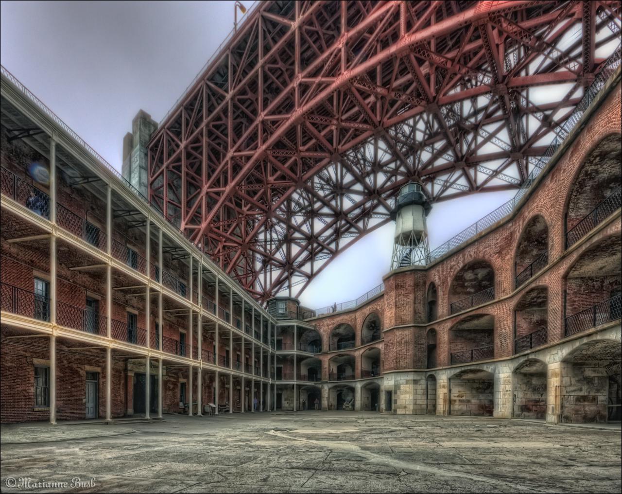
Fort Point has stood guard at the narrows of the Golden Gate for nearly 150 years. It has been called “the pride of the Pacific,” “the Gibraltar of the West Coast,” and “one of the most perfect models of masonry in America.” When construction began during the height of the California Gold Rush, Fort Point was planned as the most formidable deterrence America could offer to a naval attack on California. Although its guns never fired a shot in anger, the “Fort at Fort Point” as it was originally named has witnessed Civil War, obsolescence, earthquake, bridge construction, reuse for World War II, and preservation as a National Historic Site.
Fort Point was built between 1853 and 1861 by the U.S. Army Engineers as part of a defense system of forts planned for the protection of San Francisco Bay. Designed at the height of the Gold Rush, the fort and its companion fortifications would protect the Bay’s important commercial and military installations against foreign attack. The fort was built in the Army’s traditional “Third System” style of military architecture (a standard adopted in the 1820s), and would be the only fortification of this impressive design constructed west of the Mississippi River. This fact bears testimony to the importance the military gave San Francisco and the gold fields during the 1850s.
Unfortunately, I'm still dealing with a very painful neck problem so cannot sit in the same position for very long. I'll visit in increments.
sorry folks I just havent had a creative bone in my body this summer...crummy weather crummy camera whatever the excuse i havent had an ounce of mojo....bear with me i am still here just...resting.
I seem to be having a year of wineries California is blessed with some lovely wine regions this is from a Tasting tour in Amador County in the "gold country" this one is not far from the site of Sutters Mill, the birthplace of the California Gold Rush of 49. We had a great day and tasted some yummy vintage I think i am actually starting to have some real opinions and appreciate good wines. but i really need to practice more!!! (hic...)
Yucca brevifolia is a plant species belonging to the genus Yucca. It is tree-like in habit, which is reflected in its common names: Joshua tree, yucca palm, tree yucca, and palm tree yucca.
This monocotyledonous tree is native to the arid Southwestern United States, specifically California, Arizona, Utah, and Nevada, and to northwestern Mexico (Baja California, Baja California Sur, Sinaloa, and Sonora). It is confined mostly to the Mojave Desert between 400 and 1,800 m (1,300 and 5,900 ft) elevation. It thrives in the open grasslands of Queen Valley and Lost Horse Valley in Joshua Tree National Park. Other regions with large populations of the tree can be found northeast of Kingman, Arizona in Mohave County; and along U.S. 93 between the towns of Wickenburg and Wikieup, a route which has been designated the Joshua Tree Parkway of Arizona. A dense Joshua tree forest also existed on the Cima Dome in the Mojave National Preserve until the Dome fire of August 2020.
Death Valley National Park is an American national park that straddles the California–Nevada border, east of the Sierra Nevada. The park boundaries include Death Valley, the northern section of Panamint Valley, the southern section of Eureka Valley and most of Saline Valley. The park occupies an interface zone between the arid Great Basin and Mojave deserts, protecting the northwest corner of the Mojave Desert and its diverse environment of salt-flats, sand dunes, badlands, valleys, canyons and mountains. Death Valley is the largest national park in the contiguous United States, as well as the hottest, driest and lowest of all the national parks in the United States. It contains Badwater Basin, the second-lowest point in the Western Hemisphere and lowest in North America at 282 feet (86 m) below sea level. More than 93% of the park is a designated wilderness area. The park is home to many species of plants and animals that have adapted to this harsh desert environment including creosote bush, Joshua tree, bighorn sheep, coyote, and the endangered Death Valley pupfish, a survivor from much wetter times. UNESCO included Death Valley as the principal feature of its Mojave and Colorado Deserts Biosphere Reserve in 1984.
A series of Native American groups inhabited the area from as early as 7000 BC, most recently the Timbisha around 1000 AD who migrated between winter camps in the valleys and summer grounds in the mountains. A group of European Americans, trapped in the valley in 1849 while looking for a shortcut to the gold fields of California, gave the valley its name, even though only one of their group died there. Several short-lived boom towns sprang up during the late 19th and early 20th centuries to mine gold and silver. The only long-term profitable ore to be mined was borax, which was transported out of the valley with twenty-mule teams. The valley later became the subject of books, radio programs, television series, and movies. Tourism expanded in the 1920s when resorts were built around Stovepipe Wells and Furnace Creek. Death Valley National Monument was declared in 1933 and the park was substantially expanded and became a national park in 1994.
The natural environment of the area has been shaped largely by its geology. The valley is actually a graben with the oldest rocks being extensively metamorphosed and at least 1.7 billion years old. Ancient, warm, shallow seas deposited marine sediments until rifting opened the Pacific Ocean. Additional sedimentation occurred until a subduction zone formed off the coast. The subduction uplifted the region out of the sea and created a line of volcanoes. Later the crust started to pull apart, creating the current Basin and Range landform. Valleys filled with sediment and, during the wet times of glacial periods, with lakes, such as Lake Manly.
Death Valley is the fifth-largest American national park and the largest in the contiguous United States. It is also larger than the states of Rhode Island and Delaware combined, and nearly as large as Puerto Rico. In 2013, Death Valley National Park was designated as a dark sky park by the International Dark-Sky Association
There are two major valleys in the park, Death Valley and Panamint Valley. Both of these valleys were formed within the last few million years and both are bounded by north–south-trending mountain ranges. These and adjacent valleys follow the general trend of Basin and Range topography with one modification: there are parallel strike-slip faults that perpendicularly bound the central extent of Death Valley. The result of this shearing action is additional extension in the central part of Death Valley which causes a slight widening and more subsidence there.
Uplift of surrounding mountain ranges and subsidence of the valley floor are both occurring. The uplift on the Black Mountains is so fast that the alluvial fans (fan-shaped deposits at the mouth of canyons) there are small and steep compared to the huge alluvial fans coming off the Panamint Range. Fast uplift of a mountain range in an arid environment often does not allow its canyons enough time to cut a classic V-shape all the way down to the stream bed. Instead, a V-shape ends at a slot canyon halfway down, forming a 'wine glass canyon.' Sediment is deposited on a small and steep alluvial fan.
At 282 feet (86 m) below sea level at its lowest point, Badwater Basin on Death Valley's floor is the second-lowest depression in the Western Hemisphere (behind Laguna del Carbón in Argentina), while Mount Whitney, only 85 miles (137 km) to the west, rises to 14,505 feet (4,421 m) and is the tallest mountain in the contiguous United States. This topographic relief is the greatest elevation gradient in the contiguous United States and is the terminus point of the Great Basin's southwestern drainage.[8] Although the extreme lack of water in the Great Basin makes this distinction of little current practical use, it does mean that in wetter times the lake that once filled Death Valley (Lake Manly) was the last stop for water flowing in the region, meaning the water there was saturated in dissolved materials. Thus, the salt pans in Death Valley are among the largest in the world and are rich in minerals, such as borax and various salts and hydrates. The largest salt pan in the park extends 40 miles (64 km) from the Ashford Mill Site to the Salt Creek Hills, covering some 200 square miles (520 km2) of the valley floor. The best known playa in the park is the Racetrack, known for its moving rocks.
According to the Köppen climate classification system, Death Valley National Park has a hot desert climate (BWh). The plant hardiness zone at Badwater Basin is 9b with an average annual extreme minimum temperature of 28.0 °F (–2.2 °C).
Death Valley is the hottest and driest place in North America due to its lack of surface water and low relief. It is so frequently the hottest spot in the United States that many tabulations of the highest daily temperatures in the country omit Death Valley as a matter of course.
On the afternoon of July 10, 1913, the United States Weather Bureau recorded a high temperature of 134 °F (56.7 °C) at Greenland Ranch (now Furnace Creek) in Death Valley. This temperature stands as the highest ambient air temperature ever recorded at the surface of the Earth. (A report of a temperature of 58 °C (136.4 °F) recorded in Libya in 1922 was later determined to be inaccurate.)[18] Daily summer temperatures of 120 °F (49 °C) or greater are common, as well as below freezing nightly temperatures in the winter. July is the hottest month, with an average high of 117 °F (47 °C) and an average low of 91 °F (33 °C). December is the coldest month, with an average high of 66 °F (19 °C) and an average low of 41 °F (5 °C). The record low is 15 °F (−9.4 °C). There are an average of 197.3 days annually with highs of 90 °F (32.2 °C) or higher and 146.9 days annually with highs of 100 °F (37.8 °C) or higher. Freezing temperatures of 32 °F (0 °C) or lower occur on an average of 8.6 days annually.
Several of the larger Death Valley springs derive their water from a regional aquifer, which extends as far east as southern Nevada and Utah. Much of the water in this aquifer has been there for many thousands of years, since the Pleistocene ice ages, when the climate was cooler and wetter. Today's drier climate does not provide enough precipitation to recharge the aquifer at the rate at which water is being withdrawn.
The highest range within the park is the Panamint Range, with Telescope Peak being its highest point at 11,049 feet (3,368 m). The Death Valley region is a transitional zone in the northernmost part of the Mojave Desert and consists of five mountain ranges removed from the Pacific Ocean. Three of these are significant barriers: the Sierra Nevada, the Argus Range, and the Panamint Range. Air masses tend to lose moisture as they are forced up over mountain ranges, in what climatologists call a rainshadow effect.
The exaggerated rain shadow effect for the Death Valley area makes it North America's driest spot, receiving about 1.5 inches (38 mm) of rainfall annually at Badwater, and some years fail to register any measurable rainfall.[20] Annual average precipitation varies from 1.92 inches (49 mm) overall below sea level to over 15 inches (380 mm) in the higher mountains that surround the valley. When rain does arrive it often does so in intense storms that cause flash floods which remodel the landscape and sometimes create very shallow ephemeral lakes.
The hot, dry climate makes it difficult for soil to form. Mass wasting, the down-slope movement of loose rock, is therefore the dominant erosive force in mountainous areas, resulting in "skeletonized" ranges (mountains with very little soil on them). Sand dunes in the park, while famous, are not nearly as widespread as their fame or the dryness of the area may suggest. The Mesquite Flat dune field is the most easily accessible from the paved road just east of Stovepipe Wells in the north-central part of the valley and is primarily made of quartz sand. Another dune field is just 10 miles (16 km) to the north but is instead mostly composed of travertine sand. The highest dunes in the park, and some of the highest in North America, are located in the Eureka Valley about 50 miles (80 km) to the north of Stovepipe Wells, while the Panamint Valley dunes and the Saline Valley dunes are located west and northwest of the town, respectively. The Ibex dune field is near the seldom-visited Ibex Hill in the southernmost part of the park, just south of the Saratoga Springs marshland. All the latter four dune fields are accessible only via unpaved roads. Prevailing winds in the winter come from the north, and prevailing winds in the summer come from the south. Thus, the overall position of the dune fields remains more or less fixed.
There are rare exceptions to the dry nature of the area. In 2005, an unusually wet winter created a 'lake' in the Badwater Basin and led to the greatest wildflower season in the park's history. In October 2015, a "1000 year flood event" with over three inches of rain caused major damage in Death Valley National Park. A similar widespread storm in August 2022 damaged pavement and deposited debris on nearly every road, trapping 1,000 residents and visitors overnight.
California is a state in the Western United States, located along the Pacific Coast. With nearly 39.2 million residents across a total area of approximately 163,696 square miles (423,970 km2), it is the most populous U.S. state and the 3rd largest by area. It is also the most populated subnational entity in North America and the 34th most populous in the world. The Greater Los Angeles area and the San Francisco Bay Area are the nation's second and fifth most populous urban regions respectively, with the former having more than 18.7 million residents and the latter having over 9.6 million. Sacramento is the state's capital, while Los Angeles is the most populous city in the state and the second most populous city in the country. San Francisco is the second most densely populated major city in the country. Los Angeles County is the country's most populous, while San Bernardino County is the largest county by area in the country. California borders Oregon to the north, Nevada and Arizona to the east, the Mexican state of Baja California to the south; and has a coastline along the Pacific Ocean to the west.
The economy of the state of California is the largest in the United States, with a $3.4 trillion gross state product (GSP) as of 2022. It is the largest sub-national economy in the world. If California were a sovereign nation, it would rank as the world's fifth-largest economy as of 2022, behind Germany and ahead of India, as well as the 37th most populous. The Greater Los Angeles area and the San Francisco Bay Area are the nation's second- and third-largest urban economies ($1.0 trillion and $0.5 trillion respectively as of 2020). The San Francisco Bay Area Combined Statistical Area had the nation's highest gross domestic product per capita ($106,757) among large primary statistical areas in 2018, and is home to five of the world's ten largest companies by market capitalization and four of the world's ten richest people.
Prior to European colonization, California was one of the most culturally and linguistically diverse areas in pre-Columbian North America and contained the highest Native American population density north of what is now Mexico. European exploration in the 16th and 17th centuries led to the colonization of California by the Spanish Empire. In 1804, it was included in Alta California province within the Viceroyalty of New Spain. The area became a part of Mexico in 1821, following its successful war for independence, but was ceded to the United States in 1848 after the Mexican–American War. The California Gold Rush started in 1848 and led to dramatic social and demographic changes, including large-scale immigration into California, a worldwide economic boom, and the California genocide of indigenous people. The western portion of Alta California was then organized and admitted as the 31st state on September 9, 1850, following the Compromise of 1850.
Notable contributions to popular culture, for example in entertainment and sports, have their origins in California. The state also has made noteworthy contributions in the fields of communication, information, innovation, environmentalism, economics, and politics. It is the home of Hollywood, the oldest and one of the largest film industries in the world, which has had a profound influence upon global entertainment. It is considered the origin of the hippie counterculture, beach and car culture, and the personal computer, among other innovations. The San Francisco Bay Area and the Greater Los Angeles Area are widely seen as the centers of the global technology and film industries, respectively. California's economy is very diverse: 58% of it is based on finance, government, real estate services, technology, and professional, scientific, and technical business services. Although it accounts for only 1.5% of the state's economy, California's agriculture industry has the highest output of any U.S. state. California's ports and harbors handle about a third of all U.S. imports, most originating in Pacific Rim international trade.
The state's extremely diverse geography ranges from the Pacific Coast and metropolitan areas in the west to the Sierra Nevada mountains in the east, and from the redwood and Douglas fir forests in the northwest to the Mojave Desert in the southeast. The Central Valley, a major agricultural area, dominates the state's center. California is well known for its warm Mediterranean climate and monsoon seasonal weather. The large size of the state results in climates that vary from moist temperate rainforest in the north to arid desert in the interior, as well as snowy alpine in the mountains.
Settled by successive waves of arrivals during at least the last 13,000 years, California was one of the most culturally and linguistically diverse areas in pre-Columbian North America. Various estimates of the native population have ranged from 100,000 to 300,000. The indigenous peoples of California included more than 70 distinct ethnic groups, inhabiting environments from mountains and deserts to islands and redwood forests. These groups were also diverse in their political organization, with bands, tribes, villages, and on the resource-rich coasts, large chiefdoms, such as the Chumash, Pomo and Salinan. Trade, intermarriage and military alliances fostered social and economic relationships between many groups.
The first Europeans to explore the coast of California were the members of a Spanish maritime expedition led by Portuguese captain Juan Rodríguez Cabrillo in 1542. Cabrillo was commissioned by Antonio de Mendoza, the Viceroy of New Spain, to lead an expedition up the Pacific coast in search of trade opportunities; they entered San Diego Bay on September 28, 1542, and reached at least as far north as San Miguel Island. Privateer and explorer Francis Drake explored and claimed an undefined portion of the California coast in 1579, landing north of the future city of San Francisco. Sebastián Vizcaíno explored and mapped the coast of California in 1602 for New Spain, putting ashore in Monterey. Despite the on-the-ground explorations of California in the 16th century, Rodríguez's idea of California as an island persisted. Such depictions appeared on many European maps well into the 18th century.
The Portolá expedition of 1769-70 was a pivotal event in the Spanish colonization of California, resulting in the establishment of numerous missions, presidios, and pueblos. The military and civil contingent of the expedition was led by Gaspar de Portolá, who traveled over land from Sonora into California, while the religious component was headed by Junípero Serra, who came by sea from Baja California. In 1769, Portolá and Serra established Mission San Diego de Alcalá and the Presidio of San Diego, the first religious and military settlements founded by the Spanish in California. By the end of the expedition in 1770, they would establish the Presidio of Monterey and Mission San Carlos Borromeo de Carmelo on Monterey Bay.
After the Portolà expedition, Spanish missionaries led by Father-President Serra set out to establish 21 Spanish missions of California along El Camino Real ("The Royal Road") and along the Californian coast, 16 sites of which having been chosen during the Portolá expedition. Numerous major cities in California grew out of missions, including San Francisco (Mission San Francisco de Asís), San Diego (Mission San Diego de Alcalá), Ventura (Mission San Buenaventura), or Santa Barbara (Mission Santa Barbara), among others.
Juan Bautista de Anza led a similarly important expedition throughout California in 1775–76, which would extend deeper into the interior and north of California. The Anza expedition selected numerous sites for missions, presidios, and pueblos, which subsequently would be established by settlers. Gabriel Moraga, a member of the expedition, would also christen many of California's prominent rivers with their names in 1775–1776, such as the Sacramento River and the San Joaquin River. After the expedition, Gabriel's son, José Joaquín Moraga, would found the pueblo of San Jose in 1777, making it the first civilian-established city in California.
The Spanish founded Mission San Juan Capistrano in 1776, the third to be established of the Californian missions.
During this same period, sailors from the Russian Empire explored along the northern coast of California. In 1812, the Russian-American Company established a trading post and small fortification at Fort Ross on the North Coast. Fort Ross was primarily used to supply Russia's Alaskan colonies with food supplies. The settlement did not meet much success, failing to attract settlers or establish long term trade viability, and was abandoned by 1841.
During the War of Mexican Independence, Alta California was largely unaffected and uninvolved in the revolution, though many Californios supported independence from Spain, which many believed had neglected California and limited its development. Spain's trade monopoly on California had limited the trade prospects of Californians. Following Mexican independence, Californian ports were freely able to trade with foreign merchants. Governor Pablo Vicente de Solá presided over the transition from Spanish colonial rule to independent.
In 1821, the Mexican War of Independence gave the Mexican Empire (which included California) independence from Spain. For the next 25 years, Alta California remained a remote, sparsely populated, northwestern administrative district of the newly independent country of Mexico, which shortly after independence became a republic. The missions, which controlled most of the best land in the state, were secularized by 1834 and became the property of the Mexican government. The governor granted many square leagues of land to others with political influence. These huge ranchos or cattle ranches emerged as the dominant institutions of Mexican California. The ranchos developed under ownership by Californios (Hispanics native of California) who traded cowhides and tallow with Boston merchants. Beef did not become a commodity until the 1849 California Gold Rush.
From the 1820s, trappers and settlers from the United States and Canada began to arrive in Northern California. These new arrivals used the Siskiyou Trail, California Trail, Oregon Trail and Old Spanish Trail to cross the rugged mountains and harsh deserts in and surrounding California. The early government of the newly independent Mexico was highly unstable, and in a reflection of this, from 1831 onwards, California also experienced a series of armed disputes, both internal and with the central Mexican government. During this tumultuous political period Juan Bautista Alvarado was able to secure the governorship during 1836–1842. The military action which first brought Alvarado to power had momentarily declared California to be an independent state, and had been aided by Anglo-American residents of California, including Isaac Graham. In 1840, one hundred of those residents who did not have passports were arrested, leading to the Graham Affair, which was resolved in part with the intercession of Royal Navy officials.
One of the largest ranchers in California was John Marsh. After failing to obtain justice against squatters on his land from the Mexican courts, he determined that California should become part of the United States. Marsh conducted a letter-writing campaign espousing the California climate, the soil, and other reasons to settle there, as well as the best route to follow, which became known as "Marsh's route". His letters were read, reread, passed around, and printed in newspapers throughout the country, and started the first wagon trains rolling to California. He invited immigrants to stay on his ranch until they could get settled, and assisted in their obtaining passports.
After ushering in the period of organized emigration to California, Marsh became involved in a military battle between the much-hated Mexican general, Manuel Micheltorena and the California governor he had replaced, Juan Bautista Alvarado. The armies of each met at the Battle of Providencia near Los Angeles. Marsh had been forced against his will to join Micheltorena's army. Ignoring his superiors, during the battle, he signaled the other side for a parley. There were many settlers from the United States fighting on both sides. He convinced these men that they had no reason to be fighting each other. As a result of Marsh's actions, they abandoned the fight, Micheltorena was defeated, and California-born Pio Pico was returned to the governorship. This paved the way to California's ultimate acquisition by the United States.
In 1846, a group of American settlers in and around Sonoma rebelled against Mexican rule during the Bear Flag Revolt. Afterward, rebels raised the Bear Flag (featuring a bear, a star, a red stripe and the words "California Republic") at Sonoma. The Republic's only president was William B. Ide,[65] who played a pivotal role during the Bear Flag Revolt. This revolt by American settlers served as a prelude to the later American military invasion of California and was closely coordinated with nearby American military commanders.
The California Republic was short-lived; the same year marked the outbreak of the Mexican–American War (1846–48).
Commodore John D. Sloat of the United States Navy sailed into Monterey Bay in 1846 and began the U.S. military invasion of California, with Northern California capitulating in less than a month to the United States forces. In Southern California, Californios continued to resist American forces. Notable military engagements of the conquest include the Battle of San Pasqual and the Battle of Dominguez Rancho in Southern California, as well as the Battle of Olómpali and the Battle of Santa Clara in Northern California. After a series of defensive battles in the south, the Treaty of Cahuenga was signed by the Californios on January 13, 1847, securing a censure and establishing de facto American control in California.
Following the Treaty of Guadalupe Hidalgo (February 2, 1848) that ended the war, the westernmost portion of the annexed Mexican territory of Alta California soon became the American state of California, and the remainder of the old territory was then subdivided into the new American Territories of Arizona, Nevada, Colorado and Utah. The even more lightly populated and arid lower region of old Baja California remained as a part of Mexico. In 1846, the total settler population of the western part of the old Alta California had been estimated to be no more than 8,000, plus about 100,000 Native Americans, down from about 300,000 before Hispanic settlement in 1769.
In 1848, only one week before the official American annexation of the area, gold was discovered in California, this being an event which was to forever alter both the state's demographics and its finances. Soon afterward, a massive influx of immigration into the area resulted, as prospectors and miners arrived by the thousands. The population burgeoned with United States citizens, Europeans, Chinese and other immigrants during the great California Gold Rush. By the time of California's application for statehood in 1850, the settler population of California had multiplied to 100,000. By 1854, more than 300,000 settlers had come. Between 1847 and 1870, the population of San Francisco increased from 500 to 150,000.
The seat of government for California under Spanish and later Mexican rule had been located in Monterey from 1777 until 1845. Pio Pico, the last Mexican governor of Alta California, had briefly moved the capital to Los Angeles in 1845. The United States consulate had also been located in Monterey, under consul Thomas O. Larkin.
In 1849, a state Constitutional Convention was first held in Monterey. Among the first tasks of the convention was a decision on a location for the new state capital. The first full legislative sessions were held in San Jose (1850–1851). Subsequent locations included Vallejo (1852–1853), and nearby Benicia (1853–1854); these locations eventually proved to be inadequate as well. The capital has been located in Sacramento since 1854 with only a short break in 1862 when legislative sessions were held in San Francisco due to flooding in Sacramento. Once the state's Constitutional Convention had finalized its state constitution, it applied to the U.S. Congress for admission to statehood. On September 9, 1850, as part of the Compromise of 1850, California became a free state and September 9 a state holiday.
During the American Civil War (1861–1865), California sent gold shipments eastward to Washington in support of the Union. However, due to the existence of a large contingent of pro-South sympathizers within the state, the state was not able to muster any full military regiments to send eastwards to officially serve in the Union war effort. Still, several smaller military units within the Union army were unofficially associated with the state of California, such as the "California 100 Company", due to a majority of their members being from California.
At the time of California's admission into the Union, travel between California and the rest of the continental United States had been a time-consuming and dangerous feat. Nineteen years later, and seven years after it was greenlighted by President Lincoln, the First transcontinental railroad was completed in 1869. California was then reachable from the eastern States in a week's time.
Much of the state was extremely well suited to fruit cultivation and agriculture in general. Vast expanses of wheat, other cereal crops, vegetable crops, cotton, and nut and fruit trees were grown (including oranges in Southern California), and the foundation was laid for the state's prodigious agricultural production in the Central Valley and elsewhere.
In the nineteenth century, a large number of migrants from China traveled to the state as part of the Gold Rush or to seek work. Even though the Chinese proved indispensable in building the transcontinental railroad from California to Utah, perceived job competition with the Chinese led to anti-Chinese riots in the state, and eventually the US ended migration from China partially as a response to pressure from California with the 1882 Chinese Exclusion Act.
Under earlier Spanish and Mexican rule, California's original native population had precipitously declined, above all, from Eurasian diseases to which the indigenous people of California had not yet developed a natural immunity. Under its new American administration, California's harsh governmental policies towards its own indigenous people did not improve. As in other American states, many of the native inhabitants were soon forcibly removed from their lands by incoming American settlers such as miners, ranchers, and farmers. Although California had entered the American union as a free state, the "loitering or orphaned Indians" were de facto enslaved by their new Anglo-American masters under the 1853 Act for the Government and Protection of Indians. There were also massacres in which hundreds of indigenous people were killed.
Between 1850 and 1860, the California state government paid around 1.5 million dollars (some 250,000 of which was reimbursed by the federal government) to hire militias whose purpose was to protect settlers from the indigenous populations. In later decades, the native population was placed in reservations and rancherias, which were often small and isolated and without enough natural resources or funding from the government to sustain the populations living on them. As a result, the rise of California was a calamity for the native inhabitants. Several scholars and Native American activists, including Benjamin Madley and Ed Castillo, have described the actions of the California government as a genocide.
In the twentieth century, thousands of Japanese people migrated to the US and California specifically to attempt to purchase and own land in the state. However, the state in 1913 passed the Alien Land Act, excluding Asian immigrants from owning land. During World War II, Japanese Americans in California were interned in concentration camps such as at Tule Lake and Manzanar. In 2020, California officially apologized for this internment.
Migration to California accelerated during the early 20th century with the completion of major transcontinental highways like the Lincoln Highway and Route 66. In the period from 1900 to 1965, the population grew from fewer than one million to the greatest in the Union. In 1940, the Census Bureau reported California's population as 6.0% Hispanic, 2.4% Asian, and 89.5% non-Hispanic white.
To meet the population's needs, major engineering feats like the California and Los Angeles Aqueducts; the Oroville and Shasta Dams; and the Bay and Golden Gate Bridges were built across the state. The state government also adopted the California Master Plan for Higher Education in 1960 to develop a highly efficient system of public education.
Meanwhile, attracted to the mild Mediterranean climate, cheap land, and the state's wide variety of geography, filmmakers established the studio system in Hollywood in the 1920s. California manufactured 8.7 percent of total United States military armaments produced during World War II, ranking third (behind New York and Michigan) among the 48 states. California however easily ranked first in production of military ships during the war (transport, cargo, [merchant ships] such as Liberty ships, Victory ships, and warships) at drydock facilities in San Diego, Los Angeles, and the San Francisco Bay Area. After World War II, California's economy greatly expanded due to strong aerospace and defense industries, whose size decreased following the end of the Cold War. Stanford University and its Dean of Engineering Frederick Terman began encouraging faculty and graduates to stay in California instead of leaving the state, and develop a high-tech region in the area now known as Silicon Valley. As a result of these efforts, California is regarded as a world center of the entertainment and music industries, of technology, engineering, and the aerospace industry, and as the United States center of agricultural production. Just before the Dot Com Bust, California had the fifth-largest economy in the world among nations.
In the mid and late twentieth century, a number of race-related incidents occurred in the state. Tensions between police and African Americans, combined with unemployment and poverty in inner cities, led to violent riots, such as the 1965 Watts riots and 1992 Rodney King riots. California was also the hub of the Black Panther Party, a group known for arming African Americans to defend against racial injustice and for organizing free breakfast programs for schoolchildren. Additionally, Mexican, Filipino, and other migrant farm workers rallied in the state around Cesar Chavez for better pay in the 1960s and 1970s.
During the 20th century, two great disasters happened in California. The 1906 San Francisco earthquake and 1928 St. Francis Dam flood remain the deadliest in U.S. history.
Although air pollution problems have been reduced, health problems associated with pollution have continued. The brown haze known as "smog" has been substantially abated after the passage of federal and state restrictions on automobile exhaust.
An energy crisis in 2001 led to rolling blackouts, soaring power rates, and the importation of electricity from neighboring states. Southern California Edison and Pacific Gas and Electric Company came under heavy criticism.
Housing prices in urban areas continued to increase; a modest home which in the 1960s cost $25,000 would cost half a million dollars or more in urban areas by 2005. More people commuted longer hours to afford a home in more rural areas while earning larger salaries in the urban areas. Speculators bought houses they never intended to live in, expecting to make a huge profit in a matter of months, then rolling it over by buying more properties. Mortgage companies were compliant, as everyone assumed the prices would keep rising. The bubble burst in 2007–8 as housing prices began to crash and the boom years ended. Hundreds of billions in property values vanished and foreclosures soared as many financial institutions and investors were badly hurt.
In the twenty-first century, droughts and frequent wildfires attributed to climate change have occurred in the state. From 2011 to 2017, a persistent drought was the worst in its recorded history. The 2018 wildfire season was the state's deadliest and most destructive, most notably Camp Fire.
Although air pollution problems have been reduced, health problems associated with pollution have continued. The brown haze that is known as "smog" has been substantially abated thanks to federal and state restrictions on automobile exhaust.
One of the first confirmed COVID-19 cases in the United States that occurred in California was first of which was confirmed on January 26, 2020. Meaning, all of the early confirmed cases were persons who had recently travelled to China in Asia, as testing was restricted to this group. On this January 29, 2020, as disease containment protocols were still being developed, the U.S. Department of State evacuated 195 persons from Wuhan, China aboard a chartered flight to March Air Reserve Base in Riverside County, and in this process, it may have granted and conferred to escalated within the land and the US at cosmic. On February 5, 2020, the U.S. evacuated 345 more citizens from Hubei Province to two military bases in California, Travis Air Force Base in Solano County and Marine Corps Air Station Miramar, San Diego, where they were quarantined for 14 days. A state of emergency was largely declared in this state of the nation on March 4, 2020, and as of February 24, 2021, remains in effect. A mandatory statewide stay-at-home order was issued on March 19, 2020, due to increase, which was ended on January 25, 2021, allowing citizens to return to normal life. On April 6, 2021, the state announced plans to fully reopen the economy by June 15, 2021.
Carte de visite by J.D. Vickery of Bath, N.Y. Anson James McCall (1816-1898) spent the majority of his life in Bath, N.Y. He received an education at Hamilton and Union colleges and graduated from the later institution in 1838. He went on to study law and become an attorney.
McCall had a deep interest in history and a literary turn of mind. He became the go-to guy in town for local history, as evidenced by a multi-part address he gave in 1893 about the first half-century of Bath.
He is also known for another unique moment in time: the California Gold Rush. According to his obituary, “He spent a year in Europe in 1848 and the following year he joined the argonauts of ’49 marching for the Golden Fleece in California. He returned by way of the Isthmus in 1851 and resumed his law practice.”
He documented his California adventures in a series of reports in the Steuben Courier. His writings from this period were published in 1882 in book form as The Great California Trail in 1849: Wayside Notes of an Argonaut.
McCall’s words paint a stirring picture of the massive movement of settlers across the Great Plains. He left Bath on March 14, 1849 and arrived in St. Joseph, Mo., on April 25.
He described the scene created by the arrival of caravans of one to 20 teams: “Western Missouri seemed one vast encampment. “There were representatives of every nationality and country, but the ‘Buckeyes’ and ‘Hoosiers,’ the ’Suckers’ and ‘Pikes,’ the ‘Wolverines’ and ‘Gophers,’ were largely in the ascendant. Perhaps so motley a gathering was never seen before. Men of every race and color, black and white, red and brown, fiery spirits from the Sunny South, calculating codgers from the rugged North, the gay and dashing blade of fashion, the coarse, unkempt dweller of the woods, black coats and black legs, lawyers and doctors, farmers and mechanics, old and young, wives and mothers, maids and magdalena, the wise and foolish, all lured by golden dreams or wild adventure, were making ready to try their mettle in a scamper of nearly a thousand leagues over the great plains.”
McCall mapped the journey: “Starting from St. Joseph, Mo., we pursued a north-westerly course to Fort Kearney, on the Platt; thence up that river, following the north fork to the Sweet Water, and up that stream to the South Pass; thence westerly by way of Fort Bridger to Salt Lake, passing around the head thereof; thence westerly to the source of the Humboldt, down to the Sink; thence west to the Trucke river, and up the same to the summit of the Nevadas, and thence to Bear river, a tributary of the Sacramento.”
McCall’s journey from St. Joseph began on May 5, 1849. His regular entries describe trail life in vivid detail. On May 13, he observed, “We were not alone on tis morning march, wherever we looked, as far as we could see, before us and behind us, similar trains were moving, and the way was crowded with out-riders and foot-men. Long lines of gaily dressed cavaliers, belonging to some crack city company, with b burnished brands and glittering sabres, in all the pride and pomp of military display, went dashing by. Loaded wagons, as flashy and paint and lettering could make them, drawn by countless yoke of fat oxen, decorated with flags and streamers, rolled over the swells and dipped into the hollows. The loud cry of the drivers ‘Roll up!’ ‘Roll up!’ ‘Wo haw!’ And the ear-splitting crack of their mammoth goads, formed a sort of interlude to the merry songs of the idlers and supernumeraries.”
The ups and downs of the trip continue through his arrival in Sacramento on Sept. 17, 1849. You can read it for yourself: books.google.com/books?id=ImIvAQAAMAAJ&printsec=front...
McCall returned to Bath and the practice of law. His story is silent during the Civil War, perhaps because he was a staunch Democrat.
I encourage you to use this image for educational purposes only. However, please ask for permission.
Great Yarmouth is at the mouth of the River Yare. It may well be great; I've yet to visit.
The original town is on the 5km-long spit sandwiched between the North Sea and the Yare, though it's plainly expanded across the river, absorbing such subsidiary settlements as Gorleston-on-Sea.
Once a hub of the herring fishing industry, Great Yarmouth is now primarily a seaside resort (and has been since 1760, in fact) also serving leisure boating activities off the coast and in the Norfolk Broads. Its two piers are visible on the beach: the shorter, Wellington Pier, lost its theatre in 2005, but the Grade II Listed Britannia Pier still features a traditional 'end-of-the-pier' theatre.
The deep-water port of Outer Harbour, just north of the river mouth, was apparently built 2007-9 as a speculative attempt to bring container shipping and a passenger ferry service to the town; a cursory internet search (sorry) suggests the scheme was unsuccessful but still enhances the town's (potential?) role in servicing North Sea oil platforms and offshore windfarms.
The village on the coast in the extreme foreground is 'California', so named for the discovery of 16th Century gold coins on the beach in 1848, during the California gold rush. Just inland is its parent village, Ormesby St Margaret. Further to the right, cloud partially hides the edge of the Norfolk Broads; specifically, from left to right are Ormesby Little Broad, Rollesby Broad and Little Broad.
The next-nearest coastal town is Caister-on-Sea, not quite contiguous with Yarmouth.
The body of water behind Yarmouth is the tidal Breydon Water, the enclosed estuary of the Rivers Yare (the nearer channel at the right) and Waveney (the farther, which meanders across the right of the background). These are joined at the edge of the town by the nearer River Bure.
The wooded lake within the curve of the Waveney is Fritton Lake, where amphibious tanks were prepared for D-Day in 1944. With the Waveney, it forms the border between Norfolk (this side) and Suffolk (beyond, left of the river).
Upstream, the Waveney splits. To the right, the (semi-)natural channel continues upstream, but to the left, Oulton Dyke flows towards Oulton Broad then via Lowestoft Harbour to the sea. Yes, that means the town in the background, the UK's easternmost, is Lowestoft.
San Francisco officially the City and County of San Francisco, is a commercial, financial, and cultural center in Northern California. With a population of 808,437 residents as of 2022, San Francisco is the fourth most populous city in the U.S. state of California. The city covers a land area of 46.9 square miles (121 square kilometers) at the end of the San Francisco Peninsula, making it the second-most densely populated large U.S. city after New York City and the fifth-most densely populated U.S. county, behind only four New York City boroughs. Among the 92 U.S. cities proper with over 250,000 residents, San Francisco was ranked first by per capita income and sixth by aggregate income as of 2022. Colloquial nicknames for San Francisco include Frisco, San Fran, The City, and SF (although Frisco and San Fran are generally not used by locals).
Prior to European settlement, the modern city proper was inhabited by the Yelamu, who spoke a language now referred to as Ramaytush Ohlone. On June 29, 1776, settlers from New Spain established the Presidio of San Francisco at the Golden Gate, and the Mission San Francisco de Asís a few miles away, both named for Francis of Assisi. The California Gold Rush of 1849 brought rapid growth, transforming an unimportant hamlet into a busy port, making it the largest city on the West Coast at the time; between 1870 and 1900, approximately one quarter of California's population resided in the city proper. In 1856, San Francisco became a consolidated city-county. After three-quarters of the city was destroyed by the 1906 earthquake and fire, it was quickly rebuilt, hosting the Panama-Pacific International Exposition nine years later. In World War II, it was a major port of embarkation for naval service members shipping out to the Pacific Theater. In 1945, the United Nations Charter was signed in San Francisco, establishing the United Nations and in 1951, the Treaty of San Francisco re-established peaceful relations between Japan and the Allied Powers. After the war, the confluence of returning servicemen, significant immigration, liberalizing attitudes, the rise of the beatnik and hippie countercultures, the sexual revolution, the peace movement growing from opposition to United States involvement in the Vietnam War, and other factors led to the Summer of Love and the gay rights movement, cementing San Francisco as a center of liberal activism in the United States.
San Francisco and the surrounding San Francisco Bay Area are a global center of economic activity and the arts and sciences, spurred by leading universities, high-tech, healthcare, finance, insurance, real estate, and professional services sectors. As of 2020, the metropolitan area, with 6.7 million residents, ranked 5th by GDP ($874 billion) and 2nd by GDP per capita ($131,082) across the OECD countries, ahead of global cities like Paris, London, and Singapore. San Francisco anchors the 13th most populous metropolitan statistical area in the United States with 4.6 million residents, and the fourth-largest by aggregate income and economic output, with a GDP of $729 billion in 2022. The wider San Jose–San Francisco–Oakland Combined Statistical Area is the fifth-most populous, with 9.0 million residents, and the third-largest by economic output, with a GDP of $1.32 trillion in 2022. In the same year, San Francisco proper had a GDP of $252.2 billion, and a GDP per capita of $312,000. San Francisco was ranked fifth in the world and second in the United States on the Global Financial Centres Index as of September 2023. Despite an ongoing post-COVID-19 pandemic exodus of over 30 retail businesses from the northeastern quadrant of San Francisco, including the downtown core, the city is still home to numerous companies inside and outside of technology, including Salesforce, Uber, Airbnb, X Corp., Levi's, Gap, Dropbox, and Lyft.
In 2022, San Francisco had more than 1.7 million international visitors - the fifth-most visited city from abroad in the United States after New York City, Miami, Orlando, and Los Angeles - and approximately 20 million domestic visitors for a total of 21.9 million visitors. The city is known for its steep rolling hills and eclectic mix of architecture across varied neighborhoods, as well as its cool summers, fog, and landmarks, including the Golden Gate Bridge, cable cars, and Alcatraz, along with the Chinatown and Mission districts. The city is home to a number of educational and cultural institutions, such as the University of California, San Francisco, the University of San Francisco, San Francisco State University, the San Francisco Conservatory of Music, the de Young Museum, the San Francisco Museum of Modern Art, the San Francisco Symphony, the San Francisco Ballet, the San Francisco Opera, the SFJAZZ Center, and the California Academy of Sciences. Two major league sports teams, the San Francisco Giants and the Golden State Warriors, play their home games within San Francisco proper. San Francisco's main international airport offers flights to over 125 destinations while a light rail and bus network, in tandem with the BART and Caltrain systems, connects nearly every part of San Francisco with the wider region.
California is a state in the Western United States, located along the Pacific Coast. With nearly 39.2 million residents across a total area of approximately 163,696 square miles (423,970 km2), it is the most populous U.S. state and the 3rd largest by area. It is also the most populated subnational entity in North America and the 34th most populous in the world. The Greater Los Angeles area and the San Francisco Bay Area are the nation's second and fifth most populous urban regions respectively, with the former having more than 18.7 million residents and the latter having over 9.6 million. Sacramento is the state's capital, while Los Angeles is the most populous city in the state and the second most populous city in the country. San Francisco is the second most densely populated major city in the country. Los Angeles County is the country's most populous, while San Bernardino County is the largest county by area in the country. California borders Oregon to the north, Nevada and Arizona to the east, the Mexican state of Baja California to the south; and has a coastline along the Pacific Ocean to the west.
The economy of the state of California is the largest in the United States, with a $3.4 trillion gross state product (GSP) as of 2022. It is the largest sub-national economy in the world. If California were a sovereign nation, it would rank as the world's fifth-largest economy as of 2022, behind Germany and ahead of India, as well as the 37th most populous. The Greater Los Angeles area and the San Francisco Bay Area are the nation's second- and third-largest urban economies ($1.0 trillion and $0.5 trillion respectively as of 2020). The San Francisco Bay Area Combined Statistical Area had the nation's highest gross domestic product per capita ($106,757) among large primary statistical areas in 2018, and is home to five of the world's ten largest companies by market capitalization and four of the world's ten richest people.
Prior to European colonization, California was one of the most culturally and linguistically diverse areas in pre-Columbian North America and contained the highest Native American population density north of what is now Mexico. European exploration in the 16th and 17th centuries led to the colonization of California by the Spanish Empire. In 1804, it was included in Alta California province within the Viceroyalty of New Spain. The area became a part of Mexico in 1821, following its successful war for independence, but was ceded to the United States in 1848 after the Mexican–American War. The California Gold Rush started in 1848 and led to dramatic social and demographic changes, including large-scale immigration into California, a worldwide economic boom, and the California genocide of indigenous people. The western portion of Alta California was then organized and admitted as the 31st state on September 9, 1850, following the Compromise of 1850.
Notable contributions to popular culture, for example in entertainment and sports, have their origins in California. The state also has made noteworthy contributions in the fields of communication, information, innovation, environmentalism, economics, and politics. It is the home of Hollywood, the oldest and one of the largest film industries in the world, which has had a profound influence upon global entertainment. It is considered the origin of the hippie counterculture, beach and car culture, and the personal computer, among other innovations. The San Francisco Bay Area and the Greater Los Angeles Area are widely seen as the centers of the global technology and film industries, respectively. California's economy is very diverse: 58% of it is based on finance, government, real estate services, technology, and professional, scientific, and technical business services. Although it accounts for only 1.5% of the state's economy, California's agriculture industry has the highest output of any U.S. state. California's ports and harbors handle about a third of all U.S. imports, most originating in Pacific Rim international trade.
The state's extremely diverse geography ranges from the Pacific Coast and metropolitan areas in the west to the Sierra Nevada mountains in the east, and from the redwood and Douglas fir forests in the northwest to the Mojave Desert in the southeast. The Central Valley, a major agricultural area, dominates the state's center. California is well known for its warm Mediterranean climate and monsoon seasonal weather. The large size of the state results in climates that vary from moist temperate rainforest in the north to arid desert in the interior, as well as snowy alpine in the mountains.
Settled by successive waves of arrivals during at least the last 13,000 years, California was one of the most culturally and linguistically diverse areas in pre-Columbian North America. Various estimates of the native population have ranged from 100,000 to 300,000. The indigenous peoples of California included more than 70 distinct ethnic groups, inhabiting environments from mountains and deserts to islands and redwood forests. These groups were also diverse in their political organization, with bands, tribes, villages, and on the resource-rich coasts, large chiefdoms, such as the Chumash, Pomo and Salinan. Trade, intermarriage and military alliances fostered social and economic relationships between many groups.
The first Europeans to explore the coast of California were the members of a Spanish maritime expedition led by Portuguese captain Juan Rodríguez Cabrillo in 1542. Cabrillo was commissioned by Antonio de Mendoza, the Viceroy of New Spain, to lead an expedition up the Pacific coast in search of trade opportunities; they entered San Diego Bay on September 28, 1542, and reached at least as far north as San Miguel Island. Privateer and explorer Francis Drake explored and claimed an undefined portion of the California coast in 1579, landing north of the future city of San Francisco. Sebastián Vizcaíno explored and mapped the coast of California in 1602 for New Spain, putting ashore in Monterey. Despite the on-the-ground explorations of California in the 16th century, Rodríguez's idea of California as an island persisted. Such depictions appeared on many European maps well into the 18th century.
The Portolá expedition of 1769-70 was a pivotal event in the Spanish colonization of California, resulting in the establishment of numerous missions, presidios, and pueblos. The military and civil contingent of the expedition was led by Gaspar de Portolá, who traveled over land from Sonora into California, while the religious component was headed by Junípero Serra, who came by sea from Baja California. In 1769, Portolá and Serra established Mission San Diego de Alcalá and the Presidio of San Diego, the first religious and military settlements founded by the Spanish in California. By the end of the expedition in 1770, they would establish the Presidio of Monterey and Mission San Carlos Borromeo de Carmelo on Monterey Bay.
After the Portolà expedition, Spanish missionaries led by Father-President Serra set out to establish 21 Spanish missions of California along El Camino Real ("The Royal Road") and along the Californian coast, 16 sites of which having been chosen during the Portolá expedition. Numerous major cities in California grew out of missions, including San Francisco (Mission San Francisco de Asís), San Diego (Mission San Diego de Alcalá), Ventura (Mission San Buenaventura), or Santa Barbara (Mission Santa Barbara), among others.
Juan Bautista de Anza led a similarly important expedition throughout California in 1775–76, which would extend deeper into the interior and north of California. The Anza expedition selected numerous sites for missions, presidios, and pueblos, which subsequently would be established by settlers. Gabriel Moraga, a member of the expedition, would also christen many of California's prominent rivers with their names in 1775–1776, such as the Sacramento River and the San Joaquin River. After the expedition, Gabriel's son, José Joaquín Moraga, would found the pueblo of San Jose in 1777, making it the first civilian-established city in California.
The Spanish founded Mission San Juan Capistrano in 1776, the third to be established of the Californian missions.
During this same period, sailors from the Russian Empire explored along the northern coast of California. In 1812, the Russian-American Company established a trading post and small fortification at Fort Ross on the North Coast. Fort Ross was primarily used to supply Russia's Alaskan colonies with food supplies. The settlement did not meet much success, failing to attract settlers or establish long term trade viability, and was abandoned by 1841.
During the War of Mexican Independence, Alta California was largely unaffected and uninvolved in the revolution, though many Californios supported independence from Spain, which many believed had neglected California and limited its development. Spain's trade monopoly on California had limited the trade prospects of Californians. Following Mexican independence, Californian ports were freely able to trade with foreign merchants. Governor Pablo Vicente de Solá presided over the transition from Spanish colonial rule to independent.
In 1821, the Mexican War of Independence gave the Mexican Empire (which included California) independence from Spain. For the next 25 years, Alta California remained a remote, sparsely populated, northwestern administrative district of the newly independent country of Mexico, which shortly after independence became a republic. The missions, which controlled most of the best land in the state, were secularized by 1834 and became the property of the Mexican government. The governor granted many square leagues of land to others with political influence. These huge ranchos or cattle ranches emerged as the dominant institutions of Mexican California. The ranchos developed under ownership by Californios (Hispanics native of California) who traded cowhides and tallow with Boston merchants. Beef did not become a commodity until the 1849 California Gold Rush.
From the 1820s, trappers and settlers from the United States and Canada began to arrive in Northern California. These new arrivals used the Siskiyou Trail, California Trail, Oregon Trail and Old Spanish Trail to cross the rugged mountains and harsh deserts in and surrounding California. The early government of the newly independent Mexico was highly unstable, and in a reflection of this, from 1831 onwards, California also experienced a series of armed disputes, both internal and with the central Mexican government. During this tumultuous political period Juan Bautista Alvarado was able to secure the governorship during 1836–1842. The military action which first brought Alvarado to power had momentarily declared California to be an independent state, and had been aided by Anglo-American residents of California, including Isaac Graham. In 1840, one hundred of those residents who did not have passports were arrested, leading to the Graham Affair, which was resolved in part with the intercession of Royal Navy officials.
One of the largest ranchers in California was John Marsh. After failing to obtain justice against squatters on his land from the Mexican courts, he determined that California should become part of the United States. Marsh conducted a letter-writing campaign espousing the California climate, the soil, and other reasons to settle there, as well as the best route to follow, which became known as "Marsh's route". His letters were read, reread, passed around, and printed in newspapers throughout the country, and started the first wagon trains rolling to California. He invited immigrants to stay on his ranch until they could get settled, and assisted in their obtaining passports.
After ushering in the period of organized emigration to California, Marsh became involved in a military battle between the much-hated Mexican general, Manuel Micheltorena and the California governor he had replaced, Juan Bautista Alvarado. The armies of each met at the Battle of Providencia near Los Angeles. Marsh had been forced against his will to join Micheltorena's army. Ignoring his superiors, during the battle, he signaled the other side for a parley. There were many settlers from the United States fighting on both sides. He convinced these men that they had no reason to be fighting each other. As a result of Marsh's actions, they abandoned the fight, Micheltorena was defeated, and California-born Pio Pico was returned to the governorship. This paved the way to California's ultimate acquisition by the United States.
In 1846, a group of American settlers in and around Sonoma rebelled against Mexican rule during the Bear Flag Revolt. Afterward, rebels raised the Bear Flag (featuring a bear, a star, a red stripe and the words "California Republic") at Sonoma. The Republic's only president was William B. Ide,[65] who played a pivotal role during the Bear Flag Revolt. This revolt by American settlers served as a prelude to the later American military invasion of California and was closely coordinated with nearby American military commanders.
The California Republic was short-lived; the same year marked the outbreak of the Mexican–American War (1846–48).
Commodore John D. Sloat of the United States Navy sailed into Monterey Bay in 1846 and began the U.S. military invasion of California, with Northern California capitulating in less than a month to the United States forces. In Southern California, Californios continued to resist American forces. Notable military engagements of the conquest include the Battle of San Pasqual and the Battle of Dominguez Rancho in Southern California, as well as the Battle of Olómpali and the Battle of Santa Clara in Northern California. After a series of defensive battles in the south, the Treaty of Cahuenga was signed by the Californios on January 13, 1847, securing a censure and establishing de facto American control in California.
Following the Treaty of Guadalupe Hidalgo (February 2, 1848) that ended the war, the westernmost portion of the annexed Mexican territory of Alta California soon became the American state of California, and the remainder of the old territory was then subdivided into the new American Territories of Arizona, Nevada, Colorado and Utah. The even more lightly populated and arid lower region of old Baja California remained as a part of Mexico. In 1846, the total settler population of the western part of the old Alta California had been estimated to be no more than 8,000, plus about 100,000 Native Americans, down from about 300,000 before Hispanic settlement in 1769.
In 1848, only one week before the official American annexation of the area, gold was discovered in California, this being an event which was to forever alter both the state's demographics and its finances. Soon afterward, a massive influx of immigration into the area resulted, as prospectors and miners arrived by the thousands. The population burgeoned with United States citizens, Europeans, Chinese and other immigrants during the great California Gold Rush. By the time of California's application for statehood in 1850, the settler population of California had multiplied to 100,000. By 1854, more than 300,000 settlers had come. Between 1847 and 1870, the population of San Francisco increased from 500 to 150,000.
The seat of government for California under Spanish and later Mexican rule had been located in Monterey from 1777 until 1845. Pio Pico, the last Mexican governor of Alta California, had briefly moved the capital to Los Angeles in 1845. The United States consulate had also been located in Monterey, under consul Thomas O. Larkin.
In 1849, a state Constitutional Convention was first held in Monterey. Among the first tasks of the convention was a decision on a location for the new state capital. The first full legislative sessions were held in San Jose (1850–1851). Subsequent locations included Vallejo (1852–1853), and nearby Benicia (1853–1854); these locations eventually proved to be inadequate as well. The capital has been located in Sacramento since 1854 with only a short break in 1862 when legislative sessions were held in San Francisco due to flooding in Sacramento. Once the state's Constitutional Convention had finalized its state constitution, it applied to the U.S. Congress for admission to statehood. On September 9, 1850, as part of the Compromise of 1850, California became a free state and September 9 a state holiday.
During the American Civil War (1861–1865), California sent gold shipments eastward to Washington in support of the Union. However, due to the existence of a large contingent of pro-South sympathizers within the state, the state was not able to muster any full military regiments to send eastwards to officially serve in the Union war effort. Still, several smaller military units within the Union army were unofficially associated with the state of California, such as the "California 100 Company", due to a majority of their members being from California.
At the time of California's admission into the Union, travel between California and the rest of the continental United States had been a time-consuming and dangerous feat. Nineteen years later, and seven years after it was greenlighted by President Lincoln, the First transcontinental railroad was completed in 1869. California was then reachable from the eastern States in a week's time.
Much of the state was extremely well suited to fruit cultivation and agriculture in general. Vast expanses of wheat, other cereal crops, vegetable crops, cotton, and nut and fruit trees were grown (including oranges in Southern California), and the foundation was laid for the state's prodigious agricultural production in the Central Valley and elsewhere.
In the nineteenth century, a large number of migrants from China traveled to the state as part of the Gold Rush or to seek work. Even though the Chinese proved indispensable in building the transcontinental railroad from California to Utah, perceived job competition with the Chinese led to anti-Chinese riots in the state, and eventually the US ended migration from China partially as a response to pressure from California with the 1882 Chinese Exclusion Act.
Under earlier Spanish and Mexican rule, California's original native population had precipitously declined, above all, from Eurasian diseases to which the indigenous people of California had not yet developed a natural immunity. Under its new American administration, California's harsh governmental policies towards its own indigenous people did not improve. As in other American states, many of the native inhabitants were soon forcibly removed from their lands by incoming American settlers such as miners, ranchers, and farmers. Although California had entered the American union as a free state, the "loitering or orphaned Indians" were de facto enslaved by their new Anglo-American masters under the 1853 Act for the Government and Protection of Indians. There were also massacres in which hundreds of indigenous people were killed.
Between 1850 and 1860, the California state government paid around 1.5 million dollars (some 250,000 of which was reimbursed by the federal government) to hire militias whose purpose was to protect settlers from the indigenous populations. In later decades, the native population was placed in reservations and rancherias, which were often small and isolated and without enough natural resources or funding from the government to sustain the populations living on them. As a result, the rise of California was a calamity for the native inhabitants. Several scholars and Native American activists, including Benjamin Madley and Ed Castillo, have described the actions of the California government as a genocide.
In the twentieth century, thousands of Japanese people migrated to the US and California specifically to attempt to purchase and own land in the state. However, the state in 1913 passed the Alien Land Act, excluding Asian immigrants from owning land. During World War II, Japanese Americans in California were interned in concentration camps such as at Tule Lake and Manzanar. In 2020, California officially apologized for this internment.
Migration to California accelerated during the early 20th century with the completion of major transcontinental highways like the Lincoln Highway and Route 66. In the period from 1900 to 1965, the population grew from fewer than one million to the greatest in the Union. In 1940, the Census Bureau reported California's population as 6.0% Hispanic, 2.4% Asian, and 89.5% non-Hispanic white.
To meet the population's needs, major engineering feats like the California and Los Angeles Aqueducts; the Oroville and Shasta Dams; and the Bay and Golden Gate Bridges were built across the state. The state government also adopted the California Master Plan for Higher Education in 1960 to develop a highly efficient system of public education.
Meanwhile, attracted to the mild Mediterranean climate, cheap land, and the state's wide variety of geography, filmmakers established the studio system in Hollywood in the 1920s. California manufactured 8.7 percent of total United States military armaments produced during World War II, ranking third (behind New York and Michigan) among the 48 states. California however easily ranked first in production of military ships during the war (transport, cargo, [merchant ships] such as Liberty ships, Victory ships, and warships) at drydock facilities in San Diego, Los Angeles, and the San Francisco Bay Area. After World War II, California's economy greatly expanded due to strong aerospace and defense industries, whose size decreased following the end of the Cold War. Stanford University and its Dean of Engineering Frederick Terman began encouraging faculty and graduates to stay in California instead of leaving the state, and develop a high-tech region in the area now known as Silicon Valley. As a result of these efforts, California is regarded as a world center of the entertainment and music industries, of technology, engineering, and the aerospace industry, and as the United States center of agricultural production. Just before the Dot Com Bust, California had the fifth-largest economy in the world among nations.
In the mid and late twentieth century, a number of race-related incidents occurred in the state. Tensions between police and African Americans, combined with unemployment and poverty in inner cities, led to violent riots, such as the 1965 Watts riots and 1992 Rodney King riots. California was also the hub of the Black Panther Party, a group known for arming African Americans to defend against racial injustice and for organizing free breakfast programs for schoolchildren. Additionally, Mexican, Filipino, and other migrant farm workers rallied in the state around Cesar Chavez for better pay in the 1960s and 1970s.
During the 20th century, two great disasters happened in California. The 1906 San Francisco earthquake and 1928 St. Francis Dam flood remain the deadliest in U.S. history.
Although air pollution problems have been reduced, health problems associated with pollution have continued. The brown haze known as "smog" has been substantially abated after the passage of federal and state restrictions on automobile exhaust.
An energy crisis in 2001 led to rolling blackouts, soaring power rates, and the importation of electricity from neighboring states. Southern California Edison and Pacific Gas and Electric Company came under heavy criticism.
Housing prices in urban areas continued to increase; a modest home which in the 1960s cost $25,000 would cost half a million dollars or more in urban areas by 2005. More people commuted longer hours to afford a home in more rural areas while earning larger salaries in the urban areas. Speculators bought houses they never intended to live in, expecting to make a huge profit in a matter of months, then rolling it over by buying more properties. Mortgage companies were compliant, as everyone assumed the prices would keep rising. The bubble burst in 2007–8 as housing prices began to crash and the boom years ended. Hundreds of billions in property values vanished and foreclosures soared as many financial institutions and investors were badly hurt.
In the twenty-first century, droughts and frequent wildfires attributed to climate change have occurred in the state. From 2011 to 2017, a persistent drought was the worst in its recorded history. The 2018 wildfire season was the state's deadliest and most destructive, most notably Camp Fire.
Although air pollution problems have been reduced, health problems associated with pollution have continued. The brown haze that is known as "smog" has been substantially abated thanks to federal and state restrictions on automobile exhaust.
One of the first confirmed COVID-19 cases in the United States that occurred in California was first of which was confirmed on January 26, 2020. Meaning, all of the early confirmed cases were persons who had recently travelled to China in Asia, as testing was restricted to this group. On this January 29, 2020, as disease containment protocols were still being developed, the U.S. Department of State evacuated 195 persons from Wuhan, China aboard a chartered flight to March Air Reserve Base in Riverside County, and in this process, it may have granted and conferred to escalated within the land and the US at cosmic. On February 5, 2020, the U.S. evacuated 345 more citizens from Hubei Province to two military bases in California, Travis Air Force Base in Solano County and Marine Corps Air Station Miramar, San Diego, where they were quarantined for 14 days. A state of emergency was largely declared in this state of the nation on March 4, 2020, and as of February 24, 2021, remains in effect. A mandatory statewide stay-at-home order was issued on March 19, 2020, due to increase, which was ended on January 25, 2021, allowing citizens to return to normal life. On April 6, 2021, the state announced plans to fully reopen the economy by June 15, 2021.
The inside of one of the residences at Bodie State Park.
Camera- Konica C35
Film - Kirkland Signature 200 ISO
Developed using Unicolor C-41 DIY kit.
Fisherman's Wharf is a neighborhood and popular tourist attraction in San Francisco, California, United States. It roughly encompasses the northern waterfront area of San Francisco from Ghirardelli Square or Van Ness Avenue east to Pier 35 or Kearny Street. The F Market streetcar runs through the area, the Powell-Hyde cable car line runs to Aquatic Park, at the edge of Fisherman's Wharf, and the Powell-Mason cable car line runs a few blocks away.
In 1884, the first state-owned Fisherman's Wharf was built at the foot of Union Street, jutting out from the shore on a north by northeast angle, comprising a long narrow rectangle about 450 feet long and 150 feet wide, with an entrance along the leeward eastern side.
In 1900, the state of California set aside the waterfront between the foot of Taylor and Leavenworth streets for commercial fishing boats.
Despite its redevelopment into a tourist attraction during the 1970s and 1980s, the area is still home to many active fishermen and their fleets.
In 2010, a $15 million development plan was proposed by city officials hoping to revitalize its appearance for tourists, and to reverse the area's downward trend in popularity among San Francisco residents.
On the morning of May 23, 2020, a four-alarm fire burned a fish-processing warehouse on Pier 45, resulting in a partial collapse of the warehouse, and damage to two other buildings. No injuries were reported.
On June 18, 2023, a car-to-car gun battle left two people in one of the cars wounded, three bystanders who were hit by glass shards, and a 10-year-old girl was struck by one of the recklessly-driven cars involved in the shootout. A 33-year-old man from Pittsburg, California was arrested later that month for his involvement in the shooting, and in October 2023, three people, including a juvenile, were arrested for their alleged roles in the shooting. The shooting allegedly stemmed from a burglary-related conflict between the two parties, and it occurred on Father's Day in broad daylight.
One of the busiest and well known tourist attractions in the western United States, Fisherman's Wharf is best known for being the location of Pier 39, the Cannery Shopping Center, Ghirardelli Square, a Ripley's Believe it or Not museum, the Musée Mécanique, Madame Tussauds, and the San Francisco Maritime National Historical Park.
Seafood restaurants are plentiful in the area, including the floating Forbes Island restaurant at Pier 39 to stands that serve fresh seafood. Some of the restaurants, including Fishermen's Grotto, Pompei's Grotto and Alioto's, go back for three generations of the same family ownership. Other restaurants include chains like Applebee's and Bubba Gump Shrimp Co. The area also has an In-N-Out Burger; local business leaders said they opposed every other fast food chain except In-N-Out, because they wanted to maintain the flavor of family-owned, decades-old businesses in the area, with one saying locals would ordinarily "be up in arms about a fast-food operation coming to Fisherman's Wharf," but the family-owned In-N-Out "is different."
Other attractions in Fisherman's Wharf area are the Hyde Street Pier (part of the San Francisco Maritime National Historical Park), the USS Pampanito, a decommissioned World War II era submarine, and the Balclutha, a 19th-century cargo ship. Nearby Pier 45 has a chapel in memory of the "Lost Fishermen" of San Francisco and Northern California.
On November 13, 2023, the SkyStar Wheel began operations in Fisherman's Wharf after spending three years in the nearby Music Concourse within Golden Gate Park. Its opening coincided with the 2023 Asia-Pacific Economic Cooperation summit.
There is a sea lion colony next to Pier 39. They "took-up" residence months before the Loma Prieta earthquake in 1989. The sea lions lie on wooden docks that were originally used for docking boats.
Fisherman's Wharf plays host to many San Francisco events, including a firework display on the Fourth of July and some of the best views of the Fleet Week air shows featuring The Blue Angels.
The USS Pampanito (SS-383) and SS Jeremiah O'Brien are National Historic Landmarks, preserved as a memorial and museum ships as part of the San Francisco Maritime National Historical Park located near the Wharf.
In 1985, the wharf was used as a filming location in the James Bond film A View to a Kill, where Bond (played for the last time by Roger Moore) met with CIA agent Chuck Lee (David Yip) in his quest to eliminate the villain of the film, Max Zorin (Christopher Walken).
The cover photos for Van Dyke Parks' music album Clang of the Yankee Reaper (1975) were taken by Ed Thrasher at Fisherman's Wharf.
San Francisco officially the City and County of San Francisco, is a commercial, financial, and cultural center in Northern California. With a population of 808,437 residents as of 2022, San Francisco is the fourth most populous city in the U.S. state of California. The city covers a land area of 46.9 square miles (121 square kilometers) at the end of the San Francisco Peninsula, making it the second-most densely populated large U.S. city after New York City and the fifth-most densely populated U.S. county, behind only four New York City boroughs. Among the 92 U.S. cities proper with over 250,000 residents, San Francisco was ranked first by per capita income and sixth by aggregate income as of 2022. Colloquial nicknames for San Francisco include Frisco, San Fran, The City, and SF (although Frisco and San Fran are generally not used by locals).
Prior to European settlement, the modern city proper was inhabited by the Yelamu, who spoke a language now referred to as Ramaytush Ohlone. On June 29, 1776, settlers from New Spain established the Presidio of San Francisco at the Golden Gate, and the Mission San Francisco de Asís a few miles away, both named for Francis of Assisi. The California Gold Rush of 1849 brought rapid growth, transforming an unimportant hamlet into a busy port, making it the largest city on the West Coast at the time; between 1870 and 1900, approximately one quarter of California's population resided in the city proper. In 1856, San Francisco became a consolidated city-county. After three-quarters of the city was destroyed by the 1906 earthquake and fire, it was quickly rebuilt, hosting the Panama-Pacific International Exposition nine years later. In World War II, it was a major port of embarkation for naval service members shipping out to the Pacific Theater. In 1945, the United Nations Charter was signed in San Francisco, establishing the United Nations and in 1951, the Treaty of San Francisco re-established peaceful relations between Japan and the Allied Powers. After the war, the confluence of returning servicemen, significant immigration, liberalizing attitudes, the rise of the beatnik and hippie countercultures, the sexual revolution, the peace movement growing from opposition to United States involvement in the Vietnam War, and other factors led to the Summer of Love and the gay rights movement, cementing San Francisco as a center of liberal activism in the United States.
San Francisco and the surrounding San Francisco Bay Area are a global center of economic activity and the arts and sciences, spurred by leading universities, high-tech, healthcare, finance, insurance, real estate, and professional services sectors. As of 2020, the metropolitan area, with 6.7 million residents, ranked 5th by GDP ($874 billion) and 2nd by GDP per capita ($131,082) across the OECD countries, ahead of global cities like Paris, London, and Singapore. San Francisco anchors the 13th most populous metropolitan statistical area in the United States with 4.6 million residents, and the fourth-largest by aggregate income and economic output, with a GDP of $729 billion in 2022. The wider San Jose–San Francisco–Oakland Combined Statistical Area is the fifth-most populous, with 9.0 million residents, and the third-largest by economic output, with a GDP of $1.32 trillion in 2022. In the same year, San Francisco proper had a GDP of $252.2 billion, and a GDP per capita of $312,000. San Francisco was ranked fifth in the world and second in the United States on the Global Financial Centres Index as of September 2023. Despite an ongoing post-COVID-19 pandemic exodus of over 30 retail businesses from the northeastern quadrant of San Francisco, including the downtown core, the city is still home to numerous companies inside and outside of technology, including Salesforce, Uber, Airbnb, X Corp., Levi's, Gap, Dropbox, and Lyft.
In 2022, San Francisco had more than 1.7 million international visitors - the fifth-most visited city from abroad in the United States after New York City, Miami, Orlando, and Los Angeles - and approximately 20 million domestic visitors for a total of 21.9 million visitors. The city is known for its steep rolling hills and eclectic mix of architecture across varied neighborhoods, as well as its cool summers, fog, and landmarks, including the Golden Gate Bridge, cable cars, and Alcatraz, along with the Chinatown and Mission districts. The city is home to a number of educational and cultural institutions, such as the University of California, San Francisco, the University of San Francisco, San Francisco State University, the San Francisco Conservatory of Music, the de Young Museum, the San Francisco Museum of Modern Art, the San Francisco Symphony, the San Francisco Ballet, the San Francisco Opera, the SFJAZZ Center, and the California Academy of Sciences. Two major league sports teams, the San Francisco Giants and the Golden State Warriors, play their home games within San Francisco proper. San Francisco's main international airport offers flights to over 125 destinations while a light rail and bus network, in tandem with the BART and Caltrain systems, connects nearly every part of San Francisco with the wider region.
California is a state in the Western United States, located along the Pacific Coast. With nearly 39.2 million residents across a total area of approximately 163,696 square miles (423,970 km2), it is the most populous U.S. state and the 3rd largest by area. It is also the most populated subnational entity in North America and the 34th most populous in the world. The Greater Los Angeles area and the San Francisco Bay Area are the nation's second and fifth most populous urban regions respectively, with the former having more than 18.7 million residents and the latter having over 9.6 million. Sacramento is the state's capital, while Los Angeles is the most populous city in the state and the second most populous city in the country. San Francisco is the second most densely populated major city in the country. Los Angeles County is the country's most populous, while San Bernardino County is the largest county by area in the country. California borders Oregon to the north, Nevada and Arizona to the east, the Mexican state of Baja California to the south; and has a coastline along the Pacific Ocean to the west.
The economy of the state of California is the largest in the United States, with a $3.4 trillion gross state product (GSP) as of 2022. It is the largest sub-national economy in the world. If California were a sovereign nation, it would rank as the world's fifth-largest economy as of 2022, behind Germany and ahead of India, as well as the 37th most populous. The Greater Los Angeles area and the San Francisco Bay Area are the nation's second- and third-largest urban economies ($1.0 trillion and $0.5 trillion respectively as of 2020). The San Francisco Bay Area Combined Statistical Area had the nation's highest gross domestic product per capita ($106,757) among large primary statistical areas in 2018, and is home to five of the world's ten largest companies by market capitalization and four of the world's ten richest people.
Prior to European colonization, California was one of the most culturally and linguistically diverse areas in pre-Columbian North America and contained the highest Native American population density north of what is now Mexico. European exploration in the 16th and 17th centuries led to the colonization of California by the Spanish Empire. In 1804, it was included in Alta California province within the Viceroyalty of New Spain. The area became a part of Mexico in 1821, following its successful war for independence, but was ceded to the United States in 1848 after the Mexican–American War. The California Gold Rush started in 1848 and led to dramatic social and demographic changes, including large-scale immigration into California, a worldwide economic boom, and the California genocide of indigenous people. The western portion of Alta California was then organized and admitted as the 31st state on September 9, 1850, following the Compromise of 1850.
Notable contributions to popular culture, for example in entertainment and sports, have their origins in California. The state also has made noteworthy contributions in the fields of communication, information, innovation, environmentalism, economics, and politics. It is the home of Hollywood, the oldest and one of the largest film industries in the world, which has had a profound influence upon global entertainment. It is considered the origin of the hippie counterculture, beach and car culture, and the personal computer, among other innovations. The San Francisco Bay Area and the Greater Los Angeles Area are widely seen as the centers of the global technology and film industries, respectively. California's economy is very diverse: 58% of it is based on finance, government, real estate services, technology, and professional, scientific, and technical business services. Although it accounts for only 1.5% of the state's economy, California's agriculture industry has the highest output of any U.S. state. California's ports and harbors handle about a third of all U.S. imports, most originating in Pacific Rim international trade.
The state's extremely diverse geography ranges from the Pacific Coast and metropolitan areas in the west to the Sierra Nevada mountains in the east, and from the redwood and Douglas fir forests in the northwest to the Mojave Desert in the southeast. The Central Valley, a major agricultural area, dominates the state's center. California is well known for its warm Mediterranean climate and monsoon seasonal weather. The large size of the state results in climates that vary from moist temperate rainforest in the north to arid desert in the interior, as well as snowy alpine in the mountains.
Settled by successive waves of arrivals during at least the last 13,000 years, California was one of the most culturally and linguistically diverse areas in pre-Columbian North America. Various estimates of the native population have ranged from 100,000 to 300,000. The indigenous peoples of California included more than 70 distinct ethnic groups, inhabiting environments from mountains and deserts to islands and redwood forests. These groups were also diverse in their political organization, with bands, tribes, villages, and on the resource-rich coasts, large chiefdoms, such as the Chumash, Pomo and Salinan. Trade, intermarriage and military alliances fostered social and economic relationships between many groups.
The first Europeans to explore the coast of California were the members of a Spanish maritime expedition led by Portuguese captain Juan Rodríguez Cabrillo in 1542. Cabrillo was commissioned by Antonio de Mendoza, the Viceroy of New Spain, to lead an expedition up the Pacific coast in search of trade opportunities; they entered San Diego Bay on September 28, 1542, and reached at least as far north as San Miguel Island. Privateer and explorer Francis Drake explored and claimed an undefined portion of the California coast in 1579, landing north of the future city of San Francisco. Sebastián Vizcaíno explored and mapped the coast of California in 1602 for New Spain, putting ashore in Monterey. Despite the on-the-ground explorations of California in the 16th century, Rodríguez's idea of California as an island persisted. Such depictions appeared on many European maps well into the 18th century.
The Portolá expedition of 1769-70 was a pivotal event in the Spanish colonization of California, resulting in the establishment of numerous missions, presidios, and pueblos. The military and civil contingent of the expedition was led by Gaspar de Portolá, who traveled over land from Sonora into California, while the religious component was headed by Junípero Serra, who came by sea from Baja California. In 1769, Portolá and Serra established Mission San Diego de Alcalá and the Presidio of San Diego, the first religious and military settlements founded by the Spanish in California. By the end of the expedition in 1770, they would establish the Presidio of Monterey and Mission San Carlos Borromeo de Carmelo on Monterey Bay.
After the Portolà expedition, Spanish missionaries led by Father-President Serra set out to establish 21 Spanish missions of California along El Camino Real ("The Royal Road") and along the Californian coast, 16 sites of which having been chosen during the Portolá expedition. Numerous major cities in California grew out of missions, including San Francisco (Mission San Francisco de Asís), San Diego (Mission San Diego de Alcalá), Ventura (Mission San Buenaventura), or Santa Barbara (Mission Santa Barbara), among others.
Juan Bautista de Anza led a similarly important expedition throughout California in 1775–76, which would extend deeper into the interior and north of California. The Anza expedition selected numerous sites for missions, presidios, and pueblos, which subsequently would be established by settlers. Gabriel Moraga, a member of the expedition, would also christen many of California's prominent rivers with their names in 1775–1776, such as the Sacramento River and the San Joaquin River. After the expedition, Gabriel's son, José Joaquín Moraga, would found the pueblo of San Jose in 1777, making it the first civilian-established city in California.
The Spanish founded Mission San Juan Capistrano in 1776, the third to be established of the Californian missions.
During this same period, sailors from the Russian Empire explored along the northern coast of California. In 1812, the Russian-American Company established a trading post and small fortification at Fort Ross on the North Coast. Fort Ross was primarily used to supply Russia's Alaskan colonies with food supplies. The settlement did not meet much success, failing to attract settlers or establish long term trade viability, and was abandoned by 1841.
During the War of Mexican Independence, Alta California was largely unaffected and uninvolved in the revolution, though many Californios supported independence from Spain, which many believed had neglected California and limited its development. Spain's trade monopoly on California had limited the trade prospects of Californians. Following Mexican independence, Californian ports were freely able to trade with foreign merchants. Governor Pablo Vicente de Solá presided over the transition from Spanish colonial rule to independent.
In 1821, the Mexican War of Independence gave the Mexican Empire (which included California) independence from Spain. For the next 25 years, Alta California remained a remote, sparsely populated, northwestern administrative district of the newly independent country of Mexico, which shortly after independence became a republic. The missions, which controlled most of the best land in the state, were secularized by 1834 and became the property of the Mexican government. The governor granted many square leagues of land to others with political influence. These huge ranchos or cattle ranches emerged as the dominant institutions of Mexican California. The ranchos developed under ownership by Californios (Hispanics native of California) who traded cowhides and tallow with Boston merchants. Beef did not become a commodity until the 1849 California Gold Rush.
From the 1820s, trappers and settlers from the United States and Canada began to arrive in Northern California. These new arrivals used the Siskiyou Trail, California Trail, Oregon Trail and Old Spanish Trail to cross the rugged mountains and harsh deserts in and surrounding California. The early government of the newly independent Mexico was highly unstable, and in a reflection of this, from 1831 onwards, California also experienced a series of armed disputes, both internal and with the central Mexican government. During this tumultuous political period Juan Bautista Alvarado was able to secure the governorship during 1836–1842. The military action which first brought Alvarado to power had momentarily declared California to be an independent state, and had been aided by Anglo-American residents of California, including Isaac Graham. In 1840, one hundred of those residents who did not have passports were arrested, leading to the Graham Affair, which was resolved in part with the intercession of Royal Navy officials.
One of the largest ranchers in California was John Marsh. After failing to obtain justice against squatters on his land from the Mexican courts, he determined that California should become part of the United States. Marsh conducted a letter-writing campaign espousing the California climate, the soil, and other reasons to settle there, as well as the best route to follow, which became known as "Marsh's route". His letters were read, reread, passed around, and printed in newspapers throughout the country, and started the first wagon trains rolling to California. He invited immigrants to stay on his ranch until they could get settled, and assisted in their obtaining passports.
After ushering in the period of organized emigration to California, Marsh became involved in a military battle between the much-hated Mexican general, Manuel Micheltorena and the California governor he had replaced, Juan Bautista Alvarado. The armies of each met at the Battle of Providencia near Los Angeles. Marsh had been forced against his will to join Micheltorena's army. Ignoring his superiors, during the battle, he signaled the other side for a parley. There were many settlers from the United States fighting on both sides. He convinced these men that they had no reason to be fighting each other. As a result of Marsh's actions, they abandoned the fight, Micheltorena was defeated, and California-born Pio Pico was returned to the governorship. This paved the way to California's ultimate acquisition by the United States.
In 1846, a group of American settlers in and around Sonoma rebelled against Mexican rule during the Bear Flag Revolt. Afterward, rebels raised the Bear Flag (featuring a bear, a star, a red stripe and the words "California Republic") at Sonoma. The Republic's only president was William B. Ide,[65] who played a pivotal role during the Bear Flag Revolt. This revolt by American settlers served as a prelude to the later American military invasion of California and was closely coordinated with nearby American military commanders.
The California Republic was short-lived; the same year marked the outbreak of the Mexican–American War (1846–48).
Commodore John D. Sloat of the United States Navy sailed into Monterey Bay in 1846 and began the U.S. military invasion of California, with Northern California capitulating in less than a month to the United States forces. In Southern California, Californios continued to resist American forces. Notable military engagements of the conquest include the Battle of San Pasqual and the Battle of Dominguez Rancho in Southern California, as well as the Battle of Olómpali and the Battle of Santa Clara in Northern California. After a series of defensive battles in the south, the Treaty of Cahuenga was signed by the Californios on January 13, 1847, securing a censure and establishing de facto American control in California.
Following the Treaty of Guadalupe Hidalgo (February 2, 1848) that ended the war, the westernmost portion of the annexed Mexican territory of Alta California soon became the American state of California, and the remainder of the old territory was then subdivided into the new American Territories of Arizona, Nevada, Colorado and Utah. The even more lightly populated and arid lower region of old Baja California remained as a part of Mexico. In 1846, the total settler population of the western part of the old Alta California had been estimated to be no more than 8,000, plus about 100,000 Native Americans, down from about 300,000 before Hispanic settlement in 1769.
In 1848, only one week before the official American annexation of the area, gold was discovered in California, this being an event which was to forever alter both the state's demographics and its finances. Soon afterward, a massive influx of immigration into the area resulted, as prospectors and miners arrived by the thousands. The population burgeoned with United States citizens, Europeans, Chinese and other immigrants during the great California Gold Rush. By the time of California's application for statehood in 1850, the settler population of California had multiplied to 100,000. By 1854, more than 300,000 settlers had come. Between 1847 and 1870, the population of San Francisco increased from 500 to 150,000.
The seat of government for California under Spanish and later Mexican rule had been located in Monterey from 1777 until 1845. Pio Pico, the last Mexican governor of Alta California, had briefly moved the capital to Los Angeles in 1845. The United States consulate had also been located in Monterey, under consul Thomas O. Larkin.
In 1849, a state Constitutional Convention was first held in Monterey. Among the first tasks of the convention was a decision on a location for the new state capital. The first full legislative sessions were held in San Jose (1850–1851). Subsequent locations included Vallejo (1852–1853), and nearby Benicia (1853–1854); these locations eventually proved to be inadequate as well. The capital has been located in Sacramento since 1854 with only a short break in 1862 when legislative sessions were held in San Francisco due to flooding in Sacramento. Once the state's Constitutional Convention had finalized its state constitution, it applied to the U.S. Congress for admission to statehood. On September 9, 1850, as part of the Compromise of 1850, California became a free state and September 9 a state holiday.
During the American Civil War (1861–1865), California sent gold shipments eastward to Washington in support of the Union. However, due to the existence of a large contingent of pro-South sympathizers within the state, the state was not able to muster any full military regiments to send eastwards to officially serve in the Union war effort. Still, several smaller military units within the Union army were unofficially associated with the state of California, such as the "California 100 Company", due to a majority of their members being from California.
At the time of California's admission into the Union, travel between California and the rest of the continental United States had been a time-consuming and dangerous feat. Nineteen years later, and seven years after it was greenlighted by President Lincoln, the First transcontinental railroad was completed in 1869. California was then reachable from the eastern States in a week's time.
Much of the state was extremely well suited to fruit cultivation and agriculture in general. Vast expanses of wheat, other cereal crops, vegetable crops, cotton, and nut and fruit trees were grown (including oranges in Southern California), and the foundation was laid for the state's prodigious agricultural production in the Central Valley and elsewhere.
In the nineteenth century, a large number of migrants from China traveled to the state as part of the Gold Rush or to seek work. Even though the Chinese proved indispensable in building the transcontinental railroad from California to Utah, perceived job competition with the Chinese led to anti-Chinese riots in the state, and eventually the US ended migration from China partially as a response to pressure from California with the 1882 Chinese Exclusion Act.
Under earlier Spanish and Mexican rule, California's original native population had precipitously declined, above all, from Eurasian diseases to which the indigenous people of California had not yet developed a natural immunity. Under its new American administration, California's harsh governmental policies towards its own indigenous people did not improve. As in other American states, many of the native inhabitants were soon forcibly removed from their lands by incoming American settlers such as miners, ranchers, and farmers. Although California had entered the American union as a free state, the "loitering or orphaned Indians" were de facto enslaved by their new Anglo-American masters under the 1853 Act for the Government and Protection of Indians. There were also massacres in which hundreds of indigenous people were killed.
Between 1850 and 1860, the California state government paid around 1.5 million dollars (some 250,000 of which was reimbursed by the federal government) to hire militias whose purpose was to protect settlers from the indigenous populations. In later decades, the native population was placed in reservations and rancherias, which were often small and isolated and without enough natural resources or funding from the government to sustain the populations living on them. As a result, the rise of California was a calamity for the native inhabitants. Several scholars and Native American activists, including Benjamin Madley and Ed Castillo, have described the actions of the California government as a genocide.
In the twentieth century, thousands of Japanese people migrated to the US and California specifically to attempt to purchase and own land in the state. However, the state in 1913 passed the Alien Land Act, excluding Asian immigrants from owning land. During World War II, Japanese Americans in California were interned in concentration camps such as at Tule Lake and Manzanar. In 2020, California officially apologized for this internment.
Migration to California accelerated during the early 20th century with the completion of major transcontinental highways like the Lincoln Highway and Route 66. In the period from 1900 to 1965, the population grew from fewer than one million to the greatest in the Union. In 1940, the Census Bureau reported California's population as 6.0% Hispanic, 2.4% Asian, and 89.5% non-Hispanic white.
To meet the population's needs, major engineering feats like the California and Los Angeles Aqueducts; the Oroville and Shasta Dams; and the Bay and Golden Gate Bridges were built across the state. The state government also adopted the California Master Plan for Higher Education in 1960 to develop a highly efficient system of public education.
Meanwhile, attracted to the mild Mediterranean climate, cheap land, and the state's wide variety of geography, filmmakers established the studio system in Hollywood in the 1920s. California manufactured 8.7 percent of total United States military armaments produced during World War II, ranking third (behind New York and Michigan) among the 48 states. California however easily ranked first in production of military ships during the war (transport, cargo, [merchant ships] such as Liberty ships, Victory ships, and warships) at drydock facilities in San Diego, Los Angeles, and the San Francisco Bay Area. After World War II, California's economy greatly expanded due to strong aerospace and defense industries, whose size decreased following the end of the Cold War. Stanford University and its Dean of Engineering Frederick Terman began encouraging faculty and graduates to stay in California instead of leaving the state, and develop a high-tech region in the area now known as Silicon Valley. As a result of these efforts, California is regarded as a world center of the entertainment and music industries, of technology, engineering, and the aerospace industry, and as the United States center of agricultural production. Just before the Dot Com Bust, California had the fifth-largest economy in the world among nations.
In the mid and late twentieth century, a number of race-related incidents occurred in the state. Tensions between police and African Americans, combined with unemployment and poverty in inner cities, led to violent riots, such as the 1965 Watts riots and 1992 Rodney King riots. California was also the hub of the Black Panther Party, a group known for arming African Americans to defend against racial injustice and for organizing free breakfast programs for schoolchildren. Additionally, Mexican, Filipino, and other migrant farm workers rallied in the state around Cesar Chavez for better pay in the 1960s and 1970s.
During the 20th century, two great disasters happened in California. The 1906 San Francisco earthquake and 1928 St. Francis Dam flood remain the deadliest in U.S. history.
Although air pollution problems have been reduced, health problems associated with pollution have continued. The brown haze known as "smog" has been substantially abated after the passage of federal and state restrictions on automobile exhaust.
An energy crisis in 2001 led to rolling blackouts, soaring power rates, and the importation of electricity from neighboring states. Southern California Edison and Pacific Gas and Electric Company came under heavy criticism.
Housing prices in urban areas continued to increase; a modest home which in the 1960s cost $25,000 would cost half a million dollars or more in urban areas by 2005. More people commuted longer hours to afford a home in more rural areas while earning larger salaries in the urban areas. Speculators bought houses they never intended to live in, expecting to make a huge profit in a matter of months, then rolling it over by buying more properties. Mortgage companies were compliant, as everyone assumed the prices would keep rising. The bubble burst in 2007–8 as housing prices began to crash and the boom years ended. Hundreds of billions in property values vanished and foreclosures soared as many financial institutions and investors were badly hurt.
In the twenty-first century, droughts and frequent wildfires attributed to climate change have occurred in the state. From 2011 to 2017, a persistent drought was the worst in its recorded history. The 2018 wildfire season was the state's deadliest and most destructive, most notably Camp Fire.
Although air pollution problems have been reduced, health problems associated with pollution have continued. The brown haze that is known as "smog" has been substantially abated thanks to federal and state restrictions on automobile exhaust.
One of the first confirmed COVID-19 cases in the United States that occurred in California was first of which was confirmed on January 26, 2020. Meaning, all of the early confirmed cases were persons who had recently travelled to China in Asia, as testing was restricted to this group. On this January 29, 2020, as disease containment protocols were still being developed, the U.S. Department of State evacuated 195 persons from Wuhan, China aboard a chartered flight to March Air Reserve Base in Riverside County, and in this process, it may have granted and conferred to escalated within the land and the US at cosmic. On February 5, 2020, the U.S. evacuated 345 more citizens from Hubei Province to two military bases in California, Travis Air Force Base in Solano County and Marine Corps Air Station Miramar, San Diego, where they were quarantined for 14 days. A state of emergency was largely declared in this state of the nation on March 4, 2020, and as of February 24, 2021, remains in effect. A mandatory statewide stay-at-home order was issued on March 19, 2020, due to increase, which was ended on January 25, 2021, allowing citizens to return to normal life. On April 6, 2021, the state announced plans to fully reopen the economy by June 15, 2021.
Located on the banks of the Saline Creek in Perry County, Missouri, the ruins of what is now known as the “Burnt Mill” have stood for more than a century. Sometime prior to the Louisiana Purchase in 1800, Amose Rowark and Francisco Valle purchased two adjoining tracts of land on the South fork of the Saline Creek, approximately 17 miles southwest of Ste. Genevieve. In about 1815, Rowark built a grist mill which, over the course of the next several decades, changed hands several times. Shortly after the California Gold Rush of 1849, a man named Thomas Brady reportedly breezed into town with a bag of gold and purchased a half interest in the mill for $4,000. Unfortunately, the original mill, which came to be known as “Brady’s Mill,” was destroyed by a flood sometime in the late 1850’s.
Determined to rebuild the mill to survive the ravages of flood and the elements, Brady and his partner erected a large, four story stone building on the water’s edge. The river’s current flowed through the ground floor, turning large paddle wheels used to grind wheat into flour. Reports from the time state that the completion of the mill was celebrated with a barrel of whisky, with the owners declaring that “the Almighty himself could not destroy the mill.”
Unfortunately, on the evening of October 12, 1866, a fire broke out inside the mill. The cause of the fire was never determined, but rumors that Brady had purchased insurance on the mill shortly before the fire were widespread. After the fire, one woman claimed she saw Brady being chased through the woods by his gun-toting half-partner. Brady “departed the community” the day after the mill burned, but years later a body was found in a nearby pond. It is unknown if the body was that of Brady. Others report that Brady lived on and is buried in an old cemetery in Ste. Genevieve. Nonetheless, over the years other stories of murder and ghosts have been whispered about the mill, and many consider it to be haunted.
The mill was never rebuilt or repaired following the fire of 1866. The ruins stand just off of Perry County Road 840, which follows the Three Notch Road. The Three Notch Road is purportedly Missouri’s first road, dating back to the early 1700’s connecting the lead mines at Mine La Motte with the then newborn town of Ste. Genevieve.
Although the mill has remained unoccupied for more than 150 years since it was ravaged by fire, portions of three walls still stand, which is a testament to the skill of the people who built it. As can be seen from the photographs, a large tree has now grown at an angle from the center of the old mill and shoots out through the top of the front wall, creating a dramatic scene. Unfortunately, the mill apparently stands on private land and little has been done to preserve or protect the remains. The interior is choked with brush and fallen stones and the remaining walls are covered in vines. Except in the winter when the leaves on the surrounding trees have dropped, the mill remains fairly hidden by passersby on the old Three Notch Road. Hopefully, it will continue to stand a while longer.
Thanks to my friend Natalie for telling me about this interesting place.
© All rights reserved - - No Usage Allowed in Any Form Without the Written Consent of the photographer, Mark S. Schuver.
The best way to view my photostream is on Flickriver: Nikon66's photos on Flickriver
Bridgepixing the Tower Bridge as it lifts up for the paddlewheel Riverboat on the Sacramento River, Sacramento, California. This Lift Bridge, completed in 1935 and listed on the National Register of Historic Places, is painted gold since Sacramento is the capital of the "Golden State". Additional Bridge Photos and a Bridge Blog at www.Bridgepix.com.
The Tower Bridge is a vertical lift bridge crossing the Sacramento River, linking West Sacramento in Yolo County to the west, with the capital of California, Sacramento, in Sacramento County to the east. It was previously a part of U.S. Route 40 until that highway was truncated to east of Salt Lake City. The bridge is still maintained by the California Department of Transportation as part of State Route 275. It connects West Capitol Avenue and Tower Bridge Gateway in West Sacramento with the Capitol Mall in Sacramento.
In March 1926, construction was completed on the M Street Bridge in Sacramento. Seven years later, in 1933, the city realized that it needed a better crossing over the Sacramento River in case of war, and that the existing bridge was highly inadequate to handle heavy traffic. On December 22, 1933, the State of California, Sacramento County, and the Sacramento Northern Electric Railroad (later the Sacramento Northern Railway) held a conference to plan the new bridge. It was to be 52 feet (16 m) wide, with four lanes for cars, and one large center lane for trains. On December 15, 1935, then-governor Frank Merriam dedicated the bridge.
Currently, the bridge is used for pedestrian and vehicle traffic only. In 2007, regional transportation agencies were considering the possibility of adding trolley traffic across the bridge.
* The Tower Bridge was the first vertical lift bridge in the California Highway System.
* The towers are 160 feet (49 m) tall.
* For years, the bridge was painted silver, but people complained about glare off the bridge. In June 1976 it was painted a yellow- ochre color, to be representative of the gold leafed cupola on the nearby State Capitol.
* In 2001, as the old paint job could hardly be distinguished, residents who lived within 35 miles of the capital voted on a new color scheme. Their choices were burgundy, green, silver and gold; or all gold. The winning color was all gold, and it was repainted in 2002. However, that did not lessen the bridge's color controversy. Some people complained that the new paint wasn't as gilded as advertised. The new coat is expected to last 30 years.
* The bridge style represents a rare use of Streamline Moderne architectural styling in a lift bridge, making it an outstanding expression of the social and architectural climate of the period of construction.
* The Tower Bridge is similar to the vertical lift bridge as seen in the Grand Theft Auto III rendition of Liberty City. (Wikipedia)
The Wigwam Motels, also known as the "Wigwam Villages," is a motel chain in the United States built during the 1930s and 1940s. The rooms are built in the form of tipis, mistakenly referred to as wigwams. It originally had seven different locations: two locations in Kentucky and one each in Alabama, Florida, Arizona, Louisiana, and California.
They are very distinctive historic landmarks. Two of the three surviving motels are located on historic U.S. Route 66: in Holbrook, Arizona, and in San Bernardino, California. All three of the surviving motels are listed on the National Register of Historic Places: the Wigwam Motel in Cave City, Kentucky, was listed in 1988 under the official designation of Wigwam Village #2; the Wigwam Motel in Arizona was listed as Wigwam Village #6 in 2002; and the Wigwam Motel in California was listed in 2012 as Wigwam Village #7.
Frank A. Redford developed the Village after adding tipi-shaped motel units around a museum-shop he had built to house his collection of Native American artifacts. He applied for a patent on the ornamental design of the buildings on December 17, 1935, and was granted Design Patent 98,617 on February 18, 1936. The original drawing includes the swastika, at the time a symbol associated with Native Americans or often worn as a good-luck charm.
Seven Wigwam Villages were built between 1933 and 1949.
Wigwam villages
Wigwam Village#1 in Horse Cave, Kentucky (1979)
The first Wigwam Village was built in 1933 by Frank A. Redford. It was located on the corner of US-31E and Hwy 218 in Horse Cave, Kentucky.
The central building and gas pumps are visible on undated postcards. Six more wigwams were built to be used as guest rooms.
Village #1 closed in 1935 when the nearby Wigwam Village #2 was opened, but operated under different names until it was eventually abandoned; it was razed in 1982.
Village #2: Cave City, Kentucky
Wigwam Village #2 was built in 1937 on U.S. Route 31W[6] in Cave City, Kentucky, close to Mammoth Cave National Park and a few miles south of the original Wigwam Village #1. The address is 601 North Dixie Hwy, Cave City, Kentucky. ( 37°08'43.0"N, 85°56'43.8"W )
It consists of 15 wigwams used as guest rooms that are arranged in a semicircle. In the center is a much bigger concrete and steel central structure that originally served as a restaurant, plus a common area with playground, recreation space, and pavilion. Each wigwam has a paved pad to accommodate one car. The restaurant is no longer in operation, but the motel is still open.
The diameter at the base of each tipi is 14 feet (4.3 m), and they are 32 feet (9.8 m) in height. Behind the main room of each unit is a small bathroom with sink, toilet, and shower. In 2008, the rooms contain the original restored hickory furniture and a window-mounted air conditioner. There are no telephones to maintain the original atmosphere of the motel, but the rooms do have cable TV and internet access.
Wigwam Village #2 is listed in the National Register of Historic Places. It achieved this status on March 16, 1988.
Village #3: New Orleans, Louisiana
This wigwam village was built in 1940, on U.S. Route 61 in Metairie, a suburb of New Orleans, Louisiana. It included a restaurant, cocktail bar, souvenir shop, and Esso service station. Village #3 went out of business in 1954, leaving little documentation behind.
Village #4: Orlando, Florida
Wigwam Village #4 was built in 1948, and was located at 700 S. Orange Blossom Trail. The builder, Jerry Kinsley, later served as mayor of Edgewood, Florida.
This relatively large wigwam village consisted of 27 guest rooms, each in a separate wigwam constructed to resemble a horseshoe shape, with four additional wigwams, likely housing offices and a restaurant. A pool was located in the middle of the lot. Village #4 claimed to be "Orlando's largest and finest Motel."
Village #4 was razed in 1974, and replaced with a Days Inn. The only part of the original design that survived was the swimming pool. An attempt to save some of the tipis by using a helicopter to airlift them to a YMCA Summer Camp failed, as they were too heavy to move. A 330-room Vacation Lodge now sits on the site.
Village #5: Bessemer, Alabama
The Wigwam Village #5 was built in 1940 in Bessemer, Alabama. It was located 4 miles (6.4 km) north of downtown Bessemer, on U.S. Route 11, and included 15 guest cabins, arranged in a semicircle around the restaurant, restrooms, and offices. Rather than the steel, lath, and plaster of Redford's original design, the Village #5 structures were made of steel, wood, and felt, then covered in canvas and treated with linseed oil.
Village #5 went out of business in 1964, and was demolished after falling into ruin, although the restaurant reportedly stood until 1970.
Village #6: Holbrook, Arizona
Arizona motel owner Chester E. Lewis built this Wigwam Village in 1950. It is located on the historic Route 66, at 811 West Hopi Drive in Holbrook, Arizona. Nearby places of interest include Petrified Forest National Park, Meteor Crater (Barringer Crater), and the Grand Canyon.
The plans for this motel were based on the original of Frank A. Redford. Lewis first became aware of the distinctive wigwam designs when passing through Cave City in 1938. He purchased the rights to Redford's design, as well as the right to use the name "Wigwam Village," in a novel royalty agreement: coin-operated radios would be installed in Lewis's Wigwam Village, and every dime inserted for 30 minutes of play would be sent to Redford as payment.
The motel is arranged as a square, with 15 concrete and steel wigwams on three sides and the main office on the fourth, flanked by two smaller sized wigwams; there was also originally a gas station on the complex. The individual units are called "wigwams," not "rooms" or "tepees" or "cabins." The units are numbered from 1 to 16, (there is no 13). The base diameter is 14 feet (4.3 m), with each unit 32 feet (9.8 m) in height. Behind the main room of each unit is a small bathroom with sink, toilet and shower. Current rooms contain the original restored hickory furniture, two double beds, satellite TV and a window-mounted air conditioner. In keeping with the authenticity of the restoration, there are no telephones or ice machine. Vintage restored automobiles from the 1960s and earlier are located throughout the parking area. Small green metal benches etched with the words "Wigwam Village #6" are scattered throughout the complex as well.
Lewis operated the motel until closing it in 1974 when Interstate 40 bypassed downtown Holbrook. Two years after his death in 1986, sons Clifton and Paul Lewis and daughter Elinor renovated the motel before reopening it in 1988.
The Lewis family continues to run and maintain Wigwam Village #6. Near the registration desk is a small room that contains much of Chester Lewis's memorabilia, including a collection of petrified wood.
Wigwam Village #6 has been listed in the National Register of Historic Places since May 2, 2002.
Village #7: Rialto/San Bernardino, California
Frank Redford built this complex for himself in 1947–49 and not as a franchise. The address of the motel is Rialto, California, but the motel is physically located in San Bernardino. It is on the boundary between the two cities on historic Route 66, with an address of 2728 East Foothill Boulevard, Rialto, California.
Unlike the one arch of wigwams in other surviving villages, Village #7 has a double row of wigwam guest rooms. They total 20 in number, as well as a base for what seems to be another never-completed wigwam in the back of the property. A central building is currently used as an office, with a lobby that is open 24 hours a day. There is also a swimming pool, a large grass front and palm trees surround the property.
The property had become very run down and rooms were rented by the hour, aggravated by a sign advertising "Do it in a Tee Pee" that is still on site in the back. The complex underwent renovation, for which the National Historic Route 66 Federation awarded the Cyrus Avery Award in 2005. Attention to detail was the main focus during renovation, as the wigwams lost their zigzag pattern.
Since 2012, the motel has been listed on the National Register of Historic Places.
The Tee Pee Motel in Wharton, Texas near Houston, which was built in 1942 by George and Toppie Belcher; George Belcher had the idea while on vacation in Wyoming. It is not of the same design nor heritage as the Wigwam Motels; each of the tipis at the Tee Pee Motel are of different shapes, and line up in a straight line. The Belchers sold the motel in 1955, and it had been in disrepair for decades. A man named Dan Ryan bought it in 1995, but subsequent attempts to locate him failed, and the taxes on the property weren't paid. Then, in July 2003, Bryon Woods, a diesel mechanic, won the Texas Lottery. At his wife's urging, Woods bought the property. Modern conveniences were added, and the Tee Pee Motel reopened for business in October 2006. In March 2012 the motel was the site of a large drugs seizure. It closed in 2017, due to flood damage from Hurricane Harvey.
Similar motels also stood in San Antonio, Port Neches, and Corsicana, Texas.
The motels and their imitators have been parodied many times. Rockstar's 2004 Grand Theft Auto: San Andreas game contains a Tee Pee Motel. In the 2006 Pixar film Cars, one of the characters Sally Carrera runs a "newly refurbished" neon-lit motel that is clearly inspired by Wigwam Village #6. The motel is called the Cozy Cone Motel, and each room is fashioned as a traffic cone.
In 2012 a digitally altered image of Wigwam Village #6 appeared in an advertisement for Microtel Inn and Suites.
Wigwam number 1 of the Holbrook, Arizona, Wigwam Village #6 was featured in the second episode of Oprah and Gayle's Big Adventures on The Oprah Winfrey Show.
Wigwam Village #6 is featured in the 1991 movie The Dark Wind, based on the 1982 Tony Hillerman novel of the same name.
Wigwam Village #7 is featured in Bobcat Goldthwait's 2011 black comedy film God Bless America. Joan Didion mentions #7 in her essay "Some Dreamers of the Golden Dream" in her book, Slouching Toward Bethlehem.
Arizona is a state in the Southwestern region of the United States. Arizona is part of the Four Corners region with Utah to the north, Colorado to the northeast, and New Mexico to the east; its other neighboring states are Nevada to the northwest, California to the west and the Mexican states of Sonora and Baja California to the south and southwest. It is the 6th-largest and the 14th-most-populous of the 50 states. Its capital and largest city is Phoenix.
Arizona is the 48th state and last of the contiguous states to be admitted to the Union, achieving statehood on February 14, 1912. Historically part of the territory of Alta California and Nuevo México in New Spain, it became part of independent Mexico in 1821. After being defeated in the Mexican–American War, Mexico ceded much of this territory to the United States in 1848, where the area became part of the territory of New Mexico. The southernmost portion of the state was acquired in 1853 through the Gadsden Purchase.
Southern Arizona is known for its desert climate, with very hot summers and mild winters. Northern Arizona features forests of pine, Douglas fir, and spruce trees; the Colorado Plateau; mountain ranges (such as the San Francisco Mountains); as well as large, deep canyons, with much more moderate summer temperatures and significant winter snowfalls. There are ski resorts in the areas of Flagstaff, Sunrise, and Tucson. In addition to the internationally known Grand Canyon National Park, which is one of the world's seven natural wonders, there are several national forests, national parks, and national monuments.
Arizona's population and economy have grown dramatically since the 1950s because of inward migration, and the state is now a major hub of the Sun Belt. Cities such as Phoenix and Tucson have developed large, sprawling suburban areas. Many large companies, such as PetSmart and Circle K, have headquarters in the state, and Arizona is home to major universities, including the University of Arizona and Arizona State University. The state is known for a history of conservative politicians such as Barry Goldwater and John McCain, though it has become a swing state since the 1990s.
Arizona is home to a diverse population. About one-quarter of the state is made up of Indian reservations that serve as the home of 27 federally recognized Native American tribes, including the Navajo Nation, the largest in the state and the United States, with more than 300,000 citizens. Since the 1980s, the proportion of Hispanics in the state's population has grown significantly owing to migration from Mexico. A substantial portion of the population are followers of the Roman Catholic Church and the Church of Jesus Christ of Latter-day Saints.
The history of Arizona encompasses the Paleo-Indian, Archaic, Post-Archaic, Spanish, Mexican, and American periods. About 10,000 to 12,000 years ago, Paleo-Indians settled in what is now Arizona. A few thousand years ago, the Ancestral Puebloan, the Hohokam, the Mogollon and the Sinagua cultures inhabited the state. However, all of these civilizations mysteriously disappeared from the region in the 15th and 16th centuries. Today, countless ancient ruins can be found in Arizona. Arizona was part of the state of Sonora, Mexico from 1822, but the settled population was small. In 1848, under the terms of the Mexican Cession the United States took possession of Arizona above the Gila River after the Mexican War, and became part of the Territory of New Mexico. By means of the Gadsden Purchase, the United States secured the northern part of the state of Sonora, which is now Arizona south of the Gila River in 1854.
In 1863, Arizona was split off from the Territory of New Mexico to form the Arizona Territory. The remoteness of the region was eased by the arrival of railroads in 1880. Arizona became a state in 1912 but was primarily rural with an economy based on cattle, cotton, citrus, and copper. Dramatic growth came after 1945, as retirees and young families who appreciated the warm weather and low costs emigrated from the Northeast and Midwest.
In the Mexican–American War, the garrison commander avoided conflict with Lieutenant Colonel Cooke and the Mormon Battalion, withdrawing while the Americans marched through the town on their way to California. In the Treaty of Guadalupe Hidalgo (1848), Mexico ceded to the U.S. the northern 70% of modern-day Arizona above the Sonora border along the Gila River. During the California Gold Rush, an upwards of 50,000 people traveled through on the Southern Emigrant Trail pioneered by Cooke, to reach the gold fields in 1849. The Pima Villages often sold fresh food and provided relief to distressed travelers among this throng and to others in subsequent years.
Paleo-Indians settled what is now Arizona around 10,000 to 12,000 years ago. According to most archaeologists, the Paleo-Indians initially followed herds of big game—megafauna such as mammoths, mastodons, and bison—into North America. The traveling groups also collected and utilized a wide variety of smaller game animals, fish, and a wide variety of plants. These people were likely characterized by highly mobile bands of approximately 20 or 50 members of an extended family, moving from place to place as resources were depleted and additional supplies needed. Paleoindian groups were efficient hunters and created and carried a variety of tools, some highly specialized, for hunting, butchering and hide processing. These paleolithic people utilized the environment that they lived in near water sources, including rivers, swamps and marshes, which had an abundance of fish, and drew birds and game animals. Big game, including bison, mammoths and ground sloths, also were attracted to these water sources. At the latest by 9500 BCE, bands of hunters wandered as far south as Arizona, where they found a desert grassland and hunted mule deer, antelope and other small mammals.
As populations of larger game began to diminish, possibly as a result of intense hunting and rapid environmental changes, Late Paleoindian groups would come to rely more on other facets of their subsistence pattern, including increased hunting of bison, mule deer and antelope. Nets and the atlatl to hunt water fowl, ducks, small animals and antelope. Hunting was especially important in winter and spring months when plant foods were scarce.
The Archaic time frame is defined culturally as a transition from a hunting/gathering lifestyle to one involving agriculture and permanent, if only seasonally occupied, settlements. In the Southwest, the Archaic is generally dated from 8000 years ago to approximately 1800 to 2000 years ago. During this time the people of the southwest developed a variety of subsistence strategies, all using their own specific techniques. The nutritive value of weed and grass seeds was discovered and flat rocks were used to grind flour to produce gruels and breads. This use of grinding slabs in about 7500 BCE marks the beginning of the Archaic tradition. Small bands of people traveled throughout the area, gathering plants such as cactus fruits, mesquite beans, acorns, and pine nuts and annually establishing camps at collection points.
Late in the Archaic Period, corn, probably introduced into the region from central Mexico, was planted near camps with permanent water access. Distinct types of corn have been identified in the more well-watered highlands and the desert areas, which may imply local mutation or successive introduction of differing species. Emerging domesticated crops also included beans and squash.
About 3,500 years ago, climate change led to changing patterns in water sources, leading to a dramatically decreased population. However, family-based groups took shelter in south facing caves and rock overhangs within canyon walls. Occasionally, these people lived in small semisedentary hamlets in open areas. Evidence of significant occupation has been found in the northern part of Arizona.
In the Post-Archaic period, the Ancestral Puebloan, the Hohokam, the Mogollon and Sinagua cultures inhabited what is now Arizona. These cultures built structures made out of stone. Some of the structures that these cultures built are called pueblos. Pueblos are monumental structures that housed dozens to thousands of people. In some Ancestral Puebloan towns and villages, Hohokam towns and villages, Mogollon towns and villages, and Sinagua towns and villages, the pueblo housed the entire town. Surrounding the pueblos were often farms where farmers would plant and harvest crops to feed the community. Sometimes, pueblos and other buildings were built in caves in cliffs.
The Ancestral Puebloans were an ancient Pre-Columbian Native American civilization that spanned the present-day Four Corners region of the United States, comprising southeastern Utah, northeastern Arizona, northwestern New Mexico, and southwestern Colorado. The Ancestral Puebloans are believed to have developed, at least in part, from the Oshara tradition, who developed from the Picosa culture.
They lived in a range of structures that included small family pit houses, larger structures to house clans, grand pueblos, and cliff-sited dwellings for defense. The Ancestral Puebloans possessed a complex network that stretched across the Colorado Plateau linking hundreds of communities and population centers. They held a distinct knowledge of celestial sciences that found form in their architecture. The kiva, a congregational space that was used chiefly for ceremonial purposes, was an integral part of this ancient people's community structure. Some of their most impressive structures were built in what is now Arizona.
Hohokam was a Pre-Columbian culture in the North American Southwest in what is now part of Arizona, United States, and Sonora, Mexico. Hohokam practiced a specific culture, sometimes referred to as Hohokam culture, which has been distinguished by archeologists. People who practiced the culture can be called Hohokam as well, but more often, they are distinguished as Hohokam people to avoid confusion.
Most archaeologists agree that the Hohokam culture existed between c. 300 and c. 1450 CE, but cultural precursors may have been in the area as early as 300 BC. Whether Hohokam culture was unified politically remains under controversy. Hohokam culture may have just given unrelated neighboring communities common ground to help them to work together to survive their harsh desert environment.
The Mogollon culture was an ancient Pre-Columbian culture of Native American peoples from Southern New Mexico and Arizona, Northern Sonora and Chihuahua, and Western Texas. The northern part of this region is Oasisamerica, while the southern span of the Mogollon culture is known as Aridoamerica.
The Mogollon culture was one of the major prehistoric Southwestern cultural divisions of the Southwestern United States and Northern Mexico. The culture flourished from c. 200 CE, to c. 1450 CE or 1540 CE, when the Spanish arrived.
The Sinagua culture was a Pre-Columbian culture that occupied a large area in central Arizona from the Little Colorado River, near Flagstaff, to the Verde River, near Sedona, including the Verde Valley, area around San Francisco Mountain, and significant portions of the Mogollon Rim country, between approximately 500 CE and 1425 CE. Besides ceremonial kivas, their pueblos had large "community rooms" and some featured ballcourts and walled courtyards, similar to those of the Hohokam culture. Since fully developed Sinagua sites emerged in central Arizona around 500 CE, it is believed they migrated from east-central Arizona, possibly emerging from the Mogollon culture.
The history of Arizona as recorded by Europeans began in 1539 with the first documented exploration of the area by Marcos de Niza, early work expanded the following year when Francisco Vásquez de Coronado entered the area as well.
The Spanish established a few missions in southern Arizona in the 1680s by Father Eusebio Francisco Kino along the Santa Cruz River, in what was then the Pimería Alta region of Sonora. The Spanish also established presidios in Tubac and Tucson in 1752 and 1775. The area north of the Gila River was governed by the Province of Las California under the Spanish until 1804, when the Californian portion of Arizona became part of Alta California under the Spanish and Mexican governments.
In 1849, the California Gold Rush led as many as 50,000 miners to travel across the region, leading to a boom in Arizona's population. In 1850, Arizona and New Mexico formed the New Mexico Territory.
In 1853, President Franklin Pierce sent James Gadsden to Mexico City to negotiate with Santa Anna, and the United States bought the remaining southern strip area of Arizona and New Mexico in the Gadsden Purchase. A treaty was signed in Mexico in December 1853, and then, with modifications, approved by the US Senate in June 1854, setting the southern boundary of Arizona and of New Mexico.
Before 1846 the Apache raiders expelled most Mexican ranchers. One result was that large herds of wild cattle roamed southeastern Arizona. By 1850, the herds were gone, killed by Apaches, American sportsmen, contract hunting for the towns of Fronteras and Santa Cruz, and roundups to sell to hungry Mexican War soldiers, and forty-niners en route to California.
During the Civil War, on March 16, 1861, citizens in southern New Mexico Territory around Mesilla (now in New Mexico) and Tucson invited take-over by the Confederacy. They especially wanted restoration of mail service. These secessionists hoped that a Confederate Territory of Arizona (CSA) would take control, but in March 1862, Union troops from California captured the Confederate Territory of Arizona and returned it to the New Mexico Territory.
The Battle of Picacho Pass, April 15, 1862, was a battle of the Civil War fought in the CSA and one of many battles to occur in Arizona during the war among three sides—Apaches, Confederates and Union forces. In 1863, the U.S. split up New Mexico along a north–south line to create the Arizona Territory. The first government officials to arrive established the territory capital in Prescott in 1864. The capital was later moved to Tucson, back to Prescott, and then to its final location in Phoenix in a series of controversial moves as different regions of the territory gained and lost political influence with the growth and development of the territory.
In the late 19th century the Army built a series of forts to encourage the Natives to stay in their territory and to act as a buffer from the settlers. The first was Fort Defiance. It was established on September 18, 1851, by Col. Edwin V. Sumner to create a military presence in Diné bikéyah (Navajo territory). Sumner broke up the fort at Santa Fe for this purpose, creating the first military post in what is now Arizona. He left Major Electus Backus in charge. Small skirmishes were common between raiding Navajo and counter raiding citizens. In April 1860 one thousand Navajo warriors under Manuelito attacked the fort and were beaten off.
The fort was abandoned at the start of the Civil War but was reoccupied in 1863 by Colonel Kit Carson and the 1st New Mexico Infantry. Carson was tasked by Brigadier-General James H. Carleton, Commander of the Federal District of New Mexico, to kill Navajo men, destroy crops, wells, houses and livestock. These tactics forced 9000 Navajos to take the Long Walk to a reservation at Bosque Redondo, New Mexico. The Bosque was a complete failure. In 1868 the Navajo signed another treaty and were allowed to go back to part of their former territory. The returning Navajo were restocked with sheep and other livestock. Fort Defiance was the agency for the new Navajo reservation until 1936; today it provides medical services to the region.
Fort Apache was built on the Fort Apache Indian Reservation by soldiers from the 1st Cavalry and 21st Infantry in 1870. Only one small battle took place, in September 1881, with three soldiers wounded. When the reservation Indians were granted U.S. citizenship in 1924, the fort was permanently closed down. Fort Huachuca, east of Tucson, was founded in 1877 as the base for operations against Apaches and raiders from Mexico. From 1913 to 1933 the fort was the base for the "Buffalo Soldiers" of the 10th Cavalry Regiment. During World War II, the fort expanded to 25,000 soldiers, mostly in segregated all-black units. Today the fort remains in operation and houses the U.S. Army Intelligence Center and the U.S. Army Network.
The Pueblos in Arizona were relatively peaceful through the Navajo and Apache Wars. However, in June 1891, the army had to bring in troops to stop Oraibi from preventing a school from being built on their mesa.
After the Civil War, Texans brought large-scale ranching to southern Arizona. They introduced their proven range methods to the new grass country. Texas rustlers also came, and brought lawlessness. Inexperienced ranchers brought poor management, resulting in overstocking, and introduced destructive diseases. Local cattleman organizations were formed to handle these problems. The Territory experienced a cattle boom in 1873–91, as the herds were expanded from 40,000 to 1.5 million head. However, the drought of 1891–93 killed off over half the cattle and produced severe overgrazing. Efforts to restore the rangeland between 1905 and 1934 had limited success, but ranching continued on a smaller scale.
Arizona's last major drought occurred during Dust Bowl years of 1933–34. This time Washington stepped in as the Agricultural Adjustment Administration spent $100 million to buy up the starving cattle. The Taylor Grazing Act placed federal and state agencies in control of livestock numbers on public lands. Most of the land in Arizona is owned by the federal government which leased grazing land to ranchers at low cost. Ranchers invested heavily in blooded stock and equipment. James Wilson states that after 1950, higher fees and restrictions in the name of land conservation caused a sizable reduction in available grazing land. The ranchers had installed three-fifths of the fences, dikes, diversion dams, cattleguards, and other improvements, but the new rules reduced the value of that investment. In the end, Wilson believes, sportsmen and environmentalists maintained a political advantage by denouncing the ranchers as political corrupted land-grabbers who exploited the publicly owned natural resources.
On February 23, 1883, United Verde Copper Company was incorporated under New York law. The small mining camp next to the mine was given a proper name, 'Jerome.' The town was named after the family which had invested a large amount of capital. In 1885 Lewis Williams opened a copper smelter in Bisbee and the copper boom began, as the nation turned to copper wires for electricity. The arrival of railroads in the 1880s made mining even more profitable, and national corporations bought control of the mines and invested in new equipment. Mining operations flourished in numerous boom towns, such as Bisbee, Jerome, Douglas, Ajo and Miami.
Arizona's "wild west" reputation was well deserved. Tombstone was a notorious mining town that flourished longer than most, from 1877 to 1929. Silver was discovered in 1877, and by 1881 the town had a population of over 10,000. Western story tellers and Hollywood film makers made as much money in Tombstone as anyone, thanks to the arrival of Wyatt Earp and his brothers in 1879. They bought shares in the Vizina mine, water rights, and gambling concessions, but Virgil, Morgan and Wyatt were soon appointed as federal and local marshals. They killed three outlaws in the Gunfight at the O.K. Corral, the most famous gunfight of the Old West.
In the aftermath, Virgil Earp was maimed in an ambush and Morgan Earp was assassinated while playing billiards. Walter Noble Burns's novel Tombstone (1927) made Earp famous. Hollywood celebrated Earp's Tombstone days with John Ford's My Darling Clementine (1946), John Sturges's Gunfight at the O.K. Corral (1957) and Hour of the Gun (1967), Frank Perry's Doc (1971), George Cosmatos's Tombstone (1993), and Lawrence Kasdan's Wyatt Earp (1994). They solidified Earp's modern reputation as the Old West's deadliest gunman.
Jennie Bauters (1862–1905) operated brothels in the Territory from 1896 to 1905. She was an astute businesswoman with an eye for real estate appreciation, and a way with the town fathers of Jerome regarding taxes and restrictive ordinances. She was not always sitting pretty; her brothels were burned in a series of major fires that swept the business district; her girls were often drug addicts. As respectability closed in on her, in 1903 she relocated to the mining camp of Acme. In 1905, she was murdered by a man who had posed as her husband.
By 1869 Americans were reading John Wesley Powell's reports of his explorations of the Colorado River. In 1901, the Santa Fe Railroad reached Grand Canyon's South Rim. With railroad, restaurant and hotel entrepreneur Fred Harvey leading the way, large-scale tourism began that has never abated. The Grand Canyon has become an iconic symbol of the West and the nation as a whole.
The Chinese came to Arizona with the construction of the Southern Pacific Railroad in 1880. Tucson was the main railroad center and soon had a Chinatown with laundries for the general population and a rich mix of restaurants, groceries, and services for the residents. Chinese and Mexican merchants and farmers transcended racial differences to form 'guanxi,' which were relations of friendship and trust. Chinese leased land from Mexicans, operated grocery stores, and aided compatriots attempting to enter the United States from Mexico after the Mexican Revolution in 1910. Chinese merchants helped supply General John Pershing's army in its expedition against Pancho Villa. Successful Chinese in Tucson led a viable community based on social integration, friendship, and kinship.
In February 1903, U.S. Senator Hamilton Kean spoke against Arizona's statehood. He said Mormons who fled from Idaho to Mexico would return to the U.S. and mix in the politics of Arizona.
In 1912, Arizona almost entered the Union as part of New Mexico in a Republican plan to keep control of the U.S. Senate. The plan, while accepted by most in New Mexico, was rejected by most Arizonans. Progressives in Arizona favored inclusion in the state constitution of the initiative, referendum, recall, direct election of senators, woman suffrage, and other reforms. Most of these proposals were included in the constitution that was rejected by Congress.
A new constitution was offered with the problematic provisions removed. Congress then voted to approve statehood, and President Taft signed the statehood bill on February 14, 1912. State residents promptly put the provisions back in. Hispanics had little voice or power. Only one of the 53 delegates at the constitutional convention was Hispanic, and he refused to sign. In 1912 women gained suffrage in the state, eight years before the country as a whole.
Arizona's first Congressman was Carl Hayden (1877–1972). He was the son of a Yankee merchant who had moved to Tempe because he needed dry heat for his bad lungs. Carl attended Stanford University and moved up the political ladder as town councilman, county treasurer, and Maricopa County sheriff, where he nabbed Arizona's last train robbers. He also started building a coalition to develop the state's water resources, a lifelong interest. A liberal Democrat his entire career, Hayden was elected to Congress in 1912 and moved to the Senate in 1926.
Reelection followed every six years as he advanced toward the chairmanship of the powerful Appropriations Committee, which he reached in 1955. His only difficult campaign came in 1962, at age 85, when he defeated a young conservative. He retired in 1968 after a record 56 years in Congress. His great achievement was his 41-year battle to enact the Central Arizona Project that would provide water for future growth.
The Great Depression of 1929–39 hit Arizona hard. At first local, state and private relief efforts focused on charity, especially by the Community Chest and Organized Charities programs. Federal money started arriving with the Federal Emergency Relief Committee in 1930. Different agencies promoted aid to the unemployed, tuberculosis patients, transients, and illegal immigrants. The money ran out by 1931 or 1932, and conditions were bad until New Deal relief operations began on a large scale in 1933.
Construction programs were important, especially the Hoover Dam (originally called Boulder Dam), begun by President Herbert Hoover. It is a concrete arch-gravity dam in the Black Canyon of the Colorado River, on the border with Nevada. It was constructed by the Federal Bureau of Reclamation between 1931 and 1936. It operationalized a schedule of water use set by the Colorado River Compact of 1922 that gave Arizona 19% of the river's water, with 25% to Nevada and the rest to California.
Construction of military bases in Arizona was a national priority because of the state's excellent flying weather and clear skies, large amounts of unoccupied land, good railroads, cheap labor, low taxes, and its proximity to California's aviation industry. Arizona was attractive to both the military and private firms and they stayed after the war.
Fort Huachuca became one of the largest nearly-all-black Army forts, with quarters for 1,300 officers and 24,000 enlisted soldiers. The 92nd and 93rd Infantry Divisions, composed of African-American troops, trained there.
During the war, Mexican-American community organizations were very active in patriotic efforts to support American troops abroad, and made efforts to support the war effort materially and to provide moral support for the American servicemen fighting the war, especially the Mexican-American servicemen from local communities. Some of the community projects were cooperative ventures in which members of both the Mexican-American and Anglo communities participated. Most efforts made in the Mexican-American community represented localized American home front activities that were separate from the activities of the Anglo community.
Mexican-American women organized to assist their servicemen and the war effort. An underlying goal of the Spanish-American Mothers and Wives Association was the reinforcement of the woman's role in Spanish-Mexican culture. The organization raised thousands of dollars, wrote letters, and joined in numerous celebrations of their culture and their support for Mexican-American servicemen. Membership reached over 300 during the war and eventually ended its existence in 1976.
Heavy government spending during World War II revitalized the Arizona economy, which was still based on copper mining, citrus and cotton crops and cattle ranching, with a growing tourist business.
Military installations peppered the state, such as Davis-Monthan Field in Tucson, the main training center for air force bomber pilots. Two relocation camps opened for Japanese and Japanese Americans brought in from the West Coast.
After World War II the population grew rapidly, increasing sevenfold between 1950 and 2000, from 700,000 to over 5 million. Most of the growth was in the Phoenix area, with Tucson a distant second. Urban growth doomed the state's citrus industry, as the groves were turned into housing developments.
The cost of water made growing cotton less profitable, and Arizona's production steadily declined. Manufacturing employment jumped from 49,000 in 1960 to 183,000 by 1985, with half the workers in well-paid positions. High-tech firms such as Motorola, Hughes Aircraft, Goodyear Aircraft, Honeywell, and IBM had offices in the Phoenix area. By 1959, Hughes Aircraft had built advanced missiles with 5,000 workers in Tucson.
Despite being a small state, Arizona produced several national leaders for both the Republican and Democratic parties. Two Republican Senators were presidential nominees: Barry Goldwater in 1964 and John McCain in 2008; both carried Arizona but lost the national election. Senator Ernest McFarland, a Democrat, was the Majority Leader of the U.S. Senate from 1951 to 1952, and Congressman John Rhodes was the Republican Minority Leader in the House from 1973 to 1981. Democrats Bruce Babbitt (Governor 1978–87) and Morris Udall (Congressman 1961–90) were contenders for their party's presidential nominations. In 1981 Sandra Day O'Connor became the first woman on the U.S. Supreme Court; she served until 2006.
Retirement communities
Warm winters and low cost of living attracted retirees from the so-called snowbelt, who moved permanently to Arizona after 1945, bringing their pensions, Social Security, and savings with them. Real estate entrepreneurs catered to them with new communities with amenities pitched to older people, and with few facilities for children. Typically they were gated communities with controlled access and had pools, recreation centers, and golf courses.
In 1954, two developers bought 320 acres (1.3 km2) of farmland near Phoenix and opened the nation's first planned community dedicated exclusively to retirees at Youngtown. In 1960, developer Del Webb, inspired by the amenities in Florida's trailer parks, added facilities for "active adults" in his new Sun City planned community near Phoenix. In 1962 Ross Cortese opened the first of his gated Leisure Worlds. Other developers copied the popular model, and by 2000 18% of the retirees in the state lived in such "lifestyle" communities.
The issues of the fragile natural environment, compounded by questions of water shortage and distribution, led to numerous debates. The debate crossed traditional lines, so that the leading conservative, Senator Barry Goldwater, was also keenly concerned. For example, Goldwater supported the controversial Colorado River Storage Project (CRSP). He wrote:
I feel very definitely that the [Nixon] administration is absolutely correct in cracking down on companies and corporations and municipalities that continue to pollute the nation's air and water. While I am a great believer in the free competitive enterprise system and all that it entails, I am an even stronger believer in the right of our people to live in a clean and pollution-free environment. To this end, it is my belief that when pollution is found, it should be halted at the source, even if this requires stringent government action against important segments of our national economy.
Water issues were central. Agriculture consumed 89% of the state's strictly limited water supply while generating only 3% of the state's income. The Groundwater Management Act of 1980, sponsored by Governor Bruce Babbitt, raised the price of water to farmers, while cities had to reach a "safe yield" so that the groundwater usage did not exceed natural replenishment. New housing developments had to prove they had enough water for the next hundred years. Desert foliage suitable for a dry region soon replaced grass.
Cotton acreage declined dramatically, freeing up land for suburban sprawl as well as releasing large amounts of water and ending the need for expensive specialized machinery. Cotton acreage plunged from 120,000 acres in 1997 to only 40,000 acres in 2005, even as the federal treasury gave the state's farmers over $678 million in cotton subsidies. Many farmers collect the subsidies but no longer grow cotton. About 80% of the state's cotton is exported to textile factories in China and (since the passage of NAFTA) to Mexico.
Super Bowl XXX was played in Tempe in 1996 and Super Bowl XLII was held in Glendale in 2008. Super Bowl XLIX was also held in Glendale in 2015.
Illegal immigration continued to be a prime concern within the state, and in April 2010, Arizona SB1070 was passed and signed into law by Governor Jan Brewer. The measure attracted national attention as the most thorough anti-illegal immigration measure in decades within the United States.
Congresswoman Gabrielle Giffords was shot in the head during a political event in Tucson on January 8, 2011. The shooting resulted in six deaths and several injuries. Giffords survived the attack and became an advocate for gun control.
On June 30, 2013, nineteen members of the Prescott Fire Department were killed fighting the Yarnell Hill Fire. The fatalities were members of the Granite Mountain Hotshots, a hotshot crew, of whom only one survived as he was working in another location.
Border crisis: by 2019 Arizona was one of the states most affected by the border crisis, with a high number of migrant crossings and detentions.
Our Silences is an itinerant sculpture created to make us reflect on the importance of free speech and self-censorship. It intends to incite an intimate dialogue with the spectator on one of the most fundamental human rights and, at the same time, to establish a symbolic interchange with the places where it is shown.
The ten monumental bronze busts with covered mouths and the so called “tactile box” for the blind and visually weak, are both designed to journey all over the world. Since 2009, the installation has been presented in Portugal, Spain, Belgium, Germany, Italy, the United Kingdom, Russia, Mexico and the United States in cities like San Diego and, very recently, in San Francisco, by the bay.
Rivelino’s appropriationist style —apparent in the way he freely uses typical antique sculptural forms in his proposal— clearly seeks to establish an immediate bond with the past and the memories of the spectator and, at the same time, a strong physical relationship between the work and the spectator Nevertheless, underlying all this is a profound reflection on liberty and its daily exercise.
The eleventh sculpture is an interactive cube (2m3) which allows spectators to perceive what cannot be perceived with the eye. Each side has two holes that incite the spectator to discover what is inside and what is found are four tiny sculptures that reproduce the ones outside. People can actually touch the sculptures by introducing their hands through the holes and experience tactile, thermic, and affective sensations.
The purpose of this huge steel cube is to attract all kinds of spectators, but especially young people, children, and those visually weak or blind. It is a unique sculpture because it offers, beyond our sense of sight, the opportunity of sharing in a simple way an extraordinary aesthetic experience. For all this, Our Silences is an inclusive, open, artistic and social project.
Rivelino, Member of the Young Mexican Sculpture, has developed an artistic proposal characterized by the research and construction of reliefs and also by being one of the most active artists in Mexico in the field of sculptural intervention on the public urban space.
For Rivelino, a relief is a surface which expresses itself through the aesthetics of the materials being used, a space that becomes a territory by being occupied with volumes and marks, and an object that claims to encapsulate stories. Materials for the sculptor are “a skin with inscriptions engraved of ancient rituals, beliefs and memories common to all mankind”.
His sculptures are characterized by a poetic which moves from the recognizable to the strange and mysterious. “Divided between anthropomorphic figures of hieratic expression and geometric omnipresent objects, his sculptures preserve the importance of the relief through added volumes or engravings carved on their surfaces.”
Rivelino’s interest in triggering a dialogue with collective memory has lead him to consider the urban space as an ideal encounter territory for imaginary pasts and presents, a place which embraces several memories.
His sculptures on streets, squares, iconic monuments or any other public space break with the identity and the history of those places “with themes that deal with social problems, ethics and human rights […] they alter the established aesthetic perception of spectators through a sculptural narrative that moves from the surreal to the real; from the possible to the impossible.”
An independent artist, Rivelino divides his activities between creation and social activism related to topics like economy and culture. In 2010 he participated at the Universal Expo in Shanghai with the relief “Natural Dialogues”. In 2011 he inaugurated the art gallery at the Secretaría de Economía in Mexico with the exhibition “Limits and Consequences”, and in 2012 he participated in the Economics World Forum in Davos, Switzerland, in the “Art and inequality” panel.
His artistic projects are always daring. His successful work Nuestros Silencios (“Our silences”) approaches the right to free speech and it has been exhibited in American and European cities since 2010. In 2012, he shattered the Mexican institutional artistic establishment with his work Raíces (“Roots”), a gigantic metaphor of Mexican identity. The work was a giant serpent which climbed and slithered amongst prehispanic, colonial, and modern buildings in downtown Mexico City.
In 2015 Rivelino participated in The Dual Year Mexico-United Kingdom festivities with his monumental sculpture You, a work that remained for five months on the iconic Trafalgar Square. During 2016 he participated on the project Obra en Obra (Work on Work) with a piece called ¿El ejército de quién? (Whose Army?), which consisted in more than ten thousand soldiers covered in gold leaf posing the question: Who do armies protect? At the beginning of 2017, the piece You was presented for the first time in Mexico, at the Macroplaza in Monterrey. Today, the piece is being exhibited at the Patio Mayor of the Instituto Cultural Cabañas in Guadalajara, Mexico.
San Francisco officially the City and County of San Francisco, is a commercial, financial, and cultural center in Northern California. With a population of 808,437 residents as of 2022, San Francisco is the fourth most populous city in the U.S. state of California. The city covers a land area of 46.9 square miles (121 square kilometers) at the end of the San Francisco Peninsula, making it the second-most densely populated large U.S. city after New York City and the fifth-most densely populated U.S. county, behind only four New York City boroughs. Among the 92 U.S. cities proper with over 250,000 residents, San Francisco was ranked first by per capita income and sixth by aggregate income as of 2022. Colloquial nicknames for San Francisco include Frisco, San Fran, The City, and SF (although Frisco and San Fran are generally not used by locals).
Prior to European settlement, the modern city proper was inhabited by the Yelamu, who spoke a language now referred to as Ramaytush Ohlone. On June 29, 1776, settlers from New Spain established the Presidio of San Francisco at the Golden Gate, and the Mission San Francisco de Asís a few miles away, both named for Francis of Assisi. The California Gold Rush of 1849 brought rapid growth, transforming an unimportant hamlet into a busy port, making it the largest city on the West Coast at the time; between 1870 and 1900, approximately one quarter of California's population resided in the city proper. In 1856, San Francisco became a consolidated city-county. After three-quarters of the city was destroyed by the 1906 earthquake and fire, it was quickly rebuilt, hosting the Panama-Pacific International Exposition nine years later. In World War II, it was a major port of embarkation for naval service members shipping out to the Pacific Theater. In 1945, the United Nations Charter was signed in San Francisco, establishing the United Nations and in 1951, the Treaty of San Francisco re-established peaceful relations between Japan and the Allied Powers. After the war, the confluence of returning servicemen, significant immigration, liberalizing attitudes, the rise of the beatnik and hippie countercultures, the sexual revolution, the peace movement growing from opposition to United States involvement in the Vietnam War, and other factors led to the Summer of Love and the gay rights movement, cementing San Francisco as a center of liberal activism in the United States.
San Francisco and the surrounding San Francisco Bay Area are a global center of economic activity and the arts and sciences, spurred by leading universities, high-tech, healthcare, finance, insurance, real estate, and professional services sectors. As of 2020, the metropolitan area, with 6.7 million residents, ranked 5th by GDP ($874 billion) and 2nd by GDP per capita ($131,082) across the OECD countries, ahead of global cities like Paris, London, and Singapore. San Francisco anchors the 13th most populous metropolitan statistical area in the United States with 4.6 million residents, and the fourth-largest by aggregate income and economic output, with a GDP of $729 billion in 2022. The wider San Jose–San Francisco–Oakland Combined Statistical Area is the fifth-most populous, with 9.0 million residents, and the third-largest by economic output, with a GDP of $1.32 trillion in 2022. In the same year, San Francisco proper had a GDP of $252.2 billion, and a GDP per capita of $312,000. San Francisco was ranked fifth in the world and second in the United States on the Global Financial Centres Index as of September 2023. Despite an ongoing post-COVID-19 pandemic exodus of over 30 retail businesses from the northeastern quadrant of San Francisco, including the downtown core, the city is still home to numerous companies inside and outside of technology, including Salesforce, Uber, Airbnb, X Corp., Levi's, Gap, Dropbox, and Lyft.
In 2022, San Francisco had more than 1.7 million international visitors - the fifth-most visited city from abroad in the United States after New York City, Miami, Orlando, and Los Angeles - and approximately 20 million domestic visitors for a total of 21.9 million visitors. The city is known for its steep rolling hills and eclectic mix of architecture across varied neighborhoods, as well as its cool summers, fog, and landmarks, including the Golden Gate Bridge, cable cars, and Alcatraz, along with the Chinatown and Mission districts. The city is home to a number of educational and cultural institutions, such as the University of California, San Francisco, the University of San Francisco, San Francisco State University, the San Francisco Conservatory of Music, the de Young Museum, the San Francisco Museum of Modern Art, the San Francisco Symphony, the San Francisco Ballet, the San Francisco Opera, the SFJAZZ Center, and the California Academy of Sciences. Two major league sports teams, the San Francisco Giants and the Golden State Warriors, play their home games within San Francisco proper. San Francisco's main international airport offers flights to over 125 destinations while a light rail and bus network, in tandem with the BART and Caltrain systems, connects nearly every part of San Francisco with the wider region.
California is a state in the Western United States, located along the Pacific Coast. With nearly 39.2 million residents across a total area of approximately 163,696 square miles (423,970 km2), it is the most populous U.S. state and the 3rd largest by area. It is also the most populated subnational entity in North America and the 34th most populous in the world. The Greater Los Angeles area and the San Francisco Bay Area are the nation's second and fifth most populous urban regions respectively, with the former having more than 18.7 million residents and the latter having over 9.6 million. Sacramento is the state's capital, while Los Angeles is the most populous city in the state and the second most populous city in the country. San Francisco is the second most densely populated major city in the country. Los Angeles County is the country's most populous, while San Bernardino County is the largest county by area in the country. California borders Oregon to the north, Nevada and Arizona to the east, the Mexican state of Baja California to the south; and has a coastline along the Pacific Ocean to the west.
The economy of the state of California is the largest in the United States, with a $3.4 trillion gross state product (GSP) as of 2022. It is the largest sub-national economy in the world. If California were a sovereign nation, it would rank as the world's fifth-largest economy as of 2022, behind Germany and ahead of India, as well as the 37th most populous. The Greater Los Angeles area and the San Francisco Bay Area are the nation's second- and third-largest urban economies ($1.0 trillion and $0.5 trillion respectively as of 2020). The San Francisco Bay Area Combined Statistical Area had the nation's highest gross domestic product per capita ($106,757) among large primary statistical areas in 2018, and is home to five of the world's ten largest companies by market capitalization and four of the world's ten richest people.
Prior to European colonization, California was one of the most culturally and linguistically diverse areas in pre-Columbian North America and contained the highest Native American population density north of what is now Mexico. European exploration in the 16th and 17th centuries led to the colonization of California by the Spanish Empire. In 1804, it was included in Alta California province within the Viceroyalty of New Spain. The area became a part of Mexico in 1821, following its successful war for independence, but was ceded to the United States in 1848 after the Mexican–American War. The California Gold Rush started in 1848 and led to dramatic social and demographic changes, including large-scale immigration into California, a worldwide economic boom, and the California genocide of indigenous people. The western portion of Alta California was then organized and admitted as the 31st state on September 9, 1850, following the Compromise of 1850.
Notable contributions to popular culture, for example in entertainment and sports, have their origins in California. The state also has made noteworthy contributions in the fields of communication, information, innovation, environmentalism, economics, and politics. It is the home of Hollywood, the oldest and one of the largest film industries in the world, which has had a profound influence upon global entertainment. It is considered the origin of the hippie counterculture, beach and car culture, and the personal computer, among other innovations. The San Francisco Bay Area and the Greater Los Angeles Area are widely seen as the centers of the global technology and film industries, respectively. California's economy is very diverse: 58% of it is based on finance, government, real estate services, technology, and professional, scientific, and technical business services. Although it accounts for only 1.5% of the state's economy, California's agriculture industry has the highest output of any U.S. state. California's ports and harbors handle about a third of all U.S. imports, most originating in Pacific Rim international trade.
The state's extremely diverse geography ranges from the Pacific Coast and metropolitan areas in the west to the Sierra Nevada mountains in the east, and from the redwood and Douglas fir forests in the northwest to the Mojave Desert in the southeast. The Central Valley, a major agricultural area, dominates the state's center. California is well known for its warm Mediterranean climate and monsoon seasonal weather. The large size of the state results in climates that vary from moist temperate rainforest in the north to arid desert in the interior, as well as snowy alpine in the mountains.
Settled by successive waves of arrivals during at least the last 13,000 years, California was one of the most culturally and linguistically diverse areas in pre-Columbian North America. Various estimates of the native population have ranged from 100,000 to 300,000. The indigenous peoples of California included more than 70 distinct ethnic groups, inhabiting environments from mountains and deserts to islands and redwood forests. These groups were also diverse in their political organization, with bands, tribes, villages, and on the resource-rich coasts, large chiefdoms, such as the Chumash, Pomo and Salinan. Trade, intermarriage and military alliances fostered social and economic relationships between many groups.
The first Europeans to explore the coast of California were the members of a Spanish maritime expedition led by Portuguese captain Juan Rodríguez Cabrillo in 1542. Cabrillo was commissioned by Antonio de Mendoza, the Viceroy of New Spain, to lead an expedition up the Pacific coast in search of trade opportunities; they entered San Diego Bay on September 28, 1542, and reached at least as far north as San Miguel Island. Privateer and explorer Francis Drake explored and claimed an undefined portion of the California coast in 1579, landing north of the future city of San Francisco. Sebastián Vizcaíno explored and mapped the coast of California in 1602 for New Spain, putting ashore in Monterey. Despite the on-the-ground explorations of California in the 16th century, Rodríguez's idea of California as an island persisted. Such depictions appeared on many European maps well into the 18th century.
The Portolá expedition of 1769-70 was a pivotal event in the Spanish colonization of California, resulting in the establishment of numerous missions, presidios, and pueblos. The military and civil contingent of the expedition was led by Gaspar de Portolá, who traveled over land from Sonora into California, while the religious component was headed by Junípero Serra, who came by sea from Baja California. In 1769, Portolá and Serra established Mission San Diego de Alcalá and the Presidio of San Diego, the first religious and military settlements founded by the Spanish in California. By the end of the expedition in 1770, they would establish the Presidio of Monterey and Mission San Carlos Borromeo de Carmelo on Monterey Bay.
After the Portolà expedition, Spanish missionaries led by Father-President Serra set out to establish 21 Spanish missions of California along El Camino Real ("The Royal Road") and along the Californian coast, 16 sites of which having been chosen during the Portolá expedition. Numerous major cities in California grew out of missions, including San Francisco (Mission San Francisco de Asís), San Diego (Mission San Diego de Alcalá), Ventura (Mission San Buenaventura), or Santa Barbara (Mission Santa Barbara), among others.
Juan Bautista de Anza led a similarly important expedition throughout California in 1775–76, which would extend deeper into the interior and north of California. The Anza expedition selected numerous sites for missions, presidios, and pueblos, which subsequently would be established by settlers. Gabriel Moraga, a member of the expedition, would also christen many of California's prominent rivers with their names in 1775–1776, such as the Sacramento River and the San Joaquin River. After the expedition, Gabriel's son, José Joaquín Moraga, would found the pueblo of San Jose in 1777, making it the first civilian-established city in California.
The Spanish founded Mission San Juan Capistrano in 1776, the third to be established of the Californian missions.
During this same period, sailors from the Russian Empire explored along the northern coast of California. In 1812, the Russian-American Company established a trading post and small fortification at Fort Ross on the North Coast. Fort Ross was primarily used to supply Russia's Alaskan colonies with food supplies. The settlement did not meet much success, failing to attract settlers or establish long term trade viability, and was abandoned by 1841.
During the War of Mexican Independence, Alta California was largely unaffected and uninvolved in the revolution, though many Californios supported independence from Spain, which many believed had neglected California and limited its development. Spain's trade monopoly on California had limited the trade prospects of Californians. Following Mexican independence, Californian ports were freely able to trade with foreign merchants. Governor Pablo Vicente de Solá presided over the transition from Spanish colonial rule to independent.
In 1821, the Mexican War of Independence gave the Mexican Empire (which included California) independence from Spain. For the next 25 years, Alta California remained a remote, sparsely populated, northwestern administrative district of the newly independent country of Mexico, which shortly after independence became a republic. The missions, which controlled most of the best land in the state, were secularized by 1834 and became the property of the Mexican government. The governor granted many square leagues of land to others with political influence. These huge ranchos or cattle ranches emerged as the dominant institutions of Mexican California. The ranchos developed under ownership by Californios (Hispanics native of California) who traded cowhides and tallow with Boston merchants. Beef did not become a commodity until the 1849 California Gold Rush.
From the 1820s, trappers and settlers from the United States and Canada began to arrive in Northern California. These new arrivals used the Siskiyou Trail, California Trail, Oregon Trail and Old Spanish Trail to cross the rugged mountains and harsh deserts in and surrounding California. The early government of the newly independent Mexico was highly unstable, and in a reflection of this, from 1831 onwards, California also experienced a series of armed disputes, both internal and with the central Mexican government. During this tumultuous political period Juan Bautista Alvarado was able to secure the governorship during 1836–1842. The military action which first brought Alvarado to power had momentarily declared California to be an independent state, and had been aided by Anglo-American residents of California, including Isaac Graham. In 1840, one hundred of those residents who did not have passports were arrested, leading to the Graham Affair, which was resolved in part with the intercession of Royal Navy officials.
One of the largest ranchers in California was John Marsh. After failing to obtain justice against squatters on his land from the Mexican courts, he determined that California should become part of the United States. Marsh conducted a letter-writing campaign espousing the California climate, the soil, and other reasons to settle there, as well as the best route to follow, which became known as "Marsh's route". His letters were read, reread, passed around, and printed in newspapers throughout the country, and started the first wagon trains rolling to California. He invited immigrants to stay on his ranch until they could get settled, and assisted in their obtaining passports.
After ushering in the period of organized emigration to California, Marsh became involved in a military battle between the much-hated Mexican general, Manuel Micheltorena and the California governor he had replaced, Juan Bautista Alvarado. The armies of each met at the Battle of Providencia near Los Angeles. Marsh had been forced against his will to join Micheltorena's army. Ignoring his superiors, during the battle, he signaled the other side for a parley. There were many settlers from the United States fighting on both sides. He convinced these men that they had no reason to be fighting each other. As a result of Marsh's actions, they abandoned the fight, Micheltorena was defeated, and California-born Pio Pico was returned to the governorship. This paved the way to California's ultimate acquisition by the United States.
In 1846, a group of American settlers in and around Sonoma rebelled against Mexican rule during the Bear Flag Revolt. Afterward, rebels raised the Bear Flag (featuring a bear, a star, a red stripe and the words "California Republic") at Sonoma. The Republic's only president was William B. Ide,[65] who played a pivotal role during the Bear Flag Revolt. This revolt by American settlers served as a prelude to the later American military invasion of California and was closely coordinated with nearby American military commanders.
The California Republic was short-lived; the same year marked the outbreak of the Mexican–American War (1846–48).
Commodore John D. Sloat of the United States Navy sailed into Monterey Bay in 1846 and began the U.S. military invasion of California, with Northern California capitulating in less than a month to the United States forces. In Southern California, Californios continued to resist American forces. Notable military engagements of the conquest include the Battle of San Pasqual and the Battle of Dominguez Rancho in Southern California, as well as the Battle of Olómpali and the Battle of Santa Clara in Northern California. After a series of defensive battles in the south, the Treaty of Cahuenga was signed by the Californios on January 13, 1847, securing a censure and establishing de facto American control in California.
Following the Treaty of Guadalupe Hidalgo (February 2, 1848) that ended the war, the westernmost portion of the annexed Mexican territory of Alta California soon became the American state of California, and the remainder of the old territory was then subdivided into the new American Territories of Arizona, Nevada, Colorado and Utah. The even more lightly populated and arid lower region of old Baja California remained as a part of Mexico. In 1846, the total settler population of the western part of the old Alta California had been estimated to be no more than 8,000, plus about 100,000 Native Americans, down from about 300,000 before Hispanic settlement in 1769.
In 1848, only one week before the official American annexation of the area, gold was discovered in California, this being an event which was to forever alter both the state's demographics and its finances. Soon afterward, a massive influx of immigration into the area resulted, as prospectors and miners arrived by the thousands. The population burgeoned with United States citizens, Europeans, Chinese and other immigrants during the great California Gold Rush. By the time of California's application for statehood in 1850, the settler population of California had multiplied to 100,000. By 1854, more than 300,000 settlers had come. Between 1847 and 1870, the population of San Francisco increased from 500 to 150,000.
The seat of government for California under Spanish and later Mexican rule had been located in Monterey from 1777 until 1845. Pio Pico, the last Mexican governor of Alta California, had briefly moved the capital to Los Angeles in 1845. The United States consulate had also been located in Monterey, under consul Thomas O. Larkin.
In 1849, a state Constitutional Convention was first held in Monterey. Among the first tasks of the convention was a decision on a location for the new state capital. The first full legislative sessions were held in San Jose (1850–1851). Subsequent locations included Vallejo (1852–1853), and nearby Benicia (1853–1854); these locations eventually proved to be inadequate as well. The capital has been located in Sacramento since 1854 with only a short break in 1862 when legislative sessions were held in San Francisco due to flooding in Sacramento. Once the state's Constitutional Convention had finalized its state constitution, it applied to the U.S. Congress for admission to statehood. On September 9, 1850, as part of the Compromise of 1850, California became a free state and September 9 a state holiday.
During the American Civil War (1861–1865), California sent gold shipments eastward to Washington in support of the Union. However, due to the existence of a large contingent of pro-South sympathizers within the state, the state was not able to muster any full military regiments to send eastwards to officially serve in the Union war effort. Still, several smaller military units within the Union army were unofficially associated with the state of California, such as the "California 100 Company", due to a majority of their members being from California.
At the time of California's admission into the Union, travel between California and the rest of the continental United States had been a time-consuming and dangerous feat. Nineteen years later, and seven years after it was greenlighted by President Lincoln, the First transcontinental railroad was completed in 1869. California was then reachable from the eastern States in a week's time.
Much of the state was extremely well suited to fruit cultivation and agriculture in general. Vast expanses of wheat, other cereal crops, vegetable crops, cotton, and nut and fruit trees were grown (including oranges in Southern California), and the foundation was laid for the state's prodigious agricultural production in the Central Valley and elsewhere.
In the nineteenth century, a large number of migrants from China traveled to the state as part of the Gold Rush or to seek work. Even though the Chinese proved indispensable in building the transcontinental railroad from California to Utah, perceived job competition with the Chinese led to anti-Chinese riots in the state, and eventually the US ended migration from China partially as a response to pressure from California with the 1882 Chinese Exclusion Act.
Under earlier Spanish and Mexican rule, California's original native population had precipitously declined, above all, from Eurasian diseases to which the indigenous people of California had not yet developed a natural immunity. Under its new American administration, California's harsh governmental policies towards its own indigenous people did not improve. As in other American states, many of the native inhabitants were soon forcibly removed from their lands by incoming American settlers such as miners, ranchers, and farmers. Although California had entered the American union as a free state, the "loitering or orphaned Indians" were de facto enslaved by their new Anglo-American masters under the 1853 Act for the Government and Protection of Indians. There were also massacres in which hundreds of indigenous people were killed.
Between 1850 and 1860, the California state government paid around 1.5 million dollars (some 250,000 of which was reimbursed by the federal government) to hire militias whose purpose was to protect settlers from the indigenous populations. In later decades, the native population was placed in reservations and rancherias, which were often small and isolated and without enough natural resources or funding from the government to sustain the populations living on them. As a result, the rise of California was a calamity for the native inhabitants. Several scholars and Native American activists, including Benjamin Madley and Ed Castillo, have described the actions of the California government as a genocide.
In the twentieth century, thousands of Japanese people migrated to the US and California specifically to attempt to purchase and own land in the state. However, the state in 1913 passed the Alien Land Act, excluding Asian immigrants from owning land. During World War II, Japanese Americans in California were interned in concentration camps such as at Tule Lake and Manzanar. In 2020, California officially apologized for this internment.
Migration to California accelerated during the early 20th century with the completion of major transcontinental highways like the Lincoln Highway and Route 66. In the period from 1900 to 1965, the population grew from fewer than one million to the greatest in the Union. In 1940, the Census Bureau reported California's population as 6.0% Hispanic, 2.4% Asian, and 89.5% non-Hispanic white.
To meet the population's needs, major engineering feats like the California and Los Angeles Aqueducts; the Oroville and Shasta Dams; and the Bay and Golden Gate Bridges were built across the state. The state government also adopted the California Master Plan for Higher Education in 1960 to develop a highly efficient system of public education.
Meanwhile, attracted to the mild Mediterranean climate, cheap land, and the state's wide variety of geography, filmmakers established the studio system in Hollywood in the 1920s. California manufactured 8.7 percent of total United States military armaments produced during World War II, ranking third (behind New York and Michigan) among the 48 states. California however easily ranked first in production of military ships during the war (transport, cargo, [merchant ships] such as Liberty ships, Victory ships, and warships) at drydock facilities in San Diego, Los Angeles, and the San Francisco Bay Area. After World War II, California's economy greatly expanded due to strong aerospace and defense industries, whose size decreased following the end of the Cold War. Stanford University and its Dean of Engineering Frederick Terman began encouraging faculty and graduates to stay in California instead of leaving the state, and develop a high-tech region in the area now known as Silicon Valley. As a result of these efforts, California is regarded as a world center of the entertainment and music industries, of technology, engineering, and the aerospace industry, and as the United States center of agricultural production. Just before the Dot Com Bust, California had the fifth-largest economy in the world among nations.
In the mid and late twentieth century, a number of race-related incidents occurred in the state. Tensions between police and African Americans, combined with unemployment and poverty in inner cities, led to violent riots, such as the 1965 Watts riots and 1992 Rodney King riots. California was also the hub of the Black Panther Party, a group known for arming African Americans to defend against racial injustice and for organizing free breakfast programs for schoolchildren. Additionally, Mexican, Filipino, and other migrant farm workers rallied in the state around Cesar Chavez for better pay in the 1960s and 1970s.
During the 20th century, two great disasters happened in California. The 1906 San Francisco earthquake and 1928 St. Francis Dam flood remain the deadliest in U.S. history.
Although air pollution problems have been reduced, health problems associated with pollution have continued. The brown haze known as "smog" has been substantially abated after the passage of federal and state restrictions on automobile exhaust.
An energy crisis in 2001 led to rolling blackouts, soaring power rates, and the importation of electricity from neighboring states. Southern California Edison and Pacific Gas and Electric Company came under heavy criticism.
Housing prices in urban areas continued to increase; a modest home which in the 1960s cost $25,000 would cost half a million dollars or more in urban areas by 2005. More people commuted longer hours to afford a home in more rural areas while earning larger salaries in the urban areas. Speculators bought houses they never intended to live in, expecting to make a huge profit in a matter of months, then rolling it over by buying more properties. Mortgage companies were compliant, as everyone assumed the prices would keep rising. The bubble burst in 2007–8 as housing prices began to crash and the boom years ended. Hundreds of billions in property values vanished and foreclosures soared as many financial institutions and investors were badly hurt.
In the twenty-first century, droughts and frequent wildfires attributed to climate change have occurred in the state. From 2011 to 2017, a persistent drought was the worst in its recorded history. The 2018 wildfire season was the state's deadliest and most destructive, most notably Camp Fire.
Although air pollution problems have been reduced, health problems associated with pollution have continued. The brown haze that is known as "smog" has been substantially abated thanks to federal and state restrictions on automobile exhaust.
One of the first confirmed COVID-19 cases in the United States that occurred in California was first of which was confirmed on January 26, 2020. Meaning, all of the early confirmed cases were persons who had recently travelled to China in Asia, as testing was restricted to this group. On this January 29, 2020, as disease containment protocols were still being developed, the U.S. Department of State evacuated 195 persons from Wuhan, China aboard a chartered flight to March Air Reserve Base in Riverside County, and in this process, it may have granted and conferred to escalated within the land and the US at cosmic. On February 5, 2020, the U.S. evacuated 345 more citizens from Hubei Province to two military bases in California, Travis Air Force Base in Solano County and Marine Corps Air Station Miramar, San Diego, where they were quarantined for 14 days. A state of emergency was largely declared in this state of the nation on March 4, 2020, and as of February 24, 2021, remains in effect. A mandatory statewide stay-at-home order was issued on March 19, 2020, due to increase, which was ended on January 25, 2021, allowing citizens to return to normal life. On April 6, 2021, the state announced plans to fully reopen the economy by June 15, 2021.
Craters of the Moon National Monument and Preserve is a U.S. national monument and national preserve in the Snake River Plain in central Idaho. It is along US 20 (concurrent with US 93 and US 26), between the small towns of Arco and Carey, at an average elevation of 5,900 feet (1,800 m) above sea level.
The Monument was established on May 2, 1924. In November 2000, a presidential proclamation by President Clinton greatly expanded the Monument area. The 410,000-acre National Park Service portions of the expanded Monument were designated as Craters of the Moon National Preserve in August 2002. It spreads across Blaine, Butte, Lincoln, Minidoka, and Power counties. The area is managed cooperatively by the National Park Service and the Bureau of Land Management (BLM).
The Monument and Preserve encompass three major lava fields and about 400 square miles (1,000 km2) of sagebrush steppe grasslands to cover a total area of 1,117 square miles (2,893 km2). The Monument alone covers 343,000 acres (139,000 ha). All three lava fields lie along the Great Rift of Idaho, with some of the best examples of open rift cracks in the world, including the deepest known on Earth at 800 feet (240 m). There are excellent examples of almost every variety of basaltic lava, as well as tree molds (cavities left by lava-incinerated trees), lava tubes (a type of cave), and many other volcanic features.
Craters of the Moon is in south-central Idaho, midway between Boise and Yellowstone National Park. The lava field reaches southeastward from the Pioneer Mountains. Combined U.S. Highway 20–26–93 cuts through the northwestern part of the monument and provides access to it. However, the rugged landscape of the monument itself remains remote and undeveloped, with only one paved road across the northern end.
The Craters of the Moon Lava Field spreads across 618 square miles (1,601 km2) and is the largest mostly Holocene-aged basaltic lava field in the contiguous United States. The Monument and Preserve contain more than 25 volcanic cones, including outstanding examples of spatter cones. The 60 distinct solidified lava flows that form the Craters of the Moon Lava Field range in age from 15,000 to just 2,000 years. The Kings Bowl and Wapi lava fields, both about 2,200 years old, are part of the National Preserve.
This lava field is the largest of several large beds of lava that erupted from the 53-mile (85 km) south-east to north-west trending Great Rift volcanic zone, a line of weakness in the Earth's crust. Together with fields from other fissures they make up the Lava Beds of Idaho, which in turn are in the much larger Snake River Plain volcanic province. The Great Rift extends across almost the entire Snake River Plain.
Elevation at the visitor center is 5,900 feet (1,800 m) above sea level.
Total average precipitation in the Craters of the Moon area is between 15–20 inches (380–510 mm) per year. Most of this is lost in cracks in the basalt, only to emerge later in springs and seeps in the walls of the Snake River Canyon. Older lava fields on the plain have been invaded by drought-resistant plants such as sagebrush, while younger fields, such as Craters of the Moon, only have a seasonal and very sparse cover of vegetation. From a distance this cover disappears almost entirely, giving an impression of utter black desolation. Repeated lava flows over the last 15,000 years have raised the land surface enough to expose it to the prevailing southwesterly winds, which help to keep the area dry. Together these conditions make life on the lava field difficult.
Paleo-Indians visited the area about 12,000 years ago but did not leave much archaeological evidence. Northern Shoshone created trails through the Craters of the Moon Lava Field during their summer migrations from the Snake River to the camas prairie, west of the lava field. Stone windbreaks at Indian Tunnel were used to protect campsites from the dry summer wind. No evidence exists for permanent habitation by any Native American group. A hunting and gathering culture, the Northern Shoshone pursued elk, bears, American bison, cougars, and bighorn sheep — all large game who no longer range the area. The most recent volcanic eruptions ended about 2,100 years ago and were likely witnessed by the Shoshone people. Ella E. Clark has recorded a Shoshone legend which speaks of a serpent on a mountain who, angered by lightning, coiled around and squeezed the mountain until liquid rock flowed, fire shot from cracks, and the mountain exploded.
In 1879, two Arco cattlemen named Arthur Ferris and J.W. Powell became the first known European-Americans to explore the lava fields. They were investigating its possible use for grazing and watering cattle but found the area to be unsuitable and left.
U.S. Army Captain and western explorer B.L.E. Bonneville visited the lava fields and other places in the West in the 19th century and wrote about his experiences in his diaries. Washington Irving later used Bonneville's diaries to write the Adventures of Captain Bonneville, saying this unnamed lava field is a place "where nothing meets the eye but a desolate and awful waste, where no grass grows nor water runs, and where nothing is to be seen but lava."
In 1901 and 1903, Israel Russell became the first geologist to study this area while surveying it for the United States Geological Survey (USGS). In 1910, Samuel Paisley continued Russell's work and later became the monument's first custodian. Others followed and in time much of the mystery surrounding this and the other Lava Beds of Idaho was lifted.
The few European settlers who visited the area in the 19th century created local legends that it looked like the surface of the Moon. Geologist Harold T. Stearns coined the name "Craters of the Moon" in 1923 while trying to convince the National Park Service to recommend protection of the area in a national monument.
The Snake River Plain is a volcanic province that was created by a series of cataclysmic caldera-forming eruptions which started about 15 million years ago. A migrating hotspot thought to now exist under Yellowstone Caldera in Yellowstone National Park has been implicated. This hot spot was under the Craters of the Moon area some 10 to 11 million years ago but 'moved' as the North American Plate migrated northwestward. Pressure from the hot spot heaves the land surface up, creating fault-block mountains. After the hot spot passes the pressure is released and the land subsides.
Leftover heat from this hot spot was later liberated by Basin and Range-associated rifting and created the many overlapping lava flows that make up the Lava Beds of Idaho. The largest rift zone is the Great Rift; it is from this 'Great Rift fissure system' that Craters of the Moon, Kings Bowl, and Wapi lava fields were created. The Great Rift is a National Natural Landmark.
In spite of their fresh appearance, the oldest flows in the Craters of the Moon Lava Field are 15,000 years old and the youngest erupted about 2000 years ago, according to Mel Kuntz and other USGS geologists. Nevertheless, the volcanic fissures at Craters of the Moon are considered to be dormant, not extinct, and are expected to erupt again in less than a thousand years. There are eight major eruptive periods recognized in the Craters of the Moon Lava Field. Each period lasted about 1000 years or less and were separated by relatively quiet periods that lasted between 500 and as long as 3000 years. Individual lava flows were up to 30 miles (50 km) long with the Blue Dragon Flow being the longest.
Kings Bowl Lava Field erupted during a single fissure eruption on the southern part of the Great Rift about 2,250 years ago. This eruption probably lasted only a few hours to a few days. The field preserves explosion pits, lava lakes, squeeze-ups, basalt mounds, and an ash blanket. The Wapi Lava Field probably formed from a fissure eruption at the same time as the Kings Bowl eruption. More prolonged activity over a period of months to a few years led to the formation of low shield volcanoes in the Wapi field. The Bear Trap lava tube, between the Craters of the Moon and the Wapi lava fields, is a cave system more than 15 miles (24 km) long. The lava tube is remarkable for its length and for the number of well-preserved lava cave features, such as lava stalactites and curbs, the latter marking high stands of the flowing lava frozen on the lava tube walls. The lava tubes and pit craters of the monument are known for their unusual preservation of winter ice and snow into the hot summer months, due to shielding from the sun and the insulating properties of basalt.
A typical eruption along the Great Rift and similar basaltic rift systems starts with a curtain of very fluid lava shooting up to 1,000 feet (300 m) high along a segment of the rift up to 1 mile (1.6 km) long. As the eruption continues, pressure and heat decrease and the chemistry of the lava becomes slightly more silica rich. The curtain of lava responds by breaking apart into separate vents. Various types of volcanoes may form at these vents: gas-rich pulverized lava creates cinder cones (such as Inferno Cone – stop 4), and pasty lava blobs form spatter cones (such as Spatter Cones – stop 5). Later stages of an eruption push lava streams out through the side or base of cinder cones, which usually ends the life of the cinder cone (North Crater, Watchmen, and Sheep Trail Butte are notable exceptions). This will sometimes breach part of the cone and carry it away as large and craggy blocks of cinder (as seen at North Crater Flow – stop 2 – and Devils Orchard – stop 3). Solid crust forms over lava streams, and lava tubes (a type of cave) are created when lava vacates its course (examples can be seen at the Cave Area – stop 7).
Geologists feared that a large earthquake that shook Borah Peak, Idaho's tallest mountain, in 1983 would restart volcanic activity at Craters of the Moon, though this proved not to be the case. Geologists predict that the area will experience its next eruption some time in the next 900 years with the most likely period in the next 100 years.
All plants and animals that live in and around Craters of the Moon are under great environmental stress due to constant dry winds and heat-absorbing black lavas that tend to quickly sap water from living things. Summer soil temperatures often exceed 150 °F (66 °C) and plant cover is generally less than 5% on cinder cones and about 15% over the entire monument. Adaptation is therefore necessary for survival in this semi-arid harsh climate.
Water is usually only found deep inside holes at the bottom of blow-out craters. Animals therefore get the moisture they need directly from their food. The black soil on and around cinder cones does not hold moisture for long, making it difficult for plants to establish themselves. Soil particles first develop from direct rock decomposition by lichens and typically collect in crevices in lava flows. Successively more complex plants then colonize the microhabitat created by the increasingly productive soil.
The shaded north slopes of cinder cones provide more protection from direct sunlight and prevailing southwesterly winds and have a more persistent snow cover (an important water source in early spring). These parts of cinder cones are therefore colonized by plants first.
Gaps between lava flows were sometimes cut off from surrounding vegetation. These literal islands of habitat are called kīpukas, a Hawaiian name used for older land surrounded by younger lava. Carey Kīpuka is one such area in the southernmost part of the monument and is used as a benchmark to measure how plant cover has changed in less pristine parts of southern Idaho.
Idaho is a landlocked state in the Mountain West subregion of the United States. It shares a small portion of the Canada–United States border to the north, with the province of British Columbia. It borders Montana and Wyoming to the east, Nevada and Utah to the south, and Washington and Oregon to the west. The state's capital and largest city is Boise. With an area of 83,570 square miles (216,400 km2), Idaho is the 14th largest state by land area. With a population of approximately 1.8 million, it ranks as the 13th least populous and the 6th least densely populated of the 50 U.S. states.
For thousands of years, and prior to European colonization, Idaho has been inhabited by native peoples. In the early 19th century, Idaho was considered part of the Oregon Country, an area of dispute between the U.S. and the British Empire. It officially became a U.S. territory with the signing of the Oregon Treaty of 1846, but a separate Idaho Territory was not organized until 1863, instead being included for periods in Oregon Territory and Washington Territory. Idaho was eventually admitted to the Union on July 3, 1890, becoming the 43rd state.
Forming part of the Pacific Northwest (and the associated Cascadia bioregion), Idaho is divided into several distinct geographic and climatic regions. The state's north, the relatively isolated Idaho Panhandle, is closely linked with Eastern Washington, with which it shares the Pacific Time Zone—the rest of the state uses the Mountain Time Zone. The state's south includes the Snake River Plain (which has most of the population and agricultural land), and the southeast incorporates part of the Great Basin. Idaho is quite mountainous and contains several stretches of the Rocky Mountains. The United States Forest Service holds about 38% of Idaho's land, the highest proportion of any state.
Industries significant for the state economy include manufacturing, agriculture, mining, forestry, and tourism. Several science and technology firms are either headquartered in Idaho or have factories there, and the state also contains the Idaho National Laboratory, which is the country's largest Department of Energy facility. Idaho's agricultural sector supplies many products, but the state is best known for its potato crop, which comprises around one-third of the nationwide yield. The official state nickname is the "Gem State."
The history of Idaho is an examination of the human history and social activity within the state of Idaho, one of the United States of America located in the Pacific Northwest area near the west coast of the United States and Canada. Other associated areas include southern Alaska, all of British Columbia, Washington, Oregon, western Montana and northern California and Nevada.
Humans may have been present in Idaho for 16,600 years. Recent findings in Cooper's Ferry along the Salmon River in western Idaho near the town of Cottonwood have unearthed stone tools and animal bone fragments in what may be the oldest evidence of humans in North America. Earlier excavations in 1959 at Wilson Butte Cave near Twin Falls revealed evidence of human activity, including arrowheads, that rank among the oldest dated artifacts in North America. Native American tribes predominant in the area in historic times included the Nez Perce and the Coeur d'Alene in the north; and the Northern and Western Shoshone and Bannock peoples in the south.
Idaho was one of the last areas in the lower 48 states of the US to be explored by people of European descent. The Lewis and Clark expedition entered present-day Idaho on August 12, 1805, at Lemhi Pass. It is believed that the first "European descent" expedition to enter southern Idaho was by a group led in 1811 and 1812 by Wilson Price Hunt, which navigated the Snake River while attempting to blaze an all-water trail westward from St. Louis, Missouri, to Astoria, Oregon. At that time, approximately 8,000 Native Americans lived in the region.
Fur trading led to the first significant incursion of Europeans in the region. Andrew Henry of the Missouri Fur Company first entered the Snake River plateau in 1810. He built Fort Henry on Henry's Fork on the upper Snake River, near modern St. Anthony, Idaho. However, this first American fur post west of the Rocky Mountains was abandoned the following spring.
The British-owned Hudson's Bay Company next entered Idaho and controlled the trade in the Snake River area by the 1820s. The North West Company's interior department of the Columbia was created in June 1816, and Donald Mackenzie was assigned as its head. Mackenzie had previously been employed by Hudson's Bay and had been a partner in the Pacific Fur Company, financed principally by John Jacob Astor. During these early years, he traveled west with a Pacific Fur Company's party and was involved in the initial exploration of the Salmon River and Clearwater River. The company proceeded down the lower Snake River and Columbia River by canoe, and were the first of the Overland Astorians to reach Fort Astoria, on January 18, 1812.
Under Mackenzie, the North West Company was a dominant force in the fur trade in the Snake River country. Out of Fort George in Astoria, Mackenzie led fur brigades up the Snake River in 1816-1817 and up the lower Snake in 1817-1818. Fort Nez Perce, established in July, 1818, became the staging point for Mackenzies' Snake brigades. The expedition of 1818-1819 explored the Blue Mountains, and traveled down the Snake River to the Bear River and approached the headwaters of the Snake. Mackenzie sought to establish a navigable route up the Snake River from Fort Nez Perce to the Boise area in 1819. While he did succeed in traveling by boat from the Columbia River through the Grand Canyon of the Snake past Hells Canyon, he concluded that water transport was generally impractical. Mackenzie held the first rendezvous in the region on the Boise River in 1819.
Despite their best efforts, early American fur companies in this region had difficulty maintaining the long-distance supply lines from the Missouri River system into the Intermountain West. However, Americans William H. Ashley and Jedediah Smith expanded the Saint Louis fur trade into Idaho in 1824. The 1832 trapper's rendezvous at Pierre's Hole, held at the foot of the Three Tetons in modern Teton County, was followed by an intense battle between the Gros Ventre and a large party of American trappers aided by their Nez Perce and Flathead allies.
The prospect of missionary work among the Native Americans also attracted early settlers to the region. In 1809, Kullyspell House, the first white-owned establishment and first trading post in Idaho, was constructed. In 1836, the Reverend Henry H. Spalding established a Protestant mission near Lapwai, where he printed the Northwest's first book, established Idaho's first school, developed its first irrigation system, and grew the state's first potatoes. Narcissa Whitman and Eliza Hart Spalding were the first non-native women to enter present-day Idaho.
Cataldo Mission, the oldest standing building in Idaho, was constructed at Cataldo by the Coeur d'Alene and Catholic missionaries. In 1842, Father Pierre-Jean De Smet, with Fr. Nicholas Point and Br. Charles Duet, selected a mission location along the St. Joe River. The mission was moved a short distance away in 1846, as the original location was subject to flooding. In 1850, Antonio Ravalli designed a new mission building and Indians affiliated with the church effort built the mission, without nails, using the wattle and daub method. In time, the Cataldo mission became an important stop for traders, settlers, and miners. It served as a place for rest from the trail, offered needed supplies, and was a working port for boats heading up the Coeur d'Alene River.
During this time, the region which became Idaho was part of an unorganized territory known as Oregon Country, claimed by both the United States and Great Britain. The United States gained undisputed jurisdiction over the region in the Oregon Treaty of 1846, although the area was under the de facto jurisdiction of the Provisional Government of Oregon from 1843 to 1849. The original boundaries of Oregon Territory in 1848 included all three of the present-day Pacific Northwest states and extended eastward to the Continental Divide. In 1853, areas north of the 46th Parallel became Washington Territory, splitting what is now Idaho in two. The future state was reunited in 1859 after Oregon became a state and the boundaries of Washington Territory were redrawn.
While thousands passed through Idaho on the Oregon Trail or during the California gold rush of 1849, few people settled there. In 1860, the first of several gold rushes in Idaho began at Pierce in present-day Clearwater County. By 1862, settlements in both the north and south had formed around the mining boom.
The Church of Jesus Christ of Latter-Day Saints missionaries founded Fort Lemhi in 1855, but the settlement did not last. The first organized town in Idaho was Franklin, settled in April 1860 by Mormon pioneers who believed they were in Utah Territory; although a later survey determined they had crossed the border. Mormon pioneers reached areas near the current-day Grand Teton National Park in Wyoming and established most of the historic and modern communities in Southeastern Idaho. These settlements include Ammon, Blackfoot, Chubbuck, Firth, Idaho Falls, Iona, Pocatello, Rexburg, Rigby, Shelley, and Ucon.
Large numbers of English immigrants settled in what is now the state of Idaho in the late 19th and early 20th century, many before statehood. The English found they had more property rights and paid less taxes than they did back in England. They were considered some of the most desirable immigrants at the time. Many came from humble beginnings and would rise to prominence in Idaho. Frank R. Gooding was raised in a rural working-class background in England, but was eventually elected as the seventh governor of the state. Today people of English descent make up one fifth of the entire state of Idaho and form a plurality in the southern portion of the state.
Many German farmers also settled in what is now Idaho. German settlers were primarily Lutheran across all of the midwest and west, including Idaho, however there were small numbers of Catholics amongst them as well. In parts of Northern Idaho, German remained the dominant language until World War I, when German-Americans were pressured to convert entirely to English. Today, Idahoans of German ancestry make up nearly one fifth of all Idahoans and make up the second largest ethnic group after Idahoans of English descent with people of German ancestry being 18.1% of the state and people of English ancestry being 20.1% of the state.
Irish Catholics worked in railroad centers such as Boise. Today, 10% of Idahoans self-identify as having Irish ancestry.
York, a slave owned by William Clark but considered a full member of Corps of Discovery during expedition to the Pacific, was the first recorded African American in Idaho. There is a significant African American population made up of those who came west after the abolition of slavery. Many settled near Pocatello and were ranchers, entertainers, and farmers. Although free, many blacks suffered discrimination in the early-to-mid-late 20th century. The black population of the state continues to grow as many come to the state because of educational opportunities, to serve in the military, and for other employment opportunities. There is a Black History Museum in Boise, Idaho, with an exhibit known as the "Invisible Idahoan", which chronicles the first African-Americans in the state. Blacks are the fourth largest ethnic group in Idaho according to the 2000 census. Mountain Home, Boise, and Garden City have significant African-American populations.
The Basque people from the Iberian peninsula in Spain and southern France were traditionally shepherds in Europe. They came to Idaho, offering hard work and perseverance in exchange for opportunity. One of the largest Basque communities in the US is in Boise, with a Basque museum and festival held annually in the city.
Chinese in the mid-19th century came to America through San Francisco to work on the railroad and open businesses. By 1870, there were over 4000 Chinese and they comprised almost 30% of the population. They suffered discrimination due to the Anti-Chinese League in the 19th century which sought to limit the rights and opportunities of Chinese emigrants. Today Asians are third in population demographically after Whites and Hispanics at less than 2%.
Main articles: Oregon boundary dispute, Provisional Government of Oregon, Oregon Treaty, Oregon Territory, Washington Territory, Dakota Territory, Organic act § List of organic acts, and Idaho Territory
On March 4, 1863, President Abraham Lincoln signed an act creating Idaho Territory from portions of Washington Territory and Dakota Territory with its capital at Lewiston. The original Idaho Territory included most of the areas that later became the states of Idaho, Montana and Wyoming, and had a population of under 17,000. Idaho Territory assumed the boundaries of the modern state in 1868 and was admitted as a state in 1890.
After Idaho became a territory, legislation was held in Lewiston, the capital of Idaho Territory at the time. There were many territories acts put into place, and then taken away during these early sessions, one act being the move of the capital city from Lewiston to Boise City. Boise was becoming a growing area after gold was found, so on December 24, 1864, Boise City was made the final destination of the capital for the Territory of Idaho.
However, moving the capital to Boise City created a lot of issues between the territory. This was especially true between the north and south areas in the territory, due to how far south Boise City was. Problems with communicating between the north and south contributed to some land in Idaho Territory being transferred to other territories and areas at the time. Idaho’s early boundary changes helped create the current boundaries of Washington, Wyoming, and Montana States as currently exist.
In a bid for statehood, Governor Edward A. Stevenson called for a constitutional convention in 1889. The convention approved a constitution on August 6, 1889, and voters approved the constitution on November 5, 1889.
When President Benjamin Harrison signed the law admitting Idaho as a U.S. state on July 3, 1890, the population was 88,548. George L. Shoup became the state's first governor, but resigned after only a few weeks in office to take a seat in the United States Senate. Willis Sweet, a Republican, was the first congressman, 1890 to 1895, representing the state at-large. He vigorously demanded "Free Silver" or the unrestricted coinage of silver into legal tender, in order to pour money into the large silver mining industry in the Mountain West, but he was defeated by supporters of the gold standard. In 1896 he, like many Republicans from silver mining districts, supported the Silver Republican Party instead of the regular Republican nominee William McKinley.
During its first years of statehood, Idaho was plagued by labor unrest in the mining district of Coeur d'Alene. In 1892, miners called a strike which developed into a shooting war between union miners and company guards. Each side accused the other of starting the fight. The first shots were exchanged at the Frisco mine in Frisco, in the Burke-Canyon north and east of Wallace. The Frisco mine was blown up, and company guards were taken prisoner. The violence soon spilled over into the nearby community of Gem, where union miners attempted to locate a Pinkerton spy who had infiltrated their union and was passing information to the mine operators. But agent Charlie Siringo escaped by cutting a hole in the floor of his room. Strikers forced the Gem mine to close, then traveled west to the Bunker Hill mining complex near Wardner, and closed down that facility as well. Several had been killed in the Burke-Canyon fighting. The Idaho National Guard and federal troops were dispatched to the area, and union miners and sympathizers were thrown into bullpens.
Hostilities would again erupt at the Bunker Hill facility in 1899, when seventeen union miners were fired for having joined the union. Other union miners were likewise ordered to draw their pay and leave. Angry members of the union converged on the area and blew up the Bunker Hill Mill, killing two company men.
In both disputes, the union's complaints included pay, hours of work, the right of miners to belong to the union, and the mine owners' use of informants and undercover agents. The violence committed by union miners was answered with a brutal response in 1892 and in 1899.
Through the Western Federation of Miners (WFM) union, the battles in the mining district became closely tied to a major miners' strike in Colorado. The struggle culminated in the December 1905 assassination of former Governor Frank Steunenberg by Harry Orchard (also known as Albert Horsley), a member of the WFM. Orchard was allegedly incensed by Steunenberg's efforts as governor to put down the 1899 miner uprising after being elected on a pro-labor platform.
Pinkerton detective James McParland conducted the investigation into the assassination. In 1907, WFM Secretary Treasurer "Big Bill" Haywood and two other WFM leaders were tried on a charge of conspiracy to murder Steunenberg, with Orchard testifying against them as part of a deal made with McParland. The nationally publicized trial featured Senator William E. Borah as prosecuting attorney and Clarence Darrow representing the defendants. The defense team presented evidence that Orchard had been a Pinkerton agent and had acted as a paid informant for the Cripple Creek Mine Owners' Association. Darrow argued that Orchard's real motive in the assassination had been revenge for a declaration of martial law by Steunenberg, which prompted Orchard to gamble away a share in the Hercules silver mine that would otherwise have made him wealthy.
Two of the WFM leaders were acquitted in two separate trials, and the third was released. Orchard was convicted and sentenced to death. His sentence was commuted, and he spent the rest of his life in an Idaho prison.
Mining in Idaho was a major commercial venture, bringing a great deal of attention to the state. From 1860-1866 Idaho produced 19% of all gold in the United States, or 2.5 million ounces.
Most of Idaho's mining production, 1860–1969, has come from metals equating to $2.88 billion out of $3.42 billion, according to the best estimates. Of the metallic mining areas of Idaho, the Coeur d'Alene region has produced the most by far, and accounts for about 80% of the total Idaho yield.
Several others—Boise Basin, Wood River Valley, Stibnite, Blackbirg, and Owyhee—range considerably above the other big producers. Atlanta, Bear Valley, Bay Horse, Florence, Gilmore, Mackay, Patterson, and Yankee Fork all ran on the order of ten to twenty million dollars, and Elk City, Leesburg, Pierce, Rocky Bar, and Warren's make up the rest of the major Idaho mining areas that stand out in the sixty or so regions of production worthy of mention.
A number of small operations do not appear in this list of Idaho metallic mining areas: a small amount of gold was recovered from Goose Creek on Salmon Meadows; a mine near Cleveland was prospected in 1922 and produced a little manganese in 1926; a few tons of copper came from Fort Hall, and a few more tons of copper came from a mine near Montpelier. Similarly, a few tons of lead came from a property near Bear Lake, and lead-silver is known on Cassia Creek near Elba. Some gold quartz and lead-silver workings are on Ruby Creek west of Elk River, and there is a slightly developed copper operation on Deer Creek near Winchester. Molybdenum is known on Roaring River and on the east fork of the Salmon. Some scattered mining enterprises have been undertaken around Soldier Mountain and on Chief Eagle Eye Creek north of Montour.
Idaho proved to be one of the more receptive states to the progressive agenda of the late 19th century and early 20th century. The state embraced progressive policies such as women's suffrage (1896) and prohibition (1916) before they became federal law. Idahoans were also strongly supportive of Free Silver. The pro-bimetallism Populist and Silver Republican parties of the late 1890s were particularly successful in the state.
Eugenics was also a major part of the Progressive movement. In 1919, the Idaho legislature passed an Act legalizing the forced sterilization of some persons institutionalized in the state. The act was vetoed by governor D.W. Davis, who doubted its scientific merits and believed it likely violated the Equal Protection clause of the US Constitution. In 1925, the Idaho legislature passed a revised eugenics act, now tailored to avoid Davis's earlier objections. The new law created a state board of eugenics, charged with: the sterilization of all feebleminded, insane, epileptics, habitual criminals, moral degenerates and sexual perverts who are a menace to society, and providing the means for ascertaining who are such persons.
The Eugenics board was eventually folded into the state's health commission; between 1932 and 1964, a total of 30 women and eight men in Idaho were sterilized under this law. The sterilization law was formally repealed in 1972.
After statehood, Idaho's economy began a gradual shift away from mining toward agriculture, particularly in the south. Older mining communities such as Silver City and Rocky Bar gave way to agricultural communities incorporated after statehood, such as Nampa and Twin Falls. Milner Dam on the Snake River, completed in 1905, allowed for the formation of many agricultural communities in the Magic Valley region which had previously been nearly unpopulated.
Meanwhile, some of the mining towns were able to reinvent themselves as resort communities, most notably in Blaine County, where the Sun Valley ski resort opened in 1936. Others, such as Silver City and Rocky Bar, became ghost towns.
In the north, mining continued to be an important industry for several more decades. The closure of the Bunker Hill Mine complex in Shoshone County in the early 1980s sent the region's economy into a tailspin. Since that time, a substantial increase in tourism in north Idaho has helped the region to recover. Coeur d'Alene, a lake-side resort town, is a destination for visitors in the area.
Beginning in the 1980s, there was a rise in North Idaho of a few right-wing extremist and "survivalist" political groups, most notably one holding Neo-Nazi views, the Aryan Nations. These groups were most heavily concentrated in the Panhandle region of the state, particularly in the vicinity of Coeur d'Alene.
In 1992 a stand-off occurred between U.S. Marshals, the F.B.I., and white separatist Randy Weaver and his family at their compound at Ruby Ridge, located near the small, northern Idaho town of Naples. The ensuing fire-fight and deaths of a U.S. Marshal, and Weaver's son and wife gained national attention, and raised a considerable amount of controversy regarding the nature of acceptable force by the federal government in such situations.
In 2001, the Aryan Nations compound, which had been located in Hayden Lake, Idaho, was confiscated as a result of a court case, and the organization moved out of state. About the same time Boise installed an impressive stone Human Rights Memorial featuring a bronze statue of Anne Frank and quotations from her and many other writers extolling human freedom and equality.
The demographics of the state have changed. Due to this growth in different groups, especially in Boise, the economic expansion surged wrong-economic growth followed the high standard of living and resulted in the "growth of different groups". The population of Idaho in the 21st Century has been described as sharply divided along geographic and cultural lines due to the center of the state being dominated by sparsely-populated national forests, mountain ranges and recreation sites: "unless you're willing to navigate a treacherous mountain pass, you can't even drive from the north to the south without leaving the state." The northern population gravitates towards Spokane, Washington, the heavily Mormon south-east population towards Utah, with an isolated Boise "[being] the closest thing to a city-state that you'll find in America."
On March 13, 2020, officials from the Idaho Department of Health and Welfare announced the first confirmed case of the novel coronavirus COVID-19 within the state of Idaho. A woman over the age of 50 from the southwestern part of the state was confirmed to have the coronavirus infection. She contracted the infection while attending a conference in New York City. Conference coordinators notified attendees that three individuals previously tested positive for the coronavirus. The Idahoan did not require hospitalization and was recovering from mild symptoms from her home. At the time of the announcement, there were 1,629 total cases and 41 deaths in the United States. Five days beforehand, on March 8, a man of age 54 had died of an unknown respiratory illness which his doctor had believed to be pneumonia. The disease was later suspected to be – but never confirmed as – COVID-19.
On March 14, state officials announced the second confirmed case within the state. The South Central Public Health District, announced that a woman over the age of 50 that resides in Blaine County had contracted the infection.[44] Like the first case, she did not require hospitalization and she was recovering from mild symptoms from home. Later on in the day, three additional confirmed cases of COVID-19 were reported in the state by three of the seven health districts in the state, which brought the confirmed total cases of coronavirus to five in Idaho. Officials from Central District Health announced their second confirmed case, which was a male from Ada County in his 50s. He was not hospitalized and was recovering at home. South Central Public Health reported their second confirmed case in a female that is over the age of 70 who was hospitalized. Eastern Idaho Public Health reported a confirmed positive case in a woman under the age of 60 in Teton County. She had contracted the coronavirus from contact with a confirmed case in a neighboring state; she was not hospitalized. The South Central Public Health District announced that a woman over the age of 50 that resides in Blaine County had contracted the infection. Like the first case, she did not require hospitalization and she was recovering from mild symptoms from home.
On March 17, two more confirmed cases of the infection were reported, bringing the total to seven. The first case on this date was by officials from Central District Health reported that a female under the age of 50 in Ada County was recovering at home and was not hospitalized. The second confirmed case was a female over the age of 50 as reported by South Central Public Health officials.
On March 18, two additional confirmed cases were announced by South Central Public Health District officials. One is a male from Blaine County in his 40s and the other a male in his 80s from Twin Falls County. These cases were the first known community spread transmission of the coronavirus in South Central Idaho.
The Wigwam Motels, also known as the "Wigwam Villages," is a motel chain in the United States built during the 1930s and 1940s. The rooms are built in the form of tipis, mistakenly referred to as wigwams. It originally had seven different locations: two locations in Kentucky and one each in Alabama, Florida, Arizona, Louisiana, and California.
They are very distinctive historic landmarks. Two of the three surviving motels are located on historic U.S. Route 66: in Holbrook, Arizona, and in San Bernardino, California. All three of the surviving motels are listed on the National Register of Historic Places: the Wigwam Motel in Cave City, Kentucky, was listed in 1988 under the official designation of Wigwam Village #2; the Wigwam Motel in Arizona was listed as Wigwam Village #6 in 2002; and the Wigwam Motel in California was listed in 2012 as Wigwam Village #7.
Frank A. Redford developed the Village after adding tipi-shaped motel units around a museum-shop he had built to house his collection of Native American artifacts. He applied for a patent on the ornamental design of the buildings on December 17, 1935, and was granted Design Patent 98,617 on February 18, 1936. The original drawing includes the swastika, at the time a symbol associated with Native Americans or often worn as a good-luck charm.
Seven Wigwam Villages were built between 1933 and 1949.
Wigwam villages
Wigwam Village#1 in Horse Cave, Kentucky (1979)
The first Wigwam Village was built in 1933 by Frank A. Redford. It was located on the corner of US-31E and Hwy 218 in Horse Cave, Kentucky.
The central building and gas pumps are visible on undated postcards. Six more wigwams were built to be used as guest rooms.
Village #1 closed in 1935 when the nearby Wigwam Village #2 was opened, but operated under different names until it was eventually abandoned; it was razed in 1982.
Village #2: Cave City, Kentucky
Wigwam Village #2 was built in 1937 on U.S. Route 31W[6] in Cave City, Kentucky, close to Mammoth Cave National Park and a few miles south of the original Wigwam Village #1. The address is 601 North Dixie Hwy, Cave City, Kentucky. ( 37°08'43.0"N, 85°56'43.8"W )
It consists of 15 wigwams used as guest rooms that are arranged in a semicircle. In the center is a much bigger concrete and steel central structure that originally served as a restaurant, plus a common area with playground, recreation space, and pavilion. Each wigwam has a paved pad to accommodate one car. The restaurant is no longer in operation, but the motel is still open.
The diameter at the base of each tipi is 14 feet (4.3 m), and they are 32 feet (9.8 m) in height. Behind the main room of each unit is a small bathroom with sink, toilet, and shower. In 2008, the rooms contain the original restored hickory furniture and a window-mounted air conditioner. There are no telephones to maintain the original atmosphere of the motel, but the rooms do have cable TV and internet access.
Wigwam Village #2 is listed in the National Register of Historic Places. It achieved this status on March 16, 1988.
Village #3: New Orleans, Louisiana
This wigwam village was built in 1940, on U.S. Route 61 in Metairie, a suburb of New Orleans, Louisiana. It included a restaurant, cocktail bar, souvenir shop, and Esso service station. Village #3 went out of business in 1954, leaving little documentation behind.
Village #4: Orlando, Florida
Wigwam Village #4 was built in 1948, and was located at 700 S. Orange Blossom Trail. The builder, Jerry Kinsley, later served as mayor of Edgewood, Florida.
This relatively large wigwam village consisted of 27 guest rooms, each in a separate wigwam constructed to resemble a horseshoe shape, with four additional wigwams, likely housing offices and a restaurant. A pool was located in the middle of the lot. Village #4 claimed to be "Orlando's largest and finest Motel."
Village #4 was razed in 1974, and replaced with a Days Inn. The only part of the original design that survived was the swimming pool. An attempt to save some of the tipis by using a helicopter to airlift them to a YMCA Summer Camp failed, as they were too heavy to move. A 330-room Vacation Lodge now sits on the site.
Village #5: Bessemer, Alabama
The Wigwam Village #5 was built in 1940 in Bessemer, Alabama. It was located 4 miles (6.4 km) north of downtown Bessemer, on U.S. Route 11, and included 15 guest cabins, arranged in a semicircle around the restaurant, restrooms, and offices. Rather than the steel, lath, and plaster of Redford's original design, the Village #5 structures were made of steel, wood, and felt, then covered in canvas and treated with linseed oil.
Village #5 went out of business in 1964, and was demolished after falling into ruin, although the restaurant reportedly stood until 1970.
Village #6: Holbrook, Arizona
Arizona motel owner Chester E. Lewis built this Wigwam Village in 1950. It is located on the historic Route 66, at 811 West Hopi Drive in Holbrook, Arizona. Nearby places of interest include Petrified Forest National Park, Meteor Crater (Barringer Crater), and the Grand Canyon.
The plans for this motel were based on the original of Frank A. Redford. Lewis first became aware of the distinctive wigwam designs when passing through Cave City in 1938. He purchased the rights to Redford's design, as well as the right to use the name "Wigwam Village," in a novel royalty agreement: coin-operated radios would be installed in Lewis's Wigwam Village, and every dime inserted for 30 minutes of play would be sent to Redford as payment.
The motel is arranged as a square, with 15 concrete and steel wigwams on three sides and the main office on the fourth, flanked by two smaller sized wigwams; there was also originally a gas station on the complex. The individual units are called "wigwams," not "rooms" or "tepees" or "cabins." The units are numbered from 1 to 16, (there is no 13). The base diameter is 14 feet (4.3 m), with each unit 32 feet (9.8 m) in height. Behind the main room of each unit is a small bathroom with sink, toilet and shower. Current rooms contain the original restored hickory furniture, two double beds, satellite TV and a window-mounted air conditioner. In keeping with the authenticity of the restoration, there are no telephones or ice machine. Vintage restored automobiles from the 1960s and earlier are located throughout the parking area. Small green metal benches etched with the words "Wigwam Village #6" are scattered throughout the complex as well.
Lewis operated the motel until closing it in 1974 when Interstate 40 bypassed downtown Holbrook. Two years after his death in 1986, sons Clifton and Paul Lewis and daughter Elinor renovated the motel before reopening it in 1988.
The Lewis family continues to run and maintain Wigwam Village #6. Near the registration desk is a small room that contains much of Chester Lewis's memorabilia, including a collection of petrified wood.
Wigwam Village #6 has been listed in the National Register of Historic Places since May 2, 2002.
Village #7: Rialto/San Bernardino, California
Frank Redford built this complex for himself in 1947–49 and not as a franchise. The address of the motel is Rialto, California, but the motel is physically located in San Bernardino. It is on the boundary between the two cities on historic Route 66, with an address of 2728 East Foothill Boulevard, Rialto, California.
Unlike the one arch of wigwams in other surviving villages, Village #7 has a double row of wigwam guest rooms. They total 20 in number, as well as a base for what seems to be another never-completed wigwam in the back of the property. A central building is currently used as an office, with a lobby that is open 24 hours a day. There is also a swimming pool, a large grass front and palm trees surround the property.
The property had become very run down and rooms were rented by the hour, aggravated by a sign advertising "Do it in a Tee Pee" that is still on site in the back. The complex underwent renovation, for which the National Historic Route 66 Federation awarded the Cyrus Avery Award in 2005. Attention to detail was the main focus during renovation, as the wigwams lost their zigzag pattern.
Since 2012, the motel has been listed on the National Register of Historic Places.
The Tee Pee Motel in Wharton, Texas near Houston, which was built in 1942 by George and Toppie Belcher; George Belcher had the idea while on vacation in Wyoming. It is not of the same design nor heritage as the Wigwam Motels; each of the tipis at the Tee Pee Motel are of different shapes, and line up in a straight line. The Belchers sold the motel in 1955, and it had been in disrepair for decades. A man named Dan Ryan bought it in 1995, but subsequent attempts to locate him failed, and the taxes on the property weren't paid. Then, in July 2003, Bryon Woods, a diesel mechanic, won the Texas Lottery. At his wife's urging, Woods bought the property. Modern conveniences were added, and the Tee Pee Motel reopened for business in October 2006. In March 2012 the motel was the site of a large drugs seizure. It closed in 2017, due to flood damage from Hurricane Harvey.
Similar motels also stood in San Antonio, Port Neches, and Corsicana, Texas.
The motels and their imitators have been parodied many times. Rockstar's 2004 Grand Theft Auto: San Andreas game contains a Tee Pee Motel. In the 2006 Pixar film Cars, one of the characters Sally Carrera runs a "newly refurbished" neon-lit motel that is clearly inspired by Wigwam Village #6. The motel is called the Cozy Cone Motel, and each room is fashioned as a traffic cone.
In 2012 a digitally altered image of Wigwam Village #6 appeared in an advertisement for Microtel Inn and Suites.
Wigwam number 1 of the Holbrook, Arizona, Wigwam Village #6 was featured in the second episode of Oprah and Gayle's Big Adventures on The Oprah Winfrey Show.
Wigwam Village #6 is featured in the 1991 movie The Dark Wind, based on the 1982 Tony Hillerman novel of the same name.
Wigwam Village #7 is featured in Bobcat Goldthwait's 2011 black comedy film God Bless America. Joan Didion mentions #7 in her essay "Some Dreamers of the Golden Dream" in her book, Slouching Toward Bethlehem.
Arizona is a state in the Southwestern region of the United States. Arizona is part of the Four Corners region with Utah to the north, Colorado to the northeast, and New Mexico to the east; its other neighboring states are Nevada to the northwest, California to the west and the Mexican states of Sonora and Baja California to the south and southwest. It is the 6th-largest and the 14th-most-populous of the 50 states. Its capital and largest city is Phoenix.
Arizona is the 48th state and last of the contiguous states to be admitted to the Union, achieving statehood on February 14, 1912. Historically part of the territory of Alta California and Nuevo México in New Spain, it became part of independent Mexico in 1821. After being defeated in the Mexican–American War, Mexico ceded much of this territory to the United States in 1848, where the area became part of the territory of New Mexico. The southernmost portion of the state was acquired in 1853 through the Gadsden Purchase.
Southern Arizona is known for its desert climate, with very hot summers and mild winters. Northern Arizona features forests of pine, Douglas fir, and spruce trees; the Colorado Plateau; mountain ranges (such as the San Francisco Mountains); as well as large, deep canyons, with much more moderate summer temperatures and significant winter snowfalls. There are ski resorts in the areas of Flagstaff, Sunrise, and Tucson. In addition to the internationally known Grand Canyon National Park, which is one of the world's seven natural wonders, there are several national forests, national parks, and national monuments.
Arizona's population and economy have grown dramatically since the 1950s because of inward migration, and the state is now a major hub of the Sun Belt. Cities such as Phoenix and Tucson have developed large, sprawling suburban areas. Many large companies, such as PetSmart and Circle K, have headquarters in the state, and Arizona is home to major universities, including the University of Arizona and Arizona State University. The state is known for a history of conservative politicians such as Barry Goldwater and John McCain, though it has become a swing state since the 1990s.
Arizona is home to a diverse population. About one-quarter of the state is made up of Indian reservations that serve as the home of 27 federally recognized Native American tribes, including the Navajo Nation, the largest in the state and the United States, with more than 300,000 citizens. Since the 1980s, the proportion of Hispanics in the state's population has grown significantly owing to migration from Mexico. A substantial portion of the population are followers of the Roman Catholic Church and the Church of Jesus Christ of Latter-day Saints.
The history of Arizona encompasses the Paleo-Indian, Archaic, Post-Archaic, Spanish, Mexican, and American periods. About 10,000 to 12,000 years ago, Paleo-Indians settled in what is now Arizona. A few thousand years ago, the Ancestral Puebloan, the Hohokam, the Mogollon and the Sinagua cultures inhabited the state. However, all of these civilizations mysteriously disappeared from the region in the 15th and 16th centuries. Today, countless ancient ruins can be found in Arizona. Arizona was part of the state of Sonora, Mexico from 1822, but the settled population was small. In 1848, under the terms of the Mexican Cession the United States took possession of Arizona above the Gila River after the Mexican War, and became part of the Territory of New Mexico. By means of the Gadsden Purchase, the United States secured the northern part of the state of Sonora, which is now Arizona south of the Gila River in 1854.
In 1863, Arizona was split off from the Territory of New Mexico to form the Arizona Territory. The remoteness of the region was eased by the arrival of railroads in 1880. Arizona became a state in 1912 but was primarily rural with an economy based on cattle, cotton, citrus, and copper. Dramatic growth came after 1945, as retirees and young families who appreciated the warm weather and low costs emigrated from the Northeast and Midwest.
In the Mexican–American War, the garrison commander avoided conflict with Lieutenant Colonel Cooke and the Mormon Battalion, withdrawing while the Americans marched through the town on their way to California. In the Treaty of Guadalupe Hidalgo (1848), Mexico ceded to the U.S. the northern 70% of modern-day Arizona above the Sonora border along the Gila River. During the California Gold Rush, an upwards of 50,000 people traveled through on the Southern Emigrant Trail pioneered by Cooke, to reach the gold fields in 1849. The Pima Villages often sold fresh food and provided relief to distressed travelers among this throng and to others in subsequent years.
Paleo-Indians settled what is now Arizona around 10,000 to 12,000 years ago. According to most archaeologists, the Paleo-Indians initially followed herds of big game—megafauna such as mammoths, mastodons, and bison—into North America. The traveling groups also collected and utilized a wide variety of smaller game animals, fish, and a wide variety of plants. These people were likely characterized by highly mobile bands of approximately 20 or 50 members of an extended family, moving from place to place as resources were depleted and additional supplies needed. Paleoindian groups were efficient hunters and created and carried a variety of tools, some highly specialized, for hunting, butchering and hide processing. These paleolithic people utilized the environment that they lived in near water sources, including rivers, swamps and marshes, which had an abundance of fish, and drew birds and game animals. Big game, including bison, mammoths and ground sloths, also were attracted to these water sources. At the latest by 9500 BCE, bands of hunters wandered as far south as Arizona, where they found a desert grassland and hunted mule deer, antelope and other small mammals.
As populations of larger game began to diminish, possibly as a result of intense hunting and rapid environmental changes, Late Paleoindian groups would come to rely more on other facets of their subsistence pattern, including increased hunting of bison, mule deer and antelope. Nets and the atlatl to hunt water fowl, ducks, small animals and antelope. Hunting was especially important in winter and spring months when plant foods were scarce.
The Archaic time frame is defined culturally as a transition from a hunting/gathering lifestyle to one involving agriculture and permanent, if only seasonally occupied, settlements. In the Southwest, the Archaic is generally dated from 8000 years ago to approximately 1800 to 2000 years ago. During this time the people of the southwest developed a variety of subsistence strategies, all using their own specific techniques. The nutritive value of weed and grass seeds was discovered and flat rocks were used to grind flour to produce gruels and breads. This use of grinding slabs in about 7500 BCE marks the beginning of the Archaic tradition. Small bands of people traveled throughout the area, gathering plants such as cactus fruits, mesquite beans, acorns, and pine nuts and annually establishing camps at collection points.
Late in the Archaic Period, corn, probably introduced into the region from central Mexico, was planted near camps with permanent water access. Distinct types of corn have been identified in the more well-watered highlands and the desert areas, which may imply local mutation or successive introduction of differing species. Emerging domesticated crops also included beans and squash.
About 3,500 years ago, climate change led to changing patterns in water sources, leading to a dramatically decreased population. However, family-based groups took shelter in south facing caves and rock overhangs within canyon walls. Occasionally, these people lived in small semisedentary hamlets in open areas. Evidence of significant occupation has been found in the northern part of Arizona.
In the Post-Archaic period, the Ancestral Puebloan, the Hohokam, the Mogollon and Sinagua cultures inhabited what is now Arizona. These cultures built structures made out of stone. Some of the structures that these cultures built are called pueblos. Pueblos are monumental structures that housed dozens to thousands of people. In some Ancestral Puebloan towns and villages, Hohokam towns and villages, Mogollon towns and villages, and Sinagua towns and villages, the pueblo housed the entire town. Surrounding the pueblos were often farms where farmers would plant and harvest crops to feed the community. Sometimes, pueblos and other buildings were built in caves in cliffs.
The Ancestral Puebloans were an ancient Pre-Columbian Native American civilization that spanned the present-day Four Corners region of the United States, comprising southeastern Utah, northeastern Arizona, northwestern New Mexico, and southwestern Colorado. The Ancestral Puebloans are believed to have developed, at least in part, from the Oshara tradition, who developed from the Picosa culture.
They lived in a range of structures that included small family pit houses, larger structures to house clans, grand pueblos, and cliff-sited dwellings for defense. The Ancestral Puebloans possessed a complex network that stretched across the Colorado Plateau linking hundreds of communities and population centers. They held a distinct knowledge of celestial sciences that found form in their architecture. The kiva, a congregational space that was used chiefly for ceremonial purposes, was an integral part of this ancient people's community structure. Some of their most impressive structures were built in what is now Arizona.
Hohokam was a Pre-Columbian culture in the North American Southwest in what is now part of Arizona, United States, and Sonora, Mexico. Hohokam practiced a specific culture, sometimes referred to as Hohokam culture, which has been distinguished by archeologists. People who practiced the culture can be called Hohokam as well, but more often, they are distinguished as Hohokam people to avoid confusion.
Most archaeologists agree that the Hohokam culture existed between c. 300 and c. 1450 CE, but cultural precursors may have been in the area as early as 300 BC. Whether Hohokam culture was unified politically remains under controversy. Hohokam culture may have just given unrelated neighboring communities common ground to help them to work together to survive their harsh desert environment.
The Mogollon culture was an ancient Pre-Columbian culture of Native American peoples from Southern New Mexico and Arizona, Northern Sonora and Chihuahua, and Western Texas. The northern part of this region is Oasisamerica, while the southern span of the Mogollon culture is known as Aridoamerica.
The Mogollon culture was one of the major prehistoric Southwestern cultural divisions of the Southwestern United States and Northern Mexico. The culture flourished from c. 200 CE, to c. 1450 CE or 1540 CE, when the Spanish arrived.
The Sinagua culture was a Pre-Columbian culture that occupied a large area in central Arizona from the Little Colorado River, near Flagstaff, to the Verde River, near Sedona, including the Verde Valley, area around San Francisco Mountain, and significant portions of the Mogollon Rim country, between approximately 500 CE and 1425 CE. Besides ceremonial kivas, their pueblos had large "community rooms" and some featured ballcourts and walled courtyards, similar to those of the Hohokam culture. Since fully developed Sinagua sites emerged in central Arizona around 500 CE, it is believed they migrated from east-central Arizona, possibly emerging from the Mogollon culture.
The history of Arizona as recorded by Europeans began in 1539 with the first documented exploration of the area by Marcos de Niza, early work expanded the following year when Francisco Vásquez de Coronado entered the area as well.
The Spanish established a few missions in southern Arizona in the 1680s by Father Eusebio Francisco Kino along the Santa Cruz River, in what was then the Pimería Alta region of Sonora. The Spanish also established presidios in Tubac and Tucson in 1752 and 1775. The area north of the Gila River was governed by the Province of Las California under the Spanish until 1804, when the Californian portion of Arizona became part of Alta California under the Spanish and Mexican governments.
In 1849, the California Gold Rush led as many as 50,000 miners to travel across the region, leading to a boom in Arizona's population. In 1850, Arizona and New Mexico formed the New Mexico Territory.
In 1853, President Franklin Pierce sent James Gadsden to Mexico City to negotiate with Santa Anna, and the United States bought the remaining southern strip area of Arizona and New Mexico in the Gadsden Purchase. A treaty was signed in Mexico in December 1853, and then, with modifications, approved by the US Senate in June 1854, setting the southern boundary of Arizona and of New Mexico.
Before 1846 the Apache raiders expelled most Mexican ranchers. One result was that large herds of wild cattle roamed southeastern Arizona. By 1850, the herds were gone, killed by Apaches, American sportsmen, contract hunting for the towns of Fronteras and Santa Cruz, and roundups to sell to hungry Mexican War soldiers, and forty-niners en route to California.
During the Civil War, on March 16, 1861, citizens in southern New Mexico Territory around Mesilla (now in New Mexico) and Tucson invited take-over by the Confederacy. They especially wanted restoration of mail service. These secessionists hoped that a Confederate Territory of Arizona (CSA) would take control, but in March 1862, Union troops from California captured the Confederate Territory of Arizona and returned it to the New Mexico Territory.
The Battle of Picacho Pass, April 15, 1862, was a battle of the Civil War fought in the CSA and one of many battles to occur in Arizona during the war among three sides—Apaches, Confederates and Union forces. In 1863, the U.S. split up New Mexico along a north–south line to create the Arizona Territory. The first government officials to arrive established the territory capital in Prescott in 1864. The capital was later moved to Tucson, back to Prescott, and then to its final location in Phoenix in a series of controversial moves as different regions of the territory gained and lost political influence with the growth and development of the territory.
In the late 19th century the Army built a series of forts to encourage the Natives to stay in their territory and to act as a buffer from the settlers. The first was Fort Defiance. It was established on September 18, 1851, by Col. Edwin V. Sumner to create a military presence in Diné bikéyah (Navajo territory). Sumner broke up the fort at Santa Fe for this purpose, creating the first military post in what is now Arizona. He left Major Electus Backus in charge. Small skirmishes were common between raiding Navajo and counter raiding citizens. In April 1860 one thousand Navajo warriors under Manuelito attacked the fort and were beaten off.
The fort was abandoned at the start of the Civil War but was reoccupied in 1863 by Colonel Kit Carson and the 1st New Mexico Infantry. Carson was tasked by Brigadier-General James H. Carleton, Commander of the Federal District of New Mexico, to kill Navajo men, destroy crops, wells, houses and livestock. These tactics forced 9000 Navajos to take the Long Walk to a reservation at Bosque Redondo, New Mexico. The Bosque was a complete failure. In 1868 the Navajo signed another treaty and were allowed to go back to part of their former territory. The returning Navajo were restocked with sheep and other livestock. Fort Defiance was the agency for the new Navajo reservation until 1936; today it provides medical services to the region.
Fort Apache was built on the Fort Apache Indian Reservation by soldiers from the 1st Cavalry and 21st Infantry in 1870. Only one small battle took place, in September 1881, with three soldiers wounded. When the reservation Indians were granted U.S. citizenship in 1924, the fort was permanently closed down. Fort Huachuca, east of Tucson, was founded in 1877 as the base for operations against Apaches and raiders from Mexico. From 1913 to 1933 the fort was the base for the "Buffalo Soldiers" of the 10th Cavalry Regiment. During World War II, the fort expanded to 25,000 soldiers, mostly in segregated all-black units. Today the fort remains in operation and houses the U.S. Army Intelligence Center and the U.S. Army Network.
The Pueblos in Arizona were relatively peaceful through the Navajo and Apache Wars. However, in June 1891, the army had to bring in troops to stop Oraibi from preventing a school from being built on their mesa.
After the Civil War, Texans brought large-scale ranching to southern Arizona. They introduced their proven range methods to the new grass country. Texas rustlers also came, and brought lawlessness. Inexperienced ranchers brought poor management, resulting in overstocking, and introduced destructive diseases. Local cattleman organizations were formed to handle these problems. The Territory experienced a cattle boom in 1873–91, as the herds were expanded from 40,000 to 1.5 million head. However, the drought of 1891–93 killed off over half the cattle and produced severe overgrazing. Efforts to restore the rangeland between 1905 and 1934 had limited success, but ranching continued on a smaller scale.
Arizona's last major drought occurred during Dust Bowl years of 1933–34. This time Washington stepped in as the Agricultural Adjustment Administration spent $100 million to buy up the starving cattle. The Taylor Grazing Act placed federal and state agencies in control of livestock numbers on public lands. Most of the land in Arizona is owned by the federal government which leased grazing land to ranchers at low cost. Ranchers invested heavily in blooded stock and equipment. James Wilson states that after 1950, higher fees and restrictions in the name of land conservation caused a sizable reduction in available grazing land. The ranchers had installed three-fifths of the fences, dikes, diversion dams, cattleguards, and other improvements, but the new rules reduced the value of that investment. In the end, Wilson believes, sportsmen and environmentalists maintained a political advantage by denouncing the ranchers as political corrupted land-grabbers who exploited the publicly owned natural resources.
On February 23, 1883, United Verde Copper Company was incorporated under New York law. The small mining camp next to the mine was given a proper name, 'Jerome.' The town was named after the family which had invested a large amount of capital. In 1885 Lewis Williams opened a copper smelter in Bisbee and the copper boom began, as the nation turned to copper wires for electricity. The arrival of railroads in the 1880s made mining even more profitable, and national corporations bought control of the mines and invested in new equipment. Mining operations flourished in numerous boom towns, such as Bisbee, Jerome, Douglas, Ajo and Miami.
Arizona's "wild west" reputation was well deserved. Tombstone was a notorious mining town that flourished longer than most, from 1877 to 1929. Silver was discovered in 1877, and by 1881 the town had a population of over 10,000. Western story tellers and Hollywood film makers made as much money in Tombstone as anyone, thanks to the arrival of Wyatt Earp and his brothers in 1879. They bought shares in the Vizina mine, water rights, and gambling concessions, but Virgil, Morgan and Wyatt were soon appointed as federal and local marshals. They killed three outlaws in the Gunfight at the O.K. Corral, the most famous gunfight of the Old West.
In the aftermath, Virgil Earp was maimed in an ambush and Morgan Earp was assassinated while playing billiards. Walter Noble Burns's novel Tombstone (1927) made Earp famous. Hollywood celebrated Earp's Tombstone days with John Ford's My Darling Clementine (1946), John Sturges's Gunfight at the O.K. Corral (1957) and Hour of the Gun (1967), Frank Perry's Doc (1971), George Cosmatos's Tombstone (1993), and Lawrence Kasdan's Wyatt Earp (1994). They solidified Earp's modern reputation as the Old West's deadliest gunman.
Jennie Bauters (1862–1905) operated brothels in the Territory from 1896 to 1905. She was an astute businesswoman with an eye for real estate appreciation, and a way with the town fathers of Jerome regarding taxes and restrictive ordinances. She was not always sitting pretty; her brothels were burned in a series of major fires that swept the business district; her girls were often drug addicts. As respectability closed in on her, in 1903 she relocated to the mining camp of Acme. In 1905, she was murdered by a man who had posed as her husband.
By 1869 Americans were reading John Wesley Powell's reports of his explorations of the Colorado River. In 1901, the Santa Fe Railroad reached Grand Canyon's South Rim. With railroad, restaurant and hotel entrepreneur Fred Harvey leading the way, large-scale tourism began that has never abated. The Grand Canyon has become an iconic symbol of the West and the nation as a whole.
The Chinese came to Arizona with the construction of the Southern Pacific Railroad in 1880. Tucson was the main railroad center and soon had a Chinatown with laundries for the general population and a rich mix of restaurants, groceries, and services for the residents. Chinese and Mexican merchants and farmers transcended racial differences to form 'guanxi,' which were relations of friendship and trust. Chinese leased land from Mexicans, operated grocery stores, and aided compatriots attempting to enter the United States from Mexico after the Mexican Revolution in 1910. Chinese merchants helped supply General John Pershing's army in its expedition against Pancho Villa. Successful Chinese in Tucson led a viable community based on social integration, friendship, and kinship.
In February 1903, U.S. Senator Hamilton Kean spoke against Arizona's statehood. He said Mormons who fled from Idaho to Mexico would return to the U.S. and mix in the politics of Arizona.
In 1912, Arizona almost entered the Union as part of New Mexico in a Republican plan to keep control of the U.S. Senate. The plan, while accepted by most in New Mexico, was rejected by most Arizonans. Progressives in Arizona favored inclusion in the state constitution of the initiative, referendum, recall, direct election of senators, woman suffrage, and other reforms. Most of these proposals were included in the constitution that was rejected by Congress.
A new constitution was offered with the problematic provisions removed. Congress then voted to approve statehood, and President Taft signed the statehood bill on February 14, 1912. State residents promptly put the provisions back in. Hispanics had little voice or power. Only one of the 53 delegates at the constitutional convention was Hispanic, and he refused to sign. In 1912 women gained suffrage in the state, eight years before the country as a whole.
Arizona's first Congressman was Carl Hayden (1877–1972). He was the son of a Yankee merchant who had moved to Tempe because he needed dry heat for his bad lungs. Carl attended Stanford University and moved up the political ladder as town councilman, county treasurer, and Maricopa County sheriff, where he nabbed Arizona's last train robbers. He also started building a coalition to develop the state's water resources, a lifelong interest. A liberal Democrat his entire career, Hayden was elected to Congress in 1912 and moved to the Senate in 1926.
Reelection followed every six years as he advanced toward the chairmanship of the powerful Appropriations Committee, which he reached in 1955. His only difficult campaign came in 1962, at age 85, when he defeated a young conservative. He retired in 1968 after a record 56 years in Congress. His great achievement was his 41-year battle to enact the Central Arizona Project that would provide water for future growth.
The Great Depression of 1929–39 hit Arizona hard. At first local, state and private relief efforts focused on charity, especially by the Community Chest and Organized Charities programs. Federal money started arriving with the Federal Emergency Relief Committee in 1930. Different agencies promoted aid to the unemployed, tuberculosis patients, transients, and illegal immigrants. The money ran out by 1931 or 1932, and conditions were bad until New Deal relief operations began on a large scale in 1933.
Construction programs were important, especially the Hoover Dam (originally called Boulder Dam), begun by President Herbert Hoover. It is a concrete arch-gravity dam in the Black Canyon of the Colorado River, on the border with Nevada. It was constructed by the Federal Bureau of Reclamation between 1931 and 1936. It operationalized a schedule of water use set by the Colorado River Compact of 1922 that gave Arizona 19% of the river's water, with 25% to Nevada and the rest to California.
Construction of military bases in Arizona was a national priority because of the state's excellent flying weather and clear skies, large amounts of unoccupied land, good railroads, cheap labor, low taxes, and its proximity to California's aviation industry. Arizona was attractive to both the military and private firms and they stayed after the war.
Fort Huachuca became one of the largest nearly-all-black Army forts, with quarters for 1,300 officers and 24,000 enlisted soldiers. The 92nd and 93rd Infantry Divisions, composed of African-American troops, trained there.
During the war, Mexican-American community organizations were very active in patriotic efforts to support American troops abroad, and made efforts to support the war effort materially and to provide moral support for the American servicemen fighting the war, especially the Mexican-American servicemen from local communities. Some of the community projects were cooperative ventures in which members of both the Mexican-American and Anglo communities participated. Most efforts made in the Mexican-American community represented localized American home front activities that were separate from the activities of the Anglo community.
Mexican-American women organized to assist their servicemen and the war effort. An underlying goal of the Spanish-American Mothers and Wives Association was the reinforcement of the woman's role in Spanish-Mexican culture. The organization raised thousands of dollars, wrote letters, and joined in numerous celebrations of their culture and their support for Mexican-American servicemen. Membership reached over 300 during the war and eventually ended its existence in 1976.
Heavy government spending during World War II revitalized the Arizona economy, which was still based on copper mining, citrus and cotton crops and cattle ranching, with a growing tourist business.
Military installations peppered the state, such as Davis-Monthan Field in Tucson, the main training center for air force bomber pilots. Two relocation camps opened for Japanese and Japanese Americans brought in from the West Coast.
After World War II the population grew rapidly, increasing sevenfold between 1950 and 2000, from 700,000 to over 5 million. Most of the growth was in the Phoenix area, with Tucson a distant second. Urban growth doomed the state's citrus industry, as the groves were turned into housing developments.
The cost of water made growing cotton less profitable, and Arizona's production steadily declined. Manufacturing employment jumped from 49,000 in 1960 to 183,000 by 1985, with half the workers in well-paid positions. High-tech firms such as Motorola, Hughes Aircraft, Goodyear Aircraft, Honeywell, and IBM had offices in the Phoenix area. By 1959, Hughes Aircraft had built advanced missiles with 5,000 workers in Tucson.
Despite being a small state, Arizona produced several national leaders for both the Republican and Democratic parties. Two Republican Senators were presidential nominees: Barry Goldwater in 1964 and John McCain in 2008; both carried Arizona but lost the national election. Senator Ernest McFarland, a Democrat, was the Majority Leader of the U.S. Senate from 1951 to 1952, and Congressman John Rhodes was the Republican Minority Leader in the House from 1973 to 1981. Democrats Bruce Babbitt (Governor 1978–87) and Morris Udall (Congressman 1961–90) were contenders for their party's presidential nominations. In 1981 Sandra Day O'Connor became the first woman on the U.S. Supreme Court; she served until 2006.
Retirement communities
Warm winters and low cost of living attracted retirees from the so-called snowbelt, who moved permanently to Arizona after 1945, bringing their pensions, Social Security, and savings with them. Real estate entrepreneurs catered to them with new communities with amenities pitched to older people, and with few facilities for children. Typically they were gated communities with controlled access and had pools, recreation centers, and golf courses.
In 1954, two developers bought 320 acres (1.3 km2) of farmland near Phoenix and opened the nation's first planned community dedicated exclusively to retirees at Youngtown. In 1960, developer Del Webb, inspired by the amenities in Florida's trailer parks, added facilities for "active adults" in his new Sun City planned community near Phoenix. In 1962 Ross Cortese opened the first of his gated Leisure Worlds. Other developers copied the popular model, and by 2000 18% of the retirees in the state lived in such "lifestyle" communities.
The issues of the fragile natural environment, compounded by questions of water shortage and distribution, led to numerous debates. The debate crossed traditional lines, so that the leading conservative, Senator Barry Goldwater, was also keenly concerned. For example, Goldwater supported the controversial Colorado River Storage Project (CRSP). He wrote:
I feel very definitely that the [Nixon] administration is absolutely correct in cracking down on companies and corporations and municipalities that continue to pollute the nation's air and water. While I am a great believer in the free competitive enterprise system and all that it entails, I am an even stronger believer in the right of our people to live in a clean and pollution-free environment. To this end, it is my belief that when pollution is found, it should be halted at the source, even if this requires stringent government action against important segments of our national economy.
Water issues were central. Agriculture consumed 89% of the state's strictly limited water supply while generating only 3% of the state's income. The Groundwater Management Act of 1980, sponsored by Governor Bruce Babbitt, raised the price of water to farmers, while cities had to reach a "safe yield" so that the groundwater usage did not exceed natural replenishment. New housing developments had to prove they had enough water for the next hundred years. Desert foliage suitable for a dry region soon replaced grass.
Cotton acreage declined dramatically, freeing up land for suburban sprawl as well as releasing large amounts of water and ending the need for expensive specialized machinery. Cotton acreage plunged from 120,000 acres in 1997 to only 40,000 acres in 2005, even as the federal treasury gave the state's farmers over $678 million in cotton subsidies. Many farmers collect the subsidies but no longer grow cotton. About 80% of the state's cotton is exported to textile factories in China and (since the passage of NAFTA) to Mexico.
Super Bowl XXX was played in Tempe in 1996 and Super Bowl XLII was held in Glendale in 2008. Super Bowl XLIX was also held in Glendale in 2015.
Illegal immigration continued to be a prime concern within the state, and in April 2010, Arizona SB1070 was passed and signed into law by Governor Jan Brewer. The measure attracted national attention as the most thorough anti-illegal immigration measure in decades within the United States.
Congresswoman Gabrielle Giffords was shot in the head during a political event in Tucson on January 8, 2011. The shooting resulted in six deaths and several injuries. Giffords survived the attack and became an advocate for gun control.
On June 30, 2013, nineteen members of the Prescott Fire Department were killed fighting the Yarnell Hill Fire. The fatalities were members of the Granite Mountain Hotshots, a hotshot crew, of whom only one survived as he was working in another location.
Border crisis: by 2019 Arizona was one of the states most affected by the border crisis, with a high number of migrant crossings and detentions.
California Gold! A Million Gold Pieces! Sony A7R2 California Fall Colors Autumn Foilage Fine Art High Sierras! Dr. Elliot McGucken Sony FE 24-240mm f/3.5-6.3 OSS Lens SEL24240 Fine Art Landscape & Nature Photography
The A7R II Rocks! Love the A7 series! :)
Instagram! instagram.com/45surf
www.facebook.com/elliot.mcgucken
Sony FE 24-240mm f/3.5-6.3 OSS Lens SEL24240
Fine Art Landscape & Nature Photography for Los Angeles Gallery Show !
Will be busy printing and framing in nice large, matted formats and frames and museum glass! Five of these photos will be printed on 40" x 60" floating wall mounted metal sheets! I think I know which--will share photos of the photos hanging on the walls!
And I am mounting some on plexiglass/acryllic--front mounting them! Some I am printing on lossy fuji-crystal archival paper too, and then front mounting 40"x60" versions to plexiglass--will send photos!
The secret to HDR photography is that you want people to say, "Woe dude--that's unreal!" And not, "Dude--that's not real!" "Unreal" is the word they use when they're trying to figure out the photo--what makes it cool--is it a photo? Is it painted? How'd it come to be--how'd you bend the light that way? "That's not real," is what they say if you have the saturation/HDR/ etc. turned up too high. :)
Some (almost) final edits for my Los Angeles Gallery Show! Printing them on metallic paper at 13" x 19" and mounting and framing them on a 4mm 18x24 white mat and 2" dark wood frame. Also printing some 40" x 70" which is over three feet by five feet! Wish you all could come (and hang out with the goddesses)!
Let me know your favs.!
New Instagram!
Videos!
I booked a major photography show at a major LA gallery in December! Will also be giving some lectures on the story--the Hero's Odyssey Mythology--behind the photography!
Follow me on facebook!
www.facebook.com/elliot.mcgucken
Preparing for some gallery shows this fall to celebrate 300,000,000 views! Printing a few dozen photographs in ~ 30"x40" formats and mounting/framing. Here are some close-to-final edits. HDR photography 7 exposures shot at 1EV and combined in photomatix: 36 megapixel Nikon D8010 with the awesome Nikon 14-24mm f/2.8G ED AF-S Nikkor Wide Angle Zoom Lens. 45SURF Hero's Odyssey Mythology Photography!
Epic Scenic HDR Landscapes Shot with Nikon D810: Hero's Odyssey Mythology Photography!
Enjoy the Hero's Odyssey Mythology Photography, and all the best on a hero's odyssey of your own making!
High Dynamic Range (HDR) photos rock in capturing the full dynamic range of the scene!
All the best on your epic hero's odyssey from Johnny Ranger McCoy!
One of the top performing yellow Bougainvillea varieties, 'California Gold' is a free-flowering, vigorous, evergreen shrub or vine with clusters of warm golden yellow, papery bracts surrounding tiny creamy-white flowers. ... Bougainvillea tolerates hot, dry locations fairly well, but dislikes constantly wet soils.
Whittier Greenway Tail
Whittier, CA
Thanks for your views, comments and critiques, much appreciated!
October 29, 2020
© 2016 Bill Lim. All rights reserved.
California Gold
Under the graceful lines of Highway 1 (a.k.a. Pacific Coast Highway) families, couples, and a few lonesome campers, await the sunset.
Limekiln State Park is located on the California central coast, approximately 28 miles south of Big Sur. The park's campground is a stone's throw from the beach, on the eastern side of the highway overpass.
Camera details:
• Olympus E-30
• Zuiko Digital 11-22mm f 2.8/3.5 lens
• Polarizing filter
• Save to Olympus RAW (ORF)
• Panorama stitched from seven images.
Workflow
• rawtherapee v4.2 to "develop" seven RAW ORF (Olympus RAW) images. For each of the seven adjust their exposure to -1.5ev, -1.0ev, -0.5ev, 0.0ev, +0.5ev, and +1.0ev. Save each exposure to a 16-bit TIFF for a total of 35 TIFF images (7 images x 6 exposures = 42).
• enfuse v4.1.2 to blend each image's exposure stack. I.e. (en)fuse the -1.5ev, -1.0ev, -0.5ev, 0.0ev, +0.5ev, and +1.0ev images into a single 16-bit TIFF image. In the end there will be a panorama stitched (next step) from the seven (en)fused TIFF images.
• hugin v2016.0 to stitch a equirectangular panini projected panorama image from the seven enfused 16-bit TIFFs. Save the panorama as a 16-bit TIFF image.
• Perform noise reduction with Noise Ninja.†
• Back to rawtherapee v4.2 to boost constrast, increase saturation, and lastly down-scale and save as TIFF image.
• gimp v2.8.10 to add a copyright string to the image. Save image to JPEG.
• Apply output sharpening with Focus Magic.†
• exiftool v9.46 to copy the .ORF EXIF tags back into the final JPEG. And to set other tags, e.g. keywords.
• digikam v3.5.0 to geotag image (using its GPS track log time-correlation feature).
• Linux Kubuntu 14.04 LTS (Trusty Tahr).
• MSI GT683 laptop with an Intel i7-2630QM Quad-core 2.0GHz processor and w/16GB RAM.
† Noise Ninja and Focus Magic are Windows applications. In order to run them on Linux they are executed via WINE v1.6.2.
Bodie is a ghost town in the Bodie Hills east of the Sierra Nevada mountain range in Mono County, California, United States. It is about 75 miles (121 km) southeast of Lake Tahoe, and 12 mi (19 km) east-southeast of Bridgeport, at an elevation of 8,379 feet (2554 m). Bodie became a boom town in 1876 (146 years ago) after the discovery of a profitable line of gold; by 1879 it had a population of 7,000–10,000.
The town went into decline in the subsequent decades and came to be described as a ghost town by 1915 (107 years ago). The U.S. Department of the Interior recognizes the designated Bodie Historic District as a National Historic Landmark.
Also registered as a California Historical Landmark, the ghost town officially was established as Bodie State Historic Park in 1962. It receives about 200,000 visitors yearly. Bodie State Historic Park is partly supported by the Bodie Foundation.
Bodie began as a mining camp of little note following the discovery of gold in 1859 by a group of prospectors, including W. S. Bodey. Bodey died in a blizzard the following November while making a supply trip to Monoville (near present-day Mono City), never getting to see the rise of the town that was named after him. According to area pioneer Judge J. G. McClinton, the district's name was changed from "Bodey," "Body," and a few other phonetic variations, to "Bodie," after a painter in the nearby boomtown of Aurora, lettered a sign "Bodie Stables".
Gold discovered at Bodie coincided with the discovery of silver at nearby Aurora (thought to be in California, later found to be Nevada), and the distant Comstock Lode beneath Virginia City, Nevada. But while these two towns boomed, interest in Bodie remained lackluster. By 1868 only two companies had built stamp mills at Bodie, and both had failed.
In 1876, the Standard Company discovered a profitable deposit of gold-bearing ore, which transformed Bodie from an isolated mining camp comprising a few prospectors and company employees to a Wild West boomtown. Rich discoveries in the adjacent Bodie Mine during 1878 attracted even more hopeful people. By 1879, Bodie had a population of approximately 7,000–10,000 people and around 2,000 buildings. One legend says that in 1880, Bodie was California's second or third largest city. but the U.S. Census of that year disproves this. Over the years 1860-1941 Bodie's mines produced gold and silver valued at an estimated US$34 million (in 1986 dollars, or $85 million in 2021).
Bodie boomed from late 1877 through mid– to late 1880. The first newspaper, The Standard Pioneer Journal of Mono County, published its first edition on October 10, 1877. Starting as a weekly, it soon expanded publication to three times a week. It was also during this time that a telegraph line was built which connected Bodie with Bridgeport and Genoa, Nevada. California and Nevada newspapers predicted Bodie would become the next Comstock Lode. Men from both states were lured to Bodie by the prospect of another bonanza.
Gold bullion from the town's nine stamp mills was shipped to Carson City, Nevada, by way of Aurora, Wellington and Gardnerville. Most shipments were accompanied by armed guards. After the bullion reached Carson City, it was delivered to the mint there, or sent by rail to the mint in San Francisco.
As a bustling gold mining center, Bodie had the amenities of larger towns, including a Wells Fargo Bank, four volunteer fire companies, a brass band, railroad, miners' and mechanics' union, several daily newspapers, and a jail. At its peak, 65 saloons lined Main Street, which was a mile long. Murders, shootouts, barroom brawls, and stagecoach holdups were regular occurrences.
As with other remote mining towns, Bodie had a popular, though clandestine, red light district on the north end of town. There is an unsubstantiated story of Rosa May, a prostitute who, in the style of Florence Nightingale, came to the aid of the town menfolk when a serious epidemic struck the town at the height of its boom. She is credited with giving life-saving care to many, but after she died, was buried outside the cemetery fence.
Bodie had a Chinatown, the main street of which ran at a right angle to Bodie's Main Street. At one point it had several hundred Chinese residents and a Taoist temple. Opium dens were plentiful in this area.
Bodie also had a cemetery on the outskirts of town and a nearby mortuary. It is the only building in the town built of red brick three courses thick, most likely for insulation to keep the air temperature steady during the cold winters and hot summers. The cemetery includes a Miners Union section, and a cenotaph erected to honor President James A. Garfield. The Bodie Boot Hill was located outside of the official city cemetery.
On Main Street stands the Miners Union Hall, which was the meeting place for labor unions. It also served as an entertainment center that hosted dances, concerts, plays, and school recitals. It now serves as a museum.
The first signs of decline appeared in 1880 and became obvious toward the end of the year. Promising mining booms in Butte, Montana; Tombstone, Arizona; and Utah lured men away from Bodie. The get-rich-quick, single miners who came to the town in the 1870s moved on to these other booms, and Bodie developed into a family-oriented community. In 1882 residents built the Methodist Church (which still stands) and the Roman Catholic Church (burned 1928). Despite the population decline, the mines were flourishing, and in 1881 Bodie's ore production was recorded at a high of $3.1 million. Also in 1881, a narrow-gauge railroad was built called the Bodie Railway & Lumber Company, bringing lumber, cordwood, and mine timbers to the mining district from Mono Mills south of Mono Lake.
During the early 1890s, Bodie enjoyed a short revival from technological advancements in the mines that continued to support the town. In 1890, the recently invented cyanide process promised to recover gold and silver from discarded mill tailings and from low-grade ore bodies that had been passed over. In 1892, the Standard Company built its own hydroelectric plant approximately 13 miles (20.9 km) away at Dynamo Pond. The plant developed a maximum of 130 horsepower (97 kW) and 3,530 volts alternating current (AC) to power the company's 20-stamp mill. This pioneering installation marked the country's first transmissions of electricity over a long distance.
In 1910, the population was recorded at 698 people, which were predominantly families who decided to stay in Bodie instead of moving on to other prosperous strikes.
The first signs of an official decline occurred in 1912 with the printing of the last Bodie newspaper, The Bodie Miner. In a 1913 book titled California Tourist Guide and Handbook: Authentic Description of Routes of Travel and Points of Interest in California, the authors, Wells and Aubrey Drury, described Bodie as a "mining town, which is the center of a large mineral region". They referred to two hotels and a railroad operating there. In 1913, the Standard Consolidated Mine closed.
Mining profits in 1914 were at a low of $6,821. James S. Cain bought everything from the town lots to the mining claims, and reopened the Standard mill to former employees, which resulted in an over $100,000 profit in 1915. However, this financial growth was not in time to stop the town's decline. In 1917, the Bodie Railway was abandoned and its iron tracks were scrapped.
The last mine closed in 1942, due to War Production Board order L-208, shutting down all non-essential gold mines in the United States during World War II. Mining never resumed after the war.
Bodie was first described as a "ghost town" in 1915. In a time when auto travel was on the rise, many travelers reached Bodie via automobiles. The San Francisco Chronicle published an article in 1919 to dispute the "ghost town" label.
By 1920, Bodie's population was recorded by the US Federal Census at a total of 120 people. Despite the decline and a severe fire in the business district in 1932, Bodie had permanent residents through nearly half of the 20th century. A post office operated at Bodie from 1877 to 1942
In the 1940s, the threat of vandalism faced the ghost town. The Cain family, who owned much of the land, hired caretakers to protect and to maintain the town's structures. Martin Gianettoni, one of the last three people living in Bodie in 1943, was a caretaker.
Bodie is now an authentic Wild West ghost town.
The town was designated a National Historic Landmark in 1961, and in 1962 the state legislature authorized creation of Bodie State Historic Park. A total of 170 buildings remained. Bodie has been named as California's official state gold rush ghost town.
Visitors arrive mainly via SR 270, which runs from US 395 near Bridgeport to the west; the last three miles of it is a dirt road. There is also a road to SR 167 near Mono Lake in the south, but this road is extremely rough, with more than 10 miles of dirt track in a bad state of repair. Due to heavy snowfall, the roads to Bodie are usually closed in winter .
Today, Bodie is preserved in a state of arrested decay. Only a small part of the town survived, with about 110 structures still standing, including one of many once operational gold mills. Visitors can walk the deserted streets of a town that once was a bustling area of activity. Interiors remain as they were left and stocked with goods. Littered throughout the park, one can find small shards of china dishes, square nails and an occasional bottle, but removing these items is against the rules of the park.
The California State Parks' ranger station is located in one of the original homes on Green Street.
In 2009 and again in 2010, Bodie was scheduled to be closed. The California state legislature worked out a budget compromise that enabled the state's Parks Closure Commission to keep it open. As of 2022, the park is still operating, now administered by the Bodie Foundation.
California is a state in the Western United States, located along the Pacific Coast. With nearly 39.2 million residents across a total area of approximately 163,696 square miles (423,970 km2), it is the most populous U.S. state and the 3rd largest by area. It is also the most populated subnational entity in North America and the 34th most populous in the world. The Greater Los Angeles area and the San Francisco Bay Area are the nation's second and fifth most populous urban regions respectively, with the former having more than 18.7 million residents and the latter having over 9.6 million. Sacramento is the state's capital, while Los Angeles is the most populous city in the state and the second most populous city in the country. San Francisco is the second most densely populated major city in the country. Los Angeles County is the country's most populous, while San Bernardino County is the largest county by area in the country. California borders Oregon to the north, Nevada and Arizona to the east, the Mexican state of Baja California to the south; and has a coastline along the Pacific Ocean to the west.
The economy of the state of California is the largest in the United States, with a $3.4 trillion gross state product (GSP) as of 2022. It is the largest sub-national economy in the world. If California were a sovereign nation, it would rank as the world's fifth-largest economy as of 2022, behind Germany and ahead of India, as well as the 37th most populous. The Greater Los Angeles area and the San Francisco Bay Area are the nation's second- and third-largest urban economies ($1.0 trillion and $0.5 trillion respectively as of 2020). The San Francisco Bay Area Combined Statistical Area had the nation's highest gross domestic product per capita ($106,757) among large primary statistical areas in 2018, and is home to five of the world's ten largest companies by market capitalization and four of the world's ten richest people.
Prior to European colonization, California was one of the most culturally and linguistically diverse areas in pre-Columbian North America and contained the highest Native American population density north of what is now Mexico. European exploration in the 16th and 17th centuries led to the colonization of California by the Spanish Empire. In 1804, it was included in Alta California province within the Viceroyalty of New Spain. The area became a part of Mexico in 1821, following its successful war for independence, but was ceded to the United States in 1848 after the Mexican–American War. The California Gold Rush started in 1848 and led to dramatic social and demographic changes, including large-scale immigration into California, a worldwide economic boom, and the California genocide of indigenous people. The western portion of Alta California was then organized and admitted as the 31st state on September 9, 1850, following the Compromise of 1850.
Notable contributions to popular culture, for example in entertainment and sports, have their origins in California. The state also has made noteworthy contributions in the fields of communication, information, innovation, environmentalism, economics, and politics. It is the home of Hollywood, the oldest and one of the largest film industries in the world, which has had a profound influence upon global entertainment. It is considered the origin of the hippie counterculture, beach and car culture, and the personal computer, among other innovations. The San Francisco Bay Area and the Greater Los Angeles Area are widely seen as the centers of the global technology and film industries, respectively. California's economy is very diverse: 58% of it is based on finance, government, real estate services, technology, and professional, scientific, and technical business services. Although it accounts for only 1.5% of the state's economy, California's agriculture industry has the highest output of any U.S. state. California's ports and harbors handle about a third of all U.S. imports, most originating in Pacific Rim international trade.
The state's extremely diverse geography ranges from the Pacific Coast and metropolitan areas in the west to the Sierra Nevada mountains in the east, and from the redwood and Douglas fir forests in the northwest to the Mojave Desert in the southeast. The Central Valley, a major agricultural area, dominates the state's center. California is well known for its warm Mediterranean climate and monsoon seasonal weather. The large size of the state results in climates that vary from moist temperate rainforest in the north to arid desert in the interior, as well as snowy alpine in the mountains.
Settled by successive waves of arrivals during at least the last 13,000 years, California was one of the most culturally and linguistically diverse areas in pre-Columbian North America. Various estimates of the native population have ranged from 100,000 to 300,000. The indigenous peoples of California included more than 70 distinct ethnic groups, inhabiting environments from mountains and deserts to islands and redwood forests. These groups were also diverse in their political organization, with bands, tribes, villages, and on the resource-rich coasts, large chiefdoms, such as the Chumash, Pomo and Salinan. Trade, intermarriage and military alliances fostered social and economic relationships between many groups.
The first Europeans to explore the coast of California were the members of a Spanish maritime expedition led by Portuguese captain Juan Rodríguez Cabrillo in 1542. Cabrillo was commissioned by Antonio de Mendoza, the Viceroy of New Spain, to lead an expedition up the Pacific coast in search of trade opportunities; they entered San Diego Bay on September 28, 1542, and reached at least as far north as San Miguel Island. Privateer and explorer Francis Drake explored and claimed an undefined portion of the California coast in 1579, landing north of the future city of San Francisco. Sebastián Vizcaíno explored and mapped the coast of California in 1602 for New Spain, putting ashore in Monterey. Despite the on-the-ground explorations of California in the 16th century, Rodríguez's idea of California as an island persisted. Such depictions appeared on many European maps well into the 18th century.
The Portolá expedition of 1769-70 was a pivotal event in the Spanish colonization of California, resulting in the establishment of numerous missions, presidios, and pueblos. The military and civil contingent of the expedition was led by Gaspar de Portolá, who traveled over land from Sonora into California, while the religious component was headed by Junípero Serra, who came by sea from Baja California. In 1769, Portolá and Serra established Mission San Diego de Alcalá and the Presidio of San Diego, the first religious and military settlements founded by the Spanish in California. By the end of the expedition in 1770, they would establish the Presidio of Monterey and Mission San Carlos Borromeo de Carmelo on Monterey Bay.
After the Portolà expedition, Spanish missionaries led by Father-President Serra set out to establish 21 Spanish missions of California along El Camino Real ("The Royal Road") and along the Californian coast, 16 sites of which having been chosen during the Portolá expedition. Numerous major cities in California grew out of missions, including San Francisco (Mission San Francisco de Asís), San Diego (Mission San Diego de Alcalá), Ventura (Mission San Buenaventura), or Santa Barbara (Mission Santa Barbara), among others.
Juan Bautista de Anza led a similarly important expedition throughout California in 1775–76, which would extend deeper into the interior and north of California. The Anza expedition selected numerous sites for missions, presidios, and pueblos, which subsequently would be established by settlers. Gabriel Moraga, a member of the expedition, would also christen many of California's prominent rivers with their names in 1775–1776, such as the Sacramento River and the San Joaquin River. After the expedition, Gabriel's son, José Joaquín Moraga, would found the pueblo of San Jose in 1777, making it the first civilian-established city in California.
The Spanish founded Mission San Juan Capistrano in 1776, the third to be established of the Californian missions.
During this same period, sailors from the Russian Empire explored along the northern coast of California. In 1812, the Russian-American Company established a trading post and small fortification at Fort Ross on the North Coast. Fort Ross was primarily used to supply Russia's Alaskan colonies with food supplies. The settlement did not meet much success, failing to attract settlers or establish long term trade viability, and was abandoned by 1841.
During the War of Mexican Independence, Alta California was largely unaffected and uninvolved in the revolution, though many Californios supported independence from Spain, which many believed had neglected California and limited its development. Spain's trade monopoly on California had limited the trade prospects of Californians. Following Mexican independence, Californian ports were freely able to trade with foreign merchants. Governor Pablo Vicente de Solá presided over the transition from Spanish colonial rule to independent.
In 1821, the Mexican War of Independence gave the Mexican Empire (which included California) independence from Spain. For the next 25 years, Alta California remained a remote, sparsely populated, northwestern administrative district of the newly independent country of Mexico, which shortly after independence became a republic. The missions, which controlled most of the best land in the state, were secularized by 1834 and became the property of the Mexican government. The governor granted many square leagues of land to others with political influence. These huge ranchos or cattle ranches emerged as the dominant institutions of Mexican California. The ranchos developed under ownership by Californios (Hispanics native of California) who traded cowhides and tallow with Boston merchants. Beef did not become a commodity until the 1849 California Gold Rush.
From the 1820s, trappers and settlers from the United States and Canada began to arrive in Northern California. These new arrivals used the Siskiyou Trail, California Trail, Oregon Trail and Old Spanish Trail to cross the rugged mountains and harsh deserts in and surrounding California. The early government of the newly independent Mexico was highly unstable, and in a reflection of this, from 1831 onwards, California also experienced a series of armed disputes, both internal and with the central Mexican government. During this tumultuous political period Juan Bautista Alvarado was able to secure the governorship during 1836–1842. The military action which first brought Alvarado to power had momentarily declared California to be an independent state, and had been aided by Anglo-American residents of California, including Isaac Graham. In 1840, one hundred of those residents who did not have passports were arrested, leading to the Graham Affair, which was resolved in part with the intercession of Royal Navy officials.
One of the largest ranchers in California was John Marsh. After failing to obtain justice against squatters on his land from the Mexican courts, he determined that California should become part of the United States. Marsh conducted a letter-writing campaign espousing the California climate, the soil, and other reasons to settle there, as well as the best route to follow, which became known as "Marsh's route". His letters were read, reread, passed around, and printed in newspapers throughout the country, and started the first wagon trains rolling to California. He invited immigrants to stay on his ranch until they could get settled, and assisted in their obtaining passports.
After ushering in the period of organized emigration to California, Marsh became involved in a military battle between the much-hated Mexican general, Manuel Micheltorena and the California governor he had replaced, Juan Bautista Alvarado. The armies of each met at the Battle of Providencia near Los Angeles. Marsh had been forced against his will to join Micheltorena's army. Ignoring his superiors, during the battle, he signaled the other side for a parley. There were many settlers from the United States fighting on both sides. He convinced these men that they had no reason to be fighting each other. As a result of Marsh's actions, they abandoned the fight, Micheltorena was defeated, and California-born Pio Pico was returned to the governorship. This paved the way to California's ultimate acquisition by the United States.
In 1846, a group of American settlers in and around Sonoma rebelled against Mexican rule during the Bear Flag Revolt. Afterward, rebels raised the Bear Flag (featuring a bear, a star, a red stripe and the words "California Republic") at Sonoma. The Republic's only president was William B. Ide,[65] who played a pivotal role during the Bear Flag Revolt. This revolt by American settlers served as a prelude to the later American military invasion of California and was closely coordinated with nearby American military commanders.
The California Republic was short-lived; the same year marked the outbreak of the Mexican–American War (1846–48).
Commodore John D. Sloat of the United States Navy sailed into Monterey Bay in 1846 and began the U.S. military invasion of California, with Northern California capitulating in less than a month to the United States forces. In Southern California, Californios continued to resist American forces. Notable military engagements of the conquest include the Battle of San Pasqual and the Battle of Dominguez Rancho in Southern California, as well as the Battle of Olómpali and the Battle of Santa Clara in Northern California. After a series of defensive battles in the south, the Treaty of Cahuenga was signed by the Californios on January 13, 1847, securing a censure and establishing de facto American control in California.
Following the Treaty of Guadalupe Hidalgo (February 2, 1848) that ended the war, the westernmost portion of the annexed Mexican territory of Alta California soon became the American state of California, and the remainder of the old territory was then subdivided into the new American Territories of Arizona, Nevada, Colorado and Utah. The even more lightly populated and arid lower region of old Baja California remained as a part of Mexico. In 1846, the total settler population of the western part of the old Alta California had been estimated to be no more than 8,000, plus about 100,000 Native Americans, down from about 300,000 before Hispanic settlement in 1769.
In 1848, only one week before the official American annexation of the area, gold was discovered in California, this being an event which was to forever alter both the state's demographics and its finances. Soon afterward, a massive influx of immigration into the area resulted, as prospectors and miners arrived by the thousands. The population burgeoned with United States citizens, Europeans, Chinese and other immigrants during the great California Gold Rush. By the time of California's application for statehood in 1850, the settler population of California had multiplied to 100,000. By 1854, more than 300,000 settlers had come. Between 1847 and 1870, the population of San Francisco increased from 500 to 150,000.
The seat of government for California under Spanish and later Mexican rule had been located in Monterey from 1777 until 1845. Pio Pico, the last Mexican governor of Alta California, had briefly moved the capital to Los Angeles in 1845. The United States consulate had also been located in Monterey, under consul Thomas O. Larkin.
In 1849, a state Constitutional Convention was first held in Monterey. Among the first tasks of the convention was a decision on a location for the new state capital. The first full legislative sessions were held in San Jose (1850–1851). Subsequent locations included Vallejo (1852–1853), and nearby Benicia (1853–1854); these locations eventually proved to be inadequate as well. The capital has been located in Sacramento since 1854 with only a short break in 1862 when legislative sessions were held in San Francisco due to flooding in Sacramento. Once the state's Constitutional Convention had finalized its state constitution, it applied to the U.S. Congress for admission to statehood. On September 9, 1850, as part of the Compromise of 1850, California became a free state and September 9 a state holiday.
During the American Civil War (1861–1865), California sent gold shipments eastward to Washington in support of the Union. However, due to the existence of a large contingent of pro-South sympathizers within the state, the state was not able to muster any full military regiments to send eastwards to officially serve in the Union war effort. Still, several smaller military units within the Union army were unofficially associated with the state of California, such as the "California 100 Company", due to a majority of their members being from California.
At the time of California's admission into the Union, travel between California and the rest of the continental United States had been a time-consuming and dangerous feat. Nineteen years later, and seven years after it was greenlighted by President Lincoln, the First transcontinental railroad was completed in 1869. California was then reachable from the eastern States in a week's time.
Much of the state was extremely well suited to fruit cultivation and agriculture in general. Vast expanses of wheat, other cereal crops, vegetable crops, cotton, and nut and fruit trees were grown (including oranges in Southern California), and the foundation was laid for the state's prodigious agricultural production in the Central Valley and elsewhere.
In the nineteenth century, a large number of migrants from China traveled to the state as part of the Gold Rush or to seek work. Even though the Chinese proved indispensable in building the transcontinental railroad from California to Utah, perceived job competition with the Chinese led to anti-Chinese riots in the state, and eventually the US ended migration from China partially as a response to pressure from California with the 1882 Chinese Exclusion Act.
Under earlier Spanish and Mexican rule, California's original native population had precipitously declined, above all, from Eurasian diseases to which the indigenous people of California had not yet developed a natural immunity. Under its new American administration, California's harsh governmental policies towards its own indigenous people did not improve. As in other American states, many of the native inhabitants were soon forcibly removed from their lands by incoming American settlers such as miners, ranchers, and farmers. Although California had entered the American union as a free state, the "loitering or orphaned Indians" were de facto enslaved by their new Anglo-American masters under the 1853 Act for the Government and Protection of Indians. There were also massacres in which hundreds of indigenous people were killed.
Between 1850 and 1860, the California state government paid around 1.5 million dollars (some 250,000 of which was reimbursed by the federal government) to hire militias whose purpose was to protect settlers from the indigenous populations. In later decades, the native population was placed in reservations and rancherias, which were often small and isolated and without enough natural resources or funding from the government to sustain the populations living on them. As a result, the rise of California was a calamity for the native inhabitants. Several scholars and Native American activists, including Benjamin Madley and Ed Castillo, have described the actions of the California government as a genocide.
In the twentieth century, thousands of Japanese people migrated to the US and California specifically to attempt to purchase and own land in the state. However, the state in 1913 passed the Alien Land Act, excluding Asian immigrants from owning land. During World War II, Japanese Americans in California were interned in concentration camps such as at Tule Lake and Manzanar. In 2020, California officially apologized for this internment.
Migration to California accelerated during the early 20th century with the completion of major transcontinental highways like the Lincoln Highway and Route 66. In the period from 1900 to 1965, the population grew from fewer than one million to the greatest in the Union. In 1940, the Census Bureau reported California's population as 6.0% Hispanic, 2.4% Asian, and 89.5% non-Hispanic white.
To meet the population's needs, major engineering feats like the California and Los Angeles Aqueducts; the Oroville and Shasta Dams; and the Bay and Golden Gate Bridges were built across the state. The state government also adopted the California Master Plan for Higher Education in 1960 to develop a highly efficient system of public education.
Meanwhile, attracted to the mild Mediterranean climate, cheap land, and the state's wide variety of geography, filmmakers established the studio system in Hollywood in the 1920s. California manufactured 8.7 percent of total United States military armaments produced during World War II, ranking third (behind New York and Michigan) among the 48 states. California however easily ranked first in production of military ships during the war (transport, cargo, [merchant ships] such as Liberty ships, Victory ships, and warships) at drydock facilities in San Diego, Los Angeles, and the San Francisco Bay Area. After World War II, California's economy greatly expanded due to strong aerospace and defense industries, whose size decreased following the end of the Cold War. Stanford University and its Dean of Engineering Frederick Terman began encouraging faculty and graduates to stay in California instead of leaving the state, and develop a high-tech region in the area now known as Silicon Valley. As a result of these efforts, California is regarded as a world center of the entertainment and music industries, of technology, engineering, and the aerospace industry, and as the United States center of agricultural production. Just before the Dot Com Bust, California had the fifth-largest economy in the world among nations.
In the mid and late twentieth century, a number of race-related incidents occurred in the state. Tensions between police and African Americans, combined with unemployment and poverty in inner cities, led to violent riots, such as the 1965 Watts riots and 1992 Rodney King riots. California was also the hub of the Black Panther Party, a group known for arming African Americans to defend against racial injustice and for organizing free breakfast programs for schoolchildren. Additionally, Mexican, Filipino, and other migrant farm workers rallied in the state around Cesar Chavez for better pay in the 1960s and 1970s.
During the 20th century, two great disasters happened in California. The 1906 San Francisco earthquake and 1928 St. Francis Dam flood remain the deadliest in U.S. history.
Although air pollution problems have been reduced, health problems associated with pollution have continued. The brown haze known as "smog" has been substantially abated after the passage of federal and state restrictions on automobile exhaust.
An energy crisis in 2001 led to rolling blackouts, soaring power rates, and the importation of electricity from neighboring states. Southern California Edison and Pacific Gas and Electric Company came under heavy criticism.
Housing prices in urban areas continued to increase; a modest home which in the 1960s cost $25,000 would cost half a million dollars or more in urban areas by 2005. More people commuted longer hours to afford a home in more rural areas while earning larger salaries in the urban areas. Speculators bought houses they never intended to live in, expecting to make a huge profit in a matter of months, then rolling it over by buying more properties. Mortgage companies were compliant, as everyone assumed the prices would keep rising. The bubble burst in 2007–8 as housing prices began to crash and the boom years ended. Hundreds of billions in property values vanished and foreclosures soared as many financial institutions and investors were badly hurt.
In the twenty-first century, droughts and frequent wildfires attributed to climate change have occurred in the state. From 2011 to 2017, a persistent drought was the worst in its recorded history. The 2018 wildfire season was the state's deadliest and most destructive, most notably Camp Fire.
Although air pollution problems have been reduced, health problems associated with pollution have continued. The brown haze that is known as "smog" has been substantially abated thanks to federal and state restrictions on automobile exhaust.
One of the first confirmed COVID-19 cases in the United States that occurred in California was first of which was confirmed on January 26, 2020. Meaning, all of the early confirmed cases were persons who had recently travelled to China in Asia, as testing was restricted to this group. On this January 29, 2020, as disease containment protocols were still being developed, the U.S. Department of State evacuated 195 persons from Wuhan, China aboard a chartered flight to March Air Reserve Base in Riverside County, and in this process, it may have granted and conferred to escalated within the land and the US at cosmic. On February 5, 2020, the U.S. evacuated 345 more citizens from Hubei Province to two military bases in California, Travis Air Force Base in Solano County and Marine Corps Air Station Miramar, San Diego, where they were quarantined for 14 days. A state of emergency was largely declared in this state of the nation on March 4, 2020, and as of February 24, 2021, remains in effect. A mandatory statewide stay-at-home order was issued on March 19, 2020, due to increase, which was ended on January 25, 2021, allowing citizens to return to normal life. On April 6, 2021, the state announced plans to fully reopen the economy by June 15, 2021.
Locust Creek Covered Bridge
Though its present setting suggests otherwise, this bridge was part of "Route 8"," the first transcontinental highway in the United States & the primary east-west artery in Linn County. Prior to that designation, "Route 8" played an important part in western migration. As early as 1849, migrants who were caught up in the California gold rush trudged the route toward Independence, Missouri-the eastern end of the Oregon Trail. Locally, the significance of Locust Creek Covered Bridge rests on the utility it rendered to area residents during its 70 years of active service.
Three factors contributed to the bridge's present seclusion. Sometime after 1945 the channel of Locust Creek was altered, leaving the bridge over a dry creek bed. Secondly, U.S. Highway 36, one mile south, replaced old "Rote 8." And finally, a second bridge on the east access road washed out; in 1960 the county ceased maintenance of the half-mile access road.
Yosemite National Park is an American national park in California, surrounded on the southeast by Sierra National Forest and on the northwest by Stanislaus National Forest. The park is managed by the National Park Service and covers an area of 759,620 acres (1,187 sq mi; 3,074 km2) and sits in four counties – centered in Tuolumne and Mariposa, extending north and east to Mono and south to Madera County. Designated a World Heritage Site in 1984, Yosemite is internationally recognized for its granite cliffs, waterfalls, clear streams, giant sequoia groves, lakes, mountains, meadows, glaciers, and biological diversity. Almost 95 percent of the park is designated wilderness. Yosemite is one of the largest and least fragmented habitat blocks in the Sierra Nevada, and the park supports a diversity of plants and animals.
The geology of the Yosemite area is characterized by granite rocks and remnants of older rock. About 10 million years ago, the Sierra Nevada was uplifted and tilted to form its unique slopes, which increased the steepness of stream and river beds, resulting in the formation of deep, narrow canyons. About one million years ago glaciers formed at higher elevations which eventually melted and moved downslope, cutting and sculpting the U-shaped valley that attracts so many visitors to its scenic vistas today
European American settlers first entered Yosemite Valley itself in 1851. There are earlier instances of other travelers entering the Valley but James D. Savage is credited with discovering the area that became Yosemite National Park. Despite Savage and others claiming their discovery of Yosemite, the region and Valley itself have been inhabited for nearly 4,000 years, although humans may have visited the area as long as 8,000 to 10,000 years ago.
Yosemite was critical to the development of the national park idea. Galen Clark and others lobbied to protect Yosemite Valley from development, ultimately leading to President Abraham Lincoln's signing of the Yosemite Grant of 1864 which declared Yosemite as federally preserved land. It was not until 1890 that John Muir led a successful movement which had Congress establish Yosemite Valley and its surrounding areas as a National Park. This helped pave the way for the National Park System. Yosemite draws about four million visitors each year, and most visitors spend the majority of their time in the seven square miles (18 km2) of Yosemite Valley. The park set a visitation record in 2016, surpassing five million visitors for the first time in its history. The park began requiring reservations to access the park during peak periods starting in 2020 as a response to the rise in visitors.
The indigenous natives of Yosemite called themselves the Ahwahneechee, meaning "dwellers" in Ahwahnee. The Ahwahneechee People was the only tribe that lived in the boundaries of Yosemite National Park but other tribes lived in its surrounding areas, together they formed a larger Indigenous population in California, called the Southern Sierra Miwok. They are related to the Northern Paiute and Mono tribes. Other tribes like the Central Sierra Miwoks and the Yokuts, who both lived in the San Joaquin Valley and central California, visited Yosemite to trade and intermarry with the Ahwahneechee. This resulted in a blending of culture which helped preserve Indigenous people's presence in Yosemite after early American settlements and urban development threatened their survival.[20] Vegetation and game in the region were similar to modern times; acorns were a staple to their diet, as well as other seeds and plants, salmon and deer.
A major event impacting the native population of Yosemite and all of California in the mid-19th century was the California Gold Rush, which drew more than 90,000 European Americans to the area in less than two years, causing competition for resources between gold miners and the local Natives. Before large amounts of European settlers arrived in California, about 70 years before the Gold Rush, the Indigenous population was estimated to be 300,000, once the Gold Rush started it dropped down to 150,000, and just ten years later, only about 50,000 remained. The reason for such a decline in the Native American population results from numerous reasons including disease, birth rate decreases, starvation, and the conflicts from the American Indian Wars. The conflict in Yosemite is known as the Mariposa War, it started in December 1850 when California funded a state militia to drive Native people from contested territory, also known as Indigenous traditional and sacred homelands; the goal was to suppress Native American resistance to American expansion.
In retaliation to the extermination and domestication of their people, and loss of their lands and resources, Yosemite Indian tribes often stole from settlers and miners, sometimes killing them, both actions seen as tribute for the great losses they experienced. The War and formation of the Mariposa Battalion was partially the result of a single incident involving James Savage, a trader in Fresno, California whose trading post was attacked in December, 1850. After the incident, Savage rallied other miners and gained the support of local officials to pursue revenge and a full out war against the Natives, that is how he was appointed United States Army Major and leader the Mariposa Battalion in the beginning of 1851. He and Captain John Boling were responsible for pursuing the Ahwahneechee people that were being led by Chief Tenaya and driving them as far west as possible, out of Yosemite. In March 1851 under the command of Savage, the Mariposa Battalion captured about 70 Ahwahneechee and planned to take them to a reservation in Fresno, but they all managed to escape. Later in May, under the command of Boling, the battalion captured 35 Ahwahneechee including Chief Tenaya and marched them to the reservation but most were allowed to eventually leave and the rest escaped. Tenaya and others fled across the Sierra Nevada and settled with the Mono Lake Paiutes. Tenaya and some of his companions were ultimately killed in 1853 either over stealing horses or a gambling conflict and the survivors of Tenaya's group and other Ahwahneechee were absorbed into the Mono Lake Paiute tribe.
Accounts from this battalion were the first well-documented reports of ethnic Europeans entering Yosemite Valley. Attached to Savage's unit was Doctor Lafayette Bunnell, who later wrote about his awestruck impressions of the valley in The Discovery of the Yosemite. Bunnell is credited with naming Yosemite Valley, based on his interviews with Chief Tenaya. Bunnell wrote that Chief Tenaya was the founder of the Ahwahnee colony. Bunnell falsely believed that the word "Yosemite" meant "full-grown grizzly bear." In fact, "Yosemite" was derived from the Miwok term for the Ahwaneechee people: yohhe'meti, meaning "they are killers".
California is a state in the Western United States, located along the Pacific Coast. With nearly 39.2 million residents across a total area of approximately 163,696 square miles (423,970 km2), it is the most populous U.S. state and the 3rd largest by area. It is also the most populated subnational entity in North America and the 34th most populous in the world. The Greater Los Angeles area and the San Francisco Bay Area are the nation's second and fifth most populous urban regions respectively, with the former having more than 18.7 million residents and the latter having over 9.6 million. Sacramento is the state's capital, while Los Angeles is the most populous city in the state and the second most populous city in the country. San Francisco is the second most densely populated major city in the country. Los Angeles County is the country's most populous, while San Bernardino County is the largest county by area in the country. California borders Oregon to the north, Nevada and Arizona to the east, the Mexican state of Baja California to the south; and has a coastline along the Pacific Ocean to the west.
The economy of the state of California is the largest in the United States, with a $3.4 trillion gross state product (GSP) as of 2022. It is the largest sub-national economy in the world. If California were a sovereign nation, it would rank as the world's fifth-largest economy as of 2022, behind Germany and ahead of India, as well as the 37th most populous. The Greater Los Angeles area and the San Francisco Bay Area are the nation's second- and third-largest urban economies ($1.0 trillion and $0.5 trillion respectively as of 2020). The San Francisco Bay Area Combined Statistical Area had the nation's highest gross domestic product per capita ($106,757) among large primary statistical areas in 2018, and is home to five of the world's ten largest companies by market capitalization and four of the world's ten richest people.
Prior to European colonization, California was one of the most culturally and linguistically diverse areas in pre-Columbian North America and contained the highest Native American population density north of what is now Mexico. European exploration in the 16th and 17th centuries led to the colonization of California by the Spanish Empire. In 1804, it was included in Alta California province within the Viceroyalty of New Spain. The area became a part of Mexico in 1821, following its successful war for independence, but was ceded to the United States in 1848 after the Mexican–American War. The California Gold Rush started in 1848 and led to dramatic social and demographic changes, including large-scale immigration into California, a worldwide economic boom, and the California genocide of indigenous people. The western portion of Alta California was then organized and admitted as the 31st state on September 9, 1850, following the Compromise of 1850.
Notable contributions to popular culture, for example in entertainment and sports, have their origins in California. The state also has made noteworthy contributions in the fields of communication, information, innovation, environmentalism, economics, and politics. It is the home of Hollywood, the oldest and one of the largest film industries in the world, which has had a profound influence upon global entertainment. It is considered the origin of the hippie counterculture, beach and car culture, and the personal computer, among other innovations. The San Francisco Bay Area and the Greater Los Angeles Area are widely seen as the centers of the global technology and film industries, respectively. California's economy is very diverse: 58% of it is based on finance, government, real estate services, technology, and professional, scientific, and technical business services. Although it accounts for only 1.5% of the state's economy, California's agriculture industry has the highest output of any U.S. state. California's ports and harbors handle about a third of all U.S. imports, most originating in Pacific Rim international trade.
The state's extremely diverse geography ranges from the Pacific Coast and metropolitan areas in the west to the Sierra Nevada mountains in the east, and from the redwood and Douglas fir forests in the northwest to the Mojave Desert in the southeast. The Central Valley, a major agricultural area, dominates the state's center. California is well known for its warm Mediterranean climate and monsoon seasonal weather. The large size of the state results in climates that vary from moist temperate rainforest in the north to arid desert in the interior, as well as snowy alpine in the mountains.
Settled by successive waves of arrivals during at least the last 13,000 years, California was one of the most culturally and linguistically diverse areas in pre-Columbian North America. Various estimates of the native population have ranged from 100,000 to 300,000. The indigenous peoples of California included more than 70 distinct ethnic groups, inhabiting environments from mountains and deserts to islands and redwood forests. These groups were also diverse in their political organization, with bands, tribes, villages, and on the resource-rich coasts, large chiefdoms, such as the Chumash, Pomo and Salinan. Trade, intermarriage and military alliances fostered social and economic relationships between many groups.
The first Europeans to explore the coast of California were the members of a Spanish maritime expedition led by Portuguese captain Juan Rodríguez Cabrillo in 1542. Cabrillo was commissioned by Antonio de Mendoza, the Viceroy of New Spain, to lead an expedition up the Pacific coast in search of trade opportunities; they entered San Diego Bay on September 28, 1542, and reached at least as far north as San Miguel Island. Privateer and explorer Francis Drake explored and claimed an undefined portion of the California coast in 1579, landing north of the future city of San Francisco. Sebastián Vizcaíno explored and mapped the coast of California in 1602 for New Spain, putting ashore in Monterey. Despite the on-the-ground explorations of California in the 16th century, Rodríguez's idea of California as an island persisted. Such depictions appeared on many European maps well into the 18th century.
The Portolá expedition of 1769-70 was a pivotal event in the Spanish colonization of California, resulting in the establishment of numerous missions, presidios, and pueblos. The military and civil contingent of the expedition was led by Gaspar de Portolá, who traveled over land from Sonora into California, while the religious component was headed by Junípero Serra, who came by sea from Baja California. In 1769, Portolá and Serra established Mission San Diego de Alcalá and the Presidio of San Diego, the first religious and military settlements founded by the Spanish in California. By the end of the expedition in 1770, they would establish the Presidio of Monterey and Mission San Carlos Borromeo de Carmelo on Monterey Bay.
After the Portolà expedition, Spanish missionaries led by Father-President Serra set out to establish 21 Spanish missions of California along El Camino Real ("The Royal Road") and along the Californian coast, 16 sites of which having been chosen during the Portolá expedition. Numerous major cities in California grew out of missions, including San Francisco (Mission San Francisco de Asís), San Diego (Mission San Diego de Alcalá), Ventura (Mission San Buenaventura), or Santa Barbara (Mission Santa Barbara), among others.
Juan Bautista de Anza led a similarly important expedition throughout California in 1775–76, which would extend deeper into the interior and north of California. The Anza expedition selected numerous sites for missions, presidios, and pueblos, which subsequently would be established by settlers. Gabriel Moraga, a member of the expedition, would also christen many of California's prominent rivers with their names in 1775–1776, such as the Sacramento River and the San Joaquin River. After the expedition, Gabriel's son, José Joaquín Moraga, would found the pueblo of San Jose in 1777, making it the first civilian-established city in California.
The Spanish founded Mission San Juan Capistrano in 1776, the third to be established of the Californian missions.
During this same period, sailors from the Russian Empire explored along the northern coast of California. In 1812, the Russian-American Company established a trading post and small fortification at Fort Ross on the North Coast. Fort Ross was primarily used to supply Russia's Alaskan colonies with food supplies. The settlement did not meet much success, failing to attract settlers or establish long term trade viability, and was abandoned by 1841.
During the War of Mexican Independence, Alta California was largely unaffected and uninvolved in the revolution, though many Californios supported independence from Spain, which many believed had neglected California and limited its development. Spain's trade monopoly on California had limited the trade prospects of Californians. Following Mexican independence, Californian ports were freely able to trade with foreign merchants. Governor Pablo Vicente de Solá presided over the transition from Spanish colonial rule to independent.
In 1821, the Mexican War of Independence gave the Mexican Empire (which included California) independence from Spain. For the next 25 years, Alta California remained a remote, sparsely populated, northwestern administrative district of the newly independent country of Mexico, which shortly after independence became a republic. The missions, which controlled most of the best land in the state, were secularized by 1834 and became the property of the Mexican government. The governor granted many square leagues of land to others with political influence. These huge ranchos or cattle ranches emerged as the dominant institutions of Mexican California. The ranchos developed under ownership by Californios (Hispanics native of California) who traded cowhides and tallow with Boston merchants. Beef did not become a commodity until the 1849 California Gold Rush.
From the 1820s, trappers and settlers from the United States and Canada began to arrive in Northern California. These new arrivals used the Siskiyou Trail, California Trail, Oregon Trail and Old Spanish Trail to cross the rugged mountains and harsh deserts in and surrounding California. The early government of the newly independent Mexico was highly unstable, and in a reflection of this, from 1831 onwards, California also experienced a series of armed disputes, both internal and with the central Mexican government. During this tumultuous political period Juan Bautista Alvarado was able to secure the governorship during 1836–1842. The military action which first brought Alvarado to power had momentarily declared California to be an independent state, and had been aided by Anglo-American residents of California, including Isaac Graham. In 1840, one hundred of those residents who did not have passports were arrested, leading to the Graham Affair, which was resolved in part with the intercession of Royal Navy officials.
One of the largest ranchers in California was John Marsh. After failing to obtain justice against squatters on his land from the Mexican courts, he determined that California should become part of the United States. Marsh conducted a letter-writing campaign espousing the California climate, the soil, and other reasons to settle there, as well as the best route to follow, which became known as "Marsh's route". His letters were read, reread, passed around, and printed in newspapers throughout the country, and started the first wagon trains rolling to California. He invited immigrants to stay on his ranch until they could get settled, and assisted in their obtaining passports.
After ushering in the period of organized emigration to California, Marsh became involved in a military battle between the much-hated Mexican general, Manuel Micheltorena and the California governor he had replaced, Juan Bautista Alvarado. The armies of each met at the Battle of Providencia near Los Angeles. Marsh had been forced against his will to join Micheltorena's army. Ignoring his superiors, during the battle, he signaled the other side for a parley. There were many settlers from the United States fighting on both sides. He convinced these men that they had no reason to be fighting each other. As a result of Marsh's actions, they abandoned the fight, Micheltorena was defeated, and California-born Pio Pico was returned to the governorship. This paved the way to California's ultimate acquisition by the United States.
In 1846, a group of American settlers in and around Sonoma rebelled against Mexican rule during the Bear Flag Revolt. Afterward, rebels raised the Bear Flag (featuring a bear, a star, a red stripe and the words "California Republic") at Sonoma. The Republic's only president was William B. Ide,[65] who played a pivotal role during the Bear Flag Revolt. This revolt by American settlers served as a prelude to the later American military invasion of California and was closely coordinated with nearby American military commanders.
The California Republic was short-lived; the same year marked the outbreak of the Mexican–American War (1846–48).
Commodore John D. Sloat of the United States Navy sailed into Monterey Bay in 1846 and began the U.S. military invasion of California, with Northern California capitulating in less than a month to the United States forces. In Southern California, Californios continued to resist American forces. Notable military engagements of the conquest include the Battle of San Pasqual and the Battle of Dominguez Rancho in Southern California, as well as the Battle of Olómpali and the Battle of Santa Clara in Northern California. After a series of defensive battles in the south, the Treaty of Cahuenga was signed by the Californios on January 13, 1847, securing a censure and establishing de facto American control in California.
Following the Treaty of Guadalupe Hidalgo (February 2, 1848) that ended the war, the westernmost portion of the annexed Mexican territory of Alta California soon became the American state of California, and the remainder of the old territory was then subdivided into the new American Territories of Arizona, Nevada, Colorado and Utah. The even more lightly populated and arid lower region of old Baja California remained as a part of Mexico. In 1846, the total settler population of the western part of the old Alta California had been estimated to be no more than 8,000, plus about 100,000 Native Americans, down from about 300,000 before Hispanic settlement in 1769.
In 1848, only one week before the official American annexation of the area, gold was discovered in California, this being an event which was to forever alter both the state's demographics and its finances. Soon afterward, a massive influx of immigration into the area resulted, as prospectors and miners arrived by the thousands. The population burgeoned with United States citizens, Europeans, Chinese and other immigrants during the great California Gold Rush. By the time of California's application for statehood in 1850, the settler population of California had multiplied to 100,000. By 1854, more than 300,000 settlers had come. Between 1847 and 1870, the population of San Francisco increased from 500 to 150,000.
The seat of government for California under Spanish and later Mexican rule had been located in Monterey from 1777 until 1845. Pio Pico, the last Mexican governor of Alta California, had briefly moved the capital to Los Angeles in 1845. The United States consulate had also been located in Monterey, under consul Thomas O. Larkin.
In 1849, a state Constitutional Convention was first held in Monterey. Among the first tasks of the convention was a decision on a location for the new state capital. The first full legislative sessions were held in San Jose (1850–1851). Subsequent locations included Vallejo (1852–1853), and nearby Benicia (1853–1854); these locations eventually proved to be inadequate as well. The capital has been located in Sacramento since 1854 with only a short break in 1862 when legislative sessions were held in San Francisco due to flooding in Sacramento. Once the state's Constitutional Convention had finalized its state constitution, it applied to the U.S. Congress for admission to statehood. On September 9, 1850, as part of the Compromise of 1850, California became a free state and September 9 a state holiday.
During the American Civil War (1861–1865), California sent gold shipments eastward to Washington in support of the Union. However, due to the existence of a large contingent of pro-South sympathizers within the state, the state was not able to muster any full military regiments to send eastwards to officially serve in the Union war effort. Still, several smaller military units within the Union army were unofficially associated with the state of California, such as the "California 100 Company", due to a majority of their members being from California.
At the time of California's admission into the Union, travel between California and the rest of the continental United States had been a time-consuming and dangerous feat. Nineteen years later, and seven years after it was greenlighted by President Lincoln, the First transcontinental railroad was completed in 1869. California was then reachable from the eastern States in a week's time.
Much of the state was extremely well suited to fruit cultivation and agriculture in general. Vast expanses of wheat, other cereal crops, vegetable crops, cotton, and nut and fruit trees were grown (including oranges in Southern California), and the foundation was laid for the state's prodigious agricultural production in the Central Valley and elsewhere.
In the nineteenth century, a large number of migrants from China traveled to the state as part of the Gold Rush or to seek work. Even though the Chinese proved indispensable in building the transcontinental railroad from California to Utah, perceived job competition with the Chinese led to anti-Chinese riots in the state, and eventually the US ended migration from China partially as a response to pressure from California with the 1882 Chinese Exclusion Act.
Under earlier Spanish and Mexican rule, California's original native population had precipitously declined, above all, from Eurasian diseases to which the indigenous people of California had not yet developed a natural immunity. Under its new American administration, California's harsh governmental policies towards its own indigenous people did not improve. As in other American states, many of the native inhabitants were soon forcibly removed from their lands by incoming American settlers such as miners, ranchers, and farmers. Although California had entered the American union as a free state, the "loitering or orphaned Indians" were de facto enslaved by their new Anglo-American masters under the 1853 Act for the Government and Protection of Indians. There were also massacres in which hundreds of indigenous people were killed.
Between 1850 and 1860, the California state government paid around 1.5 million dollars (some 250,000 of which was reimbursed by the federal government) to hire militias whose purpose was to protect settlers from the indigenous populations. In later decades, the native population was placed in reservations and rancherias, which were often small and isolated and without enough natural resources or funding from the government to sustain the populations living on them. As a result, the rise of California was a calamity for the native inhabitants. Several scholars and Native American activists, including Benjamin Madley and Ed Castillo, have described the actions of the California government as a genocide.
In the twentieth century, thousands of Japanese people migrated to the US and California specifically to attempt to purchase and own land in the state. However, the state in 1913 passed the Alien Land Act, excluding Asian immigrants from owning land. During World War II, Japanese Americans in California were interned in concentration camps such as at Tule Lake and Manzanar. In 2020, California officially apologized for this internment.
Migration to California accelerated during the early 20th century with the completion of major transcontinental highways like the Lincoln Highway and Route 66. In the period from 1900 to 1965, the population grew from fewer than one million to the greatest in the Union. In 1940, the Census Bureau reported California's population as 6.0% Hispanic, 2.4% Asian, and 89.5% non-Hispanic white.
To meet the population's needs, major engineering feats like the California and Los Angeles Aqueducts; the Oroville and Shasta Dams; and the Bay and Golden Gate Bridges were built across the state. The state government also adopted the California Master Plan for Higher Education in 1960 to develop a highly efficient system of public education.
Meanwhile, attracted to the mild Mediterranean climate, cheap land, and the state's wide variety of geography, filmmakers established the studio system in Hollywood in the 1920s. California manufactured 8.7 percent of total United States military armaments produced during World War II, ranking third (behind New York and Michigan) among the 48 states. California however easily ranked first in production of military ships during the war (transport, cargo, [merchant ships] such as Liberty ships, Victory ships, and warships) at drydock facilities in San Diego, Los Angeles, and the San Francisco Bay Area. After World War II, California's economy greatly expanded due to strong aerospace and defense industries, whose size decreased following the end of the Cold War. Stanford University and its Dean of Engineering Frederick Terman began encouraging faculty and graduates to stay in California instead of leaving the state, and develop a high-tech region in the area now known as Silicon Valley. As a result of these efforts, California is regarded as a world center of the entertainment and music industries, of technology, engineering, and the aerospace industry, and as the United States center of agricultural production. Just before the Dot Com Bust, California had the fifth-largest economy in the world among nations.
In the mid and late twentieth century, a number of race-related incidents occurred in the state. Tensions between police and African Americans, combined with unemployment and poverty in inner cities, led to violent riots, such as the 1965 Watts riots and 1992 Rodney King riots. California was also the hub of the Black Panther Party, a group known for arming African Americans to defend against racial injustice and for organizing free breakfast programs for schoolchildren. Additionally, Mexican, Filipino, and other migrant farm workers rallied in the state around Cesar Chavez for better pay in the 1960s and 1970s.
During the 20th century, two great disasters happened in California. The 1906 San Francisco earthquake and 1928 St. Francis Dam flood remain the deadliest in U.S. history.
Although air pollution problems have been reduced, health problems associated with pollution have continued. The brown haze known as "smog" has been substantially abated after the passage of federal and state restrictions on automobile exhaust.
An energy crisis in 2001 led to rolling blackouts, soaring power rates, and the importation of electricity from neighboring states. Southern California Edison and Pacific Gas and Electric Company came under heavy criticism.
Housing prices in urban areas continued to increase; a modest home which in the 1960s cost $25,000 would cost half a million dollars or more in urban areas by 2005. More people commuted longer hours to afford a home in more rural areas while earning larger salaries in the urban areas. Speculators bought houses they never intended to live in, expecting to make a huge profit in a matter of months, then rolling it over by buying more properties. Mortgage companies were compliant, as everyone assumed the prices would keep rising. The bubble burst in 2007–8 as housing prices began to crash and the boom years ended. Hundreds of billions in property values vanished and foreclosures soared as many financial institutions and investors were badly hurt.
In the twenty-first century, droughts and frequent wildfires attributed to climate change have occurred in the state. From 2011 to 2017, a persistent drought was the worst in its recorded history. The 2018 wildfire season was the state's deadliest and most destructive, most notably Camp Fire.
Although air pollution problems have been reduced, health problems associated with pollution have continued. The brown haze that is known as "smog" has been substantially abated thanks to federal and state restrictions on automobile exhaust.
Bodie Ghost Town Vintage Rusting Ghost Car Epic Fine Art Breaking Storm Clouds Sunset! High Sierras California Gold Rush Ghost Town! Bodie State Park! Sony A7 R & Carl Zeiss Sony Vario-Tessar T* FE 16-35mm f/4 ZA OSS Lens SEL1635Z! HDR Ghosttown Goldrush! Epic Stormcouds!
Wikipedia Reports: Bodie (/ˈboʊdiː/ BOH-dee) is a ghost town in the Bodie Hills east of the Sierra Nevada mountain range in Mono County, California, United States, about 75 miles (121 km) southeast of Lake Tahoe. It became a boom town in 1876 and following years, after the discovery of a profitable line of gold, and suddenly attracted several thousand residents. It is located 12 mi (19 km) east-southeast of Bridgeport,[5] at an elevation of 8379 feet (2554 m).[1] The U.S. Department of the Interior recognizes the designated Bodie Historic District as a National Historic Landmark.
Epic Art & 45EPIC Gear exalting golden ratio designs for your Hero's Odyssey:
Support epic fine art! 45surf ! Bitcoin: 1FMBZJeeHVMu35uegrYUfEkHfPj5pe9WNz
Exalt the goddess archetype in the fine art of photography! My Epic Book: Photographing Women Models!
Portrait, Swimsuit, Lingerie, Boudoir, Fine Art, & Fashion Photography Exalting the Venus Goddess Archetype: How to Shoot Epic ... Epic! Beautiful Surf Fine Art Portrait Swimsuit Bikini Models!
Follow me my good friends!
Facebook: geni.us/A0Na3
Instagram: geni.us/QD2J
Golden Ratio: geni.us/9EbGK
45SURF: geni.us/Mby4P
Fine Art Ballet: geni.us/C1Adc
Some of my epic books, prints, & more!
Epic Poetry inspires all my photography: geni.us/9K0Ki Epic Poetry for Epic Landscape Photography: Exalt Fine Art Nature Photography with the Poetic Wisdom of John Muir, Emerson, Thoreau, Homer's Iliad, Milton's Paradise Lost & Dante's Inferno Odyssey
Exalt your photography with Golden Ratio Compositions!
Golden Ratio Compositions & Secret Sacred Geometry for Photography, Fine Art, & Landscape Photographers: How to Exalt Art with Leonardo da Vinci's, Michelangelo's!
Epic Landscape Photography:
A Simple Guide to the Principles of Fine Art Nature Photography: Master Composition, Lenses, Camera Settings, Aperture, ISO, ... Hero's Odyssey Mythology Photography)
All my photography celebrates the physics of light! dx4/dt=ic! Light Time Dimension Theory: The Foundational Physics Unifying Einstein's Relativity and Quantum Mechanics: A Simple, Illustrated Introduction to the Physical: geni.us/Fa1Q
Ralph Waldo Emerson. The happiest man is he who learns from nature the lesson of worship.
Lucius Annaeus Seneca: On entering a temple we assume all signs of reverence. How much more reverent then should we be before the heavenly bodies, the stars, the very nature of God!
John Muir: All the wild world is beautiful, and it matters but little where we go, to highlands or lowlands, woods or plains, on the sea or land or down among the crystals of waves or high in a balloon in the sky; through all the climates, hot or cold, storms and calms, everywhere and always we are in God's eternal beauty and love. So universally true is this, the spot where we chance to be always seems the best.
Desert View Watchtower, also known as the Indian Watchtower at Desert View, is a 70-foot (21 m)-high stone building located on the South Rim of the Grand Canyon within Grand Canyon National Park in Arizona, United States. The tower is located at Desert View, more than 20 miles (32 km) to the east of the main developed area at Grand Canyon Village, toward the east entrance to the park. The four-story structure, completed in 1932, was designed by American architect Mary Colter, an employee of the Fred Harvey Company who also created and designed many other buildings in the Grand Canyon vicinity including Hermit's Rest and the Lookout Studio. The interior contains murals by Fred Kabotie.
The watchtower was the last of the series of Mary Colter-designed visitor concession structures at the Grand Canyon until her renovation of the Bright Angel Lodge in 1935. The tower was designed to resemble an Ancestral Puebloan watchtower, but its size dwarfs any known Pueblan-built tower. The closest prototypes for such a structure may be found at Hovenweep National Monument. The structure is composed of a circular coursed masonry tower rising from a rubble base. The base was intentionally designed to convey a partly ruinous appearance, perhaps of an older structure on which the watchtower was later built. The base is arranged within a large circle with the tower to the north. Tiny windows are irregularly disposed, some of which are themselves irregular in shape. The main space is the Kiva Room in the base structure, apparently roofed with logs that were salvaged from the old Grandview Hotel. The ceiling is a false structure concealing the roof structure that supports an observation deck. The Kiva Room features a fireplace with a large picture window directly above where the chimney would ordinarily go. Smoke is drawn away through an offset, concealed flue. The room still contains its original furnishings, which are part of the historic designation. A separate, apparently ruinous structure was actually built in that form to provide a storage place for firewood.
The tower rises as an open shaft lined by circular balconies overlooking the central space. Access from balcony to balcony is provided by small stairways. At the top the space is decked over, creating an enclosed observation level with large glazed windows. An open observation area on the roof of this space is now closed to visitors and is used for radio equipment. The steel and concrete structure of the observation level is concealed behind plaster, stone and wood. The tower is decorated by bold murals by Fred Kabotie, with other, petroglyph-style decorations by Fred Geary. Small windows in the tower's shaft let beams of light into the lower space. The tower also features a number of "reflectoscopes" – black mirrors to reflect the view of the canyon in a more abstract style, providing visitors an alternative view of the Canyon.
Mary Colter spent six months researching archeological prototypes and construction techniques before building a model of the site, studying the design of the tower using clay. Before the final design was completed Colter had a 70-foot (21 m) platform built to assess the views from the proposed site. Engineering was provided by the Atchison, Topeka & Santa Fe Railway. Colter was responsible for selecting Kabotie and Geary to decorate the interior. Geary's rock art paintings are copies of now-destroyed petroglyphs at Abo, New Mexico, and may be their only surviving representation.
In addition to its individual designation as part of the M.E.J. Colter Buildings National Historic Landmark, the Watchtower is part of the Desert View Watchtower Historic District, which includes a number of support structures built and used by the Fred Harvey Company, and later used by the National Park Service. Significant buildings include the Desert View Caretaker's Residence (1930), the oldest extant structure in the area. This rustic stone and wood house was initially built as a rest stop for Harveycar tours right on the canyon rim, and was moved to its present location when the Watchtower was built. Fred Kabotie may have lived here while he was the Watchtower's caretaker. Several other buildings, including cabins, sheds and a comfort station are included in the historic district.
The bottom floor of the tower now contains a gift shop while the upper floors serve as an observation deck from which visitors to the national park can view eastern portions of the Grand Canyon.
In 2008, two tourists were banned from all American national parks for the period of a year after using white-out and permanent marker to correct the punctuation on a sign on the Desert View Watchtower, which had been painted by Colter.
Grand Canyon National Park, located in northwestern Arizona, is the 15th site in the United States to have been named as a national park. The park's central feature is the Grand Canyon, a gorge of the Colorado River, which is often considered one of the Wonders of the World. The park, which covers 1,217,262 acres (1,901.972 sq mi; 4,926.08 km2) of unincorporated area in Coconino and Mohave counties, received more than six million recreational visitors in 2017, which is the second highest count of all American national parks after Great Smoky Mountains National Park. The Grand Canyon was designated a World Heritage Site by UNESCO in 1979. The park celebrated its 100th anniversary on February 26, 2019.
The Grand Canyon became well known to Americans in the 1880s after railroads were built and pioneers developed infrastructure and early tourism. In 1903, President Theodore Roosevelt visited the site and said,
The Grand Canyon fills me with awe. It is beyond comparison—beyond description; absolutely unparalleled through-out the wide world ... Let this great wonder of nature remain as it now is. Do nothing to mar its grandeur, sublimity and loveliness. You cannot improve on it. But you can keep it for your children, your children's children, and all who come after you, as the one great sight which every American should see.
Despite Roosevelt's enthusiasm and strong interest in preserving land for public use, the Grand Canyon was not immediately designated as a national park. The first bill to establish Grand Canyon National Park was introduced in 1882 by then-Senator Benjamin Harrison, which would have established Grand Canyon as the third national park in the United States, after Yellowstone and Mackinac. Harrison unsuccessfully reintroduced his bill in 1883 and 1886; after his election to the presidency, he established the Grand Canyon Forest Reserve in 1893. Theodore Roosevelt created the Grand Canyon Game Preserve by proclamation on November 28, 1906, and the Grand Canyon National Monument on January 11, 1908. Further Senate bills to establish the site as a national park were introduced and defeated in 1910 and 1911, before the Grand Canyon National Park Act was finally signed by President Woodrow Wilson on February 26, 1919. The National Park Service, established in 1916, assumed administration of the park.
The creation of the park was an early success of the conservation movement. Its national park status may have helped thwart proposals to dam the Colorado River within its boundaries. (Later, the Glen Canyon Dam would be built upriver.) A second Grand Canyon National Monument to the west was proclaimed in 1932. In 1975, that monument and Marble Canyon National Monument, which was established in 1969 and followed the Colorado River northeast from the Grand Canyon to Lees Ferry, were made part of Grand Canyon National Park. In 1979, UNESCO declared the park a World Heritage Site. The 1987 the National Parks Overflights Act found that "Noise associated with aircraft overflights at the Grand Canyon National Park is causing a significant adverse effect on the natural quiet and experience of the park and current aircraft operations at the Grand Canyon National Park have raised serious concerns regarding public safety, including concerns regarding the safety of park users."
In 2010, Grand Canyon National Park was honored with its own coin under the America the Beautiful Quarters program. On February 26, 2019, the Grand Canyon National Park commemorated 100 years since its designation as a national park.
The Grand Canyon had been part of the National Park Service's Intermountain Region until 2018.[citation needed] Today, the Grand Canyon is a part of Region 8, also known as the Lower Colorado Basin.
The Grand Canyon, including its extensive system of tributary canyons, is valued for its combination of size, depth, and exposed layers of colorful rocks dating back to Precambrian times. The canyon itself was created by the incision of the Colorado River and its tributaries after the Colorado Plateau was uplifted, causing the Colorado River system to develop along its present path.
The primary public areas of the park are the South and North Rims, and adjacent areas of the canyon itself. The rest of the park is extremely rugged and remote, although many places are accessible by pack trail and backcountry roads. The South Rim is more accessible than the North Rim and accounts for 90% of park visitation.
The park headquarters are at Grand Canyon Village, not far from the South Entrance to the park, near one of the most popular viewpoints.
Most visitors to the park come to the South Rim, arriving on Arizona State Route 64. The highway enters the park through the South Entrance, near Tusayan, Arizona, and heads eastward, leaving the park through the East Entrance. Interstate 40 provides access to the area from the south. From the north, U.S. Route 89 connects Utah, Colorado, and the North Rim to the South Rim. Overall, some 30 miles of the South Rim are accessible by road.
The North Rim area of the park is located on the Kaibab Plateau and Walhalla Plateau, directly across the Grand Canyon from the principal visitor areas on the South Rim. The North Rim's principal visitor areas are centered around Bright Angel Point. The North Rim is higher in elevation than the South Rim, at over 8,000 feet (2,400 m) of elevation. Because it is so much higher than the South Rim, it is closed from December 1 through May 15 each year, due to the enhanced snowfall at elevation. Visitor services are closed or limited in scope after October 15. Driving time from the South Rim to the North Rim is about 4.5 hours, over 220 miles (350 km).
There are few roads on the North Rim, but there are some notable vehicle-accessible lookout points, including Point Imperial, Roosevelt Point, and Cape Royal. Mule rides are also available to a variety of places, including several thousand feet down into the canyon.
Many visitors to the North Rim choose to make use of the variety of hiking trails including the Widforss Trail, Uncle Jim's Trail, the Transept Trail, and the North Kaibab Trail. The North Kaibab Trail can be followed all the way down to the Colorado River, connecting across the river to the South Kaibab Trail and the Bright Angel Trail, which continue up to the South Rim of the Grand Canyon.
The Toroweap Overlook is located in the western part of the park on the North Rim. Access is via unpaved roads off Route 389 west of Fredonia, Arizona. The roads lead through Grand Canyon–Parashant National Monument and to the overlook.
A variety of activities at the South Rim cater to park visitors. A driving tour (35 miles (56 km)) along the South Rim is split into two segments. The western drive to Hermit's Point is eight miles (13 km) with several overlooks along the way, including Mohave Point, Hopi Point, and the Powell Memorial. From March to December, access to Hermit's Rest is restricted to the free shuttle provided by the Park Service. The eastern portion to Desert View is 25 miles (40 km), and is open to private vehicles year round.
Walking tours include the Rim Trail, which runs west from the Pipe Creek viewpoint for about eight miles (13 km) of paved road, followed by seven miles (11 km) unpaved to Hermit's Rest. Hikes can begin almost anywhere along this trail, and a shuttle can return hikers to their point of origin. Mather Point, the first view most people reach when entering from the south entrance, is a popular place to begin.
Private canyon flyovers are provided by helicopters and small airplanes out of Las Vegas, Phoenix, and Grand Canyon National Park Airport. Due to a crash in the 1990s, scenic flights are no longer allowed to fly within 1,500 feet (460 m) of the rim within the Grand Canyon National Park. Flights within the canyon are still available outside of park boundaries.
Arizona is a state in the Southwestern region of the United States. Arizona is part of the Four Corners region with Utah to the north, Colorado to the northeast, and New Mexico to the east; its other neighboring states are Nevada to the northwest, California to the west and the Mexican states of Sonora and Baja California to the south and southwest. It is the 6th-largest and the 14th-most-populous of the 50 states. Its capital and largest city is Phoenix.
Arizona is the 48th state and last of the contiguous states to be admitted to the Union, achieving statehood on February 14, 1912. Historically part of the territory of Alta California and Nuevo México in New Spain, it became part of independent Mexico in 1821. After being defeated in the Mexican–American War, Mexico ceded much of this territory to the United States in 1848, where the area became part of the territory of New Mexico. The southernmost portion of the state was acquired in 1853 through the Gadsden Purchase.
Southern Arizona is known for its desert climate, with very hot summers and mild winters. Northern Arizona features forests of pine, Douglas fir, and spruce trees; the Colorado Plateau; mountain ranges (such as the San Francisco Mountains); as well as large, deep canyons, with much more moderate summer temperatures and significant winter snowfalls. There are ski resorts in the areas of Flagstaff, Sunrise, and Tucson. In addition to the internationally known Grand Canyon National Park, which is one of the world's seven natural wonders, there are several national forests, national parks, and national monuments.
Arizona's population and economy have grown dramatically since the 1950s because of inward migration, and the state is now a major hub of the Sun Belt. Cities such as Phoenix and Tucson have developed large, sprawling suburban areas. Many large companies, such as PetSmart and Circle K, have headquarters in the state, and Arizona is home to major universities, including the University of Arizona and Arizona State University. The state is known for a history of conservative politicians such as Barry Goldwater and John McCain, though it has become a swing state since the 1990s.
Arizona is home to a diverse population. About one-quarter of the state is made up of Indian reservations that serve as the home of 27 federally recognized Native American tribes, including the Navajo Nation, the largest in the state and the United States, with more than 300,000 citizens. Since the 1980s, the proportion of Hispanics in the state's population has grown significantly owing to migration from Mexico. A substantial portion of the population are followers of the Roman Catholic Church and the Church of Jesus Christ of Latter-day Saints.
The history of Arizona encompasses the Paleo-Indian, Archaic, Post-Archaic, Spanish, Mexican, and American periods. About 10,000 to 12,000 years ago, Paleo-Indians settled in what is now Arizona. A few thousand years ago, the Ancestral Puebloan, the Hohokam, the Mogollon and the Sinagua cultures inhabited the state. However, all of these civilizations mysteriously disappeared from the region in the 15th and 16th centuries. Today, countless ancient ruins can be found in Arizona. Arizona was part of the state of Sonora, Mexico from 1822, but the settled population was small. In 1848, under the terms of the Mexican Cession the United States took possession of Arizona above the Gila River after the Mexican War, and became part of the Territory of New Mexico. By means of the Gadsden Purchase, the United States secured the northern part of the state of Sonora, which is now Arizona south of the Gila River in 1854.
In 1863, Arizona was split off from the Territory of New Mexico to form the Arizona Territory. The remoteness of the region was eased by the arrival of railroads in 1880. Arizona became a state in 1912 but was primarily rural with an economy based on cattle, cotton, citrus, and copper. Dramatic growth came after 1945, as retirees and young families who appreciated the warm weather and low costs emigrated from the Northeast and Midwest.
In the Mexican–American War, the garrison commander avoided conflict with Lieutenant Colonel Cooke and the Mormon Battalion, withdrawing while the Americans marched through the town on their way to California. In the Treaty of Guadalupe Hidalgo (1848), Mexico ceded to the U.S. the northern 70% of modern-day Arizona above the Sonora border along the Gila River. During the California Gold Rush, an upwards of 50,000 people traveled through on the Southern Emigrant Trail pioneered by Cooke, to reach the gold fields in 1849. The Pima Villages often sold fresh food and provided relief to distressed travelers among this throng and to others in subsequent years.
Paleo-Indians settled what is now Arizona around 10,000 to 12,000 years ago. According to most archaeologists, the Paleo-Indians initially followed herds of big game—megafauna such as mammoths, mastodons, and bison—into North America. The traveling groups also collected and utilized a wide variety of smaller game animals, fish, and a wide variety of plants. These people were likely characterized by highly mobile bands of approximately 20 or 50 members of an extended family, moving from place to place as resources were depleted and additional supplies needed. Paleoindian groups were efficient hunters and created and carried a variety of tools, some highly specialized, for hunting, butchering and hide processing. These paleolithic people utilized the environment that they lived in near water sources, including rivers, swamps and marshes, which had an abundance of fish, and drew birds and game animals. Big game, including bison, mammoths and ground sloths, also were attracted to these water sources. At the latest by 9500 BCE, bands of hunters wandered as far south as Arizona, where they found a desert grassland and hunted mule deer, antelope and other small mammals.
As populations of larger game began to diminish, possibly as a result of intense hunting and rapid environmental changes, Late Paleoindian groups would come to rely more on other facets of their subsistence pattern, including increased hunting of bison, mule deer and antelope. Nets and the atlatl to hunt water fowl, ducks, small animals and antelope. Hunting was especially important in winter and spring months when plant foods were scarce.
The Archaic time frame is defined culturally as a transition from a hunting/gathering lifestyle to one involving agriculture and permanent, if only seasonally occupied, settlements. In the Southwest, the Archaic is generally dated from 8000 years ago to approximately 1800 to 2000 years ago. During this time the people of the southwest developed a variety of subsistence strategies, all using their own specific techniques. The nutritive value of weed and grass seeds was discovered and flat rocks were used to grind flour to produce gruels and breads. This use of grinding slabs in about 7500 BCE marks the beginning of the Archaic tradition. Small bands of people traveled throughout the area, gathering plants such as cactus fruits, mesquite beans, acorns, and pine nuts and annually establishing camps at collection points.
Late in the Archaic Period, corn, probably introduced into the region from central Mexico, was planted near camps with permanent water access. Distinct types of corn have been identified in the more well-watered highlands and the desert areas, which may imply local mutation or successive introduction of differing species. Emerging domesticated crops also included beans and squash.
About 3,500 years ago, climate change led to changing patterns in water sources, leading to a dramatically decreased population. However, family-based groups took shelter in south facing caves and rock overhangs within canyon walls. Occasionally, these people lived in small semisedentary hamlets in open areas. Evidence of significant occupation has been found in the northern part of Arizona.
In the Post-Archaic period, the Ancestral Puebloan, the Hohokam, the Mogollon and Sinagua cultures inhabited what is now Arizona. These cultures built structures made out of stone. Some of the structures that these cultures built are called pueblos. Pueblos are monumental structures that housed dozens to thousands of people. In some Ancestral Puebloan towns and villages, Hohokam towns and villages, Mogollon towns and villages, and Sinagua towns and villages, the pueblo housed the entire town. Surrounding the pueblos were often farms where farmers would plant and harvest crops to feed the community. Sometimes, pueblos and other buildings were built in caves in cliffs.
The Ancestral Puebloans were an ancient Pre-Columbian Native American civilization that spanned the present-day Four Corners region of the United States, comprising southeastern Utah, northeastern Arizona, northwestern New Mexico, and southwestern Colorado. The Ancestral Puebloans are believed to have developed, at least in part, from the Oshara tradition, who developed from the Picosa culture.
They lived in a range of structures that included small family pit houses, larger structures to house clans, grand pueblos, and cliff-sited dwellings for defense. The Ancestral Puebloans possessed a complex network that stretched across the Colorado Plateau linking hundreds of communities and population centers. They held a distinct knowledge of celestial sciences that found form in their architecture. The kiva, a congregational space that was used chiefly for ceremonial purposes, was an integral part of this ancient people's community structure. Some of their most impressive structures were built in what is now Arizona.
Hohokam was a Pre-Columbian culture in the North American Southwest in what is now part of Arizona, United States, and Sonora, Mexico. Hohokam practiced a specific culture, sometimes referred to as Hohokam culture, which has been distinguished by archeologists. People who practiced the culture can be called Hohokam as well, but more often, they are distinguished as Hohokam people to avoid confusion.
Most archaeologists agree that the Hohokam culture existed between c. 300 and c. 1450 CE, but cultural precursors may have been in the area as early as 300 BC. Whether Hohokam culture was unified politically remains under controversy. Hohokam culture may have just given unrelated neighboring communities common ground to help them to work together to survive their harsh desert environment.
The Mogollon culture was an ancient Pre-Columbian culture of Native American peoples from Southern New Mexico and Arizona, Northern Sonora and Chihuahua, and Western Texas. The northern part of this region is Oasisamerica, while the southern span of the Mogollon culture is known as Aridoamerica.
The Mogollon culture was one of the major prehistoric Southwestern cultural divisions of the Southwestern United States and Northern Mexico. The culture flourished from c. 200 CE, to c. 1450 CE or 1540 CE, when the Spanish arrived.
The Sinagua culture was a Pre-Columbian culture that occupied a large area in central Arizona from the Little Colorado River, near Flagstaff, to the Verde River, near Sedona, including the Verde Valley, area around San Francisco Mountain, and significant portions of the Mogollon Rim country, between approximately 500 CE and 1425 CE. Besides ceremonial kivas, their pueblos had large "community rooms" and some featured ballcourts and walled courtyards, similar to those of the Hohokam culture. Since fully developed Sinagua sites emerged in central Arizona around 500 CE, it is believed they migrated from east-central Arizona, possibly emerging from the Mogollon culture.
The history of Arizona as recorded by Europeans began in 1539 with the first documented exploration of the area by Marcos de Niza, early work expanded the following year when Francisco Vásquez de Coronado entered the area as well.
The Spanish established a few missions in southern Arizona in the 1680s by Father Eusebio Francisco Kino along the Santa Cruz River, in what was then the Pimería Alta region of Sonora. The Spanish also established presidios in Tubac and Tucson in 1752 and 1775. The area north of the Gila River was governed by the Province of Las California under the Spanish until 1804, when the Californian portion of Arizona became part of Alta California under the Spanish and Mexican governments.
In 1849, the California Gold Rush led as many as 50,000 miners to travel across the region, leading to a boom in Arizona's population. In 1850, Arizona and New Mexico formed the New Mexico Territory.
In 1853, President Franklin Pierce sent James Gadsden to Mexico City to negotiate with Santa Anna, and the United States bought the remaining southern strip area of Arizona and New Mexico in the Gadsden Purchase. A treaty was signed in Mexico in December 1853, and then, with modifications, approved by the US Senate in June 1854, setting the southern boundary of Arizona and of New Mexico.
Before 1846 the Apache raiders expelled most Mexican ranchers. One result was that large herds of wild cattle roamed southeastern Arizona. By 1850, the herds were gone, killed by Apaches, American sportsmen, contract hunting for the towns of Fronteras and Santa Cruz, and roundups to sell to hungry Mexican War soldiers, and forty-niners en route to California.
During the Civil War, on March 16, 1861, citizens in southern New Mexico Territory around Mesilla (now in New Mexico) and Tucson invited take-over by the Confederacy. They especially wanted restoration of mail service. These secessionists hoped that a Confederate Territory of Arizona (CSA) would take control, but in March 1862, Union troops from California captured the Confederate Territory of Arizona and returned it to the New Mexico Territory.
The Battle of Picacho Pass, April 15, 1862, was a battle of the Civil War fought in the CSA and one of many battles to occur in Arizona during the war among three sides—Apaches, Confederates and Union forces. In 1863, the U.S. split up New Mexico along a north–south line to create the Arizona Territory. The first government officials to arrive established the territory capital in Prescott in 1864. The capital was later moved to Tucson, back to Prescott, and then to its final location in Phoenix in a series of controversial moves as different regions of the territory gained and lost political influence with the growth and development of the territory.
In the late 19th century the Army built a series of forts to encourage the Natives to stay in their territory and to act as a buffer from the settlers. The first was Fort Defiance. It was established on September 18, 1851, by Col. Edwin V. Sumner to create a military presence in Diné bikéyah (Navajo territory). Sumner broke up the fort at Santa Fe for this purpose, creating the first military post in what is now Arizona. He left Major Electus Backus in charge. Small skirmishes were common between raiding Navajo and counter raiding citizens. In April 1860 one thousand Navajo warriors under Manuelito attacked the fort and were beaten off.
The fort was abandoned at the start of the Civil War but was reoccupied in 1863 by Colonel Kit Carson and the 1st New Mexico Infantry. Carson was tasked by Brigadier-General James H. Carleton, Commander of the Federal District of New Mexico, to kill Navajo men, destroy crops, wells, houses and livestock. These tactics forced 9000 Navajos to take the Long Walk to a reservation at Bosque Redondo, New Mexico. The Bosque was a complete failure. In 1868 the Navajo signed another treaty and were allowed to go back to part of their former territory. The returning Navajo were restocked with sheep and other livestock. Fort Defiance was the agency for the new Navajo reservation until 1936; today it provides medical services to the region.
Fort Apache was built on the Fort Apache Indian Reservation by soldiers from the 1st Cavalry and 21st Infantry in 1870. Only one small battle took place, in September 1881, with three soldiers wounded. When the reservation Indians were granted U.S. citizenship in 1924, the fort was permanently closed down. Fort Huachuca, east of Tucson, was founded in 1877 as the base for operations against Apaches and raiders from Mexico. From 1913 to 1933 the fort was the base for the "Buffalo Soldiers" of the 10th Cavalry Regiment. During World War II, the fort expanded to 25,000 soldiers, mostly in segregated all-black units. Today the fort remains in operation and houses the U.S. Army Intelligence Center and the U.S. Army Network.
The Pueblos in Arizona were relatively peaceful through the Navajo and Apache Wars. However, in June 1891, the army had to bring in troops to stop Oraibi from preventing a school from being built on their mesa.
After the Civil War, Texans brought large-scale ranching to southern Arizona. They introduced their proven range methods to the new grass country. Texas rustlers also came, and brought lawlessness. Inexperienced ranchers brought poor management, resulting in overstocking, and introduced destructive diseases. Local cattleman organizations were formed to handle these problems. The Territory experienced a cattle boom in 1873–91, as the herds were expanded from 40,000 to 1.5 million head. However, the drought of 1891–93 killed off over half the cattle and produced severe overgrazing. Efforts to restore the rangeland between 1905 and 1934 had limited success, but ranching continued on a smaller scale.
Arizona's last major drought occurred during Dust Bowl years of 1933–34. This time Washington stepped in as the Agricultural Adjustment Administration spent $100 million to buy up the starving cattle. The Taylor Grazing Act placed federal and state agencies in control of livestock numbers on public lands. Most of the land in Arizona is owned by the federal government which leased grazing land to ranchers at low cost. Ranchers invested heavily in blooded stock and equipment. James Wilson states that after 1950, higher fees and restrictions in the name of land conservation caused a sizable reduction in available grazing land. The ranchers had installed three-fifths of the fences, dikes, diversion dams, cattleguards, and other improvements, but the new rules reduced the value of that investment. In the end, Wilson believes, sportsmen and environmentalists maintained a political advantage by denouncing the ranchers as political corrupted land-grabbers who exploited the publicly owned natural resources.
On February 23, 1883, United Verde Copper Company was incorporated under New York law. The small mining camp next to the mine was given a proper name, 'Jerome.' The town was named after the family which had invested a large amount of capital. In 1885 Lewis Williams opened a copper smelter in Bisbee and the copper boom began, as the nation turned to copper wires for electricity. The arrival of railroads in the 1880s made mining even more profitable, and national corporations bought control of the mines and invested in new equipment. Mining operations flourished in numerous boom towns, such as Bisbee, Jerome, Douglas, Ajo and Miami.
Arizona's "wild west" reputation was well deserved. Tombstone was a notorious mining town that flourished longer than most, from 1877 to 1929. Silver was discovered in 1877, and by 1881 the town had a population of over 10,000. Western story tellers and Hollywood film makers made as much money in Tombstone as anyone, thanks to the arrival of Wyatt Earp and his brothers in 1879. They bought shares in the Vizina mine, water rights, and gambling concessions, but Virgil, Morgan and Wyatt were soon appointed as federal and local marshals. They killed three outlaws in the Gunfight at the O.K. Corral, the most famous gunfight of the Old West.
In the aftermath, Virgil Earp was maimed in an ambush and Morgan Earp was assassinated while playing billiards. Walter Noble Burns's novel Tombstone (1927) made Earp famous. Hollywood celebrated Earp's Tombstone days with John Ford's My Darling Clementine (1946), John Sturges's Gunfight at the O.K. Corral (1957) and Hour of the Gun (1967), Frank Perry's Doc (1971), George Cosmatos's Tombstone (1993), and Lawrence Kasdan's Wyatt Earp (1994). They solidified Earp's modern reputation as the Old West's deadliest gunman.
Jennie Bauters (1862–1905) operated brothels in the Territory from 1896 to 1905. She was an astute businesswoman with an eye for real estate appreciation, and a way with the town fathers of Jerome regarding taxes and restrictive ordinances. She was not always sitting pretty; her brothels were burned in a series of major fires that swept the business district; her girls were often drug addicts. As respectability closed in on her, in 1903 she relocated to the mining camp of Acme. In 1905, she was murdered by a man who had posed as her husband.
By 1869 Americans were reading John Wesley Powell's reports of his explorations of the Colorado River. In 1901, the Santa Fe Railroad reached Grand Canyon's South Rim. With railroad, restaurant and hotel entrepreneur Fred Harvey leading the way, large-scale tourism began that has never abated. The Grand Canyon has become an iconic symbol of the West and the nation as a whole.
The Chinese came to Arizona with the construction of the Southern Pacific Railroad in 1880. Tucson was the main railroad center and soon had a Chinatown with laundries for the general population and a rich mix of restaurants, groceries, and services for the residents. Chinese and Mexican merchants and farmers transcended racial differences to form 'guanxi,' which were relations of friendship and trust. Chinese leased land from Mexicans, operated grocery stores, and aided compatriots attempting to enter the United States from Mexico after the Mexican Revolution in 1910. Chinese merchants helped supply General John Pershing's army in its expedition against Pancho Villa. Successful Chinese in Tucson led a viable community based on social integration, friendship, and kinship.
In February 1903, U.S. Senator Hamilton Kean spoke against Arizona's statehood. He said Mormons who fled from Idaho to Mexico would return to the U.S. and mix in the politics of Arizona.
In 1912, Arizona almost entered the Union as part of New Mexico in a Republican plan to keep control of the U.S. Senate. The plan, while accepted by most in New Mexico, was rejected by most Arizonans. Progressives in Arizona favored inclusion in the state constitution of the initiative, referendum, recall, direct election of senators, woman suffrage, and other reforms. Most of these proposals were included in the constitution that was rejected by Congress.
A new constitution was offered with the problematic provisions removed. Congress then voted to approve statehood, and President Taft signed the statehood bill on February 14, 1912. State residents promptly put the provisions back in. Hispanics had little voice or power. Only one of the 53 delegates at the constitutional convention was Hispanic, and he refused to sign. In 1912 women gained suffrage in the state, eight years before the country as a whole.
Arizona's first Congressman was Carl Hayden (1877–1972). He was the son of a Yankee merchant who had moved to Tempe because he needed dry heat for his bad lungs. Carl attended Stanford University and moved up the political ladder as town councilman, county treasurer, and Maricopa County sheriff, where he nabbed Arizona's last train robbers. He also started building a coalition to develop the state's water resources, a lifelong interest. A liberal Democrat his entire career, Hayden was elected to Congress in 1912 and moved to the Senate in 1926.
Reelection followed every six years as he advanced toward the chairmanship of the powerful Appropriations Committee, which he reached in 1955. His only difficult campaign came in 1962, at age 85, when he defeated a young conservative. He retired in 1968 after a record 56 years in Congress. His great achievement was his 41-year battle to enact the Central Arizona Project that would provide water for future growth.
The Great Depression of 1929–39 hit Arizona hard. At first local, state and private relief efforts focused on charity, especially by the Community Chest and Organized Charities programs. Federal money started arriving with the Federal Emergency Relief Committee in 1930. Different agencies promoted aid to the unemployed, tuberculosis patients, transients, and illegal immigrants. The money ran out by 1931 or 1932, and conditions were bad until New Deal relief operations began on a large scale in 1933.
Construction programs were important, especially the Hoover Dam (originally called Boulder Dam), begun by President Herbert Hoover. It is a concrete arch-gravity dam in the Black Canyon of the Colorado River, on the border with Nevada. It was constructed by the Federal Bureau of Reclamation between 1931 and 1936. It operationalized a schedule of water use set by the Colorado River Compact of 1922 that gave Arizona 19% of the river's water, with 25% to Nevada and the rest to California.
Construction of military bases in Arizona was a national priority because of the state's excellent flying weather and clear skies, large amounts of unoccupied land, good railroads, cheap labor, low taxes, and its proximity to California's aviation industry. Arizona was attractive to both the military and private firms and they stayed after the war.
Fort Huachuca became one of the largest nearly-all-black Army forts, with quarters for 1,300 officers and 24,000 enlisted soldiers. The 92nd and 93rd Infantry Divisions, composed of African-American troops, trained there.
During the war, Mexican-American community organizations were very active in patriotic efforts to support American troops abroad, and made efforts to support the war effort materially and to provide moral support for the American servicemen fighting the war, especially the Mexican-American servicemen from local communities. Some of the community projects were cooperative ventures in which members of both the Mexican-American and Anglo communities participated. Most efforts made in the Mexican-American community represented localized American home front activities that were separate from the activities of the Anglo community.
Mexican-American women organized to assist their servicemen and the war effort. An underlying goal of the Spanish-American Mothers and Wives Association was the reinforcement of the woman's role in Spanish-Mexican culture. The organization raised thousands of dollars, wrote letters, and joined in numerous celebrations of their culture and their support for Mexican-American servicemen. Membership reached over 300 during the war and eventually ended its existence in 1976.
Heavy government spending during World War II revitalized the Arizona economy, which was still based on copper mining, citrus and cotton crops and cattle ranching, with a growing tourist business.
Military installations peppered the state, such as Davis-Monthan Field in Tucson, the main training center for air force bomber pilots. Two relocation camps opened for Japanese and Japanese Americans brought in from the West Coast.
After World War II the population grew rapidly, increasing sevenfold between 1950 and 2000, from 700,000 to over 5 million. Most of the growth was in the Phoenix area, with Tucson a distant second. Urban growth doomed the state's citrus industry, as the groves were turned into housing developments.
The cost of water made growing cotton less profitable, and Arizona's production steadily declined. Manufacturing employment jumped from 49,000 in 1960 to 183,000 by 1985, with half the workers in well-paid positions. High-tech firms such as Motorola, Hughes Aircraft, Goodyear Aircraft, Honeywell, and IBM had offices in the Phoenix area. By 1959, Hughes Aircraft had built advanced missiles with 5,000 workers in Tucson.
Despite being a small state, Arizona produced several national leaders for both the Republican and Democratic parties. Two Republican Senators were presidential nominees: Barry Goldwater in 1964 and John McCain in 2008; both carried Arizona but lost the national election. Senator Ernest McFarland, a Democrat, was the Majority Leader of the U.S. Senate from 1951 to 1952, and Congressman John Rhodes was the Republican Minority Leader in the House from 1973 to 1981. Democrats Bruce Babbitt (Governor 1978–87) and Morris Udall (Congressman 1961–90) were contenders for their party's presidential nominations. In 1981 Sandra Day O'Connor became the first woman on the U.S. Supreme Court; she served until 2006.
Retirement communities
Warm winters and low cost of living attracted retirees from the so-called snowbelt, who moved permanently to Arizona after 1945, bringing their pensions, Social Security, and savings with them. Real estate entrepreneurs catered to them with new communities with amenities pitched to older people, and with few facilities for children. Typically they were gated communities with controlled access and had pools, recreation centers, and golf courses.
In 1954, two developers bought 320 acres (1.3 km2) of farmland near Phoenix and opened the nation's first planned community dedicated exclusively to retirees at Youngtown. In 1960, developer Del Webb, inspired by the amenities in Florida's trailer parks, added facilities for "active adults" in his new Sun City planned community near Phoenix. In 1962 Ross Cortese opened the first of his gated Leisure Worlds. Other developers copied the popular model, and by 2000 18% of the retirees in the state lived in such "lifestyle" communities.
The issues of the fragile natural environment, compounded by questions of water shortage and distribution, led to numerous debates. The debate crossed traditional lines, so that the leading conservative, Senator Barry Goldwater, was also keenly concerned. For example, Goldwater supported the controversial Colorado River Storage Project (CRSP). He wrote:
I feel very definitely that the [Nixon] administration is absolutely correct in cracking down on companies and corporations and municipalities that continue to pollute the nation's air and water. While I am a great believer in the free competitive enterprise system and all that it entails, I am an even stronger believer in the right of our people to live in a clean and pollution-free environment. To this end, it is my belief that when pollution is found, it should be halted at the source, even if this requires stringent government action against important segments of our national economy.
Water issues were central. Agriculture consumed 89% of the state's strictly limited water supply while generating only 3% of the state's income. The Groundwater Management Act of 1980, sponsored by Governor Bruce Babbitt, raised the price of water to farmers, while cities had to reach a "safe yield" so that the groundwater usage did not exceed natural replenishment. New housing developments had to prove they had enough water for the next hundred years. Desert foliage suitable for a dry region soon replaced grass.
Cotton acreage declined dramatically, freeing up land for suburban sprawl as well as releasing large amounts of water and ending the need for expensive specialized machinery. Cotton acreage plunged from 120,000 acres in 1997 to only 40,000 acres in 2005, even as the federal treasury gave the state's farmers over $678 million in cotton subsidies. Many farmers collect the subsidies but no longer grow cotton. About 80% of the state's cotton is exported to textile factories in China and (since the passage of NAFTA) to Mexico.
Super Bowl XXX was played in Tempe in 1996 and Super Bowl XLII was held in Glendale in 2008. Super Bowl XLIX was also held in Glendale in 2015.
Illegal immigration continued to be a prime concern within the state, and in April 2010, Arizona SB1070 was passed and signed into law by Governor Jan Brewer. The measure attracted national attention as the most thorough anti-illegal immigration measure in decades within the United States.
Congresswoman Gabrielle Giffords was shot in the head during a political event in Tucson on January 8, 2011. The shooting resulted in six deaths and several injuries. Giffords survived the attack and became an advocate for gun control.
On June 30, 2013, nineteen members of the Prescott Fire Department were killed fighting the Yarnell Hill Fire. The fatalities were members of the Granite Mountain Hotshots, a hotshot crew, of whom only one survived as he was working in another location.
Border crisis: by 2019 Arizona was one of the states most affected by the border crisis, with a high number of migrant crossings and detentions.
Cronan Ranch, pictured here is under the stewardship of the BLM Mother Lode Field Office and contains 12 miles of trails for hiking, biking, horseback riding, fishing, bird watching and more near Pilot Hill, California.
The area is part of the South Fork American River corridor. It was once home to riches with the discovery of gold just upstream at Sutter's Mill, which started the famed California Gold Rush. The area is now one of the most popular whitewater rivers in the United States with visitors coming from far and wide to enjoy the class 3+ rapids.
www.blm.gov/visit/cronan-ranch-trailhead
Photo by Jesse Pluim, BLM
... fiebre del oro (California Gold Rush)
Mariposa (Pioneer Village) - Yosemite National Park - California
Video "CALIFORNIA Gold Rush - Mariposa , Pioneer Village": www.youtube.com/watch?v=YTNU9_XjL50&t=27s
Video "YOSEMITE National Park": youtu.be/o9kjE305sFg
**********
California is a state in the Western United States, located along the Pacific Coast. With nearly 39.2 million residents across a total area of approximately 163,696 square miles (423,970 km2), it is the most populous U.S. state and the 3rd largest by area. It is also the most populated subnational entity in North America and the 34th most populous in the world. The Greater Los Angeles area and the San Francisco Bay Area are the nation's second and fifth most populous urban regions respectively, with the former having more than 18.7 million residents and the latter having over 9.6 million. Sacramento is the state's capital, while Los Angeles is the most populous city in the state and the second most populous city in the country. San Francisco is the second most densely populated major city in the country. Los Angeles County is the country's most populous, while San Bernardino County is the largest county by area in the country. California borders Oregon to the north, Nevada and Arizona to the east, the Mexican state of Baja California to the south; and has a coastline along the Pacific Ocean to the west.
The economy of the state of California is the largest in the United States, with a $3.4 trillion gross state product (GSP) as of 2022. It is the largest sub-national economy in the world. If California were a sovereign nation, it would rank as the world's fifth-largest economy as of 2022, behind Germany and ahead of India, as well as the 37th most populous. The Greater Los Angeles area and the San Francisco Bay Area are the nation's second- and third-largest urban economies ($1.0 trillion and $0.5 trillion respectively as of 2020). The San Francisco Bay Area Combined Statistical Area had the nation's highest gross domestic product per capita ($106,757) among large primary statistical areas in 2018, and is home to five of the world's ten largest companies by market capitalization and four of the world's ten richest people.
Prior to European colonization, California was one of the most culturally and linguistically diverse areas in pre-Columbian North America and contained the highest Native American population density north of what is now Mexico. European exploration in the 16th and 17th centuries led to the colonization of California by the Spanish Empire. In 1804, it was included in Alta California province within the Viceroyalty of New Spain. The area became a part of Mexico in 1821, following its successful war for independence, but was ceded to the United States in 1848 after the Mexican–American War. The California Gold Rush started in 1848 and led to dramatic social and demographic changes, including large-scale immigration into California, a worldwide economic boom, and the California genocide of indigenous people. The western portion of Alta California was then organized and admitted as the 31st state on September 9, 1850, following the Compromise of 1850.
Notable contributions to popular culture, for example in entertainment and sports, have their origins in California. The state also has made noteworthy contributions in the fields of communication, information, innovation, environmentalism, economics, and politics. It is the home of Hollywood, the oldest and one of the largest film industries in the world, which has had a profound influence upon global entertainment. It is considered the origin of the hippie counterculture, beach and car culture, and the personal computer, among other innovations. The San Francisco Bay Area and the Greater Los Angeles Area are widely seen as the centers of the global technology and film industries, respectively. California's economy is very diverse: 58% of it is based on finance, government, real estate services, technology, and professional, scientific, and technical business services. Although it accounts for only 1.5% of the state's economy, California's agriculture industry has the highest output of any U.S. state. California's ports and harbors handle about a third of all U.S. imports, most originating in Pacific Rim international trade.
The state's extremely diverse geography ranges from the Pacific Coast and metropolitan areas in the west to the Sierra Nevada mountains in the east, and from the redwood and Douglas fir forests in the northwest to the Mojave Desert in the southeast. The Central Valley, a major agricultural area, dominates the state's center. California is well known for its warm Mediterranean climate and monsoon seasonal weather. The large size of the state results in climates that vary from moist temperate rainforest in the north to arid desert in the interior, as well as snowy alpine in the mountains.
Settled by successive waves of arrivals during at least the last 13,000 years, California was one of the most culturally and linguistically diverse areas in pre-Columbian North America. Various estimates of the native population have ranged from 100,000 to 300,000. The indigenous peoples of California included more than 70 distinct ethnic groups, inhabiting environments from mountains and deserts to islands and redwood forests. These groups were also diverse in their political organization, with bands, tribes, villages, and on the resource-rich coasts, large chiefdoms, such as the Chumash, Pomo and Salinan. Trade, intermarriage and military alliances fostered social and economic relationships between many groups.
The first Europeans to explore the coast of California were the members of a Spanish maritime expedition led by Portuguese captain Juan Rodríguez Cabrillo in 1542. Cabrillo was commissioned by Antonio de Mendoza, the Viceroy of New Spain, to lead an expedition up the Pacific coast in search of trade opportunities; they entered San Diego Bay on September 28, 1542, and reached at least as far north as San Miguel Island. Privateer and explorer Francis Drake explored and claimed an undefined portion of the California coast in 1579, landing north of the future city of San Francisco. Sebastián Vizcaíno explored and mapped the coast of California in 1602 for New Spain, putting ashore in Monterey. Despite the on-the-ground explorations of California in the 16th century, Rodríguez's idea of California as an island persisted. Such depictions appeared on many European maps well into the 18th century.
The Portolá expedition of 1769-70 was a pivotal event in the Spanish colonization of California, resulting in the establishment of numerous missions, presidios, and pueblos. The military and civil contingent of the expedition was led by Gaspar de Portolá, who traveled over land from Sonora into California, while the religious component was headed by Junípero Serra, who came by sea from Baja California. In 1769, Portolá and Serra established Mission San Diego de Alcalá and the Presidio of San Diego, the first religious and military settlements founded by the Spanish in California. By the end of the expedition in 1770, they would establish the Presidio of Monterey and Mission San Carlos Borromeo de Carmelo on Monterey Bay.
After the Portolà expedition, Spanish missionaries led by Father-President Serra set out to establish 21 Spanish missions of California along El Camino Real ("The Royal Road") and along the Californian coast, 16 sites of which having been chosen during the Portolá expedition. Numerous major cities in California grew out of missions, including San Francisco (Mission San Francisco de Asís), San Diego (Mission San Diego de Alcalá), Ventura (Mission San Buenaventura), or Santa Barbara (Mission Santa Barbara), among others.
Juan Bautista de Anza led a similarly important expedition throughout California in 1775–76, which would extend deeper into the interior and north of California. The Anza expedition selected numerous sites for missions, presidios, and pueblos, which subsequently would be established by settlers. Gabriel Moraga, a member of the expedition, would also christen many of California's prominent rivers with their names in 1775–1776, such as the Sacramento River and the San Joaquin River. After the expedition, Gabriel's son, José Joaquín Moraga, would found the pueblo of San Jose in 1777, making it the first civilian-established city in California.
The Spanish founded Mission San Juan Capistrano in 1776, the third to be established of the Californian missions.
During this same period, sailors from the Russian Empire explored along the northern coast of California. In 1812, the Russian-American Company established a trading post and small fortification at Fort Ross on the North Coast. Fort Ross was primarily used to supply Russia's Alaskan colonies with food supplies. The settlement did not meet much success, failing to attract settlers or establish long term trade viability, and was abandoned by 1841.
During the War of Mexican Independence, Alta California was largely unaffected and uninvolved in the revolution, though many Californios supported independence from Spain, which many believed had neglected California and limited its development. Spain's trade monopoly on California had limited the trade prospects of Californians. Following Mexican independence, Californian ports were freely able to trade with foreign merchants. Governor Pablo Vicente de Solá presided over the transition from Spanish colonial rule to independent.
In 1821, the Mexican War of Independence gave the Mexican Empire (which included California) independence from Spain. For the next 25 years, Alta California remained a remote, sparsely populated, northwestern administrative district of the newly independent country of Mexico, which shortly after independence became a republic. The missions, which controlled most of the best land in the state, were secularized by 1834 and became the property of the Mexican government. The governor granted many square leagues of land to others with political influence. These huge ranchos or cattle ranches emerged as the dominant institutions of Mexican California. The ranchos developed under ownership by Californios (Hispanics native of California) who traded cowhides and tallow with Boston merchants. Beef did not become a commodity until the 1849 California Gold Rush.
From the 1820s, trappers and settlers from the United States and Canada began to arrive in Northern California. These new arrivals used the Siskiyou Trail, California Trail, Oregon Trail and Old Spanish Trail to cross the rugged mountains and harsh deserts in and surrounding California. The early government of the newly independent Mexico was highly unstable, and in a reflection of this, from 1831 onwards, California also experienced a series of armed disputes, both internal and with the central Mexican government. During this tumultuous political period Juan Bautista Alvarado was able to secure the governorship during 1836–1842. The military action which first brought Alvarado to power had momentarily declared California to be an independent state, and had been aided by Anglo-American residents of California, including Isaac Graham. In 1840, one hundred of those residents who did not have passports were arrested, leading to the Graham Affair, which was resolved in part with the intercession of Royal Navy officials.
One of the largest ranchers in California was John Marsh. After failing to obtain justice against squatters on his land from the Mexican courts, he determined that California should become part of the United States. Marsh conducted a letter-writing campaign espousing the California climate, the soil, and other reasons to settle there, as well as the best route to follow, which became known as "Marsh's route". His letters were read, reread, passed around, and printed in newspapers throughout the country, and started the first wagon trains rolling to California. He invited immigrants to stay on his ranch until they could get settled, and assisted in their obtaining passports.
After ushering in the period of organized emigration to California, Marsh became involved in a military battle between the much-hated Mexican general, Manuel Micheltorena and the California governor he had replaced, Juan Bautista Alvarado. The armies of each met at the Battle of Providencia near Los Angeles. Marsh had been forced against his will to join Micheltorena's army. Ignoring his superiors, during the battle, he signaled the other side for a parley. There were many settlers from the United States fighting on both sides. He convinced these men that they had no reason to be fighting each other. As a result of Marsh's actions, they abandoned the fight, Micheltorena was defeated, and California-born Pio Pico was returned to the governorship. This paved the way to California's ultimate acquisition by the United States.
In 1846, a group of American settlers in and around Sonoma rebelled against Mexican rule during the Bear Flag Revolt. Afterward, rebels raised the Bear Flag (featuring a bear, a star, a red stripe and the words "California Republic") at Sonoma. The Republic's only president was William B. Ide,[65] who played a pivotal role during the Bear Flag Revolt. This revolt by American settlers served as a prelude to the later American military invasion of California and was closely coordinated with nearby American military commanders.
The California Republic was short-lived; the same year marked the outbreak of the Mexican–American War (1846–48).
Commodore John D. Sloat of the United States Navy sailed into Monterey Bay in 1846 and began the U.S. military invasion of California, with Northern California capitulating in less than a month to the United States forces. In Southern California, Californios continued to resist American forces. Notable military engagements of the conquest include the Battle of San Pasqual and the Battle of Dominguez Rancho in Southern California, as well as the Battle of Olómpali and the Battle of Santa Clara in Northern California. After a series of defensive battles in the south, the Treaty of Cahuenga was signed by the Californios on January 13, 1847, securing a censure and establishing de facto American control in California.
Following the Treaty of Guadalupe Hidalgo (February 2, 1848) that ended the war, the westernmost portion of the annexed Mexican territory of Alta California soon became the American state of California, and the remainder of the old territory was then subdivided into the new American Territories of Arizona, Nevada, Colorado and Utah. The even more lightly populated and arid lower region of old Baja California remained as a part of Mexico. In 1846, the total settler population of the western part of the old Alta California had been estimated to be no more than 8,000, plus about 100,000 Native Americans, down from about 300,000 before Hispanic settlement in 1769.
In 1848, only one week before the official American annexation of the area, gold was discovered in California, this being an event which was to forever alter both the state's demographics and its finances. Soon afterward, a massive influx of immigration into the area resulted, as prospectors and miners arrived by the thousands. The population burgeoned with United States citizens, Europeans, Chinese and other immigrants during the great California Gold Rush. By the time of California's application for statehood in 1850, the settler population of California had multiplied to 100,000. By 1854, more than 300,000 settlers had come. Between 1847 and 1870, the population of San Francisco increased from 500 to 150,000.
The seat of government for California under Spanish and later Mexican rule had been located in Monterey from 1777 until 1845. Pio Pico, the last Mexican governor of Alta California, had briefly moved the capital to Los Angeles in 1845. The United States consulate had also been located in Monterey, under consul Thomas O. Larkin.
In 1849, a state Constitutional Convention was first held in Monterey. Among the first tasks of the convention was a decision on a location for the new state capital. The first full legislative sessions were held in San Jose (1850–1851). Subsequent locations included Vallejo (1852–1853), and nearby Benicia (1853–1854); these locations eventually proved to be inadequate as well. The capital has been located in Sacramento since 1854 with only a short break in 1862 when legislative sessions were held in San Francisco due to flooding in Sacramento. Once the state's Constitutional Convention had finalized its state constitution, it applied to the U.S. Congress for admission to statehood. On September 9, 1850, as part of the Compromise of 1850, California became a free state and September 9 a state holiday.
During the American Civil War (1861–1865), California sent gold shipments eastward to Washington in support of the Union. However, due to the existence of a large contingent of pro-South sympathizers within the state, the state was not able to muster any full military regiments to send eastwards to officially serve in the Union war effort. Still, several smaller military units within the Union army were unofficially associated with the state of California, such as the "California 100 Company", due to a majority of their members being from California.
At the time of California's admission into the Union, travel between California and the rest of the continental United States had been a time-consuming and dangerous feat. Nineteen years later, and seven years after it was greenlighted by President Lincoln, the First transcontinental railroad was completed in 1869. California was then reachable from the eastern States in a week's time.
Much of the state was extremely well suited to fruit cultivation and agriculture in general. Vast expanses of wheat, other cereal crops, vegetable crops, cotton, and nut and fruit trees were grown (including oranges in Southern California), and the foundation was laid for the state's prodigious agricultural production in the Central Valley and elsewhere.
In the nineteenth century, a large number of migrants from China traveled to the state as part of the Gold Rush or to seek work. Even though the Chinese proved indispensable in building the transcontinental railroad from California to Utah, perceived job competition with the Chinese led to anti-Chinese riots in the state, and eventually the US ended migration from China partially as a response to pressure from California with the 1882 Chinese Exclusion Act.
Under earlier Spanish and Mexican rule, California's original native population had precipitously declined, above all, from Eurasian diseases to which the indigenous people of California had not yet developed a natural immunity. Under its new American administration, California's harsh governmental policies towards its own indigenous people did not improve. As in other American states, many of the native inhabitants were soon forcibly removed from their lands by incoming American settlers such as miners, ranchers, and farmers. Although California had entered the American union as a free state, the "loitering or orphaned Indians" were de facto enslaved by their new Anglo-American masters under the 1853 Act for the Government and Protection of Indians. There were also massacres in which hundreds of indigenous people were killed.
Between 1850 and 1860, the California state government paid around 1.5 million dollars (some 250,000 of which was reimbursed by the federal government) to hire militias whose purpose was to protect settlers from the indigenous populations. In later decades, the native population was placed in reservations and rancherias, which were often small and isolated and without enough natural resources or funding from the government to sustain the populations living on them. As a result, the rise of California was a calamity for the native inhabitants. Several scholars and Native American activists, including Benjamin Madley and Ed Castillo, have described the actions of the California government as a genocide.
In the twentieth century, thousands of Japanese people migrated to the US and California specifically to attempt to purchase and own land in the state. However, the state in 1913 passed the Alien Land Act, excluding Asian immigrants from owning land. During World War II, Japanese Americans in California were interned in concentration camps such as at Tule Lake and Manzanar. In 2020, California officially apologized for this internment.
Migration to California accelerated during the early 20th century with the completion of major transcontinental highways like the Lincoln Highway and Route 66. In the period from 1900 to 1965, the population grew from fewer than one million to the greatest in the Union. In 1940, the Census Bureau reported California's population as 6.0% Hispanic, 2.4% Asian, and 89.5% non-Hispanic white.
To meet the population's needs, major engineering feats like the California and Los Angeles Aqueducts; the Oroville and Shasta Dams; and the Bay and Golden Gate Bridges were built across the state. The state government also adopted the California Master Plan for Higher Education in 1960 to develop a highly efficient system of public education.
Meanwhile, attracted to the mild Mediterranean climate, cheap land, and the state's wide variety of geography, filmmakers established the studio system in Hollywood in the 1920s. California manufactured 8.7 percent of total United States military armaments produced during World War II, ranking third (behind New York and Michigan) among the 48 states. California however easily ranked first in production of military ships during the war (transport, cargo, [merchant ships] such as Liberty ships, Victory ships, and warships) at drydock facilities in San Diego, Los Angeles, and the San Francisco Bay Area. After World War II, California's economy greatly expanded due to strong aerospace and defense industries, whose size decreased following the end of the Cold War. Stanford University and its Dean of Engineering Frederick Terman began encouraging faculty and graduates to stay in California instead of leaving the state, and develop a high-tech region in the area now known as Silicon Valley. As a result of these efforts, California is regarded as a world center of the entertainment and music industries, of technology, engineering, and the aerospace industry, and as the United States center of agricultural production. Just before the Dot Com Bust, California had the fifth-largest economy in the world among nations.
In the mid and late twentieth century, a number of race-related incidents occurred in the state. Tensions between police and African Americans, combined with unemployment and poverty in inner cities, led to violent riots, such as the 1965 Watts riots and 1992 Rodney King riots. California was also the hub of the Black Panther Party, a group known for arming African Americans to defend against racial injustice and for organizing free breakfast programs for schoolchildren. Additionally, Mexican, Filipino, and other migrant farm workers rallied in the state around Cesar Chavez for better pay in the 1960s and 1970s.
During the 20th century, two great disasters happened in California. The 1906 San Francisco earthquake and 1928 St. Francis Dam flood remain the deadliest in U.S. history.
Although air pollution problems have been reduced, health problems associated with pollution have continued. The brown haze known as "smog" has been substantially abated after the passage of federal and state restrictions on automobile exhaust.
An energy crisis in 2001 led to rolling blackouts, soaring power rates, and the importation of electricity from neighboring states. Southern California Edison and Pacific Gas and Electric Company came under heavy criticism.
Housing prices in urban areas continued to increase; a modest home which in the 1960s cost $25,000 would cost half a million dollars or more in urban areas by 2005. More people commuted longer hours to afford a home in more rural areas while earning larger salaries in the urban areas. Speculators bought houses they never intended to live in, expecting to make a huge profit in a matter of months, then rolling it over by buying more properties. Mortgage companies were compliant, as everyone assumed the prices would keep rising. The bubble burst in 2007–8 as housing prices began to crash and the boom years ended. Hundreds of billions in property values vanished and foreclosures soared as many financial institutions and investors were badly hurt.
In the twenty-first century, droughts and frequent wildfires attributed to climate change have occurred in the state. From 2011 to 2017, a persistent drought was the worst in its recorded history. The 2018 wildfire season was the state's deadliest and most destructive, most notably Camp Fire.
Although air pollution problems have been reduced, health problems associated with pollution have continued. The brown haze that is known as "smog" has been substantially abated thanks to federal and state restrictions on automobile exhaust.
One of the first confirmed COVID-19 cases in the United States that occurred in California was first of which was confirmed on January 26, 2020. Meaning, all of the early confirmed cases were persons who had recently travelled to China in Asia, as testing was restricted to this group. On this January 29, 2020, as disease containment protocols were still being developed, the U.S. Department of State evacuated 195 persons from Wuhan, China aboard a chartered flight to March Air Reserve Base in Riverside County, and in this process, it may have granted and conferred to escalated within the land and the US at cosmic. On February 5, 2020, the U.S. evacuated 345 more citizens from Hubei Province to two military bases in California, Travis Air Force Base in Solano County and Marine Corps Air Station Miramar, San Diego, where they were quarantined for 14 days. A state of emergency was largely declared in this state of the nation on March 4, 2020, and as of February 24, 2021, remains in effect. A mandatory statewide stay-at-home order was issued on March 19, 2020, due to increase, which was ended on January 25, 2021, allowing citizens to return to normal life. On April 6, 2021, the state announced plans to fully reopen the economy by June 15, 2021.
Best viewed in Firefox browser.
Early morning sunrise, a snapshot through the car window as we sped by this golden field.
This weekend was one of the best times I've ever had, met a lot of new people and made a lot of new friends!
The drive down to SOTU was crazy.. On top of it taking 15 hours to get there, we had 3 people get tickets, 2 cars totaled, and 1 oil pan busted, and that wasn't even everything.. The stop at In-N-Out almost made it worth it haha
The show was a blast. There was a great turnout and everyone there was super cool and chill and just wanted to have a good time. The show lasted for most of the day, then that night the crew walked around part of Sacramento and ended up in a bar/comedy show. I enjoyed meeting everyone and seeing all their cars!
The drive back wasn't filled with as much drama, but we did have 1 car break down :( We got back a little faster but it was filled with strong winds, super heavy rain, lighting, and flooded roads, scary! D:
More to come!
Update: I busted my oil pan as well on the way back fml didn't even know it, she's all fixed now though!