WorldofArun
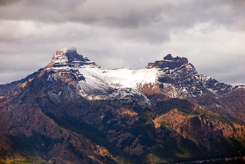
Pilot-Index peaks
A view of Pilot (11,708 ft) and Index (11,313 ft) Peaks from the pilot-index overlook on Beartooth highway. Both peaks were formed by melting/retreating glaciers that eroded a lot of hillsides. Still seen is one of the glaciers in between the two peaks. Pilot Peak (the pointy one) is a glacial horn, a pyramid of rock carved by four glaciers while Index Peak (to the right) was also carved by glaciers but looks little blunted at the top.
This is the northern edge of the Absoraka Range, an eroded mass of lava, ash, and mudflows that began forming 50 million years ago.
The Beartooth highway is an All-American Road that has been called "the most beautiful drive in America," by late CBS correspondent Charles Kuralt. The Beartooth highway is the section of U.S. Highway 212 between Red Lodge, Montana and Cooke City, Montana. It traces a series of steep zigzags and switchbacks, along the Montana-Wyoming border to the 10,947 ft (3,337 m) high Beartooth Pass. The approximate elevation rise is from 5,200 ft (1,600 m) to 8,000 ft (2,400 m) in 12 mi (19 km) in the most daring landscapes.
Source:Wikipedia
September 6, 2010, Pilot-Index overlook, Beartooth highway, Wyoming, Geo location.