View allAll Photos Tagged autonomy
Prime Minister’s Secretariat
* I constituted a high powered Committee under the chairmanship of Minister for KANA to prepare a reforms package for the purpose.
* Here, I would like to mention that all major improvements were made during the period of PPP. The first noticeable administrative improvement came through the Northern Areas Council Legal Framework Order 1974-75 by Shaheed Zulfiqar Ali Bhutto, wherein major administrative, judicial and political reforms were introduced and Jagirdari Nazam and FCR were abolished.
* Further democratization was done through the Northern Areas Legal Framework Order, 1994 by Shaheed Mohtrama Benazir Bhutto so as to ensure more internal autonomy to the people of Northern Areas through their elected representatives.
* Now the KANA Division has prepared a draft “ GILGIT-BALTISTAN (Empowerment and Self-Governance) Order 2009.
* The draft was discussed with all the stake holders and their views were accordingly incorporated.
* Informal discussions were also held with members of the Northern Areas Legislative Assembly and leaders of public opinion of the area.
* I also took the leadership of the major political parties into confidence.
* The Gilgit-Baltistan Assembly will formulate its own Rules of Procedures while legislation on various subjects pertinent to governance will be done by the Council and Assembly in their respective jurisdiction.
* Special meeting of the Cabinet was convened today to discuss the New Northern Areas Governance Order named “Gilgit-Baltistan Empowerment and Self Governance Order -2009”.
* This will replace Northern Areas Governance Order, 1994.
* The new name of Northern Areas of Pakistan shall be Gilgit-Baltistan as proposed under Article-2(f).
* There shall be a Governor of Gilgit-Baltistan as proposed under Article-20. and shall be appointed by the President of Pakistan.
* Till the election of the new legislative Assembly, Federal Minister for KANA will act as Governor.
* There will be a Chief Minister of Gilgit-Baltistan who shall be elected by the Gilgit-Baltistan Legislative Assembly.
* The Chief Minister shall be assisted by six Ministers.
* There shall be a provision of two advisors to the Chief Minister.
* There shall be Legislative assembly having directly elected 24 members. In addition there shall be six women and three technocrats’ seats.
* Today’s decision will empower the Gilgit-Baltistan Council and Assembly to make laws. The subject under which the Assembly shall now have power to make law has increased from 49 to 61 while the Council shall have 55 subjects.
* In order to empower the Council and the Assembly on financial matters, there shall be a Council Consolidated Fund under article 54, and Gilgit-Baltistan Consolidated Fund under article 55.
* Regarding annual budget, a detailed item-wise budget shall be presented before the Gilgit-Baltistan Assembly as it is being practiced in Pakistan and shall be accordingly voted upon as suggested in article 56.
* The Chief Judge of Supreme Appellate Court shall be appointed by the Chairman of the Council on the Advice of the Governor and other Judges shall be appointed by the Chairman on the Advice of Governor after seeking views of the Chief Judge.
* The Chief Judge and Judges of the Chief Court shall be appointed by the Chairman of the Council on the advice of the Governor on the same pattern as it is being practiced in AJ&K.
* Auditor General Gilgit-Baltistan to be appointed by the Governor on the advice of Council as the case in AJ&K.
* There shall be a Chief Election Commissioner under article-82 as well as Auditor General besides emergency provisions under article-83 & 87 respectively.
Frederick II had granted Esslingen the so-called town status in 1219. It became a as a free imperial city which meant it was a self-ruling city with a certain amount of autonomy and most of all it was not was subordinate to a territorial lord but only to the Emperor of the Holy Roman Empire.
It was not until 1286 and 1287 that Rudolf of Habsburg the town fortifications by means of two connecting walls. A third connecting wall was added in the 14th century. Between 1519 and 1531, the complex was extended to include a castle approach, as well as a rampart and moat on the town side. In contrast to other castles which represented the status of a lord, this castle’s main function was to protect its people. In 1519, the fortifications withstood an attack by Duke Ulrich of Württemberg, who, having captured Reutlingen, also attempted to take the imperial city of Esslingen.
In 1688, the city walls were not able to prevent considerable destruction by French forces marauding in Southern Germany under General Ezéchiel de Mélac. The same general had blown up the castle of Heidelberg. Esslingen was once more occupied by French troops under General de Mazel in 1693 and in 1707 by General Villars. In the early 19th century, under Napoleon, Württemberg became a French vassal state until 1871.
137 Wukang Rd., Shanghai
The anger of the demonstrations and protests did not infect everyone. Just a short distance away from the blockade, youths steeped in consumerism were still relaxing and having fun. This is partly due to the blockade of information by the authorities, and partly due to the fact that thirty years of condoning and exploiting consumerism and suppressing social autonomy have created a large group of people who are indifferent to the fate of others.
On the night of 26 November 2022, a demonstration took place in Middle Wulumuqi (Urumqi) Road, Shanghai in memory of the victims of the fire in Wulumuqi (Urumqi), Xinjiang, the casualties of which were caused by the building being locked up as a result of absurd anti-epidemic measures which made it impossible for residents to escape. The police ended up arresting many of the demonstrators and loading three police buses:
www.lemonde.fr/international/article/2022/11/27/chine-de-...
twitter.com/whyyoutouzhele/status/1596578107540099076
twitter.com/whyyoutouzhele/status/1596570771081424896
twitter.com/whyyoutouzhele/status/1596572854933663746
twitter.com/smashcherryM/status/1596573951899369472
twitter.com/whyyoutouzhele/status/1596573231787507713
twitter.com/whyyoutouzhele/status/1596579177700163584
twitter.com/whyyoutouzhele/status/1596807003078549505
twitter.com/whyyoutouzhele/status/1596587392437305344
twitter.com/whyyoutouzhele/status/1596615782418780160
twitter.com/whyyoutouzhele/status/1596858254792892416
twitter.com/whyyoutouzhele/status/1596807681372610560
twitter.com/whyyoutouzhele/status/1596612817326587905
twitter.com/whyyoutouzhele/status/1596620498930393090
etc.
On the evening of the 27th, a large area of the neighbourhood where the demonstration took place last night was suddenly blocked off, allowing only people to leave and not enter, perhaps to prevent further demonstrations from gathering there.. A large number of people gathered at the intersections of the blocked-off neighbourhoods, which gradually festered into a new demonstration.
The demonstration on the night of the 27th:
twitter.com/zonghengjp/status/1597636556369850369
twitter.com/whyyoutouzhele/status/1596839928058744839
twitter.com/whyyoutouzhele/status/1596573755723374592
twitter.com/whyyoutouzhele/status/1596848557365301250
twitter.com/whyyoutouzhele/status/1596800397397856256
twitter.com/whyyoutouzhele/status/1596848447700672513
twitter.com/whyyoutouzhele/status/1596846410061725696
twitter.com/whyyoutouzhele/status/1596833070879223812
twitter.com/whyyoutouzhele/status/1596847889439166465
twitter.com/whyyoutouzhele/status/1596833340023525377
twitter.com/whyyoutouzhele/status/1596844625238831105
twitter.com/whyyoutouzhele/status/1596842613629669376
etc.
25 April is for many the day of Italy’s Liberation from Nazism and Fascism. For me it is also a day of uncomfortable questions. I wonder how truly free we are if, over time, our country operates within alliances, political conditioning, military bases, international strategies, and external interests that influence fundamental decisions.
I cannot reduce freedom to a merely formal dimension when concrete sovereignty appears limited. The presence of NATO bases on the territory, shared military missions, and the systematic alignment with the policies of the United States and, in various international scenarios, also with Israel’s positions, contribute to the perception of reduced autonomy in foreign policy choices.
I do not celebrate a freedom that I perceive as incomplete, I remember history and I respect those who fought fascism.
I express my dissent towards an Italian foreign policy that aligns automatically with decisions and strategies of the United States and Israel, without real space for autonomy and critical evaluation by our country. I do not agree with a system in which Italy appears subject to external dynamics and decisions taken elsewhere.
I dissociate myself from this approach to Italian foreign policy, which I consider lacking sufficient independence.
I believe that Italy should maintain an autonomous position, oriented towards peace and the interests of its citizens, and should not automatically adhere to dynamics of war and military escalation decided elsewhere.
威尼斯(威尼斯語︰Venezsia;義大利語︰Venezia;弗留利語︰Vignesie;拉丁語︰Venetia;英文:Venice)是義大利東北部著名的旅遊與工業城市,也是威尼托地區的首府。人口約271,251人(2004年1月1日)。威尼斯與帕多瓦組成大帕多瓦-威尼斯地區(人口約1,600,000人)。別名「亞得里亞海的女王」、「水之都」、「面具之城」、「橋之城」、「漂浮之都」、「運河之城」、及「光之城」,Luigi Barzini曾在紐約時報形容它「無疑是最美麗的人造都市」,時代線上也稱讚威尼斯是歐洲最浪漫的城市之一。
威尼斯市區涵蓋義大利東北部亞得里亞海沿岸的威尼斯潟湖的118個島嶼和鄰近一個半島。這個鹹水潟湖分布在波河與皮亞韋河之間的海岸線。
威尼斯曾經是威尼斯共和國的中心,十字軍進行十字軍東征時也曾在這裡集結,而且也是13世紀至17世紀末一個非常重要的商業(尤其是香料貿易、糧食與毛皮貿易)與藝術重鎮。後來因為土耳其人對地中海東邊的控制促使歐洲國家尋找其他航線的慾望,威尼斯因此失去了大部分的重要性與影響力。Venice (English /ˈvɛnɪs/ ven-iss; Italian: Venezia [veˈnɛttsja] ( listen); Venetian: Venesia [veˈnɛsja]) is a city in northeastern Italy and the capital of the Veneto region. It is situated across a group of 117 small islands that are separated by canals and linked by bridges.[1] These are located in the shallow Venetian Lagoon, an enclosed bay that lies between the mouths of the Po and the Piave Rivers. Parts of Venice are renowned for the beauty of their settings, their architecture, and artwork.[1] The lagoon and a part of the city are listed as a World Heritage Site.
In 2014, 264,579 people resided in Comune di Venezia, of whom around 55,000 live in the historic city of Venice (Centro storico). Together with Padua and Treviso, the city is included in the Padua-Treviso-Venice Metropolitan Area (PATREVE), with a total population of 2.6 million. PATREVE is only a statistical metropolitan area without any degree of autonomy.
The name is derived from the ancient Veneti people who inhabited the region by the 10th century BC. The city was historically the capital of the Republic of Venice. Venice has been known as the "La Dominante," "Serenissima," "Queen of the Adriatic," "City of Water," "City of Masks," "City of Bridges," "The Floating City," and "City of Canals."
Nick Cave is a phenomenal artist for several reasons. One thing that I loved about this exhibit at the Museum of Contemporary Art in Chicago is that there were audio pieces explaining some of the works. The main work the couple are viewing is called Speak Louder but the work above it is one of a few in his Tondo series. When Nick Cave started making Soundsuits, it was right after he heard about the police brutality and the Rodney King beatings. I posted a shot of his Soundsuits here:
www.flickr.com/photos/kirstiecat/52075785831/in/dateposted/
When he speaks about Tondo, he speaks about the effects of inner city violence on children. This is something that is a dear issue to me as I work with kids with disabilities in the public schools in Chicago. At one school I work at, kids come all over the city and 97% must be drawn from the highest poverty areas of the city according to the last census. So, when a parent is concerned because of a child's lack of attention or behavior and a nurse asks, "How much sleep does your child get each night?" and the parent replies "None because there are constantly gunshots and police sirens going off," you know something needs to change in this world.
As many of you know, I believe in proactive means to building better communities. As we continue to put more budgets into funding police, we actually have more crime because less is going into quality education, libraries, mental health facilities, preventing food deserts, equitable employment and low income housing. As our policing has increased, it means that there is also less of a viable public transportation system as well, at the same time that many families earning lower incomes cannot afford these astronomical gas prices and we all need to take an active role when it comes to climate change.
In my 21 years of working with children at Chicago Public Schools, I've worked at a few different schools. In 2003, I had the great honor of working with kids in the Cabrini Green neighborhood before re gentrification and racism (profit over people time and time again) unfortunately forced many people out. I've worked on the West side and lately on the North side. I love children all over the city. When I bike to the far South side to see art, some ask me if it's safe. Wherever children go, we should be willing to go. And, if we are not wiling to go there, we need to think about making it safer there. Chicago is a microcasm of the whole world in that respect. We have the ability to make a world where everyone has a basic level of human rights and a higher quality of life. We don't need little boys getting to go to space again. We don't need billionaires who have 10 homes. We need sustainability.
In all my years at Chicago Public Schools and in the hundreds upon thousands of children I've met (and hopeful helped), not one of them has ever told me he/she/they want to rob or kill people for a living. However, there was an eight year old girl who told a Speech Therapist I worked with that she wanted to be a cop "because they get away with murder." We need to be better.
I am an active voter and donate money to charity and some politicians. I wish I had more power. I wish I could also create something as beautiful as Nick Cave does when he falls into despair. Some people ask me what protesting does. Others ask me what making art does. Still, others ask me what voting does. I'll tell you I don't have all the answers (or any some days) but I can tell you this much, if we were ALL trying to make the world a better place. If we were all making decisions based on trying to be more kind, just, and human, this world would in fact change.
So, if you're kind, Speak Louder. If you're a fan of human rights, Speak Louder. If you want children of all races, religions, and socioeconomic backgrounds to grow up in a better world, Speak Louder. If you want Environmental Justice, speak louder. If you want immigration rights and body autonomy, speak louder. If you want those in the LGBTQ+ community to have the same quality of life as those who are cis gendered and/or heterosexual, speak louder. If you want an end to the For Profit Prison Industrial Complex, speak louder.
Speak Louder.
mcachicago.org/exhibitions/2022/nick-cave-forothermore
**All photos are copyrighted**
Frederick II had granted Esslingen the so-called town status in 1219. It became a as a free imperial city which meant it was a self-ruling city with a certain amount of autonomy and most of all it was not was subordinate to a territorial lord but only to the Emperor of the Holy Roman Empire.
It was not until 1286 and 1287 that Rudolf of Habsburg the town fortifications by means of two connecting walls. A third connecting wall was added in the 14th century. Between 1519 and 1531, the complex was extended to include a castle approach, as well as a rampart and moat on the town side. In contrast to other castles which represented the status of a lord, this castle’s main function was to protect its people. In 1519, the fortifications withstood an attack by Duke Ulrich of Württemberg, who, having captured Reutlingen, also attempted to take the imperial city of Esslingen.
In 1688, the city walls were not able to prevent considerable destruction by French forces marauding in Southern Germany under General Ezéchiel de Mélac. The same general had blown up the castle of Heidelberg. Esslingen was once more occupied by French troops under General de Mazel in 1693 and in 1707 by General Villars. In the early 19th century, under Napoleon, Württemberg became a French vassal state until 1871.
Rovingian Nomadism: A Personal and Spiritual Journey in Freedom - The Road as Teacher and Experience as Path by Daniel Arrhakis (2026)
Rovingian Nomadism: A Personal and Spiritual Journey in Freedom
The Road as Teacher and Experience as Path
Introduction
Rovingian Nomadism represents a unique approach to the spiritual quest, characterized by freedom of movement and the practitioner's autonomy. Unlike the traditional monastic model, this path values direct experience and personal experience as supreme teachers of inner development.
From Individual Quest to Self-Determination
From the beginning, candidates for monks are encouraged to embark on an inner journey that is personal and unique. The paths and spiritual goals are designed by the practitioners themselves, with only initial support and guidance from the masters. This autonomy ensures that each individual explores their own path of spiritual enrichment, living authentic experiences in the different communities they pass through.
Self-determination is one of the pillars of this nomadism, where the practitioner takes control of their trajectory. The path is individual, shaped by choices that reflect inner needs, and all discipline arises from one's own will, not from imposed obedience. The role of the master, in this context, is limited to acting as an occasional mentor, offering guidance without taking away the sovereignty of the traveler.
The Road as Monastery
In this model, the external world becomes the true laboratory of the soul. Spiritual growth occurs through interaction with the "other" and diverse communities, allowing the practitioner to test compassion and adaptability in real time.
Learning is organic and experiential: wisdom comes not only from study, but from physical effort, hospitality received, and the unexpected challenges of the path. Without a fixed physical structure, the nomad is compelled to find their inner center, no matter where they are.
Experience as Teacher
In Rovingian Nomadism, experience precedes doctrine. Spiritual enrichment is eminently empirical: each trail traveled and each encounter is seen as a lesson sent by life, capable of shaping the practitioner's character.
This path stimulates spiritual flexibility, breaking down the barriers of mental rigidity and allowing constant adaptation to present reality. Continuous movement demands detachment from material and emotional attachments, purifying the inner search and distancing oneself from superficial distractions.
Key Point
In essence, Rovingian nomadism transforms life into a continuous prayer in motion. Spiritual “truth” ceases to be something merely read or learned, becoming something lived and experienced at every step of the way.
__________________________________________________________________________________________________________
Nomadismo Rovingiano: Uma Jornada Pessoal e Espiritual em Liberdade
A Estrada Como Mestre e a Experiência Como Caminho
Introdução
O Nomadismo Rovingiano representa uma abordagem singular à busca espiritual, caracterizada pela liberdade de movimento e pela autonomia do praticante. Diferente do tradicional modelo monástico, este caminho valoriza a experiência direta e a vivência pessoal como mestres supremos do desenvolvimento interior.
Da Busca Individual à Autodeterminação
Desde o início, os candidatos a monges são incentivados a embarcar numa jornada interior que é pessoal e única. Os trajetos e objetivos espirituais são desenhados pelos próprios praticantes, contando apenas com apoio e orientação inicial dos mestres. Esta autonomia garante que cada indivíduo explore o seu próprio caminho de enriquecimento espiritual, vivendo experiências autênticas nas diferentes comunidades por onde passa.
A autodeterminação é um dos pilares deste nomadismo, onde o praticante assume o controlo da sua trajetória. O percurso é individual, moldado por escolhas que refletem necessidades internas, e toda a disciplina nasce da vontade própria, não da obediência imposta. O papel do mestre, neste contexto, limita-se a atuar como mentor ocasional, oferecendo orientação sem retirar a soberania do caminhante.
A Estrada como Mosteiro
Neste modelo, o mundo exterior transforma-se no verdadeiro laboratório da alma. O crescimento espiritual ocorre através da interação com o “outro” e com comunidades diversas, permitindo ao praticante testar a compaixão e a adaptabilidade em tempo real.
A aprendizagem é orgânica e vivencial: a sabedoria provém não apenas do estudo, mas do esforço físico, da hospitalidade recebida e dos desafios inesperados do caminho. Sem uma estrutura física fixa, o nómada é compelido a encontrar o seu centro interior, independentemente do local onde se encontre.
A Experiência como Mestre
No Nomadismo Rovingiano, a experiência precede a doutrina. O enriquecimento espiritual é eminentemente empírico: cada trilho percorrido e cada encontro são encarados como lições enviadas pela vida, capazes de moldar o caráter do praticante.
Este caminho estimula a flexibilidade espiritual, quebrando as barreiras da rigidez mental e permitindo uma adaptação constante à realidade presente. O movimento contínuo exige desapego material e emocional, purificando a busca interior e afastando distrações superficiais.
Ponto Chave
Em essência, o nomadismo rovingiano transforma a vida numa oração contínua em movimento. A “verdade” espiritual deixa de ser algo apenas lido ou aprendido, tornando-se algo vivido e experimentado a cada passo do caminho.
A view of Funchal past the 'Monumento à Autonomia' which is sculpted in bronze and concrete plaques, representing a woman bursting out of nowhere and coming forth as a winner. It aims to celebrate the autonomy of the region.
Mandel Explorer One was the First Interstellar Fully Autonomic Self Contained System Capable of Major Self-Repairs was sent on a Mission to Explore the Universe and Forward all Data back to Mission Central’s data collection points Alpha, Charlie and Delta. It was Launched Five Hundred Years Ago on St. Patrick's Day and has performed its Mission flawlessly to date. The Data it has collected has launched several other Ships to other Quadrants of Space. Manned Space Travel is still in very early stages of development. Several New Techniques and Theories look promising using Star Gates for short distances which will be eventually be replaced by onboard Space Folding Generators.
Check out My Website www.rickwillis-photos.com
... just because I'm Kurdish ...
Iraqi Kurdistan
From Wikipedia, the free encyclopedia
Capital
(and largest city) Erbil
36°11′N 44°00′E / 36.183, 44
Official languages Kurdish[1]
Government Parliamentary democracy
- President Massoud Barzani
- Prime Minister Nechervan Idris Barzani
- Deputy Prime Minister Omer Fattah Hussain
Formation of Autonomous Region
- Autonomy accord agreement signed March 11, 1970
- Autonomy accord collapsed March, 1974
- Gained de facto independence October, 1991
- The TAL recognized the autonomy of the KRG as full sovereignty. January 30, 2005
Area
- Total 80,000 km2 (117th)
30,888 sq mi
Population
- 2008 estimate 7,000,000 (108th)
- Density 40/km2 (166th)
15/sq mi
GDP (PPP) 2007 estimate
- Total 27 billion (not ranked)
- Per capita $5,500 (not ranked)
HDI (As of 2006) n/a (n/a) (not ranked)
Currency Iraqi Dinar is the offical currency, American Dollar widely accepted in all business transactions (IQD)
Time zone (UTC+3)
- Summer (DST) (UTC+4)
Internet TLD Various
Calling code 964
Iraqi Kurdistan Region (Kurdish: هه رێمى كوردستان عێراق, Herêmi Kurdistan Iraq, Arabic:إقليم كردستان العراق , Iqlĩm Kurdistãn al-‘Irāq , also Southern Kurdistan and in Kurdish: باشووری کوردستان ) is an autonomous,[2] federally recognized political, ethnic and economic region of Iraq. It borders Iran to the east, Turkey to the north, and Syria to the west and the rest of Iraq to the South. Its capital is the city of Erbil, known in Kurdish as Hewlêr.
Etymology
The name Kurdistan literally means Land of the Kurds. The term Kurd in turn is derived from the Latin word Cordueni, i.e. the of the ancient Kingdom of Corduene, which became a Roman province in 66 BC.
In the Iraqi Constitution, it is referred to as Kurdistan Region.[3]. The regional government refers to it as Kurdistan-Iraq (or simply Kurdistan region) but avoids using Iraqi Kurdistan.[4] The full name of the local government is "Kurdistan Regional Government" (abbrev: KRG.)
Kurds also refer to the region as Kurdistana Başûr (South Kurdistan) or Başûrî Kurdistan (Southern Kurdistan or South of Kurdistan) referring to its geographical location within the whole of the greater Kurdistan region.
During the Baath Party administration in the '70s and '80s, the region was called "Kurdish Autonomous Region".
[edit] History
[edit] Ottoman Period
Main articles: Ottoman Empire, Mamluk rule in Iraq, Mesopotamian campaign, and Partitioning of the Ottoman Empire
The area today known as Iraqi Kurdistan was formerly ruled by three principalities of Baban, Badinan and Soran. In 1831, the direct Ottoman rule was imposed and lasted until World War I, during which the Ottomans sided with Germany and the Central Powers.
[edit] British Mandate
During World War I the British and French divided Western Asia in the Sykes-Picot Agreement. The Treaty of Sèvres, which was ratified in the Treaty of Lausanne, led to the advent of modern Western Asia and Republic of Turkey. The League of Nations granted France mandates over Syria and Lebanon and granted the United Kingdom mandates over Iraq and Palestine (which then consisted of two autonomous regions: Palestine and Transjordan). Parts of the Ottoman Empire on the Arabian Peninsula became parts of what are today Saudi Arabia and Yemen.
[edit] Kurdish revolts
On December 1, 1918, during a meeting in Sulaymaniyah with Colonel Arnold Wilson, the Acting Civil Commissioner for Mesopotamia, Kurdish leaders called for British support for a united and independent Kurdistan under British protection. Between 1919 and 1922, Shaikh Mahmud Barzanji, an influential Kurdish leader based in Sulaymaniyah, formed a Kurdish government and led two revolts against the British rule. It took the British authorities two years to put down his uprisings. The first revolt began on May 22, 1919 with the arrest of British officials in Sulaymaniyah and it quickly spread to Mosul and Erbil. The British employed aerial bombardments, artillery, ground combat, and on one occasion, chemical gas, in an attempt to quell the uprising.[5] Then the British exiled Mahmoud to India. In July 1920, 62 tribal leaders of the region, called for the independence of Kurdistan under a British mandate. The objection of the British to Kurdish self-rule sprang from the fear that success of an independent Kurdish area would tempt the two Arab areas of Baghdad and Basra to follow suit, hence endangering the direct British control over all Mesopotamia. In 1922, Britain restored Shaikh Mahmoud to power, hoping that he would organize the Kurds to act as a buffer against the Turks, who had territorial claims over Mosul and Kirkuk. Shaikh Mahmoud declared a Kurdish Kingdom with himself as King, though later he agreed to limited autonomy within the new state of Iraq. In 1930, following the announcement of the admission of Iraq to the League of Nations, Shaikh Mahmoud started a third uprising which was suppressed with British air and ground forces.[6][7]
By 1927, the Barzani clan had become vocal supporters of Kurdish rights in Iraq. In 1929, the Barzani demanded the formation of a Kurdish province in northern Iraq. Emboldened by these demands, in 1931 Kurdish notables petitioned the League of Nations to set up an independent Kurdish government. Under pressure from the Iraqi government and the British, the most influential leader of the clan, Mustafa Barzani was forced into exile in Iran in 1945. Later he moved to the Soviet Union after the collapse of the Republic of Mahabad in 1946.[8]
[edit] Barzani Revolts 1960-1975 and their Aftermath
After the military coup by Abdul Karim Qasim in 1958, Barzani was able to return from exile and set up his own political party, Kurdistan Democratic Party, which was granted legal status in 1960. Soon afterwards, Qasim incited the Baradost and Zebari tribes against Barzani. In June 1961, Barzani led his first revolt against the Iraqi government with the aim of securing Kurdish autonomy. Due to the disarray in the Iraqi Army after the 1958 coup, Qasim's government was not able to subdue the insurrection. This stalemate irritated powerful factions within the military and is said to be one of the main reasons behind the Baathist coup against Qasim in February 1963. Abdul Salam Arif declared a ceasefire in February 1964 which provoked a split among Kurdish urban radicals on one hand and traditional forces led by Barzani on the other. Barzani agreed to the ceasefire and fired the radicals from the party. Despite this, the government in Baghdad tried once more to defeat Barzani's movement by force. This campaign failed in 1966, when Barzani forces defeated the Iraqi Army near Rawanduz. After this, Arif announced a 12-point peace program in June 1966, which was not implemented due to the overthrow of Arif in a 1968 coup by the Baath Party. The Baath government started a campaign to end the Kurdish insurrection, which stalled in 1969. This can be partly attributed to the internal power struggle in Baghdad and also tensions with Iran. Moreover, the Soviets pressured the Iraqis to come to terms with Barzani. A peace plan was announced in March 1970 and provided for broader Kurdish autonomy. The plan also gave Kurds representation in government bodies, to be implemented in four years.[9] Despite this, the Iraqi government embarked on an Arabization program in the oil rich regions of Kirkuk and Khanaqin in the same period.[10] In the following years, Baghdad government overcame its internal divisions and concluded a treaty of friendship with the Soviet Union in April 1972 and ended its isolation within the Arab world. On the other hand, Kurds remained dependent on the Iranian military support and could do little to strengthen their forces.
[edit] The Algiers Agreement
In 1974, Iraqi government began a new offensive against the Kurds and pushed them close to the border with Iran. Iraq informed Tehran that it was willing to satisfy other Iranian demands in return for an end to its aid to the Kurds. With mediation by Algerian President Houari Boumédiènne, Iran and Iraq reached a comprehensive settlement in March 1975 known as the Algiers Pact. The agreement left the Kurds helpless and Tehran cut supplies to the Kurdish movement. Barzani fled to Iran with many of his supporters. Others surrendered en masse and the rebellion ended after a few days. As a result Iraqi government extended its control over the northern region after 15 years and in order to secure its influence, started an Arabization program by moving Arabs to the oil fields in Kurdistan, particularly the ones around Kirkuk.[11] The repressive measures carried out by the government against the Kurds after the Algiers agreement led to renewed clashes between the Iraqi Army and Kurdish guerrillas in 1977. In 1978 and 1979, 600 Kurdish villages were burned down and around 200,000 Kurds were deported to the other parts of the country.[12]
[edit] Iran–Iraq War and Anfal Campaign
During the Iran–Iraq War, the Iraqi government again implemented anti-Kurdish policies and a de facto civil war broke out. Iraq was widely-condemned by the international community, but was never seriously punished for oppressive measures, including the use of chemical weapons against the Kurds, which resulted in thousands of deaths. (See Halabja poison gas attack.)
The Al-Anfal Campaign constituted a systematic genocide of the Kurdish people in Iraq. From March 29, 1987 until April 23, 1989, Iraqi army under the command of Ali Hassan al-Majid carried out a genocidal campaign against the Kurds, characterized by the following human rights violations: The widespread use of chemical weapons, the wholesale destruction of some 2,000 villages, and slaughter of around 50,000 rural Kurds, by the most conservative estimates. The large Kurdish town of Qala Dizeh (population 70,000) was completely destroyed by the Iraqi army. The campaign also included Arabization of Kirkuk, a program to drive Kurds out of the oil-rich city and replace them with Arab settlers from central and southern Iraq.[13] Kurdish sources report the number of dead to be greater than 182,000.[14]
[edit] After the Persian Gulf War
The Kurdistan Region was originally established in 1970 as the Kurdish Autonomous Region following the agreement of an Autonomy Accord between the government of Iraq and leaders of the Iraqi Kurdish community. A Legislative Assembly was established in the city of Erbil with theoretical authority over the Kurdish-populated governorates of Erbil, Dahuk and As Sulaymaniyah. In practice, however, the assembly created in 1970 was under the control of Iraqi President Saddam Hussein until the 1991 uprising against his rule following the end of the Persian Gulf War. Concern for safety of Kurdish refugees was reflected in the United Nations Security Council Resolution 688 which gave birth to a safe haven, in which U.S. and British air power protected a Kurdish zone inside Iraq.[15] (see Operation Provide Comfort). While the no-fly zone covered Dahuk and Erbil, it left out Sulaymaniyah and Kirkuk. Then following several bloody clashes between Iraqi forces and Kurdish troops, an uneasy and shaky balance of power was reached, and the Iraqi government withdrew its military and other personnel from the region in October 1991. At the same time, Iraq imposed an economic blockade over the region, reducing its oil and food supplies.[16] The region thus gained de facto independence, being ruled by the two principal Kurdish parties – the Kurdish Democratic Party and the Patriotic Union of Kurdistan – outside the control of Baghdad. The region has its own flag and national anthem.
Elections held in June 1992 produced an inconclusive outcome, with the assembly divided almost equally between the two main parties and their allies. During this period, the Kurds were subjected to a double embargo: one imposed by the United Nations on Iraq and one imposed by Saddam Hussein on their region. The severe economic hardships caused by the embargoes, fueled tensions between the two dominant political parties: Kurdistan Democratic Party of Iraq (KDP) and Patriotic Union of Kurdistan (PUK) over control of trade routes and resources.[17] This led to internecine and intra-Kurdish conflict and warfare between 1994 and 1996. After 1996, 13% of the Iraqi oil sales were allocated for Iraqi Kurdistan and this led to a relative prosperity in the region.[18] Direct United States mediation led the two parties to a formal ceasefire in Washington Agreement in September 1998. It is also argued that the Oil for Food Program from 1997 onward had an important effect on cessation of hostilities.[19] Kurdish parties joined forces against the Iraqi government in the Operation Iraqi Freedom in Spring 2003. The Kurdish military forces known as peshmerga played a key role in the overthrow of the former Iraqi government.[20]
KDP and PUK have united to form an alliance with several smaller parties, and the Kurdish alliance has 53 deputies in the new Baghdad parliament, while the Kurdish Islamic Union has 5. PUK-leader Jalal Talabani has been elected President of the new Iraqi administration, while KDP leader Massoud Barzani is President of the Kurdistan Regional Government.
[edit] Politics
Main article: Kurdistan Regional Government
President George W. Bush talks to reporters as he welcomes Massoud Barzani, the President of the Kurdistan Regional Government of Iraq, to the Oval Office at the White House, Tuesday, Oct 25, 2005.Since 1992, the Kurdistan Regional Government (KRG) has been based in Erbil. The KRG has a parliament, elected by popular vote, called the Iraqi Kurdistan National Assembly, and a cabinet composed of the KDP, the PUK and their allies (Iraqi Communist Party, the Socialist Party of Kurdistan etc.). Nechervan Idris Barzani has been prime minister of the KRG since 1999.
After the 2003 Invasion of Iraq Kurdish politicians were represented in the Iraqi governing council. On January 30, 2005 three elections were held in the region: 1) for Transitional National Assembly of Iraq 2) for Iraqi Kurdistan National Assembly and 3) for provincial councils.[21] The Law of Administration for the State of Iraq for the Transitional Period recognized the autonomy of the Kurdistan Regional Government during the interim between "full sovereignty" and the adoption of a permanent constitution.
The Kurdistan Regional Government currently has constitutionally recognised authority over the provinces of Erbil, Dahuk, and As Sulaymaniyah, as well as de facto authority over half of Kirkuk (at-Ta'mim) province and parts of Diyala, Salah ad-Din and Ninawa provinces.
[edit] Economy
The Kurdistan region's economy is dominated by the oil industry, agriculture and tourism[22]. Due to relative peace in the region it has a more developed economy in comparison to other parts of Iraq.
Prior to the removal of Saddam Hussein, the Kurdistan Regional Government received approximately 13% of the revenues from Iraq's Oil-for-Food Program. By the time of the US invasion of Iraq in 2003, the program had disbursed $8.35 billion to the KRG. Iraqi Kurdistan's food security allowed for substantially more of the funds to be spent on development projects than in the rest of Iraq. By the program's end in 2003 $4 billion of the KRG's oil-for-food funds remained unspent.
Following the removal of Saddam Hussein's administration and the subsequent violence, the three provinces fully under the Kurdistan Regional Government's control were the only three in Iraq to be ranked "secure" by the US military. The relative security and stability of the region has allowed the KRG to sign a number of investment contracts with foreign companies. In 2006 the first new oil well since the invasion of Iraq was drilled in the Kurdistan region by the Norwegian energy company DNO. Initial indications are that the oil field contains at least 100 million barrels (16,000,000 m3) of oil and will be pumping 5,000 bpd by early 2007. The KRG has signed exploration agreements with two other oil companies, Canada's Western Oil Sands and the UK's Sterling Energy.
The stability of the Kurdistan region has allowed it to achieve a higher level of development than other regions in Iraq. In 2004 the per capita income was 25% higher than in the rest of Iraq. Two international airports at Erbil (see Erbil International Airport and Sulaymaniyah (see Sulaimaniyah International Airport) both operate flights to Middle Eastern and European destinations. The government continues to receive a portion of the revenue from Iraq's oil exports, and the government will soon implement a unified foreign investment law. The KRG also has plans to build a media city in Erbil and free trade zones near the borders of Turkey and Iran.
The region still gets a cut from Iraqi-Turkish trade, plus subsidies from the United States[citation needed] and Israel[citation needed].
Since 2003, the stronger economy of Kurdistan has attracted around 20,000 workers from other parts of Iraq.[23] According to Iraqi president Jalal Talabani, since 2003 the number of millionaires in the Kurdish city of Silêmani has increased from 12 to 2000, reflecting the financial and economic growth of the region.[24]
[edit] Geography
A popular waterfall near Erbil.The Iraqi Kurdistan is largely mountainous, with the highest point being a 3,611 m (11,847 ft) point known locally as Cheekah Dar (black tent). There are many rivers flowing and running through mountains of the region making it distinguished by its fertile lands, plentiful water, picturesque nature.
The mountainous nature of Kurdistan, the difference of temperatures in its various parts, and its wealth of waters, make Kurdistan a land of agriculture and tourism. In addition to various minerals, oil in particular, which for a long time was being extracted via pipeline only in Kurdistan through Iraq.
The largest lake in the region is Lake Dukan.
The term "Northern Iraq" is a bit of a geographical ambiguity in usage. "North" typically refers to the Kurdistan Region. "Center" and "South" or "Center-South" when individually referring to the other areas of Iraq or the rest of the country that is not the Kurdistan Region. Most media sources continually refer to "North" and "Northern Iraq" as anywhere north of Baghdad.
[edit] Governorates
Iraqi Kurdistan is divided among seven governorates of which currently three are under the control of the Kurdistan Regional Government. These governorates are called in Kurdish parêzge. Particularly in Iraqi government documents, the term governorate is preferred:
Autonomous Region KurdistanThe governorates wholly under the Kurdistan Regional Government are:
1. As Sulaymaniyah (Slêmanî)
2. Erbil (Hewlêr)
3. Dahuk (Duhok)
Main article: Kirkuk status referendum, 2008
The governorates claimed totally or in part by the Kurdistan Regional Government are:
4. Kirkuk (Kerkûk) - (all)
5. Diyala - Kifri Khanaqin and Baladrooz districts
6. Ninawa - Akra, Shekhan, Al-Shikhan, Al-Hamdaniya, Tel Kaif, Tall Afar and Sinjar districts
7. Salah ad Din - Tooz district
8. Wasit - Badrah district
A referendum was scheduled to be held on 15 November 2007 to determine whether these governorates, or parts of them, will be included in the Kurdish Regional Government. The referendum is intended to cover all districts of Kirkuk Governorate, the Khanaquin and Kifri districts of Diyala Governorate, the Touz-Khur-Mati district of Salah ad Din Governorate, and the Akra and Shekan districts of Ninewa Governorate. This referendum has been postponed, first to 31 December 2007, and subsequently for up to a further six months. Kurds insist that the referendum be held as soon as possible.
[edit] Demographics
Ethnic and religious distribution of Iraq.The population is about 5-6 million. 95% of these are Kurdish Muslims who are Sunnis. There are also significant numbers of Yazidis, Kakeyís, Jews and Christians. Kurds comprise the ethnic majority in the region (about 95%) while the Turkmen, Assyrians, Armenians and Arabs who reside particularly in the western part of the area make up the rest.
[edit] Culture
Main article: Kurdish culture
A Kurdish woman makes breadKurdish culture is a group of distinctive cultural traits practiced by Kurdish people. The Kurdish culture is a legacy from the various ancient peoples who shaped modern Kurds and their society, but primarily of two layers of indigenous (Hurrian), and of the ancient Iranic (Medes).
Among their neighbours, the Kurdish culture is closest to Iranian culture . For example they celebrate Newroz as the new year day, which is celebrated on March 21. It is the first day of the month of Xakelêwe in Kurdish calendar and the first day of spring.[25]
[edit] Music
Main article: Kurdish music
Traditionally, there are three types of Kurdish classical performers - storytellers (çîrokbêj), minstrels (stranbêj) and bards (dengbêj). There was no specific music related to the Kurdish princely courts, and instead, music performed in night gatherings (şevbihêrk) is considered classical. Several musical forms are found in this genre. Many songs are epic in nature, such as the popular lawiks which are heroic ballads recounting the tales of Kurdish heroes of the past like Saladin. Heyrans are love ballads usually expressing the melancholy of separation and unfulfilled love. Lawje is a form of religious music and Payizoks are songs performed specifically in autumn. Love songs, dance music, wedding and other celebratory songs (dîlok/narînk), erotic poetry and work songs are also popular.
[edit] Military
Main article: Peshmerga
Peshmerga is the term used by Kurds to refer to armed Kurdish fighters, they have been labelled by some as freedom fighters. Literally meaning "those who face death" (pêş front + merg death e is) the peshmerga forces of Kurdistan have been around since the advent of the Kurdish independence movement in the early 1920s, following the collapse of the Ottoman and Qajar empires which had jointly ruled over the area known today as Kurdistan.
Peshmerga forces also played a significant role with coalition troops in the war against the Ba'ath government in Northern Iraq.
We'd like to think we have some form of control still
Making our constant binary choices and voicing
Our equally shallow opinions more loudly or quietly
Most people can't even decide what colour to wear
Or which burger to eat, what the fuck does it matter man?
Autonomy is an illusion
Autonomy is an illusion
Autonomy is an illusion
Most people can't even decide what colour to wear
Or which burger to eat, what the fuck does it matter man?
Autonomy is an illusion
Autonomy is an illusion
Autonomy is an illusion
I tried to document this event from different point of view: the people, the media and the enforcement officers
=====
3 March 2012 -- Thousands of people marched to the offices of the Hong Kong city government on Saturday, demanding that outgoing chief executive Donald Tsang stand trial following allegations of ethics violations in his dealings with businessmen.
Organizers said more than 5,000 participated in Saturday's march, but local police estimated about 2,800 turned up at Victoria Park, the site of Hong Kong's annual Tiananmen vigil and where the protest started.
Hong Kong returned to Chinese rule in 1997 amid promises of a high degree of autonomy. But China's leaders have kept grip over political and administrative elite from behind the scenes.
The city's seven million people can elect some legislative and district council members, but have no direct vote for their top leader, who is selected by a 1,200-strong election committee comprised largely of business leaders and Beijing loyalists.
Source: Reuters
For more photos, please visit my set:
Rally Against Outgoing Leader 民陣3月3日「踢走爛攤子,還我真普選」大遊行
A visit to Norwich and compare the old and new.. The guildhall was commissioned after King Henry IV awarded a charter to the City of Norwich giving it autonomy from the county of Norfolk. The building, which was quickly established as the new civic meeting place, was built between 1407 and 1413.
Installation in der Kuppelhalle des Treppenhauses im Kunstpalast in Düsseldorf des Künstlerduos Steiner/Lenzlinger
---
Installation by the artists Steiner/Lenzlinger in the dome hall of the staircase in the museum "Kunstpalast" in Düsseldorf
I CRY FROM MY HANDS
WHAT HYPERHIDROSIS REALLY IS
Hyperhidrosis is not a skin disease.
It is not a problem of the sweat glands.
It is not an aesthetic defect.
Hyperhidrosis is a dysregulation of the autonomic nervous system, specifically its sympathetic branch.
The autonomic nervous system automatically regulates:
body temperature
sweating
heart rate
blood pressure
digestion
stress response
It works without conscious control.
HOW IT FUNCTIONS IN A PERSON WITHOUT HYPERHIDROSIS
1. A stimulus arrives (heat, emotion, stress)
2. The brain receives it
3. Filtering circuits evaluate intensity and danger
4. If necessary, the hypothalamus activates sweating
5. When no longer needed, the signal turns off
There is always a brake.
WHAT HAPPENS IN HYPERHIDROSIS
In people with hyperhidrosis:
Filtering and modulation circuits work poorly
The signal is not attenuated
The brake is weak
This means:
stimuli arrive unfiltered
they arrive directly
they arrive amplified
No anatomical part is missing.
What is reduced is the functional efficiency of inhibitory filtering.
In simple terms:
The brain does not lower the volume.
WHERE THE PROBLEM OCCURS
In the connections between:
Limbic system (emotions)
Hypothalamus (body regulation)
Brainstem
Prefrontal cortex
These circuits should say:
“This stimulus is mild”
“This is not dangerous”
“This does not require a bodily response”
In severe hyperhidrosis, this mechanism is weak.
Everything passes through.
WHAT “EVERYTHING PASSES THROUGH” MEANS
Tension
Anger
Fear
Injustice
Humiliation
Conflict
Sensory overload
There is no effective protective barrier.
Every stimulus arrives pure.
WHY THE BODY CHOOSES SWEAT
When the brain perceives threat:
It activates the sympathetic system
It prepares for survival
It increases sweating
In hyperhidrosis, this channel becomes a primary discharge valve.
The body releases through sweat.
Not because it is wrong.
Because it is one of the fastest exits.
WHY IT WORSENS IN TOXIC ENVIRONMENTS
A toxic environment is one where:
You are not safe
You are not listened to
You are devalued
You experience injustice
You must constantly defend yourself
The brain does not reason morally.
It reasons in terms of:
danger / no danger
Toxic environment = prolonged danger.
Therefore:
Sympathetic system always active.
If you stay four hours in that environment:
four hours of continuous signal.
The body collapses.
WHY IT MAY DECREASE AT HOME OR IN SAFE PLACES
Because:
The brain perceives less threat
The sympathetic system slows
Baseline activation lowers
This proves that:
it is not a skin problem
it is not a local defect
It is a neurophysiological response to context.
LEVELS OF HYPERHIDROSIS
Level 1
Occasional increased sweating
Level 2
Frequent sweating
Level 3
Continuous sweating
Level 4 (severe)
Profuse, visible, disabling, uncontrollable sweating
WHY CREAMS, BOTOX AND SURGERY FAIL
They act at the end of the circuit.
They block the faucet.
But the pressure remains.
Result:
Sweat appears elsewhere
Compensations occur
Global worsening
This is physiology, not bad luck.
An honest physician knows this.
THE UNCOMFORTABLE TRUTH
Severe hyperhidrosis is often associated with:
Highly sensitive nervous systems
Trauma
Chronic stress
Prolonged overload
Highly perceptive personalities
Not weakness.
Neurological hyper-receptivity.
WHAT THIS PHOTO SHOWS
Not a wet hand.
It shows:
A nervous system under overload.
A body that can no longer contain.
A real biological response.
CLOSING STATEMENT
This is not shame.
This is not guilt.
This is not a defect.
It is the cost of a nervous system that feels everything.
Domenico di Bartolo (1400/1404 - 1445/1447) Pope Celestine III gave privileges to the hospital autonomy (1442-1444) - Hall of pilgrims of Santa Maria della Scala in Siena
Pellegrinaio di Santa Maria della Scala
La grande corsia ospedaliera, nata come pellegrinaio maschile, viene costruita nella prima metà del Trecento. Il grandioso ciclo affrescato che decora le pareti e il soffitto è invece realizzato tra gli anni Trenta e Quaranta del Quattrocento, a celebrazione dell'ospedale, delle sue funzioni e del ruolo svolto.
Tra 1441 e 1443 la committenza ospedaliera affidò inoltre la decorazione delle pareti: Lorenzo di Pietro, Domenico di Bartolo e Priamo della Quercia furono impegnati, come documentano i libri di pagamento, nella celebrazione per immagini della storia e delle funzioni ospedaliere
Hall of pilgrims of Santa Maria della Scala
The great hospital ward, born as male "pellegrinaio", is built in the first half of the fourteenth century. The grandiose fresco cycle that decorates the walls and the ceiling is instead made between the thirties and forties of the fifteenth century, in celebration of the hospital, its functions and the role performed.
Between 1441 and 1443 the hospital commission also entrusted the decoration of the walls: Lorenzo di Pietro, Domenico di Bartolo and Priamo della Quercia were involved, as documented by the payment books, in the celebration through images of the history and functions of hospital
Techno-menticide!
Your souls will be touched: your very ego, your sense of self will be altered by the Beast. You will not be in control of your own emotions. You will not have free will, autonomy, or free choice. The Beast system will directly stimulate your neurons, bypassing all five of your senses. You will be plugged into a synthetic reality—a false reality so real, you will not be able to perceive that it’s fake.
Transhumanism: the birth of a new species. You will be transhuman computing units, part of the hivemind network, part of the Beast system. You will be infected and controlled by the 666 mind virus.
What is the end game? Total domination of the world! The Beast system: the ultimate weapon. Why were you so weak? Why did you sell your soul to the Beast? You will suffer the eternal consequences of your decision. You will be condemned to the furnace of damnation.
.……………………………….
-
-
………………………………
quinlan.it/upload/images/2021/10/nostalghia-1983-andrej-t...

quinlan.it/upload/images/2021/10/nostalghia-1983-andrej-t...

quinlan.it/upload/images/2021/10/nostalghia-1983-andrej-t...

quinlan.it/upload/images/2021/10/nostalghia-1983-andrej-t...
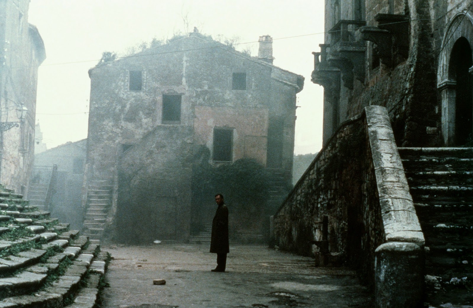
quinlan.it/upload/images/2021/10/nostalghia-1983-andrej-t...
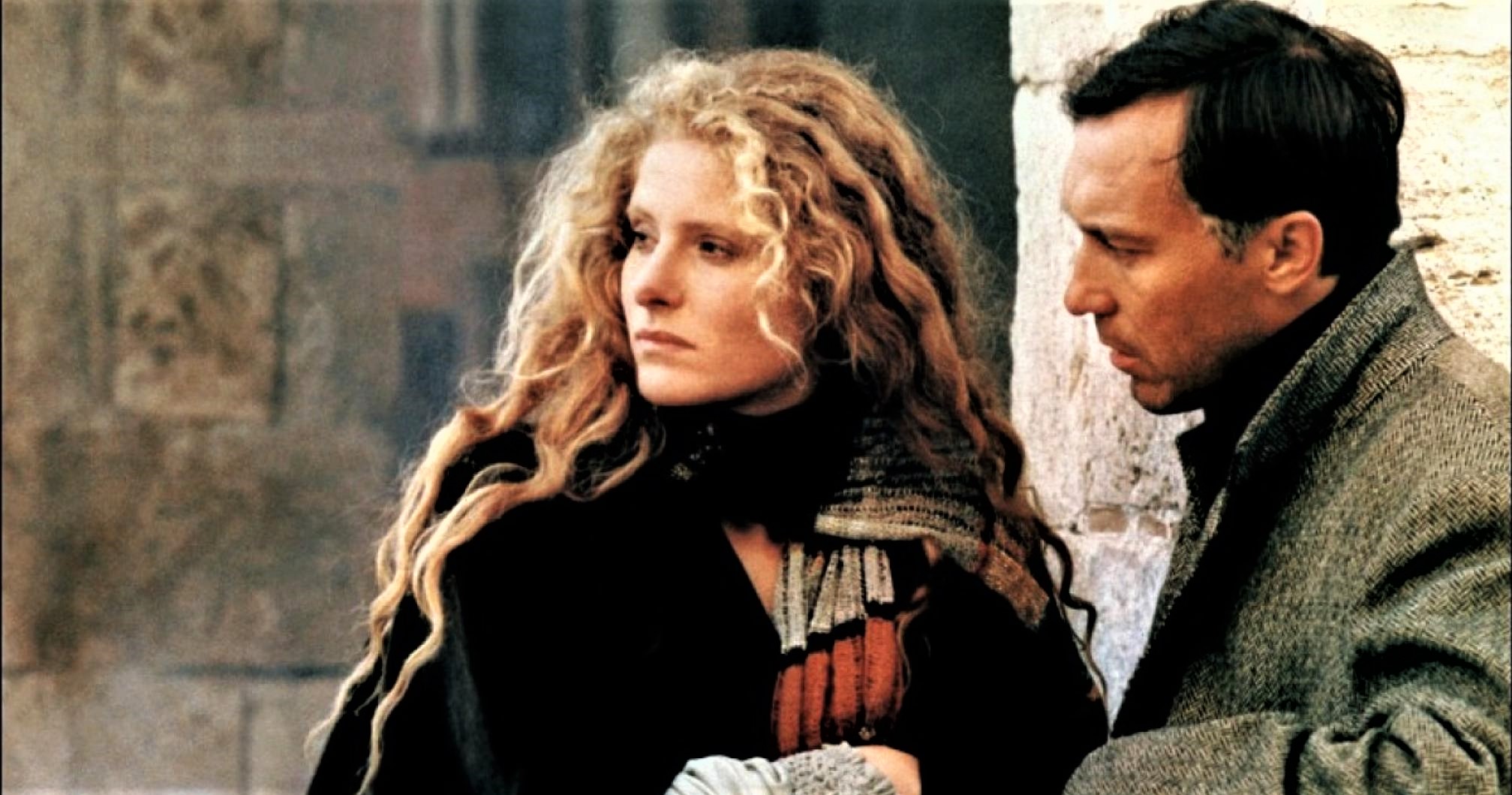
-----------------------------------------------------------------
click to activate the icon of slideshow: the small triangle inscribed in the small rectangle, at the top right, in the photostream;
or…. Press the “L” button to zoom in the image;
clicca sulla piccola icona per attivare lo slideshow: sulla facciata principale del photostream, in alto a destra c'è un piccolo rettangolo (rappresenta il monitor) con dentro un piccolo triangolo nero;
oppure…. premi il tasto “L” per ingrandire l'immagine;
www.fotografidigitali.it/gallery/2726/opere-italiane-segn...
…………………………………………………………………
I begin this photographic story with a description, starting from far away, from very far away, it is a story that speaks of chains, innocent men condemned to death, a voice that comes from a painting, chains that break by themselves, a barred door that opens spontaneously: we are in Palermo (Sicily), it is the 23rd (18th is also reported) August 1392 during the reign of Martin V, the Marina square (located in the Kalsa district of Palermo), overlooking the port (Cala), is the place designated for capital executions by hanging, in this way the population and sailors can witness the hangings, a few meters from the square is the church of " Our Lady of the Port", also known as the "church of the chain" due to the presence nearby of one end of a large and long chain which, when hooked to the two sides of the entrance from the sea to the port, thus put under tension, the same prevented Saracen pirate ships from entering it; the gallows is now ready for three condemned men to death, the sudden arrival of a violent storm prevents the imminent execution, the gendarmes and the condemned men take refuge in the nearby church of Our Lady of the Port, avoiding reaching the prison, the gendarmes tie the three unfortunate men with double chains, barricade the heavy church door from inside, the execution is postponed until the next day; during the night the gendarmes fall asleep, the three condemned men certainly cannot sleep, that is their last night, they approach a painting of the Virgin Mary placed on the altar, ask mercy from the Holy Mother, they invoke her incessantly, a voice is heard coming from the Sacred Image, the Divine Infant that Mary holds in Her arms has granted them freedom, the chains break without making a sound, the door opens spontaneously, the three incredulous men come out into the square, news of what happened immediately spreads, the gendarmes awakened by the clamor recapture the three condemned men, but the population resists, requests the intervention of the king, who arrives and learns of what happened, since the miracle has occurred he considers them innocent and therefore declares them free. Thus was born the cult of the "Our Lady of the Chain", She holds a long chain in Her hands. She is attributed the gift of Powerful Liberator, from all kinds of constraints, both physical and psychological. This cult quickly spread throughout Sicily, but also beyond, to Calabria, Puglia, Campania, and Lazio. In the locality of Cronarmerina, in the Piazza Armerina area (Enna), it is said that in the event of a difficult birth, the chain held by the statue of Our Lady of the Chain was placed on the pregnant woman's belly, thus facilitating the birth. This beginning introduces the current photographic story made on the first Sunday of May 2025, taken on the occasion of the "Great Feast" that Castiglione di Sicilia (Catania) dedicates to its Most Holy. The patron saint, Our Lady of the Chain, is celebrated every 5 years (with several exceptions). This celebration is characterized by the carrying in procession of the heavy marble statue, weighing approximately 800 kgs, made by the Gagini school, through the streets of the town, together with the relic of the “Virgin Mary’s Hair”. Every year, the “normal” celebration is celebrated, without carrying the Sacred Effigy in procession, always on the first Sunday in May and the second Sunday in August. Extraordinary events attributed to this Virgin Mary Statue have occurred in Castiglione. In 1612, the "miracle of sweating" occurred, linked to the "redemption of the mere and mixed empire." In short, during the Aragonese and Spanish occupation, Castiglione di S. (S. as Sicily) was subject to the rule of feudal lords, who exercised the "mere and mixed empire," thus having full powers of jurisdictional sovereignty over Castiglione in place of the king. The population attempted to "redeem" these rights to escape taxes and feudal arbitration, obtain their own autonomy, and be administered by royal magistrates. It is said that during a critical moment in the attempt to redeem the "mere and mixed empire," the statue of the Our Lady of the Chain "sweated," a supernatural phenomenon interpreted as the participation of the Blessed Virgin Mary and Her Infant in the suffering of the population, with her approval and protection in the process of redemption-liberation (a manuscript records what happened). In April 1809, after weeks of incessant prayers, the Statue was carried in procession to invoke Our Lady of the Chain to halt the advance of a lava flow from volcano Etna that threatened to destroy homes and fields in the Castiglione area. In 1879, the Statue was carried in procession behind the Castle to invoke the intercession of the Blessed Virgin Mary to put out a devastating fire; in 1946, at the end of World War II, a solemn procession was organized with the heavy Statue carried on shoulders, to thank the Blessed Virgin Mary for the end of the conflict; in 2020, the "Great Feast" was not celebrated due to the Covid-virus emergency. One aspect worthy of consideration is the deep attachment of the population of Castiglione di S. to the cult of Our Lady of the Chain, a cult that becomes a distinctive feature in the small communities of people of Castiglione scattered across many countries, some very far away. For example, in an interview with people who have moved to Australia (including their children or grandchildren) and now live in Brisbane or Sydney, we read that in every home of people off Castiglione there are always iconographic elements of Our Lady of the Chain, sacred images, small statues, postcards, paintings. And so, the anniversary of the "Great Feast” which occurs every 5 years, is a long-awaited moment for those who live abroad. The time comes to organize themselves into groups, take those who can, the same flight, and thus return to their native land, embrace their families again, and be able to see the Most Holy Mother again who "visits the town" walking its streets. A little curiosity: the first names "Cateno" or "Catena" are typically Sicilian names, originating from this Marian devotion. For example, our current and well-known mayor of Taormina (Messina), a politician, is named Cateno De Luca, as is the writer Catena Fiorello. Finally, a personal thought of mine: my paternal grandfather emigrated to the USA to find work and support his family. My grandmother remained in Taormina with their two children, her work as a photographer (she was the daughter of Gaetano D'Agata, assistant photographer of Baron-photographer Wilhelm von Gloeden, as I mentioned in a previous photo story) was not enough. My grandfather subsequently had to return to Sicily prematurely due to the outbreak of World War II. This photographic story of mine was created with constant, unceasing thought of all those Sicilians who emigrated abroad for work.
…………………………
Inizio questo racconto fotografico con descrizione, partendo da lontano, da molto lontano, è una storia che parla di catene, uomini innocenti condannati a morte, una voce che proviene da un quadro, catene che si spezzano da sole, un portone sbarrato che si apre spontaneamente: siamo a Palermo (Sicilia), è il 23 (viene anche riportato il 18) agosto 1392 durante il regno di Martino V, la Piazza Marina (si trova nel quartiere Kalsa di Palermo), si affaccia sul porto (Cala), è il luogo deputato alle esecuzioni capitali per impiccagione, in tal modo la popolazione ed i marinai possono assistere alle impiccagioni, a pochi metri dalla piazza si trova la chiesa di “S.Maria del porto”, conosciuta anche come la “chiesa della catena” per la presenza nelle vicinanze di una estremità di una grossa e lunga catena che, quando agganciata ai due lati dell’ingresso dal mare del porto, messa così in tensione, la stessa impediva alle navi pirata saracene di entrarvi dentro; la forca è ora pronta per tre condannati a morte, l’improvviso sopraggiungere di un violento temporale impedisce l’imminente esecuzione, gendarmi e condannati riparano nella vicina chiesa di S. Maria, evitando di raggiungere il carcere, i gendarmi legano i tre malcapitati con doppie catene, sbarrano da dentro il pesante portone della chiesa, l’esecuzione viene rimandata all’indomani; durante la notte i gendarmi si addormentano, i tre condannati non possono certo dormire, quella è la loro ultima notte, si avvicinano ad un quadro della Madonna posto sull’altare, chiedono misericordia alla Madre Santissima, la invocano incessantemente, una voce si ode provenire dalla Sacra Immagine, il Divino Infante che Maria sorregge in braccio ha concesso loro la libertà, le catene si spezzano senza fare rumore, il portone si spalanca spontaneamente, i tre increduli escono nella piazza, si sparge immediatamente la notizia di quanto accaduto, i gendarmi svegliati dal clamore riacciuffano i tre condannati, ma la popolazione si oppone, richiede l’intervento del re, il quale sopraggiunge e viene a conoscenza dell’accaduto, poiché c’è stato il miracolo li considera innocenti e quindi li dichiara liberi. Così nacque il culto per la “Madonna della Catena”, Ella regge tra le mani una lunga catena, Le viene attribuito il dono di Potente Liberatrice, da ogni sorta di costrizione in senso lato, fisico e psichico, culto che rapidamente si diffonde maggiormente in tutta la Sicilia, ma anche oltre, in Calabria, Puglia, Campania, Lazio. In località Cronarmerina, sul territorio di Piazza Armerina (Enna), si racconta che in presenza di un parto difficile, sulla gestante si adagiava sul ventre la catena tenuta in mano dalla statua della Madonna della Catena, per favorirne così il parto. Questo incipit, per introdurre l’attuale racconto fotografico, realizzato la prima domenica di maggio del 2025, in occasione della “Festa Grande” che Castiglione di Sicilia (Catania) dedica alla sua SS. Patrona, la Madonna della Catena, che viene celebrata ogni 5 anni (con diverse eccezioni) caratterizzata dal portare in processione la pesante statua di marmo, del peso di circa 800 kg, ad opera della scuola dei Gagini, per le vie del paese, insieme alla reliquia del “Capello della Madonna”, mentre ogni anno si celebra la festa “normale”, senza portare in processione il Sacro Simulacro, sempre la prima domenica di maggio, e la seconda domenica di agosto. Eventi straordinari in quel di Castiglione, attribuiti a questa Madonna ne sono accaduti, nel 1612 avvenne il “miracolo della sudorazione”, legato al “riscatto del mero et mixto imperio”, in breve, Castiglione di S. durante l’occupazione aragonese e spagnola, era soggetta al dominio da parte di signori feudali, che esercitavano il “mero et mixto imperio”, avevano così pieni poteri di sovranità giurisdizionale su Castiglione al posto del re, la popolazione cercò di “riscattare” questi diritti per sottrarsi a tasse ed arbìtri feudali, ottenere una propria autonomia, ed essere amministrati dai magistrati regi, si narra che durante un momento critico del tentativo di riscatto del “mero et mixto imperio” la statua della Madonna della Catena avrebbe “sudato”, fenomeno sovrannaturale interpretato come partecipazione della SS. Maria e del Suo Infante alle sofferenze della popolazione, con la Sua approvazione e protezione nel processo di riscatto – liberazione (si legge quanto accaduto in un manoscritto). Nell’aprile 1809 dopo settimane di incessanti preghiere, la statua fu portata in processione, per invocare la Madonna della Catena nel fermare l’avanzare di una colata lavica proveniente dall’Etna che minacciava di distruggere case e campi del territorio di Castiglione; nel 1879 la statua fu portata in processione dietro il Castello, per invocare l’intercessione della SS. Maria per far cessare un devastante incendio; nel 1946 alla fine della seconda guerra mondiale, si organizzò una solenne processione con la pesante statua portata in spalla, per ringraziare la SS. Maria per la fine del conflitto mondiale; nel 2020 la “Festa Grande” non fu celebrata, causa l’emergenza dettata dal Covid-virus. Un aspetto degno di considerazione è il profondo attaccamento della popolazione di Castiglione di S. al culto della Madonna della Catena, culto che diviene una nota distintiva nelle piccole comunità di Castiglionesi che si trovano sparse in molte nazioni, alcune lontanissime, ad esempio, in una intervista a persone trapiantate in Australia (anche, i loro figli od i loro nipoti) che vivono a Brisbane od a Sydney, si legge che in ogni casa di castiglionesi sono sempre presenti elementi iconografici della Madonna della Catena, immagini sacre, piccole statue, cartoline, quadri, ed ecco che la ricorrenza della “Festa Grande” che si verifica ogni 5 anni, è un momento attesissimo da coloro che vivono all’estero, giunge il momento di organizzarsi in gruppi, prendere chi può, lo stesso volo aereo, e così ritornare alla terra natia, riabbracciare i familiari, poter rivedere la SS. Madre che “fa visita al paese” percorrendo le sue strade. Una piccola curiosità, il nome proprio di persona “Cateno o Catena”, sono nomi tipicamente siciliani, provengono da questa devozione mariana, ad esempio il nostro attuale e conosciuto sindaco di Taormina (ME), uomo politico, si chiama Cateno De Luca, od anche la scrittrice Catena Fiorello. Infine, un mio personale pensiero, mio nonno paterno emigrò negli USA per cercare lavoro e così poter mantenere la famiglia, mia nonna restò a Taormina con i loro due figli, il suo lavoro come fotografa (era la figlia di Gaetano D’Agata, assistente fotografo del barone-fotografo Wilhelm von Gloeden, ne ho parlato in un mio precedente racconto fotografico) non era sufficiente, successivamente mio nonno dovette anzitempo rientrare in Sicilia per il presentarsi del conflitto mondiale, questo mio racconto fotografico è stato realizzato pensando costantemente, incessantemente, a tutti quei Siciliani emigrati all’estero per necessità di lavoro.
…………………………………………..
The flag is a tricolour (green, white and pink) and was created in 1843.
This country lost autonomy in 1917 and after a referendum now is Canadian.
Terranova (in inglese: Newfoundland, in francese: Terre-Neuve; in gaelico canadese: Talamh an Èisg; in micmac: Ktaqmkuk)
Una curiosità e un mistero: i Micmac, o meglio i Mi'kmaq, (nativi americani presenti a Terranova) avevano una scrittura simile ai geroglifici egiziani !
-------------------------------------------------------------------------------------------
Sorry, to me is very difficult to reciprocate your visit if you only leave a fav without commenting...
-------------------------------------------------------------------------------------------
Do not use any of my images on websites, blogs or other media without my explicit written permission.
All rights reserved - Copyright © fotomie2009 - Nora Caracci
-------------------------------------------------------------------------------------------
The Universal Declaration of Human Rights and other international human rights agreements underscore that bodily autonomy is a fundamental right. People must be able and empowered to freely and responsibly make decisions about their own bodies.
~
3d draw
Domenico di Bartolo (1400/1404 - 1445/1447) Pope Celestine III gave privileges to the hospital autonomy (1442-1444) - Hall of pilgrims of Santa Maria della Scala in Siena
Pellegrinaio di Santa Maria della Scala
La grande corsia ospedaliera, nata come pellegrinaio maschile, viene costruita nella prima metà del Trecento. Il grandioso ciclo affrescato che decora le pareti e il soffitto è invece realizzato tra gli anni Trenta e Quaranta del Quattrocento, a celebrazione dell'ospedale, delle sue funzioni e del ruolo svolto.
Tra 1441 e 1443 la committenza ospedaliera affidò inoltre la decorazione delle pareti: Lorenzo di Pietro, Domenico di Bartolo e Priamo della Quercia furono impegnati, come documentano i libri di pagamento, nella celebrazione per immagini della storia e delle funzioni ospedaliere
Hall of pilgrims of Santa Maria della Scala
The great hospital ward, born as male "pellegrinaio", is built in the first half of the fourteenth century. The grandiose fresco cycle that decorates the walls and the ceiling is instead made between the thirties and forties of the fifteenth century, in celebration of the hospital, its functions and the role performed.
Between 1441 and 1443 the hospital commission also entrusted the decoration of the walls: Lorenzo di Pietro, Domenico di Bartolo and Priamo della Quercia were involved, as documented by the payment books, in the celebration through images of the history and functions of hospital
Elsie is not one of those cats who can't wait for the box to be emptied so she can jump in. She's usually indifferent to boxes. I learned the hard way never to try to put Elsie in a box. She's possessive about her autonomy.
However, yesterday I lured Elsie into the box by scratching the inside, convincing her there was a rodent inside. Once Elsie was in the box, I entertained her by making scratching sounds on the outside.
A good time was had by all.
Illustration commissioned by brazilian publisher Editora Globo.
Revista Galileu
May 2011
Visit www.luklima.com.
Technology image of the week:
ESA’s light-studded Rover Autonomy Testbed vehicle does a twirl during night testing in Tenerife, intended to simulate the low light environment of the lunar poles.
The testbed, operated by a team from GMV in Spain, plus ESA’s Heavy Duty Planetary Rover, overseen by ESA’s planetary robotics team, have travelled to the Canary Islands for day and night testing in the volcanic, Moon-like environment of Teide National Park.
The two rovers carry navigation aids to work in both light and dark, including stereo cameras, lights, GPS, laser rangers and radar-like lidar. They can build digital 3D maps from these various sensors for both autonomous and teleoperated steering.
Credit: Fernando Gandía/GMV
Domenico di Bartolo (1400/1404 - 1445/1447) Pope Celestine III gave privileges to the hospital autonomy (1442-1444) - Hall of pilgrims of Santa Maria della Scala in Siena
Pellegrinaio di Santa Maria della Scala
La grande corsia ospedaliera, nata come pellegrinaio maschile, viene costruita nella prima metà del Trecento. Il grandioso ciclo affrescato che decora le pareti e il soffitto è invece realizzato tra gli anni Trenta e Quaranta del Quattrocento, a celebrazione dell'ospedale, delle sue funzioni e del ruolo svolto.
Tra 1441 e 1443 la committenza ospedaliera affidò inoltre la decorazione delle pareti: Lorenzo di Pietro, Domenico di Bartolo e Priamo della Quercia furono impegnati, come documentano i libri di pagamento, nella celebrazione per immagini della storia e delle funzioni ospedaliere
Hall of pilgrims of Santa Maria della Scala
The great hospital ward, born as male "pellegrinaio", is built in the first half of the fourteenth century. The grandiose fresco cycle that decorates the walls and the ceiling is instead made between the thirties and forties of the fifteenth century, in celebration of the hospital, its functions and the role performed.
Between 1441 and 1443 the hospital commission also entrusted the decoration of the walls: Lorenzo di Pietro, Domenico di Bartolo and Priamo della Quercia were involved, as documented by the payment books, in the celebration through images of the history and functions of hospital
Rethymno was built in antiquity (ancient Rhithymna and Arsinoe), but was never a competitive Minoan centre. As a result of its relative independence and autonomy it did, however, mint its own coins. Rithymna coins almost always depicted the greek gods of Apollo or Athena on one side with symbols of the sea - such as tridents or dolphins - on the other.
One of these coins is today depicted as the crest of the town - two dolphins in a circle. The symbol is immortalised in physical form as a bronze statue situated on the main pier of the modern day port, seen here just after sunrise in early August.
It is interesting to note that, despite their similarity, the two preceding sunrise images (IV and V) were each taken on separate days to this image.
Copyright Neil Mair 2019. All rights reserved.
Use of my images without my explicit written permission is an infringement of copyright law.
Tagged with #rethymno #rethymnon #rethimno #architecture #urban #city #greece #greek #travel #crete #venetian #tourism #light #neilmair #reflections #sunrise #harbour #lighthouse #port #sea #ocean #morning #statue #sculpture #dolphins #emblem #symbol
en.wikipedia.org/wiki/Bournemouth
Bournemouth Listeni/ˈbɔərnməθ/ is a large coastal resort town on the south coast of England directly to the east of the Jurassic Coast, a 96-mile (155 km) World Heritage Site.[1] According to the 2011 census, the town has a population of 183,491 making it the largest settlement in Dorset. With Poole to the west and Christchurch in the east, Bournemouth forms the South East Dorset conurbation, which has a total population of over 465,000.
Before it was founded in 1810 by Lewis Tregonwell, the area was a deserted heathland occasionally visited by fishermen and smugglers. Initially marketed as a health resort, the town received a boost when it appeared in Dr Granville's book, The Spas of England. Bournemouth's growth really accelerated with the arrival of the railway and it became a recognised town in 1870. Historically part of Hampshire, it joined Dorset with the reorganisation of local government in 1974. Since 1997, the town has been administered by a unitary authority, giving it autonomy from Dorset County Council although it remains part of the ceremonial county. The local council is Bournemouth Borough Council.
The town centre has notable Victorian architecture and the 202-foot (62 m) spire of St Peter's Church, one of three Grade I listed churches in the borough, is a local landmark. Bournemouth's location has made it a popular destination for tourists, attracting over five million visitors annually with its beaches and popular nightlife. The town is also a regional centre of business, home of the Bournemouth International Centre or BIC, and a financial sector that is worth more than £1,000 million in Gross Value Added.
Toponymy
The first mention of Bournemouth comes in the Christchurch cartulary of 1406, where a monk describes how a large fish ("uni magno piscis"), 18 ft. long, was washed up at "La Bournemowthe" in October of that year and taken to the Manor of Wick; six days later, a portion of the fish was collected by a canon from Christchurch Priory and taken away as tithe.[2] "La Bournemowthe", however, was purely a geographic reference to the uninhabited area around the mouth of the small river which, in turn, drained the heathland between the towns of Poole and Christchurch.[3][4][5] The word bourne, meaning a small stream, is a derivative of burna, old English for a brook.[4][6] From the latter half of the 16th century "Bourne Mouth" seems to be preferred, being recorded as such in surveys and reports of the period, but this appears to have been shortened to "Bourne" after the area had started to develop.[4][5] A travel guide published in 1831 calls the place "Bourne Cliffe" or "Tregonwell's Bourne" after its founder.[7] The Spas of England, published ten years later, calls it simply "Bourne"[8] as does an 1838 edition of the Hampshire Advertiser.[9] In the late 19th century "Bournemouth" became predominant, although its two-word form appears to have remained in use up until at least the early 20th century, turning up on a 1909 ordnance map.[
History
In the 12th century the region around the mouth of the River Bourne was part of the Hundred of Holdenhurst. The hundred later became the Liberty of Westover when it was also extended to include the settlements of North Ashley, Muscliff, Muccleshill, Throop, Iford, Pokesdown, Tuckton and Wick, and incorporated into the Manor of Christchurch.[11] Although the Dorset and Hampshire region surrounding it had been the site of human settlement for thousands of years, Westover was largely a remote and barren heathland before 1800.[12] In 1574 the Earl of Southampton noted that the area was "Devoid of all habitation", and as late as 1795 the Duke of Rutland recorded that "... on this barren and uncultivated heath there was not a human to direct us".[4][13]
In the late 19th and early 20th centuries the Borough of Bournemouth would grow to encompass a number of ancient settlements along the River Stour, including Longham where a skull thought to be 5,500 years old was found in 1932. Bronze Age burials near Moordown, and the discovery of Iron Age pottery on the East Cliff in 1969, suggest there may have been settlements there during that period. Hengistbury Head, added to the borough in 1932, was the site of a much older Palaeolithic encampment.[14][15][16] During the latter half of the 16th century James Blount, 6th Baron Mountjoy, began mining for alum in the area, and at one time part of the heath was used for hunting, although by the late 18th century little evidence of either event remained.[17][18] No-one lived at the mouth of the Bourne river and the only regular visitors to the area before the 19th century were a few fishermen, turf cutters and gangs of smugglers.[19]
Prior to the Christchurch Inclosures Act 1802, more than 70% of the Westover area was common land. The act, together with the Inclosure Commissioners' Award of 1805, transferred five thousand acres into the hands of five private owners, including James Harris, 1st Earl of Malmesbury, and Sir George Ivison Tapps.[20][21] In 1809 the Tapps Arms public house appeared on the heath. A few years later, in 1812, the first official residents, retired army officer Lewis Tregonwell and his wife, moved into their new home built on land purchased from Tapps. The area was well known to Tregonwell who, during the Napoleonic wars, spent much of his time searching the heath and coastline for French invaders and smugglers.[22]
Anticipating that people would come to the area to indulge in the newly fashionable pastime of sea-bathing, an activity with perceived health benefits, Tregonwell built a series of villas on his land between 1816 and 1822, which he hoped to let out.[23][24] The common belief that pine-scented air was good for lung conditions, and in particular tuberculosis, prompted Tregonwell and Tapps to plant hundreds of pine trees. These early attempts to promote the town as a health resort meant that by the time Tregonwell had died in 1832, Bournemouth had grown into a small community with a scattering of houses, villas and cottages.[23][25] The town would ultimately grow up around the scattered pines and tree-lined walk to the beach, later to become known as the Invalids' Walk.[26][27]
After the death of Tapps in 1835, his son Sir George William Tapps-Gervis inherited his father's estate. He hired the young local architect Benjamin Ferrey to develop the coastal area on the east side of the stream.[28] Bournemouth's first hotel, later to become part of the Royal Bath Hotel, opened in 1838 and is one of the few buildings designed by Ferrey still standing.[25][28] Bournemouth started to grow at a faster rate as Tapps-Gervis began developing the area similarly to the south coast resorts of Weymouth and Brighton. Despite enormous investment, the town's share of the market remained modest.[26] In 1841 Tapps-Gervis invited the physician and writer Augustus Granville to stay. Granville was the author of The Spas of England, which described health resorts around the country, and as a result of his visit he included a chapter on Bournemouth in the second edition of his book. The publication of the book, and the increase in visitors seeking the medicinal use of seawater and the pine-scented air, helped the town to grow and establish itself as an early tourist destination.[29][30]
In the 1840s Benjamin Ferrey was replaced by Decimus Burton, whose plans for Bournemouth included the construction of a garden alongside the Bourne stream, an idea first mooted by Granville. The fields south of the road crossing (later Bournemouth Square) were drained and laid out with shrubberies and walks. Many of these paths, including the Invalids' Walk, remain in the town today.[30][31] A second suggestion of Granville's, a sanatorium, was completed in 1855 and greatly raised Bournemouth's profile as a place for recuperation.[32]
At a time when the most convenient way to arrive in the town was by sea, a pier was considered to be a necessity. Holdenhurst Parish Council were reluctant to find the money, and an attempt to raise the money privately in 1847 had only succeeded in financing a small 100 feet (30 m) jetty.[33] The Bournemouth Improvement Act of 1856 granted greater financial autonomy to the town and a pier was approved that year. A number of wooden structures were built before an 838 feet (255 m) cast iron design by Eugenius Birch was completed in 1880.[33][34] Under the Act, a board of 13 Commissioners was established to build and organise the expanding infrastructure of the town, such as paving, sewers, drainage, street lighting and street cleaning.[35]
The arrival of the railways in 1870 precipitated a massive growth in seaside and summer visitors to the town, especially from the Midlands and London. In 1880 the town had a population of 17,000, but by 1900, when railway connections to Bournemouth were at their most developed, the town's population had risen to 60,000 and it had become a favourite location for visiting artists and writers.[23] The town was improved greatly during this period through the efforts of Sir Merton Russell-Cotes, the town's mayor and a local philanthropist, who helped to establish the town's first library and museum. The Russell-Cotes Art Gallery & Museum was housed in his mansion, and after his death it was given to the town.[36] Bournemouth became a municipal borough in 1890 and a county borough in 1900.[35]
As Bournemouth's growth increased in the early 20th century, the town centre spawned theatres, cafés, two art deco cinemas and more hotels. Other new buildings included the war memorial in 1921 and the Bournemouth Pavilion, the town's concert hall and grand theatre, finished in 1925.
The town escaped heavy bombing during the Second World War, but the sea front incurred great damage when it was fortified against invasion.[37] The cast iron lamposts and benches along the front were removed and melted down for munitions, as was much of the superstructure from both Bournemouth and Boscombe piers before they were breached to prevent their use by enemy ships.[37] The large amounts of barbed wire and anti-tank obstacles along the beach, and the mines at the foot of the chines, took two years to remove when peace was finally achieved.[38]
The Royal National Lifeboat Institution stationed an inshore lifeboat at Bournemouth between 1965 and 1972. Coverage for the area has otherwise been provided from Poole Lifeboat Station.[39] The Bournemouth International Centre (BIC), a large conference and exhibition centre, was constructed near the seafront in 1984,[40] and in the following year Bournemouth became the first town in the United Kingdom to introduce and use CCTV cameras for public street-based surveillance.[25]
The Waterfront complex, which was intended to hold an IMAX cinema, was constructed on the seafront in 1998.[41] The 19 m (62 ft)-high concrete and smoked glass building featured a wavy roof design, but was despised by residents and visitors alike because it blocked views of the bay and the Isle of Purbeck.[41][42] In 2005 it was voted the most hated building in England in a 10,000-people poll conducted by the Channel 4 programme 'Demolition', and was pulled down in Spring 2013.[41][43] The site is to be used as an outdoor event arena. The council still plan a larger redevelopment of the site and adjoining council land in the long term.
In 2012 Bournemouth was unsuccessful in its bid for city status, losing out to Chelmsford in competition with 26 other towns to commemorate Queen Elizabeth II's Diamond Jubilee.[
Governance
Historically Bournemouth was part of Hampshire, with neighbouring Poole, just to the west of the border, in Dorset. At the time of the 1974 local government re-organisation, it was considered desirable that the whole of the Poole/Bournemouth urban area should be part of the same county. Bournemouth therefore became part of the non-metropolitan county of Dorset on 1 April 1974.[35] On 1 April 1997, Bournemouth became a unitary authority, independent from Dorset County Council.[45] For the purposes of the Lieutenancy it remains part of the ceremonial county of Dorset.
For local elections the district is divided into 18 wards,[46] and the Bournemouth Borough Council is elected every four years.[47] In the 2011 local elections the Conservatives held overall control, winning 45 of the available 51 seats.[48] The Council elects a Mayor and Deputy Mayor annually.[49] For 2014–15 the mayor is Chris Mayne.[50]
Bournemouth is represented by two parliamentary constituencies in the House of Commons; Bournemouth East and Bournemouth West.[51] In the 2010 general election, the former was held for the Conservatives by Tobias Elwood with 48.4% of the vote, while the latter was also held for the Conservatives by Connor Burns with 45.1%.[52][53]
Geography
Bournemouth is about 94 miles (151 km) southwest of London at 50°43′12″N 1°52′48″WCoordinates: 50°43′12″N 1°52′48″W.[54] The borough borders the neighbouring boroughs of Poole and Christchurch to the west and east respectively and the East Dorset District to the north. Poole Bay lies to the South.[55][56] The River Stour forms a natural boundary to the north and east, terminating at Christchurch Harbour;[56][57] while the River Bourne rises in Poole and flows through the middle of Bournemouth town centre, into the English Channel.[58] The towns of Poole, Bournemouth and Christchurch form the South East Dorset conurbation with a combined population of over 400,000. Bournemouth is both a retail and commercial centre.[59] Areas within Bournemouth include: Boscombe, Kinson, Southbourne, Springbourne, Throop, Westbourne and Winton.[60]
The area's geology has little variety, comprising almost entirely of Eocene clays which, prior to urbanisation, supported a heathland environment.[61][62] Patches of the original heath still remain, notably Turbary Common, a 36-hectare (89-acre) site, much of which is designated a Site of Special Scientific Interest.[63] This heathland habitat is home to all six species of native reptile, the Dartford Warbler and some important flora such as Sundew and Bog Asphodel. Small populations of Exmoor pony and Shetland cattle help to maintain the area.[64] Bournemouth is directly north of Old Harry Rocks, the easternmost end of the Jurassic Coast, 96 miles (155 km) of coastline designated a World Heritage Site in 2001.[65] Bournemouth's own coastline stretches from Sandbanks to Christchurch Harbour and comprises mainly sandy beaches backed by gravel and sandy clay cliffs. These cliffs are cut by a number of chines which provide natural access to the shore.[66] At the easternmost point lies Hengistbury Head, a narrow peninsula that forms the southern shore of Christchurch Harbour. It is a local nature reserve and the site of a Bronze Age settlement.
Climate
Due to its location on the south coast, Bournemouth has a temperate climate with moderate variation in annual and daily temperatures. From 1981 to 2010 the annual mean temperature was 10 to 11 °C (50 to 52 °F).[69] The warmest months are July and August, which have an average temperature range of 12 to 22 °C (54 to 72 °F), while the coolest months are January and February, which have an average temperature range of 1 to 8 °C (34 to 46 °F).[70] Average rainfall in Bournemouth is around 800 mm (31 in) annually, well below the national average of 1,126 millimetres.[71] Since 1960, temperature extremes as measured at Bournemouth Hurn Airport have ranged from 34.1 °C (93.4 °F) in August 1990,[72] down to −13.4 °C (7.9 °F) in January 1963.[73] The lowest temperature recorded in recent years was −10.4 °C (13.3 °F) in December 2010.[
Demography
Religious demography
Christian 57.1
Buddhist 0.7
Hindu 0.7
Jewish 0.7
Muslim 1.8
Sikh 0.1
Other religion 0.7
No religion 30.5
Not stated 7.8
The 2011 census records the population of Bournemouth as 183,491, comprising 91,386 males and 92,105 females, which equates to 49.8% and 50.2% of the population respectively.[77][78] The mean average age of all persons is 40 years.[79] With 4,000 residents per square kilometre, Bournemouth has the highest population density of any authority in the South-West region, and is the eighth most populated.[80]
Much of the population, 83.8%, describe their ethnicity as 'white British' while other white groups account for a further 8.1%. Asian groups; Indian, Pakistani, Bangladeshi, Chinese and other Asian, make up 3.9%. Black British, black African, black Caribbean and other black groups form 1.0% of the population, Those of a mixed race make up 2.3% of the population, and 0.9% are from other ethnic groups.[81]
Christians made up 57.1% of the population but 30% of residents said they had no religion and 7.8% refused to say whether they were religious or not. Muslims were 1.8%, Budhists, Hindus and Jews each had a 0.7% share, Sikhs were 0.1%. and other religions made up 0.7%.[76]
Of all Bournemouth residents aged 16 or over, 19.1% had no qualifications at all, although 35% said they had between one and four O-levels, CSEs, GCSEs or equivalent, and 36.5% have more than five O-level equivalents (grade C and above), an A-level or two to three AS-levels. Those with an NVQ level 1 comprise 8.0% of the population while 15.2% have a level 2 NVQ, a City and Guilds craft certificate, BTEC or general diploma. Just over 20% of residents had two or more A-levels, four or more AS-Levels or an advanced diploma while 15.8% possessed a degree, such as a BA or BSc or a higher degree such as an MA or PhD. An NVQ level 4 or 5, HNC, HND, higher BTEC or higher diploma, is held by 4.2% and a professional qualification is held by 13.9% of residents. An apprenticeship has been completed by 6.3% of the population while 16.9% have some other work related or vocational qualification and 8.3% hold a foreign qualification.[82]
Historical population of Bournemouth
Year
Population
1801 726
1821 877
1841 1,605
1851 2,029
1871 13,160
1891 34,098
1941 128,099
1961 149,106
1981 140,216
1991 158,711
2001 163,441
Historical population figures are for an area that equates to the modern Unitary Authority of Bournemouth[83]
Source: GIS / University of Portsmouth, A Vision of Britain through Time.[84]
Historically Bournemouth has suffered from negative rates of natural increase and has relied on immigration to maintain population growth. In 2007 however, births exceeded deaths for the first time, and this trend has continued through to 2011. This, coupled with a substantial increase in people moving into the area, has led to a sharp rise in the resident population since 2001.[80][85] Of the total population, 3.3% are 85 or over, compared to 2.2% nationally; however the largest group of people moving into the area are students in the 16-24-year age group, and 9% of the current population are between 20 and 24. In England this age group accounts for only 7%.[85]
Economy
Similarly to the rest of Dorset, Bournemouth's economy is primarily in the service sector, which employed 95% of the workforce in 2010.[86] This was 10% higher than the average employment in the service sector for Great Britain and 11% higher than the South West.[86] Of particular importance are the financial and public service sectors which through 2011 continued to show sustained growth. Compared to the rest of the country, Bournemouth performed well in these two areas but under performed in transport and communications.[87]
The smallest geographical region for which Gross Value Added information is available is the NUTS3 area, Bournemouth and Poole. The latest figures, as of 2012, are for the year 2009 which showed that the Bournemouth and Poole area enjoyed the strongest annualised growth in the South-West region.[88][89] In 2009 the South West Regional Accounts showed that the Financial Services sector in Bournemouth was worth £1,031.8 million in Gross Value Added. Important employers in this sector include: JPMorgan, Nationwide Building Society, and the Liverpool Victoria, Unisys, and RIAS insurance companies.[89] The manufacturing sector is predominantly based in neighbouring Poole, but still employed 2% of the workforce in 2010 and 2.6% in 2011.[86][90][Note 2]
Tourism is also important to the local economy. In 2011, domestic and overseas visitors made more than 5.6 million trips to the town and spent over £460 million between them. The equivalent of 8,531 full-time jobs exist as a result which accounts for 15% of all employment in the town.[91] Bournemouth seafront is one of the UK's biggest attractions with 4.5 million visitors in 2011.[92]
With a third of all town centre businesses in the leisure industry, Bournemouth has a booming nightlife economy and is a popular destination for stag and hen parties.[93][94] These party-goers contribute £125 million a year to the economy and support 4,000 jobs. In 2010 the town was awarded a Purple Flag for providing a wide variety of night-time activities while maintaining the safety of both residents and visitors.[94] An independent report published in 2012 indicates there has been a rise in antisocial behaviour which it attributes to the increase in nightlife.[93]
Those of working age make up approximately 65% of Bournemouth's population and of these, 74.6% are economically active although not necessarily employed within the Bournemouth area.[89] Industry in Bournemouth employed more than 76,400 people in 2011 but not all of these were Bournemouth residents.[90] Of those employed in Bournemouth based industries, 29.32% were employed in the public administration, education and health sector. This compares favourably with Dorset, the South-West region, and the country as a whole, as do the other large sectors; distribution, hotels & restaurants (29.06%), and banking, finance and insurance (24.48%). 37.2% of Bournemouth's resident population are employed full-time while 13.3% are employed part-time. An additional 7.1% full-time workers are self-employed, 3.1% are self-employed part-time. Full-time students with jobs account for 5.3% and 3.8% are unemployed.[95]
The shopping streets are mostly pedestrianised with modern shopping malls, Victorian arcades and a large selection of bars, clubs and cafés. North of the centre there is an out-of-town shopping complex called Castlepoint. The 41 acre site has 40 units and was the largest shopping centre in the UK when it opened it 2003.[96] Other major shopping areas are situated in the districts of Westbourne and Boscombe.
Culture
Bournemouth is a tourist and regional centre for leisure, entertainment, culture and recreation. Local author and former mayor, Keith Rawlings, suggests that Bournemouth has a thriving youth culture due to its large university population and many language school students.[97][98] In recent years, Bournemouth has become a popular nightlife destination with UK visitors and many clubs, bars and restaurants are located within the town centre.[98][99] In a 2007 survey by First Direct, Bournemouth was found to be the happiest place in the UK, with 82% of people questioned saying they were happy with their lives.[100]
Major venues for concerts include BIC, Pavilion Theatre and O2 Academy.[101] Built in 1984, the BIC is also a popular place for party political conferences and has been used by all three major political parties.[102] Its four auditoria make it the largest venue on the south coast.[103] The O2 and Pavilion are older and are both Grade II listed buildings. The O2, which opened in 1895 as The Grand Pavilion Theatre, was initially used as a circus and later for music hall theatre. The Pavilion opened in 1929 as concert hall and tea room while also providing a venue for the municipal orchestra. It continues to provide traditional entertainment today, presenting West End stage shows, ballet and operas.[104][105][106] Bournemouth has more than 200 listed buildings, mainly from the Victorian and Edwardian eras, including three grade I churches; St Peter's, St Clement's and St Stephen's.[106]
The Russell-Cotes Museum is a Grade II* listed, villa completed in 1901. It houses artefacts and paintings collected by the Victorian philanthropist Merton Russell-Cotes and his wife during their extensive travels around the world.[107] The four art galleries display paintings by William Powell Frith, Edwin Landseer, Edwin Long, William Orchardson, Arthur Hughes, Albert Moore, and Dante Gabriel Rossetti.[108] It was Russell-Cotes who successfully campaigned to have a promenade built; it runs continuously along the Bournemouth and Poole shoreline.[109]
The Lower, Central and Upper Gardens are Grade II* public parks, leading for several miles down the valley of the River Bourne through the centre of the town to the sea.[110] Bournemouth has a further 425 acres (172 ha) of parkland. Initially serving to compensate for the loss of common rights after common land was enclosed in 1802, it was held in trust until 1889 when ownership passed to Bournemouth Corporation and the land became five public parks: King's Park, Queen's Park, Meyrick Park, Seafield Gardens and Redhill Common.[7][111]
The detailed Land Use Survey by the Office for National Statistics in 2005 noted that the local authority area of Bournemouth had the third highest proportion of land taken up by domestic gardens, 34.6%, of the 326 districts in England; narrowly less than the London Boroughs of Harrow and Sutton at the time with 34.7% and 35.1%.[112]
One of Bournemouth's most noted cultural institutions is the Bournemouth Symphony Orchestra which was formed in 1893 under Dan Godfrey.[113][114] It became the first municipal orchestra in the country when in 1896, Bournemouth Borough Council took control and Godfrey was appointed musical director and head of the town's entertainments.[113][115] Originally playing three concerts a day during the summer season, in the great glass palm house known as the Winter Gardens;[114][116] the orchestra is now based in Poole and performs around 130 concerts a year across Southern England.[117]
Bournemouth is currently host to a number of festivals. The Bournemouth Food and Drink Festival is a ten-day event which combines a market with live cookery demonstrations.[118] The Arts by the Sea Festival is a mix of dance, film, theatre, literature, and music[119] which was launched in 2012 by the local university, The Arts University Bournemouth, and is set to become an annual event.[120] The Bourne Free carnival is held in the town each year during the summer. Initially a gay pride festival, it has become a celebration of diversity and inclusion.[121] Since 2008, Bournemouth has held its own air festival over four days in August.[122] This has featured displays from the Red Arrows as well as appearances from the Yakovlevs, Blades, Team Guinot Wing-Walkers, Battle of Britain Memorial Flight including Lancaster, Hurricane, Spitfire and also the last flying Vulcan. The festival has also seen appearances from modern aircraft such as the Eurofighter Typhoon.[123] The air festival attracts up to a million people over the four-day event.
The town was especially rich in literary associations during the late 19th century and earlier years of the 20th century. P. C. Wren author of Beau Geste, Frederick E. Smith, writer of the 633 Squadron books, and Beatrice Webb, later Potter, all lived in the town.[126] Paul Verlaine taught at Bournemouth a preparatory school[127][128] and the writer J. R. R. Tolkien, spent 30 years taking holidays in Bournemouth, staying in the same room at the Hotel Miramar. He eventually retired to the area in the 1960s with his wife Edith, where they lived close to Branksome Chine. Tolkien died in September 1973 at his home in Bournemouth but was buried in Oxfordshire. The house was demolished in 2008.[129]
Percy Florence Shelley lived at Boscombe Manor; a house he had built for his mother, Mary Shelley, the writer and author of the gothic horror novel, Frankenstein. Mary died before the house was completed but she was buried in Bournemouth, in accordance with her wishes. The family plot in St Peter's churchyard also contains her parents William Godwin and Mary Wollstonecraft, and the heart of her husband, Percy Bysshe Shelley.[130] Robert Louis Stevenson wrote The Strange Case of Dr. Jekyll and Mr. Hyde and most of his novel Kidnapped from his house "Skerryvore" on the west cliff, Westbourne.[131] Vladimir Chertkov established a Tolstoyan publishing house with other Russian exiles in Iford Waterworks at Southbourne, and under the 'Free Age Press' imprint, published the first edition of several works by Leo Tolstoy.[126] Author Bill Bryson worked for a time with the Bournemouth Echo newspaper and wrote about the town in his 1995 work Notes from a Small Island.[132]
Landmarks
Bournemouth has three Grade I listed churches, St Peter's and St Stephen's in the town centre and St Clemment's in Boscombe.[106] St Peter's was the town's first church, completed in 1879 and designed by George Edmund Street.[133] In his book, England's Thousand Best Churches, Simon Jenkins describes the chancel as "one of the richest Gothic Revival interiors in England", while the 202 feet (62 m) spire dominates the surrounding skyline.[134][135] When the architect, John Loughborough Pearson, designed St Stephen's his aim was to,"bring people to their knees". It has a high stone groined roof, twin aisles and a triforium gallery, although the tower lacks a spire.[136][137]
The borough has two piers: Bournemouth Pier, close to the town centre, and the shorter but architecturally more important Boscombe Pier. Designed by the architect Archibald Smith, Boscombe Pier opened in 1889 as a 600 feet (180 m) structure which was extended to 750 feet (230 m) in 1927 when a new head was constructed.[138] Added in 1958, the boomerang-shaped entrance kiosk and overhanging concrete roof is now a Grade II listed building. In 1961 a theatre was added but this was demolished in 2008 when the rest of the pier was renovated.[138][139] In 2009, fashion designer Wayne Hemingway described Boscombe Pier as "Britain's coolest pier". It was also voted Pier of the Year 2010 by the National Piers Society.[140]
In 1856, Bournemouth Pier was a simple, wooden jetty. This was replaced by a longer, wooden pier five years later, and a cast iron structure in 1880.[34] Two extensions to the pier in 1894 and 1905, brought the total length to 305 metres (1000 feet). After World War II, the structure was strengthened to allow for the addition of a Pier Theatre, finally constructed in 1960. Between 1979 and 1981, a £1.7 million redevelopment programme, saw a great deal of reconstruction work, and the addition of a large two-storey, octagonal-shaped entrance building.[34]
Built as the Mont Dore Hotel in 1881, Bournemouth Town Hall was designated a Grade II listed building in 2001. Designed by Alfred Bedborough in the French, Italian and neo-classical styles, the foundation stone was laid by King Oscar II of Sweden and Norway and the hotel opened in 1885.[141][142][143] The buff brick exterior features Bath stone dressings and terracotta friezes. The main entrance is sited within a projected façade that reaches to the eaves and is topped with a pediment, while above sits a belvedere with turrets and a pavilion roof.[142] During the First World War the hotel was used as a hospital for British and Indian soldiers and after as a convalescent home. It never opened as a hotel again and was purchased by Bournemouth Borough Council in 1919.[144]
Built in the Art Deco style in 1929, situated close to the seafront, the Pavilion Theatre was at the time considered to be the greatest ever municipal enterprise for the benefit of entertainment.[145] Built from brick and stone, the frontage features square Corinthian columns.[141] Still a popular venue, it is today a Grade II listed building.[145]
The Bournemouth Eye is a helium-filled balloon attached to a steel cable in the town's lower gardens. The spherical balloon is 69 m (226 ft) in circumference and carries an enclosed, steel gondola. Rising to a height of 150 m (492 ft), it provides a panoramic view of the surrounding area for up to 28 passengers.[
Sport
The town has a professional football club, AFC Bournemouth, known as the Cherries, who were promoted to the Championship in 2013 and Premier League in 2015,[148] AFC Bournemouth play at Dean Court near Boscombe in Kings' Park, 2 miles (3 km) east of the town centre.[149]
Bournemouth Rugby Club, which competes in the National League Division Two South, has its home at the Bournemouth Sports Club, next to Bournemouth Airport, where it hosts an annual Rugby sevens tournament and festival.[150][151][152] Bournemouth Cricket Club also plays at Bournemouth Sports Club and is reported to be one of the biggest cricket clubs in the country. Its first team plays in the Southern Premier League.[153] Dean Park is a former county cricket ground, once home to Hampshire County Cricket Club and later Dorset County Cricket Club. Today it is a venue for university cricket.[154]
The BIC has become a venue for a round of the Premier League Darts Championship organised by the Professional Darts Corporation.[155]
The Westover and Bournemouth Rowing Club, is the town's coastal rowing club. Established in 1865, it is reported to be the oldest sporting association in the county. The club regularly competes in regattas organised by the Hants and Dorset Amateur Rowing Association which take place on the South Coast of England between May and September.[156]
Other watersports popular in Poole Bay include sailing and surfing, and there are a number of local schools for the beginner to learn either sport.[157] Bournemouth has the third largest community of surfers in the UK and in 2009 an artificial surf reef, one of only four in the world, was constructed there.[158] The reef failed to deliver the promised grade 5 wave, suffered a series of delays and ran over budget, finally costing £3.2 million.
Transport
Road
The principal route to the town centre is the A338 spur road, a dual carriageway that connects to the A31 close to the Hampshire border. The A31 joins the M27 at Southampton and from there the M3 to London and the A34 to the Midlands and the North can be accessed.[161] The main road west is the A35 to Honiton in Devon which runs through the South East Dorset Conurbation and continues east as far as Southampton, albeit as a non-primary route.[162][163] The A350 in the neighbouring borough of Poole provides the only northern route out of the conurbation.[164] National Express coaches serve Bournemouth Travel Interchange & Bournemouth University. There are frequent departures to London Victoria Coach Station and Heathrow Airport and Gatwick Airports.[165][166] Local buses are provided mainly by two companies, More Bus, the former National Bus Company subsidiary and now owned by the Go-Ahead group, and Yellow Buses, the former Bournemouth Council-owned company and successors to Bournemouth Corporation Transport, which began operating trams in 1902.[166][167] Other operators serving the town include Damory Coaches and the Shaftesbury & District bus company.[166]
Rail
There are two stations in the town, Bournemouth railway station and Pokesdown railway station to the east.[168] Parts of western Bournemouth can also be reached from Branksome station. All three stations lie on the South Western Main Line from Weymouth to London Waterloo.[169] South West Trains operates a comprehensive service along this line, which also serves Southampton Central, Winchester and Basingstoke to the east, and Poole, Wareham, and Dorchester South to the west.[169][170] Before its closure in 1966, Bournemouth was also served by the Somerset and Dorset Joint Railway which provided direct access to Somerset and the Midlands.[171]
Air
Originally an RAF airfield, Bournemouth Airport was transferred to the Civil Aviation Authority in 1944 and was the UK's only international airport before the opening of Heathrow in 1946.[172] Acquired by the Manchester Airports Group in 2001, the airport underwent a £45 million phased expansion programme between 2007 and 2011.[173][174] Situated in the village of Hurn on the periphery of Bournemouth, the airport is 7 kilometres (4.3 mi) from the town centre and serves around 600,000 passengers annually.[175] There are direct flights to more than 35 international destinations in 19 countries including: Croatia, Egypt, Finland, France, Greece, Italy, Poland, Portugal, Spain, Switzerland, Tunisia, Turkey and the United States.[175]
Education
The Bournemouth local education authority was first set up in 1903 and remained in existence until local government was reorganised in 1974 when Bournemouth lost its County Borough status and became part of the county of Dorset. Under the later reforms of 1997, Bournemouth became a unitary authority and the Bournemouth local education authority was re-established.[176][177]
The local council operates a two-tier comprehensive system whereby pupils attend one of the 26 primary schools in the borough before completing their education at secondary school.[178] Bournemouth is one of the minority of local authorities in England still to maintain selective education, with two grammar schools (one for boys, one for girls) and ten secondary modern/comprehensive schools.[179] There are also a small number of independent schools in the town, and a further education college.[180] Bournemouth has two universities: Bournemouth University and Arts University Bournemouth, both of which are located across the boundary in neighbouring Poole.[181]
In 2012, 60.7% of the borough's school leavers gained 5 GCSEs of grade C or above. This was slightly better than the national average of 59.4% and above the average for the rest of Dorset, with 58.8% of pupils from the local authority of Poole, and 54.1% from the remainder of the county, managing to do likewise.[182]
I post this series of photos of a pro-Ukraine protest in London's Trafalgar Square as a neutral observer (more photos will be following soon). I'm no fan of either Russian or Western imperialism and military aggression and I have every sympathy with the Ukrainians who are facing a war of aggression from their more powerful northern neighbour, part of the motive for which seems to be to rebuild the prestige and power of Russia, as a sort of new Russian empire reflecting the former hegemonic influence over Eastern Europe of the Soviet Union. All at an immense cost in lives, and also a clear and grave violation of international law. Putin's decision to escalate the nuclear standoff with the West by publicly placing his nuclear forces on high alert should be another reminder of just how dangerous he is.
However, the West should also share a significant portion of the blame for this war. The Russian invasion is far from "unprovoked" as many media commentators claim. First, we have to remember recent history and how Russia has good reason to fear NATO which was originally set up to combat the threat of the 'Russian hordes.' It is remarkable how in 1990 Mikhail Gorbachev, despite his familiarity with Germany's responsibility for having invaded Russia twice during the twentieth century (in 1914 and 1941), agreed to allow East Germany to join West Germany inside a hostile military alliance. There was however a quid pro quo, as promised by President George H. W. Bush (senior) and Secretary of State James Baker that NATO wouldn't move "another inch to the east" but that promise was soon broken as during the Clinton presidency, Poland, the Czech Republic and Hungary joined, and then under President George W. Bush, the NATO alliance was further extended to include Bulgaria, Romania, Slovakia, Slovenia and the Baltic States, and further still under Obama to Croatia and Albania.
This means that NATO forces are now frequently deployed right around Russia's western borders (except for Ukraine and Belarus). One can imagine, Washington's paranoia, if say in the 1960s or 1970s, Mexico and Canada had declared their intention to join the Warsaw Pact and many people may be familiar with how Cuba's desire to station Soviet missiles on its territory to deter a feared US invasion (and frequent terror attacks), almost led to a nuclear war, though fortunately Khrushchev saw wisdom and backed down in the face of JFK's terrifying brinkmanship and secretly the United States did agree to withdraw some of its older strategic nuclear missiles from Turkey.
At the same time the United States sees Ukraine as occupying a key space on the strategic chessboard, and has ensured that Ukraine has become increasingly dependent on foreign debt and Washington's goodwill, and has continued to plan for Ukraine's eventual incorporation into NATO. That would mean Ukraine, which occupies a vital strategic position on Russia's southern flank and with its border just 350 miles from Moscow, would also become a potential platform for an assault on Russia and even if no assault ever occurred, the mere fact of NATO's enhanced power, would inevitably greatly diminish any remaining influence Russia had to counterbalance US hegemony in Europe. That's why Ukraine's membership of NATO is something which no Russian leader was ever likely to accept. It is of course easy to see a possible compromise - that Ukraine should remain neutral but that in return all countries should respect its territorial integrity, although allowing some autonomy for the Russian speaking areas in Crimea and the Donbass.
Western media has downplayed the suffering of the Russian population in the Donbass region, which for years has been subjected to constant shelling from government forces, and although Ukrainian civilians have also been killed by Russian backed separatists, the UN figures clearly show that year after year, it was the Russian population which suffered a far higher level of fatalities and serious injuries, including the deaths of many children.
ukraine.un.org/sites/default/files/2022-02/Conflict-relat...
Western media also holds up Ukraine as a beacon of freedom and democracy, but while there have been some important gains for civil society in recent years, Russians have good reason to be unhappy. The Ukraine government has harassed and detained several opposition and pro-Russian journalists and in February 2017 it banned the commercial importation of books from Russia and a new education law made Ukrainian the sole language of instruction in secondary schools, which obviously discriminated against its Russian population. Fascist militias are also growing in number and corruption is endemic while the UN Subcommittee on the Prevention of Torture suspects the Ukrainian government of operating secret prisons.
However, it should be noted that the human rights record of the separatist regions of Luhansk and Donetsk have also received intense criticism from the UN OHCHR (Office of the United Nations High Commissioner for Human Rights) and various NGOs for suspected human rights abuses, while Russia's appalling human rights record and its increasing authoritarianism is well known.
To avoid the enormous risk of a nuclear confrontation the West has to start thinking of a way to allow Putin to climb down, without jeopardising European security or sacrificing the freedoms of the Ukrainian people and the obvious way would be to agree to recognise Ukraine as a neutral sovereign state which would remain outside NATO and with a real democratic autonomy for the Luhansk and Donetsk regions.
If the West continues to funnel enormous quantities of high tech military equipment into Ukraine, without any attempt to reach a political compromise (by recognising Russia's legitimate security concerns and autonomy for the Donbass region while still guaranteeing Ukraine's sovereignty) there's a very real risk that an increasingly frustrated Putin will issue an ultimatum for the tactical use of nuclear weapons in order to regain the upper hand on the battlefield, and this will be an incredibly dangerous moment for humankind.
However, without taking the enormous risks of provoking a nuclear Armageddon, we can still do a lot to help Ukrainians. Putin's aggression requires the severest possible sanctions on Russian oligarchs and accomplices of Putin's regime as well as terminating their use of London as their money laundering centre of choice. I also hope that the UK and other countries can do everything possible to accommodate and assist ALL Ukrainian refugees as well as refugees from other equally brutal conflicts (Yemen and Syria), regardless of their wealth, work skills, ethnicity, first language or religion.