View allAll Photos Tagged assinado
Déjà vu (IPA: English /deɪʒɑː vuː/, French /deʒa vy/) (French for "already seen", also called paramnesia from the Greek word para (παρα) for parallel and mnēmē (μνήμη) for memory) is the experience of feeling that one has witnessed or experienced a new situation previously.
Copyright © 2010 Tatiana Cardeal. All rights reserved.
Reprodução proibida. © Todos os direitos reservados.
In the middle of many debates about elections, sustainable development, social responsibility...
what would be the real future for Xingu People of Brazil?
Petition (english)
salsa.democracyinaction.org/o/2486/p/dia/action/public/?a...
Abaixo-assinado (português)
hq-salsa.democracyinaction.org/o/2486/l/por/p/dia/action/...
> A tired Kayapo child, during the Indigenous National Festival.
Árvore Suinã - muito comum na Mata Atlântica Brasileira.
Ciente do poder da fotografia e querendo fazer uma coisa diferente, o Plante Árvores visa cadastrar mais de 6000 fotógrafos e suas fotos como abaixo assinado para os nossos governantes, pedindo-lhes as seguintes medidas:
- reflorestamento com plantas nativas de áreas ao longo de estradas, rodovias, ferrovias, indústrias, escolas, cidades e divisas de propriedades rurais.
- incentivo a inclusão social pela produção de mudas com espécies nativas para a indústria madeireira.
- obrigatoriedade da matéria Ecologia nas Escolas Públicas e Privadas.
Nossa intenção é a de mandar a página, quando cadastrarmos um número acima de 6000 para Instituições Governamentais e ONGs.
Por isso, pense antes de se cadastrar.
Aware of the power of photography and wanting to do something different, Plant Trees aims to register more than 6000 photographers and their photos as the undersigned for our leaders, asking them the following measures:
- Reforestation with native species of areas along roads, highways, railroads, industries, schools, cities and currency of rural properties.
- Encouraging social inclusion for the production of seedlings with native species for the timber industry.
- Compulsory field ecology in private and public schools.
Our intention is to send a page when signing up with a number above 6000 for Government and NGOs
So, think before registrate yourself.
-----------------------------------------------------
www.flickr.com/groups/planteumarvore
and
Presents
Concurso Foto Símbolo
Photo Symbol Contest
Ingresse no Grupo, leia o post sobre o Concurso e participe!
Come to enjoy, read the post about the Context and post your photo!
Este grupo está fazendo uma campanha contra o Aquecimento Global. Pense bem antes de filiar-se.
This group is doing a campaign against the Global Warming. Please, think about before participate.
Se quiser participar, copie esta mensagem e passe adiante.
If you want to participate, copy this messenger and pass it on.
Em Tordesilhas, a estátua de Joana I de Castela, rainha de Castela de 1504 a 1555, ergue-se em frente à Igreja-Museu de San Antolín, um edifício histórico que combina elementos góticos e renascentistas. A escolha do local não é fortuita, pois foi nesta vila que Joana, conhecida como "a Louca", viveu reclusa durante 46 anos, por ordem do seu pai, Fernando o Católico, e posteriormente, do seu filho, o rei Carlos I. Este cativeiro, justificado por uma alegada instabilidade mental, serviu para a afastar do poder, apesar de ser a legítima herdeira dos tronos de Castela e Aragão. A igreja, convertida em museu de arte sacra em 1969, alberga um valioso espólio proveniente de outros templos da cidade, incluindo obras de artistas como Juan de Juni e Pedro de Mena, testemunhando a importância histórica e artística de Tordesilhas durante este período conturbado da história peninsular, onde também foi assinado o Tratado de Tordesilhas.
In Tordesillas, the statue of Joanna I of Castile, Queen of Castile from 1504 to 1555, stands in front of the Church-Museum of San Antolín, a historic building that combines Gothic and Renaissance elements. The choice of location is no coincidence, as it was in this town that Joanna, known as “the Mad,” lived in seclusion for 46 years, by order of her father, Ferdinand the Catholic, and later, her son, King Charles I. This imprisonment, justified by alleged mental instability, served to remove her from power, despite her being the legitimate heir to the thrones of Castile and Aragon. The church, converted into a museum of sacred art in 1969, houses a valuable collection from other temples in the city, including works by artists such as Juan de Juni and Pedro de Mena, testifying to the historical and artistic importance of Tordesillas during this turbulent period in the history of the peninsula, where the Treaty of Tordesillas was also signed.
No dia 20 de setembro, festeja-se no Rio Grande do Sul a Revolução Farroupilha, que eclodiu na noite de 19/09/1835, quando Bento Gonçalves da Silva avançou com cerca de 200 "farrapos"
(ala dos exaltados, que queriam províncias mais autônomas, unidas por uma república mais flexível) sobrea capital Porto Alegre (que na época possuía cerca de 14 mil habitantes) pelo caminho da Azenha (atual AvenidaJoão Pessoa).
A revolta deveu-se em função dos elevados impostos cobrados no local devenda (normalmente outros Estados) sobre itens (animais, couro, charque e trigo) produzidos nas estâncias do Estado.
Charqueadores e estancieiros reclamavam, ainda, de outros impostos:
-sobre o sal importado e sobre a propriedade da terra.
A revolução durou quase 10 anos, sem vencedor e vencido.
O tratado de paz foi assinado em Ponche Verde, pelo barão Duque de Caxias e o general Davi Canabarro, em 28/02/1845.
------------------
On September 20 is celebrated in Rio Grande do Sul Farroupilha Revolution, which erupted on the night of 9/19/1835, when Bento Gonçalves da Silva came up with about 200 "rags"
(ala the hotheads who wanted more autonomous provinces, united by a more flexible republic) on Porto Alegre (which then had about 14 000 inhabitants) by way of Watermill (current AvenidaJoão Person).
The revolt was due to due to the high taxes in place Devender (usually other states) on items (animals, leather, dried beef and wheat) produced in the offices of the state.
Charqueadores and ranchers complained also of other taxes:
on salt imported apropriedade and on land.
The revolution lasted almost 10 years, no winner and loser.
The peace treaty was signed in Green Poncho by Baron Duque de Caxias and General David Canabarro on 28/02/1845.
= = = = = = = = = = = = = = = = = = = = = = = = = = = =
Francisco Aragão © 2013. All Rights Reserved.
Use without permission is illegal.
Attention please !
If you are interested in my photos, they are available for sale. Please contact me by email: aragaofrancisco@gmail.com. Do not use without permission.
Many images are available for license on Getty Images
= = = = = = = = = = = = = = = = = = = = = = = = = = = =
Portuguese
A Igreja de São Roque é uma igreja católica em Lisboa, dedicada a São Roque e mandada edificar no final do século XVI, com colaboração de Afonso Álvares e Bartolomeu Álvares. Pertenceu à Companhia de Jesus, sendo a sua primeira igreja em Portugal, e uma das primeiras igrejas jesuítas em todo o mundo. Foi a igreja principal da Companhia em Portugal durante mais de 200 anos, antes de os Jesuítas terem sido expulsos do país no século XVIII. A igreja de São Roque foi um dos raros edifícios em Lisboa a sobreviver ao Terramoto de 1755 relativamente incólume. Tanto a igreja como a residência auxiliar foram cedidas à Santa Casa da Misericórdia de Lisboa, para substituir os seus edifícios e igreja destruídos no sismo. Continua a fazer parte da Santa Casa hoje em dia.
Aquando da sua construção no século XVI, foi a primeira igreja jesuíta a ser desenhada no estilo "igreja-auditório", especificamente para pregação. Tem diversas capelas, sobretudo no estilo barroco do século XVII inicial, sendo a mais notável a de São João Baptista, do século XVIII, projecto inicial de Nicola Salvi e Luigi Vanvitelli, depois alterado com a intervenção do arquitecto-mor João Frederico Ludovice, como se pode verificar pela correspondência entre Ludovice e Vanvitelli, publicada por Sousa Viterbo e R. Vicente de Almeida em 1900. Ludovice enviou uma série de desenhos para Itália com as alterações impostas, uma vez que Vanvitelli se recusara a alterar o projecto inicial. Foi encomendada em Itália por D. João V em 1742. Chegou a Lisboa em 1747 e só ficou assente em 1749. É uma obra-prima da arte italiana, única no mundo, constituída por quadros de mosaico executados por Mattia Moretti, sobre cartões de Masucci, representando o Batismo de Cristo, o Pentecostes e a Anunciação. Suspenso da abóbada, de caixotões de jaspe moldurados de bronze, é de admirar um lampadário de excelente execução da ourivesaria italiana, enquadrado por um admirável conjunto de estátuas de mármore. Supõe-se que à época tenha sido a mais cara capela da Europa.
A fachada, simples e austera, segue os cânones impostos então pela igreja reformada. Em contraste, o interior é enriquecido por talha dourada, pinturas e azulejos e constituiu um importante museu de artes decorativas maneiristas e barrocas. Tem azulejos dos séculos XVI e XVII, assinados por Francisco de Matos.
O tecto, com pintura de interessante simbologia apresenta caixotões. A talha, maneirista e barroca, é rica e variada, com retábulos de altares e emoldura pinturas. Há mármores coloridos embrechados à italiana e um boa coleção de alfaias litúrgicas.
Ao lado do edifício, no Largo Trindade Coelho, está o Museu de Arte Sacra de São Roque, que tem compartimentos ligados com a igreja.
English
The Igreja de São Roque (Church of Saint Roch) in Lisbon was the earliest Jesuit church in the Portuguese world, and one of the first Jesuit churches anywhere. It served as the Society’s home church in Portugal for over 200 years, before the Jesuits were expelled from that country. After the 1755 Lisbon Earthquake, the church and its ancillary residence were given to the Santa Casa da Misericórdia de Lisboa (the Charity House of Lisbon) to replace their church and headquarters which had been destroyed. It remains a part of the Santa Casa today, one of its many heritage buildings.
The Igreja de São Roque was one of the few buildings in Lisbon to survive the Earthquake relatively unscathed. When built in the 16th century it was the first Jesuit church designed in the “auditorium-church” style specifically for preaching. It contains a number of chapels, most in the Baroque style of the early 17th century. The most notable chapel is the 18th-century Chapel of St. John the Baptist (Capela de São João Baptista), a project by Nicola Salvi and Luigi Vanvitelli constructed in Rome of many precious stones and disassembled, shipped and reconstructed in São Roque; at the time it was reportedly the most expensive chapel in Europe.
Wikipedia
www.diarioaveiro.pt/files/news/59a5a17c61071.png
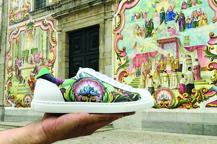
História
O padroado da igreja de Válega pertenceu até 1150 a particulares. Desde essa data e até 1288 pertenceu ao Mosteiro de São Pedro de Ferreira após o que, e até 1583, passou a pertencer ao bispo e ao cabido da Sé do Porto. Posteriormente ficou em exclusivo ao cabido que o manteve até 1833.
O templo terá sido fundada primitivamente no lugar do Seixo Branco, onde não restam vestígios, passando em época não posterior ao século XV para o lugar da Espinha, no local hoje designado por Adro Velho.
Em meados do século XVIII a sua implantação veio a localizar-se onde se encontra atualmente, tendo as obras se iniciada em 1746, e vindo a consumir mais de um século.
No século XX, entre 1923 e 1958, realizaram-se trabalhos de conservação por iniciativa J. O. Lopes e sua esposa, M. J. O. Lopes, em que se destacou a construção do atual teto de caixotões de madeira exótica. Data desse período ainda, em 1942, a colocação do painel de azulejos figurando a Senhora do Amparo, no topo externo da capela-mor, assinados pelo atelier de Jorge Colaço e executados pela Fábrica Lusitânia, em Lisboa.
Entre 1959 e 1960 teve lugar a campanha patrocinada por António Maria Augusto da Silva, comendador da Ordem de Benemerência, que compreendeu o revestimento por placas de mármore das paredes interiores da capela-mor, do sub-coro e dos lambris gerais, o revestimento na fachada principal nas paredes interiores da nave e na parte superior do arco triunfal, com azulejos polícromos figurados da Fábrica Aleluia, de Aveiro, e os vitrais das janelas assinados por S. Cuadrado, de Madrid.
Finalmente, em 1975 teve lugar o revestimento dos alçados laterais e posterior com azulejos da Fábrica Aleluia, desenhados pelo arquiteto Januário Godinho.
O templo não se encontra classificado.
Fonte:-https://pt.wikipedia.org/wiki/Igreja_Paroquial_de_V%C3%A1lega)
--------------------------------------------------------------------------------------
History [edit | edit source-code]
The patronage of the church of Válega belonged until 1150 to individuals. From that date until 1288 it belonged to the Monastery of São Pedro de Ferreira after which, and until 1583, it belonged to the bishop and to the seat of the Cathedral of Porto. Subsequently it remained in exclusive to the place that maintained it until 1833.
The temple was originally founded in the place of the White Pebble, where there are no remains, passing in time not later than the XV century to the place of the Spine, in the place nowadays called Adro Velho.
In the middle of the eighteenth century its implantation came to be located where it is currently, having the works begun in 1746, and coming to consume more than a century.
In the twentieth century, between 1923 and 1958, conservation work was carried out on the initiative of J. O. Lopes and his wife, M. J. O. Lopes, in which the construction of the current roof of exotic wood boxes was highlighted. In 1942, the tile panel was placed on the outside of the chapel, signed by Jorge Colaço's atelier and executed by the Lusitânia Factory in Lisbon.
Between 1959 and 1960, the campaign was sponsored by António Maria Augusto da Silva, commander of the Order of Benemerence, which included the covering by marble slabs of the inner walls of the chancel, the sub-chorus and the general wainscoting, the main facade on the interior walls of the nave and on the upper part of the triumphal arch, with figurative polychrome tiles from Fábrica Aleluia, from Aveiro, and stained glass windows signed by S. Cuadrado, from Madrid.
Finally, in 1975 took place the covering of the lateral and later elevations with tiles of Fábrica Aleluia, designed by the architect Januário Godinho.
The temple is not classified.
See the building here: www.flickr.com/photos/silwittmann/5562669867/
-------------------------------------------------------------------------------------------------------------------------------
perspective of the mill: www.flickr.com/photos/silwittmann/5562654709/
-----------------------------------------------------------------------------------------------------------------------------
Memorial da Imigração Holandesa – Moinho – (Colônia Castrolanda) / detalhes arquitetônicos
"Em Castrolanda situa-se um dos maiores moinhos de vento do mundo: inaugurado em 30 de novembro de 2001, De Immigrant (O Imigrante) é um grande monumento de 26 metros de envergadura, possui duas mós conseguindo produzir até 3.000 kg de farinha de trigo, e mecanismos, engrenagens, pinos e encaixes feitos quase que totalmente em madeira.
O projeto é assinado e executado pelo arquiteto holandês Jan Heijdra, especialista em moinhos de vento, como homenagem aos imigrantes holandeses da década de 1950 que colonizaram a região.
O moinho é acionado pelo moleiro Rafael Rabbers - único operador de moinho de vento diplomado do Brasil -, que trabalhou na construção e posteriormente foi treinado para operá-lo.
De Immigrant funciona perfeitamente e pode ser visitado por dentro até a cúpula.
Além do moinho,o MEMORIAL abriga salão de eventos, museu, restaurante, biblioteca e loja de artesanato."
(fonte: Wikipedia)
- "Castrolanda é uma colônia fundada por imigrantes neerlandeses (holandeses) (1951 a 1954) no município de Castro, no estado do Paraná. A atividade agrícola e pecuária leiteira são predominantes na colônia, sendo uma das mais importantes bacias leiteiras da região e uma considerável produção de grãos, principalmente soja e feijão. Tendo também uma das maiores cooperativas agrícolas do Brasil, que leva o nome da colônia."
(Wikipedia)
-----------------------------------------------------------------------
The Memorial of the Dutch Immigration - Mill - (Castrolanda Colony), / details of the building
is one of the largest windmills in the world, opened on November 30, 2001. De Immigrant (The Immigrant) is a large monument, 26 meters wide.
The mill has two grinding wheels being able to produce up to 3.000 kg of wheat flour, and mechanisms, gears, bolts and fittings made almost completely of wood.
The project is signed and executed by the Dutch architect Jan Heijdra, an expert on windmills, as tribute to the Dutch immigrants of the 1950s who colonized the region.
The mill is operated by the miller Rafael Rabbers - single operator windmill graduate from Brazil - who worked in construction and later was trained to operate it.
"De Immigrant" works perfectly and can be visited inside by a dome.
Besides the mill, the MEMORIAL has an event Hall, museum, restaurant, library and craft store. "
- Castrolanda is a colony that was founded by Netherlands immigrants between 1951 and 1954. Its economy is based on agricultural production and dairy farming which is one of the most important in this region that is considered the largest dairy in Brazil due to their genetic quality. It has a considerable production of grain, mostly soy and beans. Also having one of the largest agricultural cooperatives in Brazil, which bears the name of the colony.
(by Wikipedia)
pt.wikipedia.org/wiki/Igreja_Paroquial_de_V%C3%A1lega
english
The Parish Church of Válega , also referred to as the Church of Our Lady of Perpetual Help , located in the parish of Válega , Ovar municipality , district of Aveiro in Portugal .
history
The patronage of the church of Válega belonged until 1150 to individuals. From that date until 1288 belonged to the monastery of San Pedro de Ferreira after which , until 1583, became part of the bishop and chapter of the Porto Cathedral . Later became exclusively to fit that lasted until 1833.
The temple will have been founded originally in place of White Pebble , where no traces are left , passing in no later then the fifteenth century to the place of the spine , in the place today known as Old Churchyard .
In the mid-eighteenth century came to its deployment where he remains be located , and the works were started in 1746 , and coming to consume more than a century .
In the twentieth century , between 1923 and 1958 , there were conservation work by JO Lopes and his wife , MJO Lopes initiative, which highlighted the construction of the current ceiling coffered exotic wood . Date of this period still , in 1942 , placing the tile panel figuring Lady of Perpetual Help , the outer top of the chancel , signed by Jorge Colaco workshop and executed by Lusitania Factory in Lisbon .
Between 1959 and 1960 took place a campaign sponsored by António Maria Augusto da Silva , Commander of the Order of benevolence , which comprised coating of marble slabs of the interior walls of the chancel , the sub - chorus and general wainscoting , flooring in main facade on the interior walls of the nave and the top of the triumphal arch , with polychrome tiles figured Factory Hallelujah Aveiro , and the stained glass windows signed by S. Cuadrado , Madrid .
Finally , in 1975 took place the lining of the side and rear elevations with tile Hallelujah Factory , designed by architect Gennaro Godinho .
Português
A Igreja Paroquial de Válega, também referida como Igreja de Nossa Senhora do Amparo, localiza-se na freguesia de Válega, concelho de Ovar, distrito de Aveiro, em Portugal.
Historia
O padroado da igreja de Válega pertenceu até 1150 a particulares. Desde essa data e até 1288 pertenceu ao Mosteiro de São Pedro de Ferreira após o que, e até 1583, passou a pertencer ao bispo e ao cabido da Sé do Porto. Posteriormente ficou em exclusivo ao cabido que o manteve até 1833.
O templo terá sido fundada primitivamente no lugar do Seixo Branco, onde não restam vestígios, passando em época não posterior ao século XV para o lugar da Espinha, no local hoje designado por Adro Velho.
Em meados do século XVIII a sua implantação veio a localizar-se onde se encontra atualmente, tendo as obras se iniciada em 1746, e vindo a consumir mais de um século.
No século XX, entre 1923 e 1958, realizaram-se trabalhos de conservação por iniciativa J. O. Lopes e sua esposa, M. J. O. Lopes, em que se destacou a construção do atual teto de caixotões de madeira exótica. Data desse período ainda, em 1942, a colocação do painel de azulejos figurando a Senhora do Amparo, no topo externo da capela-mor, assinados pelo atelier de Jorge Colaço e executados pela Fábrica Lusitânia, em Lisboa.
Entre 1959 e 1960 teve lugar a campanha patrocinada por António Maria Augusto da Silva, comendador da Ordem de Benemerência, que compreendeu o revestimento por placas de mármore das paredes interiores da capela-mor, do sub-coro e dos lambris gerais, o revestimento na fachada principal nas paredes interiores da nave e na parte superior do arco triunfal, com azulejos polícromos figurados da Fábrica Aleluia, de Aveiro, e os vitrais das janelas assinados por S. Cuadrado, de Madrid.
Finalmente, em 1975 teve lugar o revestimento dos alçados laterais e posterior com azulejos da Fábrica Aleluia, desenhados pelo arquiteto Januário Godinho.
O templo não se encontra classificado.
Special edition poster marking 9 years of Tipocracia: a fantastic reinterpretation of the oldest known illustration of mechanical printing, Danse Macabre (1499), drawn by the group Bicicleta Sem Freio.
Screen-printed by Estúdio Elástico on Markatto Stile Bianco 240 g/m² paper in 3 colours.
Size: 640 × 460 mm / 25.2 × 18.1"
A limited edition of 100 copies numbered and signed by BSF.
Cartaz especial de 9 anos do Tipocracia: uma fantástica releitura da mais antiga ilustração conhecida de uma prensa mecânica (Danse Macabre, 1499), feita pelo pessoal do Bicicleta Sem Freio.
Impresso em serigrafia pelo Estúdio Elástico no papel Markatto Stile Bianco 240 g/m² em 3 cores.
Tamanho:
640 × 460 mm / 25.2 × 18.1"
Tiragem única de 100 exemplares numerados e assinados pelo BSF.
]t[
impressão digital sobre papel couchê 230g, assinado e numerado
42x29 cm
R$ 70
Para saber como adquirir envie email para Jordons: qaz@qaz-urbanart.com
Rijks Museum - National Museum of Netherlands
Vision
The Rijksmuseum links individuals with art and history.
Mission
At the Rijksmuseum, art and history take on new meaning for a broad-based, contemporary national and international audience.
As a national institute, the Rijksmuseum offers a representative overview of Dutch art and history from the Middle Ages onwards, and of major aspects of European and Asian art.
The Rijksmuseum keeps, manages, conserves, restores, researches, prepares, collects, publishes, and presents artistic and historical objects, both on its own premises and elsewhere.
From 1800 to 2013
The Rijksmuseum first opened its doors in 1800 under the name ‘Nationale Kunstgalerij’. At the time, it was housed in Huis ten Bosch in The Hague. The collection mainly comprised paintings and historical objects. In 1808, the museum moved to the new capital city of Amsterdam, where it was based in the Royal Palace on Dam Square.
After King Willem I’s accession to the throne, the paintings and national print collection were moved to the Trippenhuis on Kloveniersburgwal, while the other objects were returned to The Hague. The current building was put into use in 1885. The Netherlands Museum for History and Art based in The Hague moved into the same premises, forming what would later become the departments of Dutch History and Sculpture & Applied Art.
The beginning
On 19 November 1798, more than three years after the birth of the Batavian Republic, the government decided to honour a suggestion put forward by Isaac Gogel by following the French example of setting up a national museum. The museum initially housed the remains of the viceregal collections and a variety of objects originating from state institutions. When the Nationale Kunstgalerij first opened its doors on 31 May 1800, it had more than 200 paintings and historical objects on display. In the years that followed, Gogel and the first director, C.S. Roos, made countless acquisitions. Their first purchase, The Swan by Jan Asselijn, cost 100 Dutch guilders and is still one of the Rijksmuseum’s top pieces.
Move to Amsterdam
In 1808, the new King Louis Napoleon ordered the collections to be moved to Amsterdam, which was to be made the capital of the Kingdom of Holland. The works of art and objects were taken to the Royal Palace on Dam Square, the former city hall of Amsterdam, where they were united with the city’s foremost paintings, including the Night Watch by Rembrandt. In 1809, the Koninklijk Museum opened its doors on the top floor of the palace.
A few years after Willem I returned to the Netherlands as the new king in 1813, the ‘Rijks Museum’ and the national print collection from The Hague relocated to the Trippenhuis, a 17th-century town-palace on Kloveniersburgwal, home to what would later become the Royal Netherlands Academy of Arts and Sciences. Much to the regret of the director, Cornelis Apostool, in 1820 many objects including pieces of great historical interest were assigned to the Kabinet van Zeldzaamheden [Royal Gallery of Rare Objects], which had been founded in The Hague. In 1838, a separate museum for modern 19th-century art was established in Paviljoen Welgelegen in Haarlem. Contrary to the days of Louis Napoleon, very few large acquisitions were made during this period.
Cuypers Cathedral
The Trippenhuis proved unsuitable as a museum. Furthermore, many people thought it time to establish a dedicated national museum building in the Netherlands. Work on a new building did not commence until 1876, after many years of debate. The architect, Pierre Cuypers, had drawn up a historic design for the Rijksmuseum, which combined the Gothic and the Renaissance styles. The design was not generally well-received; people considered it too mediaeval and not Dutch enough. The official opening took place in 1885.
Nearly all the older paintings belonging to the City of Amsterdam were hung in the Rijksmuseum alongside paintings and prints from the Trippenhuis, including paintings such as Rembrandt’s Jewish Bride, which had been bequeathed to the city by the banker A. van der Hoop. The collection of 19th-century art from Haarlem was also added to the museum’s collection. Finally, a significant part of the Kabinet van Zeldzaamheden, which had by then been incorporated into the new Netherlands Museum for History and Art, was returned to Amsterdam.
Renovations
Over the years, collections continued to grow and museum insight continued to expand, and so the Rijksmuseum building underwent many changes. Rooms were added to the south-west side of the building between 1904 and 1916 (now the Philips wing) to house the collection of 19th-century paintings donated to the museum by Mr and Mrs Drucker-Fraser. In the 1950s and 1960s, the two original courtyards were covered and renovated to create more rooms.
In 1927, while Schmidt-Degener was Managing Director, the Netherlands Museum was split to form the departments of Dutch History and Sculpture & Applied Art. These departments were moved to separate parts of the building after 1945. The arrival of a collection donated by the Association of Friends of Asian Art in the 1950s resulted in the creation of the Asian Art department.
The 1970s saw record numbers of visitors of almost one-and-a-half million per year, and the building gradually started to fall short of modern requirements.
‘Verder met Cuypers'
The current renovation reinstates the original Cuypers structure. The building work in the courtyards are removed. Paintings, applied art and history are no longer displayed in separate parts of the building, but form a single chronological circuit that tells the story of Dutch art and history.
The building is thoroughly modernized, while at the same time restoring more of Cuypers original interior designs: the Rijksmuseum has dubbed the venture ‘Verder met Cuypers‘ [Continuing with Cuypers]. The Rijksmuseum will be a dazzling new museum able to satisfy the needs of its 21st-century visitors!
Every year, the Rijksmuseum compiles an annual report for the previous year. Annual reports dating back to 1998 can be found here (in Dutch only). Reports relating to the years before 1998 are available in the reading room of the library.
O grupo de Laocoonte (Ver a foto da Escultura no Museu do Vaticano): www.flickr.com/photos/59863704@N00/3350602156/in/photolis...
Agesandro, Atenodoro e Polidoro: Grupo de Laocoonte, Museu Pio-Clementino
Um texto, em português, da Wapedia, que pode ser visto no endereço wapedia.mobi/pt/Grupo_de_Laocoonte
O grupo de Laocoonte é uma escultura em mármore, também conhecida como Laocoonte e seus filhos, hoje em dia exposta no Museu do Vaticano, em Roma. A estátua representa Laocoonte e seus dois filhos, Antiphantes e Thymbraeus, sendo estrangulados por duas serpentes marinhas, um episódio dramático da Guerra de Tróia relatado na Ilíada de Homero e na Eneida de Virgílio. Laocoonte, um sacerdote de Apolo, foi o único que pressentiu o perigo que o cavalo de Tróia representava para a cidade e que protestou contra a ideia de o levar para dentro das muralhas. Segundo a lenda, Poseidon, um deus que favorecia os gregos, enviou então duas serpentes para calar a voz da oposição. O cavalo acabou por ser levado para Tróia, com as consequências trágicas que se conhece.
O grupo de Laocoonte é descrito por Plínio o velho, no volume 36 da sua Naturalis Historia, como uma obra de arte superior a qualquer pintura ou bronze conhecido do autor. A escultura encontrava-se então no palácio do Imperador Tito. A autoria da obra é atribuída por Plínio a Agesandro, Atenodoro e Polidoro, três escultores da ilha de Rodes. Através do cruzamento desta informação com o período de vida dos escultores, a estátua fica datada na segunda metade do século I a.C., mais provavelmente entre 42 e 20 a.C. A escultura foi provavelmente encomendada por um cidadão romano rico, mas não se sabe exactamente como foi parar às mãos imperiais. Após esta menção de Plínio, o grupo de Laocoon desaparece nos 1400 anos seguintes.
No dia 14 de Janeiro de 1506, o romano Felice de Fredi descobriu uma estátua durante trabalhos de manutenção da sua vinha, localizada na zona das antigas termas de Tito. A escultura desconhecida estava desfeita em cinco pedaços, mas todos os habitantes da Roma renascentista sabiam reconhecer uma obra clássica quando a viam e de Fredi passou a palavra a Giuliano de Sangallo, arquitecto do papa Júlio II. Sangallo acorreu ao local da descoberta de imediato trazendo consigo Michelangelo Buonarroti, que por coincidência almoçava na sua casa nesse dia. De imediato, os dois reconheceram a estátua desfeita como o grupo de Laocoon descrito por Plínio e enviaram a notícia da descoberta a Júlio II, que comprou a estátua na hora por 4140 ducados.
A redescoberta do grupo de Laocoonte causou sensação em Roma e a sua apresentação à cidade como parte da colecção dos jardins do Vaticano foi um acontecimento social. Felice de Fredi foi recompensado com uma pensão vitalícia de 600 ducados por ano e quando morreu, o seu papel na descoberta da estátua ficou mencionada no seu túmulo.
Apesar de ser considerada já então uma obra impressionante, o grupo de Laocoonte era uma estátua incompleta pois faltava o braço direito da figura do próprio Laocoonte. A omissão provocou o debate da comunidade artística romana, polarizado entre duas opiniões: Michelangelo sugeriu que o braço estivesse dobrado sobre o ombro do personagem, enquanto que a maioria defendia que estivesse, pelo contrário, distendido numa posição mais heróica. Júlio II organizou então uma competição informal onde os escultores pudessem propôr a sua solução para o problema. Rafael, como júri do concurso, acabou por escolher uma proposta que representava o braço esticado, e a estátua foi completada desta forma. Em 1957, o verdadeiro braço perdido de Laocoon foi descoberto num antiquário italiano e, como Michelangelo previra, estava de facto dobrado sobre o ombro.
O grupo de Laocoonte depressa se transformou numa celebridade na Europa e num motivo de cobiça. No âmbito dos tratados assinados com França, o papa Leão X prometeu oferecer a estátua ao rei Francisco I de França. Mas como este papa era um amante de arte clássica, e não pretendia separar-se da obra prima, encomendou uma cópia ao escultor Baccio Bandinelli, que acabou por ser o modelo de muitas outras versões menores em bronze. O tratado com os franceses acabou por não ser cumprido e esta cópia encontra-se hoje exposta na galeria Uffizi em Florença.
Em 1799, Napoleão Bonaparte conquistou a Itália e levou o grupo de Laocoonte para o Museu do Louvre, em Paris, como espólio de guerra. A estátua acabou por ser devolvida ao Vaticano por iniciativa britânica, depois da queda de Bonaparte em 1816.
O Wikimedia Commons possui uma categoria contendo imagens e outros ficheiros sobre Grupo de Laocoonte (Ver outra foto no Museu do Vaticano) www.flickr.com/photos/59863704@N00/3350602156/in/photolis... )
O grupo de Laocoonte foi uma das influências principais nos trabalhos de Michelangelo posteriores à sua descoberta. O escultor italiano ficou bastante impressionado com a monumentalidade da escultura e a estética helenística das personagens, em particular a figura de Laocoonte.
A estátua foi ainda objecto de comentários da autoria de Winckelmann e Goethe, e de profundas observações em "Laocoonte", um ensaio de Gotthold Lessing escrito em 1766, que se tornou um clássico da teoria estética.
O Rijksmuseum é um dos maiores e mais importantes museus da Europa.
É o maior dos Países Baixos, com acervo voltado quase todo aos artistas holandeses. As obras vão desde exemplares da arte sacra até a era dourada holandesa, além de uma substancial coleção de arte asiática.
Esse é o Rijksmuseum, o Museu Nacional dos Países Baixos. E aproveite, caro leitor, porque o Rijks esteve parcialmente fechado para reforma durante 10 anos – voltou a funcionar só em 2013. Ou seja, quem esteve em Amsterdam na última década não conheceu o Rijks, pelo menos não completamente
.
Mas o quê tem lá? Muita coisa. Destaque para as coleções de arte e História holandesas. Os trabalhos dos pintores Frans Hals e Johannes Vermeer são alguns dos mais concorridos, mas imbatível mesmo é Rembrandt van Rijn, considerado um dos maiores pintores de todos os tempos. Se você não é um fã de museus de arte, mas faz questão de conhecer o trabalho desses grandes artistas, uma dica: assim que chegar ao Rijks, vá direto para a ala onde estão as obras-primas. Assim você vê o mais importante no início da visita, quando ainda está descansado e poderá dedicar o tempo necessário para essas obras.
A mais famosa delas é a “A Ronda Noturna”, de Rembrandt, uma obra que inspirou músicas, pinturas, filmes e até um flash mob. Quando o Rijks foi reaberto, artistas recriam a cena mostrada no quadro dentro de um shopping de Amsterdam. A ação está no vídeo abaixo e eu te garanto que vale a pena dar play.
Read more: www.360meridianos.com/2014/01/museus-de-amsterdam.html#ix...
Read more: www.360meridianos.com/2014/01/museus-de-amsterdam.html#ix...
Rijksmuseum, Museu Nacional
42 Stadhouderskade
Amsterdam
O museu Rijksmuseum de Amsterdã é o Museu Nacional da Holanda, onde você encontrará uma impressionante coleção permanente, formada por 5.000 pinturas e 30.000 obras de arte, além de 17.000 objetos históricos.
Esse museu nacional foi fundado em 1885 e está instalado em um edifício de estilo neogótico. A sua principal atração é a extensa coleção de quadros pintados por artistas holandeses, abrangendo um período que vai do séc. XV aos dias de hoje. A obra de arte mais famosa em exibição é o quadro A Ronda Noturna, de Rembrandt.
O museu Rijksmuseum está dividido em cinco departamentos: pintura, escultura, arte aplicada, arte oriental, história dos Países Baixos e gravuras. O núcleo da coleção é a pintura e suas obras mais representativas são as que pertencem ao Século de Ouro holandês, com quadros de artistas como Rembrandt, Vermeer ou Frans Hals.
Ver fonte: dreamguides.edreams.pt/holanda/amsterda/rijksmuseum
Museu Rijks, Amesterdão
O Museu Rijks (Museu Nacional) é um edifício histórico, sendo o maior museu nos Países Baixos. O Museu é o maior no numero relativamente às suas colecções, na área do edifício em si, no financiamento e no numero de funcionários empregados.
Cada ano, mais de um milhão de pessoas visitam o Museu Rijks. O Museu emprega cerca de 400 pessoas, incluindo 45 conservadores de museu que são especializados em todas as áreas.
O Museu Rijks é internacionalmente reconhecido pelas suas exibições e publicações, mas não só apenas por estes produtos de grande qualidade, mas também pelas áreas no museu em si que são fonte de inspiração e encorajam a criação de novas ideias.
O museu também tem recursos consideráveis para a educação, para a decoração e apresentação de exibições. Importantes designers são regularmente chamados a trabalharem em projectos no Museu Rijks.
O edifício principal do Museu Rijks está a ser renovado. A boa noticia é que a melhor parte da exposição está apresentada na redesenhada ala Philips. O nome desta exposição denomina-se "The Masterpieces'.
O museu abre diariamente das 10 da manhã até ás 5 da tarde.
A entrada é pela Stadhouderskade 42.
Rijksmuseum
Origem: Wikipédia, a enciclopédia livre.
O Rijksmuseum é um museu nacional dos Países Baixos, localizada em Amsterdão na Praça do museu. O Rijksmuseum é dedicado à artes e história. Ele tem uma larga coleção de pinturas da idade de ouro neerlandesa e uma substancial coleção de arte asiática.
O museu foi fundado em 1800 na cidade da Haia para exibir a coleção do primeiro-ministro. Foi inspirado no exemplo francês. Pelos neerlandeses ficou conhecida como Galeria de Arte. Em 1808 o museu mudou-se para Amsterdã pelas ordens do rei Louis Napoleón, irmão de Napoleão Bonaparte. As pinturas daquela cidade, como A Ronda Nocturna de Rembrandt, tornaram-se parte da coleção.
Em 1885 o museu mudou-se para sua localização atual, construído pelo arquiteto neerlandês Pierre Cuypers. Ele combinou elementos góticos e renascentistas. O museu tem um posição proeminente na Praça do Museu, próximo ao Museu van Gogh e ao Museu Stedelijk. A construção é ricamente decorada com referências da história da arte neerlandesa. A Ronda Nocturna de Rembrandt tem seu próprio corredor no museu desde 1906. Desde 2003 o museu sofreu restaurações, mas as obras-primas são constatemente presentes para o público.
A coleção de pinturas inclui trabalhos de artistas como Jacob van Ruysdael, Frans Hals, Johannes Vermeer e Rembrandt e de alunos de Rembrandt.
Em 2005, 95% do museu está fechado para renovação, mas as pinturas da coleção permanente ainda estão em mostra em uma exibição especial chamada As Obras-primas.
Algumas das pinturas do museu:
Rembrandt van Rijn
A Ronda Nocturna
Os síndicos da guilda dos fabricantes de tecidos
A noiva judia
A lição de Anatomia do Dr. Deyman
Pedro negando Cristo
Saskia com um véu
Retrato de Titus em hábito de monge
Auto-retrato como Apóstolo Paulo
Tobias, Ana e o Bode
Johannes Vermeer:
A Leiteira
A Carta de Amor
Mulher de Azul a ler uma carta
A Rua pequena
Frans Hals:
Retrato de um jovem casal
A Companhia Reynier Real
O bebedor alegre
Retrato de Lucas De Clercq
Retrato de Nicolaes Hasselaer
Retrato de um homem
Página oficial do Rijksmuseum
Virtual Collection of Masterpieces (VCM)
O melhor museu de Amsterdam: Rijksmuseum
O Commons possui uma categoria contendo imagens e outros ficheiros sobre Rijksmuseum
Rijksmuseum Amsterdam
1/4
Se você visitar Amsterdam, precisará conhecer o Museu Nacional da Holanda: Rijksmuseum Amsterdam. O Museu Nacional fica na Praça do Museu, situada no centro de Amsterdam. O Museu Nacional, ou Rijksmuseum, possui uma maravilhosa coleção de arte e história holandesas. Após uma visita ao Rijksmuseum, você saberá mais sobre história e arte e terá visto alguns dos maiores marcos culturais da Holanda.
Obras-primas do Museu Nacional
Ao todo, a coleção do Rijksmuseum apresenta a história da Holanda em um contexto internacional, desde 1.100 até o presente. Há alguns ícones da história e cultura da Holanda que você não pode perder:
Ronda Noturna (de Nachtwacht) de Rembrandt é uma das mais famosas obras desse mestre holandês e é de tirar o fôlego.
O Rijksmuseum tem uma das melhores coleções de pinturas dos grandes mestres do século XVII, como Frans Hals, Jan Steen, Vermeer e Rembrandt.
Assim como o Museu Histórico de Haia, o Rijksmuseum apresenta lindas casas de bonecas, mobiliadas em detalhes, datando de 1676.
Se você não puder ir ao Delft Real, pode ainda apreciar algumas das melhores cerâmicas de Delft, de conjuntos de chá a vasos, no Museu Nacional.
Museu que é visita obrigatória em Amsterdam
Quer sua estadia em Amsterdam seja breve ou longa, você deve visitar o Rijksmuseum. Chegue cedo para evitar enfrentar filas. Combine a visita ao Rijksmuseum com várias outras atrações próximas, como o Museu Van Gogh, o Museu Stedelijk Amsterdam e a Coster Diamonds
Para obter mais informações sobre Amsterdam, retorne à página sobre Amsterdam ou à página sobre os museus de Amsterdam.
LOLY HOSTERNO - o.s.t., 24 X 34 cm, assinado e datado (1975) no c.i.d. Cachê da artista no verso.
Maria Hosterno, Loli Bittencourt Hosterno
= = = = = = = = = = = = = = = = = = = = = = = = = = = =
Francisco Aragão © 2013. All Rights Reserved.
Use without permission is illegal.
Attention please !
If you are interested in my photos, they are available for sale. Please contact me by email: aragaofrancisco@gmail.com. Do not use without permission.
Many images are available for license on Getty Images
= = = = = = = = = = = = = = = = = = = = = = = = = = = =
Portuguese
A Igreja de São Roque é uma igreja católica em Lisboa, dedicada a São Roque e mandada edificar no final do século XVI, com colaboração de Afonso Álvares e Bartolomeu Álvares. Pertenceu à Companhia de Jesus, sendo a sua primeira igreja em Portugal, e uma das primeiras igrejas jesuítas em todo o mundo. Foi a igreja principal da Companhia em Portugal durante mais de 200 anos, antes de os Jesuítas terem sido expulsos do país no século XVIII. A igreja de São Roque foi um dos raros edifícios em Lisboa a sobreviver ao Terramoto de 1755 relativamente incólume. Tanto a igreja como a residência auxiliar foram cedidas à Santa Casa da Misericórdia de Lisboa, para substituir os seus edifícios e igreja destruídos no sismo. Continua a fazer parte da Santa Casa hoje em dia.
Aquando da sua construção no século XVI, foi a primeira igreja jesuíta a ser desenhada no estilo "igreja-auditório", especificamente para pregação. Tem diversas capelas, sobretudo no estilo barroco do século XVII inicial, sendo a mais notável a de São João Baptista, do século XVIII, projecto inicial de Nicola Salvi e Luigi Vanvitelli, depois alterado com a intervenção do arquitecto-mor João Frederico Ludovice, como se pode verificar pela correspondência entre Ludovice e Vanvitelli, publicada por Sousa Viterbo e R. Vicente de Almeida em 1900. Ludovice enviou uma série de desenhos para Itália com as alterações impostas, uma vez que Vanvitelli se recusara a alterar o projecto inicial. Foi encomendada em Itália por D. João V em 1742. Chegou a Lisboa em 1747 e só ficou assente em 1749. É uma obra-prima da arte italiana, única no mundo, constituída por quadros de mosaico executados por Mattia Moretti, sobre cartões de Masucci, representando o Batismo de Cristo, o Pentecostes e a Anunciação. Suspenso da abóbada, de caixotões de jaspe moldurados de bronze, é de admirar um lampadário de excelente execução da ourivesaria italiana, enquadrado por um admirável conjunto de estátuas de mármore. Supõe-se que à época tenha sido a mais cara capela da Europa.
A fachada, simples e austera, segue os cânones impostos então pela igreja reformada. Em contraste, o interior é enriquecido por talha dourada, pinturas e azulejos e constituiu um importante museu de artes decorativas maneiristas e barrocas. Tem azulejos dos séculos XVI e XVII, assinados por Francisco de Matos.
O tecto, com pintura de interessante simbologia apresenta caixotões. A talha, maneirista e barroca, é rica e variada, com retábulos de altares e emoldura pinturas. Há mármores coloridos embrechados à italiana e um boa coleção de alfaias litúrgicas.
Ao lado do edifício, no Largo Trindade Coelho, está o Museu de Arte Sacra de São Roque, que tem compartimentos ligados com a igreja.
English
The Igreja de São Roque (Church of Saint Roch) in Lisbon was the earliest Jesuit church in the Portuguese world, and one of the first Jesuit churches anywhere. It served as the Society’s home church in Portugal for over 200 years, before the Jesuits were expelled from that country. After the 1755 Lisbon Earthquake, the church and its ancillary residence were given to the Santa Casa da Misericórdia de Lisboa (the Charity House of Lisbon) to replace their church and headquarters which had been destroyed. It remains a part of the Santa Casa today, one of its many heritage buildings.
The Igreja de São Roque was one of the few buildings in Lisbon to survive the Earthquake relatively unscathed. When built in the 16th century it was the first Jesuit church designed in the “auditorium-church” style specifically for preaching. It contains a number of chapels, most in the Baroque style of the early 17th century. The most notable chapel is the 18th-century Chapel of St. John the Baptist (Capela de São João Baptista), a project by Nicola Salvi and Luigi Vanvitelli constructed in Rome of many precious stones and disassembled, shipped and reconstructed in São Roque; at the time it was reportedly the most expensive chapel in Europe.
Wikipedia
● Celestial Blue ●
(Dedicated to my friend brother Diego Dalmaso)
Ring (white gold, sapphire and diamonds) signed by Sara Jóias.
The oldies believed that the firmament was a big blue sapphire that involved the earth. The name comes from the greek sappheiros, that means blue stone. However, the sapphires have different colors, from white to black.
I love to photograph jewerly; they're delicated and shining. It's almost impossible not to get a good result.
See on 3D
The publication or reproduction of the works that are in this page without the autorization of the author is crime.
● Azul Celeste ●
(Dedicado ao meu amigo irmão Diego Dalmaso)
Anel (ouro branco, safira e diamantes) assinado por Sara Jóias.
Os antigos acreditavam que o firmamento era uma enorme safira azul na qual a terra estava envolta. O nome vem do grego sappheiros, que significa pedra azul. No entanto, as safiras se apresentam de diversas cores, desde o branco até o preto.
Adoro fotografar jóias; são delicadas e brilhantes. É quase impossível não conseguir um bom resultado.
Veja em 3D
A publicação ou reprodução dos trabalhos dispostos nesta página sem a devida autorização é crime.
CNBB apoia abaixo-assinado contra texto do Código Florestal
17/06/2011 - 14h47
enviada por nosso Querido Amigo Renê...vejam sua maravilhosa galeria!
A exemplo da campanha da Ficha Limpa, a CNBB (Conferência Nacional dos Bispos do Brasil) vai incentivar um abaixo-assinado contra o atual texto do Código Florestal, que está em tramitação no Senado.
Os bispos criticam dois pontos da proposta: a mudança nas regras para as APPs (Áreas de Preservação Permanente) e a chamada anistia aos desmatamentos antigos.
"Anistiar é um problema. Não é possível que todo esse desmatamento seja esquecido", afirmou dom Leonardo Steiner, secretário-geral da CNBB e bispo prelado de São Félix do Araguaia (MT).
A lei da Ficha Limpa, sancionada em 2010, veta a candidatura de políticos condenados por um colegiado da Justiça (mais de um juiz). A regra foi resultado de iniciativa popular que obteve em um abaixo-assinado 1,6 milhão de assinaturas, a maior parte delas captada em paróquias de todo o país.
"Se não fosse a Igreja, a Ficha Limpa não teria tantas assinaturas. Gostaríamos de fazer um pouco de pressão agora", disse dom Steiner.
O secretário-geral da CNBB criticou o fato de a votação na Câmara dos Deputados ter sido influenciada pelo "jogo político".
Questionado sobre o motivo de o abaixo-assinado não ter sido organizado antes da votação do Código Florestal na Câmara, ele respondeu: "Não esperávamos que a Câmara tomasse a atitude que tomou."
MORTES NO CAMPO
A CNBB criticou ainda o governo pela falta de "medidas preventivas", que poderiam ter evitado as recentes mortes de líderes extrativistas na região Norte do país.
"O governo já tomou algumas medidas cabíveis, mas não pode agir somente quando acontecem esses fatos dolorosos", disse o cardeal Raymundo Damasceno, presidente da CNBB.
***
CNBB supports petition against the text of the Forest Code
17/06/2011 - 14h47
sent by our dear friend Rene ... seeing your wonderful gallery!
Like the Clean Record campaign, the CNBB (National Conference of Bishops of Brazil) will encourage a petition against the current text of the Forest Code, which is under debate in the Senate.
Bishops criticize two points of the proposal: change the rules for the APP (Permanent Preservation Areas) and the call amnesty to former deforestation.
"Amnesty is a problem. It is not possible that all this deforestation is forgotten," said Archbishop Leonardo Steiner, Secretary General of the CNBB bishop and bishop of Sao Felix do Araguaia (MT).
The Clean Sheet law, enacted in 2010, prohibits the application of politicians convicted of a college of Justice (two judges). The rule was the result of popular initiative that obtained in a 1.6 million petition signatures, most of them captured in parishes across the country.
"If not for the Church, a clean slate would not have so many signatures. We would like to do a bit of pressure now," said Don Steiner.
The Secretary-General of the CNBB criticized the fact that the vote in the House have been influenced by "political game".
Asked why the petition was not organized before the vote in the House of the Forest Code, he replied: "We did not expect the House to take the attitude he took."
DEATHS IN THE FIELD
The CNBB also criticized the government for lack of "preventive measures" that could have prevented the recent deaths of leaders extraction in the North of the country.
"The government has taken some appropriate measures, but can not act only when these painful events happen," said Cardinal Raymundo Damasceno, president of the CNBB.
***
CNBB soutient la pétition contre le texte du Code forestier
17/06/2011 - 14h47
envoyé par notre cher ami René ... voir votre merveilleuse galerie!
Comme la campagne casier judiciaire vierge, la CNBB (Conférence Nationale des Évêques du Brésil) va encourager une pétition contre le texte actuel du Code forestier, qui est en débat au Sénat.
Évêques critiquent deux points de la proposition: modifier les règles de l'APP (aires de conservation permanentes) et l'amnistie appel à la déforestation ancienne.
«L'amnistie est un problème. Il n'est pas possible que tout cela est oublié la déforestation", a déclaré l'archevêque Leonardo Steiner, Secrétaire général de l'évêque CNBB et évêque de Sao Felix do Araguaia (MT).
La loi de but encaissé, promulguée en 2010, interdit l'application de politiques condamnés pour un collège de la Justice (deux juges). La règle a été le résultat d'une initiative populaire qui a obtenu 1,6 million de signatures de pétition, la plupart d'entre eux capturé dans les paroisses à travers le pays.
"Si ce n'est pas pour l'Église, une table rase n'aurait pas autant de signatures. Nous aimerions faire un peu de pression maintenant", a déclaré Don Steiner.
Le Secrétaire général de la CNBB a critiqué le fait que le vote à la Chambre ont été influencés par «jeu politique».
Lorsqu'on lui demande pourquoi la pétition n'était pas organisé avant le vote à la Chambre du Code forestier, il a répondu: "On ne s'attendait pas à la Chambre de prendre l'attitude qu'il a pris."
DÉCÈS DANS LE DOMAINE
La CNBB a également critiqué le gouvernement pour le manque de «mesures préventives» qui auraient pu empêcher le décès récent de l'extraction des leaders dans le nord du pays.
"Le gouvernement a pris certaines mesures appropriées, mais ne peut agir que lorsque ces événements douloureux arriver", a déclaré le cardinal Raymundo Damasceno, président de la CNBB.
Catamara Trip. Seals. Walvis Bay, Erongo. Namibia. Nov/2015.
Walvis Bay (Afrikaans Walvisbaai, German Walfischbucht or Walfischbai, all meaning "Whale Bay") is a city[2] in Namibia and the name of the bay on which it lies. The town has 85,000 inhabitants and has a total area of 29 square kilometres (11 sq mi) of land.[3]
The bay is a safe haven for sea vessels because of its natural deepwater harbour, protected by the Pelican Point sand spit, being the only natural harbour of any size along the country's coast. Being rich in plankton and marine life, these waters also drew large numbers of Southern right whales,[4] attracting whalers and fishing vessels. The Dutch referred to it as Walvisch Baye and the English as Whale Bay. In its eventual formal incorporation, it was named Walfish Bay, which was changed to Walvish Bay, and ultimately to Walvis Bay. It has also been referred to as Walwich Bay[5] or Walwisch Bay.[6]
A succession of colonists developed the location and resources of this strategic harbour settlement. The harbour's value in relation to the sea route around the Cape of Good Hope had caught the attention of world powers since it was discovered by the outside world in 1485. This explains the complicated political status of Walvis Bay down the years.
The town is situated just north of the Tropic of Capricorn in the Kuiseb River delta and lies at the end of the TransNamib Railway to Windhoek, and on the B2 road.
Walvis Bay, with its large bay and sand dunes, is an important centre of tourism activity in Namibia. Attractions include the artificial Bird Island, centre of a guano collection industry, the Dune 7 sand dune, the salt works, the abundant birdlife, and a museum. Kuisebmund Stadium, home to two clubs in the Namibia Premier League, is also located in the city. The beach resort of Langstrand lies just a few kilometres north. The Walvis Bay Export Processing Zone is an important facet of the local economy.
Walvis Bay (do africâner Walvisbaai, que significa "Baía das Baleias"; em alemão, Walfischbucht) é uma importante cidade portuária na Namíbia
Em 1990, o Sudoeste Africano tornou-se independente com o nome de Namíbia, mas Walvis Bay continuou sob controle da África do Sul até 28 de Fevereiro de 1994, depois de os proprietários locais aplicarem pressão na potência administrativa.
O acordo de cessão foi assinado oficialmente no governo de Nelson Mandela, passando ao domínio namíbio em 29 de fevereiro de 1994, juntamente com as ilhas dos Pinguins.
Flamingos and Pelicans. Walvis Bay, Erongo. Namibia. Nov/2015
Walvis Bay (Afrikaans Walvisbaai, German Walfischbucht or Walfischbai, all meaning "Whale Bay") is a city[2] in Namibia and the name of the bay on which it lies. The town has 85,000 inhabitants and has a total area of 29 square kilometres (11 sq mi) of land.[3]
The bay is a safe haven for sea vessels because of its natural deepwater harbour, protected by the Pelican Point sand spit, being the only natural harbour of any size along the country's coast. Being rich in plankton and marine life, these waters also drew large numbers of Southern right whales,[4] attracting whalers and fishing vessels. The Dutch referred to it as Walvisch Baye and the English as Whale Bay. In its eventual formal incorporation, it was named Walfish Bay, which was changed to Walvish Bay, and ultimately to Walvis Bay. It has also been referred to as Walwich Bay[5] or Walwisch Bay.[6]
A succession of colonists developed the location and resources of this strategic harbour settlement. The harbour's value in relation to the sea route around the Cape of Good Hope had caught the attention of world powers since it was discovered by the outside world in 1485. This explains the complicated political status of Walvis Bay down the years.
The town is situated just north of the Tropic of Capricorn in the Kuiseb River delta and lies at the end of the TransNamib Railway to Windhoek, and on the B2 road.
Walvis Bay, with its large bay and sand dunes, is an important centre of tourism activity in Namibia. Attractions include the artificial Bird Island, centre of a guano collection industry, the Dune 7 sand dune, the salt works, the abundant birdlife, and a museum. Kuisebmund Stadium, home to two clubs in the Namibia Premier League, is also located in the city. The beach resort of Langstrand lies just a few kilometres north. The Walvis Bay Export Processing Zone is an important facet of the local economy.
Walvis Bay (do africâner Walvisbaai, que significa "Baía das Baleias"; em alemão, Walfischbucht) é uma importante cidade portuária na Namíbia.
Em 1990, o Sudoeste Africano tornou-se independente com o nome de Namíbia, mas Walvis Bay continuou sob controle da África do Sul até 28 de Fevereiro de 1994, depois de os proprietários locais aplicarem pressão na potência administrativa.
O acordo de cessão foi assinado oficialmente no governo de Nelson Mandela, passando ao domínio namíbio em 29 de fevereiro de 1994, juntamente com as ilhas dos Pinguins.
Archeological site of the indian-jesuit reduction of St. Miguel Arcanjo, declared World Heritage Site by Unesco in 1983.
The site is located in the small town of São Miguel das Missões, in southern Brasil. This village was founded in the end of the 17th century, but the main building of the church was build between 1735-1745. The church - in the barroque style - was build in sandstone by the indians and jesuits, following the project of Gean Battista Primoli (an italian priest and architect) and was richly decorated.
After the Treaty of Madrid (signed in 1750 by Portugal and Spain), the reduction was partly destructed by armies, then abandoned and pillaged.
-----------------------------------
Sítio arqueológico da redução jesuíta de São Miguel Arcanjo, declarado
Patrimônio Mundial da Humanidade em 1983 pela UNESCO. Está localizado na cidade de São Miguel das Missões-RS.
Embora a redução tenha sido fundada no final do Séc. XVII, a construção da nave principal iniciou-se em 1735 e durou 10 anos. A igreja, em puro estilo barroco, foi construída em pedra grés pelos guaranis e jesuítas, seguindo o projeto de Gean Battista Primoli (um padre e arquiteto italiano) e era ricamente decorada.
Após as conseqüências do Tratado de Madrid (assinado por Portugal e Espanha em 1750) para o território dos Sete Povos das Missões, a redução entrou em decadência, num misto de destruição armada, desocupação, seguido, a partir do Século XIX, por saques da população local e gradual abandono.
Catamara Trip. Pelicans. Walvis Bay, Erongo. Namibia. Nov/2015
Walvis Bay (Afrikaans Walvisbaai, German Walfischbucht or Walfischbai, all meaning "Whale Bay") is a city[2] in Namibia and the name of the bay on which it lies. The town has 85,000 inhabitants and has a total area of 29 square kilometres (11 sq mi) of land.[3]
The bay is a safe haven for sea vessels because of its natural deepwater harbour, protected by the Pelican Point sand spit, being the only natural harbour of any size along the country's coast. Being rich in plankton and marine life, these waters also drew large numbers of Southern right whales,[4] attracting whalers and fishing vessels. The Dutch referred to it as Walvisch Baye and the English as Whale Bay. In its eventual formal incorporation, it was named Walfish Bay, which was changed to Walvish Bay, and ultimately to Walvis Bay. It has also been referred to as Walwich Bay[5] or Walwisch Bay.[6]
A succession of colonists developed the location and resources of this strategic harbour settlement. The harbour's value in relation to the sea route around the Cape of Good Hope had caught the attention of world powers since it was discovered by the outside world in 1485. This explains the complicated political status of Walvis Bay down the years.
The town is situated just north of the Tropic of Capricorn in the Kuiseb River delta and lies at the end of the TransNamib Railway to Windhoek, and on the B2 road.
Walvis Bay, with its large bay and sand dunes, is an important centre of tourism activity in Namibia. Attractions include the artificial Bird Island, centre of a guano collection industry, the Dune 7 sand dune, the salt works, the abundant birdlife, and a museum. Kuisebmund Stadium, home to two clubs in the Namibia Premier League, is also located in the city. The beach resort of Langstrand lies just a few kilometres north. The Walvis Bay Export Processing Zone is an important facet of the local economy.
Walvis Bay (do africâner Walvisbaai, que significa "Baía das Baleias"; em alemão, Walfischbucht) é uma importante cidade portuária na Namíbia.
Em 1990, o Sudoeste Africano tornou-se independente com o nome de Namíbia, mas Walvis Bay continuou sob controle da África do Sul até 28 de Fevereiro de 1994, depois de os proprietários locais aplicarem pressão na potência administrativa.
O acordo de cessão foi assinado oficialmente no governo de Nelson Mandela, passando ao domínio namíbio em 29 de fevereiro de 1994, juntamente com as ilhas dos Pinguins.
A full interview with the Israeli painter Raphael Perez (in Hebrew Rafi Peretz) about the ideas behind the naive painting, resume, personal biography and CV
Question: Raphael Perez Tell us about your work process as a naive painter?
Answer: I choose the most iconic and famous buildings in every city and town that are architecturally interesting and have a special shape and place the iconic buildings on boulevards full of trees, bushes, vegetation, flowers.
Question: How do you give depth in your naive paintings?
Answer: To give depth to the painting, I build the painting with layers of vegetation, after those low famous buildings, followed by a tall avenue of trees, and behind them towers and skyscrapers, in the sky I sometimes put innocent signs of balloons, kites.
A recurring motif in some of my paintings is the figure of the painter who is in the center of the boulevard and paints the entire scene unfolding in front of him, also there are two kindergarten teachers who are walking with the kindergarten children with the state flags that I paint, and loving couples hugging and kissing and family paintings of mother, father and child walking in harmony on the boulevard.
Question: Raphael Perez What characterizes your naive painting?
Answer: Most naive paintings have the same characteristics
(Definition as it appears in Wikipedia)
• Tells a simple story to absorb from everyday life, usually with humans.
• The representation of the painter's idealization to reality - the mapping of reality.
• Failure to maintain perspective - especially details even in distant details.
• Extensive use of repeating patterns - many details.
• Warm and bright colors.
• Sometimes the emphasis is on outlines.
• Most of the characters are flat, lack volume
• No interest in texture, expression, correct proportions
• No interest in anatomy.
• There is not much use of light and shadow, the colors create a three-dimensional effect.
I find these definitions to be valid for all my naive paintings
Question: Raphael Perez Why do you mainly choose the city of Tel Aviv?
Answer: I was born in Jerusalem, the capital city which I love very much and also paint,
I love the special Bauhaus buildings in Tel Aviv, the ornamental buildings that were built a century ago in the 1920s and 1930s, the beautiful boulevards, towers and modern skyscrapers give you the feeling of the hustle and bustle of a large metropolis and there are quite a few low and tall buildings that are architecturally fascinating in their form the special one
Also, the move to Tel Aviv, which is the capital of culture, freedom, and secularism, allowed me to live my life as I chose, to live in a relationship with a man, Jerusalem, which is a traditional city, it is more complicated to live a homosexual life, also, the art world takes place mainly in the city of Tel Aviv, and it is possible that from a professional point of view, this allows I can support myself better in Tel Aviv than in any other city in Israel.
Question: raphael perez are the paintings of the city of Tel Aviv different from the paintings of the city of Jerusalem
Answer: Most of the paintings of Jerusalem have an emphasis on the color yellow, gold, the color of the old city walls, the subjects I painted in Jerusalem are mainly a type of idealization of a peaceful life between Jews and Arabs and paintings that deal with the Jewish religious world, a number of paintings depict all shades of the currents of Judaism of today
In contrast, the Tel Aviv paintings are more colorful, with skyscrapers, the sea, balloons and more secular motifs
Question: Raphael Perez Tell us about which buildings and their architects you usually choose in your city paintings
Answer: My favorite buildings are those that have a special shape that anyone can recognize and are the symbols of the city and you will give several examples:
In the city of Tel Aviv, my favorite buildings are: the opera building with its unusual geometric shape, the Yisrotel tower with its special head, the Hail Bo Shalom tower that for years was the symbol of the tallest building in Tel Aviv, the Levin house that looks like a Japanese pagoda, the burgundy-colored Nordeau hotel with the special dome at the end of the building, A pair of Alon towers with the special structure of the sea, Bauhaus buildings typical of Tel Aviv with the special balconies and the special staircase, the Yaakov Agam fountain in Dizengoff square appears in a large part of the paintings, many towers that are in the stock exchange complex, the Aviv towers and other tall buildings on Ayalon, in some of the paintings I took plans An outline of future buildings that need to be built in the city and I drew them even before they were built in reality,
In the paintings of Jerusalem, I mainly chose the area of the Old City and East Jerusalem, a painting of the walls of the Old City, the Western Wall, the Church of the Holy Sepulcher, the El Akchea Mosque, the Tower of David, most of the famous churches in the city, the right hand of Moses, in most of the paintings the Jew is wearing a blue shirt with a red male cord I was in the youth movement and the Arab with a galabia, and in the paintings of the religious public then, Jews with black suits and white shirts, tallitas, kippahs, special hats, synagogues and more
I also created three paintings of the city of Haifa and one painting of Safed
In the Haifa paintings I drew the university, the Technion, the famous Egged Tower, the Sail Tower, well-known hotels, of course the Baha'i Gardens and the Baha'i Temple, Haifa Port and the boats and other famous buildings in the city
Question: Have you created series of other cities from around the world?
Answer: I created series of New York City with all the iconic and famous buildings such as: the Guggenheim Museum, the famous skyscrapers - the Chrysler Building, the Empire State Building, Lincoln Center, the famous synagogue in the city, the Statue of Liberty, the flags of the United States and other famous buildings
Two paintings of London and all its famous sites, Big Ben, famous monuments, the Ferris wheel, Queen Elizabeth and her family, the double bus, the famous public telephone, palaces, famous churches, well-known monuments
I created 4 naive paintings of cities in China, a painting of Shanghai, two paintings of the city of Suzhou and a painting of the World Park in the city of Beijing... I chose the famous skyline of Shanghai with all the famous towers, the famous promenade, temples and old buildings, two Paintings of the city of Suzhou with the famous canals, bridges, special gardens, towers and skyscrapers of the city
A imagem mostra uma recriação histórica no Museu do Tratado de Tordesilhas, instalado nas Casas do Tratado, em Tordesilhas, Espanha, onde o acordo foi assinado a 7 de junho de 1494. A exposição recria o ambiente das negociações entre Portugal e Castela, que culminaram na divisão das zonas de influência no Atlântico. Figuras representam os embaixadores e peritos envolvidos nas discussões, acompanhadas por réplicas de documentos, mapas e instrumentos de navegação da época dispostos sobre a mesa. O tratado definiu uma linha de demarcação a 370 léguas a oeste de Cabo Verde, solução que pôs termo às disputas iniciadas pelas Bulas Alexandrinas e pelo Tratado de Alcáçovas-Toledo. Restaurado em 1994, o edifício preserva o brasão dos Reis Católicos e acolhe exposições dedicadas às negociações e a cópias do documento original, evidenciando o contexto diplomático que moldou a América Latina e o Brasil. A intenção do acordo era assegurar a paz entre as coroas ibéricas, influenciando a expansão colonial europeia e a repartição do mundo conhecido na época, sob as instruções secretas de D. João II.
The image shows a historical reenactment at the Treaty of Tordesillas Museum, located in the Treaty Houses in Tordesillas, Spain, where the agreement was signed on June 7, 1494. The exhibition recreates the atmosphere of the negotiations between Portugal and Castile, which culminated in the division of spheres of influence in the Atlantic. Figures represent the ambassadors and experts involved in the discussions, accompanied by replicas of documents, maps, and navigation instruments from the period laid out on the table. The treaty defined a demarcation line 370 leagues west of Cape Verde, a solution that put an end to the disputes initiated by the Alexandrian Bulls and the Treaty of Alcáçovas-Toledo. Restored in 1994, the building preserves the coat of arms of the Catholic Monarchs and hosts exhibitions dedicated to the negotiations and copies of the original document, highlighting the diplomatic context that shaped Latin America and Brazil. The agreement was intended to ensure peace between the Iberian crowns, influencing European colonial expansion and the division of the known world at the time, under the secret instructions of King John II.
Flamingos and Pelicans. Walvis Bay, Erongo. Namibia. Nov/2015
Walvis Bay (Afrikaans Walvisbaai, German Walfischbucht or Walfischbai, all meaning "Whale Bay") is a city[2] in Namibia and the name of the bay on which it lies. The town has 85,000 inhabitants and has a total area of 29 square kilometres (11 sq mi) of land.[3]
The bay is a safe haven for sea vessels because of its natural deepwater harbour, protected by the Pelican Point sand spit, being the only natural harbour of any size along the country's coast. Being rich in plankton and marine life, these waters also drew large numbers of Southern right whales,[4] attracting whalers and fishing vessels. The Dutch referred to it as Walvisch Baye and the English as Whale Bay. In its eventual formal incorporation, it was named Walfish Bay, which was changed to Walvish Bay, and ultimately to Walvis Bay. It has also been referred to as Walwich Bay[5] or Walwisch Bay.[6]
A succession of colonists developed the location and resources of this strategic harbour settlement. The harbour's value in relation to the sea route around the Cape of Good Hope had caught the attention of world powers since it was discovered by the outside world in 1485. This explains the complicated political status of Walvis Bay down the years.
The town is situated just north of the Tropic of Capricorn in the Kuiseb River delta and lies at the end of the TransNamib Railway to Windhoek, and on the B2 road.
Walvis Bay, with its large bay and sand dunes, is an important centre of tourism activity in Namibia. Attractions include the artificial Bird Island, centre of a guano collection industry, the Dune 7 sand dune, the salt works, the abundant birdlife, and a museum. Kuisebmund Stadium, home to two clubs in the Namibia Premier League, is also located in the city. The beach resort of Langstrand lies just a few kilometres north. The Walvis Bay Export Processing Zone is an important facet of the local economy.
Walvis Bay (do africâner Walvisbaai, que significa "Baía das Baleias"; em alemão, Walfischbucht) é uma importante cidade portuária na Namíbia.
Em 1990, o Sudoeste Africano tornou-se independente com o nome de Namíbia, mas Walvis Bay continuou sob controle da África do Sul até 28 de Fevereiro de 1994, depois de os proprietários locais aplicarem pressão na potência administrativa.
O acordo de cessão foi assinado oficialmente no governo de Nelson Mandela, passando ao domínio namíbio em 29 de fevereiro de 1994, juntamente com as ilhas dos Pinguins.
Catamara Trip. Pelicans. Walvis Bay, Erongo. Namibia. Nov/2015
Walvis Bay (Afrikaans Walvisbaai, German Walfischbucht or Walfischbai, all meaning "Whale Bay") is a city[2] in Namibia and the name of the bay on which it lies. The town has 85,000 inhabitants and has a total area of 29 square kilometres (11 sq mi) of land.[3]
The bay is a safe haven for sea vessels because of its natural deepwater harbour, protected by the Pelican Point sand spit, being the only natural harbour of any size along the country's coast. Being rich in plankton and marine life, these waters also drew large numbers of Southern right whales,[4] attracting whalers and fishing vessels. The Dutch referred to it as Walvisch Baye and the English as Whale Bay. In its eventual formal incorporation, it was named Walfish Bay, which was changed to Walvish Bay, and ultimately to Walvis Bay. It has also been referred to as Walwich Bay[5] or Walwisch Bay.[6]
A succession of colonists developed the location and resources of this strategic harbour settlement. The harbour's value in relation to the sea route around the Cape of Good Hope had caught the attention of world powers since it was discovered by the outside world in 1485. This explains the complicated political status of Walvis Bay down the years.
The town is situated just north of the Tropic of Capricorn in the Kuiseb River delta and lies at the end of the TransNamib Railway to Windhoek, and on the B2 road.
Walvis Bay, with its large bay and sand dunes, is an important centre of tourism activity in Namibia. Attractions include the artificial Bird Island, centre of a guano collection industry, the Dune 7 sand dune, the salt works, the abundant birdlife, and a museum. Kuisebmund Stadium, home to two clubs in the Namibia Premier League, is also located in the city. The beach resort of Langstrand lies just a few kilometres north. The Walvis Bay Export Processing Zone is an important facet of the local economy.
Walvis Bay (do africâner Walvisbaai, que significa "Baía das Baleias"; em alemão, Walfischbucht) é uma importante cidade portuária na Namíbia.
Em 1990, o Sudoeste Africano tornou-se independente com o nome de Namíbia, mas Walvis Bay continuou sob controle da África do Sul até 28 de Fevereiro de 1994, depois de os proprietários locais aplicarem pressão na potência administrativa.
O acordo de cessão foi assinado oficialmente no governo de Nelson Mandela, passando ao domínio namíbio em 29 de fevereiro de 1994, juntamente com as ilhas dos Pinguins.
Catamara Trip. Pelicans. Walvis Bay, Erongo. Namibia. Nov/2015
Walvis Bay (Afrikaans Walvisbaai, German Walfischbucht or Walfischbai, all meaning "Whale Bay") is a city[2] in Namibia and the name of the bay on which it lies. The town has 85,000 inhabitants and has a total area of 29 square kilometres (11 sq mi) of land.[3]
The bay is a safe haven for sea vessels because of its natural deepwater harbour, protected by the Pelican Point sand spit, being the only natural harbour of any size along the country's coast. Being rich in plankton and marine life, these waters also drew large numbers of Southern right whales,[4] attracting whalers and fishing vessels. The Dutch referred to it as Walvisch Baye and the English as Whale Bay. In its eventual formal incorporation, it was named Walfish Bay, which was changed to Walvish Bay, and ultimately to Walvis Bay. It has also been referred to as Walwich Bay[5] or Walwisch Bay.[6]
A succession of colonists developed the location and resources of this strategic harbour settlement. The harbour's value in relation to the sea route around the Cape of Good Hope had caught the attention of world powers since it was discovered by the outside world in 1485. This explains the complicated political status of Walvis Bay down the years.
The town is situated just north of the Tropic of Capricorn in the Kuiseb River delta and lies at the end of the TransNamib Railway to Windhoek, and on the B2 road.
Walvis Bay, with its large bay and sand dunes, is an important centre of tourism activity in Namibia. Attractions include the artificial Bird Island, centre of a guano collection industry, the Dune 7 sand dune, the salt works, the abundant birdlife, and a museum. Kuisebmund Stadium, home to two clubs in the Namibia Premier League, is also located in the city. The beach resort of Langstrand lies just a few kilometres north. The Walvis Bay Export Processing Zone is an important facet of the local economy.
Walvis Bay (do africâner Walvisbaai, que significa "Baía das Baleias"; em alemão, Walfischbucht) é uma importante cidade portuária na Namíbia.
Em 1990, o Sudoeste Africano tornou-se independente com o nome de Namíbia, mas Walvis Bay continuou sob controle da África do Sul até 28 de Fevereiro de 1994, depois de os proprietários locais aplicarem pressão na potência administrativa.
O acordo de cessão foi assinado oficialmente no governo de Nelson Mandela, passando ao domínio namíbio em 29 de fevereiro de 1994, juntamente com as ilhas dos Pinguins.
Flamingos and Pelicans. Walvis Bay, Erongo. Namibia. Nov/2015
Walvis Bay (Afrikaans Walvisbaai, German Walfischbucht or Walfischbai, all meaning "Whale Bay") is a city[2] in Namibia and the name of the bay on which it lies. The town has 85,000 inhabitants and has a total area of 29 square kilometres (11 sq mi) of land.[3]
The bay is a safe haven for sea vessels because of its natural deepwater harbour, protected by the Pelican Point sand spit, being the only natural harbour of any size along the country's coast. Being rich in plankton and marine life, these waters also drew large numbers of Southern right whales,[4] attracting whalers and fishing vessels. The Dutch referred to it as Walvisch Baye and the English as Whale Bay. In its eventual formal incorporation, it was named Walfish Bay, which was changed to Walvish Bay, and ultimately to Walvis Bay. It has also been referred to as Walwich Bay[5] or Walwisch Bay.[6]
A succession of colonists developed the location and resources of this strategic harbour settlement. The harbour's value in relation to the sea route around the Cape of Good Hope had caught the attention of world powers since it was discovered by the outside world in 1485. This explains the complicated political status of Walvis Bay down the years.
The town is situated just north of the Tropic of Capricorn in the Kuiseb River delta and lies at the end of the TransNamib Railway to Windhoek, and on the B2 road.
Walvis Bay, with its large bay and sand dunes, is an important centre of tourism activity in Namibia. Attractions include the artificial Bird Island, centre of a guano collection industry, the Dune 7 sand dune, the salt works, the abundant birdlife, and a museum. Kuisebmund Stadium, home to two clubs in the Namibia Premier League, is also located in the city. The beach resort of Langstrand lies just a few kilometres north. The Walvis Bay Export Processing Zone is an important facet of the local economy.
Walvis Bay (do africâner Walvisbaai, que significa "Baía das Baleias"; em alemão, Walfischbucht) é uma importante cidade portuária na Namíbia.
Em 1990, o Sudoeste Africano tornou-se independente com o nome de Namíbia, mas Walvis Bay continuou sob controle da África do Sul até 28 de Fevereiro de 1994, depois de os proprietários locais aplicarem pressão na potência administrativa.
O acordo de cessão foi assinado oficialmente no governo de Nelson Mandela, passando ao domínio namíbio em 29 de fevereiro de 1994, juntamente com as ilhas dos Pinguins.
Castrolanda Windmill, Parana, Brazil
Em Castrolanda situa-se um dos maiores moinhos de vento do mundo: inaugurado em 30 de novembro de 2001, De Immigrant (O Imigrante) é um grande monumento de 26 metros de envergadura, possui duas mós conseguindo produzir até 3.000 kg de farinha de trigo, e mecanismos, engrenagens, pinos e encaixes feitos quase que totalmente em madeira. O projeto é assinado e executado pelo arquiteto holandês Jan Heijdra, especialista em moinhos de vento, como homenagem aos imigrantes holandeses da década de 1950 que colonizaram a região. O moinho é acionado pelo moleiro Rafael Rabbers - único operador de moinho de vento diplomado do Brasil -, que trabalhou na construção e posteriormente foi treinado para operá-lo. De Immigrant funciona perfeitamente e pode ser visitado por dentro até a cúpula. Além do moinho, a construção abriga salão de eventos, museu, restaurante, biblioteca e loja de artesanato.
pt.wikipedia.org/wiki/Castrolanda
In Castrolanda lies one of the largest windmills in the world: Opened in November 30, 2001, De Immigrant (The Immigrant) is a large monument of 26 meters in size, has two millstones able to produce up to 3,000 kg of wheat flour and mechanisms, gears, pins and fittings made almost entirely of wood. The project is signed and executed by the Dutch architect Jan Heijdra, an expert on windmills, as homage to the Dutch immigrants of the 1950s who colonized the region. The mill is powered by Rafael Rabbers miller - single operator windmill graduate from Brazil - who worked in construction and later was trained to operate it. De Immigrant works perfectly and can be visited inside by a dome. Besides the mill, the building houses events hall, museum, restaurant, library and craft store.
Catamara Trip. Seals. Walvis Bay, Erongo. Namibia. Nov/2015.
Walvis Bay (Afrikaans Walvisbaai, German Walfischbucht or Walfischbai, all meaning "Whale Bay") is a city[2] in Namibia and the name of the bay on which it lies. The town has 85,000 inhabitants and has a total area of 29 square kilometres (11 sq mi) of land.[3]
The bay is a safe haven for sea vessels because of its natural deepwater harbour, protected by the Pelican Point sand spit, being the only natural harbour of any size along the country's coast. Being rich in plankton and marine life, these waters also drew large numbers of Southern right whales,[4] attracting whalers and fishing vessels. The Dutch referred to it as Walvisch Baye and the English as Whale Bay. In its eventual formal incorporation, it was named Walfish Bay, which was changed to Walvish Bay, and ultimately to Walvis Bay. It has also been referred to as Walwich Bay[5] or Walwisch Bay.[6]
A succession of colonists developed the location and resources of this strategic harbour settlement. The harbour's value in relation to the sea route around the Cape of Good Hope had caught the attention of world powers since it was discovered by the outside world in 1485. This explains the complicated political status of Walvis Bay down the years.
The town is situated just north of the Tropic of Capricorn in the Kuiseb River delta and lies at the end of the TransNamib Railway to Windhoek, and on the B2 road.
Walvis Bay, with its large bay and sand dunes, is an important centre of tourism activity in Namibia. Attractions include the artificial Bird Island, centre of a guano collection industry, the Dune 7 sand dune, the salt works, the abundant birdlife, and a museum. Kuisebmund Stadium, home to two clubs in the Namibia Premier League, is also located in the city. The beach resort of Langstrand lies just a few kilometres north. The Walvis Bay Export Processing Zone is an important facet of the local economy.
Walvis Bay (do africâner Walvisbaai, que significa "Baía das Baleias"; em alemão, Walfischbucht) é uma importante cidade portuária na Namíbia
Em 1990, o Sudoeste Africano tornou-se independente com o nome de Namíbia, mas Walvis Bay continuou sob controle da África do Sul até 28 de Fevereiro de 1994, depois de os proprietários locais aplicarem pressão na potência administrativa.
O acordo de cessão foi assinado oficialmente no governo de Nelson Mandela, passando ao domínio namíbio em 29 de fevereiro de 1994, juntamente com as ilhas dos Pinguins.
Flamingos and Pelicans. Walvis Bay, Erongo. Namibia. Nov/2015
Walvis Bay (Afrikaans Walvisbaai, German Walfischbucht or Walfischbai, all meaning "Whale Bay") is a city[2] in Namibia and the name of the bay on which it lies. The town has 85,000 inhabitants and has a total area of 29 square kilometres (11 sq mi) of land.[3]
The bay is a safe haven for sea vessels because of its natural deepwater harbour, protected by the Pelican Point sand spit, being the only natural harbour of any size along the country's coast. Being rich in plankton and marine life, these waters also drew large numbers of Southern right whales,[4] attracting whalers and fishing vessels. The Dutch referred to it as Walvisch Baye and the English as Whale Bay. In its eventual formal incorporation, it was named Walfish Bay, which was changed to Walvish Bay, and ultimately to Walvis Bay. It has also been referred to as Walwich Bay[5] or Walwisch Bay.[6]
A succession of colonists developed the location and resources of this strategic harbour settlement. The harbour's value in relation to the sea route around the Cape of Good Hope had caught the attention of world powers since it was discovered by the outside world in 1485. This explains the complicated political status of Walvis Bay down the years.
The town is situated just north of the Tropic of Capricorn in the Kuiseb River delta and lies at the end of the TransNamib Railway to Windhoek, and on the B2 road.
Walvis Bay, with its large bay and sand dunes, is an important centre of tourism activity in Namibia. Attractions include the artificial Bird Island, centre of a guano collection industry, the Dune 7 sand dune, the salt works, the abundant birdlife, and a museum. Kuisebmund Stadium, home to two clubs in the Namibia Premier League, is also located in the city. The beach resort of Langstrand lies just a few kilometres north. The Walvis Bay Export Processing Zone is an important facet of the local economy.
Walvis Bay (do africâner Walvisbaai, que significa "Baía das Baleias"; em alemão, Walfischbucht) é uma importante cidade portuária na Namíbia.
Em 1990, o Sudoeste Africano tornou-se independente com o nome de Namíbia, mas Walvis Bay continuou sob controle da África do Sul até 28 de Fevereiro de 1994, depois de os proprietários locais aplicarem pressão na potência administrativa.
O acordo de cessão foi assinado oficialmente no governo de Nelson Mandela, passando ao domínio namíbio em 29 de fevereiro de 1994, juntamente com as ilhas dos Pinguins.
Catamara Trip. Pelicans. Walvis Bay, Erongo. Namibia. Nov/2015
Walvis Bay (Afrikaans Walvisbaai, German Walfischbucht or Walfischbai, all meaning "Whale Bay") is a city[2] in Namibia and the name of the bay on which it lies. The town has 85,000 inhabitants and has a total area of 29 square kilometres (11 sq mi) of land.[3]
The bay is a safe haven for sea vessels because of its natural deepwater harbour, protected by the Pelican Point sand spit, being the only natural harbour of any size along the country's coast. Being rich in plankton and marine life, these waters also drew large numbers of Southern right whales,[4] attracting whalers and fishing vessels. The Dutch referred to it as Walvisch Baye and the English as Whale Bay. In its eventual formal incorporation, it was named Walfish Bay, which was changed to Walvish Bay, and ultimately to Walvis Bay. It has also been referred to as Walwich Bay[5] or Walwisch Bay.[6]
A succession of colonists developed the location and resources of this strategic harbour settlement. The harbour's value in relation to the sea route around the Cape of Good Hope had caught the attention of world powers since it was discovered by the outside world in 1485. This explains the complicated political status of Walvis Bay down the years.
The town is situated just north of the Tropic of Capricorn in the Kuiseb River delta and lies at the end of the TransNamib Railway to Windhoek, and on the B2 road.
Walvis Bay, with its large bay and sand dunes, is an important centre of tourism activity in Namibia. Attractions include the artificial Bird Island, centre of a guano collection industry, the Dune 7 sand dune, the salt works, the abundant birdlife, and a museum. Kuisebmund Stadium, home to two clubs in the Namibia Premier League, is also located in the city. The beach resort of Langstrand lies just a few kilometres north. The Walvis Bay Export Processing Zone is an important facet of the local economy.
Walvis Bay (do africâner Walvisbaai, que significa "Baía das Baleias"; em alemão, Walfischbucht) é uma importante cidade portuária na Namíbia.
Em 1990, o Sudoeste Africano tornou-se independente com o nome de Namíbia, mas Walvis Bay continuou sob controle da África do Sul até 28 de Fevereiro de 1994, depois de os proprietários locais aplicarem pressão na potência administrativa.
O acordo de cessão foi assinado oficialmente no governo de Nelson Mandela, passando ao domínio namíbio em 29 de fevereiro de 1994, juntamente com as ilhas dos Pinguins.
Flamingos and Pelicans. Walvis Bay, Erongo. Namibia. Nov/2015
Walvis Bay (Afrikaans Walvisbaai, German Walfischbucht or Walfischbai, all meaning "Whale Bay") is a city[2] in Namibia and the name of the bay on which it lies. The town has 85,000 inhabitants and has a total area of 29 square kilometres (11 sq mi) of land.[3]
The bay is a safe haven for sea vessels because of its natural deepwater harbour, protected by the Pelican Point sand spit, being the only natural harbour of any size along the country's coast. Being rich in plankton and marine life, these waters also drew large numbers of Southern right whales,[4] attracting whalers and fishing vessels. The Dutch referred to it as Walvisch Baye and the English as Whale Bay. In its eventual formal incorporation, it was named Walfish Bay, which was changed to Walvish Bay, and ultimately to Walvis Bay. It has also been referred to as Walwich Bay[5] or Walwisch Bay.[6]
A succession of colonists developed the location and resources of this strategic harbour settlement. The harbour's value in relation to the sea route around the Cape of Good Hope had caught the attention of world powers since it was discovered by the outside world in 1485. This explains the complicated political status of Walvis Bay down the years.
The town is situated just north of the Tropic of Capricorn in the Kuiseb River delta and lies at the end of the TransNamib Railway to Windhoek, and on the B2 road.
Walvis Bay, with its large bay and sand dunes, is an important centre of tourism activity in Namibia. Attractions include the artificial Bird Island, centre of a guano collection industry, the Dune 7 sand dune, the salt works, the abundant birdlife, and a museum. Kuisebmund Stadium, home to two clubs in the Namibia Premier League, is also located in the city. The beach resort of Langstrand lies just a few kilometres north. The Walvis Bay Export Processing Zone is an important facet of the local economy.
Walvis Bay (do africâner Walvisbaai, que significa "Baía das Baleias"; em alemão, Walfischbucht) é uma importante cidade portuária na Namíbia.
Em 1990, o Sudoeste Africano tornou-se independente com o nome de Namíbia, mas Walvis Bay continuou sob controle da África do Sul até 28 de Fevereiro de 1994, depois de os proprietários locais aplicarem pressão na potência administrativa.
O acordo de cessão foi assinado oficialmente no governo de Nelson Mandela, passando ao domínio namíbio em 29 de fevereiro de 1994, juntamente com as ilhas dos Pinguins.
Flamingos and Pelicans. Walvis Bay, Erongo. Namibia. Nov/2015
Walvis Bay (Afrikaans Walvisbaai, German Walfischbucht or Walfischbai, all meaning "Whale Bay") is a city[2] in Namibia and the name of the bay on which it lies. The town has 85,000 inhabitants and has a total area of 29 square kilometres (11 sq mi) of land.[3]
The bay is a safe haven for sea vessels because of its natural deepwater harbour, protected by the Pelican Point sand spit, being the only natural harbour of any size along the country's coast. Being rich in plankton and marine life, these waters also drew large numbers of Southern right whales,[4] attracting whalers and fishing vessels. The Dutch referred to it as Walvisch Baye and the English as Whale Bay. In its eventual formal incorporation, it was named Walfish Bay, which was changed to Walvish Bay, and ultimately to Walvis Bay. It has also been referred to as Walwich Bay[5] or Walwisch Bay.[6]
A succession of colonists developed the location and resources of this strategic harbour settlement. The harbour's value in relation to the sea route around the Cape of Good Hope had caught the attention of world powers since it was discovered by the outside world in 1485. This explains the complicated political status of Walvis Bay down the years.
The town is situated just north of the Tropic of Capricorn in the Kuiseb River delta and lies at the end of the TransNamib Railway to Windhoek, and on the B2 road.
Walvis Bay, with its large bay and sand dunes, is an important centre of tourism activity in Namibia. Attractions include the artificial Bird Island, centre of a guano collection industry, the Dune 7 sand dune, the salt works, the abundant birdlife, and a museum. Kuisebmund Stadium, home to two clubs in the Namibia Premier League, is also located in the city. The beach resort of Langstrand lies just a few kilometres north. The Walvis Bay Export Processing Zone is an important facet of the local economy.
Walvis Bay (do africâner Walvisbaai, que significa "Baía das Baleias"; em alemão, Walfischbucht) é uma importante cidade portuária na Namíbia.
Em 1990, o Sudoeste Africano tornou-se independente com o nome de Namíbia, mas Walvis Bay continuou sob controle da África do Sul até 28 de Fevereiro de 1994, depois de os proprietários locais aplicarem pressão na potência administrativa.
O acordo de cessão foi assinado oficialmente no governo de Nelson Mandela, passando ao domínio namíbio em 29 de fevereiro de 1994, juntamente com as ilhas dos Pinguins.
Catamara Trip. Whales and Dolphins. Walvis Bay, Erongo. Namibia. Nov/2015
Walvis Bay (Afrikaans Walvisbaai, German Walfischbucht or Walfischbai, all meaning "Whale Bay") is a city[2] in Namibia and the name of the bay on which it lies. The town has 85,000 inhabitants and has a total area of 29 square kilometres (11 sq mi) of land.[3]
The bay is a safe haven for sea vessels because of its natural deepwater harbour, protected by the Pelican Point sand spit, being the only natural harbour of any size along the country's coast. Being rich in plankton and marine life, these waters also drew large numbers of Southern right whales,[4] attracting whalers and fishing vessels. The Dutch referred to it as Walvisch Baye and the English as Whale Bay. In its eventual formal incorporation, it was named Walfish Bay, which was changed to Walvish Bay, and ultimately to Walvis Bay. It has also been referred to as Walwich Bay[5] or Walwisch Bay.[6]
A succession of colonists developed the location and resources of this strategic harbour settlement. The harbour's value in relation to the sea route around the Cape of Good Hope had caught the attention of world powers since it was discovered by the outside world in 1485. This explains the complicated political status of Walvis Bay down the years.
The town is situated just north of the Tropic of Capricorn in the Kuiseb River delta and lies at the end of the TransNamib Railway to Windhoek, and on the B2 road.
Walvis Bay, with its large bay and sand dunes, is an important centre of tourism activity in Namibia. Attractions include the artificial Bird Island, centre of a guano collection industry, the Dune 7 sand dune, the salt works, the abundant birdlife, and a museum. Kuisebmund Stadium, home to two clubs in the Namibia Premier League, is also located in the city. The beach resort of Langstrand lies just a few kilometres north. The Walvis Bay Export Processing Zone is an important facet of the local economy.
Walvis Bay (do africâner Walvisbaai, que significa "Baía das Baleias"; em alemão, Walfischbucht) é uma importante cidade portuária na Namíbia
Em 1990, o Sudoeste Africano tornou-se independente com o nome de Namíbia, mas Walvis Bay continuou sob controle da África do Sul até 28 de Fevereiro de 1994, depois de os proprietários locais aplicarem pressão na potência administrativa.
O acordo de cessão foi assinado oficialmente no governo de Nelson Mandela, passando ao domínio namíbio em 29 de fevereiro de 1994, juntamente com as ilhas dos Pinguins.
Flamingos and Pelicans. Walvis Bay, Erongo. Namibia. Nov/2015
Walvis Bay (Afrikaans Walvisbaai, German Walfischbucht or Walfischbai, all meaning "Whale Bay") is a city[2] in Namibia and the name of the bay on which it lies. The town has 85,000 inhabitants and has a total area of 29 square kilometres (11 sq mi) of land.[3]
The bay is a safe haven for sea vessels because of its natural deepwater harbour, protected by the Pelican Point sand spit, being the only natural harbour of any size along the country's coast. Being rich in plankton and marine life, these waters also drew large numbers of Southern right whales,[4] attracting whalers and fishing vessels. The Dutch referred to it as Walvisch Baye and the English as Whale Bay. In its eventual formal incorporation, it was named Walfish Bay, which was changed to Walvish Bay, and ultimately to Walvis Bay. It has also been referred to as Walwich Bay[5] or Walwisch Bay.[6]
A succession of colonists developed the location and resources of this strategic harbour settlement. The harbour's value in relation to the sea route around the Cape of Good Hope had caught the attention of world powers since it was discovered by the outside world in 1485. This explains the complicated political status of Walvis Bay down the years.
The town is situated just north of the Tropic of Capricorn in the Kuiseb River delta and lies at the end of the TransNamib Railway to Windhoek, and on the B2 road.
Walvis Bay, with its large bay and sand dunes, is an important centre of tourism activity in Namibia. Attractions include the artificial Bird Island, centre of a guano collection industry, the Dune 7 sand dune, the salt works, the abundant birdlife, and a museum. Kuisebmund Stadium, home to two clubs in the Namibia Premier League, is also located in the city. The beach resort of Langstrand lies just a few kilometres north. The Walvis Bay Export Processing Zone is an important facet of the local economy.
Walvis Bay (do africâner Walvisbaai, que significa "Baía das Baleias"; em alemão, Walfischbucht) é uma importante cidade portuária na Namíbia.
Em 1990, o Sudoeste Africano tornou-se independente com o nome de Namíbia, mas Walvis Bay continuou sob controle da África do Sul até 28 de Fevereiro de 1994, depois de os proprietários locais aplicarem pressão na potência administrativa.
O acordo de cessão foi assinado oficialmente no governo de Nelson Mandela, passando ao domínio namíbio em 29 de fevereiro de 1994, juntamente com as ilhas dos Pinguins.
Catamara Trip. Seals. Walvis Bay, Erongo. Namibia. Nov/2015.
Walvis Bay (Afrikaans Walvisbaai, German Walfischbucht or Walfischbai, all meaning "Whale Bay") is a city[2] in Namibia and the name of the bay on which it lies. The town has 85,000 inhabitants and has a total area of 29 square kilometres (11 sq mi) of land.[3]
The bay is a safe haven for sea vessels because of its natural deepwater harbour, protected by the Pelican Point sand spit, being the only natural harbour of any size along the country's coast. Being rich in plankton and marine life, these waters also drew large numbers of Southern right whales,[4] attracting whalers and fishing vessels. The Dutch referred to it as Walvisch Baye and the English as Whale Bay. In its eventual formal incorporation, it was named Walfish Bay, which was changed to Walvish Bay, and ultimately to Walvis Bay. It has also been referred to as Walwich Bay[5] or Walwisch Bay.[6]
A succession of colonists developed the location and resources of this strategic harbour settlement. The harbour's value in relation to the sea route around the Cape of Good Hope had caught the attention of world powers since it was discovered by the outside world in 1485. This explains the complicated political status of Walvis Bay down the years.
The town is situated just north of the Tropic of Capricorn in the Kuiseb River delta and lies at the end of the TransNamib Railway to Windhoek, and on the B2 road.
Walvis Bay, with its large bay and sand dunes, is an important centre of tourism activity in Namibia. Attractions include the artificial Bird Island, centre of a guano collection industry, the Dune 7 sand dune, the salt works, the abundant birdlife, and a museum. Kuisebmund Stadium, home to two clubs in the Namibia Premier League, is also located in the city. The beach resort of Langstrand lies just a few kilometres north. The Walvis Bay Export Processing Zone is an important facet of the local economy.
Walvis Bay (do africâner Walvisbaai, que significa "Baía das Baleias"; em alemão, Walfischbucht) é uma importante cidade portuária na Namíbia
Em 1990, o Sudoeste Africano tornou-se independente com o nome de Namíbia, mas Walvis Bay continuou sob controle da África do Sul até 28 de Fevereiro de 1994, depois de os proprietários locais aplicarem pressão na potência administrativa.
O acordo de cessão foi assinado oficialmente no governo de Nelson Mandela, passando ao domínio namíbio em 29 de fevereiro de 1994, juntamente com as ilhas dos Pinguins.
Flamingos and Pelicans. Walvis Bay, Erongo. Namibia. Nov/2015
Walvis Bay (Afrikaans Walvisbaai, German Walfischbucht or Walfischbai, all meaning "Whale Bay") is a city[2] in Namibia and the name of the bay on which it lies. The town has 85,000 inhabitants and has a total area of 29 square kilometres (11 sq mi) of land.[3]
The bay is a safe haven for sea vessels because of its natural deepwater harbour, protected by the Pelican Point sand spit, being the only natural harbour of any size along the country's coast. Being rich in plankton and marine life, these waters also drew large numbers of Southern right whales,[4] attracting whalers and fishing vessels. The Dutch referred to it as Walvisch Baye and the English as Whale Bay. In its eventual formal incorporation, it was named Walfish Bay, which was changed to Walvish Bay, and ultimately to Walvis Bay. It has also been referred to as Walwich Bay[5] or Walwisch Bay.[6]
A succession of colonists developed the location and resources of this strategic harbour settlement. The harbour's value in relation to the sea route around the Cape of Good Hope had caught the attention of world powers since it was discovered by the outside world in 1485. This explains the complicated political status of Walvis Bay down the years.
The town is situated just north of the Tropic of Capricorn in the Kuiseb River delta and lies at the end of the TransNamib Railway to Windhoek, and on the B2 road.
Walvis Bay, with its large bay and sand dunes, is an important centre of tourism activity in Namibia. Attractions include the artificial Bird Island, centre of a guano collection industry, the Dune 7 sand dune, the salt works, the abundant birdlife, and a museum. Kuisebmund Stadium, home to two clubs in the Namibia Premier League, is also located in the city. The beach resort of Langstrand lies just a few kilometres north. The Walvis Bay Export Processing Zone is an important facet of the local economy.
Walvis Bay (do africâner Walvisbaai, que significa "Baía das Baleias"; em alemão, Walfischbucht) é uma importante cidade portuária na Namíbia.
Em 1990, o Sudoeste Africano tornou-se independente com o nome de Namíbia, mas Walvis Bay continuou sob controle da África do Sul até 28 de Fevereiro de 1994, depois de os proprietários locais aplicarem pressão na potência administrativa.
O acordo de cessão foi assinado oficialmente no governo de Nelson Mandela, passando ao domínio namíbio em 29 de fevereiro de 1994, juntamente com as ilhas dos Pinguins.