View allAll Photos Tagged Bastam
Porto
______
PAX LUSITANICA
Ora se bem me lembro bem bastava
ter que me dar a gregos e troianos.
Mas dar-me a americanos, russos
e chineses, arre! isso não, que bem me bastam
os portugueses! Esses facínoras de pé na mão, esses
minhocas endomingados na semana
e tesos ao domingo.
Gregos de Ulisses, vale é uma chama
acesa no altar da pátria.
Troianos . . . há Eneias, piedoso,
acartando nas costas o seu povo.
De Portugal, não se fala, nem do Gama.
Mas dar-me a americanos, russos
e chineses, arre! isso não, que bem me bastam
os portugueses!
Quero ver-me é entre tahitianas,
Titiro manhoso, vendedor de flautas
e com elas convívio amenizado.
Quero é dar-me a Circe, enfeitiçar-me
em cavernas simbólicas
onde não faltem os sobresselentes,
o simulacro, o ver de cão travado
pelo cheiro a carne quente.
Penélope esperou-me tanto tempo
que pode esperar mais, como Lisboa.
Mas dar-me a americanos, russos
e chineses, arre! isso não, que bem me bastam
os portugueses!
Acertadas as contas, quero ver
se não me engano.
Contra Ulisses, eu quero ser troiano.
Quero ter
viagem paga, um fim que dignifique,
uma toga, um palácio . . . tudo o que
justifique
minha precária existência
marcada pela traição, pelo pavor
piloto morto, pelo sonhador, pelo incêndio, pela lágrima
de aligator . . .
Verdade, que há um cheiro lusitano . . .
Sou romano.
Aquilo que prometo nunca faço.
Mas dar-me a americanos, russos
e chineses, arre! isso não, que bem
me bastam os portugueses!
© 1971, Ruy Cinatti
From: Memória Descritiva
Publisher: Portugália, Lisbon, 1971
_____________
PAX LUSITANICA
Well, if I remember right it was bad enough
having to give myself to Greeks and Trojans.
But to give myself to Americans, Russians,
and Chinese, arghh! not that, the Portuguese
are bad enough! Those
strutting thugs, those
tiny worms in Sunday-best all week
and then flat-broke on Sundays.
Odysseus’ Greeks, well, fine, O.K., a flame
burning on the homeland's altar.
Trojans . . . there’s Aeneas, pious guy,
lugging all his people on his back.
Of Portugal, nothing’s said, not even the name Da Gama.
But to give myself to Americans, Russians,
and Chinese, arghh! not that, the Portuguese
are bad enough!
I’d like to see myself among Tahitian girls,
Cunning Titiro, a seller of flutes,
living with them in soothed familiarity.
I’d like to give myself to Circe, get bewitched
in symbolic caverns
suffering no dearth of provender,
with a simulacrum, the vision of a dog fettered
by smell to the warm flesh.
Penelope has waited so long for me
she can, like Lisbon, wait a little longer.
But to give myself to Americans, Russians,
and Chinese, arghh! not that, the Portuguese
are bad enough!
My affairs in order, I’d like to see
if I’ve got it right.
Against Odysseus, I’d like to be a Trojan.
I’d like to have
my trip for free, an end that dignifies,
a toga, a palace . . . all that might
justify
my precarious existence
marked by treason, dread,
the pilot dead, by the dreamer, fire, an alligator
tear . . .
True, there is a Lusitanian smell . . .
I am a Roman.
What I promise, I never do.
But to give myself to Americans, Russians,
and Chinese, arghh!, not that, the Portuguese
are bad enough!
© 1971, Ruy Cinatti
From: Memória Descritiva
Publisher: Portugália, Lisbon, 1971
© Translation: 2009, Alexis Levitin
"Poetry International Web "
Pt. & En.
.
Dois grupos de fotos mostrando a grande variação em padrão de coloração dentro de uma mesma espécie (Phasmahyla guttata). O interessante é observar que essa variação não é individual, mas sim relacionada à iluminação e nível de estresse que os bichos se encontram. Para fotografar o padrão mais escuro e ornamentado é necessário não iluminar diretamente a perereca no campo, bastam poucos minutos de luz das lanternas pro bicho "clarear" a pele.
.
Two groups of photos showing the large variation in coloration pattern within the same species (Phasmahyla guttata). The interesting thing to note is that this variation is not individual, but rather related to the illumination and level of stress that the animals is in. To photograph the darker and more ornate pattern it is necessary not to directly illuminate the frog in the field. Just a few minutes of light from the flashlights for the animal to "lighten" the skin.
Jedna z těch fotek, u kterých si říkám: ono to je TEPRVE deset let? Zdá se to jako věčnost, jako poselství z jinýho světa...
Osobáky na Šumavu patřily k posledním baštám té klasické dráhy: velká mašina a vlak, co ještě vypadá jako vlak. Ale v roce 2011 už bylo taky zjevný, že tohle pomalu zmizí do historie. Jako první přišla kosmetická změna barun za brejlovce a pak... Ať si každý zhodnotí sám.
A barunám, těm se to tady už opravdu krátí. Pokud se nepletu, ten první víkend v září byl posledním, kdy jezdily posílené soupravy. Stromy, které jsou tehdy ještě na kraji vojenského újezdu Boletice, už pomalu chytají podzimní barvy a loučí se s červenou kráskou 749.252, která lomozí s poledním osobákem dál vzhůru.
Koukám na ty fotky a nechápu.
The Monastery of St. Thaddeus 66 AC
Qara Kelisa, Chaldoran Plain, West Azerbaijan Province, Iran
© Vafa Nematzadeh. All rights reserved. Thank you very much for your visits, faves and comments here.
Un Conflicto !! Spain 1492 AD
Christopher Columbus to Don Luis Santangel "A banker" :
May i ask you a question, Don Luis ?
Why do you want to help me? "for travel to the new world"
Don Luis :
Faith, Hope, Charity.
But greater than all these .. is banking !!
1492: Conquest of Paradise, Ridley Scott - 1992
History and Architecture :
The Saint Thaddeus Monastery (Armenian: Sourb Tadeos Vank and Persian: Ghareh Keliseh"Qara",literally "The Great Church") is an ancient functioning monastery of the Armenian Apostolic Church located in the mountainous area of Iran's West Azerbaijan Province,about 20 kilometers from the town of Maku.
One of the 12 Apostles,St.Thaddeus,also known as Saint Jude,(not to be confused with Judas Iscariot),was martyred while spreading the Gospel.He is revered as an apostle of the Armenian Apostolic Church.Legend has it that a church dedicated to him was first built on the present site in AC 66.
Not much appears to remain of the original church,which was extensively rebuilt in 1329 after an earthquake damaged the structure in 1319.Nevertheless,some of the parts surrounding the altar apse date from the 10th century.Most of the present structure dates from the early19th century when Qajar prince Abbas Mirza helped in renovations and repairs.The 19th century additions are from carved sandstone.The earliest parts are of black and white stone,hence its Turkic name Kara Kilise,the Black Church.
The monastery is visible from a distance because of the massiveness of the church, strongly characterized by the polygonal drums and conical roofs of its two domes.There are several chapels nearby: three on the hills east of the stream,one approximately 3km south of the monastery on the road to Bastam,and another that serves as the church for the village of Ghara-Kilise.
In July 2008,the St.Thaddeus monastery was added to UNESCO's World Heritage List,along with two other Armenian monuments located in the same province: "Saint Stepanos" Monastery and the chapel of "St.Mary Dzordzor".. Based on evidence and research experts the Monastery of Saint Thaddeus one of the oldest Churches in all of the World.
Qara Kelisa,Chaldoran Plain, West Azerbaijan Province, Iran
© Vafa Nematzadeh. All rights reserved. Thank you very much for your visits, faves and comments here.
History and Architecture :
The Saint Thaddeus Monastery (Armenian: Sourb Tadeos Vank and Persian: Ghareh Keliseh"Qara",literally "The Great Church") is an ancient functioning monastery of the Armenian Apostolic Church located in the mountainous area of Iran's West Azerbaijan Province,about 20 kilometers from the town of Maku.
One of the 12 Apostles,St.Thaddeus,also known as Saint Jude,(not to be confused with Judas Iscariot),was martyred while spreading the Gospel.He is revered as an apostle of the Armenian Apostolic Church.Legend has it that a church dedicated to him was first built on the present site in AC 66.
Not much appears to remain of the original church,which was extensively rebuilt in 1329 after an earthquake damaged the structure in 1319.Nevertheless,some of the parts surrounding the altar apse date from the 10th century.Most of the present structure dates from the early19th century when Qajar prince Abbas Mirza helped in renovations and repairs.The 19th century additions are from carved sandstone.The earliest parts are of black and white stone,hence its Turkic name Kara Kilise,the Black Church.
The monastery is visible from a distance because of the massiveness of the church, strongly characterized by the polygonal drums and conical roofs of its two domes.There are several chapels nearby: three on the hills east of the stream,one approximately 3km south of the monastery on the road to Bastam,and another that serves as the church for the village of Ghara-Kilise.
In July 2008,the St.Thaddeus monastery was added to UNESCO's World Heritage List,along with two other Armenian monuments located in the same province: "Saint Stepanos" Monastery and the chapel of "St.Mary Dzordzor".. Based on evidence and research experts the Monastery of Saint Thaddeus one of the oldest Churches in all of the World.
© Todos os direitos reservados /© All rights are reserved. Do not use, copy or edit any of my photographs without my written permission. THANK YOU
Apenas três letras bastam para compor o seu nome. No entanto, é de todos os nomes o mais DOCE, o mais SUAVE, o mais SUBLIME, o mais BELO, o mais LEMBRADO; é o que mais emoção desperta; é o nome que dizemos quando aprendemos a balbuciar e que ainda lembramos quando, coberto de cabelos brancos, já vemos raiar a aurora do Dia Eterno!
Este NOME é - M Ã E !
Por isso, dedico as minhas flores preferidas a todas as mâes do Mundo e incluo-me nesta homenagem, porque faz hoje,precisamente, 37 anos que recebi essa benção - a de ser MÃE.
♥♥♥♥♥♥♥♥♥♥♥♥♥♥♥♥♥♥♥♥♥♥♥♥♥♥♥♥♥♥♥♥♥♥♥♥♥♥♥♥♥♥♥♥♥♥♥♥♥♥♥♥♥♥♥♥♥♥♥♥♥♥♥♥♥♥♥♥♥♥♥♥♥♥♥♥♥♥♥♥♥♥♥♥♥♥♥♥♥♥
Only three letters are enough to make his name. However, all names is the sweetest, the softest, most sublime, the most beautiful, most remember, is what arouses more emotion, is the name we say when we learn to babble and still remember when, covered with white hair, as we break the dawn of Eternal Day!
This name is - MOTHER!
Therefore, I dedicate my favorite flowers to all mothers in the world and I include myself in this tribute. Precisely 37 years ago I received this blessing - to be MOTHER!
Pt. & En.
.
Dois grupos de fotos mostrando a grande variação em padrão de coloração dentro de uma mesma espécie (Phasmahyla guttata). O interessante é observar que essa variação não é individual, mas sim relacionada à iluminação e nível de estresse que os bichos se encontram. Para fotografar o padrão mais escuro e ornamentado é necessário não iluminar diretamente a perereca no campo, bastam poucos minutos de luz das lanternas pro bicho "clarear" a pele.
.
Two groups of photos showing the large variation in coloration pattern within the same species (Phasmahyla guttata). The interesting thing to note is that this variation is not individual, but rather related to the illumination and level of stress that the animals is in. To photograph the darker and more ornate pattern it is necessary not to directly illuminate the frog in the field. Just a few minutes of light from the flashlights for the animal to "lighten" the skin.
و چه بود این لکه ی رنگ ٬ این دود سبک ؟ پروانه گذشت ؟
افسانه دمید ؟
نی ٬ این لکه ی رنگ ٬ این دود سبک ٬ پروانه نبود ٬ من بودم و تو ٬
افسانه نبود ٬
ما بود شما
سهراب سپهری
Pt. & En.
.
Dois grupos de fotos mostrando a grande variação em padrão de coloração dentro de uma mesma espécie (Phasmahyla guttata). O interessante é observar que essa variação não é individual, mas sim relacionada à iluminação e nível de estresse que os bichos se encontram. Para fotografar o padrão mais escuro e ornamentado é necessário não iluminar diretamente a perereca no campo, bastam poucos minutos de luz das lanternas pro bicho "clarear" a pele.
.
Two groups of photos showing the large variation in coloration pattern within the same species (Phasmahyla guttata). The interesting thing to note is that this variation is not individual, but rather related to the illumination and level of stress that the animals is in. To photograph the darker and more ornate pattern it is necessary not to directly illuminate the frog in the field. Just a few minutes of light from the flashlights for the animal to "lighten" the skin.
bom, decidi não postar a 3 foto do black in december por achar que as duas postadas já bastam, e a terceira não está tão legal assim :( mas postarei ela nos comentários e me dizem oque acharam dela, pode ser? Como foram de feriado? Meu coelhinho vai passar atrasado aqui no flickr hehehe boa semana, pessoal.
* * * * * * * * * * *
well, I decided not to post the third picture of black in december to find that the two already posted enough, and the third is not so cool: (but I'll post it in comments and you made me say what they thought of it, can it be? How was the holiday ? My bunny will pass late here on flickr hehehe good week, people.
more inside.
A Iranian woman enveloped in a chador and headscarf takes a photo in a historic religious site. Photo taken on August 07, 2008 in Ba Yazid Bastami Tomb, Bastam, Semnan Province, Iran.
An elderly Iranian man affectionately touches his friend just behind his ear. Photo taken on August 07, 2008 in Bayazid Bastami Complex, Bastam, Semnan Province, Iran
Bayazid Bastami Tomb / Bastam / Shahroud / Semnan / Iran
مقبره بایزید بسطامی / بسطام شاهرود / سمنان
--
Bayazid Bastami (Persian بايزيد بسطامى ), also known as Abu Yazid Bistami or Tayfur Abu Yazid al-Bustami, (804-874 CE) was a Persian[1] Sufi born in Bastam, Iran.
ابويزيد طيفور پسر عيسي پسر سروشان بسطامي ملقب به سلطان العارفين ابویزید طیقور بن عیسی البسطامی معروف به بایزید بسطامی از بزرگترین عارفان و بزرگان اهل تصوف است که در سال های 161 تا234 می زیسته و بیش از دیگران دارای شهرت و اهمیت بوده و رفتار و گفتارش در همهٔ مردان راه حق تأثیر کردهاست، به این جهت داستانها و سخنان او بیش از هر صوفی و عارفی در کتب صوفیه و عرفا آمدهاست و مخصوصا در آثار منظوم عرفانی مانند آثار عطار و مثنوی مولوی بیشتر جلوهگر است..
Bayazid Bastami, The King Of Mystics
بایزید بسطامی ، سلطان العارفین
*****************************

Bayazid Bastami Tomb / Bastam / Shahroud / Semnan / Iran
مقبره بایزید بسطامی / بسطام شاهرود / سمنان
--
Bayazid Bastami, The King Of Mystics
بایزید بسطامی ، سلطان العارفین
*****************************

Kashaneh Tower / Bastam / Shahroud / Iran
برج کاشانه / بسطام / شاهرود
*************************************************************************
Kashaneh Bastam Tower, Shahrood
Located to the south east of the Jame' Mosque of Bastam in the district of Shahrood, the height of this tower internally is 24 m. and externally rises to an elevation of 20 m. This tower has 30 sides. In the south western side there is an engraving in the 'Tholth' script which is extremely beautiful. Some researchers believe that this structure is a relic from the times of 'Qazan Khan Mongol' and its former name was 'Qazaneh'- the passage of time changing the name to 'Kashaneh'.
*************************************************************************
برج کاشانه بسطام برج بلند و زیبایی در جنوب بسطام و جنوب خاوری مسجد جامع بسطام است.
ارتفاع این برج از درون ۲۴ متر و از بیرون نزدیک به ۲۰ متر است. شکل خارجی آن چند ضلعی منتظم سی ضلعی است. از تاریخ بنای این برج آگاهی درستی در دست نیست. اهالی بسطام گویند که این برج آتشکده زردشتیان قبل از اسلام بوده است. برخی از شرقشناسان از جمله آندره گدار بر این گمان است که این بنا از آثار غازانخان مغول است و نام اصلی آن غازانه بوده که به مرور زمان و بدون توجه به اصل آن کاشانه نایده شده است.
Kashaneh Tower with about 24 high meter.
Bastam - Semnan
"برج کاشانه بسطام" برج بلند و زیبایی در جنوب بسطام و جنوب خاوری" مسجد جامع بسطام" است
*Copyright © 2010 Lélia Valduga, all rights reserved.
*Reprodução proibida. © Todos os direitos reservados.
*Imagem protegida pela Lei do Direito Autoral Nº 9.610 de 19/02/1998.
Feliz quinta-feira flower!
Eu trago a poesia fantástica de nossa amiga Regina! Um ser onde floresce a sabedoria e a sensibilidade! Especial para você querida!!
Ilusão II
Há dias de flores pela casa, enchendo vasos , olhos , corações.
Enebriando sentidos, empapuçando olfatos.
Há dias porém, que a cor, o cheiro, se apagam, ou é como se apagassem... que só restasse o cinza... Cinza sobre cinzas.
Luzes apagadas, vozes caladas, olhares postos debaixo da cama, junto às sandálias...
Há dias que não as flores, mas galhos secos, bastam.
São o bastante... e nos enchem as vistas, como se vistosos fossem.
Há dias em que só sombras falam.
E o som sombrio é estridente, agudo, esganiçado, alto.
Então é preciso coragem.
Fazer vir uma luz , que nem de onde se sabe.
Provocar fortes contrastes,
treinar os olhos e ir desvendando em meio as sombras cinzas, nuances,
semi-tons, tantans pelos ares...
É preciso ver beleza nos degradés ,
reflexos , sombras... mágicas miragens.
É preciso inventar a beleza e novamente recolocá-la nos lugares,
lugares comuns, mas já incomuns agora que é tão tarde.
regina coeli lodde
-------------------------
Flowers in honor of sensitivity!
Flower Happy Thursday!
I bring a fantastic poetry of our friend Regina! One is where the wisdom and sensitivity blooms! Special for you honey!
illusion II
Some days the house of flowers, filling vessels, eyes, hearts.
Enebriando senses, baggy sense of smell.
There are days however, the color, smell, fade, or is it like to put out ... that is left is gray ... Grey ashes.
Lights out, quiet voices, looks under the bed posts, along with sandals ...
There are days when no flowers, but dry sticks, enough.
Are enough ... and fill the order, as if they were gorgeous.
There are days where only shadows speak.
And the sound is dark strident, shrill, shrieking loudly.
So it takes courage.
Do you see a light that no one knows where.
Provoke strong contrasts,
train your eyes and go unraveling amid the shadows gray, shades,
semi-tones, tantans the air ...
You have to see beauty in the gradients,
reflections, shadows ... magical illusions.
You must re-invent the beauty and put it back in place,
commonplace, but it is unusual now that so late.
regina coeli Lodder.........
Tomb of Bayazid Bastami in Bastam, Iran. Bayazid Bastami (died in 874 CE) was an influential Persian Sufi. Photo taken on August 07, 2008 in Bastam, Iran.
Pois toda a lei se cumpre numa só palavra, a saber: Amar ao teu próximo como a ti mesmo .Gálatas 5:14
God bless u all my Flickr friends...
Have a great Wednesday friends. This plan is a good photograph tmepero sauces for pasta, if I remember correctly the name is Alfavaca of the Chicken! This little leaf is the best sauce for fish, meat and rice that is cooked with a tablet of broth. Two leafs enough. It's kind of relative of basil, but tastier.
Tenham uma ótima quarta-feira amigos. Essa planta da fotografia é um bom tmepero para molhos de macarrão, se não me engano o nome é Alfavaca de galinha! Essa folhinha é o melhor tempero para peixes, carnes e aquele arroz que se cozinha com um tablete de caldo de carne. Duas folhinhas bastam. É meio parente do manjericão, porém mais saborosa.
A young Iranian girl wearing colorful traditional clothes stands inside the entrance to the Bayazid Shrine Complex. Her head scarf is bright orange. Photo taken on August 07, 2008 in Bastam, Iran.
ESPETACULAR ESCULTURA EM ESTILO "ART NOUVEAU", NO CEMITÉRIO DE SÃO JOÃO BATISTA , NA CIDADE DO RIO DO JANEIRO (ESTADO DO RIO DE JANEIRO) - BRAZIL.
Os cemitérios do mundo inteiro estão sendo reabilitados e reconhecidos, como verdadeiras galerias de arte e cultura, pois testemunham estilos arquitetônicos e modos de pensar e viver de nossos antepassados.
Os cemitérios de Père Lachaise (Paris), de La Recoleta (Buenos Aires), são lugares de visitação, contemplação, turismo e lazer para as populações, conhecedoras da beleza dos trabalhos artísticos existentes nesses locais. Há muito tempo superaram o medo da morte e de seus símbolos. O perigo não está nos mortos, mas nos vivos, alguns muito vivos (assaltantes, ladrões encontrados nesses locais).
No Brasil, os cemitérios da Consolação e Araçá (na cidade de São Paulo), São João Batista e Caju (na cidade do Rio de Janeiro), do Bonfim (na cidade de Belo Horizonte), o da Soledade (em Belém do Pará) e vários outros, já despertam o interesse de estudiosos e pesquisadores, em contraste com a omissão do poder público,fazendo sòmente promessas de melhoramentos, anos e anos em seguida. Autoridades e administrações públicas continuam sendo questionadas pela população e intelectuais, pela ausência de proteção efetiva a esses lugares especiais.Será tão difícil, limpar as quadras, restaurar os túmulos, colocar câmeras de vigilância, reforçar o policiamento, e transformá-los em cemitérios-parque iluminados, atraentes e bonitos? BASTAM PARA ISSO, VONTADE POLÍTICA E COMPETÊNCIA.
As providências acima sugeridas, exigem o desmonte definitivo e punição de verdadeiras quadrilhas, especializadas em roubos de imagens, crucifixos, detalhes artísticos, que tem alto valor monetário pelo material nobre empregado. Se há ladrões, também há compradores. Deixem os mortos em paz!
ARTUR VITOR IANNINI
Email: arturiannini@yahoo.com.br
SCULPTURE IN THE "ART NOUVEAU" STYKE,IN SAINT JOHN BAPTIST CEMETERY, IN CITY OF RIO DE JANEITO - ( RIO DE JANEIRO STATE - BRAZIL).
The cemeteries of the whole world are being rehabilitated and recognized, as true art galleries and culture, because they testify architectural styles and manners of to think and to live of our ancestors.
Père Lachaise's cemeteries (Paris), Recoleta (Buenos Aires), they are visitation places, contemplation, tourism and leisure for the populations, experts of the beauty of the existent artistic works in those places. There is a long time overcame the fear of the death and of their symbols. The danger is not in the deads, but in the alive ones, some very alive ones (attackers, thieves found places). In Brazil, the cemeteries of the Consolation and Araçá (in São Paulo city), Saint John Baptist and Caju (in Rio de Janeiro city), of Bonfim (in Belo Horizonte city ) the one of Soledade (in Belém city, Pará State) and several other, they already wake up the specialists' interest and researchers, in contrast with the omission of the public power, only promises of improvements, years and years soon after wards. Authorities and public administrations continue being questioned by the population and intellectuals, for the absence of effective protection the those special places.Will it be so difficult, to clean the blocks, to restore the graves, to put surveillance cameras, to reinforce the policing, and done to transform them in cemetery-park light up, attractive and beautiful? THEY HAVE ENOUGH FOR THAT, POLITICAL WILL AND COMPETENCE.
The providences above suggested, they demand him/it dismounts definitive and punishment of true gangs, specialized in robberies of images, crucifixes, artistic details, that he has high monetary value for the employed noble material. There are been thieves, there are also buyers. Leave the deads alone!
ARTUR VITOR IANNINI
Email:arturiannini@yahoo.com.br
Pt. & En.
.
Dois grupos de fotos mostrando a grande variação em padrão de coloração dentro de uma mesma espécie (Phasmahyla guttata). O interessante é observar que essa variação não é individual, mas sim relacionada à iluminação e nível de estresse que os bichos se encontram. Para fotografar o padrão mais escuro e ornamentado é necessário não iluminar diretamente a perereca no campo, bastam poucos minutos de luz das lanternas pro bicho "clarear" a pele.
.
Two groups of photos showing the large variation in coloration pattern within the same species (Phasmahyla guttata). The interesting thing to note is that this variation is not individual, but rather related to the illumination and level of stress that the animals is in. To photograph the darker and more ornate pattern it is necessary not to directly illuminate the frog in the field. Just a few minutes of light from the flashlights for the animal to "lighten" the skin.
An Iranian girl looks to the camera. Photo taken on August 08, 2008 in Mojen, Semnan Province, Iran.
Pt. & En.
.
Dois grupos de fotos mostrando a grande variação em padrão de coloração dentro de uma mesma espécie (Phasmahyla guttata). O interessante é observar que essa variação não é individual, mas sim relacionada à iluminação e nível de estresse que os bichos se encontram. Para fotografar o padrão mais escuro e ornamentado é necessário não iluminar diretamente a perereca no campo, bastam poucos minutos de luz das lanternas pro bicho "clarear" a pele.
.
Two groups of photos showing the large variation in coloration pattern within the same species (Phasmahyla guttata). The interesting thing to note is that this variation is not individual, but rather related to the illumination and level of stress that the animals is in. To photograph the darker and more ornate pattern it is necessary not to directly illuminate the frog in the field. Just a few minutes of light from the flashlights for the animal to "lighten" the skin.
Iran/ Semnan/ Bastam/ Jame Mosque
مسجد جامع بسطام
اين مسجد در جنوب بسطام و در حد فاصل دويست متری جنوب آرامگاه بايزيد بسطامی قرار گرفته است . اين مسجد به دو قسمت تقسيم می گردد . قسمت اول عبارت است از صحن مسجد که دارای محرابی است که با گچبری های بسيار زيبا و هنرمندانه ترئين گرديده است. صحن مسجد مربع و فضای آن باز است . قسمت دوم که از لحاظ شيوه و صنعتی که در ساختن آن بکار رفته با قسمت آن فرق دارد . تفاوت فاحش گچبری مستطيل دوم با تمام گچبری های اين محراب کاملا محسوس است .
به نظر می رسد از آنجا که اين مسجد در سال 706 هجری ساخته شده و درآن زمان مذهب تسنن در ايران رواج داشته , اسامی ابوبکر و عمر و عثمان برآن نوشته شده بود . ولی از زمان رواج مذهب شيعه و تسلط فرمانروايان و حکام شيعی آن اسامی را حذف کرده و بجای آن نام علی بن ابی طالب ولی الله را نوشته اند .
Te bastam a noite, o dia e o seu ir e vir.Saúde e simpatia no que há por vir.
E aí sim
As cores, nuances e tons
Se uniram no meu pensamento!
Forfun-Aí sim ♫
Here I'm in one of those diners popular with the locals (it's more crowded than you can tell in this photo), and I'm eating a bowl of abgusht (pron. ah-pooshed) a delicious stew, but very carefully and very slowly as it's full of small bone sherds broken for the marrow. It's a Tabrizi specialty, "made with fatty meat, typically beef or mutton, thick chunks of potato and lentils." (LP) Other patrons here were smoking the hookah.
- These men are Azeris, Turkic-speaking Shiites, members of the largest minority in Iran (@ 25% of the total pop.!). West and East Azerbayjan provinces are majority Azeri.
- Tabriz is a city of @ 1.5 million, the 6th largest in Iran and the 4th largest I would tour in Iran that trip. It's a legendary city, known for its great splendour as a capital in the Il-khanate, the Qara Qoyunlu and Aq Qoyunlu states, and in the early Safavid period. But it's a cerebral place for a tourist. Many once-glorious Persian cities are, as earthquakes have cleared away most of its late-medieval monuments.
GARDEN of EDEN - More from the Book of Genesis: "Biblical clues point to the Ajichay river flowing out of the Garden of Eden, which places Tabriz at the gates of paradise!" (LP, 2012) Genesis 2:8-14 reads: "A river flows out of Eden to water the garden, and from there it divides and becomes 4 branches. The name of the 1st is Pishon; it's the one that flows @ the whole land of Havilah, where there is gold; and the gold of that land is good; bdellium and onyx stone are there. The name of the 2nd river is Gihon; it's the one that flows @ the whole land of Cush. The name of the 3rd river is Hiddekel [Tigris], which flows east of Assyria. And the 4th river is the Perath [Euphrates]." British archaeologist David Rohl claims to have located and identified the biblical Garden of Eden as the Adji Chay valley in which, or just west of which, Tabriz sits and which extends east @ 150 clicks to the city of Sarab ('Edin' is Sumerian for plain or steppe, see a map at the 32:20 min. pt. in the doc. in the link below) on the basis of the following argument. He suggests that the Gihon and Pishon are the Aras (or Araxes) river and the Uizhun. Before the Islamic invasion, the Aras was known as the Gaihun. "Victorian dictionaries had referred to it as the Gihon-Aras." Pishon is the Hebrew corruption of Uizon, wherein labial 'U' becomes labial 'P', 'z' becomes 'sh', and 'o' and 'u' are well accepted linguistic variations. The headwaters for all 4 rivers are in the region of this valley or plain. (But the Adji Chay isn't their source. Again, "a river flows out of Eden, ... and divides and becomes 4 branches." And from what I can see in the map in the video in the link to follow, the headwaters of the Tigris and the Euphrates are west and NW of Lake Ourumiyeh, respectively. Something to google.) www.ramsdale.org/dna6.htm The wider area is "packed with landmarks that retain their biblical names. North of the Adji Chay river valley rises the Kusheh Dagh, the mtn. of Kush. Beyond it lay the biblical land of Cush, Rohl asserts. "The bible tells us that the Gihon flows through the land of Cush", and the Araxes, the biblical Gihon, "winds through" the area. The Uizhun is known locally as the Golden river and meanders /b/ ancient gold mines and lodes of lapis lazuli, matching the biblical account. "East of Eden" [or just east of the river valley or plain hemmed in by mtn.s to the north, east, and south, and beyond a pass] is a rural district named Noqdi ['belonging to Noq'], which could be Cain's land of Nod. Some km.s south of Noqdi, at the head of a mtn. pass, lies the sleepy town of Helabad, www.google.com/maps/place/Hellabad,+Ardabil+Province,+Ira... formerly Kheruabad, "settlement of the Kheru people," which could be "a permutation of the Biblical word Keruvim ['Cherubim'], the ferocious winged guardians of Eden's eastern gateway. The name in Genesis is normally read as a reference to some type of angel, but Rohl suggests that the Keruvim, or 'Cherubs', were a tribe of fearsome warriors whose token was an eagle or falcon, and who only morphed into otherworldly creatures by later tradition." ("So He drove the man out. And He placed cherubim east of the garden of Eden with a sword of fire that turned every way. They kept watch over the path to the tree of life.") Wow! A series of coincidences or clues? It seems I might've spent 3 days in the Garden of Eden (in Tabriz!) or only @ 40 clicks west of it. What a miss! tiborkrausz.com/html/features/Paradise Found.html (Rohl's findings or theories were publicized in 1999 just before I took this trip, but I'm only reading about them now [in 2023]. Nobody tells me anything.)
- Rohl argues that the ancient Sumerians might've descended from people who lived in this 'Edin' (or plain, literally) east of Lake Ourumiyeh in a warmer period, and then moved south into southern Mesopotamia. (They might've been driven from their home by violent invaders or by an epidemic or drought, more the rule than the exception when prehistoric peoples moved en masse.) A legend then developed as an expression of their nostalgia for life in the mtn.s (there's no stone in southern Mesopotamia; I can take rocks for granted at times I confess), which then spread throughout much of the Middle and Near East, transmuting into the biblical tale in Genesis. What's most remarkable, if Rohl's right (and the coincidences with all the names listed above really do rack up), is the evidence that the author(s) of Genesis knew where the former site of the 'Garden' was on the map, so to speak. He or they knew it as a real place that had fallen from grace, a location that could be visited.
- I wonder what kind of access a Judaean might have had (if any) to the Adji Chay river valley as a traveller or trader in the early 1st mill. B.C. (Long-distance trade was alive and well then. Lapis lazuli was traded great distances from Afghanistan.) It was within or just south of the land of Aratta (quite possibly Ararat [Urartu]) on the other side of Assyria until the early 6th cent. B.C., and was NE of the north-eastern extent of the Neo-Babylonian empire in lands newly-conquered by the Medes, enemies of the Babylonians, during the period of the Babylonian exile. The description and co-ordinates given are so specific, it seems the author(s) received a credible, current account of the place (if he didn't visit it himself), wherever it is.
- Rohl makes his pitch.: youtu.be/jjuYYFn1cXk He recommends the lower slopes of Mt. Sahand (the 'Mountain of God' in Genesis he suggests), the old town of Osku in particular, 15 clicks SW of Tabriz, with its orchards, olive groves, walnut and almond trees, ancient giant plane tree and silk-weaving workshops, as the place to seek a glimpse of the inspiration for Genesis 2-3. Sarab at the east end of the valley and surrounding villages, groves, and orchards, look inviting as well, and Sarab is in the valley itself, near its 'Eastern gate'. (Sarab's old brick mosque has 2 old minarets topped with huge storks' nests.)
- A final point is that Rohl's assertions re these names listed above should be fact-checked wherever possible (although I haven't found an article or anything online that debunks them yet), b/c his other work is dodgy. He famously argues for a shift in the Egyptian chronology by 300-350 yr.s, such that the Amarna period of Akhenaten becomes that of the Early Monarchic period in Israel so as to identify the grand 12th-13th cent. BC ruins of what's been accepted as a Canaanite centre at the site of Jerusalem in that period with David and Solomon, for whose 10th-cent.-BC reign such ruins are conspicuous by their absence. Without touching on carbon-dating, this article debunks his Egyptian re-set handily.: anarchic-teapot.net/david-rohl-how-to-fail-a-test-of-time/ I think he tells a white lie when he says he's not religious (let alone a fundamentalist), that he hasn't sought to support the accuracy of the Bible, his discoveries are happen-stance, etc. His mask might've slipped a bit when he spoke to Peter Martin about historical figures who "apparently knew" where Noah's Ark was (on Mt. Judi Dagh in SE Turkey), which of course implies that Noah's Ark was a thing.
TABRIZ CITY HISTORY: - An Iron-age cemetery from the early 1st mill. B.C. has been excavated near the Blue mosque, the city was referred to as Tarui or Taruis in a royal Assyrian epigraph dating from 714 B.C., and is said to have been 'founded' by Jhosrow Arshakid (Arsacid) of Armenia in @ 220. Following the Muslim conquest, the Arab Azd tribe from Yemen settled in what was then a Sassanian village. In 791, Zubaidah, wife of the Abbasid caliph Harun al-Rashid, rebuilt Tabriz following a devastating earthquake and beautified the city such that she was (also) credited with founding it. Earthquakes in 858 and 1042 levelled any structure from the pre-Islamic period. By the end of the 10th cent. it was such a prosperous centre for trade that it was chosen as the venue for the marriage celebrations of the Seljuq sultan Tughril Beg and a daughter of the caliph of Baghdad.
- At Ramadan in 1208, Tabriz and its adjacent territories, then under Seljuq rule, were conquered by the Kingdom of Georgia under Queen Tamar the Great, in response to the (infamous) massacre of 12,000 Christians by the Seljuqs in the Georgian-controlled city of Ani on Easter day. In nearby Ardabil, the Georgians slew as many as 12,000 Muslims (in a tit for tat?).
- Following the Mongol invasion, Tabriz came to eclipse Maragheh as the 2nd Il-Khanid (Mongol) 'royal' capital of Azerbaijan, chosen by Abaqa Khan (r 1265-'81), 4th ruler of the Ilkhanate, in @ 1265 for its favoured location in the northwestern grasslands. "Even then [the locals] had a reputation for business acumen as the city's traders rioted over the introduction of paper money to replace coinage." Western visitors to Tabriz in the 13th cent. would consistently gush as to the magnificence of the city and its bldg.s. Marco Polo described it in 1275 as "a great and noble city. ... The men of Tauris get their living by trade and handicrafts, for they weave many kinds of beautiful and valuable stuffs of silk and gold. The city has such a good position that merchandise is brought thither from India, Baudas [Baghdad], Cremesor [aka Garmsir, the Gulf coast], and many other regions; and that attracts many Latin merchants, Genoese in particular, to buy goods and transact other business there; the more as it is also a great market for precious stones. It is a city in fact where merchants make large profits." (But he then refers to "a medley of different classes" in the city, and to "the natives of the city themselves", the Taurizi, as "a very evil generation." [He's generally regative re 'worshippers of Mahommet."]) In 1295, Abaqa's successor Ghazan Khan made Tabriz the administrative centre of an empire stretching from Anatolia to the Oxus river and from the Caucasus to the Indian Ocean. Under his rule, new city walls, many public buildings, schools, an enormous mausoleum, bazaars, and caravanserais were built to serve traders travelling the Silk road, but little remains of these. But, his conversion to Islam was marked by persecution of all non-Muslims in the region and the razing of all churches, synagogues and Zoroastrian temples in town.
- The Byzantine Greek astronomer Gregory Chioniades served as the city's Orthodox bishop during this time. Born in @ 1240 and raised in Constantinople, he "received assistance from Alexios II and travelled to Persia where he lived in Tabriz from 1295 to '96 and translated a number of Arabic and Persian works on mathematics and astronomy, incl. the astronomical tables of his teacher Shams al-Din al-Bukhari who had worked at the famous observatory at Maragheh under the polymath Nasir al-Din al-Tusi. Chioniades played an important role in transmitting several innovations from the Islamic world to Europe, incl. the universal latitude-independent astrolabe and a Greek description of the Tusi couple." (Wikipedia) He returned to Tabriz as a bishop in 1302 and stayed until at least 1310. (But what about Ghazan Khan's persecution of Christians?)
- From the mid-14th cent., Tabriz and the surrounding area came under the control of various warlords, and the city was sacked by Timur in 1392. The Turcoman Qara Qoyunlu ('Black Sheep') tribal chiefs made Tabriz their capital from 1436 to 1467 when Jahan Shah was slain in an ambush and the city was taken by Uzun Hassan of the Aq Koyunlu ('White Sheep') who located their capital there from 1469 to 1501. The 'Blue mosque' dates to the Qara Qoyunlu period. Ismail I entered Tabriz in 1501 and proclaimed it the capital of his Safavid state. He was crowned there, and it was at Tabriz where he momentously declared the Twelver branch of Shi'ite Islam as the official religion of the Safavid empire. The primarily Sunni population of Tabriz was then forcibly converted to Shi'ism. In 1514, following the Persian defeat at the Battle of Chaldiran, Tabriz was sacked by Selim I (the Grim). On July 16, 1534, prior to the Ottoman conquest of Baghdad, Pargalı Ibrahim Pasha occupied Tabriz. In 1555, Tahmasp I transferred the Safavid capital to Qazvin to avoid the growing Ottoman threat, ending a period of 290 yr.s in which Tabriz had been the capitol of much of the medieval Middle East. Tabriz came under Ottoman occupation from 1585 to 1603, was retaken by the Safavids under Abbas I, and then grew as a centre of commerce and of trade with the Ottoman empire, Russia, and the Caucasus. Tabriz was then occupied and sacked by Murad IV in 1635 in the Ottoman-Safavid War (1623–39), was returned to Persia with the Treaty of Zohab in 1639, and was devastated by a strong earthquake in 1641.
- The 18th cent. was an unhappy one for Tabriz. It was shocked by a deadly earthquake in 1721 that killed @ 80,000, and was then invaded by the Ottomans in 1724-'25 who took many captives and massacred @ 200,000 (!). When the Persians retook the city, a famine and an epidemic killed more of the survivors. In 1780, a major earthquake killed @ 50,000 (an estimate, some say as many as 200,000), leaving only @ 30,000!
- The Persians were such accomplished engineers, I wonder how they designed their cities and their larger buildings to withstand earthquakes, as the Incas, the Chinese and Japanese famously did. Or might there have been less emphasis on seismic threats because Islam means submission? www.theguardian.com/environment/2003/dec/27/iran.naturald... This article explores vernacular measures taken in the construction of adobe bldg.s in Yazd to anticipate earthquakes, such as reducing their weight and lowering their centre of gravity, and the use of "thick spandrel walls and vaults which function as transversal stiffeners and enhance vault lateral capacity." built-heritage.springeropen.com/articles/10.1186/s43238-0... The Times of India claims that the Tomb of Cyrus at Pasargadae is the world's oldest earthquake resistant structure. timesofindia.indiatimes.com/travel/destinations/do-you-kn... It's not true. Ancient coastal Peruvians employed very effective "shicra bags in the foundations of their monumental step pyramids" @ 5,000 yr.s ago, more than 2,000 yr.s before Cyrus. They filled these mesh bags "with river cobbles and piled them behind retaining walls and into the bases of the terraces of their temples." roseannechambers.com/buildings-that-last/ But "[a]n Iranian newspaper has quoted a Tehran risk management official as reporting that 60% of the city's bldg.s don't meet seismic standards and would be heavily damaged if a major earthquake hit." One official in the city's 'risk management dept.' said that 20% of Tehran's bldg.s would be "completely destroyed". The standards are on the books, but enforcement is lax. www.rferl.org/a/iran-earthquake-risks-damage/31439140.html temblor.net/earthquake-insights/a-personal-cry-by-an-iran...
- In the late 18th cent., the city was divided into several districts, each ruled by a family until 1799 when Qajar Prince Abbas Mirza was appointed governor. In the Qajar era the city was the residence of the Crown Prince, who would serve as governor of Azerbaijan province as well. (Something similar in 15th-16th cent. Amasya where, by tradition, the Ottoman crown prince was sent "to be taught statecraft, and to test his knowledge and skill as governor of the province." The Qajar shahs were of Turkish stock.) Prince Eristov marched into the city with 3,000 troops and captured it in the Russo-Persian War of 1826-'28. The 'Peace of Turkomanchay' signed by Abbas Mirza and Ivan Paskevich in 1828 ceded Iran's Caucasian territories (Georgia, southern Dagestan, Azerbaijan and Armenia, prior to which "Tabriz had been instrumental to the implementation of Iranian rule in [those] territories"), and the Russians left Tabriz having received a crippling war indemnity. Abbas Mirza then launched a modernization scheme from Tabriz, introduced Western institutions, imported industrial machinery, installed the first regular postal service, and undertook military reforms in the city. He launched a rebuilding campaign and established a modern taxation system. Tabriz became a city of Iranian 'firsts'. It was home to the first publication house, public library, public cinema, primary school, kindergarten, municipality, chamber of commerce, firefighting dept., telephone system, power plant, industrial factories, public limited co., etc. (Wikipedia, etc.)
- "Heavy-handed Qajar attempts to 'persianize' the Azeri reqion caused resentment. The 'Constitutional revolution' of 1906 briefly permitted Azeri Turkic-speakers to regain linguistic rights (schools, newspapers, etc.) and Tabriz held out valiantly in 1908 when the liberal constitution was promptly revoked again. For its pains it was brutally besieged by Russian troops [again]", etc. (LP, 2012)
- www.youtube.com/watch?v=gusgQNkFLYw
- I was happy with the moserferkhane (sp?) that I found and stayed at in Tabriz, @ $5.00 per night. My memory's fuzzy but I recall sleeping in a bed that was raised quite high atop some structure and that I had to climb up to with a ladder, although it wasn't a 'bunk-bed' (? possibly above wall storage cabinets), and which was very clean and comfortable with white sheets. It wasn't luxurious but it was perfect. I was well-rested in Tabriz and spent 3 days there (I think).
- As to sites and sights, I followed the LP and toured the following.:
- The ARG (Citadel), one of 4 massive eivans of what "must have been one of the largest mosques ever constructed" (LP), the Masjed-e-Shah (Il-Khanate, 1312-'22), built of brick with a huge mihrab /b/ 2 arches and visible from afar, it was once coated in tile panels. (I'll scan a photo.) The mosque was "the brainchild of a vizier in Oljeitu's court. Judging from the surviving height (26 m.s) and thickness (10.5 m.s) of the walls of the eivan, it's thought that the one leading to the prayer chamber stood @ 66 m.s high, with the vault springing starting at @ 24.5 m.s, with a staggering vault span of almost 31 m.s, much wider than anything attempted in 14th cent. Europe." (Bradt) A point of local pride was that the vault was larger than the famous, ancient (Sassanian! pre-Islamic) vault of Khosrow/Kisra, the Taq-i-Kisra at Ctesiphon in latter-day Iraq, 37 m.s high, 26 across and 50 m.s long, said to be "the largest man-made, free standing vault constructed until modern times", but apparently not. (Fie those earthquakes!). "Chronicles describe the mosque as having a huge 285 x 228 m. marble-paved courtyard, surrounded by an alabaster-columned arcade and with an ablution pool so large that, 2 centuries later, Shah Ismail I would sail across it in a barge. Its minarets, soaring > 60 m.s high, were said to have so impressed envoys from the Mameluke court of Cairo that they influenced the design of those built in 1330 at the Mosque of Amir Qarasunqur in Cairo (no longer extant)." (Bradt) The compound also included adjoining prayer halls, libraries, and a mausoleum. Most of it collapsed in the earthquake of 1641, although later that century "there was [still] enough cover to conduct the Friday prayer."
- In 1809, the Qajar governor converted the structure into a citadel, "a large acropolis fortification (whence the metathetic name Ark or Arg plus polis)", and built a barracks, headquarters, cannon foundry and a small palace on-site. The Qajar general Samson Makintsev, a Ukrainian deserter from the Russian army, lived in the citadel for years with his wife, the daughter of Prince Aleksandre of Georgia. en.wikipedia.org/wiki/Samson_Makintsev
- In that period, "criminals were hurled from the top of the Arg into a ditch below. It's said that one woman sentenced to this end was saved from death by the parachute-like effect of her chador." (LP)
- "The Arg's defenses were finally dismantled in the late 19th cent., and by then not one tile panel remained." (Bradt)
- The Russians shelled the Arg in yet another invasion in 1911, and then used it as a command centre. In the Pahlavi era, parts of it which were presumed to date from the Qajar era were removed, and in the process much of the much older Il-khanid and Safavid elements were unwittingly destroyed. It now adjoins an empty plaza and is handy to a vast, controversial new mosque (the construction of which is said to have undermined the Arg's foundations).
Encounters with architectural and engineering superlatives like this would recur over my 3 mos. in Iran.
- The 'BLUE MOSQUE', Masjed-e Kabud (1465, Qara Qoyunlu): Its construction was on the orders of Saliha Khanum, daughter of Jahan Shah, or of his wife Khatun Jan, and was completed in 1465, 2 yr.s before Jahan Shah was slain in an ambush (Bradt) and Tabriz was taken by Uzun Hassan of the Aq Koyunlu. Following the Safavid defeat at Chaldiran in 1514, the Ottomans looted Tabriz and the mosque, absconding with at least 8 carpets, taken to Istanbul. The mosque was damaged in several earthquakes /b/ the 16th and 18th cent.s, and most severely in 1780 (Wikipedia, 1776 according to Bradt) when only the entrance eivan was left standing, although the mosque had been abandoned by then. (That quake had an estimated magnitude of 7.4, a maximum felt intensity of IX on the Mercalli Intensity Scale, and almost entirely destroyed the city. The number of reported casualties varies from 40,000 to as many as 200,000, with a 'best estimate' of 50,000.) Locals looted its ruins in the 19th cent. Reconstruction began in 1973 (according to Wikipedia, 1950 according to Bradt, 1960 according to the LP), and much of it's been rebuilt, incl. the dome (since 2000).
- It's renowned for the fine, chromatic, mosaic tiling which once coated the interior and exterior walls, but which is now fractured and fragmentary, although still glorious. The tiles were of such quality that they represent something of a height or pinnacle of achievement in their production, or so I've read. (But Esfahan? Sheikh Lotfollah?) www.flickr.com/photos/bijantaravels/3032399359/ www.flickr.com/photos/bijantaravels/46464373821/ www.youtube.com/watch?v=53gifnSsXGI The Kufic and Thuluth inscriptions, arabesque compositions and patterns were created by the famous calligrapher Nematollah-ben-Mohammad-ol-Bavab. www.youtube.com/shorts/7AwUyTuKYvQ "Modern glazes rarely match the jewel-like intensity and depth of colour" in the tiles that remain. (Bradt) This mosque was my reintroduction to the height of this art-form after my tourism in Istanbul and Bursa (where the famous 'Green mosque' and 'Green tomb' were decorated by Persian 'Masters of Tabriz' in the early 15th cent.) and which I'd see much more of later at Esfahan (!) and Yazd.
- It was designed in the 'covered mosque' plan of 9 domes, incl. the central dome (diameter 16 m.s), more often found in early Ottoman architecture. The ground plan is similar to the 'T-shaped' mosques of 15th cent. Bursa (such as the Green mosque), but the function, emphasis and proportions differ. (Bradt)
- The importance of this mosque was emphasized with the great pains taken to preserve and reconstruct much of it, and the remaining tiles are lovely, but I'd appreciate it more today than I did then. Again, most of the sites and sights in Tabriz are cerebral. It's on Iran's 'Tentative list' for Unesco designation.
- A video re the Blue mosque led me to this video (1 of 3 from 'Gamesquad') of this group playing a strange boardgame, 'Secret Hitler' (a "social deduction game for 5-10") with fascists v. liberals. youtu.be/P0KHFO9Jekc It reminds me of how well the average young, University-educated Iranian in the big cities speaks English, better than the average German, even in Berlin, and much better than les Quebecois in much of rural Quebec. It also reminds me of how strange it was to travel in a country for 3 mos. where much of the population dress like nuns.
- The CHURCH of ST. MARY (Armenian, 1785): I'm a fan of Marco Polo, of course (I travelled to Montreal in 2014 to take in this exhibit at the Pte.-à-Callière: pacmusee.qc.ca/en/exhibitions/detail/marco-polo-an-epic-j... ), and looked forward to touring this church as the LP ('92) had written that "there's been a sizeable Armenian community in Tabriz from the earliest days of Christianity, and the city boasts a number of churches, incl. one mentioned by Marco Polo. Probably the most interesting is the old but [very] substantially rebuilt Church of St. Mary." But there's no reference in Marco Polo's 'Travels' to any church in 'Tauris' (Tabriz). (?) The 12th-cent. church that he allegedly visited in 1271, and which served as the seat of the Armenian archbishop of Azerbaijan, stood on-site until the city was destroyed in the earthquake of 1780. The current domed bldg., 16 x 14 m.s, was built upon its ruins "in Safavid style" from 1782 to '85 per an inscription. "The oldest gravestone [inside] dates to the 16th cent." and "parts of the tabernacle date to the 12th" (Wikipedia), but I was disappointed. It was in a spacious, sunny compound, but aside from an old plaque or 2 preserved in its walls, it appeared to be entirely new with little atmosphere. See for yourself from the 13 min. pt. in this French vlog.: www.youtube.com/watch?v=SMeiye6ZRYU Again, tourism in Tabriz was often cerebral (and later in Hamadan and Shiraz too). Preserve thoroughly, renovate sparingly.
- The SAHEB-OL-AMR MOSQUE and medrese (1636, Safavid, reconstructed 1694-1722) www.flickr.com/photos/bijantaravels/52021115783/ This was the most atmospheric sight that I toured in the city and not so cerebral. Built in 1636 by Tahmasp I, destroyed in 1638 by Murad IV, then rebuilt and then badly damaged in an earthquake, the mosque was finally rebuilt by Goli Khan Danbali. "In favour of the people" it was named Sāheb ol Amr, the title of the last 'Twelver' Shī‘ite Imām, Muhammad al-Mahdi, which is to say that Danbali was being selfless in not naming it after himself. (Wikipedia)
- It wasn't in my LP guide (not much was), and I was surprised when I came across it. It's large, wide, and domed, with rows of false pointed arches along the exterior and with twin minarets with ornate brickwork and little metal domes or cupolas raised on poles at the tops to shelter the muezzin (something I hadn't seen before). It was visibly ancient and seemed exotic. My memory's hazy (again) but I explored it and it definitely wasn't crowded if it wasn't entirely or almost entirely empty. Old, dim and quiet with high ceilings, what I recall best is a pair of tall wooden doors that open onto a prayer-room to the right of the entrance, entirely coated on the side facing the room with small, round or oval metal faces with unibrows which I assumed had been tacked up by local supplicants, one at a time. There were some metal hands as well, but far fewer (more likely in Shi'ite cultures to represent the hands of Abulfazl Abbas, who lost them as punishment for bringing water to Imam Hussein's children, than 'the hand of Fatima', a shield against jealousy and the evil eye). These were charms or offerings of some type and seemed very un-Islamic (Islam is iconoclastic), possibly syncretistic. www.flickr.com/photos/peteshep/5258476665/ (I'll scan a photo.) This kind of thing can be common in Catholic churches, as congregants will attach photos of loved ones etc. to a particular wall. (One in this cathedral in San Antonio is covered with photos.: www.flickr.com/photos/97924400@N00/15458532657/in/photoli... ). I didn't see these for sale in town.
- I just found this on-line.: pdfs.semanticscholar.org/e50c/9711a8b2ea0d1634041424cc285... "Metal Decorations of Door of Saheb al-Amr Mosque in Tabriz: Azerbaijan Folk Art from Qajar Era", in the 'Journal of History, Culture and Art Research' (2019). They're of "low-grade silver and brass" and many are inscribed with prayers for divine assistance, verses from the Koran, or spells. The most interesting point in the article, made at the end, is that such metal faces or masks hadn't been used or found in any other mosques or shrines in Iran. Their use was unique to the culture of the members of this one congregation. Wow.
- The mosque, or bldg. (if it's no longer a functioning mosque), now houses a 'Qur'an museum' with exhibits in cases.
- The BAZAAR, has become the most celebrated attraction in Tabriz following its designation by Unesco in 2010. I didn't know it when I explored part of it (or until I read this just now), but it's the largest covered bazaar in the world. Labyrinthine, "it covers some 7 km.s with 24 separate caravanserais and 22 impressive timchehs (domed halls). Construction began over a millenium ago, although much of the fine brick-vaulting is 15th cent. There are several carpet sections, organized according to knot-size and type. The spice bazaar has a few shops that still sell herbal remedies and natural perfumes. ..." (LP)
- This complex has long been one of the most important commercial centres on the Silk Road, having stood on the same site since the early periods of Iranian urbanism following the arrival of Islam. Al-Maqdisi (in the 10th cent.), Yaqut al-Hamawi (@ 1213), Zakariya al-Qazwini (@ 1252), Marco Polo (1271), Odoric of Pordenone (@ 1321), Ibn Battuta (@ 1330), Ambrogio Contarini (1474), Hamdallah Mustawfi (13th to 14th cent.), John Cartwright (1606), Jean Chardin (in the time of Suleiman I of Persia), Jean-Baptiste Tavernier (@ 1636), Giovanni Francesco Gemelli Careri (@ 1642) and dozens of other explorers and historians have written about it.
- During Ashura merchants cease trading for @ 10 days and religious ceremonies are held inside the bazaar. Several mosques have been constructed behind it, incl. the Jameh mosque. (Wikipedia)
- The walls are cleaner, lighter and brighter today, following restoration with much sand-blasting, than they were in 2000. It's a bit like a grand mosque, with high ceilings in a very long series of pointed arches, with lofty, round sky-lights and domes supported by elaborate squinches, all built with fine, small bricks. I preferred the bazaar in Esfahan, but this in Tabriz has Unesco designation for good reason.
- Some 19th and/or early 20th cent. Tabrizi bldg.s have some European baroque architectural or decorative features. I'll scan a shot of some large, relatively intact pieces of decorative, white stucco work in a pile on the ground somewhere (that would've been snapped right up in the west) which include images of the faces of cherubs with long, wild hair above their heads.
- The AZERBAIJAN MUSEUM.: I spent the better part of my last day in town touring this history and archaeology museum (with the 2nd largest collection in Iran from a range of periods and cultures in the country's history; the proto-Elamite, Elamite, Mitanni, Median, etc. through to the Qajar, after the Bastam in Tehran [Wikipedia]), perusing its ancient and medieval coins, seals, much sculpture (incl. some fine Sassanian metal plates or disks with reliefs), ceramics, calligraphy, etc., and the obligatory ethnographic collection. The item I remember best is the Basmala or 'Sang-e Bism Allah stone', intricately carved in 1845 by Mohammad-Ali Qhochani (Mirza Sanglakh) in Cairo, a huge, marble masterpiece with a large central inscription, in the photo in the next link. (It helps that I have a postcard of it in a bound collection I bought in town. In Tabriz I had returned to the world of postcards, quality ones.) 'Besm Allah', 'In the name of Allah' is from the phrase "In the name of God, the Most Gracious, the Most Merciful", one of the most important phrases in Islam, used by Muslims before performing 'good deeds', daily prayers, etc. Those words commence each surah in the Koran, apart from the 9th.
commons.wikimedia.org/wiki/File:Besm_allah_stone.jpg en.wikipedia.org/wiki/Azerbaijan_Museum#

- The POET'S MAUSOLEUM, Maqbarat-o-shoara (1971, modernist) - I toured this monument on my return visit to Tabriz in December, and I'll write about it here.: www.flickr.com/photos/97924400@N00/3471850513/in/datepost...
- I might vaguely recall the Tabriz Municipal bldg. with its distinctive clock tower (1934), built under the supervision of German architects. I didn't tour the municipal museum inside, but I don't know that it was a miss apart from a room with 12 Tabrizi carpets.
Misses in Tabriz include:
- The Armenian 'Church of St. Sergius' (Sarkis), renovated in 1845 and a bit Russian in appearance.
- The "curious" Anglican church "has a tower of 4 diminishing cylinders." (LP, '12). There are some 6 churches in town but I only recall the one (see above).
- The Jame mosque (11th-12th cent., renovated or rebuilt after 1779), a miss as I don't see how I could've forgotten its dramatic entrance.: en.wikipedia.org/wiki/Jameh_Mosque_of_Tabriz#/media/File:...

- 'The Constitution House' (1868), a "Qajar-era courtyard house, headquarters for rebels during the 1906-'11 Constitutional revolution" (LP);
- The Imāmzādeh Hamzah (14th cent.), a pilgrimage site with the tomb of Hamzah, son of the Twelver Shī‘ah Imām, Mūsā al-Kāzim and a founder of the Safavid dynasty (!);
- The shrine of On ibn Ali on Eynali mtn. (a large park) just north of town, a tomb for 2 Muslim clerics which had initially been a Sassanid Zoroastrian temple (also !);
- Ruins of the Rab'-e Rashidi University or academic community (Ilkhanid, 1307 at the latest until after 1501), founded and endowed (with @ 50,000 dinars, a huge sum) by Rashid-al-Din Hamadani, vizier to Ghazan Khan, it received "provision for > 100 employees, @ 1/4 labourers and the rest skilled professionals, 220 slaves, and salaried students [i.e. with scholarships] from Iran, China, Egypt, and Syria." Early manuscripts of the Jami' al-Tawarikh and the Great Mongol Shahnameh were produced there, as well as the 1st global history (!), with sections or chapters on Mongolia (of course), China, India, the Jews, and the Franks, books on plants and agriculture, medicine, etc. "The most prominent extant ruin might be the foundation of an observatory mentioned in Rashid al-Din's writings." (Wikipedia, etc.) www.youtube.com/watch?v=30g_yHmgusM www.youtube.com/watch?v=_3S6oiWkaCY
- Several Tabrizi museums have come about since 2000 incl. the now-famous Qajar museum (2006) in the Amir Nezām mansion; the 'Iron Age museum' (2006) built to showcase an Iron Age cemetery and items found there; the Qur'an museum in the Saheb-ol-Amr mosque; and the photogenic Hariree house (Qajar, 19th cent.).: en.wikipedia.org/wiki/Hariree_House#/media/File:Hariri_Ho...

- A big miss 62 clicks south of town was the very photogenic and now very popular troglodyte town of Kandovan, a little piece of Cappadocchia where locals live in ancient, multi-level homes carved out from the volcanic tuff. (Get a better guidebook!) www.youtube.com/shorts/nNvqXBUC3bo
- Ardabil was a big hike from Tabriz, 3 1/2 hr.s, 215 clicks east towards the Caspian, but a mausoleum-shrine complex there, that of Sheikh Safi-od-din-Ardabili (1252/3-1334, dervish-Sufi mystic, founder of the Safaviyya order and eponymous forebear of the Safavid dynasty), is my 3rd or 4th biggest miss in the country. A work in progress from the 14th to the 17th cent.s, the exterior is impressive but the interior is about as delicate and dazzling as any I've seen anywhere or seen photos of, at least that I can think of (apart from the Sistine chapel). With its "'Chini Khaneh', 'China room' (1612), honeycombed with ‘stalactite’-vaulted, gilt niches designed to display the royal porcelain collection" carted off to the Hermitage by the Russians (LP), etc., it competes with the best in Samarkand, Khiva, Esfahan, etc., although on a more intimate scale.
From Tabriz I took a long-distance bus @ 30 clicks SE down the 16 to the fork with the 21, then @ 80 south down the 21 to Bonab and the fork with the 24, and then east @ 15-20 clicks to Maragheh. I passed Mamqan a few clicks west of the 21, a town claimed to be the largest producer of chickpeas in the world. The biggest miss that leg of my trip was the Mithraic cave temple near the village of Qadamgah, less than 10 clicks SE of the 21 and @ 12 S. of Azarshahr, a vast domed chamber sculpted out from a natural cave or from the living rock. www.youtube.com/shorts/UWrNiJvG7HM
- I only passed through Bonab on the bus, but it's at least 6,000 yr.s old and "has 25 registered historical national monuments, 8 under protection." (What are they?) The Mehrabad mosque is filled with "splendid wooden columns under colourful, faceted capitals dated to 1083." (LP) The city has "the only nuclear research centre in the NW of the country" where "the laser ion argon 10 was first produced in the Middle East." It's known for laser and thyatron production, etc. But Bonab is famous for one thing, Bonab Kebab (mixed ground beef and lamb). Not only is it the best in Iran, it was registered as 'National Intangible Cultural Heritage' in 2015, so it's official. youtu.be/1JWgA70aXOU
- "Archeologists hope a newly-discovered tunnel in Bonab will lead them to the legendary city of Shiz, dating back 7,000 yr.s. [??] ... The tunnel is 12 km.s long [? I wouldn't buy 1 km., let alone 12] and 0.8 m.s high [a qanat?] and clearly reveals the impact of sledge hammers used to burrow it. Experts speculate it might have served as an escape route for the city's nobility." Shiz was one of the most prosperous cities in ancient Persia with a pop. of > 10,000 at its height and is believed to predate Susa. Experts can't agree on its location. (Wikipedia, etc.)
MARAGHEH (Marag-huh) was a city with a pop. of < 150,000 in 2000, but with an out-sized importance to history as the capital, albeit briefly (only 7 yr.s) of the vast, new Il-Khanate in the mid-13th cent.
- It might've been ancient Phraata, winter capital of Atropatene, as it was known as 'Afrah-rudh' in the 10th cent. and as 'Afrazah-rudh' in the 12th-13th, which might have derived from Phraata. The Umayyad prince Marwan ibn Muhammad briefly stayed at Maragheh following his expedition to Muqan and Gilan in 740. It was in this period that the settlement was given the name Maragheh ('place where an animal rolls') due to the large quantity of dung there. A perimeter wall was erected and a garrison established there (803 or later) on the orders of Khuzayma ibn Khazim, governor of Adharbayjan and Arminiya in response to the rebellion of Wajna ibn Rawwad, Lord of Tabriz. Caliph al-Mam'un (r. 813–833) restored the walls following the rebellion of Babak Khorramdin in 816/17. Khaydhar ibn Kawus al-Afshin used Maragheh as his winter quarters during his expedition against Babak. To reduce the unstable autonomy of the Arab chieftains of Adharbayjan and curb the dominance of the Bagratid kings of Armenia, Caliph al-Mu'tamid installed Muhammad ibn Abi'l-Saj (of the Sajid family, native to Ushrusana, likely Soghdian) as governor of Adharbayjan and Armenia in @ 892. When rebel 'Abd-Allah ibn al-Hasan ibn al-Hamdani took control of Maragheh in 893, Muhammad convinced him to surrender by promising his safety, but then executed him anyway. Muhammad then made Maragheh his capital (although he was more often in Barda'a) and amassed so much authority that he briefly declared independence from the caliphate. He died in an epidemic in 901, his troops installed his son Devdad ibn Muhammad on the throne, and 5 mos. later his uncle Yusuf ibn Abi'l-Saj usurped, destroyed the city walls, and moved his capital to Ardabil. Yusuf was acknowledged as the ruler of Adharbayjan and Armenia in 909 by the new caliph al-Muqtadir. The last Sajid ruler, Abu'l-Musafir al-Fath, was killed at Maragheh in 929.
- Maragheh and much of Azerbaijan were then contested and held by the Daylamite Sallarids, the Buyids, the Kurdish Rawadids, Oghuz Turks, and the Seljuqs. The Seljuq brothers and rivals Berkyaruq and Muhammad I Tapar signed a peace treaty near Maragheh in 1104. One Ahmadil ibn Ibrahim ibn Wahsudan (who might've been Rawadid, the 1st of the Ahmadili dynasty) was appointed ruler of Maragheh in 1111/12, and was succeeded by his slave Aq Sunqur (who engaged in much intrigue with unsuccessfully rebellious Seljuq princes, was dismissed and somehow reappointed as governor). "The last Ahmadili ruler of Maragheh, Sulafa Khatun (r. 1209–1225) was at Ru'in Dez", the local "impregnable fortress", during the storming and burning of Maragheh and the slaughter of its inhabitants by the Mongols on March 30, 1221. In 1225, the Khwarazmshah of the Anushtegins, Jalal al-Din Mangburni (r. 1220–1231) entered and conquered Maragheh easily due to local discontent with recent raids and oppression by the raiding Georgians.
- Mongol rule over Maragheh and the region was solidified in 1231. Following his conquest of Baghdad in 1258, Hulagu Khan (r 1256-'65), ruler of the vast Il-Khanate, established his residence and his court at Maragheh. He died from an illness and was buried on the island of Shahi in Lake Ourumiyeh with a shamanist funeral (together with many beautiful, young virgins) in 1265, only 7 yr.s later. His successor, his son Abaqa Khan, moved the capital to Tabriz in 1265 or soon thereafter. By 1340, Maragheh was the capital of a tuman, which included the southern portion of Azerbaijan. (All Wikipedia, etc.)
- I spent a night in Maragheh and recall eating a restaurant meal and reading or writing at a table outside by a busy street after dark. I saw most of what I'd see in and @ town the next day.
- I wrote (on the back of a photo) in 2002 that Maraghe "is known for the excellence of its seedless grapes. the best I remember ever having." ! At least I remembered them then, 20 yr.s ago, lol.
- I vaguely recall touring the interesting but small 'Il-Khanate museum' with its surfeit of ancient hand-written books, collection of coins, ceramics and all manner of things from the Il-khanid period, Maragheh's heyday in the 13th-14th cent.s.
- The main attraction (according to the LP in '92, but not really, see below) are 4 gonbads, medieval tomb towers.:
1. The GONBAD-e SORKH ('Red', Seljuq, 1147): The oldest of the bunch, tall and boxy, 8.4 m.s2 in area, 10 m.s high, with 2 blind pointed-arches on 3 of its sides, it reminds me a bit of a British telephone-booth. The pyramidal roof above the dome is long gone. It has 7 inscriptions incl. Koranic verses and was built by architect Bani Bakr Mohammad Ibn Bandan Ibn Mohsen Memar per the order of Abd al-Aziz Ibn Mahmoud Ibn Saad Yadim, Seljuk governor of Azerbaijan (although it's uncertain if he's the occupant).
- Holes in the sides of the bldg. were used like a sundial to determine the months of the year and the hours of the day (before construction of the local observatory). It's the most recent bldg. constructed in the 'Razi' architectural style in Iran, popular in the time of the Samanid and Seljuk empires and the Khwarazmian dynasty. (Wikipedia) I've read that it's the oldest known structure in which turquoise tiles or faience is combined with decorative brickwork (as seen in the tall entrance with its central, Kufic inscription), a big deal. The decorative brickwork fills each of the blind arches.
2. The BORJ-e MODAVAR ('Round', Seljuq, 1167): It stands, photogenically juxtaposed, next to the Gonbad-e Kabood. (I'll scan a photo). Per its name, it's cylindrical and much simpler than the other tombs, apart from its ornate entrance portal, with delicate, interlacing brickwork and two inscriptions in blue faience.
3. The GONBAD-e KABOOD ('Blue', Seljuq, 1197): A decagonal, brick tower, 14.5 m.s tall, it's been (falsely) attributed to the Christian mother of Hulagu Khan (not with those Koranic verses in its Kufic inscriptions). There's a blind pointed-arch on each of its 10 sides, within which the surfaces are entirely covered in complex strap brickwork with raised, interlacing hexagons and 6-pointed stars, like a large web. There's much muqarnas vaulting covered in dense, labyrinthine patterns in brick and mosaic faience. It's by far the busiest of the gonbads and the most memorable. Much of it's badly damaged (and in photos online, it looks worse for wear than it did in 2000 I think), but it's > 800 yr.s old and delicate.
commons.wikimedia.org/wiki/File:Gonbadkabod.jpg

4. The GONBAD-e GHAFFARIYEH (Il-Khanid, 1325-'28): Named after a local school, it's another boxy, square, brick construction on a stone platform, with pairs of blind pointed-arches on 3 of its sides, and contains a main chamber above a crypt. But the brick used is a darker red and all inscriptions are in the Rayhani script. What's left of the decorative blue tiles (both turquoise and sky blue) is impressive. I've read that it's thought to be the tomb of one Shams al-din Qara Sunghur "who worked for both the Egyptian Mamluks and then the Il-Khanids as a local governor. He was also 'Master of the Royal Polo', indicated by the heraldic device of 2 polo sticks." (Bradt). But the presenter in the Press TV clip in the link below advises that it's the tomb of the 9th Il-Khanate Khan, Abe Saeed Bahadur (?).
- iolanda-andrade.blogspot.com/2017/06/my-19-day-iranian-az...
- www.tehrantimes.com/news/465808/Maragheh-tomb-towers-on-t...
- See 2 of these gonbads to the 6 min. pt. in this Press-TV clip.: www.youtube.com/watch?v=7becD8x5yJs
- To tour Towers 1, 2 and 3, above, "I had to pay a man from the museum a fee (and taxi-fare) to accompany me to 2 locked courtyards. He unlocked the Gonbads as well." (written on the back of a photo 20 yr.s ago, but which I don't recall. youtu.be/zTIVI6JLQUE youtu.be/063qvy0QJos ) I toured the 4th on my own.
- I don't recall the Gonbad-e Arqala or Aghalar, which looks (in photos online) to be plainer in appearance and shorter but wider. It contains a museum today.
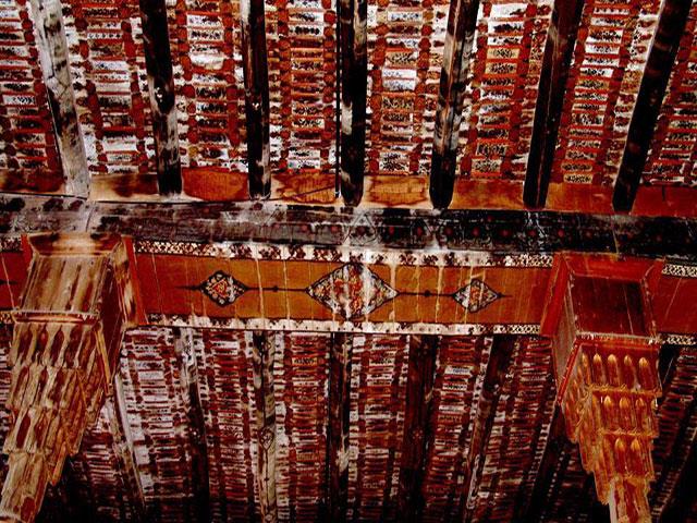
- The MOLLA ROSTAM MOSQUE (Safavid, 16th cent., rebuilt in the Qajar era): Said to have been built by one 'Haj Ali Khan Moghaddam Maraghe'e', it's spacious, under a flat wooden ceiling supported by rows of 35 octagonal wooden pillars, with stalactite-carving on the capitols which connect with beams which support perpendicular logs which in turn support long rows of long, narrow, wooden slats, parallel to the beams. Medallions are painted on the beams and logs, and detailed floral and foliate images with tiny medallions on each slat /b/ the logs. It's a very busy ceiling with one painstaking paint-job. I liked that it (clearly) hadn't been renovated or touched up. tishineh.com/tour/Pictures/Item/3077/38532.jpg See it from the 7:07 min. pt. in this clip.: www.youtube.com/watch?v=7becD8x5yJs www.youtube.com/watch?v=tHHR65SOMi4&list=PLhxDUhiBSi9...
- The famous MARAGHEH OBSERVATORY (the greatest Observatory in the Medieval world!): The ruins of Hulagu khan's 13th cent. rasadkhune (observatory; known in it's day as 'the Star House') are on a low, flat-topped hill west of the city under a geodesic dome, and include a long, straight, flag-stone-paved, 3.1-m.-wide corridor with entrances to a series of long, rectangular rooms on both sides, and with the 'meridian', a straight gutter-like recess, running down its centre to the base of the 'Mural Quadrant' ( www.flickr.com/photos/97924400@N00/6337193475/in/photostr... ), originally with a radius of @ 40 m.s of which 5.5 m.s has survived, and which was used to calculate the position and motion of the sun (see below), all within the round base of what was once a large bldg., 22 m.s in diameter, and /b/ the thick foundations of the walls of its rooms. "The bldg., which no doubt served as a citadel as well, had a staff of at least 10 astronomers and a librarian, covered 340 x 135 m.s, and the foundations of the walls were 1.3 to 2 m.s thick." It made use of "a complex system of water wheels" (?). Instruments designed for it include the said quadrant, an armillary sphere with a radius of @ 160 cm.s, a solstitial armilla, an azimuth ring and a parallactic ruler (triquetrum). 5 circular platforms "on which astronomical instruments were placed" (I'll scan a photo of one) and the foundations of outbldg.s surround the site of the central tower, incl. one 330 m.s2, thought to have been the library which allegedly had holdings of @ 400,000 books (plundered by the Mongols from libraries across Persia, Syria and Mesopotamia, incl. "the legendary library of Alamut" where Tusi himself salvaged some works.) Some families of Iranian tourists were milling @. www.youtube.com/watch?v=rGYczp2WJpM
- "A mural instrument is an angle-measuring device mounted on or built into a wall. For astronomical purposes, such walls were oriented to lie precisely on the meridian. Mural instruments that measured angles from 0 to 90 degrees were called 'mural quadrants' and were utilized as astronomical devices in ancient Egypt and ancient Greece. ... To measure the position of a star, the observer needs a sidereal clock in addition to the mural instrument. With the clock measuring time, a star of interest is observed with the instrument until it crosses an indicator and 'transits the meridian'. The time on the clock is then recorded as well as the angular elevation of the star, yielding the position in the coordinates of the instrument. If the instrument's arc is not marked relative to the celestial equator, then the elevation is corrected for the difference, resulting in the star's declination." (Wikipedia)
- The Astronomical Observatory, as we know it, was a medieval, Islamic invention. www.youtube.com/watch?v=jqQYR6qYj4U And the Maragheh observatory (Il-Khanid, 1259-@'63) "represented new heights in the science of astronomy within Islam and the [wider] world" (Huff, "The rise of Early Modern Science"). It was the earliest and most successful of the 3 greatest astronomical observatories in the Muslim Middle East, incl. those in Islanbul (1420) and Samarkand (1577). (Why isn't this site on Iran's 'Tentative list' for Unesco designation?) "[T]he Chinese, having less hostile relations with Islam, and possibly through the intermediaries of the Mongols who sponsored the observatory, could have gained access to the most advanced astronomy in the world [!] 2 centuries before the West did." (Huff)
- "... The Maragha school of astronomers built [their] observatory with the hope of constructing new tables of observation that would surpass those of Ptolemy. Although this research team included such figures as al-Urdi, al-Tusi, Qutb al-Din al-Shirazi, and al-Maghribi [whose full name was Muhyī al‐Milla wa al‐Dīn Yahyā Abū ʿAbdallāh ibn Muhammad ibn Abī al‐Shukr al‐Maghribī al‐Andalusī], they didn't produce the observational database that might have displaced Ptolemy. Nonetheless, by adjusting various parameters they did create the first non-Ptolemaic planetary models, [but which] remained geocentric, ... [and] improved the Ptolemaic system such that its models were mathematically equivalent to [and preceded by > a century] those in the Copernican system. ... This is to say, (1) Copernicus [1473-1543] used the Tusi couple as the Maragha astronomers did ["a geometric system that includes a smaller circle within a larger circle twice its diameter. The rotations of the smaller circle allow a specific point on the circumference to oscillate in linear motion. The Tusi-couple solved many issues with Ptolemaic systems over planetary motion" and helped astronomers to understand how celestial bodies revolve around one another.], (2) his planetary models for longitude in the Commentariolus are very similar to those of Ibn al-Shatir, while (3) those for the superior planets in De Revolutionibus used Maragha models, and (4) the lunar models of Copernicus and the Maragha school are identical." (Huff) At the Maragheh and Samarkand observatories, the Earth's rotation was discussed by Najm al-Din al-Qazwini al-Katibi (d. 1277), Tusi (b. 1201) and Qushji (b. 1403). (Huff) The arguments and evidence used by Tusi and Qushji resemble those used by Copernicus to support the Earth's motion. (Wikipedia)
- financialtribune.com/articles/travel/3009/maragheh-the-je...
- "In 1256, the Mongols under Hulagu took the [infamous] Alamut castle [see my photo] where the religious scholar and astronomer Nasir al-Din al-Tusi (d. 1274) and several other scholars had taken refuge to continue their studies. Impressed with Al-Tusi's scholarship, Hulagu appointed him wazir or vizier, and then employed him to found and oversee the construction of the observatory. (According to one account, Al-Tusi appealed to Hulagu's superstitions and told him that he could predict the future with a good observatory.) This appears to have been done under the umbrella of the law of waqf, the religious law of endowments that al-Tusi understood as a legal scholar. This seems to be the first example of such use of Islamic law for these purposes." (Huff) But while Islam had initially generated and supported the observatory, it was Islam that would later destroy it. "Astronomers [maintained] that astronomy was a “handmaiden of religion”, as it was used to determine the new moon and time-keeping. Nonetheless it was associated with astrology whose assumptions ran counter to the tenets of Islam (and to those of Christianity too). If only God knows the future, those who claim such knowledge usurp his power and capacities. The decline of the observatory began in the late 13th cent., although it would survive the rule of 7 khans, incl. Abaqa and Uljaytu, and remained active for over 50 yr.s. > 100 astronomers conducted research in the facility in that period. ("It is believed that several Chinese astronomers worked at the observatory where they introduced several Chinese methods of computation.") The site became derelict as a result of a loss of funding, and damage sustained in earthquakes.
- en.wikipedia.org/wiki/Astronomy_in_the_medieval_Islamic_w...
- RASAD-KHANEH CAVES: A "MITHRAIC" TEMPLE or BUDDHIST or ?: I came upon an unusual cave complex, the Rasad-khaneh caves, just below and west of the observatory, carved out of the side of the hill. The ceilings of 2 chambers had been sculpted and smoothed, each like 2 sides of a triangle meeting at a point, like ceilings under a pitched roof. What look like large altars carved out from the living rock were in the centre of the floor in each. (I'll scan a photo.) There were subterranean levels and tunnels with much atmosphere. I used my flashlight or my camera flash to spelunk all through it. A vlogger and his friends explore some of it here.: www.youtube.com/watch?v=TxfCFZ7hPdU Some maintain that this was a mithraic temple complex, but Wikipedia refers to these sculpted caves as similar in style to Chinese and Mongol cave temples or shrines, and as having been used "for religious ceremonies in the Il-Khanid period." Oxford research fellow Arezou Azad writes that "[t]he rectangular stone blocks in chambers A and B were identified as altars, and hence the chambers as sanctuaries. To [Warwick] Ball they [resemble] the Buddhist circumambulatory pillar-caves of Afghanistan and Central Asia, and to Bowman and Thompson the Jacobite style of dual sanctuaries. I would also note a resemblance to the Sassanian fire altars of Balkh. ... In the cave temples of the Mithraists (or Mithraea), altars of such dimensions can also be found. An ancient Mithraic use is likely given the similarities with Roman Mithraic temples, but it is the Il-khanid period which is of greater interest to us." www.tertullian.org/rpearse/mithras/display.php?page=supp_...
- "Mithraic narratives state that Mehr was born in a cave and thus caves were considered important in the construction of mithraic temples. [Supplicants] performed their rituals in natural caves. ... The most important part of a temple was its altar, located at the end of the hall and including a small porch, built a little higher than ground level. The walls contained images of Mehr. ... [In the] hand-made caves of the Observatory hill ... platforms for sacrifice or on which images of Mehr were engraved are well preserved." www.cais-soas.com/CAIS/Archaeology/Ashkanian/verjuy_mithr...
- Dr. Amin Moradi is dismissive of "the traditional views of scholars" that the cave complex at Varjavi, nearby, is a mithraeum. link.springer.com/article/10.1007/s41826-022-00049-x "In the history of Zoroastrianism or Mazdayasna, Western Iran has been thought of as the heart of religious activity under the Median emperors (Herodotus). It's believed that after the unification of the Median and Achaemenid dynasties in 550 B.C., temples to Mithra, a Zoroastrian divinity, were constructed throughout the empire. (Malandra 1983, 88)." But he maintains that no evidence of any ancient mithraeum has been identified east of Syria (although they're found from Great Britain across the former Roman Empire to Dura Europos, and notwithstanding that the cult of Mithras is thought to have been adopted by Roman soldiers from its source in the worship of the Aryan pantheon in Parthian and Sassanian Iran.) No assumptions or inferences should be made as to Iranian mithraism on the basis of Roman mithraism. As to the purported mithraic cave-complex at Varjavi (which I write about in the next photo comment, a miss) Moradi suggests that it's an Il-Khanid-era tomb, "an attempt to try to copy the earlier Mongol construction methodologies in the Islamic context of Iran." He notes similarities in its layout with those of 7 cave 'dome tombs' that belong to clans of eastern Turks in Mongolia and which predate the Il-Khanate by /b/ @ 230 and 570 yr.s. But who was buried at Varjavi? All Khans are accounted for. Moradi admits that there's "no unknown Ilkhanid elite burial candidate for this monument in this region."
- After all that, I might find the evidence of the Buddhist nature of the Rasad-Khaneh caves (but not the Varjavi complex) to be most persuasive. (Cont.)
Have just the one kid and you'll be able to afford to relax and have popsicles.
- (Continued from the last photo of the ruins at Susa): Susa's golden age began with the conquests of Cyrus the Great, founder of the Achaemenid empire, and the choice of Susa as winter capital by his son and successor Cambyses II as "it stood between the Aryans of the east and the Semites of the west. ... The Achaemenid kings were great road builders, and their most important hwy. was the famous Royal rd. from Susa to Sardis (the Lydian capitol) in Asia Minor. Another road continued from Susa SE across the plain and through the Zagros to Persepolis and Pasargadae.
- Cyrus regarded the waters of the Choaspes or Karkha river as excelling all others. "Herodotus recounts that whenever Cyrus went on expedition, he brought with him "water from the Choaspes ... whereof and of none other he drinks. This water of the Choaspes is boiled, and very many 4-wheeled wagons drawn by mules carry it in silver vessels, following the King whithersoever he goes."
- In 517 Darius I began to build his palace at Susa on a mound (an Elamite cemetery) levelled with the sides revetted and a great platform made (820' by 490'). He recorded the construction on a preserved tablet: "I constructed this palace. Its decoration was brought from afar ... The ground was dug out ... and the gravel that was thrown in, and the bricks that were moulded, they were the people of Babylon who did this work. The wood called naucina [cedar] was brought from a mtn. called Lebanon. The people of Assyria brought it up to Babylon and the people of Karkha and Ionia brought it from Babylonia to the land of the Susians. Wood was brought from Candara and Karmana, Gold was brought from Sardis and Bactria. ... That which was employed here of silver and bronze was brought from Egypt. The decoration with which the [walls of the] fortification were embellished was brought from Ionia. Ivory ... was brought from Kussa, from India and Arachosia. ... Those who worked in gold were the Medes and the Egyptians. ..." You get it, a palace for the ruler of most of the known world. While the general style of the palace was Assyrio-Babylonian, its design was influenced by Persian architecture, and the hypostyle hall was on the Egyptian model. It burned down in the reign of Artaxerxes I (465-424 BC) but was rebuilt by Artaxerxes Mnemon (r. 404-359 BC) "on even more sumptuous lines than before", but on a different site across the Karkha.
- W. K. Loftus, the archaeologist who first identified the site with ancient Susa, thus describes the city as it must have appeared in the great days of the Achaemenians.: "It is difficult to conceive a more imposing site than Susa, as it stood in the days of its Kayanian splendour, its great citadel and columnar edifices raising their stately heads above groves of date, konar and lemon trees, and backed by rich pastures and golden seas of corn [not real corn of course; wheat?], and by the distant snow-clad mountains. ..." The geographer Strabo stated that the walls, temples and palaces of Susa were constructed in the same manner as those at Babylon, that is of baked brick and asphalt (the latter used in place of mortar).
- "It was from Susa that Xerxes set out on his great expedition against Greece; in Milton's words "Xerxes, the Libertie of Greece to yoke, from Susa his Memnonia Palace high came to the sea..." Although he failed to subjugate the whole of Greece, he did despoil both Delphi and Athens and deposited their wealth in his treasury at Susa. With the extension of the empire first to Asia Minor and later to parts of Greece itself, the might of Persia and the glories of Susa became well known to the Greeks. When Aristagoras of Miletus sought to enlist the aid of Cleomenes of Sparta in an attempt to free it and the other Ionian cities from the Persian yoke, he said "Susa, where the Persian monarch occasionally resides and where his treasures are deposited - make yourself master of this city and you may vie in influence with Zeus himself." (When Cleomenes learned that the expedition would entail a march of 3 mos.' duration from the Mediterranean, he refused to take part in it.)
- "It was at 'Shushan the palace' that Daniel had his vision of the ram with the 2 horns. If we are to believe the story of Daniel in the lion's den, Susa or some place in the vicinity may have been where he underwent his ordeal, as the district was until the 1800s a favourite haunt of the king of beasts.". 'Shushan the palace' is also the setting for the intrigues in the Book of Esther. (See below.)
- After the Greeks had won their great victory over the Persians at Salamis, and the remnants of the hosts of Xerxes had been forced to retreat in disorder, the poet Aeschylus commemorated that triumph in his Athenian tragedy 'The Persians' (472 BC) Susa is the setting for 'The Persians' (472 BC), THE OLDEST surviving play in the history of theatre (!), for which the setting is in the great palace of Darius at Susa. "In some moving lines, the poet portrayed the grief of Atossa, the queen mother, and of the nobles and courtiers when the news of the disaster was received". (L. Lockhart)
- After his defeat of the Persians near Arbela in 331 BC, Alexander "marched through Babylonia into Elam. At Susa, like Assurbanipal > 300 years earlier, he discovered enormous riches. In the palace were 40,000 talents worth of coined $ and an immense amt. of other treasure; all this wealth he distributed amongst his troops. He then passed on to India, and returned and came once more to Susa. There he married an Achaemenid princess and gave a great banquet in the royal palace to celebrate his nuptuals". (According to Aristobulos, a member of Alexander's expedition, the heat in the summer was so great at Susa that reptiles that tried to cross a street at midday couldn't cross quickly enough to avoid being burnt to death. Again this was the Persian WINTER capital, Ecbatana [modern-day Hamadan] was the summer capital.)
- Following Alexander's death in Babylon in 323 BC, Susa became for a time the capital of a Graeco-Persian subkingdom, the Seleucid capital, and retained some importance in the Roman period as part of the Parthian empire, with much autonomy from the capital Ctesiphon. The city continued to thrive until it was destroyed by the Mongols, and never recovered.
- See? So historic that I've written a book with just a bare-bones history of the place
- A video with scenes from Susa www.youtube.com/watch?v=vt97ahE2pG4 Here's one with slides and captions set to the Game of Thrones theme, with singing in Persian. www.youtube.com/watch?v=bwkTCPELkvI
Cont. from the last photo comment, re more misses en route south from Khorramabad to Andimeshk:
- 2 aquamarine ponds are at 'Siah Gav Twin Lakes' @ 15 km.s SW of the 37 and Hamgan.
- Quite a find on google maps, a most photogenic suspension bridge and an equally impressive canyon in an oxbow, the magical Khazineh valley, @ 1 km. and visible from the 37 /b/ Cham Gaz and Pa Alam.: www.google.com/maps/place/Khazineh+Valley/@32.9022776,47.... youtu.be/ksrWy-ynXmo?si=xCz2hZqYFloIIfmX
- The ruins of a Sassanian fort or castle loom above the Karkheh river less than a km. south of the bend in the 37 just below Pa Alam.
- 2 interesting, exotic suspension bridges span the Dez river in the mtn.s just @ 50 clicks or more east and a bit north of the 5 and 37 where they turn south, and 5 - 10 north of 'Tale Zang'.: www.google.com/maps/place//@32.8588859,48.699076,13z?entr...
- The ruins of Reza castle and caravanserai are only @ 300 m.s north of the 37 near Qaleh Razeh.
ANDIMESHK - I arrived in Khuzestan and disembarked at Andimeshk, a city of @ 110,000 in 2000, where I found affordable accommodation in a home-stay (the home of a very nice couple) which became my base in Khuzestan, 34 km.s NE of Susa, for at least 3 nights (too few).
History: The name had formerly been that of the Sassanian town on the river Dez, now known as Dezful. It "first appears in Mesopotamian cuneiform tablets from the Ur III period (21st to 20th cent.s BC) in the form 'Adamshakh', which likely means 'Crocodile (town)'. ! It then morphed into 'Andamaska' or 'Andimaska', 'Plenty of butter'.
- The current town of Andimeshk became a stop on the Trans-Iranian Railway in 1929. During WWII a pipeline was laid from Abadan, then the location of the world's largest oil refinery, to Andimeshk, where fuel was re-loaded onto trucks and sent to the U.S.S.R. (and which was important to the Soviet war effort against Nazi Germany). In 1955 the pipeline was extended from Andimeshk to Tehran. Two famous, high-capacity dams are in the city's vicinity, the Dez dam, built under the direction of an Italian co. from 1959 to '62, and the Karkheh, built from 1992 to 2001. (I heard nothing about these dams when I was there.)
- After settling in that first day I took a shared taxi or bus 34 km.s further SW and SE down the 37 to legendary Susa or Shush (Shoosh).
- Re more misses on that stretch: Another ancient, well-preserved Sassanian bridge, the Seyhe, less than 1 km. south of the hwy. across from Azadi; and the Eyvan-e Karkheh, @ 12 km.s west of the 37, the adobe ruins of an ancient Sassanian city dating to the reign of Shahpur II, said to be "the most complete and the largest buried city of the Sassanian period," a centre of silk weaving with pottery kilns and weaving workshops.
- DANIEL'S TOMB at SHUSH - Soon after I arrived in the modern town of Shush (Shoosh) (adjacent to the site of Susa) I visited the shrine and tomb purported to be that of the Old Testament prophet Daniel of 'Daniel in the Lion's Den' fame, surmounted by its famous, tiered, plaster, white sugar-loaf or 'pine-cone' tower (1871). This is one of only 9 purported tombs of this prophet in 5 countries (!), incl. Iraq, Turkey, Uzbekistan and Morocco. 4 are in Iraq, 2 of which were blown up, one in Mosul by ISIS in 2014 and the other in Muqdadiyah by terrorists (the AQI?) in 2007. But this at Susa is the most famous and "the most widely accepted" of the bunch.
- The Book of Daniel mentions that he lived in Babylon, but the only reference to Susa is in the account of a vision in 8:2.: "And I saw in a vision; and it came to pass, when I saw, that I was at Shushan [Susa] in the palace, which is in the province of Elam; and I saw in a vision, and I was by the river [or canal] of Ulai." (That's it?) "Some older versions take this to be the Ulai River [the KJV, which I've quoted], but the word 'uval' (אוּבָל) is not the common word for a river (nahar, נָהָר). Daniel seems to refer to the (now dry) canal that separated the royal city at Susa from the lower city. ... Why did this vision take place in Susa and not in Babylon? Perhaps because the first part of the vision relates to the Medo-Persian empire." (Crossroadsbible.net) The Book doesn't specify where Daniel died, but "the tradition preserved among the Jews and Arabs is that he was buried at Susa." (Wikipedia) According to a 9th cent. Muslim chronicler, Daniel's body was brought to Susa from Babylon. (See below.)
- Elam was known for its population of Asiatic lions in the 1st mill. B.C. (and more recently). Elamite tribute bearers in the procession of the 24 subject nations depicted on the Apadana staircase at Persepolis bear 2 daggers, 2 bows, a fierce lioness on a chain and her 2 cubs. www.google.com/imgres?q=apadana%20lioness&imgurl=http... "The Asiatic lion was recorded only in Iran's Khuzestan and Fars Provinces. The last sighting occurred [as recently as] 1957 in the Dez River valley." (Wikipedia. A population survives today in the Gir forest in Western India.) Could this have something to do with the association made /b/ Daniel and Susa (although the lion's den was in Babylon, per the good Book)?

- Re the historicity of Daniel per Wikipedia: "[T]he broad consensus [amongst historians] is that Daniel is not a historical figure, [and that the Book's] author appears to have taken the name from a legendary figure of the distant past mentioned in the Book of Ezekiel [14:14, 14:20 and 28:3. A tablet in the Louvre found at Ugarit in coastal Syria and which dates from @ 1400 BC is referred to as 'the Legend of Aqhat, son of Dan'el'. Some scholars consider this to be the famous Dani'el mentioned by Ezekiel. The Hebrew name of the Daniel of the Book of Daniel is Daniyye'l. biblicalstudies.info/louvre.pdf] The Book of Daniel features prophecies, but it's an apocalypse, ["one of a large number of Jewish apocalypses, all pseudonymous",] not a book of prophecy, and its contents are a cryptic allusion to the persecution of the Jews by the Seleucid king Antiochus IV Epiphanes (r 175-164 B.C.) [who married his sister btw, Laodice IV, and whose paternal grandparents were nephew and aunt, that nephew being the son of 1st cousins. But the contemporary Ptolemies of Egypt were much more in-bred, incredibly.] Broad agreement has it that the stories of court intrigue in chap.s 1-6 of the Book are legendary [ youtu.be/6r1baNdgImo?si=6kfysaaA4irNG9Sh commons.wikimedia.org/wiki/File:William_Blake_-_Nebuchadn... , so it's a myth that "God had brought Daniel into favour and tender love with the prince of the eunuchs" {?}, etc., Daniel 1:9], that the visions in chap.s 7-12 were added during the persecution of Antiochus IV, and that the Book itself was completed in or @ 164 B.C., but before Antiochus' death in December of that year in Persia or before word of his death had reached Jerusalem, for the Book predicts his death in Palestine (11:44-45). The language in Daniel 5 (the tale of 'Belshazzar's feast' joyofmuseums.com/museums/united-kingdom-museums/london-mu... youtu.be/z4wO4aMblv8?si=fmjJ8h4fV2YawXwj ), for example, follows ancient Near Eastern conventions. Daniel 6 ('the Lions' Den') [might be] based on the classic Babylonian folk-tale Ludlul-bel-nemeqi, which concerns a courtier who suffers disgrace at the hands of evil enemies but is restored due to the intervention of a kindly god; in the Babylonian original the 'pit of lions' is a metaphor for human adversaries at court." (Wikipedia)

- Benjamin of Tudela, who travelled in Asia /b/ 1160 and 1163, wrote the following account as to the tomb of Daniel at Susa.:
"4 miles from thence begins Khuzistan, the Elam of Scripture, a large province, which, however, is but partially inhabited, a portion of it lying in ruins. Among the latter are the remains of Shushan [Susa], the metropolis and palace of King Ahasuerus [Xerxes], which still contains very large and handsome bldg.s of ancient date. It has 7,000 Jewish inhabitants, with 14 synagogues, before one of which is the sepulchre of Daniel, who rests in peace. The river Ulai divides the city into 2 parts, which are connected by a bridge; that portion of it which is inhabited by the Jews contains the markets, to which all trade is confined, and there all the rich dwell; across the river they are poor, because they are deprived of the above-named advantages, and have even no gardens or orchards. These circumstances gave rise to jealousy, which was fostered by the belief that all honour and riches originated in the possession of the remains of the prophet Daniel, who rests in peace, and who was buried on the favoured side of the river. A request was made by the poor for permission to remove the sepulchre to the other side, but it was rejected; upon which a war arose, and was carried on /b/ the 2 parties for a length of time; this strife lasted until "their souls become loath," and they came to a mutual agreement, by which it was arranged that the coffin which contained Daniel's bones should be deposited alternately every year on either side. Both parties faithfully adhered to this arrangement, until it was interrupted by the interference of Sanjar Shah ben Shah [r 1118 - 1157] who governs all Persia, and holds supreme power over 45 of its kings. This prince is called in Arabic Sultan-al-Fars-al-Khabir ('Supreme Commander of Persia'), and his empire extends from the banks of the Shat-el-Arab to the city of Samarkand and the Kizil Ozein, enclosing the city of Nishapur, the cities of Media, and the Chaphton mountains, and reaches as far as Tibet, in the forests of which country that quadruped is found which yields the musk. The extent of his empire is 4 months and 4 days' journey. When this great emperor, Sanjar, King of Persia, came to Shushan and saw that the coffin of Daniel was removed from one side to the other, he crossed the bridge with a very numerous retinue, accompanied by Jews and Mohammedans, and inquired into the reason of those proceedings. Upon being told what we have related, he declared it to be derogatory to the honor of Daniel, and commanded that the distance between the two banks should be exactly measured, that Daniel's coffin should be deposited in another coffin, made of glass, and that it should be suspended from the center of the bridge by, chains of iron. A place of public worship was erected on the spot, open to every one who desired to say his prayers, whether he be Jew or Gentile; and the coffin of Daniel is suspended from the bridge unto this very day. The King commanded that, in honor of Daniel, nobody should be allowed to fish in the river one mile on each side of the coffin." sacred-texts.com/jud/mhl/mhl20.htm#fn_70
- "Muslim traditions agree that Daniel was buried at Susa, and a similar tradition was current among Syriac writers. Al-Baladhuri (9th cent., [whose account predates that of Benjamin of Tudela by @ 3 centuries]) states that when the conqueror Abu Musa al-Ash'ari came to Susa in 638, he found the coffin of Daniel, which had been brought there from Babylon so as to bring down rain in a period of drought. [Interesting.] Abu Musa referred the matter to the caliph Umar, who ordered the coffin to be buried, which was done by sinking it to the bottom of one of the streams nearby. In another account, once the city fell to the Muslims, as there's no reference to Daniel (Arabic: دانيال,) in the Qur'an, the invaders confiscated the treasure that had been stored at the tomb since the Achaemenid era. They then broke open the silver coffin, carried off the mummified corpse and removed a signet ring from it, which carried an image of a man /b/ 2 lions. However, upon hearing of this, the caliph Umar ordered the ring to be returned and the body reburied under the riverbed. In time, Daniel became a Muslim cult figure ... (etc.) (Wikipedia)
- Arab chronicler Ibn Hawqai wrote a similar account in the 10th cent.: “In the city of Susa there is a river and I have heard that in the time of Abu Mousa Al Ashoari a coffin was found there; it is said to contain the bones of Daniel the Prophet. The people held it in great veneration and in times of distress, famine or drought brought it out and prayed for rain. Abu Mousa Al Ashoari ordered that the coffin be encased with 3 coverings and submerged it in the river so that it could not be viewed. The grave can be seen by anyone who dives to the bottom of the water.” Istakhri gives a similar account adding that the Jews were accustomed to make a circuit around Daniel's tomb and to draw water in its neighborhood. Al-Muqaddasi refers to the contention /b/ the people of Susa and those of Tustar [Shushtar]. A divergent tradition reported by Ibn Taimiyyah claims that the body was found in Tustar; that at night 13 graves were dug, and that it was placed in one of these - a sign, according to him, that the early Muslims were opposed to the worship of the tombs of holy men." (Wikipedia)
- William Ouseley in Walpole's Memoirs of the East described the Tomb of Daniel in Susa as being situated in "a most beautiful spot, washed by a clear running stream and shaded by planes and other trees of ample foliage. The building is of Mahomedan date and is inhabited by a solitary Dervish, who shows the spot where the prophet is buried beneath, a small and simple square brick mausoleum, said to be (without probability) coeval with his death. It has, however, neither date nor inscription to prove the truth or falsehood of the Dervish's assertion. The small river running at the foot of this building, which is called the Bellerau, it has been said flows immediately over the prophets Tomb, and from the transparency of the water, his coffin was to be seen at the bottom; but the Dervish and the natives whom I questioned remembered no [such] tradition ... ; on the contrary, it has at all times been customary with the people of the country to resort hither on certain days of the months, when they offer up their prayers at the tomb, in supplication to the prophet's shade."
- "The current tomb was renovated and repaired in 1870 by order of Shia scholar Sheikh Jafar Shooshtari. ... Today the tomb is a [very] popular attraction among local Muslims and Iran's Jewish community alike, who crowd the glittery interior, kissing the zarih grate @ a green-draped cenotaph" as at so many imamzadehs in Iran. (Wikipedia)
- www.youtube.com/shorts/qGU3CViEpRo
- www.7dorim.com/tasavir/ziyarat_danial_nabi/
- The RUINS of SUSA.: The most prominent feature at the site is the vast 'Château de Morgan' (1890s), resembling a crenellated Omani desert fortress, infamously built from 1897 to 1912 on the site of an Elamite acropolis with bricks taken from the legendary Achaemenid palace of Darius I and other structures on-site by French archaeologist (or vandal or whatever I should call him) Jean-Marie Jacques de Morgan as protection from local Arab and Lurish tribesmen, at least allegedly. Many of the bricks in the walls are covered in ancient cuneiform. Worse still, the 'château' was built atop a tappeh which almost certainly contains invaluable artifacts. (Following the identification of the site by William Loftus with the biblical Shushan in the 1850s, Sir Henry Rawlinson inexplicably "persuaded the British Museum that the site had little to offer" [Bradt]. Imagine how much more would remain on site to be seen today if the British had dug there [rather than the French], and hadn't cannibalized the site to built a fortress or folly.) It's huge, built in a design similar to that of medieval castles in France, and must've been built for purposes beyond any concern for the security of the French team, if not as a 'folly'. It's a prime example of the early, pre-scientific age of archaeology when sites were mutilated or destroyed in official excavations with the focus on obtaining treasures for the Louvre, the British museum, etc. (The "Persian Collections at [the] Louvre [obtained at Susa] Are Worth the Journey" [the NYT] www.nytimes.com/2019/03/12/arts/persian-collections-louvr...; "“France [had] made a very clever [and mercenary] diplomatic agreement and had a monopoly,” said Julien Cuny, curator of the Persian collections at the Louvre. “For decades, only the French could dig, and everything they dug up was allowed to come to France”" until 1925 and the renegotiation of the agreement to split the spoils. depts.washington.edu/silkroad/museums/ml/achaemenid.html ) We can only try to imagine how vast and impressive the Achaemenid and Elamite ruins would be today if they'd been untouched. French property until 1979 (!) and the Islamic Revolution, and badly damaged in the Iran-Iraq war ("Iraqi strikes badly damaged the ruins of the [Achaemenid] palace’s audience hall" [NYT]), the castle's been restored since. But the interior's off limits to tourists for some reason.
- I met some Westerners on the site of the terrace of the apadana, an elderly European couple on tour, the first foreign tourists I'd met since Dogubeyazit, aside from one seen from a distance at Ghara Kelise and someone in Hamadan (whom I don't recall). I'd meet many more in Esfahan, Yazd and Shiraz.
- The site of the terrace of the Achaemenid palace complex (246 x 155 m.s) and of the apadana (109 m.s2), built from 516 to 521 B.C. for Darius I, had a labyrinth of neatly outlined foundations of long, strong walls of brick and wattle; and with 6 x 6 large, column bases or pedestals finely carved in limestone and some fluted column drums (pieces of columns that had been 22 m.s high) on the site of the former apadana, and several cracked or fragmentary white Achaemenid bulls' heads on the ground from column capitals of the type seen in abundance at Persepolis (I'll scan a photo), with other bits and pieces on the terrace. en.wikipedia.org/wiki/Palace_of_Darius_in_Susa#/media/Fil... Darius' dictation discovered on 2 foundation tablets in 1970 reads, in part, as follows.: "This palace which I built at Susa, from afar its ornamentation was brought. [See above.] ... Downward the earth was dug, until I reached rock in the earth. When the excavation had been made, then rubble was packed down, some 40 cubits in depth, another part 20 cubits in depth. On that rubble the palace was constructed. ..." Built on an artificially raised platform or terrace 15 m.s high, 100 ha.s in area, the complex at Susa consists of a residential palace, an apadana (audience hall), and a monumental gate. A covered passage ('propylaeum') faces these structures. The apadana is similar to that at Persepolis, incl. 36 distinctive grand Persian columns, each 23.25 m.s in height, incl. 13.5 m. shafts, 1.75 m. pedestals, and an 8 m. tall composite capital topped by 2 symmetrical bulls' heads, which was probably developed here. They once supported the roof, comprised of beams of Lebanese cedar, of the 128,000-square-foot audience hall, the apadana in the palace. youtu.be/N17JaXoxvP0?si=5C9rP2gPWQ3FWaZv "Any surviving painted plaster and glazed brick panels of pacing animals [incl. griffins and winged bulls] and motionless military guards [incl. spearmen and archers] and attendants were all removed to Paris, with a few examples going to Tehran" (Bradt), which I'd see later in the Bastam museum. Part of a monumental entrance or doorway remains, 40 x 30 m.s (which I don't recall), where "a fragmented granite statue of Darius was found in 1972 [also now in Tehran's Bastam museum], its quadrilingual inscription recording his victories in Egypt." (Bradt) Those ruins were the first glimpse I would have of a fleeting grandeur that the Seleucids, Parthians, and even the vigorous Sassanians couldn't begin to imitate. (Darius' inscription at Bisotun was obscured by scaffolding and by its height; otherwise these sculptures at Susa were the first distinctly Achaemenid works of art that I saw that trip [o/s of a museum].) See the ruins of the palace in this PressTV clip from the 2:50 min. pt. to 3:55. youtu.be/vt97ahE2pG4?si=1v0pWaKhK8aCswjR Much work has been done at the site since 2000 with the partial reconstruction of the base of the bldg.s in the complex. youtu.be/kw_FtzYCkus?si=BiHMbe-eJAfZjwt0

- youtu.be/yd_13K4O3EA?si=dlCoIRK0snVopLT0
- 'Shushan the Palace' is the setting for the Book of Esther, which I write about at length in this 'description' www.flickr.com/photos/97924400@N00/3623624478/in/photostr... , and the Book includes some interesting passages re Susa. In the first chapter, King Ahasuerus (Xerxes or Artaxerxes I) held a great feast for his subjects in the court of the garden of the palace "where were white, green and blue hangings, fastened with cords of fine linen and purple to silver rings and pillars of marble; the beds were of gold and silver, upon a pavement of red and blue and white and black marble. And they gave them to drink in vessels of gold (vessels being diverse one from another) and royal wine in abundance..." Simultaneously, "Vashti the Queen made a feast for the women in the royal house" (which implies that the sexes were segregated amongst the nobility).
- At Susa, "one has a feeling of being in the midst of something almost immeasurably old." ('Persian Cities') The site's vast, "currently consisting of 3 archaeological mounds over an area of @ 1 km 2", and although most of what there is to be seen are indistinct mounds and badly eroded walls of adobe mud brick (or what had once been mud brick, see the last photo in this stream), with one prominent vertical structure (an adobe tower of sorts nick-named 'De Morgan's pillar; I'll scan a photo www.livius.org/pictures/iran/susa/susa-acropolis/susa-de-... ), there was enough to walk through and @ and look over for more than a day. I'd read that the French had found and identified 13 layers of habitation sediment (as well as such treasures as the Babylonian stele with the Code of Hammurabi, Elamite war booty) and I did my utmost to keep in mind how very historic and prehistoric the place had been. The renovation of the foundations of adobe walls since 2000 at various points across the vast site (as seen in photos online) has made a dramatic difference.
- The following is a copy and paste of a paragraph from Bradt (2009) with details and info. that I wish I'd known when I was there.: "The mounds far behind the chateau mark the so-called 'Royal Sector', that the site guardian is unlikely to allow you to approach [there were no such restrictions in 2000], where the French found evidence of at least 15 layers of occupation [again I've read 13], [dating] from 2700BC to the Islamic period. Remains of excavated streets and bldg.s date from the Elamite period, @ 1900 BC, but this section, House A in particular, proved to be rich in Seleucid figurines. ... Various Seleucid inscriptions suggest that, as with Dura Europos in eastern Syria, a stadium, gymnasium, archive and law court were constructed together with at least 3 temples: to Apollo, the Mesopotamian goddess Nanaya, and to Ma, an Anatolian deity. Later this area was occupied in the Sassanian and early Islamic periods until the 10th cent. [Further to the south of this sector is the 'Donjon', per Bradt's map.] Further to the east is the ‘Artisans’ village’ where clear evidence of Seleucid and Parthian workshops and an early Islamic mosque were discovered. Immediately south of the chateau was 'the Acropolis' where a necropolis was excavated and where Elamite temples had stood [incl. the 'Temple of Inšušinak', the 'Temple of Nin-hursag' {although Ninhursag was the Sumerian 'mother goddess of the sacred mountain', "similar to the Elamite goddess Kiririsha", Wikipedia - ?} and that of the Neo-Elamite king 'Shutruk-Nahhunte II' (r 717-699 BC), in whose reign emerged "a true beginning of the Elamite renaissance." (Amiet) "When Elam was incorporated into the Achaemenid Empire in 538 BC, the Persians inherited its art and civilization." (W. Hinz 1973: 178) A "bronze and copper statue of Queen Napirasu, wife of Untash (r1 359-1333 BC), known from Choga Zanbil, was discovered in 1903 in the Temple of the Goddess Ninhursag. Weighing 1,750kg.s, it now stands headless {again, in the Bastam museum in Tehran} 1.29 m.s tall, inscribed with a warning to anyone who might cause it damage that "his name shall become extinct, that his offspring be barren". 'De Morgan's pillar' stands within or at the edge of the Acropolis.] It doesn’t seem possible that from such a jumble of lumps and humps, such unique and fascinating artefacts were uncovered in such a marvellous state of preservation. Make a mental note to visit the Louvre in Paris." (Bradt)
- At Susa, I had a similar experience to the one at Hasanlu with a group of curious kids who followed me @ for a bit and then threw stones in my direction from a distance when my back was turned, to get the attention of this odd, solo foreigner who was so strangely interested in mud and broken bits of pottery, etc. One of them pointed out something earlier that I would see again twice later en route, a needle or 2 left behind somewhere in the ruins by a heroin junkie. (I'll write more about Iran's troubles with heroin addiction in a subsequent photo write-up).
- More re the ANCIENT HISTORY of SUSA (further to what I wrote above and at the top of the last photo comment many yr.s ago): "The name Susa derives from the Ancient Greek Sousa (Σουσα) and ultimately from an original Elamite name written as Šušen in its Middle Elamite form, Šušun in its Middle and Neo-Elamite forms, Šušan in its Neo-Elamite and Achaemenid forms, and Šuša in its Achaemenid Elamite form. Susa appears in the very earliest Sumerian records: e.g. it's referred to as one of the cities obedient to Inanna, patron deity of Uruk, in 'Enmerkar and the Lord of Aratta'.
- Biblical references in the Books of Esther and Daniel are reviewed above and in my photo write-up re Hamadan, but Susa features in Nehemiah 1:1 as well. "The words of Nehemiah the son of Hachaliah. And it came to pass in the month Chisleu, in the 20th year, as I was in Shushan the palace [at the time of the Babylonian captivity in the 6th cent. B.C.], that Hanani, one of my brethren, came, he and certain men of Judah; and I asked them concerning the Jews that had escaped, which were left of the captivity, and concerning Jerusalem. And they said unto me, The remnant that are left of the captivity there in the province are in great affliction and reproach: the wall of Jerusalem also is broken down, and the gates thereof are burned with fire. ..." The city is further mentioned in the Book of Jubilees (8:21 & 9:2) as within the inheritance of Shem and his oldest son Elam; and in 8:1 "Susan" is also named as the son (or daughter, in some translations) of Elam.
- Carbon-14 test results place the foundation of the settlement at no later than 4395 B.C., a date which "corresponds with the abandonment of nearby villages. Potts suggests that the settlement may have been founded to re-establish the previously destroyed settlement at Chogha Mish, @ 25 km.s west. Chogha Mish had been very large, featuring a massive platform [for a temple?] similar to one later built at Susa." Lovely, finely painted ceramic goblets, serving dishes and jars from this period (free-hand painted in black and white) were interred for use in the afterlife in the Susa 1 period, 4200-3800 B.C., in > 1000 graves in a cemetery near the base of the platform. Of @ 2000 excavated, most are in the Louvre. (Ceramics found at Susa from this period are famous, and are a highlight of the Bastam museum's collections in Tehran.) They were crafted in "a late, regional variation of the Mesopotamian Ubaid ceramic tradition that spread across the Near East in the 5th millennium B.C.", and their style was also "very much a product of the past and of influences from contemporary ceramic industries in the mtn.s of western Iran." (A bit contradictory.) "We learn from this pottery that [the locals] practised a sun and fertility cult." (L. Lockhart) Copper axes and mirrors and tools of flint and obsidian have also been discovered which date from that early period.
- "Susa came within the cultural sphere of Uruk in 'the Uruk period'. An imitation of the state apparatus of Uruk, with proto-writing [although, again, the earliest Elamite cuneiform might predate the earliest Sumerian], cylinder seals with Sumerian motifs, and monumental architecture, is found at Susa. According to some scholars, Susa may have been a colony of the much larger city of Uruk, although this is in dispute. Recent research indicates that the Early Uruk period corresponds to Susa II (3800-3200 B.C.). Daniel Potts maintains that the cultural influence of the highlands in Khuzestan was more significant in the early period and continued and that the culture at Susa combined influences from the highlands and the alluvial plains. "An architectural link has also been suggested between Susa, Tal-i Malyan, and Godin Tepe at this time, which supports the theory of the parallel development of the proto-Cuneiform and proto-Elamite scripts". (?)
- During Susa III (3200-2700 B.C.), the 'Proto-Elamite' period, proto-Elamite tablets appear in the record and Susa then became the centre of Elamite civilization. Elam was one of the most perdurable kingdoms or civilizations in history. It enters recorded history in Sumer's Early Dynastic period in @ 2700 B.C. when En-me-barage-si "made the land of Elam submit" following a battle /b/ Kish and Susa. In the Sumerian period, Susa was the capital of the state of Susiana (Šušan), which occupied the territory of modern Khūzestān prov. centered on the Karun river, control of which shifted /b/ Elam, Sumer, and Akkad.
- It seems that Elamite was a linguistic isolate which bore no relation to Semitic, Sumerian or Indo-European, but has been classified as 'Elamo-Dravidian', with ties to India. (?) The name 'Elam' ('highland'), is Akkadian, while in the original Elamite form it was Haltamtu or Haltamti. Elam was also known in classical records as Susiana, from the city state of Susa (one of the four major cities of Elam with Awan [NW of and close to Susa but in a location that's a mystery today; 3 kings of Awan in succession were the first foreign rulers of Sumer in @ the mid 3 mill. BC], Anshan [in Fars prov., @ 400 km.s to the south, ruled often as a separate kingdom, perhaps only briefly united within one state] and Simash). Elamite kings succeeded by matrilineal descent, and were referred to as 'son of a sister'. www.historyfiles.co.uk/KingListsMiddEast/EasternElam.htm
- The earliest evidence of the use of Elamite as an administrative language is in texts of ancient Anshan from Tall-e Mal-yan, dated to @ 1000 B.C. Akkadian had been in use in the 2nd mill. B.C. and earlier following the incorporation of Susiana by Sargon into his Akkadian Empire in @ 2330 B.C. The pre-eminent goddess of the city in that period was Nanaya, to whom a significant temple was dedicated in Susa.
- 3 dynasties reigned during the 'Old Elamite period' (c. 2700-1500 BC). 12 kings of each of the first two, Awan or Avan (@ 2400-2100 B.C.) and Simashki (@ 2100-1970 B.C.), are known from a list which dates to the Old Babylonian period. 2 Elamite dynasties which exercised brief control over parts of Sumer include Awan and Hamazi; and several of the stronger Sumerian rulers, such as Eannatum of Lagash and Lugal-annemundu of Adab, temporarily dominated Elam.
- Susa was reputedly conquered by Alusarsid of Akkad under Sargon in @ 2350 BC and served as capital of an Akkadian province until the collapse of the Akkadian empire (the world's first) in 2154 BC with the onslaught of Gutians as they swept down from the Zagros. King Kutik-Inšušinak aka Puzur-Inšušinak, the last of the Awan dynasty per the Susa king-list, ruled Susa as an independent state and literary centre in @ 2100 BC. books.google.ca/books?id=mc4cfzkRVj4C&pg=PA124&lp... He unified neighbouring territories, became the king of Elam, and encouraged the use of the Linear Elamite script (which, reportedly, has recently been deciphered. www.smithsonianmag.com/history/have-scholars-finally-deci... ) Susa was then conquered by the Neo-Sumerian 3rd Dynasty of Ur in 2050 and was held until Ur was sacked by Kindattu (of the Simash dynasty) and rebellious Elamites in @ 2004 B.C., the death knell for Neo-Sumeria. The last king of Ur was exiled to Anshan (modern Malyan).
- Trade was conducted in this period /b/ Susa and the Indus Valley civilization. Many seals and much jewellery with etched carnelian beads from the Indus have been found at Susa.
- KING CHEDORLAOMER: Elam features in the account of 'the War of the 9 kings' in Genesis 14, the first biblical war (!), in which 5 Canaanite kings fought against Chedorlaomer, their Elamite overlord (!). In @ 1750 BC, per Genesis 14:1-17, "it came to pass in the days of Amraphel [Nimrod per Rabbinic sources] king of Shinar [Hebrew for Sumer, allied with] Arioch king of Eliasar [Cappadocia per the Genesis Apocryphon, col. 21, or Eri-Aku of Larsa - ?], Chedorlaomer [Kedorlaomer or Kudur-Lagamer] king of Elam, and Tidal king of nations ['king of Goyim', in Mesopotamia per the Genesis Apocryphon, col. 21, or the proto-Hittite king Tudhaliya - ?] that these made war with Bera king of Sodom, Birsha king of Gomorrah, Shinab king of Admah, Shemeber king of Zeboiim, and the king of Bela, which is Zoar. All these were joined together in the vale of Siddim, which is the sea of salt. 12 yr.s they served [ie. paid tribute to] Chedorlaomer, and in the 13th year they rebelled. And in the 14th year came Chedorlaomer, and the kings that were with him, and smote the Rephaim [see below] in Ashteroth Karnaim ["widely seen" as Al-Shaykh Saad near Daraa, Syria, aka Dair Ayyub, the 'Monastery of Job', the capital of ancient Bashan {incl. what is today 'the Golan Heights'}], and the Zuzims in Ham, and the Emims in Shaveh Kiriathaim, and the Horites in their Mt. Seir, unto Elparan, which is by the wilderness. And they returned, and came to Enmishpat, which is Kadesh, and smote all the country of the Amalekites, and also the Amorites that dwelt in Hazezontamar. And there went out the king of Sodom, and the king of Gomorrah, and the king of Admah, and the king of Zeboiim, and the king of Bela (the same is Zoar); and they joined battle with them in the vale of Siddim; with Chedorlaomer the king of Elam, and with Tidal, Amraphel, and Arioch, 4 kings with 5. And the vale of Siddim was full of slime-pits [bitumen]; and the kings of Sodom and Gomorrah fled and fell there; and they that remained fled to the mountain. And they took all the goods of Sodom and Gomorrah, and all their victuals, and went their way. And they took Lot, Abram's brother's son, who dwelt in Sodom, and his goods, and departed. And there came one that had escaped, and told Abram the Hebrew [Abraham]; for he dwelt in the plain of Mamre the Amorite, brother of Eshcol, and brother of Aner; and these were confederate with Abram. And when Abram heard that his [nephew] was taken captive, he armed his trained servants, born in his own house, 318, and pursued them unto Dan. And he divided himself against them, he and his servants, by night, and smote them, and pursued them unto Hobah, which is on the left hand of Damascus. And he brought back all the goods, and also brought again his brother Lot [sic? nephew? see 14:12], and his goods, and the women also, and the people. [So Abraham freed Lot et al. from the Elamites and their allies.] And the king of Sodom went out to meet him after his return from the slaughter of Chedorlaomer, and of the kings that were with him, at the valley of Shaveh, which is the king's dale. ..." (I'm not religious, but I was raised in the church and find the Old Testament interesting.)
- Chedorlaomer fascinates Christians (apparently), which he would do if the Rephaim he smote "in Ashteroth Karnai" descend from the giant Nephilim of Genesis 6:4. Listen to this guy.: youtube.com/shorts/Xrb-7x0SMKs?si=-whZ96bVKRoCr3Xk youtu.be/jtdQIQNdHrw?si=JVB3mK4C89EOSjUk Genesis 6. "And it came to pass, when men began to multiply on the face of the earth, and daughters were born unto them. ... There were Nephilim in the earth in those days. ..." "[Most] ancient biblical translations - incl. the Septuagint, Theodotion, Latin Vulgate, Samaritan Targum, Targum Onkelos, and Targum Neofiti - interpret the word [Nephilim] to mean 'giants'." (Wikipedia) "Rephaites or Repha'im describe an ancient race of giants in Canaan" in the Bible, according to Wikipedia, but the go-to reference in Deuteronomy 2 is to "a people strong, numerous and tall" (if not gigantic). So do Rephaim descend from Nephilim? In any case, if I was Iranian I'd make a point to drop oblique references to Chedorlaomer in any discussion with Christian fundamentalists or Orthodox Jews. "What, you don't recall Chedorlaomer, king of the Elamites? Genesis 14:5 "Chedorlaomer ... [valiantly] smote the Rephaim [an ancient tribe of giants, likely descendants of the Nephilim] in Ashteroth Karnaim" in the VERY FIRST battle to be mentioned in the Old Testament, which then allowed the race of man to multiply and prosper here on God's green earth, giant-free. Yes, the Elamites ... [then look away and say wistfully] ... my ancestors. [Iranians descend from a mix of Elamites, Medes, ancient Persians, et al.] I thank them every day for appointing Chedorlaomer as their king and for the evil-giant-free life and world that all people everywhere have enjoyed since then and owe to them, including Moses and then Jesus and his mother and all the good people of the Holy Land in his time. Credit where credit's due, don't ya think?" :D
- The 'Middle Elamite period' commences @ 1500 B.C. with the rise of the Anshanite dynasties, whose rulers took the title "king of Anshan and Susa" and whose reign was characterized by the "Elamization" of Susa. Local scribes shifted from the use of Akkadian to Elamite, and Elamite language and culture grew in importance in Susiana. The Elamite pantheon was imposed in this period, resulting in the construction of the political and religious complex at Chogha Zanbil, 30 km.s SE in @ 1300 B.C. (See my next 2 photos.) In @ 1175 B.C., the Elamites under Shutruk-Nahhunte plundered Babylon, absconding with the already ancient stele bearing the Code of the Old Babylonian and 6th Amorite king Hammurabi (r 1792-1750 B.C.). The French found it at Susa in 1901. But Nebuchadnezzar I of Neo-Babylon would plunder Susa @ 50 yr.s later. (But, again, Shutruk-Nahhunte, having married the eldest daughter of Melishipak, seems to have laid claim to Babylon, evicting the Kassites and placing his son Kutir-Nahhunte III (r 1158-1155) on the throne. "The Middle Period ends with the sacking of [Susa by Nebuchadrezzar] and with further occupation by Babylonia, from which Elam never fully recovered." (historyfiles.co.uk)
- In the 'Neo-Elamite Period II', a new Elamite state emerged from centuries of Babylonian rule, although not as the powerful state of the late 2nd mill. BC. "Records of the Elamite rulers of this period are poor, with only 5 kings recorded from native sources, while sources from Mesopotamia record 15. However, although the country was politically unstable and under constant threat from Assyria, the Elamites retained control of the Persians to their south, whom they heavily influenced culturally." (historyfiles.co.uk)
- NEO-ASSYRIA v. ELAM: "Clashes between the Elamites and the Assyrians had been ongoing for many years prior to 721 BC, the year of their first recorded conflict. For centuries the Elamites would intervene in Babylonian politics, while the Assyrians saw Babylon as within their sphere of influence. In 721 BC, Babylon rebelled against Assyria and Elamite forces attempted to aid the Babylonians in their revolt. The Assyrians and Elamites then clashed at the Tigris in 717 BC, again along the Elamite coast in an amphibious invasion in 694 BC, at the province of Der and again at the River Diyala in 693 BC (these may have been the same battle). [I've also read that in 692-'91 BC, Khumma-Menanu led a coalition of Elamites, the Parsua/Parsuash [Persians], Babylon, Ellipi [in Lorestan], and Anshan against Sennacherib in the Battle of Halule on the Tigris. "The location ... suggests a march by the allies towards the heart of Assyrian-dominated territory."] These battles were generally bloody and inconclusive, but after a failed attack on Babylon in 655 BC, Elamite power soon began to collapse. Aššurbanipal (r. 666-625 BC) invaded in 653, his army assaulted Elamite defensive positions and defeated the Elamites at the river Ulai in the plain of Susa, beheading king Tempti-Khumma-In-Shushinak whilst he attempted to flee in his chariot. Although another Babylonian revolt saved Elam from immediate invasion, it would remain one of the most important objectives in the mind of the next and last great Assyrian King, Aššurbanipal" (r. 666-625 BC).
- "In 648 BC [I've also read 647 and 644], Susa was razed to the ground ["in a sacking that continued for > 50 days" {Bradt}], and in 639 the Assyrians moved their entire army from the west to destroy their enemies; it would be their last and most glorious act of retribution and conquest that the Assyrians had mastered like none before." In the meantime, "civil war had erupted in Elam, and her northern borders had been overrun by the Persians." In 639 BC, Aššurbanipal moved into Elam and proudly recorded his vengeance:
“For a distance of a month and 25 days' journey I devastated the provinces of Elam. Salt and sihlu I scattered over them. ... The dust of Susa, Madaktu, Haltemash and the rest of the cities I gathered together and took to Assyria. ... The noise of people, the tread of cattle and sheep, the glad shouts of rejoicing, I banished from its fields. Wild asses, gazelles and all kinds of beasts of the plain I caused to lie down among them, as if at home." (Aššurbanipal). A tablet discovered by Layard in Nineveh in 1854 refers to Aššurbanipal as an 'avenger', seeking retribution for humiliations that the Elamites had inflicted on the Assyrians over the centuries. In the Rassam Cylinder (quoted above?), Aššurbanipal boasted that he had destroyed the ziggurat of Susa, built from lapis-lazuli bricks, and broke off its horns of gleaming bronze. Assyrian rule of Susa would then last until the downfall of Assyria and the Median capture of Susa 30 yr.s later in 617 B.C.
- What goes around comes around.: "With Elam destroyed, the Assyrians returned to find their empire falling apart; years of war had destroyed their ability to wage it. Within 34 years of Elam's destruction, Assyria fell as an independent political entity." (Wikipedia)
- Elam was captured by Cyrus the Great and the Persians from the Neo-Babylonians in 539 B.C. The Nabonidus Chronicle records that, at least prior to the decisive battles of Opis (an ancient city on the Tigris @ 80 km.s north of Baghdad and then at one end of the Median wall) and Sippara, Nabonidus had ordered cult statues from outlying Babylonian cities to be brought into the city of Babylon, which suggests that the conflict over Susa might have begun in the winter of 540 B.C. (Btw, that contemporary chronicle in cuneiform helps to expose the tendency of Herodotus and Xenophon and the author[s] of the 'Book of Daniel' to make shit up and fill in the historical gaps, or to recount folk tales and legends.) Nabonidus had been living in Susa at the time and soon fled to Babylon, the imperial capital, which he hadn't visited in years. Cyrus' conquest of Susa and the rest of Babylonia commenced a fundamental shift and brought Susa under Persian control for the first time. Strabo writes that Cyrus made Susa an imperial capital, but this is in dispute as there was no new construction in that period. Under Cyrus' son Cambyses II, Susa became a center of political power as one of 4 capitals of the Achaemenid Persian empire (the winter capital), while reducing the significance of Pasargadae as the fading capital of Persis. Following Cambyses' brief rule, Darius began a major building program at Susa, his favourite capital, which included construction of the apadana, his famous palace, etc. (See above.) Construction continued under Darius I's son, Xerxes I (in the time of Esther, allegedly), and to a lesser extent, Artaxerxes I (r 465-424 BC) and Darius II (r 423-404 BC). Artaxerxes II (404-358 BC) partially restored the palace as it was destroyed in a fire during the reign of Artaxerxes I, 50 yr.s earlier.
- Susa was captured and plundered by Alexander and the invading Macedonians in December 330 BC (Susa had the ill reputation amongst the Greeks as the despicable home and point of departure of Xerxes I when he set out against Greece and Athens in 480 BC.) Alexander presided over a mass wedding there in 324 BC /b/ Persian women and his Macedonian troops. Persian custom permits polygamy, and so Alexander's marriage to Roxana of Sogdiana, the daughter of a Bactrian chief, wasn't a hindrance. His 2nd wife was Stateira II, eldest daughter of the late Darius III. Alexander may have taken a 3rd wife at the same ceremony, Parysatis, the youngest daughter of Artaxerxes III (Darius III's late great-uncle and a former Persian king in his own right). Hephaestion married Stateira's sister, Drypetis. To Seleucus Alexander gave Apama, the daughter of Spitamenes the Bactrian, and likewise to the other companions the daughters of the most notable Medes and Persians, 80 in all. Ptolemy I Soter married Artakama, daughter of Artabazus of Phrygia. "The weddings were solemnized in the Persian fashion: chairs were placed for the bridegrooms in order of precedence; following toasts the brides entered and sat down each by her groom, who took them by the hand and kissed them. The king was the first to be married." upload.wikimedia.org/wikipedia/commons/2/2f/The_weddings_...(late_19th_century_engraving).jpg Following Alexander's death in 323 BC, Roxana murdered Stateira and possibly her sister, to remove competition in the succession. All surviving Macedonian officers except Seleucus divorced their Persian wives, ending any pretense at Macedonian-Persian unity. In 320 BC, at the division of Alexander's new, short-lived empire by his rival generals (the Diadochi), Antigenes, one of the 3 murderers of Perdiccas, was made satrap of the former Persian province of Susiana. He was burned alive by Antigonus in 316 BC, and Susiana was then drawn into Antigonus' empire. One outcome of the 3rd War of the Diadochi, 314-311 BC, was that Seleucus regained Babylonia. Following the 4th War of the Diadochi (306-301 BC) and the Battle of Ipsus in 301 BC, Seleucus came to rule all Hellenic territory from Syria eastwards, incl. Susiana, where the Seleucids would reign until 147 BC.
- Susa retained its importance under the Seleucids for @ a century after Alexander, however the imperial capital was moved to Seleucia on the Tigris, while Susa became the regional capital of the satrapy of Susiana and was renamed Seleucia on the Eulaeus or Seleucia ad Eulaeum. It retained its economic importance to the empire with its large population of merchants, who used the port of Charax Spasinou. Seleucus I Nicator minted coins at Susa in substantial quantities. The site is rich in Greek inscriptions, and large, well-equipped peristyle (Greek) houses have been excavated in the royal precincts. The Seleucid emperor Antiochus III 'the Great' (whose parents were nephew and aunt) was born near Susa in @ 242 B.C.
- Susa and the adjacent Elymais broke free from Seleucid rule in @ 147 B.C. The city was at least briefly ruled by the Elymais as Kamnaskires II Nikephoros minted coins there. From the reign of Phraates II (@ 138-127 B.C.) to Gotarzes II (@ 40-51 A.D.) most rulers of the Parthian Empire minted coins in Susa, and so it must've been under Parthian control over that period. But the city retained some relative independence and its Greek city-state organization well into the Parthian period. Susa was a frequent place of refuge for Parthian and, later, Sassanian kings as the Romans sacked Ctesiphon 5 X /b/ 116 and 297 AD. Susa was briefly captured in 116 by Trajan in the course of his Parthian campaign (which again was Rome's easternmost penetration).
- 'Suzan' was conquered and destroyed by Ardashir I Babakan in 224 AD, but was promptly rebuilt ("in the shape of a falcon ... according to Hamdullah Mustaufi" [L. Lockhart]), and it's possible that it served briefly as a royal residence. According to a later tradition, Shapur I is said to have spent his twilight years in the city, although this tradition is uncertain and might refer to Shapur II. Following the foundation of Gundeshapur, Susa slowly lost its importance under the Sassanians. It became less densely populated than it had been under the Parthians, but there were still significant bldg.s and the settlement extended > 400 ha.s in area. The city's importance as a centre of trade, particularly in gold, continued, and coins continued to be minted there. The city was home to a Christian community in a separate district, and was made a Nestorian bishopric in the 4th cent., the last representative of which is attested to in 1265. But with the adoption of Christianity as the state religion of the Roman Empire in 312 during the reign of Shapur II, Christians came to be regarded with suspicion as potential collaborators with the Romans and then the Byzantines. Shapur II (r 309-379) imposed a double tax on them during his campaign against the Romans, which led to a rebellion by local Christians at Susa. The first occupant of the see, a Mede named Miles, met with such opposition from the locals that he was forced to leave Susa, having called down the wrath of the Almighty upon them. 3 mos. later in 339, having received word of the Christian revolt at Susa, the king sent an army accompanied by 300 elephants to subdue them, which razed the walls and most of the bldg.s. He later had the city rebuilt and resettled with prisoners of war and weavers following his victory over the Romans at Amida in 359. The city became a centre for the production of silk brocade, and Shapur II renamed it Eran-Khwarrah-Shapur ('Iran's glory [built by] Shapur').
- During the Muslim conquest an Arab army invaded Khuzistan under the command of Abu Musa al-Ash'ari. After taking most of the smaller fortified towns the army captured Tustar [Shustar] in 642 and then laid siege to Susa. There are 2 accounts in Muslim sources as to how the city fell. In the first, a Persian priest proclaimed from the walls that only a dajjal (an Al-Masih ad-Dajjal, a false messiah analogous to the Antichrist in Christianity, or a 'deceiver' or 'imposter' in common usage) was fated to capture the city. Siyah, a Persian general who had defected to the Muslim side, claimed that by converting to Islam he had turned his back on Zoroastrianism and was thus a dajjal. He had a plan to which Abu Musa agreed. Soon after sunrise one morning, the sentries saw a man in a Persian officer's uniform covered in blood and lying on the ground before the main gate. Thinking he had been left there following the fighting the previous day, they opened the gate and some came out to collect him, but as they approached Siyah jumped up and slew them. Before the other sentries had time to react, Siyah and a small group of Muslim soldiers hidden nearby charged through the open gate and held it open long enough for Muslim reinforcements to arrive and pass through to take the city.
- In the 2nd account, again the Muslims were taunted from the city walls that only an Al-Masih ad-Dajjal could capture the city, and as there were none in the besieging army then they may as well give up and go home. One of the Muslim commanders was so angry and frustrated at this taunt that he went up to one of the gates and kicked it. Instantly the chains snapped, the locks broke and it fell open. Following their entry into the city, the Muslims slew all the Persian nobles.
- Susa recovered following its capture by the Army of Islam and remained a regional centre, > 400 ha.s in area. A mosque was built, but Susa remained a diocese of the Church of the East until the 13th cent. (which it had been since the 4th) with a significant Christian population in the metropolitan province of Beth Huzaye (Elam), and home to a Jewish community with its own synagogue, and remained a manufacturing centre of luxury fabrics and rich ceramics during this period. But the city was razed by the rampaging Mongols in 1218 and never regained its prior stature. Most of its populace moved to Dezful in the 15th cent.
- The foundations of one of the oldest or earliest mosques in Iran were discovered at Susa (which I don't recall), with a plan based upon that of the mosque at Medina. Coins found on-site indicate that it was built in the 1st century of the hijra.
- There's a small but interesting archaeological museum in Shush today but no one mentioned it, nor did my LP guide, so I think it might've been closed for repairs and renovation in 2000, having been so since the Iran-Iraq war 11 yr.s earlier, like the one at Haft Tappeh.
- Another miss, the "remains of another Achaemenid palace [which] came to light during ploughing in 1969, across the river [from the Susa site and NW of the tomb of Daniel], ... an apadana of 64 columns, likely constructed on the orders of Artaxerxes II Mnemon (r. 404-359 BC)", Milton's 'Memnonia palace high', with clearly visible foundations and low column bases, but cerebral today.
I hitched up the E90 to Ankara from Gordion via Polatli, and stayed 9 days in that city if I recall, a little longer than I'd planned. I stayed in an affordable, old-fashioned hotel frequented by Turks, with a smokey T.V. room on the ground floor where I'd watch some Turkish T.V. with them.
- There are 3 great sites and sights to experience in Ankara: the Citadel with its ancient Byzantine walls; the awesome 'Museum of Anatolian Civilizations'; and the Anit Kebir, the massive and vast tomb of Ataturk. A 4th is the ruined Roman Imperial cult Temple of Augustus with its famous inscription.
- Ankara is a large city, the 2nd largest in Turkey with a population of > 3 million in 2000, but which didn't feel as large as that. It was founded by the Hittites who named it Ankuwash in @ 1,200 B.C. "The town grew and prospered due to its position on the royal road [?] running from Sardis to their capital at Hattusas". It became a staging post on the royal road /b/ Sardis and Susa under the Persians. The Hittites were succeeded by Phrygians (who named the city Ankyra), Lydians, Persians, Hellenistic Greeks, and invading Galatians (Gauls who renamed the city Galatia). "By the early 1st cent. BC, the Romans had made substantial inroads into Asia Minor, and in 74 B.C. their 14-yr.-old campaign against the kingdom of Pontus ended when Mithridates the Great was defeated just NE of Ankara by Roman general Pompey." Central Anatolia opened up to Roman control as a result and in 24 BC "Ankara was officially absorbed into the Empire under Augustus and renamed Sebaste (Greek for Augustus). The city thrived under the Romans astride major trade routes, developing into a flourishing city of 200,000 inhabitants by the 3rd cent. A.D. The Byzantines ushered in a period of decline with attacks from Arabs, Persians, Crusaders and Mongols, en route to greater prizes. But the Selcuks settled, taking control of the city in 1071. By 1361 Ankara had been absorbed into the Ottoman state, briefly occupying centre stage when the Mongol ruler Tamerlane [the vicious Timur] defeated the army of Beyazit Yildirim 30 km.s north of the modern city in 1402. [Beyazit would die as Timur's captive locked in a small iron cage in Samarkand a year later.] Though Tamerlane died 3 yr.s later and this final wave of Mongol conquest soon ebbed, the defeat precipitated several years of dynastic in-fighting among the Ottomans and slowed the Ottoman advance." (RG) Ankara then went into decline, with only its famous wool (Angora, from goats, for which Ankara's famous) to support it.
- Details re the clash /b/ Tamerlane and Beyazit: "It's been said that the two biggest dogs in the neighborhood will eventually fight. Initially, some fairly innocuous diplomatic notes were passed between Beyazit and Tamerlane concerning border town disputes, refugees of one being harbored by the other, and so on, but things quickly turned ugly. Beyazit’s diplomatic approach to Tamerlane was influenced by the fact that one of his sons, Prince Ertoghrul, had been killed by Timur’s troops at Sivas. The tone of their correspondence became more abrasive. Beyazit opened a letter with “Know, oh ravenous dog named Timur,” questioned his courage and stated that “If you lack the courage to meet me in the field, may you again receive your wives after they have thrice endured the embraces of a stranger.” ... It was definitely on at that point. Beyazit received word that Timur’s forces were approaching his capital at Angora (Ankara) [his capital? Not Bursa?] from the east. Beyazit sped with all haste in their direction, failing to replenish supplies, incl. water, through a series of forced marches in desert terrain [? - what desert(s)?]. Timur moved his army south, then west, and then north, positioning it /b/ Beyazit and Angora, and laid siege. In his approach, Tamerlane had been grazing his horses, replenishing his supplies of water, and scorching the earth behind him. Beyazit's troops were suffering from forced travel and lack of water, but he planned to refresh them before battle. When Timur’s scouts reported the approach of the sultan’s troops, he lifted the siege, deployed his army in the town of Cubuk NE of Angora and deployed his engineers. When Beyazit's men arrived at a river to refresh themselves, they watched in horror as it dried to a trickle. Timur’s engineers had dammed it and had done so to coincide with the arrival of the Ottoman army. The only remaining nearby water sources were small wells poisoned by Timur’s men. The battle began and proceeded at a rough stalemate until a large contingent of Beyazit’s Tatar cavalry switched sides and turned on his flank. Timur, himself having Tatar [Mongol] blood [and having married a Chagatai princess and descendant of Genghis], had spent months sending spies to urge tribal loyalties among Beyazit’s Tatar contingent and promised rich booty in exchange for their betrayal of the sultan. The tide of battle turned in Timur’s favor. Beyazit refused to concede defeat and fought on bravely surrounded by his loyal Janissary guard until his army collapsed and he was forced to flee. He was captured when his horse was killed underneath him. His sons fled, and his wife, who was in the follower’s camp, was also captured. Victory against the Ottomans had seemed impossible for the best coalition of armies in Europe, but Timur, the lame conqueror, made it look easy at the age of 66." listverse.com/2018/01/15/10-terrors-of-the-tyrant-tamerlane/ (I'll fact-check this account sometime, which I've edited, as it falsely refers to Angora as Beyazit's capital and as his "beloved Angora", and to desert terrain in the area.)
- "Following Atatürk's final victory [in the Turkish War of Independence], the designation of Ankara as the official capital of the Republic was ratified by parliament on Oct. 13, 1923. But on that date "the city was still little more than a backward provincial centre. The majority of its population lived in mud-brick bldg.s and electricity or running water were luxuries. ... The gov't recruited German and Austrian town planners to transform the city and Ankara soon overspilled its original boundaries. ..." (RG)
- I toured the following.:
- The first port of call after settling in at my hotel was the citadel or kale, the walled, elevated, ancient part of town in which Roman column drums, inscribed lintels, and large pieces of ancient masonry were recycled for use in the construction of the Byzantine defensive walls and towers. (I've seen the same thing in the 'Sea castle' in Saida/Sidon, Lebanon where ancient column drums stabilize and almost decorate the walls.) The spolia even include sculpture in high relief, statues laid on their side, 4 in a row on the exterior of one wall. The kale's an atmospheric time-capsule filled with 1/2-timbered, Ottoman houses, cobbled streets, shops and cafes enclosed by the well-preserved walls. It was very much lived-in, a bit run-down (or "defiantly unrestored" [RG]) and a bit garbage-strewn, although it's been much gentrified and commercialized since 2000. I explored it well and was charmed by it. My photos reveal that I kept coming back to it. (I'll scan another photo or 2).
- "Ankara's first city walls were probably built by the Hittites when they recognized the defensive potential of the citadel outcrop over 3,000 years ago. The walls seen today were built on the orders of Emperor Michael III ('Michael the Sot') in 859, who renovated defenses built by the Roman emperor Heraclius, who in turn had used earlier Gaulish [Galatian] fortifications as a foundation." (RG) According to the LP, the outer walls were 9th cent. but the more prominent inner walls were built in the 6th.
- Most enter via the South Gate, a twin portal flanked by 2 large towers, the largest of which has commanding views over Ankara and sheer drops. www.youtube.com/watch?v=z7uc8F8l4VI
- The much restored, 12th cent. Alaeddin Camii, which has a detailed, carved Selcuk mimber. That might have been the mosque in which I met and sat and spoke with a young imam.
- "The NE edge of the city, just about visible from [the citadel walls], is the approximate site of the battlefield where Pompey defeated the Pontic king Mithridates the Great in 74 BC." (RG)
- I saw kids flying kites from points along the top of the walls (I'll scan a photo), and lots of stray dogs and cats too.
- One day, while walking @ one side of the base of the kale I came upon the end of a long queue of men facing and leading into a cave in a cliff. The queue was in something of an open, wide enclosure between walls. I asked the men at the end of the line what they were waiting for (in a combination of English words and body lg.), and a young guy at or near the end hit the palm of one hand with the side of his fist (the side with the thumb), and made other gestures to indicate that the queue led into a brothel, and sufficient to dispel any doubt. These men were all waiting their turn. The few I spoke to at the end were enthusiastic and tried to encourage me to join the line. (The thought that they'd be getting sloppy 2nds, or 18ths, or 46ths or whatever didn't dampen their enthusiasm.) I don't know how many women could have been working in that cave-brothel, but with such a long queue I don't assume the patrons were encouraged to take their time.
- The famous and splendid 'Museum of Anatolian Civilizations' (est. 1921, with > 200,000 artifacts) over 3 days, spending more time in that museum than in any other that entire trip after the Bastam in Tehran. I saw some of the best artifacts on display anywhere from the Paleolithic, Neolithic (incl. from Çatalhöyük), Chalcolithic, Bronze Age, 'Early Assyrian', 'Early Hittite', 'Hittite empire', 'Late Hittite', Phrygian, Urartian, Greek, Hellenistic and Roman cultures and periods, incl. ceramics, figurines, stone reliefs, cult items, cuneiform tablets, stelae, jewelry, statues, seals, ivories, coins, etc., etc. I'd taken archaeology courses at U of T. in undergrad, and so many of the items were familiar to me. What a collection!
- A wall painting of a map excavated at Çatalhöyük is on display, thought to be the plan of that site. Dated to 6,200 ± 97 B.C., it's the oldest known map found anywhere to date. arkeonews.net/the-oldest-map-of-the-world-found-in-catalh...
- Some postcards I bought give examples of the more impressive items.: An obsidian mirror (claimed by the RG to be the oldest mirror found anywhere) and an iconic statuette in baked clay of an ample, enthroned mother goddess from Çatalhöyük (both early 6th mill. B.C.) (I'd like to tour Çatalhöyük some day); a Hatti bronze ritual standard from Alaca Höyük (late 3rd mill. B.C.), one in a large collection of similar standards found there; an 'Old Assyrian' baked-clay tub from Kültepe (18th cent. B.C.); a stone relief of the head of the Hittite or neo-Hittite goddess Kubaba from Carchemish (8th cent. BC); a Phrygian inlaid table from Tumulus MM [Midas mound] at Gordion (8th cent. BC); and a round Roman todo with a wreathed portrait bust in bronze of Ulpius Aelius Pompeianus, the Agonothetes of the sacred games of Ancyra (117-138 CE). www.youtube.com/watch?v=OiQDlXkkaj8
- A highlight was the collection of finely inlaid Phrygian wooden furniture (the best preserved from antiquity) and other grave goods from the huge tumulus at Gordion, the tomb of King Gordios dating from the reign of his legendary son Midas that I'd toured only a couple of days earlier. I'd seen these years earlier in the National Geographic. www.youtube.com/watch?v=YxYrPc_oeTE I also recall original Hittite friezes and statues from Hattusas, where copies stand in their place today.
- The museum is housed in the former, 10-domed Bedesten (covered market) and Kursunlu Han built by Mahmut Pasha, grand vizier to Mehmet the Conqueror, in the late 15th cent.
- The Ahi Şerefeddin or Arslanhane (Lion-House) Camii (1290), built by Mesud II, "an unadulterated example of Selcuk architecture" (RG), 400 m.s2 with one minaret. It's a 'forest mosque' with 24 wooden columns (4 rows of 6) supporting a wooden ceiling, a fine walnut mimber (1209) and stucco and tile mihrab. (I'll scan a photo.) "Ahi Zerafattin, the mosque's founder, is buried next-door in an octagonal tomb with a pointed roof, Ankara's sole surviving Selcuk tomb." (RG) www.youtube.com/watch?v=BjifBgHoZr4 The mosque was built with spolia from other bldg.s and it's said that the basis for its name is that it contains a statue of a lion buried within its walls. Update: It was designated a Unesco site in 2023 in a serial nomination, one of 5 Selcuk 'Wooden Hypostyle Mosques of Medieval Anatolia' which date from the late 13th to the mid-14th cent.s., all in central or Western Turkey. "[Their] unusual structural system combines an exterior bldg. envelope built of masonry with multiple rows of wooden interior columns (“hypostyle”) that support a flat wooden ceiling and the roof. These mosques are known for the skillful woodcarving and handiwork used in their structures, architectural fittings, and furnishings." (Unesco) I toured a similar, wooden, 'hypostyle' mosque, but Safavid, 16th cent., in Maragheh over a month later.
- I think I toured another forest or 'hypostyle' mosque, the Ahi Elvan Camii (early Ottoman, late 14th cent.), "founded by the Ahi brotherhood, a medieval guild associated with the dervish orders." (RG)
- The remains of the Roman 'Temple of Augustus and Rome', an Imperial cult bldg. built in honour of Caesar Octavius Augustus /b/ 25 and 20 B.C. after 'Ancyra' had been made the provincial capital of Galatia. It displays a lengthy inscription in Latin on one of its walls: the Res Gestae Divi Augusti, the 'Deeds of the Divine Augustus', the emperor's political testament, composed by Augustus himself, to be engraved on 2 bronze pillars before his mausoleum per his will, and which was carved on every temple to Augustus in the Roman world soon after his death in 14 A.D. This in Ankara is the only one which survives in its entirety. "The inscription recounts his early career, magistracies, and other honours; the public benefactions he had made from his private means; and his warlike and diplomatic achievements. It culminates with his claim to have restored to Rome the republic, a form of government that actually ended with his accession in 27 BC. A summary of his benefactions was added after his death." (RG and Britannica) All that remains of the temple are the high walls of the cella, the inner sanctum (supported inside by a thicket of scaffolding). The temple was built over an earlier Phrygian shrine to Cybele and to Men, the phallic god. (LP) It "was converted into a church in @ the 5th cent., and into the medrese of the nearby Haci Bayram Camii in the 15th." (RG) I was impressed with that huge inscription, of course.
- The Haci Bayram Veli Camii (1427-'28), "named after Bayram Veli, founder of the Bayrami order of dervishes [Ankara was the centre of the order], and Ankara's most celebrated saint. His body is buried in the turbe in front of the bldg" (RG). The 'Haci Bayram mosque and surrounding district' is on Turkey's long list of tentative Unesco sites, with this mosque and the Augustus temple as its focal point. "The Bayrami sect, ... a Turkish Sufi order [tariqah] was founded by Bayram-ı Veli in Ankara @ the yr. 1,400 as a combination of Khalwatī, Naqshbandī, and Akbarī Sufi Orders. The order spread to Istanbul where there were several tekkes and into the Balkans, incl. Rumelia, Bosnia, Macedonia and Greece, from the 15th cent. onwards." (Unesco)
- I photographed (but don't recall) the Julyanus Sutunu (Column of Julian) "commemorating a visit to Ankara by the Byzantine emperor Julian the Apostate, chiefly remembered for his short-lived attempt in the 4th cent. to revive worship of the old Roman gods. ... Once memories of the Byzantine empire had faded, the locals took to calling the column Belkis Minaresi, "the Queen of Sheba's Minaret"." (RG) It was topped by a heron's nest.
- I explored a large, open, ruined, 2-storey han or medreseh and its many rooms opening from colonnades @ a central courtyard.
ANIT KABIR - the famous 'Anit Kabir' (Turkish for mausoleum), the massive, brutalist tomb built from 1944-'53 for Mustafa Kemal Atatürk (1881-1938), army general, founder and first president of the Turkish Republic. ("Atatürk" means 'Father of the Turks', a title officially bestowed by parliament in 1934, and "Kemal" means 'Perfect'.) Admission to the tomb and the complex is free, and encouraged. It's the most monumental tomb I've seen anywhere that's not subterranean, (I stood on the mound above the tomb of Qin Shi Huang-di near Xi'an, and I've seen his terracotta warriors; the Tang-era Zhaoling mausoleum is the world's largest), Moghul (the Taj and Hemayun's tomb), or an ancient pyramid. (I haven't toured Mashad in Iran, Karbala and Najaf in Iraq, nor Medinah in the R.S.A. Tian'anmen square was off limits to clean up the tank-tracks when I was in Beijing in '89 and so I missed Mao's tomb. Online sources re its dimensions are contradictory.) The complex was crowded but I took it in well enough. I'd appreciate it more now than I did then. I like brutalist architecture but it struck me then as over-the-top, reflecting a cult of personality unlike anything else I'd encountered that focuses on anyone other than a religious figure such as Jesus, Muhammad or the Buddha. (The Venezolano veneration of Bolivar might come close. I write a bit about such things in this photo-comment.: www.flickr.com/photos/97924400@N00/16629772685/in/photoli... ). Some indications of the local, cultish regard for Atatürk when I was in Ankara: A friendly, young Turkish woman in the Citadel (a tourist?) asked where I'm from and only a sentence or 2 into a brief exchange, and out of any context, said she loves Atatürk and he was wonderful (to paraphrase. What she said sounded a bit rote. Who did she think I was? ["Atatürk's status is so untouchable that criticizing his memory is a crime under Turkish law." www.youtube.com/watch?v=rhgD11FzN44 ]). An abundance of postcards with photos of the man, well-coiffed and done up in the best western suits, never in a fez (which he outlawed), were on sale everywhere. I bought one with a photo of a monument to the 'Dumlupınar martyrdom' (commemorating the 'Battle of Dumlupınar [Aug. 26-33, '22] in the Greco-Turkish war), a marble plinth and a flag below a cloud formation resembling 2 eyes looking down at it with this caption: "Atatürk'ün bakışını yansıtan bir doğa olayı", "A natural phenomenon reflecting Atatürk's view." www.flickr.com/photos/talatoncu/17001037335 www.flickr.com/photos/duckorange/2161522037/in/photolist-... www.flickr.com/photos/32030149@N04/3348945311/in/photolis... The country has become less secular since 2000, at least politically, and so I wonder if I'd have a different impression today. (Atatürk was a secularist.)
- At the 10 min. pt. of the vlog in this link, a tourist comments on Atatürk's ubiquity in Turkey.: www.youtube.com/watch?v=tZlgVgcahS4
In this next video, "almost on cue, everyone [at the complex] stops as horns pay [Atatürk] tribute.": www.youtube.com/watch?v=DbDv9Psi8Zk
- Atatürk worked hard to modernize and westernize Turkey and did much good for the country. His resume is amazing.: "Born in Ottoman-occupied Thessaloniki, Atatürk made a name for himself as a military commander during WW1. He’s best known for his defeat of the Allies at the Battle of Gallipoli in 1915. Throughout the war, he also commanded armies in the Balkans, Caucasus, Syria and Palestine. Despite the Ottoman Empire’s loss in that war, Atatürk was the only Turkish general to have never suffered a defeat. The Allies were then set on colonizing Anatolia and dividing it amongst themselves. While the Ottoman sultanate was agreeable, Atatürk was intent on driving the Europeans out. He established the Grand National Assembly with Ankara as its capital and for a time the country had 2 rival governments, but Atatürk gained many followers and soon launched and waged the Turkish War of Independence from 1919 to '23. His victory led to the foundation of the Republic of Turkey. He would then remain in power as president until his death in 1938, creating the first modern and secular republic in the Muslim world. He looked to the West for inspiration in the reform of education. Math and sciences were emphasized by schools, and a common curriculum was implemented. He abolished and replaced the Arabic-based script with Romanized script. Literacy rates increased dramatically as a result. He granted women the vote (although only local elections were a thing in his time). And quite controversially, he abolished the Islamic caliphate which had been centered in Turkey since Ottoman times. He also abolished sharia courts and translated the Quran into Turkish for the first time."
- But his legacy is controversial.: He declared that "[t]he evils which had sapped the nation's strength had all been wrought in the name of religion." David Pryce-Jones writes that "[i]n a swift and brutal reversal, Turks were obliged to repudiate the Ottoman assumption that their faith had entailed superiority over others." Atatürk's revolutionary reforms and changes "concerned only the outward forms of Westernization, and were at a complete remove from its spirit. Western strength derived in the final analysis from the spectrum of institutions, political and otherwise, through which a citizenry could express its energy [or at least that was the case in much of the West in the 1st 1/2 of the 20th cent.]. The Ottomans had had no such institutions and the Turks did not now acquire them. Mustapha Kemal's powers were every bit as absolute as the sultan's, but, thanks to improved techniques of communication, far more effectively applied. Much as the sultan had relied on faithful janissaries to execute orders, Atatürk recruited his People's Party, which held all but one seat in the assembly, to do his bidding. Tailored to one-man rule, the resulting state had no place for a loyal opposition, for accountability, for free association, for civil rights, nor indeed for any of the essentials of democracy. Whoever stood in Mustapha Kemal's way was murdered, either secretly or through scandalous judicial fixes. ... [Would I have been arrested in Ankara if I had said as much?] Luckily, and it has been as much by luck as by skillful management, Mustapha Kemal's heirs have been able to proceed further down the road to Westernization. Turkey is now the only Islamic country (leaving aside the questionable example of Pakistan) [or Malaysia or Indonesia?] in which a free and fair election has led to a change of government. But it still suffers from the repercussions of Atatürk's rule. The military has taken power several times on dubious nationalist pretexts, while extremists of one kind or another have engaged in campaigns of mutual and reciprocal murder. Kurds, even if they don't engage in terrorism but strive for a pluralist solution to their plight, encounter state terror in response. Immune to extirpation by decree, Islam has made a comeback, and about a quarter of the Turkish electorate now votes for the Islamic Fundamentalist party." (That was written in 2000.: archive.wilsonquarterly.com/sites/default/files/articles/... I'd written a bit in this description re E. Knobloch's theory explored in his book 'Russia & Asia' that cultures and societies with nomadic roots such as those of Russia, [Turkey,] etc., tend toward nationalism and authoritarianism, as their ancestors, exposed on the open steppe, required strong leadership and unity to survive, and I asked if that might be a factor here. But reading some more, incl. the article in the last link, I was reminded that Atatürk represents military leadership, that the military seeks and expects public acquiescence to the occasional coup [3 in 20 yr.s!], that it has great power in Turkey which as a result is relatively militaristic politically, uncompromising with its minorities and often with its neighbours, and fosters the unquestioning adulation of its greatest military hero, the 'Father of the Turks'.)
- www.youtube.com/watch?v=6YPuTsfjZkg
- The mausoleum aka the 'Hall of Honour', 41.65 × 57.35 m.s in area, 17 m.s in height, faces an expansive square, the immaculately kept 'Ceremonial Ground', 129 x 84 m.s, paved in the centre with 373 travertine flagstones resembling carpets and kilims, and surrounded by colonnades with long narrow halls behind them. These halls contain exhibits and house the 'Atatürk museum', displaying his effects, his wardrobe, 2 Lincoln Limousines, and his grand, black Cadillac (none of which I recall). The mausoleum itself is entered through huge bronze doors above a monumental flight of steps. Fine and impressive mosaics decorate the ceiling and represent Anatolian carpet designs (I'll scan a photo), and carved and gilded inscriptions from speeches given by Atatürk cover some of the walls. The man is buried under a large, raised, plain 40-ton marble cenotaph at the centre of the NE side of the bldg.
- The complex was designed by architects Emin Onat and Ahmet Orhan Arda and is approached from the NW to the SE via 'the Lions' road', a 262-m.-long walkway lined by 24 Hittite-style stone lions, 12 on each side, representing the 24 Oghuz Turkic tribes. They're seated "to represent both power and peace." 10 rectangular, cube-like towers stand in a symmetrical arrangement in the complex which "symbolize the ideals that influenced the Turkish nation and the creation of the Republic of Turkey" (which I don't recall).
- All the stone and marble used in the complex was sourced in Turkey. Porous travertine, the external cladding of concrete surfaces inside the Hall of Honour; white travertine used to construct the Hall's columns; and red and black travertine used to pave the ceremonial ground, was all quarried in Kayseri; the Hall of Honour's external walls and the perimeter columns of the Ceremonial ground consist in yellow travertine from Çankırı; the red, black and cream colour marble in the floor of the Hall of Honour was quarried in Hatay, Adana and Çanakkale; and the Hall's internal walls were built with tiger-patterned marble from Afyon and green marble from Bilecik. (Wikipedia)
- İsmet İnönü, Turkish army general, hero of the Battle of İnönü (after which he was named) and 2nd President of Turkey, is buried under a marble cenotaph at the SW side of the complex opposite the Hall of Honour. youtube.com/shorts/Bb-5omF7psA?si=Y9f3NUE5GwuRGfFo
- In Ulus square, closer to the citadel, I photographed the 'Victory Monument' (1927, artist Heinrich Krippel from Austria), a bronze, equestrian statue of Atatürk high on a plinth with scenes in relief from the War of Independence, above statues of 2 soldiers, one calling his friend to the front, the other observing it, and of a woman carrying a cannonball (representing the contributions of Turkish women in the war).
- I watched some late-night Turkish T.V. on a few occasions with Turkish patrons in the smokey T.V. room or lobby of my old hotel. I recall watching a talk show featuring a mustachioed man who spoke a fair bit and a blonde woman who laughed nervously at much of what he said. I was told he was a big pop star and a Kurd, that she was his wife, and that it was common knowledge that she was "always in the womens' shelters". (You remember strange and surprising things like that from your travels.) After some google-searching, I've found him.: İbrahim Tatlıses, a most successful and popular folk singer and movie star www.youtube.com/watch?v=7YlEUJ14vtE who "recorded 42 albums, including [such] notable ones as Ayağında Kundura and Selam Olsun, and was the host of the highly popular 'İbo Show'." (Wikipedia) www.youtube.com/watch?v=Ai_IDHNNjTE www.youtube.com/watch?v=pBpnHU7FpZ8 www.youtube.com/watch?v=bU8ZAryrRs0 Born İbrahim Tatlı in Urfa in 1952 to an Arab father and Kurdish mother, his Wikipedia entry is fascinating.: "In the 1980s the Turkish government banned the use of Kurdish; at a concert in Sweden in December 1986, Tatlises sang folk songs in Kurdish and was thus prosecuted for separatist propaganda [?], but was found not guilty in 1987. The charge was dismissed after he showed regret [again, for singing in Kurdish in public]. In 1988, he was asked by businessman Mehmet Yılmaz at a cultural festival in Uşak to sing a Kurdish folk song, but refused, saying "I am a Kurd, but the laws ban me from singing in Kurdish". For this, he was indicted on September 19, 1988. [?!] In 1994 there was evidence that Turkish counter-guerrilla organizations targeted Kurdish businessmen, including Tatlıses. In 1998 it was reported that he offered to be an intermediary /b/ the government and the Kurdistan Workers' Party (PKK) during the armed conflict. He recorded a song with Iranian Kurdish musician Abdollah Alijani Ardeshir." Since then there have been 3 assassination attempts on his life. "He was shot in the leg in 1990, survived an assassination attempt in 1998" and on March 14, 2011 "he was attacked and seriously wounded in the head" upon leaving the TV station following the recording of his weekly show. "A bullet entered the back of his skull and exited through the front." He was taken to hospital for emergency treatment, and regained consciousness 5 days later. The police arrested @ 20 people involved in the attack. (!) It doesn't seem he did much to merit all that negative attention apart from being a successful Kurd (or half-Kurd). But it's alleged that he has a history as an assailant in a domestic relationship. In 1984, he was accused by an ex-wife of kidnapping her and of beating her for 7 hours. In his interrogation by police he's reported to have said: "Savaş [the ex-wife] is the mother of my child. To let her wander around would make it feel beneath me." (Wikipedia) (But of course I don't think his treatment of women has much to do with the attempts on his life. www.youtube.com/watch?v=22odBJ-TXKA www.youtube.com/watch?v=O69_tFa5K9E )
- I thought I might extend my trip into 2021 for up to 5 or 6 mos. if I could find some relatively lucrative work en route. I could take a boat to a Gulf state after my tour in Iran and teach English for a spell. So I wasted a couple days in Ankara looking into any such options. I visited the U.A.E. consulate and spoke to a consul there whose English was good but who was befuddled and said (to paraphrase) "I don't know how to help you. This isn't an employment office." It's just as well as I'd probably have to commit to more than a couple of months to find work like that, and which wouldn't have done my resume any good.
- In my tourism, I missed the enclosed site of the Roma Hamalari (the 'Roman baths') set in a large palaestra (sports field) "scattered with truncated columns and fragments of cracked masonry. Of the baths themselves, which date to the 3rd cent., only the [hypocaust] survive." The site looked to be extensive, but there was an entry fee that seemed a bit steep for what it is, and I balked. I don't know how much of a miss it was. (I've seen plenty of hypocaust elsewhere.)
- I don't recall and can't say whether I toured the 'Museum of the War of Independence' in the bldg. in which the Republican Grand National Assembly held its early sessions, where it first convened on April 23, 1920, and where the Turkish Republic was declared on Oct. 29, 1923. It reviews "the struggle to preserve Turkish independence waged /b/ 1919 and 1923" and the various military campaigns fought against other interloping imperial powers, with all captions in Turkish.
- I don't recall the 'Republic museum' either (again with all captions in Turkish), nor the "grandiose" Ethnography museum.
- I bought a postcard in Ankara with a photo of a massive, perfectly globular chandelier in the interior of the huge, new, neo-Ottoman Kocatepe mosque (1967-'87), which was photogenic www.flickr.com/photos/pra-yudi/6002398750/in/photolist-2e... , and I planned to go see it one evening but didn't make the time. (I might've been a bit mosqued out.) It's one of the largest mosques anywhere and was a miss.
- From Ankara (I would've taken a city bus to the eastern outskirts of town) I hitched to Boğazkale and the heart of the Hittite Empire of the late 2nd mill. B.C. I travelled east on the D200 and E88 and then either SE via historic Çerikli (where Turkmen tribes settled in the 11th cent.) to Yozgat, then north up the twisty Yozgat Boğazkale Yolu, or (more likely) headed NE up the D190, through Sungurlu and then south down Boğazkale Yolu to the town of Boğazkale.
- Yozgat and environs has been archaeologically fruitful, revealing "countless artifacts" from the Bronze age and the Hittite, Hellenistic, Roman, Byzantine, Seljuq and Ottoman eras. A site surrounded by walls on the Kerkenes plateau (a miss) is believed to be that of the lost city of Pteria, "burned, destroyed and abandoned in the Battle of Pteria /b/ the Lydians and the Medes. The battle ended on May 28, 585 B.C. during a solar eclipse taken as an omen that the gods wanted the fighting to stop. :) (Wikipedia)
- This is a 200 click, 2 1/2 hr. trip (via Sungurlu) but it took me most of a day, assuming I left Ankara in the morning as I would do, for I arrived in Boğazkale @ supper time. (See the description in my next photo).