
Nov 1942 - "Warning sign & Memorial Plaque on the road to Damascus"
IMAGE INFO
- Viewpoint would be looking approx. south-west.
- According to Frank Hurley reference photo [see link] this Memorial Plaque is actually located just south of the Nahr El Kaleb [aka "Lycus River" or colloquially known by the Australian & Allied Forces as "Dog River"] at Wady-El-Kalb on the Haifa-Tripoli road & reads - "June-July 1941, First Australian Corps captured Damour while British, Indian, Australian and Free French troops captured Damascus, bringing freedom to Syria and The Lebanon."
- Very clear Frank Hurley reference image link:
nla.gov.au/nla.obj-159452413/view
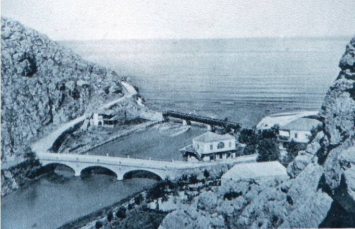
- Vintage photo showing overall view of the location site courtesy of: zoukelkharab.org/images/img1.jpg
- Feb 2019 Google Street View image:
www.google.com.au/maps/@33.9564567,35.5991756,3a,65.7y,23...
******************************
SOURCE INFO
- This original image with somewhat mis-leading title [actually located next to the Haifa-Tripoli road - not the Beirut - Damascus road] was captured late evening by my late father-in-law, Driver Tom Beazley, 2/4 Anti Malaria Control Unit, 9th Division, 2nd Australian Imperial Force, using a Kodak 6-20 Folding Brownie camera with 120 B&W roll film.
Nov 1942 - "Warning sign & Memorial Plaque on the road to Damascus"
IMAGE INFO
- Viewpoint would be looking approx. south-west.
- According to Frank Hurley reference photo [see link] this Memorial Plaque is actually located just south of the Nahr El Kaleb [aka "Lycus River" or colloquially known by the Australian & Allied Forces as "Dog River"] at Wady-El-Kalb on the Haifa-Tripoli road & reads - "June-July 1941, First Australian Corps captured Damour while British, Indian, Australian and Free French troops captured Damascus, bringing freedom to Syria and The Lebanon."
- Very clear Frank Hurley reference image link:
nla.gov.au/nla.obj-159452413/view
- Vintage photo showing overall view of the location site courtesy of: zoukelkharab.org/images/img1.jpg
- Feb 2019 Google Street View image:
www.google.com.au/maps/@33.9564567,35.5991756,3a,65.7y,23...
******************************
SOURCE INFO
- This original image with somewhat mis-leading title [actually located next to the Haifa-Tripoli road - not the Beirut - Damascus road] was captured late evening by my late father-in-law, Driver Tom Beazley, 2/4 Anti Malaria Control Unit, 9th Division, 2nd Australian Imperial Force, using a Kodak 6-20 Folding Brownie camera with 120 B&W roll film.