View allAll Photos Tagged refelction
Located on Loch Leven in Glencoe close to the Ballachulish Church that also has many MacInneses in its graveyard, this is the burial isle for the Stewarts of Ballachulish & Ardsheal, the MacDonalds of Glencoe, the Camerons of Callart, the Appin Stewarts as well as others from the Glencoe area. It is said that Alasdair MacDonald (MacIain of Glencoe) was buried here after the Glencoe massacre of 1692. The Glencoe Center is not far away which has highlights of this famous massacre.
The island is only accessible by boat. Some of the island is cared for, but many of the burial sites have fallen into disarray. Every year a volunteer group of people of MacInnes and MacDonald come to the island and clean as much of the overgrowth as they can. One of the Clan MacInnes officers has family buried on the island, and participates in this clean up.
Many of the stones and slabs are made of slate and come from the Ballachulish Slate Quarry. Some of these stones are extremely large, considering that they must be hand carried in boats and taken up some difficult terrain.
You will see the name both Munda or Munde. Eilean means island. Eilean Munde was named after St. Fintan Mundus of Argyle, an Irish disciple of St. Columba. St. Columba established the other well-known MacInnes burial site, Kiel Church. St. Mundus came from Iona in the 7th century and established several abbeys, including one on the island which is now in ruins. The church had burned in 1495 but rebuilt. The last service was in July of 1693. St. Mundus died in 962.
Fintan Munnu (Mundus appears to be Latinized) was of the Ui-Neill clan in Ireland and trained as a monk. His birth year is unknown, but he died in 635AD. He studied at Bangor and at Cluain-Innis. As a young monk, he arrived on Iona shortly after Columba died and was sent back to Ireland to found his own monastery as its Abbot. He arrived in Alba in about 600AD and founded several churches. His final parish was on Eilean Nam Munde (Isle of the Teacher) which later became known as Eilean Nam Mairbh (Isle of the Dead). The Irish Gaelic word munnu means “to learn” or “to teach”.
It is rumored that the island is guarded (or haunted?) by the spirit of the last person buried there who cannot enter Paradise until the next is buried.
Last Weekend I took my infrared camera for a walk at Lindo Lake in Lakeside, California. It has the elements that I look for in Infrared photography - water, clouds and vegetation.
I've been taking infrared images for at least 18 years with a total of 3 different cameras. It's much easier to take infrared pictures with digital cameras that have been converted to infrared that it was in the film days. Other infrared images that I've posted on Flickr can be seen in my Infrared album. Over the years I've posted more than 650 infrared images on Flickr.
www.flickr.com/photos/9422878@N08/albums/72157600507865146
I used Nik Software's Silver Efex Pro 2 to convert the image from infrared to black and white. I have an album with over 200 black and white images in my cleverly titled Black And White Album.
www.flickr.com/photos/9422878@N08/albums/7215764498960693...`
So tired ... Still, there's no turning back.
Location, Kastoria Hellas
Nikon D300s, AF-S Nikkor 70-300mm f 1:4.5-5.6G ED VR@ 70mm
1/250, f/8, Aperture priority, ISO 200
(The accurate colour profile of this image is best viewed in google chrome)
**This image is protected by copyright and it is not for use on any site, blog or forum without my explicit written permission.**
This shot is many years old, but it will be many more years before we can get shots like this in Big Spring Park. They "improved" the park and it will take some time for the trees to grow.
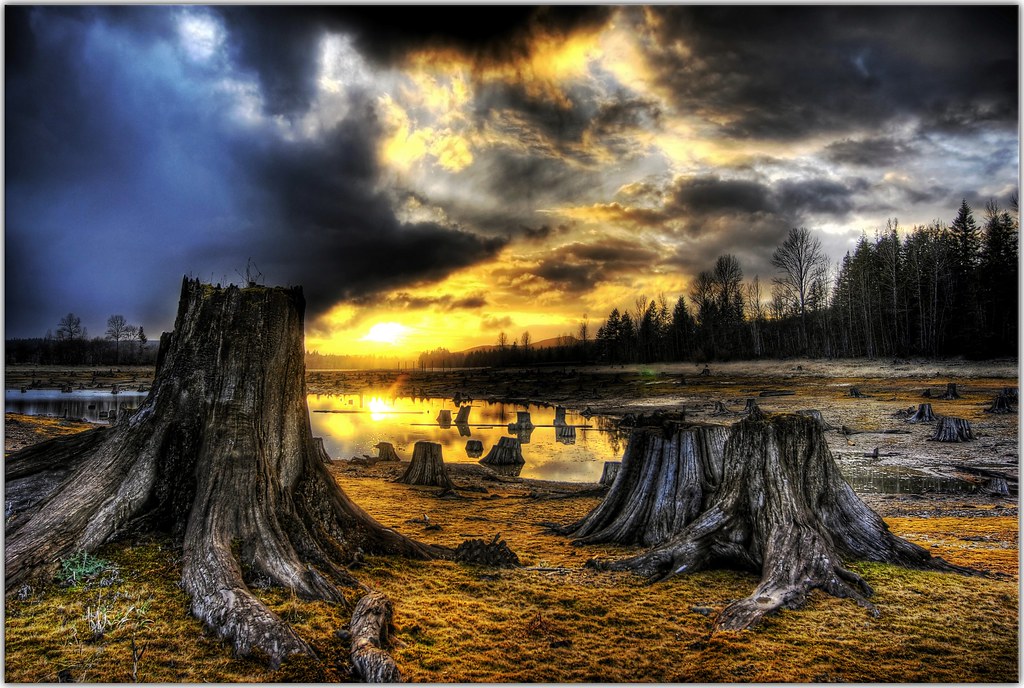
I drove 120 miles round trip from where I'm working just to make it to a lake where the water is drastically low, and most of the forrest around it has been clear cut.
Needless to say, I think it was worth the trip. I'm probably going to post a lot of photos from this 30 minute shoot. I just couldn't stop myself.
I haven't done it in a while, but here is a larger version of this shot only because I want to see it tomorrow at work, to the guys who I saw this spot as we went wizzing by.
We spent a great morning at Hastings Point today, the reflections on the beach were amazing.
We had a BBQ breakfast on the point while watching whales and dolphins playing in the ocean. Then a walk on this beautiful beach and some fossicking in the rock pools, we even found a starfish.
Such an amazing spot, was very hard to leave.
While visiting Co. Donegal last weekend i decided to spent 2 mornings trying to get a good image of the Mount Errigal. This colour has appeared on Sunday morning. Clouds were on fire and water was very so still. Prefect morning.
Zaanse Schans is a neighbourhood of Zaandam, near Zaandijk in the Netherlands. It has a collection of well-preserved historic windmills and houses; the ca. 35 houses from all over the Zaanstreek were moved to the area starting in 1961. The Zaans Museum, established in 1994, is located in the Zaanse Schans.
The Zaanse Schans is one of the popular tourist attractions of the Netherlands and an anchor point of ERIH, the European Route of Industrial Heritage. The neighbourhood attracted approximately 1,6 million visitors in 2014
A mirrored reflection of the sunset from a few weeks back. This is at the waterway channel near Riva Row Boathouse in The Woodlands.
I loved the refelctions of the duck and the reeds in this shot. Pacific Black Duck at Morang Wetlands, Plenty Gorge.
For the Through The Lens week 2 theme of "Floating".
I am thankful to have the freedom and opportunity to curl up in my sleeping bag by the campfire until my alarm goes off telling me it’s time to photograph the Milky Way on my favourite lake. Taken at around 12:30 this fine Canada Day Morning. I love my Country! Happy Canada Day!!
Summer Night
Remnants of an old pier, the only visual remains of a once booming, Salmon canning industry.
Dating back to the turn of the century.
Washington (State)--Point Roberts
Well over a hundred years ago, this would have been a busy fishing port.
Today, we can only imagine the sights of the heavily loaded fishing vessels tied up alongside this pier, and the hardworking employees bustling the catch of the day, up and down the pier.
On the horizon you will have left USA waters and entered Canadian waters, BC Canada
If you take a closer look you may see the Seagulls perched on the pilings
~C
Point Roberts is a pene-exclave of the United States on the southernmost tip of the Tsawwassen Peninsula, south of Vancouver, British Columbia, Canada. The area, which had a population of 1,314 at the 2010 census, is reached by land by traveling 25 mi (40 km) through Canada. It is a census-designated place (CDP) in Whatcom County, Washington with a post office, and a ZIP Code of 98281. Direct sea and air connections with the U.S. are available across Boundary Bay.
Point Roberts was created when the United Kingdom and the United States settled the Pacific Northwest American-Canadian border dispute in the mid-19th century with the Oregon Treaty. Both parties agreed the 49th parallel would delineate both countries' territories, but they overlooked the small area that incorporates Point Roberts (south of the 49th parallel). Questions about ceding the territory to the United Kingdom and later to Canada have been raised since its creation but its status has remained unchanged.
Wikipedia
A special thanks to all my Flickr friends and visitors, for taking the time to view and acknowledge my photography.
Happy Clicks,
~Christie
** Best experienced full screen